Embed Size (px)
Citation preview
Geodaten vernetzen die WeltA world connected by geodata
DigitalisationDigitalisierung
Ferngesteuert in die ZukunftInto the future with remote control
30UAVs im Aufwind
Geointelligenz bietet EntfaltungsraumGeointelligence offers scope for development
Using geodata 11Geodaten nutzen
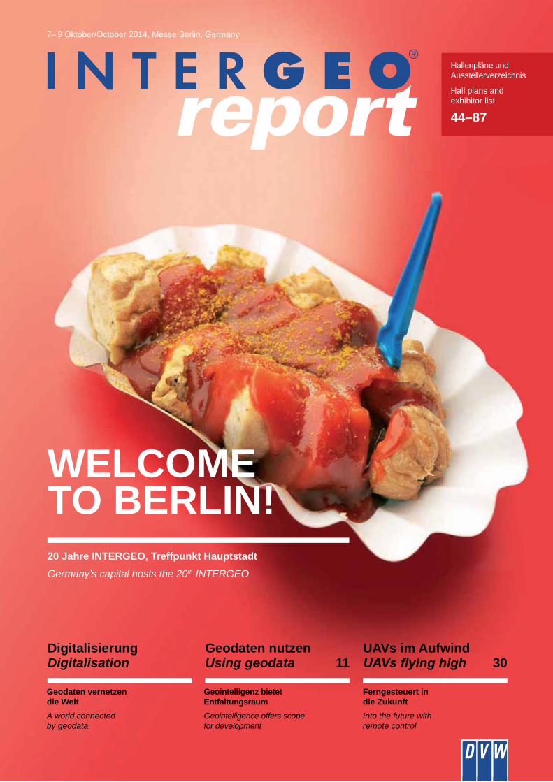
WELCOME TO BERLIN!20 Jahre INTERGEO, Treffpunkt HauptstadtGermany’s capital hosts the 20th INTERGEO
Hallenpläne und Ausstellerverzeichnis
Hall plans and exhibitor list
44–87
7– 9 Oktober/October 2014, Messe Berlin, Germany
ThemaTopic
2
3
report
InhalteContents
Inhalte
14
08
Clevere Trassen für die EnergiewendeSmart routes for the energy revolution
INSPIRE national – Wege in die AnwendungNational INSPIRE – Routes into application
Contents
Digitalisierung – Geodaten vernetzen die Welt ________ 05INSPIRE national – Wege in die Anwendung _________ 08Nutzung von Geodaten ___________________________ 11Für die Erde – Cleveres Trassenmanagement ________ 14imaGIne – Von Smart Cities bis Copernicus __________ 16Im Wandel – Landmanagement ____________________ 1820 Jahre INTERGEO ____________________________ 22Trend- und Medien-Forum ________________________ 23Nachwuchs – Prof. Thöne im Interview ______________ 24SAT NAV-Forum – Von Copernicus bis Indoor-Apps ___ 26Very British – UK Pavillon _________________________ 27DVW GIS Best Practice Award 2014 ________________ 28OpenSource-Park – GI-Daten für alle _______________ 29UAVs im Aufwind ________________________________ 30Wichmann Innovations Award _____________________ 33Who’s Who – CEO-Verzeichnis ____________________ 34Relaxzone _____________________________________ 40Produkt-Highlights _______________________________ 41Ausstellerverzeichnis ____________________________ 44Hallenplan _____________________________________ 84Service / Impressum _____________________________ 90
Digitalisation – a world connected by geodata ________ 05National INSPIRE – routes into application ___________ 08Making use of geodata ___________________________ 11For planet Earth – intelligent route management ______ 14imaGIne – from Smart Cities to Copernicus __________ 16Facing change: Land management _________________ 1820 years of INTERGEO __________________________ 22Trend- and Media-Forum _________________________ 23The next generation: interview with Prof. Thöne _______ 24SAT NAV-Forum – from Copernicus to indoor apps ____ 26Very British – UK Pavilion _________________________ 27DVW GIS Best Practice Award 2014 ________________ 28OpenSource-Park – GI-Data for everyone ___________ 29
_________________________________ 30Wichmann Innovations Award _____________________ 33Who’s Who – CEO directory ______________________ 34Relax zone _____________________________________ 40Product highlights _______________________________ 41Exhibitor list ____________________________________ 46Hall plan _______________________________________ 84Service / imprint _________________________________ 90
Nachwuchs – Prof. Thöne im InterviewThe next generation – Interview with Professor Thöne
24
twitter.com/InsideIntergeo
youtube.com/tvintergeo
intergeo.de/facebook
ThemaTopic
4
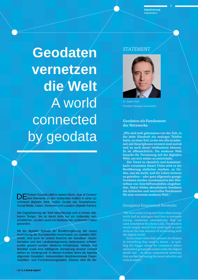
Geodaten als Fundament der Netzwerke
„Wir sind weit gekommen von der Zeit, in der jeder Haushalt ein analoges Telefon hatte, zu einer Zeit, in der wir alle zu jeder-zeit mit Smartphones vernetzt sind und ab und zu auch damit telefonieren können. Es ist offensichtlich: Die moderne Welt braucht die Vernetzung mit der digitalen Welt, um sich weiter zu entwickeln.
Der Trend zu räumlich und kommuni-kativ vernetzten Smart Cities wird es der Bevölkerung einfacher machen, zu fin-den, was sie sucht, und ihr Leben sicherer zu gestalten – oder ganz allgemein gesagt: Geodaten werden zunehmend in den Wer-tefluss von Geschäftsmodellen eingebun-den. Daher bilden aktualisierte Geodaten ein kritisches und wertvolles Fundament für eine vernetzte moderne Welt.“
Geospatial Empowered Networks
“We have come a long way from when house-holds had an analogue land line to everyone having connected smartphones that are used sometimes for phone calls. The modern world simply would find itself hard to exist without the vast amount of networking with the digital world.
From smart cities that connect its citizens to everything they need or desire – to tack-ling the bigger issues for commerce where networked geospatial assets make the digital world real – its these empowered networks that are fast becoming the most valuable and critical assets.”
Geodaten vernetzen
die WeltA world
connected by geodata
Dr. Jürgen Dold
President Hexagon Geosystems
STATEMENT
DE Robert Scooble zählt in seinem Buch „Age of Context“ fünf Elemente zu den treibenden Kräften in einer zu-
nehmend digitalen Welt: mobile Geräte wie Smartphones, Social Media, Daten, Sensoren und Location ( digitale Karten).
Die Digitalisierung der Welt beschleunigt sich in immer stär-kerem Tempo. Sie ist damit nicht nur ein treibender wirt-schaftlicher, sondern auch ein bedeutender politischer Faktor geworden.
Mit der digitalen Agenda der Bundesregierung, der neuen Ausrichtung der Europäischen Kommission zur digitalen Wirt-schaft, sind auch für unsere Branche der Geodäsie, Geoin-formation und des Landmanagements bedeutsame Schwer-punkte gesetzt worden. Moderne Infrastruktur, Verkehr und Mobilität sowie eine intelligente Vernetzung unserer Umwelt stehen im Vordergrund. In diesem Kontext nennt die Agenda allgemein Geodaten, insbesondere dreidimensionale Daten, Satelliten- und Fernerkundungsdaten. Ebenso wird die Be-
report
5DigitalisierungDigitalisation
EN In his book “Age of Context”, Robert Scooble iden-
world – mobile devices such as smartphones, social media, data, sensors and location (digital maps).
The digitisation of our world is accelerating at an ever faster rate. It has now become not just a driving economic factor,
The German government’s digital agenda and the Europe-an Commission’s new orientation towards the digital econ-omy have established important points of focus for our own
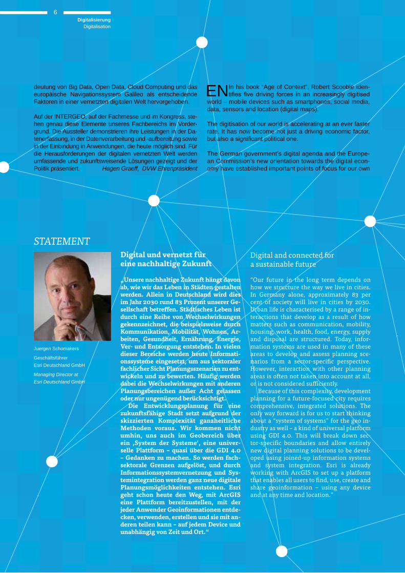
Digital und vernetzt für eine nachhaltige Zukunft
„Unsere nachhaltige Zukunft hängt davon ab, wie wir das Leben in Städten gestalten werden. Allein in Deutschland wird dies im Jahr 2030 rund 83 Prozent unserer Ge-sellschaft betreffen. Städtisches Leben ist durch eine Reihe von Wechselwirkungen gekennzeichnet, die beispielsweise durch Kommunikation, Mobilität, Wohnen, Ar-beiten, Gesundheit, Ernährung, Energie, Ver- und Entsorgung entstehen. In vielen dieser Bereiche werden heute Informati-onssysteme eingesetzt, um aus sektoraler fachlicher Sicht Planungsszenarien zu ent-wickeln und zu bewerten. Häufig werden dabei die Wechselwirkungen mit anderen Planungsbereichen außer Acht gelassen oder nur ungenügend berücksichtigt.
Die Entwicklungsplanung für eine zukunftsfähige Stadt setzt aufgrund der skizzierten Komplexität ganzheitliche Methoden voraus. Wir kommen nicht umhin, uns auch im Geobereich über ein , System der Systeme‘, eine univer-selle Plattform – quasi über die GDI 4.0 – Gedanken zu machen. So werden fach-sektorale Grenzen aufgelöst, und durch Informationssystemvernetzung und Sys-tem integration werden ganz neue digitale Planungsmöglichkeiten entstehen. Esri geht schon heute den Weg, mit ArcGIS eine Plattform bereitzustellen, mit der jeder Anwender Geoinformationen entde-cken, verwenden, erstellen und sie mit an-deren teilen kann – auf jedem Device und unabhängig von Zeit und Ort.“
Juergen Schomakers
Geschäftsführer Esri Deutschland GmbH
Managing Director at Esri Deutschland GmbH
STATEMENT
deutung von Big Data, Open Data, Cloud Computing und das europäische Navigationssystem Galileo als entscheidende Faktoren in einer vernetzten digitalen Welt hervorgehoben.
Auf der INTERGEO, auf der Fachmesse und im Kongress, ste-hen genau diese Elemente unseres Fachbereichs im Vorder-grund. Die Aussteller demonstrieren ihre Leistungen in der Da-tenerfassung, in der Datenverarbeitung und -aufbereitung sowie in der Einbindung in Anwendungen, die heute möglich sind. Für die Herausforderungen der digitalen vernetzten Welt werden umfassende und zukunftsweisende Lösungen gezeigt und der Politik präsentiert. Hagen Graeff, DVW Ehrenpräsident
Digital and connected for a sustainable future
“Our future in the long term depends on how we structure the way we live in cities. In Germany alone, approximately 83 per cent of society will live in cities by 2030. Urban life is characterised by a range of in-teractions that develop as a result of how matters such as communication, mobility, housing, work, health, food, energy, supply and disposal are structured. Today, infor-mation systems are used in many of these areas to develop and assess planning sce-narios from a sector-specific perspective. However, interaction with other planning areas is often not taken into account at all, or is not considered sufficiently.
Because of this complexity, development planning for a future-focused city requires comprehensive, integrated solutions. The only way forward is for us to start thinking about a “system of systems” for the geo in-dustry as well – a kind of universal platform using GDI 4.0. This will break down sec-tor-specific boundaries and allow entirely new digital planning solutions to be devel-oped using joined-up information systems and system integration. Esri is already working with ArcGIS to set up a platform that enables all users to find, use, create and share geoinformation – using any device and at any time and location.”
DigitalisierungDigitalisation
6
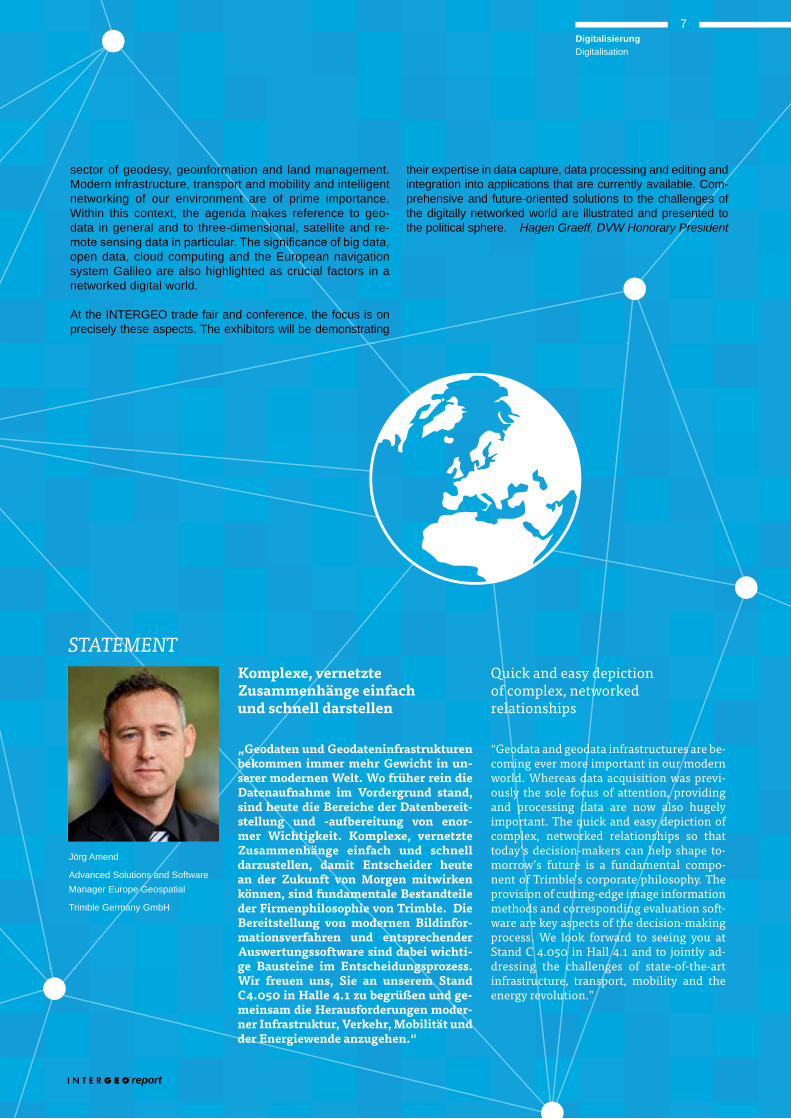
Jörg Amend
Advanced Solutions and Software Manager Europe Geospatial
Trimble Germany GmbH
STATEMENT
sector of geodesy, geoinformation and land management. Modern infrastructure, transport and mobility and intelligent networking of our environment are of prime importance. Within this context, the agenda makes reference to geo-data in general and to three-dimensional, satellite and re-
open data, cloud computing and the European navigation system Galileo are also highlighted as crucial factors in a networked digital world.
At the INTERGEO trade fair and conference, the focus is on precisely these aspects. The exhibitors will be demonstrating
Quick and easy depiction of complex, networked relationships
“Geodata and geodata infrastructures are be-coming ever more important in our modern world. Whereas data acquisition was previ-ously the sole focus of attention, providing and processing data are now also hugely important. The quick and easy depiction of complex, networked relationships so that today’s decision-makers can help shape to-morrow’s future is a fundamental compo-nent of Trimble’s corporate philosophy. The provision of cutting-edge image information methods and corresponding evaluation soft-ware are key aspects of the decision-making process. We look forward to seeing you at Stand C 4.050 in Hall 4.1 and to jointly ad-dressing the challenges of state-of-the-art infrastructure, transport, mobility and the energy revolution.”
their expertise in data capture, data processing and editing and integration into applications that are currently available. Com-prehensive and future-oriented solutions to the challenges of the digitally networked world are illustrated and presented to the political sphere. Hagen Graeff, DVW Honorary President
report
DigitalisierungDigitalisation
7
Komplexe, vernetzte Zusammenhänge einfach und schnell darstellen
„Geodaten und Geodateninfrastrukturen bekommen immer mehr Gewicht in un-serer modernen Welt. Wo früher rein die Datenaufnahme im Vordergrund stand, sind heute die Bereiche der Datenbereit-stellung und -aufbereitung von enor-mer Wichtigkeit. Komplexe, vernetzte Zusammenhänge einfach und schnell darzustellen, damit Entscheider heute an der Zukunft von Morgen mitwirken können, sind fundamentale Bestandteile der Firmenphilosophie von Trimble. Die Bereitstellung von modernen Bildinfor-mationsverfahren und entsprechender Auswertungssoftware sind dabei wichti-ge Bausteine im Entscheidungsprozess. Wir freuen uns, Sie an unserem Stand C4.050 in Halle 4.1 zu begrüßen und ge-meinsam die Herausforderungen moder-ner Infrastruktur, Verkehr, Mobilität und der Energiewende anzugehen.“
Wege in die AnwendungRoutes into application
Unter dem Motto „Geoinformationen als Schlüssel für die gesellschaftlichen Herausforderungen des 21. Jahrhunderts“ steht die 3. Nationale INSPIRE-Konferenz am INTERGEO-Eröffnungstag.
rd
21st
DE Nach hochinteressanten Impulsvorträgen, wie „Geoinformation und Mobilität“ von Staatssekretärin
Dorothee Bär oder „Umsetzung von INSPIRE in den Kommu-nen – von Rahmenbedingungen und Wirkungen in der Pra-xis“ des Beigeordneten des Deutschen Städtetages Hilmar von Lojewski, steht die große Podiumsdiskussion „Wo hilft INSPIRE uns, die gesellschaftlichen Herausforderungen zu lösen?“ (16:30 Uhr) im Fokus des Interesses.
Doch was sind eigentlich die Erwartungen der Wirtschaft an INSPIRE, an den weiteren Ausbau und an die Zusammenar-beit mit der Verwaltung? INTERGEO report sprach mit Prof. Dr. Gerd Buziek, Director Communications und Public Affairs der Esri Deutschland Group GmbH.
ein, sowie die großen Megatrends, die den Bürger in Euro-
dass INSPIRE mit den derzeitigen IT-Trends Schritt hal-ten muss. Einer dieser Trends ist „Consumerization“. Der Bürger möchte eine Anwendung, mit der sein Interesse spontan, ohne Suchen im Portal, ohne Training via App und überall auf beliebigen Endgeräten befriedigt wird. Die-se „letzte Meile“ in die Anwendungen hinein muss dringend organisiert werden. Dafür benötigt es eine Community aus Technologiepartnern, Dienstleistern und Entwicklern. Sie
-
liegt in Big bzw. Smart Data Methoden, Digitalisierung und Algorithmisierung. INSPIRE ist darin eine Informations-schicht, die mit anderen integrativ verarbeitet werden muss. Dann könnten etwa INSPIRE Daten wie zur Luftbelastung verwendet werden, um Verkehrsampeln zu schalten, oder mobil bei Orts terminen der Stadt- und Landschaftsplanung eingesetzt werden. Zurzeit habe ich den Eindruck, mit der Verfügbarkeit von Geo-Portalen hätte INSPIRE seinen Zweck erfüllt. Das Gegenteil aber ist der Fall! Jetzt heißt es,
Der Aufbau von Diensten, die die INSPIRE-Daten für den Endnutzer einfach erreichbar machen, ist die Forderung. Welche Anforderungen hat die Wirtschaft an diese Dienste, was müssen sie leisten, und welche Anforderungen haben die Unternehmen an die Zusammenarbeit mit der Verwaltung?
In INSPIRE muss weiter investiert werden. Auch muss die Wirtschaft Gelegenheit bekommen, nachhaltige Geschäfts-
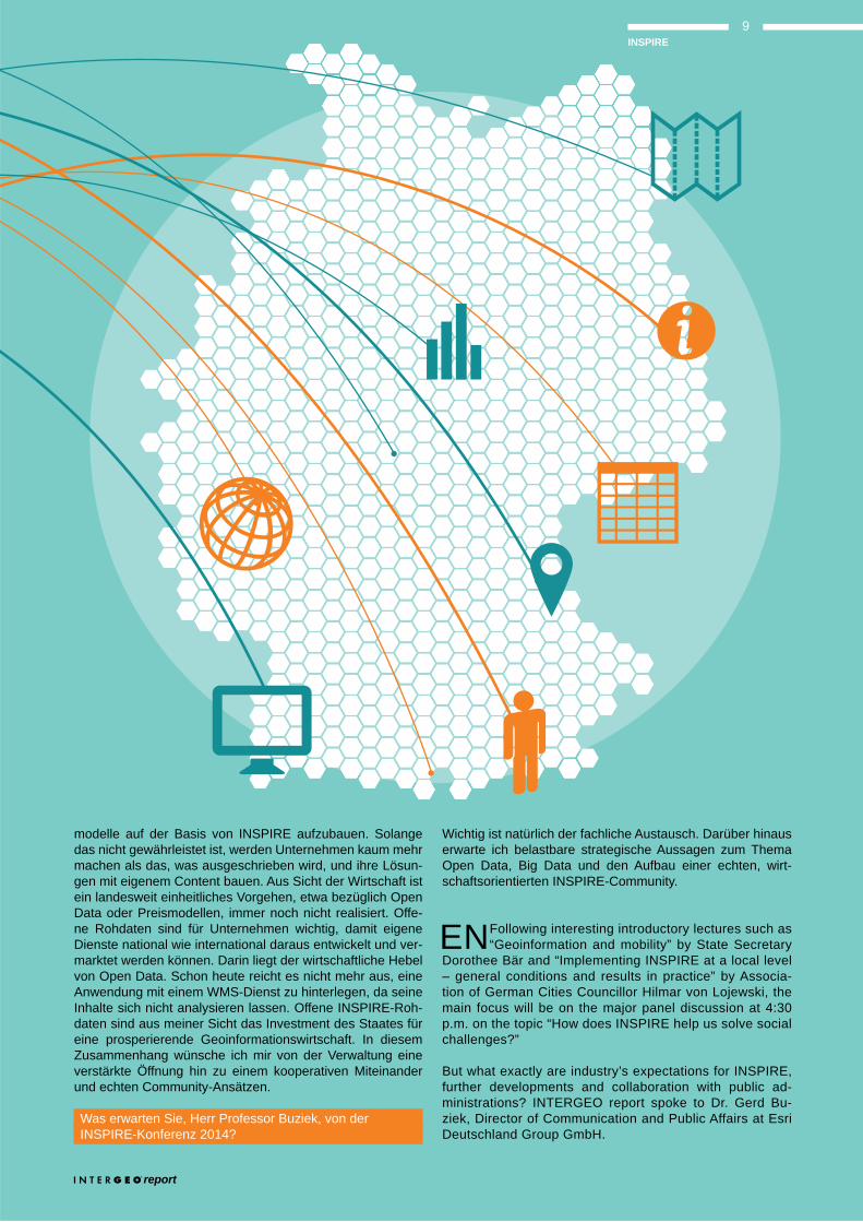
INSPIRE
Wo hilft INSPIRE uns, die gesellschaftlichen Herausforde-rungen zu lösen, und wie sieht die konkrete Umsetzung aus?
Spontan fallen mir demographischer Wandel, die Energie-wende, die zunehmende Verstädterung und die Mobilität
8INSPIRE
modelle auf der Basis von INSPIRE aufzubauen. Solange das nicht gewährleistet ist, werden Unternehmen kaum mehr machen als das, was ausgeschrieben wird, und ihre Lösun-gen mit eigenem Content bauen. Aus Sicht der Wirtschaft ist ein landesweit einheitliches Vorgehen, etwa bezüglich Open Data oder Preismodellen, immer noch nicht realisiert. Offe-ne Rohdaten sind für Unternehmen wichtig, damit eigene Dienste national wie international daraus entwickelt und ver-marktet werden können. Darin liegt der wirtschaftliche Hebel von Open Data. Schon heute reicht es nicht mehr aus, eine Anwendung mit einem WMS-Dienst zu hinterlegen, da seine Inhalte sich nicht analysieren lassen. Offene INSPIRE-Roh-daten sind aus meiner Sicht das Investment des Staates für eine prosperierende Geoinformationswirtschaft. In diesem Zusammenhang wünsche ich mir von der Verwaltung eine verstärkte Öffnung hin zu einem kooperativen Miteinander und echten Community-Ansätzen.
Was erwarten Sie, Herr Professor Buziek, von der INSPIRE-Konferenz 2014?
Wichtig ist natürlich der fachliche Austausch. Darüber hinaus erwarte ich belastbare strategische Aussagen zum Thema Open Data, Big Data und den Aufbau einer echten, wirt-schaftsorientierten INSPIRE-Community.
EN Following interesting introductory lectures such as “Geoinformation and mobility” by State Secretary
Dorothee Bär and “Implementing INSPIRE at a local level – general conditions and results in practice” by Associa-tion of German Cities Councillor Hilmar von Lojewski, the main focus will be on the major panel discussion at 4:30 p.m. on the topic “How does INSPIRE help us solve social challenges?”
But what exactly are industry’s expectations for INSPIRE, further developments and collaboration with public ad-ministrations? INTERGEO report spoke to Dr. Gerd Bu-ziek, Director of Communication and Public Affairs at Esri Deutschland Group GmbH.
report
9INSPIRE
How does INSPIRE help us solve social challenges andwhat will its implementation be like in practice?
What immediately comes to mind is demographic change, the energy revolution, increasing urbanisation and mobili-
people of Europe. From my perspective, it is important that INSPIRE keeps up with current IT trends. One of these trends is “consumerisation”. The public want an applica-
search through a portal or special training via an app – and one that’s accessible anywhere on any mobile terminal.
-gy partners, service providers and developers. They need services and also the raw data – often this is even more
how it can be used. The future lies in big and smart data methods, digitisation and algorithmisation. INSPIRE is just one layer of this information in this, and must be integrat-ed with others. This would allow INSPIRE data such as air
on a mobile basis at town and country planning meetings, among other things. At the moment I get the feeling that the accessibility of geo portals means that INSPIRE has
in applications!
The aim is to create services that make the INSPIRE data easily accessible for the end user. What expectations does industry have for these services, what do they needto provide and what expectations do businesses have for collaboration with public administrations?
Investment in INSPIRE needs to continue. Industry must also have the chance to build up sustainable business models on the basis of INSPIRE. Until this is possible, businesses will create their own solutions using their own content. From the
on issues such as open data or pricing models is not yet in place. Raw open data is important for businesses so that it can be used to develop and market services on a national and international scale. This is where the economic leverage of open data lies. It is already no longer enough to produce an application with a WMS service, as its contents cannot be analysed. In my opinion, using INSPIRE to provide raw open data is an investment by the state in a prospering geoinfor-mation industry. In this context, I hope that public administra-tions will be increasingly open to working together and to real community-based approaches.
Prof. Buziek, what do you expect from the 2014 INSPIRE Conference?
Expert exchange and discussion is clearly important. I also want to see reliable strategic commitments on the issues of open data, big data and the development of a real, indus-try-oriented INSPIRE community.
„INSPIRE ist ein gelungenes europäisches Projekt, das wir in Deutschland mit der GDI-DE und den Geodatenzugangsgesetzen gewinnbringend umsetzen. Das Erreich-te eröffnet nun auch neue Möglichkeiten. Für die Bürgerinnen und Bürger, aber auch Unternehmen und Wissenschaft, sollte der Nutzen von INSPIRE noch weiter ausgebaut werden. So müssen Dienste konsequent aufgebaut werden, die die INSPIRE-Daten für den Endnutzer einfach und unkompli-ziert erreichbar machen und die Einbezie-hung weiterer Datenbestände ermöglichen.
Die INTERGEO ist ein seit Jahren bewähr-tes Forum, um diese Möglichkeiten und Ide-en miteinander zu vernetzen und Impulse zu geben. INSPIRE sollte uns alle inspirieren, die Möglichkeiten von validen und qualita-tiv hochwertigen Geoinformationen zu nut-zen, um unsere Zukunft zu gestalten.“
Dr. Georg Thiel
Ministerialdirigent im Bundesministerium des Innern
Deputy Head of Directorate-GeneralFederal Ministry of the Interior
“INSPIRE is a successful European project that we in Germany are implementing to great effect through GDI-DE and the geoda-ta access laws. These achievements are now opening up new possibilities. For the benefit of citizens and also businesses and science, the success of INSPIRE needs to be expanded still further. For instance, services must be developed to make the INSPIRE data simpler for the end user to access, and to facilitate the integration of further databases.
Over the years, INTERGEO has proved itself an important forum for sharing these ideas and possibilities and providing new momentum. INSPIRE should inspire us all to use the opportunities provided by valid and high-quality geoinformation to shape our future.”
STATEMENT
10INSPIRE
„Geodaten kommen heute in allen Wirtschaftsbereichen zum Einsatz und spielen eine
wichtige Rolle für innovative Geschäftsmodelle.“
“These days, geodata is used in all sectors of the economy and has major significance for innovative business models.”
Lars Behrens
NUTZUNG VON GEODATEN
MAKING USE OF GEODATA
Weiterlesen auf Seite 12Continued on page 12
report
11Nutzung von GeodatenMaking use of geodata
DE Geo-Intelligenz bietet noch ausrei-chend Raum zur Entfaltung: Ener-
gieversorgung und Infrastruktur, Verwaltung, Handel und schnelldrehende Produkte, Banken und Versicherungen, Telekommunikation, Trans-port und Verkehr oder Pharma und Gesundheitswe-sen – Geodaten sind gefragt. Gleichwohl bietet sich noch ausreichend Potenzial: Beispielsweise schätzen Geomarketing-Experten, dass 80 Prozent der Daten in Unternehmen, die der Business Intelligence (BI) und dem Customer-Relationship-Management (CRM) dienen, einen Raumbezug haben. Aber nur rund acht Prozent der Unter-nehmen nutzen Geodaten in BI und im CRM. Das „Wo“ wer-de noch unterschätzt. Ergo müsse es noch einfacher wer-den, auf Location Intelligence zu setzen. Über Mehrwerte mit Location Intelligence informieren sich INTERGEO-Besucher zum Beispiel bei Pitney Bowes und dds (Halle 3.1, B3.020)
vielen Vorteilen verknüpfter Daten kennen sich zudem die Geobusiness- und Vermessungsfachleute bei frox Die IT Fa-brik (Halle 1.1, D1.020) aus.
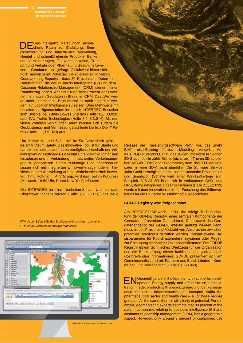
Um Mehrwert durch Sicherheit im Straßenverkehr geht es bei PTV Visum Safety. Das innovative Tool ist für Städte und Landkreise interessant, da es ermöglicht, innerhalb der Ver-kehrsplanungssoftware PTV Visum Unfalldaten automatisiert einzulesen und in Verbindung mit netzweiten Verkehrsmen-gen zu analysieren. Selbst zukünftige Planungsszenarien lassen sich mit integrierten Unfallvorhersagemodellen hin-sichtlich ihrer Auswirkung auf die Verkehrssicherheit bewer-ten. Timo Hoffmann, PTV Group, wird das Tool im Kongress (Mittwoch, 16:50 Uhr, Raum New York) erläutern.
Die INTERGEO ist eine Neuheiten-Schau. Und so stellt Obermeyer Planen+Beraten (Halle 2.1, C2.058) das neue
Release der Trassierungssoftware ProVI vor, das „mehr BIM“ – also Building Information Modeling – verspricht. Am INTERGEO-Standort Berlin, das zu den Vorreitern in Sachen 3D-Stadtmodelle zählt, fällt es leicht, beim Thema 3D zu blei-ben: VIS-All 3D heißt das Programmsystem, das 2D-Planungs-daten in eine 3D-Ansicht überführt. Die Software Service John GmbH ermöglicht damit eine realitätsnahe Präsentation und Simulation (Schattenwurf einer Windkraftanlage zum Beispiel). VIS-All 3D lässt sich in vorhandene CAD- und GI- Systeme integrieren. Das Unternehmen (Halle 2.1, E2.039) wurde mit dem Innovationspreis für Forschung des Stifterver-bands für die Deutsche Wissenschaft ausgezeichnet.
GDI-DE Registry wird freigeschaltet
Am INTERGEO-Mittwoch, 11:00 Uhr, erfolgt die Freischal-tung der GDI-DE Registry, einer zentralen Komponente der Geodaten-Infrastruktur Deutschland. Denn damit das Geo-datenangebot der GDI-DE effektiv genutzt werden kann, muss in der Praxis eine Vielzahl von Absprachen zwischen potentiell Beteiligten getroffen werden. Beispielsweise Ba-sisparameter für Koordinatenreferenzsysteme oder Regeln
Registry ist ein technisches Werkzeug für die Organisation und die Bereitstellung dieser fachlich und organisatorisch übergreifenden Informationen. GDI-DE präsentiert sich am Gemeinschaftsstand mit Partnern aus Bund, Ländern, Kom-munen und Wissenschaft (Halle 3.1, B3.060).
EN Geointelligence still offers plenty of scope for devel-opment: Energy supply and infrastructure, adminis-
-
geodata. All the same, there is still plenty of potential. For ex-ample, geomarketing experts estimate that 80 percent of the data in companies relating to business intelligence (BI) and customer relationship management (CRM) has a geographic aspect. However, only around 8 percent of companies use
PTV Visum Safety hilft, den Straßenverkehr sicherer zu machen. PTV Visum Safety helps improve road safety.
Bild/Picture: Visum Safety, PTV Group 2014
12Nutzung von GeodatenMaking use of geodata
geodata in BI and CRM. The issue of “where” is still very much underestimated. It needs to become easier to utilise lo-
about added value with location intelligence from companies such as Pitney Bowes and dds (Hall 3.1, B3.020) and IVU
surveying experts from frox Die IT Fabrik (Hall 1.1, D1.020) know all about the many advantages of linked data.
PTV Visum Safety focuses on creating added value through
for towns and local authorities as it means accident data can
Visum and analysed in combination with network-wide traf-
-casting models. Timo Hoffmann of the PTV Group will ex-plain more about the tool during the conference (Wednesday, 4:50 p.m., New York room).
INTERGEO is all about innovations. Obermeyer Planen+Ber-aten (Hall 2.1, C2.058) is showcasing the new release of route planning software ProVI, which promises “more BIM” (building information modelling). Given that Berlin, the city playing host
-ban models, 3D is very much a hot topic. VIS-All 3D is a pro-gram system that translates 2D planning data into a 3D view. Software Service John GmbH uses the system to deliver realis-tic presentations and simulations (such as the shadow cast by a wind turbine). VIS-All 3D can be integrated into existing CAD and GI systems. The company (Hall 2.1, E2.039) was present-ed with the innovation award for research by Stifterverband für die Deutsche Wissenschaft, a business community initiative that promotes science and education.
GDI-DE Registry to go live
At 11:00 a.m. on the Wednesday of INTERGEO, the GDI-DE Registry will go live, forming a core component of the geo-data infrastructure in Germany. To ensure the geodata portfo-
lio of GDI-DE can be used effectively, a range of agreements must be reached between potential participants on subjects such as basic parameters for coordinate reference systems
Registry is a technical tool used to organise and provide this kind of specialist and organisational information. GDI-DE is participating in a joint stand with partners from national, re-
„Geodaten kommen heute in allen Wirtschaftsbereichen zum Einsatz und spielen eine wichtige Rolle für inno-vative Geschäftsmodelle. Zeitgleich nimmt auch das Angebot an Geodaten immer mehr zu – hier gilt es, für Datenanbieter zukünftig eine klare Struktur zu schaffen, damit der Nutzer nicht den Überblick verliert. Und vor allem müssen einfache, einheitliche und sichere Bedin-gungen für die Nutzung von Geodaten gelten. Nur so können Innovationen entstehen.
Open Data kann in vielen Fällen eine gute Wahl sein – allerdings braucht die Wirtschaft, wenn sie tragfähige Geschäftsmodelle entwickeln soll, Geodaten- Angebote, auf die sie sich verlassen kann. Dann kann das Geo- Business den Wirtschaftsstandort Deutschland nachhal-tig stärken und dazu beitragen neue und zukunftsfähige Arbeitsplätze zu schaffen.“
Lars Behrens
Stellvertretender Geschäftsführer, Geschäftsstelle Kommission für Geoinformationswirtschaft beim Bundesministerium für Wirtschaft und Energie
Deputy manager of the Geobusiness Commission at the Federal Ministry for Economic Affairs and Energy
“These days, geodata is used in all sectors of the economy and has major significance for innovative business models. At the same time, there is an increasing amount of geoda-ta available – for data providers of the future, this means that a clear structure will need to be developed so that users are not left confused. Above all, the use of geodata must be regulated by clear, consistent and secure conditions. This is the only way for innovation to succeed.
Open data is the right choice in many cases. But for via-ble business models to be developed, the economy needs geodata that can be relied upon. Geobusiness will thus be able to promote Germany’s status as a business hub and contribute to creating new, future-focused jobs.”
STATEMENT
report
Nutzung von GeodatenMaking use of geodata
13
“Thanks to major advances in science and technology, we can now broadly predict the consequences of environmen-tal intervention. However, a better understanding of planet Earth is only part of the key to efficient environmental and climate-related policy. In this networked world, we must also learn to take control of the fast-growing amount of data ob-tained from observation stations on Earth and in space, and be able to translate it into comprehensible, reliable informa-tion about the state of our planet.
We therefore need to be able to use data related to the envi-ronment across different sectors and across borders without any restrictions. This stage is still a long way off, even though data policy in Germany and in Europe has put us in a better position to reach it, through measures including the Envi-ronmental Information and INSPIRE Directives.
Future-oriented geoinformation technologies such as those on display at INTERGEO can be used to make political decisions more transparent and ensure citizen participa-tion.“
„Dank enormer Fortschritte in Wissenschaft und Tech-nik können wir die Folgen von Eingriffen in die Umwelt im Grundsatz voraussagen. Der Schlüssel für eine effizi-ente Umwelt- und Klimapolitik liegt allerdings nicht nur im besseren Verständnis des Systems Erde. In unserer vernetzten Welt müssen wir vielmehr die rasant anwach-senden Datenmengen von Beobachtungsstationen auf der Erde und im Weltraum beherrschen und in verständliche und belastbare Informationen über den Zustand unseres Planeten übersetzen können.
Daten mit Relevanz für die Umwelt müssen deshalb grenz- wie fachübergreifend uneingeschränkt nutzbar sein. Hier-von sind wir noch weit entfernt, auch wenn die Datenpolitik in Deutschland und Europa unter anderem auf der Grund-lage der Umweltinformations- und der INSPIRE-Richtlinie bessere Voraussetzungen geschaffen hat.
Mit zukunftsweisenden Techniken der Geoinformation, wie Sie hier auf der INTERGEO gezeigt werden, können politische Entscheidungen transparent vorbereitet und die Teilhabe der Bürger sichergestellt werden.“
Dr. Martin Lenk
Bundesministerium für Umwelt, Naturschutz, Bau und Reaktor-sicherheit (BMUB) Referat / Division – Z II 3 Informationsmanagement, Statistik, Bibliothek
Federal Ministry for the Environ-ment, Nature Conservation, Building and Nuclear Safety
STATEMENT
Umwelt- und KlimaschutzEnvironmental and climate protection
14
Für die ErdeFor planet Earth
DEZu den gesellschaftlichen Herausforderungen wie Umwelt- und Klimaschutz, Energiewende und Hoch-
wasservorsorge leistet die INTERGEO wertvolle Beiträge sowohl im Kongress als auch auf der Fachmesse. Ein Part-ner der Umweltverwaltung ist beispielsweise Disy (Halle 3.1, B3.026). Das Karlsruher Unternehmen präsentiert, wie Geo-
veröffentlicht werden können. Die GIS- und Reporting-Platt-form Cadenza ist auf dem Desktop, via Web und mobil im
alle Zugänge zur Verfügung. Cadenza Mobile ist weltweit die erste App, mit der Nutzer ihre Daten auf iPads und And-
Basis für kluge Entscheidungen im Umwelt- und Klimaschutz ist auch das Java-GIS von GDV GeoSoftware (Halle 3.1, B3.059). „Datenbank trifft GIS“ heißt es bei den Ingelheimer Experten, die zudem mit der neuesten Version des FreeGIS Spatial Commander den Einstieg für Analysen mit räum-lichen Daten erleichtern.
Mit der Energiewende geht der Netzausbau einher. Hier-zu nehmen Gregor Weyer, Luftbild Umwelt Planung GmbH (LUP), und Thorsten Werner, SAG Deutschland, die neuesten Entwicklungen aus dem ökologischen Trassenmanagement unter die Lupe. Der Beitrag im Themenblock „Geo information für moderne Infrastrukturen – Energie“ (Mittwoch, 9:00 Uhr,
-
und die Akzeptanz erhöhen lässt. Die LUP ist auf dem Stand der Berlin-Brandenburgischen Geoinformationswirtschaft
Ganz gleich, ob Hochwasser als Folge des Klimawandels oder des Flächenmanagements entsteht, Geodaten braucht es vor, während und nach einem Katastrophenereignis. Als Kongressthema wird „Hochwasservorsorge – Strategien und Beispiele der Landentwicklung in Deutschland“ am Dienstag- vormittag ab 10:30 Uhr (Raum London 3) beleuchtet.
ENThe conference and trade fair at INTERGEO both make a valuable contribution to the challenges fac-
ing our society, such as environmental and climate protec-
B3.026). The Karlsruhe-based company is demonstrating how geodata and alphanumeric data can be analysed in a
and reporting platform Cadenza is available for desktop, web -
on iPads and Android tablets.
The Java-GIS from GDV GeoSoftware (Hall 3.1, B3.059) is the basis for intelligent decisions in environmental and cli-mate protection. “Database meets GIS” is the slogan of the experts from Ingelheim, who also simplify the analysis of spa-tial data with the latest version of the FreeGIS Spatial Com-mander.
The energy revolution goes hand in hand with grid expan-sion. Gregor Weyer of Luftbild Umwelt Planung GmbH (LUP) and Thorsten Werner of SAG Germany will be ex-
-cal route management. In the conference section, the topic area “Geoinformation for modern infrastructures – energy” (Wednesday, 9:00 a.m., New York room) will
-cy and increase acceptance. LUP is located at the Ber-lin-Brandenburgische Geoinformationswirtschaft stand (Hall 3.1, C3.014).
after any such catastrophic event. “Flood prevention – strat-egies and examples of land development in Germany” will be one of the conference topics on Tuesday morning from 10:30 a.m. ( London room 3).
Nachhaltige Umweltverwaltung und cleveres Trassenmanagement sind ohne Geo-Know-how nicht denkbar.
Sustainable environmental management and intelligent route management are inconceivable without geo know-how.
report
15Umwelt- und KlimaschutzEnvironmental and climate protection
Grobdaten
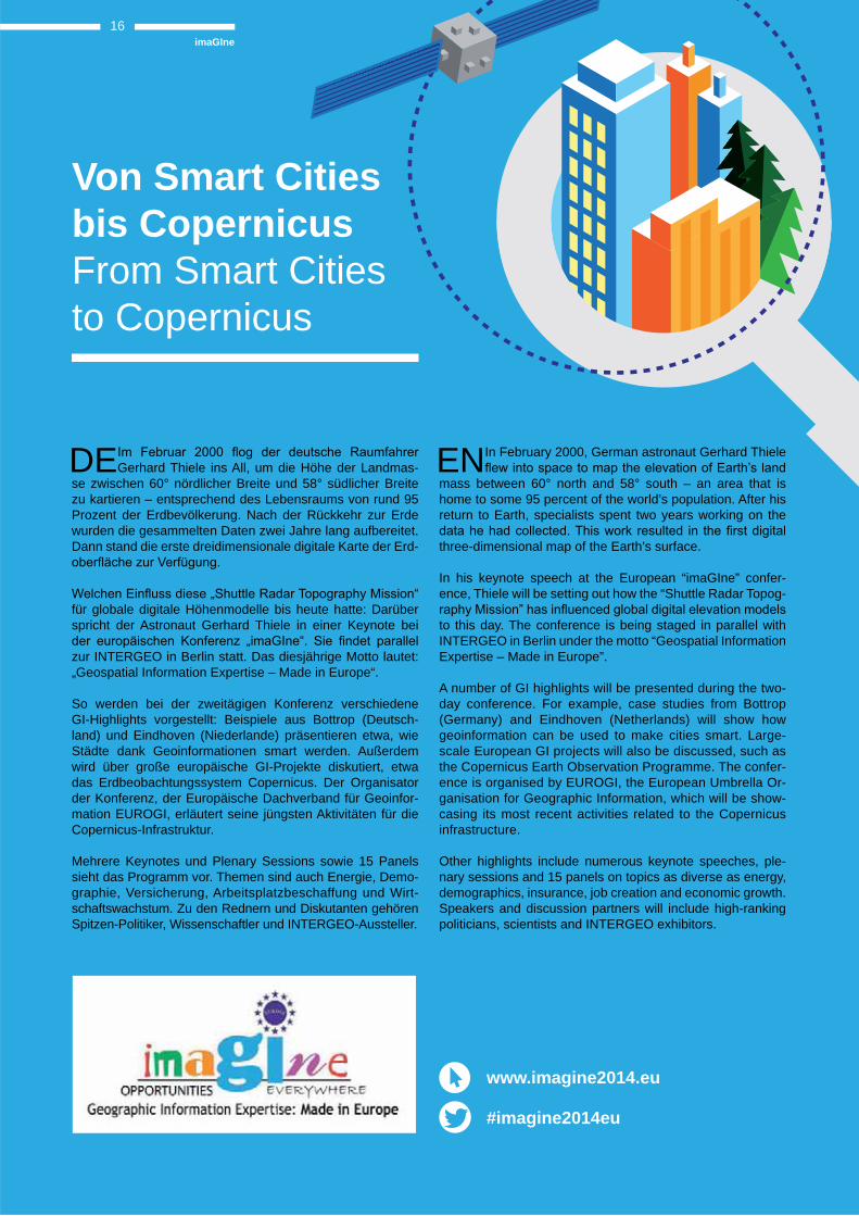
DEGerhard Thiele ins All, um die Höhe der Landmas-se zwischen 60° nördlicher Breite und 58° südlicher Breite zu kartieren – entsprechend des Lebensraums von rund 95 Prozent der Erdbevölkerung. Nach der Rückkehr zur Erde wurden die gesammelten Daten zwei Jahre lang aufbereitet. Dann stand die erste dreidimensionale digitale Karte der Erd-
für globale digitale Höhenmodelle bis heute hatte: Darüber spricht der Astronaut Gerhard Thiele in einer Keynote bei
zur INTERGEO in Berlin statt. Das diesjährige Motto lautet: „Geospatial Information Expertise – Made in Europe“.
So werden bei der zweitägigen Konferenz verschiedene GI-Highlights vorgestellt: Beispiele aus Bottrop (Deutsch-land) und Eindhoven (Niederlande) präsentieren etwa, wie Städte dank Geoinformationen smart werden. Außerdem wird über große europäische GI-Projekte diskutiert, etwa das Erdbeobachtungssystem Copernicus. Der Organisator der Konferenz, der Europäische Dachverband für Geoinfor-mation EUROGI, erläutert seine jüngsten Aktivitäten für die Copernicus-Infrastruktur.
Mehrere Keynotes und Plenary Sessions sowie 15 Panels sieht das Programm vor. Themen sind auch Energie, Demo-graphie, Versicherung, Arbeitsplatzbeschaffung und Wirt-schaftswachstum. Zu den Rednern und Diskutanten gehören Spitzen-Politiker, Wissenschaftler und INTERGEO-Aussteller.
EN In February 2000, German astronaut Gerhard Thiele
mass between 60° north and 58° south – an area that is home to some 95 percent of the world’s population. After his return to Earth, specialists spent two years working on the
three-dimensional map of the Earth’s surface.
In his keynote speech at the European “imaGIne” confer-ence, Thiele will be setting out how the “Shuttle Radar Topog-
to this day. The conference is being staged in parallel with INTERGEO in Berlin under the motto “Geospatial Information Expertise – Made in Europe”.
A number of GI highlights will be presented during the two-day conference. For example, case studies from Bottrop (Germany) and Eindhoven (Netherlands) will show how geoinformation can be used to make cities smart. Large-scale European GI projects will also be discussed, such as the Copernicus Earth Observation Programme. The confer-ence is organised by EUROGI, the European Umbrella Or-ganisation for Geographic Information, which will be show-casing its most recent activities related to the Copernicus infrastructure.
Other highlights include numerous keynote speeches, ple-nary sessions and 15 panels on topics as diverse as energy, demographics, insurance, job creation and economic growth. Speakers and discussion partners will include high-ranking politicians, scientists and INTERGEO exhibitors.
Von Smart Cities bis CopernicusFrom Smart Cities to Copernicus
imaGIne16
www.imagine2014.eu
#imagine2014eu
ThemaTopic
17
report © Copyright 2014 Hexagon. All rights reserved.
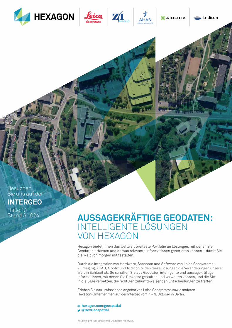
AUSSAGEKRÄFTIGE GEODATEN:INTELLIGENTE LÖSUNGEN VON HEXAGON Hexagon bietet Ihnen das weltweit breiteste Portfolio an Lösungen, mit denen Sie
Geodaten erfassen und daraus relevante Informationen generieren können – damit Sie
die Welt von morgen mitgestalten.
Durch die Integration von Hardware, Sensoren und Software von Leica Geosystems,
ZI Imaging, AHAB, Aibotix und tridicon bilden diese Lösungen die Veränderungen unserer
Welt in Echtzeit ab. So schaffen Sie aus Geodaten intelligente und aussagekräftige
Informationen, mit denen Sie Prozesse gestalten und verwalten können, und die Sie
in die Lage versetzen, die richtigen zukunftsweisenden Entscheidungen zu treffen.
Erleben Sie das umfassende Angebot von Leica Geosystems sowie anderen
Hexagon-Unternehmen auf der Intergeo vom 7. – 9. Oktober in Berlin.
hexagon.com/geospatial @HexGeospatial
Besuchen Sie uns auf der
INTERGEOHalle 1.1 Stand A1.024
„Der ländliche Raum ist vom Wandlungs-prozess enorm betroffen: Häuser stehen leer, Arbeitsplätze fehlen und die Land-schaft verliert ihren einstigen Charakter. Hinzu kommen aktuelle Erfordernisse wie Hochwasserschutz, Energieversorgung und Klimawandel.
Landentwicklung macht Dörfer vital, Landwirtschaft rentabel, Landschaften attraktiv und Ökosysteme intakt. Sie un-terstützt aktuelle Bedürfnisse wie bei-spielsweise die Hochwasservorsorge durch Flächenbereitstellungen und eigene Maß-nahmen.
Der Schlüssel für einen zukunftsfähigen ländlichen Raum liegt im Miteinander. Bürgerbeteiligung, gemeinsame Nutzungs-konzepte, interkommunale Kooperationen: Grenzen verschwinden, die Landentwick-lung macht es möglich!
Die INTERGEO dient als Plattform für alle Geodätinnen und Geodäten – Landent-wicklerinnen und Landentwickler gehören hier dazu! Wir als Bund-Länder-Arbeitsge-meinschaft Nachhaltige Landentwicklung widmen uns in diesem Jahr auf dem Kon-gress speziell dem Thema Landentwick-lung und Hochwasservorsorge.“
STATEMENT „Rural areas are undergoing a major trans-formation process: buildings are being left empty, there is a lack of jobs and the coun-tryside is losing the identity it once had. Added to this are topical challenges such as flood protection, energy supply and climate change.
Land development keeps villages active, agriculture profitable, landscapes attractive and ecosystems intact. It addresses current concerns such as flood prevention by prepa-ring areas of land as necessary, and through other measures.
The key to making rural areas viable in the long term is to work together. Citizen parti-cipation, shared usage strategies, intercom-munal cooperation – boundaries can disap-pear and it is land development that makes this possible!
INTERGEO is a platform for all geodesists – land development specialists included! At the congress this year, we at the Federal and State Working Group on Sustainable Land Development are committing to a particular focus on land management and flood pre-vention.“
Im Wandel: LandmanagementFacing change: Land management
Hartmut Alker
Vorsitzender der Bund-Länder-Arbeits-gemeinschaft Nachhaltige Landent-wicklung (ArgeLandentwicklung)
Chair of the Bund-Länder-Arbeitsge-meinschaft Nachhaltige Landentwick-lung (ArgeLandentwicklung) – Federal and State Working Group on Sustain-able Land Development
LandmanagementLand management
18
DENachhaltiges Landmanagement steht vor großen Herausforderungen. Die Aussteller der INTER-
GEO stellen die ganze Bandbreite wertvoller Werkzeuge und Lösungsanwendungen für das Land mangement be-reit; exemplarisch seien AED Solution Group ( Halle 3.1, A3.028) oder con terra (Halle 3.1, B3.044) genannt. Wäh-renddessen fokussiert sich der Kongress auf die strategi-sche Komponente. Am Donnerstag, 9. Oktober, widmen sich namhafte Experten im Raum London 1 folgenden drei Themen blöcken:
Wohnungsnot in Ballungsräumen
Die Referenten behandeln Fragen sozialgerechter Boden-nutzung ebenso wie Strategien für bezahlbaren Wohnraum und neue Ansätze für ein strategisches Flächenmanage-ment. Vorgestellt und im Vergleich bewertet werden kommu-nale Bodenpolitiken verschiedener Großstädte.
Flächenkonkurrenzen in der Energiewende
Für die Energiewende und den damit verbundenen Netzaus-bau braucht es vermehrt Flächen. Das führt zu Nutzungs-
gegenüber steht. Verschärfte Richtlinien (z. B. Hochwasser-schutz) stellen eine andere Herausforderung dar, die die vor-gestellten Strategien berücksichtigen.
Zukunft ländlicher Räume
Die Professorin für Landmanagement, Martina Klärle, sucht unter der Überschrift „Erfolgreich schrumpfen – Erfolgsmo-delle aus ländlichen Räumen“ eine Antwort auf die Fragen: Wer bestimmt, wie sich unsere Dörfer entwickeln? Wie ge-lingt es, dass sich die politische Öffentlichkeit dem Tabu- Thema der schrumpfenden Regionen öffnet? Der Hinter-grund: Die Weltbevölkerung wächst stark, insbesondere in den Städten. Im Jahr 2050 werden wohl drei Viertel der Menschheit in Städten wohnen. Deutschland widerfährt eine
Einwohnerzahlen der Ballungsräume sind zwar stabil stabil oder wachsen, z. B. wächst die Einwohnerzahl Frankfurts um jährlich 7000. Die Landbevölkerung, insbesondere der kleinen Gemeinden unter 10.000 Einwohner, sinkt deutsch-landweit stark, je nach Region um weit mehr als 30 Prozent in den letzten 15 Jahren.
Um Dörfer und ihre historischen Ortskerne für alle Generatio-nen attraktiv zu gestalten, muss gemäß Klärle mit Nachdruck gehandelt werden. Zu den Feldern zählen etwa die Schaffung attraktiver, zukunftsfähiger Arbeitsplätze, der Ausbau der ört-lichen und wirtschaftlichen Infrastruktur sowie die Schaffung
sein.“ Der ländliche Raum brauche Vorbilder für das erfolgrei-che Schrumpfen im Bereich der Planung, der Zuschusspolitik, der Öffentlichkeitsarbeit und der politischen Bekenntnisse.
19LandmanagementLand management
report
Bezahlbar wohnen oder erfolgreich schrumpfen: Strategien für Stadt und Land
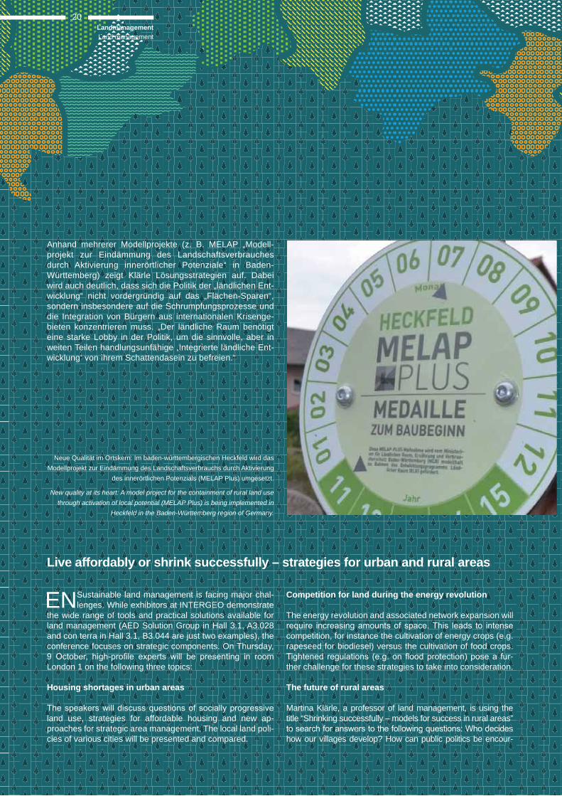
Neue Qualität im Ortskern: Im baden-württembergischen Heckfeld wird das Modellprojekt zur Eindämmung des Landschaftsverbrauchs durch Aktivierung
des innerörtlichen Potenzials (MELAP Plus) umgesetzt.
New quality at its heart: A model project for the containment of rural land use through activation of local potential (MELAP Plus) is being implemented in
Heckfeld in the Baden-Württemberg region of Germany.
Anhand mehrerer Modellprojekte (z. B. MELAP „Modell-projekt zur Eindämmung des Landschaftsverbrauches durch Aktivierung innerörtlicher Potenziale“ in Baden-Württem berg) zeigt Klärle Lösungsstrategien auf. Dabei wird auch deutlich, dass sich die Politik der „ländlichen Ent-wicklung“ nicht vordergründig auf das „Flächen-Sparen“, sondern insbesondere auf die Schrumpfungsprozesse und die Integration von Bürgern aus internationalen Krisenge-bieten konzentrieren muss. „Der ländliche Raum benötigt eine starke Lobby in der Politik, um die sinnvolle, aber in weiten Teilen handlungsunfähige ,Integrierte ländliche Ent-wicklung‘ von ihrem Schattendasein zu befreien.“
Competition for land during the energy revolution
The energy revolution and associated network expansion will
competition, for instance the cultivation of energy crops (e.g. rapeseed for biodiesel) versus the cultivation of food crops.
-ther challenge for these strategies to take into consideration.
The future of rural areas
Martina Klärle, a professor of land management, is using the title “Shrinking successfully – models for success in rural areas”
how our villages develop? How can public politics be encour-
LandmanagementLand management
20
Live affordably or shrink successfully – strategies for urban and rural areas
ENSustainable land management is facing major chal-lenges. While exhibitors at INTERGEO demonstrate
the wide range of tools and practical solutions available for land management (AED Solution Group in Hall 3.1, A3.028 and con terra in Hall 3.1, B3.044 are just two examples), the conference focuses on strategic components. On Thursday,
London 1 on the following three topics:
Housing shortages in urban areas
land use, strategies for affordable housing and new ap-proaches for strategic area management. The local land poli-cies of various cities will be presented and compared.
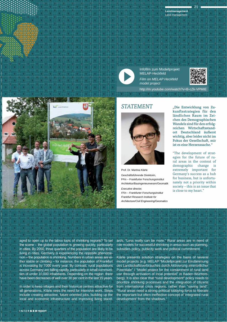
http://m.youtube.com/watch?v=B-cZk-VPMIE
MELAP-Heckfeld
Film on MELAP Heckfeld model project
„Die Entwicklung von Zu-kunftsstrategien für den länd lichen Raum im Zei-chen des Demographischen Wandels sind für den erfolg-reichen Wirtschaftsstand-ort Deutschland äußerst wichtig, aber leider nicht im Fokus der Gesellschaft, mir ist es eine Herzenssache.“
“The development of strat-egies for the future of ru-ral areas in the context of demographic change is extremely important for Germany’s success as a hub for business, but is unfortu-nately not a priority within society – this is an issue that is close to my heart.”
Prof. Dr. Martina Klärle
Geschäftsführende Direktorin, FFin – Frankfurter Forschungsinstitut Architektur/Bauingenieurwesen/Geomatik
Executive director, FFin – Frankfurter ForschungsinstitutFrankfurt Research Institute for Architecture/Civil Engineering/Geomatics
STATEMENT
21LandmanagementLand management
report
aged to open up to the taboo topic of shrinking regions? To set
living in cities. Germany is experiencing the opposite phenome-non – the population is shrinking. Numbers in urban areas are ei-ther stable or climbing – for instance, the population of Frankfurt is increasing by 7000 every year. By contrast, rural populations across Germany are falling rapidly, particularly in small communi-ties of under 10,000 inhabitants. Depending on the region, there have been decreases of well over 30 per cent in the last 15 years.
In order to keep villages and their historical centres attractive for all generations, Klärle sees the need for intensive work. Steps include creating attractive, future-oriented jobs, building up the local and economic infrastructure and improving living stand-
ards. “Less really can be more.” Rural areas are in need of role models for successful shrinking in areas such as planning, subsidies policy, publicity work and political commitment.
Klärle presents solution strategies on the basis of several model projects (e.g. MELAP “Modellprojekt zur Eindämmung des Landschaftsverbrauches durch Aktivierung innerörtlicher Potentiale” / “Model project for the containment of rural land use through activation of local potential” in Baden-Württem-berg). It is also clear that “rural development” policy needs to prioritize shrinking processes and the integration of citizens from international crisis regions, rather than “saving land”. “Rural areas need a strong political lobbying force to liberate the important but often ineffective concept of ‘integrated rural development’ from the shadows.”
1998 Wiesbaden
2001 Cologne2010
2009
2012
2005 Dusseldorf
2013 Essen 1995 Dortmund
1999 Hanover
2008 Bremen
2003 Hamburg
2000 Berlin2014
2007 Leipzig
1996 Dresden
1994 Mainz2002 Frankfurt am Main
1997 Karlsruhe
2004 Stuttgart
2011 Nuremberg
2006 Munich
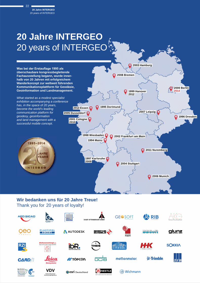
Wir bedanken uns für 20 Jahre Treue! Thank you for 20 years of loyalty!
20 Jahre INTERGEO20 years of INTERGEO
überschaubare kongressbegleitende Fachausstellung begann, wurde inner-halb von 20 Jahren mit erfolgreichem Wanderkonzept zur weltweit führenden Kommunikationsplattform für Geodäsie, Geoinformation und Landmanagement.
What started as a modest specialist exhibition accompanying a conference has, in the space of 20 years, become the world’s leading communication platform for geodesy, geoinformation and land management with a successful mobile concept.
Bohnenstingl.de
S p e z i a l v e r m e s s u n g s z u b e h ö r
GE SOFTVermessungssysteme
A TRIMBLE COMPANY
20 Jahre INTERGEO20 years of INTERGEO
22

--
Dienstag / Tuesday, 07.10.2014
INTELLIGENTE GEOINFORMATIONEN
10:00 David McKittrick 10:30 Senior Applications Specialist Blue Marble Geographics
10:30 Nutzung von ALKIS 10:30 Daten in Geoinformations systemen CWSM GmbH
11:00 KUMONOS and 11:30 Baum Station Development and application
of total stations with advanced reticles
Kansai Construction Survey Co., Ltd.
11:30 Leica VIVA GNSS 12:30 verschiebt Grenzen Leica-Geosystems
JobSHAKER
12:30 Das Karriere-Event im 14:00 im Rahmen der INTERGEO Dieckmann & Schilling KG
INTELLIGENTE GEOINFORMATIONEN
14:00 GIS-basierte Geschäfts - 14:30 prozesse als smarte Lösung
Kataster, mobile Kontrollen und digitale Auftragsbearbeitung als
kommunalen Baubetriebshof IP Syscon
CLGE CONTEST & WICHMANN INNOVATIONS AWARD
14:30 CLGE Contest 15:00 CLGE
15:00 Wichmann 17:00 Innovations Award VDE Verlag GmbH
Mittwoch / Wednesday, 08.10.2014
INNOVATION MADE IN GERMANY
10:00 Julia Teich 10:30 service-drone.de GmbH
10:30 Dr. Hans-Peter Thamm 11:00 Geo-Technic
11:00 Wilfried Lindemann 11:30 GerMAP GmbH
11:30 wetransform.to und HALE 12:30 Geodaten gemeinsam
modellieren und transformieren wetransform GmbH
Donnerstag / Thursday, 09.10.2014
VERMESSUNG ALS DYNAMISCHER PROZESS
10:00 The Tao of Measurement 10:30 International standards,
measured surveys and BIM RICS – Professional Institution
10:30 Tragbare Fernerkundung 11:00 Eine Out-of-the-Box Komplett-
Lösung für den globalen Einsatz Joanneum RESEARCH Forschungsgesellschaft
11:00 Scanning 11:30 Möglichkeiten der Kombination
von stationärem und kinematischem Laser Scanning
RIEGL Laser Measurement Systems GmbH
11:30 Aibot X6 12:30
industrial and mapping applications Aibotix GmbH
JobSHAKER Mehr zum Thema auf Seite 25 More information on page 25
Neuheiten live erleben News and highlights liveHalle / Hall 6.1 | Stand A6.016
JobSHAKER
12:30 Das Karriere-Event im 14:00 im Rahmen der INTERGEO Dieckmann & Schilling KG
INTELLIGENTE GEOINFORMATIONEN
14:00 Tanja Eigenhuis 14:30 TOPCON EUROPE Positioning B.V.
14:30 15:00 Flightcopter
15:00 Mobile Mapping 15:30 Leica Geosystems
CLGE STUDENTS CONTEST 2014
16:00 CLGE Students Contest 17:30 CLGE
JobSHAKER
12:30 Das Karriere-Event im 14:00 im Rahmen der INTERGEO Dieckmann & Schilling KG
CHINA IN DIALOGUE WITH THE WORLD
14:00 How do you see the 16:00 opportunities in the geospatial industry of China? How far can Chinese enterprises
go in terms of globalization? What should enterprises do for the win-win international cooperation?
3sNewsmedia
12:00 PAUSE 12:30
12:00 PAUSE 12:30
12:00 PAUSE 12:30
report
23Trend- und Medien-ForumTrend- and Media-Forum
DE JobSHAKER, www.geocareer.de, International stu-dents meeting: Innovative Formate fokussieren den
Bereich Karriere auf der INTERGEO.
Herr Dr. Thöne, welche Bedeutung messen Sie der INTER-GEO für Nachwuchswerbung und Karriereplanung bei?
-gewinnung: Dieser Dreiklang betrifft auch die Geo-Commu-nity im Kern. Es sind Techniker und Ingenieure, die mit ihren Ideen und Innovationen neue Entwicklungen vorantreiben. Ein attraktives Berufsbild mit guten Zukunftsaussichten ist die erste Voraussetzung für erfolgreiche Nachwuchs-werbung. Dies vermittelt die INTERGEO als weltweit ein-zigartige Plattform. Immer mehr junge Menschen nutzen den Kontakt mit den Ausstellern für ihre Karriereplanung. Ein Arbeitsplatz zwischen Cloud und Erde lockt immer mehr Studienanfänger. Die Nachwuchsinitiativen des DVW tra-gen Früchte.
Wird dies auch im internationalen Rahmen als Herausforde-rung gesehen?
Die Geo-Branche agiert global und deshalb muss das
Die alarmierenden Nachrichten über den Fachkräftemangel machen vor den Geo-Bran-chen nicht Halt. INTERGEO report sprach mit Prof. Dr.-Ing. Karl-Friedrich Thöne, Präsi-dent des DVW – Gesellschaft für Geodäsie, Geoinformation und Landmanagement e.V., über die Bedeutung der Themen Nachwuchs und Recruiting auf der INTERGEO.
News on the shortage of specialists continues to be alarming – and the geo industry is no exception. INTERGEO report spoke to Professor Karl-Friedrich Thöne, President of DVW e.V. (the German Society for Geodesy, Geoinformation and Land Management) about the 3
Frag
en a
n …
3 qu
estio
ns fo
r …
Prof. Dr.-Ing. Karl-Friedrich Thöne
Geoinformation und Landmanagement e.V.
President of DVW e.V. – German Society for Geodesy, Geoinformation and Land Management
Nachwuchsthema im internationalen Kontext betrachtet werden. Die größten Nachwuchssorgen haben wir derzeit im deutschsprachigen Raum. Im gesamteuropäischen und
wir über Internationale Studententreffen und die anderen Formate auf der INTERGEO mit den Branchenvertretern zusammenbringen.
Was sind die Argumente für eine Berufswahl in der Geo- Branche?
Die Keywords der INTERGEO markieren die Handlungsfel-der für die Geo-Branche: Infrastrukturmodernisierung und Digitalisierung moderner Infrastrukturen, Klimawandel und Hochwasservorsorge, Mobilität und Verkehrsinfarkt, Ener-giewende und Planungsdaten, Flächenkonsum und -konkur-renzen, Smart Cities und die Zukunft auf dem Lande. Die Orientierung geodätischer Expertise entspricht doch exakt
-spruchsvoller Technik und wichtig für unser Gemeinwesen.
-
wir unsere Reputation.
24Karriere / Nachwuchs
Careers and the next generation
International Students Meeting (ISM)
DE
-
sche Vermessernachwuchs hat die INTERGEO als attraktive
Plattform für fachliche Information und Austausch sowie den
Berufseinstieg erkannt“, sagt DVW-Vizepräsident Dr. Jens
Riecken mit Blick auf die rund 200 Anmeldungen des Interna-
tional Students Meetings (ISM). Die ausstellenden Unterneh-
men in Berlin treten verstärkt in den direkten Dialog mit dem
Nachwuchs. Nach 2009 (Karlsruhe) und 2012 (Hannover)
7. und 8. Oktober zum dritten Mal auf der INTERGEO statt.
International Students Meeting (ISM)
ENof surveyors in Europe has recognised INTERGEO as an at-
tractive platform for both specialist information exchange and
recruitment opportunities,” says DVW Vice President Dr. Jens
Riecken, referring to the some 200 participants registered for
the International Students Meeting (ISM). The employers ex-
hibiting in Berlin will be engaging in direct dialogue with the
students. Following events in 2009 (Karlsruhe) and 2012 (Han-
over), the ISM is being held at INTERGEO for the third time on
7 and 8 October as part of the FIG Young Surveyor Network.
DE Bundeswehr, Leica Geosystems/Hexagon, RIEGL Laser Measurement Systems und Trimble, von Branchengrößen bis Start-ups: Sie alle präsentieren sich auf dem Trend- und Medien-Forum und werben um Einsteiger und Jobsuchende. Das innovative Recruiting-Format JobSHAKER garantiert bei seinem zweiten INTERGEO-Aufschlag beste Chancen für erfolgreiches Networking zwischen Unternehmen und po-tentiellen Mitarbeitern. Bei kurzen Präsentationen und per-sönlichen Gesprächen in lockerer Atmosphäre (täglich von 12:30 bis 14:00 Uhr) stellen sich Personalleiter den Fragen. geocareer .de “, sagt Stephan Schilling von der Dieckmann und Schilling KG, die den JobSHAKER konzipiert hat. Auch auf dem Trend- und Medien-Forum willkommen.
EN Industry giants and new start-ups including the German armed forces, Leica Geosystems/Hexagon, RIEGL Laser Measurement Systems and Trimble are presenting at the Trend and Media Forum and are on the lookout for new recruits and jobseekers. The JobSHAKER recruiting initiative taking place at INTERGEO for the second time offers excellent op-portunities for successful networking between businesses and
during short presentations and individual discussions in an in-formal atmosphere every day, from 12:30 a.m. to 14:00 p.m. “JobSHAKER is also being complemented by the launch of the online portal geocareer.de,” says Stephan Schilling from Dieckmann und Schilling KG, which established JobSHAKER. Professionals looking to change career are also welcome to take part in JobSHAKER at the Trend and Media Forum.
EN JobSHAKER, www.geocareer.de, International stu-dents meeting: Innovative initiatives for focusing on
careers at INTERGEO.
Dr. Thöne, how important do you consider INTERGEO to be for attracting new talent and planning careers?
Demographic change, the shortage of specialists and recruit-
affecting the geo community as well. Technical experts and engineers and their ideas and innovations are what drive new
successfully attracting new talent. In this respect, INTERGEO serves as a globally unique platform. An increasing number of young people are using the opportunity to network with exhib-itors and plan their own careers. The idea of working between earth and cloud is winning over more and more students. DVW initiatives for attracting new talent are taking effect.
Is this a challenge that applies on an international scale?
The geo industry is globally active, so the issue of recruiting the next generation must be considered at an international
level. These concerns are currently most pressing in the Ger-man-speaking world. We use international student meetings
young professionals in the European and global context into contact with industry representatives.
What are the arguments for choosing a career in the geo industry?
INTERGEO’s keywords outline the geo industry’s core areas
mobility and congestion, the energy revolution and planning data, land use and competition for land, smart cities and the future of rural areas. The orientation of geodetic expertise corresponds exactly with the priorities that young people set
high-performance technology and relevance within society. The challenges that society will face in future will require a
otherwise we will be risking our reputation.
25Karriere / NachwuchsCareers and the next generation
SAT NAV-Forum26
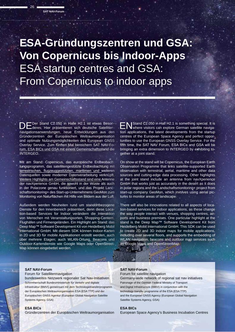
DEDer Stand C2.050 in Halle H2.1 ist etwas Beson-deres: Hier präsentieren sich deutsche Satelliten-
navigationsanwendungen, neue Entwicklungen aus den Gründerzentren der Europäischen Weltraumorganisation und optimale Nutzungsmöglichkeiten des European GNSS Overlay Service. Zum fünften Mal bereichern SAT NAV-Fo-rum, ESA BICs und GSA mit einem Gemeinschaftsstand die INTERGEO.
Mit am Stand: Copernicus, das europäische Erdbeobach-tungsprogramm, das satellitengestützte Erdbeobachtung mit
Datenquellen sowie moderner Datenverarbeitung verknüpft. Weitere Highlights am Gemeinschaftsstand sind eine Antenne der navXperience GmbH, die sowohl in der Wüste als auch in der Polarzone genau funktioniert, und das Projekt Land-schaftsmonitoring+ des Start-up-Unternehmens GeoMon zum
Außerdem werden Neuheiten rund um standortbezogene Dienste für den Innenbereich präsentiert, denn diese Loca-tion-based Services for Indoor verändern die Interaktion von Menschen mit Veranstaltungsorten, Shopping-Centern, Flughäfen und Firmengeländen. Ein Highlight am Stand: das Deep Map™ Software Development Kit von Heidelberg Mobil International GmbH. Mit diesem SDK können Indoor-Karten in 2D und 3D für mobile Applikationen erstellt werden, auch über mehrere Etagen; auch WLAN-Ortung, Beacons und Outdoor-Kartendienste wie Google Maps oder OpenStreet-Map können eingebettet werden.
Bessssooononn---atelliittteennnn---
aus ddeeeennnn anisaaaattioooonnnnn n GGNNNNSSSSSSSSS NAVVV-V-FFoo---tandddd dddieee
beobaaacchhhh---tungg mmmmittt t
erknnüüüüppppftttt. Anteeeennnnnneeeee als aaaauucccchhhh hkt LLaaanndd----
Mon zzzzuummmm m
ezogggeeennneee se Loooococcaaa---terakkkttioooonnnn Cennttteerrrrnnnn, and: ddaaasssss erg MMMMooobbiill r-Kaaaarrteeeennnn nen, aaaauucccchhhh ons uuuunnnddddd nStreeeeeetttnStreeeeeet----
ENStand C2.050 in Hall H2.1 is something special. It is where visitors can explore German satellite naviga-
tion applications, the latest developments from the startup centres of the European Space Agency and perfect oppor-tunities to use the European GNSS Overlay Service. For the
bringing an extra dimension to INTERGEO by exhibiting to-gether at a joint stand.
On show at the stand will be Copernicus, the European Earth Observation Programme that links satellite-supported Earth observation with terrestrial, aerial, maritime and other data sources and cutting-edge data processing. Other highlights at the joint stand include an antenna from navXperience GmbH that works just as accurately in the desert as it does in polar regions and the Landschaftsmonitoring+ project from start-up company GeoMon, which involves using aerial pic-tures to monitor areas of landscape.
There will also be innovations related to all aspects of loca-tion-based services for indoor applications, as these change the way people interact with venues, shopping centres, air-ports and business premises. One particular highlight at the stand is the Deep Map™ Software Development Kit from Heidelberg Mobil International GmbH. This SDK can be used to create 2D and 3D indoor maps for mobile applications,
WLAN navigation, beacons and outdoor map services such as Google Maps and OpenStreetMap.
SAT NAV-ForumForum für Satellitennavigation bundesweites Netzwerk regionaler Sat Nav-InitiativenSchirmherrschaft Bundesministerium für Verkehr und digitale Infrastruktur (BMVI) gemeinsam mit dem Technologietransferprogramm der Europäischen Weltraumorganisation ESA (ESA TTP) und der Europäischen GNSS Agentur (European Global Navigation Satellite Systems Agency, GSA)
ESA BICsGründerzentren der Europäischen Weltraumorganisation
SAT NAV-ForumForum for satellite navigation Germany-wide network of regional sat nav initiativesPatronage of the German Federal Ministry of Transport and Digital Infrastructure (BMVI) in conjunction with the technology transfer programme of the ESA (ESA TTP) and the European GNSS Agency (European Global Navigation Satellite Systems Agency, GSA)
ESA BICsEuropean Space Agency’s Business Incubation Centres
ESA-Gründungszentren und GSA: Von Copernicus bis Indoor-AppsESA startup centres and GSA:From Copernicus to indoor apps
Ordnance Survey · www.ordnancesurvey.co.uk | MAPIX technologies Ltd · www.mapix.com | TerraGo Ltd · www.terragotech.com DMC International Imaging Ltd · www.dmcii.com | QuestUAV Ltd · www.questuav.co.uk Visual Technology Services Ltd · www.pdf3d.com | GeoConnexion magazine · www.geoconnexion.com
VERY BRITISH
technologies Ltd · wwwUAV Ltd · wwwnnexio
UK Pavillon mit doppelter Fläche
UK Pavilion with double the space
DE“Nach der gelungenen Premiere des UK-Pavillons
sagt Mai Ward, Managing Director vom britischen Informa-
mehr junge Unternehmen aus Großbritannien beim UK-Pa-
der britischen Aussteller: Kartierungssoftware, Satellitenna-vigationssysteme, Fernerkundungsdaten und mehr von der Insel auf den europäischen Markt zu bringen.
Daniel Katzer, Marktbereichsleiter für GEO/IT beim INTER-
der Länderpräsentationen geht auf, so wie beim Brasili-en-Pavillon 2013.“ Die Idee: Mehrere junge Unternehmen aus einem Land bekommen mit Hilfe eines starken Partners im Mutterland die Möglichkeit, auf der INTERGEO ihre Pro-dukte und Dienstleistungen einem internationalen Publikum zu präsentieren und Kontakte zu knüpfen.
EN”Following the successful première of the UK Pavilion, we have doubled the stand space this year,” says
Mai Ward, Managing Director of UK information ser-vice GeoConnexion Ltd. “This year, there will be even more young companies from the UK represented in the UK Pavilion and lots of brand new products.” The UK ex-hibitors hope to bring mapping software, satellite navigation systems, remote sensing data and much more to the market in mainland Europe.
Daniel Katzer, Head of GEO/IT at INTERGEO organiser
bearing fruit.” The idea is that a number of young companies from a certain country join forces with a strong partner in that country to get the opportunity to present their products and services to an international audience at INTERGEO and make new contacts.
27
report
UK PavillonUK Pavilion
Anzeige / ad
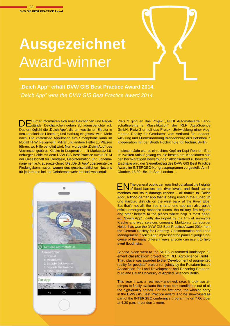
DEBürger informieren sich über Deichhöhen und Pegel-stände; Deichwachen geben Schadensberichte auf:
den Landkreisen Lüneburg und Harburg eingesetzt wird. Mehr noch: Die kostenlose Applikation fürs Smartphone kann im Notfall THW, Feuerwehr, Militär und andere Helfer zu Plätzen
Vermessungsbüros Kiepke in Kooperation mit Marktplatz Lü-neburger Heide mit dem DVW GIS Best Practice Award 2014 der Gesellschaft für Geodäsie, Geoinformation und Landma-
Findungskommission wegen des gesellschaftlichen Nutzens für jedermann bei der Gefahrenabwehr im Hochwasserfall.
AusgezeichnetAward-winner
-
-mented Reality für Geodaten“ vom Verband für Landent-wicklung und Flurneuordnung Brandenburg aus Potsdam in Kooperation mit der Beuth Hochschule für Technik Berlin.
In diesem Jahr war es ein echtes Kopf-an-Kopf-Rennen: Erst im zweiten Anlauf gelang es, die besten drei Kandidaten aus den hochkarätigen Bewerbungen abschließend zu bewerten.Erstmalig wird der Siegerbeitrag des DVW GIS Best Practice Award im INTERGEO-Kongressprogramm vorgestellt: Am 7. Oktober, 16.30 Uhr, im Saal London 1.
„Deich App“ erhält DVW GIS Best Practice Award 2014.
EN und Harburg districts on the west bank of the River Elbe. But that’s not all, the free smartphone app can also guide
and other helpers to the places where help is most need-
Kiepke and web services company Marktplatz Lüneburger Heide, has won the DVW GIS Best Practice Award 2014 from the German Society for Geodesy, Geoinformation and Land Management. “Deich App” impressed the panel of judges be-cause of the many different ways anyone can use it to help
Second place went to the “ALEK automated landscape el-
Third place was awarded to the “Development of augmented reality for geodata” project run jointly by the Potsdam-based Association for Land Development and Rezoning Branden-burg and Beuth University of Applied Sciences Berlin.
This year it was a real neck-and-neck race. It took two at-
in the DVW GIS Best Practice Award is to be showcased as part of the INTERGEO conference programme on 7 October at 4.30 p.m. in London 1 room.
für jedermann bei der Gefahrenabwehr im Hochwasserfall.
28DVW GIS BEST PRACTICE Award
Programm / Programme: www.intergeo.de/intergeo/besucher/messe/opensource-park.php
GI-Daten für alle
GI data for everyone DEZu den ausstellenden Firmen und Projekten gehören
ISB AG, norBIT GmbH, OpenSeaMap, OpenStreet-Map, Sourcepole AG und WhereGroup GmbH & Co. KG. Deren Schwerpunkte sind die Themen Performance-Opti-mierung für große Datenmengen, schnelle und umfassende Suchfunktionen über verteilte Datenbestände, Lösungen für die Ver- und Entsorgungsbranche, Geoportale für Unter-nehmen und Behörden und spezialisierte Beratungsleistun-gen. Zu den Messe-Highlights gehört die neue Anwendung
Kommune Probleme und Ideen in Bezug auf das Stadtbild -
desbehörden“, erläutert Geschäftsführer Peter Stamm.
OpenSource-Systeme lösen zunehmend proprietäre Anwen-dungen ab und erhöhen in der Geo-IT-Branche kontinuierlich ihren Marktanteil. Qualitativ und sicherheitstechnisch sind die quelloffenen Lösungen der Konkurrenz in vielen Berei-chen bereits überlegen.
Zur Tradition des OpenSource-Parks gehört auch ein Vor--
blick in OpenSource-Anwendungen und deren Möglichkeiten.
Professionelle OpenSource-Anwendungen stehen im Mittelpunkt des OpenSource-Parks (Halle 3.1, D3.051): Den Gemeinschaftsstand mit Community-Fläche gibt es nun zum neunten Mal auf der INTERGEO.
Professional open-source applications take centre stage at
ninth time the joint stand and community section have been staged at INTERGEO.
ENThe companies and projects on show include ISB AG, norBIT GmbH, OpenSeaMap, OpenStreetMap, Sour-
cepole AG and WhereGroup GmbH & Co. KG. Key themes for this year include performance optimisation for large volumes of data, fast and comprehensive search functions for distribu-ted databases, solutions for the supply and disposal sector, geoportals for companies and public authorities and speciali-sed consulting services. Nestled amongst the highlights at the
which members of the public can use to report problems and ideas in relation to their cityscape to the relevant authorities.
government,“ explains Managing Director Peter Stamm.
Open-source systems are increasingly replacing proprietary applications and gaining an ever greater market share in the geo-IT sector. In terms of quality and security, they already outperform rival solutions in a number of areas.
A presentation forum has become something of a tradition in the community section of Open Source Park and offers an in-cisive insight into open-source applications and the opportuni-ties they bring.
report
29OpenSource-Park
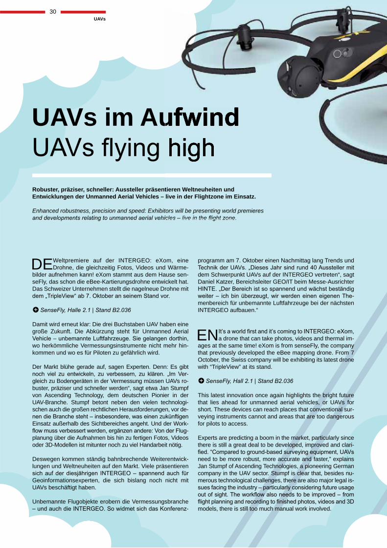
DE Weltpremiere auf der INTERGEO: eXom, eine Drohne, die gleichzeitig Fotos, Videos und Wärme-
bilder aufnehmen kann! eXom stammt aus dem Hause sen-seFly, das schon die eBee-Kartierungsdrohne entwickelt hat. Das Schweizer Unternehmen stellt die nagelneue Drohne mit
Damit wird erneut klar: Die drei Buchstaben UAV haben eine große Zukunft. Die Abkürzung steht für Unmanned Aerial
wo herkömmliche Vermessungsinstrumente nicht mehr hin-kommen und wo es für Piloten zu gefährlich wird.
Der Markt blühe gerade auf, sagen Experten. Denn: Es gibt -
gleich zu Bodengeräten in der Vermessung müssen UAVs ro-buster, präziser und schneller werden“, sagt etwa Jan Stumpf von Ascending Technology, dem deutschen Pionier in der UAV-Branche. Stumpf betont neben den vielen technologi-schen auch die großen rechtlichen Herausforderungen, vor de-
Einsatz außerhalb des Sichtbereiches angeht. Und der Work--
planung über die Aufnahmen bis hin zu fertigen Fotos, Videos oder 3D-Modellen ist mitunter noch zu viel Handarbeit nötig.
Deswegen kommen ständig bahnbrechende Weiterentwick-lungen und Weltneuheiten auf den Markt. Viele präsentieren
Geoinformationsexperten, die sich bislang noch nicht mit UAVs beschäftigt haben.
Unbemannte Flugobjekte erobern die Vermessungsbranche -
UAVs im Aufwind
Robuster, präziser, schneller: Aussteller präsentieren Weltneuheiten und Entwicklungen der Unmanned Aerial Vehicles – live in der Flightzone im Einsatz.
Enhanced robustness, precision and speed: Exhibitors will be presenting world premieres
programm am 7. Oktober einen Nachmittag lang Trends und
dem Schwerpunkt UAVs auf der INTERGEO vertreten“, sagt Daniel Katzer, Bereichsleiter GEO/IT beim Messe-Ausrichter
-menbereich für unbemannte Luftfahrzeuge bei der nächsten INTERGEO aufbauen.“
tieren Weltneuheiten und live in der Flightzone im Einsatz.
tors will be presenting world premieres
ENa drone that can take photos, videos and thermal im-ages at the same time! eXom is from senseFly, the company that previously developed the eBee mapping drone. From 7 October, the Swiss company will be exhibiting its latest drone with “TripleView” at its stand.
This latest innovation once again highlights the bright future that lies ahead for unmanned aerial vehicles, or UAVs for short. These devices can reach places that conventional sur-veying instruments cannot and areas that are too dangerous for pilots to access.
Experts are predicting a boom in the market, particularly since there is still a great deal to be developed, improved and clari-
need to be more robust, more accurate and faster,” explains Jan Stumpf of Ascending Technologies, a pioneering German company in the UAV sector. Stumpf is clear that, besides nu-merous technological challenges, there are also major legal is-
models, there is still too much manual work involved.
30UAVs
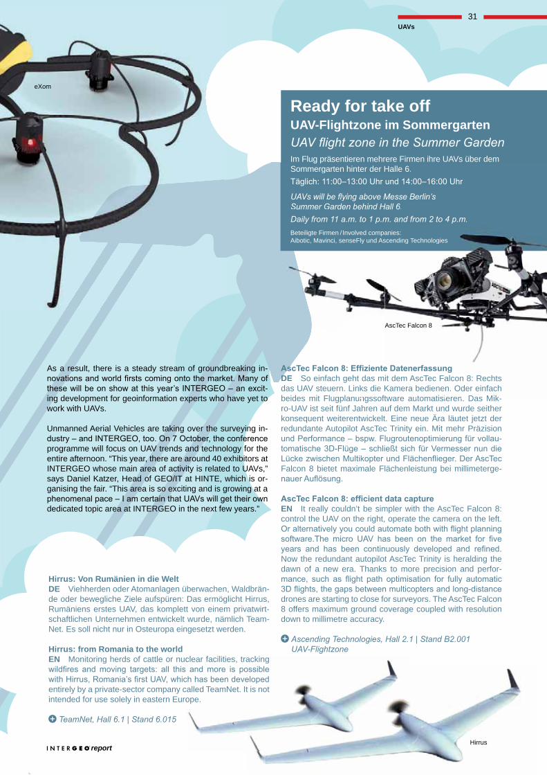
DE So einfach geht das mit dem AscTec Falcon 8: Rechts das UAV steuern. Links die Kamera bedienen. Oder einfach beides mit Flugplanungssoftware automatisieren. Das Mik-ro-UAV ist seit fünf Jahren auf dem Markt und wurde seither konsequent weiterentwickelt. Eine neue Ära läutet jetzt der redundante Autopilot AscTec Trinity ein. Mit mehr Präzision
-
Falcon 8 bietet maximale Flächenleistung bei millimeterge-
EN It really couldn’t be simpler with the AscTec Falcon 8: control the UAV on the right, operate the camera on the left.
Now the redundant autopilot AscTec Trinity is heralding the dawn of a new era. Thanks to more precision and perfor-
drones are starting to close for surveyors. The AscTec Falcon 8 offers maximum ground coverage coupled with resolution down to millimetre accuracy.
Hirrus: Von Rumänien in die Welt DE Viehherden oder Atomanlagen überwachen, Waldbrän-de oder bewegliche Ziele aufspüren: Das ermöglicht Hirrus, Rumäniens erstes UAV, das komplett von einem privatwirt-schaftlichen Unternehmen entwickelt wurde, nämlich Team-Net. Es soll nicht nur in Osteuropa eingesetzt werden.
Hirrus: from Romania to the world EN Monitoring herds of cattle or nuclear facilities, tracking
entirely by a private-sector company called TeamNet. It is not intended for use solely in eastern Europe.
As a result, there is a steady stream of groundbreaking in-
-ing development for geoinformation experts who have yet to work with UAVs.
Unmanned Aerial Vehicles are taking over the surveying in-
programme will focus on UAV trends and technology for the entire afternoon. “This year, there are around 40 exhibitors at INTERGEO whose main area of activity is related to UAVs,” says Daniel Katzer, Head of GEO/IT at HINTE, which is or-ganising the fair. “This area is so exciting and is growing at a
dedicated topic area at INTERGEO in the next few years.”
Ready for take offUAV-Flightzone im Sommergarten
Im Flug präsentieren mehrere Firmen ihre UAVs über dem Sommergarten hinter der Halle 6.
Beteiligte Firmen / Involved companies: Aibotic, Mavinci, senseFly und Ascending Technologies
DED So einnfach geht das mit dem AscTec Falcon 8: Rechts das UAV steeuern. Links diedie KKamera bedienen. Oder einfach beides mit Flulugplanunngssofttware automatisieren Das Mik-
g pSommergarten hinter der Halle 6.
Beteiligte Firmen / Involved companies: Aibotic, Mavinci, senseFly und Ascending Technologies
clear facilities, tracking
called TeamNet. Itope.
t is not
Hirrus
eXom
AscTec Falcon 8
report
31UAVs
The Combined Pack: Unbeatable Value
geoconnexion.com
Join today for only £2.50 a month
The monthly Print Magazine, the eNewsletter, and full access to the Website with
Geoconnexion International Magazine
July/August Volume 11 Issue 7
· GIS
· GPS
· CAD
· REMOTE SENSING
· PHOTOGRAMMETRY
· SURVEYING
· CARTOGRAPHY
· IMAGE PROCESSING
· BUSINESS GEOGRAPHICS
The latest geoinformation serving the World
This month incorporating July/August 2012
ASIAN SPOTLIGHTGEO:INNOVATION
BORDERLINE CASES IN GERMANYEDUCATION
RISK MANAGEMENT
SPOT THE DETAILPLÉIADES 50 CM IMAGERY
CAPTURES IT ALL
Just £2.50 a Month
Just £1a Month
Print Online Combined PackNever miss news as it happens
Online Pack
Privileged access to online news, comment and features sectionsUnlimited access to archive of news, articles, latest recruitments and training
Monthly e-Newsletter, packed with latest news and what’s on in the regions
magazines per yearPrivileged access to online news, comment and features sectionsUnlimited access to archive of news, articles, latest recruitments and training
Monthly e-Newsletter, packed with latest news and what’s on in the regions
Subscribe and stay ahead of the gameThe content that you can trust
LOOKING FOR INFORMATION ON…We’ve got it covered at geodatapoint.com
Stay up-to-date on news, trends and best practices with the GeoDataPoint weekly eNewsletter. Subscribe today
at geodatapoint.com/enews.
LiDAR & Laser Scanning
GNSS3D Data MANAGEMENT
MOBILE MAPPINGGIS
ModelingPhotogrammetry
GPS
BIM
IMAGERY
SOFTWARE
Developed by
The Point of Convergence for Geospatial Technologies
I N F O R M E D I N F R A S T R U C T U R EThe construction engineer’s source for projects, products and technology.
www.informedinfrastructure.com
32
Anzeige / ad
Anzeige / ad
Anzeige / ad
Anzeige / ad
Anzeige / ad
Anzeige / ad
33Wichmann Innovations Award
DE Bereits zum dritten Mal vergibt der Wichmann Verlag auf der INTERGEO den Wichmann Inno-
vations Award. Gekürt wird in einem Publikumsentscheid
INTERGEO. Machen Sie mit. Wählen Sie Ihr Top-Produkt aus den hier vorgestellten Nominierten. Dazu einfach Stimmkarte am Wichmann Stand auf der INTERGEO Halle 2.1, B2.029 ausfüllen oder online auf gisPoint.de abstimmen. Und gewinnen Sie mit etwas Glück einen Samsung Tablet-PC.
Aus den Bewerbungen um den diesjährigen Wichmann In-novations Award haben es neun Unternehmen auf die Nomi-niertenliste geschafft. Die bewährte Jury, bestehend aus Prof. Dr. Jukka Krisp vom Runden Tisch GIS e. V., Prof. Dr.-Ing. Willfried Schwarz, Bauhaus-Universität Weimar, Dr.-Ing. Mar-kus Seifert, LVG Bayern, Dipl.-Ing. Udo Stichling, Präsi-dent des DDGI sowie Prof. Dr. Josef Strobl von der Universität Salzburg hat sich wieder für die Be-wertung der Einsendungen und Auswahl der Nominierten zur Verfügung ge-stellt. Wir danken ausdrücklich sowohl der Jury als auch den zahlreichen Einsendern der Produktvorschläge.
Alle Teilnehmer werden im Trend- und Medien- Forum am ersten Messetag,
dem Publikum vorstellen. Nun liegt es an den INTER-GEO-Besuchern. Wer be-kommt die Krone? Wer er-steigt den Thron und wird Sieger beim dritten Wich-mann Innovations Award? Der Wichmann Innovations Award ist für die beteiligten Unter-nehmen neben der WIA-Trophäe vor allem mit wertvoller Unterstützung im Marke-ting verbunden. Der Preisträger wird unmittelbar nach der INTERGEO in all unseren Magazinen und auf unserem Online-Portal www.gisPoint.de bekannt gegeben und ausgezeichnet.
Auch den Teilnehmern an der Stimmabgabe winken attrakti-ve Preise. Gewinnen Sie einen Samsung Tablet-PC, ein Abo für die Fachmagazine gis.Business/gis.Science oder avn oder ein Fachbuch aus dem Wichmann Verlagsprogramm.
Viel Glück wünscht Ihnen das Wichmann-Team.
Ihre Stimme für das beste ProduktYour Voice for the Best Product
EN Wichmann publishers will present the Wichmann Innovations Award for the third time this year at
the INTERGEO. The best product or best application will be chosen by the INTERGEO public. Why don‘t you join in. Vote for your top product from the nominated products presented at the exhibition. Simply get the voting card and
online at gisPoint.de, and with a bit of luck, you could win a Samsung tablet-PC.
From all companies who have applied for the Wichmann Innovations Award, nine have made it on the list of nomi-nees. The established jury comprising Prof. Dr. Jukka Krisp of Runder Tisch GIS e. V., Prof. Dr.-Ing. Willfried Schwarz, Bauhaus University Weimar, Dr.-Ing. Markus Seifert, LVG Bayern, Dipl.-Ing. Udo Stichling, President of DDGI and Prof.
Dr. Josef Strobl of the University of Salzburg have again provided their knowledge in order to select their nomi-
nations from the submitted product proposals. We would like to express our thanks to both the
jury and all those who submitted their product proposals.
All nominees will be given the opportunity to present them-selves and their products in the Trend- and Media-Forum on
Who will be crowned? Who will ascend the throne and be the winner of the third Wichmann Innovations Award? In addition to the WIA trophy, the Wich-mann Innovation Award is pri-marily associated with valuable marketing support for the com-
panies involved. The winner will be made known after the INTERGEO
in all our magazines and on our website www.gisPoint.de.
Even the voters can win prizes. Win a Samsung tab-let-PC, a free subscription of the magazines gis.Business/gis.Science or avn or one of the books from the reknowned Wichmann publisher’s list.
The Wichmann Team wishes you good luck.
www.gisPoint.de/wia
report report
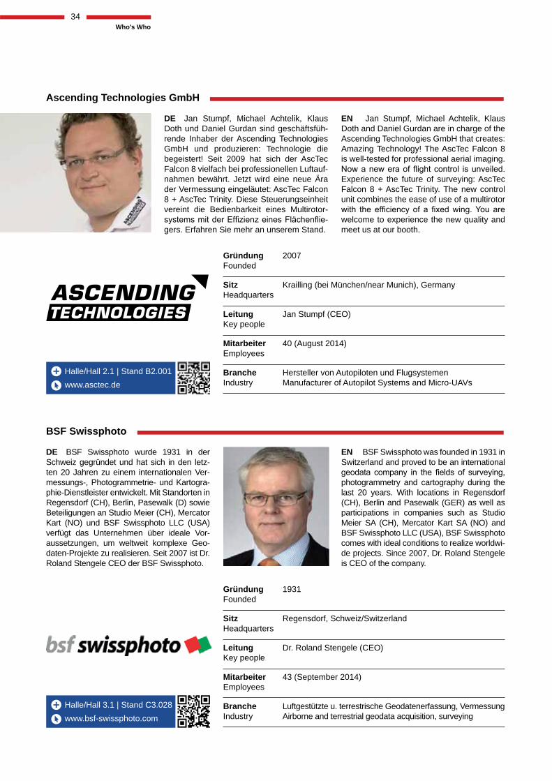
Halle/Hall 3.1 | Stand C3.028
Halle/Hall 2.1 | Stand B2.001
www.bsf-swissphoto.com
www.asctec.de
Ascending Technologies GmbH
DE Jan Stumpf, Michael Achtelik, Klaus Doth und Daniel Gurdan sind geschäftsfüh-rende Inhaber der Ascending Technologies GmbH und produzieren: Technologie die begeistert! Seit 2009 hat sich der AscTec Falcon 8 vielfach bei professionellen Luftauf-nahmen bewährt. Jetzt wird eine neue Ära der Vermessung eingeläutet: AscTec Falcon 8 + AscTec Trinity. Diese Steuerungseinheit vereint die Bedienbarkeit eines Multirotor-
-gers. Erfahren Sie mehr an unserem Stand.
DE BSF Swissphoto wurde 1931 in der Schweiz gegründet und hat sich in den letz-ten 20 Jahren zu einem internationalen Ver-messungs-, Photogrammetrie- und Kartogra-phie-Dienstleister entwickelt. Mit Standorten in Regensdorf (CH), Berlin, Pasewalk (D) sowie Beteiligungen an Studio Meier (CH), Mercator Kart (NO) und BSF Swissphoto LLC (USA) verfügt das Unternehmen über ideale Vor-aussetzungen, um weltweit komplexe Geo-daten-Projekte zu realisieren. Seit 2007 ist Dr. Roland Stengele CEO der BSF Swissphoto.
BSF Swissphoto
EN Jan Stumpf, Michael Achtelik, Klaus Doth and Daniel Gurdan are in charge of the Ascending Technologies GmbH that creates: Amazing Technology! The AscTec Falcon 8 is well-tested for professional aerial imaging.
Experience the future of surveying: AscTec Falcon 8 + AscTec Trinity. The new control unit combines the ease of use of a multirotor
welcome to experience the new quality and meet us at our booth.
EN BSF Swissphoto was founded in 1931 in Switzerland and proved to be an international
photogrammetry and cartography during the last 20 years. With locations in Regensdorf (CH), Berlin and Pasewalk (GER) as well as participations in companies such as Studio Meier SA (CH), Mercator Kart SA (NO) and BSF Swissphoto LLC (USA), BSF Swissphoto comes with ideal conditions to realize worldwi-de projects. Since 2007, Dr. Roland Stengele is CEO of the company.
Gründung 2007 Founded
Sitz Krailling (bei München/near Munich), Germany Headquarters
Leitung Jan Stumpf (CEO) Key people
Mitarbeiter 40 (August 2014) Employees
Branche Hersteller von Autopiloten und Flugsystemen Industry Manufacturer of Autopilot Systems and Micro-UAVs
Gründung 1931 Founded
Sitz Regensdorf, Schweiz/Switzerland Headquarters
Leitung Dr. Roland Stengele (CEO) Key people
Mitarbeiter 43 (September 2014) Employees
Branche Luftgestützte u. terrestrische Geodatenerfassung, Vermessung Industry Airborne and terrestrial geodata acquisition, surveying
p y
34Who’s Who
Halle/Hall 3.1 | Stand D3.030
Halle/Hall 4.1 | Stand D4.008
www.ilv-fernerkundung.de
www.tallysman.com
ILV-Fernerkundung GmbH
DE Die ILV-FE GmbH ist seit 2001 als
und satelliten-gestützten Fernerkundung tätig. -
zeugen, die mit Digitalkamera-, aber auch Laser- und Thermalkamera-Systemen aus-gestattet sind, werden weltweit durchgeführt. Zum Portfolio gehören auch Gewässerver-messungen für den Bergbau sowie für Fluss- und Talsperren-Verwaltungen. Höchst genaue GIS-Produkte, auch in 3D, werden generiert und auch mit eigenen Software ausgeliefert.
EN Tallysman’s mission is to provide GNSS antennas which meet the needs of a new generation of positioning systems providing unprecedented accuracy at ever decreasing prices. The once simple single constellation GPS antenna has inadequate bandwidth, re-markably poor axial ratio, and a non-linear phase response and simply doesn’t measure up. The GNSS antenna is now the limiting fac-tor on just how precise a GNSS system can be. Tallysman’s mission is to eliminate this barrier.
TALLYSMAN
EN The company ILV-FE GmbH works as
satellite-based remote sensing since 2001.
which are equipped with digital cameras, but also with LiDAR and thermal camera sys-tems are performed worldwide. The portfolio includes also water surveys for the mining industry as well as for river and dams ad-ministrations. Highly accurate GIS products also in 3D are generated and delivered with its own software.
Gründung 2001 Founded
Sitz Berlin Mitte, Germany Headquarters
Leitung Martin Wagner (Managing Director) Key people
Mitarbeiter 9 (Juli/July 2014) Employees
Branche Fernerkundung, Vermessung Industry Remote Sensing, Surveying
Founded 2009
Headquarters Ottawa, Canada
Key people Gyles Panther (President/CTO)
Employees 2.500 (Juli/July 2014)
Industry Computer hardware and software
35Who’s Who
report
Halle/Hall 3.1 | Stand C3.032
Halle/Hall 2.1 | Stand A2.008
www.viametris.com
www.topconpositioning.eu
TOPCON
DE TOPCON, ein innovatives und weltweit marktführendes Unternehmen, entwickelt und fertigt präzise optische und satellitengestützte Positionierungs-Produkte, sowie Software-Lö-sungen für die Vermessungs- und Bauindus-trie. TOPCON’s Produktportfolio besteht aus hoch präzisen GNSS-Sensoren, Robotic und Imaging Totalstationen, BIM-Layout-Sys-temen, Laser Scannern, Mobilen-Datener-fassungs-Instrumenten, Maschinen-Steue-rungs-Systemen und Feldrechnern, die durch cloudbasierte Software für alle Positionie-rungs- und Bauarbeiten unterstüzt werden.
DE Jérôme Ninot, VIAMETRIS Gründer und CEO, sammelte eine Forschungs-mannschaft in Domänen wie Bild und Sig-nalverarbeitung, angewandte Mathematik, künstliche Intelligenz und Programmierung. Anfang von Jérôme ist Überbringer darin WEIHEN Gruppe in Bildverarbeitung und autonomen Wagen EIN. Warten Sie auf DARPA Städtische Herausforderung damit WEIHT in 2005/2007 EIN und bekommt einen Dr mit Telekommunikation Bretagne
-zeichnet Anerkennung, die Bildverarbeitung
-me seine These als VIAMETRIS Präsident.
EN Jérôme Ninot, VIAMETRIS Founder and CEO, gathered a research team in do-mains such as image and signal processing,
and programming. Jérôme start is carrier in INDUCT Group in image processing and autonomous vehicles. Attend DARPA Urban Challenge with INDUCT in 2005/2007 and get a PhD with Telecom Bretagne (ENST) on:
Image processing“. In 2011 Jerome defends his thesis as VIAMETRIS President.
Viametris
EN TOPCON, an innovative & global mar-ket leading company, develops & manufac-tures precise satellite & optical positioning products and software solutions for the geopositioning & construction industries. TOPCON’s product portfolio consists of high precision GNSS sensors, robotic & imaging total stations, BIM layout systems, laser scanners, mobile mappers, machine cont-
cloud based software for all positioning & construction activities.
Gründung September 1932 in Tokyo, Japan Founded
Standorte Tokyo, Japan; Livermore, California; Beijing, China; Locations Capelle, The Netherlands; And technology centres in
Australia, California, Italy and Russia
Leitung Jim Paetz Key people (managing director Topcon Europe Positioning B.V.)
Mitarbeiter 4000 Employees
Branche Smart Infrastructure, Positioning, Eye Care Industry
Gründung Founded Dezember/December 2007
Sitz Headquarters Laval, France
Leitung Jerome Ninot (CEO) Key people
Mitarbeiter 5 Employees
Branche Indoor Mobile Scanning Industry
36Who’s Who
PRECISION ENGINEERED
© 2014, Trimble Navigation Limited. Alle Rechte vorbehalten. Trimble, das Globus- & Dreieck-Logo, und inpho sind in den USA und in anderen Ländern eingetragene Marken von Trimble Navigation Limited. Alle anderen Marken sind Eigentum der entsprechenden Inhaber. Bestellnr. GEO 043 (09/14)
transforming the way the world works
HOCHQUALITATIVE GEODATEN AUS PHOTOGRAMMETRIE UND LIDARDie aktuelle Bevölkerungsentwicklung stellt neue Anforderungen an Kataster-Information und topografische Daten als Grundlage für eine effektive Verwaltung. Eine solide Geodaten-Infrastruktur benötigt zuverlässige Daten für Kataster und Topographie um einen immer aktuellen Stand zu gewährleisten.
Trimble Inpho Software verwendet Luftbilder sowie Satellitenbilder, um daraus homogene, zuverlässige und hochgenaue Punktwolken bzw. Oberflächenmodelle, Orthomosaike und digitalisierte 3D Karten zu erstellen. Inpho greift dabei auf jahrzehntelange Erfahrung in photogrammetrischen Prozessen zurück.
Diese Prozesse garantieren standardisierte und qualitativ hochwertige Geodaten für die Landesvermessung, Forstwirtschaft, Stadtplanung, Energiekonzerne und mehr. Durch ihren Modulcharakter ist Inpho Software als komplettes, perfekt aufeinander abgestimmtes System, oder aber als individuelle Komponentenlösung verfügbar, welche sich nahtlos in komplette Produktionsumgebungen integrieren lässt.
LESEN SIE MEHR UNTER: WWW.TRIMBLE.COM/INPHO
report
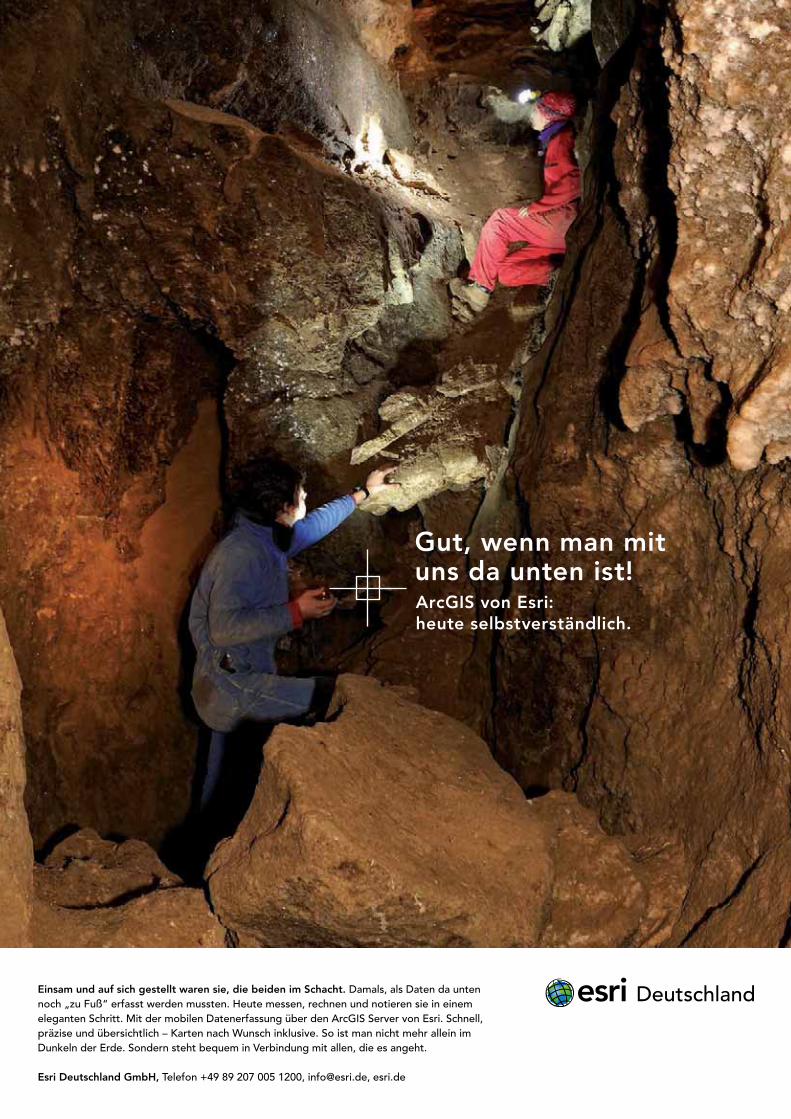
Einsam und auf sich gestellt waren sie, die beiden im Schacht. Damals, als Daten da unten noch „zu Fuß“ erfasst werden mussten. Heute messen, rechnen und notieren sie in einem eleganten Schritt. Mit der mobilen Datenerfassung über den ArcGIS Server von Esri. Schnell, präzise und übersichtlich – Karten nach Wunsch inklusive. So ist man nicht mehr allein im Dunkeln der Erde. Sondern steht bequem in Verbindung mit allen, die es angeht.
Esri Deutschland GmbH, Telefon +49 89 207 005 1200, [email protected], esri.de
Gut, wenn man mit uns da unten ist!ArcGIS von Esri: heute selbstverständlich.
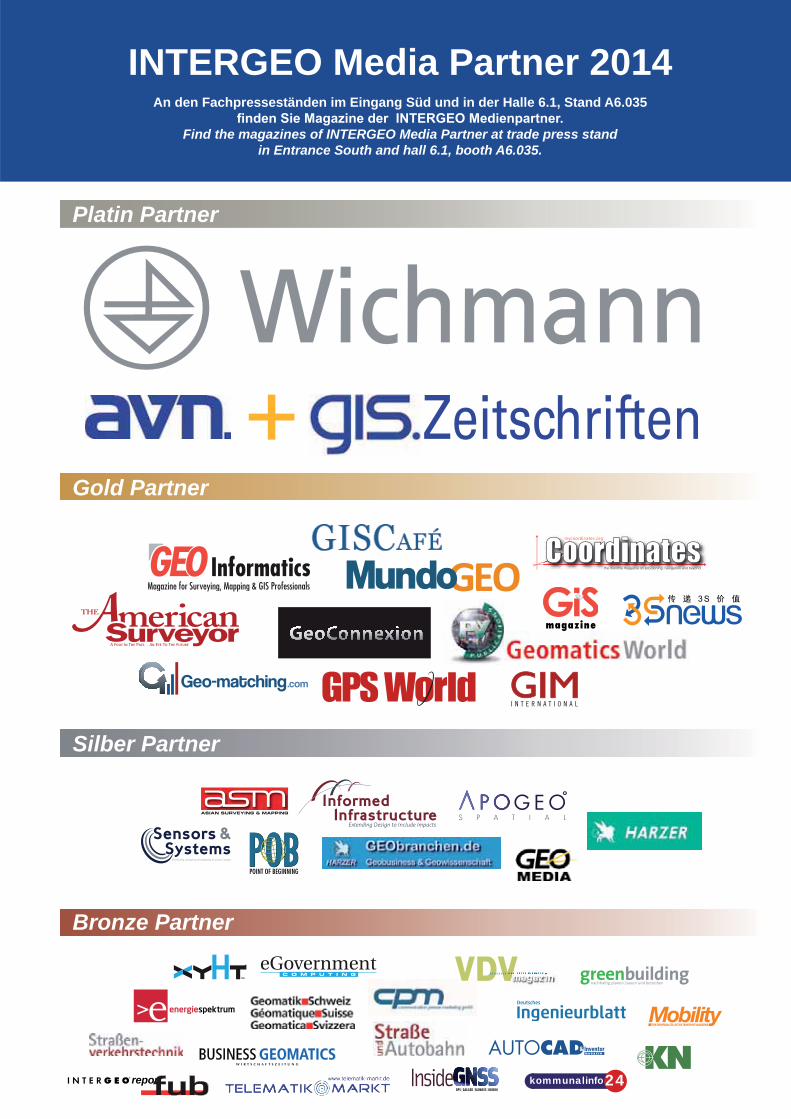
ThemaTopic
39
report
INTERGEO Media Partner 2014An den Fachpresseständen im Eingang Süd und in der Halle 6.1, Stand A6.035
Find the magazines of INTERGEO Media Partner at trade press stand in Entrance South and hall 6.1, booth A6.035.
Platin Partner
Gold Partner
Bronze Partner
Silber Partner
+ Zeitschriften
.com
kommunalinfo24
40RelaxzoneRelax zone
ILV-Fernerkundung GmbH Bildfl ug, Thermal- und Scanneraufnahmen
Vertrieb von Satellitendaten und Luftbildern
Topographische Luftbild- und Satellitenbildkarten
Herstellung von topografi schen-, Satelliten- und Orthophotokarten
Thematische Analysen von Satelliten- und Flugzeug gestützten
Fernerkundungsdaten
Konzipierung und Entwicklung von GIS-Applikationen
Forschung und Entwicklung zu neuen Fernerkundungstechnologien
Erstellung von Expertisen, Forschungsberichten
Durchführung von Schulungen und Weiterbildung auf dem Gebiet
der Fernerkundungs- und GIS-Technologie
See und Gewässervermessung
ILV-FERNERKUNDUNG GmbHww
w.agreement-berlin.de
Büro Berlin MitteWallstraße 15/15a10179 BerlinDeutschlandTelefon +49 (0) 30-240485-0Telefax +49 (0) 30-240485-19E-Mail [email protected]
Büro Gutshof WagnerLeipener Straße 704539 GroitzschDeutschlandTelefon +49 (0) 34296-956-0Telefax +49 (0) 34296-956-71
Offi ce GhanaHouse no. 206 ECOMOG - Haatso Accra - Ghana
Escritório AngolaUrbanização Nova VidaRua: 121Residência: [email protected]
Anzeige / ad
Entspannungpause? Aufgepasst!Fancy a little break? Yes please!
all 6.1, Stand A6. 7
,HHHHHHHHHHHHHHHHHHHHHHHHaaaaaaaaaaaaaaaaaaaaalllllllllllllllllllllllll 666666666666666666666 11111111111111111 SSSSSSSSSSSSSSSSSSSSSSSSSSStttttttttttttttttttaaaaaaaaaaaaaaaaaaaaaaaannnnnnnnnnnnnnnnnnnnndddddddddddddddddddddd AAAAAAAAAAAAAAAAAA6666666666666666666 00000000000000000000000005555555555555555555577777777777777Hall 6 1, Stand A6 057HHHHHHHHHHaaaallllllllllllllll 66666 11111111 SSSSSSSSSSSStttttttttttaaaaaaaaannnnnnnnnnnndddddddddd AAAAAAAAA66666 000000000000055557777777HHHHHHHHHHHHHHHHHHaaaalll 6.11,, SSttaanndd AA6.0557HHHHHHHHHHHHHHHHHHHHHHHHHHHHHHHHHHHHHHHHHHHHHHHHHHHHHHHHHHHHHaaaaaaaaaaaaaaaaaaaaaaaaaaaaaaaaaaaaaaaaaaaaaaaaaaaaaaaaaaaaaaallllllllllllllllllllllllllllllllllllllllllllllllllllllllllllllllllllllllllllllllllllllllllllllllllllllllllllllll 666666666666666666666666666666666666666666666666666666666666...........................................11111111111111111111111111111111111111111111111111111111111,,,,,,,,,,,,,,,,,,,,,,,,,,,,,,,,,,,,,,,,,,, SSSSSSSSSSSSSSSSSSSSSSSSSSSSSSSSSSSSSSSSSSSSSSSSSSSSSSSSSSSSSSSSSSSSSSttttttttttttttttttttttttttttttttttttttttttttttttttttttttttttttttaaaaaaaaaaaaaaaaaaaaaaaaaaaaaaaaaaaaaaaaaaaaaaaaaaaaaaaaaaaaaaaaannnnnnnnnnnnnnnnnnnnnnnnnnnnnnnnnnnnnnnnnnnnnnnnnnnnnnnnndddddddddddddddddddddddddddddddddddddddddddddddddddddddddddddddddddddddd AAAAAAAAAAAAAAAAAAAAAAAAAAAAAAAAAAAAAAAAAAAAAAAAAAAAAAAAAAAAAAAAAAAAAAAA6666666666666666666666666666666666666666666666666666666666666666.............................................0000000000000000000000000000000000000000000000000000000000000000000055555555555555555555555555555555555555555555555555555555555555555555577777777777777777777777777777777777777777777777777777777777777
DE
Auszeit vom Messestress. Anlässlich der 20. INTERGEO gibt es eine Relaxzone mit Wohlfühlcharakter. Lassen Sie Ihre Seele baumeln und genießen Sie im Lounge-Stil einen Fruchtcocktail oder eine (Live-)Massage.
EN -self to a little break from the stress of the trade fair. The 20th INTERGEO boasts a relax zone designed to create a sense of wellbeing. Leave your cares behind and enjoy a fruit cock-tail or a massage in lounge-style surroundings.
Supported by:
41
report
Produkt-HighlightsProduct highlights
DE Als Ergebnis von mehr als 20 Jahren Erfahrung mit der Implementierung von Kundenwünschen aus aller Welt ist Pho-tomod 6.0 jetzt erhältlich. Die leistungsfähige 64 Bit Version liefert einen einzigartig dichten DSM Erstellungsalgorithmus,
und mehrfache Beschleunigung von Bündelblockausgleich.
DE Die Trimble® V10 Multi-Kamera-Rover mit der patentier-ten Trimble VISION™ Technologie ist ein integriertes 360° Digitalkamera System, das die effektive Aufnahme von Pa-noramafotos zur Dokumentation und Messdatenerfassung ermöglicht. Das System dient zur schnellen Aufnahme aus-sagekräftiger Digitalbilder im Felde.
Grenzenlose MöglichkeitenBoundlessopportunities
AllumfassendComprehensive
EN As the result of more than 20 years experience imple-menting the wishes of users from all over the world, PHO-TOMOD 6.0 is now available. This powerful 64-bit version delivers unique dense DSM creation algorithm, PHOTOMOD
speeding up of block adjustment calculations.
EN The Trimble® V10 Imaging Rover with Trimble VISION ™ technology is an integrated camera system that
visual documentation and measurement of the surrounding environment. The Trimble V10 Imaging Rover provides the
www.racurs.ru
Halle/Hall 1.1 | A1.046
www.trimble.com
Halle/Hall 4.1 | C4.050
G lPHOTOMOD 6.0, RACURS
All f dv10 Multi-Kamera-Rover v10 Imaging Rover, Trimble
Anzeige / ad
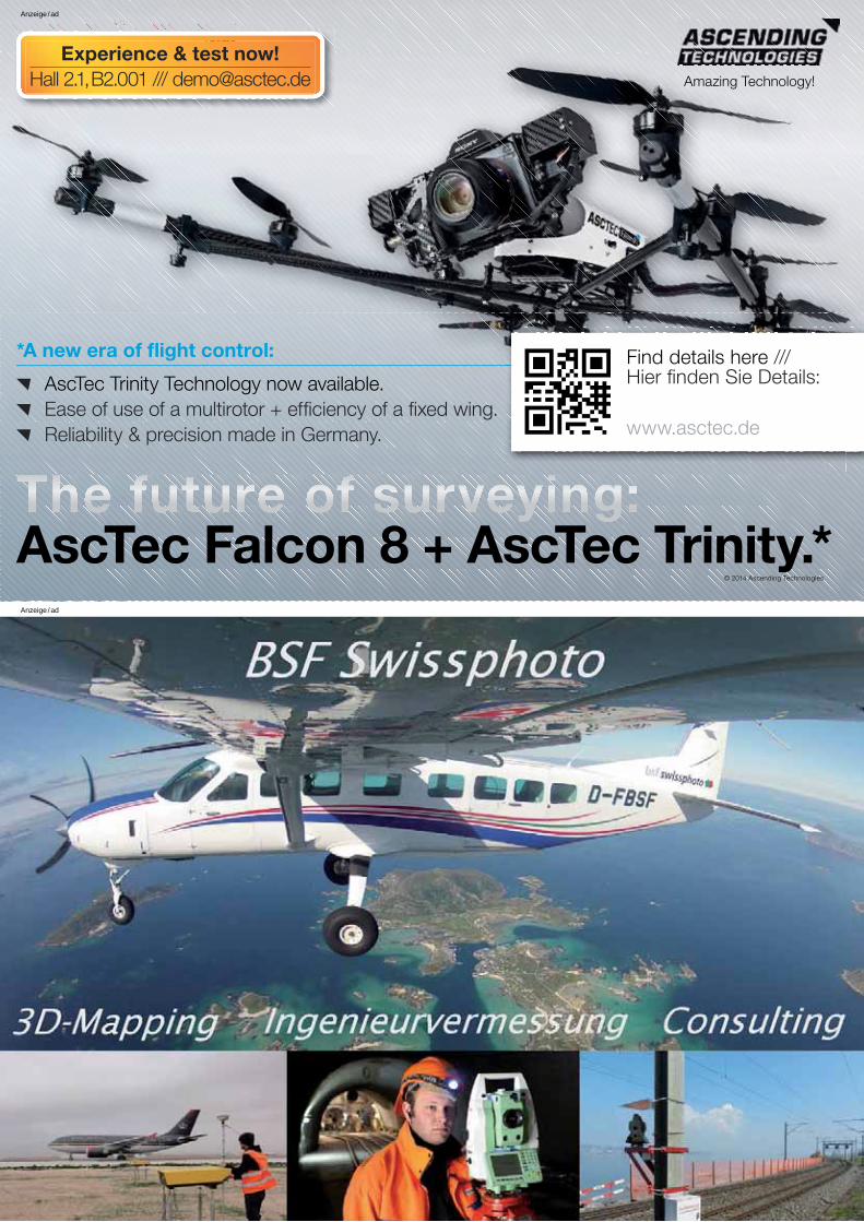
ThemaTopic
42
*A new era of flight control:
AscTec Trinity Technology now available.
Ease of use of a multirotor + efficiency of a fixed wing.
Reliability & precision made in Germany.
Amazing Technology!
Experience & test now!Hall 2.1, B2.001 /// [email protected]
© 2014 Ascending Technologies
Find details here /// Hier finden Sie Details:
www.asctec.de
AscTec Falcon 8 + AscTec Trinity.*
Anzeige / ad
Anzeige / ad
report
����������
The World‘s first survey-grade UAS LiDAR sensor
RIEGL VUX®-1
www.riegl.com
ULS
The VUX®-1 is a compact and lightweight LiDAR sensor forunmanned aerial missions.| weight approx. 3.6 kg | accuracy 10 mm | up to 550 kHz PRR | long measurement range | up to 200 scans/sec | 330° field of view | echo digitization & online waveform processing | multiple target capability | multiple time around processing | parallel scan lines | various IMU integration options | internal data storage 240 GByte | data storage on external USB devices | integrated LAN-TCP/IPinterface | flexible, easy system installation
FOV330°
field of view (FOV) up to 330°
compact and lightweight
3.6 kg
10 cm0 cm 20 cm 30 cm
RIEGL LMS GmbH, Austria | RIEGL USA Inc. | RIEGL Japan Ltd. | RIEGL China Ltd.
Visit us at
Hall 3.1, Booth A3.014
1/4 ANZEIGE
• Accutenna™ Technology • Multi-constellation / multi-frequency antennas
• VeraPhase™ Technology • Multi-constellation smart antennas
Contact us at: [email protected] or visit our website: www.tallysman.com
Visit us at Hall 4.1 - Booth D4.008
Increaseyourprecision
Anzeige / ad
Anzeige / ad
Anzeige / ad
ERFASSEN SIE ERST ALLES, MESSEN SIE SPÄTER
© 2014, Trimble Navigation Limited. Alle Rechte vorbehalten. Trimble und das Globus- & Dreieck-Logo sind in den USA und in anderen Ländern eingetragene Marken von Trimble Navigation Limited. Access und VISION sind Marken von Trimble Navigation Limited. Alle anderen Marken sind Eigentum der entsprechenden Inhaber. Bestellnr. GEO-017A-DEU
ERFASSEN SIE ERST ALLES, MESSEN SIE SPÄTER
SIE SIND ES LEID, ZUM AUFTRAGSORT ZURÜCKKEHREN ZU MÜSSEN, UM VERPASSTE DATEN ZU ERFASSEN? DANN KANN IHNEN DER TRIMBLE V10 MULTIKAMERA ROVER WEITERHELFEN.
Mit dem völlig neuentwickelten Trimble® V10 wird die Trimble VISION™ Technologie weiter vorangebracht. Bei dem V10 handelt es sich um ein integriertes System, das digitale 360° Panoramabilder der Umgebung erfasst, die für eine präzise Vermessung dieser Umgebung weiterverwendet werden können. Erledigen Sie die Arbeiten vor Ort schneller, und vermeiden Sie Nacharbeiten. Mit dem V10 können Sie sicher sein, dass Sie beim Verlassen des Auftragsortes alle erforderlichen Daten auch bei sich haben.
Sei es für Projektplanung, Inspektionen oder Erkundunge, diese von Grund auf neue Lösung liefert Ihnen Daten, die früher nicht gewonnen werden konnten und durch die Sie Ihre Aufgaben mit höherer Effizienz erledigen können, in welcher Branche auch immer.
In Kombination mit der Feldsoftware Trimble Access™ und der Bürosoftware Trimble Business Center stellt der Trimble V10 eine professionelle Lösung dar, die sich in jeden Arbeitsablauf im Vermessungswesen einpasst.
Überzeugen sie sich selbst, unter trimble.com/V10
transforming the way the world works
BESUCHEN SIE UNS AN DER INTERGEO, STAND #C4.050
Anzeige / ad
twitter.com/InsideIntergeo
intergeo.de/facebook
youtube.com/tvintergeo
Radar for monitoring deformation and vibration of natural elements and manmade structures
+ Unique design
+ Compact
+ Easy to install
+ High performance
+ Fastest on the market
FastGBSARFast Ground Based Synthetic Aperture Radar
Contact us [email protected]
Radars have never been this sensible
M E T A S E N S I N G
M E T A S E N S I N G
Anzeige / ad
Anzeige / ad

twitter.com/InsideIntergeo intergeo.de/facebook youtube.com/tvintergeo
82
“The monthly magazine on Positioning, Navigation and Beyond”
Download your copy of Coordinates at www.mycoordinates.org
Volume X, Issue 06, June 2014 THE MONTHLY MAGAZINE ON POSITIONING, NAVIGATION AND BEYOND
Indoor Positioning • Marine NavigationQR Code scan for latest issue
Publishers of the leadingindustry journals...
The journal forGIS Professionals
A window intoGeomatics
www.pvpubs.comFor more information about our publications, visit:
Available digitally or in print amerisurv.com | lidarnews.com
VOLU
ME 3
ISSU
E 3
MODELING PETRA
LIDARCanadian space firm looks to commercialize new tech
YELLOWSTONEAnalyzing scan results tomonitor geyser deformation
CATASTROPHEMobile and tripod scanningservices aid EF-4 Tornado
SPECIALIZED
Mapping the worldStay informed with GIM International – anytime, anywhere
• The very latest edition in your inbox
• An archive of back issues at your fi ngertips
• Online access – anytime, anywhere
www.gim-international.com/onlinemagazine
Sign up for a free subscription to the online magazine to ensure you have:
Supporting geoprofessionals in mapping the world
Anzeige / ad
Anzeige / ad
Anzeige / ad
Anzeige / ad

83
report
The GIS industry rang up $5 billion in 2011, and will grow to $10.6 billion by 2015.Keep up with this growing market. Get ahead of it with expert analysis!
APPLYING THE POWER OF PLACE
BETTER THAN EVER!!In the biggest market ever.
www.geospatial-solutions.com gives you the edge in a rapidly expanding industry.
Eric Gakstatter, Survey editor for GPS World, produces www.geospatial-solutions.com, the Geospatial Solutions Weekly enewsletter, frequent webinars, and a Twitter newsfeed with the latest news, analysis, and trends in the expanding geospatial industry: software, services and data.
Source: TomTom
Source: USGS
Magaz i ne f o r Su r vey i ng , Mapp ing & G I S P ro f e s s i ona l s
www.geoinformatics.com
+ 100,000
CONNECTED
PROFESSIONALSWebinars
Magazines
Web portal
Conference and Trade Fair MundoGEO#Connect
Social Networks
Anzeige / ad
Anzeige / ad
Anzeige / ad
Anzeige / ad
EINGANGSÜD
REGISTRIERUNG
A1.050A1.050
B1.060
C1.050
A1.053A1.057A1.061
A1.040
B1.037
B1.051
B1.050
B1.036
A1.052
A1.055
B1.063
B1.065
B1.066
C1.043
B1.040
B1.038
C1.066
D1.066
E1.065
A1.044
A1.046
B1.033
C1.001
B1.002
A1.024
B1.001
B1.035
B1.020B1.030
C1.029
B1.012
B1.029
B1.008
A1.026
A1.028
B1.003
B1.005
B1.024
A1.039 A1.033 A1.029 A1.015 A1.001
A1.002
A1.036 A1.034
E1.059
C1.028
C1.050
C1.060
D1.044 D1.002
D1.060
E1.023
D1.020
C1.058
E1.019
D1.020
E1.027 E1.021E1.025
D1.020D1.020
D1.054
E1.053E1.057
E1.001
C1.036
D1.035D1.059
E1.003
E1.062E1.056 E1.040 E1.032 E1.030 E1.016 E1.014 E1.010
D1.014 D1.010
C1.010C1.016C1.020C1.034C1.044
D1.012
E1.054
INTERGEO App
With the INTERGEO app you are always well informed anytime and anywhere!Wi
84
3.1/4.1
FREIGELÄNDE/OUTDOOR AREA 2.2
KONGRESSCONFERENCE
SOUTH ENTRANCEREGISTRATION
A2.039 A2.057
C2.039
C2.007
C2.055
E2.001
A2.035A2.029A2.008 A2.031
B2.059
B2.025
A2.053
B2.029
A2.002
B2.002
B2.064
C2.001
C2.025C2.011 C2.013C2.031
C2.057C2.049
E2.007
C2.002
E2.011
E2.039
B2.001
A2.060A2.050A2.026 A2.040A2.008
B2.008 B2.016B2.012B2.040
B2.026 B2.052 B2.060B2.054
B2.066
C2.065
B2.042
C2.061
C2.058C2.050
C2.066
C2.042C2.040C2.036C2.032C2.026C2.016C2.008
D2.026 D2.032 D2.040
E2.065D2.058
E2.058E2.054E2.038E2.034E2.030E2.016E2.008
B2.063
A2.066
E2.012
D2.042
B2.036
A2.064
D2.041
B2.050
E2.025
B2.020
C2.019
C2.021
E2.060
FG.001 FG.003 FG.005 FG.007 FG.009FG.011
FG.002 FG.004 FG.006 FG.008 FG.010
FG.003B
FG.003A
The complete exhibitor list on pages: 44 – 81
85
report
0
340
32
03
00
280
260
240220
200
180
160
14
01
20
100
80
6040
20
N
W
S
O
FGGFG
2.1
4.1
6.1
1.1
3.1
D3.007D3.010D3.030D3.040D3.054
D3.059
C3.060
C3.064 C 3.048 C3.044 C3.040 C3.032
C3.028
D3.025
C3.022
D4.008
C3.014
C3.004
C3.006
D3.003
B3.006
B3.004
B3.008B3.014
C3.013C2.019C3.037C3.055C3.057C3.065
B3.068
B3.066
C3.043 C3.025
B3.026B3.030B3.036B3.044
A3.044
A3.039 A3.037 A3.033 A3.029 A3.017 A3.011
A3.028 A3.014
C3.035
B3.020B3.052
C3.049C3.059
B3.060
A3.065 A3.061 A3.059
A3.060
B3.059
A3.054
A3.055
B3.003
A3.004
C3.009C3.003
C3.005
D3.019
D3.045
D3.056D3.058
D3.062
D3.061
C3.066
B3.065
A3.062
C3.062
D3.029
C3.021C3.
045
C3.017
C3.056
D3.051D3.051
FLIGHT ZONE
86
0
340
3333343400
34340
34040
32
03
233
20
20
200
30
03333
03
03
000
0000
0000
280
280
28
2880
28800
260222222626260602606022626026060260
24000220
200
180
16001606016016161
14
01
400
400
14
11
20
200
112
12
01
2
100
10
00
00
00
10
10
110
808880808080
6040
20
NNNNNNNNNNN
WWWW
SSSSSSS
OOOO
FGGFGFGGFGFGFGFGFGFGGGGGGGG
2.122222.1112.12.12 122
4.14444444.1.14 114.144
6.166666 1.16.16.16 166
1.1111.11.11.11.111
3.113.1133.13.13.13
6.1
1.1/2.1
KONGRESSCONFERENCE
D4.001
C4.003
B4.002
D4.001
B4.007
A4.010 A4.014
B4.015
A4.022 A4.026 A4.032 A4.050 A4.058
A4.057A4.053A4.037 A4.039A4.033A4.015A4.011A4.007 A4.029
B4.021
A4.002
C4.001C4.007
B4.012 B4.016 C4.021 B4.032 B4.050 B4.054
B4.056
C4.053B4.026
B4.008
C4.002
C4.008 C4.014 C4.022 C4.032 C4.040C4.050
D4.040D4.034D4.030D4.016
D4.013
D4.015
C4.065
B4.066
A4.066
A4.009
A4.067
C4.005
D4.010D4.008
D4.021
3.1/4.1
KONGRESSCONFERENCED6.
009 A6.011 A6.015
B6.018 B6.024 B6.034 B6.040
A6.030 A6.040
A6.041
A6.050
A6.057A6.057A6.035A6.035
A6.006A6.006
A6.053
A6.039
A6.029
A6.026A6.016
The complete exhibitor list on pages: 44 – 81
87
report
--

Anzeige / ad
Anzeige / ad
Anzeige / ad
88
See us in Hall 1.1 at Booth #B1.035 Tel: +1.303.649.1000www.lasertech.com/ig
www.facebook.com/LaserTechnologyInc
EMPOWER YOUR GIS WITH LASER DATA
+ Visit us at INTERGEO® 2014
+ Find out how to connect your current GIS solution to a TruPulse® laser
+ Unleash the laser offset capability you already possess
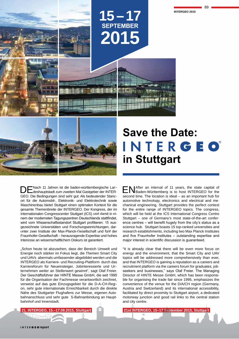
DE Nach 11 Jahren ist die baden-württembergische Lan-deshauptstadt zum zweiten Mal Gastgeber der INTER -
GEO. Die Bedingungen sind sehr gut: Als bedeutender Stand-ort für die Automobil-, Elektronik- und Elektrotechnik sowie Maschinenbau bietet Stuttgart einen optimalen Kontext für die gesamte Themenbreite der INTERGEO. Der Kongress, der im Internationalen Congresscenter Stuttgart (ICS) und damit in ei-
-gezeichnete Universitäten und Forschungseinrichtungen, dar-rrunter zwei Institute der Max-Planck-Gesellschaft und fünf der Fraunhofer-Gesellschaft – herausragende Expertise und hohes Interesse an wissenschaftlichem Diskurs ist garantiert.
„Schon heute ist abzusehen, dass der Bereich Umwelt und Energie noch stärker im Fokus liegt, die Themen Smart Cityund UAVs abermals umfassender abgebildet werden und die INTERGEO als Karriere- und Recruiting-Plattform durch das Karriereforum für Neueinsteiger, Jobinteressierte und Un-ternehmen weiter an Stellenwert gewinnt“, sagt Olaf Freier.
für die Organisation der Fachmesse verantwortlich zeichnet,verweist auf das gute Einzugsgebiet für die D-A-CH-Regi-on, sehr gute internationale Erreichbarkeit durch die direkte Nähe des Stuttgarter Flughafens zur Messe, eigenen Auto-bahnanschluss und sehr gute S-Bahnanbindung an Haupt-bahnhof und Innenstadt.
21. INTERGEO, 15.–17.09.2015, Stuttgart . , .– , tt
15 – 172015
ENAfter an interval of 11 years, the state capital of Baden-Württemberg is to host INTERGEO for the
second time. The location is ideal – as an important hub for automotive technology, electronics and electrical and me-chanical engineering, Stuttgart provides the perfect contextfor the entire range of INTERGEO topics. The congress,which will be held at the ICS International Congress Centre Stuttgart – one of Germany’s most state-of-the-art confer-
science hub. Stuttgart boasts 15 top-ranked universities and research establishments, including two Max Planck Institutes
“It is already clear that there will be even more focus onenergy and the environment, that the Smart City and UAV topics will be addressed more comprehensively than ever,and that INTERGEO is gaining a reputation as a careers and recruitment platform via the careers forum for graduates, job-
Di t f HINTE M G bH hi h h b iDirector of HINTE Messe GmbH, which has been responsi-ble for organising the trade fair since 1995, emphasizes theconvenience of the venue for the D/A/CH region (Germany, Austria and Switzerland) and its international accessibility,facilitated by direct proximity to Stuttgart airport, a dedicated motorway junction and good rail links to the central station wand city centre. t
21st INTERGEO, 15–17 September 2015, StuttgartII SSepept aarr
report
INTERGEO 2015
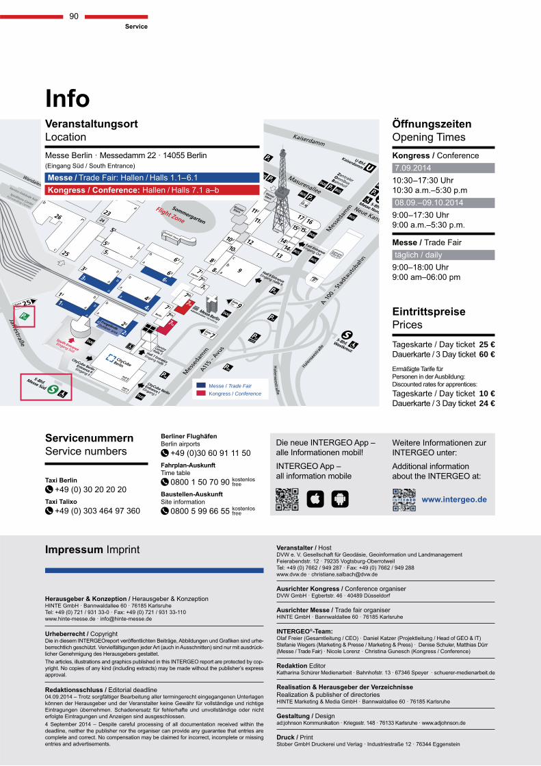
25 € 60 €
10 € 24 €
INTERGEO®
Editor
Messe / Trade FairKongress / Conference
FreigeländeOutdoor area
free
free
report repreppportorortor www.gispoint.de
Technikwissen punktgenau:
Zukunftspotenzial Geodaten Der Herbert Wichmann Verlag bietet Ihnen eine im Markt einmalige Medienkompetenz für die Bereiche Geoinformatik, Geodäsie, Photogrammetrie und Verkehrsplanung. Das Angebot umfasst:
das Webportal mit Servicecharakter: www.gisPoint.de, die Fachzeitschriften: avn, gis.Business und gis.Science sowie mehr als 70 Fachbücher und Proceedings.
Bleiben Sie informiert und nutzen Sie neueste Erkenntnisse aus Wissenschaft, Forschung und Wirtschaft!
ten eine im Markt einm
ormatik, Geodäsie,k dA b t f t:
aligma ge
Halle
2.1
Stan
d C
2.00
8 O
utdo
or A
rea
Stan
d FG
.008


