Embed Size (px)
Citation preview
HARTLEY ON INLAND NAVIGATIONS IN EUROPE. 101
19 March, 1885.
Sir FEEDEEICK J. BEAMWELL, F.B.S., President, in the Chair.
"Inland Navigations in Europe." By Sir CHARLES A. HARTLEY, K.C.M.G., M. Inst. C.E.
THE subject on which the Council has done me the honour to ask me to lecture this evening is so vast in its scope that I fear that in whatever way it may be treated, in the short space of time at the disposal of a lecturer, the result cannot fail to disappoint a portion at least of his audience.
With a view to minimise this natural feeling of disappointed expectation, I think it best to announce at once that my remarks tonight, instead of referring, as might naturally be expected, almost solely to inland navigation in connection with the United Kingdom, will direct your attention almost exclusively to certain important inland navigations and river improvements on the continent of Europe (Plate 2) , with which, owing to my avocations abroad for a period of nearly thirty years, I am in a measure practically acquainted. In other words, I naturally prefer to confine my observations almost wholly, and with but one exception, to that part of the subject of my lecture on which I have some direct knowledge, namely, to systems of large river navigations in Europe—for time will not allow me to allude even in the briefest way to navigations in other quarters of the globe—rather than to dwell at length on the more popular subject of home navigations, concerning which the majority of my audience are doubtless already much better informed than myself, or, in any case, may speedily become so after reference to the many excellent publications on rivers and canals to be found in every public library, and especially on the well-stocked shelves of this Institution.
With regard to the actual cost of transport by inland waterways as compared with the cost by land, the question is evidently too large to be discussed with advantage on the present occasion. In what follows, therefore, I shall only touch incidentally on this important subject, and refer you for the latest and most authentic details thereon to the Beport on Canals published in July 1883 by order of the House of Commons.
Downloaded by [ La Trobe University] on [01/10/16]. Copyright © ICE Publishing, all rights reserved.
1 0 2 HARTLEY ON INLAND NAVIGATIONS IN EUROPE.
Canals in history of canals from the time of Alexander, the Ptolemies, and Marius, down to the days of Biquet, Brindley, Smeaton, Telford, Eennie, and De Lesseps, is published in countless volumes accessible to every one. I need not therefore follow in the old track, and t ry to vary the recitals by conjectures concerning the priority of invention, by the Italians or Dutch in the fifteenth century, of the lock, by which alone inland navigation eventually became generally applicable and useful; nor need I dwell on the fact that at home and abroad, during the latter half of the eighteenth century, there was as great a rage for canals as in the second quarter of this century for railroads.
Inter- I should not omit, however, to notice the circumstance that, Ship great as has been the check by the introduction of railways to the Canals. construction of canals for the use of barges, the latter part of the
present century will ever be famous for its great isthmian ship canals, such as the so-called artificial Bosphorus at Suez, which has already diverted the old lines of commerce in a remarkable manner, and the Panama Canal, which is apparently destined to effect a still more notable revolution in the old trade routes, before the end, let us hope, of the present decade.
Tidal ports. But as the theme allotted to me is inland navigation, I must perforce be silent on the topic of inter-oceanic waterways; and the same restriction applies to tidal ports and tidal rivers—a subject which is in the programme of a lecture to be delivered next month from this platform by a very distinguished member of this Institution, Mr. Thomas Stevenson, of Edinburgh.
Theories. As to the theoretical part of my subject, I have no new theories to propound, or old ones dressed up in a new garb, to place before you; but in saying this, I desire to indicate to any student in hydraulics who may be present to-night the best sources of information with which I am acquainted concerning the most generally accepted theories in this country, and the most recent experiments of value on the flow of water, namely, Dr. Eobison's remarkable article under the head of " Bivers " in the last completed edition of the "Encyclopaedia Britannica," and to the experiments of Major Cunningham, 1 B.E., on the Ganges canal.
INLAND NAVIGATION IN GREAT BRITAIN AND IRELAND.
British The lower parts of the chief rivers of the United Kingdom are Kivers. m 0 s t l y arms of the sea, navigable at high water by ships of the
1 Minutes of Proceedings Inst. C.E. vol. xxi. p. 1.
Downloaded by [ La Trobe University] on [01/10/16]. Copyright © ICE Publishing, all rights reserved.
HARTLEY ON INLAND NAVIGATIONS IN EUROPE. 103
largest burden. Higher up stream, where the tidal influence is gradually diminished, they are generally navigable for ordinary river steamers, and, finally, when the tide is no longer of any avail they are in many cases canalized for the use of barges up to points which appear to be best adapted for the departure of entirely new waterways to navigable channels in other river basins.
As a case in point, the Thames (218 miles in length) is navigable The Thames,
for the largest vessels from the Nore to London Bridge (48 miles), and thence for ordinary steamers to Teddington (20 miles), where the canalized portion of the river begins, and whence it is navigable as far as Lechlade, situated at 24 miles below Thames head. The total fall between the latter and London Bridge (170 miles) is 250 feet. Again, the Thames, at certain parts of its course above London Bridge, is united by means of a grand network of canals with the Solent, the Severn, the Mersey, the Humber, and the Trent; and thus, independently of its estuary, the Thames is in direct inland communication not only with the English and Irish Channels and the North Sea, but with every inland town of importance south of the Tees. With reference to the estuary of the Thames, trustworthy evidence was taken before arbitrators in 1879-80, in a case concerning the navigable condition of the Thames, by which it appeared (1) that of the entire area of its basin, 5,162 square miles, 3,676 belonged to the non-tidal area, and 1,486 to the tidal portion below Teddington; (2) that the mean volume discharged from the tideless portion was 1,540 cubic feet per second over a period of twenty-five years ending 1878, or about 2,000 cubic feet per second at Crossness, 13 miles below London Bridge, from a total area of 4,661 square miles; and (3) that at Crossness the proportion of inland water (when the river is running moderately full) to tidal water (at an ordinary spring tide) is 1 in 26.
These figures are given with a view to enable comparisons to be made between our famous English river, on which is situated the chief commercial port and city in the world, and certain rivers on the Continent, shortly to come under review, of incomparably greater magnitude, but nevertheless of infinitely less importance as great highways of trade.
The absolute length of inland navigations in the British Isles British
seems to be rather a difficult matter to arrive at with exactitude, Canals,
for whilst Mr. Calcraft of the Board of Trade states it to be 2,688 miles in England and Wales, 256 in Ireland, and 85 in Scotland, or 3,029 miles in all, exclusive of the rivers Thames, Severn, Wye , Humber, Wear, and Tyne in England, the Shannon and other
Downloaded by [ La Trobe University] on [01/10/16]. Copyright © ICE Publishing, all rights reserved.
104 HAKTLEY ON INLAND NAVIGATIONS IN EUROPE.
navigations in Ireland, and the Clyde, Forth, and Tay in Scotland, Mr. Conder, M. Inst. C.E., who has for many years past given special attention to railway construction and the cost of transport generally, estimates the length of-inland waterways at 4,332 miles in England and Wales (of which 2,919 are canals and canalized rivers, and 1,413 navigable rivers), 755 in Ireland, and 354 in Scotland, or a total of 5,442 miles. As to the cost of construction, the same authority has obligingly informed me that according to his researches the total cost of the canals and canalized rivers in England and Wales (4,332 miles) was £19,145,866, giving an average of £6,052 per mile, the minimum (Fen water canals,. 431 miles) costing £4000 per mile, and the maximum (Thames and Humber river and canal systems, 393 miles) £10,000 per mile, including the Eegent's canal, which cost £120,000 per mile.1
The carrying power of barges on British canals varies, with but few exceptions, from 20 to 80 tons when loaded down to draughts of from 3J to 5 feet. The average dimensions of the locks, by which of course the size of the barges is regulated, are 80 feet by 14 feet, not taking into account of course the exceptional cases of the Weaver navigation (the best study in England at present of modern canal appliances), the new Aire and Calder canal, and the Gloucester and Berkley canal. There is a lock on English canals at every 1̂ mile on an average, and the loss of time they occasion to barges is estimated at about two minutes per mile. Taking this retardation into account, the mean speed of barges in England by horse traction may be stated at 2\ miles per hour.
According to Mr. Conder, the working expenses of steam lighters on the Forth and Clyde canal (35 miles long, and accommodating vessels of 8 \ feet draught) are 0 • 23d. per ton per mile, including all expenses, but excluding interest on works; the average working expenses on all the English waterways are 0*26d. per ton per mile, or 0 • 37d. including 4c\ per cent, interest on capital, and the cost on the Thames 0*10d., as compared with 0*083d. per ton per mile on the Aire and Calder Canal, for steam-tug expenses only.
There are no examples in the United Kingdom of cable-towing. A costly experiment of the system was tried on the Bridgewater navigation some years ago, but it was not adopted there, as the distances between the locks are short and the navigation tortuous.
Caledonian No account, however short, of British waterways should omit Canal.
1 The total length of railways open for traffic in the United Kingdom on the 1st January, 1884, was 18,681 miles, and the total capital paid up thereon £784,921,000, giving an average of £12,000 per mile.
Downloaded by [ La Trobe University] on [01/10/16]. Copyright © ICE Publishing, all rights reserved.
HARTLEY ON INLAND NAVIGATIONS IN EUROPE. 105
to mention Telford's masterpiece, the Caledonian Canal. This celebrated work has a length of 60 J miles, of which 37^ are natural lake navigation, and 23 are artificial or canal navigation. The standard depth of the canal is 18 feet, giving access to vessels 160 feet in length, 38 feet beam, and 17 feet draught. The summit level is 102 feet above the sea, and at Corpach, its southern extremity, eight locks are clustered together up the side of a hill, to overcome a height of 64 feet. The cost of the canal was about £1,000,000 sterling.
INLAND NAVIGATIONS ON THE CONTINENT OF EUROPE. It is a far cry from England to Eussia, but as this lecture is
meant to embrace inland navigations generally throughout Europe, a succession of long and sudden leaps is unavoidable in a voyage covering so much ground. Hence my excuse for hurrying on without further preamble to the most northerly country of the Continent, with the intention of then working west about to Eoumania, which marches with her gigantic neighbour along mid-channel of the lower Pruth to its mouth near Eeni, and thence by the left bank of the Danube and the new frontier line of the Kilia mouths to the Black Sea.
EUSSIA IN EUROPE.
European Eussia is forty times larger than England, having in round numbers a length of 1,600 miles from the confines of Scandinavia, Germany, and Austria, a width of 1,300 miles from the Arctic Ocean to the Black Sea, and a total area of 2,000,000 square miles, or more than one-half that of Europe.
With the exception of the little group of the Yaldai Hills the main divisions of European Eussia are the frozen " tundras " of the Arctic coast, the rock and lake plateau of Finland, the great forest and corn-bearing lands of the central region, and the vast treeless " steppes " or pastoral lands of the south and south-west, the chief characteristic of the whole landscape being that of an apparently illimitable gently-rolling plain, without a hill in view to break the monotony of the horizon. Thanks, however, to its comparatively low elevation this enormous region enjoys a river and lake system of navigation on an immense scale, and in order to complete Nature's handiwork—for hitherto Eussian rivers have been little improved by the hand of man—a well-considered system of artificial canals has been established, by means of which the whole country can readily be traversed by water from end to end. European Eussia possesses 19,000 miles of navigable waterway, and 38,000 miles of raft-bearing rivers. In summer these great high-
Downloaded by [ La Trobe University] on [01/10/16]. Copyright © ICE Publishing, all rights reserved.
106 HARTLEY ON INLAND NAVIGATIONS IN EUROPE.
ways transport raw products to the south and west, and receive back manufactured goods, whilst in the long winter months, from October to May in the north, and from November to April in the south, all inland traffic is necessarily carried on either by means of railways, of which there is already a length of 16,000 miles in European Eussia, or by sledges over the frozen ground in districts where railways are still unmade or temporarily buried in snow.
The chief inland waterways of European Eussia will now be briefly passed in review, after drawing attention to the fact that the great watershed of Europe—that which separates its northern from its southern drainage—coincides throughout the eastern half of the continent with a low range of hills, which in their greatest elevation, the Yaldai plateau, hardly reach more than 1,100 feet, and which widens out in some parts into an expanse of marsh.
Thus to the north of this watershed the Petchora flows into the Arctic Ocean and the Dwina into the White Sea: to the northwest the Neva and the Duna fall into the Baltic; to the south-east the Ural and Volga fall into the Caspian Sea; and to the south, the Don, the Dnieper, the Bug and Dniester fall into the Black Sea.
Petchora. The Petchora, 915 miles in length, 1 with a drainage area of 127,000 miles, has but 10 feet of water on its bar, and is only free from ice during a third of the year. Nevertheless, its traffic in cereals and raw produce in the short summer season is very considerable.
Dwina. The Dwina has a course of 650 miles, and becomes navigable on receiving the Vichegda, where it turns to the north; but though at the Port of Archangel the water is very deep, it is only accessible to vessels of a less draught than 14 feet—the maximum depth over the deepest of the four mouths of the river which empty themselves into the gulf of the Dwina, about 30 miles below Archangel.
Ural. The Ural has a course of 1,446 miles, and drains an area of 95,000 square miles, but the volume of its waters does not correspond with its length and the extent of its basin as compared with rivers in moister climates. It is navigable for small craft for most of its length, and enters the Caspian by three mouths of great width but insignificant depth.
Volga. The Volga, the longest river in Europe, and the chief commercial road of the whole Eussian empire, rises in the Valdai Hills, at an elevation of 663 feet above the Caspian Sea, into which it flows
1 The areas of the drainage basins of Eussia and Germany are mostly after Strelbitsky. All measurements are in English statute miles of 5,280 feet.
Downloaded by [ La Trobe University] on [01/10/16]. Copyright © ICE Publishing, all rights reserved.
HARTLEY ON INLAND NAVIGATIONS IN EUROPE. 107
through upwards of seventy mouths, after a tortuous course of more than 2,000 miles. Its drainage area is 563,000 square miles. With its tributaries, it affords 7,200 miles of navigation, and is connected by canals with the White and Black seas, the Baltic, and the Azov. The Yolga first becomes navigable for small steamers at Tver, whence it flows almost due east to its confluence with the river Oka (which drains 93,000 square miles) at Nijni Novgorod,- so celebrated for its great fairs, and then on in the same direction to the large manufacturing and semi-Asiatic town of Kazan. Hence to the Caspian Sea there are said to be only four towns on the left bank of the river, as against more than thirty on the right; and this is readily accounted for by the fact that it is chiefly the left bank that is liable to be flooded, the right bank being mostly the higher and steeper of the two—a remark, it may be said in passing, that also applies to the Dnieper, the Don, and the lower Danube. About 50 miles below Kazan and 300 below Nijni Novgorod, the Yolga receives the waters of its chief feeder, the river Kama, which rises in the Ural mountains, and drains 200,000 square miles. As upwards of 900 miles of its total length of 980 are navigable, and as it is the great artery of communication with Siberia, the traffic of the Kama is very important. From its confluence with the Yolga to Astrakhan, the great river flows nearly south for 1,200 miles, and, owing to the dryness of the climate, receives no other tributary of importance in the remainder of its course to the sea. In this distance it spreads out in many places to a width of several thousand feet, with depths varying from 3 feet at dry seasons, where the width is abnormal, to 50 feet and upwards in the concavities of sharp bends and in narrow places.
Hitherto no permanent works have been undertaken to improve the navigation of the Yolga, and the Bussian Government will hesitate a long time yet, I think, before rushing into heavy works for that purpose, for not only would they be exceedingly costly, but their effect would be very uncertain. Meanwhile, in the lower part of the river, the removal of shoals which are formed annually by the spring floods is effected by dredging, by provisional lattice groynes, and, during the last three or four years, by what is called a new system of iron harrows,1 which are said to have doubled the navigable depth over certain shoals in a few days, and, in one instance, at the Chebocksarsk shoal where the depth was only 2 feet 4 inches right across the river, to
1 Minutes of Proceedings Inst. C.E. vol. lxxvi. p. 393.
Downloaded by [ La Trobe University] on [01/10/16]. Copyright © ICE Publishing, all rights reserved.
108 HARTLEY ON INLAND NAVIGATIONS IN EUROPE.
have deepened the water 3 feet in six days, over a sufficiently wide channel, and to have given a depth therein of 2 metres in a fortnight. This reference to shallow water in the Volga will give an idea of the difficulties the navigation has to contend with at certain seasons of the year; nevertheless upwards of six hundred steamers navigate the river and its chief tributaries, and trade goes on increasing rapidly.
Six days are generally needed to steam down from Nijni Novgorod to Astrakhan. Stoppages, both up and down stream, are always made at Tsaritzyn, on the right bank, which is connected by rail with Kalatch, on the left bank of the Don, The distance between the Volga and the Don, at Tsaritzyn, is only 49 miles, but as yet the only water communication between these two great streams is by means of the Upa canal, which connects the Oka with one of the upper reaches of the Don, thus uniting the Caspian Sea with the Azov.
The flourishing town of Astrakhan is situated on the right bank of the Volga, at a few miles above the head of the delta, 1,440 miles below Nijni-Novgorod, 320 below Tsaritzyn, and 50 from the Caspian Sea. Although the Volga is longer than the Danube, and the area of its catchment basin 90 per cent, greater, the volume discharged by the Volga is less than two-thirds of that discharged by the Danube, a circumstance which is explained by the fact that in the region traversed by the former there is relatively a much smaller rainfall than in the most westerly parts of Europe.
At the numerous mouths of the Volga, which frequently change in direction and volume, the south, or principal one, is happily kept open for the passage of small steamers by the action of the prevailing S.S.W. winds, which tend to drive the detritus northwards, and thus partially to choke up the subsidiary channels to the north-east.
The Caspian This inland sea has an area of 160,000 square miles, and the Sea. level 0 f j t g 8 u r f a c e i s 84 f e e t below that of the Black Sea. Its
trade is now very important, owing principally to the great increase of late years in the production of petroleum from wells sunk near that ancient seat of fire-worship, the Port of Baku. In 1883 the transport by rail and steamer of this industry alone amounted to 206,000 tons, of which more than one-half was produced by the enterprising Swedish firm of Nobel Brothers. A large fleet of cistern steamers are already employed in connection with this trade, and it will be interesting to engineers to watch the effect on the water traffic when the means now in progress to facilitate the land transport by rail and lines of iron tubing have
Downloaded by [ La Trobe University] on [01/10/16]. Copyright © ICE Publishing, all rights reserved.
HARTLEY ON INLAND NAVIGATIONS IN EUROPE. 109
been perfected. By this combined system of carriage it is anticipated that ultimately there will be no difficulty in exporting the 250,000,000 gallons a year which experts assert can regularly be obtained from the Caucasian regions, a supply, it may be added, which is equal to the present wants of the whole world. Apropos of this interesting question of the petroleum trade it may not be out of place to quote a passage from a letter I received last month from H.B.M.'s Vice-Consul at Odessa. He says : " We have in port a small light-draught screw steamer—150 tons burden dead weight—called the ' Samuel Owen,' which has just arrived from Baku (Caspian Sea) via the Volga, the Marie system of canals, Lake Onega, Eiver Neva, and thence round Europe to Odessa." . Now as the distance, by land, in a straight line from Baku to Odessa is less than 1,000 miles, and as the distance steamed over by the " Samuel Owen " must have been fully 8,000 miles, it appears to me that the voyage of this vessel is a remarkable illustration of the preference that is given, in certain cases, to water over land transport, even when the former mode of transit involves the delay attending an extraordinarily circuitous navigation by lakes, rivers, canals, and narrow seas, to attain the end in view.
The Don rises in the Ivan lake, 586 feet above the sea; its Don. length is 980 miles, and its drainage area 170,000 square miles. This river is navigable for large rafts of timber down to the mouth of its first great tributary, the Voronjo, at Tavrovsky, on the left bank (where Peter the Great built his ships of war for the Black Sea), and thence to Kalatch it is navigated by small steamers. From Kalatch, which, as we have seen, approaches within 49 miles of the Yolga, large freight steamers start several times a week for Bostov, the largest commercial town in Bussia after Odessa, and situated on the right bank of the river at the head of the delta. The quantity of merchandise floated down, including the traffic of the Donetz, which enters the Don between Kalatch and Bostov, as well as that of the Sosna, another tributary which enters it between Yoronej and Kalatch, is above 200,000 tons annually, exclusive of large deliveries of anthracite coal, which is obtained from Novo Tcherkask and Lugan (about 100 miles above Bostov), and sent down the Don for the use of the Bussian steamers in the Azov.
A short distance below Bostov, where, according to my own observations, the sectional area of the river at low water is 23,300 square feet, the Don splits up into two channels (Plate 3) which ultimately give birth to five separate mouths, at the deepest of which, the Perevoloka mouth, 25 miles below Bqstov and 15 miles from the Taganrog roadstead, the available depth is rarely more than 6 feet.
Downloaded by [ La Trobe University] on [01/10/16]. Copyright © ICE Publishing, all rights reserved.
110 HARTLEY ON INLAND NAVIGATIONS IN EUROPE.
During the summer of 1882, and in November, 1884, however, all the bars of the Don were completely dry for several hours, owing to the effect produced by a long-continued east wind. On the other hand, in 1866 (when the mouths of the river were surveyed under my direction), a long series of hydrographic observations recorded the interesting fact that after a long and stiff blow from the W.S.W., and therefore from seaward, the water at the Perevoloka mouth rose 9 feet above its ordinary level, thus giving a momentary depth of 15 feet on the bar, and so causing the current to flow upstream past Eostov with considerable velocity.
After this description of the mouths of the Don, it need not be said that the river is only accessible to coasters of light draught. Sea-going vessels either take in their cargoes from lighters in the Straits of Kertch, where there is now a depth of 15 feet, or in the roadstead of Taganrog, which, on account of shallow water, is 10 miles distant from the port of Taganrog. Taganrog is one of the three privileged ports of the Empire for the importation of foreign goods, and the great entrepot for the commerce of the Volga and the Don.
Dnieper. The Dnieper drains an area of 204,000 square miles, and rises not far from the source of the Volga. In its length of 1,060 miles it flows nearly south from Smolensk to Kiev, below which its direction south-east to Ekaterinoslav, and thence south and south-west to the Black Sea. Its first great tributary below Smolensk is the river Berezina (which is joined to a branch of the river Duna by the Berezina Canal); but its most important feeder is the Pripet, which joins the Dnieper at about 60 miles above the city of Kiev, the " Jerusalem" of Eussia. The Pripet is 380 miles in length, and rises within a few miles of the right bank of the northern Bug, which flows into the Vistula. By the Oginsky Canal the Pripet is connected with a branch of the river Niemen, and thus there is an alternative means of inland water-communication between the Black Sea and the Baltic. The Desna, the third tributary of importance, joins the Dnieper on its left bank at Kiev, and contributes a large quota of trade to the main river in the early summer when it is navigable as far as Briansk in the province of Orel. At Kiev, where, as we all know, the Dnieper is spanned by Vignoles's magnificent suspension bridge, the river is 1,500 feet wide, but thence to Kremen-tchug, about 100 miles above Ekaterinoslav, it occasionally exceeds 1 mile in width. The minimum depth between Kiev and Ekaterinoslav is 3 feet. At Krementchug a large trade is carried on in taUow, salt, grain, and beet-root sugar, and large storehouses are provided for the half-manufactured produce brought down the Dnieper and
Downloaded by [ La Trobe University] on [01/10/16]. Copyright © ICE Publishing, all rights reserved.
HARTLEY ON INLAND NAVIGATIONS IN EUROPE. I l l
its tributaries from the provinces through which they flow, as well as for goods brought overland from the interior.
Steamers ply daily in summer between Kiev and Krementchug, and every other day between the latter and Ekaterinoslav, an important town on the right bank, about 60 miles above Alex-androvsk, a large port on the left bank at the foot of the cataracts of the Dnieper. This great obstruction to the navigation, which I inspected in 1873 at the request of the Eussian Black Sea Steam Navigation Company, is caused by a granite outshoot of the Carpathians, and consists of nine distinct rapids in a length of 47 miles, the total fall being 107 feet. The most formidable of these obstacles are the Koidatsky, Nenasitetsky, the insatiable (Plate 3) , and Volingsky Bapids, their average length being only 7,700 feet, with a total fall of 34 feet. Several abortive attempts were made between 1788 and 1833 to improve the navigation by means of side-cuttings near the shore line, but no improvement of any kind was effected till 1853, when, after ten years' work, a series of canals were formed in the bed of the river, and protected at the sides by parallel walls of rock-work, furnished with splayed guiding-walls facing up-stream, with the view of allowing vessels of small draught to make use of them at certain seasons of the year, when the rapids would otherwise be impassable. In practice, however, their only use has been to allow of the occasional passage of undecked flat-bottomed barges carrying from 5 to 7 tons, and drawing 18 inches at extreme low water. At all other seasons the confined artificial channels, which have a width of about 140 feet, are regarded as mere traps at each one of the rapids, and are therefore always carefully avoided by descending vessels. No cargo-boats ever ascend the rapids, and the whole trade over them is consequently limited to rafts of timber and to raw and also manufactured produce floated down-stream from long distances in lightly-constructed barges, which are broken up and the wood used for building purposes on their arrival at Kherson, a languishing port on the right bank at the head of the Delta, 216 miles below Alexandrovsk.
Immediately after passing Kherson, the Dnieper divides into several channels, and finally delivers its waters into the Bay of Kherson by nine mouths, at the deepest of which, by the aid of occasional dredging, a depth of 10 feet is generally maintained.
In spring, when barges drawing from 5 to 6 feet can descend the river from the foot of the rapids to Kherson, there are barges carrying 100,000 tons plying between Alexandrovsk and Odessa, a distance of 306 miles, at an average freight of 7s. per ton. At
Downloaded by [ La Trobe University] on [01/10/16]. Copyright © ICE Publishing, all rights reserved.
HARTLEY ON INLAND NAVIGATIONS IN EUROPE.
the low-water season, however, the rates sometimes rise to 15s. per ton.
Bug. The Southern Bug rises in Podolia, and after a course of 430 miles enters the Bay of Kherson at 30 miles west of the town of Kherson. It drains 26,000 square miles, and can be navigated by craft drawing 6 feet for about 80 miles above the town of Nikolaev, which stands on the east bank of the river at 20 miles from its mouth, and at the junction of the rivers Ingul and Bug. Nicolaev is the Bussian arsenal of the Black Sea, and ships-of-war are built and launched here, and pass into the Bug from the Ingul by a channel 20 feet deep, a depth which diminishes to 17 feet at the entrance of Kherson Bay, off Kinburn. The tonnage of vessels cleared from the port of Nicolaev with cargoes of grain in 1882 was 162,000, a shipment which is much below the general average.
Dniester The Dniester rises in the Carpathian Mountains in Galicia, and flows south-east into Bussia. It forms the boundary between Bessarabia on the right, and Podolia and Kherson on the left, and its waters, after passing through a wide and shallow estuary below Akerman, enter the Black Sea on a low sandy shore between Odessa and the Danube mouths. Its total length is 640 miles, and, like the Bug, having no tributaries of importance, it only drains 30,000 square miles. Its channel is broken up by rapids near Bender, and below that historic town is only navigable for vessels drawing less than 8 feet, whilst at its principal mouths the depth varies from 4 to 6 feet.
A long leap backwards must now be made to the north of Bussia, to carry out my programme to work west about from the North Sea to the Danube mouths.
The Baltic The Baltic has been well termed an estuary rather than a sea, Sea. receiving as it does a number of rivers, none of them individuaUy
of great size, but collectively draining an area equal to one-fifth of the entire area of Europe. Near the mouths of these rivers, the depth of water becomes greatly diminished, and, like the Black and Caspian Seas, there being little or no tide, and the water being comparatively fresh, the surface of the Baltic, which is emphatically a shallow sea, soon becomes frozen. Hence all its ports are sealed up for more than a third of the year, and during this long period the inland navigation of north-eastern Europe is entirely suspended.
Neva. The Neva is only 34 miles long, and its waters are immediately derived from Lake Ladoga, which, having a surface of 7,000 square miles, is the largest fresh-water lake in Europe. The Ladoga receives the contributions of numerous other lakes, including Lake Onega, which covers an area of 3,800 miles, or seventeen
Downloaded by [ La Trobe University] on [01/10/16]. Copyright © ICE Publishing, all rights reserved.
HARTLEY ON INLAND NAVIGATIONS IN EUROPE. 113
times that of the Lake of Geneva. The entire area drained by the Neva is 112,000 square miles, and through Lake Onega it is connected with the Dwina and the Yolga by canals, through which small vessels can pass from the Baltic into either the White Sea or the Caspian.
Before taking leave of the Neva, a few words should be said St. Peters-regarding the new canal, which now unites the commercial harbour ^ u r S Canal, of St. Petersburg and the military port of Cronstadt. When I journeyed between these two places on the ice in mid-channel in the upper part of the Gulf of Finland, in 1869, the carrying trade through the Baltic, to and from St. Petersburg, had to be done almost entirely by transhipment at Cronstadt, as at that time lighters only could cross the 8 to 9 feet of water at the long bar of the Neva. The construction of a maritime canal to unite St. Petersburg and Cronstadt, designed originally by Peter the Great in 1725, was only begun in 1878, and thrown open to commerce in October last. This canal is 18 miles in length, with a floor width of 276 feet, and an actual depth of 20 feet. This depth is now being increased to 22 feet at ordinary low water. With regard to this level, it is worthy of notice that, during the construction of the works, strong winds from seaward raised the level of the gulf 9 feet on one occasion, whilst on another a strong N.E. wind lowered the water 5 feet; the extreme difference being 14 feet, as compared with 15 feet from the same causes at the mouths of the Don.
The estimated cost of the St. Petersburg Canal is 10,000,000 roubles, a sum well spent, in my opinion, on such a work, although, notwithstanding its obvious utility, both from a commercial and strategical point of view, there are many self-dubbed authorities, especially among those interested in the lightering trade, who maintain, as invariably happens in similar cases, that the canalization will turn out anything but a success in practice.
The Duna rises near the source of the Yolga, and drains an area Dana, of 33,000 square miles. Its length is 470 miles, and its general direction north-west. It forms the frontier between Livonia and Courland, and enters the Gulf of Biga 7 miles below the town of Biga. The navigation of the river is obstructed by rocks and sandbanks, but during the floods of spring and autumn its products are readily transported in barges to the Baltic. The depth of the navigable channel at Kiga is 17 feet, but at the entrance to the Duna, at the head of the north pier, 9 miles below Eiga, the depth in 1881 was only 14 feet.
The total length of the canals in European Eussia is about 200 Canals. [THE INST. C.E. LEOT. VOL III.] I
Downloaded by [ La Trobe University] on [01/10/16]. Copyright © ICE Publishing, all rights reserved.
114 HARTLEY ON INLAND NAVIGATIONS IN EUROPE.
miles. In most instances they have been formed with but little difficulty across the gentle undulations of the great watershed, thus uniting, as we have seen, the head-waters of rivers which have their outlets at opposite extremities of the continent.
SWEDEN.
Sweden abounds in lakes, which cover more than 14,000 square miles of its surface. Of these the Wenern and the Wettern are the largest, the former having an area of 2,400 square miles, and the latter 760. The Malar Lake, with its one thousand three hundred beautiful islands of all sizes, is also of great extent. None of the rivers are navigable, excepting those which have been made so artificially, and nearly all are obstructed by cataracts and rapids. Nevertheless Sweden has remarkable facilities for internal navigation, during the seven months that the country is free from ice, by means of a series of lakes, rivers, and bays, connected by more than 300 miles of canals. These furnish direct water-communication between the Baltic and Gothenburg, the chief commercial town of Sweden, situated upon the estuary of the Gotha river, 5 miles from the Cattegat. Plans for effecting this communication were devised long before they were carried out. In
Gotha 1800 the Trollhattan or Gotha canal, at the head of the river Gotha, Canal. w j i e r e ft descends 108 feet in 5 miles, was opened to the navigation,
and improved and widened to the dimensions of the Gotha canal between 1836 and 1844. This celebrated canal, which I visited in 1880, was founded at the beginning of this century by Count Yon Platen, the De Lesseps of his day. In 1808, he summoned to his aid Mr. Telford, the first President of this Institution, who, after visiting the ground, prepared and sent in a series of detailed plans and sections, with an elaborate report on the subject. His plans were accepted, and the works were begun in the following year, but although the West Gotha canal was opened for traffic in 1822, the two Swedish seas were not connected before 1832. Of the entire distance of 370 miles between Stockholm and Gothenburg, only about 50 are canal, and the same distance along the coast of the Baltic, the remaining 270 being through lakes, bays, and rivers. The canal is now everywhere 48 feet wide at the bottom, 90 at the surface, and 10 feet deep. In 1855 it was thrown open to steamers. Its most elevated point is Lake Wiken, between Wettern and Wenern, where it is 300 feet above the level of the sea. The descent is made by vessels through thirty-seven locks, or seventy-four from sea to sea; and as several of the lock chambers, which
Downloaded by [ La Trobe University] on [01/10/16]. Copyright © ICE Publishing, all rights reserved.
HARTLEY ON INLAND NAVIGATIONS IN EUROPE. 115
are 120 feet long and 24 broad, are grouped together where the ground is steep, vessels have the appearance every here and there of slowly descending a flight of gigantic stairs.
The total length of the railways in Sweden and Norway is 3,937 miles, of which one-third belongs to the State.
GERMANY.
The German empire owns parts of seven river valleys, and three large coast streams. Of the latter, the Pregel flows to the Baltic, and the Eider and Ems to the North Sea; of the former, the Niemen (or Memel in German), Vistula, and Oder, flow to the Baltic; the Elbe, Weser, and Khine, to the North Sea, and the Danube to the Black Sea. Of these seven large rivers, the Weser is the only one which belongs entirely to the German empire; of the Elbe and Oder the larger part; of the Ehine the larger half; but of the Danube only one-fifth part. The hydrography of all these rivers, with the exception of the Danube, will now be briefly described.
The drainage area of the Niemen (35,000 square miles) is con- The Niemen. terminous with that of the Duna, and of about the same extent. The Niemen rises in Eussia, becomes navigable at Grodno, and divides at Winge into the Euss and the Gilge, both of which fall into the Kurisches-Haff, one of those peculiar lagoons characteristic of the shores of the Baltic opposite their river mouths. The Niemen enters the sea at the port of Memel, the central point of the timber trade of the Baltic. The depth of its harbour is 23 feet; but on the bar of the river, 2 miles below the town, the depth is 18 feet only. By means of an artificial canal between the Upper Niemen and the Pripet, already described, vessels can pass from Memel to the Black Sea.
The Vistula rises in Austrian Silesia in the Carpathian moun- Vistula, tains at 2,000 feet above the level of the sea, and its basin drains 74,000 square miles, including the whole area of Eussian and Prussian Poland. In its length of 600 miles, it flows past KracoW and Warsaw, becomes navigable for vessels of from 7 feet to 8 feet draught at ordinary high-water level at the German frontier, and carries this depth to its principal mouth at Plonsdorf, about 5 miles east of Dantzig (Plate 3), the chief port of Germany in the Baltic.
Dantzig is situated on the west, or left bank, of an old arm of the Vistula, through which the current ceased to flow on the 31st of January, 1840, when, owing to the effect of a sudden break
i 2
Downloaded by [ La Trobe University] on [01/10/16]. Copyright © ICE Publishing, all rights reserved.
116 HARTLEY ON INLAND NAVIGATIONS IN EUROPE.
up of the ice, the river formed for itself a new mouth at Frondorf, nine miles below the old mouth at Neufahrwasser, which is now completely closed. In the following year a lock, with 10 feet of water on its sill, was built across the old arm close to the new entrance, to ensure the easy passage of river craft between Dantzig and the interior of the country, and in 1846 the old lock at Neufahrwasser, constructed in 1801-1805, being no longer needed, was destroyed, and a wide open channel substituted in its place.
From Dantzig to Neufahrwasser, a distance of 5 miles, and thence to deep water at the head of the east pier, the dredging of a channel 200 feet wide and 23 feet deep is now on the eve of completion.
In 1848, the navigation of the Vistula between the new mouth and the head of the delta, where the river bifurcates into the Nogat, or east arm of the river, and the Dantzig, or west arm, became so difficult that works of correction were begun in that year by the Prussian Government to ensure a regular flow of water through both branches, and, as it was hoped, to improve their navigable condition as well. In 1858, a short time after the works were completed, I visited the ground and obtained, through the kindness of the Government engineers, certain technical information of interest, which I venture to reproduce in this place, as it refers to a very delicate operation in river engineering, namely, that of radically changing with success the relative flow of two branches of a great river at a point where they separate from their parent stem never to reunite. In the Vistula, immediately above the head of the delta, the volume discharged at zero or extreme low water is estimated at 8,766 cubic feet per second, and at high water, when its level stands at 10^ feet above zero, at 76,700 cubic feet per second. Of this quantity, three hundred years ago, two-thirds passed by the Dantzig branch, and one-third by the Nogat. The latter, however, having a steeper slope than its sister branch, went on gradually increasing in volume, until, in 1840, the proportions were completely reversed, and it appeared highly probable that unless the art of the engineer stepped in before long to re-establish the old order of things and to fix the flow at the bifurcation, the Dantzig branch would silt up altogether. Hence the contemplated works had principally in view the restoration of the old regimen, by means of which the Nogat, instead of withdrawing two-thirds of the total volume of the main river, should have its flow permanently brought back to the original proportion of one third only.
The works were admirably executed, and principally consisted of the cutting of an entirely new channel (Plate 3), furnished with
Downloaded by [ La Trobe University] on [01/10/16]. Copyright © ICE Publishing, all rights reserved.
HARTLEY ON INLAND NAVIGATIONS IN EUROPE. 117
incorrodible sills and revetments for the waters of the Nogat; the blocking up of its old channel by several substantial dams; the construction of extensive training works from the fork down to Dirchau on the one branch, and Marienburg on the other: and the construction of twenty-six massive ice-breakers across the new Nogat entrance.
The result of the works (the cost of which is estimated at £600,000) has proved:—1st. That the discharge of the Nogat as compared with that of the undivided Vistula, is now only 10 per cent, at low water, 24 per cent, at ordinary water-level, and 28 per cent, at high water, and consequently the discharge of the Dantzig branch 90 per cent., 76 per cent., and 72 per cent, respectively of the total flow at the same periods. 2nd. That a good navigable channel everywhere 8 feet deep is now available in the Dantzig branch, whilst at low water in the sadly impoverished Nogat the channel is impassable for vessels drawing more than 3 feet. 3rd. That the ice-breakers have produced the desired effect of diverting all the largest ice-floes to the sea by the Dantzig branch; and 4thly. That the general result has apparently been to improve one branch of the river at the expense of the other.
In connection with the mouths of the Vistula, it should be Pregel.
further observed that the Nogat discharges itself into the Frische Haff by several very shallow channels near Elbing, where a lateral artificial canal permits steamers of small draught to enter the Haff and then to steer direct either for the mouth of the river Pregel, or for the port of Pillau on the Baltic. The entrance to this seaport has deepened itself 10 feet since the completion of its piers in 1846, and has now a depth of 24 feet; but from its harbour to the mouth of the Pregel, 19 miles, and thence for 4 miles further on, to the great corn-exporting port of Konigsburg, the channels through the Haff and river only admit of the passage of vessels drawing less than 10 feet.
The Oder rises in Moravia at an elevation of 1,000 feet above Oder,
the sea, enters Prussian Silesia, traverses the provinces of Brandenburg and Pomerania, and after a course of 550 miles, empties its waters through the Stettin Haff or estuary into the Baltic (Plate 4) . Its basin has an area of 50,000 square miles. The result of the large expenditure which has been incurred with the view of improving the navigation of the Oder, has thus far proved satisfactory. Works have been going on for some years past, and are now nearly accomplished, with the view of securing a depth of 3^ feet between Batibor, near the frontier of Silesia and Schwedt, 400 miles lower down. The other works of importance which have
Downloaded by [ La Trobe University] on [01/10/16]. Copyright © ICE Publishing, all rights reserved.
118 HARTLEY ON INLAND NAVIGATIONS IN EUROPE.
lately been determined on in connection with this river, are: the extension upwards of the navigable channel from Eatibor to Oder-berg; the construction of another Oder-Spree canal, leaving the Oder opposite the mouth of the Werthe; whilst a project for a ship-canal connecting the Oder and the Danube has been planned in detail, and its execution seriously entertained.
The estuary of the Oder may be said to begin at Stettin, from which place to Swinemiinde, a distance of 50 miles, a channel has lately been dredged to a depth of 20 feet over a width varying from 250 feet to 400 feet, so that sea-going vessels of 19 feet draught can now trade with facility from the mouth of the Oder to Stettin without transhipment of cargo.
Elbe. The Elbe rises in the north-east of Bohemia, and one of its sources is about 4,500 feet above the level of the sea. It drains an area of 55,000 square miles, and next to the Bhine is the most important of German rivers. It enters the North Sea near Cuxhaven, and like the Duna, Niemen, Vistula, and Oder, its general flow is in a north-westerly direction. Its principal affluents are the Moldau and Eger, both of which enter the Elbe on its left bank above the Bohemian town of Aussig, not far from the German frontier. Notwithstanding the comparatively favourable state of the river at ordinary water-level, the condition of its bed in some places at extreme low water was so deplorable in 1870 that a technical commission, which was convoked at that time, recommended the execution of a project which had for its object the permanent acquisition of a channel of a minimum depth of 2 feet 10 inches from the Bohemian frontier downwards.
According to Mr. Ludwig Hagen, who has the supervision of all the Prussian streams, the minimum depths at ordinary water are now 5 feet from the Bohemian-Saxon frontier to the Saxon-Prussian frontier at Anhalt (163 miles), 5 to 6 feet from Anhalt to Havelburg (103 miles), and 6 to 6^ feet from Havelburg to Hamburg (121 miles). The practice of towing vessels of from 30 to 450 tons burden by men and horses between Aussig and Hamburg, has been almost entirely abandoned. As early as 1866, chain-tugs were running on 200 miles of its course, and in 1874 this mode of traction had been so much increased that there were then twenty-eight tugs running regularly between Hamburg and Aussig. These tugs are 138 to 150 feet long, 24 feet wide, with 18 inches draught. On the Upper Elbe the average tow is from four to eight large barges, and taking the ice into consideration, there, are about 300 towing days in a year. On this river it has been found, as elsewhere, that vessels of large tonnage
Downloaded by [ La Trobe University] on [01/10/16]. Copyright © ICE Publishing, all rights reserved.
HARTLEY ON INLAND NAVIGATIONS IN EUROPE. 119
pay best. Thus to the Hamburg Magdeburg Navigation Company (which has perhaps had more experience in the modus operandi of steam tugging in inland waters than any other corporation in the world) the cost of transporting a cargo from Hamburg to Dresden, a distance of 350 miles, for barges of 150 tons, 300 tons, and 400 tons is, respectively, lis. 6d., 9s. 9^d., and 9s. 4d. per ton up stream, and 4s. 4Jd., 3s. 2^d., and 2s. 9\d. per ton down stream. These figures are given on the authority of Mr. Bauer, and have been selected as a fair type of the present method of traction with its precise cost on one of the best conducted inland water routes on the continent.
The formation of an internal navigation to join the Elbe, the Oder, and the Vistula, has been successfully accomplished partly by the aid of secondary rivers and partly by canals. The canal of Miillrose unites the Oder and the Spree; the latter being a navigable river falling into the Havel, which in its turn falls into the Elbe near Havelburg. But the navigation from the Oder to the Elbe being difficult by this route, another communication was made by the Finow canal and a chain of lakes stretching from the Oder at Oderburg to the Elbe near Magdeburg. The Elbe being in this way connected with the Oder by a comparatively easy navigation, the latter has been united to the Vistula, partly by the river Netze and partly by a canal joining that river to the Brahe, which falls into the Vistula near Bromberg. A vast inland navigation has thus been completed, by which barges of 110 to 125 tons burden, and drawing 3 feet at ordinary low-water level, can pass freely through the whole extent of country from Hamburg to Dantzig.
Before quitting the Baltic, a few words should be said with Hoi stein reference to an existing water communication across Holstein, and Canals, of a maritime canal which is shortly to be cut between Kiel and the mouth of the Elbe. The Holstein canal, formerly belonging to Denmark, is of great importance, joining as it does the Baltic with the river Eider, which falls into the North Sea. The Eider is navigable for vessels of 9 feet draught from Tonning, near its mouth, to Bendsburg, where it is joined by the canal which communicates with the Baltic at Holtenau, about 3 miles north of Kiel, the chief naval arsenal of Germany. The canal is 26 miles long, and the excavated portion is 52 feet wide at the bottom, and 9 J feet deep. It was opened in 1785 at a cost of £500,000.
The projected ship-canal is to run from the mouth of the Elbe near Gliickstadt to a point near Kiel, and is to be of such dimensions as to pass the largest war vessels in the German navy from
Downloaded by [ La Trobe University] on [01/10/16]. Copyright © ICE Publishing, all rights reserved.
120 HARTLEY ON INLAND NAVIGATIONS IN EUROPE.
sea to sea. When completed, this important undertaking will be of the greatest benefit to large steamers trading to the Baltic ports, and will supersede the present circuitous voyage by Jutland and the Sound, if the dues imposed are not prohibitory to the passage of merchant vessels.
Weser. The Weser has a length of 355 miles, and drains 18,000 square miles. In its upper part it traverses a mountainous district, and only emerges on the plain at Miinden, whence to Bremen the distance is 230 miles. The system of improvement of the lower part of the river commenced in 1823 with the intention of securing a depth throughout of 1^ foot at extreme low water. Up to this time, however, the depth already obtained ranges from 1^ foot to 3 feet, thanks to the construction of an extensive series of groynes and training walls, and of a separate canal to avoid a difficult obstruction above Hameln. The barges now in use below Miinden vary from 80 to 260 tons burden, and the proportion of laden vessels bound down stream is as six to one bound up stream. Works are in progress to still further improve the navigation of the Weser and its tributaries, especially the Fulda, down to Bremen, the second commercial town of Germany, situated on the right bank of the river about 50 miles from the sea. The depth of water at Bremen is only 7 feet, but at its sea port Bremer-hafen vessels drawing 22 feet can enter safely, and, as at Hamburg, Bremerhafen is free from ice nearly all the year round.
Ems. The Ems rises on the confines of Lippe Detmold. It flows in a northerly direction, through Westphalia and Hanover, and empties itself through the Dollart estuary into the North Sea, near the town of Emden. I t has a length of 200 miles, and is navigable for vessels of 200 tons to a distance of about 14 miles from its mouth, and for small vessels as far as the town of Bheine, 75 miles from the sea.
Rhine. The Bhine rises in Switzerland at an elevation of 7,240 feet above the sea, and its basin receives the drainage of 76,000 square miles. Its total length is 850 miles. It first becomes navigable for rafts at Beichenau, but thence to Basel, 820 feet above the sea, its navigation is difficult, and in many cases impossible, owing to the existence of numerous rapids and cataracts, of which that at Schaffhausen, 70 feet in height, is the most remarkable. At Basel the river trends to the north, and flows in that direction over a long flat plain to Mainz (310 miles from the sea, and 240 feet above sea-level) at the confluence of the Main. In this part of its course floods take place annually, but since 1840 this evil has been greatly remedied by the formation of a navigable channel
Downloaded by [ La Trobe University] on [01/10/16]. Copyright © ICE Publishing, all rights reserved.
HARTLEY ON INLAND NAVIGATIONS IN EUROPE. 121
varying from 3 to 30 feet in depth, with high embankments confining the stream to a width of 807 feet. At Mainz the river again turns west along the south slopes of the Taunus, and at Bingen, where the navigation has been improved by the removal of rocks which formerly impeded the course of the river, it once more turns north, entering a narrow defile which it quits at Bonn to wind westward over a portion of the great German plain to Emmerich, a frontier town a little above the head of the delta. How the Bhine then breaks up into Bhine and Waal, Bhine and Yessel, crooked Rhine and Lek, and finally reaches the sea through several mouths on the coast of Holland, can only be well understood by reference to a large map of the Netherlands.
Between Mainz and Emmerich the average summer width of the Rhine is 1,300 feet, and its mean navigable depth 8 feet. At certain places, at extreme low water, in dry seasons, the available depth is not more than 2 feet, in spite of the large sums of money which have been spent by the German States during more than half a century on regulation works of magnitude, comprising dredging and blasting operations, and the construction of those massive parallel training dykes and groynes which are so noticeable to the eye of every traveller between Bonn and Basel.
The principal tributaries of the Rhine on the right bank are the Neckar and the Main, the latter of which is navigable for barges over the last 200 miles of its course. The Moselle on the left bank rises in the Yosges, and becomes navigable at Pont-a-Mousson in France, but is almost useless for navigation on account of its very tortuous course and of its shallow bar where it joins the Rhine at Coblentz.
There is another tributary of the Rhine, however, of small volume, but formerly of great importance, which, on account of its celebrated coal measures, great industrial resources, and certain physical peculiarities, deserves especial notice in any sketch, however slight, of German waterways. I refer to the River Ruhr, which joins the Rhine on its right bank near Duisburg, between the river ports of Diisseldorf and Wesel. The Ruhr is the water-road from the Westphalian coal districts to the Rhine. Its drainage basin, including that of its tributaries, the Lenne, Ennepe, and Yolme, is 2,000 square miles. Its minimum discharge, is 300 cubic feet per second, and its maximum 58,245 cubic feet per second, or two hundred times more than its minimum volume—a very abnormal relation indeed. The navigable length of the Ruhr is 46 miles and its average and minimum widths are 164 and 68 feet respectively. The river has
Downloaded by [ La Trobe University] on [01/10/16]. Copyright © ICE Publishing, all rights reserved.
122 HARTLEY ON INLAND NAVIGATIONS IN EUROPE.
eleven locks, 147 feet long and 18 feet 6 inches wide, and the barges traversing them draw 3 feet 6 inches, and carry 180 tons. During the period 1855 -78 , the navigation was interrupted either by ice or by floods, on an average from a maximum of one hundred and fourteen days to a minimum of twelve days. On this account, and on account of the low transit charges of the network of railways the importance of the Euhr has become almost nil. Thus in 1855 there passed through the Euhr lock at Muhlheim 750,000 tons, and in 1878 only 46,800 tons. Projects for the improvement of the navigation of the Euhr have been made, but are not likely to be carried out. I f anything is done it will be solely with the view of diminishing the floods. This recent information concerning the Euhr was obtained for me from official sources by my friend, Mr. Henry Gill of Berlin, M. Inst. C.E.
In the first reach of the river above the delta of the Ehine, 12 miles below Emmerich, the width of the undivided river in summer is about 1,800 feet, and more than double that width in winter; the mean discharge being 89,000 cubic feet per second, and the maximum 341,000. At the apex of the delta extensive training works have been constructed to regulate the flow of the river after it leaves the German frontier, the object in view being so to distribute its volume, that in all states of flood, high as well as low, two-thirds thereof should be conveyed into the Waal, and one-third into the Lek or Lower Ehine. The navigable depth of the deltaic branches of the Ehine varies from 4 to 10 feet. An interesting account of the great works which have been constructed to regulate the flow of the various branches of the delta of the Ehine will be found in the Minutes of Proceedings Inst. C.E. 1
Steam-towage is almost universal on the Ehine, and, as on some other rivers, a great difference of opinion exists as to the relative merits of paddle-tugs, chain-tugs, and wire-rope tugs. In 1873, a wire-rope tug company laid down the line from Bingen to Eotter-dam and worked the upper section of 155 miles themselves, and in 1874, on the Neckar, five tugs were employed on a length of 56 miles. By means of canals the basin of the Ehine is connected with the basins of the Ehone and Saone, Scheldt, Meuse and Danube.
Canals. Although Germany possesses a length of nearly 17,000 miles of navigable rivers, or more than double the combined length of the navigable streams of France and the United Kingdom, it cannot be said to be rich in canals. In South Germany the Eegnitz and
1 Minutes of Proceedings Inst. C.E. vol. lix. p. 227.
Downloaded by [ La Trobe University] on [01/10/16]. Copyright © ICE Publishing, all rights reserved.
HARTLEY ON INLAND NAVIGATIONS IN EUROPE. 123
Ludwig's canals, from the Main at Bamberg to the river Altmiihl, an affluent of the Danube, were the only artificial waterways of importance until the annexation of Alsace-Lorraine. The North German Plain has several canals, the most important of which I have already referred to in describing some of the chief river systems of the Empire. In 1878 the total length of the seventy canals of Germany was only 1,250 miles, a very small extent when compared with the other canal systems of Western Europe.
H O L L A N D .
Holland has the great advantage of holding the mouths of the Rhine and the Meuse, or Maas, and the Schelde or Scheldt (Plate 4) . The means of river communication with Germany, France and Belgium are numerous, and the possession of 930 miles of canals, 340 miles of rivers, and 1,130 miles of railways, enables a large trade to be carried out with greater facility of transport than in any other European country, with the exception, perhaps, of Belgium.
Owing to the great improvements that have lately been carried out New mouth
at the new mouth of the Maas at the Hoek of Holland, 18 miles o f t h e M a a s -from Rotterdam, vessels drawing 22 feet can already reach that port, and works are now in progress for the further improvement of the Lower Maas, which, when completed, wiU bring the total expenditure up to £2,500,000. Of the 3,765 vessels that made use of the new channel in 1884 70 had a draught of from 20 to 21 feet, and 10 of from 21 to 22 feet.
By means of the North Sea and Amsterdam canal, a full account North Sea
of which will be found in Mr. Hayter's Paper on that great j ^ ^ ^ " work, 1 vessels drawing from 23 to 24 feet are able to reach Amsterdam direct from the sea by a channel 15 miles long, and from 65 to 105 feet wide at the floor line. This canal, which cost upwards of £3,000,000, and for which Sir John Hawkshaw was Consulting Engineer, and Mr. J. Dirks, Resident Engineer, has now almost totally superseded the third and earliest great maritime highway of the Netherlands, namely, the North Holland North
canal, 52 miles long and 16 feet deep, from the Texel to Amster- Q°^ [ n ( i
dam. This, the greatest work of its day, was constructed in 1819-25 by Blanken, at a cost of nearly £900,000.
The inland canals of Holland, which serve as arterial drains as other well as for navigable purposes, are generally 60 feet wide at the canals.
1 Minutes of Proceedings Inst. C.E. vol. lxii. p. 1.
Downloaded by [ La Trobe University] on [01/10/16]. Copyright © ICE Publishing, all rights reserved.
124 HARTLEY ON INLAND NAVIGATIONS IN EUROPE.
bottom and 6 feet deep. In places where their extremities are connected with the sea, they are closed by massive flood-gates to keep it out when it rises higher than the canal. It is worthy of remark that within the natural sand dunes and artificial dykes which protect the coasts of Holland and Belgium from the encroachments of the sea, not only is the surface of the canal but the bed itself frequently many feet above the level of the surrounding reclaimed land; and it is an interesting fact that the surface-level of the North Holland canal between Buiksloot and Purmerend is 4 feet below mean sea-level.
Through the kindness of Mr. J. Dirks, M. Inst. C.E., Engineer-in-Chief of the Waterstaat, I am able to direct your attention to a very interesting map of the Low Countries which he lately forwarded to me " with the object of explaining," to make use of his own words, " our singular but historic system of nomenclature; our rivers being cut up into longitudinal pieces like an eel."
B E L G I U M .
The surface of Belgium is generally level, and it is only towards the south-east that one finds a wild tract of country of smaU extent, but with elevations sometimes attaining a height of 2,000 feet. The principal rivers of Belgium are the Meuse and the Scheldt.
Meuse. The Meuse rises at a level of 1,350 feet above the sea near Langres in France, enters Belgium about 30 miles south of Namur, and on reaching that town receives its largest tributary, the Sambre, which almost doubles its volume. From Namur the course of the Meuse trends to the north-east, and continues that direction to Yenloo, passing Liege and Maastricht on the way. From Yenloo it takes a north-west direction to Gorcum, where it joins the Waal branch of the Ehine. Its further progress to the sea is difficult to describe in a few words, and can be best understood by reference to Mr. Dirks' map. The total length of the Meuse, which is canalized at difficult places, is 580 miles, of which 460 miles are navigable.
Scheldt. This by far the most important river in Belgium, although its basin has an area of only 8,000 square miles, derives its origin in France, 10 miles north of St. Quentin, at an altitude of 360 feet above the sea, and is navigable for more than four-fifths of its course. On arriving at Ghent, where it receives its chief tributary the Lys, the tidal influence is first felt, and on reaching Antwerp the mean range of the tide is 13 feet 8 inches. At
Downloaded by [ La Trobe University] on [01/10/16]. Copyright © ICE Publishing, all rights reserved.
H A R T L E Y O N I N L A N D N A V I G A T I O N S I N E U R O P E . 125
the mouth of the Estuary (Flushing) the mean range is nearly 2 feet less, or only 11 feet 9 inches. According to information which I received on the spot in 1867, when charged by the British Government with a mission concerning an international question of engineering connected with the Scheldt, the scouring power of the tide at Antwerp is nine times greater than that of the fresh-water flow, the mean discharge of the latter being only 5,000 cubic feet per second over a width of 1,200 feet. Hence the great depth of the river at Antwerp of 24 feet at extreme low water alongside its noble range of commercial quays, which for extent and accommodation are unrivalled in any other port with which I am acquainted. Thanks to its unique position at the head of a tidal estuary, which, like the Thames, has no bar at its mouth ; to the abolition of the Scheldt dues; and above all to the foresight and liberality of the Belgian Government, which has spent £4,000,000 sterling on dock and river works since 1877, Antwerp has now become in many respects the foremost port of the continent of Europe.
Besides her 700 miles of navigable rivers, and 2,634 miles Canals, of railways, Belgium possesses a length of about 540 miles of canals, by means of which an excellent system of water-communication exists between all the large towns and the chief seaports of the kingdom. By these artificial waterways also there is easy and cheap intercourse with Holland and with the chief towns in the north of France. On the authority of Mr. Yon Borries, the cost of canal carriage from the Belgian coalfields to Paris was 0 • 29d. per ton-mile in the spring, and 0 • 34d. in the autumn of 1883, without paying interest.
F R A N C E .
My description of the chief rivers of France, so far as regards their navigable capabilities, must necessarily be very brief.
The Seine rises on the northern slope of the Cote d'Or, at an Seine, elevation of 1,460 feet. Its length is 480 miles, and it first becomes navigable near Troyes, about 350 miles from its mouth. Its principal tributaries are the Yonne and Eure on the left bank, and the Marne and Oise on the right, and by means of waterway it communicates with the Loire, Saone, Bhine, and Scheldt.
From Paris to Tankerville, at the head of the estuary, and 16 miles from Havre, the Seine is so winding in its course that whilst by water the distance is 220 miles, it is only 100 miles in a straight line. From Paris to Bouen, 150 miles by water and only 72 in a straight line, the river is studded with many islands, and its average fall
Downloaded by [ La Trobe University] on [01/10/16]. Copyright © ICE Publishing, all rights reserved.
126 HARTLEY ON INLAND NAVIGATIONS IN EUROPE.
1 Minutes of Proceedings Inst. C.E. vol. lx. p. 24.
is 6 inches per mile. At Eonen the level of low water is only 10 feet above the sea. Until the end of last century the low-water depth of the Seine was only 2J feet, and for nearly fifty years afterwards it was considered to be in a good navigable state when giving a draught of 4 feet. Between 1846 and 1865 numerous locks and weirs were constructed between Paris and Eouen to provide a depth of 5 feet, but before the works were completed it was decided to increase the draught to 6^ feet. The engineers, however, who were entrusted with this work, seeing its inadequacy, proposed increasing the draught to 10^ feet, so that vessels of 800 tons burden could come up to the Pont de la Concorde at Paris at all times, and the execution of a project with this end in view was decreed in 1878. At the present time, between the first lock at Surenne and the last one at Martot—15 J miles above Eouen— there are seven locks, the average distance between them being 15^ miles. The average rise of these nine locks is 8 feet 3 inches, the maximum at Martot being 13 feet 9 inches, and the minimum at Mericourt 6 feet 5 inches. The estimated cost of the improvements, which are still in progress, consisting principally of several new locks provided with movable weirs, is £1,700,000, including the provision of the same draught of water throughout the whole of Paris. At Bougival, 30 miles from Paris, the new lock is 722 feet long, and at Port Yillez, 60 miles from Paris, the lock and weir, which together cost £235,000, were completed in 1880. The weir of this lock consists of two navigable passes 198 and 194 feet wide, and of an overfall 267 feet wide. Many interesting details concerning fixed and movable weirs in France will be found in Mr. Yernon-Harcourt's Paper on that subject.1
The navigation of the Seine from Eouen to the sea (76 miles) is both tedious and difficult, owing to its very sinuous course and to the numerous shoals which obstruct the shifting channel of its estuary, and it is with the view of rectifying this latter evil that a canal is now being made between Tankerville and Havre, so that ultimately vessels navigating the Seine above Eouen may reach Havre with expedition and at small cost. The canal will be at one level throughout, and is to have a lock at each end 590 feet long and 98 feet wide. The depth of the canal will be 1 0 L feet (3-25 metres).
With regard to traffic on the Seine, it was stated in 1872 by Mr. Krantz that the canalized river between Paris and Eouen carried 150,000,000 ton-miles, or more than one-eighth at that
Downloaded by [ La Trobe University] on [01/10/16]. Copyright © ICE Publishing, all rights reserved.
HARTLEY ON INLAND NAVIGATIONS IN EUROPE. 127
1 Discharge of the Lower Loire, after Comoy, 1856, in cubic feet per second:— Confluence of the Maine, maximum discharge 215,145; minimum 4,485 = 1 to 47 Nantes „ „ 215,980; „ 10,600 = 1 „ 20
time of the whole water traffic of France, and about one-twenty-fifth of that of all the railways.
The mean discharge of the Seine is 24,500 cubic feet per second from a total area of 30,000 square miles. The discharge at Paris at high floods is 60,000 cubic feet per second, and 1,230 cubic feet at extreme low water. During the extraordinary high flood of 1876 the water rose 25 feet 3 inches at Paris and 13 feet 6 inches at Eouen.
The Loire rises in the Cevennes 30 miles from the course of the Loire. Ehone, and flows in a north-west and west direction through the centre of France to the Bay of Biscay. The mean discharge of the Loire is 34,800 cubic feet per second from an area of 44,000 square miles. Of its total length of 607 miles, 450 are navigable, but its chief tributaries, four on the left and one on the right bank, are of little service to the navigation, owing to their shallow and irregular channels. In the middle part of its course the Loire traverses some of the most beautiful scenery in France. In the lower part, which is subject to frequent and sometimes disastrous inundations, high embankments have been thrown up to contain the floods, and a lateral canal was completed in 1838 between Eoanne and St. Brisson to afford the means of navigation at all stages of the river. Of all French rivers the Loire is the most irregular in its regimen, and therefore the most intractable as a navigable stream. Its bed, occasionally half filled for a day or two with sand-banks, intersected by serpentine channels, which are barely navigable for small river craft, becomes covered in a few days with from 20 to 24 feet of water. At such times the embankments are overtopped, many breaches are made in them, and the country is inundated far and wide. To give an idea of the great variations in the volume of water discharged by the Loire below the confluence of its chief tributary the Allier, I may state that, according to Mr. Eeclus—to whom I am indebted for many of my figures concerning French rivers—the maximum discharge at floods is 353,000 cubic feet per second, and the minimum only 1,060; the mean being 10,600 cubic feet per second. Thus the extreme difference in the discharge of the Loire at the " Bee d'Allier " is from 1 to 330, or more than one-half greater than that of the river Euhr, which, as has been already mentioned, is from 1 to 200. 1 The City of Nantes is the chief maritime port of the
Downloaded by [ La Trobe University] on [01/10/16]. Copyright © ICE Publishing, all rights reserved.
128 HARTLEY ON INLAND NAVIGATIONS IN EUROPE.
Loire, but owing to its shallowness ocean steamers of deep draught are compelled to load and unload 30 miles lower down stream, either at St. Nazaire or at Paimboeuf, close to the river mouth.
Garonne. The Garonne (615 miles in length) rises in the Pyrenees within the Spanish frontier, becomes navigable at Cazeres, is connected with the Mediterranean at Toulouse by a canal, and finally unites with the Dordogne about 13 miles below Bordeaux to form the large estuary of the Gironde, a tidal basin 50 miles long. The river frequently overflows its banks, and, owing to general shallowness and frequent changes in its bed, the inland navigation of the Garonne, and of its tributaries above Bordeaux, is subject to many difficulties, in spite of the generally successful results of the system of training works that has been adopted at several places, with the object of maintaining a depth of at least 7 feet in the artificially contracted channel without having recourse to dredging.
Yessels of 800 tons can trade to Bordeaux, but ships of larger burden can only ascend the Gironde as far as Pauillac on the left bank, about 30 miles below Bordeaux, and about the same distance from the Atlantic. The Gironde, which comprises the united waters of the Garonne and Dordogne, has a mean discharge of 41,000 cubic feet per second from an area of 35,000 square miles.
Rhone. The Bhone (635 miles in length) has its source in Switzerland, not far from the St. Gothard Pass, and enters France by the narrow defile of l'Ecluse. Its upper course is both rapid and tortuous, and hardly navigable, until Lyons is reached at the confluence of the Saone. The Saone from its source in the Yosges flows south-west and south, and possesses an excellent system of navigation for 170 miles, through the lower part of its highly fertile valley. The chief towns on its banks are Beaune, a little above which the Saone and the Seine are connected by the Canal of Bourgogne-Chalon, where the Canal du Centre joins the Saone with the Loire and Macon. In the 200 miles from Lyons to the Mediterranean the Bhone falls 532 feet, giving an average of 32 inches to the mile. Notwithstanding this great inclination, the river is navigable the whole way for vessels of considerable burden excepting at extreme low water, when the depth is less than 3 feet in many places, or barely enough for the working of the steam-tugs on the grapne system, which are in constant use above Aries, a large town at the head of the delta, and 175 miles from Lyons. The charge for up-river transport between these two places is \&. per ton per mile.
The Bhone has a mean discharge into the sea of 60,600 cubic feet per second, from an area of 38,000 square miles. Its maximum
Downloaded by [ La Trobe University] on [01/10/16]. Copyright © ICE Publishing, all rights reserved.
HARTLEY ON INLAND NAVIGATIONS IN EUROPE. 129
discharge is 423,840 cubic feet per second, and its minimum 19,426 cubic feet = 1 to 22.
The improvement of the Rhone as far as Aries from the new Mulatiere dam (525 feet long and 52J feet wide) at the junction of the Rhone and the Saone,1 so as to ensure everywhere a depth of 5 feet 3 inches (1 • 60 m.) at low water, is now in progress, and a grant of £1,800,000 has already been obtained for this work. The project is a combination of the two systems of regulation and canalization, and the cost of improving the navigation throughout on this principle is estimated by Mr. Pasqueau, the author of the project, at £2,250,000. Between Aries and the Mediterranean the minimum depth of the channel is about 6 feet, or as much as exists on any one of the bars at the mouth of the river.
To avoid these bars, after having tried unsuccessfully to deepen Lateral Canal one of them by the system of parallel piers, which for want of ^ h ^ 0
eu t h ° f
being carried sufficiently far seaward never had a fair chance of success (although such a chance would have been but a feeble one if, as has been stated on good authority, there is no littoral current), the Government resorted to the expedient of cutting a lateral canal 2 miles in length, and furnished with a lock, from the tower of St. Louis to the neighbouring Bay of Repose (Plate 4) . By means of this work, the annual maintenance of which has not been onerous, vessels drawing up to 19 feet have been able to enter the Rhone since 1862, when the canal was completed at an expense of £620,000 including quays. As a work of art, the canal (which I visited more than once whilst under construction) reflects great credit on Mr. Pascal, Inspector-General of Roads and Bridges, under whose direction the works were executed.
"With regard to the condition of the Rhone as a navigable stream, Mr. Reclus stated in 1879, that " before the construction of the Lyons and Marseilles Railway, the navigation was very important, but that since that time it has never been able to compete with the railway; in place of sixty-two steamers, which were always employed in carrying goods from one port to another, there are now only eight boats employed in carrying an annual freight of little more than 200,000 tons."
With but few exceptions, the earliest of the canals in France General were laid out solely with reference to local interests, and were Canals ° f
1 Relative discharge of the two rivers at their confluence at Lyons, in cubic feet per second—
loEwwTee, ^ a n . Extreme floods. Rhone . . . 8 ,830 22 ,958 211,920 1 to 24 Saone . . . 2 ,119 8,830 141,280 1 „ 66
[THE INST. C.E. LECT. VOL. III.] K
Downloaded by [ La Trobe University] on [01/10/16]. Copyright © ICE Publishing, all rights reserved.
130 HARTLEY ON INLAND NAVIGATIONS IN EUROPE.
therefore as a rule, badly adapted for economical transport over very long distances. On the other hand, since 1821-22, when the most important canals of the country were designed, and their execution decreed, French waterways have been dug down to a uniform depth of 5 feet 3 inches (1 • 60 metre) over a bottom width of 33 feet (10 metres), with the view of giving the cheapest and most direct means of transit between great centres of trade far apart from each other. In the north, the Seine is placed in direct communication with Belgium, by the river Oise which the canal of St. Quentin prolongs to Mons, and the canal of Charleroi to the town of that name. On the other hand, the canal of Ardennes unites the basin of the Seine with that of the Meuse, and consequently again puts it in communication with Belgium and Holland. In the west, a network of canals, commencing at Nantes, puts Brittany in direct intercourse with the naval ports of Brest and L'Orient; and, by the Loire, with the centre of France. In the East, Paris is in direct communication with Nancy and Strasburg by the Marne and Ehine Canals. In the south, the lateral canal of the Garonne and the Canal du Midi unite the Atlantic with the Mediterranean and Bordeaux with Cette. This latter port is also in direct communication with the Bhone by means of canals to Aigues-Mortes, and Beaucaire.
The celebrated canal of Languedoc, now an integral part of the Canal du Midi, was built in 1667-81 (eighty years before the opening of Brindley's Bridgewater Canal) by Eiquet, the greatest engineer of his day. It has a length of 171 miles and a depth of 5 feet 3 inches, and its highest part is 600 feet above the sea. From this summit level it communicates with the Garonne, and therefore with the Atlantic, by twenty-six locks, and descends the southern slope by seventy-three locks to the Mediterranean.
With reference to the Canal du Midi, I have the authority of Mr. Malezieux, Inspector-General of Eoads and Bridges, for stating that, like all the canals in France classed as principal lines of communication by the law of 1879, it is to be deepened to 7 feet 4 inches (2*20 metres) or its level is to be raised in such a way that vessels drawing 6 feet 6 inches (2 metres) may be able to pass through it without delay. The same decree also prescribes that the locks of all the principal canals shall have a clear length of 126 feet (38-50 metres) and a width of 17 feet (5 • 20 metres), with sufficient water on their sills (now fixed at 2*50 metres) to allow the free passage of vessels drawing 6 feet 6 inches (2 metres).
Downloaded by [ La Trobe University] on [01/10/16]. Copyright © ICE Publishing, all rights reserved.
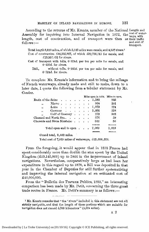
HARTLEY ON INLAND NAVIGATIONS IN EUROPE. 131
According to the returns of Mr. Krantz, member of the National Length and Assembly for inquiring into Internal Navigation in 1872, the ^ ° a y S ° f ^ e r " length, cost of construction, and of transport were then as their'traffic
fol lows:— a n d c o s t o f
transport.
Total length 8,120 miles, of which 3,123 miles were canals, and 4,997 rivers.1
Cost of construction £46,295,867, of which £32,738,715 for canals, and £13,557,152 for rivers.
Cost of transport with tolls, 0*324d. per ton per mile for canals, and 0'420d. for livers.
Ibid., without tolls, 0 '243d. per ton per mile for canals, and 0*324d. for rivers.
To complete Mr. Krantz's information and to bring the mileage of French waterways, already made and still to make, down to a later date, I quote the following from a tabular statement by Mr. Conder.
Miles open in 1878. Miles to open.
Basin of the Seine Rhone
„ Gulf of Gascony . Channel and North Sea Charente and Sevre Niortaise . . .
Total open and to open .
Grand total, 8 ,882 miles.
Total cost of 7,069 miles of waterways, £43 ,608 ,516 .
1,582 233 994 201
1,979 774 1,324 328
272 162 576 59 342 56
7,069 1,813
From the foregoing, it would appear that in 1878 France had spent considerably more than double the sum spent by the United Kingdom (£19,145,866) up to 1844 in the improvement of inland navigations. Nevertheless, comparatively large as had been her expenditure in this regard up to 1878, a Bill was deposited in that year in the Chamber of Deputies for still further systematizing and improving the internal navigation at an estimated cost of £40,000,000.
From the "Bulletin des Travaux Publics, 1881," an interesting comparison has been made by Mr. Petit, concerning the three great trade routes in France. Mr. Petit's summary is as fol lows:—
1 Mr. Krantz remarks that " the ' rivers' included in this statement are not all strictly navigable, and that the length of those portions which are suitable for navigation does not exceed 5,700 kilometres " (3,524 miles).
K 2
Downloaded by [ La Trobe University] on [01/10/16]. Copyright © ICE Publishing, all rights reserved.
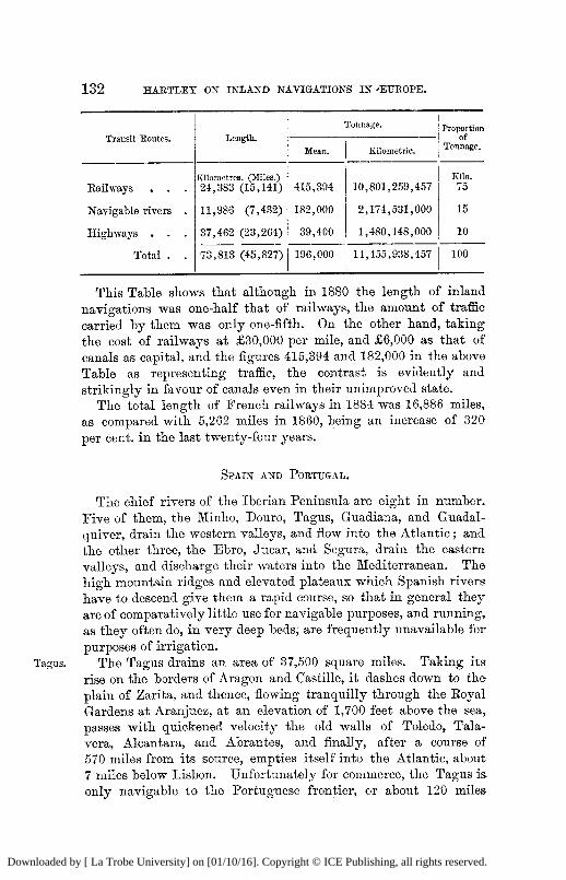
132 HARTLEY ON INLAND NAVIGATIONS IN 'EUROPE.
Transit Routes. Length. Tonnage. Proportion
of Tonnage.
Transit Routes. Length. Mean. Kilometric.
Proportion of
Tonnage.
Railways • Kilometres. (Miles.) 24 ,383 (15 ,141) 415,394 10 ,801 ,259 ,457
Kilo. 75
Navigable rivers . 11,986 (7 ,432) 182,000 2 ,174 ,531 ,000 15
Highways . 37 ,462 (23 ,264) 39 ,400 1 ,480 ,148 ,000 10
Total . . 73 ,813 (45 ,827) 196,000 14 ,455 ,938 ,457 100
This Table shows that although in 1880 the length of inland navigations was one-half that of railways, the amount of traffic carried by them was only one-fifth. On the other hand, taking the cost of railways at £30,000 per mile, and £6,000 as that of canals as capital, and the figures 415,394 and 182,000 in the above Table as representing traffic, the contrast is evidently and strikingly in favour of canals even in their unimproved state.
The total length of French railways in 1884 was 16,886 miles, as compared with 5,262 miles in 1860, being an increase of 320 per cent, in the last twenty-four years.
S P A I N A N D P O R T U G A L .
The chief rivers of the Iberian Peninsula are eight in number. Five of them, the Minho, Douro, Tagus, Guadiana, and Guadal-quiver, drain the western valleys, and flow into the Atlantic; and the other three, the Ebro, Jucar, and Segura, drain the eastern valleys, and discharge their waters into the Mediterranean. The high mountain ridges and elevated plateaux which Spanish rivers-have to descend give them a rapid course, so that in general they are of comparatively little use for navigable purposes, and running, as they often do, in very deep beds, are frequently unavailable for purposes of irrigation.
Tagus. The Tagus drains an area of 37,500 square miles. Taking its rise on the borders of Aragon and Castille, it dashes down to the plain of Zarita, and thence, flowing tranquilly through the Royal Gardens at Aranjuez, at an elevation of 1,700 feet above the sea, passes with quickened velocity the old walls of Toledo, Tala-vera, Alcantara, and Abrantes, and finally, after a course of 570 miles from its source, empties itself into the Atlantic, about 7 miles below Lisbon. Unfortunately for commerce, the Tagus is. only navigable to the Portuguese frontier, or about 120 miles
Downloaded by [ La Trobe University] on [01/10/16]. Copyright © ICE Publishing, all rights reserved.
HARTLEY ON INLAND NAVIGATIONS IN EUROPE. 133
from the sea. Opposite Lisbon, on the south shore, is Cassilhas Point, or the eastern extremity of what may be called the Port of Lisbon, whence a wide expanse towards the north opens out into a magnificent harbour, of from 2 to 7 miles in breadth. At the Point itself the river is 1 mile wide, but it narrows to f mile at Belem, on the north bank 2 miles below Lisbon, whence it expands again to a width of nearly 2 miles at its mouth. The bar has a depth of from 6 to 7 fathoms at low water of spring tides, and the channel within it soon deepens to 19 fathoms. Notwithstanding this great depth, however, the bar is impracticable in south-westerly gales, and in winter, or when the freshets are strong and accompanied with westerly gales, continues so for several days together.
The Douro is 485 miles long, and drains an area of 37,000 square Douro.
miles. Its direction is generally west, and it traverses the most mountainous portions of Leon and Salamanca before it reaches the Portuguese frontier. Thence to the sea, the channel is everywhere narrow, with a rocky bed, and the water, being confined,, the current frequently exceeds 9 miles an hour at times of thaw and heavy rains. Instances have already been given of great oscillations in the volume of discharge in the rivers Euhr and Loire, but these may be termed insignificant when compared with the variations in the volume of the Douro. On one occasion, in 1860, when the river rose to the level of 33 feet 9 inches above low water of spring tides at the suspension bridge, 3J miles from the sea, the velocity equalled 16 knots an hour, and the discharge 995,000 cubic feet per second, or two and a half times as great as the highest flood-discharge of the Tagus. At the same bridge, and according to the same authority, Mr. A. J. Nogueira Soares, the lowest discharge in the summer months of 1875 was only 700 cubic feet per second.
Mr. Soares, in stating these phenomena, is justified, therefore, in declaring that there is probably no other river of importance where so great a flood-rise takes place so near the sea, or where the volume of fresh-water discharge varies from 1 to 1,500. During spring tides, he adds, the total tidal outflow does not exceed 35,300 cubic feet per second, or about one-thirtieth part of a great river flood.
The depth of water on the bar of the Douro, between the years 1874-78, averaged 14 feet 6 inches at low water, or 25 feet 6 inches at high water of spring tides. Oporto, the second city of Portugal, stands on the side of a steep eminence of about 200 feet elevation, which rises from the north bank of the Douro about
Downloaded by [ La Trobe University] on [01/10/16]. Copyright © ICE Publishing, all rights reserved.
134 HARTLEY ON INLAND NAVIGATIONS IN EUROPE.
2 miles from the sea. The river is navigable for 70 miles from the entrance, and boats of light draught can proceed 30 miles higher. Grain and other produce are floated down from Spain on flats, but navigation is often interrupted by heavy floods.
The Guadalquiver rises on the borders of Murcia, drains 22,000 square miles, has a length of 375 miles, and occupies the centre of the plain that lies between the Sierra Morena and the chain of Granada. In the upper part of its course it intersects the rich province of Andalusia, and after pursuing its way through pestiferous swamps to Cordova and Seville at last forms a harbour near its mouth, above the seaport of San Luca de Barrameda, whence Columbus sailed on his third voyage to America in 1498, and Magellan on the first voyage of the circumnavigation of the world in 1519. The Guadalquiver is navigable for vessels of 100 tons, at certain seasons of the year, up to Seville, 70 miles from the sea, but, as a rule, vessels of more than 10 feet draught are obliged to load and unload about 8 miles below the city. The channels between the shoals at the mouth of the river are only practicable for small vessels.
The Guadiana rises in La Mancha, and after passing through the province of that name, flows on to Merida and Badajoz. A little below the latter it turns to the south and enters Portugal, through which it flows for nearly 100 miles, and then, again washing the frontier of Spain, forms the boundary of the two kingdoms to the sea. The area of the basin of the Guadiana is 25,000 square miles. Although 316 miles in length, the river is only navigable up to the town of Mertola, about 40 miles from its mouth at Villa Real. The entrance to the Guadiana is encumbered with shoals, and at low water there is only a depth of about 6 feet on the bar, or 18 feet at spring tides. Within the bar, however, off Villa Real, where the river is \ mile broad, the depth is 27 feet.
The Ebro rises in the province of Santander, and drains 39,000 square miles, and after a course of about 470 miles, empties itself into the Mediterranean, about 15 miles east of the town of San Carlos de la Rapita. It receives one hundred and fifty tributaries, and its chief towns are Tudela, Saragossa, and Tortosa. At Amposta, 20 miles below Tortosa, the river divides and runs into the sea by two branches. In order to facilitate the communication with the sea, a lateral canal, 10 miles long and 5 feet deep, runs south from Amposta to San Carlos, at Port Alfaques, where there is room for a large number of vessels not drawing more than 18 feet. The principal commercial utility of the Ebro is the transport of grain from Saragossa to Tortosa, together with the floating down of
Downloaded by [ La Trobe University] on [01/10/16]. Copyright © ICE Publishing, all rights reserved.
HARTLEY ON INLAND NAVIGATIONS IN EUROPE. 135
timber from the Pyrenees. Owing to the shallow channels of the Delta, however, and to the nnmerons sandbanks at its months, only vessels of very light draught are able to pass the bars, and hence the navigation of the Ebro, although the largest river in the peninsula, is not very important. As a source of supply for irrigation, however, the Ebro, like the majority of Spanish rivers, is of more value in this respect than as a navigable stream. Its bed is rocky, and its current above the influx of the Segre, its principal affluent on the left, much disturbed by rapids and cataracts; and though this evil has been remedied in part by the construction of a navigable channel, the Imperial Canal from Tudela to a point 20 miles below Saragossa, yet the obstacles to navigation are still great; and whilst its use as a source of supply for irrigation is increasing, its volume for navigable purposes goes on decreasing in the same degree.
Besides the navigable canals connected with the Ebro, there are Canals, only worthy of special mention the canal of Segovia, connecting that town with the river of the same name, and the canal of Castille, to unite Santander with the Douro, a work, however, which is only partly finished. According to Millet, the total length of navigable canals in Spain was only 130 miles in 1875. On the other hand, t
the length of her railways was 5,600 miles in 1884.
I T A L Y .
Italy is not rich in waterways except in the valley of the Po. The navigable portions of her rivers—the most important of which wiU shortly be described—have only an aggregate length of 1,100 miles.
The Po rises at 6,560 feet above the sea, and in a course of The Po. 350 miles drains an area of 29,000 square miles. At a distance of 20 miles from its source it enters the plain of Saluzzo, between which and Turin, a distance of only 30 miles, it receives three considerable tributaries. The Dora, which flows past Susa at the foot of Mount Cenis, unites with the greater river a little below Turin, and the Sesia joins it 25 miles below the confluence of the Dora. About 30 miles still further on, the Po is joined by the Ticino, which brings with it the overflow of Lake Maggiore. Its next great affluent is the Adda, which flows through Lake Como; then comes the Oglio from Lake Iseo; and finally the Mincio runs in near Mantua from Lake Garda. At its confluence with the Mincio, the Po has a width of from 1,200 to 1,800 feet, and it then con-
Downloaded by [ La Trobe University] on [01/10/16]. Copyright © ICE Publishing, all rights reserved.
136 HARTLEY ON INLAND NAVIGATIONS IN EUROPE.
tinues to flow on in an undivided stream to its first bifurcation near Ponte Lagoscuro, and thence on to Maria de Ariano—about 25 miles from the sea—where it parts into two arms, and these again are subdivided into several other branches, forming an extensive delta about 20 miles in width from north to south. The growth of the delta since the time of the Romans is very marked. The town of Adria, which was then a maritime town, now stands on the banks of the Po 20 miles inland, and it has been estimated that from the year 1600 to 1800, the delta advanced at the rate of 225 feet annually. On the other hand, to the north of the delta, there is equally good evidence of the encroachment of the sea on the land.
The Po is continuously embanked from near Cremona to the marshes at its mouths. At its highest flood the water rises 24 feet above extreme low water at the confluence of the Ticino; 26 feet near Piacenza; 20 feet at Cremona; and 28 feet at Ponte Lagoscuro, 4 miles above Ferrara, where the level of low water is only 9 feet above the sea, from which the old city is now removed 50 miles, or 20 miles further from the coast than two thousand years ago. Hence it is that the top of the embankments at Ferrara is higher than the roofs of the houses. The prevention of the lateral spread of the water in floods by dykes is said by many engineers to occasion the deposit of sediment in the channel, and consequently to cause an elevation of the bed, which requires the embankments to be raised proportionally; but Lom-bardini has shown that the effect of this on the Po is by no means so considerable as has been often represented, and that in the middle lower course of the river the bed of the proper low-water channel is subject to so little permanent change of level as to have now become substantially constant.
The mean discharge of the Po is 60,745 cubic feet per second, its maximum 181,580, and its minimum 7,558 cubic feet per second, or a ratio of 1 to 24. The waters of the Po are very heavily charged with detritus, and, according to Mr. Boccardo, the volume held in suspension is at times of the volume of water discharged.
The Po is navigable from its mouth for vessels of 130 tons up to Valenza, 600 feet above the level of the sea, and 7 miles below the confluence of the Sesia, and below the confluence of the Oglio the depth of the main river at extreme low water is never less than 5 feet 10 inches; but as most of the transport which would otherwise be carried on by means of its channel is now effected by railways, of which Italy possessed 5,651 miles in 1883, the river
Downloaded by [ La Trobe University] on [01/10/16]. Copyright © ICE Publishing, all rights reserved.
HARTLEY ON INLAND NAVIGATIONS IN EUROPE. 137
has lost much of its relative importance as a route for commercial communication.
The Adige rises in the Tyrolean Alps, and drains 5,400 square The Adige. miles in a length of 234 miles. Flowing southward it passes by Trent, and enters Lombardy. After passing Verona, it flows nearly south-east, and pursues a course parallel to that of the Po till it enters the Adriatic by an independent mouth about 13 miles north-east of Adria. The waters of the two rivers have been made to communicate by artificial cuts at several places. The Adige is navigable from its mouth to Trent, but the velocity of the current impedes the navigation.
The Tiber rises in the Apennines at a height of 3,805 feet above The Tiber, the sea, and drains 6,500 square miles, and after a course of 240 miles, generally in a south direction, empties itself into the Mediterranean through two mouths about 16 miles south-west of Eome or 24 miles by the course of the river (Plate 4) . The mean discharge of the Tiber is 10,800 cubic feet per second, and its minimum discharge 5,800 cubic feet per second.1
Eozet has calculated that the advance of the delta for many centuries past has kept steadily at the rate of 13 feet per year. The estuary, which originally formed the harbour of Eome, was so reduced in depth by silt from the river and sand rolled in by the sea, that it was found necessary in the days of the Empire to cut a channel from a point about l j mile above Ostia (the ancient sea-port of Eome, and now 2J miles inland) to the coast, at a place called Fiumicino, situated at 2 miles N. of the chief disemboguement of the Tiber, now called the Bocca di Fiumara. The artificial canal—known as the Fiumicino branch—(on the north bank of which are the remains of the once famous ports of Claudius and Trajan) is still the only navigable channel between the Mediterranean and Eome, the old Fiumara mouth being obstructed by constantly-shifting sandbanks.
The rise of the Tiber in its great floods is very considerable, and is measured from the zero of the gauge at the Eipetta stairs at Eome. This zero is 4 feet above the level of the sea. The lowest known surface of the Tiber at the stairs is 17^ feet above zero, and its mean height 22 feet. In the inundation of 1870, when I was on a visit to Eome, the waters rose to 56
1 The proportion of the minimum to the maximum flood has been variously-estimated by Italian engineers as being from 1 to 25 to 1 to 3 0 ; or from a minimum discharge of 3,500 cubic feet per second to a maximum of 105,000 cubic feet. According to Mr. Vescovali, the discharge of the Tiber has never been less than from 5,600 to 6,300 cubic feet per second.
Downloaded by [ La Trobe University] on [01/10/16]. Copyright © ICE Publishing, all rights reserved.
138 HARTLEY ON INLAND NAVIGATIONS IN EUROPE.
feet 6 inches above zero, and as the pavement of the Eipetta and that of the adjacent streets is only about 44 feet above zero, all the north-west quarter of the city, including the Corso-and other important business streets, was overflowed, to a depth near the river of about 12J feet, and the direct and indirect damage occasioned by the flood, which was the greatest on record since 1637, could hardly be over-estimated. Numerous schemes, have since been proposed to prevent the recurrence of a similar disaster. Grave objections have been made to many of these projects, but on one point all engineers seem to agree—and this principle is now being practically carried out—the expediency of widening and straightening the channel at various points within and near the limits of the city, of carefully regulating the outflow of drains into the river, and of removing from its bed the numerous artificial obstructions, chiefly piers of old bridges, and accumulated rubbish of centuries.
The Tiber is navigable from the sea to Kome for vessels of 140 tons, and, with some difficulty, 60 or 70 miles further for vessels-of 60 tons. At the Fiumicino mouth of the river the entrance is narrowed between parallel piers so as to increase the scour over the bar, but the available depth on it is rarely more than from 6 to 8 feet.
Canals. The Italians were the first people in Modern Europe who-attempted to plan and execute canals. As a rule, however, they have been principally undertaken for the purpose of irrigation. The total length of the navigable canals is 435 miles. The most important are the Cavour Canal, in Piedmont, which, supplied from the Po, begins at Chivasso and terminates at Turbiga, a distance of 52 miles; the Grand Canal, in Lombardy, supplied from the Ticino, near Tornavento; the Canal of Pavia, also-supplied from the Ticino, and passing through Binasco ; the Canal of Martesana, which, from Milan through Gorgonzola, leads to Cassano on the Adda. The provinces of Polesina in Venice, o f Padua, and the Emilia have all excellent canal systems. In Tuscany the most important are those of Pescia, Pisa, and Ombrone.
A U S T R I A - H U N G A R Y .
As the highlands of Austria form part of the great watershed of Europe which divides the waters flowing north into the North Sea or Baltic, from those running south or east into the Mediterranean or the Black Sea, all Austrian rivers of note flow either north, south or east. All her great river mouths, moreover, are situated
Downloaded by [ La Trobe University] on [01/10/16]. Copyright © ICE Publishing, all rights reserved.
HARTLEY ON INLAND NAVIGATIONS IN EUROPE. 139
in other countries, and one of them, the Danube, has its source as well in a neighbouring State. The courses of its chief streams, namely the Dnieper, the Vistula, the Oder, and the Elbe, have already been summarily passed in review, and it therefore only now remains for me to describe the course of the Danube to complete the list.
T H E D A N U B E .
The Danube is the largest river in Europe as regards volume of discharge, but is inferior to the Volga in the length of its course and the area of its basin. It rises in the Black Forest at an elevation of about 3,600 feet above the sea, and drains 316,000 square miles, its total length being 1,750 miles.
From the mouth of the Iller, which divides Wurtemburg and Tributaries. Bavaria, the Danube is fed by at least three hundred tributaries. On the right bank, the chief of these, with their drainage area in square miles, are : the Inn (9,600), the Drave (14,300), and the Save (37,500), and on the left bank the Theiss (60,000), the Olta (9,000), the Sereth (18,000), and the Pruth (10,000). Together, these seven streams have a length of 2,900 miles and drain one-half of the whole extent of the Danube basin.
U P P E R A N D M I D D L E D A N U B E .
The upper part of the river first becomes navigable, for flat Ulm. bottomed boats carrying 100 tons, at Ulm, 130 miles from its source, and only a few miles below the confluence of the Iller, its first tributary of any importance.
At Kelheim, half way between Ulm and Passau, the Danube Ulm to communicates with the Bhine by means of the Ludwig Canal, and ^ i e n n a -the rivers Altmiihl, Regnitz and Main. The canal is 110 miles long and 7 feet deep, and was completed in 1844 by King Ludwig the First of Bavaria. From Ulm to Passau (220 miles), at the mouth of the river Inn, which doubles the volume of the main stream, the Danube traverses the great Bavarian plain, but thenceforward it flows through a mountainous region till it reaches Vienna. In this distance of 406 miles of the lower section of the Upper Danube the river has been considerably improved by works of correction, and vessels drawing 4 feet can now navigate the whole distance at low water, excepting at the Fischament-Theben rapids, where the depth is occasionally reduced to 3 feet.
At Vienna, which is situated on the right and left banks of a River ^
branch of the Danube (164 feet wide and 4 feet deep at low water) v^enST **
Downloaded by [ La Trobe University] on [01/10/16]. Copyright © ICE Publishing, all rights reserved.
140 HARTLEY ON INLAND NAVIGATIONS IN EUROPE.
at an elevation of about 520 feet above the sea, and at a distance of 1,208 miles from the Sulina mouth, the main stream of the river has been brought l j mile nearer to the city by a new channel 10 miles long, 1,000 feet wide and with a depth of from 10 to 12 feet below ordinary low-water level (Plate 5) . This great cut involved the removal of 12,000,000 cubic metres of sand and gravel, and, with all its subsidiary work, cost £3,250,000. The enterprize was established by an Imperial Commission in 1866, and the proposal to construct the regulation on its present plan had the able support of Mr James Abernethy, Past-President Inst. C.E.
The cutting has been very successfully carried out, and has already been of great service, not only in protecting Vienna from disastrous floods, the principal object of the scheme, but in improving the railway communications and the navigable capabilities of the river at this portion of its course.
Further particulars of this interesting river diversion, written by the Engineer-in-Chief, Eitter Von Wex, are published in our Abstracts of Papers in Foreign Transactions.1
The construction of a deep canal, about 150 miles long, from a point on the left bank about 6 miles below Vienna, to Oderburg on the river Oder, has lately been under serious consideration, and the execution of this project bids fair to become an accomplished fact at no distant day.
From Vienna the Danube flows east for 150 miles through a wide expanse of plain country to Waitzen; and then turning south pursues that direction through the great plain of Hungary by numerous windings to Esseg situated at the confluence of the Drave, 347 miles below Vienna, and 165 miles below Buda Pesth. This imposing-looking capital of Hungary is situated on the right and left banks of the Danube at 182 miles below Vienna, 152 below the confluence of the March at Theben, the frontier of Austria-Hungary on the left bank ; 146 from Pressburg; 89 from Gonyo near the confluence of the Eaab; and 21 from Waitzen. From Esseg the river trends south-east to Semlin (140 miles), the lower frontier town of Hungary on the right bank at the confluence of the Save, and immediately opposite Belgrade, the capital of Servia. Hence to Old Moldova (76 miles), and then on to the Hungarian-Eoumanian frontier at Old Orsova (63 miles) the river flows nearly due east. At Old Moldova, it enters a series of rocky gorges, unequalled in Europe for their grandeur; and after
1 Minutes of Proceedings Inst. C.E. vol. xlvi. p. 294.
Downloaded by [ La Trobe University] on [01/10/16]. Copyright © ICE Publishing, all rights reserved.
HARTLEY ON INLAND NAVIGATIONS IN EUROPE. 141
sweeping through a succession of deep pools and shallow rapids, confined within the grand passes of Stenka, Izlaz, and the Kasan, finally reaches its last and most formidable rapid called the " Iron Gates," 632 miles from Vienna, and 582 miles from the Black Sea.
Although the Danube, from Vienna to Old Moldova, has also Proposed
been regulated in numerous places and at great cost, by narrowing J ^ ^ g V e "
and training works, consisting of groynes, dams, and longitudinal dykes, there has been but little appreciable improvement effected in its general navigable depth. On this account, projects, having in view the permanent acquisition of a sufficiently wide channel of from 6 to 8 feet deep at every point between Passau and Old Moldova, have lately been prepared by Government Engineers, which involve an outlay of .£2,000,000 to effect the desired improvements, the principal of which would be the permanent removal of the Fischament-Theben, and the Pressburg-Gonyo shoals.
With the exception of a short stretch of the river near Gonyo, Condition of
the existing channel between Vienna and Old Moldova affords a e x i s . t m o
minimum depth of from 4 to 5 feet, during nearly two-thirds of channel,
the year (taking the ice into consideration); but at Gonyo itself, the navigation during the dry season is so difficult that a depth of from 3 to 5 feet is only maintained by Mr. Murray Jackson's excellent system of steam-raking, a full account of which will be found in our Minutes of Proceedings. 1
The Danube between Old Moldova and the Iron Gates (69 Eapids below
miles), 6 miles below Orsova, the frontier town of Hungary, is 0 1 d M ° l d o v a .
traversed at eight different places by reefs of sharp-pointed rocks, which render the navigation difficult at ordinary low water, and altogether impracticable at the lowest water season. These serious natural obstructions have hitherto been the great barrier to the free development of traffic on the middle and lower Danube, and the existing slackness of trade at this part of the river will continue, and possibly increase, until its navigable condition has been radically improved. These so-called Cataracts of the Iron Gates, which are wholly within the territories of Roumania and Servia, have a length of 5,070 feet, with inclinations of 1 in 507 at high, and 1 in 307 at low, water; the extreme variations between high and low water being 14 feet 6 inches at the head and 22 feet 6 inches at the foot of the falls. The level of low water at Old Moldova is 201 feet, and at the foot of the Iron Gates, 118 feet above sea-level. This fall of 83 feet in 69 miles gives an •
1 Minutes of Proceedings Inst. C.E. vol. lx. p. 387.
Downloaded by [ La Trobe University] on [01/10/16]. Copyright © ICE Publishing, all rights reserved.
142 HARTLEY ON INLAND NAVIGATIONS IN EUROPE.
inclination of 1 in.4,400, as compared with 1 in 2,220 between Passau and Vienna, and of 1 in 10,000 between Vienna and Old Moldova.
For more than a quarter of a century projects have been made for surmounting the difficulties between Old Moldova and the foot of the Iron Gates, by four different systems of treatment, namely, by open cuts; by simply narrowing the channel; by excavated channels confined within submerged and insubmergible walls ; and by a combination of one or more of these plans, aided by one or more lateral canals.
The latest project is that of an International Commission of Engineers named by the Austro-Hungarian Government in 1879. This Commission proposed to establish a channel 2 metres deep at extreme low water, at every point between Old Moldova and Turn-Severin by means of cuttings 60 metres wide through the upper seven shoals, and to construct a lateral canal at the Iron Gates on the Servian shore, provided with two lift locks (508 feet by 118 feet) to overcome a difference of level of 14 feet 6 inches at that place. The cost of the open cuttings was estimated at £350,000; the improvement of the Iron Gates at £530,000.
The width of the Danube between Vienna and Basias (15 miles above Old Moldova) varies from 2,000 to 6,000 feet at low water, and from 7 miles to 30 miles at high water; but to this statement exception should be made of Peterwardein (50 miles above Belgrade), where the entire volume of the river, at high and low water, flows through a channel 40 feet deep, and only 800 feet in width. At this spot, 777 miles from the Black Sea, the Danube is crossed for the last time by a railway bridge, or, indeed, by a bridge of any kind whatever. At the Kasan, a pass 5̂ - miles long, where the granite cliffs rise to a perpendicular height of nearly 1,000 feet, and where the depth is 80 feet in the dry season, the mean width of the river is but 600 feet, and the difference between extreme high- and low-water level as much as 23 feet. The mean velocity of the current from Vienna to Basias is 2 knots an hour, and 3 knots at high water, but at the narrow defiles of the Kasan and Izlas it attains 8 knots at high floods.
The Hungarian central section of the river is fed by the Drave, the Theiss, and the Save.
With regard to the Drave and the Save, I have only time to remark that their improvement has never yet been attempted; that the former is navigable in its natural state to the confluence of the Mur (150 miles), and the latter to Sissek (370 miles), and that their lengths from their sources in Illyria to Esseg and Belgrade are 434 and 535 miles respectively.
Downloaded by [ La Trobe University] on [01/10/16]. Copyright © ICE Publishing, all rights reserved.
HARTLEY ON INLAND NAVIGATIONS IN EUROPE. 143
The Theiss, or Tisza, falls into the Danube on the left bank, Theiss. between Peterwardein and the confluence of the Save, and is navigable for a length of 475 miles to Tokay. It would require the time allotted for a whole lecture to give anything like a detailed description of this remarkable affluent, and therefore, in the few minutes at my disposal, I can only sketch its chief characteristics in the briefest possible manner. I t rises in the Carpathians, and its basin drains one-fifth of the great valley of the Danube. Half a century ago it had a total course of 828 miles, and from Tisza Uylek, where it ceases to be a mountain stream, and enters the great Hungarian plain, a course of 750 miles. The length of its valley from Tisza Uylek is only 372 miles, so that, like the lower Seine, its length was double that of the plain through which it flowed. From Tisza Uylek to Szegedin (621 miles) the fall was 136 feet in 621 miles, or 1 in 24,500 ; and from Szegedin to the mouth of the river, 129 miles, only 8 feet, or 1 in 73,000. Between 1832 and 1879 the cut-offs executed by the Government for the principal purpose of protecting the adjacent lands from inundations, were one hundred and thirteen in number, of an aggregate length of 83 miles. These cuts shortened the river 300 miles below Tisza Uylek, and cost £690,000, exclusive of a further sum of £2,000,000, which was spent by local companies on 1,000 miles of embankments. According to the report of Mr. Herrich, Ministerial Councillor, the result of these great works has been to protect an area of 4,200 square miles, out of a total area of 6,000 square miles of low ground, from floods; but from no authority can I glean any information concerning the effect of the cut-offs on the navigable condition of the river. Unfortunately, however, one fact is but too well known, namely, the great disaster of 1879, when the large town of Szegedin, at the confluence of the river Maros, was almost totally destroyed, and many of its inhabitants swept away by an unprecedently heavy flood. It should be added that the Maros enters the Theiss at a bad angle, and has also been greatly reduced in length—from 430 miles to its present length of only 162 miles.
The two chief canals in Hungary are the Bega, 75 miles long, Canals, joining Temesvar with the Theiss at Tetel, a little above its junction with the Danube, and the Franz Josef, 69 miles long, which stretches from the Danube at Battina by Zombor to the Theiss near Foldvar. On the latter canal the traffic increased from 246,000 ton-miles in 1876 to 600,000 ton-miles in 1878, but it has never yet, I learn, paid any interest to its shareholders.
According to Mr. Lanfranconi, whose Papers on Hungarian rivers,
Downloaded by [ La Trobe University] on [01/10/16]. Copyright © ICE Publishing, all rights reserved.
144 HARTLEY ON INLAND NAVIGATIONS IN EUROPE.
with excellent maps thereof, may be referred to with advantage in our library, Austria-Hungary possesses 2,104 miles of waterways made up as follows :—
Traffic on the Upper and Lower Danube is mostly carried in barges belonging to the Imperial and Royal Danube Steam Navigation Company, of which they possess about eight hundred, the greater portion having a carrying power of 250 tons. The mean annual traffic up-stream from Belgrade to Pesth is 600,000 tons, or about as much as by rail. The barges have been built in recent years entirely of steel, and have generally a length of 180 to 190 feet, with 24 feet beam and 8\ feet depth, and their displacement is 120 tons without cargo. The largest steamers are from 220 to 250 feet in length, with from 25 to 27\ feet beam and 10 feet deep at the sides, with a slight displacement of 440 to 460 tons.
Haulage is performed on the Upper and Central Danube by steam-tugs and chain-tugs; and it was with the view of obtaining1
some authentic information on this important subject that I applied some time ago to Mr. Murray Jackson, late Chief Engineer of the Danube Steam Navigation Company, for a short statement of the result of his long and varied experience regarding the relative merits of each mode of traction. Mr. Jackson has obligingly furnished me with some valuable " Notes " on " Water Traction by Steam Power," which are too long to repeat at this advanced hour ; but I trust the Council will permit them to appear hereafter in the shapeof an Appendix to my lecture, should the latter be considered worthy of publication. 4
The Lower Danube begins at the foot of the Iron Gates (Plate 5) , and terminates in the Black Sea, from which it is distant 340 miles in a straight line, and 580 by the windings of the river. The left bank from Verciorova, the Boumanian frontier town (2\ miles from the Hungarian frontier town of Orsova) to mid-channel of the Pruth (11 miles below Galatz), is Boumanian territory; and from mid-channel of the Danube, opposite the mouth of the Pruth,
Miles. Passau to Orsova. Brave, Thiess, and Save Eaab and I n n . . . Canals *
817 1,013
48 226
2 ,104
L O W E R D A N U B E .
1 The total length of railways open for traffic in Austria-Hungary in January, 1884, was 12,223 miles.
Downloaded by [ La Trobe University] on [01/10/16]. Copyright © ICE Publishing, all rights reserved.
HARTLEY ON INLAND NAVIGATIONS IN EUROPE. 145
the frontier of Eoumania is conterminous with that of Russia (according to the Treaty of Berlin of 1878) to mid-channel of the Danube at Ismail Chatal, and thence to mid-channel of the Kilia branch at Wilkov, where the Kilia branch spreads out into several subsidiary channels (Plate 5) . From the village of Wilkov the frontier follows the mid-channel of the Stary Stamboul, the most southerly of the branches of the Kilia delta, till it reaches the sea, at a distance of about 10 miles north of Sulina. The right bank of the river from the confluence of the Save at Belgrade to the mouth of the Timok at Rakovitza (59 miles below the Iron Gates) is in Servia; from Baovitzak to Silistria (284 miles) it is in Bulgaria, and thence to the sea, following the St. George's branch, in Roumania. Thus both banks below Silistria belong to the Boumanians, with the exception of the left bank from the mouth of the Pruth to Wilkov, and thence to the sea by the Stary Stamboul branch. The fall of the river from the Iron Gates to Sulina gradually becomes less, as in the lower part of all large rivers flowing through their own alluvium, as it reaches the sea. Thus between the Iron Gates and Tchernavoda, 388 miles, with a difference of level of 103 feet 6 inches, the inclination is 1 in 19,800; between Tchernavoda and Ibraila, 76 miles, with a difference of 11 feet, 1 in 36,500 ; whilst between Ibraila and Sulina, 116 miles, with a difference of only 3 feet 6 inches, it is reduced to 1 in 175,000.
1. Iron Gates to Ibraila.
At the Roumanian town of Turn-Severin, on the left bank, 8 miles below the Iron Gates, are still to be seen, at extreme low-water, thirteen of the twenty stone piers of a bridge that was built across the Danube in A . D . 103 by Apollodorus, the architect who built Trajan's column at Rome. The river here is about 3,000 feet wide, and the maximum depth 18 feet. From Turn-Severin to Widin, 83 miles, its course is very tortuous, but the general direction is to the south. From Widin, however, to Tchernavoda, 297 miles, its general trend is to the east. The river leaves the mountains behind at Widin, whence, to Ibraila, the left bank is everywhere flat and uninteresting. The right bank, on the contrary, is bordered by high banks as a rule, to the sea, and generally presents a landscape pleasantly varied by headlands, gentle slopes, and cultivated enclosures. Nicopoli, 122 miles below Wid in ; Sistov, 25 miles below Nicopoli ; Rustschuk, 37 miles below Sistov ; &nd Silistria, 68 miles below Rustschuk, all situated on considerable elevations on the right bank, and all famous as great battle-fields
[THE INST. C.E. LECT. VOL. III.] L
Downloaded by [ La Trobe University] on [01/10/16]. Copyright © ICE Publishing, all rights reserved.
146 HARTLEY ON INLAND NAVIGATIONS IN EUROPE.
between the Russians and Turks, have each corresponding towns on the opposite bank, but the only one worthy of special notice is Giurgevo, the Port of Bucharest, and formerly the tete du pont of Rustschuk.
Tchernavoda. At Tchernavoda, 45 miles below Silistria, the width of the main river is 2,000 feet, and its depth at low water 28 feet. The-extreme variation between high and low water is 23 feet, the latter having here a level of 14 feet 6 inches above the sea. When the floods attain a height of 18 feet, the whole country is inundated (for the river below the Iron Gates is nowhere embanked), and its width expands across the Balta or island to the village of Fetesci, 8J miles, to the high left bank of a subsidiary branch of the river, called the Borcea, which, leaving the Danube opposite Silistria, again joins the main stream 31 miles below Tchernavoda. Elaborate competition projects, presented by Belgian, French, German and Swiss Engineers, have for some time past been under the consideration of the Roumanian Government for bridging the Borcea at Fetesci, and the main river at Tchernavoda, which was surveyed under my direction in 1882, so as to join Bucharest with Kustendjie, but although two of these projects were considered worthy of high commendation no decision has yet been come to as to the precise dimensions of the structures to be erected.
The Danube at Tchernavoda, 210 miles from Sulina, is separated from the port of Kustendjie on the Black Sea by an isthmus only 40 miles wide, and if a waterway were cut to that seaport in the line of the existing railway or Trajan's Wall, the distance by water from Tchernavoda to Constantinople would be shortened 263-miles; the distance from Sulina to Constantinople being 311 miles, and from Kustendjie to Constantinople only 218 miles. In 1837, surveys were made and a series of levels taken of this part of the-Dobruja with the view of constructing a canal across the isthmus, but the scheme was abandoned on ascertaining that the summit level was 164 feet above the sea, and that no adequate supply of water could be obtained from the neighbouring high lands to flU the locks that would be required *to overcome the difficulties o f the ground between the river and the sea. In 1857, an English company obtained a concession from the Sublime Porte to construct a railway, instead of a canal, and in 1860 the Tchernavoda Kustendjie Railway was opened for public traffic. Although well managed, it never prospered, owing to the impossibility of competing successfully with the Sulina route in its improved condition, and, in 1882, the line was sold to the Roumanian
Downloaded by [ La Trobe University] on [01/10/16]. Copyright © ICE Publishing, all rights reserved.
H A R T L E Y O N I N L A N D N A V I G A T I O N S I N E U R O P E . 147
Government, and it is now worked by the State. It may here be added that, in 1884, the length of railways in Roumania already constructed was 850 miles, and the length under construction 340 miles. The charge of the railway for grain discharged from up-river craft at Tchernavoda, then cleaned by machinery and loaded into wagons, and finally shipped at Kustendjie, after being transported over 40 miles of railway, has generally been 4s. per ton—a charge by no means excessive—and yet, with but very few exceptions, vessels pass Tchernavoda and go straight on to Ibraila or Sulina; for in practice it has been found either more economical or more convenient to take the longer water route. This is another example showing how in certain cases preference is given to a very circuitous waterway instead of to a direct route by land.
On leaving Tchernavoda, the Danube bends to the north and continues that direction to Galatz (13 miles below Ibraila) whence it flows east by south to the sea.
The river between the Iron Gates and Ibraila has frequently a depth of over 40 feet at low water, but at seasons of very low water its bed is encumbered in several places by sandbanks on which the depth is not more than 9 feet, and at three shoals, Nicopoli, Sistov, and Tchernavoda, not far below the railway station, the depth is at extreme low water reduced to 7, 6, and 4J feet respectively. Still the navigability of this long stretch o f the Danube, which has never yet been " doctored " b y an Engineer, may be considered in a good condition compared with other European rivers of anything like the same importance.
Between the Iron Gates and Ibraila, the average width of the main Danube (for here it splits into many branches forming numerous islands) before it floods its natural banks, is about ^ mile. The extreme difference between high and low water varies-from 24 feet 6 inches at Turn-Severin to 23 feet at Nicopoli, and 19 feet 6 inches at Ibraila.
D A N U B E F R O M I B R A I L A T O T H E S E A .
In obedience to the special request of my friend the President,, I shall now inflict upon you a mauvais quart oVJieure in describing the nature and intention of some of the regulation-works which have been carried out under my direction as Engineer-in-Chief in what may be called the maritime section of the Danube, since the conclusion of the Crimean war—at which epoch the river below Ibraila was in a state of nature, that is to say, unruly and entirely untrained (Plate 5) .
L 2
Downloaded by [ La Trobe University] on [01/10/16]. Copyright © ICE Publishing, all rights reserved.
148 HARTLEY ON INLAND NAVIGATIONS IN EUROPE.
From the port of Ibraila, at the head of the maritime section of the Danube, the navigable channel to the Sulina mouth (116 miles) is under the control of the European Commission of the Danube. This Commission, by virtue of the Treaty of Paris of 1856, was charged to remove the sandbanks which obstructed the navigation between Isaktcha at the head of the delta, and the Black Sea, and authorized to levy tolls on shipping to cover the expenses of the work. Its jurisdiction was extended to Galatz by the Treaty of Berlin of 1878, and further extended to Ibraila by the Conference of London of 1883.
As a " Description of the Delta of the Danube," of " Works executed at the Sulina Mouth," and of " Dredging in the Sulina Branch," have been published in the Minutes of the Institution, 1
I need only here describe, as concisely as I can, the nature and result of the works which have been undertaken and completed below Isaktcha since 1856 in the river itself,
of At the creation of the Commission, the depth of the navigable channel between Ibraila and the bars of the Kilia and St. George was nowhere less than 17 feet and 15 feet respectively, and as the permanent establishment of 16 feet on the bar of whichever mouth of the Danube might be chosen ultimately for special treatment was all that was then considered necessary for the navigation, no provision was made in my first estimates for the deepening of the river channels between the head of the delta and the Kilia and St. George's mouths. In estimating the cost of improving the Sulina mouth, however, the removal of the numerous shoals in the Sulina branch was, of course, taken into account; but before referring further to this subject, I desire to say a few words regarding the removal of an isolated shoal which cropped up unexpectedly several years after the provisional works at the Sulina mouth (which for economical reasons was selected in 1858 for special treatment), had been successfully completed.
I should premise that in June 1857, at a period of ordinary summer flood, when the water attains the level of the natural banks of the delta, I found by exact gaugings that the total discharge of the main river in the first reach above Ismail Chatal or Fork 14 miles below Isaktcha and 55 miles below Ibraila, was 325,000 cubic feet per second, of which 205,000 escaped by the Kilia branch. 2 I also ascertained that the minimum depth of the
1 Minutes of Proceedings Inst. C.E. vol. xxi. p. 2 7 7 ; vol. xxxvi. p. 2 0 1 ; and vol. lxv. p. 266.
2 The flow past Isaktcha at extraordinary high floods, when the delta is submerged, is estimated at 1,000,000 cubic feet per second.
Downloaded by [ La Trobe University] on [01/10/16]. Copyright © ICE Publishing, all rights reserved.
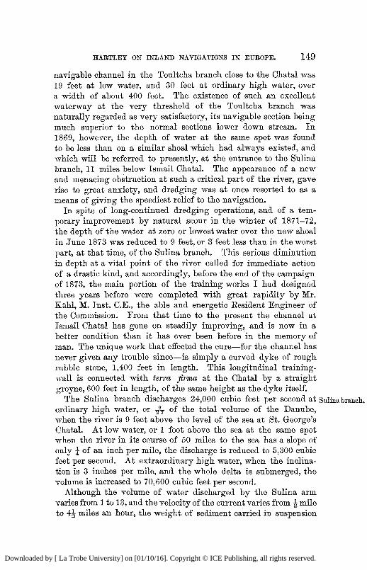
HARTLEY ON INLAND NAVIGATIONS IN EUROPE. 149
navigable channel in the Toultcha branch close to the Chatal was 19 feet at low water, and 30 feet at ordinary high water, over a width of about 400 feet. The existence of such an excellent waterway at the very threshold of the Toultcha branch was naturally regarded as very satisfactory, its navigable section being much superior to the normal sections lower down stream. In 1869, however, the depth of water at the same spot was found to be less than on a similar shoal which had always existed, and which will be referred to presently, at the entrance to the Sulina branch, 11 miles below Ismail Chatal. The appearance of a new and menacing obstruction at such a critical part of the river, gave rise to great anxiety, and dredging was at once resorted to as a means of giving the speediest relief to the navigation.
In spite of long-continued dredging operations, and of a temporary improvement by natural scour in the winter of 1871-72, the depth of the water at zero or lowest water over the new shoal in June 1873 was reduced to 9 feet, or 3 feet less than in the worst part, at that time, of the Sulina branch. This serious diminution in depth at a vital point of the river called for immediate action of a drastic kind, and accordingly, before the end of the campaign of 1873, the main portion of the training works I had designed three years before were completed with great rapidity by Mr. Kiihl, M. Inst. C.E., the able and energetic Eesident Engineer of the Commission. From that time to the present the channel at Ismail Chatal has gone on steadily improving, and is now in a better condition than it has ever been before in the memory of man. The unique work that effected the cure—for the channel has never given any trouble since—is simply a curved dyke of rough rubble stone, 1,400 feet in length. This longitudinal training-wall is connected with terra firma at the Chatal by a straight groyne, 600 feet in length, of the same height as the dyke itself.
The Sulina branch discharges 24,000 cubic feet per second at s ordinary high water, or -fT of the total volume of the Danube, when the river is 9 feet above the level of the sea at St. George's Chatal. At low water, or 1 foot above the sea at the same spot when the river in its course of 50 miles to the sea has a slope of only \ of an inch per mile, the discharge is reduced to 5,300 cubic feet per second. At extraordinary high water, when the inclination is 3 inches per mile, and the whole delta is submerged, the volume is increased to 70,600 cubic feet per second.
Although the volume of water discharged by the Sulina arm varies from 1 to 13, and the velocity of the current varies from ^ mile to 4 j miles an hour, the weight of sediment carried in suspension
Downloaded by [ La Trobe University] on [01/10/16]. Copyright © ICE Publishing, all rights reserved.
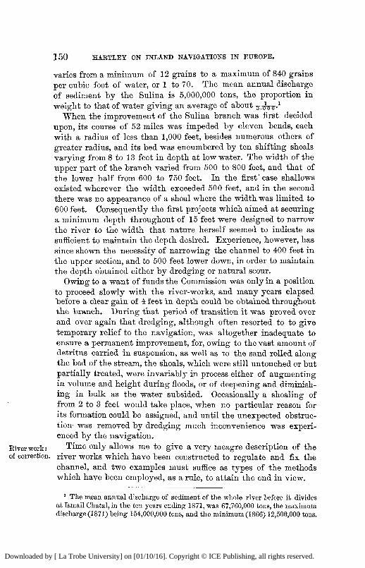
150 HARTLEY ON INLAND NAVIGATIONS IN EUROPE.
varies from a minimum of 12 grains to a maximum of 840 grains per cubic foot of water, or 1 to 70. The mean annual discharge of sediment by the Sulina is 5,000,000 tons, the proportion in weight to that of water giving an average of about - 1
When the improvement of the Sulina branch was first decided upon, its course of 52 miles was impeded by eleven bends, each with a radius of less than 1,000 feet, besides numerous others of greater radius, and its bed was encumbered by ten shifting shoals varying from 8 to 13 feet in depth at low water. The width of the upper part of the branch varied from 500 to 800 feet, and that of the lower half from 600 to 750 feet. In the first'case shallows existed wherever the width exceeded 500 feet, and in the second there was no appearance of a shoal where the width was limited to 600 feet. Consequently the first projects which aimed at securing a minimum depth throughout of 15 feet were designed to narrow the river to the width that nature herself seemed to indicate as sufficient to maintain the depth desired. Experience, however, has since shown the necessity of narrowing the channel to 400 feet in the upper section, and to 500 feet lower down, in order to maintain the depth obtained either by dredging or natural scour.
Owing to a want of funds the Commission was only in a position to proceed slowly with the river-works, and many years elapsed "before a clear gain of 4 feet in depth could be obtained throughout the branch. During that period of transition it was proved over and over again that dredging, although often resorted to to give temporary relief to the navigation, was altogether inadequate to ensure a permanent improvement, for, owing to the vast amount of detritus carried in suspension, as well as to the sand rolled along the bed of the stream, the shoals, which were still untouched or but partially treated, were invariably in process either of augmenting in volume and height during floods, or of deepening and diminishing in bulk as the water subsided. Occasionally a shoaling of from 2 to 3 feet would take place, when no particular reason for its formation could be assigned, and until the unexpected obstruction- was removed by dredging much inconvenience was experienced by the navigation.
River work3 Time only allows me to give a very meagre description of the of correction, river works which have been constructed to regulate and fix the
channel, and two examples must suffice as types of the methods which have been employed, as a rule, to attain the end in view.
1 The mean annual discharge of sediment of the whole river before it divides at Ismail Chatal,in the ten years ending 1871, was 67,760,000 tons, the maximum discharge (1871) being 154,000,000 tons, and the minimum (1866) 12,500,000 tons.
Downloaded by [ La Trobe University] on [01/10/16]. Copyright © ICE Publishing, all rights reserved.
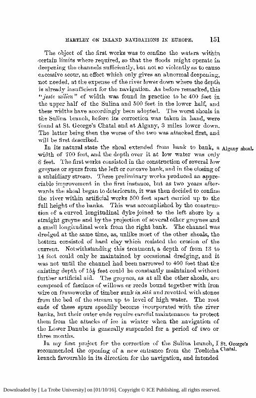
HARTLEY ON INLAND NAVIGATIONS IN EUROPE. 151
The object of the first works was to confine the waters within certain limits where required, so that the floods might operate in deepening the channels sufficiently, but not so violently as to cause excessive scour, an effect which only gives an abnormal deepening, not needed, at the expense of the river lower down where the depth is already insufficient for the navigation. As before remarked, this "juste milieu " of width was found in practice to be 400 feet in the upper half of the Sulina and 500 feet in the lower half, and these widths have accordingly been adopted. The worst shoals in the Sulina branch, before its correction was taken in hand, were found at St. George's Chatal and at Algany, 3 miles lower down. The latter being then the worse of the two was attacked first, and will be first described.
In its natural state the shoal extended from bank to bank, a Algany shoal,
width of 700 feet, and the depth over it at low water was only 8 feet. The first works consisted in the construction of several low groynes or spurs from the left or concave bank, and in the closing of a subsidiary stream. These preliminary works produced an appreciable improvement in the first instance, but as two years afterwards the shoal began to deteriorate, it was then decided to confine the river within artificial works 500 feet apart carried up to the full height of the banks. This was accomplished by the construction of a curved longitudinal dyke joined to the left shore by a straight groyne and by the projection of several other groynes and a small longitudinal work from the right bank. The channel was dredged at the same time, as, unlike most of the other shoals, the bottom consisted of hard clay which resisted the erosion of the current. Notwithstanding this treatment, a depth of from 13 to 14 feet could only be maintained by occasional dredging, and it was not until the channel had been narrowed to 400 feet that the -existing depth of 15J feet could be constantly maintained without further artificial aid. The groynes, as at all the other shoals, are composed of fascines of willows or reeds bound together with iron wire on frameworks of timber sunkm situ and revetted with stones from the bed of the stream up to level of high water. The root ends of these spurs speedily become incorporated with the river banks, but their outer ends require careful maintenance to protect them from the attacks of ice in winter when the navigation of the Lower Danube is generally suspended for a period of two or three months.
In my first project for the correction of the Sulina branch, I St. George's
recommended the opening of a new entrance from the Toultcha Chatal.
branch favourable in its direction for the navigation, and intended
Downloaded by [ La Trobe University] on [01/10/16]. Copyright © ICE Publishing, all rights reserved.
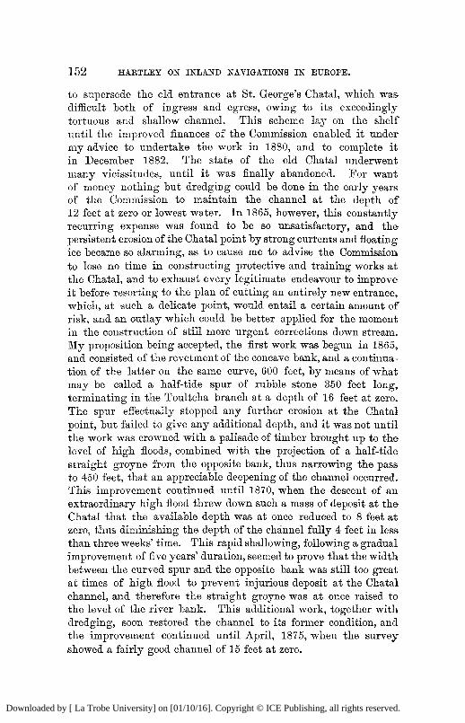
152 HARTLEY ON INLAND NAVIGATIONS IN EUROPE.
to supersede the old entrance at St. George's Chatal, which was difficult both of ingress and egress, owing to its exceedingly tortuous and shallow channel. This scheme lay on the shelf until the improved finances of the Commission enabled it under my advice to undertake the work in 1880, and to complete it in December 1882. The state of the old Chatal underwent many vicissitudes, until it was finally abandoned. For want of money nothing but dredging could be done in the early years of the Commission to maintain the channel at the dejDth o f 12 feet at zero or lowest water. In 1865, however, this constantly recurring expense was found to be so unsatisfactory, and the persistent erosion of the Chatal point by strong currents and floating ice became so alarming, as to cause me to advise the Commission to lose no time in constructing protective and training works at the Chatal, and to exhaust every legitimate endeavour to improve it before resorting to the plan of cutting an entirely new entrance, which, at such a delicate point, would entail a certain amount o f risk, and an outlay which could be better applied for the moment in the construction of still more urgent corrections down stream. My proposition being accepted, the first work was begun in 1865, and consisted of the revetment of the concave bank, and a continuation of the latter on the same curve, 600 feet, by means of what may be called a half-tide spur of rubble stone 350 feet long, terminating in the Toultcha branch at a depth of 16 feet at zero. The spur effectually stopped any further erosion at the Chatal point, but failed to give any additional depth, and it was not until the work was crowned with a palisade of timber brought up to the level of high floods, combined with the projection of a half-tide straight groyne from the opposite bank, thus narrowing the pass to 450 feet, that an appreciable deepening of the channel occurred. This improvement continued until 1870, when the descent of an extraordinary high flood threw down such a mass of deposit at the Chatal that the available depth was at once reduced to 8 feet at zero, thus diminishing the depth of the channel fully 4 feet in less than three weeks' time. This rapid shallowing, following a gradual improvement of five years' duration, seemed to prove that the width between the curved spur and the opposite bank was still too great at times of high flood to prevent injurious deposit at the Chatal channel, and therefore the straight groyne was at once raised to the level of the river bank. This additional work, together with dredging, soon restored the channel to its former condition, and the improvement continued until April, 1875, when the survey showed a fairly good channel of 15 feet at zero.
Downloaded by [ La Trobe University] on [01/10/16]. Copyright © ICE Publishing, all rights reserved.
HARTLEY ON INLAND NAVIGATIONS IN EUROPE. 153
Shortly after that time, however, the depth again began to fluctuate between 11 and 14 feet, and these constant changes in the bed of the stream, added to the inherently vicious direction of the entrance itself, became at length so intolerable to the long steamers which now trade to the Black Sea ports, that urgent demands were made for the cutting of an entirely new entrance. This request, as we have seen, was complied with.
The new cut, ^ mile above the old Chatal, has a length of New cutting 3,300 feet, an average depth of 24 feet, and a bottom width of 300 e o r g e ? &
feet, with slopes of 1J to 1 and 1 to 1. It was begun in June, 1880, and its contents of 1,057,000 cubic yards of clay and sand were removed by the aid of dredgers, floating tubes, and hopper barges by December 1882, when the new channel was opened to the navigation. In the four following months there was a silting up of 3 feet in the new channel, and of 4 feet in the old one, owing to the velocity of the current in both channels being considerably less than in the reach immediately below them, and it was not until the old branch was entirely closed by a solid dam that the regime of the lower part of the Sulina branch was restored. An accelerated current swept away the recent deposits in the new cutting in proportion as the dam in the old branch was raised to the water-level, and within two months of its completion the whole mass of sediment, 187,000 cubic yards,, an accumulation of less than six months' duration, was swept away by natural scour. The new channel then assumed the normal area of the improved sections of the river, and, with but few modifications, has retained it to the present time.
The programme of the Commission for improving the naviga- improved
tion of the Lower Danube is on the eve of completion. Between condition of
the ports of Ibraila and Sulina there is now everywhere a navigable b^nch a T l c | depth of from 17 to 20 feet at the season of high water, and a mouth,
minimum depth of 14 feet at low water. In the Sulina branch nine of its worst shoals have been successfully dealt with, three cut-offs have been made, by which the river has been shortened 2 miles, eight of its worst bends have been entirely suppressed, and a length of 10 miles of stone revetement to protect the banks has been constructed. The total cost of these river works, including maintenance and dredging, has not exceeded £300,000.
At the Sulina mouth, where there was only a depth of from 8 to 10 feet before the construction of the piers, the depth for many years past, unaided by dredging, has not been less than 20J feet. The cost of the piers, including their maintenance to the present time, has been about £220,000.
Downloaded by [ La Trobe University] on [01/10/16]. Copyright © ICE Publishing, all rights reserved.
154 HARTLEY ON INLAND NAVIGATIONS IN EUROPE.
The effect of these improvements has been to increase the trade from 680,000 gross tons in 1859, to 1,530,000 gross tons of 2,240 lbs. in 1883, and to lower the charges on shipping from an average of 20s. per ton for lighterage before the deepening of the Sulina mouth and the improvement of its branch to less than 2s. per register ton at the present time for Commission dues.
Two-thirds of the trade are now carried by English steamers, which usually ascend to Galatz and Ibraila at ordinary high water to discharge merchandise or coals, and to load with grain. At seasons of low water they prefer, as a rule, taking in their cargoes at Sulina from iron lighters drawing from 8 to 12 feet, and carrying cargoes of from 300 to 1,000 tons. The average charge for conveying grain down stream by these lighters, which are towed by steam-tugs from Ibraila to Sulina, exclusive of loading and discharging, is 0*20 of a penny per ton per mile, and 0*33 of a penny per ton per mile for the transport of coals from Sulina to ports up stream.
It may be encouraging to young engineers who have difficult river and sea undertakings on hand—in the ultimate success of which they themselves have implicit faith—to learn that the works I have just described are almost identical with my first projects in 1857, which were emphatically condemned in 1858 by an International Commission of distinguished engineers—who had never visited the ground—in the following terms:—" The Commission cannot recommend the application of the proposed system of improvement, which offers no guarantee of success. As for the projects for the Sulina mouth and branch, they ought not to be carried out : their success is very uncertain; they will be of no real use; they will cause the total loss of very large sums of money, and will even throw obstacles in the way of the existing navigation." And even in stronger terms than these they condemned my plan of provisional piers at Sulina, which in three years' time (1858-1861) increased the depth on the bar from 8J feet to 17 feet, at an expense of only £86,000. These provisional works, they reported in 1858 to their Governments, "should be immediately abandoned, if already commenced, for not only would they be useless for the purpose intended, but the guiding-piers themselves would speedily be destroyed by the force of the waves, owing to their feeble section." 1
1 A s a substitute for the parallel pier system at the mouth itself, the Technical International Commission recommended the construction of a lateral canal 16 feet
Downloaded by [ La Trobe University] on [01/10/16]. Copyright © ICE Publishing, all rights reserved.
HARTLEY ON INLAND NAVIGATIONS IN EUROPE. 155
As a commentary on the above, I need only draw attention to Commentary, two facts, namely, that the execution of the works so unsparingly •criticised in 1857, has already effected a saving of upwards of £20,000,000 sterling, and that experience has abundantly proved that the predictions of a rapid silting up to seaward of the Sulina piers, which were so prevalent at one time, were happily unfounded ; for, on the contrary, the entrance was never so free from sandbanks as at this moment, as will be seen at a glance on referring to the last survey of the Sulina mouth in November 1884.
I cannot quit this subject without calling to mind the eminent services of my steadfast old friend, Col. Sir John Stokes, K.C.B., R.E. (whom I am happy to see in front of me to-night), whose prompt and energetic action at moments of financial and other difficulties, which beset the European Commission of the Danube during the fifteen years from 1856 to 1871 that he acted as H.M.'s Commissioner, has contributed more than anything else to the complete success of the governing body, which for the last twenty-nine years has exercised almost sovereign power on the lower part of the river.
And now, I am happy to say, our bad quarter of an hour is at an end, and that it only remains for me to conclude my lecture by a few practical observations, which have suggested themselves to my mind, on reviewing the facts which I have ventured to bring under your notice this evening.
It may have been remarked that I have taken some pains to ascertain the actual available depths for navigation in the principal inland waterways of Europe. This procedure has involved a considerable amount of correspondence with some of my colleagues at home and abroad, to whom I take this opportunity of tendering my grateful acknowledgments for the kind manner in which they have responded to my solicitations, for certain precise information, within their personal cognizance. The question of improved inland waterways is one that eminently deserves the attention of English engineers; but, unfortunately, since the establishment of the railway system in this country, the construction of canals and the improvement and canalization of
•deep to the St. George's branch of the Danube from a point on the sea-board about £ mile to the north of St. George's mouth, at an estimated cost of £360,000. If this plan had been executed, the cost of the canal up to this time, including maintenance, would have amounted to at least £600,000, and the navigation, instead of enjoying as at present a depth of 20J feet at a wide, open mouth, would have been compelled to enter and leave the Danube through a narrow locked entrance of solid masonry with only 16 feet of water over its sill.
Downloaded by [ La Trobe University] on [01/10/16]. Copyright © ICE Publishing, all rights reserved.
156 HARTLEY ON INLAND NAVIGATIONS IN EUROPE.
rivers has ceased to he appreciable. Such, however, is not the* case abroad. On the great inland navigations on the Continent the permanent acquisition of even a single foot of additional depth between great trading ports in the same or in an adjacent river basin, is considered of immense importance, and worthy of being attained at a great cost; and striking examples of this assertion, in France and Germany, I have endeavoured to lay before you. In no other way than by deepening existing channels and by acquiring new ones of comparatively great depth, can a wholesale and wholesome competition with railways for the transport of heavy goods be brought about. With regard to the permanent deepening of large rivers without the aid of locks, the question is a very difficult one, and, fortunately for civil engineers, there is no golden rule to effect this grand desideratum; for every river must be studied per se, as it by no means follows that a system of improvement that has answered well at one spot, will be equally successful at another. Where a large river has many shifting shoals throughout its course, it is comparatively an easy matter to get permanently rid of one, two, three, or even more o f them; but the crucial difficulty, especially in rivers heavily charged with detritus, is to get rid of every one of the shallows down to a depth where water transport can successfully compete with railways.
If, for instance, only a single shoal remains, which demands transhipment at certain seasons of the year between two important seats of trade on the same river, that shoal, like the weakest link in a chain, which is the measure of its strength, will be the real standard of the value of the river as a navigable highway. Again, until rivers in different basins are radically dealt with so as to ensure a sufficient navigable depth at all seasons, it is almost useless to join them by constructing canals deeper than the river channels they connect. Thus, for example, the Ludwig Canal joining the Danube and the Main can never be profitably worked until the navigable channel of those rivers has been very materially improved, and the same remark applies to the proposed canal between Vienna and Oderburg, at the ends of which the Danube and Oder have but comparatively shallow navigable channels. It goes without saying, that intractable rivers can only be profitably dealt with, by using them as feeders for lateral canals furnished with locks, or by canalizing the rivers themselves, with ample provision by means of movable dams or otherwise to enable the floods to pass freely without detriment to the navigation. In either case, apart from the question of depth, the locks should
Downloaded by [ La Trobe University] on [01/10/16]. Copyright © ICE Publishing, all rights reserved.
HARTLEY ON INLAND NAVIGATIONS IN EUROPE. 157
wherever practicable have dimensions approaching those now being constructed on the Lower Seine. It need not be added that another element required to enable a canal to prosper as a great carrying highway is a great increase in speed, an improvement which can only be accomplished by enlarging the sectional area of the canal; by the best known mode of traction, and by protecting the banks against pernicious erosion.
As I remarked at the beginning of my lecture, it has not been my intention to discuss the relative cost of rail and water conveyance. Railways will prosper where, water communications languish, when the latter labour under great physical difficulties, as on the Rhone and the Ruhr, and where, as in the United Kingdom, canals are handicapped by frequent lockages and insufficient sectional area.
On the other hand, waterways will flourish, as on the Seine, in Belgium, and in Southern Germany, where the winters are comparatively short, where tolls are merely nominal, where locks are large and infrequent, and where a good navigable depth is constantly maintained, so that vessels of large tonnage—the great desideratum in economical water transport—can nearly always be profitably employed.
I have abstained advisedly from alluding in this discourse to the Corinth Canal, now in progress, or to certain well-known projects for overcoming Isthmian difficulties of a like nature elsewhere, either by means of artificial water-channels, or by ship railways. It is one of the traditions, I believe, of this Institution, to discourage anything like a serious discussion, within these walls, of public works that are still in embryo, or under construction, and of course I shall not attempt to infringe this salutary unwritten law. I may remark, however, with regard to such great enterprizes, that whatever may be their ultimate fate, the number of great Isthmian schemes must necessarily be very limited, and that in this respect they differ materially from ship canals of an inland and therefore of a less ambitious character. Whatever, for instance, may be the result of the Liverpool and Manchester scheme now before Parliament, it is evident, I think, that a grand future is open to works of that class; and I venture to predict that the improvement of water communications between the sea and inland towns of importance, by means of canals or of deep, open channels planned so as to aid nature in maintaining permanently their increased depth, will continue to go on briskly after the last ghost of a practicable inter-oceanic waterway has been finally laid.
Downloaded by [ La Trobe University] on [01/10/16]. Copyright © ICE Publishing, all rights reserved.
158 HARTLEY OK INLAND NAVIGATIONS IN EUROPE.
[ A P P E N D I X ,
Sir F R E D E R I C K B R A M W E L L , President, said the lecture had brought before the members information from an enormous area of the civilized world, information obtained by great labour, but given to Sir Charles Hartley with that readiness which every engineer would feel disposed to entertain towards a request coming from a man so distinguished in his profession, and especially in that branch which had formed the subject of the lecture. He would not occupy their time longer except to ask them to return their hearty thanks to Sir Charles Hartley for the lecture he had given.
Sir J O H N COODE , Vice-President, said it was only those who had. undertaken the labour of preparing a lecture on any subject who could have an idea of the trouble and time entailed in bringing together such a host of facts of great value, and he was quite certain that the lecture would be most useful as a reference to any one who might be interested in the subject of Inland Navigation. He had great pleasure in seconding the vote of thanks.
The resolution was carried by acclamation, and was acknowledged by Sir Charles Hartley.
Downloaded by [ La Trobe University] on [01/10/16]. Copyright © ICE Publishing, all rights reserved.
HARTLEY ON INLAND NAVIGATIONS IN EUROPE. 159
A P P E N D I X .
DATA CONCEKNING CHAIN-TUGS.
B Y MURRAY JACKSON.
THE advantages of towing on a submerged cable are, from a mechanical point of view, clearly understood. It is, however, too often forgotten that in order to realize them a very considerable outlay has to be incurred. This outlay is proportionate to the length laid down, and to the weight of the chain. The chain requires renewing in ten years, and taking this into account, together with the cost of maintenance, repairs, and interest of capital, 15 per cent, on the original outlay may be reckoned as the price of the advantage gained by the chain on the paddle. On the Elbe and on the Danube the chain first laid down was Jths of an inch in diameter. Bepeated breakages caused the substitution of one of 1 inch in diameter. On the latter river this chain is of the very best " special" iron, and consists of short links 4| inches long and 3£ inches wide; the weight being nearly 1 kilogram per link, or say 24 tons per English mile. The chain was made and laid in lengths of 100 yards, each end being provided with a shackle. The breaking strain was guaranteed at 30 tons, and each separate length of 100 yards was subjected to a test of 10 tons, whereby no permanent elongation or set was caused. The cost per mile of this chain was about £600 (including 12 per cent, for government duty on foreign chain) laid down in the river; and taking the length laid down between Pressburg and Vienna, at 40 miles (the real distance-being 38 miles), including the necessary slack, the cost was £24,000. Owing to the' freezing of the river, extraordinary high water periodically—during which the use of the chain is suspended—and other causes, the number of days actually worked does not exceed three hundred in each year. Taking, then, 15 per cent* on the outlay, this amounts to a charge of £12 per day for the use of the chain. In the case of the best paddle-tugs running between Pressburg and Vienna the slip of the wheel, taken at one-third the breadth of the float from the outer edge, is in no case more than 50 per cent. The time occupied by the tugs is on an average twelve hours, and as the current averages 4 miles an hour, the distance from Pressburg to Vienna, 38 miles, is in effect increased to 86 miles, during which the way passed through by the wheel is 172 miles. The useful effect of the latter therefore is reduced to 22 per cent. Supposing, in the case of the chain-tug, the load to be equal to that towed by the paddle, the resistance would be equal, provided the former likewise took twelve hours for the trip; and supposing no loss to arise from the chain, the proportion of power required for each would be as 4-5 to 1. The slack of the chain and slip may be taken at 10 per cent., but in addition to this a considerable loss of power arises from the friction on the rollers and on the hauling drums, &c. In practice the time of running on the chain from Pressburg to Vienna is fourteen hours, and the maximum load is 1,000 tons in four barges; while the load taken by the paddle-tugs consists of 500 tons in two to three barges, or about one-half. Comparing the cost of the one mode of towing with the other, the coal burnt per trip by the chain-tug can be taken at 90 to 95 cwts., while the paddle-tug requires 180 to 190 cwts. As two such tugs are wanted to take up 1,000 tons (taken by chain-tug) this is increased to 360 to 380 cwts. The proportion of coal burnt is therefore 4 to 1.
Downloaded by [ La Trobe University] on [01/10/16]. Copyright © ICE Publishing, all rights reserved.
160 HARTLEY ON INLAND NAVIGATIONS IN EUROPE.
Assuming, further, the whole transport to amount yearly to 300,000 tons, which could be taken up on the chain by one departure daily, and would on the •other hand require two paddle-tugs daily, the comparison could be easily made as follows:—
Cwts. £ .
300 trips on chain from Pressburg to Vienna—coal 27,00c1 = 1,080 15 per cent, on chain = 3 , 6 0 0
4,680
600 trips with paddle-tugs, 108,000 cwts. coal . . . . = 4 , 3 2 0
If the amount of traffic were doubled, and 600,000 tons were transported yearly on the chain, two chain-tugs daily would be required. The cost of transport by the chain would be £5,760 against £8,640 by four paddle-tugs daily, showing a saving of £2,880 for double the traffic, thus converting a loss into a great gain. If with this amount of traffic the length of chain laid were doubled, the cost •of transport would be £11,520 against £17,280, showing a saving of £5,760, or double that by the shorter chain, i.e., for half the distance. It may be noted, although it has been taken for granted, that two paddle-tugs are requisite to do the work of one chain-tug, this is not strictly speaking the case. At times when the chain-towing is interrupted, for instance at times of high floods, the paddle-tugs can, and do run, making the service regularly. The chain-tug is likewise more helpless, and requires assistance in getting together her convoy, und cannot well be used for intermediate stations without loss of time. Again, it often occurs that the chain-tug has to make the trip with considerably less than the maximum load. The greatest drawback to the chain-towing on a long line of navigation, when it has only been partially introduced as on the Danube, lies, however, in the fact that the tugs can only be used where it is laid, whereas the paddle-tug is free to work wherever required. Trade may be good on the •Save, while little is doing between Pressburg and Vienna. The paddle-tugs which can be spared may be sent there at once, while the chain-tugs cannot be so made use of. The Danube tugs do not use the chain in running down the stream, but are fitted for that purpose with feathering wheels, and can now take down the barges which they tow up. On no other river are chain-tugs fitted with paddles, which are of great advantage, as not only is the chain in a strong •current of no use in descending the river, but its employment for several reasons has been found objectionable. On the Elbe the whole of the goods downwards are carried on barges without the aid of steam. In returning the barges are for the most part empty, or only partially loaded, and make use of the chain-tugs to tow them up stream. The current is very much less than on the Danube. With paddle-tugs it is very important that the load taken is not excessive, but proportioned to the power and force of current, otherwise a great loss is -occasioned by slip.
1 Price of the Company's coal is taken at 16s. per ton at Pressburg, about 40 kreutzers in gold.
Downloaded by [ La Trobe University] on [01/10/16]. Copyright © ICE Publishing, all rights reserved.