Embed Size (px)
Citation preview
Guidelines
2014 U Urb
an &
R Reg
ion
al
D Dev
elo
pm
ent
P P
lan
s
F Fo
rmu
lati
on
&
I Imp
lem
enta
tio
n
Volume I
First Draft Report
Ministry of Urban Development
CONFIDENTIAL
February, 2014
Draft
319928 ISA MCB AA 01
P:\Noida\DMC\Projects\319928-MoUD UDPFI Guidelines Revision\Deliverable\Draft Report\URDPFI Guidelines Vol I Draft-1
1 Feburary 2014
Urban and Regional Development Plans Formulation & Implement
Volume – I, DRAFT REPORT VERSION 1
Urban and Regional Development Plans Formulation & Implementation Guidelines, 2014
Volume – I,
1st Draft
February 2014
Ministry of Urban Development
CONFIDENTIAL
Mott MacDonald, 501 Sakar II, Ellisbridge, Ahmedabad 380 006, Gujarat, India
T +91 (0)79 2657 5550 F +91 (0)79 2657 5558
Nirman Bhavan, New Delhi
URDPFI Guidelines , 2014 Volume – I, DRAFT REPORT VERSION 1
CONFIDENTIAL
319928/ISA/MCB/AA/01 1 Feburary 2014 P:\Noida\DMC\Projects\319928-MoUD UDPFI Guidelines Revision\Deliverable\Draft Report\URDPFI Guidelines Vol I Draft-1 26.02.14.docx
Revision Date Originator Checker Approver Description Standard00 25.02.2014 Ms. Akriti Bhatia
Mr. Anubhav Tyagi Mr. Karan Malhotra Ms. Richa Rathi Thakkar Ms.Shagufta Noor Mr.Shubham Rathore Ms. Vandana Sain
Ms.Richa Rathi Thakkar Ms.Madhurima Waghmare Mr.Pramod Kumar Mr.Ronak Soni Ms.Aditi Singh
Prof.Bijayanand Mishra Ms.Shoma Majumdar
URDPFI Guidelines 2014- 1
st Draft
Issue and revision record
This document is issued for the party which commissioned it and for specific purposes connected with the above-captioned project only. It should not be relied upon by any other party or used for any other purpose.
We accept no responsibility for the consequences of this document being relied upon by any other party, or being used for any other purpose, or containing any error or omission which is due to an error or omission in data supplied to us by other parties.
This document contains confidential information and proprietary intellectual property. It should not be shown to other parties without consent from us and from the party which commissioned it.
URDPFI Guidelines , 2014 Volume – I, DRAFT REPORT VERSION 1
CONFIDENTIAL
319928/ISA/MCB/AA/01 1 Feburary 2014 P:\Noida\DMC\Projects\319928-MoUD UDPFI Guidelines Revision\Deliverable\Draft Report\URDPFI Guidelines Vol I Draft-1 26.02.14.docx
Chapter Title Page
Preface ii
Acknowledgements iv
Abbreviations v
1 Introduction 1
1.1 Need for Revision of UDPFI Guidelines1996 ______________________________________________ 1 1.2 Urbanisation _______________________________________________________________________ 1 1.3 The Planning Scenario _______________________________________________________________ 2 1.4 Need of a Renewed Planning System ___________________________________________________ 4 1.5 Consultative Approach for drafting URDPFI Guidelines ______________________________________ 5 1.6 Information for the users ______________________________________________________________ 5 1.7 Classification of Urban Settlements _____________________________________________________ 7 1.8 Recommended Planning System _______________________________________________________ 8 1.9 Scope and purpose of various plans ____________________________________________________ 9 1.10 Sustainable Urban & Regional Development _____________________________________________ 15
2 Plan Formulation 23
2.1 Planning Process __________________________________________________________________ 23 2.2 Contents of Plans __________________________________________________________________ 38
3 Resource Mobilization 74
3.1 Introduction _______________________________________________________________________ 74 3.2 Land Assembly ____________________________________________________________________ 74 3.3 Fiscal Resource Mobilisation _________________________________________________________ 86 3.4 Good Governance ________________________________________________________________ 111 3.5 Institutional Set-Up ________________________________________________________________ 117 3.6 Institutional Reforms _______________________________________________________________ 120
4 Regional Planning Approach 122
4.1 Need of Region as Planning Unit _____________________________________________________ 122 4.2 Aspects of Regional Planning ________________________________________________________ 122 4.3 Planning Regions in India ___________________________________________________________ 124 4.4 Metropolitan Planning ______________________________________________________________ 134 4.5 Regional Planning Process for Investment Regions _______________________________________ 141 4.6 Special Regions __________________________________________________________________ 145 4.7 Land use classification for Regional Planning ___________________________________________ 147 4.8 Members of the Regional Planning Board ______________________________________________ 150
5 Urban Planning Approach 152
5.1 Guidelines for Study on Location and Settlement Setting___________________________________ 152
Contents
URDPFI Guidelines , 2014 Volume – I, DRAFT REPORT VERSION 1
CONFIDENTIAL
319928/ISA/MCB/AA/01 1 Feburary 2014 P:\Noida\DMC\Projects\319928-MoUD UDPFI Guidelines Revision\Deliverable\Draft Report\URDPFI Guidelines Vol I Draft-1 26.02.14.docx
5.2 Distribution of Land Use ____________________________________________________________ 157 5.3 Urban Planning Approach __________________________________________________________ 159 5.4 City Typology ____________________________________________________________________ 179
6 Sustainability Guidelines 224
6.1 Sustainability and Urban Development_________________________________________________ 224 6.2 Impact of Climate Change __________________________________________________________ 228 6.3 Bio Diversity Index ________________________________________________________________ 230 6.4 Environment Policies and Statuary Obligation ___________________________________________ 234 6.5 Environmental Guidelines ___________________________________________________________ 238 6.6 Environmental Guidelines for Planning Eco fragile zones __________________________________ 242
7 Simplified Planning Techniques 257
7.1 Identifying Data Needs and Data Collection List _________________________________________ 257 7.2 Data Collection Techniques _________________________________________________________ 258 7.3 Types of Survey __________________________________________________________________ 262 7.4 Analytical Techniques______________________________________________________________ 211 7.5 Projection Techniques _____________________________________________________________ 227 7.6 Mapping ________________________________________________________________________ 231 7.7 Base Map & Development Plan Preparation ____________________________________________ 246
8 Infrastructure Planning 254
9 Simplified Development Promotion Regulations 355
9.1 Simplified Urban Land use Classification _______________________________________________ 356 9.2 Simplified Urban Land use Zoning Regulations __________________________________________ 358 9.3 Plot Requirement Regulations in Land use zones ________________________________________ 365 9.4 Simplified Development Promotion Regulations for Specific land Use Zones ___________________ 369 9.5 Special Requirements _____________________________________________________________ 379
10 General Recommendations 384
10.1 Adoption of URDPFI Guidelines, 2014 _________________________________________________ 384 10.2 Key Recommendations in the Guidelines _______________________________________________ 384 10.3 Suggestions for future Development in Planning _________________________________________ 385
Appendices 393
Appendix A. Making of the Guidelines ___________________________________________________________ 394 A.1 Background and Objective __________________________________________________________ 394 A.2 Terms of Reference (ToR) __________________________________________________________ 394 A.3 Scope of Work ___________________________________________________________________ 395 A.4 Approach and Methodology for the Revision Study _______________________________________ 396 A.5 Organisation of the Research Study ___________________________________________________ 404 A.6 Contact List _____________________________________________________________________ 406 A.7 Glossary ________________________________________________________________________ 416 Appendix B. Basic Planning Definition ___________________________________________________________ 418
URDPFI Guidelines , 2014 Volume – I, DRAFT REPORT VERSION 1
CONFIDENTIAL
319928/ISA/MCB/AA/01 1 Feburary 2014 P:\Noida\DMC\Projects\319928-MoUD UDPFI Guidelines Revision\Deliverable\Draft Report\URDPFI Guidelines Vol I Draft-1 26.02.14.docx
Appendix C. PPP Models in existing scenario _____________________________________________________ 429 C.1 Introduction ______________________________________________________________________ 429 C.2 Existing scenario _________________________________________________________________ 429 C.3 Public Private Partnership: Alternate Definitions _________________________________________ 429 C.4 Public Private Partnership (PPP) in India* ______________________________________________ 430 Appendix D. List of Recognised Institutes _________________________________________________________ 435 Appendix E. Waste Water Recycling Techniques ___________________________________________________ 436 E.1 Waste Stabilisation Pond Systems (WSPS) _____________________________________________ 436 E.2 Duckweed Pond System (DPS) ______________________________________________________ 436 E.3 Facultative Aerate Lagoon (FAL) _____________________________________________________ 437 E.4 Trickling Filter (TF) ________________________________________________________________ 438 E.5 Activated Sludge Process (ASP) _____________________________________________________ 438 E.6 Biological Filtration and Oxygenated reactor (BIOFOR) Technology __________________________ 439 E.7 High rate Activated Sludge Biofor –F Technology ________________________________________ 439 E.8 Fluidized Aerated Bed (FAB) ________________________________________________________ 440 E.9 Submerged Aeration Fixed Film (SAFF) Technology ______________________________________ 440 E.10 Cyclic Activated Sludge Process (CASP) _______________________________________________ 441 E.11 Upflow Anaerobic Sludge Blanket Process (UASB) _______________________________________ 441 Appendix F. Hierarchy of Social Infrastructure Development __________________________________________ 443 Appendix G. Transport Survey Format ___________________________________________________________ 447 G.1 Review of Existing Studies, Reports and Plans __________________________________________ 447 G.2 Ongoing and Planned Projects _______________________________________________________ 448 G.3 Outline of Road Network ___________________________________________________________ 449 G.4 Inventory of Arterial Road Network ____________________________________________________ 450 G.5 Inventory of Flyovers and Underpasses ________________________________________________ 451 G.6 Inventory of Major Intersections ______________________________________________________ 452 G.7 Inventory of Parking Facilities ________________________________________________________ 453 G.8 Inventory of Traffic Control Facilities __________________________________________________ 454 G.9 Inventory of Pedestrian Facilities _____________________________________________________ 455 G.10 Inventory of NMV Facilities __________________________________________________________ 456 G.11 Inventory of Level Crossings ________________________________________________________ 457 G.12 Availability of Public Transport Types / Para-Transit Modes ________________________________ 458 G.13 Inventory of Bus Operation, Maintenance, and Economic and Productivity Indicators _____________ 459 G.14 Inventory of Para-Transit ___________________________________________________________ 461 G.15 Inventory of Major Intermodal Interchanges _____________________________________________ 462 G.16 Summary of Traffic Accidents ________________________________________________________ 463 G.17 Summary of Enforcement ___________________________________________________________ 464 G.18 Inventory of Agencies / Organizations Relating to Urban Transport ___________________________ 465 G.19 Assessment of Planning, Implementation and Coordination Capacity _________________________ 466 G.20 Inventory Environmental Monitoring Data _______________________________________________ 467 G.21 Typical Urban Transport Issues ______________________________________________________ 468 G.22 Population and Socio-economic Situation ______________________________________________ 471 G.23 Vehicle Ownership Data ____________________________________________________________ 472 G.24 Traffic Count Surveys (Screen Line Survey and Cordon Survey) _____________________________ 473 G.25 Traffic Count Survey (Intersection Turning Movement Survey) ______________________________ 474 G.26 Queue Length Survey______________________________________________________________ 475 G.27 Travel Speed and Time Survey ______________________________________________________ 476 G.28 Household O-D Survey _____________________________________________________________ 477
URDPFI Guidelines , 2014 Volume – I, DRAFT REPORT VERSION 1
CONFIDENTIAL
319928/ISA/MCB/AA/01 1 Feburary 2014 P:\Noida\DMC\Projects\319928-MoUD UDPFI Guidelines Revision\Deliverable\Draft Report\URDPFI Guidelines Vol I Draft-1 26.02.14.docx
G.29 Household O-D Survey _____________________________________________________________ 479 G.30 Roadside O-D Survey______________________________________________________________ 480 G.31 Public Transport and Freight Vehicle Movement Survey ___________________________________ 481 Appendix H. Road Cross Sections ______________________________________________________________ 482
Tables
Table 1.1: Structure of URDPFI Guidelines, 2014 ___________________________________________________ 6 Table 1.2: Classification of Urban Settlements _____________________________________________________ 7 Table 1.3: Various emerging plans in addition to the existing Planning System framework ___________________ 8 Table 2.1: Site Specific Needs of Few City Types __________________________________________________ 24 Table 2.2: Decentralised Plan Approval Process __________________________________________________ 31 Table 2.3: Participatory Planning Approach ______________________________________________________ 32 Table 2.4: Parameters for the Evaluation of Plans _________________________________________________ 36 Table 3.1: List of various Taxes, Surcharges, Charges, Fees and Tolls as maybe levied for Urban & Infrastructure
Development _____________________________________________________________________ 91 Table 3.2: Possible roles of Private and Public sectors in the urban development process _________________ 103 Table 3.3: Categorisation of Municipal Expenditures ______________________________________________ 106 Table 3.4: Composition and Trends of Municipal Expenditure (Rs in Lakh) _____________________________ 107 Table 3.5: Selective e-Government functions and Online Services in India _____________________________ 115 Table 3.6: Required manpower of State Town Planning Department __________________________________ 117 Table 3.7: Number of Town Planners required at District Level ______________________________________ 118 Table 3.8: Number of Town Planners in Metropolitan Planning Area __________________________________ 118 Table 3.9: Number of Town Planners required for non-million plus cities (small & medium cities) ____________ 119 Table 4.1: Institutional responsibilities __________________________________________________________ 131 Table 4.2: Road Hierarchy for peri-urban areas in line with low income habitat planning norms _____________ 139 Table 4.3: Criteria for Delineation of Region _____________________________________________________ 144 Table 4.4: Simplified Regional Land use Classification _____________________________________________ 148 Table 5.1: Developed area average densities ____________________________________________________ 157 Table 5.2: Land use structure for urban centres __________________________________________________ 158 Table 5.3: Land use structure for hill towns ______________________________________________________ 159 Table 5.4: Comparison of Compact City and Urban Sprawl _________________________________________ 167 Table 5.5: Transit Oriented Development Matrix __________________________________________________ 168 Table 5.6: e-Services of a Smart city ___________________________________________________________ 178 Table 5.7: Land use structure for Industrial towns _________________________________________________ 190 Table 5.8: Cantonment Categories ____________________________________________________________ 209 Table 5.9: Rajasthan Policy: Types of Townships _________________________________________________ 216 Table 5.10: Space Allocation/Land Use Mix ______________________________________________________ 218 Table 5.11: Proportion of Plots/Houses/Flats in Townships/Group Housing Schemes ______________________ 222 Table 6.1: Disaster Management strategies for different sectors _____________________________________ 229 Table 6.2: Biodiversity Index Indicators _________________________________________________________ 230 Table 6.3: Strategic Actions suggested _________________________________________________________ 235 Table 6.4: Statutory Obligations of Environment Clearances ________________________________________ 236 Table 6.5: Thrust areas of solar thermal sector ___________________________________________________ 237 Table 6.6: List of Buffers based on various activities _______________________________________________ 239 Table 6.7: Salient Features of NDMA guidelines for Management of Floods, Earth quakes and other Natural
Hazards ________________________________________________________________________ 249 Table 6.8: Salient Features of NDMA guidelines for Manmade Hazards _______________________________ 251 Table 7.1: Possible Proxy Indicators ___________________________________________________________ 259
URDPFI Guidelines , 2014 Volume – I, DRAFT REPORT VERSION 1
CONFIDENTIAL
319928/ISA/MCB/AA/01 1 Feburary 2014 P:\Noida\DMC\Projects\319928-MoUD UDPFI Guidelines Revision\Deliverable\Draft Report\URDPFI Guidelines Vol I Draft-1 26.02.14.docx
Table 7.2: Field sheet for non-residential survey __________________________________________________ 265 Table 7.3: Infrastructure indicators and benchmark providing agencies ________________________________ 265 Table 7.4: Comprehensive table of transportation surveys __________________________________________ 205 Table 7.6: Comparison of Scale of Maps _______________________________________________________ 232 Table 7.7: Map Data Checklist _______________________________________________________________ 233 Table 7.8: Satellite Data Provided by NRSC (2013) _______________________________________________ 241 Table 7.9: Standard sizes of maps ____________________________________________________________ 242 Table 8.1: Hierarchy of Infrastructure Development _______________________________________________ 254 Table 8.2: Water Supply Standards ____________________________________________________________ 255 Table 8.3: Water requirements for institutional buildings – CPHEEO, 1999 _____________________________ 256 Table 8.4: Water requirement for industrial units __________________________________________________ 257 Table 8.5: Organoleptic and Physical Parameters of drinking water ___________________________________ 259 Table 8.6: General Parameters Concerning Substances Undesirable in Excessive Amounts in drinking water __ 259 Table 8.7: Permissible limits of Toxic Substances _________________________________________________ 261 Table 8.8: Permissible Limits of Radioactive Substances ___________________________________________ 262 Table 8.9: Pesticide Residues Limits of Drinking Water ____________________________________________ 262 Table 8.10: Bacteriological Quality of Drinking Water1 ______________________________________________ 263 Table 8.11: Recommended land Requirement based on capacities ____________________________________ 263 Table 8.12: Recommended design period for sewerage systems components ___________________________ 264 Table 8.13: General Effluent Standards for Discharge ______________________________________________ 268 Table 8.14: Recommended norms for sewage and its uses __________________________________________ 270 Table 8.15: Recommended upper limits of treated sewage quality for specified activities at point of use. _______ 271 Table 8.16: Facts Sheet for Various Treatment Process _____________________________________________ 272 Table 8.17: Guidelines for the selection of Septage disposal system ___________________________________ 275 Table 8.18: Norms for public toilets in public area __________________________________________________ 276 Table 8.19: Runoff coefficients for stated surfaces _________________________________________________ 277 Table 8.20: Waste generation Per Capita per Day _________________________________________________ 283 Table 8.21: Comparison of Different Solid Waste Treatment Technologies ______________________________ 283 Table 8.22: Disposal and Processing Site ________________________________________________________ 288 Table 8.23: Service Level Benchmarks ____________________________________________________________ 292 Table 8.24: Norms for Pre Primary to Secondary Education __________________________________________ 294 Table 8.25: Norms for Higher Education Facilities _________________________________________________ 295 Table 8.26: Health Care Facilities ______________________________________________________________ 297 Table 8.27: Norms for Socio – Cultural Facilities___________________________________________________ 298 Table 8.28: Hierarchy of Organised Green _______________________________________________________ 299 Table 8.29: Norms for organised green for plain areas ______________________________________________ 300 Table 8.30: Norms for organised green for hilly areas _______________________________________________ 300 Table 8.31: Norms for Multipurpose grounds _____________________________________________________ 301 Table 8.32: Norms for Sports Facilities __________________________________________________________ 301 Table 8.33: Norms for Distribution Services ______________________________________________________ 302 Table 8.34: Norms for Police Facilities __________________________________________________________ 303 Table 8.35: Norms for Safety Facilities __________________________________________________________ 304 Table 8.36: Hierarchy of Commercial Centres (NBC) _______________________________________________ 305 Table 8.37: Norms for Commercial Centres ______________________________________________________ 305 Table 8.38: Area of Commercial Centres ________________________________________________________ 306 Table 8.39: Distribution on Activities ____________________________________________________________ 306 Table 8.40: Norms for Informal Units for Urban Street Vendors _______________________________________ 308 Table 8.41: Norms for Cremation/ Burial Ground __________________________________________________ 311
URDPFI Guidelines , 2014 Volume – I, DRAFT REPORT VERSION 1
CONFIDENTIAL
319928/ISA/MCB/AA/01 1 Feburary 2014 P:\Noida\DMC\Projects\319928-MoUD UDPFI Guidelines Revision\Deliverable\Draft Report\URDPFI Guidelines Vol I Draft-1 26.02.14.docx
Table 8.42: Norms for Dhobi Ghat ______________________________________________________________ 311 Table 8.43: Norms for Communication facilities ___________________________________________________ 313 Table 8.44: Norms for Hilly Areas ______________________________________________________________ 314 Table 8.45: Minimum Access provisions for Barrier Free Built Environment ______________________________ 316 Table 8.46: Design consideration of urban roads __________________________________________________ 317 Table 8.47: Carriageway Width for each type of road _______________________________________________ 318 Table 8.48: Capacity of Footpath ______________________________________________________________ 319 Table 8.49: Required width of footpath as per adjacent land use ______________________________________ 319 Table 8.50: Cycle / NMT track _________________________________________________________________ 320 Table 8.51: Carriageway width in Hilly areas _____________________________________________________ 320 Table 8.52: PCU standards ___________________________________________________________________ 320 Table 8.53: Design Service volume Standards ____________________________________________________ 321 Table 8.54: Recommended ECS for various types of vehicles ________________________________________ 321 Table 8.55: Parking Standards ________________________________________________________________ 322 Table 8.56: Permissible ECS for different land uses ________________________________________________ 324 Table 8.57: Space standards for Parking ________________________________________________________ 325 Table 8.58: Bus Bays – Parking Standards _______________________________________________________ 327 Table 8.59: Broad Land Use break up ___________________________________________________________ 329 Table 8.60: Space Norms ____________________________________________________________________ 330 Table 8.61: Broad Land Use Break Up __________________________________________________________ 330 Table 8.62: Factors affecting mode choice _______________________________________________________ 336 Table 8.63: Recommended derived modal split ___________________________________________________ 339 Table 8.64: MRT options for the City ____________________________________________________________ 339 Table 8.65: Technical Parameters of Public Transport Options _______________________________________ 341 Table 8.66: Types of urban buses and their characteristics __________________________________________ 342 Table 8.67: TOD Influence Zones ______________________________________________________________ 344 Table 8.68: Waterways Classification ___________________________________________________________ 351 Table 8.69: Approximate Land Requirement for Airport infrastructure __________________________________ 353 Table 8.70: Norms for Airport Terminal __________________________________________________________ 353 Table 9.1: Simplified Urban Land use Classification _______________________________________________ 356 Table 9.2: Width and Length of Means of Access for Residential Plots ________________________________ 365 Table 9.3: Width and Length of Means of Access for plots other than residential _________________________ 365 Table 9.4: Minimum Setbacks ________________________________________________________________ 367 Table 9.5: Front Setbacks with respect to abutting road width _______________________________________ 367 Table 9.6: Rear and side setback with respect to abutting road width __________________________________ 368 Table 9.7: Distances from Electric Lines ________________________________________________________ 369 Table 9.8: Indicative Dwelling Unit Sizes ________________________________________________________ 369 Table 9.9: Plotted Housing __________________________________________________________________ 370 Table 9.10: Density norms for low income housing _________________________________________________ 371 Table 9.11: Group Housing ___________________________________________________________________ 371 Table 9.12: FAR and Ground Coverage for Group Housing __________________________________________ 372 Table 9.13: Norms for Commercial Centres ______________________________________________________ 373 Table 9.14: Public and Semi Public _____________________________________________________________ 374 Table 9.15: Socio Cultural Use Zone ____________________________________________________________ 375 Table 9.16: Security and Safety Facilities Use Zone ________________________________________________ 376 Table 9.17: Industrial Use Zone _______________________________________________________________ 376 Table 9.18: Norms for Transportation Zone ______________________________________________________ 378 Table 9.19: Norms for farm houses _____________________________________________________________ 379
URDPFI Guidelines , 2014 Volume – I, DRAFT REPORT VERSION 1
CONFIDENTIAL
319928/ISA/MCB/AA/01 1 Feburary 2014 P:\Noida\DMC\Projects\319928-MoUD UDPFI Guidelines Revision\Deliverable\Draft Report\URDPFI Guidelines Vol I Draft-1 26.02.14.docx
Table 9.20: Norms for Primary Activity __________________________________________________________ 379 Table 10.1: Key aspects of the Guidelines _______________________________________________________ 385 Table A.1: Relevant State Level Acts to be considered for revision____________________________________ 388 Table A.1: Major Stakeholder Consultations and Key Inputs _________________________________________ 399 Table A.2: Contact list for consultation and data collection __________________________________________ 406 Table B.1: Chapterwise Basic Planning Definitions ________________________________________________ 418 Table C.1: Alandur Sewerage Project Details ____________________________________________________ 431 Table C.2: Timarpur-Okhla Integrated MSWM Project details ________________________________________ 432 Table C.3: Hyderabad Metro Details ___________________________________________________________ 433 Table C.4: Vadidra Halol Toll Road Details ______________________________________________________ 434 Table D.1: List of Institutes offering various courses in Town Planning: ________________________________ 435 Table F.1: Hierarchy of Social Infrastructure Development __________________________________________ 443
Figures
Figure 1.1: Relationship of Planning System ______________________________________________________ 14 Figure 2.1: General Process of Planning _________________________________________________________ 23 Figure 2.2: Identification of Projected Requirements ________________________________________________ 26 Figure 2.3: Plan Formulation Process ___________________________________________________________ 28 Figure 2.4: Low-Cost Demonstration of Road modification ___________________________________________ 33 Figure 2.5: Plan Modification process ____________________________________________________________ 35 Figure 2.6: Process of preparing City Development Plan _____________________________________________ 56 Figure 2.7: City Mobilisation Planning Process_____________________________________________________ 60 Figure 2.8: City Sanitation Planning Process ______________________________________________________ 65 Figure 2.9: Slum Free City Plan of Action Process __________________________________________________ 68 Figure 3.1: Project Life Cycle__________________________________________________________________ 86 Figure 3.2: Funding Sources __________________________________________________________________ 87 Figure 3.3: Revenue sources __________________________________________________________________ 87 Figure 3.4: Sources for fund generation __________________________________________________________ 93 Figure 3.5: PPP Models _____________________________________________________________________ 101 Figure 3.6: Characteristics of Good Governance __________________________________________________ 112 Figure 4.1: Categorisation of Regions in Indian Context ____________________________________________ 126 Figure 4.2: Plan Preparation Process of Kerala ___________________________________________________ 128 Figure 4.3: Plan Preparation Process in the State of Goa ___________________________________________ 129 Figure 4.4: Proposed District Planning Process ___________________________________________________ 132 Figure 4.5: Framework for Kolkata Metropolitan Planning Committee __________________________________ 135 Figure 4.6: Investment Region plan preparation process ____________________________________________ 142 Figure 4.7: Planning Board for Inter State Regions ________________________________________________ 151 Figure 5.1: Way towards Green Redevelopment __________________________________________________ 165 Figure 5.2: Compact City’s Concept and Approach ________________________________________________ 166 Figure 5.3: Types of Intense Land Use __________________________________________________________ 169 Figure 5.4: Case Study of China Sky City _______________________________________________________ 171 Figure 5.5: Important insights of SMART city application globally _____________________________________ 174 Figure 5.6: The Universal Targets _____________________________________________________________ 175 Figure 5.7: Malta: World’s first Smart Islan _______________________________________________________ 177 Figure 5.8: Integrated approach to Tourism City/Region Planning _____________________________________ 194 Figure 5.9: Mumbai Port City Analysis __________________________________________________________ 198 Figure 5.10: Suggested Port city Planning Strategy _________________________________________________ 199 Figure 6.1: Schematic cross-section of Arterial Roads ______________________________________________ 226
URDPFI Guidelines , 2014 Volume – I, DRAFT REPORT VERSION 1
CONFIDENTIAL
319928/ISA/MCB/AA/01 1 Feburary 2014 P:\Noida\DMC\Projects\319928-MoUD UDPFI Guidelines Revision\Deliverable\Draft Report\URDPFI Guidelines Vol I Draft-1 26.02.14.docx
Figure 6.2: Components of Guwahati Climate Resilience Strategy ____________________________________ 230 Figure 6.3: Disaster Management Cycle ________________________________________________________ 247 Figure 6.4: Suggested Broad Framework for developing SDMP and DDMP _____________________________ 255 Figure 7.1: Stages of conducting Primary Survey__________________________________________________ 258 Figure 7.2: Techniques of Data Representation: Development Radar __________________________________ 212 Figure 7.3: Tabular presentation of Smiley fac ____________________________________________________ 213 Figure 7.4: Components of Carrying Capacity of Urban Areas ________________________________________ 216 Figure 7.5: Planning of Urban and Regional areas based on carrying capacity ___________________________ 217 Figure 7.6: Methodology for measuring Tourism Carrying Capacity ____________________________________ 219 Figure 7.7: Land suitability process in Planning ___________________________________________________ 222 Figure 7.8: Factors taken into consideration to assess the most suitable land use ________________________ 223 Figure 7.9: Weighted Overlay of Land Suitability __________________________________________________ 225 Figure 7.10: Representation of Standard layout of the map ___________________________________________ 244 Figure 7.11: Survey of India Toposheet __________________________________________________________ 245 Figure 7.12: International Study inputs ___________________________________________________________ 245 Figure 7.13: Survey of India Toposheet __________________________________________________________ 246 Figure 7.14: Process of Development Plan Preparation through GIS (A) _________________________________ 249 Figure 7.15: Process of Development Plan Preparation through GIS (B) _________________________________ 250 Figure 7.16: Process of Development Plan Preparation through GIS (C) _________________________________ 251 Figure 8.1: Decision Tree: Selecting the wastewater management system (Onsite, Decentralized or Conventional)267
Figure 8.2: Flowchart showing the various artificial recharge practices _________________________________ 281 Figure 8.3: Ditch and Furrow Method ___________________________________________________________ 282 Figure 8.4: Recharge Pit: ____________________________________________________________________ 282 Figure 8.5: Contour Pattern __________________________________________________________________ 282 Figure 8.6: Injection well: ____________________________________________________________________ 282 Figure 8.7: Schematic Solid Waste Management Process ___________________________________________ 285 Figure 8.8: BBMP model of SWM ______________________________________________________________ 288 Figure 8.9: Processing of Construction Waste at Mallasandra, Bangalore _______________________________ 289 Figure 8.10: Proposed Karkardooma TOD Project __________________________________________________ 343 Figure 8.11: Proposed Karkardooma TOD Project __________________________________________________ 347 Figure 9.1: Compound walls restricting street visibility ______________________________________________ 380 Figure H.1: Cross Section Distributary Road _____________________________________________________ 482 Figure H.2: Cross Section Distributary Road _____________________________________________________ 482 Figure H.3: Cross section of Access road ________________________________________________________ 483
URDPFI Guidelines , 2014 Volume – I, DRAFT REPORT VERSION 1
CONFIDENTIAL
ii
319928/ISA/MCB/AA/01 1 Feburary 2014 P:\Noida\DMC\Projects\319928-MoUD UDPFI Guidelines Revision\Deliverable\Draft Report\URDPFI Guidelines Vol I Draft-1 26.02.14.docx
Planning for development is an envisioning process which requires a sound assessment of the ground issues and providing options for sustainable development within the bound constraints of the demographic, physical, socio-economic, jurisdictional and financial aspects. It is a continuous process and must incorporate a regular evaluation of implementation. However, the plans have been criticised to be rigid and static having little regard to investment planning efforts and taking very long time in the process of plan formulation and approval.
During 1995, the National Workshop on Master Plan Approach: Its Efficacies and Alternatives was held which examined the entire process of urban development planning and implementation and as a recommendation of this workshop, the first national level planning guidelines ‘Urban Development Plans Formulation and Implementation’, (UDPFI) were framed in 1996 by Institute of Town Planners, India.
UDPFI Guidelines provided a framework for plan preparation and implementation process. Since 1996, many changes have taken place in the field of urban development especially in view of emerging needs and requirements of urban settlements due to rapid population growth and other reasons like globalization and liberalization. The towns and cities have been more dynamic in nature and are subject to unprecedented changes in terms of requirements of infrastructure and other basic services/ amenities. Besides, new emerging aspects like inclusive planning, sustainable habitat, land use and transport integration at planning stage, preparation of Comprehensive Mobility Plans (CMP) for urban transport, Service Level Benchmarks, disaster management, environmentally sustainable transport and urban reforms have given a new dimension to the planning process. Therefore, it necessitates revisiting the UDPFI Guidelines, 1996.
To address these emerging aspects, it was felt that the revision of the UDPFI Guidelines should be taken up. The ‘Urban and Regional Development Plans Formulation and Implementation Guidelines (URDPFI)’ was conceptualised as the outcome of widespread consultations with the planning peers in the Ministries, Departments, Institutions, Professional Bodies and Academic Institutions under the chairmanship of Dr. Sudhir Krishna, Secretary, Ministry of Urban Development, Government of India and with technical advice of the six member Technical Core Group, stakeholders from different States and Town & Country Planning Organisation, Delhi. The URDPFI Guidelines have been framed to incorporate the provisions of the various legal and policy/ guidelines of the respective Ministries and departments, best practices of the States as examples and the planning system in vogue. An interrelationship between them is proposed for a sustainable urban and regional development.
The urban and regional planning system could be divided under two heads, a) Core Area Planning and b) Specific and Investment Planning. The Core Area Planning could comprise a set of 4 interdependent plans: (i) a long term Perspective Plan with a vision and policy orientation, (ii) a sustainability based long term Regional Plan (and District Plans) with optimisation of regional resources for development, (iii) a comprehensive long term settlement plan as Development Plan for urban and peri urban areas (iv) A short term rolling Local Area Plan within the framework of Development Plan. The Specific and Investment Planning could comprise a set of three plans, (i) A rolling Special Purpose Plan for special areas within the framework of Development Plan, (ii) Annual Plans to translate the physical and fiscal resource requirement of Development/ local Area Plan, and (iii) Project/ Research to focus on items of execution.
For planned and sustainable development of the human settlements, the regional planning approach needs to be promoted. The planning regions could be classified under three heads: (a) Administrative Regions, which can be District Regions or Metropolitan Regions as per the recommendations of the 74
th
Constitutional Amendment Act, (b) Investment Regions, which can be new investment manufacturing zones, industrial and freight corridors, special investment regions etc. They could be identified under National Acts/ policies, (c) Special regions, which are sensitive in terms of environment/ socio economic or political aspects.
Preface
URDPFI Guidelines , 2014 Volume – I, DRAFT REPORT VERSION 1
CONFIDENTIAL
iii
319928/ISA/MCB/AA/01 1 Feburary 2014 P:\Noida\DMC\Projects\319928-MoUD UDPFI Guidelines Revision\Deliverable\Draft Report\URDPFI Guidelines Vol I Draft-1 26.02.14.docx
The URDPFI Guidelines, 2014 comprises two Volumes. The Volume-I incorporates the planning process, contents of the plans suggested in the planning system, resource mobilisation for plan implementation including land and finance as the primary resources for sustainable development, institutional reforms particularly at State level, outlining approaches and strategies for regional and urban planning. For sustainability in a human settlement, various sections focus on land suitability and urban renewal norms and provides framework for Crisis/Disaster Management Plans as part of Development Plan. To speed the process of plan formulation; simplified planning techniques, norms and standards for social and physical infrastructure planning are detailed along with simplified development promotion regulations. Various cities of all classes across nation from different regions have been covered as best practices for review. The overall recommendations for future actions have also been included
A separate volume (Volume-II) on legal aspects covering the implications of 74th CAA; Land Acquisition
Resettlement and Rehabilitation Act, 2013; a review of the Model Town and Country Planning and Development Law, Model Municipal Law, legal requirements for industrial development, State level planning framework and other National level requirements for heritage and environment conservation with the relevant Acts/Law/Notifications/Guidelines etc. has been included. The guidelines have been formulated to be simple so that it is easily understood and interpreted by all.
The team of Mott MacDonald has worked along with the various stakeholders across the country for effectively capturing the content of these guidelines.
URDPFI Guidelines , 2014 Volume – I, DRAFT REPORT VERSION 1
CONFIDENTIAL
iv
319928/ISA/MCB/AA/01 1 Feburary 2014 P:\Noida\DMC\Projects\319928-MoUD UDPFI Guidelines Revision\Deliverable\Draft Report\URDPFI Guidelines Vol I Draft-1 26.02.14.docx
The first National level planning guidelines, referred to as ‘Urban Development Plans formulation and implementation guidelines’ (UDPFI) were framed in 1996 by Institute of Town Planners, India. Thereafter, the vision for updation of the UDPFI guidelines was formed by the Ministry of Urban Development (MoUD) to accommodate the sea change that has taken place in planning since 1996 and to include the concept of regional development. This envisioning process has been the foundation of the formulation of the Urban and Regional Development Plans Formulation and Implementation Guidelines (URDPFI), 2014.
We would like to thank MoUD for giving us this opportunity for working on this esteemed project of preparation of the URDPFI Guidelines. We sincerely acknowledge MoUD’s participatory approach of preparation of the Guidelines through widespread consultations with various Central Government Ministries/ Agencies/ Bodies/ National Institutions/ State Governments which was guided and steered by Dr. Sudhir Krishna, Secretary MoUD and was supported by Dr. Ashok Singhvi, Joint secretary, MoUD and all the senior officials. We would like to thank the members of the Technical Core Group specifically created by the MoUD for the project which consistently provided their inputs during the drafting of the guidelines.
We express our gratitude to Mr. J.B Kshirsagar, Chief Planner, TCPO, Delhi for guiding the project team on various aspects. We are extremely thankful to Mr. R. Srinivas, Head, Metropolitan and Union Territories Division, TCPO and all the officers and staff of TCPO for co-ordinating the workshops and providing the essential database for research and support.
We thank the State Governments and the Town and Country Planning Departments of Haryana, Karnataka, Goa, Assam and Odisha for organising the regional workshops at Panchkula, Mysore, Goa, Guwahati and Bhubaneswar. We appreciate the active response and participation of the States and UTs of Andhra Pradesh, Gujarat, Himachal Pradesh, Karnataka, Kerala, Maharashtra, Puducherry, Punjab, Rajasthan, Uttar Pradesh, Uttarakhand during the Regional Workshops and all the States for sharing their State specific good practices during the project period.
Apart from the various Ministries of Government of India, we extend our sincere thanks to Department of Land Resources, JnNURM and Planning Commission (for their contributions in Resource Mobilisation section), Directorate General of Defence Estates and EMBARQ, India (for their contribution in Urban Planning Approach), National Disaster Management Authority (for their contribution in Disaster Management and Sustainability issues), National Remote Sensing Centre (for their contributions in GIS based planning), Bureau of Indian Standards, Central Public Health & Environmental Engineering Organisation, Institute of Urban Transport (for their contributions in Physical Infrastructure aspects) and to Hyderabad Metropolitan Development Authority, Ahmedabad Urban Development Authority and Mumbai Metropolitan Development Authority for their active response while sharing information. We sincerely thank the various departments of School of Planning and Architecture, Delhi for multiple consultations and to all other stakeholders who provided their sector specific information. The output, in the form of URDPFI Guidelines, is the result of the widespread consultation and participation of these and other experts with Mott MacDonald team and we are grateful to each one of them.
Finally we express thanks to all the staff members and employees of MoUD for coordinating the necessary things which assisted in timely preparation of the guidelines.
February 2014 Mott MacDonald Private Limited
Project Consultant
Acknowledgements
URDPFI Guidelines , 2014 Volume – I, DRAFT REPORT VERSION 1
CONFIDENTIAL
v
319928/ISA/MCB/AA/01 1 Feburary 2014 P:\Noida\DMC\Projects\319928-MoUD UDPFI Guidelines Revision\Deliverable\Draft Report\URDPFI Guidelines Vol I Draft-1 26.02.14.docx
AAC : Autoclaved Aerated Concrete AAI : Airport Authority of India AC : Air Conditioning ADAS : Advanced Driver Assistance Systems ADB : Asian Development Bank ADBI : Asian Development Bank Institute ADT : Average Daily Traffic AFP : Aerodrome Reference Point AM : Alandur Municipality AMC : Ahmedabad Municipal Corporation AMDA : Association of Municipalities and Development Authorities AMI : Advanced Metering Infrastructure AOAC : Association of Analytical Communities APHA : American Public Health Association APMC : Agricultural Produce Market Committee APTR : Aerial Photography Transaction Registry ARP : Aerodrome Reference Point ASI : Archaeological Survey of India ASP : Alandur Sewerage Project ASTM : American Society for Testing and Materials ATM : Automated Teller Machine ATR : Action Taken Reports AWiFS : Advanced Wide Field Sensor B&W : Black and White BBMP : Bruhat Bangalore Mahanagar Palike BBO : Buy-Build-Operate BEAM : Building Environmental Assessment Method BHK : Bath-room, Hall, Kitchen BIOFOR : Biological Filtration and Oxygenated Reactor BIS : Bureau of Indian Standards BIT : Birla Institute of Technology BLT : Build, Lease and Transfer BOD : Biological Oxygen Demand BOL : Bus Only Lane BOO : Build, Own, Operate BOOT : Built, Own, Operate and Transfer BOQ : Bill of Quantities BOT : Build, Operate and Transfer BPO : Business Process Outsourcing BRE : Building Research Establishment BREEAM : Building Research Establishment Environmental Assessment Methodology BROT : Build-Rehabilitate-Operate-Transfer BRT : Bus Rapid Transit BRTS : Bus Rapid Transit System BT : Build and Transfer BTO : Build, Transfer and Operate C/N : Carbon Nitrogen CAA : Constitution Amendment Act CAD : Computer Aided Design CAM : Computer Aided Manufacturing CARE : Courtesy, Accessibility, Responsiveness and Effectiveness
Abbreviations
URDPFI Guidelines , 2014 Volume – I, DRAFT REPORT VERSION 1
CONFIDENTIAL
vi
319928/ISA/MCB/AA/01 1 Feburary 2014 P:\Noida\DMC\Projects\319928-MoUD UDPFI Guidelines Revision\Deliverable\Draft Report\URDPFI Guidelines Vol I Draft-1 26.02.14.docx
CASBEE : Comprehensive Assessment System for Built Environment Efficiency CASP : Cyclic Activated Sludge Process CAT : Catchment Area Treatment CBD : Central Business Districts CBI : City Biodiversity Index CBOs : Community Based Organisations CCTV : Closed Circuit Television CDM : Clean Development Mechanism CDP : City Development Plan CEPT : Center for Environmental Planning and Technology CERs : Certified Emission Reductions CETP : Common Effluent Treatment Plants CFC : Central Finance Commission CGS : City Gate Stations CGWB : Central Ground Water Board CIDCO : City and Industrial Development Corporation of Maharashtra Limited CIP : City Investment Plan CIWTC : Central Inland Water Transport Corporation CMDA : Chennai Metropolitan Development Authority CMG : Crisis Management Group CMP : Comprehensive Mobility Plans CNG : Compressed Natural Gas COD : Chemical Oxygen Demand CPCB : Central Pollution Control Board CPHEEO : Central Public Health and Environmental Engineering Organisation CRC : Central Relief Commissioner CRF : Calamity Relief Fund CRZ : Coastal Regulation Zone CSO : Central Statistical Organization CSP : City Sanitation Plan CTD : Chemical (Terrorism) Disasters CTTS : Comprehensive Traffic and Transport Studies CWC : Central Warehousing Corporation CWMS : Centralized Wastewater Management System DBFO : Design-Build-Finance-Operate DBFOMT : Design-Build-Finance-Operate-Maintenance-Transfer DBOM : Design-Build-Operate-Maintain DCA : Development Credit Authority DCR : Development Control Rules DDA : Delhi Development Authority DDD : Dichloro Diphenyl Dichloroethane DDE : Dichloro Diphenyl Dichloroethylene DDMA : District Disaster Management Authority DDMP : District Disaster Management Plan DDT : Dichloro Diphenyl Trichloroethane DE : Developer Entity DEM : Digital Terrain Modelling DFID : Department for International Development DG : Diesel Generator DM : Disaster Management DMAs : Directorate Of Municipal Administration DMHP : District Mental Health Programme
URDPFI Guidelines , 2014 Volume – I, DRAFT REPORT VERSION 1
CONFIDENTIAL
vii
319928/ISA/MCB/AA/01 1 Feburary 2014 P:\Noida\DMC\Projects\319928-MoUD UDPFI Guidelines Revision\Deliverable\Draft Report\URDPFI Guidelines Vol I Draft-1 26.02.14.docx
DMIC : Delhi Mumbai Industrial Corridor DMP : Disaster Management Plan DMT : Disaster Management Team DO : Dissolved Oxygen DPC : District Planning Committee DPR : Detailed Project Report DPS : Duckweed Pond System DRC : Development Rights Certificate DTW : Depths to the Water Table DWMS : Decentralised Wastewater Management System DWWM : Decentralised Wastewater Management EAC : Expert Advisory Committee EC : Environmental Clearance ECA : Expert Advisory Committee ECBC : Energy Conservation Building Code ECS : Equivalent Car Space EE : Energy Efficiency EEE : Electrical and Electronic Equipment EIA : Environmental Impact Assessment EMR : Emergency Medical Response EMS : Environmental Management Systems EMU : Electrical Multiple Unit EPA : Environment Protection Act EVs : Electric Vehicles EWS : Economic Weak Class FAB : Fluidized Aerated Bed FAL : Facultative Aerate Lagoon FAR : Floor Area Ration FC : Finance Commission FCI : Food Corporation of India FDI : Foreign Direct Investment FGD : Focussed Group Discussion FHRMP : Fire Hazard Response Mitigation Plan FIRE : Financial Institution Reform and Expansion FM : Flood Management FSI : Floor Space Index G2B : Government to Businesses G2C : Government to Citizens G2E : Government to Employees GBWASP : Greater Bangalore Water Supply and Sewerage Project GDA : Ghaziabad Development Authority GDP : Gross Domestic Product GEAC : Genetic Engineering Approval Committee GEM : Generators of Economic Momentum GHG : Greenhouse Gas GIS : Geographic Information System GLR : General Land Record GMA : Guwahati Management Association GO : Government Order GoAP : Government of Andhra Pradesh GoG : Government of Gujarat GoI : Government of India
URDPFI Guidelines , 2014 Volume – I, DRAFT REPORT VERSION 1
CONFIDENTIAL
viii
319928/ISA/MCB/AA/01 1 Feburary 2014 P:\Noida\DMC\Projects\319928-MoUD UDPFI Guidelines Revision\Deliverable\Draft Report\URDPFI Guidelines Vol I Draft-1 26.02.14.docx
GPRS : General Packet Radio Service GPS : Global Positioning System GRIHA : Green Rating for Integrated Habitat Assessment GSI : Geological Survey of India GUDC : Gujarat Urban Development Company Ltd. HCBRT : High Capacity Bus Rapid Transit HCH : Hexa Chlorocyclo Hexane HFL : Highest Flood Level HIS : Institute for Housing and Urban Development Studies HMDA : Hyderabad Metropolitan Development Authority HRVA : Hazard Risk and Vulnerability Analysis HTL : High Tide Line HUDCO : Housing and Urban Development Corporation HVAC : Heating, Ventilating, and Air Conditioning IATA : International Air Transport Association IAY : Indira Awaas Yojana ICDS : Integrated Child Development Scheme ICICI : Industrial Credit and Investment Corporation of India ICS : International Certification Services ICT : Information Communication Technology ICZM : Integrated Coastal Zone Management IDDP : Integrated District Development Plan IDFC : Infrastructure Development Finance Company IDSMT : Integrated Development of Small & Medium Towns IDSP : Integrated Disease Surveillance Programme IGAS : Indian Government Accounting Standard IGBC : Indian Green Building Council IIT : Indian Institute of Technology IL&FS : Infrastructure Leasing & Financial Services Limited IMD : India Meteorological Department IMF : International Monetary Fund INR : Indian Rupee IOD : Immediate Oxygen Demand IPCC : Integrated Professional Competence Course IPHS : Indian Public Health Standards IPT : Intermediate Public Transport IRC : Indian Road Congress IS : Indian Standard ISA : Infrastructure and Social Advisory ISBT : Inter State Bus Terminus ISHUP : Interest Subsidy Scheme for Housing the Urban Poor ISO : International Organization for Standardization ISRO : Indian Space Research Organisation IT : Information Technology ITI : Industrial Training Institute ITPI : Institute of Town Planners, India ITS : Intelligent Transport System IVTT : In-Vehicle Travel Time IWAI : Inland Waterways Authority of India IWT : Inland Water Transport JBIC : Japan Bank for international Cooperation JICA : Japan International Cooperation Agency
URDPFI Guidelines , 2014 Volume – I, DRAFT REPORT VERSION 1
CONFIDENTIAL
ix
319928/ISA/MCB/AA/01 1 Feburary 2014 P:\Noida\DMC\Projects\319928-MoUD UDPFI Guidelines Revision\Deliverable\Draft Report\URDPFI Guidelines Vol I Draft-1 26.02.14.docx
JJ : Juggi Jhompadi JnNURM : Jawaharlal Nehru National Urban Renewal Mission JNTU : Jawaharlal Nehru Technological University JV : Joint Venture KMPC : Kolkata Metropolitan Planning Committee KPH : Kilometre per Hour KPI : Key Performance Indicator KSPCB : Karnataka State Pollution Control Board kV : Kilovolt KWSPF : Karnataka Water and Sanitation Pooled Fund LBSAP : Local Biodiversity Strategy and Action Plan LCV : Light Commercial Vehicle LDC : Lower Division Clerk LEED : Leadership in Energy and Environmental Design LFG : Landfill Gas Extraction LIC : Life Insurance Corporation LIG : Low Income Group LISS : Linear Imaging Self-Scanning LOS : Level of Service LPG : Liquefied Petroleum Gas LRT : Light Rail Transport LUZ Land Utilisation Zone LVIT : Land Value Increment Taxes M&SME : Micro, Small and Medium Enterprises M/F : Male to Female MAH : Major Accident Hazard MANIT : Maulana Azad National Institute of Technology MANU : Mapping the Neighbourhood in Uttarakhand MCB : Management Consultancy & Buildings MCD : Municipal Corporation of Delhi MDGs : Millennium Development Goals MDPE : Medium-Density Polyethylene MDR : Major District Road ML : Mining Lease MLD : Million Litres per Day MM : Mott MacDonald MNRE : Ministry of New and Renewable Energy MoEF : Ministry of Environment & Forests MoPPG&P : Ministry of Personnel, Public Grievances and Pensions MoUD : Ministry of Urban Development MPC : Metropolitan Planning Committee MPD : Master Plan of Delhi MRT : Mass Rapid Transit MRTS : Mass Rapid Transit System MSMED : Micro, Small & Medium Enterprises MSW : Municipal Solid Waste MSWM : Municipal Solid Waste Management MT : Metric Tonnes MTPD : Million Ton per Day MVs : Motor Vehicles MW : Mega Watt NA : Not Applicable
URDPFI Guidelines , 2014 Volume – I, DRAFT REPORT VERSION 1
CONFIDENTIAL
x
319928/ISA/MCB/AA/01 1 Feburary 2014 P:\Noida\DMC\Projects\319928-MoUD UDPFI Guidelines Revision\Deliverable\Draft Report\URDPFI Guidelines Vol I Draft-1 26.02.14.docx
NATMO : National Atlas and Thematic Mapping Organisation NBC : National Building Code NBSAP : National Biodiversity Strategy and Action Plan NCC : National Cadet Corps NCCF : National Calamity Contingency Fund NCERT : National Council for Educational Research and Training NCMC : National Crisis Management Committee NCRPB : National Capital Region Planning Board NCT : National Capital Territory NDFR : National Disaster Relief Force NDMA : National Disaster Management Authority NDRF : National Disaster Response Force NEC : National Executive Committee NeGP : National e-Governance Plan NEP : National Environmental Policy NGO : Non-Governmental Organisation NHAI : National Highways Authority of India NHB : National Housing Bank NHDP : National Highway Development Project NIC : National Informatics Centre NIDM : National Institute of Disaster Management NIMZ : National Investment & Manufacturing Zone NIT : National Institute of Technology NIUA : National Institute of Urban Affairs NMHP : National Mental Health Programme NMT : Non-Motorised Transport NMV : Non-Motorised Vehicle NOC : No Objection Certificate NRCD : National River Conservation Directorate NRLMP : National Land Records Modernization Programme NRSC : National Remote Sensing Centre NRW : Non-Revenue Water NSHM : National Sustainable Habitat Mission NSS : National Service Scheme NSSO : National Sample Survey Organization NTU : Nephelometric Turbidity Unit NUIS : National Urban Information System NUSP : National Urban Sanitation Policy NUTP : National Urban Transport Policy NWAP : National Wildlife Action Plan O&M : Operation and Maintenance O&S : Objections and Suggestions OCM : Ocean Colour Monitor ODR : Other District Road OECD : Organisation for Economic Cooperation and Development OPD : Out Patient Department OVTT : Out-of-Vehicle Travel Time PA : Primary Activity PAH : Polynuclear Aromatic Hydro-carbons PAN : Panchromatic Image PCBs : Pollution Control Boards PCCF : Principal Chief Conservator of Forests
URDPFI Guidelines , 2014 Volume – I, DRAFT REPORT VERSION 1
CONFIDENTIAL
xi
319928/ISA/MCB/AA/01 1 Feburary 2014 P:\Noida\DMC\Projects\319928-MoUD UDPFI Guidelines Revision\Deliverable\Draft Report\URDPFI Guidelines Vol I Draft-1 26.02.14.docx
PCU : Passenger Car Unit PFDF : Pooled Finance Development Fund PFDS : Pooled Finance Development Scheme PFI : Private Finance Initiative PFMB : Pooled Finance Municipal Bonds PNG : Piped Natural Gas PNGRB : Petroleum and Natural Gas Regulatory Board PPH : Persons per Hectare PPP : Public Private Partnership PS : Public and Semi-Public PSSMHS : Psycho-Social Support and Mental Health Services PT : Property Tax PV : Photovoltaic PVC : Poly Vinyl Chloride QRT : Quick Reaction Team RAY : Rajiv Awas Yojana RCL : Rent Control Law RDA : Regional Development Authorities RDF : Refuse Derived Fuel RE : Renewal Energy RFD : Result Framework Document RGDW : Rajiv Gandhi Drinking Water Mission RIICO : Rajasthan State Industrial Development and Investment Corporation RISAT : Radar Imaging Satellite ROO : Rehabilitate -Own-and-Operate ROT : Rehabilitate-Operate-and-Transfer RoU : Right of Usage RoW : Right of Way RPC : Rational Polynomial Coefficients RRR : Repair, Renovation & Restoration RS : Remote Sensing RUE : Road User Education RWA : Residential Welfare Association SAFF : Submerged Aeration Fixed Film SAR : Synthetic Aperture Radar SAS : Statistical Analysis System SDMA : State Disaster Management Authorities SDRF : State Disaster Relief Fund SDMP : State Disaster Management Plan SEC : State Executive Committee SEZ : Special Economic Zone SFC : State Finance Commission SFCPoA : Slum free City Plan of Action SH : State Highway SHG : Self Help Group SIR : Special Investment Region SLB : Service Level Benchmark SLC : State Level Committee SoI : Survey of India SP : Special Publication SPCB : State Pollution Control Board SPFE : State Pooled Finance Entity
URDPFI Guidelines , 2014 Volume – I, DRAFT REPORT VERSION 1
CONFIDENTIAL
xii
319928/ISA/MCB/AA/01 1 Feburary 2014 P:\Noida\DMC\Projects\319928-MoUD UDPFI Guidelines Revision\Deliverable\Draft Report\URDPFI Guidelines Vol I Draft-1 26.02.14.docx
SPSS : Statistical Package for the Social Sciences SPUR : Spatial Priority Urban Region SPV : Special Purpose Vehicle SRSAC : State Remote Sensing Application Centre SS : Suspended Solid SSI : Small Scale Industry STDF : Septage Treatment and Disposal Facility STP : Sewage Treatment Plant SW : Solid Waste SWM : Solid Waste Management SWOT : Strengths, Weaknesses, Opportunities and Threats T&CP : Town and Country Planning TC : Tourism Capacity TCC : Tourism Carrying Capacity TCG : Technical Core Group TCPO : Town and Country Planning Organisation TDM : Transport Demand Management TDR : Transferable Development Rights TDS : Total Dissolve Solid TERI : Tata Energy Research Institute/The Energy and Resources Institute TF : Trickling Filter TLTT : Taluka Level Technical Team TNUDF : Tamil Nadu Urban Development Fund TNUIFSL : Tamil Nadu Urban Infrastructure Financial Services Limited TOD : Transit Oriented Development TP : Town Planning TPD : Ton per Day TPO : Town Planning Officer TREES : Thai’s Rating of Energy and Environmental Sustainability TSS : Total Suspended Solid TVU : Train Vehicle Unit UASB : Upflow Anaerobic Sludge Blanket Process UCL : University College London UDA : Urban Development Area UDC : Upper Division Clerk UDPFI : Urban Development Plans Formulation & Implementation UFDM : Urban Flood Disaster Management UFW : Unaccounted-for Water UIDSSMT : Urban Infrastructure Development Scheme for Small & Medium Towns UK : United Kingdom ULB : Urban Local Body UN : United Nations Economic and Social Commission for Asia and the Pacific UNEP : United Nations Environment Programme UNESCAP : United Nations Economic and Social Commission for Asia and the Pacific UNESCO : United Nations Educational, Scientific and Cultural Organization UNFCCC : United Nations Framework Convention on Climate Change UNWTO : United Nations World Tourism Organization URDPFI : Urban and Regional Development Plans Formulation and Implementation Guidelines USAID : United States Agency for International Development USEPA : United States Environmental Protection Agency USHA : Urban Statistics for HR and Assessment UTTIPEC : Unified Traffic and Transportation Infrastructure (Planning & Engineering) Centre
URDPFI Guidelines , 2014 Volume – I, DRAFT REPORT VERSION 1
CONFIDENTIAL
xiii
319928/ISA/MCB/AA/01 1 Feburary 2014 P:\Noida\DMC\Projects\319928-MoUD UDPFI Guidelines Revision\Deliverable\Draft Report\URDPFI Guidelines Vol I Draft-1 26.02.14.docx
VHTR : Vadodara Halol Toll Road WHO : World Health Organization WS : Water Supply WSP : Waste Stabilization Pond WSPF : Water and Sanitation Pooled Fund WSPS : Waste Stabilisation Pond Systems WTP : Water Treatment Plant WWF : World Wildlife Fund
URDPFI Guidelines , 2014 Volume – I, DRAFT REPORT VERSION 1
CONFIDENTIAL
xiv
319928/ISA/MCB/AA/01 1 Feburary 2014 P:\Noida\DMC\Projects\319928-MoUD UDPFI Guidelines Revision\Deliverable\Draft Report\URDPFI Guidelines Vol I Draft-1 26.02.14.docx
Volume I: Urban and Regional Planning Guidelines
(1st Draft)
Urban and Regional Development Plans Formulation & Implement Volume – I, DRAFT REPORT VERSION 1
CONFIDENTIAL
319928/ISA/MCB/AA/01 1 Feburary 2014 P:\Noida\DMC\Projects\319928-MoUD UDPFI Guidelines Revision\Deliverable\Draft Report\URDPFI Guidelines Vol I Draft-1 26.02.14.docx
1
1.1 Need for Revision of UDPFI Guidelines1996
Ministry of Urban Development MoUD is responsible for formulating policies, supporting and monitoring
programmes and coordinating the activities of various Central Ministries, State Governments and other
nodal authorities related to the urban development issues in the country.
The Urban Development Plans Formulation & Implementation (UDPFI) Guidelines was formulated in 1996
following the recommendations of the National Workshop on Master Plan Approach: Its Efficacy and
Alternatives held in Delhi in 1995. The National Workshop took into consideration the not so efficient
capabilities of the urban local authorities vis-à-vis the provisions of the Constitution (74th) Amendment Act,
1992 (74th CAA), the deficiencies in the Master Plan approach and the introduction of policy of economic
liberation and recommended among others, preparation of model guidelines for the guidance of State,
Town and Country Planning Departments, Urban Development Authorities and Urban Local Bodies in
terms of preparation of Master Plans/ Development Plans and formulating Norms / Standards thereof in
order to ensure planned development of towns and cities.
Since 1996, many changes have taken place in the field of urban development especially in view of
emerging needs and requirements of urban settlements due to rapid population growth and other reasons
like globalization and liberalization. Towns and cities are dynamic entities and are being subjected to
unprecedented changes in terms of requirements of infrastructure and other basic services / amenities.
Besides, emerging issues like land use and transport integration within the TOD design and planning for
green, compact and smart cities, along with building safer cities are at the forefront. Comprehensive
Mobility Plans(CMP) for Urban Transport, Service Level Benchmarks, Disaster Management, Inclusive
Planning, Sustainable Habitat, Environmentally Sustainable Transport and Urban Reforms have added to
the challenges, urging significant changes in the UDPFI Guidelines, 1996.
Therefore to accommodate the wide change in urban development systems since 1996 (various new
regulations, changes in land policy, objectives and actions of 74th CAA, 1992, role of Urban Local Bodies,
inclusive growth agenda) & the emerging needs of urban settlements due to rapid population growth &
globalisation, this revision of the guidelines was conceptualised.
The objective of this document is to revise ‘The Urban Development Plans Formulation & Implementation
(UDPFI) Guidelines, 1996’ in view of the sea change that took place in the field of urbanisation with the
passage of time and formulate-
“The Urban and Regional Development Plans Formulation & Implementation (URDPFI) Guidelines,
2014”
1.2 Urbanisation
India’s three urban agglomerations viz. Greater Mumbai, Delhi and Kolkata have crossed the 10 million
mark in population, while the number of million plus cities has increased from 35 in 2001 to 53 in 2011.
1 Introduction
Urban and Regional Development Plans Formulation & Implement Volume – I, DRAFT REPORT VERSION 1
CONFIDENTIAL
319928/ISA/MCB/AA/01 1 Feburary 2014 P:\Noida\DMC\Projects\319928-MoUD UDPFI Guidelines Revision\Deliverable\Draft Report\URDPFI Guidelines Vol I Draft-1 26.02.14.docx
2
Five cities viz. Chennai, Bengaluru, Hyderabad, Ahmedabad and Pune have attained more than 50 lakh
population. The total population of million plus cities constitute 42% of the total urban population, while the
total population in Class I cities constitutes 70% of the total urban population. The Census of India has
released provisional figures of million plus cities and cities with more than one lakh population. The total
number of towns as per 2011 Census is 7935. The number of Class I towns (1 lakh +) has increased
marginally from 441 in 2001 to 468 in 2011.
The decadal growth rate of the population has, however, slowed down as the rate has declined from 21.5%
during 1991-2001 to 17.6% during 2001-2011. The growth rate of urban population also seems to be
heading for stabilization as the decadal variation remained around 31.5% during the last two decades.
In terms of conversion from rural to urban, the number of Census Towns increased by 185% whereas the
number of statutory towns has increased by 6.37%. This signifies that a number of rural settlements have
attained Urban characteristics and accordingly has been classified as Census Towns.
1.3 The Planning Scenario
A critical examination of the available literature on the current planning practices in the country indicates
that planning objectives, policies and strategies at national level, are basically formalised in the Five Year
Plans which are economic and social in nature and contents. These plans are the major documents which
determine the course of national development.
According to the Item 20 of the Concurrent List in the Seventh Schedule of the Constitution of India, social
and economic planning is a joint responsibility of the Central and State governments. However, land being
a state subject the role of the State Government becomes more pronounced in the implementation
process.
Further, the Central Government has been encouraging State Governments to make provision to
decentralise the planning exercise and form local self-governments in the spirit of 74th CAA. It is reflected
in the JNNURM reform agenda, ATR on Second Administrative Reforms Commission (SARC) and XIII
Finance Commission and advisories issued by MoUD on the subject. However, limited States have taken
the initiative to reform their legislation (through Notification or Acts) to confirm with the 73rd and 74th CAA.
Only States of West Bengal, Kerala, Maharashtra and Andhra Pradesh have issued procedures for
formulation of Metropolitan Planning Committee (MPC) and metropolitan areas like Kolkata, Mumbai,
Nagpur and Pune have MPCs.
As per the study titled ‘Urban Sector Feedback for Metropolitan Planning Committees’ submitted by the
Indian Institute of Public Administration (IIPA) to the Ministry of Urban Development, it can be noted that
the implementation of the constitutional provision to constitute Metropolitan Planning Committees and to
prepare Metropolitan Development Plans is tardy. Out of 53 metropolitan areas (million plus cities), as per
2011 Census, Kolkata has prepared a Metropolitan Development Plan and similar action is being
undertaken for Mumbai, Nagpur and Pune. Besides, it is pertinent to note that very few metropolitan cities
Urban and Regional Development Plans Formulation & Implement Volume – I, DRAFT REPORT VERSION 1
CONFIDENTIAL
319928/ISA/MCB/AA/01 1 Feburary 2014 P:\Noida\DMC\Projects\319928-MoUD UDPFI Guidelines Revision\Deliverable\Draft Report\URDPFI Guidelines Vol I Draft-1 26.02.14.docx
3
have constituted “Metropolitan Planning Committees”. The prognosis on this aspect by the Planning
Commission and Census of India put the urban population of India between 550-590 million with over 60
metropolitan cities by 2030.
In Kerala during 2013, major reforms in the planning system and administrative set-up have been made
through an ordinance to form District Planning Committee and Metropolitan Planning Committees. The
State is a pioneer in the formation of six District Development Plans with provision of joint area planning
too.
Regional planning as District level planning, is a provision in the 73rd and 74th CAA, however the urban
sprawl along the National capital region gave a new shape to regional planning in India in the 1980’s. Apart
from the NCT, urban agglomeration around metropolitan cities set an alarming need of metropolitan
regions to be planned along with surrounding urban nodes, peri-urban areas and rural settlements. Thus,
another planning system emerged as Metropolitan Development Regions under respective Metropolitan
Development Authority, such as Mumbai Metropolitan Regional Development Authority (MMRDA), Kolkata
Metropolitan Development Authority (KMDA), Hyderabad Metropolitan Development Authority (HMDA) and
Bangalore Metropolitan Development Authority (BMDA).
Further, settlements across region are linked physically through transport corridors. As movement of
goods, services and alignment of infrastructure are closely linked to transport network, the human
settlement and economic activities generally follow the transport lines. Lately, the Government of India has
recognised the potential of transport corridors as a mechanism to impart economic push to large region
and has launched Delhi Mumbai Industrial Corridor (DMIC) Project. The objective of this project is to
expand India's manufacturing and services base and develop DMIC as a "Global Manufacturing and
Trading Hub". The project will provide a major impetus to planned urbanization in India with manufacturing
as the key driver.
The planning process in the cities of India were initially managed by Sanitary Commissions which further
evolved to Improvement Trusts and with the complexities in the urbanisation, urban local bodies–
Municipal Corporations were formed through State Municipal Acts. However, the Municipal Bodies were
limited to public health, public works & roads, water supply, drainage, permission and regulation of
buildings and were found highly inefficient to meet the requirements of large cities or the metropolitan
areas. So, the need for Urban Development Authority Acts and Metropolitan Regional Development
Authority Acts in various states was felt and Urban Development Authorities/ Metropolitan Authorities with
its designated jurisdiction covering urban and peri-urban areas were formed. The multiplicity of urban local
bodies in large cities and overlapping jurisdiction has many a times led to confusion in their roles and
cross-purpose functioning. Isolation in spatial planning and lack of coordination are among the common
issues faced by all State Governments.
Urban and Regional Development Plans Formulation & Implement Volume – I, DRAFT REPORT VERSION 1
CONFIDENTIAL
319928/ISA/MCB/AA/01 1 Feburary 2014 P:\Noida\DMC\Projects\319928-MoUD UDPFI Guidelines Revision\Deliverable\Draft Report\URDPFI Guidelines Vol I Draft-1 26.02.14.docx
4
1.4 Need of a Renewed Planning System
Land Planning in India is facing challenges. Some of the major issues associated with planning in the
current scenario can be listed and categorised as:
� Urban development issues specially in newly formed states and backward areas,
� Need for planning system uniformity in the country,
� Problems in planning practices and requirement of coordinated working between Departments/
Authorities,
� Issues in implementation of plans and projects by the States/ UT’s in legal, funding and decision
making aspects,
� Issues related to promoting rapid urbanisation and climate change,
� Lack of focus on economic aspects of plan implementation / budgeting while preparing land use
development plans etc.
� Need for inclusive Planning, people participation and planning for the urban poor,
� Integration of Peri-urban areas in the planning process,
� SEZ’s or industrial development’s impact on spatial and urban development especially when their
location is near to large cities.
� CRZ policy and Coastal management in case of coastal cities.
� Special issues in urban development in hill states.
� Provisions for Affordable housing
As per the Working Group on Urban Strategic Planning, 12th Five Year Plan, lack of integration between
spatial and sectoral planning is among the major issues. It states that ‘most of the sectoral (socio-
economic) planning efforts are focused on program and project formulation and have very weak spatial
planning components. The most recent additions in the context of urban development are the plans
required under JnNURM and other GOI programs. Various plans not covered in the previous guidelines
and some of those which have emerged lately are:
� Master plan, Concept plan,
� Urban Revitalisation Plan, Slum Redevelopment Plan,
� City Development Plan, Comprehensive Mobility Plan, City Sanitation Plan,
� Coastal Zone Management Plan, Environmental Conservation Plan, Riverfront development projects,
� Heritage Conservation Plan, Tourism Master Plan
� Investment plan
The new planning systems are emerging without integration between different levels of plans - including
integration of city development plan and comprehensive mobility plan with other statutory planning
systems, which need to be addressed through a reformed planning system and hence a renewed planning
system is needed.
The sections in the URDPFI Guidelines recommend and guide the following:
� Current scenario of the country to be included on basis of Region and at Nation level
� Planning practises and issues in implementation of plan by States and Union Territories (UT’s),
Urban and Regional Development Plans Formulation & Implement Volume – I, DRAFT REPORT VERSION 1
CONFIDENTIAL
319928/ISA/MCB/AA/01 1 Feburary 2014 P:\Noida\DMC\Projects\319928-MoUD UDPFI Guidelines Revision\Deliverable\Draft Report\URDPFI Guidelines Vol I Draft-1 26.02.14.docx
5
� Inclusion of the latest trend in the Urban Development process
� Suggested changes in the master planning processes and implementation as per the current situation
requirements
� Address relevant issues related to peri-urban areas and urban planning regions.
1.5 Consultative Approach for drafting URDPFI Guidelines
A participatory consultative approach has been followed in order to revise the guidelines to holistically
understand and proactively involve the Government of India Ministries/Agencies/Bodies and State
Governments for guiding Urbanisation.
In line with the approach, the key following actions were undertaken:
� National Consultation – The consultation is proposed for deliberations on the first draft of the
guidelines to holistically consult with National and State level stakeholders.
� Regional Workshops – Six regional workshops across country covering all the States. The planning
aspects varying across States and approach to planning in future were discussed.
� Technical Core Group (TCG) – TCG was formed by MoUD and interactions were held periodically
with the TCG members formally and informally for getting inputs.
� Google Discussion Group – This portal as was set up by the TCPO allowed interface of various
planners and practitioners.
� Monthly Review Meetings with stakeholders- Monthly review meetings were held with MoUD and
the respective stakeholders for discussing progress of work and receiving their comments.
� Key Consultations- Interaction with more than 50 organisations, agencies, institutes both public and
private has provided the technical appraisal and recommendation in the guidelines.
The detailed approach, methodology, contacts for consultations, glossary and the project team involved in
the preparation of URDPFI Guidelines, 2014 is given in Appendix A.
1.6 Information for the users
The URDPFI Guideline is intended to be a comprehensive guideline for regional and urban planning
process. These guidelines would basically provide the framework; the necessary techniques; norms and
standards, resource mobilisation and land assembly approaches and development promotion rules and
regulations needed for formulation and implementation of urban & regional development plans. Since
conditions vary from place to place and even within a settlement, these guidelines are not uniformly
applicable to all situations and places would need to be modified depending upon the local conditions, felt
needs and technological innovations so that the development plan may serve as an efficient and dynamic
instrument for planning and do not in any way, intend to limit the freedom of expression of urban and
regional planners. This Guideline could be used to evolve various alternative planning and design solutions
pertaining to urban development. The Guideline is intended to be a reference for various aspects of
planning by State Governments, Development Authorities and Planning Organisations.
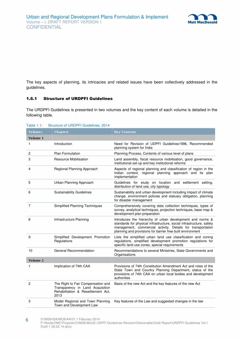
Urban and Regional Development Plans Formulation & Implement Volume – I, DRAFT REPORT VERSION 1
CONFIDENTIAL
319928/ISA/MCB/AA/01 1 Feburary 2014 P:\Noida\DMC\Projects\319928-MoUD UDPFI Guidelines Revision\Deliverable\Draft Report\URDPFI Guidelines Vol I Draft-1 26.02.14.docx
6
The key aspects of planning, its intricacies and related issues have been collectively addressed in the
guidelines.
1.6.1 Structure of URDPFI Guidelines
The URDPFI Guidelines is presented in two volumes and the key content of each volume is detailed in the
following table.
Table 1.1: Structure of URDPFI Guidelines, 2014
Volumes Chapters Key Contents
Volume 1
1 Introduction Need for Revision of UDPFI Guidelines1996, Recommended planning system for India
2 Plan Formulation Planning Process, Contents of various level of plans
3 Resource Mobilisation Land assembly, fiscal resource mobilisation, good governance, institutional set-up and key institutional reforms
4 Regional Planning Approach Aspects of regional planning and classification of region in the Indian context, regional planning approach and its plan implementation
5 Urban Planning Approach Guidelines for study on location and settlement setting, distribution of land use, city typology
6 Sustainability Guidelines Sustainability and urban development including impact of climate change, environment policies and statuary obligation, planning for disaster management
7 Simplified Planning Techniques Comprehensively covering data collection techniques, types of survey, analytical techniques, projection techniques, base map & development plan preparation
8 Infrastructure Planning Introduces the hierarchy of urban development and norms & standards for physical infrastructure, social infrastructure, safety management, commercial activity. Details for transportation planning and provisions for barrier free built environment
9 Simplified Development Promotion Regulations
Lists the simplified urban land use classification and zoning regulations, simplified development promotion regulations for specific land use zones, special requirements
10 General Recommendation Recommendations to several Ministries, State Governments and Organisations
Volume 2
1 Implication of 74th CAA Provisions of 74th Constitution Amendment Act and roles of the State Town and Country Planning Department, status of the provisions of 74th CAA on urban local bodies and development authorities
2 The Right to Fair Compensation and Transparency in Land Acquisition Rehabilitation & Resettlement Act, 2013
Basis of the new Act and the key features of the new Act
3 Model Regional and Town Planning Town and Development Law
Key features of the Law and suggested changes in the law
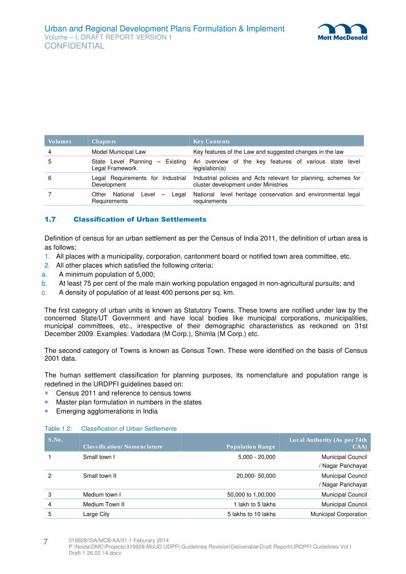
Urban and Regional Development Plans Formulation & Implement Volume – I, DRAFT REPORT VERSION 1
CONFIDENTIAL
319928/ISA/MCB/AA/01 1 Feburary 2014 P:\Noida\DMC\Projects\319928-MoUD UDPFI Guidelines Revision\Deliverable\Draft Report\URDPFI Guidelines Vol I Draft-1 26.02.14.docx
7
Volumes Chapters Key Contents
4 Model Municipal Law Key features of the Law and suggested changes in the law
5 State Level Planning – Existing Legal Framework
An overview of the key features of various state level legislation(s)
6 Legal Requirements for Industrial Development
Industrial policies and Acts relevant for planning, schemes for cluster development under Ministries
7 Other National Level – Legal Requirements
National level heritage conservation and environmental legal requirements
1.7 Classification of Urban Settlements
Definition of census for an urban settlement as per the Census of India 2011, the definition of urban area is
as follows;
1. All places with a municipality, corporation, cantonment board or notified town area committee, etc.
2. All other places which satisfied the following criteria:
a. A minimum population of 5,000;
b. At least 75 per cent of the male main working population engaged in non-agricultural pursuits; and
c. A density of population of at least 400 persons per sq. km.
The first category of urban units is known as Statutory Towns. These towns are notified under law by the concerned State/UT Government and have local bodies like municipal corporations, municipalities, municipal committees, etc., irrespective of their demographic characteristics as reckoned on 31st December 2009. Examples: Vadodara (M Corp.), Shimla (M Corp.) etc.
The second category of Towns is known as Census Town. These were identified on the basis of Census 2001 data.
The human settlement classification for planning purposes, its nomenclature and population range is
redefined in the URDPFI guidelines based on:
� Census 2011 and reference to census towns
� Master plan formulation in numbers in the states
� Emerging agglomerations in India
Table 1.2: Classification of Urban Settlements
S.No.
Classification/ Nomenclature Population Range Local Authority (As per 74th
CAA)
1 Small town I 5,000 - 20,000 Municipal Council
/ Nagar Panchayat
2 Small town II 20,000- 50,000 Municipal Council
/ Nagar Panchayat
3 Medium town I 50,000 to 1,00,000 Municipal Council
4 Medium Town II 1 lakh to 5 lakhs Municipal Council
5 Large City 5 lakhs to 10 lakhs Municipal Corporation
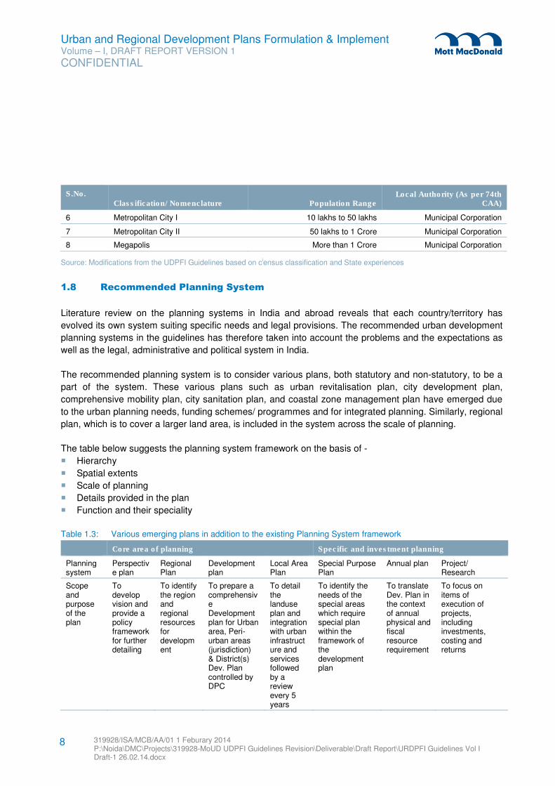
Urban and Regional Development Plans Formulation & Implement Volume – I, DRAFT REPORT VERSION 1
CONFIDENTIAL
319928/ISA/MCB/AA/01 1 Feburary 2014 P:\Noida\DMC\Projects\319928-MoUD UDPFI Guidelines Revision\Deliverable\Draft Report\URDPFI Guidelines Vol I Draft-1 26.02.14.docx
8
S.No.
Classification/ Nomenclature Population Range Local Authority (As per 74th
CAA)
6 Metropolitan City I 10 lakhs to 50 lakhs Municipal Corporation
7 Metropolitan City II 50 lakhs to 1 Crore Municipal Corporation
8 Megapolis More than 1 Crore Municipal Corporation
Source: Modifications from the UDPFI Guidelines based on ciensus classification and State experiences
1.8 Recommended Planning System
Literature review on the planning systems in India and abroad reveals that each country/territory has
evolved its own system suiting specific needs and legal provisions. The recommended urban development
planning systems in the guidelines has therefore taken into account the problems and the expectations as
well as the legal, administrative and political system in India.
The recommended planning system is to consider various plans, both statutory and non-statutory, to be a
part of the system. These various plans such as urban revitalisation plan, city development plan,
comprehensive mobility plan, city sanitation plan, and coastal zone management plan have emerged due
to the urban planning needs, funding schemes/ programmes and for integrated planning. Similarly, regional
plan, which is to cover a larger land area, is included in the system across the scale of planning.
The table below suggests the planning system framework on the basis of -
� Hierarchy
� Spatial extents
� Scale of planning
� Details provided in the plan
� Function and their speciality
Table 1.3: Various emerging plans in addition to the existing Planning System framework
Core area of planning Specific and investment planning
Planning system
Perspective plan
Regional Plan
Development plan
Local Area Plan
Special Purpose Plan
Annual plan Project/ Research
Scope and purpose of the plan
To develop vision and provide a policy framework for further detailing
To identify the region and regional resources for development
To prepare a comprehensive Development plan for Urban area, Peri-urban areas (jurisdiction) & District(s) Dev. Plan controlled by DPC
To detail the landuse plan and integration with urban infrastructure and services followed by a review every 5 years
To identify the needs of the special areas which require special plan within the framework of the development plan
To translate Dev. Plan in the context of annual physical and fiscal resource requirement
To focus on items of execution of projects, including investments, costing and returns
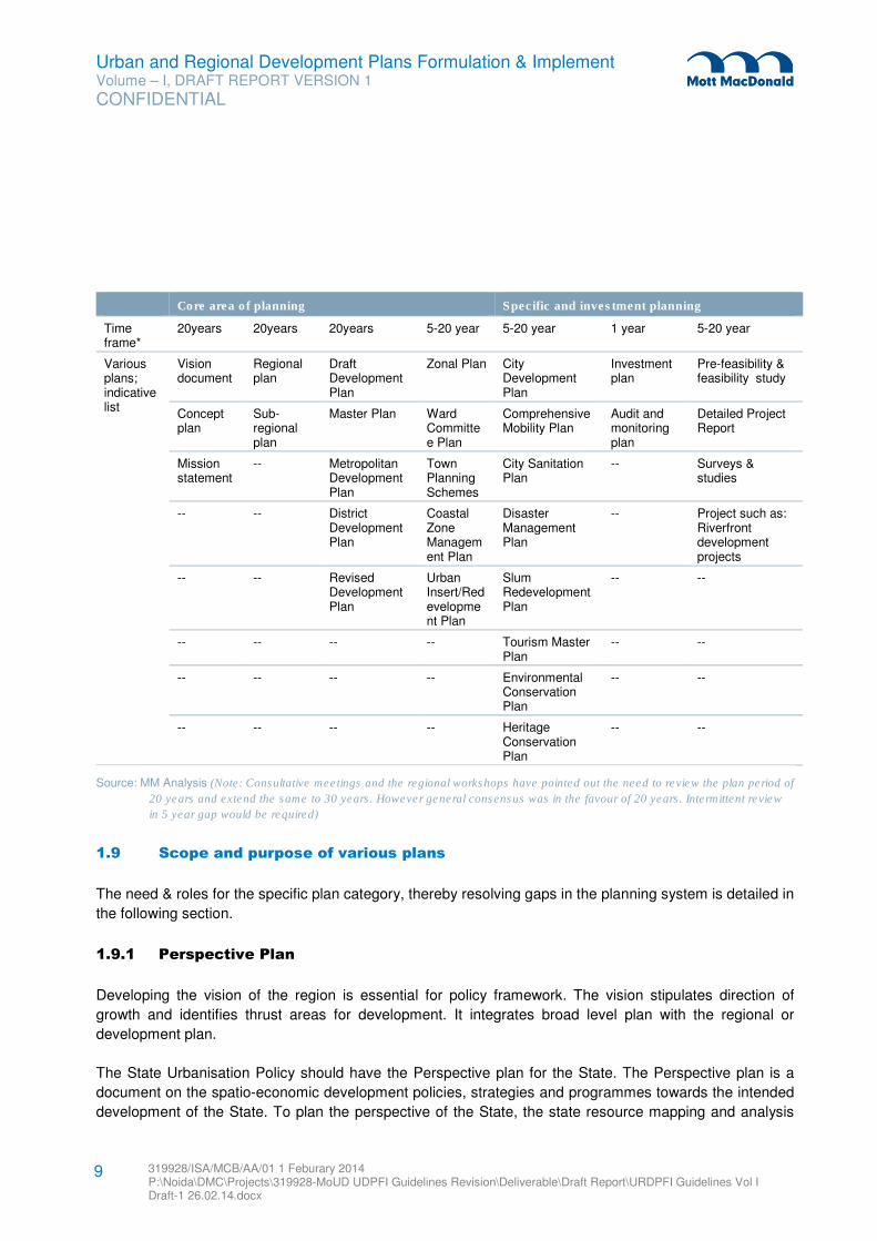
Urban and Regional Development Plans Formulation & Implement Volume – I, DRAFT REPORT VERSION 1
CONFIDENTIAL
319928/ISA/MCB/AA/01 1 Feburary 2014 P:\Noida\DMC\Projects\319928-MoUD UDPFI Guidelines Revision\Deliverable\Draft Report\URDPFI Guidelines Vol I Draft-1 26.02.14.docx
9
Core area of planning Specific and investment planning
Time frame*
20years 20years 20years 5-20 year 5-20 year 1 year 5-20 year
Various plans; indicative list
Vision document
Regional plan
Draft Development Plan
Zonal Plan City Development Plan
Investment plan
Pre-feasibility & feasibility study
Concept plan
Sub-regional plan
Master Plan Ward Committee Plan
Comprehensive Mobility Plan
Audit and monitoring plan
Detailed Project Report
Mission statement
-- Metropolitan Development Plan
Town Planning Schemes
City Sanitation Plan
-- Surveys & studies
-- -- District Development Plan
Coastal Zone Management Plan
Disaster Management Plan
-- Project such as: Riverfront development projects
-- -- Revised Development Plan
Urban Insert/Redevelopment Plan
Slum Redevelopment Plan
-- --
-- -- -- -- Tourism Master Plan
-- --
-- -- -- -- Environmental Conservation Plan
-- --
-- -- -- -- Heritage Conservation Plan
-- --
Source: MM Analysis (Note: Consultative meetings and the regional workshops have pointed out the need to review the plan period of
20 years and extend the same to 30 years. However general consensus was in the favour of 20 years. Intermittent review
in 5 year gap would be required)
1.9 Scope and purpose of various plans
The need & roles for the specific plan category, thereby resolving gaps in the planning system is detailed in
the following section.
1.9.1 Perspective Plan
Developing the vision of the region is essential for policy framework. The vision stipulates direction of
growth and identifies thrust areas for development. It integrates broad level plan with the regional or
development plan.
The State Urbanisation Policy should have the Perspective plan for the State. The Perspective plan is a
document on the spatio-economic development policies, strategies and programmes towards the intended
development of the State. To plan the perspective of the State, the state resource mapping and analysis
Urban and Regional Development Plans Formulation & Implement Volume – I, DRAFT REPORT VERSION 1
CONFIDENTIAL
319928/ISA/MCB/AA/01 1 Feburary 2014 P:\Noida\DMC\Projects\319928-MoUD UDPFI Guidelines Revision\Deliverable\Draft Report\URDPFI Guidelines Vol I Draft-1 26.02.14.docx
10
shall play the foundation of the long-term policies regarding development of infrastructure and resource
mobilisation. Thereafter, the vision statement and its concept plan needs to be formulated to define the
perspective. The scope of this plan covers the social, economic and spatial development goals, policies
and priorities relating to the activities that have spatial and financial implications.
The purpose of a perspective plan is to provide overall framework for further detailing; and it serves as a
guide for urban local authorities and regional development authorities in preparation of the regional and
development plans.
1.9.2 Regional Plan
Regional plan is to be a comprehensive plan at an appropriate scale for the integration of urban nodes with
the semi-urban and rural areas. The plan shall encompass characteristics of the region on the
understanding of the flow of people, goods, knowledge and money.
Some states have comprehensive town and country planning legislation which provides for urban planning
and development in a regional perspective beyond the city limits and coordinated with the overall
framework of economic development, priorities and resource availabilities. Regions (identified in the
States) are to be planned holistically or as sub-regions for the holistic approach of planning.
The detailed planning of the urban nodes will be addressed by the development plans at the next stage of
planning, while the requirements of the region will be addressed by the regional plan to bring out policies
for development and bringing in harmony between the different types of human settlements. Regional Plan
will have higher magnitude (in terms of its geographical area coverage) and would encompass planning of
larger area, and thus overcoming the missing link in the present planning system.
1.9.3 Development Plan
To avoid overlapping with Special Purpose Plans and confusion in terms of the scale of planning, the
development shall be further defined to serve the purpose of a Master plan and integration of land and
transport.
Development plan is a statutory plan prepared within the framework of the approved perspective plan. The
objective of a development plan is to provide further necessary details and intended actions in the form of
strategies and physical proposals for various policies given in the perspective plan depending upon the
economic and social needs and aspiration of the people, available resources and priorities.
Its proposals are precise and definite, with an implementation strategy and evaluation criteria. It makes
known publicly the intention of the local authority regarding physical, social and economic development,
the facilities and the services that are proposed to be provided in the near future. The approved
development plan allows the local authority to implement the development of the land area with the help of
schemes and projects.
Urban and Regional Development Plans Formulation & Implement Volume – I, DRAFT REPORT VERSION 1
CONFIDENTIAL
319928/ISA/MCB/AA/01 1 Feburary 2014 P:\Noida\DMC\Projects\319928-MoUD UDPFI Guidelines Revision\Deliverable\Draft Report\URDPFI Guidelines Vol I Draft-1 26.02.14.docx
11
The time frame of the existing Development Plans is for a period of 20 years by most of the urban
development authorities/ULB. A longer period for greenfield cities where infrastructure life of 30 years is
considered while planning could also be looked into.
These plans should be in phases of 5 years to coincide with the State Five Year plans and State Finance
Commissions’ recommendations. The targets set for each phase can be assessed as the mid-term review
against the achievements at the end of each phase. For Greenfield area phasing could include a ‘Zero’
period for approvals, initial land polling and developments and revisiting any strategy.
1.9.3.1 Master Plan
Development plan is a statutory plan, approved and adopted by the local authority and its proposals are
precise and definite. Also Development plan ‘notifies the property owners the manner in which their
properties will be affected’. Similar details are provided by the Delhi Master Plan, Chennai Master Plan,
Guwahati Master Plan, Ahmedabad Development Plan, Hyderabad Metropolitan Development Plan and
Bhopal Development Plan. Here, both the plans, Development plans and Master plans have the same
functions and impose similar controls. Hence, the two are to be understood as similar plans with variation
in the use of nomenclatures by State Governments.
It may be desirable to review and if necessary to adopt structure plan as an intermediately between the
regional and master plan. In areas under the schedule list as per the Article 6 of the Constitution of India,
land is not directly State subject and hence precise and definite detailing upto the level of revenue may not
be possible. In such cases or otherwise, Structure Plan is a planning document which directs the growth
and zones of planning, but is not as precise as the development plan (such as the Bangalore Structure
Plan) may be formulated. Structure plans may be considered as an option of Development plan for
Metropolitan Regions, thereby allowing flexibility.
1.9.4 Local Area Plan
The planning hierarchy needs a focused approach in the present context. It should not be included under
the title of project or scheme. Thrust of planning should shift to local area plans which could encourage
decentralisation.
Local area plans are to be prepared to achieve development or re-development of land; conservation of
buildings, physical features; providing improvements in the physical layout, making infrastructure and
amenities available and managing the area to enhance health and safety of the occupants to support
economic development as well as to enhance the quality of living, environment, and preparation of area
specific regulatory parametersii for the area covered.
Local area plans are prepared to specify the implementation details to comply with the Government
Policies (such as State urban housing, hi-tech township, rainwater harvesting, energy, disaster
management, industrial and service sector investment, barrier-free environment for physically disabled,
information technology, tourism & other policies).
Urban and Regional Development Plans Formulation & Implement Volume – I, DRAFT REPORT VERSION 1
CONFIDENTIAL
319928/ISA/MCB/AA/01 1 Feburary 2014 P:\Noida\DMC\Projects\319928-MoUD UDPFI Guidelines Revision\Deliverable\Draft Report\URDPFI Guidelines Vol I Draft-1 26.02.14.docx
12
The plan shall identify allotment or reservation of land for roads and public purposes of all kinds, for sale by
the ULB, for construction, for reclamation etc. The plan shall instrumentalise recovery of the associated
costs by mechanisms like levy of betterment charges, charges on additional development rights,
implementation of the Local Area Plan providing benefits to the persons concerned.
1.9.5 Special Purpose Plan
The Special Purpose Plan cannot be treated as Development plan as it emerges from its proposal. Also
approach, scale, context of each one of them is different and also from the Development plan.
Depending on the urgency of the needs and priorities requiring special treatment and covering special
aerial extent - Special Purpose Plans for specific subjects can be prepared within the framework of the
Regional Plan, Development Plan or Local Area Plan in the area of jurisdiction of the local authority.
These plans may also emerge to serve the purpose of urban planning needs under the Capital or State
grants, funding schemesiii/ programmes with an aim to:
� Encourage reforms and fast track planned development of cities, peri-urban areas, outgrowths, urban
corridors, and others,
� Scale-up delivery of civic amenities and provision of utilities with emphasis on universal access to the
urban poor,
� Special focus on urban renewal programme,
� Supplement to budget documents on ULBs,
� Sustainability, Environmental and heritage protection,
� Theme based development
1.9.6 Annual Plan
An Annual Plan would contain the details of the new and ongoing projects that the local authority intends to
implement during each financial year for necessary financial resource mobilisation.
The annual plan is to be prepared by the local authority every year to identify the new projects, which the
authority will undertake for implementation during the year, taking into account the physical and fiscal
performance of the preceding year, the priorities, the policies and proposals contained in the approved
Regional Plan, Development Plan or Local Area Plan.
The annual plan is intended to provide the resource requirement during the year and sources of funds
including those mobilised by the local authority, grants, aids and project/scheme funds by the State and
Central Governments.
It is thus an important document for the resource mobilisation as on the basis of this, the plan funds are to
be allocated by the funding body. This plan, therefore, serves as an important link with the budgetary
process.
Urban and Regional Development Plans Formulation & Implement Volume – I, DRAFT REPORT VERSION 1
CONFIDENTIAL
319928/ISA/MCB/AA/01 1 Feburary 2014 P:\Noida\DMC\Projects\319928-MoUD UDPFI Guidelines Revision\Deliverable\Draft Report\URDPFI Guidelines Vol I Draft-1 26.02.14.docx
13
1.9.7 Projects
Projects are derived targets of the sequences of plans which focus on items of execution, investments,
costing and returns. Conceived within the framework of the perspective plan, development plan or any of
the plans in the planning system, projects are the working layouts with all supporting infrastructure and
documents including cost, source of fund and recovery providing all necessary details for execution
including finance, development, administrative and management.
These projects could be for any area, old or new; any activity or land use like residential, commercial,
industrial, recreational, educational or health related; or infrastructure development, separately or in an
integrated manner; for research and development in the field of planning, key surveys to determine
statistics, by any agency such as government, semi-government, private or even individual; or any agency
prepared by town planners, architects, engineers as the case may be, enjoying maximum freedom of
expression in their design within the stipulations of development promotion rules and other regulations as
applicable.
The selection of the area subject/ project is to be determined by the needs or priorities of the executing
agency guided by market forces and government policy interventions.
The contents of the plans suggested in the planning system are given subsequently in plan formulation
section.
1.9.8 Inter-relationships among various plans
Taking into account the entire planning process and also incorporating the suggested planning system,
Figure 1.1 shows the interrelationship of the different plans, directly or indirectly related to the land
development, at various levels ranging from national to a transitional urban area under the jurisdiction of a
Nagar Panchayat.
A Perspective Plan is formulation of development strategy generally at the State level or at the regional
level. This is detailed further in Regional Plan or Sub Regional Plan as the case may be and in
Development Plan. Perspective Plan should be a guiding document for planning. It could also specify the
regional planning authorities, urban/local area planning authorities, regulatory authorities in the State and
those responsible for preparing plan at various levels. The State Urbanisation Plan shall give a stock of the
urbanisation, planning status and especially of the land suitability.
Regional Plans are to be prepared at district and metropolitan region level, and where economic regions
are formulated. This is the linkage for aggregation of plan’s proposals for consolidation and integration of
physical and fiscal planning efforts at District, Metropolitan area, state and also at national level (in case of
inter-state regions). As figure 1.1 depicts, Regional and Development Plan is the level of integration and
disaggregation of policies, resources in the planning system.
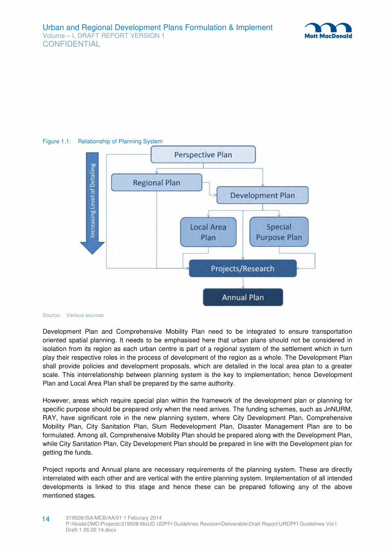
Urban and Regional Development Plans Formulation & Implement Volume – I, DRAFT REPORT VERSION 1
CONFIDENTIAL
319928/ISA/MCB/AA/01 1 Feburary 2014 P:\Noida\DMC\Projects\319928-MoUD UDPFI Guidelines Revision\Deliverable\Draft Report\URDPFI Guidelines Vol I Draft-1 26.02.14.docx
14
Figure 1.1: Relationship of Planning System
Source: Various sources
Development Plan and Comprehensive Mobility Plan need to be integrated to ensure transportation
oriented spatial planning. It needs to be emphasised here that urban plans should not be considered in
isolation from its region as each urban centre is part of a regional system of the settlement which in turn
play their respective roles in the process of development of the region as a whole. The Development Plan
shall provide policies and development proposals, which are detailed in the local area plan to a greater
scale. This interrelationship between planning system is the key to implementation; hence Development
Plan and Local Area Plan shall be prepared by the same authority.
However, areas which require special plan within the framework of the development plan or planning for
specific purpose should be prepared only when the need arrives. The funding schemes, such as JnNURM,
RAY, have significant role in the new planning system, where City Development Plan, Comprehensive
Mobility Plan, City Sanitation Plan, Slum Redevelopment Plan, Disaster Management Plan are to be
formulated. Among all, Comprehensive Mobility Plan should be prepared along with the Development Plan,
while City Sanitation Plan, City Development Plan should be prepared in line with the Development plan for
getting the funds.
Project reports and Annual plans are necessary requirements of the planning system. These are directly
interrelated with each other and are vertical with the entire planning system. Implementation of all intended
developments is linked to this stage and hence these can be prepared following any of the above
mentioned stages.
Urban and Regional Development Plans Formulation & Implement Volume – I, DRAFT REPORT VERSION 1
CONFIDENTIAL
319928/ISA/MCB/AA/01 1 Feburary 2014 P:\Noida\DMC\Projects\319928-MoUD UDPFI Guidelines Revision\Deliverable\Draft Report\URDPFI Guidelines Vol I Draft-1 26.02.14.docx
15
1.10 Sustainable Urban & Regional Development
The important concepts influencing planning are: Transport network, Drainage network, Density distribution
and Disaster proofing. For achieving the above, there should be adequate emphasis of these on the basic
concept in planning.
Twelfth Five Year Plan has also noticed the trend of urbanisation like its precursor and provided road map
intending to fasten and guiding urbanisation into broad based inclusive development phenomenon
including:
� Step up investment and leverage JnNURM to provide required investment in Urban Infrastructure-
Capex, Operation & Management,
� Strengthen Urban Governance structure / Local Bodies,
� Augment ‘Soft infrastructure’- System Capacities,
� Inclusive Governance- Take care of the Poor, More Miles to cover,
� More Attention to the Urban Renewal as well as Regional Planning,
� Urban Governance structures, esp. the Municipalities, need strengthening & support
� Environmental sustainability- Cities are not sustainable yet: Inadequate water supply, solid waste
management
India is a diverse nation, with varying topography, many types of cites; contextual in term of land form,
cultural historic backgrounds and socio-cultural variations. With a long history; the Indian cities have
evolved into typical urban morphology, which have extreme variations from each other. In such diversities,
multiple options would need to be explored. Micro projects would need to be molded in existing
developments, while larger concept and approaches have to be tailored in city specific and contextual
requirements. Implementation of some of the successful approaches in one city has failed in another due
to lack of alteration as per situation.
1.10.1 State Land Policy
State Land Utilisation Policy would need to be defined at the Perspective Plan Level, which should be as
per the guiding framework of National Land Utilisation Policy (draft version is currently in place),
Department of Land Resources, Ministry of Rural Development, for different states keeping in context the
state-specific needs, potential, priorities and legal provisions.
The National Land Utilisation Policy takes into consideration the predominant (existing or scientifically
established) functions of land serving the needs of people, environment as well as different sectors of
economy and development. Also, the Policy takes into consideration the existing laws and approaches that
govern land uses. It is suggested that the land in the country will be divided into Land Utilisation Zones
(LUZs) based on the predominant use of those lands. Here, each state should formulate the strategy of
land development in a spatial concept plan. The following six types of Land Utilisation Zones (LUZs) are
proposed to be identified on the basis of predominant land use:
1. Predominantly Rural and Agricultural Areas;
Urban and Regional Development Plans Formulation & Implement Volume – I, DRAFT REPORT VERSION 1
CONFIDENTIAL
319928/ISA/MCB/AA/01 1 Feburary 2014 P:\Noida\DMC\Projects\319928-MoUD UDPFI Guidelines Revision\Deliverable\Draft Report\URDPFI Guidelines Vol I Draft-1 26.02.14.docx
16
2. Areas Under Transformation;
3. Predominantly Urban Areas;
4. Predominantly Industrial Areas;
5. Predominantly Ecological Areas, Landscape Conservation & Tourism Areas. Heritage Areas;
6. Major Hazard Vulnerable Areas.
As mentioned, the perspective of the State, the state resource mapping and analysis shall play the
foundation of the long-term policies regarding development of infrastructure and resource mobilisation on
the land.
1.10.2 Land Transport Integration
National Urban Transport Policy (NUTP), 2006 has identified - Integrating land use and transport planning
as one of its objectives. In the past decades, urban sprawl has resulted into loss of high quality agricultural
land and open space, fragmentation of ecosystems, spatially segregated uses inducing high dependency
on private vehicle use and unfavourable conditions for public transport. Land transport integration benefits
in making investment decisions in transport infrastructure and services which in turn are linked to
economic, social, and environmental outcomes. It involves two mutually supportive processes:
� Organizing the physical form and land use pattern of a city such that the travel demands, trip
lengths and travel times are minimized, while accessibility, comfort and efficiency are maximized.
� Organizing all systems of transportation from pedestrian pathways to mass transit systems such that
they integrate well with each other and enable the harmonious establishment of land use around
them, in the process generating a city form that is sustainable1.
Conventional development plans for Indian cities have a statutory requirement to plan land uses and
channelize growth, whereas transportation plans are not statutory and work with the mandate of arriving at
regional and local level projects for improving mobility. Thus, this URDPFI guideline suggests the shift from
such an approach to explicitly regarding interactions between various land uses/ activity subsystems2.
Therefore, Comprehensive Mobility Plans (CMPs) mandatory under the JnNURM3 to access central
funding for any transport related projects in cities is integrated with development plans bridging the
disconnect between transportation projects and statutory land use planning.
1 Source: Development of Toolkit under Sustainable Urban Transport Project, Land Use Transport Integration and
Density of Urban Growth, 2013, Ministry of Urban Development, Government of India. Details on the approach to land transport integration to be referred from the document.
2 Development of Toolkit under Sustainable Urban Transport Project, Land Use Transport Integration and Density of
Urban Growth, 2013, Ministry of Urban Development, Government of India
3 The Jawaharlal National Urban Renewal Mission in 2005 was set up under the Ministry of Urban Development with a
focus on efficiency in urban infrastructure and service delivery mechanisms as well as accountability and citizen participation
Urban and Regional Development Plans Formulation & Implement Volume – I, DRAFT REPORT VERSION 1
CONFIDENTIAL
319928/ISA/MCB/AA/01 1 Feburary 2014 P:\Noida\DMC\Projects\319928-MoUD UDPFI Guidelines Revision\Deliverable\Draft Report\URDPFI Guidelines Vol I Draft-1 26.02.14.docx
17
Transport networks are among the most permanent element of cities which change very slowly over
decades or centuries. While, buildings are the second most permanent element of cities, with lifetime of
hundreds of years, but can be adapted to changes through refurbishment but the integration of the two
shapes the urban form of a settlement.
1.10.3 Transit Oriented Development (TOD)
“Transit Oriented Development is essentially any development, macro or micro that is focused around a
transit node, and facilitates complete ease of access to the transit facility thereby inducing people to prefer
to walk and use public transportation over personal modes of transport”4. This is an attempt to compact the
cities and reducing dependency on the new urban developments in the periphery which highly encourage
the shift from non-motorized to motorized modes of travel. Approach to TOD development highly depends
on establishing mixed landuse zone by strategic densification. The policy includes:
� Network & Connectivity: Disperse high traffic volumes over multiple parallel streets rather than
concentrating traffic on few major arterial streets. Create a fine network of streets that provides choice
of routes for all modes, reducing distances between places as well as journey times.
� Last mile connectivity: Provide fast, convenient interchange options and spatial provision for various
modes of Intermediate Public Transport (IPT) at Multimodal Transit Station for seam less travel.
Provide multiple mode choices for last-mile connectivity at various prices and comfort levels. And at a
given situation, eliminate the need of Intermediate Public Transport by design and engineering5.
� Pedestrian access: Provide the shortest direct route to pedestrians and non-motorised modes to
station as well as between building blocks.
� High Density, Mixed-Income Development: Compact neighborhoods for shorter commutes and
equity for all sections of society. Mix of use to promote 24 hour activity.
� Streetscape Design: Urban places should be designed for enjoyment, relaxation and equity.
Pedestrian friendly designated space for all activities.
� Promote Place Making to Create a Sense of Place - Focus on promoting liveability, quality and
uniqueness of each space
� Direct Business to TOD Locations- Create transit services to regional job centers, focus job creation
investments in transit serviced locations
Application of TOD is in context of scales in planning i.e. Regional context, Sub-regional context, city
context and area context. It shall require a robust methodology for intervention6. Hence the Transit oriented
development would need to be planned at:
1. Moblity1: i.e Regional or Sub-regional planning level
2. Moblity2: i.e City or local area planning level
4 Draft UTTIPEC Guidelines, 2012
5 In case of China and Japan
6 Working paper on Transit Oriented Development, Embarq, India
Urban and Regional Development Plans Formulation & Implement Volume – I, DRAFT REPORT VERSION 1
CONFIDENTIAL
319928/ISA/MCB/AA/01 1 Feburary 2014 P:\Noida\DMC\Projects\319928-MoUD UDPFI Guidelines Revision\Deliverable\Draft Report\URDPFI Guidelines Vol I Draft-1 26.02.14.docx
18
The context of TOD is in terms of City Core areas, Peripheral areas and Greenfield areas which are
equally important and mutually dependent on densification, redevelopment, mode of public transport and
intermediate public transport, uses of land in the influence zone. Detailed approach of identifying influence
zone and its planning is covered in chapter 8.
Besides, integrated urban development, TOD can benefit as an alternative revenue generation source,
from:
� Financing of Urban Transport projects by Unlocking Land Values as Higher FSI in influence zone of
Transit corridors within the framework of the overall planning guidelines to be prepared by respective
states
� Transit Corridors (Metro/ Mono Rail, BRTS, Ring Road) attracting economic activities and leading to
induced urban development with less efforts
� Land-use based financing sources along Transport Corridors. For example, periodic revision of
property guidance value, higher property tax along transit corridors, impact fees, development charges,
conversion charges and betterment charges.
If properly planned and implemented, invariably promotes, value added activities including commercial and
services.
1.10.4 Focus on Regional Planning
Strategic approach to planning urban areas starts with macro perspective at the national/state level and
then at regional level to guide urbanization and rural development in an integrated and holistic manner.
This comprehensive approach shall eventually pave way for ‘sustainable settlement planning’ emphasising
on human living environment rather than overtly concentrating on built environment and the accompanying
administrative structures. It will integrate top-down and bottom-up approaches. Hence, as suggested by
the Steering committee on Urban Development & Management, 12th Five-year plan; ‘Regional and urban
planning should be an instrument for guiding inclusive growth i.e spatial and development planning
covering metropolitan regions, planning areas of cities, while transportation networks to be central pieces
of planning to “lead” development’7.
Chapter 4 of this guideline entitled ‘Regional planning’ covers several aspects of District and Metropolitan
Development Plans which are envisaged to ensure integrated rural and urban planning. This approach
needs to ensure spatial planning in a coordinated manner, sharing of natural and other resources,
integrated provision of infrastructure and conservation of the environment. However, detailed planning
needs to be left to the urban and rural local bodies. Wherelse, development of investment regions along
the national transport/industrial growth corridors shall form the national spatial grid structure.
7 Report of the Working Group on Urban Strategic Planning, 12th Five-year plan, Steering committee on Urban Development &
Management, Ministry of Housing and Urban Poverty Alleviation
Urban and Regional Development Plans Formulation & Implement Volume – I, DRAFT REPORT VERSION 1
CONFIDENTIAL
319928/ISA/MCB/AA/01 1 Feburary 2014 P:\Noida\DMC\Projects\319928-MoUD UDPFI Guidelines Revision\Deliverable\Draft Report\URDPFI Guidelines Vol I Draft-1 26.02.14.docx
19
1.10.5 Flexibility in Plans
Statutory landuse plans have implications on the land use and development control mechanism. Due to the
controlled (rigid) approach, Development plans are not implemented completely and have deficiency in
coverage. Sometimes, in spite of statutory backing, it has been experienced that the proposals/estimates
have not kept pace with the growing requirement of cities or the aspirations of the city dwellers. In case of
conflicts, these matters escalate.
Master planning approach is to be for a flexible plan formulation for facilitation and promotion of
development in plan making and implementation, where changes in landuse are to be permitted only when
necessary by specifically appointed empowered committee. These changes may be guided by large
developments, social interest and need for all.
For minor changes in the landuse, the planning system is to be improved to allow flexibility in the
development plans/ master plans. Such as allowing mixed use of land in the zoning regulation for industrial
– non industrial aspects of mix. Vertical mix of use of land is an alternative approach for promoting
flexibility is suggested in section 5.3.2 of the guideline.
1.10.6 Land to generate fund for Infrastructure Development
The URDPFI Guidelines suggest the ways to augment financial resources for implementation of the
development/ spatial plan through various innovative sources of revenue generation. Formulation of spatial
plan should be such that the plan is able to create economic growth and which could fund the
implementation of the plan. Among the land development mechanism, town planning schemes followed in
the states of Maharashtra and Gujarat are successful case to demonstrate financial sustainability (cost of
recovery) of the plan.
Many schemes and projects are conceptualised without proper techno-feasibility studies or financial
viability assessments. Consequently, in the Plan, there is not much appreciation of the implications of its
standards for capital cost, cost recovery and maintenance by the municipalities and the state agencies.
The Urban Local Bodies (ULBs) mainly in the small and medium size towns, without exception, suffer from
a very weak resource base. Their per capita income is much less than the level of expenditure, which
makes it heavily depend on external funding instead of its self-generated revenues.
For fiscal resource generation from the land, vacant land policy, unauthorised informal development and
unutilised FAR could be a source of financial resource generation (refer section 3.3), which can be for
dedicated urban development through an infrastructure fund. Here, implementing agencies need to treat
land as an asset for infrastructure development through capital gain, stamp duty, auction and other
mechanisms in consensus of the State Finance Commission.
Urban and Regional Development Plans Formulation & Implement Volume – I, DRAFT REPORT VERSION 1
CONFIDENTIAL
319928/ISA/MCB/AA/01 1 Feburary 2014 P:\Noida\DMC\Projects\319928-MoUD UDPFI Guidelines Revision\Deliverable\Draft Report\URDPFI Guidelines Vol I Draft-1 26.02.14.docx
20
1.10.7 Sustainable Waste Management
Developed nations in Europe have managed ‘Zero waste’ disposal in a phased manner. International
agencies working on zero waste have claimed that recycling rates of 75% & plus have been achieved by
municipalities large and small throughout the world to prove it. Zero waste is gaining ground as being
practicably achievable.
Zero waste can be achieved by adopting systematic approach of segregation at source by planning,
collection facilitation and most importantly public awareness. As per MoUD, ‘Cities are sitting on untapped
wealth, i.e. waste to wealth’. In India, many of such practices of conversion from waste to wealth have
been successfully implemented, where waste is treated as a commodity for sale and purchase. However
this is required to be planned by the other cities in a phased manner in respective situations with multiple
party interventions. Sustainable Waste Management is detailed in the chapter number 8.
It is rather important in India now when the trends of urbanization are changing, the standard of living is
improving and thus, increasing quantum of all kinds of waste. Such approaches are needed to be
conceptualized in the State level policies and practically implemented by the cities at the Development
Plan level and the local area planning.
Besides solid waste, the effective management of waste water would result in availability of treated water
for reuse, capture of methane gas for power generation and improvement in the quality of the environment.
Therefore, planning should encompass concepts of zero landfill site is to save the precious land and
judicious use of water is to save the planet.
1.10.8 Inclusive planning
Development plan / Local area plans in India have not explicitly earmarked spaces for the urban poor /
informal sector for residents or other activities. In new townships and new developments of IT / BPO
Townships, Satellite Townships, SEZ, etc. where the space standards are changing, informal sector is
significantly gaining recognition. Planning norms for urban street vendors, the marginalised and the
informal sector to be adopted and developed from this guideline. It is of utmost importance to protect the
interest of urban poor by reserving space, extending legal title (ownership) and above all the Master Plans
/ Development Plans to take this component into account. Hence, planners should allocate space with
serious assessment of the requirements of urban poor after ascertaining the ground realities with regard to
location of vendors, informal activities, slums and need for in-situ redevelopment/upgradation.
There is a strong gender dimension of the ‘shelter-transport-livelihood link’, which exist between women’s
place of residence, their ability to access places of employment, education or basic services and their
ability to improve their livelihoods. The core problem is that places of employment for low-income people
are often located far away from their place of residence8. Another vulnerable group of the society is the
8 Wilson, 1987; Anand, Anvita and Tiwari, Geetam. 2006. A Gendered Perspective of the Shelter-Transport-Livelihood Link: The Case
Urban and Regional Development Plans Formulation & Implement Volume – I, DRAFT REPORT VERSION 1
CONFIDENTIAL
319928/ISA/MCB/AA/01 1 Feburary 2014 P:\Noida\DMC\Projects\319928-MoUD UDPFI Guidelines Revision\Deliverable\Draft Report\URDPFI Guidelines Vol I Draft-1 26.02.14.docx
21
disabled and the elderly. Barrier Free Environment (refer section 9.5) is one way to enable people with
disabilities to move about safely and freely and to use the facilities within the built environment9. However,
to integrate the disabled and elderly persons fully into the society, the social infrastructure norms suggest
co-development of old age home and orphanage facilities with appropriate barriers so that the two distinct
sections can benefit from each other’s presence.
Over the past couple of years, the Government of India has brought about a paradigm shift in the approach
to disaster management. The new policy emanates from the belief that investments in mitigation are much
more cost effective than expenditure on relief and rehabilitation10
. This approach has been translated in the
URDPFI Guidelines in chapter 6 for disaster planning, covering institutional mechanisms, preparedness,
response and capacity building both at State and District level.
States, metropolitan areas, regions and cities need to collect data, information and undertake mapping for
all infrastructure, services and amenities to understand requirements and identify gaps. At the local
planning area level, spatial maps need to be created to evaluate neighbourhood, streets and public spaces
based on their safety, comfort and convenience.
1.10.9 Speeding the process of planning & implementation
1.10.9.1 Simplifying the planning process
As per the ‘Strategy paper on master plan formulation, inclusive planning, proritization for housing and
pedestrian movement’, TCPO, there is a widely held view that the urban development planning process in
the past has been unduly time consuming and largely confined to the detailing of land use aspects. In light
to the concern, the State Governments would need to modify respective Town & Country Planning Acts for
the following:
i. Simplification of preparation of plan: making provisions in the Development Plans for detailing
only the focused key sectors and preparation in a limited time to one year, as suggested by
TCPO
ii. Simplification in the implementation of plan: the plans to be easily understandable &
acceptable, minimizing conflicting recommendations within a plan, provision for translation of
plans and related documents into vernacular languages
iii. Simplification in data gathering: user-friendly GIS and remote sensing data to be sourced for
simplifying the process for plan formulation by developing a spatial data base useful for
planning, decision making and implementation decision
iv. Simplification of approval/schemes: improving the approval process by developing citizens
charter, approval mechanism for the change in landuse permissions and by developing
of Poor Women in Delhi. Transport Reviews, Vol 26 (1), p 63-80
9 ‘Guidelines and space standards for Barrier Free Built Environment for Disabled and Elderly Person’, CPWD, Ministry of Urban
Affairs and Employment (erstwhile Ministry)
10 Disaster Management of India, Ministry of Home Affairs, Government of India
Urban and Regional Development Plans Formulation & Implement Volume – I, DRAFT REPORT VERSION 1
CONFIDENTIAL
319928/ISA/MCB/AA/01 1 Feburary 2014 P:\Noida\DMC\Projects\319928-MoUD UDPFI Guidelines Revision\Deliverable\Draft Report\URDPFI Guidelines Vol I Draft-1 26.02.14.docx
22
regulatory body at State and/or local area planning level to bridge the gap between approval
and implementation. Provision of Interim development order11
in between the period of plan
formulation to implementation can be considered.
v. Better public participation: The State planning provisions to be modified to emphasis on
involvement of public at early stages, formulation of Grievance & Redressal system to address
the public grievances and bringing transparency in accounting system. It is suggested to
involve Residential Welfare Associations (RWA) in Local area plans (LAPs) and ULBs to use
modern tools for awareness through websites/ on project sites.
Foremost, during the plan formulation, roles and responsibilities for the implementation of the plan are to
be well defined in order to achieve the milestones as per the action plan and to bring in transparency in the
implementation system. Further, during the plan evaluation, citizen charter should to be involved.
In case of inadequacy in the manpower capacity with the Government bodies for planning, outsourcing to
non-governmental and private organisation could be considered as an option, but as suggested by TCPO -
Urban Local Bodies and Development Authorities of the States need to take necessary steps in the
direction and take a lead to ensure that all the cities and towns of the State have statutory Master Plans by
the end of the XII Five year plan.
11 Kerala Town & Country Planning Ordinance, 2013
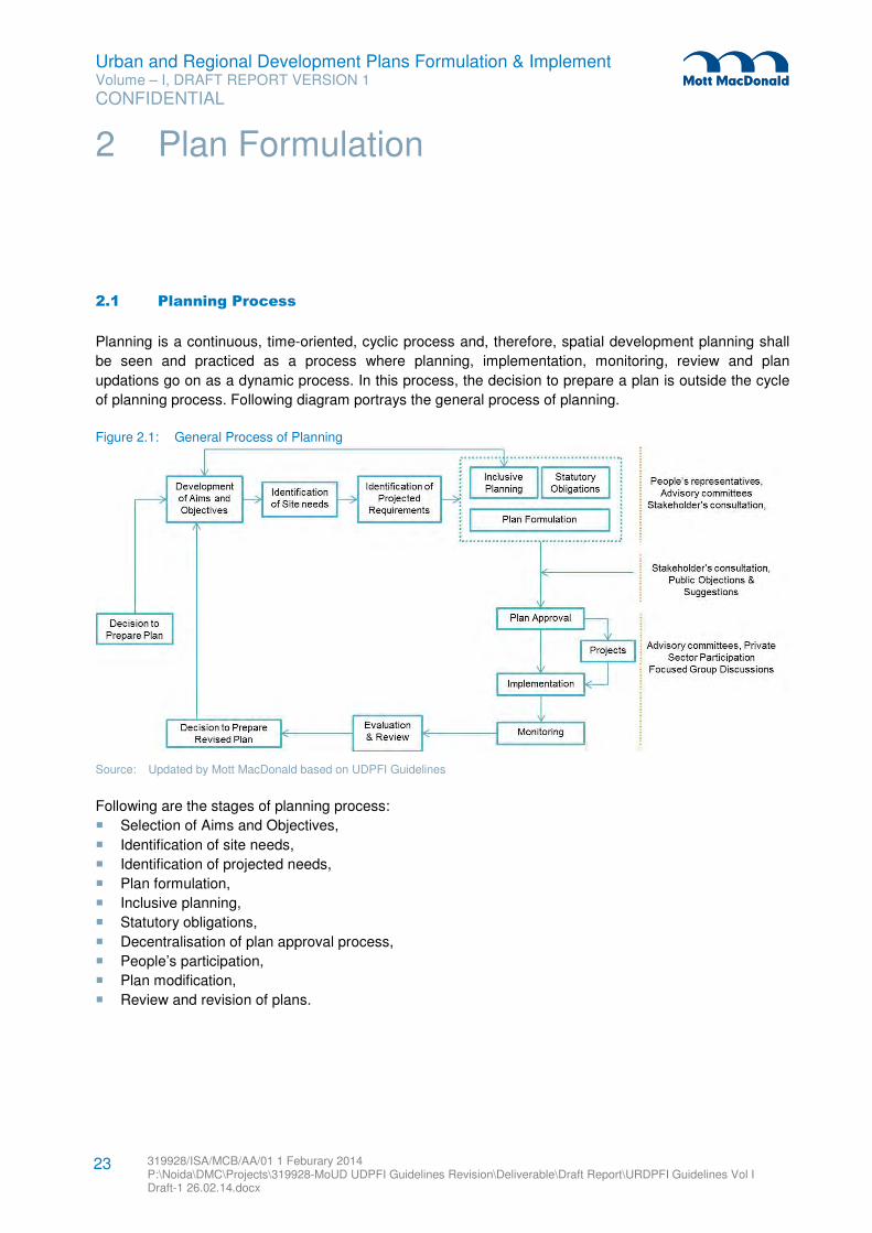
Urban and Regional Development Plans Formulation & Implement Volume – I, DRAFT REPORT VERSION 1
CONFIDENTIAL
319928/ISA/MCB/AA/01 1 Feburary 2014 P:\Noida\DMC\Projects\319928-MoUD UDPFI Guidelines Revision\Deliverable\Draft Report\URDPFI Guidelines Vol I Draft-1 26.02.14.docx
23
2.1 Planning Process
Planning is a continuous, time-oriented, cyclic process and, therefore, spatial development planning shall
be seen and practiced as a process where planning, implementation, monitoring, review and plan
updations go on as a dynamic process. In this process, the decision to prepare a plan is outside the cycle
of planning process. Following diagram portrays the general process of planning.
Figure 2.1: General Process of Planning
Source: Updated by Mott MacDonald based on UDPFI Guidelines
Following are the stages of planning process:
� Selection of Aims and Objectives,
� Identification of site needs,
� Identification of projected needs,
� Plan formulation,
� Inclusive planning,
� Statutory obligations,
� Decentralisation of plan approval process,
� People’s participation,
� Plan modification,
� Review and revision of plans.
2 Plan Formulation
Urban and Regional Development Plans Formulation & Implement Volume – I, DRAFT REPORT VERSION 1
CONFIDENTIAL
319928/ISA/MCB/AA/01 1 Feburary 2014 P:\Noida\DMC\Projects\319928-MoUD UDPFI Guidelines Revision\Deliverable\Draft Report\URDPFI Guidelines Vol I Draft-1 26.02.14.docx
24
2.1.1 Aims and Objectives
The aims are broad and general statements indicating the decisions of the policy makers, aspirations of
the people and needs of the community. For example, ‘To provide job opportunities for all’ is a statement of
aims.
Objectives are specific statements indicating the ways and means of achieving the set aims taking into
account the potentials. For example, for the aim related to job opportunities, the objectives could be:
� Provision of jobs through development of industries / commerce or trade;
� Provision of incentives and inducements (specific) to industries;
� Provisions of informal sector economic activity sites as part of commercial areas, and such others.
The aims and objectives formulation exercise comprises the following four steps:
1. Identification of values cherished by and needs of various stakeholders including citizens,
administrators, professionals, politicians, and other group of people;
2. Identification of aims incorporating the values’
3. Identification of criteria that further defines each aim to form basis for formulation of objectives, and
4. Formulation of objectives which could be further defined as design objectives and implementation
objectives.
2.1.2 Identification of Site Needs
For comprehensive planning and integration of the sectoral development and spatial planning, site specific
needs are to be identified in the beginning of the planning process. The report of the Working Group on
Urban Strategic Planning (12th Five year plan), states that due to ‘Lack of Comprehensive Planning
Approach, haphazard growth and proliferation of slums around industrial locations, peri-urban areas and
randomly located new developments such as SEZs and township has taken place’.
Diverse ground conditions and interrelationships in settlements require different strategies for spatial
planning. The growth potential and special functions performed by the urban centres such as marketing,
industrial, tourism, pilgrim centres etc. need to be explicitly recognized.
At this stage of the planning process, the site needs shall be identified based on the typology of urban
development- such as port city, old city, industrial townships, peri-urban areas; corridor development,
regional development and accordingly the vision needs to be prepared. Table 2.1 throws light on some site
specific features for studying urban and regional settlements while planning. The list is comprehensive but
not exhaustive.
Table 2.1: Site Specific Needs of Few City Types
Indicators Port City Industrial City Peri-Urban Area Old City
Common Indicators Regional Settings & connectivity, Historical background, Locational Analysis, Demography, Socio-economic Analysis, Environmental profile, Land Profile, Key Developmental Indicators,
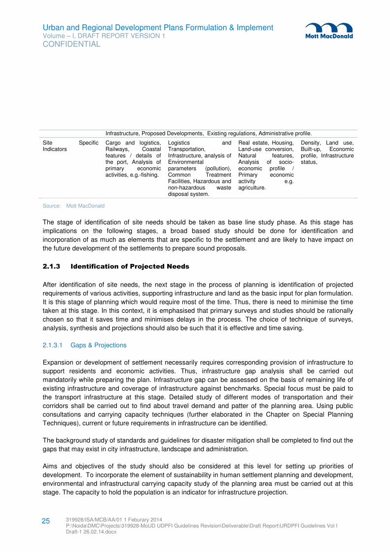
Urban and Regional Development Plans Formulation & Implement Volume – I, DRAFT REPORT VERSION 1
CONFIDENTIAL
319928/ISA/MCB/AA/01 1 Feburary 2014 P:\Noida\DMC\Projects\319928-MoUD UDPFI Guidelines Revision\Deliverable\Draft Report\URDPFI Guidelines Vol I Draft-1 26.02.14.docx
25
Infrastructure, Proposed Developments, Existing regulations, Administrative profile.
Site Specific Indicators
Cargo and logistics, Railways, Coastal features / details of the port, Analysis of primary economic activities, e.g.-fishing.
Logistics and Transportation, Infrastructure, analysis of Environmental parameters (pollution), Common Treatment Facilities, Hazardous and non-hazardous waste disposal system.
Real estate, Housing, Land-use conversion, Natural features, Analysis of socio-economic profile / Primary economic activity e.g. agriculture.
Density, Land use, Built-up, Economic profile, Infrastructure status,
Source: Mott MacDonald
The stage of identification of site needs should be taken as base line study phase. As this stage has
implications on the following stages, a broad based study should be done for identification and
incorporation of as much as elements that are specific to the settlement and are likely to have impact on
the future development of the settlements to prepare sound proposals.
2.1.3 Identification of Projected Needs
After identification of site needs, the next stage in the process of planning is identification of projected
requirements of various activities, supporting infrastructure and land as the basic input for plan formulation.
It is this stage of planning which would require most of the time. Thus, there is need to minimise the time
taken at this stage. In this context, it is emphasised that primary surveys and studies should be rationally
chosen so that it saves time and minimises delays in the process. The choice of technique of surveys,
analysis, synthesis and projections should also be such that it is effective and time saving.
2.1.3.1 Gaps & Projections
Expansion or development of settlement necessarily requires corresponding provision of infrastructure to
support residents and economic activities. Thus, infrastructure gap analysis shall be carried out
mandatorily while preparing the plan. Infrastructure gap can be assessed on the basis of remaining life of
existing infrastructure and coverage of infrastructure against benchmarks. Special focus must be paid to
the transport infrastructure at this stage. Detailed study of different modes of transportation and their
corridors shall be carried out to find about travel demand and patter of the planning area. Using public
consultations and carrying capacity techniques (further elaborated in the Chapter on Special Planning
Techniques), current or future requirements in infrastructure can be identified.
The background study of standards and guidelines for disaster mitigation shall be completed to find out the
gaps that may exist in city infrastructure, landscape and administration.
Aims and objectives of the study should also be considered at this level for setting up priorities of
development. To incorporate the element of sustainability in human settlement planning and development,
environmental and infrastructural carrying capacity study of the planning area must be carried out at this
stage. The capacity to hold the population is an indicator for infrastructure projection.
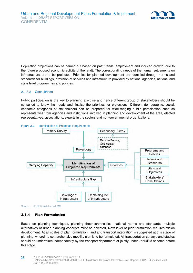
Urban and Regional Development Plans Formulation & Implement Volume – I, DRAFT REPORT VERSION 1
CONFIDENTIAL
319928/ISA/MCB/AA/01 1 Feburary 2014 P:\Noida\DMC\Projects\319928-MoUD UDPFI Guidelines Revision\Deliverable\Draft Report\URDPFI Guidelines Vol I Draft-1 26.02.14.docx
26
Population projections can be carried out based on past trends, employment and induced growth (due to
the future proposed economic activity of the land). The corresponding needs of the human settlements on
infrastructure are to be projected. Priorities for planned development are identified through norms and
standards for buildings, provision of services and infrastructure provided by national agencies, national and
state level programmes and policies.
2.1.3.2 Consultation
Public participation is the key to planning exercise and hence different group of stakeholders should be
consulted to know the needs and finalise the priorities for projections. Different demographic, social,
economic categories of stakeholders can be prepared for wide-ranging public participation such as
representatives from agencies and institutions involved in planning and development of the area, elected
representatives, associations, experts in the sectors and non-governmental organizations.
Figure 2.2: Identification of Projected Requirements
Source: UDPFI Guidelines & MM
2.1.4 Plan Formulation
Based on planning techniques, planning theories/principles, national norms and standards, multiple
alternatives of urban planning concepts must be selected. Next level of plan formulation requires Vision
development. At all scales of plan formulation, land and transport integration is suggested at this stage of
planning, wherein a comprehensive mobility plan is to be formulated. All transportation surveys and studies
should be undertaken independently by the transport department or jointly under JnNURM scheme before
this stage.
Urban and Regional Development Plans Formulation & Implement Volume – I, DRAFT REPORT VERSION 1
CONFIDENTIAL
319928/ISA/MCB/AA/01 1 Feburary 2014 P:\Noida\DMC\Projects\319928-MoUD UDPFI Guidelines Revision\Deliverable\Draft Report\URDPFI Guidelines Vol I Draft-1 26.02.14.docx
27
2.1.4.1 Visioning Exercise
The focus of the plan preparation exercise shall be on ensuring adequate stakeholder participation to
arrive at a shared vision for the settlements, with regard to economic development and quality of life. The
vision thus arrived shall form the guiding principle for the Regional or Development plan. These would
include inter alia: � Economic Development Objectives;
� Transportation Objectives;
� Utility Services (levels and coverage) Objectives;
� Social Infrastructure Objectives;
� Growth Pattern/Design Objectives;
� Investment Program/ Sustainability Objectives, etc.
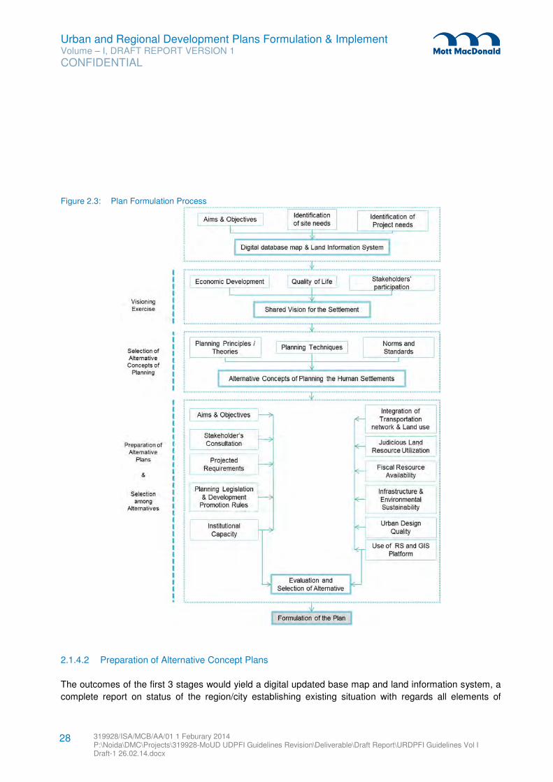
Urban and Regional Development Plans Formulation & Implement Volume – I, DRAFT REPORT VERSION 1
CONFIDENTIAL
319928/ISA/MCB/AA/01 1 Feburary 2014 P:\Noida\DMC\Projects\319928-MoUD UDPFI Guidelines Revision\Deliverable\Draft Report\URDPFI Guidelines Vol I Draft-1 26.02.14.docx
28
Figure 2.3: Plan Formulation Process
2.1.4.2 Preparation of Alternative Concept Plans
The outcomes of the first 3 stages would yield a digital updated base map and land information system, a
complete report on status of the region/city establishing existing situation with regards all elements of
Urban and Regional Development Plans Formulation & Implement Volume – I, DRAFT REPORT VERSION 1
CONFIDENTIAL
319928/ISA/MCB/AA/01 1 Feburary 2014 P:\Noida\DMC\Projects\319928-MoUD UDPFI Guidelines Revision\Deliverable\Draft Report\URDPFI Guidelines Vol I Draft-1 26.02.14.docx
29
development, identification of areas of concern, a shared vision and development goals and objectives.
This shall form the input for formulation of the Plan. The planning horizon for the planning period shall be
identified and the components shall include: � Estimation of land requirement for different uses
� Environmental land suitability analysis
� Delineation of developable area based on environmental land suitability and growth trend
� Preparation of a general activity structure and
� Preparation of a conceptual land use plan as per the required scale
As projections are estimations of an envisioned pattern, deviation from the projection are always possible
and hence projected figures shall not be always be treated as absolute. Here it is required by planners to
build alternative scenarios and situations which may highlight the extremities as pessimistic or optimistic.
The following key remarks to be focused while formulating the plan:
a. Land being limited but a very important natural resource in planning and must be utilized vigilantly.
Great care shall be taken regarding inter-relations of various activities and land uses with each other.
Land uses only then must be planned most solicitously. New concepts like compact cities, mixed land
use etc. can also be explored.
b. Deteriorating traffic conditions due to faster increasing travel demand in cities have impact not only on
environment but also on economy by wastage of man-hours. Thus, to reduce the trip generation in the
cities land use and transport integration shall be made at the initial stage by incorporating TOD and
mixed land use concepts.
c. As a part of the plan implementation, a study regarding quality and quantity manpower shall be done
and suggestions to be made concerning human resources requirement for effective implementation of
all the aspects of the plan.
d. To prepare and implement all the aspects of the plan for the whole plan period requires steady flow of
finance. Otherwise the optimum outcome of the plans cannot be realized. Thus, it is imperative to plan
and map out all the finance sources in the beginning of planning process so that appropriate plan
proposals and milestones to be targeted get maximum results. It should not only include finance for
plan implementation but also for plan preparation. At this stage only, revenue generation capacity of
plan itself should also be defined with measurable milestone against which plan can be later reviewed.
e. Other parameters, based on which plan is prepared and projected for plan period shall be provided
with distinct measurable milestone against which plan must be intermittently reviewed at interval of 5
years and finally evaluated at the termination stage. This will work as input for next planning process
from the previous plan period.
f. Remote sensing and GIS technologies should be used to speed up the plan formulation process.
Large amount of spatial and attribute data can be processed through these platforms and alternate
concepts of planning human settlements can be prepared in shorter time span. The data available
with the NRSC and NUIS can be utilised for the plan preparation.
g. Other elements like planning legislation, development promotion rules and urban design quality shall
also be incorporated in the evaluation and selection process of a preferred alternative, which will be
further detailed as the proposed plan for the settlement.
Urban and Regional Development Plans Formulation & Implement Volume – I, DRAFT REPORT VERSION 1
CONFIDENTIAL
319928/ISA/MCB/AA/01 1 Feburary 2014 P:\Noida\DMC\Projects\319928-MoUD UDPFI Guidelines Revision\Deliverable\Draft Report\URDPFI Guidelines Vol I Draft-1 26.02.14.docx
30
2.1.4.3 Selection among Alternatives
The next level of plan formulation requires evaluation of all the alternatives to reach one selected
alternative that would be elaborated to prepare plan for the settlement. At this stage, focused group
discussions or selected representative’s discussion can be arranged as appropriate. Usually evaluation of
alternatives result into another newly developed concept which derives the best from all the options.
2.1.5 Inclusive Planning
Inclusive development as perceived by central government in XIth and XIIth five year plans focuses on
broad based improvement in the living standards of all residents of the country. XIth five year plan’s
approach was “Faster and more inclusive growth” while XIIth five year plan called for “Faster, more
inclusive and sustainable growth”.
Inclusive planning means infusion of varying aspects, which lead to growth of whole society into
development process, such as integrated trunk infrastructure, sustainable development, poverty elevation,
decentralised decision making with special emphasis on women, elderly and disabled friendly
infrastructure and financial planning. These facets of development were not traditionally recognised
distinctly. Thus, for overall development of residents of human settlements in India, inclusivity in planning
must be fundamental feature.
Inclusive development in planning should have focus on the following parameters; other such features to
promote inclusivity in development process can be identified based on the needs and requirements of
settlements and time12
:
� Inclusive governance: entire system must function in a manner which is seen to be fair and inclusive.
� Inclusive Sustainable development: Development is a qualitative indicator rather than quantitative.
Development of human settlements shall not be unidirectional causing environmental degradation in
the process. To direct growth on sustainable manner Environmental Impact Assessment should be
essential part of development plans and projects.
� Inclusive access to healthcare and education.
� For inclusive employment and regionally balanced growth, M&SME should be promoted.
� Developing capacities of Infrastructure: Infrastructure plays an important role in growth and
development of cities. It also promotes inclusivity in the society by means of easy access to services.
� Agriculture has been identified as very important for promoting inclusivity. Various central Acts, Policies
and Guidelines give provisions that agriculturally fertile/multi cropped land be acquired as last resort.
Same provision can be followed while planning human settlements.
� For inclusive development of society special attention to disadvantaged groups should be paid.
Disabled and old-age friendly infrastructure is integral factor for this.
12 Source: Eleventh Five Year Plan 2007-12 Volume-I; Twelfth Five Year Plan 2012-17 Volume-I
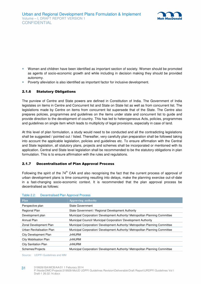
Urban and Regional Development Plans Formulation & Implement Volume – I, DRAFT REPORT VERSION 1
CONFIDENTIAL
319928/ISA/MCB/AA/01 1 Feburary 2014 P:\Noida\DMC\Projects\319928-MoUD UDPFI Guidelines Revision\Deliverable\Draft Report\URDPFI Guidelines Vol I Draft-1 26.02.14.docx
31
� Women and children have been identified as important section of society. Women should be promoted
as agents of socio-economic growth and while including in decision making they should be provided
autonomy.
� Poverty alleviation is also identified as important factor for inclusive development.
2.1.6 Statutory Obligations
The purview of Centre and State powers are defined in Constitution of India. The Government of India
legislates on items in Centre and Concurrent list and State on State list as well as from concurrent list. The
legislations made by Centre on items from concurrent list supersede that of the State. The Centre also
prepares policies, programmes and guidelines on the items under state and concurrent list to guide and
provide direction to the development of country. This has led to heterogeneous Acts, policies, programmes
and guidelines on single item which leads to multiplicity of legal provisions, especially in case of land.
At this level of plan formulation, a study would need to be conducted and all the contradicting legislations
shall be suggested / pointed out / listed. Thereafter, very carefully plan preparation shall be followed taking
into account the applicable legislation, policies and guidelines etc. To ensure affirmation with the Central
and State legislation, all statutory plans, projects and schemes shall be incorporated or mentioned with its
application. Central and State level legislation shall be recommended to be the statutory obligations in plan
formulation. This is to ensure affirmation with the rules and regulations.
2.1.7 Decentralisation of Plan Approval Process
Following the spirit of the 74th CAA and also recognising the fact that the current process of approval of
urban development plans is time consuming resulting into delays, make the planning exercise out-of-date
in a fast-changing socio-economic context. It is recommended that the plan approval process be
decentralised as follows:
Table 2.2: Decentralised Plan Approval Process
Plan Approving authority
Perspective plan State Government
Regional Plan State Government / Regional Development Authority
Development plan Municipal Corporation/ Development Authority/ Metropolitan Planning Committee
Annual Plan Municipal Council/ Municipal Corporation/ Development Authority
Zonal Development Plan Municipal Corporation/ Development Authority/ Metropolitan Planning Committee
Urban Revitalisation Plan Municipal Corporation/ Development Authority/ Metropolitan Planning Committee
City Development Plan JnNURM
City Mobilisation Plan JnNURM
City Sanitation Plan JnNURM
Schemes/Projects Municipal Corporation/ Development Authority/ Metropolitan Planning Committee
Source: UDPFI Guidelines and MM
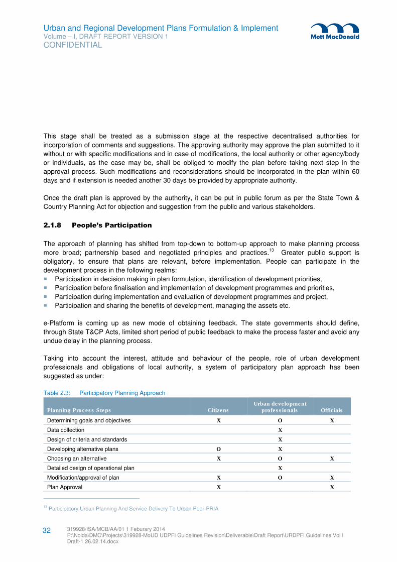
Urban and Regional Development Plans Formulation & Implement Volume – I, DRAFT REPORT VERSION 1
CONFIDENTIAL
319928/ISA/MCB/AA/01 1 Feburary 2014 P:\Noida\DMC\Projects\319928-MoUD UDPFI Guidelines Revision\Deliverable\Draft Report\URDPFI Guidelines Vol I Draft-1 26.02.14.docx
32
This stage shall be treated as a submission stage at the respective decentralised authorities for
incorporation of comments and suggestions. The approving authority may approve the plan submitted to it
without or with specific modifications and in case of modifications, the local authority or other agency/body
or individuals, as the case may be, shall be obliged to modify the plan before taking next step in the
approval process. Such modifications and reconsiderations should be incorporated in the plan within 60
days and if extension is needed another 30 days be provided by appropriate authority.
Once the draft plan is approved by the authority, it can be put in public forum as per the State Town &
Country Planning Act for objection and suggestion from the public and various stakeholders.
2.1.8 People’s Participation
The approach of planning has shifted from top-down to bottom-up approach to make planning process
more broad; partnership based and negotiated principles and practices.13
Greater public support is
obligatory, to ensure that plans are relevant, before implementation. People can participate in the
development process in the following realms:
� Participation in decision making in plan formulation, identification of development priorities,
� Participation before finalisation and implementation of development programmes and priorities,
� Participation during implementation and evaluation of development programmes and project,
� Participation and sharing the benefits of development, managing the assets etc.
e-Platform is coming up as new mode of obtaining feedback. The state governments should define,
through State T&CP Acts, limited short period of public feedback to make the process faster and avoid any
undue delay in the planning process.
Taking into account the interest, attitude and behaviour of the people, role of urban development
professionals and obligations of local authority, a system of participatory plan approach has been
suggested as under:
Table 2.3: Participatory Planning Approach
Planning Process Steps Citizens Urban development
professionals Officials
Determining goals and objectives X O X
Data collection X
Design of criteria and standards X
Developing alternative plans O X
Choosing an alternative X O X
Detailed design of operational plan X
Modification/approval of plan X O X
Plan Approval X X
13 Participatory Urban Planning And Service Delivery To Urban Poor-PRIA
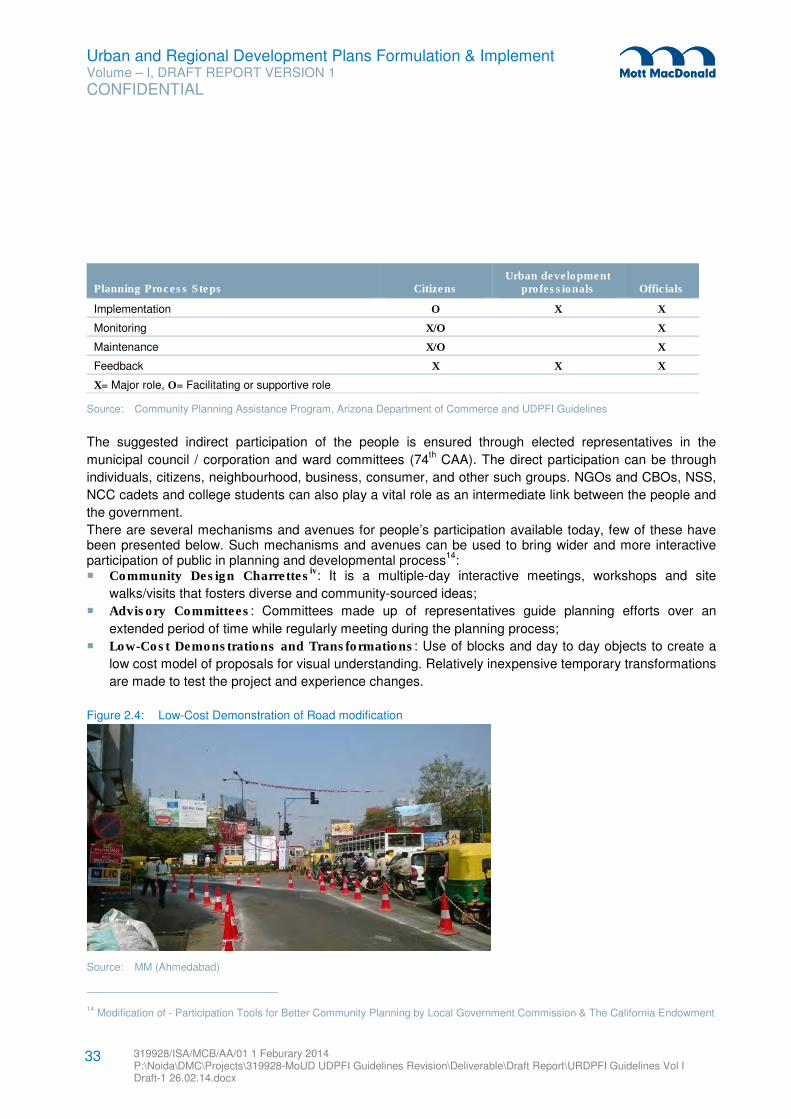
Urban and Regional Development Plans Formulation & Implement Volume – I, DRAFT REPORT VERSION 1
CONFIDENTIAL
319928/ISA/MCB/AA/01 1 Feburary 2014 P:\Noida\DMC\Projects\319928-MoUD UDPFI Guidelines Revision\Deliverable\Draft Report\URDPFI Guidelines Vol I Draft-1 26.02.14.docx
33
Planning Process Steps Citizens Urban development
professionals Officials
Implementation O X X
Monitoring X/O X
Maintenance X/O X
Feedback X X X
X= Major role, O= Facilitating or supportive role
Source: Community Planning Assistance Program, Arizona Department of Commerce and UDPFI Guidelines
The suggested indirect participation of the people is ensured through elected representatives in the
municipal council / corporation and ward committees (74th CAA). The direct participation can be through
individuals, citizens, neighbourhood, business, consumer, and other such groups. NGOs and CBOs, NSS,
NCC cadets and college students can also play a vital role as an intermediate link between the people and
the government.
There are several mechanisms and avenues for people’s participation available today, few of these have been presented below. Such mechanisms and avenues can be used to bring wider and more interactive participation of public in planning and developmental process
14:
� Community Design Charrettesiv: It is a multiple-day interactive meetings, workshops and site
walks/visits that fosters diverse and community-sourced ideas;
� Advisory Committees: Committees made up of representatives guide planning efforts over an
extended period of time while regularly meeting during the planning process;
� Low-Cost Demonstrations and Transformations: Use of blocks and day to day objects to create a
low cost model of proposals for visual understanding. Relatively inexpensive temporary transformations
are made to test the project and experience changes.
Figure 2.4: Low-Cost Demonstration of Road modification
Source: MM (Ahmedabad)
14 Modification of - Participation Tools for Better Community Planning by Local Government Commission & The California Endowment
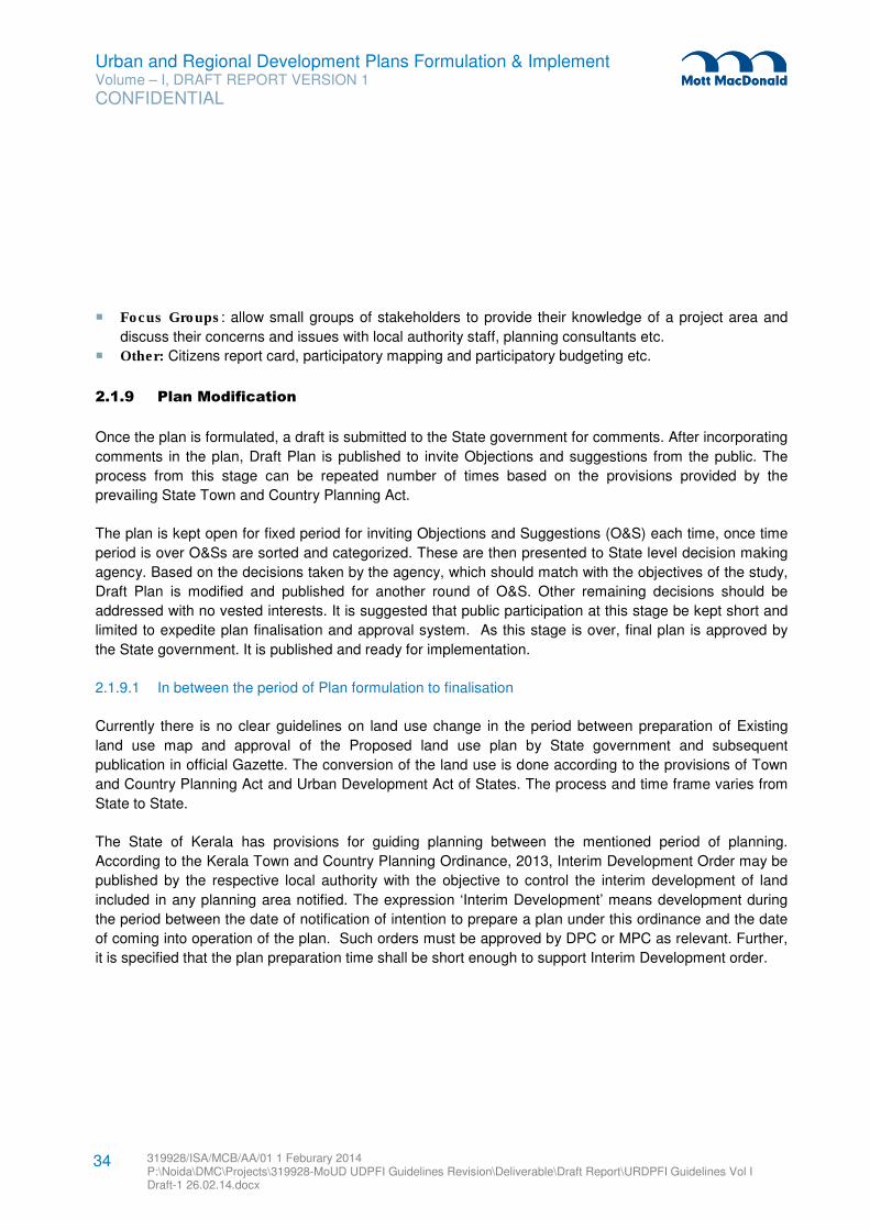
Urban and Regional Development Plans Formulation & Implement Volume – I, DRAFT REPORT VERSION 1
CONFIDENTIAL
319928/ISA/MCB/AA/01 1 Feburary 2014 P:\Noida\DMC\Projects\319928-MoUD UDPFI Guidelines Revision\Deliverable\Draft Report\URDPFI Guidelines Vol I Draft-1 26.02.14.docx
34
� Focus Groups: allow small groups of stakeholders to provide their knowledge of a project area and
discuss their concerns and issues with local authority staff, planning consultants etc.
� Other: Citizens report card, participatory mapping and participatory budgeting etc.
2.1.9 Plan Modification
Once the plan is formulated, a draft is submitted to the State government for comments. After incorporating
comments in the plan, Draft Plan is published to invite Objections and suggestions from the public. The
process from this stage can be repeated number of times based on the provisions provided by the
prevailing State Town and Country Planning Act.
The plan is kept open for fixed period for inviting Objections and Suggestions (O&S) each time, once time
period is over O&Ss are sorted and categorized. These are then presented to State level decision making
agency. Based on the decisions taken by the agency, which should match with the objectives of the study,
Draft Plan is modified and published for another round of O&S. Other remaining decisions should be
addressed with no vested interests. It is suggested that public participation at this stage be kept short and
limited to expedite plan finalisation and approval system. As this stage is over, final plan is approved by
the State government. It is published and ready for implementation.
2.1.9.1 In between the period of Plan formulation to finalisation
Currently there is no clear guidelines on land use change in the period between preparation of Existing
land use map and approval of the Proposed land use plan by State government and subsequent
publication in official Gazette. The conversion of the land use is done according to the provisions of Town
and Country Planning Act and Urban Development Act of States. The process and time frame varies from
State to State.
The State of Kerala has provisions for guiding planning between the mentioned period of planning.
According to the Kerala Town and Country Planning Ordinance, 2013, Interim Development Order may be
published by the respective local authority with the objective to control the interim development of land
included in any planning area notified. The expression ‘Interim Development’ means development during
the period between the date of notification of intention to prepare a plan under this ordinance and the date
of coming into operation of the plan. Such orders must be approved by DPC or MPC as relevant. Further,
it is specified that the plan preparation time shall be short enough to support Interim Development order.
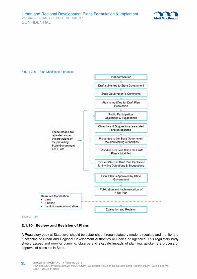
Urban and Regional Development Plans Formulation & Implement Volume – I, DRAFT REPORT VERSION 1
CONFIDENTIAL
319928/ISA/MCB/AA/01 1 Feburary 2014 P:\Noida\DMC\Projects\319928-MoUD UDPFI Guidelines Revision\Deliverable\Draft Report\URDPFI Guidelines Vol I Draft-1 26.02.14.docx
35
Figure 2.5: Plan Modification process
Source: MM
2.1.10 Review and Revision of Plans
A Regulatory body at State level should be established through statutory mode to regulate and monitor the
functioning of Urban and Regional Development Authorities or Bodies or Agencies. This regulatory body
should assess and monitor planning, observe and evaluate impacts of planning, quicken the process of
approval of plans etc in State.
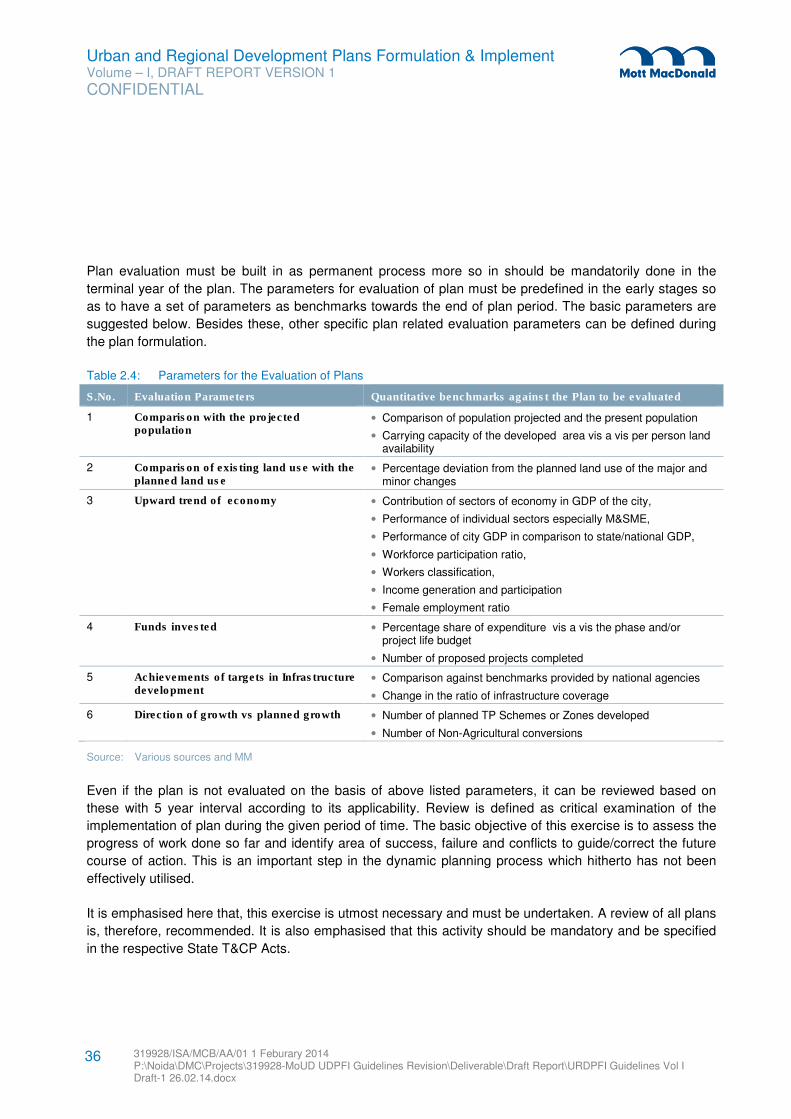
Urban and Regional Development Plans Formulation & Implement Volume – I, DRAFT REPORT VERSION 1
CONFIDENTIAL
319928/ISA/MCB/AA/01 1 Feburary 2014 P:\Noida\DMC\Projects\319928-MoUD UDPFI Guidelines Revision\Deliverable\Draft Report\URDPFI Guidelines Vol I Draft-1 26.02.14.docx
36
Plan evaluation must be built in as permanent process more so in should be mandatorily done in the
terminal year of the plan. The parameters for evaluation of plan must be predefined in the early stages so
as to have a set of parameters as benchmarks towards the end of plan period. The basic parameters are
suggested below. Besides these, other specific plan related evaluation parameters can be defined during
the plan formulation.
Table 2.4: Parameters for the Evaluation of Plans
S.No. Evaluation Parameters Quantitative benchmarks against the Plan to be evaluated
1 Comparison with the projected population
• Comparison of population projected and the present population
• Carrying capacity of the developed area vis a vis per person land availability
2 Comparison of existing land use with the planned land use
• Percentage deviation from the planned land use of the major and minor changes
3 Upward trend of economy • Contribution of sectors of economy in GDP of the city,
• Performance of individual sectors especially M&SME,
• Performance of city GDP in comparison to state/national GDP,
• Workforce participation ratio,
• Workers classification,
• Income generation and participation
• Female employment ratio
4 Funds invested • Percentage share of expenditure vis a vis the phase and/or project life budget
• Number of proposed projects completed
5 Achievements of targets in Infrastructure development
• Comparison against benchmarks provided by national agencies
• Change in the ratio of infrastructure coverage
6 Direction of growth vs planned growth • Number of planned TP Schemes or Zones developed
• Number of Non-Agricultural conversions
Source: Various sources and MM
Even if the plan is not evaluated on the basis of above listed parameters, it can be reviewed based on
these with 5 year interval according to its applicability. Review is defined as critical examination of the
implementation of plan during the given period of time. The basic objective of this exercise is to assess the
progress of work done so far and identify area of success, failure and conflicts to guide/correct the future
course of action. This is an important step in the dynamic planning process which hitherto has not been
effectively utilised.
It is emphasised here that, this exercise is utmost necessary and must be undertaken. A review of all plans
is, therefore, recommended. It is also emphasised that this activity should be mandatory and be specified
in the respective State T&CP Acts.
Urban and Regional Development Plans Formulation & Implement Volume – I, DRAFT REPORT VERSION 1
CONFIDENTIAL
319928/ISA/MCB/AA/01 1 Feburary 2014 P:\Noida\DMC\Projects\319928-MoUD UDPFI Guidelines Revision\Deliverable\Draft Report\URDPFI Guidelines Vol I Draft-1 26.02.14.docx
37
The review of the plan depending upon the results (positive, indicating satisfactory implementation or
negative showing faults of varying degrees) generates various possibilities of further action. The following
sections provide more details of various stages of this process.
Revision and monitoring of plans:
� Perspective plan: The plan is to be formed for its planned duration of 20-30 years. The perspective
plan will be reviewed based on the success of the development plan as a whole, indicating success or
failures in the application of the perspective plan. No revision is required at this planning level.
In order to introduce dynamism and efficiency, it is suggested that a fresh perspective plan for 20-30
years be prepared after incorporating results of the review and the future projected requirements. It
should be followed by usual approval process.
� Regional Plan & Development plan: These plans can be in phases of 5 years when they should be
revised so as to coincide with the State Fiver plans and State Finance Commissions’
recommendations. The development plan prepared can be in the phases of 5 years. The targets set for
each phase can be assessed against the achievements at the end of each phase. Hence we
monitoring of the development plan is in every five years.
Taking into account the results of the review exercise and the future requirements for the next
subsequent plan period of 20-30 years a subsequent plan should be prepared and further action be
taken for its approval.
The total time taken in revision, preparation and approval of the new development plan should not
exceed 2 years.
� Local Area Plan & Special Purpose Plan:
– City Mobility Plan: It should be prepared in 1 year with planning period of more than twenty years.
This plan should be revised and updated in every five years.15
– City Sanitation Plan: The CSP is a vision document on sanitation with twenty to twenty-five years
horizon with short term town level action plans for 3-5 years to achieve sanitation goals.16
The plan
shall be reviewed along with Development Plan.
– Slum Redevelopment Plan: This plan should be prepared for ten to fifteen years.17
It should be
reviewed intermediate with Development Plan.
� Annual plan: No revision is required for annual plan. The plan is to be formed for its planned duration.
The annual plan monitoring to be included in the next annual plan preparation.
Performance of the projects/schemes implemented by the local authority, as contained in the annual
plan of the previous year, shall be reviewed in terms of achievements of the physical and fiscal targets.
This would ensure a continuous monitoring and review of actions taken by local authority.
15 Comprehensive Mobility Plans: Preparation Toolkit; Guidelines and Toolkits for Urban Transport development in Medium Sized
Cities in India
16 Manual on Preparing CSP
17 Rajiv Awas Yojana Guidelines
Urban and Regional Development Plans Formulation & Implement Volume – I, DRAFT REPORT VERSION 1
CONFIDENTIAL
319928/ISA/MCB/AA/01 1 Feburary 2014 P:\Noida\DMC\Projects\319928-MoUD UDPFI Guidelines Revision\Deliverable\Draft Report\URDPFI Guidelines Vol I Draft-1 26.02.14.docx
38
Results of the review should provide input for perpetration of next annual plan. The monitoring of the
plans/schemes should be regular so that time taken in review and formulation of annual plan is
minimised.
Since each year the annual plan gas to be sent to the State Urban and Regional Planning Board and
Metropolitan Planning Committee or District Planning Committee, as the case may be, the time frame
for review and annual plan formulation should be suitably adjusted, depending upon the directives from
these bodies.
� Projects / Schemes: Making the plan dynamic. Projects and schemes can be suggested to be
reviewed on annual basis to assess its progress and hindrances before the allotment of the funding in
Annual Plan.
2.2 Contents of Plans
The Final Plan approved, contains a report, supporting diagrams, annexures and maps to describe the
plan, its methodology, its aims and objectives and approach to achieve desired results to the public. The
plan formulation process of final approved plan is reflected in report. The following sections of the chapter
provide contents and other minimum relevant particulars of report of different plans.
2.2.1 Contents of Perspective Plan
Urban and Regional Development should be guided by two sets of policies; Vision policy and Operating
policy. Vision policy at the State level should aim at providing guidelines for use of land for urban and
regional development, environment protection and interface between rural and urban settlements. Such a
vision policy may be in the form of preparation of Strategy Plan (population strategy, urban and regional
development strategy. Categorization of all available land at the state level in to specific zones in the
context of urban development may be useful exercise for meaningful preparation and implementation of
development plans.
This part provides the contents of the written report supported by necessary maps, charts and diagrams
constituting integral part of the perspective plan. It provides major heads and sub heads to serve as a
guide for presenting results of various surveys, their analyses and projections and enunciating policies,
strategies and programmes of spatio-economic development of an urban centre.
It is highlighted here that the Perspective plan is a policy document and, therefore, the effort should be to
identify policies and programmes for socio-economic development and their implications in setting a trend
of spatial development of different components of the region/city. Elaborate and comprehensive details
should, therefore be avoided which will form part of development plans to be formulated subsequently.
Perspective plan should generally contain the following major heads:
Urban and Regional Development Plans Formulation & Implement Volume – I, DRAFT REPORT VERSION 1
CONFIDENTIAL
319928/ISA/MCB/AA/01 1 Feburary 2014 P:\Noida\DMC\Projects\319928-MoUD UDPFI Guidelines Revision\Deliverable\Draft Report\URDPFI Guidelines Vol I Draft-1 26.02.14.docx
39
1. Existing characteristics and potentials of the town which when synthesised would form the basis
for identification of the policy issues;
2. Projected requirements and assessments of deficiencies;
3. Based on existing conditions and projected requirements, Development aims and objectives for
the planning area should be prepared; and
4. Policies, strategies, general programmes and policies.
2.2.1.1 Existing Conditions and Developmental Issues
Physical characteristics and natural resources:
� Location, regional setting, urban challenges (urban sprawl, details of peri-urban, sub-urban and
leapfrog phenomenon)
� Climate,
� Existing generalised land use,
� Land use pattern
� Environmentally sensitive areas
� Heritage; sites, buildings and areas.
Demography:
� Existing population, migration and household characteristics
� Floating population
Economic base and employment:
� Formal sector
– Primary:
– Urban agriculture, forestry & fishing
– Mining & quarrying
– Secondary:
– Manufacturing
– Construction
– Gas, water and electricity supply
– Tertiary:
– Trade, Hotels and Restaurants
– Transport, Storage and Communication
– Financial services such as Banking, Insurance etc.
– Real estate and Business services
– Public Administration
– Others services
� Informal sector and urban poverty alleviation, informal trade, commerce, transport, household
industries.
Housing and shelter (both formal and informal)
Urban and Regional Development Plans Formulation & Implement Volume – I, DRAFT REPORT VERSION 1
CONFIDENTIAL
319928/ISA/MCB/AA/01 1 Feburary 2014 P:\Noida\DMC\Projects\319928-MoUD UDPFI Guidelines Revision\Deliverable\Draft Report\URDPFI Guidelines Vol I Draft-1 26.02.14.docx
40
Transportation:
� Mode of transportation - by road, rail, air, water as the as may be.
� Network of roads, railways, waterways and their interrelationship with major activity nodes.
� Transport terminals.
� Transport Corridors
Facilities like:
� Education
� Health care
� Recreational
� Religious
Infrastructure:
� Water
� Energy
� Drainage, sanitation and refuse and solid waste disposal
� Communication
� Police protection, fire protection
� Cremation and graveyards
Identification of disaster risk, both natural and manmade
Resources:
� Fiscal
� Manpower
� Land
Developmental Management:
� Institutional set-up
� Legal support
� Inter-department cooperation
� Integration of development efforts
Major policy issues
� Major policy issues shall be identified, for which solutions or alternatives can be sought in later
stages.
Existing Conditions and Policy Issues
� Delineation and assessment of general characteristics of the city influence region including
settlement hierarchy, functional specialisation and interdependence.
� Issues related to decentralisation of economic activities, if any
� Issues related to renewal of old dilapidated areas
� Issues related to mass transportation and its interface with major activity nodes.
Urban and Regional Development Plans Formulation & Implement Volume – I, DRAFT REPORT VERSION 1
CONFIDENTIAL
319928/ISA/MCB/AA/01 1 Feburary 2014 P:\Noida\DMC\Projects\319928-MoUD UDPFI Guidelines Revision\Deliverable\Draft Report\URDPFI Guidelines Vol I Draft-1 26.02.14.docx
41
2.2.1.2 Projected Requirements
Assessment of the projected requirements should be for the period of 20-30 years and it should further be
classified under periods of 5 years co-terminus with the State Five Year Plan period and State Finance
Commission report. This classification of projected requirement into 5-year terms would help in integrating
the spatial planning and economic planning efforts as developmental funds are allocated through the Five
Year Plans.
The assessment of projected requirements should cover all matters as contained under preceding section,
that is:
1. Extent of local planning area: Based on the projected population and infrastructure thus required,
extant of planning area must be decided.
2. Population (also floating population): Population for the local planning area must be projected
based on past trends. The techniques of population projection have been discussed in chapter 8 of the
Guidelines namely ‘Simplified Planning Techniques’ which can be used for same. While projecting
future population, trends of floating population shall also be studied and future floating population
trends must be amalgamated with projected population.
3. Economic base and employment: Economic base and employment profile of an area shall be
forecasted and its impacts on population must also be anticipated for better planning approach.
Chapter 8 ‘Simplified Planning Techniques’ provides few techniques to project economic base and
employment of an area.
4. Housing and shelter: Based on existing condition of housing and house quality and future population
trends projected, housing need and demand should be projected, especially for vulnerable population
as inclusive development is major thrust area for sustainable and holistic development of the country.
Difference between housing need and demand has been elaborated in ‘Simplified Planning
Techniques’ chapter.
5. Transportation: Projections about trip generation, area of travel and demand for public and private
transportation and its equivalent need for transport infrastructure shall be done. Transport infrastructure
has direct correlation with economy of an area thus a comprehensive study must be done for projecting
transport infrastructure.
6. Facilities: Projections for facilities have direct linkage with population, thus based on future population
facilities must be forecasted for an area. Physical infrastructure chapter of the guidelines has provided
detailed hierarchy of facilities in Social Infrastructure sub sections, which must be referred for facilities’
projection.
7. Infrastructure: Based on the national guidelines for various infrastructure projections shall be made,
which must adhere to such benchmarks as provided by national agencies. Physical infrastructure
chapter provides these benchmarks for the different infrastructures.
8. Resources: A plan cannot be implemented successfully if resource base of an area is neglected.
Chapter on ‘Resource Mobilisation’ details about land, fiscal and man-power resource base of
settlement.
9. Land: Shelter, Commerce and trade, Industries, Public and semi-public facilities, Open spaces, Roads
and streets, Infrastructure.
Urban and Regional Development Plans Formulation & Implement Volume – I, DRAFT REPORT VERSION 1
CONFIDENTIAL
319928/ISA/MCB/AA/01 1 Feburary 2014 P:\Noida\DMC\Projects\319928-MoUD UDPFI Guidelines Revision\Deliverable\Draft Report\URDPFI Guidelines Vol I Draft-1 26.02.14.docx
42
10. Special activities: If any activity, like tourism or pilgrimage is present in an area, which results in
increase of floating population and demand for facilities and infrastructure shall be taken into account
and projected accordingly.
11. Projected Requirements: As a basic principle the projected population and economic activities in
case of large cities should be function of environment and infrastructural sustainability of the city.
Through policy initiatives the unsustainable activity project should be diverted to the other settlements
in the city region where it would be sustainable and the relevant projected figures for the city should be
adjusted accordingly.
2.2.1.3 Development Aims & Objectives
Developmental aims and objectives pertaining to each of the major policy issues identified under existing
conditions and development issues taking into account the future requirements identified under projected
requirements must be decided.
2.2.1.4 Policies and Priorities
Taking existing conditions, projected requirements, major policy issues and aims and objectives into
account, the policies and priorities shall be regarding:
1. Development of economic base and employment generation covering:
� Formal sector;
� Informal sector; and
� Special sectors like tourism and pilgrimage
2. Infrastructure development covering:
� Utilities like water supply, electricity, sewerage, drainage; refuse collection and disposal;
� Facilities pertaining to education, health, recreation, disaster rescue cell;
� Services like communication (postal and telephone), protection (policies, fire) and others.
3. Housing and shelter development
4. Transportation
5. Environmental protection
6. Spatial development covering:
� Proposed generalised land use indicating direction, growth of the settlement and its components
like residential, commercial, industrial areas, open spaces;
� Network of roads;
� Major activity node;
� Conservation of environmentally sensitive areas, historic sites and monuments and tourism;
� Phasing of spatial development.
7. Implementation and monitoring
� Priorities and
� Monitoring mechanism
8. Capacity building for
� Fiscal
� Manpower and
Urban and Regional Development Plans Formulation & Implement Volume – I, DRAFT REPORT VERSION 1
CONFIDENTIAL
319928/ISA/MCB/AA/01 1 Feburary 2014 P:\Noida\DMC\Projects\319928-MoUD UDPFI Guidelines Revision\Deliverable\Draft Report\URDPFI Guidelines Vol I Draft-1 26.02.14.docx
43
� Land resources mobilisation
9. Disaster Management: All amenities and facilities in the perspective plan created shall be an integral
part of the Disaster Mitigation.
10. Economic activities in the context of the city region including dispersal of activities, if any.
11. Informal residential areas/slums and unauthorised colonies.
12. Intra-city mass transportation system and its interface with land use pattern and location of
major activities nodes.
2.2.2 Contents of Regional Plan
Regional plan is to be prepared for the area identified as formal or functional region. A state will have to
prepare regional plan for a region which could be inter-district or intra-district based on the criteria for
selection and functionality of area. If region so identified is interstate, all such states will have to prepare
regional plans for their respective areas.
1. Introduction
� About the region,
� Constituted areas: Region, Sub-region, Functional areas
� Region Morphology
2. Regional Resources
� Physical setting, Geology, Topography, Hydrology and Ground water
� Demography Region and Sub-region wise: Population distribution, density, age-sex composition,
literacy and migration, growth of population, population projection.
� Settlement pattern: Urban and Rural settlement, hierarchy of settlements, proposed hierarchy of
settlements,
� Infrastructure resources:
– Physical:
– Power- existing availability and demand, transmission and distribution losses, load
management, future demand, sectoral plans for power;
– Water- existing demand and supply, ground water level, dependence on ground water;
– Sewerage- existing generation, Sewerage treatment plants;
– SWM- Current generation, SW treatment plant, Disposal sites, Area of such sites, number
of vehicles used to transport municipal waste,
– Drainage- length of drainage network,
– Irrigation,
– Social:
– Education
– Health
– Socio-cultural
– Police
– Fire
� Transport:
– Transport network- road, rail
Urban and Regional Development Plans Formulation & Implement Volume – I, DRAFT REPORT VERSION 1
CONFIDENTIAL
319928/ISA/MCB/AA/01 1 Feburary 2014 P:\Noida\DMC\Projects\319928-MoUD UDPFI Guidelines Revision\Deliverable\Draft Report\URDPFI Guidelines Vol I Draft-1 26.02.14.docx
44
– Traffic volume
– Pattern of movement,
– Transport corridors
� Heritage & tourism
– Natural heritage
– Man-made heritage
� Rural settlement system
� Economic activity and fiscal policy: Economy’s sectors, Distribution of workforce, workforce
participation ratio, occupational structure, economic nodes?
� Housing and Shelter
3. Environment & sustainability
� Agro-climatic zone
� Hydrology- surface and ground water situation in region
� Geology & Geomorphology
� Green & Forest cover
� Hazard prone zones/eco sensitive zones-vulnerability and risk assessment of the region.
� Pollution: water, soil, land, air
4. Regional policy & Development strategy
� Policy Zones
� Growth poles & Satellite townships: strategy of development of settlement system
� Development corridors
� Economic activity and fiscal policy (tax policy)
5. Regional land use
� Land use analysis: built-up, agriculture, forest, waste lands, water bodies, others; land use change
analysis,
� Priority towns
� Counter magnet areas
6. Disaster Management Plan:
� Earthquake, floods/flash floods, high winds, cyclone, fire, land slide, tsunami
7. Implementation strategies and Management structure
8. New and Modified Policies
� Rationalization of Floor Area Ratio (FAR) for Villages
� Eco-Zone II Policy
� Growth Centres/Hubs
� Satellite Townships
� Micro-Industrial Zones
� Policy on Tribal Settlements
� Disaster Management Sites
� Other Issues that Need New Policies
Urban and Regional Development Plans Formulation & Implement Volume – I, DRAFT REPORT VERSION 1
CONFIDENTIAL
319928/ISA/MCB/AA/01 1 Feburary 2014 P:\Noida\DMC\Projects\319928-MoUD UDPFI Guidelines Revision\Deliverable\Draft Report\URDPFI Guidelines Vol I Draft-1 26.02.14.docx
45
2.2.3 Contents of Development Plan
This part provides contents of development plan document which incorporates the written document as
well as the map showing the development plan and other supporting charts and diagrams. It provides
major heads and sub-heads to serve as a guide for formulation of development plan of an urban centre.
With the view of saving time and also developing a participatory system of spatio-economic planning,
necessary information from secondary sources be utilised, as far as practical, and primary surveys should
be conducted only when it is unavoidable. Conceived within the framework of the perspective plan, a
developmental plan is to be prepared for a period of twenty to thirty years.
A development plan shall contain the following major heads:
1. Existing Conditions and Development Issues;
2. Projected Requirements and assessment of deficiencies;
3. Development Aims & Objectives;
4. Development Proposals;
5. Resource mobilisation;
6. Implementation;
7. Monitoring & Review.
The details of each of the major sub-heads of developmental plan are given in the following sections.
2.2.3.1 Existing Conditions and Development Issues
1. Physical characteristics and natural resources:
� Location, regional setting, brief history of development of the town;
� City influence and its characteristics including settlement pattern, rural-urban relationship and
fringe area developments
� Issues related to decentralisation of activities
� Climate;
� Topography;
� Soil: soil profile and condition;
� Sub-surface geology and aquifer system;
� Environmentally and ecologically sensitive areas; water bodies, air, water, noise, soil pollution
� Heritage; sites, buildings and areas;
� Existing generalised land use;
� Developable and non-developable area.
� Land use, zoning and built floor space, existing zoning and development within zoned area,
existing land use, existing land use pattern, built floor space, floor space permitted
2. Demography: Existing population, age-sex composition, sex ratio, literacy, working population, growth
rate, natural growth rate, migration, floating population, population density, and household
characteristics-household density and size
Urban and Regional Development Plans Formulation & Implement Volume – I, DRAFT REPORT VERSION 1
CONFIDENTIAL
319928/ISA/MCB/AA/01 1 Feburary 2014 P:\Noida\DMC\Projects\319928-MoUD UDPFI Guidelines Revision\Deliverable\Draft Report\URDPFI Guidelines Vol I Draft-1 26.02.14.docx
46
3. Economic base and employment:
� Formal sector
– Primary:
– Urban agriculture, forestry & fishing
– Mining & quarrying
– Secondary:
– Manufacturing
– Construction
– Gas, water and electricity supply
– Tertiary:
– Trade, Hotels and Restaurants
– Transport, Storage and Communication
– Financial services such as Banking, Insurance etc.
– Real estate and Business services
– Public Administration
– Others services.
– Informal sector and urban poverty alleviation, informal trade, commerce, transport, household
industries.
– Work force
– Occupational pattern
– Employment generation / Major work areas
– Whole sale / retail trade
4. Housing and shelter (both formal and informal):
� housing scenario, housing stock, housing supply mechanism, housing need assessment, slums,
squatter and illegal housing identification,
5. Transportation:
� Mode of transportation - by road, rail, air, water as the as may be.
� Network of roads, railways, waterways and their interrelationship with major activity nodes.
� Transport terminals.
� Trans-intra city transportation facility
� Pedestrian and bicycle
� Goods movement system
� Transportation land use integration
� Parking
� Signage and way findings
6. Facilities like:
� Education: schools, technical institutes, universities,
� Health care: Dispensary, health centres, hospitals
� Recreational
� Religious
� Socio-cultural
� Parks and open spaces
7. Infrastructure: (benchmarks)
Urban and Regional Development Plans Formulation & Implement Volume – I, DRAFT REPORT VERSION 1
CONFIDENTIAL
319928/ISA/MCB/AA/01 1 Feburary 2014 P:\Noida\DMC\Projects\319928-MoUD UDPFI Guidelines Revision\Deliverable\Draft Report\URDPFI Guidelines Vol I Draft-1 26.02.14.docx
47
� Water supply: network, existing demand and supply scenario, water transmission, reservoirs and
distribution
� Energy: existing demand and supply scenario, transmission and distribution network
� Drainage, sanitation and refuse and solid waste disposal: existing demand and supply scenario,
generation and collection system, transportation, treatment and disposal of waste
� Communication
� Police protection, fire protection
� Cremation and graveyards
� Disaster management centre
8. Gap analysis:
� Based on the existing conditions and the projected requirements of the planning area, a gap
analysis is suggested to be done and issues be identified.
9. Identification of disaster risk, both natural and manmade
10. Resources:
� Fiscal: Sources of revenue, streams of expenditure – existing, required
� Manpower: departments workforce - existing, required
� Land:
11. Developmental Management:
� Institutional set-up
� Legal support
� Inter-department cooperation
� Integration of development efforts
12. Major policy issues
13. Maps & Plans:
� Existing land use / utilisation plan
� Historical city growth map
� Infrastructure maps
� Environmental sensitive zones map
� Disaster maps
2.2.3.2 Projected Requirements
Assessment of projected requirements should be for a period of twenty to thirty years and it should further
be classified under periods of 5 year in lieu with State five year plans and State Finance Commission
reports. This classification of projected requirement would help in preparation of annual plans and budget.
1. Population:
� Proposed population, (the population projected should be guided by environmental and
infrastructure [especially drinking water] sustainability and holding capacity of the city. Dispersal of
economic activity also guide population projection)
� Floating population, age sex composition, literates.
2. Economic base and employment:
� Hierarchy of commercial areas, dispersal of commercial activity and related activities.

Urban and Regional Development Plans Formulation & Implement Volume – I, DRAFT REPORT VERSION 1
CONFIDENTIAL
319928/ISA/MCB/AA/01 1 Feburary 2014 P:\Noida\DMC\Projects\319928-MoUD UDPFI Guidelines Revision\Deliverable\Draft Report\URDPFI Guidelines Vol I Draft-1 26.02.14.docx
48
� Dispersal of industries or restriction of specific type of industries considering pollution level,
environmental sustainability.
� Urban poverty and its alleviation.
� Work force, employment in different sectors of economy
� Proposed hierarchy of trade and commerce area.
3. Housing and shelter:
� Informal sector housing, slum up-gradation and resettlement strategy,
� Housing need and requirement, parking
4. Transportation:
� Mass transportation system and its integration with activity nodes/facility centres and land use
pattern
� Airport, seaport (as the case may be)
� Travel demand forecast, Road length, hierarchy of roads, transport terminals,
5. Facilities:
� Education: schools, technical institutes, universities;
� Health care: Dispensary, health centres, hospitals;
� Recreational;
� Religious;
� Socio-cultural; Parks and open spaces;
6. Public facilities:
� Cultural facilities- museum, cultural centres;
� Specialised hospitals and specialised education and research centres,
7. Open spaces: protection of encroachment and misuse of open spaces,
8. Infrastructure:
� Water: projected water demand, water treatment plant,
9. Land use requirement for (DCRs)
� Residential areas
– Primary residential
– Mixed residential
– Unplanned / informal residential
� Commercial areas
– Retail shopping
– General business and commercial district / centres
– Wholesale, godowns, warehousing /regulated markets
� Manufacturing area
– Service and light industry
– Extensive and heavy industry
– Special industrial, hazardous, noxious and chemical
� Public and semi-public
– Government / Semi Government / Public Offices
– Government land (use undetermined)
– Educational and research
– Medical and health
Urban and Regional Development Plans Formulation & Implement Volume – I, DRAFT REPORT VERSION 1
CONFIDENTIAL
319928/ISA/MCB/AA/01 1 Feburary 2014 P:\Noida\DMC\Projects\319928-MoUD UDPFI Guidelines Revision\Deliverable\Draft Report\URDPFI Guidelines Vol I Draft-1 26.02.14.docx
49
– Social, cultural and religious
– Utilities and services
– Cremation and burial grounds
� Parks, Playgrounds and Open Spaces
– Playground / stadium/sports complex
– Parks & gardens - public open spaces
– Special recreational - restricted open spaces
– Multipurpose open space (maidan)
� Transport and Communication
– Roads
– Railways
– Airport
– Seaports and dockyards
– Bus depots / truck terminals and freight complexes, transport terminals
– Transmission and communication
� Special areas
– Old built-up (core) area
– Heritage and conservation areas
– Scenic value areas
– Disaster prone areas / Eco sensitive area
� Agriculture
– Agriculture
– Forest
– Poultry and dairy farming
– Rural settlements
– Brick kiln and extractive areas
� Water-bodies
– Special activities, if any, like tourism or pilgrimage which results in increase of floating
population and demand for facilities and infrastructure. This will particularly be useful for hill
towns and pilgrimage towns.
10. Disaster management plans:
� Earthquake, cyclone, flood, land slide
11. Maps & Plans:
� Proposed land use plan
2.2.3.3 Development Strategies
The plan shall contain aims and objectives of development of the town covering issues identified under
section existing conditions and development issues.
Goals and objectives related to dispersal of activities, environmental and infrastructure sustainability; mass
transportation and informal activities, Information and Communication Technology to be incorporated if not
already included.
Urban and Regional Development Plans Formulation & Implement Volume – I, DRAFT REPORT VERSION 1
CONFIDENTIAL
319928/ISA/MCB/AA/01 1 Feburary 2014 P:\Noida\DMC\Projects\319928-MoUD UDPFI Guidelines Revision\Deliverable\Draft Report\URDPFI Guidelines Vol I Draft-1 26.02.14.docx
50
It can/shall consist of the guiding planning principles for the plan formulation. Like whether the city
development strategy is for Compact city/ green city/ densities/ particular zones of density.
2.2.3.4 Development Proposals
The proposal sub heads are enlisted as:
� Concept of hierarchy of planning units and spatial development of various activity nodes, facility
centres and network of roads
� Commercial activity nodes and corridors
� Industrial activity nodes / Corridors
� Residential
� Open Spaces System
� Higher order facilities and facility centres
� Public and semi-public offices
� Transportation network and transport activity nodes
� Renewal and redevelopment areas
� Proposed land use
� Mass transportation system and land uses interfaces.
2.2.3.5 Resource mobilisation
1. Proposals for fiscal resource mobilisation including:
� Grants
� Aids
� Internal revenue
� Institutional finance
� Market borrowing
� Private sector finance
2. Proposal for land resource mobilisation including:
� Land acquisition
� Land pooling
� Accommodation reservation
� TDR
3. Proposals for manpower resource mobilisation including:
� Technical manpower
2.2.3.6 Implementation
Following inputs from preceding stages and prevailing Statutory Acts a seamless plan implementation
schedule must be prepared for Development Plan. It should contain roles and responsibilities of all
stakeholders, resource mobilisation framework and phase-wise implementation schedule for planned
project activities. The key aspects to be covered in the Implementation framework shall be in lines with
aims, objectives and prioritised projects and schemes. Implementation framework will include the following:
� Priorities of projects and schemes
Urban and Regional Development Plans Formulation & Implement Volume – I, DRAFT REPORT VERSION 1
CONFIDENTIAL
319928/ISA/MCB/AA/01 1 Feburary 2014 P:\Noida\DMC\Projects\319928-MoUD UDPFI Guidelines Revision\Deliverable\Draft Report\URDPFI Guidelines Vol I Draft-1 26.02.14.docx
51
� Phasing of developmental activities
� Identification and placement of projects and schemes
� Investment Strategy and Promotion
� Development promotion rules / regulations
� Stakeholders’ role and responsibility
1. Priorities: Classify various projects identified as a part of development proposals by priority as
under:
� Essentials (top priority)
� Necessary (2nd
priority)
� Acceptable and desirable (3rd
priority)
� Deferrable (4th priority)
2. Phasing: Phase the development in two phases:
� Phase-I: (3 years) up to end of the term of the local authority which formulated the development
plan
� Phase-II: (2 years) up to the end of the plan period and to be implemented by the following or
subsequently elected local authority.
3. Projects / schemes
Projects and Schemes shall be identified by phase and implementing agencies (including private,
cooperative and corporate sectors).
4. Investment Strategy and Promotion
5. Development promotion rules / regulations
To regulate and develop land use as premeditated under the Development Plan, development promotion
rules / regulations should be mentioned in this section.
6. Stakeholders’ role and responsibility
2.2.4 Contents of Local Area Plan
Once the Development plan is prepared, its proposals can be further implemented by preparing local area
plan. Local area plan can be either Zonal Development Plan or Local Area Scheme and these can have
the following contents:
2.2.4.1 Contents of Zonal Development Plan
1. Introduction
� A brief introduction to the city comprising its regional setting, functional character growth trends.
� Development plan / Master Plan context
� Interdependence of Zone on other parts of the city
2. Site Background & Analysis
� Land use distribution and analysis,
� Population and density
� Built-up area, character, extent and delineation
Urban and Regional Development Plans Formulation & Implement Volume – I, DRAFT REPORT VERSION 1
CONFIDENTIAL
319928/ISA/MCB/AA/01 1 Feburary 2014 P:\Noida\DMC\Projects\319928-MoUD UDPFI Guidelines Revision\Deliverable\Draft Report\URDPFI Guidelines Vol I Draft-1 26.02.14.docx
52
� Transportation: Circulation network, traffic flow (people and goods) and terminal facilities.
� Physical and social infrastructure
� Land ownership
� Slope analysis
� Micro zoning hazard mapping
� Green cover: parks/open spaces, forest, orchards, green belts, etc.
� Site potentials and constraints
3. Conceptual Framework
� Planning parameter
� Planning concept & hierarchy till community level
� Projected requirements
� Urban design framework
4. Proposals and development strategy
� Land use plan (map scale 1:2000)
� Proposed circulation system
� Proposals for physical infrastructure
� Proposals for community facilities
� Strategy for new development, redevelopment and improvement
� Proposals for informal sector
� Strategy for rehabilitation/regularization of unauthorized colonies
� Strategy for maintenance of services.
5. Conservation and Improvement of Environment
� Conservation and Improvement of land profile
� Proposals for conservation and improvement of rivers streams, water-sheds.
� Conservation and Improvement of green cover and landscape.
� Conservation of heritage areas/zones.
� Energy-efficient and environmentally sustainable development
� Integration of proposals regarding air water and noise pollution control.
6. Compliance of Government Policies
� State Urban Housing Policy.
� Hi-tech Township and Integrated Township Policy.
� Rainwater Harvesting Policy.
� Energy Policy.
� Disaster Management Policy.
� Industrial and Service Sector Investment Policy.
� Barrier-free Environment for Physically Disabled.
� Information Technology Policy.
� Tourism Policy.
� Other Policies.
7. Zoning Regulations
� Definitions of various use zone premises.
� Use restrictions (uses permitted, specially permitted, conditionally permitted and uses prohibited).
� Proposal for mixed land uses.
Urban and Regional Development Plans Formulation & Implement Volume – I, DRAFT REPORT VERSION 1
CONFIDENTIAL
319928/ISA/MCB/AA/01 1 Feburary 2014 P:\Noida\DMC\Projects\319928-MoUD UDPFI Guidelines Revision\Deliverable\Draft Report\URDPFI Guidelines Vol I Draft-1 26.02.14.docx
53
� Strategy for non-conforming land uses.
8. Development Regulations
� Building bulk Rise Zoning
� Architectural Control, if necessary.
� Development control for heritage and other special areas if any.
9. Resource Mobilization and Implementation
� Institutional set-up for Implementation
� Physical Infrastructure development cost and phasing including annual and 5 year plans.
� Resource Mobilization for implementation through public, private and cooperative sectors.
10. Implementation framework
� Phasing and prioritization of development.
� Development Management
Any other proposal necessary for the development of the zone or ward or area.
2.2.4.2 Specific Contents of Urban Redevelopment/Renewal Plan
Urban redevelopment or renewal plans have following distinct contents, apart from the local area plans’
contents as provided in the preceding section:
1. Development gaps & projected requirements
2. City Revitalisation Strategy
3. Development proposals : Typology of the urban development – transportation, infrastructure,
congestion areas revitalisation, heritage resources, utilisation of Government properties
4. Restructuring of Institutional set-up
2.2.5 Contents of Specific Purpose Plan
JnNURM was launched with rationale of developing physical infrastructure under National Common
Minimum Programme, for achieving MDGs and realising full potential of cities & making them engine of
growth of Indian economy. Mission had objectives focusing on integrated development of infrastructure,
ensuring adequate funds, promoting urban reforms, provision of basic urban infrastructure to the urban
poor. Preparing CDP is one of the strategies, to achieve objectives of the mission. Developmental Plan
provides comprehensive proposals for socio-economic and spatial development of urban centre but
increasing population and spatial extent of the cities has raised the urban planning needs. As a result
various special purpose plans have come up to fill the gap and to cater the specialised planning needs of
different aspects of city.18
18 JnNURM : Formulation of CDP, JnNURM : Overview
Urban and Regional Development Plans Formulation & Implement Volume – I, DRAFT REPORT VERSION 1
CONFIDENTIAL
319928/ISA/MCB/AA/01 1 Feburary 2014 P:\Noida\DMC\Projects\319928-MoUD UDPFI Guidelines Revision\Deliverable\Draft Report\URDPFI Guidelines Vol I Draft-1 26.02.14.docx
54
2.2.5.1 Contents of City Development Plan19
CDPs are prepared for implementing JnNURM goals and to create economically productive, efficient,
equitable and responsive cities. CDP is perspective and vision document which gives existing condition of
the city, sets out direction of change through vision, provides thrust areas and strategies, and investment
framework to fallow for successful implementation of plan.20
1. City Assessment: Analysis of the Existing Situation
� Demography
– Population growth
– Composition of growth: natural, in-migration and jurisdictional change
– Social composition of change: number of poor
– Access of slum dwellers to basic services: water supply, drainage system, waste service
collection
� Economic base
– Identification of key sectors that drive city’s economy
– Registered manufacturing and services: employment, production, value added
– Economic base and occupational distribution
� Financial profile: sources of municipal revenue, expenditure of municipality, status revenue
account, local tax assessment and collection level, dependence on state government transfers,
reason for gap,
� Infrastructure: Water supply network, waste water disposal, Solid waste, storm water drainage,
road infrastructure, street lighting, cost recovery in urban infrastructure, investment in urban
infrastructure, social infrastructure,
� Physical and Environment aspects: topography, natural drainage pattern, land supply – developed
land and undeveloped and under developed land, environmental services and quality of
environment, land use
� Institutions: institutional responsibility in provision of urban infrastructure, organisation structure,
role of private sector in provision of urban infrastructure,
2. Developing a vision for the city
Vision is a statement about where city expects to be within a given timeframe. It defines the potential of the
city and reflects unique attributes. All objectives, strategies, programmes and projects must be aligned with
the vision of the city.
� Sector agenda : water supply to all, improving quality of water supplied, decrease the cost of
water supply, increasing sewerage connection, sewerage connection to all households, increasing
community and public toilets, solid waste management – daily street sweeping, waste
segregation at household level, household collection of waste , drainage/storm water – regular
cleaning of drainage network, urban transport – shift to public transport, heritage
19 JnNURM: Formulation of CDP
20 JnNURM : Formulation of CDP, JnNURM : Overview
Urban and Regional Development Plans Formulation & Implement Volume – I, DRAFT REPORT VERSION 1
CONFIDENTIAL
319928/ISA/MCB/AA/01 1 Feburary 2014 P:\Noida\DMC\Projects\319928-MoUD UDPFI Guidelines Revision\Deliverable\Draft Report\URDPFI Guidelines Vol I Draft-1 26.02.14.docx
55
� Reform agenda : decentralisation, land and housing markets, transparency and
accountability, community participation, financing management system, municipal finances,
budgeting for the urban poor, e-governance, public feedback
3. Working on strategies
These are alternate strategies which help to bridge the gap between where city stands currently stand
where it envisages reaching in particular time frame. Selection of such strategies should be guided by
goals objectives and reform agendas. Alternate strategies provide underlined feature which joins and
carries results of programmes and projects to a predefined particular direction. Such strategies could be
inclusive development, environmental protection. Alternate strategies are aimed at maximising the impact
of goals, programmes and projects. Selection of alternate strategies needs to be guided by the probability
of producing results and should be evaluated in terms of “outcomes” instead of “inputs”.
4. City Investment Plan (CIP) and financial strategies
A CIP provides an estimate of the level of investment that will be needed to implement the CDP. It is an
estimate and provides an order of investment, arrived at by using financial norms or standards for service
provision and up-gradation or directly estimating the cost of implementing a reform agenda. A linked
aspect is to consider options and strategies for financing the vision as contained in the CDP.
Financing options of the local body could be own resources, state government grants and loans, financing
institutions, capital market, FDI, central government grants, PPP.
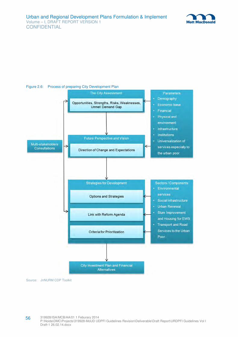
Urban and Regional Development Plans Formulation & Implement Volume – I, DRAFT REPORT VERSION 1
CONFIDENTIAL
319928/ISA/MCB/AA/01 1 Feburary 2014 P:\Noida\DMC\Projects\319928-MoUD UDPFI Guidelines Revision\Deliverable\Draft Report\URDPFI Guidelines Vol I Draft-1 26.02.14.docx
56
Figure 2.6: Process of preparing City Development Plan
Source: JnNURM CDP Toolkit
Urban and Regional Development Plans Formulation & Implement Volume – I, DRAFT REPORT VERSION 1
CONFIDENTIAL
319928/ISA/MCB/AA/01 1 Feburary 2014 P:\Noida\DMC\Projects\319928-MoUD UDPFI Guidelines Revision\Deliverable\Draft Report\URDPFI Guidelines Vol I Draft-1 26.02.14.docx
57
2.2.5.2 Contents of Comprehensive Mobility Plan21
Increasing population of urban centres has resulted in traffic problems. CMP is the key document providing
rationale for the transportation proposals under JnNURM. It draws its rationale and base from CDP, Master
plan and comprehensive traffic and transport studies (CTTS). It provides the long term vision of mobility
patterns and focuses on integration of land use and transport and improvement of the mobility of people.
CMP reviews the future land use patterns in the Master Plan from the mobility optimization point of view
and selects a preferred pattern of land use/transport integration if necessary.22
1. Existing situation
� Introduction
– Objective of the CMP
– Scope of the CMP
� City Profile
– General background
– Socio-economic profile
� Review of Land Use System
– Existing reports and documents
– Land use patterns and development trends
– Land use development policies and strategies
– Identification of issues
� Existing Transport Systems
– Existing studies, reports and proposals
– Existing transport infrastructure
– Public transport systems
– Urban goods movement
– Traffic safety and enforcement
– Legal framework and standards
– Institutional and financial situation
– Environmental and social conditions
– Other relevant issues
� Analysis of Existing Traffic/Transport Situation
– Traffic surveys (Traffic Volume, Origin Destination, Traffic Movement, etc.)
– Development of base-year transport demand model
– Analysis of travel characteristics
– Analysis of vehicular traffic and bottlenecks
– Analysis of social consideration
– Identification of Issues
21 Guidelines and Toolkit for Urban Transport Development
22 Comprehensive Mobility Plans: Preparation Toolkit; Guidelines and Toolkits for Urban Transport development in Medium Sized Cities in India
Urban and Regional Development Plans Formulation & Implement Volume – I, DRAFT REPORT VERSION 1
CONFIDENTIAL
319928/ISA/MCB/AA/01 1 Feburary 2014 P:\Noida\DMC\Projects\319928-MoUD UDPFI Guidelines Revision\Deliverable\Draft Report\URDPFI Guidelines Vol I Draft-1 26.02.14.docx
58
– Comparative analysis of urban transport environment
2. Development of urban land use and transport strategy
� Development of Visions and Goals
– Vision statement
– Urban transport development strategies
– Goals setting
� Future Urban Growth Scenarios
– Urban growth scenarios in the master plan
– Development of urban growth scenarios
� Future Transport Network Scenarios
– Road network scenarios
– Public transport development split scenarios
� Development of Urban Land Use and Transport Strategy
– Evaluation of urban growth and transport network scenarios
– Strategies for land use and transport systems development
3. Plans and projects
� Public Transport Improvement Plan
– Bus service improvement plan
– MRT development plans
– Trunk and feeder public transport network
– ITS application
� Road Network Development Plan
– Hierarchical road network
– Arterial road construction/improvement
– Secondary road construction/improvement
– Intersections and flyovers
– Railway crossing and underpass
� NMV Facility Improvement Plan
– Strategy for NMT facility improvement
– Pedestrian facility improvement
– NMV facility improvement (bicycles, rickshaws)
� Intermodal Facilities
– Bus terminals
– Bus-Rail interchange
– Park and ride facilities
– Freight terminals
� Regulatory and Institutional Measures
– Unified metropolitan transport authority
– Traffic impact assessment mechanism
– Regulatory changes required for the introduction of TDM measures
– Traffic safety regulations
– Parking regulations
Urban and Regional Development Plans Formulation & Implement Volume – I, DRAFT REPORT VERSION 1
CONFIDENTIAL
319928/ISA/MCB/AA/01 1 Feburary 2014 P:\Noida\DMC\Projects\319928-MoUD UDPFI Guidelines Revision\Deliverable\Draft Report\URDPFI Guidelines Vol I Draft-1 26.02.14.docx
59
� Fiscal Measures
– Fare policy for public transportation, and parking
– Subsidy policy for public transport operators
– Taxation on private vehicles and public transport vehicles
– Potential for road congestion charging
� Mobility Improvement Measures and National Urban Transportation Policy Objectives
– Introduction
– Summary of NUTP objectives and the proposed measures
� Social and environmental considerations
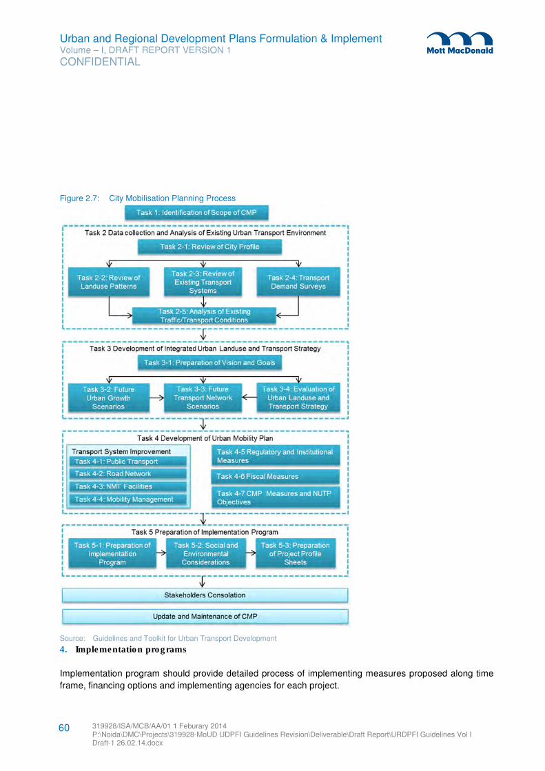
Urban and Regional Development Plans Formulation & Implement Volume – I, DRAFT REPORT VERSION 1
CONFIDENTIAL
319928/ISA/MCB/AA/01 1 Feburary 2014 P:\Noida\DMC\Projects\319928-MoUD UDPFI Guidelines Revision\Deliverable\Draft Report\URDPFI Guidelines Vol I Draft-1 26.02.14.docx
60
Figure 2.7: City Mobilisation Planning Process
Source: Guidelines and Toolkit for Urban Transport Development
4. Implementation programs
Implementation program should provide detailed process of implementing measures proposed along time
frame, financing options and implementing agencies for each project.
Urban and Regional Development Plans Formulation & Implement Volume – I, DRAFT REPORT VERSION 1
CONFIDENTIAL
319928/ISA/MCB/AA/01 1 Feburary 2014 P:\Noida\DMC\Projects\319928-MoUD UDPFI Guidelines Revision\Deliverable\Draft Report\URDPFI Guidelines Vol I Draft-1 26.02.14.docx
61
� Implementation Programs
– List of mobility improvement projects and measures – list will be prepared by reviewing all the
existing and on-going projects along with very brief summary of each.
– Selection of priority projects/measures – while considering timeframe of measures, a selection
process should be developed to screen prime candidates based on their importance and
constraints to implementation.
– Implementation agencies/organizations – for each project implementing agency / organisation
should be identified and considering existing implementation capacity, new agencies could be
proposed.
– Financing options – financing options could be from Local Government; Central Government,
private sector financing (or PPP); and international development partners (donor agencies). In
addition, the financial constraints of the local body should also be clarified.
– Implementation programs – followed by above examinations the implementation program
should be summarized. An implementation program can be prepared based on time frame of
each project, which will indicate a realistic schedule for implementing all recommended projects
and measures.
5. Annexes
� Survey data
� Details of traffic demand modelling
� Project profile sheets
� Minutes of stakeholder consultation
2.2.5.3 Contents of City Sanitation Plan23
Unprecedented growth of urban population in India has resulted in several infrastructural issues. Sanitation
infrastructure is important to keep cities healthy and liveable. The National Urban Sanitation Policy (NUSP)
was prepared with the vision of making all Indian cities totally sanitized, healthy and liveable for all citizens
especially the urban poor. The CSP is a vision document on sanitation with 20 to 25 years horizon with
short term town level action plans for 3-5 years to achieve sanitation goals. CSP provides for the
preparation of City Sanitation Task Force, stakeholder mapping, situation analysis, current deficiency
assessment, prioritising of areas, institutional capacity and financial mapping.24
1. Introduction
� Background
� Objectives of City-Wide Sanitation Plan
� Context
� City Sanitation Planning
23 Manual on Preparing CSP
24 National Urban Sanitation Policy
Urban and Regional Development Plans Formulation & Implement Volume – I, DRAFT REPORT VERSION 1
CONFIDENTIAL
319928/ISA/MCB/AA/01 1 Feburary 2014 P:\Noida\DMC\Projects\319928-MoUD UDPFI Guidelines Revision\Deliverable\Draft Report\URDPFI Guidelines Vol I Draft-1 26.02.14.docx
62
� Process, detailed Steps and limitations
� Activity Update on CSP
� Verification of MoUD checklist
� Chapter plan
2. State Urban Sanitation Policies & Programmes – A review
� National Urban Sanitation Policy (NUSP)
� Municipal Solid Waste Rules, 2000
� JnNURM
� Urban Infrastructure Development Scheme for Small & Medium Towns (UIDSSMT)
� Rajiv Awas Yojana
� Urban Statistics for HR and Assessments (USHA)
� Interest Subsidy Scheme for Housing the Urban Poor (ISHUP)
� 13TH Central Finance Commission (CFC)
� National Mission on Sustainable Habitat
3. Profile of the City
� Introduction
� Location and regional linkages
� Climate
� Topography
� Brief History
� Regional Importance
� Economies
� Demography
– Population projections
– Population density
– Sex Ratio
– Literacy
– Ward wise population distribution and growth potential
� Housing Scenario-Ownership Status
� Slums and squatter settlements
� Existing Land use
� Municipal Governance
4. Environmental Sanitation – An Assessment
� Sanitation Situation Analysis
– Introduction
– Household Sanitation
– Slum sanitation
– Open defecation areas
– Community toilets
– Public toilets
Urban and Regional Development Plans Formulation & Implement Volume – I, DRAFT REPORT VERSION 1
CONFIDENTIAL
319928/ISA/MCB/AA/01 1 Feburary 2014 P:\Noida\DMC\Projects\319928-MoUD UDPFI Guidelines Revision\Deliverable\Draft Report\URDPFI Guidelines Vol I Draft-1 26.02.14.docx
63
– School sanitation
– Wastewater treatment in
– Septage management
– Service level benchmarking indicators
– Waste water projections
� Storm Water Drainage System
– Introduction
– Existing drainage network
– Coverage
– Outfalls
– Existing drainage conditions
– Local flooding areas/ low lying areas
– Standardized service level indicators
� Solid Waste Management
– Primary collection and coverage
– Street sweeping
– Waste generation, Segregation, quantity and characteristics
– Secondary Collection
– Transportation
– Treatment & disposal
– Institutional setup & Health of sanitary workers
– Operation & Maintenance (O&M)
– Service level benchmarking indicators
– Future demand and gap
� Water Supply
– Source of water
– Existing transmission, distribution and storage capacities
– Service coverage
– Standardized service level indicators
– Future demand and gap
5. Institutional Capacity and Finance:
� Existing institutional framework:
– Details of existing State laws related to slums applicable to the city
– Institutions engaged in slum improvement i.e. Slum Clearance Board, ULBs, SUDA/DUDA,
Housing Boards, Development Authorities, District Collectorate, NGO, CDS/Neighbourhood
society’s, assessment of organizational capacities.
– Community participation arrangements (Identification of city level Lead NGOs/UPA Cell) and
the existing community mobilization and development structure
� Financial Capacity Assessment of Local Body
6. Sanitation Situation with respect to National Ranking Parameter
Urban and Regional Development Plans Formulation & Implement Volume – I, DRAFT REPORT VERSION 1
CONFIDENTIAL
319928/ISA/MCB/AA/01 1 Feburary 2014 P:\Noida\DMC\Projects\319928-MoUD UDPFI Guidelines Revision\Deliverable\Draft Report\URDPFI Guidelines Vol I Draft-1 26.02.14.docx
64
� Sanitation situation with respect to national sanitation ranking parameters: To promote sanitation in
Indian cities, National Rating and Award Scheme for Sanitation for Indian cities, was implemented
under National Urban Sanitation Policy by MoUD. Cities are rated based on set of objective
indicators of outputs, processes and outcomes
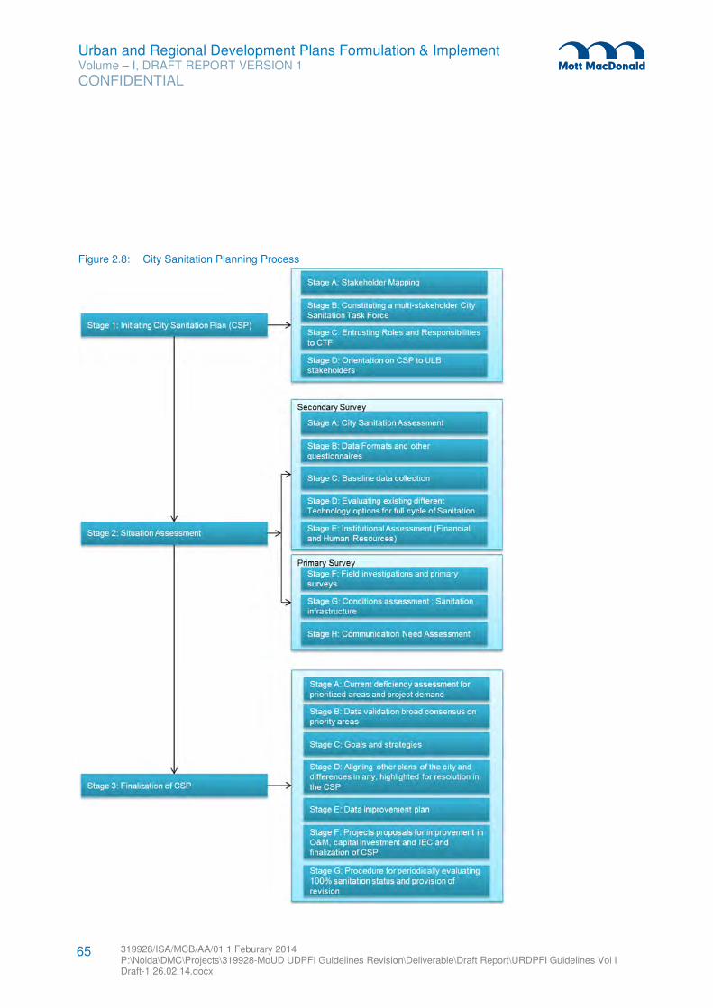
Urban and Regional Development Plans Formulation & Implement Volume – I, DRAFT REPORT VERSION 1
CONFIDENTIAL
319928/ISA/MCB/AA/01 1 Feburary 2014 P:\Noida\DMC\Projects\319928-MoUD UDPFI Guidelines Revision\Deliverable\Draft Report\URDPFI Guidelines Vol I Draft-1 26.02.14.docx
65
Figure 2.8: City Sanitation Planning Process
Urban and Regional Development Plans Formulation & Implement Volume – I, DRAFT REPORT VERSION 1
CONFIDENTIAL
319928/ISA/MCB/AA/01 1 Feburary 2014 P:\Noida\DMC\Projects\319928-MoUD UDPFI Guidelines Revision\Deliverable\Draft Report\URDPFI Guidelines Vol I Draft-1 26.02.14.docx
66
Source: CSP Manual - NUSP
7. City-Wide Sanitation
� Introduction
� Vision and City- Wide Sanitation Planning
– Vision statement
– Principles of CSP
– Assumptions, norms and units costs
– Various occurrences of issues versus consequences
� Subsector Strategies
– Open defecation free status by ensuring access to all (including poor and slum dwellers as well
as visiting population)
– Excreta disposal and waste water management
– Improvement of integrated solid waste management
– Improvement of storm water management
� Enabling and Sustaining Strategies
– Awareness raising, hygiene promotion and community participation
– Institutional arrangement and responsibility
� Monitoring and Evaluation
– Monitoring and review
– Launching reward scheme:
– Incentives and disincentives
2.2.5.4 Contents of Slum Redevelopment Plan25
In pursuance of “Slum Free India” vision of Government of India, Rajiv Awas Yojana was launched in 2011
under which Slum Redevelopment Plan is prepared. RAY envisages two-step implementation strategy i.e.
preparation of Slum free City Plan of Action (SFCPoA) and preparation of projects for selected slum. RAY
provides financial support to States/UTs/Urban Local Bodies (ULBs)/Central Government Agencies for
providing housing and improvement of basic civic infrastructure and social amenities in each selected
slums.
� Beginning the SFCPoA (Slum Free City Plan of Action) process
– Conducting Stakeholder Workshops and meetings to prepare the ground for beginning the
processes and surveys required under SFCPoA.
– Preparation of a city profile
– Review of existing policies and programmes related to slum improvement and housing.
1. Curative strategy
� Assessment of Present Status of Slums
– Preparation of a municipal information base for all slums
– Categorization of slums based on tenability analysis
25 Rajiv Awas Yojana Guidelines
Urban and Regional Development Plans Formulation & Implement Volume – I, DRAFT REPORT VERSION 1
CONFIDENTIAL
319928/ISA/MCB/AA/01 1 Feburary 2014 P:\Noida\DMC\Projects\319928-MoUD UDPFI Guidelines Revision\Deliverable\Draft Report\URDPFI Guidelines Vol I Draft-1 26.02.14.docx
67
– Prioritization of tenable slums through priority matrix
– Prioritization of untenable and (semi tenable) slums
� Formulation of Slum Intervention Strategies
– Detailed Analysis of all Prioritised Slums
– Formulation of slum intervention strategies for all prioritised slums
2. Preventive strategy
� Estimating Urban Poor Housing Shortage & Identifying Supply and Demand Constraints.
– Estimating present and future housing shortage for the urban poor.
– Identification of supply and demand constraints in housing (Not applicable for smaller cities less
than 3 lac population included under RAY implementation phase)
� Identifying Supply and Demand Side Reforms and Framing Future Supply Strategy
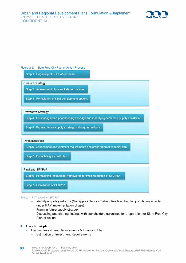
Urban and Regional Development Plans Formulation & Implement Volume – I, DRAFT REPORT VERSION 1
CONFIDENTIAL
319928/ISA/MCB/AA/01 1 Feburary 2014 P:\Noida\DMC\Projects\319928-MoUD UDPFI Guidelines Revision\Deliverable\Draft Report\URDPFI Guidelines Vol I Draft-1 26.02.14.docx
68
Figure 2.9: Slum Free City Plan of Action Process
Source: RAY guidelines SFCPoA
– Identifying policy reforms (Not applicable for smaller cities less than lac population included
under RAY implementation phase)
– Framing future supply strategy
– Discussing and sharing findings with stakeholders guidelines for preparation for Slum Free City
Plan of Action
3. Investment plan
� Framing Investment Requirements & Financing Plan
– Estimation of Investment Requirements
Urban and Regional Development Plans Formulation & Implement Volume – I, DRAFT REPORT VERSION 1
CONFIDENTIAL
319928/ISA/MCB/AA/01 1 Feburary 2014 P:\Noida\DMC\Projects\319928-MoUD UDPFI Guidelines Revision\Deliverable\Draft Report\URDPFI Guidelines Vol I Draft-1 26.02.14.docx
69
– Financial Planning for Implementation of Slum Improvement and Prevention Strategy
� Formulating a Credit Plan
– Review of existing housing finance options for the urban poor
– Review of the credit profile of urban poor
4. Finalisation of SFCPoA
� Framing Institutional Arrangements
– Preparation of an indicative implementation mode and definition of roles and responsibilities of
institutions for implementation
� Finalization of Slum Free City Plan of Action.
2.2.5.5 Disaster Management Plan (DMP)
The disaster management plan is to be prepared on the lines of proposals made by National Disaster
Management Authority. Chapter 7 on ‘Sustainability Guidelines’ of the URDPFI guidelines has provided
detailed contents for DMP.
Other specific purpose plans are Tourist Management Plan and Heritage Conservation Plan.
2.2.6 Contents of Annual Plan
This section provides the contents of Annual plan prepared in the framework of an approved development
plan by the local authority. It is an important document for the local authority as its aggregation at the
district planning committee or metropolitan planning committee level will generate the district or
metropolitan area annual plan which when further aggregated at State level will form its consolidated
annual plan. The State annual plan after its consideration by the State Planning Board and the central
Planning Commission will provide the State and central funds for different sectors which finally will result in
the allocation of funds to the local authorities. The annual plan of the local authority will also help in
formulation of its annual budget.
As annual plan and budget are interlinked it is important that preceding annual plan be evaluated before
the next financial year, so that the following plan will have inputs from previous plan and investments for
new plan can be incorporated in budget. The contents of annual plan of a local authority, as given in the
following sections, are applicable to all small, medium-size, or large urban centres.
2.2.6.1 Review or Evaluation of Preceding Annual Plan
Review of last year’s performance
The review of the performance of the last preceding year should include both physical and fiscal
achievements. It should cover all the components of the development plan as contained in the last year’s
annual plan and highlight for each component:
� The physical target set
Urban and Regional Development Plans Formulation & Implement Volume – I, DRAFT REPORT VERSION 1
CONFIDENTIAL
319928/ISA/MCB/AA/01 1 Feburary 2014 P:\Noida\DMC\Projects\319928-MoUD UDPFI Guidelines Revision\Deliverable\Draft Report\URDPFI Guidelines Vol I Draft-1 26.02.14.docx
70
� The status at the end of the annual plan and the level of physical performance by percentage of
targets achieved
� The allocations made
� The money spent and level of fiscal performance by percentage of money spent
The review should also present an analysis of performance component wise, highlighting:
� Areas where the local authority had a very high degree of performance.
� Areas where the local authority had a very low degree of performance and reasons for such
performance as well as the ways and means to correct the course of action.
� A further analysis of the performance by source of funds should also be presented. It should
include physical and fiscal performance of the projects implemented through funds from:
– Central assistance
– Central and state assistance
– State assistance
– National funding agencies
– International assistance or funding agencies
– Local authority resources
– PPP
– Private sector funds
� Finally, specify the areas or actions which require attention with particular reference to :
– Finance
– Capacity and skill up-gradation
– Administrative and legal issues
– Changes in policies, programmes or priorities
Mechanisms of review of Annual Plans Performance:
� Preparation of a pert chart in each annual plan, which shall be reviewed in the next year to rate the
performance.
� The physical and fiscal performance to be assessed on the target achieved on quarterly or at least
half yearly basis. This will ensure distribution of development and activities throughout the year and
not at the end of the annual period.
� Key performance indicators (KPI) to be proposed in the Annual plan for its evaluation in the
following year. This will ensure the quality and will be application specific.
� It is suggested to consider disasters, hazards and Act of God, if any, while reviewing the annual
plan performance
2.2.6.2 The Annual Plan
Brief Introduction
Give brief introduction to the urban centre as indicated in its development plan. The objective in writing this
introduction is to make the annual plan self-contained and its section should be as brief as possible.
Urban and Regional Development Plans Formulation & Implement Volume – I, DRAFT REPORT VERSION 1
CONFIDENTIAL
319928/ISA/MCB/AA/01 1 Feburary 2014 P:\Noida\DMC\Projects\319928-MoUD UDPFI Guidelines Revision\Deliverable\Draft Report\URDPFI Guidelines Vol I Draft-1 26.02.14.docx
71
Aims and Objectives:
Taking the review of the previous year’s annual plan and the proposals of the development plan into
account, prepare the annual plan. This plan should provide:
� Aims and objectives of development during the year.
� Priorities.
Fiscal requirements and physical targets:
Such a plan should provide implementation of each component of the plan:
� The funds required; and
� The physical targets to be achieved during the year
Fiscal resource mobilisation plan:
The resource mobilisation plan should present the manner of mobilisation of resource required for
implementation of the annual plan, specifying the amount of money proposed to be mobilised through:
� Local authority resources
� PPP
� Institutional financing
� Market borrowing
� Private sector funds
� State assistance
� Central-state assistance
� Central assistance
Local assembly:
Estimate the total land required by the development components and present the manner of assembly of
land by the local authority including assembly through:
� Land acquisition
� Land pooling scheme
� Accommodation reservation
� Transferable development rights
� Private sector land pooling schemes
Capacity building and skill up-gradation
This section should incorporate-
� Appointment of staff, both technical and administrative
� Training of staff
� Strengthening of the urban planning department
� Consultancy practice
Urban and Regional Development Plans Formulation & Implement Volume – I, DRAFT REPORT VERSION 1
CONFIDENTIAL
319928/ISA/MCB/AA/01 1 Feburary 2014 P:\Noida\DMC\Projects\319928-MoUD UDPFI Guidelines Revision\Deliverable\Draft Report\URDPFI Guidelines Vol I Draft-1 26.02.14.docx
72
Other Proposals:
Depending upon the specific needs and local area requirements provide other proposals also.
2.2.7 Contents of Projects
The following is the recommended list of contents of plans of projects for execution on site. Depending
upon the local requirements of the approving or funding agency, these may be modified if necessary.
These contents are applicable to all plans of projects for all size of settlements, small, medium or large.
Location
� Location and other physical characteristics of the site if it is already available
� Identification of possible sites, if not already available. And :
– Evaluation of alternative location;
– Selection of preferred location; and
– Physical characteristics of the preferred site.
Site Planning
� Aims and objectives and schedule of area requirements as per provision of the development plan.
� Alternative concepts of layout, their evaluation and selection of a preferred concept.
� Layout based upon the preferred concept.
� Planning and design of infrastructure (water supply, sewage, drainage, electricity, road network
and arbori-culture).
Detailed drawings
In case of further contracting of projects - detailed drawings shall be provided for estimating cost, working
drawing for design and procurements purposes.
Environment Impact Assessment
As per department of environment guidelines, provide environment impact assessment of the project.
Spatial Impact Assessment
In case of large project, provide spatial assessment of the project. Such as assessment should include:
� Impact of the project on additional demand for housing with specific reference to EWS & LIG
sections of the society who would squat near the project site if no proper care is taken in this
context.
� Impact on the direction of the growth of the settlement
� Impact on the commercial and other ancillary industrial activities.
� Impact on resettlement of the population due to compulsory land acquisition.
Urban and Regional Development Plans Formulation & Implement Volume – I, DRAFT REPORT VERSION 1
CONFIDENTIAL
319928/ISA/MCB/AA/01 1 Feburary 2014 P:\Noida\DMC\Projects\319928-MoUD UDPFI Guidelines Revision\Deliverable\Draft Report\URDPFI Guidelines Vol I Draft-1 26.02.14.docx
73
� Impact on city level infrastructure specially, roads, bridges, transportation system, water supply,
sewerage treatment plant, electricity generation and supply.
� Impact on city level facilities.
Financing Plan
� Cost recovery strategy
� Financing terms
� Financing plan
– Sources of finance
– Proportion, form and nature of funds
– Proportion, forms and nature of financing by various participating agencies and local authority
– Interest rates and terms for borrowed funds
– Cash flow and repayment schedule
Project Administration and Organisation
� Project administration agency
� Major administrative requirements
– Advertisement
– Processing of application
– Collection of dues
– System of allotment of plots/units
– Supervision
– Monitoring
– General management
� Requirement of personnel
� Executing agency
Legal Support / Constraints (if any)
� Land assembly laws.
� Land tenure laws.
� Development promotion laws/regulations
These sections may not form part of the documents needed at the time of approval of private sector project
by the local authority.
Urban and Regional Development Plans Formulation & Implement Volume – I, DRAFT REPORT VERSION 1
CONFIDENTIAL
319928/ISA/MCB/AA/01 1 Feburary 2014 P:\Noida\DMC\Projects\319928-MoUD UDPFI Guidelines Revision\Deliverable\Draft Report\URDPFI Guidelines Vol I Draft-1 26.02.14.docx
74
3.1 Introduction
Land, money and manpower are the three main resources for planning and development of urban centres.
Among these three resources, land’s availability is limited and differs from place to place. As a basic
principle, allocation of these resources among various competing land uses must be such that it helps in
achieving a high level of economic efficiency.
In pursuit of spatial development, the government should not always be expected to spend money, or
participate directly in building activities and development programmes. Private sector resources should
also be appropriately mobilised for investment in development of urban centres. The role of private sector
in the development process has been duly recognised nationally. As a general fiscal policy on resource
mobilisation, it would be desirable to have a proper mix of public and private sectors participation, both
playing a symbiotic role in such a way that the public infrastructure programme is implemented through
budgetary sources, while the facilities could be provided through private sector. A joint venture could also
be explored where practical.
Fast economic development of country with flourishing urban centres has increased the demand for
improved quality of services and better urban governance. Good Governance which is accountable,
participatory, transparent, inclusive, effective and efficient is the next step which ensures better service
delivery to the citizens. Urban governance shall focus on inclusivity of the vulnerable population in decision
making, infrastructure development and feedback mechanism, leading to overall growth and development
of urban economy in return.
This chapter focuses on the fiscal, land, good governance and manpower resources mobilization strategies
in general and the local authorities could select the most appropriate system depending upon local needs
and potential.
3.2 Land Assembly
Land is most essential resource required for infrastructure development and service delivery. To play its
role as service provider (/facilitator), the government requires land for developing new infrastructure
projects or expansion of old ones to cater the needs of the increasing population. Requirement of land for
public purposes result in land assembly by government agencies from private land owners.
The Land Acquisition Act of 1894 was made to facilitate the government to procure privately held land for
the purpose of developing physical infrastructure like, roads, railway, irrigation canals and planned
development, rural or town planning. After 120 years of Land Acquisition Act of 1894 in force, a new bill
was proposed by the Central Government in 2011 to replace it. This bill became Law on 26 September
2013 and is now called ‘The Right to Fair Compensation and Transparency in Land Acquisition,
Rehabilitation and Resettlement Act, 2013’ (RFCTLARR Act, 2013).
3 Resource Mobilization
Urban and Regional Development Plans Formulation & Implement Volume – I, DRAFT REPORT VERSION 1
CONFIDENTIAL
319928/ISA/MCB/AA/01 1 Feburary 2014 P:\Noida\DMC\Projects\319928-MoUD UDPFI Guidelines Revision\Deliverable\Draft Report\URDPFI Guidelines Vol I Draft-1 26.02.14.docx
75
RFCTLARR Act, 2013 is a legislation that regulates land acquisition and provides laid down rules for
granting compensation, rehabilitation and resettlement to the affected persons. The Act establishes
regulations for land acquisition as a part of India's massive industrialization, driven by public-private
partnership. The Act has provisions to provide fair compensation to those whose land is acquired
permanently or temporarily, brings transparency to the process of acquisition of land to set up factories or
buildings, infrastructural projects and assures rehabilitation of those affected.
3.2.1 Land as a Resource
According to The Right to Fair Compensation and Transparency in Land Acquisition, Rehabilitation and
Resettlement Act, 2013, the expression “land” includes benefits to arise out of land, and things attached to
the earth or permanently fastened to anything attached to the earth26
.
Land is the medium on which the entire superstructure of human settlement is created and under which a
lot of infrastructure find their place. Planning of the use of land leads to socio-economic and physical
development of urban and rural areas. However it is a scarce commodity as its supply is limited and it
cannot be mass created. The (Draft) National Land Utilisation Policy of India, 2013 mentions that land is
required for development of essential infrastructure and for urbanisation, while at the same time there is
also a need to protect land under environmental sensitive zones and land which provides ecosystem
services. Farmers and food security makes it imperative to protect land for agriculture. Further, the need to
preserve natural, cultural and historical areas requires land protection.
It is, therefore, most essential to ensure that utilisation of the available land is judicious and in the best
interest of the community through the instrument of development plans. Thus, there is requirement for
cohesive land use planning for development and well-judged allocation of land.
3.2.2 Land Economics
Land value depends on demand and supply of land. The value increases as the demand exceeds the
supply. Due to these characteristics, planners and urban economists have often been urging that urban
land should be treated as an asset and be planned accordingly.
According to ‘The Right to Fair Compensation and Transparency in Land Acquisition, Rehabilitation and
Resettlement Act, 2013’, market value of land is to be calculated as the minimum land value specified in
the Indian Stamp Act, 1899 for the registration of sale deeds in the area, where the land is located. Or the
average of the sale price for similar type of land located in the immediate areas adjoining the land being
acquired. It is ascertained from fifty per cent of the sale deeds registered during the preceding three years,
where higher price has been paid. This approach is suggested for determining the market value of land for
acquisition purpose mainly.
26 Appendix B provides definition for land and associated terms.
Urban and Regional Development Plans Formulation & Implement Volume – I, DRAFT REPORT VERSION 1
CONFIDENTIAL
319928/ISA/MCB/AA/01 1 Feburary 2014 P:\Noida\DMC\Projects\319928-MoUD UDPFI Guidelines Revision\Deliverable\Draft Report\URDPFI Guidelines Vol I Draft-1 26.02.14.docx
76
3.2.3 Land assembly and planning techniques/ Land development mechanism
Land assembly and development mechanism are undertaken for achieving optimum social use of urban
land and to ensure adequate availability of land to public authority and individuals. Public private
participation is achieved in land development through various techniques. Land assembly techniques
prevent concentration of land in few hands and promote its efficient social and economic allocation. Some
of the land assembly techniques also promote flexibility in land utilisation in response to changes resulting
from growing city. The various mechanisms to assemble and/or develop land are enlisted below:
� Land Acquisition: bulk land acquisition by State and by private initiatives
� Land Pooling: land pooling approach and redistribution scheme, popularly known as Town Planning
schemes
� Land Reservations: the concept of Accommodation Reservation which allows the land owner to
develop the sites reserved for an amenity
� Transferable Development Rights: a technique of land development which separates the
development potential of a land parcel for use elsewhere
3.2.3.1 Land acquisition
“Land Acquisition” means the acquisition of land for some public purpose by a government agency from
individual landowners, as authorised by the law, after paying a government-fixed compensation to cover
losses incurred by landowners from surrendering their land to the concerned government agency
(Wikipedia). The land acquisition process can be undertaken by the State or through private initiatives.
Bulk land acquisition is to be processed as stated in the RFCTLARR, 2013.
Bulk land acquisition method as a State Initiative:
In this method, Master Plan is prepared for the entire area for different land uses and various urban
activities. Land is developed in accordance to the planning norms for various uses/activities and is
disposed-off accordingly. Bulk land is acquired from farmers by the development agency and
compensation is paid to farmers/owners based on the provision of prevailing act. (Source: Alternate modes
of assembly and development of land and housing in the NCT of Delhi-AMDA)
Bulk land acquisition method with Private Initiative:
To defray the cost of land acquisition some state governments and ULBs have developed models in which
private sector acquire land by directly paying compensation to the affected families. A variety of models are
in existence through which land is acquired for planning urban growth with the private partnership. The
following alternate methods could be used to make the land acquisition more flexible and responsive to
people in order to reduce the burden and conflict between landowner and government.
Urban and Regional Development Plans Formulation & Implement Volume – I, DRAFT REPORT VERSION 1
CONFIDENTIAL
319928/ISA/MCB/AA/01 1 Feburary 2014 P:\Noida\DMC\Projects\319928-MoUD UDPFI Guidelines Revision\Deliverable\Draft Report\URDPFI Guidelines Vol I Draft-1 26.02.14.docx
77
• Private developers could be allowed to acquire land directly from landowners for township
development.
• A joint venture financial model of urban development can be adopted as alternate to land
development to fund the acquisition and provision of facilities in new parcel of land.
• Separate set of compensations could be decided for acquisition of land for public or private
projects.
Haryana Guided Land Development Model: In the Haryana model of Guided Urban Development,
private developer can acquire land directly from farmers at market price and at the same time, it permits a
land owner to assume the role of a colonizer. This model provides fixed time period of 5 years to
utilise that land acquired (initially 2 years, then extension of 3 years if required) and within this
period projects are supposed to be finished by private developer. Major achievements of this model
are that the difficulties and delays of land acquisition are avoided and pressure on government to pay
compensation is reduced, overall enhancing investments.
Ghaziabad Joint Venture Model: Another land acquisition technique is followed by Ghaziabad
Development Authority, where a joint venture (JV) is entered between development authority and
builders/developers/co-operative societies through open bid (based on technical and financial capabilities).
Under this land developmental model, twenty per cent of the plots developed are to be reserved for
EWS/LIG and the costing and allotting of social facility by developer has to be done as per the government
regulations. The balance of the land is to be sold by the developer at profit. The development authority for
the entire process acts as a facilitator only. Project duration is specified in the JV agreement and
penalty is imposed if developer requires time extension, thus making sure that land is utilised in
fixed time for stipulated time period.
Hyderabad Differential Compensation Model: In Hyderabad, the land acquisition technique has been
modified into two different models, in which while acquiring land for public and private projects, different
level of compensations are arrived at, these are-
A. Model I: When land is acquired for projects mainly for public purpose such as roads, power
generation and distribution, irrigation, schools, welfare housing, environmental projects etc., higher
compensation is paid to landowners by consulting them.
B. Model II: When land is acquired for projects such as SEZ, Industrial Estates, Satellite townships
and others where value addition enhances the land prices, mainly for third party use,
compensation is normally worked out on profit sharing basis which is in two parts
• Basic Value (Government Rate) of Land
• % Equity Sharing in SPV / % of Net Developed Area / Built Space
CIDCO Model of Land Development in Navi Mumbai follows the technique of land banking for land
assembly. The compensation to land owners is done by the way of monetary and land compensation. But
in Vasai Vihar sub-region, CIDCO undertook the land assembly by obtaining power of attorney from
landowners or outright purchase of freehold lands located close to each other by private developers or
Urban and Regional Development Plans Formulation & Implement Volume – I, DRAFT REPORT VERSION 1
CONFIDENTIAL
319928/ISA/MCB/AA/01 1 Feburary 2014 P:\Noida\DMC\Projects\319928-MoUD UDPFI Guidelines Revision\Deliverable\Draft Report\URDPFI Guidelines Vol I Draft-1 26.02.14.docx
78
builder. The promoter is solely responsible for providing and maintaining infrastructure for consolidated
land parcel.
3.2.3.2 Land pooling
In Town Planning or Plot Reconstitution Scheme, the land is pooled and its development is financed with
the involvement of landowners without compulsorily acquiring land. This land assembly technique helps to
provide plots with basic services in a planned layout from the original haphazard arrangement. Costs
incurred by developmental authority for development and provision of infrastructure are recovered from the
sale of the final land plots reserved by the authority and charges levied on landowners.
The land pooling technique is a mechanism for temporary pooling of different land for a unified planning
and thereafter sub-dividing and collecting betterment charges to finance the infrastructure works. In
addition, the local authority can secure land free of cost for public purposes and EWS housing after
returning part of the developed land to original landowners. The reconstituted plots are allotted to the land
owners in proportion to their original land holdings.
The scheme was first introduced in the Maharashtra Regional and Town Planning Act, 1966 and later in
Gujarat Town Planning & Urban Development Act, 1976 and is now widely accepted model of land
assembly. Another deviation of the land pooling mechanism has been recently introduced by the Delhi
Development Authority (DDA).
Maharashtra Regional and Town Planning Act, 1966 (Town Planning scheme)
The Act provides for the creation of urban local bodies and development authorities for preparation of
development plans and their implementation by a number of Town Planning schemes (TP scheme)
utilizing the technique of Plot Reconstruction. As per the Act-Town Planning Scheme is a land
development technique undertaken by the land owners who pool their land to secure a good layout thereof.
The town planning scheme is basically a legal procedure for allowing:
� Pooling of land by different land owners
� Formulation and approval of the layout showing the ‘original’ as well as the ‘final’ plots, including roads
and amenities with active participation of the land owners; and
� Redistribution of ‘final’ plots after charging betterment contributions and paying compensation for the
land used for public purposes and transferred to the local authority.
The local authority, which is also a party to the TP Scheme, prepares the layout, processes it for approval
by the state government and is responsible for its execution. In the whole process the land is developed as
per the plan and without any land acquisition. When town planning scheme is finalised, the land so carved
out for public purposes vests with the local authority free from all encumbrances. The remaining land is re-
distributed amongst the original landowners in the form of developed plots according to the equitable
formula. The development expenses are also shared in similar manner.
Urban and Regional Development Plans Formulation & Implement Volume – I, DRAFT REPORT VERSION 1
CONFIDENTIAL
319928/ISA/MCB/AA/01 1 Feburary 2014 P:\Noida\DMC\Projects\319928-MoUD UDPFI Guidelines Revision\Deliverable\Draft Report\URDPFI Guidelines Vol I Draft-1 26.02.14.docx
79
Gujarat Town Planning & Urban Development Act, 1976: (Town Planning scheme)
As per the provisions in the Act, the responsibility of initiation, implementation, and investment in the
schemes rests with the development/local authority. The model is most attractive to the landowner who
gets back fifty-four per cent of the land. Under this Act, the Town Planning Scheme is divided into 2 parts
namely physical planning of the scheme and financial aspects of the scheme. The concept of TP scheme
is akin to land pooling technique in which land of different owners is pooled together and after proper
planning the same is redistributed in a properly reconstituted plots after deducting the land required for
open spaces, social infrastructure, services, housing for the weaker section and street network. The
process enables the local planning authority to develop the commonly pooled land without compulsorily
acquiring the same. It facilitates the freedom of planning and design and the control on the growth and
development.
In order to implement the Master Plan / Development Plan prepared under the Gujarat Town Planning &
Urban Development Act, 1976, Town Planning Schemes are prepared at micro level. It is prepared in
those pockets which are under pressure of urban development and need priority attention. The scheme is
conceptualized as a joint venture between the local authority and the owners of land, who voluntarily agree
to pool their land, redistribute the reconstituted plots of land among themselves and share the development
cost.
For preparation of scheme, land parcels with common ownership are marked with original survey number /
plot number on a map. All such original plots form one area for planning purpose. In the layout plan, the
area for roads and streets and public and semi-public spaces are taken out while the remaining area is
planned for the final plots. The final plots are, though reduced in size but are, better in shape, build ability
and accessibility, thereby the value of the plots is enhanced. These final plots are allocated to the land
owners preferably in close proximity to their original plots. Part of such increment in land value is
contributed for the cost of development work in the scheme. (Source: Town planning and valuation
Department-Government of Gujarat)
Delhi Land Pooling Policy
In Delhi, large scale Land Acquisition, Development and Disposal Policy is operational since 1961.
According to the modifications introduced in 2013, the new land policy is based on the concept of Land
Pooling. Under this, the land parcels owned by individuals or group of owners are legally consolidated by
transfer of ownership rights to the designated Land Agency. This Land Agency later transfers the
ownership of part of land back to the land owners for undertaking of development of such areas.
The Delhi Development Authority (DDA) acts as a facilitator with minimum intervention and speeds up
integrated planned development. A land owner, or a group of land owners or developer (Developer Entity),
are permitted to pool land for unified planning, servicing and subdivision / share of the land for
development as per prescribed norms and guidelines. Each owner gets equitable return irrespective of
land use assigned to their land in Zonal Development Plan with minimum displacement.
Urban and Regional Development Plans Formulation & Implement Volume – I, DRAFT REPORT VERSION 1
CONFIDENTIAL
319928/ISA/MCB/AA/01 1 Feburary 2014 P:\Noida\DMC\Projects\319928-MoUD UDPFI Guidelines Revision\Deliverable\Draft Report\URDPFI Guidelines Vol I Draft-1 26.02.14.docx
80
This Land Policy is adopted to ensure speedy development of Master Plan Roads and other essential
physical and social infrastructure and recreational areas and as well to ensure inclusive development by
adequate provision of EWS and other housing as per Shelter Policy of the Master Plan.
However, the private sector intervention is by Developer Entity (DE), who is responsible for assembly and
surrender of land as per policy in the prescribed time frame, preparation of layout plans/detailed plans as
per the provisions of the Master Plan and the policy and seek approval from the DDA. The DE will have to
develop sector roads/internal roads/infrastructure/services falling in its share of the land and can also be
allowed creation of infrastructure facilities, roads, parks etc. at city level subject approval of Competent
Authority. Prescribed built up space/Dwelling Units for EWS/LIG housing component to the DDA has to be
returned as per the Policy by the DE. The DE will also be responsible for the timely completion of
development and its maintenance with all the neighbourhood level facilities till the area is handed over to
the concerned Municipal Corporation for maintenance.
According to Delhi Land Pooling Model, for land assembly and development with Developer Entities, two
categories have been proposed for land assembly. Category I is for 20 Ha, in which land that is returned to
DE will be sixty percent while DDA will retain forty percent land. Category II is for 2 Ha to less than 20 Ha
under which land returned to DE will be forty-eight percent and land retained by DDA will be fifty-two
percent.
The town planning scheme is referred as ‘land acquisition without tears’ and has the following key
advantages:
� Infrastructure is provided in coordinated way
� Partial cost is recovered through betterment charges
� Land for public and community purposes is acquired without direct expanses
� Community benefits through unified planning
� Landowner shares the project cost and benefits by increased property prices
However, the Land Pooling Scheme suffers from various issues, such as:
� Delay in process of preparation, approval, arbitration and implementation mainly due to litigations
� There are issues related to cost recovery
� There is also definite lack in public participation in such schemes
To overcome the drawbacks of TP scheme, some of the suggestions are enlisted below:
� Division of scheme into planning and financial part, which has been done in the Gujarat model
� Appointment of an arbitrator and a project planner by local authority to modify the plan after initial
preparation, who would undertake active consultation with original stakeholders
� The contribution which is based upon the estimated value of land assuming full development as per the
scheme should be replaced by estimated cost of the scheme
� Provision of Transferable Development Rights in lieu of compensation to original plot holders can be
considered
� Land pooling schemes to be prepared only for the areas included in current development plan
Urban and Regional Development Plans Formulation & Implement Volume – I, DRAFT REPORT VERSION 1
CONFIDENTIAL
319928/ISA/MCB/AA/01 1 Feburary 2014 P:\Noida\DMC\Projects\319928-MoUD UDPFI Guidelines Revision\Deliverable\Draft Report\URDPFI Guidelines Vol I Draft-1 26.02.14.docx
81
Land development for Schedule-6 areas: Northeast states have areas/districts which are under the
Schedule 6 of Constitution of India. In the states of Assam, Meghalaya, Tripura and Mizoram land
development and planning are not directly under the control of the State government but rests with the
Autonomous District Councils. In the north-eastern states, land is broadly under two types of ownership:
a. Public land,
b. Community tenure.
Since communities are owner of land rather than individual owners, communities can be involved in
development process of the settlements as it may be viable and easier approach. Community may be
encouraged to pool land rather than developer or individual land owners. For the development of important
infrastructure in these States may take initiative if it has sizable continuous proportion of land, otherwise
involvement of communities must be explored as an option. A land pooling agreement may be done
between government and communities for such land development. The suggested approach may fasten
the process of land and infrastructure development, and increase economic development which is also the
requirement of the region.
3.2.3.3 Land reservations (reservation on land development by Central governments & different State
governments)
The concept of Accommodation Reservation allows the land owners to develop the sites reserved for an
amenity in the development plan using full permissible FSI/FAR on the plot subject to agreeing to entrust
and hand over the built-up area of such amenity to the local authority free of all encumbrances and except
full FAR/FSI as compensation in lieu thereof. The area utilised for the amenity shall not form part of
FAR/FSI calculation. Reservations such as retail markets, dispensaries, etc. can be implemented in this
way wherein local authority is not required to acquire the land by incurring expenditure on payment of
compensation.
In case of reservations like shopping centres, industrial estates, etc, the owner can be allowed to develop
them on his agreeing to give at least upto 25 % of the shops to the local authority for the purpose of
rehabilitation of the displaced persons from sites reserved for public purposes or amenities in the
development plan, on payment of cost of construction. The remaining shops are allowed to be taken care
of by the land owner.
In case of road widening and construction of new roads, the local authority can grant additional FSI on 100
% of the area required for road widening or for construction of new roads proposed under the development
plan, provided the owner surrenders the land for widening or construction of new roads to the local
authority free of all encumbrances and accept the additional FAR/FSI as the compensation in lieu thereof.
This mechanism has considerably relieved local authorities from incurring huge expenses for the purpose
of acquisition of such lands.
The concept of accommodation reservation has already been introduced in Mumbai by incorporating it in
the Development Control Rules of Bombay Municipal Corporation. Realising its positive effect in
implementing the developmental plan proposals, the Government of Maharashtra has directed all the
Urban and Regional Development Plans Formulation & Implement Volume – I, DRAFT REPORT VERSION 1
CONFIDENTIAL
319928/ISA/MCB/AA/01 1 Feburary 2014 P:\Noida\DMC\Projects\319928-MoUD UDPFI Guidelines Revision\Deliverable\Draft Report\URDPFI Guidelines Vol I Draft-1 26.02.14.docx
82
Municipal Corporations and Municipal Councils in the state to incorporate the provision of accommodation
reservation in their development control regulations. Accordingly, this new system is also now followed by
all the local authorities in the state for the purpose of executing the sanctioned development plans.
3.2.3.4 Transferable Development Rights (TDR)
TDR is a technique of land development which separates the development potential of a particular parcel
of land from it and allows its use elsewhere within the defined zones of the city. It allows the owner to sell
the development rights of a particular parcel of land in exchange of another land parcel. This entitlement is
over and above the usual FSI available for the receiving plot in accordance with the prevailing laws and
regulations, which entitles a landowner to construct additional built-up area on his existing building or
vacant land.
TDR is taken away from the zone and it is tradable which makes it different from Accommodation
reservation. This is also generally used as a technique for redevelopment of inner city zones and for
reconstruction. TDR is a useful tool for re-development of land. However it has its prospects and
consequences as understood from the implementation experience in various cities in India. Hence it should
be used carefully.
Greater Mumbai: Under the TDR concept in Greater Mumbai, the development potential of a plot of land
partly or fully reserved for public purpose can be separated from the land itself and be made available to
the owner of the land by way of TDR in the form of Floor Space Index. This way the exorbitant costs of
acquisition of urban land for public purpose can be met by a system of compensation in kind rather than in
cash. FSI or FAR can be utilised by owner from an inner-zone (originating area) to an outer-zone
(receiving area) specified by regulations. According to the Development Control Rules of Greater Bombay
Municipal Corporation, land reserved for public amenities, utilities and services can compulsorily be
acquired by granting TDR in lieu of compensation.
Chennai: In year 2008, Chennai Metropolitan Development Authority (CMDA) introduced TDR. According
to the guidelines, TDR can be used in case where land is partly affected by the Master Plan / Detailed
Development Plan proposals. TDR is granted when a project for road widening or a new road formation or
implementation of any traffic and transportation infrastructure development or any urban infrastructure
development is published by the authority. Even if the site is already developed one, irrespective of
whether it is an authorized or unauthorised development, the part of the land required for the public
purpose is eligible for the award of Development Rights Certificate (DRC).
Karnataka: In Karnataka, the local bodies are empowered to permit additional FAR for the land, handed
over free of cost by the landowners, for road widening, formation of new roads, for development of parks,
playgrounds and other civic amenities etc. Such award is entitled to the owner of the land in the form of a
DRC. The DRC has an attached time limit of 10 years within which it is to be utilised, or else it will lapse.
Based on the intensity of development, the city is divided into intensively developed (A-zone), moderately
developed (B-zone) and sparsely developed (C-zone) zones in the plan. The Transfer of Development
Rights shall be from intensely developed zone to other zones and not vice versa.
Urban and Regional Development Plans Formulation & Implement Volume – I, DRAFT REPORT VERSION 1
CONFIDENTIAL
319928/ISA/MCB/AA/01 1 Feburary 2014 P:\Noida\DMC\Projects\319928-MoUD UDPFI Guidelines Revision\Deliverable\Draft Report\URDPFI Guidelines Vol I Draft-1 26.02.14.docx
83
Rajasthan: The state of Rajasthan has introduced Rajasthan Urban Areas Transferable Development
Right Policy (2012) in which TDR enables the transfer of development potential partly or fully from one plot
to another. TDR certificate is issued by ULBs in lieu of land surrendered by the owner/ private developer
for development of affordable housing, green spaces, public parking lots, roads including road widening,
city level facilities/other public purposes, slum rehabilitation scheme under Slum Development Policy 2012.
Under this policy, TDR generated in an urban area (meaning city) can be utilized within the same urban
area only. However, the TDR shall be utilized in various receiving zones over and above the prescribed
standard FAR but subject to the maximum FAR allowed in Building Regulations. The policy encourages
TDR generation for residential use only in case of Affordable Housing.
3.2.3.5 Guided Land Development
The models discussed above use different techniques of land assembly for the land development or
provision of services. However, United Nations Economic and Social Commission for Asia and the Pacific
(UNESCAP) provides a model of land development in its paper ‘Urban Land Policy for the Uninitiated’
which guides the direction of urban development for Asian cities.
Guided land development model uses the provision of infrastructure as instrument to guide urban
development. This is done in partnership with landowners who pay for the cost of providing services to
their land and in return donate land for public infrastructure and a payment as betterment levy. This model
has been proposed for guiding the conversion of privately owned land in the urban periphery from rural to
urban uses. It uses a combination of traditional government role of providing infrastructure and the
enforcement of land subdivision regulations. The key advantage of the approach is that it is less costly
than outright land acquisition and more equitable than land banking.
The principle behind guided land subdivision is that the government agency proactively selects the
direction where it feels urban development should take place and provides infrastructure in those areas.
This acts as an incentive to encourage developer to invest in the planned area selected by the government
agency.
The cost effectiveness of guided land development approach results from the fact that land development is
planned, designed and implemented with the landowners of the designated area, who donate land for
roads and right of way for infrastructure and public spaces, as well as, pay a betterment levy to meet the
costs of the project. The betterment levy is justified because of:
– the increase in the value of land from the provision of infrastructure and
– conversion of rural land use to urban land use.
To finance the scheme, a loan is initially taken to build the infrastructure, which is paid from betterment
levies provided by landowners either on annual instalments or in lump sum upon sale of land. The
infrastructure is provided by the government agency upto the site. Individual landowners are supposed to
subdivide their land for various developments and lay the on-site services.
Urban and Regional Development Plans Formulation & Implement Volume – I, DRAFT REPORT VERSION 1
CONFIDENTIAL
319928/ISA/MCB/AA/01 1 Feburary 2014 P:\Noida\DMC\Projects\319928-MoUD UDPFI Guidelines Revision\Deliverable\Draft Report\URDPFI Guidelines Vol I Draft-1 26.02.14.docx
84
But Guided land is often fraught with difficulties on the ground. First, as the model depends on the consent
of the landowners it cannot be applied in areas with fragmented landownership, lack of owners’ will and
consensus. Second, collection of betterment levies may not be feasible by small landholders and lead to
default of payment.
3.2.4 Inclusive Land Development
Most cities in developing countries suffer from land market distortions caused by poor land development
and management policies including poor planning, slow provision of infrastructure and services, poor land
information systems, cumbersome and slow land transaction procedures, as well as under regulation of
private land development, leading to unplanned or ribbon/corridor development of land in the urban
periphery. The urban poor suffer most from a dysfunctional city. Distortions in the land markets allow land
speculation which often prices the poor out of the formal land markets and into the informal land markets
which are exemplified by slums, squatter settlements and illegal sub-divisions, mainly in the periphery of
cities. This leads to longer commuting time and costs, very poor living conditions, caused by lack of
adequate infrastructure and services, causing poor health and greater expenditure, thereby entrenching
the cycle of poverty.
Land and housing have special significance for the poor. Often for poor, a house is not just a shelter, but is
also a place for income generation. Urban settlements of the poor in the region are characterized by home
based workshops from which the poor earn their incomes. When the poor are locked out of the formal land
and housing markets they revert to the informal land and housing markets to meet their needs.
Though slum, squatter and illegal settlements are often used interchangeably but they are different from
each other and denote different characteristics of the settlement.
� Slums are legal but substandard settlements, with a lack of adequate services and overcrowding.
� Squatter are settlements where land has been occupied illegally. They are often found on marginal or
environmentally hazardous lands, such as close to railway tracks, along rivers and canals etc. They are
also found on government land or land whose ownership is unclear.
� While squatter settlements are spontaneous and unorganized, illegal settlements are planned and
organized. These usually occur in cities where the government owns large tracts of vacant land, with
low opportunity cost, in the periphery of the city.
3.2.4.1 Inclusion of Poorer Section into the Formal Land Market
Experience has shown that bringing the poor into the formal land and housing markets needs a two
pronged strategy: increasing the choices available on the supply side and increasing affordability on the
demand side.
1. Increasing supply of land for the poor includes following:
– Sites and services: It provides the target group with a plot and basic infrastructure, such as
water, roads and sanitation facilities.
Urban and Regional Development Plans Formulation & Implement Volume – I, DRAFT REPORT VERSION 1
CONFIDENTIAL
319928/ISA/MCB/AA/01 1 Feburary 2014 P:\Noida\DMC\Projects\319928-MoUD UDPFI Guidelines Revision\Deliverable\Draft Report\URDPFI Guidelines Vol I Draft-1 26.02.14.docx
85
– Illegal settlements regularization/upgrading: Settlement upgrading provides existing settlement
dwellers land tenure, as well as, basic infrastructure.
– Land-sharing: Landowner and the land occupants reach an agreement whereby the land owner
develops the economically most attractive part of the plot and the dwellers build houses on the
other part with full or limited land ownership.
– Sites without services - incremental development: The approach includes mechanisms
whereby groups of households are encouraged to organize themselves, accumulate funds and
provide infrastructure gradually.
2. The strategy of increasing effective demand for land for the poor has following schemes which can
be used to provide better shelter to the urban poor:
– Community organization: Organized communities of the poor can afford housing and they also
negotiate with governments and other stakeholders more effectively.
– Increasing savings and providing access to finance: Community-based savings-and-credit
schemes preserve organized communities and increase access to finance.
(Source: UNESCAP- Urban Land Policy for the Uninitiated)
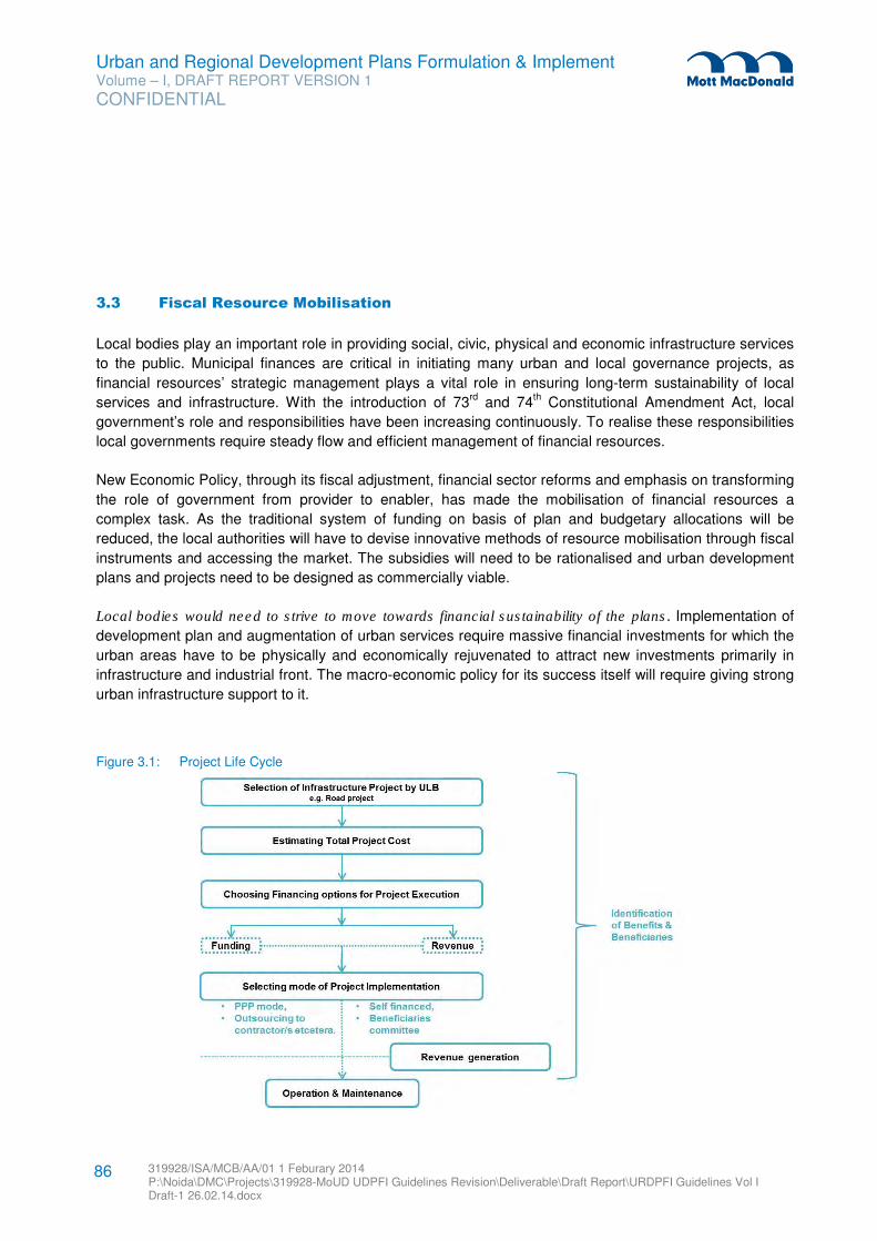
Urban and Regional Development Plans Formulation & Implement Volume – I, DRAFT REPORT VERSION 1
CONFIDENTIAL
319928/ISA/MCB/AA/01 1 Feburary 2014 P:\Noida\DMC\Projects\319928-MoUD UDPFI Guidelines Revision\Deliverable\Draft Report\URDPFI Guidelines Vol I Draft-1 26.02.14.docx
86
3.3 Fiscal Resource Mobilisation
Local bodies play an important role in providing social, civic, physical and economic infrastructure services
to the public. Municipal finances are critical in initiating many urban and local governance projects, as
financial resources’ strategic management plays a vital role in ensuring long-term sustainability of local
services and infrastructure. With the introduction of 73rd
and 74th Constitutional Amendment Act, local
government’s role and responsibilities have been increasing continuously. To realise these responsibilities
local governments require steady flow and efficient management of financial resources.
New Economic Policy, through its fiscal adjustment, financial sector reforms and emphasis on transforming
the role of government from provider to enabler, has made the mobilisation of financial resources a
complex task. As the traditional system of funding on basis of plan and budgetary allocations will be
reduced, the local authorities will have to devise innovative methods of resource mobilisation through fiscal
instruments and accessing the market. The subsidies will need to be rationalised and urban development
plans and projects need to be designed as commercially viable.
Local bodies would need to strive to move towards financial sustainability of the plans. Implementation of
development plan and augmentation of urban services require massive financial investments for which the
urban areas have to be physically and economically rejuvenated to attract new investments primarily in
infrastructure and industrial front. The macro-economic policy for its success itself will require giving strong
urban infrastructure support to it.
Figure 3.1: Project Life Cycle
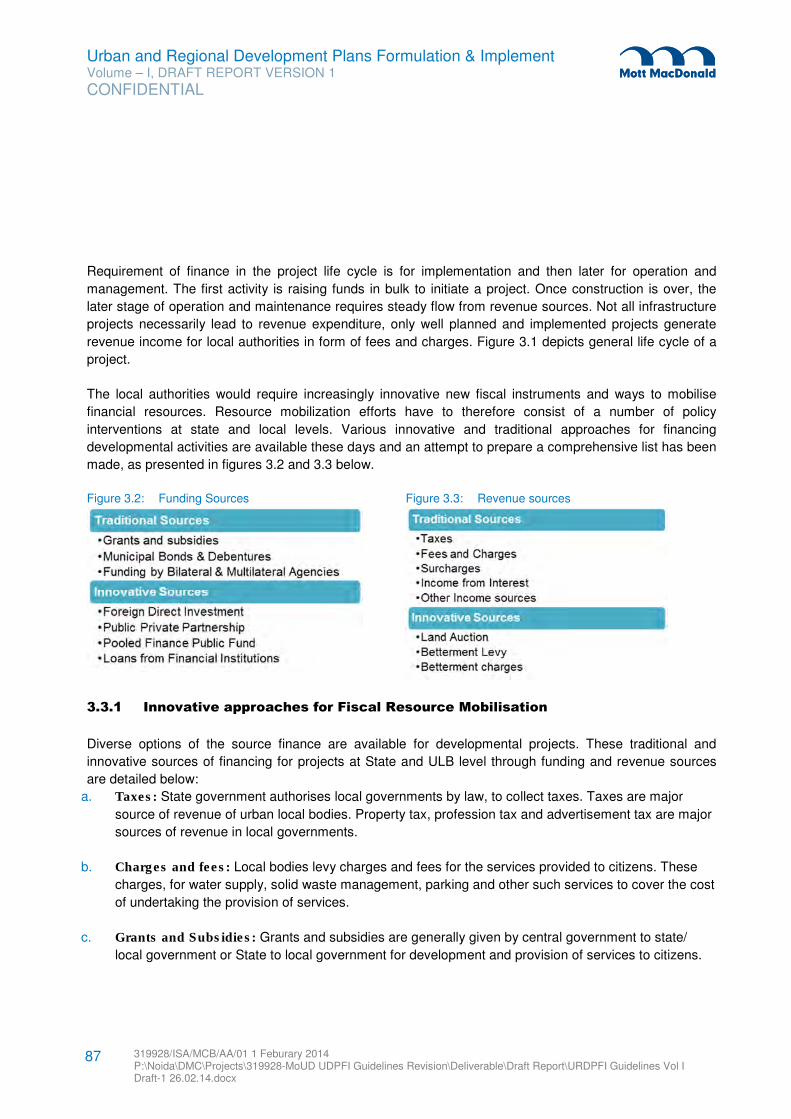
Urban and Regional Development Plans Formulation & Implement Volume – I, DRAFT REPORT VERSION 1
CONFIDENTIAL
319928/ISA/MCB/AA/01 1 Feburary 2014 P:\Noida\DMC\Projects\319928-MoUD UDPFI Guidelines Revision\Deliverable\Draft Report\URDPFI Guidelines Vol I Draft-1 26.02.14.docx
87
Requirement of finance in the project life cycle is for implementation and then later for operation and
management. The first activity is raising funds in bulk to initiate a project. Once construction is over, the
later stage of operation and maintenance requires steady flow from revenue sources. Not all infrastructure
projects necessarily lead to revenue expenditure, only well planned and implemented projects generate
revenue income for local authorities in form of fees and charges. Figure 3.1 depicts general life cycle of a
project.
The local authorities would require increasingly innovative new fiscal instruments and ways to mobilise
financial resources. Resource mobilization efforts have to therefore consist of a number of policy
interventions at state and local levels. Various innovative and traditional approaches for financing
developmental activities are available these days and an attempt to prepare a comprehensive list has been
made, as presented in figures 3.2 and 3.3 below.
Figure 3.2: Funding Sources Figure 3.3: Revenue sources
3.3.1 Innovative approaches for Fiscal Resource Mobilisation
Diverse options of the source finance are available for developmental projects. These traditional and
innovative sources of financing for projects at State and ULB level through funding and revenue sources
are detailed below:
a. Taxes: State government authorises local governments by law, to collect taxes. Taxes are major
source of revenue of urban local bodies. Property tax, profession tax and advertisement tax are major
sources of revenue in local governments.
b. Charges and fees: Local bodies levy charges and fees for the services provided to citizens. These
charges, for water supply, solid waste management, parking and other such services to cover the cost
of undertaking the provision of services.
c. Grants and Subsidies: Grants and subsidies are generally given by central government to state/
local government or State to local government for development and provision of services to citizens.
Urban and Regional Development Plans Formulation & Implement Volume – I, DRAFT REPORT VERSION 1
CONFIDENTIAL
319928/ISA/MCB/AA/01 1 Feburary 2014 P:\Noida\DMC\Projects\319928-MoUD UDPFI Guidelines Revision\Deliverable\Draft Report\URDPFI Guidelines Vol I Draft-1 26.02.14.docx
88
d. Public Private Partnership: PPP is an agreement between public and private entity for providing
services or infrastructure to citizens. It helps municipal authorities to shed some of its functions and
evolve alternative institutional arrangement for the performance of such functions.
e. Loans from financial institutions: Public and private organisations come together to pool funds from
public and investing it in financial assets. Such loans are for long term.
f. Funding by Bilateral and Multilateral Agencies: These are developmental agencies which provide
soft loans for infrastructural projects. Almost all such loans are backed by sovereign guarantee and
take long process to access.
g. Foreign Direct Investment: FDI is direct investment from company or entity into a foreign country.
h. Pooled Finance Development Fund (PFDF) Scheme of Government of India: PFDF is meant to
provide credit enhancement grants to enable ULBs to access market borrowings to facilitate
development of municipal infrastructure.
i. Municipal Bonds and Debentures: Municipal bonds and debentures are issued by ULBs and
Infrastructure Funds, to general public or specific institutional investors to raise finance for developing
physical infrastructure.
3.3.1.1 Taxes (Property taxes, Vacant developed land tax)
The municipal entities derive their tax powers from the laws enacted by the State legislatures. The sources
of revenue – both tax and non-tax are delegated to them under these laws as obligatory and discretionary
taxes. However, the municipal bodies are at the liberty to levy a tax and may or may not levy all the entitled
taxes.
In order to match the functional domain of municipal bodies with tax power, it is imperative to devolve
additional tax powers to municipalities and to provide for transfer of new functions to them as proposed in
73rd
& 74th CAA, along with the requisite funds which currently are under the purview of State Government
Departments.
In addition to taxes, state governments has also provide authority to local bodies to levy ‘surcharge’ on
some taxes to generate additional fund to meet its requirements. Following is the list of taxes and
surcharges that local bodies can levy to generate revenue.
Taxes:
� Property tax on lands and buildings: reforming the property tax (PT) will entail bringing in
amendment of inherent rent control laws (RCL) either (i) for delinking its present depressing effect on
rental value or (ii) for permitting legally the periodical revision of standard rent. A new enactment for
Delhi state by the Indian Parliament – the Model Rent Control Act – provides for refurbishing of
Urban and Regional Development Plans Formulation & Implement Volume – I, DRAFT REPORT VERSION 1
CONFIDENTIAL
319928/ISA/MCB/AA/01 1 Feburary 2014 P:\Noida\DMC\Projects\319928-MoUD UDPFI Guidelines Revision\Deliverable\Draft Report\URDPFI Guidelines Vol I Draft-1 26.02.14.docx
89
standard rent and its periodical revision. This, if adopted by all the state governments, will go a long
way in restoring the base of this tax with some relationship with the market value.
� Stamp Duty: This tax is levied on those instruments or documents of transactions when selling and
buying property. The proceeds in regard with this duty go directly to State in which the individuals are
levied.
� Tax on land/property values increment: It is common phenomenon that land values keep on
increasing over the years not because of any individual effort but due to implementation of
development schemes. Land values increment may also be due to economic phenomenon of rise in
general prices. The basic objective of land value increment taxes (LVIT) is to capture some of this
increase for the benefit of the community.
� Water tax: The Municipality can levy a water tax on any land or residential building or non-residential
building as a percentage of property tax as specified by regulations.
� Fire tax: The Municipality can levy a fire tax on any building as a percentage of property tax as may be
specified by regulations.
� Tax on congregations: It is a tax levied per head or per vehicle for providing municipal services to
persons or vehicles visiting the municipal area for the purpose of tourism or in connection with any
congregation of whatever nature, including pilgrimage, fair, festival, circus or yatra, within a municipal
area for persons or vehicles assembling within the municipal area for the purpose.
� Tax on pilgrims and tourists
� Tax on deficit in parking spaces in any non-residential building: This tax is on the deficits in the
provision for parking spaces required for different types of vehicles in any non-residential building.
� Advertisement Tax: Such tax can be levied for the exhibition or display of any advertisement (other
than in newspaper) to public view in any manner. The municipalities can also levy any other tax which
the state legislature has the power to levy under the Constitution of India, subject to the prior approval
of the state government.
� Vehicle tax: It is a tax on purchasing vehicles and using roads.
� Profession Tax: Profession tax is levied by municipal authority on individual, company, business
owners or merchants’ It is levied on the income earned by way of trade, profession, employment or
business.
� Menial Domestic Servants Tax: This tax is payable by employer on menial domestic servants.
Some of the new (or old) taxes for which power could be delegated to the local authority, from the state
government, are:
Urban and Regional Development Plans Formulation & Implement Volume – I, DRAFT REPORT VERSION 1
CONFIDENTIAL
319928/ISA/MCB/AA/01 1 Feburary 2014 P:\Noida\DMC\Projects\319928-MoUD UDPFI Guidelines Revision\Deliverable\Draft Report\URDPFI Guidelines Vol I Draft-1 26.02.14.docx
90
� Vacant developed land tax: In some urban places the land is kept vacant without any use by the
owner. A tax is payable on vacant land to incentivize its development or sale to those who have the
interest and access to resources to develop it. In some States, this tax is applicable on municipal FAR
rather than vacant land.
� Octroi: This tax is levied on the entry of goods into a municipality for consumption, use, or sale.
Surcharges:
� Surcharge on stamp duty: The Municipality can levy a surcharge on the transfer of lands and
buildings situated within the municipal area as a percentage of stamp duty levied on such transfer.
� Surcharge on entertainment tax: It is a surcharge on any tax levied by the state government on any
entertainment or amusement within the municipal area.
� Surcharge on electricity consumption: It is a surcharge on consumption of electricity within the
municipal area.
� Surcharge on petroleum products: It is a fee or other charge that is added to the cost of a good or
service. A surcharge is typically added to an existing tax and maybe a temporary measure to bear the
cost of the increased commodity pricing. State governments levy sales tax on petroleum products and
additional surcharge is put to cover the financial demands of local bodies. But as per the current
developments in petroleum pricing, Rangarajan Committee has suggested to persuade the concerned
state governments/local bodies to withdraw such levies in view of their distortionary impact on price of
petroleum products.
Tolls:
It is a form of taxation, typically implemented to help recover the cost of road construction and
maintenance.
� Roads: The Municipal authority can establish a toll-bar on any public street in the municipal area and
levy a toll at such toll-bar on vehicles.
� Bridges: The Municipal authority may establish a toll-bar on any bridge for collecting tolls on vehicles,
carriages and carts passing over such bridge.
� Ferries: Where a ferry plies between two points on a water-course and either one or both the points
are situated within a municipal area State Government can declare such ferry to be a municipal ferry
and the profits derivable from the plying of such ferry shall be credited to the Municipal Fund.
� Heavy trucks: It is a toll on heavy goods vehicles, and buses, which is heavy passenger motor
vehicles, within the meaning of the Motor Vehicles Act, 1988, plying on a public street.
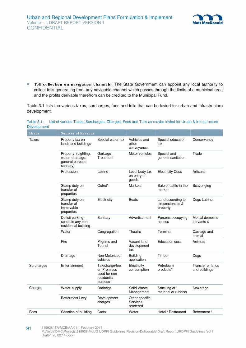
Urban and Regional Development Plans Formulation & Implement Volume – I, DRAFT REPORT VERSION 1
CONFIDENTIAL
319928/ISA/MCB/AA/01 1 Feburary 2014 P:\Noida\DMC\Projects\319928-MoUD UDPFI Guidelines Revision\Deliverable\Draft Report\URDPFI Guidelines Vol I Draft-1 26.02.14.docx
91
� Toll collection on navigation channels: The State Government can appoint any local authority to
collect tolls generating from any navigable channel which passes through the limits of a municipal area
and the profits derivable therefrom can be credited to the Municipal Fund.
Table 3.1 lists the various taxes, surcharges, fees and tolls that can be levied for urban and infrastructure
development.
Table 3.1: List of various Taxes, Surcharges, Charges, Fees and Tolls as maybe levied for Urban & Infrastructure
Development
Heads Sources of Revenue
Taxes Property tax on lands and buildings
Special water tax Vehicles and other conveyance
Special education tax
Conservancy
Property: (Lighting, water, drainage, general purpose, sanitary)
Garbage Treatment
Motor vehicles Special and general sanitation
Trade
Profession Latrine Local body tax on entry of goods
Electricity Cess Artisans
Stamp duty on transfer of properties
Octroi* Markets Sale of cattle in the market
Scavenging
Stamp duty on transfer of immovable properties
Electricity Boats Land according to circumstances & property
Dogs Latrine
Deficit parking space in any non-residential building
Sanitary Advertisement Persons occupying houses
Menial domestic servants s
Water Congregation Theatre Terminal Carriage and animal
Fire Pilgrims and Tourist
Vacant land development tax
Education cess Animals
Drainage Non-Motorized vehicles
Building application
Timber Dogs
Surcharges Entertainment Tax/charge/fee on Premises used for non-residential purpose
Electricity consumption
Petroleum products*
Transfer of lands and buildings
Charges Water-supply Drainage Solid Waste Management
Stacking of material or rubbish
Sewerage
Betterment Levy Development charges
Other specific Services rendered
Fees Sanction of building Carts Water Hotel / Restaurant Betterment /
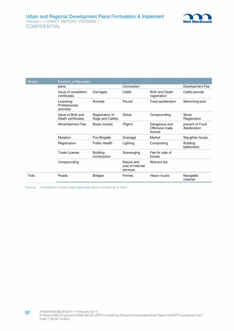
Urban and Regional Development Plans Formulation & Implement Volume – I, DRAFT REPORT VERSION 1
CONFIDENTIAL
319928/ISA/MCB/AA/01 1 Feburary 2014 P:\Noida\DMC\Projects\319928-MoUD UDPFI Guidelines Revision\Deliverable\Draft Report\URDPFI Guidelines Vol I Draft-1 26.02.14.docx
92
Heads Sources of Revenue
plans Connection Development Fee
Issue of completion certificates
Carriages Cattle Birth and Death registration
Cattle pounds
Licensing: Professionals, activities
Animals Pound Food adulteration Swimming pool
Issue of Birth and Death certificates
Registration of Dogs and Cattles
Street Compounding Stock Registration
Advertisement Fee Boats (rental) Pilgrim Dangerous and Offensive trade license
prevent of Food Adulteration
Mutation Fire Brigade Drainage Market Slaughter house
Registration Public Health Lighting Composting Building betterment
Trade License Building construction
Scavenging Fee for sale of Goods
Compounding Nature and cost of Internet services
Warrant fee
Tolls Roads Bridges Ferries Heavy trucks Navigable channel
Source: Compilation of State wise applicable taxes and fees as in 2004
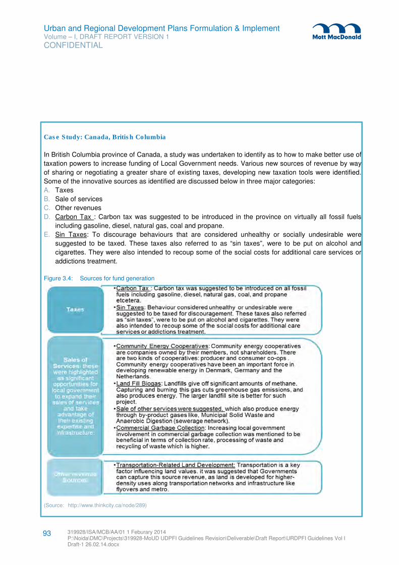
Urban and Regional Development Plans Formulation & Implement Volume – I, DRAFT REPORT VERSION 1
CONFIDENTIAL
319928/ISA/MCB/AA/01 1 Feburary 2014 P:\Noida\DMC\Projects\319928-MoUD UDPFI Guidelines Revision\Deliverable\Draft Report\URDPFI Guidelines Vol I Draft-1 26.02.14.docx
93
Case Study: Canada, British Columbia
In British Columbia province of Canada, a study was undertaken to identify as to how to make better use of
taxation powers to increase funding of Local Government needs. Various new sources of revenue by way
of sharing or negotiating a greater share of existing taxes, developing new taxation tools were identified.
Some of the innovative sources as identified are discussed below in three major categories:
A. Taxes
B. Sale of services
C. Other revenues
D. Carbon Tax : Carbon tax was suggested to be introduced in the province on virtually all fossil fuels
including gasoline, diesel, natural gas, coal and propane.
E. Sin Taxes: To discourage behaviours that are considered unhealthy or socially undesirable were
suggested to be taxed. These taxes also referred to as “sin taxes”, were to be put on alcohol and
cigarettes. They were also intended to recoup some of the social costs for additional care services or
addictions treatment.
Figure 3.4: Sources for fund generation
(Source: http://www.thinkcity.ca/node/289)
Urban and Regional Development Plans Formulation & Implement Volume – I, DRAFT REPORT VERSION 1
CONFIDENTIAL
319928/ISA/MCB/AA/01 1 Feburary 2014 P:\Noida\DMC\Projects\319928-MoUD UDPFI Guidelines Revision\Deliverable\Draft Report\URDPFI Guidelines Vol I Draft-1 26.02.14.docx
94
3.3.1.2 Charges & Fees (Development Charges, Levies, Impact Fees, non-tax sources, valorisation
charges, service charges)
Charges are a fee charged by a consumer’s local body to recover the costs of specific community/physical services. For example, municipal charges of water supply may go to cover costs of laying water supply infrastructure and water treatment plant in a city. Betterment charges are usually imposed on the beneficiaries of the improvement projects to recover the project cost. Development charge is used for recovering the cost of providing new services and infrastructure in an area.
The Municipality can levy user charges for following services provided in the urban areas:
� Provision of water-supply, drainage and sewerage
� Solid Waste Management
� Parking of different types of vehicles in different areas and for different periods
� Stacking of materials or rubbish on public streets for construction, alteration, repair or demolition work
of any type
� Other specific services rendered
Transit Corridors attracts economic activities and concentred development where provision of additional
infrastructure or its augmentation requires additional financial support. Therefore, such areas call for self-
financed urban infrastructure projects. Alternative possibilities to raise revenues in these areas can be by
tapping land-based financing sources along dense transport corridors, these options can be:
� Higher Conversion charges especially for commercial and economically lucrative activities,
� Higher Development charges or Betterment levy on land uses which put more pressure on
infrastructure
� Impact fees or higher charges on the purchase of extra FSI/FAR along the corridor upto a maximum
prescribed by the authority
� Overall additional changes and fees such as higher property tax, special water tax (mentioned in the
table 3.1)
� Non tax source for the use of particular services, such as Service charges for parking in the TOD
influence zone, fire safety facilities in the zone among others.
The Municipality can levy fees and fines for the following services and activities to generate revenue:
� Sanction of building plans and issue of completion certificates,
� Issue of municipal licenses for various non-residential use of lands and buildings,
� Licensing of various categories of professionals, activities such as sinking of tube-wells, sale of meat,
fish or poultry or premises used for private markets, slaughterhouses, hospitals, animals, carts or
carriages and other activities.
� Sites used for advertisements in roads, parking lots, commercial locations and public building,
� Issue of birth and death certificates.
� Impact Fees: It is a fee imposed on builder, developer on industrialist to compensate the impact and
burden new project is going to have on socio-physical infrastructure (existing and need for new) and
environment.
Urban and Regional Development Plans Formulation & Implement Volume – I, DRAFT REPORT VERSION 1
CONFIDENTIAL
319928/ISA/MCB/AA/01 1 Feburary 2014 P:\Noida\DMC\Projects\319928-MoUD UDPFI Guidelines Revision\Deliverable\Draft Report\URDPFI Guidelines Vol I Draft-1 26.02.14.docx
95
3.3.1.3 Grant-in-aid & Subsidiaries
Central Finance Commission (CFC) evolves a comprehensive framework for the distribution of the grants-
in-aid between states. This criterion include indicators like – population, area, distance from highest per
capita sectoral income, index of devolution, SC/ST proportion in the population and FC local body grants
utilisation index. These indicators have varying weightage according to which grants are allocated to the
States.
Grants are classified as planned on non-planned. Plan Grants are made available through planned
transfers from upper tier of Government under various projects, programmes and schemes, such as
JnNURM, UIDSSMT, IDSMT, RAY and IAY. Non-Plan Grants are made available to compensate against
the loss of income and some specific transfers, such as Octroi compensation.
A capital grant is usually utilised for capital expenditure like purchase of land, building, equipment,
facilities, etc. The benefits of such expenditure are of an enduring nature and spread over an extended
period of time, such as road development grant.
The revenue grant is generally utilised for meeting recurring expenditure, the benefits of which usually
expire within the accounting year in which it is incurred. Revenue Grants are usually in the nature of a
subsidy. Subsidies are provided, directly or indirectly, for the provision of services such as water supply,
disposal of sewage, transporting and disposal of wastes; municipal transport, street lighting, hospitals and
schools.
Further, the 13th Finance commission has introduced other grants namely, general basic grant, general
performance grant and special area basic grant.
3.3.1.4 Public Private Partnership PPP
One of the ways to enhance fiscal capabilities of the municipal authorities is to shed some of their functions
and evolve alternative institutional arrangement for the performance of such functions. Public Private
Partnership is such arrangement between a government / statutory entity / government owned entity on
one side and a private sector entity on the other, for the provision of public assets or public services,
through investments being made and management being undertaken by the private sector entity, for a
specified period of time. There is well defined allocation of risk between the private sector and the public
entity. The PPP arrangement ensures that private entity receives performance linked payments that
conform to specified and pre-determined performance standards, measurable by the public entity or its
representative.
PPP models are generally classified in the categories are enlisted below and detailed in section 4.3.2:
� Management Contracts
� Turnkey Projects
� Lease
� Concession
Urban and Regional Development Plans Formulation & Implement Volume – I, DRAFT REPORT VERSION 1
CONFIDENTIAL
319928/ISA/MCB/AA/01 1 Feburary 2014 P:\Noida\DMC\Projects\319928-MoUD UDPFI Guidelines Revision\Deliverable\Draft Report\URDPFI Guidelines Vol I Draft-1 26.02.14.docx
96
� Private Ownership
3.3.1.5 Loans from Financial Institutions
A financial institution is either in public and private sector which brings funds from the public and puts them
in financial assets rather than physical property. Such institutions are made up of different organizations
such as banks, trust companies, insurance companies and investment dealers. Specialised financial
institutions e.g. IDFC, NHB, HUDCO and IL&FS are some agencies which provide loans and a variety of
instruments for infrastructure financing. Other financial institutions e.g. ICICI, LIC of India, etc. also provide
funds for infrastructure projects. These institutions have access to funds which are for longer duration e.g.
loans from development agencies, bonds from open market, foreign institutional investors, etc. and are
thus able to lend for relatively longer durations than banks.
Credit rating of the ULB plays an important role here. The better the credit rating for repayment of principal
and interest, lower is the rate of interest. Certain financial institutions provide credit enhancement
mechanisms to enhance the inherent credit quality to obtain a better credit rating resulting in lower interest
rates. This facility is now also being extended by Ministry of Urban Development through its Pooled
Finance Development Fund (PFDF) scheme. Institutions may also provide guarantees for funds accessed
from other sources. (Municipal Finance Improvement Programme-JnNURM)
Banking institutions also provide finance to local authorities. Bank loan is a relatively new avenue and an
easier option for finance for Local Bodies, as the banks have prescribed norms and well laid down
procedures. The time period of these loans are short to medium term and generally do not cater to the long
tenor needs of infrastructure projects. Bank loans are available to finance the short term needs of
institutions e.g. working capital loan, bridge loans, loans against property etc.
3.3.1.6 Funding by Bi-lateral & Multi-lateral agencies
Bilateral organizations are government agencies or non-profit organizations of a country that provide aid to
other countries. Bilateral organizations receive funding from their national governments, and use the
funding to aid developing countries. Few bilateral agencies are as follows:
� US Agency for International Development (USAID)
� Department for International Development (DFID; UK)
� Japan Bank for international Cooperation (JBIC)
� Japan International Cooperation Agency (JICA)
� Aus Aid
Multilateral organisations are international organisations whose membership comprises member
governments, who collectively govern the organisation and are the primary source of funds while the
loans/grants-in-aid are provided for projects in various countries. Some examples of multilateral funding
agencies are:
� Various United Nation (UN) bodies
� World Bank
Urban and Regional Development Plans Formulation & Implement Volume – I, DRAFT REPORT VERSION 1
CONFIDENTIAL
319928/ISA/MCB/AA/01 1 Feburary 2014 P:\Noida\DMC\Projects\319928-MoUD UDPFI Guidelines Revision\Deliverable\Draft Report\URDPFI Guidelines Vol I Draft-1 26.02.14.docx
97
� Organisation for Economic Cooperation and Development (OECD)
� Asian Development Bank (ADB)
Bi-lateral and Multi-lateral bodies are also known as Development Agencies. These provide soft loans and
grants for infrastructure projects. Accessing funds from these agencies is relatively a long process and it
requires preparation of various project documents - in-depth planning, and studies to assess compliance of
the project with respect to environment, rehabilitation / resettlement and social safeguard policies, and pilot
testing of new initiatives. As almost all loan projects of bi-lateral and multi-lateral agencies are backed by a
sovereign guarantee, the Department of Economic Affairs, Ministry of Finance, Government of India plays
an important role during the entire process. In line with the development financing objectives of these
institutions, projects funded by these institutions are typically in sectors that are not commercially
attractive. Local bodies can receive external development assistance from bilateral and multilateral
sources on behalf of the State Governments for State sector projects/programmes. (Municipal Finance
Improvement Programme-JnNURM)
3.3.1.7 Foreign Direct Investment
Funds from Foreign Direct Investment (FDI) have emerged as a major source of funds in infrastructural
projects in India – for instance Japan’s (Japan Bank of International Cooperation) FDI support in
developing the Delhi Mumbai Industrial Corridor (DMIC).
Under FDI Policy 2013, almost all the sectors have been opened for 100 per cent FDI except agriculture,
mining and petroleum and natural gas, manufacturing, service sector and financial services. The sectors in
which hundred per cent FDI is permissible are construction (townships, housing and built up infrastructure),
Industrial Parks and Airports with few conditions. Hence FDI support for financial resource mobilization is
easily available, which could be permitted through financial collaborations, joint ventures/technical
collaborations, capital market, preferential allotments etc.
3.3.1.8 Pooled Finance development fund scheme by GoI
Small and medium sized cities find it difficult to raise resources from the market for infrastructure projects
due to lack of project structuring capabilities and creditworthiness. The Government of India has launched
the Pooled Finance Development Scheme (PFDS) to enable these local bodies to bridge this gap through
accessing market funds for their infrastructure projects. The scheme is meant to provide credit
enhancement grants to enable local authorities to access market borrowings through Pooled Finance
Municipal Bonds (PFMB) for investment in urban infrastructure projects.
PFDS facilitates ULBs in municipal infrastructure by helping them access capital and financial market for
investment in essential projects. It facilitates local bodies in developing bankable urban infrastructure
projects. With appropriate credit enhancement measures it helps ULBs in reducing the cost of borrowing
from market, on the other hand strengthening the municipal bond market.
Urban and Regional Development Plans Formulation & Implement Volume – I, DRAFT REPORT VERSION 1
CONFIDENTIAL
319928/ISA/MCB/AA/01 1 Feburary 2014 P:\Noida\DMC\Projects\319928-MoUD UDPFI Guidelines Revision\Deliverable\Draft Report\URDPFI Guidelines Vol I Draft-1 26.02.14.docx
98
The PFDS creates an incentive structure to support urban reforms, which would also be driven by
covenants of financial market lenders to ULBs. These urban reforms are in synergy with urban reform
agenda of other central schemes as JnNURM and UIDSSMT. In order to apply for the grant assistance a
State Pooled Finance Entity (SPFE) is required to be established in every state. The SPFE could be a trust
provided that the entity is just a pass through vehicle. The Central Government will be responsible for the
funding of these State pooled finance entities through the PFDF. The cost of each project of the
Municipality/ULBs will be estimated. Seventy-five per cent of these costs will be reimbursed by the Central
Government and twenty-five per cent by the State Governments.
Other funds at the national level, set-up by Financial Institutions and Banks have also started providing the
much required funds. State level Infrastructure funds (from supply side) and Pooled Finance Funds (from
demand side) have also started providing funds for infrastructure projects. The examples of such funds are
Tamil Nadu Urban Development Fund and Gujarat Infrastructure Development Fund etc.
3.3.1.9 Municipal bonds/debentures
Urban Local Bodies and Infrastructure funds, issue municipal bonds and debentures to general public or
specific institutions at fixed rate of interest and are redeemable after a specific period. Municipal bonds can
either be taxable or tax-free. These bonds and debentures can be listed on the stock exchange which
makes the securities highly liquid and makes secondary market available for the bonds and debentures
holders. National Stock Exchange and Bombay Stock Exchange provide a facility for listing of bonds and
debentures in their Exchanges. In India, the Municipal bond market is still in its budding stage. Only large
ULBs having buoyant revenue base e.g. Ahmedabad, Bangalore were successful in the past in raising
funds through Municipal Bonds27
.
Some national success cases of Local Bodies in raising bonds for infrastructure projects are given below:
Municipal Bonds by Ahmedabad Municipal Corporation (AMC) for water supply and sewerage
program, 1998: To finance the water supply and sewerage program, AMC floated municipal bonds in
January 1998. These were rated AA(SO) specifying having high degree of safety regarding timely servicing
of financial obligations or carrying very low credit risk. These bonds were floated for seventy-five per cent
private and twenty-five per cent public issue. This was a significant accomplishment at the given time, as it
was the first municipal bond issue in India without a state government guarantee and it represented the
first step towards fully market-based system of local government finance.
Tamil Nadu Urban Development Fund (TNUDF), 2003: Tamil Nadu Urban Development Fund issued
bonds for commercially viable water and sewerage infrastructure projects by pooling fourteen
municipalities in 2003. A special purpose vehicle, the Water and Sanitation Pooled Fund (WSPF), was set-
up to issue the municipal bonds. The Indo-USAID Programme on Financial Institutions Reform and
27 (Source: Indo-US Financial Institutions Reform and Expansion Project - Debt Market Component FIRE(D); Creative Financing of Urban Infrastructure in India through Market-based Financing and Public-Private Partnership Options, Chetan and Hitesh Vaidya )
Urban and Regional Development Plans Formulation & Implement Volume – I, DRAFT REPORT VERSION 1
CONFIDENTIAL
319928/ISA/MCB/AA/01 1 Feburary 2014 P:\Noida\DMC\Projects\319928-MoUD UDPFI Guidelines Revision\Deliverable\Draft Report\URDPFI Guidelines Vol I Draft-1 26.02.14.docx
99
Expansion (FIRE-D) supported the efforts of WSPF to structure the bond issue whose proceeds financed
small water and sanitation projects in the fourteen small ULBs. USAID provided a backup guarantee of fifty
per cent of the bond’s principal through the Development Credit Authority (DCA) mechanism.
Greater Bangalore Water & Sewerage Project (8 ULBs), 2005: Government of Karnataka created debt
fund called the Karnataka Water and Sanitation Pooled Fund (KWSPF) and successfully floated tax-free
municipal bonds during June, 2005. It was done for the Greater Bangalore Water Supply and Sewerage
Project (GBWASP). Government of Karnataka was assisted by USAID under its DCA program and
provided a guarantee of up to fifty per cent of the principal amount of market borrowing. The GBWASP is
planned to provide water supply to 1.5 million people residing in about 300,000 households
3.3.2 Alternative Financial Avenues by Private Sector Participation
Public-Private Partnership (PPP) is a long term contractual agreement between a public agency (central,
state or local) and a private sector entity for providing a public asset or service in which the private party
bears significant risk and management responsibility.
The private sector includes consultancy firms, developers, builders and promoters, cooperative societies,
non-governmental organisations (NGOs) and community based organisations (CBOs), cooperative bodies,
industrialists and businessmen.
‘PPP means an arrangement between a government or statutory entity or government owned entity on one
side and a private sector entity on the other, for the provision of public assets and/ or related services for
public benefit, through investments being made by and/or management undertaken by the private sector
entity for a specified time period, where there is a substantial risk sharing with the private sector and the
private sector receives performance linked payments that conform (or are benchmarked) to specified, pre-
determined and measurable performance standards’28
.
3.3.2.1 Conditions/Situations for PPP Selection
A project may be considered to be implemented as a PPP project when there are efficiency gains from
improved project delivery, operation and management, and access to advanced technology can offset the
incidental costs, improvement in human resource etc. In fact, many countries have established value for
money as the main criterion in judging the merits of a PPP option for a project. Decision for PPP to be an
alternative development mechanism can be selected for a project, if it satisfies the following conditions or
is set in the given situations:
� Enhance the supply of much-needed services
� Does not require any immediate cash spending
� Provide relief from the burden of the costs of design and construction
� Transfer of many project risks to the private sector
28 (Department of Economic Affairs - DEA, Ministry of Finance, Government of India, 2010)
Urban and Regional Development Plans Formulation & Implement Volume – I, DRAFT REPORT VERSION 1
CONFIDENTIAL
319928/ISA/MCB/AA/01 1 Feburary 2014 P:\Noida\DMC\Projects\319928-MoUD UDPFI Guidelines Revision\Deliverable\Draft Report\URDPFI Guidelines Vol I Draft-1 26.02.14.docx
100
� Promise better project design, choice of technology, construction, operation and service delivery
� A PPP project is viable essentially when a robust business model can be developed
3.3.2.2 Systems of Participation
PPP models vary from short-term simple management contracts to long-term and very complex BOT form.
Depending upon type of project and requirements of public entity any single or combinations could be
selected. In such models amount of investment, risks, obligations and durations vary. These models vary
mainly by:
� Ownership of capital assets
� Responsibility for investment
� Assumption of risks
� Duration of contract
The PPP models can be classified into following broad categories in order of generally (but not always)
increased involvement and assumption of risks by the private sector. These are enlisted below and are
diagrammatically presented in the figure 3.5.
i. Management Contracts
ii. Turnkey Projects
iii. Lease
iv. Concession
v. Private Ownership
1. Management Contracts: It is a contractual agreement between government and private sector for
the management of public enterprise partially or completely by private party.
Control of public enterprise remains with the government. While private sector skills are brought
into service design and delivery, operational control, labour management and equipment
procurement.
– Supply or Service Contracts: In these types of contracts supply of material, equipment or
services is provided to public enterprise by private counterpart. The main purpose of such
contracts is to ensure the supply of the relevant service at the desired level of quantity and
quality. Example of these contracts is catering services for passengers on public railway
systems.
– Maintenance management: Private partner is contracted by public partner to operate,
maintain, and manage a facility or system providing a service. Such as in provision of
wastewater treatment services, transport projects etc.
– Operational Management: Public partner (Centre, state, or local government agency or
authority) contracts with a private partner to provide and/or maintain a specific service.
Such contracts are useful in major transport facilities (port or airport) when local manpower is
limited, in the transport sector for providing management services like ticketing, reservation or
of urban transport. In the simplest type of such contract, the private operator is paid a fixed fee
for performing managerial tasks. More complex contracts may offer greater incentives for
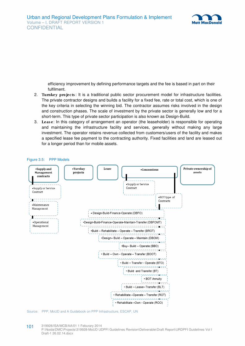
Urban and Regional Development Plans Formulation & Implement Volume – I, DRAFT REPORT VERSION 1
CONFIDENTIAL
319928/ISA/MCB/AA/01 1 Feburary 2014 P:\Noida\DMC\Projects\319928-MoUD UDPFI Guidelines Revision\Deliverable\Draft Report\URDPFI Guidelines Vol I Draft-1 26.02.14.docx
101
efficiency improvement by defining performance targets and the fee is based in part on their
fulfilment.
2. Turnkey projects: It is a traditional public sector procurement model for infrastructure facilities.
The private contractor designs and builds a facility for a fixed fee, rate or total cost, which is one of
the key criteria in selecting the winning bid. The contractor assumes risks involved in the design
and construction phases. The scale of investment by the private sector is generally low and for a
short-term. This type of private sector participation is also known as Design-Build.
3. Lease: In this category of arrangement an operator (the leaseholder) is responsible for operating
and maintaining the infrastructure facility and services, generally without making any large
investment. The operator retains revenue collected from customers/users of the facility and makes
a specified lease fee payment to the contracting authority. Fixed facilities and land are leased out
for a longer period than for mobile assets.
Figure 3.5: PPP Models
Source: PPP, MoUD and A Guidebook on PPP Infrastructure, ESCAP, UN
Urban and Regional Development Plans Formulation & Implement Volume – I, DRAFT REPORT VERSION 1
CONFIDENTIAL
319928/ISA/MCB/AA/01 1 Feburary 2014 P:\Noida\DMC\Projects\319928-MoUD UDPFI Guidelines Revision\Deliverable\Draft Report\URDPFI Guidelines Vol I Draft-1 26.02.14.docx
102
4. Concessions: In this alternative, Government defines and grants specific rights to a private
company to build and operate a facility for a fixed period of time. The Government may retain the
ultimate ownership of the facility and/or right to supply the services. Typical concession periods
range between 5 to 50 years. Concessions may be awarded to a concessionaire, under two types
of contractual arrangements:
– Franchise: Under a franchise arrangement the concessionaire provides services that are fully
specified by the franchising authority. Commercial risks are carried by private sector and may
be required to make investments. This form of private sector participation is historically popular
in providing urban bus or rail services.
– Build-Operate-Transfer (BOT): Build-Operate-Transfer or its other variants type of
arrangement, the concessionaire undertakes investments and operates the facility for a fixed
period of time after which the ownership reverts back to the public sector. In BOT type of model
the government carries the risk. The various types of BOT combinations are given below:
– Design-Build-Finance-Operate (DBFO): In DBFO approach, the responsibilities for
designing, building, financing, operating and maintaining are bundled together and
transferred to private sector partners. Varying degree of financial responsibilities is
transferred to the private sector. Direct user fees are the most common revenue source.
– Design-Build-Finance-Operate-Maintenance-Transfer (DBFOMT): DBFOMT model is
the same as a DBFO except that the private sector owns the asset until the end of the
contract when the ownership is transferred to the public sector.
– Build-Rehabilitate-Operate-Transfer (BROT): A private developer builds an add-on to an
existing facility or completes a partially built facility and rehabilitates existing assets, then
operates and maintains the facility at its own risk for the contract period.
– Design-Build-Operate-Maintain (DBOM): DBOM model is an integrated partnership that
combines the design and construction responsibilities of design-build procurements with
operations and maintenance.
– Buy-Build-Operate (BBO): BBO is a form of asset sale that includes a rehabilitation or
expansion of an existing facility. The government sells the asset to the private sector entity,
which then makes the improvements necessary to operate the facility in a profitable
manner.
– Build-Own-Operate-and-Transfer (BOOT): BOOT is based on the granting of a
concession by the Union/ Government/local authority to the concessionaire, who is
responsible for the construction, financing, operation and maintenance of a facility over the
period of the concession before finally transferring the fully operational facility.
– Build-Transfer-and-Operate (BTO): BTO is a contractual arrangement whereby the public
sector contracts out the building of an infrastructure facility to a private entity such that the
concessionaire builds the facility on a turn-key basis, assuming cost overrun, delay and
specified performance risks.
– Build-and-Transfer (BT): BT is a contractual arrangement whereby the concessionaire
undertakes the financing and construction of a given infrastructure or development facility
and after its completion turns it over to the Government Agency or Local Government unit
concerned.
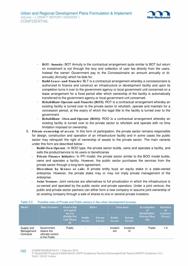
Urban and Regional Development Plans Formulation & Implement Volume – I, DRAFT REPORT VERSION 1
CONFIDENTIAL
319928/ISA/MCB/AA/01 1 Feburary 2014 P:\Noida\DMC\Projects\319928-MoUD UDPFI Guidelines Revision\Deliverable\Draft Report\URDPFI Guidelines Vol I Draft-1 26.02.14.docx
103
– BOT- Annuity: BOT Annuity is the contractual arrangement quite similar to BOT but return
on investment is not through the levy and collection of user fee directly from the users.
Instead the owner/ Government pay to the Concessionaire an amount annually or bi-
annually (Annuity) which he bids for.
– Build-Lease–and-Transfer: BLT is a contractual arrangement whereby a concessionaire is
authorized to finance and construct an infrastructure or development facility and upon its
completion turns it over to the government agency or local government unit concerned on a
lease arrangement for a fixed period after which ownership of the facility is automatically
transferred to the government agency or local government unit concerned.
– Rehabilitate-Operate-and-Transfer (ROT): ROT is a contractual arrangement whereby an
existing facility is turned over to the private sector to refurbish, operate and maintain for a
concession period, at the expiry of which the legal title to the facility is turned over to the
government.
– Rehabilitate -Own-and-Operate (ROO): ROO is a contractual arrangement whereby an
existing facility is turned over to the private sector to refurbish and operate with no time
limitation imposed on ownership.
5. Private ownership of assets: In this form of participation, the private sector remains responsible
for design, construction and operation of an infrastructure facility and in some cases the public
sector may relinquish the right of ownership of assets to the private sector. The main variants
under this form are described below -
– Build-Own-Operate: In BOO type, the private sector builds, owns and operates a facility, and
sells the product/service to its users or beneficiaries
– Private Finance Initiative: In PFI model, the private sector similar to the BOO model builds,
owns and operates a facility. However, the public sector purchases the services from the
private sector through a long-term agreement.
– Divestiture by license or sale: A private entity buys an equity stake in a state-owned
enterprise. However, the private stake may or may not imply private management of the
enterprise.
– Joint Venture: Joint ventures are alternatives to full privatization in which the infrastructure is
co-owned and operated by the public sector and private operators. Under a joint venture, the
public and private sector partners can either form a new company or assume joint ownership of
an existing company through a sale of shares to one or several private investors.
Table 3.2: Possible roles of Private and Public sectors in the urban development process
Model Main Features Ownership of Capital
Assets (Public/Private/Share
d)
Roles Functions Assumption of
Risk(Public/Private/Shar
ed)
Duration of
Contract (Years) Public
Sector Private Sector
Public Sector
Private Sector
Supply and Management Contracts
Government retains the ultimate control of the Public
Public -
-
Investment
Investment
Public 1-5
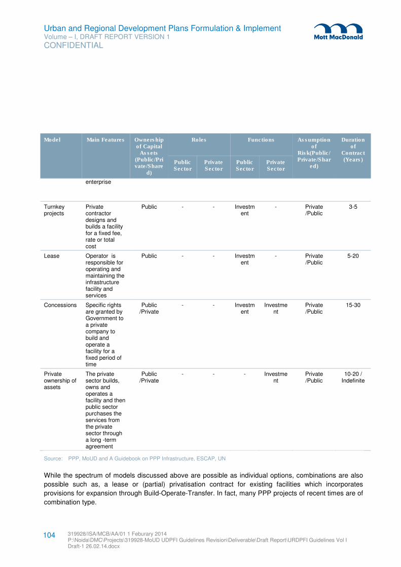
Urban and Regional Development Plans Formulation & Implement Volume – I, DRAFT REPORT VERSION 1
CONFIDENTIAL
319928/ISA/MCB/AA/01 1 Feburary 2014 P:\Noida\DMC\Projects\319928-MoUD UDPFI Guidelines Revision\Deliverable\Draft Report\URDPFI Guidelines Vol I Draft-1 26.02.14.docx
104
Model Main Features Ownership of Capital
Assets (Public/Private/Share
d)
Roles Functions Assumption of
Risk(Public/Private/Shar
ed)
Duration of
Contract (Years) Public
Sector Private Sector
Public Sector
Private Sector
enterprise
Turnkey projects
Private contractor designs and builds a facility for a fixed fee, rate or total cost
Public - - Investment
- Private /Public
3-5
Lease Operator is responsible for operating and maintaining the infrastructure facility and services
Public - - Investment
- Private /Public
5-20
Concessions Specific rights are granted by Government to a private company to build and operate a facility for a fixed period of time
Public /Private
- - Investment
Investment
Private /Public
15-30
Private ownership of assets
The private sector builds, owns and operates a facility and then public sector purchases the services from the private sector through a long -term agreement
Public /Private
- - - Investment
Private /Public
10-20 / Indefinite
Source: PPP, MoUD and A Guidebook on PPP Infrastructure, ESCAP, UN
While the spectrum of models discussed above are possible as individual options, combinations are also
possible such as, a lease or (partial) privatisation contract for existing facilities which incorporates
provisions for expansion through Build-Operate-Transfer. In fact, many PPP projects of recent times are of
combination type.
Urban and Regional Development Plans Formulation & Implement Volume – I, DRAFT REPORT VERSION 1
CONFIDENTIAL
319928/ISA/MCB/AA/01 1 Feburary 2014 P:\Noida\DMC\Projects\319928-MoUD UDPFI Guidelines Revision\Deliverable\Draft Report\URDPFI Guidelines Vol I Draft-1 26.02.14.docx
105
3.3.2.3 Suggested role of public and private sectors
Public sector is now changing its role from service provider to contract manager. Some of case studies of
Public Private Partnership Projects in India are enlisted in Appendix C. In PPP projects the role of public
entity is different from private sector due to the responsibility public sector carry for provision of services to
citizens. Following are the tentative roles of public and private entities in PPP projects:
Public Sector:
� Selection of private party
� Monitoring of performance and quality
� Payment
Private Sector:
� Construction
� Operation & Maintenance
� Service delivery
� Procurement of equipment or material
3.3.2.4 Toolkits for Decision Making for PPPs
Toolkits for decision making for PPP projects are available and could be used by the partners to identify,
assess, develop, procure and monitor the PPP projects. Such toolkits are structured to cover the full life
cycle of PPP projects. The toolkits are built on specific approaches for project procurement; approval etc.
currently in place in India to ensure that it forms a relevant resource for practitioners in India.
Various toolkits to assist decision making in Public Private Partnerships has been provided on the website
of Public Private Partnerships in India by Ministry of Finance29
.
These Toolkits are as follows:
1. PPP Family Indicator – It gives a starting indication of which PPP mode ‘family’ the particular project
might be suited to.
2. PPP Mode Validation Tool – It uses a risk allocation analysis to help decide further whether the
selected PPP mode is best for the project.
3. The PPP Suitability Filter - It tests how well suited the project is to being a PPP and checks for
barriers that might make it difficult to do the project as a PPP
4. Financial Viability Indicator Model - It allows an analysis of the key questions of financial viability of
the project and to test these using ‘what-if?’ scenarios.
5. Value-for-money Indicator Tool - It provides an indication of the expected range of value-for- money
for the public sector from the PPP.
29 (www.pppinindia.com).
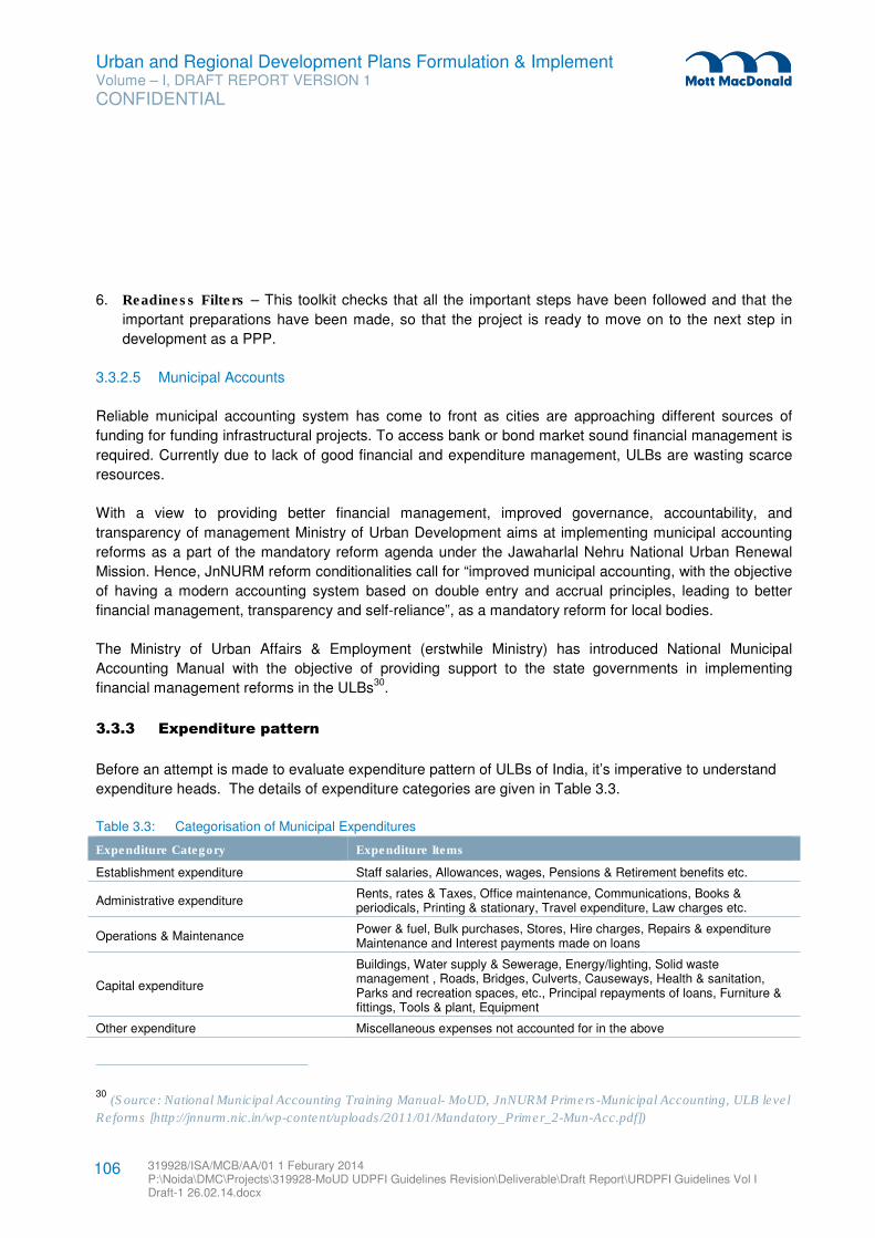
Urban and Regional Development Plans Formulation & Implement Volume – I, DRAFT REPORT VERSION 1
CONFIDENTIAL
319928/ISA/MCB/AA/01 1 Feburary 2014 P:\Noida\DMC\Projects\319928-MoUD UDPFI Guidelines Revision\Deliverable\Draft Report\URDPFI Guidelines Vol I Draft-1 26.02.14.docx
106
6. Readiness Filters – This toolkit checks that all the important steps have been followed and that the
important preparations have been made, so that the project is ready to move on to the next step in
development as a PPP.
3.3.2.5 Municipal Accounts
Reliable municipal accounting system has come to front as cities are approaching different sources of
funding for funding infrastructural projects. To access bank or bond market sound financial management is
required. Currently due to lack of good financial and expenditure management, ULBs are wasting scarce
resources.
With a view to providing better financial management, improved governance, accountability, and
transparency of management Ministry of Urban Development aims at implementing municipal accounting
reforms as a part of the mandatory reform agenda under the Jawaharlal Nehru National Urban Renewal
Mission. Hence, JnNURM reform conditionalities call for “improved municipal accounting, with the objective
of having a modern accounting system based on double entry and accrual principles, leading to better
financial management, transparency and self-reliance”, as a mandatory reform for local bodies.
The Ministry of Urban Affairs & Employment (erstwhile Ministry) has introduced National Municipal
Accounting Manual with the objective of providing support to the state governments in implementing
financial management reforms in the ULBs30
.
3.3.3 Expenditure pattern
Before an attempt is made to evaluate expenditure pattern of ULBs of India, it’s imperative to understand
expenditure heads. The details of expenditure categories are given in Table 3.3.
Table 3.3: Categorisation of Municipal Expenditures
Expenditure Category Expenditure Items
Establishment expenditure Staff salaries, Allowances, wages, Pensions & Retirement benefits etc.
Administrative expenditure Rents, rates & Taxes, Office maintenance, Communications, Books & periodicals, Printing & stationary, Travel expenditure, Law charges etc.
Operations & Maintenance Power & fuel, Bulk purchases, Stores, Hire charges, Repairs & expenditure Maintenance and Interest payments made on loans
Capital expenditure
Buildings, Water supply & Sewerage, Energy/lighting, Solid waste management , Roads, Bridges, Culverts, Causeways, Health & sanitation, Parks and recreation spaces, etc., Principal repayments of loans, Furniture & fittings, Tools & plant, Equipment
Other expenditure Miscellaneous expenses not accounted for in the above
30 (Source: National Municipal Accounting Training Manual- MoUD, JnNURM Primers-Municipal Accounting, ULB level
Reforms [http://jnnurm.nic.in/wp-content/uploads/2011/01/Mandatory_Primer_2-Mun-Acc.pdf])
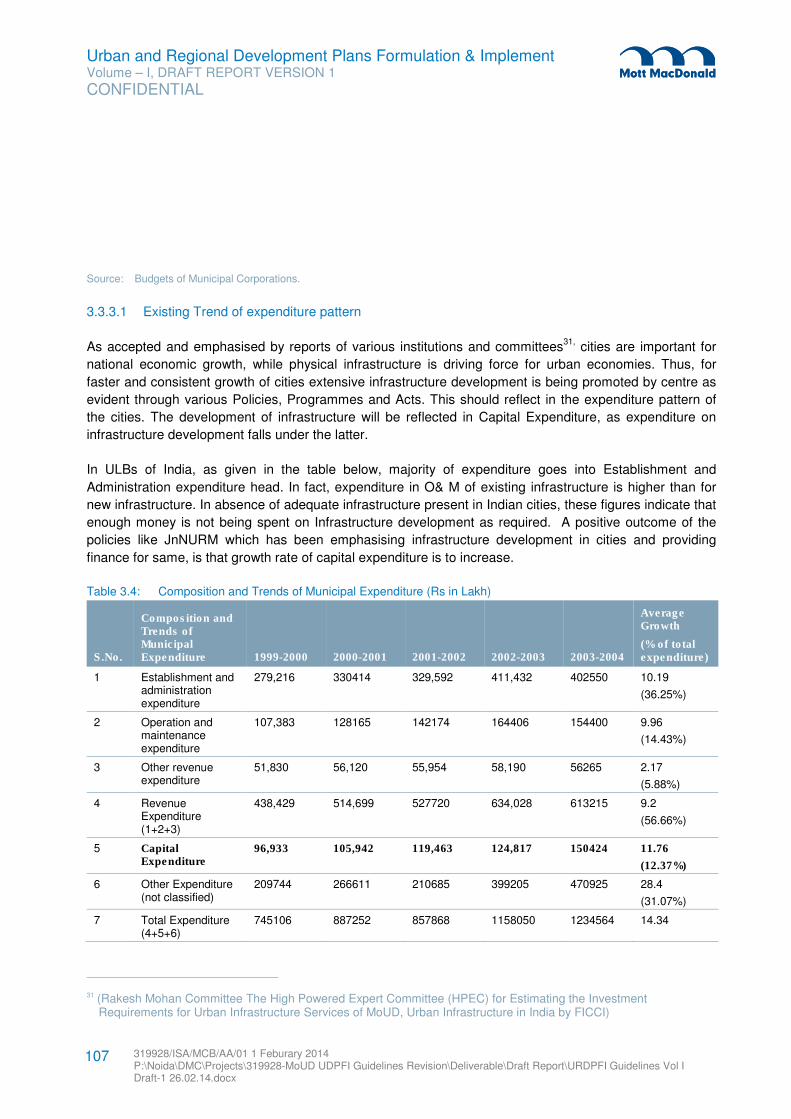
Urban and Regional Development Plans Formulation & Implement Volume – I, DRAFT REPORT VERSION 1
CONFIDENTIAL
319928/ISA/MCB/AA/01 1 Feburary 2014 P:\Noida\DMC\Projects\319928-MoUD UDPFI Guidelines Revision\Deliverable\Draft Report\URDPFI Guidelines Vol I Draft-1 26.02.14.docx
107
Source: Budgets of Municipal Corporations.
3.3.3.1 Existing Trend of expenditure pattern
As accepted and emphasised by reports of various institutions and committees31,
cities are important for
national economic growth, while physical infrastructure is driving force for urban economies. Thus, for
faster and consistent growth of cities extensive infrastructure development is being promoted by centre as
evident through various Policies, Programmes and Acts. This should reflect in the expenditure pattern of
the cities. The development of infrastructure will be reflected in Capital Expenditure, as expenditure on
infrastructure development falls under the latter.
In ULBs of India, as given in the table below, majority of expenditure goes into Establishment and
Administration expenditure head. In fact, expenditure in O& M of existing infrastructure is higher than for
new infrastructure. In absence of adequate infrastructure present in Indian cities, these figures indicate that
enough money is not being spent on Infrastructure development as required. A positive outcome of the
policies like JnNURM which has been emphasising infrastructure development in cities and providing
finance for same, is that growth rate of capital expenditure is to increase.
Table 3.4: Composition and Trends of Municipal Expenditure (Rs in Lakh)
S.No.
Composition and Trends of Municipal Expenditure 1999-2000 2000-2001 2001-2002 2002-2003 2003-2004
Average Growth
(% of total expenditure)
1 Establishment and administration expenditure
279,216 330414 329,592 411,432 402550 10.19
(36.25%)
2 Operation and maintenance expenditure
107,383 128165 142174 164406 154400 9.96
(14.43%)
3 Other revenue expenditure
51,830 56,120 55,954 58,190 56265 2.17
(5.88%)
4 Revenue Expenditure (1+2+3)
438,429 514,699 527720 634,028 613215 9.2
(56.66%)
5 Capital Expenditure
96,933 105,942 119,463 124,817 150424 11.76
(12.37%)
6 Other Expenditure (not classified)
209744 266611 210685 399205 470925 28.4
(31.07%)
7 Total Expenditure (4+5+6)
745106 887252 857868 1158050 1234564 14.34
31 (Rakesh Mohan Committee The High Powered Expert Committee (HPEC) for Estimating the Investment Requirements for Urban Infrastructure Services of MoUD, Urban Infrastructure in India by FICCI)
Urban and Regional Development Plans Formulation & Implement Volume – I, DRAFT REPORT VERSION 1
CONFIDENTIAL
319928/ISA/MCB/AA/01 1 Feburary 2014 P:\Noida\DMC\Projects\319928-MoUD UDPFI Guidelines Revision\Deliverable\Draft Report\URDPFI Guidelines Vol I Draft-1 26.02.14.docx
108
Source: Municipal Finance in India: An Assessment by Department of Economic Analysis and Policy, Reserve Bank of India,
Mumbai. December 27, 2007
It is recommended that the urban settlements need to increase spending on capital expenditure head in
total Municipal Expenditure which leads to the development of economy and humans alike.
3.3.4 Effective finance management
3.3.4.1 Uniformity of accounting system
Need for uniformity in municipal accounting system was felt as cities in India are developing infrastructure
projects that reflect principles of commercial viability and private sector participation. Under the JnNURM,
MoUD decided to provide financial resources to states and ULBs that agree to undertake following modern
accounting reforms:
� Budgeting, accounting, internal controls and auditing.
� Re-engineering business processes to align with accrual-based accounting system,
� Integrate financial management systems with financial accounting system,
� Staff and building financial management capacity.
To encourage decentralization and improving transparency in the functioning of municipalities of the
country, the Government of India has made initiatives for improvements in the accounting and budgeting
systems, improved record keeping and maintenance among others. With this objective the Ministry of
Urban Development, initiated to develop a National Municipal Accounts Manual.
The National Municipal Accounts Manual comprehensively details the accounting policies, procedures,
guidelines designed to ensure correct, complete and timely recording of municipal transactions and
produce accurate and relevant financial reports. The manual is to be adopted and followed by the various
State Governments while drafting their state specific municipal accounts manuals.
3.3.4.2 Efficient tax/charges administration and recovery management
Tax administration and recovery mechanisms need to be revised in India to improve tax collection and
increase the revenue resources available with local bodies to meet its requirements. Enforcement of tax
collection needs to be strengthened. For collection of fees for provision of services, proper techniques
should be enforced. Periodic assessment and valuation of properties for tax revision should take place and
for expanding the tax base, property tax rolls should be updated via identification of new properties,
computerising billing & collection.
3.3.4.3 Fiscal transfer management for ULBs/RDAs
Lack of structured fiscal transfer mechanisms from State to ULBs is one of the major reasons of availability
of lesser fiscal resources with local authorities. State Governments and ULBs need to explore the
Urban and Regional Development Plans Formulation & Implement Volume – I, DRAFT REPORT VERSION 1
CONFIDENTIAL
319928/ISA/MCB/AA/01 1 Feburary 2014 P:\Noida\DMC\Projects\319928-MoUD UDPFI Guidelines Revision\Deliverable\Draft Report\URDPFI Guidelines Vol I Draft-1 26.02.14.docx
109
performance-based grants as suggested by the 13th Central Finance Commission (CFC). State Finance
Commissions (SFC) generally do not have access to good databases at the ULB level and there are no
agencies at the state level, which collect and maintain comprehensive databases. State Governments
should address this issue of creation and maintenance of databases of ULBs rather than depending on
databases based on sample surveys.
Timely constitution of SFC and timely submission of SFC Reports is very important. The system of
providing grant-in-aid to ULBs is complex and the SFCs should try to introduce the concept of devolution
packages after taking into consideration all types of revenue grants and these should be linked with State’s
own resources.
SFCs should also consider the idea of performance based or incentive grants based on outcomes such as
improved service delivery, improved tax collections and improved financial management etc. SFCs could
review and link the grants to performance as suggested by the 13th CFC and reforms under JNNURM.
Importantly, the State Governments should give a serious consideration to the recommendations of the
SFC Reports and timely issuance of Action Taken Reports (ATR). All State Governments should build a
system for predictability and transparency of state transfers to ULBs. The State Governments should follow
the system of electronic transfers to ULBs rather than the conventional transfers. (Source: Tracking Central
Finance Commissions and State Finance Commissions Grants to Selected States and Urban Local Bodies
in India, NIUA)
3.3.5 City Infrastructure Fund
The infrastructure plays a vital role in the growth and development of cities in the current context. Keeping
in mind the demands and requirements of urban development, Government of India has also been
emphasising and providing finance for development of infrastructure. Following the same line thought, a
City Infrastructure Fund should be established at urban centres by the Executive order. It should be other
than the Budget fund and dedicated only for the Urban and Regional Infrastructure development. Sources
of possible funding for such fund could be:
1. Whole or part of the Stamp Duty on transaction of real-estate property,
2. Capital gain tax on real-estate property,
3. Land use conversion fee,
4. Entry tax on vehicles in special areas (inner city, CBD etc.) of cities,
5. Part of the TDS on real-estate transactions valued over 50 Lakhs ( now mooted by the Finance
Ministry),
6. Vacant tax on Municipal FAR rather than vacant land,
7. Toll tax,
8. Part of funds raised through auction of strategic plots,
9. Cess on purchase of luxury vehicles say costing above 10 lakhs,
10. Betterment levy on special zones (transport corridors etc.).
11. Cess on electricity bill is imposed to cover the cost street lighting,
12. Urban Infrastructure Bonds,
Urban and Regional Development Plans Formulation & Implement Volume – I, DRAFT REPORT VERSION 1
CONFIDENTIAL
319928/ISA/MCB/AA/01 1 Feburary 2014 P:\Noida\DMC\Projects\319928-MoUD UDPFI Guidelines Revision\Deliverable\Draft Report\URDPFI Guidelines Vol I Draft-1 26.02.14.docx
110
13. Use idle funds (Provident Fund, various Trusts etcetera) to subscribe to the Bonds.
14. Leverage Urban Infrastructure Bonds with long term loans from multilateral development banks.
Land-based financing sources along Transport Corridors can be tapped through the following:
� Conversion charges,
� Betterment charges,
� Periodic revision of property guidance value, especially along Transit corridors,
� Impact fees,
� Development charges.
� Higher FSI & Mixed Land Use in influence zone of Transit corridors within overall planning guidelines,
� Pricing of Floor Space Index (FSI) above a certain limit,
� Prepare city-wide inventory of land assets,
� Transparent and accountable mechanism for monetisation of public land with attention to the poor,
� Dedicated Urban Infrastructure Fund at city & state levels: For regular inflows of funds from various
beneficiaries of improved urban transport facilities.

Urban and Regional Development Plans Formulation & Implement Volume – I, DRAFT REPORT VERSION 1
CONFIDENTIAL
319928/ISA/MCB/AA/01 1 Feburary 2014 P:\Noida\DMC\Projects\319928-MoUD UDPFI Guidelines Revision\Deliverable\Draft Report\URDPFI Guidelines Vol I Draft-1 26.02.14.docx
111
State of Odisha has developed Odisha Urban Infrastructure Development Fund (OUIDF) to strengthen
revenue buoyancy at ULB level.
Institutional framework of OUIDF consists of:
• Urban Loan Fund.
• Grant Fund.
• Project Development Fund.
OUIDF has been developed as a Trust under the Housing and Urban Development Department (HUDD)
with assistance from KfW (Germany’s Development Bank).
The OUIDF seeks to (a) catalyse development of well-structured pool of bankable projects, (b) build
capacity in appraisals and resource mobilization and (c) spur institutional reforms as a pre-requisite for
external financing.
Focus sectors and projects for funding under the OUIDF include the following:
• Water supply and water supply improvement schemes,
• Underground sewerage schemes,
• SWM,
• Climate adaption measures,
• Slum development, rehabilitation, provision of basic amenities to informal settlements,
• Bio-medical waste management,
• Development and renovation of bus/train terminals,
• Electric crematories,
• Energy efficient street lighting,
• Reclamation / preservation of water bodies/tanks.
To raise financial support under the fund project needs to clear set of criteria like, positive climate /
environment impact, financial soundness of ULB, projects which are expected to achieve economic viability
after three years of grant support amongst others.
Source: Odisha Infrastructure Development Fund
Similarly, State of Rajasthan has developed innovative sources of finance to develop infrastructure in
State. The expenditure of the fund is broadly divided into two-
� 50% on Transport
� 50% on Urban infrastructure and buildings
3.4 Good Governance
The new economic policy of Government of India has changed the role of government from provider to
facilitator. With entry of private sector in service provision and improving economic profile of Indian
economy, urban public (basically but not only) has started demanding better service provision standards
and accountability in the process of governance. Herein comes the role and concept of ‘Good governance’.
It is an evolving concept, concerning best practices of decision making for conducting public affairs and
management of public resources. Good governance is responsive and responsible governance. It is
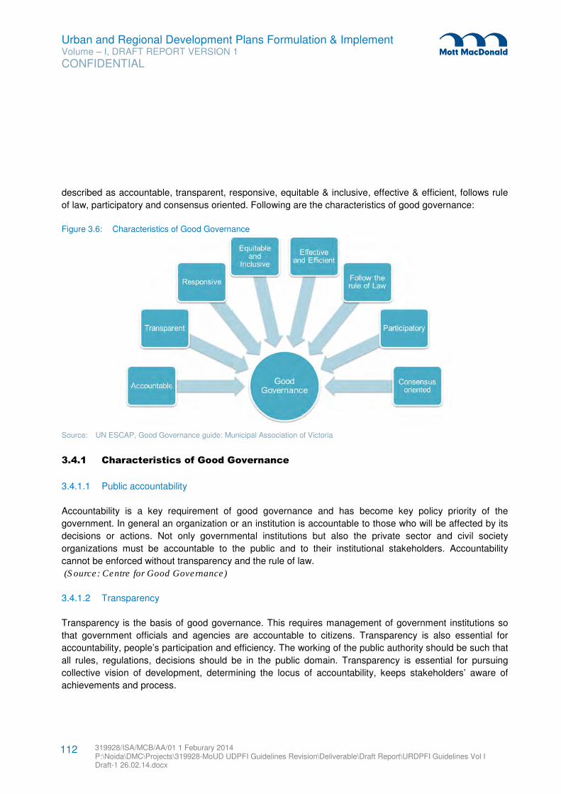
Urban and Regional Development Plans Formulation & Implement Volume – I, DRAFT REPORT VERSION 1
CONFIDENTIAL
319928/ISA/MCB/AA/01 1 Feburary 2014 P:\Noida\DMC\Projects\319928-MoUD UDPFI Guidelines Revision\Deliverable\Draft Report\URDPFI Guidelines Vol I Draft-1 26.02.14.docx
112
described as accountable, transparent, responsive, equitable & inclusive, effective & efficient, follows rule
of law, participatory and consensus oriented. Following are the characteristics of good governance:
Figure 3.6: Characteristics of Good Governance
Source: UN ESCAP, Good Governance guide: Municipal Association of Victoria
3.4.1 Characteristics of Good Governance
3.4.1.1 Public accountability
Accountability is a key requirement of good governance and has become key policy priority of the
government. In general an organization or an institution is accountable to those who will be affected by its
decisions or actions. Not only governmental institutions but also the private sector and civil society
organizations must be accountable to the public and to their institutional stakeholders. Accountability
cannot be enforced without transparency and the rule of law.
(Source: Centre for Good Governance)
3.4.1.2 Transparency
Transparency is the basis of good governance. This requires management of government institutions so
that government officials and agencies are accountable to citizens. Transparency is also essential for
accountability, people’s participation and efficiency. The working of the public authority should be such that
all rules, regulations, decisions should be in the public domain. Transparency is essential for pursuing
collective vision of development, determining the locus of accountability, keeps stakeholders’ aware of
achievements and process.
Urban and Regional Development Plans Formulation & Implement Volume – I, DRAFT REPORT VERSION 1
CONFIDENTIAL
319928/ISA/MCB/AA/01 1 Feburary 2014 P:\Noida\DMC\Projects\319928-MoUD UDPFI Guidelines Revision\Deliverable\Draft Report\URDPFI Guidelines Vol I Draft-1 26.02.14.docx
113
Emergence of United Nations Convention against Corruption, activism and awareness of civil society for
transparency, strong media leading to increased voice of citizens and participation in governance have
further emphasised the need for transparency in governance. This means addressing corruption and
ensuring accountability in formulation of policies, implementing programmes and delivering services in a
convenient, accessible and responsive manner is becoming a non-negotiable priority for governance.
(Source: Good Governance & Transparency- Their Impact on Development by Saladin Al-Jurf &
Transparency and Good Governance at the Municipal Level: Transparency International Canada)
3.4.1.3 Citizens charter and Grievance redressal
One of the functions of government is to provide public services to the citizens and to do the same, the
government has to operate efficiently and effectively for reaching its optimum performance. For the
delivery of public services to the citizens at acceptable performance requires government entities to act in
the public interest at all times. It requires transparency, citizen participation in decision making and public
accountability. Citizens’ feedback plays an important role in service delivery and its improvement.
Citizens’ charter and grievance redressal brings accountability in the process of service delivery. A
Citizens' charter represents the commitment of the organisation towards standard, quality and time frame
of service delivery, grievance redress mechanism, transparency and accountability. The concept of
Citizen’s charter enshrines the trust between the service provider and its users. A grievance can be
defined as any sort of dissatisfaction, which needs to be redressed in order to result in service delivery.
The Government of India has introduced, The Right of Citizens for time bound delivery of Goods and
Services and Redressal of their Grievances Bill, 2011. It confers right on every individual citizen to time
bound delivery of goods and provision for services and redressal of grievances32
.
The citizen report card is a simple but powerful tool to provide public agencies with systematic feedback
from users of public services. By collecting feedback on the quality and adequacy of public services from
actual users, CRC provides a rigorous basis and a proactive agenda for communities, civil society
organization or local governments to engage in a dialogue with service providers to improve the delivery of
public services. (Improving Local Governance and Service Delivery: Citizen Report Card Learning Tool Kit-
ADB & ADBI)
3.4.1.4 Inclusive development
As the term implies, inclusive development means development of all the citizens of an area. If all groups
of people contribute in creating opportunities, share the benefits of development and participate in
decision-making, the development can be inclusive. This requires all groups, but particularly the most
vulnerable, have opportunities to improve or maintain their well-being.
32 (http://goicharters.nic.in/welcome.html & Study on Reforms and Restructuring Final Report of Meghalaya State Power Sector)
Urban and Regional Development Plans Formulation & Implement Volume – I, DRAFT REPORT VERSION 1
CONFIDENTIAL
319928/ISA/MCB/AA/01 1 Feburary 2014 P:\Noida\DMC\Projects\319928-MoUD UDPFI Guidelines Revision\Deliverable\Draft Report\URDPFI Guidelines Vol I Draft-1 26.02.14.docx
114
The Government of India has put focus on inclusive development in the last two Five-Year Development
plan’s vision statement. The 11th Five Year Plan’s Vision statement was, “Faster and more inclusive
growth”. While 12th Five Year Plan’s vision statement, is “Faster, sustainable and more inclusive growth”.
3.4.1.5 Effective and Efficient
Good governance means that processes and institutions produce results that meet the needs of society
while making the best use of resources at their disposal. The concept of efficiency in the context of good
governance also covers the sustainable use of natural resources and the protection of the environment.
3.4.1.6 Follow the Rule of Law
Good governance requires fair legal frameworks that are enforced impartially. It also requires full protection
of human rights, particularly those of minorities. Impartial enforcement of laws requires an independent
judiciary and an impartial and incorruptible police force.
3.4.1.7 People’s participation
Good governance is linked to the welfare of citizens. Good governance through people’s participation
ensures development which is equitable and sustainable. People’s participation is not a single stage
activity but should be done in multiple stages. It should take place from decision making to implementation
and then feedback, for ensuring answerability and transparency in the public governance33
.
3.4.1.8 Consensus oriented
There are several actors and as many viewpoints in a society. Good governance requires mediation of the
different interests in society to reach a broad consensus in society on what is in the best interest of the
whole community and how this can be achieved. It also requires a broad and long-term perspective on
what is needed for sustainable human development and how to achieve the goals of such development.
This can only result from an understanding of the historical, cultural and social contexts of a given society
or community.
(Source: UN ESCAP)
3.4.2 e-Governance Reforms
e-Governance is the application of ICT in delivery of services to public by government. It brings efficiency,
effectiveness, transparency and accountability of informational & transactional exchanges with in
government, government agencies of National, State, Municipal & Local levels, and citizen. It empowers
citizens through access & use of information.
33
(http://peoplesgoals.org/)
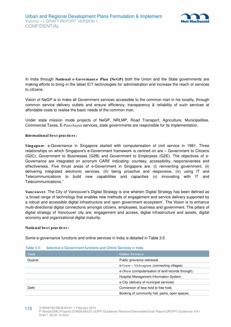
Urban and Regional Development Plans Formulation & Implement Volume – I, DRAFT REPORT VERSION 1
CONFIDENTIAL
319928/ISA/MCB/AA/01 1 Feburary 2014 P:\Noida\DMC\Projects\319928-MoUD UDPFI Guidelines Revision\Deliverable\Draft Report\URDPFI Guidelines Vol I Draft-1 26.02.14.docx
115
In India through National e-Governance Plan (NeGP) both the Union and the State governments are
making efforts to bring in the latest ICT technologies for administration and increase the reach of services
to citizens.
Vision of NeGP is to make all Government services accessible to the common man in his locality, through
common service delivery outlets and ensure efficiency, transparency & reliability of such services at
affordable costs to realise the basic needs of the common man.
Under state mission mode projects of NeGP, NRLMP, Road Transport, Agriculture, Municipalities,
Commercial Taxes, E-Panchayat services, state governments are responsible for its implementation.
International best practices:
Singapore: e-Governance in Singapore started with computerisation of civil service in 1981. Three
relationships on which Singapore's e-Government framework is centred on are – Government to Citizens
(G2C), Government to Businesses (G2B) and Government to Employees (G2E). The objectives of e-
Governance are integrated on acronym CARE indicating: courtesy, accessibility, responsiveness and
effectiveness. Five thrust areas of e-Government in Singapore are: (i) reinventing government, (ii)
delivering integrated electronic services, (iii) being proactive and responsive, (iv) using IT and
Telecommunications to build new capabilities and capacities (v) innovating with IT and
Telecommunications.”
Vancouver- The City of Vancouver’s Digital Strategy is one wherein Digital Strategy has been defined as
‘a broad range of technology that enables new methods of engagement and service delivery supported by
a robust and accessible digital infrastructure and open government ecosystem’. The Vision is to enhance
multi-directional digital connections amongst citizens, employees, business and government. The pillars of
digital strategy of Vancouver city are; engagement and access, digital infrastructure and assets, digital
economy and organizational digital maturity.
National best practices:
Some e-governance functions and online services in India is detailed in Table 3.5
Table 3.5: Selective e-Government functions and Online Services in India
State Online Services
Gujarat Public grievance redressal,
e-Gram – Vishvagram (connecting villages)
e-Dhara (computerisation of land records through),
Hospital Management Information System,
e-City (delivery of municipal services)
Delhi Conversion of lese hold to free hold,
Booking of community hall, parks, open spaces,
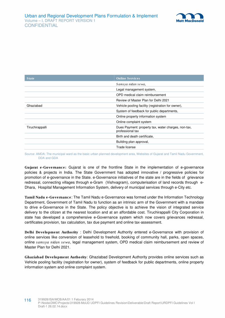
Urban and Regional Development Plans Formulation & Implement Volume – I, DRAFT REPORT VERSION 1
CONFIDENTIAL
319928/ISA/MCB/AA/01 1 Feburary 2014 P:\Noida\DMC\Projects\319928-MoUD UDPFI Guidelines Revision\Deliverable\Draft Report\URDPFI Guidelines Vol I Draft-1 26.02.14.docx
116
State Online Services
Samsya nidan sewa,
Legal management system,
OPD medical claim reimbursement
Review of Master Plan for Delhi 2021
Ghaziabad Vehicle pooling facility (registration for owner),
System of feedback for public departments,
Online property information system
Online complaint system
Tiruchirappalli Dues Payment: property tax, water charges, non-tax, professional tax
Birth and death certificate,
Building plan approval,
Trade license
Source: AMDA: The municipal ward as the basic urban planned development area, Websites of Gujarat and Tamil Nadu Government,
DDA and GDA
Gujarat e-Governance: Gujarat is one of the frontline State in the implementation of e-governance
policies & projects in India. The State Government has adopted innovative / progressive policies for
promotion of e-governance in the State. e-Governance initiatives of the state are in the fields of grievance
redressal, connecting villages through e-Gram (Vishvagram), computerisation of land records through e-
Dhara, Hospital Management Information System, delivery of municipal services through e-City etc.
Tamil Nadu e-Governance: The Tamil Nadu e-Governance was formed under the Information Technology
Department, Government of Tamil Nadu to function as an intrinsic arm of the Government with a mandate
to drive e-Governance in the State. The policy objective is to achieve the vision of integrated service
delivery to the citizen at the nearest location and at an affordable cost. Tiruchirappalli City Corporation in
state has developed a comprehensive e-Governance system which now covers grievances redressal,
certificates provision, tax calculation, tax due payment and online tax-assessment.
Delhi Development Authority : Delhi Development Authority entered e-Governance with provision of
online services like conversion of leasehold to freehold, booking of community hall, parks, open spaces,
online samsya nidan sewa, legal management system, OPD medical claim reimbursement and review of
Master Plan for Delhi 2021.
Ghaziabad Development Authority: Ghaziabad Development Authority provides online services such as
Vehicle pooling facility (registration for owner), system of feedback for public departments, online property
information system and online complaint system.
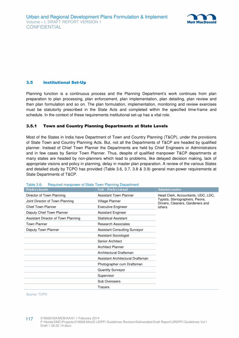
Urban and Regional Development Plans Formulation & Implement Volume – I, DRAFT REPORT VERSION 1
CONFIDENTIAL
319928/ISA/MCB/AA/01 1 Feburary 2014 P:\Noida\DMC\Projects\319928-MoUD UDPFI Guidelines Revision\Deliverable\Draft Report\URDPFI Guidelines Vol I Draft-1 26.02.14.docx
117
3.5 Institutional Set-Up
Planning function is a continuous process and the Planning Department’s work continues from plan
preparation to plan processing, plan enforcement, plan implementation, plan detailing, plan review and
then plan formulation and so on. The plan formulation, implementation, monitoring and review exercises
must be statutorily prescribed in the State Acts and completed within the specified time-frame and
schedule. In the context of these requirements institutional set-up has a vital role.
3.5.1 Town and Country Planning Departments at State Levels
Most of the States in India have Department of Town and Country Planning (T&CP), under the provisions
of State Town and Country Planning Acts. But, not all the Departments of T&CP are headed by qualified
planner. Instead of Chief Town Planner the Departments are held by Chief Engineers or Administrators
and in few cases by Senior Town Planner. Thus, despite of qualified manpower T&CP departments at
many states are headed by non-planners which lead to problems, like delayed decision making, lack of
appropriate visions and policy in planning, delay in master plan preparation. A review of the various States
and detailed study by TCPO has provided (Table 3.6, 3.7, 3.8 & 3.9) general man-power requirements at
State Departments of T&CP.
Table 3.6: Required manpower of State Town Planning Department
Professionals Sub - Professional Administrative
Director of Town Planning Assistant Town Planner Head Clerk, Accountants, UDC, LDC, Typists, Stenographers, Peons, Drivers, Cleaners, Gardeners and others
Joint Director of Town Planning Village Planner
Chief Town Planner Executive Engineer
Deputy Chief Town Planner Assistant Engineer
Assistant Director of Town Planning Statistical Assistant
Town Planner Research Associates
Deputy Town Planner Assistant Consulting Surveyor
Assistant Sociologist
Senior Architect
Architect Planner
Architectural Draftsman
Assistant Architectural Draftsman
Photographer cum Draftsman
Quantity Surveyor
Supervisor
Sub Overseers
Tracers
Source: TCPO
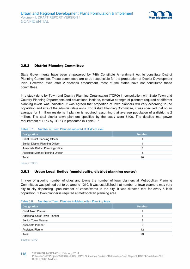
Urban and Regional Development Plans Formulation & Implement Volume – I, DRAFT REPORT VERSION 1
CONFIDENTIAL
319928/ISA/MCB/AA/01 1 Feburary 2014 P:\Noida\DMC\Projects\319928-MoUD UDPFI Guidelines Revision\Deliverable\Draft Report\URDPFI Guidelines Vol I Draft-1 26.02.14.docx
118
3.5.2 District Planning Committee
State Governments have been empowered by 74th Constitute Amendment Act to constitute District
Planning Committee. These committees are to be responsible for the preparation of District Development
Plan. However, even after 2 decades amendment, most of the states have not constituted these
committees.
In a study done by Town and Country Planning Organisation (TCPO) in consultation with State Town and
Country Planning Departments and educational institute, tentative strength of planners required at different
planning levels was indicated. It was agreed that proportion of town planners will vary according to the
population and size of the administrative units. For District Planning Committee, it was specified that on an
average for 1 million residents 1 planner is required, assuming that average population of a district is 2
million. The total district town planners specified by the study were 6400. The detailed man-power
requirement of DPC by TCPO is presented in Table 3.7.
Table 3.7: Number of Town Planners required at District Level
Designation Number
Chief District Planning Officer 1
Senior District Planning Officer 1
Associate District Planning Officer 3
Assistant District Planning Officer 5
Total 10
Source: TCPO
3.5.3 Urban Local Bodies (municipality, district planning centre)
In view of growing number of cities and towns the number of town planners at Metropolitan Planning
Committees was pointed out to be around 1219. It was established that number of town planners may vary
city to city depending upon number of zones/wards in the city. It was directed that for every 5 lakh
population, 1 town planner is required at metropolitan planning area.
Table 3.8: Number of Town Planners in Metropolitan Planning Area
Designation Number
Chief Town Planner 1
Additional Chief Town Planner 1
Senior Town Planner 3
Associate Planner 6
Assistant Planner 12
Total 23
Source: TCPO
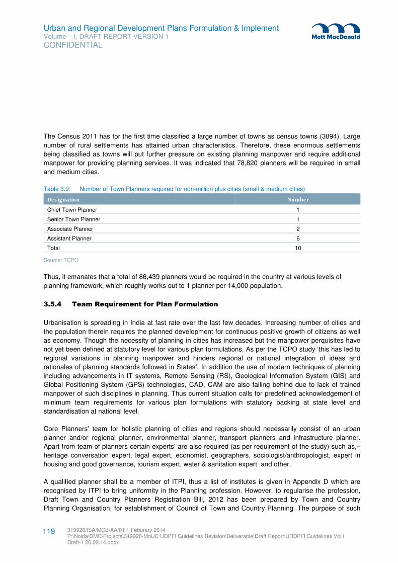
Urban and Regional Development Plans Formulation & Implement Volume – I, DRAFT REPORT VERSION 1
CONFIDENTIAL
319928/ISA/MCB/AA/01 1 Feburary 2014 P:\Noida\DMC\Projects\319928-MoUD UDPFI Guidelines Revision\Deliverable\Draft Report\URDPFI Guidelines Vol I Draft-1 26.02.14.docx
119
The Census 2011 has for the first time classified a large number of towns as census towns (3894). Large
number of rural settlements has attained urban characteristics. Therefore, these enormous settlements
being classified as towns will put further pressure on existing planning manpower and require additional
manpower for providing planning services. It was indicated that 78,820 planners will be required in small
and medium cities.
Table 3.9: Number of Town Planners required for non-million plus cities (small & medium cities)
Designation Number
Chief Town Planner 1
Senior Town Planner 1
Associate Planner 2
Assistant Planner 6
Total 10
Source: TCPO
Thus, it emanates that a total of 86,439 planners would be required in the country at various levels of
planning framework, which roughly works out to 1 planner per 14,000 population.
3.5.4 Team Requirement for Plan Formulation
Urbanisation is spreading in India at fast rate over the last few decades. Increasing number of cities and
the population therein requires the planned development for continuous positive growth of citizens as well
as economy. Though the necessity of planning in cities has increased but the manpower perquisites have
not yet been defined at statutory level for various plan formulations. As per the TCPO study ‘this has led to
regional variations in planning manpower and hinders regional or national integration of ideas and
rationales of planning standards followed in States’. In addition the use of modern techniques of planning
including advancements in IT systems, Remote Sensing (RS), Geological Information System (GIS) and
Global Positioning System (GPS) technologies, CAD, CAM are also falling behind due to lack of trained
manpower of such disciplines in planning. Thus current situation calls for predefined acknowledgement of
minimum team requirements for various plan formulations with statutory backing at state level and
standardisation at national level.
Core Planners’ team for holistic planning of cities and regions should necessarily consist of an urban
planner and/or regional planner, environmental planner, transport planners and infrastructure planner.
Apart from team of planners certain experts’ are also required (as per requirement of the study) such as,–
heritage conversation expert, legal expert, economist, geographers, sociologist/anthropologist, expert in
housing and good governance, tourism expert, water & sanitation expert and other.
A qualified planner shall be a member of ITPI, thus a list of institutes is given in Appendix D which are
recognised by ITPI to bring uniformity in the Planning profession. However, to regularise the profession,
Draft Town and Country Planners Registration Bill, 2012 has been prepared by Town and Country
Planning Organisation, for establishment of Council of Town and Country Planning. The purpose of such
Urban and Regional Development Plans Formulation & Implement Volume – I, DRAFT REPORT VERSION 1
CONFIDENTIAL
319928/ISA/MCB/AA/01 1 Feburary 2014 P:\Noida\DMC\Projects\319928-MoUD UDPFI Guidelines Revision\Deliverable\Draft Report\URDPFI Guidelines Vol I Draft-1 26.02.14.docx
120
council is to control and regulate the quality of education institutions of Town and Country Planning and
qualified professionals from such institutes, in the country.
According to the Bill, "Town and Country Planning" means the profession responsible for planned
development of urban and rural areas and the process concerned with control of the use of land so as to
guide and ensure planned and orderly development.
Town and Country Planner is proposed to be a person holding a professional undergraduate or
postgraduate qualification in Town and Country Planning or in accordance with the nomenclature as
specified in the Schedule of the Bill, acquired from a recognized School, Institution, Department of study /
University and registered with the Council. Minimum standards of Town and Country Planning education
required for granting recognised qualification by Institutions in India will be prescribed by the Council.
3.5.5 Policy Options of Manpower Mobilisation
As indicated in sub section 4.5.4 the country would require roughly 86,439 planners to perform the function
of planning and development at district level, metropolitan level and local area levels. Currently there are
3700 planners registered with Institute of Town Planners, India (ITPI), who are working in different
organisations.
� Every state should have a Planning School. As evident from list of institutes that North- eastern
States, Jammu and Kashmir, Himachal Pradesh, Haryana, Uttar Pradesh, Orissa and Bihar do not
have a single recognized institute offering courses in Town Planning. Planning Schools should be
set up in these states, especially in view of requirement of constituting MPC/DPC under 74th CAA.
3.6 Institutional Reforms
3.6.1 Regulatory Body at State Level
A Regulatory body at State level should be established through statutory support. The role of this State
Body would be to regulate and monitor the functioning of Development bodies. The function of this
regulatory body is to regulate Urban and Regional Development Authorities or Bodies or Agencies.
Similar efforts are taken in Kerala , where Town & Country Planning Commission as an apex body to
advise Government and to guide, direct and assist the MPCs and DPCs on matters relating to spatial
planning and development has been formulated under the Kerala Town & Country planning ordinance,
2013.
This regulatory body should have following objectives to fulfil its role and functions in an envisioned
manner:
� Assess and Monitor the overall Urban / Regional Planning in the State.
� Observer and Evaluate impacts of planning on other elements of development system, especially
Environment and Social & Balanced Regional Development.
Urban and Regional Development Plans Formulation & Implement Volume – I, DRAFT REPORT VERSION 1
CONFIDENTIAL
319928/ISA/MCB/AA/01 1 Feburary 2014 P:\Noida\DMC\Projects\319928-MoUD UDPFI Guidelines Revision\Deliverable\Draft Report\URDPFI Guidelines Vol I Draft-1 26.02.14.docx
121
� Quicken the process of approval of Plans coupled with transparency.
� Promote and direct FDI in Real Estate Sector.
It is to be established in the lines of Supreme Court’s order to Central Government to establish an
Environmental Regulatory Body / Authority by March 2014 under Environmental Protection Act; it is
encompant for the Government. The establishment of this authority would require amendment of State
Town and Country Planning Acts.
3.6.2 Grievance Redressal System
A grievance redressal system should be established in every state with further decentralisation upto the
level of local development authority, which will provide a decentralised system for relief and dealing with
complaints related to Urban / Regional plan.
A Citizen’s Charter could be formed under “Action Plan for Effective and Responsive Government” (1997).
Citizen's Charter and Grievance Redressal Bill, 2011 is also under consideration in Parliament.
Central Government is providing base for public grievance under Citizen’s Charter, for which guidelines are
also available (Compilation of Guidelines for redress of public grievance, 2010). Under MoPPG&P,
Department of Administrative Reforms and Public Grievance has a dedicated website for citizen’s charter,
http://goicharters.nic.in/welcome.html .
To ensure obligation of transparent modification of schemes, including the updated progress Local Area
Planning level, the method of public participation should be utilised.
Urban and Regional Development Plans Formulation & Implement Volume – I, DRAFT REPORT VERSION 1
CONFIDENTIAL
319928/ISA/MCB/AA/01 1 Feburary 2014 P:\Noida\DMC\Projects\319928-MoUD UDPFI Guidelines Revision\Deliverable\Draft Report\URDPFI Guidelines Vol I Draft-1 26.02.14.docx
122
4.1 Need of Region as Planning Unit
Region is a consecutive geographical area which has uniformity, be it in form of administration or economic
linkages or natural environment. It is relatively large area which has a hierarchy of settlements and varying
landscape.
Planning in India till now has been limited to urban settlements. Our country has large area extent and the
urbanisation has been going on very fast in past few decades, thereby the space between cities and their
surroundings has been growing in a unplanned haphazard manner. Centrifugal forces attract huge volume
of migrant population which has rendered short the planning efforts of local bodies in urban settlements.
The resultant biases in demography have also had negative implications in the development at the source
of migration. It has been noticed that urban centres have linkages of various sorts with its surrounding
areas and these settlements have two way interrelationships in terms of cause and effect of many
elements.
Since, 1960’s Planning commission has taken major thrust in regional development through Five Year
Plans. Most important ones are district planning, metropolitan planning, watershed management and
special area development. The planning commission has also developed methods for regionalisation and
policy guidance for preparation of development plans for regions. A number of such case studies have
been taken up by the State Governments with the support of Central Government for development of
special regions. Considering the importance of regional planning at the district level and with the view to
integrate urban and regional development, the 73rd
& 74th CAA was enacted to create DPC and MPC.
Thus, planning as an exercise shall not always be exclusively limited to urban settlements but a region
can be identified to have holistic development of growth promoting centres and surrounding subsequent
hierarchy of settlements. This may facilitate urban infrastructure in rural areas and strengthen the
economic links.
4.2 Aspects of Regional Planning
The preliminary aspects of regional planning may constitute the following:
1. Sustainability - Sustainability leads to balance in Regional Development which implies efficient use of
available resources and opportunities for development in all parts of the region. Sustainability of
regional planning depends upon:
i. Management of major environmental inputs namely water (both surface and ground), minerals,
maintenance of green cover, protection of fragile environmental areas and linking areas with
special opportunities for development like religious, archaeological etc.
ii. Balanced and equitable spatial development of the region
iii. Effective Use of local resources including cultural resources such as crafts, art forms.
Sustainability based regional development can provide solutions for elevation of urban poverty,
minimisation of urban sprawl and managing migration which are outcomes of due to lack of regional
planning.
4 Regional Planning Approach
Urban and Regional Development Plans Formulation & Implement Volume – I, DRAFT REPORT VERSION 1
CONFIDENTIAL
319928/ISA/MCB/AA/01 1 Feburary 2014 P:\Noida\DMC\Projects\319928-MoUD UDPFI Guidelines Revision\Deliverable\Draft Report\URDPFI Guidelines Vol I Draft-1 26.02.14.docx
123
2. Environment – Some of the major environmental concerns that can be addressed by regional
planning approach are the following:
i. Control of pollution specially water pollution, use and maintenance of the water courses.
ii. Maintenance of green cover, forests and eco fragile areas.
iii. Control and regulation of activities which have impact on environment.
While planning, the environmentally sensitive areas should be identified which are non-conducive
for development. Such areas should be either protected or developed while following relevant
standards.
3. Disaster Management – The impact of natural disasters is exaggerated by unscientific plus unplanned
development. Regional development should promote efficient response and preparedness to disasters
such as floods, landslides, land subsistence, fire and earthquake. Disaster Management Act, 2005
makes it mandatory to prepare Disaster Management Plan at State and District level. Integration of
hazard (micro) zoning in planning activities is more facilitative and responding at regional level which
can be integrated with the provisions of NDMA. Zoning hazards and its holistic approach can be
achieved at regional level and not at city level, and hence regional planning is the solution to integrated
response.
4. Promoting Balanced Development – Imbalanced development of the country due to missing regional
planning approach to bring development in urban-rural settlements simultaneously has led to lop-sided
development in favour of urban settlements. As a result centripetal and centrifugal forces of human
movement have come to work with intensity in the urban parts of the country. The lack of integrated
spatial planning specially in the influence area of metropolitan cities has led to ‘rural push’. Migration
across administrative boundaries to the cities without adequate functional infrastructure to support the
population puts pressure on the administrative departments. On the other hand the areas from where
out-migration takes place suffer with imbalance growth. Thus, an integrated planning approach is
required to provide administrative solution for provision of sustainable infrastructure in the region and
vision development of the peri-urban areas & counter magnets.
The 74th CAA provides for constitution of District Planning Committees, as single decision making
committees which can address to the issues of administration in a District. The state of Kerala has
provided for the constitution of District Planning Committee (DPC) in The Kerala Municipality Act,
1994. The DPC was directed to consolidate the plans prepared by the Panchayats and the
municipalities in the district and to prepare a draft development plan for the district as a whole.
The Kerala Town and Country Planning Ordinance, 2013 DPC is directed to have due regard to
Perspective Plan of the district while preparing draft development plan for the district. The same
Act also provides for the provision of Metropolitan Planning Committee in the State.
In many States DPC’s are not constituted, however, in some of them, the Town and Country
Planning Acts provides a legal framework for constitution of Regional Development Authorities
(RDA). Like, Bombay Metropolitan Region Development Authority Act, 1974 makes it mandatory
Urban and Regional Development Plans Formulation & Implement Volume – I, DRAFT REPORT VERSION 1
CONFIDENTIAL
319928/ISA/MCB/AA/01 1 Feburary 2014 P:\Noida\DMC\Projects\319928-MoUD UDPFI Guidelines Revision\Deliverable\Draft Report\URDPFI Guidelines Vol I Draft-1 26.02.14.docx
124
to constitute Mumbai Metropolitan Regional Development Authority for the planning and
development of Mumbai metropolitan city.
Whenever functional areas cut across different State boundaries there may be problems of co-
ordination in administration. Ideally in such cases, a unified RDA (for this specified region) may be
instituted with representation from each of the State.
5. Inclusivity – Regional planning can bring inclusivity in broader area by preparing plan after
considering issues, strengths and prospects of a large spatial unit. Regional disparities specially peri
urban areas surrounding large cities present contrasting conditions both physically and social-
economically. Regional planning can efficiently tackle the problem arising out of the transition of rural
area into peri urban and urban areas. Inclusive development principles can bridge the gap present in
terms of regional disparity in India.
4.3 Planning Regions in India
The increasing need of urbanisation is further aggravated by the rural push factors directly affecting the
quality of life and environment in the urban areas. Natural outcome of this urban sprawl is a virtual region
in which settlements have functional relationships and it may have a homogeneous nature. Such areas
shall not be merely left to the factors of natural growth and can be identified for Regional planning. A region
is a flexible concept and can be referred to as a continuous and localised area intermediate between
National and Urban levels.
In the present scenario, Indian metropolitan cities have planned development which partially satisfies the
aim of the 74th CAA, however, incomplete adherence of the Act, has resulted into lack of holistic planning.
The 74th CAA has provides foundation for the constitution of District Planning Committee which has to
consolidate plans prepared by Panchayats and municipalities for the formulation of District Development
Plan.
Such regions are holistic from administrative point of view and there are little chances of conflict when
there is a single administrative unit. The present planning system for only urban settlements has developed
islands of growth centres, creating vast disparity. Planning for district as a region is the approach in which
country as whole can be covered in planning exercise leaving no intermediate space. Thus, for
convenience of administration of regions and entire coverage of country under planned development the
structure of regional planning provided by Constitution of India can be utilised.
The XII Five Year Plan has emphasised on regional development particularly DPC composition to control
and regulate unplanned development beyond the urban areas i.e. urban sprawl/ scatter. The Town and
Country Planning Acts of various States provide statutory setup for urban and regional planning and
development. In many States Special Area Planning Acts (similar to Regional Planning) are also in place.
Urban and Regional Development Plans Formulation & Implement Volume – I, DRAFT REPORT VERSION 1
CONFIDENTIAL
319928/ISA/MCB/AA/01 1 Feburary 2014 P:\Noida\DMC\Projects\319928-MoUD UDPFI Guidelines Revision\Deliverable\Draft Report\URDPFI Guidelines Vol I Draft-1 26.02.14.docx
125
Transport linkages play an integral role in growth of urban nodes as settlements across region are linked
physically through transport corridors. As movement of goods, services and alignment of infrastructure
follow the transport network and human settlement and economic activities generally follow the transport
lines. Lately, Government of India has recognised the potential of transport corridors as instrument of
imparting economic push to large region and thus has been implementing programmes which are spread
across a large region like, Delhi Mumbai Industrial Corridor (DMIC) Programme. The objective of DMIC
project is to expand India's manufacturing and services base and develop DMIC as a "Global
Manufacturing and Trading Hub". The programme will provide a major impetus to planned urbanization in
India with manufacturing as the key driver. The programme has been conceptualized in international
partnership and collaboration with Government of Japan34
.
Government of India has also launched National Highway Development Project (NHDP) in year 2000 to
upgrade and strengthen National Highways and one of the advantages identified under the project is all
round development of areas. Another transport oriented regional corridor as conceptualised is the eastern
and western freight corridors. Keeping these developments in mind, Transport Oriented Development
approach to develop and plan regions can be adopted. Such an approach emphasises on development of
economic linkages and growth of manufacturing and services.
There are other types of regions, as well, which have homogeneity and linkages in terms of investment,
tourism and natural environment. In India, owing to its vast stretch and heterogeneity, multiple/different
typologies of regions could be adopted for planned development. The regional planning approach is
suggested in these guidelines for planned and sustainable development of the human settlements.
The planning regions in India can be categorised as:
34 http://www.dmicdc.com
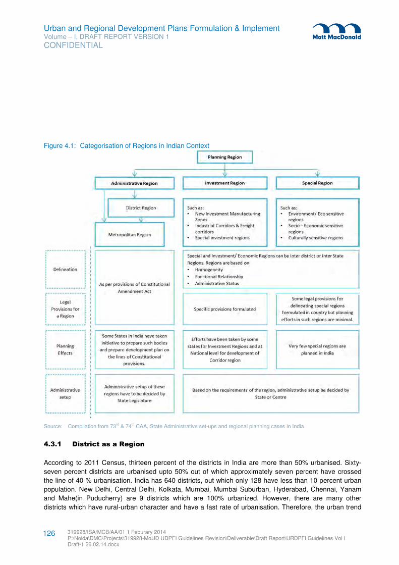
Urban and Regional Development Plans Formulation & Implement Volume – I, DRAFT REPORT VERSION 1
CONFIDENTIAL
319928/ISA/MCB/AA/01 1 Feburary 2014 P:\Noida\DMC\Projects\319928-MoUD UDPFI Guidelines Revision\Deliverable\Draft Report\URDPFI Guidelines Vol I Draft-1 26.02.14.docx
126
Figure 4.1: Categorisation of Regions in Indian Context
Source: Compilation from 73rd & 74th CAA, State Administrative set-ups and regional planning cases in India
4.3.1 District as a Region
According to 2011 Census, thirteen percent of the districts in India are more than 50% urbanised. Sixty-
seven percent districts are urbanised upto 50% out of which approximately seven percent have crossed
the line of 40 % urbanisation. India has 640 districts, out which only 128 have less than 10 percent urban
population. New Delhi, Central Delhi, Kolkata, Mumbai, Mumbai Suburban, Hyderabad, Chennai, Yanam
and Mahe(in Puducherry) are 9 districts which are 100% urbanized. However, there are many other
districts which have rural-urban character and have a fast rate of urbanisation. Therefore, the urban trend
Urban and Regional Development Plans Formulation & Implement Volume – I, DRAFT REPORT VERSION 1
CONFIDENTIAL
319928/ISA/MCB/AA/01 1 Feburary 2014 P:\Noida\DMC\Projects\319928-MoUD UDPFI Guidelines Revision\Deliverable\Draft Report\URDPFI Guidelines Vol I Draft-1 26.02.14.docx
127
of these districts should be planned. Efforts to direct urbanisation of such districts will sync the growth of
cities with goals of national development.
The district as a unit is a holistic concept administratively which provides a strong foundation for planning.
The hierarchy of settlements and natural resources available in relatively larger region are other additional
reasons which make district a unit of planning more logical premise.
4.3.1.1 Need for Administrative Structure
Administrative structure to guide planning at district level is important as without suitable administration,
regional planning cannot take place. The 74th Constitutional Amendment Act provides that each State
should have District Planning Committee and the State Legislature should provide for the composition of
DPC given that there shall be elected representatives of Panchayats and municipalities in committee in
proportionate ratio. For this, State Governments are required to amend existing or enact new laws to
introduce District Planning Committee in planning administration structure.
4.3.1.2 Process of planning at District level
In India, planning process for administrative areas equal to or bigger than district has been attempted.
Kerala: The State of Kerala has provision for DPC and MPC. Its methodology of District plan preparation
provides for a decentralised planning process by initiating preparation of an Integrated District
Development Plan along with Local Development Plans for every local government in the district in an
integrated manner. The Integrated District Development Plan (IDDP) aims for an integrated draft
development plan with due regard to common interests of Panchayats and municipalities (as shown in
Figure 4.2) to plan for spatial and sharing of resources: both natural and man-made. The IDDP includes
planning of special areas such as tribal areas, coastal areas, economically backward areas, areas for
establishment of new towns etc. Also, there are provisions of Joint area planning in case the area
comprises more than one Municipal Corporation, Municipal Council, Town Panchayat or village Panchayat,
either in full or in part.
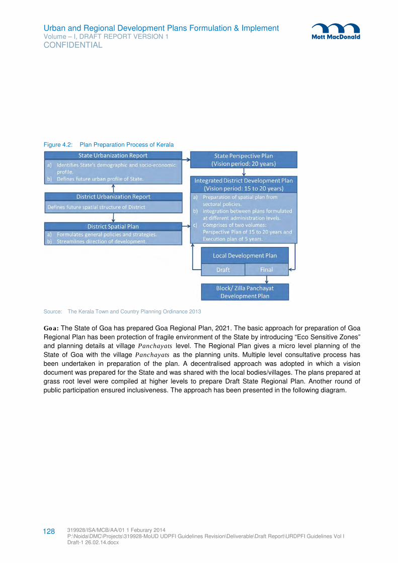
Urban and Regional Development Plans Formulation & Implement Volume – I, DRAFT REPORT VERSION 1
CONFIDENTIAL
319928/ISA/MCB/AA/01 1 Feburary 2014 P:\Noida\DMC\Projects\319928-MoUD UDPFI Guidelines Revision\Deliverable\Draft Report\URDPFI Guidelines Vol I Draft-1 26.02.14.docx
128
Figure 4.2: Plan Preparation Process of Kerala
Source: The Kerala Town and Country Planning Ordinance 2013
Goa: The State of Goa has prepared Goa Regional Plan, 2021. The basic approach for preparation of Goa
Regional Plan has been protection of fragile environment of the State by introducing “Eco Sensitive Zones”
and planning details at village Panchayats level. The Regional Plan gives a micro level planning of the
State of Goa with the village Panchayats as the planning units. Multiple level consultative process has
been undertaken in preparation of the plan. A decentralised approach was adopted in which a vision
document was prepared for the State and was shared with the local bodies/villages. The plans prepared at
grass root level were compiled at higher levels to prepare Draft State Regional Plan. Another round of
public participation ensured inclusiveness. The approach has been presented in the following diagram.
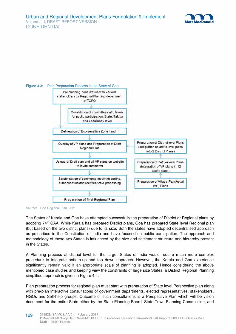
Urban and Regional Development Plans Formulation & Implement Volume – I, DRAFT REPORT VERSION 1
CONFIDENTIAL
319928/ISA/MCB/AA/01 1 Feburary 2014 P:\Noida\DMC\Projects\319928-MoUD UDPFI Guidelines Revision\Deliverable\Draft Report\URDPFI Guidelines Vol I Draft-1 26.02.14.docx
129
Figure 4.3: Plan Preparation Process in the State of Goa
Source: Goa Regional Plan, 2021
The States of Kerala and Goa have attempted successfully the preparation of District or Regional plans by
adopting 74th CAA. While Kerala has prepared District plans, Goa has prepared State level Regional plan
(but based on the two district plans) due to its size. Both the states have adopted decentralised approach
as prescribed in the Constitution of India and have focused on public participation. The approach and
methodology of these two States is influenced by the size and settlement structure and hierarchy present
in the States.
A Planning process at district level for the larger States of India would require much more complex
procedure to integrate bottom-up and top down approach. However, the Kerala and Goa experience
significantly remain valid if an appropriate scale of planning is adopted. Hence considering the above
mentioned case studies and keeping view the constraints of large size States, a District Regional Planning
simplified approach is given in Figure 4.4.
Plan preparation process for regional plan must start with preparation of State level Perspective plan along
with pre-plan interactive consultations of government departments, elected representatives, stakeholders,
NGOs and Self-help groups. Outcome of such consultations is a Perspective Plan which will be vision
document for the entire State either by the State Planning Board, State Town Planning Commission, and
Urban and Regional Development Plans Formulation & Implement Volume – I, DRAFT REPORT VERSION 1
CONFIDENTIAL
319928/ISA/MCB/AA/01 1 Feburary 2014 P:\Noida\DMC\Projects\319928-MoUD UDPFI Guidelines Revision\Deliverable\Draft Report\URDPFI Guidelines Vol I Draft-1 26.02.14.docx
130
State Town & Country Planning Department or by State Urbanisation Committee, such as efforts taken by
Kerala and Rajasthan recently. The composition of the State Urbanisation Committee should include top
decision makers of the concerns departments and preferably be chaired by the Chief Minister.
Plan preparation process for regional plan must start with preparation of State level Perspective plan along
with pre-plan consultations of government departments, elected representatives, stakeholders, NGOs.
Outcome of such consultations is a Perspective Plan which will be vision document for the entire State.
Perspective Plan must delineate State into developable, prohibited and restricted zones. For this
classification, variety of parameters could be used based on development approach of the state. Some of
the parameters have been shared below but this is only suggestive list which must be made exhaustive
while preparing plan at state level:
� Eco sensitive zones of the state,
� Boundaries of all the urban and rural settlements of the state,
� Mapping of transport and communication networks,
� Mapping of natural features,
� Industrial, mining and related area,
� Disaster Zonation
� All maps/plans must be prepared on GIS platform and geo-referenced.
At the stage of Perspective plan preparation, mapping scale and time lines can also be decided which will
bring clarity and uniformity in mapping and plan preparation process. List of all the authorities that are
stakeholders in development process of settlements must be prepared and their roles and responsibilities
should be clearly enumerated.
The State Perspective plan should be distributed to the Districts as a reference for preparation of further
plans at district level. District administration should proceed with distributing the plans and maps at taluka
level and from taluka level to village Panchayats. The Draft Development plan should then be prepared at
each village Panchayat level with public participation. Here, capacity building and technical knowhow
would need to be percolated from the top administrative set-ups and supporting institutional arrangements.
The training to the selected people or people’s representatives must be provided along with trained officials
through the plan preparation process. Similar process must be followed in settlements of urban hierarchy.
Once the plan process at grass root level is over, these plans should be compiled first at taluka level or at
its urban counters parts by Development Authority / Municipal Corporation level to formulate the draft
District Regional Plan.
The Draft District Regional Plan then must be put on public forum for objections and suggestions to impart
transparency in the plan process. To meet the purpose of the district plan, interchangeable options and
conflicts interest would need to be answered in the regional plan. Once the process of public participation
is over and with the approval of State legislature, the final Regional Plan should uploaded on relevant
websites for future reference and use.
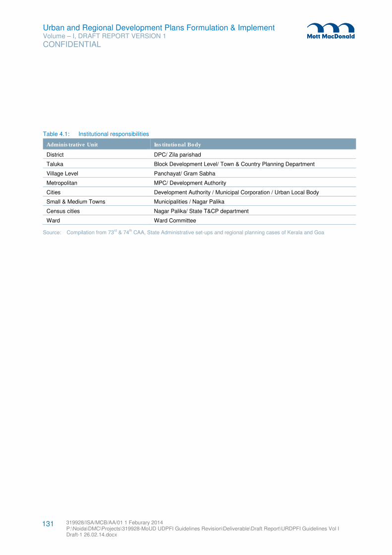
Urban and Regional Development Plans Formulation & Implement Volume – I, DRAFT REPORT VERSION 1
CONFIDENTIAL
319928/ISA/MCB/AA/01 1 Feburary 2014 P:\Noida\DMC\Projects\319928-MoUD UDPFI Guidelines Revision\Deliverable\Draft Report\URDPFI Guidelines Vol I Draft-1 26.02.14.docx
131
Table 4.1: Institutional responsibilities
Administrative Unit Institutional Body
District DPC/ Zila parishad
Taluka Block Development Level/ Town & Country Planning Department
Village Level Panchayat/ Gram Sabha
Metropolitan MPC/ Development Authority
Cities Development Authority / Municipal Corporation / Urban Local Body
Small & Medium Towns Municipalities / Nagar Palika
Census cities Nagar Palika/ State T&CP department
Ward Ward Committee
Source: Compilation from 73rd & 74th CAA, State Administrative set-ups and regional planning cases of Kerala and Goa
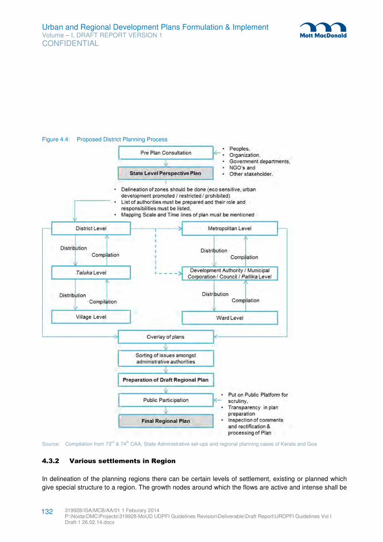
Urban and Regional Development Plans Formulation & Implement Volume – I, DRAFT REPORT VERSION 1
CONFIDENTIAL
319928/ISA/MCB/AA/01 1 Feburary 2014 P:\Noida\DMC\Projects\319928-MoUD UDPFI Guidelines Revision\Deliverable\Draft Report\URDPFI Guidelines Vol I Draft-1 26.02.14.docx
132
Figure 4.4: Proposed District Planning Process
Source: Compilation from 73rd & 74th CAA, State Administrative set-ups and regional planning cases of Kerala and Goa
4.3.2 Various settlements in Region
In delineation of the planning regions there can be certain levels of settlement, existing or planned which
give special structure to a region. The growth nodes around which the flows are active and intense shall be
Urban and Regional Development Plans Formulation & Implement Volume – I, DRAFT REPORT VERSION 1
CONFIDENTIAL
319928/ISA/MCB/AA/01 1 Feburary 2014 P:\Noida\DMC\Projects\319928-MoUD UDPFI Guidelines Revision\Deliverable\Draft Report\URDPFI Guidelines Vol I Draft-1 26.02.14.docx
133
the nodal centre. The nodal centre could act as the highest echelon in the hierarchy of the settlements.
This may have a unipolar (metropolitan city), bipolar (such as twin cities) or multipolar structure. The other
settlements within the region shall be directly or indirectly functionally linked to this centre. They can be:
1. Counter Magnets: The counter magnets are potential and growing sub nodal centres located out of
the direct functionally linked areas of the growth node/ nodal centres in the region, e.g. Hissar, Gwalior,
Patiala and Kota etc in context of NCR. The purpose of development of the counter magnets is to
prevent undesirable concentration of growth impulses in the nodal centres and to disperse the same to
counter magnets for more balanced development of the region. The counter magnet areas may play
two distinctive roles:
i. As interceptors of migratory flows into the nodal centre
ii. As regional growth centres, this would be able to achieve a balanced pattern of urbanisation in
the region over a period of time.
2. Satellite Towns: A Satellite Town is one which is located near or within reasonable distance, well
connected by transportation route of the growth node or a metropolitan city, e.g. Gurgaon and Noida
(Delhi), Navi Mumbai (Mumbai) and Salt Lake City (Kolkata) etc. The Satellite towns are dependent on
the growth node largely for employment.
3. Priority Towns: Priority towns shall be the potential towns for investment and development; identified
on the basis of their inter-aerial relationship with the regional nodal centre. For integrated development
of the identified region, identification of the priority towns and planning for their development should be
done.
4. Growth Centres/ Points: Settlements with growth potential and special advantage of location within
the region can be classified as growth centres/ growth points/ service village in order of hierarchy from
high to low while planning for settlement structure within the region.
5. Peri Urban Areas35
: Peri-urban areas are zones of transition from rural to urban land uses located
between the outer limits of urban and regional centers and the rural environment. The boundaries of
peri-urban areas are porous and transitory as urban development extends into rural, agricultural and
industrial land. Peri–urban areas might include valuable protected areas, forested hills, preserved
woodlands, prime agricultural lands and important wetlands, which may require conservation.
Irrespective of how the boundaries move there will always be peri-urban zones. These areas if planned
properly can provide essential life support services for urban residents. In preparation of development
plans for metropolitan cities, the area may be taken as 5-8 kms around existing cities, say those with
more than 3 lakh population to cover the urban spill.36
35 (http://periurban14.org/)
36 Working group on urban strategic planning, pg 33
Urban and Regional Development Plans Formulation & Implement Volume – I, DRAFT REPORT VERSION 1
CONFIDENTIAL
319928/ISA/MCB/AA/01 1 Feburary 2014 P:\Noida\DMC\Projects\319928-MoUD UDPFI Guidelines Revision\Deliverable\Draft Report\URDPFI Guidelines Vol I Draft-1 26.02.14.docx
134
4.4 Metropolitan Planning
Metropolitan area is a large urban settlement which has population from 10 lakhs and above. The arial
extant of such settlements are huge and often they spread across multiple districts. India has 53
metropolitan cities according to 2011 census. Many of these cities have already been institutionalised
under metropolitan or development authorities, such as Mumbai, Kolkata, Chennai, Bangalore, Hyderabad,
Ahmedabad and Guwahati among others. Formulation of Metropolitans Authorities was conceived with the
idea of initiating the planning of the cities and surrounding areas. The Constitution of India directs the
States to initiate the process of planning metropolitan cities by constituting Metropolitan Planning
Committees through State legislature. Various States -West Bengal, Maharashtra, Andhra Pradesh have
issued procedures for formulation of Metropolitan Planning Committee (MPC) and metropolitan areas like
Kolkata, Mumbai, Nagpur, Pune have MPCs. However, only Kolkata MPC has prepared a Metropolitan
Development Plan (MDP). This has been referred as a lesson to guide the MPC formulation and
integration in the existing scenario. In parallel, Hyderabad, Bangalore and Bhopal metropolitan areas have
also taken initiatives to form MPCs.
National Commission on Urbanisation, 1988 with a visionary approach to future urbanisation in India
identified 329 urban centres all over the country as Generators of Economic Momentum (GEMs) where
development activities should converge, based on which the upcoming Metropolitan regions could be
forecasted. The Commission also identified 49 Spatial Priority Urban Regions (SPURs). SPURs were
based on observed trends of growth and Commission’s assessment of growth potential, integration with
national transport network, optimising investments and opportunities already in a particular region. Such an
attempt of regional planning pan India was the first of its kind and evolved from the idea of expanding
planned urban regions.
4.4.1 Metropolitan Administrative set-ups
As cities have eventually increased in size, Municipal Bodies have been found inefficient to meet the
requirements of large cities or the metropolitan areas with many limitations. Thus, the need for Urban
Development Authority Acts and Metropolitan Regional Development Authority Acts were felt to regulate a
designated jurisdiction covering urban and peri-urban areas. The authorities formed under these acts
perform functions in close coordination with the State Town and Country Planning Departments, apart from
the already existing Municipal Corporations. The multiplicity of urban local bodies in large cities and
overlapping jurisdiction has many a times lead to confusion in their roles and cross-purpose functioning.
Isolation in spatial planning and lack of coordination are among the common issues faced by all State
Governments.
Given the situation, West Bengal Government has been able to work out a framework for Kolkata
Metropolitan Planning Committee (KMPC), which integrates the local bodies and affirms with the spirit of
73rd and 74th CAA. Hence, the Kolkata Model has been referred to guide the MPC formulation and
integration in the existing scenario.
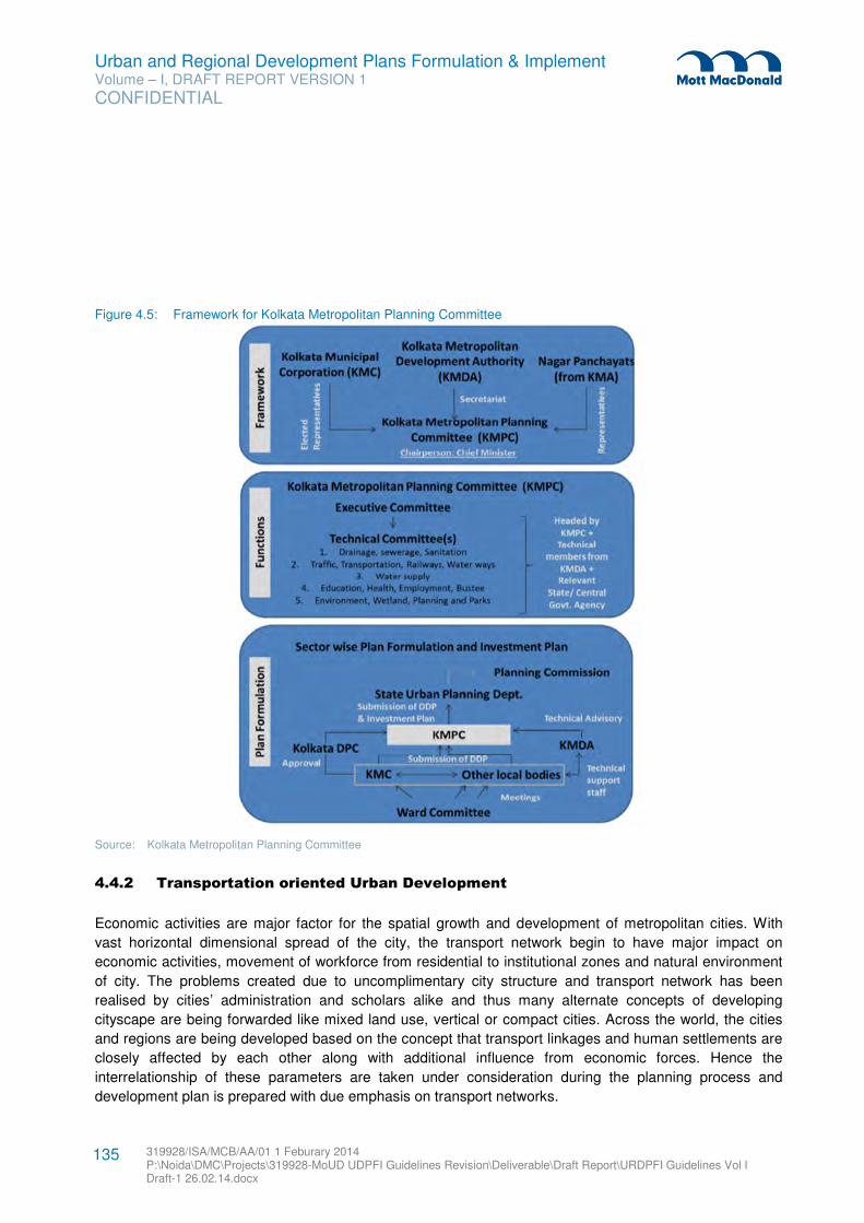
Urban and Regional Development Plans Formulation & Implement Volume – I, DRAFT REPORT VERSION 1
CONFIDENTIAL
319928/ISA/MCB/AA/01 1 Feburary 2014 P:\Noida\DMC\Projects\319928-MoUD UDPFI Guidelines Revision\Deliverable\Draft Report\URDPFI Guidelines Vol I Draft-1 26.02.14.docx
135
Figure 4.5: Framework for Kolkata Metropolitan Planning Committee
Source: Kolkata Metropolitan Planning Committee
4.4.2 Transportation oriented Urban Development
Economic activities are major factor for the spatial growth and development of metropolitan cities. With
vast horizontal dimensional spread of the city, the transport network begin to have major impact on
economic activities, movement of workforce from residential to institutional zones and natural environment
of city. The problems created due to uncomplimentary city structure and transport network has been
realised by cities’ administration and scholars alike and thus many alternate concepts of developing
cityscape are being forwarded like mixed land use, vertical or compact cities. Across the world, the cities
and regions are being developed based on the concept that transport linkages and human settlements are
closely affected by each other along with additional influence from economic forces. Hence the
interrelationship of these parameters are taken under consideration during the planning process and
development plan is prepared with due emphasis on transport networks.
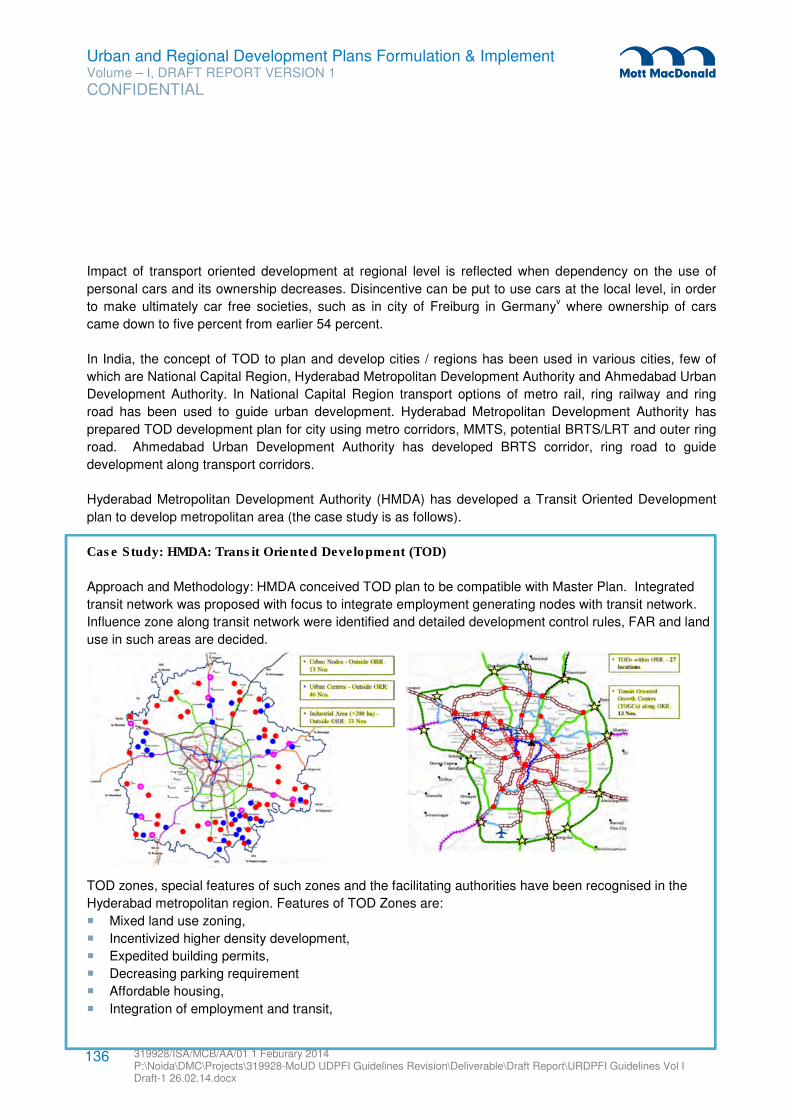
Urban and Regional Development Plans Formulation & Implement Volume – I, DRAFT REPORT VERSION 1
CONFIDENTIAL
319928/ISA/MCB/AA/01 1 Feburary 2014 P:\Noida\DMC\Projects\319928-MoUD UDPFI Guidelines Revision\Deliverable\Draft Report\URDPFI Guidelines Vol I Draft-1 26.02.14.docx
136
Impact of transport oriented development at regional level is reflected when dependency on the use of
personal cars and its ownership decreases. Disincentive can be put to use cars at the local level, in order
to make ultimately car free societies, such as in city of Freiburg in Germanyv where ownership of cars
came down to five percent from earlier 54 percent.
In India, the concept of TOD to plan and develop cities / regions has been used in various cities, few of
which are National Capital Region, Hyderabad Metropolitan Development Authority and Ahmedabad Urban
Development Authority. In National Capital Region transport options of metro rail, ring railway and ring
road has been used to guide urban development. Hyderabad Metropolitan Development Authority has
prepared TOD development plan for city using metro corridors, MMTS, potential BRTS/LRT and outer ring
road. Ahmedabad Urban Development Authority has developed BRTS corridor, ring road to guide
development along transport corridors.
Hyderabad Metropolitan Development Authority (HMDA) has developed a Transit Oriented Development
plan to develop metropolitan area (the case study is as follows).
Case Study: HMDA: Transit Oriented Development (TOD)
Approach and Methodology: HMDA conceived TOD plan to be compatible with Master Plan. Integrated
transit network was proposed with focus to integrate employment generating nodes with transit network.
Influence zone along transit network were identified and detailed development control rules, FAR and land
use in such areas are decided.
TOD zones, special features of such zones and the facilitating authorities have been recognised in the
Hyderabad metropolitan region. Features of TOD Zones are:
� Mixed land use zoning,
� Incentivized higher density development,
� Expedited building permits,
� Decreasing parking requirement
� Affordable housing,
� Integration of employment and transit,
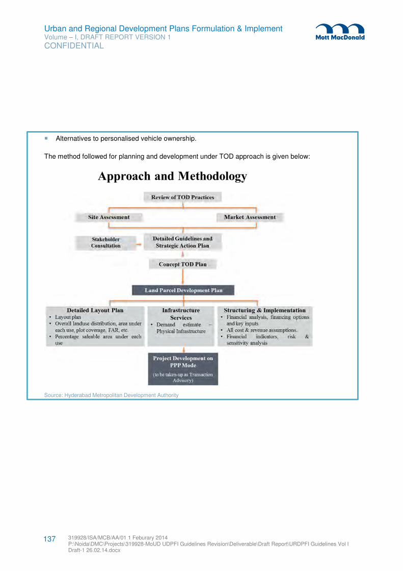
Urban and Regional Development Plans Formulation & Implement Volume – I, DRAFT REPORT VERSION 1
CONFIDENTIAL
319928/ISA/MCB/AA/01 1 Feburary 2014 P:\Noida\DMC\Projects\319928-MoUD UDPFI Guidelines Revision\Deliverable\Draft Report\URDPFI Guidelines Vol I Draft-1 26.02.14.docx
137
� Alternatives to personalised vehicle ownership.
The method followed for planning and development under TOD approach is given below:
Source: Hyderabad Metropolitan Development Authority
Urban and Regional Development Plans Formulation & Implement Volume – I, DRAFT REPORT VERSION 1
CONFIDENTIAL
319928/ISA/MCB/AA/01 1 Feburary 2014 P:\Noida\DMC\Projects\319928-MoUD UDPFI Guidelines Revision\Deliverable\Draft Report\URDPFI Guidelines Vol I Draft-1 26.02.14.docx
138
4.4.3 Planning for peri-urban area
Peri-urban is the zone which is within the planning area limits but outside the urbanisation limit of the
municipal corporation / authority or metropolitan planning committee or authority. Integration of the plans of
such settlements can be done through two approaches.
• The plans can be prepared by the developmental body in consultation with the village authority
and implemented jointly by the village authority or developmental body,
• Village bodies may prepare the plan and such plans will be compiled and made part of overall
developmental plan of the region by developmental body.
Since, definition of planning area is not clear in all the states, identification and planning of peri-urban area
(outside municipal limits) is important in the context of urban and rural development. Also the States till
now have not clearly defined what should constitute peri-urban areas and therefore a change in the Acts in
this context is surely called for. However peri-urban area has been included in planning areas of Master /
Development plans which invariably go beyond the municipal boundary. In some state like in Andhra
Pradesh, Mandal committees are empowered to prepare land conversion and development of peri-urban
areas. Nonetheless this aspect of urban and rural development needs special legal and policy efforts.
To holistically approach the legal and planning issues for peri-urban areas, it is suggested by the ministry
of Urban development to the States to avoid multiplicity of the authorities and simultaneously allow
coordination. In a regional authority, the urban agglomeration should be recognised as the urban centre,
while the small towns and urban villages shall be within the overarching boundary of the Metropolitan
regions to co-exist. Where planning, the landuse will be decentralised to local authorities, apart from some
regional resource management such as management of water and preservation of eco-sensitive areas.
While the planning and developmental norms for the city are available, there are no such norms for peri-
urban areas. As the regional and metropolitan area planning intends to bring such area in planning
framework it is only logical that development norms for peri-urban area is also developed because of its
heavy bias towards urban character. In the absence of this, such settlements will keep developing
unscientifically. These areas develop faster than rural settlements and have considerable urban form, yet it
cannot have zoning regulation of larger cities.
Low income habitat planning norms of National Building Code are suggested to be followed in peri-urban
areas. The states may develop further specific guidelines for such settlements based on their growth trend
and economic base. Low income habitat planning norms are as following:
1. Plot size: Minimum 80 sq.m.
2. Density: Maximum 60 plots per Ha
3. Minimum frontage: 6m
4. Ground Coverage: 33% (subject to a maximum of 50%)
5. FAR: Maximum 200
6. Open spaces: 1.21 Ha open space for a village with 200 houses.
Urban and Regional Development Plans Formulation & Implement Volume – I, DRAFT REPORT VERSION 1
CONFIDENTIAL
319928/ISA/MCB/AA/01 1 Feburary 2014 P:\Noida\DMC\Projects\319928-MoUD UDPFI Guidelines Revision\Deliverable\Draft Report\URDPFI Guidelines Vol I Draft-1 26.02.14.docx
139
7. If required, facilities like branches of co-operative bank, a fertilizer depot, a veterinary hospital, market
place and a branch of the co-operative consumer store besides facilities for educational and health
care should be available within a maximum distance of 5 km from any settlement.
8. Proposed Road hierarchy:
Table 4.2: Road Hierarchy for peri-urban areas in line with low income habitat planning norms
Road Type Road Description Road width Function/ Remarks
R1 Road which connects village to nearby areas
9 m Widest road
R2 Road which take major traffic to village
6m Amin village roads with drain on both sides to facilitate drainage system of the village
R3 Internal Village road 4.5 m Other village roads
R 4 Internal Village road 3 m Village lanes
Source: NBC
9. Community facilities:
– A community hall/ baraat ghar
– Rural development centre shall include Panchayat ghar, a Mahila Kendra that may also serve as a
vocational training centre
– School, health centre, post office, police post, shopping, work sheds for the artisans, telephone
facilities, should be established.
– The concept of ‘aided self-help’ shall be ensured for active participation of the prospective users
and association in the construction and development of dwelling units and other community
buildings.
4.4.4 Village Planning
Planning at grass root level includes that at village Panchayat in rural settings of both District Planning and
Metropolitan Planning. Plans prepared at these levels must be compiled at higher administrative units,
either through talukas or villages falling in urban areas through metropolitan regions, and finally compiled
draft plan is prepared at appropriate level. Use of cadastral at village area planning level is important and
the revenue department which is custodian of cadastral maps has to play the critical role in providing,
reliable and authentic land data base.
States are advised to provide technical support to village Panchayat for providing support in planning
process. Lower literacy levels in rural areas can be hindrance to the planning process or can result in faulty
planning or social-economic bias. The State governments can provide conditional planning powers to
village Panchayats. State can provide planning function to village Panchayats when the performance at
grass root level is good in following parameters:
� Literacy,
� Women’s participation in decision making, women empowerment,
� Handling of development funds as in past records,
Urban and Regional Development Plans Formulation & Implement Volume – I, DRAFT REPORT VERSION 1
CONFIDENTIAL
319928/ISA/MCB/AA/01 1 Feburary 2014 P:\Noida\DMC\Projects\319928-MoUD UDPFI Guidelines Revision\Deliverable\Draft Report\URDPFI Guidelines Vol I Draft-1 26.02.14.docx
140
� Transparency in funds handling,
� Inclusion of vulnerable groups and youths in decision making.
Case study: Goa Institutional set-up Study
In the State of Goa to facilitate the process of Regional planning three tier structure was prepared. At
highest level is State Level Committee, at lowest level is Village Panchayat and Taluka Level Task Force
at intermediate level. The State of Goa has prepared Draft Regional Plan for Goa, 2021 through this three
tier structure.
State Level Committee (SLC): This committee had 10 members and presided by CM and Minister (TCP).
SLC supervised the process of Public participation, co-ordinated with Taluka level technical team (TLTT),
explained the Revised Regional Plan for Goa-2021 and its features to TLTT. It also prepared a
questionnaire and a list of parameters on which comments/suggestions were sought from village
Panchayats.
Taluka Level Technical Committee (TLTC): This committee comprising of 7 members was headed by
Town Planner/Dy. Town Planner to headed Committee of concerned taluka. TLTC took the Revised
Regional Plan for Goa-2021 to the respective village Panchayats and municipalities, under its jurisdiction.
It arranged for the venue of meeting at respective village Panchayats and municipalities to explain the
plan. Committee also assisted the village Panchayats and municipalities by visiting the Village
Panchayats/municipalities in phased manner and supervised the public participation process. The
suggestions from all village Panchayats and municipalities were collected and classified in categories and
submitted to State Level Committee.
Local body level team/committee: These bodies had to mark all the existing (up to 6 meters) and
proposed roads in the village, identified resources/services, water bodies, heritage sites, missing water
bodies, nalhas, heritage sites, settlements, industrial areas, public utilities and services etc on the map with
the help of TLTC.
Source: Goa Regional Plan, 2021
Urban and Regional Development Plans Formulation & Implement Volume – I, DRAFT REPORT VERSION 1
CONFIDENTIAL
319928/ISA/MCB/AA/01 1 Feburary 2014 P:\Noida\DMC\Projects\319928-MoUD UDPFI Guidelines Revision\Deliverable\Draft Report\URDPFI Guidelines Vol I Draft-1 26.02.14.docx
141
4.5 Regional Planning Process for Investment Regions
Investment Regions/ Zones are generally areas which show potential for development due to economic
forces. These areas face problem of uncontrolled land confiscation and holding by the private entities. Due
to lack of policies or plan to control development in such places haphazard development of commercial,
industrial activities and human settlement takes place along the transportation nodes and routes posing a
threat to environment. Urbanisation in the eco sensitive areas takes place and natural resources are
misused in the process of unplanned growth. Thus, the planning efforts of the investment regions must be
undertaken at the earliest to realise the scope of economic development with the global vision.
Government of India has started the process of developing investment zones across the country. DMIC,
Chennai- Bangalore Economic Corridor and Bangalore-Mumbai Economic Corridor are examples of such
efforts. While these investment zones are inter-State and backed by Central government, States have also
started envisaging such investment regions and have brought legislations to support the same. The State
of Gujarat has enacted Special Investment Region (SIR) Act, 2009. The Act is an initiative to develop
investment zones and encourage industrial activities in the State. Under this Act, minimum area
requirement for an SIR is 100 sq. km. Forty percent of the area of such zones shall be for industrial
activities. This is an example of intra-State investment region, which can be inter-district or intra-district.
Planning approach to investment regions includes strategically delineation for promoting investment in
identified nodes or along the influence zone of national corridors. The plan for Investment regions shall be
prepared by a unified Regional Development Authority (for this specified region) through a National
Provision. It can be delineated as per the recommendations of the study titled “India Urban Corridors”
based on 1991 census by National Atlas and Thematic Mapping Organisation (NATMO). The study
identified a set of 25 urban corridors at the country level, prominently in the 5 states (Maharashtra, Gujarat,
Tamil Nadu, Karnataka and Andhra Pradesh). The investment planning regions can correspond to an Inter-
district or Inter-State region.37
4.5.1 Approach of Plan Preparation
Unlike the district and metropolitan region planning which has administrative boundaries, the planning of
investment region involves a strategic decision making process beginning from delineation of the region
boundary; identifying the region which has the potential to attract investment and can lead to an economic
development.
Among the several techniques to delineate a region, few have been elaborated in the subsequent section.
These techniques use parameters based on which area is demarcated. In case of development of nodes,
the delineation should be based on the potential of development/ investment that the node can attract,
while the corridor development shall depend upon its hinterland. The delineation of investment region
should follow the steps given below: 37 Paper on Urbanisation by K. C. Sivaramakrishnan and B. N. Singh;
(http://planningcommission.nic.in/reports/sereport/ser/vision2025/urban.pdf.)
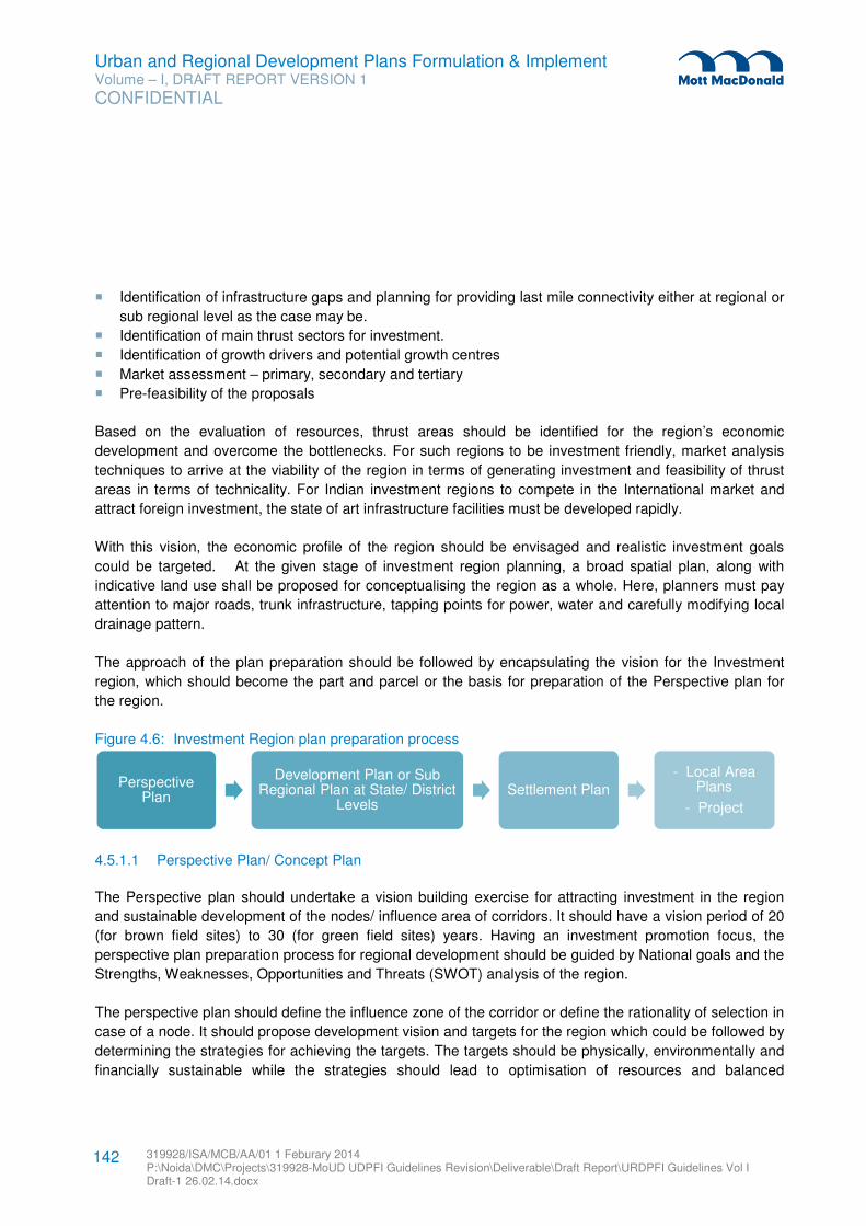
Urban and Regional Development Plans Formulation & Implement Volume – I, DRAFT REPORT VERSION 1
CONFIDENTIAL
319928/ISA/MCB/AA/01 1 Feburary 2014 P:\Noida\DMC\Projects\319928-MoUD UDPFI Guidelines Revision\Deliverable\Draft Report\URDPFI Guidelines Vol I Draft-1 26.02.14.docx
142
� Identification of infrastructure gaps and planning for providing last mile connectivity either at regional or
sub regional level as the case may be.
� Identification of main thrust sectors for investment.
� Identification of growth drivers and potential growth centres
� Market assessment – primary, secondary and tertiary
� Pre-feasibility of the proposals
Based on the evaluation of resources, thrust areas should be identified for the region’s economic
development and overcome the bottlenecks. For such regions to be investment friendly, market analysis
techniques to arrive at the viability of the region in terms of generating investment and feasibility of thrust
areas in terms of technicality. For Indian investment regions to compete in the International market and
attract foreign investment, the state of art infrastructure facilities must be developed rapidly.
With this vision, the economic profile of the region should be envisaged and realistic investment goals
could be targeted. At the given stage of investment region planning, a broad spatial plan, along with
indicative land use shall be proposed for conceptualising the region as a whole. Here, planners must pay
attention to major roads, trunk infrastructure, tapping points for power, water and carefully modifying local
drainage pattern.
The approach of the plan preparation should be followed by encapsulating the vision for the Investment
region, which should become the part and parcel or the basis for preparation of the Perspective plan for
the region.
Figure 4.6: Investment Region plan preparation process
4.5.1.1 Perspective Plan/ Concept Plan
The Perspective plan should undertake a vision building exercise for attracting investment in the region
and sustainable development of the nodes/ influence area of corridors. It should have a vision period of 20
(for brown field sites) to 30 (for green field sites) years. Having an investment promotion focus, the
perspective plan preparation process for regional development should be guided by National goals and the
Strengths, Weaknesses, Opportunities and Threats (SWOT) analysis of the region.
The perspective plan should define the influence zone of the corridor or define the rationality of selection in
case of a node. It should propose development vision and targets for the region which could be followed by
determining the strategies for achieving the targets. The targets should be physically, environmentally and
financially sustainable while the strategies should lead to optimisation of resources and balanced
Perspective Plan
Development Plan or Sub Regional Plan at State/ District
LevelsSettlement Plan
- Local Area Plans
- Project
Urban and Regional Development Plans Formulation & Implement Volume – I, DRAFT REPORT VERSION 1
CONFIDENTIAL
319928/ISA/MCB/AA/01 1 Feburary 2014 P:\Noida\DMC\Projects\319928-MoUD UDPFI Guidelines Revision\Deliverable\Draft Report\URDPFI Guidelines Vol I Draft-1 26.02.14.docx
143
development of the region. Successive to this, there should be a broad land use zoning, funding pattern
and a phasing strategy for development.
4.5.1.2 Development Plan/ Sub regional Plan
The perspective plan should be followed by preparation of a development plan, however, in case of an
inter district or interstate region (which maybe in case of corridor development), the perspective plan
should lead to preparation of sub regional plans.
The sub regional plans should be prepared in connection with the State/ District Perspective Plans in which
the sub region lies. It should have a vision period of 20 to 30 years. The development plan/ sub regional
plan should identify the priority areas for which immediate plans are necessary.
4.5.1.3 Local Area Plans and Projects
The development/sub regional plans should guide the projects and plan development process of local
areas in association with the State Perspective Plans.
4.5.1.4 Aspects of Investment Region Planning
The planning process should include the following key elements essential to promote growth and balanced
development of the region, namely:-
� The manner in which the land in the region shall be used, whether by carrying out development
thereon or by conservation.
� The policy in relation to land-use and the allocation of land for different uses.
� Identification of the potential nodes and counter magnets (if required for decongestion) for future and
proposals for development.
� Integrated transport policy, administration policy, law and order machinery.
� Plan for regional infrastructure linkages, a dedicated and sustainable connectivity across the corridor
and hinterland.
� Policy for economic development.
� Indication of the areas which require immediate development as "priority areas".
� Housing and shelter development.
� Protection of environmentally and ecologically sensitive areas and conservation of heritage.
� Sustainable development of resources including agriculture and rural development.
� Fund flow for development.
� Roles and responsibilities of various stakeholders.
� Monitoring systems and social audit mechanisms to ensure effective implementation of the plan.
4.5.2 Criteria for delineation of Region
Regions can be classified based on many criteria but while delineating region for planning purpose the
forward and backward linkages of the parameters must be kept in mind and relevant parameters be
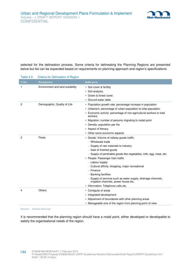
Urban and Regional Development Plans Formulation & Implement Volume – I, DRAFT REPORT VERSION 1
CONFIDENTIAL
319928/ISA/MCB/AA/01 1 Feburary 2014 P:\Noida\DMC\Projects\319928-MoUD UDPFI Guidelines Revision\Deliverable\Draft Report\URDPFI Guidelines Vol I Draft-1 26.02.14.docx
144
selected for the delineation process. Some criteria for delineating the Planning Regions are presented
below but list can be expanded based on requirements on planning approach and region’s specifications:
Table 4.3: Criteria for Delineation of Region
S.No. Parameters Indicators
1 Environment and land suitability • Soil cover & fertility
• Soil analysis,
• Green & forest cover,
• Ground water table
2 Demographic, Quality of Life • Population growth rate: percentage increase in population
• Urbanism: percentage of urban population to total population
• Economic activity: percentage of non-agricultural workers to total workers
• Migration: number of persons migrating to nodal point
• Density: population per Ha
• Aspect of literacy
• Other socio economic aspects
3 Flows • Goods: Volume of railway goods traffic
– Wholesale trade
– Supply of raw materials to industry
– Sale of finished goods
– Supply of perishable goods like vegetables, milk, egg, meat, etc.
• People: Passenger train traffic
– Labour supply
– Cultural affinity: shopping, major recreational
– Finance:
– Banking facilities
– Supply of services such as water supply, drainage channels, irrigation channels, power house etc.
• Information: Telephone calls etc.
4 Others • Contiguity of areas
• Integrated development
• Adjustment of boundaries with other planning areas
• Manageable size of the region from planning point of view.
Source: Various Sources
It is recommended that the planning region should have a nodal point, either developed or developable to
satisfy the organisational needs of the region.
Urban and Regional Development Plans Formulation & Implement Volume – I, DRAFT REPORT VERSION 1
CONFIDENTIAL
319928/ISA/MCB/AA/01 1 Feburary 2014 P:\Noida\DMC\Projects\319928-MoUD UDPFI Guidelines Revision\Deliverable\Draft Report\URDPFI Guidelines Vol I Draft-1 26.02.14.docx
145
4.5.2.1 Techniques for delineation
The criteria mentioned above are to be analysed by the following suggested techniques for area
delineation:
1. Weighted Index Number Method: This method helps to determine a homogeneous region within
certain variations/ deviation limits. For example, delineation of a region based on literacy rate may be
limited within the area having specific mean literacy rate with not more than one a standard deviation.
The approach used in this method is:
i. Identification of the criteria such as literacy rate, unemployment rate, watershed, contours etc.
ii. Determination of weights to the respective criteria
iii. Determination of homogeneity limits such as standard deviation.
2. Flow Analysis: The flow analysis identifies the direction and intensity of flows and builds up functional
relationship between the dominant centre and the surrounding satellite towns. The flows show
decreasing intensity as it becomes more distant from the main centre, hence identifying the sphere of
influence of the main centre. The flows can be plotted on linear graphs from which following information
can be obtained:
i. Most intense (Primary) and less intense (Secondary) flows into and out of each centre
ii. Hierarchy of nodes providing the form and extent of functional relationships within an area.
The flow analysis involves grouping together of local units which displays a considerable degree
of inter dependence.
3. Gravitational Analysis: This technique identifies the potential flows between centres rather than the
actual flows. This model suggests that the interaction between the two centres is directly proportional
to the ‘mass’ of the centres and inversely proportional to the ‘distance’ between the centres. The
variables used to measure ‘mass’ and ‘distance’ depend upon the problem and data availability. The
‘mass’ can be represented by variables such as population, employment, income, expenditure etc. and
‘distance’ can be represented by distance in physical terms i.e. km, time, price etc. Mathematically this
can be represented as:
Tij = k [ pipj / d2ij]
Where Tij is the gravitational force between towns i and j and Pi and Pj are the masses of the two
centres, dij is the distance between them and k is a constant.
By calculating the potential for the centres in a study area, contour lines of equal potential can be
plotted on a map, illustrating the relative attractiveness and sphere of influence of various centres.
4.6 Special Regions
The Special area development planning implies prudent use of all the available resources to ensure
optimum and sustained development of the region, towards improving quality of life of the people and to
meet growing demands of an increasing population. It is also imperative to maintain the fragile balance
Urban and Regional Development Plans Formulation & Implement Volume – I, DRAFT REPORT VERSION 1
CONFIDENTIAL
319928/ISA/MCB/AA/01 1 Feburary 2014 P:\Noida\DMC\Projects\319928-MoUD UDPFI Guidelines Revision\Deliverable\Draft Report\URDPFI Guidelines Vol I Draft-1 26.02.14.docx
146
between development and conservation practices through identification of the problem areas and
preparation of location specific development plans.
The special areas requiring conservation- development approach could be:
4.6.1 Eco sensitive areas
Eco-sensitive area is a designation provided to area which has very diverse yet fragile ecosystem. Western
Ghats is one of the ecologically sensitive areas in the country. The Government of India had taken a step
to conserve and develop this region sustainably.
For this GoI constituted Western Ghats Ecology Expert Panel which submitted its report in year 2011.
Western Ghats is a region which is defined by its geological characteristics, biological landscape, richness
in flora-fauna species, spatial heterogeneity, high conservation value and ecological sensitivity. Human
activities had deteriorating ecological impacts on the region due to which the committee was constituted to
give recommendations for its conservation. The committee has given recommendations for protection of
Western Ghats few of which have been shared below:
� River basin-level planning and decentralised management of water resources,
� Sustainable strategy of livestock development for the Western Ghats,
� Convert tea estates to organic production with the integration of animal husbandry,
� Promote systems of providing incentives to local people for conservation efforts,
� Strengthening the Rural Development department on issues related to non-timber forest produce,
� Promote industries and services that involve dematerialization – e.g. e-commerce, teleconferencing.
� Promote education hubs and special incentives should be given to agro-based fruit and food
processing industries,
� The Zoning Atlas for siting of Industries should be used as a tool for decision-making at various levels
for industry, regulatory authorities and the general public,
� Exclusion of mining from ecologically sensitive areas/zones etc.
The basic unit of development of eco sensitive areas can be a watershed, which is a manageable
hydrological unit and covers the entire area starting from the highest point of the area to the outlet of the
stream. The efficient development planning requires an overlay of various thematic layers of the spatial
and non-spatial data. The watershed management approach is a suitable planning platform for
conservation and sustainable development of all the resources specially the land and water.
The development approach shall consist of the following steps:
a. Identification and acquisition of the spatial and non-spatial data
b. Identification of the ‘formal region’ on the basis of homogeneity of demographic and economic
characteristics and sharing of natural resources.
c. Creation of the thematic layers, overlay and interpretation for developing an integrated approach for
conservation and development.
Urban and Regional Development Plans Formulation & Implement Volume – I, DRAFT REPORT VERSION 1
CONFIDENTIAL
319928/ISA/MCB/AA/01 1 Feburary 2014 P:\Noida\DMC\Projects\319928-MoUD UDPFI Guidelines Revision\Deliverable\Draft Report\URDPFI Guidelines Vol I Draft-1 26.02.14.docx
147
4.6.2 Socio economic sensitive areas
These are areas which lack amenities due to an imbalance in the economic development of the region/
nearby region and standard of living of the residing population. Such areas also encounter high rate of
social stresses.
4.6.3 Culturally sensitive areas
They may be tribal areas which lack even the basic social amenities of health and education as mostly
they are not covered in the jurisdictional areas of the administrative offices. Schedule 6 of Constitution of
India gives the provision for the tribal areas in the north-east states of India. This schedule gives provisions
for the administration of tribal areas in the States of Assam, Meghalaya, Tripura and Mizoram. In relation to
these areas Autonomous District Councils can be formed in the districts mentioned in the Constitution. In
such cases, planning and land development is not directly under the control of the State, but rests with the
Autonomous District Councils.
However, the Regional Council of an autonomous region or District Council for an autonomous district of
these states have the power to make laws with respect to ‘the allotment, occupation or use, or the setting
apart, of land, other than any land which is a reserved forest for the purposes of agriculture or grazing or
for residential or other non-agricultural purposes or for any other purpose likely to promote the interests of
the inhabitants of any village or town.’
4.7 Land use classification for Regional Planning
1. Urbanisable Zone: In Regional Plan, the areas under existing development and those earmarked for
future development shall be termed as ‘U Zone’. This zone is envisaged at three levels U-1, U-2 and U-
3.
• ‘U -1’ zone shall primarily cover the existing areas where more intensive urban
development and economic activity are expected in future.
• ‘U-2’ zone shall cover the new town areas/ satellite towns/counter magnet/growth
centres where urban development and economic activity is expected or proposed.
• ‘U-3’ zone shall be zone outside the existing or proposed urban zones, which have
potential for urban development such as lands around major roads and corridors, railway
stations etc. No formal development plan may be prepared for U-3 zone but the
development shall be regulated on the basis of road widths and development promotion
regulations.
In U Zone all residential, commercial, light and service industry, public and semi-public
buildings, transport zones and recreation area may be permitted depending upon the
compatibility of the uses.
2. Industrial Zone: The areas earmarked for industrial use – service and light industry, extensive and
heavy industry, special industrial zone or development of SIR, IT zones etc. shall be termed as ‘I Zone’.
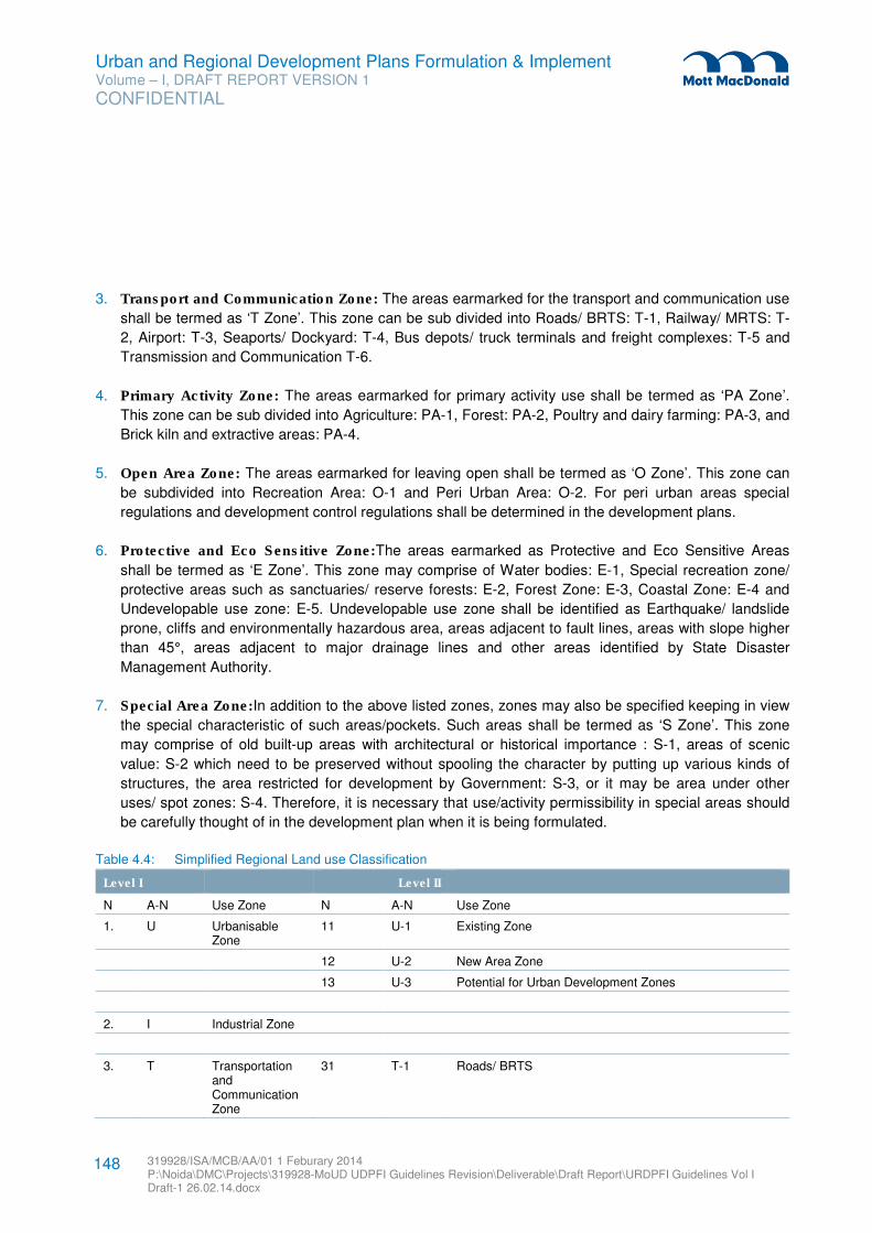
Urban and Regional Development Plans Formulation & Implement Volume – I, DRAFT REPORT VERSION 1
CONFIDENTIAL
319928/ISA/MCB/AA/01 1 Feburary 2014 P:\Noida\DMC\Projects\319928-MoUD UDPFI Guidelines Revision\Deliverable\Draft Report\URDPFI Guidelines Vol I Draft-1 26.02.14.docx
148
3. Transport and Communication Zone: The areas earmarked for the transport and communication use
shall be termed as ‘T Zone’. This zone can be sub divided into Roads/ BRTS: T-1, Railway/ MRTS: T-
2, Airport: T-3, Seaports/ Dockyard: T-4, Bus depots/ truck terminals and freight complexes: T-5 and
Transmission and Communication T-6.
4. Primary Activity Zone: The areas earmarked for primary activity use shall be termed as ‘PA Zone’.
This zone can be sub divided into Agriculture: PA-1, Forest: PA-2, Poultry and dairy farming: PA-3, and
Brick kiln and extractive areas: PA-4.
5. Open Area Zone: The areas earmarked for leaving open shall be termed as ‘O Zone’. This zone can
be subdivided into Recreation Area: O-1 and Peri Urban Area: O-2. For peri urban areas special
regulations and development control regulations shall be determined in the development plans.
6. Protective and Eco Sensitive Zone:The areas earmarked as Protective and Eco Sensitive Areas
shall be termed as ‘E Zone’. This zone may comprise of Water bodies: E-1, Special recreation zone/
protective areas such as sanctuaries/ reserve forests: E-2, Forest Zone: E-3, Coastal Zone: E-4 and
Undevelopable use zone: E-5. Undevelopable use zone shall be identified as Earthquake/ landslide
prone, cliffs and environmentally hazardous area, areas adjacent to fault lines, areas with slope higher
than 45°, areas adjacent to major drainage lines and other areas identified by State Disaster
Management Authority.
7. Special Area Zone:In addition to the above listed zones, zones may also be specified keeping in view
the special characteristic of such areas/pockets. Such areas shall be termed as ‘S Zone’. This zone
may comprise of old built-up areas with architectural or historical importance : S-1, areas of scenic
value: S-2 which need to be preserved without spooling the character by putting up various kinds of
structures, the area restricted for development by Government: S-3, or it may be area under other
uses/ spot zones: S-4. Therefore, it is necessary that use/activity permissibility in special areas should
be carefully thought of in the development plan when it is being formulated.
Table 4.4: Simplified Regional Land use Classification
Level I Level II
N A-N Use Zone N A-N Use Zone
1. U Urbanisable Zone
11 U-1 Existing Zone
12 U-2 New Area Zone
13 U-3 Potential for Urban Development Zones
2. I Industrial Zone
3. T Transportation and Communication Zone
31 T-1 Roads/ BRTS
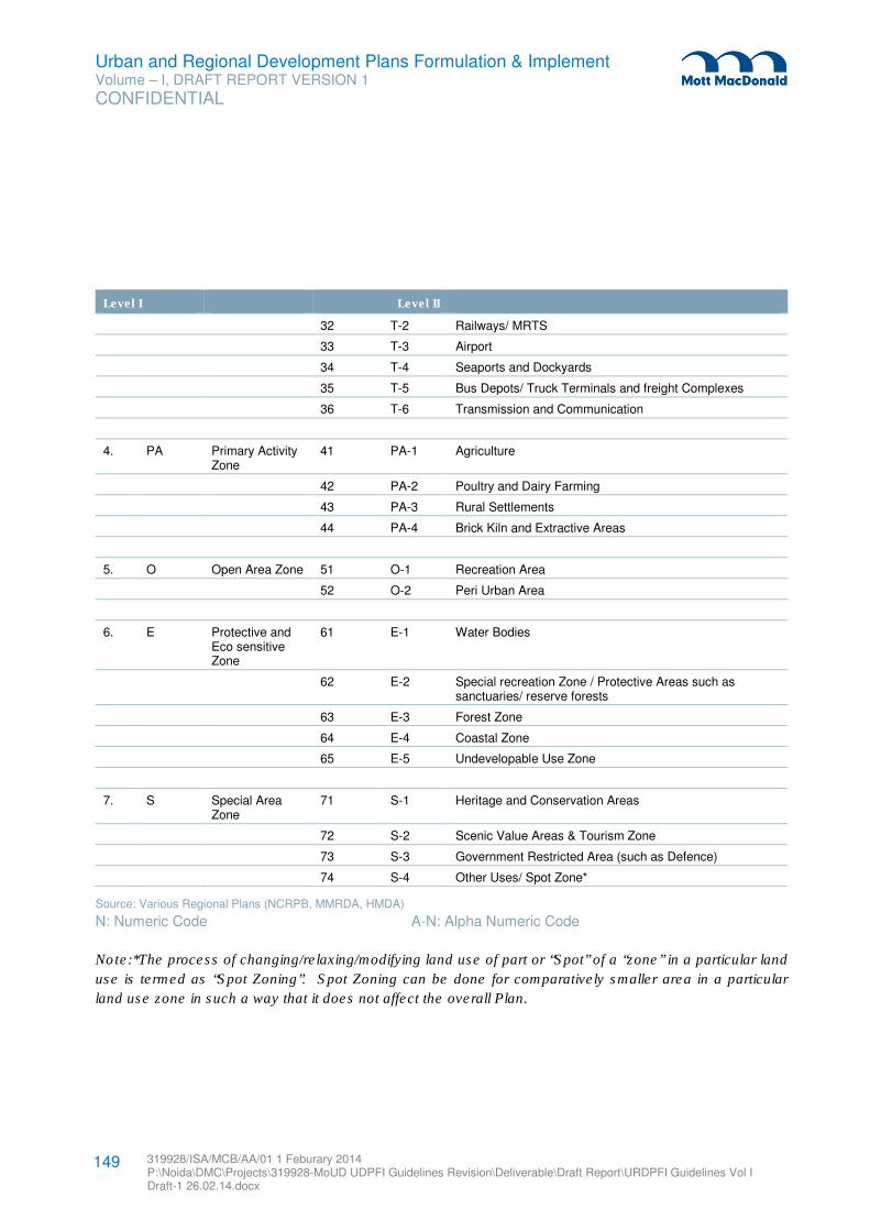
Urban and Regional Development Plans Formulation & Implement Volume – I, DRAFT REPORT VERSION 1
CONFIDENTIAL
319928/ISA/MCB/AA/01 1 Feburary 2014 P:\Noida\DMC\Projects\319928-MoUD UDPFI Guidelines Revision\Deliverable\Draft Report\URDPFI Guidelines Vol I Draft-1 26.02.14.docx
149
Level I Level II
32 T-2 Railways/ MRTS
33 T-3 Airport
34 T-4 Seaports and Dockyards
35 T-5 Bus Depots/ Truck Terminals and freight Complexes
36 T-6 Transmission and Communication
4. PA Primary Activity Zone
41 PA-1 Agriculture
42 PA-2 Poultry and Dairy Farming
43 PA-3 Rural Settlements
44 PA-4 Brick Kiln and Extractive Areas
5. O Open Area Zone 51 O-1 Recreation Area
52 O-2 Peri Urban Area
6. E Protective and Eco sensitive Zone
61 E-1 Water Bodies
62 E-2 Special recreation Zone / Protective Areas such as sanctuaries/ reserve forests
63 E-3 Forest Zone
64 E-4 Coastal Zone
65 E-5 Undevelopable Use Zone
7. S Special Area Zone
71 S-1 Heritage and Conservation Areas
72 S-2 Scenic Value Areas & Tourism Zone
73 S-3 Government Restricted Area (such as Defence)
74 S-4 Other Uses/ Spot Zone*
Source: Various Regional Plans (NCRPB, MMRDA, HMDA)
N: Numeric Code A-N: Alpha Numeric Code
Note:*The process of changing/relaxing/modifying land use of part or “Spot” of a “zone” in a particular land
use is termed as “Spot Zoning”. Spot Zoning can be done for comparatively smaller area in a particular
land use zone in such a way that it does not affect the overall Plan.
Urban and Regional Development Plans Formulation & Implement Volume – I, DRAFT REPORT VERSION 1
CONFIDENTIAL
319928/ISA/MCB/AA/01 1 Feburary 2014 P:\Noida\DMC\Projects\319928-MoUD UDPFI Guidelines Revision\Deliverable\Draft Report\URDPFI Guidelines Vol I Draft-1 26.02.14.docx
150
4.8 Members of the Regional Planning Board
4.8.1 Recommended Members for Regional Planning Board (Intra state regions)
For development of the administrative regions, the DPC’s and MPC’s shall be constituted as per the
recommendations of the 74th CAA. However, a suggestive list of members of the Regional Planning Board
for intra state planning regions is given below. The members shall be selected by the State Government.
1) Chairperson who can be the Minister-in-charge
2) Vice Chairperson, who can be the Principal Secretary
3) Director/ Chief Town Planner
4) Secretaries to the Government in the department dealing with the following subjects, namely:
a) Health
b) Industries
c) Housing
d) Revenue
e) Agriculture
f) Public works
g) Finance
h) Education
i) Forest and Environment
5) Commissioners/ Members of local authorities (such as Municipal Corporations, Zila Parishad etc.)
in region
6) Members who shall be from the house of the State Legislatures / Chamber of Municipal Chairman
etc.
7) Other members could be the chairpersons of other statutory bodies constituted in the States
8) Members with specialised knowledge/ Chief Engineers of:
a) Public Health and Municipal Works
b) Highways and Rural Works
c) Buildings, etc.
9) Members of the State Government to represent the following Ministries:
a) Railways
b) Civil Aviation
c) Transport and Communication
In case of special areas in region such as Military areas, members from the State Government who
represent such ministries shall also be appointed.
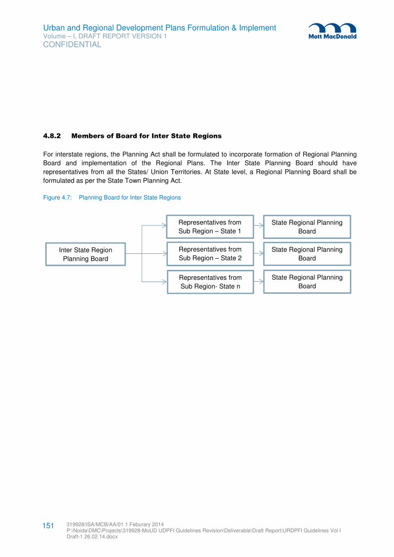
Urban and Regional Development Plans Formulation & Implement Volume – I, DRAFT REPORT VERSION 1
CONFIDENTIAL
319928/ISA/MCB/AA/01 1 Feburary 2014 P:\Noida\DMC\Projects\319928-MoUD UDPFI Guidelines Revision\Deliverable\Draft Report\URDPFI Guidelines Vol I Draft-1 26.02.14.docx
151
4.8.2 Members of Board for Inter State Regions
For interstate regions, the Planning Act shall be formulated to incorporate formation of Regional Planning
Board and implementation of the Regional Plans. The Inter State Planning Board should have
representatives from all the States/ Union Territories. At State level, a Regional Planning Board shall be
formulated as per the State Town Planning Act.
Figure 4.7: Planning Board for Inter State Regions
Inter State Region
Planning Board
Representatives from
Sub Region – State 1
Representatives from
Sub Region- State n
Representatives from
Sub Region – State 2
State Regional Planning
Board
State Regional Planning
Board
State Regional Planning
Board
Urban and Regional Development Plans Formulation & Implement Volume – I, DRAFT REPORT VERSION 1
CONFIDENTIAL
319928/ISA/MCB/AA/01 1 Feburary 2014 P:\Noida\DMC\Projects\319928-MoUD UDPFI Guidelines Revision\Deliverable\Draft Report\URDPFI Guidelines Vol I Draft-1 26.02.14.docx
152
5.1 Guidelines for Study on Location and Settlement Setting
The location, site and situation contribute in localising, growth in size and function of a town. Location can
be stated quite tersely and precisely in terms of latitude and longitude, or distance and direction from other
established points. But this gives only one aspect of the total sphere of a town. In order to know the milieu
of towns, other aspects which are equally important, rather more, in the development of a town are site, the
ground upon which a town stands, the area of earth it actually occupies and its situation in relation to its
surroundings.
The urban character, both in respect of size and functions, emerges by growth and accretion around a pre-
urban nucleus. Any appraisal of the value and importance of a particular site must involve a knowledge of
its historical past, that is, when the nucleus was established.
Site: Another factor in the siting of towns is the tendency for certain kinds of specialised settlements to
cluster together. These clusters tend to grow around some localised physical resources; and often
manufacturing is a dominant occupation. The growth of clusters of urban settlements is more frequently
found around large metropolises and results in what are sometimes called “city regions”. Often these are
made up of small towns and villages which have been enormously expanded as a result of national policy
on dispersal of economic activities away from the metropolises. The small and medium towns in these city
regions are related to one another by the functions which they perform.
In the hilly and mountainous regions, towns occupy six types of site: Ridges, Valleys, River terraces,
Confluences, Entrance to specific hill region and along Major transportation routes.
Situation: A factor of greater importance than “site” in the subsequent growth in size of a town and
enhancement of its function is its wider setting or situation. A town may achieve great size and prosperity
because of the endowment of its situation, although its site may have little to commend it and may even be
a persistent handicap. Great towns have arisen in many places in spite of serious drawbacks of site,
because the situations demanded the presence of urban functions, and, as it called for towns into being.
Calcutta and Madras which have developed to a metropolitan scale are good examples.
Although situation may thus be a compelling influence that overrides the deficiencies of site, usually it
simply provides the stimulus for a degree of urban development somewhere within a more or less confined
area in which the situation can be exploited. Local site advantages or even historical accident fix the
precise spots but it is the situation which governs their growth.
Political Impacts: Among the factors that decide the fortune of towns none are more sudden and striking
in their effects than political changes that radically alter the territorial frame of reference. This is especially
evident in respect of towns that discharge administrative, commercial and cultural functions. No town,
however, is independent of the effect of changes in the cultural situation upon which the value of its
physical setting depends. Moreover, towns are fixtures of civilization, which cannot readily be improvised
but which are built-up by patient effort, thus they are so persistent and capable of continued growth.
5 Urban Planning Approach
Urban and Regional Development Plans Formulation & Implement Volume – I, DRAFT REPORT VERSION 1
CONFIDENTIAL
319928/ISA/MCB/AA/01 1 Feburary 2014 P:\Noida\DMC\Projects\319928-MoUD UDPFI Guidelines Revision\Deliverable\Draft Report\URDPFI Guidelines Vol I Draft-1 26.02.14.docx
153
Keeping the above factors in mind, the guidelines for the study on location, site and situation are as under:
5.1.1 Location
The following locational attributes shall be considered in planning exercise:
a) Location of the city/ town in absolute terms of latitude and longitude; also distance and direction
from other established points;
b) Nodal significance of the city/ town in the national or regional infrastructure of transport and
communication, power, and in an agricultural area, irrigation network, agricultural extension
services, agricultural produce collection and distribution centre, agro-industries linked to local
markets;
c) Status that the city/ town occupied in the urban hierarchy involved;
d) Role and status of the city/ town in the national delivery systems of social services;
e) Relative significance of locations of city/ town in proximity to a metropolis/megapolis:
I. Nodal significance
II. Presence of high productive economic activities
III. Presence of large scale market
5.1.2 Site
The following site attributes shall be studied for taking up any planning exercise:
a) Conditions of site: low-lying, swamp, or dry land, ridge; on a river bank or canal side. Within the
town-flat, slopping (in which direction), undulating-gentle slope, moderate slope, steep slope.
b) Value and importance of the site; and its historical past, that is, when the nucleus was established.
c) Analyse the factors responsible for determining the site:
I. In alluvial plains
II. In hilly and mountainous regions
III. In arid regions
IV. In the areas of territorial ruler ship
V. In the areas around some localised physical resources, mining settlements, manufacturing
towns, resort towns
VI. Around large metropolises
d) Climate and its influence on daily life, on building the homes, the range of crops a city-region can
produce; and how the city activities have modified the natural climate, particularly in the built-up
area.
e) Analysis of climate type, variations in temperature, wind velocity and wind directions in different
parts of the city; study of the climate with reference to summer, rainy and winter seasons.
f) Limiting and the favourable factors of site in the spread and growth of the city/town.
5.1.3 Situation
The following shall be considered for situation analysis:
Urban and Regional Development Plans Formulation & Implement Volume – I, DRAFT REPORT VERSION 1
CONFIDENTIAL
319928/ISA/MCB/AA/01 1 Feburary 2014 P:\Noida\DMC\Projects\319928-MoUD UDPFI Guidelines Revision\Deliverable\Draft Report\URDPFI Guidelines Vol I Draft-1 26.02.14.docx
154
a) The endowment of the situation (wider setting) for the subsequent growth in size of the city/town
and for the enhancement of its functions
b) The important and interrelated aspects of situation, namely,
I. Physical configuration
II. Route patterns
III. The extent of the territory to which the urban functions are related
c) Suggest measures to retard or even overcome the weakening of the original value of the site and
situation.
5.1.4 Hinterland
The endowment of the hinterland is another factor on which growth of an urban centre rests. An urban
centre, for example, can establish a mutually interacting relationship with its hinterland if the hinterland has
a variety and extent of natural resources in terms of both agriculture and economic potentials. A city’s
growth may be consistent and stable mainly because its economic base is closely linked with that of its
hinterland. It is also conceivable that the city can be an instrument not merely for effectively utilising the
existing potential of its hinterland but also of increasing the hinterland’s potential itself. The development of
the regional economy helps the growth of small towns which in the process become the main service
centres for their hinterlands.
Therefore, considerable attention should be given to the delimitation of the areas joined by social and
economic bonds to a particular urban settlement. The area linked socially and economically to an urban
settlement has been given various names, such as “Hinterland”, “Umland”, “Urban Field”, “Sphere of
Influence”, “Zones of Influence”, “Tributary Area”, or “Catchment Area”. The immediate hinterland of a large
city, which is directly under the influence of the agglomeration, is the ‘peri-urban area’.
5.1.4.1 Peri-urban area
The area influenced by a town is not a two-dimensional feature, not a sphere, nor does it necessarily form
a continuous zone. For that matter, goods and services flow both into and out of a town: most modern
urban settlements and their immediate hinterlands are economically interdependent, rather than one being
a tributary to the other. An analysis of the rural area served by a market town gives some indication of the
relation between city and the urban-rural mix (the peri-urban area), which is of practical application in
examining the provision of goods and services in an urban centre. However, as mentioned in the Regional
planning chapter, Peri-urban is the zone which is within the planning area limits but outside the
urbanisation limit of the municipal corporation / authority or metropolitan planning committee or
authority.
As smaller towns fall within the areas served by larger metropolitan regions, the delimitation of urban
zones of influence also sheds light on the manner in which a city at a particular level in the urban hierarchy
provides specialist services for the surrounding population and settlements (such as service towns,
satellite towns or service villages). Finally, very large cities extend a particularly intensive influence over
Urban and Regional Development Plans Formulation & Implement Volume – I, DRAFT REPORT VERSION 1
CONFIDENTIAL
319928/ISA/MCB/AA/01 1 Feburary 2014 P:\Noida\DMC\Projects\319928-MoUD UDPFI Guidelines Revision\Deliverable\Draft Report\URDPFI Guidelines Vol I Draft-1 26.02.14.docx
155
the areas around them, so much so that these can be well defined peri-urban areas. Delimitation of peri-
urban areas, as mentioned is not spherical; it is directly influenced by accessibility as of highways and/or
prime economic investments. With rapid urbanisation conditions, the influence or peri-urban zone is
dynamic and with the shift in the urban forms, the distance of the peri-urban limits also undergoes
alterations.
In examining zone of influence, one commonly adopted method is to establish on a map the areas served
by employment, shopping, entertainment, education, health services and so on. This method of analysis is
applicable to cities and towns at all level in urban hierarchy. At a higher level in urban hierarchy the criteria
used reflect the distinctive functions of larger settlements and employ information like:
� The area served by the city’s services and amenities like water supply, electricity, gas supply and
telephone, health services, educational, cultural, recreational elements, security services such as
police and fire brigades, postal services, mainly the local delivery areas and postal zones; banking and
insurance facilities, the circulation of its daily newspapers.
� Wholesale flow, journey-to-work, intensity and speed of movement should be taken into consideration.
� Other reflective elements, which may be considered are land use ratio of non-agricultural to agricultural
population, density trends in population growth, settlement pattern, growth of built-up areas and pattern
of communication.
In respect of industrial towns, its tributary area will be much more restricted than that of a town of equal
size, which has grown to serve the rural population. While the latter will dominate a relatively clearly
defined area, an intrusive industrial town may well not have the full range of urban services appropriate of
its size. These missing functions will be supplied from other centres, thus making its zone of influence less
clearly defined.
It will be clear that the analysis of urban zones of influence is most appropriate for those cities whose
dominant role is that of serving as a central place, although most settlements of any reasonable size will
have this among their various functions.
5.1.4.2 Unique Development phenomenon such as Leap Frog Development
Leapfrog development refers to the occurrence of urban settlement in places separated from denser areas
by open space and land under agricultural production. This development has “jumped” land unavailable for
such development because it is held by the state, by other private owners, or because it is under the
control of traditional authorities. This type of development may take the form of upmarket residential and
business park development, or it may take the form of low-cost housing projects or informal settlements
which may be implemented, or which may occur as a consequence of rapid urbanization38
.
Municipal Planning & Management Tools can be applied for such a development, primarily it is suggested
to define an urban edge or an urban development/growth boundary. Ensure that the municipality has up to
38 Sustainable Urbanization: Guidelines to Manage Urban Growth, Volume 2: Tools and Guidelines, McIntosh Xaba & Associates
Urban and Regional Development Plans Formulation & Implement Volume – I, DRAFT REPORT VERSION 1
CONFIDENTIAL
319928/ISA/MCB/AA/01 1 Feburary 2014 P:\Noida\DMC\Projects\319928-MoUD UDPFI Guidelines Revision\Deliverable\Draft Report\URDPFI Guidelines Vol I Draft-1 26.02.14.docx
156
date user friendly data on social, economic, agricultural, environmental and spatial trends within the area of
its jurisdiction and applying stricter control over subdivision of agricultural land.
5.1.5 Accessibility
Accessibility is the dominant factor influencing the location, growth and functions of urban centres. It is to
combine at least three elements: the location of a place within a region (in general, centrally located places
are more accessible); the form of the transport system; and the locations within the area of the activities:
access to employment opportunities, access to population, access to educational or health facilities, etc.
Transport routes are the most influential in governing the location of cities which link regions to external
areas. Urban settlements tend to grow on transport routes only at specific places, particularly at junctions
and break-of-bulk points, where one form of the transport is changed for another. Hence settlements
whose locations are guided by transport routes are found not only at the end of these routes, but also
along them. The number of routes which come together at a particular point is not important, rather it is the
degree to which passengers and goods are interchanged there.
The guidelines for the study of accessibility are as under –
Establish the role of:
i) Long-distance transportation in determining the locations of the city/town;
ii) both the long distance as well as local and intra-urban transportation in the growth of size
of the city/town;
iii) inter-urban transportation in affecting the urban form (shape of urban area and its basic
transportation network) and urban structure (distribution of land uses and population
densities);
iv) easy access from many areas and by different modes;
v) good mobility within city/town(construction of a bridge or tunnel results in the development
of new areas with commercial, industrial and residential activities, which leads to
population increase in the entire urban area).
5.1.6 Socio-Economic Profile
City is not alone a characteristic of its physical or locational forms; it encompasses the inhabitants, who
through social process develop its culture. Socio-economic profile of the city is an important aspect of the
city planning. Class-wise distribution of the population is a key indicator of the social parameters in a
settlement. In case of existing settlement, the pattern of population on the basis of socio-economic levels
can be studied for planning to understand the services and facilities. On the contrary, it is useful for the
greenfield sites, where wide zoning can be proposed based on the economics of the settling population,
either for higher, middle or low income class. Here the distribution and spatial plan is usually influenced by
the two schools of thought, one being Working class or Class IV employees to be settled outside the prime
city area, another being, to provide settlement inside the city, reducing number of travel trips.
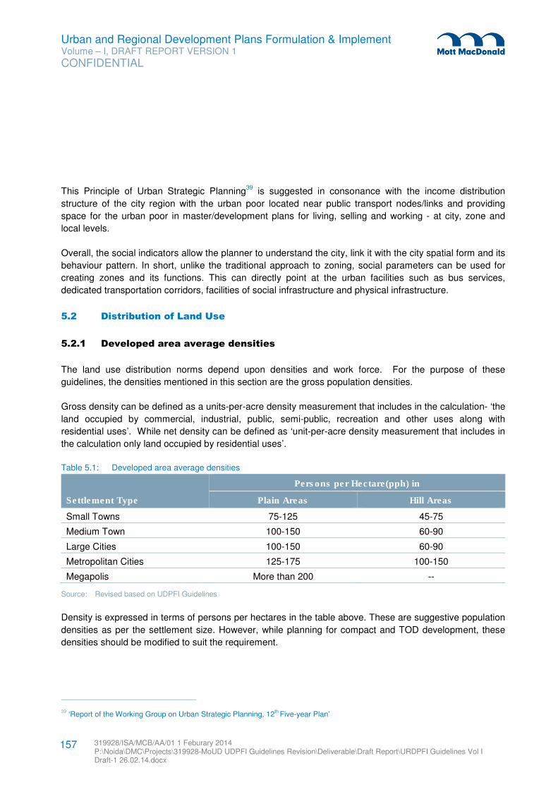
Urban and Regional Development Plans Formulation & Implement Volume – I, DRAFT REPORT VERSION 1
CONFIDENTIAL
319928/ISA/MCB/AA/01 1 Feburary 2014 P:\Noida\DMC\Projects\319928-MoUD UDPFI Guidelines Revision\Deliverable\Draft Report\URDPFI Guidelines Vol I Draft-1 26.02.14.docx
157
This Principle of Urban Strategic Planning39
is suggested in consonance with the income distribution
structure of the city region with the urban poor located near public transport nodes/links and providing
space for the urban poor in master/development plans for living, selling and working - at city, zone and
local levels.
Overall, the social indicators allow the planner to understand the city, link it with the city spatial form and its
behaviour pattern. In short, unlike the traditional approach to zoning, social parameters can be used for
creating zones and its functions. This can directly point at the urban facilities such as bus services,
dedicated transportation corridors, facilities of social infrastructure and physical infrastructure.
5.2 Distribution of Land Use
5.2.1 Developed area average densities
The land use distribution norms depend upon densities and work force. For the purpose of these
guidelines, the densities mentioned in this section are the gross population densities.
Gross density can be defined as a units-per-acre density measurement that includes in the calculation- ‘the
land occupied by commercial, industrial, public, semi-public, recreation and other uses along with
residential uses’. While net density can be defined as ‘unit-per-acre density measurement that includes in
the calculation only land occupied by residential uses’.
Table 5.1: Developed area average densities
Settlement Type
Persons per Hectare(pph) in
Plain Areas Hill Areas
Small Towns 75-125 45-75
Medium Town 100-150 60-90
Large Cities 100-150 60-90
Metropolitan Cities 125-175 100-150
Megapolis More than 200 --
Source: Revised based on UDPFI Guidelines
Density is expressed in terms of persons per hectares in the table above. These are suggestive population
densities as per the settlement size. However, while planning for compact and TOD development, these
densities should be modified to suit the requirement.
39 ‘Report of the Working Group on Urban Strategic Planning, 12th Five-year Plan’
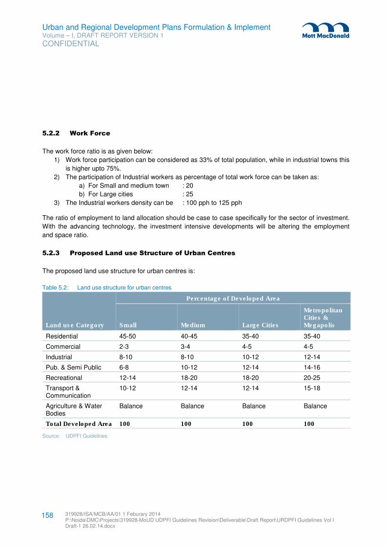
Urban and Regional Development Plans Formulation & Implement Volume – I, DRAFT REPORT VERSION 1
CONFIDENTIAL
319928/ISA/MCB/AA/01 1 Feburary 2014 P:\Noida\DMC\Projects\319928-MoUD UDPFI Guidelines Revision\Deliverable\Draft Report\URDPFI Guidelines Vol I Draft-1 26.02.14.docx
158
5.2.2 Work Force
The work force ratio is as given below:
1) Work force participation can be considered as 33% of total population, while in industrial towns this
is higher upto 75%.
2) The participation of Industrial workers as percentage of total work force can be taken as:
a) For Small and medium town : 20
b) For Large cities : 25
3) The Industrial workers density can be : 100 pph to 125 pph
The ratio of employment to land allocation should be case to case specifically for the sector of investment.
With the advancing technology, the investment intensive developments will be altering the employment
and space ratio.
5.2.3 Proposed Land use Structure of Urban Centres
The proposed land use structure for urban centres is:
Table 5.2: Land use structure for urban centres
Land use Category
Percentage of Developed Area
Small Medium Large Cities
Metropolitan Cities & Megapolis
Residential 45-50 40-45 35-40 35-40
Commercial 2-3 3-4 4-5 4-5
Industrial 8-10 8-10 10-12 12-14
Pub. & Semi Public 6-8 10-12 12-14 14-16
Recreational 12-14 18-20 18-20 20-25
Transport & Communication
10-12 12-14 12-14 15-18
Agriculture & Water Bodies
Balance Balance Balance Balance
Total Developed Area 100 100 100 100
Source: UDPFI Guidelines
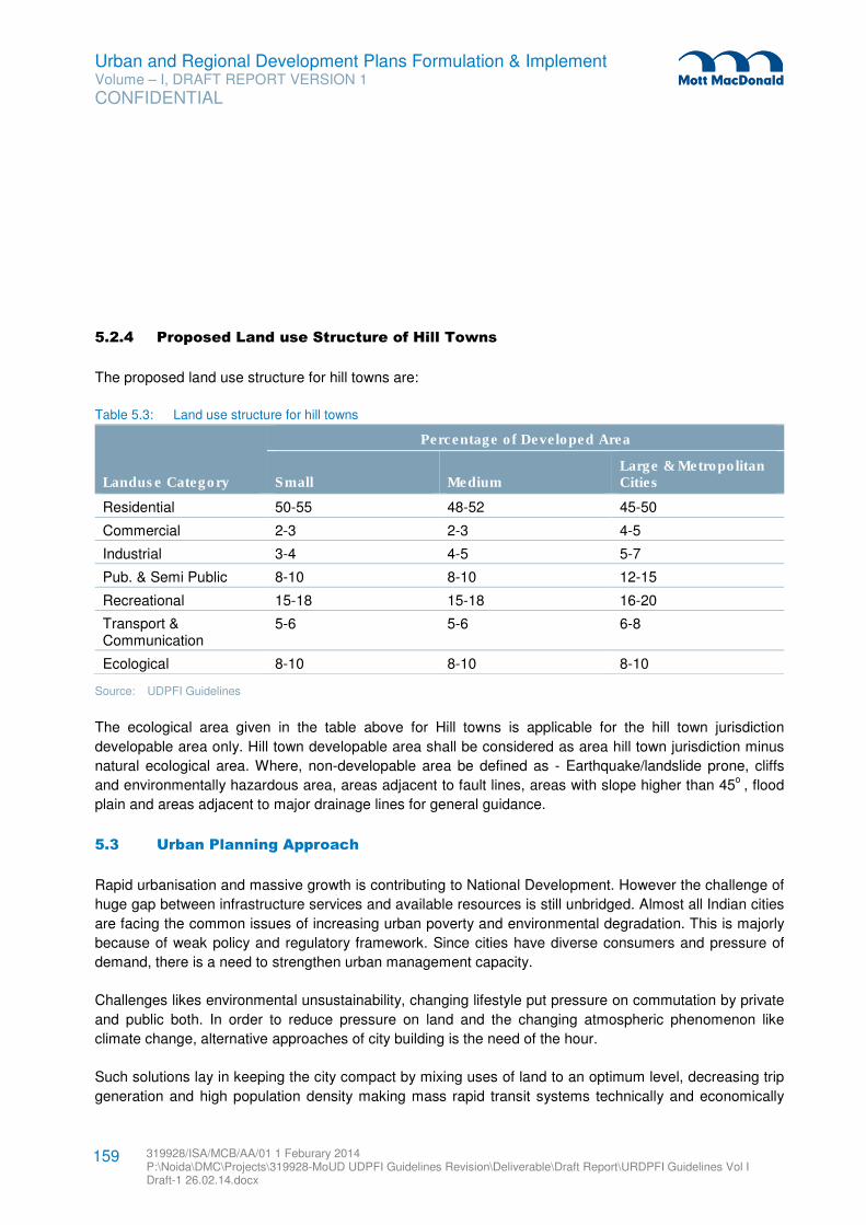
Urban and Regional Development Plans Formulation & Implement Volume – I, DRAFT REPORT VERSION 1
CONFIDENTIAL
319928/ISA/MCB/AA/01 1 Feburary 2014 P:\Noida\DMC\Projects\319928-MoUD UDPFI Guidelines Revision\Deliverable\Draft Report\URDPFI Guidelines Vol I Draft-1 26.02.14.docx
159
5.2.4 Proposed Land use Structure of Hill Towns
The proposed land use structure for hill towns are:
Table 5.3: Land use structure for hill towns
Landuse Category
Percentage of Developed Area
Small Medium Large & Metropolitan Cities
Residential 50-55 48-52 45-50
Commercial 2-3 2-3 4-5
Industrial 3-4 4-5 5-7
Pub. & Semi Public 8-10 8-10 12-15
Recreational 15-18 15-18 16-20
Transport & Communication
5-6 5-6 6-8
Ecological 8-10 8-10 8-10
Source: UDPFI Guidelines
The ecological area given in the table above for Hill towns is applicable for the hill town jurisdiction
developable area only. Hill town developable area shall be considered as area hill town jurisdiction minus
natural ecological area. Where, non-developable area be defined as - Earthquake/landslide prone, cliffs
and environmentally hazardous area, areas adjacent to fault lines, areas with slope higher than 45o
, flood
plain and areas adjacent to major drainage lines for general guidance.
5.3 Urban Planning Approach
Rapid urbanisation and massive growth is contributing to National Development. However the challenge of
huge gap between infrastructure services and available resources is still unbridged. Almost all Indian cities
are facing the common issues of increasing urban poverty and environmental degradation. This is majorly
because of weak policy and regulatory framework. Since cities have diverse consumers and pressure of
demand, there is a need to strengthen urban management capacity.
Challenges likes environmental unsustainability, changing lifestyle put pressure on commutation by private
and public both. In order to reduce pressure on land and the changing atmospheric phenomenon like
climate change, alternative approaches of city building is the need of the hour.
Such solutions lay in keeping the city compact by mixing uses of land to an optimum level, decreasing trip
generation and high population density making mass rapid transit systems technically and economically
Urban and Regional Development Plans Formulation & Implement Volume – I, DRAFT REPORT VERSION 1
CONFIDENTIAL
319928/ISA/MCB/AA/01 1 Feburary 2014 P:\Noida\DMC\Projects\319928-MoUD UDPFI Guidelines Revision\Deliverable\Draft Report\URDPFI Guidelines Vol I Draft-1 26.02.14.docx
160
viable. Another important aspect to be encouraged by urban planners is walk to work by giving pedestrian
safety.
To moderate the environmental impacts of urbanisation, sustainable ways of planning are required. Urban
centres by its form play a significant role in mounting urban heat island. Green city modules such as street
orientation in lines with sun direction and wind direction not only help reduce the impact, but also slow
down the gas emissions from artificial cooling systems. Further green spaces within the urban set-up
ensures cooling effect and better public interaction spaces, apart from psychological supports in reducing
human stress levels.
Both compact city and green city approach shall help to enhance agricultural activities, reducing pollution
levels, decentralising waste handling, encouraging public transportation and simplifying landuse
segregation.
To technically meet the demand of the urban centres in making it cost effective and in optimum utilisation
of available resources to any of the urban planning approaches, ITU has emerged as a solution. SMART
city concept facilities better living experience for human kind, declining dependency on contingencies by
using Information Communication Technology (ICT) enable development of smart communities, providing
a communication web that connects buildings, energy and mobility devices such as EVs by using bi-
directional information exchange.
The following sections cover the key benefits of compact city, green city and SMART city approaches and
its aspects in planning.
5.3.1 Green City
Green cities are those where economic growth and development is fostering, that reduce negative
environmental externalities, the impact on natural resources and the pressure on ecosystem services.
These cities have significant synergies between environmental and economic objectives. A clean or
effective production and consumption of facilities related to movement of people and goods, waste
management and recycling, pollution prevention, treatment, energy, abatement, design, construction,
maintenance, resource extraction, agriculture, natural resource management and other environmental
services, are the prime component of a green city.
In short, a green city is a community of residents, neighbours, workers, and visitors who endeavour
together to balance economic, social, and ecological needs to ensure a clean, healthy and safe
environment for all members of society and for generations to come.
5.3.1.1 Key Benefits of Green city
� Effective Land Use: Green cities practices an effective land use and addresses the impacts of urban
sprawl by encouraging compact, mixed-use developments and promotes higher urban densities
without affecting the quality of life.
Urban and Regional Development Plans Formulation & Implement Volume – I, DRAFT REPORT VERSION 1
CONFIDENTIAL
319928/ISA/MCB/AA/01 1 Feburary 2014 P:\Noida\DMC\Projects\319928-MoUD UDPFI Guidelines Revision\Deliverable\Draft Report\URDPFI Guidelines Vol I Draft-1 26.02.14.docx
161
� Habitat Prevention and Restoration: These cities aim to prevent scar to the landscape, productivity
of agricultural land, biodiversity and natural habitat. Such green spaces improve the quality of air and
canopy covers reduces noise level.
� Efficient Transportation Management: Green city increases opportunities for bicycling, encouraging
pedestrian friendly network, reduction in the number of automobile trips, promoting public
transportation and use of vehicles with alternative fuels.
� Effective Use of Resources: Limits the usage of resources by incorporating efficient systems, like:
– Water Efficiency: Green city includes “R3” (reduce-recycle-reuse) strategies and can save potable
water to an extent of 30%.
– Energy Efficiency: On-site power generation using various renewable energy technologies and
other clean fuels can significantly reduce the load on grid power supply. There can be energy
saving to the tune of 20-30%.
– Waste Management: Waste management in Green Cities are well planned which takes into
account waste reduction initiatives by planning and implementation of efficient and effective
systems for collection, transportation, treatment, recycling and reuse or disposal of municipal solid
waste. Also, Waste-to-energy is a key component of green city.
� Other Benefits: Reduced maintenance costs, resource consumption, waste generation along with
higher marketability and speedy environmental clearance approvals.
5.3.1.2 Green city Planning Components
Site Selection and Planning
Green city development should be selected on land which is fully approved by the local government
authority and have no ecologically sensitive areas or any associated environmental impacts. Land with
minimum site disturbance should be preferred during site selection in case of a Greenfield township.
Priority should be given to the already developed land in order to achieve green redevelopment.
Land Use & Transportation Planning
1. Urban sprawl should be discouraged by practicing higher development densities
2. Green cities should majorly use public transportation to reduce fossil fuel consumption & vehicular
emissions. The proximities of basic transportation mode should be in walkable distance.
3. Locate basic amenities within walkable distances to reduce dependency on automobiles
4. 8-10 basic amenities (e.g. ATM, Parking, Convenience shopping, religious facilities, crèche etc.) within
600-800 meters.
5. 3-4 amenities within 1.6- 2 km (e.g. School, Medical Clinic, Community hall with sports facilities,
Restaurant etc.)
6. Provide a non-industrial mixed land use by including atleast 3-4 developments like Offices, Hospitals,
Retails, Recreational areas, etc.
7. About 25-35 % of total area should be earmarked as recreational and open spaces within the Green
City.
8. The need of differently abled people should also be adequately addressed.
Urban and Regional Development Plans Formulation & Implement Volume – I, DRAFT REPORT VERSION 1
CONFIDENTIAL
319928/ISA/MCB/AA/01 1 Feburary 2014 P:\Noida\DMC\Projects\319928-MoUD UDPFI Guidelines Revision\Deliverable\Draft Report\URDPFI Guidelines Vol I Draft-1 26.02.14.docx
162
9. Eco- friendly transportation services should be preferred which runs on CNG, bio-fuels, solar battery
etc. Thus, Non-Motorised Transport (NMT) and Intelligent Transport System (ITS)40
should be
encouraged.
10. Provision of interconnected road and street network will facilitate transport efficiency and easy
connectivity, so that people will be encouraged to use Bicycle and Pedestrian Network.
11. Requirements:
– Rail Station Proximity: Locate the project within 1/2-mile (800-meter) walking distance (measured
from a main building entrance) of an existing or planned and funded commuter rail, light rail or
subway station.
– Bus Stop Proximity: Locate the project within 1/4-mile (400-meter) walking distance (measured
from a main building entrance) of 1 or more stops for 2 or more public, campus, or private bus lines
usable by building occupants.
– Public Transportation Proximity: Locate the project within ¼-mile (400-meter) walking distance
(measured from a main building entrance) of 1 or more stops for at least 2 rideshare options for 4
or more passengers. Rideshare options include passenger ferry terminals, vans and human-
powered conveyances, such as rickshaws, that are authorized by the local transit authority and that
meet the definition of public transportation.
Infrastructure Resource Management
Green cities are required to be developed as a self-sustained entity i.e. the place where the resources can
be utilized in a recycled and reusable approach, so that the dependency over the civic bodies can be
minimized. Thus, it needs to include most effective resource management system. Starting with the water
scarcity, it should be mandatory for a green city to practice the rainwater harvesting to enhance
groundwater table and reduce municipal water demand. As a whole, water supply should comply with the
R3 (Reduce-Recycle-Reuse) 41
concept in order to address the water related issues. Grey water reuse shall
be in built in the infrastructure set-up.
Coming to the efficient energy, green cities shall majorly emphasize on non-conventional sources of
energy, atleast 10% of city’s peak electricity load42
. Solar energy, Waste-to-energy, Landfill Gas Energy
and Wind energy are some of the alternative sources that can be integrated with the green city
development to reduce the load on grid power.
Waste reduction is among the prime concern for these cities. The aim should be to achieve “Zero Waste”
to landfills. “User-friendly” recycling and composting programs should be implemented with the goal to
reduce atleast 20% per capita solid waste disposal to landfill.
40 Green Module, A study of West Bengal
41 Green Module, A study of West Bengal
42 Pasadena Green City Report
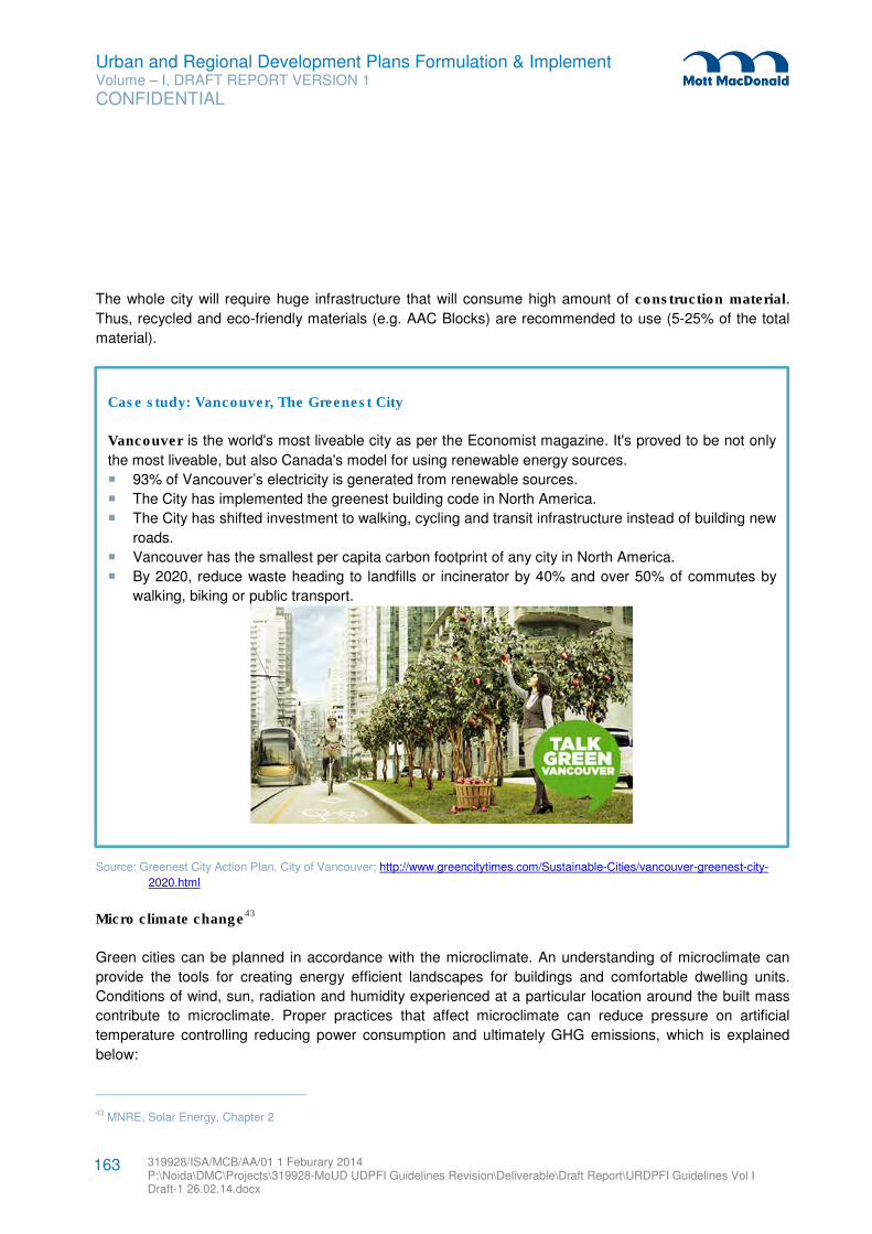
Urban and Regional Development Plans Formulation & Implement Volume – I, DRAFT REPORT VERSION 1
CONFIDENTIAL
319928/ISA/MCB/AA/01 1 Feburary 2014 P:\Noida\DMC\Projects\319928-MoUD UDPFI Guidelines Revision\Deliverable\Draft Report\URDPFI Guidelines Vol I Draft-1 26.02.14.docx
163
The whole city will require huge infrastructure that will consume high amount of construction material.
Thus, recycled and eco-friendly materials (e.g. AAC Blocks) are recommended to use (5-25% of the total
material).
Source: Greenest City Action Plan, City of Vancouver; http://www.greencitytimes.com/Sustainable-Cities/vancouver-greenest-city-
2020.html
Micro climate change43
Green cities can be planned in accordance with the microclimate. An understanding of microclimate can
provide the tools for creating energy efficient landscapes for buildings and comfortable dwelling units.
Conditions of wind, sun, radiation and humidity experienced at a particular location around the built mass
contribute to microclimate. Proper practices that affect microclimate can reduce pressure on artificial
temperature controlling reducing power consumption and ultimately GHG emissions, which is explained
below:
43 MNRE, Solar Energy, Chapter 2
Case study: Vancouver, The Greenest City
Vancouver is the world's most liveable city as per the Economist magazine. It's proved to be not only
the most liveable, but also Canada's model for using renewable energy sources.
� 93% of Vancouver’s electricity is generated from renewable sources.
� The City has implemented the greenest building code in North America.
� The City has shifted investment to walking, cycling and transit infrastructure instead of building new
roads.
� Vancouver has the smallest per capita carbon footprint of any city in North America.
� By 2020, reduce waste heading to landfills or incinerator by 40% and over 50% of commutes by
walking, biking or public transport.
Urban and Regional Development Plans Formulation & Implement Volume – I, DRAFT REPORT VERSION 1
CONFIDENTIAL
319928/ISA/MCB/AA/01 1 Feburary 2014 P:\Noida\DMC\Projects\319928-MoUD UDPFI Guidelines Revision\Deliverable\Draft Report\URDPFI Guidelines Vol I Draft-1 26.02.14.docx
164
1. Street Orientation: Street geometry and orientation influences the amount of solar radiation received
by street surfaces, as well as the potential for cooling of the whole urban system. The streets can be
oriented parallel to prevailing wind direction for free airflow in warm climates. Preferably, the street
orientation in Indian context should be E-W, as the buildings will be oriented N-S, thus there will be
easier seasonal solar control as the walls are protected in the summer and exposed in the winter.
2. Water bodies: Since water has a relatively high latent heat of vaporisation, it absorbs a large amount
of heat from the surrounding air for evaporation which cools the air. The wind pattern at a site is also
influenced by the presence of water body. Therefore, water bodies such as lakes, ponds or fountains
should be provided.
3. Open spaces & Vegetation: Open spaces such as courtyards can be designed, that can act as heat
sinks. Grass cover and shading which gives cooling effect. Plants adsorb radiations and cool the
environment. Planting a deciduous plant (e.g. Mulberry, Champa) on East and West side provides
shade from intense and glazing morning and evening sun in summers, cut off hot breeze, and also
allow solar radiations in winter as they shed the leaves in that period.
4. Semi-pervious ground cover: Semi-pervious paving which allow percolation of water into the
underground water table.
5. Green Buildings: A green building is one which uses less water, optimises energy efficiency,
conserves natural resources, generates less waste and provides healthier spaces for occupants, as
compared to a conventional building. As an added benefit, green design measures reduce operating
costs, enhance building marketability, increase worker productivity and reduce potential health impacts
resulting from indoor air quality problems.
6. Solar Passive Design44
: Passive solar design refers to the use of the sun’s energy for the heating and
cooling of living spaces. In this approach, the building itself or some element of it takes advantage of
natural energy characteristics in materials and air created by exposure to the sun. The key features lies
with solar passive design are: Orientation of building, Sunshades, Window design, double glazed
windows, Building insulation, Roof treatment, Evaporative cooling, Landscaping, Surface to volume
ratio, Passive heating, Earth air tunnel, Solar chimney, and Wind tower.
7. Green Roof: Green roofs are roofs that have a layer of living plants on top of the standard structure
and waterproofing elements. It helps in reducing Urban Heat Island Effect and also delays stormwater
runoff. It also reduced energy consumption. Thus, adaption of this technology throughout the city will
increase the green area; hence areas with construction can also be converted to green area.
For development of green buildings, the norms as suggested by Ministry of Environment & Forest and
various bodies such as LEED, GRIHA or IGBC may be applicable depending upon the requirements.
An effective design of green city for its various components can even reduce crime. Green cities promote
features that maximize visibility of people, open spaces in and around the campuses and building
entrances looking over the streets and parking areas; pedestrian‐friendly sidewalks which allows natural
surveillance.
44 TERI with support of MNRE
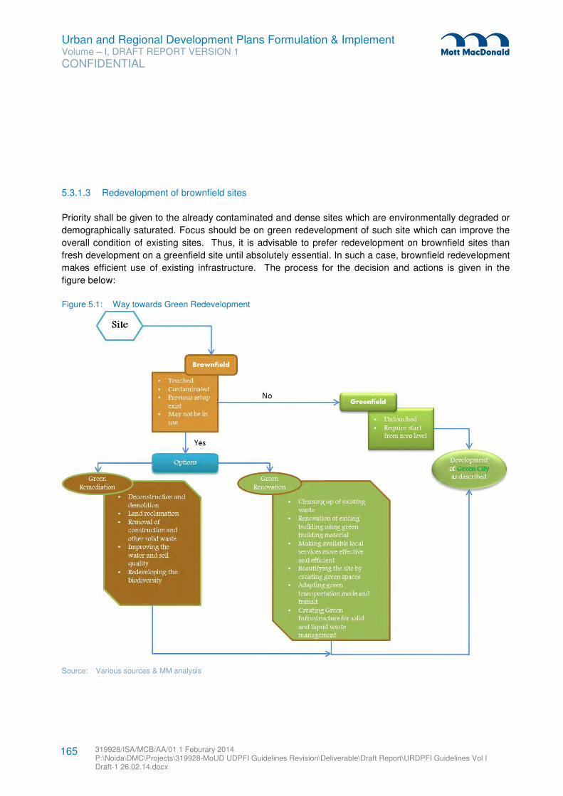
Urban and Regional Development Plans Formulation & Implement Volume – I, DRAFT REPORT VERSION 1
CONFIDENTIAL
319928/ISA/MCB/AA/01 1 Feburary 2014 P:\Noida\DMC\Projects\319928-MoUD UDPFI Guidelines Revision\Deliverable\Draft Report\URDPFI Guidelines Vol I Draft-1 26.02.14.docx
165
5.3.1.3 Redevelopment of brownfield sites
Priority shall be given to the already contaminated and dense sites which are environmentally degraded or
demographically saturated. Focus should be on green redevelopment of such site which can improve the
overall condition of existing sites. Thus, it is advisable to prefer redevelopment on brownfield sites than
fresh development on a greenfield site until absolutely essential. In such a case, brownfield redevelopment
makes efficient use of existing infrastructure. The process for the decision and actions is given in the
figure below:
Figure 5.1: Way towards Green Redevelopment
Source: Various sources & MM analysis
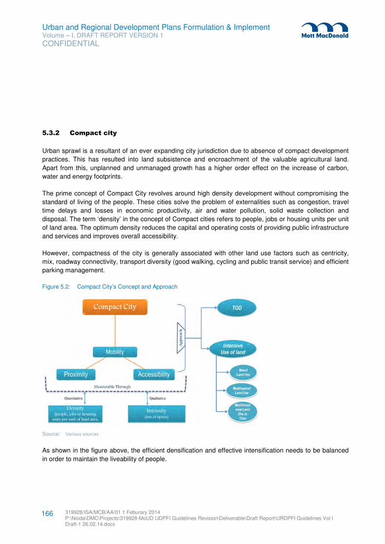
Urban and Regional Development Plans Formulation & Implement Volume – I, DRAFT REPORT VERSION 1
CONFIDENTIAL
319928/ISA/MCB/AA/01 1 Feburary 2014 P:\Noida\DMC\Projects\319928-MoUD UDPFI Guidelines Revision\Deliverable\Draft Report\URDPFI Guidelines Vol I Draft-1 26.02.14.docx
166
5.3.2 Compact city
Urban sprawl is a resultant of an ever expanding city jurisdiction due to absence of compact development
practices. This has resulted into land subsistence and encroachment of the valuable agricultural land.
Apart from this, unplanned and unmanaged growth has a higher order effect on the increase of carbon,
water and energy footprints.
The prime concept of Compact City revolves around high density development without compromising the
standard of living of the people. These cities solve the problem of externalities such as congestion, travel
time delays and losses in economic productivity, air and water pollution, solid waste collection and
disposal. The term ‘density’ in the concept of Compact cities refers to people, jobs or housing units per unit
of land area. The optimum density reduces the capital and operating costs of providing public infrastructure
and services and improves overall accessibility.
However, compactness of the city is generally associated with other land use factors such as centricity,
mix, roadway connectivity, transport diversity (good walking, cycling and public transit service) and efficient
parking management.
Figure 5.2: Compact City’s Concept and Approach
Source: Various sources
As shown in the figure above, the efficient densification and effective intensification needs to be balanced
in order to maintain the liveability of people.
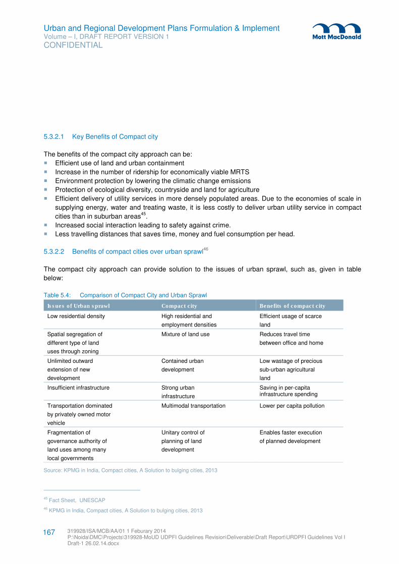
Urban and Regional Development Plans Formulation & Implement Volume – I, DRAFT REPORT VERSION 1
CONFIDENTIAL
319928/ISA/MCB/AA/01 1 Feburary 2014 P:\Noida\DMC\Projects\319928-MoUD UDPFI Guidelines Revision\Deliverable\Draft Report\URDPFI Guidelines Vol I Draft-1 26.02.14.docx
167
5.3.2.1 Key Benefits of Compact city
The benefits of the compact city approach can be:
� Efficient use of land and urban containment
� Increase in the number of ridership for economically viable MRTS
� Environment protection by lowering the climatic change emissions
� Protection of ecological diversity, countryside and land for agriculture
� Efficient delivery of utility services in more densely populated areas. Due to the economies of scale in
supplying energy, water and treating waste, it is less costly to deliver urban utility service in compact
cities than in suburban areas45
.
� Increased social interaction leading to safety against crime.
� Less travelling distances that saves time, money and fuel consumption per head.
5.3.2.2 Benefits of compact cities over urban sprawl46
The compact city approach can provide solution to the issues of urban sprawl, such as, given in table
below:
Table 5.4: Comparison of Compact City and Urban Sprawl
Issues of Urban sprawl Compact city Benefits of compact city
Low residential density High residential and
employment densities
Efficient usage of scarce
land
Spatial segregation of
different type of land
uses through zoning
Mixture of land use Reduces travel time
between office and home
Unlimited outward
extension of new
development
Contained urban
development
Low wastage of precious
sub-urban agricultural
land
Insufficient infrastructure Strong urban
infrastructure
Saving in per-capita infrastructure spending
Transportation dominated
by privately owned motor
vehicle
Multimodal transportation Lower per capita pollution
Fragmentation of
governance authority of
land uses among many
local governments
Unitary control of
planning of land
development
Enables faster execution
of planned development
Source: KPMG in India, Compact cities, A Solution to bulging cities, 2013
45 Fact Sheet, UNESCAP
46 KPMG in India, Compact cities, A Solution to bulging cities, 2013
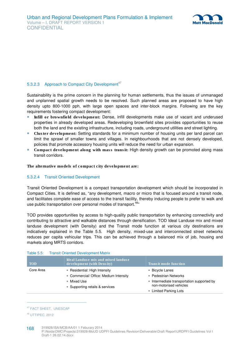
Urban and Regional Development Plans Formulation & Implement Volume – I, DRAFT REPORT VERSION 1
CONFIDENTIAL
319928/ISA/MCB/AA/01 1 Feburary 2014 P:\Noida\DMC\Projects\319928-MoUD UDPFI Guidelines Revision\Deliverable\Draft Report\URDPFI Guidelines Vol I Draft-1 26.02.14.docx
168
5.3.2.3 Approach to Compact City Development47
Sustainability is the prime concern in the planning for human settlements, thus the issues of unmanaged
and unplanned spatial growth needs to be resolved. Such planned areas are proposed to have high
density upto 800-1000 pph, with large open spaces and inter-block margins. Following are the key
requirements fostering compact development:
� Infill or brownfield development: Dense, infill developments make use of vacant and underused
properties in already developed areas. Redeveloping brownfield sites provides opportunities to reuse
both the land and the existing infrastructure, including roads, underground utilities and street lighting.
� Cluster development: Setting standards for a minimum number of housing units per land parcel can
limit the sprawl of smaller towns and villages. In neighbourhoods that are not densely developed,
policies that promote accessory housing units will reduce the need for urban expansion.
� Compact development along with mass transit: High density growth can be promoted along mass
transit corridors.
The alternative models of compact city development are:
5.3.2.4 Transit Oriented Development
Transit Oriented Development is a compact transportation development which should be incorporated in
Compact Cities. It is defined as, “any development, macro or micro that is focused around a transit node,
and facilitates complete ease of access to the transit facility, thereby inducing people to prefer to walk and
use public transportation over personal modes of transport.48
”
TOD provides opportunities by access to high-quality public transportation by enhancing connectivity and
contributing to attractive and walkable distances through densification. TOD Ideal Landuse mix and mixed
landuse development (with Density) and the Transit mode function at various city destinations are
indicatively explained in the Table 5.5. High density, mixed-use and interconnected street networks
reduces per capita vehicular trips. This can be achieved through a balanced mix of job, housing and
markets along MRTS corridors.
Table 5.5: Transit Oriented Development Matrix
TOD Ideal Landuse mix and mixed landuse development (with Density) Transit mode function
Core Area • Residential: High Intensity
• Commercial/ Office: Medium Intensity
• Mixed Use
• Supporting retails & services
• Bicycle Lanes
• Pedestrian Networks
• Intermediate transportation supported by non-motorised vehicles
• Limited Parking Lots
47 FACT SHEET, UNESCAP
48 UTTIPEC, 2012
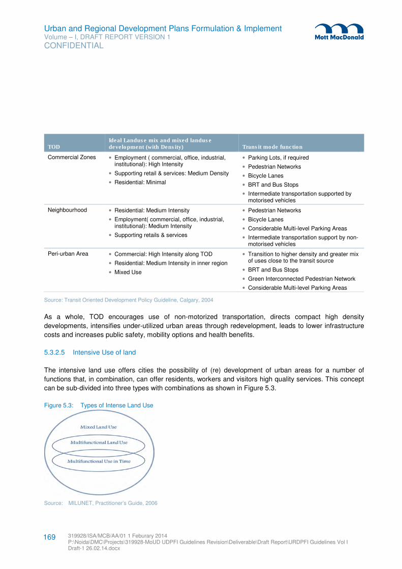
Urban and Regional Development Plans Formulation & Implement Volume – I, DRAFT REPORT VERSION 1
CONFIDENTIAL
319928/ISA/MCB/AA/01 1 Feburary 2014 P:\Noida\DMC\Projects\319928-MoUD UDPFI Guidelines Revision\Deliverable\Draft Report\URDPFI Guidelines Vol I Draft-1 26.02.14.docx
169
TOD Ideal Landuse mix and mixed landuse development (with Density) Transit mode function
Commercial Zones • Employment ( commercial, office, industrial, institutional): High Intensity
• Supporting retail & services: Medium Density
• Residential: Minimal
• Parking Lots, if required
• Pedestrian Networks
• Bicycle Lanes
• BRT and Bus Stops
• Intermediate transportation supported by motorised vehicles
Neighbourhood • Residential: Medium Intensity
• Employment( commercial, office, industrial, institutional): Medium Intensity
• Supporting retails & services
• Pedestrian Networks
• Bicycle Lanes
• Considerable Multi-level Parking Areas
• Intermediate transportation support by non-motorised vehicles
Peri-urban Area • Commercial: High Intensity along TOD
• Residential: Medium Intensity in inner region
• Mixed Use
• Transition to higher density and greater mix of uses close to the transit source
• BRT and Bus Stops
• Green Interconnected Pedestrian Network
• Considerable Multi-level Parking Areas
Source: Transit Oriented Development Policy Guideline, Calgary, 2004
As a whole, TOD encourages use of non-motorized transportation, directs compact high density
developments, intensifies under-utilized urban areas through redevelopment, leads to lower infrastructure
costs and increases public safety, mobility options and health benefits.
5.3.2.5 Intensive Use of land
The intensive land use offers cities the possibility of (re) development of urban areas for a number of
functions that, in combination, can offer residents, workers and visitors high quality services. This concept
can be sub-divided into three types with combinations as shown in Figure 5.3.
Figure 5.3: Types of Intense Land Use
Source: MILUNET, Practitioner’s Guide, 2006
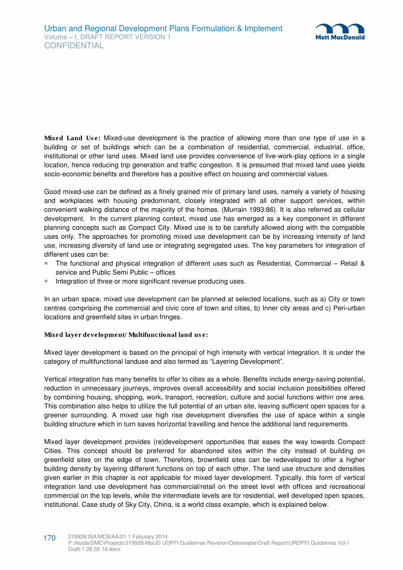
Urban and Regional Development Plans Formulation & Implement Volume – I, DRAFT REPORT VERSION 1
CONFIDENTIAL
319928/ISA/MCB/AA/01 1 Feburary 2014 P:\Noida\DMC\Projects\319928-MoUD UDPFI Guidelines Revision\Deliverable\Draft Report\URDPFI Guidelines Vol I Draft-1 26.02.14.docx
170
Mixed Land Use: Mixed-use development is the practice of allowing more than one type of use in a
building or set of buildings which can be a combination of residential, commercial, industrial, office,
institutional or other land uses. Mixed land use provides convenience of live-work-play options in a single
location, hence reducing trip generation and traffic congestion. It is presumed that mixed land uses yields
socio-economic benefits and therefore has a positive effect on housing and commercial values.
Good mixed-use can be defined as a finely grained mix of primary land uses, namely a variety of housing
and workplaces with housing predominant, closely integrated with all other support services, within
convenient walking distance of the majority of the homes. (Murrain 1993:86). It is also referred as cellular
development. In the current planning context, mixed use has emerged as a key component in different
planning concepts such as Compact City. Mixed use is to be carefully allowed along with the compatible
uses only. The approaches for promoting mixed use development can be by increasing intensity of land
use, increasing diversity of land use or integrating segregated uses. The key parameters for integration of
different uses can be:
� The functional and physical integration of different uses such as Residential, Commercial – Retail &
service and Public Semi Public – offices
� Integration of three or more significant revenue producing uses.
In an urban space, mixed use development can be planned at selected locations, such as a) City or town
centres comprising the commercial and civic core of town and cities, b) Inner city areas and c) Peri-urban
locations and greenfield sites in urban fringes.
Mixed layer development/ Multifunctional land use:
Mixed layer development is based on the principal of high intensity with vertical integration. It is under the
category of multifunctional landuse and also termed as “Layering Development”.
Vertical integration has many benefits to offer to cities as a whole. Benefits include energy-saving potential,
reduction in unnecessary journeys, improves overall accessibility and social inclusion possibilities offered
by combining housing, shopping, work, transport, recreation, culture and social functions within one area.
This combination also helps to utilize the full potential of an urban site, leaving sufficient open spaces for a
greener surrounding. A mixed use high rise development diversifies the use of space within a single
building structure which in turn saves horizontal travelling and hence the additional land requirements.
Mixed layer development provides (re)development opportunities that eases the way towards Compact
Cities. This concept should be preferred for abandoned sites within the city instead of building on
greenfield sites on the edge of town. Therefore, brownfield sites can be redeveloped to offer a higher
building density by layering different functions on top of each other. The land use structure and densities
given earlier in this chapter is not applicable for mixed layer development. Typically, this form of vertical
integration land use development has commercial/retail on the street level with offices and recreational
commercial on the top levels, while the intermediate levels are for residential, well developed open spaces,
institutional. Case study of Sky City, China, is a world class example, which is explained below.
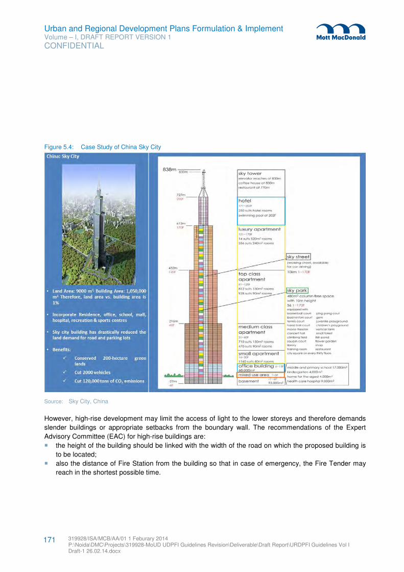
Urban and Regional Development Plans Formulation & Implement Volume – I, DRAFT REPORT VERSION 1
CONFIDENTIAL
319928/ISA/MCB/AA/01 1 Feburary 2014 P:\Noida\DMC\Projects\319928-MoUD UDPFI Guidelines Revision\Deliverable\Draft Report\URDPFI Guidelines Vol I Draft-1 26.02.14.docx
171
Figure 5.4: Case Study of China Sky City
Source: Sky City, China
However, high-rise development may limit the access of light to the lower storeys and therefore demands
slender buildings or appropriate setbacks from the boundary wall. The recommendations of the Expert
Advisory Committee (EAC) for high-rise buildings are:
� the height of the building should be linked with the width of the road on which the proposed building is
to be located;
� also the distance of Fire Station from the building so that in case of emergency, the Fire Tender may
reach in the shortest possible time.
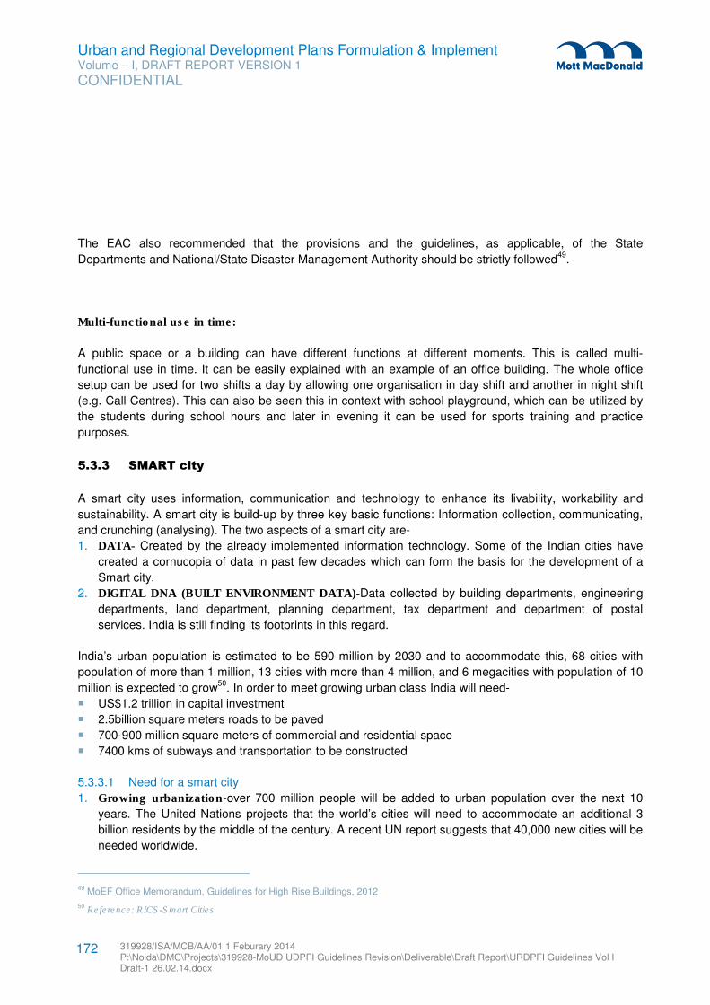
Urban and Regional Development Plans Formulation & Implement Volume – I, DRAFT REPORT VERSION 1
CONFIDENTIAL
319928/ISA/MCB/AA/01 1 Feburary 2014 P:\Noida\DMC\Projects\319928-MoUD UDPFI Guidelines Revision\Deliverable\Draft Report\URDPFI Guidelines Vol I Draft-1 26.02.14.docx
172
The EAC also recommended that the provisions and the guidelines, as applicable, of the State
Departments and National/State Disaster Management Authority should be strictly followed49
.
Multi-functional use in time:
A public space or a building can have different functions at different moments. This is called multi-
functional use in time. It can be easily explained with an example of an office building. The whole office
setup can be used for two shifts a day by allowing one organisation in day shift and another in night shift
(e.g. Call Centres). This can also be seen this in context with school playground, which can be utilized by
the students during school hours and later in evening it can be used for sports training and practice
purposes.
5.3.3 SMART city
A smart city uses information, communication and technology to enhance its livability, workability and
sustainability. A smart city is build-up by three key basic functions: Information collection, communicating,
and crunching (analysing). The two aspects of a smart city are-
1. DATA- Created by the already implemented information technology. Some of the Indian cities have
created a cornucopia of data in past few decades which can form the basis for the development of a
Smart city.
2. DIGITAL DNA (BUILT ENVIRONMENT DATA)-Data collected by building departments, engineering
departments, land department, planning department, tax department and department of postal
services. India is still finding its footprints in this regard.
India’s urban population is estimated to be 590 million by 2030 and to accommodate this, 68 cities with
population of more than 1 million, 13 cities with more than 4 million, and 6 megacities with population of 10
million is expected to grow50
. In order to meet growing urban class India will need-
� US$1.2 trillion in capital investment
� 2.5billion square meters roads to be paved
� 700-900 million square meters of commercial and residential space
� 7400 kms of subways and transportation to be constructed
5.3.3.1 Need for a smart city
1. Growing urbanization-over 700 million people will be added to urban population over the next 10
years. The United Nations projects that the world’s cities will need to accommodate an additional 3
billion residents by the middle of the century. A recent UN report suggests that 40,000 new cities will be
needed worldwide.
49 MoEF Office Memorandum, Guidelines for High Rise Buildings, 2012
50 Reference: RICS-Smart Cities
Urban and Regional Development Plans Formulation & Implement Volume – I, DRAFT REPORT VERSION 1
CONFIDENTIAL
319928/ISA/MCB/AA/01 1 Feburary 2014 P:\Noida\DMC\Projects\319928-MoUD UDPFI Guidelines Revision\Deliverable\Draft Report\URDPFI Guidelines Vol I Draft-1 26.02.14.docx
173
2. Growing stress- Today’s cities face significant challenges such as increasing populations,
environmental and regulatory requirements, declining tax bases and budget and increased costs,
pollution, crowding and sprawl to inadequate housing, high unemployment and rising crime rates.
3. Inadequate infrastructure- Much of the developed world has infrastructure that is near or past its
design life, requiring massive upgrades51
. While, new developments have put pressure on
infrastructure.
4. Growing economic competition- The world has seen a rapid rise in competition between cities to
secure the investments, jobs, businesses and talent for economic success.
5. Growing expectation-As per United Nations survey of over 560,000 citizens from 194 countries
revealed their top priorities are a good education, better healthcare and an honest and responsive
government.
6. Growing environmental challenges-Cities house half of the world’s population but use two-thirds of
the world’s energy and generate three-fourths of the world’s CO2 emissions, which needs to be
managed.
7. Rapidly improving technology capabilities
8. Protection of Business From Cyber Crime
9. Revolutionize people’s relationship with Government
51 Smart Cities Readiness Guide
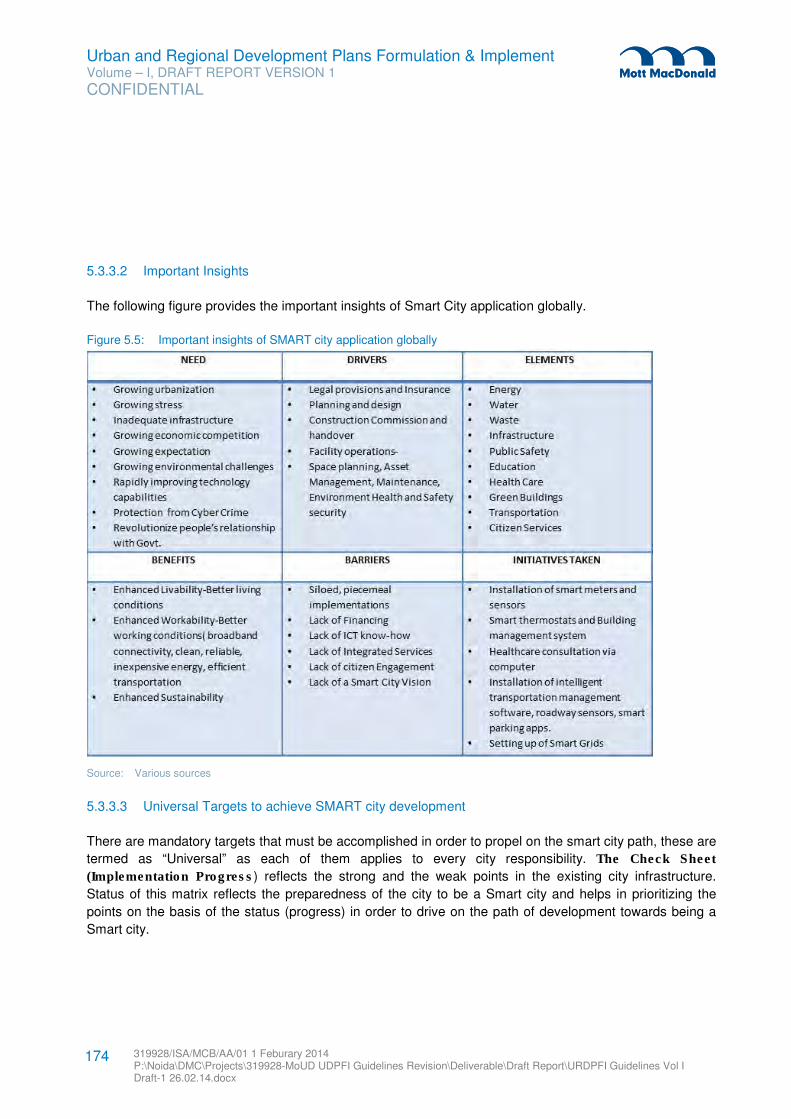
Urban and Regional Development Plans Formulation & Implement Volume – I, DRAFT REPORT VERSION 1
CONFIDENTIAL
319928/ISA/MCB/AA/01 1 Feburary 2014 P:\Noida\DMC\Projects\319928-MoUD UDPFI Guidelines Revision\Deliverable\Draft Report\URDPFI Guidelines Vol I Draft-1 26.02.14.docx
174
5.3.3.2 Important Insights
The following figure provides the important insights of Smart City application globally.
Figure 5.5: Important insights of SMART city application globally
Source: Various sources
5.3.3.3 Universal Targets to achieve SMART city development
There are mandatory targets that must be accomplished in order to propel on the smart city path, these are
termed as “Universal” as each of them applies to every city responsibility. The Check Sheet
(Implementation Progress) reflects the strong and the weak points in the existing city infrastructure.
Status of this matrix reflects the preparedness of the city to be a Smart city and helps in prioritizing the
points on the basis of the status (progress) in order to drive on the path of development towards being a
Smart city.
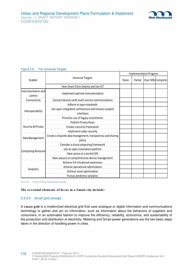
Urban and Regional Development Plans Formulation & Implement Volume – I, DRAFT REPORT VERSION 1
CONFIDENTIAL
319928/ISA/MCB/AA/01 1 Feburary 2014 P:\Noida\DMC\Projects\319928-MoUD UDPFI Guidelines Revision\Deliverable\Draft Report\URDPFI Guidelines Vol I Draft-1 26.02.14.docx
175
Figure 5.6: The Universal Targets
Source: Smart Cities Readiness Guide
The essential elements of focus in a Smart city include:
5.3.3.4 Smart grid concept
A smart grid is a modernized electrical grid that uses analogue or digital information and communications
technology to gather and act on information, such as information about the behaviors of suppliers and
consumers, in an automated fashion to improve the efficiency, reliability, economics, and sustainability of
the production and distribution of electricity. Metering and Smart power generations are the two basic steps
taken in the direction of handling power in cities.
None Partial Over 50% Complete
How Smart Cities Deploy and Use ICT
Instrumentation and
controlImplement optimal instrumentation
Connectivity Connect devices with multi-service communications
Adhere to open standards
Use open integration architecture and loosely coupled
interfaces
Prioritize use of legacy investments
Publish Privacy Rules
Create a security framework
Implement cyber security
Data ManagementCreate a citywide data management, transparency and sharing
policy
Consider a cloud computing framework
Use an open innovation platform
Have access to a central GIS
Have aaccess to comprehensive device management
Achieve full situational awareness
Achieve operational optimization
Achieve asset optimization
Pursue predictive analytics
Security & Privacy
Interoperability
Computing Resource
Analytics
Universal Targets
Implementation Progress
Enabler
Urban and Regional Development Plans Formulation & Implement Volume – I, DRAFT REPORT VERSION 1
CONFIDENTIAL
319928/ISA/MCB/AA/01 1 Feburary 2014 P:\Noida\DMC\Projects\319928-MoUD UDPFI Guidelines Revision\Deliverable\Draft Report\URDPFI Guidelines Vol I Draft-1 26.02.14.docx
176
a. Smart meter- Smart meters help utilities to better detect and manage outages. Smart meters
coupled with advanced metering infrastructure (AMI) helps to pinpoint problems in the grid,
allowing determination of faults and failures in no time52
.
b. Smart power generator- Smart power generation is a concept of matching electricity production
with demand using multiple generators, alternatively to buffer the peak and high demand for load
balancing. These generators are designed on smart technologies to operate efficiently at chosen
load53
.
5.3.3.5 Smart Transportation Concept
The smart transportation refers to the integration of information and communication technologies with
transport infrastructure to improve economic performance, safety, mobility and time saving of the citizens.
The above can be accomplished by incorporating the following technologies in the existing structure:
a. Digital view terminals-These terminals provide users with an intelligent navigation system that
optimizes the best routes, alternative destinations, efficient movement by a well-informed
guidance from the terminal. For example, the entire city's bus lines, their stops, and drop-off and
pick-up times are displayed on the terminals along with satellite street views of locations, such as
of restaurants and other tourist attractions. Alternative destinations such as coordinates for
banks, schools, hospitals, and real estate are also featured for the citizens to determine best
suited route.
b. Intelligent roads- It includes setting up of sensor technologies in the pavements and over the
bridges which can be combined with the data collected from moving vehicles to provide
operators, maintenance authorities and road users with rapid warning of emerging problems.
c. Traffic Prediction Tool-It predicts traffic flows over pre-set durations (10, 15, 30, 45 and 60
minutes) by stimulations. With these predictions, traffic controllers can anticipate and better
manage the flow of traffic to prevent congestion and save time.
Other smart applications in the intelligent Transportation system may consist of:
� Optimised dynamic signalling
� Automatic parking system,
� Advanced Driver Assistance Systems (ADAS),
� Satellite application for emergency handling, traffic alerts, road safety and incident prevention
� Automated transport systems
52 A U.S. Department of Energy study showed that real-time pricing information provided by the smart meter helped consumers
reduce their electricity costs 10% on average and their peak consumption by 15%.
53 Source: GE: Smart grid technology guide
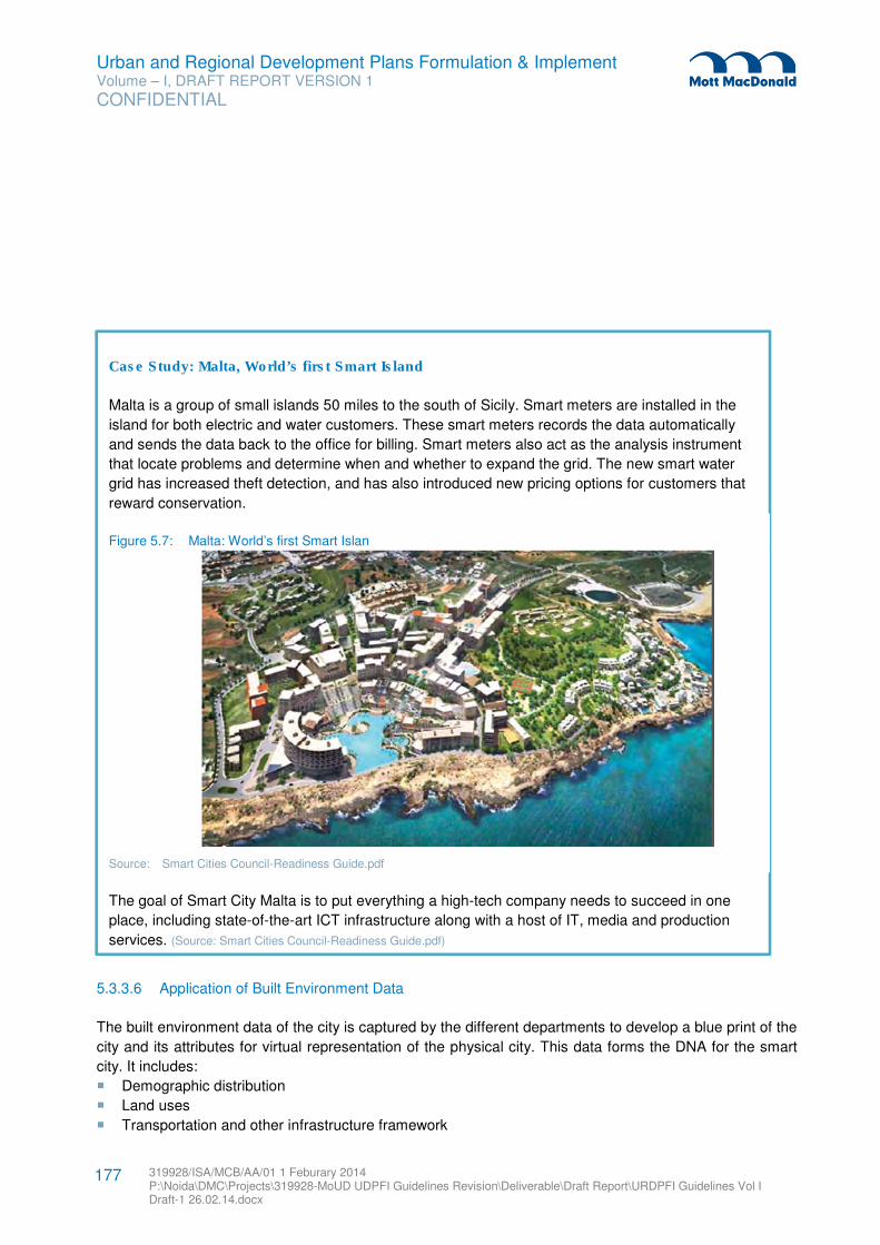
Urban and Regional Development Plans Formulation & Implement Volume – I, DRAFT REPORT VERSION 1
CONFIDENTIAL
319928/ISA/MCB/AA/01 1 Feburary 2014 P:\Noida\DMC\Projects\319928-MoUD UDPFI Guidelines Revision\Deliverable\Draft Report\URDPFI Guidelines Vol I Draft-1 26.02.14.docx
177
5.3.3.6 Application of Built Environment Data
The built environment data of the city is captured by the different departments to develop a blue print of the
city and its attributes for virtual representation of the physical city. This data forms the DNA for the smart
city. It includes:
� Demographic distribution
� Land uses
� Transportation and other infrastructure framework
Case Study: Malta, World’s first Smart Island
Malta is a group of small islands 50 miles to the south of Sicily. Smart meters are installed in the
island for both electric and water customers. These smart meters records the data automatically
and sends the data back to the office for billing. Smart meters also act as the analysis instrument
that locate problems and determine when and whether to expand the grid. The new smart water
grid has increased theft detection, and has also introduced new pricing options for customers that
reward conservation.
Figure 5.7: Malta: World’s first Smart Islan
Source: Smart Cities Council-Readiness Guide.pdf
The goal of Smart City Malta is to put everything a high-tech company needs to succeed in one
place, including state-of-the-art ICT infrastructure along with a host of IT, media and production
services. (Source: Smart Cities Council-Readiness Guide.pdf)
Urban and Regional Development Plans Formulation & Implement Volume – I, DRAFT REPORT VERSION 1
CONFIDENTIAL
319928/ISA/MCB/AA/01 1 Feburary 2014 P:\Noida\DMC\Projects\319928-MoUD UDPFI Guidelines Revision\Deliverable\Draft Report\URDPFI Guidelines Vol I Draft-1 26.02.14.docx
178
� Forests and parks
� General urban plan
� Space and organization plan
This data when linked with the Information communication and technology develops the digital DNA which
forms the basis for the Smart city. The software and service layers for the built environment data can
contain the following layers54
:
� Data layer: that presents all the information, which is required, produced and collected in the smart
city.
� User layer: that concerns all e-service end-users and the stakeholders of a smart city for dialoguing
and in decision making. The participation includes:
– the local stakeholders –who supervise the smart city, and design
– those who offer e-services- and
– the end-users –who “consume” the smart city’s services
� Service layer: This incorporates all the particular e-services being offered by the smart city.
� Infrastructure layer: that contains network, information systems and other facilities, which contribute
to e-Service deployment.
5.3.3.7 Urban planning and smart city interrelations
On the attributes discussed in the preceding section, various e-service portfolios can be offered in a
modern smart city, some of which have been mentioned below:
Table 5.6: e-Services of a Smart city
e-Services
e-Government Public complaints, showing administrative procedure, bringing transparency in governance.
e-democracy Performing dialogue, consultation, polling and voting of issues of city.
e-Business Supports business installation.
e-health and Tele-care Distant support and services to elderly, civilians with diseases, disabled
e-learning Distant learning opportunities, training material to the students.
e-Security Supports public safety via amber-alert notifications, school monitoring and natural hazard management
Environmental services Information about recycling, guide households and enterprises in waste/energy/water management
Intelligent Transportation Offers tools for traffic monitoring, measurement and optimization.
Communication services Broadband connectivity, digital TV
Source: Various sources
54 Source: Urban Planning and Smart Cities: Interrelations and Reciprocities, Leonidas G. Anthopoulos.
Urban and Regional Development Plans Formulation & Implement Volume – I, DRAFT REPORT VERSION 1
CONFIDENTIAL
319928/ISA/MCB/AA/01 1 Feburary 2014 P:\Noida\DMC\Projects\319928-MoUD UDPFI Guidelines Revision\Deliverable\Draft Report\URDPFI Guidelines Vol I Draft-1 26.02.14.docx
179
5.4 City Typology
Urbanisation over centuries and evolving city morphology has given shape to the present day cities in
India. Most post-independence cities have emerged from planned directions and yet have experienced
population explosion. Lately cities have benefited from Government schemes and programmes. However,
the functions of the urban centres have taken natural course to its maturity, without or with intended
interventions. These are the consequences of response of human settlement and interaction of societies.
Situation of the city: Situation of the city is the prime factor to be considered while planning. City situation
is established on its growth in size, physical configuration or route pattern and largely with its function.
Cities, besides multi-functional, can be also defined on the basis of the prime economic activity and/or
evolution of the city. Such cities with typical location, situation and functions need focused approach while
planning, to address the associated issues. Some of such kinds are:
� Hill cities,
� Inner cities/ walled cities,
� Industrial cities,
� Religious cities,
� Tourism cities,
� Heritage cities,
� Port cities,
� Medi-cities,
� Sports cities
Site and situation specific solutions: These cities, owning to its nature of development and population,
and either permanent, new settlers or floating population, have specific functions and therefore have
associated issues. Some of the generic ones are:
� Lack of alternative economic activities,
� Stagnation of city growth,
� Strict segregation of classes by profession and income,
� High crime rate,
� Lack of public spaces,
� Lack of recreational activities,
� Lack of educational facilities for low income class/ poor,
� Significant ratio of bachelor population,
� Lack of gender specific health facilities and other facilities,
� Investment oriented land/property ownership,
� Others: pressure on public utilities, lack of social guidance in case of exposure to cultural variation et
al.
Such as, in case of industrial cities or township, specific drawbacks are observed like lack of recreational
activities, lack of alternative economic opportunities, and social activities. These townships are limited to
Urban and Regional Development Plans Formulation & Implement Volume – I, DRAFT REPORT VERSION 1
CONFIDENTIAL
319928/ISA/MCB/AA/01 1 Feburary 2014 P:\Noida\DMC\Projects\319928-MoUD UDPFI Guidelines Revision\Deliverable\Draft Report\URDPFI Guidelines Vol I Draft-1 26.02.14.docx
180
work - home relationship and lack recreational activities and therefore, there is a need to focus on
providing dedicated public spaces for population to interact in such townships.
Similarly, other city typologies also have specific issues to be addressed for which approach can be
defined while preparing plans. Mix of economic activities such as service industries and social activities
shall be promoted to encourage the avenues for wholesome development.
Some of the townships like industrial and port towns also show high rate of crime. This is primarily due to
segregation of classes, lack of recreational activities, lack of educational facilities for low income class, and
to some extent due to a portion of the population is bachelor.
Therefore to promote sustainability of cities, its situation in terms of its function and its social behaviour
shall be addressed. Such cases need emphasis on complimentary requirements of the city, besides its
prime economic activity and physical infrastructure for holistic development of the city. Some of the
complementary activities are suggested below-
� Promotion of service industries,
� Educational facilities with emphasis on technical institutes
� Institutional and administrative land use,
� Social infrastructure, targeting needs of specific strata of population
� Recreational facilities, also theme based facilities
� Heritage and religious activities to be promoted for mixing of economic base and population
� Earmarked spaces for the urban poor / informal sector residents or their activities55
.
5.4.1 Hill city
The National Building Code defines hilly areas as “Any area above 600 m in height from mean sea level, or
any area with average slope of 30°, considering the sensitive and fragile eco-system of hills and
mountains.” However, the State Governments may identify and notify areas to be covered under ‘Hilly
Area’, which need to be dealt with special consideration, when developmental activities are taking up.
Hilly areas have one of the most fragile ecosystems, which need to be conserved. Therefore planning and
development strategies for hilly areas shall have to be designed with added sensitivity and stress on
integrated development. The development approach shall comprise sound land use planning and
settlement planning.
5.4.1.1 Associated Issues
Hilly areas have a sensitive ecosystem consisting of mountains, rivers and valleys, several lineaments and
some of them even experience extreme weather conditions. These varied natural features also make hilly
areas a suitable place for tourist destination, thus creating a pull for commercial development and
55 Also Suggested in ‘Strategy paper on master plan formulation, inclusive planning, prioritization for housing and pedestrian
movement, 2010’
Urban and Regional Development Plans Formulation & Implement Volume – I, DRAFT REPORT VERSION 1
CONFIDENTIAL
319928/ISA/MCB/AA/01 1 Feburary 2014 P:\Noida\DMC\Projects\319928-MoUD UDPFI Guidelines Revision\Deliverable\Draft Report\URDPFI Guidelines Vol I Draft-1 26.02.14.docx
181
urbanisation. Also, many rivers originate from the Northern Himalayan range, thus the areas attract
development of hydro power plants, which directly or indirectly have shown great impact on the river
hydrology and bio-diversity.
The common issues associated with planning in Hilly areas are:
� Hilly areas in Himalayas and North east experience heavy rainfall which makes the shallow soil cover
highly susceptible to erosion (such as in Darjeeling)56
. These conditions necessitate conserving the
precious soil cover during monsoons and harvesting irrigation water for dry months. In other areas
heavy rainfall causes deep weathering of sedimentary rock and rapid and active erosion of weathered
materials from steep slopes.
� There are issues with respect to mobility and connectivity due to steep slopes and difficult terrain.
� In hilly areas, remarkable variations in culture and practices exists between the settlements even within
short distances as compared to those in plain areas57
� As terrain plays a crucial role in the hilly areas, settlements are to be on definite habitable lands and
thus, its carrying capacity needs to be determined for adequate planning.
� The planning status of hilly areas, in the present state, is uncontrolled creating haphazard growth due
to need for urbanisation, industrialisation (such as quarrying and hydro power generation) and intrusion
of commercial activity (such as tourism industry) on the limited land cover, typically along hill routes.
These trends has led to encroachment on forest land and precious green cover, construction on
unsuitable lands and development at higher level of ridges, thereby disturbing the natural ecosystem
and making the areas more vulnerable to disasters.
– The impacts on infrastructure are - inadequate social infrastructure, traffic chaos, inefficient service
infrastructure and congestion in prime locations.
– The impacts on the environment are loss of hill and forests, degradation of stream system,
landslide and erosion, increase in natural hazard as earthquake, landslide and manmade hazards
such as air pollution and roadway noise.
5.4.1.2 Strategies for Development
Hilly areas have various factors which necessitate a thrust on adoption of an integrated planning approach
for conservation, preservation and planned development.
Strategy 1: Land Conservation and Optimisation:
1) Environment Inventory/ Impact Assessment: Settlement planning in the hill areas has
extremely large implications on the environment. For planning of the new settlements or working
out the strategies for the growth of the existing settlements, it is necessary to conduct detailed
environmental inventory/ impact assessment. The inventory would involve geological
investigations, slope analysis, soil, flora and fauna analysis, climatic inventories, vulnerability to
56 Planning Commission Report of Task Group on Problems in Hilly habitations
57 Report of the Evaluation Study on Hill area Development programme in Assam and West Bengal”, Planning Commission, June 2010
Urban and Regional Development Plans Formulation & Implement Volume – I, DRAFT REPORT VERSION 1
CONFIDENTIAL
319928/ISA/MCB/AA/01 1 Feburary 2014 P:\Noida\DMC\Projects\319928-MoUD UDPFI Guidelines Revision\Deliverable\Draft Report\URDPFI Guidelines Vol I Draft-1 26.02.14.docx
182
natural disasters (such as earthquakes, landslides, floods etc.), etc. In addition to this the aesthetic
factors, cultural, architectural and historical heritage, scenic/ landscape value shall also be taken
into consideration.
2) Identification of Developable Area: Identification of developed area is calculated by deducting
the natural ecological area from the entire township jurisdiction. Jurisdiction may be large to control
the surrounding areas. The classification of land uses should be given only for developed area,
while the rest of the ecological area shall be for conservation or restoration.
Hill Town Developable Area = Hill town jurisdiction area – Natural Ecological Area.
3) Land use optimisation: Keeping in view the scarcity of good buildable land and also the high cost
of the construction, it is necessary to optimize the use of land by calculation of carrying capacity
and land suitability analysis. Green building approach should be adopted such as use of cost
effective and appropriate building materials and technologies.
Strategy 2: Sustainable development including Watershed Management:
A watershed, also called a drainage basin or catchment area, is defined as an area in which all water
flowing into it goes to a common outlet. People and livestock are the integral part of watershed and their
activities affect the productive status of watersheds and vice versa. From the hydrological point of view, the
different phases of hydrological cycle in a watershed are dependent on the various natural features and
human activities. Watershed is not simply the hydrological unit but is also socio- political-ecological entity
which plays crucial role in determining food, social, and economical security and provides life support
services to rural people. In hilly areas or where intensive agriculture development is planned, the size of
watershed relatively preferred is small.58
During the Tenth Five Year Plan of Planning Commission, for the hill areas of Assam and West Bengal, the
emphasis is on watershed development and ecological restoration/preservation. In the sixth Five Year
Plan, the Planning Commission suggests achieving a balance between beneficiary-oriented and
infrastructural development programmes, keeping in view the vital importance of ecological restoration and
conservation. This can be achieved through59
:
� Better water and land-use and control of soil erosion through watershed management,
� Afforestation, silvi-pasture development and replacement of annual crops with perennial shrubs and
trees and plantation crops in steep slopes and development of other high value-low volume crops
linked with processing and marketing.
� Rural and small industries and electronic and precision instruments industries can also be promoted.
58 http://oar.icrisat.org/3914/1/1._Watershed_Management_Concept.pdf
59 http://planningcommission.nic.in/plans/planrel/fiveyr/6th/6planch25.html
Urban and Regional Development Plans Formulation & Implement Volume – I, DRAFT REPORT VERSION 1
CONFIDENTIAL
319928/ISA/MCB/AA/01 1 Feburary 2014 P:\Noida\DMC\Projects\319928-MoUD UDPFI Guidelines Revision\Deliverable\Draft Report\URDPFI Guidelines Vol I Draft-1 26.02.14.docx
183
Overall Planning Concept60
: the overall planning concept for hilly areas can include the following:
1. Complete communities: Create an integrated, vibrant and diverse community that provides a mix of
land uses, including a balance of housing, employment, community services, parks and open spaces.
2. Environment: Protect and enhance natural environmental systems, functions and resources over the
long term. Incorporate and promote sustainable development practices and initiatives.
3. Economy: Promote economic vitality and provide for a balanced and diverse range of employment
opportunities.
4. Place making: Recognize and enhance the inherent and unique aspects of hilly areas (such as
facades).
5. Connectivity and Mobility: Promote connectivity, mobility and accessibility within and between
neighbourhoods, employment areas, parks and open spaces.
5.4.1.3 Aspects of planning:
The important aspects to be considered in planning for the hilly areas are suggested as below:
1. The hill side with less than 30° slope are in general stable. Therefore, building sites should in general
be located on hill side with not more than 30° slope.
2. No residential (temporary or permanent) buildings may be constructed on steeper slopes upto 45°.
3. Flat land is normally not available in hilly regions. The houses are required to be constructed on
partially sloping land made available by cut and fill. It shall be necessary to protect the house by
building retaining walls/breast walls to avoid landslides occurring at time of earthquakes or heavy rains.
4. Cut slopes with height less than 5 m or two to three storey heights of residential buildings are in
general stable. For higher cut slopes special investigation should be carried out and details of
protection works should be worked out and implemented.
a. Site development in hilly regions consumes about 30 to 40 percent of total cost of building
complex, therefore the following investigations shall be done to obtain the following geotechnical
parameters:
b. Type of Soil Rock : Weathered or intact, dip of bedding planes, drainage conditions, shear
planes, material between the joints, tension cracks, type of plantation, verticality of trunks of the
trees, etc.
c. Thickness of overburden, nature of soil strata, details of soil matrix etc.
d. Estimation of shear-parameters of the in situ soil mass which will govern the failure.
e. Drainage pattern of the area and permeability tests in the area to see the Drainage conditions.
f. Specific slip zones in the area, if any.
5. Roads and paths: Street orientation shall preferably be East-West to allow for maximum South sun to
enter the buildings. The street shall be wide enough to ensure that the buildings on one side do not
shade those on the other side. Hill Road Manual (IRC: SP: 48-1998) shall be referred to for detailed
guidelines for planning roads in Hilly Areas.
60 Aizawl Master Plan
Urban and Regional Development Plans Formulation & Implement Volume – I, DRAFT REPORT VERSION 1
CONFIDENTIAL
319928/ISA/MCB/AA/01 1 Feburary 2014 P:\Noida\DMC\Projects\319928-MoUD UDPFI Guidelines Revision\Deliverable\Draft Report\URDPFI Guidelines Vol I Draft-1 26.02.14.docx
184
Specific aspects for New Towns:
1. The new towns will have to follow the basic principles of hill architecture including use of local building
materials, slanting roofs, seismic bands in structures etc. so that they merge in cultural landscape of
their regions.
2. Travelling time from nearest town to the new township should be at least one hour or 20 Km.
3. The new town should be self-sufficient in infrastructure and its area should ideally not be less than 40
hectares.
4. Provision of facilities for additional (and /or floating) population should be made.
Specific aspects for Buildings in Hilly area:
1. A minimum clearance of 1.5 m should be provided between toe of boundary wall and building wall.
2. On the uphill side of the building on a sloping site, the natural flow of the water shall be diverted away
from the foundations.
3. The slope of ground all around building should be not less than 1: 50 built in such a way that rain water
does not find way to ingress in ground excessively and moves away quickly to surface drains or away
on adjoining hill surface towards natural streams.
4. A minimum of 0.75 m wide apron should be provided all around the building to prevent entry of water
into foundation.
5. Stepped terrace development and stepped storeyed building construction may be adopted for offices,
schools and other building complexes61
because of following advantages:
a. It results in least hill cutting, disturbance to hill stability and also in least deforestation.
b. Cost of site development works, slope protection and other protection works is reduced
considerably.
c. Least load comes on valley side, so danger of foundation failures is avoided.
6. Buildings to be provided with good drainage facilities to prevent excessive saturation of sub surface
formations. Construction should not obstruct existing surface drainage courses.
7. Buildings in hills shall be clustered together to minimise the exposure to cold winds. Open spaces
provided shall allow for maximum South sun.
8. Buildings shall be located on the south slope of a hill or mountain for better exposure to solar radiation.
At the same time, exposure to cold winds may be minimized by locating the building on the leeward
side.
9. Appropriate solar passive methods, such as orientation, double-glazing, trombe walls and solar
collectors, shall be adopted to achieve climatic comfort with little use of conventional energy.
5.4.2 Inner city
Walled city, old city, often central zones, which are also generally the core area of the new settlements are
referred as inner cities. These cities have been the melting pot for cultures with a history. Some of the old
cities have been historically an important trading centre, owing to its regional prominence, strategic
location and trade links. However, owing to its prosperity, some of the cities were under the threat of
61 (Refer conditions of development from IS 14243 Part 2: 1995 for details )
Urban and Regional Development Plans Formulation & Implement Volume – I, DRAFT REPORT VERSION 1
CONFIDENTIAL
319928/ISA/MCB/AA/01 1 Feburary 2014 P:\Noida\DMC\Projects\319928-MoUD UDPFI Guidelines Revision\Deliverable\Draft Report\URDPFI Guidelines Vol I Draft-1 26.02.14.docx
185
plunder and loot, which reshaped the city form over the centuries (as also walled cities). These cities are
marked by key features, such as, narrow roads (gullies), dense built -up, often mixed use of land, small
plot sizes occupying 100% ground for built-up, social homogeneity, limited public spaces, which are usually
congested developments, in comparison to the modern day cities.
5.4.2.1 Associated Issues
Common issues associated with the inner cities:
� Out migration of local residents, reducing residential landuse,
� Dilapidated buildings (as building owners only repair their buildings, while little or no reconstruction is
takes place) and vacant properties,
� Narrow roads- not planned for vehicular movement,
� Unorganized on-street parking at various locations,
� No prominent public transport system present in the city,
� Presence of cottage or household industries and polluting industries
� Prominence of on-street encroachments for informal markets & hawkers,
� Due to shift from residential to commercial landuse, emergence of warehouses, go-downs, workshops
or other non-compatible activities,
� Old water supply distribution network and in non-metric sizes, difficult to maintain,
� Repeated excavation of roads damaging the underground utilities and disturbed road levels,
� On-ground network of utilities such telecommunication lines, power supply lines and others,
� Overall lack of social infrastructure facilities compared to the density of the inner cities
� Outcrop of Slum like conditions in the open areas surrounding historical properties or on old
recreational open spaces
5.4.2.2 Alternative strategies for the Redevelopment and Regeneration
Redevelopment and regeneration are the prime planning aspects which prevail across the world. The two
alternatives for the redevelopment of an inner city/ old city are based on the strategy of revival or in-situ
development. These are:
Alternative 1- Modification in Built-up: In this approach, the residential built up is adjusted with the plot
size and height from urban renewal point of view. The building density is redefined, usually by increasing
the permissible FAR/FSI. It allows the market forces to reconstruct and redevelop the core city areas. The
urban local authority may provide supporting infrastructure through betterment levy or charges. This tool of
redevelopment is in practise in major cities like, Hyderabad and in some parts of the old Delhi
(Shahajahanabad). The increased building height is regulated by abutting road width, plot sizes,
accessibility and land use.
Urban and Regional Development Plans Formulation & Implement Volume – I, DRAFT REPORT VERSION 1
CONFIDENTIAL
319928/ISA/MCB/AA/01 1 Feburary 2014 P:\Noida\DMC\Projects\319928-MoUD UDPFI Guidelines Revision\Deliverable\Draft Report\URDPFI Guidelines Vol I Draft-1 26.02.14.docx
186
This alternative can be applied for the entire inner city or it could be limited to an identified area such as
along the transport corridors as in the case of Old Delhi (Shahajahanabad) wherein a 500 meter influence
zone of metro rail is permitted with a suitable enhanced FAR.62
.
An added advantage of this alternative is amalgamation of residential units. To improve the morphology of
the core city, increase in unit size of the residential plots is also often necessary, especially where very
small units are present. Higher FSI, for medium size plots, even marginally will lead to amalgamation of
small and very small plots by market forces. This will improve the urban design and density of residential
areas. However amalgamation of plots is to be carried out in lines with regulations, which is to be defined
based on the study of the area by the local authority. The redevelopment project of east Kidwai Nagar,
New Delhi is among the first initiatives as a vision project of Ministry of Urban Development.
Alternative 2- In-situ Development: In order to conserve the characteristics of the inner city, this
alternative is adopted to maintain and revive the old city by different mechanisms. Unlike the alternative 1,
in-situ development maintains the height and the building foot print, by carefully using Transferable
Development Rights (TDR). This alternative is used where the redevelopment strategy is to maintain and
encourage the heritage of the city and its housing morphology, as in the case of Ahmedabad, where
Tradable Development Rights are provided for the notified Structures, Buildings and Precincts in the form
of Tradable Right Certificate by competent authority. However the authority controls other activities such
as:
� The Permissible Uses for the Heritage Areas and other buildings on the basis of its plot size and floor.
� Amalgamation and/or Sub-division not be permitted in the Zone,
� The owners of these heritage structures and buildings are required to conserve the following original
aspects of their Buildings:
– All Façades
– Building Footprint
– Character of Open Spaces such as courtyards, khadki, streets, etc.
The in-situ development also does not encourage road widening until necessary, as it aims to preserve the
building façade. Therefore parking spaces are created through community initiatives and by consultative
process. In case if it is not feasible to provide the required parking within the existing building as per
Regulations, the Competent Authority may recover fees for deficit parking to develop on-street
parking/parking lots/parking structures as a part of Parking Management Plan.
The concept of Accommodation Reservation may be introduced for social infrastructure whereby for the
provision of essential public facilities to be handed over to the local body / government, the owner of
property is given full permissible FAR on the component of public facility. Vacant properties should be
preferred for this purpose.
The two alternatives of redevelopment to be chosen carefully and a combination of the two may be used
for suitable sub-zones in an inner city. However the redevelopment strategy is to cover the key aspect i.e.
62 Source: ITPI article by Mr.A.K. Jain, Commissioner (Planning), Delhi Development Authority
Urban and Regional Development Plans Formulation & Implement Volume – I, DRAFT REPORT VERSION 1
CONFIDENTIAL
319928/ISA/MCB/AA/01 1 Feburary 2014 P:\Noida\DMC\Projects\319928-MoUD UDPFI Guidelines Revision\Deliverable\Draft Report\URDPFI Guidelines Vol I Draft-1 26.02.14.docx
187
positive growth for the city to be a liveable area and also as a work space. Therefore in most of the Indian
inner cities, mixed landuse is to be recognised as permissible and thereafter organised, as the city is
planned on the concept of work & live with inherited benefit of reduced travel trips. To achieve this,
regeneration is to be a part of the redevelopment, including socio-economic development, maintaining and
encouraging commercial lifeline of the inner city for its revival.
5.4.2.3 Aspects of Revival
While planning, planners face the problems associated with road levels, lying of new pipelines, parking in
residential areas, decongestion, fire safety issues, requirement of road widening and lose of heritage
façade, re-planning underground infrastructure, provision of land for social infrastructure. Core city revival
is based on conservation, promotion and solution. These can be:
1. Out-Shifting of polluting, noxious and hazardous trades / industries and de-limitation of non-residential
non-compatible activity with priority,
2. To decongest the inner city, proposal can be to develop counter centres in the form of Integrated
Freight Complexes at the peripheral location or new industrial area,
3. Iconic developments along the historically valuable areas and if space allows - encourage city level
recreational areas to create a pull factor towards the old city,
4. A new set of development controls for Mixed Use, enhanced FAR and TDR applicability. Mixed use to
be maintained with regulations on the road width, plot sizes and density,
5. Conservation and restoration of historical buildings. Provisions for FAR and Tax incentives for those
who have to maintain the architectural controls,
6. Revival of cities by alternative public transport system technically modified for the road network and as
per the trip generation,
7. For parking, multi-level parking is one of the solutions. Here residential pedestrian zones are to be
identified,
8. Street design can be enhanced by adding street furniture. This is to facilitate public space for
community interaction and promote pedestrian movement,
9. In congested and bottle neck areas, solutions such as one ways and multi-level parking
10. In case of new development, stilt parking to be promoted,
11. Infrastructure agencies – public or private to be involved to practically resolve the issues of
infrastructure on the ground or underground,
12. Alternative solutions for very narrow roads for the fire safety,
13. To meet the social infrastructure requirement, reducing space norms upto 50% in case of space
unavailability in the core city,
14. ULBs to initiate developing data base of the buildings, with attributes such as its age, height, heritage
value, revenue collection and other points as desirable.
5.4.3 Industrial city
Cities with major thrust in manufacturing and production are industrial cities. Such a focus on
manufacturing was initially in the beginning five year plans after independence, when the focus was on
Urban and Regional Development Plans Formulation & Implement Volume – I, DRAFT REPORT VERSION 1
CONFIDENTIAL
319928/ISA/MCB/AA/01 1 Feburary 2014 P:\Noida\DMC\Projects\319928-MoUD UDPFI Guidelines Revision\Deliverable\Draft Report\URDPFI Guidelines Vol I Draft-1 26.02.14.docx
188
heavy iron and steel manufacturing. Industrialisation again boosted after liberalisation in 1991 and
encouraged developing clusters for export in 2005 by the SEZ Act, 2005, which provides for the
establishment, development and management of the Special Economic Zones for the promotion of
exports. The Act gives tax benefits which shall boost international trade. There were also schemes
proposed for promotion of cluster/ park development by respective Ministries, while Small Scale Industry
(SSI) was defined under Micro, Small & Medium Enterprises (MSMED) Act, 2006.
Lately, Government of India has also announced the National Manufacturing Policy in year 2011 with the
objective to enhance the share of manufacturing in GDP and increasing employment. Under the National
Manufacturing Policy, the New Investment and Manufacturing Zones (NIMZ) guidelines was cleared by the
Cabinet in 2011.
5.4.3.1 Associated issues
From the industrial support point of view, the following are the key concerns for industrial area planning:
� Movement of heavy traffic for transportation of raw material and finished goods, large share of the
traffic load on the roads, highways, rail.
� Limited space for industrial plots, allowing no expansion in future
� Lack of supporting infrastructure such as logistics, warehousing,
� Unplanned infrastructure provisions for various utilities, both underground and on surface
� Industries face power problems with respect to unscheduled cuts which affects the productivity,
especially in the continuous process plants. In order to make up for production loss, industries have to
operate DG sets which eventually increase the overall productivity and air pollution.
� Absence of integration with research and development and ICT infra in Indian industrial cities
� Lack of emergency facilities for fire safety and accidents, including medical infrastructure and health
care
Other associated issues are for the industrial township:
� Industrial cities are marked by high intensity of noise levels and air pollution levels, which makes
unsuitable for residential. Also, improper discharges of liquid and solid industrial waste are concerns for
health. These hazard prone areas have a direct impact on residential areas.
� Compatibility between processing and non-processing areas
� Lack of alternative economic activities leading to stagnation of city growth,
� Some of the port towns also show high rate of crime. This is primarily due to segregation of classes,
lack of recreational activities, lack of educational facilities for labour class, and to some extent due to a
portion of the population is bachelor.
� Ignorance on the public transportation in the industrial areas for labour and managerial labour,
� Lack of housing requirements for low income labour and informal employment
5.4.3.2 Planning strategies
Site location of the industrial city is the prime aspect of its planning. The siting criteria shall satisfy the
environmental requirements mentioned by Ministry of Environment and Forest, which is with sufficient
buffers, distance from a large size town and agricultural land.
Urban and Regional Development Plans Formulation & Implement Volume – I, DRAFT REPORT VERSION 1
CONFIDENTIAL
319928/ISA/MCB/AA/01 1 Feburary 2014 P:\Noida\DMC\Projects\319928-MoUD UDPFI Guidelines Revision\Deliverable\Draft Report\URDPFI Guidelines Vol I Draft-1 26.02.14.docx
189
Land industrial potentiality analysis to be done considering for identifying zones for placing hazardous
industrial, other manufacturing industrial, compatible uses along surface water bodies, hamlets and
settlements and placing of non-processing areas. For locating industrial zone, preference to areas with
easy connectivity, provision for logistics and areas with existing industries to be given, also wind directions
to be considered.
Zoning for processing and non-processing areas is recommended in the ratio of 40:60. The land use
regulations have to keep in view the requirements of both these areas according to the activities
envisaged. The purpose of the land use regulations is to promote quality of life of the people by organizing
appropriate development of land in accordance with the development policies and land use proposals of
Development Plan. Due to the health concerns and safeguards, provision of buffers between compatible
and non-compatible shall be well defined while zoning.
Processing area: may be comprise of the following activities:
� Industries / manufacturing;
� Retail Trade and commerce;
� Go-downs and warehousing;
� Utility corridor;
� Port and port related activities;
� Airport and related uses, rail, road and inland waterway and spaces for parking etc;
� Public utilities and any other essential services;
� Incidental and other activities for safety and security; and essential residential for the same;
� Governmental use / activities to manage the proper functioning of such processing areas.
� Information Technology and Enabled Services;
Within the processing areas, space for informal commercial, service industries and parking as per
industrial requirement to be paid attention. For development of various typed of parks – like Plastic parks,
Bio-technology parks, Food parks, Agro park, etc. the policy and norms issued by respective departments
and guidelines available to be considered for planning. In absence of such handholding provisions, study
of the specific industrial sector to be referred.
Non-processing areas: Areas other than processing area are to be planned for various uses and
activities, mainly as an industrial town / township including residential, commercial, recreational and
activities related to social infrastructure like education, health care, and socio-cultural facilities.
Social infrastructure: The overall quantum of social infrastructure to be provided in the industrial
township may be divided into two levels of facilities:
� Industrial city level Facilities: meant to serve the overall population requiring them to be located
centrally in one or more than one location.
� Local Level Facilities: meant to serve smaller pockets.
Functionally all social infrastructure facilities to be provided in such cities at the above cited level may be
same as those of any other township.
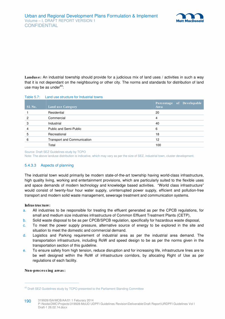
Urban and Regional Development Plans Formulation & Implement Volume – I, DRAFT REPORT VERSION 1
CONFIDENTIAL
319928/ISA/MCB/AA/01 1 Feburary 2014 P:\Noida\DMC\Projects\319928-MoUD UDPFI Guidelines Revision\Deliverable\Draft Report\URDPFI Guidelines Vol I Draft-1 26.02.14.docx
190
Landuse: An industrial township should provide for a judicious mix of land uses / activities in such a way
that it is not dependant on the neighbouring or other city. The norms and standards for distribution of land
use may be as under63
:
Table 5.7: Land use structure for Industrial towns
Sl. No. Land use Category Percentage of Developable Area
1 Residential 20
2 Commercial 4
3 Industrial 40
4 Public and Semi-Public 6
5 Recreational 18
6 Transport and Communication 12
Total 100
Source: Draft SEZ Guidelines study by TCPO
Note: The above landuse distribution is indicative, which may vary as per the size of SEZ, industrial town, cluster development.
5.4.3.3 Aspects of planning
The industrial town would primarily be modern state-of-the-art township having world-class infrastructure,
high quality living, working and entertainment provisions, which are particularly suited to the flexible uses
and space demands of modern technology and knowledge based activities. “World class infrastructure”
would consist of twenty-four hour water supply, uninterrupted power supply, efficient and pollution-free
transport and modern solid waste management, sewerage treatment and communication systems.
Infrastructure:
a. All industries to be responsible for treating the effluent generated as per the CPCB regulations, for
small and medium size industries infrastructure of Common Effluent Treatment Plants (CETP),
b. Solid waste disposal to be as per CPCB/SPCB regulation, specifically for hazardous waste disposal,
c. To meet the power supply pressure, alternative source of energy to be explored in the site and
situation to meet the domestic and commercial demand.
d. Logistics and Parking requirement of industrial area as per the industrial area demand. The
transportation infrastructure, including RoW and speed design to be as per the norms given in the
transportation section of this guideline.
e. To ensure safety from high tension, reduce disruption and for increasing life, infrastructure lines are to
be well designed within the RoW of infrastructure corridors, by allocating Right of Use as per
regulations of each facility.
Non-processing areas:
63 Draft SEZ Guidelines study by TCPO presented to the Parliament Standing Committee
Urban and Regional Development Plans Formulation & Implement Volume – I, DRAFT REPORT VERSION 1
CONFIDENTIAL
319928/ISA/MCB/AA/01 1 Feburary 2014 P:\Noida\DMC\Projects\319928-MoUD UDPFI Guidelines Revision\Deliverable\Draft Report\URDPFI Guidelines Vol I Draft-1 26.02.14.docx
191
a. To bring harmony in the societies, integration of residential sectors (informal/low income
group/managerial staff/ pockets of high income group) shall be planned to reduce friction and
encourage interaction socially and economically. The locations of low income group to be in proximity
to the industrial and commercial areas to facilitate easy movement and reduce pressure on public
transportation.
b. Public transportation shall primarily target integration of residential areas with industrial zone.
c. In case of greenfield industrial sites, for the expansion of existing hamlets and small settlement, a
buffer to be governed by respective authority shall be marked on the development plan after
calculating the induced growth rate. Such buffers shall be established for recreational, livestock
support and social infrastructure for the developments of the hamlets. Similarly buffers along rivers in
the industrial areas shall be well protected by allowing river front developments with recreational
activities, without permanent developments.
Space norms:
After liberalisation in 1991, several changes have taken place in the manufacturing and service industries.
Among which the key shift is from labour intensive to capital intensive. Hence the space for industrial
allocation is shrinking, while in service sector the work space norms are altering with the FDI in IT/BPO
sector.
Safeguards:
a. Disaster management Plan for the industrial towns to be prepared at initial stages of planning and
integrated with the Development Plan. In case of hazardous industrial, an evaluation plan shall be
designed within the transportation network, to ensure evaluation by high speed designed roads.
b. Health care facilities and emergency services to be decentralised and located in the processing and
non-processing areas both.
c. Specifically fire stations to be located on the corner plot giving direct access to sub-arterial roads.
d. Local water holes and rainwater harvesting tanks to be linked with pressured hoses as a back-up to
fire extinguisher.
5.4.4 Heritage/ Religious/ Tourism city
Heritage areas and cities with historical and tangible / intangible cultural values; preserved, conserved and
evolved by social interactions and changing economic factors have given shape to tourism in these cities.
The World Heritage Organisation, Ministry of Culture, Ministry of Tourism have laid focus on the
conservation, restoration and promotion of cultural heritage. Among these historical cities, pilgrim
destinations and centres of religious values have emerged with broad base economic activity of tourism.
Besides, historic monuments, religious cities are marked by ethnic values, local cultural orientation which is
also reflected in the urban planning and design of these cities. Close observation of these cities revels that
these cities were not designed for large population influx. Many of the religious towns with pilgrim
destination in India are located on the fronts of water bodies or in the fragile ecosystems, (such as in the
Himalayan ranges) where the balance between human kind and the nature is sensitive. It is crucial to
Urban and Regional Development Plans Formulation & Implement Volume – I, DRAFT REPORT VERSION 1
CONFIDENTIAL
319928/ISA/MCB/AA/01 1 Feburary 2014 P:\Noida\DMC\Projects\319928-MoUD UDPFI Guidelines Revision\Deliverable\Draft Report\URDPFI Guidelines Vol I Draft-1 26.02.14.docx
192
include the eco-sensitive area mapping, evaluation of carrying capacity and provision of eco-tourism in
planning for such towns.
As evolved from the Tourism 2020 Vision, UNWTO 2002, cities or places of high population density where
trips are taken by travellers for leisure and recreation can be referred as tourism cities. Besides, the
heritage and religious cities, as mentioned before, tourism cities/regions have developed from natural
tourism, sports tourism, adventure tourism, rural tourism, wellness tourism, among others. The National
Tourism Policy, 2002, Ministry of Tourism rests on the principle of:
� Institutional framework to be involved between Government and the private sector. Government to
provide legislative framework to regulate tourism trade and private sector to act as the main spring of
activities.
� The deep rooted relationship of tourism and our culture to be realised, and provided for,
� Greater emphasis on Eco-tourism, whose parameters will be broader than nature tourism alone,
� Special thrust to be imparted to rural tourism and tourism in small settlements, where sizable assets of
our cultural and natural wealth exist.
5.4.4.1 Associated issue
Issues associated with heritage cities, religious cities and cities of tourism potential:
� Influx of the floating population or tourists,
� Assessment of areas of influence of tourism/ pilgrimage,
� Pressure on fragile/sensitive tourism zones and identification of potential eco-tourism sites in the tourist
circuits,
� Seasonal variation of the local economic base,
� Unclear infrastructure & planning estimations for the tourism towns due to fluctuation in the population
to be served,
� Planning issues associated with terrain, slopes and undulated systems,
� Conservation and improvement of land profile, areas of scenic value and utilization of site features for
strengthening the ambience
� Issues in solid waste management especially in religious/pilgrim towns,
� Street vending activities in the popular religious and tourist sites and measures for their rehabilitation,
� Lack of documentation of heritage buildings and areas,
� Application of general architectural control in historical areas,
� Provision of land for social infrastructure in heritage cities,
� Supporting local facilities and services and pressure on public utilities,
� Supporting investment in heritage assets and generating returns by ULBs or by private sector,
� Lack of social guidance in case of exposure to cultural variation, specifically in international tourism
destination, et al.
5.4.4.2 Planning Strategy
A tourism city planning strategy is to be broadly based on the understanding -
� for ‘Nature’ in its many forms, its mountains, streams, sylvan surroundings;
Urban and Regional Development Plans Formulation & Implement Volume – I, DRAFT REPORT VERSION 1
CONFIDENTIAL
319928/ISA/MCB/AA/01 1 Feburary 2014 P:\Noida\DMC\Projects\319928-MoUD UDPFI Guidelines Revision\Deliverable\Draft Report\URDPFI Guidelines Vol I Draft-1 26.02.14.docx
193
� its ‘Culture’ as manifest in the art, architecture, temples and pilgrim towns;
� its ‘History’ as seen in the archaeology of the tangible and intangible outputs of an earlier era.
Integration of nature, culture, is suggested by Eco-sensitive approach to the ‘Cultural Conservation of its
Heritage’ either of the Natural Heritage or of its Build Heritage.
On 10th November 2011, UNESCO’s General Conference adopted the new recommendation on the
Historic Urban Landscape by acclamation, as an additional tool to integrate policies and practices of
conservation of the built environment into the wider goals of urban development in respect of the inherited
values and traditions of different cultural contexts. The UNESCO General Conference recommended its
Member States to take the appropriate steps to facilitate its implementation:
� adapt the new instrument to their specific contexts;
� disseminate it widely across their national territories;
� facilitate implementation through formulation and adoption of supporting policies; and to
� monitor its impact on the conservation and management of historic cities.
It is further recommended that Member States and relevant local authorities identify within their specific
contexts the critical steps to implement the Historic Urban Landscape approach, which may include the
following:
� To undertake comprehensive surveys and mapping of the city’s natural, cultural and human resources;
� To reach consensus using participatory planning and stakeholder consultations on what values to
protect for transmission to future generations and to determine the attributes that carry these values;
� To assess vulnerability of these attributes to socio-economic stresses and impacts of climate change;
� To integrate urban heritage values and their vulnerability status into a wider framework of city
development, which shall provide indications of areas of heritage sensitivity that require careful
attention to planning, design and implementation of development projects;
� To prioritize actions for conservation and development;
� To establish the appropriate partnerships and local management frameworks for each of the identified
projects for conservation and development, as well as to develop mechanisms for the coordination of
the various activities between different actors, both public and private.
Through adopted strategies, such as of UNESCO’s new Recommendation on the Historic Urban
Landscape, the local conservation approach is to be defined by the local authority in lines with the broader
prevailing policies in India. However application of conservation, preservation and promotion is not to be
equally treated. With detailed mapping, documentation and analysis, zones of treatment and extend of
tourism may be identified for sustainable development. Figure 5.8 explains the integrated approach to
tourism city/region planning.
High Value zone: The core zone of heritage, religious or of tourism value is the high value zone. This may
consist of Natural Heritage or Build Heritage or both. Ethnic value of the zone is of the highest level and is
meant for preservation. The carrying capacity of this value zone is the key to the tourism potential of the
city.
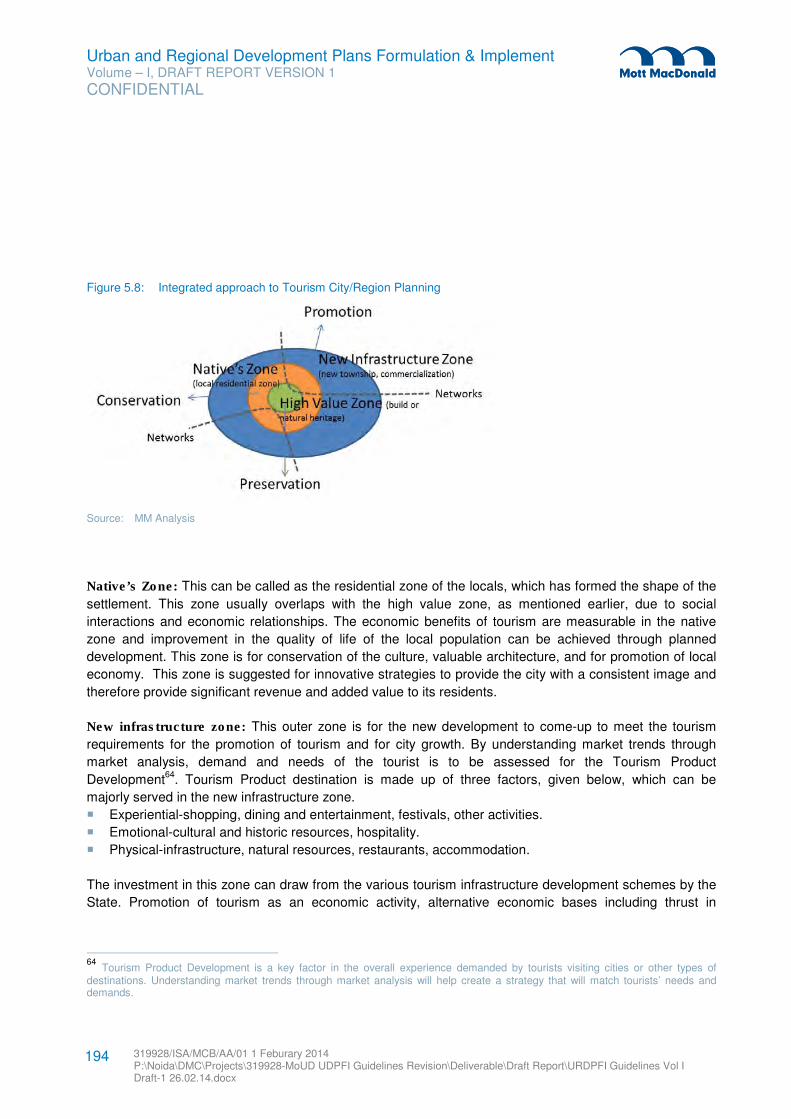
Urban and Regional Development Plans Formulation & Implement Volume – I, DRAFT REPORT VERSION 1
CONFIDENTIAL
319928/ISA/MCB/AA/01 1 Feburary 2014 P:\Noida\DMC\Projects\319928-MoUD UDPFI Guidelines Revision\Deliverable\Draft Report\URDPFI Guidelines Vol I Draft-1 26.02.14.docx
194
Figure 5.8: Integrated approach to Tourism City/Region Planning
Source: MM Analysis
Native’s Zone: This can be called as the residential zone of the locals, which has formed the shape of the
settlement. This zone usually overlaps with the high value zone, as mentioned earlier, due to social
interactions and economic relationships. The economic benefits of tourism are measurable in the native
zone and improvement in the quality of life of the local population can be achieved through planned
development. This zone is for conservation of the culture, valuable architecture, and for promotion of local
economy. This zone is suggested for innovative strategies to provide the city with a consistent image and
therefore provide significant revenue and added value to its residents.
New infrastructure zone: This outer zone is for the new development to come-up to meet the tourism
requirements for the promotion of tourism and for city growth. By understanding market trends through
market analysis, demand and needs of the tourist is to be assessed for the Tourism Product
Development64
. Tourism Product destination is made up of three factors, given below, which can be
majorly served in the new infrastructure zone.
� Experiential-shopping, dining and entertainment, festivals, other activities.
� Emotional-cultural and historic resources, hospitality.
� Physical-infrastructure, natural resources, restaurants, accommodation.
The investment in this zone can draw from the various tourism infrastructure development schemes by the
State. Promotion of tourism as an economic activity, alternative economic bases including thrust in
64
Tourism Product Development is a key factor in the overall experience demanded by tourists visiting cities or other types of destinations. Understanding market trends through market analysis will help create a strategy that will match tourists’ needs and demands.
Urban and Regional Development Plans Formulation & Implement Volume – I, DRAFT REPORT VERSION 1
CONFIDENTIAL
319928/ISA/MCB/AA/01 1 Feburary 2014 P:\Noida\DMC\Projects\319928-MoUD UDPFI Guidelines Revision\Deliverable\Draft Report\URDPFI Guidelines Vol I Draft-1 26.02.14.docx
195
institutional and commercial developments to be established in this zone and if allowable in Native’s Zone
too.
In case of tourism regions/circuits, the new infrastructure zone may be wide spread and can be considered
as the rest of the area of the region/circuit outside high value zone and native’s zone. A tourism circuit will
have various nucleus of high value zone bedded by the thread of connectivity.
Networks: However, the integration of the zones is to be strong hand in planning. Networks to connect
zones for accessibility between the two outer zones i.e. new infrastructure zone and native’s zone shall
have strong linkages, while from eco-sensitive approach; the High Value zone shall have limited access (if
possible pedestrian only). For the protection of the heritage (both build and natural) from the adverse
impacts of tourism, adoption of greener tourism in this zone is to be the prime effort. For improving external
connectivity upto the tourist centres, alternative modes of transportation to be promoted.
Simple practical steps to reduce impact on the environment and promote the benefits of tourism are
through zoning. Local consultative approach to be taken for tourism based livelihood development,
physical infrastructure, transport and tourists, heritage and tourism conservation, environment and tourism,
any other.
5.4.4.3 Aspects of preservation, conservation & promotion
1. In lines, with the objectives of the Ministry of Culture, (RFD 2013-14), planning for heritage cities to
include- Safeguard various forms of Intangible Cultural Heritage and promote research through
financial support to artistes, scholars and cultural organizations and Manage national monuments
(Tangible Heritage) of India through Archaeological Survey of India, State Governments, Universities,
Local Bodies.
2. Special attention to be paid while planning to Religious settlements along the river fronts and water
bodies, where emphasis is to be laid on conservation of water bodies and no alteration of the
watershed system of the area.
3. For the application of the conservation, preservation and promotion in various zones of treatment and
extend of tourism, the various planning aspects can be adopted:
a. Pre-requisite for Planning Permission to be listed in Development plan for historic & religious
zones,
b. Development controls proposed shall be based on ground realities with a separate section on
façade controls for improving aesthetics of the town at large,
c. Standardised of Urban Design in the preservation and conservation zone including: Typical
elevation of the houses, Building height, Elevation colour theme, Building material (Maintain and
encouraging local building material use), Typical styles for column, bracket, balcony, motifs.
While the usable area inside should be free from regulation.
d. Visibility of historical monuments and façade of the core zone to be maintained,
e. Approach and Signages to be specified and preferably aesthetically fitted, (as given in Shimla
Master Plan)
Urban and Regional Development Plans Formulation & Implement Volume – I, DRAFT REPORT VERSION 1
CONFIDENTIAL
319928/ISA/MCB/AA/01 1 Feburary 2014 P:\Noida\DMC\Projects\319928-MoUD UDPFI Guidelines Revision\Deliverable\Draft Report\URDPFI Guidelines Vol I Draft-1 26.02.14.docx
196
4. Formation of a Heritage Cell for the heritage cities, as an implementation agency, for Heritage related
policies and plans. The cell to essentially consist of Planners, Conservation architects, Archaeologist,
Structure (retrofitting) engineer, Urban designer, Property evaluator, members from revenue
department, town planning department and local representatives. Its roles & responsibility may include:
a. Strict implementation of Central & State Government policies
b. Carry out Heritage related studies & plan preparation
c. Formulate special heritage guidelines
d. Categorising heritage properties
e. Formulate & implement Heritage related Development Control regulations and make revisions
f. Any heritage related notification and fines.
g. Equipment and infrastructure for maintenance of the heritage buildings to be acquired and
maintained.
h. Conducting workshops, awareness programs and cultural activities
i. Maintenance of heritage funds
j. Support heritage property owners in repair and maintenance and suggestions for retrofitting of
old structures
k. Give provisions for revolving heritage property maintenance fund for repair and maintenance of
private properties
5. Other attractions may include:
a. Promotion of Heritage walkway and River front walkway, b. Landscaping & Up-gradation of available open spaces
c. Revival of urban water bodies
d. Seasonal tourism events such as Fair and Festivals to be organised as per the approved ‘Guidelines for Financial Assistance to State Government / Union Territory Administrations for Organizing Fair and Festivals and Tourism related Events’.
e. Alternative modes of transportation to be encouraged in the tourism plan for increase options for the tourist. Key nodes on transportation networks to have Tourist Information Centre/kiosk.
f. Marketing strategies of the tourism destinations to be well-defined including generating revenue to the local population, apart from employment generation estimations. On average, Employment generation by tourism industry as direct and indirect is suggested for hotel industry (per room) by the Tourism Policy is: i. Direct employment: 2 persons
ii. Indirect employment: 3 persons
5.4.5 Port city
A coastal city whose seafront is dominated by port and which has come into existence primarily due to port
activities is referred to as a Port City. Such cities represent exceptional developmental potential due to
their maritime identity. Coastal features remarkably notable within the high-low tide line mark are mudflats,
salt pans, estuaries, creeks, mangroves, coral reefs, geomorphological features with patches under sand
and beaches; scrubs, plantations, forests and sometimes horticulture. On the other hand, proximity of the
area to port leads to development of coastal infrastructure, fishing activities, salt manufacturing, presence
of industries and even power plants, which provide an advantage to the City development by means of
Urban and Regional Development Plans Formulation & Implement Volume – I, DRAFT REPORT VERSION 1
CONFIDENTIAL
319928/ISA/MCB/AA/01 1 Feburary 2014 P:\Noida\DMC\Projects\319928-MoUD UDPFI Guidelines Revision\Deliverable\Draft Report\URDPFI Guidelines Vol I Draft-1 26.02.14.docx
197
bearing the benefits of its location. Besides the coastal advantages, these sites are connected to the
hinterland by rail and roads.
5.4.5.1 Associated issue
The challenge in the management of such cities lies in the balanced development of port activities,
environmental protection and urbanisation. Key issues associated with port city planning are:
� Challenge to sustain the port city’s activities while transforming into major economic centres. Some of
the ports have intensified port activities which have resulted in increasing pressure on land for
urbanisation.
� Development of compatible land uses, activity areas and integration of port, industries, logistics
facilities and the residential zones.
� Decentralised development through provision of self-contained zones within the Port City region.
� Preservation of ecologically fragile areas, water bodies and their basins, CRZ and forests.
� Identification and planning for the Coastal Regulations Zone and land under the High Tide line.
� Attempts along the port land are made to reclaim land impacts the marine ecology .
� Defining the major use of the available waterfront.
� Lack of alternative economic activities leading to stagnation of city growth.
� Some of the port towns also show high rate of crime. This is primarily due to segregation of classes,
lack of recreational activities, lack of educational facilities for labour class, and to some extent due to a
considerable percentage of the population is bachelor.
5.4.5.2 Planning strategy
A growth model in general is observed for port city which evolves from harbour to a heavy manufacturing
base, eventually leading to a commercial growth centre. The pressure on land impacts its demographic
profile and land values. Also, industrial development requires supporting residential development. Often
ancillary and service industries, warehousing facilities, logistic sector, truck and heavy vehicle parking
areas begin cropping up around the industrial development. This is the stage where the unplanned
proliferation of developmental activities start and a strong need for planning intervention is felt. Slowly the
surrounding land’s real estate value rises and commercial development intensifies. As a result worker
population increases and forward linkages are established as services like institutional development,
development of financial institutions, corporate offices, BPO amongst others. As the quality of
infrastructure and service improves, eventually the tourism sector also grows.
The international and Indian port cities, viz, Mumbai, Vishakhapatnam, Shanghai and Singapore reflect
presence of industrial manufacturing base and other key components such as city size and population
density. Land use pattern of Los Angeles and Vishakhapatnam, amongst others have inspired the planning
for the non-industrial components of institutional support system and commercial economic base.
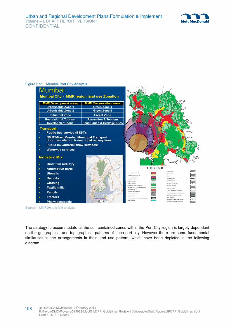
Urban and Regional Development Plans Formulation & Implement Volume – I, DRAFT REPORT VERSION 1
CONFIDENTIAL
319928/ISA/MCB/AA/01 1 Feburary 2014 P:\Noida\DMC\Projects\319928-MoUD UDPFI Guidelines Revision\Deliverable\Draft Report\URDPFI Guidelines Vol I Draft-1 26.02.14.docx
198
Figure 5.9: Mumbai Port City Analysis
Source: MMRDA and MM analysis
The strategy to accommodate all the self-contained zones within the Port City region is largely dependent
on the geographical and topographical patterns of each port city. However there are some fundamental
similarities in the arrangements in their land use pattern, which have been depicted in the following
diagram.
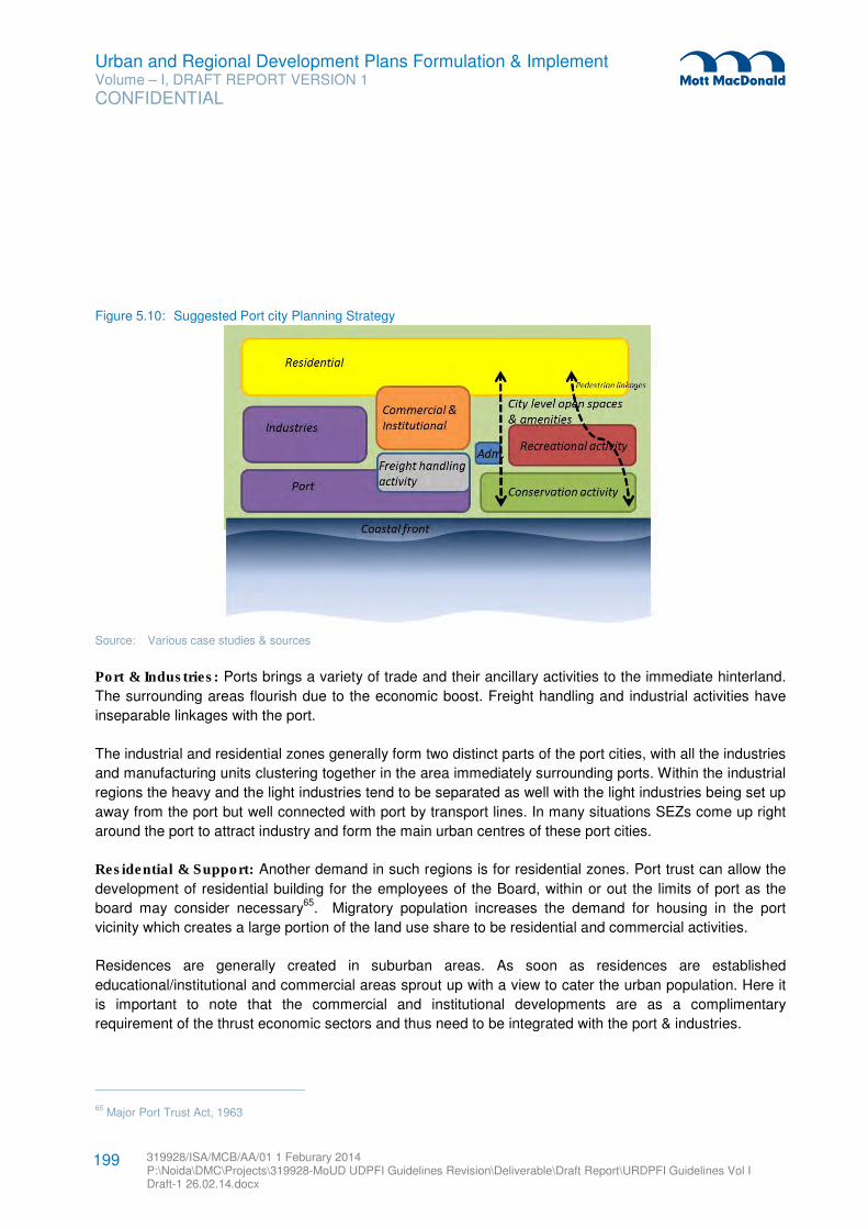
Urban and Regional Development Plans Formulation & Implement Volume – I, DRAFT REPORT VERSION 1
CONFIDENTIAL
319928/ISA/MCB/AA/01 1 Feburary 2014 P:\Noida\DMC\Projects\319928-MoUD UDPFI Guidelines Revision\Deliverable\Draft Report\URDPFI Guidelines Vol I Draft-1 26.02.14.docx
199
Figure 5.10: Suggested Port city Planning Strategy
Source: Various case studies & sources
Port & Industries: Ports brings a variety of trade and their ancillary activities to the immediate hinterland.
The surrounding areas flourish due to the economic boost. Freight handling and industrial activities have
inseparable linkages with the port.
The industrial and residential zones generally form two distinct parts of the port cities, with all the industries
and manufacturing units clustering together in the area immediately surrounding ports. Within the industrial
regions the heavy and the light industries tend to be separated as well with the light industries being set up
away from the port but well connected with port by transport lines. In many situations SEZs come up right
around the port to attract industry and form the main urban centres of these port cities.
Residential & Support: Another demand in such regions is for residential zones. Port trust can allow the
development of residential building for the employees of the Board, within or out the limits of port as the
board may consider necessary65
. Migratory population increases the demand for housing in the port
vicinity which creates a large portion of the land use share to be residential and commercial activities.
Residences are generally created in suburban areas. As soon as residences are established
educational/institutional and commercial areas sprout up with a view to cater the urban population. Here it
is important to note that the commercial and institutional developments are as a complimentary
requirement of the thrust economic sectors and thus need to be integrated with the port & industries.
65 Major Port Trust Act, 1963
Urban and Regional Development Plans Formulation & Implement Volume – I, DRAFT REPORT VERSION 1
CONFIDENTIAL
319928/ISA/MCB/AA/01 1 Feburary 2014 P:\Noida\DMC\Projects\319928-MoUD UDPFI Guidelines Revision\Deliverable\Draft Report\URDPFI Guidelines Vol I Draft-1 26.02.14.docx
200
To avoid stagnation of port city growth, alternative avenues and economic opportunities shall be adopted
as key strategy. Institutional infrastructure base provides skilled and semi-skilled labour as per the demand
and as a consequence, share of institutional requirement in port cities is slightly on the higher side. With
higher end services being provided, an institutional framework is established that provides a highly
educated and motivated workforce.
Transportation: There seem to be two aspects to the development of transport infrastructure in port cities.
Firstly, the aspect of infrastructure development is the establishment of interstate rail lines and airports that
are created to accommodate the easy movement of cargo as the capability of port increase with the setting
up of more industries.
Second is development of a public transport network which in most cases consists of rail lines as well as
mass rapid transit service. This comes up to cater the movement of the residential population to the
commercial and industrial zones and forms the backbone of the expansion and growth of the city. Also, the
areas around these Transport Corridors gain in land values and various kinds of mixed use developments
develop around it including commercial, institutional, theme developments, investment areas, and
hospitality and tourism activities amongst others.
Works for roads, railways, bridges, tunnels can be executed within or without the limits of the port by the
sanction of the Board of Trustees.66
A seamless transport infrastructure network should be developed
throughout port trust and local authority area.
Environment and Sustainability: Marine ecosystems of the coast are very rich in species diversity and
abundance. It is seen in many of the port cities across the world that once industry and residence has been
established, port cities set up environmental reserves and forest regions and begin focussing on
sustainable development. Economic activities requiring water front and conservation of this front under
coastal regulation zones have a combating demand for the sensitive land.
This zone can be regulated through provision of buffers and protected areas surrounded with around with
compatible land uses of recreational, institutional and sparse residential areas to give the city a flavour of
nature and greenery. By carefully integrating the sea edge with the city by well-developed pedestrian
paths, recreational zone can be developed with beaches, creek development, parks, street shopping
etcetera to accommodate urban leisure activities.
Port trusts have power to carry out the activities like reclaiming, excavating, enclosing, and raising any part
of the foreshore of the port or port approaches to carry the port activities properly.67
Quality of life: As more workers begin to settle, an urban, cosmopolitan environment is generated which
attracts the commercial and service sectors to these port as well as recreational areas. The development
66 Major Port Trust Act, 1963
67 Major Port Trust Act, 1963
Urban and Regional Development Plans Formulation & Implement Volume – I, DRAFT REPORT VERSION 1
CONFIDENTIAL
319928/ISA/MCB/AA/01 1 Feburary 2014 P:\Noida\DMC\Projects\319928-MoUD UDPFI Guidelines Revision\Deliverable\Draft Report\URDPFI Guidelines Vol I Draft-1 26.02.14.docx
201
of these service sectors attracts a different population of workers, service providers, henceforth
emphasising on the need of educational facilities with technical institutes.
For interaction of the various classes of the society, the living and recreational areas are to be integrated
and hence the open spaces and amenities to be decentralised and inclusively planned for public
integration. Here, social infrastructure can target needs of specific strata of population to ensure improved
quality of life and eventually social security.
Maritime boards of the country in respective States are making effort to plan these cities as multi-functional
and sustainable. The idea is to provide for infrastructure to attract & accommodate urban population and to
regulate development in and around these ports.
5.4.5.3 Aspects of Planning
1. Planning of the port and its surrounding area to be based on the harbour structure, port infrastructure,
cargo capacity, facilities including jetties & wharfs, Godown facilities and the understanding the
backward & forward linkages of the commodities of import and export. The following supporting
infrastructure to be considered as per the port city requirement:
i. Encourage logistics sector development by private or by the ULBs to generate revenue.
Logistics as a backward linkage benefits directly from other industries and provides direct and
indirect employment generation in the immediate region.
ii. Separate rail lines and cargo/freight handling junctions to be situated along the port and its
industries.
iii. The aerodrome can be extended to commercial operations as well.
iv. During planning, provision for pipelines infrastructure in and around port city to be given
attention
v. Innovative and feasible alternatives of water supply infrastructure, using techniques such as
desalination, reverse osmosis.
2. Different port cities have different industrial land use and infrastructure patterns depending upon the
stage of development they are in. Younger cities like Shenzhen, Surat and the proposed Pipavav site
as well as Shanghai, where development has been fairly recent have larger industrial areas (around
30% of land use) but few institutions around residences. Older cities where ports were set up many
years ago have the largest land use committed to residential areas with industry and commercial
sectors having an equivalent share (7 – 10 %). There is a lot of institutional infrastructure in these
regions as well with recreation facilities and educational institutions. These cities include Singapore,
LA, Mumbai and Chennai.
3. Sectors with focus on local raw material available from the natural resource base have due advantage
to bring benefit to the local economy. The areas marked as high cropping intensity have been left as
green/agriculture. Also, Ship building industry generates direct and indirect employment in the
immediate region.
4. The National Environmental Policy, 2006 suggests actions to conserve coastal resources - Explicitly
consider sea-level rise and vulnerability of coastal areas to climate change and geological events, in
coastal management plans, as well as infrastructure planning and construction norms.
Urban and Regional Development Plans Formulation & Implement Volume – I, DRAFT REPORT VERSION 1
CONFIDENTIAL
319928/ISA/MCB/AA/01 1 Feburary 2014 P:\Noida\DMC\Projects\319928-MoUD UDPFI Guidelines Revision\Deliverable\Draft Report\URDPFI Guidelines Vol I Draft-1 26.02.14.docx
202
5. Adopt a comprehensive approach to Integrated Coastal Management by addressing linkages between
coastal areas, wetlands, and river systems, in relevant policies, regulation, and programs.
6. Environment risks and mitigation plan to be taken into consideration while planning the port city
development. Sustainability of the port is reflected from its planning as per local weather conditions and
for Ecologically Sensitive Areas such as CRZ, Marine National park and sanctuaries, specifically taking
into consideration the climate change. Port city design is generally in grid formation. This is due to
alignment with the wind flow directions in the coastal areas as sea breezes and helps to reduce
pressure of cyclonic winds, apart from the influence of mangroves on the cyclone.
7. In case of older cities where ports were set up many years ago, the aim is to attain sustainable growth
of the city by decongesting city centres while at the same time allowing greater growth in the
commercial and industrial sectors by connecting these cities to smaller towns, suburbs and
decentralized hubs of activity.
8. Institutional development is complementary and key support to port city industrial development for
sectors such as port & logistics. Skilled labour is required and crucial in light engineering for technical
inputs. Similarly semi-skilled manpower is prime logistics requirement. Development centres for skilled
and semi-skill labour shall be developed as a part of institutional facility. Office spaces and Information
Technology is a support system required for high end and value addition in the entire industrial zone for
upgradation. Besides this, Marine mining & biotechnology may benefit from research & development.
R& D can be diverted to add value to agriculture, pharmaceuticals etc.
5.4.6 Medi-City
The concept of modern medical cities has been in place for some time, but has gained renewed interest,
particularly in rapidly developing economies. The concept of a medi-city or health city defines a cluster of
hospitals, a holistic healthcare centre, a large hospital sprawled across acres of land. In simpler term
medical cities could change the way medical education, research and development is conducted, taking it
from public to private to corporate.
Medi-cities have been designed to be comprehensive in scope and incorporate advanced technologies and
medical practices. The scale and scope of medical cities usually demands an advanced level of care, both
in technology and approaches to create an attractive destination for care. This attractiveness is necessary
to ensure the high level of patient volumes required to support such a large operation.
5.4.6.1 Associated issue
In certain circumstances, Medi-cities evolve in metropolitan cities. There are many pre-requisites for the
development of Medi-cities, as:
� Volume and demand: Medi-cities will always require a significant amount of patient volume from the
local population in addition to the human resources and community infrastructure that a city setting
provides.
Urban and Regional Development Plans Formulation & Implement Volume – I, DRAFT REPORT VERSION 1
CONFIDENTIAL
319928/ISA/MCB/AA/01 1 Feburary 2014 P:\Noida\DMC\Projects\319928-MoUD UDPFI Guidelines Revision\Deliverable\Draft Report\URDPFI Guidelines Vol I Draft-1 26.02.14.docx
203
� Special infrastructure: Medical care and associated infrastructure is to be provided in a planned
manner. Medi-cities require highly specialised provisions for waste handling, accessibility, special care
systems, area reservations and infrastructure.
� Accessibility: Well-connected site is required for Medi-city development to provide an ease in
accessibility. Parking provisions in a medi-city is need based demand, focusing on institutional set-ups.
Accessibility into and around the medi-city should be highly focused on the accessibility of differently
abled.
� Attractiveness: Medical cities need to offer several attractive attributes to attract foreign or ‘non-local’
patients to overcome the competition, having special care, area reservation, infrastructure facilities.
The medi-city should be complemented by hotels, beautiful landscaping and country club, in order to
attract and promote medical tourism.
� Multiple functions: Medi-cities developing in isolation do not reach the maturity stage. Medical cities
should also incorporate substantial non-medical services to support the staff, patients and visitors.
Clear approach and effective forecasting may not be easy in such a case.
� Poor management of health care waste potentially exposes health care workers, waste handlers,
patients and the community at large to infection, toxic effects and injuries, and risks polluting the
environment. It is essential that all medical waste materials generated from medical city are segregated
at the point of generation, appropriately treated and disposed of safely. Bio-Medical Waste
(Management and Handling) Rules, 2011 of MoEF or latest such guidelines, must be followed in Medi-
cities.
5.4.6.2 Planning strategy
As medical cities are of a larger scale and better represent the full continuum of care, they have the ability
to support services that are highly specialized, services that often struggle to see sufficient volume to
support a business case. Medi-cities need to have a strong higher and medical educational system and
complete and stable infrastructure to become an ideal location for specialisation. Due to the interplay of
economies of scale, the Medi-city creates an interesting and opportunistic intersection with medical
tourism.
For those organizations providing medical tourism services, this integration extends beyond the immediate
community into the global healthcare delivery system. The stronger integration into the local or global
community is required to strengthen the clinical outcomes and provide a much stronger infrastructure for
prevention, wellness and the management. Thus, this integration will also create a cost-effective setting.
Medical tourism organizations are accustomed to bundling and offering package pricing.
5.4.6.3 Aspects of Planning
Since the most critical issue in Medi-city is handling of medical waste, essential facilities for the
maintenance of Medi-city has been prescribed by WHO, these are:
� Effective waste reduction and waste segregation, ensuring that only appropriate wastes are
incinerated;
Urban and Regional Development Plans Formulation & Implement Volume – I, DRAFT REPORT VERSION 1
CONFIDENTIAL
319928/ISA/MCB/AA/01 1 Feburary 2014 P:\Noida\DMC\Projects\319928-MoUD UDPFI Guidelines Revision\Deliverable\Draft Report\URDPFI Guidelines Vol I Draft-1 26.02.14.docx
204
� Siting incinerators away from populated areas or areas where food is grown, thus minimizing
exposures and thereby risks;
� A properly engineered design, ensuring that combustion conditions are appropriate, e.g., sufficient
residence time and temperatures to minimize products of incomplete combustion;
� Construction following detailed dimensional plans, thus avoiding flaws that can lead to incomplete
destruction of waste, higher emissions, and premature failure of the incinerator.
Apart from the waste handling of the Medi-city, the key aspects of planning are:
1. Access: One of the primary success factors for proper healthcare design is convenient and easy
access to and from the facility. This includes simple way-finding, safe and weather-protected vehicular
drop-offs, and convenient access to parking. Such access is often at odds with urban planning trends,
which attempt to minimize the impact of vehicular transportation in favour of more pedestrian-oriented
buildings.
2. Transportation facilities like bus routes, metro rail, bicycling, and heliports are substantial non-medical
services to support the staff, patients and visitors.
3. Parking Demands: Access to public transportation and housing within walking distance creates
opportunities for staff and certain patients and visitors to avoid vehicular commuting altogether. This
reduces the polluting impact of automobiles and can minimize the size of required parking facilities. It
should be noted, however, that even with these reductions, hospitals will still generally create a much
higher parking demand per square foot than a typical urban office building.68
4. Natural Environment: Environment Studies have concluded that a natural environment is essential to
creating a genuine state-of-the-art healing environment and reducing stress. Key sustainable design
elements such as roof-gardens, courtyard spaces can minimizes the building’s heat-island effect,
reduces demand on storm water systems, improves surrounding air quality, and reduces noise
pollution.
5. Institutional: Integration of Medi-city with research and development centres for bio-medical research,
medical colleges, training centres are necessary. Also, financial support units should be created such
as banks, ATM facilities, money transfers and exchange and insurance company outlets.
6. Commercial Space: A mixed use community is desirable in this area because of its proximity to the
emerging Medical City. Therefore, Planned Development shall be encouraged, including a mixture of
residential use types, hotel, retail/commercial, office and airport support, commerce, hospital,
conservation and recreational uses.
Medical city should encompass the concept of self-sustainable cities, in a way as an eco-city is designed
with consideration of environmental impact. They should have clean disposal of waste, waste-to-energy,
renewable energy, sustainable transportation and drainage system, zero-energy building, green roof, etc.
68 Case Studies in Design Excellence for Mid-Sized Urban / Inner Suburban Medical Centers, by AIA Potomac Valley
Urban and Regional Development Plans Formulation & Implement Volume – I, DRAFT REPORT VERSION 1
CONFIDENTIAL
319928/ISA/MCB/AA/01 1 Feburary 2014 P:\Noida\DMC\Projects\319928-MoUD UDPFI Guidelines Revision\Deliverable\Draft Report\URDPFI Guidelines Vol I Draft-1 26.02.14.docx
205
5.4.7 Sports city
Sports City defines a large developed area with all kind of sports infrastructure facility to support organising
and hosting different sports activities in a city. Basically it is a concept of “City within City” which provides a
regular series of sports venues, sports academies, providing a platform for youth development,
recreational sports facilities, residential and commercial developments, together with all the related
amenities. The purpose-built city is supported by service facilities like schools, medical facilities for
sportsmen and residents, hotels, community centres and entertainment venue. And eventually all the
events of sports city translate their activity into economic generation for an economically sustainable sport
city.
5.4.7.1 Associated issue
As sports city emerges as a newly developed city on the fringe or near to the existing or old city so the
associated issues are different from the parent city. Following are some of the issues associated with
sports city:
� Large vacant land is required for developing sports city for development of sports infrastructure and
supporting services. This required land is only available near to the parent city, if planned in advance.
� Huge and regular investment for infrastructure development is a big challenge to sustain sports cities.
Major sports events are not held on a high frequency so maintenance and sustainability during lean
time is a big challenge
� World class modern infrastructure and equipment only can act as a pull factor of sports persons to
come, participate and stay for long. Apart from development of sports complexes other development
including residential, commercial and logistic facilities (store houses) are to be integrated.
� As sports cities lies on outskirts of the city, lack of connectivity leads to isolation of the sport city.
� Further, if the sports city lack of alternative economic activities, apart from sport event, it leads to
stagnation of city growth.
Apart from sports city, it has been widely accepted that availability of facilities for sports and games and
recreation is an essential part of healthy social life. Now it has been considered as an important parameter
in determining the quality of human development. Sports play a vital role in overall development of youth.
As per the latest All India Educational Survey conducted by the National Council for Educational Research
and Training (NCERT) more than 50 per cent of one million plus schools in the country lack playground
facility. This problem is more acute in the urban areas where playing fields are facing serious threat from
competing demands on open spaces due to the low priority attached to it.
5.4.7.2 Planning strategy
The various factors associated with Sports city planning is strategic location, sports infrastructure,
supporting institutional infrastructure and most importantly, skilled man power in the sector.
Urban and Regional Development Plans Formulation & Implement Volume – I, DRAFT REPORT VERSION 1
CONFIDENTIAL
319928/ISA/MCB/AA/01 1 Feburary 2014 P:\Noida\DMC\Projects\319928-MoUD UDPFI Guidelines Revision\Deliverable\Draft Report\URDPFI Guidelines Vol I Draft-1 26.02.14.docx
206
In India, cities like Greater Noida Sports City, Mohali Sports Complex have emerged as a sports city. Now,
New Raipur, almost 20 km from Raipur city is developing as a new sports city by the Naya Raipur
Development Authority in eastern part of India.
Initial development of the sports city are to focus on infrastructure development, specific to sports,
recreation and connectivity to national level urban centres and also international. Success of the city lies in
the institutional backing to provide for highly specialised skill development, research and development and
application of evolving technologies in the field. To overcome the challenge of huge investments, sports
tourism, is among the alternative sources to sustain sports cities. The management of such cities shall
strategies these with hospitality, commercials and entertainment venues.
Case Study: Naya Raipur Sports City
Total area: Proposed development is on 130 acres, with its prime use divided into recreational and
residential zone as mentioned in the Master Plan of Naya Raipur, 2031.
Land use & Infrastructure: The project is conceived as an integrated development featuring
residential and commercial real estate components of the Greenfield capital city, complemented by
various sports facilities of international standards. Core activities of the two areas is proposed to be
well segregated, however, the supporting infrastructure and amenities to facilitate all the prerequisites
for luxury lifestyle and a well-equipped base for sports requirements are integrated.
Inclusive planning: As per the stipulations of NRDA, 10% of the total housing units need to be
developed as LIG and 15% of the total number of housing units need to be developed as EWS
housing.
Residential Zone: The core concept of this component is to be an integrated neighbourhood
development with easy access to social amenities and facilities like healthcare, education, shopping,
leisure and entertainment, sports.
Sports Zone: It is the prime focus area for development of sports city for providing sports complex for
organising games, training centre, practice venue and competition based environment of sports at both
national and international level. The sports zone would offer a wide range of indoor and outdoor sports
facilities, mainly comprising an aquatic centre and indoor stadium to be development components.
Sports centre, accommodation facilities for players along with other support infrastructure such as food
courts, restaurants, and open spaces form optional sports components.
Other facilities would be parking space, public utilities and amenities, hospital and primary health
centre and shopping centre for local residents.
Urban and Regional Development Plans Formulation & Implement Volume – I, DRAFT REPORT VERSION 1
CONFIDENTIAL
319928/ISA/MCB/AA/01 1 Feburary 2014 P:\Noida\DMC\Projects\319928-MoUD UDPFI Guidelines Revision\Deliverable\Draft Report\URDPFI Guidelines Vol I Draft-1 26.02.14.docx
207
5.4.7.3 Aspects of Planning
The major planning aspects of the sports city are development of sports complexes, training centres,
medical facilities, good connectivity, residential and commercial zones. The following supporting
infrastructure should be considered for sport city:
� Good connectivity with the existing cities by road and rail facilities.
� Provisions for all basic infrastructure like water supply, storm water drainage and sewerage, and if
location allows, integrate with the parent city, in order to draw benefits from the common infrastructure.
� Share of open spaces to be significantly high and hence provision of water harvesting system for
available large open spaces in the sports city to be mandatory.
� Alternative uses of the open space to generate revenue during lean period.
� To regulate the development activity of sports city an integrated institutional development is required
with local bodies and the sports authority.
� To promote Sports Tourism, Sports City to boast major entertainment venues, community centres,
hotels and all the related amenities expected
It shall be noted that the projections and allocation of infrastructure provisions and space standards of a
Sports city are different. Such as the per capita water supply requirement should be planned for higher
amount compared to the other cities. Since it is a “City within City”, the building regulations in the
development plan for these areas to be individually prepared. The large land requirement in these cities
must be compensated by sustainable development and green infrastructure.
Government of India (GoI) has taken into consideration, the importance of sports in day to day life and
have made policies for development of sports at the level of Gram Panchayat, Urban Local Body and
schools. Initiatives taken by the GoI are as follows:
� The National Sports Policy, 2001 of Government of India, ensures the provision of land and
development of sports for the educational institutions, Schools and Colleges in both rural and urban
areas. While existing play fields and stadium, both in rural and urban areas, will be maintained for
sports purposes. The introduction of suitable legislation may be considered for providing open areas to
promote sports activities. Steps would be taken to evolve low cost functional and environment-friendly
designs in this regard, so that maximum benefits could be derived through relatively low levels of
investment.
� The revised Twenty Point Programme, 2006 of Ministry of Youth Affaire and Sports provide for
substantially enhanced public investments as a fundamental requirement for the time-bound
establishment of basic but extensive sports infrastructure along with trained supervisors and organized
sports management arrangements. This will include trained supervisors, in all rural Panchayats and
urban neighbourhoods throughout the country, leading to the establishment of a National
Sports Infrastructure Grid extending from the community level in Panchayats and Municipalities
to Block, District, State, Metropolitan and National levels, backed by sports medicine and sports
sciences.
� Apart from Sports city, the Comprehensive Sports Policy, 2007 of Ministry of Youth Affaire and Sports
urges State Governments and Local Governments to engage physical instructors in schools and make
available at least 1 acre of land for a primary school and 2.5 acres of land for an upper primary
Urban and Regional Development Plans Formulation & Implement Volume – I, DRAFT REPORT VERSION 1
CONFIDENTIAL
319928/ISA/MCB/AA/01 1 Feburary 2014 P:\Noida\DMC\Projects\319928-MoUD UDPFI Guidelines Revision\Deliverable\Draft Report\URDPFI Guidelines Vol I Draft-1 26.02.14.docx
208
school for use as playgrounds. In addition, it is also introducing and thus, implementing major
programme in urban areas, to financially support the Nagarpalikas and other Urban Local Institutions to
provide basic safe places to play in poorer areas in convergence with the Jawaharlal Nehru National
Urban Renewal Mission. The Nagarpalikas will need to provide the minimum prescribed extent of land
on a realistic basis. For this, financial assistance from GoI should be used as seed money to raise
other contributions from the public and private entities for the creation of the basic sports infrastructure.
5.4.8 Special Area Planning (cantonment area, restricted area etc.)
5.4.8.1 Cantonment Area
Cantonment area is a place or places along with boundaries in which any part of the Forces is quartered
for the services of accommodation and administration of such forces. As per Director General Defence
Estates, the overall municipal administration of the notified cantonments is the function of the Cantonment
Boards which are democratic bodies.
As per “The Cantonments Act, 2006”, Central Government may, by notification in the Official Gazette,
declare any place or places along with boundaries in which any part of the Forces is quartered or which,
being in the vicinity of any such place or places, is or are required for the service of such forces to be a
cantonment for the purposes of this Act and of all other enactments for the time being in force, and may, by
a like notification, declare that any cantonment shall cease to be a cantonment. Also, section 10(2)69
states
that, “Every Board shall be deemed to be a municipality under clause of article 243P of the Constitution for
the purposes of-
a. receiving grants and allocations; or
b. implementing the Central Government schemes of social welfare, public health, hygiene, safety, water
supply, sanitation, urban renewal and education.
Thus, the Cantonment Board provides municipal services, community facilities and civic utilities including Water Supply, Sanitation, Street-lighting, roads, medical, educational, and recreational facilities. The Board also strives, as per the National Policy, for the environmental up-gradation by planting trees, bushes, decorative plants, etc. The cantonment board also act as a municipality for taxation purposes
70.
The structure of Cantonment Boards is being maintained keeping in view the fact that the Cantonment
areas were and are primarily meant to accommodate the military population and their installations. The
Cantonment is an area which comprise of both military and civil population. Thus, it needs to be covered
under the guidelines of area development plan, so that the civic services can be integrated for the benefit
of the ultimate user.
69 The Cantonments Act, 2006
70 Section 10870, states that, “A Board shall be deemed to be a municipal committee for the purposes of taxation as per the Municipal Taxation Act, 1881 (11 of 1881).”
Urban and Regional Development Plans Formulation & Implement Volume – I, DRAFT REPORT VERSION 1
CONFIDENTIAL
319928/ISA/MCB/AA/01 1 Feburary 2014 P:\Noida\DMC\Projects\319928-MoUD UDPFI Guidelines Revision\Deliverable\Draft Report\URDPFI Guidelines Vol I Draft-1 26.02.14.docx
209
5.4.8.2 Categorises of Cantonments
As per the Cantonments Act, 2006, the cantonments are categorised into four types based on the
population residing within the cantonment limit. The categories are mentioned in table below.
Table 5.8: Cantonment Categories
Sr. No. Cantonment Categories Population Limit
i Category I More than 50, 000
ii Category II 10,000 - 50,000
iii Category III 2,500 – 10,000
iv Category IV Below 2,500
5.4.8.3 Land Use in Cantonment
Land in cantonments is classified under the following major categories for the purpose of development:
� Class A: Reserved for specific military purpose and is managed by military authorities.
� Class B: Reserved for military administration for central government departments, railways; state
government and agricultural land; used by private persons on lease; Vacant land, managed by the
military estate officer.
� Class C: Occupied or used as markets, roads, ranges, gardens, etc. it is managed by the cantonment
board.
Urban and Regional Development Plans Formulation & Implement Volume – I, DRAFT REPORT VERSION 1
CONFIDENTIAL
319928/ISA/MCB/AA/01 1 Feburary 2014 P:\Noida\DMC\Projects\319928-MoUD UDPFI Guidelines Revision\Deliverable\Draft Report\URDPFI Guidelines Vol I Draft-1 26.02.14.docx
210
Case Study of Cantonment areas
1. Delhi Cantonment Area
Delhi Cantonment Area is spread over an area of 42.97 sq.km and is administered by the Delhi
Cantonment Board (DCB), which reports directly to the Central Government (Ministry of Defence).
Role in Infrastructure: The Board (DCB) is responsible for solid waste management, drainage and
sewerage, street cleaning of the Delhi Cantonment area. While bulk water is supplied by Delhi Jal
Board which is 100% metered, water is being metered in the distribution side at the pump houses for
bulk consumers but not at individual houses. The Delhi Jal Board is bound to receive in bulk all
sewerage from Delhi Cantonment Board for treatment and disposal.
Land features: DCB regulates development in the Cantonment Area, located between the airport and
the NDMC area, within which features such as the Cantonment low density bungalow layout with
extensive gardens, heritage buildings associated with the Armed Forces, and components such as
Gopinath Bazaar and St. Martins Garrison church are considered to be of significance. Some locations
in the Cantonment Area have been proposed as a Conservation Area by INTACH in the 2000 List.
However, total number of Jhuggies has been increased from 1570 in 1990 to 1700 in 1994 in Delhi
Cantonment Board area. (Source: CDP Delhi, Dept. of Urban Development, Govt. of Delhi ( http://jnnurm.nic.in/wp-
content/uploads/2010/12/CDP_Delhi.pdf)
2. Pune Cantonment Board (PCB)
The Pune Cantonment Board (PCB) is considering levying the Local Body Tax (LBT) in future, only
after the Pune Municipal Corporation abolishes octroi. They have also studied the implementation of
LBT in Aurangabad and have found there is a hike in their revenue and they believe LBT is far more
feasible than octroi. At present the Pune Municipal Corporation and the PCB are sharing octroi and
the PCB gets one-and-a-half crore Rupees monthly. This sharing of octroi depends on the population
and has been going on since several years. Since, specific rule under Cantonments Act which states
that if the State abolishes a particular tax, the cantonment board existing in that State cannot levy that
particular tax, limits PCB to impose it.
Urban and Regional Development Plans Formulation & Implement Volume – I, DRAFT REPORT VERSION 1
CONFIDENTIAL
319928/ISA/MCB/AA/01 1 Feburary 2014 P:\Noida\DMC\Projects\319928-MoUD UDPFI Guidelines Revision\Deliverable\Draft Report\URDPFI Guidelines Vol I Draft-1 26.02.14.docx
211
5.4.8.4 Associated issues
Some major and minor issues associated with Cantonment areas and their developments are:
� Cantonments were always considered as high-security areas, and were insulated from civil population.
The Cantonment Land Administration Rules permitted lease option for civilian population, who initially
settled within the limit of Cantonment Board for the purpose of residential and commercial activity.
These settlements are support systems such as for commercial activities, manpower support as formal
or informal and to fulfil some of the institutional requirements. Within the cantonment areas, military
based development and civilian based development takes place. But the management of this
development faces the similar issues as those by the ULBs and development authorities. They are:
– Lack of sufficient funding due to dependency on the State government policies and permitted or
abolished finance revenues;
– Lack of consolidated and appropriate planning norms to guide the development of the civilian areas
� Cantonment is like a Union Territory, a political subdivision and agency of the Central government and
exercises the state function. Also, cantonments cannot access development funds because the
Ministry of Defence and the army are in the non-plan sector. This isolation is the fundamental reason
for:
– Lack of integration with the city as a whole: Since, security is of prime importance in
Cantonment areas which is in relation with the national security, thus Directorate General Defence
Estates are the key decision makers, making the interest of the development authority and the
Directorate General Defence Estates separate.
– However, as per the Cantonments Act, 2006 the Board may join with any other local authority and
appoint a joint committee for any purpose in which they are jointly interested.
– Lack of representation from the Civilians: The requirement of local self-government is not
explored in the Cantonment area, as it will be in contradiction with the philosophy and principles of
Army. Hence, the aspiration of the people of the cantonments will not be on par with the aspirations
of the people of the state in which the cantonments are situated.
– Therefore, from the planning perspective, the integration of planning between cantonment areas
and the urban settlements around it is weak or absent.
� Another important planning issue of the cantonment and city development is urban sprawl.
Cantonment areas located which were located at a distance from the city are now within its limits or on
the fringe. The rapid urbanisation along urban settlements has engulfed the buffer zone between the
two, leading to71
:
– Haphazard development in the surrounding areas of cantonment due to lack of Master Plan /
Development Plan, and lack of land use specifications, resulting into unplanned formal and informal
commercial establishments.
– High waste generation in the surroundings of the Cantonment areas due to uncontrolled and
undeveloped open spaces. Such a case is of Ahmedabad Cantonment area (due to untreated
disposal methods and lack of proper waste management system).
71 The Times of India
Urban and Regional Development Plans Formulation & Implement Volume – I, DRAFT REPORT VERSION 1
CONFIDENTIAL
319928/ISA/MCB/AA/01 1 Feburary 2014 P:\Noida\DMC\Projects\319928-MoUD UDPFI Guidelines Revision\Deliverable\Draft Report\URDPFI Guidelines Vol I Draft-1 26.02.14.docx
212
– Rapid increase in the slum population in the vicinity of Cantonment as the Cantonment Board has
relatively high living standards which provide employment opportunities to the poor for making a
living in the area.
– Illegal occupancy on defence land due to uncertain General Land Records (GLR). Cases of
occupants questioning the preparation of GLR particularly in the case of Secunderabad
Cantonment have arrived.
5.4.8.5 Planning Strategies
The Cantonment Board has to execute a variety of duties and functions with the limited availability of
funds. The board is responsible to make provisions for physical as well as social infrastructure.
Construction, conservation and maintenance of public service infrastructure, historical monuments, public
places, etc. are also under the purview of the board.
In the given circumstances, where the duties and functions of the cantonment board and the municipality
are similar, the integrated planning efforts shall address the associated issues of the cantonment area
planning
Strategy 1: To control the overall area, in absence of land use specifications which results into shopping
and commercial establishments in Cantonment residential areas calls for the need for preparation of
Comprehensive Development Plans. Here, efforts shall be made by the Cantonment Board or by Joint
Committee for formulation of a detailed Development plan. The norms and standards given in this
Guideline are to be adopted with modifications for planning (specifically) the civilian areas of the
cantonment. Some specific planning aspects to include:
a. Public utilities such as water supply, sewage systems and treatment plants, telecommunication,
transportation networks and modes, power etc. can be integrated for ULB’s and Cantonment Board
for an effective output by the powers vested in the Joint Committee.
b. Social infrastructure such as stadium and sports complex, working women hostel can be built within
the Cantonment area for civilians. Recreational facilities shall be integrated with the cantonment
areas.
c. Commercial space development with proper guidelines will result in increment of the land value which
will be beneficial for Cantonment Board.
d. Integration of the external infrastructure with the city level infrastructure facilities.
Strategy 272
: Another approach for planning exercise is by JnNURM scheme, where Comprehensive
Development Plan and Comprehensive Mobility Plan shall be prepared by the Local authorities in
consultation with Cantonment Board and approved by Ministry of Defence for raising the funds under the
scheme. As per norms, a city development plan projecting future development of roads, water, sewerage
72 Ministry of Urban Development (MoUD) had introduced JnNURM in selected 76 cities of the country to provide funds on Central/
State/ Local Body sharing basis to develop basic infrastructure of the cities keeping in view the modern day requirements of urban governance. Among these cities, there are 28 Cantonments which are co-located within these Mission cities in the first phase of JnNURM. However, the issue of sharing funds with cantonment boards is still under consideration of Government of India.
Urban and Regional Development Plans Formulation & Implement Volume – I, DRAFT REPORT VERSION 1
CONFIDENTIAL
319928/ISA/MCB/AA/01 1 Feburary 2014 P:\Noida\DMC\Projects\319928-MoUD UDPFI Guidelines Revision\Deliverable\Draft Report\URDPFI Guidelines Vol I Draft-1 26.02.14.docx
213
and storm water drains and an indent of existing land use and a future land use plan is mandatory to obtain
grants under all Central schemes such as Jawaharlal Nehru National Urban Renewal Mission (JnNURM),
Rajiv Awas Yojana (RAY) and other Central government schemes.
This approach of planning the cantonment is to ensure:
� Integration in terms of connectivity as well as mass rapid transportation system,
� Suitably chosen locations of city level infrastructure for cantonment and civilians
� Well planned economic/commercial base in the cantonment area,
� Giving city a direction to its future growth towards or away from cantonment as strategized.
� Another advantage is that the natural systems management such as rivers and flood control measures
can be clubbed for both the Cantonment areas and City area which will minimise the losses, as
witnessed for Ambala Cantonment.
� Control on the surrounding or immediate zonal plans to cater to the requirements of the cantonment
area.
Revenue generation for Implementation of the plan:
The Cantonment Board generates revenue through meagre octroi, taxes and other fees, as explained in
above sections. There are alternatives to increase this revenue. Cantonment area should incorporate
shopping plaza/complex which will encourage the shopkeepers to pay more rent to the board. The board
can also organise weekly markets which will also encourage higher shop rents73
. Proper planning strategy
as recommended above shall ease the establishment of paid parking, theatres, cinemas, community hall,
73 The Deolali Cantonment Board (DCB), The Times of India
Case Study for CDP preparation in Cantonment area
The Khadki Cantonment Board (KCB), Pune is preparing City Development Plan (CDP) to strengthen
urban infrastructure and integrate it with that of the Pune Municipal Corporation with focus on traffic
management for better connectivity, improvement in water supply, better garbage disposal system,
developing sewerage system in old bungalow areas and implementing projects in slum areas. The
concept arises to get more funds from the state and Union government under the Jawaharlal Nehru
National Urban Renewal Mission (JnNURM) as cantonment board is looking for more funds.
The first step for getting the funds is to prepare a CDP, which has to be approved by the state
government and sent to the Union government for final approval. The cantonment board will be
inviting bids from private agencies this month to prepare the CDP.
(Source: The Times of India (http://articles.timesofindia.indiatimes.com/2014-01-09/pune/46028931_1_the-cdp-khadki-
cantonment-board-jnnurm-scheme)
Urban and Regional Development Plans Formulation & Implement Volume – I, DRAFT REPORT VERSION 1
CONFIDENTIAL
319928/ISA/MCB/AA/01 1 Feburary 2014 P:\Noida\DMC\Projects\319928-MoUD UDPFI Guidelines Revision\Deliverable\Draft Report\URDPFI Guidelines Vol I Draft-1 26.02.14.docx
214
stadiums, gymnasia etc. which will also generate revenue. As per “The Cantonment Act, 2006”, these
establishments are the responsibilities of Cantonment Board.
5.4.8.6 Recommendations
As per the Study of the National Commission to Review the Working of the Constitution, recommendation
on “Empowering and Strengthening Local Self-Government in Cantonments” suggest the following
reforms:
1. As Cantonments come with the legislative competence of the GoI under Article 246 read with entry 3 of
List I of the Seventh Schedule, the solution appears to bring the Cantonments under the administrative
control of the Ministry which has something to do with the local self-government and can access plan
finance and developmental grants and loans (rephrase). It may be worthwhile considering that the
Ministry of Urban Development and Poverty Alleviation as the most suitable Ministry for Cantonments.
The Cantonments could be brought under the Ministry of Urban Development and Poverty Alleviation
(now MoUD) for planning and budget purposes and the mechanism should be worked out as in the
case of border roads and coastal guards which are not under the administrative control of Ministry of
Defence but still function in the interest of Defence forces with the Ministry of Defence and army having
their say.
2. The Cantonments should also be brought under the Part IX-A of the Constitution so that they can take
the advantage of the benefits of district planning, metropolitan planning, the finance commission,
assignment of taxes, duties, tolls and grants and aids from the State Government, prepare plans for
economic development and social justice, etc.
3. Structural constraints prevent the Cantonment Boards to access plan finance and development funds
available for municipal necessities merely because the Cantonments come under the Ministry of
Defence, a non-plan area.
4. On the contrary, the alternate scenario envisaged by Balwant Rai Mehta Committee will remove the
say of the army in the civic matters of the locale in which they are quartered. But, the outgoes of the
Defence budget for services provided will not be proportionally reduced. The costs would be higher,
services may not be satisfactory. Again, in the context of growing militancy, acts of terrorism and other
such conflicts within the borders and deployment of the army becoming a day-to-day necessity,
insulating the army from the civil population totally will not be in their interest or in the interest of
security of India in as much as the empathy of the civil population is a necessary morale booster and at
the same time provides a balanced backdrop for easy and efficient intelligence flow.
Urban and Regional Development Plans Formulation & Implement Volume – I, DRAFT REPORT VERSION 1
CONFIDENTIAL
319928/ISA/MCB/AA/01 1 Feburary 2014 P:\Noida\DMC\Projects\319928-MoUD UDPFI Guidelines Revision\Deliverable\Draft Report\URDPFI Guidelines Vol I Draft-1 26.02.14.docx
215
5.4.9 Integrated Township
Integrated Township can be defined as clusters of housing and commercial businesses with associated
infrastructure such as roads, schools, hospitals, convenience shopping, water treatment plants and
drainage & sewage facilities. Integrated townships majorly emphasise on creating self-contained
settlements with work-live-play concept by integrating selected economic activities in
manufacturing/service/business categories.
Integrated townships have more open areas with suitable economic size capable of supporting businesses
and homes, with adequate physical and social infrastructure. Yet, these should be compact enough to
enable high quality living environments where it is possible to walk-to-work / school or take public transport
for other activities. Such townships are expected to offer the same or more comforts and facilities as
available in main city. Over that, it provides relief from congestion and traffic bottlenecks.
Strategically, integrated townships should be designed to have zero impact in terms of waste management
and be adequately self-sufficient in terms of facilities for education, health and other aspects of social
welfare. Therefore, for sustainable infrastructure and continued operation and maintenance, new service
sectors such as facilities management and integrated waste management shall be promoted in Integrated
Townships.
Government of India has permitted Foreign Direct Investment up to 100% for development of
integrated townships including housing, commercial premises, hotels, resorts, city and regional level
urban infrastructure facilities such as roads and bridges, mass rapid transit systems and manufacture of
building materials. Development of land and providing allied infrastructure will form an integrated part of
township's development.74
Many States in the India have made an attempt to prepare policies or schemes
for the development of integrated townships, from which study of three States’ relevant policy/scheme has
been presented below.
5.4.9.1 State Integrated Township Policies
To provide a framework for the development of townships and to regulate the functions of the participants
in such developments, the Government should formulate an Integrated Township policy / scheme, as done
by the Governments of Gujarat75
, Himachal Pradesh76
, Rajasthan77
and Uttar Pradesh78
. Such policies
institutionalise the role of the state government, developers, and other state level agencies in the process
of developing Integrated Townships.
74 Guidelines for FDI in Development of Integrated Township, DIPP Press Note, 2002
75 Gujarat Integrated Township Policy, 2008 (GUDC)
76 Himachal Pradesh Integrated Township Scheme(Draft)
77 Rajasthan Township Policy, 2010
78 Integrated Township Policy, Housing & Urban Planning Department, Government of Uttar Pradesh
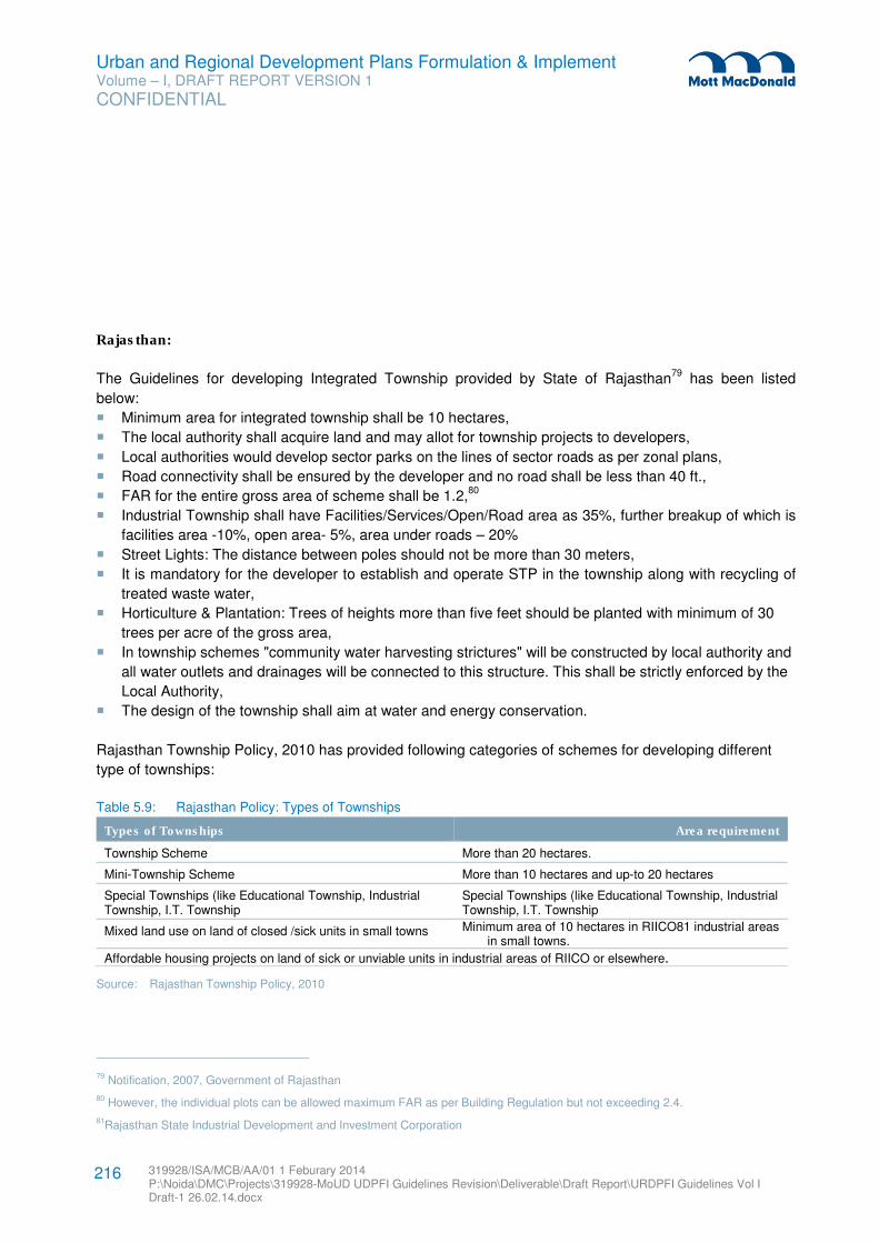
Urban and Regional Development Plans Formulation & Implement Volume – I, DRAFT REPORT VERSION 1
CONFIDENTIAL
319928/ISA/MCB/AA/01 1 Feburary 2014 P:\Noida\DMC\Projects\319928-MoUD UDPFI Guidelines Revision\Deliverable\Draft Report\URDPFI Guidelines Vol I Draft-1 26.02.14.docx
216
Rajasthan:
The Guidelines for developing Integrated Township provided by State of Rajasthan79
has been listed
below:
� Minimum area for integrated township shall be 10 hectares,
� The local authority shall acquire land and may allot for township projects to developers,
� Local authorities would develop sector parks on the lines of sector roads as per zonal plans,
� Road connectivity shall be ensured by the developer and no road shall be less than 40 ft.,
� FAR for the entire gross area of scheme shall be 1.2,80
� Industrial Township shall have Facilities/Services/Open/Road area as 35%, further breakup of which is
facilities area -10%, open area- 5%, area under roads – 20%
� Street Lights: The distance between poles should not be more than 30 meters,
� It is mandatory for the developer to establish and operate STP in the township along with recycling of
treated waste water,
� Horticulture & Plantation: Trees of heights more than five feet should be planted with minimum of 30
trees per acre of the gross area,
� In township schemes "community water harvesting strictures" will be constructed by local authority and
all water outlets and drainages will be connected to this structure. This shall be strictly enforced by the
Local Authority,
� The design of the township shall aim at water and energy conservation.
Rajasthan Township Policy, 2010 has provided following categories of schemes for developing different
type of townships:
Table 5.9: Rajasthan Policy: Types of Townships
Types of Townships Area requirement
Township Scheme More than 20 hectares.
Mini-Township Scheme More than 10 hectares and up-to 20 hectares
Special Townships (like Educational Township, Industrial Township, I.T. Township
Special Townships (like Educational Township, Industrial Township, I.T. Township
Mixed land use on land of closed /sick units in small towns Minimum area of 10 hectares in RIICO81 industrial areas in small towns.
Affordable housing projects on land of sick or unviable units in industrial areas of RIICO or elsewhere.
Source: Rajasthan Township Policy, 2010
79 Notification, 2007, Government of Rajasthan
80 However, the individual plots can be allowed maximum FAR as per Building Regulation but not exceeding 2.4.
81Rajasthan State Industrial Development and Investment Corporation
Urban and Regional Development Plans Formulation & Implement Volume – I, DRAFT REPORT VERSION 1
CONFIDENTIAL
319928/ISA/MCB/AA/01 1 Feburary 2014 P:\Noida\DMC\Projects\319928-MoUD UDPFI Guidelines Revision\Deliverable\Draft Report\URDPFI Guidelines Vol I Draft-1 26.02.14.docx
217
Gujarat:
Government of Gujarat has proposed to provide primarily five types of support activities through the
Gujarat Integrated Township Policy, 2008 (GUDC) for facilitating to develop Integrated Townships in the
State, which are as following:
� Provision of trunk infrastructure and procurement of land,
� Establishment of a Green Channel for statutory clearances related to land, development permissions,
environmental clearances,
� Special benefits(tourism, education, health projects) under the policy,
� Rating of developers and projects to be mandated by the government.
Gujarat Integrated Township Policy has provided detailed town planning norms about land use
classification. Broad percentages of land area under each use sub category in the proposed township are
defined in the policy document. The land use categories prescribed in table below may be the predominant
use of the land, thus, the document also specifies land uses which are permitted and those which are not
permitted in the land use zone. The colour coding differentiates the mandatory from the recommended
norms.
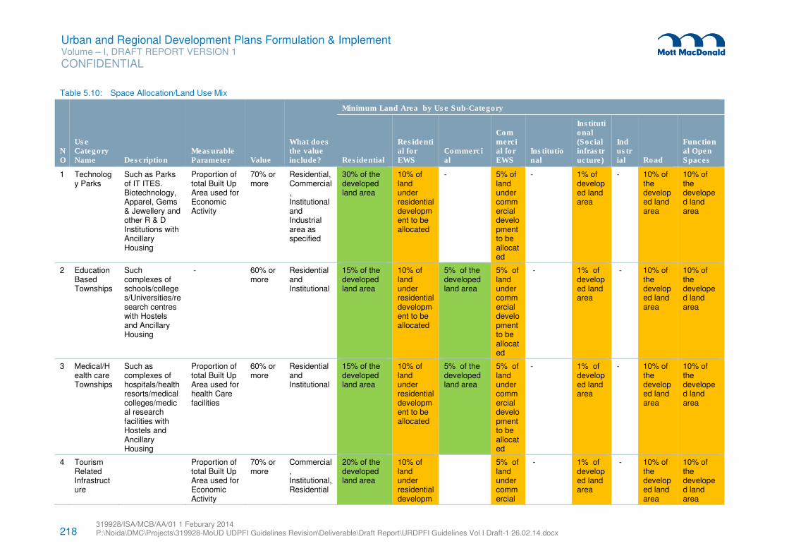
218 319928/ISA/MCB/AA/01 1 Feburary 2014 P:\Noida\DMC\Projects\319928-MoUD UDPFI Guidelines Revision\Deliverable\Draft Report\URDPFI Guidelines Vol I Draft-1 26.02.14.docx
Urban and Regional Development Plans Formulation & Implement Volume – I, DRAFT REPORT VERSION 1
CONFIDENTIAL
Table 5.10: Space Allocation/Land Use Mix
NO
Use Category Name Description
Measurable Parameter Value
What does the value include?
Minimum Land Area by Use Sub-Category
Residential
Residential for EWS
Commercial
Commercial for EWS
Institutional
Institutional (Social infrastructure)
Industrial Road
Functional Open Spaces
1 Technology Parks
Such as Parks of IT ITES. Biotechnology, Apparel, Gems & Jewellery and other R & D Institutions with Ancillary Housing
Proportion of total Built Up Area used for Economic Activity
70% or more
Residential, Commercial, Institutional and Industrial area as specified
30% of the developed land area
10% of land under residential development to be allocated
- 5% of land under commercial development to be allocated
- 1% of developed land area
- 10% of the developed land area
10% of the developed land area
2 Education Based Townships
Such complexes of schools/colleges/Universities/research centres with Hostels and Ancillary Housing
- 60% or more
Residential and Institutional
15% of the developed land area
10% of land under residential development to be allocated
5% of the developed land area
5% of land under commercial development to be allocated
- 1% of developed land area
- 10% of the developed land area
10% of the developed land area
3 Medical/Health care Townships
Such as complexes of hospitals/health resorts/medical colleges/medical research facilities with Hostels and Ancillary Housing
Proportion of total Built Up Area used for health Care facilities
60% or more
Residential and Institutional
15% of the developed land area
10% of land under residential development to be allocated
5% of the developed land area
5% of land under commercial development to be allocated
- 1% of developed land area
- 10% of the developed land area
10% of the developed land area
4 Tourism Related Infrastructure
Proportion of total Built Up Area used for Economic Activity
70% or more
Commercial, Institutional, Residential
20% of the developed land area
10% of land under residential developm
5% of land under commercial
- 1% of developed land area
- 10% of the developed land area
10% of the developed land area
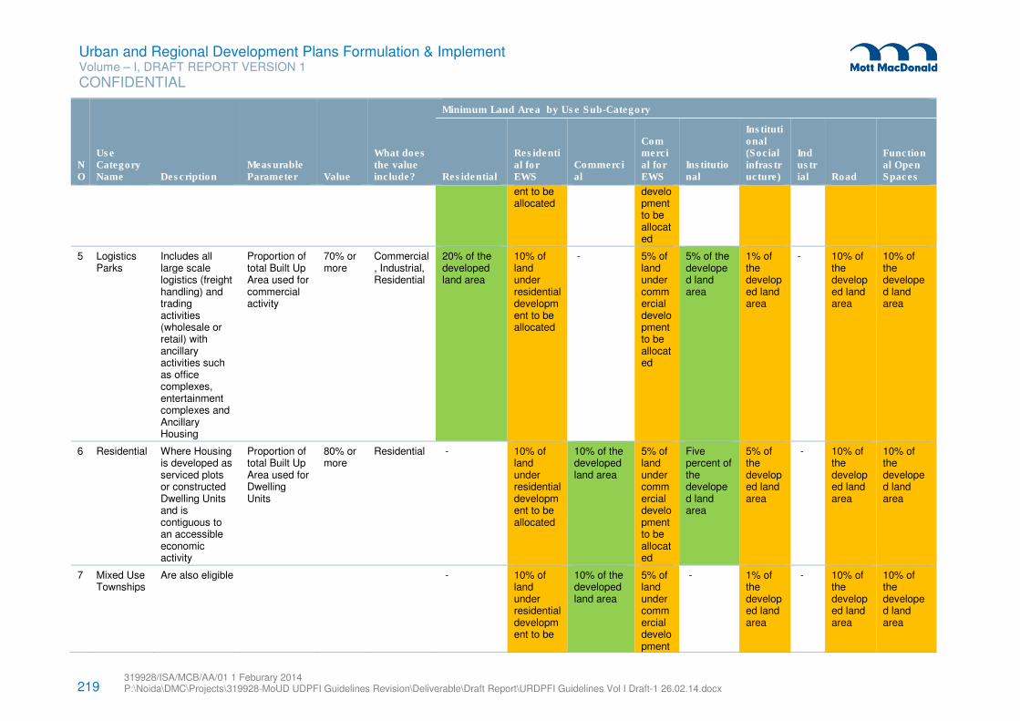
219 319928/ISA/MCB/AA/01 1 Feburary 2014 P:\Noida\DMC\Projects\319928-MoUD UDPFI Guidelines Revision\Deliverable\Draft Report\URDPFI Guidelines Vol I Draft-1 26.02.14.docx
Urban and Regional Development Plans Formulation & Implement Volume – I, DRAFT REPORT VERSION 1
CONFIDENTIAL
NO
Use Category Name Description
Measurable Parameter Value
What does the value include?
Minimum Land Area by Use Sub-Category
Residential
Residential for EWS
Commercial
Commercial for EWS
Institutional
Institutional (Social infrastructure)
Industrial Road
Functional Open Spaces
ent to be allocated
development to be allocated
5 Logistics Parks
Includes all large scale logistics (freight handling) and trading activities (wholesale or retail) with ancillary activities such as office complexes, entertainment complexes and Ancillary Housing
Proportion of total Built Up Area used for commercial activity
70% or more
Commercial, Industrial, Residential
20% of the developed land area
10% of land under residential development to be allocated
- 5% of land under commercial development to be allocated
5% of the developed land area
1% of the developed land area
- 10% of the developed land area
10% of the developed land area
6 Residential Where Housing is developed as serviced plots or constructed Dwelling Units and is contiguous to an accessible economic activity
Proportion of total Built Up Area used for Dwelling Units
80% or more
Residential - 10% of land under residential development to be allocated
10% of the developed land area
5% of land under commercial development to be allocated
Five percent of the developed land area
5% of the developed land area
- 10% of the developed land area
10% of the developed land area
7 Mixed Use Townships
Are also eligible - 10% of land under residential development to be
10% of the developed land area
5% of land under commercial development
- 1% of the developed land area
- 10% of the developed land area
10% of the developed land area
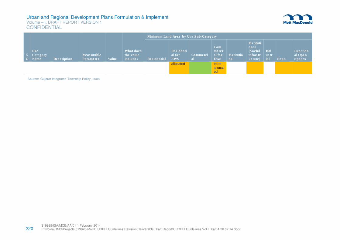
220 319928/ISA/MCB/AA/01 1 Feburary 2014 P:\Noida\DMC\Projects\319928-MoUD UDPFI Guidelines Revision\Deliverable\Draft Report\URDPFI Guidelines Vol I Draft-1 26.02.14.docx
Urban and Regional Development Plans Formulation & Implement Volume – I, DRAFT REPORT VERSION 1
CONFIDENTIAL
NO
Use Category Name Description
Measurable Parameter Value
What does the value include?
Minimum Land Area by Use Sub-Category
Residential
Residential for EWS
Commercial
Commercial for EWS
Institutional
Institutional (Social infrastructure)
Industrial Road
Functional Open Spaces
allocated to be allocated
Source: Gujarat Integrated Township Policy, 2008
Urban and Regional Development Plans Formulation & Implement Volume – I, DRAFT REPORT VERSION 1
CONFIDENTIAL
319928/ISA/MCB/AA/01 1 Feburary 2014 P:\Noida\DMC\Projects\319928-MoUD UDPFI Guidelines Revision\Deliverable\Draft Report\URDPFI Guidelines Vol I Draft-1 26.02.14.docx
221
Himachal Pradesh82
The key guidelines provided by Himachal Pradesh Integrated Township Scheme are:
� More than 40 hectare of land in hilly terrain and above in 50 hectare in plains mandatory for developing
Integrated Townships,
� Special Townships (like Educational Township, Industrial Township, I.T. Township etc.), with more than
40 hectares of land,
� The Township shall not include land under the forest, water bodies, land falling within 100m from
(having the level the HFL) the HFL (High Flood Level) of the major lakes, dams land falling within 200m
from the official boundary of historical monuments and places of archaeological importance,
archaeological monuments, heritage precincts, other restricted areas.
� The Township scheme shall have a minimum of 15 meter approach road from any National Highway,
State Highway, Major District Road, Other District Road or any other road area network/sector
roads/master plan roads.
� For Township global FAR for the entire gross area of scheme shall be 1.75. 83
Policies at national level also provided guidelines for the Integrated Townships, as National Urban Housing
and Habitat Policy states that, Integrated Townships should generally be located on comparatively
degraded land excluding prime agricultural areas growing more than one crop with the help of assured
irrigation. Also, these should be located at a reasonable distance from medium or large towns.84
Hence,
mass rapid transport corridors shall be developed between existing medium and large towns and new
green-field towns so that the relationship between industry and commerce is developed to an optimum
level.
82 Himachal Pradesh Integrated Township Scheme
83 However, the individual plots can be allowed maximum FAR as per Building Regulation but not exceeding 2.4.
84 National Urban Housing and Habitat Policy, 2007
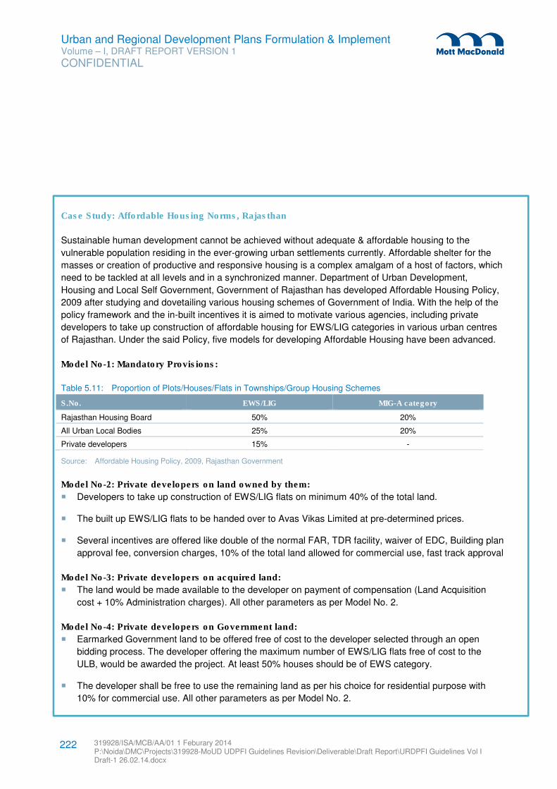
Urban and Regional Development Plans Formulation & Implement Volume – I, DRAFT REPORT VERSION 1
CONFIDENTIAL
319928/ISA/MCB/AA/01 1 Feburary 2014 P:\Noida\DMC\Projects\319928-MoUD UDPFI Guidelines Revision\Deliverable\Draft Report\URDPFI Guidelines Vol I Draft-1 26.02.14.docx
222
Case Study: Affordable Housing Norms, Rajasthan
Sustainable human development cannot be achieved without adequate & affordable housing to the
vulnerable population residing in the ever-growing urban settlements currently. Affordable shelter for the
masses or creation of productive and responsive housing is a complex amalgam of a host of factors, which
need to be tackled at all levels and in a synchronized manner. Department of Urban Development,
Housing and Local Self Government, Government of Rajasthan has developed Affordable Housing Policy,
2009 after studying and dovetailing various housing schemes of Government of India. With the help of the
policy framework and the in-built incentives it is aimed to motivate various agencies, including private
developers to take up construction of affordable housing for EWS/LIG categories in various urban centres
of Rajasthan. Under the said Policy, five models for developing Affordable Housing have been advanced.
Model No-1: Mandatory Provisions:
Table 5.11: Proportion of Plots/Houses/Flats in Townships/Group Housing Schemes
S.No. EWS/LIG MIG-A category
Rajasthan Housing Board 50% 20%
All Urban Local Bodies 25% 20%
Private developers 15% -
Source: Affordable Housing Policy, 2009, Rajasthan Government
Model No-2: Private developers on land owned by them:
� Developers to take up construction of EWS/LIG flats on minimum 40% of the total land.
� The built up EWS/LIG flats to be handed over to Avas Vikas Limited at pre-determined prices.
� Several incentives are offered like double of the normal FAR, TDR facility, waiver of EDC, Building plan
approval fee, conversion charges, 10% of the total land allowed for commercial use, fast track approval
Model No-3: Private developers on acquired land:
� The land would be made available to the developer on payment of compensation (Land Acquisition
cost + 10% Administration charges). All other parameters as per Model No. 2.
Model No-4: Private developers on Government land:
� Earmarked Government land to be offered free of cost to the developer selected through an open
bidding process. The developer offering the maximum number of EWS/LIG flats free of cost to the
ULB, would be awarded the project. At least 50% houses should be of EWS category.
� The developer shall be free to use the remaining land as per his choice for residential purpose with
10% for commercial use. All other parameters as per Model No. 2.
Urban and Regional Development Plans Formulation & Implement Volume – I, DRAFT REPORT VERSION 1
CONFIDENTIAL
319928/ISA/MCB/AA/01 1 Feburary 2014 P:\Noida\DMC\Projects\319928-MoUD UDPFI Guidelines Revision\Deliverable\Draft Report\URDPFI Guidelines Vol I Draft-1 26.02.14.docx
223
(v) Model No-5: Slum Housing:
� The model is based on various schemes approved by Government of India and also on the lines of
"Mumbai Model" of slum redevelopment with private sector participation.
The Policy document also provides for the tentative land use breakup, ground coverage, time period for
finishing project, additional FAR and Use of TDR as a result of additional FAR.
Urban and Regional Development Plans Formulation & Implement Volume – I, DRAFT REPORT VERSION 1
CONFIDENTIAL
319928/ISA/MCB/AA/01 1 Feburary 2014 P:\Noida\DMC\Projects\319928-MoUD UDPFI Guidelines Revision\Deliverable\Draft Report\URDPFI Guidelines Vol I Draft-1 26.02.14.docx
224
The first definition of sustainable development provided by Brundtland Commission appeared in 1987
which states ‘development that meets the needs of the present without compromising the ability of future
generations to meet their own needs’85
. The Commission’s report also states that “in essence, sustainable
development is a process of change in which the exploitation of resources, the direction of investments,
the orientation of technological development; and institutional changes are all in harmony and enhance
both current and future potential to meet human needs and aspirations. Applied to the context of planning
and development, the most fundamental elements of sustainability are the utilization of natural resources in
a city region most efficiently, most equitably across sections of society and in such a manner that the
resources are conserved and renewed for future generations to meet their needs and aspirations.
Integrating sustainability principles in planning process and development is evident in today’s scenario,
which has been explained in this chapter.
6.1 Sustainability and Urban Development
Sustainable habitat development means achieving a balance between the economic and social
development of human habitat together with the protection of environment, equity in employment, shelter,
basic services, social infrastructure and transportation. To bring sustainability in urban areas, it is important
to integrate sustainability in urban development and can be achieved by considering sustainability
parameters in urban planning.
Some of these parameters which can be considered in Planning and Development are:
1. Regional Planning: Master Plans/Development Plans/ Comprehensive Development Plans for towns
and cities are prepared under relevant provisions of enabling legislation for a horizon year and
delineate the proposed urbanisable limits in both spatial and demographic terms. Outside these limits
i.e. in the peri-urban areas there is lack of control in terms of assignment of land uses and development
control leading to mushrooming unplanned and un-organized growth along with little or no integration
between land use and transport resulting in unsustainable development. A regional planning framework
effectively addresses these issues in terms of a proposed hierarchy of settlement and assignment of
regional resources/land uses and development control. It is therefore imperative to incorporate
provisions for preparing a regional plan so that all master plans are formulated within a regional
planning framework leading to sustainable development of both the region and the town/city
concerned.
2. High Density Development: The National Sustainable Habitat Mission86
(NSHM) recommends Low
Rise and Higher Density Development to improve overall energy efficiency of the area; such forms are
less expensive and reduce pressure on travel demand. Therefore for planning for high density
development it is necessary to carry out capacity analysis. For increase in FAR in existing built up
area, rationality for the increase in FAR should be worked out apart from carrying capacity analysis for
the area.
85 World Commission on Environment and Development’s (The Brundtland Commission) Report Our Common Future (Oxford: Oxford
University Press, 1987)
86 National Mission on Sustainable Habitat, MoUD
6 Sustainability Guidelines
Urban and Regional Development Plans Formulation & Implement Volume – I, DRAFT REPORT VERSION 1
CONFIDENTIAL
319928/ISA/MCB/AA/01 1 Feburary 2014 P:\Noida\DMC\Projects\319928-MoUD UDPFI Guidelines Revision\Deliverable\Draft Report\URDPFI Guidelines Vol I Draft-1 26.02.14.docx
225
3. Re-development / re-densification: Approaches shall be developed for Re-development / re-
densification of existing urban habitat. Mixed land use, integrated and shared social space and
multiple transport options can be considered and implemented, further reducing trip generation and
creating efficient transport system.
4. Open Spaces: Emphasis should be given on vegetation/Green Belt in urban areas to reduce “heat
island” effects.
Apart from the key parameters, the National Mission on Sustainable Habitat has identified the components,
which have major role to play in bringing environmental sustainability. These basic norms are detailed out
below:
6.1.1 Energy Efficiency
The Generic Energy Efficiency Guidelines are given below. These guidelines are applicable for various
categories of the building irrespective of their climate location.
� Non-Conventional /Renewal Energy: As per NSHM87,
for residential buildings 15% of the total external
lighting load should be met through renewable energy and for commercial / institutional / industrial /
mixed use buildings, 5% of the total lighting load should be met through renewable energy sources
(solar, wind, biomass, fuel-cells and so on). Also, there should be development of city level Energy
Efficiency (EE) and Renewal Energy (RE) policy actions for e.g. Nagpur and Bhubaneswar have
developed and adopted city level EE and RE.
� Energy Efficient Design: Efficient development control regulations and building bye-laws from the point
of view of energy efficient design should be considered. The Government of India has developed the
Energy Conservation Building Code (ECBC) which provides minimum energy performance standards
for energy efficient buildings, which can to be referred while designing private and public buildings. The
ECBC is currently a voluntary programme, with a number of States adopting it as a mandatory
requirement.
� Building Performance Certification and Rating System - After the introduction of ECBC, MoEF
suggested ECBC compliance while undertaking EIA for all building and construction projects falling
under their purview. Apart from EIA, in 2008, Green Rating for Integrated Habitat Assessment (GRIHA)
has been launched by the Ministry of New and Renewable Energy, the Government of India. GRIHA
rating system has incorporated the provisions of the NBC 2005, ECBC, and other Indian Standard
codes.
87 Report of the sub-committee for development of National Sustainable Habitat parameters for energy efficiency in Residential and
Commercial Buildings
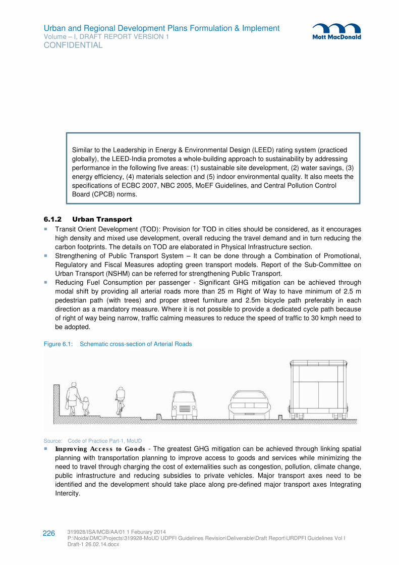
Urban and Regional Development Plans Formulation & Implement Volume – I, DRAFT REPORT VERSION 1
CONFIDENTIAL
319928/ISA/MCB/AA/01 1 Feburary 2014 P:\Noida\DMC\Projects\319928-MoUD UDPFI Guidelines Revision\Deliverable\Draft Report\URDPFI Guidelines Vol I Draft-1 26.02.14.docx
226
6.1.2 Urban Transport
� Transit Orient Development (TOD): Provision for TOD in cities should be considered, as it encourages
high density and mixed use development, overall reducing the travel demand and in turn reducing the
carbon footprints. The details on TOD are elaborated in Physical Infrastructure section.
� Strengthening of Public Transport System – It can be done through a Combination of Promotional,
Regulatory and Fiscal Measures adopting green transport models. Report of the Sub-Committee on
Urban Transport (NSHM) can be referred for strengthening Public Transport.
� Reducing Fuel Consumption per passenger - Significant GHG mitigation can be achieved through
modal shift by providing all arterial roads more than 25 m Right of Way to have minimum of 2.5 m
pedestrian path (with trees) and proper street furniture and 2.5m bicycle path preferably in each
direction as a mandatory measure. Where it is not possible to provide a dedicated cycle path because
of right of way being narrow, traffic calming measures to reduce the speed of traffic to 30 kmph need to
be adopted.
Figure 6.1: Schematic cross-section of Arterial Roads
Source: Code of Practice Part-1, MoUD
� Improving Access to Goods - The greatest GHG mitigation can be achieved through linking spatial
planning with transportation planning to improve access to goods and services while minimizing the
need to travel through charging the cost of externalities such as congestion, pollution, climate change,
public infrastructure and reducing subsidies to private vehicles. Major transport axes need to be
identified and the development should take place along pre-defined major transport axes Integrating
Intercity.
Similar to the Leadership in Energy & Environmental Design (LEED) rating system (practiced
globally), the LEED-India promotes a whole-building approach to sustainability by addressing
performance in the following five areas: (1) sustainable site development, (2) water savings, (3)
energy efficiency, (4) materials selection and (5) indoor environmental quality. It also meets the
specifications of ECBC 2007, NBC 2005, MoEF Guidelines, and Central Pollution Control
Board (CPCB) norms.
Urban and Regional Development Plans Formulation & Implement Volume – I, DRAFT REPORT VERSION 1
CONFIDENTIAL
319928/ISA/MCB/AA/01 1 Feburary 2014 P:\Noida\DMC\Projects\319928-MoUD UDPFI Guidelines Revision\Deliverable\Draft Report\URDPFI Guidelines Vol I Draft-1 26.02.14.docx
227
� Road Passenger with Urban Transport systems - Long-distance passenger travel needs to be
closely integrated into the urban environment, facilitating fast traveller-friendly mass-transport access
to well-located terminals and airports. Carefully planned highway system improvements are required to
reduce travel times for goods and passengers while improving road safety, congestion, fuel
consumption and emissions.
� NMT and Intelligent Transport System (ITS) - Non-Motorised Transport (NMT) and ITS should be
encouraged. Provision of NMT is described in Physical Infrastructure section of this guideline, which
aims to reduce carbon foot print. Moreover, ITS shall be implemented for demand management and
efficient implementation/enforcement of Public Transport.
� Non-Conventional source of Energy - Changing to fuels that have a lower carbon footprint in
sufficient quantities would have a major impact on GHG emissions from urban transport. Also
alternative fuel base in cities to be promoted to reduce dependency.
� Discouraging Diesel Propelled personal vehicles – In some cities, Diesel Engine has increased the
pollution levels. Restriction should be imposed on the manufacturer of diesel vehicles and to
discourage its use for personal transport.
� Accessibility88
: Accessibility of public transport to be improved in order to reduce travel distance. The
Rail Station including metros, monorail, light rail etc. should be located within 800m or 5 minutes
walking distance from neighbourhood. It would directly and indirect encourage public transport. Bus
stops should be planned within 400m walking distance from neighbourhood. Similarly Intermediate
Public Transport (IPT) Stop should be planned within 400m from neighbourhood.
6.1.3 Urban Infrastructure
� Zero Waste and Waste Recycling – Zero waste concept shall be practiced in all cities which
encouraged reuse or recovery of all waste. It reduces the need of raw material which mainly extract
from natural environment to make new products, creating far less pollution and benefiting the local
economy. The urban waste should be recognised with a significant proportion of organic constituents,
which has emerged as a resource for energy generation in an environmentally sustainable manner.
Energy in the form of biogas, heat or power should be seen as a bonus which improves the viability of
such projects. While biomethanation, refuse derived fuel and incineration are the most common
technologies, pyrolysis and gasification are also emerging as preferred options. In case of existing
landfills, bioremediation of waste is recommended with a view to reclaim the land and convert organic
waste into useful products which will result in reduction or elimination of GHG emission.
� GHG mitigation measures for wastewater - GHG mitigation measures includes - collection,
conveyance and treatment of wastewater, reuse and recycling of treated effluent and gas recovery
from sludge as well as use of treated wastewater for artificial recharge of aquifers to improve the
ground water potential.
� Decentralised Wastewater Management – Decentralized waste water management systems for
community, housing complexes, and commercial buildings to be introduced for efficient wastewater
management. Institutional capacity of all (ULBs) should be strengthened for effective implementation
and O&M of sewerage system.
88 LEED for India, 2011, IGBC 2011
Urban and Regional Development Plans Formulation & Implement Volume – I, DRAFT REPORT VERSION 1
CONFIDENTIAL
319928/ISA/MCB/AA/01 1 Feburary 2014 P:\Noida\DMC\Projects\319928-MoUD UDPFI Guidelines Revision\Deliverable\Draft Report\URDPFI Guidelines Vol I Draft-1 26.02.14.docx
228
� Low Water use and Ecological Sanitation - It should be ensured that systems for the management
of human excreta incorporate conservation principles. Low-water use toilets (3-5 litre) and ecological
sanitation approaches (including ecological toilets), where nutrients are safely recycled into agricultural
manual can be promoted.
� Recovery of Energy - The major benefits of recovery of energy from urban wastes is to bring about
reduction in the quantity of waste by 60 per cent to 90 per cent; reduction in demand for land as well as
cost for transportation of wastes to faraway landfill sites; and net reduction in environmental pollution
besides generation of substantial quantity of energy.
� Reducing need for pumping - It would reduce the demand for energy, reduction of Non-Revenue
Water (NRW), energy audit of all the water utilities, rationalization of water tariff to reduce wasteful use
of water, minimization of leakages, metering of all water taps and water audit, etc.
6.2 Impact of Climate Change
Various dimensions of sustainability are needed to be integrated with development planning. Aspects
related to environmental and social sustainability needs to be considered along with economic
sustainability to ensure sustainable development of various settlements. Numerous agencies which
include, nation, international agencies are carrying out studies and are supporting cities to develop, adopt
and implement sustainable and climate safe practices. City-Level Action Plans, for e.g. Kanpur and Meerut
have already initiated the effort which is supported by WWF. Green building is also one of the approaches
for effectively reducing impact of climate change. It is combination of all the best practise principle. A brief
on Green Building is given in subsection below.
6.2.1 Green Building
A green building is one which uses less water, optimises energy efficiency, conserves natural resources,
generates less waste and provides healthier spaces for occupants, as compared to a conventional
building. Green building concept recognises sustainable development by effective performance in the
following key areas:
1. Sustainable site development: the sustainable site development shall include the following:
a. Efficient landuse
b. Habitat preservation and restoration
c. Efficient transportation management
d. Efficient use of locally available materials and resources
2. Water Efficiency: It shall encourage use of water in a self-sustainable manner through reducing,
recycling and reusing strategies. The methods of rain water harvesting can be integrated to reduce
load of water requirement on the urban water supply system.
3. Energy Efficiency: It shall reduce energy consumption of infrastructural equipment through energy
efficient street lighting, motor pumps etc. On site power generation using various renewable energy
technologies and other clean fuels can also be integrated in the planning system.
4. Waste Management: It shall encourage effective waste management strategies by facilitating the
segregating of waste at source and promoting re-use of products and materials.
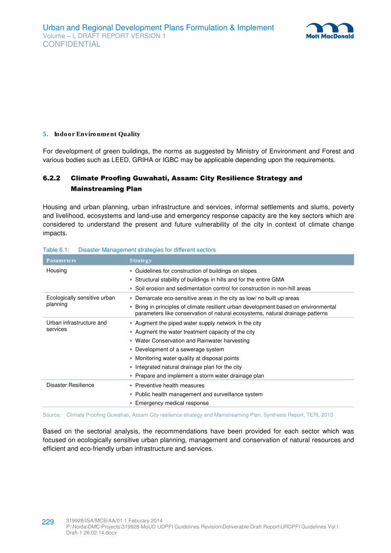
Urban and Regional Development Plans Formulation & Implement Volume – I, DRAFT REPORT VERSION 1
CONFIDENTIAL
319928/ISA/MCB/AA/01 1 Feburary 2014 P:\Noida\DMC\Projects\319928-MoUD UDPFI Guidelines Revision\Deliverable\Draft Report\URDPFI Guidelines Vol I Draft-1 26.02.14.docx
229
5. Indoor Environment Quality
For development of green buildings, the norms as suggested by Ministry of Environment and Forest and
various bodies such as LEED, GRIHA or IGBC may be applicable depending upon the requirements.
6.2.2 Climate Proofing Guwahati, Assam: City Resilience Strategy and
Mainstreaming Plan
Housing and urban planning, urban infrastructure and services, informal settlements and slums, poverty
and livelihood, ecosystems and land-use and emergency response capacity are the key sectors which are
considered to understand the present and future vulnerability of the city in context of climate change
impacts.
Table 6.1: Disaster Management strategies for different sectors
Parameters Strategy
Housing • Guidelines for construction of buildings on slopes
• Structural stability of buildings in hills and for the entire GMA
• Soil erosion and sedimentation control for construction in non-hill areas
Ecologically sensitive urban planning
• Demarcate eco-sensitive areas in the city as low/ no built up areas
• Bring in principles of climate resilient urban development based on environmental parameters like conservation of natural ecosystems, natural drainage patterns
Urban infrastructure and services
• Augment the piped water supply network in the city
• Augment the water treatment capacity of the city
• Water Conservation and Rainwater harvesting
• Development of a sewerage system
• Monitoring water quality at disposal points
• Integrated natural drainage plan for the city
• Prepare and implement a storm water drainage plan
Disaster Resilience • Preventive health measures
• Public health management and surveillance system
• Emergency medical response
Source: Climate Proofing Guwahati, Assam City resilience strategy and Mainstreaming Plan, Synthesis Report, TERI, 2013
Based on the sectorial analysis, the recommendations have been provided for each sector which was
focused on ecologically sensitive urban planning, management and conservation of natural resources and
efficient and eco-friendly urban infrastructure and services.
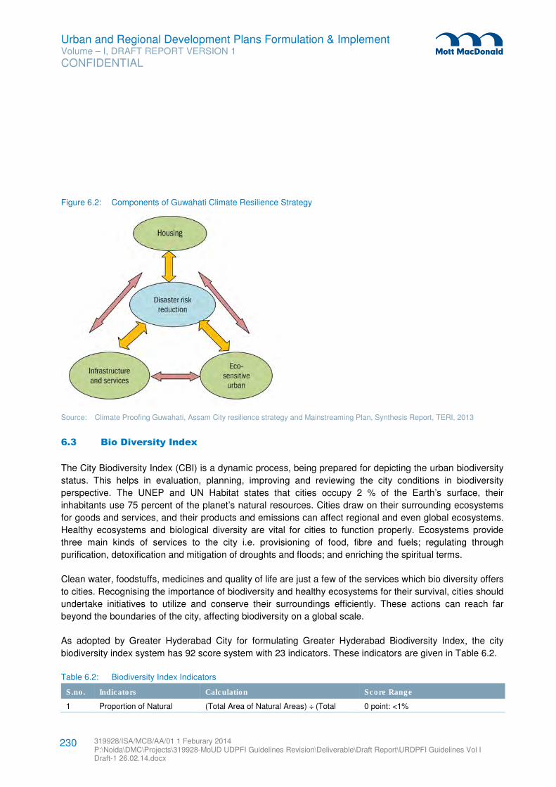
Urban and Regional Development Plans Formulation & Implement Volume – I, DRAFT REPORT VERSION 1
CONFIDENTIAL
319928/ISA/MCB/AA/01 1 Feburary 2014 P:\Noida\DMC\Projects\319928-MoUD UDPFI Guidelines Revision\Deliverable\Draft Report\URDPFI Guidelines Vol I Draft-1 26.02.14.docx
230
Figure 6.2: Components of Guwahati Climate Resilience Strategy
Source: Climate Proofing Guwahati, Assam City resilience strategy and Mainstreaming Plan, Synthesis Report, TERI, 2013
6.3 Bio Diversity Index
The City Biodiversity Index (CBI) is a dynamic process, being prepared for depicting the urban biodiversity
status. This helps in evaluation, planning, improving and reviewing the city conditions in biodiversity
perspective. The UNEP and UN Habitat states that cities occupy 2 % of the Earth’s surface, their
inhabitants use 75 percent of the planet’s natural resources. Cities draw on their surrounding ecosystems
for goods and services, and their products and emissions can affect regional and even global ecosystems.
Healthy ecosystems and biological diversity are vital for cities to function properly. Ecosystems provide
three main kinds of services to the city i.e. provisioning of food, fibre and fuels; regulating through
purification, detoxification and mitigation of droughts and floods; and enriching the spiritual terms.
Clean water, foodstuffs, medicines and quality of life are just a few of the services which bio diversity offers
to cities. Recognising the importance of biodiversity and healthy ecosystems for their survival, cities should
undertake initiatives to utilize and conserve their surroundings efficiently. These actions can reach far
beyond the boundaries of the city, affecting biodiversity on a global scale.
As adopted by Greater Hyderabad City for formulating Greater Hyderabad Biodiversity Index, the city
biodiversity index system has 92 score system with 23 indicators. These indicators are given in Table 6.2.
Table 6.2: Biodiversity Index Indicators
S.no. Indicators Calculation Score Range
1 Proportion of Natural (Total Area of Natural Areas) ÷ (Total 0 point: <1%
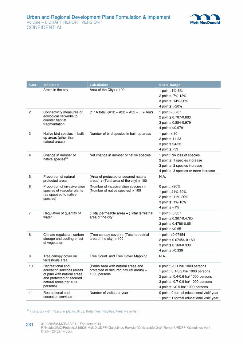
Urban and Regional Development Plans Formulation & Implement Volume – I, DRAFT REPORT VERSION 1
CONFIDENTIAL
319928/ISA/MCB/AA/01 1 Feburary 2014 P:\Noida\DMC\Projects\319928-MoUD UDPFI Guidelines Revision\Deliverable\Draft Report\URDPFI Guidelines Vol I Draft-1 26.02.14.docx
231
S.no. Indicators Calculation Score Range
Areas in the city Area of the City) × 100 1 point: 1%-6%
2 points: 7%-13%
3 points: 14%-20%
4 points: >20%
2 Connectivity measures or ecological networks to counter habitat fragmentation
(1 / A total )(A12 + A22 + A32 + …+ An2) 1 point <0.787
2 points 0.787-0.883
3 points 0.884-0.979
4 points >0.979
3 Native bird species in built up areas (other than natural areas)
Number of bird species in built-up areas 1 point < 10
2 points 11-23
3 points 24-53
4 points >53
4 Change in number of native species89
Net change in number of native species 1 point: No loss of species
2 points: 1 species increase
3 points: 2 species increase
4 points: 3 species or more increase
5 Proportion of natural protected areas
(Area of protected or secured natural areas) ÷ (Total area of the city) × 100
N.A.
6 Proportion of invasive alien species of vascular plants (as opposed to native species)
(Number of invasive alien species) ÷ (Number of native species) × 100
0 point: >30%
1 point: 21%-30%
2 points: 11%-20%
3 points: 1%-10%
4 points <1%
7 Regulation of quantity of water
(Total permeable area) ÷ (Total terrestrial area of the city)
1 point <0.307
2 points 0.307-0.4785
3 points 0.4786-0.65
4 points >0.65
8 Climate regulation: carbon storage and cooling effect of vegetation
(Tree canopy cover) ÷ (Total terrestrial area of the city) × 100
1 point <0.07454
2 points 0.07454-0.160
3 points 0.160-0.339
4 points >0.339
9 Tree canopy cover on terrestrials area
Tree Count and Tree Cover Mapping N.A.
10 Recreational and education services (areas of park with natural areas and protected or secured natural areas per 1000 persons)
(Parks Area with natural areas and protected or secured natural areas) ÷ 1000 persons
0 point: <0.1 ha/ 1000 persons
1 point: 0.1-0.3 ha/ 1000 persons
2 points: 0.4-0.6 ha/ 1000 persons
3 points: 0.7-0.9 ha/ 1000 persons
4 points: >0.9 ha/ 1000 persons
11 Recreational and education services
Number of visits per year 0 point: 0 formal educational visit/ year
1 point: 1 formal educational visit/ year
89 Indicators 4-8 ( Vascular plants, Birds, Butterflies, Reptiles, Freshwater fish
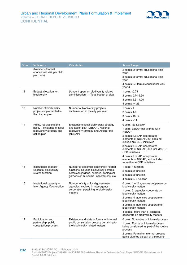
Urban and Regional Development Plans Formulation & Implement Volume – I, DRAFT REPORT VERSION 1
CONFIDENTIAL
319928/ISA/MCB/AA/01 1 Feburary 2014 P:\Noida\DMC\Projects\319928-MoUD UDPFI Guidelines Revision\Deliverable\Draft Report\URDPFI Guidelines Vol I Draft-1 26.02.14.docx
232
S.no. Indicators Calculation Score Range
(Number of formal educational visit per child per park)
2 points: 2 formal educational visit/ year
3 points: 3 formal educational visit/ year
4 points: >3 formal educational visit/ year 4
12 Budget allocation for biodiversity
(Amount spent on biodiversity related administration) ÷ (Total budget of city)
1 point <0.74
2 points 0.74-2.50
3 points 2.51-4.26
4 points >4.26
13 Number of biodiversity projects implemented in the city per year
Number of biodiversity projects implemented in the city per year
1 point <4
2 points 4-9
3 points 10-14
4 points >14
14 Rules, regulations and policy – existence of local biodiversity strategy and action plan
Existence of local biodiversity strategy and action plan (LBSAP), National Biodiversity Strategy and Action Plan (NBSAP)
0 point: No LBSAP
1 point: LBSAP not aligned with NBSAP
2 points: LBSAP incorporates elements of NBSAP, but does not include any CBD initiatives
3 points: LBSAP incorporates elements of NBSAP, and includes 1-3 CBD initiatives
4 points: LBSAP incorporates elements of NBSAP, and includes more than 4 CBD initiatives
15 Institutional capacity – Essential biodiversity - related function
Number of essential biodiversity related functions includes biodiversity centres, botanical gardens, herbaria, zoological gardens or museums, insectariums, etc.
1 point: 1 function
2 points: 2 function
3 points: 3 function
4 points: > 3 function
16 Institutional capacity – Inter Agency Cooperation
Number of city or local government agencies involved in inter-agency corporation pertaining to biodiversity matters
0 point: 1 or 2 agencies cooperate on biodiversity matters
1 point: 3 agencies cooperate on biodiversity matters
2 points: 4 agencies cooperate on biodiversity matters
3 points: 5 agencies cooperate on biodiversity matters
4 points: More than 5 agencies cooperate on biodiversity matters
17 Participation and partnership: public consultation process
Existence and state of formal or informal public consultation process pertaining to the biodiversity related matters
0 point: No routine or informal process
1 point: Formal or informal process being considered as part of the routine process
2 points: Formal or informal process being planned as part of the routine
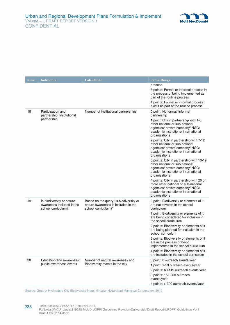
Urban and Regional Development Plans Formulation & Implement Volume – I, DRAFT REPORT VERSION 1
CONFIDENTIAL
319928/ISA/MCB/AA/01 1 Feburary 2014 P:\Noida\DMC\Projects\319928-MoUD UDPFI Guidelines Revision\Deliverable\Draft Report\URDPFI Guidelines Vol I Draft-1 26.02.14.docx
233
S.no. Indicators Calculation Score Range
process
3 points: Formal or informal process in the process of being implemented as part of the routine process
4 points: Formal or informal process exists as part of the routine process
18 Participation and partnership: Institutional partnership
Number of institutional partnerships 0 point: No formal/ informal partnership
1 point: City in partnership with 1-6 other national or sub-national agencies/ private company/ NGO/ academic institutions/ international organizations
2 points: City in partnership with 7-12 other national or sub-national agencies/ private company/ NGO/ academic institutions/ international organizations
3 points: City in partnership with 13-19 other national or sub-national agencies/ private company/ NGO/ academic institutions/ international organizations
4 points: City in partnership with 20 or more other national or sub-national agencies/ private company/ NGO/ academic institutions/ international organizations
19 Is biodiversity or nature awareness included in the school curriculum?
Based on the query “Is biodiversity or nature awareness is included in the school curriculum?”
0 point: Biodiversity or elements of it are not covered in the school curriculum
1 point: Biodiversity or elements of it are being considered for inclusion in the school curriculum
2 points: Biodiversity or elements of it are being planned for inclusion in the school curriculum
3 points: Biodiversity or elements of it are in the process of being implemented in the school curriculum
4 points: Biodiversity or elements of it are included in the school curriculum
20 Education and awareness: public awareness events
Number of natural awareness and Biodiversity events in the city
0 point: 0 outreach events/year
1 point: 1-59 outreach events/year
2 points: 60-149 outreach events/year
3 points: 150-300 outreach events/year
4 points: > 300 outreach events/year
Source: Greater Hyderabad City Biodiversity Index, Greater Hyderabad Municipal Corporation, 2012
Urban and Regional Development Plans Formulation & Implement Volume – I, DRAFT REPORT VERSION 1
CONFIDENTIAL
319928/ISA/MCB/AA/01 1 Feburary 2014 P:\Noida\DMC\Projects\319928-MoUD UDPFI Guidelines Revision\Deliverable\Draft Report\URDPFI Guidelines Vol I Draft-1 26.02.14.docx
234
6.4 Environment Policies and Statuary Obligation
Key environmental policies and obligations to be observed while planning are enlisted and detailed in this
section, for reference. However, the latest and updated versions shall be referred from respective sources
during planning and compliance.
6.4.1 National Environmental Policy (NEP), 2006
The NEP 2006 encompasses an integrated approach to reduce the impact on environment degradation on
human life by taking proactive measures at various fronts. These include regulatory reforms, process
related reforms, substantive reforms, enhancing and conserving environmental resources, prevention of
land degradation, desert ecosystem, and also various other factors that influences the environment. The
policy primarily focuses on ensuring that people who are dependent on natural resources for securing their
livelihoods from the act of degradation should realize that a greater purpose will be served from the
conservation of resources which includes land, desert ecosystem, water, wildlife, forests, wetlands etc.
The National Environment Policy (NEP, 2004) is a response to our National Commitment to a clean
environment, mandated in the Constitution in Articles 48 A and 51 A (g), strengthened by judicial
interpretation of Article 21. The NEP, 2004 has been motivated by the above considerations and is
intended to mainstream environmental concerns in all development activities.
6.4.1.1 Reforms suggested through the policy
The statements of policy objectives are to be realized by concrete actions in different areas relating to key
environmental challenges. Therefore the key reforms suggested through this policy, which impact planning
directly or indirectly are:
� Environmental and Forest clearance
� Economic principles for environmental decision making by costing the resources
� Coastal areas: development activities in the coastal areas are regulated by means of the coastal
regulation zone notification.
� Environmentally sensitive zones: environmental sensitive zones may be defined as areas with
identified environmental resource with ‘incomparable values’ which require special attention for their
conservation.
� Monitoring & enforcement of environmental compliance.
� Use of economic principles in environmental decision making so that costs are associated with the
degradation and depletion of natural resources.
� Enhancing and conserving environmental resources through production and consumption practices
with focus on regulatory and institutional reforms. Land degradation, forests and wildlife, biodiversity,
freshwater resources, ground water and wetlands are the thrust resources of concern.
� Pollution abatement: ecosystems have some natural capacities to assimilate pollution; however these
vary considerably with the nature of the pollutant and the ecosystem.
� Climate change issues
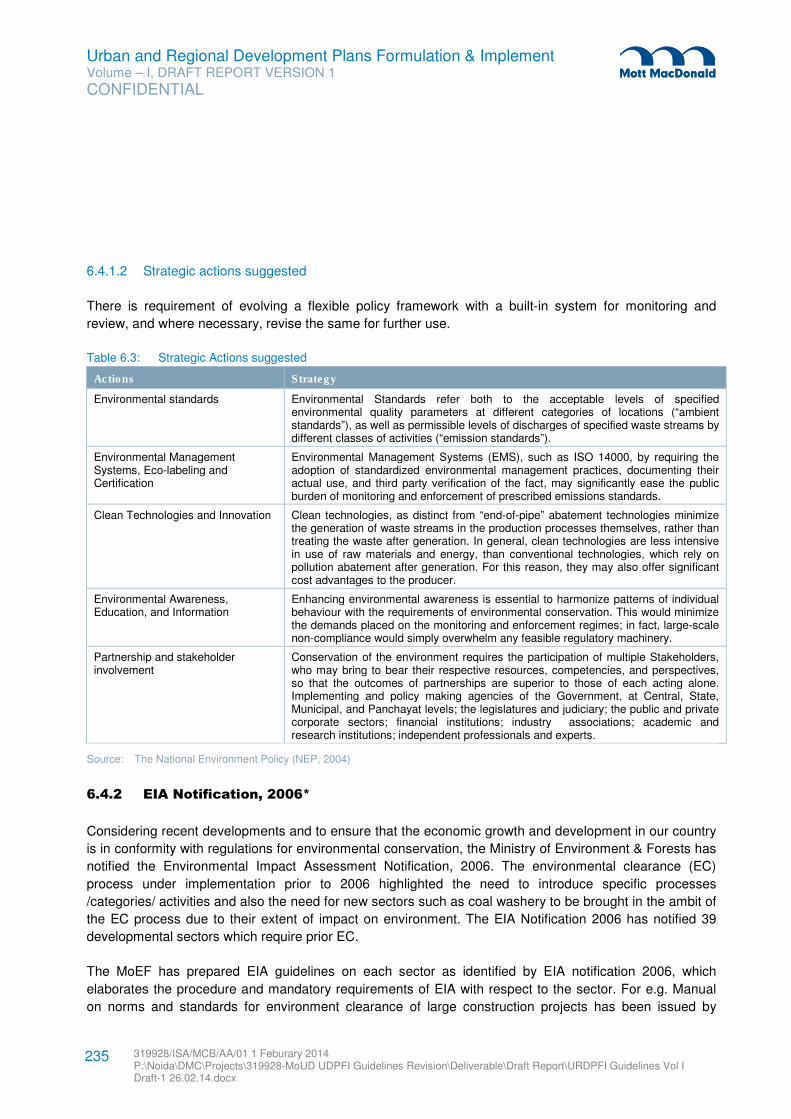
Urban and Regional Development Plans Formulation & Implement Volume – I, DRAFT REPORT VERSION 1
CONFIDENTIAL
319928/ISA/MCB/AA/01 1 Feburary 2014 P:\Noida\DMC\Projects\319928-MoUD UDPFI Guidelines Revision\Deliverable\Draft Report\URDPFI Guidelines Vol I Draft-1 26.02.14.docx
235
6.4.1.2 Strategic actions suggested
There is requirement of evolving a flexible policy framework with a built-in system for monitoring and
review, and where necessary, revise the same for further use.
Table 6.3: Strategic Actions suggested
Actions Strategy
Environmental standards Environmental Standards refer both to the acceptable levels of specified environmental quality parameters at different categories of locations (“ambient standards”), as well as permissible levels of discharges of specified waste streams by different classes of activities (“emission standards”).
Environmental Management Systems, Eco-labeling and Certification
Environmental Management Systems (EMS), such as ISO 14000, by requiring the adoption of standardized environmental management practices, documenting their actual use, and third party verification of the fact, may significantly ease the public burden of monitoring and enforcement of prescribed emissions standards.
Clean Technologies and Innovation Clean technologies, as distinct from “end-of-pipe” abatement technologies minimize the generation of waste streams in the production processes themselves, rather than treating the waste after generation. In general, clean technologies are less intensive in use of raw materials and energy, than conventional technologies, which rely on pollution abatement after generation. For this reason, they may also offer significant cost advantages to the producer.
Environmental Awareness, Education, and Information
Enhancing environmental awareness is essential to harmonize patterns of individual behaviour with the requirements of environmental conservation. This would minimize the demands placed on the monitoring and enforcement regimes; in fact, large-scale non-compliance would simply overwhelm any feasible regulatory machinery.
Partnership and stakeholder involvement
Conservation of the environment requires the participation of multiple Stakeholders, who may bring to bear their respective resources, competencies, and perspectives, so that the outcomes of partnerships are superior to those of each acting alone. Implementing and policy making agencies of the Government, at Central, State, Municipal, and Panchayat levels; the legislatures and judiciary; the public and private corporate sectors; financial institutions; industry associations; academic and research institutions; independent professionals and experts.
Source: The National Environment Policy (NEP, 2004)
6.4.2 EIA Notification, 2006*
Considering recent developments and to ensure that the economic growth and development in our country
is in conformity with regulations for environmental conservation, the Ministry of Environment & Forests has
notified the Environmental Impact Assessment Notification, 2006. The environmental clearance (EC)
process under implementation prior to 2006 highlighted the need to introduce specific processes
/categories/ activities and also the need for new sectors such as coal washery to be brought in the ambit of
the EC process due to their extent of impact on environment. The EIA Notification 2006 has notified 39
developmental sectors which require prior EC.
The MoEF has prepared EIA guidelines on each sector as identified by EIA notification 2006, which
elaborates the procedure and mandatory requirements of EIA with respect to the sector. For e.g. Manual
on norms and standards for environment clearance of large construction projects has been issued by
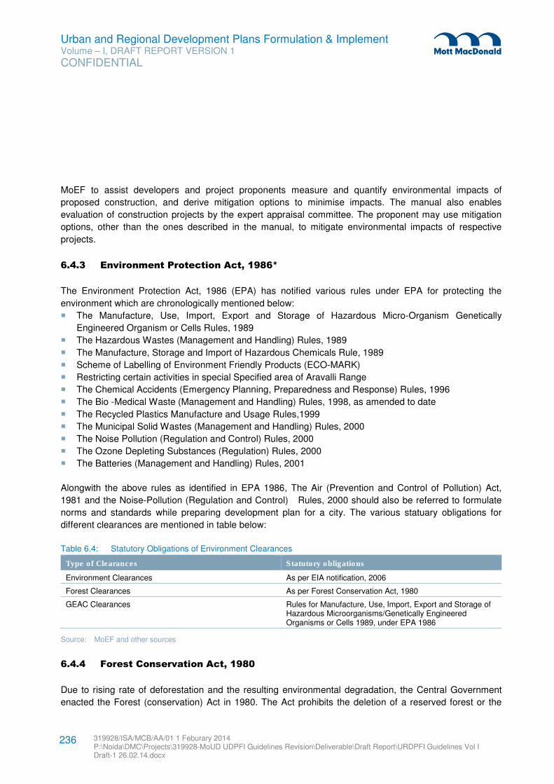
Urban and Regional Development Plans Formulation & Implement Volume – I, DRAFT REPORT VERSION 1
CONFIDENTIAL
319928/ISA/MCB/AA/01 1 Feburary 2014 P:\Noida\DMC\Projects\319928-MoUD UDPFI Guidelines Revision\Deliverable\Draft Report\URDPFI Guidelines Vol I Draft-1 26.02.14.docx
236
MoEF to assist developers and project proponents measure and quantify environmental impacts of
proposed construction, and derive mitigation options to minimise impacts. The manual also enables
evaluation of construction projects by the expert appraisal committee. The proponent may use mitigation
options, other than the ones described in the manual, to mitigate environmental impacts of respective
projects.
6.4.3 Environment Protection Act, 1986*
The Environment Protection Act, 1986 (EPA) has notified various rules under EPA for protecting the
environment which are chronologically mentioned below:
� The Manufacture, Use, Import, Export and Storage of Hazardous Micro-Organism Genetically
Engineered Organism or Cells Rules, 1989
� The Hazardous Wastes (Management and Handling) Rules, 1989
� The Manufacture, Storage and Import of Hazardous Chemicals Rule, 1989
� Scheme of Labelling of Environment Friendly Products (ECO-MARK)
� Restricting certain activities in special Specified area of Aravalli Range
� The Chemical Accidents (Emergency Planning, Preparedness and Response) Rules, 1996
� The Bio -Medical Waste (Management and Handling) Rules, 1998, as amended to date
� The Recycled Plastics Manufacture and Usage Rules,1999
� The Municipal Solid Wastes (Management and Handling) Rules, 2000
� The Noise Pollution (Regulation and Control) Rules, 2000
� The Ozone Depleting Substances (Regulation) Rules, 2000
� The Batteries (Management and Handling) Rules, 2001
Alongwith the above rules as identified in EPA 1986, The Air (Prevention and Control of Pollution) Act,
1981 and the Noise-Pollution (Regulation and Control) Rules, 2000 should also be referred to formulate
norms and standards while preparing development plan for a city. The various statuary obligations for
different clearances are mentioned in table below:
Table 6.4: Statutory Obligations of Environment Clearances
Type of Clearances Statutory obligations
Environment Clearances As per EIA notification, 2006
Forest Clearances As per Forest Conservation Act, 1980
GEAC Clearances Rules for Manufacture, Use, Import, Export and Storage of Hazardous Microorganisms/Genetically Engineered Organisms or Cells 1989, under EPA 1986
Source: MoEF and other sources
6.4.4 Forest Conservation Act, 1980
Due to rising rate of deforestation and the resulting environmental degradation, the Central Government
enacted the Forest (conservation) Act in 1980. The Act prohibits the deletion of a reserved forest or the
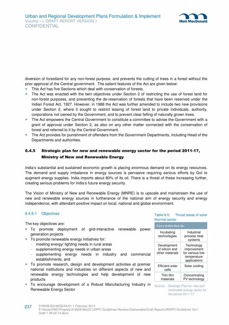
Urban and Regional Development Plans Formulation & Implement Volume – I, DRAFT REPORT VERSION 1
CONFIDENTIAL
319928/ISA/MCB/AA/01 1 Feburary 2014 P:\Noida\DMC\Projects\319928-MoUD UDPFI Guidelines Revision\Deliverable\Draft Report\URDPFI Guidelines Vol I Draft-1 26.02.14.docx
237
diversion of forestland for any non-forest purpose, and prevents the cutting of trees in a forest without the
prior approval of the Central government. The salient features of the Act are given below:
� This Act has five Sections which deal with conservation of forests.
� The Act was enacted with the twin objectives under Section 2 of restricting the use of forest land for
non-forest purposes, and preventing the de-reservation of forests that have been reserved under the
Indian Forest Act, 1927. However, in 1988 the Act was further amended to include two new provisions
under Section 2, where it sought to restrict leasing of forest land to private individuals, authority,
corporations not owned by the Government, and to prevent clear felling of naturally grown trees.
� The Act empowers the Central Government to constitute a committee to advise the Government with a
grant of approval under Section 2, as also on any other matter connected with the conservation of
forest and referred to it by the Central Government.
� The Act provides for punishment of offenders from the Government Departments, including Head of the
Departments and authorities.
6.4.5 Strategic plan for new and renewable energy sector for the period 2011-17,
Ministry of New and Renewable Energy
India’s substantial and sustained economic growth is placing enormous demand on its energy resources.
The demand and supply imbalance in energy sources is pervasive requiring serious efforts by GoI to
augment energy supplies. India imports about 80% of its oil. There is a threat of these increasing further,
creating serious problems for India’s future energy security.
The Vision of Ministry of New and Renewable Energy (MNRE) is to upscale and mainstream the use of
new and renewable energy sources in furtherance of the national aim of energy security and energy
independence, with attendant positive impact on local, national and global environment.
6.4.5.1 Objectives
The key objectives are:
� To promote deployment of grid-interactive renewable power
generation projects
� To promote renewable energy initiatives for:
− meeting energy/ lighting needs in rural areas
− supplementing energy needs in urban areas
− supplementing energy needs in industry and commercial
establishments, and
� To promote research, design and development activities at premier
national institutions and industries on different aspects of new and
renewable energy technologies and help development of new
products
� To encourage development of a Robust Manufacturing Industry in
Renewable Energy Sector
Table 6.5: Thrust areas of solar
thermal sector
Cost reduction in:
Incubating technologies
Industrial process heat
systems
Development of silicon and
other materials
Technology improvement
for various low temperature applications
Efficient solar cells
Solar cooling
Thin film materials
Concentrating PV technology
Source: Strategic Plan for new and
renewable energy sector for
the period 2011-17
Urban and Regional Development Plans Formulation & Implement Volume – I, DRAFT REPORT VERSION 1
CONFIDENTIAL
319928/ISA/MCB/AA/01 1 Feburary 2014 P:\Noida\DMC\Projects\319928-MoUD UDPFI Guidelines Revision\Deliverable\Draft Report\URDPFI Guidelines Vol I Draft-1 26.02.14.docx
238
6.5 Environmental Guidelines
6.5.1 Environmental Guidelines for Industries
6.5.1.1 Areas to be avoided90
In siting industries, care should be taken to minimise the adverse impact of the industries on the immediate
neighbourhood as well as distant places. Some of the natural life sustaining systems and some specific
land uses are sensitive to industrial impacts because of the nature and extent of fragility. With a view of
protection such an industrial site shall maintain the following distances from the areas listed:
� Ecologically and/or otherwise sensitive areas: at least 25 km; depending on the geo-climatic conditions
the requisite distance have to be increased by the appropriate agency.
� Coastal areas: at least 1/2 km from High Tide Line.
� Flood Plain of the Riverine Systems: at least 1/2 km from flood plain or modified flood plain affected by
dam in the upstream or by flood control systems.
� Transport/Communication System: at least 1/2 km from highway and railway.
� Major settlements (3,00,000 population):distance from settlements is difficult to maintain because of
urban sprawl. At the time of siting of the industry if any major settlement's notified limit is within 50 km,
the spatial direction of growth of the settlement for at least a decade must be assessed and the
industry shall be sited at least 25 km from the projected growth boundary of the settlement.
6.5.1.2 Siting criteria91
Economic and social factors are recognized and assessed while siting an industry. Environmental factors
must be taken into consideration in industrial siting. Proximity of water sources, highway, major
settlements, markets for products and raw material resources is desired for economy of production, but all
the above listed systems must be away for environmental protection. Industries are, therefore, required to
be sited, striking a balance between economic and environmental considerations. In such a selected site,
the following factors must be recognized:
� No forest land shall be converted into non-forest activity for the sustenance of the industry (as per the
Forest Conservation Act, 1980).
� No prime agricultural land shall be converted into industrial site.
� Within the acquired site the industry must locate itself at the lowest location to remain obscured from
general sight.
� Land acquired shall be sufficiently large to provide space for appropriate treatment of waste water still
left for treatment after maximum possible reuse and recycle. Reclaimed (treated) wastewater shall be
used to raise green belt and to create water body for aesthetics, recreation and if possible, for
90 http://moef.gov.in/citizen/specinfo/enguin.html
91 http://moef.gov.in/citizen/specinfo/enguin.html
Urban and Regional Development Plans Formulation & Implement Volume – I, DRAFT REPORT VERSION 1
CONFIDENTIAL
319928/ISA/MCB/AA/01 1 Feburary 2014 P:\Noida\DMC\Projects\319928-MoUD UDPFI Guidelines Revision\Deliverable\Draft Report\URDPFI Guidelines Vol I Draft-1 26.02.14.docx
239
aquaculture. The green belt shall be 1/2 km wide around the battery limit of the industry. For industry
having odour problem it shall be a kilometer wide.
� The green belt between two adjoining large scale industries shall be one kilometer.
� Enough space should be provided for storage of solid wastes so that these could be available for
possible reuse.
� Layout and form of the industry that may come up in the area must confirm with the landscape of the
area without affecting the scenic features of that place.
� Associated township of the industry must be created at a space having physiographic barrier between
the industry and the township.
� Each industry is required to maintain three ambient air quality measuring stations within 120 degree
angle between stations.
6.5.2 Guidelines for Rain Water Harvesting
Rain water harvesting is the technique of collection and storage of rain water at surface or in sub-surface
aquifers, before it is lost as surface run-off. The augmented resource can be harvested in the time of need.
Artificial recharge to ground water is a process by which the ground water reservoir is augmented at rate
exceeding that under natural conditions of replenishment.
The functioning of ground water recharge units, various methods and techniques have already been
elaborated in Infrastructure Planning section. However, the environmental Importance of rain water
harvesting techniques in order to preserve ground water cannot be ignored. The CGWB has been issued
the ‘Manual on Artificial Recharge of Ground Water92
’, which can be referred for development of such
projects.
6.5.3 Guidelines for Buffer Zones
Buffer zones are areas created to enhance the protection of a conservation area, often peripheral to it,
inside or outside. Within Buffer zones, certain legal and/or customary restrictions are placed upon resource
use and/or is managed to reduce the negative impacts of restrictions on the neighbouring communities.
Buffer Zone can be set up to protect the environment, and protect residential and commercial zones from
industrial accidents or natural disasters. While planning for a city, it is important to consider the buffer
zones. Based on various activities, important buffer zones have been identified in Table 6.6.
Table 6.6: List of Buffers based on various activities
Activities Recommended Buffer
Eco sensitive zones 93
As per National Wildlife Action Plan (NWAP) 2002-2016, “All identified areas around Protected Areas and wildlife corridors are to be declared as ecologically fragile under the Environment (Protection) Act, 1986.” As general principle the width of the eco-sensitive zone could go upto
92 Available at www.cgwb.gov.in
93 Guidelines for declaration of Eco-Sensitive Zones around national parks and wild life sanctuaries, MoEF, 2011
Urban and Regional Development Plans Formulation & Implement Volume – I, DRAFT REPORT VERSION 1
CONFIDENTIAL
319928/ISA/MCB/AA/01 1 Feburary 2014 P:\Noida\DMC\Projects\319928-MoUD UDPFI Guidelines Revision\Deliverable\Draft Report\URDPFI Guidelines Vol I Draft-1 26.02.14.docx
240
Activities Recommended Buffer
10kms around a Protected area as provided in the Wildlife Conservation Strategy-2002. In case where sensitive corridors, connectivity and ecologically important patches, crucial for landscape linkage, are even beyond 10 kms width, these should be included in the Eco-sensitive zones. Further, even in context of a particular Protected Area, the distribution of an area of Eco-sensitive Zone and the extent of regulation may not be uniform all around and it could be of variable width and extent.
Railway land RoW includes no development Zone in itself. Aviation related infrastructure As per Airport Authority of India (AAI), the buffer zone is applicable
within 20 km radius of Airport on the height of the buildings, for which NOC is required from AAI for any construction activity. Aviation imposes height restrictions only. Other DCR norms such as ground coverage, setbacks etc. of the local municipality are applicable. The airport should be 20 km away from green area such as wildlife sanctuaries/ zoos/ bird sanctuaries and should not have restricted activities such as butcheries, sewage and no garbage storage around airports.
Communication and Transmission facilities such as satellite towers
94
Installation of telecom towers should not be allowed on and around (100 Meters) the buildings where educational, religious and health care institutions are functioning.
Industrial area / SEZ95
No SEZs may be planned in the sensitive areas such as the forests, mangroves, coral reefs, archeologically important sites, sensitive ecosystems, etc. A buffer zone of 1000 m shall be maintained from such sensitive areas and a greenbelt with tree density of 1000 trees/ acre shall be developed in the said buffer zone. Major settlements (of 3,00,000 population) to maintain a buffer of 50-25 kms from the settlement's notified limit and projected growth boundary respectively.
Mining and quarrying96
Buffer zone in case of Mining Lease (ML) area up to 25 ha is to be considered as 5 km all around the periphery of the core zone and for ML area above 25 ha - an area 10 km all around the periphery of the core zone.
94Draft Special Regulation For Installation Of Telecom Towers In Urban Areas, Government of Orissa, 2013
95 SEZ guidelines, Industries Commissionerate, Government of Gujarat
96 Proforma For Environmental Appraisal Of Mining Projects, MOEF
Urban and Regional Development Plans Formulation & Implement Volume – I, DRAFT REPORT VERSION 1
CONFIDENTIAL
319928/ISA/MCB/AA/01 1 Feburary 2014 P:\Noida\DMC\Projects\319928-MoUD UDPFI Guidelines Revision\Deliverable\Draft Report\URDPFI Guidelines Vol I Draft-1 26.02.14.docx
241
Activities Recommended Buffer
Petrochemical and Gas industries
97
No Gas pipeline should be located within 15.0 meters of any private dwelling or any industrial building or place of public assembly in which persons work, congregate or assemble, unless it is provided with at least 300 mm of cover over and minimum cover as specified Petroleum And Natural Gas Regulatory Board Notification, 2009. No Gas or Oil well shall be drilled at any point, within a minimum distance, to be prescribed by the Central Government, of any railway, pipeline or other right of way, surveyed road, dwellings, industrial plant, air-craft runway, buildings used for military or public purposes, or within three kilometres of any mine, whether active or abandoned, unless the special permission of the Central Government is obtained in advance. About 90m x 90m buffer to be maintained along the active oil wells, petroleum storage tanks, encompassing all the safety norms for precautions against fire
98.
Heritage related areas99
100
Every area, beginning from the limit of the protected area/monument, extending to a distance of 100 meters in all directions shall be the protected areas and extending upto a distance of 200 meters in all directions shall be regulated area. The protected zone is a no construction zone.
Natural hazard zones such River flood plains and water bodies including wetlands
101
The basic concept of flood plain zoning is to regulate land use in the flood plains to restrict the damage caused by floods. The flood plain can be identified based on last 50 or 100 year flooded area of water bodies or river. There can be different considerations for regulations. For example, the area likely to be affected by floods up to a 10-year frequency should be kept reserved only for gardens, parks, playgrounds, etc. Residential or public buildings, or any commercial buildings, industries, and public utilities should be prohibited in this zone. In area liable to flooding in a 25-year frequency flood, residential buildings could be permitted with certain stipulation of construction on stilts (columns), minimum plinth levels, prohibition for construction of basements and minimum levels of approach roads, etc. In urban areas there should be double storeyed buildings. Ground floors could be utilised for schools and other non-residential purposes.
Coastal Regulation Zone Coastal land up to 500 m from the High Tide Line (HTL) landward side and a stage of 100 m along banks of creeks, estuaries, backwater and rivers subject to tidal fluctuations is called the Coastal Regulation Zone, which is regulated for developmental activities.
Manmade hazard zones such as radioactive, chemical and
Chemical Industry The development of buffer zones all around the industry in an effective
97 The Petroleum and Natural Gas Rules, 1959
98 Oil Mines Regulations, 1984
99 Model Building Byelaws, TCPO
100 Ancient Monuments and Archaeological Sites and Remains Act, 2010 (AMASR)
101 National Disaster Management Guidelines Management of Floods, NDMA
Urban and Regional Development Plans Formulation & Implement Volume – I, DRAFT REPORT VERSION 1
CONFIDENTIAL
319928/ISA/MCB/AA/01 1 Feburary 2014 P:\Noida\DMC\Projects\319928-MoUD UDPFI Guidelines Revision\Deliverable\Draft Report\URDPFI Guidelines Vol I Draft-1 26.02.14.docx
242
Activities Recommended Buffer
gas treatment / processing / distribution lines
102
manner and establish Off-Site responding agencies at an appropriate distance from the new installations. Nuclear Plants
103
500 Ha is needed to be in the control of power station as an exclusion zone. This is maintained as a vacant space and developed as a green belt area. Sterilised Zone: Area of 5 km radius is maintained by the plant as sterilized zone. No restriction is imposed by the plant on organic development activities of population in the annulus between 1.5 and 5 kms. Administrative actions ensure that there is no influx of large population in this area
Population Restriction � Population density within 10 km radius: Less than two-third
of state average; � Population within sterilised zone (5Km radius) Less than
20,000; � Population centres with more than 10,000 persons more
than 10 km away; � Population centres with more than 100,000 person) more
than 30 km away; High density/ high activity zones
Areas around high density, mixed landuse or residential areas along dense commuter’s zones/ arterial and sub-arterial roads to be buffered with trees and plantations, flexible building material for attenuation/reflection.
Sources: As given
6.6 Environmental Guidelines for Planning Eco fragile zones
6.6.1 Coastal Area
As per the CRZ notification, 2011, coastal land up to 500 m from the High Tide Line (HTL) landward side
and a stage of 100 m along banks of creeks, estuaries, backwater and rivers subject to tidal fluctuations is
called the Coastal Regulation Zone (CRZ). For regulation of developmental activities, the coastal stretches
within 500 m of HTL on the landward side are classified into four categories and restrictions have been
imposed on construction activities in these zones. The following activities are prohibited within the CRZ:-
1. Setting up of new industries and expansion of existing industries, except those directly related to water
front or directly needing foreshore facilities.
2. Manufacture or handling or disposal of hazardous substances.
3. Setting up and expansion of fish processing units including warehousing (excluding hatchery and
natural fish drying in permitted areas).
4. Setting up and expansion of units/mechanism for disposal of waste and effluents into the water course.
102 National Disaster Management Guidelines Chemical Disasters (Industrial), NDMA
103 http://www.npcil.nic.in/pdf/news_12oct2011_01.pdf (National Power Corporation of India Limited)
Urban and Regional Development Plans Formulation & Implement Volume – I, DRAFT REPORT VERSION 1
CONFIDENTIAL
319928/ISA/MCB/AA/01 1 Feburary 2014 P:\Noida\DMC\Projects\319928-MoUD UDPFI Guidelines Revision\Deliverable\Draft Report\URDPFI Guidelines Vol I Draft-1 26.02.14.docx
243
5. Discharging of city untreated waters and effluents from industries, cities or towns and other human
settlements.
6. Dumping of city or town waste for the purposes of land filling or otherwise, the existing practice, if any,
shall be phased out within a reasonable time not exceeding 3 years from the date of notification.
6.6.2 Eco Sensitive zones
Due to rapid urbanisation and its impact on protected zone, there is a need to conserve protected areas.
The MoEF has developed guidelines for declaration of eco-sensitive zones around protected areas;
national parks and wildlife sanctuaries. These guidelines provide the framework to states/UTs to develop
specific buffer zones around National Parks, Wildlife Sanctuaries, Sanctuaries, important migratory
corridors, etc. with a view of minimizing and preferably eliminating any negative impact on protected areas
and sanctuaries. The recommended procedure to be adopted by states is mentioned below:
� Prepare an inventory of the different land use patterns and the different types of activities, types and
number of industries operating around each of the Protected Area (National Parks/Sanctuaries) as well
as important Corridors be made with the help of range officers.
� A small committee comprising the concerned Wildlife Warden, Warden, an Ecologist and an official of
the Revenue Department of the concerned area, could be formed whose function is to provide
recommendation on requirement and extent of eco sensitive zone. Further, the committee can also
suggest the methods of management of zone and thematic activities which can be included in the
master plan of the region.
6.6.3 Water bodies in Urban Areas
Water Bodies play multi-functional role in urban area. It can be the source of water for supply, landscaping,
irrigation, fishing and eco-tourism which add values to social benefits. Hence, it is important to conserve
water bodies in urban areas which are now impacted by rapid urbanisation in India. For conserving the
same; it is necessary to analyse the hydrological system with reference to catchment basins for the water
bodies; MoEF has prepared ‘Advisory Report for Conservation and Restoration of Water Bodies in Urban
Areas’ which recommends State and ULBs to take initiatives in order to conserve water bodies. While
formulating development plan at city levels, steps suggested by MoEF in the above mentioned report can
be adopted to conserve and restore the water bodies in cities. One of the finest examples of restoration of
lakes in the fast growing urban environment is the Kankaria Lake in Ahmedabad.
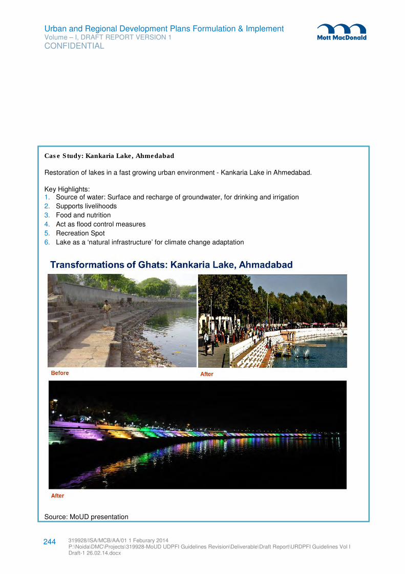
Urban and Regional Development Plans Formulation & Implement Volume – I, DRAFT REPORT VERSION 1
CONFIDENTIAL
319928/ISA/MCB/AA/01 1 Feburary 2014 P:\Noida\DMC\Projects\319928-MoUD UDPFI Guidelines Revision\Deliverable\Draft Report\URDPFI Guidelines Vol I Draft-1 26.02.14.docx
244
Case Study: Kankaria Lake, Ahmedabad
Restoration of lakes in a fast growing urban environment - Kankaria Lake in Ahmedabad.
Key Highlights: 1. Source of water: Surface and recharge of groundwater, for drinking and irrigation
2. Supports livelihoods
3. Food and nutrition
4. Act as flood control measures
5. Recreation Spot
6. Lake as a ‘natural infrastructure’ for climate change adaptation
Source: MoUD presentation
Urban and Regional Development Plans Formulation & Implement Volume – I, DRAFT REPORT VERSION 1
CONFIDENTIAL
319928/ISA/MCB/AA/01 1 Feburary 2014 P:\Noida\DMC\Projects\319928-MoUD UDPFI Guidelines Revision\Deliverable\Draft Report\URDPFI Guidelines Vol I Draft-1 26.02.14.docx
245
MoEF has also suggested to integrate identified projects on water bodies with Programmes such as
National Lake Conservation Programme and National Wetland Conservation Programme, JnNURM/
UIDSSMT, Ministry of Water Resources programme for Repair, Renovation & Restoration (RRR) of Water
Bodies with Domestic/External Assistance which are undertaken by Government of India (GoI).
For conserving rivers, MoEF has taken up the initiative and formed National River Conservation
Directorate (NRCD). Initiatives have been taken through various River Action Plans such as - Ganga
Action Plan and Yamuna Action Plan
6.6.4 Desert areas104
The Indian desert fauna is extremely rich in species diversity of mammals and winter migratory birds.
However the pressures of a rapidly increasing population on the natural resource base necessitate
adoption of innovative and integrated measures for conservation of desert ecosystems. These pressures
are enhanced by practices which lead to land degradation.
The key actions suggested in NEP 2006 are as follows:
� Intensive water and moisture conservation through practices based on traditional and science
based knowledge, and relying on traditional infrastructure.
� Enhancing and expanding green cover based on local species.
� Reviewing the agronomic practices in these areas, and promoting agricultural practices and
varieties, which are well adapted to the desert eco-system.
6.6.5 Wetlands105
Wetlands, natural and manmade, freshwater or brackish, provide numerous ecological services. They
provide habitat to aquatic flora and fauna, as well as numerous species of birds, including migratory
species. Several wetlands have sufficiently unique ecological character as to merit international recognition
as Ramsar Sites.
Wetlands also provide freshwater for agriculture, animal husbandry, and domestic use, drainage services,
and provide livelihoods to fisher folk. Larger wetlands may also comprise an important resource for
sustainable tourism and recreation.
Wetlands are under threat from drainage and conversion for agriculture and human settlements, besides
pollution. This happens because public authorities or individuals having jurisdiction over wetlands derive
little revenues from them, while the alternative use may result in windfall financial gains to them.
104 National Environmental Policy 2006, MOEF
105 National Environmental Policy 2006, MOEF
Urban and Regional Development Plans Formulation & Implement Volume – I, DRAFT REPORT VERSION 1
CONFIDENTIAL
319928/ISA/MCB/AA/01 1 Feburary 2014 P:\Noida\DMC\Projects\319928-MoUD UDPFI Guidelines Revision\Deliverable\Draft Report\URDPFI Guidelines Vol I Draft-1 26.02.14.docx
246
A holistic view of wetlands is necessary, which looks at each identified wetland in terms of its causal
linkages with other natural entities, human needs, and its own attributes.
Key actions suggested in NEP 2006 at state or local level are as follows:
� Integrate wetland conservation, including conservation of village ponds and tanks, into sectoral
development plans for poverty alleviation and livelihood improvement, and link efforts for conservation
and sustainable use of wetlands with the ongoing rural infrastructure development and employment
generation programmes.
� Formulate conservation and prudent use strategies for each significant catalogued wetland, with
participation of local communities, and other relevant stakeholders.
� Formulate and implement eco-tourism strategies for identified wetlands through multi stakeholder
partnerships involving public agencies, local communities, and investors.
� Take explicit account of impacts on wetlands of significant development projects during the
environmental appraisal of such projects; in particular, the reduction in economic value of wetland
environmental services should be explicitly factored into cost-benefit analyses.
� Consider particular unique wetlands as entities with “Incomparable Values”, in developing strategies for
their protection.
� Promote traditional techniques and practices for conserving village ponds.
6.6.6 Hilly areas
Hilly areas have one of the most fragile ecosystems, which need to be conserved. Therefore planning and
development strategies for hilly areas shall be designed with added sensitivity and stress on integrated
development. The development approach shall comprise judicious land use planning and settlement
planning. In hill areas, the space standards are affected by the following and therefore these factors should
be considered while setting norms in such areas:
� Exposure to sunlight, degree of slopes and accessibility in the form of distance travelled.
� Minimum needs of the people and the conservation principle.
� Flexibility in norms and standards to accommodate conditions guided by difficult hill terrain and its
geology.
� Work-place and residence relationship.
� Energy needs.
� Alternative mode of transportation communication network.
� Communication network.
� Mobile and emergency facilities.
On the same line, TCPO of Government of Himachal Pradesh has formulated the Norms and Standards
for their state which can be adopted by other states for hilly areas. Some of the infrastructure norms and
standards are detailed in Infrastructure planning chapter.
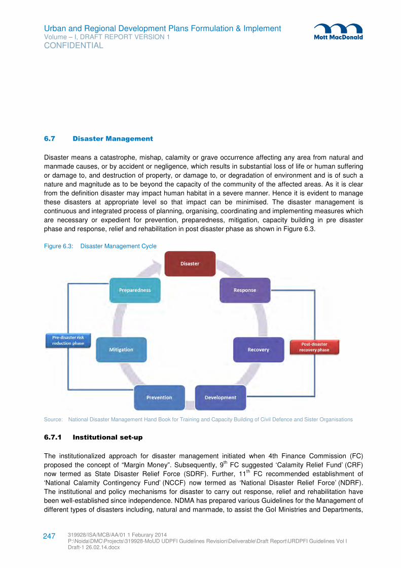
Urban and Regional Development Plans Formulation & Implement Volume – I, DRAFT REPORT VERSION 1
CONFIDENTIAL
319928/ISA/MCB/AA/01 1 Feburary 2014 P:\Noida\DMC\Projects\319928-MoUD UDPFI Guidelines Revision\Deliverable\Draft Report\URDPFI Guidelines Vol I Draft-1 26.02.14.docx
247
6.7 Disaster Management
Disaster means a catastrophe, mishap, calamity or grave occurrence affecting any area from natural and
manmade causes, or by accident or negligence, which results in substantial loss of life or human suffering
or damage to, and destruction of property, or damage to, or degradation of environment and is of such a
nature and magnitude as to be beyond the capacity of the community of the affected areas. As it is clear
from the definition disaster may impact human habitat in a severe manner. Hence it is evident to manage
these disasters at appropriate level so that impact can be minimised. The disaster management is
continuous and integrated process of planning, organising, coordinating and implementing measures which
are necessary or expedient for prevention, preparedness, mitigation, capacity building in pre disaster
phase and response, relief and rehabilitation in post disaster phase as shown in Figure 6.3.
Figure 6.3: Disaster Management Cycle
Source: National Disaster Management Hand Book for Training and Capacity Building of Civil Defence and Sister Organisations
6.7.1 Institutional set-up
The institutionalized approach for disaster management initiated when 4th Finance Commission (FC)
proposed the concept of “Margin Money”. Subsequently, 9th FC suggested ‘Calamity Relief Fund’ (CRF)
now termed as State Disaster Relief Force (SDRF). Further, 11th FC recommended establishment of
‘National Calamity Contingency Fund’ (NCCF) now termed as ‘National Disaster Relief Force’ (NDRF).
The institutional and policy mechanisms for disaster to carry out response, relief and rehabilitation have
been well-established since independence. NDMA has prepared various Guidelines for the Management of
different types of disasters including, natural and manmade, to assist the GoI Ministries and Departments,
Urban and Regional Development Plans Formulation & Implement Volume – I, DRAFT REPORT VERSION 1
CONFIDENTIAL
319928/ISA/MCB/AA/01 1 Feburary 2014 P:\Noida\DMC\Projects\319928-MoUD UDPFI Guidelines Revision\Deliverable\Draft Report\URDPFI Guidelines Vol I Draft-1 26.02.14.docx
248
State Governments and other agencies to prepare Disaster Management (DM) Plans. The Central Relief
Commissioner (CRC) in the Ministry of Home Affairs is the nodal officer to coordinate the relief operations
for natural disasters. The CRC in the Ministry of Home Affairs is the Chairman of the Crisis Management
Group (CMG) whose primary function is to review the contingency plans formulated by various Ministries /
Departments / Organizations in their respective sectors; provide measures and coordinate among central
and state ministries.
Post Disaster Management: The National Crisis Management Committee (NCMC) set up by Ministry of
Home Affairs, Government of India which gives direction to the CMG. NCMC can give directions to any
Ministry/Department/Organization for specific action needed for meeting the crisis situation. These
mechanisms are based on post-disaster relief and rehabilitation and have proved to be robust and effective
mechanisms in addressing its requirements.
However, in order to further institutionalize the new approach, the Government of India have decided to
enunciate a National Policy on Disaster Management (2009), whose broad objectives are to minimize the
loss of lives and social, private and community assets because of natural or manmade disasters and
contribute to sustainable development and better standards of living for all, more specifically for the poor
and vulnerable sections by ensuring that the development gains are not lost through natural
calamities/disasters.
Disaster Prevention, Preparedness & Mitigation: Apart from above, The Disaster Management Act, 2005
(DM Act, 53 of 2005) lays down institutional and coordination mechanisms for effective disaster
management (DM) at the national, state, and district levels. As mandated by this Act, the Government of
India (GoI) created a multi-tiered institutional system consisting of:
� National Disaster Management Authority (NDMA), headed by the Prime Minister, � State Disaster Management Authorities (SDMAs) by the Chief Ministers and � District Disaster Management Authorities (DDMAs) by the District Collectors and co-chaired by elected
representatives of the local authorities of the respective districts.
Others organisations: The Act further provides for constitution of National Executive Committee (NEC),
National Institute of Disaster Management (NIDM) and National Disaster Response Force (NDRF).
6.7.2 National Disaster Management Guidelines
The salient features of the NDMA guidelines with respect to the formulation of DM plans have been
briefed, along with integration of the recommended planning system for the urban and regional planning in
Table 6.7 and Table 6.8. The detailed NDMA guidelines for following disasters can be referred separately
while formulating the Plans106
.
106 For details NDMA guidelines are available at www.ndma.gov.in website.
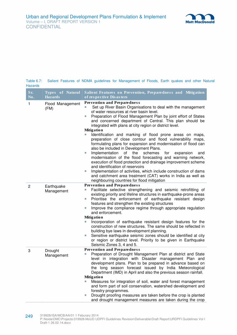
Urban and Regional Development Plans Formulation & Implement Volume – I, DRAFT REPORT VERSION 1
CONFIDENTIAL
319928/ISA/MCB/AA/01 1 Feburary 2014 P:\Noida\DMC\Projects\319928-MoUD UDPFI Guidelines Revision\Deliverable\Draft Report\URDPFI Guidelines Vol I Draft-1 26.02.14.docx
249
Table 6.7: Salient Features of NDMA guidelines for Management of Floods, Earth quakes and other Natural
Hazards
Sr. No.
Types of Natural Hazards
Salient Features on Prevention, Preparedness and Mitigation of respective Disasters
1 Flood Management (FM)
Prevention and Preparedness � Set up River Basin Organisations to deal with the management
of water resources at river basin level. � Preparation of Flood Management Plan by joint effort of States
and concerned department of Central. This plan should be integrated with plans at city region or district level.
Mitigation � Identification and marking of flood prone areas on maps,
preparation of close contour and flood vulnerability maps, formulating plans for expansion and modernisation of flood can also be included in Development Plans.
� Implementation of the schemes for expansion and modernisation of the flood forecasting and warning network, execution of flood protection and drainage improvement scheme and identification of reservoirs
� Implementation of activities, which include construction of dams and catchment area treatment (CAT) works in India as well as neighbouring countries for flood mitigation
2 Earthquake Management
Prevention and Preparedness � Facilitate selective strengthening and seismic retrofitting of
existing priority and lifeline structures in earthquake-prone areas � Prioritise the enforcement of earthquake resistant design
features and strengthen the existing structures � Improve the compliance regime through appropriate regulation
and enforcement. Mitigation � Incorporation of earthquake resistant design features for the
construction of new structures. The same should be reflected in building bye laws in development planning.
� Sensitive earthquake seismic zones should be identified at city or region or district level. Priority to be given in Earthquake Seismic Zones 3, 4 and 5.
3 Drought Management
Prevention and Preparedness � Preparation of Drought Management Plan at district and State
level in integration with Disaster management Plan and development plans. Plan to be prepared in advance based on the long season forecast issued by India Meteorological Department (IMD) in April and also the previous season rainfall.
Mitigation � Measures for integration of soil, water and forest management
and form part of soil conservation, watershed development and forestry programmes.
� Drought proofing measures are taken before the crop is planted and drought management measures are taken during the crop
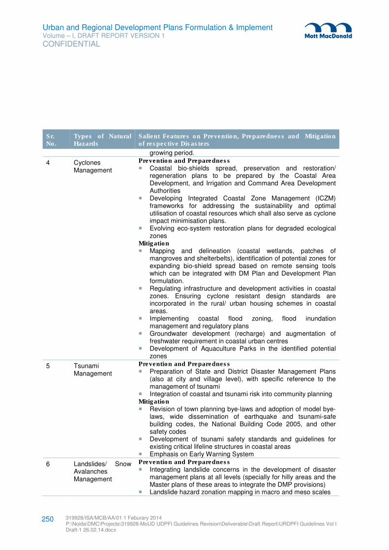
Urban and Regional Development Plans Formulation & Implement Volume – I, DRAFT REPORT VERSION 1
CONFIDENTIAL
319928/ISA/MCB/AA/01 1 Feburary 2014 P:\Noida\DMC\Projects\319928-MoUD UDPFI Guidelines Revision\Deliverable\Draft Report\URDPFI Guidelines Vol I Draft-1 26.02.14.docx
250
Sr. No.
Types of Natural Hazards
Salient Features on Prevention, Preparedness and Mitigation of respective Disasters
growing period.
4 Cyclones Management
Prevention and Preparedness � Coastal bio-shields spread, preservation and restoration/
regeneration plans to be prepared by the Coastal Area Development, and Irrigation and Command Area Development Authorities
� Developing Integrated Coastal Zone Management (ICZM) frameworks for addressing the sustainability and optimal utilisation of coastal resources which shall also serve as cyclone impact minimisation plans.
� Evolving eco-system restoration plans for degraded ecological zones
Mitigation � Mapping and delineation (coastal wetlands, patches of
mangroves and shelterbelts), identification of potential zones for expanding bio-shield spread based on remote sensing tools which can be integrated with DM Plan and Development Plan formulation.
� Regulating infrastructure and development activities in coastal zones. Ensuring cyclone resistant design standards are incorporated in the rural/ urban housing schemes in coastal areas.
� Implementing coastal flood zoning, flood inundation management and regulatory plans
� Groundwater development (recharge) and augmentation of freshwater requirement in coastal urban centres
� Development of Aquaculture Parks in the identified potential zones
5 Tsunami Management
Prevention and Preparedness � Preparation of State and District Disaster Management Plans
(also at city and village level), with specific reference to the management of tsunami
� Integration of coastal and tsunami risk into community planning Mitigation � Revision of town planning bye-laws and adoption of model bye-
laws, wide dissemination of earthquake and tsunami-safe building codes, the National Building Code 2005, and other safety codes
� Development of tsunami safety standards and guidelines for existing critical lifeline structures in coastal areas
� Emphasis on Early Warning System
6 Landslides/ Snow Avalanches Management
Prevention and Preparedness � Integrating landslide concerns in the development of disaster
management plans at all levels (specially for hilly areas and the Master plans of these areas to integrate the DMP provisions)
� Landslide hazard zonation mapping in macro and meso scales
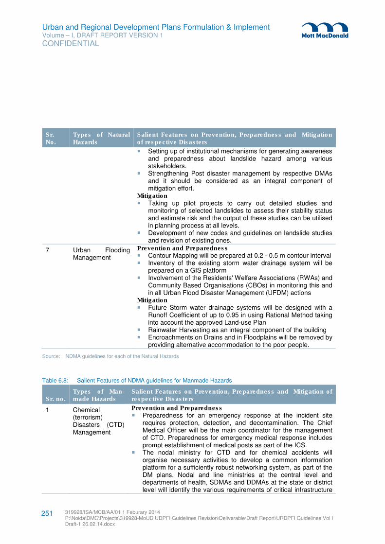
Urban and Regional Development Plans Formulation & Implement Volume – I, DRAFT REPORT VERSION 1
CONFIDENTIAL
319928/ISA/MCB/AA/01 1 Feburary 2014 P:\Noida\DMC\Projects\319928-MoUD UDPFI Guidelines Revision\Deliverable\Draft Report\URDPFI Guidelines Vol I Draft-1 26.02.14.docx
251
Sr. No.
Types of Natural Hazards
Salient Features on Prevention, Preparedness and Mitigation of respective Disasters
� Setting up of institutional mechanisms for generating awareness and preparedness about landslide hazard among various stakeholders.
� Strengthening Post disaster management by respective DMAs and it should be considered as an integral component of mitigation effort.
Mitigation � Taking up pilot projects to carry out detailed studies and
monitoring of selected landslides to assess their stability status and estimate risk and the output of these studies can be utilised in planning process at all levels.
� Development of new codes and guidelines on landslide studies and revision of existing ones.
7 Urban Flooding Management
Prevention and Preparedness � Contour Mapping will be prepared at 0.2 - 0.5 m contour interval � Inventory of the existing storm water drainage system will be
prepared on a GIS platform � Involvement of the Residents' Welfare Associations (RWAs) and
Community Based Organisations (CBOs) in monitoring this and in all Urban Flood Disaster Management (UFDM) actions
Mitigation � Future Storm water drainage systems will be designed with a
Runoff Coefficient of up to 0.95 in using Rational Method taking into account the approved Land-use Plan
� Rainwater Harvesting as an integral component of the building � Encroachments on Drains and in Floodplains will be removed by
providing alternative accommodation to the poor people.
Source: NDMA guidelines for each of the Natural Hazards
Table 6.8: Salient Features of NDMA guidelines for Manmade Hazards
Sr. no. Types of Man- made Hazards
Salient Features on Prevention, Preparedness and Mitigation of respective Disasters
1 Chemical (terrorism) Disasters (CTD) Management
Prevention and Preparedness � Preparedness for an emergency response at the incident site
requires protection, detection, and decontamination. The Chief Medical Officer will be the main coordinator for the management of CTD. Preparedness for emergency medical response includes prompt establishment of medical posts as part of the ICS.
� The nodal ministry for CTD and for chemical accidents will organise necessary activities to develop a common information platform for a sufficiently robust networking system, as part of the DM plans. Nodal and line ministries at the central level and departments of health, SDMAs and DDMAs at the state or district level will identify the various requirements of critical infrastructure
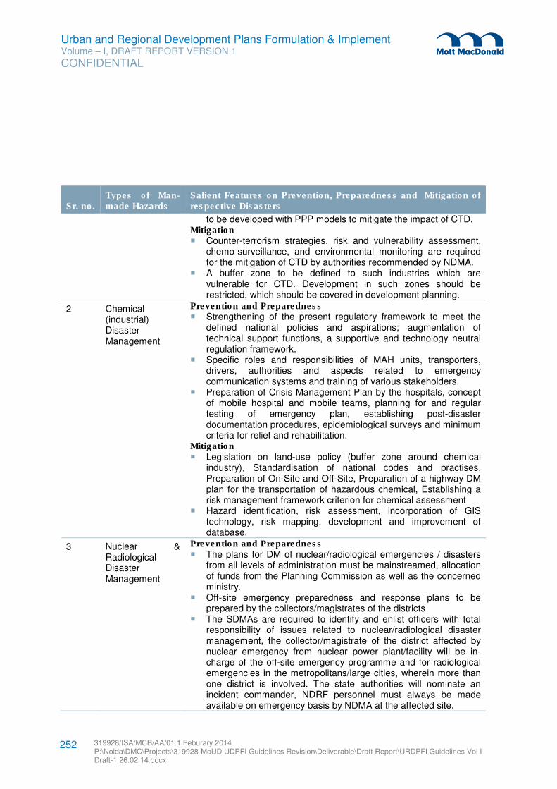
Urban and Regional Development Plans Formulation & Implement Volume – I, DRAFT REPORT VERSION 1
CONFIDENTIAL
319928/ISA/MCB/AA/01 1 Feburary 2014 P:\Noida\DMC\Projects\319928-MoUD UDPFI Guidelines Revision\Deliverable\Draft Report\URDPFI Guidelines Vol I Draft-1 26.02.14.docx
252
Sr. no. Types of Man- made Hazards
Salient Features on Prevention, Preparedness and Mitigation of respective Disasters
to be developed with PPP models to mitigate the impact of CTD. Mitigation � Counter-terrorism strategies, risk and vulnerability assessment,
chemo-surveillance, and environmental monitoring are required for the mitigation of CTD by authorities recommended by NDMA.
� A buffer zone to be defined to such industries which are vulnerable for CTD. Development in such zones should be restricted, which should be covered in development planning.
2 Chemical (industrial) Disaster Management
Prevention and Preparedness � Strengthening of the present regulatory framework to meet the
defined national policies and aspirations; augmentation of technical support functions, a supportive and technology neutral regulation framework.
� Specific roles and responsibilities of MAH units, transporters, drivers, authorities and aspects related to emergency communication systems and training of various stakeholders.
� Preparation of Crisis Management Plan by the hospitals, concept of mobile hospital and mobile teams, planning for and regular testing of emergency plan, establishing post-disaster documentation procedures, epidemiological surveys and minimum criteria for relief and rehabilitation.
Mitigation � Legislation on land-use policy (buffer zone around chemical
industry), Standardisation of national codes and practises, Preparation of On-Site and Off-Site, Preparation of a highway DM plan for the transportation of hazardous chemical, Establishing a risk management framework criterion for chemical assessment
� Hazard identification, risk assessment, incorporation of GIS technology, risk mapping, development and improvement of database.
3 Nuclear & Radiological Disaster Management
Prevention and Preparedness � The plans for DM of nuclear/radiological emergencies / disasters
from all levels of administration must be mainstreamed, allocation of funds from the Planning Commission as well as the concerned ministry.
� Off-site emergency preparedness and response plans to be prepared by the collectors/magistrates of the districts
� The SDMAs are required to identify and enlist officers with total responsibility of issues related to nuclear/radiological disaster management, the collector/magistrate of the district affected by nuclear emergency from nuclear power plant/facility will be in-charge of the off-site emergency programme and for radiological emergencies in the metropolitans/large cities, wherein more than one district is involved. The state authorities will nominate an incident commander, NDRF personnel must always be made available on emergency basis by NDMA at the affected site.

Urban and Regional Development Plans Formulation & Implement Volume – I, DRAFT REPORT VERSION 1
CONFIDENTIAL
319928/ISA/MCB/AA/01 1 Feburary 2014 P:\Noida\DMC\Projects\319928-MoUD UDPFI Guidelines Revision\Deliverable\Draft Report\URDPFI Guidelines Vol I Draft-1 26.02.14.docx
253
Sr. no. Types of Man- made Hazards
Salient Features on Prevention, Preparedness and Mitigation of respective Disasters
Mitigation � Engineering safety features and accident management
procedures that should be in place in a nuclear plant as accident mitigation measures for minimising the impact of a nuclear emergency by keeping the radioactivity release in the environment to levels as low as possible.
� Controlling the power, cooling the fuel and confining the radioactive material should be used as three basic safety functions in Nuclear Plant.
� The inbuilt safety measures, including biological shields, safety systems and interlocks, safety audits, operations strictly following safety procedures, etc., mitigate the consequences of accidents should be adopted.
4 Fire Services Management
Prevention and Preparedness � Preparation of Fire Hazard Response Mitigation Plan (FHRMP) � The plan should incorporate activities for mass awareness and
inspection of firefighting facilities and equipment especially in schools, busy shopping malls, high rise buildings and residential clusters
� Integration of FHRMP with 13th Finance Commission report and state five year plans for mobilisation of funds.
Source: NDMA guidelines for each of the Manmade Hazards
Moreover, in addition to above points, there is a need to identify infrastructural needs for preparing
mitigation plans, Implementing a financial strategy for the allocation of funds for different national and
state/district level mitigation projects.
Capacity Building: In addition to above mentioned salient features, the capacity development for
managing the disaster is an important criterion, which should be considered as a part of preparedness.
There should be availability of skilled and adequately trained manpower like rescue and relief teams, Civil
Defence, Home Guards, and other emergency service providers having basic knowledge of relevant
disasters. In Disaster Management Plan, the role of NGOs, other voluntary organisations, and the
community is required to be defined. Capacity development should be undertaken at the district, state, and
national levels by the Ministries and departments concerned as a part of their respective DM plans.
Response Mechanisms: A mechanism for coordinated approach and efforts is required for effective
response after the incident. Role of communities, NGO and National Disaster Response Force (NDRF)107
should be considered while formulating incident response strategy.
107 A separate guideline has been issued by NDMA on Incident Response System and National Disaster Management Information
and Communication System, which is available at www.ndma.gov.in
Urban and Regional Development Plans Formulation & Implement Volume – I, DRAFT REPORT VERSION 1
CONFIDENTIAL
319928/ISA/MCB/AA/01 1 Feburary 2014 P:\Noida\DMC\Projects\319928-MoUD UDPFI Guidelines Revision\Deliverable\Draft Report\URDPFI Guidelines Vol I Draft-1 26.02.14.docx
254
Response & Relief: To provide Psycho Social Support after the incident as a part of relief is an important
aspect. NDMA has also issued detailed guidelines which describes the following features:
� Implementation of Psycho-Social Support and Mental Health Services (PSSMHS) in National Mental
Health Programme (NMHP) and in District Mental Health Programme (DMHP);
� Integration of the PSSMHS in DMHP and General Health Programme as a part of hospital and District
health plan;
� Formation of a National Sub-Committee on PSSMHS;
� Training of National Disaster Response Force (NDRF), Quick Reaction Teams (QRTs)
� Disaster Management Teams (DMTs) in all basic psycho-social support skills;
� Integration of PSSMHS and NMHP with Disaster Management (DM) Plan and Health/Hospital DM
Plans.
In terms of medical preparedness108
, the prevention measure and the preparedness measure is separately
highlighted by NDMA.
� Preventive measure: Integrated Disease Surveillance Programme (IDSP)
� Preparedness for the management of mass causalities: Emergency Medical Response (EMR) at the
incident site and their quick and safe evacuation by ambulance, are two important steps.
6.7.3 State Disaster Management Plan
The Section 23 of Disaster Management (DM) Act 2005 states that there shall be a DM plan for every
state. The NDMA has also issued guidelines on preparation of State Disaster Management Plan (SDMP)
which outlines the broad coverage of the plan as well as the requirements of consultation in its preparation.
It also provides provision for annual review and updating of the State DM Plan, and enjoins upon the state
governments to make provisions for financing the activities to be carried out under the state plans. The
SDMP shall be prepared in consultation with the State Perspective Plans and/or State Urbanisation
Policies.
The Act provides for the departments of the State Governments to draw up their own plans in accordance
with the state DM plan. The SDMP should be prepared by the State Executive Committee (SEC) in
conformity with the guidelines to be issued on related matters by the SDMA having regard to the NDMA
guidelines. The SDMP prepared by SEC should be approved by the SDMA. The approach to the
preparation of the SDMP should be holistic and address all the hazards the state is vulnerable to.
The SDMP may also adopt the generic categorisation of disasters with respect to specific plans at the state
level by various departments to handle different disasters. These categories could be L0, L1, L2, and L3.
� L0 denotes normal times which are expected to be utilised for close monitoring, documentation,
prevention, mitigation and preparatory activities. This is the planning stage where plans at all levels
from community to the State should be put in place. Training on search and rescue, rehearsals,
evaluation and inventory updation for response activities should be carried out during this time.
� L1 specifies disasters that can be managed at the district level, however, the state and centre will
remain in readiness to provide assistance if needed.
108
The NDMA guideline on Medical Preparedness available at www.ndma.gov.in can be referred.
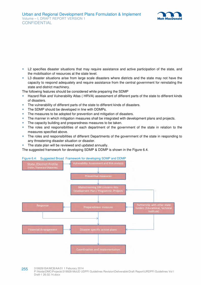
Urban and Regional Development Plans Formulation & Implement Volume – I, DRAFT REPORT VERSION 1
CONFIDENTIAL
319928/ISA/MCB/AA/01 1 Feburary 2014 P:\Noida\DMC\Projects\319928-MoUD UDPFI Guidelines Revision\Deliverable\Draft Report\URDPFI Guidelines Vol I Draft-1 26.02.14.docx
255
� L2 specifies disaster situations that may require assistance and active participation of the state, and
the mobilisation of resources at the state level.
� L3 disaster situations arise from large scale disasters where districts and the state may not have the
capacity to respond adequately and require assistance from the central government for reinstating the
state and district machinery.
The following features should be considered while preparing the SDMP
� Hazard Risk and Vulnerability Atlas ( HRVA) assessment of different parts of the state to different kinds
of disasters.
� The vulnerability of different parts of the state to different kinds of disasters.
� The SDMP should be developed in line with DDMPs.
� The measures to be adopted for prevention and mitigation of disasters.
� The manner in which mitigation measures shall be integrated with development plans and projects.
� The capacity building and preparedness measures to be taken.
� The roles and responsibilities of each department of the government of the state in relation to the
measures specified above.
� The roles and responsibilities of different Departments of the government of the state in responding to
any threatening disaster situation or disaster.
� The state plan will be reviewed and updated annually.
The suggested framework for developing SDMP & DDMP is shown in the Figure 6.4.
Figure 6.4: Suggested Broad Framework for developing SDMP and DDMP
Urban and Regional Development Plans Formulation & Implement Volume – I, DRAFT REPORT VERSION 1
CONFIDENTIAL
319928/ISA/MCB/AA/01 1 Feburary 2014 P:\Noida\DMC\Projects\319928-MoUD UDPFI Guidelines Revision\Deliverable\Draft Report\URDPFI Guidelines Vol I Draft-1 26.02.14.docx
256
Source: National Disaster Management Guidelines, Preparation of State Disaster Management Plans
6.7.4 District Disaster Management Plan (DDMP)109
Section 31 of the DM Act, 2005 makes mandatory to formulate District Disaster Management Plan (DDMP)
by District Authority in consultation with local authorities. DDMP shall include Hazard Risk and Vulnerability
Analysis (HRVA), prevention, mitigation, preparedness measures, response plan and procedures. An
indicative list with possible plan objectives is given below:
� To identify the areas vulnerable to major types of the hazards in the district.
� To adopt proactive measures at district level by all the Government departments to prevent/ know
disaster and mitigate its effects.
� To define and assign the different tasks and responsibilities to stakeholders during the pre-disaster and
post-disaster phases.
� To adopt disaster resilient construction mechanism in the district by way of using Information,
Education and Communication for making the community aware of the need of disaster resilient future
development.
� To enhance disaster resilience of the people in the district by way of capacity building.
� Reduce the loss of public and private property, especially critical facilities and infrastructure, through
proper disaster management planning
� Manage future development to mitigate the effect of natural hazards in the district.
� To set up the early warning system so as to prepare the community to deal with the disaster and
responsive communication system based upon fail-proof proven technology.
� To develop the standardized mechanism to respond to disaster situation to manage the disaster
efficiently.
� To set up an Emergency Operations Centre at the District level to function effectively in search, rescue,
response.
� To prepare the response plan based upon the guidelines issued in the State Disaster Management
Plan so as to provide prompt relief, rescue and search support in the disaster affected areas.
� To make the use of media in disaster management.
� Rehabilitation plan of the affected people and reconstruction measures to be taken by different govt.
departments at district level and local authority.
� Integration of DM initiatives into development plan and projects.
� To coordinate with Centre & State agencies concerned for effective and efficient DM.
The District Disaster Management Plan (DDMP) is the guide for achieving the objective mitigation,
preparedness, response and recovery. It should be noted that Development Plan for the District/City
should also integrate with DDMPs and city planning or town planning should be in compliance with the
DDMPs and SDMP of the concerned District.
109 Source: Explanatory Notes for Preparation of District Disaster Management Plan (DDMP), NDMA
Urban and Regional Development Plans Formulation & Implement Volume – I, DRAFT REPORT VERSION 1
CONFIDENTIAL
319928/ISA/MCB/AA/01 1 Feburary 2014 P:\Noida\DMC\Projects\319928-MoUD UDPFI Guidelines Revision\Deliverable\Draft Report\URDPFI Guidelines Vol I Draft-1 26.02.14.docx
257
Town planners use variety of techniques at various stages of the planning process. These techniques may
relate to surveys for collection of data, assessment of existing conditions in a town, as well as analysis and
projections of future requirements in respect of various activities.
Substantial proportions of these techniques are highly elaborate and demand intensive data inputs.
Considerable time is lost in collecting the required data and long delays occur in the plan preparation
process. Today, the pace of development of towns has speeded up so much that planners have begun to
feel the necessity of simplified and quick techniques for analysis and plan preparation. The chapter briefly
describes some of the useful and simplified techniques for data collection, survey, analysis, projections
and mapping.
7.1 Identifying Data Needs and Data Collection List
The basic presumption of simplified information gathering methodologies is that there is always a certain
amount of uncertainty attached to any set of data, and that the available data may or may not be complete
as compared to what is required for ensuring perfectness in decision making. This presumption implies that
decision making most often involves an element of imperfect data and good decision maker makes good
use of extrapolation of the collected data though the application of simplified and sustainable survey
techniques.
The methods of rapid information collection institutionalize existing good practices and even common
sense. They rely mostly on direct observation, seek several views of any one “fact” (cross checking) and
make use of checklists and semi structured dialogues instead of lengthy and often costly questionnaire-
based surveys. Due to difficulties of measuring much of socio-economic information directly, rapid survey
techniques make liberal use of proxy indicators to trace ranking, trends and shifts. These rapid methods
must not be considered as substitutes to specialist investigations and should be used for quick access to
information for rapid decision making.
7.1.1 Data Checklist
The data collection checklist is a precise and exhaustive listing of topics/issues and sub-topics/issues
related to information need. The process begins with the preparation of an initial checklist. The next stage
is to define the method of acquiring information about each sub-topic in the list. The checklist is flexible and
allows the surveyor to adapt and improvise in the field. The steps involved in the preparation of the
checklist are as follow:
� List major topics with its priority.
� List of major information needs and how each will be used for analysis.
� Break down each topic into sub-topics.
� Indicate the likely information sources such as
– Document from Government departments, organisations, private agencies, publications etc.
– Observation in the study area and inspection
– Dialogue, interviews
7 Simplified Planning Techniques
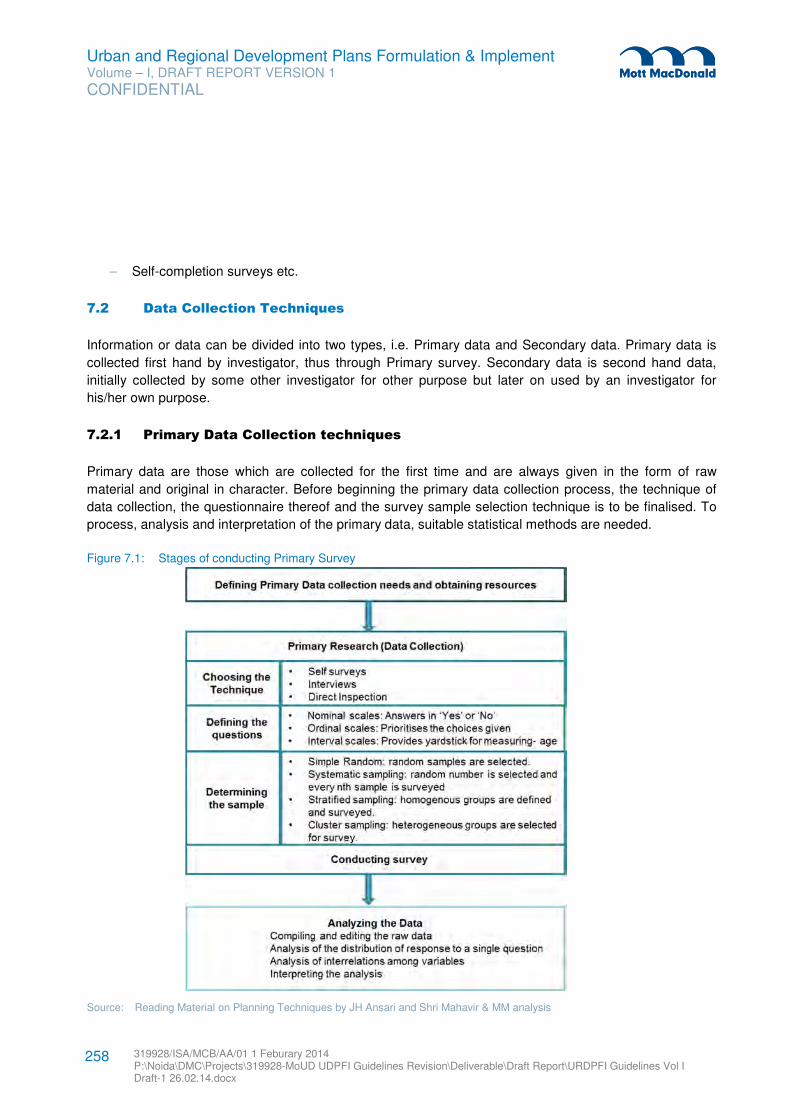
Urban and Regional Development Plans Formulation & Implement Volume – I, DRAFT REPORT VERSION 1
CONFIDENTIAL
319928/ISA/MCB/AA/01 1 Feburary 2014 P:\Noida\DMC\Projects\319928-MoUD UDPFI Guidelines Revision\Deliverable\Draft Report\URDPFI Guidelines Vol I Draft-1 26.02.14.docx
258
– Self-completion surveys etc.
7.2 Data Collection Techniques
Information or data can be divided into two types, i.e. Primary data and Secondary data. Primary data is
collected first hand by investigator, thus through Primary survey. Secondary data is second hand data,
initially collected by some other investigator for other purpose but later on used by an investigator for
his/her own purpose.
7.2.1 Primary Data Collection techniques
Primary data are those which are collected for the first time and are always given in the form of raw
material and original in character. Before beginning the primary data collection process, the technique of
data collection, the questionnaire thereof and the survey sample selection technique is to be finalised. To
process, analysis and interpretation of the primary data, suitable statistical methods are needed.
Figure 7.1: Stages of conducting Primary Survey
Source: Reading Material on Planning Techniques by JH Ansari and Shri Mahavir & MM analysis
Urban and Regional Development Plans Formulation & Implement Volume – I, DRAFT REPORT VERSION 1
CONFIDENTIAL
319928/ISA/MCB/AA/01 1 Feburary 2014 P:\Noida\DMC\Projects\319928-MoUD UDPFI Guidelines Revision\Deliverable\Draft Report\URDPFI Guidelines Vol I Draft-1 26.02.14.docx
259
This section discusses four types of primary surveys which are listed in the order of passive to active
respondents. Following are the broad categories of primary surveys:
� Visual survey / Reconnaissance survey: This survey does not require direct contact with population of
the study area. It is quick overview of the area.
� Inspection: It involves direct inspection of area by surveyor for extracting information.
� Personal Interview / Dialogue: This survey is more personal and could be either face to face or
telephonic. In such type of surveys some initial topics are investigated to gain insight in the area of
interest.
� Self-survey: In this type of survey indirect contact is made with the respondent by sending
questionnaire through mail or handed out but the response is not collected on the spot.
7.2.1.1 Visual surveys / Reconnaissance survey
Visual surveys are direct inspection surveys which are performed by survey teams moving in automobile or
walking. This type of survey can be used in the initial stages of the investigation, often after preparing initial
checklist. It performs variety of functions, such as:
� Familiarise with study area.
� Give initial impressions of the physical and human state of an area.
� Identify selected areas for further investigation.
� Generate ideas for development of checklist.
7.2.1.2 Inspection
Direct Inspection: The direct inspection of conditions or activities is employed in many kinds of surveys
where human communication is not required to elicit the information ( Source: Reading Material on
Planning Techniques by JH Ansari and Shri Mahavir). It can be used for observing traffic counts, recreation
area use surveys, housing quality studies and proxy observations where required.
Indirect Inspection: The findings of the initial survey can be substantiated with the help of Key Indicator
Survey which are specific to the objectives of the analysis. Often, instead of getting direct information on
the variable, surveyors rely on observing approximations known as proxies. A proxy is used to inform
about a variable without direct investigation, instead investigating its key indicators. Such as: instead of
enquiring about the income range, the surveyor can observe the housing condition, number of vehicles and
other consumer goods. Table 7.1 lists proxy indicators to be generated through checklist, relating to the
sub-topics which are identified as important.
Table 7.1: Possible Proxy Indicators
Topic Possible Proxy Add your own proxies
Economic growth Housing construction & condition
Dwelling extensions
Electricity consumption
Sale of new vehicles
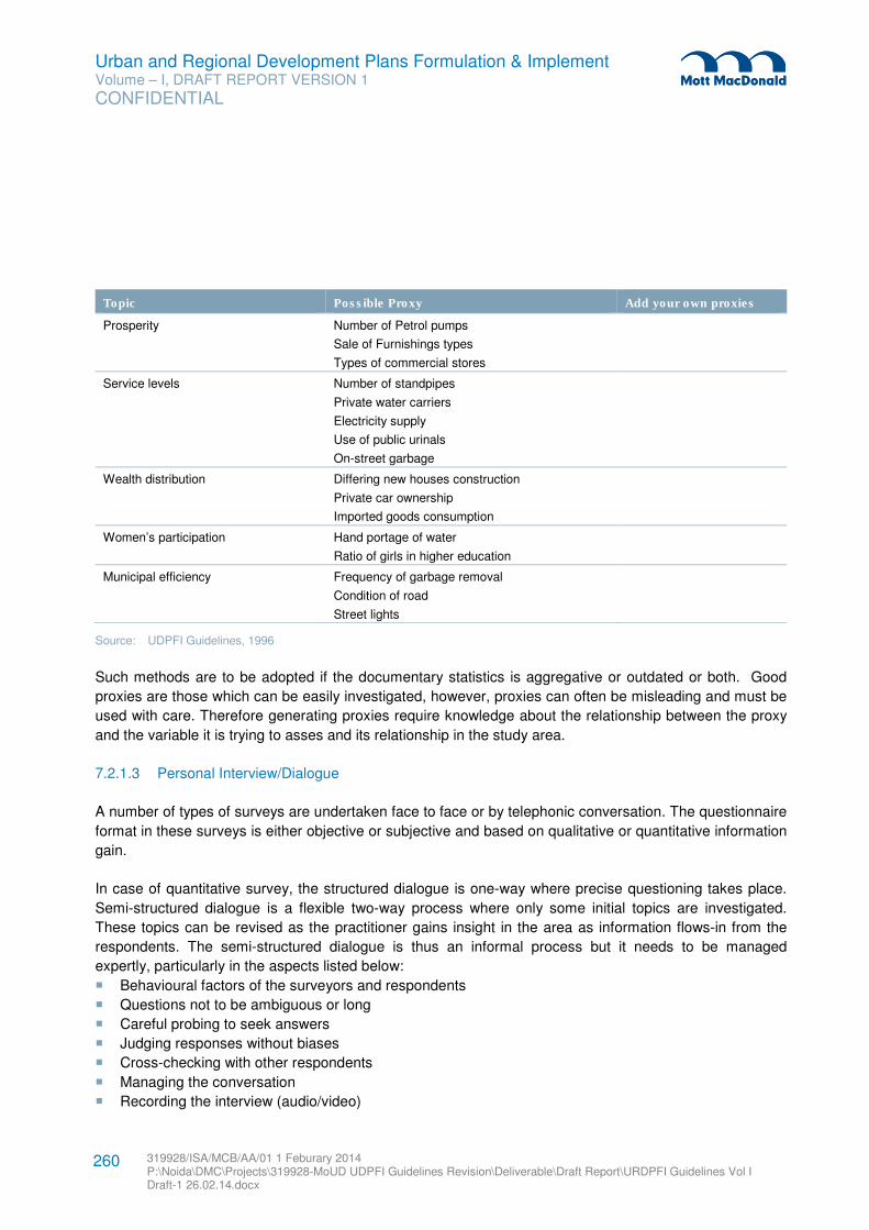
Urban and Regional Development Plans Formulation & Implement Volume – I, DRAFT REPORT VERSION 1
CONFIDENTIAL
319928/ISA/MCB/AA/01 1 Feburary 2014 P:\Noida\DMC\Projects\319928-MoUD UDPFI Guidelines Revision\Deliverable\Draft Report\URDPFI Guidelines Vol I Draft-1 26.02.14.docx
260
Topic Possible Proxy Add your own proxies
Prosperity Number of Petrol pumps
Sale of Furnishings types
Types of commercial stores
Service levels Number of standpipes
Private water carriers
Electricity supply
Use of public urinals
On-street garbage
Wealth distribution Differing new houses construction
Private car ownership
Imported goods consumption
Women’s participation Hand portage of water
Ratio of girls in higher education
Municipal efficiency Frequency of garbage removal
Condition of road
Street lights
Source: UDPFI Guidelines, 1996
Such methods are to be adopted if the documentary statistics is aggregative or outdated or both. Good
proxies are those which can be easily investigated, however, proxies can often be misleading and must be
used with care. Therefore generating proxies require knowledge about the relationship between the proxy
and the variable it is trying to asses and its relationship in the study area.
7.2.1.3 Personal Interview/Dialogue
A number of types of surveys are undertaken face to face or by telephonic conversation. The questionnaire
format in these surveys is either objective or subjective and based on qualitative or quantitative information
gain.
In case of quantitative survey, the structured dialogue is one-way where precise questioning takes place.
Semi-structured dialogue is a flexible two-way process where only some initial topics are investigated.
These topics can be revised as the practitioner gains insight in the area as information flows-in from the
respondents. The semi-structured dialogue is thus an informal process but it needs to be managed
expertly, particularly in the aspects listed below:
� Behavioural factors of the surveyors and respondents
� Questions not to be ambiguous or long
� Careful probing to seek answers
� Judging responses without biases
� Cross-checking with other respondents
� Managing the conversation
� Recording the interview (audio/video)
Urban and Regional Development Plans Formulation & Implement Volume – I, DRAFT REPORT VERSION 1
CONFIDENTIAL
319928/ISA/MCB/AA/01 1 Feburary 2014 P:\Noida\DMC\Projects\319928-MoUD UDPFI Guidelines Revision\Deliverable\Draft Report\URDPFI Guidelines Vol I Draft-1 26.02.14.docx
261
� Avoiding errors and biases
7.2.1.4 Focussed Group Discussion (FGD)
Focussed group discussion is a qualitative data collection and research technique. Questions about
opinions, perceptions, beliefs, attitude of people towards planning aims, services are probed in these
discussions. FGD can be used for learning about stakeholders, their interrelationship and to know about a
range of issues on the topic. This method costs fairly low compared to surveys, as one can get results
relatively quickly and increase the sample size by talking with several people at the same time. FGDs can
either be used to explore meaning of survey findings that cannot be explained statically as well as before
designing questionnaires.
Homogenous group of people are selected for FGD so that they are comfortable and have free flow of
discussion. Main objective and key questions of the meeting should be pre-decided. Group of 10 to 12
people and questions should be selected for a single FGD110
. More than one, mostly three to four FGDs to
be done before legitimate results can be reached on an issue. FGD in rural settings can make use of
interactive diagrammatic data collection techniques such as mapping, Venn diagram etc.
7.2.1.5 Self-Survey
These are often in the questionnaires sent to respondents through mail or survey forms handed out or
inserted in the newspapers and the filled questionnaires are mailed back to the surveyor. It has various
limitations, like; responses can be low and unsatisfactory.
Primary data collection techniques can be costly and very time consuming thus methods of rapid
information collection, which rely mostly on direct observation, is an alternative. This method seeks several
views of any one “fact” (cross checking), makes use of checklists and semi structured dialogue. However,
rapid methods must not be considered as substitutes to specialist investigations and should be used for
quick access to information for rapid decision making only.
7.2.2 Secondary Data Collection techniques
The secondary data are those which have already been collected by someone other than the investigator
himself. These are usually compiled and processed information but may be relatively less accurate than
the primary data. However, the problems associated with the primary data collection such as time
consumption, skilled manpower requirement do not arise here. Secondary data can be collected from a
number of sources which can be broadly classified into two categories.
110
(Source: Overseas Development Institute, UK; Wikipedia)
Urban and Regional Development Plans Formulation & Implement Volume – I, DRAFT REPORT VERSION 1
CONFIDENTIAL
319928/ISA/MCB/AA/01 1 Feburary 2014 P:\Noida\DMC\Projects\319928-MoUD UDPFI Guidelines Revision\Deliverable\Draft Report\URDPFI Guidelines Vol I Draft-1 26.02.14.docx
262
7.2.2.1 Published Sources
Mostly secondary data is collected from published sources, which makes it reliable. Some important
sources of published sources and statistical data are as follow:
� Published reports of Central and State Governments and local bodies.
� Statistical abstracts, census reports and other reports published by different Ministries of the
Government.
� Official publications of the foreign Governments.
� Reports and Publications of trade associations, chambers of commerce, financial institutions etc.
� Journals, Magazines and periodicals.
� Periodic Publications of Government organizations like Central Statistical Organization (CSO), National
Sample Survey Organization (NSSO).
� Reports submitted by Economists, Research Scholars, Bureaus,
� Published works of research institutions and Universities
7.2.2.2 Unpublished Sources
Statistical and non-statistical data can also be collected from various unpublished sources. Some of the
important unpublished sources from which secondary data can be collected are:
� The research works carried out by scholars, research associates and professionals.
� The records maintained by private firms and business enterprises, which may not have been published
due to business discretion.
� Records and statistics maintained by various departments and offices of the Central and State
Governments, Corporations, Undertakings among others.
7.3 Types of Survey
While planning regional or urban area diverse studies are done which use various sets of information to
analyse existing situation and make future projections. Thus, keeping in mind the range of data required in
planning, following survey types have been demarcated.
7.3.1 Socio -Economic Survey
Demographic survey is concerned with collection of socio-economic data regarding characteristics of
human populations, such as size, growth, density, distribution, and vital statistics. This survey forms base
for not only understanding current socio-demographic characteristics of specific area but also projections
of future population and related infrastructure.
7.3.2 Land use/utilisation Surveys
Land use survey is commonly undertaken with the purpose to identify developed and undeveloped areas
for analysis of physical distribution and condition of existing development for future projections. In case of
Urban and Regional Development Plans Formulation & Implement Volume – I, DRAFT REPORT VERSION 1
CONFIDENTIAL
319928/ISA/MCB/AA/01 1 Feburary 2014 P:\Noida\DMC\Projects\319928-MoUD UDPFI Guidelines Revision\Deliverable\Draft Report\URDPFI Guidelines Vol I Draft-1 26.02.14.docx
263
ground verification of the land use map prepared by remote access or by various secondary sources, land
use of a defined land parcel can be observed by undertaking a well-planned exercise.
The developed area can then be further sub-classified into following major categories depending upon the
use to which major portions of urban land are put to:
� Residential area
� Commercial area
� Industrial area
� Public and semi-public use
� Parks and playfields
� Transportation
� Other uses
� Vacant land
The undeveloped land can be further sub-classified111
into following categories:
� Agricultural
� Conservation areas
� Undevelopable land
In regional context sub divisions of land utilisation can be classified as follow:
� Forest
� Area under non-agricultural uses
� Barren and unculturable land
� Permanent pasture and other grazing land
� Miscellaneous tree crops and groves
� Culturable waste land
� Fallow lands
� Net area sown
7.3.3 Density Surveys
Density surveys are done to understand the relationship between built-up area and population density. It is
taken up for assessment of infrastructure requirements, to reduce congestion, appropriate availability of
land for specific activities and services required by residents for good quality of life.
7.3.3.1 Residential Density
Residential density surveys are undertaken with the objective to understand the accommodation density,
built-up area density and the residing population density. Based on the analysis from this survey, the
decisions on the control and promotional measures can be taken.
111 Source: Reading Material on Planning Techniques by JH Ansari and Shri Mahavir
Urban and Regional Development Plans Formulation & Implement Volume – I, DRAFT REPORT VERSION 1
CONFIDENTIAL
319928/ISA/MCB/AA/01 1 Feburary 2014 P:\Noida\DMC\Projects\319928-MoUD UDPFI Guidelines Revision\Deliverable\Draft Report\URDPFI Guidelines Vol I Draft-1 26.02.14.docx
264
There are two separate aspects of this objective, first is less congestion within dwelling unit and second is
low- high density in a neighbourhood or the study area. Another reason for such surveys is to control
number of people residing in an area so as to provide appropriate/sustainable services and utilities for the
area.
Residential density is normally expressed in terms of:
� Houses per acre,
� Habitable rooms per acre (Accommodation density) and
� Persons per acre (Population Density).
For comparison at later stages and analysis of the residential areas, the study area can be further divided
into zones/sub-divisions of similar housing types/conditions and tentative observation of density or based
on similar pattern for survey within the study area.
As accommodation density and population density are calculated for same unit of area, thus these can be
compared to reach at number of persons (occupancy rate) per habitable room. Thus it is used to determine
whether particular area is under-utilized or over-utilised. This information can be used in future planning to
decide which areas are to be decongested and in which areas density can be increased. The following
formulas are used for the calculation:
Number of habitable rooms in the study area/sub-division
Accommodation density = ----------------------------------------------------------------------------------
Net area of the study area/ sub-division
Total population of the study area
Population density = --------------------------------------------------------
Total area of the study area
Population density
Occupancy rates = ------------------------------------------
Accommodation density
(Source: Reading Material on Planning Techniques by JH Ansari and Shri Mahavir)
7.3.3.2 Non-Residential Density
Density in non-residential areas is carried out for assessment and provision of appropriate quantity and
quality of services to the users of study area. Measurement of density in non-residential area in terms of
room or occupant per acre does not provide useful information, thus a method based upon the floor space
index (FSI) is used to calculate non-residential density.
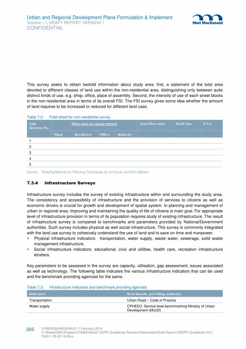
Urban and Regional Development Plans Formulation & Implement Volume – I, DRAFT REPORT VERSION 1
CONFIDENTIAL
319928/ISA/MCB/AA/01 1 Feburary 2014 P:\Noida\DMC\Projects\319928-MoUD UDPFI Guidelines Revision\Deliverable\Draft Report\URDPFI Guidelines Vol I Draft-1 26.02.14.docx
265
This survey seeks to obtain twofold information about study area; first, a statement of the total area
devoted to different classes of land use within the non-residential area, distinguishing only between quite
distinct kinds of use, e.g. shop, office, place of assembly. Second, the intensity of use of each street blocks
in the non-residential area in terms of its overall FSI. The FSI survey gives some idea whether the amount
of land requires to be increased or reduced for different land uses.
Table 7.2: Field sheet for non-residential survey
Sub-division No.
Floor area in square meters Total floor area Total Size F.S.I.
Shop Residence Office Industry
1
2
3
4
5
Source: Reading Material on Planning Techniques by JH Ansari and Shri Mahavir
7.3.4 Infrastructure Surveys
Infrastructure survey includes the survey of existing infrastructure within and surrounding the study area.
The consistency and accessibility of infrastructure and the provision of services to citizens as well as
economic drivers is crucial for growth and development of spatial system. In planning and management of
urban or regional area, improving and maintaining the quality of life of citizens is main goal. For appropriate
level of infrastructure provision in terms of its population requires study of existing infrastructure. The result
of infrastructure survey is compared to benchmarks and parameters provided by National/Government
authorities. Such survey includes physical as well social infrastructure. This survey is commonly integrated
with the land use survey to cohesively understand the use of land and to save on time and manpower.
� Physical infrastructure indicators: transportation, water supply, waste water, sewerage, solid waste
management infrastructure.
� Social infrastructure indicators: educational, civic and utilities, health care, recreation infrastructure
etcetera.
Key parameters to be assessed in the survey are capacity, utilisation, gap assessment, issues associated
as well as technology. The following table indicates the various infrastructure indicators that can be used
and the benchmark providing agencies for the same.
Table 7.3: Infrastructure indicators and benchmark providing agencies
Indicators Benchmarks providing authority
Transportation Urban Road – Code of Practice
Water supply CPHEEO, Service level benchmarking-Ministry of Urban Development (MoUD)
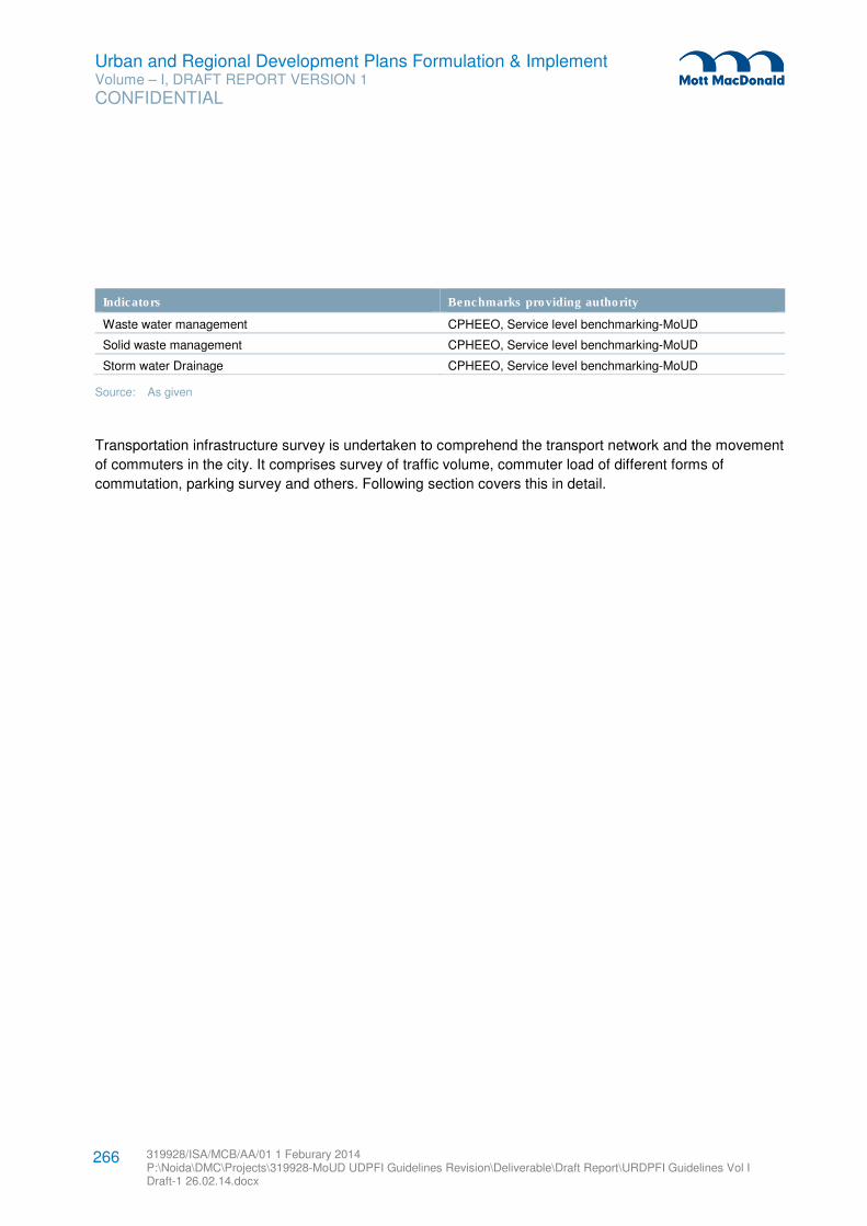
Urban and Regional Development Plans Formulation & Implement Volume – I, DRAFT REPORT VERSION 1
CONFIDENTIAL
319928/ISA/MCB/AA/01 1 Feburary 2014 P:\Noida\DMC\Projects\319928-MoUD UDPFI Guidelines Revision\Deliverable\Draft Report\URDPFI Guidelines Vol I Draft-1 26.02.14.docx
266
Indicators Benchmarks providing authority
Waste water management CPHEEO, Service level benchmarking-MoUD
Solid waste management CPHEEO, Service level benchmarking-MoUD
Storm water Drainage CPHEEO, Service level benchmarking-MoUD
Source: As given
Transportation infrastructure survey is undertaken to comprehend the transport network and the movement
of commuters in the city. It comprises survey of traffic volume, commuter load of different forms of
commutation, parking survey and others. Following section covers this in detail.
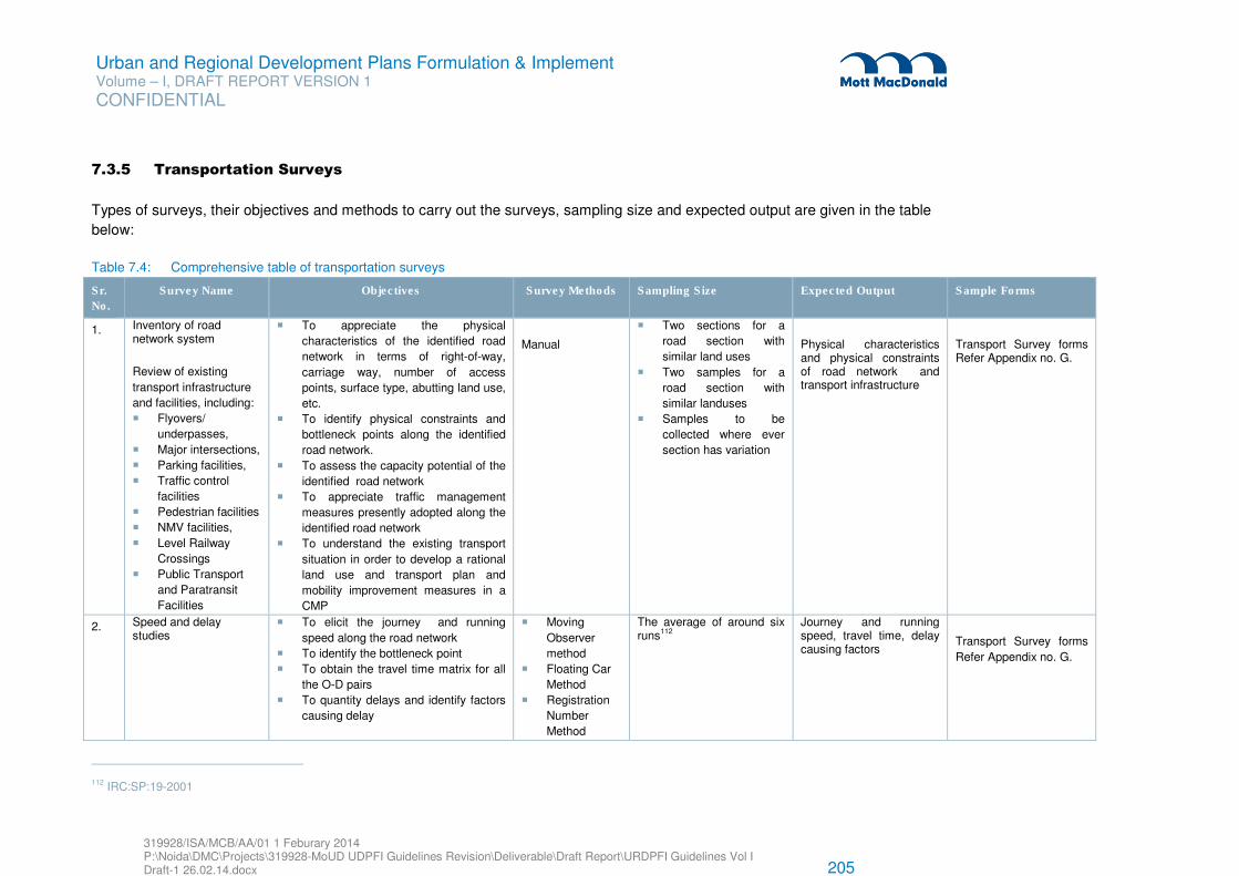
Urban and Regional Development Plans Formulation & Implement Volume – I, DRAFT REPORT VERSION 1
CONFIDENTIAL
319928/ISA/MCB/AA/01 1 Feburary 2014 P:\Noida\DMC\Projects\319928-MoUD UDPFI Guidelines Revision\Deliverable\Draft Report\URDPFI Guidelines Vol I Draft-1 26.02.14.docx 205
7.3.5 Transportation Surveys
Types of surveys, their objectives and methods to carry out the surveys, sampling size and expected output are given in the table
below:
Table 7.4: Comprehensive table of transportation surveys
Sr.
No.
Survey Name Objectives Survey Methods Sampling Size Expected Output Sample Forms
1. Inventory of road network system
Review of existing
transport infrastructure
and facilities, including:
� Flyovers/
underpasses,
� Major intersections,
� Parking facilities,
� Traffic control
facilities
� Pedestrian facilities
� NMV facilities,
� Level Railway
Crossings
� Public Transport
and Paratransit
Facilities
� To appreciate the physical
characteristics of the identified road
network in terms of right-of-way,
carriage way, number of access
points, surface type, abutting land use,
etc.
� To identify physical constraints and
bottleneck points along the identified
road network.
� To assess the capacity potential of the
identified road network
� To appreciate traffic management
measures presently adopted along the
identified road network
� To understand the existing transport
situation in order to develop a rational
land use and transport plan and
mobility improvement measures in a
CMP
Manual
� Two sections for a
road section with
similar land uses
� Two samples for a
road section with
similar landuses
� Samples to be
collected where ever
section has variation
Physical characteristics and physical constraints of road network and transport infrastructure
Transport Survey forms Refer Appendix no. G.
2. Speed and delay studies
� To elicit the journey and running
speed along the road network
� To identify the bottleneck point
� To obtain the travel time matrix for all
the O-D pairs
� To quantity delays and identify factors
causing delay
� Moving
Observer
method
� Floating Car
Method
� Registration
Number
Method
The average of around six runs112
Journey and running speed, travel time, delay causing factors
Transport Survey forms
Refer Appendix no. G.
112 IRC:SP:19-2001
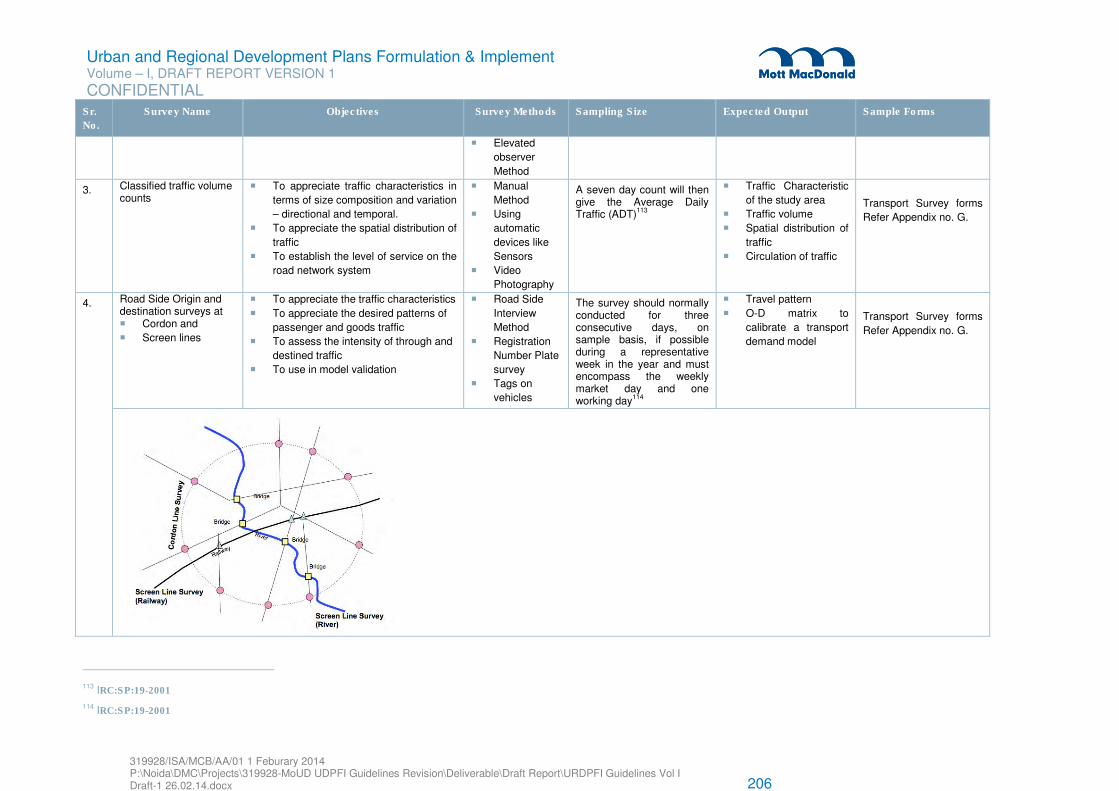
Urban and Regional Development Plans Formulation & Implement Volume – I, DRAFT REPORT VERSION 1
CONFIDENTIAL
319928/ISA/MCB/AA/01 1 Feburary 2014 P:\Noida\DMC\Projects\319928-MoUD UDPFI Guidelines Revision\Deliverable\Draft Report\URDPFI Guidelines Vol I Draft-1 26.02.14.docx 206
Sr.
No.
Survey Name Objectives Survey Methods Sampling Size Expected Output Sample Forms
� Elevated
observer
Method
3. Classified traffic volume counts
� To appreciate traffic characteristics in
terms of size composition and variation
– directional and temporal.
� To appreciate the spatial distribution of
traffic
� To establish the level of service on the
road network system
� Manual
Method
� Using
automatic
devices like
Sensors
� Video
Photography
A seven day count will then give the Average Daily Traffic (ADT)113
� Traffic Characteristic
of the study area
� Traffic volume
� Spatial distribution of
traffic
� Circulation of traffic
Transport Survey forms
Refer Appendix no. G.
4. Road Side Origin and destination surveys at � Cordon and
� Screen lines
� To appreciate the traffic characteristics
� To appreciate the desired patterns of
passenger and goods traffic
� To assess the intensity of through and
destined traffic
� To use in model validation
� Road Side
Interview
Method
� Registration
Number Plate
survey
� Tags on
vehicles
The survey should normally conducted for three consecutive days, on sample basis, if possible during a representative week in the year and must encompass the weekly market day and one working day114
� Travel pattern
� O-D matrix to
calibrate a transport
demand model
Transport Survey forms
Refer Appendix no. G.
113 IRC:SP:19-2001
114 IRC:SP:19-2001
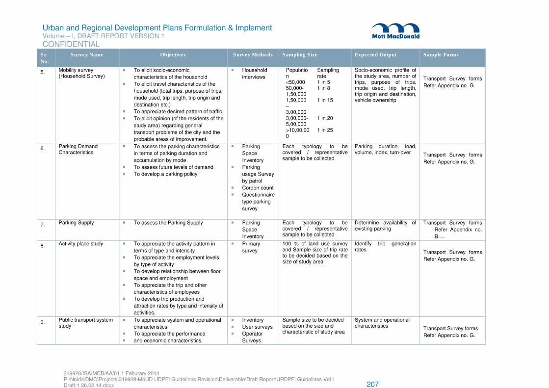
Urban and Regional Development Plans Formulation & Implement Volume – I, DRAFT REPORT VERSION 1
CONFIDENTIAL
319928/ISA/MCB/AA/01 1 Feburary 2014 P:\Noida\DMC\Projects\319928-MoUD UDPFI Guidelines Revision\Deliverable\Draft Report\URDPFI Guidelines Vol I Draft-1 26.02.14.docx 207
Sr.
No.
Survey Name Objectives Survey Methods Sampling Size Expected Output Sample Forms
5. Mobility survey (Household Survey)
� To elicit socio-economic
characteristics of the household
� To elicit travel characteristics of the
household (total trips, purpose of trips,
mode used, trip length, trip origin and
destination etc.)
� To appreciate desired pattern of traffic
� To elicit opinion (of the residents of the
study area) regarding general
transport problems of the city and the
probable areas of improvement.
� Household
interviews
Population
Sampling rate
<50,000 1 in 5 50,000-1,50,000
1 in 8
1,50,000 – 3,00,000
1 in 15
3,00,000-5,00,000
1 in 20
>10,00,000
1 in 25
Socio-economic profile of the study area, number of trips, purpose of trips, mode used, trip length, trip origin and destination, vehicle ownership
Transport Survey forms
Refer Appendix no. G.
6. Parking Demand Characteristics
� To assess the parking characteristics
in terms of parking duration and
accumulation by mode
� To assess future levels of demand
� To develop a parking policy
� Parking
Space
Inventory
� Parking
usage Survey
by patrol
� Cordon count
� Questionnaire
type parking
survey
Each typology to be covered / representative sample to be collected
Parking duration, load, volume, index, turn-over Transport Survey forms
Refer Appendix no. G.
7. Parking Supply � To assess the Parking Supply � Parking
Space
Inventory
Each typology to be covered / representative sample to be collected
Determine availability of existing parking
Transport Survey forms
Refer Appendix no.
B….
8. Activity place study � To appreciate the activity pattern in
terms of type and intensity
� To appreciate the employment levels
by type of activity
� To develop relationship between floor
space and employment
� To appreciate the trip and other
characteristics of employees
� To develop trip production and
attraction rates by type and intensity of
activities.
� Primary
survey
100 % of land use survey and Sample size of trip rate to be decided based on the size of study area.
Identify trip generation rates Transport Survey forms
Refer Appendix no. G.
9. Public transport system study
� To appreciate system and operational
characteristics
� To appreciate the performance
� and economic characteristics
� Inventory
� User surveys
� Operator
Surveys
Sample size to be decided based on the size and characteristic of study area
System and operational characteristics Transport Survey forms
Refer Appendix no. G.
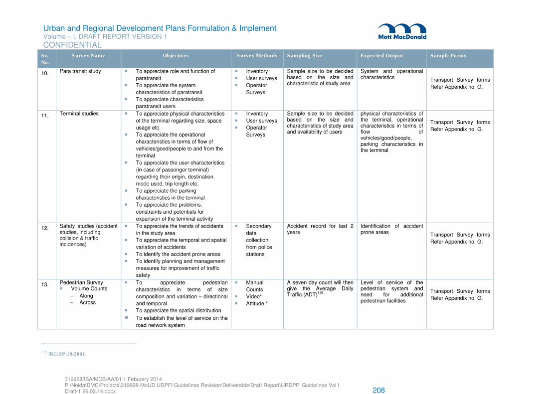
Urban and Regional Development Plans Formulation & Implement Volume – I, DRAFT REPORT VERSION 1
CONFIDENTIAL
319928/ISA/MCB/AA/01 1 Feburary 2014 P:\Noida\DMC\Projects\319928-MoUD UDPFI Guidelines Revision\Deliverable\Draft Report\URDPFI Guidelines Vol I Draft-1 26.02.14.docx 208
Sr.
No.
Survey Name Objectives Survey Methods Sampling Size Expected Output Sample Forms
10. Para transit study � To appreciate role and function of
paratransit
� To appreciate the system
characteristics of paratransit
� To appreciate characteristics
paratransit users
� Inventory
� User surveys
� Operator
Surveys
Sample size to be decided based on the size and characteristic of study area
System and operational characteristics Transport Survey forms
Refer Appendix no. G.
11. Terminal studies � To appreciate physical characteristics
of the terminal regarding size, space
usage etc.
� To appreciate the operational
characteristics in terms of flow of
vehicles/good/people to and from the
terminal
� To appreciate the user characteristics
(in case of passenger terminal)
regarding their origin, destination,
mode used, trip length etc.
� To appreciate the parking
characteristics in the terminal
� To appreciate the problems,
constraints and potentials for
expansion of the terminal activity
� Inventory
� User surveys
� Operator
Surveys
Sample size to be decided based on the size and characteristics of study area and availability of users
physical characteristics of the terminal, operational characteristics in terms of flow of vehicles/good/people, parking characteristics in the terminal
Transport Survey forms
Refer Appendix no. G.
12. Safety studies (accident studies, including collision & traffic incidences)
� To appreciate the trends of accidents
in the study area
� To appreciate the temporal and spatial
variation of accidents
� To identify the accident prone areas
� To identify planning and management
measures for improvement of traffic
safety
� Secondary
data
collection
from police
stations
Accident record for last 2 years
Identification of accident prone areas Transport Survey forms
Refer Appendix no. G.
13. Pedestrian Survey � Volume Counts
− Along − Across
� To appreciate pedestrian
characteristics in terms of size
composition and variation – directional
and temporal.
� To appreciate the spatial distribution
� To establish the level of service on the
road network system
� Manual
Counts
� Video*
� Attitude *
A seven day count will then give the Average Daily Traffic (ADT)115
Level of service of the pedestrian system and need for additional pedestrian facilities
Transport Survey forms
Refer Appendix no. G.
115 IRC:SP:19-2001
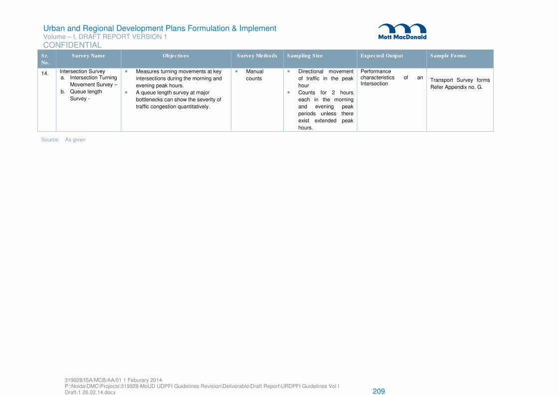
Urban and Regional Development Plans Formulation & Implement Volume – I, DRAFT REPORT VERSION 1
CONFIDENTIAL
319928/ISA/MCB/AA/01 1 Feburary 2014 P:\Noida\DMC\Projects\319928-MoUD UDPFI Guidelines Revision\Deliverable\Draft Report\URDPFI Guidelines Vol I Draft-1 26.02.14.docx 209
Sr.
No.
Survey Name Objectives Survey Methods Sampling Size Expected Output Sample Forms
14. Intersection Survey a. Intersection Turning
Movement Survey –
b. Queue length
Survey -
� Measures turning movements at key
intersections during the morning and
evening peak hours.
� A queue length survey at major
bottlenecks can show the severity of
traffic congestion quantitatively.
� Manual
counts
� Directional movement
of traffic in the peak
hour
� Counts for 2 hours
each in the morning
and evening peak
periods unless there
exist extended peak
hours.
Performance characteristics of an Intersection
Transport Survey forms
Refer Appendix no. G.
Source: As given
Urban and Regional Development Plans Formulation & Implement Volume – I, DRAFT REPORT VERSION 1
CONFIDENTIAL
319928/ISA/MCB/AA/01 1 Feburary 2014 P:\Noida\DMC\Projects\319928-MoUD UDPFI Guidelines Revision\Deliverable\Draft Report\URDPFI Guidelines Vol I Draft-1 26.02.14.docx
211
7.4 Analytical Techniques
Analysis breaks down complex phenomena into simple elements by organising, correlating, classifying,
displaying and resolving. Various analytical tools are available today which perform one or several of these
tasks and which town planners use to study the state of the society, the settlements and their physical and
socio-economic attributes, technological directions, environmental condition and the change that occur
over a period of time. Based on the understanding of existing conditions and trends of change, the
planners propose short-term and long-term scenarios of future and design schedules of inter connected
interventions to steer development towards a desired future state.
These analysis techniques shall be carefully chosen keeping in view the objective of the study and the
extent of data collected. The techniques with following characterised shall be preferred:
� Consideration of multiple parameters
� Handling mass data base
� Analysis output in visual form
7.4.1 Simplified Reporting
A report can be a summarized or detailed description of studied phenomenon. It helps in performing the
tasks of putting information in ordered format, identifying patterns, classifying, observing trends, correlating
and inferring with a view to arriving at insights, conclusions, policy guidelines or design directions related to
issues under investigation.
The report should introduce the contents at the very beginning, stating the objectives, scope and limitation
of the study, describing the methodology used in collecting information and conducting analyses for
arriving at alternatives, evaluating alternatives and deriving conclusions and recommendations.
The ideal report should be brief yet illuminative with judicious use of tables, graphs and maps and proper
presentation of cross sectional characteristics of area like density, air pollution, land use pattern and socio
economic variations over space and time. The rating of information by grouping it and assigning weights
and noting it in ordered sequence is also part of the analytical process.
7.4.2 Trend Analysis
This is a simple technique to study changes in a system over a period of time. Availability of time series
data at least for three points of time is a basic requirement for its application. The analysis can be
displayed in the form of tables, graphs, maps or diagrams. This technique is popularly used in study and
analysis of change in urban economy, demographic pattern and physical form.
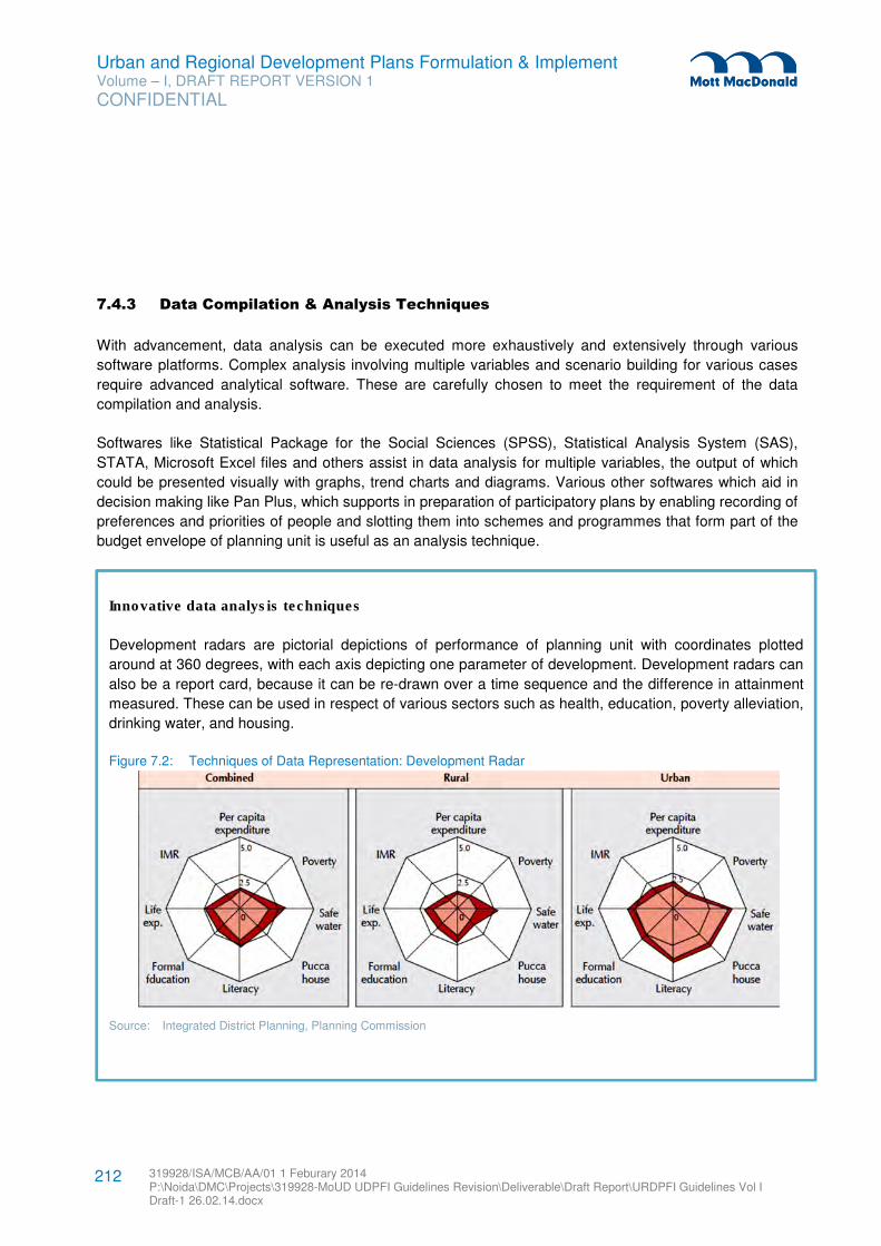
Urban and Regional Development Plans Formulation & Implement Volume – I, DRAFT REPORT VERSION 1
CONFIDENTIAL
319928/ISA/MCB/AA/01 1 Feburary 2014 P:\Noida\DMC\Projects\319928-MoUD UDPFI Guidelines Revision\Deliverable\Draft Report\URDPFI Guidelines Vol I Draft-1 26.02.14.docx
212
7.4.3 Data Compilation & Analysis Techniques
With advancement, data analysis can be executed more exhaustively and extensively through various
software platforms. Complex analysis involving multiple variables and scenario building for various cases
require advanced analytical software. These are carefully chosen to meet the requirement of the data
compilation and analysis.
Softwares like Statistical Package for the Social Sciences (SPSS), Statistical Analysis System (SAS),
STATA, Microsoft Excel files and others assist in data analysis for multiple variables, the output of which
could be presented visually with graphs, trend charts and diagrams. Various other softwares which aid in
decision making like Pan Plus, which supports in preparation of participatory plans by enabling recording of
preferences and priorities of people and slotting them into schemes and programmes that form part of the
budget envelope of planning unit is useful as an analysis technique.
Innovative data analysis techniques
Development radars are pictorial depictions of performance of planning unit with coordinates plotted
around at 360 degrees, with each axis depicting one parameter of development. Development radars can
also be a report card, because it can be re-drawn over a time sequence and the difference in attainment
measured. These can be used in respect of various sectors such as health, education, poverty alleviation,
drinking water, and housing.
Figure 7.2: Techniques of Data Representation: Development Radar
Source: Integrated District Planning, Planning Commission
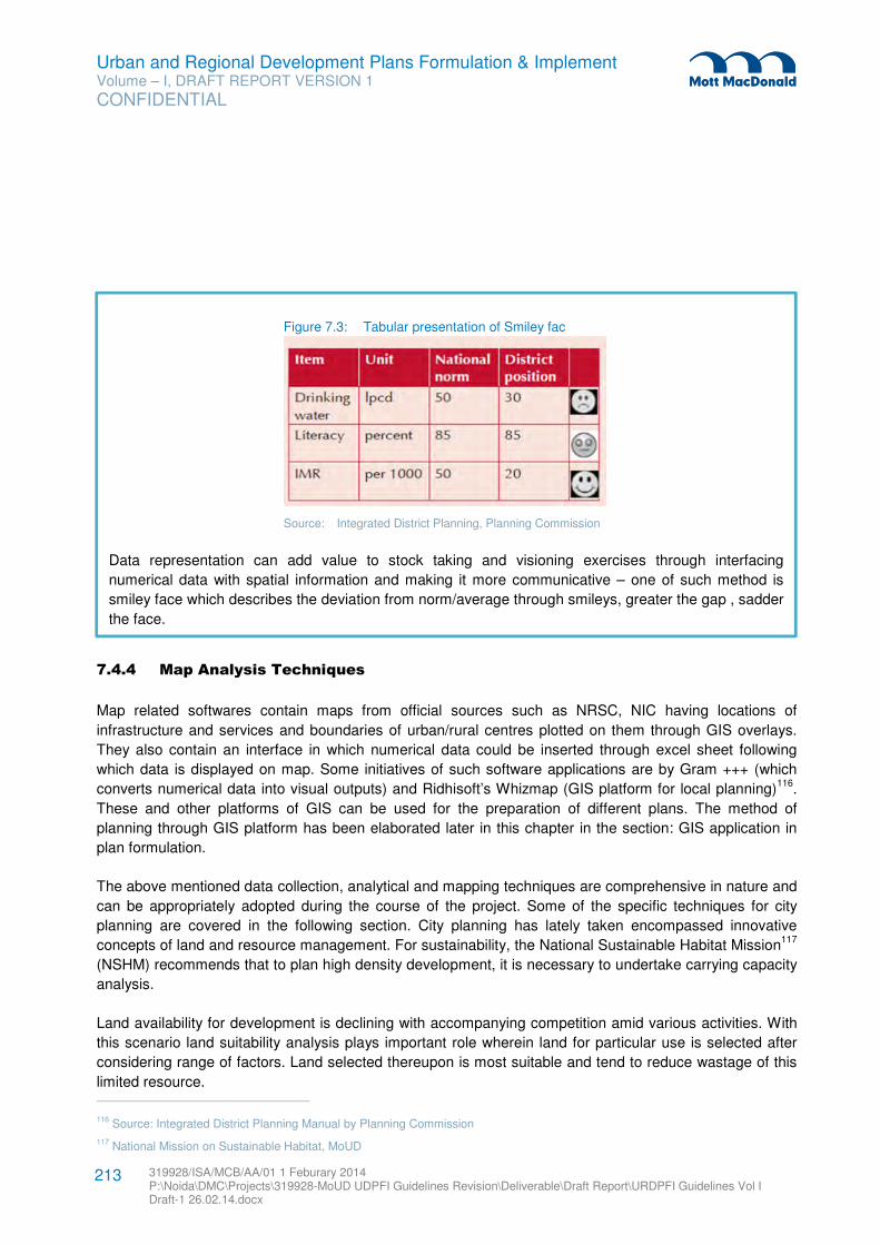
Urban and Regional Development Plans Formulation & Implement Volume – I, DRAFT REPORT VERSION 1
CONFIDENTIAL
319928/ISA/MCB/AA/01 1 Feburary 2014 P:\Noida\DMC\Projects\319928-MoUD UDPFI Guidelines Revision\Deliverable\Draft Report\URDPFI Guidelines Vol I Draft-1 26.02.14.docx
213
7.4.4 Map Analysis Techniques
Map related softwares contain maps from official sources such as NRSC, NIC having locations of
infrastructure and services and boundaries of urban/rural centres plotted on them through GIS overlays.
They also contain an interface in which numerical data could be inserted through excel sheet following
which data is displayed on map. Some initiatives of such software applications are by Gram +++ (which
converts numerical data into visual outputs) and Ridhisoft’s Whizmap (GIS platform for local planning)116
.
These and other platforms of GIS can be used for the preparation of different plans. The method of
planning through GIS platform has been elaborated later in this chapter in the section: GIS application in
plan formulation.
The above mentioned data collection, analytical and mapping techniques are comprehensive in nature and
can be appropriately adopted during the course of the project. Some of the specific techniques for city
planning are covered in the following section. City planning has lately taken encompassed innovative
concepts of land and resource management. For sustainability, the National Sustainable Habitat Mission117
(NSHM) recommends that to plan high density development, it is necessary to undertake carrying capacity
analysis.
Land availability for development is declining with accompanying competition amid various activities. With
this scenario land suitability analysis plays important role wherein land for particular use is selected after
considering range of factors. Land selected thereupon is most suitable and tend to reduce wastage of this
limited resource. 116 Source: Integrated District Planning Manual by Planning Commission
117 National Mission on Sustainable Habitat, MoUD
Figure 7.3: Tabular presentation of Smiley fac
Source: Integrated District Planning, Planning Commission
Data representation can add value to stock taking and visioning exercises through interfacing
numerical data with spatial information and making it more communicative – one of such method is
smiley face which describes the deviation from norm/average through smileys, greater the gap , sadder
the face.
Urban and Regional Development Plans Formulation & Implement Volume – I, DRAFT REPORT VERSION 1
CONFIDENTIAL
319928/ISA/MCB/AA/01 1 Feburary 2014 P:\Noida\DMC\Projects\319928-MoUD UDPFI Guidelines Revision\Deliverable\Draft Report\URDPFI Guidelines Vol I Draft-1 26.02.14.docx
214
With the expanding city areas, threshold analysis for limiting its boundaries is evaluated on the basis of
viability. These techniques have significant impact on decision making.
7.4.5 Carrying Capacity
Carrying capacity of an area can be defined as the maximum number of population that can be supported
by the environment of that area through optimum utilization of the available resources. The pattern and
extent of resource usage serves to be the primary factor that affects the carrying capacity. This indeed
depends highly on the:
� socio-economic status of the people
� use of technology
If technology is used in a positive manner then the carrying capacity is measured to increase manifold.
Planners usually define carrying capacity as the ability of the natural or artificial system that can absorb the
population growth or physical development without considerable degradation or damage (Schneider et al.,
1978). (Schneider, D.M., D.R. Godschalk, and N. Axler. 1978. The Carrying Capacity Concept as a Planning Tool. Chicago, IL:
American Planning Association, Planning Advisory Service Report 338).
The techniques can be translated into policies, strategies and action plans at the local level towards
augmentation and sustenance of urban environment resources in terms of their supportive and assimilative
capacities on one hand and size, nature and distribution of urban-economic activities and their concomitant
demands on environment, on another. (Carrying Capacity based Regional Planning by National Institute of Urban Affairs,
New Delhi; IHS, Rotterdam)
The evaluation of urban carrying capacity is a complex process as it is determined from basic needs such
as food requirements, various kinds of resources consumed and the many kinds of wastes generated,
different kinds of land use conversions leading to ecological imbalance and the great variability in
technology, institutions and lifestyles created. There are six types of carrying capacities that can be
evaluated -
� Infrastructure capacity level,
� Institutional capacity level,
� Perceptual carrying capacity,
� Environmental capacity level,
� Sustainable capacity level and
� Bio-centric capacity level.
Among these six types, the profound ones are infrastructure capacity level, environmental capacity level,
and sustainable capacity level which are more relevant to urban planning.
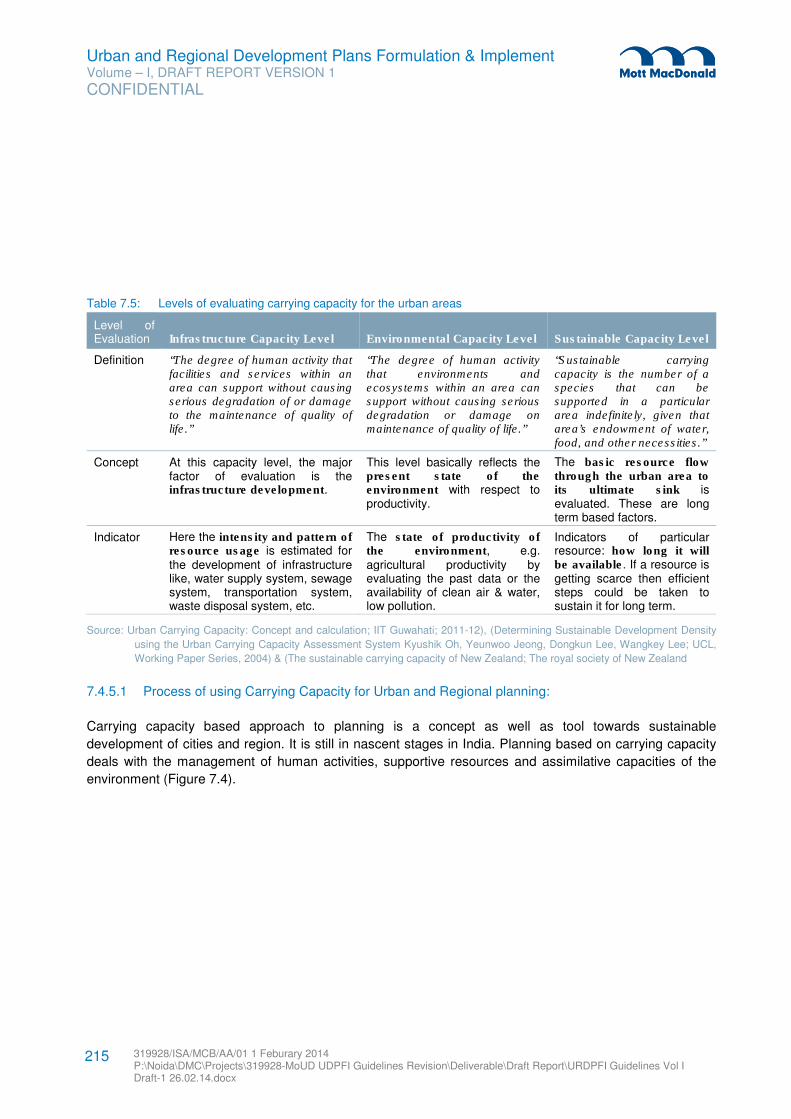
Urban and Regional Development Plans Formulation & Implement Volume – I, DRAFT REPORT VERSION 1
CONFIDENTIAL
319928/ISA/MCB/AA/01 1 Feburary 2014 P:\Noida\DMC\Projects\319928-MoUD UDPFI Guidelines Revision\Deliverable\Draft Report\URDPFI Guidelines Vol I Draft-1 26.02.14.docx
215
Table 7.5: Levels of evaluating carrying capacity for the urban areas
Level of Evaluation Infrastructure Capacity Level Environmental Capacity Level Sustainable Capacity Level
Definition “The degree of human activity that facilities and services within an area can support without causing serious degradation of or damage to the maintenance of quality of life.”
“The degree of human activity that environments and ecosystems within an area can support without causing serious degradation or damage on maintenance of quality of life.”
“Sustainable carrying capacity is the number of a species that can be supported in a particular area indefinitely, given that area’s endowment of water, food, and other necessities.”
Concept At this capacity level, the major factor of evaluation is the infrastructure development.
This level basically reflects the present state of the environment with respect to productivity.
The basic resource flow through the urban area to its ultimate sink is evaluated. These are long term based factors.
Indicator Here the intensity and pattern of resource usage is estimated for the development of infrastructure like, water supply system, sewage system, transportation system, waste disposal system, etc.
The state of productivity of the environment, e.g. agricultural productivity by evaluating the past data or the availability of clean air & water, low pollution.
Indicators of particular resource: how long it will be available. If a resource is getting scarce then efficient steps could be taken to sustain it for long term.
Source: Urban Carrying Capacity: Concept and calculation; IIT Guwahati; 2011-12), (Determining Sustainable Development Density
using the Urban Carrying Capacity Assessment System Kyushik Oh, Yeunwoo Jeong, Dongkun Lee, Wangkey Lee; UCL,
Working Paper Series, 2004) & (The sustainable carrying capacity of New Zealand; The royal society of New Zealand
7.4.5.1 Process of using Carrying Capacity for Urban and Regional planning:
Carrying capacity based approach to planning is a concept as well as tool towards sustainable
development of cities and region. It is still in nascent stages in India. Planning based on carrying capacity
deals with the management of human activities, supportive resources and assimilative capacities of the
environment (Figure 7.4).
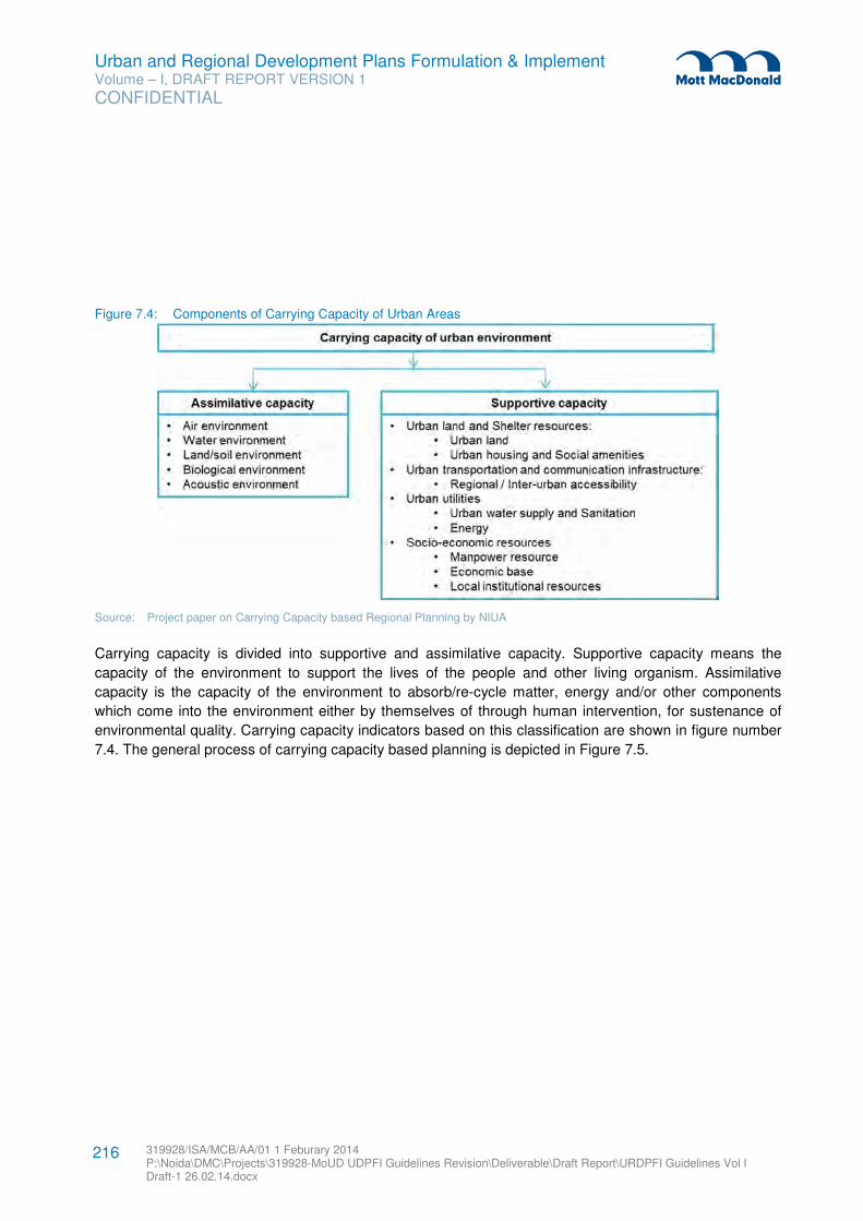
Urban and Regional Development Plans Formulation & Implement Volume – I, DRAFT REPORT VERSION 1
CONFIDENTIAL
319928/ISA/MCB/AA/01 1 Feburary 2014 P:\Noida\DMC\Projects\319928-MoUD UDPFI Guidelines Revision\Deliverable\Draft Report\URDPFI Guidelines Vol I Draft-1 26.02.14.docx
216
Figure 7.4: Components of Carrying Capacity of Urban Areas
Source: Project paper on Carrying Capacity based Regional Planning by NIUA
Carrying capacity is divided into supportive and assimilative capacity. Supportive capacity means the
capacity of the environment to support the lives of the people and other living organism. Assimilative
capacity is the capacity of the environment to absorb/re-cycle matter, energy and/or other components
which come into the environment either by themselves of through human intervention, for sustenance of
environmental quality. Carrying capacity indicators based on this classification are shown in figure number
7.4. The general process of carrying capacity based planning is depicted in Figure 7.5.
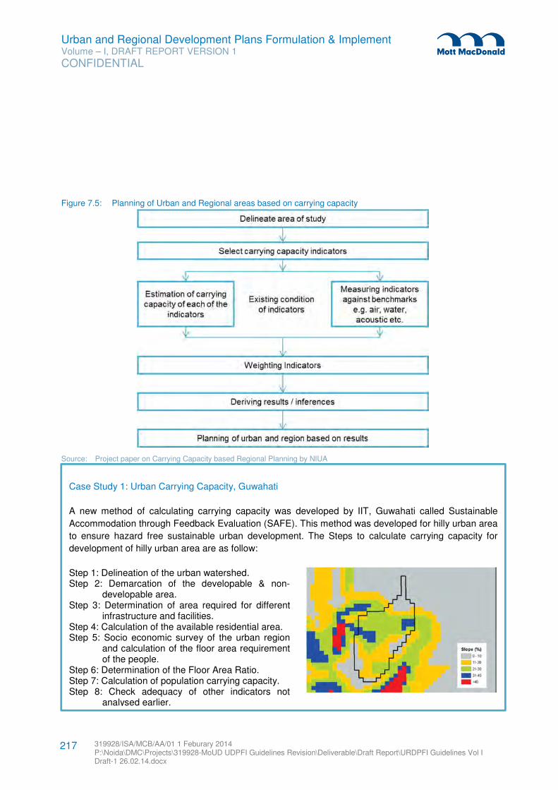
Urban and Regional Development Plans Formulation & Implement Volume – I, DRAFT REPORT VERSION 1
CONFIDENTIAL
319928/ISA/MCB/AA/01 1 Feburary 2014 P:\Noida\DMC\Projects\319928-MoUD UDPFI Guidelines Revision\Deliverable\Draft Report\URDPFI Guidelines Vol I Draft-1 26.02.14.docx
217
Figure 7.5: Planning of Urban and Regional areas based on carrying capacity
Source: Project paper on Carrying Capacity based Regional Planning by NIUA
Case Study 1: Urban Carrying Capacity, Guwahati
A new method of calculating carrying capacity was developed by IIT, Guwahati called Sustainable
Accommodation through Feedback Evaluation (SAFE). This method was developed for hilly urban area
to ensure hazard free sustainable urban development. The Steps to calculate carrying capacity for
development of hilly urban area are as follow:
Step 1: Delineation of the urban watershed. Step 2: Demarcation of the developable & non-
developable area. Step 3: Determination of area required for different
infrastructure and facilities. Step 4: Calculation of the available residential area. Step 5: Socio economic survey of the urban region
and calculation of the floor area requirement of the people.
Step 6: Determination of the Floor Area Ratio. Step 7: Calculation of population carrying capacity. Step 8: Check adequacy of other indicators not
analysed earlier.
Urban and Regional Development Plans Formulation & Implement Volume – I, DRAFT REPORT VERSION 1
CONFIDENTIAL
319928/ISA/MCB/AA/01 1 Feburary 2014 P:\Noida\DMC\Projects\319928-MoUD UDPFI Guidelines Revision\Deliverable\Draft Report\URDPFI Guidelines Vol I Draft-1 26.02.14.docx
218
Case Study 2: Tourism Carrying Capacity in European Tourism Destinations
The study was undertaken to elaborate comprehensive methodological framework to understand the
concept of Tourism Carrying Capacity (TCC) and applying this methodology for sustainable tourism
activities in the European tourist destinations.
The basic elements of the concept of carrying capacity from tourism point of view, i.e. the need for a limit/ a
threshold in the tourist activities, were charted by following a methodology. For measuring TCC different
components and subsequent indicators were weighted based on the (a) characteristics of the locality, (b)
the type of tourism and environment interface and (c) the type of tourism. Sample of different type of
tourism destinations were studied for calculating TCC. Such as coastal areas, islands, protected areas,
mountain resorts etcetera. The methodology of measuring TCC has been shown in Figure 7.6.
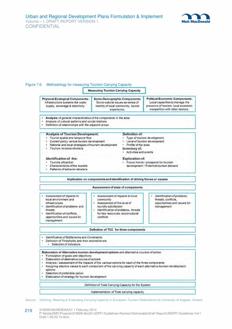
Urban and Regional Development Plans Formulation & Implement Volume – I, DRAFT REPORT VERSION 1
CONFIDENTIAL
319928/ISA/MCB/AA/01 1 Feburary 2014 P:\Noida\DMC\Projects\319928-MoUD UDPFI Guidelines Revision\Deliverable\Draft Report\URDPFI Guidelines Vol I Draft-1 26.02.14.docx
219
Figure 7.6: Methodology for measuring Tourism Carrying Capacity
Source: Defining, Meaning & Evaluating Carrying Capacity in European Tourism Destinations by University of Aegean, Greece
Urban and Regional Development Plans Formulation & Implement Volume – I, DRAFT REPORT VERSION 1
CONFIDENTIAL
319928/ISA/MCB/AA/01 1 Feburary 2014 P:\Noida\DMC\Projects\319928-MoUD UDPFI Guidelines Revision\Deliverable\Draft Report\URDPFI Guidelines Vol I Draft-1 26.02.14.docx
220
7.4.6 Threshold Analysis
The threshold theory is based on the observation that towns encounter limitations to their expansion due to
physiographic features, existing land use and technology of infrastructure. An important inference from this
observation is that physical growth of town is not smoothly continuous but proceeds in stages marked by
successive limitations which have been called development threshold. These thresholds are not
insurmountable and can be overcome but only at additional (often very high) development investments
known as threshold costs.
These techniques are commonly used to determine influence zones, urban extents and regions. The
threshold theory attempts to rationalize and control the process of urban growth and provides a
quantitative tool to help decision making. Thresholds can be tangible or intangible. Thresholds based on
physical limitations are comparatively easy to determine using mapping techniques.
Tangible thresholds are those which can be measured, quantified and represented. These are physical,
technological and structural limitations such as land available for development, current technology of water
treatment or electricity production. Physical limitations or threshold are restrictions imposed by
physiography and topography and get physically identified in the form of natural features such as rivers to
be crossed, hilly areas and steep slopes etc. Technological thresholds are limitations imposed on physical
growth of city, by constraints in expansion of infrastructure system. Some of these thresholds can be
identified spatially and some numerically for instance, watershed line is generally the limit of extension of
sewerage system, whereas, the capacity of a sewage treatment plant can be expressed in terms of
number of inhabitants that can be served (numerically) identified threshold. Intangible thresholds can only
be understood and indirectly measured such as, socio economic limitations. These are limitations imposed
by physiography and topography and get physically identified in the form of natural features such as rivers
to be crossed, hilly areas and steep slopes.
7.4.6.1 The Process of Threshold Analysis
Part One: Analysis
� Stage I: Delineation of area to be surveyed by drawing the boundaries of area as closely as possible to
a homogenous pattern of settlement.
� Stage II: Analysis of factors affecting town/urban development such as physiographic suitability of land
and possible extension of public utilities.
� Stage III: Tracing the threshold lines, delimiting areas suitable for urban development and new
development areas from fundamental land development.
� Stage IV: Synthesis – The information can now be correlated to form a synthesis of all factors
considered on basis of which, the lines of urban development thresholds can be defined. Physical
thresholds are shown spatially on base map and quantitative thresholds such as population figures,
investment, power or water supply requirement can be expressed.
� Stage V: Land is subdivided for main functions of city within the successive physical threshold areas.
This is done generally for two main functions, suitable area for industry and suitable area for other
urban uses, priority being given based on vision of development.
Urban and Regional Development Plans Formulation & Implement Volume – I, DRAFT REPORT VERSION 1
CONFIDENTIAL
319928/ISA/MCB/AA/01 1 Feburary 2014 P:\Noida\DMC\Projects\319928-MoUD UDPFI Guidelines Revision\Deliverable\Draft Report\URDPFI Guidelines Vol I Draft-1 26.02.14.docx
221
� Stage VI: The calculation of capacity of residential areas within the first and successive threshold lines
in relation to quantitative threshold figures in order to define the approximate number of inhabitants
which may be accommodated.
� Stage VII: The calculation of averages of industrial areas within the first and successive threshold lines
to define their potential for industrial location after considering the quantitative threshold figures.
Part Two: Outline of Economic Assessment
� Stage VIII: Calculating the approximate capital investment costs necessary to overcome each
threshold within the examined area.
� Stage IX: Calculating the following efficiency indices for each successive threshold area:
– Cost of each new inhabitant
– Cost per acre of land suitable for development
In regional planning indirect use of quantified results can be used in decision making among alternative
locations for some significant investment within the region, while preparing a comprehensive regional
policy for the distribution of the expected influx of population.
7.4.7 Land Suitability Analysis
Land suitability refers to the ability of a particular type of land to support a specific use. The process of land
suitability classification involves; evaluation and grouping of particular land areas based on their suitability
for a defined use118
. Land use suitability analysis aims at identifying the most appropriate spatial pattern for
future land uses according to specific requirements, preferences, or predictors of some activity119
.
Applications of suitability analysis can be found in many fields, such as site selection for cropland,
agriculture suitability, graze suitability, forestry suitability (natural resource management field), flooding
control, sustainable development (environment field), suitability for urban expansion, site selection for
specific land use etcetera. Land suitability can be used in planning process to finalise most appropriate
land for particular land use or activity by following the process presented in Figure 7.7.
118 (Land suitability analysis for agriculture crops: a fuzzy multi-criteria decision making approach; 2003; Prakash T N).
119 (Hopkins, L., 1977. Methods for generating land suitability maps: a comparative evaluation. Journal for American Institute of Planners 34 (1), 19–29.) (Collins, M.G., Steiner, F.R., Rushman, M.J., 2001. Land-use suitability analysis in the United States: historical development and promising technological achievements. Environmental Management 28 (5), 611–621.)
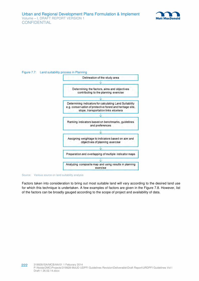
Urban and Regional Development Plans Formulation & Implement Volume – I, DRAFT REPORT VERSION 1
CONFIDENTIAL
319928/ISA/MCB/AA/01 1 Feburary 2014 P:\Noida\DMC\Projects\319928-MoUD UDPFI Guidelines Revision\Deliverable\Draft Report\URDPFI Guidelines Vol I Draft-1 26.02.14.docx
222
Figure 7.7: Land suitability process in Planning
Source: Various source on land suitability analysis
Factors taken into consideration to bring out most suitable land will vary according to the desired land use
for which this technique is undertaken. A few examples of factors are given in the Figure 7.8. However, list
of the factors can be broadly gauged according to the scope of project and availability of data.
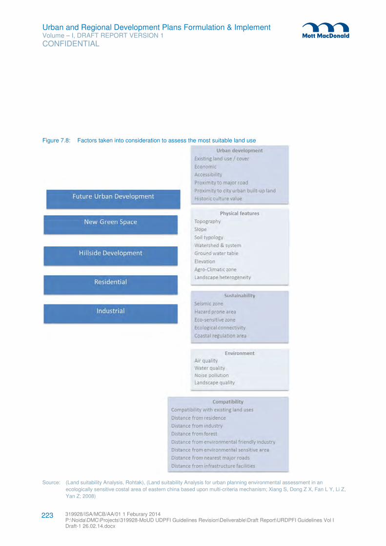
Urban and Regional Development Plans Formulation & Implement Volume – I, DRAFT REPORT VERSION 1
CONFIDENTIAL
319928/ISA/MCB/AA/01 1 Feburary 2014 P:\Noida\DMC\Projects\319928-MoUD UDPFI Guidelines Revision\Deliverable\Draft Report\URDPFI Guidelines Vol I Draft-1 26.02.14.docx
223
Figure 7.8: Factors taken into consideration to assess the most suitable land use
Source: (Land suitability Analysis, Rohtak), (Land suitability Analysis for urban planning environmental assessment in an
ecologically sensitive costal area of eastern china based upon multi-criteria mechanism; Xiang S, Dong Z X, Fan L Y, Li Z,
Yan Z; 2008)
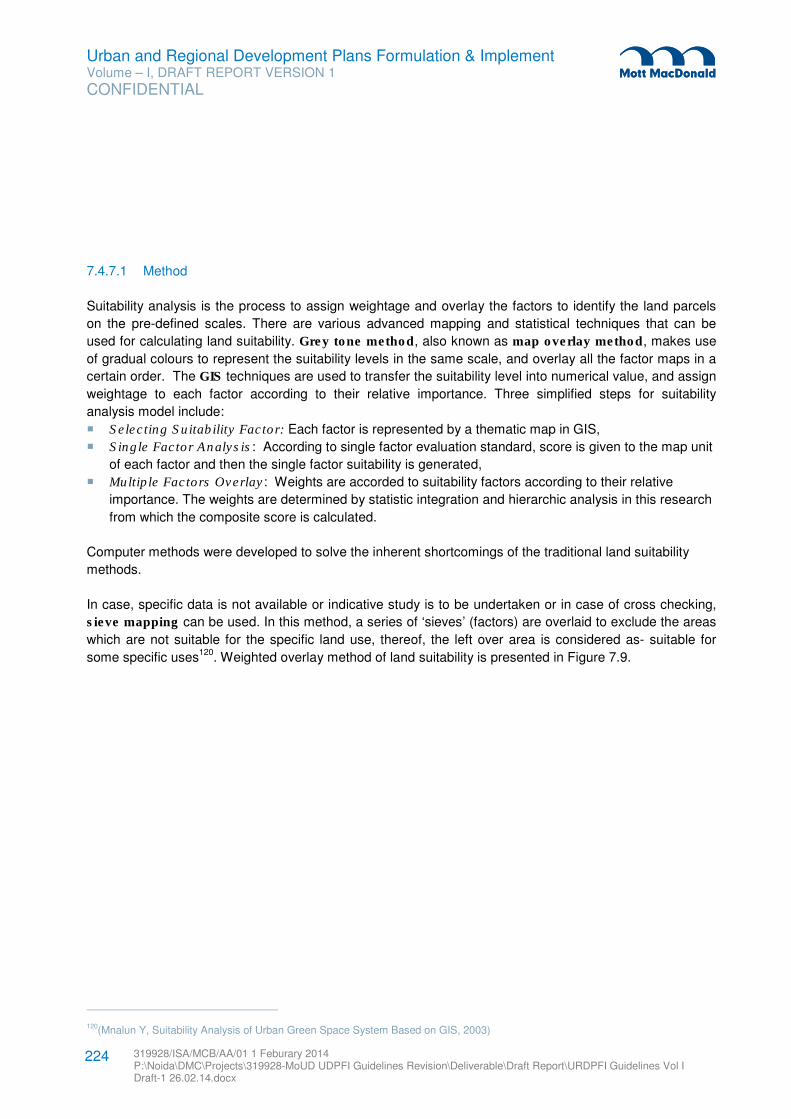
Urban and Regional Development Plans Formulation & Implement Volume – I, DRAFT REPORT VERSION 1
CONFIDENTIAL
319928/ISA/MCB/AA/01 1 Feburary 2014 P:\Noida\DMC\Projects\319928-MoUD UDPFI Guidelines Revision\Deliverable\Draft Report\URDPFI Guidelines Vol I Draft-1 26.02.14.docx
224
7.4.7.1 Method
Suitability analysis is the process to assign weightage and overlay the factors to identify the land parcels
on the pre-defined scales. There are various advanced mapping and statistical techniques that can be
used for calculating land suitability. Grey tone method, also known as map overlay method, makes use
of gradual colours to represent the suitability levels in the same scale, and overlay all the factor maps in a
certain order. The GIS techniques are used to transfer the suitability level into numerical value, and assign
weightage to each factor according to their relative importance. Three simplified steps for suitability
analysis model include:
� Selecting Suitability Factor: Each factor is represented by a thematic map in GIS,
� Single Factor Analysis: According to single factor evaluation standard, score is given to the map unit
of each factor and then the single factor suitability is generated,
� Multiple Factors Overlay: Weights are accorded to suitability factors according to their relative
importance. The weights are determined by statistic integration and hierarchic analysis in this research
from which the composite score is calculated.
Computer methods were developed to solve the inherent shortcomings of the traditional land suitability
methods.
In case, specific data is not available or indicative study is to be undertaken or in case of cross checking,
sieve mapping can be used. In this method, a series of ‘sieves’ (factors) are overlaid to exclude the areas
which are not suitable for the specific land use, thereof, the left over area is considered as- suitable for
some specific uses120
. Weighted overlay method of land suitability is presented in Figure 7.9.
120(Mnalun Y, Suitability Analysis of Urban Green Space System Based on GIS, 2003)
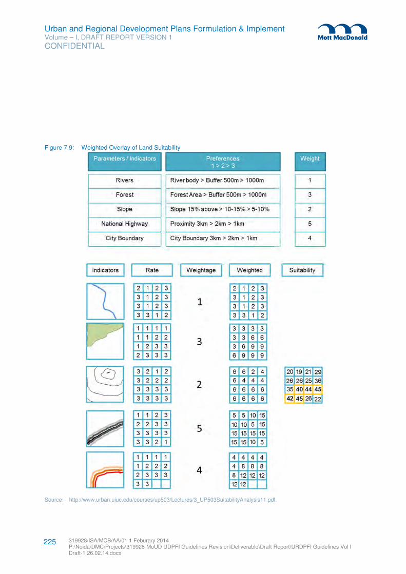
Urban and Regional Development Plans Formulation & Implement Volume – I, DRAFT REPORT VERSION 1
CONFIDENTIAL
319928/ISA/MCB/AA/01 1 Feburary 2014 P:\Noida\DMC\Projects\319928-MoUD UDPFI Guidelines Revision\Deliverable\Draft Report\URDPFI Guidelines Vol I Draft-1 26.02.14.docx
225
Figure 7.9: Weighted Overlay of Land Suitability
Source: http://www.urban.uiuc.edu/courses/up503/Lectures/3_UP503SuitabilityAnalysis11.pdf.
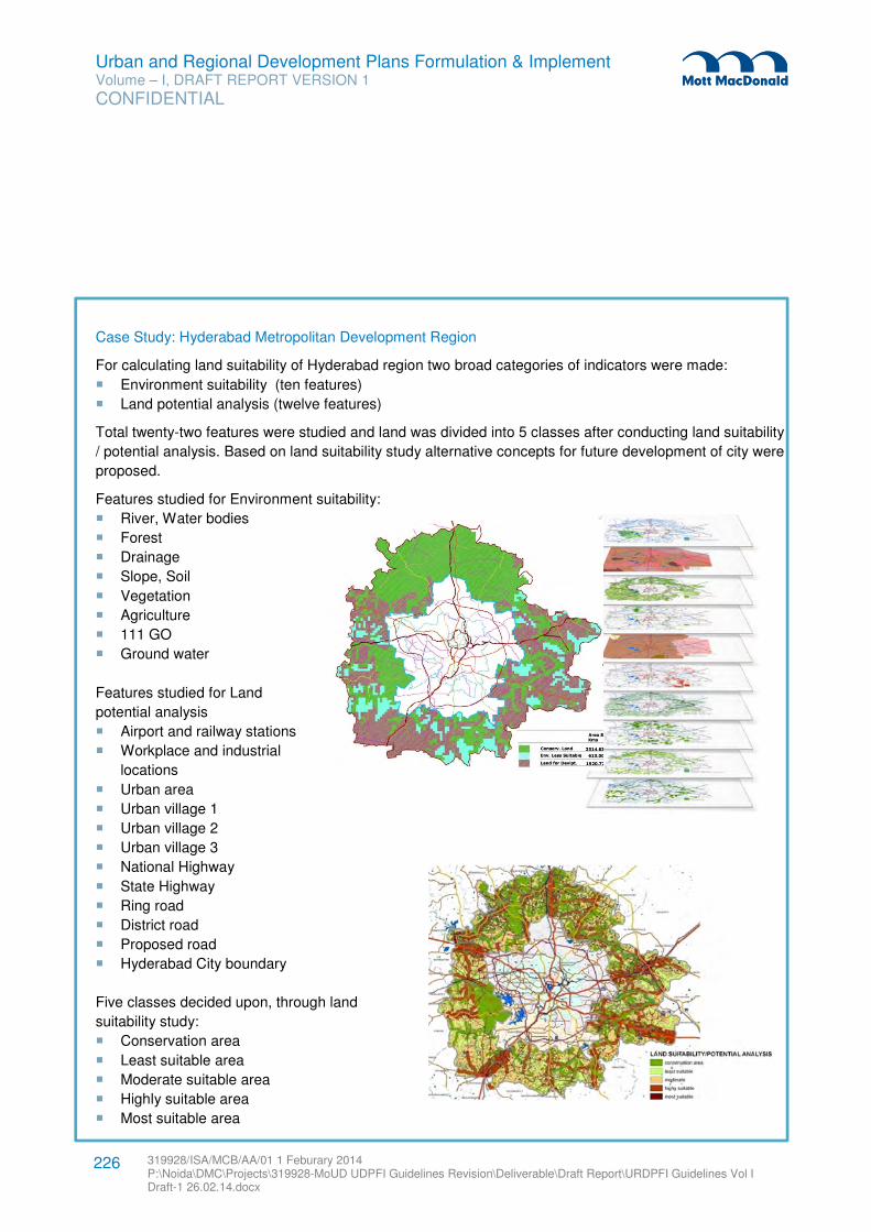
Urban and Regional Development Plans Formulation & Implement Volume – I, DRAFT REPORT VERSION 1
CONFIDENTIAL
319928/ISA/MCB/AA/01 1 Feburary 2014 P:\Noida\DMC\Projects\319928-MoUD UDPFI Guidelines Revision\Deliverable\Draft Report\URDPFI Guidelines Vol I Draft-1 26.02.14.docx
226
Case Study: Hyderabad Metropolitan Development Region
For calculating land suitability of Hyderabad region two broad categories of indicators were made:
� Environment suitability (ten features)
� Land potential analysis (twelve features)
Total twenty-two features were studied and land was divided into 5 classes after conducting land suitability
/ potential analysis. Based on land suitability study alternative concepts for future development of city were
proposed.
Features studied for Environment suitability:
� River, Water bodies
� Forest
� Drainage
� Slope, Soil
� Vegetation
� Agriculture
� 111 GO
� Ground water
Features studied for Land
potential analysis
� Airport and railway stations
� Workplace and industrial
locations
� Urban area
� Urban village 1
� Urban village 2
� Urban village 3
� National Highway
� State Highway
� Ring road
� District road
� Proposed road
� Hyderabad City boundary
Five classes decided upon, through land
suitability study:
� Conservation area
� Least suitable area
� Moderate suitable area
� Highly suitable area
� Most suitable area
Urban and Regional Development Plans Formulation & Implement Volume – I, DRAFT REPORT VERSION 1
CONFIDENTIAL
319928/ISA/MCB/AA/01 1 Feburary 2014 P:\Noida\DMC\Projects\319928-MoUD UDPFI Guidelines Revision\Deliverable\Draft Report\URDPFI Guidelines Vol I Draft-1 26.02.14.docx
227
7.5 Projection Techniques
In the process of plan formulation, projection techniques are used for anticipating future which is a
necessary step. Here, two types of projection techniques, Simple (1, 2 and 3) and Analytical (4, 5 and 6)
which are available to planners for making projections, have been discussed.
The distinction between simple projections and analytical projections is that simple projection operate on
limited data directly and usually extrapolate a series of observations in a direct manner and analytical
projections which depend on more detailed information and in which the projected value is often the
dependent variable derived from projections of independent variables. Generally speaking, analytical
methods are to be preferred over simple ones since it allows to account for or assume differing patterns of
change in the components of a situation; this usually leads to more accurate results than is the case with
simple projections where the internal structure of a phenomenon is usually ignored.
7.5.1 Population Projection
Planners are concerned with population projections which form the basic framework for setting targets expected to be achieved within a specified time-frame, be it for land use, services or facilities. Most of the important decisions about land uses and services are derived from population estimates: the demand for water, power and waste disposal facilities; housing, open spaces and schools; the supply of labour; spending power available for the retail trade, the numbers of private cars to be expected, possible recreational demands -all can be estimated from the projected population.
The section describes 6 methods of population projections viz.
� Mathematical and Direct Methods: These are simple or direct methods of estimations based on the past population records. Arithmetic progression is involved when, past data suggests that, population is changing by a constant rate. The figures are plotted on plain paper (conventionally with y = population and x = time) which results in a straight line. This straight line is extrapolated for projecting the future population.
However, mostly population changes according to geometric progression, in such a case semi-
logarithmic paper is to be used to yield a straight line for extrapolation. If the past data does not follow
a definite progression, a ‘best fit’ equation can be derived by method of least square and this may be
extended to provide projection.
Graphical methods are most useful for short-term projections, particularly when demographic changes
show stable trends. Hence, these methods should be used for projecting up to 10 years in stable
situations and 5 years where population change is more volatile.
� Employment Method: This method assumes that there is a very strong inter-relationship between
population and employment and indicators such as worker’s population can be correlated with total
population to yield extrapolated information.
This method’s reliability is low and should not be used for long range population forecasting.
� Ratio Methods: These methods rests on the assumption that changes in any geographical area is a
function of those experienced in wider area. Thus population of a city is held to be a function of the
region and region itself is a result of the function of that nation.
Urban and Regional Development Plans Formulation & Implement Volume – I, DRAFT REPORT VERSION 1
CONFIDENTIAL
319928/ISA/MCB/AA/01 1 Feburary 2014 P:\Noida\DMC\Projects\319928-MoUD UDPFI Guidelines Revision\Deliverable\Draft Report\URDPFI Guidelines Vol I Draft-1 26.02.14.docx
228
In ratio methods the population of the second largest area (e.g. the region) is plotted against that of the
parent area (the nation). A curve is obtained by fitting it on the two points. Thereafter it is extrapolated,
by least square/ graphical/other method, to estimate the projected value for the parent area for the
target year.
The requirements of such projections are time–series of populations for the areas to be used in the
analysis and a forecast or sets of forecast for the larger area. These methods are weaker for longer
periods and smaller areas, but are useful for quick and cheap forecasting for middle range (10-15
years) for areas not less than a whole metropolitan area or a city region.
� Migration and Natural increase Method: As the name implies, this method enables natural and
migratory changes to be handled separately.
By examining past data on net migration rates and by attempting to relate these to economic
conditions, particularly to the demand for employment in the study area, it is possible to adopt varying
assumptions about the pattern of future migration. Next, a set of programmes of future natural change
would be developed either by subjective projection of past maximum and minimum migration rates or
by using migration data from projections produced nationally or regionally. The essence of the method
is to begin with the starting date population, add the estimated migratory population figure to produce
the next figure (A). Natural change in population is then added to the projected figure (A), thus
completing one cycle of the projection giving a figure (B). The process is then repeated until the end of
the projection period giving a figure (C). Cycle of projection could be any convenient period e.g. 5
years, 10 years or more.
This projection method uses total population, but age & sex structure is not considered. Thus changes
in death and birth rates which might result from changing age/sex structure cannot be seen and acted
upon. Neither future estimates of school-age population and numbers of women of working age can be
made. Still migration and natural increase method does reveal the possible sequence and the main
elements of change.
� The Cohort-Survival Method: The Cohort-Survival projection is a method for forecasting what the
future population will be, based upon the survival of the existing population and the births that will
occur121
. This method can be applied for any period of time but typically it involves five-year steps.
Cohort-component models are so-called because they divide the population into cohorts, and model on
the demographic components of change such as fertility, mortality and migration – affecting each of the
cohorts. Cohort indicates the generational group e.g. 0- 9, 10-19 and so forth122
.
The cohort component method is used when population projections by age and sex are needed for 5
years, 10 years or longer periods of time. This projection tool allows planners to examine the future
needs of different segments of the population including the needs of children, women in their
reproductive years, persons in the labour force and the elderly. It also allows planners to project the
121 (http://www.sjsu.edu/faculty/watkins/cohort.htm).
122 (Tom Wilson, A Review of Sub-Regional Population Projection Methods, 2011).
Urban and Regional Development Plans Formulation & Implement Volume – I, DRAFT REPORT VERSION 1
CONFIDENTIAL
319928/ISA/MCB/AA/01 1 Feburary 2014 P:\Noida\DMC\Projects\319928-MoUD UDPFI Guidelines Revision\Deliverable\Draft Report\URDPFI Guidelines Vol I Draft-1 26.02.14.docx
229
total size of the population. The results can be used in all aspects of local and regional development
plans123
.
� Matrix Methods: These methods follow the logic of the cohort-survival technique. The initial age and
sex distribution is similarly represented as a column sector but the incidence of births and deaths is
handled by means of a ‘survivor-ship matrix’ which operates on the original population to age the
population through successive time periods, simultaneously performing the calculations of births and
deaths.
7.5.2 Economic Projection
The likely demands of land development rest on the various types of economic activities, its scale, its possible location within a city or a city region and broad relationships between these activities. The key concerns are addressed by economic projections which are ultimately relevant for calculating demand for housing, hospitals, schools and other social facilities. Seven methods of economic projections are described, viz. � Simple Extrapolation: Measures of economic activity such as employment, volume or value of
production, value added by manufacturer etc. may be arranged in time series and extrapolated in a
variety of ways.
These methods have advantage of simplicity, relying on readily-available data and do not require high
level of skills. But since these do not attempt to examine the factors of the phenomenon (e.g.
employment) to reveal the possible reasons of its occurrence or influences upon it, these are likely to
be unreliable and are only referred as a general guide. Also, simple extrapolation method is suitable for
small planning areas only.
� Productivity Method: The variables of ‘production’ or ‘output’ on one hand and ‘employment’ on the
other are linked by the variable ‘productivity’. This is simply measured as ‘output per worker’. This
simple form is suitable for planners for whom employment is the most useful measure. The projection
is accomplished by obtaining estimate of future production or output and productivity from some
reliable source. Hence,
Output Output / ---------------- = Workers Workers
or, in other words, output divided by productivity yields an estimate of workers.
This method has advantages over the simple manipulations of employment data since it enables user
to examine the projected employment with the trends of production, separately and therefore more
clearly.
� Projections by Sectors of Economy: It is more valuable to have estimates of the future levels of
output or employment in the various sectors of the economy separately. For example, to estimate the
possible amount of secondary activity, the land requirement for different kinds of manufacturing is
estimated (such as the floor-space needed by wholesaling and retailing and office-type employment).
In the simplest case, the forecaster simply extrapolates the past trend in each sector of the economy
e.g. through productivity method. The estimates from different sector forecasts then have to be
123 (https://training.measureevaluation.org/non-certficate-courses/pap/lesson-8).
Urban and Regional Development Plans Formulation & Implement Volume – I, DRAFT REPORT VERSION 1
CONFIDENTIAL
319928/ISA/MCB/AA/01 1 Feburary 2014 P:\Noida\DMC\Projects\319928-MoUD UDPFI Guidelines Revision\Deliverable\Draft Report\URDPFI Guidelines Vol I Draft-1 26.02.14.docx
230
summed. Such figure arrived should be cross-checked with a forecast of total employment derived
from some other source or calculation.
� Economic Base Method: This method is based on the postulate that growth in an area’s economy
comes from the expansion of economic base which is defined as all those ‘basic’ activities which are
produced for export beyond boundaries of local area and which increases its wealth and ability to pay
for imports. The remaining activities which do not produce for 'export' but which exist to satisfy local
needs are referred to as the 'service' or 'non-basic' activities.
The projection of basic activities (produce for export only) of the economy are made by using ratio
method of comparing local to national trends (for each sector of economy separately). Once the
projection of basic activities of each sector of economy has been made in the basic/non-basic ratios,
the forecasts of basic employment are projected in comparison to total employment estimate.
The problems associated with the method are, the definition of the 'local area' and the identification of
the basic sector of the economy itself. The shortcomings of the economic base method are: reliance on
employment as the measure ignores the possible effects of changes in productivity; and the basic/non-
basic ratio is a suspect measure at any given point of time.
� Ratio Method: The method makes use of a similar rational as described in the population projection
studies i.e. local levels of economic activity (either in total or sector wise) bear proportional
relationships to levels of economic activity in successively larger geographical areas. The ratio method
also implies that these relationships may be studied as they change over time and are extrapolated so
that, estimates for the local area may be derived based on the given set of forecasts for the larger
geographical unit (e.g. the nation).
� Input-Output Methods: This method is based on the assumption that if the total output of particular
industry is distributed among all other sectors of economy (including consumers and export) in a known
proportion, it should be possible to calculate a ‘table of co-efficiency’ which would show effects of a
given increase of output of one industry on the purchase of all others. This kind of definable
relationship spelled out in input-output grid can be helpful for economic projections for a particular
region/city.
The results are valid for short term projections only as it cannot be assumed that relationships between
sectors will be stable through time. But to use this method, first, the relationship between different
sectors of economy for a given date has to be obtained by some reliable source.
� Social or Regional Accounts Method: These methods employ the same logic as input-output method
but by using money (rather than production or employment) as the measure. It can be fully
comprehensive in its analysis of the inter-relations within an economic system by inclusion of capital
formation, investment and trade as well as industrial production. In this way the matrix is a record of the
income-and-expenditure relationships between all sectors of the economy. This matrix may be used to
obtain projections of the expected income of each sector for the future. To do so, it is necessary that
the coefficients expressing the inter-sector relationships (each cell in the matrix) is set. Then, the level
of employment and income per worker of different sectors of economy is estimated124
.
124 (Urban & Regional Planning-A systems Approach by J.Brrian McLoughlin)
Urban and Regional Development Plans Formulation & Implement Volume – I, DRAFT REPORT VERSION 1
CONFIDENTIAL
319928/ISA/MCB/AA/01 1 Feburary 2014 P:\Noida\DMC\Projects\319928-MoUD UDPFI Guidelines Revision\Deliverable\Draft Report\URDPFI Guidelines Vol I Draft-1 26.02.14.docx
231
7.5.3 Assessment of Requirement of Housing
Based on the projection of population and economic activities, town planners’ major pre-occupation is to
determine the demand for housing and other facilities in a town. While dealing with housing, it is necessary
to clearly distinguish between housing need and its demand. ‘Need’ refers to inadequacy of existing
provisions when compared with socially acceptable norms, while ‘demand’ is an economic concept
wherein standard and amount of housing demand is related to household’s income and ability to pay. Both
housing need and demand are affected by factors such as housing shortage and rate of obsolescence,
whereas demand would be additionally affected by affordability and future housing needs.
Present housing need: By subtracting the number of unsuitable dwellings from the existing housing stock
the present housing need can be estimated.
Future housing need: Further, the future housing need can be estimated from the projected number of
additional households in the city. A simple way of doing this is to estimate the future population of the city
and divide it by the expected household size. The household size is to be referred from National average
family size.
Demand estimation requires careful analysis of the affordability criterion. For this initial capital cost of the
housing units, total annual household income and annual economic rent have to be looked into
simultaneously. The annual economic rent can be further analysed based on the information on
amortisation rates, interest rates, and cost of maintenance, repair and management.
7.6 Mapping
The map can be defined as representation of earth’s pattern as a whole or part of it on a plane surface with
conventional signs, drawn to a scale and projection so that each and every point on it corresponds to the
actual terrestrial position.
No matter how large or small a community is; a planner has to deal with spatial information required for
planning such as land parcels, zoning, land use, transportation networks, housing stock among others. As
well, to monitor multiple urban and regional indicators, forecast community needs, and plan accordingly to
improve quality of life of the community, mapping activities are valuable in understanding and
communicating planning issues.
7.6.1 Scale of Map
The scale of map used depends upon the size of the planning area and the coverage and extent of the
information to be shown. The scale of maps for different types of planning exercises at various levels may
be selected out of the range indicated in the following table.
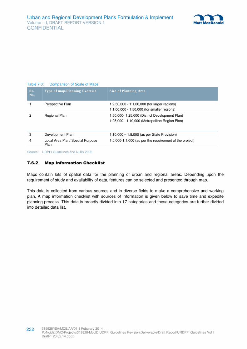
Urban and Regional Development Plans Formulation & Implement Volume – I, DRAFT REPORT VERSION 1
CONFIDENTIAL
319928/ISA/MCB/AA/01 1 Feburary 2014 P:\Noida\DMC\Projects\319928-MoUD UDPFI Guidelines Revision\Deliverable\Draft Report\URDPFI Guidelines Vol I Draft-1 26.02.14.docx
232
Table 7.6: Comparison of Scale of Maps
Sr. No.
Type of map/Planning Exercise Size of Planning Area
1 Perspective Plan 1:2,50,000 - 1:1,00,000 (for larger regions)
1:1,00,000 - 1:50,000 (for smaller regions)
2 Regional Plan 1:50,000- 1:25,000 (District Development Plan)
1:25,000 - 1:10,000 (Metropolitan Region Plan)
3 Development Plan 1:10,000 – 1:8,000 (as per State Provision)
4 Local Area Plan/ Special Purpose Plan
1:5,000-1:1,000 (as per the requirement of the project)
Source: UDPFI Guidelines and NUIS 2006
7.6.2 Map Information Checklist
Maps contain lots of spatial data for the planning of urban and regional areas. Depending upon the
requirement of study and availability of data, features can be selected and presented through map.
This data is collected from various sources and in diverse fields to make a comprehensive and working
plan. A map information checklist with sources of information is given below to save time and expedite
planning process. This data is broadly divided into 17 categories and these categories are further divided
into detailed data list.
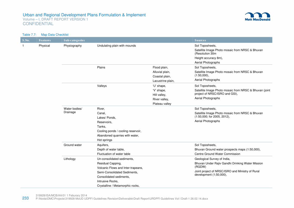
233 319928/ISA/MCB/AA/01 1 Feburary 2014 P:\Noida\DMC\Projects\319928-MoUD UDPFI Guidelines Revision\Deliverable\Draft Report\URDPFI Guidelines Vol I Draft-1 26.02.14.docx
Urban and Regional Development Plans Formulation & Implement Volume – I, DRAFT REPORT VERSION 1
CONFIDENTIAL
Table 7.7: Map Data Checklist
S.No. Features Sub-categories Sources
1 Physical Physiography Undulating plain with mounds SoI Toposheets,
Satellite Image Photo mosaic from NRSC & Bhuvan (Resolution 30m
Height accuracy 8m),
Aerial Photographs
Plains
Flood plain,
Alluvial plain,
Coastal plain,
Lacustrine plain,
SoI Toposheets,
Satellite Image Photo mosaic from NRSC & Bhuvan (1:50,000),
Aerial Photographs
Valleys ‘U’ shape,
‘V’ shape,
Hill valley,
River valley,
Plateau valley
SoI Toposheets,
Satellite Image Photo mosaic from NRSC & Bhuvan (joint project of NRSC/ISRO and GSI),
Aerial Photographs
Water bodies/ Drainage
River,
Canal,
Lakes/ Ponds,
Reservoirs,
Tanks,
Cooling ponds / cooling reservoir,
Abandoned quarries with water,
Hot springs
SoI Toposheets,
Satellite Image Photo mosaic from NRSC & Bhuvan (1:50,000; for 2005, 2012),
Aerial Photographs
Ground water Aquifers,
Depth of water table,
Fluctuation of water table
SoI Toposheets,
Bhuvan Ground water prospects maps (1:50,000),
Centre Ground Water Commission
Lithology
Un-consolidated sediments,
Residual Capping,
Volcanic Flows and Inter-trapeans,
Semi-Consolidated Sediments,
Consolidated sediments,
Intrusive Rocks,
Crystalline / Metamorphic rocks,
Geological Survey of India,
Bhuvan Under Rajiv Gandhi Drinking Water Mission (RGDW)
Joint project of NRSC/ISRO and Ministry of Rural development (1;50,000),
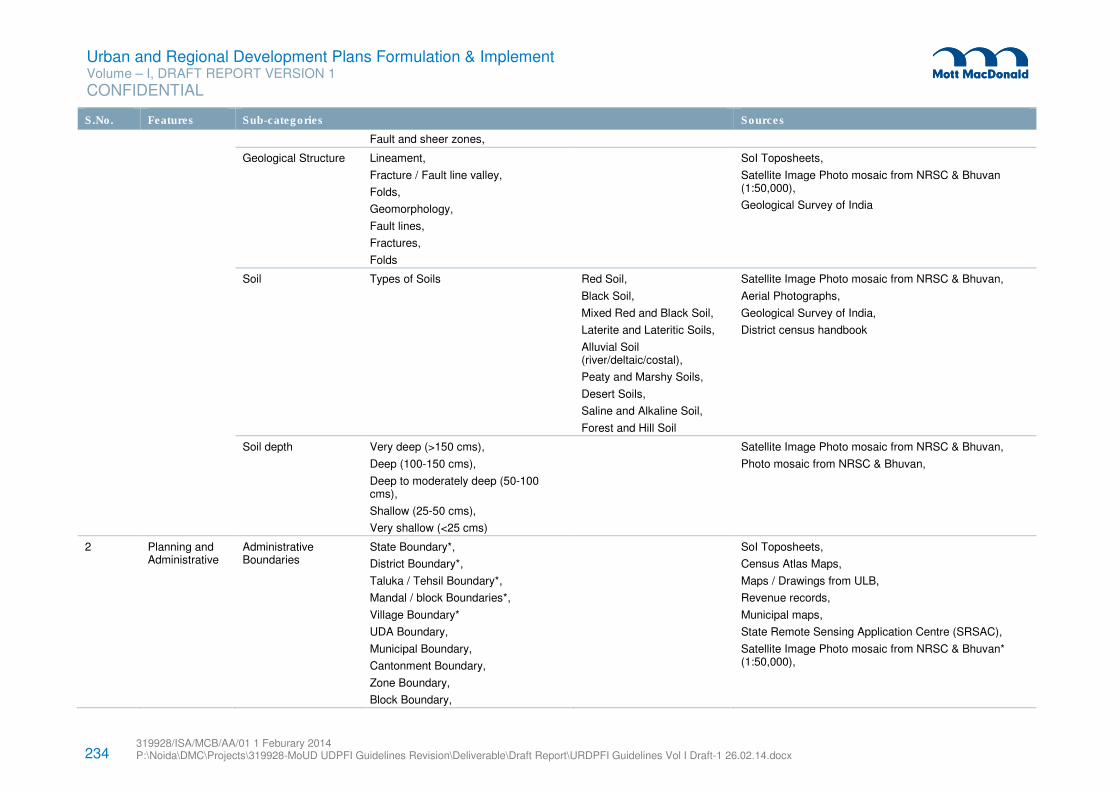
234 319928/ISA/MCB/AA/01 1 Feburary 2014 P:\Noida\DMC\Projects\319928-MoUD UDPFI Guidelines Revision\Deliverable\Draft Report\URDPFI Guidelines Vol I Draft-1 26.02.14.docx
Urban and Regional Development Plans Formulation & Implement Volume – I, DRAFT REPORT VERSION 1
CONFIDENTIAL
S.No. Features Sub-categories Sources
Fault and sheer zones,
Geological Structure
Lineament,
Fracture / Fault line valley,
Folds,
Geomorphology,
Fault lines,
Fractures,
Folds
SoI Toposheets,
Satellite Image Photo mosaic from NRSC & Bhuvan (1:50,000),
Geological Survey of India
Soil
Types of Soils Red Soil,
Black Soil,
Mixed Red and Black Soil,
Laterite and Lateritic Soils,
Alluvial Soil (river/deltaic/costal),
Peaty and Marshy Soils,
Desert Soils,
Saline and Alkaline Soil,
Forest and Hill Soil
Satellite Image Photo mosaic from NRSC & Bhuvan,
Aerial Photographs,
Geological Survey of India,
District census handbook
Soil depth
Very deep (>150 cms),
Deep (100-150 cms),
Deep to moderately deep (50-100 cms),
Shallow (25-50 cms),
Very shallow (<25 cms)
Satellite Image Photo mosaic from NRSC & Bhuvan,
Photo mosaic from NRSC & Bhuvan,
2 Planning and Administrative
Administrative Boundaries
State Boundary*,
District Boundary*,
Taluka / Tehsil Boundary*,
Mandal / block Boundaries*,
Village Boundary*
UDA Boundary,
Municipal Boundary,
Cantonment Boundary,
Zone Boundary,
Block Boundary,
SoI Toposheets,
Census Atlas Maps,
Maps / Drawings from ULB,
Revenue records,
Municipal maps,
State Remote Sensing Application Centre (SRSAC),
Satellite Image Photo mosaic from NRSC & Bhuvan* (1:50,000),
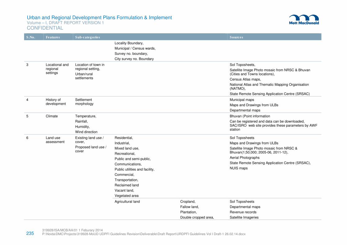
235 319928/ISA/MCB/AA/01 1 Feburary 2014 P:\Noida\DMC\Projects\319928-MoUD UDPFI Guidelines Revision\Deliverable\Draft Report\URDPFI Guidelines Vol I Draft-1 26.02.14.docx
Urban and Regional Development Plans Formulation & Implement Volume – I, DRAFT REPORT VERSION 1
CONFIDENTIAL
S.No. Features Sub-categories Sources
Locality Boundary,
Municipal / Census wards,
Survey no. boundary,
City survey no. Boundary
3 Locational and regional settings
Location of town in regional setting,
Urban/rural settlements
SoI Toposheets,
Satellite Image Photo mosaic from NRSC & Bhuvan (Cities and Towns locations),
Census Atlas maps,
National Atlas and Thematic Mapping Organisation (NATMO),
State Remote Sensing Application Centre (SRSAC)
4 History of development
Settlement morphology
Municipal maps
Maps and Drawings from ULBs
Departmental maps
5 Climate Temperature,
Rainfall,
Humidity,
Wind direction
Bhuvan (Point information
Can be registered and data can be downloaded, SAC/ISRO web site provides these parameters by AWF station
6 Land use assessment
Existing land use / cover,
Proposed land use / cover
Residential,
Industrial,
Mixed land use,
Recreational,
Public and semi-public,
Communications,
Public utilities and facility,
Commercial,
Transportation,
Reclaimed land
Vacant land,
Vegetated area
SoI Toposheets
Maps and Drawings from ULBs
Satellite Image Photo mosaic from NRSC & Bhuvan(1;50,000; 2005-06, 2011-12),
Aerial Photographs
State Remote Sensing Application Centre (SRSAC),
NUIS maps
Agricultural land
Cropland,
Fallow land,
Plantation,
Double cropped area,
SoI Toposheets
Departmental maps
Revenue records
Satellite Imageries
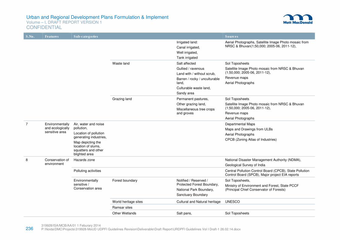
236 319928/ISA/MCB/AA/01 1 Feburary 2014 P:\Noida\DMC\Projects\319928-MoUD UDPFI Guidelines Revision\Deliverable\Draft Report\URDPFI Guidelines Vol I Draft-1 26.02.14.docx
Urban and Regional Development Plans Formulation & Implement Volume – I, DRAFT REPORT VERSION 1
CONFIDENTIAL
S.No. Features Sub-categories Sources
Irrigated land:
Canal irrigated,
Well irrigated,
Tank irrigated
Aerial Photographs, Satellite Image Photo mosaic from NRSC & Bhuvan(1;50,000; 2005-06, 2011-12),
Waste land
Salt affected
Gullied / ravenous
Land with / without scrub,
Barren / rocky / unculturable land,
Culturable waste land,
Sandy area
SoI Toposheets
Satellite Image Photo mosaic from NRSC & Bhuvan (1;50,000; 2005-06, 2011-12),
Revenue maps
Aerial Photographs
Grazing land Permanent pastures,
Other grazing land,
Miscellaneous tree crops and groves
SoI Toposheets
Satellite Image Photo mosaic from NRSC & Bhuvan (1;50,000; 2005-06, 2011-12),
Revenue maps
Aerial Photographs
7 Environmentally and ecologically sensitive area
Air, water and noise pollution,
Location of pollution generating industries,
Map depicting the location of slums, squatters and other blighted area
Departmental Maps
Maps and Drawings from ULBs
Aerial Photographs
CPCB (Zoning Atlas of Industries)
8 Conservation of environment
Hazards zone
National Disaster Management Authority (NDMA),
Geological Survey of India
Polluting activities Central Pollution Control Board (CPCB), State Pollution Control Board (SPCB), Major project EIA reports
Environmentally sensitive / Conservation area
Forest boundary
Notified / Reserved / Protected Forest Boundary,
National Park Boundary,
Sanctuary Boundary
SoI Toposheets,
Ministry of Environment and Forest, State PCCF (Principal Chief Conservator of Forests)
World heritage sites Cultural and Natural heritage UNESCO
Ramsar sites
Other Wetlands Salt pans, SoI Toposheets
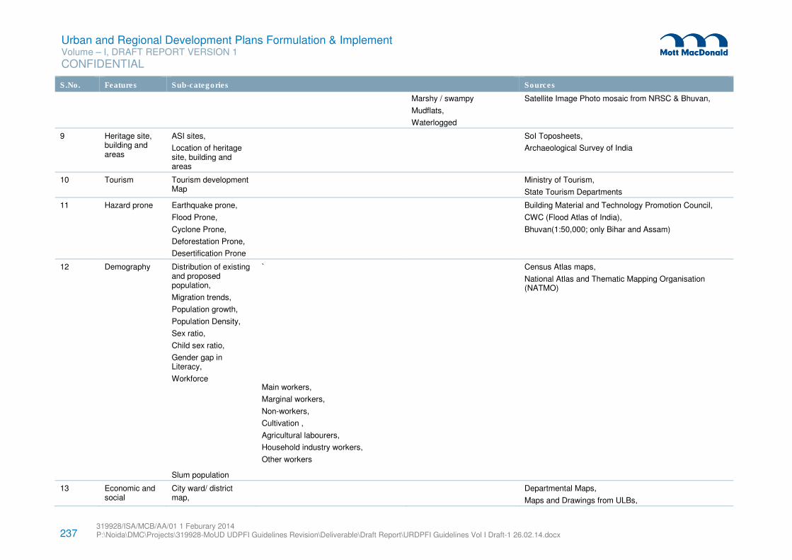
237 319928/ISA/MCB/AA/01 1 Feburary 2014 P:\Noida\DMC\Projects\319928-MoUD UDPFI Guidelines Revision\Deliverable\Draft Report\URDPFI Guidelines Vol I Draft-1 26.02.14.docx
Urban and Regional Development Plans Formulation & Implement Volume – I, DRAFT REPORT VERSION 1
CONFIDENTIAL
S.No. Features Sub-categories Sources
Marshy / swampy
Mudflats,
Waterlogged
Satellite Image Photo mosaic from NRSC & Bhuvan,
9 Heritage site, building and areas
ASI sites,
Location of heritage site, building and areas
SoI Toposheets,
Archaeological Survey of India
10 Tourism Tourism development Map
Ministry of Tourism,
State Tourism Departments
11 Hazard prone Earthquake prone,
Flood Prone,
Cyclone Prone,
Deforestation Prone,
Desertification Prone
Building Material and Technology Promotion Council,
CWC (Flood Atlas of India),
Bhuvan(1:50,000; only Bihar and Assam)
12 Demography Distribution of existing and proposed population,
Migration trends,
Population growth,
Population Density,
Sex ratio,
Child sex ratio,
Gender gap in Literacy,
Workforce
Slum population
`
Main workers,
Marginal workers,
Non-workers,
Cultivation ,
Agricultural labourers,
Household industry workers,
Other workers
Census Atlas maps,
National Atlas and Thematic Mapping Organisation (NATMO)
13 Economic and social
City ward/ district map,
Departmental Maps,
Maps and Drawings from ULBs,
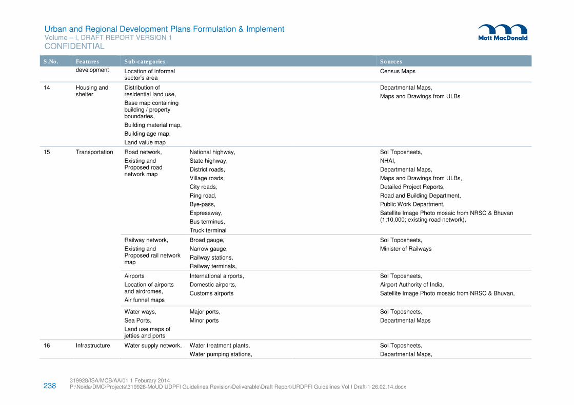
238 319928/ISA/MCB/AA/01 1 Feburary 2014 P:\Noida\DMC\Projects\319928-MoUD UDPFI Guidelines Revision\Deliverable\Draft Report\URDPFI Guidelines Vol I Draft-1 26.02.14.docx
Urban and Regional Development Plans Formulation & Implement Volume – I, DRAFT REPORT VERSION 1
CONFIDENTIAL
S.No. Features Sub-categories Sources
development Location of informal sector’s area
Census Maps
14 Housing and shelter
Distribution of residential land use,
Base map containing building / property boundaries,
Building material map,
Building age map,
Land value map
Departmental Maps,
Maps and Drawings from ULBs
15 Transportation Road network,
Existing and Proposed road network map
National highway,
State highway,
District roads,
Village roads,
City roads,
Ring road,
Bye-pass,
Expressway,
Bus terminus,
Truck terminal
SoI Toposheets,
NHAI,
Departmental Maps,
Maps and Drawings from ULBs,
Detailed Project Reports,
Road and Building Department,
Public Work Department,
Satellite Image Photo mosaic from NRSC & Bhuvan (1;10,000; existing road network),
Railway network,
Existing and Proposed rail network map
Broad gauge,
Narrow gauge,
Railway stations,
Railway terminals,
SoI Toposheets,
Minister of Railways
Airports
Location of airports and airdromes,
Air funnel maps
International airports,
Domestic airports,
Customs airports
SoI Toposheets,
Airport Authority of India,
Satellite Image Photo mosaic from NRSC & Bhuvan,
Water ways,
Sea Ports,
Land use maps of jetties and ports
Major ports,
Minor ports
SoI Toposheets,
Departmental Maps
16 Infrastructure Water supply network,
Water treatment plants,
Water pumping stations,
SoI Toposheets,
Departmental Maps,
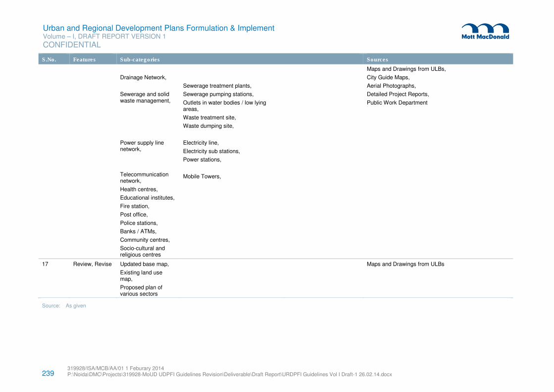
239 319928/ISA/MCB/AA/01 1 Feburary 2014 P:\Noida\DMC\Projects\319928-MoUD UDPFI Guidelines Revision\Deliverable\Draft Report\URDPFI Guidelines Vol I Draft-1 26.02.14.docx
Urban and Regional Development Plans Formulation & Implement Volume – I, DRAFT REPORT VERSION 1
CONFIDENTIAL
S.No. Features Sub-categories Sources
Drainage Network,
Sewerage and solid waste management,
Power supply line network,
Telecommunication network,
Health centres,
Educational institutes,
Fire station,
Post office,
Police stations,
Banks / ATMs,
Community centres,
Socio-cultural and religious centres
Sewerage treatment plants,
Sewerage pumping stations,
Outlets in water bodies / low lying areas,
Waste treatment site,
Waste dumping site,
Electricity line,
Electricity sub stations,
Power stations,
Mobile Towers,
Maps and Drawings from ULBs,
City Guide Maps,
Aerial Photographs,
Detailed Project Reports,
Public Work Department
17 Review, Revise Updated base map,
Existing land use map,
Proposed plan of various sectors
Maps and Drawings from ULBs
Source: As given
Urban and Regional Development Plans Formulation & Implement Volume – I, DRAFT REPORT VERSION 1
CONFIDENTIAL
319928/ISA/MCB/AA/01 1 Feburary 2014 P:\Noida\DMC\Projects\319928-MoUD UDPFI Guidelines Revision\Deliverable\Draft Report\URDPFI Guidelines Vol I Draft-1 26.02.14.docx
240
7.6.3 Procedure of Collecting Data
Procedure to retrieve data by permissions, which is not available in the public forum are given below:
7.6.3.1 Toposheets
Unrestricted topographical/ city guide maps published by Survey of India are available for sale. The
standard topographical maps on scale 1:25000, 1:50000 and 1: 250,000 and city guide maps published for
selected towns/cities are useful for urban development plan purpose.
All the topographical maps along the external boundary/coastline of India, as indicated in the Topo Index
map of Survey of India are categorised as restricted maps. The restricted category maps can be procured
by State and Central Governments / Private Individuals / organisations/commercial firms by following a
prescribed procedure. Private individuals and organizations / commercial firms can also obtain restricted
maps with prior approval from Ministry of Defence through the State Government to whom they should
apply.
7.6.3.2 Aerial photography
The available information regarding area of interest, its scale and cost rates can be obtained from Surveyor
General’s Office, Dehradun or the Directorate of Survey (Air), New Delhi. Survey of India (SoI) has a
dedicated web portal for presenting the meta data information available with SoI from various aerial
photography tasks commenced. Web Aerial Photography Transaction Registry (APTR) provides
transparent indenting process based on instructions issued by Ministry of Defence.
Indentor can obtain the existing photography by marking the area of interest on 1:250,000 scale
topographical map, indicating purpose, identifying the type (B&W, colour, colour infrared), scale and the
photographic product required (contact prints, enlargements, mosaic, etc.). If the existing photography
does not cater to the requirements of indentor, process for fresh aerial photography can be initiated. The
National Government agencies, which provide fresh aerial photography, are:
� Indian Air Force (through Survey of India)
� National Remote Sensing Centre, Hyderabad
� Air Survey Company, Calcutta.
For indenting fresh aerial photography the indentor may approach any of the flying agencies with specific
information. The indentor may mark the limit of the area to be photographed on 1:250,000 scale toposheet
if photography is required on scale smaller than 1:20,000 and 1:50,000 scale toposheet if photography is
required on scale 1:20,000 and larger and apply with the specific requirements mentioned for the
procurement of the existing aerial photography.
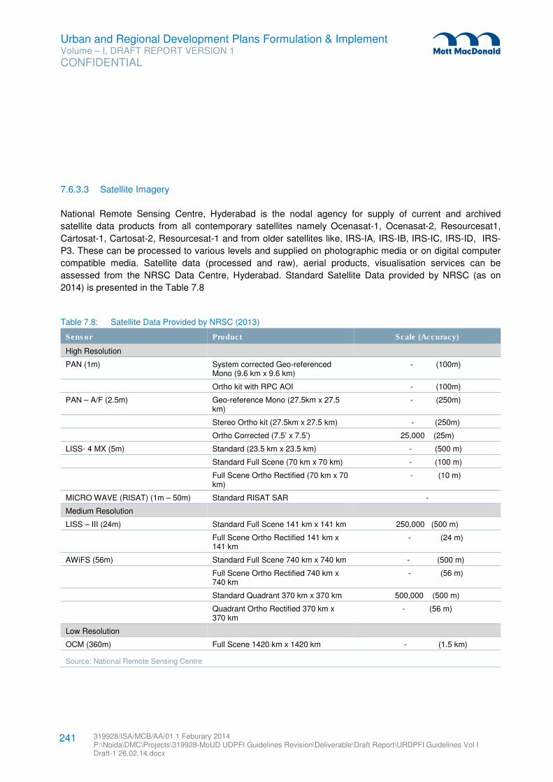
Urban and Regional Development Plans Formulation & Implement Volume – I, DRAFT REPORT VERSION 1
CONFIDENTIAL
319928/ISA/MCB/AA/01 1 Feburary 2014 P:\Noida\DMC\Projects\319928-MoUD UDPFI Guidelines Revision\Deliverable\Draft Report\URDPFI Guidelines Vol I Draft-1 26.02.14.docx
241
7.6.3.3 Satellite Imagery
National Remote Sensing Centre, Hyderabad is the nodal agency for supply of current and archived
satellite data products from all contemporary satellites namely Ocenasat-1, Ocenasat-2, Resourcesat1,
Cartosat-1, Cartosat-2, Resourcesat-1 and from older satellites like, IRS-IA, IRS-IB, IRS-IC, IRS-ID, IRS-
P3. These can be processed to various levels and supplied on photographic media or on digital computer
compatible media. Satellite data (processed and raw), aerial products, visualisation services can be
assessed from the NRSC Data Centre, Hyderabad. Standard Satellite Data provided by NRSC (as on
2014) is presented in the Table 7.8
Table 7.8: Satellite Data Provided by NRSC (2013)
Sensor Product Scale (Accuracy) High Resolution
PAN (1m) System corrected Geo-referenced Mono (9.6 km x 9.6 km)
- (100m)
Ortho kit with RPC AOI - (100m)
PAN – A/F (2.5m) Geo-reference Mono (27.5km x 27.5 km)
- (250m)
Stereo Ortho kit (27.5km x 27.5 km) - (250m)
Ortho Corrected (7.5’ x 7.5’) 25,000 (25m)
LISS- 4 MX (5m) Standard (23.5 km x 23.5 km) - (500 m)
Standard Full Scene (70 km x 70 km) - (100 m)
Full Scene Ortho Rectified (70 km x 70 km)
- (10 m)
MICRO WAVE (RISAT) (1m – 50m) Standard RISAT SAR -
Medium Resolution
LISS – III (24m) Standard Full Scene 141 km x 141 km 250,000 (500 m)
Full Scene Ortho Rectified 141 km x 141 km
- (24 m)
AWiFS (56m) Standard Full Scene 740 km x 740 km - (500 m)
Full Scene Ortho Rectified 740 km x 740 km
- (56 m)
Standard Quadrant 370 km x 370 km 500,000 (500 m)
Quadrant Ortho Rectified 370 km x 370 km
- (56 m)
Low Resolution
OCM (360m) Full Scene 1420 km x 1420 km - (1.5 km)
Source: National Remote Sensing Centre
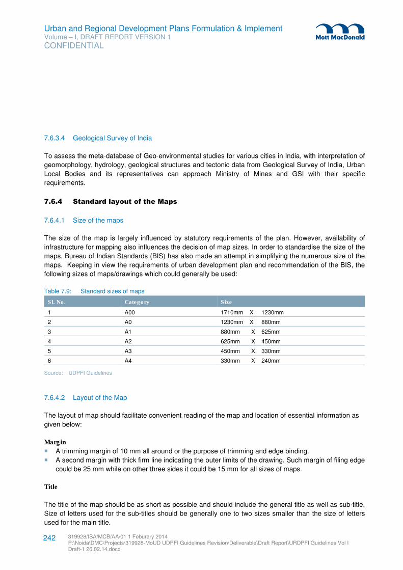
Urban and Regional Development Plans Formulation & Implement Volume – I, DRAFT REPORT VERSION 1
CONFIDENTIAL
319928/ISA/MCB/AA/01 1 Feburary 2014 P:\Noida\DMC\Projects\319928-MoUD UDPFI Guidelines Revision\Deliverable\Draft Report\URDPFI Guidelines Vol I Draft-1 26.02.14.docx
242
7.6.3.4 Geological Survey of India
To assess the meta-database of Geo-environmental studies for various cities in India, with interpretation of
geomorphology, hydrology, geological structures and tectonic data from Geological Survey of India, Urban
Local Bodies and its representatives can approach Ministry of Mines and GSI with their specific
requirements.
7.6.4 Standard layout of the Maps
7.6.4.1 Size of the maps
The size of the map is largely influenced by statutory requirements of the plan. However, availability of
infrastructure for mapping also influences the decision of map sizes. In order to standardise the size of the
maps, Bureau of Indian Standards (BIS) has also made an attempt in simplifying the numerous size of the
maps. Keeping in view the requirements of urban development plan and recommendation of the BIS, the
following sizes of maps/drawings which could generally be used:
Table 7.9: Standard sizes of maps
Sl. No. Category Size
1 A00 1710mm X 1230mm
2 A0 1230mm X 880mm
3 A1 880mm X 625mm
4 A2 625mm X 450mm
5 A3 450mm X 330mm
6 A4 330mm X 240mm
Source: UDPFI Guidelines
7.6.4.2 Layout of the Map
The layout of map should facilitate convenient reading of the map and location of essential information as
given below:
Margin
� A trimming margin of 10 mm all around or the purpose of trimming and edge binding.
� A second margin with thick firm line indicating the outer limits of the drawing. Such margin of filing edge
could be 25 mm while on other three sides it could be 15 mm for all sizes of maps.
Title
The title of the map should be as short as possible and should include the general title as well as sub-title.
Size of letters used for the sub-titles should be generally one to two sizes smaller than the size of letters
used for the main title.
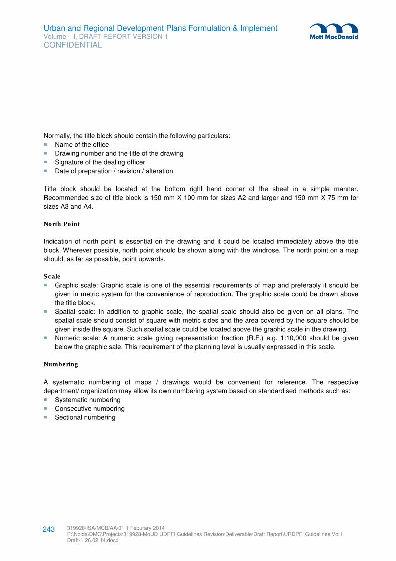
Urban and Regional Development Plans Formulation & Implement Volume – I, DRAFT REPORT VERSION 1
CONFIDENTIAL
319928/ISA/MCB/AA/01 1 Feburary 2014 P:\Noida\DMC\Projects\319928-MoUD UDPFI Guidelines Revision\Deliverable\Draft Report\URDPFI Guidelines Vol I Draft-1 26.02.14.docx
243
Normally, the title block should contain the following particulars:
� Name of the office
� Drawing number and the title of the drawing
� Signature of the dealing officer
� Date of preparation / revision / alteration
Title block should be located at the bottom right hand corner of the sheet in a simple manner.
Recommended size of title block is 150 mm X 100 mm for sizes A2 and larger and 150 mm X 75 mm for
sizes A3 and A4.
North Point
Indication of north point is essential on the drawing and it could be located immediately above the title
block. Wherever possible, north point should be shown along with the windrose. The north point on a map
should, as far as possible, point upwards.
Scale
� Graphic scale: Graphic scale is one of the essential requirements of map and preferably it should be
given in metric system for the convenience of reproduction. The graphic scale could be drawn above
the title block.
� Spatial scale: In addition to graphic scale, the spatial scale should also be given on all plans. The
spatial scale should consist of square with metric sides and the area covered by the square should be
given inside the square. Such spatial scale could be located above the graphic scale in the drawing.
� Numeric scale: A numeric scale giving representation fraction (R.F.) e.g. 1:10,000 should be given
below the graphic sale. This requirement of the planning level is usually expressed in this scale.
Numbering
A systematic numbering of maps / drawings would be convenient for reference. The respective
department/ organization may allow its own numbering system based on standardised methods such as:
� Systematic numbering
� Consecutive numbering
� Sectional numbering
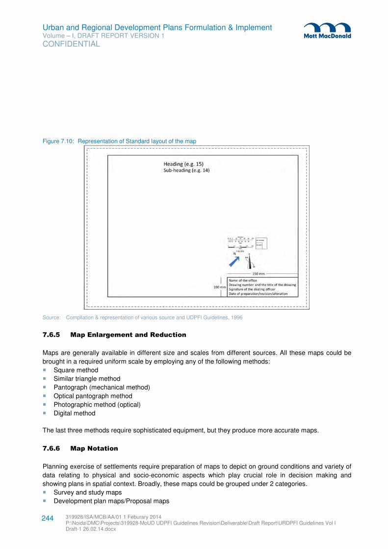
Urban and Regional Development Plans Formulation & Implement Volume – I, DRAFT REPORT VERSION 1
CONFIDENTIAL
319928/ISA/MCB/AA/01 1 Feburary 2014 P:\Noida\DMC\Projects\319928-MoUD UDPFI Guidelines Revision\Deliverable\Draft Report\URDPFI Guidelines Vol I Draft-1 26.02.14.docx
244
Figure 7.10: Representation of Standard layout of the map
Source: Compilation & representation of various source and UDPFI Guidelines, 1996
7.6.5 Map Enlargement and Reduction
Maps are generally available in different size and scales from different sources. All these maps could be
brought in a required uniform scale by employing any of the following methods:
� Square method
� Similar triangle method
� Pantograph (mechanical method)
� Optical pantograph method
� Photographic method (optical)
� Digital method
The last three methods require sophisticated equipment, but they produce more accurate maps.
7.6.6 Map Notation
Planning exercise of settlements require preparation of maps to depict on ground conditions and variety of
data relating to physical and socio-economic aspects which play crucial role in decision making and
showing plans in spatial context. Broadly, these maps could be grouped under 2 categories.
� Survey and study maps
� Development plan maps/Proposal maps
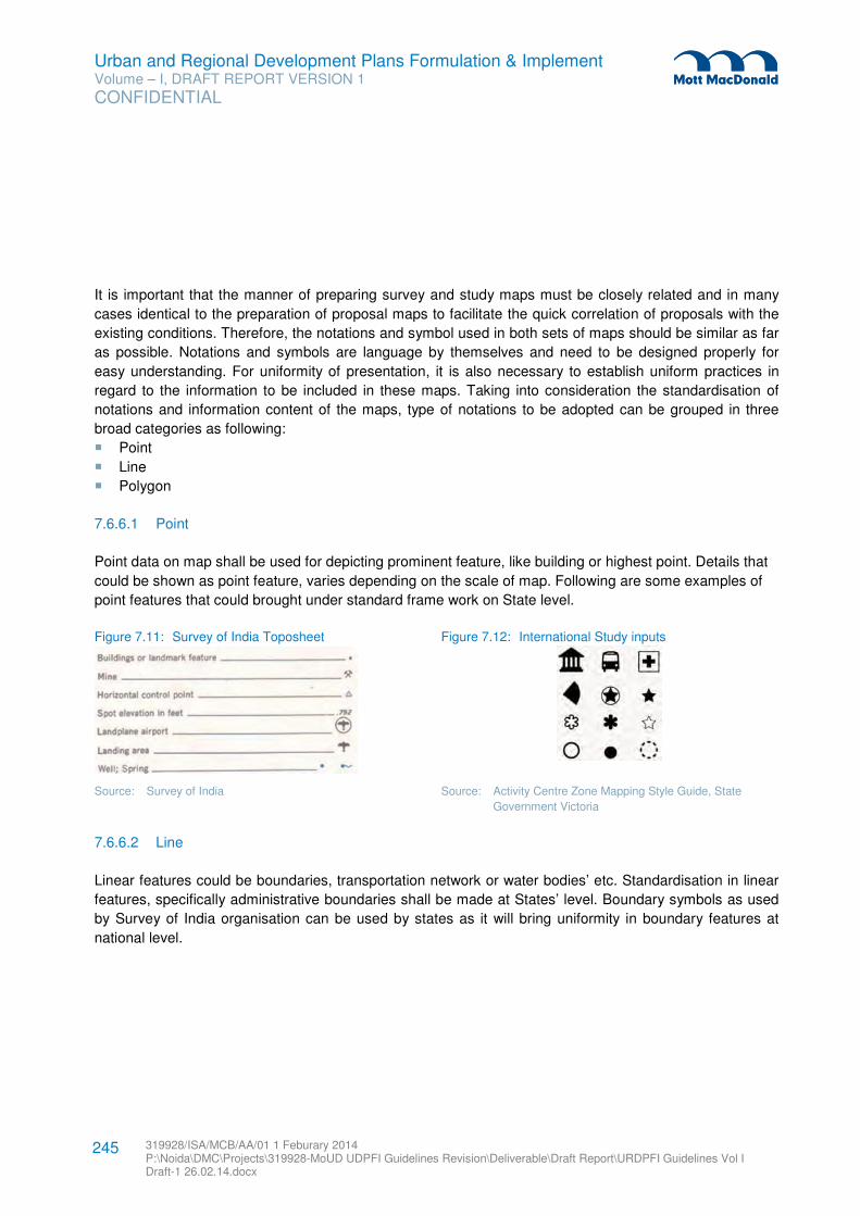
Urban and Regional Development Plans Formulation & Implement Volume – I, DRAFT REPORT VERSION 1
CONFIDENTIAL
319928/ISA/MCB/AA/01 1 Feburary 2014 P:\Noida\DMC\Projects\319928-MoUD UDPFI Guidelines Revision\Deliverable\Draft Report\URDPFI Guidelines Vol I Draft-1 26.02.14.docx
245
It is important that the manner of preparing survey and study maps must be closely related and in many
cases identical to the preparation of proposal maps to facilitate the quick correlation of proposals with the
existing conditions. Therefore, the notations and symbol used in both sets of maps should be similar as far
as possible. Notations and symbols are language by themselves and need to be designed properly for
easy understanding. For uniformity of presentation, it is also necessary to establish uniform practices in
regard to the information to be included in these maps. Taking into consideration the standardisation of
notations and information content of the maps, type of notations to be adopted can be grouped in three
broad categories as following:
� Point
� Line
� Polygon
7.6.6.1 Point
Point data on map shall be used for depicting prominent feature, like building or highest point. Details that
could be shown as point feature, varies depending on the scale of map. Following are some examples of
point features that could brought under standard frame work on State level.
Figure 7.11: Survey of India Toposheet Figure 7.12: International Study inputs
Source: Survey of India Source: Activity Centre Zone Mapping Style Guide, State
Government Victoria
7.6.6.2 Line
Linear features could be boundaries, transportation network or water bodies’ etc. Standardisation in linear
features, specifically administrative boundaries shall be made at States’ level. Boundary symbols as used
by Survey of India organisation can be used by states as it will bring uniformity in boundary features at
national level.
Urban and Regional Development Plans Formulation & Implement Volume – I, DRAFT REPORT VERSION 1
CONFIDENTIAL
319928/ISA/MCB/AA/01 1 Feburary 2014 P:\Noida\DMC\Projects\319928-MoUD UDPFI Guidelines Revision\Deliverable\Draft Report\URDPFI Guidelines Vol I Draft-1 26.02.14.docx
246
Figure 7.13: Survey of India Toposheet
Source: Survey of India
7.6.6.3 Polygon
A calibration in colour, notation and font used in maps should be made by state departments so that maps
of a State depict information in uniform manner and are relatively easy for comparison and study by public.
Mode of preparation of map on different platforms has impact on colour and notation. Thus, a standardised
format of legend shall be made. RGB (Red Green Blue) colour specification can be provided for computer
based platforms like GIS or CAD etc. Following are examples of such RGB colour specifications:
� Red: 255:51:0
� Purple: 102:0:204
� Yellow: 255:255:0
� Green: 0:153:0
� Orange: 255:153:0
Font’s specifications can also be provided in terms of style, size and colour. Though these provisions will
vary as per the scale and site of the sheet and be accordingly provided.
7.7 Base Map & Development Plan Preparation
7.7.1 Base map features
Before taking up any urban development plan exercise the first task, both from planning point of view and
as statutory requirement, is to prepare or obtain reliable, accurate and up-to-date base map for the
respective town or city for which the plan is being prepared. The map may be defined as representation of
earth’s pattern as a whole or part of it on a plane surface with conventional signs, drawn to a scale and
Urban and Regional Development Plans Formulation & Implement Volume – I, DRAFT REPORT VERSION 1
CONFIDENTIAL
319928/ISA/MCB/AA/01 1 Feburary 2014 P:\Noida\DMC\Projects\319928-MoUD UDPFI Guidelines Revision\Deliverable\Draft Report\URDPFI Guidelines Vol I Draft-1 26.02.14.docx
247
projection so that each and every point on it corresponds to the actual terrestrial position. The amount of
information to be represented on the map varies from map to map because information depiction depends
on:
� Purpose of map
� Scale
� Projection
� Method of map-making
� Draughting skill
Uniformity of base map with regard to presentation of features, scale, size and notations, facilitates the
readability of these maps and comparison of one map with another. Mapping software of Remote Sensing
and Geographical Information System are capable of generating maps with uniformity as well as
processing data from different platform.
7.7.1 Plan formulation through Remote Sensing & Geographic Information System
Geographical Information System (GIS) in planning is increasingly being applied for plan formulation,
analysis as well as for proposal. GIS is a computer based system, capable of input, storage, manipulation,
analysis and geographic data useful for planning, decision making and implementation decision. As a
powerful tool, GIS helps the planners to view different scenarios and their outcome so that an optimal
strategy can be chosen for planning and development. Besides this Plan formulation using Remote
Sensing and in GIS platform have the following advantages:
� Benefits of Analytical techniques in GIS platform
� Ground points and geo-referenced data base for proposals preparation
� Dynamic features can be incorporated from RS data
� Regular Database updating and Plan Revision without hassle
� Provide decision making support
� Promote collaboration among public agencies.
� Automated tasks -reduce human errors
� Long Term Investment
� For Bhuvan - Enhance public participation
� For Bhuvan - Increase access to government & efficient approval procedures
Once the spatial and attribute data are generated in GIS frame, their applications are many and varied.
These include resource inventory and management, planning and monitoring, land records for taxation and
ownership controls, facilities and services management, environment impact assessment. GIS is being
used for planning of various cities in India lately. Development Plan is a level of plan for which GIS could
be used very successfully. Preparation of Development Plan using RS & GIS can be classified under
following parts for easier understanding and implementation.
� Base map preparation process
� Preparation of existing land use plan
� Analysis of the study area
� Proposed land use plan
Urban and Regional Development Plans Formulation & Implement Volume – I, DRAFT REPORT VERSION 1
CONFIDENTIAL
319928/ISA/MCB/AA/01 1 Feburary 2014 P:\Noida\DMC\Projects\319928-MoUD UDPFI Guidelines Revision\Deliverable\Draft Report\URDPFI Guidelines Vol I Draft-1 26.02.14.docx
248
� Revision of the plan
7.7.1.1 Base Map preparation process
Preparation of Master Plan starts with base map preparation before which relevant data of all the
information which is to be presented via base map is collected. For base map preparation, Bhuvan Land
use sheet and/or National Urban Information System, Indian Space Research Organisation (NUIS) layers
can be used.
Bhuvan Land use sheets provide administrative boundaries, infrastructure, water bodies, watershed
boundaries, soil resources, wasteland, groundwater prospect and land use/land cover data. NUIS
database comprises of thematic mapping and attribute data. Thematic mapping database consists data of;
urban land use / cover, physiography*, geomorphology*, geological structures*, lithology*, soils*, drainage,
surface water bodies, road, rail canal and transportation nodes (*outside core area also). Attribute data has
spatial layers as, administrative boundaries, forest boundary, settlement and village locations / names and
city / town boundaries and non-spatial data. Other sources of licenced/authentic versions of interpreted
satellite imageries can also be used for preparation of base map.
Alternatively, for detailed base map preparation more than one satellite imageries can be merged to
provide appropriate information through fused imagery. For preparing thematic maps, under NUIS,
Cartosat-1 (panchromatic) and Resourcesat-1 (LISS-IV/ multispectral data) satellite imageries were fused,
which produced fused (PAN+LISS-IV) image consisting data from both the images.
At this stage, scale of the map should be decided. Thematic data available with NUIS is at the scale of
1:10,000 and with Bhuvan is at the scale of 1:10,000, 1:50,000 and 1:250,000.
Once the base from the Satellite Imagery is prepared, other information can be superimposed on the
imagery from the sources other than satellite. Such information could be cadastral maps, revenue records,
plans of government agencies and bodies like Industrial Development Corporation, Public Work
Department, Railways, National Highway Authority and proposals by these agencies.
Once the base map is prepared, the process of preparation of draft existing land use plan can be started
which is next stage.
7.7.1.2 Preparation of Existing Draft Land Use Plan
The drafted existing land use map incorporating the land use features from the satellite interpretation,
revenue records is taken for ground verification. The amount of information or area verified under this
stage varies from settlement to settlement. In rural area 15-20% percent of ground verification should be
appropriate given the predominance of agriculture, wasteland or forest land cover. While in urban areas
ground verification could be 20-50% or even up to 100%, if settlement is very dense.
Once ground verification is over and incorporated in the existing draft land use map, final land use map is
produced. In the final existing land use map, the date on which map was approved should be mentioned.
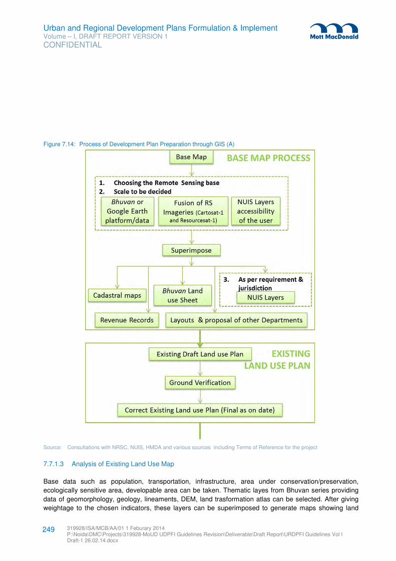
Urban and Regional Development Plans Formulation & Implement Volume – I, DRAFT REPORT VERSION 1
CONFIDENTIAL
319928/ISA/MCB/AA/01 1 Feburary 2014 P:\Noida\DMC\Projects\319928-MoUD UDPFI Guidelines Revision\Deliverable\Draft Report\URDPFI Guidelines Vol I Draft-1 26.02.14.docx
249
Figure 7.14: Process of Development Plan Preparation through GIS (A)
Source: Consultations with NRSC, NUIS, HMDA and various sources including Terms of Reference for the project
7.7.1.3 Analysis of Existing Land Use Map
Base data such as population, transportation, infrastructure, area under conservation/preservation,
ecologically sensitive area, developable area can be taken. Thematic layes from Bhuvan series providing
data of geomorphology, geology, lineaments, DEM, land trasformation atlas can be selected. After giving
weightage to the chosen indicators, these layers can be superimposed to generate maps showing land
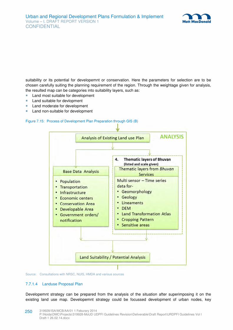
Urban and Regional Development Plans Formulation & Implement Volume – I, DRAFT REPORT VERSION 1
CONFIDENTIAL
319928/ISA/MCB/AA/01 1 Feburary 2014 P:\Noida\DMC\Projects\319928-MoUD UDPFI Guidelines Revision\Deliverable\Draft Report\URDPFI Guidelines Vol I Draft-1 26.02.14.docx
250
suitability or its potential for developemnt or conservation. Here the parameters for selection are to be
chosen carefully suiting the planning requirement of the region. Through the weightage given for analysis,
the resulted map can be categories into suitability layers, such as:
� Land most suitable for development
� Land suitable for devlopment
� Land moderate for development
� Land non-suitable for development
Figure 7.15: Process of Development Plan Preparation through GIS (B)
Source: Consultations with NRSC, NUIS, HMDA and various sources
7.7.1.4 Landuse Proposal Plan
Developemnt strategy can be prepared from the analysis of the situation after superimposing it on the
existing land use map. Developemnt strategy could be focussed development of urban nodes, key
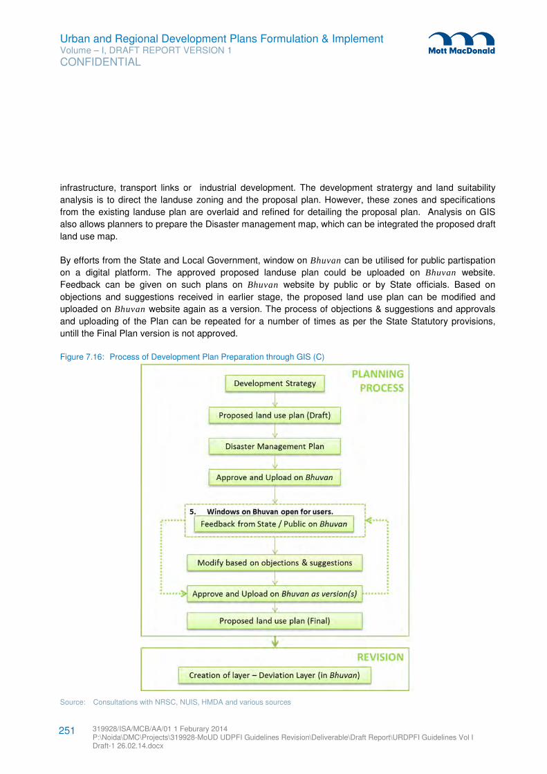
Urban and Regional Development Plans Formulation & Implement Volume – I, DRAFT REPORT VERSION 1
CONFIDENTIAL
319928/ISA/MCB/AA/01 1 Feburary 2014 P:\Noida\DMC\Projects\319928-MoUD UDPFI Guidelines Revision\Deliverable\Draft Report\URDPFI Guidelines Vol I Draft-1 26.02.14.docx
251
infrastructure, transport links or industrial development. The development stratergy and land suitability
analysis is to direct the landuse zoning and the proposal plan. However, these zones and specifications
from the existing landuse plan are overlaid and refined for detailing the proposal plan. Analysis on GIS
also allows planners to prepare the Disaster management map, which can be integrated the proposed draft
land use map.
By efforts from the State and Local Government, window on Bhuvan can be utilised for public partispation
on a digital platform. The approved proposed landuse plan could be uploaded on Bhuvan website.
Feedback can be given on such plans on Bhuvan website by public or by State officials. Based on
objections and suggestions received in earlier stage, the proposed land use plan can be modified and
uploaded on Bhuvan website again as a version. The process of objections & suggestions and approvals
and uploading of the Plan can be repeated for a number of times as per the State Statutory provisions,
untill the Final Plan version is not approved.
Figure 7.16: Process of Development Plan Preparation through GIS (C)
Source: Consultations with NRSC, NUIS, HMDA and various sources
Urban and Regional Development Plans Formulation & Implement Volume – I, DRAFT REPORT VERSION 1
CONFIDENTIAL
319928/ISA/MCB/AA/01 1 Feburary 2014 P:\Noida\DMC\Projects\319928-MoUD UDPFI Guidelines Revision\Deliverable\Draft Report\URDPFI Guidelines Vol I Draft-1 26.02.14.docx
252
7.7.1.5 Use of GIS in Plan Revision
For monitoring and revision of the Development Plan, deviation from the proposed land use can be
determined in GIS. The ULB and the State governments having utilised the Bhuvan portal can create new
data layers for the non-conforming land uses to assess the deviation between the previous approved
Proposed Land use plan and the existing situation. And since the mapping has been done on GIS,
temporal variation from the latest remote sensing imagery can also be earmarked. This deviation can be
addressed in the revision of the plan.
7.7.2 Bhuvan GIS Applicatoin for Planning
Bhuvan is a geoportal of Indian Space Research Organisation (ISRO) which is a to Indian Earth
Observation data products and services. Bhuvan provides interpretated satellite imageries, thematic data
and other services to all, apart from base for urban and regional planning for the authorised Government
agencies.
7.7.2.1 Portal User Access
Bhuvan provides access to ULBs, development authorities for government administration for urban and
regional planning, to work on the available information, create new database as layers; prepare, approve
and upload plan. At ULB, the three tier system of Bhuvan data mangement provides login to draughtman,
Town Planning Officer and Commissioner level officers.
Each level has different powers to access Bhuvan database, which is described below:
� Draughtsman can work on Town database. Draughtman have rights to read and controll write in the
portal database. Draughtsman have access control for all database for ready, edit, process and write to
temporary folder. At this level personnel can create new spatial files or edit the existing files and upload
data for approval.
� Town planning officer (TPO) can work on Town database and have rights to read and write. TPO have
full control on the database. The maps, analysis on existing data, uploaded data and reports by
draughtsmen are posted in temporary folder and requires TPO approval to move these files to the
database.
� Commissioner level officer can work on Town database and have rights to self-controlled read and
write access.
7.7.2.2 Portal User Interface
After Planning activity is over, such data can be uploaded on Bhuvan portal for public viewing. Bhuvan
portal has user interface in three levels such as:
� Viewing: Citizens and governemnt departments can view the spatial plan that is uploaded on Bhuvan
portal
� Data creation: Bhuvan accessed town level Urban Planning authorities can create and upload data on
the Portal.
Urban and Regional Development Plans Formulation & Implement Volume – I, DRAFT REPORT VERSION 1
CONFIDENTIAL
319928/ISA/MCB/AA/01 1 Feburary 2014 P:\Noida\DMC\Projects\319928-MoUD UDPFI Guidelines Revision\Deliverable\Draft Report\URDPFI Guidelines Vol I Draft-1 26.02.14.docx
253
� Feedback on the uploaded Plans: Citizens, Government departments and Bhuvan accessed Town
level Urban Planning authorities can give feedback of uploaded data/plans.
7.7.2.3 Bhuvan Mobile applications
Bhuvan provides Mobile platform to collect data and upload data on web portal, which can be used for
urban and regional planning exercise. ‘Bhuvan App’ can be downloaded on compatible mobile softwares.
Both attribute data and pictorial data can be collection from the field through the app, and uploaded on
Bhuvan to develop a centralized data base and thereafter can be viewed by all.
Other applications are also available on Bhuvan mobile app, such as emergency services/responses at the
event of hazard. Such applications can be used for SMART city concepts and can be modified or
customized for the need to the ULBs/DA. State of Uttarakhand with Bhuvan has developed customized
applications called, Mapping the Neighbourhood in Uttarakhand (MANU), for collecting information from
the field on mobile by assigned team and updating it on the Bhuvan.
Urban and Regional Development Plans Formulation & Implement Volume – I, DRAFT REPORT VERSION 1
CONFIDENTIAL
319928/ISA/MCB/AA/01 1 Feburary 2014 P:\Noida\DMC\Projects\319928-MoUD UDPFI Guidelines Revision\Deliverable\Draft Report\URDPFI Guidelines Vol I Draft-1 26.02.14.docx
254
Provision of adequate infrastructure in relation to the National parameter corresponds to sustainable
development of an urban space with high quality living quotient of the residing population. The planning of
infrastructure shall be based on the hierarchy of urban development. This chapter of URDPFI guidelines
suggest the infrastructure planning norms for an Urban/ Regional space; the norms are suggested under
five categories, namely:
1. Physical Infrastructure
2. Social Infrastructure
3. Commercial Infrastructure
4. Miscellaneous Infrastructure
5. Transportation
8.1 Hierarchy of Urban Development
A planned city for an environment of convenience should have a hierarchical structure; with each unit
planned for basic self-sufficiency. The smallest planning unit is conceived as Housing Area for 5000
population with convenience shopping, open area, Anganwadi and milk booth as minimum infrastructure
provision. The higher level of additional facilities is to be provided at Neighbourhood, Community, District,
Zonal and Regional levels. The hierarchy of development on the basis of population is given in Table 8.1.
Table 8.1: Hierarchy of Infrastructure Development
Sr.No. Planning Unit Population
1 Housing Cluster/ Neighbourhood 5000
2 Neighbourhood 5000-15,000
3 Community/ Ward Upto 100,000
4 District 5 Lakh
Zonal 10 lakh
5 Sub city centre 25 Lakh – 50 Lakh
6 City 50 Lakh +
Source: UDPFI Guidelines, MPD, 2021, Jaipur Master Plan
The provision of amenities in the hierarchy of urban development can be planned on the basis of the
standards set in Section 8.2.
8.2 Physical Infrastructure
8.2.1 Water Supply
The objective of a public protected water supply system is to supply safe and clean water in adequate
quantity, conveniently and as economically as possible. Rising demand of water due to rapid urbanisation
is putting enormous stress. While planning the water supply system for an area, it is evident to consider
water conservation aspects which may be possible through optimal use of available water resources,
prevention and control of wastage of water and effective demand management.
8 Infrastructure Planning
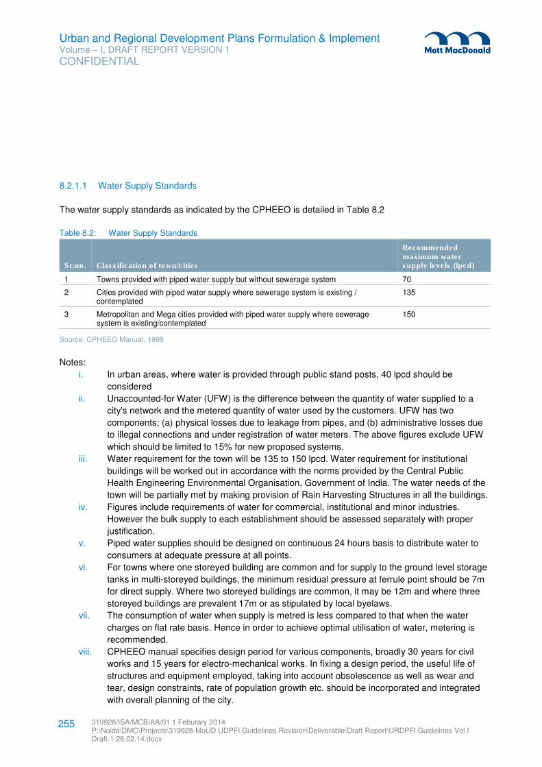
Urban and Regional Development Plans Formulation & Implement Volume – I, DRAFT REPORT VERSION 1
CONFIDENTIAL
319928/ISA/MCB/AA/01 1 Feburary 2014 P:\Noida\DMC\Projects\319928-MoUD UDPFI Guidelines Revision\Deliverable\Draft Report\URDPFI Guidelines Vol I Draft-1 26.02.14.docx
255
8.2.1.1 Water Supply Standards
The water supply standards as indicated by the CPHEEO is detailed in Table 8.2
Table 8.2: Water Supply Standards
Sr.no. Classification of town/cities
Recommended maximum water supply levels (lpcd)
1 Towns provided with piped water supply but without sewerage system 70
2 Cities provided with piped water supply where sewerage system is existing / contemplated
135
3 Metropolitan and Mega cities provided with piped water supply where sewerage system is existing/contemplated
150
Source: CPHEEO Manual, 1999
Notes:
i. In urban areas, where water is provided through public stand posts, 40 lpcd should be
considered
ii. Unaccounted-for Water (UFW) is the difference between the quantity of water supplied to a
city's network and the metered quantity of water used by the customers. UFW has two
components: (a) physical losses due to leakage from pipes, and (b) administrative losses due
to illegal connections and under registration of water meters. The above figures exclude UFW
which should be limited to 15% for new proposed systems.
iii. Water requirement for the town will be 135 to 150 lpcd. Water requirement for institutional
buildings will be worked out in accordance with the norms provided by the Central Public
Health Engineering Environmental Organisation, Government of India. The water needs of the
town will be partially met by making provision of Rain Harvesting Structures in all the buildings.
iv. Figures include requirements of water for commercial, institutional and minor industries.
However the bulk supply to each establishment should be assessed separately with proper
justification.
v. Piped water supplies should be designed on continuous 24 hours basis to distribute water to
consumers at adequate pressure at all points.
vi. For towns where one storeyed building are common and for supply to the ground level storage
tanks in multi-storeyed buildings, the minimum residual pressure at ferrule point should be 7m
for direct supply. Where two storeyed buildings are common, it may be 12m and where three
storeyed buildings are prevalent 17m or as stipulated by local byelaws.
vii. The consumption of water when supply is metred is less compared to that when the water
charges on flat rate basis. Hence in order to achieve optimal utilisation of water, metering is
recommended.
viii. CPHEEO manual specifies design period for various components, broadly 30 years for civil
works and 15 years for electro-mechanical works. In fixing a design period, the useful life of
structures and equipment employed, taking into account obsolescence as well as wear and
tear, design constraints, rate of population growth etc. should be incorporated and integrated
with overall planning of the city.
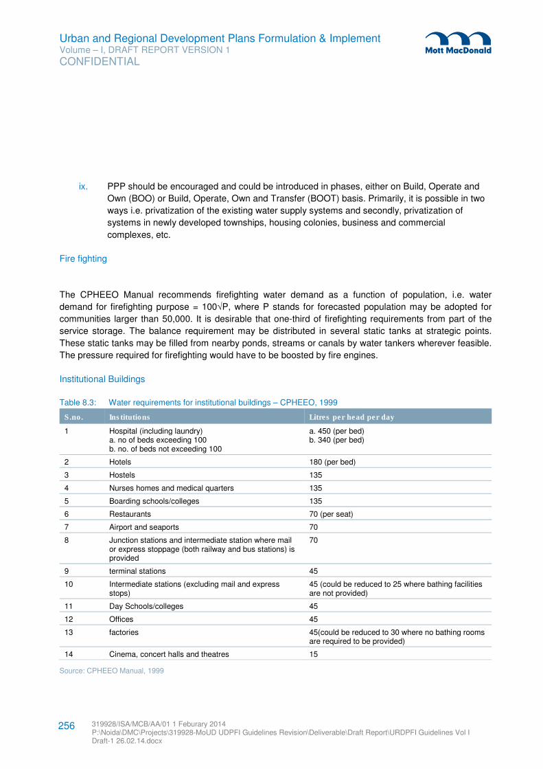
Urban and Regional Development Plans Formulation & Implement Volume – I, DRAFT REPORT VERSION 1
CONFIDENTIAL
319928/ISA/MCB/AA/01 1 Feburary 2014 P:\Noida\DMC\Projects\319928-MoUD UDPFI Guidelines Revision\Deliverable\Draft Report\URDPFI Guidelines Vol I Draft-1 26.02.14.docx
256
ix. PPP should be encouraged and could be introduced in phases, either on Build, Operate and
Own (BOO) or Build, Operate, Own and Transfer (BOOT) basis. Primarily, it is possible in two
ways i.e. privatization of the existing water supply systems and secondly, privatization of
systems in newly developed townships, housing colonies, business and commercial
complexes, etc.
Fire fighting
The CPHEEO Manual recommends firefighting water demand as a function of population, i.e. water
demand for firefighting purpose = 100√P, where P stands for forecasted population may be adopted for
communities larger than 50,000. It is desirable that one-third of firefighting requirements from part of the
service storage. The balance requirement may be distributed in several static tanks at strategic points.
These static tanks may be filled from nearby ponds, streams or canals by water tankers wherever feasible.
The pressure required for firefighting would have to be boosted by fire engines.
Institutional Buildings
Table 8.3: Water requirements for institutional buildings – CPHEEO, 1999
S.no. Institutions Litres per head per day
1 Hospital (including laundry) a. no of beds exceeding 100 b. no. of beds not exceeding 100
a. 450 (per bed) b. 340 (per bed)
2 Hotels 180 (per bed)
3 Hostels 135
4 Nurses homes and medical quarters 135
5 Boarding schools/colleges 135
6 Restaurants 70 (per seat)
7 Airport and seaports 70
8 Junction stations and intermediate station where mail or express stoppage (both railway and bus stations) is provided
70
9 terminal stations 45
10 Intermediate stations (excluding mail and express stops)
45 (could be reduced to 25 where bathing facilities are not provided)
11 Day Schools/colleges 45
12 Offices 45
13 factories 45(could be reduced to 30 where no bathing rooms are required to be provided)
14 Cinema, concert halls and theatres 15
Source: CPHEEO Manual, 1999
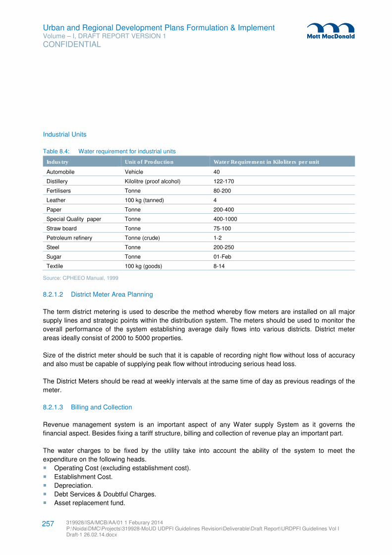
Urban and Regional Development Plans Formulation & Implement Volume – I, DRAFT REPORT VERSION 1
CONFIDENTIAL
319928/ISA/MCB/AA/01 1 Feburary 2014 P:\Noida\DMC\Projects\319928-MoUD UDPFI Guidelines Revision\Deliverable\Draft Report\URDPFI Guidelines Vol I Draft-1 26.02.14.docx
257
Industrial Units
Table 8.4: Water requirement for industrial units
Industry Unit of Production Water Requirement in Kiloliters per unit
Automobile Vehicle 40
Distillery Kilolitre (proof alcohol) 122-170
Fertilisers Tonne 80-200
Leather 100 kg (tanned) 4
Paper Tonne 200-400
Special Quality paper Tonne 400-1000
Straw board Tonne 75-100
Petroleum refinery Tonne (crude) 1-2
Steel Tonne 200-250
Sugar Tonne 01-Feb
Textile 100 kg (goods) 8-14
Source: CPHEEO Manual, 1999
8.2.1.2 District Meter Area Planning
The term district metering is used to describe the method whereby flow meters are installed on all major
supply lines and strategic points within the distribution system. The meters should be used to monitor the
overall performance of the system establishing average daily flows into various districts. District meter
areas ideally consist of 2000 to 5000 properties.
Size of the district meter should be such that it is capable of recording night flow without loss of accuracy
and also must be capable of supplying peak flow without introducing serious head loss.
The District Meters should be read at weekly intervals at the same time of day as previous readings of the
meter.
8.2.1.3 Billing and Collection
Revenue management system is an important aspect of any Water supply System as it governs the
financial aspect. Besides fixing a tariff structure, billing and collection of revenue play an important part.
The water charges to be fixed by the utility take into account the ability of the system to meet the
expenditure on the following heads.
� Operating Cost (excluding establishment cost).
� Establishment Cost.
� Depreciation.
� Debt Services & Doubtful Charges.
� Asset replacement fund.
Urban and Regional Development Plans Formulation & Implement Volume – I, DRAFT REPORT VERSION 1
CONFIDENTIAL
319928/ISA/MCB/AA/01 1 Feburary 2014 P:\Noida\DMC\Projects\319928-MoUD UDPFI Guidelines Revision\Deliverable\Draft Report\URDPFI Guidelines Vol I Draft-1 26.02.14.docx
258
Tariff structure should be fixed and revised periodically. Automatic increase of tariff periodically on index
basis can also be adopted. Where the same authority also provides sewerage system, charges for this can
also supply through Public stand post, may be charged and also be included as a percentage of the water
charges.
There are various methods by which Water Billing can be done. The user is advised to refer ‘Manual on
Operation and Maintenance of Water Supply Systems’ of CPHEEO while fixing the tariff, billing process
and collection system.
8.2.1.4 Leakage Control
The overall objective of leakage control is to diagnose how water loss is caused and to formulate and
implement action to reduce it, to technically and economically acceptable minimal.
The water losses can be termed into two categories i.e. Physical losses and Non-Physical Losses. The
Physical Losses is mainly due to leakage of water in the network and comprises of physical losses from
pipes, joints & fittings, reservoirs & overflows of reservoirs & sumps. The Non-Physical Losses is due to
theft of water through illegal, already disconnected connections, under-billing either deliberately or through
defective meters, water wasted by consumer through open or leaky taps, errors in estimating flat rate
consumption, public stand posts and hydrants.
The major activities which should be taken up for efficient monitoring and leakage control are:
� Preliminary data collection and planning – The water distribution drawings are to be studied and
updated. The number of service connections is to be obtained and in the drawings of the roads the
exact locations of service connections marked. The district and sub-district boundaries are suitably
fixed taking into consideration the number of service connections, length of mains, and pressure points
in the main. The exact locations of valves, hydrants with their sizes should be noted on the drawings.
� Pipe location and survey – Electronic pipe locators can be used during survey. These instruments
work on the principle of Electromagnetic signal propagation. It consists of a battery operated
transmitter and a cordless receiver unit to pick up the signals of pre-set frequency. There are various
models to choose from.
� Assessment of pressure and flows – Data loggers are used to record the pressure and flows. It is an
instrument which stores the raw data electronically so as to be able to transfer it to the computer with a
data cable link. Two types of portable data loggers are used either with a single channel or dual
channel. In the absence of electronic equipment, the pressures can be ascertained by tapping and
providing a pressure gauge. Flows can be assessed by using meters on a bypass line.
� Locating the leaks – Walking and sounding are the two general methods or their combination can be
used to detect possible location of leakages. Leakage can be detected by walking over the main
looking for tell-tale signs of presence of water. Whereas sounding is the cheapest and an effective
method of detecting leaks in a medium - sized water supply system. The equipment used for detecting
leakages is described in in ‘Manual on Operation and Maintenance of Water Supply Systems’ of
CPHEEO.
� Assessment of leakage – To conduct tests for assessment of leak the following equipment are
needed :
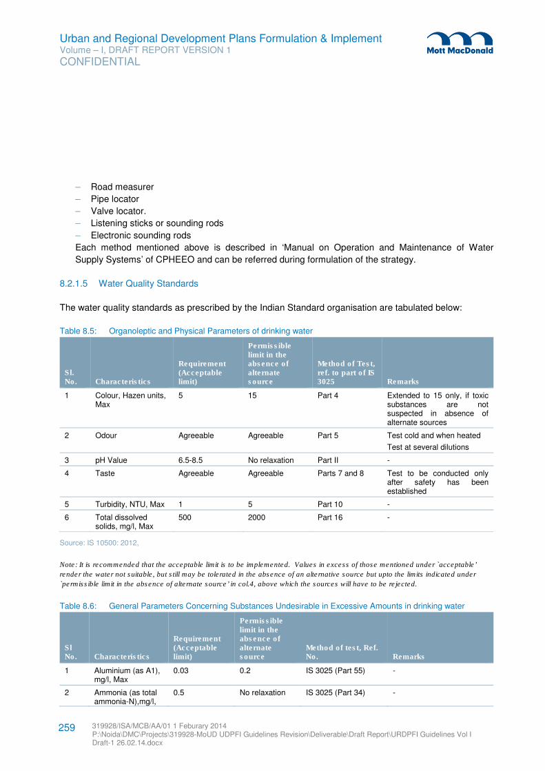
Urban and Regional Development Plans Formulation & Implement Volume – I, DRAFT REPORT VERSION 1
CONFIDENTIAL
319928/ISA/MCB/AA/01 1 Feburary 2014 P:\Noida\DMC\Projects\319928-MoUD UDPFI Guidelines Revision\Deliverable\Draft Report\URDPFI Guidelines Vol I Draft-1 26.02.14.docx
259
– Road measurer
– Pipe locator
– Valve locator.
– Listening sticks or sounding rods
– Electronic sounding rods
Each method mentioned above is described in ‘Manual on Operation and Maintenance of Water
Supply Systems’ of CPHEEO and can be referred during formulation of the strategy.
8.2.1.5 Water Quality Standards
The water quality standards as prescribed by the Indian Standard organisation are tabulated below:
Table 8.5: Organoleptic and Physical Parameters of drinking water
Sl. No. Characteristics
Requirement (Acceptable limit)
Permissible limit in the absence of alternate source
Method of Test, ref. to part of IS 3025 Remarks
1 Colour, Hazen units, Max
5 15 Part 4 Extended to 15 only, if toxic substances are not suspected in absence of alternate sources
2 Odour Agreeable Agreeable Part 5 Test cold and when heated
Test at several dilutions
3 pH Value 6.5-8.5 No relaxation Part II -
4 Taste Agreeable Agreeable Parts 7 and 8 Test to be conducted only after safety has been established
5 Turbidity, NTU, Max 1 5 Part 10 -
6 Total dissolved solids, mg/l, Max
500 2000 Part 16 -
Source: IS 10500: 2012,
Note: It is recommended that the acceptable limit is to be implemented. Values in excess of those mentioned under `acceptable’
render the water not suitable, but still may be tolerated in the absence of an alternative source but upto the limits indicated under
`permissible limit in the absence of alternate source’ in col.4, above which the sources will have to be rejected.
Table 8.6: General Parameters Concerning Substances Undesirable in Excessive Amounts in drinking water
Sl No. Characteristics
Requirement (Acceptable limit)
Permissible limit in the absence of alternate source
Method of test, Ref. No. Remarks
1 Aluminium (as A1), mg/l, Max
0.03 0.2 IS 3025 (Part 55) -
2 Ammonia (as total ammonia-N),mg/l,
0.5 No relaxation IS 3025 (Part 34) -
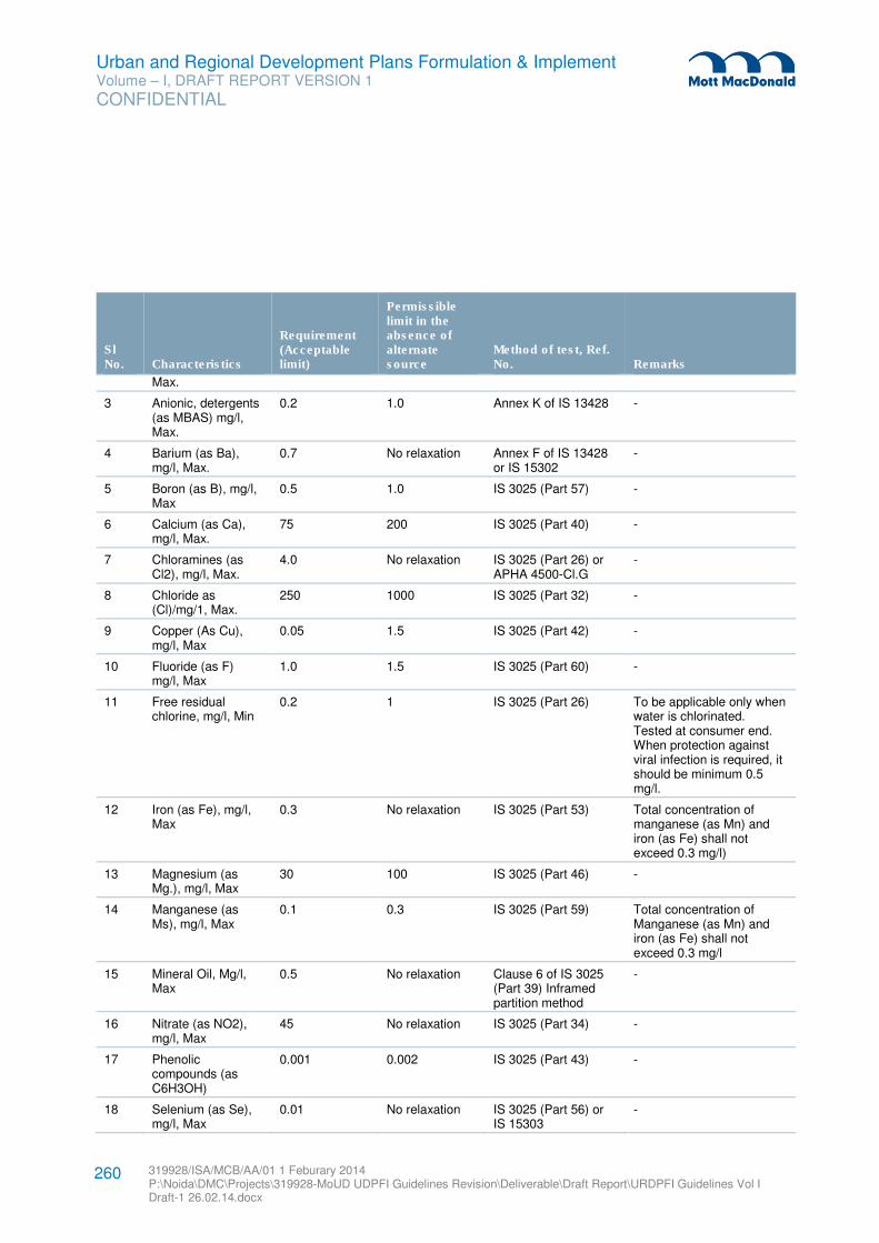
Urban and Regional Development Plans Formulation & Implement Volume – I, DRAFT REPORT VERSION 1
CONFIDENTIAL
319928/ISA/MCB/AA/01 1 Feburary 2014 P:\Noida\DMC\Projects\319928-MoUD UDPFI Guidelines Revision\Deliverable\Draft Report\URDPFI Guidelines Vol I Draft-1 26.02.14.docx
260
Sl No. Characteristics
Requirement (Acceptable limit)
Permissible limit in the absence of alternate source
Method of test, Ref. No. Remarks
Max.
3 Anionic, detergents (as MBAS) mg/l, Max.
0.2 1.0 Annex K of IS 13428 -
4 Barium (as Ba), mg/l, Max.
0.7 No relaxation Annex F of IS 13428 or IS 15302
-
5 Boron (as B), mg/l, Max
0.5 1.0 IS 3025 (Part 57) -
6 Calcium (as Ca), mg/l, Max.
75 200 IS 3025 (Part 40) -
7 Chloramines (as Cl2), mg/l, Max.
4.0 No relaxation IS 3025 (Part 26) or APHA 4500-Cl.G
-
8 Chloride as (Cl)/mg/1, Max.
250 1000 IS 3025 (Part 32) -
9 Copper (As Cu), mg/l, Max
0.05 1.5 IS 3025 (Part 42) -
10 Fluoride (as F) mg/l, Max
1.0 1.5 IS 3025 (Part 60) -
11 Free residual chlorine, mg/l, Min
0.2 1 IS 3025 (Part 26) To be applicable only when water is chlorinated. Tested at consumer end. When protection against viral infection is required, it should be minimum 0.5 mg/l.
12 Iron (as Fe), mg/l, Max
0.3 No relaxation IS 3025 (Part 53) Total concentration of manganese (as Mn) and iron (as Fe) shall not exceed 0.3 mg/l)
13 Magnesium (as Mg.), mg/l, Max
30 100 IS 3025 (Part 46) -
14 Manganese (as Ms), mg/l, Max
0.1 0.3 IS 3025 (Part 59) Total concentration of Manganese (as Mn) and iron (as Fe) shall not exceed 0.3 mg/l
15 Mineral Oil, Mg/l, Max
0.5 No relaxation Clause 6 of IS 3025 (Part 39) Inframed partition method
-
16 Nitrate (as NO2), mg/l, Max
45 No relaxation IS 3025 (Part 34) -
17 Phenolic compounds (as C6H3OH)
0.001 0.002 IS 3025 (Part 43) -
18 Selenium (as Se), mg/l, Max
0.01 No relaxation IS 3025 (Part 56) or IS 15303
-
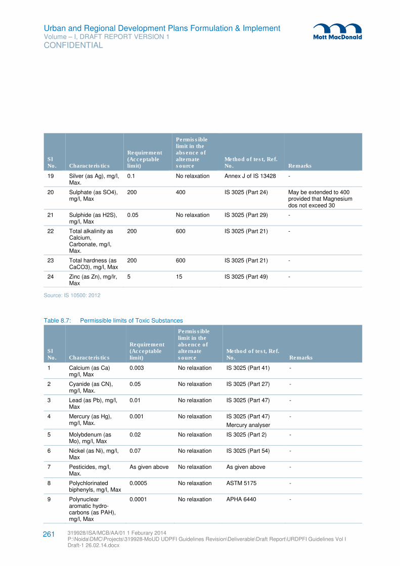
Urban and Regional Development Plans Formulation & Implement Volume – I, DRAFT REPORT VERSION 1
CONFIDENTIAL
319928/ISA/MCB/AA/01 1 Feburary 2014 P:\Noida\DMC\Projects\319928-MoUD UDPFI Guidelines Revision\Deliverable\Draft Report\URDPFI Guidelines Vol I Draft-1 26.02.14.docx
261
Sl No. Characteristics
Requirement (Acceptable limit)
Permissible limit in the absence of alternate source
Method of test, Ref. No. Remarks
19 Silver (as Ag), mg/l, Max.
0.1 No relaxation Annex J of IS 13428 -
20 Sulphate (as SO4), mg/l, Max
200 400 IS 3025 (Part 24) May be extended to 400 provided that Magnesium dos not exceed 30
21 Sulphide (as H2S), mg/l, Max
0.05 No relaxation IS 3025 (Part 29) -
22 Total alkalinity as Calcium, Carbonate, mg/l, Max.
200 600 IS 3025 (Part 21) -
23 Total hardness (as CaCO3), mg/l, Max
200 600 IS 3025 (Part 21) -
24 Zinc (as Zn), mg/lr, Max
5 15 IS 3025 (Part 49) -
Source: IS 10500: 2012
Table 8.7: Permissible limits of Toxic Substances
Sl No. Characteristics
Requirement (Acceptable limit)
Permissible limit in the absence of alternate source
Method of test, Ref. No. Remarks
1 Calcium (as Ca) mg/l, Max
0.003 No relaxation IS 3025 (Part 41) -
2 Cyanide (as CN), mg/l, Max.
0.05 No relaxation IS 3025 (Part 27) -
3 Lead (as Pb), mg/l, Max
0.01 No relaxation IS 3025 (Part 47) -
4 Mercury (as Hg), mg/l, Max.
0.001 No relaxation IS 3025 (Part 47)
Mercury analyser
-
5 Molybdenum (as Mo), mg/l, Max
0.02 No relaxation IS 3025 (Part 2) -
6 Nickel (as Ni), mg/l, Max
0.07 No relaxation IS 3025 (Part 54) -
7 Pesticides, mg/l, Max.
As given above No relaxation As given above -
8 Polychlorinated biphenyls, mg/l, Max
0.0005 No relaxation ASTM 5175 -
9 Polynuclear aromatic hydro-carbons (as PAH), mg/l, Max
0.0001 No relaxation APHA 6440 -
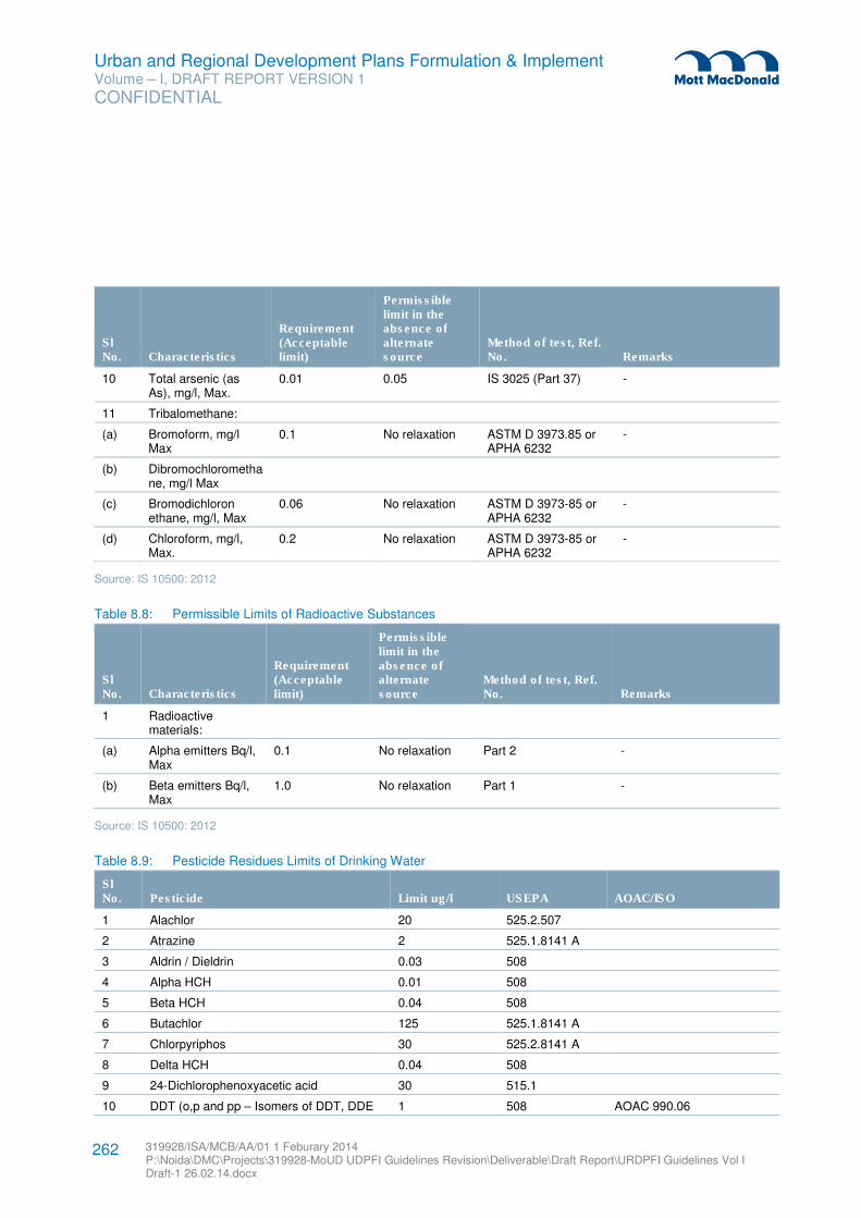
Urban and Regional Development Plans Formulation & Implement Volume – I, DRAFT REPORT VERSION 1
CONFIDENTIAL
319928/ISA/MCB/AA/01 1 Feburary 2014 P:\Noida\DMC\Projects\319928-MoUD UDPFI Guidelines Revision\Deliverable\Draft Report\URDPFI Guidelines Vol I Draft-1 26.02.14.docx
262
Sl No. Characteristics
Requirement (Acceptable limit)
Permissible limit in the absence of alternate source
Method of test, Ref. No. Remarks
10 Total arsenic (as As), mg/l, Max.
0.01 0.05 IS 3025 (Part 37) -
11 Tribalomethane:
(a) Bromoform, mg/l Max
0.1 No relaxation ASTM D 3973.85 or APHA 6232
-
(b) Dibromochloromethane, mg/l Max
(c) Bromodichloron ethane, mg/l, Max
0.06 No relaxation ASTM D 3973-85 or APHA 6232
-
(d) Chloroform, mg/l, Max.
0.2 No relaxation ASTM D 3973-85 or APHA 6232
-
Source: IS 10500: 2012
Table 8.8: Permissible Limits of Radioactive Substances
Sl No. Characteristics
Requirement (Acceptable limit)
Permissible limit in the absence of alternate source
Method of test, Ref. No. Remarks
1 Radioactive materials:
(a) Alpha emitters Bq/l, Max
0.1 No relaxation Part 2 -
(b) Beta emitters Bq/l, Max
1.0 No relaxation Part 1 -
Source: IS 10500: 2012
Table 8.9: Pesticide Residues Limits of Drinking Water
Sl No. Pesticide Limit ug/l USEPA AOAC/ISO
1 Alachlor 20 525.2.507
2 Atrazine 2 525.1.8141 A
3 Aldrin / Dieldrin 0.03 508
4 Alpha HCH 0.01 508
5 Beta HCH 0.04 508
6 Butachlor 125 525.1.8141 A
7 Chlorpyriphos 30 525.2.8141 A
8 Delta HCH 0.04 508
9 24-Dichlorophenoxyacetic acid 30 515.1
10 DDT (o,p and pp – Isomers of DDT, DDE 1 508 AOAC 990.06
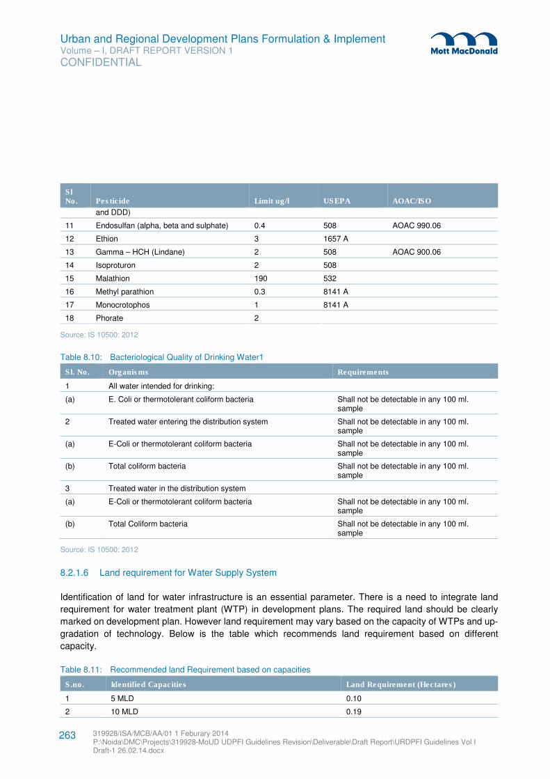
Urban and Regional Development Plans Formulation & Implement Volume – I, DRAFT REPORT VERSION 1
CONFIDENTIAL
319928/ISA/MCB/AA/01 1 Feburary 2014 P:\Noida\DMC\Projects\319928-MoUD UDPFI Guidelines Revision\Deliverable\Draft Report\URDPFI Guidelines Vol I Draft-1 26.02.14.docx
263
Sl No. Pesticide Limit ug/l USEPA AOAC/ISO
and DDD)
11 Endosulfan (alpha, beta and sulphate) 0.4 508 AOAC 990.06
12 Ethion 3 1657 A
13 Gamma – HCH (Lindane) 2 508 AOAC 900.06
14 Isoproturon 2 508
15 Malathion 190 532
16 Methyl parathion 0.3 8141 A
17 Monocrotophos 1 8141 A
18 Phorate 2
Source: IS 10500: 2012
Table 8.10: Bacteriological Quality of Drinking Water1
Sl. No. Organisms Requirements
1 All water intended for drinking:
(a) E. Coli or thermotolerant coliform bacteria Shall not be detectable in any 100 ml. sample
2 Treated water entering the distribution system Shall not be detectable in any 100 ml. sample
(a) E-Coli or thermotolerant coliform bacteria Shall not be detectable in any 100 ml. sample
(b) Total coliform bacteria Shall not be detectable in any 100 ml. sample
3 Treated water in the distribution system
(a) E-Coli or thermotolerant coliform bacteria Shall not be detectable in any 100 ml. sample
(b) Total Coliform bacteria Shall not be detectable in any 100 ml. sample
Source: IS 10500: 2012
8.2.1.6 Land requirement for Water Supply System
Identification of land for water infrastructure is an essential parameter. There is a need to integrate land
requirement for water treatment plant (WTP) in development plans. The required land should be clearly
marked on development plan. However land requirement may vary based on the capacity of WTPs and up-
gradation of technology. Below is the table which recommends land requirement based on different
capacity.
Table 8.11: Recommended land Requirement based on capacities
S.no. Identified Capacities Land Requirement (Hectares)
1 5 MLD 0.10
2 10 MLD 0.19
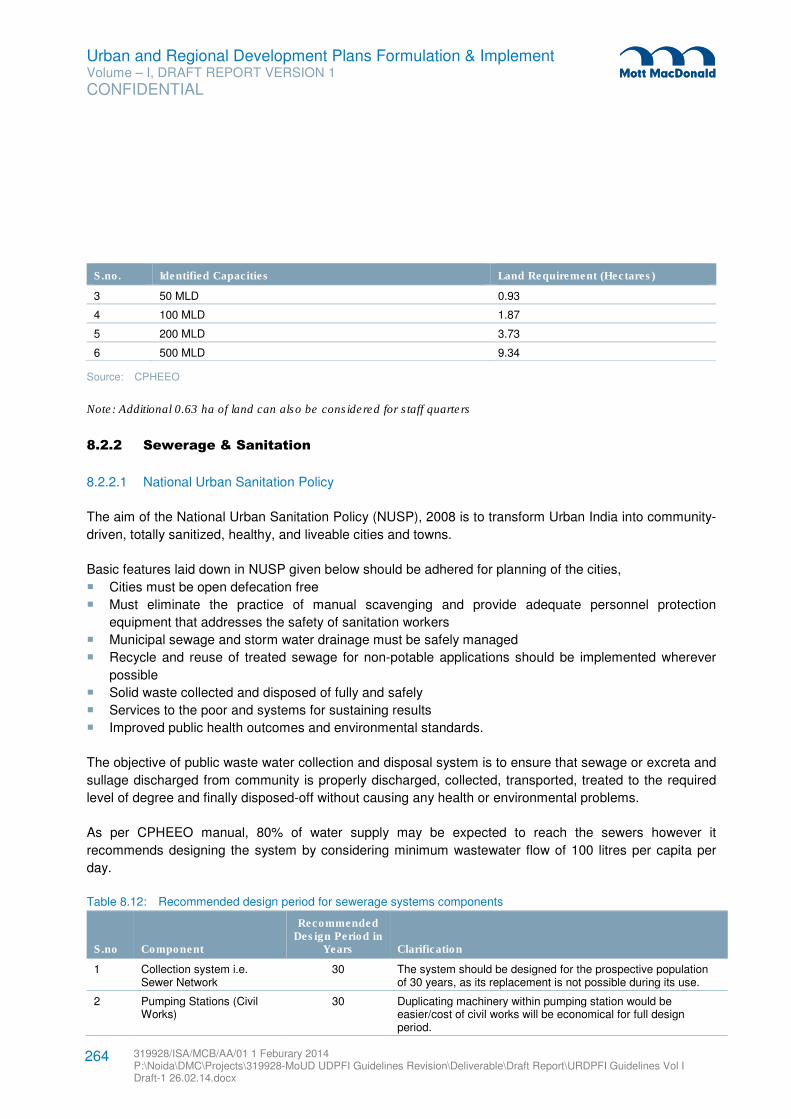
Urban and Regional Development Plans Formulation & Implement Volume – I, DRAFT REPORT VERSION 1
CONFIDENTIAL
319928/ISA/MCB/AA/01 1 Feburary 2014 P:\Noida\DMC\Projects\319928-MoUD UDPFI Guidelines Revision\Deliverable\Draft Report\URDPFI Guidelines Vol I Draft-1 26.02.14.docx
264
S.no. Identified Capacities Land Requirement (Hectares)
3 50 MLD 0.93
4 100 MLD 1.87
5 200 MLD 3.73
6 500 MLD 9.34
Source: CPHEEO
Note: Additional 0.63 ha of land can also be considered for staff quarters
8.2.2 Sewerage & Sanitation
8.2.2.1 National Urban Sanitation Policy
The aim of the National Urban Sanitation Policy (NUSP), 2008 is to transform Urban India into community-
driven, totally sanitized, healthy, and liveable cities and towns.
Basic features laid down in NUSP given below should be adhered for planning of the cities,
� Cities must be open defecation free
� Must eliminate the practice of manual scavenging and provide adequate personnel protection
equipment that addresses the safety of sanitation workers
� Municipal sewage and storm water drainage must be safely managed
� Recycle and reuse of treated sewage for non-potable applications should be implemented wherever
possible
� Solid waste collected and disposed of fully and safely
� Services to the poor and systems for sustaining results
� Improved public health outcomes and environmental standards.
The objective of public waste water collection and disposal system is to ensure that sewage or excreta and
sullage discharged from community is properly discharged, collected, transported, treated to the required
level of degree and finally disposed-off without causing any health or environmental problems.
As per CPHEEO manual, 80% of water supply may be expected to reach the sewers however it
recommends designing the system by considering minimum wastewater flow of 100 litres per capita per
day.
Table 8.12: Recommended design period for sewerage systems components
S.no Component
Recommended Design Period in
Years Clarification
1 Collection system i.e. Sewer Network
30 The system should be designed for the prospective population of 30 years, as its replacement is not possible during its use.
2 Pumping Stations (Civil Works)
30 Duplicating machinery within pumping station would be easier/cost of civil works will be economical for full design period.
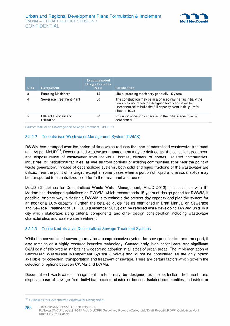
Urban and Regional Development Plans Formulation & Implement Volume – I, DRAFT REPORT VERSION 1
CONFIDENTIAL
319928/ISA/MCB/AA/01 1 Feburary 2014 P:\Noida\DMC\Projects\319928-MoUD UDPFI Guidelines Revision\Deliverable\Draft Report\URDPFI Guidelines Vol I Draft-1 26.02.14.docx
265
S.no Component
Recommended Design Period in
Years Clarification
3 Pumping Machinery 15 Life of pumping machinery generally 15 years
4 Sewerage Treatment Plant 30 The construction may be in a phased manner as initially the flows may not reach the designed levels and it will be uneconomical to build the full capacity plant initially. (refer chapter 10.2)
5 Effluent Disposal and Utilisation
30 Provision of design capacities in the initial stages itself is economical.
Source: Manual on Sewerage and Sewage Treatment, CPHEEO
8.2.2.2 Decentralised Wastewater Management System (DWMS)
DWWM has emerged over the period of time which reduces the load of centralised wastewater treatment
unit. As per MoUD125
, Decentralized wastewater management may be defined as “the collection, treatment,
and disposal/reuse of wastewater from individual homes, clusters of homes, isolated communities,
industries, or institutional facilities, as well as from portions of existing communities at or near the point of
waste generation”. In case of decentralized systems, both solid and liquid fractions of the wastewater are
utilized near the point of its origin, except in some cases when a portion of liquid and residual solids may
be transported to a centralized point for further treatment and reuse.
MoUD (Guidelines for Decentralised Waste Water Management, MoUD 2012) in association with IIT
Madras has developed guidelines on DWWM, which recommends 15 years of design period for DWWM, if
possible. Another way to design a DWWM is to estimate the present day capacity and plan the system for
an additional 20% capacity. Further, the detailed guidelines as mentioned in Draft Manual on Sewerage
and Sewage Treatment of CPHEEO (December 2013) can be referred while developing DWWM units in a
city which elaborates siting criteria, components and other design consideration including wastewater
characteristics and waste water treatment.
8.2.2.3 Centralized vis-a-vis Decentralized Sewage Treatment Systems
While the conventional sewerage may be a comprehensive system for sewage collection and transport, it
also remains as a highly resource-intensive technology. Consequently, high capital cost, and significant
O&M cost of this system inhibits its widespread adoption in all sizes of urban areas. The implementation of
Centralized Wastewater Management System (CWMS) should not be considered as the only option
available for collection, transportation and treatment of sewage. There are certain factors which govern the
selection of options between CWMS and DWMS.
Decentralized wastewater management system may be designed as the collection, treatment, and
disposal/reuse of sewage from individual houses, cluster of houses, isolated communities, industries or
125 Guidelines for Decentralized Wastewater Management
Urban and Regional Development Plans Formulation & Implement Volume – I, DRAFT REPORT VERSION 1
CONFIDENTIAL
319928/ISA/MCB/AA/01 1 Feburary 2014 P:\Noida\DMC\Projects\319928-MoUD UDPFI Guidelines Revision\Deliverable\Draft Report\URDPFI Guidelines Vol I Draft-1 26.02.14.docx
266
institutional facilities as well as from portion of existing communities at or near the point of generation of
sewage.
Decentralized systems maintain both the solids and liquid fraction, although the liquid portion and/or any
residual solids can be transported to a centralized point for further treatment and reuse.
Recognizing the many applications and benefits of sewage reuse, some important points may be kept in
view such as;
(i) Review of the impact of the population growth rate
(ii) Review of potential water reuse applications and water quality requirements
(iii) Review of appropriate technologies for sewage treatment and reuse
(iv) Considering the type of management structure that will be required in the future and
(v) Identification of issues that must be solved to bring about water reuse for sustainable
development on a broad scale.
It has been emphasized that if sewage from the urban and semi urban areas were reused for a
variety of non-potable uses, the demand on the potable water supply would be reduced.
The choice of appropriate technology also depends on several factors such as composition of sewage,
availability of land, availability of funds and expertise. Different operation and maintenance options have to
be considered with respect to sustainable plant operation, the use of local resources, knowledge, and
manpower.

Urban and Regional Development Plans Formulation & Implement Volume – I, DRAFT REPORT VERSION 1
CONFIDENTIAL
319928/ISA/MCB/AA/01 1 Feburary 2014 P:\Noida\DMC\Projects\319928-MoUD UDPFI Guidelines Revision\Deliverable\Draft Report\URDPFI Guidelines Vol I Draft-1 26.02.14.docx
267
Figure 8.1: Decision Tree: Selecting the wastewater management system (Onsite, Decentralized or Conventional)
Source: Guidelines for Decentralized Wastewater Management, MoUD
8.2.2.4 Effluent Standards
As per MoEF, the general effluent standards for discharging the waste water are given in table below:
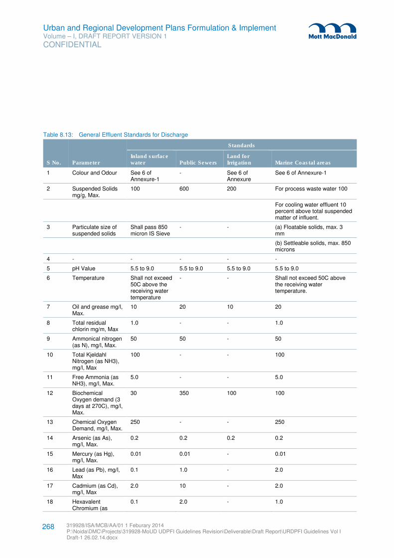
Urban and Regional Development Plans Formulation & Implement Volume – I, DRAFT REPORT VERSION 1
CONFIDENTIAL
319928/ISA/MCB/AA/01 1 Feburary 2014 P:\Noida\DMC\Projects\319928-MoUD UDPFI Guidelines Revision\Deliverable\Draft Report\URDPFI Guidelines Vol I Draft-1 26.02.14.docx
268
Table 8.13: General Effluent Standards for Discharge
S No. Parameter
Standards
Inland surface water Public Sewers
Land for Irrigation Marine Coastal areas
1 Colour and Odour See 6 of Annexure-1
- See 6 of Annexure
See 6 of Annexure-1
2 Suspended Solids mg/g, Max.
100 600 200 For process waste water 100
For cooling water effluent 10 percent above total suspended matter of influent.
3 Particulate size of suspended solids
Shall pass 850 micron IS Sieve
- - (a) Floatable solids, max. 3 mm
(b) Settleable solids, max. 850 microns
4 - - - - -
5 pH Value 5.5 to 9.0 5.5 to 9.0 5.5 to 9.0 5.5 to 9.0
6 Temperature Shall not exceed 50C above the receiving water temperature
- - Shall not exceed 50C above the receiving water temperature.
7 Oil and grease mg/l, Max.
10 20 10 20
8 Total residual chlorin mg/m, Max
1.0 - - 1.0
9 Ammonical nitrogen (as N), mg/l, Max.
50 50 - 50
10 Total Kjeldahl Nitrogen (as NH3), mg/l, Max
100 - - 100
11 Free Ammonia (as NH3), mg/l, Max.
5.0 - - 5.0
12 Biochemical Oxygen demand (3 days at 270C), mg/l, Max.
30 350 100 100
13 Chemical Oxygen Demand, mg/l, Max.
250 - - 250
14 Arsenic (as As), mg/l, Max.
0.2 0.2 0.2 0.2
15 Mercury (as Hg), mg/l, Max.
0.01 0.01 - 0.01
16 Lead (as Pb), mg/l, Max
0.1 1.0 - 2.0
17 Cadmium (as Cd), mg/l, Max
2.0 10 - 2.0
18 Hexavalent Chromium (as
0.1 2.0 - 1.0
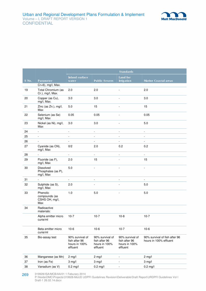
Urban and Regional Development Plans Formulation & Implement Volume – I, DRAFT REPORT VERSION 1
CONFIDENTIAL
319928/ISA/MCB/AA/01 1 Feburary 2014 P:\Noida\DMC\Projects\319928-MoUD UDPFI Guidelines Revision\Deliverable\Draft Report\URDPFI Guidelines Vol I Draft-1 26.02.14.docx
269
S No. Parameter
Standards
Inland surface water Public Sewers
Land for Irrigation Marine Coastal areas
Cr+6), mg/l, Max.
19 Total Chromium (as Cr.), mg/l, Max.
2.0 2.0 - 2.0
20 Copper (as Cu), mg/l, Max.
3.0 3.0 - 3.0
21 Zinc (as Zn.), mg/l, Max
5.0 15 - 15
22 Selenium (as Se) mg/l, Max
0.05 0.05 - 0.05
23 Nickel (as Ni), mg/l, Max
3.0 3.0 - 5.0
24 - - - - -
25 - - - - -
26 - - - - -
27 Cyanide (as CN), mg/l, Max
0/2 2.0 0.2 0.2
28 - - - - -
29 Fluoride (as F), mg/l, Max
2.0 15 - 15
30 Dissolved Phosphates (as P), mg/l, Max
5.0 - - -
31 - - - - -
32 Sulphide (as S), mg/l, Max
2.0 - - 5.0
33 Phenolic compounds (as CSHS OH, mg/l, Max
1.0 5.0 - 5.0
34 Radioactive materials:
Alpha emitter micro curie/ml
10-7 10-7 10-8 10-7
Beta emitter micro curie/ml
10-6 10-6 10-7 10-6
35 Bio-assay test 90% survival of fish after 96 hours in 100% effluent
90% survival of fish after 96 hours in 100% effluent
90% survival of fish after 96 hours in 100% effluent
90% survival of fish after 96 hours in 100% effluent
36 Manganese (as Mn) 2 mg/l 2 mg/l - 2 mg/l
37 Iron (as Fe) 3 mg/l 3 mg/l - 3 mg/l
38 Vanadium (as V) 0.2 mg/l 0.2 mg/l - 0.2 mg/l
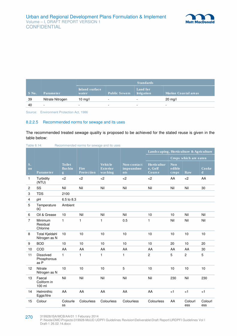
Urban and Regional Development Plans Formulation & Implement Volume – I, DRAFT REPORT VERSION 1
CONFIDENTIAL
319928/ISA/MCB/AA/01 1 Feburary 2014 P:\Noida\DMC\Projects\319928-MoUD UDPFI Guidelines Revision\Deliverable\Draft Report\URDPFI Guidelines Vol I Draft-1 26.02.14.docx
270
S No. Parameter
Standards
Inland surface water Public Sewers
Land for Irrigation Marine Coastal areas
39 Nitrate Nitrogen 10 mg/l - - 20 mg/l
40 - - - - -
Source: Environment Protection Act, 1986
8.2.2.5 Recommended norms for sewage and its uses
The recommended treated sewage quality is proposed to be achieved for the stated reuse is given in the
table below:
Table 8.14: Recommended norms for sewage and its uses
S.no. Parameter
Toilet flushing
Fire Protection
Vehicle Exterior washing
Non-contact impoundments
Landscaping, Horticulture & Agriculture
Crops which are eaten
Horticulture, Golf Course
Non edible crops Raw
Cooked
1 Turbidity (NTU)
<2 <2 <2 <2 <2 AA <2 AA
2 SS Nil Nil Nil Nil Nil Nil Nil 30
3 TDS 2100
4 pH 6.5 to 8.3
5 Temperature 0C
Ambient
6 Oil & Grease 10 Nil Nil Nil 10 10 Nil Nil
7 Minimum Residual Chlorine
1 1 1 0.5 1 Nil Nil Nil
8 Total Kjeldahl Nitrogen as N
10 10 10 10 10 10 10 10
9 BOD 10 10 10 10 10 20 10 20
10 COD AA AA AA AA AA AA AA 30
11 Dissolved Phosphorous as P
1 1 1 1 2 5 2 5
12 Nitrate Nitrogen as N
10 10 10 5 10 10 10 10
13 Faecal Coliform in 100 ml
Nil Nil Nil Nil Nil 230 Nil 230
14 Helminthic Eggs/litre
AA AA AA AA AA <1 <1 <1
15 Colour Colourless
Colourless Colourless Colourless Colourless AA Colourless
Colourless
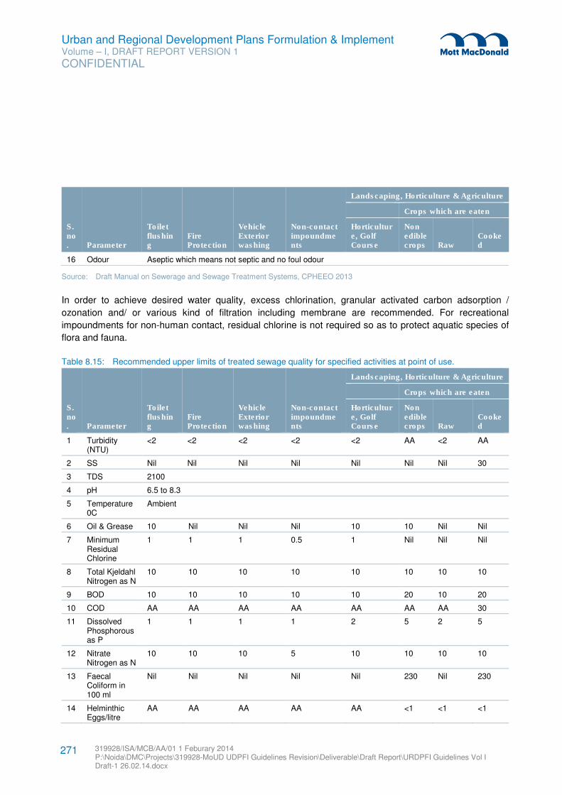
Urban and Regional Development Plans Formulation & Implement Volume – I, DRAFT REPORT VERSION 1
CONFIDENTIAL
319928/ISA/MCB/AA/01 1 Feburary 2014 P:\Noida\DMC\Projects\319928-MoUD UDPFI Guidelines Revision\Deliverable\Draft Report\URDPFI Guidelines Vol I Draft-1 26.02.14.docx
271
S.no. Parameter
Toilet flushing
Fire Protection
Vehicle Exterior washing
Non-contact impoundments
Landscaping, Horticulture & Agriculture
Crops which are eaten
Horticulture, Golf Course
Non edible crops Raw
Cooked
16 Odour Aseptic which means not septic and no foul odour
Source: Draft Manual on Sewerage and Sewage Treatment Systems, CPHEEO 2013
In order to achieve desired water quality, excess chlorination, granular activated carbon adsorption /
ozonation and/ or various kind of filtration including membrane are recommended. For recreational
impoundments for non-human contact, residual chlorine is not required so as to protect aquatic species of
flora and fauna.
Table 8.15: Recommended upper limits of treated sewage quality for specified activities at point of use.
S.no. Parameter
Toilet flushing
Fire Protection
Vehicle Exterior washing
Non-contact impoundments
Landscaping, Horticulture & Agriculture
Crops which are eaten
Horticulture, Golf Course
Non edible crops Raw
Cooked
1 Turbidity (NTU)
<2 <2 <2 <2 <2 AA <2 AA
2 SS Nil Nil Nil Nil Nil Nil Nil 30
3 TDS 2100
4 pH 6.5 to 8.3
5 Temperature 0C
Ambient
6 Oil & Grease 10 Nil Nil Nil 10 10 Nil Nil
7 Minimum Residual Chlorine
1 1 1 0.5 1 Nil Nil Nil
8 Total Kjeldahl Nitrogen as N
10 10 10 10 10 10 10 10
9 BOD 10 10 10 10 10 20 10 20
10 COD AA AA AA AA AA AA AA 30
11 Dissolved Phosphorous as P
1 1 1 1 2 5 2 5
12 Nitrate Nitrogen as N
10 10 10 5 10 10 10 10
13 Faecal Coliform in 100 ml
Nil Nil Nil Nil Nil 230 Nil 230
14 Helminthic Eggs/litre
AA AA AA AA AA <1 <1 <1
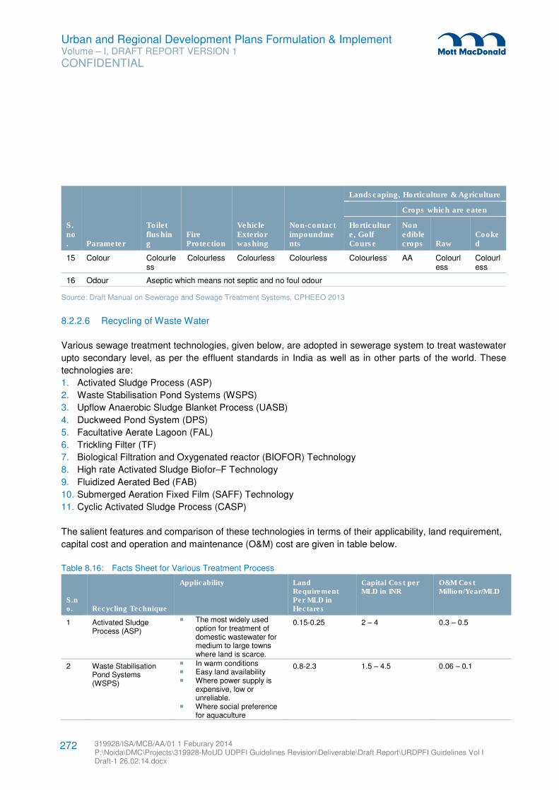
Urban and Regional Development Plans Formulation & Implement Volume – I, DRAFT REPORT VERSION 1
CONFIDENTIAL
319928/ISA/MCB/AA/01 1 Feburary 2014 P:\Noida\DMC\Projects\319928-MoUD UDPFI Guidelines Revision\Deliverable\Draft Report\URDPFI Guidelines Vol I Draft-1 26.02.14.docx
272
S.no. Parameter
Toilet flushing
Fire Protection
Vehicle Exterior washing
Non-contact impoundments
Landscaping, Horticulture & Agriculture
Crops which are eaten
Horticulture, Golf Course
Non edible crops Raw
Cooked
15 Colour Colourless
Colourless Colourless Colourless Colourless AA Colourless
Colourless
16 Odour Aseptic which means not septic and no foul odour
Source: Draft Manual on Sewerage and Sewage Treatment Systems, CPHEEO 2013
8.2.2.6 Recycling of Waste Water
Various sewage treatment technologies, given below, are adopted in sewerage system to treat wastewater
upto secondary level, as per the effluent standards in India as well as in other parts of the world. These
technologies are:
1. Activated Sludge Process (ASP)
2. Waste Stabilisation Pond Systems (WSPS)
3. Upflow Anaerobic Sludge Blanket Process (UASB)
4. Duckweed Pond System (DPS)
5. Facultative Aerate Lagoon (FAL)
6. Trickling Filter (TF)
7. Biological Filtration and Oxygenated reactor (BIOFOR) Technology
8. High rate Activated Sludge Biofor–F Technology
9. Fluidized Aerated Bed (FAB)
10. Submerged Aeration Fixed Film (SAFF) Technology
11. Cyclic Activated Sludge Process (CASP)
The salient features and comparison of these technologies in terms of their applicability, land requirement,
capital cost and operation and maintenance (O&M) cost are given in table below.
Table 8.16: Facts Sheet for Various Treatment Process
S.no. Recycling Technique
Applicability Land Requirement Per MLD in Hectares
Capital Cost per MLD in INR
O&M Cost Million/Year/MLD
1 Activated Sludge Process (ASP)
� The most widely used option for treatment of domestic wastewater for medium to large towns where land is scarce.
0.15-0.25 2 – 4 0.3 – 0.5
2 Waste Stabilisation Pond Systems (WSPS)
� In warm conditions � Easy land availability � Where power supply is
expensive, low or unreliable.
� Where social preference for aquaculture
0.8-2.3 1.5 – 4.5 0.06 – 0.1
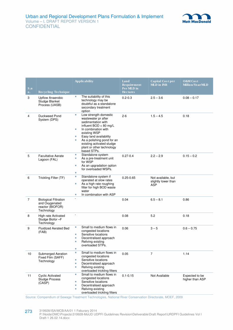
Urban and Regional Development Plans Formulation & Implement Volume – I, DRAFT REPORT VERSION 1
CONFIDENTIAL
319928/ISA/MCB/AA/01 1 Feburary 2014 P:\Noida\DMC\Projects\319928-MoUD UDPFI Guidelines Revision\Deliverable\Draft Report\URDPFI Guidelines Vol I Draft-1 26.02.14.docx
273
S.no. Recycling Technique
Applicability Land Requirement Per MLD in Hectares
Capital Cost per MLD in INR
O&M Cost Million/Year/MLD
3 Upflow Anaerobic Sludge Blanket Process (UASB)
� The suitability of this technology may be doubtful as a standalone secondary treatment option
0.2-0.3 2.5 – 3.6 0.08 – 0.17
4 Duckweed Pond System (DPS)
� Low strength domestic wastewater pr after sedimentation with influent BOD < 80 mg/L
� In combination with existing WSP
� Easy land availability � As a polishing pond for an
existing activated sludge plant or other technology based STPs.
2-6 1.5 – 4.5 0.18
5 Facultative Aerate Lagoon (FAL)
� Standalone system � As a pre-treatment unit
for WSP � As an upgradation option
for overloaded WSPs. �
0.27-0.4 2.2 – 2.9 0.15 – 0.2
6 Trickling Filter (TF) � Standalone system if operated at slow rates
� As a high rate roughing filter for high BOD waste water
� In combination with ASP
0.25-0.65 Not available, but slightly lower than ASP
7 Biological Filtration and Oxygenated reactor (BIOFOR) Technology
- 0.04 6.5 – 8.1 0.86
8 High rate Activated Sludge Biofor –F Technology
- 0.08 5.2 0.18
9 Fluidized Aerated Bed (FAB)
� Small to medium flows in congested locations
� Sensitive locations � Decentralised approach � Reliving existing
overloaded STPs. �
0.06 3 – 5 0.6 – 0.75
10 Submerged Aeration Fixed Film (SAFF) Technology
� Small to medium flows in congested locations
� Sensitive locations � Decentralised approach � Reliving existing
overloaded trickling filters
0.05 7 1.14
11 Cyclic Activated Sludge Process (CASP)
� Small to medium flows in congested locations
� Sensitive locations � Decentralised approach � Reliving existing
overloaded trickling filters
0.1-0.15 Not Available Expected to be higher than ASP
Source: Compendium of Sewage Treatment Technologies, National River Conservation Directorate, MOEF, 2009
Urban and Regional Development Plans Formulation & Implement Volume – I, DRAFT REPORT VERSION 1
CONFIDENTIAL
319928/ISA/MCB/AA/01 1 Feburary 2014 P:\Noida\DMC\Projects\319928-MoUD UDPFI Guidelines Revision\Deliverable\Draft Report\URDPFI Guidelines Vol I Draft-1 26.02.14.docx
274
Land availability plays an important role in providing such facilities. Land requirement may vary based on
the technology adopted for sewage treatment. However, it is evident to mark the required land on
development plan. It is recommended to decide the most suitable technology in advance based on the
various parameters as given in Appendix E.
8.2.2.7 Septage Management – Planning and Implementation126
For effective septage management plan, robust data on septage arrangements, their quantity and locations
of its generation etc. are required. The ULBs would need to make arrangements to collect baseline data,
like type of latrine disposal, effluent disposal arrangement, size, age, when it was last cleaned, access to
the on-site system, arrangement for disposal of effluent, if any) of existing installations, to plan for workable
de-sludging schedules. It is advisable to divide the city into different sanitary zones (if not already done)
and carry out the baseline survey in one or a few of these zones, pilot de-sludging area wise schedules to
learn operational issues and devise solutions, before up-scaling to the entire ULB can be taken up. The
selection of zone could be based on availability of septage disposal sites – existing STPs could be
potential septage disposal/application sites or trenches provided in solid waste landfill sites or suitable
urban forestry sites where the septage trenches would serve to fertilize the plants. In order to be
economical and financially competitive, it is suggested that households in demarcated septage
management zone should be within 20 to 30 km travel distance from the identified treatment and disposal
sites.
Further a two-step process is to be followed for selection of the treatment system:
1. To determine the appropriate treatment option on the basis of size of town, land availability,
proximity/availability of sewage treatment plants and proximity to residential areas; and
2. To conduct a techno-economic feasibility to choose the most appropriate technology on the basis of
capital, operations and maintenance costs.
The steps in planning and implementing septage management are given below:
3. Collect data on the households and other properties with on-site arrangements in the city.
4. List out the municipal, private and other septic tank/pit cleaning services active in the city
5. Identify catchment-wise land for septage treatment facility such as use existing STP where available; or
acquire land if not available for construction of septage treatment facility
6. Formulate draft regulations for septage management
7. Choose technology for septage treatment: prepare design of Septage Treatment and Disposal Facility
(STDF) along with operations and maintenance costs
8. Conduct techno-economic feasibility of the STDF
9. Implement construction of septage management and disposal facility
10. Purchase vehicles and vacuum trucks etc.
11. Launch awareness campaign
12. Initiate training and capacity building
13. Provide cleaning services incrementally in areas completing surveys of tanks and pits.
126 Advisory Note – Septage Management in Urban India, 2013 MoUD
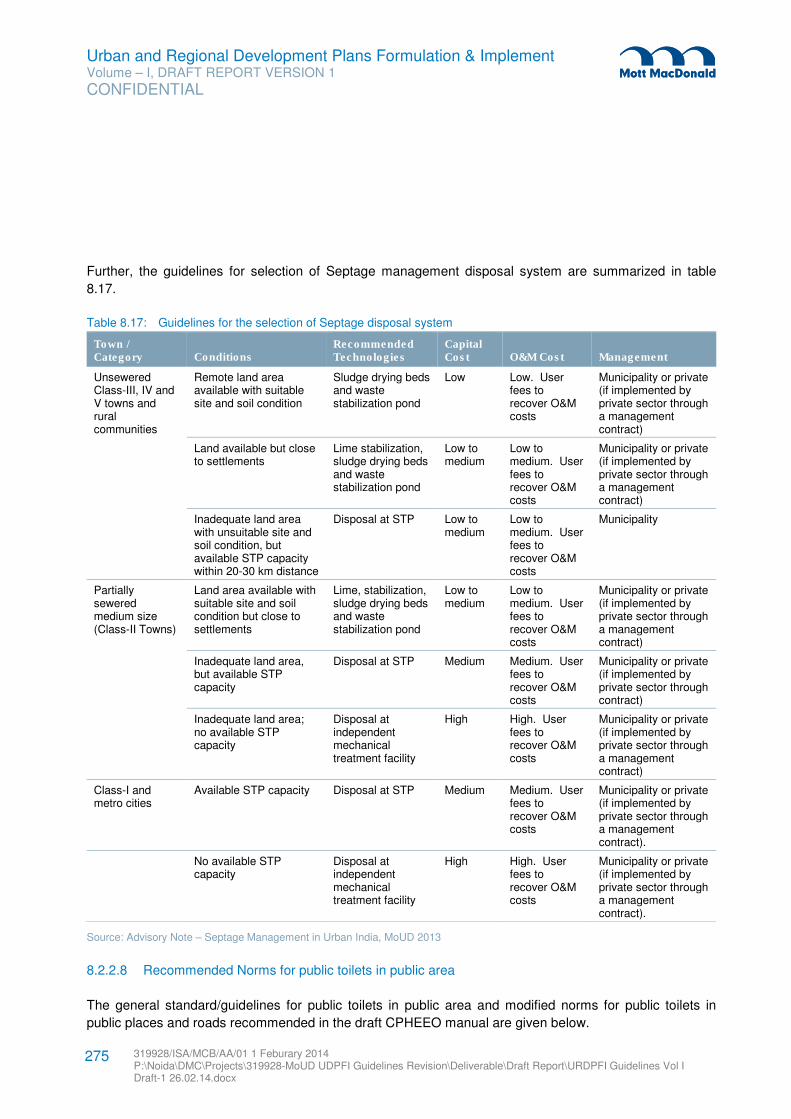
Urban and Regional Development Plans Formulation & Implement Volume – I, DRAFT REPORT VERSION 1
CONFIDENTIAL
319928/ISA/MCB/AA/01 1 Feburary 2014 P:\Noida\DMC\Projects\319928-MoUD UDPFI Guidelines Revision\Deliverable\Draft Report\URDPFI Guidelines Vol I Draft-1 26.02.14.docx
275
Further, the guidelines for selection of Septage management disposal system are summarized in table
8.17.
Table 8.17: Guidelines for the selection of Septage disposal system
Town / Category Conditions
Recommended Technologies
Capital Cost O&M Cost Management
Unsewered Class-III, IV and V towns and rural communities
Remote land area available with suitable site and soil condition
Sludge drying beds and waste stabilization pond
Low Low. User fees to recover O&M costs
Municipality or private (if implemented by private sector through a management contract)
Land available but close to settlements
Lime stabilization, sludge drying beds and waste stabilization pond
Low to medium
Low to medium. User fees to recover O&M costs
Municipality or private (if implemented by private sector through a management contract)
Inadequate land area with unsuitable site and soil condition, but available STP capacity within 20-30 km distance
Disposal at STP Low to medium
Low to medium. User fees to recover O&M costs
Municipality
Partially sewered medium size (Class-II Towns)
Land area available with suitable site and soil condition but close to settlements
Lime, stabilization, sludge drying beds and waste stabilization pond
Low to medium
Low to medium. User fees to recover O&M costs
Municipality or private (if implemented by private sector through a management contract)
Inadequate land area, but available STP capacity
Disposal at STP Medium Medium. User fees to recover O&M costs
Municipality or private (if implemented by private sector through contract)
Inadequate land area; no available STP capacity
Disposal at independent mechanical treatment facility
High High. User fees to recover O&M costs
Municipality or private (if implemented by private sector through a management contract)
Class-I and metro cities
Available STP capacity Disposal at STP Medium Medium. User fees to recover O&M costs
Municipality or private (if implemented by private sector through a management contract).
No available STP capacity
Disposal at independent mechanical treatment facility
High High. User fees to recover O&M costs
Municipality or private (if implemented by private sector through a management contract).
Source: Advisory Note – Septage Management in Urban India, MoUD 2013
8.2.2.8 Recommended Norms for public toilets in public area
The general standard/guidelines for public toilets in public area and modified norms for public toilets in
public places and roads recommended in the draft CPHEEO manual are given below.
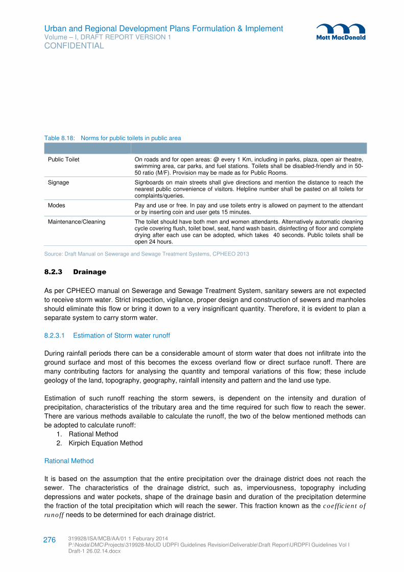
Urban and Regional Development Plans Formulation & Implement Volume – I, DRAFT REPORT VERSION 1
CONFIDENTIAL
319928/ISA/MCB/AA/01 1 Feburary 2014 P:\Noida\DMC\Projects\319928-MoUD UDPFI Guidelines Revision\Deliverable\Draft Report\URDPFI Guidelines Vol I Draft-1 26.02.14.docx
276
Table 8.18: Norms for public toilets in public area
Public Toilet On roads and for open areas: @ every 1 Km, including in parks, plaza, open air theatre, swimming area, car parks, and fuel stations. Toilets shall be disabled-friendly and in 50-50 ratio (M/F). Provision may be made as for Public Rooms.
Signage Signboards on main streets shall give directions and mention the distance to reach the nearest public convenience of visitors. Helpline number shall be pasted on all toilets for complaints/queries.
Modes Pay and use or free. In pay and use toilets entry is allowed on payment to the attendant or by inserting coin and user gets 15 minutes.
Maintenance/Cleaning The toilet should have both men and women attendants. Alternatively automatic cleaning cycle covering flush, toilet bowl, seat, hand wash basin, disinfecting of floor and complete drying after each use can be adopted, which takes 40 seconds. Public toilets shall be open 24 hours.
Source: Draft Manual on Sewerage and Sewage Treatment Systems, CPHEEO 2013
8.2.3 Drainage
As per CPHEEO manual on Sewerage and Sewage Treatment System, sanitary sewers are not expected
to receive storm water. Strict inspection, vigilance, proper design and construction of sewers and manholes
should eliminate this flow or bring it down to a very insignificant quantity. Therefore, it is evident to plan a
separate system to carry storm water.
8.2.3.1 Estimation of Storm water runoff
During rainfall periods there can be a considerable amount of storm water that does not infiltrate into the
ground surface and most of this becomes the excess overland flow or direct surface runoff. There are
many contributing factors for analysing the quantity and temporal variations of this flow; these include
geology of the land, topography, geography, rainfall intensity and pattern and the land use type.
Estimation of such runoff reaching the storm sewers, is dependent on the intensity and duration of
precipitation, characteristics of the tributary area and the time required for such flow to reach the sewer.
There are various methods available to calculate the runoff, the two of the below mentioned methods can
be adopted to calculate runoff:
1. Rational Method
2. Kirpich Equation Method
Rational Method
It is based on the assumption that the entire precipitation over the drainage district does not reach the
sewer. The characteristics of the drainage district, such as, imperviousness, topography including
depressions and water pockets, shape of the drainage basin and duration of the precipitation determine
the fraction of the total precipitation which will reach the sewer. This fraction known as the coefficient of
runoff needs to be determined for each drainage district.

Urban and Regional Development Plans Formulation & Implement Volume – I, DRAFT REPORT VERSION 1
CONFIDENTIAL
319928/ISA/MCB/AA/01 1 Feburary 2014 P:\Noida\DMC\Projects\319928-MoUD UDPFI Guidelines Revision\Deliverable\Draft Report\URDPFI Guidelines Vol I Draft-1 26.02.14.docx
277
The National Disaster Management Authority (NDMA) guidelines on urban flood management has
prescribed that “all future storm water drainage systems for peak flow for any city should be designed after
taking into consideration a runoff Coefficient of upto 0.95127
using the rational method. The runoff reaching
the sewer is given by the expression,
Q= 10 C i A
• Where Q is the runoff in m3/hr;
• C is the coefficient of runoff
• i is the intensity of in mm/hr and
• A is the area drainage district in hectares.
It may be reiterated that Q represents only the maximum discharge caused by a particular storm.
The portion of rainfall, which finds its way to the sewer is dependent on the imperviousness and the shape
of the drainage area apart from the duration of storm. The percentage of imperviousness of the drainage
area can be obtained from the records of a particular district. In the absence of such data, the table below
may serve as a guide.
Table 8.19: Runoff coefficients for stated surfaces
S. No. Type of Area Percentage of Imperviousness
1 Commercial and Industrial Area 70-90
2 Residential Area
- High Density
- Low Density
61-75
35-60
3 Parks and undeveloped areas 10-20
Source: NDMA
When several different surface types or land use which comprise the drainage area, a composite or
weighted average value of the imperviousness runoff coefficient can be computed, such as:
I = 1/A x (A1 x I1+A2 x I2+A3 x I3+………+An x In)
Where, the subscripts refer to respective sub-drainage area types, and A obviously the total drainage
area.
Kirpich Equation Method128
The time of concentration is defined as the time it takes for a drop of water in the remotest point in a
drainage basin to travel to the outlet. As calculation methods go, the Kirpich formula is one of the most
widely used methods.
127 Source: National Disaster Management Guidelines- Urban Flood management, 2010, page 45
128 K Subramanya pg 247,45
Urban and Regional Development Plans Formulation & Implement Volume – I, DRAFT REPORT VERSION 1
CONFIDENTIAL
319928/ISA/MCB/AA/01 1 Feburary 2014 P:\Noida\DMC\Projects\319928-MoUD UDPFI Guidelines Revision\Deliverable\Draft Report\URDPFI Guidelines Vol I Draft-1 26.02.14.docx
278
Tc = 0.01947 X L0.77
S-0.385
Where:
• Tc = Time of concentration (hours)
• L = Maximum length of water travel (m)
• S = surface slope, given by H/L (m/m)
• H = difference in elevation between the remotest point in the drainage basin and the outlet (m)
The Kirpich equation is normally used for natural basins with well-defined channels. If there are many
undefined channels that are grassed or vegetated throughout, the Kirpich formula will likely underestimate
the time of concentration, and a factor of 1.3 – 1.5 should be added. If most of the drainage basins are
non-natural (in urban system) with concrete or other smooth channels, the result should be decreased
about 40 – 60%.
8.2.4 Rain Water Harvesting
Rain water harvesting and conservation is the activity of direct collection of rain water. The conservation of
rain water so collected can be stored for direct use or can be recharged into the ground water. The main
goal is to minimise flow of rain water through drains / nallahs to the rivers. It is a known fact that the ground
water level is depleting and has gone down in the last decades. Thus the rain water harvesting and
conservation aims at optimum utilisation of the natural resource i.e. rain water129
. Many states such as
Tamil Nadu130
, Kerala131
, Delhi132
etc. have made mandatory the adoption of rain water harvesting in new
constructions. It is suggested to all the other States to mandate rain water harvesting in all their new
construction works.
8.2.4.1 Basic requirement of artificial recharge133
A. Availability of non-committed runoff in space and time;
B. Identification of suitable hydrogeological environment and sites for augmenting subsurface
reservoir through cost effective artificial recharge techniques.
If the above mentioned criteria are satisfied, the following criteria need to be evaluated for planning the
artificial recharge scheme:
C. Identification of Area
• Areas where ground water levels are declining on regular basis. • Areas where substantial amount of aquifer has already been desaturated. • Areas where availability of ground water is inadequate in lean months. • Areas where salinity ingress is taking place.
129 Manual on rain Water harvesting and Conservation, CPWD
130 Tamil Nadu Municipal Laws Ordinance, 2003
131 The Kerala Municipality Building Rules, 1999
132 Central Ground Water Board
133 Guide on Artificial Recharge to Ground Water, CGWB
Urban and Regional Development Plans Formulation & Implement Volume – I, DRAFT REPORT VERSION 1
CONFIDENTIAL
319928/ISA/MCB/AA/01 1 Feburary 2014 P:\Noida\DMC\Projects\319928-MoUD UDPFI Guidelines Revision\Deliverable\Draft Report\URDPFI Guidelines Vol I Draft-1 26.02.14.docx
279
• Urban Area where decline in water level is observed.
D. Hydrometerological studies
• Rainfall pattern in the area. • Evaporation losses from the area. • Climatological features that effect the planning of artificial recharge.
E. Hydrological studies
• In-situ precipitation on the watershed. • Surface (canal) supplies from large reservoirs located within basin. • Surface supplies through trans-basin water transfer. • Treated municipal and industrial wastewaters. • Hydrological investigations are to be carried out in the Watershed/Sub-basin/basin for
determining the source water availability. F. Soil infiltration studies
• Control the rate of infiltration. • Prerequisite study in cases of artificial recharge through water spreading methods. • Infiltration rates can be estimated by soils infiltration tests using Cylinder or flood infiltro-
meters instruments. G. Hydrogeological studies
• Firstly, to synthesize all the available data on hydrogeology from different agencies. • Study of satellite imagery for identification of geomorphic units. • Regional Hydrogeological maps indicating hydrogeological units, both at shallow and
deeper levels. • Water table contours to determine the form of the water table and the hydraulic connection
of ground water with rivers, canals etc. • Depths to the water table (DTW) for the periods of the maximum, minimum and mean
annual position of water table. • Ground water potential of different hydrogeological units and the level of ground water
development. H. Aquifer Geometry
• Data on the sub-surface hydrogeological units, their thickness and depth of occurrence • Disposition and hydraulic properties of unconfined, semi-confined and confined aquifers in
the area I. Chemical Quality of Source Water
• Quality of raw waters available for recharge is determine • Treatment before being used for recharge • Relation to the changes in the soil structure and the biological phenomena which take
place when infiltration begins • Changes expected to the environmental conditions.
8.2.4.2 Artificial Recharge Techniques134
A variety of methods have been developed to recharge ground water. Most of the artificial recharge
techniques are briefly described below:
1. Direct surface techniques, by -
134 Select Case Studies Rain Water Harvesting and Artificial Recharge, Central Ground Water Board
Urban and Regional Development Plans Formulation & Implement Volume – I, DRAFT REPORT VERSION 1
CONFIDENTIAL
319928/ISA/MCB/AA/01 1 Feburary 2014 P:\Noida\DMC\Projects\319928-MoUD UDPFI Guidelines Revision\Deliverable\Draft Report\URDPFI Guidelines Vol I Draft-1 26.02.14.docx
280
• Flooding
• Basins or percolation tanks
• Stream augmentation
• Ditch and furrow system
• Over irrigation
2. Direct sub surface techniques, by -
• Injection wells or recharge wells
• Recharge pits and shafts
• Dug well recharge
• Bore hole flooding
• Natural openings, cavity fillings.
3. Combination surface – sub-surface techniques, by -
• Basin or percolation tanks with pit shaft or wells.
4. Indirect Techniques, by -
• Induced recharge from surface water source.
• Aquifer modification
Although no two projects are identical, most use variation or combination of direct method, direct-sub-
surface, or indirect techniques. A schematic diagram of the artificial recharge methods used is given as
flowchart below.
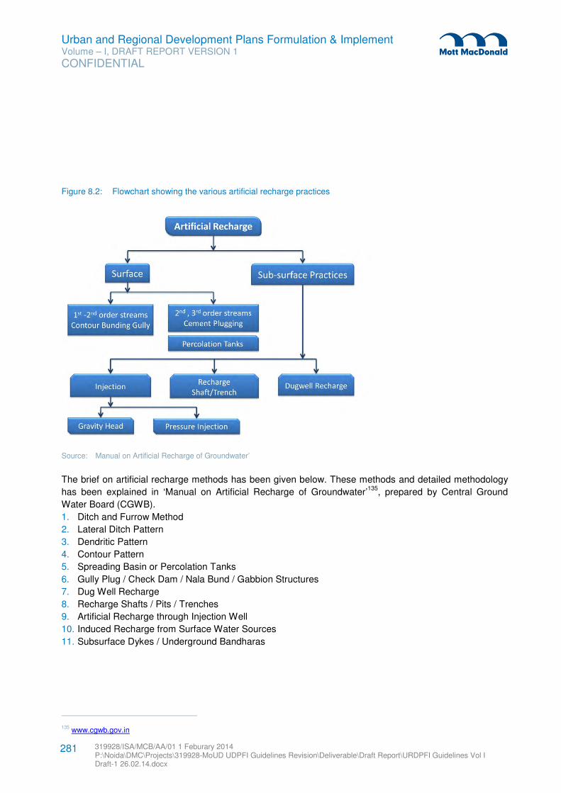
Urban and Regional Development Plans Formulation & Implement Volume – I, DRAFT REPORT VERSION 1
CONFIDENTIAL
319928/ISA/MCB/AA/01 1 Feburary 2014 P:\Noida\DMC\Projects\319928-MoUD UDPFI Guidelines Revision\Deliverable\Draft Report\URDPFI Guidelines Vol I Draft-1 26.02.14.docx
281
Figure 8.2: Flowchart showing the various artificial recharge practices
Source: Manual on Artificial Recharge of Groundwater’
The brief on artificial recharge methods has been given below. These methods and detailed methodology
has been explained in ‘Manual on Artificial Recharge of Groundwater’135
, prepared by Central Ground
Water Board (CGWB).
1. Ditch and Furrow Method
2. Lateral Ditch Pattern
3. Dendritic Pattern
4. Contour Pattern
5. Spreading Basin or Percolation Tanks
6. Gully Plug / Check Dam / Nala Bund / Gabbion Structures
7. Dug Well Recharge
8. Recharge Shafts / Pits / Trenches
9. Artificial Recharge through Injection Well
10. Induced Recharge from Surface Water Sources
11. Subsurface Dykes / Underground Bandharas
135 www.cgwb.gov.in
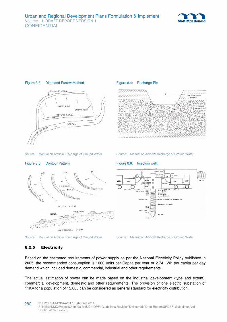
Urban and Regional Development Plans Formulation & Implement Volume – I, DRAFT REPORT VERSION 1
CONFIDENTIAL
319928/ISA/MCB/AA/01 1 Feburary 2014 P:\Noida\DMC\Projects\319928-MoUD UDPFI Guidelines Revision\Deliverable\Draft Report\URDPFI Guidelines Vol I Draft-1 26.02.14.docx
282
Figure 8.3: Ditch and Furrow Method Figure 8.4: Recharge Pit:
Source: Manual on Artificial Recharge of Ground Water Source: Manual on Artificial Recharge of Ground Water
Figure 8.5: Contour Pattern Figure 8.6: Injection well:
Source: Manual on Artificial Recharge of Ground Water Source: Manual on Artificial Recharge of Ground Water
8.2.5 Electricity
Based on the estimated requirements of power supply as per the National Electricity Policy published in
2005, the recommended consumption is 1000 units per Capita per year or 2.74 kWh per capita per day
demand which included domestic, commercial, industrial and other requirements.
The actual estimation of power can be made based on the industrial development (type and extent),
commercial development, domestic and other requirements. The provision of one electric substation of
11KV for a population of 15,000 can be considered as general standard for electricity distribution.
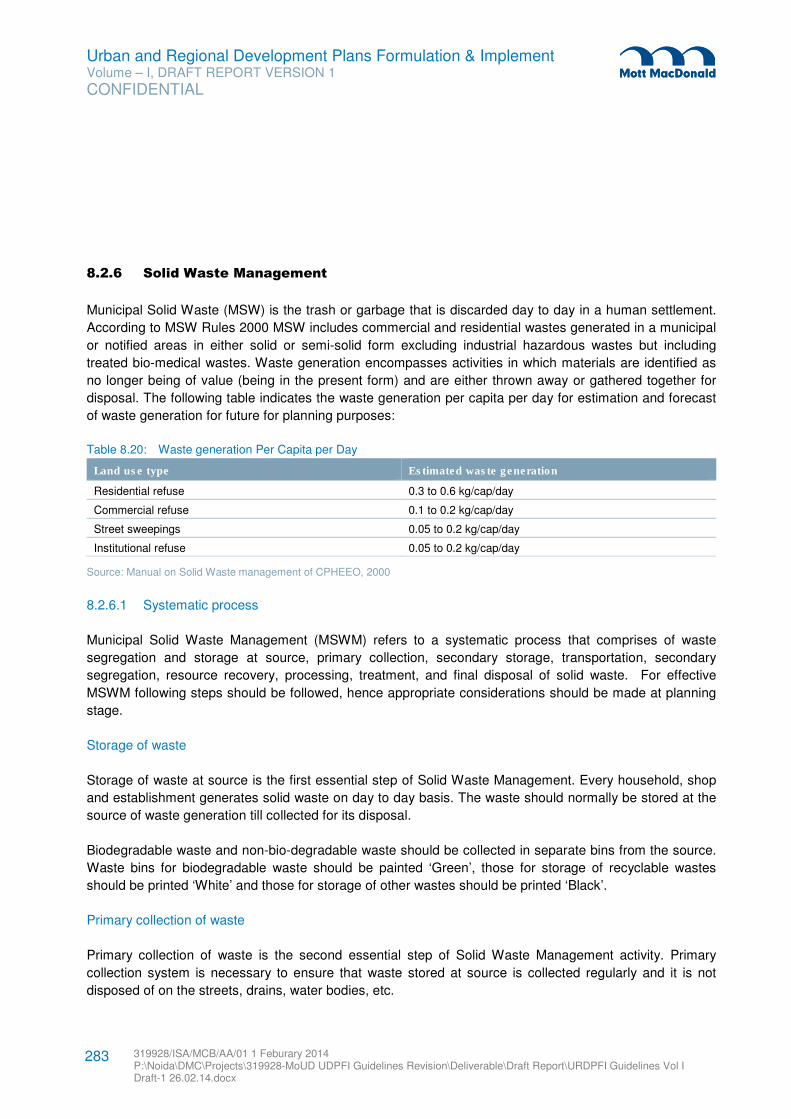
Urban and Regional Development Plans Formulation & Implement Volume – I, DRAFT REPORT VERSION 1
CONFIDENTIAL
319928/ISA/MCB/AA/01 1 Feburary 2014 P:\Noida\DMC\Projects\319928-MoUD UDPFI Guidelines Revision\Deliverable\Draft Report\URDPFI Guidelines Vol I Draft-1 26.02.14.docx
283
8.2.6 Solid Waste Management
Municipal Solid Waste (MSW) is the trash or garbage that is discarded day to day in a human settlement.
According to MSW Rules 2000 MSW includes commercial and residential wastes generated in a municipal
or notified areas in either solid or semi-solid form excluding industrial hazardous wastes but including
treated bio-medical wastes. Waste generation encompasses activities in which materials are identified as
no longer being of value (being in the present form) and are either thrown away or gathered together for
disposal. The following table indicates the waste generation per capita per day for estimation and forecast
of waste generation for future for planning purposes:
Table 8.20: Waste generation Per Capita per Day
Land use type Estimated waste generation
Residential refuse 0.3 to 0.6 kg/cap/day
Commercial refuse 0.1 to 0.2 kg/cap/day
Street sweepings 0.05 to 0.2 kg/cap/day
Institutional refuse 0.05 to 0.2 kg/cap/day
Source: Manual on Solid Waste management of CPHEEO, 2000
8.2.6.1 Systematic process
Municipal Solid Waste Management (MSWM) refers to a systematic process that comprises of waste
segregation and storage at source, primary collection, secondary storage, transportation, secondary
segregation, resource recovery, processing, treatment, and final disposal of solid waste. For effective
MSWM following steps should be followed, hence appropriate considerations should be made at planning
stage.
Storage of waste
Storage of waste at source is the first essential step of Solid Waste Management. Every household, shop
and establishment generates solid waste on day to day basis. The waste should normally be stored at the
source of waste generation till collected for its disposal.
Biodegradable waste and non-bio-degradable waste should be collected in separate bins from the source.
Waste bins for biodegradable waste should be painted ‘Green’, those for storage of recyclable wastes
should be printed ‘White’ and those for storage of other wastes should be printed ‘Black’.
Primary collection of waste
Primary collection of waste is the second essential step of Solid Waste Management activity. Primary
collection system is necessary to ensure that waste stored at source is collected regularly and it is not
disposed of on the streets, drains, water bodies, etc.
Urban and Regional Development Plans Formulation & Implement Volume – I, DRAFT REPORT VERSION 1
CONFIDENTIAL
319928/ISA/MCB/AA/01 1 Feburary 2014 P:\Noida\DMC\Projects\319928-MoUD UDPFI Guidelines Revision\Deliverable\Draft Report\URDPFI Guidelines Vol I Draft-1 26.02.14.docx
284
Local bodies should arrange for the primary collection of waste stored at various sources of waste
generation by any of the following methods or combination of more than one method:
� Doorstep collection of waste through non-motorised and motorised vehicles with active community
participation.
� Collection through community bins
� Doorstep or lane-wise collection of waste from authorised/unauthorised slums or collection from the
community bins to be provided in the slums by local bodies
Waste Storage Depots
This is the third essential step for an appropriate Solid Waste Management System. All the waste collected
through Primary Collection System, from the households, shops and establishments has to be taken to the
processing or disposal site either directly necessitating a large fleet of vehicles and manpower or through
cost effective systems which are designed to ensure that all the waste collected from the sources of waste
generation is temporarily stored at a common place called "Waste Storage Depots" and then transported in
bulk to the processing or disposal sites. Such temporary arrangement for storage of waste is popularly
known as dust bin, dhalavs, etc. This facility has to be so designed that the system synchronizes with the
system of primary collection as well as transportation of waste. Locations for bins/depots of appropriate
size should be identified at planning stage.
Transportation of the waste
Transportation of the waste stored at waste storage depots at regular intervals is essential to ensure that
no garbage bins/containers overflow and waste does not littered on the streets. Hygienic conditions can be
maintained in cities/towns only if regular clearance of waste from temporary waste storage depots (bins) is
ensured. Transportation system has to be so designed that it is efficient, yet cost effective. The system
should synchronize with the system of waste storage depot and should be easily maintainable.
The schematic diagram of SWM process is shown in Figure 8.7. The detailed description of above
mentioned stages are given in Manual on Municipal Solid Waste Management, CPHEEO.
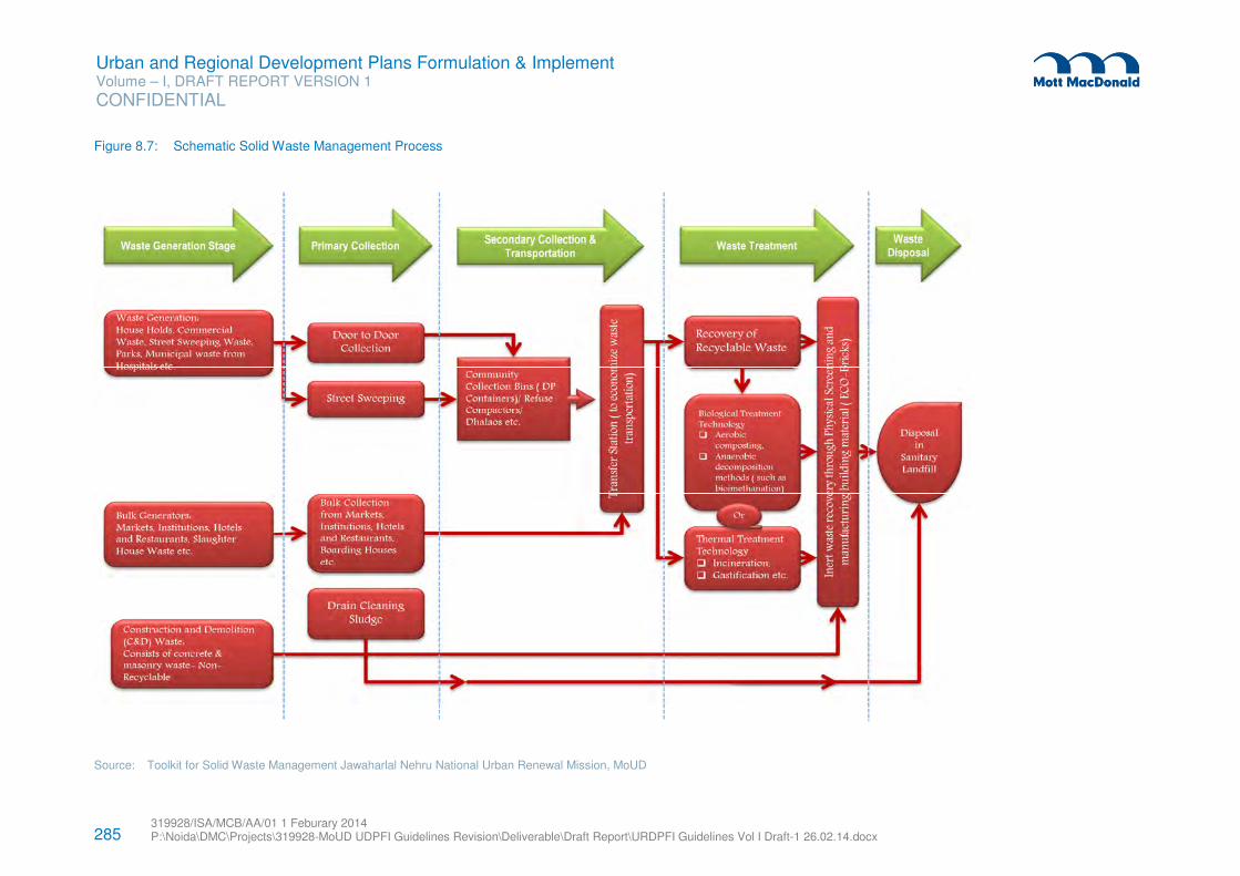
285 319928/ISA/MCB/AA/01 1 Feburary 2014 P:\Noida\DMC\Projects\319928-MoUD UDPFI Guidelines Revision\Deliverable\Draft Report\URDPFI Guidelines Vol I Draft-1 26.02.14.docx
Urban and Regional Development Plans Formulation & Implement Volume – I, DRAFT REPORT VERSION 1
CONFIDENTIAL
Figure 8.7: Schematic Solid Waste Management Process
Source: Toolkit for Solid Waste Management Jawaharlal Nehru National Urban Renewal Mission, MoUD
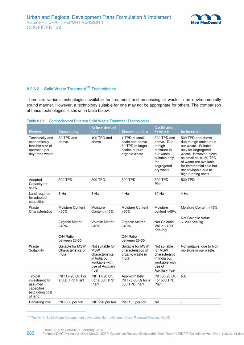
283 319928/ISA/MCB/AA/01 1 Feburary 2014 P:\Noida\DMC\Projects\319928-MoUD UDPFI Guidelines Revision\Deliverable\Draft Report\URDPFI Guidelines Vol I Draft-1 26.02.14.docx
Urban and Regional Development Plans Formulation & Implement Volume – I, DRAFT REPORT VERSION 1
CONFIDENTIAL
8.2.6.2 Solid Waste Treatment136
Technologies
There are various technologies available for treatment and processing of waste in an environmentally
sound manner. However, a technology suitable for one may not be appropriate for others. The comparison
of these technologies is shown in table below:
Table 8.21: Comparison of Different Solid Waste Treatment Technologies
Element Composting Refuse derived fuel Biomethanation
Gasification / Pyrolysis Incineration
Technically and economically feasible size of operation per day fresh waste
50 TPD and above
100 TPD and above
1 TPD at small scale and above 50 TPD at larger scales of pure organic waste
500 TPD and above. Due to high moisture in our waste, suitable only for segregated dry waste.
500 TPD and above due to high moisture in our waste. Suitable only for segregated waste. However, sizes as small as 10-50 TPD of waste are available for commercial sale but not advisable due to high running costs.
Adopted Capacity for study
500 TPD 500 TPD 500 TPD 500 TPD Plant
500 TPD
Land required for adopted capacities
6 Ha 3 Ha 4 Ha 10 Ha 4 Ha
Waste Characteristics
Moisture Content >50%
Organic Matter >40%
C/N Ratio between 25-30
Moisture Content <45%
Volatile Matter >40%
Moisture Content >50%
Organic Matter >40%
C/N Ratio between 25-30
Moisture content <45%
Net Calorific Value >1200 Kcal/Kg
Moisture Content <45%
Net Calorific Value >1200 Kcal/kg
Waste Suitability
Suitable for MSW Characteristics of India
Not suitable for MSW characteristics in India but workable with use of Auxiliary Fuel
Suitable for MSW characteristics of organic waste in India
Not suitable for MSW characteristic in India but workable with use of Auxiliary Fuel
Not suitable, due to high moisture in our waste.
Typical investment for assumed capacities (excluding cost of land)
INR 17-20 Cr. For a 500 TPD Plant
INR 17-20 Cr. For a 500 TPD Plant
Approximately INR 75-80 Cr for a 500 TPD Plant
INR 80-90 Cr. For 500 TPD Plant
NA
Recurring cost INR 300 per ton INR 290 per ton INR 100 per ton NA -
136 Toolkit for Solid Waste Management Jawaharlal Nehru National Urban Renewal Mission, MoUD
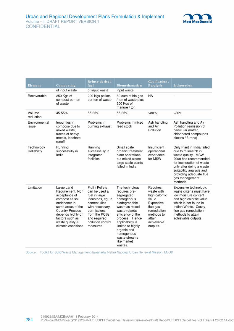
284 319928/ISA/MCB/AA/01 1 Feburary 2014 P:\Noida\DMC\Projects\319928-MoUD UDPFI Guidelines Revision\Deliverable\Draft Report\URDPFI Guidelines Vol I Draft-1 26.02.14.docx
Urban and Regional Development Plans Formulation & Implement Volume – I, DRAFT REPORT VERSION 1
CONFIDENTIAL
Element Composting Refuse derived fuel Biomethanation
Gasification / Pyrolysis Incineration
of input waste of input waste input waste
Recoverable 250 Kgs of compost per ton of waste
200 Kgs pellets per ton of waste
80 cum of bio gas / ton of waste plus 200 Kgs of manure / ton
NA -
Volume reduction
45-55% 55-65% 55-65% >80% >80%
Environmental issue
Impurities in compose due to mixed waste, traces of heavy metals, leachate runoff
Problems in burning exhaust
Problems if mixed feed stock
Ash handling and Air Pollution
Ash handling and Air Pollution (emission of particular matter, chlorinated compounds dioxins / furans)
Technology Reliability
Running successfully in India
Running successfully in integrated facilities
Small scale organic treatment plant operational but mixed waste large scale plants failed in India
Insufficient operational experience for MSW
Only Plant in India failed due to mismatch in waste quality. MSW 2000 has recommended for incineration of waste only after doing a waste suitability analysis and providing adequate flue gas management methods.
Limitation Large Land Requirement, Non acceptance of compost as soil enrichener in some areas of the Country Process depends highly on factors such as waste quality & climatic conditions
Fluff / Pellets can be used a fuel in large industries, eg. In cement kilns with necessary permissions from the PCBs and required pollution control measures.
The technology requires pre-segregated homogenous biodegradable waste as mixed waste retards efficiency of the process. Hence applicability is limited to highly organic and homogenous waste streams like market wastes.
Requires waste with high calorific value. Expensive flue gas remediation methods to attain achievable outputs.
Expensive technology, waste criteria must have low moisture content and high calorific value, which is not found in Indian Waste. Costly flue gas remediation methods to attain achievable outputs.
Source: Toolkit for Solid Waste Management Jawaharlal Nehru National Urban Renewal Mission, MoUD
285 319928/ISA/MCB/AA/01 1 Feburary 2014 P:\Noida\DMC\Projects\319928-MoUD UDPFI Guidelines Revision\Deliverable\Draft Report\URDPFI Guidelines Vol I Draft-1 26.02.14.docx
Urban and Regional Development Plans Formulation & Implement Volume – I, DRAFT REPORT VERSION 1
CONFIDENTIAL
8.2.6.3 Disposal of Waste137
Waste after treatment must be disposed in a manner that does not create any instance of environmental
pollution and public nuisance. The MSW Rule 2000, defines waste disposal as an activity which involves
“final disposal of municipal solid wastes in terms of the specified measures to prevent contamination of
ground-water, surface water and ambient air quality”.
The landfill design shall be aimed to minimize the following:
� The ingress of water into the landfill,
� The production of leachate, its subsequent outflow and uncontrolled dispersions into surrounding
aquatic environment,
� The accumulation, migration and uncontrolled release of landfill gas into the atmosphere.
The detailed description of disposal of waste can be referred from Toolkit for Solid Waste Management
Jawaharlal Nehru National Urban Renewal Mission, MoUD.
Landfill Gas Extraction (LFG)138
,139
The waste deposited in a landfill gets subjected, over a period of time, to anaerobic conditions140
. This
leads to landfill gas production containing about 45-55% methane. This methane can be recovered through
a network of pipes and utilised as a source of energy. Landfill gas extraction systems adds to Climate
Change initiatives as it helps reduce Green House Gas emissions through avoidance of landfill gas(mainly
comprising of methane) into the atmosphere.
Waste composition is the most important factor in assessing the LFG generation potential and total yield at
a site. Inorganic and inert wastes will produce little or no LFG; more organic wastes will produce greater
amounts of LFG on a per unit mass basis. Similarly moisture content in waste is also impact the LFG
generation from waste. For e.g. Highly-organic wastes such as food wastes are able to produce LFG, but
also comprise largely water, which inherently does not produce LFG but will aid the rate of LFG evolution.
While planning for LFG, pH and Nutrient content of the waste should also be considered. The generation of
methane in landfills is greatest when neutral pH conditions exist. MSW contains the nutrients necessary to
support the decomposition process that generates methane gas. Numerous toxic materials, such as heavy
metals, can retard bacterial growth in portions of a site and consequently slow gas generation. Another
parameter that influences the LFG generation rate is the particle size and density, which may affect the
transport of nutrients and moisture throughout the landfill.
137 Toolkit for Solid Waste Management Jawaharlal Nehru National Urban Renewal Mission, MoUD
138 Toolkit for Solid Waste Management Jawaharlal Nehru National Urban Renewal Mission, MoUD
139 Landfill Gas Management Facilities Design Guidelines, Ministry of Environment, British Colombia
140 Organic Compounds are transformed into methane (CH4), CO2, and Water in an atmosphere devoid of oxygen.
286 319928/ISA/MCB/AA/01 1 Feburary 2014 P:\Noida\DMC\Projects\319928-MoUD UDPFI Guidelines Revision\Deliverable\Draft Report\URDPFI Guidelines Vol I Draft-1 26.02.14.docx
Urban and Regional Development Plans Formulation & Implement Volume – I, DRAFT REPORT VERSION 1
CONFIDENTIAL
Regional Solid Waste Management141
A ‘Regional MSW Project’ means a project to either:
1. Develop and/or construct and/or operate, maintain and/or manage any type of new Regional MSW
Facility; or
2. Convert and/or redevelop an existing MSW facility or system from being a facility used by a single
Authority into a Regional MSW Facility. A Regional MSW Project can cover, within its scope, any
existing MSW management facilities or systems within the jurisdiction of an Authority.
Thus Regional MSW Facilities or Regional MSW Projects would help the Authorities to share technical
expertise, costs of development and management of infrastructure and scarce natural resources, such as
land, and consequently help in provision of scientific collection, management, processing and disposal of
MSW in an efficient manner within respective states
For the implementation of the Regional MSW Projects, state governments may incorporate a public limited
company or state-level utility (which may be called the State MSW Management Company Limited/Utility—
the ‘Company/Utility’) for the purposes of identifying and enabling the development of Regional MSW
Projects within the state. The Company/Utility may create a body of expertise in the development,
implementation and financing of Regional MSW Projects for the benefit of the state. The Utility may be
backed by appropriate legislation.
The Company/Utility would have to be supported by the state government through issuance of adequate
administrative instructions/ directions/policies. The state government may facilitate the process where
Authorities are unable to provide for adequate services in a consultative manner.
In order to ensure a balanced framework for the implementation of a Regional MSW Project through such
a Company/Utility, a framework should be established whereby a Project Coordination Committee for each
project is constituted which comprises representatives of each participating Authority and the Company/
Utility; and important project decisions during the project development, implementation and operational
stages are taken through this committee.
In the event that the Regional MSW Project is implemented through the PPP route, the Board of the
Project Company (SPV) so constituted with a private sector participant, will have nominees of the
participating Authorities, state government as well as the Company/Utility. The Project Coordination
Committee, overseeing project implementation, would also have a nominee of the selected private sector
participant.
Special provisions for hilly areas142
Cities and towns located on hills shall have location-specific methods evolved for final disposal of solid
wastes by the municipal authority with the approval of the concerned State Board or the Committee. 141 Guidance Note on Municipal Solid Waste Management on a Regional Basis, MoUD
142 Toolkit for Solid Waste Management Jawaharlal Nehru National Urban Renewal Mission, MoUD
287 319928/ISA/MCB/AA/01 1 Feburary 2014 P:\Noida\DMC\Projects\319928-MoUD UDPFI Guidelines Revision\Deliverable\Draft Report\URDPFI Guidelines Vol I Draft-1 26.02.14.docx
Urban and Regional Development Plans Formulation & Implement Volume – I, DRAFT REPORT VERSION 1
CONFIDENTIAL
� The municipal authority shall set up processing facilities for utilization of biodegradable organic wastes.
� The inert and non-biodegradable waste shall be used for building roads or filling-up of appropriate
areas on hills.
� Because of constraints in finding adequate land in hilly areas, wastes not suitable for road-laying or
filling up shall be disposed of in specially designed landfills.
Case study Solid Waste Management in Bruhat Bangalore Mahanagar Palike (BBMP)143
The Bruhat Bangalore Mahanagar Palike has area of 800 sq. km which accommodates the population of
78 Lakh. Estimated MSW generation projection for 2009, from all the BBMP zones is 3000 tpd. BBMP
aims to adopt zero waste management or reducing the quantity of inerts that goes to landfills by less than
10% by recycling wherever possible.
Waste Collection System
About 70% of the MSW (Municipal Solid Waste) activity starting from primary collection to disposal has
been outsourced & 30% is managed by BBMP. A combination of alternatives is adopted, such as:
� There are about 4300 Pourakarmikas (Sweepers) of BBMP & 10000 Pourakarmikas (Sweepers) from
contractor who performs Door to Door collection & sweeping activities.
� In some of the new zones the Door to Door collection activity is entrusted to Self Help Groups (SHG’s)
which are basically below poverty women’s groups.
� In some of the residential areas the Residential Welfare Associations (RWA’s) are involved in Door to
Door collection & decentralization of composting the waste.
Decentralized Processing Plants
� Some of the areas where RWA’s are performing Door to Door collection, the waste is segregated at
source & the organic waste is composted in the community in a small scale.
� BBMP has setup a 15 ton capacity decentralized plant to process organic waste as well as recycle the
plastic, metal etc
� BBMP has established an decentralizes one ton capacity aerobic composting unit at Malleshwaram
market (West Zone) using organic waste convertor.
� Dry waste collection centers has been set up for recycling the dry materials like plastic, paper, glass,
metals etc.
143 www.bbmp.gov.in
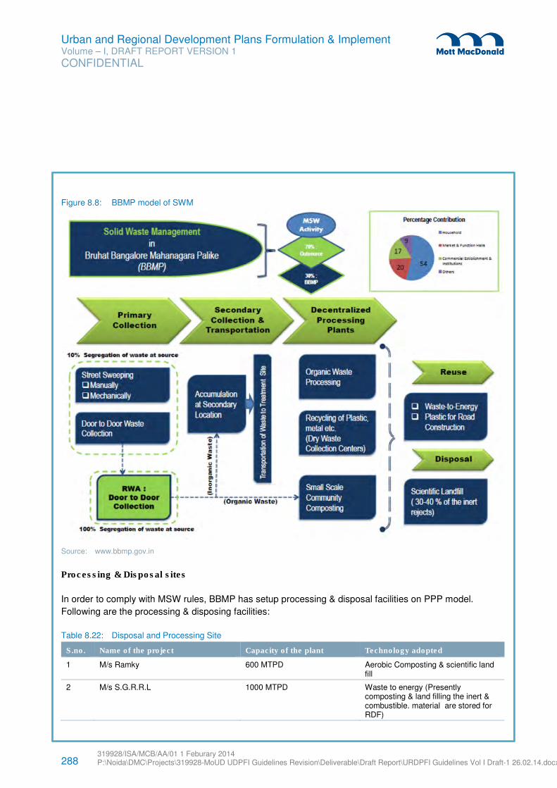
288 319928/ISA/MCB/AA/01 1 Feburary 2014 P:\Noida\DMC\Projects\319928-MoUD UDPFI Guidelines Revision\Deliverable\Draft Report\URDPFI Guidelines Vol I Draft-1 26.02.14.docx
Urban and Regional Development Plans Formulation & Implement Volume – I, DRAFT REPORT VERSION 1
CONFIDENTIAL
Figure 8.8: BBMP model of SWM
Source: www.bbmp.gov.in
Processing & Disposal sites
In order to comply with MSW rules, BBMP has setup processing & disposal facilities on PPP model.
Following are the processing & disposing facilities:
Table 8.22: Disposal and Processing Site
S.no. Name of the project Capacity of the plant Technology adopted
1 M/s Ramky 600 MTPD Aerobic Composting & scientific land fill
2 M/s S.G.R.R.L 1000 MTPD Waste to energy (Presently composting & land filling the inert & combustible. material are stored for RDF)
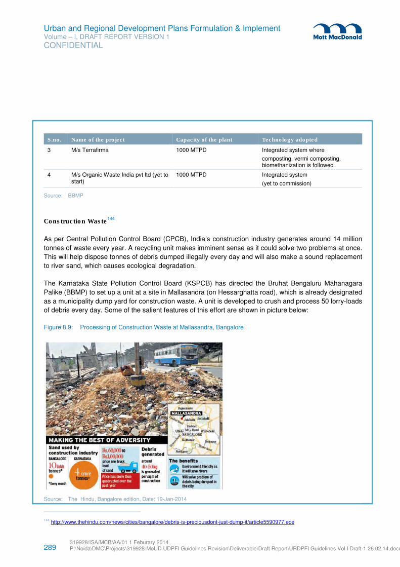
289 319928/ISA/MCB/AA/01 1 Feburary 2014 P:\Noida\DMC\Projects\319928-MoUD UDPFI Guidelines Revision\Deliverable\Draft Report\URDPFI Guidelines Vol I Draft-1 26.02.14.docx
Urban and Regional Development Plans Formulation & Implement Volume – I, DRAFT REPORT VERSION 1
CONFIDENTIAL
S.no. Name of the project Capacity of the plant Technology adopted
3 M/s Terrafirma 1000 MTPD Integrated system where
composting, vermi composting, biomethanization is followed
4 M/s Organic Waste India pvt ltd (yet to start)
1000 MTPD Integrated system
(yet to commission)
Source: BBMP
Construction Waste144
As per Central Pollution Control Board (CPCB), India’s construction industry generates around 14 million
tonnes of waste every year. A recycling unit makes imminent sense as it could solve two problems at once.
This will help dispose tonnes of debris dumped illegally every day and will also make a sound replacement
to river sand, which causes ecological degradation.
The Karnataka State Pollution Control Board (KSPCB) has directed the Bruhat Bengaluru Mahanagara
Palike (BBMP) to set up a unit at a site in Mallasandra (on Hessarghatta road), which is already designated
as a municipality dump yard for construction waste. A unit is developed to crush and process 50 lorry-loads
of debris every day. Some of the salient features of this effort are shown in picture below:
Figure 8.9: Processing of Construction Waste at Mallasandra, Bangalore
Source: The Hindu, Bangalore edition, Date: 19-Jan-2014
144 http://www.thehindu.com/news/cities/bangalore/debris-is-preciousdont-just-dump-it/article5590977.ece
290 319928/ISA/MCB/AA/01 1 Feburary 2014 P:\Noida\DMC\Projects\319928-MoUD UDPFI Guidelines Revision\Deliverable\Draft Report\URDPFI Guidelines Vol I Draft-1 26.02.14.docx
Urban and Regional Development Plans Formulation & Implement Volume – I, DRAFT REPORT VERSION 1
CONFIDENTIAL
Approach adopted & actions taken:
� The combination of technologies for processing of MSW attempted for sustenance & viability.
� Generally around 30 to 40 percent of inert rejects which includes recyclables are going to the scientific
landfill.
� Attempt is being made to utilize all the recyclables.
� Small quantity of Waste Plastic are segregated and used in the construction of pavement roads. About
8% of Poly blend is mixed in the asphalt
� There is an exposure of converting the plastics into diesel by following depolymerization technology
which is yet to be implemented in large scale.
� To bring in accountability for the distance travelled by the vehicles GPS/GPRS Based Tracking system
is implemented.
� CCTV cameras have been installed at all the processing sites at the entry and exit points to view the
vehicles reached.
� Also a ticketing system using Hand Held Device, which collect the data and send it to the central server
for monitoring and analysis is in place,
� The entire truck numbers and operation schedule is automatically down loaded to the Hand Held
device through GPRS.
8.2.6.4 Specific Waste Handling
Nuclear or Radioactive Waste
Nuclear or radioactive waste means any waste material containing radionuclides in quantities or
concentrations. The disposal of such waste include the release of radioactive material to the environment
in a manner leading to loss of control over the future disposition of the radionuclides contained therein and
includes emplacement of waste materials in a repository beings or animals or in research activities in
these fields or in the production or testing of biological waste. Such waste must be managed through
“Atomic Energy (Safe Disposal of Radioactive Wastes) Rules, 1987”.
E-Waste
E-waste or electronic waste means waste electrical and electronic equipment (EEE), whole or in part or
rejects from their manufacturing and repair process, which are intended to be discarded. “The E-waste
(Management and Handling) Rules 2011” should be followed for disposal of E Waste.
Bio Medical Waste
Hospital waste/Bio-medical waste is generated during the diagnosis, treatment, or immunization of human
beings or animals or in research activities in these fields or in the production or testing of biological waste.
Hospital/Bio-medical waste must be handled and disposed-off as per guidelines laid in “Bio-Medical Waste
(Management and Handling) Rules, 1998”.
291 319928/ISA/MCB/AA/01 1 Feburary 2014 P:\Noida\DMC\Projects\319928-MoUD UDPFI Guidelines Revision\Deliverable\Draft Report\URDPFI Guidelines Vol I Draft-1 26.02.14.docx
Urban and Regional Development Plans Formulation & Implement Volume – I, DRAFT REPORT VERSION 1
CONFIDENTIAL
8.2.7 Domestic Gas Supply Pipelines
8.2.7.1 Criteria for Technically Feasible Domestic PNG Connection145
A technically feasible area/locality/ society / building shall have provision to lay MDPE pipelines and its lanes shall have free accessibility for fire tender in case of any emergency. The under-developed slum areas, water-logging areas, places with soak pits, narrow lanes that do not have room for excavation and/or the narrow and/ or crowded lanes which prevent accessing the area in case of emergency and structurally unstable buildings shall be considered technically not feasible.
A technically feasible domestic PNG connection shall have provision for connecting the customer’s premises with the service MDPE pipe line with the riser for the customers building. The connectivity service pipeline to customers building from the mainline should be possible without posing any hindrance or safety hazard.
8.2.7.2 Provisions
The provision of the domestic and trans-country pipelines shall be as per the PNGRB Technical & Quality
Standards and specifications which ensures overall safety, quality, and convenience. The latest and
updated PNGRB rules and regulations shall be followed for:
� Design, Layout, Construction, & Maintenance of City Gas Distribution Infrastructure
� Pressure Standards & Maintenance
� Material of Construction
� Selection of Location for City Gate Stations (CGS)
The municipalities and development authorities to make provisions for:
� Right of Usage (RoU) to be pre-defined in the Right of Way (RoW) of the city roads, as per the norms
of PNGRB to be compatible with the other utilities,
� The safety norms prescribed by PNGRB to be included in the Development control regulations by the
development authorities
� Land for City gas stations to be provisioned in the urban extensions, avoiding congested areas. Land
requirement for the CGS of an area of minimum 2000 sq. mtrs.
8.2.8 Service Level Benchmarking for Infrastructure
In recent development, MoUD has initiated an exercise to define Service Level Benchmarking (SLBs).
Measuring service levels of civic agencies implies measuring outcomes, and indirectly reflects on
institutional capacity, financial performance and other parameters. The Handbook of Service level
benchmarking prepared by MoUD can be referred while providing basic infrastructure facility such as water
supply, sewerage, drainage and solid waste management for efficient functioning.
145 Indraprastha Gas Limited (IGL)
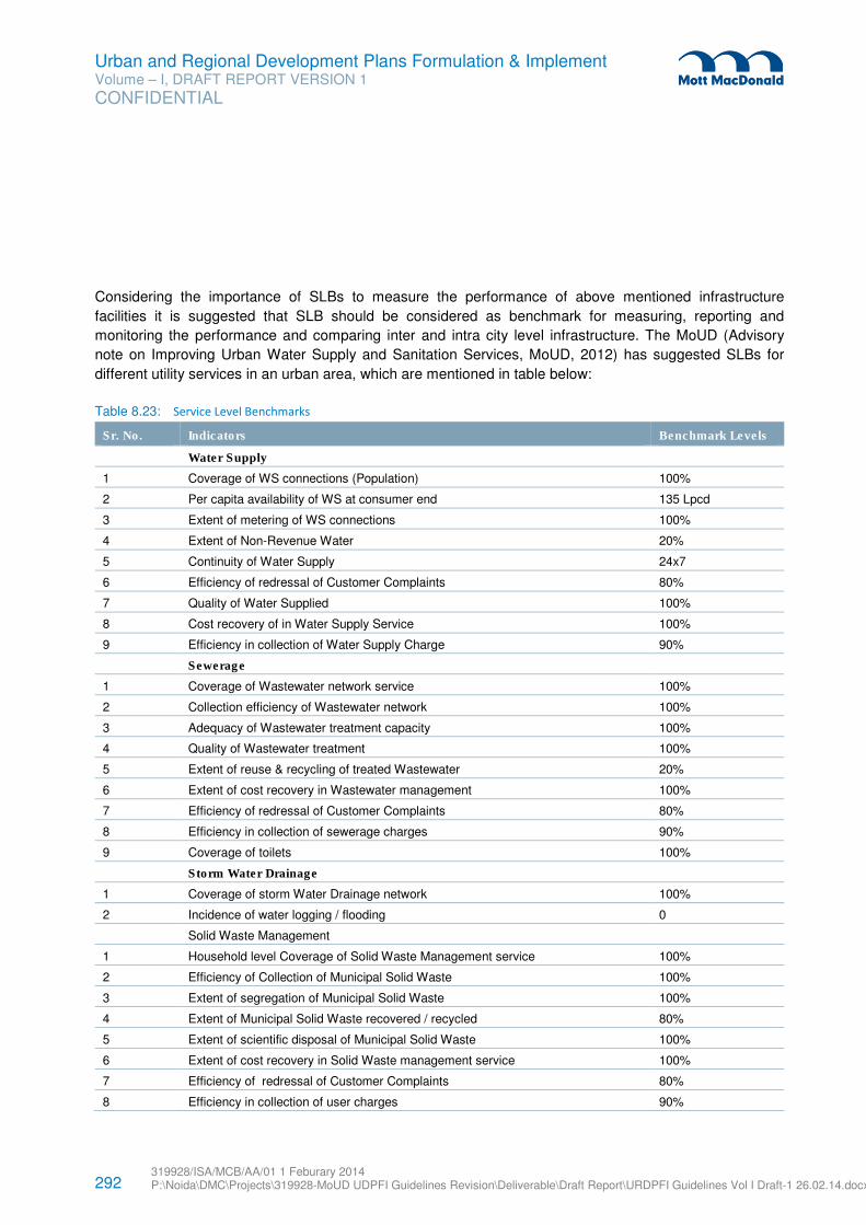
292 319928/ISA/MCB/AA/01 1 Feburary 2014 P:\Noida\DMC\Projects\319928-MoUD UDPFI Guidelines Revision\Deliverable\Draft Report\URDPFI Guidelines Vol I Draft-1 26.02.14.docx
Urban and Regional Development Plans Formulation & Implement Volume – I, DRAFT REPORT VERSION 1
CONFIDENTIAL
Considering the importance of SLBs to measure the performance of above mentioned infrastructure
facilities it is suggested that SLB should be considered as benchmark for measuring, reporting and
monitoring the performance and comparing inter and intra city level infrastructure. The MoUD (Advisory
note on Improving Urban Water Supply and Sanitation Services, MoUD, 2012) has suggested SLBs for
different utility services in an urban area, which are mentioned in table below:
Table 8.23: Service Level Benchmarks
Sr. No. Indicators Benchmark Levels
Water Supply
1 Coverage of WS connections (Population) 100%
2 Per capita availability of WS at consumer end 135 Lpcd
3 Extent of metering of WS connections 100%
4 Extent of Non-Revenue Water 20%
5 Continuity of Water Supply 24x7
6 Efficiency of redressal of Customer Complaints 80%
7 Quality of Water Supplied 100%
8 Cost recovery of in Water Supply Service 100%
9 Efficiency in collection of Water Supply Charge 90%
Sewerage
1 Coverage of Wastewater network service 100%
2 Collection efficiency of Wastewater network 100%
3 Adequacy of Wastewater treatment capacity 100%
4 Quality of Wastewater treatment 100%
5 Extent of reuse & recycling of treated Wastewater 20%
6 Extent of cost recovery in Wastewater management 100%
7 Efficiency of redressal of Customer Complaints 80%
8 Efficiency in collection of sewerage charges 90%
9 Coverage of toilets 100%
Storm Water Drainage
1 Coverage of storm Water Drainage network 100%
2 Incidence of water logging / flooding 0
Solid Waste Management
1 Household level Coverage of Solid Waste Management service 100%
2 Efficiency of Collection of Municipal Solid Waste 100%
3 Extent of segregation of Municipal Solid Waste 100%
4 Extent of Municipal Solid Waste recovered / recycled 80%
5 Extent of scientific disposal of Municipal Solid Waste 100%
6 Extent of cost recovery in Solid Waste management service 100%
7 Efficiency of redressal of Customer Complaints 80%
8 Efficiency in collection of user charges 90%
293 319928/ISA/MCB/AA/01 1 Feburary 2014 P:\Noida\DMC\Projects\319928-MoUD UDPFI Guidelines Revision\Deliverable\Draft Report\URDPFI Guidelines Vol I Draft-1 26.02.14.docx
Urban and Regional Development Plans Formulation & Implement Volume – I, DRAFT REPORT VERSION 1
CONFIDENTIAL
Source: Advisory note on Improving Urban Water Supply and Sanitation Services, MoUD, 2012
8.3 Social Infrastructure
The quality of life in any urban centre depends upon the availability of and accessibility to quality social
infrastructure. These include the following infrastructure:
a) Education facilities
b) Healthcare facilities
c) Socio Cultural facilities
d) Recreational facilities
e) Sports Facilities
f) Distribution Services
g) Police Safety
8.3.1 Provision of infrastructure
Hierarchy: The provision of social amenities in any urban area shall consider the regional bearings; as
small towns cater to the requirements (especially of higher level facilities) of surrounding villages, medium
size towns cater to small towns and villages and so on. However, in case of large and metro cities, certain
apex level facilities significantly cater to regional requirements in addition to the city demand. In order to
efficiently plan for cities & regions, alternatives which could be considered may be to provide:
a) Amenities for 25% additional population overall as a cushion, or
b) Exclude such apex level facilities from the total estimated needs provision.
In distribution of infrastructure, population plays the guiding role and therefore, indication of population
served by a facility or service is given. In some cases depending upon the regional requirements, a higher
order facility becomes necessary in a lower order settlement. A comprehensive list of facilities at each
hierarchy is given in Appendix F.
Proximity: The local community participation shall be encouraged in management of the local level facility
units to promote efficient utilization and upkeep of the facilities. These local level facilities shall be provided
at a preferable 600 m to 800 m walkable distance to promote pedestrianization and reduction in vehicular
use.
It is observed that a number of lower level social amenities particularly in regard to education and health
infrastructure operate in private residential premises due to their proximity to the area of demand. The
potential of such practices shall be assessed to find out the actual needs, which shall be reliable input for
arriving at realistic norms as well as for providing adequate number of sites for such facilities.
Multiple uses: The possibilities for multiple uses of social amenities may be considered depending upon
the compatibility of the activities and acceptance of the society, such as the school auditoriums can be
utilised for public seminars in off working hours. The multiple uses can be for private and public owned
land/properties. The possibility of multiple activities in public facilities may also be considered such as in
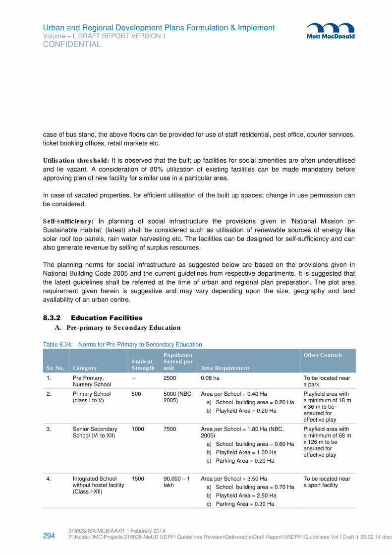
294 319928/ISA/MCB/AA/01 1 Feburary 2014 P:\Noida\DMC\Projects\319928-MoUD UDPFI Guidelines Revision\Deliverable\Draft Report\URDPFI Guidelines Vol I Draft-1 26.02.14.docx
Urban and Regional Development Plans Formulation & Implement Volume – I, DRAFT REPORT VERSION 1
CONFIDENTIAL
case of bus stand, the above floors can be provided for use of staff residential, post office, courier services,
ticket booking offices, retail markets etc.
Utilisation threshold: It is observed that the built up facilities for social amenities are often underutilised
and lie vacant. A consideration of 80% utilization of existing facilities can be made mandatory before
approving plan of new facility for similar use in a particular area.
In case of vacated properties, for efficient utilisation of the built up spaces; change in use permission can
be considered.
Self-sufficiency: In planning of social infrastructure the provisions given in ‘National Mission on
Sustainable Habitat’ (latest) shall be considered such as utilisation of renewable sources of energy like
solar roof top panels, rain water harvesting etc. The facilities can be designed for self-sufficiency and can
also generate revenue by selling of surplus resources.
The planning norms for social infrastructure as suggested below are based on the provisions given in
National Building Code 2005 and the current guidelines from respective departments. It is suggested that
the latest guidelines shall be referred at the time of urban and regional plan preparation. The plot area
requirement given herein is suggestive and may vary depending upon the size, geography and land
availability of an urban centre.
8.3.2 Education Facilities
A. Pre-primary to Secondary Education
Table 8.24: Norms for Pre Primary to Secondary Education
Sr. No. Category Student Strength
Population Served per unit Area Requirement
Other Controls
1. Pre Primary, Nursery School
-- 2500 0.08 ha To be located near a park
2. Primary School (class I to V)
500 5000 (NBC, 2005)
Area per School = 0.40 Ha
a) School building area = 0.20 Ha
b) Playfield Area = 0.20 Ha
Playfield area with a minimum of 18 m x 36 m to be ensured for effective play
3. Senior Secondary School (VI to XII)
1000 7500 Area per School = 1.80 Ha (NBC, 2005)
a) School building area = 0.60 Ha
b) Playfield Area = 1.00 Ha
c) Parking Area = 0.20 Ha
Playfield area with a minimum of 68 m x 126 m to be ensured for effective play
4. Integrated School without hostel facility (Class I-XII)
1500 90,000 – 1 lakh
Area per School = 3.50 Ha
a) School building area = 0.70 Ha
b) Playfield Area = 2.50 Ha
c) Parking Area = 0.30 Ha
To be located near a sport facility
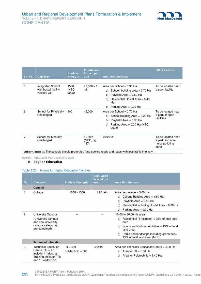
295 319928/ISA/MCB/AA/01 1 Feburary 2014 P:\Noida\DMC\Projects\319928-MoUD UDPFI Guidelines Revision\Deliverable\Draft Report\URDPFI Guidelines Vol I Draft-1 26.02.14.docx
Urban and Regional Development Plans Formulation & Implement Volume – I, DRAFT REPORT VERSION 1
CONFIDENTIAL
Sr. No. Category Student Strength
Population Served per unit Area Requirement
Other Controls
5. Integrated School with hostel facility (Class I-XII)
1500 (NBC, 2005)
90,000 – 1 lakh
Area per School = 3.90 Ha
a) School building area = 0.70 Ha
b) Playfield Area = 2.50 Ha
c) Residential Hostel Area = 0.40 Ha
d) Parking Area = 0.30 Ha
To be located near a sport facility
6. School for Physically Challenged
400 45,000 Area per School = 0.70 Ha
a) School Building Area = 0.20 Ha
b) Playfield Area = 0.30 Ha
c) Parking Area = 0.20 Ha (NBC, 2005)
To be located near a park or sport facilities
7. School for Mentally Challenged
10 lakh (MPD, pg 137)
0.20 Ha To be located near a park and non-noise polluting zone
Other Controls: The schools should preferably face service roads and roads with less traffic intensity.
Source: NBC, 2005 Part 3 and MPD 2021
B. Higher Education
Table 8.25: Norms for Higher Education Facilities
Sr. No. Category Student Strength
Population Served per unit Area Requirement
General
1. College 1000 - 1500 1.25 lakh Area per college = 5.00 Ha
a) College Building Area = 1.80 Ha
b) Playfield Area = 2.50 Ha
c) Residential including Hostel Area = 0.30 Ha
d) Parking Area = 0.30 Ha
2. University Campus
(University campus and new university campus categories are combined)
-- -- 10.00 to 60.00 Ha area
a) Residential (if included) = 25% of total land area
b) Sports and Cultural Activities = 15% of total land area
c) Parks and landscape including green belt= 15% of total land area. (MPD)
Technical Education
3. Technical Education Centre (A) – To include 1 Industrial Training Institute (ITI) and 1 Polytechnic
ITI = 400
Polytechnic = 500
10 lakh Area per Technical Education Centre = 4.00 Ha
a) Area for ITI = 1.60 Ha
b) Area for Polytechnic = 2.40 Ha
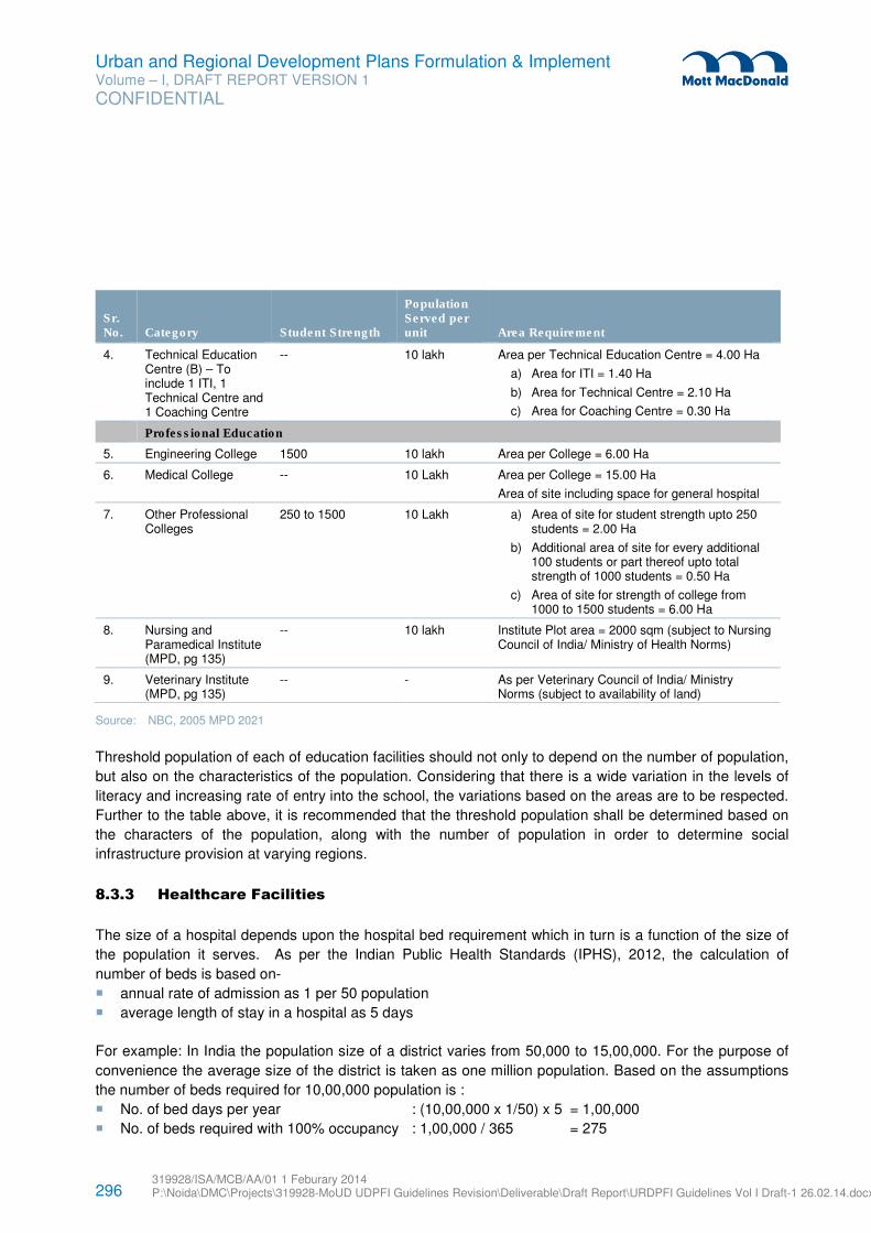
296 319928/ISA/MCB/AA/01 1 Feburary 2014 P:\Noida\DMC\Projects\319928-MoUD UDPFI Guidelines Revision\Deliverable\Draft Report\URDPFI Guidelines Vol I Draft-1 26.02.14.docx
Urban and Regional Development Plans Formulation & Implement Volume – I, DRAFT REPORT VERSION 1
CONFIDENTIAL
Sr. No. Category Student Strength
Population Served per unit Area Requirement
4. Technical Education Centre (B) – To include 1 ITI, 1 Technical Centre and 1 Coaching Centre
-- 10 lakh Area per Technical Education Centre = 4.00 Ha
a) Area for ITI = 1.40 Ha
b) Area for Technical Centre = 2.10 Ha
c) Area for Coaching Centre = 0.30 Ha
Professional Education
5. Engineering College 1500 10 lakh Area per College = 6.00 Ha
6. Medical College -- 10 Lakh Area per College = 15.00 Ha
Area of site including space for general hospital
7. Other Professional Colleges
250 to 1500 10 Lakh a) Area of site for student strength upto 250 students = 2.00 Ha
b) Additional area of site for every additional 100 students or part thereof upto total strength of 1000 students = 0.50 Ha
c) Area of site for strength of college from 1000 to 1500 students = 6.00 Ha
8. Nursing and Paramedical Institute (MPD, pg 135)
-- 10 lakh Institute Plot area = 2000 sqm (subject to Nursing Council of India/ Ministry of Health Norms)
9. Veterinary Institute (MPD, pg 135)
-- - As per Veterinary Council of India/ Ministry Norms (subject to availability of land)
Source: NBC, 2005 MPD 2021
Threshold population of each of education facilities should not only to depend on the number of population,
but also on the characteristics of the population. Considering that there is a wide variation in the levels of
literacy and increasing rate of entry into the school, the variations based on the areas are to be respected.
Further to the table above, it is recommended that the threshold population shall be determined based on
the characters of the population, along with the number of population in order to determine social
infrastructure provision at varying regions.
8.3.3 Healthcare Facilities
The size of a hospital depends upon the hospital bed requirement which in turn is a function of the size of
the population it serves. As per the Indian Public Health Standards (IPHS), 2012, the calculation of
number of beds is based on-
� annual rate of admission as 1 per 50 population
� average length of stay in a hospital as 5 days
For example: In India the population size of a district varies from 50,000 to 15,00,000. For the purpose of
convenience the average size of the district is taken as one million population. Based on the assumptions
the number of beds required for 10,00,000 population is :
� No. of bed days per year : (10,00,000 x 1/50) x 5 = 1,00,000
� No. of beds required with 100% occupancy : 1,00,000 / 365 = 275
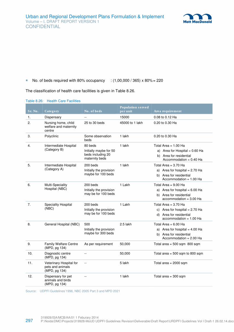
297 319928/ISA/MCB/AA/01 1 Feburary 2014 P:\Noida\DMC\Projects\319928-MoUD UDPFI Guidelines Revision\Deliverable\Draft Report\URDPFI Guidelines Vol I Draft-1 26.02.14.docx
Urban and Regional Development Plans Formulation & Implement Volume – I, DRAFT REPORT VERSION 1
CONFIDENTIAL
� No. of beds required with 80% occupancy : (1,00,000 / 365) x 80% = 220
The classification of health care facilities is given in Table 8.26.
Table 8.26: Health Care Facilities
Sr. No. Category No. of beds Population served per unit Area requirement
1. Dispensary -- 15000 0.08 to 0.12 Ha
2. Nursing home, child welfare and maternity centre
25 to 30 beds 45000 to 1 lakh 0.20 to 0.30 Ha
3. Polyclinic Some observation beds
1 lakh 0.20 to 0.30 Ha
4. Intermediate Hospital (Category B)
80 beds
Initially maybe for 50 beds including 20 maternity beds
1 lakh Total Area = 1.00 Ha
a) Area for Hospital = 0.60 Ha
b) Area for residential Accommodation = 0.40 Ha
5. Intermediate Hospital (Category A)
200 beds
Initially the provision maybe for 100 beds
1 lakh Total Area = 3.70 Ha
a) Area for hospital = 2.70 Ha
b) Area for residential Accommodation = 1.00 Ha
6. Multi-Speciality Hospital (NBC)
200 beds
Initially the provision may be for 100 beds
1 Lakh Total Area = 9.00 Ha
a) Area for hospital = 6.00 Ha
b) Area for residential accommodation = 3.00 Ha
7. Speciality Hospital (NBC)
200 beds
Initially the provision may be for 100 beds
1 Lakh Total Area = 3.70 Ha
c) Area for hospital = 2.70 Ha
d) Area for residential accommodation = 1.00 Ha
8. General Hospital (NBC) 500
Initially the provision maybe for 300 beds
2.5 lakh Total Area = 6.00 Ha
a) Area for hospital = 4.00 Ha
b) Area for residential Accommodation = 2.00 Ha
9. Family Welfare Centre (MPD, pg 134)
As per requirement 50,000 Total area = 500 sqm 800 sqm
10. Diagnostic centre (MPD, pg 134)
-- 50,000 Total area = 500 sqm to 800 sqm
11. Veterinary Hospital for pets and animals (MPD, pg 134)
-- 5 lakh Total area = 2000 sqm
12. Dispensary for pet animals and birds (MPD, pg 134)
-- 1 lakh Total area = 300 sqm
Source: UDPFI Guidelines’1996, NBC 2005 Part 3 and MPD 2021
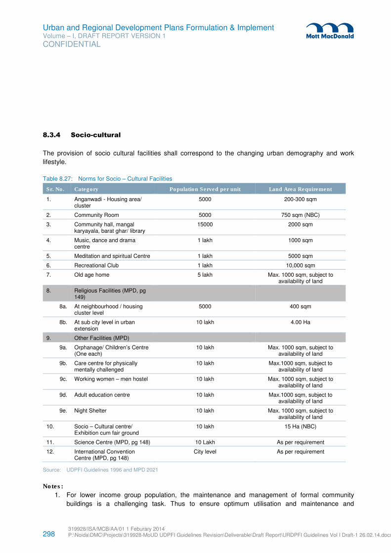
298 319928/ISA/MCB/AA/01 1 Feburary 2014 P:\Noida\DMC\Projects\319928-MoUD UDPFI Guidelines Revision\Deliverable\Draft Report\URDPFI Guidelines Vol I Draft-1 26.02.14.docx
Urban and Regional Development Plans Formulation & Implement Volume – I, DRAFT REPORT VERSION 1
CONFIDENTIAL
8.3.4 Socio-cultural
The provision of socio cultural facilities shall correspond to the changing urban demography and work
lifestyle.
Table 8.27: Norms for Socio – Cultural Facilities
Sr. No. Category Population Served per unit Land Area Requirement
1. Anganwadi - Housing area/ cluster
5000 200-300 sqm
2. Community Room 5000 750 sqm (NBC)
3. Community hall, mangal karyayala, barat ghar/ library
15000 2000 sqm
4. Music, dance and drama centre
1 lakh 1000 sqm
5. Meditation and spiritual Centre 1 lakh 5000 sqm
6. Recreational Club 1 lakh 10,000 sqm
7. Old age home 5 lakh Max. 1000 sqm, subject to availability of land
8. Religious Facilities (MPD, pg 149)
8a. At neighbourhood / housing cluster level
5000 400 sqm
8b. At sub city level in urban extension
10 lakh 4.00 Ha
9. Other Facilities (MPD)
9a. Orphanage/ Children’s Centre (One each)
10 lakh Max. 1000 sqm, subject to availability of land
9b. Care centre for physically mentally challenged
10 lakh Max.1000 sqm, subject to availability of land
9c. Working women – men hostel 10 lakh Max. 1000 sqm, subject to availability of land
9d. Adult education centre 10 lakh Max.1000 sqm, subject to availability of land
9e. Night Shelter 10 lakh Max. 1000 sqm, subject to availability of land
10. Socio – Cultural centre/ Exhibition cum fair ground
10 lakh 15 Ha (NBC)
11. Science Centre (MPD, pg 148) 10 Lakh As per requirement
12. International Convention Centre (MPD, pg 148)
City level As per requirement
Source: UDPFI Guidelines 1996 and MPD 2021
Notes:
1. For lower income group population, the maintenance and management of formal community
buildings is a challenging task. Thus to ensure optimum utilisation and maintenance and
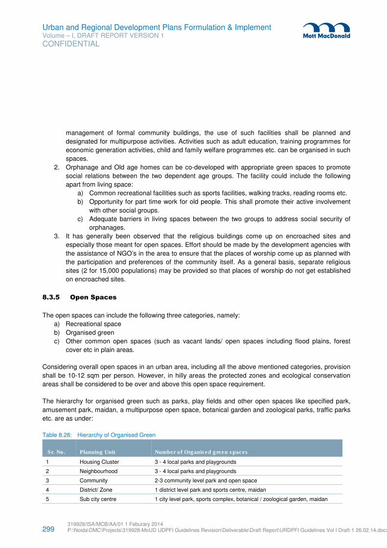
299 319928/ISA/MCB/AA/01 1 Feburary 2014 P:\Noida\DMC\Projects\319928-MoUD UDPFI Guidelines Revision\Deliverable\Draft Report\URDPFI Guidelines Vol I Draft-1 26.02.14.docx
Urban and Regional Development Plans Formulation & Implement Volume – I, DRAFT REPORT VERSION 1
CONFIDENTIAL
management of formal community buildings, the use of such facilities shall be planned and
designated for multipurpose activities. Activities such as adult education, training programmes for
economic generation activities, child and family welfare programmes etc. can be organised in such
spaces.
2. Orphanage and Old age homes can be co-developed with appropriate green spaces to promote
social relations between the two dependent age groups. The facility could include the following
apart from living space:
a) Common recreational facilities such as sports facilities, walking tracks, reading rooms etc.
b) Opportunity for part time work for old people. This shall promote their active involvement
with other social groups.
c) Adequate barriers in living spaces between the two groups to address social security of
orphanages.
3. It has generally been observed that the religious buildings come up on encroached sites and
especially those meant for open spaces. Effort should be made by the development agencies with
the assistance of NGO’s in the area to ensure that the places of worship come up as planned with
the participation and preferences of the community itself. As a general basis, separate religious
sites (2 for 15,000 populations) may be provided so that places of worship do not get established
on encroached sites.
8.3.5 Open Spaces
The open spaces can include the following three categories, namely:
a) Recreational space
b) Organised green
c) Other common open spaces (such as vacant lands/ open spaces including flood plains, forest
cover etc in plain areas.
Considering overall open spaces in an urban area, including all the above mentioned categories, provision
shall be 10-12 sqm per person. However, in hilly areas the protected zones and ecological conservation
areas shall be considered to be over and above this open space requirement.
The hierarchy for organised green such as parks, play fields and other open spaces like specified park,
amusement park, maidan, a multipurpose open space, botanical garden and zoological parks, traffic parks
etc. are as under:
Table 8.28: Hierarchy of Organised Green
Sr. No. Planning Unit Number of Organised green spaces
1 Housing Cluster 3 - 4 local parks and playgrounds
2 Neighbourhood 3 - 4 local parks and playgrounds
3 Community 2-3 community level park and open space
4 District/ Zone 1 district level park and sports centre, maidan
5 Sub city centre 1 city level park, sports complex, botanical / zoological garden, maidan
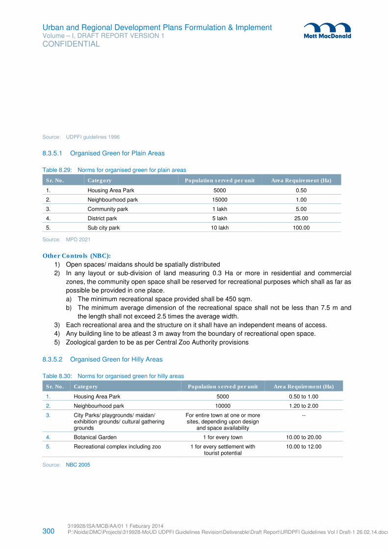
300 319928/ISA/MCB/AA/01 1 Feburary 2014 P:\Noida\DMC\Projects\319928-MoUD UDPFI Guidelines Revision\Deliverable\Draft Report\URDPFI Guidelines Vol I Draft-1 26.02.14.docx
Urban and Regional Development Plans Formulation & Implement Volume – I, DRAFT REPORT VERSION 1
CONFIDENTIAL
Source: UDPFI guidelines 1996
8.3.5.1 Organised Green for Plain Areas
Table 8.29: Norms for organised green for plain areas
Sr. No. Category Population served per unit Area Requirement (Ha)
1. Housing Area Park 5000 0.50
2. Neighbourhood park 15000 1.00
3. Community park 1 lakh 5.00
4. District park 5 lakh 25.00
5. Sub city park 10 lakh 100.00
Source: MPD 2021
Other Controls (NBC):
1) Open spaces/ maidans should be spatially distributed
2) In any layout or sub-division of land measuring 0.3 Ha or more in residential and commercial
zones, the community open space shall be reserved for recreational purposes which shall as far as
possible be provided in one place.
a) The minimum recreational space provided shall be 450 sqm.
b) The minimum average dimension of the recreational space shall not be less than 7.5 m and
the length shall not exceed 2.5 times the average width.
3) Each recreational area and the structure on it shall have an independent means of access.
4) Any building line to be atleast 3 m away from the boundary of recreational open space.
5) Zoological garden to be as per Central Zoo Authority provisions
8.3.5.2 Organised Green for Hilly Areas
Table 8.30: Norms for organised green for hilly areas
Sr. No. Category Population served per unit Area Requirement (Ha)
1. Housing Area Park 5000 0.50 to 1.00
2. Neighbourhood park 10000 1.20 to 2.00
3. City Parks/ playgrounds/ maidan/ exhibition grounds/ cultural gathering grounds
For entire town at one or more sites, depending upon design
and space availability
--
4. Botanical Garden 1 for every town 10.00 to 20.00
5. Recreational complex including zoo 1 for every settlement with tourist potential
10.00 to 12.00
Source: NBC 2005
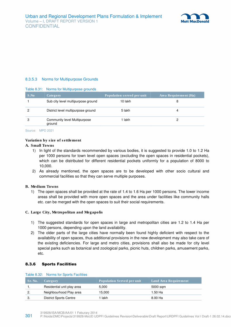
301 319928/ISA/MCB/AA/01 1 Feburary 2014 P:\Noida\DMC\Projects\319928-MoUD UDPFI Guidelines Revision\Deliverable\Draft Report\URDPFI Guidelines Vol I Draft-1 26.02.14.docx
Urban and Regional Development Plans Formulation & Implement Volume – I, DRAFT REPORT VERSION 1
CONFIDENTIAL
8.3.5.3 Norms for Multipurpose Grounds
Table 8.31: Norms for Multipurpose grounds
S.No Category Population served per unit Area Requirement (Ha)
1 Sub city level multipurpose ground 10 lakh 8
2 District level multipurpose ground 5 lakh 4
3 Community level Multipurpose ground
1 lakh 2
Source: MPD 2021
Variation by size of settlement
A. Small Towns
1) In light of the standards recommended by various bodies, it is suggested to provide 1.0 to 1.2 Ha
per 1000 persons for town level open spaces (excluding the open spaces in residential pockets),
which can be distributed for different residential pockets uniformly for a population of 8000 to
10,000.
2) As already mentioned, the open spaces are to be developed with other socio cultural and
commercial facilities so that they can serve multiple purposes.
B. Medium Towns
1) The open spaces shall be provided at the rate of 1.4 to 1.6 Ha per 1000 persons. The lower income
areas shall be provided with more open spaces and the area under facilities like community halls
etc. can be merged with the open spaces to suit their social requirements.
C. Large City, Metropolitan and Megapolis
1) The suggested standards for open spaces in large and metropolitan cities are 1.2 to 1.4 Ha per
1000 persons, depending upon the land availability.
2) The older parts of the large cities have normally been found highly deficient with respect to the
availability of open spaces, thus additional provisions in the new development may also take care of
the existing deficiencies. For large and metro cities, provisions shall also be made for city level
special parks such as botanical and zoological parks, picnic huts, children parks, amusement parks,
etc.
8.3.6 Sports Facilities
Table 8.32: Norms for Sports Facilities
Sr. No. Category Population Served per unit Land Area Requirement
1. Residential unit play area 5,000 5000 sqm
2. Neighbourhood Play area 15,000 1.50 Ha
3. District Sports Centre 1 lakh 8.00 Ha
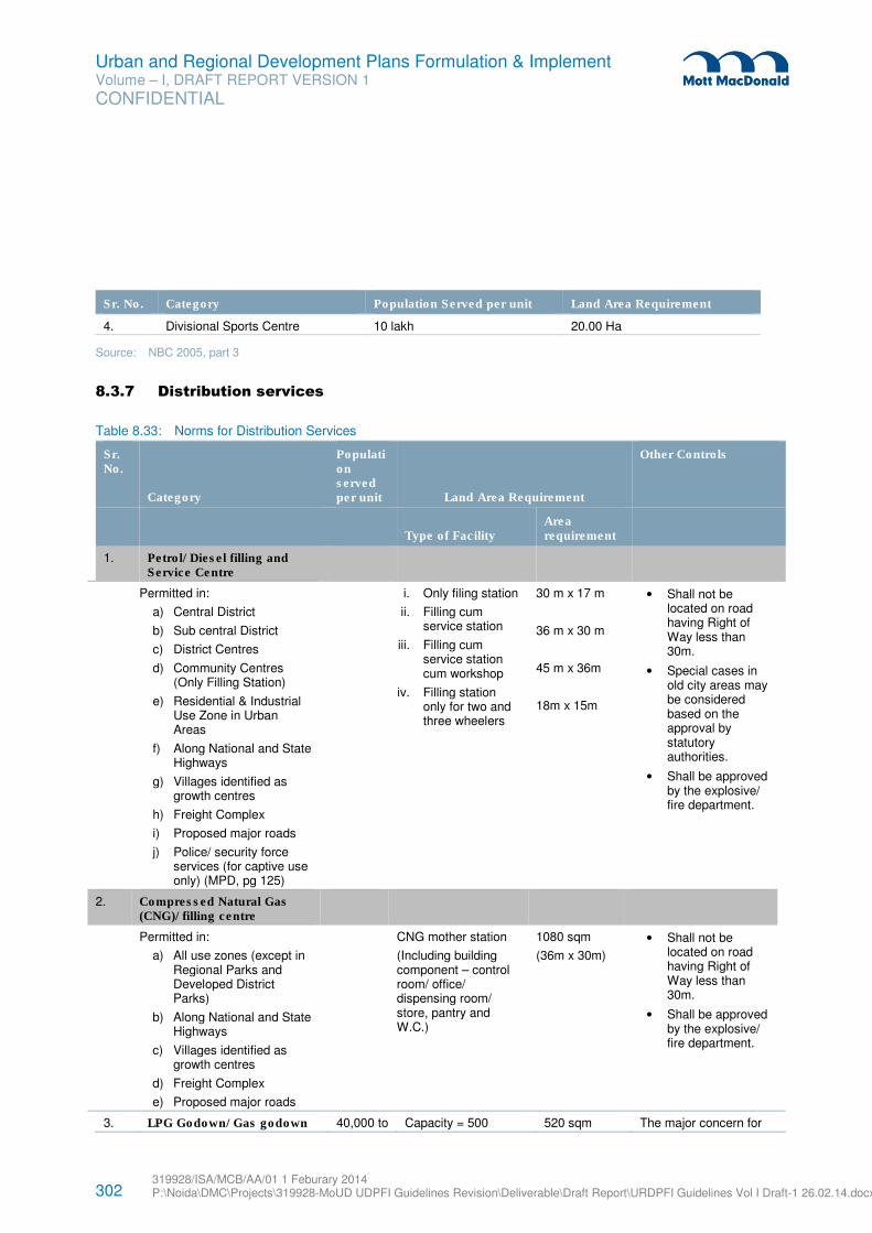
302 319928/ISA/MCB/AA/01 1 Feburary 2014 P:\Noida\DMC\Projects\319928-MoUD UDPFI Guidelines Revision\Deliverable\Draft Report\URDPFI Guidelines Vol I Draft-1 26.02.14.docx
Urban and Regional Development Plans Formulation & Implement Volume – I, DRAFT REPORT VERSION 1
CONFIDENTIAL
Sr. No. Category Population Served per unit Land Area Requirement
4. Divisional Sports Centre 10 lakh 20.00 Ha
Source: NBC 2005, part 3
8.3.7 Distribution services
Table 8.33: Norms for Distribution Services
Sr. No.
Category
Population served per unit Land Area Requirement
Other Controls
Type of Facility
Area requirement
1. Petrol/ Diesel filling and Service Centre
Permitted in:
a) Central District
b) Sub central District
c) District Centres
d) Community Centres (Only Filling Station)
e) Residential & Industrial Use Zone in Urban Areas
f) Along National and State Highways
g) Villages identified as growth centres
h) Freight Complex
i) Proposed major roads
j) Police/ security force services (for captive use only) (MPD, pg 125)
i. Only filing station
ii. Filling cum service station
iii. Filling cum service station cum workshop
iv. Filling station only for two and three wheelers
30 m x 17 m
36 m x 30 m
45 m x 36m
18m x 15m
• Shall not be located on road having Right of Way less than 30m.
• Special cases in old city areas may be considered based on the approval by statutory authorities.
• Shall be approved by the explosive/ fire department.
2. Compressed Natural Gas (CNG)/ filling centre
Permitted in:
a) All use zones (except in Regional Parks and Developed District Parks)
b) Along National and State Highways
c) Villages identified as growth centres
d) Freight Complex
e) Proposed major roads
CNG mother station
(Including building component – control room/ office/ dispensing room/ store, pantry and W.C.)
1080 sqm
(36m x 30m)
• Shall not be located on road having Right of Way less than 30m.
• Shall be approved by the explosive/ fire department.
3. LPG Godown/ Gas godown 40,000 to Capacity = 500 520 sqm The major concern for
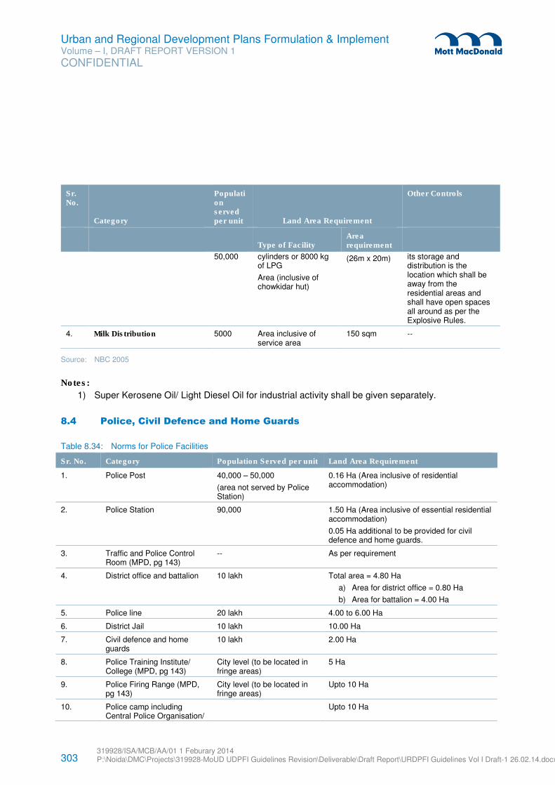
303 319928/ISA/MCB/AA/01 1 Feburary 2014 P:\Noida\DMC\Projects\319928-MoUD UDPFI Guidelines Revision\Deliverable\Draft Report\URDPFI Guidelines Vol I Draft-1 26.02.14.docx
Urban and Regional Development Plans Formulation & Implement Volume – I, DRAFT REPORT VERSION 1
CONFIDENTIAL
Sr. No.
Category
Population served per unit Land Area Requirement
Other Controls
Type of Facility
Area requirement
50,000 cylinders or 8000 kg of LPG
Area (inclusive of chowkidar hut)
(26m x 20m) its storage and distribution is the location which shall be away from the residential areas and shall have open spaces all around as per the Explosive Rules.
4. Milk Distribution 5000 Area inclusive of service area
150 sqm --
Source: NBC 2005
Notes:
1) Super Kerosene Oil/ Light Diesel Oil for industrial activity shall be given separately.
8.4 Police, Civil Defence and Home Guards
Table 8.34: Norms for Police Facilities
Sr. No. Category Population Served per unit Land Area Requirement
1. Police Post 40,000 – 50,000
(area not served by Police Station)
0.16 Ha (Area inclusive of residential accommodation)
2. Police Station 90,000 1.50 Ha (Area inclusive of essential residential accommodation)
0.05 Ha additional to be provided for civil defence and home guards.
3. Traffic and Police Control Room (MPD, pg 143)
-- As per requirement
4. District office and battalion 10 lakh Total area = 4.80 Ha
a) Area for district office = 0.80 Ha
b) Area for battalion = 4.00 Ha
5. Police line 20 lakh 4.00 to 6.00 Ha
6. District Jail 10 lakh 10.00 Ha
7. Civil defence and home guards
10 lakh 2.00 Ha
8. Police Training Institute/ College (MPD, pg 143)
City level (to be located in fringe areas)
5 Ha
9. Police Firing Range (MPD, pg 143)
City level (to be located in fringe areas)
Upto 10 Ha
10. Police camp including Central Police Organisation/
Upto 10 Ha
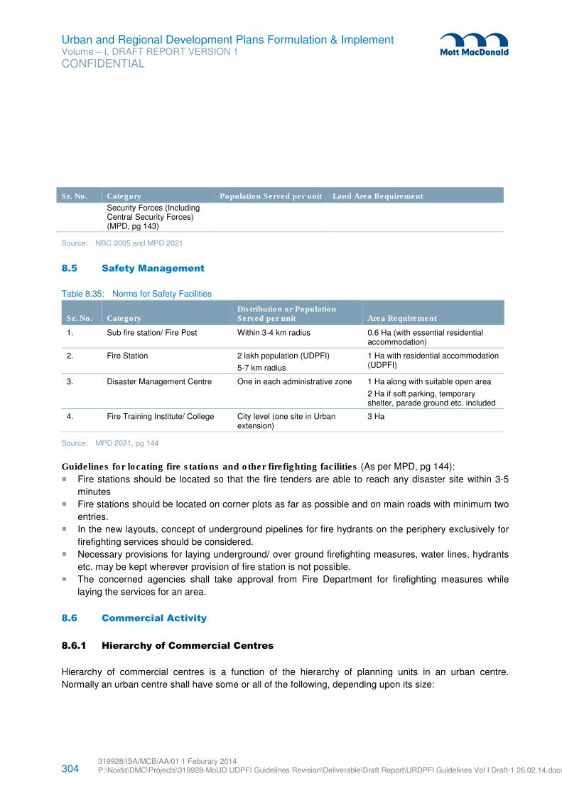
304 319928/ISA/MCB/AA/01 1 Feburary 2014 P:\Noida\DMC\Projects\319928-MoUD UDPFI Guidelines Revision\Deliverable\Draft Report\URDPFI Guidelines Vol I Draft-1 26.02.14.docx
Urban and Regional Development Plans Formulation & Implement Volume – I, DRAFT REPORT VERSION 1
CONFIDENTIAL
Sr. No. Category Population Served per unit Land Area Requirement
Security Forces (Including Central Security Forces) (MPD, pg 143)
Source: NBC 2005 and MPD 2021
8.5 Safety Management
Table 8.35: Norms for Safety Facilities
Sr. No. Category Distribution or Population Served per unit Area Requirement
1. Sub fire station/ Fire Post Within 3-4 km radius 0.6 Ha (with essential residential accommodation)
2. Fire Station 2 lakh population (UDPFI)
5-7 km radius
1 Ha with residential accommodation (UDPFI)
3. Disaster Management Centre One in each administrative zone 1 Ha along with suitable open area
2 Ha if soft parking, temporary shelter, parade ground etc. included
4. Fire Training Institute/ College City level (one site in Urban extension)
3 Ha
Source: MPD 2021, pg 144
Guidelines for locating fire stations and other firefighting facilities (As per MPD, pg 144):
� Fire stations should be located so that the fire tenders are able to reach any disaster site within 3-5
minutes
� Fire stations should be located on corner plots as far as possible and on main roads with minimum two
entries.
� In the new layouts, concept of underground pipelines for fire hydrants on the periphery exclusively for
firefighting services should be considered.
� Necessary provisions for laying underground/ over ground firefighting measures, water lines, hydrants
etc. may be kept wherever provision of fire station is not possible.
� The concerned agencies shall take approval from Fire Department for firefighting measures while
laying the services for an area.
8.6 Commercial Activity
8.6.1 Hierarchy of Commercial Centres
Hierarchy of commercial centres is a function of the hierarchy of planning units in an urban centre.
Normally an urban centre shall have some or all of the following, depending upon its size:
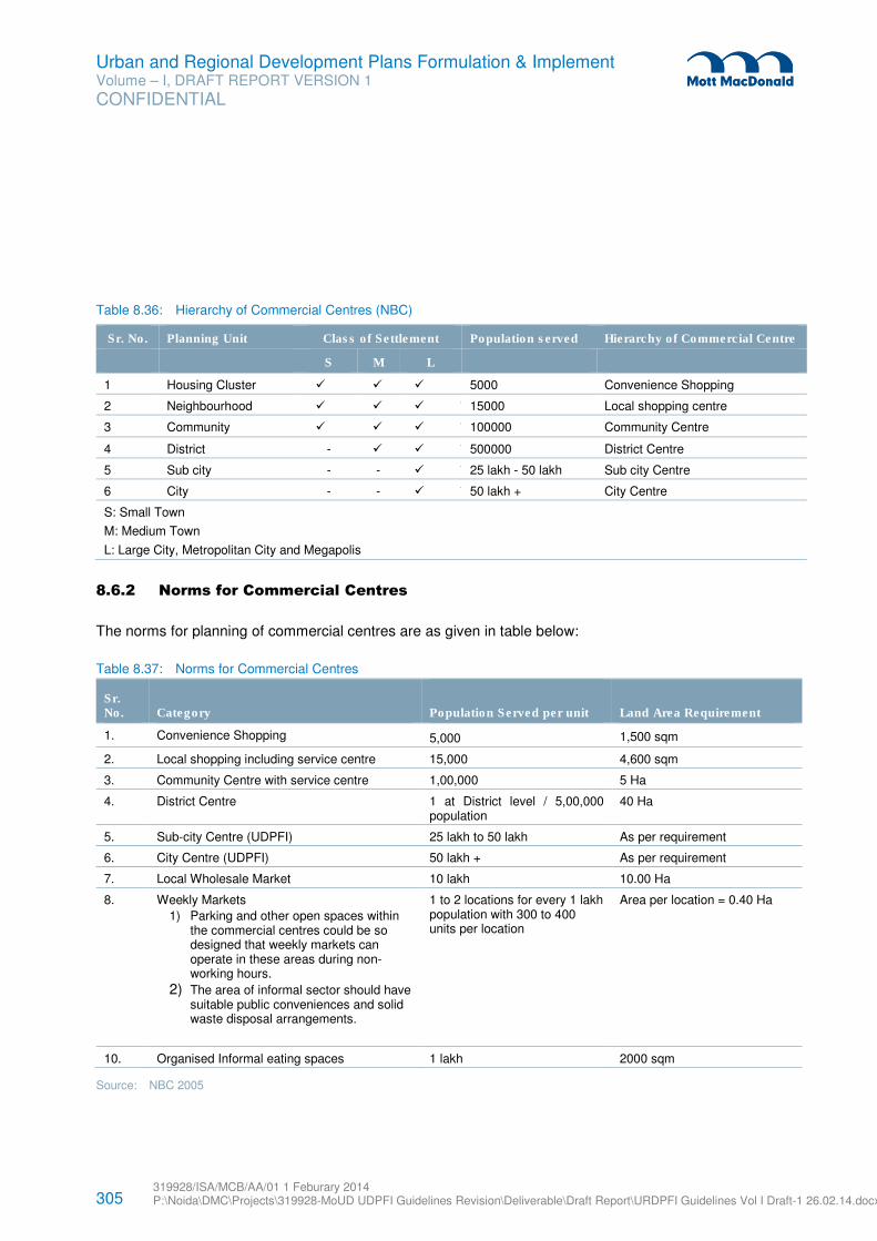
305 319928/ISA/MCB/AA/01 1 Feburary 2014 P:\Noida\DMC\Projects\319928-MoUD UDPFI Guidelines Revision\Deliverable\Draft Report\URDPFI Guidelines Vol I Draft-1 26.02.14.docx
Urban and Regional Development Plans Formulation & Implement Volume – I, DRAFT REPORT VERSION 1
CONFIDENTIAL
Table 8.36: Hierarchy of Commercial Centres (NBC)
Sr. No. Planning Unit Class of Settlement Population served Hierarchy of Commercial Centre
S M L
1 Housing Cluster � � � 5000 Convenience Shopping
2 Neighbourhood � � � * 15000 Local shopping centre
3 Community � � � * 100000 Community Centre
4 District - � � * 500000 District Centre
5 Sub city - - � * 25 lakh - 50 lakh Sub city Centre
6 City - - � * 50 lakh + City Centre
S: Small Town
M: Medium Town
L: Large City, Metropolitan City and Megapolis
8.6.2 Norms for Commercial Centres
The norms for planning of commercial centres are as given in table below:
Table 8.37: Norms for Commercial Centres
Sr. No. Category
Population Served per unit Land Area Requirement
1. Convenience Shopping 5,000 1,500 sqm
2. Local shopping including service centre 15,000 4,600 sqm
3. Community Centre with service centre 1,00,000 5 Ha
4. District Centre 1 at District level / 5,00,000 population
40 Ha
5. Sub-city Centre (UDPFI) 25 lakh to 50 lakh As per requirement
6. City Centre (UDPFI) 50 lakh + As per requirement
7. Local Wholesale Market 10 lakh 10.00 Ha
8. Weekly Markets
1) Parking and other open spaces within the commercial centres could be so designed that weekly markets can operate in these areas during non-working hours.
2) The area of informal sector should have suitable public conveniences and solid waste disposal arrangements.
1 to 2 locations for every 1 lakh population with 300 to 400 units per location
Area per location = 0.40 Ha
10. Organised Informal eating spaces 1 lakh 2000 sqm
Source: NBC 2005

306 319928/ISA/MCB/AA/01 1 Feburary 2014 P:\Noida\DMC\Projects\319928-MoUD UDPFI Guidelines Revision\Deliverable\Draft Report\URDPFI Guidelines Vol I Draft-1 26.02.14.docx
Urban and Regional Development Plans Formulation & Implement Volume – I, DRAFT REPORT VERSION 1
CONFIDENTIAL
Notes:
� Small and medium towns to give emphasis on the weekly markets from promoting local economic
activities,
� Mandis and wholesale markets to be given emphasis in regional planning. Integration of the rural and
small and medium towns to be developed through the provision of Mandis.
The area of commercial centres and the number of shops is given below:
Table 8.38: Area of Commercial Centres
Sr. No. Category Area per 1000 persons (sqm) Number of shops
1. Convenience Shopping 220 1 for 110 persons
2. Local shopping including service centre
300 1 for 200 persons
3. Community Centre with service centre
500 1 for 200 persons
4. District Centre 880 1 for 300 persons
Source: UDPFI Guidelines 1996 and MM
8.6.3 Distribution of Activities
The following activities allowed in the hierarchy of Commercial Centres.
Table 8.39: Distribution on Activities
Hierarchy of Commercial Centres
Sr. No. Activities City an Sub city centre District centre
Community centre
Neighbourhood Centre
Cluster Centre
1. Shopping (retail services, repair)
� � � � �
2. Limited wholesale & Mandies
� � - - -
3. Informal shopping � � � � �
4. Commercial Offices � � � � -
5. Cinema � � � - -
6. Hotel � � � - -
7. Guest House � � � - -
8. Bank/ ATM � � � � �
9. Nursing Home � � � - -
10. Service Industries � � � � �
11. Auditorium � � � - -
12. Museum � � - - -
13. Library � � � - -
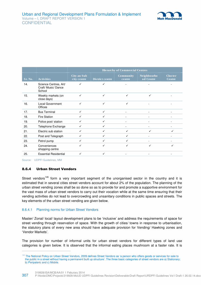
307 319928/ISA/MCB/AA/01 1 Feburary 2014 P:\Noida\DMC\Projects\319928-MoUD UDPFI Guidelines Revision\Deliverable\Draft Report\URDPFI Guidelines Vol I Draft-1 26.02.14.docx
Urban and Regional Development Plans Formulation & Implement Volume – I, DRAFT REPORT VERSION 1
CONFIDENTIAL
Hierarchy of Commercial Centres
Sr. No. Activities City an Sub city centre District centre
Community centre
Neighbourhood Centre
Cluster Centre
14. Science Centres, Art/ Craft/ Music/ Dance School
� � - - -
15. Weekly markets (on close days)
� � � � -
16. Local Government Offices
� � � - -
17. Bus Terminal � � - - -
18. Fire Station � � - - -
19. Police post/ station � � - - -
20. Telephone Exchange � � - - -
21. Electric sub station � � � � �
22. Post and Telegraph � � � - -
23. Petrol pump � � � - -
24. Conveniences shopping centre
� � � � �
25. Essential Residential � � - - -
Source: UDPFI Guidelines, MM
8.6.4 Urban Street Vendors
Street vendors146
form a very important segment of the unorganised sector in the country and it is
estimated that in several cities street vendors account for about 2% of the population. The planning of the
urban street vending zones shall be so done so as to provide for and promote a supportive environment for
the vast mass of urban street vendors to carry out their vocation while at the same time ensuring that their
vending activities do not lead to overcrowding and unsanitary conditions in public spaces and streets. The
key elements of the urban street vending are given below.
8.6.4.1 Planning norms for Urban Street Vendors
Master/ Zonal/ local/ layout development plans to be ‘inclusive’ and address the requirements of space for
street vending through reservation of space. With the growth of cities/ towns in response to urbanisation,
the statutory plans of every new area should have adequate provision for Vending/ Hawking zones and
‘Vendor Markets’.
The provision for number of informal units for urban street vendors for different types of land use
categories is given below. It is observed that the informal eating places mushroom at a faster rate. It is
146 The National Policy on Urban Street Vendors, 2009 defines Street Vendors as ‘a person who offers goods or services for sale to
the public in a street without having a permanent built up structure’. The three basic categories of street vendors are a) Stationary; b) Peripateric and c) Mobile.
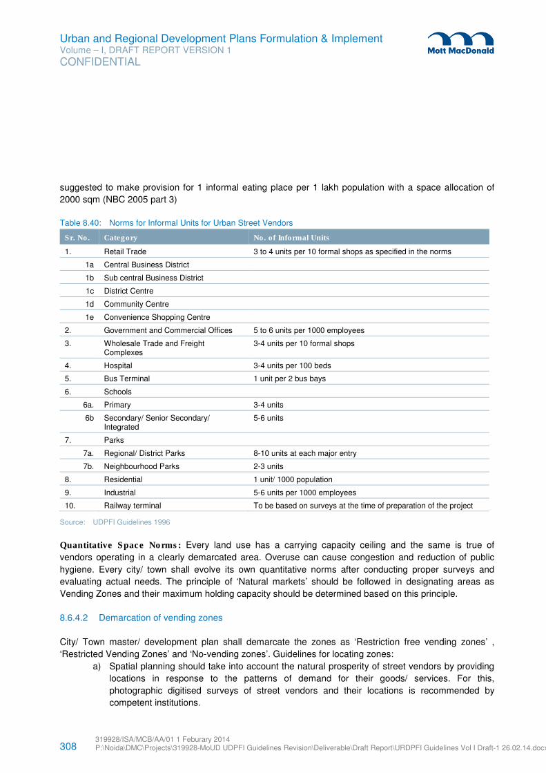
308 319928/ISA/MCB/AA/01 1 Feburary 2014 P:\Noida\DMC\Projects\319928-MoUD UDPFI Guidelines Revision\Deliverable\Draft Report\URDPFI Guidelines Vol I Draft-1 26.02.14.docx
Urban and Regional Development Plans Formulation & Implement Volume – I, DRAFT REPORT VERSION 1
CONFIDENTIAL
suggested to make provision for 1 informal eating place per 1 lakh population with a space allocation of
2000 sqm (NBC 2005 part 3)
Table 8.40: Norms for Informal Units for Urban Street Vendors
Sr. No. Category No. of Informal Units
1. Retail Trade 3 to 4 units per 10 formal shops as specified in the norms
1a Central Business District
1b Sub central Business District
1c District Centre
1d Community Centre
1e Convenience Shopping Centre
2. Government and Commercial Offices 5 to 6 units per 1000 employees
3. Wholesale Trade and Freight Complexes
3-4 units per 10 formal shops
4. Hospital 3-4 units per 100 beds
5. Bus Terminal 1 unit per 2 bus bays
6. Schools
6a. Primary 3-4 units
6b Secondary/ Senior Secondary/ Integrated
5-6 units
7. Parks
7a. Regional/ District Parks 8-10 units at each major entry
7b. Neighbourhood Parks 2-3 units
8. Residential 1 unit/ 1000 population
9. Industrial 5-6 units per 1000 employees
10. Railway terminal To be based on surveys at the time of preparation of the project
Source: UDPFI Guidelines 1996
Quantitative Space Norms: Every land use has a carrying capacity ceiling and the same is true of
vendors operating in a clearly demarcated area. Overuse can cause congestion and reduction of public
hygiene. Every city/ town shall evolve its own quantitative norms after conducting proper surveys and
evaluating actual needs. The principle of ‘Natural markets’ should be followed in designating areas as
Vending Zones and their maximum holding capacity should be determined based on this principle.
8.6.4.2 Demarcation of vending zones
City/ Town master/ development plan shall demarcate the zones as ‘Restriction free vending zones’ ,
‘Restricted Vending Zones’ and ‘No-vending zones’. Guidelines for locating zones:
a) Spatial planning should take into account the natural prosperity of street vendors by providing
locations in response to the patterns of demand for their goods/ services. For this,
photographic digitised surveys of street vendors and their locations is recommended by
competent institutions.
309 319928/ISA/MCB/AA/01 1 Feburary 2014 P:\Noida\DMC\Projects\319928-MoUD UDPFI Guidelines Revision\Deliverable\Draft Report\URDPFI Guidelines Vol I Draft-1 26.02.14.docx
Urban and Regional Development Plans Formulation & Implement Volume – I, DRAFT REPORT VERSION 1
CONFIDENTIAL
b) A policy for regulating entry of street vendors into the identified street vending zones on time
sharing basis shall be formulated by Municipal Authorities.
c) The ‘vendor markets’ may be established at suitable locations keeping in view demand for the
wares/ services of street vendors. Time restrictions on vending should be in accordance with
the need for ensuring non congestion of public spaces/ maintaining public hygiene without
being ad hoc, arbitrary or discriminatory. Attempts should be made to provide ample parking
areas for mobile vendors for security of their vehicles and wares at night on payment of
suitable fees.
d) Mobile vending should be permitted in all areas even outside the ‘Vendors Markets’, unless
designated as ‘No- vending zone’ in the zonal, local area or layout plans. ‘Restricted Vending
zones’ may be notified in terms of both location and time. Locations designated as ‘No vending
zones’ shall be fully justified.
8.6.4.3 Provision of Civic facilities
The following basic civic facilities shall be provided in Vending Zones/ Vendor’s markets:
a) Solid waste disposal
b) Public toilets to maintain cleanliness
c) Aesthetic design of mobile stalls/ push carts
d) Electricity
e) Drinking water
f) Protective covers to protect wares of street vendors as well as themselves from heat, rain,
dust etc.
g) Storage facilities including cold storage for specific goods like fish, meat and poultry, and
h) Parking areas
The vendor markets should to the extent possible, also provide for crèches, toilets and restrooms for
female and male members.
For other aspects of the street vending norms such as organisation and participative processes,
promotional measures, action plan for stakeholders, monitoring and review etc., the provisions of the policy
shall be referred to as updated from time to time.
8.6.4.4 Variations in Norms and Standards by size of settlements
A. Small Towns
1) For the general retail shopping requirements, the concept of street/ road side commercial activity
shall be accepted as a policy with certain specific controls such as:
a) No commercial activity along the NH/ SH or any major district road
b) The minimum width of the street to be 12 m, where vehicular movement is permitted to a
limited extent (i.e only upto 2 wheelers or rickshaw) and the streets with a minimum width of
4.5 m without vehicular movement may be permitted for road/ street side commercial activity.
310 319928/ISA/MCB/AA/01 1 Feburary 2014 P:\Noida\DMC\Projects\319928-MoUD UDPFI Guidelines Revision\Deliverable\Draft Report\URDPFI Guidelines Vol I Draft-1 26.02.14.docx
Urban and Regional Development Plans Formulation & Implement Volume – I, DRAFT REPORT VERSION 1
CONFIDENTIAL
2) It has been generally observed that the service and retail shops emerge along the major roads and
the activities are extended upto the roads in most cases, thereby affecting the smooth flow of
traffic and increasing probability of accidents.
Thus, it is suggested that the service centres shall be provided as a planned component and the
sites near the petrol pumps shall be considered. The exact requirement of the area for service
centre will be guided by the following factors:
a) Vehicular population
b) Villages falling in the influence zone of the towns or, in other words, the service requirements
of the villages in the surrounding areas.
3) The function based commercial requirements such as mandi (vegetables/ grains/ fruits), cattle
markets or any other such specialised markets are to be planned as per the case specific
requirements based on the study of the area.
4) The quantum of commercial activities to be proposed shall be restricted based on locational
attributes and the local need based emergence in its natural growth be permitted.
5) For the newly planned schemes in small towns also, the policy of mixed land use can be adopted
to suiting the behaviour pattern of the society.
6) As already dealt in the previous section on landuse, the area requirements for commercial
activities in small sized towns works out to be about 0.2 to 0.25 Ha/ 1000 persons on an average,
based on the proposed land use which is governed by the functional character of the town.
B. Medium Town
1) The growth of towns from small to medium sized town through transition phases (50,000 to
100,000) changes the requirements for commercial activities gradually and for a town exceeding a
population of 1 lakh, the extensions start developing in pockets of well-defined economic strata of
the people and thus it is suggested that the areas predominantly planned for upper middle groups
shall be provided with the planned commercial centres (with adequate inbuilt provision for informal
commercial activities with the commercial centres) at the rate of 4-5 formal shops and 2-3 informal
shops per 1000 persons.
2) The requirements for the wholesale trade will be governed by the following factors:
a) Location of the town with respect to large/ metro cities
b) Small towns and villages falling in the direct influence zone of the town for which it has to act
as a distribution centre.
3) As already dealt in the previous section on landuse, the area requirements for commercial
activities in medium sized towns works out to be about 0.24 to 0.32 Ha/ 1000 persons on an
average, based on the proposed land use which is governed by the functional character of the
town and the regional imperatives mentioned above.
C. Large City, Metropolitan City and Megapolis
The average land requirements for commercial activities work out to be 0.4 Ha per 1000 persons
in a range of 0.2 to 0.6 Ha/ 1000 persons depending on the location of these large cities with
respect to metro cities. Similar requirements have also been observed in case of metro cities
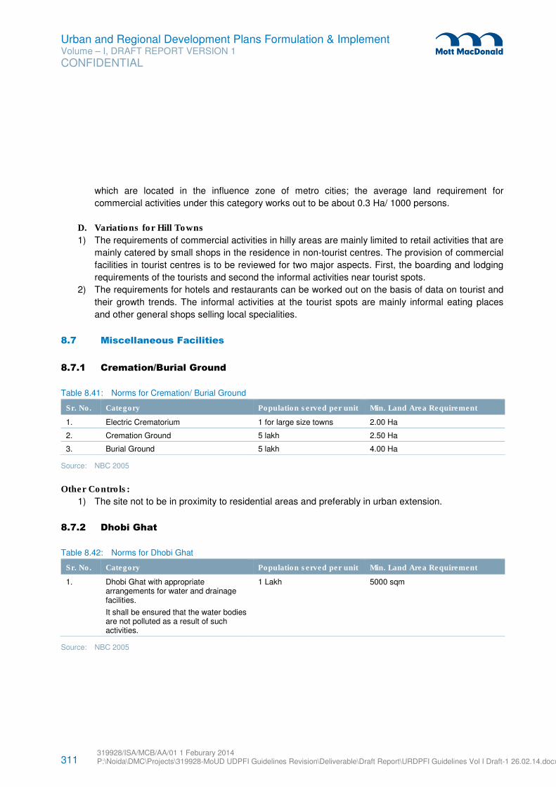
311 319928/ISA/MCB/AA/01 1 Feburary 2014 P:\Noida\DMC\Projects\319928-MoUD UDPFI Guidelines Revision\Deliverable\Draft Report\URDPFI Guidelines Vol I Draft-1 26.02.14.docx
Urban and Regional Development Plans Formulation & Implement Volume – I, DRAFT REPORT VERSION 1
CONFIDENTIAL
which are located in the influence zone of metro cities; the average land requirement for
commercial activities under this category works out to be about 0.3 Ha/ 1000 persons.
D. Variations for Hill Towns
1) The requirements of commercial activities in hilly areas are mainly limited to retail activities that are
mainly catered by small shops in the residence in non-tourist centres. The provision of commercial
facilities in tourist centres is to be reviewed for two major aspects. First, the boarding and lodging
requirements of the tourists and second the informal activities near tourist spots.
2) The requirements for hotels and restaurants can be worked out on the basis of data on tourist and
their growth trends. The informal activities at the tourist spots are mainly informal eating places
and other general shops selling local specialities.
8.7 Miscellaneous Facilities
8.7.1 Cremation/Burial Ground
Table 8.41: Norms for Cremation/ Burial Ground
Sr. No. Category Population served per unit Min. Land Area Requirement
1. Electric Crematorium 1 for large size towns 2.00 Ha
2. Cremation Ground 5 lakh 2.50 Ha
3. Burial Ground 5 lakh 4.00 Ha
Source: NBC 2005
Other Controls:
1) The site not to be in proximity to residential areas and preferably in urban extension.
8.7.2 Dhobi Ghat
Table 8.42: Norms for Dhobi Ghat
Sr. No. Category Population served per unit Min. Land Area Requirement
1. Dhobi Ghat with appropriate arrangements for water and drainage facilities.
It shall be ensured that the water bodies are not polluted as a result of such activities.
1 Lakh 5000 sqm
Source: NBC 2005
312 319928/ISA/MCB/AA/01 1 Feburary 2014 P:\Noida\DMC\Projects\319928-MoUD UDPFI Guidelines Revision\Deliverable\Draft Report\URDPFI Guidelines Vol I Draft-1 26.02.14.docx
Urban and Regional Development Plans Formulation & Implement Volume – I, DRAFT REPORT VERSION 1
CONFIDENTIAL
8.7.3 Mandis and whole-sale agricultural produce markets
According to the recommendations by National Farmers Commission (2004)147
, availability of regulated
Markets should be within 5 km radius (area served approx. 80 sq km) The agricultural produce can be
categorised under two heads (a) Perishable produce consisting of fruits, vegetables and flowers and (b)
Non-perishable produce consisting of grains and pulses. The planning for the mandies shall depend upon
the following parameters:
� Number of food items
� Perishability of food items
� Volume to be handled
� Type of storage/ cool chain facilities.
� The mandies shall be preferably adjacent to arterial roads.
The government initiatives for promoting regulated markets are:
1. Direct marketing by promoting farmers’ markets in various forms, such as Apni Mandis in Punjab,
Rythu Bazaars in Andhra Pradesh, Uzhavar Santhai in Tamil Nadu, and Shetkari Bazaar in
Maharashtra, promoted by state agencies.
2. e-trading: Various states have adopted the Model APMC Act which provides for e-trading. (Pg 16)
3. Terminal market complex: proposed to be implemented through Public Private Partnership (PPP)
mode by establishing the Hub (Main Market) and Spokes (Collection Centers) in the States who have
amended their APMC Act.
8.7.4 Provisions for Livestock Management/ Animal Management Centre
In order to ensure primary economic activities and food security, in urban areas and region, sustainable
development of agricultural sector and associated activities is interdependent. Livestock management and
addressing the urban problem of street animals calls for a dedicated space for its management.
The National Livestock Policy, 2013 provides a policy framework for improving productivity of the livestock
sector in a sustainable manner, taking into account the provisions of the National Policy of Farmers, 2007
and the recommendations of the stakeholders, including the States.
The policy recommends the following with respect to urban and regional planning:
1. Inclusive planning of livestock management services such as veterinary institutions, vaccine and
diagnostic production units, semen stations and artificial insemination breeding farms, feed and fodder
production units etc. at regional and community level for generation and delivery of these services in
rural and urban areas.
2. Integrated land use planning with livestock as a component should be encouraged through Panchayati
Raj Institutions to ensure production potential of pastures and grazing community lands
147 Working group on Agriculture Marketing Infrastructure, Planning Commission, 12th Five Year Plan, pg 8
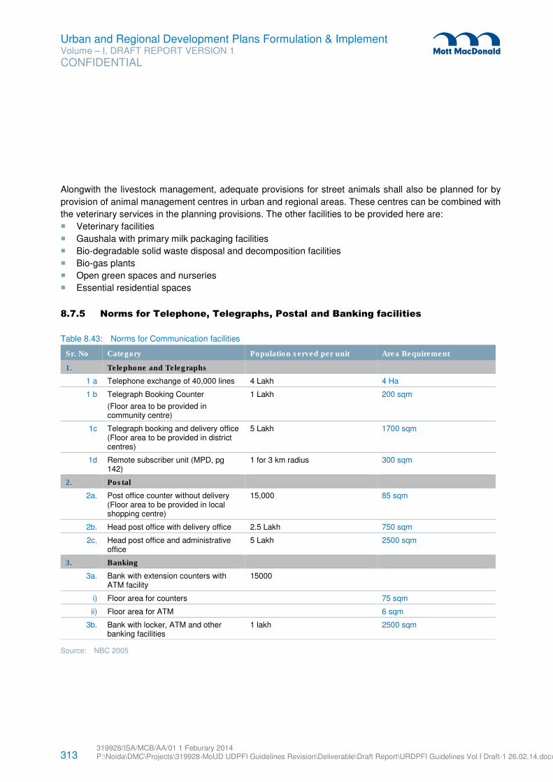
313 319928/ISA/MCB/AA/01 1 Feburary 2014 P:\Noida\DMC\Projects\319928-MoUD UDPFI Guidelines Revision\Deliverable\Draft Report\URDPFI Guidelines Vol I Draft-1 26.02.14.docx
Urban and Regional Development Plans Formulation & Implement Volume – I, DRAFT REPORT VERSION 1
CONFIDENTIAL
Alongwith the livestock management, adequate provisions for street animals shall also be planned for by
provision of animal management centres in urban and regional areas. These centres can be combined with
the veterinary services in the planning provisions. The other facilities to be provided here are:
� Veterinary facilities
� Gaushala with primary milk packaging facilities
� Bio-degradable solid waste disposal and decomposition facilities
� Bio-gas plants
� Open green spaces and nurseries
� Essential residential spaces
8.7.5 Norms for Telephone, Telegraphs, Postal and Banking facilities
Table 8.43: Norms for Communication facilities
Sr. No Category Population served per unit Area Requirement
1. Telephone and Telegraphs
1 a Telephone exchange of 40,000 lines 4 Lakh 4 Ha
1 b Telegraph Booking Counter
(Floor area to be provided in community centre)
1 Lakh 200 sqm
1c Telegraph booking and delivery office (Floor area to be provided in district centres)
5 Lakh 1700 sqm
1d Remote subscriber unit (MPD, pg 142)
1 for 3 km radius 300 sqm
2. Postal
2a. Post office counter without delivery (Floor area to be provided in local shopping centre)
15,000 85 sqm
2b. Head post office with delivery office 2.5 Lakh 750 sqm
2c. Head post office and administrative office
5 Lakh 2500 sqm
3. Banking
3a. Bank with extension counters with ATM facility
15000
i) Floor area for counters 75 sqm
ii) Floor area for ATM 6 sqm
3b. Bank with locker, ATM and other banking facilities
1 lakh 2500 sqm
Source: NBC 2005
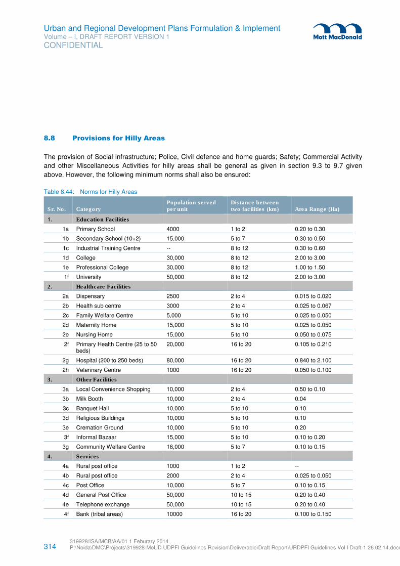
314 319928/ISA/MCB/AA/01 1 Feburary 2014 P:\Noida\DMC\Projects\319928-MoUD UDPFI Guidelines Revision\Deliverable\Draft Report\URDPFI Guidelines Vol I Draft-1 26.02.14.docx
Urban and Regional Development Plans Formulation & Implement Volume – I, DRAFT REPORT VERSION 1
CONFIDENTIAL
8.8 Provisions for Hilly Areas
The provision of Social infrastructure; Police, Civil defence and home guards; Safety; Commercial Activity
and other Miscellaneous Activities for hilly areas shall be general as given in section 9.3 to 9.7 given
above. However, the following minimum norms shall also be ensured:
Table 8.44: Norms for Hilly Areas
Sr. No. Category Population served per unit
Distance between two facilities (km) Area Range (Ha)
1. Education Facilities
1a Primary School 4000 1 to 2 0.20 to 0.30
1b Secondary School (10+2) 15,000 5 to 7 0.30 to 0.50
1c Industrial Training Centre -- 8 to 12 0.30 to 0.60
1d College 30,000 8 to 12 2.00 to 3.00
1e Professional College 30,000 8 to 12 1.00 to 1.50
1f University 50,000 8 to 12 2.00 to 3.00
2. Healthcare Facilities
2a Dispensary 2500 2 to 4 0.015 to 0.020
2b Health sub centre 3000 2 to 4 0.025 to 0.067
2c Family Welfare Centre 5,000 5 to 10 0.025 to 0.050
2d Maternity Home 15,000 5 to 10 0.025 to 0.050
2e Nursing Home 15,000 5 to 10 0.050 to 0.075
2f Primary Health Centre (25 to 50 beds)
20,000 16 to 20 0.105 to 0.210
2g Hospital (200 to 250 beds) 80,000 16 to 20 0.840 to 2.100
2h Veterinary Centre 1000 16 to 20 0.050 to 0.100
3. Other Facilities
3a Local Convenience Shopping 10,000 2 to 4 0.50 to 0.10
3b Milk Booth 10,000 2 to 4 0.04
3c Banquet Hall 10,000 5 to 10 0.10
3d Religious Buildings 10,000 5 to 10 0.10
3e Cremation Ground 10,000 5 to 10 0.20
3f Informal Bazaar 15,000 5 to 10 0.10 to 0.20
3g Community Welfare Centre 16,000 5 to 7 0.10 to 0.15
4. Services
4a Rural post office 1000 1 to 2 --
4b Rural post office 2000 2 to 4 0.025 to 0.050
4c Post Office 10,000 5 to 7 0.10 to 0.15
4d General Post Office 50,000 10 to 15 0.20 to 0.40
4e Telephone exchange 50,000 10 to 15 0.20 to 0.40
4f Bank (tribal areas) 10000 16 to 20 0.100 to 0.150
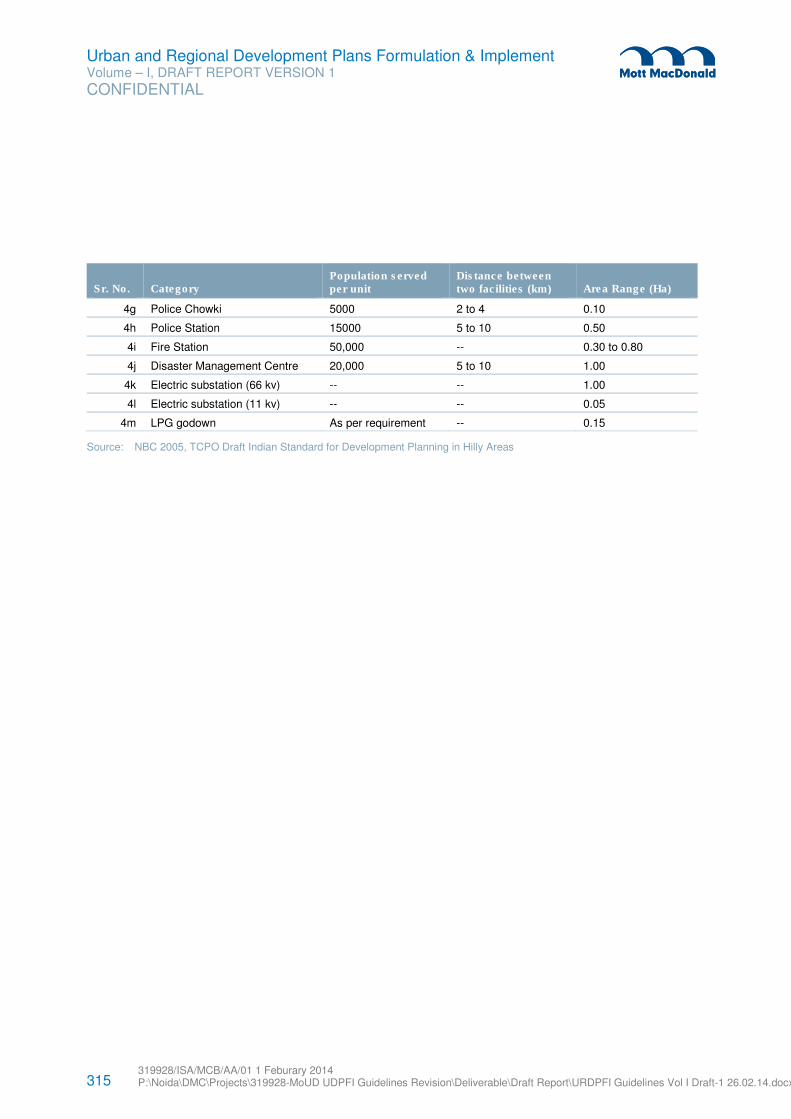
315 319928/ISA/MCB/AA/01 1 Feburary 2014 P:\Noida\DMC\Projects\319928-MoUD UDPFI Guidelines Revision\Deliverable\Draft Report\URDPFI Guidelines Vol I Draft-1 26.02.14.docx
Urban and Regional Development Plans Formulation & Implement Volume – I, DRAFT REPORT VERSION 1
CONFIDENTIAL
Sr. No. Category Population served per unit
Distance between two facilities (km) Area Range (Ha)
4g Police Chowki 5000 2 to 4 0.10
4h Police Station 15000 5 to 10 0.50
4i Fire Station 50,000 -- 0.30 to 0.80
4j Disaster Management Centre 20,000 5 to 10 1.00
4k Electric substation (66 kv) -- -- 1.00
4l Electric substation (11 kv) -- -- 0.05
4m LPG godown As per requirement -- 0.15
Source: NBC 2005, TCPO Draft Indian Standard for Development Planning in Hilly Areas
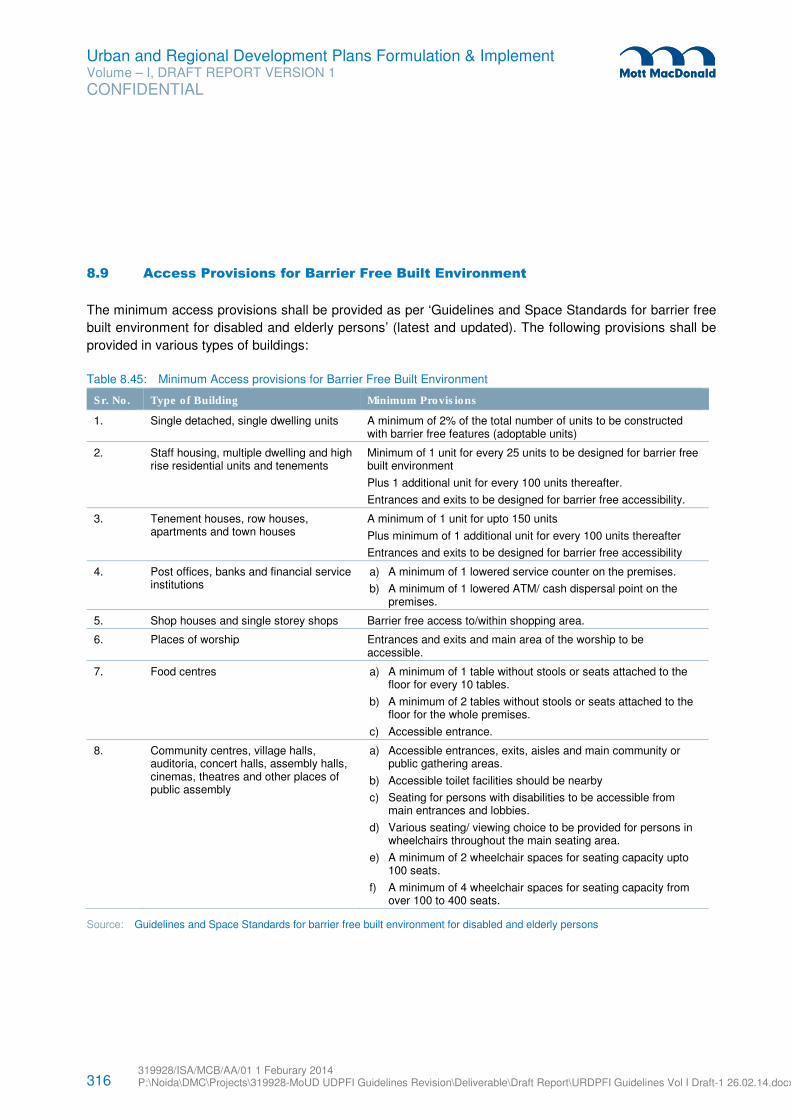
316 319928/ISA/MCB/AA/01 1 Feburary 2014 P:\Noida\DMC\Projects\319928-MoUD UDPFI Guidelines Revision\Deliverable\Draft Report\URDPFI Guidelines Vol I Draft-1 26.02.14.docx
Urban and Regional Development Plans Formulation & Implement Volume – I, DRAFT REPORT VERSION 1
CONFIDENTIAL
8.9 Access Provisions for Barrier Free Built Environment
The minimum access provisions shall be provided as per ‘Guidelines and Space Standards for barrier free
built environment for disabled and elderly persons’ (latest and updated). The following provisions shall be
provided in various types of buildings:
Table 8.45: Minimum Access provisions for Barrier Free Built Environment
Sr. No. Type of Building Minimum Provisions
1. Single detached, single dwelling units A minimum of 2% of the total number of units to be constructed with barrier free features (adoptable units)
2. Staff housing, multiple dwelling and high rise residential units and tenements
Minimum of 1 unit for every 25 units to be designed for barrier free built environment
Plus 1 additional unit for every 100 units thereafter.
Entrances and exits to be designed for barrier free accessibility.
3. Tenement houses, row houses, apartments and town houses
A minimum of 1 unit for upto 150 units
Plus minimum of 1 additional unit for every 100 units thereafter
Entrances and exits to be designed for barrier free accessibility
4. Post offices, banks and financial service institutions
a) A minimum of 1 lowered service counter on the premises.
b) A minimum of 1 lowered ATM/ cash dispersal point on the premises.
5. Shop houses and single storey shops Barrier free access to/within shopping area.
6. Places of worship Entrances and exits and main area of the worship to be accessible.
7. Food centres a) A minimum of 1 table without stools or seats attached to the floor for every 10 tables.
b) A minimum of 2 tables without stools or seats attached to the floor for the whole premises.
c) Accessible entrance.
8. Community centres, village halls, auditoria, concert halls, assembly halls, cinemas, theatres and other places of public assembly
a) Accessible entrances, exits, aisles and main community or public gathering areas.
b) Accessible toilet facilities should be nearby
c) Seating for persons with disabilities to be accessible from main entrances and lobbies.
d) Various seating/ viewing choice to be provided for persons in wheelchairs throughout the main seating area.
e) A minimum of 2 wheelchair spaces for seating capacity upto 100 seats.
f) A minimum of 4 wheelchair spaces for seating capacity from over 100 to 400 seats.
Source: Guidelines and Space Standards for barrier free built environment for disabled and elderly persons
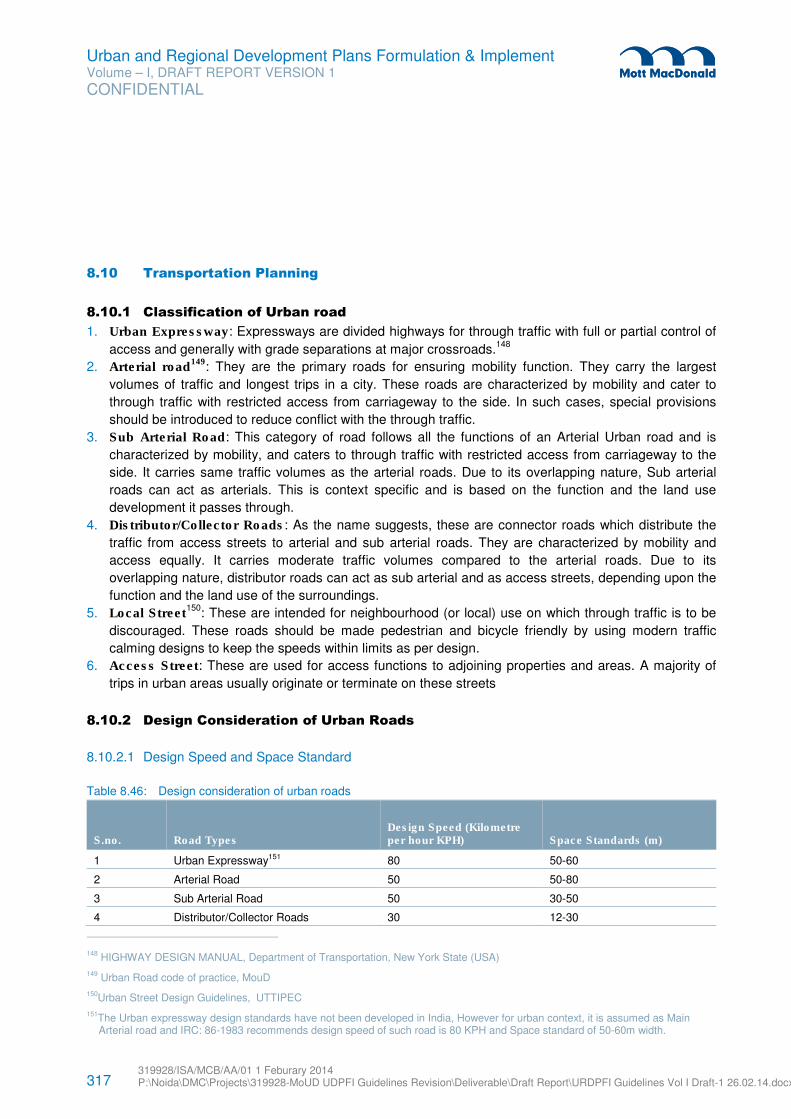
317 319928/ISA/MCB/AA/01 1 Feburary 2014 P:\Noida\DMC\Projects\319928-MoUD UDPFI Guidelines Revision\Deliverable\Draft Report\URDPFI Guidelines Vol I Draft-1 26.02.14.docx
Urban and Regional Development Plans Formulation & Implement Volume – I, DRAFT REPORT VERSION 1
CONFIDENTIAL
8.10 Transportation Planning
8.10.1 Classification of Urban road
1. Urban Expressway: Expressways are divided highways for through traffic with full or partial control of
access and generally with grade separations at major crossroads.148
2. Arterial road149
: They are the primary roads for ensuring mobility function. They carry the largest
volumes of traffic and longest trips in a city. These roads are characterized by mobility and cater to
through traffic with restricted access from carriageway to the side. In such cases, special provisions
should be introduced to reduce conflict with the through traffic.
3. Sub Arterial Road: This category of road follows all the functions of an Arterial Urban road and is
characterized by mobility, and caters to through traffic with restricted access from carriageway to the
side. It carries same traffic volumes as the arterial roads. Due to its overlapping nature, Sub arterial
roads can act as arterials. This is context specific and is based on the function and the land use
development it passes through.
4. Distributor/Collector Roads: As the name suggests, these are connector roads which distribute the
traffic from access streets to arterial and sub arterial roads. They are characterized by mobility and
access equally. It carries moderate traffic volumes compared to the arterial roads. Due to its
overlapping nature, distributor roads can act as sub arterial and as access streets, depending upon the
function and the land use of the surroundings.
5. Local Street150
: These are intended for neighbourhood (or local) use on which through traffic is to be
discouraged. These roads should be made pedestrian and bicycle friendly by using modern traffic
calming designs to keep the speeds within limits as per design.
6. Access Street: These are used for access functions to adjoining properties and areas. A majority of
trips in urban areas usually originate or terminate on these streets
8.10.2 Design Consideration of Urban Roads
8.10.2.1 Design Speed and Space Standard
Table 8.46: Design consideration of urban roads
S.no. Road Types Design Speed (Kilometre per hour KPH) Space Standards (m)
1 Urban Expressway151 80 50-60
2 Arterial Road 50 50-80
3 Sub Arterial Road 50 30-50
4 Distributor/Collector Roads 30 12-30
148 HIGHWAY DESIGN MANUAL, Department of Transportation, New York State (USA)
149 Urban Road code of practice, MouD
150Urban Street Design Guidelines, UTTIPEC
151The Urban expressway design standards have not been developed in India, However for urban context, it is assumed as Main Arterial road and IRC: 86-1983 recommends design speed of such road is 80 KPH and Space standard of 50-60m width.
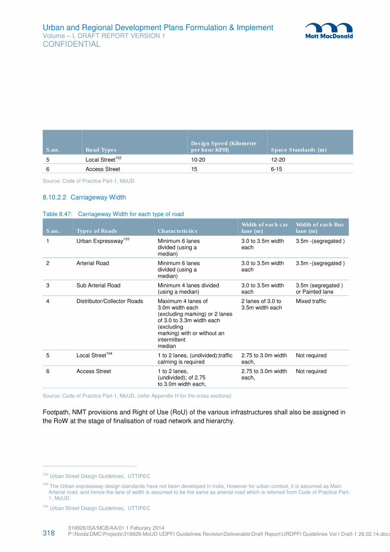
318 319928/ISA/MCB/AA/01 1 Feburary 2014 P:\Noida\DMC\Projects\319928-MoUD UDPFI Guidelines Revision\Deliverable\Draft Report\URDPFI Guidelines Vol I Draft-1 26.02.14.docx
Urban and Regional Development Plans Formulation & Implement Volume – I, DRAFT REPORT VERSION 1
CONFIDENTIAL
S.no. Road Types Design Speed (Kilometre per hour KPH) Space Standards (m)
5 Local Street152 10-20 12-20
6 Access Street 15 6-15
Source: Code of Practice Part-1, MoUD
8.10.2.2 Carriageway Width
Table 8.47: Carriageway Width for each type of road
S.no. Types of Roads Characteristics Width of each car lane (m)
Width of each Bus lane (m)
1 Urban Expressway153 Minimum 6 lanes divided (using a median)
3.0 to 3.5m width each
3.5m -(segregated )
2 Arterial Road Minimum 6 lanes divided (using a median)
3.0 to 3.5m width each
3.5m -(segregated )
3 Sub Arterial Road Minimum 4 lanes divided (using a median)
3.0 to 3.5m width each
3.5m (segregated ) or Painted lane
4 Distributor/Collector Roads Maximum 4 lanes of 3.0m width each (excluding marking) or 2 lanes of 3.0 to 3.3m width each (excluding marking) with or without an intermittent median
2 lanes of 3.0 to 3.5m width each
Mixed traffic
5 Local Street154 1 to 2 lanes, (undivided);traffic calming is required
2.75 to 3.0m width each,
Not required
6 Access Street 1 to 2 lanes, (undivided); of 2.75 to 3.0m width each,
2.75 to 3.0m width each,
Not required
Source: Code of Practice Part-1, MoUD, (refer Appendix H for the cross sections)
Footpath, NMT provisions and Right of Use (RoU) of the various infrastructures shall also be assigned in
the RoW at the stage of finalisation of road network and hierarchy.
152 Urban Street Design Guidelines, UTTIPEC
153 The Urban expressway design standards have not been developed in India, However for urban context, it is assumed as Main Arterial road, and hence the lane of width is assumed to be the same as arterial road which is referred from Code of Practice Part-1, MoUD.
154 Urban Street Design Guidelines, UTTIPEC
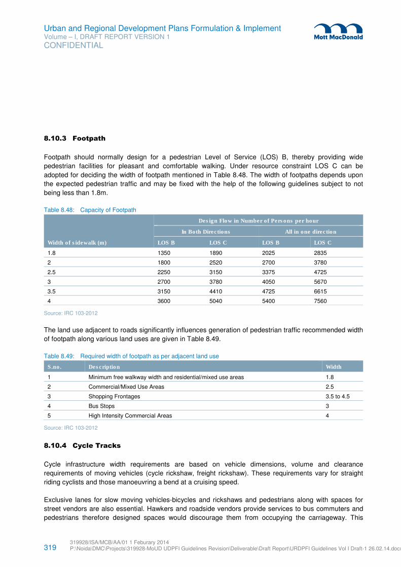
319 319928/ISA/MCB/AA/01 1 Feburary 2014 P:\Noida\DMC\Projects\319928-MoUD UDPFI Guidelines Revision\Deliverable\Draft Report\URDPFI Guidelines Vol I Draft-1 26.02.14.docx
Urban and Regional Development Plans Formulation & Implement Volume – I, DRAFT REPORT VERSION 1
CONFIDENTIAL
8.10.3 Footpath
Footpath should normally design for a pedestrian Level of Service (LOS) B, thereby providing wide
pedestrian facilities for pleasant and comfortable walking. Under resource constraint LOS C can be
adopted for deciding the width of footpath mentioned in Table 8.48. The width of footpaths depends upon
the expected pedestrian traffic and may be fixed with the help of the following guidelines subject to not
being less than 1.8m.
Table 8.48: Capacity of Footpath
Width of sidewalk (m)
Design Flow in Number of Persons per hour
In Both Directions All in one direction
LOS B LOS C LOS B LOS C
1.8 1350 1890 2025 2835
2 1800 2520 2700 3780
2.5 2250 3150 3375 4725
3 2700 3780 4050 5670
3.5 3150 4410 4725 6615
4 3600 5040 5400 7560
Source: IRC 103-2012
The land use adjacent to roads significantly influences generation of pedestrian traffic recommended width
of footpath along various land uses are given in Table 8.49.
Table 8.49: Required width of footpath as per adjacent land use
S.no. Description Width
1 Minimum free walkway width and residential/mixed use areas 1.8
2 Commercial/Mixed Use Areas 2.5
3 Shopping Frontages 3.5 to 4.5
4 Bus Stops 3
5 High Intensity Commercial Areas 4
Source: IRC 103-2012
8.10.4 Cycle Tracks
Cycle infrastructure width requirements are based on vehicle dimensions, volume and clearance
requirements of moving vehicles (cycle rickshaw, freight rickshaw). These requirements vary for straight
riding cyclists and those manoeuvring a bend at a cruising speed.
Exclusive lanes for slow moving vehicles-bicycles and rickshaws and pedestrians along with spaces for
street vendors are also essential. Hawkers and roadside vendors provide services to bus commuters and
pedestrians therefore designed spaces would discourage them from occupying the carriageway. This
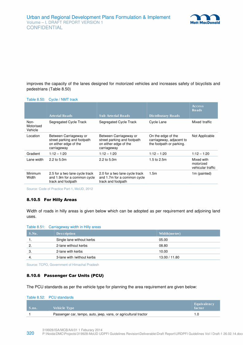
320 319928/ISA/MCB/AA/01 1 Feburary 2014 P:\Noida\DMC\Projects\319928-MoUD UDPFI Guidelines Revision\Deliverable\Draft Report\URDPFI Guidelines Vol I Draft-1 26.02.14.docx
Urban and Regional Development Plans Formulation & Implement Volume – I, DRAFT REPORT VERSION 1
CONFIDENTIAL
improves the capacity of the lanes designed for motorized vehicles and increases safety of bicyclists and
pedestrians (Table 8.50)
Table 8.50: Cycle / NMT track
Arterial Roads Sub Arterial Roads Distributary Roads
Access Roads
Non-Motorised Vehicle
Segregated Cycle Track Segregated Cycle Track Cycle Lane Mixed \traffic
Location Between Carriageway or street parking and footpath on either edge of the carriageway
Between Carriageway or street parking and footpath on either edge of the carriageway
On the edge of the carriageway, adjacent to the footpath or parking.
Not Applicable
Gradient 1:12 – 1:20 1:12 – 1:20 1:12 – 1:20 1:12 – 1:20
Lane width 2.2 to 5.0m 2.2 to 5.0m 1.5 to 2.5m Mixed with motorized vehicular traffic
Minimum Width
2.5 for a two lane cycle track and 1.9m for a common cycle track and footpath
2.0 for a two lane cycle track and 1.7m for a common cycle track and footpath
1.5m 1m (painted)
Source: Code of Practice Part-1, MoUD, 2012
8.10.5 For Hilly Areas
Width of roads in hilly areas is given below which can be adopted as per requirement and adjoining land
uses.
Table 8.51: Carriageway width in Hilly areas
S.No. Description Width(metre)
1. Single lane without kerbs 05.00
2. 2-lane without kerbs 08.80
3. 2-lane with kerbs 10.00
4. 3-lane with /without kerbs 13.00 / 11.80
Source: TCPO, Government of Himachal Pradesh
8.10.6 Passenger Car Units (PCU)
The PCU standards as per the vehicle type for planning the area requirement are given below:
Table 8.52: PCU standards
S.no. Vehicle Type Equivalency factor
1 Passenger car, tempo, auto, jeep, vans, or agricultural tractor 1.0
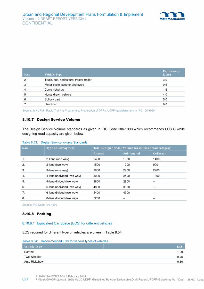
321 319928/ISA/MCB/AA/01 1 Feburary 2014 P:\Noida\DMC\Projects\319928-MoUD UDPFI Guidelines Revision\Deliverable\Draft Report\URDPFI Guidelines Vol I Draft-1 26.02.14.docx
Urban and Regional Development Plans Formulation & Implement Volume – I, DRAFT REPORT VERSION 1
CONFIDENTIAL
S.no. Vehicle Type Equivalency factor
2 Truck, bus, agricultural tractor-trailer 3.0
3 Motor-cycle, scooter and cycle 0.5
4 Cycle-rickshaw 1.5
5 Horse drawn vehicle 4.0
6 Bullock cart 5.0
7 Hand-cart 6.0
Source: JnNURM - Rapid Training Programme, Preparation of DPRs, UDPFI guidelines and in IRC 106-1990
8.10.7 Design Service Volume
The Design Service Volume standards as given in IRC Code 106-1990 which recommends LOS C while
designing road capacity are given below:
Table 8.53: Design Service volume Standards
S.no. Type of Carriageway Total Design Service Volume for different road category
Arterial Sub-Arterial Collector
1. 2-Lane (one way) 2400 1900 1400
2. 2-lane (two way) 1500 1200 900
3. 3-lane (one way) 3600 2900 2200
4. 4-lane undivided (two way) 3000 2400 1800
5. 4-lane divided (two way) 3600 2900 --
6. 6-lane undivided (two way) 4800 3800 --
7. 6-lane divided (two way) 5400 4300 --
8. 8-lane divided (two way) 7200 -- --
Source: IRC Code 106-1990
8.10.8 Parking
8.10.8.1 Equivalent Car Space (ECS) for different vehicles
ECS required for different type of vehicles are given in Table 8.54.
Table 8.54: Recommended ECS for various types of vehicles
Vehicle Type ECS
Car/taxi 1.00
Two Wheeler 0.25
Auto Rickshaw 0.50
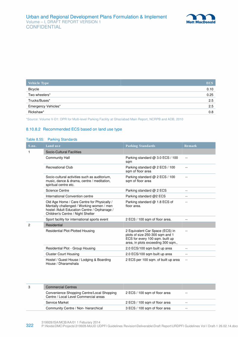
322 319928/ISA/MCB/AA/01 1 Feburary 2014 P:\Noida\DMC\Projects\319928-MoUD UDPFI Guidelines Revision\Deliverable\Draft Report\URDPFI Guidelines Vol I Draft-1 26.02.14.docx
Urban and Regional Development Plans Formulation & Implement Volume – I, DRAFT REPORT VERSION 1
CONFIDENTIAL
Vehicle Type ECS
Bicycle 0.10
Two wheelers* 0.25
Trucks/Buses* 2.5
Emergency Vehicles* 2.5
Rickshaw* 0.8
*Source: Volume V-D1: DPR for Multi-level Parking Facility at Ghaziabad Main Report, NCRPB and ADB, 2010
8.10.8.2 Recommended ECS based on land use type
Table 8.55: Parking Standards
S.no. Land use Parking Standards Remark
1
Socio-Cultural Facilities
Community Hall Parking standard @ 3.0 ECS / 100 sqm
--
Recreational Club Parking standard @ 2 ECS / 100 sqm of floor area
--
Socio-cultural activities such as auditorium, music, dance & drama, centre / meditation, spiritual centre etc.
Parking standard @ 2 ECS / 100 sqm of floor area
--
Science Centre Parking standard @ 2 ECS --
International Convention centre Parking standard @2 ECS --
Old Age Home / Care Centre for Physically / Mentally challenged / Working women / men hostel /Adult Education Centre / Orphanage / Children's Centre / Night Shelter
Parking standard @ 1.8 ECS of floor area.
--
Sport facility for international sports event 2 ECS / 100 sqm of floor area. --
2
Residential
Residential Plot-Plotted Housing 2 Equivalent Car Space (ECS) in plots of size 250-300 sqm and 1 ECS for every 100 sqm. built up area, in plots exceeding 300 sqm.,
--
Residential Plot - Group Housing 2.0 ECS/100 sqm built up area --
Cluster Court Housing 2.0 ECS/100 sqm built up area --
Hostel / Guest House / Lodging & Boarding House / Dharamshala
2 ECS per 100 sqm. of built up area --
3 Commercial Centres
Convenience Shopping Centre/Local Shopping Centre / Local Level Commercial areas
2 ECS / 100 sqm of floor area --
Service Market 2 ECS / 100 sqm of floor area --
Community Centre / Non- hierarchical 3 ECS / 100 sqm of floor area --
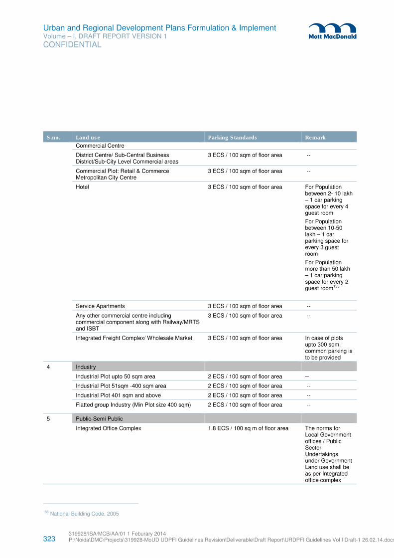
323 319928/ISA/MCB/AA/01 1 Feburary 2014 P:\Noida\DMC\Projects\319928-MoUD UDPFI Guidelines Revision\Deliverable\Draft Report\URDPFI Guidelines Vol I Draft-1 26.02.14.docx
Urban and Regional Development Plans Formulation & Implement Volume – I, DRAFT REPORT VERSION 1
CONFIDENTIAL
S.no. Land use Parking Standards Remark
Commercial Centre
District Centre/ Sub-Central Business District/Sub-City Level Commercial areas
3 ECS / 100 sqm of floor area --
Commercial Plot: Retail & Commerce Metropolitan City Centre
3 ECS / 100 sqm of floor area --
Hotel 3 ECS / 100 sqm of floor area For Population between 2- 10 lakh – 1 car parking space for every 4 guest room
For Population between 10-50 lakh – 1 car parking space for every 3 guest room
For Population more than 50 lakh – 1 car parking space for every 2 guest room155
Service Apartments 3 ECS / 100 sqm of floor area --
Any other commercial centre including commercial component along with Railway/MRTS and ISBT
3 ECS / 100 sqm of floor area --
Integrated Freight Complex/ Wholesale Market 3 ECS / 100 sqm of floor area In case of plots upto 300 sqm. common parking is to be provided
4
Industry
Industrial Plot upto 50 sqm area 2 ECS / 100 sqm of floor area --
Industrial Plot 51sqm -400 sqm area 2 ECS / 100 sqm of floor area --
Industrial Plot 401 sqm and above 2 ECS / 100 sqm of floor area --
Flatted group Industry (Min Plot size 400 sqm) 2 ECS / 100 sqm of floor area --
5
Public-Semi Public
Integrated Office Complex 1.8 ECS / 100 sq m of floor area The norms for Local Government offices / Public Sector Undertakings under Government Land use shall be as per Integrated office complex
155 National Building Code, 2005
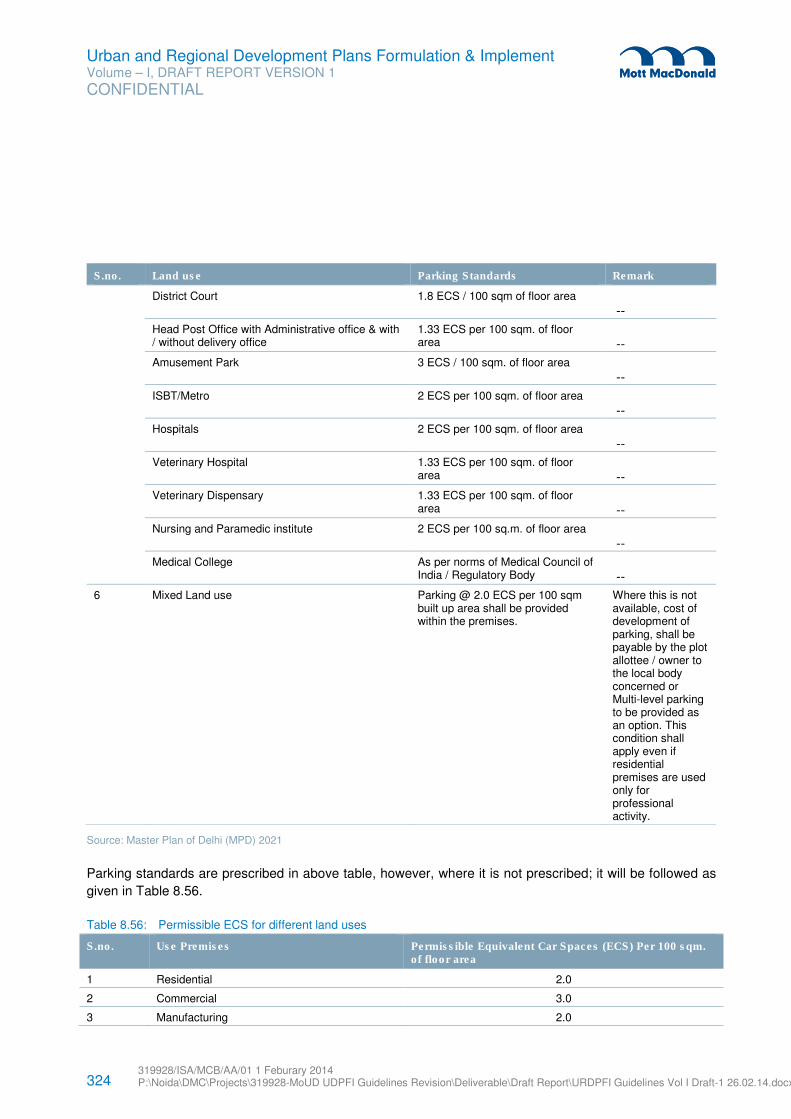
324 319928/ISA/MCB/AA/01 1 Feburary 2014 P:\Noida\DMC\Projects\319928-MoUD UDPFI Guidelines Revision\Deliverable\Draft Report\URDPFI Guidelines Vol I Draft-1 26.02.14.docx
Urban and Regional Development Plans Formulation & Implement Volume – I, DRAFT REPORT VERSION 1
CONFIDENTIAL
S.no. Land use Parking Standards Remark
District Court 1.8 ECS / 100 sqm of floor area
--
Head Post Office with Administrative office & with / without delivery office
1.33 ECS per 100 sqm. of floor area --
Amusement Park 3 ECS / 100 sqm. of floor area
--
ISBT/Metro 2 ECS per 100 sqm. of floor area
--
Hospitals 2 ECS per 100 sqm. of floor area
--
Veterinary Hospital 1.33 ECS per 100 sqm. of floor area --
Veterinary Dispensary 1.33 ECS per 100 sqm. of floor area --
Nursing and Paramedic institute 2 ECS per 100 sq.m. of floor area
--
Medical College As per norms of Medical Council of India / Regulatory Body --
6 Mixed Land use Parking @ 2.0 ECS per 100 sqm built up area shall be provided within the premises.
Where this is not available, cost of development of parking, shall be payable by the plot allottee / owner to the local body concerned or Multi-level parking to be provided as an option. This condition shall apply even if residential premises are used only for professional activity.
Source: Master Plan of Delhi (MPD) 2021
Parking standards are prescribed in above table, however, where it is not prescribed; it will be followed as
given in Table 8.56.
Table 8.56: Permissible ECS for different land uses
S.no. Use Premises Permissible Equivalent Car Spaces (ECS) Per 100 sqm. of floor area
1 Residential 2.0
2 Commercial 3.0
3 Manufacturing 2.0
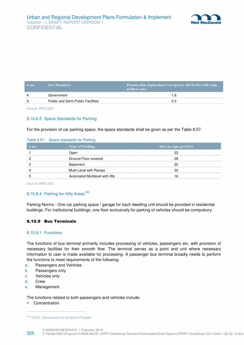
325 319928/ISA/MCB/AA/01 1 Feburary 2014 P:\Noida\DMC\Projects\319928-MoUD UDPFI Guidelines Revision\Deliverable\Draft Report\URDPFI Guidelines Vol I Draft-1 26.02.14.docx
Urban and Regional Development Plans Formulation & Implement Volume – I, DRAFT REPORT VERSION 1
CONFIDENTIAL
S.no. Use Premises Permissible Equivalent Car Spaces (ECS) Per 100 sqm. of floor area
4 Government 1.8
5 Public and Semi-Public Facilities 2.0
Source: MPD 2021
8.10.8.3 Space Standards for Parking
For the provision of car parking space, the space standards shall be given as per the Table 8.57.
Table 8.57: Space standards for Parking
S.no. Type of Parking Area in sqm per ECS
1 Open 23
2 Ground Floor covered 28
3 Basement 32
4 Multi-Level with Ramps 30
5 Automated Multilevel with lifts 16
Source: MPD 2021
8.10.8.4 Parking for Hilly Areas156
Parking Norms - One car parking space / garage for each dwelling unit should be provided in residential
buildings. For institutional buildings, one floor exclusively for parking of vehicles should be compulsory.
8.10.9 Bus Terminals
8.10.9.1 Functions
The functions of bus terminal primarily includes processing of vehicles, passengers etc. with provision of
necessary facilities for their smooth flow. The terminal serves as a point and unit where necessary
information to user is made available for processing. A passenger bus terminal broadly needs to perform
the functions to meet requirements of the following:
a. Passengers and Vehicles
b. Passengers only
c. Vehicles only
d. Crew
e. Management
The functions related to both passengers and vehicles include:
� Concentration
156 TCPO, Government of Himachal Pradesh
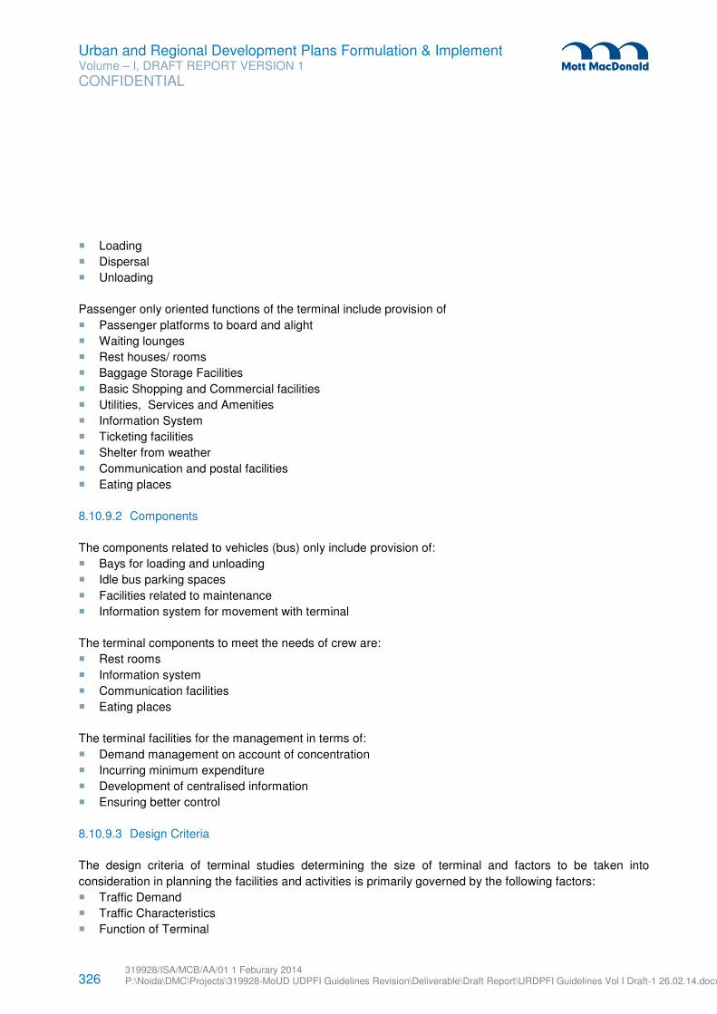
326 319928/ISA/MCB/AA/01 1 Feburary 2014 P:\Noida\DMC\Projects\319928-MoUD UDPFI Guidelines Revision\Deliverable\Draft Report\URDPFI Guidelines Vol I Draft-1 26.02.14.docx
Urban and Regional Development Plans Formulation & Implement Volume – I, DRAFT REPORT VERSION 1
CONFIDENTIAL
� Loading
� Dispersal
� Unloading
Passenger only oriented functions of the terminal include provision of
� Passenger platforms to board and alight
� Waiting lounges
� Rest houses/ rooms
� Baggage Storage Facilities
� Basic Shopping and Commercial facilities
� Utilities, Services and Amenities
� Information System
� Ticketing facilities
� Shelter from weather
� Communication and postal facilities
� Eating places
8.10.9.2 Components
The components related to vehicles (bus) only include provision of:
� Bays for loading and unloading
� Idle bus parking spaces
� Facilities related to maintenance
� Information system for movement with terminal
The terminal components to meet the needs of crew are:
� Rest rooms
� Information system
� Communication facilities
� Eating places
The terminal facilities for the management in terms of:
� Demand management on account of concentration
� Incurring minimum expenditure
� Development of centralised information
� Ensuring better control
8.10.9.3 Design Criteria
The design criteria of terminal studies determining the size of terminal and factors to be taken into
consideration in planning the facilities and activities is primarily governed by the following factors:
� Traffic Demand
� Traffic Characteristics
� Function of Terminal
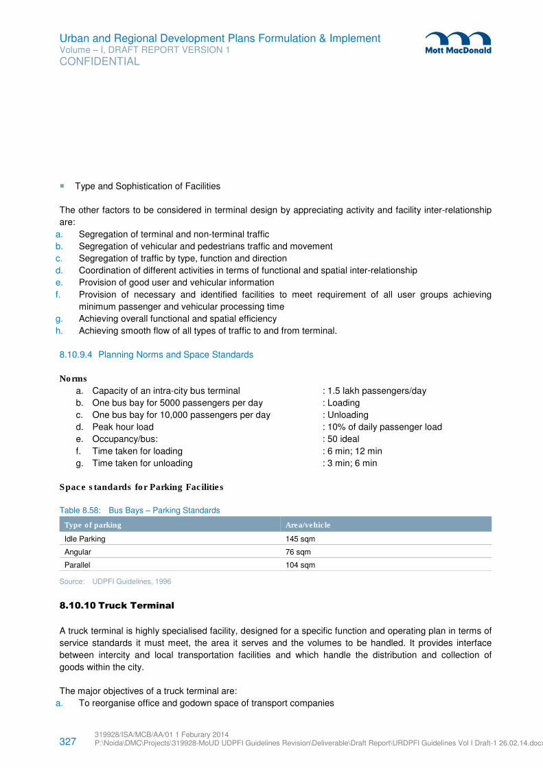
327 319928/ISA/MCB/AA/01 1 Feburary 2014 P:\Noida\DMC\Projects\319928-MoUD UDPFI Guidelines Revision\Deliverable\Draft Report\URDPFI Guidelines Vol I Draft-1 26.02.14.docx
Urban and Regional Development Plans Formulation & Implement Volume – I, DRAFT REPORT VERSION 1
CONFIDENTIAL
� Type and Sophistication of Facilities
The other factors to be considered in terminal design by appreciating activity and facility inter-relationship
are:
a. Segregation of terminal and non-terminal traffic
b. Segregation of vehicular and pedestrians traffic and movement
c. Segregation of traffic by type, function and direction
d. Coordination of different activities in terms of functional and spatial inter-relationship
e. Provision of good user and vehicular information
f. Provision of necessary and identified facilities to meet requirement of all user groups achieving
minimum passenger and vehicular processing time
g. Achieving overall functional and spatial efficiency
h. Achieving smooth flow of all types of traffic to and from terminal.
8.10.9.4 Planning Norms and Space Standards
Norms
a. Capacity of an intra-city bus terminal : 1.5 lakh passengers/day
b. One bus bay for 5000 passengers per day : Loading
c. One bus bay for 10,000 passengers per day : Unloading
d. Peak hour load : 10% of daily passenger load
e. Occupancy/bus: : 50 ideal
f. Time taken for loading : 6 min; 12 min
g. Time taken for unloading : 3 min; 6 min
Space standards for Parking Facilities
Table 8.58: Bus Bays – Parking Standards
Type of parking Area/vehicle
Idle Parking 145 sqm
Angular 76 sqm
Parallel 104 sqm
Source: UDPFI Guidelines, 1996
8.10.10 Truck Terminal
A truck terminal is highly specialised facility, designed for a specific function and operating plan in terms of
service standards it must meet, the area it serves and the volumes to be handled. It provides interface
between intercity and local transportation facilities and which handle the distribution and collection of
goods within the city.
The major objectives of a truck terminal are:
a. To reorganise office and godown space of transport companies
328 319928/ISA/MCB/AA/01 1 Feburary 2014 P:\Noida\DMC\Projects\319928-MoUD UDPFI Guidelines Revision\Deliverable\Draft Report\URDPFI Guidelines Vol I Draft-1 26.02.14.docx
Urban and Regional Development Plans Formulation & Implement Volume – I, DRAFT REPORT VERSION 1
CONFIDENTIAL
b. To provide for expansion of companies
c. To reduce parking, loading/unloading instances in CBD
d. To locate the facilities for vehicle repairs, servicing, rest places, shops etc.
e. To cater to intercity movements destined to operator’s godown and provide for idle parking for trucks
waiting for return load.
f. To function as a rest and halting place for through traffic.
8.10.10.1 Facilities in Transport Nagar
The main facilities for which area allocation needs to be made in Transport Nagar are:
i. Transport Agencies
ii. Circulation
iii. Parking
iv. Open Space
v. Petrol Pump
vi. Service Centre
vii. Toilets
viii. Police Station
ix. Restaurant
x. Shops
xi. Godowns
xii. Weigh Bridge
xiii. Stalls/Dhabas
xiv. Administrative Office
xv. Fire Station, Post Office, Dispensary
xvi. Bank, Bus Station, Electric Sub station
xvii. Cold Storage
xviii. Spare Parts Shops
xix. Body Building Shops
xx. Cinema
8.10.10.2 Locational Factors
The following factors are generally considered while locating a truck terminal/Transport Nagar:
a. They should be located on main corridor of goods movement.
b. They are generally located on fringe of developed lands
c. They should have proper linkage with other freight generating activities as well as developed areas.
d. Consideration for intra city goods movement pattern in terms of desire of movement, modes used and
distances over which movement is made should also be kept in view.
8.10.10.3 Broad Land Use Break Up
The broad land use breakup in a truck terminal (Transport Nagar) is as below:
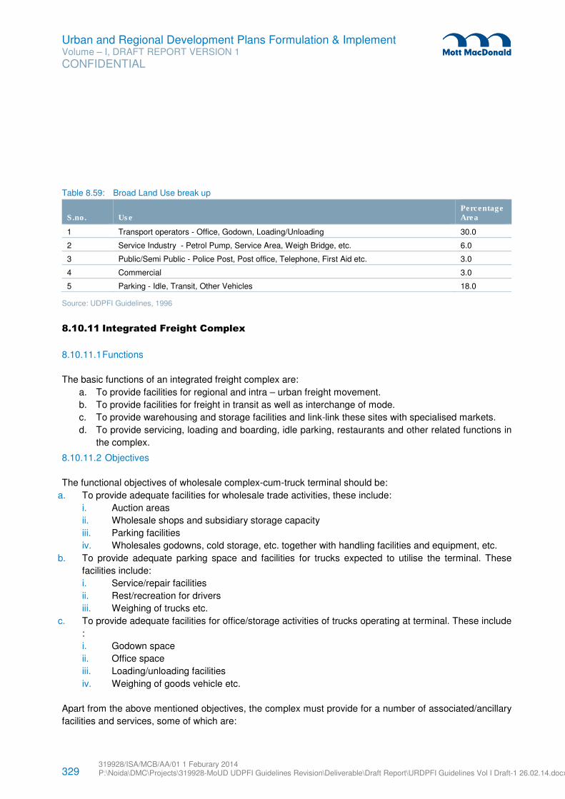
329 319928/ISA/MCB/AA/01 1 Feburary 2014 P:\Noida\DMC\Projects\319928-MoUD UDPFI Guidelines Revision\Deliverable\Draft Report\URDPFI Guidelines Vol I Draft-1 26.02.14.docx
Urban and Regional Development Plans Formulation & Implement Volume – I, DRAFT REPORT VERSION 1
CONFIDENTIAL
Table 8.59: Broad Land Use break up
S.no. Use Percentage Area
1 Transport operators - Office, Godown, Loading/Unloading 30.0
2 Service Industry - Petrol Pump, Service Area, Weigh Bridge, etc. 6.0
3 Public/Semi Public - Police Post, Post office, Telephone, First Aid etc. 3.0
4 Commercial 3.0
5 Parking - Idle, Transit, Other Vehicles 18.0
Source: UDPFI Guidelines, 1996
8.10.11 Integrated Freight Complex
8.10.11.1 Functions
The basic functions of an integrated freight complex are:
a. To provide facilities for regional and intra – urban freight movement.
b. To provide facilities for freight in transit as well as interchange of mode.
c. To provide warehousing and storage facilities and link-link these sites with specialised markets.
d. To provide servicing, loading and boarding, idle parking, restaurants and other related functions in
the complex.
8.10.11.2 Objectives
The functional objectives of wholesale complex-cum-truck terminal should be:
a. To provide adequate facilities for wholesale trade activities, these include:
i. Auction areas
ii. Wholesale shops and subsidiary storage capacity
iii. Parking facilities
iv. Wholesales godowns, cold storage, etc. together with handling facilities and equipment, etc.
b. To provide adequate parking space and facilities for trucks expected to utilise the terminal. These
facilities include:
i. Service/repair facilities
ii. Rest/recreation for drivers
iii. Weighing of trucks etc.
c. To provide adequate facilities for office/storage activities of trucks operating at terminal. These include
:
i. Godown space
ii. Office space
iii. Loading/unloading facilities
iv. Weighing of goods vehicle etc.
Apart from the above mentioned objectives, the complex must provide for a number of associated/ancillary
facilities and services, some of which are:
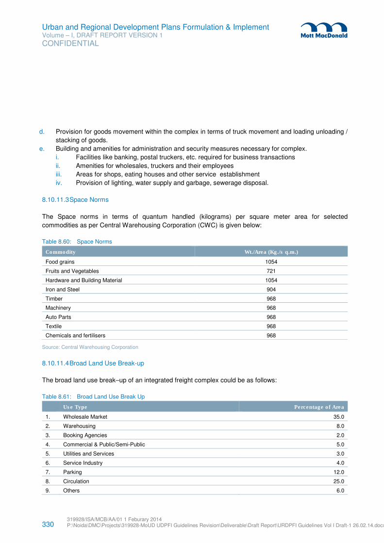
330 319928/ISA/MCB/AA/01 1 Feburary 2014 P:\Noida\DMC\Projects\319928-MoUD UDPFI Guidelines Revision\Deliverable\Draft Report\URDPFI Guidelines Vol I Draft-1 26.02.14.docx
Urban and Regional Development Plans Formulation & Implement Volume – I, DRAFT REPORT VERSION 1
CONFIDENTIAL
d. Provision for goods movement within the complex in terms of truck movement and loading unloading /
stacking of goods.
e. Building and amenities for administration and security measures necessary for complex.
i. Facilities like banking, postal truckers, etc. required for business transactions
ii. Amenities for wholesales, truckers and their employees
iii. Areas for shops, eating houses and other service establishment
iv. Provision of lighting, water supply and garbage, sewerage disposal.
8.10.11.3 Space Norms
The Space norms in terms of quantum handled (kilograms) per square meter area for selected
commodities as per Central Warehousing Corporation (CWC) is given below:
Table 8.60: Space Norms
Commodity Wt./Area (Kg./s q.m.)
Food grains 1054
Fruits and Vegetables 721
Hardware and Building Material 1054
Iron and Steel 904
Timber 968
Machinery 968
Auto Parts 968
Textile 968
Chemicals and fertilisers 968
Source: Central Warehousing Corporation
8.10.11.4 Broad Land Use Break-up
The broad land use break–up of an integrated freight complex could be as follows:
Table 8.61: Broad Land Use Break Up
Use Type Percentage of Area
1. Wholesale Market 35.0
2. Warehousing 8.0
3. Booking Agencies 2.0
4. Commercial & Public/Semi-Public 5.0
5. Utilities and Services 3.0
6. Service Industry 4.0
7. Parking 12.0
8. Circulation 25.0
9. Others 6.0
331 319928/ISA/MCB/AA/01 1 Feburary 2014 P:\Noida\DMC\Projects\319928-MoUD UDPFI Guidelines Revision\Deliverable\Draft Report\URDPFI Guidelines Vol I Draft-1 26.02.14.docx
Urban and Regional Development Plans Formulation & Implement Volume – I, DRAFT REPORT VERSION 1
CONFIDENTIAL
Use Type Percentage of Area
Total 100.0
8.10.11.5 Area Requirements
As a general guideline, the area required for a truck terminal (Transport Nagar) should be reserved at the
rate of one hectare per 300 tonnes of daily goods inflow into the complex. In case of integrated freight
complex, the area necessary would be one hectare per 400 tonnes of daily goods inflow into the complex.
8.10.12 Travel Demand Modelling Process157
A travel model is a simplified representation of travel behaviour through the use of mathematical equations
and data analysis. Models are based on the theory that an individual's travel choices are a function of his
or her socioeconomic characteristics (household size, income, and vehicle ownership), geographic location
(distance to work, shops, etc.) and modal choices (road, rail, bus, NMT) available to them. Modelling is an
attempt to replicate this behaviour using statistical analysis. The process is complex and requires large
amount of data.
The accuracy of a travel model depends on many factors: land use and demographic data, quality of travel
survey data, technical expertise of the developer, and assumptions used. Therefore, a model should be
evaluated as a whole and never as a function of the forecasts produced. A model should always be
calibrated well so that it can replicate current year conditions within reason before using it to produce
forecasts. Model calibration and validation should be done at every step of the process to ensure quality of
forecasts.
Models are a simplified simulation of travel behaviour producing rational travel choices based on the
controlled variables within a model. In the real world, variables are constantly changing and individuals
don't always make the most rational decisions. Therefore model forecasts should only be used as one
element in transport planning.
The most commonly used method of forecasting is 4 step Aggregate Model, this model includes trip
generation, distribution, modal split, and assignment.
An individual decides whether to make a trip, where and when to go, which mode to select, and which
route to take based on his needs, income, occupation, vehicle ownership, etc. and the choices available to
them. The choices could be different modes of transportation (car, 2 wheeler, public transport, bicycle etc),
different times of day travel (peak, off-peak) or competing destinations (shopping mall, downtown). As
mentioned above, this method involves 4 major components which are detailed out below:
157 Development of Training Material under Sustainable Urban Transport Project, Reference Guide Volume 2 Demand Assessment,
MoUD
332 319928/ISA/MCB/AA/01 1 Feburary 2014 P:\Noida\DMC\Projects\319928-MoUD UDPFI Guidelines Revision\Deliverable\Draft Report\URDPFI Guidelines Vol I Draft-1 26.02.14.docx
Urban and Regional Development Plans Formulation & Implement Volume – I, DRAFT REPORT VERSION 1
CONFIDENTIAL
8.10.12.1 Trip Generation
The first step in travel forecasting is trip generation. In this step, information from land use, population, and
economic forecasts are used to estimate how many trips will be made to and from each zone.
Types of Most Commonly Used Trip Generation Models
� Regression models: equations such as:
– Total trips = 1.1*population,
– Home-based work trips = 1.5*total employment, etc;
� Cross-classification tables based on: household size, number of workers, income class, vehicle
ownership, etc.;
� Special generator models: used for generators such as airports, colleges, amusement parks, green
spaces, etc.;
� Separate rates for peak and off-peak trips.
Assumptions and limitations:
� Pedestrian and bicycle trips are usually excluded from trip generation models.
� Commercial vehicles need to be generated separately.
� Care should be taken before interchanging vehicle trip rates with person trip rates.
Validation and Reasonableness Checking for trip generation
� Compare trips per household to the regional average. There should be a valid explanation if numbers
are too high or too low.
� Review trips per household by purpose.
� Ensure that trip productions and trip attractions balance well. Check trip rates and adjust if they do not
balance
� Create GIS color-coded maps of productions and attractions to review for errors. Use special
generators for facilities such as schools, hospitals, malls, and recreational facilities such as parks,
playgrounds, etc.
� Make model external trips and visitor trips using external cordon and visitor surveys.
� Make sure Commercial Vehicle and Freight Travel is included in the model
8.10.12.2 Trip Distribution
The trip distribution model estimates number of trips travelled from one zone to another. Trip generation
only finds the number of trips that begin or end at a particular zone. The process of trip distribution links the
trip ends to form an origin-destination pattern. Trip distribution is used to represent the process of
destination choice (i.e. "I need to go shopping, but where should I go to meet my shopping needs?").
The most commonly used procedure for trip distribution is called the gravity model. The gravity model
takes the trips produced at one zone and distributes to other zones based on both the size of the other
zones (as measured by their trip attractions) and the composite cost (travel time, distance or cost for all
modes available) to other zones. A zone with many trip attractions (say, a large shopping center) will
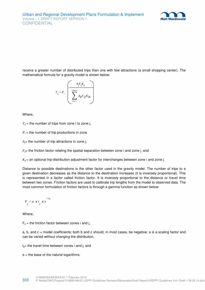
333 319928/ISA/MCB/AA/01 1 Feburary 2014 P:\Noida\DMC\Projects\319928-MoUD UDPFI Guidelines Revision\Deliverable\Draft Report\URDPFI Guidelines Vol I Draft-1 26.02.14.docx
Urban and Regional Development Plans Formulation & Implement Volume – I, DRAFT REPORT VERSION 1
CONFIDENTIAL
receive a greater number of distributed trips than one with few attractions (a small shopping center). The
mathematical formula for a gravity model is shown below:
Where,
Tij = the number of trips from zone i to zone j,
Pi = the number of trip productions in zone
Aj= the number of trip attractions in zone j,
Fij= the friction factor relating the spatial separation between zone i and zone j, and
Kij = an optional trip-distribution adjustment factor for interchanges between zone i and zone j.
Distance to possible destinations is the other factor used in the gravity model. The number of trips to a
given destination decreases as the distance to the destination increases (it is inversely proportional). This
is represented in a factor called friction factor. It is inversely proportional to the distance or travel time
between two zones. Friction factors are used to calibrate trip lengths from the model to observed data. The
most common formulation of friction factors is through a gamma function as shown below:
Where,
Fij = the friction factor between zones i and j,
a, b, and c = model coefficients; both b and c should, in most cases, be negative; a is a scaling factor and
can be varied without changing the distribution,
tij= the travel time between zones i and j, and
e = the base of the natural logarithms.
Tij = P
i
AjF
ijK
ij
� ����������
�=1
Fij = a X t
ij X e
cxte
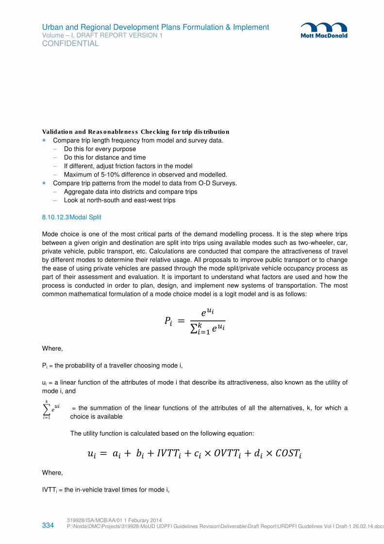
334 319928/ISA/MCB/AA/01 1 Feburary 2014 P:\Noida\DMC\Projects\319928-MoUD UDPFI Guidelines Revision\Deliverable\Draft Report\URDPFI Guidelines Vol I Draft-1 26.02.14.docx
Urban and Regional Development Plans Formulation & Implement Volume – I, DRAFT REPORT VERSION 1
CONFIDENTIAL
Validation and Reasonableness Checking for trip distribution
� Compare trip length frequency from model and survey data.
– Do this for every purpose
– Do this for distance and time
– If different, adjust friction factors in the model
– Maximum of 5-10% difference in observed and modelled.
� Compare trip patterns from the model to data from O-D Surveys.
– Aggregate data into districts and compare trips
– Look at north-south and east-west trips
8.10.12.3 Modal Split
Mode choice is one of the most critical parts of the demand modelling process. It is the step where trips
between a given origin and destination are split into trips using available modes such as two-wheeler, car,
private vehicle, public transport, etc. Calculations are conducted that compare the attractiveness of travel
by different modes to determine their relative usage. All proposals to improve public transport or to change
the ease of using private vehicles are passed through the mode split/private vehicle occupancy process as
part of their assessment and evaluation. It is important to understand what factors are used and how the
process is conducted in order to plan, design, and implement new systems of transportation. The most
common mathematical formulation of a mode choice model is a logit model and is as follows:
�� = ���
∑ �������
Where,
Pi = the probability of a traveller choosing mode i,
ui = a linear function of the attributes of mode i that describe its attractiveness, also known as the utility of
mode i, and
= the summation of the linear functions of the attributes of all the alternatives, k, for which a
choice is available
The utility function is calculated based on the following equation:
�� =�� +�� + ����� + � × "���� + #� × $"%�� Where,
IVTTi = the in-vehicle travel times for mode i,
�����
���
335 319928/ISA/MCB/AA/01 1 Feburary 2014 P:\Noida\DMC\Projects\319928-MoUD UDPFI Guidelines Revision\Deliverable\Draft Report\URDPFI Guidelines Vol I Draft-1 26.02.14.docx
Urban and Regional Development Plans Formulation & Implement Volume – I, DRAFT REPORT VERSION 1
CONFIDENTIAL
OVTTi = set of variables measuring the out-of-vehicle travel times for mode i—walk, wait, and transfer
times—may all be kept separate or combined, depending on the calibrated structure of the model,
COSTi = the cost of mode i,
ai = mode-specific coefficient (constant) to account for mode bias not measurable with the level of
service variables,
bi= coefficient for the IVTT variables of mode
ci = a set of coefficients for OVTT variables of mode i, and
di= coefficient for COST variable of mode i
Key Points about Mode Split
� Mode split is done by a comparison of the "disutility" of travel between two points for the different
modes that are available.
� "Disutility" is a term used to represent a combination of the travel time, cost, and convenience of a
mode between an origin and a destination.
� Travel time is divided into two components: in-vehicle time to represent the time when a traveller is
actually in a vehicle and moving, and out-of-vehicle time, which includes time spent travelling outside of
the vehicle (time to walk to and from bus/rail stops, waiting time, transfer time).
� Out-of-vehicle time is used to represent "inconvenience" and the coefficient for out-of-vehicle time is
typically several times larger than for in-vehicle time, reflecting the fact that travellers do not like to wait
or walk long distances to their destinations. The size of the multiplier will be different depending upon
the purpose of the trip.
� For public transport trips, the cost of the trip is usually measured as the average public transport fare
for that trip, while for private vehicle trips, cost is found by adding the parking cost to the length of the
trip and multiplying by cost per kilometer. Private vehicle cost is based on a "perceived" cost per
kilometer (on the order of 5-10 cents/kilometer), which only includes fuel and oil costs and does not
include ownership, insurance, maintenance, and other fixed costs (total costs of private vehicle travel
are much higher).
� Disutility equations also contain a "modal constant", represents other characteristics or travel modes
that are not explicitly captured by the variables in the model, but that may influence the choice of mode
(such as a difference in comfort between public transport and private vehicles). A model will have n-1
constants with ‘n’ being the number of modes.
� Once disutilities are estimated for the various choices between an origin and a destination, the trips are
split among various modes based on the relative differences between disutilities. A large advantage will
mean a high percentage for that mode.
All model coefficients are estimated using actual traveller data.
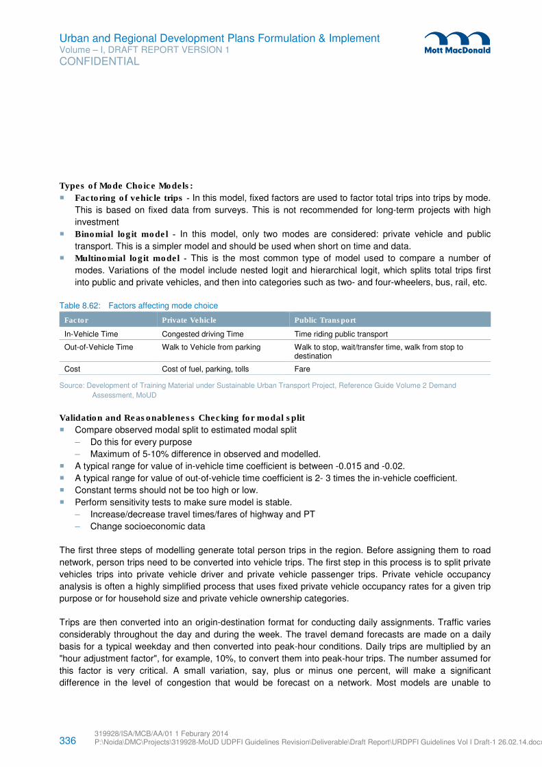
336 319928/ISA/MCB/AA/01 1 Feburary 2014 P:\Noida\DMC\Projects\319928-MoUD UDPFI Guidelines Revision\Deliverable\Draft Report\URDPFI Guidelines Vol I Draft-1 26.02.14.docx
Urban and Regional Development Plans Formulation & Implement Volume – I, DRAFT REPORT VERSION 1
CONFIDENTIAL
Types of Mode Choice Models:
� Factoring of vehicle trips - In this model, fixed factors are used to factor total trips into trips by mode.
This is based on fixed data from surveys. This is not recommended for long-term projects with high
investment
� Binomial logit model - In this model, only two modes are considered: private vehicle and public
transport. This is a simpler model and should be used when short on time and data.
� Multinomial logit model - This is the most common type of model used to compare a number of
modes. Variations of the model include nested logit and hierarchical logit, which splits total trips first
into public and private vehicles, and then into categories such as two- and four-wheelers, bus, rail, etc.
Table 8.62: Factors affecting mode choice
Factor Private Vehicle Public Transport
In-Vehicle Time Congested driving Time Time riding public transport
Out-of-Vehicle Time Walk to Vehicle from parking Walk to stop, wait/transfer time, walk from stop to destination
Cost Cost of fuel, parking, tolls Fare
Source: Development of Training Material under Sustainable Urban Transport Project, Reference Guide Volume 2 Demand
Assessment, MoUD
Validation and Reasonableness Checking for modal split
� Compare observed modal split to estimated modal split
– Do this for every purpose
– Maximum of 5-10% difference in observed and modelled.
� A typical range for value of in-vehicle time coefficient is between -0.015 and -0.02.
� A typical range for value of out-of-vehicle time coefficient is 2- 3 times the in-vehicle coefficient.
� Constant terms should not be too high or low.
� Perform sensitivity tests to make sure model is stable.
– Increase/decrease travel times/fares of highway and PT
– Change socioeconomic data
The first three steps of modelling generate total person trips in the region. Before assigning them to road
network, person trips need to be converted into vehicle trips. The first step in this process is to split private
vehicles trips into private vehicle driver and private vehicle passenger trips. Private vehicle occupancy
analysis is often a highly simplified process that uses fixed private vehicle occupancy rates for a given trip
purpose or for household size and private vehicle ownership categories.
Trips are then converted into an origin-destination format for conducting daily assignments. Traffic varies
considerably throughout the day and during the week. The travel demand forecasts are made on a daily
basis for a typical weekday and then converted into peak-hour conditions. Daily trips are multiplied by an
"hour adjustment factor", for example, 10%, to convert them into peak-hour trips. The number assumed for
this factor is very critical. A small variation, say, plus or minus one percent, will make a significant
difference in the level of congestion that would be forecast on a network. Most models are unable to
337 319928/ISA/MCB/AA/01 1 Feburary 2014 P:\Noida\DMC\Projects\319928-MoUD UDPFI Guidelines Revision\Deliverable\Draft Report\URDPFI Guidelines Vol I Draft-1 26.02.14.docx
Urban and Regional Development Plans Formulation & Implement Volume – I, DRAFT REPORT VERSION 1
CONFIDENTIAL
represent how travellers tend to cope with congestion by changing the time they make their trips, although
advanced travel demand models and activity models represent time of travel explicitly.
8.10.12.4 Traffic Assignment
Once trips have been split into highway and public transport trips, the specific route that they use to travel
from their origin to their destination must be found. These trips are then assigned to that route in the step
called traffic assignment. Traffic assignment is conducted differently for highway trips and public transport
trips.
The process first involves the calculation of the shortest path from each origin to all destinations (usually
the minimum time path is used). Trips for each O-D pair are then assigned to the links in the minimum
path, and the trips are added up for each link. The assigned trip volume is then compared to the capacity
of the link to see whether it is congested. If a link is congested, the speed on the link needs to be reduced
to result in a longer travel time on that link. When speeds and travel times are changed, the shortest path
may change. Hence, the whole process must be repeated many times (iterated) until there is an
equilibrium between travel demand and travel supply. Trips on congested links will be shifted to
uncongested links until this equilibrium condition occurs. There are a variety of ways in which the
calculations are done to reach network equilibrium. One way to get a feel for the accuracy of the models is
to look at the resulting speeds on the network. These should be realistic after equilibrium.
Public transport trip assignment is done in a similar way, except that public transport headways are
adjusted rather than travel times. Public transport headways (minutes between vehicles) affect the capacity
of a public transport route. Low headways mean that there is more frequent service and a greater number
of vehicles. Public transport supply and demand are also recalculated to reach equilibrium between supply
and demand.
It is important to understand the concept of equilibrium. If a highway or public transport route is congested
during peak hours, its excess trips will be shifted to alternative routes. If the alternative routes are also
congested, the final results will show congestion over a wide part of the network. In the real world, this
congestion will eventually dissipate overtime.
Another important step in assignment is the time of day analysis. Daily trip patterns need to be converted
into peak-time period traffic. A key assumption needed is the portion of daily travel that occurs during the
peak period. This is normally used as a constant, and conventional travel models have very limited
capability to describe how travellers will shift their trips to less congested times of the day.
Validation and Reasonableness Checking for traffic assignment
The following summaries should be prepared:
� Compare traffic volumes with observed counts.
– Volumes by road class
– Volumes by area type
– Volumes by screenlines
338 319928/ISA/MCB/AA/01 1 Feburary 2014 P:\Noida\DMC\Projects\319928-MoUD UDPFI Guidelines Revision\Deliverable\Draft Report\URDPFI Guidelines Vol I Draft-1 26.02.14.docx
Urban and Regional Development Plans Formulation & Implement Volume – I, DRAFT REPORT VERSION 1
CONFIDENTIAL
– Volumes at external cordons
– Observed vs. estimated speeds
� Compare PT ridership from the model with observed ridership.
� Ridership by route groups should be within +/- 15%
8.10.12.5 Model Forecasts
Forecasting is the process of using a fully calibrated and validated model to estimate future year traffic
volumes and public transport ridership.
Inputs for Forecasts
• Socioeconomic data, such as population, income class, and employment forecasts;
• List of approved highway and public transport projects and a list of projects to be evaluated.
Transportation forecasting processes should consider a broad range of alternatives. There can be
alternative modes of transportation, alternative locations of different systems, alternative levels of capacity,
or alternative policies. This would include the following:
• A no-build alternative: This is basically the status quo with continuing maintenance and operation
of the current transportation system. It may include substantial efforts to improve the efficiency and
utilization of existing transportation systems. These are considered as an alternative to building
new systems. Developing a no-build alternative is a must for evaluating other alternatives. Every
new investment alternative has to be compared to the no-build alternative to see if the
improvement justifies the cost.
• Travel demand management policies: Transportation services require a broad range of policies
to function. Travel demand management involves efforts to make the current system more efficient
and to use techniques to reduce demand during critical periods. This is not unlike programs that
utility companies have used to promote energy conservation among their customers. Some of the
techniques that could be used include: use of priority techniques for high occupancy vehicles,
parking regulation, efforts to shift when travel occurs, promotion of telecommuting, public transport
service improvements, use of pricing techniques, etc.
• Land use alternatives: Different land use patterns and policies can be used to affect travel
demand and to affect the use of natural resources. These could include concentrated urban
development patterns, increased suburban growth, or some combination.
• Modal alternatives: Different modes of transportation such as highway, public transport, ride
sharing, freight, etc. should be considered. Generally, transportation plans are concerned with
picking the best combination of modes to deal with a particular problem. Single-mode plans such
as a highway plan, public transport plan, etc. should not be done without first considering other
modes. All options should be considered in order to develop a balanced transportation system.
• Capacity changes: The capacity of each mode (number of lanes, how often public transport
vehicles operate) can be varied in different alternatives. Highway capacity depends on many
factors besides the number of lanes, such as intersection characteristics, traffic signal systems,
and the characteristics of access along the highway.
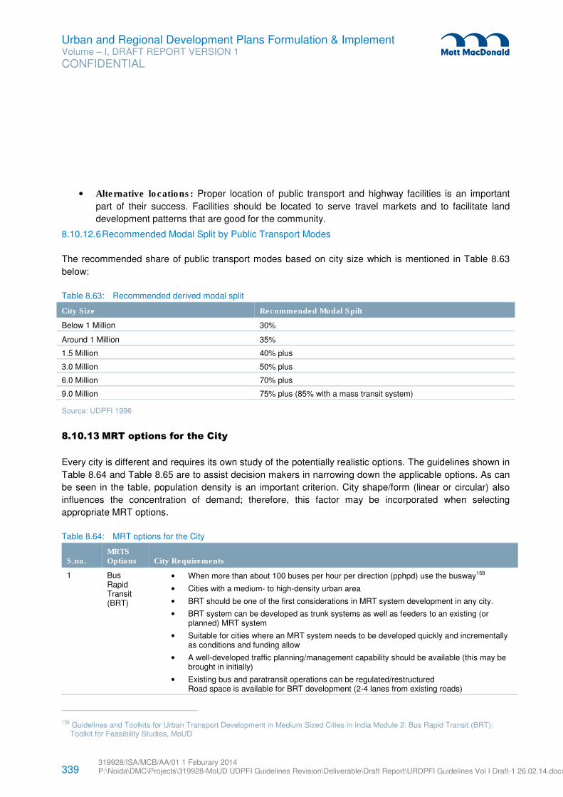
339 319928/ISA/MCB/AA/01 1 Feburary 2014 P:\Noida\DMC\Projects\319928-MoUD UDPFI Guidelines Revision\Deliverable\Draft Report\URDPFI Guidelines Vol I Draft-1 26.02.14.docx
Urban and Regional Development Plans Formulation & Implement Volume – I, DRAFT REPORT VERSION 1
CONFIDENTIAL
• Alternative locations: Proper location of public transport and highway facilities is an important
part of their success. Facilities should be located to serve travel markets and to facilitate land
development patterns that are good for the community.
8.10.12.6 Recommended Modal Split by Public Transport Modes
The recommended share of public transport modes based on city size which is mentioned in Table 8.63
below:
Table 8.63: Recommended derived modal split
City Size Recommended Modal Spilt
Below 1 Million 30%
Around 1 Million 35%
1.5 Million 40% plus
3.0 Million 50% plus
6.0 Million 70% plus
9.0 Million 75% plus (85% with a mass transit system)
Source: UDPFI 1996
8.10.13 MRT options for the City
Every city is different and requires its own study of the potentially realistic options. The guidelines shown in
Table 8.64 and Table 8.65 are to assist decision makers in narrowing down the applicable options. As can
be seen in the table, population density is an important criterion. City shape/form (linear or circular) also
influences the concentration of demand; therefore, this factor may be incorporated when selecting
appropriate MRT options.
Table 8.64: MRT options for the City
S.no. MRTS Options City Requirements
1 Bus Rapid Transit (BRT)
• When more than about 100 buses per hour per direction (pphpd) use the busway158
• Cities with a medium- to high-density urban area
• BRT should be one of the first considerations in MRT system development in any city.
• BRT system can be developed as trunk systems as well as feeders to an existing (or planned) MRT system
• Suitable for cities where an MRT system needs to be developed quickly and incrementally as conditions and funding allow
• A well-developed traffic planning/management capability should be available (this may be brought in initially)
• Existing bus and paratransit operations can be regulated/restructured Road space is available for BRT development (2-4 lanes from existing roads)
158 Guidelines and Toolkits for Urban Transport Development in Medium Sized Cities in India Module 2: Bus Rapid Transit (BRT):
Toolkit for Feasibility Studies, MoUD
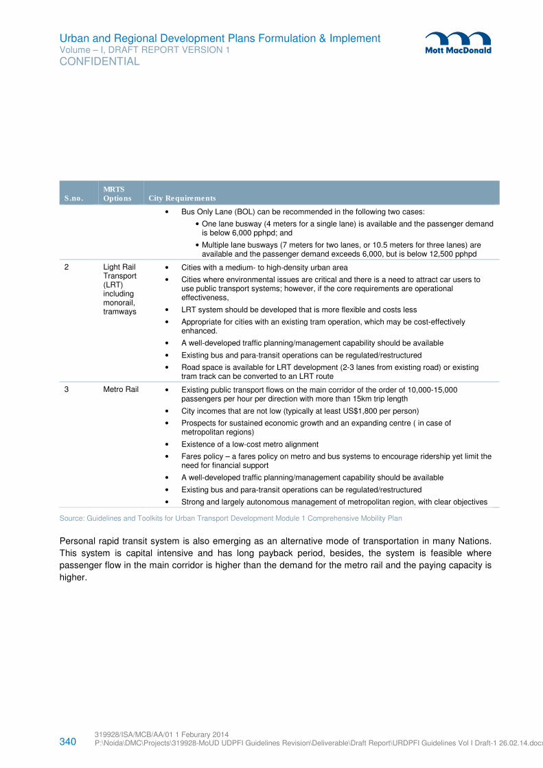
340 319928/ISA/MCB/AA/01 1 Feburary 2014 P:\Noida\DMC\Projects\319928-MoUD UDPFI Guidelines Revision\Deliverable\Draft Report\URDPFI Guidelines Vol I Draft-1 26.02.14.docx
Urban and Regional Development Plans Formulation & Implement Volume – I, DRAFT REPORT VERSION 1
CONFIDENTIAL
S.no. MRTS Options City Requirements
• Bus Only Lane (BOL) can be recommended in the following two cases:
• One lane busway (4 meters for a single lane) is available and the passenger demand is below 6,000 pphpd; and
• Multiple lane busways (7 meters for two lanes, or 10.5 meters for three lanes) are available and the passenger demand exceeds 6,000, but is below 12,500 pphpd
2 Light Rail Transport (LRT) including monorail, tramways
• Cities with a medium- to high-density urban area
• Cities where environmental issues are critical and there is a need to attract car users to use public transport systems; however, if the core requirements are operational effectiveness,
• LRT system should be developed that is more flexible and costs less
• Appropriate for cities with an existing tram operation, which may be cost-effectively enhanced.
• A well-developed traffic planning/management capability should be available
• Existing bus and para-transit operations can be regulated/restructured
• Road space is available for LRT development (2-3 lanes from existing road) or existing tram track can be converted to an LRT route
3 Metro Rail • Existing public transport flows on the main corridor of the order of 10,000-15,000 passengers per hour per direction with more than 15km trip length
• City incomes that are not low (typically at least US$1,800 per person)
• Prospects for sustained economic growth and an expanding centre ( in case of metropolitan regions)
• Existence of a low-cost metro alignment
• Fares policy – a fares policy on metro and bus systems to encourage ridership yet limit the need for financial support
• A well-developed traffic planning/management capability should be available
• Existing bus and para-transit operations can be regulated/restructured
• Strong and largely autonomous management of metropolitan region, with clear objectives
Source: Guidelines and Toolkits for Urban Transport Development Module 1 Comprehensive Mobility Plan
Personal rapid transit system is also emerging as an alternative mode of transportation in many Nations.
This system is capital intensive and has long payback period, besides, the system is feasible where
passenger flow in the main corridor is higher than the demand for the metro rail and the paying capacity is
higher.
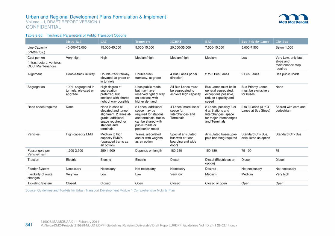
341 319928/ISA/MCB/AA/01 1 Feburary 2014 P:\Noida\DMC\Projects\319928-MoUD UDPFI Guidelines Revision\Deliverable\Draft Report\URDPFI Guidelines Vol I Draft-1 26.02.14.docx
Urban and Regional Development Plans Formulation & Implement Volume – I, DRAFT REPORT VERSION 1
CONFIDENTIAL
Table 8.65: Technical Parameters of Public Transport Options
Metro Rail LRT Tramways HCBRT BRT Bus Priority Lanes City Bus
Line Capacity
(PAX/hr/dir.)
40,000-75,000 15,000-45,000 5,000-15,000 20,000-35,000 7,500-15,000 5,000-7,500 Below 1,000
Cost per km
(Infrastructure, vehicles, OCC, Maintenance)
Very high High Medium/high Medium/high Medium Low Very Low, only bus stops and maintenance stop required
Alignment Double-track railway Double-track railway, elevated, at grade or in tunnels
Double-track tramway, at-grade
4 Bus Lanes (2 per direction)
2 to 3 Bus Lanes 2 Bus Lanes Use public roads
Segregation 100% segregated in tunnels, elevated or at-grade
High degree of segregation preferred, but sections with shared right of way possible
Uses public roads, but may have reserved right of way on sections with higher demand
All Bus Lanes must be segregated to achieve high capacity
Bus Lanes must be in general segregated, exceptions possible, reduce capacity and speed
Bus Priority Lanes must be exclusively for buses
None
Road space required None None in case of elevated and tunnel alignment, 2 lanes at-grade, additional space required for stations and terminals
2 Lanes, additional space may be required for stations and terminals, tracks can be shared with public roads or pedestrian roads
4 Lanes; more linear space for Interchanges and Terminals
2 Lanes, possibly 3 or 4 at Stations and Interchanges, space for major Interchanges and Terminals
2 to 3 Lanes (3 to 4 Lanes at Bus Stops)
Shared with cars and pedestrian
Vehicles High capacity EMU Medium to high capacity EMU’s (upgraded trams as an option)
Trams, articulated and/or with wagons as an option
Special articulated bus with at-floor boarding and wide doors
Articulated buses; pre-paid boarding required
Standard City Bus, articulated as option
Standard City Bus
Passengers per Vehicle/Train
1,200-2,500 250-1,500 Depends on length 180-240 150-180 75-100 75
Traction Electric Electric Electric Diesel Diesel (Electric as an option)
Diesel Diesel
Feeder System Necessary Necessary Not necessary Necessary Desired Not necessary Not necessary
Flexibility of route changes
Very low Low Low Very low Medium Medium Very high
Ticketing System Closed Closed Open Closed Closed or open Open Open
Source: Guidelines and Toolkits for Urban Transport Development Module 1 Comprehensive Mobility Plan
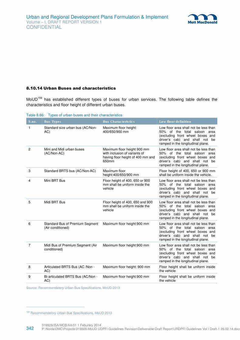
342 319928/ISA/MCB/AA/01 1 Feburary 2014 P:\Noida\DMC\Projects\319928-MoUD UDPFI Guidelines Revision\Deliverable\Draft Report\URDPFI Guidelines Vol I Draft-1 26.02.14.docx
Urban and Regional Development Plans Formulation & Implement Volume – I, DRAFT REPORT VERSION 1
CONFIDENTIAL
8.10.14 Urban Buses and characteristics
MoUD159
has established different types of buses for urban services. The following table defines the
characteristics and floor height of different urban buses.
Table 8.66: Types of urban buses and their characteristics
S.no. Bus Types Bus Characteristics Low floor definition
1 Standard size urban bus (AC/Non-AC)
Maximum floor height: 400/650/900 mm
Low floor area shall not be less than 50% of the total saloon area (excluding front wheel boxes and driver’s cab) and shall not be ramped in the longitudinal plane.
2 Mini and Midi urban buses (AC/Non-AC)
Maximum floor height 900 mm with inclusion of variants of having floor height of 400 mm and 650mm
Low floor area shall not be less than 50% of the total saloon area (excluding front wheel boxes and driver’s cab) and shall not be ramped in the longitudinal plane.
3 Standard BRTS bus (AC/Non-AC) Maximum floor height:400/650/900 mm
Floor height of 400, 650 or 900 mm shall be uniform inside the vehicle.
4 Mini BRT Bus Floor height of 400, 650 or 900 mm shall be uniform inside the vehicle
Low floor area shall not be less than 50% of the total saloon area (excluding front wheel boxes and driver’s cab) and shall not be ramped in the longitudinal plane.
5 Midi BRT Bus Floor height of 400, 650 and 900 mm shall be uniform inside the vehicle
Low floor area shall not be less than 50% of the total saloon area (excluding front wheel boxes and driver’s cab) and shall not be ramped in the longitudinal plane.
6 Standard Bus of Premium Segment (Air conditioned)
Maximum floor height:900 mm Low floor area shall not be less than 50% of the total saloon area (excluding front wheel boxes and driver’s cab) and shall not be ramped in the longitudinal plane.
7 Midi Bus of Premium Segment (Air conditioned)
Maximum floor height:900 mm Low floor area shall not be less than 50% of the total saloon area (excluding front wheel boxes and driver’s cab) and shall not be ramped in the longitudinal plane.
8 Articulated BRTS Bus (AC /Non -AC)
Maximum floor height: 900 mm Floor height shall be uniform inside the vehicle
9 Bi-articulated BRTS Bus (AC/Non -AC)
Maximum floor height:900 mm Floor height shall be uniform inside the vehicle
Source: Recommendatory Urban Bus Specifications, MoUD 2013
159 Recommendatory Urban Bus Specifications, MoUD 2013
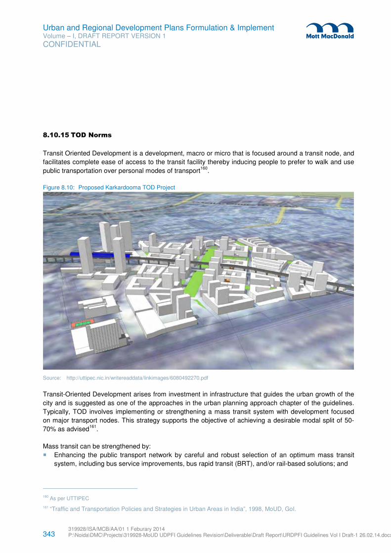
343 319928/ISA/MCB/AA/01 1 Feburary 2014 P:\Noida\DMC\Projects\319928-MoUD UDPFI Guidelines Revision\Deliverable\Draft Report\URDPFI Guidelines Vol I Draft-1 26.02.14.docx
Urban and Regional Development Plans Formulation & Implement Volume – I, DRAFT REPORT VERSION 1
CONFIDENTIAL
8.10.15 TOD Norms
Transit Oriented Development is a development, macro or micro that is focused around a transit node, and
facilitates complete ease of access to the transit facility thereby inducing people to prefer to walk and use
public transportation over personal modes of transport160
.
Figure 8.10: Proposed Karkardooma TOD Project
Source: http://uttipec.nic.in/writereaddata/linkimages/6080492270.pdf
Transit-Oriented Development arises from investment in infrastructure that guides the urban growth of the
city and is suggested as one of the approaches in the urban planning approach chapter of the guidelines.
Typically, TOD involves implementing or strengthening a mass transit system with development focused
on major transport nodes. This strategy supports the objective of achieving a desirable modal split of 50-
70% as advised161
.
Mass transit can be strengthened by:
� Enhancing the public transport network by careful and robust selection of an optimum mass transit
system, including bus service improvements, bus rapid transit (BRT), and/or rail-based solutions; and
160 As per UTTIPEC
161 “Traffic and Transportation Policies and Strategies in Urban Areas in India”, 1998, MoUD, GoI.
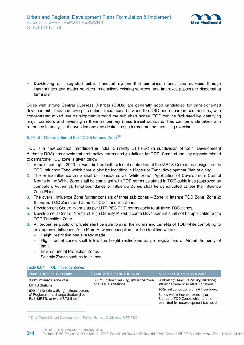
344 319928/ISA/MCB/AA/01 1 Feburary 2014 P:\Noida\DMC\Projects\319928-MoUD UDPFI Guidelines Revision\Deliverable\Draft Report\URDPFI Guidelines Vol I Draft-1 26.02.14.docx
Urban and Regional Development Plans Formulation & Implement Volume – I, DRAFT REPORT VERSION 1
CONFIDENTIAL
� Developing an integrated public transport system that combines modes and services through
interchanges and feeder services, rationalises existing services, and improves passenger dispersal at
terminals
Cities with strong Central Business Districts (CBDs) are generally good candidates for transit-oriented
development. Trips can take place along radial axes between the CBD and suburban communities, with
concentrated mixed use development around the suburban nodes. TOD can be facilitated by identifying
major corridors and investing in them as primary mass transit corridors. This can be undertaken with
reference to analysis of travel demand and desire line patterns from the modelling exercise.
8.10.15.1 Demarcation of the TOD Influence Zone162
TOD is a new concept introduced in India. Currently UTTIPEC (a subdivision of Delhi Development
Authority DDA) has developed draft policy norms and guidelines for TOD. Some of the key aspects related
to demarcate TOD zone is given below:
1. A maximum upto 2000 m. wide belt on both sides of centre line of the MRTS Corridor is designated as
TOD Influence Zone which should also be identified in Master or Zonal development Plan of a city.
2. The entire influence zone shall be considered as “white zone”. Application of Development Control
Norms in the White Zone shall be compliant with TOD norms as stated in TOD guidelines (approved by
competent Authority). Final boundaries of Influence Zones shall be demarcated as per the Influence
Zone Plans.
3. The overall Influence Zone further consists of three sub zones – Zone 1: Intense TOD Zone, Zone 2:
Standard TOD Zone, and Zone 3: TOD Transition Zone.
4. Development Control Norms as per UTTIPEC TOD norms apply to all three TOD zones.
5. Development Control Norms of High Density Mixed Income Development shall not be applicable to the
TOD Transition Zone.
6. All properties public or private shall be able to avail the norms and benefits of TOD while complying to
an approved Influence Zone Plan, However exception can be identified where:
– Height restriction has already made.
– Flight funnel zones shall follow the height restrictions as per regulations of Airport Authority of
India.
– Environmental Protection Zones
– Seismic Zones such as fault lines.
Table 8.67: TOD Influence Zones
Zone 1: Intense TOD Zone Zone 2: Standard TOD Zone Zone 3: TOD Transition Zone
300m influence zone of all
MRTS Stations
800m* (10-min walking) influence zone of Regional Interchange Station (i.e. Rail -MRTS, or two MRTS lines.)
800m* (10-min walking) influence zone of all MRTS Stations.
2000m** (10-minute cycling distance) influence zone of all MRTS Stations.
300m influence zone of BRT corridors.
Zones within Intense (zone 1) or Standard TOD Zones which are not permitted for redevelopment but need
162 Draft Transit Orient Development – Policy, Norms , Guidelines, UTTIPEC
345 319928/ISA/MCB/AA/01 1 Feburary 2014 P:\Noida\DMC\Projects\319928-MoUD UDPFI Guidelines Revision\Deliverable\Draft Report\URDPFI Guidelines Vol I Draft-1 26.02.14.docx
Urban and Regional Development Plans Formulation & Implement Volume – I, DRAFT REPORT VERSION 1
CONFIDENTIAL
Zone 1: Intense TOD Zone Zone 2: Standard TOD Zone Zone 3: TOD Transition Zone
enhancements in public realm and network connectivity.
Source: Draft Transit Orient Development – Policy, Norms, Guidelines, UTTIPEC
8.10.15.2 Development Types within Influence Zones163
Broadly the types of planned and unplanned development which may fall within the Zone 1: Intense TOD
influence zones and Zone 2: Standard TOD may be categorized into three broad categories:
Redevelopment/ Infill – Sites within the Intense/ Standard TOD Zones are those within Existing Urban
Area and suitable for development/ redevelopment.
1. Infill Sites are empty sites within Existing Urban Area which may have opened up for development.
2. Redevelopment sites could be any of the following:
i. Low density areas with gross density less than 250 du/ha
ii. Shopping/ Commercial centres
iii. Industrial areas/ clusters
iv. Resettlement Colonies
v. Unauthorized colonies
vi. Urban Villages
vii. JJ clusters
Greenfield – Sites within the Intense/ Standard TOD Zones which are in the Urban Extension Area where
provision of road networks, services and social facilities has not yet taken place.
Retrofit – In addition to TOD Transition Zones, sites within Intense/ Standard Zones which have existing
gross density higher than 250 du/ha may not be suitable for redevelopment, but may need retrofitting to
meet TOD Zone requirements. The following criteria may be used as benchmarks for selecting such dense
sites for need for retrofitting:
1. Lack of street network and connectivity
2. Lack of fire access to buildings.
3. Lack of adequate physical and social infrastructure facilities.
Hence depending upon the requirement of the area, to which TOD is applied, the influence zone plan is to
be prepared.
8.10.15.3 Influence Zone Plan
A Detailed Influence Zone Plan is a document that provides a framework and vision for future TOD
development for MRTS. Any public or private development within the Influence Zone Plan Areas must
adhere to the overall strategies, framework and benchmarks provided by the Plan. The Plan shall be
163 Draft Transit Orient Development – Policy, Norms , Guidelines, UTTIPEC
346 319928/ISA/MCB/AA/01 1 Feburary 2014 P:\Noida\DMC\Projects\319928-MoUD UDPFI Guidelines Revision\Deliverable\Draft Report\URDPFI Guidelines Vol I Draft-1 26.02.14.docx
Urban and Regional Development Plans Formulation & Implement Volume – I, DRAFT REPORT VERSION 1
CONFIDENTIAL
prepared or be approved by the competent Planning Authority for each influence zone area in a phased
manner, customized to site characteristics and context. The plan shall include the following components:
4. Urban Design Framework – This would include:
– Street Network Plan indicating street hierarchy and character
– Landscape and Open Space Structure indicating type of open spaces and distribution of play
areas. To include planting strategy for all street trees.
– Net FAR and residential densities for each block within the Influence Zone
– Vertical mix of uses for each TOD parcel indicating location of civic amenities within mixed –use
blocks. To include location of ‘unbundled’ parking sites for shared use.
– Three-dimensional site briefs for each block within the Influence Zone indicating recommended
massing and organisation of uses.
– Location and numbers of short and long term parking spaces
5. Transport Impact Assessment & Mitigation Strategies – This would include strategies for:
– Achieving the desired modal shift, in particular mode shift for short trips
– Street network improvement through assessment of existing capacity and augmentation of network
as required through new linkages, alternate routes, junction designs etc for all modes with priority
for intermediate public transport, pedestrians, cyclists / NMT.
– Integrated strategy for Public transport, Pedestrian and Cycle access
– Determining the optimum mix of uses to mitigate negative impact on surrounding land uses and
transport networks
– Parking Strategy as a Demand Management Tool
– Mitigation strategies for traffic noise and vibration
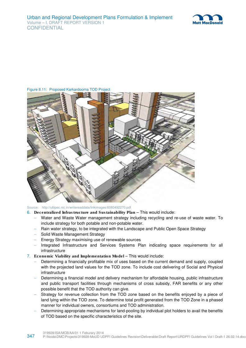
347 319928/ISA/MCB/AA/01 1 Feburary 2014 P:\Noida\DMC\Projects\319928-MoUD UDPFI Guidelines Revision\Deliverable\Draft Report\URDPFI Guidelines Vol I Draft-1 26.02.14.docx
Urban and Regional Development Plans Formulation & Implement Volume – I, DRAFT REPORT VERSION 1
CONFIDENTIAL
Figure 8.11: Proposed Karkardooma TOD Project
Source: http://uttipec.nic.in/writereaddata/linkimages/6080492270.pdf
6. Decentralized Infrastructure and Sustainability Plan – This would include:
– Water and Waste Water management strategy including recycling and re-use of waste water. To
include strategy for both potable and non-potable water.
– Rain water strategy, to be integrated with the Landscape and Public Open Space Strategy
– Solid Waste Management Strategy
– Energy Strategy maximising use of renewable sources
– Integrated Infrastructure and Services Systems Plan indicating space requirements for all
infrastructure
7. Economic Viability and Implementation Model – This would include:
– Determining a financially profitable mix of uses based on the current demand and supply, coupled
with the projected land values for the TOD zone. To include cost delivering of Social and Physical
infrastructure
– Determining a financial model and delivery mechanism for affordable housing, public infrastructure
and public transport facilities through mechanisms of cross subsidy, FAR benefits or any other
possible benefit that the TOD authority can give.
– Strategy for revenue collection from the TOD zone based on the benefits enjoyed by a piece of
land lying within the TOD zone. To determine total profit generated from the TOD Zone in a phased
manner for individual owners, consortiums and TOD administration.
– Determining appropriate mechanisms for land-pooling by individual plot holders to avail the benefits
of TOD based on the specific characteristics of the site.
348 319928/ISA/MCB/AA/01 1 Feburary 2014 P:\Noida\DMC\Projects\319928-MoUD UDPFI Guidelines Revision\Deliverable\Draft Report\URDPFI Guidelines Vol I Draft-1 26.02.14.docx
Urban and Regional Development Plans Formulation & Implement Volume – I, DRAFT REPORT VERSION 1
CONFIDENTIAL
– Determining the structure of the administrative body of the TOD zone and the cost of operation of
the body.
– Strategy for implementing the TOD policy in the TOD zone through the principle of award and
penalty.
Note: After preparation of Influence Zone Plans for Urban Extension areas, the TOD Zones shall
accommodate substantially greater proportion of the population of planned areas of Zonal Plans, which
may therefore require subsequent modification.
8.10.15.4 Redevelopment Criteria and Minimum Project Size Criteria164
Policy:
� Redevelopment within developed areas of the city would be permitted only when an overall Influence
Zone Plan has been prepared for the Station. This is to ensure that local street networks, physical and
social infrastructure and shared parking facilities have been planned for the area, before densification
commences.
� For achieving the higher FAR it would be desirable to incentivize amalgamation of plots as well as
make appropriate amendments in the bye laws, as per TOD norms. However, though amalgamation is
desirable but it may not be a pre-requisite. Densification should be allowed in all plot sizes subject to
the project complying to the approved Influence Zone Plan, so that incremental development and
densification can start taking place.
� It is highly inappropriate to allow land banking in TOD zones. Penalties such as vacant land tax, etc. on
underutilized land and/or underutilized FAR could be levied, in order to ensure time bound densification
along with MRTS corridor. Such penalties should apply to all developers as well as Govt. bodies, to
event inefficient use of valuable land.
Norms:
1. If Influence Zone layout plan for the station area does not exist, no individual developments with TOD
norms shall be permitted.
2. If Influence Zone Plan for the station area exists:
i. Any projects size of equal or more than 50 Ha may be taken up for development/ infill or
redevelopment, if in adherence to the influence zone plan prepared by the Planning Authority.
ii. Individual buildings shall be given sanction by the concerned authority within the framework of
the overall influence zone plan.
iii. For projects accommodating more than 5000 residential population, the residents/ cooperative
societies/ private developers should get the detailed layout and services plan prepared in
consultation with the concerned authority for final approval.
164 Draft Transit Orient Development – Policy, Norms , Guidelines, UTTIPEC
349 319928/ISA/MCB/AA/01 1 Feburary 2014 P:\Noida\DMC\Projects\319928-MoUD UDPFI Guidelines Revision\Deliverable\Draft Report\URDPFI Guidelines Vol I Draft-1 26.02.14.docx
Urban and Regional Development Plans Formulation & Implement Volume – I, DRAFT REPORT VERSION 1
CONFIDENTIAL
8.10.15.5 TOD Development Control Norms165
The TOD mainly has 6 components for which the DCR is to be developed by development authorities. These components are as following:
1. Pedestrian & Cycle/ Cycle-Rickshaw Friendly Environment
2. Connectivity: Create dense networks of streets and paths for all modes.
3. Multi-modal Interchange: Mass transportation modes servicing the area should be well integrated to
afford rapid and comfortable modal transfers.
4. Modal Shift Measures: Shift to Sustainable Modes by using Design, Technology, Road Use Regulation,
Mixed-Use, Parking Policy and Fiscal Measures
5. Placemaking and Safety: Urban places should be designed for enjoyment, relaxation and equity.
6. High Density, Mixed-Income Development: Compact Neighbourhoods for Shorter Commutes and
equity for all sections of society.
Policy details and development norms for each of the above components are provided in Draft Transit
Orient Development – Policy, Norms, Guidelines issued by UTTIPEC166
, which is the only guideline
available in India at present and can be referred for TOD projects. However, any latest and more
comprehensive document and case studies can also be referred for this exercise.
8.10.16 Non-Motorised vehicles (NMV)
As per Guidelines and Toolkits for Urban Transport Development in Medium Sized Cities in India prepared
by MoUD and ADB, Non-Motorised Transport (NMT) measures proposed by an Indian city should conform
to existing policy at National, State and City level. National Urban Transport Policy has also encouraged
using NMVs by offering Central financial assistance for this purpose. As per MoUD guidelines, NMVs can
be promoted through the following initiatives:
� Providing better facilities to accommodate existing NMV use and encourage more NMVs through
visible infrastructure;
� Developing a strategic NMV plan including a network of routes available to NMVs throughout the city;
� Segregating NMVs/MVs to improve safety and smooth passage of NMVs;
� Promoting freight NMVs for the transport and delivery of small goods to markets and shopping areas;
� Identifying sub-projects which make positive, pro-active provision for NMVs as part of a balanced
approach to traffic planning;
� Giving NMVs priority over MVs on selected routes and in selected areas;
� Strengthening Road User Education (RUE) programmes for NMV users to improve behaviour and road
safety;
� Rationalising and improving NMV registration, licensing for use as a PT or freight vehicle, regulation
and enforcement
165 Draft Transit Orient Development – Policy, Norms , Guidelines, UTTIPEC
166 The document is available at www.uttipec.nic.in
350 319928/ISA/MCB/AA/01 1 Feburary 2014 P:\Noida\DMC\Projects\319928-MoUD UDPFI Guidelines Revision\Deliverable\Draft Report\URDPFI Guidelines Vol I Draft-1 26.02.14.docx
Urban and Regional Development Plans Formulation & Implement Volume – I, DRAFT REPORT VERSION 1
CONFIDENTIAL
� Various initiates and programmes taken-up by Ministry of Road Transport and Highways in the
direction.
It has also been suggested by MoUD that NMV measures can be implemented either as mandatory or
advisory. Mandatory measures are ‘formal’ and require to be backed up by appropriate traffic regulations.
For example, part of the highway may be designated for NMVs only. Advisory measures are usually
designed to encourage NMV use, or where mandatory measures are difficult to implement due to the
requirement of traffic regulations or the practicalities of accommodating motorized vehicles within limited
road space. For example, part of the highway may be allocated for NMVs, but MVs would be allowed to
encroach for side accesses or when traffic volume is high. Even advisory measures can incur costs such
improved road surfacing or removal of physical obstructions to ensure that NMV passage is smooth and
comfortable.
MoUD has also recommended that segregation of NMVs and Motor Vehicles (MVs) is well suited for Indian
scenario. Segregated NMV measures can take the form of dedicated lanes within the highway (with
physical dividers or simple line demarcation) either with-flow or contra-flow, and streets that prohibit motor
vehicles. Mixed flow measures allow all types of traffic to mix within the highway and are typically a do-
nothing or minimum case, though some treatments can be implemented to improve the comfort level of
NMVs or provide priority, e.g. at intersections. It also offers safe and efficient network for NMVs.
8.10.17 Inland Water Transportation
Water based transport is effective as generally speaking, operating costs of fuel are low and environmental
pollution is lower than for corresponding volumes of movement by road, rail or air. A major advantage is
that the main infrastructure – the waterway – is often naturally available167
.
In India, a number of central and state agencies play crucial role in the regulation, operation and
sustenance of Inland Water Transport (IWT). Their smooth functioning is required for IWT to be viable.
Some of the actors in this sector are given below.
� Inland Waterways Authority of India (IWAI)
� Central Inland Water Transport Corporation (CIWTC)
� State governments
� Port authorities
� Transport development agencies
� Customers
As per constitutional provisions, only those waterways which are declared as National Waterways come
under the purview of Central Government while rest of waterways remain in the purview of respective State
Government. Since formation of IWAI, five waterways namely:
1. Ganga
167 Rangaraj N and Raghuram G, Viability of Inland Water Transport in India,
http://www.ieor.iitb.ac.in/files/faculty/narayan/transport/iwt-tec-rep-oct-05.pdf
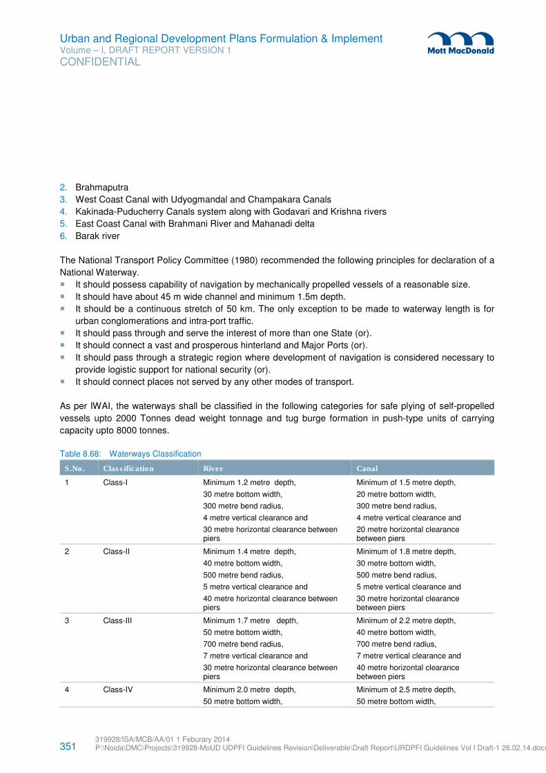
351 319928/ISA/MCB/AA/01 1 Feburary 2014 P:\Noida\DMC\Projects\319928-MoUD UDPFI Guidelines Revision\Deliverable\Draft Report\URDPFI Guidelines Vol I Draft-1 26.02.14.docx
Urban and Regional Development Plans Formulation & Implement Volume – I, DRAFT REPORT VERSION 1
CONFIDENTIAL
2. Brahmaputra
3. West Coast Canal with Udyogmandal and Champakara Canals
4. Kakinada-Puducherry Canals system along with Godavari and Krishna rivers
5. East Coast Canal with Brahmani River and Mahanadi delta
6. Barak river
The National Transport Policy Committee (1980) recommended the following principles for declaration of a
National Waterway.
� It should possess capability of navigation by mechanically propelled vessels of a reasonable size.
� It should have about 45 m wide channel and minimum 1.5m depth.
� It should be a continuous stretch of 50 km. The only exception to be made to waterway length is for
urban conglomerations and intra-port traffic.
� It should pass through and serve the interest of more than one State (or).
� It should connect a vast and prosperous hinterland and Major Ports (or).
� It should pass through a strategic region where development of navigation is considered necessary to
provide logistic support for national security (or).
� It should connect places not served by any other modes of transport.
As per IWAI, the waterways shall be classified in the following categories for safe plying of self-propelled
vessels upto 2000 Tonnes dead weight tonnage and tug burge formation in push-type units of carrying
capacity upto 8000 tonnes.
Table 8.68: Waterways Classification
S.No. Classification River Canal
1 Class-I Minimum 1.2 metre depth,
30 metre bottom width,
300 metre bend radius,
4 metre vertical clearance and
30 metre horizontal clearance between piers
Minimum of 1.5 metre depth,
20 metre bottom width,
300 metre bend radius,
4 metre vertical clearance and
20 metre horizontal clearance between piers
2 Class-II Minimum 1.4 metre depth,
40 metre bottom width,
500 metre bend radius,
5 metre vertical clearance and
40 metre horizontal clearance between piers
Minimum of 1.8 metre depth,
30 metre bottom width,
500 metre bend radius,
5 metre vertical clearance and
30 metre horizontal clearance between piers
3 Class-III Minimum 1.7 metre depth,
50 metre bottom width,
700 metre bend radius,
7 metre vertical clearance and
30 metre horizontal clearance between piers
Minimum of 2.2 metre depth,
40 metre bottom width,
700 metre bend radius,
7 metre vertical clearance and
40 metre horizontal clearance between piers
4 Class-IV Minimum 2.0 metre depth,
50 metre bottom width,
Minimum of 2.5 metre depth,
50 metre bottom width,
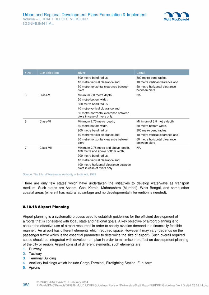
352 319928/ISA/MCB/AA/01 1 Feburary 2014 P:\Noida\DMC\Projects\319928-MoUD UDPFI Guidelines Revision\Deliverable\Draft Report\URDPFI Guidelines Vol I Draft-1 26.02.14.docx
Urban and Regional Development Plans Formulation & Implement Volume – I, DRAFT REPORT VERSION 1
CONFIDENTIAL
S.No. Classification River Canal
800 metre bend radius,
10 metre vertical clearance and
50 metre horizontal clearance between piers
800 metre bend radius,
10 metre vertical clearance and
50 metre horizontal clearance between piers
5 Class-V Minimum 2.0 metre depth,
50 metre bottom width,
800 metre bend radius,
10 metre vertical clearance and
80 metre horizontal clearance between piers in case of rivers only.
NA
6 Class-VI Minimum 2.75 metre depth,
80 metre bottom width,
900 metre bend radius,
10 metre vertical clearance and
80 metre horizontal clearance between piers
Minimum of 3.5 metre depth,
60 metre bottom width,
900 metre bend radius,
10 metre vertical clearance and
60 metre horizontal clearance between piers
7 Class-VII Minimum 2.75 metre and above depth, 100 metre and above bottom width,
900 metre bend radius,
10 metre vertical clearance and
100 metre horizontal clearance between piers in case of rivers only
NA
Source: The Inland Waterways Authority of India Act, 1985
There are only few states which have undertaken the initiatives to develop waterways as transport
medium. Such states are Assam, Goa, Kerala, Maharashtra (Mumbai), West Bengal, and some other
coastal areas (where it has natural advantage and no developmental intervention is needed).
8.10.18 Airport Planning
Airport planning is a systematic process used to establish guidelines for the efficient development of
airports that is consistent with local, state and national goals. A key objective of airport planning is to
assure the effective use of airport resources in order to satisfy aviation demand in a financially feasible
manner. An airport has different elements which required space. However it may vary (depends on the
passenger traffic which is the essential parameter to determine the size of airport). Such overall required
space should be integrated with development plan in order to minimise the effect on development planning
of the city or region. Airport consist of different elements, such elements are:
1. Runway
2. Taxiway
3. Terminal Building
4. Ancillary buildings which include Cargo Terminal, Firefighting Station, Fuel farm
5. Aprons
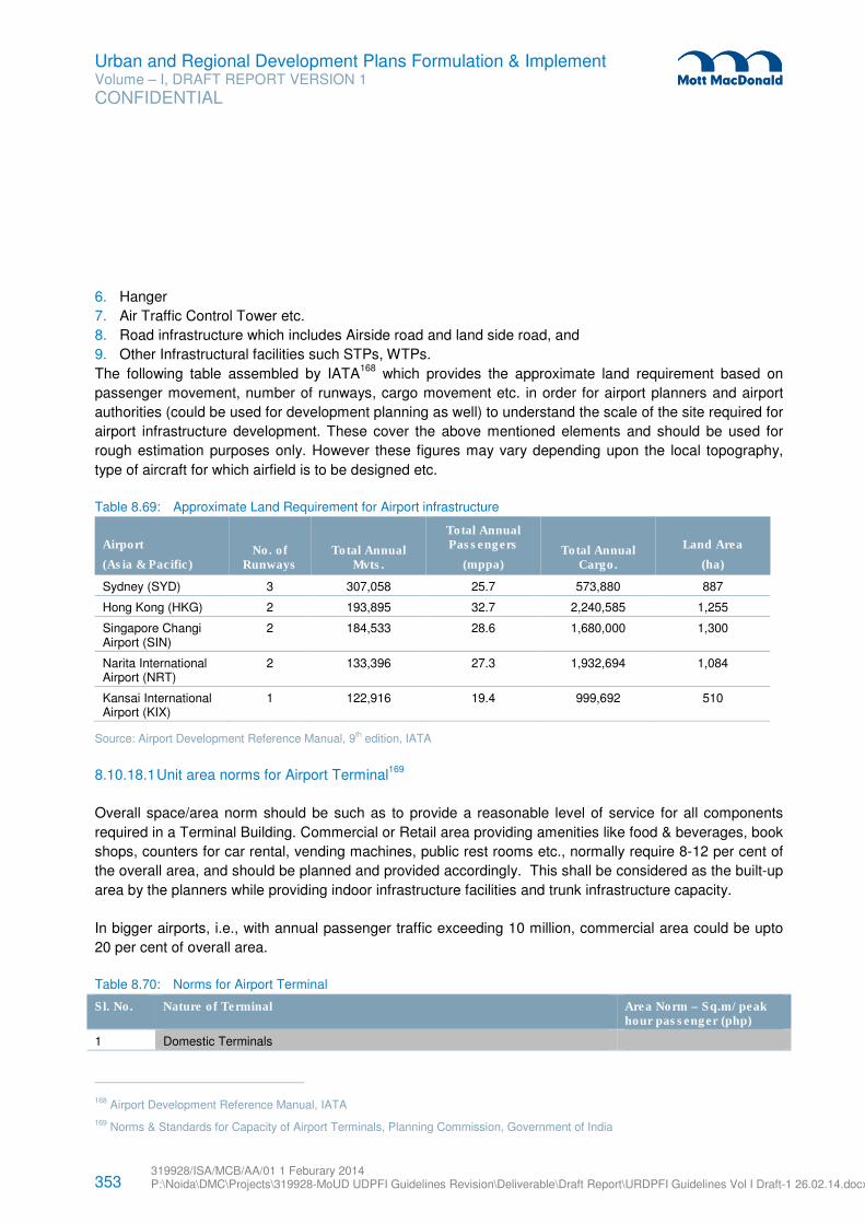
353 319928/ISA/MCB/AA/01 1 Feburary 2014 P:\Noida\DMC\Projects\319928-MoUD UDPFI Guidelines Revision\Deliverable\Draft Report\URDPFI Guidelines Vol I Draft-1 26.02.14.docx
Urban and Regional Development Plans Formulation & Implement Volume – I, DRAFT REPORT VERSION 1
CONFIDENTIAL
6. Hanger
7. Air Traffic Control Tower etc.
8. Road infrastructure which includes Airside road and land side road, and
9. Other Infrastructural facilities such STPs, WTPs.
The following table assembled by IATA168
which provides the approximate land requirement based on
passenger movement, number of runways, cargo movement etc. in order for airport planners and airport
authorities (could be used for development planning as well) to understand the scale of the site required for
airport infrastructure development. These cover the above mentioned elements and should be used for
rough estimation purposes only. However these figures may vary depending upon the local topography,
type of aircraft for which airfield is to be designed etc.
Table 8.69: Approximate Land Requirement for Airport infrastructure
Airport
(Asia & Pacific) No. of
Runways Total Annual
Mvts.
Total Annual Passengers
(mppa) Total Annual
Cargo.
Land Area
(ha)
Sydney (SYD) 3 307,058 25.7 573,880 887
Hong Kong (HKG) 2 193,895 32.7 2,240,585 1,255
Singapore Changi Airport (SIN)
2 184,533 28.6 1,680,000 1,300
Narita International Airport (NRT)
2 133,396 27.3 1,932,694 1,084
Kansai International Airport (KIX)
1 122,916 19.4 999,692 510
Source: Airport Development Reference Manual, 9th edition, IATA
8.10.18.1 Unit area norms for Airport Terminal169
Overall space/area norm should be such as to provide a reasonable level of service for all components
required in a Terminal Building. Commercial or Retail area providing amenities like food & beverages, book
shops, counters for car rental, vending machines, public rest rooms etc., normally require 8-12 per cent of
the overall area, and should be planned and provided accordingly. This shall be considered as the built-up
area by the planners while providing indoor infrastructure facilities and trunk infrastructure capacity.
In bigger airports, i.e., with annual passenger traffic exceeding 10 million, commercial area could be upto
20 per cent of overall area.
Table 8.70: Norms for Airport Terminal
Sl. No. Nature of Terminal Area Norm – Sq.m/ peak hour passenger (php)
1 Domestic Terminals
168 Airport Development Reference Manual, IATA
169 Norms & Standards for Capacity of Airport Terminals, Planning Commission, Government of India
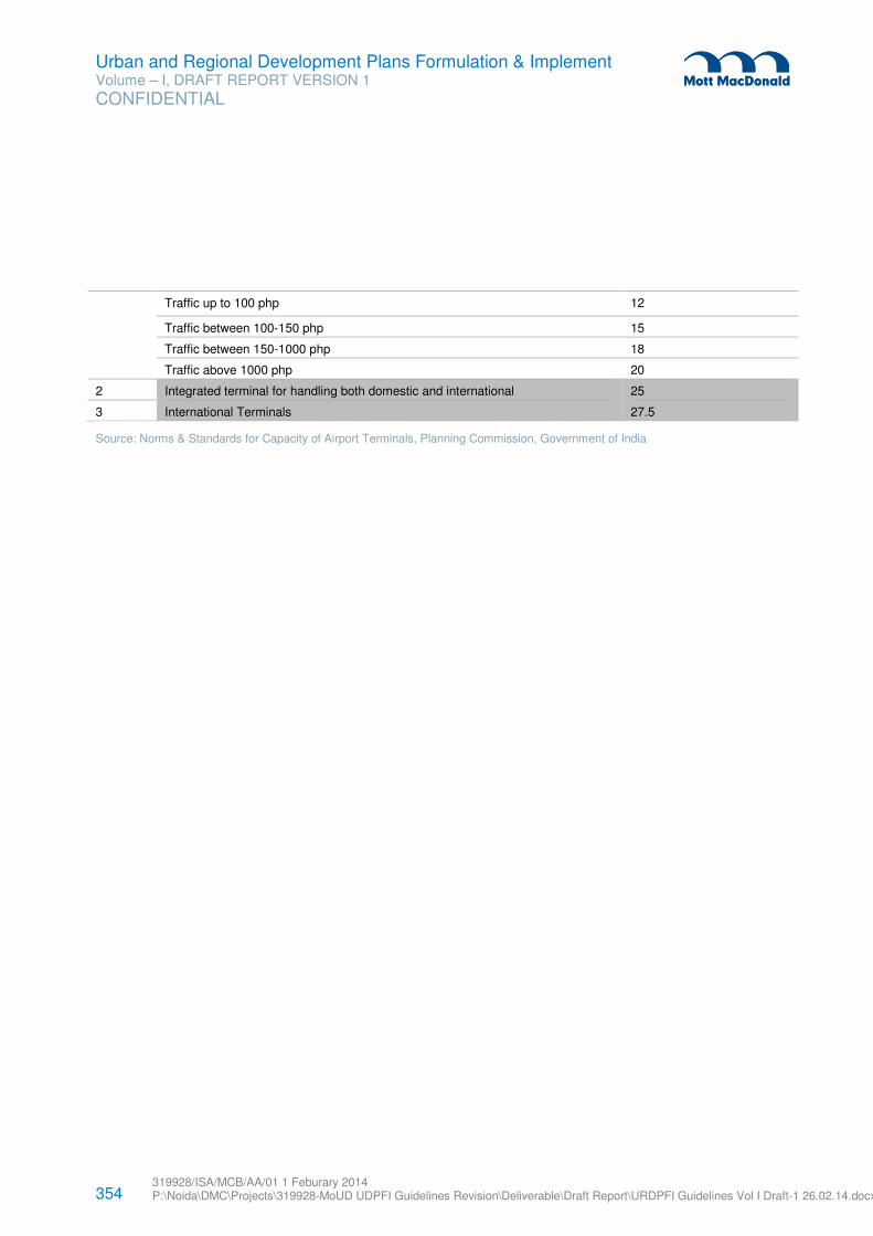
354 319928/ISA/MCB/AA/01 1 Feburary 2014 P:\Noida\DMC\Projects\319928-MoUD UDPFI Guidelines Revision\Deliverable\Draft Report\URDPFI Guidelines Vol I Draft-1 26.02.14.docx
Urban and Regional Development Plans Formulation & Implement Volume – I, DRAFT REPORT VERSION 1
CONFIDENTIAL
Traffic up to 100 php 12
Traffic between 100-150 php 15
Traffic between 150-1000 php 18
Traffic above 1000 php 20
2 Integrated terminal for handling both domestic and international 25
3 International Terminals 27.5
Source: Norms & Standards for Capacity of Airport Terminals, Planning Commission, Government of India
355 319928/ISA/MCB/AA/01 1 Feburary 2014 P:\Noida\DMC\Projects\319928-MoUD UDPFI Guidelines Revision\Deliverable\Draft Report\URDPFI Guidelines Vol I Draft-1 26.02.14.docx
Urban and Regional Development Plans Formulation & Implement Volume – I, DRAFT REPORT VERSION 1
CONFIDENTIAL
The purpose of the Simplified Development Promotion Regulations is to guide the formation of building
regulations by State Departments and by Local Urban Bodies for zonal regulations. These regulations,
besides prescribing the various provisions, also allow freedom to adopt appropriate practices in lines with
the approach to the human settlement, both urban and regional. These can be:
� Development plans for its zonal planning and building designing,
� Fire safety provisions,
� Environmental and geographical variation,
� In case of use of eco-friendly materials,
� Protection and improvement of local environment,
� Socio-economic considerations,
� Towards the creation of sustainable human settlements.
As per the National Building Codes, 2005, ‘Technological and socio-economic developments in recent
times have led to remarkable increase in demand for more and more sophistication in buildings resulting in
ever increasing complexities. These perforce demand high levels of inputs from professionals of different
disciplines such as architecture, civil engineering, structural engineering, functional and life safety services
including special aspects relating to utilities, landscaping, etc in conceptualization, spatial planning, design
and construction of buildings of various material and technology streams, with due regard to various
services including operation, maintenance, repairs and rehabilitation aspects throughout the service life of
the building.’
Apart from the given general regulations, energy efficiency in the building bye-laws to be adopted as per
Energy Conservation Building Code (ECBC). ECBC was launched by Ministry of Power in May 2007. It
sets minimum performance standards for buildings to promote energy efficiency. The National Building
Code – 2005 focuses on energy efficiency in the following:
� Use of Pozzolona in concrete production
� Daylight integration (indoor lighting levels to be met via day lighting)
� Artificial lighting requirements for indoor spaces
� Ventilation standards (natural and mechanical) for optimal human health and wellbeing.
� Electrical standards (min power factor, allowances for diversity etc)
� Select HVAC design norms.
India being a large country with variations from region to region, these regulations may be followed for the
regulating development in the settlement which under no jurisdiction or in case of absence of any statutory
plan to meet the requirements of different regions of the country.
9 Simplified Development Promotion Regulations
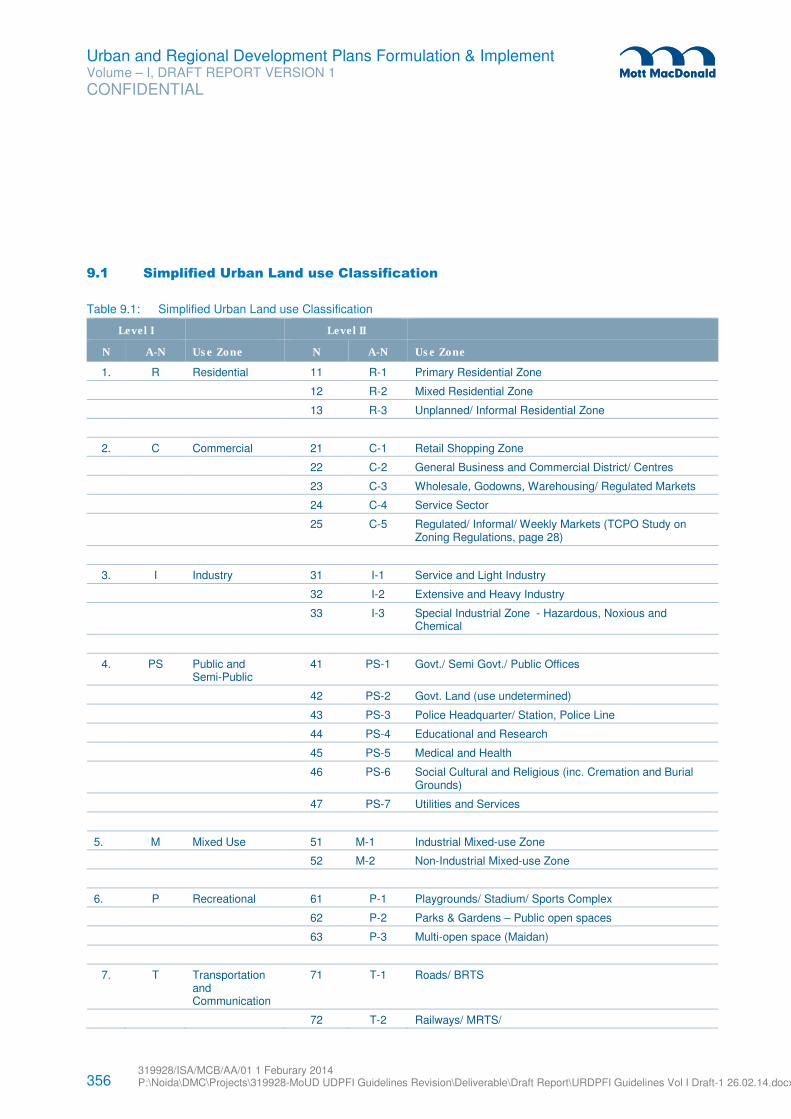
356 319928/ISA/MCB/AA/01 1 Feburary 2014 P:\Noida\DMC\Projects\319928-MoUD UDPFI Guidelines Revision\Deliverable\Draft Report\URDPFI Guidelines Vol I Draft-1 26.02.14.docx
Urban and Regional Development Plans Formulation & Implement Volume – I, DRAFT REPORT VERSION 1
CONFIDENTIAL
9.1 Simplified Urban Land use Classification
Table 9.1: Simplified Urban Land use Classification
Level I Level II
N A-N Use Zone N A-N Use Zone
1. R Residential 11 R-1 Primary Residential Zone
12 R-2 Mixed Residential Zone
13 R-3 Unplanned/ Informal Residential Zone
2. C Commercial 21 C-1 Retail Shopping Zone
22 C-2 General Business and Commercial District/ Centres
23 C-3 Wholesale, Godowns, Warehousing/ Regulated Markets
24 C-4 Service Sector
25 C-5 Regulated/ Informal/ Weekly Markets (TCPO Study on Zoning Regulations, page 28)
3. I Industry 31 I-1 Service and Light Industry
32 I-2 Extensive and Heavy Industry
33 I-3 Special Industrial Zone - Hazardous, Noxious and Chemical
4. PS Public and Semi-Public
41 PS-1 Govt./ Semi Govt./ Public Offices
42 PS-2 Govt. Land (use undetermined)
43 PS-3 Police Headquarter/ Station, Police Line
44 PS-4 Educational and Research
45 PS-5 Medical and Health
46 PS-6 Social Cultural and Religious (inc. Cremation and Burial Grounds)
47 PS-7 Utilities and Services
5. M Mixed Use 51 M-1 Industrial Mixed-use Zone
52 M-2 Non-Industrial Mixed-use Zone
6. P Recreational 61 P-1 Playgrounds/ Stadium/ Sports Complex
62 P-2 Parks & Gardens – Public open spaces
63 P-3 Multi-open space (Maidan)
7. T Transportation and Communication
71 T-1 Roads/ BRTS
72 T-2 Railways/ MRTS/
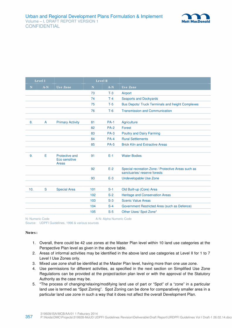
357 319928/ISA/MCB/AA/01 1 Feburary 2014 P:\Noida\DMC\Projects\319928-MoUD UDPFI Guidelines Revision\Deliverable\Draft Report\URDPFI Guidelines Vol I Draft-1 26.02.14.docx
Urban and Regional Development Plans Formulation & Implement Volume – I, DRAFT REPORT VERSION 1
CONFIDENTIAL
Level I Level II
N A-N Use Zone N A-N Use Zone
73 T-3 Airport
74 T-4 Seaports and Dockyards
75 T-5 Bus Depots/ Truck Terminals and freight Complexes
76 T-6 Transmission and Communication
8. A Primary Activity 81 PA-1 Agriculture
82 PA-2 Forest
83 PA-3 Poultry and Dairy Farming
84 PA-4 Rural Settlements
85 PA-5 Brick Kiln and Extractive Areas
9. E Protective and Eco sensitive Areas
91 E-1 Water Bodies
92 E-2 Special recreation Zone / Protective Areas such as sanctuaries/ reserve forests
93 E-3 Undevelopable Use Zone
10. S Special Area 101 S-1 Old Built-up (Core) Area
102 S-2 Heritage and Conservation Areas
103 S-3 Scenic Value Areas
104 S-4 Government Restricted Area (such as Defence)
105 S-5 Other Uses/ Spot Zone*
N: Numeric Code A-N: Alpha Numeric Code
Source: UDPFI Guidelines, 1996 & various sources
Notes:
1. Overall, there could be 42 use zones at the Master Plan level within 10 land use categories at the
Perspective Plan level as given in the above table.
2. Areas of informal activities may be identified in the above land use categories at Level II for 1 to 7
Level I Use Zones only.
3. Mixed use zone shall be identified at the Master Plan level, having more than one use zone.
4. Use permissions for different activities, as specified in the next section on Simplified Use Zone
Regulations can be provided at the project/action plan level or with the approval of the Statutory
Authority as the case may be.
5. *The process of changing/relaxing/modifying land use of part or “Spot” of a “zone” in a particular
land use is termed as “Spot Zoning”. Spot Zoning can be done for comparatively smaller area in a
particular land use zone in such a way that it does not affect the overall Development Plan.
358 319928/ISA/MCB/AA/01 1 Feburary 2014 P:\Noida\DMC\Projects\319928-MoUD UDPFI Guidelines Revision\Deliverable\Draft Report\URDPFI Guidelines Vol I Draft-1 26.02.14.docx
Urban and Regional Development Plans Formulation & Implement Volume – I, DRAFT REPORT VERSION 1
CONFIDENTIAL
6. Use zone regulations for the use permissibility (from the suggestive list) could be decided by the
town planner depending upon the requirement/ feasibility.
7. Appropriate code in terms of both numerical and alphabetic (letter) are provided to facilitate the
reference and to have a simplified procedure to follow.
9.2 Simplified Urban Land use Zoning Regulations
Buildings and premises listed below are ‘Permitted’ normally on specific sites/locations forming part of the
development plan, annual plan and projects. However, this is a suggested list which could be further
enhanced or reduced, as the case may be, depending on the size of the city/town, characteristics and
other relevant factors. The list also contains the buildings/premises which could be allowed on an
application to the Competent Authority if such sites do not form part of the development plan, annual plan
and projects. Such use/activity is termed as ‘Restricted’. The uses/activities which are otherwise not
allowed in a particular use zone are termed as ‘Prohibited’. The activities shall be proposed in the land use
based on its compatibility with surrounding land uses and width of the approach road as the case may be.
1) RESIDENTIAL ( R)
The Residential Use Zone can be subdivided into
1. Primary Residential Zone: R1,
2. Mixed Residential Zone: R2 and
3. Unplanned/ Informal residential Zone: R3.
The activities Permitted, Restricted and Prohibited in Residential land use zone shall be as given below:
Permitted Uses
Residence – plotted, (detached, semi-detached and row housing) group housing houses, residential flat,
residential-cum-work, hostels, boarding and lodging (accommodation for transit employees of Govt./ Local
Bodies) houses, barat ghar/ marriage hall, community hall, old age home, police post, guest houses,
crèches, day care centre, convenience shopping centres, local (retail shopping), medical clinic,
dispensaries, nursing home and health centres (20 bed), dispensary for pets and animals, professional
offices, educational buildings: (nursery, primary, high school, college), school for mentally/ physically
challenged, research institutes, community centres, religious premises , library, gymnasium, park/tot-lots,
plant nursery, technical training centre, yoga centres/health clinics, exhibition and art gallery, clubs, banks/
ATM, police stations, taxi stand/three wheeler stands, bus stops, electrical distribution depot, water
pumping station, post offices, hostels of non-commercial nature, kindergartens, public utilities and buildings
except service and storage yards.
Restricted Uses/Activities
Dharamshala, foreign missions, night shelters, petrol pumps, motor vehicle repairing workshop/garages,
household industry, bakeries and confectionaries, storage of LPG gas cylinders, burial-grounds,
restaurants and hotels, printing press, go-downs/warehousing, bus depots without workshop, cinema hall,
auditoriums, markets for retail goods, weekly markets (if not obstructing traffic circulation and open during
359 319928/ISA/MCB/AA/01 1 Feburary 2014 P:\Noida\DMC\Projects\319928-MoUD UDPFI Guidelines Revision\Deliverable\Draft Report\URDPFI Guidelines Vol I Draft-1 26.02.14.docx
Urban and Regional Development Plans Formulation & Implement Volume – I, DRAFT REPORT VERSION 1
CONFIDENTIAL
non-working hours), informal markets, multipurpose or junior technical shops, transient visitors camp,
municipal, state and central government offices.
Uses/Activities Prohibited
Heavy, large and extensive industries : noxious, obnoxious and hazardous industries, warehousing,
storage go-downs of perishables, hazardous, inflammable goods, workshops for buses etc., slaughter-
housing wholesale mandis, hospitals treating contagious diseases, sewage treatment plant/disposal work,
water treatment plant, solid waste dumping yards, outdoor games stadium, indoor games stadium,
shooting range, zoological garden, botanical garden, bird sanctuary, picnic hut, international conference
centre, courts, sports training centre, reformatory, district battalion office, forensic science laboratory.
2) COMMERCIAL USE (C)
The Commercial zone can be subdivided into
1. Retail Shopping Zone: C1,
2. General Business and Commercial District/ Centres: C2,
3. Wholesale, Go-downs, Warehousing/ Regulated markets: C3,
4. Service Sector: C4 and
5. Regulated/ Informal/ Weekly markets: C5.
The activities Permitted, Restricted and Prohibited in Commercial land use zone shall be as given below:
Permitted Use/Activity
Shops, convenience/neighbourhood shopping centre, local shopping centres, professional offices, work
places/offices, banks, stock exchange/financial institution, bakeries and confectionaries, cinema
hall/theatre, malls, banquet halls, guest houses, restaurants, hotels, weekly market, petrol pumps, go-
downs and warehousing, general business, wholesale, residential plot-group housing, hostel/boarding
housing, hostel, banks/ ATM, restaurants, auditoriums, colleges, nursing homes/medical clinics, pet clinics,
religious places, offices/work places, commercial centres, research/training institute, commercial service
centres/garages/workshop, barat ghar/night shelter, weekly/formal markets, library, parks/open space,
museum, police stations/post, taxi stand/three wheeler stands, parking site, post offices, government/
institutional offices, telephone exchange/centres, warehousing and covered storage, research institutions.
Restricted Uses/Activities
Non-pollution, non-obnoxious light industries, warehousing/storage go-downs of perishable, inflammable
goods, coal, wood, timber yards, bus and truck depots, gas installation and gas works, poly-techniques
and higher technical institutes, junk yards, water treatment plant, railway yards/stations, sports/stadium
and public utility installation, hotel and transient visitor’s homes, religious buildings, hospitals and nursing
homes.
Uses/Activities Prohibited
360 319928/ISA/MCB/AA/01 1 Feburary 2014 P:\Noida\DMC\Projects\319928-MoUD UDPFI Guidelines Revision\Deliverable\Draft Report\URDPFI Guidelines Vol I Draft-1 26.02.14.docx
Urban and Regional Development Plans Formulation & Implement Volume – I, DRAFT REPORT VERSION 1
CONFIDENTIAL
Dwellings except those of essential watch and ward personnel, heavy, extensive, noxious, obnoxious,
hazardous and extractive industrial units, hospitals/research laboratories treating contagious diseases,
poultry farms/dairy farms, slaughter-houses, sewage treatment/disposal sites, agricultural uses, storage of
perishable and inflammable commodities, quarrying of gravel, sand, clay and stone, zoological garden,
botanical garden, bird sanctuary, picnic hut, international conference centre, courts, sports training centre,
reformatory, district battalion office, forensic science laboratory and all other activities which may cause
nuisance and are noxious and obnoxious in nature.
3) INDUSTRIAL USE ZONE
The Industrial Use Zone can be subdivided into
1. Service and Light Industry: I 1,
2. Extensive and Heavy Industry: I 2 and
3. Special Industrial Zone – Hazardous, Noxious and Chemical: I 3.
The activities Permitted, Restricted and Prohibited in Industrial land use zone shall be as given below:
Permitted Use/Activity
Residential building for essential staff and for watch and ward personnel, all kind of industries, public
utilities, parking, loading, unloading spaces, warehousing, storage and depot of non-perishable and non-
inflammable commodities and incidental use, cold storage and ice factory, gas go-downs, cinema, bus
terminal, bus depot and workshop, wholesale business establishments, petrol filling stations with garage
and service stations, parks and playgrounds, medical centres, restaurants.
Restricted Uses/Activities
Noxious, obnoxious and hazardous industries except storage of perishable and inflammable goods,
junkyards, sports/stadium/playgrounds, sewage disposal works, electric power plants, service stations,
cemeteries, government/semi-government/private business offices, bank and financial institutions,
helipads, hospitals/medical centres, religious buildings, taxi stands, gas installations and gas works, animal
racing or riding stables, workshops/garages, dairy and farming, quarrying of gravel, sand, clay or stone.
Prohibited Uses/Activities
Residential dwellings other than those essential operational and watch and ward staff, schools and
colleges, hotels, motels and caravan parks, recreational sports or centres, other non-industrial related
activities, religious buildings, irrigated and sewage farms, major oil depot and LPG refilling plants,
commercial office, educational institutions, social buildings.
4) PUBLIC AND SEMI-PUBLIC USE ZONE (PS)
The Public and Semi Public use zone can be sub divided into
1. Govt./ Semi Govt. / Public Offices : PS 1,
2. Govt. land use : PS 2,
3. Police Headquarter/ Station. Police line: PS 3,
361 319928/ISA/MCB/AA/01 1 Feburary 2014 P:\Noida\DMC\Projects\319928-MoUD UDPFI Guidelines Revision\Deliverable\Draft Report\URDPFI Guidelines Vol I Draft-1 26.02.14.docx
Urban and Regional Development Plans Formulation & Implement Volume – I, DRAFT REPORT VERSION 1
CONFIDENTIAL
4. Educational and Research: PS 4,
5. Medical and Health: PS 5,
6. Socio Cultural and Religious (incl. Cremation and Burial Grounds: PS 6 and
7. Utilities and Services: PS 7.
The activities Permitted, Restricted and Prohibited in Industrial land use zone shall be as given below:
Permitted Uses/Activities
Government offices, central, state, local and semi government, public undertaking offices, defence court,
universities and specialised educational institute, polytechnic, colleges, schools, nursery and kindergarden
(not to be located near hospital or health care facility), research and development centres, social and
welfare centres, libraries, social and cultural institutes, religious buildings/centres, conference halls,
community halls, barat ghar, dharam shala, guest house, museum/art galleries, exhibition centres,
auditoriums, open air theatre, recreational club, playground, banks, police station/police posts, police lines,
police headquarters, jails, fire stations/fire posts, post and telegraph, public utilities and buildings, solid
waste dumping grounds/sites, post offices, local state and central government offices and use for defence
purposes, bus and railway passenger terminals, public utility and buildings, local municipal facilities, uses
incidental to government offices and for their use, monuments, radio transmitter and wireless stations,
telecommunication centre, telephone exchange, hospitals, health centres, nursing homes, dispensaries
and clinic.
Restricted Activities/Uses
Residential flat and residential plot for group housing for staff employees, hostels, water supply
installations, sewage disposal works, service stations, railway stations/yards, bus/truck terminals, burial
grounds, cremation grounds and cemeteries/graveyards, warehouse/storage godowns, helipads,
commercial uses/centres, other uses/ activities.
Prohibited Uses/Activities
Heavy, extensive and other obnoxious, hazardous industries, slaughter-houses, junk yards, wholesale
mandis, dairy and poultry farms, farm-houses, workshop for servicing and repairs, processing and sale of
farm product and uses not specifically permitted herein.
5) MIXED USE ZONE (M)
The Mixed-use Zone can be subdivided into
1. Industrial Mixed-use: M1
2. Non Industrial Mixed-use: M2
The activities permissible, restricted and prohibited shall as given below.
Permitted Uses/Activities
362 319928/ISA/MCB/AA/01 1 Feburary 2014 P:\Noida\DMC\Projects\319928-MoUD UDPFI Guidelines Revision\Deliverable\Draft Report\URDPFI Guidelines Vol I Draft-1 26.02.14.docx
Urban and Regional Development Plans Formulation & Implement Volume – I, DRAFT REPORT VERSION 1
CONFIDENTIAL
In M1 Zone activities falling within non- polluting industry categories can coexist with maximum up to 10-
20% of commercial, institutional, recreational and residential land use. In M2 Zone all activities falling
within permitted commercial, institutional, recreational and residential land use can coexist with maximum
of 10% of non- polluting and household industry.
Restricted Uses/Activities
Activities related to commercial, institutional and residential landuse in M1 Zone and non-polluting
industrial landuse in M2 Zone can be increased to between 20-50% depending on the contextual and
locational feasibility of the area.
Prohibited Uses/Activities
All other activities especially industrial which are polluting in nature and which will have an adverse impact
on the overall activities of this zone
Note: Mixed landuse to be well defined by the Development control body by prescribing the limits
on the use of activity based on the abutting road width, compatible uses, plots size and ground
coverage.
6) RECREATIONAL USE ZONE (P)
The Recreational Use Zone can be subdivided into
1. Playgrounds/ Stadium/ Sports Complex: P 1,
2. Parks and Gardens – Public open spaces: P2 and
3. Multi-open space (Maidan): P 3.
The activities Permitted, Restricted and Prohibited in Industrial land use zone shall be as given below:
Permitted Uses/Activities
Regional parks, district parks, playgrounds, children traffic parks, botanical/zoological garden, bird
sanctuary, clubs, stadiums (indoor), outdoor stadiums with/ without health centre for players and staff,
picnic huts, holiday resorts, shooting range, sports training centres, specialized parks/maidans for
multiuse, swimming pool, special recreation and special educational areas, , library, public utilities.
Restricted Uses/Activities
Building and structures ancillary to use permitted in open spaces and parks such as stand for vehicles on
hire, taxis and scooters, bus and railway passenger terminals, facilities such as police post, fire post, post
and telegraph office, commercial use of transit nature like cinema, circus and other shows, public assembly
halls, restaurants and caravan parks, sports stadium, open air cinemas.
Prohibited Uses/Activities
363 319928/ISA/MCB/AA/01 1 Feburary 2014 P:\Noida\DMC\Projects\319928-MoUD UDPFI Guidelines Revision\Deliverable\Draft Report\URDPFI Guidelines Vol I Draft-1 26.02.14.docx
Urban and Regional Development Plans Formulation & Implement Volume – I, DRAFT REPORT VERSION 1
CONFIDENTIAL
Any building or structure which is not required for open air recreation, dwelling unit except for watch and
ward personnel and uses not specifically permitted therein.
7) TRANSPORT AND COMMUNICATION USE ZONE (T)
The transport and communication use zone can be sub divided into
1. Roads/ BRTS: T 1,
2. Railway/ MRTS: T 2,
3. Airport: T 3,
4. Seaports/ Dockyard: T4,
5. Bus depots/ truck terminals and freight complexes: T5 and
6. Transmission and Communication T 6
The activities Permitted, Restricted and Prohibited in Industrial land use zone shall be as given below:
Permitted Uses/Activities
Road transport terminals (bus terminals and depots), goods terminals, parking areas, circulations, airports-
building and infrastructure, truck terminal, motor garage, workshop, repair and repair shop and facilities
such as night shelter, boarding house, banks, restaurants, booking offices, transmission centre, wireless
station, radio and television station, observatory and weather office.
Restricted Uses/Activities
Any other use/activity incidental to transport and communication, residential dwelling units for essential
staff and watch and ward personnel.
Prohibited Uses/Activities
Use/activity not specifically permitted herein. In vicinity of airports: butcheries, tanneries and solid waste
disposal sites shall be prohibited within 10 km from the Aerodrome Reference Point (ARP)
8) PRIMARY ACTIVITY USE ZONE
Primary Activity can be sub divided into
1. Agriculture: PA 1,
2. Forest: PA 2,
3. Poultry and dairy farming: PA 3,
4. Rural settlements: PA 4 and
5. Brick kiln and extractive areas: PA 5.
The activities Permitted, Restricted and Prohibited in Industrial land use zone shall be as given below:
Permitted Uses/Activities
364 319928/ISA/MCB/AA/01 1 Feburary 2014 P:\Noida\DMC\Projects\319928-MoUD UDPFI Guidelines Revision\Deliverable\Draft Report\URDPFI Guidelines Vol I Draft-1 26.02.14.docx
Urban and Regional Development Plans Formulation & Implement Volume – I, DRAFT REPORT VERSION 1
CONFIDENTIAL
Dwelling for the people engaged in the farm (rural settlement), farm-houses and accessory buildings,
agriculture, horticulture and forestry, poultry, piggeries and dairy farm, cottage industries, storage,
processing and sale of farm produce, petrol and other fuel filling stations, public utility and facility buildings.
Restricted Uses/Activities
Farm houses, extensive industry, brick kilns, sewage disposal works, electric power plant, quarrying of
gravel, sand, clay or stone, service industries accessory to obnoxious and hazardous industries, school
and library, temple, churches, mosques and other religious buildings, milk chilling stations and
pasteurisation plants.
Prohibited Uses/Activities
Residential use except those ancillary uses permitted in agricultural use zone, heavy extensive, noxious,
obnoxious and hazardous industries, any activity which is creating nuisance and is obnoxious in nature.
9) PROTECTED AND ECO-SENSITIVE AREAS
The protective and eco sensitive use zone shall be sub divided into
1. Water bodies: E1,
2. Special recreation zone/ protective areas such as sanctuaries/ reserve forests: E2 and
3. Undevelopable use zone: E3
Undevelopable use zone shall be identified as Earthquake/ landslide prone, cliffs and environmentally
hazardous area, areas adjacent to fault lines, areas with slope higher than 45° (NBC), areas adjacent to
major drainage lines170
and other areas identified by State Disaster Management Authority.
10) SPECIAL AREAS (S)
In addition to the various uses/activities, permitted, restricted on application to the Competent Authority
and prohibited, listed under various use zones, zone may also be specified keeping in view the special
characteristic of such areas/pockets. This may comprise of old built-up areas having mixed land use: S1,
areas of historical or archaeological importance having historical monuments and architecturally important
buildings: S 2, areas of scenic value: S3 which need to be preserved without spooling the character by
putting up various kinds of structures, the area restricted for development by Government: S 4, or it may be
area under other uses/ spot zones: S 5. Therefore, it is necessary that use/activity permissibility in special
areas should be carefully thought of in the development plan while formulated, keeping in view the
predominant and compatible activities of a specific use, of which such a special area is a part of.
170 Aizawl Master Plan
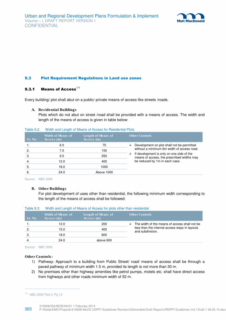
365 319928/ISA/MCB/AA/01 1 Feburary 2014 P:\Noida\DMC\Projects\319928-MoUD UDPFI Guidelines Revision\Deliverable\Draft Report\URDPFI Guidelines Vol I Draft-1 26.02.14.docx
Urban and Regional Development Plans Formulation & Implement Volume – I, DRAFT REPORT VERSION 1
CONFIDENTIAL
9.3 Plot Requirement Regulations in Land use zones
9.3.1 Means of Access171
Every building/ plot shall abut on a public/ private means of access like streets /roads.
A. Residential Buildings
Plots which do not abut on street /road shall be provided with a means of access. The width and
length of the means of access is given in table below:
Table 9.2: Width and Length of Means of Access for Residential Plots
Sr. No. Width of Means of Access (m)
Length of Means of Access (m)
Other Controls
1. 6.0 75 � Development on plot shall not be permitted without a minimum 6m width of access road.
� If development is only on one side of the means of access, the prescribed widths may be reduced by 1m in each case.
2. 7.5 150
3. 9.0 250
4. 12.0 400
5. 18.0 1000
6. 24.0 Above 1000
Source: NBC 2005
B. Other Buildings
For plot development of uses other than residential, the following minimum width corresponding to
the length of the means of access shall be followed:
Table 9.3: Width and Length of Means of Access for plots other than residential
Sr. No. Width of Means of Access (m)
Length of Means of Access (m)
Other Controls
1. 12.0 200 � The width of the means of access shall not be less than the internal access ways in layouts and subdivision.
2. 15.0 400
3. 18.0 600
4. 24.0 above 600
Source: NBC 2005
Other Controls:
1) Pathway: Approach to a building from Public Street/ road/ means of access shall be through a
paved pathway of minimum width 1.5 m, provided its length is not more than 30 m.
2) No premises other than highway amenities like petrol pumps, motels etc. shall have direct access
from highways and other roads minimum width of 52 m.
171 NBC 2005 Part 3, Pg 13
366 319928/ISA/MCB/AA/01 1 Feburary 2014 P:\Noida\DMC\Projects\319928-MoUD UDPFI Guidelines Revision\Deliverable\Draft Report\URDPFI Guidelines Vol I Draft-1 26.02.14.docx
Urban and Regional Development Plans Formulation & Implement Volume – I, DRAFT REPORT VERSION 1
CONFIDENTIAL
3) For high rise buildings and buildings other than residential, the following additional provisions shall
be ensured:
a) The width of the abutting main street shall not be less than 12 m and one end of this street
shall join another street not less than 12 m in width.
b) The approach to the building and open spaces on all sides upto 6 m width and the layout shall
be done in consultation with Chief Fire Officer of the city.
c) The main entrance to the plot shall be of minimum 6 m width to allow easy access to fire
engine.
9.3.2 Area and Height Limitations172
The limitation of area and height of buildings shall be specified in terms of Floor Area Ratio (FAR). The
FAR shall take into account the following aspects:
1) Population Density
2) Occupancy Class
3) Types of construction
4) Width of street fronting the building and the traffic load
5) Locality where the building is proposed and the density
6) Parking facilities
7) Local firefighting facilities
8) Water supply and drainage facilities
9) Land use zone
9.3.3 Minimum Setbacks
The setbacks in a building layout are provided subject to requirements of building height, the ventilation
and fire safety requirements. Setbacks can be provided in two ways, i.e;
1) Based on plot sizes
2) Based on abutting road widths.
These two methods as described below may be adopted for providing setbacks. However, the provisions
shall also confirm to the local building bye-laws.
9.3.3.1 Setbacks based on plot sizes
The following table may be referred for deciding the minimum setbacks for different size plots in various
use zones. The size of plots should be decided after taking into account the provisions of National Housing
Policy and Urban Land (Ceiling and regulation) Act. The setbacks, if necessary, may be changed
depending upon the local situations and specified in the Master plans and Building bye laws.
172 NBC 2005 part 3 Pg 26
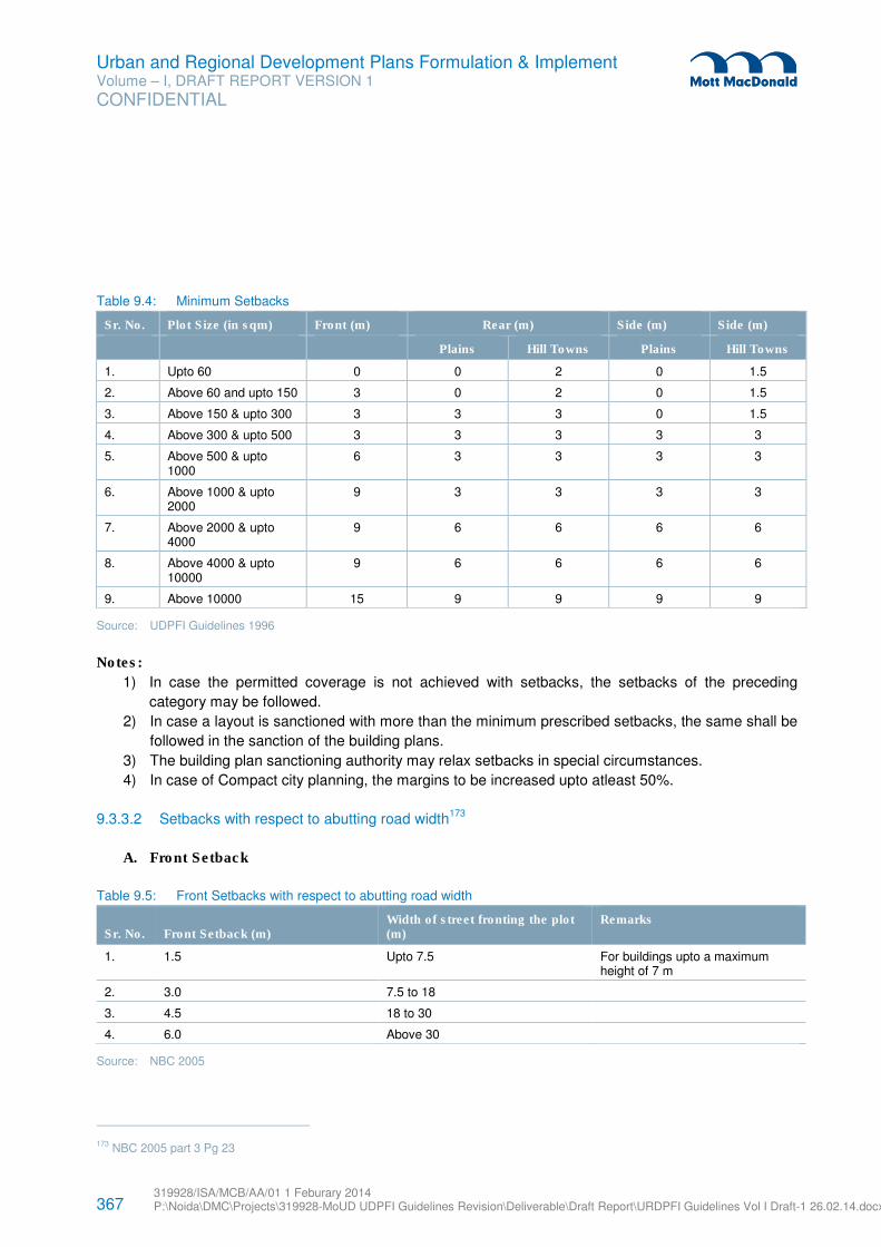
367 319928/ISA/MCB/AA/01 1 Feburary 2014 P:\Noida\DMC\Projects\319928-MoUD UDPFI Guidelines Revision\Deliverable\Draft Report\URDPFI Guidelines Vol I Draft-1 26.02.14.docx
Urban and Regional Development Plans Formulation & Implement Volume – I, DRAFT REPORT VERSION 1
CONFIDENTIAL
Table 9.4: Minimum Setbacks
Sr. No. Plot Size (in sqm) Front (m) Rear (m) Side (m) Side (m)
Plains Hill Towns Plains Hill Towns
1. Upto 60 0 0 2 0 1.5
2. Above 60 and upto 150 3 0 2 0 1.5
3. Above 150 & upto 300 3 3 3 0 1.5
4. Above 300 & upto 500 3 3 3 3 3
5. Above 500 & upto 1000
6 3 3 3 3
6. Above 1000 & upto 2000
9 3 3 3 3
7. Above 2000 & upto 4000
9 6 6 6 6
8. Above 4000 & upto 10000
9 6 6 6 6
9. Above 10000 15 9 9 9 9
Source: UDPFI Guidelines 1996
Notes:
1) In case the permitted coverage is not achieved with setbacks, the setbacks of the preceding
category may be followed.
2) In case a layout is sanctioned with more than the minimum prescribed setbacks, the same shall be
followed in the sanction of the building plans.
3) The building plan sanctioning authority may relax setbacks in special circumstances.
4) In case of Compact city planning, the margins to be increased upto atleast 50%.
9.3.3.2 Setbacks with respect to abutting road width173
A. Front Setback
Table 9.5: Front Setbacks with respect to abutting road width
Sr. No. Front Setback (m) Width of street fronting the plot (m)
Remarks
1. 1.5 Upto 7.5 For buildings upto a maximum height of 7 m
2. 3.0 7.5 to 18
3. 4.5 18 to 30
4. 6.0 Above 30
Source: NBC 2005
173 NBC 2005 part 3 Pg 23
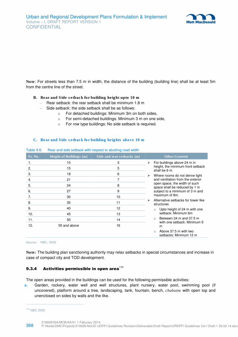
368 319928/ISA/MCB/AA/01 1 Feburary 2014 P:\Noida\DMC\Projects\319928-MoUD UDPFI Guidelines Revision\Deliverable\Draft Report\URDPFI Guidelines Vol I Draft-1 26.02.14.docx
Urban and Regional Development Plans Formulation & Implement Volume – I, DRAFT REPORT VERSION 1
CONFIDENTIAL
Note: For streets less than 7.5 m in width, the distance of the building (building line) shall be at least 5m
from the centre line of the street.
B. Rear and Side setback for building height upto 10 m
– Rear setback: the rear setback shall be minimum 1.8 m
– Side setback: the side setback shall be as follows:
o For detached buildings: Minimum 3m on both sides,
o For semi-detached buildings: Minimum 3 m on one side,
o For row type buildings: No side setback is required.
C. Rear and Side setback for building heights above 10 m
Table 9.6: Rear and side setback with respect to abutting road width
Sr. No. Height of Buildings (m) Side and rear setbacks (m) Other Controls
1. 10 3 � For buildings above 24 m in height, the minimum front setback shall be 6 m.
� Where rooms do not derive light and ventilation from the exterior open space, the width of such space shall be reduced by 1 m subject to a minimum of 3 m and maximum of 8m.
� Alternative setbacks for tower like structures
o Upto height of 24 m with one setback: Minimum 6m
o Between 24 m and 37.5 m with one setback: Minimum 9 m
o Above 37.5 m with two setbacks: Minimum 12 m
2. 15 5
3. 18 6
4. 21 7
5. 24 8
6. 27 9
7. 30 10
8. 35 11
9. 40 12
10. 45 13
11. 50 14
12. 55 and above 16
Source: NBC, 2005
Note: The building plan sanctioning authority may relax setbacks in special circumstances and increase in
case of compact city and TOD development.
9.3.4 Activities permissible in open area174
The open areas provided in the buildings can be used for the following permissible activities:
a. Garden, rockery, water well and well structures, plant nursery, water pool, swimming pool (if
uncovered), platform around a tree, landscaping, tank, fountain, bench, chabutra with open top and
unenclosed on sides by walls and the like.
174 NBC 2005
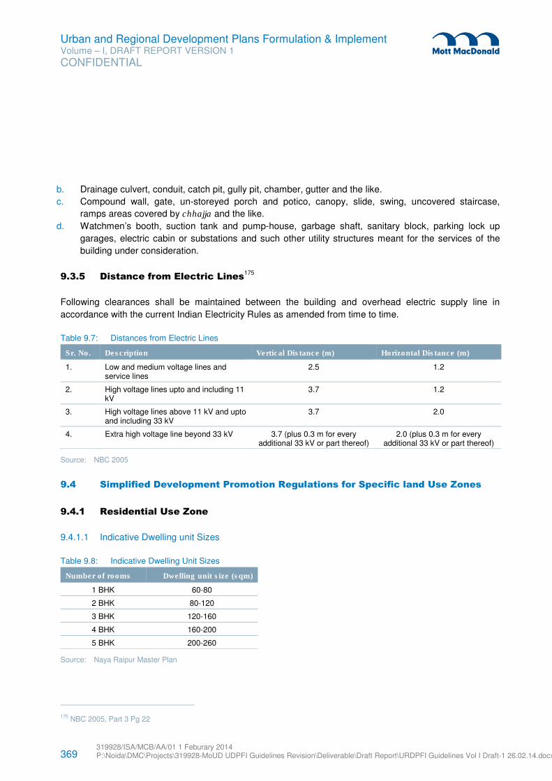
369 319928/ISA/MCB/AA/01 1 Feburary 2014 P:\Noida\DMC\Projects\319928-MoUD UDPFI Guidelines Revision\Deliverable\Draft Report\URDPFI Guidelines Vol I Draft-1 26.02.14.docx
Urban and Regional Development Plans Formulation & Implement Volume – I, DRAFT REPORT VERSION 1
CONFIDENTIAL
b. Drainage culvert, conduit, catch pit, gully pit, chamber, gutter and the like.
c. Compound wall, gate, un-storeyed porch and potico, canopy, slide, swing, uncovered staircase,
ramps areas covered by chhajja and the like.
d. Watchmen’s booth, suction tank and pump-house, garbage shaft, sanitary block, parking lock up
garages, electric cabin or substations and such other utility structures meant for the services of the
building under consideration.
9.3.5 Distance from Electric Lines175
Following clearances shall be maintained between the building and overhead electric supply line in
accordance with the current Indian Electricity Rules as amended from time to time.
Table 9.7: Distances from Electric Lines
Sr. No. Description Vertical Distance (m) Horizontal Distance (m)
1. Low and medium voltage lines and service lines
2.5 1.2
2. High voltage lines upto and including 11 kV
3.7 1.2
3. High voltage lines above 11 kV and upto and including 33 kV
3.7 2.0
4. Extra high voltage line beyond 33 kV 3.7 (plus 0.3 m for every additional 33 kV or part thereof)
2.0 (plus 0.3 m for every additional 33 kV or part thereof)
Source: NBC 2005
9.4 Simplified Development Promotion Regulations for Specific land Use Zones
9.4.1 Residential Use Zone
9.4.1.1 Indicative Dwelling unit Sizes
Table 9.8: Indicative Dwelling Unit Sizes
Number of rooms Dwelling unit size (sqm)
1 BHK 60-80
2 BHK 80-120
3 BHK 120-160
4 BHK 160-200
5 BHK 200-260
Source: Naya Raipur Master Plan
175 NBC 2005, Part 3 Pg 22
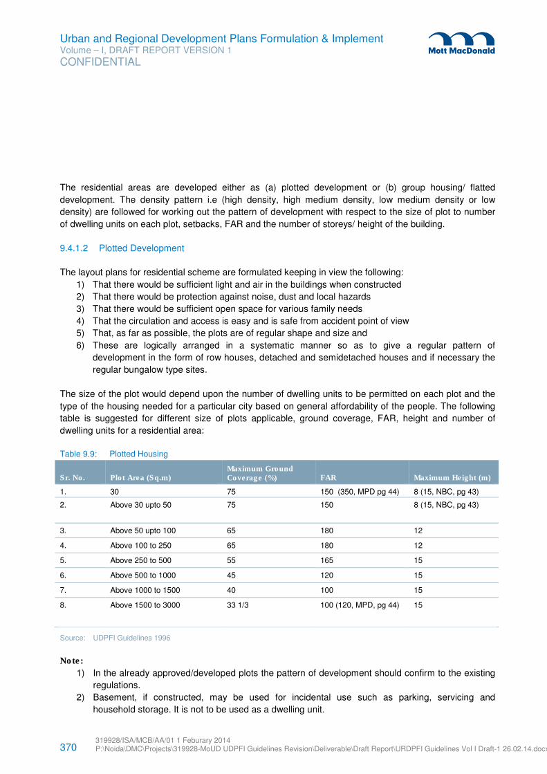
370 319928/ISA/MCB/AA/01 1 Feburary 2014 P:\Noida\DMC\Projects\319928-MoUD UDPFI Guidelines Revision\Deliverable\Draft Report\URDPFI Guidelines Vol I Draft-1 26.02.14.docx
Urban and Regional Development Plans Formulation & Implement Volume – I, DRAFT REPORT VERSION 1
CONFIDENTIAL
The residential areas are developed either as (a) plotted development or (b) group housing/ flatted
development. The density pattern i.e (high density, high medium density, low medium density or low
density) are followed for working out the pattern of development with respect to the size of plot to number
of dwelling units on each plot, setbacks, FAR and the number of storeys/ height of the building.
9.4.1.2 Plotted Development
The layout plans for residential scheme are formulated keeping in view the following:
1) That there would be sufficient light and air in the buildings when constructed
2) That there would be protection against noise, dust and local hazards
3) That there would be sufficient open space for various family needs
4) That the circulation and access is easy and is safe from accident point of view
5) That, as far as possible, the plots are of regular shape and size and
6) These are logically arranged in a systematic manner so as to give a regular pattern of
development in the form of row houses, detached and semidetached houses and if necessary the
regular bungalow type sites.
The size of the plot would depend upon the number of dwelling units to be permitted on each plot and the
type of the housing needed for a particular city based on general affordability of the people. The following
table is suggested for different size of plots applicable, ground coverage, FAR, height and number of
dwelling units for a residential area:
Table 9.9: Plotted Housing
Sr. No. Plot Area (Sq.m) Maximum Ground Coverage (%) FAR Maximum Height (m)
1. 30 75 150 (350, MPD pg 44) 8 (15, NBC, pg 43)
2. Above 30 upto 50 75 150 8 (15, NBC, pg 43)
3. Above 50 upto 100 65 180 12
4. Above 100 to 250 65 180 12
5. Above 250 to 500 55 165 15
6. Above 500 to 1000 45 120 15
7. Above 1000 to 1500 40 100 15
8. Above 1500 to 3000
33 1/3 100 (120, MPD, pg 44) 15
Source: UDPFI Guidelines 1996
Note:
1) In the already approved/developed plots the pattern of development should confirm to the existing
regulations.
2) Basement, if constructed, may be used for incidental use such as parking, servicing and
household storage. It is not to be used as a dwelling unit.
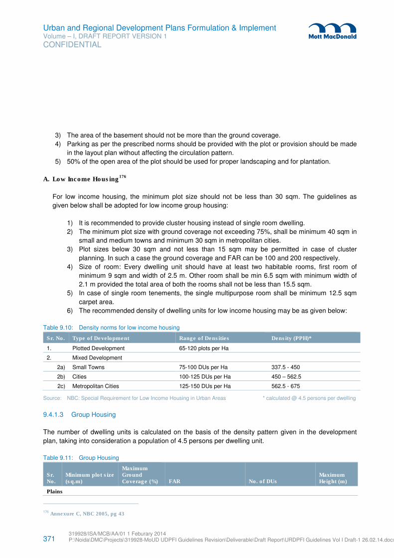
371 319928/ISA/MCB/AA/01 1 Feburary 2014 P:\Noida\DMC\Projects\319928-MoUD UDPFI Guidelines Revision\Deliverable\Draft Report\URDPFI Guidelines Vol I Draft-1 26.02.14.docx
Urban and Regional Development Plans Formulation & Implement Volume – I, DRAFT REPORT VERSION 1
CONFIDENTIAL
3) The area of the basement should not be more than the ground coverage.
4) Parking as per the prescribed norms should be provided with the plot or provision should be made
in the layout plan without affecting the circulation pattern.
5) 50% of the open area of the plot should be used for proper landscaping and for plantation.
A. Low Income Housing176
For low income housing, the minimum plot size should not be less than 30 sqm. The guidelines as
given below shall be adopted for low income group housing:
1) It is recommended to provide cluster housing instead of single room dwelling.
2) The minimum plot size with ground coverage not exceeding 75%, shall be minimum 40 sqm in
small and medium towns and minimum 30 sqm in metropolitan cities.
3) Plot sizes below 30 sqm and not less than 15 sqm may be permitted in case of cluster
planning. In such a case the ground coverage and FAR can be 100 and 200 respectively.
4) Size of room: Every dwelling unit should have at least two habitable rooms, first room of
minimum 9 sqm and width of 2.5 m. Other room shall be min 6.5 sqm with minimum width of
2.1 m provided the total area of both the rooms shall not be less than 15.5 sqm.
5) In case of single room tenements, the single multipurpose room shall be minimum 12.5 sqm
carpet area.
6) The recommended density of dwelling units for low income housing may be as given below:
Table 9.10: Density norms for low income housing
Sr. No. Type of Development Range of Densities Density (PPH)*
1. Plotted Development 65-120 plots per Ha
2. Mixed Development
2a) Small Towns 75-100 DUs per Ha 337.5 - 450
2b) Cities 100-125 DUs per Ha 450 – 562.5
2c) Metropolitan Cities 125-150 DUs per Ha 562.5 - 675
Source: NBC: Special Requirement for Low Income Housing in Urban Areas * calculated @ 4.5 persons per dwelling
9.4.1.3 Group Housing
The number of dwelling units is calculated on the basis of the density pattern given in the development
plan, taking into consideration a population of 4.5 persons per dwelling unit.
Table 9.11: Group Housing
Sr. No.
Minimum plot size (sq.m)
Maximum Ground Coverage (%) FAR No. of DUs
Maximum Height (m)
Plains
176 Annexure C, NBC 2005, pg 43
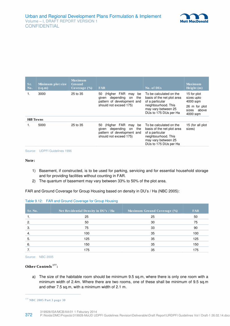
372 319928/ISA/MCB/AA/01 1 Feburary 2014 P:\Noida\DMC\Projects\319928-MoUD UDPFI Guidelines Revision\Deliverable\Draft Report\URDPFI Guidelines Vol I Draft-1 26.02.14.docx
Urban and Regional Development Plans Formulation & Implement Volume – I, DRAFT REPORT VERSION 1
CONFIDENTIAL
Sr. No.
Minimum plot size (sq.m)
Maximum Ground Coverage (%) FAR No. of DUs
Maximum Height (m)
1. 3000
25 to 35 50 (Higher FAR may be given depending on the pattern of development and should not exceed 175)
To be calculated on the basis of the net plot area of a particular neighbourhood. This may vary between 25 DUs to 175 DUs per Ha
15 for plot sizes upto 4000 sqm
26 m for plot sizes above 4000 sqm
Hill Towns
1. 5000 25 to 35 50 (Higher FAR may be given depending on the pattern of development and should not exceed 175)
To be calculated on the basis of the net plot area of a particular neighbourhood. This may vary between 25 DUs to 175 DUs per Ha
15 (for all plot sizes)
Source: UDPFI Guidelines 1996
Note:
1) Basement, if constructed, is to be used for parking, servicing and for essential household storage
and for providing facilities without counting in FAR.
2) The quantum of basement may vary between 33% to 50% of the plot area.
FAR and Ground Coverage for Group Housing based on density in DU’s / Ha (NBC 2005):
Table 9.12: FAR and Ground Coverage for Group Housing
Sr. No. Net Residential Density in DU’s / Ha Maximum Ground Coverage (%) FAR
1. 25 25 50
2. 50 30 75
3. 75 33 90
4. 100 35 100
5. 125 35 125
6. 150 35 150
7. 175 35 175
Source: NBC 2005
Other Controls177
:
a) The size of the habitable room should be minimum 9.5 sq.m, where there is only one room with a
minimum width of 2.4m. Where there are two rooms, one of these shall be minimum of 9.5 sq.m
and other 7.5 sq.m, with a minimum width of 2.1 m.
177 NBC 2005 Part 3 page 30
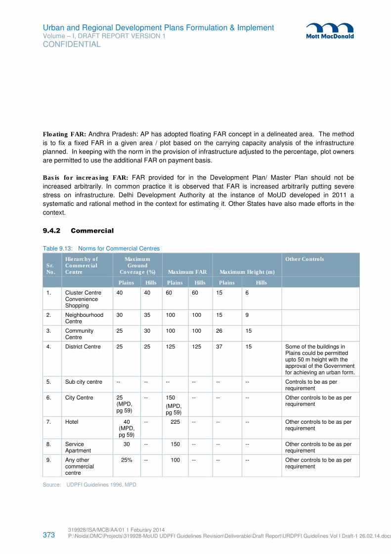
373 319928/ISA/MCB/AA/01 1 Feburary 2014 P:\Noida\DMC\Projects\319928-MoUD UDPFI Guidelines Revision\Deliverable\Draft Report\URDPFI Guidelines Vol I Draft-1 26.02.14.docx
Urban and Regional Development Plans Formulation & Implement Volume – I, DRAFT REPORT VERSION 1
CONFIDENTIAL
Floating FAR: Andhra Pradesh: AP has adopted floating FAR concept in a delineated area. The method
is to fix a fixed FAR in a given area / plot based on the carrying capacity analysis of the infrastructure
planned. In keeping with the norm in the provision of infrastructure adjusted to the percentage, plot owners
are permitted to use the additional FAR on payment basis.
Basis for increasing FAR: FAR provided for in the Development Plan/ Master Plan should not be
increased arbitrarily. In common practice it is observed that FAR is increased arbitrarily putting severe
stress on infrastructure. Delhi Development Authority at the instance of MoUD developed in 2011 a
systematic and rational method in the context for estimating it. Other States have also made efforts in the
context.
9.4.2 Commercial
Table 9.13: Norms for Commercial Centres
Sr. No.
Hierarchy of Commercial Centre
Maximum Ground
Coverage (%) Maximum FAR Maximum Height (m)
Other Controls
Plains Hills Plains Hills Plains Hills
1. Cluster Centre Convenience Shopping
40 40 60 60 15 6
2. Neighbourhood Centre
30 35 100 100 15 9
3. Community Centre
25 30 100 100 26 15
4. District Centre 25 25 125 125 37 15 Some of the buildings in Plains could be permitted upto 50 m height with the approval of the Government for achieving an urban form.
5. Sub city centre -- -- -- -- -- -- Controls to be as per requirement
6. City Centre 25 (MPD, pg 59)
-- 150
(MPD, pg 59)
-- -- -- Other controls to be as per requirement
7. Hotel 40 (MPD, pg 59)
-- 225 -- -- -- Other controls to be as per requirement
8. Service Apartment
30 -- 150 -- -- -- Other controls to be as per requirement
9. Any other commercial centre
25% -- 100 -- -- -- Other controls to be as per requirement
Source: UDPFI Guidelines 1996, MPD
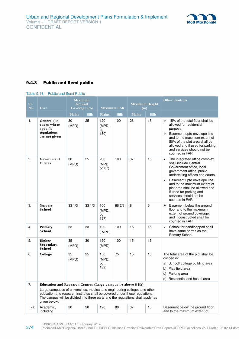
374 319928/ISA/MCB/AA/01 1 Feburary 2014 P:\Noida\DMC\Projects\319928-MoUD UDPFI Guidelines Revision\Deliverable\Draft Report\URDPFI Guidelines Vol I Draft-1 26.02.14.docx
Urban and Regional Development Plans Formulation & Implement Volume – I, DRAFT REPORT VERSION 1
CONFIDENTIAL
9.4.3 Public and Semi-public
Table 9.14: Public and Semi Public
Sr. No. Uses
Maximum Ground
Coverage (%) Maximum FAR Maximum Height
(m)
Other Controls
Plains Hills Plains Hills Plains Hills
1. General ( in cases where specific regulations are not given
30
(MPD)
25 120
(MPD, pg 150)
100 26 15 � 15% of the total floor shall be allowed for residential purpose.
� Basement upto envelope line and to the maximum extent of 50% of the plot area shall be allowed and if used for parking and services should not be counted in FAR.
2. Government Offices
30
(MPD)
25 200
(MPD, pg 87)
100 37 15 � The integrated office complex shall include Central Government office, local government office, public undertaking offices and courts.
� Basement upto envelope line and to the maximum extent of plot area shall be allowed and if used for parking and services should not be counted in FAR.
3. Nursery School
33 1/3
33 1/3 100
(MPD, pg 137)
66 2/3 8 6 � Basement below the ground floor and to the maximum extent of ground coverage, and if constructed shall be counted in FAR.
4. Primary School
33 33 120
( MPD)
100 15 15 � School for handicapped shall have same norms as the Primary School.
5. Higher Secondary School
35
(MPD)
30 150
(MPD)
100 15 15
6. College 35
(MPD)
25 150
(MPD, pg 139)
75 15 15 The total area of the plot shall be divided in:
a) School/ college building area
b) Play field area
c) Parking area
d) Residential and hostel area
7. Education and Research Centres (Large campus i.e above 8 Ha)
Large campuses of universities, medical and engineering colleges and other education and research institutes shall be covered under these regulations. The campus will be divided into three parts and the regulations shall apply, as given below:
7a) Academic, including
30 20 120 80 37 15 Basement below the ground floor and to the maximum extent of
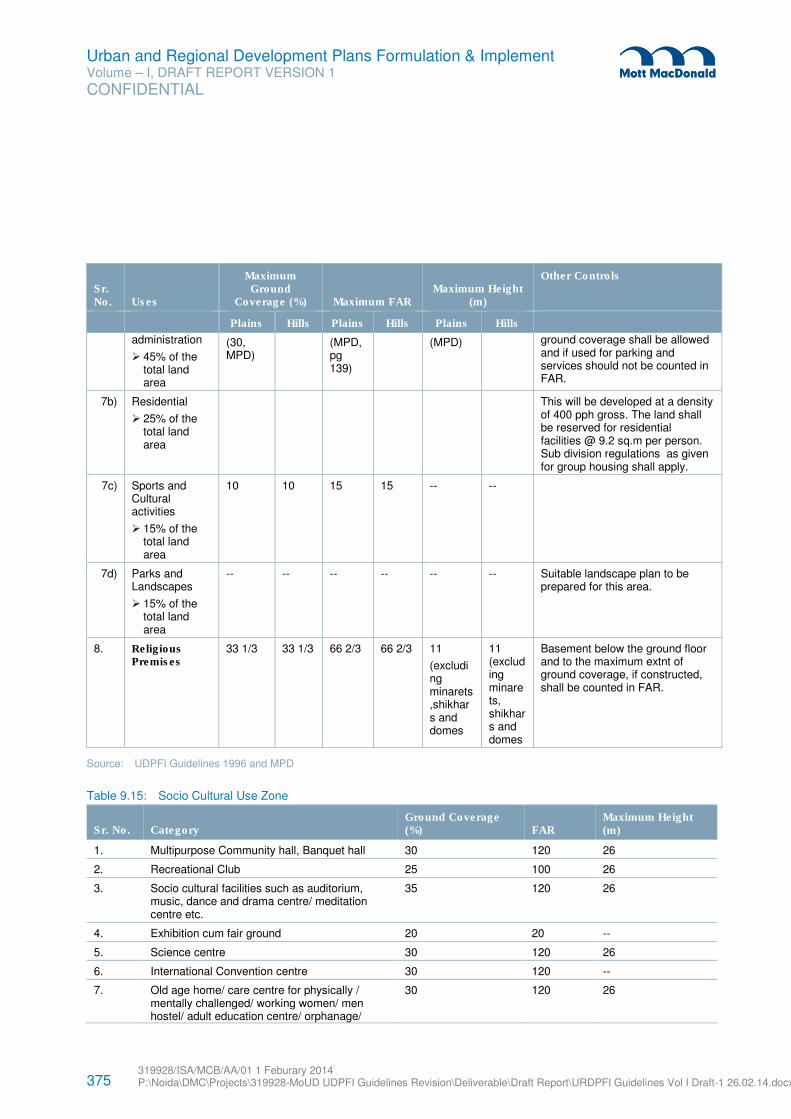
375 319928/ISA/MCB/AA/01 1 Feburary 2014 P:\Noida\DMC\Projects\319928-MoUD UDPFI Guidelines Revision\Deliverable\Draft Report\URDPFI Guidelines Vol I Draft-1 26.02.14.docx
Urban and Regional Development Plans Formulation & Implement Volume – I, DRAFT REPORT VERSION 1
CONFIDENTIAL
Sr. No. Uses
Maximum Ground
Coverage (%) Maximum FAR Maximum Height
(m)
Other Controls
Plains Hills Plains Hills Plains Hills
administration
� 45% of the total land area
(30, MPD)
(MPD, pg 139)
(MPD) ground coverage shall be allowed and if used for parking and services should not be counted in FAR.
7b) Residential
� 25% of the total land area
This will be developed at a density of 400 pph gross. The land shall be reserved for residential facilities @ 9.2 sq.m per person. Sub division regulations as given for group housing shall apply.
7c) Sports and Cultural activities
� 15% of the total land area
10 10 15 15 -- --
7d) Parks and Landscapes
� 15% of the total land area
-- -- -- -- -- -- Suitable landscape plan to be prepared for this area.
8. Religious Premises
33 1/3 33 1/3 66 2/3 66 2/3 11
(excluding minarets,shikhars and domes
11 (excluding minarets, shikhars and domes
Basement below the ground floor and to the maximum extnt of ground coverage, if constructed, shall be counted in FAR.
Source: UDPFI Guidelines 1996 and MPD
Table 9.15: Socio Cultural Use Zone
Sr. No. Category Ground Coverage (%) FAR
Maximum Height (m)
1. Multipurpose Community hall, Banquet hall 30 120 26
2. Recreational Club 25 100 26
3. Socio cultural facilities such as auditorium, music, dance and drama centre/ meditation centre etc.
35 120 26
4. Exhibition cum fair ground 20 20 --
5. Science centre 30 120 26
6. International Convention centre 30 120 --
7. Old age home/ care centre for physically / mentally challenged/ working women/ men hostel/ adult education centre/ orphanage/
30 120 26
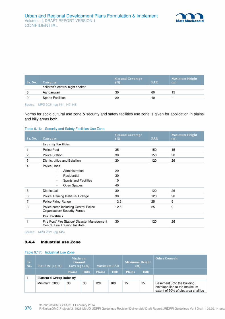
376 319928/ISA/MCB/AA/01 1 Feburary 2014 P:\Noida\DMC\Projects\319928-MoUD UDPFI Guidelines Revision\Deliverable\Draft Report\URDPFI Guidelines Vol I Draft-1 26.02.14.docx
Urban and Regional Development Plans Formulation & Implement Volume – I, DRAFT REPORT VERSION 1
CONFIDENTIAL
Sr. No. Category Ground Coverage (%) FAR
Maximum Height (m)
children’s centre/ night shelter
8. Aanganwari 30 60 15
9. Sports Facilities 20 40 --
Source: MPD 2021 (pg 141, 147-148)
Norms for socio cultural use zone & security and safety facilities use zone is given for application in plains
and hilly areas both.
Table 9.16: Security and Safety Facilities Use Zone
Sr. No. Category Ground Coverage (%) FAR
Maximum Height (m)
Security Facilities
1. Police Post 35 150 15
2. Police Station 30 150 26
3. District office and Batallion 30 120 26
4. Police Lines
- Administration
- Residential
- Sports and Facilities
- Open Spaces
20
30
10
40
5. District Jail 30 120 26
6. Police Training Institute/ College 30 120 26
7. Police Firing Range 12.5 25 9
8. Police camp including Central Police Organisation/ Security Forces
12.5 25 9
Fire Facilities
1. Fire Post/ Fire Station/ Disaster Management Centre/ Fire Training Institute
30 120 26
Source: MPD 2021 (pg 145)
9.4.4 Industrial use Zone
Table 9.17: Industrial Use Zone
Sr. No. Plot Size (sq m)
Maximum Ground
Coverage (%) Maximum FAR Maximum Height
(m)
Other Controls
Plains Hills Plains Hills Plains Hills
1. Flattened Group Industry
Minimum 2000 30 30 120 100 15 15 Basement upto the building envelope line to the maximum extent of 50% of plot area shall be
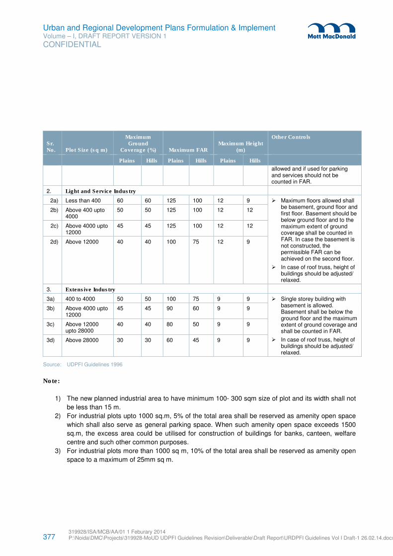
377 319928/ISA/MCB/AA/01 1 Feburary 2014 P:\Noida\DMC\Projects\319928-MoUD UDPFI Guidelines Revision\Deliverable\Draft Report\URDPFI Guidelines Vol I Draft-1 26.02.14.docx
Urban and Regional Development Plans Formulation & Implement Volume – I, DRAFT REPORT VERSION 1
CONFIDENTIAL
Sr. No. Plot Size (sq m)
Maximum Ground
Coverage (%) Maximum FAR Maximum Height
(m)
Other Controls
Plains Hills Plains Hills Plains Hills
allowed and if used for parking and services should not be counted in FAR.
2. Light and Service Industry
2a) Less than 400 60 60 125 100 12 9 � Maximum floors allowed shall be basement, ground floor and first floor. Basement should be below ground floor and to the maximum extent of ground coverage shall be counted in FAR. In case the basement is not constructed, the permissible FAR can be achieved on the second floor.
� In case of roof truss, height of buildings should be adjusted/ relaxed.
2b) Above 400 upto 4000
50 50 125 100 12 12
2c) Above 4000 upto 12000
45 45 125 100 12 12
2d) Above 12000 40 40 100 75 12 9
3. Extensive Industry
3a) 400 to 4000 50 50 100 75 9 9 � Single storey building with basement is allowed. Basement shall be below the ground floor and the maximum extent of ground coverage and shall be counted in FAR.
� In case of roof truss, height of buildings should be adjusted/ relaxed.
3b) Above 4000 upto 12000
45 45 90 60 9 9
3c) Above 12000 upto 28000
40 40 80 50 9 9
3d) Above 28000 30 30 60 45 9 9
Source: UDPFI Guidelines 1996
Note:
1) The new planned industrial area to have minimum 100- 300 sqm size of plot and its width shall not
be less than 15 m.
2) For industrial plots upto 1000 sq.m, 5% of the total area shall be reserved as amenity open space
which shall also serve as general parking space. When such amenity open space exceeds 1500
sq.m, the excess area could be utilised for construction of buildings for banks, canteen, welfare
centre and such other common purposes.
3) For industrial plots more than 1000 sq m, 10% of the total area shall be reserved as amenity open
space to a maximum of 25mm sq m.
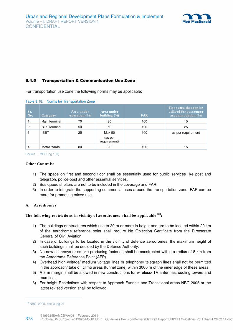
378 319928/ISA/MCB/AA/01 1 Feburary 2014 P:\Noida\DMC\Projects\319928-MoUD UDPFI Guidelines Revision\Deliverable\Draft Report\URDPFI Guidelines Vol I Draft-1 26.02.14.docx
Urban and Regional Development Plans Formulation & Implement Volume – I, DRAFT REPORT VERSION 1
CONFIDENTIAL
9.4.5 Transportation & Communication Use Zone
For transportation use zone the following norms may be applicable:
Table 9.18: Norms for Transportation Zone
Sr. No. Category
Area under operation (%)
Area under building (%) FAR
Floor area that can be utilised for passenger accommodation (%)
1. Rail Terminal 70 30 100 15
2. Bus Terminal 50 50 100 25
3. ISBT 25 Max 50
(as per requirement)
100 as per requirement
4. Metro Yards 80 20 100 15
Source: MPD (pg 130)
Other Controls:
1) The space on first and second floor shall be essentially used for public services like post and
telegraph, police-post and other essential services.
2) Bus queue shelters are not to be included in the coverage and FAR.
3) In order to integrate the supporting commercial uses around the transportation zone, FAR can be
more for promoting mixed use.
A. Aerodromes
The following restrictions in vicinity of aerodromes shall be applicable178
:
1) The buildings or structures which rise to 30 m or more in height and are to be located within 20 km
of the aerodrome reference point shall require No Objection Certificate from the Directorate
General of Civil Aviation.
2) In case of buildings to be located in the vicinity of defence aerodromes, the maximum height of
such buildings shall be decided by the Defence Authority.
3) No new chimneys or smoke producing factories shall be constructed within a radius of 8 km from
the Aerodrome Reference Point (AFP).
4) Overhead high voltage/ medium voltage lines or telephone/ telegraph lines shall not be permitted
in the approach/ take off climb areas (funnel zone) within 3000 m of the inner edge of these areas.
5) A 3 m margin shall be allowed in new constructions for wireless/ TV antennas, cooling towers and
mumties.
6) For height Restrictions with respect to Approach Funnels and Transitional areas NBC 2005 or the
latest revised version shall be followed.
178 NBC, 2005, part 3, pg 27
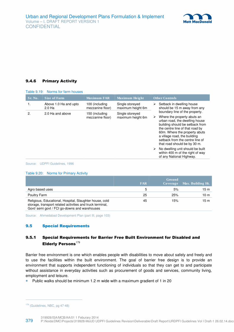
379 319928/ISA/MCB/AA/01 1 Feburary 2014 P:\Noida\DMC\Projects\319928-MoUD UDPFI Guidelines Revision\Deliverable\Draft Report\URDPFI Guidelines Vol I Draft-1 26.02.14.docx
Urban and Regional Development Plans Formulation & Implement Volume – I, DRAFT REPORT VERSION 1
CONFIDENTIAL
9.4.6 Primary Activity
Table 9.19: Norms for farm houses
Sr. No. Size of Farm Maximum FAR Maximum Height Other Controls
1. Above 1.0 Ha and upto 2.0 Ha
100 (including mezzanine floor)
Single storeyed maximum height 6m
� Setback in dwelling house should be 15 m away from any boundary line of the property.
� Where the property abuts an urban road, the dwelling house building should be setback from the centre line of that road by 60m. Where the property abuts a village road, the building setback from the centre line of that road should be by 30 m.
� No dwelling unit should be built within 400 m of the right of way of any National Highway.
2. 2.0 Ha and above 150 (including mezzanine floor)
Single storeyed maximum height 6m
Source: UDPFI Guidelines, 1996
Table 9.20: Norms for Primary Activity
FAR Ground
Coverage Max. Building Ht.
Agro based uses 5 5% 15 m
Poultry Farm 25 25% 10 m
Religious, Educational, Hospital, Slaughter house, cold storage, transport related activities and truck terminal, Govt/ semi govt / FCI go-downs and warehouses
45 15% 15 m
Source: Ahmedabad Development Plan (part III, page 103)
9.5 Special Requirements
9.5.1 Special Requirements for Barrier Free Built Environment for Disabled and
Elderly Persons179
Barrier free environment is one which enables people with disabilities to move about safely and freely and
to use the facilities within the built environment. The goal of barrier free design is to provide an
environment that supports independent functioning of individuals so that they can get to and participate
without assistance in everyday activities such as procurement of goods and services, community living,
employment and leisure.
� Public walks should be minimum 1.2 m wide with a maximum gradient of 1 in 20
179 (Guidelines, NBC, pg 47-48)
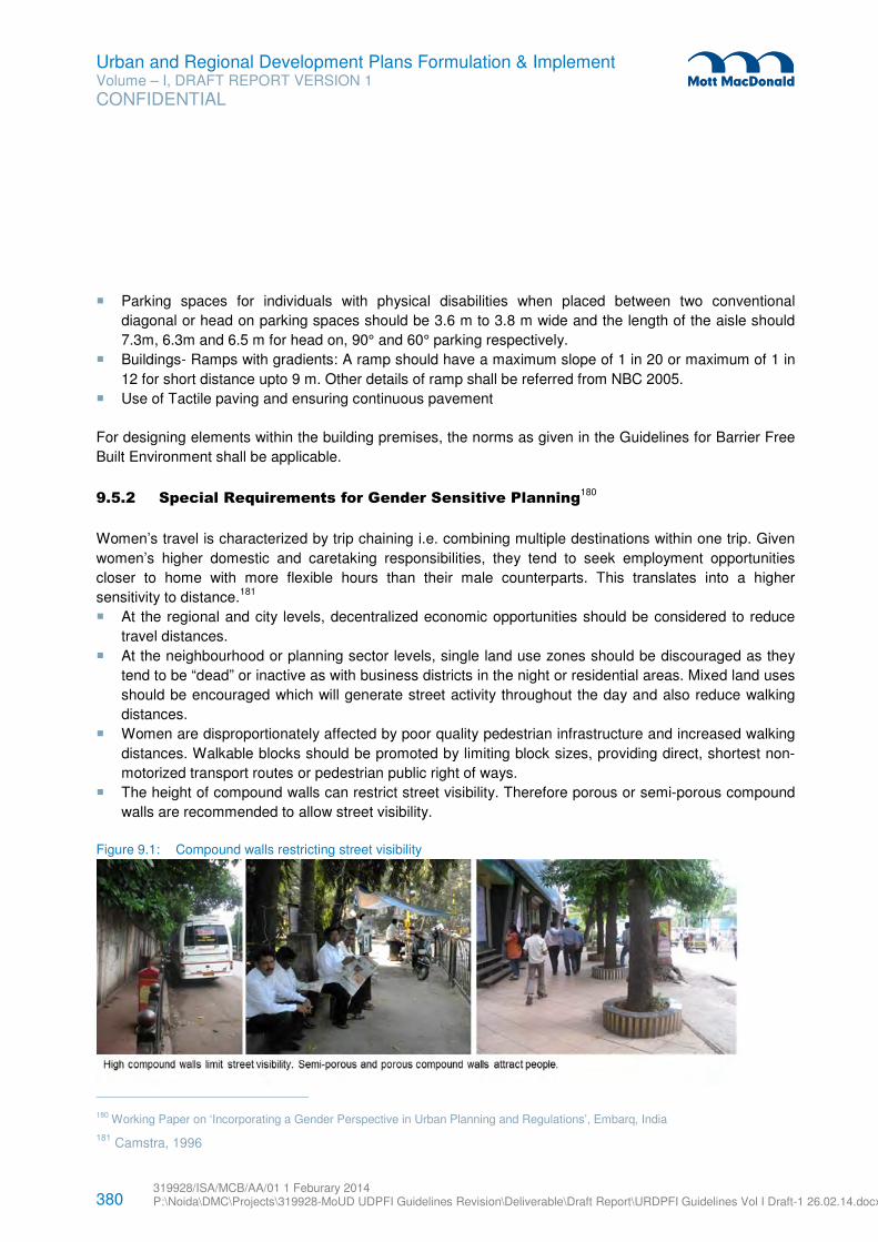
380 319928/ISA/MCB/AA/01 1 Feburary 2014 P:\Noida\DMC\Projects\319928-MoUD UDPFI Guidelines Revision\Deliverable\Draft Report\URDPFI Guidelines Vol I Draft-1 26.02.14.docx
Urban and Regional Development Plans Formulation & Implement Volume – I, DRAFT REPORT VERSION 1
CONFIDENTIAL
� Parking spaces for individuals with physical disabilities when placed between two conventional
diagonal or head on parking spaces should be 3.6 m to 3.8 m wide and the length of the aisle should
7.3m, 6.3m and 6.5 m for head on, 90° and 60° parking respectively.
� Buildings- Ramps with gradients: A ramp should have a maximum slope of 1 in 20 or maximum of 1 in
12 for short distance upto 9 m. Other details of ramp shall be referred from NBC 2005.
� Use of Tactile paving and ensuring continuous pavement
For designing elements within the building premises, the norms as given in the Guidelines for Barrier Free
Built Environment shall be applicable.
9.5.2 Special Requirements for Gender Sensitive Planning180
Women’s travel is characterized by trip chaining i.e. combining multiple destinations within one trip. Given
women’s higher domestic and caretaking responsibilities, they tend to seek employment opportunities
closer to home with more flexible hours than their male counterparts. This translates into a higher
sensitivity to distance.181
� At the regional and city levels, decentralized economic opportunities should be considered to reduce
travel distances.
� At the neighbourhood or planning sector levels, single land use zones should be discouraged as they
tend to be “dead” or inactive as with business districts in the night or residential areas. Mixed land uses
should be encouraged which will generate street activity throughout the day and also reduce walking
distances.
� Women are disproportionately affected by poor quality pedestrian infrastructure and increased walking
distances. Walkable blocks should be promoted by limiting block sizes, providing direct, shortest non-
motorized transport routes or pedestrian public right of ways.
� The height of compound walls can restrict street visibility. Therefore porous or semi-porous compound
walls are recommended to allow street visibility.
Figure 9.1: Compound walls restricting street visibility
180 Working Paper on ‘Incorporating a Gender Perspective in Urban Planning and Regulations’, Embarq, India
181 Camstra, 1996
381 319928/ISA/MCB/AA/01 1 Feburary 2014 P:\Noida\DMC\Projects\319928-MoUD UDPFI Guidelines Revision\Deliverable\Draft Report\URDPFI Guidelines Vol I Draft-1 26.02.14.docx
Urban and Regional Development Plans Formulation & Implement Volume – I, DRAFT REPORT VERSION 1
CONFIDENTIAL
Source: Working Paper on ‘Incorporating a Gender Perspective in Urban Planning and Regulations’, Embarq, India
9.5.2.1 Housing
� Any project which involves relocation of households, economic links or networks should be preserved
by considering relocation within the same ward or local area.
� The design of housing schemes for poor women should consider their lower incomes, work in the
informal sector182
and that the house and the open space adjoining it is also used for economic
activity.183
9.5.2.2 Amenities
� Where land is not reserved for amenities like police stations, public toilets, reading areas, community
bins, they are constructed on pavements or informally provided thereby obstructing pedestrian
movement.
� Due to women’s higher domestic and care-taking facilities, amenities like day care centres, pre-primary
and primary schools, primary health facilities, local markets are recommended to be provided within 5-
15 minutes walking distances.
� Similarly adequate space and access should be provided for women in these public amenities,
considering their needs. For example, it is recommended that public toilets should be provided within
15 minutes walking distance with special emphasis on areas with high volumes of people i.e. railway
stations, markets, bus terminals, public buildings, public open spaces etc. Public toilets should ensure
sufficient seats for women, space for child care and include toilet seats for dependents.
9.5.2.3 Street Design
� There needs to be an effort to increase cycling modal shares of women by improving women and girls’
access to cycles, especially load carrying cycles.
� Crowded streets, station entrances or exits are perceived as unsafe for women. Therefore a level of
service approach should be used to plan pedestrian infrastructure. As per IRC Guidelines 103-2012:
Guidelines for Pedestrian Facilities, a level of service B or C is recommended. All footpaths should
include and specify a dead zone, an uninterrupted walking zone and a multi-utility zone for street
furniture etc.
� Streets, including carriageway and pavements should be consistently and continuously lit.
� The role of street vendors in creating street eyes is acknowledged184
and therefore must be planned for
in neighbourhood layout or local area plans and in street design.
182
Khosla, Renu. Addressing Gender Concerns in India’s Urban Renewal Mission. UNDP
183 SPARC and KRVIA. 2010. Re-Dharavi. http://www.sdinet.org/media/upload/documents/ReDharavi.pdf (Accessed on 25th February 2014)
184 Cross, John and Morales, Alfonso (Ed). 2007. Street Entrepreneurs: People, Place and Politics in Local and Global Perspective, Routledge

382 319928/ISA/MCB/AA/01 1 Feburary 2014 P:\Noida\DMC\Projects\319928-MoUD UDPFI Guidelines Revision\Deliverable\Draft Report\URDPFI Guidelines Vol I Draft-1 26.02.14.docx
Urban and Regional Development Plans Formulation & Implement Volume – I, DRAFT REPORT VERSION 1
CONFIDENTIAL
9.5.2.4 Public Transport
Such provision include - Prioritizing safe access to transit, rethinking transit fare structures to minimize cost
for multi-stop journeys and in off-peak hours, introducing flexible services – such as halting buses in-
between stops to drop women closer to their destination in the night, women only buses/trains/coaches or
reserved seats for women in buses, ensuring sufficient toilet seats for women at stations and terminals,
ensuring bus shelters and train stations have safety and comfort features (lighting, benches, emergency
call options) etc.
9.5.3 Building Norms Natural Habitat
The land uses identified as Natural Habitat covering water bodies, forest & vegetation, green open spaces,
coastal zone, wetlands etc., shall be protected and adequate buffer shall be provided from the planned
establishments. For planning around these areas, the building norms and regulations as stipulated by the
respective statutory bodies such as MoEF and State Environment and Forest Department shall be
applicable.
9.5.4 Historical or Archaeological areas
The special areas shall be identified as old built-up areas, areas of historical or archaeological importance,
areas of scenic value, area restricted for development by Government or area under other uses/ spot zone
during preparation of Development plan. For protection of these areas the norms as stipulated by the
respective statutory bodies such as Archaeological Survey of India and respective departments shall be
applicable.
As per the Model Building Bye-laws, buildings within heritage precincts or in the vicinity of heritage sites
shall maintain the skyline in the precinct and follow the architectural style (without any high-rise or multi-
storeyed development) as may be existing in the surrounding area, so as not to diminish or destroy the
value and beauty of or the view from the said heritage sites. The development within the precinct or in the
vicinity of heritage sites shall be in accordance with the guidelines framed by the Commissioner, Municipal
Corporation / Vice- Chairman, Development Authority on the advice of the Heritage Conservation
Committee or separate regulations / guidelines, if any, prescribed for respective zones by Municipal
Corporation / Development Authority.
9.5.5 Industrial Regions
For planning of Industrial Regions the guidelines development by State Authorities such as Special
Investment Region (SIR) guidelines within Delhi Mumbai Industrial Corridor (DMIC) or by National
Authorities such as guidelines for National Investment & Manufacturing Zones (NIMZ’s), Special Economic
Zone (SEZ) should be referred to.
383 319928/ISA/MCB/AA/01 1 Feburary 2014 P:\Noida\DMC\Projects\319928-MoUD UDPFI Guidelines Revision\Deliverable\Draft Report\URDPFI Guidelines Vol I Draft-1 26.02.14.docx
Urban and Regional Development Plans Formulation & Implement Volume – I, DRAFT REPORT VERSION 1
CONFIDENTIAL
9.5.6 Introduce Use of Form Based Codes
In view of current urban form of Indian city, an approach may be adopted to the form the image of city
through Form-Based Code in addition to the development promotion regulation. This can act as a
technique for regulating development to achieve a specific urban form, and it creates a predictable public
realm by the regulation of the physical form primarily. The different parameters used to zone the city into
different transects are land use intensity, density, building disposition, building configuration, building
function, standards, mixed use and neighbourhood.
384 319928/ISA/MCB/AA/01 1 Feburary 2014 P:\Noida\DMC\Projects\319928-MoUD UDPFI Guidelines Revision\Deliverable\Draft Report\URDPFI Guidelines Vol I Draft-1 26.02.14.docx
Urban and Regional Development Plans Formulation & Implement Volume – I, DRAFT REPORT VERSION 1
CONFIDENTIAL
10.1 Adoption of URDPFI Guidelines, 2014
Planning for development is an envisioning process which requires a sound assessment of the ground
issues and provides options for sustainable development within the bound constraints of the demographic,
physical, socio-economic, jurisdictional and financial aspects. The process of planning must always be
continuous to address the evolving issues of the human settlements. The formulation of the URDPFI
guidelines as a revision of the UDPFI guidelines, 1996 addresses the present challenges of urban and
regional development, plan preparation process and implementation and attempts to standardise the
guidelines required for planning in the country. Considering the rapid pace of urbanisation, it is suggested
that the Ministry of Urban Development should revisit the guidelines in a periodic time frame.
The norms and standards prescribed by URDPFI Guidelines would be in a form of a model which could be
adopted and adapted by the respective State Governments in accordance to the local conditions. From
time to time, Master Plans prepared by State Town and Country Planning Departments are referred to
TCPO, Ministry of Urban Development for advice /concurrence. The Master Plans appraisals are being
done based on the UDPFI Guidelines.
The recommendations for urban and regional planning and implementation of the development plans have
been suggested at length in the guidelines. Some of the key points that require immediate attention of the
State Town and Country planning departments, the planners and practitioners have been detailed. Along
with suggestions for further actions to be taken up by the Ministries, Organisations and Agencies at
National level, those for the governments, organisations and agencies at State level and Development
Authorities are also provided.
10.2 Key Recommendations in the Guidelines
In light of the speed of development in India, there is a continuous pressure on the existing resources and
infrastructure and a need for an integrated, creative and contextual approach to urban and regional
development mechanisms. Based on the extensive consultations & deliberations with various stakeholders
and experts it can be summed up and recommended that following parameters are a prerequisite for the
developments to be taken up in India. The guidelines, overall focuses on the following:
� Integrated regional and urban development
� Regional frame to provide the backdrop under which settlement planning (urban, rural, peri-urban) and
local area planning
� Adapting a paradigm shift towards planning for compact, green and SMART cities and safer cities,
� Ensuring that the task of urban and regional planning must be only carried out or must ONLY be the
responsibility of certified planner.
Our country is not only one of the oldest civilizations but also the largest democracy and is extremely
diverse geographically, culturally, socially, economically, administratively & historically. Hence, no single
approach can work uniformly. The approaches to development need to be tailored contextually, which
needs to be done by the individual State governments and City Municipalities. Also during the
implementation process as seen while comparing in cases like Delhi, Ahmedabad, Hyderabad and
10 General Recommendations
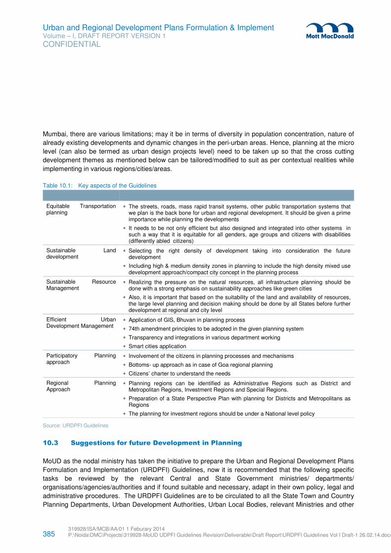
385 319928/ISA/MCB/AA/01 1 Feburary 2014 P:\Noida\DMC\Projects\319928-MoUD UDPFI Guidelines Revision\Deliverable\Draft Report\URDPFI Guidelines Vol I Draft-1 26.02.14.docx
Urban and Regional Development Plans Formulation & Implement Volume – I, DRAFT REPORT VERSION 1
CONFIDENTIAL
Mumbai, there are various limitations; may it be in terms of diversity in population concentration, nature of
already existing developments and dynamic changes in the peri-urban areas. Hence, planning at the micro
level (can also be termed as urban design projects level) need to be taken up so that the cross cutting
development themes as mentioned below can be tailored/modified to suit as per contextual realities while
implementing in various regions/cities/areas.
Table 10.1: Key aspects of the Guidelines
Equitable Transportation planning
• The streets, roads, mass rapid transit systems, other public transportation systems that we plan is the back bone for urban and regional development. It should be given a prime importance while planning the developments
• It needs to be not only efficient but also designed and integrated into other systems in such a way that it is equitable for all genders, age groups and citizens with disabilities (differently abled citizens)
Sustainable Land development
• Selecting the right density of development taking into consideration the future development
• Including high & medium density zones in planning to include the high density mixed use development approach/compact city concept in the planning process
Sustainable Resource Management
• Realizing the pressure on the natural resources, all infrastructure planning should be done with a strong emphasis on sustainability approaches like green cities
• Also, it is important that based on the suitability of the land and availability of resources, the large level planning and decision making should be done by all States before further development at regional and city level
Efficient Urban Development Management
• Application of GIS, Bhuvan in planning process
• 74th amendment principles to be adopted in the given planning system
• Transparency and integrations in various department working
• Smart cities application
Participatory Planning approach
• Involvement of the citizens in planning processes and mechanisms
• Bottoms- up approach as in case of Goa regional planning
• Citizens’ charter to understand the needs
Regional Planning Approach
• Planning regions can be identified as Administrative Regions such as District and Metropolitan Regions, Investment Regions and Special Regions.
• Preparation of a State Perspective Plan with planning for Districts and Metropolitans as Regions
• The planning for investment regions should be under a National level policy
Source: URDPFI Guidelines
10.3 Suggestions for future Development in Planning
MoUD as the nodal ministry has taken the initiative to prepare the Urban and Regional Development Plans
Formulation and Implementation (URDPFI) Guidelines, now it is recommended that the following specific
tasks be reviewed by the relevant Central and State Government ministries/ departments/
organisations/agencies/authorities and if found suitable and necessary, adapt in their own policy, legal and
administrative procedures. The URDPFI Guidelines are to be circulated to all the State Town and Country
Planning Departments, Urban Development Authorities, Urban Local Bodies, relevant Ministries and other
386 319928/ISA/MCB/AA/01 1 Feburary 2014 P:\Noida\DMC\Projects\319928-MoUD UDPFI Guidelines Revision\Deliverable\Draft Report\URDPFI Guidelines Vol I Draft-1 26.02.14.docx
Urban and Regional Development Plans Formulation & Implement Volume – I, DRAFT REPORT VERSION 1
CONFIDENTIAL
agencies which are involved in preparation of Master Plans/ Development Plans/Metropolitan Plans
/District Development Plans for their appropriate adoption.
In the regional workshop held in Panchkula during the drafting of the URDPFI Guidelines on 29.11.2013, it
was suggested that there is a need for statutory backing for these guidelines, so that the State
Governments mandatorily adopt the same. The matter was also deliberated in other workshops.
However, since Urban Development is a State Subject, it may not be possible to provide statutory backing
for these guidelines. In order to mainstream the guidelines, in the process of preparing the Master Plans/
Development Plans/Metropolitan Plans /District Development Plans, it would be desirable that all the State
Town and Country Planning Acts, Urban Development Authority Acts, Municipal Acts, Industrial
Development Corporation Acts may be aligned with URDPFI Guidelines.
10.3.1 Recommendations for the National Organisation(s)
1. Draft National Land Policy to consider the inclusion of primary division of land from the sensitivity point
of view. The six broad categories of Land Utilisation Zone (LUZs) to be primarily segregated into
developable and non-developable land for further segregation.
2. Model law needs to be reviewed and revised to simplify & suggest State Departments to come to a
unified legal and operational framework.
a. The Model Regional and Town Planning and Development Law was prepared in 1985, almost 30
years ago, since then many legislative and ideological changes have taken place in the
developmental approach of GoI. Also to incorporate the provisions of 74th CAA, the Model Regional
and Town Planning and Development Law requires a complete revision and restructuring.
Accordingly, an independent exercise for changes in the Model law in light to the suggestions made in
the URDPFI Guidelines, 2014, Volume – II could be undertaken.
b. The Model Municipal Law (MML), 2003 was introduced more than a decade back; it is pertinent that
the provisions of MML need to be updated to bring it in harmony with the recent developments in the
Municipal Law. The MoUD study undertaken by NUIA to review the MML, suggested various points for
revision of the provisions given in MML, based on their status of implementation. There are various
provisions in the current scenario that are vital for MML to bring it in line with the new developments in
municipal governance. Provisions like reservations of seats for Women/SC/ST/BC in Municipality,
Local Bodies/Municipal Ombudsman, functions and duties of Area Sabha Representative, disclosure
of various documents relating to municipal affairs, accrual based double entry system of accounts,
defining functions and responsibilities of DPCs and MPCs are suggested to be detailed out under the
MML. Such changes and more are suggested to be considered for the revision of the Model Municipal
Law.
3. Draft Town and Country Planners Registration Bill, 2012 is being prepared by Town and Country
Planning Organisation identifies the need for establishment of Council of Town and Country Planning.
Such Council is suggested to be body corporate, having continuous succession and a common seal.
The purpose of such Council is to control and regulate the quality of education institutions of Town and
Country Planning and qualified professionals from such institutes, in the country. It is suggested, that
the bill be given a legal status and adopted at the earliest. It could be explored that the certified
planners by the council are empowered to take decision on financial expenditure as appropriate for the
387 319928/ISA/MCB/AA/01 1 Feburary 2014 P:\Noida\DMC\Projects\319928-MoUD UDPFI Guidelines Revision\Deliverable\Draft Report\URDPFI Guidelines Vol I Draft-1 26.02.14.docx
Urban and Regional Development Plans Formulation & Implement Volume – I, DRAFT REPORT VERSION 1
CONFIDENTIAL
administrative position. Also, the Council could ensure that the task of urban and regional planning
must be only carried out by certified planners.
4. For integration of planning systems, both statutory and non-statutory plans, JnNURM to approve
Comprehensive Development Plan and Comprehensive Sanitation Plan and provide funding after
preparation of Development plan/ Master plan or Statutory Plans as per the State Government
provision.
5. It is suggested that the nomenclature of JnNURM’s ‘Comprehensive Development Plan’ be changed to
as ‘City Investment Plan’ to avoid confusion between the recommended statutory Development Plan
(the nomenclature) as per the State provision and ‘Comprehensive Development Plan’ as per
JnNURM.
6. While adopting the URDPFI Guidelines, it would be imperative to envisage Planning Information
System (PIS) on the lines of Management Information System (MIS). This will be essential as numbers
of agencies are involved in collection of attribute and spatial data. This often leads to duplicity of work
and ambiguity in terms of analysis and interpretation. Hence, it becomes necessary to streamline the
data collection, analysis and interpretation for preparing the Master Plans/ Development
Plans/Metropolitan Plans /District Development Plans. This will enable hastening the process of
preparation of Plans. It has been observed that the process of Plan Preparation often gets delayed
due to lack of availability of relevant spatial/attribute data.
7. National Remote Sensing Centre (NRSC) to take necessary actions for easy access and wider
popularity of Bhuvan and making it faster and user friendly. Ministry of Urban Development to extend
the necessary support for it. For compatibility of geo-spatial database other Ministries’ geospatial data
could be incorporated with the Bhuvan database, like Ministry of Drinking Water & Sanitation, Ministry
of Road Transport & Highways MoRTH, NIC. Already database from Geological Survey of India has
been integrated at appropriate scale with Bhuvan.
8. Lack of cadastral maps limits the use of Bhuvan landuse base for preparation of development plan/
Mater plan, and therefore, integration of the cadastral records at appropriate scale with National Land
Record Modernisation Programme is suggested which could provide ready to use geo-spatial and
revenue database pan India.
9. The centrally sponsored National Urban Information System (NUIS) Scheme approved by GoI with two
major components (i) Urban Spatial Information System (USIS) to meet the spatial data requirements
of urban planning & management (ii) National Urban Data Bank & Indicators (NUDB&I) to develop town
level urban database to support development of indices through a network of Local Urban
Observatories (LUO) under the National Urban Observatory (NUO) programme. These schemes and
programmes are suggested to be expedited for completion.
10. With the experience of the practitioners in the North eastern states, it is suggested to relook at the
Service Level Benchmarks SLBs, which should be flexible on such certain items, for example: extent
non-revenue water source could be additional 5%. MoUD to relook and assist the SLBs in hilly and
North-Eastern areas to redefine the SLBs.
11. E-governance, techniques and methods: Under the E-Governance, it has to be seen that how the
entire planning process gets expedited in a short period of time, wherein use of digital technology
should be maximized by way of preparing spatial database and integration of attribute data periodically.
It is recommended that the plans should be updated /revised through mid- term review, so as to
ascertain the efficacy of implementation, preferably every five years, which may be co-terminus with
the five year plans. Under E-governance, various processes related to planning like change of land
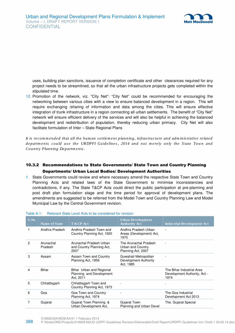
388 319928/ISA/MCB/AA/01 1 Feburary 2014 P:\Noida\DMC\Projects\319928-MoUD UDPFI Guidelines Revision\Deliverable\Draft Report\URDPFI Guidelines Vol I Draft-1 26.02.14.docx
Urban and Regional Development Plans Formulation & Implement Volume – I, DRAFT REPORT VERSION 1
CONFIDENTIAL
uses, building plan sanctions, issuance of completion certificate and other clearances required for any
project needs to be streamlined, so that all the urban infrastructure projects gets completed within the
stipulated time.
12. Promotion of the network, viz, “City Net”: “City Net” could be recommended for encouraging the
networking between various cities with a view to ensure balanced development in a region. This will
require exchanging /sharing of information and data among the cities. This will ensure effective
integration of trunk infrastructure in a region connecting all urban settlements. The benefit of “City Net”
network will ensure efficient delivery of the services and will also be helpful in achieving the balanced
development and redistribution of population, thereby reducing urban primacy. City Net will also
facilitate formulation of Inter – State Regional Plans
It is recommended that all the human settlement planning, infrastructure and administrative related
departments could use the URDPFI Guidelines, 2014 and not merely only the State Town and
Country Planning Departments.
10.3.2 Recommendations to State Governments/ State Town and Country Planning
Departments/ Urban Local Bodies/ Development Authorities
1. State Governments could review and where necessary amend the respective State Town and Country
Planning Acts and related laws of the State Government to minimise inconsistencies and
contradictions, if any. The State T&CP Acts could direct the public participation at pre-planning and
post draft plan formulation stage and the time period for approval of development plans. The
amendments are suggested to be referred from the Model Town and Country Planning Law and Model
Municipal Law by the Central Government revision.
Table A.1: Relevant State Level Acts to be considered for revision
S.No. Name of State T & CP Act
Urban Development Authority Act Industrial Development Act
1 Andhra Pradesh Andhra Pradesh Town and Country Planning Act, 1920
Andhra Pradesh Urban Areas (Development) Act, 1975
-
2 Arunachal Pradesh
Arunachal Pradesh Urban and Country Planning Act, 2007
The Arunachal Pradesh Urban and Country Planning Act, 2007
-
3 Assam Assam Town and Country Planning Act, 1959
Guwahati Metropolitan Development Authority Act, 1985
-
4 Bihar Bihar Urban and Regional Planning and Development Act, 2011
The Bihar Industrial Area Development Authority, Act -1974
5 Chhattisgarh Chhattisgarh Town and Country Planning Act, 1973
- -
6 Goa Goa Town and Country Planning Act, 1974
- The Goa Industrial Development Act 2013
7 Gujarat Gujarat Town Planning & Urban Development Act,
Gujarat Town Planning and Urban Devel
The. Gujarat Special
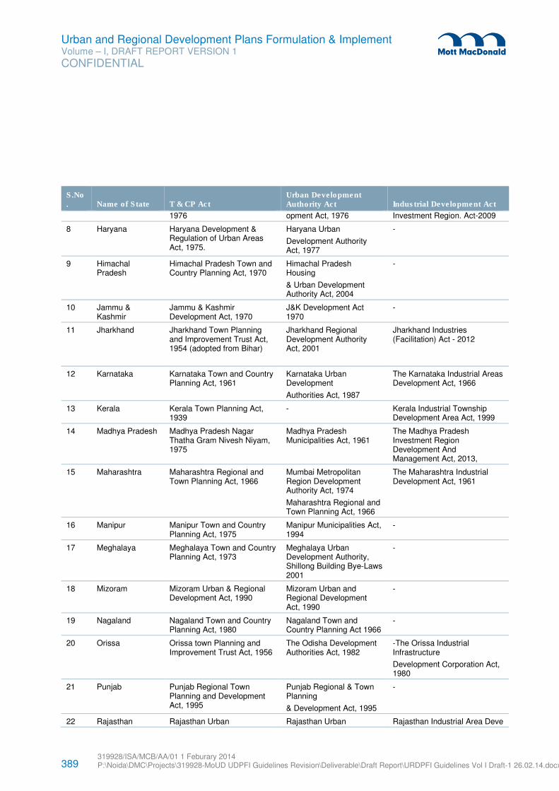
389 319928/ISA/MCB/AA/01 1 Feburary 2014 P:\Noida\DMC\Projects\319928-MoUD UDPFI Guidelines Revision\Deliverable\Draft Report\URDPFI Guidelines Vol I Draft-1 26.02.14.docx
Urban and Regional Development Plans Formulation & Implement Volume – I, DRAFT REPORT VERSION 1
CONFIDENTIAL
S.No. Name of State T & CP Act
Urban Development Authority Act Industrial Development Act
1976 opment Act, 1976 Investment Region. Act-2009
8 Haryana Haryana Development & Regulation of Urban Areas Act, 1975.
Haryana Urban
Development Authority Act, 1977
-
9 Himachal Pradesh
Himachal Pradesh Town and Country Planning Act, 1970
Himachal Pradesh Housing
& Urban Development Authority Act, 2004
-
10 Jammu & Kashmir
Jammu & Kashmir Development Act, 1970
J&K Development Act 1970
-
11 Jharkhand Jharkhand Town Planning and Improvement Trust Act, 1954 (adopted from Bihar)
Jharkhand Regional Development Authority Act, 2001
Jharkhand Industries (Facilitation) Act - 2012
12 Karnataka Karnataka Town and Country Planning Act, 1961
Karnataka Urban Development
Authorities Act, 1987
The Karnataka Industrial Areas Development Act, 1966
13 Kerala Kerala Town Planning Act, 1939
- Kerala Industrial Township Development Area Act, 1999
14 Madhya Pradesh Madhya Pradesh Nagar Thatha Gram Nivesh Niyam, 1975
Madhya Pradesh Municipalities Act, 1961
The Madhya Pradesh Investment Region Development And Management Act, 2013,
15 Maharashtra Maharashtra Regional and Town Planning Act, 1966
Mumbai Metropolitan Region Development Authority Act, 1974
Maharashtra Regional and Town Planning Act, 1966
The Maharashtra Industrial Development Act, 1961
16 Manipur Manipur Town and Country Planning Act, 1975
Manipur Municipalities Act, 1994
-
17 Meghalaya Meghalaya Town and Country Planning Act, 1973
Meghalaya Urban Development Authority, Shillong Building Bye-Laws 2001
-
18 Mizoram Mizoram Urban & Regional Development Act, 1990
Mizoram Urban and Regional Development Act, 1990
-
19 Nagaland Nagaland Town and Country Planning Act, 1980
Nagaland Town and Country Planning Act 1966
-
20 Orissa Orissa town Planning and Improvement Trust Act, 1956
The Odisha Development Authorities Act, 1982
-The Orissa Industrial Infrastructure
Development Corporation Act, 1980
21 Punjab Punjab Regional Town Planning and Development Act, 1995
Punjab Regional & Town Planning
& Development Act, 1995
-
22 Rajasthan Rajasthan Urban Rajasthan Urban Rajasthan Industrial Area Deve
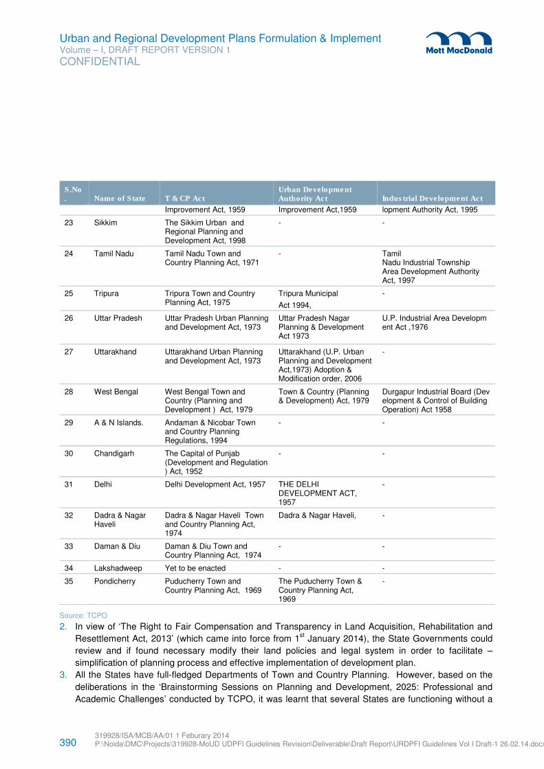
390 319928/ISA/MCB/AA/01 1 Feburary 2014 P:\Noida\DMC\Projects\319928-MoUD UDPFI Guidelines Revision\Deliverable\Draft Report\URDPFI Guidelines Vol I Draft-1 26.02.14.docx
Urban and Regional Development Plans Formulation & Implement Volume – I, DRAFT REPORT VERSION 1
CONFIDENTIAL
S.No. Name of State T & CP Act
Urban Development Authority Act Industrial Development Act
Improvement Act, 1959 Improvement Act,1959 lopment Authority Act, 1995
23 Sikkim The Sikkim Urban and Regional Planning and Development Act, 1998
- -
24 Tamil Nadu Tamil Nadu Town and Country Planning Act, 1971
- Tamil Nadu Industrial Township Area Development Authority Act, 1997
25 Tripura Tripura Town and Country Planning Act, 1975
Tripura Municipal
Act 1994,
-
26 Uttar Pradesh Uttar Pradesh Urban Planning and Development Act, 1973
Uttar Pradesh Nagar Planning & Development Act 1973
U.P. Industrial Area Development Act ,1976
27 Uttarakhand Uttarakhand Urban Planning and Development Act, 1973
Uttarakhand (U.P. Urban Planning and Development Act,1973) Adoption & Modification order, 2006
-
28 West Bengal West Bengal Town and Country (Planning and Development ) Act, 1979
Town & Country (Planning & Development) Act, 1979
Durgapur Industrial Board (Development & Control of Building Operation) Act 1958
29 A & N Islands. Andaman & Nicobar Town and Country Planning Regulations, 1994
- -
30 Chandigarh The Capital of Punjab (Development and Regulation ) Act, 1952
- -
31 Delhi Delhi Development Act, 1957 THE DELHI DEVELOPMENT ACT, 1957
-
32 Dadra & Nagar Haveli
Dadra & Nagar Haveli Town and Country Planning Act, 1974
Dadra & Nagar Haveli, -
33 Daman & Diu Daman & Diu Town and Country Planning Act, 1974
- -
34 Lakshadweep Yet to be enacted - -
35 Pondicherry Puducherry Town and Country Planning Act, 1969
The Puducherry Town & Country Planning Act, 1969
-
Source: TCPO
2. In view of ‘The Right to Fair Compensation and Transparency in Land Acquisition, Rehabilitation and
Resettlement Act, 2013’ (which came into force from 1st January 2014), the State Governments could
review and if found necessary modify their land policies and legal system in order to facilitate –
simplification of planning process and effective implementation of development plan.
3. All the States have full-fledged Departments of Town and Country Planning. However, based on the
deliberations in the ‘Brainstorming Sessions on Planning and Development, 2025: Professional and
Academic Challenges’ conducted by TCPO, it was learnt that several States are functioning without a
391 319928/ISA/MCB/AA/01 1 Feburary 2014 P:\Noida\DMC\Projects\319928-MoUD UDPFI Guidelines Revision\Deliverable\Draft Report\URDPFI Guidelines Vol I Draft-1 26.02.14.docx
Urban and Regional Development Plans Formulation & Implement Volume – I, DRAFT REPORT VERSION 1
CONFIDENTIAL
qualified Director/Chief Town Planner as the post is being held either by an Administrator or charge is
given to Senior Town Planner. Hence, the cities/towns of such States continue to suffer from lack of
attention to the development aspects apart from infrastructure deficiencies and ad-hoc decisions which
lead to mismatch between the actual availability and requirement of the infrastructure facilities. It is
suggested that all State Governments appoint a qualified Town Planner as the head of State Town and
Country Department.
4. Regulatory Authority at the State level: The institutional reforms suggested by the URDPFI Guidelines,
2014 could be embraced by State Governments by constitution of an Urban and Regional
Development Regulatory Authority at State level and creation of City Level Infrastructure Fund. The
regulatory authority at the state level may function as an appellate authority to address the grievances
redressal. It shall also list of authorities and roles and responsibilities to avoid multiplicity. The
regulatory body could review the smooth functioning of the agencies to overcome the multiplicity,
duplication or gaps.
5. City Infrastructure Fund could raise funds from direct and indirect taxes which have direct relevance to
urban and state subjects, this consolidated fund at State and ULBs level to be exclusively used for
urban infrastructure.
6. State Finance Commission could bring uniformity in accounting and budgeting at municipal level.
TCPO, IIPA, NUIA to recommend a uniformed accounting system based on the JnNURM reform(s).
The Model Municipal Law could be revised keeping in view of the same.
7. State level policy could be adopted for institutional requirements to meet the demand of manpower in
planning:
– Every State could have a Planning School.
– Standardization of nomenclature for planning courses.
– Schools of Planning could have continuous interface with the profession/industry.
8. Under the attempts to improve implementation of plans, State Governments could develop Good
Governance systems, including:
i. Citizen’s charters could be formulated by the State government taking into account the local
condition that determine level and discharge of the services. This may include items like issue
of licence, approval of building plans, issue of completion certificate etc. This could consider
Right to Information (RTI) system also.
ii. Direct responsibility of the project progress by the responsible field officers to chief of the
division/ departments.
iii. The details of the start and progress of the local projects including financial and time allocation
could be displayed publically, at strategic locations within the development sites and updated
regularly.
iv. Maintenance of regular updated land and property records preferably with the changes of land
use in land transactions. This database integrated with GIS maps should be on a digital
platform easily accessible to the public. This approach will also initiate SMART city concept.
v. The practice of monitoring land prices in cities as followed by some cities including Delhi
Development Authority. Monitoring and dissemination of land/ property prices should be done
by Development /State Authorities for benefit of real estate market.
9. Respective State Town and Country Planning Department to approach NRSC/Bhuvan for the
authorised access to the spatial data and attribute data for the preparation of Master Plan/
392 319928/ISA/MCB/AA/01 1 Feburary 2014 P:\Noida\DMC\Projects\319928-MoUD UDPFI Guidelines Revision\Deliverable\Draft Report\URDPFI Guidelines Vol I Draft-1 26.02.14.docx
Urban and Regional Development Plans Formulation & Implement Volume – I, DRAFT REPORT VERSION 1
CONFIDENTIAL
development plan. Each State/ UT to identify one town/city (medium/ metropolitan size) Master Plan
pilot project on Bhuvan platform.
10. Creation of real time demographic and other database at State level which can be accessible to public
on Government website. This should be integrated on a National level platform. Use of advanced
techniques for digital database and hyper database uploaded on the website which is user-friendly.
11. Every State should formulate the State Level Planning Guidelines within the Framework of URDPFI
Guidelines (making key amendments in the provisions as per the State’s vision or contextual
requirements) and National and State level policies.
12. In order to promote affordable housing for low income & EWS, grant for additional FSI may be used as
leverage to private developers, within the norms set by the State Governments.
13. In order to promote the visionary approach of urban and regional development, facilitation of effective
implementation of the plan it is necessary to have availability of number of qualified planners at the
state level and municipal level.
393 319928/ISA/MCB/AA/01 1 Feburary 2014 P:\Noida\DMC\Projects\319928-MoUD UDPFI Guidelines Revision\Deliverable\Draft Report\URDPFI Guidelines Vol I Draft-1 26.02.14.docx
Urban and Regional Development Plans Formulation & Implement Volume – I, DRAFT REPORT VERSION 1
CONFIDENTIAL
Appendices
Appendix A. Making of the Guidelines ___________________________________________________________ 394 Appendix B. Basic Planning Definition ___________________________________________________________ 418 Appendix C. PPP Models in existing scenario ______________________________________________________ 429 Appendix D. List of Recognised Institutes _________________________________________________________ 435 Appendix E. Waste Water Recycling Techniques ___________________________________________________ 436 Appendix F. Hierarchy of Social Infrastructure Development __________________________________________ 443 Appendix G. Transport Survey Format ___________________________________________________________ 447 Appendix H. Road Cross Sections ______________________________________________________________ 482
394 319928/ISA/MCB/AA/01 1 Feburary 2014 P:\Noida\DMC\Projects\319928-MoUD UDPFI Guidelines Revision\Deliverable\Draft Report\URDPFI Guidelines Vol I Draft-1 26.02.14.docx
Urban and Regional Development Plans Formulation & Implement Volume – I, DRAFT REPORT VERSION 1
CONFIDENTIAL
A.1 Background and Objective
The first National level planning guidelines ‘The Urban Development Plans Formulations and
Implementation Guidelines’ (UDPFI) were framed in 1996. Since then, many changes have taken place in
the field of urban development especially in view of emerging needs and requirements of urban
settlements due to rapid population growth and other reasons like globalization and liberalization. The
towns and cities have been more dynamic in nature and are subject to unprecedented changes in terms of
requirements of infrastructure and other basic services/ amenities. Besides, new emerging aspects like
inclusive planning, sustainable habitat, land use and transport integration at planning stage, preparation of
Comprehensive Mobility Plans (CMP) for urban transport, Service Level Benchmarks, disaster
management, environmentally sustainable transport and urban reforms have given a new dimension to the
planning process. Therefore, it necessitated to revisit the UDPFI Guidelines, 1996.
The Ministry of Urban Development (MoUD), through the standard tendering procedures, awarded the task
to revise the guidelines to Mott MacDonald (referred to as Consultant) in August 2013. The time frame was
9 months. The objective was to revise ‘The Urban Development Plans Formulation & Implementation
(UDPFI) Guidelines, 1996’ and formulate-
“The Urban and Regional Development Plans Formulation & Implementation (URDPFI) Guidelines,
2014”
A.2 Terms of Reference (ToR)
Ministry of Urban Development proposed to formulate the URDPFI Guidelines, 2014 to accommodate the
future needs of the ever growing population coupled with urbanization with the following Terms of
Reference (ToR):
� Review the UDPFI Guidelines, 1996, revise and prepare the URDPFI guidelines;
� Undertake stakeholder consultation with all relevant stakeholders;
� Consult key Ministries and the Planning Commission, NCRPB, MMRDA and other relevant State and
Central Ministries, Bodies or Authorities;
� Study relevant Central and State Laws , rules and regulations;
� Address to the data available with BHUVAN, ISRO, NESAC, NUIS Census 2001 and 2011, Survey of
India and GIS database of NIC;
� Integration of different types of plans;
� Identify the gaps where new set of norms and standards for plan formulation are required;
� Suggest a clear-cut framework for plan formulation in view of the emerging scenario of the country’s
urbanization and overall vision;
� Suggest the new set of norms and standards, zoning regulations including integrated development of
peri-urban areas which are easily comprehensible and user-friendly;
� Suggest framework and standards, for transit oriented development, affordable housing projects and
slum redevelopment and incorporate principles of inclusive development;
� Suggest set of norms and standards for land use and transport integration at planning stage itself,
integration of CMP with the master plan of the planning area;
Appendix A. Making of the Guidelines
395 319928/ISA/MCB/AA/01 1 Feburary 2014 P:\Noida\DMC\Projects\319928-MoUD UDPFI Guidelines Revision\Deliverable\Draft Report\URDPFI Guidelines Vol I Draft-1 26.02.14.docx
Urban and Regional Development Plans Formulation & Implement Volume – I, DRAFT REPORT VERSION 1
CONFIDENTIAL
� Suggest planning, regulatory and enforcement mechanisms for effectively dealing with challenges of
urbanization;
� Suggest set of norms and standards for earthquake prone areas, environmentally fragile zones such as
CRZ areas and hazard prone areas etc.;
� Suggest mechanism for improving economic opportunities of cities;
� Include framework for Crisis/Disaster Management Plans as part of Development Plan;
� Suggest mechanism and avenues for participatory planning; and
� Suggest various resource mobilization options and institutional supporting systems for urban
development.
� Assess the Legal Implications and framework for plan preparation, monitoring and impact assessment
of the Master Plans.
� Evolve participatory plan approach including planning at ULBs, planning for peri-urban areas and
provide for integration between different levels of plan.
A.3 Scope of Work
While formulating the URDPFI Guidelines,2014 the following issues was to be focussed upon as was
indicated by the MOUD :
1. The service level benchmarks developed by the MoUD.
2. A broad based consultation process by developing a discussion portal and disseminating the
Guidelines in regional language.
3. Integration between different levels of plans including integration of City Development Plan and
Comprehensive Mobility Plan (CMP) with statutory Master Plan.
4. Integrated land use transport planning with priority to public transport and non-motorised transport.
5. A separate volume on legal aspects.
6. Need for assessing the impact of the plan on growth, employment etc. in a quantifiable manner to
make it more acceptable to various stakeholders.
7. A separate chapter should be included on redevelopment of inner city areas as well the city as a whole,
with densification along mass transit corridors.
8. A separate Chapter on Urban Transport Impact Assessment for different land use scenarios in terms of
overall travel demand, average trip length Maximum time of travel by public transport (for 80% of the
trips) in peak time.
9. Guidelines for regional planning including for interstate region that would require cross cutting
interventions from zonal administration.
10. Norms and standards for earthquake prone areas, environmentally fragile zones such as CRZ areas
and hazard prone areas etc.
11. Framework to make Crisis/Disaster Management Plans a part of Development Plan.
12. Use of GIS technologies for plan formulation including integration with Bhuvan and Google Map etc.
13. Dovetailing the guidelines with various statutory provisions as also the recommendations of 2nd
Administrative Reforms Commission and the Working Group on Urban Planning.
14. Measures to tackle the problems arising out of the transition of rural areas into peri urban and urban
areas.
396 319928/ISA/MCB/AA/01 1 Feburary 2014 P:\Noida\DMC\Projects\319928-MoUD UDPFI Guidelines Revision\Deliverable\Draft Report\URDPFI Guidelines Vol I Draft-1 26.02.14.docx
Urban and Regional Development Plans Formulation & Implement Volume – I, DRAFT REPORT VERSION 1
CONFIDENTIAL
15. Include guidelines for special purpose cities, industrial towns, smart cities, port cities, sport cities,
heritage cities, medicities, IT corridors, corridor (main and subsidiary), SEZ, Hi tech cities, greenfield
towns, hill towns etc.
16. Focus on land suitability and urban renewal norms.
17. One National Workshop and three Regional Workshops to be organized with at least one workshop in
the eastern region with State T&CP Department, Urban Development Department, Transport
Department, Traffic Police, Development Authorities, UMTAs and Local Bodies.
18. Links with the National Building Code and parameter under National Mission for Sustainable Habitat.
19. Include plans for water, sanitation and drainage.
20. Principles for determination of the costs (capital & recurring) to implement the different aspects of the
plan along with specific measures to meet such costs.
21. Uniform/ standardisation of colour code
22. Framework for implementation of the plan, including governance of the same.
23. Ultimately, the URDPFI guidelines should culminate in a responsive planning system.
A.4 Approach and Methodology for the Revision Study
A.4.1 Approach
With the vision to encompass and provide for the holistic urban and regional development for the entire
land cover of India, the crucial approach followed in the formulation of URDPFI Guidelines, 2014
comprised of a participatory consultation of the various stakeholders through the following pathways, viz:
1) Formulation of Technical Core Group (TCG): TCG was formed by MoUD for this revision. The
consultant held periodic interactions with the TCG members formally and informally for getting
inputs. The role of TCG members included:
� Co-ordination with the consultant on technical aspects
� Technical inputs & area specific recommendations
� Review the consultant's work at various stages
� Guide & support - data collection, stakeholder consultation and workshops
2) Google Discussion Group: An online group was facilitated by TCPO which allowed interface of
various planners and practitioners for the following:
� Technical inputs & area specific recommendations
� Sharing of information
� Technical feedback & interaction
3) Monthly Review Meetings with MoUD: The review meetings were held by MoUD for the
consultant to appraise the progress of the project and highlight the key issues for inclusion in the
guidelines.
397 319928/ISA/MCB/AA/01 1 Feburary 2014 P:\Noida\DMC\Projects\319928-MoUD UDPFI Guidelines Revision\Deliverable\Draft Report\URDPFI Guidelines Vol I Draft-1 26.02.14.docx
Urban and Regional Development Plans Formulation & Implement Volume – I, DRAFT REPORT VERSION 1
CONFIDENTIAL
4) Key Consultations: The foremost criteria adopted in provisions of the URDPFI guidelines, 2014
were to make them in concomitance with the provisions of the Policies/ Guidelines/ Acts/ Bills of
various other Ministries and Departments.
5) Regional workshops and National Consultative meeting: A total of five Regional workshops
were conducted to invite comments from all the 35 States and Union Territories of India. Regional
workshops were organised wherein the planning aspects varying across States were discussed
and approach to planning in future was directed. Regional workshops were held at Panchkula,
Mysore, Goa, Guwahati and Bhubaneswar. The National Consultative meeting is proposed to be
organised in New Delhi in the 1st week of April 2014 to deliberate on the aspects of the guidelines
to holistically consult with National and State level stakeholders.
All the key suggestions, comments and provisions obtained from the legal documents and the
consultations have been comprehensively incorporated in the URDPFI Guidelines, 2014 amongst other
inclusions upon appraisal at various stages.
A.4.2 Methodology
The methodology adopted for formulation of the guidelines is described in the chart below:
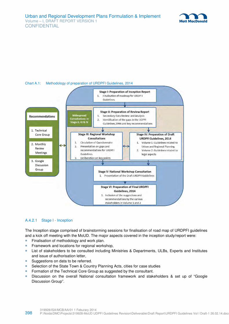
398 319928/ISA/MCB/AA/01 1 Feburary 2014 P:\Noida\DMC\Projects\319928-MoUD UDPFI Guidelines Revision\Deliverable\Draft Report\URDPFI Guidelines Vol I Draft-1 26.02.14.docx
Urban and Regional Development Plans Formulation & Implement Volume – I, DRAFT REPORT VERSION 1
CONFIDENTIAL
Chart A.1: Methodology of preparation of URDPFI Guidelines, 2014
A.4.2.1 Stage I - Inception
The Inception stage comprised of brainstorming sessions for finalisation of road map of URDPFI guidelines
and a kick off meeting with the MoUD. The major aspects covered in the inception study/report were:
� Finalisation of methodology and work plan.
� Framework and locations for regional workshop,
� List of stakeholders to be consulted including Ministries & Departments, ULBs, Experts and Institutes
and issue of authorisation letter,
� Suggestions on data to be referred.
� Selection of the State Town & Country Planning Acts, cities for case studies
� Formation of the Technical Core Group as suggested by the consultant.
� Discussion on the overall National consultation framework and stakeholders & set up of “Google
Discussion Group”.
399 319928/ISA/MCB/AA/01 1 Feburary 2014 P:\Noida\DMC\Projects\319928-MoUD UDPFI Guidelines Revision\Deliverable\Draft Report\URDPFI Guidelines Vol I Draft-1 26.02.14.docx
Urban and Regional Development Plans Formulation & Implement Volume – I, DRAFT REPORT VERSION 1
CONFIDENTIAL
A.4.2.2 Stage II - Review & Analysis
The second stage undertook secondary data review & analysis of the UDPFI guidelines, 1996. During this
stage the stakeholder consultations were initiated which followed through the Stages III and IV.
Secondary Data Review: The secondary data of various Ministries, Departments, Institutions and
Professional Bodies uploaded on websites such as of Planning Commission; Ministry of Urban
Development; Ministry of Drinking Water Supply and Sanitation; Ministry of Environment and Forests;
Department of Land Resources, Ministry of Rural Development, etc. and various City Master/ Development
Plans were identified for review and analysis. Some of the important references included - Report of the
Working Group on Urban Strategic Planning, Twelfth Five Year Plan, Public Private Partnership Toolkit of
ADB and MoUD, JNNURM CDP Toolkit, The Land Acquisition, Rehabilitation and Resettlement Act, 2013,
Handbook on Service Level Benchmarking, National Urban Sanitation Policy, NDMA Guidelines for
Disaster Management, State Town and Country Planning Acts of Tamil Nadu, Karnataka, Himachal
Pradesh, Mizoram, Bihar, Maharashtra and Gujarat, The Kerala Town and Country Planning Ordinance,
2013 etc.
Based on the secondary data review, analysis and consultations; the gaps in the UDPFI guidelines, 1996
were identified. As an output of analysis, the recommendations for formulation of URDPFI guidelines were
listed. The gaps and updations were finalised in close consultation with the TCG and MoUD.
Stakeholder consultations: After secondary data review, consultations were through telephonic
conversation/ email/ face to face meetings. This undertook in depth interview and assisted in crystallisation
of the vision of the URDPFI guidelines. The major consultations corresponding to the information obtained
were:
Table A.1: Major Stakeholder Consultations and Key Inputs
Sr. No. Particulars Consultations
1. Planning Process a) Planning Commission
b) Registrar General of India
c) Survey of India (SoI)
d) Town and Country Planning Organisation, Delhi (TCPO)
e) Ahmedabad Urban Development Authority (AUDA)
f) Delhi Development Authority (DDA)
g) Association of Municipalities and Development Authorities (AMDA)
h) Jawaharlal Nehru National Urban Renewal Mission (JNNURM)
i) School of Planning & Architecture, Delhi (SPA, Delhi)
2. Urban Planning Approach a) Ministry of Shipping
b) Ministry of Tourism Indian Green Building Council (IGBC)
c) Directorate General of Defence Estates
d) Delhi Urban Arts Commission (DUAC)
e) Institute of Town Planners (ITP)
f) EMBARQ, India
g) Hyderabad Metropolitan Development Authority (HMDA)
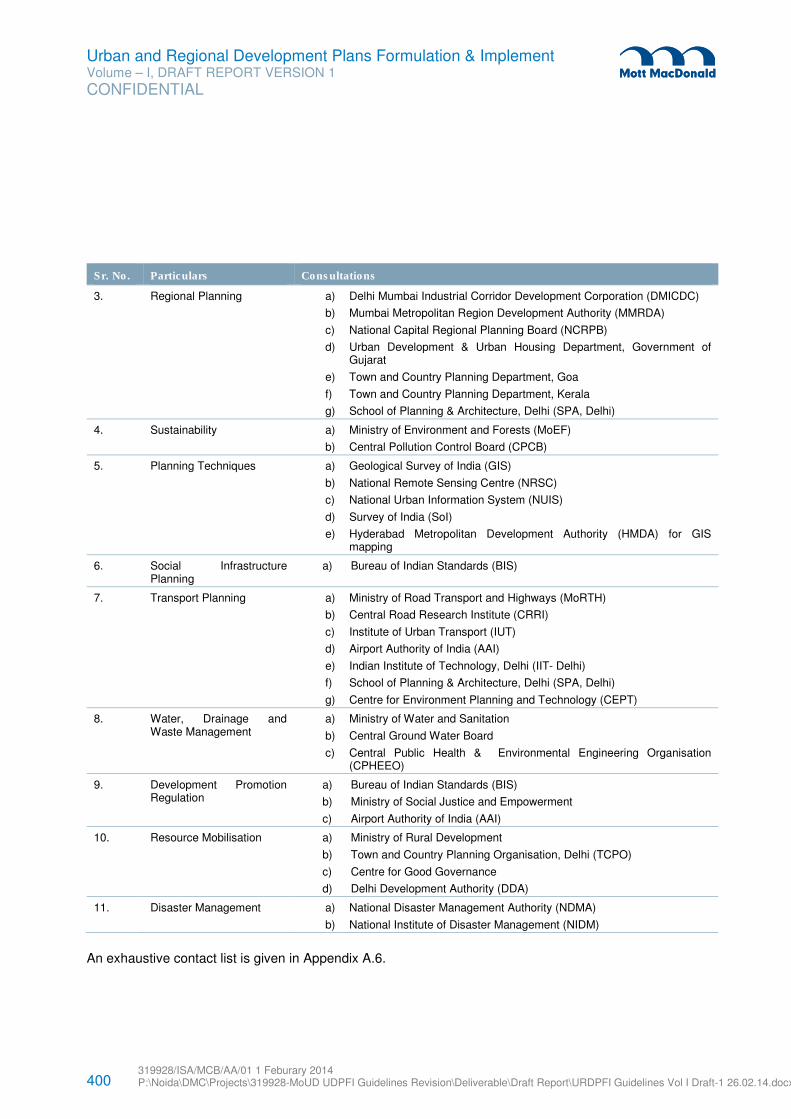
400 319928/ISA/MCB/AA/01 1 Feburary 2014 P:\Noida\DMC\Projects\319928-MoUD UDPFI Guidelines Revision\Deliverable\Draft Report\URDPFI Guidelines Vol I Draft-1 26.02.14.docx
Urban and Regional Development Plans Formulation & Implement Volume – I, DRAFT REPORT VERSION 1
CONFIDENTIAL
Sr. No. Particulars Consultations
3. Regional Planning a) Delhi Mumbai Industrial Corridor Development Corporation (DMICDC)
b) Mumbai Metropolitan Region Development Authority (MMRDA)
c) National Capital Regional Planning Board (NCRPB)
d) Urban Development & Urban Housing Department, Government of Gujarat
e) Town and Country Planning Department, Goa
f) Town and Country Planning Department, Kerala
g) School of Planning & Architecture, Delhi (SPA, Delhi)
4. Sustainability a) Ministry of Environment and Forests (MoEF)
b) Central Pollution Control Board (CPCB)
5. Planning Techniques a) Geological Survey of India (GIS)
b) National Remote Sensing Centre (NRSC)
c) National Urban Information System (NUIS)
d) Survey of India (SoI)
e) Hyderabad Metropolitan Development Authority (HMDA) for GIS mapping
6. Social Infrastructure Planning
a) Bureau of Indian Standards (BIS)
7. Transport Planning a) Ministry of Road Transport and Highways (MoRTH)
b) Central Road Research Institute (CRRI)
c) Institute of Urban Transport (IUT)
d) Airport Authority of India (AAI)
e) Indian Institute of Technology, Delhi (IIT- Delhi)
f) School of Planning & Architecture, Delhi (SPA, Delhi)
g) Centre for Environment Planning and Technology (CEPT)
8. Water, Drainage and Waste Management
a) Ministry of Water and Sanitation
b) Central Ground Water Board
c) Central Public Health & Environmental Engineering Organisation (CPHEEO)
9. Development Promotion Regulation
a) Bureau of Indian Standards (BIS)
b) Ministry of Social Justice and Empowerment
c) Airport Authority of India (AAI)
10. Resource Mobilisation a) Ministry of Rural Development
b) Town and Country Planning Organisation, Delhi (TCPO)
c) Centre for Good Governance
d) Delhi Development Authority (DDA)
11. Disaster Management a) National Disaster Management Authority (NDMA)
b) National Institute of Disaster Management (NIDM)
An exhaustive contact list is given in Appendix A.6.
401 319928/ISA/MCB/AA/01 1 Feburary 2014 P:\Noida\DMC\Projects\319928-MoUD UDPFI Guidelines Revision\Deliverable\Draft Report\URDPFI Guidelines Vol I Draft-1 26.02.14.docx
Urban and Regional Development Plans Formulation & Implement Volume – I, DRAFT REPORT VERSION 1
CONFIDENTIAL
A.4.2.3 Stage III – Regional Workshop Consultation
The preparation of the Draft URDPFI Guidelines and organisation of Regional Workshops at five locations
were held. The agenda of the regional workshop consultations were:
� Learning from State specific best practices and planning innovations
� Identification of the sources to bridge data gaps
� Sharing of guidelines/ policies and other data
The agenda was attained by a three step procedure followed in the workshops:
a) Circulation of questionnaire: the questionnaire was circulated in advance to the identified
stakeholders for receiving their comments
b) Presentation: presentation of the identification of gaps in UDPFI guidelines,1996 and major
recommendations for the URDPFI Guidelines, 2014
c) Deliberations on key points
During the workshops most of the States responded to the questionnaire circulated and provided database
for reference. Alongwith this, some States gave presentations on chosen best practices such as Planning
in Hilly Areas by Shimla, Himachal Pradesh; Regional planning process by Goa, Plan preparation process
by Kerala, Village level planning in Rajasthan etc. The Regional Workshops provided a good platform for
communication of URDPFI vision and dovetailing the expectations of the various stakeholders and also
getting inputs on best practices.
States and UTs of Andhra Pradesh, Himachal Pradesh, Karnataka, Kerala, Maharashtra, Puducherry,
Punjab, Rajasthan, Uttar Pradesh, Uttarakhand, Goa, Sikkim, Tripura, Odisha shared comments on UDPFI
Guidelines, 1996 and suggestions for the URDPFI Guidelines, 2014 in writing. Ministries including Ministry
of Defence, Directorate General of Defence Estates, Ministry of Shipping, Ministry of Railways, Ministry of
Rural Development, Ministry of Road, Transport and Highways, Ministry of Water Resources extended
great help in the formulation of the Guidelines.
Further suggestions were invited from the States on “Google Discussion Group”. Some academic
institutions such as Indian Institute of Technology, Kharagpur; School of Planning and Architecture,
Vijaywada, College of Engineering, Pune, Department of Architecture and Planning, College of
Engineering, Trivandrum shared their comments.
Recommendations from Regional Consultation: At this stage an analysis of the suggestions was made
and a concise recommendation report of all the workshops was prepared. The key points from the
recommendation report were appropriately addressed in the URDPFI Guidelines upon consultation with
MoUD and TCG.
402 319928/ISA/MCB/AA/01 1 Feburary 2014 P:\Noida\DMC\Projects\319928-MoUD UDPFI Guidelines Revision\Deliverable\Draft Report\URDPFI Guidelines Vol I Draft-1 26.02.14.docx
Urban and Regional Development Plans Formulation & Implement Volume – I, DRAFT REPORT VERSION 1
CONFIDENTIAL
A.4.2.4 Stage IV – Drafting of URDPFI Guidelines
Drafting of Volume I- Guidelines related to Urban and Regional Planning
Based on the inputs from stage I to III and the gaps in the existing UDPFI guidelines, the Draft URDPFI
guidelines were prepared containing the following points. In preparation of the guidelines, some of the
sections of UDPFI Guidelines were retained which were applicable in the current planning scenario.
� Reclassification of the urban settlements
� Recommended planning system, Planning process including the inter relationships between various
plans and their contents
� Resource mobilisation and options for land assembly, fiscal resource mobilisation and institutional set
up.
� A separate chapter on Regional Planning and land use classification including peri-urban areas.
� Revised urban planning approach and planning based on city typologies such as hilly, inner city,
industrial, heritage/ religious/ tourism, port, medical and sport cities. An introduction to the planning
aspects of compact city covering TOD and Mixed use, green city/ township and Smart city.
� Inclusion of mandatory aspects of sustainability- sustainable transportation viz a viz landuse planning,
disaster management, environment statutory obligations etc.
� Techniques for plan preparation including GIS based planning through use of Bhuvan and allied
portals.
� Guidelines for assessment of infrastructure demand for the newer kind of integrated developments
� Dovetailing with various statutory provisions including recommendations of 2nd Administrative Reforms
Commission, Working Group on Planning, 73rd
and 74th CAA.
� A chapter on recommendations and action plan based on rationality.
Drafting of Volume II- Guidelines related to legal aspects
A separate volume on legal aspects was formulated, especially focussing on:
� Implications of the 74th CAA
� Land Acquisition Rehabilitation and Resettlement Act, 2013
� Suggestions on the revision of Model Regional and Town Planning and Development law and Model
Municipal law
� Some of the State level Legal framework were compared to bring out advantages and disadvantages
� Legal requirements for industrial developments
� Other National level legal requirements for heritage and environment conservation
The draft URDPFI guidelines including its chapterisation structure was prepared in consultation with the
various stakeholders. Further draft technical sections were shared with respective agencies for their inputs
such as NRSC, NDMA, AAI, various departments of SPA, Delhi etc. who confirmed the provisions with
reference to their statutory requirements/ key suggestions. The glossary of the reference is given in
Appendix A.7.
The draft URDFPI guideline is proposed to be circulated to all Ministries, inviting comments and
suggestions for inclusion/ making modifications in the guidelines.
403 319928/ISA/MCB/AA/01 1 Feburary 2014 P:\Noida\DMC\Projects\319928-MoUD UDPFI Guidelines Revision\Deliverable\Draft Report\URDPFI Guidelines Vol I Draft-1 26.02.14.docx
Urban and Regional Development Plans Formulation & Implement Volume – I, DRAFT REPORT VERSION 1
CONFIDENTIAL
A.4.2.5 Stage V & Stage VI: National Consultative Meeting and formulation of Final URDPFI Guidelines,
2014
A National Consultative meeting is proposed to be held in Delhi for a holistic consultation on the Draft
Guidelines. The finalisation of stakeholders will be done in close consultation with MoUD. Based on the
comments and recommendation on the Draft Guidelines and outputs of consultative meeting, the Draft
Guidelines will be updated to the Final URDPFI Guidelines.
404 319928/ISA/MCB/AA/01 1 Feburary 2014 P:\Noida\DMC\Projects\319928-MoUD UDPFI Guidelines Revision\Deliverable\Draft Report\URDPFI Guidelines Vol I Draft-1 26.02.14.docx
Urban and Regional Development Plans Formulation & Implement Volume – I, DRAFT REPORT VERSION 1
CONFIDENTIAL
A.5 Organisation of the Research Study
A.5.1 Project Team
Mr. B. Misra, Team Leader
Ms. Shoma Majumdar, Project Director
Ms. Richa Rathi Thakkar, Project Manager
Core Team Members
Mr. Pramod Kumar
Ms. Madhurima Waghmare
Mr. Shubham Rathore
Ms. Akriti Bhatia
Ms. Vandana Sain
Consultative Members
Mr. Pankaj Trivedi,
Ms. Aditi Singh
Ms. Shagufta Noor
Mr. Rajnish Kumar,
Mr. Ronak Soni
Mr. Madhu Nair
Mr. Anubhav Tyagi
405 319928/ISA/MCB/AA/01 1 Feburary 2014 P:\Noida\DMC\Projects\319928-MoUD UDPFI Guidelines Revision\Deliverable\Draft Report\URDPFI Guidelines Vol I Draft-1 26.02.14.docx
Urban and Regional Development Plans Formulation & Implement Volume – I, DRAFT REPORT VERSION 1
CONFIDENTIAL
A.5.2 Technical Core Group Team
As per MoUD, Office Memorandum, dated 2nd
September, 2013.
Joint Secretary (UD), MoUD, Chairperson
Chief Planner, TCPO, Member Convenor
Consultative Members
Ms. Swati Ramanathan, India Urban Space Foundation
Town Planner, TCPO
Chief Regional Planner, NCRPB
Director, NIUA
Director General, Institute of Urban Transport, MoUD
Director, Centre for Research, Documentation & Training (CRDT), Institute of Town
Planners India
Head, Department of Physical Planning, School of Planning & Architecture, New Delhi
Head, Deptt of Transport Planning, School of Planning & Architecture, New Delhi
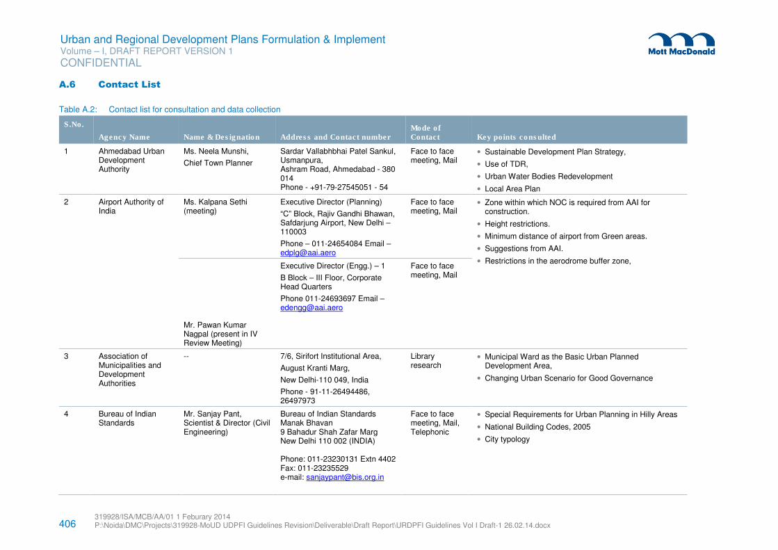
406 319928/ISA/MCB/AA/01 1 Feburary 2014 P:\Noida\DMC\Projects\319928-MoUD UDPFI Guidelines Revision\Deliverable\Draft Report\URDPFI Guidelines Vol I Draft-1 26.02.14.docx
Urban and Regional Development Plans Formulation & Implement Volume – I, DRAFT REPORT VERSION 1
CONFIDENTIAL
A.6 Contact List
Table A.2: Contact list for consultation and data collection
S.No.
Agency Name Name & Designation Address and Contact number Mode of Contact Key points consulted
1 Ahmedabad Urban Development Authority
Ms. Neela Munshi,
Chief Town Planner
Sardar Vallabhbhai Patel Sankul, Usmanpura, Ashram Road, Ahmedabad - 380 014 Phone - +91-79-27545051 - 54
Face to face meeting, Mail
• Sustainable Development Plan Strategy,
• Use of TDR,
• Urban Water Bodies Redevelopment
• Local Area Plan
2 Airport Authority of India
Ms. Kalpana Sethi (meeting)
Executive Director (Planning)
“C” Block, Rajiv Gandhi Bhawan, Safdarjung Airport, New Delhi – 110003
Phone – 011-24654084 Email – [email protected]
Face to face meeting, Mail
• Zone within which NOC is required from AAI for construction.
• Height restrictions.
• Minimum distance of airport from Green areas.
• Suggestions from AAI.
• Restrictions in the aerodrome buffer zone,
Mr. Pawan Kumar Nagpal (present in IV Review Meeting)
Executive Director (Engg.) – 1
B Block – III Floor, Corporate Head Quarters
Phone 011-24693697 Email – [email protected]
Face to face meeting, Mail
3 Association of Municipalities and Development Authorities
-- 7/6, Sirifort Institutional Area,
August Kranti Marg,
New Delhi-110 049, India
Phone - 91-11-26494486, 26497973
Library research
• Municipal Ward as the Basic Urban Planned Development Area,
• Changing Urban Scenario for Good Governance
4 Bureau of Indian Standards
Mr. Sanjay Pant, Scientist & Director (Civil Engineering)
Bureau of Indian Standards Manak Bhavan 9 Bahadur Shah Zafar Marg New Delhi 110 002 (INDIA) Phone: 011-23230131 Extn 4402 Fax: 011-23235529 e-mail: [email protected]
Face to face meeting, Mail, Telephonic
• Special Requirements for Urban Planning in Hilly Areas
• National Building Codes, 2005
• City typology
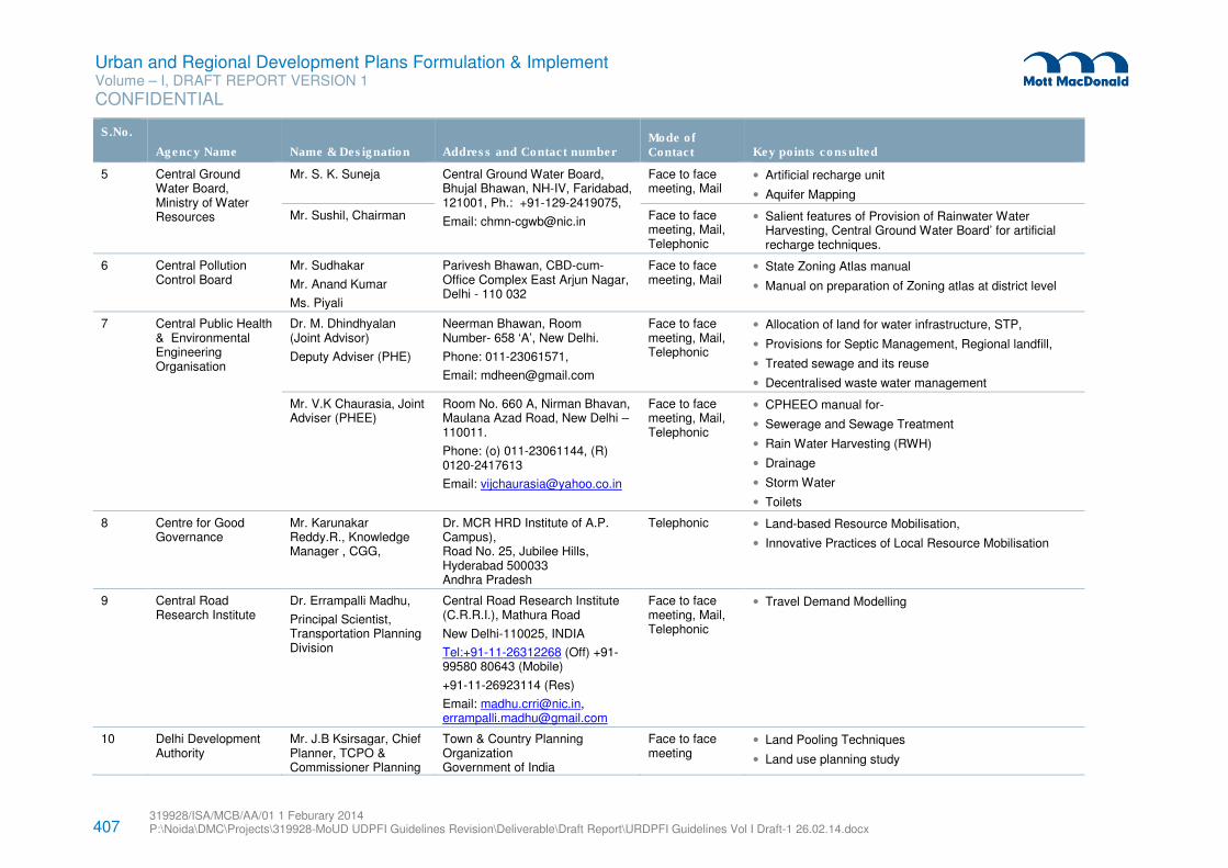
407 319928/ISA/MCB/AA/01 1 Feburary 2014 P:\Noida\DMC\Projects\319928-MoUD UDPFI Guidelines Revision\Deliverable\Draft Report\URDPFI Guidelines Vol I Draft-1 26.02.14.docx
Urban and Regional Development Plans Formulation & Implement Volume – I, DRAFT REPORT VERSION 1
CONFIDENTIAL
S.No.
Agency Name Name & Designation Address and Contact number Mode of Contact Key points consulted
5 Central Ground Water Board, Ministry of Water Resources
Mr. S. K. Suneja Central Ground Water Board, Bhujal Bhawan, NH-IV, Faridabad, 121001, Ph.: +91-129-2419075,
Email: [email protected]
Face to face meeting, Mail
• Artificial recharge unit
• Aquifer Mapping
Mr. Sushil, Chairman Face to face meeting, Mail, Telephonic
• Salient features of Provision of Rainwater Water Harvesting, Central Ground Water Board’ for artificial recharge techniques.
6 Central Pollution Control Board
Mr. Sudhakar
Mr. Anand Kumar
Ms. Piyali
Parivesh Bhawan, CBD-cum-Office Complex East Arjun Nagar, Delhi - 110 032
Face to face meeting, Mail
• State Zoning Atlas manual
• Manual on preparation of Zoning atlas at district level
7 Central Public Health & Environmental Engineering Organisation
Dr. M. Dhindhyalan (Joint Advisor)
Deputy Adviser (PHE)
Neerman Bhawan, Room Number- 658 ‘A’, New Delhi.
Phone: 011-23061571,
Email: [email protected]
Face to face meeting, Mail, Telephonic
• Allocation of land for water infrastructure, STP,
• Provisions for Septic Management, Regional landfill,
• Treated sewage and its reuse
• Decentralised waste water management
Mr. V.K Chaurasia, Joint Adviser (PHEE)
Room No. 660 A, Nirman Bhavan, Maulana Azad Road, New Delhi – 110011.
Phone: (o) 011-23061144, (R) 0120-2417613
Email: [email protected]
Face to face meeting, Mail, Telephonic
• CPHEEO manual for-
• Sewerage and Sewage Treatment
• Rain Water Harvesting (RWH)
• Drainage
• Storm Water
• Toilets
8 Centre for Good Governance
Mr. Karunakar Reddy.R., Knowledge Manager , CGG,
Dr. MCR HRD Institute of A.P. Campus), Road No. 25, Jubilee Hills, Hyderabad 500033 Andhra Pradesh
Telephonic • Land-based Resource Mobilisation,
• Innovative Practices of Local Resource Mobilisation
9 Central Road Research Institute
Dr. Errampalli Madhu,
Principal Scientist, Transportation Planning Division
Central Road Research Institute (C.R.R.I.), Mathura Road
New Delhi-110025, INDIA
Tel:+91-11-26312268 (Off) +91-99580 80643 (Mobile)
+91-11-26923114 (Res)
Email: [email protected], [email protected]
Face to face meeting, Mail, Telephonic
• Travel Demand Modelling
10 Delhi Development Authority
Mr. J.B Ksirsagar, Chief Planner, TCPO & Commissioner Planning
Town & Country Planning Organization Government of India
Face to face meeting
• Land Pooling Techniques
• Land use planning study
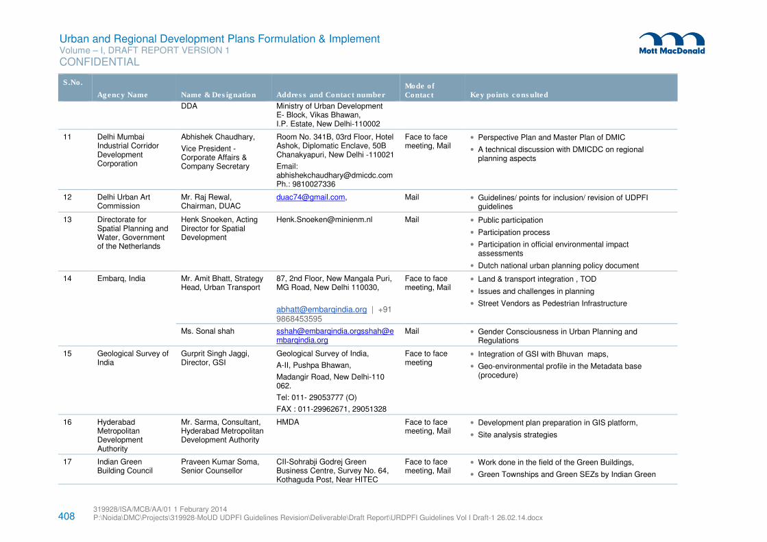
408 319928/ISA/MCB/AA/01 1 Feburary 2014 P:\Noida\DMC\Projects\319928-MoUD UDPFI Guidelines Revision\Deliverable\Draft Report\URDPFI Guidelines Vol I Draft-1 26.02.14.docx
Urban and Regional Development Plans Formulation & Implement Volume – I, DRAFT REPORT VERSION 1
CONFIDENTIAL
S.No.
Agency Name Name & Designation Address and Contact number Mode of Contact Key points consulted
DDA Ministry of Urban Development E- Block, Vikas Bhawan, I.P. Estate, New Delhi-110002
11 Delhi Mumbai Industrial Corridor Development Corporation
Abhishek Chaudhary,
Vice President - Corporate Affairs & Company Secretary
Room No. 341B, 03rd Floor, Hotel Ashok, Diplomatic Enclave, 50B Chanakyapuri, New Delhi -110021
Email: [email protected] Ph.: 9810027336
Face to face meeting, Mail
• Perspective Plan and Master Plan of DMIC
• A technical discussion with DMICDC on regional planning aspects
12 Delhi Urban Art Commission
Mr. Raj Rewal, Chairman, DUAC
[email protected], Mail • Guidelines/ points for inclusion/ revision of UDPFI guidelines
13 Directorate for Spatial Planning and Water, Government of the Netherlands
Henk Snoeken, Acting Director for Spatial Development
[email protected] Mail • Public participation
• Participation process
• Participation in official environmental impact assessments
• Dutch national urban planning policy document
14 Embarq, India Mr. Amit Bhatt, Strategy Head, Urban Transport
87, 2nd Floor, New Mangala Puri, MG Road, New Delhi 110030,
[email protected] | +91 9868453595
Face to face meeting, Mail
• Land & transport integration , TOD
• Issues and challenges in planning
• Street Vendors as Pedestrian Infrastructure
Ms. Sonal shah [email protected]@embarqindia.org
Mail • Gender Consciousness in Urban Planning and Regulations
15 Geological Survey of India
Gurprit Singh Jaggi, Director, GSI
Geological Survey of India,
A-II, Pushpa Bhawan,
Madangir Road, New Delhi-110 062.
Tel: 011- 29053777 (O)
FAX : 011-29962671, 29051328
Face to face meeting
• Integration of GSI with Bhuvan maps,
• Geo-environmental profile in the Metadata base (procedure)
16 Hyderabad Metropolitan Development Authority
Mr. Sarma, Consultant, Hyderabad Metropolitan Development Authority
HMDA Face to face meeting, Mail
• Development plan preparation in GIS platform,
• Site analysis strategies
17 Indian Green Building Council
Praveen Kumar Soma, Senior Counsellor
CII-Sohrabji Godrej Green Business Centre, Survey No. 64, Kothaguda Post, Near HITEC
Face to face meeting, Mail
• Work done in the field of the Green Buildings,
• Green Townships and Green SEZs by Indian Green
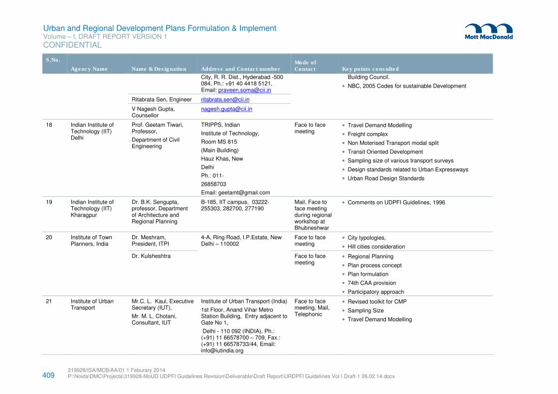
409 319928/ISA/MCB/AA/01 1 Feburary 2014 P:\Noida\DMC\Projects\319928-MoUD UDPFI Guidelines Revision\Deliverable\Draft Report\URDPFI Guidelines Vol I Draft-1 26.02.14.docx
Urban and Regional Development Plans Formulation & Implement Volume – I, DRAFT REPORT VERSION 1
CONFIDENTIAL
S.No.
Agency Name Name & Designation Address and Contact number Mode of Contact Key points consulted
City, R. R. Dist., Hyderabad -500 084, Ph.: +91 40 4418 5121, Email: [email protected]
Building Council.
• NBC, 2005 Codes for sustainable Development
Ritabrata Sen, Engineer [email protected]
V Nagesh Gupta, Counsellor
18
Indian Institute of Technology (IIT) Delhi
Prof. Geetam Tiwari, Professor,
Department of Civil Engineering
TRIPPS, Indian
Institute of Technology,
Room MS 815
(Main Building)
Hauz Khas, New
Delhi
Ph.: 011-
26858703
Email: [email protected]
Face to face meeting
• Travel Demand Modelling
• Freight complex
• Non Moterised Transport modal split
• Transit Oriented Development
• Sampling size of various transport surveys
• Design standards related to Urban Expressways
• Urban Road Design Standards
19 Indian Institute of Technology (IIT) Kharagpur
Dr. B.K. Sengupta, professor, Department of Architecture and Regional Planning
B-185, IIT campus, 03222-255303, 282700, 277190
Mail, Face to face meeting during regional workshop at Bhubneshwar
• Comments on UDPFI Guidelines, 1996
20 Institute of Town Planners, India
Dr. Meshram, President, ITPI
4-A, Ring Road, I.P.Estate, New Delhi – 110002
Face to face meeting
• City typologies,
• Hill cities consideration
Dr. Kulsheshtra Face to face meeting
• Regional Planning
• Plan process concept
• Plan formulation
• 74th CAA provision
• Participatory approach
21 Institute of Urban Transport
Mr.C. L. Kaul, Executive Secretary (IUT),
Mr. M. L. Chotani, Consultant, IUT
Institute of Urban Transport (India)
1st Floor, Anand Vihar Metro Station Building, Entry adjacent to Gate No 1,
Delhi - 110 092 (INDIA), Ph.: (+91) 11 66578700 – 709, Fax.: (+91) 11 66578733/44, Email: [email protected]
Face to face meeting, Mail, Telephonic
• Revised toolkit for CMP
• Sampling Size
• Travel Demand Modelling
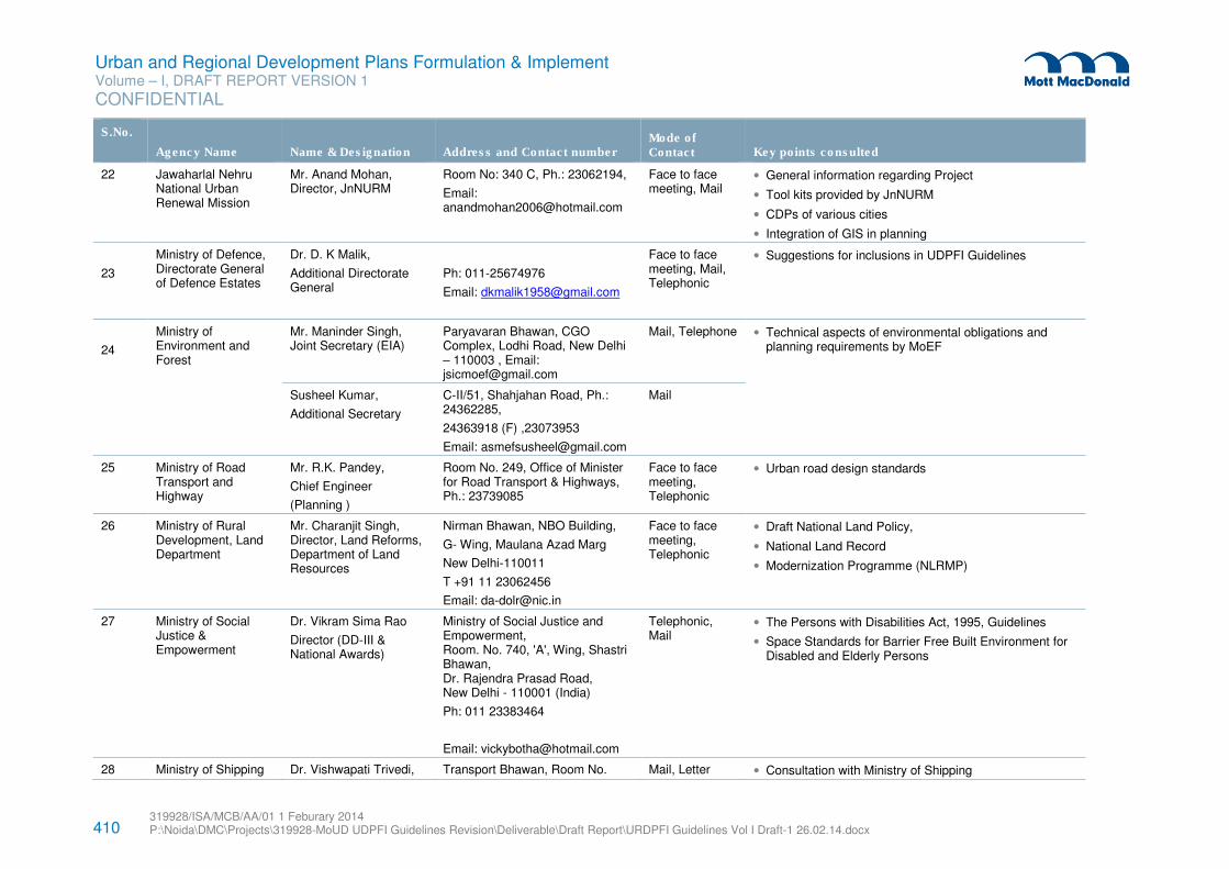
410 319928/ISA/MCB/AA/01 1 Feburary 2014 P:\Noida\DMC\Projects\319928-MoUD UDPFI Guidelines Revision\Deliverable\Draft Report\URDPFI Guidelines Vol I Draft-1 26.02.14.docx
Urban and Regional Development Plans Formulation & Implement Volume – I, DRAFT REPORT VERSION 1
CONFIDENTIAL
S.No.
Agency Name Name & Designation Address and Contact number Mode of Contact Key points consulted
22 Jawaharlal Nehru National Urban Renewal Mission
Mr. Anand Mohan, Director, JnNURM
Room No: 340 C, Ph.: 23062194,
Email: [email protected]
Face to face meeting, Mail
• General information regarding Project
• Tool kits provided by JnNURM
• CDPs of various cities
• Integration of GIS in planning
23
Ministry of Defence, Directorate General of Defence Estates
Dr. D. K Malik,
Additional Directorate General
Ph: 011-25674976
Email: [email protected]
Face to face meeting, Mail, Telephonic
• Suggestions for inclusions in UDPFI Guidelines
24
Ministry of Environment and Forest
Mr. Maninder Singh, Joint Secretary (EIA)
Paryavaran Bhawan, CGO Complex, Lodhi Road, New Delhi – 110003 , Email: [email protected]
Mail, Telephone • Technical aspects of environmental obligations and planning requirements by MoEF
Susheel Kumar,
Additional Secretary
C-II/51, Shahjahan Road, Ph.: 24362285,
24363918 (F) ,23073953
Email: [email protected]
25 Ministry of Road Transport and Highway
Mr. R.K. Pandey,
Chief Engineer
(Planning )
Room No. 249, Office of Minister for Road Transport & Highways, Ph.: 23739085
Face to face meeting, Telephonic
• Urban road design standards
26 Ministry of Rural Development, Land Department
Mr. Charanjit Singh, Director, Land Reforms, Department of Land Resources
Nirman Bhawan, NBO Building,
G- Wing, Maulana Azad Marg
New Delhi-110011
T +91 11 23062456
Email: [email protected]
Face to face meeting, Telephonic
• Draft National Land Policy,
• National Land Record
• Modernization Programme (NLRMP)
27 Ministry of Social Justice & Empowerment
Dr. Vikram Sima Rao
Director (DD-III & National Awards)
Ministry of Social Justice and Empowerment, Room. No. 740, 'A', Wing, Shastri Bhawan, Dr. Rajendra Prasad Road, New Delhi - 110001 (India)
Ph: 011 23383464
Email: [email protected]
Telephonic, Mail
• The Persons with Disabilities Act, 1995, Guidelines
• Space Standards for Barrier Free Built Environment for Disabled and Elderly Persons
28 Ministry of Shipping Dr. Vishwapati Trivedi, Transport Bhawan, Room No. Mail, Letter • Consultation with Ministry of Shipping
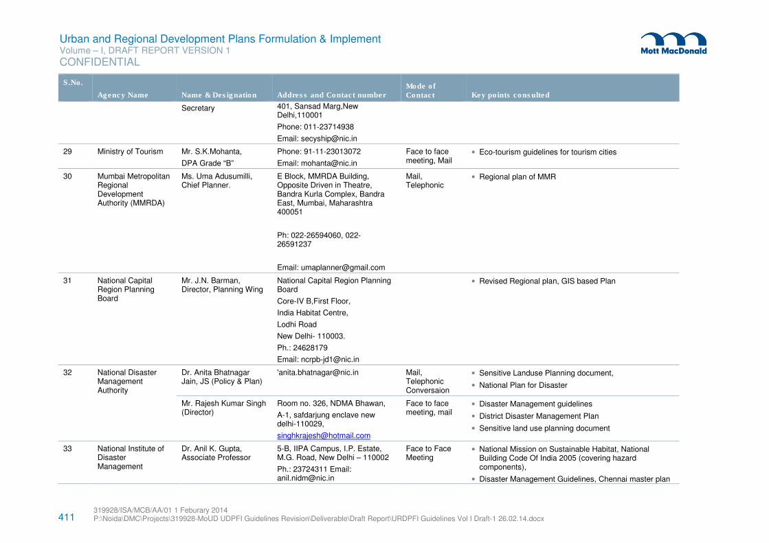
411 319928/ISA/MCB/AA/01 1 Feburary 2014 P:\Noida\DMC\Projects\319928-MoUD UDPFI Guidelines Revision\Deliverable\Draft Report\URDPFI Guidelines Vol I Draft-1 26.02.14.docx
Urban and Regional Development Plans Formulation & Implement Volume – I, DRAFT REPORT VERSION 1
CONFIDENTIAL
S.No.
Agency Name Name & Designation Address and Contact number Mode of Contact Key points consulted
Secretary 401, Sansad Marg,New Delhi,110001
Phone: 011-23714938
Email: [email protected]
29 Ministry of Tourism Mr. S.K.Mohanta,
DPA Grade “B”
Phone: 91-11-23013072
Email: [email protected]
Face to face meeting, Mail
• Eco-tourism guidelines for tourism cities
30 Mumbai Metropolitan Regional Development Authority (MMRDA)
Ms. Uma Adusumilli, Chief Planner.
E Block, MMRDA Building, Opposite Driven in Theatre, Bandra Kurla Complex, Bandra East, Mumbai, Maharashtra 400051
Ph: 022-26594060, 022- 26591237
Email: [email protected]
Mail, Telephonic
• Regional plan of MMR
31 National Capital Region Planning Board
Mr. J.N. Barman, Director, Planning Wing
National Capital Region Planning Board
Core-IV B,First Floor,
India Habitat Centre,
Lodhi Road
New Delhi- 110003.
Ph.: 24628179
Email: [email protected]
• Revised Regional plan, GIS based Plan
32 National Disaster Management Authority
Dr. Anita Bhatnagar Jain, JS (Policy & Plan)
'[email protected] Mail, Telephonic Conversaion
• Sensitive Landuse Planning document,
• National Plan for Disaster
Mr. Rajesh Kumar Singh (Director)
Room no. 326, NDMA Bhawan,
A-1, safdarjung enclave new delhi-110029,
Face to face meeting, mail
• Disaster Management guidelines
• District Disaster Management Plan
• Sensitive land use planning document
33 National Institute of Disaster Management
Dr. Anil K. Gupta, Associate Professor
5-B, IIPA Campus, I.P. Estate, M.G. Road, New Delhi – 110002
Ph.: 23724311 Email: [email protected]
Face to Face Meeting
• National Mission on Sustainable Habitat, National Building Code Of India 2005 (covering hazard components),
• Disaster Management Guidelines, Chennai master plan
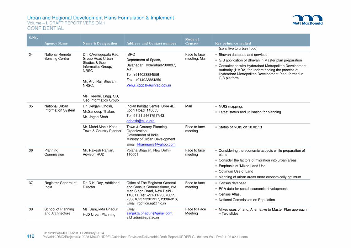
412 319928/ISA/MCB/AA/01 1 Feburary 2014 P:\Noida\DMC\Projects\319928-MoUD UDPFI Guidelines Revision\Deliverable\Draft Report\URDPFI Guidelines Vol I Draft-1 26.02.14.docx
Urban and Regional Development Plans Formulation & Implement Volume – I, DRAFT REPORT VERSION 1
CONFIDENTIAL
S.No.
Agency Name Name & Designation Address and Contact number Mode of Contact Key points consulted
(sensitive to urban flood)
34 National Remote Sensing Centre
Dr. K.Venugopala Rao, Group Head Urban Studies & Geo Informatics Group, NRSC
Mr. Arul Raj, Bhuvan, NRSC,
Ms. Reedhi, Engg. SD, Geo Informatics Group
ISRO
Department of Space,
Balanagar, Hyderabad-500037, A.P.
Tel: +914023884556
Fax: +914023884259
Face to face meeting, Mail
• Bhuvan database and services
• GIS application of Bhuvan in Master plan preparation
• Consultation with Hyderabad Metropolitan Development Authority (HMDA) for understanding the process of Hyderabad Metropolitan Development Plan formed in GIS platform
35 National Urban Information System
Dr. Debjani Ghosh,
Mr.Sandeep Thakur,
Mr. Jagan Shah
Indian habitat Centre, Core 4B, Lodhi Road, 110003
Tel: 91-11 24617517/43
Mail • NUIS mapping,
• Latest status and utilisation for planning
Mr. Mohd.Monis Khan, Town & Country Planner
Town & Country Planning Organization Government of India Ministry of Urban Development
Email: [email protected]
Face to face meeting
• Status of NUIS on 18.02.13
36 Planning Commission
Mr. Rakesh Ranjan, Advisor, HUD
Yojana Bhawan, New Delhi- 110001
Face to face meeting
• Considering the economic aspects while preparation of plans
• Consider the factors of migration into urban areas
• Emphasis of 'Mixed Land Use '
• Optimum Use of Land
• planning of urban areas more economically optimum
37 Registrar General of India
Dr. D.K. Dey, Additional Director
Office of The Registrar General and Census Commissioner, 2/A, Man Singh Road, New Delhi -110011, Tel: +91-11-23070629, 23381623,23381917, 23384816, Email: [email protected]
Face to face meeting
• Census database,
• PCA data for social-economic development,
• Census Atlas,
• National Commission on Population
38 School of Planning and Architecture
Ms. Sanjukkta Bhaduri
HoD Urban Planning
Email: [email protected], [email protected]
Face to Face Meeting
• Mixed uses of land, Alternative to Master Plan approach – Two slides
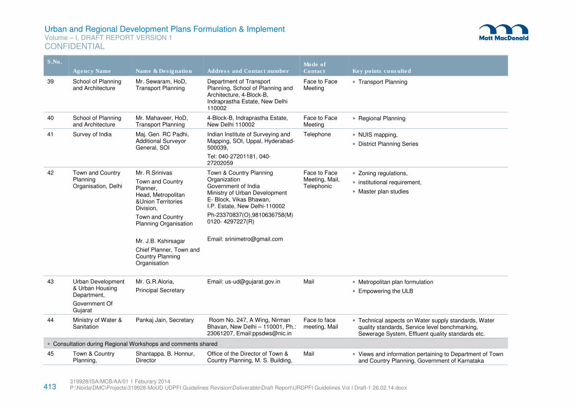
413 319928/ISA/MCB/AA/01 1 Feburary 2014 P:\Noida\DMC\Projects\319928-MoUD UDPFI Guidelines Revision\Deliverable\Draft Report\URDPFI Guidelines Vol I Draft-1 26.02.14.docx
Urban and Regional Development Plans Formulation & Implement Volume – I, DRAFT REPORT VERSION 1
CONFIDENTIAL
S.No.
Agency Name Name & Designation Address and Contact number Mode of Contact Key points consulted
39 School of Planning and Architecture
Mr. Sewaram, HoD, Transport Planning
Department of Transport Planning, School of Planning and Architecture, 4-Block-B, Indraprastha Estate, New Delhi 110002
Face to Face Meeting
• Transport Planning
40 School of Planning and Architecture
Mr. Mahaveer, HoD, Transport Planning
4-Block-B, Indraprastha Estate, New Delhi 110002
Face to Face Meeting
• Regional Planning
41 Survey of India Maj. Gen. RC Padhi, Additional Surveyor General, SOI
Indian Institute of Surveying and Mapping, SOI, Uppal, Hyderabad-500039,
Tel: 040-27201181, 040-27202059
Telephone • NUIS mapping,
• District Planning Series
42 Town and Country Planning Organisation, Delhi
Mr. R.Srinivas
Town and Country Planner, Head, Metropolitan &Union Territories Division,
Town and Country Planning Organisation
Mr. J.B. Kshirsagar
Chief Planner, Town and Country Planning Organisation
Town & Country Planning Organization Government of India Ministry of Urban Development E- Block, Vikas Bhawan, I.P. Estate, New Delhi-110002
Ph-23370837(O),9810636758(M) 0120- 4297227(R)
Email: [email protected]
Face to Face Meeting, Mail, Telephonic
• Zoning regulations,
• institutional requirement,
• Master plan studies
43 Urban Development & Urban Housing Department,
Government Of Gujarat
Mr. G.R.Aloria,
Principal Secretary
Email: [email protected] Mail • Metropolitan plan formulation
• Empowering the ULB
44 Ministry of Water & Sanitation
Pankaj Jain, Secretary Room No. 247, A Wing, Nirman Bhavan, New Delhi – 110001, Ph.: 23061207, Email:[email protected]
Face to face meeting, Mail
• Technical aspects on Water supply standards, Water quality standards, Service level benchmarking, Sewerage System, Effluent quality standards etc.
• Consultation during Regional Workshops and comments shared
45 Town & Country Planning,
Shantappa. B. Honnur, Director
Office of the Director of Town & Country Planning, M. S. Building,
Mail • Views and information pertaining to Department of Town and Country Planning, Government of Karnataka
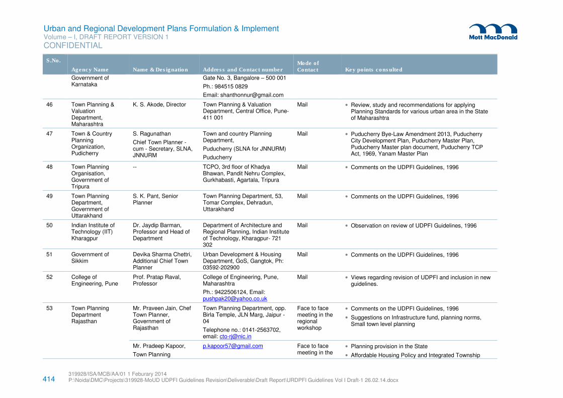
414 319928/ISA/MCB/AA/01 1 Feburary 2014 P:\Noida\DMC\Projects\319928-MoUD UDPFI Guidelines Revision\Deliverable\Draft Report\URDPFI Guidelines Vol I Draft-1 26.02.14.docx
Urban and Regional Development Plans Formulation & Implement Volume – I, DRAFT REPORT VERSION 1
CONFIDENTIAL
S.No.
Agency Name Name & Designation Address and Contact number Mode of Contact Key points consulted
Government of Karnataka
Gate No. 3, Bangalore – 500 001
Ph.: 984515 0829
Email: [email protected]
46 Town Planning & Valuation Department, Maharashtra
K. S. Akode, Director Town Planning & Valuation Department, Central Office, Pune-411 001
Mail • Review, study and recommendations for applying Planning Standards for various urban area in the State of Maharashtra
47 Town & Country Planning Organization, Pudicherry
S. Ragunathan
Chief Town Planner - cum - Secretary, SLNA, JNNURM
Town and country Planning Department,
Puducherry (SLNA for JNNURM)
Puducherry
Mail • Puducherry Bye-Law Amendment 2013, Puducherry City Development Plan, Puducherry Master Plan, Puducherry Master plan document, Puducherry TCP Act, 1969, Yanam Master Plan
48 Town Planning Organisation, Government of Tripura
-- TCPO, 3rd floor of Khadya Bhawan, Pandit Nehru Complex, Gurkhabasti, Agartala, Tripura
Mail • Comments on the UDPFI Guidelines, 1996
49 Town Planning Department, Government of Uttarakhand
S. K. Pant, Senior Planner
Town Planning Department, 53, Tomar Complex, Dehradun, Uttarakhand
Mail • Comments on the UDPFI Guidelines, 1996
50 Indian Institute of Technology (IIT) Kharagpur
Dr. Jaydip Barman, Professor and Head of Department
Department of Architecture and Regional Planning, Indian Institute of Technology, Kharagpur- 721 302
Mail • Observation on review of UDPFI Guidelines, 1996
51 Government of Sikkim
Devika Sharma Chettri, Additional Chief Town Planner
Urban Development & Housing Department, GoS, Gangtok, Ph: 03592-202900
Mail • Comments on the UDPFI Guidelines, 1996
52 College of Engineering, Pune
Prof. Pratap Raval, Professor
College of Engineering, Pune, Maharashtra
Ph.: 9422506124, Email: [email protected]
Mail • Views regarding revision of UDPFI and inclusion in new guidelines.
53
Town Planning Department Rajasthan
Mr. Praveen Jain, Chef Town Planner, Government of Rajasthan
Town Planning Department, opp. Birla Temple, JLN Marg, Jaipur -04
Telephone no.: 0141-2563702, email: [email protected]
Face to face meeting in the regional workshop
• Comments on the UDPFI Guidelines, 1996
• Suggestions on Infrastructure fund, planning norms, Small town level planning
Mr. Pradeep Kapoor,
Town Planning
[email protected] Face to face meeting in the
• Planning provision in the State
• Affordable Housing Policy and Integrated Township
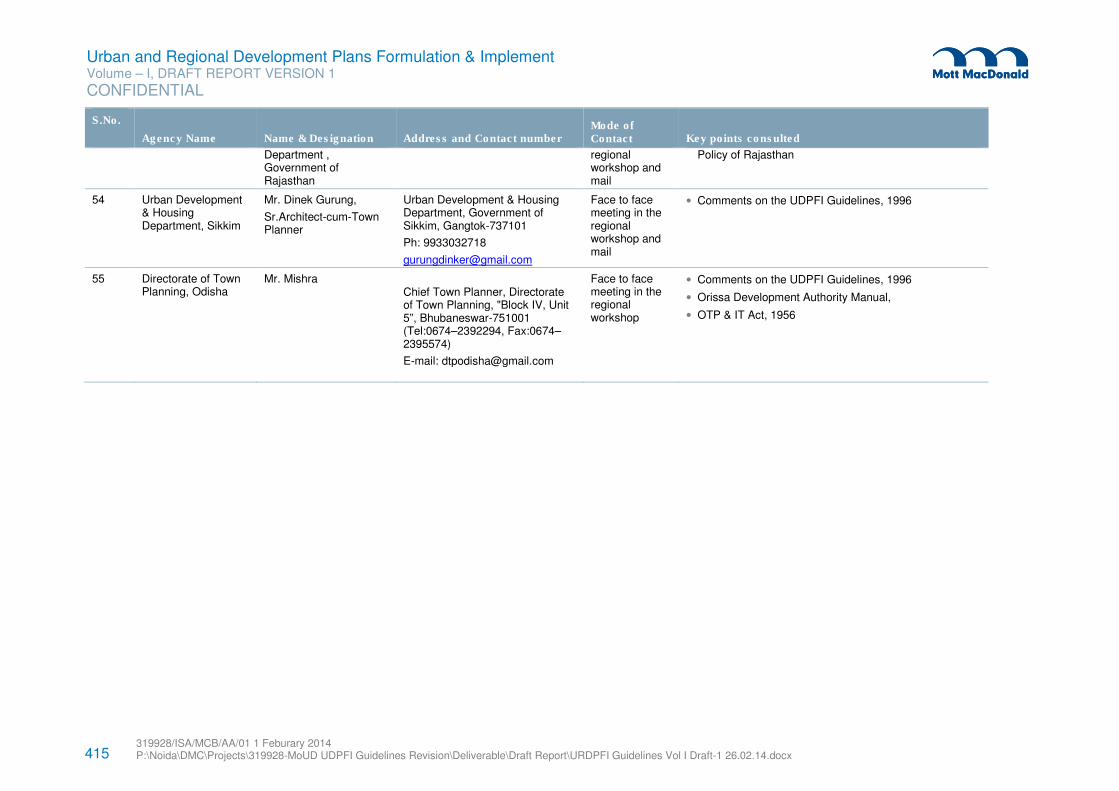
415 319928/ISA/MCB/AA/01 1 Feburary 2014 P:\Noida\DMC\Projects\319928-MoUD UDPFI Guidelines Revision\Deliverable\Draft Report\URDPFI Guidelines Vol I Draft-1 26.02.14.docx
Urban and Regional Development Plans Formulation & Implement Volume – I, DRAFT REPORT VERSION 1
CONFIDENTIAL
S.No.
Agency Name Name & Designation Address and Contact number Mode of Contact Key points consulted
Department , Government of Rajasthan
regional workshop and mail
Policy of Rajasthan
54 Urban Development & Housing Department, Sikkim
Mr. Dinek Gurung,
Sr.Architect-cum-Town Planner
Urban Development & Housing Department, Government of Sikkim, Gangtok-737101
Ph: 9933032718
Face to face meeting in the regional workshop and mail
• Comments on the UDPFI Guidelines, 1996
55 Directorate of Town Planning, Odisha
Mr. Mishra Chief Town Planner, Directorate of Town Planning, "Block IV, Unit 5”, Bhubaneswar-751001 (Tel:0674–2392294, Fax:0674–2395574)
E-mail: [email protected]
Face to face meeting in the regional workshop
• Comments on the UDPFI Guidelines, 1996
• Orissa Development Authority Manual,
• OTP & IT Act, 1956
416 319928/ISA/MCB/AA/01 1 Feburary 2014 P:\Noida\DMC\Projects\319928-MoUD UDPFI Guidelines Revision\Deliverable\Draft Report\URDPFI Guidelines Vol I Draft-1 26.02.14.docx
Urban and Regional Development Plans Formulation & Implement Volume – I, DRAFT REPORT VERSION 1
CONFIDENTIAL
A.7 Glossary
A.7.1 List of reference made in the guidelines
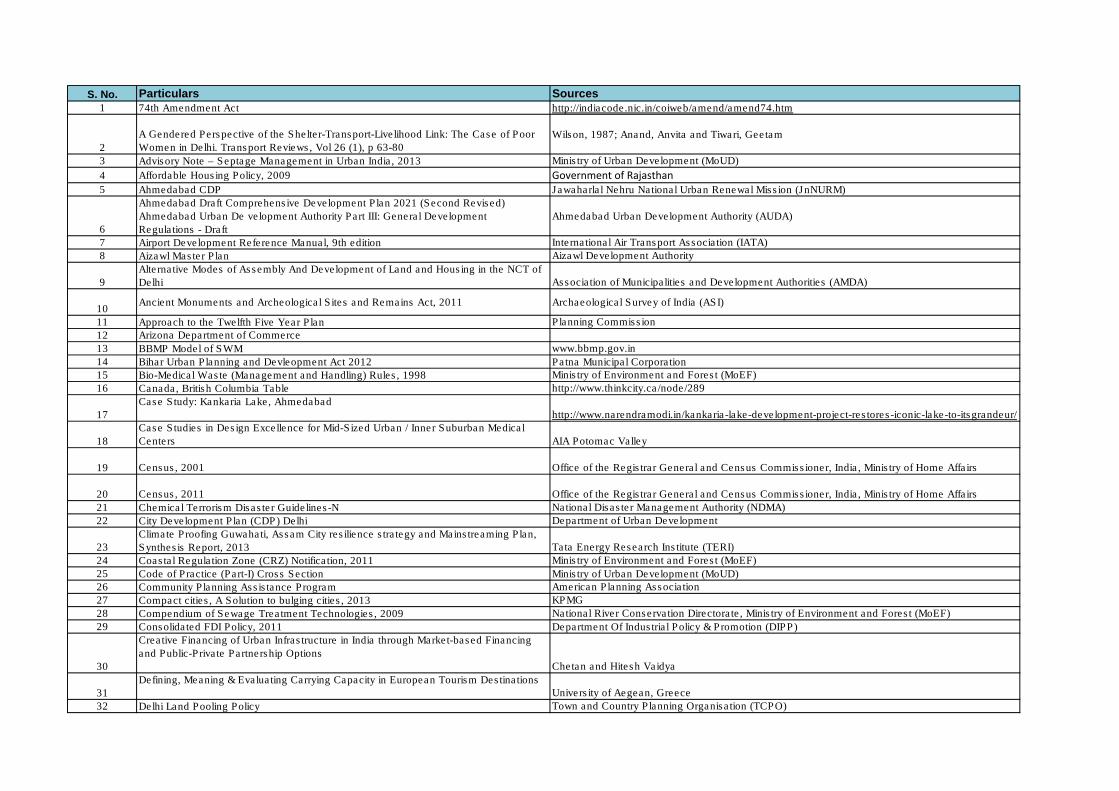
S. No. Particulars Sources
1 74th Amendment Act http://indiacode.nic.in/coiweb/amend/amend74.htm
2
A Gendered Perspective of the Shelter-Transport-Livelihood Link: The Case of Poor
Women in Delhi. Transport Reviews, Vol 26 (1), p 63-80
Wilson, 1987; Anand, Anvita and Tiwari, Geetam
3 Advisory Note – Septage Management in Urban India, 2013 Ministry of Urban Development (MoUD)
4 Affordable Housing Policy, 2009 Government of Rajasthan
5 Ahmedabad CDP Jawaharlal Nehru National Urban Renewal Mission (JnNURM)
6
Ahmedabad Draft Comprehensive Development Plan 2021 (Second Revised)
Ahmedabad Urban De velopment Authority Part III: General Development
Regulations - Draft
Ahmedabad Urban Development Authority (AUDA)
7 Airport Development Reference Manual, 9th edition International Air Transport Association (IATA)
8 Aizawl Master Plan Aizawl Development Authority
9
Alternative Modes of Assembly And Development of Land and Housing in the NCT of
Delhi Association of Municipalities and Development Authorities (AMDA)
10Ancient Monuments and Archeological Sites and Remains Act, 2011 Archaeological Survey of India (ASI)
11 Approach to the Twelfth Five Year Plan Planning Commission
12 Arizona Department of Commerce
13 BBMP Model of SWM www.bbmp.gov.in
14 Bihar Urban Planning and Devleopment Act 2012 Patna Municipal Corporation
15 Bio-Medical Waste (Management and Handling) Rules, 1998 Ministry of Environment and Forest (MoEF)
16 Canada, British Columbia Table http://www.thinkcity.ca/node/289
17
Case Study: Kankaria Lake, Ahmedabad
http://www.narendramodi.in/kankaria-lake-development-project-restores-iconic-lake-to-itsgrandeur/
18
Case Studies in Design Excellence for Mid-Sized Urban / Inner Suburban Medical
Centers AIA Potomac Valley
19 Census, 2001 Office of the Registrar General and Census Commissioner, India, Ministry of Home Affairs
20 Census, 2011 Office of the Registrar General and Census Commissioner, India, Ministry of Home Affairs
21 Chemical Terrorism Disaster Guidelines-N National Disaster Management Authority (NDMA)
22 City Development Plan (CDP) Delhi Department of Urban Development
23
Climate Proofing Guwahati, Assam City resilience strategy and Mainstreaming Plan,
Synthesis Report, 2013 Tata Energy Research Institute (TERI)
24 Coastal Regulation Zone (CRZ) Notification, 2011 Ministry of Environment and Forest (MoEF)
25 Code of Practice (Part-I) Cross Section Ministry of Urban Development (MoUD)
26 Community Planning Assistance Program American Planning Association
27 Compact cities, A Solution to bulging cities, 2013 KPMG
28 Compendium of Sewage Treatment Technologies, 2009 National River Conservation Directorate, Ministry of Environment and Forest (MoEF)
29 Consolidated FDI Policy, 2011 Department Of Industrial Policy & Promotion (DIPP)
30
Creative Financing of Urban Infrastructure in India through Market-based Financing
and Public-Private Partnership Options
Chetan and Hitesh Vaidya
31
Defining, Meaning & Evaluating Carrying Capacity in European Tourism Destinations
University of Aegean, Greece
32 Delhi Land Pooling Policy Town and Country Planning Organisation (TCPO)
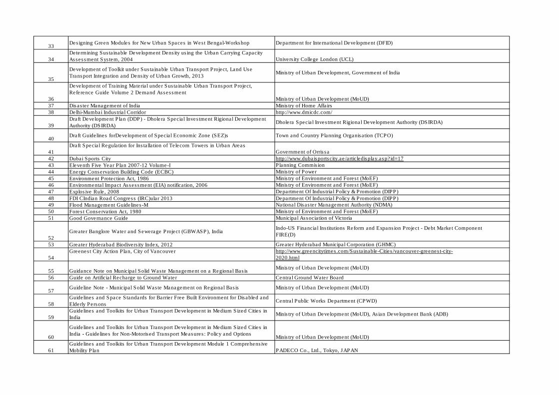
33Designing Green Modules for New Urban Spaces in West Bengal-Workshop Department for International Development (DFID)
34
Determining Sustainable Development Density using the Urban Carrying Capacity
Assessment System, 2004 University College London (UCL)
35
Development of Toolkit under Sustainable Urban Transport Project, Land Use
Transport Integration and Density of Urban Growth, 2013Ministry of Urban Development, Government of India
36
Development of Training Material under Sustainable Urban Transport Project,
Reference Guide Volume 2 Demand Assessment
Ministry of Urban Development (MoUD)
37 Disaster Management of India Ministry of Home Affairs
38 Delhi-Mumbai Industrial Corridor http://www.dmicdc.com/
39
Draft Development Plan (DDP) - Dholera Special Investment Rigional Development
Authority (DSIRDA)Dholera Special Investment Rigional Development Authority (DSIRDA)
40Draft Guidelines forDevelopment of Special Economic Zone (SEZ)s Town and Country Planning Organisation (TCPO)
41
Draft Special Regulation for Installation of Telecom Towers in Urban Areas
Government of Orrissa
42 Dubai Sports City http://www.dubaisportscity.ae/articledisplay.asp?id=17
43 Eleventh Five Year Plan 2007-12 Volume-I Planning Commision
44 Energy Conservation Building Code (ECBC) Ministry of Power
45 Environment Protection Act, 1986 Ministry of Environment and Forest (MoEF)
46 Environmental Impact Assessment (EIA) notification, 2006 Ministry of Environment and Forest (MoEF)
47 Explosive Rule, 2008 Department Of Industrial Policy & Promotion (DIPP)
48 FDI CIndian Road Congress (IRC)ular 2013 Department Of Industrial Policy & Promotion (DIPP)
49 Flood Management Guidelines-M National Disaster Management Authority (NDMA)
50 Forest Conservation Act, 1980 Ministry of Environment and Forest (MoEF)
51 Good Governance Guide Municipal Association of Victoria
52
Greater Banglore Water and Sewerage Project (GBWASP), IndiaIndo-US Financial Institutions Reform and Expansion Project - Debt Market Component
FIRE(D)
53 Greater Hyderabad Biodiversity Index, 2012 Greater Hyderabad Municipal Corporation (GHMC)
54
Greenest City Action Plan, City of Vancouver http://www.greencitytimes.com/Sustainable-Cities/vancouver-greenest-city-
2020.html
55 Guidance Note on Municipal Solid Waste Management on a Regional BasisMinistry of Urban Development (MoUD)
56 Guide on Artificial Recharge to Ground Water Central Ground Water Board
57Guideline Note - Municipal Solid Waste Management on Regional Basis Ministry of Urban Development (MoUD)
58
Guidelines and Space Standards for Barrier Free Built Environment for Disabled and
Elderly PersonsCentral Public Works Department (CPWD)
59
Guidelines and Toolkits for Urban Transport Development in Medium Sized Cities in
IndiaMinistry of Urban Development (MoUD), Asian Development Bank (ADB)
60
Guidelines and Toolkits for Urban Transport Development in Medium Sized Cities in
India - Guidelines for Non‐Motorised Transport Measures: Policy and OptionsMinistry of Urban Development (MoUD)
61
Guidelines and Toolkits for Urban Transport Development Module 1 Comprehensive
Mobility Plan PADECO Co., Ltd., Tokyo, JAPAN
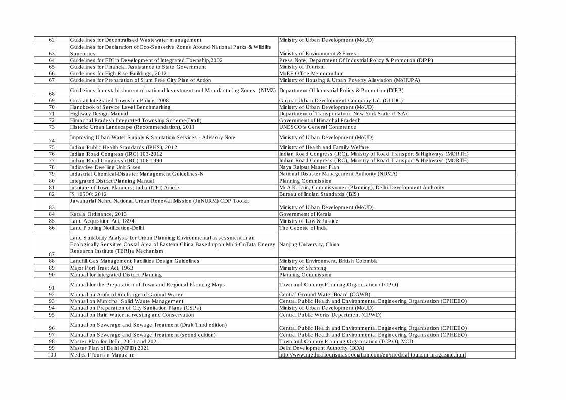
62 Guidelines for Decentralised Wastewater management Ministry of Urban Development (MoUD)
63
Guidelines for Declaration of Eco-Sensetive Zones Around National Parks & Wildlife
Sancturies Ministry of Environment & Forest
64 Guidelines for FDI in Development of Integrated Township,2002 Press Note, Department Of Industrial Policy & Promotion (DIPP)
65 Guidelines for Financial Assistance to State Government Ministry of Tourism
66 Guidelines for High Rise Buildings, 2012 MoEF Office Memorandum
67 Guidelines for Preparation of Slum Free City Plan of Action Ministry of Housing & Urban Poverty Alleviation (MoHUPA)
68Guidleines for establishment of national Investment and Manufacturing Zones (NIMZ) Department Of Industrial Policy & Promotion (DIPP)
69 Gujarat Integrated Township Policy, 2008 Gujarat Urban Development Company Ltd. (GUDC)
70 Handbook of Service Level Benchmarking Ministry of Urban Development (MoUD)
71 Highway Design Manual Department of Transportation, New York State (USA)
72 Himachal Pradesh Integrated Township Scheme(Draft) Government of Himachal Pradesh
73 Historic Urban Landscape (Recommendation), 2011 UNESCO’s General Conference
74Improving Urban Water Supply & Sanitation Services - Advisory Note Ministry of Urban Development (MoUD)
75 Indian Public Health Standards (IPHS), 2012 Ministry of Health and Family Welfare
76 Indian Road Congress (IRC) 103-2012 Indian Road Congress (IRC), Ministry of Road Transport & Highways (MORTH)
77 Indian Road Congress (IRC) 106-1990 Indian Road Congress (IRC), Ministry of Road Transport & Highways (MORTH)
78 Indicative Dwelling Unit Sizes Naya Raipur Master Plan
79 Industrial Chemical-Disaster Management Guidelines-N National Disaster Management Authority (NDMA)
80 Integrated District Planning Manual Planning Commission
81 Institute of Town Planners, India (ITPI) Article Mr.A.K. Jain, Commissioner (Planning), Delhi Development Authority
82 IS 10500: 2012 Bureau of Indian Standards (BIS)
83
Jawaharlal Nehru National Urban Renewal Mission (JnNURM) CDP Toolkit
Ministry of Urban Development (MoUD)
84 Kerala Ordinance, 2013 Government of Kerala
85 Land Acquisition Act, 1894 Ministry of Law & Justice
86 Land Pooling Notification-Delhi The Gazette of India
87
Land Suitability Analysis for Urban Planning Environmental assessment in an
Ecologically Sensitive Costal Area of Eastern China Based upon Multi-CriTata Energy
Research Institute (TERI)a Mechanism
Nanjing University, China
88 Landfill Gas Management Facilities Design Guidelines Ministry of Environment, British Colombia
89 Major Port Trust Act, 1963 Ministry of Shipping
90 Manual for Integrated District Planning Planning Commission
91Manual for the Preparation of Town and Regional Planning Maps Town and Country Planning Organisation (TCPO)
92 Manual on Artificial Recharge of Ground Water Central Ground Water Board (CGWB)
93 Manual on Municipal Solid Waste Management Central Public Health and Environmental Engineering Organisation (CPHEEO)
94 Manual on Preparation of City Sanitation Plans (CSPs) Ministry of Urban Development (MoUD)
95 Manual on Rain Water harvesting and Conservation Central Public Works Department (CPWD)
96Manual on Sewerage and Sewage Treatment (Draft Third edition)
Central Public Health and Environmental Engineering Organisation (CPHEEO)
97 Manual on Sewerage and Sewage Treatment (seond edition) Central Public Health and Environmental Engineering Organisation (CPHEEO)
98 Master Plan for Delhi, 2001 and 2021 Town and Country Planning Organisation (TCPO), MCD
99 Master Plan of Delhi (MPD) 2021 Delhi Development Authority (DDA)
100 Medical Tourism Magazine http://www.medicaltourismassociation.com/en/medical-tourism-magazine.html

101 Model Building Bye-laws Town and Country Planning Organisation (TCPO)
102Model Urban and Regional Planning and Development Law (revised) Ministry of Urban Affairs and Employment (MoUA&E)
103 Mumbai Waterway System Inland Waterways Authority of India (IWAI)
104 Municipal Accounting-ULB Level Reform
http://Jawaharlal Nehru National Urban Renewal Mission (JnNURM).nic.in/wp-
content/uploads/2011/01/Mandatory_Primer_2-Mun-Acc.pdf
105
Municipal Finance Improvement Programme, Jawaharlal Nehru National Urban
Renewal Mission (JnNURM) Ministry of Urban Development (MoUD)
106 Municipal Finance in India: An Assessment Reserve Bank of India (RBI)
107 National Building Codes of India 2005 Bureau of Indian Standards (BIS)
108 National Electricity Policy , 2005 Ministry of Power
109 National Environmental Policy 2006 Ministry of Environment & Forest
110 National Disaster Management Guidelines Chemical Disasters (Industrial) National Disaster Management Authority (NDMA)
111 National Disaster Management Guidelines Management of Floods National Disaster Management Authority (NDMA)
112 National Manufacturing Policy, 2011 Department Of Industrial Policy & Promotion (DIPP)
113 National Mission on Sustainable Habitat Ministry of Urban Development (MoUD)
114 National Municipal Accounting Training Manual Ministry of Urban Development (MoUD)
115 National Policy on Urban Street Vendors, 2009 Ministry of Housing & Urban Poverty Alleviation (MoHUPA)
116 National PPP Policy 2011 http://www.pppinindia.com/
117 National Urban Housing and Habitat Policy, 2007 Ministry of Housing & Urban Poverty Alleviation (MoHUPA)
118 National Urban Sanitation Policy Ministry of Urban Development (MoUD)
119 National Urban Transport Policy (Draft) Department of Land Resources, Ministry of Rural Development
120 National Urban Transport Policy 2006 http://urbanindia.nic.in/
121 National Wildlife Action Plan (NWAP) 2002-2016 Forest Department, Andaman & Nicobar
122
News Article: DCB to Develop Weekly Market, Pune Cantonment Board Plans
Building Complex on Space at Cantt Court, CDP Khadli Cantonment
Times of India
123 Norms & Standards for Capacity of Airport Terminals Planning Commission
124
Norms and Standards - Hill areas - http://himachal.nic.in/tcp/chap6.htm
Town and Country Planning Organisation (TCPO), Government of Himachal Pradesh
125 Notification for Integrated Township, 2007 Government of Rajasthan
126 Oil Mines Regulations, 1984 Directorate General of Mines Safety
127 Overseas Development Institute, UK Wikipedia
128
Paper on Urbanisation by K. C. Sivaramakrishnan and B. N. Singh
http://planningcommission.nic.in/reports/sereport/ser/vision2025/urban.pdf
129 Participation Tools for Better Community Planning Local Government Commission & The California Endowment
130 Participatory Urban Planning And Service Delivery To Urban Poor PRIA
131 Peri-Urban Area http://periurban14.org/
132
Petroleum and Natural Gas Regulatory Board (PNGRB) Notification
Petroleum and Natural Gas Regulatory Board (PNGRB)
133 Planning and Development, 2025: Professional and Academic ChallengesTown and Country Planning Organisation (TCPO)
134 Pooled Finance Development Scheme - Toolkit Ministry of Urban Development (MoUD)
135 PPP Toolkit for Improving PPP Decision Making Process Ministry of Finance
136 Practitioner’s Guide, 2006 MILUNET
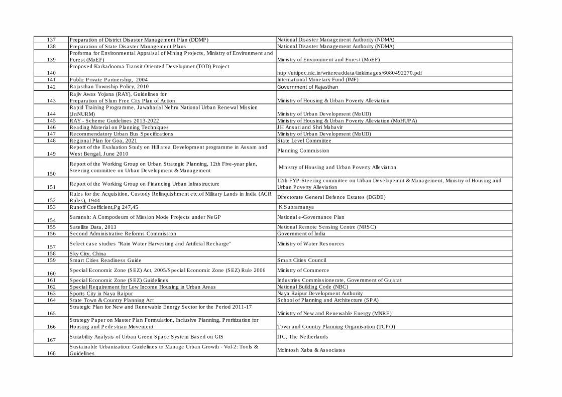
137 Preparation of District Disaster Management Plan (DDMP) National Disaster Management Authority (NDMA)
138 Preparation of State Disaster Management Plans National Disaster Management Authority (NDMA)
139
Proforma for Environmental Appraisal of Mining Projects, Ministry of Environment and
Forest (MoEF) Ministry of Environment and Forest (MoEF)
140
Proposed Karkadooma Transit Oriented Developmet (TOD) Project
http://uttipec.nic.in/writereaddata/linkimages/6080492270.pdf
141 Public Private Partnership, 2004 International Monetary Fund (IMF)
142 Rajasthan Township Policy, 2010 Government of Rajasthan
143
Rajiv Awas Yojana (RAY), Guidelines for
Preparation of Slum Free City Plan of Action Ministry of Housing & Urban Poverty Alleviation
144
Rapid Training Programme, Jawaharlal Nehru National Urban Renewal Mission
(JnNURM) Ministry of Urban Development (MoUD)
145 RAY - Scheme Guidelines 2013-2022 Ministry of Housing & Urban Poverty Alleviation (MoHUPA)
146 Reading Material on Planning Techniques JH Ansari and Shri Mahavir
147 Recommendatory Urban Bus Specifications Ministry of Urban Development (MoUD)
148 Regional Plan for Goa, 2021 State Level Committee
149
Report of the Evaluation Study on Hill area Development programme in Assam and
West Bengal, June 2010Planning Commission
150
Report of the Working Group on Urban Strategic Planning, 12th Five-year plan,
Steering committee on Urban Development & Management Ministry of Housing and Urban Poverty Alleviation
151Report of the Working Group on Financing Urban Infrastructure
12th FYP-Steering committee on Urban Developemnt & Management, Ministry of Housing and
Urban Poverty Alleviation
152
Rules for the Acquisition, Custody Relinquishment etc.of Military Lands in India (ACR
Rules), 1944Directorate General Defence Estates (DGDE)
153 Runoff Coefficient,Pg 247,45 K Subramanya
154Saransh: A Compodeum of Mission Mode Projects under NeGP National e-Governance Plan
155 Satellite Data, 2013 National Remote Sensing Centre (NRSC)
156 Second Administrative Reforms Commission Government of India
157Select case studies "Rain Water Harvesting and Artificial Recharge" Ministry of Water Resources
158 Sky City, China
159 Smart Cities Readiness Guide Smart Cities Council
160Special Economic Zone (SEZ) Act, 2005/Special Economic Zone (SEZ) Rule 2006 Ministry of Commerce
161 Special Economic Zone (SEZ) Guidelines Industries Commissionerate, Government of Gujarat
162 Special Requirement for Low Income Housing in Urban Areas National Building Code (NBC)
163 Sports City in Naya Raipur Naya Raipur Development Authority
164 State Town & Country Planning Act School of Planning and Architecture (SPA)
165
Strategic Plan for New and Renewable Energy Sector for the Period 2011-17
Ministry of New and Renewable Energy (MNRE)
166
Strategy Paper on Master Plan Formulation, Inclusive Planning, Proritization for
Housing and Pedestrian Movement Town and Country Planning Organisation (TCPO)
167Suitability Analysis of Urban Green Space System Based on GIS ITC, The Netherlands
168
Sustainable Urbanization: Guidelines to Manage Urban Growth - Vol-2: Tools &
GuidelinesMcIntosh Xaba & Associates
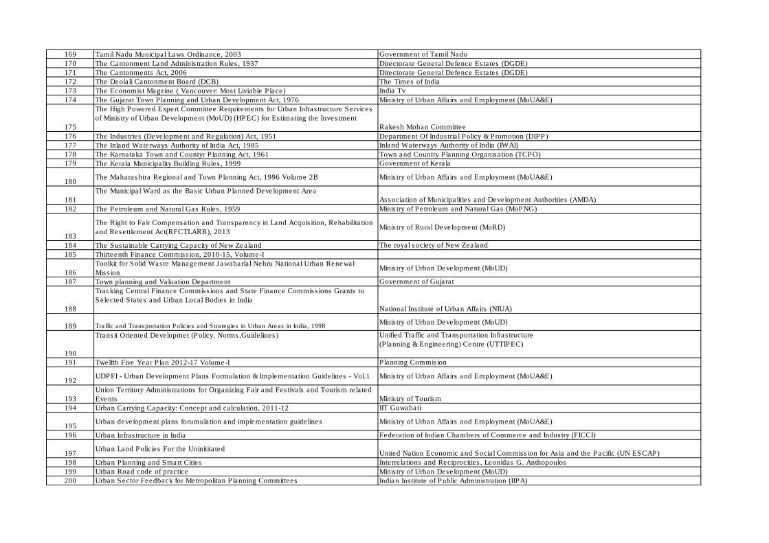
169 Tamil Nadu Municipal Laws Ordinance, 2003 Government of Tamil Nadu
170 The Cantonment Land Administration Rules, 1937 Directorate General Defence Estates (DGDE)
171 The Cantonments Act, 2006 Directorate General Defence Estates (DGDE)
172 The Deolali Cantonment Board (DCB) The Times of India
173 The Economist Magzine ( Vancouver: Most Liviable Place) India Tv
174 The Gujarat Town Planning and Urban Development Act, 1976 Ministry of Urban Affairs and Employment (MoUA&E)
175
The High Powered Expert Committee Requirements for Urban Infrastructure Services
of Ministry of Urban Development (MoUD) (HPEC) for Estimating the Investment
Rakesh Mohan Committee
176 The Industries (Development and Regulation) Act, 1951 Department Of Industrial Policy & Promotion (DIPP)
177 The Inland Waterways Authority of India Act, 1985 Inland Waterways Authority of India (IWAI)
178 The Karnataka Town and Countyr Planning Act, 1961 Town and Country Planning Organisation (TCPO)
179 The Kerala Municipality Building Rules, 1999 Government of Kerala
180The Maharashtra Regional and Town Planning Act, 1996 Volume 2B Ministry of Urban Affairs and Employment (MoUA&E)
181
The Municipal Ward as the Basic Urban Planned Development Area
Association of Municipalities and Development Authorities (AMDA)
182 The Petroleum and Natural Gas Rules, 1959 Ministry of Petroleum and Natural Gas (MoPNG)
183
The Right to Fair Compensation and Transparency in Land Acquisition, Rehabilitation
and Resettlement Act(RFCTLARR), 2013Ministry of Rural Development (MoRD)
184 The Sustainable Carrying Capacity of New Zealand The royal society of New Zealand
185 Thirteenth Finance Commission, 2010-15, Volume-I
186
Toolkit for Solid Waste Management Jawaharlal Nehru National Urban Renewal
MissionMinistry of Urban Development (MoUD)
187 Town planning and Valuation Department Government of Gujarat
188
Tracking Central Finance Commissions and State Finance Commissions Grants to
Selected States and Urban Local Bodies in India
National Institute of Urban Affairs (NIUA)
189 Traffic and Transportation Policies and Strategies in Urban Areas in India, 1998Ministry of Urban Development (MoUD)
190
Transit Oriented Developmet (Policy, Norms,Guidelines) Unified Traffic and Transportation Infrastructure
(Planning & Engineering) Centre (UTTIPEC)
191 Twelfth Five Year Plan 2012-17 Volume-I Planning Commision
192UDPFI - Urban Development Plans Formulation & Implementation Guidelines - Vol.1 Ministry of Urban Affairs and Employment (MoUA&E)
193
Union Territory Administrations for Organizing Fair and Festivals and Tourism related
Events Ministry of Tourism
194 Urban Carrying Capacity: Concept and calculation, 2011-12 IIT Guwahati
195Urban development plans forumulation and implementation guidelines Ministry of Urban Affairs and Employment (MoUA&E)
196 Urban Infrastructure in India Federation of Indian Chambers of Commerce and Industry (FICCI)
197Urban Land Policies For the Uninititated
United Nation Economic and Social Commission for Asia and the Pacific (UN ESCAP)
198 Urban Planning and Smart Cities Interrelations and Reciprocities, Leonidas G. Anthopoulos
199 Urban Road code of practice Ministry of Urban Development (MoUD)
200 Urban Sector Feedback for Metropolitan Planning Committees Indian Institute of Public Administration (IIPA)
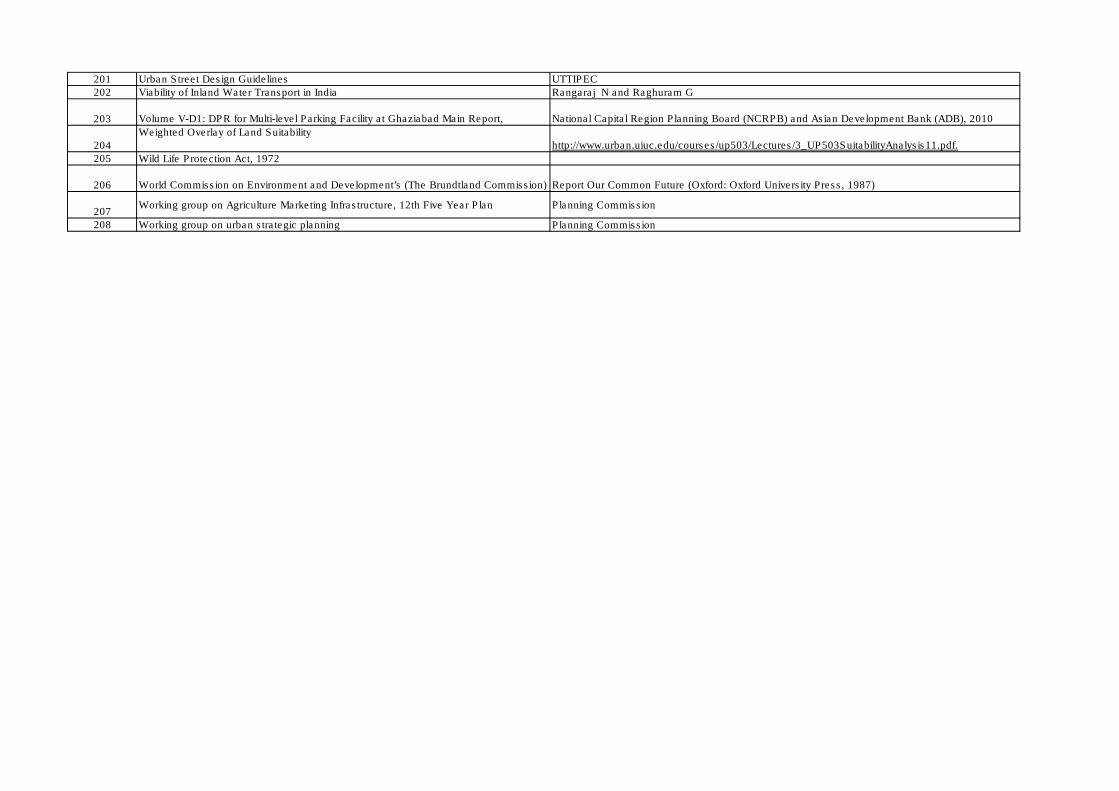
201 Urban Street Design Guidelines UTTIPEC
202 Viability of Inland Water Transport in India Rangaraj N and Raghuram G
203 Volume V-D1: DPR for Multi-level Parking Facility at Ghaziabad Main Report, National Capital Region Planning Board (NCRPB) and Asian Development Bank (ADB), 2010
204
Weighted Overlay of Land Suitability
http://www.urban.uiuc.edu/courses/up503/Lectures/3_UP503SuitabilityAnalysis11.pdf.
205 Wild Life Protection Act, 1972
206 World Commission on Environment and Development’s (The Brundtland Commission) Report Our Common Future (Oxford: Oxford University Press, 1987)
207Working group on Agriculture Marketing Infrastructure, 12th Five Year Plan Planning Commission
208 Working group on urban strategic planning Planning Commission
417 319928/ISA/MCB/AA/01 1 Feburary 2014 P:\Noida\DMC\Projects\319928-MoUD UDPFI Guidelines Revision\Deliverable\Draft Report\URDPFI Guidelines Vol I Draft-1 26.02.14.docx
Urban and Regional Development Plans Formulation & Implement Volume – I, DRAFT REPORT VERSION 1
CONFIDENTIAL
A.7.2 References for the guidelines
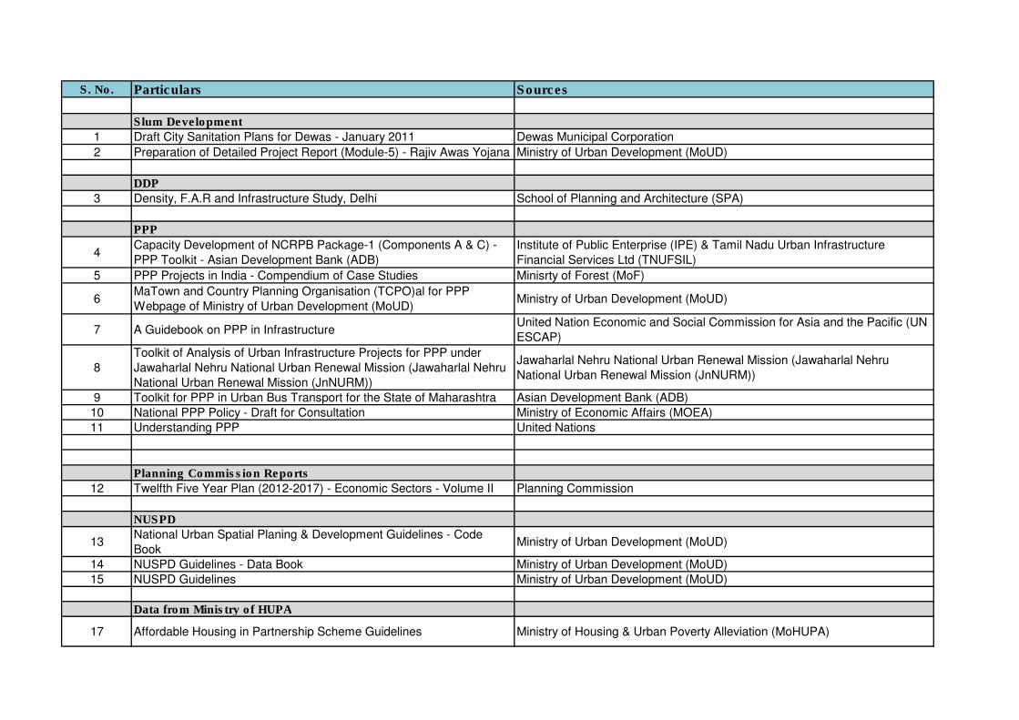
S. No. Particulars Sources
Slum Development
1 Draft City Sanitation Plans for Dewas - January 2011 Dewas Municipal Corporation
2 Preparation of Detailed Project Report (Module-5) - Rajiv Awas Yojana Ministry of Urban Development (MoUD)
DDP
3 Density, F.A.R and Infrastructure Study, Delhi School of Planning and Architecture (SPA)
PPP
4Capacity Development of NCRPB Package-1 (Components A & C) -
PPP Toolkit - Asian Development Bank (ADB)
Institute of Public Enterprise (IPE) & Tamil Nadu Urban Infrastructure
Financial Services Ltd (TNUFSIL)
5 PPP Projects in India - Compendium of Case Studies Minisrty of Forest (MoF)
6MaTown and Country Planning Organisation (TCPO)al for PPP
Webpage of Ministry of Urban Development (MoUD)Ministry of Urban Development (MoUD)
7 A Guidebook on PPP in InfrastructureUnited Nation Economic and Social Commission for Asia and the Pacific (UN
ESCAP)
8
Toolkit of Analysis of Urban Infrastructure Projects for PPP under
Jawaharlal Nehru National Urban Renewal Mission (Jawaharlal Nehru
National Urban Renewal Mission (JnNURM))
Jawaharlal Nehru National Urban Renewal Mission (Jawaharlal Nehru
National Urban Renewal Mission (JnNURM))
9 Toolkit for PPP in Urban Bus Transport for the State of Maharashtra Asian Development Bank (ADB)
10 National PPP Policy - Draft for Consultation Ministry of Economic Affairs (MOEA)
11 Understanding PPP United Nations
Planning Commission Reports
12 Twelfth Five Year Plan (2012-2017) - Economic Sectors - Volume II Planning Commission
NUSPD
13National Urban Spatial Planing & Development Guidelines - Code
BookMinistry of Urban Development (MoUD)
14 NUSPD Guidelines - Data Book Ministry of Urban Development (MoUD)
15 NUSPD Guidelines Ministry of Urban Development (MoUD)
Data from Ministry of HUPA
17 Affordable Housing in Partnership Scheme Guidelines Ministry of Housing & Urban Poverty Alleviation (MoHUPA)
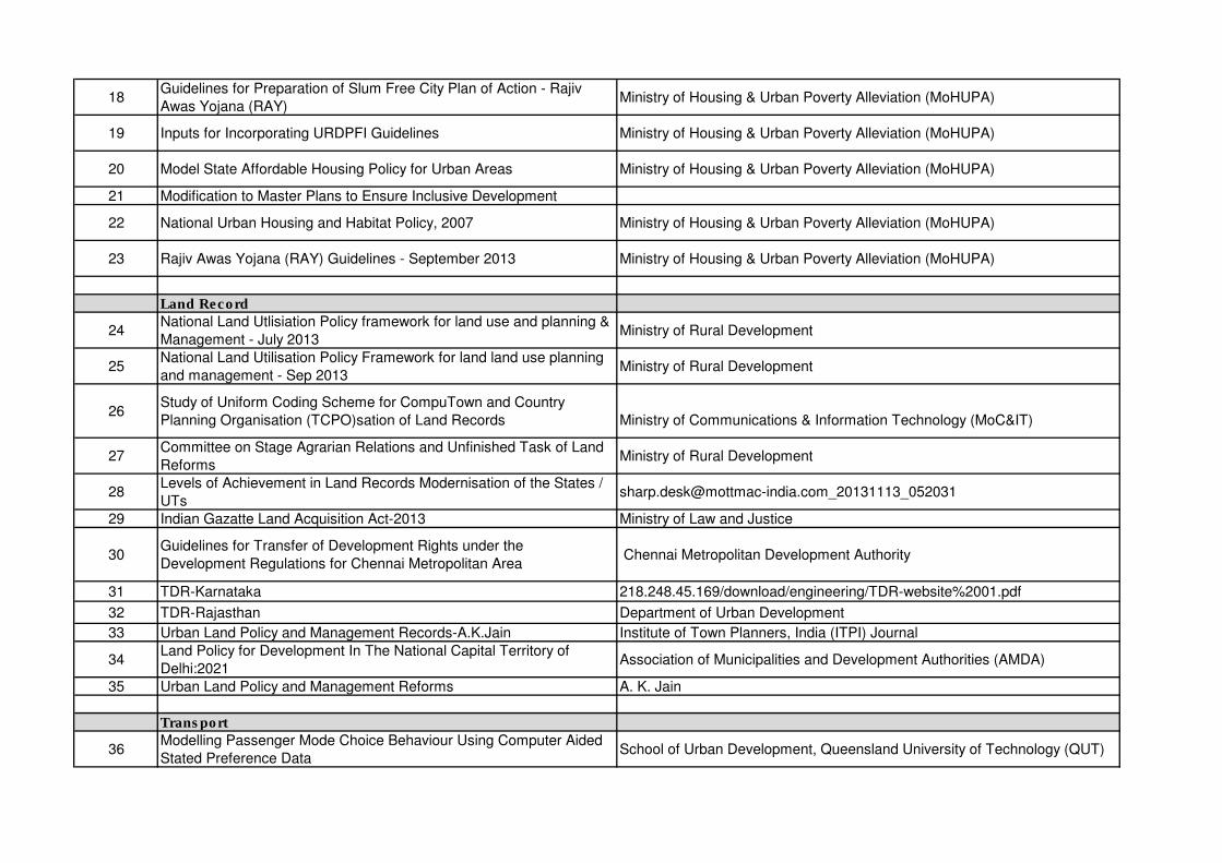
18Guidelines for Preparation of Slum Free City Plan of Action - Rajiv
Awas Yojana (RAY)Ministry of Housing & Urban Poverty Alleviation (MoHUPA)
19 Inputs for Incorporating URDPFI Guidelines Ministry of Housing & Urban Poverty Alleviation (MoHUPA)
20 Model State Affordable Housing Policy for Urban Areas Ministry of Housing & Urban Poverty Alleviation (MoHUPA)
21 Modification to Master Plans to Ensure Inclusive Development
22 National Urban Housing and Habitat Policy, 2007 Ministry of Housing & Urban Poverty Alleviation (MoHUPA)
23 Rajiv Awas Yojana (RAY) Guidelines - September 2013 Ministry of Housing & Urban Poverty Alleviation (MoHUPA)
Land Record
24National Land Utlisiation Policy framework for land use and planning &
Management - July 2013Ministry of Rural Development
25National Land Utilisation Policy Framework for land land use planning
and management - Sep 2013Ministry of Rural Development
26Study of Uniform Coding Scheme for CompuTown and Country
Planning Organisation (TCPO)sation of Land Records Ministry of Communications & Information Technology (MoC&IT)
27Committee on Stage Agrarian Relations and Unfinished Task of Land
ReformsMinistry of Rural Development
28Levels of Achievement in Land Records Modernisation of the States /
[email protected]_20131113_052031
29 Indian Gazatte Land Acquisition Act-2013 Ministry of Law and Justice
30Guidelines for Transfer of Development Rights under the
Development Regulations for Chennai Metropolitan Area Chennai Metropolitan Development Authority
31 TDR-Karnataka 218.248.45.169/download/engineering/TDR-website%2001.pdf
32 TDR-Rajasthan Department of Urban Development
33 Urban Land Policy and Management Records-A.K.Jain Institute of Town Planners, India (ITPI) Journal
34Land Policy for Development In The National Capital Territory of
Delhi:2021Association of Municipalities and Development Authorities (AMDA)
35 Urban Land Policy and Management Reforms A. K. Jain
Transport
36Modelling Passenger Mode Choice Behaviour Using Computer Aided
Stated Preference DataSchool of Urban Development, Queensland University of Technology (QUT)
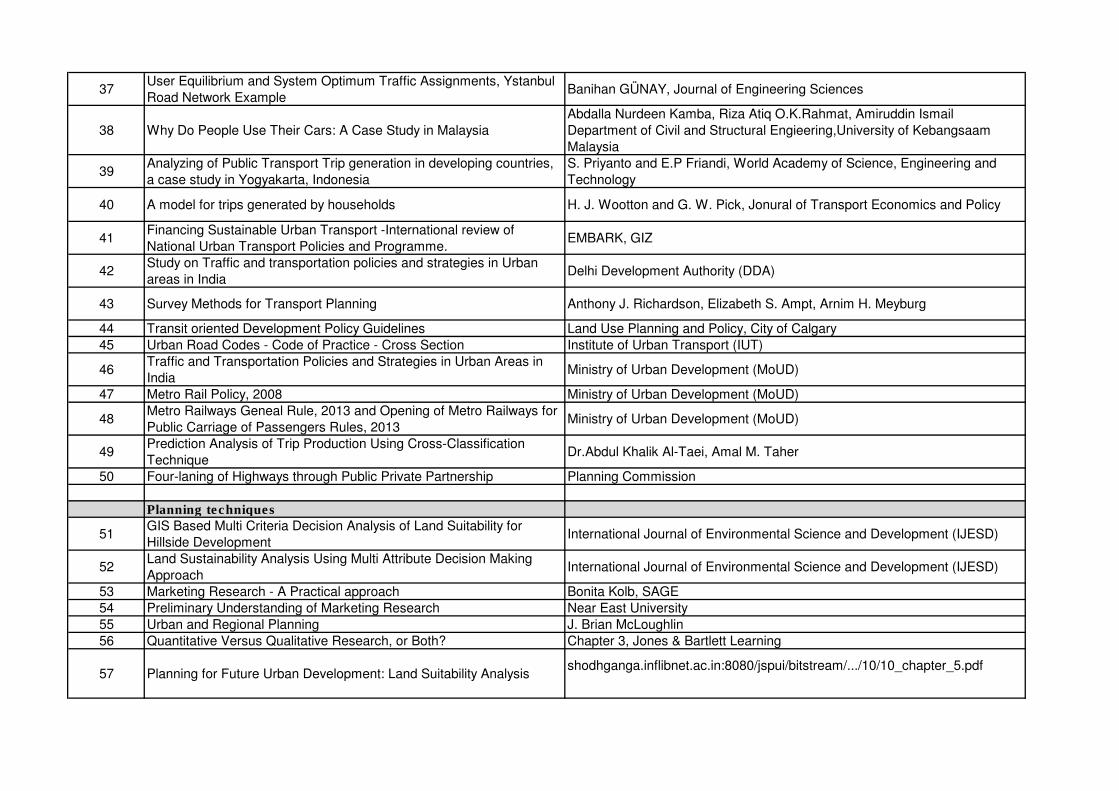
37User Equilibrium and System Optimum Traffic Assignments, Ystanbul
Road Network ExampleBanihan GÜNAY, Journal of Engineering Sciences
38 Why Do People Use Their Cars: A Case Study in Malaysia
Abdalla Nurdeen Kamba, Riza Atiq O.K.Rahmat, Amiruddin Ismail
Department of Civil and Structural Engieering,University of Kebangsaam
Malaysia
39Analyzing of Public Transport Trip generation in developing countries,
a case study in Yogyakarta, Indonesia
S. Priyanto and E.P Friandi, World Academy of Science, Engineering and
Technology
40 A model for trips generated by households H. J. Wootton and G. W. Pick, Jonural of Transport Economics and Policy
41Financing Sustainable Urban Transport -International review of
National Urban Transport Policies and Programme.EMBARK, GIZ
42Study on Traffic and transportation policies and strategies in Urban
areas in IndiaDelhi Development Authority (DDA)
43 Survey Methods for Transport Planning Anthony J. Richardson, Elizabeth S. Ampt, Arnim H. Meyburg
44 Transit oriented Development Policy Guidelines Land Use Planning and Policy, City of Calgary
45 Urban Road Codes - Code of Practice - Cross Section Institute of Urban Transport (IUT)
46Traffic and Transportation Policies and Strategies in Urban Areas in
IndiaMinistry of Urban Development (MoUD)
47 Metro Rail Policy, 2008 Ministry of Urban Development (MoUD)
48Metro Railways Geneal Rule, 2013 and Opening of Metro Railways for
Public Carriage of Passengers Rules, 2013 Ministry of Urban Development (MoUD)
49Prediction Analysis of Trip Production Using Cross-Classification
TechniqueDr.Abdul Khalik Al-Taei, Amal M. Taher
50 Four-laning of Highways through Public Private Partnership Planning Commission
Planning techniques
51GIS Based Multi Criteria Decision Analysis of Land Suitability for
Hillside DevelopmentInternational Journal of Environmental Science and Development (IJESD)
52Land Sustainability Analysis Using Multi Attribute Decision Making
Approach International Journal of Environmental Science and Development (IJESD)
53 Marketing Research - A Practical approach Bonita Kolb, SAGE
54 Preliminary Understanding of Marketing Research Near East University
55 Urban and Regional Planning J. Brian McLoughlin
56 Quantitative Versus Qualitative Research, or Both? Chapter 3, Jones & Bartlett Learning
57 Planning for Future Urban Development: Land Suitability Analysisshodhganga.inflibnet.ac.in:8080/jspui/bitstream/.../10/10_chapter_5.pdf
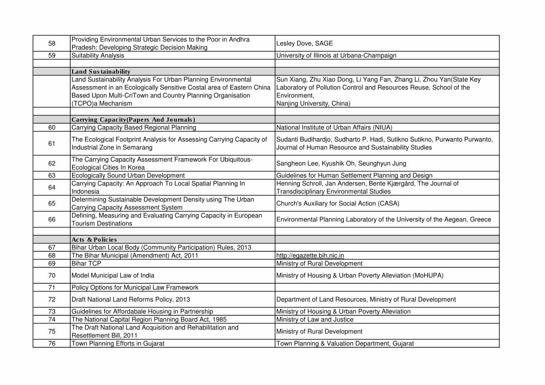
58Providing Environmental Urban Services to the Poor in Andhra
Pradesh: Developing Strategic Decision MakingLesley Dove, SAGE
59 Suitability Analysis University of Illinois at Urbana-Champaign
Land Sustainability
Land Sustainability Analysis For Urban Planning Environmental
Assessment in an Ecologically Sensitive Costal area of Eastern China
Based Upon Multi-CriTown and Country Planning Organisation
(TCPO)a Mechanism
Sun Xiang, Zhu Xiao Dong, Li Yang Fan, Zhang Li, Zhou Yan(State Key
Laboratory of Pollution Control and Resources Reuse, School of the
Environment,
Nanjing University, China)
Carrying Capacity(Papers And Journals)
60 Carrying Capacity Based Regional Planning National Institute of Urban Affairs (NIUA)
61The Ecological Footprint Analysis for Assessing Carrying Capacity of
Industrial Zone in Semarang
Sudanti Budihardjo, Sudharto P. Hadi, Sutikno Sutikno, Purwanto Purwanto,
Journal of Human Resource and Sustainability Studies
62The Carrying Capacity Assessment Framework For Ubiquitous-
Ecological Cities In KoreaSangheon Lee, Kyushik Oh, Seunghyun Jung
63 Ecologically Sound Urban Development Guidelines for Human Settlement Planning and Design
64Carrying Capacity: An Approach To Local Spatial Planning In
Indonesia
Henning Schroll, Jan Andersen, Bente Kjærgård, The Journal of
Transdisciplinary Environmental Studies
65Determining Sustainable Development Density using The Urban
Carrying Capacity Assessment SystemChurch's Auxiliary for Social Action (CASA)
66Defining, Measuring and Evaluating Carrying Capacity in European
Tourism DestinationsEnvironmental Planning Laboratory of the University of the Aegean, Greece
Acts & Policies
67 Bihar Urban Local Body (Community Participation) Rules, 2013
68 The Bihar Municipal (Amendment) Act, 2011 http://egazette.bih.nic.in
69 Bihar TCP Ministry of Rural Development
70 Model Municipal Law of India Ministry of Housing & Urban Poverty Alleviation (MoHUPA)
71 Policy Options for Municipal Law Framework
72 Draft National Land Reforms Policy, 2013 Department of Land Resources, Ministry of Rural Development
73 Guidelines for Affordabale Housing in Partnership Ministry of Housing & Urban Poverty Alleviation
74 The National Capital Region Planning Board Act, 1985 Ministry of Law and Justice
75The Draft National Land Acquisition and Rehabilitation and
Resettlement Bill, 2011Ministry of Rural Development
76 Town Planning Efforts in Gujarat Town Planning & Valuation Department, Gujarat
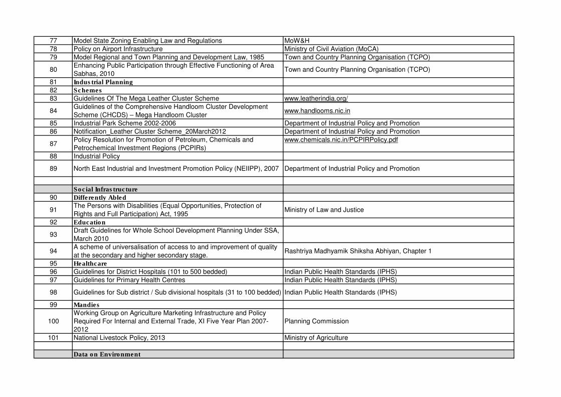
77 Model State Zoning Enabling Law and Regulations MoW&H
78 Policy on Airport Infrastructure Ministry of Civil Aviation (MoCA)
79 Model Regional and Town Planning and Development Law, 1985 Town and Country Planning Organisation (TCPO)
80Enhancing Public Participation through Effective Functioning of Area
Sabhas, 2010Town and Country Planning Organisation (TCPO)
81 Industrial Planning
82 Schemes
83 Guidelines Of The Mega Leather Cluster Scheme www.leatherindia.org/
84Guidelines of the Comprehensive Handloom Cluster Development
Scheme (CHCDS) – Mega Handloom Clusterwww.handlooms.nic.in
85 Industrial Park Scheme 2002-2006 Department of Industrial Policy and Promotion
86 Notification_Leather Cluster Scheme_20March2012 Department of Industrial Policy and Promotion
87Policy Resolution for Promotion of Petroleum, Chemicals and
Petrochemical Investment Regions (PCPIRs)
www.chemicals.nic.in/PCPIRPolicy.pdf
88 Industrial Policy
89 North East Industrial and Investment Promotion Policy (NEIIPP), 2007 Department of Industrial Policy and Promotion
Social Infrastructure
90 Differently Abled
91The Persons with Disabilities (Equal Opportunities, Protection of
Rights and Full Participation) Act, 1995Ministry of Law and Justice
92 Education
93Draft Guidelines for Whole School Development Planning Under SSA,
March 2010
94A scheme of universalisation of access to and improvement of quality
at the secondary and higher secondary stage.Rashtriya Madhyamik Shiksha Abhiyan, Chapter 1
95 Healthcare
96 Guidelines for District Hospitals (101 to 500 bedded) Indian Public Health Standards (IPHS)
97 Guidelines for Primary Health Centres Indian Public Health Standards (IPHS)
98 Guidelines for Sub district / Sub divisional hospitals (31 to 100 bedded) Indian Public Health Standards (IPHS)
99 Mandies
100
Working Group on Agriculture Marketing Infrastructure and Policy
Required For Internal and External Trade, XI Five Year Plan 2007-
2012
Planning Commission
101 National Livestock Policy, 2013 Ministry of Agriculture
Data on Environment
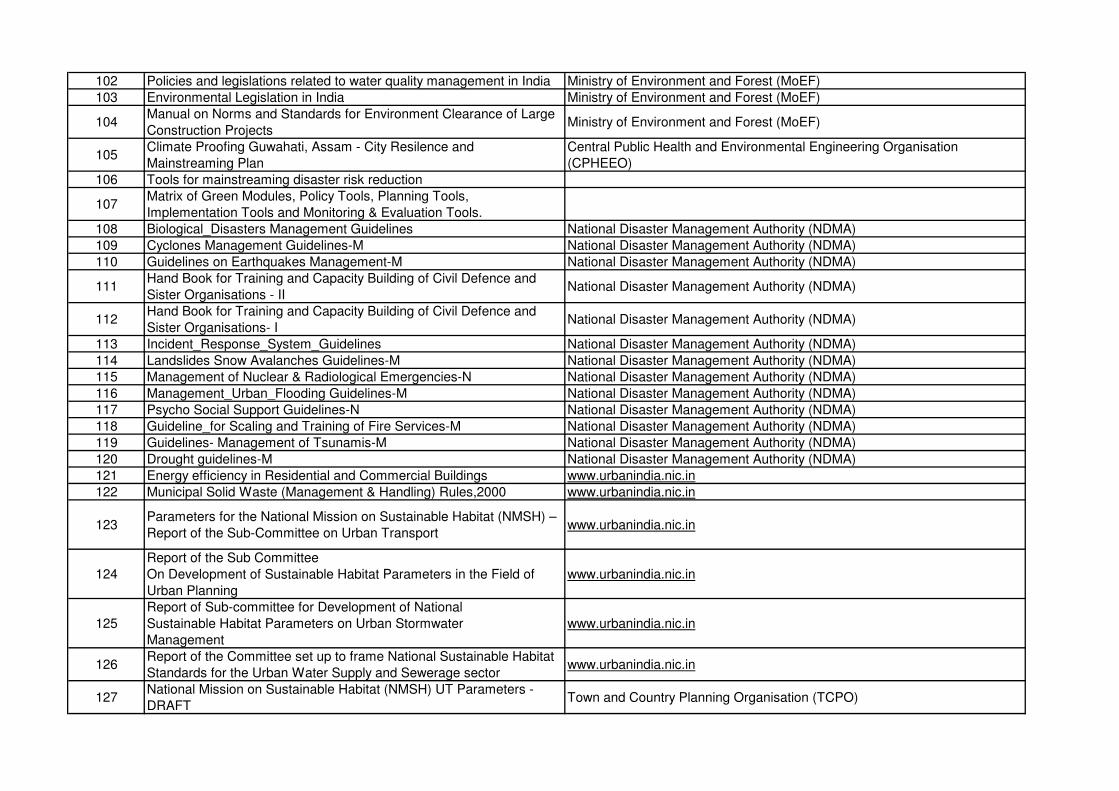
102 Policies and legislations related to water quality management in India Ministry of Environment and Forest (MoEF)
103 Environmental Legislation in India Ministry of Environment and Forest (MoEF)
104Manual on Norms and Standards for Environment Clearance of Large
Construction ProjectsMinistry of Environment and Forest (MoEF)
105Climate Proofing Guwahati, Assam - City Resilence and
Mainstreaming Plan
Central Public Health and Environmental Engineering Organisation
(CPHEEO)
106 Tools for mainstreaming disaster risk reduction
107Matrix of Green Modules, Policy Tools, Planning Tools,
Implementation Tools and Monitoring & Evaluation Tools.
108 Biological_Disasters Management Guidelines National Disaster Management Authority (NDMA)
109 Cyclones Management Guidelines-M National Disaster Management Authority (NDMA)
110 Guidelines on Earthquakes Management-M National Disaster Management Authority (NDMA)
111Hand Book for Training and Capacity Building of Civil Defence and
Sister Organisations - IINational Disaster Management Authority (NDMA)
112Hand Book for Training and Capacity Building of Civil Defence and
Sister Organisations- INational Disaster Management Authority (NDMA)
113 Incident_Response_System_Guidelines National Disaster Management Authority (NDMA)
114 Landslides Snow Avalanches Guidelines-M National Disaster Management Authority (NDMA)
115 Management of Nuclear & Radiological Emergencies-N National Disaster Management Authority (NDMA)
116 Management_Urban_Flooding Guidelines-M National Disaster Management Authority (NDMA)
117 Psycho Social Support Guidelines-N National Disaster Management Authority (NDMA)
118 Guideline_for Scaling and Training of Fire Services-M National Disaster Management Authority (NDMA)
119 Guidelines- Management of Tsunamis-M National Disaster Management Authority (NDMA)
120 Drought guidelines-M National Disaster Management Authority (NDMA)
121 Energy efficiency in Residential and Commercial Buildings www.urbanindia.nic.in
122 Municipal Solid Waste (Management & Handling) Rules,2000 www.urbanindia.nic.in
123Parameters for the National Mission on Sustainable Habitat (NMSH) –
Report of the Sub-Committee on Urban Transportwww.urbanindia.nic.in
124
Report of the Sub Committee
On Development of Sustainable Habitat Parameters in the Field of
Urban Planning
www.urbanindia.nic.in
125
Report of Sub-committee for Development of National
Sustainable Habitat Parameters on Urban Stormwater
Management
www.urbanindia.nic.in
126Report of the Committee set up to frame National Sustainable Habitat
Standards for the Urban Water Supply and Sewerage sectorwww.urbanindia.nic.in
127National Mission on Sustainable Habitat (NMSH) UT Parameters -
DRAFTTown and Country Planning Organisation (TCPO)
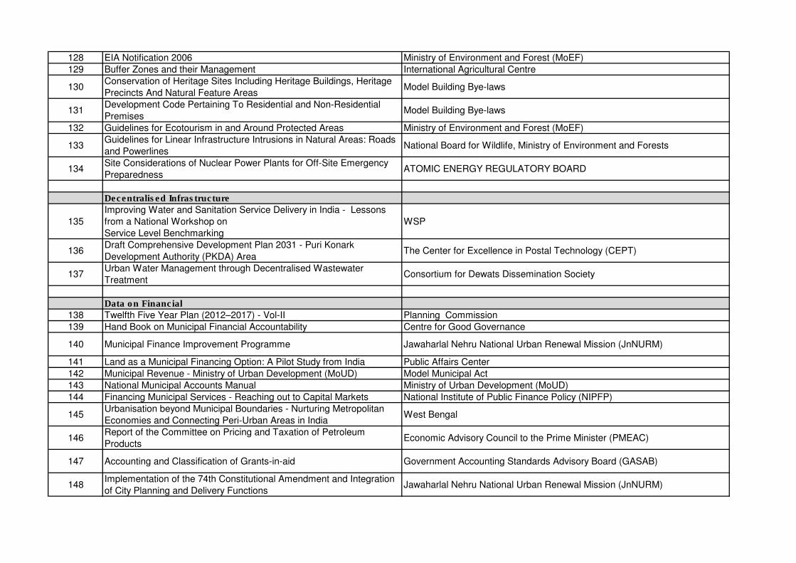
128 EIA Notification 2006 Ministry of Environment and Forest (MoEF)
129 Buffer Zones and their Management International Agricultural Centre
130Conservation of Heritage Sites Including Heritage Buildings, Heritage
Precincts And Natural Feature AreasModel Building Bye-laws
131Development Code Pertaining To Residential and Non-Residential
PremisesModel Building Bye-laws
132 Guidelines for Ecotourism in and Around Protected Areas Ministry of Environment and Forest (MoEF)
133Guidelines for Linear Infrastructure Intrusions in Natural Areas: Roads
and PowerlinesNational Board for Wildlife, Ministry of Environment and Forests
134Site Considerations of Nuclear Power Plants for Off-Site Emergency
PreparednessATOMIC ENERGY REGULATORY BOARD
Decentralised Infrastructure
135
Improving Water and Sanitation Service Delivery in India - Lessons
from a National Workshop on
Service Level Benchmarking
WSP
136Draft Comprehensive Development Plan 2031 - Puri Konark
Development Authority (PKDA) AreaThe Center for Excellence in Postal Technology (CEPT)
137Urban Water Management through Decentralised Wastewater
TreatmentConsortium for Dewats Dissemination Society
Data on Financial
138 Twelfth Five Year Plan (2012–2017) - Vol-II Planning Commission
139 Hand Book on Municipal Financial Accountability Centre for Good Governance
140 Municipal Finance Improvement Programme Jawaharlal Nehru National Urban Renewal Mission (JnNURM)
141 Land as a Municipal Financing Option: A Pilot Study from India Public Affairs Center
142 Municipal Revenue - Ministry of Urban Development (MoUD) Model Municipal Act
143 National Municipal Accounts Manual Ministry of Urban Development (MoUD)
144 Financing Municipal Services - Reaching out to Capital Markets National Institute of Public Finance Policy (NIPFP)
145Urbanisation beyond Municipal Boundaries - Nurturing Metropolitan
Economies and Connecting Peri-Urban Areas in IndiaWest Bengal
146Report of the Committee on Pricing and Taxation of Petroleum
ProductsEconomic Advisory Council to the Prime Minister (PMEAC)
147 Accounting and Classification of Grants-in-aid Government Accounting Standards Advisory Board (GASAB)
148Implementation of the 74th Constitutional Amendment and Integration
of City Planning and Delivery Functions Jawaharlal Nehru National Urban Renewal Mission (JnNURM)
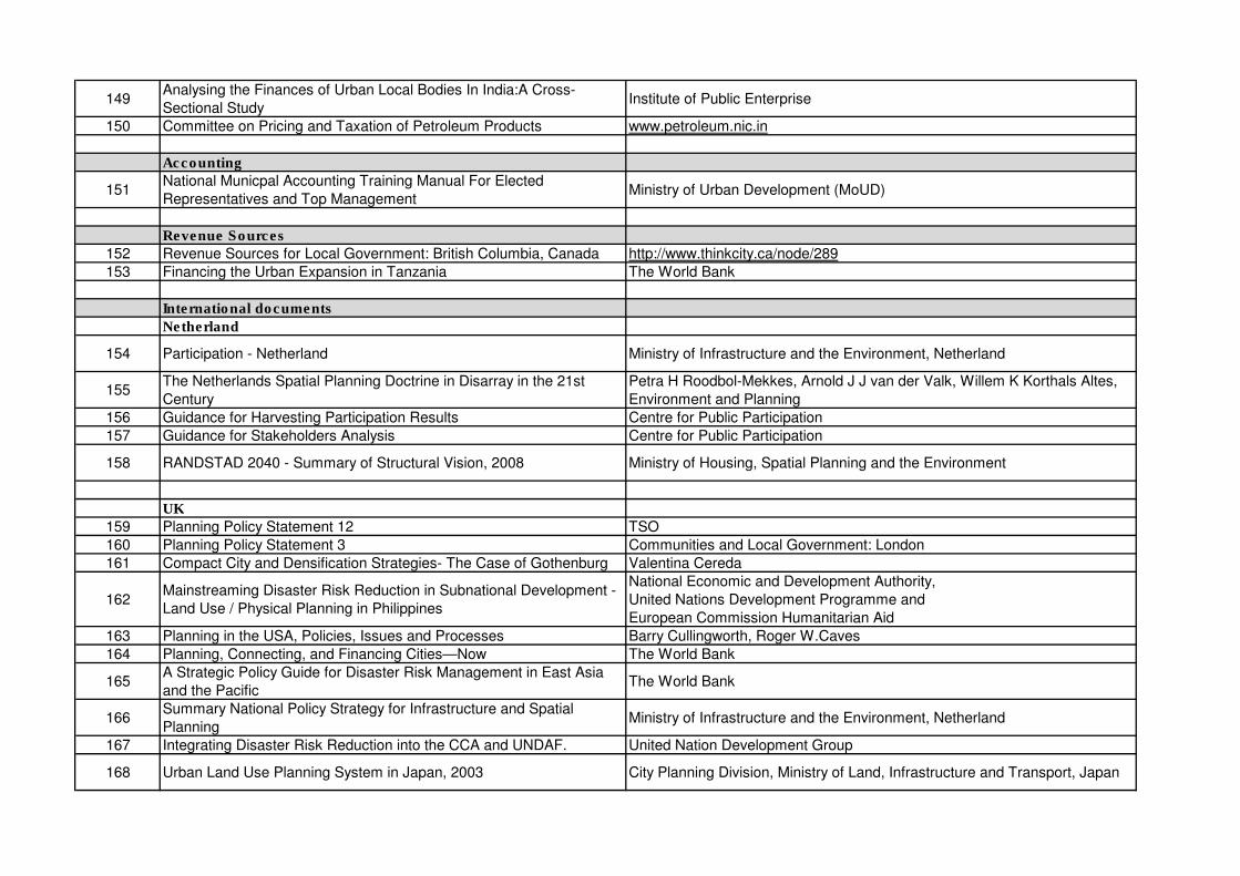
149Analysing the Finances of Urban Local Bodies In India:A Cross-
Sectional StudyInstitute of Public Enterprise
150 Committee on Pricing and Taxation of Petroleum Products www.petroleum.nic.in
Accounting
151National Municpal Accounting Training Manual For Elected
Representatives and Top ManagementMinistry of Urban Development (MoUD)
Revenue Sources
152 Revenue Sources for Local Government: British Columbia, Canada http://www.thinkcity.ca/node/289
153 Financing the Urban Expansion in Tanzania The World Bank
International documents
Netherland
154 Participation - Netherland Ministry of Infrastructure and the Environment, Netherland
155The Netherlands Spatial Planning Doctrine in Disarray in the 21st
Century
Petra H Roodbol-Mekkes, Arnold J J van der Valk, Willem K Korthals Altes,
Environment and Planning
156 Guidance for Harvesting Participation Results Centre for Public Participation
157 Guidance for Stakeholders Analysis Centre for Public Participation
158 RANDSTAD 2040 - Summary of Structural Vision, 2008 Ministry of Housing, Spatial Planning and the Environment
UK
159 Planning Policy Statement 12 TSO
160 Planning Policy Statement 3 Communities and Local Government: London
161 Compact City and Densification Strategies- The Case of Gothenburg Valentina Cereda
162Mainstreaming Disaster Risk Reduction in Subnational Development -
Land Use / Physical Planning in Philippines
National Economic and Development Authority,
United Nations Development Programme and
European Commission Humanitarian Aid
163 Planning in the USA, Policies, Issues and Processes Barry Cullingworth, Roger W.Caves
164 Planning, Connecting, and Financing Cities—Now The World Bank
165A Strategic Policy Guide for Disaster Risk Management in East Asia
and the PacificThe World Bank
166Summary National Policy Strategy for Infrastructure and Spatial
PlanningMinistry of Infrastructure and the Environment, Netherland
167 Integrating Disaster Risk Reduction into the CCA and UNDAF. United Nation Development Group
168 Urban Land Use Planning System in Japan, 2003 City Planning Division, Ministry of Land, Infrastructure and Transport, Japan
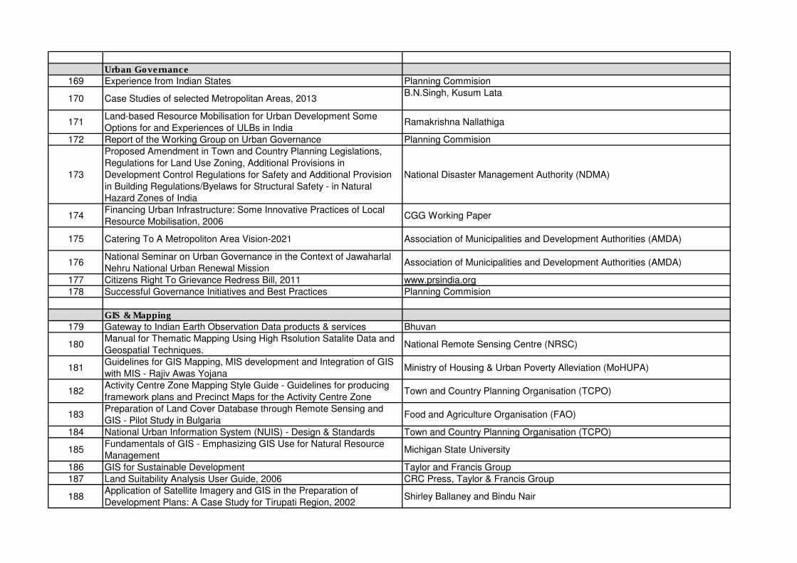
Urban Governance
169 Experience from Indian States Planning Commision
170 Case Studies of selected Metropolitan Areas, 2013B.N.Singh, Kusum Lata
171Land-based Resource Mobilisation for Urban Development Some
Options for and Experiences of ULBs in IndiaRamakrishna Nallathiga
172 Report of the Working Group on Urban Governance Planning Commision
173
Proposed Amendment in Town and Country Planning Legislations,
Regulations for Land Use Zoning, Additional Provisions in
Development Control Regulations for Safety and Additional Provision
in Building Regulations/Byelaws for Structural Safety - in Natural
Hazard Zones of India
National Disaster Management Authority (NDMA)
174Financing Urban Infrastructure: Some Innovative Practices of Local
Resource Mobilisation, 2006CGG Working Paper
175 Catering To A Metropoliton Area Vision-2021 Association of Municipalities and Development Authorities (AMDA)
176National Seminar on Urban Governance in the Context of Jawaharlal
Nehru National Urban Renewal MissionAssociation of Municipalities and Development Authorities (AMDA)
177 Citizens Right To Grievance Redress Bill, 2011 www.prsindia.org
178 Successful Governance Initiatives and Best Practices Planning Commision
GIS & Mapping
179 Gateway to Indian Earth Observation Data products & services Bhuvan
180Manual for Thematic Mapping Using High Rsolution Satalite Data and
Geospatial Techniques.National Remote Sensing Centre (NRSC)
181Guidelines for GIS Mapping, MIS development and Integration of GIS
with MIS - Rajiv Awas YojanaMinistry of Housing & Urban Poverty Alleviation (MoHUPA)
182Activity Centre Zone Mapping Style Guide - Guidelines for producing
framework plans and Precinct Maps for the Activity Centre ZoneTown and Country Planning Organisation (TCPO)
183Preparation of Land Cover Database through Remote Sensing and
GIS - Pilot Study in BulgariaFood and Agriculture Organisation (FAO)
184 National Urban Information System (NUIS) - Design & Standards Town and Country Planning Organisation (TCPO)
185Fundamentals of GIS - Emphasizing GIS Use for Natural Resource
ManagementMichigan State University
186 GIS for Sustainable Development Taylor and Francis Group
187 Land Suitability Analysis User Guide, 2006 CRC Press, Taylor & Francis Group
188Application of Satellite Imagery and GIS in the Preparation of
Development Plans: A Case Study for Tirupati Region, 2002Shirley Ballaney and Bindu Nair
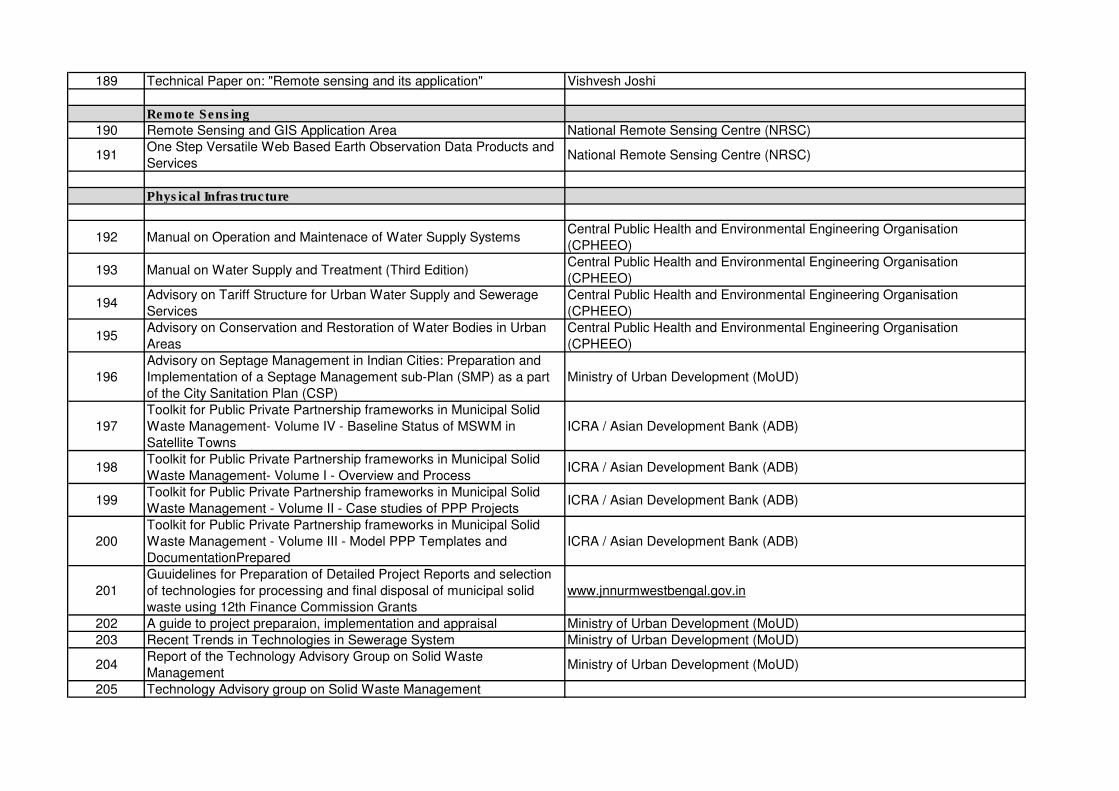
189 Technical Paper on: "Remote sensing and its application" Vishvesh Joshi
Remote Sensing
190 Remote Sensing and GIS Application Area National Remote Sensing Centre (NRSC)
191One Step Versatile Web Based Earth Observation Data Products and
ServicesNational Remote Sensing Centre (NRSC)
Physical Infrastructure
192 Manual on Operation and Maintenace of Water Supply Systems Central Public Health and Environmental Engineering Organisation
(CPHEEO)
193 Manual on Water Supply and Treatment (Third Edition)Central Public Health and Environmental Engineering Organisation
(CPHEEO)
194Advisory on Tariff Structure for Urban Water Supply and Sewerage
Services
Central Public Health and Environmental Engineering Organisation
(CPHEEO)
195Advisory on Conservation and Restoration of Water Bodies in Urban
Areas
Central Public Health and Environmental Engineering Organisation
(CPHEEO)
196
Advisory on Septage Management in Indian Cities: Preparation and
Implementation of a Septage Management sub-Plan (SMP) as a part
of the City Sanitation Plan (CSP)
Ministry of Urban Development (MoUD)
197
Toolkit for Public Private Partnership frameworks in Municipal Solid
Waste Management- Volume IV - Baseline Status of MSWM in
Satellite Towns
ICRA / Asian Development Bank (ADB)
198Toolkit for Public Private Partnership frameworks in Municipal Solid
Waste Management- Volume I - Overview and Process ICRA / Asian Development Bank (ADB)
199Toolkit for Public Private Partnership frameworks in Municipal Solid
Waste Management - Volume II - Case studies of PPP ProjectsICRA / Asian Development Bank (ADB)
200
Toolkit for Public Private Partnership frameworks in Municipal Solid
Waste Management - Volume III - Model PPP Templates and
DocumentationPrepared
ICRA / Asian Development Bank (ADB)
201
Guuidelines for Preparation of Detailed Project Reports and selection
of technologies for processing and final disposal of municipal solid
waste using 12th Finance Commission Grants
www.jnnurmwestbengal.gov.in
202 A guide to project preparaion, implementation and appraisal Ministry of Urban Development (MoUD)
203 Recent Trends in Technologies in Sewerage System Ministry of Urban Development (MoUD)
204Report of the Technology Advisory Group on Solid Waste
ManagementMinistry of Urban Development (MoUD)
205 Technology Advisory group on Solid Waste Management
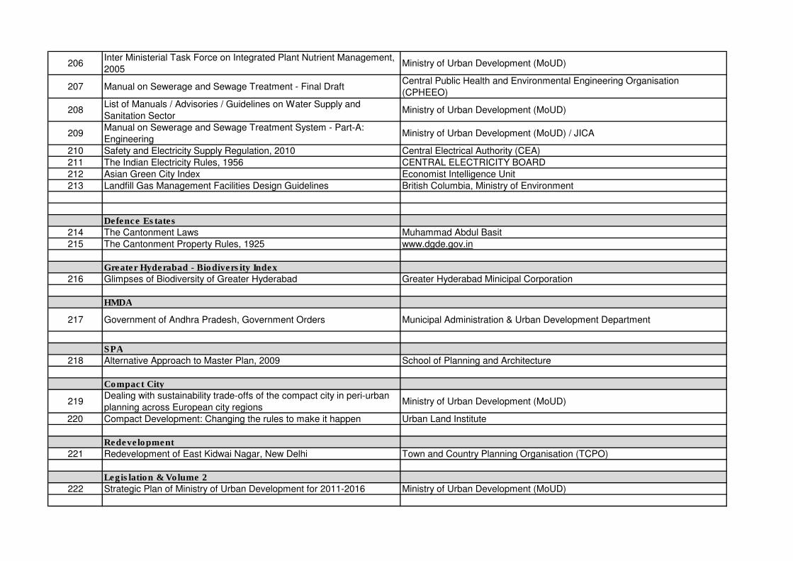
206Inter Ministerial Task Force on Integrated Plant Nutrient Management,
2005Ministry of Urban Development (MoUD)
207 Manual on Sewerage and Sewage Treatment - Final DraftCentral Public Health and Environmental Engineering Organisation
(CPHEEO)
208List of Manuals / Advisories / Guidelines on Water Supply and
Sanitation SectorMinistry of Urban Development (MoUD)
209Manual on Sewerage and Sewage Treatment System - Part-A:
EngineeringMinistry of Urban Development (MoUD) / JICA
210 Safety and Electricity Supply Regulation, 2010 Central Electrical Authority (CEA)
211 The Indian Electricity Rules, 1956 CENTRAL ELECTRICITY BOARD
212 Asian Green City Index Economist Intelligence Unit
213 Landfill Gas Management Facilities Design Guidelines British Columbia, Ministry of Environment
Defence Estates
214 The Cantonment Laws Muhammad Abdul Basit
215 The Cantonment Property Rules, 1925 www.dgde.gov.in
Greater Hyderabad - Biodiversity Index
216 Glimpses of Biodiversity of Greater Hyderabad Greater Hyderabad Minicipal Corporation
HMDA
217 Government of Andhra Pradesh, Government Orders Municipal Administration & Urban Development Department
SPA
218 Alternative Approach to Master Plan, 2009 School of Planning and Architecture
Compact City
219Dealing with sustainability trade-offs of the compact city in peri-urban
planning across European city regionsMinistry of Urban Development (MoUD)
220 Compact Development: Changing the rules to make it happen Urban Land Institute
Redevelopment
221 Redevelopment of East Kidwai Nagar, New Delhi Town and Country Planning Organisation (TCPO)
Legislation & Volume 2
222 Strategic Plan of Ministry of Urban Development for 2011-2016 Ministry of Urban Development (MoUD)
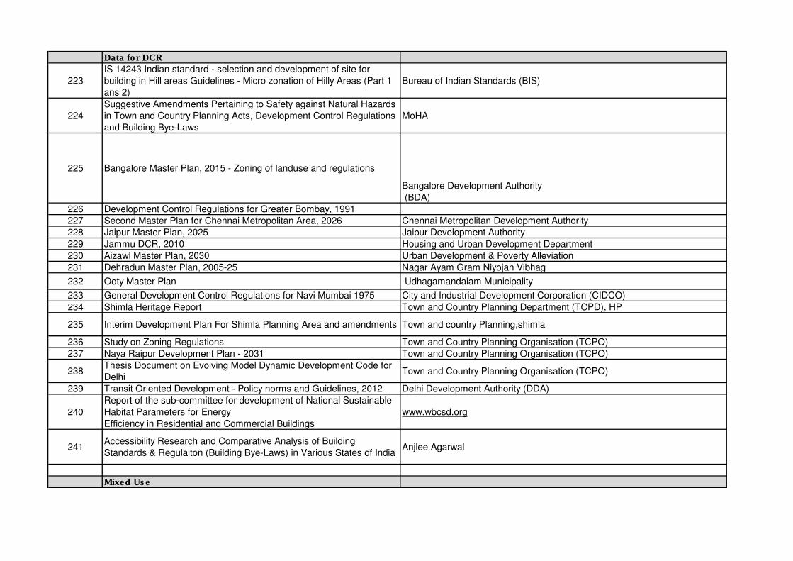
Data for DCR
223
IS 14243 Indian standard - selection and development of site for
building in Hill areas Guidelines - Micro zonation of Hilly Areas (Part 1
ans 2)
Bureau of Indian Standards (BIS)
224
Suggestive Amendments Pertaining to Safety against Natural Hazards
in Town and Country Planning Acts, Development Control Regulations
and Building Bye-Laws
MoHA
225 Bangalore Master Plan, 2015 - Zoning of landuse and regulations
Bangalore Development Authority
(BDA)
226 Development Control Regulations for Greater Bombay, 1991
227 Second Master Plan for Chennai Metropolitan Area, 2026 Chennai Metropolitan Development Authority
228 Jaipur Master Plan, 2025 Jaipur Development Authority
229 Jammu DCR, 2010 Housing and Urban Development Department
230 Aizawl Master Plan, 2030 Urban Development & Poverty Alleviation
231 Dehradun Master Plan, 2005-25 Nagar Ayam Gram Niyojan Vibhag
232 Ooty Master Plan Udhagamandalam Municipality
233 General Development Control Regulations for Navi Mumbai 1975 City and Industrial Development Corporation (CIDCO)
234 Shimla Heritage Report Town and Country Planning Department (TCPD), HP
235 Interim Development Plan For Shimla Planning Area and amendments Town and country Planning,shimla
236 Study on Zoning Regulations Town and Country Planning Organisation (TCPO)
237 Naya Raipur Development Plan - 2031 Town and Country Planning Organisation (TCPO)
238Thesis Document on Evolving Model Dynamic Development Code for
DelhiTown and Country Planning Organisation (TCPO)
239 Transit Oriented Development - Policy norms and Guidelines, 2012 Delhi Development Authority (DDA)
240
Report of the sub-committee for development of National Sustainable
Habitat Parameters for Energy
Efficiency in Residential and Commercial Buildings
www.wbcsd.org
241Accessibility Research and Comparative Analysis of Building
Standards & Regulaiton (Building Bye-Laws) in Various States of IndiaAnjlee Agarwal
Mixed Use

242Mixed-Use Development in Theory and Practice: Learning from
Atlanta’s Mixed Experiences, 2011Dr. William Drummond
243 Other National and International studies Documents suggested by SPA
244 A Mixed-Use High Rise: Mumbai Remaking of Mumbai Federation
245 Commercial and Mixed Use Development: Code Hand BookOregon’s Department of Transportation (ODOT) and Department of Land
Conservation and Development (DLCD)
246 Chapter 2: Density and Mixed Uses Transit Oriented Development Guidelines, Marta
247 Guidelines for High Rise Buildings Ministry of Environment and Forest (MoEF)
248Mixed-Use Development an Urban Design Approach to Cities in
Developing CountriesCaleb Sackey
249 Mixed-Use Development: A Review of Professional LiteratureThe National Association of Industrial and Office Properties Research
Foundation
250 Problems Achieving Mized Use Rodney E. Engelen
251Re-visioning Chandigarh: Densification and Re-development of the
City Centre (Sector 17)Gurkanwal Singh Boparai
252 The Urban Social Pattern of Navi Mumbai, India Malathi Ananthakrishnan
253 Input UDPFI - EMBARQ India: Case Studies EMBARQ
Census Data
254 Population Projections for India and States 2001- 2006 Office of Registrar General & Census Commissioner
Town and Country Planning Organisation (TCPO)
255 Sustainable Development Bureau of Indian Standards (BIS)
256 Guidelines for Energy Efficiency Street Lighting USAID, India
257Urban Transport, Draft Report to the Sub- Committee of the National
Development Council (NDC) on UrbanizationCentre of Excellence in Urban Transport, CEPT University, Ahmedabad
258 Streamlining Procedures for Clearance of Building Projects Town and Country Planning Organisation (TCPO)
259 Developing Norms and Provisions for Rural Schools in India Bureau of Indian Standards (BIS)
260 The Rajasthan Urban Improvement (Amendment) Bill, 2010
261 Rajasthan Urban Improvement Act, 1959
262 Baseline Study Shimla GTZ
263 Bangalore Metropolitan Region (BMR) Structural Plan Bangalore Metropolitan Region Development Authority
264Strategy Paper on Master Plan Formulation, Inclusive Planning,
Prioritization for Housing and Pedestrian Movement
265 Guide to Preliminary Planning Surveys for Small, Medium Size Town Town and Country Planning Organisation (TCPO)
266 Hyderabad Master Plan 2011 Hyderabad Urban Development Authority
267 Inside the Transforming Urban Asia Darshini Mahadevia
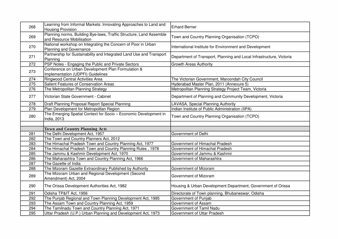
268Learning from Informal Markets: Innovating Approaches to Land and
Housing ProvisionErhard Berner
269Planning norms, Building Bye-laws, Traffic Structure, Land Assemble
and Resource Mobilisation Town and Country Planning Organisation (TCPO)
270National workshop on Integrating the Concern of Poor in Urban
Planning and GovernanceInternational Institute for Environment and Development
271Partnership for Sustainability and Integrated Land Use and Transport
PlanningDepartment of Transport, Planning and Local Infrastructure, Victoria
272 PSP Notes - Engaging the Public and Private Sectors Growth Areas Authority
273Conference on Urban Development Plan Formulation &
Implementation (UDPFI) Guidelines
274 Ringwood Central Activities Area The Victorian Government, Maroondah City Council
275 Salient Features of Conservation Areas Hyderabad Master Plan, 2011 (Annexure 5)
276 The Metropolitan Planning Strategy Metropolitan Planning Strategy Project Team, Victoria
277 Victorian State Government - Cabinet Department of Planning and Community Development, Victoria
278 Draft Planning Proposal Report Special Planning LAVASA, Special Planning Authority
279 Plan Development for Metropolitan Region Indian Institute of Public Administration (IIPA)
280The Emerging Spatial Context for Socio – Economic Development in
India, 2013Town and Country Planning Organisation (TCPO)
Town and Country Planning Acts
281 The Delhi Development Act, 1957 Government of Delhi
282 The Town and Country Planners Act, 2012
283 The Himachal Pradesh Town and Country Planning Act, 1977 Government of Himachal Pradesh
284 The Himachal Pradesh Town and Country Planning Rules , 1978 Government of Himachal Pradesh
285 The Jammu & Kashmir Development Act, 1970 Government of Jammu & Kashmir
286 The Maharashtra Town and Country Planning Act, 1966 Government of Maharashtra
287 The Gazette of India
288 The Mizoram Gazette Extraordinary Published by Authority Government of Mizoram
289The Mizoram Urban and Regional Development (Second
Amendment) Act, 2004Government of Mizoram
290 The Orissa Development Authorities Act, 1982 Housing & Urban Development Department, Government of Orissa
291 Odisha TP&IT Act, 1956 Directorate of Town planning, Bhubaneswar, Odisha
292 The Punjab Regional and Town Planning Development Act, 1995 Government of Punjab
293 The Assam Town and Country Planning Act, 1959 Government of Assam
294 The Tamilnadu Town and Country Planning Act, 1971 Government of Tamil Nadu
295 Uttar Pradesh (U.P.) Urban Planning and Development Act, 1973 Government of Uttar Pradesh
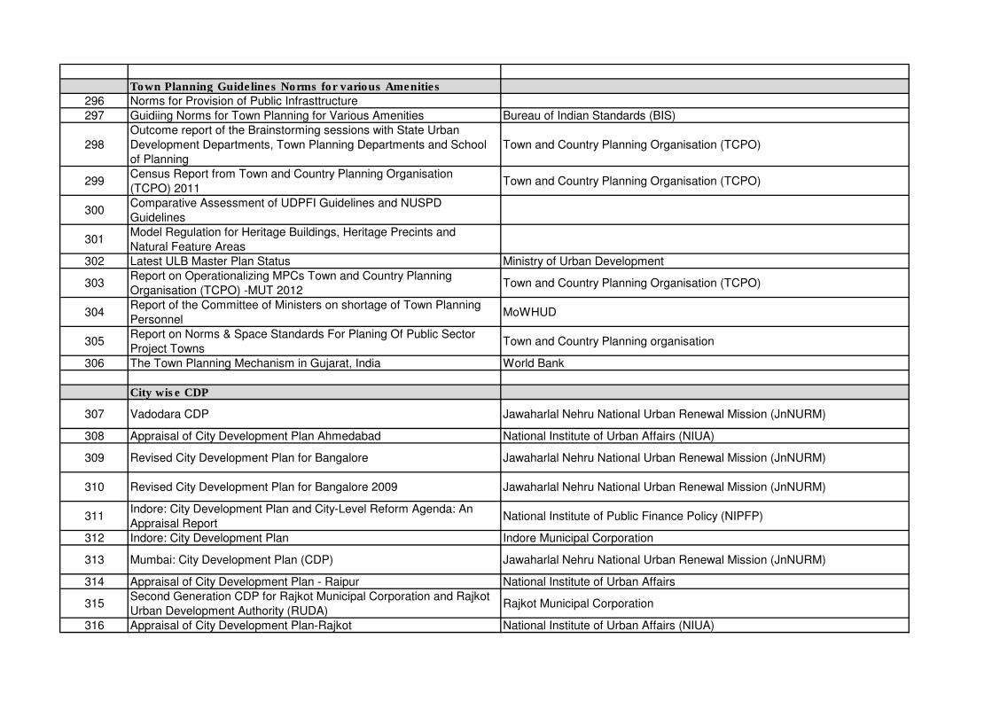
Town Planning Guidelines Norms for various Amenities
296 Norms for Provision of Public Infrasttructure
297 Guidiing Norms for Town Planning for Various Amenities Bureau of Indian Standards (BIS)
298
Outcome report of the Brainstorming sessions with State Urban
Development Departments, Town Planning Departments and School
of Planning
Town and Country Planning Organisation (TCPO)
299Census Report from Town and Country Planning Organisation
(TCPO) 2011Town and Country Planning Organisation (TCPO)
300Comparative Assessment of UDPFI Guidelines and NUSPD
Guidelines
301Model Regulation for Heritage Buildings, Heritage Precints and
Natural Feature Areas
302 Latest ULB Master Plan Status Ministry of Urban Development
303Report on Operationalizing MPCs Town and Country Planning
Organisation (TCPO) -MUT 2012Town and Country Planning Organisation (TCPO)
304Report of the Committee of Ministers on shortage of Town Planning
PersonnelMoWHUD
305Report on Norms & Space Standards For Planing Of Public Sector
Project TownsTown and Country Planning organisation
306 The Town Planning Mechanism in Gujarat, India World Bank
City wise CDP
307 Vadodara CDP Jawaharlal Nehru National Urban Renewal Mission (JnNURM)
308 Appraisal of City Development Plan Ahmedabad National Institute of Urban Affairs (NIUA)
309 Revised City Development Plan for Bangalore Jawaharlal Nehru National Urban Renewal Mission (JnNURM)
310 Revised City Development Plan for Bangalore 2009 Jawaharlal Nehru National Urban Renewal Mission (JnNURM)
311Indore: City Development Plan and City-Level Reform Agenda: An
Appraisal ReportNational Institute of Public Finance Policy (NIPFP)
312 Indore: City Development Plan Indore Municipal Corporation
313 Mumbai: City Development Plan (CDP) Jawaharlal Nehru National Urban Renewal Mission (JnNURM)
314 Appraisal of City Development Plan - Raipur National Institute of Urban Affairs
315Second Generation CDP for Rajkot Municipal Corporation and Rajkot
Urban Development Authority (RUDA)Rajkot Municipal Corporation
316 Appraisal of City Development Plan-Rajkot National Institute of Urban Affairs (NIUA)
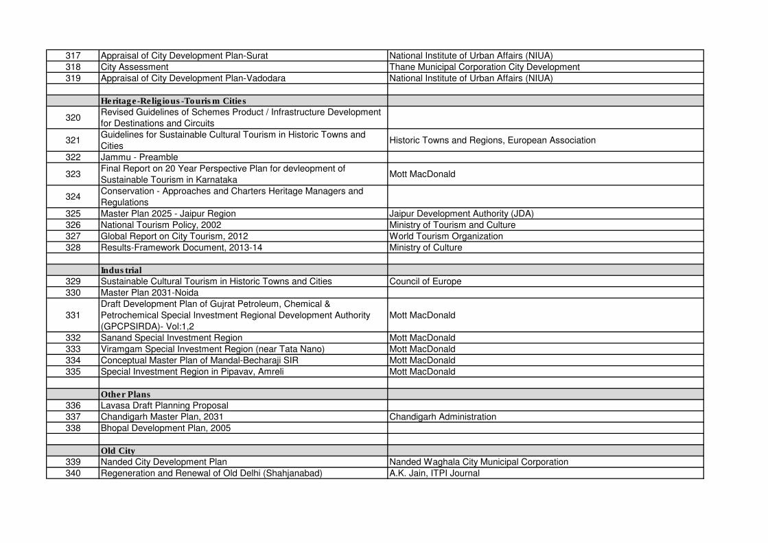
317 Appraisal of City Development Plan-Surat National Institute of Urban Affairs (NIUA)
318 City Assessment Thane Municipal Corporation City Development
319 Appraisal of City Development Plan-Vadodara National Institute of Urban Affairs (NIUA)
Heritage-Religious-Tourism Cities
320Revised Guidelines of Schemes Product / Infrastructure Development
for Destinations and Circuits
321Guidelines for Sustainable Cultural Tourism in Historic Towns and
CitiesHistoric Towns and Regions, European Association
322 Jammu - Preamble
323Final Report on 20 Year Perspective Plan for devleopment of
Sustainable Tourism in KarnatakaMott MacDonald
324Conservation - Approaches and Charters Heritage Managers and
Regulations
325 Master Plan 2025 - Jaipur Region Jaipur Development Authority (JDA)
326 National Tourism Policy, 2002 Ministry of Tourism and Culture
327 Global Report on City Tourism, 2012 World Tourism Organization
328 Results-Framework Document, 2013-14 Ministry of Culture
Industrial
329 Sustainable Cultural Tourism in Historic Towns and Cities Council of Europe
330 Master Plan 2031-Noida
331
Draft Development Plan of Gujrat Petroleum, Chemical &
Petrochemical Special Investment Regional Development Authority
(GPCPSIRDA)- Vol:1,2
Mott MacDonald
332 Sanand Special Investment Region Mott MacDonald
333 Viramgam Special Investment Region (near Tata Nano) Mott MacDonald
334 Conceptual Master Plan of Mandal-Becharaji SIR Mott MacDonald
335 Special Investment Region in Pipavav, Amreli Mott MacDonald
Other Plans
336 Lavasa Draft Planning Proposal
337 Chandigarh Master Plan, 2031 Chandigarh Administration
338 Bhopal Development Plan, 2005
Old City
339 Nanded City Development Plan Nanded Waghala City Municipal Corporation
340 Regeneration and Renewal of Old Delhi (Shahjanabad) A.K. Jain, ITPI Journal
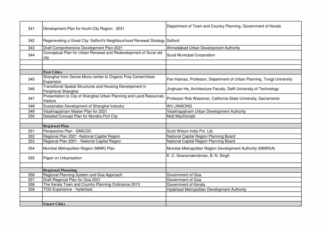
341 Development Plan for Kochi City Region - 2031Department of Town and Country Planning, Government of Kerala
342 Regenerating a Great City: Salford's Neighbourhood Renewal Strategy Salford
343 Draft Comprehensive Development Plan 2021 Ahmedabad Urban Development Authority
344Conceptual Plan for Urban Renewal and Redevelopment of Surat old
citySurat Municipal Corporation
Port Cities
345Shanghai from Dense Mono-center to Organic Poly-CenterUrban
ExpansionPan Haixiao, Professor, Department of Urban Planning, Tongji University
346Transitional Spatial Structures and Housing Development in
Peripheral ShanghaiJinghuan He, Architecture Faculty, Delft University of Technology
347Presentation to City of Shanghai Urban Planning and Land Resources
VisitorsProfessor Rob Wassmer, California State University, Sacramento
348 Sustainable Development of Shanghai Industry WU JINSONG
349 Visakhapatnam Master Plan for 2021 Visakhapatnam Urban Development Authority
350 Detailed Concept Plan for Mundra Port City Mott MacDonald
Regional Plan
351 Perspective Plan - DMICDC Scott Wilson India Pvt. Ltd.
352 Regional Plan 2021 -National Capital Region National Capital Region Planning Board
353 Regional Plan 2001 - National Capital Region National Capital Region Planning Board
354 Mumbai Metropolitan Region (MMR) Plan Mumbai Metropolitan Region Development Authority (MMRDA)
355 Paper on UrbanisationK. C. Sivaramakrishnan, B. N. Singh
Regional Planning
356 Regional Planning System and Goa Approach Government of Goa
357 Draft Regional Plan for Goa 2021 Government of Goa
358 The Kerala Town and Country Planning Ordinance 2013 Government of Kerala
359 TOD Experience - Hyderbad Hyderbad Metropolitan Development Authority
Smart Cities
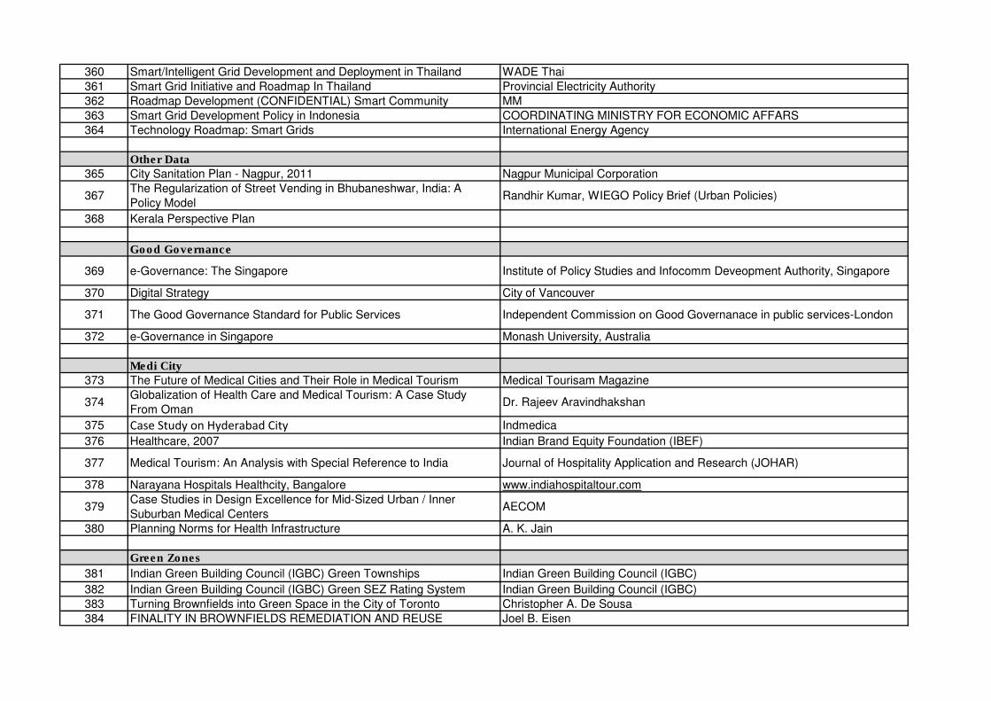
360 Smart/Intelligent Grid Development and Deployment in Thailand WADE Thai
361 Smart Grid Initiative and Roadmap In Thailand Provincial Electricity Authority
362 Roadmap Development (CONFIDENTIAL) Smart Community MM
363 Smart Grid Development Policy in Indonesia COORDINATING MINISTRY FOR ECONOMIC AFFARS
364 Technology Roadmap: Smart Grids International Energy Agency
Other Data
365 City Sanitation Plan - Nagpur, 2011 Nagpur Municipal Corporation
367The Regularization of Street Vending in Bhubaneshwar, India: A
Policy ModelRandhir Kumar, WIEGO Policy Brief (Urban Policies)
368 Kerala Perspective Plan
Good Governance
369 e-Governance: The Singapore Institute of Policy Studies and Infocomm Deveopment Authority, Singapore
370 Digital Strategy City of Vancouver
371 The Good Governance Standard for Public Services Independent Commission on Good Governanace in public services-London
372 e-Governance in Singapore Monash University, Australia
Medi City
373 The Future of Medical Cities and Their Role in Medical Tourism Medical Tourisam Magazine
374Globalization of Health Care and Medical Tourism: A Case Study
From OmanDr. Rajeev Aravindhakshan
375 Case Study on Hyderabad City Indmedica
376 Healthcare, 2007 Indian Brand Equity Foundation (IBEF)
377 Medical Tourism: An Analysis with Special Reference to India Journal of Hospitality Application and Research (JOHAR)
378 Narayana Hospitals Healthcity, Bangalore www.indiahospitaltour.com
379Case Studies in Design Excellence for Mid-Sized Urban / Inner
Suburban Medical CentersAECOM
380 Planning Norms for Health Infrastructure A. K. Jain
Green Zones
381 Indian Green Building Council (IGBC) Green Townships Indian Green Building Council (IGBC)
382 Indian Green Building Council (IGBC) Green SEZ Rating System Indian Green Building Council (IGBC)
383 Turning Brownfields into Green Space in the City of Toronto Christopher A. De Sousa
384 FINALITY IN BROWNFIELDS REMEDIATION AND REUSE Joel B. Eisen
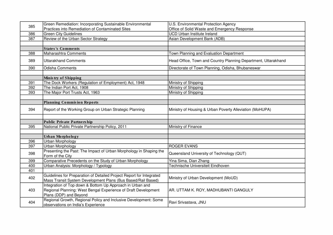
385Green Remediation: Incorporating Sustainable Environmental
Practices into Remediation of Contaminated Sites
U.S. Environmental Protection Agency
Office of Solid Waste and Emergency Response
386 Green City Guidelines UCD Urban Institute Ireland
387 Review of the Urban Sector Strategy Asian Development Bank (ADB)
States's Comments
388 Maharashtra Comments Town Planning and Evaluation Department
389 Uttarakhand Comments Head Office, Town and Country Planning Department, Uttarakhand
390 Odisha Comments Directorate of Town Planning, Odisha, Bhubaneswar
Ministry of Shipping
391 The Dock Workers (Regulation of Employment) Act, 1948 Ministry of Shipping
392 The Indian Port Act, 1908 Ministry of Shipping
393 The Major Port Trusts Act, 1963 Ministry of Shipping
Planning Commision Reports
394 Report of the Working Group on Urban Strategic Planning Ministry of Housing & Urban Poverty Alleviation (MoHUPA)
Public Private Partnership
395 National Public Private Partnership Policy, 2011 Ministry of Finance
Urban Morphology
396 Urban Morphology
397 Urban Morphology ROGER EVANS
398Presenting the Past: The Impact of Urban Morphology in Shaping the
Form of the City Queensland University of Technology (QUT)
399 Comparative Precedents on the Study of Urban Morphology Yina Sima, Dian Zhang
400 Urban Analysis: Morphology / Typology Technische Universiteit Eindhoven
401
402Guidelines for Preparation of Detailed Project Report for Integrated
Mass Transit System Development Plans (Bus Based/Rail Based)Ministry of Urban Development (MoUD)
403
Integration of Top down & Bottom Up Approach in Urban and
Regional Planning: West Bengal Experience of Draft Development
Plans (DDP) and Beyond
AR. UTTAM K. ROY, MADHUBANTI GANGULY
404Regional Growth, Regional Policy and Inclusive Development: Some
observations on India’s ExperienceRavi Srivastava, JNU
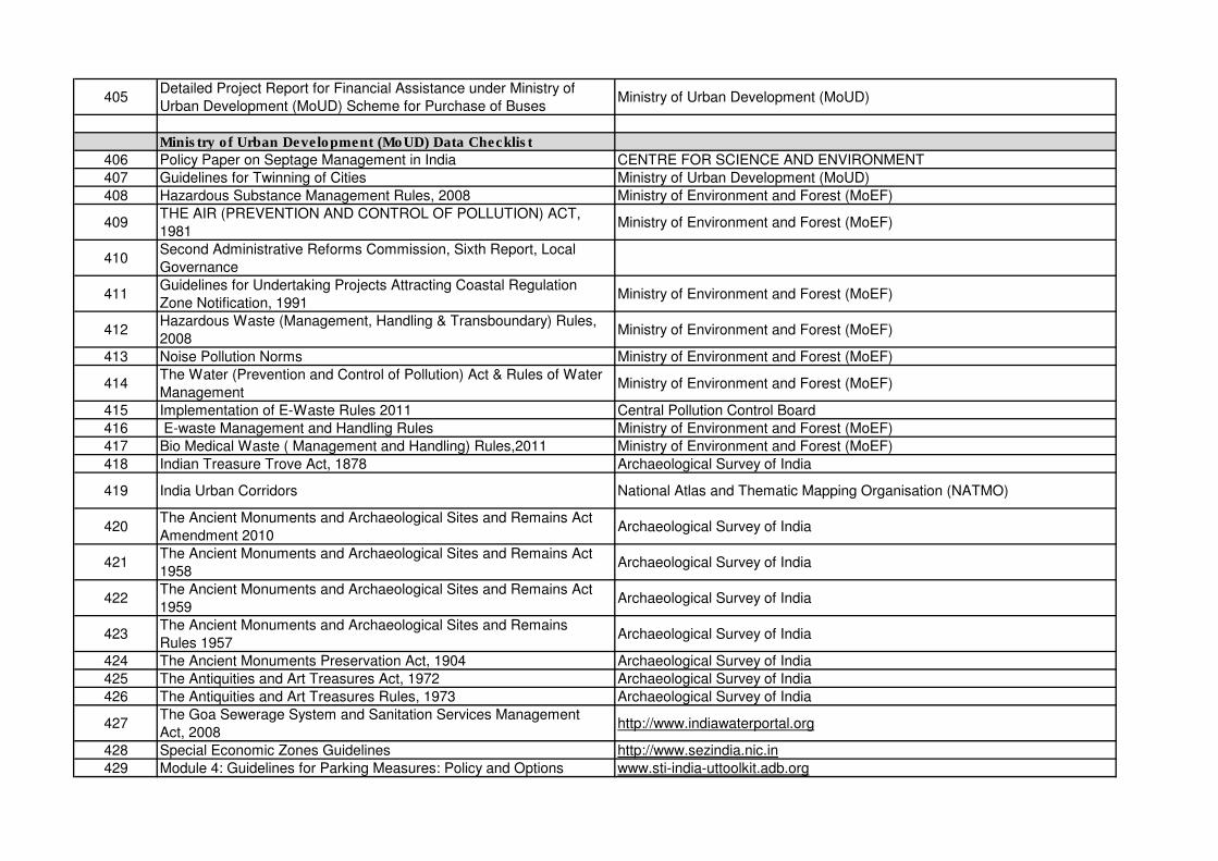
405Detailed Project Report for Financial Assistance under Ministry of
Urban Development (MoUD) Scheme for Purchase of BusesMinistry of Urban Development (MoUD)
Ministry of Urban Development (MoUD) Data Checklist
406 Policy Paper on Septage Management in India CENTRE FOR SCIENCE AND ENVIRONMENT
407 Guidelines for Twinning of Cities Ministry of Urban Development (MoUD)
408 Hazardous Substance Management Rules, 2008 Ministry of Environment and Forest (MoEF)
409THE AIR (PREVENTION AND CONTROL OF POLLUTION) ACT,
1981Ministry of Environment and Forest (MoEF)
410Second Administrative Reforms Commission, Sixth Report, Local
Governance
411Guidelines for Undertaking Projects Attracting Coastal Regulation
Zone Notification, 1991Ministry of Environment and Forest (MoEF)
412Hazardous Waste (Management, Handling & Transboundary) Rules,
2008Ministry of Environment and Forest (MoEF)
413 Noise Pollution Norms Ministry of Environment and Forest (MoEF)
414The Water (Prevention and Control of Pollution) Act & Rules of Water
ManagementMinistry of Environment and Forest (MoEF)
415 Implementation of E-Waste Rules 2011 Central Pollution Control Board
416 E-waste Management and Handling Rules Ministry of Environment and Forest (MoEF)
417 Bio Medical Waste ( Management and Handling) Rules,2011 Ministry of Environment and Forest (MoEF)
418 Indian Treasure Trove Act, 1878 Archaeological Survey of India
419 India Urban Corridors National Atlas and Thematic Mapping Organisation (NATMO)
420The Ancient Monuments and Archaeological Sites and Remains Act
Amendment 2010Archaeological Survey of India
421The Ancient Monuments and Archaeological Sites and Remains Act
1958Archaeological Survey of India
422The Ancient Monuments and Archaeological Sites and Remains Act
1959Archaeological Survey of India
423The Ancient Monuments and Archaeological Sites and Remains
Rules 1957Archaeological Survey of India
424 The Ancient Monuments Preservation Act, 1904 Archaeological Survey of India
425 The Antiquities and Art Treasures Act, 1972 Archaeological Survey of India
426 The Antiquities and Art Treasures Rules, 1973 Archaeological Survey of India
427The Goa Sewerage System and Sanitation Services Management
Act, 2008http://www.indiawaterportal.org
428 Special Economic Zones Guidelines http://www.sezindia.nic.in
429 Module 4: Guidelines for Parking Measures: Policy and Options www.sti-india-uttoolkit.adb.org
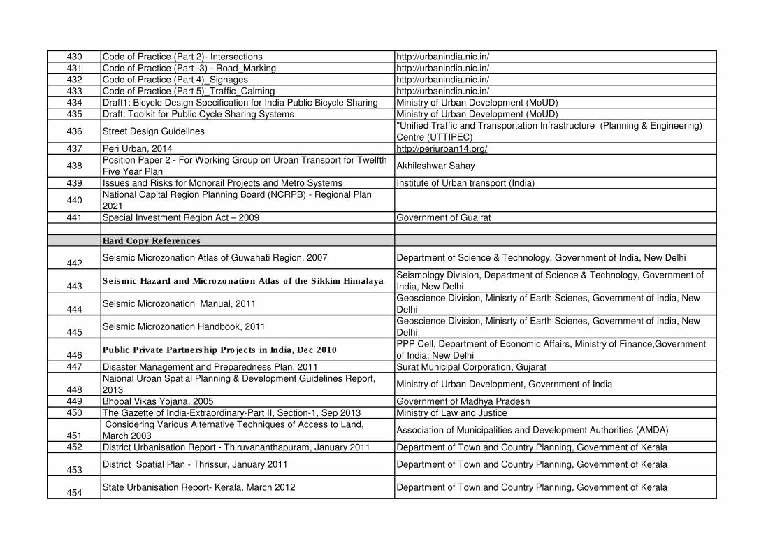
430 Code of Practice (Part 2)- Intersections http://urbanindia.nic.in/
431 Code of Practice (Part -3) - Road_Marking http://urbanindia.nic.in/
432 Code of Practice (Part 4)_Signages http://urbanindia.nic.in/
433 Code of Practice (Part 5)_Traffic_Calming http://urbanindia.nic.in/
434 Draft1: Bicycle Design Specification for India Public Bicycle Sharing Ministry of Urban Development (MoUD)
435 Draft: Toolkit for Public Cycle Sharing Systems Ministry of Urban Development (MoUD)
436 Street Design Guidelines"Unified Traffic and Transportation Infrastructure (Planning & Engineering)
Centre (UTTIPEC)
437 Peri Urban, 2014 http://periurban14.org/
438Position Paper 2 - For Working Group on Urban Transport for Twelfth
Five Year PlanAkhileshwar Sahay
439 Issues and Risks for Monorail Projects and Metro Systems Institute of Urban transport (India)
440National Capital Region Planning Board (NCRPB) - Regional Plan
2021
441 Special Investment Region Act – 2009 Government of Guajrat
Hard Copy References
442Seismic Microzonation Atlas of Guwahati Region, 2007 Department of Science & Technology, Government of India, New Delhi
443Seismic Hazard and Microzonation Atlas of the Sikkim Himalaya
Seismology Division, Department of Science & Technology, Government of
India, New Delhi
444Seismic Microzonation Manual, 2011
Geoscience Division, Minisrty of Earth Scienes, Government of India, New
Delhi
445Seismic Microzonation Handbook, 2011
Geoscience Division, Minisrty of Earth Scienes, Government of India, New
Delhi
446Public Private Partnership Projects in India, Dec 2010
PPP Cell, Department of Economic Affairs, Ministry of Finance,Government
of India, New Delhi447 Disaster Management and Preparedness Plan, 2011 Surat Municipal Corporation, Gujarat
448Naional Urban Spatial Planning & Development Guidelines Report,
2013Ministry of Urban Development, Government of India
449 Bhopal Vikas Yojana, 2005 Government of Madhya Pradesh450 The Gazette of India-Extraordinary-Part II, Section-1, Sep 2013 Ministry of Law and Justice
451 Considering Various Alternative Techniques of Access to Land,
March 2003Association of Municipalities and Development Authorities (AMDA)
452 District Urbanisation Report - Thiruvananthapuram, January 2011 Department of Town and Country Planning, Government of Kerala
453District Spatial Plan - Thrissur, January 2011 Department of Town and Country Planning, Government of Kerala
454State Urbanisation Report- Kerala, March 2012 Department of Town and Country Planning, Government of Kerala
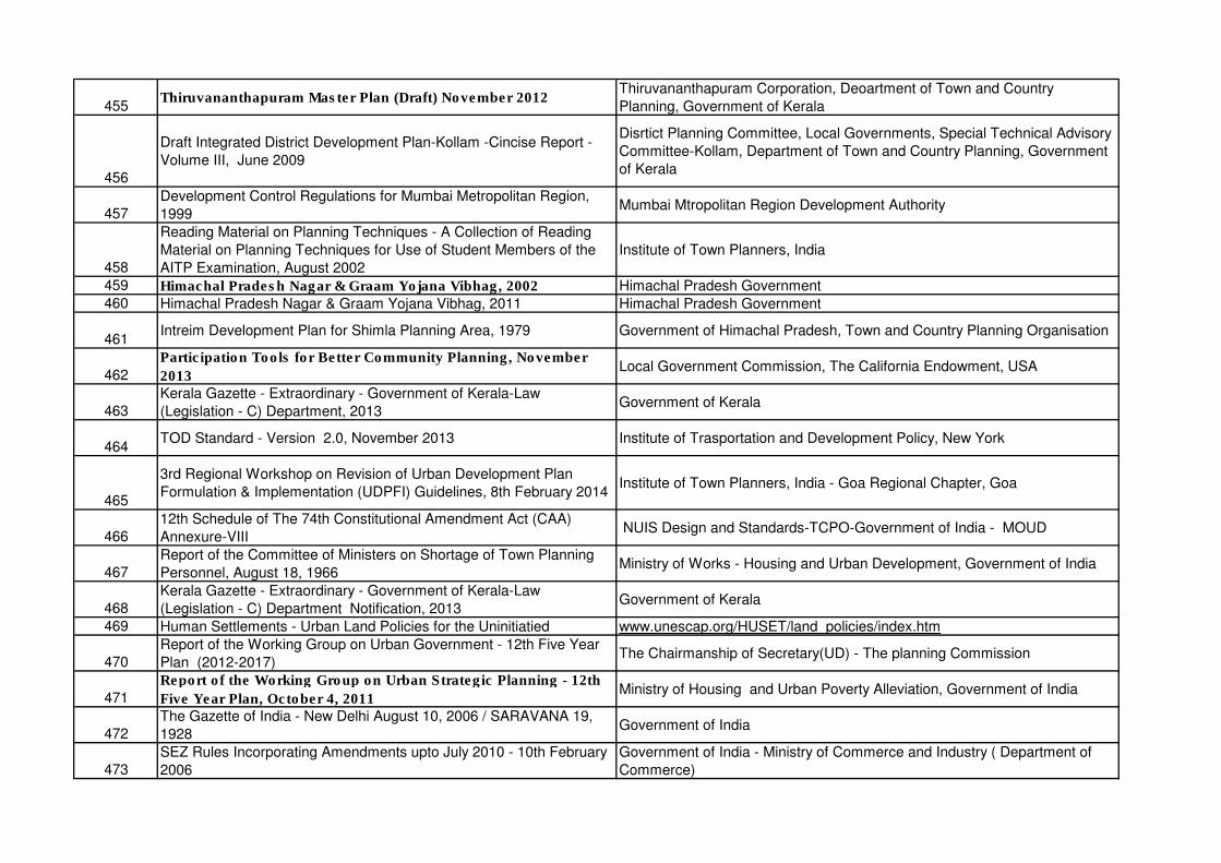
455Thiruvananthapuram Master Plan (Draft) November 2012
Thiruvananthapuram Corporation, Deoartment of Town and Country
Planning, Government of Kerala
456
Draft Integrated District Development Plan-Kollam -Cincise Report -
Volume III, June 2009
Disrtict Planning Committee, Local Governments, Special Technical Advisory
Committee-Kollam, Department of Town and Country Planning, Government
of Kerala
457Development Control Regulations for Mumbai Metropolitan Region,
1999Mumbai Mtropolitan Region Development Authority
458
Reading Material on Planning Techniques - A Collection of Reading
Material on Planning Techniques for Use of Student Members of the
AITP Examination, August 2002
Institute of Town Planners, India
459 Himachal Pradesh Nagar & Graam Yojana Vibhag, 2002 Himachal Pradesh Government460 Himachal Pradesh Nagar & Graam Yojana Vibhag, 2011 Himachal Pradesh Government
461Intreim Development Plan for Shimla Planning Area, 1979 Government of Himachal Pradesh, Town and Country Planning Organisation
462Participation Tools for Better Community Planning, November
2013Local Government Commission, The California Endowment, USA
463Kerala Gazette - Extraordinary - Government of Kerala-Law
(Legislation - C) Department, 2013Government of Kerala
464TOD Standard - Version 2.0, November 2013 Institute of Trasportation and Development Policy, New York
465
3rd Regional Workshop on Revision of Urban Development Plan
Formulation & Implementation (UDPFI) Guidelines, 8th February 2014Institute of Town Planners, India - Goa Regional Chapter, Goa
46612th Schedule of The 74th Constitutional Amendment Act (CAA)
Annexure-VIII NUIS Design and Standards-TCPO-Government of India - MOUD
467Report of the Committee of Ministers on Shortage of Town Planning
Personnel, August 18, 1966Ministry of Works - Housing and Urban Development, Government of India
468Kerala Gazette - Extraordinary - Government of Kerala-Law
(Legislation - C) Department Notification, 2013Government of Kerala
469 Human Settlements - Urban Land Policies for the Uninitiatied www.unescap.org/HUSET/land_policies/index.htm
470Report of the Working Group on Urban Government - 12th Five Year
Plan (2012-2017)The Chairmanship of Secretary(UD) - The planning Commission
471Report of the Working Group on Urban Strategic Planning - 12th
Five Year Plan, October 4, 2011Ministry of Housing and Urban Poverty Alleviation, Government of India
472The Gazette of India - New Delhi August 10, 2006 / SARAVANA 19,
1928Government of India
473SEZ Rules Incorporating Amendments upto July 2010 - 10th February
2006
Government of India - Ministry of Commerce and Industry ( Department of
Commerce)
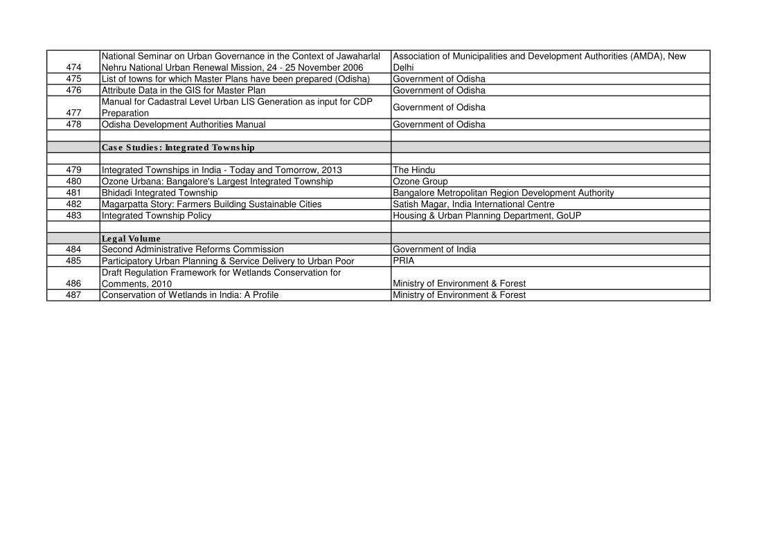
474National Seminar on Urban Governance in the Context of Jawaharlal
Nehru National Urban Renewal Mission, 24 - 25 November 2006
Association of Municipalities and Development Authorities (AMDA), New
Delhi475 List of towns for which Master Plans have been prepared (Odisha) Government of Odisha476 Attribute Data in the GIS for Master Plan Government of Odisha
477Manual for Cadastral Level Urban LIS Generation as input for CDP
PreparationGovernment of Odisha
478 Odisha Development Authorities Manual Government of Odisha
Case Studies: Integrated Township
479 Integrated Townships in India - Today and Tomorrow, 2013 The Hindu480 Ozone Urbana: Bangalore's Largest Integrated Township Ozone Group481 Bhidadi Integrated Township Bangalore Metropolitan Region Development Authority482 Magarpatta Story: Farmers Building Sustainable Cities Satish Magar, India International Centre483 Integrated Township Policy Housing & Urban Planning Department, GoUP
Legal Volume484 Second Administrative Reforms Commission Government of India
485 Participatory Urban Planning & Service Delivery to Urban Poor PRIA
486Draft Regulation Framework for Wetlands Conservation for
Comments, 2010 Ministry of Environment & Forest
487 Conservation of Wetlands in India: A Profile Ministry of Environment & Forest

418 319928/ISA/MCB/AA/01 1 Feburary 2014 P:\Noida\DMC\Projects\319928-MoUD UDPFI Guidelines Revision\Deliverable\Draft Report\URDPFI Guidelines Vol I Draft-1 26.02.14.docx
Urban and Regional Development Plans Formulation & Implement Volume – I, DRAFT REPORT VERSION 1
CONFIDENTIAL
Table B.1: Chapterwise Basic Planning Definitions
Sr. No. Particular Definitions
Source
Chapter 3: Plan Formulation
1 Agriculture Includes horticulture, farming, raising of crops, fruits, vegetables, flowers, grass, fodder, trees or any other kind of cultivation, dairy, animal husbandry, breeding and keeping of live-stock, including cattle, horses, donkeys, mules, pigs, fish, poultry and bees; and use of land which is ancillary to the farming of land or any other agriculture purposes, but shall not include the use of land attached to a building for the purposes of a garden to be used alongside such building.
Model Regional and Town Planning and Development
Law
2 Amenities Include roads and streets, open spaces, parks, recreational grounds, playgrounds, water and electric supply, street lighting, sewerage, drainage, public works and other utilities, services and conveniences.
Model Regional and Town Planning and Development
Law
6 Development The carrying out of building, engineering, mining or other operations in, on, over or under land or the making of any material change, in any building or land, or in the use of any building or land and includes sub-division of any land.
Model Regional and Town Planning and Development
Law
7 Development Plan
A plan for the development or redevelopment or improvement of an area within the jurisdiction of a Planning Authority and includes a Regional Development Plan, a Metropolitan Development Plan, Area Development Plan, Town Development Plan, Zonal Development Plan, District Development Plan, or any other plan or scheme prepared under relevant Act by whatsoever name known.
Bihar Urban Planning and Development Act, 2012
8 Disposal Discharge, deposition or dumping of any liquid or solid waste onto land or water so that it may enter the environment.
National Urban Sanitation Policy, City Sanitation Plan
Manual
9 Domestic sewage
All forms of wastewater derived from residential properties, as well as black water and grey water from commercial and institutions buildings.
National Urban Sanitation Policy, City Sanitation Plan
Manual
11 Floor Space Index
The quotient or the ratio of the Total Covered area of all floors to the total area of the plot, multiplied by 100.
Bihar Urban Planning and Development Act, 2012
14 Infrastructure Any project, public amenity or public utility or service, which is required for smooth, productive and efficient functioning of the Planning Area such as trunk infrastructure, access from or to the nearest major road, bulk supply of drinking water (surface water and ground water with trunk line), power (electric substation and network), health, education facilities, transport (major roads such as national highways, state highways, major district roads, other district roads, , bridges, bypasses and underpasses), common effluent treatment plants (CETP), sewage treatment plant (STP), solid waste disposal system and receptacles, communication network, sectorial shopping markets, institutional buildings, malls and multiplexes, cinema halls, community halls, open air theatres, playgrounds, civic and cultural facilities, public parking areas etc.
Bihar Urban Planning and Development Act, 2012
15 Land Use The major use for which a land is being used on any specified date.
Bihar Urban Planning and Development Act, 2012
Appendix B. Basic Planning Definition
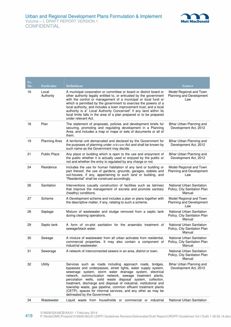
419 319928/ISA/MCB/AA/01 1 Feburary 2014 P:\Noida\DMC\Projects\319928-MoUD UDPFI Guidelines Revision\Deliverable\Draft Report\URDPFI Guidelines Vol I Draft-1 26.02.14.docx
Urban and Regional Development Plans Formulation & Implement Volume – I, DRAFT REPORT VERSION 1
CONFIDENTIAL
Sr. No. Particular Definitions
Source
16 Local Authority
A municipal corporation or committee or board or district board or other authority legally entitled to, or entrusted by the government with the control or management of a municipal or local fund or which is permitted by the government to exercise the powers of a local authority, and includes a town improvement trust; and a local authority is a” Local Authority Concerned” if any land within its local limits falls in the area of a plan prepared or to be prepared under relevant Act.
Model Regional and Town Planning and Development
Law
18 Plan The statement of proposals, policies and development briefs for securing, promoting and regulating development in a Planning Area, and includes a map or maps or sets of documents or all of them.
Bihar Urban Planning and Development Act, 2012
19 Planning Area A territorial unit demarcated and declared by the Government for the purposes of planning under relevant Act and shall be known by such name as the Government may decide.
Bihar Urban Planning and Development Act, 2012
21 Public Place Any place or building which is open to the use and enjoyment of the public whether it is actually used or enjoyed by the public or not and whether the entry is regulated by any charge or not.
Bihar Urban Planning and Development Act, 2012
24 Residence Includes the use for human habitation of any land or building or part thereof, the use of gardens, grounds, garages, stables and out-houses, if any, appertaining to such land or building, and "Residential” shall be construed accordingly.
Model Regional and Town Planning and Development
Law
26 Sanitation Interventions (usually construction of facilities such as latrines) that improve the management of excreta and promote sanitary (healthy) conditions.
National Urban Sanitation Policy, City Sanitation Plan
Manual
27 Scheme A Development scheme and includes a plan or plans together with the descriptive matter, if any, relating to such a scheme.
Model Regional and Town Planning and Development
Law
28 Septage Mixture of wastewater and sludge removed from a septic tank during cleaning operations.
National Urban Sanitation Policy, City Sanitation Plan
Manual
29 Septic tank A form of on-plot sanitation for the anaerobic treatment of sewage/black water.
National Urban Sanitation Policy, City Sanitation Plan
Manual
30 Sewage A mixture of wastewater from all urban activates from residential, commercial properties. It may also contain a component of industrial wastewater.
National Urban Sanitation Policy, City Sanitation Plan
Manual
31 Sewerage A network of interconnected sewers in an area, district or town. National Urban Sanitation Policy, City Sanitation Plan
Manual
32 Utility Services such as roads including approach roads, bridges, bypasses and underpasses, street lights, water supply system, sewerage system, storm water drainage system, electrical network, communication network, sewage treatment plants, percolation wells, solid waste disposal system, collection, treatment, discharge and disposal of industrial, institutional and township waste, gas pipeline, common effluent treatment plants (CETP), spaces for informal services, and any other as may be delineated by the Government.
Bihar Urban Planning and Development Act, 2012
34 Wastewater Liquid waste from households or commercial or industrial National Urban Sanitation
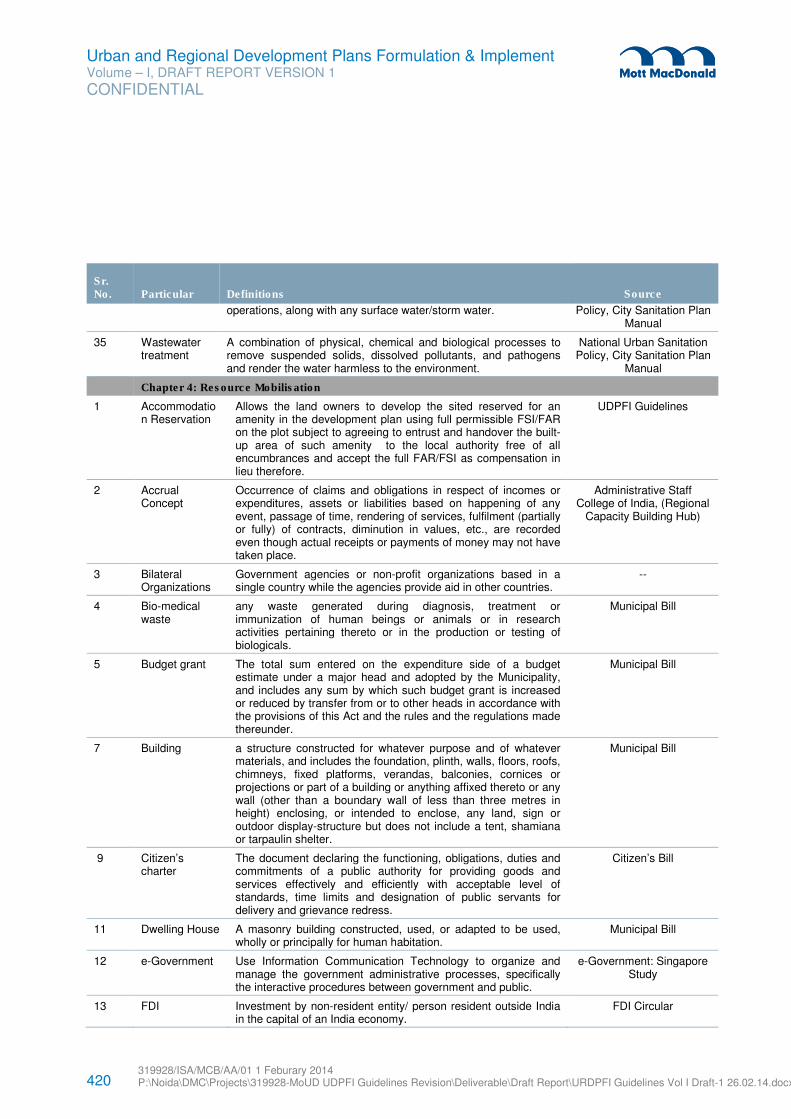
420 319928/ISA/MCB/AA/01 1 Feburary 2014 P:\Noida\DMC\Projects\319928-MoUD UDPFI Guidelines Revision\Deliverable\Draft Report\URDPFI Guidelines Vol I Draft-1 26.02.14.docx
Urban and Regional Development Plans Formulation & Implement Volume – I, DRAFT REPORT VERSION 1
CONFIDENTIAL
Sr. No. Particular Definitions
Source
operations, along with any surface water/storm water. Policy, City Sanitation Plan Manual
35 Wastewater treatment
A combination of physical, chemical and biological processes to remove suspended solids, dissolved pollutants, and pathogens and render the water harmless to the environment.
National Urban Sanitation Policy, City Sanitation Plan
Manual
Chapter 4: Resource Mobilisation
1 Accommodation Reservation
Allows the land owners to develop the sited reserved for an amenity in the development plan using full permissible FSI/FAR on the plot subject to agreeing to entrust and handover the built-up area of such amenity to the local authority free of all encumbrances and accept the full FAR/FSI as compensation in lieu therefore.
UDPFI Guidelines
2 Accrual Concept
Occurrence of claims and obligations in respect of incomes or expenditures, assets or liabilities based on happening of any event, passage of time, rendering of services, fulfilment (partially or fully) of contracts, diminution in values, etc., are recorded even though actual receipts or payments of money may not have taken place.
Administrative Staff College of India, (Regional
Capacity Building Hub)
3 Bilateral Organizations
Government agencies or non-profit organizations based in a single country while the agencies provide aid in other countries.
--
4 Bio-medical waste
any waste generated during diagnosis, treatment or immunization of human beings or animals or in research activities pertaining thereto or in the production or testing of biologicals.
Municipal Bill
5 Budget grant The total sum entered on the expenditure side of a budget estimate under a major head and adopted by the Municipality, and includes any sum by which such budget grant is increased or reduced by transfer from or to other heads in accordance with the provisions of this Act and the rules and the regulations made thereunder.
Municipal Bill
7 Building a structure constructed for whatever purpose and of whatever materials, and includes the foundation, plinth, walls, floors, roofs, chimneys, fixed platforms, verandas, balconies, cornices or projections or part of a building or anything affixed thereto or any wall (other than a boundary wall of less than three metres in height) enclosing, or intended to enclose, any land, sign or outdoor display-structure but does not include a tent, shamiana or tarpaulin shelter.
Municipal Bill
9 Citizen’s charter
The document declaring the functioning, obligations, duties and commitments of a public authority for providing goods and services effectively and efficiently with acceptable level of standards, time limits and designation of public servants for delivery and grievance redress.
Citizen’s Bill
11 Dwelling House A masonry building constructed, used, or adapted to be used, wholly or principally for human habitation.
Municipal Bill
12 e-Government Use Information Communication Technology to organize and manage the government administrative processes, specifically the interactive procedures between government and public.
e-Government: Singapore Study
13 FDI Investment by non-resident entity/ person resident outside India in the capital of an India economy.
FDI Circular
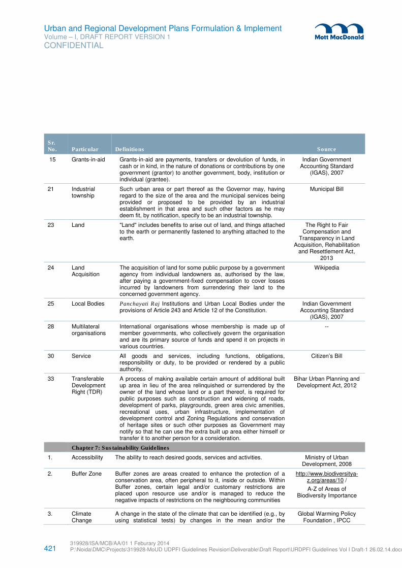
421 319928/ISA/MCB/AA/01 1 Feburary 2014 P:\Noida\DMC\Projects\319928-MoUD UDPFI Guidelines Revision\Deliverable\Draft Report\URDPFI Guidelines Vol I Draft-1 26.02.14.docx
Urban and Regional Development Plans Formulation & Implement Volume – I, DRAFT REPORT VERSION 1
CONFIDENTIAL
Sr. No. Particular Definitions
Source
15 Grants-in-aid Grants-in-aid are payments, transfers or devolution of funds, in cash or in kind, in the nature of donations or contributions by one government (grantor) to another government, body, institution or individual (grantee).
Indian Government Accounting Standard
(IGAS), 2007
21 Industrial township
Such urban area or part thereof as the Governor may, having regard to the size of the area and the municipal services being provided or proposed to be provided by an industrial establishment in that area and such other factors as he may deem fit, by notification, specify to be an industrial township.
Municipal Bill
23 Land "Land" includes benefits to arise out of land, and things attached to the earth or permanently fastened to anything attached to the earth.
The Right to Fair Compensation and
Transparency in Land Acquisition, Rehabilitation
and Resettlement Act, 2013
24 Land Acquisition
The acquisition of land for some public purpose by a government agency from individual landowners as, authorised by the law, after paying a government-fixed compensation to cover losses incurred by landowners from surrendering their land to the concerned government agency.
Wikipedia
25 Local Bodies Panchayati Raj Institutions and Urban Local Bodies under the provisions of Article 243 and Article 12 of the Constitution.
Indian Government Accounting Standard
(IGAS), 2007
28 Multilateral organisations
International organisations whose membership is made up of member governments, who collectively govern the organisation and are its primary source of funds and spend it on projects in various countries.
--
30 Service All goods and services, including functions, obligations, responsibility or duty, to be provided or rendered by a public authority.
Citizen’s Bill
33 Transferable Development Right (TDR)
A process of making available certain amount of additional built up area in lieu of the area relinquished or surrendered by the owner of the land whose land or a part thereof, is required for public purposes such as construction and widening of roads, development of parks, playgrounds, green area civic amenities, recreational uses, urban infrastructure, implementation of development control and Zoning Regulations and conservation of heritage sites or such other purposes as Government may notify so that he can use the extra built up area either himself or transfer it to another person for a consideration.
Bihar Urban Planning and Development Act, 2012
Chapter 7: Sustainability Guidelines
1. Accessibility The ability to reach desired goods, services and activities. Ministry of Urban Development, 2008
2. Buffer Zone Buffer zones are areas created to enhance the protection of a conservation area, often peripheral to it, inside or outside. Within Buffer zones, certain legal and/or customary restrictions are placed upon resource use and/or is managed to reduce the negative impacts of restrictions on the neighbouring communities
http://www.biodiversitya-z.org/areas/10 /
A-Z of Areas of Biodiversity Importance
3. Climate Change
A change in the state of the climate that can be identified (e.g., by using statistical tests) by changes in the mean and/or the
Global Warming Policy Foundation , IPCC
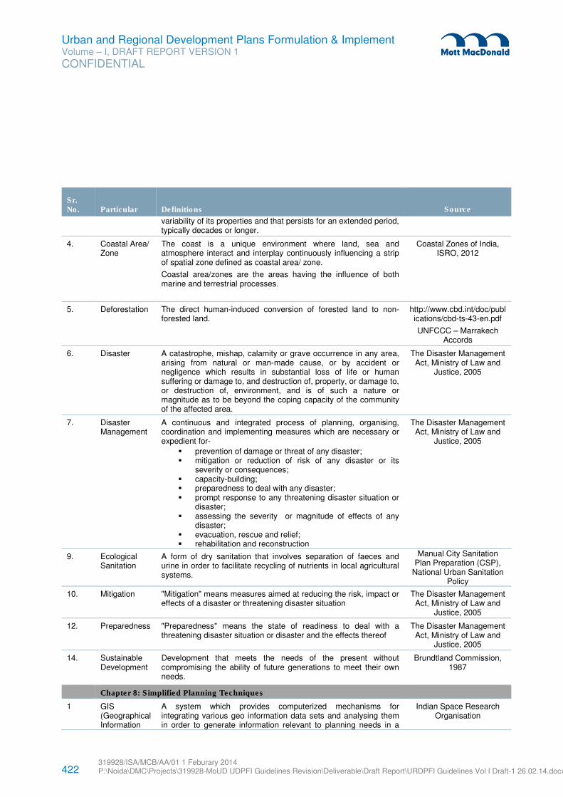
422 319928/ISA/MCB/AA/01 1 Feburary 2014 P:\Noida\DMC\Projects\319928-MoUD UDPFI Guidelines Revision\Deliverable\Draft Report\URDPFI Guidelines Vol I Draft-1 26.02.14.docx
Urban and Regional Development Plans Formulation & Implement Volume – I, DRAFT REPORT VERSION 1
CONFIDENTIAL
Sr. No. Particular Definitions
Source
variability of its properties and that persists for an extended period, typically decades or longer.
4. Coastal Area/ Zone
The coast is a unique environment where land, sea and atmosphere interact and interplay continuously influencing a strip of spatial zone defined as coastal area/ zone.
Coastal area/zones are the areas having the influence of both marine and terrestrial processes.
Coastal Zones of India, ISRO, 2012
5. Deforestation The direct human-induced conversion of forested land to non-forested land.
http://www.cbd.int/doc/publications/cbd-ts-43-en.pdf
UNFCCC – Marrakech Accords
6. Disaster A catastrophe, mishap, calamity or grave occurrence in any area, arising from natural or man-made cause, or by accident or negligence which results in substantial loss of life or human suffering or damage to, and destruction of, property, or damage to, or destruction of, environment, and is of such a nature or magnitude as to be beyond the coping capacity of the community of the affected area.
The Disaster Management Act, Ministry of Law and
Justice, 2005
7. Disaster Management
A continuous and integrated process of planning, organising, coordination and implementing measures which are necessary or expedient for-
� prevention of damage or threat of any disaster; � mitigation or reduction of risk of any disaster or its
severity or consequences; � capacity-building; � preparedness to deal with any disaster; � prompt response to any threatening disaster situation or
disaster; � assessing the severity or magnitude of effects of any
disaster; � evacuation, rescue and relief; � rehabilitation and reconstruction
The Disaster Management Act, Ministry of Law and
Justice, 2005
9. Ecological Sanitation
A form of dry sanitation that involves separation of faeces and urine in order to facilitate recycling of nutrients in local agricultural systems.
Manual City Sanitation Plan Preparation (CSP),
National Urban Sanitation Policy
10. Mitigation "Mitigation" means measures aimed at reducing the risk, impact or effects of a disaster or threatening disaster situation
The Disaster Management Act, Ministry of Law and
Justice, 2005
12. Preparedness "Preparedness" means the state of readiness to deal with a threatening disaster situation or disaster and the effects thereof
The Disaster Management Act, Ministry of Law and
Justice, 2005
14. Sustainable Development
Development that meets the needs of the present without compromising the ability of future generations to meet their own needs.
Brundtland Commission, 1987
Chapter 8: Simplified Planning Techniques
1 GIS (Geographical Information
A system which provides computerized mechanisms for integrating various geo information data sets and analysing them in order to generate information relevant to planning needs in a
Indian Space Research Organisation
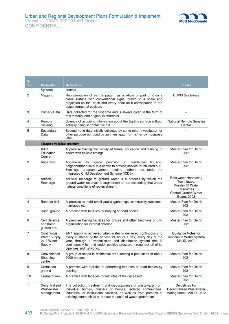
423 319928/ISA/MCB/AA/01 1 Feburary 2014 P:\Noida\DMC\Projects\319928-MoUD UDPFI Guidelines Revision\Deliverable\Draft Report\URDPFI Guidelines Vol I Draft-1 26.02.14.docx
Urban and Regional Development Plans Formulation & Implement Volume – I, DRAFT REPORT VERSION 1
CONFIDENTIAL
Sr. No. Particular Definitions
Source
System) context.
2 Mapping Representation of earth’s pattern as a whole or part of it on a plane surface with conventional signs, drawn to a scale and projection so that each and every point on it corresponds to the actual terrestrial position.
UDPFI Guidelines
3 Primary Data Data collected for the first time and is always given in the form of raw material and original in character.
--
4 Remote Sensing
Science of acquiring information about the Earth’s surface without actually being in contact with it.
National Remote Sensing Centre
5 Secondary Data
Second hand data initially collected by some other investigator for other purpose but used by an investigator for his/her own purpose later.
--
Chapter 9: Infrastructure
1 Adult Education Centre
A premise having the facility of formal education and training to adults with flexible timings.
Master Plan for Delhi: 2021
2 Anganwari Anganwari as space provision at residential housing/ neighbourhood level is a centre to provide service for children of 0-6yrs age, pregnant women, feeding mothers, etc. under the Integrated Child Development Scheme (ICDS).
Master Plan for Delhi: 2021
3 Artificial Recharge
Artificial recharge to ground water is a process by which the ground water reservoir is augmented at rate exceeding that under natural conditions of replenishment.
Rain water Harvesting Techniques,
Ministry Of Water Resources
Central Ground Water Board, 2003
4 Banquet hall A premise to hold small public gatherings, community functions, marriages etc.
Master Plan for Delhi: 2021
5 Burial ground A premise with facilities for burying of dead bodies. Master Plan for Delhi: 2021
6 Civil defence and home guards etc.
A premise having facilities for offices and other functions of civil organization for internal defence.
Master Plan for Delhi: 2021
7 Continuous Water Supply/ 24-7 Water Supply
24-7 supply is achieved when water is delivered continuously to every customer of the service 24 hours a day, every day of the year, through a transmission and distribution system that is continuously full and under positive pressure throughout all of its pipelines and networks.
Guidance Notes for Continuous Water System,
MoUD, 2009
8 Convenience Shopping centre
A group of shops in residential area serving a population of about 5000 persons.
Master Plan for Delhi: 2021
9 Cremation ground
A premise with facilities of performing last rites of dead bodies by burning.
Master Plan for Delhi: 2021
10 Crematorium A premise with facilities for last rites of the deceased. Master Plan for Delhi: 2021
11 Decentralised Wastewater Management
The collection, treatment, and disposal/reuse of wastewater from individual homes, clusters of homes, isolated communities, industries, or institutional facilities, as well as from portions of existing communities at or near the point of waste generation
Guidelines For Decentralized Wastewater Management, MoUD, 2012
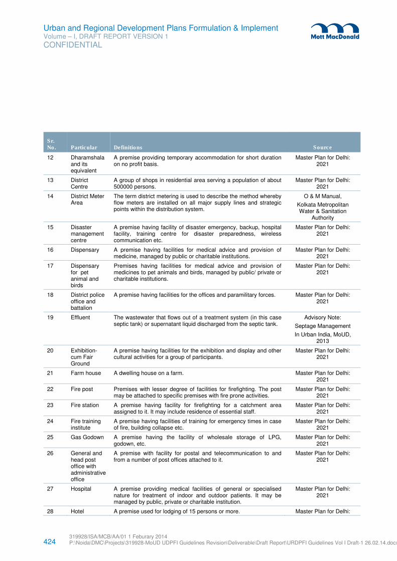
424 319928/ISA/MCB/AA/01 1 Feburary 2014 P:\Noida\DMC\Projects\319928-MoUD UDPFI Guidelines Revision\Deliverable\Draft Report\URDPFI Guidelines Vol I Draft-1 26.02.14.docx
Urban and Regional Development Plans Formulation & Implement Volume – I, DRAFT REPORT VERSION 1
CONFIDENTIAL
Sr. No. Particular Definitions
Source
12 Dharamshala and its equivalent
A premise providing temporary accommodation for short duration on no profit basis.
Master Plan for Delhi: 2021
13 District Centre
A group of shops in residential area serving a population of about 500000 persons.
Master Plan for Delhi: 2021
14 District Meter Area
The term district metering is used to describe the method whereby flow meters are installed on all major supply lines and strategic points within the distribution system.
O & M Manual,
Kolkata Metropolitan Water & Sanitation
Authority
15 Disaster management centre
A premise having facility of disaster emergency, backup, hospital facility, training centre for disaster preparedness, wireless communication etc.
Master Plan for Delhi: 2021
16 Dispensary A premise having facilities for medical advice and provision of medicine, managed by public or charitable institutions.
Master Plan for Delhi: 2021
17 Dispensary for pet animal and birds
Premises having facilities for medical advice and provision of medicines to pet animals and birds, managed by public/ private or charitable institutions.
Master Plan for Delhi: 2021
18 District police office and battalion
A premise having facilities for the offices and paramilitary forces. Master Plan for Delhi: 2021
19 Effluent The wastewater that flows out of a treatment system (in this case septic tank) or supernatant liquid discharged from the septic tank.
Advisory Note:
Septage Management
In Urban India, MoUD, 2013
20 Exhibition-cum Fair Ground
A premise having facilities for the exhibition and display and other cultural activities for a group of participants.
Master Plan for Delhi: 2021
21 Farm house A dwelling house on a farm. Master Plan for Delhi: 2021
22 Fire post Premises with lesser degree of facilities for firefighting. The post may be attached to specific premises with fire prone activities.
Master Plan for Delhi: 2021
23 Fire station A premise having facility for firefighting for a catchment area assigned to it. It may include residence of essential staff.
Master Plan for Delhi: 2021
24 Fire training institute
A premise having facilities of training for emergency times in case of fire, building collapse etc.
Master Plan for Delhi: 2021
25 Gas Godown A premise having the facility of wholesale storage of LPG, godown, etc.
Master Plan for Delhi: 2021
26 General and head post office with administrative office
A premise with facility for postal and telecommunication to and from a number of post offices attached to it.
Master Plan for Delhi: 2021
27 Hospital A premise providing medical facilities of general or specialised nature for treatment of indoor and outdoor patients. It may be managed by public, private or charitable institution.
Master Plan for Delhi: 2021
28 Hotel A premise used for lodging of 15 persons or more. Master Plan for Delhi:
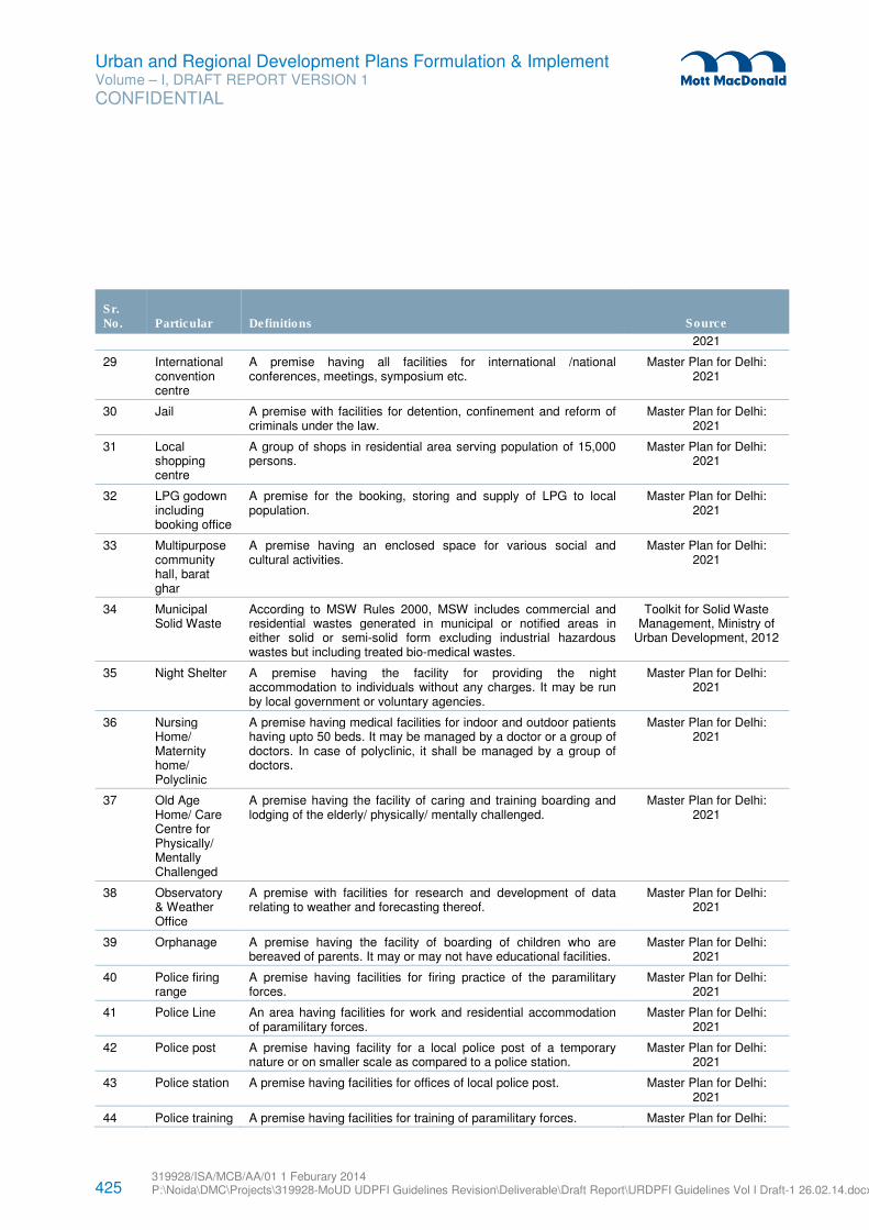
425 319928/ISA/MCB/AA/01 1 Feburary 2014 P:\Noida\DMC\Projects\319928-MoUD UDPFI Guidelines Revision\Deliverable\Draft Report\URDPFI Guidelines Vol I Draft-1 26.02.14.docx
Urban and Regional Development Plans Formulation & Implement Volume – I, DRAFT REPORT VERSION 1
CONFIDENTIAL
Sr. No. Particular Definitions
Source
2021
29 International convention centre
A premise having all facilities for international /national conferences, meetings, symposium etc.
Master Plan for Delhi: 2021
30 Jail A premise with facilities for detention, confinement and reform of criminals under the law.
Master Plan for Delhi: 2021
31 Local shopping centre
A group of shops in residential area serving population of 15,000 persons.
Master Plan for Delhi: 2021
32 LPG godown including booking office
A premise for the booking, storing and supply of LPG to local population.
Master Plan for Delhi: 2021
33 Multipurpose community hall, barat ghar
A premise having an enclosed space for various social and cultural activities.
Master Plan for Delhi: 2021
34 Municipal Solid Waste
According to MSW Rules 2000, MSW includes commercial and residential wastes generated in municipal or notified areas in either solid or semi-solid form excluding industrial hazardous wastes but including treated bio-medical wastes.
Toolkit for Solid Waste Management, Ministry of
Urban Development, 2012
35 Night Shelter A premise having the facility for providing the night accommodation to individuals without any charges. It may be run by local government or voluntary agencies.
Master Plan for Delhi: 2021
36 Nursing Home/ Maternity home/ Polyclinic
A premise having medical facilities for indoor and outdoor patients having upto 50 beds. It may be managed by a doctor or a group of doctors. In case of polyclinic, it shall be managed by a group of doctors.
Master Plan for Delhi: 2021
37 Old Age Home/ Care Centre for Physically/ Mentally Challenged
A premise having the facility of caring and training boarding and lodging of the elderly/ physically/ mentally challenged.
Master Plan for Delhi: 2021
38 Observatory & Weather Office
A premise with facilities for research and development of data relating to weather and forecasting thereof.
Master Plan for Delhi: 2021
39 Orphanage A premise having the facility of boarding of children who are bereaved of parents. It may or may not have educational facilities.
Master Plan for Delhi: 2021
40 Police firing range
A premise having facilities for firing practice of the paramilitary forces.
Master Plan for Delhi: 2021
41 Police Line An area having facilities for work and residential accommodation of paramilitary forces.
Master Plan for Delhi: 2021
42 Police post A premise having facility for a local police post of a temporary nature or on smaller scale as compared to a police station.
Master Plan for Delhi: 2021
43 Police station A premise having facilities for offices of local police post. Master Plan for Delhi: 2021
44 Police training A premise having facilities for training of paramilitary forces. Master Plan for Delhi:
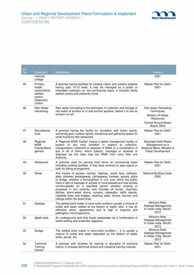
426 319928/ISA/MCB/AA/01 1 Feburary 2014 P:\Noida\DMC\Projects\319928-MoUD UDPFI Guidelines Revision\Deliverable\Draft Report\URDPFI Guidelines Vol I Draft-1 26.02.14.docx
Urban and Regional Development Plans Formulation & Implement Volume – I, DRAFT REPORT VERSION 1
CONFIDENTIAL
Sr. No. Particular Definitions
Source
institute/ college
2021
45 Primary health centre/family welfare centre/ Diagnostic Centre
A premise having facilities for treating indoor and outdoor patients having upto 10-15 beds. It may be managed by a public or charitable institution on non-commercial basis. It includes family welfare centre and maternity home.
Master Plan for Delhi: 2021
46 Rain Water Harvesting
Rain water harvesting is the technique of collection and storage of rain water at surface or in sub-surface aquifers, before it is lost as surface run-off.
Rain water Harvesting Techniques,
Ministry Of Water Resources
Central Ground Water Board, 2003
47 Recreational Club
A premise having the facility for recreation with indoor sports, swimming pool, outdoor sports, socializing and gathering space for small functions with restaurant.
Master Plan for Delhi: 2021
48 Regional MSW Facility/Management
A ‘Regional MSW Facility’ means a waste management facility or system of any kind (whether in relation to collection, transportation, treatment or disposal of MSW or a combination of any or all of them), which collects, manages or receives or disposes (as the case may be) MSW from more than one Authority.
Municipal Solid Waste Management on a
Regional Basis, Ministry of Urban Development
49 Restaurant A premise used for serving food items on commercial basis including cooking facilities. It may have covered or open space or both for sitting arrangement.
Master Plan for Delhi: 2021
50 Street Any means of access, namely, highway, street lane, pathway, alley, stairway, passageway, carriageway, footway, square, place or bridge, whether a thoroughfare or not, over which the public have a right of passage or access or have passed and had access uninterruptedly for a specified period, whether existing or proposed in any scheme, and includes all bunds, channels, ditches, storm-water drains, culverts, sidewalks, traffic islands, roadside trees and hedges, retaining walls, fences, barriers and railings within the street lines.
National Building Code: 2005
51 Septage The settled solid matter in semi-solid condition usually a mixture of solids and water settled at the bottom of septic tank. It has an offensive odour, appearance and is high in organics and pathogenic microorganisms.
Advisory Note: Septage Management In Urban India, MoUD,
2013
52 Septic tank An underground tank that treats wastewater by a combination of solids settling and anaerobic digestion.
Advisory Note: Septage Management In Urban India, MoUD,
2013
53 Sludge The settled solid matter in semi-solid condition – it is usually a mixture of solids and water deposited on the bottom of septic tanks, ponds, etc.
Advisory Note: Septage Management In Urban India, MoUD,
2013
54 Technical Training Centre/
A premise with facilities for training in discipline of technical nature. It includes technical school and industrial training institute.
Master Plan for Delhi: 2021
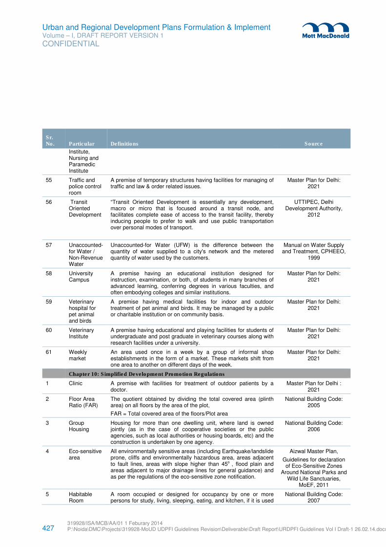
427 319928/ISA/MCB/AA/01 1 Feburary 2014 P:\Noida\DMC\Projects\319928-MoUD UDPFI Guidelines Revision\Deliverable\Draft Report\URDPFI Guidelines Vol I Draft-1 26.02.14.docx
Urban and Regional Development Plans Formulation & Implement Volume – I, DRAFT REPORT VERSION 1
CONFIDENTIAL
Sr. No. Particular Definitions
Source
Institute, Nursing and Paramedic Institute
55 Traffic and police control room
A premise of temporary structures having facilities for managing of traffic and law & order related issues.
Master Plan for Delhi: 2021
56 Transit Oriented Development
“Transit Oriented Development is essentially any development, macro or micro that is focused around a transit node, and facilitates complete ease of access to the transit facility, thereby inducing people to prefer to walk and use public transportation over personal modes of transport.
UTTIPEC, Delhi Development Authority,
2012
57 Unaccounted-for Water / Non-Revenue Water
Unaccounted-for Water (UFW) is the difference between the quantity of water supplied to a city's network and the metered quantity of water used by the customers.
Manual on Water Supply and Treatment, CPHEEO,
1999
58 University Campus
A premise having an educational institution designed for instruction, examination, or both, of students in many branches of advanced learning, conferring degrees in various faculties, and often embodying colleges and similar institutions.
Master Plan for Delhi: 2021
59 Veterinary hospital for pet animal and birds
A premise having medical facilities for indoor and outdoor treatment of pet animal and birds. It may be managed by a public or charitable institution or on community basis.
Master Plan for Delhi: 2021
60 Veterinary Institute
A premise having educational and playing facilities for students of undergraduate and post graduate in veterinary courses along with research facilities under a university.
Master Plan for Delhi: 2021
61 Weekly market
An area used once in a week by a group of informal shop establishments in the form of a market. These markets shift from one area to another on different days of the week.
Master Plan for Delhi: 2021
Chapter 10: Simplified Development Promotion Regulations
1 Clinic A premise with facilities for treatment of outdoor patients by a doctor.
Master Plan for Delhi : 2021
2 Floor Area Ratio (FAR)
The quotient obtained by dividing the total covered area (plinth area) on all floors by the area of the plot,
FAR = Total covered area of the floors/Plot area
National Building Code: 2005
3 Group Housing
Housing for more than one dwelling unit, where land is owned jointly (as in the case of cooperative societies or the public agencies, such as local authorities or housing boards, etc) and the construction is undertaken by one agency.
National Building Code: 2006
4 Eco-sensitive area
All environmentally sensitive areas (including Earthquake/landslide prone, cliffs and environmentally hazardous area, areas adjacent to fault lines, areas with slope higher than 45o , flood plain and areas adjacent to major drainage lines for general guidance) and as per the regulations of the eco-sensitive zone notification.
Aizwal Master Plan,
Guidelines for declaration of Eco-Sensitive Zones
Around National Parks and Wild Life Sanctuaries,
MoEF, 2011
5 Habitable Room
A room occupied or designed for occupancy by one or more persons for study, living, sleeping, eating, and kitchen, if it is used
National Building Code: 2007
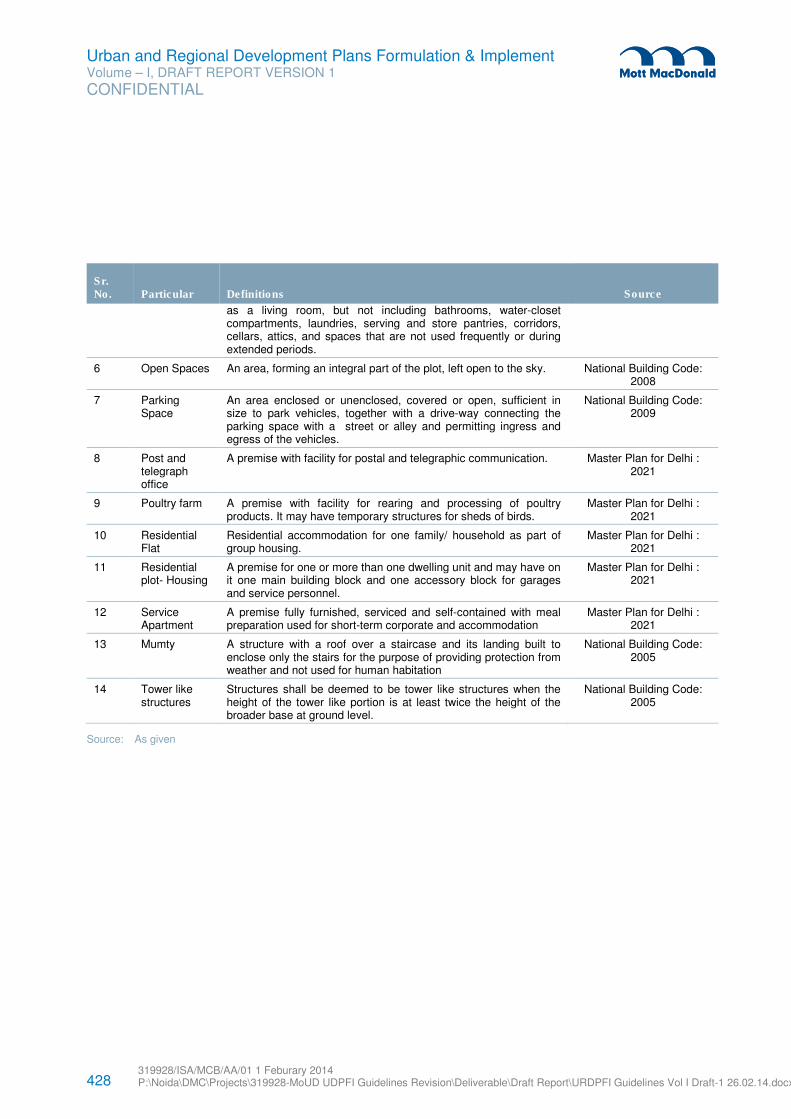
428 319928/ISA/MCB/AA/01 1 Feburary 2014 P:\Noida\DMC\Projects\319928-MoUD UDPFI Guidelines Revision\Deliverable\Draft Report\URDPFI Guidelines Vol I Draft-1 26.02.14.docx
Urban and Regional Development Plans Formulation & Implement Volume – I, DRAFT REPORT VERSION 1
CONFIDENTIAL
Sr. No. Particular Definitions
Source
as a living room, but not including bathrooms, water-closet compartments, laundries, serving and store pantries, corridors, cellars, attics, and spaces that are not used frequently or during extended periods.
6 Open Spaces An area, forming an integral part of the plot, left open to the sky. National Building Code: 2008
7 Parking Space
An area enclosed or unenclosed, covered or open, sufficient in size to park vehicles, together with a drive-way connecting the parking space with a street or alley and permitting ingress and egress of the vehicles.
National Building Code: 2009
8 Post and telegraph office
A premise with facility for postal and telegraphic communication. Master Plan for Delhi : 2021
9 Poultry farm A premise with facility for rearing and processing of poultry products. It may have temporary structures for sheds of birds.
Master Plan for Delhi : 2021
10 Residential Flat
Residential accommodation for one family/ household as part of group housing.
Master Plan for Delhi : 2021
11 Residential plot- Housing
A premise for one or more than one dwelling unit and may have on it one main building block and one accessory block for garages and service personnel.
Master Plan for Delhi : 2021
12 Service Apartment
A premise fully furnished, serviced and self-contained with meal preparation used for short-term corporate and accommodation
Master Plan for Delhi : 2021
13 Mumty A structure with a roof over a staircase and its landing built to enclose only the stairs for the purpose of providing protection from weather and not used for human habitation
National Building Code: 2005
14 Tower like structures
Structures shall be deemed to be tower like structures when the height of the tower like portion is at least twice the height of the broader base at ground level.
National Building Code: 2005
Source: As given
429 319928/ISA/MCB/AA/01 1 Feburary 2014 P:\Noida\DMC\Projects\319928-MoUD UDPFI Guidelines Revision\Deliverable\Draft Report\URDPFI Guidelines Vol I Draft-1 26.02.14.docx
Urban and Regional Development Plans Formulation & Implement Volume – I, DRAFT REPORT VERSION 1
CONFIDENTIAL
C.1 Introduction
Public Private Partnership (PPP) is infusion of private capital and management in provision of services that
have traditionally been provided by the government. Adequate risk transfer from the government to the
private sector is a key feature of PPPs along with the delivery of high-quality and cost-effective services to
consumers and the government185
.
C.2 Existing scenario
Reforms of 1990 brought/started economic liberalisation in India. The role of government underwent
transformation from provider to facilitator as a result. Demand for better service both by public for
consumption and government to perform its functions and improve on them further, led to entry of private
sector in service delivery. Initially it was in the form of privatisation but after following international
experiences PPP was introduced in India. The tendency of the private sector to undervalue social
infrastructure, and the large sunk costs associated with providing much economic infrastructure, has been
obstacle to privatization. Thus PPPs began to emerge significantly as a means of obtaining private sector
capital and management expertise for infrastructure investment. (, both to carry on where privatization had
left off and as an alternative where there had been obstacles to privatization)
India has already witnessed considerable growth in PPPs in the last one and half decade. It has emerged
as one of the leading PPP markets in the world, due to several policy and institutional initiatives taken by
the central as well as many state governments. Over the years an elaborate eco-system for PPPs has
developed, including institutions, developers, financiers, equity providers, policies and procedures186
.
The growing role of PPP in India has led for the requirement of national policy. As a result Government of
India in 2011 published a draft National PPP Policy which is under public consultation currently.
C.3 Public Private Partnership: Alternate Definitions
� Government of India:
‘PPP means an arrangement between a government or statutory entity or government owned entity on one
side and a private sector entity on the other, for the provision of public assets and/ or related services for
public benefit, through investments being made by and/or management undertaken by the private sector
entity for a specified time period, where there is a substantial risk sharing with the private sector and the
private sector receives performance linked payments that conform (or are benchmarked) to specified, pre-
determined and measurable performance standards.’
� The International Monetary Fund (IMF):
185 Sources: Public Private Partnership, IMF, 2004
186 Source: National PPP Policy 2011 - Draft for Consultation
Appendix C. PPP Models in existing scenario
430 319928/ISA/MCB/AA/01 1 Feburary 2014 P:\Noida\DMC\Projects\319928-MoUD UDPFI Guidelines Revision\Deliverable\Draft Report\URDPFI Guidelines Vol I Draft-1 26.02.14.docx
Urban and Regional Development Plans Formulation & Implement Volume – I, DRAFT REPORT VERSION 1
CONFIDENTIAL
‘Public-private partnerships (PPPs) refer to arrangements where the private sector supplies infrastructure
assets and services that traditionally have been provided by the government.’ (IMF 2004,)
� The World Bank:
‘PPP programs are projects that are for services traditionally provided by the public sector, combine
investment and service provision, see significant risks being borne by the private sector, and also see a
major role for the public sector in either purchasing services or bearing substantial risks under the project.’
(World Bank 2006)
� The Asian Development Bank (ADB):
‘PPPs broadly refer to long-term, contractual partnerships between the public and private sector agencies,
specifically targeted towards financing, designing, implementing, and operating infrastructure facilities and
services that were traditionally provided by the public sector (ADB 2006)
� The European Union:
‘A PPP is the transfer to the private sector of investment projects that traditionally have been executed or
financed by the public sector’ (European Commission 2003).
C.4 Public Private Partnership (PPP) in India*
PPP in India has evolved in the past decade and several projects of PPP have been completed in
infrastructure sector apart from residential/commercial development and these can be considered for
understanding the critical aspects of such project implementation in future.
Some of the case studies are as follow:
1. Alandur Underground Sewerage Project
2. Timarpur Okhla Integrated Municipal Solid Waste Management Project
3. Hyderabad Metro
4. Vadodara Halol Toll Road
These projects were considered owing to the key learning and observations derived from them, some to be
emulated and others to be mitigated. Each of the case studies belongs to different sectors.
Alandur Underground Sewerage Project:
The Alandur Sewerage Project (ASP) was initiated in the year 1996. The ASP was the first project in the
municipal water sector to be taken through the Public Private Partnership route in India. The proposed
sewerage system was to be designed for the estimated population of about 300,000 in 2027 and was
planned to be completed within a five-year period from its inception date.
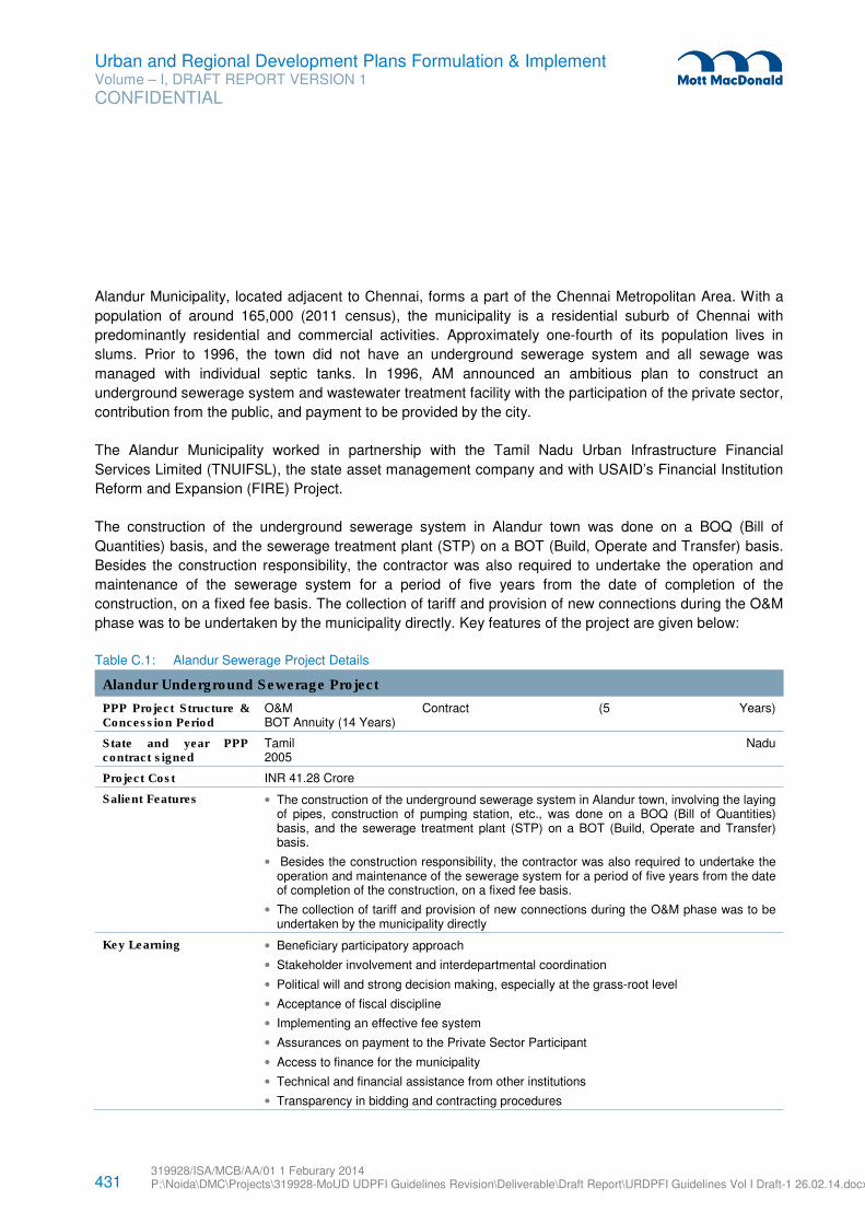
431 319928/ISA/MCB/AA/01 1 Feburary 2014 P:\Noida\DMC\Projects\319928-MoUD UDPFI Guidelines Revision\Deliverable\Draft Report\URDPFI Guidelines Vol I Draft-1 26.02.14.docx
Urban and Regional Development Plans Formulation & Implement Volume – I, DRAFT REPORT VERSION 1
CONFIDENTIAL
Alandur Municipality, located adjacent to Chennai, forms a part of the Chennai Metropolitan Area. With a
population of around 165,000 (2011 census), the municipality is a residential suburb of Chennai with
predominantly residential and commercial activities. Approximately one-fourth of its population lives in
slums. Prior to 1996, the town did not have an underground sewerage system and all sewage was
managed with individual septic tanks. In 1996, AM announced an ambitious plan to construct an
underground sewerage system and wastewater treatment facility with the participation of the private sector,
contribution from the public, and payment to be provided by the city.
The Alandur Municipality worked in partnership with the Tamil Nadu Urban Infrastructure Financial
Services Limited (TNUIFSL), the state asset management company and with USAID’s Financial Institution
Reform and Expansion (FIRE) Project.
The construction of the underground sewerage system in Alandur town was done on a BOQ (Bill of
Quantities) basis, and the sewerage treatment plant (STP) on a BOT (Build, Operate and Transfer) basis.
Besides the construction responsibility, the contractor was also required to undertake the operation and
maintenance of the sewerage system for a period of five years from the date of completion of the
construction, on a fixed fee basis. The collection of tariff and provision of new connections during the O&M
phase was to be undertaken by the municipality directly. Key features of the project are given below:
Table C.1: Alandur Sewerage Project Details
Alandur Underground Sewerage Project
PPP Project Structure & Concession Period
O&M Contract (5 Years) BOT Annuity (14 Years)
State and year PPP contract signed
Tamil Nadu 2005
Project Cost INR 41.28 Crore
Salient Features • The construction of the underground sewerage system in Alandur town, involving the laying of pipes, construction of pumping station, etc., was done on a BOQ (Bill of Quantities) basis, and the sewerage treatment plant (STP) on a BOT (Build, Operate and Transfer) basis.
• Besides the construction responsibility, the contractor was also required to undertake the operation and maintenance of the sewerage system for a period of five years from the date of completion of the construction, on a fixed fee basis.
• The collection of tariff and provision of new connections during the O&M phase was to be undertaken by the municipality directly
Key Learning • Beneficiary participatory approach
• Stakeholder involvement and interdepartmental coordination
• Political will and strong decision making, especially at the grass-root level
• Acceptance of fiscal discipline
• Implementing an effective fee system
• Assurances on payment to the Private Sector Participant
• Access to finance for the municipality
• Technical and financial assistance from other institutions
• Transparency in bidding and contracting procedures
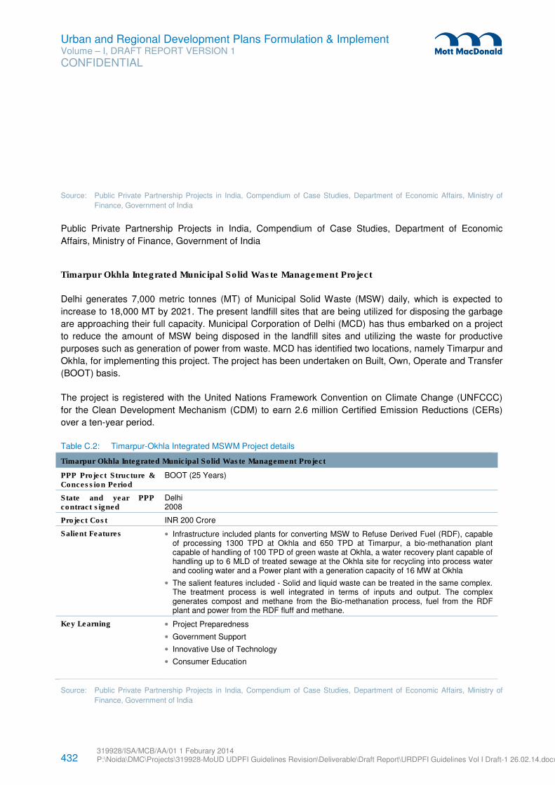
432 319928/ISA/MCB/AA/01 1 Feburary 2014 P:\Noida\DMC\Projects\319928-MoUD UDPFI Guidelines Revision\Deliverable\Draft Report\URDPFI Guidelines Vol I Draft-1 26.02.14.docx
Urban and Regional Development Plans Formulation & Implement Volume – I, DRAFT REPORT VERSION 1
CONFIDENTIAL
Source: Public Private Partnership Projects in India, Compendium of Case Studies, Department of Economic Affairs, Ministry of
Finance, Government of India
Public Private Partnership Projects in India, Compendium of Case Studies, Department of Economic
Affairs, Ministry of Finance, Government of India
Timarpur Okhla Integrated Municipal Solid Waste Management Project
Delhi generates 7,000 metric tonnes (MT) of Municipal Solid Waste (MSW) daily, which is expected to
increase to 18,000 MT by 2021. The present landfill sites that are being utilized for disposing the garbage
are approaching their full capacity. Municipal Corporation of Delhi (MCD) has thus embarked on a project
to reduce the amount of MSW being disposed in the landfill sites and utilizing the waste for productive
purposes such as generation of power from waste. MCD has identified two locations, namely Timarpur and
Okhla, for implementing this project. The project has been undertaken on Built, Own, Operate and Transfer
(BOOT) basis.
The project is registered with the United Nations Framework Convention on Climate Change (UNFCCC)
for the Clean Development Mechanism (CDM) to earn 2.6 million Certified Emission Reductions (CERs)
over a ten-year period.
Table C.2: Timarpur-Okhla Integrated MSWM Project details
Timarpur Okhla Integrated Municipal Solid Waste Management Project
PPP Project Structure & Concession Period
BOOT (25 Years)
State and year PPP contract signed
Delhi 2008
Project Cost INR 200 Crore
Salient Features • Infrastructure included plants for converting MSW to Refuse Derived Fuel (RDF), capable of processing 1300 TPD at Okhla and 650 TPD at Timarpur, a bio-methanation plant capable of handling of 100 TPD of green waste at Okhla, a water recovery plant capable of handling up to 6 MLD of treated sewage at the Okhla site for recycling into process water and cooling water and a Power plant with a generation capacity of 16 MW at Okhla
• The salient features included - Solid and liquid waste can be treated in the same complex. The treatment process is well integrated in terms of inputs and output. The complex generates compost and methane from the Bio-methanation process, fuel from the RDF plant and power from the RDF fluff and methane.
Key Learning • Project Preparedness
• Government Support
• Innovative Use of Technology
• Consumer Education
Source: Public Private Partnership Projects in India, Compendium of Case Studies, Department of Economic Affairs, Ministry of
Finance, Government of India
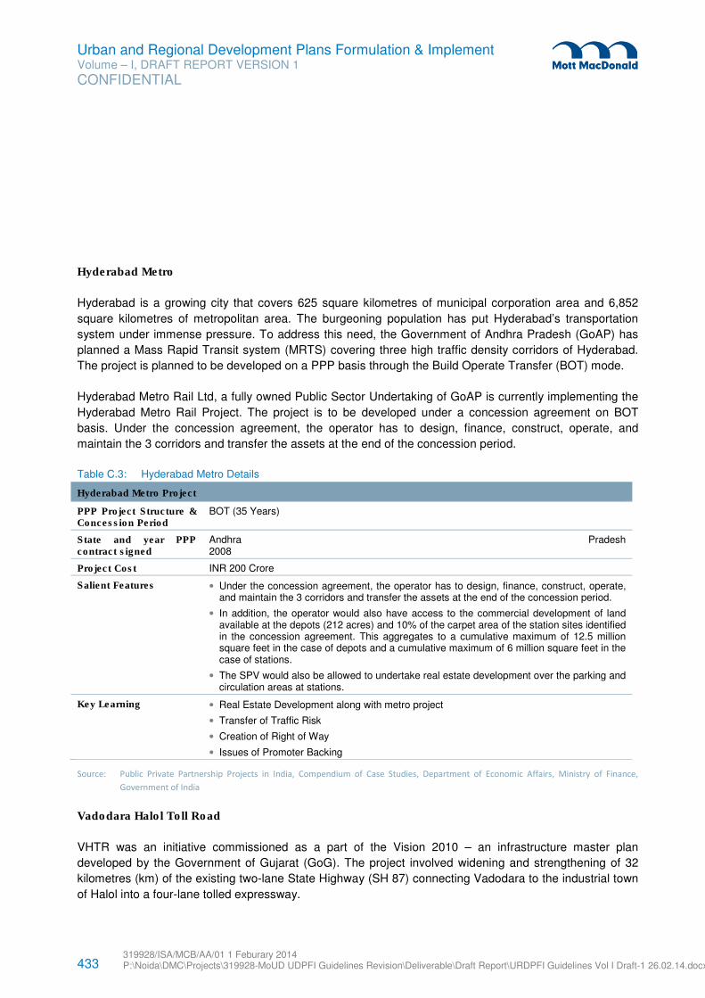
433 319928/ISA/MCB/AA/01 1 Feburary 2014 P:\Noida\DMC\Projects\319928-MoUD UDPFI Guidelines Revision\Deliverable\Draft Report\URDPFI Guidelines Vol I Draft-1 26.02.14.docx
Urban and Regional Development Plans Formulation & Implement Volume – I, DRAFT REPORT VERSION 1
CONFIDENTIAL
Hyderabad Metro
Hyderabad is a growing city that covers 625 square kilometres of municipal corporation area and 6,852
square kilometres of metropolitan area. The burgeoning population has put Hyderabad’s transportation
system under immense pressure. To address this need, the Government of Andhra Pradesh (GoAP) has
planned a Mass Rapid Transit system (MRTS) covering three high traffic density corridors of Hyderabad.
The project is planned to be developed on a PPP basis through the Build Operate Transfer (BOT) mode.
Hyderabad Metro Rail Ltd, a fully owned Public Sector Undertaking of GoAP is currently implementing the
Hyderabad Metro Rail Project. The project is to be developed under a concession agreement on BOT
basis. Under the concession agreement, the operator has to design, finance, construct, operate, and
maintain the 3 corridors and transfer the assets at the end of the concession period.
Table C.3: Hyderabad Metro Details
Hyderabad Metro Project
PPP Project Structure & Concession Period
BOT (35 Years)
State and year PPP contract signed
Andhra Pradesh 2008
Project Cost INR 200 Crore
Salient Features • Under the concession agreement, the operator has to design, finance, construct, operate, and maintain the 3 corridors and transfer the assets at the end of the concession period.
• In addition, the operator would also have access to the commercial development of land available at the depots (212 acres) and 10% of the carpet area of the station sites identified in the concession agreement. This aggregates to a cumulative maximum of 12.5 million square feet in the case of depots and a cumulative maximum of 6 million square feet in the case of stations.
• The SPV would also be allowed to undertake real estate development over the parking and circulation areas at stations.
Key Learning • Real Estate Development along with metro project
• Transfer of Traffic Risk
• Creation of Right of Way
• Issues of Promoter Backing
Source: Public Private Partnership Projects in India, Compendium of Case Studies, Department of Economic Affairs, Ministry of Finance,
Government of India
Vadodara Halol Toll Road
VHTR was an initiative commissioned as a part of the Vision 2010 – an infrastructure master plan
developed by the Government of Gujarat (GoG). The project involved widening and strengthening of 32
kilometres (km) of the existing two-lane State Highway (SH 87) connecting Vadodara to the industrial town
of Halol into a four-lane tolled expressway.
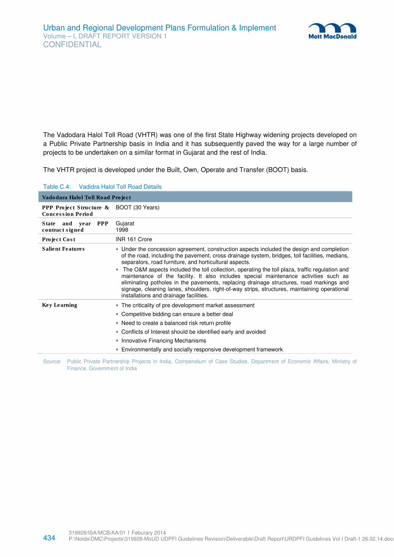
434 319928/ISA/MCB/AA/01 1 Feburary 2014 P:\Noida\DMC\Projects\319928-MoUD UDPFI Guidelines Revision\Deliverable\Draft Report\URDPFI Guidelines Vol I Draft-1 26.02.14.docx
Urban and Regional Development Plans Formulation & Implement Volume – I, DRAFT REPORT VERSION 1
CONFIDENTIAL
The Vadodara Halol Toll Road (VHTR) was one of the first State Highway widening projects developed on
a Public Private Partnership basis in India and it has subsequently paved the way for a large number of
projects to be undertaken on a similar format in Gujarat and the rest of India.
The VHTR project is developed under the Built, Own, Operate and Transfer (BOOT) basis.
Table C.4: Vadidra Halol Toll Road Details
Vadodara Halol Toll Road Project
PPP Project Structure & Concession Period
BOOT (30 Years)
State and year PPP contract signed
Gujarat 1998
Project Cost INR 161 Crore
Salient Features • Under the concession agreement, construction aspects included the design and completion of the road, including the pavement, cross drainage system, bridges, toll facilities, medians, separators, road furniture, and horticultural aspects.
• The O&M aspects included the toll collection, operating the toll plaza, traffic regulation and maintenance of the facility. It also includes special maintenance activities such as eliminating potholes in the pavements, replacing drainage structures, road markings and signage, cleaning lanes, shoulders, right-of-way strips, structures, maintaining operational installations and drainage facilities.
Key Learning • The criticality of pre development market assessment
• Competitive bidding can ensure a better deal
• Need to create a balanced risk return profile
• Conflicts of Interest should be identified early and avoided
• Innovative Financing Mechanisms
• Environmentally and socially responsive development framework
Source: Public Private Partnership Projects in India, Compendium of Case Studies, Department of Economic Affairs, Ministry of
Finance, Government of India
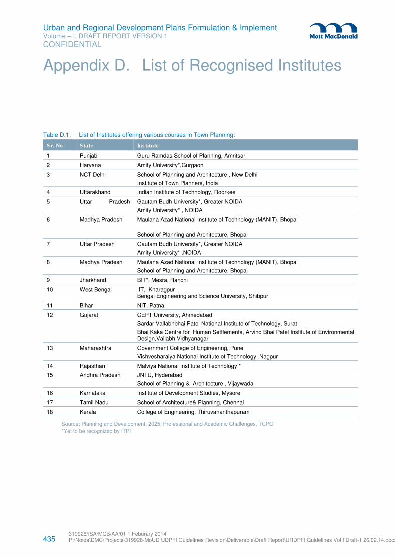
435 319928/ISA/MCB/AA/01 1 Feburary 2014 P:\Noida\DMC\Projects\319928-MoUD UDPFI Guidelines Revision\Deliverable\Draft Report\URDPFI Guidelines Vol I Draft-1 26.02.14.docx
Urban and Regional Development Plans Formulation & Implement Volume – I, DRAFT REPORT VERSION 1
CONFIDENTIAL
Table D.1: List of Institutes offering various courses in Town Planning:
Sr. No. State Institute
1 Punjab Guru Ramdas School of Planning, Amritsar
2 Haryana Amity University*,Gurgaon
3 NCT Delhi School of Planning and Architecture , New Delhi
Institute of Town Planners, India
4 Uttarakhand Indian Institute of Technology, Roorkee
5 Uttar Pradesh
Gautam Budh University*, Greater NOIDA
Amity University* , NOIDA
6 Madhya Pradesh Maulana Azad National Institute of Technology (MANIT), Bhopal
School of Planning and Architecture, Bhopal
7 Uttar Pradesh Gautam Budh University*, Greater NOIDA
Amity University* ,NOIDA
8 Madhya Pradesh Maulana Azad National Institute of Technology (MANIT), Bhopal
School of Planning and Architecture, Bhopal
9 Jharkhand BIT*, Mesra, Ranchi
10 West Bengal IIT, Kharagpur Bengal Engineering and Science University, Shibpur
11 Bihar NIT, Patna
12 Gujarat CEPT University, Ahmedabad
Sardar Vallabhbhai Patel National Institute of Technology, Surat
Bhai Kaka Centre for Human Settlements, Arvind Bhai Patel Institute of Environmental Design,Vallabh Vidhyanagar
13 Maharashtra Government College of Engineering, Pune
Vishvesharaiya National Institute of Technology, Nagpur
14 Rajasthan Malviya National Institute of Technology *
15 Andhra Pradesh JNTU, Hyderabad
School of Planning & Architecture , Vijaywada
16 Karnataka Institute of Development Studies, Mysore
17 Tamil Nadu School of Architecture& Planning, Chennai
18 Kerala College of Engineering, Thiruvananthapuram
Source: Planning and Development, 2025: Professional and Academic Challenges, TCPO
*Yet to be recognized by ITPI
Appendix D. List of Recognised Institutes
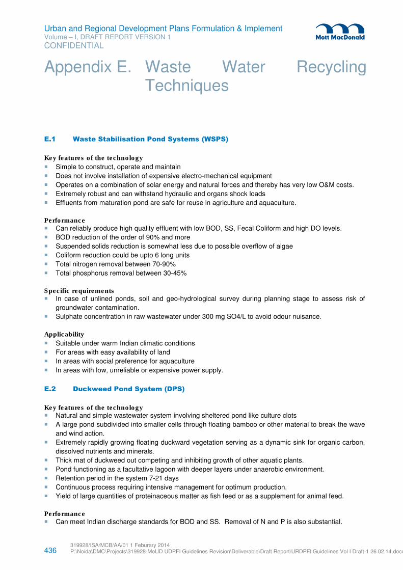
436 319928/ISA/MCB/AA/01 1 Feburary 2014 P:\Noida\DMC\Projects\319928-MoUD UDPFI Guidelines Revision\Deliverable\Draft Report\URDPFI Guidelines Vol I Draft-1 26.02.14.docx
Urban and Regional Development Plans Formulation & Implement Volume – I, DRAFT REPORT VERSION 1
CONFIDENTIAL
E.1 Waste Stabilisation Pond Systems (WSPS)
Key features of the technology
� Simple to construct, operate and maintain
� Does not involve installation of expensive electro-mechanical equipment
� Operates on a combination of solar energy and natural forces and thereby has very low O&M costs.
� Extremely robust and can withstand hydraulic and organs shock loads
� Effluents from maturation pond are safe for reuse in agriculture and aquaculture.
Performance � Can reliably produce high quality effluent with low BOD, SS, Fecal Coliform and high DO levels.
� BOD reduction of the order of 90% and more
� Suspended solids reduction is somewhat less due to possible overflow of algae
� Coliform reduction could be upto 6 long units
� Total nitrogen removal between 70-90%
� Total phosphorus removal between 30-45%
Specific requirements � In case of unlined ponds, soil and geo-hydrological survey during planning stage to assess risk of
groundwater contamination.
� Sulphate concentration in raw wastewater under 300 mg SO4/L to avoid odour nuisance.
Applicability
� Suitable under warm Indian climatic conditions
� For areas with easy availability of land
� In areas with social preference for aquaculture
� In areas with low, unreliable or expensive power supply.
E.2 Duckweed Pond System (DPS)
Key features of the technology � Natural and simple wastewater system involving sheltered pond like culture clots
� A large pond subdivided into smaller cells through floating bamboo or other material to break the wave
and wind action.
� Extremely rapidly growing floating duckward vegetation serving as a dynamic sink for organic carbon,
dissolved nutrients and minerals.
� Thick mat of duckweed out competing and inhibiting growth of other aquatic plants.
� Pond functioning as a facultative lagoon with deeper layers under anaerobic environment.
� Retention period in the system 7-21 days
� Continuous process requiring intensive management for optimum production.
� Yield of large quantities of proteinaceous matter as fish feed or as a supplement for animal feed.
Performance � Can meet Indian discharge standards for BOD and SS. Removal of N and P is also substantial.
Appendix E. Waste Water Recycling Techniques
437 319928/ISA/MCB/AA/01 1 Feburary 2014 P:\Noida\DMC\Projects\319928-MoUD UDPFI Guidelines Revision\Deliverable\Draft Report\URDPFI Guidelines Vol I Draft-1 26.02.14.docx
Urban and Regional Development Plans Formulation & Implement Volume – I, DRAFT REPORT VERSION 1
CONFIDENTIAL
� For settled wastewater, BOD and SS below 30mg/L are attainable at 12 detention.
� High nutrient and mineral removal due to uptake by duckweeds.
Specific requirements � Primary treatment including screening, grease trap, grit removal and sedimentation.
� Preferably the influent BOD, SS and ammonia to be under 80 ppm, 100 pm and 50 ppm respectively.
� A series of smaller cells of around 10m x 10m to 10m x 30m to break the continnum in the pond (cell
size as a function of wind speed, pond size and wave action.
� Cell borders made with floating bamboo mats or PVC profiles to shelter from wind and wave action
� Impermeable lining of clay or artificial liners in case of pervious and fractured strata
� Outlet structure with variable weir height
� Nitrogen loading of around 9 km/ha/day
� Small size culture ponds for duckweed seeding and as fish nursery ponds.
� Duckweed drying and processing unit in case of large harvest and for sale as animal feed
� In case of downstream aquaculture ponds – introduce suitable species of fishes e.g. Grass Carp.,
Common Carp, Silver Carp, Rohu, Mingal, Cattle and freshwater prawns.
Applicability � Low strength domestic wastewater or after primary sedimentation with influent BOD – 80mg/l
� In combination with existing WSP
� Rural and semi urban settlements with easy land availability
� As a polishing pond for an existing activated sludge plant or other technology based STPs
E.3 Facultative Aerate Lagoon (FAL)
Key features of the technology
• Simple flow scheme without primary or secondary settling and sludge recirculation • Deep lagoon with anerobic bottom layer and aerobic top layer. • Simultaneous degradation of sludge in the bottom and dissolved organics in the top layer. • Lower energy input corresponding to requirement for maintaining only desired DO levels in the top
layer and not for creating completely mixed conditions.
Performance � As per the information in literature based on Indian experience the following performance is expected
from a well-functioning aerobic lagoon:
– BOD removal 70-90%
– Suspended solids removal 70-80%
– Coliform removal 60-99%
Specific requirements � Typical hydraulic detention time 3 days or more
� Depth between 2-5 m depending on local soil and groundwater conditions
� Effective outlet structure with baffles and stilling basin to prevent solids overflow.
Applicability
438 319928/ISA/MCB/AA/01 1 Feburary 2014 P:\Noida\DMC\Projects\319928-MoUD UDPFI Guidelines Revision\Deliverable\Draft Report\URDPFI Guidelines Vol I Draft-1 26.02.14.docx
Urban and Regional Development Plans Formulation & Implement Volume – I, DRAFT REPORT VERSION 1
CONFIDENTIAL
� Standalone system for sewage treatment
� As a pre-treatment unit for WSP
� As an up-gradation option for overloaded WSPs.
E.4 Trickling Filter (TF)
Key features of the technology � A proven 100 year old technology
� Rugged system with simple and silent operation
� Lower process monitoring requirement as compared to ASP
� Consistent effluent quality.
Performance � Performance of a slow rate trickling filter is comparable to ASP
Applicability � Standalone treatment for sewage if operated at slow rates
� As a high rate roughing filter for high BOD wastewater.
� In combination with ASP for good and consistent performance
E.5 Activated Sludge Process (ASP)
Key features � Proven and tested for more than 7-8 decades all over world
� Several modifications possible to meet specific requirements.
Performance � Very good performance in terms of BOD and SS. Treated effluent can most often satisfy the current
Indian effluent discharge standards. Performance is critically dependent on sludge settling
characteristics and design of secondary clarifier. Sludge settling characteristics are typically influenced
by bio-flocculation which in turn depends on growth rate of micro-organisms. Growth rate is generally
controlled by controlling biological solids retention time / food to micro-organism ratio.
Specific requirements � Un-interrupted power supply for aeration and sludge recirculation
� Maintenance of biomass concentration in the aeration tank and proper settling in the secondary
clarifier.
Applicability � The most widely used option for treatment of domestic wastewater for medium to large towns where
land is scare.
439 319928/ISA/MCB/AA/01 1 Feburary 2014 P:\Noida\DMC\Projects\319928-MoUD UDPFI Guidelines Revision\Deliverable\Draft Report\URDPFI Guidelines Vol I Draft-1 26.02.14.docx
Urban and Regional Development Plans Formulation & Implement Volume – I, DRAFT REPORT VERSION 1
CONFIDENTIAL
E.6 Biological Filtration and Oxygenated reactor (BIOFOR) Technology
Key features of the technology � Enhanced primary treatment with addition of coagulants and flocculants.
� High rate primary tube settlers and integrated thickening offering space economy.
� Two stage high rate filtration through a biologically active media and with enhanced external aeration.
� Co-current up flow movement of wastewater and air enable higher retention and contact.
� Treatment scheme excluding secondary sedimentation but recycling of primate sludge.
� Deep reactors enabling low land requirements.
� A compact and robust system.
Performance � Suspended solids and BOD removal of 90% and 70% respectively in the primary clarifier.
� High quality effluent with BOD 10mg/L and total system efficiency of 94-99.9%
� Low turbidity with suspended solids under 15 mg/L and total system efficiency of 98%
� Pathogen removal of 2 on the log scale.
Specific requirements � Addition of alum as coagulant (~@60 ppm)
� Polyelectrolyte for high rate sedimentation ([email protected] ppm) in tube settlers.
� Special and patented granular filter media `Bioloite’ made of clay.
� Backwash of BIOFOR bed and recycle of the wastewater.
� Treatment (digestion) and disposal of sludge from clarifier (not provided at the STPs due to space
limitations)
E.7 High rate Activated Sludge Biofor –F Technology
Key features � In general, high level of mechanization and sophistication
� The flow scheme excludes primary sedimentation tank
� Superior aerated grit chamber and classifier
� Circular aeration tank with tapered air diffusion system
� Second stage aeration and rapid sand filtration through a biologically active filter media
� Dissolved air floatation for sludge thickening.
� Digester hearing and temperature controller anaerobic sludge digestion.
� Mixing of digester contents through biogas.
� Dynamic cogeneration of electrical and thermal energy through gas engines.
440 319928/ISA/MCB/AA/01 1 Feburary 2014 P:\Noida\DMC\Projects\319928-MoUD UDPFI Guidelines Revision\Deliverable\Draft Report\URDPFI Guidelines Vol I Draft-1 26.02.14.docx
Urban and Regional Development Plans Formulation & Implement Volume – I, DRAFT REPORT VERSION 1
CONFIDENTIAL
E.8 Fluidized Aerated Bed (FAB)
Key features of the technology � A compact and robust system involving extended aeration process with submerged aeration
� Biomass growth on fluidized bed of plastic media enabling retention of biomass and long solid retention
time in the reactor leading to low food to `micro-organism ratio’ and higher organic removal.
� Two stage biological oxidation
� Flexibility in handling organic load by adjusting quantity of fluidized media
� Reactors upto 5 m deep enabling low land requirements
� Tube settlers again offer space economy
� Ability to withstand limited organic overload
Specific requirements � Special grade plastic proprietary media custom made for offering high specific surface area
� Diffused aeration system
� Submerged stainless steel screens at the outlet of FAB reactors to prevent media overflow
� Tube settlers for compact clarifier.
Options � Addition of coagulant and polyelectrolyte for compact plants
� Tertiary treatment of chlorination
� Sludge treatment through thickner and bag filter press or drying beds.
Performance � High BOD removal with effluent concentration under 10mg/L
� High suspended solids removal with effluent concentration under 20mg/L
� Faecal coliforms removal of the order of 2-3 log scale at FAB-2 stage.
Applicability � The FAB technology based system is particularly applicable for:
– Small to medium flows in congested locations
– Sensitive locations
– Decentralized approach
– Reliving existing overloaded STPs.
E.9 Submerged Aeration Fixed Film (SAFF) Technology
Key features of the technology � Essentially a trickling filter with enhanced oxygen supply through submerged aeration
� Unconventional plastic media offering high void ratio and specific area compared to stone and
aggregates.
� Large biomass and long solid retention time in the reactor leading to low `food to micro-organism ratio’
and higher organic removal.
� Two stage biological oxidation
441 319928/ISA/MCB/AA/01 1 Feburary 2014 P:\Noida\DMC\Projects\319928-MoUD UDPFI Guidelines Revision\Deliverable\Draft Report\URDPFI Guidelines Vol I Draft-1 26.02.14.docx
Urban and Regional Development Plans Formulation & Implement Volume – I, DRAFT REPORT VERSION 1
CONFIDENTIAL
� Treatment scheme excluding primary sedimentation and sludge digestion
� Reactors upto 6 m deep enabling low land requirements.
� Tube settlers again offer space economy.
Applicability � The SAFF technology based system is particularly applicable for:
– Small to medium flows in congested locations
– Sensitive locations
– Decentralised approach
– Reliving existing overloaded trickling filters.
E.10 Cyclic Activated Sludge Process (CASP)
Key features of the technology � Essentially activated sludge process operated in batches through auto control
� Aeration and settling in one tank leading to lower plant foot print
� Savings in air/oxygen supply and hence energy
� Two levels of treatment possible depending on the requirement
� Treatment scheme excluding primary sedimentation and sludge digestion
Specific requirements � Complete reliance on auto control, uninterrupted power supply is a must
� Diffused aeration system
� Several moving parts
Performance � High BOD removal of 98% with effluent concentration under 10mg/L
� High suspended solids removal with effluent concentration under 20mg/L
� Faecal coliforms removal of the order of 2-3 on log scale.
Applicability � The Cyclic Activated Sludge Process (CASP) may be applicable for:
– Small to medium flows in congested locations
– Sensitive locations
– Decentralized approach
– Reliving existing overloaded trickling filters.
E.11 Upflow Anaerobic Sludge Blanket Process (UASB)
Key features � No mechanical components or external energy requirements in the reactor, therefore process not
vulnerable to power cuts
� No primary treatment, suspended solid in the wastewater serve as carrier material for microbial
attachment.
442 319928/ISA/MCB/AA/01 1 Feburary 2014 P:\Noida\DMC\Projects\319928-MoUD UDPFI Guidelines Revision\Deliverable\Draft Report\URDPFI Guidelines Vol I Draft-1 26.02.14.docx
Urban and Regional Development Plans Formulation & Implement Volume – I, DRAFT REPORT VERSION 1
CONFIDENTIAL
� Recovery of gas with high calorific value
� Low sludge production
� Relatively simple routine operation and maintenance
� Biological activity can be restarted without any external seeding or special care after interrupted
operations.
Performance � An UASB reactor can bring down the BOD of the domestic wastewater to 70-100 mg/L and suspended
solids (TSS) to 50-100 mg/L. However, sludge washout from the reactor is possible and effluent BOD
and TSS is very high during such episodes. The effluent is strongly anoxic with high immediate oxygen
demand (IOD). Should not directly discharged into water bodies or used for aquaculture or irrigation
without re-aeration.
Specific requirements � Use of anticorrosive materials / paints on exposed surfaces
� Frequent cleaning / de-sludging of distribution / division boxes and influent pipes
� Skilled supervision during start-up and for control of biomass levels within the reactor
� Post treatment of the UASB effluent is invariably required.
� Control of toxic materials and sulfates in the wastewater is required for efficient operation.
Applicability � The suitability of this technology may be doubtful as a stand-alone secondary treatment option.
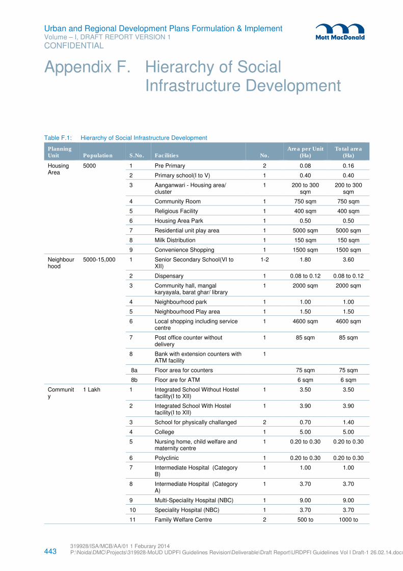
443 319928/ISA/MCB/AA/01 1 Feburary 2014 P:\Noida\DMC\Projects\319928-MoUD UDPFI Guidelines Revision\Deliverable\Draft Report\URDPFI Guidelines Vol I Draft-1 26.02.14.docx
Urban and Regional Development Plans Formulation & Implement Volume – I, DRAFT REPORT VERSION 1
CONFIDENTIAL
Table F.1: Hierarchy of Social Infrastructure Development
Planning Unit Population S.No. Facilities No.
Area per Unit (Ha)
Total area (Ha)
Housing Area
5000 1 Pre Primary 2 0.08 0.16
2 Primary school(I to V) 1 0.40 0.40
3 Aanganwari - Housing area/ cluster
1 200 to 300 sqm
200 to 300 sqm
4 Community Room 1 750 sqm 750 sqm
5 Religious Facility 1 400 sqm 400 sqm
6 Housing Area Park 1 0.50 0.50
7 Residential unit play area 1 5000 sqm 5000 sqm
8 Milk Distribution 1 150 sqm 150 sqm
9 Convenience Shopping 1 1500 sqm 1500 sqm
Neighbourhood
5000-15,000
1 Senior Secondary School(VI to XII)
1-2 1.80 3.60
2 Dispensary 1 0.08 to 0.12 0.08 to 0.12
3 Community hall, mangal karyayala, barat ghar/ library
1 2000 sqm 2000 sqm
4 Neighbourhood park 1 1.00 1.00
5 Neighbourhood Play area 1 1.50 1.50
6 Local shopping including service centre
1 4600 sqm 4600 sqm
7 Post office counter without delivery
1 85 sqm 85 sqm
8 Bank with extension counters with ATM facility
1
8a Floor area for counters 75 sqm 75 sqm
8b Floor are for ATM 6 sqm 6 sqm
Community
1 Lakh 1 Integrated School Without Hostel facility(I to XII)
1 3.50 3.50
2 Integrated School With Hostel facility(I to XII)
1 3.90 3.90
3 School for physically challanged 2 0.70 1.40
4 College 1 5.00 5.00
5 Nursing home, child welfare and maternity centre
1 0.20 to 0.30 0.20 to 0.30
6 Polyclinic 1 0.20 to 0.30 0.20 to 0.30
7 Intermediate Hospital (Category B)
1 1.00 1.00
8 Intermediate Hospital (Category A)
1 3.70 3.70
9 Multi-Speciality Hospital (NBC) 1 9.00 9.00
10 Speciality Hospital (NBC) 1 3.70 3.70
11 Family Welfare Centre 2 500 to 1000 to
Appendix F. Hierarchy of Social Infrastructure Development
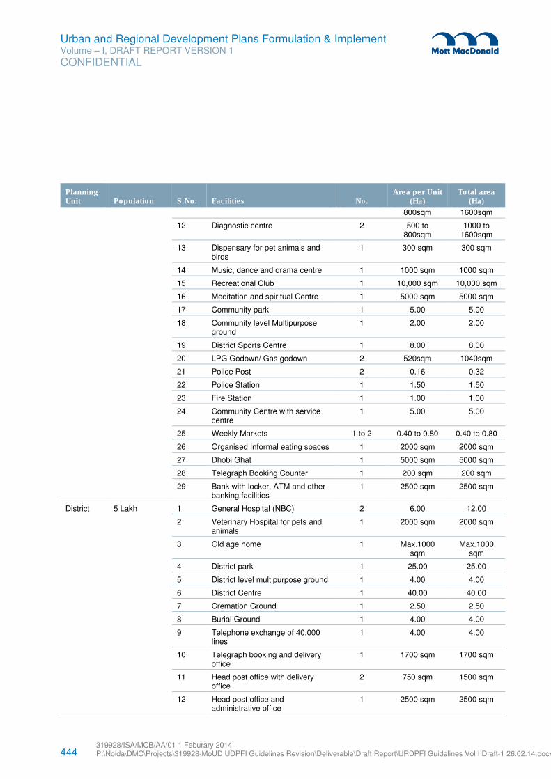
444 319928/ISA/MCB/AA/01 1 Feburary 2014 P:\Noida\DMC\Projects\319928-MoUD UDPFI Guidelines Revision\Deliverable\Draft Report\URDPFI Guidelines Vol I Draft-1 26.02.14.docx
Urban and Regional Development Plans Formulation & Implement Volume – I, DRAFT REPORT VERSION 1
CONFIDENTIAL
Planning Unit Population S.No. Facilities No.
Area per Unit (Ha)
Total area (Ha)
800sqm 1600sqm
12 Diagnostic centre 2 500 to 800sqm
1000 to 1600sqm
13 Dispensary for pet animals and birds
1 300 sqm 300 sqm
14 Music, dance and drama centre 1 1000 sqm 1000 sqm
15 Recreational Club 1 10,000 sqm 10,000 sqm
16 Meditation and spiritual Centre 1 5000 sqm 5000 sqm
17 Community park 1 5.00 5.00
18 Community level Multipurpose ground
1 2.00 2.00
19 District Sports Centre 1 8.00 8.00
20 LPG Godown/ Gas godown 2 520sqm 1040sqm
21 Police Post 2 0.16 0.32
22 Police Station 1 1.50 1.50
23 Fire Station 1 1.00 1.00
24 Community Centre with service centre
1 5.00 5.00
25 Weekly Markets 1 to 2 0.40 to 0.80 0.40 to 0.80
26 Organised Informal eating spaces 1 2000 sqm 2000 sqm
27 Dhobi Ghat 1 5000 sqm 5000 sqm
28 Telegraph Booking Counter 1 200 sqm 200 sqm
29 Bank with locker, ATM and other banking facilities
1 2500 sqm 2500 sqm
District 5 Lakh 1 General Hospital (NBC) 2 6.00 12.00
2 Veterinary Hospital for pets and animals
1 2000 sqm 2000 sqm
3 Old age home 1 Max.1000 sqm
Max.1000 sqm
4 District park 1 25.00 25.00
5 District level multipurpose ground 1 4.00 4.00
6 District Centre 1 40.00 40.00
7 Cremation Ground 1 2.50 2.50
8 Burial Ground 1 4.00 4.00
9 Telephone exchange of 40,000 lines
1 4.00 4.00
10 Telegraph booking and delivery office
1 1700 sqm 1700 sqm
11 Head post office with delivery office
2 750 sqm 1500 sqm
12 Head post office and administrative office
1 2500 sqm 2500 sqm
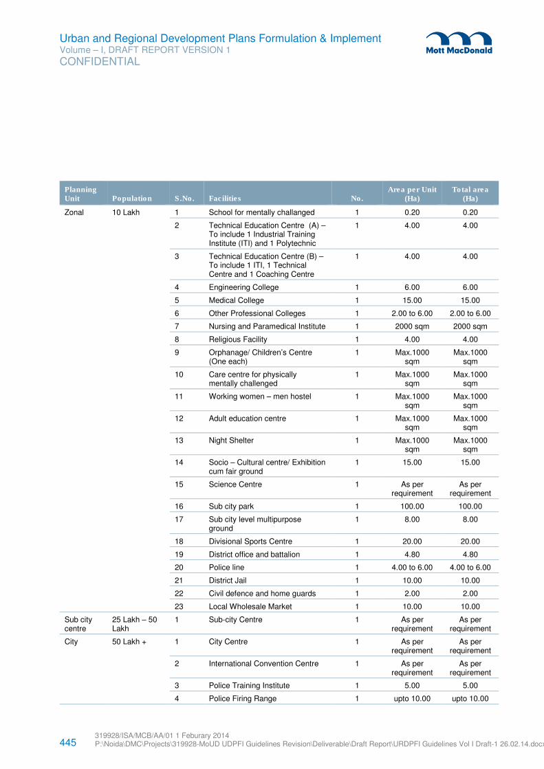
445 319928/ISA/MCB/AA/01 1 Feburary 2014 P:\Noida\DMC\Projects\319928-MoUD UDPFI Guidelines Revision\Deliverable\Draft Report\URDPFI Guidelines Vol I Draft-1 26.02.14.docx
Urban and Regional Development Plans Formulation & Implement Volume – I, DRAFT REPORT VERSION 1
CONFIDENTIAL
Planning Unit Population S.No. Facilities No.
Area per Unit (Ha)
Total area (Ha)
Zonal 10 Lakh 1 School for mentally challanged 1 0.20 0.20
2 Technical Education Centre (A) – To include 1 Industrial Training Institute (ITI) and 1 Polytechnic
1 4.00 4.00
3 Technical Education Centre (B) – To include 1 ITI, 1 Technical Centre and 1 Coaching Centre
1 4.00 4.00
4 Engineering College 1 6.00 6.00
5 Medical College 1 15.00 15.00
6 Other Professional Colleges 1 2.00 to 6.00 2.00 to 6.00
7 Nursing and Paramedical Institute 1 2000 sqm 2000 sqm
8 Religious Facility 1 4.00 4.00
9 Orphanage/ Children’s Centre (One each)
1 Max.1000 sqm
Max.1000 sqm
10 Care centre for physically mentally challenged
1 Max.1000 sqm
Max.1000 sqm
11 Working women – men hostel 1 Max.1000 sqm
Max.1000 sqm
12 Adult education centre 1 Max.1000 sqm
Max.1000 sqm
13 Night Shelter 1 Max.1000 sqm
Max.1000 sqm
14 Socio – Cultural centre/ Exhibition cum fair ground
1 15.00 15.00
15 Science Centre 1 As per requirement
As per requirement
16 Sub city park 1 100.00 100.00
17 Sub city level multipurpose ground
1 8.00 8.00
18 Divisional Sports Centre 1 20.00 20.00
19 District office and battalion 1 4.80 4.80
20 Police line 1 4.00 to 6.00 4.00 to 6.00
21 District Jail 1 10.00 10.00
22 Civil defence and home guards 1 2.00 2.00
23 Local Wholesale Market 1 10.00 10.00
Sub city centre
25 Lakh – 50 Lakh
1 Sub-city Centre 1 As per requirement
As per requirement
City 50 Lakh + 1 City Centre 1 As per requirement
As per requirement
2 International Convention Centre 1 As per requirement
As per requirement
3 Police Training Institute 1 5.00 5.00
4 Police Firing Range 1 upto 10.00 upto 10.00
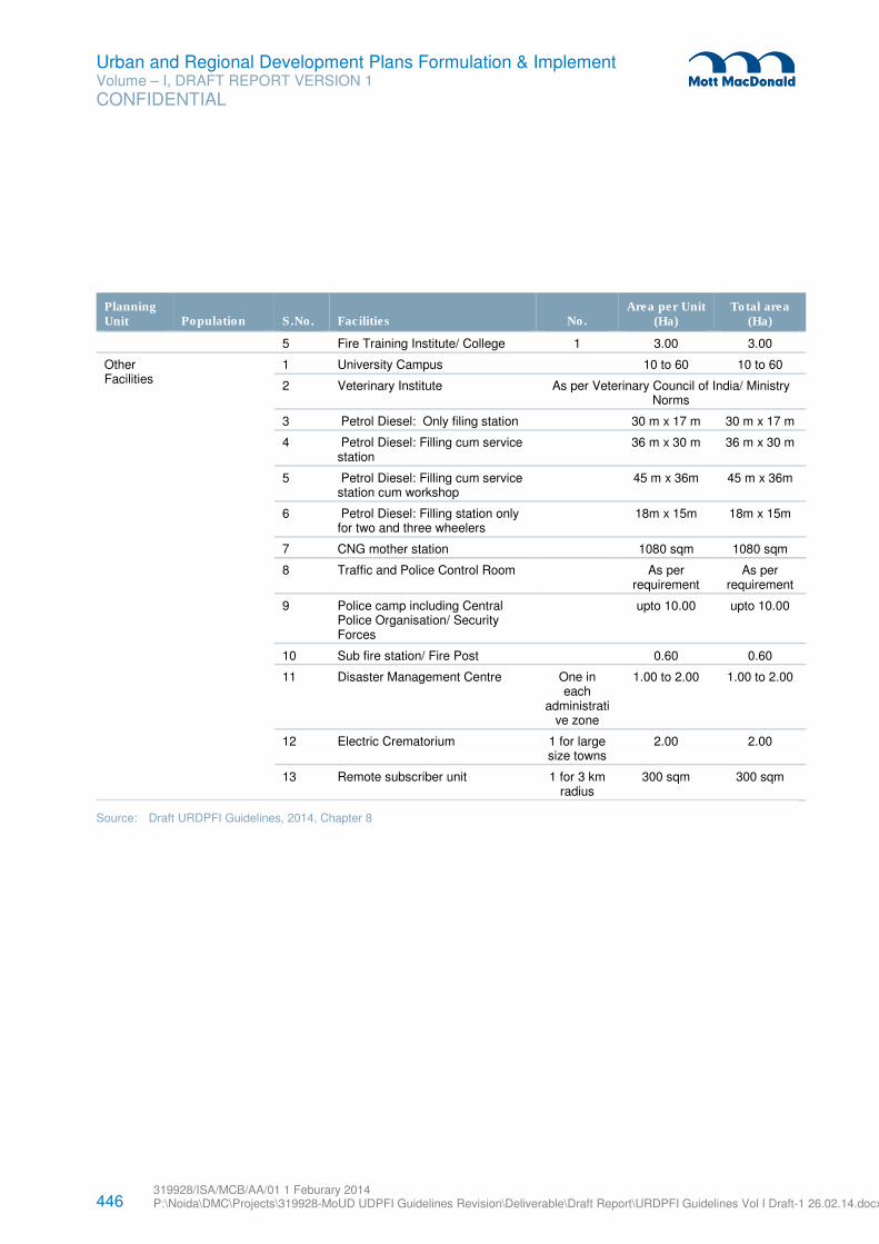
446 319928/ISA/MCB/AA/01 1 Feburary 2014 P:\Noida\DMC\Projects\319928-MoUD UDPFI Guidelines Revision\Deliverable\Draft Report\URDPFI Guidelines Vol I Draft-1 26.02.14.docx
Urban and Regional Development Plans Formulation & Implement Volume – I, DRAFT REPORT VERSION 1
CONFIDENTIAL
Planning Unit Population S.No. Facilities No.
Area per Unit (Ha)
Total area (Ha)
5 Fire Training Institute/ College 1 3.00 3.00
Other Facilities
1 University Campus 10 to 60 10 to 60
2 Veterinary Institute As per Veterinary Council of India/ Ministry Norms
3 Petrol Diesel: Only filing station 30 m x 17 m 30 m x 17 m
4 Petrol Diesel: Filling cum service station
36 m x 30 m 36 m x 30 m
5 Petrol Diesel: Filling cum service station cum workshop
45 m x 36m 45 m x 36m
6 Petrol Diesel: Filling station only for two and three wheelers
18m x 15m 18m x 15m
7 CNG mother station 1080 sqm 1080 sqm
8 Traffic and Police Control Room As per requirement
As per requirement
9 Police camp including Central Police Organisation/ Security Forces
upto 10.00 upto 10.00
10 Sub fire station/ Fire Post 0.60 0.60
11 Disaster Management Centre One in each
administrative zone
1.00 to 2.00 1.00 to 2.00
12 Electric Crematorium 1 for large size towns
2.00 2.00
13 Remote subscriber unit 1 for 3 km radius
300 sqm 300 sqm
Source: Draft URDPFI Guidelines, 2014, Chapter 8
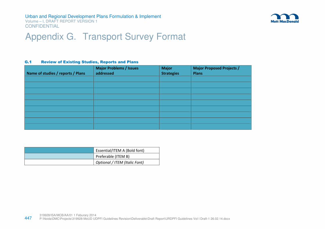
447 319928/ISA/MCB/AA/01 1 Feburary 2014 P:\Noida\DMC\Projects\319928-MoUD UDPFI Guidelines Revision\Deliverable\Draft Report\URDPFI Guidelines Vol I Draft-1 26.02.14.docx
Urban and Regional Development Plans Formulation & Implement Volume – I, DRAFT REPORT VERSION 1
CONFIDENTIAL
G.1 Review of Existing Studies, Reports and Plans
Name of studies / reports / Plans
Major Problems / Issues
addressed
Major
Strategies
Major Proposed Projects /
Plans
Essential/ITEM A (Bold font)
Preferable (ITEM B)
Optional / ITEM (Italic Font)
Appendix G. Transport Survey Format
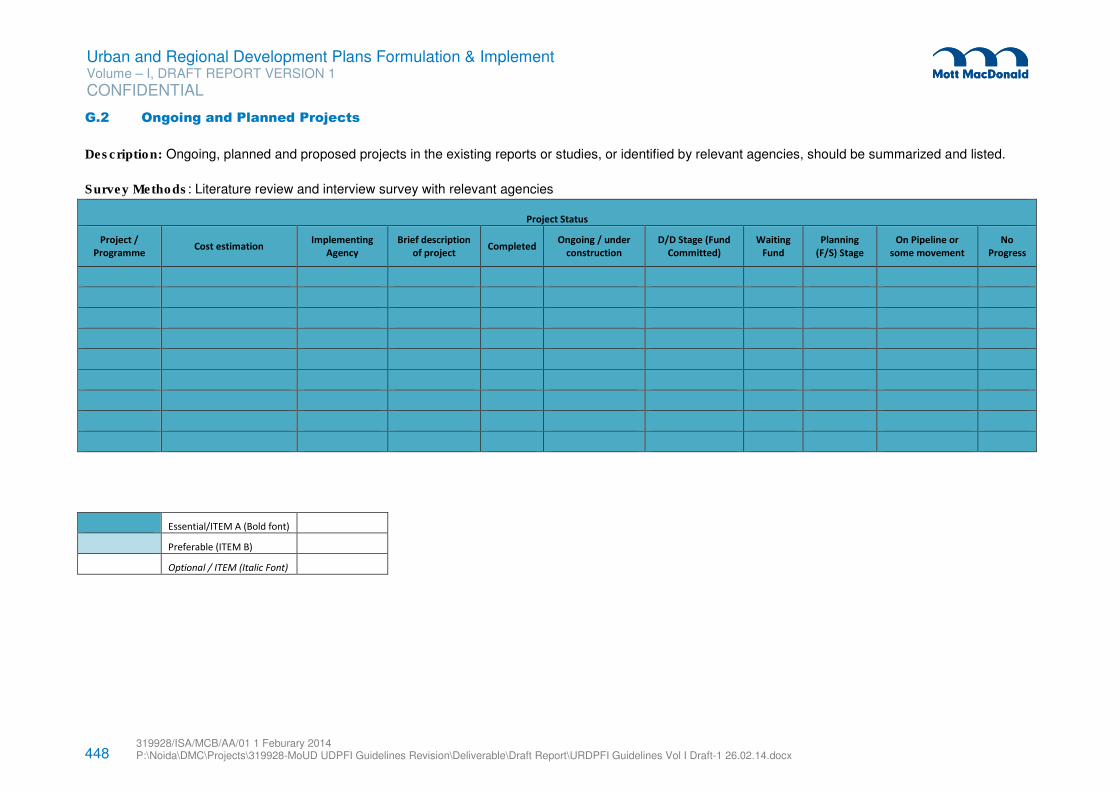
448 319928/ISA/MCB/AA/01 1 Feburary 2014 P:\Noida\DMC\Projects\319928-MoUD UDPFI Guidelines Revision\Deliverable\Draft Report\URDPFI Guidelines Vol I Draft-1 26.02.14.docx
Urban and Regional Development Plans Formulation & Implement Volume – I, DRAFT REPORT VERSION 1
CONFIDENTIAL
G.2 Ongoing and Planned Projects
Description: Ongoing, planned and proposed projects in the existing reports or studies, or identified by relevant agencies, should be summarized and listed.
Survey Methods: Literature review and interview survey with relevant agencies
Project Status
Project /
Programme Cost estimation
Implementing
Agency
Brief description
of project Completed
Ongoing / under
construction
D/D Stage (Fund
Committed)
Waiting
Fund
Planning
(F/S) Stage
On Pipeline or
some movement
No
Progress
Essential/ITEM A (Bold font)
Preferable (ITEM B)
Optional / ITEM (Italic Font)
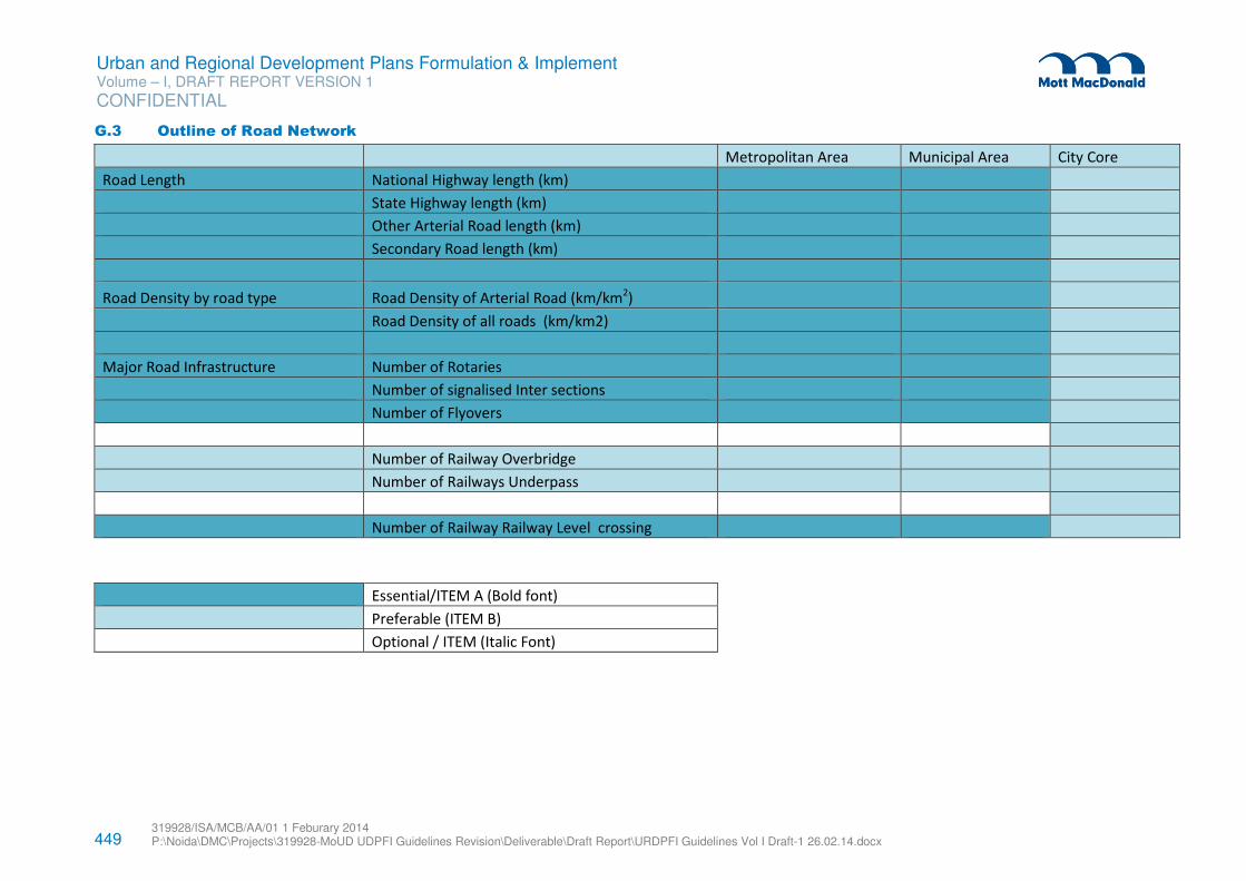
449 319928/ISA/MCB/AA/01 1 Feburary 2014 P:\Noida\DMC\Projects\319928-MoUD UDPFI Guidelines Revision\Deliverable\Draft Report\URDPFI Guidelines Vol I Draft-1 26.02.14.docx
Urban and Regional Development Plans Formulation & Implement Volume – I, DRAFT REPORT VERSION 1
CONFIDENTIAL
G.3 Outline of Road Network
Metropolitan Area Municipal Area City Core
Road Length National Highway length (km)
State Highway length (km)
Other Arterial Road length (km)
Secondary Road length (km)
Road Density by road type Road Density of Arterial Road (km/km2)
Road Density of all roads (km/km2)
Major Road Infrastructure Number of Rotaries
Number of signalised Inter sections
Number of Flyovers
Number of Railway Overbridge
Number of Railways Underpass
Number of Railway Railway Level crossing
Essential/ITEM A (Bold font)
Preferable (ITEM B)
Optional / ITEM (Italic Font)
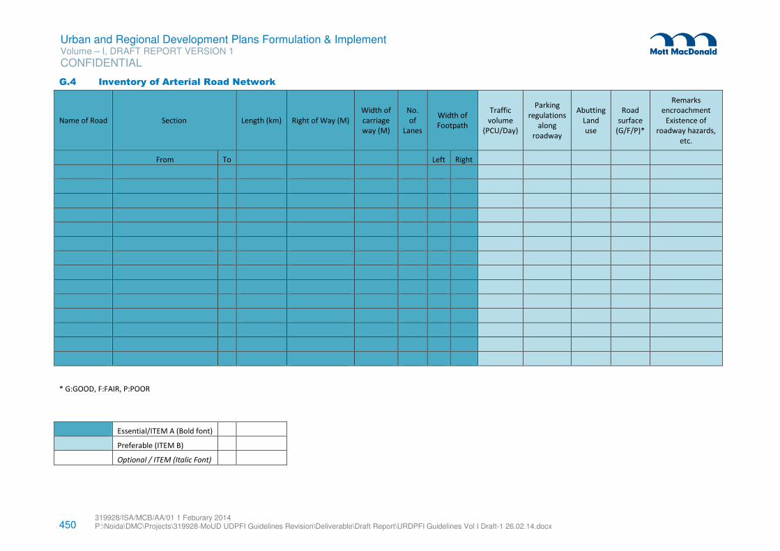
450 319928/ISA/MCB/AA/01 1 Feburary 2014 P:\Noida\DMC\Projects\319928-MoUD UDPFI Guidelines Revision\Deliverable\Draft Report\URDPFI Guidelines Vol I Draft-1 26.02.14.docx
Urban and Regional Development Plans Formulation & Implement Volume – I, DRAFT REPORT VERSION 1
CONFIDENTIAL
G.4 Inventory of Arterial Road Network
Name of Road Section Length (km) Right of Way (M)
Width of
carriage
way (M)
No.
of
Lanes
Width of
Footpath
Traffic
volume
(PCU/Day)
Parking
regulations
along
roadway
Abutting
Land
use
Road
surface
(G/F/P)*
Remarks
encroachment
Existence of
roadway hazards,
etc.
From To Left Right
* G:GOOD, F:FAIR, P:POOR
Essential/ITEM A (Bold font)
Preferable (ITEM B)
Optional / ITEM (Italic Font)
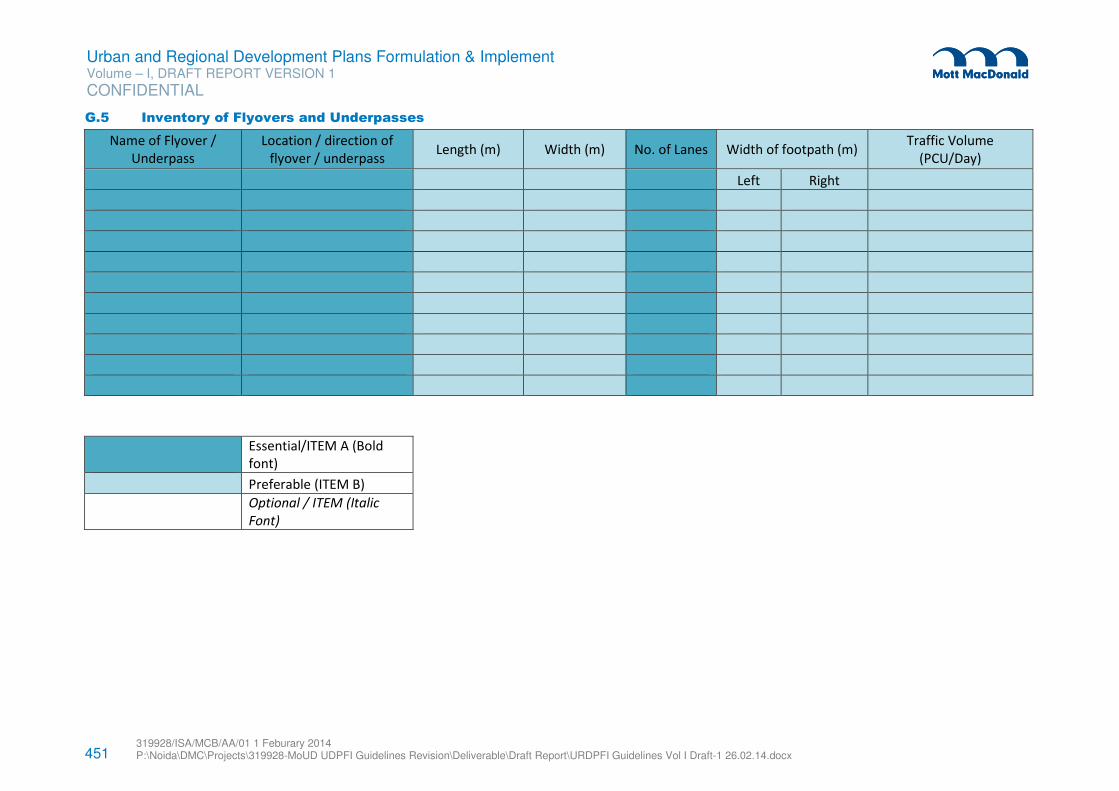
451 319928/ISA/MCB/AA/01 1 Feburary 2014 P:\Noida\DMC\Projects\319928-MoUD UDPFI Guidelines Revision\Deliverable\Draft Report\URDPFI Guidelines Vol I Draft-1 26.02.14.docx
Urban and Regional Development Plans Formulation & Implement Volume – I, DRAFT REPORT VERSION 1
CONFIDENTIAL
G.5 Inventory of Flyovers and Underpasses
Name of Flyover /
Underpass
Location / direction of
flyover / underpass Length (m) Width (m) No. of Lanes Width of footpath (m)
Traffic Volume
(PCU/Day)
Left Right
Essential/ITEM A (Bold
font)
Preferable (ITEM B)
Optional / ITEM (Italic
Font)
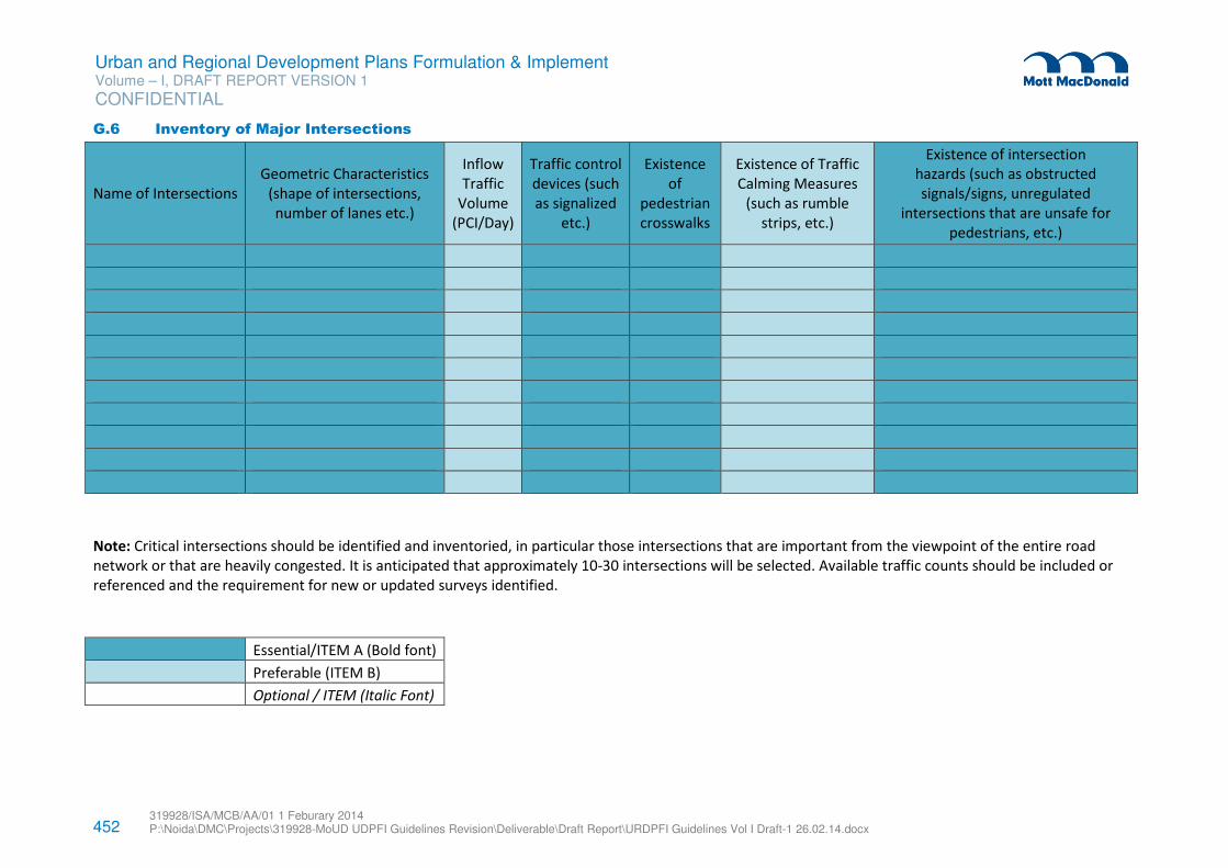
452 319928/ISA/MCB/AA/01 1 Feburary 2014 P:\Noida\DMC\Projects\319928-MoUD UDPFI Guidelines Revision\Deliverable\Draft Report\URDPFI Guidelines Vol I Draft-1 26.02.14.docx
Urban and Regional Development Plans Formulation & Implement Volume – I, DRAFT REPORT VERSION 1
CONFIDENTIAL
G.6 Inventory of Major Intersections
Name of Intersections
Geometric Characteristics
(shape of intersections,
number of lanes etc.)
Inflow
Traffic
Volume
(PCI/Day)
Traffic control
devices (such
as signalized
etc.)
Existence
of
pedestrian
crosswalks
Existence of Traffic
Calming Measures
(such as rumble
strips, etc.)
Existence of intersection
hazards (such as obstructed
signals/signs, unregulated
intersections that are unsafe for
pedestrians, etc.)
Note: Critical intersections should be identified and inventoried, in particular those intersections that are important from the viewpoint of the entire road
network or that are heavily congested. It is anticipated that approximately 10-30 intersections will be selected. Available traffic counts should be included or
referenced and the requirement for new or updated surveys identified.
Essential/ITEM A (Bold font)
Preferable (ITEM B)
Optional / ITEM (Italic Font)
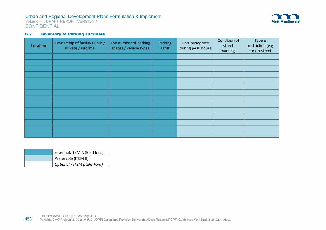
453 319928/ISA/MCB/AA/01 1 Feburary 2014 P:\Noida\DMC\Projects\319928-MoUD UDPFI Guidelines Revision\Deliverable\Draft Report\URDPFI Guidelines Vol I Draft-1 26.02.14.docx
Urban and Regional Development Plans Formulation & Implement Volume – I, DRAFT REPORT VERSION 1
CONFIDENTIAL
G.7 Inventory of Parking Facilities
Location Ownership of facility Public /
Private / Informal
The number of parking
spaces / vehicle types
Parking
Tafiff
Occupancy rate
during peak hours
Condition of
street
markings
Type of
restriction (e.g.
for on-street)
Essential/ITEM A (Bold font)
Preferable (ITEM B)
Optional / ITEM (Italic Font)
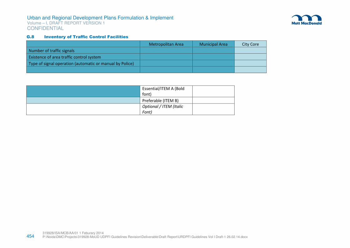
454 319928/ISA/MCB/AA/01 1 Feburary 2014 P:\Noida\DMC\Projects\319928-MoUD UDPFI Guidelines Revision\Deliverable\Draft Report\URDPFI Guidelines Vol I Draft-1 26.02.14.docx
Urban and Regional Development Plans Formulation & Implement Volume – I, DRAFT REPORT VERSION 1
CONFIDENTIAL
G.8 Inventory of Traffic Control Facilities
Metropolitan Area Municipal Area City Core
Number of traffic signals
Existence of area traffic control system
Type of signal operation (automatic or manual by Police)
Essential/ITEM A (Bold
font)
Preferable (ITEM B)
Optional / ITEM (Italic
Font)
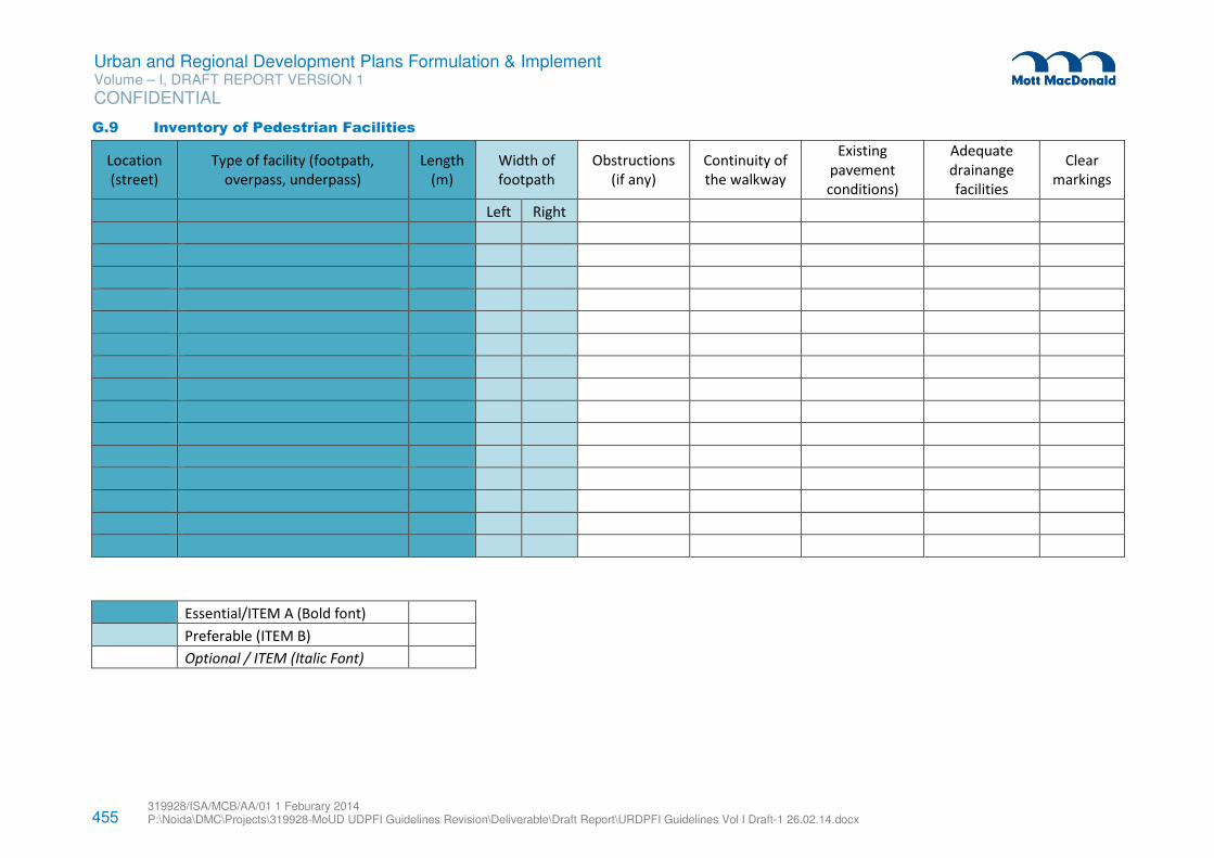
455 319928/ISA/MCB/AA/01 1 Feburary 2014 P:\Noida\DMC\Projects\319928-MoUD UDPFI Guidelines Revision\Deliverable\Draft Report\URDPFI Guidelines Vol I Draft-1 26.02.14.docx
Urban and Regional Development Plans Formulation & Implement Volume – I, DRAFT REPORT VERSION 1
CONFIDENTIAL
G.9 Inventory of Pedestrian Facilities
Location
(street)
Type of facility (footpath,
overpass, underpass)
Length
(m)
Width of
footpath
Obstructions
(if any)
Continuity of
the walkway
Existing
pavement
conditions)
Adequate
drainange
facilities
Clear
markings
Left Right
Essential/ITEM A (Bold font)
Preferable (ITEM B)
Optional / ITEM (Italic Font)
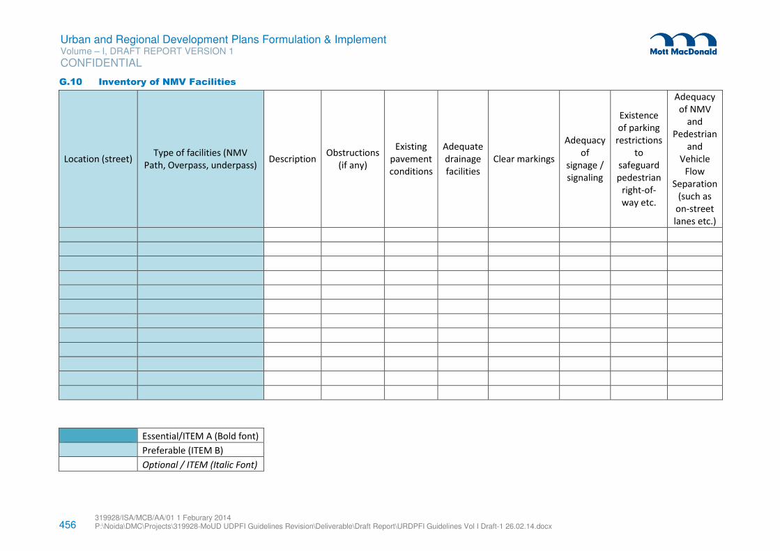
456 319928/ISA/MCB/AA/01 1 Feburary 2014 P:\Noida\DMC\Projects\319928-MoUD UDPFI Guidelines Revision\Deliverable\Draft Report\URDPFI Guidelines Vol I Draft-1 26.02.14.docx
Urban and Regional Development Plans Formulation & Implement Volume – I, DRAFT REPORT VERSION 1
CONFIDENTIAL
G.10 Inventory of NMV Facilities
Location (street) Type of facilities (NMV
Path, Overpass, underpass) Description
Obstructions
(if any)
Existing
pavement
conditions
Adequate
drainage
facilities
Clear markings
Adequacy
of
signage /
signaling
Existence
of parking
restrictions
to
safeguard
pedestrian
right-of-
way etc.
Adequacy
of NMV
and
Pedestrian
and
Vehicle
Flow
Separation
(such as
on-street
lanes etc.)
Essential/ITEM A (Bold font)
Preferable (ITEM B)
Optional / ITEM (Italic Font)
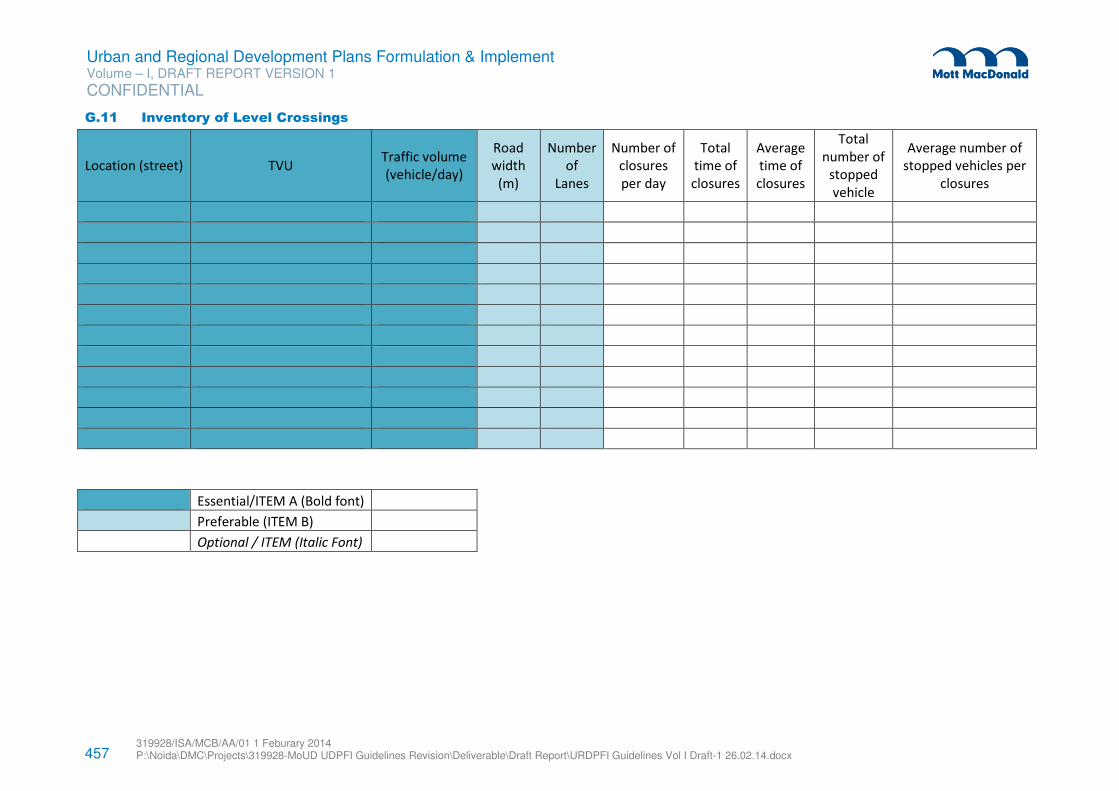
457 319928/ISA/MCB/AA/01 1 Feburary 2014 P:\Noida\DMC\Projects\319928-MoUD UDPFI Guidelines Revision\Deliverable\Draft Report\URDPFI Guidelines Vol I Draft-1 26.02.14.docx
Urban and Regional Development Plans Formulation & Implement Volume – I, DRAFT REPORT VERSION 1
CONFIDENTIAL
G.11 Inventory of Level Crossings
Location (street) TVU Traffic volume
(vehicle/day)
Road
width
(m)
Number
of
Lanes
Number of
closures
per day
Total
time of
closures
Average
time of
closures
Total
number of
stopped
vehicle
Average number of
stopped vehicles per
closures
Essential/ITEM A (Bold font)
Preferable (ITEM B)
Optional / ITEM (Italic Font)
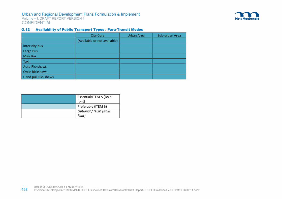
458 319928/ISA/MCB/AA/01 1 Feburary 2014 P:\Noida\DMC\Projects\319928-MoUD UDPFI Guidelines Revision\Deliverable\Draft Report\URDPFI Guidelines Vol I Draft-1 26.02.14.docx
Urban and Regional Development Plans Formulation & Implement Volume – I, DRAFT REPORT VERSION 1
CONFIDENTIAL
G.12 Availability of Public Transport Types / Para-Transit Modes
City Core Urban Area Sub-urban Area
(Available or not available)
Inter city bus
Large Bus
Mini Bus
Taxi
Auto Rickshaws
Cycle Rickshaws
Hand pull Rickshaws
Essential/ITEM A (Bold
font)
Preferable (ITEM B)
Optional / ITEM (Italic
Font)
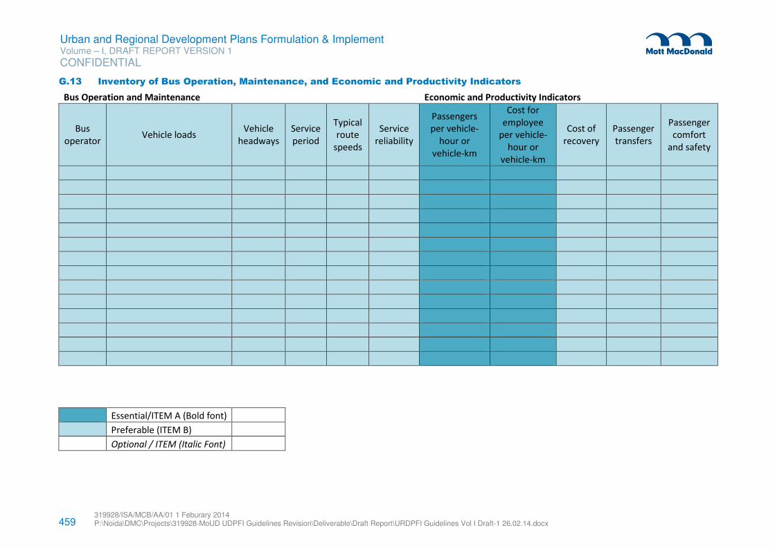
459 319928/ISA/MCB/AA/01 1 Feburary 2014 P:\Noida\DMC\Projects\319928-MoUD UDPFI Guidelines Revision\Deliverable\Draft Report\URDPFI Guidelines Vol I Draft-1 26.02.14.docx
Urban and Regional Development Plans Formulation & Implement Volume – I, DRAFT REPORT VERSION 1
CONFIDENTIAL
G.13 Inventory of Bus Operation, Maintenance, and Economic and Productivity Indicators
Bus Operation and Maintenance
Economic and Productivity Indicators
Bus
operator Vehicle loads
Vehicle
headways
Service
period
Typical
route
speeds
Service
reliability
Passengers
per vehicle-
hour or
vehicle-km
Cost for
employee
per vehicle-
hour or
vehicle-km
Cost of
recovery
Passenger
transfers
Passenger
comfort
and safety
Essential/ITEM A (Bold font)
Preferable (ITEM B)
Optional / ITEM (Italic Font)
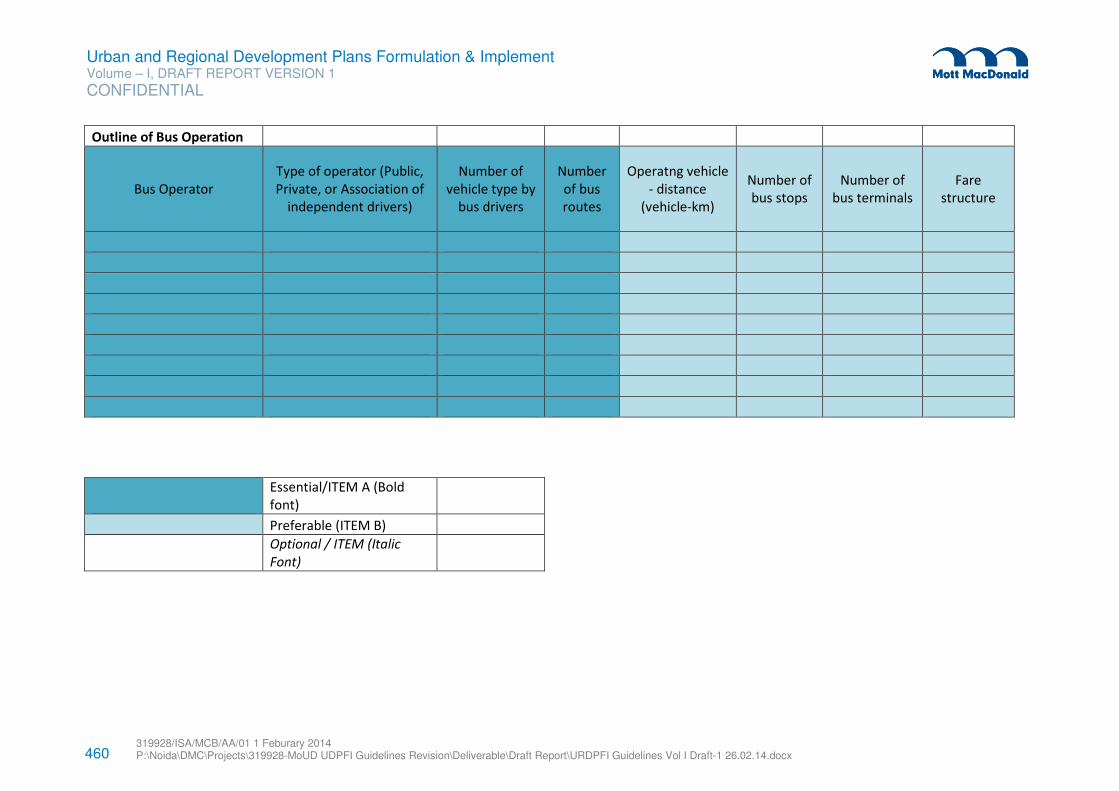
460 319928/ISA/MCB/AA/01 1 Feburary 2014 P:\Noida\DMC\Projects\319928-MoUD UDPFI Guidelines Revision\Deliverable\Draft Report\URDPFI Guidelines Vol I Draft-1 26.02.14.docx
Urban and Regional Development Plans Formulation & Implement Volume – I, DRAFT REPORT VERSION 1
CONFIDENTIAL
Outline of Bus Operation
Bus Operator
Type of operator (Public,
Private, or Association of
independent drivers)
Number of
vehicle type by
bus drivers
Number
of bus
routes
Operatng vehicle
- distance
(vehicle-km)
Number of
bus stops
Number of
bus terminals
Fare
structure
Essential/ITEM A (Bold
font)
Preferable (ITEM B)
Optional / ITEM (Italic
Font)
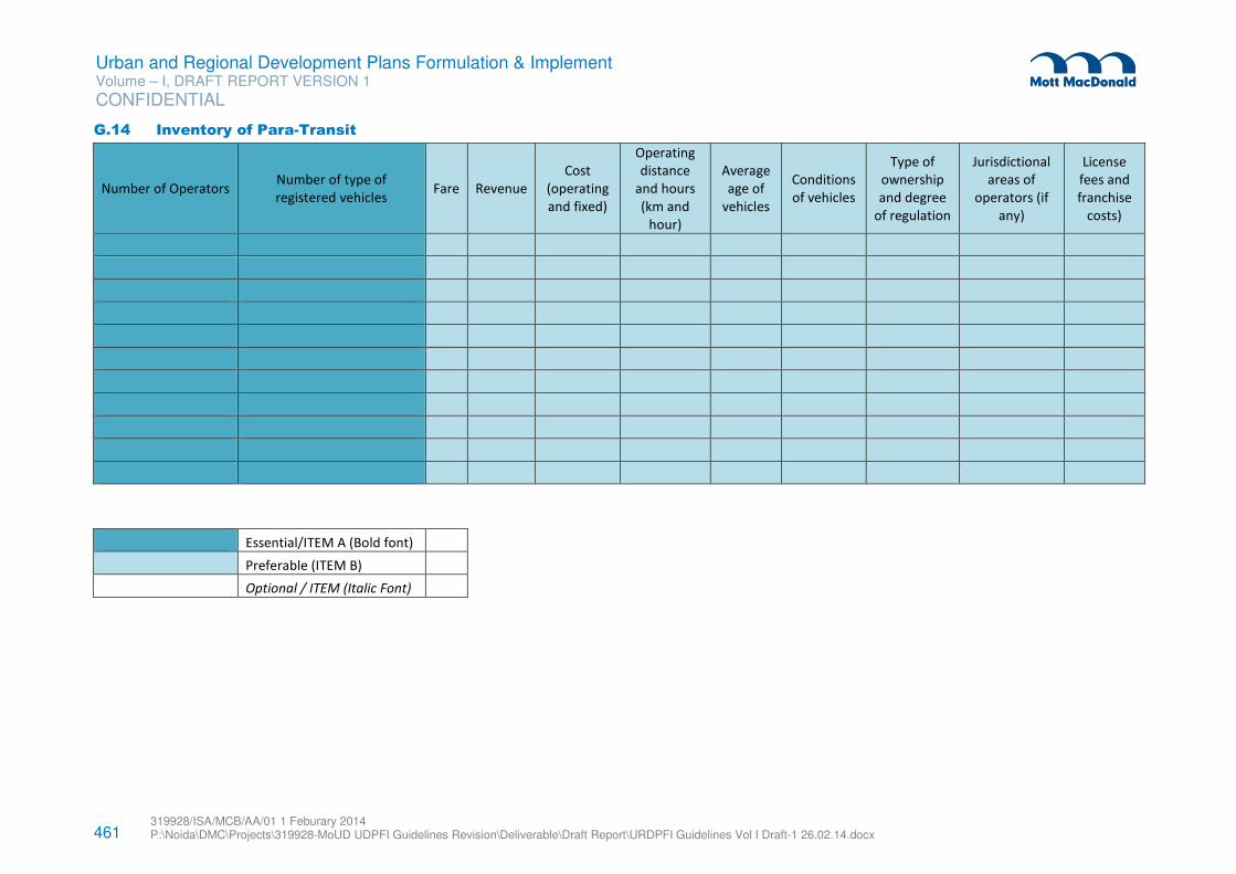
461 319928/ISA/MCB/AA/01 1 Feburary 2014 P:\Noida\DMC\Projects\319928-MoUD UDPFI Guidelines Revision\Deliverable\Draft Report\URDPFI Guidelines Vol I Draft-1 26.02.14.docx
Urban and Regional Development Plans Formulation & Implement Volume – I, DRAFT REPORT VERSION 1
CONFIDENTIAL
G.14 Inventory of Para-Transit
Number of Operators Number of type of
registered vehicles Fare Revenue
Cost
(operating
and fixed)
Operating
distance
and hours
(km and
hour)
Average
age of
vehicles
Conditions
of vehicles
Type of
ownership
and degree
of regulation
Jurisdictional
areas of
operators (if
any)
License
fees and
franchise
costs)
Essential/ITEM A (Bold font)
Preferable (ITEM B)
Optional / ITEM (Italic Font)
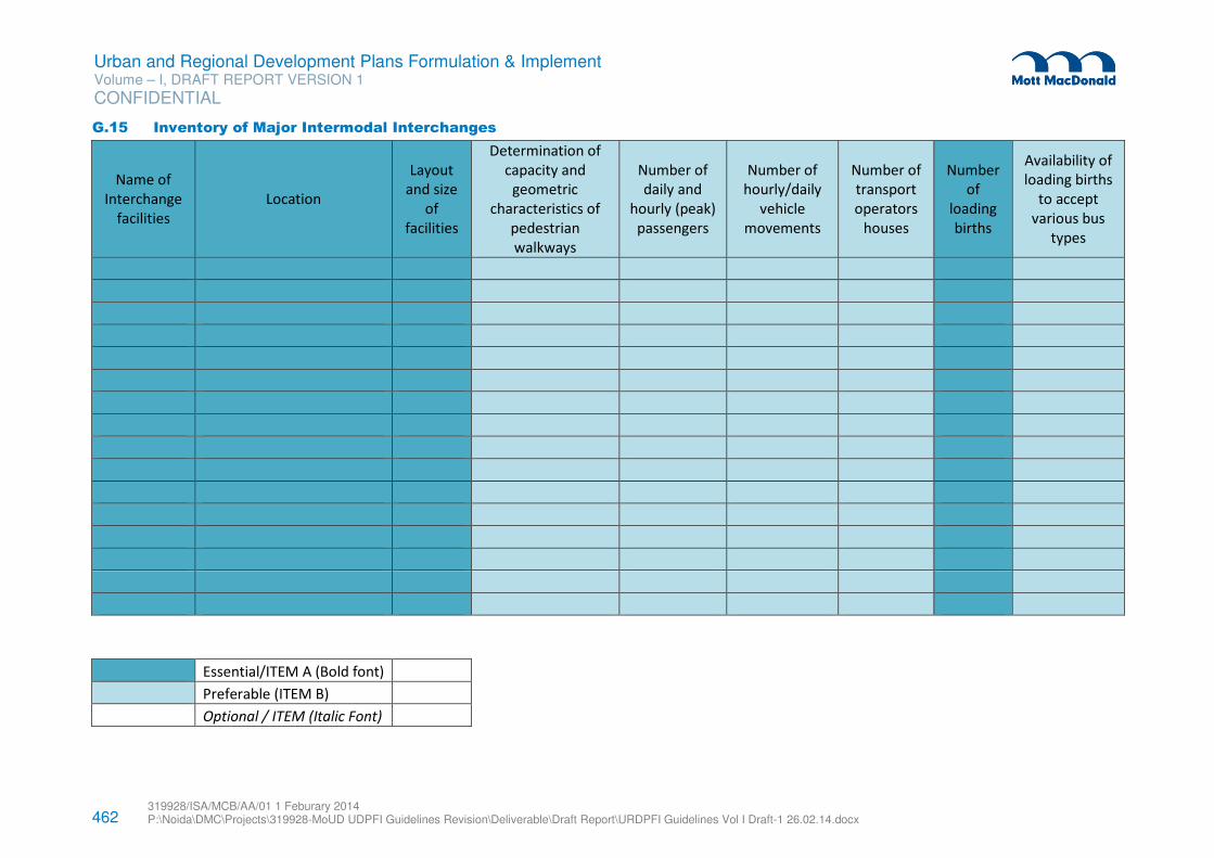
462 319928/ISA/MCB/AA/01 1 Feburary 2014 P:\Noida\DMC\Projects\319928-MoUD UDPFI Guidelines Revision\Deliverable\Draft Report\URDPFI Guidelines Vol I Draft-1 26.02.14.docx
Urban and Regional Development Plans Formulation & Implement Volume – I, DRAFT REPORT VERSION 1
CONFIDENTIAL
G.15 Inventory of Major Intermodal Interchanges
Name of
Interchange
facilities
Location
Layout
and size
of
facilities
Determination of
capacity and
geometric
characteristics of
pedestrian
walkways
Number of
daily and
hourly (peak)
passengers
Number of
hourly/daily
vehicle
movements
Number of
transport
operators
houses
Number
of
loading
births
Availability of
loading births
to accept
various bus
types
Essential/ITEM A (Bold font)
Preferable (ITEM B)
Optional / ITEM (Italic Font)
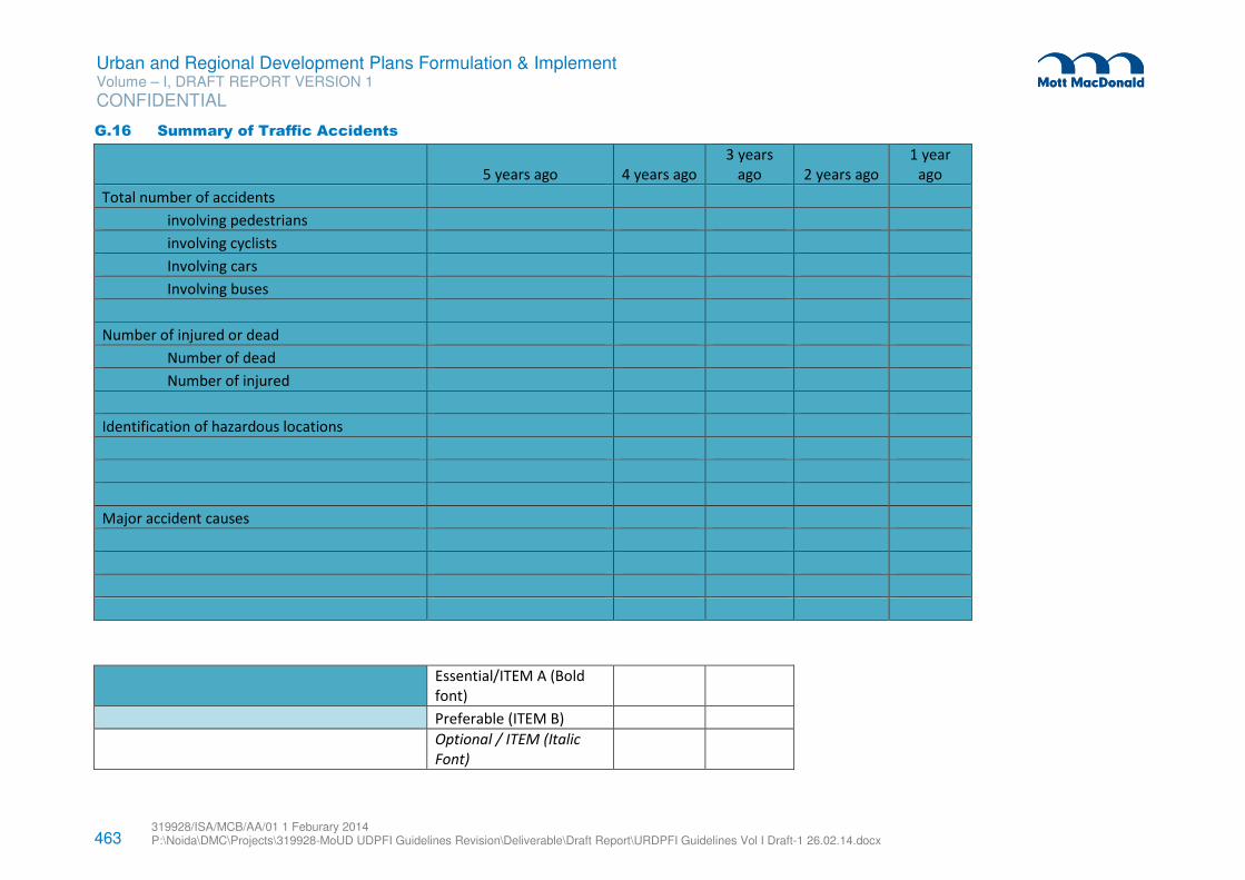
463 319928/ISA/MCB/AA/01 1 Feburary 2014 P:\Noida\DMC\Projects\319928-MoUD UDPFI Guidelines Revision\Deliverable\Draft Report\URDPFI Guidelines Vol I Draft-1 26.02.14.docx
Urban and Regional Development Plans Formulation & Implement Volume – I, DRAFT REPORT VERSION 1
CONFIDENTIAL
G.16 Summary of Traffic Accidents
5 years ago 4 years ago
3 years
ago 2 years ago
1 year
ago
Total number of accidents
involving pedestrians
involving cyclists
Involving cars
Involving buses
Number of injured or dead
Number of dead
Number of injured
Identification of hazardous locations
Major accident causes
Essential/ITEM A (Bold
font)
Preferable (ITEM B)
Optional / ITEM (Italic
Font)
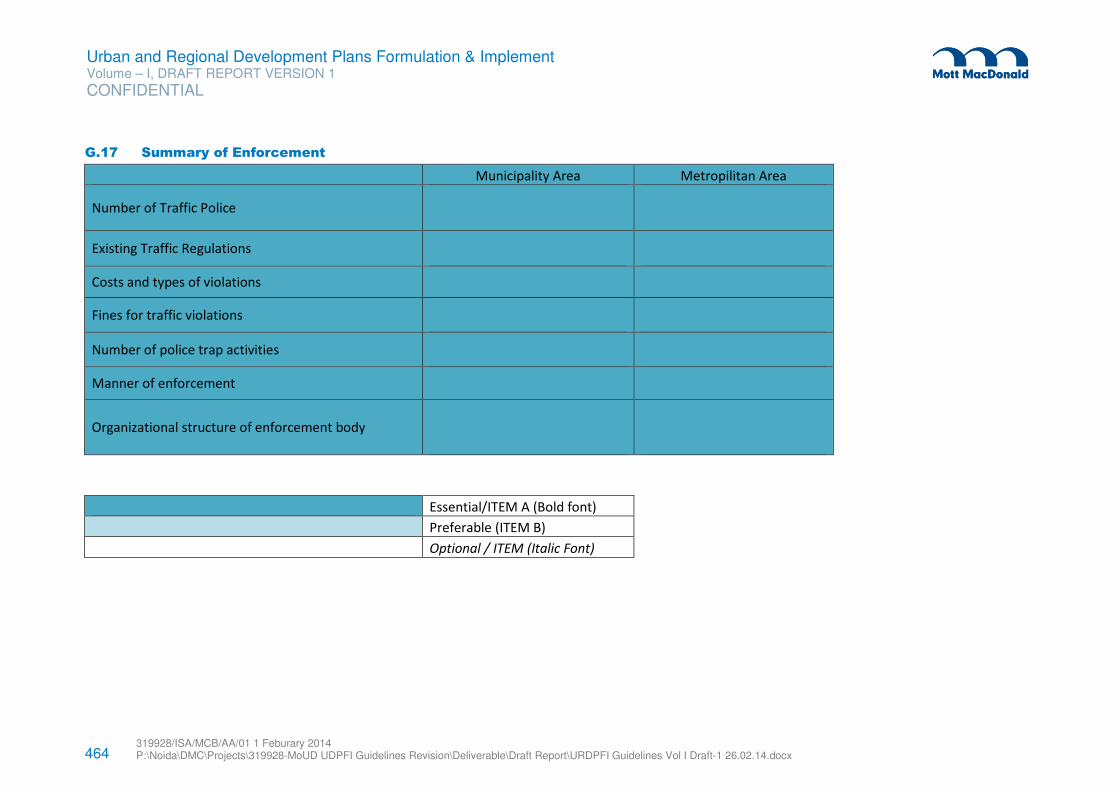
464 319928/ISA/MCB/AA/01 1 Feburary 2014 P:\Noida\DMC\Projects\319928-MoUD UDPFI Guidelines Revision\Deliverable\Draft Report\URDPFI Guidelines Vol I Draft-1 26.02.14.docx
Urban and Regional Development Plans Formulation & Implement Volume – I, DRAFT REPORT VERSION 1
CONFIDENTIAL
G.17 Summary of Enforcement
Municipality Area Metropilitan Area
Number of Traffic Police
Existing Traffic Regulations
Costs and types of violations
Fines for traffic violations
Number of police trap activities
Manner of enforcement
Organizational structure of enforcement body
Essential/ITEM A (Bold font)
Preferable (ITEM B)
Optional / ITEM (Italic Font)
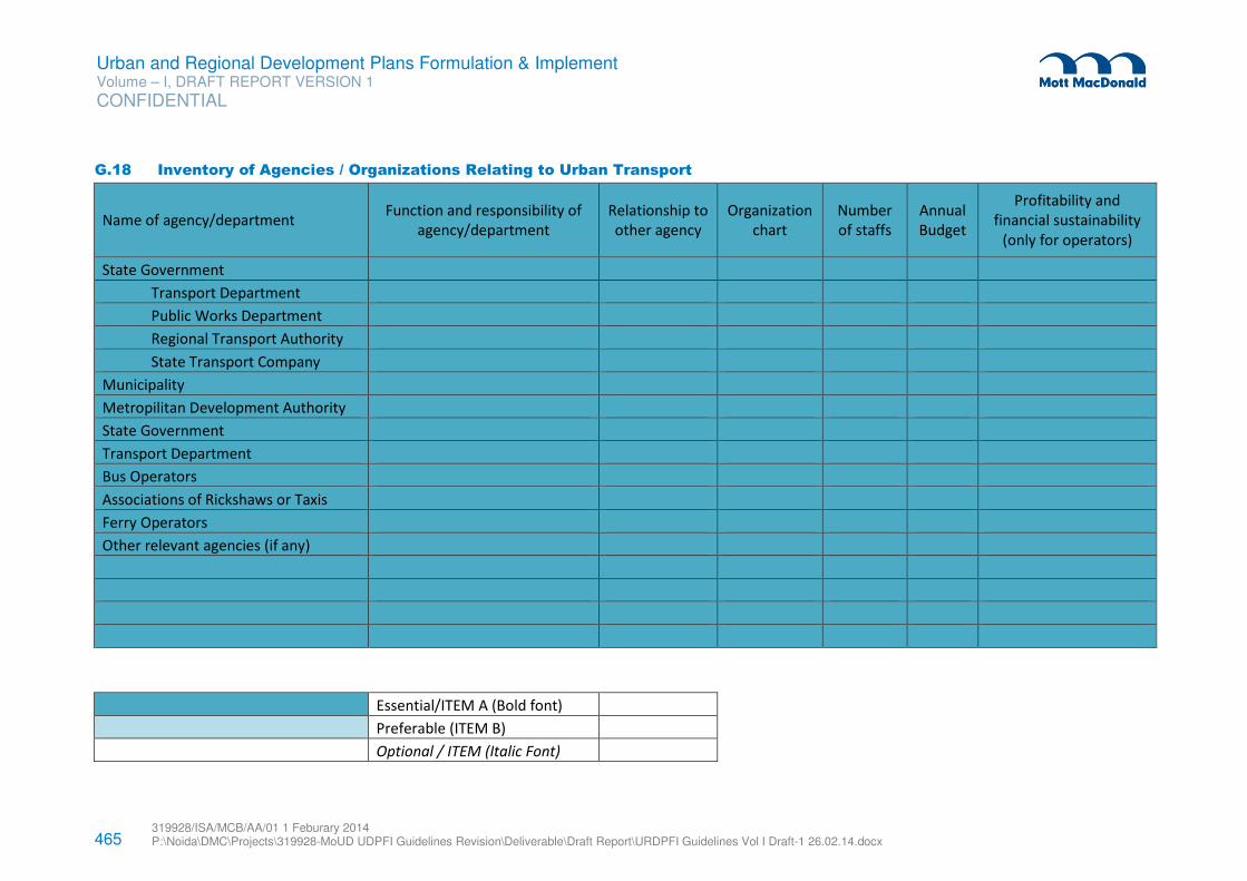
465 319928/ISA/MCB/AA/01 1 Feburary 2014 P:\Noida\DMC\Projects\319928-MoUD UDPFI Guidelines Revision\Deliverable\Draft Report\URDPFI Guidelines Vol I Draft-1 26.02.14.docx
Urban and Regional Development Plans Formulation & Implement Volume – I, DRAFT REPORT VERSION 1
CONFIDENTIAL
G.18 Inventory of Agencies / Organizations Relating to Urban Transport
Name of agency/department Function and responsibility of
agency/department
Relationship to
other agency
Organization
chart
Number
of staffs
Annual
Budget
Profitability and
financial sustainability
(only for operators)
State Government
Transport Department
Public Works Department
Regional Transport Authority
State Transport Company
Municipality
Metropilitan Development Authority
State Government
Transport Department
Bus Operators
Associations of Rickshaws or Taxis
Ferry Operators
Other relevant agencies (if any)
Essential/ITEM A (Bold font)
Preferable (ITEM B)
Optional / ITEM (Italic Font)
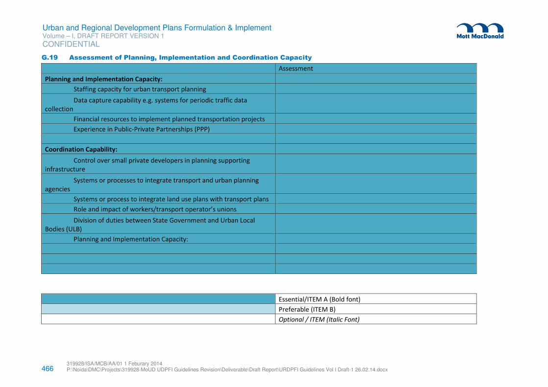
466 319928/ISA/MCB/AA/01 1 Feburary 2014 P:\Noida\DMC\Projects\319928-MoUD UDPFI Guidelines Revision\Deliverable\Draft Report\URDPFI Guidelines Vol I Draft-1 26.02.14.docx
Urban and Regional Development Plans Formulation & Implement Volume – I, DRAFT REPORT VERSION 1
CONFIDENTIAL
G.19 Assessment of Planning, Implementation and Coordination Capacity
Assessment
Planning and Implementation Capacity:
Staffing capacity for urban transport planning
Data capture capability e.g. systems for periodic traffic data
collection
Financial resources to implement planned transportation projects
Experience in Public-Private Partnerships (PPP)
Coordination Capability:
Control over small private developers in planning supporting
infrastructure
Systems or processes to integrate transport and urban planning
agencies
Systems or process to integrate land use plans with transport plans
Role and impact of workers/transport operator’s unions
Division of duties between State Government and Urban Local
Bodies (ULB)
Planning and Implementation Capacity:
Essential/ITEM A (Bold font)
Preferable (ITEM B)
Optional / ITEM (Italic Font)
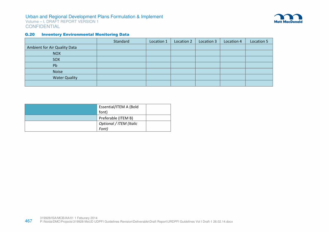
467 319928/ISA/MCB/AA/01 1 Feburary 2014 P:\Noida\DMC\Projects\319928-MoUD UDPFI Guidelines Revision\Deliverable\Draft Report\URDPFI Guidelines Vol I Draft-1 26.02.14.docx
Urban and Regional Development Plans Formulation & Implement Volume – I, DRAFT REPORT VERSION 1
CONFIDENTIAL
G.20 Inventory Environmental Monitoring Data
Standard Location 1 Location 2 Location 3 Location 4 Location 5
Ambient for Air Quality Data
NOX
SOX
Pb
Noise
Water Quality
Essential/ITEM A (Bold
font)
Preferable (ITEM B)
Optional / ITEM (Italic
Font)
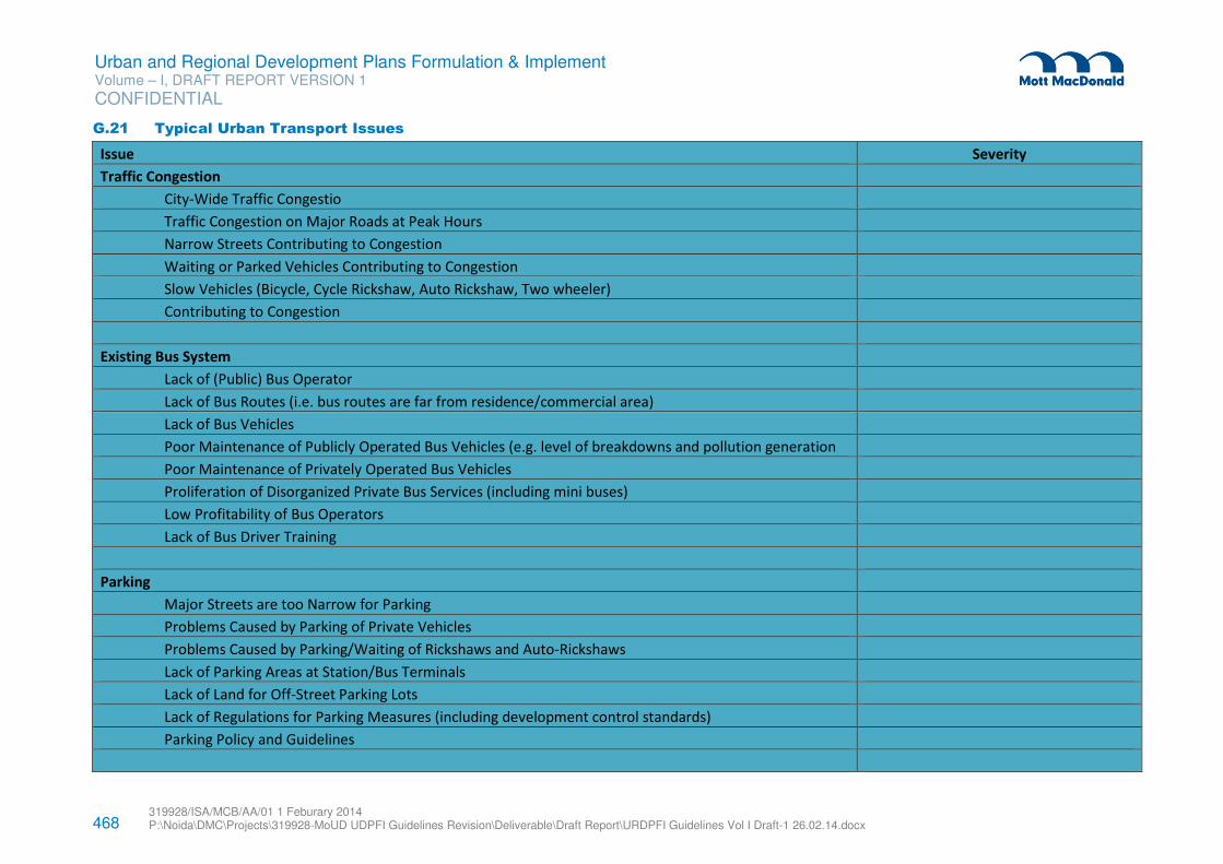
468 319928/ISA/MCB/AA/01 1 Feburary 2014 P:\Noida\DMC\Projects\319928-MoUD UDPFI Guidelines Revision\Deliverable\Draft Report\URDPFI Guidelines Vol I Draft-1 26.02.14.docx
Urban and Regional Development Plans Formulation & Implement Volume – I, DRAFT REPORT VERSION 1
CONFIDENTIAL
G.21 Typical Urban Transport Issues
Issue Severity
Traffic Congestion
City-Wide Traffic Congestio
Traffic Congestion on Major Roads at Peak Hours
Narrow Streets Contributing to Congestion
Waiting or Parked Vehicles Contributing to Congestion
Slow Vehicles (Bicycle, Cycle Rickshaw, Auto Rickshaw, Two wheeler)
Contributing to Congestion
Existing Bus System
Lack of (Public) Bus Operator
Lack of Bus Routes (i.e. bus routes are far from residence/commercial area)
Lack of Bus Vehicles
Poor Maintenance of Publicly Operated Bus Vehicles (e.g. level of breakdowns and pollution generation
Poor Maintenance of Privately Operated Bus Vehicles
Proliferation of Disorganized Private Bus Services (including mini buses)
Low Profitability of Bus Operators
Lack of Bus Driver Training
Parking
Major Streets are too Narrow for Parking
Problems Caused by Parking of Private Vehicles
Problems Caused by Parking/Waiting of Rickshaws and Auto-Rickshaws
Lack of Parking Areas at Station/Bus Terminals
Lack of Land for Off-Street Parking Lots
Lack of Regulations for Parking Measures (including development control standards)
Parking Policy and Guidelines
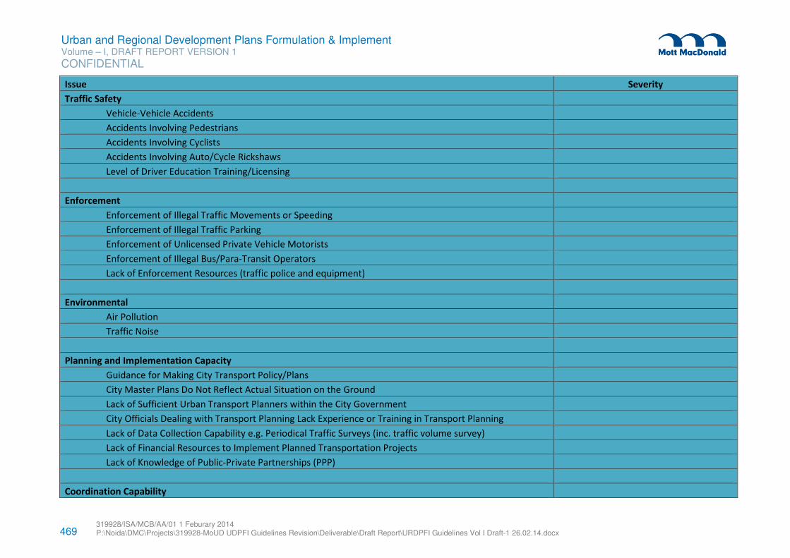
469 319928/ISA/MCB/AA/01 1 Feburary 2014 P:\Noida\DMC\Projects\319928-MoUD UDPFI Guidelines Revision\Deliverable\Draft Report\URDPFI Guidelines Vol I Draft-1 26.02.14.docx
Urban and Regional Development Plans Formulation & Implement Volume – I, DRAFT REPORT VERSION 1
CONFIDENTIAL
Issue Severity
Traffic Safety
Vehicle-Vehicle Accidents
Accidents Involving Pedestrians
Accidents Involving Cyclists
Accidents Involving Auto/Cycle Rickshaws
Level of Driver Education Training/Licensing
Enforcement
Enforcement of Illegal Traffic Movements or Speeding
Enforcement of Illegal Traffic Parking
Enforcement of Unlicensed Private Vehicle Motorists
Enforcement of Illegal Bus/Para-Transit Operators
Lack of Enforcement Resources (traffic police and equipment)
Environmental
Air Pollution
Traffic Noise
Planning and Implementation Capacity
Guidance for Making City Transport Policy/Plans
City Master Plans Do Not Reflect Actual Situation on the Ground
Lack of Sufficient Urban Transport Planners within the City Government
City Officials Dealing with Transport Planning Lack Experience or Training in Transport Planning
Lack of Data Collection Capability e.g. Periodical Traffic Surveys (inc. traffic volume survey)
Lack of Financial Resources to Implement Planned Transportation Projects
Lack of Knowledge of Public-Private Partnerships (PPP)
Coordination Capability
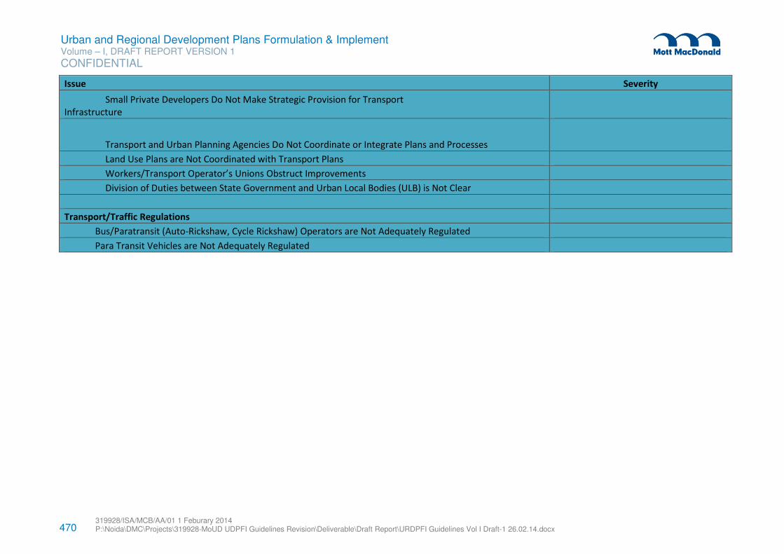
470 319928/ISA/MCB/AA/01 1 Feburary 2014 P:\Noida\DMC\Projects\319928-MoUD UDPFI Guidelines Revision\Deliverable\Draft Report\URDPFI Guidelines Vol I Draft-1 26.02.14.docx
Urban and Regional Development Plans Formulation & Implement Volume – I, DRAFT REPORT VERSION 1
CONFIDENTIAL
Issue Severity
Small Private Developers Do Not Make Strategic Provision for Transport
Infrastructure
Transport and Urban Planning Agencies Do Not Coordinate or Integrate Plans and Processes
Land Use Plans are Not Coordinated with Transport Plans
Workers/Transport Operator’s Unions Obstruct Improvements
Division of Duties between State Government and Urban Local Bodies (ULB) is Not Clear
Transport/Traffic Regulations
Bus/Paratransit (Auto-Rickshaw, Cycle Rickshaw) Operators are Not Adequately Regulated
Para Transit Vehicles are Not Adequately Regulated
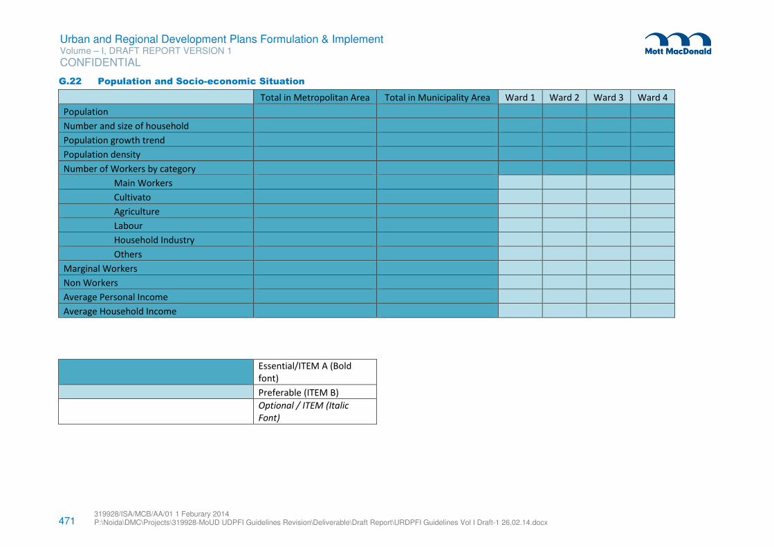
471 319928/ISA/MCB/AA/01 1 Feburary 2014 P:\Noida\DMC\Projects\319928-MoUD UDPFI Guidelines Revision\Deliverable\Draft Report\URDPFI Guidelines Vol I Draft-1 26.02.14.docx
Urban and Regional Development Plans Formulation & Implement Volume – I, DRAFT REPORT VERSION 1
CONFIDENTIAL
G.22 Population and Socio-economic Situation
Total in Metropolitan Area Total in Municipality Area Ward 1 Ward 2 Ward 3 Ward 4
Population
Number and size of household
Population growth trend
Population density
Number of Workers by category
Main Workers
Cultivato
Agriculture
Labour
Household Industry
Others
Marginal Workers
Non Workers
Average Personal Income
Average Household Income
Essential/ITEM A (Bold
font)
Preferable (ITEM B)
Optional / ITEM (Italic
Font)
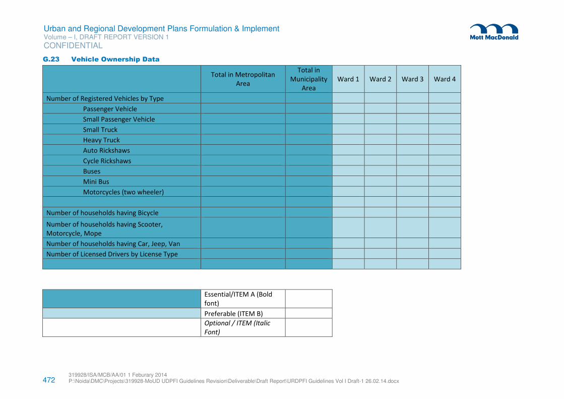
472 319928/ISA/MCB/AA/01 1 Feburary 2014 P:\Noida\DMC\Projects\319928-MoUD UDPFI Guidelines Revision\Deliverable\Draft Report\URDPFI Guidelines Vol I Draft-1 26.02.14.docx
Urban and Regional Development Plans Formulation & Implement Volume – I, DRAFT REPORT VERSION 1
CONFIDENTIAL
G.23 Vehicle Ownership Data
Total in Metropolitan
Area
Total in
Municipality
Area
Ward 1 Ward 2 Ward 3 Ward 4
Number of Registered Vehicles by Type
Passenger Vehicle
Small Passenger Vehicle
Small Truck
Heavy Truck
Auto Rickshaws
Cycle Rickshaws
Buses
Mini Bus
Motorcycles (two wheeler)
Number of households having Bicycle
Number of households having Scooter,
Motorcycle, Mope
Number of households having Car, Jeep, Van
Number of Licensed Drivers by License Type
Essential/ITEM A (Bold
font)
Preferable (ITEM B)
Optional / ITEM (Italic
Font)
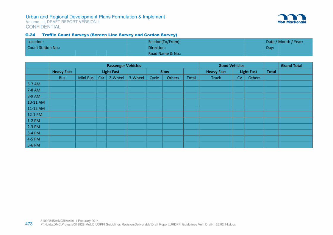
473 319928/ISA/MCB/AA/01 1 Feburary 2014 P:\Noida\DMC\Projects\319928-MoUD UDPFI Guidelines Revision\Deliverable\Draft Report\URDPFI Guidelines Vol I Draft-1 26.02.14.docx
Urban and Regional Development Plans Formulation & Implement Volume – I, DRAFT REPORT VERSION 1
CONFIDENTIAL
G.24 Traffic Count Surveys (Screen Line Survey and Cordon Survey)
Location: Section(To/From): Date / Month / Year:
Count Station No.: Direction: Day:
Road Name & No.:
Passenger Vehicles Good Vehicles Grand Total
Heavy Fast Light Fast Slow Heavy Fast Light Fast Total
Bus Mini Bus Car 2-Wheel 3-Wheel Cycle Others Total Truck LCV Others
6-7 AM
7-8 AM
8-9 AM
10-11 AM
11-12 AM
12-1 PM
1-2 PM
2-3 PM
3-4 PM
4-5 PM
5-6 PM
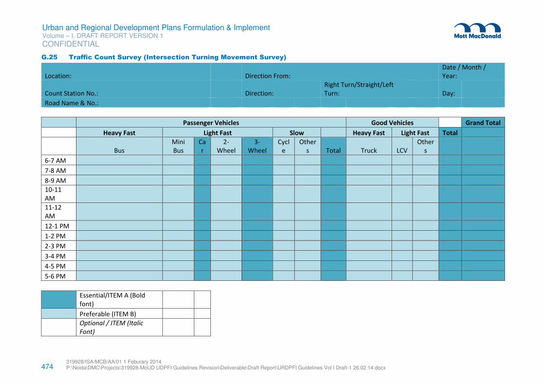
474 319928/ISA/MCB/AA/01 1 Feburary 2014 P:\Noida\DMC\Projects\319928-MoUD UDPFI Guidelines Revision\Deliverable\Draft Report\URDPFI Guidelines Vol I Draft-1 26.02.14.docx
Urban and Regional Development Plans Formulation & Implement Volume – I, DRAFT REPORT VERSION 1
CONFIDENTIAL
G.25 Traffic Count Survey (Intersection Turning Movement Survey)
Location: Direction From:
Date / Month /
Year:
Count Station No.: Direction:
Right Turn/Straight/Left
Turn: Day:
Road Name & No.:
Passenger Vehicles Good Vehicles Grand Total
Heavy Fast Light Fast Slow Heavy Fast Light Fast Total
Bus
Mini
Bus
Ca
r
2-
Wheel
3-
Wheel
Cycl
e
Other
s Total Truck LCV
Other
s
6-7 AM
7-8 AM
8-9 AM
10-11
AM
11-12
AM
12-1 PM
1-2 PM
2-3 PM
3-4 PM
4-5 PM
5-6 PM
Essential/ITEM A (Bold
font)
Preferable (ITEM B)
Optional / ITEM (Italic
Font)
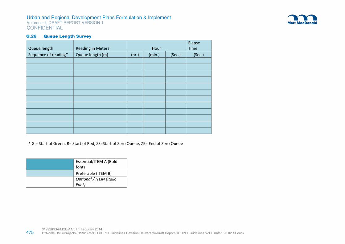
475 319928/ISA/MCB/AA/01 1 Feburary 2014 P:\Noida\DMC\Projects\319928-MoUD UDPFI Guidelines Revision\Deliverable\Draft Report\URDPFI Guidelines Vol I Draft-1 26.02.14.docx
Urban and Regional Development Plans Formulation & Implement Volume – I, DRAFT REPORT VERSION 1
CONFIDENTIAL
G.26 Queue Length Survey
Queue length Reading in Meters Hour
Elapse
Time
Sequence of reading* Queue length (m) (hr.) (min.) (Sec.) (Sec.)
* G = Start of Green, R= Start of Red, ZS=Start of Zero Queue, ZE= End of Zero Queue
Essential/ITEM A (Bold
font)
Preferable (ITEM B)
Optional / ITEM (Italic
Font)
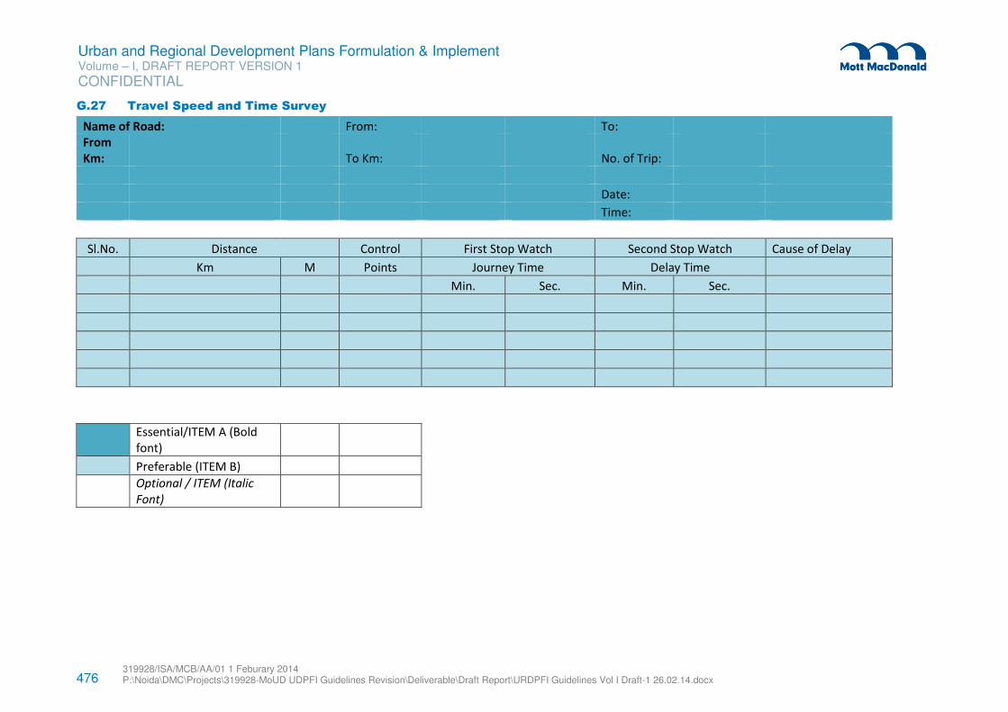
476 319928/ISA/MCB/AA/01 1 Feburary 2014 P:\Noida\DMC\Projects\319928-MoUD UDPFI Guidelines Revision\Deliverable\Draft Report\URDPFI Guidelines Vol I Draft-1 26.02.14.docx
Urban and Regional Development Plans Formulation & Implement Volume – I, DRAFT REPORT VERSION 1
CONFIDENTIAL
G.27 Travel Speed and Time Survey
Name of Road: From: To:
From
Km: To Km: No. of Trip:
Date:
Time:
Sl.No. Distance Control First Stop Watch Second Stop Watch Cause of Delay
Km M Points Journey Time Delay Time
Min. Sec. Min. Sec.
Essential/ITEM A (Bold
font)
Preferable (ITEM B)
Optional / ITEM (Italic
Font)
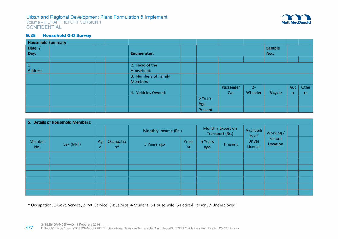
477 319928/ISA/MCB/AA/01 1 Feburary 2014 P:\Noida\DMC\Projects\319928-MoUD UDPFI Guidelines Revision\Deliverable\Draft Report\URDPFI Guidelines Vol I Draft-1 26.02.14.docx
Urban and Regional Development Plans Formulation & Implement Volume – I, DRAFT REPORT VERSION 1
CONFIDENTIAL
G.28 Household O-D Survey
Household Summary
Date: /
Day: Enumerator:
Sample
No.:
1.
Address
2. Head of the
Household:
3. Numbers of Family
Members
4. Vehicles Owned:
Passenger
Car
2-
Wheeler Bicycle
Aut
o
Othe
rs
5 Years
Ago
Present
5. Details of Household Members:
Monthly Income (Rs.)
Monthly Export on
Transport (Rs.) Availabili
ty of
Driver
License
Working /
School
Location
Member
No. Sex (M/F)
Ag
e
Occupatio
n* 5 Years ago
Prese
nt
5 Years
ago Present
* Occupation, 1-Govt. Service, 2-Pvt. Service, 3-Business, 4-Student, 5-House-wife, 6-Retired Person, 7-Unemployed
478 319928/ISA/MCB/AA/01 1 Feburary 2014 P:\Noida\DMC\Projects\319928-MoUD UDPFI Guidelines Revision\Deliverable\Draft Report\URDPFI Guidelines Vol I Draft-1 26.02.14.docx
Urban and Regional Development Plans Formulation & Implement Volume – I, DRAFT REPORT VERSION 1
CONFIDENTIAL
Essential/ITEM A (Bold
font)
Preferable (ITEM B)
Optional / ITEM (Italic
Font)
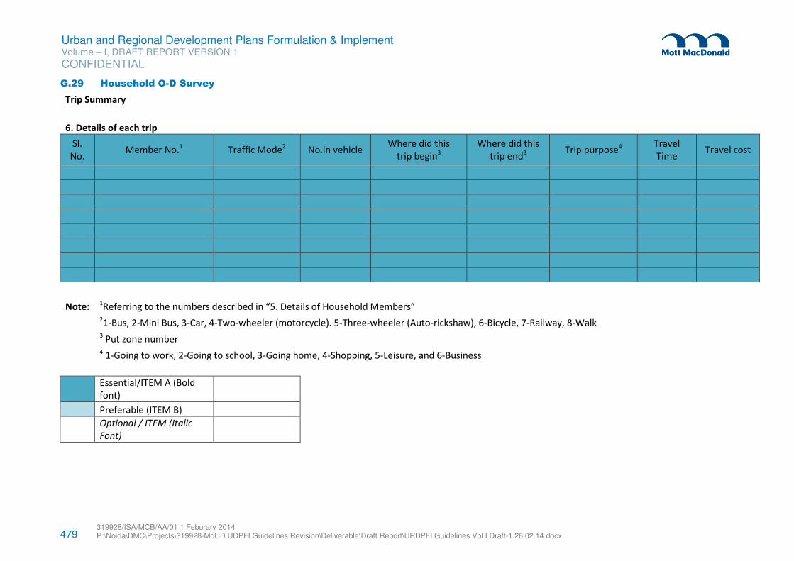
479 319928/ISA/MCB/AA/01 1 Feburary 2014 P:\Noida\DMC\Projects\319928-MoUD UDPFI Guidelines Revision\Deliverable\Draft Report\URDPFI Guidelines Vol I Draft-1 26.02.14.docx
Urban and Regional Development Plans Formulation & Implement Volume – I, DRAFT REPORT VERSION 1
CONFIDENTIAL
G.29 Household O-D Survey
Trip Summary
6. Details of each trip
Sl.
No. Member No.
1 Traffic Mode
2 No.in vehicle
Where did this
trip begin3
Where did this
trip end3
Trip purpose4
Travel
Time Travel cost
Note: 1Referring to the numbers described in “5. Details of Household Members”
21-Bus, 2-Mini Bus, 3-Car, 4-Two-wheeler (motorcycle). 5-Three-wheeler (Auto-rickshaw), 6-Bicycle, 7-Railway, 8-Walk
3 Put zone number
4 1-Going to work, 2-Going to school, 3-Going home, 4-Shopping, 5-Leisure, and 6-Business
Essential/ITEM A (Bold
font)
Preferable (ITEM B)
Optional / ITEM (Italic
Font)
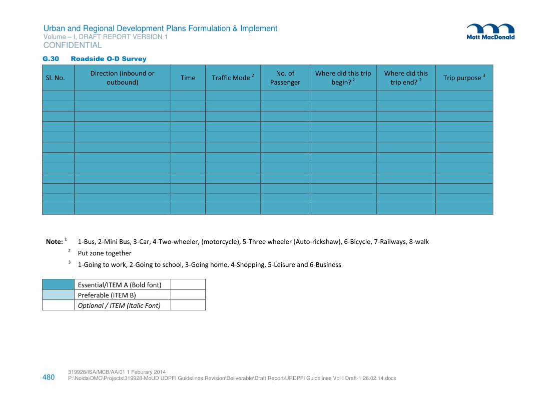
480 319928/ISA/MCB/AA/01 1 Feburary 2014 P:\Noida\DMC\Projects\319928-MoUD UDPFI Guidelines Revision\Deliverable\Draft Report\URDPFI Guidelines Vol I Draft-1 26.02.14.docx
Urban and Regional Development Plans Formulation & Implement Volume – I, DRAFT REPORT VERSION 1
CONFIDENTIAL
G.30 Roadside O-D Survey
Sl. No. Direction (inbound or
outbound) Time Traffic Mode
2
No. of
Passenger
Where did this trip
begin? 2
Where did this
trip end? 2
Trip purpose 3
Note: 1 1-Bus, 2-Mini Bus, 3-Car, 4-Two-wheeler, (motorcycle), 5-Three wheeler (Auto-rickshaw), 6-Bicycle, 7-Railways, 8-walk 2 Put zone together
3 1-Going to work, 2-Going to school, 3-Going home, 4-Shopping, 5-Leisure and 6-Business
Essential/ITEM A (Bold font)
Preferable (ITEM B)
Optional / ITEM (Italic Font)
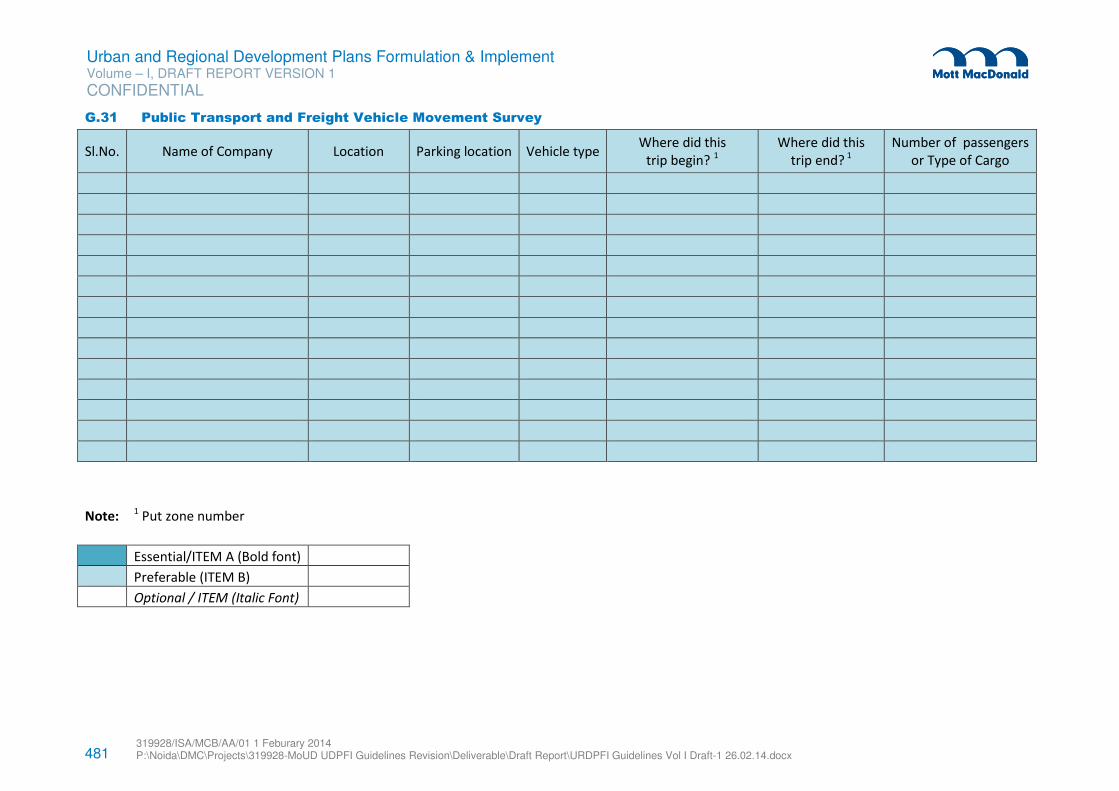
481 319928/ISA/MCB/AA/01 1 Feburary 2014 P:\Noida\DMC\Projects\319928-MoUD UDPFI Guidelines Revision\Deliverable\Draft Report\URDPFI Guidelines Vol I Draft-1 26.02.14.docx
Urban and Regional Development Plans Formulation & Implement Volume – I, DRAFT REPORT VERSION 1
CONFIDENTIAL
G.31 Public Transport and Freight Vehicle Movement Survey
Sl.No. Name of Company Location Parking location Vehicle type Where did this
trip begin? 1
Where did this
trip end? 1
Number of passengers
or Type of Cargo
Note: 1 Put zone number
Essential/ITEM A (Bold font)
Preferable (ITEM B)
Optional / ITEM (Italic Font)
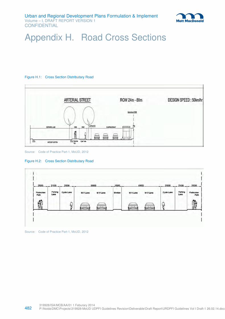
482 319928/ISA/MCB/AA/01 1 Feburary 2014 P:\Noida\DMC\Projects\319928-MoUD UDPFI Guidelines Revision\Deliverable\Draft Report\URDPFI Guidelines Vol I Draft-1 26.02.14.docx
Urban and Regional Development Plans Formulation & Implement Volume – I, DRAFT REPORT VERSION 1
CONFIDENTIAL
Figure H.1: Cross Section Distributary Road
Source: Code of Practice Part-1, MoUD, 2012
Figure H.2: Cross Section Distributary Road
Source: Code of Practice Part-1, MoUD, 2012
Appendix H. Road Cross Sections
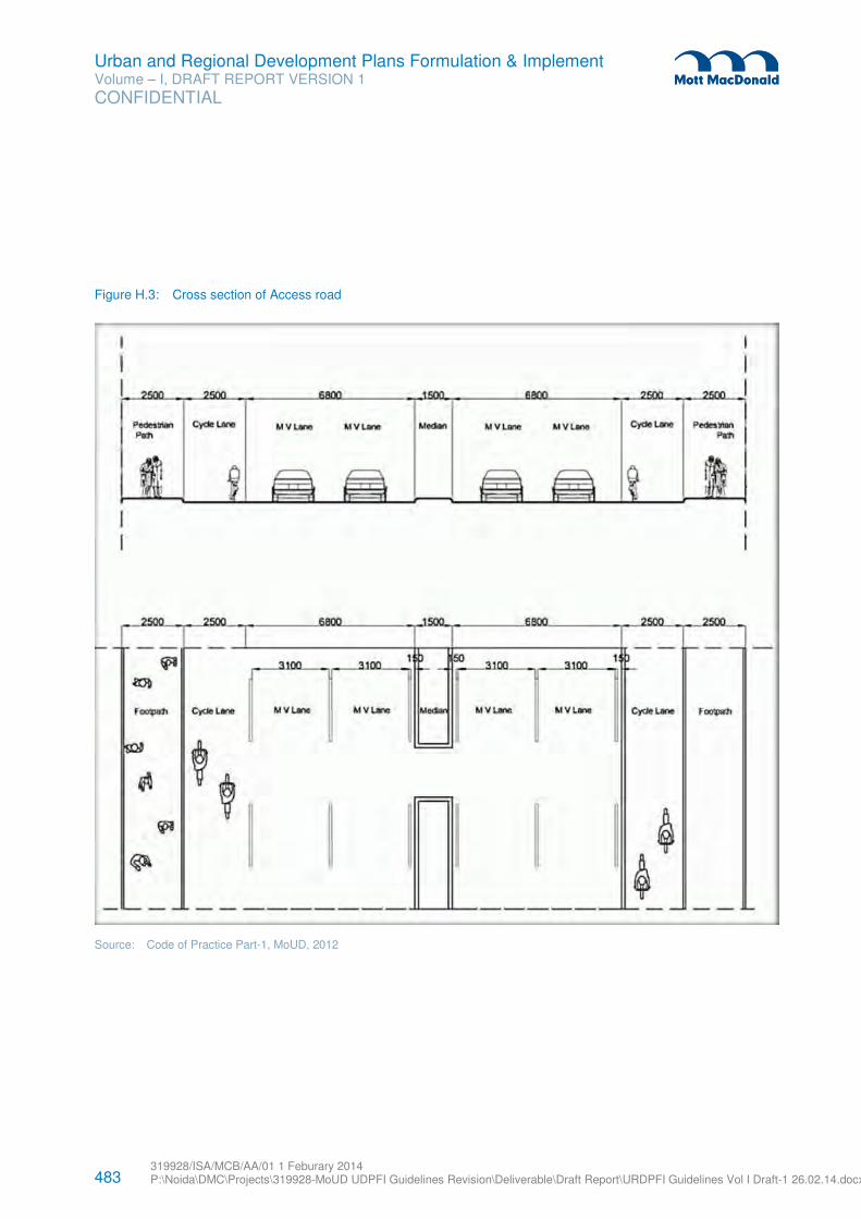
483 319928/ISA/MCB/AA/01 1 Feburary 2014 P:\Noida\DMC\Projects\319928-MoUD UDPFI Guidelines Revision\Deliverable\Draft Report\URDPFI Guidelines Vol I Draft-1 26.02.14.docx
Urban and Regional Development Plans Formulation & Implement Volume – I, DRAFT REPORT VERSION 1
CONFIDENTIAL
Figure H.3: Cross section of Access road
Source: Code of Practice Part-1, MoUD, 2012
484 319928/ISA/MCB/AA/01 1 Feburary 2014 P:\Noida\DMC\Projects\319928-MoUD UDPFI Guidelines Revision\Deliverable\Draft Report\URDPFI Guidelines Vol I Draft-1 26.02.14.docx
Urban and Regional Development Plans Formulation & Implement Volume – I, DRAFT REPORT VERSION 1
CONFIDENTIAL
ii “Area specific regulatory parameters” shall include height of buildings, quantum of built-up area, regular lines of streets and building
lines, setbacks, floor area ratios, façade controls, parking spaces, loading and unloading spaces, sizes and locations of projections and advertisement signs, and circulation pattern.
iii In 2005 the Ministry of Urban Development and Poverty Alleviation launched JNNURM with an aim to encourage reforms and fast
track planned development of cities. It focused on efficiency in urban infrastructure and service delivery mechanisms, community participation, and accountability of ULBs/ Parastatal agencies towards citizens.
The agenda of the JNNURM was to ensure improvement in urban governance and service delivery so that ULBs became financially sound and sustainable for undertaking new programmes. It was also envisaged that, with the charter of reforms that were followed by the State governments and ULBs, a stage would be set for Public Private Partnerships.
Main objectives of JNNURM were to ensure: -
(i) integrated development of infrastructure services, (ii) establishment of linkages between asset-creation and asset-management through a slew of reforms for long-term
project sustainability, (iii) adequate funds to meet the deficiencies in urban infrastructural services, (iv) planned development of identified cities including peri-urban areas, outgrowths and urban corridors leading to
dispersed urbanization, (v) scale-up delivery of civic amenities and provision of utilities with emphasis on universal access to the urban poor, (vi) special focus on urban renewal programme for the old city areas to reduce congestion, and (vii) provision of basic services to the urban poor including security of tenure at affordable prices, improved housing, water
supply and sanitation, and ensuring delivery of other existing universal services of the government for education, health and social security.
iv A charrette is an intensive planning session where citizens, designers and others collaborate on a vision for development, giving
immediate feedback to the designers. This process allows everyone who participates to be a mutual author of the plan. It is located near the project site, team of design experts and consultants sets up a full working office. Formal and informal meetings are held throughout the event and updates to the plan are presented periodically. Through brainstorming and design activity, many goals are accomplished during the charrette.
(i) Everyone who has a stake in the project develops a vested interest in the ultimate vision. (ii) The design team works together to produce a set of finished documents that address all aspects of design. (iii) Since the input of all the players is gathered at one event, it is possible to avoid the prolonged discussions that
typically delay conventional planning projects. (iv) The finished result is produced more efficiently and cost-effectively because the process is collaborative.
Charrettes are organized to encourage the participation of all. That includes everyone who is interested in the making of a development: the developer, business interests, government officials, interested residents, and activists. Ultimately, the purpose of the charrette is to give all the participants enough information to make good decisions during the planning process.
v CAR-FREE Suburb- Vauban, City of Freiburg, Germany
City of Freiburg is an eco-friendly & sustainable suburban development of 42 hectares developed using cooperative participatory
methods for achieving energy conservation, traffic reduction and social integration. The project started in 1993 and completed in
2006. Objectives of the projects were:
1. Development of a car-free project combined with specific traffic concept and special offer of alternative mobility. 2. Promotion of support of building by self –appointed co-building groups. 3. Design of special areas for passive housing and provision of a central market place and a community centre.
485 319928/ISA/MCB/AA/01 1 Feburary 2014 P:\Noida\DMC\Projects\319928-MoUD UDPFI Guidelines Revision\Deliverable\Draft Report\URDPFI Guidelines Vol I Draft-1 26.02.14.docx
Urban and Regional Development Plans Formulation & Implement Volume – I, DRAFT REPORT VERSION 1
CONFIDENTIAL
Regular meetings between the Vauban Forum and the members of the city Council were held and round tables and workshops were
organized to discuss issues pertaining to planning and development of the area with focus on innovative traffic regulation and open
green spaces.
At commencement of project 45% of resident households agreed not to own car and in lieu received financial benefits in exchange of
reducing parking demand in public car park. In 2009, 70% of the households live without car and 57% sold their cars when moved
into the development.