Embed Size (px)
Citation preview
2012-2015 Work Plan Revision 3.1
1 / 89
GEO 2012-2015 WORK PLAN
Submitted for Official Review
(please send comments to [email protected] by 28 August 2014)
17 July 2014
2012-2015 Work Plan Revision 3.1
Foreword
This document presents Revision 3.1 of the 2012-2015 Work Plan. It incorporates the technical comments received from the GEO community during the period April-June 2014 and draws from the recommendations of the 2014 Work Plan Symposium (28-30 April, Geneva). Consistent with those comments, Revision 3.1 does not propose any major change to Revision 3 circulated to the GEO community on 23 January 2014. Rather, it proposes a series of adjustments and updates that may be summarized as follows:
(i) Four Task Components are created:
a. SB-01-C5 on “Ocean Carbon and Climate” (proposed by POGO)
b. BI-01-C2 on “Essential Biodiversity Variables” (proposed by GEO BON)
c. BI-01-C3 on “Global Wetland Observing System (GWOS)” (proposed by GEO BON)
d. BI-01-C4 on “Reporting Mechanisms for Biodiversity-relevant Topics, starting with Terrestrial Ecosystems and Services, and Gene” (proposed by GEO BON)
(ii) Task Descriptions and Leads, Priority Actions, and Resources Available for Implementation are updated (see e.g. AG-01, CL-02, DI-01, WE-01; proposed by related Task Teams)
For reference, all technical comments received during the period April-June 2014 are available at ftp://earthobservations.org/TEMP/2012-2015_WorkPlan/Rev3.1_Comments/
Revision 3.1 is now submitted for Official Review until 28 August 2014. Based on this official review, Revision 3.2 of the 2012-2015 Work Plan will be prepared and submitted to the GEO-XI Plenary for approval.
2012-2015 Work Plan Revision 3.1
3 / 89
Introduction
The GEO Work Plan provides the agreed framework for implementing the GEOSS 10-Year Implementation Plan (2005-2015). It is a living document that is updated annually.
THE 2012-2015 WORK PLAN
The 2012-2015 Work Plan reflects the conclusions of the GEO Plenary (VII and VIII), Beijing Ministerial Declaration, and Mid-Term, Second, and Third Evaluations of GEOSS. It is structured to build a user-driven GEOSS and therefore engage users, especially those in developing countries.
Target-Driven Approach
The 2012-2015 Work Plan has been designed to meet the 2015 GEOSS Strategic Targets (see “Related GEOSS Strategic Targets” section under each Task). As a result, the Tasks of the Work Plan correspond to outcomes identified as being necessary to meet the Strategic Targets.
3-Part Structure
The Work Plan has been organized into three major parts: Part 1 on “Infrastructure” features the physical cross-cutting components of an operational and sustainable GEOSS, including interoperable observing, modelling and dissemination systems. Part 2 on “Institutions and Development” describes “GEO at work” and the community’s efforts to ensure that GEOSS is sustainable, relevant and widely used; it focuses on reinforcing data sharing, resource mobilization, capacity development, user engagement and science and technology integration. Part 3 on “Information for Societal Benefits” focuses on information, tools, and end-to-end systems that should be available through GEOSS to support decision-making across the nine Societal Benefit Areas.
26 Tasks
Consistent with the Target-driven approach described above, the 2012-2015 Work Plan proposes a streamlined number of Tasks. Each of the 26 Tasks is composed of, and implemented through, a limited number of Components. Each Component is supported by Leads (GEO Members and Organizations), a Point of Contact (representing one of the Leads) and contributors (additional Members and Organizations).
All information pertaining to a Component is compiled into a document referred to as the Component Sheet. The latter follows the logic model recommended by the Monitoring and Evaluation Working Group (outputs – activities – resources) and identify implementation details such as expected achievements by 2015, milestones, issues and gaps, key users, and information relevant to decision making.
Component Sheets are updated at least twice a year. They serve as a basis for monitoring GEOSS implementation as well as for reporting on Work Plan implementation progress. Their most recent versions are available online through the Work Plan Information Management System, see www.earthobservations.org/geoss_imp.shtml.
2012-2015 Work Plan Revision 3.1
4 / 89
Why Participate ?
The GEO Work Plan provides a flexible action-oriented framework for developing new projects within and across areas, and coordinating strategies and investments. Benefits and opportunities include inter-alia: fostering networking and partnerships (new contacts and collaborations); launching regional and/or global initiatives (e.g. GEOBON, GEOGLAM); providing access to data (making more data available); enlarging user-bases (users grow in numbers and diversity); developing and maintaining capacity (participants build on complementarity); increasing visibility and high-level support (e.g. through the GEO Website, Newsletter, Plenary, Ministerial); and leveraging funding for activities (funding mechanisms value contributions to GEOSS implementation, like the European 7th Framework Programme).
Getting Engaged
Getting engaged starts with an informal “signing in” procedure through which representatives of GEO Members or Participating Organizations volunteer to lead, or contribute to, a Task Component (see related 26th Executive Committee document for details on roles and responsibilities). This is typically done through an email addressed to the GEO Secretariat at [email protected], and welcome at any point of time. Leads and contributors to the Work Plan assume their roles on a best-effort basis, voluntarily, in the spirit of advancing GEOSS consistent with the GEOSS 10-Year Implementation Plan. Their effective and proactive engagement is critical to ensuring the success of the Work Plan in establishing GEOSS.
Update
Every year, the GEO Secretariat prepares an update of the 2012-2015 Work Plan based on consultations with GEO Members and Participating Organizations and recommendations from the three Implementation Boards. These recommendations derive from the actual work of the Implementation Boards to (i) assess Strategic Target completion progress; (ii) actively coordinate activities across Tasks; and (iii) advise on Task issues of technical and non-technical nature. The update process allows for adjustments and introduction of new activities. The Work Plan update is submitted to the GEO Plenary for acceptance as a living document.
2012-2015 Work Plan Revision 3.1
5 / 89
TABLE OF CONTENTS
1 INFRASTRUCTURE 7 IN-01 Earth Observing Systems .................................................................................................. 7 IN-02 Earth Data Sets ............................................................................................................... 10 IN-03 GEOSS Common Infrastructure ...................................................................................... 13 IN-04 GEOSS Communication Networks .................................................................................. 15 IN-05 GEOSS Design and Interoperability ............................................................................... 17
2 INSTITUTIONS AND DEVELOPMENT 19 ID-01 Advancing GEOSS Data Sharing Principles .................................................................. 19 ID-02 Developing Institutional and Individual Capacity .......................................................... 21 ID-03 Science and Technology in GEOSS ................................................................................. 24 ID-04 Building a User-Driven GEOSS ...................................................................................... 25 ID-05 Catalyzing Resources for GEOSS Implementation ......................................................... 27
3 INFORMATION FOR SOCIETAL BENEFITS 29 SB-01 Oceans and Society: Blue Planet .................................................................................... 29 SB-02 Global Land Cover .......................................................................................................... 34 SB-03 Global Forest Observation ............................................................................................. 38 SB-04 Global Urban Observation and Information .................................................................. 40 SB-05 Impact Assessment of Human Activities .......................................................................... 42
AGRICULTURE 44 AG-01 Global Agricultural Monitoring and Early Warning ...................................................... 44
BIODIVERSITY 47 BI-01 Global Biodiversity Observation (GEO BON) ................................................................ 47
CLIMATE 50 CL-01 Climate Information for Adaptation ................................................................................ 50 CL-02 Global Carbon Observation and Analysis ...................................................................... 53
DISASTERS 56 DI-01 Informing Risk Management and Disaster Reduction .................................................... 56
ECOSYSTEMS 61 EC-01 Global Ecosystem Monitoring ........................................................................................ 61
ENERGY 64 EN-01 Energy and Geo-Resources Management ....................................................................... 64
HEALTH 66 HE-01 Tools and Information for Health Decision-Making ....................................................... 66 HE-02 Tracking Pollutants ......................................................................................................... 69
WATER 71 WA-01 Integrated Water Information (incl. Floods and Droughts) ........................................... 71
WEATHER 76 WE-01 High-Impact Weather Prediction and Information ......................................................... 76
APPENDIX A: GEO COMMUNITIES OF PRACTICE 78
APPENDIX B: ACRONYMS 82
2012-2015 Work Plan Revision 3.1
6 / 89
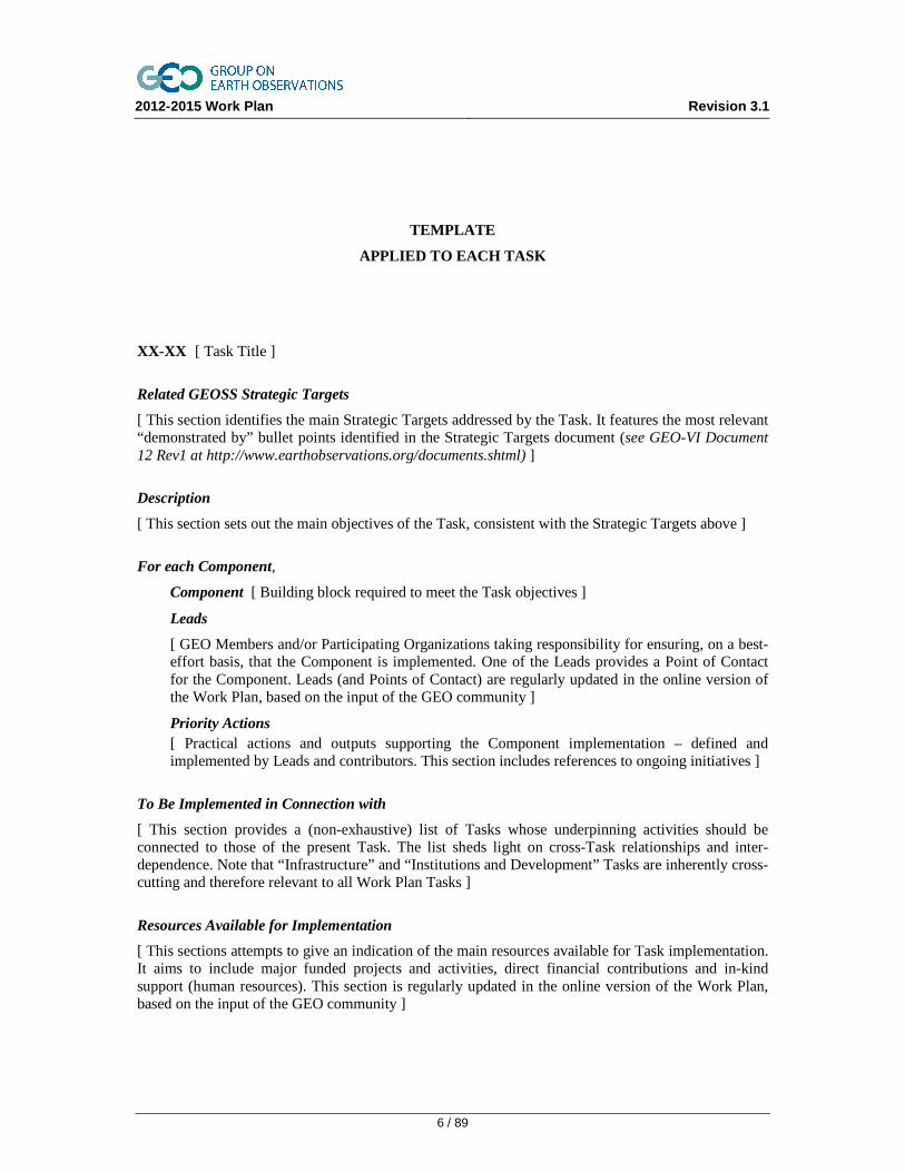
TEMPLATE
APPLIED TO EACH TASK
XX-XX [ Task Title ]
Related GEOSS Strategic Targets
[ This section identifies the main Strategic Targets addressed by the Task. It features the most relevant “demonstrated by” bullet points identified in the Strategic Targets document (see GEO-VI Document 12 Rev1 at http://www.earthobservations.org/documents.shtml) ]
Description
[ This section sets out the main objectives of the Task, consistent with the Strategic Targets above ]
For each Component,
Component [ Building block required to meet the Task objectives ]
Leads
[ GEO Members and/or Participating Organizations taking responsibility for ensuring, on a best-effort basis, that the Component is implemented. One of the Leads provides a Point of Contact for the Component. Leads (and Points of Contact) are regularly updated in the online version of the Work Plan, based on the input of the GEO community ]
Priority Actions [ Practical actions and outputs supporting the Component implementation – defined and implemented by Leads and contributors. This section includes references to ongoing initiatives ]
To Be Implemented in Connection with
[ This section provides a (non-exhaustive) list of Tasks whose underpinning activities should be connected to those of the present Task. The list sheds light on cross-Task relationships and inter-dependence. Note that “Infrastructure” and “Institutions and Development” Tasks are inherently cross-cutting and therefore relevant to all Work Plan Tasks ]
Resources Available for Implementation
[ This sections attempts to give an indication of the main resources available for Task implementation. It aims to include major funded projects and activities, direct financial contributions and in-kind support (human resources). This section is regularly updated in the online version of the Work Plan, based on the input of the GEO community ]
2012-2015 Work Plan Revision 3.1
7 / 89
1 INFRASTRUCTURE
IN-01 Earth Observing Systems
Related GEOSS Strategic Targets (from GEO-VI Document 12 Rev1)
Architecture: Coordinated planning and sustained operation of national, regional and global observing and information systems within an interoperability framework. Continual improvement in observations and information available to users through the transition of research outcomes and systems into operational use, and through an optimal mix of space-based, airborne and in-situ observing platforms. Increased efficiency in the operation of observational systems through convergence among global, regional and national facilities.
Weather: Identification and addressing of critical gaps in observational networks that reflect, in particular, the needs of developing countries, the need for continuity in space-based and in-situ observations, and the potential benefits of an interactive observing system to support user needs.
Water: An operationalized and sustained global network of in-situ observation sites.
Description
Promote and coordinate surface-based and space-based observing systems to provide long-term continuous observations of all components of the Earth System (atmosphere, ocean, terrestrial, ice, solid earth). Ensure that the Earth and its processes, resources and services are monitored globally across spatial and temporal scales. Identify critical gaps in existing observational networks with particular focus on: the needs of developing countries, the need for continuity of observations, the need for increased development of in-situ networks, and the potential benefits of enhanced observing systems. Individual Earth observing systems operated by national, regional and international entities are integral to GEOSS.
Components
C1 Development, Maintenance and Coordination of Surface-based Observing Networks (in-situ and airborne)
Leads
Germany (BFG, DWD), USA (NOAA), and EEA ([email protected])
Priority Actions
• Cooperate with in-situ operators to promote and coordinate development activities related to in-situ observation infrastructures and networks; build upon ongoing coordination efforts and activities
• Address the in-situ needs expressed by GEO Tasks, including development of regional/global networks; collection, analysis and archiving of measurements; and identification of observation gaps
• Explore and determine how in-situ coordination frameworks put in place for Copernicus can interface and/or be extended to benefit most effectively to the GEOSS Strategic Targets
• Improve global coordination on the operation of instrumented aircrafts and hyperspectral imaging sensors for in-situ data collection
• Promote the use of tools and services freely available via the Eye-on-Earth platform to facilitate access to in-situ data
2012-2015 Work Plan Revision 3.1
8 / 89
• Promote rapid development of a global high-frequency-radar network to measure coastal surface currents (see also SB-01)
• Explore how citizen science observation initiatives can contribute to filling in-situ gaps (see also IN-04)
C2 Development and Coordination of Space-based Observing Systems
Leads
China (CRESDA), Japan (JAXA), Spain (CSIC) and CEOS (NASA, [email protected])
Priority Actions
• Promote rapid development of the “CEOS Constellations Concept”. Observations from Virtual Constellations provide higher temporal, spatial, and spectral resolution, as well as improved data management and dissemination. Virtual Constellations are under development in seven areas: Precipitation, Atmospheric Composition, Land Surface Imaging, Ocean Surface Topography, Ocean Colour Radiometry, Ocean Surface Vector Wind, and Sea-Surface Temperature
• Establish and upgrade the capacity of ground stations with a footprint in Africa to receive, process, store and distribute CBERS (China-Brazil Earth Resources Satellite) imagery. Data will be distributed free of charge to all interested African countries within the footprint of the respective ground stations
• Establish actions securing the provision of Essential Climate Variables (ECVs) data from satellite systems (see also SB-02, CL-01)
• Promote space missions to fill or minimize gaps arising from the loss and limited lifetime of key instruments (e.g. on ESA Envisat, NASA AURA)
C3 Promotion and Coordination across Surface-based and Space-based Observing Systems
Leads
Spain (CSIC) and CEOS (NASA, [email protected])
Priority Actions
• Promote stable, reliable and long-term operations of Earth observing networks within the framework of national policies and international obligations. Demonstrate that global observing systems do not only serve research but also underpin products and services across all Societal Benefit Areas
• Engage with the Sustaining Arctic Observing Networks (SAON) to (i) improve networking among existing observing systems and sites; (ii) create pan-Arctic observing networks; and (iii) ensure interoperability of Arctic networks with other GEO networks. Develop effective linkages between Communities of Practice and SAON initial work (e.g. on metadata standards and practices, data integration and visualization, community-based monitoring) in areas such as Arctic Ocean structure, permafrost and sea ice, hazardous substances, and biodiversity (see also WA-01)
• Engage with Conservation of Arctic Flora and Fauna (CAFF) and its cornerstone programme the Circumpolar Biodiversity Monitoring Program (CBMP). Develop effective linkages (e.g. on monitoring approach, metadata standards and practices, data integration and visualization, community-based monitoring)
• Develop intergovernmental mechanisms for coordinating terrestrial observations needed for climate studies and forecasting (GTOS; see also CL-01)
2012-2015 Work Plan Revision 3.1
9 / 89
• Achieve a complete and stable Global Observing System (GOS)
• Enhance the coordination of coastal/open-ocean observations and modelling initiatives in support of a global ocean observation system (GOOS; see SB-01)
• Promote geodetic reference frames and the monitoring of global change signals (e.g. in gravity field or Earth rotation). The “International Terrestrial Reference Frame” and “International Celestial Reference Frame” provide foundations for most Earth observations (GGOS)
• Document user requirements and the Earth observing systems ability to produce an agreed core set of environmental, geological, and socio-economic variables relevant to users
C4 Radio-Frequency Protection
Leads
WMO (WIS, [email protected])
Priority Actions
• Advocate protection for all parts of the radio frequency spectrum needed to measure, collect and disseminate Earth observation data. Monitor, with highest care, the case of passive bands, assessing the potential impact of interference on Earth observation applications and final products
• Encourage GEO Members to liaise with national representatives in radio-communication fora – to ensure sustained political support for radio-frequency protection
• Undertake coordinated activities with representatives from the International Telecommunication Union (ITU). Link with the Scientific Committee on Frequency Allocations for Radio Astronomy and Space Science (IUCAF)
To Be Implemented in Connection with
All Work Plan Tasks
Resources Available for Implementation
− EU FP7 project GMES/Copernicus In-situ Coordination (GISC) − Funding is sought for a follow-on project from 2013, which may provide resources to extend the
approach to global in situ data in support of the GEOSS Strategic Targets − In-kind support from EEA, WMO − Global Precipitation Climatology Centre (GPCC) web portal (http://gpcc.dwd.de) − Coordination of space-based observing systems by CEOS
2012-2015 Work Plan Revision 3.1
10 / 89
IN-02 Earth Data Sets
Related GEOSS Strategic Targets (from GEO-VI Document 12 Rev1)
Architecture: Supportive of the whole Architecture target.
Data Management: Increased use of observations through advances in all aspects of life-cycle data management, integration, and data recovery and conversion. Removal of important data management deficiencies. Enhanced information extraction from historical, current and future source data.
Science and Technology: Increased accessibility of global sets of scientific data necessary for improved Earth System modelling in the different GEOSS Societal Benefit Areas.
Description
Foster advances in life-cycle data management, including processing, inter-calibration and validation, quality assurance, harmonization, archiving, integration, assimilation, modelling, long-term preservation, digitization, and visualization. Work to link regional systems and national data infrastructures into global systems to create new information sources within GEOSS. Promote the application of GEOSS interoperability principles to Earth data sets so that data are easily accessible and readily integrated to meet users’ needs. Support the development and harmonization of global data, metadata, and products commonly required across Societal Benefit Areas.
Components
C1 Advances in Life-cycle Data Management
Leads
China (BNU), Japan (University of Tokyo), Spain (CSIC), United States (DOE), CEOS ( CNES, [email protected]) and ESA
Priority Actions
• Improve and coordinate data management approaches that encompass a broad perspective of the observation data life-cycle – from processing to modelling and visualization. Identify and implement recommendations for best practices
• Develop a GEO strategy for data quality assurance, building upon ongoing initiatives such as the CEOS Quality Assurance for Earth Observation (QA4EO). Start with space-based observations and gradually expand into in-situ observations. Support related calibration and validation (cal/val) activities
• Develop a GEO strategy for the long-term preservation of Earth observation data, building upon existing long-term data preservation guidelines. Support campaigns for the digitization of observation databases. Promote the use of free software for observation database management
• Ensure the availability of accurate, homogeneous, long-term, stable, global geodetic reference frames as a mandatory framework and the metrological basis for Earth observation. Build upon the Earth System Spatial Grid (ESSG) as a new Earth system three-dimension grid and spatial framework for Earth data sets. Make synergies with the UN Global Geospatial Information Management initiative (GGIM)
• Build upon the (i) Data Integration and Analysis System (DIAS) to assess and document Earth datasets in cooperation with operational- and research- data centers; and (ii) European environment information and observation network (Eionet) to coordinate the delivery of timely, nationally validated, high-quality environmental data from individual countries
2012-2015 Work Plan Revision 3.1
11 / 89
C2 Development of Regional/Global Information and Cross-cutting Datasets (including socio-economic information)
Leads
Japan (AIST, ISCGM, GSI, JAXA), Spain (CSIC, IGN), United Kingdom (UCL) and United States (JPL, [email protected]) and EEA
Priority Actions
• Provide a suite of global datasets based on improved and validated data sources. Facilitate interoperability among data sets using the GEOSS architecture
• Produce a global, coordinated and integrated Digital Elevation Model (DEM), facilitating interoperability among existing Digital Elevation Model data sets. Upgrade and validate the pan-European Copernicus reference datasets EU-DEM and EU-HYDRO in order to ensure appropriate linkage mechanisms with national/regional reference datasets
• Improve Global Map and foster its use across Societal Benefit Areas. Work closely with the UN-GGIM Global Map for Sustainable Development (GM4SD) Working Group. Global Map datasets provide a full and consistent coverage of land on the Earth – at 1 km resolution or higher
• Develop a global digital geological map of the world. Make existing geological map data web-accessible. Use OneGeology to transfer know-how to the developing world. Develop a 3D geo-information infrastructure to enhance the effectiveness of in-situ geo-scientific datasets
• Support the development of a global soil information system incorporating data from global, regional and national soil data projects
• Develop a global road and human settlements map on GEO Grid. Collect, maintain, and evaluate relevant remote sensing and Geographic Information Systems data. Develop systems on GEO Grid towards sharing, developing and distributing data (see also SB-04)
To Be Implemented in Connection with
IN-01 Earth Observing Systems IN-03 GEOSS Common Infrastructure IN-04 GEOSS Communication Networks ID-01 Advancing GEOSS Data Sharing Principles ID-04 Building a User-Driven GEOSS SB-02 Global Land Cover SB-04 Global Urban Observation and Information WA-01 Integrated Water Information AG-01 Global Agricultural Monitoring
Resources Available for Implementation
− Japan (AIST) support for GEO Grid system development − OneGeology project (www.onegeology.org); OneGeology-Europe products (e.g. pan European
dynamic digital geological map at 1:1000000 scale); Databases from the Commission of the Geological Map of the World (CGMW)
− e-SOTER project (www.esoter.org) and GlobalSoilMap.net − European FP7 projects EGDI-Scope (www.egdi-scope.eu) to prepare for the European Geological
Data Infrastructure (EGDI); and MELODIES (Maximizing the Exploitation of Linked Open Data In Enterprise and Science; 2013-2016; http://www.melodiesproject.eu/)
− European environment information and observation network (Eionet; www.eionet.europa.eu/) − European activities related to the INSPIRE Directive and ESA Long Term Data Preservation
2012-2015 Work Plan Revision 3.1
12 / 89
− European projects COOPEUS (Connecting_Research Infrastructures; coopeus.eu/fields-of-research/ocean-observatories/); and SDI4Apps (http://sdi4apps.eu/)
− Chinese activities from National Science Funds of China (NSFC), Beijing Normal University China, University of Mining and Technology
− IOC-IHO General Bathymetric Chart of the Ocean (GEBCO) programme (www.gebco.net) − In kind support from CEOS Working Groups (e.g. DSIG, QA4EO)
2012-2015 Work Plan Revision 3.1
13 / 89
IN-03 GEOSS Common Infrastructure
Related GEOSS Strategic Targets (from GEO-VI Document 12 Rev1)
Architecture: Deployment, population, and enablement of sustained operations and maintenance of a user-friendly and user-accessible GEOSS Common Infrastructure, including the core components and functions that link the various resources of GEOSS. The GEOSS Common Infrastructure will consist of web-based portals, clearinghouses for searching data, information and services, registries and other capabilities supporting access to GEOSS components, standards, and best practices.
Data Management: Open, reliable, timely, consistent, and free access to a core set of essential environmental observations and information products, supported by adequate metadata, by users across all GEOSS Societal Benefit Areas in accordance with GEOSS Data Sharing Principles.
Description
Facilitate and support the sustained operation, maintenance and enhancement of a user-friendly GEOSS Common Infrastructure (GCI) – allowing users to search and access GEOSS resources (e.g. datasets and services). While ensuring routine operations, aim at improving and maintaining the GCI as the architectural framework essential to implementing the GEOSS Data Sharing Principles. Support the integration of new GCI capabilities and provide the resources needed for the discovery of, and access to, a core set of data and information across all Societal Benefit Areas. Continuously engage with GCI core service operators, data and service providers, and user communities.
Components
C1 Evolution and Enhancement of the GEOSS Common Infrastructure (GCI)
Leads
European Commission (FP7), Japan (University of Tokyo), Spain (CSIC, IGN), United States (USGS) and ESA ([email protected])
Priority Actions
• Define and maintain an Architecture Evolution Strategy for the GEOSS Common Infrastructure (GCI) based on periodic gap analyses. This includes defining a GCI requirements baseline, specifying interfaces between GCI components and external components, and identifying enhancements building upon new technologies and R&D
• Enhance GCI components on the basis of (i) the GCI Architecture Evolution Strategy (see IN-05) and (ii) coordinated input from multiple sources (e.g. online feedback, data sharing community, users and providers of GEOSS information, usability testing). Proceed with enhancements having assessed feasibility and need, urgency, and resources needed for implementation
• Regularly perform usability testing to ensure access by users of all levels of technical ability. Organize demonstrations of the GCI capabilities on the occasion of major events (e.g. GEO Plenary) – to collect feedback from users and suggestions for enhancements
• Support the integration of new GCI capabilities such as the GEOSS Data Collection of Open Resources for Everyone (GEOSS Data-CORE; see ID-01). Identify resources needed for the discovery of, and access to, the Data-CORE. Call to the GEO community to (i) identify operational products/data catalogs and repositories; and (ii) support the seamless search of, and access to, these data catalogs and repositories
2012-2015 Work Plan Revision 3.1
14 / 89
C2 Operations and Maintenance of GCI Components
Leads
United States (USGS, [email protected]) and ESA
Priority Actions
• Manage routine operations through (i) proper monitoring, maintenance and administration of GCI software and hardware platforms; (ii) ad-hoc problem solving; and (iii) implementation and administration of a database gathering information on GCI problems and possible enhancements
• Maintain the GCI as the architectural framework essential to implementing the Data Sharing Principles. Keep procedures for registering and maintaining metadata simple, or partially automated. Enable users to easily discover GEOSS resources and to search for data or services that (i) fit a particular application or Societal Benefit Area(s); and/or (ii) comply with full and open exchange. Users should also be able to easily understand usage requirements and restrictions indicated by data providers
To Be Implemented in Connection with
All Work Plan Tasks
Resources Available for Implementation
− GEO Web Portal (ESA), GEOSS Clearinghouse (USGS/GMU), GEOSS Component and Service Registry (USGS/GMU), GEO Best Practices Wiki (IEEE), GEOSS Standards and Interoperability Registry (IEEE), GEOSS User Requirements Registry (IEEE), GEOSS Discovery and Access Broker (Italy CNR), and related Vocabulary Services (EC JRC)
− Contracts (through 2015) of GEOSS Common Infrastructure component providers for operations and maintenance
− European FP7 projects: GEOWOW (through 2014), the GEOSS Interoperability for Weather, Ocean and Water project aimed at improving the GCI, supporting the Data-CORE and implementation of a distributed architectural model, federating data holdings, in addition to objectives specific to the three supported societal benefit areas
− European FP7 project MELODIES (Maximizing the Exploitation of Linked Open Data In Enterprise and Science; 2013-2016; http://www.melodiesproject.eu/); and SenSyf (Sentinels Synergy Framework; 2012-2015; www.sensyf.eu)
− European activities related to the INSPIRE Directive − Pledges for operations and maintenance of each GCI Component are required through 2015. This
is a commitment to abide by the Consolidated Requirements, where available, and maintain an uptime availability of 99%
2012-2015 Work Plan Revision 3.1
15 / 89
IN-04 GEOSS Communication Networks
Related GEOSS Strategic Targets (from GEO-VI Document 12 Rev1)
Architecture: Supportive of the whole Architecture target.
Data Management: Open, reliable, timely, consistent, and free access to a core set of essential environmental observations and information products, supported by adequate metadata, by users across all GEOSS Societal Benefit Areas in accordance with GEOSS Data Sharing Principles.
Capacity Building: Increased use of Earth observation in policy and decision making. Enhanced participation of developing countries in GEO and GEOSS.
User Engagement: Involvement of users in: reviewing and assessing requirements for Earth observation data, products and services; creating appropriate mechanisms for coordinating user requirements; utilizing data/information delivery systems; and capturing user feedback on an ongoing basis across Societal Benefit Areas. Increased use of geo-spatial data in all Societal Benefit Areas and in particular in developing countries.
Description
Enhance timely and reliable access to, and delivery of, Earth observation and information from all Societal Benefit Areas. In particular, address access issues in developing countries. Consider the collection of satellite and in-situ data, the transfer of data and products between relevant agencies, and the dissemination of data and products to users. Make use of relevant technology including the Internet, wireless communication (fixed and mobile) networks (e.g. satellite, cellular, WiFi, WIMAX), broadband land connections, and satellite-based direct-broadcast systems independent from ground-based telecommunications infrastructures.
Components
C1 Utilization of Communication Networks
Leads
EC (FP7) and IEEE ([email protected])
Priority Actions
• Expand GEOSS worldwide network capability to gather Earth observation data from sensors and instruments via mobile and fixed devices, and to disseminate data and information utilizing interconnected networks based on satellite, fixed land-based and mobile/wireless communication. Provide capabilities such as user access and data exchange and dissemination services in response to users’ and providers’ needs
• Establish network access to a wide range of existing and newly developed sensors and instruments using automated sensor discovery, data handling and processing, metadata annotation and support for calibration
• Explore integration of sensor web, model web, cloud computing and “big data analytics” technologies, with an emphasis on predictive analytics
• Establish a demonstrator that will include data collection and access in under-served regions (e.g. through mobile phone networks, Internet of Things technology, WiFi, mesh networks, satellite networks, etc.)
• Build upon and integrate existing systems (e.g. the WMO Information System (WIS)) and ensure operational exchange of data, information and warnings in areas such as Weather, Water, Climate and Disasters
2012-2015 Work Plan Revision 3.1
16 / 89
C2 GEONETCast
Leads
China (CMA), United States (NOAA, [email protected]) and EUMETSAT
Priority Actions
• Further develop GEONETCast – a distribution system for GEOSS information using communication satellites and low cost, off-the-shelf reception stations. Evolve GEONETCast into a fully operational global system disseminating data and products across all Societal Benefit Areas
• Enhance interoperability with GEOSS components. Pursue the integration of the GEONETCast collections catalogue with the GEOSS Common Infrastructure
• Foster relationships with data providers and users to enhance data content in line with the evolving needs of users and decision-makers
• Expand interaction with networks of users in developing countries to improve access to data in areas with limited data accessibility. In particular, facilitate improved access to disaster information in developing countries through collaboration with key disaster management mechanisms, including the International Charter on Space and Major Disasters (see also DI-01)
• Enhance the integration of the satellite data distribution system ‘Meteoinform-Mitra’. Expand the GEONETCast broadcast footprint over the Pacific region. Pacific Island states have noted the low availability of environmental information in the region – mainly due to poor internet access and communications infrastructure
• Build capacity for using GEONETcast information, particularly in developing countries. Develop GEONETCast Training Channels to (i) train end-users; and (ii) transmit training materials to local trainers
To Be Implemented in Connection with
All Work Plan Tasks
Resources Available for Implementation
− The operation and maintenance of the three GEONETCast component systems are fully funded by the main operating entities (China (CMA); USA (NOAA); EUMETSAT)
− Expansion of the GEONETCast user receive station networks and trainings are mainly funded by the main system operating entities, EC funded projects and through existing and new partnerships with multilateral organizations. New funding will be required to address the need in the Pacific Islands region
− European FP7 “Citizens Observatories” Projects (CITI-SENSE, WeSenseIt, COBWEB, CITCLOPS, OMNISCIENTIS)
2012-2015 Work Plan Revision 3.1
17 / 89
IN-05 GEOSS Design and Interoperability
Related GEOSS Strategic Targets (from GEO-VI Document 12 Rev1) Architecture: Deployment, population, and enablement of sustained operations and maintenance of a user-friendly and user-accessible GEOSS Common Infrastructure (GCI), including the core components and functions that link the various resources of GEOSS.
Description Manage the evolutionary technical architecture (design) of GEOSS and contributed Earth observation data and service resources. Promote GEOSS interoperability principles. Enable a sustainable GEOSS of value to the user – supporting the development of the GEOSS Common Infrastructure (GCI) and GEOSS communication networks for the access to, and use of, Earth observations and related services.
Components
C1 GEOSS Design and Interoperability
Leads
China (CMA), European Commission (JRC), Japan (University of Tokyo), Spain (IGN), United States (NOAA), CEOS (NASA), ESA, IEEE ([email protected]) and OGC
Priority Actions
• Technical Design of GEOSS and Contributed Resources: Develop a GEOSS technical architecture document that describes the components of GEOSS, including registries, interoperability arrangements, information types, predictive models and dynamic modeling infrastructures (model webs), sensor webs, software/applications, and data, system interfaces, and services
• GEOSS Interoperability Analysis and Support: Quantitatively analyze the standards listed in the Standards and Interoperability Registry. Write software to produce this analysis automatically, and regularly update the listing. Define the most-used standards in each category as "preferred". Actively promote adoption of Preferred Standards in GEOSS Societal Benefit Areas by (i) publicizing the Preferred Standards; (ii) identifying available software that implements the standards; (iii) helping Task Leads understand which non-standard approaches could be supplemented or replaced by equivalent Preferred Standards. Build upon the European INSPIRE experience, as appropriate
• Facilitate development of machine access to datasets. Promote the availability of services that support direct machine access, for example through web services or OpenDAP. Currently access is typically via ftp download. The GEOSS Global Datasets (IN-02), which can be very large, are not available via machine-based services, but this limitation applies widely elsewhere as well. The Data Management Principles that are now under development are very relevant here
• GEOSS Research and Prototyping: Execute and document Architecture Implementation Pilots (AIPs) and related research activities. Recommend improvements to the GEOSS architecture on the basis of AIPs’ outcomes
• Value to the User: Conduct periodic GCI “usability” tests of the GEOSS Portal by users. Establish appropriate links with the User Requirements Registry.
To Be Implemented in Connection with
IN-03 GEOSS Common Infrastructure
All Work Plan Tasks
2012-2015 Work Plan Revision 3.1
18 / 89
Resources Available for Implementation
In-kind contributions from the Task Team
2012-2015 Work Plan Revision 3.1
19 / 89
2 INSTITUTIONS AND DEVELOPMENT
ID-01 Advancing GEOSS Data Sharing Principles
Related GEOSS Strategic Targets (from GEO-VI Document 12 Rev1)
Data Management: Open, reliable, timely, consistent, and free access to a core set of essential environmental observations and information products, supported by adequate metadata, by users across all GEOSS Societal Benefit Areas in accordance with GEOSS Data Sharing Principles: (i) Full and open exchange of data, metadata and products shared within GEOSS, recognizing relevant international instruments and national policies and legislation; (ii) All shared data, metadata and products being made available with minimum time delay and at minimum cost; and (iii) All shared data, metadata and products being provided free of charge or no more than the cost of reproduction will be encouraged for research and education.
Description
Support and advance the Declaration of the Group on Earth Observations Ministerial Summit in Beijing, China (5 November 2010), which committed to: (i) Maximize the number of documented datasets made available on the basis of full and open access; (ii) Create the GEOSS Data Collection of Open Resources for Everyone (GEOSS Data CORE), a distributed pool of documented datasets with full, open and unrestricted access at no more than the cost of reproduction and distribution; and (iii) Develop flexible national and international policy frameworks to ensure that a more open data environment is implemented.
Components
C1 Advancing GEOSS Data Sharing Principles
Leads
European Commission (EC FP7), Japan (JAXA), Netherlands (ITC), Spain (CSIC, IGN), South Africa (DST), United States (USGS), COSPAR, and ICSU (CODATA, [email protected])
Priority Actions
• Develop continuously the GEOSS Data-CORE: Maximize the number of datasets made available on the basis of full and open access. Data providers should register their observation and information resources through the GEOSS Common Infrastructure (GCI) directly or via community catalogues. Detailed metadata should also be registered, with no costs or restrictions attached to its use, to facilitate data and service discovery, assessment, and integration for decision support
• Monitor the use and impact of resources made available with full and open access: Develop metrics to assess the impact and progress of data sharing and, where possible, implement such metrics into the GCI. Metrics should include clear performance indicators and milestones towards progress. Users who benefit from full and open access would be asked to document the use and impact of the data, metadata and products received
• Establish national coordinating mechanisms to promote and monitor engagement with the implementation of the GEOSS Data Sharing Principles: Establish a process within countries to identify and reduce institutional, legal and technical barriers to full and open exchange of data, metadata and products. Encourage governmental data providers to make their datasets available on the basis of full and open exchange. Governments should also seek to implement and promote the
2012-2015 Work Plan Revision 3.1
20 / 89
Implementation Guidelines as best practices at the national and institutional levels. This process should enable feedback to be provided to the GEO
• Maintain the GEOSS Common Infrastructure as the architectural framework essential to implementing the Data Sharing Principles (see IN-03)
To Be Implemented in Connection with
All Work Plan Tasks
[Note that Infrastructure Tasks (IN-xx) cover the technical aspects of data sharing, for example, the implementation of a search and discovery capability for the GEOSS Data-CORE]
Resources Available for Implementation
− Volunteered time and resources provided by Working Group members, including in-kind contributions from GEO Members and Participating Organizations represented on the Data Sharing Working Group
− Activities related to the European Copernicus Delegated Act on data policy and the INSPIRE Directive
2012-2015 Work Plan Revision 3.1
21 / 89
ID-02 Developing Institutional and Individual Capacity
Related GEOSS Strategic Targets (from GEO-VI Document 12 Rev1)
Capacity Building: Networking activities that specifically build individual, institutional and infrastructure capacity. Increased use of Earth observation in policy and decision making. Enhanced participation of developing countries in GEO and GEOSS.
User Engagement: Involvement of users in: reviewing and assessing requirements for Earth observation data, products and services; creating appropriate mechanisms for coordinating user requirements; utilizing data/information delivery systems; and capturing user feedback on an ongoing basis across Societal Benefit Areas. Increased use of geo-spatial data in all Societal Benefit Areas and in particular in developing countries.
Description
Enhance coordination of national and international capacity-building efforts to produce and use Earth observation and information. Increase the demand for day-to-day Earth observation and information across Societal Benefit Areas. Build national capacity in developing countries by enabling human, technical and institutional capacity for coordinating, accessing, using and sharing environmental data, information and services. Develop cross-border education and training across Societal Benefit Areas showing the short- and long-term benefits of Earth observation. Develop synergies, encourage cross-fertilization and address common challenges across capacity building initiatives.
Components
C1 Institutional and Individual Development
Leads
Brazil (INPE, [email protected]), China (CRESDA), EC (EC FP7), Morocco (DMN), Switzerland (Geneva University), United States (NASA, USAID), and CEOS (USGS)
Priority Actions
• Establish regional capacity-building networks: Organize and reinforce international networks (incl. training opportunity networks) for the use and provision of Earth observations. Improve coordination of these networks through the GEOSS Portal and GEONETCast. Capacity building networks include key institutions in data provision (e.g. space agencies) and academic higher-education institutions. Training opportunity networks rely on virtual and e-learning knowledge transfer
• Coordinate capacity building training activities across Societal Benefit Areas. Organize summer schools or training workshops within and/or across Societal Benefit Areas (and related areas). Build upon ongoing regional and global activities (e.g. WMO/CGMS Virtual Laboratory on Education in Satellite Meteorology VLab)
• Create conditions for expanding GEO capacity building activities and improving their effectiveness across Societal Benefit Areas: Build upon ongoing projects such as EOPOWER (Earth Observation for Economic Empowerment), the GEO capacity building initiative in Central Asia (SEOCA), OBSERVE, BalkanGEOnet, AFROMAISON, IASON, Bringing GEOSS into Practice; and existing networks such as AFRIMET, the Latin American Network of Climate Change Offices (RIOCC); the Regional Gateway for Technology Transfer and Climate Change Action in Latin America and the Caribbean (REGATTA); and the GCOS Cooperation Mechanism
• Develop adequate dissemination schemes that reflect the reality of limited bandwidth in developing countries: Build upon the Data Democracy initiative (e.g. the Fundisa disk distribution
2012-2015 Work Plan Revision 3.1
22 / 89
to Africa) and support CBERS, GEONETCast, AgriCab and SERVIR training. Develop and sustain GEONETCast user community fora to connect current and prospective users of GEONETCast stations, providers and users of data and products
• Develop open-source software and open systems: Encourage the development of open-source solutions across and along the Earth observation value chain – building upon existing efforts and drawing upon networks of Open Source Software (OSS) developers
• Develop qualitative and quantitative Performance Indicators for measuring the efficacy of institutional and individual capacity building programs. Undertake regular assessments of capacity building activities based on identified performance indicators
• Develop the GEO Capacity Building Portal to capture, store and make accessible capacity building resources through the joint effort of FP7 projects such as GEONETCab, EOPower, IASON and populated by the Earth observation/information community, including the CEOS Working Group on Capacity Building & Data Democracy
• Advance the AfriGEOSS initiative. Link current GEO activities with existing capabilities and initiatives in Africa to enhance the region’s capacity for producing, managing and using Earth observations and information
To Be Implemented in Connection with
All Work Plan Tasks
Resources Available for Implementation
− European FP7 projects (funded by the European Commission): o AFROMAISON (2011-2014, 3 MEUR; Africa at meso-scale: Adaptive and integrated tools
and strategies on natural resources management; http://www.afromaison.net/) o EOPOWER (Earth Observation for Economic Empowerment; 2013-2015;
http://www.eopower.eu/) o CEOP–AEGIS, AGRICAB (A framework for enhancing EO capacity for Agriculture and
Forest Management in Africa as a contribution to GEOSS) o OBSERVE (Strengthening and development of Earth Observation activities for the
environment in the Balkan area; http://www.observe-fp7.eu/) o BalkanGEOnet (Inclusion of Balkan Countries into Global Earth Observation Initiatives;
2010 – 2013; http://www.balkangeo.net/) o Eco Arm To Era (integrating Armenia into European Research Era (2011-2014);
http://www.ecoarm2era.eu) o IASON (Fostering sustainability and uptake of research results through Networking activities
in Black Sea & Mediterranean areas; 2013 – 2015; http://www.iason-fp7.eu) o MEDINA (Marine Ecosystem Dynamics and Indicators for North Africa; 2011-2014,
www.medinaproject.eu) o Bringing GEOSS services into practice (promoting GEO/GEOSS data sharing principles
through the use of open source & interoperable solutions, created in the framework of FP7 enviroGRIDS, EOPOWER and IASON projects http://www.geossintopractice.org)
− REGATTA project and fellowships (over 300) for courses in meteorology, co-funded by Spain − CLIVAR - Climate Variability Research Program (http://www.clivar.org/) − SERVIR regional visualization and monitoring system (http://www.servir.net) supported by USA
(NASA, USAID)
− Brazil (INPE) activities for the development of free open-source geo-technologies (including interfaces in several languages, tutorials, training courses and materials)
2012-2015 Work Plan Revision 3.1
23 / 89
− CEOS Working Group on Capacity Building and Data Democracy providing GEO with general technical support in the implementation of capacity building activities
− In-kind support from Morocco (DMN), Netherlands (HCP International),, and Denmark (DMI)
2012-2015 Work Plan Revision 3.1
24 / 89
ID-03 Science and Technology in GEOSS
Related GEOSS Strategic Targets (from GEO-VI Document 12 Rev1)
Science and Technology: Improved and new instrumentation and observation system design for in-situ, airborne, and space-based observation, benefiting from advances in science and technology. Increased accessibility of global sets of scientific data necessary for improved Earth System modelling in the different GEOSS Societal Benefit Areas. Increased accessibility of data and improved coordination and maintenance of observational systems through GEOSS are realized by the research community.
Description
Advance GEOSS through integration of innovations in Earth observation science and technology, also enabling the research community to fully benefit from GEOSS accomplishments. Promote research and development (R&D) in key areas of Earth sciences to facilitate improvements to Earth observation and information systems, and support the transition of systems and techniques from research to operations. Engage with a wide range of science and technology communities including individual scientists and their institutions, both public and private.
Components
C1 Engaging Science and Technology (S&T) Communities in GEOSS Implementation
Leads
European Commission (EC FP7), Spain (CSIC), and IEEE ([email protected])
Priority Actions
Implement the GEO Science and Technology Roadmap. In particular,
• Engage with science and technology communities with the goal to promote GEOSS and encourage contributions to the development and implementation of GEOSS
• Maintain a portfolio of compelling examples illustrating the contribution of science and technology to GEOSS and the value of GEOSS for science and research
• Expand and maintain a GEOSS Science and Technology Stakeholder Network e.g. through regular workshops
• Organize special sessions on GEOSS at major meetings and document these sessions in a web-based system. Develop and maintain a GEOSS Science and Technology Service Suite to support interactions with science and technology communities
• Maintain the User Requirement Registry (URR) and ensure that S&T needs of GEOSS and its users are captured in the URR
To Be Implemented in Connection with
All Work Plan Tasks
Resources Available for Implementation − European FP7 project GeoViqua (for the development and implementation of a GEO Label) − In-kind contribution from IEEE
2012-2015 Work Plan Revision 3.1
25 / 89
ID-04 Building a User-Driven GEOSS
Related GEOSS Strategic Targets (from GEO-VI Document 12 Rev1)
User Engagement: Establishment of an agreed core set of essential environmental, geophysical, geological, and socio-economic variables needed to provide data, metadata and products in support of all GEOSS Societal Benefit Areas. Involvement of users in: reviewing and assessing requirements for Earth observation data, products and services; creating appropriate mechanisms for coordinating user requirements; utilizing data/information delivery systems; and capturing user feedback on an ongoing basis across Societal Benefit Areas. Increased use of geo-spatial data in all Societal Benefit Areas and in particular in developing countries.
Description
Advance user-oriented perspectives and needs in GEOSS development and enable the development of Communities of Practice. Collect and integrate user-oriented feedbacks on products, tools, data access and delivery. Foster and promote applications of Earth observation and information to decision making. Support the sustained use of these applications by end-users, which can demonstrate value, encourage broader use, and build demand for Earth observations. Show the benefits of GEO and GEOSS to policy makers, scientific and technological communities, and the public.
Components
C1 GEOSS-Wide Activities for a User-Driven GEOSS
Leads
Germany (University of Bonn), United States (NASA, [email protected]), and EEA
Priority Actions
• Support user communities through GEO Communities of Practice: Encourage the development, identification, or incorporation of various communities into the GEOSS framework – to enhance the functionality and usability of GEOSS. Mentor the GEO Communities of Practice
• Identify user needs and requirements: Characterize user needs for Earth observations, information and user-oriented tools. Ensure GEO engages a broad range of user types, and assist users in utilizing GEOSS and providing feedback. Focus on Earth observations priorities, user-type analysis, visualization and analysis tool needs, and user-oriented handbooks
• Foster GEOSS applications and societal benefits: Broker connections between experts and users. Identify best practices in applications, and enable GEO efforts to document societal benefits. Develop use-cases to support user-communities of GEOSS. Improve national and regional environmental reporting through the Eye-on-Earth platform and the GEOSS Common Infrastructure, for instance near-real-time data for air quality and recreational (beach) water quality (see also HE-01 and WA-01)
• Develop GEOSS Professorships: Create GEOSS industrial professorships to demonstrate the benefits of using Earth observation/information within Societal Benefit Areas. Professorships would include research, training and diffusion activities and be funded by companies and/or organizations
2012-2015 Work Plan Revision 3.1
26 / 89
C2 Outreach and Awareness Raising
Leads
Nigeria (NASRDA), Spain (CSIC), EEA and IEEE ([email protected])
Priority Actions
• Show the benefits of Earth observation and information (including socio-economic benefits) through the identification and dissemination of success stories in language that can be understood by all, specifically decision- and policy-makers
• Maintain a GEOSS-focused web-based magazine for the general public, non-technical managers and decision-makers. Expand on existing web-pages to incorporate more material from developing countries
• Organize user-oriented workshops for GEOSS outreach and feedback. Provide avenues for user inputs into GEOSS requirements and feedback on the operational aspects of GEOSS
• Encourage researchers, global citizen-science and community-based environmental groups and networks to use GEOSS through a number of user-friendly open applications, including advanced Geographic Information Systems and mapping tools, and a market-place for data – such as those freely accessible via the Eye-on-Earth platform
To Be Implemented in Connection with
All Work Plan Tasks
Resources Available for Implementation
− European Copernicus User Forum, and other European user structures − US Integrated Ocean Observing System (IOOS)/NOAA − US EPA Public Health Protection at Beaches Program and Real-time Air Quality Data Program − Various projects (e.g. funded under FP7) that take part in organization of workshops − Earthzine: Financial support from USA (NASA) and others. In-kind support from IEEE − EEA global public environment information platform “Eye on Earth”. In kind support from related
EEA teams
2012-2015 Work Plan Revision 3.1
27 / 89
ID-05 Catalyzing Resources for GEOSS Implementation
Related GEOSS Strategic Targets (from GEO-VI Document 12 Rev1)
Capacity Building: Leveraging resources for Earth observation capacity building efforts. Ensuring the engagement and committed involvement of resource providers in the GEO capacity building process.
Science and Technology: Improved and new instrumentation and observation system design for in-situ, airborne, and space-based observation, benefiting from advances in science and technology. Increased accessibility of global sets of scientific data necessary for improved Earth System modelling in the different GEOSS Societal Benefit Areas.
Description
Mobilize resources for GEOSS in the areas of capacity building (individual, institutional, infrastructure) and research and development (R&D). Work to strengthen links between users and donor communities, involving resource providers such as national and international programmes. Encourage national governments and international organizations to integrate GEOSS science and technology needs in their R&D programmes. Ensure wide circulation of information on funding-opportunities within the GEO community.
Components
C1 Resource Mobilization for Capacity Building (individual, institutional and infrastructure)
Leads
Netherlands (HCP International, [email protected]) and Spain (AEMET)
Priority Actions
• Identify opportunities in existing programmes and mechanisms for resourcing capacity building activities
• Build on the GEONETCab project to ensure active brokering between resource providers and GEOSS needs
• Communicate GEOSS agenda to funding agencies and resource providers. Identify windows of opportunity (e.g. conferences, workshops) for interacting with groups of donors
• Promote “Earth Observations in Decision Support Projects”. Support the various phases of project development: Proposal Solicitation, Project Brokering, Donor Coordination, Applications, Showcases, Tracking, and Outreach
• Produce specific examples of resources leveraged across a range of user types and Societal Benefit Areas
C2 Resource Mobilization for Research and Development (R&D)
Leads
European Commission (EC FP7) and Norway (NSC, [email protected])
Priority Actions
• Establish a dialogue between GEO and funding agencies for the research and development needed to fully develop GEOSS and exploit the benefits of GEOSS
2012-2015 Work Plan Revision 3.1
28 / 89
• Develop means to (i) communicate GEOSS Science & Technology needs; (ii) match research projects with available funding programs; and (iii) support effective transition from research to operations
To Be Implemented in Connection with
All Work Plan Tasks
Resources Available for Implementation
− EOPOWER (Earth Observation for Economic Empowerment; June 2013 - June 2015; http://www.eopower.eu/)
− In-kind contribution from Norway
2012-2015 Work Plan Revision 3.1
29 / 89
3 INFORMATION FOR SOCIETAL BENEFITS
SB-01 Oceans and Society: Blue Planet
Task implementation is supported by the Coastal Zone Community of Practice and Ocean Community of Practice
Related GEOSS Strategic Targets (from GEO-VI Document 12 Rev1)
Climate: Improved scientific understanding, modelling and prediction of climate. Accessibility of all the observational data needed for climate monitoring and services in support of adaptation to climate variability and change. Availability of all Essential Climate Variables needed by the WCRP, the IPCC and the UNFCCC.
Ecosystems: Increased operational monitoring of major marine and coastal ecosystems on an annual basis including properties such as extent, water temperature, salinity, pH and pCO2, phytoplankton species composition and productivity and marine resource stocks, based on remote sensing and sampled in-situ observations using internationally agreed standards.
Agriculture: Improved collaboration and coordination on the use and applications of Earth observations for fisheries and aquaculture.
Biodiversity: Increased routine collection of long term in-situ and remotely sensed biodiversity observations. Increased information sharing on biodiversity conservation and sustainable use of biodiversity resources. Increased availability of biodiversity information necessary to respond to and support related topics (ecosystems, health, climate, etc).
Description
Provide sustained ocean observations and information to underpin the development, and assess the efficacy, of global-change adaptation measures (such as those related to vulnerability of coastal zones, sea-level rise, and ocean acidification). Improve the global coverage and data accuracy of coastal and open-ocean observing systems (remote-sensing and in-situ). Coordinate and promote the gathering, processing, and analysis of ocean observations. Develop a global operational ocean forecasting network. Establish a global ocean information system by making observations and information, generated on a routine basis, available through the GEOSS Common Infrastructure. Provide advanced training in ocean observations, especially for developing countries. Raise awareness of biodiversity issues in the ocean.
Components
C1 Sustained Ocean Observations and Information
Leads
EC (JRC), Germany (Univ. Bremen), Spain (CSIC), CEOS (NOAA) and IOC ([email protected])
Priority Actions
• Develop the IOC-WMO-UNEP-ICSU Global Ocean Observing System (GOOS) as a voluntary collaborative system based on the Framework for Ocean Observing and building on existing efforts and in partnership with other organizations such as POGO and GCOS
• Sustain and develop global ocean observations for climate, weather, and ocean forecasting based on national/international contributions adhering to GEOSS Best Practices, Standards, and Data Sharing Principles
2012-2015 Work Plan Revision 3.1
30 / 89
• Promote cooperation of space agencies in measuring essential ocean variables through the CEOS Virtual Constellations for Sea Surface Temperature, Ocean Surface Topography, Ocean Surface Vector Wind, and Ocean Colour Radiometry
• Develop metrics for implementation targets and real-time tracking of the status of in-situ observing arrays (cooperative work of GOOS, JCOMM)
• Develop cooperation between governmental and non-governmental ocean data management initiatives (e.g. International Oceanographic Data and Information Exchange IODE, Ocean Biogeographic Information System OBIS, GOOS Regional Alliance data management, and Copernicus), and identify their contribution to the GEOSS Common Infrastructure
• Promote rapid development of a global high frequency radar network to measure coastal surface currents. High frequency radar is recognized as a cost-effective solution to augment in-situ measurements and provide increased spatial and temporal resolution
•
C2 Sustained Ecosystems and Food Security
Leads
Canada (POGO, [email protected]), CEOS (NOAA) and IEEE
Priority Actions
• Assure sustainability and global coverage for both ChloroGIN (International network to assess the state of marine, coastal and inland-water ecosystems) and GACS (Global Alliance of Continuous Plankton Recorder Surveys). The longer-term aim would be to make both fully operational
• Advance the development of global monitoring services for mangroves, coral reefs, and estuaries: Assess user needs and observational requirements; support related observing networks (e.g. Global Coral Reef Monitoring Network); implement demonstrators for monitoring services; and assess status and trends based on these demonstrators
• Design and implement a suite of ecological indicators with a view to detecting changes in ocean ecosystems (e.g. due to climate change, overfishing)
• Develop applications of rapidly-evolving satellite technology to fish harvesting and fish health assessment. Accelerate the integration of Earth observation and information into fishery research and ecosystem-based fishery management on a global scale, through international coordination and outreach. Support the SAFARI project (Societal Applications in Fisheries and Aquaculture using Remotely-Sensed Imagery)
C3 Ocean Forecasting and Services
Leads
United Kingdom (Met Office, [email protected])
Priority Actions
• Support the GODAE OceanView international programme for the consolidation and improvement of global and regional ocean forecasting systems, including (i) development and testing of the next generation of systems extending from open-ocean into shelf-seas and coastal waters, and covering biogeochemistry and ecosystems; and (ii) exploitation of this capability in applications such as weather forecasting, seasonal prediction, and climate change detection and its coastal impacts
• Build upon forecasting systems, information and services developed in the framework of the Copernicus projects MyOcean and MyOceanII
2012-2015 Work Plan Revision 3.1
31 / 89
• Establish a global operational oceanography network, connecting advanced operational forecasting centres in developed countries and quasi-operational centers in Asia, Africa and Latin America
• Promote and extend international collaboration, and establish regional cooperation projects between advanced and less-developed operational centers
• Support events which provide a platform for communication and collaboration among national ocean forecasting systems to foster exchange of knowledge and expertise. Promote initiatives aiming to exploit operational ocean forecasting services for greater societal benefit
C4 Services for the Coastal Zone
Leads
USA (NOAA) and IEEE ([email protected])
Priority Actions
• Develop a global coastal zone information system: a global cyber-infrastructure that will provide access to available information on coastal zones and facilitate the collection of new information through crowd-sourcing and citizen-science
• Implement a pilot project in an area-at-risk (e.g. Indonesian Archipelago-South China Sea domain) to demonstrate the added-value of ecosystem-based approaches for monitoring and managing the coastal zone. This will be coordinated with GOOS Regional Associations and global/regional networks (see Plan of the Panel for Integrated Coastal Observations)
• Assess climate change impacts on island coasts for islands from the Caribbean to the Arctic using SAR data and other relevant data as a demonstrator for the use of space-based observations in the monitoring of climate change impacts. Data for this activity would be sought from CEOS members
• Assess the observational requirements for decadal forecasts of coastal local sea-level variation and develop a demonstrator forecasting service
• Assess user needs and observational requirements for coastal water quality (using the GEOSS User Requirements Registry); identify indicators and best practices for coastal water quality, and implement a monitoring service pilot for coastal water quality (with WA-01 and HE-01); disseminate information particularly to under-served communities (with IN-04)
C5 Ocean Carbon and Climate
Leads
EC (JRC, [email protected])
Priority Actions
• Address the interface between relevant Climate and Carbon communities for ocean applications
• Address the interface between activities coordinating the space-based and in-situ observations for both climate and carbon
• Ensure that the sustained observation capacity for both climate and carbon is continuously and appropriately motivated, to the appropriate funding bodies, and that this is done through a consistent framework such as that proposed for the Climate Monitoring Architecture
• Ensure that adequate integration with the other relevant Blue Planet components is developed so that an observational basis is available for periodic multi-pressure assessments, to be performed for the global oceans
• Develop an information system framework/portal comprising observational data for ocean climate and carbon from both satellite and in-situ observations
2012-2015 Work Plan Revision 3.1
32 / 89
C6 Developing Capacity and Social Awareness
Leads
Canada (POGO, [email protected]) and USA (NOAA)
Priority Actions
• Maintain, develop and expand capacity-building in the field of ocean observations and information, building on activities of international bodies such as IOC, SCOR, and POGO
• Exchange scientific knowledge and educate expert communities on the global status of ocean acidification through the means of workshops and seminars in under-resourced regions, including making effective use of internet tools and virtual conference capabilities as a matter of good practice for reducing the footprint of carbon dioxide. Through these workshops, scientific capacity will enable local communities to monitor impacts of ocean acidification on their local marine resources
• Promote the use of applications derived from initiatives such as the Chlorophyll Globally Integrated Network (ChloroGIN) and Societal Applications in Fisheries and Aquaculture using Remotely-sensed Imagery (SAFARI)
• Develop social awareness through the production of ocean-related videos aimed at the general public, with a longer-term goal of facilitating information transfer from observing systems into decision-making functions
To Be Implemented in Connection with
DI-01 Informing Risk Management and Disaster Reduction HE-01 Tools and Information for Health Decision-Making HE-02 Tracking Pollutants CL-01 Climate Information for Adaptation CL-02 Global Carbon Observation EC-01 Global Ecosystem Monitoring BI-01 Global Biodiversity Observation (GEO BON) All “Infrastructure” and “Institutions and Development” Tasks
Resources Available for Implementation
− European FP7 project “GEOSS interoperability for Weather, Ocean and Water, GEOWOW” (Ocean Component, 2011-2014); Copernicus marine services (MyOcean II)
− European FP7 projects NEXOS (Multifunctional Web Enabled Ocean Sensor Systems for the Monitoring of a Changing Ocean; 2013-2017; www.nexosproject.eu); FixO3 (Fixed-point open ocean observatories; 2013-2017; http://www.fixo3.eu/); and MELODIES (Maximizing the Exploitation of Linked Open Data In Enterprise and Science; 2013-2016; http://www.melodiesproject.eu/)
− Data and services developed through FP7 project HYPOX (In-situ monitoring of O2 depletion; www.hypox.net)
− Forecasting capabilities to warn of impending harmful algal blooms (HABs) – developed through European FP7 project ASIMUTH (http://www.asimuth.eu/en-ie/Pages/default.aspx)
− European distributed research infrastructure EMSO (European Multidisciplinary Seafloor and water-column Observatory)
− Canadian (CSA) Project FARO (Fisheries Applications of Remotely Sensed Ocean Colour) − Contributions from ChloroGIN Network members in Asia, the Americas, Europe and Africa
2012-2015 Work Plan Revision 3.1
33 / 89
− Support for the Global Ocean Acidification Observing Network (GOA-ON) from the USA (NOAA), UK (UK Ocean Acidification Programme), IOC, GOOS, International Ocean Carbon Coordination Project, and International Coordination Center for Ocean Acidification
− IOC regular annual budget support for GOOS − Multilateral member states implementation of GOOS − USA (NOAA) annual funding for the climate module of GOOS − Open Ocean Module of the Global Environmental Facility - Transboundary Water Assessment
Program (GEF-TWAP) (2012-2015) − IOC-IHO General Bathymetric Chart of the Ocean (GEBCO) programme (www.gebco.net) − CEOS Virtual Constellations (Ocean Surface Topography, Ocean Color Radiometry, Ocean
Surface Vector Wind, Sea Surface Temperature)
2012-2015 Work Plan Revision 3.1
34 / 89
SB-02 Global Land Cover
Related GEOSS Strategic Targets (from GEO-VI Document 12 Rev1)
Data Management: Preparation of and access to, among Member and Participating Organization communities, global and regional information encompassing cross-cutting data sets such as land-cover and land use information
Climate: Availability of all Essential Climate Variables needed by the WCRP, the IPCC and the UNFCCC
Ecosystems: Increased operational monitoring of major ecosystems on land on an annual basis, including properties such as land-cover type
Agriculture: Improved collaboration and coordination on the use and applications of Earth observations for land-cover mapping.
Description
Provide a suite of global land-cover and land-cover change datasets, based on improved and validated moderate resolution land-cover maps. Develop <50m global land-cover and land-cover change data sets, based on international community consensus and including a robust accuracy assessment. Improve the use of time-series products to characterize the nature and extent of land-cover change and dynamics.
Components
C1 Global Land Cover Datasets and Service
Leads
China (NSDI, [email protected]), Canada (Ryerson University), Spain (IGN, Spain), USA (USGS), ESA
Priority Actions
• Address operational issues related to global land cover/change, including data processing, product generation, updating, and service; with special emphasis on the use of fine resolution data
• Develop a global moderate-resolution (<50m) land-cover monitoring system. Focus on the delivery of: (i) a global geospatial database of land-cover types and associated attributes; (ii) frequent (up to annual) updating of the database by capturing land conversions and ecosystem disturbances; (iii) periodic global land-cover maps, statistics, and analyses; and (iv) land-cover products at the global scale (e.g. assessments of carbon storage or habitat conditions)
• Enhance, and continue to provide access to, historical land-cover relevant imagery and global high-resolution coverage obtained through international acquisitions coordination. Support retrospective processing of historical satellite data archives for land-cover mapping and change analyses (e.g. GLOBCOVER and MODIS land-cover)
• Build international consensus and generate products driven by requirements for land-cover as an Essential Climate Variable. Ensure coordinated operations of existing and new moderate resolution (<50m) satellites for land-cover mapping and monitoring, in particular the European Copernicus Sentinels, US Landsat, and China’s resource satellites
• Design a web portal connecting all major global land cover websites to (i) form a single access point and (ii) coordinate and facilitate data sharing (images, samples, etc.) and accuracy assessment of products (in collaboration with C3)
2012-2015 Work Plan Revision 3.1
35 / 89
C2 Global Land Cover Validation and User Engagement
Leads
China (NSDI), EEA ([email protected]), GTOS (GOFC-GOLD)
Priority Actions
• Outline reliable and accepted methods for the validation of global land cover datasets at all spatial resolutions (validation includes data collection, sampling design, observation analysis, and accuracy assessment)
• Support existing initiatives for a sustained reference data collection network in view of the application of standardized validation protocols. In particular, support the development of a universal validation site sampling design.
• Test approaches for augmenting existing global validation data with regional and national data. Analyze and harmonize available land cover validation databases for integration and wider use. Advocate for the development of the Land Cover Classification System (LCCS)
• Facilitate the exchange and management of validation data and explore new ways of capturing (ground truth) reference information (e.g. crowd sourcing, citizen science), as well as visualizing and distributing spatial data for validation. This may include new global public information services for collecting and sharing environmental data (e.g. Eye on Earth; see ID-04)
C3 Global Land Cover Methodology and Capacity Building/Outreach
Leads
China (Central South University, Tsinghua University), Greece (CERTH), Sweden (KTH), Japan (KEIO University), United States (USGS), GTOS (GOFC-GOLD, [email protected])
Priority Actions
• Develop methods, recommendations for mapping specifications, land cover standards (e.g. legends and definitions), and a coordinated web portal linking existing national and regional land cover data and resources (including training and e-learning material); in collaboration with C1
• Address cutting-edge technological issues related to global land cover/change, such as utilization of new sensor data, longer and denser time-series data, and SAR data (e.g. ERS-1/2, ENVISAT, Sentinel-1)
• Understand the facts and processes of land cover in different regions, such as urban/ rural areas, pasture land, costal zones, and modeling the impact/influence global/local changes
• Improve national capacity to produce regional and national land cover products by growing the size and expertise of land cover groups around the world
• Enhance national capacity to provide feedback (up-to-date, homogenized and coordinated information) to fine tune global land cover products and guarantee good-quality monitoring
• Raise awareness about global land cover products, and services and demonstrate the relevance of (global) land cover products to national strategic development planning
C4 Land Cover for Africa
Leads
China (Tsinghua Univ), EC (JRC), Egypt (NARSS), Gabon (AGEOS), Madagascar (Antananarivo Univ), Morocco (MARSE), Nigeria (NASRDA), South Africa (CSIR), USA (DOI, USAID), RCMRD ([email protected]), UNECA, and UNEP
2012-2015 Work Plan Revision 3.1
36 / 89
Priority Actions
• Develop a land use/land cover data product for the entire African continent at a 30-meter resolution (as a contribution to the African element of GEOSS – AfriGEOSS)
• Advocate for Earth observation and information data providers to adopt a policy of free-and-open access to their data
• Raise awareness of the availability of land use/land cover data, tools, applications, and land cover change dynamics among decision makers at multiple levels
• Build mutually beneficial partnerships with national and regional institutions to assess their land cover needs (e.g. products and tools) while increasing their involvement in the data validation for the global land cover data product
• Build capacity within and among national and regional institutions to integrate land cover data into decision making processes
• Promote sound governance policies and activities that maximize the value and usefulness of land cover data at multiple scales (e.g. data openness, data sharing, institutional transparency, common data standards)
• Establish an Africa-focused community for land-use and land-cover to facilitate networking between scientists, technicians, service providers, and users
To Be Implemented in Connection With
SB-03 Global Forest Observation SB-04 Global Urban Observation and Information SB-05 Impact Assessment of Human Activities CL-01 Climate Information for Adaptation AG-01 Global Agricultural Monitoring and Early Warning EC-01 Global Ecosystem Monitoring All “Infrastructure” and “Institutions and Development” Tasks
Resources Available for Implementation
− US resources available to create global 30m land-cover products from Landsat data
− China funding for a 3-year (2010-2012) project to complete a global 30m land-cover map; related work conducted by various Chinese organizations led by NASG
− ESA GLOBCOVER and land-cover climate change initiative (1.8 MEUR for 3 years) to respond to Essential Climate Variable requirements and provide land-cover products to the climate community
− GOFC-GOLD global land-cover validation and harmonization initiative funded through support by ESA, USA (NASA), and Canada (Canadian Space Agency)
− ISPRS support for the benchmarking and validation of global land-cover mapping through its working groups
− FAO support for validation activities and provision of software, standards and training (e.g. validation against existing FAO land-cover datasets; utilization with free access of any FAO software for segmentation and labeling; development of ADG (Advanced Database Gateway) interface with the GEOSS Common Infrastructure)
− EARSeL support for interactions with the European remote sensing scientific community, and capacity building and outreach activities throughout Europe via its Special Interest Groups and workshops
− EC Joint Research Centre (JRC) activities to (i) capture land-cover conversions and ecosystem disturbances at 30m resolution over Africa; (ii) validate test sites over Africa (checked with a
2012-2015 Work Plan Revision 3.1
37 / 89
network of African specialists); and (iii) define and process land cover standards and change in the African region
− Pan-European component of the Copernicus Land service
− EEA land-cover accounts (European case study) and classification (GlobCorine)
− European FP7 project MELODIES (Maximizing the Exploitation of Linked Open Data In Enterprise and Science; 2013-2016; http://www.melodiesproject.eu/)
− Additional funding is required for aforementioned Priority Actions
2012-2015 Work Plan Revision 3.1
38 / 89
SB-03 Global Forest Observation
Task implementation is supported by the Forest Community of Practice
Related GEOSS Strategic Targets (from GEO-VI Document 12 Rev1)
Climate: Development and facilitation of a comprehensive (atmosphere, ocean, land) global carbon observation and analysis system in support of monitoring based decision-making and related environmental treaty obligations.
Agriculture: Increased use of Earth observing capabilities and supporting applications systems to produce timely, objective, reliable, and transparent forest statistics and information at the national and regional level. Improved collaboration and coordination on the use and applications of Earth observations for forestry.
Ecosystems: Development of tools for decision making in support of the assessment, protection and sustainable management of ecosystems. Increased operational monitoring of major ecosystems on land on an annual basis, including properties such as (…) biomass and carbon estimates of vegetation and soils based on remote sensing and sampled in-situ observations using internationally agreed standards.
Description
Develop National Forest Monitoring Systems (NFMS) and Measurement, Reporting and Verification (MRV) systems for improved national and international forest policy-making and management worldwide. Initial focus is on supporting deforestation monitoring and forest degradation, specifically towards the UNFCCC REDD+ process (the latter requires monitoring of national forest area and change, carbon stocks and greenhouse-gas emissions and removals).
Activities will strongly support the use of satellite data for national forest management and build upon (and continue) those performed under the GEO Forest Carbon Tracking (FCT) initiative. In particular, they will facilitate the supply and use of satellite data. While satellite data will be made available worldwide, activities will support the development of national forest monitoring systems, each adapted to individual national circumstances and driven by specific country needs and requirements. Therefore, they will focus on supporting organizations or activities already having the necessary country links but still needing access to satellite data, such as FAO, the World Bank, bilateral support agreements and NGOs. In the future, activities could also address other areas such as ecosystems and biodiversity.
Components
C1 Definition, Implementation and Operations of the Global Forest Observation Initiative (GFOI) in Support of National Forest Information Systems
Leads
Australia (DOTE), Norway (NSC), United States (USGS), CEOS (ESA), and FAO; Point of Contact: GEO Secretariat ([email protected])
Priority Actions
• Facilitate the supply of satellite data: Ensure the sustained availability of satellite and ground observations in support of national forest monitoring and MRV systems. Set up a framework for engaging data providers (CEOS agencies and commercial providers) that coordinates and provides the regular and routine observations that are essential for effective reporting and management. Develop a long-term data acquisition strategy for space data coverage and continuity in support of global forest observation requirements. Work with relevant organizations to understand user
2012-2015 Work Plan Revision 3.1
39 / 89
needs. Assist in the development of data processing and delivery systems, and support the collection of, and access to, in-situ data
• Methods and Guidance Document (MGD): Produce a set of methods and guidance advice on consistent and comparable methods for monitoring forest and forest change, carbon stocks and greenhouse-gas emissions and removals. Maintain and update this advice
• Research and Development (R&D): Review the suitability of available techniques and data and produce an R&D plan that identifies work needed in order, for forest monitoring and greenhouse gas estimation, to be implemented in an operational manner worldwide
• Capacity Building: Coordinate with other organizations to efficiently and effectively supply capacity building in national forest monitoring and MRV systems
• GFOI Office: Operate a GFOI office to coordinate activities and establish and maintain links to other relevant organizations such as the FAO and the Word Bank
To Be Implemented in Connection with
SB-02 Global Land-Cover SB-05 Impact Assessment of Human Activities EN-01 Energy and Geo-Resources Management CL-02 Global Carbon Observation and Analysis EC-01 Global Ecosystem Monitoring AG-01 Global Agricultural Monitoring and Early Warning All “Infrastructure” and “Institutions and Development” Tasks
Resources Available for Implementation
− CEOS space agencies’ missions and related data acquisition. The Space Data Coordination Group (SDCG) has been set up by CEOS to manage this area and is led by Australia (DOTE), Norway (NSC), USA (USGS) and ESA
− European FP7 projects (RECOVER, REDDAF, REDD-FLAME, REDDINESS, GEOCARBON, and AGRICAB), and Copernicus services ( global component of Copernicus Land service and high-resolution forest layer of pan-European component of Copernicus Land service)
− US SilvaCarbon program – focused on capacity building in developing countries (e.g. on the use of satellite data)
− In-kind and financial contributions from Australia, Brazil, Canada, EC, France, Japan, Netherlands, Norway, UK, USA, CEOS, ESA, and FAO. Support for authors of the Methods and Guidance Document from other countries and organizations
− Other support for national forest monitoring and MRV such as UN-REDD, the World Bank Forest Carbon Partnership Facility, Australian Government international forest initiatives, and Norway International Climate and Forest Initiative
− Discussions are underway about the provision of resources needed to pre-process and deliver data to countries in support of programmes such as UN-REDD and the Forest Carbon Partnership Facility
2012-2015 Work Plan Revision 3.1
40 / 89
SB-04 Global Urban Observation and Information
Related GEOSS Strategic Targets (from GEO-VI Document 12 Rev1)
Data Management: Preparation of and access to, among Member and Participating Organization communities, global and regional information encompassing cross-cutting data sets. Enhanced information extraction from historical, current and future source data.
Disasters: More effective access to observations and related information to facilitate warning, response and recovery to disasters.
Health: Access to improved environmental information and tools to support the global community of human health and environment experts.
Climate: Accessibility of all the observational data needed for climate monitoring and services in support of adaptation to climate variability and change.
Ecosystems: Increased operational monitoring of major ecosystems on land on an annual basis.
Water: Routine, reliable production of “watershed” and human health indicators from satellite data, surface and subsurface data, and data assimilation capabilities.
Description
Improve the coordination of urban observations, monitoring, forecasting, and assessment initiatives worldwide. Support the development of a global urban observation and analysis system. Produce up-to-date information on the status and development of the urban system – from local to global scale. Fill existing gaps in the integration of global urban land observations with (i) data that characterize urban ecosystems, built environment, air quality and carbon emission; (ii) indicators of population density, environmental quality, quality of life; and (iii) patterns of human environmental and infectious diseases. Develop innovative concepts and techniques in support of effective and sustainable urban development.
Components
C1 Global Urban Observation and Information
Leads
China (Tsinghua University), EC (JRC), Germany (DLR), United States (Indiana State University, NASA, NOAA, [email protected]) and IEEE (University of Pavia)
Priority Actions
• Improve global coverage and data accuracy of urban observing systems through integrating satellite data of different sources, resolutions, and sensors with in-situ field measurements
• Document requirements for global urban monitoring and assessment in terms of data products and expectations for data validation, archiving, update and sharing
• Develop a global urban observing and research network using the mechanism of GEO, establishing regional alliances and encouraging the establishment of a Program Office
• Create a global urban morphological database for urban monitoring/assessment and climate modeling to better understand the impacts of global climate change on urban areas
• Conduct global urban analyses, including time-series for assessing mega-cities development (e.g. urban sprawl, informal development) and a world-wide inventory of human settlements based on satellite data (e.g “Global Urban Footprint” products and data base; see also IN-02)
2012-2015 Work Plan Revision 3.1
41 / 89
• Conduct urban analyses linking Earth observation products with socio-economic and demographic data, to improve knowledge of urban environments, air quality and carbon emissions, population density, quality of life, and environmental/infectious diseases (see also HE-01)
• Conduct surveys to assess the magnitude and dynamics of the urban “heat island” effect, particularly for cities in developing countries, and identify environmental impacts of “Megacities” (populations of 10,000,000 or more) as they increase in number around the world, and for evaluation of these impacts at the local, regional, and global scales
To Be Implemented in Connection with
SB-02 Global Land-Cover SB-05 Impact Assessment of Human Activities DI-01 Informing Risk Management and Disaster Reduction HE-01 Tools and Information for Health Decision Making HE-02 Tracking Pollutants EN-01 Energy and Geo-Resources Management CL-01 Climate Information for Adaptation CL-02 Global Carbon Observation and Analysis WA-01 Integrated Water-Cycle Information EC-01 Global Ecosystem Monitoring All “Infrastructure” and “Institutions and Development” Tasks
Resources Available for Implementation
− Research from the German Remote Sensing Data Center (DFD) and German Aerospace Center (DLR) in support of environmental, urban and spatial planning by means of remote sensing techniques and Earth observation based geo-information products
− Related activities of the US Geological Survey (USGS) Earth Resource Observation and Science Center (EROS)
− European Copernicus Urban Atlas; Urban Heat Island multi-mission scenario from the European FP7 project “Space-Data Routers” led by EEA
− Additional in-kind contributions from the USA (Indiana State University, NASA) and China (Tsinghua University, NSMC), Italy (University of Pavia), IEEE Geoscience and Remote Sensing Society
− Data, models, and related resources associated with US NASA Earth Science research and Earth observing remote sensing platforms such as Terra and Aqua, and the 40-year availability of continuous Landsat data
− European projects GMES Terrafirma (2002-2012, www.terrafirma.eu.com) and FP7 PANGEO (2011-2014, www.pangeoproject.eu) to provide terrain motion maps and models in 52 of the largest towns in Europe
− European FP7 project MELODIES (Maximizing the Exploitation of Linked Open Data In Enterprise and Science; 2013-2016; http://www.melodiesproject.eu/)
− Strategy for Sustainable Housing and Land Management in the East-Central-Europe region for the period 2014-2020 – UNECE (UN Economic Commission for Europe)
2012-2015 Work Plan Revision 3.1
42 / 89
SB-05 Impact Assessment of Human Activities
Task implementation is supported by the Energy Community of Practice
Related GEOSS Strategic Targets (from GEO-VI Document 12 Rev1)
User Engagement: Increased use of geo-spatial data in all Societal Benefit Areas and in particular in developing countries.
Health: Access to improved environmental information and tools to support the global community of human health and environment experts. Applying outcomes from other Societal Benefit Areas to improve health and well-being.
Energy: Significant increase in use of Earth observations by all sectors (biomass, fossils, geothermal, hydropower, nuclear, ocean, solar and wind) for improved environmental, economic and societal impact assessments of energy exploration, extraction, conversion, transportation and consumption.
Water: Increased availability of data and information, including quantity and quality of both surface and groundwater, to support a water cycle decision making system.
Ecosystems: Increased operational monitoring of major ecosystems on land on an annual basis. Increased operational monitoring of major marine and coastal ecosystems on an annual basis.
Description
Foster the use of Earth observation and information for environmental, economic and societal impact assessment. Develop datasets, tools and services for impact monitoring and prediction across Societal Benefit Areas. In particular, develop a set of tools to process and analyze datasets, either separately or in combination, including geophysical models. Identify user-defined data requirements for impact monitoring and promote related in-situ as well as remotely-sensed observations.
Components
C1 Tools and Information for Impact Assessment and Energy Policy Planning
Leads
Netherlands (TNO, [email protected]), Germany (DLR), Portugal (Algarve Univ) and United States (DOE)
Priority Actions
• Develop a modelling platform that will enable planners and governments to forecast and monitor the environmental impact of changes in the energy mix. Build on the legacy of the EnerGEO project.
• Integrate Earth observation data with state-of-the-art modelling tools to calculate socio-economic impacts and environmental costs
• Foster the use of Earth observation and information in the context of “Certification of Bio-energy”. Electricity produced from bio-energy may be certified as “green energy” provided the producer can prove that the related plantations (e.g. oil palm, rape seed) do not originate from the destruction of valuable natural resources (e.g. rain forest)
• Simulate buildings thermal behavior under different energy production scenarios (e.g. local biomass, geothermal, solar, wind) with a view to increase efficiency and minimize environmental impact
2012-2015 Work Plan Revision 3.1
43 / 89
C2 Impact Monitoring System for Geo-Resource Exploration and Exploitation
Leads
China (CUMT), France (BRGM, [email protected]), Germany (DLR), India (TERIU), and United Kingdom (BGS)
Priority Actions
• Develop new tools for impact monitoring of mining operations using Earth observations
• Integrate information from in-situ, airborne and satellite observation (through data assimilation) to provide impact diagnostics
• Identify and implement strategic measures for the competitive, reliable and sustainable management of geo-resources exploitation and treatment of re-usable materials, based on innovative monitoring and accounting methodologies (see also EN-01)
• Integrate often-sectoral monitoring approaches (and corresponding impact analysis) into a coherent approach, based on innovative Earth observation techniques (related to space-borne, airborne and ground-based sensor systems)
• In particular, create a working group on coal and environment (as part of the Energy Community of Practice) to: (i) Develop new models and indices for the environmental assessment of coal mining using integrated Earth observations from in-situ, airborne and satellite platforms; (ii) Develop freely accessible tools for coal-environment assessment, mapping and visualization; (iii) Evaluate the long-term impact of extensive coal mining on local soil, vegetation, water, and biodiversity; (iv) Identify local impacts of coal-power conversion on regional atmosphere quality and land cover; and (v) Provide assessment reports and suggestions on coal strategy and environmental impact mitigation, especially for developing countries
To Be Implemented in Connection with
SB-04 Global Urban Observation and Information HE-01 Tools and Information for Health Decision-Making EN-01 Energy and Geo-Resources Management HE-01 Tools and Information for Health Decision Making HE-02 Tracking Pollutants CL-01 Climate Information for Adaptation CL-02 Global Carbon Observation and Analysis System All “Infrastructure” and “Institutions and Development” Tasks
Resources Available for Implementation
European FP7 projects: EnerGEO (funded until 2013, overall funding 7MEUR), ImpactMIN, EO-MINERS
2012-2015 Work Plan Revision 3.1
44 / 89
AGRICULTURE Supporting sustainable agriculture and combating desertification
AG-01 Global Agricultural Monitoring
Task implementation is supported by the Global Agricultural Monitoring Community of Practice
Related GEOSS Strategic Targets (from GEO-VI Document 12 Rev1)
Agriculture: Increased use of Earth observing capabilities and supporting applications systems to produce timely, objective, reliable, and transparent crop and livestock production projections at the national and regional level. Use of agricultural risk assessment and operational weather/climate forecast systems for early warning and food security. Effective early warning of famine leading to more timely mobilization of an international response in food aid. Expanded monitoring of agricultural land use change, through periodic regional and global assessments. Increased capacity building through targeted workshops and joint multi-institution research teams.
Description
Improve sustainable agriculture management and food security through the increased use of Earth observation and information. Enhance current global, regional, and national capabilities in agricultural monitoring, food-supply prediction and agriculture risk-assessment. Strengthen early-warning systems to enable timely mobilization of international response in food aid. Build capacity and expand the use of Earth observation and information for agricultural monitoring
Components
C1 A Global Operational Monitoring System of Systems for Agricultural Production, Famine Early-warning, Food Security and Land-use Change
Leads
China (BNU, RADI), European Commission (FP7, JRC), India (ISRO, [email protected]), Japan (JAXA), United States (NASA, University of Maryland, USAID, USDA), CEOS (USGS), and ESA
Priority Actions
• Continue the development and implementation of the GEO Global Agricultural Monitoring initiative (GEO-GLAM) for improved global, regional, and national crop monitoring and reduced price volatility. Foster G20 support to develop the program and budget, and initiate implementation
• Continue the development and implementation of the Global Crop Monitor (including its website) and the production of the Global Crop Outlook, delivered monthly to the AMIS (Agricultural Market Information System) secretariat for inclusion into the AMIS Market Monitor
• Undertake Joint Experiments on Crop Assessment and Monitoring (GEOGLAM-JECAM). Establish a series of research supersites over a range of cropping systems. Facilitate inter-comparison of retrieved information and methods for crop acreage estimation/monitoring and yield estimation/ forecasting, with the aim of establishing best practices for different agricultural systems
• Develop the PAY (Production Area Yield) Database. Encourage countries to contribute monitoring data to a common database for inter-comparison and analysis. Enable query for data on
2012-2015 Work Plan Revision 3.1
45 / 89
production, commodity (e.g. corn, soy, wheat, rice), year (2005-present), date of forecast, country and agency
• Define observational requirements, identify gaps in current in-situ observations, and promote satellite data continuity. Encourage full and open access to data (e.g. from Brazil, Canada, China, EU, India, Israel, Japan, Korea, Russia, South, Thailand, USA). Work with CEOS through the CEOS-GEOGLAM working group to develop and implement an improved satellite data acquisition strategy to meet the needs for agricultural monitoring
• Develop an Earth observation approach to the production of pasture/rangeland biomass and the monitoring of those factors conducive to good quality animal protein
• Continue to hold international technical workshops on techniques and methods, best practices, emerging technologies and modeling. Foster exchange of information and expertise between developed and developing countries. Encourage thematic joint-workshops with partner programs
• Develop tools and training materials supporting agricultural applications
• Explore and debate the feasibility of a GEOGLAM crop monitor for at-risk countries
To Be Implemented in Connection with
SB-02 Global Land Cover WA-01 Integrated Water Information WE-01 High-Impact Weather Prediction All “Infrastructure” and “Institutions and Development” Tasks
Resources Available for Implementation
− National support for the JECAM sites e.g. in Africa, Argentina, Brazil, Canada, China, Europe (incl. SIGMA) and Mexico, Russia, Ukraine, and USA
− Agro-meteorological information and crop-yield information derived from GEO Members’ satellite observations. Information on soil moisture derived from Japanese AMSR-E (and GCOM-W1) used to assess crop-yield status and drought conditions around the world
− ESA project 'Sentinel-2 for Agriculture' (DUE programme; 1.5 M€) to (i) develop agricultural Earth observation products in partnership with users; (ii) benchmark and validate required algorithms; and (iii) demonstrate resulting Sentinel-2 products and services to the global agricultural community
− MARS projects funded by EU (JRC, DG AGRI, DG DEVCO) to develop operational crop monitoring in sub-saharan Africa and North African countries
− European FP7 SIGMA project (Stimulating Innovation for Global Monitoring of Agriculture and its Impact on the Environment in support of GEOGLAM, 2013-2017) to develop agricultural monitoring methods in Europe, Africa, Russia, Ukraine, China
− European FP7 AGRICAB project (A Europe-Africa partnership to develop increased Earth observation capacity for better agriculture and forestry management in Africa; 2011-2015; http://www.agricab.info)
− European FP7 project SenSyf (Sentinels Synergy Framework; 2012-2015; www.sensyf.eu) − ESA Sen2-Agriculture (Sentinel-2 for Agriculture) − NASA support for the development, implementation and management of the GEOGLAM Crop
Monitor in support of AMIS − NASA and USGS support for LDCM/Sentinel 2 merged processing and products including
agricultural land use products − US EPA project (in collaboration with University of Washington and Oregon State University) to
optimize the provision of ecosystem services and decisions on growing practices/pesticide use under extreme weather (California and Oregon)
2012-2015 Work Plan Revision 3.1
46 / 89
− European FP7 ImagineS Project (Implementation of multi-scale agricultural indicators exploiting Sentinels; http://www.fp7-imagines.eu/) project to (i) generate multi-sensor global biophysical products; (ii) monitor jointly crop/fodder production and carbon/water fluxes; (iii) demonstrate the added-value of these products acting at local, regional and global level
− BMGF STARS Project: Spurring a Transformation for Agriculture through Remote Sensing. A research project focused on utilization of satellite information in African and Asian small holder agricultural system
− FEWS NET quasi-global gridded (0.05 degree) precipitation data set for 1981-present (CHIRPS v1.8) and the associated GeoCLIM software for regional and national level gridding of precipitation station data with satellite imagery support, calculation of trends, identification of anomalous accumulations, and other applications
− FEWS NET quasi-global actual evapotranspiration (ETa) grids, for 2001 to present, based on MODIS Land Surface Temperature data at 1-km resolution
− Training program initiated by India (ISRO) − Support for the ASIA-RICE crop monitor from Japan (JAXA, RESTEC) and for technical
demonstration site activities from numerous Asian countries − Support for the GEOGLAM-JECAM Secretariat from Canada (Agriculture and Agri-food) and
Belgium (UCL) − In kind support from France through secondment of Michel Deshayes as GEOGLAM coordinator − Additional in-kind contributions from China (RADI), EC (JRC), India (ISRO) USA (EPA, UMD,
USDA), and ESA − GEOGLAM funding is expected to be on the order of US$ 7 million/year. The resources will be
used for coordination, supporting best practices experiments, and capacity development
2012-2015 Work Plan Revision 3.1
47 / 89
BIODIVERSITY Understanding, monitoring and conserving biodiversity
BI-01 Global Biodiversity Observation (GEO BON)
Task implementation is supported by the Biodiversity Community of Practice
Related GEOSS Strategic Targets (from GEO-VI Document 12 Rev1)
Biodiversity: Increased routine collection of long term in-situ and remotely sensed biodiversity observations. Access through GEOSS to a large panel of biodiversity observations, including satellite, aerial and in-situ. Increased information sharing on biodiversity conservation and sustainable use of biodiversity resources. Implementation of a mechanism that enables users to interact with the development of biodiversity observations systems and request services. Increased availability of biodiversity information necessary to respond to and support related topics (ecosystems, health, climate, etc). Increased information to reduce the cost and support the management of biodiversity issues.
Ecosystems: Implementation of a global standardized ecosystem classification system and map as a basis for worldwide inventory, assessment and monitoring. Implementation of a global, standardized inventory of major ecosystems and the protected areas within them. Increased operational monitoring of major ecosystems on land on an annual basis. Increased operational monitoring of major marine and coastal ecosystems on an annual basis.
Description
Implement the GEO Biodiversity Observation Network (GEO BON): a global, scientifically-robust framework for observations designed to detect biodiversity change. Coordinate data gathering and delivery of biodiversity information, and build upon existing analyses and systems to identify key areas of data collection and monitoring (e.g. migratory, endemic or globally threatened species). Work in cooperation with conventions (e.g. the Convention on Biological Diversity, CBD), and the Intergovernmental Platform on Biodiversity and Ecosystem Services (IPBES). Promote observations relevant to the Strategic Plan for Biodiversity 2011-2020 and the Aichi Biodiversity Targets.
In particular, (i) support monitoring systems that enable frequent, repeated assessment of status and trends in species and ecosystems; (ii) facilitate consensus on data collection and management standards and protocols; (iii) develop and facilitate implementation of Essential Biodiversity Variables (EBVs); and (iv) develop reporting mechanisms and decision support tools for biodiversity at the genetic, species and ecosystem level (connecting to ecosystem services). Foster a mutually beneficial dialogue between terrestrial and marine components (see SB-01).
Components
C1 Global Biodiversity Observation Network (GEO BON)
Leads (tentative)
Canada (Environment Canada), Germany ( iDiv, [email protected]), South Africa (CSIR,DST) , UK (CEH), United States (NASA), DIVERSITAS, and IUCN
2012-2015 Work Plan Revision 3.1
48 / 89
Priority Actions
• Implement the GEO Biodiversity Observation Network (GEO BON) – a global, scientifically-robust framework for observations – designed to detect biodiversity change by building a representative and responsive Community of Practice
• Facilitate the development or enhancement of National and Regional Biodiversity Observation Networks (BONs) geared to detect biodiversity change, to (i) fulfil reporting requirements (national and global e.g. to CBD), (ii) aid decision-makers, and (iii) inform policy responses
• Develop a Global Network of Biodiversity and Ecosystem Field (in-situ) Observation Sites • Raise awareness of GEO BONs vision and work, and increase participation through outreach
activities • Develop outreach material to assist governments in the development of National BONs like BON-
in-a Box (a suite of guidelines, tools and standards for developing or enhancing a BON)
C2 Essential Biodiversity Variables (EBVs)
Leads (tentative)
Canada (Environment Canada), Germany ( iDiv, [email protected]), United States (NASA), CEOS, and GOOS/UNESCO
Priority Actions
• Develop and promote a set of Essential Biodiversity Variables (EBVs) aimed at detecting change • Develop and/or promote monitoring and data standards for each of the EBVs, assuring
biodiversity data interoperability and publishing standards • Promote and/or facilitate the development of observation networks for each of the EBVs • Promote increased collection and availability of EBVs, in particular for monitoring progress in the
implementation of the CBD’s Strategic Plan for Biodiversity 2011-2020 • Establish actions securing the provision of EBV data from satellite systems
C3 Global Wetland Observing System (GWOS)
Leads (tentative)
Australia (NSW OEH), Conservation International, Global Mangrove Watch, Ramsar Convention STRP, and Wetlands International
Priority Actions (based on Wetland International’s report of GWOS workshop, Nov 4/5 2013)
• Develop GWOS as a consensus driven, science-based partnership that integrates and standardizes policy-relevant information
• "Act small", getting the minimum required partnership in place and the smallest possible product that will tell the story and support the business case. The partnership should gradually grow. A 3-track approach is proposed: (i) Develop a business case; (ii) Get the ownership and governance structures into place; and (iii) Practical implementation
• Get commitment at the highest-level within the initial partnership organisations • In the short-term, GWOS partners should brand regional and sub-regional projects like the
Sahelian Atlas and Global Mangrove Watch as GWOS outputs
2012-2015 Work Plan Revision 3.1
49 / 89
C4 Reporting Mechanisms for Biodiversity-relevant Topics, starting with Terrestrial Ecosystems and Services, and Gene
Leads (tentative)
Australia (CSIRO, Australian Museum), Japan (Kyushu University), and USA (USGS, Stanford University)
Priority Actions
• Promote observations on genetic diversity on crop plants and wild genetic diversity • Implement a new measure of global change in compositional biodiversity of terrestrial ecosystems
through model-based integration of in situ and remote-sensing data • Characterize, monitor and predict changes in the distribution of invasive species • Develop a full global analysis of a new measure of stability of ecosystem carbon services
To Be Implemented in Connection with
SB-01 Oceans and Society: Blue Planet SB-02 Global Land Cover SB-03 Global Forest Observation SB-05 Impact Assessment of Human Activities HE-01 Tools and Information for Health Decision Making HE-02 Tracking Pollutants CL-01 Climate Information for Adaptation WA-01 Integrated Water Information (incl. Floods and Droughts) EC-01 Global Ecosystem Monitoring AG-01 Global Agricultural Monitoring and Early Warning
All “Infrastructure” and “Institutions and Development” Tasks
Resources Available for Implementation
− Germany (iDiv) funds for the GEO BON secretariat − GEO BON 8 working groups (average membership of 16 per group). Individuals volunteer time
and represent 97 entities − Regional Biodiversity Observation Networks (BONs) − European FP7 EU BON Project “Building the European Biodiversity Observation Network”
(http://www.eubon.eu/) − South Africa (DST) contribution to the GEOBON effort − USA (NASA, NSF) grants/funds for workshop and meeting support: Approx EUR 300k over 3 yrs − Funds granted by Switzerland through the GEO Secretariat: Approx EUR 40k − ESA hosting and sponsorship of experts meetings − Ramsar sponsorship of planning meetings for a Global Wetland Observing System (GWOS) − Digital Observatory for Protected Areas (DOPA) – a web based tool documenting 9’000 marine
and terrestrial protected areas that are greater than 150 km2 (http://dopa.jrc.ec.europa.eu/); developed by the EC (JRC) in collaboration with UNEP (WCMC), GBIF, IUCN and Birdlife International
2012-2015 Work Plan Revision 3.1
50 / 89
CLIMATE Understanding, assessing, predicting, mitigating, and adapting to climate variability and change
CL-01 Climate Information for Adaptation
Related GEOSS Strategic Targets (from GEO-VI Document 12 Rev1)
Climate: Improved scientific understanding, modelling and prediction of climate. Accessibility of all the observational data needed for climate monitoring and services in support of adaptation to climate variability and change. Availability of all Essential Climate Variables needed by the WCRP, the IPCC and the UNFCCC.
Agriculture: Improved agricultural risk assessment and operational weather/climate forecast systems for early warning and food security.
Description
Produce high-quality temporally-homogeneous estimates of past and current climate to better detect climate variability and change. Accelerate the implementation of the Global Climate Observing System (GCOS) – the climate-observing component of GEOSS. Accelerate advances in Earth-system prediction with a focus on coupling and interaction of the various Earth domains. Strengthen the ability worldwide to deliver new and improved climate, weather, water and environmental services. Support the integration of climate products and services into adaptation processes. Encourage the use of this information by policy and decision makers at all levels.
Components
C1 Extension and Improvement of the Climate Record
Leads
China (CMA), European Commission (EC FP7), IGBP (PAGES, [email protected]) and WCRP
Priority Actions
• Support reanalysis and reprocessing efforts in the atmosphere, ocean, land and-sea ice domains at global and regional scale. Accelerate the development of coupled reanalysis
• Facilitate the recovery, imaging, digitization, and archiving of historical atmospheric, terrestrial and marine observations. Develop datasets suitable for global climate applications with a focus on the past 100 years, including high-resolution global reanalysis products. Support the international Atmospheric Circulation Reconstructions over the Earth (ACRE) initiative and build upon the ERA-CLIM2 project and MACC-II, MyOcean-II, and Copernicus Land Service
• Compile proxy-based paleoclimate records over the last two millennia for the Arctic and all continents (including adjacent ocean regions). Produce regional-scale reconstructions of seasonal variations in temperature, precipitation, and atmospheric pressure fields. Promote proxy calibration, data-model comparison, and understanding of inter-decadal and longer climate change at global and regional scales
2012-2015 Work Plan Revision 3.1
51 / 89
C2 Accelerated Implementation of the Global Climate Observing System
Leads
European Commission (EC FP7), Nigeria (Department of Geography), Norway (Norwegian Computing Centre), CEOS (NOAA), GCOS (WMO, [email protected]) and ESA
Priority Actions
• Support the implementation of the specific Actions identified in the “Implementation Plan for the Global Observing System for Climate in Support of the UNFCCC” (2010 Update). These will help make available Essential Climate Variables datasets and be conducted across the atmospheric, oceanic, and terrestrial domains over the next three years
• Provide support to the GCOS component systems, including the WMO Integrated Global Observing System (WIGOS), the IOC-led co-sponsored Global Ocean Observing System (GOOS) and the co-sponsored Global Terrestrial observing System (GTOS)
• Establish actions securing the provision of Essential Climate Variables data from satellite systems. Build upon international initiatives such as the ESA Climate Change Initiative
• Support the GCOS programme in its assessment of progress and adequacy, and its development of a new Implementation Plan, including review and refinement of the list of Essential Climate Variables, in the 2014-2016 timeframe
C3 Weather, Climate and Earth-System Prediction Systems
Leads
WMO (WWRP-THORPEX, [email protected])
Priority Actions
• Foster advances on seamless prediction, sub-seasonal to seasonal prediction, and polar prediction through the implementation of dedicated international research projects. Capitalize on the expertise of both the weather and climate research communities
• Improve the representation of organized tropical convection in models and of its interaction with the global circulation. In particular, support the Year of Tropical Convection (YOTC). Develop diagnostics/metrics for robust simulation of the Madden Julian Oscillation
C4 Easy Access to, and Use of, Climate Information
Leads
USA (NOAA, [email protected]) and WCRP (START)
Priority Actions
• Ensure delivery of the climate information needed for adaptation through the GEOSS Portal
• Build upon existing “Climate Services” portals and clearinghouses such as the US portal “climate.gov” and the European Climate Adaptation Platform (Climate-ADAPT) on climate change impact, vulnerability and adaptation
• Accelerate the development of regional climate downscaling efforts (e.g. Coordinated Regional Climate Downscaling Experiment - CORDEX) and assessment of related products – to better meet the needs of the vulnerability, impact and adaptation communities
• Make synergies with the WMO-led Global Framework for Climate Services
2012-2015 Work Plan Revision 3.1
52 / 89
• Promote the implementation of regional initiatives such as the Climate for Development in Africa Programme (ClimDev Africa)
• Provide training on data series handling and the generation of regional climate change scenarios to enhance the role of National Meteorological Services as climate service providers
To Be Implemented in Connection with
SB-01 Oceans and Society: Blue Planet SB-02 Global Land Cover SB-03 Global Forest Observation SB-04 Global Urban Observation and Information CL-02 Global Carbon Observation and Analysis WA-01 Integrated Water Information WE-01 High-impact Weather Prediction AG-01 Global Agricultural Monitoring and Early Warning All “Infrastructure” and “Institutions and Development” Tasks
Resources Available for Implementation
− European FP7 projects (ERACLIM2, Core-Climax, NORS, QA4ECV) and Copernicus services (MACC-II, MyOcean-II and Land)
− European Topic Centre on Climate Change impacts, vulnerability and Adaptation (ETC/CCA) − Research from Universities and Participating Organizations mentioned above − In kind support by the PAGES International Project Office (e.g. website and publication services).
Scientists participate in the regional 2k working groups as volunteers − Support from PAGES for workshops with 5-10,000 USD. Some regional groups of the PAGES 2k
network obtained national grants for individuals to work towards their regional group goals − WMO (WWRP-THORPEX) and WCRP support for Year of Tropical Convection (YOTC) project − YOTC Programme Office co-funded by USA (NASA, NOAA, NSF) in 2012 − CEOS Space Agencies’ missions and related data acquisition − ESA Climate Change Initiative (CCI; 88 M€); the programme aims to provide highly stable, long-
term satellite-based products for climate, consistently with requirements expressed by GCOS and CEOS
2012-2015 Work Plan Revision 3.1
53 / 89
CL-02 Global Carbon Observation and Analysis
Task implementation is supported by the Carbon Community of Practice
Related GEOSS Strategic Targets (from GEO-VI Document 12 Rev1)
Climate: Development and facilitation of a comprehensive (atmosphere, ocean, land) global carbon observation and analysis system in support of monitoring based decision-making and related environmental treaty obligations.
Ecosystems: Increased operational monitoring of major ecosystems on land on an annual basis, including properties such as biomass and carbon estimates of vegetation and soils based on remote sensing and sampled in-situ observations using internationally agreed standards.
Description
Develop a comprehensive global carbon observation and analysis system integrated across the atmosphere, land and ocean (including anthropogenic) domains. Provide (i) improved estimates and uncertainties of carbon budget across scales (from global to regional/national); and (ii) reliable information and products for decision-makers. Improve global observation networks of CO2, CH4, isotope ratios, attributive atmospheric gases (e.g. CO, NOx), and exchange fluxes. Develop a suite of carbon-cycle data assimilation systems. Provide communication points to increase the information flow between providers and users, and disseminate current state-of-the-art information.
Components
C1 Integrated Global Carbon Observation and Analysis System
Leads
Australia (CSIRO), China (Beijing Normal University), EC (FP7), France (LSCE), Italy (CMCC, [email protected]), Japan (JAXA, NIES), Netherlands (University of Amsterdam), Norway (BCCR), UK (University of Sheffield), USA (NASA, NOAA, USDA, USGS), CEOS, , WMO (GAW)
Priority Actions
• Improve information and products. Improve the resolution and accuracy of carbon budgets from local to global scales, including annual updates of the carbon balance for key regions. Provide harmonized global carbon information based upon existing observations (land, ocean, atmosphere and human dimension) including quantitative estimates of uncertainty
• Provide communication points to increase the information flow from providers to users, and disseminate current state-of-the-art information to decision-makers and the international community. Create a Carbon portal linked to the GEOSS Portal
• Improve global carbon observation networks. Produce a catalogue of current observation systems and datasets. Perform gap analyses of current monitoring systems and identify options to improve the coordination of global observing systems. Promote quantity and quality of measurements of carbon pools and fluxes, considering both CO2 and CH4. Design an optimal observational network for a sustained operational global carbon observing system
• Develop a suite of Carbon Cycle Data Assimilation Systems (CCDAS) ingesting data from multiple sources at different scales (in-situ and satellite observations of atmospheric, terrestrial and oceanic natural and anthropogenic sources and sinks)
• Develop user-oriented geo-information tools, databases and models integrating data from different sources. Maintain and update a geo-referenced database of all available data
2012-2015 Work Plan Revision 3.1
54 / 89
• Promote space-based measurements. Routinely provide space-based greenhouse-gas data and products for CO2 and CH4 using operational satellite sensors . Sustain satellite observations of CO2 and CH4 to enable monitoring of multi-year anthropogenic and natural flux trends. Validate greenhouse-gas observations from space. Identify gaps in the current satellite missions and consolidate data requirements for the next-generation of greenhouse-gas monitoring missions. Improve remote-sensing estimates of biomass, forest carbon stocks, and disturbances. Improve estimates of terrestrial carbon fluxes attributed to human action versus natural processes at policy relevant scales. Implement CEOS activities in response to the GEO Carbon Strategy Report
• Develop a robust carbon modeling capability for analysis. Models are needed for analysis activities including, but not limited to: converting observations into carbon-cycle quantities, spatial and temporal scaling, quantifying and propagating uncertainties, isolating and attributing carbon sources and sinks to particular underlying processes, and for prediction
To Be Implemented in Connection with
SB-01 Ocean and Society: Blue Planet SB-03 Global Forest Observation SB-04 Global Urban Observation and Information SB-05 Impact Assessment of Human Activities EN-01 Energy and Geo-Resources Management WA-01 Integrated Water Information EC-01 Global Ecosystem Monitoring All “Infrastructure” and “Institutions and Development” Tasks
Resources Available for Implementation
− European projects: GEOCARBON (8.6 MEUR for 3 years, ending Sept 2014), CARBOCHANGE, MACC-II, NORS, CARBO-Extreme, CARBOOCEAN,, GCP, GHG-Europe, ICOS, InGOS, TCCON, TRANSCOM, EMSO
− GEO-Carbon Office set up in the context of GEOCARBON. Two people are working until the end of 2014 to promote the coordination of the different communities involved in carbon observations and analysis systems, and mediate between science and policy
− Resources allocated to FLUXNET and other regional flux networks (Asia, America, Europe) − US NDACC (Network for the Detection of Atmospheric Composition Change (www.ndacc.org) − US NEON program for a comprehensive terrestrial carbon data assimilation system (TCDAS);
Open community resources developed following the open and collaborative model of the NCAR Community Earth System Model (CESM)
− US (NASA) OCO-2 satellite observations of atmospheric CO2 − US (NASA) Carbon Monitoring System for above-ground biomass/carbon stock and surface
carbon flux estimates (including CCDAS approaches)
− EEA activities related to greenhouse-gas emissions monitoring and reporting, and European carbon accounting case-study for UNSD (United Nations Statistics Division) SEEA (System of Integrated Environmental-Economic Accounting)
− Japanese greenhouse gas observing satellite GOSAT (providing e.g. datasets of CO2 global distribution)
− Resources allocated to WMO (GAW) via partner organizations and WMO Secretariat for support/coordination of the GHG observations, their quality control, data archiving, data products and publications preparation and distribution
− CEOS Strategy for Carbon Observations from Space (CEOS response to the GEO Carbon Strategy) endorsed by CEOS in April 2014

2012-2015 Work Plan Revision 3.1
55 / 89
− ESA Climate Change Initiative Greenhouse Gas Project (www.esa-ghg-cci.org/) aiming at generating and delivering consistent SCIAMACHY and GOSAT CO2 and CH4 data
− In-kind support from Italy (Ministry for the Environment, Land and Sea, and the Institute for Environmental Protection and Research - ISPRA)
2012-2015 Work Plan Revision 3.1
56 / 89
DISASTERS Reducing loss of life and property from natural and human-induced disasters
DI-01 Informing Risk Management and Disaster Reduction
Task implementation is supported by the Geohazards Community of Practice and Coastal Zone Community of Practice
Related GEOSS Strategic Targets (from GEO-VI Document 12 Rev1)
Disasters: Development of multi-hazard and/or end-to-end approaches, as appropriate to meet the needs for disaster risk reduction, preparedness and response in relevant hazard environments. More timely dissemination of information from globally-coordinated systems for monitoring, predicting, risk assessment, early warning, mitigating, and responding to hazards at local, national, regional, and global levels. Increased communication and coordination between national, regional and global communities in support of disaster risk reduction, including clarification of roles and responsibilities and improved resources management. Improved national response to natural and man-made disasters through delivery of space-based data, resulting from strengthened International Charter on Space and Major Disasters. Improved use of observations and related information to inform policies, decisions and actions associated with disaster preparedness and mitigation. Support to the successful implementation of the Hyogo Framework for Action 2005-2015.
Description
Improve disaster risk management and reduction by providing timely information relevant to the full cycle of disaster management (mitigation, preparedness, warning, response and recovery). Adopt a multi-hazard end-to-end approach to ensure that relevant Earth observations and information effectively reach decision-makers and the public. Focus on three main areas: (1) Provide support to operational systems and conduct gap analyses in order to identify missing data, system gaps, and capacity gaps; (2) Enable and inform risk and vulnerability analyses; and (3) Develop regional end-to-end systems with a focus on building institutional relationships.
Components
C1 Disaster Management Systems
Leads
China (BNU), European Commission (JRC), Nigeria (NASRDA), Spain (CSIC), United States (NASA, USGS), CEOS (TBD), ESA, UNEP, UNITAR and UNOOSA
Priority Actions
• Improve access for relevant disaster stakeholders to information produced through disaster management mechanisms, including but not limited to the International Charter on Space and Major Disasters, Sentinel Asia, Copernicus Emergency Management Services, and SERVIR
• Promote timely and reliable access to in-situ data, reference maps, and observational data required in emergency events. Integrate where possible baseline geographic information and reference maps with real-time data from satellite or in-situ platforms with web-accessible interfaces and targeted decision support tools
• Make information pertinent to environmental risk and vulnerability assessment more easily discoverable and accessible to a wide range of decision-makers. . New development efforts should
2012-2015 Work Plan Revision 3.1
57 / 89
build upon existing systems including the South African Atlas (based on a spatial database system and a repository of global-change related information), the Chinese disaster assessment system (based on Geographic Information Systems), and the European Centre of Excellence for Earth-observation based monitoring of natural disasters (BEYOND, based on databases of observations and higher-level products), and others
• Populate an inventory of global and regional disaster risk management systems in use based on existing lists and catalogs. . Based on this inventory, perform a gap analysis considering data, metadata, information delivery systems, and their capacity to cover all phases and types of disasters
C2 Geohazards Monitoring, Alert, and Risk Assessment
Leads
China (BNU, CAS, CEA), France (IPGP), Germany (GFZ Potsdam), Italy (CNR, EUCENTRE, [email protected]), Nigeria (NASRDA), United States (USGS, Miami Univ), EPOS, ESA, GEM, and IUGS
Priority Actions
• Apply a fully integrated approach to geohazards monitoring, based on collaboration among existing networks and international initiatives, using new instrumentation such as in-situ sensors, and aggregating space (radar, optical imagery) and ground-based (subsurface) observations. Develop open comprehensive natural-hazards datasets, initially focusing on selected targets (e.g. Supersites)
• Support the establishment of a global network of Geohazards Supersites and Natural Laboratories (GSNL). Provide an electronic infrastructure allowing easy access to data (space & in-situ) and a wide range of tools, and a platform for on-line collaboration. In particular, advance the Southeast Asia and Japan Natural Laboratories and establish Coastal Hazard Supersites. Develop a capacity building program around the GSNL initiative
• Enhance global earthquake and volcano monitoring, alert, and damage assessment. Improve the global and regional coordination of seismographic networks. Enable rapid access to waveform and space-borne (e.g. optical, radar) data for early warning, rapid shaking assessment and rapid damage assessment
• Support global earthquake risk assessment. Improve global standards and establish regional programs for hazard and risk assessment in a global framework. Support the implementation of the Global Earthquake Model initiative (GEM)
• Support global short-term earthquake assessment. Establish a global EarthQuake Observing System (EQuOS) to coordinate and aggregate in real-time all (ground and spacebased) observations suitable for improving, time-dependent, earthquake hazard estimates. Develop comprehensive datasets, based on validated data products and peer reviewed data analysis methods, initially focusing on selected seismic areas (Supersites)
• Develop large-area vulnerability modeling and mapping using novel algorithms and methodologies based on Synthetic Aperture Radar (SAR) and optical satellite data
• Support tsunami early warning and hazards assessment. Promote real-time data sharing in particular seismic and sea-level (deep-ocean and tide-gauge data). Enable and develop a global tsunami hazard map through provision of bathymetry and topography data. Build on existing systems such as the German Indonesian Tsunami Early Warning System (GITEWS) and the European Tsunami Alerting Device (TAD)
• Explore opportunities for expanding activities to electromagnetic hazard monitoring (high-energy particle and hard UV fluxes in upper atmosphere)
2012-2015 Work Plan Revision 3.1
58 / 89
C3 Regional End-to-End Systems
Leads
CEOS (NASA, [email protected]) and CMO (CIMH)
Priority Actions
• Implement regional and cross-cutting end-to-end projects. Develop natural-risk decision-support tools and applications supporting the full cycle of disaster management, especially for developing countries. Support the implementation of the GEO Caribbean Satellite Disaster Pilots and Sensor Web applications in Namibia
• Develop a world wide scheme of regional end-to-end systems and identify leading implementation entities for each region, in synergy with existing ones (e.g. Sentinel Asia, Copernicus)
• Identify locations for tandem centers of excellence in developed and developing regions, and initiate the formation of these centers
C4 Global Wildfire Information System
Leads
Canada (CFS), EC (JRC, [email protected]), South Africa (CSIRO), and GTOS (GOFC-GOLD)
Priority Actions
• Establish a Global Wildfire Information System (GWIS) providing harmonized fire information (e.g. fire danger). Build on initial activities of the GOFC-GOLD Fire Implementation Team
• Undertake a review of wildfire information systems building on existing reviews of operational systems for fire danger information
• Promote the networking of major national and regional fire information providers. Organize a workshop convening key national and regional providers, e.g. Australia, Canada, China, Central and South America, New Zealand, Russia, South Africa, USA
• Link with fire communities dealing with fire aspects at global scale (e.g. burnt area assessment, emission estimation)
• Further develop the GWIS by integrating regional data wildfire information sources
C5 Foster utilization of Earth observation remote sensing data for all phases of Disaster Risk Management
Leads
Japan (JAXA) and CEOS (ESA, [email protected])
Priority Actions
• Define and implement a strategy for Space Agencies to better contribute to all phases of disaster risk management, in response to the needs of the user community. Demonstrate the validity of concept through multi-action pilot demonstrators with an initial focus on floods, seismic risks and volcanoes
• Ensure a better positioning of Earth observation data from space in the post-2015 Hyogo Framework for Actions (HFA2). Contribute to the preparatory process of the 3rd UN World Conference on Disaster Risk Reduction (Sendai, Japan, 14-18 March 2015)
2012-2015 Work Plan Revision 3.1
59 / 89
To Be Implemented in Connection with
SB-01 Oceans and Society: Blue Planet SB-02 Global Land-Cover SB-03 Global Forest Observation SB-04 Global Urban Observation and Information HE-01 Tools and Information for Health Decision Making CL-01 Climate Information for Adaptation WA-01 Integrated Water Information WE-01 High-Impact Weather Prediction AG-01 Global Agricultural Monitoring and Early Warning All “Infrastructure” and “Institutions and Development” Tasks
Resources Available for Implementation
− ESA-funded review for improving access to the International Charter Space and Major Disasters in Africa
− European Plate Observing System (EPOS; www.epos-eu.org) for integrating research infrastructures in solid Earth Science. EPOS as a regional federation helps promote Supersites
− CEOS support for satellite data and related systems gap analysis
− Caribbean Satellite Disaster Pilot and Namibia Flood project co-funded by Canada (CSA), USA (NASA), and others
− Related activities of the Chinese Academy of Disaster Reduction and Emergency Management (http://adrem.org.cn/). GIS-based disaster assessment system covering earthquake, flood, landslide, debris flow, forest fire, and tsunami
− SERVIR regional visualization and monitoring system (http://www.servir.net) supported by USA (NASA, USAID)
− EC (Copernicus) Emergency Management Service(www.emergencyresponse.eu/gmes/en/ref/home.html)
− European FP7 SuperSites Projects – (i) FUTUREVOLC (http://futurevolc.hi.is/): A European volcanological supersite in Iceland: a monitoring system and network for the future Geohazards Monitoring, Alert, and Risk Assessment; (ii) MARsite (http://marsite.eu/): New Directions in Seismic Hazard assessment through Focused Earth Observation in the Marmara Supersite; and (iii) MED-SUV (http://www.med-suv.eu/): MEDiterranean Volcanoes and related seismic risks
− Italian Operational System for Integrated Management Of Hydro- Meteorological Information for Disaster Risk Reduction (DEWETRA; http://www.cimafoundation.org/en/cima-foundation/dewetra/)Sentinel Asia Geographic Information System catalogue maintained by Japan (JAXA) (https://sentinel.tksc.jaxa.jp/sentinel2/topControl.action)
− Satellite constellations committed to provide data through the International Charter in case of major disasters
− International Charter Space metadata catalogue maintained by France (CNES) (http://www.disasterschartercatalog.org)
− South African Risk and Vulnerability Atlas (SARVA) (http://www.rvatlas.org)
− Supersites Web Portal (http://supersites.earthobservations.org) including ESA’s Virtual Archive cloud infrastructure
− Global Seismographic Network (GSN; http://www.iris.edu/hq/programs/gsn)
− Global Earthquake Model (GEM) facility (http://www.globalquakemodel.org/model-facility), including the GEM’s risk assessment platform (OpenGEM) and the OpenQuake software
− Sensor network of German Indonesian Tsunami Early Warning System, including ocean bottom units, buoys and tide gauges
2012-2015 Work Plan Revision 3.1
60 / 89
− European distributed research infrastructure EMSO (European Multidisciplinary Seafloor and water-column Observatory)
− European FP7 projects DORIS (2010-2013, www.doris-project.eu) and LAMPRE (2013-2015, www.lampre-project.eu) to increase Copernicus operational capacity to monitor landslides in highly vulnerable geographic and geologic regions
− European FP7 project SUBCOAST (2010-2013, www.subcoast.eu) for assessing and monitoring subsidence hazards in coastal lowland areas in Europe
− Earthquakes Environmental Effects (EEE) catalogue to retrieve and archive information about EEE at global level into a unique database, to facilitate seismic hazard analysis (www.eeecatalog.sinanet.apat.it/terremoti/index.php)
− Global Fire Danger Forecast Web Portal (www.fire.uni-freiburg.de/gwfews/forecast_ews.html)
− Global Fire Information Management System (GFIMS, http://www.fao.org/nr/gfims/gf-home/en/)
− Italian comprehensive system for wildfire danger rating and risk assessment (RISICO; cimafoundation.org/en/cima-foundation/risico/)
− European FP7 Project PREFER (Space-based Information Support for Prevention and REcovery of Forest Fires Emergency in the MediteRranean Area; 2012-2015; http://www.prefer-copernicus.eu/)
− USGS Hazards Data Distribution System (HDDS) to provide access to pre-and post-event disaster imagery (http://HDDSExplorer.usgs.gov)
− Caribbean regional platform for sharing geospatial data and maps relevant to atmospheric risk, supported by Italy (CIMH)
− Namibia flood sensor-web portal (http://matsu.opencloudconsortium.org/namibiaflood)
− Global Volcano Model (GVM) (http://www.globalvolcanomodel.org/)
− European project SACS (Support to Aviation Control Service; sacs.aeronomie.be)
− ESA Space Situational Awareness Programme to monitor the adverse effects of space weather; http://swe.ssa.esa.int)
− AirNow (http://www.airnow.gov/)
− TSX and COSMO/SkyMed data provided free of cost by Germany (DLR) and Italy (Italian Space Agency) respectively
− ISSI (International Space Science Institute) Project “Multi-instrument space-borne observations and validation of the physical model of the Lithosphere-Atmosphere-Ionosphere-Magnetosphere Coupling” (n. 298, http://www.issibern.ch/program/teams.html)
− EQuOS feasibility study and demonstrators developed in the framework of PRE-EARTHQUAKES EU FP7 Project (www.pre-earthquakes.org)
− Results and datasets from the Italian Project “Short term earthquake prediction and preparation” (https://sites.google.com/site/ingvdpc2012progettos3/) and the Taiwanese Project iSTEP (http://www.ss.ncu.edu.tw/~jyliu/IWEP_PPT_PDF/IWEP_Presentation_Liu.pdf)
− In-kind contributions from France (IPGP), Germany (University Duisburg-Essen), Greece (National Observatory of Athens, Technological Educational Institute of Crete), Italy (University of Pavia, University of Basilicata, CNR-IMAA), Spain (Polytechnic University of Catalonia), Poland (University of Warmia, Academy of Science Space Research Center), Romania (Institute of Geodynamics, Romanian Academy), Turkey (TUBITAK), Japan (Chiba University), Taiwan (National Central University), Russia (Space Research Institute - RAS), USA (University of Miami, University of Chapman), ESA, UNAVCO and other space agencies
2012-2015 Work Plan Revision 3.1
61 / 89
ECOSYSTEMS Improving the management and protection of terrestrial, coastal and marine resources
EC-01 Global Ecosystem Monitoring
Related GEOSS Strategic Targets (from GEO-VI Document 12 Rev1)
Ecosystems: Implementation of a global standardized ecosystem classification system and map as a basis for worldwide inventory, assessment and monitoring. Implementation of a global, standardized inventory of major ecosystems and the protected areas within them. Increased operational monitoring of major ecosystems on land on an annual basis, including properties such as land cover type; species composition; vegetation structure, height and age; net ecosystem productivity; and biomass and carbon estimates of vegetation and soils based on remote sensing and sampled in-situ observations using internationally agreed standards.
Agriculture: Development of quantitative measurements of global and regional desertification.
Description
Assess the present state and trends of ecosystem conditions and services (including protected areas), as well as the pressures and impacts upon them, for policy-making and natural resource management. Provide a corresponding framework and improve the basic knowledge of temporal and spatial variations of ecosystems. Promote sustained and comprehensive observations to assess ecosystem resilience (i.e. the capacity to resist, and recover from, changes, such as habitat fragmentation and alien species invasion). Refine techniques for documenting ecosystem services, and work with established international monitoring communities and networks.
Components
C1 Global Standardized Ecosystem Classification, Map and Inventory (incl. characterizations of ecosystems in protected areas)
Leads
China (CAS), Spain (CREAF) and United States (USGS, [email protected])
Priority Actions
• Develop a standardized robust and practical global ecosystem classification – and map – for terrestrial, freshwater, and marine ecosystems. Focus on scales appropriate for ecosystem management. Integrate global ecosystem products with existing ecosystem maps and databases
• Conclude the Australia GEOSS ecosystem mapping effort, and initiate standardized terrestrial ecosystem mapping for the globe at a 250m resolution
• Apply Earth observations (e.g. optical, radar images) to the characterization, mapping and monitoring of global protected areas consisting of UNESCO World Heritage sites & Biosphere Reserves; RAMSAR Wetlands, natural areas; and sites of cultural, geological and archaeological significance. Explore technologies to assess the impact of landscape changes resulting from human activities (e.g. construction, tourism, agriculture) and environmental disasters (e.g. ground subsidence, earthquakes, floods). Conduct a global gap analysis of ecosystem representation in protected areas
2012-2015 Work Plan Revision 3.1
62 / 89
C2 Operational Monitoring of Key Ecosystems and Related Services
Leads
Austria (ZAMG), China (CAS), Finland (Thule Institut), France (INRA), Italy (CNR, Ev-K2-CNR, Salento Univ, [email protected]) and Sweden (Goteborgs Univ)
Priority Actions
• For key ecosystems (e.g. moist forests, dry forests, Arctic ecosystems, wetlands, drylands), develop a new or reinforce an existing operational monitoring program to assess changes in ecosystem extent, condition, structure, function, and composition
• Make relevant synergies with monitoring activities for marine and coastal ecosystems (see SB-01) and GEO BON activities (e.g. on freshwater ecosystems; see BI-01)
• Coordinate international efforts to collect and develop phenology observations (in-situ and space-based) and modeling products (see also HE-01)
• Build upon the ABCC Programme (Comparative Study on Global Environmental Change Using Space Technology) to assess changes in global-change sensitive parameters such as forest carbon, vegetation, glacier, snow and aerosol distributions
• Develop a conceptual framework program for using Earth observations to monitor the production and delivery of ecosystem goods and services, from ecosystems to consumers as a potential model for global implementation
C3 Global Network for Observations and Information in Mountain Environments (GEO-GNOME)
Leads
Chile (Magellanes Univ), Italy (CNR, [email protected]), Pakistan (Ev-K2-CNR), Peru (Condesan), ICIMOD, RCMRD, UNEP, and UNOOSA
Priority Actions
• Create a comprehensive partnership and network of mountain observation systems, collecting data and information, and making them available through the GEOSS Portal. A first workshop will be held in summer 2014
• Initiate new measurements and observational campaigns in mountain areas, with emphasis on sensitive areas and UNESCO designated Biosphere Reserves, Natural Heritage Sites and internationally protected areas. Encourage the design of new/better-managed protected areas and the establishment of new parks. Identify potential Supersites and Natural Laboratories, and initiate operational activities in selected areas
• Provide the Earth observations and information required for the implementation of international conventions and agreements, such as the Convention on Biodiversity (CBD), the United Nations Framework the Convention on Climate Change (UNFCCC), and regional mountain agreements such as the Alpine and Carpathian Conventions. Promote the use of remote sensing data which can capture critical aspects of mountain areas with steep topography and high elevations
• Develop capacity-building strategies and activities for mountain monitoring and sustainable development (e.g. through on-site courses and training for developing countries with fragile mountain ecosystems)
• Create highly visible communication material (e.g. reports with summaries dedicated to mountain groups) to (i) stimulate interaction among stakeholders (e.g. researchers, policy makers), (ii) identify timely issues, and (iii) trigger action at relevant level – global, regional, and/or local
2012-2015 Work Plan Revision 3.1
63 / 89
To Be Implemented in Connection with
SB-01 Oceans and Society: Blue Planet SB-02 Global Land-Cover SB-03 Global Forest Observation SB-04 Global Urban Observation and Information SB-05 Impact Assessment of Human Activities HE-01 Tools and Information for Health Decision Making HE-02 Tracking Pollutants CL-02 Global Carbon Observation and Analysis WA-01 Integrated Water Information BI-01 Global Biodiversity Observation (GEO BON) All “Infrastructure” and “Institutions and Development” Tasks
Resources Available for Implementation
− US Geological Survey (USGS) activities on global ecosystem classification and mapping ($300,000 to date (1 full-time-equivalent plus travel, 2 years); USAID activities on Africa mapping ($330,000 to date)
− EEA activities related to ecosystem capital accounting, and European case-studies for UNSD (United Nations Statistics Division) SEEA (System of Integrated Environmental-Economic Accounting)
− Center for Earth Observation and Digital Earth (CEODE, Chinese Academy of Sciences) activities related to World Heritage Sites monitoring. Resources include (i) reception, processing and product development for over 10 satellites, including TM and SPOT data; and (ii) over 1.7 million scenes of Earth satellite observation
− Remote sensing data from CBERS (China-Brazil); MODIS and GLAS (USA); FY series (China) and MTSAT (Japan); Radarsat (Canada); and ERS (Europe)
− International SHARE project - Stations at High Altitude for Research on the Environment − China ABCC Programme (Comparative Study on Global Environmental Change Using Space
Technology) − National Science Foundation of China (NSFC) support project: Comparative Study on Global
Environmental Change Using Remote Sensing Technology; 50 M$ − Chinese research programs e.g. “Virtual Reality System of Tourism in Huang Guoshu Scenic
Spot” and “Science Platform of Digital Earth” − INTERACT: The International Network for Terrestrial Research and Monitoring in the Arctic
− European FP7 project SenSyf (Sentinels Synergy Framework; 2012-2015; www.sensyf.eu) − In-kind contributions from Canada (CSA, CNR, Environment Canada), Italy (Ev-K2-CNR)
2012-2015 Work Plan Revision 3.1
64 / 89
ENERGY Improving management of energy resources
EN-01 Energy and Geo-Resources Management
Task implementation is supported by the Energy Community of Practice
Related GEOSS Strategic Targets (from GEO-VI Document 12 Rev1)
Energy: Significant increase in use of Earth observations by all sectors (biomass, fossils, geothermal, hydropower, nuclear, ocean, solar and wind) for improved: (i) Prediction of potential hazards to the energy infrastructure; (ii) Prediction of the production of intermittent sources of energy; and (iii) Mapping of renewable energy potential. Improved energy management, including balance between energy demand and supply as well as development of alternative energy scenarios. Safe, efficient and affordable development and operation of existing and new energy resources, with emphasis on minimizing environmental and societal impact while moving towards a low-carbon footprint. Advancement of the application of data, systems and tools.
Description
Support the development of Earth observation products and services for energy and geo-resources management. Consider end-to-end energy production systems (including generation, transmission, distribution, and integrated operations) and geo-resource exploitation systems (including exploration, extraction and transportation). Promote collaboration between users and providers of Earth observation and information. Encourage the use of Earth observation and information for informed energy and geo-resources policy planning in developing and developed countries.
Components
C1 Tools and Information for the Resource Assessment, Monitoring and Forecasting of Energy Sources (including solar, wind, ocean, geothermal, hydropower, and biomass) and Geological Resources (including mineral and fossil resources, raw material and groundwater)
Leads
European Commission (EC FP7), France (MINES ParisTech, [email protected]), Germany (DLR), and CEOS (NASA)
Priority Actions
• Develop products and services required to assess countries' potential for energy production. Foster the use of Earth observation and information in energy-policy planning
• Identify user needs for specific energy data sets (including solar, wind, ocean, hydropower, and biomass, geothermal)
• Develop a Bio-Energy Atlas for Africa to provide information on the quantity, distribution, usage, and quality of biomass. Provide Net Primary Production data and bio-energy potential prognosis-maps at 1 km resolution from the year 2000 onwards. Derive assessments of vegetation-cover degradation or changes (see also SB-02, SB-03)
• Promote the use of Earth observations for the mapping of geothermal resources, with a focus on the East African Rift System. Locate geothermal anomalies using thermal and mineral mapping under different climate conditions (desert, savannah, rain forest)
2012-2015 Work Plan Revision 3.1
65 / 89
• Develop and promote the use of integrated Earth observations for each stage of the mineral life cycle (exploration, extraction, transportation, waste disposal, mine remediation and aftercare) to provide the basis for informed decision-making and improved geo-resources management. Develop a sustainable “trialogue” between the mining industry, regulators and civil society
• Encourage training of decision-makers at all relevant levels for interpreting relevant data and products
To Be Implemented in Connection with
SB-02 Global Land Cover SB-03 Global Forest Observation SB-04 Impact Monitoring of Human Activities CL-01 Climate Information for Adaptation CL-02 Global Carbon Observation and Analysis WA-01 Integrated Water Information WE-01 High-impact Weather Prediction AG-01 Global Agricultural Monitoring and Early Warning
All “Infrastructure” and “Institutions and Development” Tasks
Resources Available for Implementation
− European FP7 projects ENDORSE (ENergy DOwnstReam SErvices - Providing energy components for Copernicus; 2011-2013); AEGOS Phase I legacy and Phase II, and EO-MINERS
− German (DLR) vegetation model BETHY; German “Presence Network” providing land-use change and ecosystem-services information, as well as ground truth sampling for biomass
2012-2015 Work Plan Revision 3.1
66 / 89
HEALTH Understanding environmental factors affecting human health and well-being
HE-01 Tools and Information for Health Decision-Making
Task implementation is supported by the Health and Environment Community of Practice and Air Quality Community of Practice
Related GEOSS Strategic Targets (from GEO-VI Document 12 Rev1)
Health: Access to improved environmental information and tools to support the global community of human health and environment experts. Increased use of environmental information and tools to support decision making in epidemics and/or disease management and planning for well-being. Applying outcomes from other Societal Benefit Areas to improve health and well-being.
Description
Develop tools and information systems for the environment and human health. Advance the integration of Earth observations and forecasts into health decision-making processes. Engage with health users and decision-makers to identify needs. Carry out capacity building and a plan for the promotion and sustainable use of Earth information by the health user-community. Establish linkages with other Societal Benefit Areas such as Ecosystems, Biodiversity, Climate and Disasters (e.g. in connection with floods, earthquakes, volcanic eruptions, cyclones, and tsunami events).
Components (note: Diseases may have other transmission pathways than those indicated below)
C1 Air-borne Diseases, Air Quality and Aeroallergens
Leads
European Commission (EC FP7, JRC) and United States (EPA, [email protected])
Priority Actions
• Meningitis: Support the integration of research activities with public health needs to (i) reduce the burden of meningitis in Africa; (ii) provide access to quality climate information; (iii) identify risk assessment criteria; and (iv) map the distribution of meningitis and population at highest risk
• Influenza: Assess current activities, needs, and priorities in the use of Earth observations for the surveillance and prediction of seasonal influenza and early detection of pandemic influenza. Expand the availability, use, and application of Earth and influenza monitoring data
• Aerosols: Facilitate research and development activities for services related to monitoring of the atmospheric cycles of aerosols and their improved forecast in operational numerical models. Reduce risk due to aerosols for health and public safety and assess aerosol effects on marine and terrestrial ecosystems. Support initiatives such as the Sand and Dust Storm Warning and Assessment System (SDS-WAS)
• Air Quality: Provide near-real-time air quality observations and forecasts for health management, research and public information. Improve Earth observation data assimilation schemes. Implement a system that reduces adverse respiratory and cardiovascular outcomes among residents exposed to ambient pollution. Evaluate internal air quality level in occupied building spaces. Build upon the following projects: EO2HEAVEN, AIRNow International, and Real Time Data Dissemination for Air Quality
2012-2015 Work Plan Revision 3.1
67 / 89
• Aero-allergens: Identify and expand tools, networks and databases providing information on aeroallergens for health decision-making. Support emerging observing systems and models to improve forecasts and alerts/early-warning. Improve links with phenology monitoring
C2 Water-borne Diseases, Water Quality and Risk
Leads
Nigeria (NASRDA) and United States (NOAA, [email protected])
Priority Actions
• Implement a global initiative for cholera early warning. Produce risk prediction tools to better manage cholera risk in key countries. Examine the relationship between environmental factors (e.g. climatic) and cholera outbreaks in sub-Saharan Africa and South Asia
• Identify and map environmental factors affecting the distribution and re-emergence of leptospirosis. Address the various factors controlling leptospirosis (e.g. rodent populations, water and sanitation, environmental conditions) and provide recommendations for outbreak response and research
• Build and sustain an international cross-disciplinary community that integrates environmental, health and social information to understand, predict, and reduce freshwater and marine disease risk. Determine the impact of extreme events, and climate variability and change, on the vulnerability of water sanitation systems globally, and related burden of water-borne disease
• Assess coastal and inland aquatic system health and human health impact from vibrios, contaminants, and harmful algal blooms. Improve real-time data dissemination for coastal beach water quality (see also SB-01 and WA-01)
C3 Vector-borne Diseases
Leads
India (ICMR, [email protected]) and Nigeria (NASRDA)
Priority Actions
• Link Earth observation and public-health communities to build user-driven tools for vector-borne disease monitoring. Tools would integrate climate conditions to produce advanced information for disease preparedness and control
• Foster the use of satellite and in-situ data for monitoring environmental conditions conducive to the spread of vector-borne and zoonotic diseases. Identify initially district-level study areas in India, Africa, Europe and the Americas for dengue, malaria, Rift Valley fever, and Lyme disease respectively
• Develop distribution maps of vector-borne diseases. Collect retrospective monthly/weekly data. Collect meteorological satellite data and examine the relationship with disease incidence. Study the feasibility of developing advanced systems for use by health authorities
C4 A Holistic Approach to Health: Transmission Dynamics, Urban Health Forecasting, Linkages and New Technologies
Leads
United States (EPA, [email protected])
2012-2015 Work Plan Revision 3.1
68 / 89
Priority Actions
• Implement the health-meteorology forecasting service Healthy City – Intelligent City. Develop an early warning system in Shanghai focusing on Chronic Obstructive Pulmonary Disease (COPD), cardiovascular disease and children’s asthma. Map risks to understand not only physical and clinical factors, but also social determinants (see also EC-01)
• Through an interdisciplinary approach, characterize the dynamics and mechanisms underlying the relationship between social stressors, changes in biodiversity, and disease transmission to humans (e.g. for Lyme disease, West Nile Virus)
• Establish linkages between disasters (e.g. floods, earthquakes, volcanic activity, tsunami, cyclones) and areas prone to vector and waterborne diseases. Assess health consequences of intensive agricultural land-use
To Be Implemented in Connection with
SB-01 Oceans and Society: Blue Planet DI-01 Informing Risk Management and Disaster Reduction CL-01 Climate Information for Adaptation WA-01 Integrated Water Information WE-01 High-Impact Weather Prediction EC-01 Global Ecosystem Monitoring AG-01 Global Agricultural Monitoring and Early Warning BI-01 Global Biodiversity Observation (GEO BON) All “Infrastructure” and “Institutions and Development” Tasks
Resources Available for Implementation
− European FP7 project EO2HEAVEN (funded until Jan 2013, overall budget 9MEUR), and Copernicus project MACC-II
− EEA air-quality monitoring web-services (link with Copernicus atmosphere core service); WISE (Water Information System for Europe) for water (including bathing-water) quality
− Funds and in-kind contributions (including human resources, data and information) from Brazil (FIOCRUS, UFPR), France (CNES), Japan (NIES), South Africa (CSIR, DST), USA (EPA, NASA, NOAA), WMO (SDS-WAS)
− WHO project on Global Information Management System on Environment and Health (GIMS) − Project on impact of climate variability and urbanization on dengue in Delhi for risk prediction − Project on developing an approach for prediction of outbreaks of malaria using rainfall and
satellite derived vegetation index; with USA (Michigan University)
2012-2015 Work Plan Revision 3.1
69 / 89
HE-02 Tracking Pollutants
Task implementation is supported by the Health and Environment Community of Practice
Related GEOSS Strategic Targets (from GEO-VI Document 12 Rev1)
Health: Access to improved environmental information and tools to support the global community of human health and environment experts. Increased use of environmental information and tools to support decision making in epidemics and/or disease management and planning for well-being.
Ecosystems: Increased operational monitoring of major ecosystems on land on an annual basis. Increased operational monitoring of major marine and coastal ecosystems on an annual basis.
Description
Increase the availability and quality of Earth observation and information needed to track pollutants and anticipate changes to the environment. Harmonize standard operating procedures for monitoring pollutants and their compounds in air, atmospheric deposition, water, soil, sediments, vegetation and biota. Understand temporal and spatial patterns of pollutant transport and deposition to, and evasion from, terrestrial and aquatic ecosystems. Support the validation of regional and global atmospheric pollutant models for use in evaluations of different policy options. Evaluate the effectiveness of international efforts to reduce releases of pollutants.
Components
C1 Global Mercury Observation System
Leads
European Commission (EC FP7), Germany (GKSS Research Center, HZG), Italy (CNR-IIA, [email protected]), Japan (NIES) and South Africa (DEADP)
Priority Actions
• Develop standard operating procedures for monitoring mercury and its compounds in air, atmospheric deposition, water, soil, sediments, vegetation and biota
• Conduct ground-based observations to provide spatially-distributed information on mercury concentrations in ambient air and precipitation. Collect quasi real-time observations from over 40 sites worldwide located at different altitudes and latitudes
• Conduct marine observations to provide data on mercury concentrations in biotic and abiotic systems of major oceans (Atlantic, Pacific, Indian) and seas (North, Baltic, Mediterranean Seas)
• Collect globally-distributed tropospheric observations (on regional and intercontinental flights; GMOS project and NOMADSS/SAS experiment). Establish vertical profiles of mercury species across the troposphere and lower stratosphere
• Establish a centralized system for controlling data quality (QC) and assure their quality (QA). Validate regional and global scale atmospheric mercury models on the basis of the data produced at ground-based sites over oceans and seas, and in the troposphere/stratosphere
• Develop a cyber(e)-infrastructure to share information and tools, and download various types of datasets and information (observations, modeling products, reports)
2012-2015 Work Plan Revision 3.1
70 / 89
C2 Global Monitoring of Persistent Organic Pollutants, Emerging Contaminants and Global Change Indicators
Leads
Czech Republic (MU-RECETOX) and UNEP (SC POPs, [email protected])
Priority Actions
• Develop and implement a Global Monitoring Plan (GMP) for tracking changing levels of Persistent Organic Pollutants (POPs) in the natural environment and human beings
• Develop a data management and visualization tool presenting data collected under the GMP
• Update the GMP for the chemical compounds added to the Annexes of the Stockholm Convention between 2009-2013
• Develop an electronic data collection system supporting improved quality control (QA/QC) and comparability of data
• Evaluate the effectiveness of international efforts to reduce POP releases
• Interlink relevant existing systems for monitoring air, water, ice caps and human health
To Be Implemented in Connection with
SB-01 Ocean and Society: Blue Planet SB-04 Impact Monitoring of Human Activities HE-01 Tools and Information for Health Decision Making WA-01 Integrated Water Information EC-01 Global Ecosystem Monitoring BI-01 Global Biodiversity Observations (GEO BON) All “Infrastructure” and “Institutions and Development” Tasks
Resources Available for Implementation
Global Mercury Observation System
− European FP7 project GMOS (6.9 MEUR over 2010-2015; www.gmos.eu) − Italian Polar Research Program, funding period 2010-2012; French Polar Program − US AMNet Program (supported by e.g. EPA, FWS, NOAA, NPS, USGS) − CARIBIC funded by Max Planck Society, Helmholtz Association, and Leibniz Association − NOMADSS/SAS (Nitrogen, Oxidants, Mercury and Aerosol: Distributions, Sources and
Sinks/The Southern oxidant and Aerosol Study), University of Washington-Bothel USA − Operations of monitoring sites in Canada, China, Germany, and Japan
Persistent Organic Pollutants
− Stockholm Convention Secretariat: Financial resources for 2012: US$ 640,000; 2013: US$ 350,000. Secretariat staff time; Staff time of the regional organization group members
− Contribution from strategic partners: GAPS, RECETOX, South-East Asia Monitoring Programme, UNEP DTIE/Chemicals Branch, WHO
− GEF medium-sized projects on analytical procedures for new Persistent Organic Pollutants, capacity building for the implementation of the Global Monitoring Plan in the regions
2012-2015 Work Plan Revision 3.1
71 / 89
WATER Improving water-resource management through better understanding of the water cycle
WA-01 Integrated Water Information (incl. Floods and Droughts)
Task implementation is supported by the Integrated Global Water Cycle Observations Community of Practice
Related GEOSS Strategic Targets (from GEO-VI Document 12 Rev1)
Water: An operationalized and sustained global network of in-situ observation sites. Increased availability of information products and services for monitoring changes in the water cycle, including clouds and precipitation, appropriate for both research and integrated water resource management. Increased availability of data and information, including quantity and quality of both surface and groundwater, to support a water-cycle decision-making system. Routine, reliable production of “watershed” and human health indicators from satellite data, surface and subsurface data, and data assimilation capabilities.
Ecosystems: Increased operational monitoring of major marine and coastal ecosystems on an annual basis. Increased knowledge of environmental flow requirements of river baseflow and peak flow, as well as human requirements for irrigation and power plant cooling water and domestic usage.
Description
Develop integrated and sustained information systems to produce the water products and services needed for water, disaster, agriculture, energy and health management. Focus on developing local, regional and global hydrological monitoring, risk assessment (e.g. floods, droughts), prediction and management systems for integrated water-resource management (IWRM). Maintain an operational and sustained global network of in-situ observation sites and satellite systems to provide global coverage of priority water-cycle variables. Increase the scope and availability of products and services for monitoring changes in the water cycle (including precipitation, evapo-transpiration, soil moisture, river discharge and storage in lakes and reservoirs, and groundwater storage). Develop information products on the quality of surface and coastal waters for a comprehensive water-cycle decision making system.
Components
C1 Integrated Water-cycle Products and Services
Leads
European Commission (EC FP7), Japan (University of Tokyo), Nigeria (NASRDA), Spain (CSIC),, United States (MSU, NASA, [email protected]), CEOS (JAXA) and ESA
Priority Actions
• Ensure users have access to stable, state-of-the-art, characterized, global precipitation datasets. Build upon the GMES/Copernicus In-Situ Component (GISC) and Virtual Constellation for Precipitation (see IN-01)
• Improve global evapo-transpiration products for vegetated land surfaces, and also for lakes and rivers, deserts, urban areas and snow-covered land-areas
• Develop a global soil-moisture product and service for climate and water management applications
2012-2015 Work Plan Revision 3.1
72 / 89
• Integrate, in a phased approach, dedicated river gauging networks of existing hydrological stations into a global runoff observation network. Make the data available through the GEOSS Common Infrastructure using standardized formats
• Establish a Global Groundwater Monitoring Network (GGMN) for a periodic assessment of global groundwater resources, using information from existing national, regional and global networks
• Deliver integrated data sets from the Great Lakes basin providing information on extent of ice cover, surface and groundwater levels, and bacteria conditions at beaches. Develop tools to ensure access and interoperability to serve the needs of theme-based user communities
• Develop a GEOSS Water Cycle Integrator (WCI) to provide holistic coordination of water cycle information, including integration of observations, research, modeling, and analysis; cross-SBA applications; management systems; and a sustained educational framework
• Develop end-to-end water-cycle status indicators. Provide an operational global data compendium, organized as a set of electronic maps, and representing a definitive, comprehensive, and up-to-date picture of the state of hydrological systems and affiliated water resources, their accessibility and use by society
C2 Information Systems for Hydro-meteorological Extremes (incl. Floods and Droughts)
Leads
Austria (TU Vienna, [email protected]), China (BNU), European Commission (EC FP7, JRC) and United States (NOAA)
Priority Actions
• Establish an integrated framework for predicting, monitoring and responding to hydro-meteorological extremes. Construct a global, multi-model and multi-ensemble flood and drought information platform to assemble existing sources of real-time flood and drought information (forecasts and observations), while providing a common risk-management framework for early warning and risk management. Build upon the European Floods Alert System (EFAS) and ongoing end-to-end projects (see DI-01), as appropriate
• Establish a global drought observing system to correct errors in precipitation, soil moisture, evapo-transpiration, and terrestrial water-storage change derived from land-surface/hydrological models
• Establish a global drought monitor to link together continental and regional drought monitoring efforts and produce a web-based, real-time, geographic information system. Develop a regional drought impacts monitor to assess drought vulnerability by establishing a water usage and demand baseline
• Establish a global drought information system, capitalizing on drought observing, monitoring, and impact systems, to enable early-warning systems to more effectively respond to drought at national/regional levels. Start with a prototype system focusing on documented test-cases in specific regions
C3 Information Service for Cold Regions
Leads
China (BNU), Spain (CSIC), Switzerland (SLF /WSL, [email protected]) and United States (NSF)
2012-2015 Work Plan Revision 3.1
73 / 89
Priority Actions
• Archive, manage, and provide access to in-situ and remotely-sensed metadata and data sets for monitoring frozen ground, glaciers, ice sheets, sea ice, and snow, through appropriate national, regional and global systems and centres (see also EC-01).
• Archive, manage, and provide access to in-situ and remotely sensed data sets and associated metadata for monitoring cold regions through appropriate national, regional, and global systems and centres for: (i) frozen ground, glaciers, ice sheets, sea ice, and snow; (ii) biodiversity, ecosystem productivity and human-environment interactions, including use of community-based monitoring (see also EC-01 and BI-01); (iii) ocean, atmosphere, and land surface structure, composition, and processes (see also IN-02 and SB-01)
• Build a polar data catalogue through integrated observation and modelling data from the broad range of “International Polar Year” research activities
• Support the development of sustained and coordinated pan‐Arctic observing and data sharing systems that serve societal needs. Improve the networking among existing observing systems and sites to create pan‐Arctic observing networks. Promote the implementation of the SAON project (Sustaining Arctic Observing Networks; see IN-01)
• As a component of the Global Cryosphere Watch (GCW) portal, establish a Cryosphere Constellation of Portals by linking existing and proposed portals of cryospheric information, such as the Polar Data Catalogue (Canada), National Snow and Ice Data Centre (USA) and SAON, and Norwegian Meteorological Institute (met.no). Link this Cryosphere Constellation of Portals through WIS/GEOSS interoperability standards
C4 Global Water Quality Products and Services
Leads
Australia (CSIRO), Estonia (SEA), Germany (University of Bonn) and United States (NOAA, State of Wisconsin, [email protected])
Priority Actions
• Integrate, in a phased approach, dedicated river gauging networks of existing hydrological and water quality stations into a global observation network. Make the data available through the GEOSS Common Infrastructure using standardized formats
• Develop improved Earth observation derived water-quality datasets through algorithm development, atmospheric correction and standardization of data processing and products
• Conduct demonstration projects on the value of Earth observations for water management such as expanding the ChloroGIN project as a fast track end-to-end exercise to include large lakes and evaluate existing lake algorithms (see SB-01)
• Develop a riverine water-quality data assimilation system primarily based on in-situ water quality data from the GEMS archive and constituent transport models. Develop integrative hydrologic/water-quality models focused on sediment and nutrients
• Scope water-quality information systems to collate, manage and provide public access to international water-quality datasets. Develop toolsets for analysis and visualization, incorporating both remotely-sensed and in-situ databases as well as data-assimilated information products
• Coordinate efforts of the water-quality community, working with other GEO communities such as Oceans, Health and Biodiversity (related freshwater ecosystems)
2012-2015 Work Plan Revision 3.1
74 / 89
C5 Information System Development and Capacity Building
Leads
Japan (University of Tokyo), USA (NOAA, [email protected]), and ESA
Priority Actions
• Latin and Caribbean Americas: Design a programme for water-resource management to support the development of infrastructure, decision-support-systems, and training/research applied to the use of Earth observation. The programme should include water quantity and water quality, and the application of water management to inland waters, coastal waters and oceans
• Asia: Develop competencies among water management practitioners, researchers, and administrators through demonstration projects in the Asian Water Cycle Initiative. Build upon Sentinel Asia to develop disaster management-support systems and Space Application for Environment (SAFE) in the Asia-Pacific region (see also DI-01)
• Asia: Develop information systems based on open-source software infrastructure to promote integrated water resources management (IWRM), transboundary river basin management, and water information sharing. Build upon European projects and initiatives in Central Asia (e.g. Yellow River delta and Mekong catchment areas)
• Africa: Improve the collection, analysis and dissemination of water-related information. Support the African Water Cycle Coordination Initiative to develop an independent water management capacity and sustainable water observing networks. Build upon the TIGER initiative (space technology for water resource management in Africa), the Copernicus Africa Action Plan, and existing information systems such as SERVIR
• Conduct demonstration projects on the value of Earth observations for water management. Assess and coordinate requirements for Earth observation data, products and services. Capture user-feedback on an ongoing basis across the Water area (particularly from developing countries), and register these indicators as applications in the User Requirements Registry
• Conduct pilot projects for improved water discovery and quality in cooperation with local, regional, and national groups, to provide water quantity and quality assistance
To Be Implemented in Connection with
SB-01 Oceans and Society: Blue Planet DI-01 Informing Risk Management and Disaster Reduction HE-01 Tools and Information for Health Decision-Making HE-02 Tracking Pollutants CL-01 Climate Information for Adaptation CL-02 Global Carbon Observation and Analysis WE-01 High-Impact Weather Prediction EC-01 Global Ecosystem Monitoring AG-01 Global Agricultural Monitoring All “Infrastructure” and “Institutions and Development” Tasks
Resources Available for Implementation
− Data, systems and services contributed by the Global Precipitation Climatology Centre, Global Runoff Data Centre, International Groundwater Assessment Centre, International Data Centre on the Hydrology of Lakes and Reservoirs, and World Glacier Monitoring Service
− Data, systems and services contributed by USA (EPA, NASA Goddard Space Flight Centre, NOAA NESDIS, USDA) European FP7 projects GEO-WOW (Water Component), DEWFORA, GLOWASIS, CEOP- AEGIS, ; SWITCH-ON (Sharing Water-related Information to Tackle
2012-2015 Work Plan Revision 3.1
75 / 89
Changes in the Hydrosphere - for Operational Needs; 2013-2017; http://www.water-switch-on.eu/), and eartH2Observe (Global Earth Observation for Integrated Water Resource Assessment; 2014-2017; http://www.earth2observe.eu/); and MELODIES (Maximizing the Exploitation of Linked Open Data In Enterprise and Science; 2013-2016; www.melodiesproject.eu/); and European FP7 project SenSyf (Sentinels Synergy Framework; 2012-2015; www.sensyf.eu)
− Joint Research Centre (JRC) European Floods Alert System (EFAS)
− EEA activities on floods/droughts indicators and reporting; flood impact assessment (also linked to Copernicus GIO emergency response); Water Information System for Europe (WISE) regional study for global water quality services; European water accounting (UNSD SEEAW)
− CEOS Virtual Constellation for Precipitation
− Canadian Polar Data Catalogue and prototype WMO Global Cryosphere Watch (funding obtained through grants and contributions from Canadian government agencies)
− Japan (JAXA, University of Tokyo) support for research and the African Water Cycle Coordination Initiative; Japan strengthened strategy for Arctic environment
− German capacity-building projects in Central Asia including WISDOM (www.wisdom.caf.dlr.de) and DONGTING (largest fresh water inland lake and wetland in China)
− Dragon-3 project: Glacier dynamics mapping in Tibetan Plateau using satellite observations by Beijing Normal University (BNU), China
− INTERACT: The International Network for Terrestrial Research and Monitoring in the Arctic
− Conservation of Arctic Flora and Fauna (CAFF) Circumpolar Biodiversity Monitoring Programme
− TPE program: Third Pole Environment
− Environment Canada support for Latin American & Caribbean water-cycle capacity-building activities
− ESA support for the TIGER NET project (pilot projects focused on major trans-boundary basins in Africa; 1.5 MEUR)
− IEEE support for "Monitoring Water Quality in Lake Nicaragua by Satellite Remote Sensing” (US$ 27,000)
− Additional in-kind contributions from Austria (Technical University of Vienna), Canada (University of Manitoba), EC (JRC), Japan (JAXA, University of Tokyo), UK (University College of London), USA (EPA, NOAA, Princeton University, USGS), IEEE
2012-2015 Work Plan Revision 3.1
76 / 89
WEATHER Improving weather information, forecasting and warning
WE-01 High-Impact Weather Prediction and Information
Related GEOSS Strategic Targets (from GEO-VI Document 12 Rev1)
Weather: Improvements in the range and quality of services for high-impact weather forecasting due to the design, future development, and operation of global observing, data assimilation, numerical modelling, and user application techniques. More accurate, reliable and relevant weather analyses, forecasts, advisories and warnings of severe and other high-impact hydro-meteorological events enabled by enhanced observational capabilities
Agriculture: Improved agricultural risk assessment and operational weather/climate forecast systems for early warning and food security
Energy: Significant increase in use of Earth observations by all sectors for improved prediction of potential hazards to the energy infrastructure.
Description
Increase the predictive skill of high-impact weather events worldwide. Enhance collaboration on ensemble prediction, both internationally and among operational centres and academia. Produce user-driven probabilistic products to improve early warnings of high-impact events. Realize the benefits of research through evaluation of these probabilistic products in a quasi-operational environment. Contribute to high-priority issues such as disaster early warning, food security, and energy infrastructure safeguards.
Components
C1 Global Multi-Model Prediction System for High-Impact Weather
Leads
WMO (WWRP/THORPEX, [email protected])
Priority Actions
• Further develop the TIGGE (THORPEX Interactive Global Grand Ensemble) archive at ECMWF through the GEOWOW project (Work Package 4). TIGGE is a user-friendly database of global ensemble weather forecasts.
• Continue to develop the archive of European limited area models (LAM) ensembles. These forecasts are produced at high resolution and provide detailed information for the short range over Europe
• Use web-enabled technology to foster the generation and distribution of products. Develop a future archive strategy, product generation and service provision. Finalize and implement access arrangements
• As an initial step, produce user-driven probabilistic products (based on TIGGE forecasts) such as tropical cyclone tracks, heavy rainfall and strong wind distributions. Use the WMO Severe Weather Forecast Demonstration Projects (SWFDPs) to provide a framework for the evaluation of these prototype products, and to ensure that products address the needs of operational forecasters and end-users
2012-2015 Work Plan Revision 3.1
77 / 89
C2 Easy Access to, and Use of, High-impact Weather Information
Leads
WMO (WWRP-THORPEX, [email protected])
Priority Actions
• Continue the implementation of the THORPEX Africa detailed case studies of selected high-impact weather events across Africa – to improve the predictive skill of these events through the evaluation of model performance and the promotion of collaboration between the research and operational communities
• Extend the concept of Virtual Centers for high-impact weather prevention to Central America, building upon the experience of the operational Centre for Eastern South America. Deploy weather watching networks (based on remote sensing) to better detect and forecast high-impact weather
• Facilitate technical cooperative activities for the exchange of weather prediction hardware, software, technologies, and expertise
• Develop training activities for the use of numerical weather prediction, meteorological satellite images and meteorological radar data, as a prerequisite to the implementation of early warning systems
To Be Implemented in Connection with
SB-01 Oceans and Society: Blue Planet SB-04 Global Urban Observation and Information DI-01 Informing Risk Management and Disaster Reduction HE-01 Tools and Information for Health Decision-Making EN-01 Energy and Geo-Resources Management CL-01 Climate Information for Adaptation WA-01 Integrated Water Information AG-01 Global Agricultural Monitoring and Early Warning All “Infrastructure” and “Institutions and Development” Tasks
Resources Available for Implementation
− Weather forecasts and research from 10 global weather forecasting centers: Australia (BOM), Brazil (CPTEC), Canada (Environment Canada), China (CMA), France (MétéoFrance), Japan (JMA), Korea (KMA), UK (UK Met Office), USA (NCAR, NCEP), and Europe (ECMWF)
− Archiving centres at China (CMA), USA (NCAR), and ECMWF
− European FP7 project GEOWOW (Weather Component Work Package 4; commenced in Sept. 2011)
− Support from the community of Africa National Hydrological and Hydrometeorological Services (NMHS) and academic institutions across Africa
2012-2015 Work Plan Revision 3.1
78 / 89
APPENDIX A: GEO COMMUNITIES OF PRACTICE
DEFINITION
A Community of Practice is a user-led community of stakeholders, from providers to the final beneficiaries of Earth observation data and information, with a common interest in specific aspects of societal benefits to be realized by GEOSS implementation.
OBJECTIVES
Each Community of Practice will have slightly different objectives, however common objectives will include:
a. Identify, gather, and seek agreement on particular user community requirements b. Provide a forum for cooperation of activities where GEOSS adds value to existing initiatives, to
identify linkages and opportunities for collaborative strategic and technical projects and to coordinate the delivery of GEOSS Targets to enable the realization of societal benefits
c. Advise on matters relating to societal benefit and on cross-cutting issues of interest to the Community of Practice
PARTICIPANTS
Each Community of Practice should include representatives from GEO Members, Participating Organizations and any other stakeholders that have similar interests or objectives - working closely together as a GEO forum for intelligence and advice for the successful implementation of GEOSS. Both developing and developed countries should be represented.
GEO COMMUNITIES OF PRACTICE
Air Quality
The Air Quality Community of Practice connects providers of Earth observations to users who apply them for societal benefit. It seeks to enable the development of a functioning Air Quality System of Systems by 2015. Major air quality data hubs are working toward making the Air Quality Data Network happen by (i) expanding the network; (ii) adding more datasets to the shared data pool; (iii) broadening the metadata support and linking the Air Quality Community Catalog to other catalogs. Anticipated activities in support of GEOSS include gathering user requirements for air-quality management, science, and education; enabling data access and re-use through web services; supporting the use of standards for sharing data and metadata; and fostering and sharing tools and methods as best practices.
URL: http://datafedwiki.wustl.edu/index.php/GEO_AQ_CoP
Contact Gary Foley, Environmental Protection Agency, USA, [email protected]
Biodiversity
Some 100 governmental and non-governmental organizations are collaborating through the GEO Biodiversity Network, GEO BON, to make their biodiversity data, information, and forecasts more readily accessible to policymakers, managers, experts, and other users. By bringing together the diverse, stand-alone observation instruments and systems now tracking biodiversity trends, GEO BON is working to create a global platform for integrating biodiversity data with climate data and other key variables. GEO BON has been recognized by the Parties to the Convention on Biological Diversity (CBD) as well as by GEO Member governments.
2012-2015 Work Plan Revision 3.1
79 / 89
URL: http://www.earthobservations.org/geobon.shtml
Contact Gary Geller, NASA, USA, [email protected] Rob Jongman, Wageningen University and Research Centre, Netherlands, [email protected] Anne Larigauderie, DIVERSITAS, [email protected] Bob Scholes, CSIR, South Africa, [email protected] Woody Turner, NASA, USA, [email protected]
Carbon
The Carbon Community of Practice works to (i) improve understanding of the global carbon cycle; (ii) monitor and assess the effectiveness of carbon sequestration and emission-reduction activities on global atmospheric carbon dioxide levels; and (iii) promote interoperability and improve the infrastructure of carbon observing systems. It focuses on integrating carbon observations from all platforms, reservoirs, and time and space scales; establishing and integrating data from forest-carbon tracking sites worldwide; and supporting the validation and use of space-based greenhouse gas observations. The 2010 Carbon Strategy Report, developed by the Community of Practice, sets forth a series of actions to disseminate information on the status and availability of carbon observations. URL: none at this stage
Contact Antonio Bombelli, University of Tuscia and CMCC, Italy, [email protected]
Coastal Zone
The Coastal Zone Community of Practice (CZCP) brings together scientists and other experts to support integrated coastal zone management (ICZM) decisions through utilization of Earth observations and information. The CZCP focuses on research and practical applications related to ICZM. Coastal users and data providers are engaged in specifying priority needs and requirements for observations and products to support ICZM. Through a series of workshops focused on GEOSS support for decision-making, the CZCP develops and strengthens networks that contribute to, or benefit from, GEOSS.
URL: http://www.czcp.org
Contact Paul DiGiacomo, NOAA, USA, [email protected] Hans-Peter Plag, Old Dominion University, USA, [email protected]
Energy The Energy Community of Practice works to promote application of Earth observations and information to improve management of energy resources. Active in GEO for many years, the Energy Community of Practice has engaged stakeholders via professional societies, conferences, publications, and other communications, and educated end-users about the utility of global products from satellite observations. The Community of Practice involvement in various energy management applications yielded significant results in national and international energy programs through the transfer of science results to improve decision-making, for example in support of renewable energy and energy-efficient technology optimization.
URL: http://www.geoss-ecp.org
Contact Thierry Ranchin, MINES ParisTech, France, [email protected] Marion Schroedter-Homscheidt, German Aerospace Center, [email protected]
2012-2015 Work Plan Revision 3.1
80 / 89
Forest The Forest Community of Practice focuses on fostering communication and coordination among GEO forest-related activities, which are enhancing observations and systems for forest mapping and monitoring of features such as cover, cover change, biomass and carbon, biodiversity, and fire disturbances. It also encourages registration of forest data and systems in the GEOSS Common Infrastructure, and supports the design of the Global Forest Observations Initiative (see Task SB-03).
URL: none at this stage
Contact Michael Brady, World Bank, [email protected]
Geohazards
The Geohazards Community of Practice (GHCP) promotes the use of Earth observations and information for geohazards risk assessment, adaptation and vulnerability reduction, and disaster preparedness and reduction. The GHCP Road Map commits to working towards putting in place, by 2020, the building blocks of a comprehensive geohazards monitoring system in support of all phases of the risk-management cycle and increased resilience and disaster reduction. The GHCP will work to achieve this objective by developing a few carefully selected core-sites (regional centers of excellence) and will support scientific studies, technological developments, and policy and decision-making.
URL: http://www.geohazcop.org
Contact Stuart Marsh, University of Nottingham, UK, [email protected] Hans-Peter Plag, Old Dominion University, USA, [email protected]
Global Agricultural Monitoring
The Global Agricultural Monitoring Community of Practice has close to 300 members representing a wide range of national and international agencies and organizations concerned with agricultural monitoring and crop forecasting. It works to promote the use of Earth observations and information for the (i) global monitoring of agricultural production to reduce risk and increase productivity at a range of scales; (ii) timely and accurate national (and where possible sub-national) agricultural statistical reporting; (iii) accurate forecasting of shortfalls in crop production and food supply; (iv) effective early warning of famine to aid timely international response; and (v) global mapping, monitoring, and modeling of changes in agricultural land use, type, and distribution. The Community of Practice is also working on a G20 initiative (see Task AG-01).
URL: http://www.earthobservations.org/cop_ag_gams.shtml.
Contact Wu Bingfang, Chinese Academy of Sciences, China, [email protected] Chris Justice, University of Maryland-College Park, USA, [email protected] Olivier Leo, Joint Research Centre, European Commission, [email protected] Jai Singh Parihar, Indian Space Research Organization, India, [email protected]
Health and Environment
The Health and Environment Community of Practice seeks to address the user perspective on issues involving environment and health, with an emphasis on using Earth observations and information to improve health decision-making at the international, regional, country, and district levels. The Community of Practice supports the implementation of the GEO Health Tasks (HE-01 and HE-02), focusing on tools and information for health decision-making in the areas of air-borne, water-borne and vector-borne diseases, and developing global monitoring systems for mercury and persistent
2012-2015 Work Plan Revision 3.1
81 / 89
organic pollutants. It further aims at building a holistic approach for health, with linkages to areas such as Biodiversity, Ecosystems, Water and Disasters.
URL: http://www.earthobservations.org/cop_he_henv.shtml
Contact Ramesh Dhiman, National Institute of Malaria Research, India, [email protected] Rifat Hossain, World Health Organization, [email protected]
Integrated Global Water Cycle Observations
The Integrated Global Water Cycle Observations Community of Practice (IGWCO) supports the implementation of the GEO Water Task (WA-01). The Community of Practice is supported by regional and specialized groups such as the Asian Water Cycle Initiative, the African Water Cycle Coordination Initiative, the Hydrological and Space network of Information for Latin American and the Caribbean (CIEHLYC), the International Precipitation Working Group of the Coordination Group for Meteorological Satellites (CGMS) and the Water Quality Working Group, which provide expertise in demonstration, deployment, and dissemination of new water-cycle technologies and approaches.
Work includes (i) developing integrated data products for soil moisture, runoff, groundwater, precipitation, water-cycle data integration, water-quality assessment, and monitoring; (ii) pilot projects for water discovery; and (iii) capacity-building activities and initiatives related to the monitoring and prediction of extreme events such as droughts and their impacts.
URL: http://www.earthobservations.org/wa_igwco.shtml
Contact Wolfgang Grabs, World Meteorological Organization, [email protected] Toshio Koike, University of Tokyo, Japan, [email protected] Richard Lawford, Morgan State University, USA, [email protected]
Ocean
The Ocean Community of Practice brings together researchers, producers and distributors of ocean data and information. It focuses on achieving improved sustainability and interoperability of existing and new systems that provide essential environmental observations and information. The Community of Practice encourages use of the GEOSS Common Infrastructure (GCI) that facilitates improved access to ocean observations and information. It facilitates international coordination of ocean and marine observatories and observing programs, supports the implementation of GEOSS Principles to improve and enable continuity and open exchange of data and information and encourages information dissemination to relevant communities such as operational service providers, end-users, scientific and research communities.
URL: none at this stage
Contact Albert Fischer, GOOS, UNESCO, [email protected] Robert Houtman, NSF, USA, [email protected] Jay Pearlman, IEEE, [email protected]
2012-2015 Work Plan Revision 3.1
82 / 89
APPENDIX B: ACRONYMS
AARSE African Association of Remote Sensing of the Environment ACMAD African Centre of Meteorological Applications for Development ACQWA Assessing Climatic change and impacts on the Quantity and quality of Water AGEOS Agence Gabonaise d'Etudes et d'Observations Spatiales ADG Advanced Database Gateway AEGOS African-European Geo-resources Observation System AEMET Spanish Meteorological Agency AFIS Advanced Fire Information System AFRIMET Intra-Africa Meteorology System AFROMAISON to propose concrete strategies for integrated natural resources management in Africa
in order to adapt to the consequences of climate change AGRICAB A framework for enhancing Earth Observation capacity for Agriculture and Forest
Management in Africa as a contribution to GEOSS AGRIMET Agricultural weather station network AIP Architecture Implementation Pilot AIST National Institute of Advanced Industrial Science and Technology ARCSTEE Nigeria regional centre for Space Science and Technology Education-English ASI Italian Space Agency AWCI Asian Water Cycle Initiative BCCR Bjerknes Centre for Climate Research, Norway BGS British Geological Survey BFG German Federal Institute of Hydrology BNSC British National Space Centre BOM Australian Bureau of Meteorology BRGM French Geological and Mining Research Bureau CAFF Conservation of Arctic Flora and Fauna CARSA China Association for Remote Sensing Application CAS Chinese Academy of Sciences CBD Convention on Biological Diversity CBERS China-Brazil Earth Resources Satellite CBMP Circumpolar Biodiversity Monitoring Programme CBS Commission for Basic Systems, programmes from WMO CCDAS Carbon Cycle Data Assimilation System CCS Carbon Capture and Sequestration CDIGAM Coordinated Data Initiatives for Global Agricultural Monitoring CEA Chinese Earthquake Administration CEODE Center for Earth Observation and Digital Earth, China CEOP Coordinated Energy and Water Cycle Observations Project CEOS Committee on Earth Observation Satellites CERTH Greek Centre for Research and Technology Hellas CFFDRS Canadian Forest Fire Danger Rating System CFS Canadian Forest Service CGMS Coordination Group for Meteorological Satellites CGS South African Council for Geoscience ChloroGIN Chlorophyll Ocean Globally Integrated Network
2012-2015 Work Plan Revision 3.1
83 / 89
CIESIN Center for International Earth Science Information Network ClimDev Africa Climate for Development in Africa CLIVER Climate Variability Research Program CMA Chinese Meteorological Administration CMACast CMA contribution to GEONETCast; utilises the AsiaSat 4 satellite beam to broadcast
data and products to a user community in the Asia Pacific region CMCC Italian Euro-Mediterranean Center for Climate Change CNES French Space Agency CNR Canadian Natural Resources CNR-IIA Italy National Research Council - Institute for Atmospheric Pollution COCOS Coordination of Carbon Observing Systems CODATA ICSU Interdisciplinary Scientific Committee on Data for Science and Technology CONAE Argentinean National Commission of Space Activities CoP Community of Practice COPD Chronic Obstructive Pulmonary Disease COSPAR Committee on Space Research CPR Continuous Plankton Recorder CPTEC Centro de Previsao de Tempo e Estudos Climaticos CRESDA Center for Resource Satellite Data and Applications, China CSA Canadian Space Agency CSIR Council for Scientific and Industrial Research, South Africa CSIRO Commonwealth Scientific and Industrial Research Organisation CSIS Center for Strategic and International Studies Data-CORE GEOSS Data Collection of Open Resources for Everyone DB Direct-Broadcast stations DEM Digital Elevation Model DEWFORA Improved Drought Early Warning and Forecasting to strengthen preparedness and
adaptation to droughts in Africa DFD German Remote Sensing Data Center DG-RTD EC Directorate-General for Research and Technological Development DIAS Data Integration and Analysis System DIVERSITAS An international programme of biodiversity science DLR German Aerospace Center DMI Danish Meteorological Institute DMN Morocco Direction de la Météorologie Nationale DoE Australian Department of Education DOI US Department of Interior DST Department of Science and Technology, South Africa DWD Deutscher Wetterdienst (Germany) EARSeL European Association of Remote Sensing Laboratories EBONE European Biodiversity Observation Network EC Ecosystems EC European Commission ECMWF European Centre for Medium-range Weather Forecasts ECVs Essential Climate Variables EDRS European Data Relay Satellite EEA European Environmental Agency
2012-2015 Work Plan Revision 3.1
84 / 89
EFAS European Flood Alert System EFFIS European Forest Fire Information System EMERMET Countries Emerging from Conflict and Natural Disasters Project EMSO European Multidisciplinary Seafloor and water-column Observatory ENDORSE Energy DOwnstREAM SErvices EnerGEO EO for monitoring and assessment of the environmental impact of energy use ENSMP Mines National College of Paris EnviroGRIDS Gridded management system for environmental sustainability and vulnerability EPA United States Environmental Protection Agency EPOS European Plate Observing System ERACLIM European Re-Analysis of global CLIMate observations ESA European Space Agency ESONET European Seas Observatory Network e-SOTER Web-based Regional Pilot Platform with data, methodology, and applications, using
remote sensing to validate, augment and extend existing data EUCentre European Centre for Training and Research in Earthquake Engineering EUMETCast EUMETSAT Broadcast System for Environmental Data EUMETSAT European Organisation for the Exploitation of Meteorological Satellites EuroGEOSS European environment Earth observation system supporting INSPIRE and
compatible with GEOSS (EC) Ev-K2-CNR High Altitude Scientific and Technological Research FAO Food and Agriculture Organization of the United Nations FAPAR Fraction of Absorbed Photosynthetically Active Radiation FCT Forest Carbon Tracking FDIs Fire Danger Indices FDSN International Federation of Digital Seismograph Networks FGDC Federal Geographic Data Committee FIOCRUZ Brazilian Oswaldo Cruz Foundation FLUXNET Network of Regional Networks Integrating Worldwide CO2 Flux Measurements FP7 European Union 7th Framework Programme FRA FAO Global Forest Resources Assessments GAW Global Atmosphere Watch GBIF Global Biodiversity Information Facility GCI GEOSS Common Infrastructure GCOS Global Climate Observing System GDEWS Global Drought Early Warming Systems GEF-TWAP Global Environmental Facility – Transboundary Water Assessment Program GEM Global Earthquake Model GENESI Generic European Sustainable Information Space for the Environment (EC) GEO Group on Earth Observations GEO BON Group on Earth Observations Biodiversity Observation Network GEO-JECAM Joint Experiments on Crop Assessment and Monitoring GEONETCab GEO Network for Capacity Building project is to create the conditions for the
improvement and increase of the GEO capacity building activities and framework GEONETCast Near real time, global network of satellite-based data dissemination systems designed
to distribute space-based, air-borne and in situ data, metadata and products to low-cost receiving stations maintained by users
GEOSS Global Earth Observation System of Systems
2012-2015 Work Plan Revision 3.1
85 / 89
GEWEX Global Energy and Water Cycle Experiment GFMC Global Fire Monitoring Center GFOI Global Forest Observation Initiative GFZ German Research Centre for Geosciences, Postdam GGMN Global Groundwater Monitoring Network GGOS Global Geodetic Observing System GHG Greenhouse Gas GIFS Global Interactive Forecast System GIMS Global Information Management System on Environment and Health GIS Geographical Information System GISIN Global Invasive Species Information Network GITEWS German Indonesian Tsunami Early Warning System GLAM Global Agricultural Monitoring GLIMS Global Land Ice Measurements from Space GLOBCOVER ESA Global Land Cover Service GLOWASIS Global Water Scarcity Information Service GMES Global Monitoring for Environment and Security GMOS Global Mercury Observation System GODAE Global Ocean Data Assimilation Experiment GOFC-GOLD Global Observation of Forest and Land Cover Dynamics GOIS Global Ocean Information System GOOS Global Ocean Observing System GOS Global Observing System GOSAT Greenhouse gases Observing SATellite GPM Global Precipitation Measurement GPS Global Positioning System GSDI Global Spatial Data Infrastructure GSN Global Seismographic Network GTOS Global Terrestrial Observing System GWFEWS Global Wildland Fire Early Warning System HCF Health and Climate Foundation HDDS US Geological Survey Hazards Data Distribution System HEALTHMET Strengthening capabilities to create links between meteorological, climatological and
health services HTAP Hemispheric Transport of Air Pollutants HZG Helmholtz-Zentrum Geesthacht Centre for Materials and Coastal Research, Germany IAG International Association of Geodesy IASI Infrared Atmospheric Sounding Interferometer IB Implementation Board ICIMOD International Centre for Integrated Mountain Development ICSU International Council for Science ICMR Indian Council of Medical Research IEEE Institute of Electrical and Electronics Engineers IGBP International Geosphere-Biosphere Programme IGCO Integrated Global Carbon Observation IGN French National Geographic Institute IGWCO Integrated Global Water Cycle Observations (former IGOS Water Theme)
2012-2015 Work Plan Revision 3.1
86 / 89
IHO International Hydrographic Office IIASA International Institute for Applied Systems Analysis IISD International Institute for Sustainable Development IISL International Institute for Space Law ILTER International Long Term Ecological Research network INM Spanish National Meteorological Institute INPE Brazilian National Institute for Space Research InSAR Interferometric Synthetic Aperture Radar IOC Intergovernmental Oceanographic Commission IOCCG International Ocean Colour Coordinating Group IPBES Intergovernmental Platform on Biodiversity and Ecosystem Services IPCC Intergovernmental Panel on Climate Change IPGP French Institut de Physique du Globe de Paris IRD French Institut de Recherche pour le Développement IRENA International Renewable Energy Agency IRI International Research Institute for Climate and Society ISCGM International Steering Committee for Global Mapping ISDR International Strategy for Disaster Reduction ISPRA Italy Institute for Environmental Protection and Research ISPRS International Society for Photogrammetry and Remote Sensing ISRIC International Soil Reference and Information Centre ISRO Indian Space Research Organisation ITC International Institute for Geo-Information Science and Earth Observation ITC International Training Centre ITU International Telecommunication Union IUCAF Scientific Committee on Frequency Allocations for Radio Astronomy and Space
Science IUCN International Union for the Conservation of Nature and Natural Resources (World
Conservation Union) JAXA Japan AerospaceExploration Agency JCOMM WMO-IOC Joint Technical Commission for Oceanography and Marine Meteorology JMA Japan Meteorological Agency JRC Joint Research Center of the European Commission KMA Korea Meteorological Administration KNMI Royal Netherlands Meteorological Institute KORDI Korea Ocean Research and Development Institute KTH CESIS Swedish Centre of Excellence for Science and Innovation Studies LAI Leaf Area Index LAM Limited Area Model LSCE Laboratoire des Sciences du Climat et de l’Environnement, France MARSE Moroccan Association for Remote Sensing of the Environment MERIS Medium Resolution Imaging Spectrometer MERIT Meningitis Environmental Risk Information Technologies METAGRI West Africa Agriculture Meteorology Project MetOffice Meteorological Office is the United Kingdom’s national weather service MINES ParisTech French Institutes of education and research MKFES Mariolopoulos-Kanaginis Foundation of Environmental Sciences, Greece
2012-2015 Work Plan Revision 3.1
87 / 89
MODIS Moderate Resolution Imaging Spectroradiometer MRC South African Medical Research Council MRV Measurement Reporting and Verification NAAMEX North American Airborne Mercury Experiment NARSS National Authority for Remote Sensing and Space Sciences, Egypt NASA National Aeronautics and Space Administration NASG China National Administration of Surveying, mapping and Geo-information NASRDA Nigeria National Space Research and Development Agency NCAR National Center for Atmospheric Research NCEP National Centers for Environmental Prediction NERSC Nansen Environmental and Remote Sensing Center, Norway NMI Norwegian Meteorological Institute NRC National Resource Council Canada NIDIS USA National Integrated Drought Information System NIES Japan National Institute for Environmental Studies NIOZ Royal Netherlands Institute for Sea Research NMHS National Meteorological and Hydrological Service NOAA National Oceanic and Atmospheric Administration NOMADSS/SAS “Nitrogen, Oxidants, Mercury and Aerosol: Distributions, Sources and Sinks/ The
Southern oxidant and Aerosol Study”, University of Washington-Bothel USA NPN US National Phenology Network NSA Norwegian IT consulting and operations company NSC Norwegian Space Centre NSIDC US National Snow and Ice Data Center NSMC China National Satellite Meteorological Center NWP Numerical Weather Prediction OGC Open Geospatial Consortium PAGES Past Global Changes PML UK Plymouth Marine Laboratory POGO Partnership for Observation of the Global Ocean POPs Persistent Organic Pollutants QA4EO CEOS Quality Assurance for Earth Observation R&D Research and Development RADI Institute of Remote Sensing and Digital Earth, Chinese Academy of Sciences RAMSAR Convention on Wetlands RCMRD Regional Centre for Mapping of Resources for Development RECETOX Research Centre for Toxic Compounds in the Environment REDD+ Reducing Emissions from Deforestation and Forest Degradation, including the role of
conservation, sustainable management of forests and enhancement of forest carbon stocks
REDDAF Reducing Emissions from Deforestation and Degradation in Africa: Improved Forest Monitoring Services in Developing Countries
REDD-FLAME REDD Fast Logging Assessment & Monitoring Environment project for monitoring tropical and sub-tropical forests using high-resolution radar imagery acquired by Earth Observation satellites
REGATTA Regional Gateway for Technology Transfer and Climate Change Action in Latin America and the Caribbean
RESTEC Remote Sensing Technology Center of Japan
2012-2015 Work Plan Revision 3.1
88 / 89
RIOCC The Latin Network of climate Change Offices S&T Science and Technology SAFARI Societal Applications in Fisheries & Aquaculture using Remotely-Sensed Imagery SAEON South African Environmental Observation Network SAFE Space Application for Environment SAON Sustaining Arctic Observing Networks SAR Synthetic Aperture Radar SAWS South African Weather Service SBA Societal Benefit Area SCHIAMACHY Scanning Imaging Absorption Spectrometer for Atmospheric Cartography SCOR ICSU Scientific Committee on Oceanic Research SDI Spatial Data Infrastructure SDS Sand and Dust Storm SDS-WAS Sand and Dust Storm Warning and Assessment System SEOCA Fostering cooperative ties between the countries of Central Asia and Europe in
developing and applying Earth Observation (EO) technologies for effective environmental monitoring
SERVIR Regional Visualization and Monitoring System SHARE Stations at High Altitude for Research on the Environment network SIF Standards and Interoperability Forum SLF/WSL Swiss Institute for Snow and Avalanche Research SMB Shanghai Meteorological Bureau, China SOA State Oceanic Administration, China SOP Standard Operating Procedure SPOT Système Probatoire d'Observation Terrestre SST Sea Surface Temperature NRM Swedish Museum of Natural History SWFDP WMO Severe Weather Forecast Demonstration Project TAD Tsunami Alerting Device TES Tropospheric Emission Spectrometer flying aboard US (NASA) AURA satellite THORPEX The Observing-system Research and Predictability Experiment TIGER ESA-launched initiative focusing on the use of space technology for water resource
management in Africa TIGGE THORPEX Interactive Global Grand Ensemble TNO Netherlands Organization for Applied Scientific Research UDEC University of Conception in Chile UFPR Brazilian Universidade Federal do Paraná UK United Kingdom UKMO United Kingdom Meteorological Office UMD University of Maryland Umvoto Earth Sciences consultancy specializing in hydro-geological applications, Geographic
Information Systems (GIS) and Disaster Risk Management practice UN United Nations UNCCD United Nations Convention to Combat Desertification UNECA United Nations Economic Commission for Africa UNEP United Nations Environment Programme UNESCO United Nations Educational Scientific and Cultural Organization UNFCCC United Nations Framework Convention on Climate Change
2012-2015 Work Plan Revision 3.1
89 / 89
UNITAR United Nations Institute for Training and Research Operational Satellite Applications Programme
UNOOSA United Nations Office for Outer Space Affairs UNOSAT United Nations Operational Satellite Applications Programme UNSPIDER United Nations Platform for Space-based Information for Disaster Management and
Emergency Response USA United States of America USAID United States Agency for International Development USDA United States Department of Agriculture USGEO United States Group on Earth Observations USGS United States Geological Survey VI Vegetation Index VTI The German National Forest Inventory WCI Water Cycle Integrator WCMC UNEP World Conservation Monitoring Centre WCRP World Climate Research Programme WDNR Wisconsin Department of Natural Resources, USA WGMS World Glacier Monitoring Service (Switzerland) WHO World Health Organization WHOI US Woods Hole Oceanographic Institution WiFi Standard for wirelessly connecting electronic devices WIS WMO Information System Wiki Page or Collection of Web pages designed to enable anyone who accesses it to
contribute or modify content, using a simplified markup language WIMAX Worldwide Interoperability for Microwave Access WMO World Meteorological Organization WWRP World Weather Research Programme YOTC Year of Tropical Convection ZAMG Austria Central Institute for Meteorology and Geodynamics


