Embed Size (px)
Citation preview
Finger Lakes TrailWinter 2014NEWS
Inside... Ville Easement Maple Chips into Blue ChipsRock City Reroute
Mission StatementThe mission of the Finger Lakes Trail
Conference is to build, protect, enhance, and promote a continuous footpath across
New York State. Forever!
WINTER 2014
FINGER LAKES TRAIL NEWSVolume 53 Number 4
Finger Lakes Trail ConferenceService Center
6111 Visitor Center RoadMt. Morris, NY 14510
(585) 658-9320
EditorIrene Szabo
6939 Creek Road, Mt. Morris, NY 14510. Phone (585) [email protected]
Graphic DesignJennifer Hopper
End-to-End UpdateJacqui Wensich
Walking through TimeIrene Szabo, Tim Wilbur
A Naturalist's ViewRandy Weidner
A Walk on the Wordy SideMarla Perkins
FLT ArchivesGeorgeanne Vyverberg
Finger Lakes Trail News is the official pub-lication of the Finger Lakes Trail Confer-ence, Inc., and is published four times a year by the Finger Lakes Trail Conference, 6111 Visitor Center Road, Mt. Morris, NY 14510. Comments and original contributions are welcome and may be submitted to the editor.
Send address changes to :Finger Lakes Trail Conference
Copyright © 2014 by Finger Lakes Trail Conference, Inc.
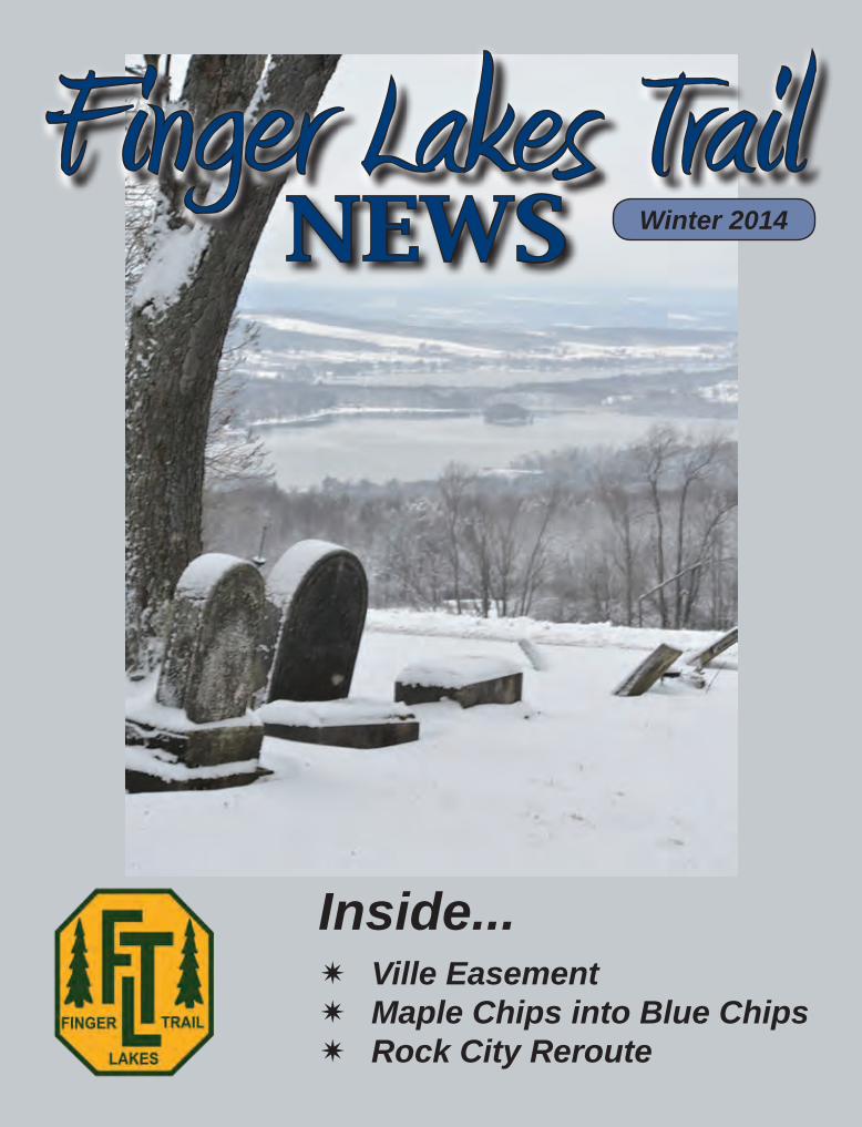
COVER/THIS PAGE: The view of Lamoka Lake (and in the distance, Waneta) from the Six Nations Cemetery on Map M13, northeast of Savona and Bath. Our eastbound trail enters Sugar Hill State Forest from this spot, west of Watkins Glen, with a sign to alert hikers not to miss the view a few feet away. Taken Thanksgiving Day by Vinnie Collins.
COLUMNS 3 President’s Message 7 Executive Director’s Report14 Trail Topics, reports from the trail management directors21 A Walk on the Wordy Side22 Naturalist’s View28 End-to-End Update
DEPARTMENTS25 Name that Map! Answers to the Spring Quiz25 FLT Named Hike Event30 Bug Bites
CONTENTS 5 Riemen Woods Transferred to Finger Lakes Trail 6 Granma’s New Toilet 8 Diane’s Crossing Turns 2510 Alley Cat 2 at Diane’s Crossing11 In Search of a Loop12 Chautauqua Gorge Hike 13 2015 Cross-County Series - Welcome to WNY19 Changes Coming for Spanish Loop Trail20 Smile with Us About the Ville Easement23 End to End Story24 In the Spirit of Donnie Mac26 Maple Chips into Blue Chips: The A chemy of Turning Logging Into Investments29 Rock City Reroute Gives Us Back an All-Footpath Route32 September 27th Little Rock City Hike33 Erv Markert Hike34 Whiskey Bridge Culvert Re-Stabilization Grant Project35 The F T on Sinnott Farm
3www.FingerLakesTrail.org Finger Lakes Trail News Winter 2014
President’s MessagePat Monahan
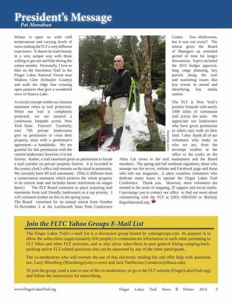
Winter is upon us with cold temperatures and varying levels of snow making the FLT a very different experience. It shares its stark beauty in a very unique way with those willing to get out and hike during the winter months. Personally, I love to hike on the Interloken Trail in the Finger Lakes National Forest near Watkins Glen (Schuyler County) and walk the ridge line crossing open pastures that give a wonderful view of Seneca Lake.
A crucial concept within our mission statement refers to trail protection. When our trail is completely protected, we are assured a continuous footpath across New York State. Forever! Currently, over 700 private landowners give us permission to cross their property, most with a gentleman’s agreement—a handshake. We are grateful for this permission with the current landowner; however, it is not forever. Rather, a trail easement gives us permission to locate a trail corridor on private property forever. It is recorded in the county clerk’s office and remains on the deed in perpetuity. We currently have 80 trail easements. (This is different from a conservation easement which protects the whole property in its current state and includes future restrictions on usages there.) The FLT Board continues to place acquiring trail easements from trail friendly landowners as a top priority. I will comment further on this in the spring issue.The Board convened for its annual retreat from October 31-November 2 at the Letchworth State Park Conference
Center. Yes—Halloween, but it was not scary!! The retreat gives the Board of Managers an extended period of time for longer discussions. Topics included the 2015 budget approval, long range planning, key parcels along the trail and marketing issues like key events to attend and identifying key media outlets.
The FLT is New York’s premier footpath with nearly 1000 miles of continuous trail across the state. We appreciate our landowners who have given permission so others may walk on their land. I also thank all of our volunteers who make us who we are, from the envelope stuffers at the office to the cooks on the
Alley Cat crews to the trail maintainers and the Board members. The spring and fall weekend organizers, those who manage our list serves, website and Facebook page and those who edit our magazine…it takes countless volunteers who dedicate many hours to operate the Finger Lakes Trail Conference. Thank you. However, more volunteers are needed in the areas of mapping, IT support and social media. I encourage you to contact our office to find out more about volunteering with the FLT at (585) 658-9320 or [email protected].
Larr
y Bl
umbe
rg
Join the FLTC Yahoo Groups E-Mail ListThe Finger Lakes Trail's e-mail list is a discussion group hosted by yahoogroups.com. Its purpose is to allow the subscribers (approximately 650 people) to communicate information to each other pertaining to FLT hikes and other FLT activities, and to also allow subscribers to post general hiking-camping-back-packing and/or FLT-related questions that can be answered by any of the other participants.
The co-moderators who will oversee the use of this electronic mailing list and offer help with questions are: Larry Blumberg ([email protected]) and Jack VanDerzee ([email protected]).
To join the group, send a note to one of the co-moderators, or go to the FLT website (FingerLakesTrail.org) and follow the instructions for subscribing.
4 Winter 2014 Finger Lakes Trail News www.FingerLakesTrail.org
STAFFDick Hubbard, Executive Director 716/604-8380 [email protected] Hopper, Office anager 585/658-9320 jhopper@fi gerlakestrail.orgStephanie Spittal, Order Fulfillment/General Information 585/658-9320 FLToffice rontiernet.net
OFFICERSPat Monahan, President Corning David Newman, VP Trail Preservation Honeoye FallsSteve Catherman, VP Trail Maintenance Bath Lynda Rummel, VP Trail Quality Keuka Park Charles Schutt, VP Finance N. Tonawanda Peggy Coleman, VP Membership & Marketing Elmira Matt Branneman, VP Crews & Construction Ithaca Greg Farnham, VP of Mapping Fayetteville Quinn Wright, Treasurer Buff lo Roy Dando, Secretary Endwell
BOARD OF MANAGERSTerms Expiring 2015Scott Brooks RochesterDonna Coon GilbertsvilleRoger Hopkins LansingTerry Meacham Hornell Laurie Ondrejka Avon
Terms Expiring 2016Cate Concannon Geneseo David Drum HammondsportDonna Flood ClarenceDavid Tuttle Pittsford
Terms Expiring 2017Michael Ogden Baldwinsville Debra Nero Ithaca Sigi Schwinge East Syracuse Wendy Stevenson SpringwaterNeil Yoder Painted Post
FINGER L AKES TRAIL CONFERENCE
January 10 ....................Howard Beye Hike at Letchworth State Park (see pg. 25)February 1....................FLT News DeadlineMarch 14 ......................Board of Managers meeting, Mt. MorrisApril 18 ........................Beginning of county hike series (4/18, 5/16, 6/20, 7/25, 8/15, 9/19) (see pg. 13)April 25-26...................Chainsaw training, near Bath. Contact Marty Howden: [email protected], 585/567-8589 May 2 ............................Wally Wood Hike in the CatskillsMay 16-17 ....................Chainsaw training repeated. See above.May 29-31 ....................FLT Annual Meeting and Spring Weekend, NorwichSeptember 10-13 .........FLT/NCTA Rendezvous at Hope Lake Lodge and Greek Peak
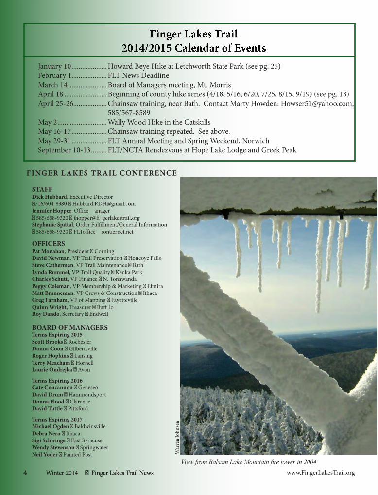
View from Balsam Lake Mountain fire tower in 2004.
War
ren
John
sen
4 Winter 2014 Finger Lakes Trail News
5www.FingerLakesTrail.org Finger Lakes Trail News Winter 2014
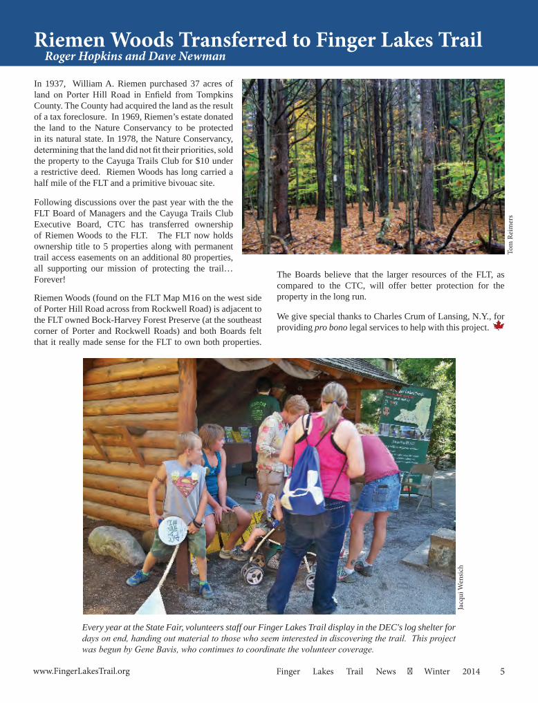
In 1937, William A. Riemen purchased 37 acres of land on Porter Hill Road in Enfield from Tompkins County. The County had acquired the land as the result of a tax foreclosure. In 1969, Riemen’s estate donated the land to the Nature Conservancy to be protected in its natural state. In 1978, the Nature Conservancy, determining that the land did not fit their priorities, sold the property to the Cayuga Trails Club for $10 under a restrictive deed. Riemen Woods has long carried a half mile of the FLT and a primitive bivouac site.
Following discussions over the past year with the the FLT Board of Managers and the Cayuga Trails Club Executive Board, CTC has transferred ownership of Riemen Woods to the FLT. The FLT now holds ownership title to 5 properties along with permanent trail access easements on an additional 80 properties, all supporting our mission of protecting the trail… Forever!
Riemen Woods (found on the FLT Map M16 on the west side of Porter Hill Road across from Rockwell Road) is adjacent to the FLT owned Bock-Harvey Forest Preserve (at the southeast corner of Porter and Rockwell Roads) and both Boards felt that it really made sense for the FLT to own both properties.
Riemen Woods Transferred to Finger Lakes Trail Roger Hopkins and Dave Newman
Tom
Rei
mer
s
The Boards believe that the larger resources of the FLT, as compared to the CTC, will offer better protection for the property in the long run.
We give special thanks to Charles Crum of Lansing, N.Y., for providing pro bono legal services to help with this project.
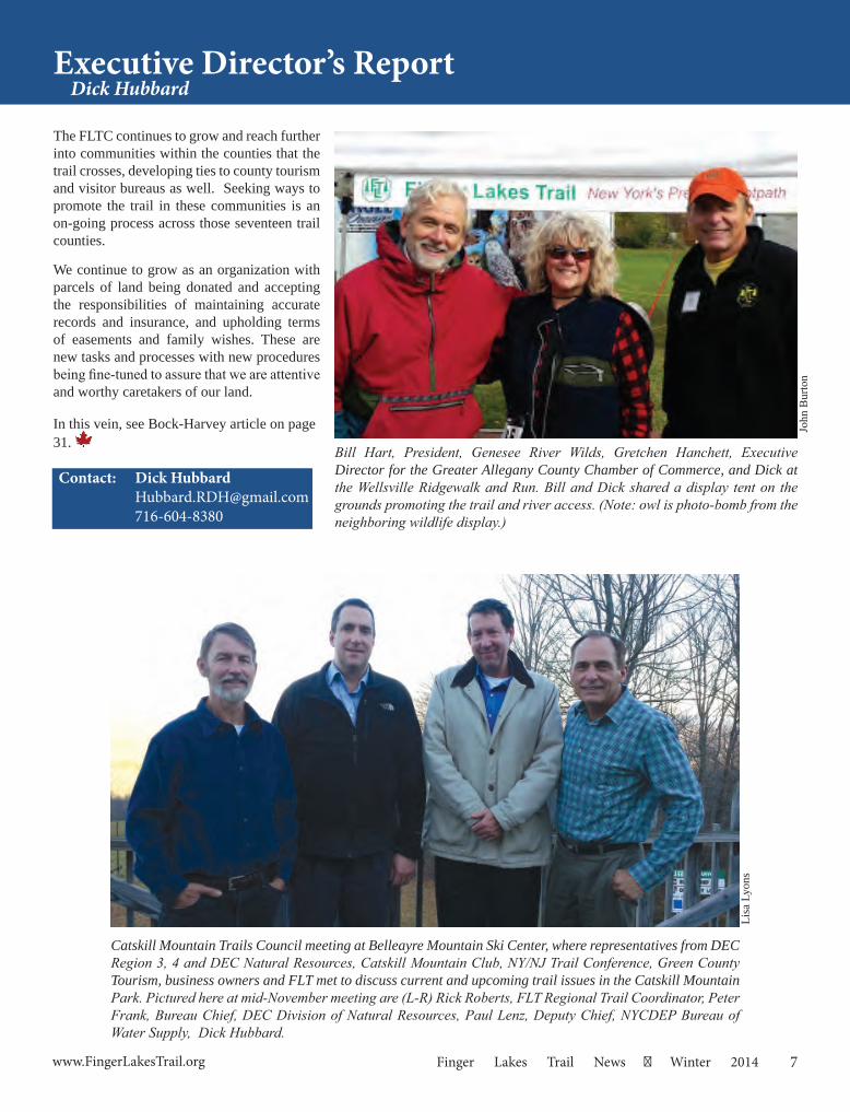
Every year at the State Fair, volunteers staff our Finger Lakes Trail display in the DEC's log shelter for days on end, handing out material to those who seem interested in discovering the trail. This project was begun by Gene Bavis, who continues to coordinate the volunteer coverage.
Jacq
ui W
ensic
h

6 Winter 2014 Finger Lakes Trail News www.FingerLakesTrail.org
On November 12th, three days before the guns began, Larry Telle’s intrepid band of roving trail workers met to install a fiberglass “open aire” crapper with a railing to help those with less capable legs at Granma’s Camp. On Bristol Hills Trail Map B3, north of Hammondsport and south of Prattsburgh in Steuben County, there is a nice long stretch of trail south of Hungry Hollow Rd. in Pigtail Hollow State Forest. Six-tenths of a mile in is a long-standing primitive campsite, named after the original Irene Szabo, with no amenities other than a rocky fire ring and a reliably running stream about a hundred feet down the trail.
When the Genesee Valley Hiking Club gave up trail sponsorship, Larry knew a handful of “young retireds” who would still like to contribute to the trail through projects and general maintenance, so many Wednesdays over the last several months Larry has summoned these guys to do scattered projects. They helped Donna Noteware build a new piece of trail near Naples to replace a lost permission, and they have helped me keep up with my too-many miles of trail maintenance for a tired old broad. Larry even cured in less than two hours a horridly steep and rocky climb northbound from CR 13, also Map B3, by replacing it with a nicely benched slanted approach, a job that has needed doing since the trail was built in 1967!
Beforehand Larry had cut and predrilled the wooden pieces required to support the fiberglass housing and its attendant
Granma’s New ToiletIrene Szabo
railings, plus made a privacy screen out of ready-made plastic lattice. From road’s edge, Mike Goodwin, Frank Jones, Chuck Stern, Marty Turner, Larry Telle, Dave Newman, and I carried tools, wood pieces, and the awkward fiberglass box into the woods, using two wheelbarrows and lots of arms. Near the end of that hike is a rocky stretch with major lumpy roots, unnavigable by a wheelbarrow, especially where we had to cross a newly fallen tree which blankety-blank bicyclists had built a ramp for out of yet more logs (bikers who had passed an official DEC sign, of course, prohibiting bicycles on this trail…in English!), but we managed to carry the tools and toilet past that stretch.
In short order the guys had dug a hole through rocky clay (of course) with lots of roots at least three feet deep, put together the wooden parts with screws, and buried the bottom wood frame in the soil to give even a wheel chair a smooth approach to the facility. I cleaned up the side trail to the campsite and repainted its blue blazes, we ate lunch, and were out of the woods soon after. Granma would have approved.
No one will aim at Dave Newman’s vividly blaze orange outfit (it was bow season). To his right are Mike Goodwin, Marty Turner, Frank Jones, and Larry Telle on the ground, whaling on the precut wooden crosspieces to get them snugly together.
Dave Newman screwing down the pre-made lattice privacy screen. Here the privy is complete except for burying the bottom framework beneath soil level for a smooth approach even by po-tential wheelchairs.
Larr
y Te
lle
Iren
e Sz
abo
Landmax Data Systems, Inc. 5919 E. Henrietta Rd. Rush, NY14543 (585) 533-9210www.landmaxdata.com
Donor of land boundary research and property information for the Finger Lakes Trail and the North
Country National Scenic Trail
Thank You
7www.FingerLakesTrail.org Finger Lakes Trail News Winter 2014
Executive Director’s ReportDick Hubbard
Contact: Dick Hubbard [email protected] 716-604-8380
The FLTC continues to grow and reach further into communities within the counties that the trail crosses, developing ties to county tourism and visitor bureaus as well. Seeking ways to promote the trail in these communities is an on-going process across those seventeen trail counties.
We continue to grow as an organization with parcels of land being donated and accepting the responsibilities of maintaining accurate records and insurance, and upholding terms of easements and family wishes. These are new tasks and processes with new procedures being fine-tuned to assure that we are attentive and worthy caretakers of our land.
In this vein, see Bock-Harvey article on page 31.
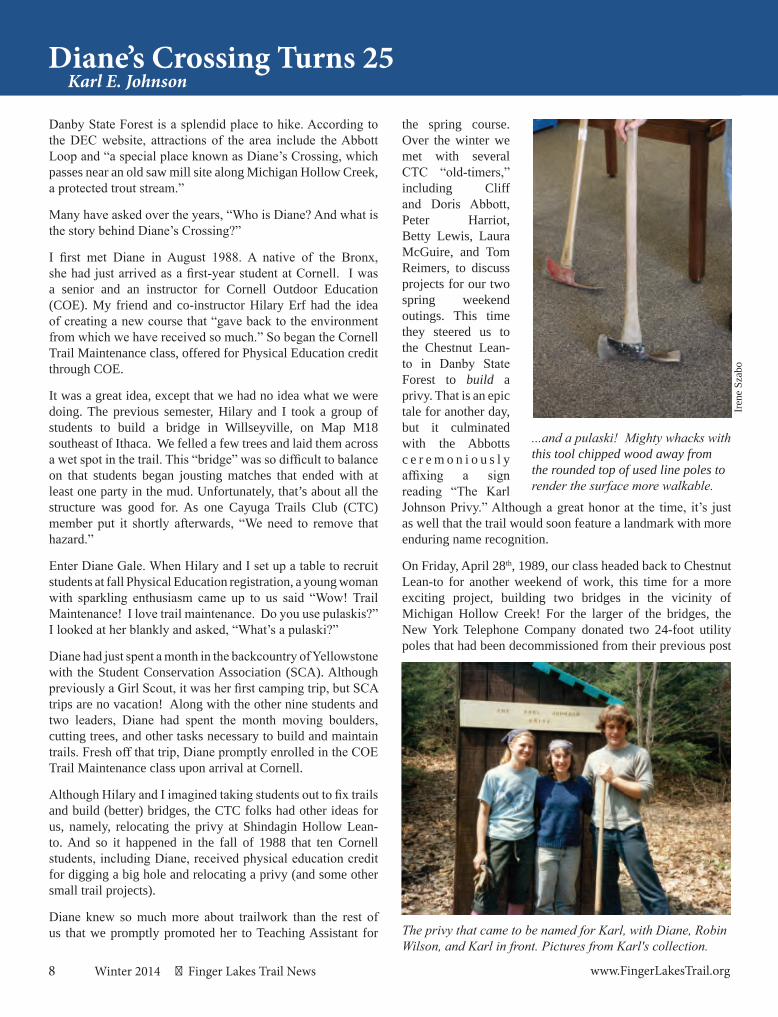
Bill Hart, President, Genesee River Wilds, Gretchen Hanchett, Executive Director for the Greater Allegany County Chamber of Commerce, and Dick at the Wellsville Ridgewalk and Run. Bill and Dick shared a display tent on the grounds promoting the trail and river access. (Note: owl is photo-bomb from the neighboring wildlife display.)
John
Bur
ton
Catskill Mountain Trails Council meeting at Belleayre Mountain Ski Center, where representatives from DEC Region 3, 4 and DEC Natural Resources, Catskill Mountain Club, NY/NJ Trail Conference, Green County Tourism, business owners and FLT met to discuss current and upcoming trail issues in the Catskill Mountain Park. Pictured here at mid-November meeting are (L-R) Rick Roberts, FLT Regional Trail Coordinator, Peter Frank, Bureau Chief, DEC Division of Natural Resources, Paul Lenz, Deputy Chief, NYCDEP Bureau of Water Supply, Dick Hubbard.
Lisa
Lyo
ns
8 Winter 2014 Finger Lakes Trail News www.FingerLakesTrail.org
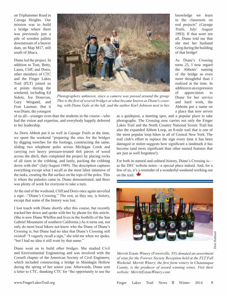
Danby State Forest is a splendid place to hike. According to the DEC website, attractions of the area include the Abbott Loop and “a special place known as Diane’s Crossing, which passes near an old saw mill site along Michigan Hollow Creek, a protected trout stream.”
Many have asked over the years, “Who is Diane? And what is the story behind Diane’s Crossing?”
I first met Diane in August 1988. A native of the Bronx, she had just arrived as a first-year student at Cornell. I was a senior and an instructor for Cornell Outdoor Education (COE). My friend and co-instructor Hilary Erf had the idea of creating a new course that “gave back to the environment from which we have received so much.” So began the Cornell Trail Maintenance class, offered for Physical Education credit through COE.
It was a great idea, except that we had no idea what we were doing. The previous semester, Hilary and I took a group of students to build a bridge in Willseyville, on Map M18 southeast of Ithaca. We felled a few trees and laid them across a wet spot in the trail. This “bridge” was so difficult to balance on that students began jousting matches that ended with at least one party in the mud. Unfortunately, that’s about all the structure was good for. As one Cayuga Trails Club (CTC) member put it shortly afterwards, “We need to remove that hazard.”
Enter Diane Gale. When Hilary and I set up a table to recruit students at fall Physical Education registration, a young woman with sparkling enthusiasm came up to us said “Wow! Trail Maintenance! I love trail maintenance. Do you use pulaskis?” I looked at her blankly and asked, “What’s a pulaski?”
Diane had just spent a month in the backcountry of Yellowstone with the Student Conservation Association (SCA). Although previously a Girl Scout, it was her first camping trip, but SCA trips are no vacation! Along with the other nine students and two leaders, Diane had spent the month moving boulders, cutting trees, and other tasks necessary to build and maintain trails. Fresh off that trip, Diane promptly enrolled in the COE Trail Maintenance class upon arrival at Cornell.
Although Hilary and I imagined taking students out to fix trails and build (better) bridges, the CTC folks had other ideas for us, namely, relocating the privy at Shindagin Hollow Lean-to. And so it happened in the fall of 1988 that ten Cornell students, including Diane, received physical education credit for digging a big hole and relocating a privy (and some other small trail projects).
Diane knew so much more about trailwork than the rest of us that we promptly promoted her to Teaching Assistant for
Diane’s Crossing Turns 25Karl E. Johnson
the spring course. Over the winter we met with several CTC “old-timers,” including Cliff and Doris Abbott, Peter Harriot, Betty Lewis, Laura McGuire, and Tom Reimers, to discuss projects for our two spring weekend outings. This time they steered us to the Chestnut Lean-to in Danby State Forest to build a privy. That is an epic tale for another day, but it culminated with the Abbotts c e r e m o n i o u s l y affixing a sign reading “The Karl Johnson Privy.” Although a great honor at the time, it’s just as well that the trail would soon feature a landmark with more enduring name recognition.
On Friday, April 28th, 1989, our class headed back to Chestnut Lean-to for another weekend of work, this time for a more exciting project, building two bridges in the vicinity of Michigan Hollow Creek! For the larger of the bridges, the New York Telephone Company donated two 24-foot utility poles that had been decommissioned from their previous post
The privy that came to be named for Karl, with Diane, Robin Wilson, and Karl in front. Pictures from Karl's collection.
...and a pulaski! Mighty whacks with this tool chipped wood away from the rounded top of used line poles to render the surface more walkable.
Iren
e Sz
abo
9www.FingerLakesTrail.org Finger Lakes Trail News Winter 2014
on Triphammer Road in Cayuga Heights. Our mission was to build a bridge where there was previously just a pile of wooden pallets downstream of a beaver dam, on Map M17, still south of Ithaca.
Diane led the project. In addition to Tom, Betty, Laura, Cliff, and Doris, other members of CTC and the Finger Lakes Trail (FLT) joined us at points during the weekend, including Ed Sidote, Joe Donovan, Gary Weigand, and Fran Lauman. But it was Diane, the youngest of us all—younger even than the students in the course—who had the vision and expertise, and everybody happily deferred to her leadership.
As Doris Abbott put it so well in Cayuga Trails at the time, we spent the weekend “preparing the sites for the bridges by digging trenches for the footings, constructing the same, sliding two telephone poles across Michigan Creek and carrying two heavy pressure-treated 4x6 pieces of wood across the ditch, then completed the project by placing rocks of all sizes in the cribbing, and lastly, packing the cribbing down with dirt” (July/August 1989). The description captures everything except what I recall as the most labor intensive of the tasks, creating the flat surface on the tops of the poles. This is where the pulaskis came in. Diane demonstrated, and there was plenty of work for everyone to take a turn.
At the end of the weekend, Cliff and Doris once again unveiled a sign—“Diane’s Crossing.” The rest, as they say, is history, except that some of the history was lost.
I lost touch with Diane shortly after this course, but recently tracked her down and spoke with her by phone for this article. (She is now Diane Whiffen and lives in the foothills of the San Gabriel Mountains of southern California.) As it turns out, not only do most local hikers not know who the Diane of Diane’s Crossing is, but Diane had no idea that Diane’s Crossing still existed! “I vaguely recall a sign,” she told me when we spoke, “but I had no idea it still went by that name.”
Diane went on to build other bridges. She studied Civil and Environmental Engineering and was involved with the Cornell chapter of the American Society of Civil Engineers, which included constructing a bridge in Shindagin Hollow during the spring of her senior year. Afterwards, Diane sent a letter to CTC, thanking CTC for “the opportunity to use the
Photographers unknown, since a camera was passed around the group. This is the first of several bridges at what became known as Diane's cross-ing, with Diane Gale at the left, and the author Karl Johnson next to her.
knowledge we learn in the classroom on real projects” (Cayuga Trails, July/ August 1993). If that were not all, Diane told me that she met her husband Greg during the building of that bridge!
As Diane’s Crossing turns 25, I now regard the Abbotts’ naming of the bridge as even more thoughtful than I realized at the time. In addition to an expression of appreciation to Diane for her service and hard work, the Abbotts put a name on a place that now serves
as a guidepost, a meeting spot, and a popular place to take photographs. The Crossing now carries not only the Finger Lakes Trail and the North Country National Scenic Trail but also the expanded Abbott Loop, an 8-mile trail that is one of the most popular loop hikes in all of Central New York. The trail club’s effort to replace the sign every time it has been damaged or stolen suggests how significant a landmark it has become (and more significant than other named features that are just as well forgotten!).
For both its natural and cultural history, Diane’s Crossing is—as the DEC website notes—a special place indeed. And, for a few of us, it’s a reminder of a wonderful weekend working out on the trail.
Merritt Estate Winery (Forestville, NY) donated an assortment of wine for the Forever Society Reception held at the FLT Fall Weekend. Merritt Winery, the first farm winery in Chautauqua County, is the producer of award winning wines. Visit their website: MerrittEstateWinery.com.
Dic
k H
ubba
rd
10 Winter 2014 Finger Lakes Trail News www.FingerLakesTrail.org
The old bridge tended to be under water on occasion recently, so instead of waiting for the bridge to wash away, we replaced the span and increased its creek clearance by 14”. The construction managers for the project were Matt Branneman and Mike Granger, while I was project manager. Volunteers included Tessa Careaga, Anne Dwyer, Dave Newman, Don Sutherland, Nigel Hudson-Dyson, Bob Emerson, and Robin Carlisle-Peck as our camp chef and host. Volunteers once again camped out at Lion’s Camp Badger nearby. Steve Catherman was instrumental in supporting the project through his contact with DEC Region 7, who were quite gracious in their support as they also purchased and had delivered the two 26’ long 6”x12” laminated beams from Una-lam of Unadilla, N.Y., for the project. All other materials and the camp fee were paid for by the Cayuga Trails Club. The Finger Lakes Trail Conference supplied all of the food
Alley Cat 2 at Diane’s CrossingPaul Warrender
that kept the voracious appetites of the volunteers satisfied. Construction of the span included widening of the approach trail from Michigan Hollow Road, and installation of two new timber cribs, each filled with stone gathered from Michigan Hollow Creek 1.5 miles from the construction site. Both cribbing blocks are 4’ cubed, constructed of 6x6 treated timbers, and filled with approximately 1.5 tons of stone in each.
The old bridge’s railings were removed, but the deck itself was left intact to help the crew wrestle the beams across the creek; the beams were then moved into place easily onto the cribbing from the adjacent former span. In a sense, that original bridge assisted in the construction of its own replacement...very fitting. After cross braces were attached to the beams, the business of installing the deck and railings was completed. While this was being done, other volunteers completed dismantling the old bridge, cutting the old bridge’s beams into 5 foot sections to be used as curbing for the new bridge approaches, and then back-filling the cribbing with more stones and soil. Once the bridge was complete, volunteers built the new approaches, set the curbing, and installed gently sloping ramps at each end of the bridge. The bridge was completed in threedays.
From left to right: Nigel Hudson-Dyson, Paul Warrender, Mike Granger, Dave Newman, Bob Emerson, Don Sutherland. Not pic-tured are Matt Branneman (he was taking the photo), Tessa Carea-ga, and Anne Dwyer (they were not present for the entire project).
Mat
t Bra
nnem
an
Before the deck was laid, we can see the glue-lam beams provided by the DEC that provide the primary support across the open span.
Robi
n C
arlis
le-P
eck
Tom
Rei
mer
s
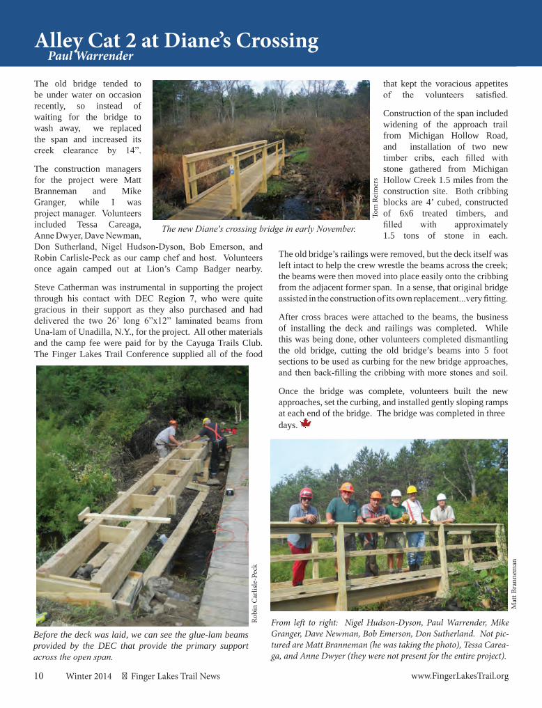
The new Diane's crossing bridge in early November.
11www.FingerLakesTrail.org Finger Lakes Trail News Winter 2014
Through-hikes are fine when you have a friend and two vehicles and the patience to spot cars. Sometimes, though, you just want a loop.
I had searched for this one once before on a sunny fall day with only dogs for companions. They weren’t much help. And I, distracted by the beauty of it all and confused by a trail that needed some TLC, I got lost. Not lost-lost… just temporarily misplaced. I finally found my way back to the car, though not by the route that looked so clear and easy on the topo.
For my second attempt, I take a human buddy, as well as the dogs. We pick winter when the foliage is gone, eliminating bright-white sunspots on the bark that look like blazes. We opt to tackle the most confusing part of the trail first while we are fresh – the opposite way around the loop from my first attempt. Besides, Coon Run Road isn’t plowed up to where the FLT crosses.
This “loop” is actually one half FLT, maintained by some of the best trail stewards ever, and one half Tuscarora Fire Tower, maintained by Allegany State Park. An unfortunate combination of events—strong winds, tree falls, and a cut to State Park funding— made for difficulties on the ASP portion.
Shortly into the Tuscarora trail, we lose the blazes near a tree fall, puzzle our way past it, and continue along what appears to be a trail. When it ends abruptly we take it as a sign that it’s time for coffee and regrouping. The dogs aren’t ready for
In Search of a LoopStory and Photos by Jennifer Schlick
a break so soon and romp impatiently in the snow. We check the topo, figure out where we are and plan our strategy. After coffee we retrace our steps to the fallen tree and investigate. Sure enough there are blazes in amongst the tangle of branches.
Back on track, the trail begins its climb, gentle in some spots, steeper in others. I know the effort will be worth it. I love the
views from the summit. Through the upper canopy you can see over the valley to the distant hills on the other side. I’m ready this time for the confusing bit where the loop takes its hairpin turn; I’ll enjoy the views without getting too distracted by the beauty of it all!
Our stomachs growl as we enjoy the view, but we opt to follow the FLT and put off lunch until we reach the lean-to at Willis Creek. After lunch we hike from the shelter to Coon Run Road, then take the road back to the truck where after-hike beers await. We did it! I’m sure we’ll try this loop again.
Trail Update: I made this hike in January of 2013. A friend who works in the park tells me that he spent two long days on the Tuscarora this summer (2014) to open it up. He also says that people interested in volunteering should call and ask to speak to the park managers. The number at Allegany State Park is (716) 354-9121.
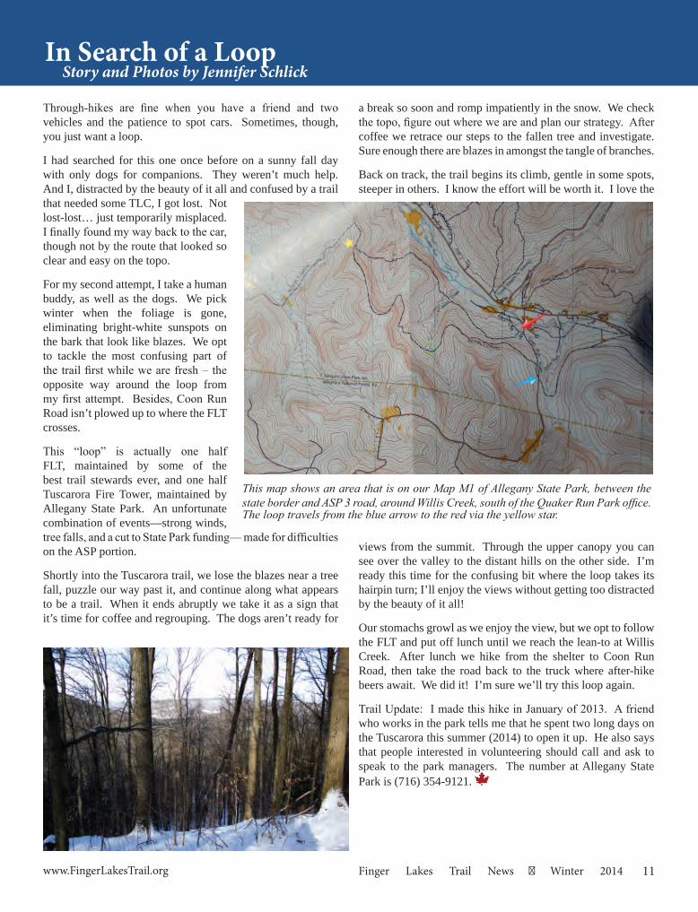
This map shows an area that is on our Map M1 of Allegany State Park, between the state border and ASP 3 road, around Willis Creek, south of the Quaker Run Park office.The loop travels from the blue arrow to the red via the yellow star.
12 Winter 2014 Finger Lakes Trail News www.FingerLakesTrail.org
While planning hikes for the September FLT weekend I saw a listing in the Chautauqua Visitors guide that there was an 8 mile gorge hike. OK, I’ll do that—how fun!
Checking into it was NOT that easy; no one seemed to know much about it. Contacted Chautauqua hiking club and they had no clue where the 8 miles were. Contacted a few others I knew and they were all excited I was doing this so I could show them? I wanted them to show ME! ha! Go figure.
By this time the schedule had already gone to print that I would do this so there was no backing out. After several trips found what I thought to be a good hike and have a $150.00 speeding ticket to prove it.
One Sunday in August headed out again and had six sightings in the nudist area. Not sure how to greet someone with no clothes on? Also that day ran into a landowner who asked how we were enjoying the hike and told me I was trespassing. He owns 100 acres on one side of the creek and 60 acres on the other. Told him I thought hiking in the creek was OK; he countered that if I was hiking in the center of the creek carrying a fishing pole I would be OK, but otherwise I’m trespassing. I’m not really sure of his facts, but my heart sank. By then people had started to sign up for my hike!
He finally did agree to let me bring the hikers through but I did need to call him first. When I called him he actually was awesome telling me how to get to shelter – his cabin –
Chautauqua Gorge HikeStory and Photos by Annette Brzezicki
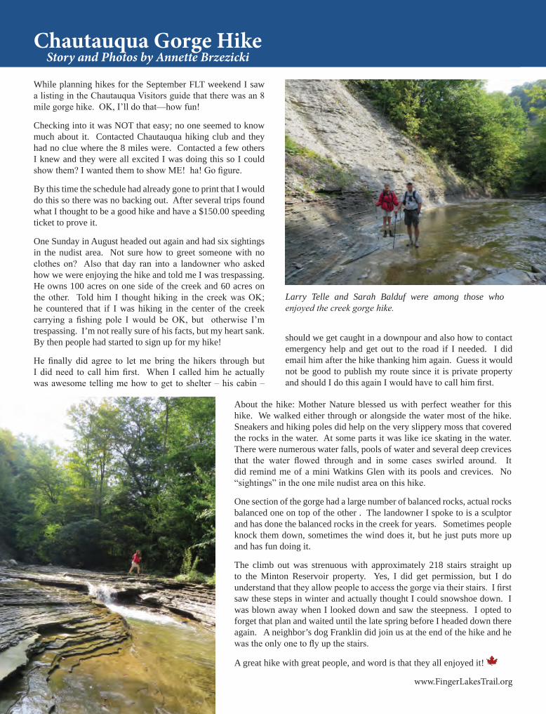
Larry Telle and Sarah Balduf were among those who enjoyed the creek gorge hike.
should we get caught in a downpour and also how to contact emergency help and get out to the road if I needed. I did email him after the hike thanking him again. Guess it would not be good to publish my route since it is private property and should I do this again I would have to call him first.
About the hike: Mother Nature blessed us with perfect weather for this hike. We walked either through or alongside the water most of the hike. Sneakers and hiking poles did help on the very slippery moss that covered the rocks in the water. At some parts it was like ice skating in the water. There were numerous water falls, pools of water and several deep crevices that the water flowed through and in some cases swirled around. It did remind me of a mini Watkins Glen with its pools and crevices. No “sightings” in the one mile nudist area on this hike.
One section of the gorge had a large number of balanced rocks, actual rocks balanced one on top of the other . The landowner I spoke to is a sculptor and has done the balanced rocks in the creek for years. Sometimes people knock them down, sometimes the wind does it, but he just puts more up and has fun doing it.
The climb out was strenuous with approximately 218 stairs straight up to the Minton Reservoir property. Yes, I did get permission, but I do understand that they allow people to access the gorge via their stairs. I first saw these steps in winter and actually thought I could snowshoe down. I was blown away when I looked down and saw the steepness. I opted to forget that plan and waited until the late spring before I headed down there again. A neighbor’s dog Franklin did join us at the end of the hike and he was the only one to fly up the stairs.
A great hike with great people, and word is that they all enjoyed it!
13www.FingerLakesTrail.org Finger Lakes Trail News Winter 2014
The Cross County Series continues its westward march. In April we will begin at the border between Steuben and Allegany Counties. Our journey will cover 62.3 miles of the Finger Lakes Main Trail. The bulk of hikes will be in Allegany County but the trail will bring us through short sections of Livingston (13 miles) and Wyoming Counties (7 miles), a three County bargain in one hiking season.
A special thanks goes out to the efforts of Shirley and Jet Thomas for coordinating the last two cross county hike series. These are big shoes to fill. The 2015 Series will be coordinated by Donna and Marty Ruszaj. Mike Schlicht’s ([email protected]) efforts will focus on putting together hike leader / sweep teams for the six to seven hiking speed groups. Quinn Wright ([email protected]) will focus on pre-hike duties. He will be working with the dedicated trail stewards for this section to ensure we have a trouble free enjoyable journey. Donna Ruszaj ([email protected]) will organize bus transportation and work with the FLTC home office to take care of registration. Marty Ruszaj ([email protected]) will be handling communications.
Help is still needed to make this series successful. We need an individual to act as the Sag Wagons Chair. Several individuals have volunteered to host the Sags. We are looking for someone to coordinate this effort. Please contact Marty.
We hope that you can join us.
What can you do now?
• Pencil in these hiking dates on Saturday – April 18th, May 16th, June 20th, July 25th, August 15th and September 19th
• Join our Yahoo Group ([email protected]). Registration for the series will start in February and will be announced through this group’s mail list and the FLTC web site. Expect reg-istration to top off at 135.
• Stay active (keep hiking) during the winter! Hike plots show average distance covered is 10 miles with the August hike covering 11.5 miles. Expect several 500’ elevation changes.
• Hikers from outside of western NY may want to consider making a weekend out of it with an over-night stay. See these sites to get you started:
o www.discoveralleganycounty.com/o www.wyomingcountyny.com/o http://www.glenirisinn.com/
See you on the trail.
2015 Cross-County Series - Welcome to Western New YorkMarty Ruszaj, 2015 County Hike Series Coordinator
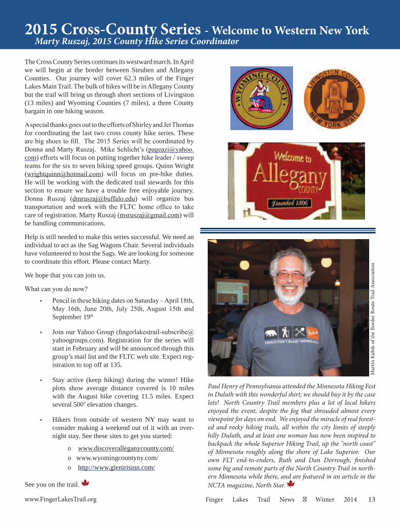
Paul Henry of Pennsylvania attended the Minnesota Hiking Fest in Duluth with this wonderful shirt; we should buy it by the case lots! North Country Trail members plus a lot of local hikers enjoyed the event, despite the fog that shrouded almost every viewpoint for days on end. We enjoyed the miracle of real forest-ed and rocky hiking trails, all within the city limits of steeply hilly Duluth, and at least one woman has now been inspired to backpack the whole Superior Hiking Trail, up the "north coast" of Minnesota roughly along the shore of Lake Superior. Our own FLT end-to-enders, Ruth and Dan Dorrough, finished some big and remote parts of the North Country Trail in north-ern Minnesota while there, and are featured in an article in the NCTA magazine, North Star.
Mar
tin K
ubik
of t
he B
orde
r Rou
te T
rail
Ass
ocia
tion
14 Winter 2014 Finger Lakes Trail News www.FingerLakesTrail.org
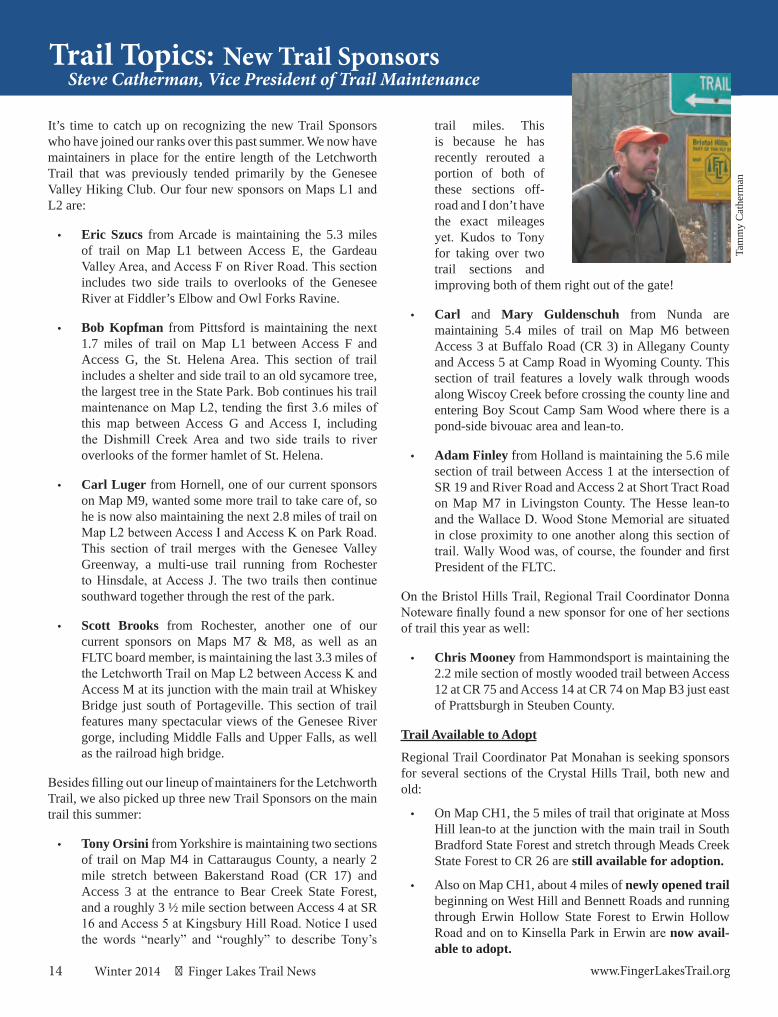
Trail Topics: New Trail SponsorsSteve Catherman, Vice President of Trail Maintenance
Tam
my
Cat
herm
an
It’s time to catch up on recognizing the new Trail Sponsors who have joined our ranks over this past summer. We now have maintainers in place for the entire length of the Letchworth Trail that was previously tended primarily by the Genesee Valley Hiking Club. Our four new sponsors on Maps L1 and L2 are:
• Eric Szucs from Arcade is maintaining the 5.3 miles of trail on Map L1 between Access E, the Gardeau Valley Area, and Access F on River Road. This section includes two side trails to overlooks of the Genesee River at Fiddler’s Elbow and Owl Forks Ravine.
• Bob Kopfman from Pittsford is maintaining the next 1.7 miles of trail on Map L1 between Access F and Access G, the St. Helena Area. This section of trail includes a shelter and side trail to an old sycamore tree, the largest tree in the State Park. Bob continues his trail maintenance on Map L2, tending the first 3.6 miles of this map between Access G and Access I, including the Dishmill Creek Area and two side trails to river overlooks of the former hamlet of St. Helena.
• Carl Luger from Hornell, one of our current sponsors on Map M9, wanted some more trail to take care of, so he is now also maintaining the next 2.8 miles of trail on Map L2 between Access I and Access K on Park Road. This section of trail merges with the Genesee Valley Greenway, a multi-use trail running from Rochester to Hinsdale, at Access J. The two trails then continue southward together through the rest of the park.
• Scott Brooks from Rochester, another one of our current sponsors on Maps M7 & M8, as well as an FLTC board member, is maintaining the last 3.3 miles of the Letchworth Trail on Map L2 between Access K and Access M at its junction with the main trail at Whiskey Bridge just south of Portageville. This section of trail features many spectacular views of the Genesee River gorge, including Middle Falls and Upper Falls, as well as the railroad high bridge.
Besides filling out our lineup of maintainers for the Letchworth Trail, we also picked up three new Trail Sponsors on the main trail this summer:
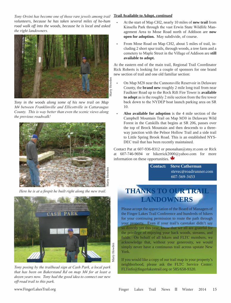
• Tony Orsini from Yorkshire is maintaining two sections of trail on Map M4 in Cattaraugus County, a nearly 2 mile stretch between Bakerstand Road (CR 17) and Access 3 at the entrance to Bear Creek State Forest, and a roughly 3 ½ mile section between Access 4 at SR 16 and Access 5 at Kingsbury Hill Road. Notice I used the words “nearly” and “roughly” to describe Tony’s
trail miles. This is because he has recently rerouted a portion of both of these sections off-road and I don’t have the exact mileages yet. Kudos to Tony for taking over two trail sections and improving both of them right out of the gate!
• Carl and Mary Guldenschuh from Nunda are maintaining 5.4 miles of trail on Map M6 between Access 3 at Buffalo Road (CR 3) in Allegany County and Access 5 at Camp Road in Wyoming County. This section of trail features a lovely walk through woods along Wiscoy Creek before crossing the county line and entering Boy Scout Camp Sam Wood where there is a pond-side bivouac area and lean-to.
• Adam Finley from Holland is maintaining the 5.6 mile section of trail between Access 1 at the intersection of SR 19 and River Road and Access 2 at Short Tract Road on Map M7 in Livingston County. The Hesse lean-to and the Wallace D. Wood Stone Memorial are situated in close proximity to one another along this section of trail. Wally Wood was, of course, the founder and first President of the FLTC.
On the Bristol Hills Trail, Regional Trail Coordinator Donna Noteware finally found a new sponsor for one of her sections of trail this year as well:
• Chris Mooney from Hammondsport is maintaining the 2.2 mile section of mostly wooded trail between Access 12 at CR 75 and Access 14 at CR 74 on Map B3 just east of Prattsburgh in Steuben County.
Trail Available to Adopt
Regional Trail Coordinator Pat Monahan is seeking sponsors for several sections of the Crystal Hills Trail, both new and old:
• On Map CH1, the 5 miles of trail that originate at Moss Hill lean-to at the junction with the main trail in South Bradford State Forest and stretch through Meads Creek State Forest to CR 26 are still available for adoption.
• Also on Map CH1, about 4 miles of newly opened trail beginning on West Hill and Bennett Roads and running through Erwin Hollow State Forest to Erwin Hollow Road and on to Kinsella Park in Erwin are now avail-able to adopt.
15www.FingerLakesTrail.org Finger Lakes Trail News Winter 2014
Tony posing by the trailhead sign at Cash Park, a local park that has been on Bakerstand Rd on map M4 for at least a dozen years now. Tony had the good idea to connect our new off-road trail to this park.
Contact: Steve Catherman [email protected] 607-569-3453
Trail Available to Adopt, continued
• At the start of Map CH2, nearly 10 miles of new trail from Kinsella Park through the vast Erwin State Wildlife Man-agement Area to Mose Road north of Addison are now open for adoption. May subdivide, of course.
• From Mose Road on Map CH2, about 5 miles of trail, in-cluding 2 short spur trails, through woods, a tree farm and a cemetery to Maple Street in the Village of Addison are still available to adopt.
At the eastern end of the main trail, Regional Trail Coordinator Rick Roberts is looking for a couple of sponsors for one brand new section of trail and one old familiar section:
• On Map M28 near the Cannonsville Reservoir in Delaware County, the brand new roughly 2 mile long trail from near Faulkner Road up to the Rock Rift Fire Tower is available to adopt as is the roughly 2 mile section from the fire tower back down to the NYDEP boat launch parking area on SR 10.
• Also available for adoption is the 4 mile section of the Campbell Mountain Trail on Map M30 in Delaware Wild Forest in the Catskills that begins at SR 206, passes over the top of Brock Mountain and then descends to a three-way junction with the Pelnor Hollow Trail and a side trail to Little Spring Brook Road. This is an established NYS-DEC trail that has been recently maintained.
Contact Pat at 607-936-8312 or [email protected] or Rick at 607-746-9694 or [email protected] for more information on these opportunities.
Tony Orsini has become one of those rare jewels among trail volunteers, because he has taken several miles of ho-hum road walk off into the woods, because he is local and asked the right landowners.
Here he is at a firepit he built right along the new trail.
Tony in the woods along some of his new trail on Map M4 between Franklinville and Ellicottville in Cattaraugus County. This is way better than even the scenic views along the previous roadwalk!
THANKS TO OUR TRAIL LANDOWNERS
Please accept the appreciation of the Board of Managers of the Finger Lakes Trail Conference and hundreds of hikers for your continuing permission to route the path through your property. Even if your trail’s caretaker didn’t say so directly yet this year, know that we all are grateful for the privilege of enjoying your back woods, streams, and fields. On behalf of all hikers and FLTC members, we acknowledge that, without your generosity, we would simply never have a continuous trail across upstate New York.
If you would like a copy of our trail map in your property’s neighborhood, please ask the FLTC Service Center: [email protected] or 585/658-9320.
Mar
ty H
owde
nM
arty
How
den
Mar
ty H
owde
n
16 Winter 2014 Finger Lakes Trail News www.FingerLakesTrail.org
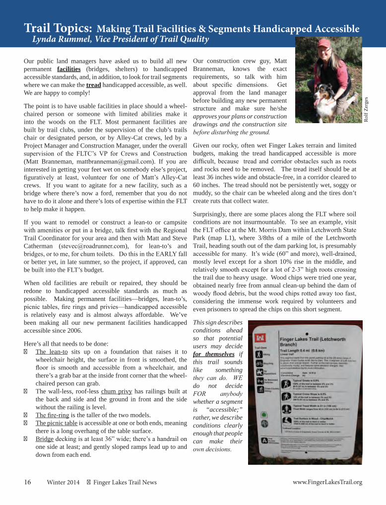
Lynda Rummel, Vice President of Trail QualityTrail Topics: Making Trail Facilities & Segments Handicapped Accessible
Rol
f Zer
ges
Our public land managers have asked us to build all new permanent facilities (bridges, shelters) to handicapped accessible standards, and, in addition, to look for trail segments where we can make the tread handicapped accessible, as well. We are happy to comply!
The point is to have usable facilities in place should a wheel-chaired person or someone with limited abilities make it into the woods on the FLT. Most permanent facilities are built by trail clubs, under the supervision of the club’s trails chair or designated person, or by Alley-Cat crews, led by a Project Manager and Construction Manager, under the overall supervision of the FLTC’s VP for Crews and Construction (Matt Branneman, [email protected]). If you are interested in getting your feet wet on somebody else’s project, figuratively at least, volunteer for one of Matt’s Alley-Cat crews. If you want to agitate for a new facility, such as a bridge where there’s now a ford, remember that you do not have to do it alone and there’s lots of expertise within the FLT to help make it happen.
If you want to remodel or construct a lean-to or campsite with amenities or put in a bridge, talk first with the Regional Trail Coordinator for your area and then with Matt and Steve Catherman ([email protected]), for lean-to’s and bridges, or to me, for chum toilets. Do this in the EARLY fall or better yet, in late summer, so the project, if approved, can be built into the FLT’s budget.
When old facilities are rebuilt or repaired, they should be redone to handicapped accessible standards as much as possible. Making permanent facilities—bridges, lean-to’s, picnic tables, fire rings and privies—handicapped accessible is relatively easy and is almost always affordable. We’ve been making all our new permanent facilities handicapped accessible since 2006.
Here’s all that needs to be done: The lean-to sits up on a foundation that raises it to
wheelchair height, the surface in front is smoothed, the floor is smooth and accessible from a wheelchair, and there’s a grab bar at the inside front corner that the wheel-chaired person can grab.
The wall-less, roof-less chum privy has railings built at the back and side and the ground in front and the side without the railing is level.
The fire-ring is the taller of the two models. The picnic table is accessible at one or both ends, meaning
there is a long overhang of the table surface. Bridge decking is at least 36” wide; there’s a handrail on
one side at least; and gently sloped ramps lead up to and down from each end.
Our construction crew guy, Matt Branneman, knows the exact requirements, so talk with him about specific dimensions. Get approval from the land manager before building any new permanent structure and make sure he/she approves your plans or construction drawings and the construction site before disturbing the ground.
Given our rocky, often wet Finger Lakes terrain and limited budgets, making the tread handicapped accessible is more difficult, because tread and corridor obstacles such as roots and rocks need to be removed. The tread itself should be at least 36 inches wide and obstacle-free, in a corridor cleared to 60 inches. The tread should not be persistently wet, soggy or muddy, so the chair can be wheeled along and the tires don’t create ruts that collect water.
Surprisingly, there are some places along the FLT where soil conditions are not insurmountable. To see an example, visit the FLT office at the Mt. Morris Dam within Letchworth State Park (map L1), where 3/8ths of a mile of the Letchworth Trail, heading south out of the dam parking lot, is presumably accessible for many. It’s wide (60” and more), well-drained, mostly level except for a short 10% rise in the middle, and relatively smooth except for a lot of 2-3” high roots crossing the trail due to heavy usage. Wood chips were tried one year, obtained nearly free from annual clean-up behind the dam of woody flood debris, but the wood chips rotted away too fast, considering the immense work required by volunteers and even prisoners to spread the chips on this short segment.
This sign describes conditions ahead so that potential users may decide for themselves if this trail sounds like something they can do. WE do not decide FOR anybody whether a segment is “accessible;” rather, we describe conditions clearly enough that people can make their own decisions.
17www.FingerLakesTrail.org Finger Lakes Trail News Winter 2014
Contact: Lynda Rummel 315-536-9484
315-679-2906 (Jan-Mar) [email protected]
If the soil isn’t typically hard and dry (except after a rain), consider building a boardwalk-style puncheon across the wet area. This style usually consists of flat sills (2”x12”x38” all wood pressure-treated) sitting across the tread, 2”x8”x10’ boards set on edge as stringers running with the tread, and 2”x8”x36” decking (boards) going across the stringers. Set the ends of the puncheon down into the tread or build ramps at both ends, so the entry to and exit from the puncheon is smooth and no more than a 6% grade. Because puncheon sits on top of the ground, technically you probably do not need approval from the land manager; however, it’s best to discuss it with the land manager and get his/her approval.
All this discussion awakens in some of us long cherished dreams of publishing a list of potentially accessible segments, with their assessments, to help potential users pick a piece of trail to try. The segment needs to be accessible from a vehicle, so look for trail heads or access points that have good parking with level access to the trail. It is not necessary that the segment lead to a spectacular natural feature or view, but if it does, all the better; it is not necessary that it go very far. The point is to have some opportunity for the handicapped person to go in at least a ways. Consider building a kiosk at the trail’s entry point. Plans for kiosks can be found in the NCTA’s Handbook for Trail Design and Construction. Have the segment assessed by Irene Szabo and/or me (we’ve both been trained in the Universal Trail Assessment Process) and with our assistance, post critical descriptive information about the segment that all potential users can use to determine whether they want to attempt the segment.
Another potential spot would be the lovely one mile trail beside Cayuta Creek on Map M16, just southeast of Cayuta Lake, east of Gulf Rd., where a relatively level and smooth old lane takes us on a lovely route, until, that is, the trail encounters
two tall bridges which were built with stairs for approaches. These bridges aren’t accessible, of course, for some users, but a beautiful shaded streamside trip would be a real treat should the hosts decide to advertise it as such.
Paul Warrender, Trail Chair of the Cayuga Trails Club, suggests other possible spots:
• the FLT from the Twin Tunnels in Burdett (M15, access 4) up the farm road and onto the former Lehigh Valley Railroad bed for 1/2 mile; it would be a very pretty walk (ride?) through Archangeli’s farm with views to the west across Seneca Lake. During dry weather it may be possible to follow the length of the trail on the railbed all the way until the trail enters the woods.
• the FLT between Carley Rd. (M15, access 13) and NYS Route 228 (access 14) is another walk with spectacular views east across Cayuta Lake and Connecticut Hill beyond. Rogers Hill Lean-to is also reachable via wheelchair from the trail, as is the fishing pond in front of it.
• the FLT between Michigan Hollow Rd. (M17) and the new Diane’s Crossing bridge, plus about the first 300 feet after the bridge (about 1/4 mile of trail in all). The approach to the bridge from the road was cleared to 6 feet across during the bridge construction, and the bridge itself is accessible on both ends via short but gently sloping ramps. The side of Michigan Hollow Creek is a nice place to sit and watch for beaver and blue heron, which are relatively abundant around the location.
Karen & Peter BaronGene & Liz Bavis
Dawn BennettJon & Kathy Bowen
Rich BreslinBill & Mary Coffin
Phil DankertKathleen Eisele
Joseph FinelliDiana Fisher
Terry GiarrossoRobert & Carol HannanGeorge KirkpatrickJean & Michael LoftusHorst & Sigi SchwingeEd SidoteKent & Marilyn ThomsonIrene ZacharekSteven & Nancy ZacharekCharlene M. Zebley
In Memory of:
George Zacharekfrom
Send address changes to Finger Lakes Trail Conference
6111 Visitor Center Rd.Mt. Morris, NY 14510
18 Winter 2014 Finger Lakes Trail News www.FingerLakesTrail.org
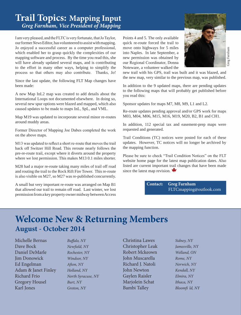
Trail Topics: Mapping InputGreg Farnham, Vice President of Mapping
Gre
g Fa
rnha
m
I am very pleased, and the FLTC is very fortunate, that Jo Taylor, our former News Editor, has volunteered to assist with mapping. Jo enjoyed a successful career as a computer professional, which enabled her to grasp quickly the complexities of our mapping software and process. By the time you read this, she will have already updated several maps, and is contributing to the effort in many other ways, helping to simplify the process so that others may also contribute. Thanks, Jo!
Since the last update, the following FLT Map changes have been made:
A new Map InL2 map was created to add details about the International Loops not documented elsewhere. In doing so, several new spur options were blazed and mapped, which also caused updates to be made to maps InL, SpL, and VML.
Map M19 was updated to incorporate several minor re-routes around muddy areas.
Former Director of Mapping Joe Dabes completed the work on the above maps.
M13 was updated to reflect a short re-route that moves the trail back off Switzer Hill Road. This reroute nearly follows the pre-re-route trail, except where it diverts around the property where we lost permission. This makes M13 0.1 miles shorter.
M28 had a major re-route taking many miles of trail off road and routing the trail to the Rock Rift Fire Tower. This re-route is also visible on M27, so M27 was re-published concurrently. A small but very important re-route was arranged on Map B1 that allowed our trail to remain off road. Last winter, we lost permission from a key property owner midway between Access
Points 4 and 5. The only available quick re-route forced the trail to move onto highways for 5 miles into Naples. In late September, a new permission was obtained by our Regional Coordinator, Donna Noteware, a volunteer walked the new trail with his GPS, trail was built and it was blazed, and the new map, very similar to the previous map, was published.
In addition to the 9 updated maps, there are pending updates to the following maps that will probably get published before you read this:
Sponsor updates for maps M7, M8, M9, L1 and L2.
Re-route updates pending approval and/or GPS work for maps M03, M04, M06, M15, M16, M19, M20, B2, B1 and CH1.
In addition, 112 special tax and easement-prep maps were requested and generated.
Trail Conditions (TC) notices were posted for each of these updates. However, TC notices will no longer be archived by the mapping function.
Please be sure to check “Trail Condition Notices” on the FLT website home page for the latest map publication dates. Also listed are current important trail changes that have been made since the latest map revision.
Contact: Greg Farnham [email protected]
Christina Lawes Sidney, NYChristopher Leak Jamesville, NYRobert Mckeown Welland, ON John Muscarella Rome, NYRichard J. Natoli Norwich, NYJohn Newton Kendall, NYGaylen Raisler Elmira, NYMarjolein Schat Ithaca, NYBambi Talley Bloomfi ld, NY
Welcome New & Returning MembersAugust - October 2014Michelle Bernas Buffalo, NYDave Bock Newfield, NYDaniel DeMarle Rochester, NYJim Donowick Windsor, NYEd Engelman Afton, NYAdam & Janet Finley Holland, NYRichard Frio North Syracuse, NYGregory Housel Burt, NYKarl Jones Groton, NY
19www.FingerLakesTrail.org Finger Lakes Trail News Winter 2014
Changes Coming for Spanish Loop TrailAlex Gonzalez
Elaine Schwartz, a longtime friend of the Spanish Loop Trail (SLT) who has happily allowed the trail to cross her land, recently granted me a right of way that makes the trail’s route through her land permanent. That means that either through easement or outright purchase, the entire route of the SLT will soon be protected except for a total of 0.4 miles. On behalf of the Finger Lakes Trail Conference, to whom the right of way will eventually be transferred as an easement, I would like to thank Elaine for her generosity and kindness. Additionally, Elaine has granted permission for the temporary use of a nearby logging road, which will facilitate trail maintenance and improvement for the next few years.
Other changes are coming. Since the trail’s creation in the late 1990s, the portion on state land has been unfortunately relegated to a marginally pleasant walk along a seasonal gravel road, Owego Hill Road. Recently, the Department of Environmental Conservation (DEC) decided that the trail could be rerouted into the woods on DEC-administered state land, taking a whole mile off road. The route given to the trail is the result of a compromise between the trail conference and the DEC, so some brief portions that we would have preferred to be switchbacked will instead turn out to be a bit steeper than we would have liked. This compromise was necessary so that the trail’s location would not create conflicts with future DEC land-management goals. I would like to thank Henry Dedrick of the DEC for his flexibility regarding the trail’s route, the majority of which actually ended up being exactly what we requested.
Once the reroute is finished, the new route will feature the following: … a lovely stream walk among huge white pines, hemlocks, tamaracks, and Norway spruces that always brings to my mind Longfellow’s famous opening from Evangeline, “This is the forest primeval” … two moss-covered rockpiles, one huge, the other slightly less so… an exceptionally lovely moss-covered ascending spring that may feature seating, if the DEC should approve our upcoming request, so that hikers can take in the spring’s beauty at their leisure… two isolated large white pines, one enormous … and, finally, an old farm-building foundation with its driveway still identifiable, which the trail actually utilizes for a few steps. The SLT will reconnect with the FLT approximately 0.1 mile from the International Mine, making that an attractive optional goal for those hiking the reroute, which, despite the few slight steep spots, is almost entirely level with only intermittent short, gentle undulations. Hikers will notice the usual sporadic obstructions (logs left across the trail intentionally to discourage repeated illegal motorized-vehicle use), but the incidence of such obstructions necessarily
increases when the trail approaches ATV access points. Owego Hill Road is often the source of problems with motorized vehicles uglifying both public and private land, with some landowners posting signs declaring their property protected by the New York State Police. I should stress that hiking is rarely affected directly and hikers should feel safe hiking the area’s trails; it has never been any worse than the unwelcome noise and smell, and the riders always seem to be friendly.
Hikers should check the trail-conditions pages on the FLT web site for the date of the reroute’s official opening, which could come as early as late November or as late as spring 2015. Once the reroute is open, slight mileage changes will be in order for the following three maps: M19, Spanish Loop Trail, and the International Loop, all of which will show that the length of the SLT’s route will have increased from 5.2 to 6.1 miles. These are exciting changes that will soon make Kennedy State Forest an even more attractive place to hike.
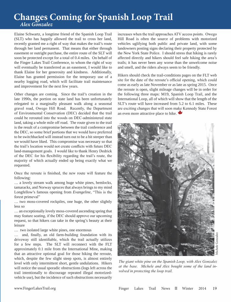
The giant white pine on the Spanish Loop, with Alex Gonzalez at the base. Michele and Alex bought some of the land in-volved in protecting the loop trail.
Mic
hele
Gon
zale
z
20 Winter 2014 Finger Lakes Trail News www.FingerLakesTrail.org
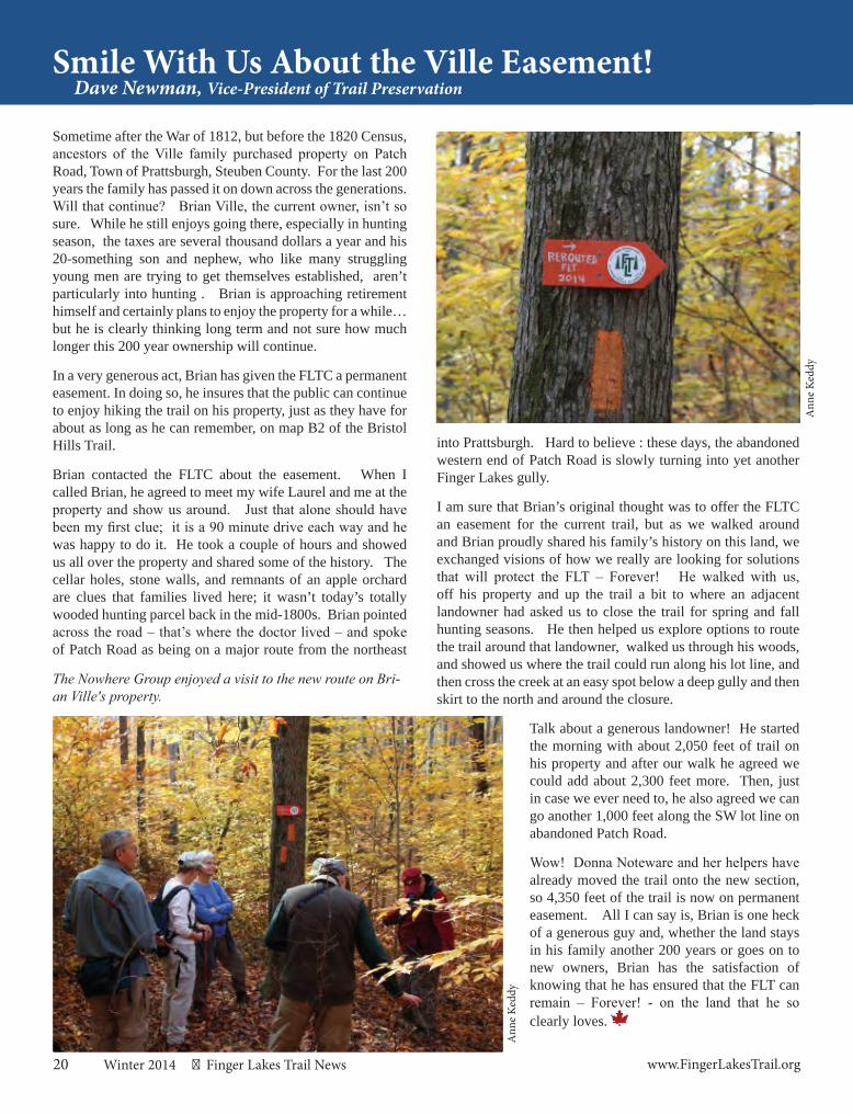
Smile With Us About the Ville Easement!Dave Newman, Vice-President of Trail Preservation
Sometime after the War of 1812, but before the 1820 Census, ancestors of the Ville family purchased property on Patch Road, Town of Prattsburgh, Steuben County. For the last 200 years the family has passed it on down across the generations. Will that continue? Brian Ville, the current owner, isn’t so sure. While he still enjoys going there, especially in hunting season, the taxes are several thousand dollars a year and his 20-something son and nephew, who like many struggling young men are trying to get themselves established, aren’t particularly into hunting . Brian is approaching retirement himself and certainly plans to enjoy the property for a while… but he is clearly thinking long term and not sure how much longer this 200 year ownership will continue.
In a very generous act, Brian has given the FLTC a permanent easement. In doing so, he insures that the public can continue to enjoy hiking the trail on his property, just as they have for about as long as he can remember, on map B2 of the Bristol Hills Trail.
Brian contacted the FLTC about the easement. When I called Brian, he agreed to meet my wife Laurel and me at the property and show us around. Just that alone should have been my first clue; it is a 90 minute drive each way and he was happy to do it. He took a couple of hours and showed us all over the property and shared some of the history. The cellar holes, stone walls, and remnants of an apple orchard are clues that families lived here; it wasn’t today’s totally wooded hunting parcel back in the mid-1800s. Brian pointed across the road – that’s where the doctor lived – and spoke of Patch Road as being on a major route from the northeast
into Prattsburgh. Hard to believe : these days, the abandoned western end of Patch Road is slowly turning into yet another Finger Lakes gully.
I am sure that Brian’s original thought was to offer the FLTC an easement for the current trail, but as we walked around and Brian proudly shared his family’s history on this land, we exchanged visions of how we really are looking for solutions that will protect the FLT – Forever! He walked with us, off his property and up the trail a bit to where an adjacent landowner had asked us to close the trail for spring and fall hunting seasons. He then helped us explore options to route the trail around that landowner, walked us through his woods, and showed us where the trail could run along his lot line, and then cross the creek at an easy spot below a deep gully and then skirt to the north and around the closure.
Talk about a generous landowner! He started the morning with about 2,050 feet of trail on his property and after our walk he agreed we could add about 2,300 feet more. Then, just in case we ever need to, he also agreed we can go another 1,000 feet along the SW lot line on abandoned Patch Road.
Wow! Donna Noteware and her helpers have already moved the trail onto the new section, so 4,350 feet of the trail is now on permanent easement. All I can say is, Brian is one heck of a generous guy and, whether the land stays in his family another 200 years or goes on to new owners, Brian has the satisfaction of knowing that he has ensured that the FLT can remain – Forever! - on the land that he so clearly loves.
The Nowhere Group enjoyed a visit to the new route on Bri-an Ville's property.
Ann
e Ke
ddy
Ann
e Ke
ddy
21www.FingerLakesTrail.org Finger Lakes Trail News Winter 2014
I have not been hiking nearly enough lately, but I was thinking about backpacking when one of my students asked why we can’t just say “camp bed” instead of “cot.” Besides the obvious possibility that it might be better to use one word instead of two, what the student was trying to communicate was that having lots of words for places to sleep is not particularly helpful to her when there are two, more common, words, that could cover the possibility covered by “cot.” “Cot” is a borrowing from Hindi, and it refers specifically to a temporary bed frame, which is why “cots” in North American English are beds that can be set up and put away as needed.
“Camp bed” is not adequate for the types of distinctions that English speakers want to make, in part because there are different types of camping. There are military encampments, which would work well with part of the history of “cot,” also. Some people go “camping” in their RVs. As a backpacker, I do not consider that camping; camping requires that we not take a house with us. The “camp bed” for RV campers would mean something different from a military “camp bed.” My camp bed is a sleeping bag that I have owned for more than a decade. So what’s the use of “cot,” when context will probably disambiguate the intended sleep situations that are possible with “camp bed?”
Here’s the short version for non-linguists.
All languages change, given space and time. It is unavoidable, although there are attempts to stop it. Of course, the fact that these attempts have been documented for almost as long as there is documentation of anything is evidence that languages keep changing. Why languages change is a matter of ongoing debate, but one of the major theories is that languages change to try to avoid things like irregular forms or subtle distinctions between vowels (such as the lack of distinction in California English between the vowels in “pin” and “pen:” I have a friend from California who insists that he writes with what I hear as “pins.”) Such changes result in untenable forms that don't make the distinctions we need, which drive further changes.
Language variation, the results of which are called dialects, is normal and expected, but there is still an idea of a standard variety of any given language. “Standards” are not actually spoken. They are theoretical ideals, but some people speak a variety that is closer to the standard than are others. Because I have piles of education, I speak relatively closely to the standard. This is the standard phenomenon: it’s the dialect of education and educated people. However, I also keep a few of my regionalisms just for fun; I like who I am and my background, and my language shows some of who I am. I have the option of controlling how much of that I reveal, which is an advantage, so awareness of and ability to use dialectal variation is a useful thing to teach, such as to my student. When I talk about my sleeping bag as my favorite
A Walk on the Wordy SideMarla Perkins
place to sleep when I’m camping, I self-identify as a person who backpacks.
The advantage of the shift toward “cot” rather than “camp bed,” if we want to talk about advantages, is that English now has a specific term that eliminates a few possibilities for confusion or ambiguity, although certainly not all of them; even “cot” is used for military encampments and temporary beds that can be kept in a closet at home. What language is really good for is helping us to make and communicate fine distinctions, and the fine distinctions that are convenient to make and communicate differ across languages. English has “bed” and “cot” and “crib” and “cradle” and “futon” and “hammock” and “stall” and “pod” and “recliner” and “mattress” and “sleeping bag,” for example, to make fine distinctions about where to sleep, who sleeps, what part of the thing the sleeping is done on or with, and under what conditions the sleeping is done.
On a side note: There’s an urban legend about an arctic language that has 40+ words for snow, but in fact they don’t: they have morphology, such as snow-ing, snow-ed, snow-s, which is one word for snow and a lot of morphology. English in fact has more distinct terms for frozen precipitation than that language (snow, hail, sleet, graupel…). The point is that we can’t say anything necessarily about a culture or context based on the distinctions that are conveniently made with words. If we didn’t have the words, we could make the same distinctions with longer explanations: for example, that thing that the baby sleeps in that has bars to keep the baby from climbing out (“crib”). Part of learning a language is learning what distinctions are available and how to use them. Some people call that “thinking in” the other language, but it can be done more intentionally and consciously once the distinctions are identified.
Hikers, of course, have their own lexicon, and specialization is a contributor to language variation (analyses of hiking terms coming soon!). Maybe some people do use “cots” as “camp beds.” I use a sleeping bag.
Happy winter camping to all, whether using a camp bed, a cot, or a sleeping bag.
CALL 911 FOR ANY
EMERGENCY
22 Winter 2014 Finger Lakes Trail News www.FingerLakesTrail.org
A Naturalist’s ViewD. Randy Weidner
You just never know what you might encounter on a hike. Recently walking with two friends on the Bristol Hills Trail of the Finger Lakes Trail System, having just ascended a steep slope near a glen, we saw something lumbering our way down the trail ahead. It was a fairly large, hunched-over creature with a wide-based gait causing it to sway side to side as it moved. My first thought was of a raccoon, so we stood very still and it approached to within twenty yards, seeming never to notice us. By then it was apparent it was a North American Porcupine, Erethizon dorsatum.
Porcupine is certainly an odd word, probably derived from the Old French, porcespin, “porce” meaning pig and “spin” meaning spine. The scientific binomial also reflects the animal’s major anatomical features, its quills, though indirectly, being loosely translated as “irritating back.” The North American Porcupine is our second largest rodent, reaching nearly 40 pounds, being surpassed only by the beaver. Occurring from Alaska to northern Mexico, the North American Porcupine came to be here by an interesting consequence of zoogeography. There is good evidence from genetic studies that our porcupine is a fairly recent descendant of African porcupines. It is currently believed most likely that the original ancestors, floating on a raft of vegetation, caught a favorable drift of current and wind, and left Africa to land in present day Brazil some 30 million years ago. At that time, North and South America were separate island continents. Roughly 3 million years ago the Isthmus of Panama formed, uniting the two land masses. There was a prompt exchange of fauna, with some North American species like cougars and sloths going south, while other South American species like opossums and the porcupines came north. So even if the porcupine we saw was an “end-to-ender” on the Finger Lakes Trail, his ancestors walked much farther.
My friends and I stood still and remained quiet watching the near-sighted porcupine in the trail ahead. He seemed to be foraging, but in a rather haphazard manner, veering to the right, turning over a small log, then left, scratching around on the ground. There were loads of acorns on the ground which he ignored, and a few nearby herbaceous plants, but we could not be sure just what he was doing. Usually porcupines are nocturnal, so at around 10 AM when we saw him, he may have just been tired. Porcupines are reported to eat twigs, stems, berries and some green vegetation in summer, but mostly needles and bark in winter. They do seem to develop specific preferences in the tree twigs they eat, perhaps selecting, for example, only poplar. This may seem like a distinct disadvantage to so slow moving an animal, but as partial compensation, discovered through complex maze running experiments, porcupines are quite intelligent and have a workable memory that lasts over 100 days. Once he finds a few favorite tree restaurants, he will remember where they are.
Life to a porcupine is lived leisurely. They find mates and breed in the fall. Before you ask, let me anticipate your next question: breeding is done carefully, with each partner flattening their coats so as not to injure the other. Just one pup is born, eyes open, with quills that harden in about an hour, and little time is spent at nursing because they can feed themselves in a few days. Generally young porcupines stay with their mothers for about six months before assuming their long solitary lifestyle. Porcupines can live over 25 years, the longest lived rodent (excluding Naked Mole Rats which do not maintain a constant body temperature like the porcupine). In winter they do not hibernate but live in a
den, rarely venturing far, eating mainly bark. One more thing about mating: porcupines are fiercely defensive with mates, probably because finding one is so infrequent. Particularly in fall, to attract the attention of a mate, porcupines vocalize from the treetops with blood-curdling shrieks and screams, often misinterpreted by humans to be big cat screams.
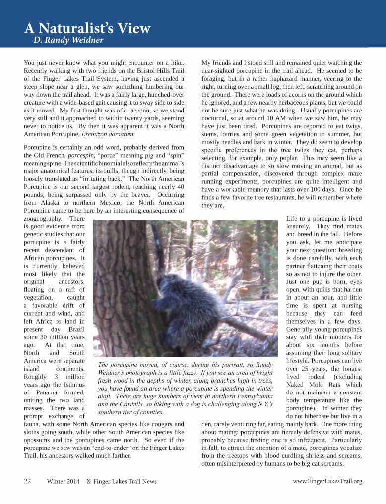
The porcupine moved, of course, during his portrait, so Randy Weidner’s photograph is a little fuzzy. If you see an area of bright fresh wood in the depths of winter, along branches high in trees, you have found an area where a porcupine is spending the winter aloft. There are huge numbers of them in northern Pennsylvania and the Catskills, so hiking with a dog is challenging along N.Y.’s southern tier of counties.
23www.FingerLakesTrail.org Finger Lakes Trail News Winter 2014
Our little group of hikers finally moved to get some pictures and the porcupine noticed us. He immediately bristled up and headed to a hemlock tree. We moved away, giving him a wide berth. He climbed higher into the tree, a surprising hazard for an arboreal animal. Many porcupines are killed by falls from trees, most likely because they venture too far out on a thin limb to reach the tender buds, and the limb snaps under their weight. Such an accident if not fatal might also result in being stuck with his own quills, but fear not. Porcupines have antibiotic substances on their skin to avoid infection. Their famous quills are made of keratin, the same as their hair and nails. Quills are most numerous around the head, back and tail. Unable truly to throw their quills, these defensive hairs readily release into the skin of an attacker and due to backward pointing scales, prove hard to extract. Large mammalian predators (wolves, coyotes, dogs, big cats, and bears) and predatory birds (eagles and owls) usually learn early in life the painful lesson of the porcupine. One predator, the fisher (Martes pennanti), can kill porcupines without serious injury, but it is gruesome. After several careful attacks to the porcupine’s face, lasting up to a half hour, the rodent, weakened by blood loss, gets spun over and the fisher finishes him with an attack to his soft, unquilled belly. I was happy to have seen the porcupine, but I would rather not see one suffer a fisher attack!
“Only those who will risk going too far can possibly find out how far they can go” T.S. Elliot
On April 11, 2009, we were introduced to the FLT by our friend, Dave Newlun. Our first hike on the FLT took place in the Goundry Hill State Forest and we discovered how out of shape we were. When asked to join in another hike we reluctantly agreed. As the summer progressed we started to look forward to the next outing and began learning more about the trail and its markings. By the end of summer we had completed Schuyler County and entered Tompkins County.
We met and hiked with Patty Millard later in our first year and continued hiking with her until she lost her battle with cancer in 2011. She is still an inspiration when we find ourselves pushing personal limits because she pushed her limits on a regular basis.
We joined the county series for Chenango, Cortland, Schuyler and Steuben Counties. Hiking has become such a part of our non-working lives that our adult children have been known to say they need an appointment to come visit. Some of them have joined us when time and
End-to-End StoryPaul (#376) and Kathy (#377) Good, Horseheads, NY
jobs permit. One of the biggest lessons we have learned is that being mentally and physically prepared will ensure an enjoyable hiking experience. We have found each new hike to be “the best one yet” with very few exceptions.
Paul (#376) and Kathy (#377) Good, finishing on North Ur-bana Rd, Map M12, east of Hammondsport.
A Special Deal for FLTC Members!
Now you can join the North Country Trail Association for just $23 per year! You’ll get a subscription to North Star magazine,
and the satisfaction of helping develop the North Country National Scenic Trail. To join, send this coupon to:
NCTA, 229 E. Main St., Lowell, MI 49331 or call 866-Hike-NCT
Name(s):
Address:
City, St. Zip:
Phone (optional):
Email (optional):
I’m enclosing a check for $23 payable to NCTA Please charge my credit card (MasterCard, Visa or AmEx only) Card #: ___________________________ Exp. Date: _______ Name as it apears on card: ____________________________ Signature: _________________________________________
Join the North Country Trail Association
Dav
e N
ewlu
n
24 Winter 2014 Finger Lakes Trail News www.FingerLakesTrail.org
I first made contact with Don McCabe via a message board on the Backpacker.com website. I exchanged brief messages with Don and informed him that I was a 1982 Appalachian Trail end-to-ender now in the early stages of “The Ramble Across New York,” a piecemeal 850+ mile walk from the New Jersey side of the George Washington Bridge to Niagara Falls. The Ramble would involve hiking part of the Long Path, part of the Appalachian Trail, the Shawangunk Ridge Trail, part of the Long Path again, the Finger Lakes Trail and the Conservation Trail. The upcoming section would be a four-day backpacking trip on the Appalachian Trail between Wawayanda and High Point State Parks in New Jersey. Don was intrigued and agreed to join our informal group. We were the “Bureaucrats Unlimited Hiking Club” - BUHC for short. (BUHC rhymes with luck.)
I met Don on Friday, November 28, 2003, at the route 94 Appalachian Trail parking lot in Vernon, New Jersey. Don was late and it was beginning to rain. Three BUHC members began hiking southward toward High Point while I shivered and waited for Don in a cold downpour. Just as I was about to give up on him, he arrived. We caught the group.
I’m glad I waited for Don in the driving rain that day. We spent three days together and immediately began to form a friendship and create memories. That next summer, Don joined me and another hiking buddy on the Shawangunk Ridge Trail. Mid-way through that trek, Don tuckered-out and called his future wife, Karen, to come bail him out in the town of Wurtsboro, New York. But he didn’t give up. He joined BUHC for yet another segment of The Ramble, this time Memorial Day weekend in 2005 through the Catskills and over The Ramble’s highest elevations, Peekamoose and Table Mountains.
That Catskill trip ended at the eastern terminus of the Finger Lakes Trail. In the parking lot at trip’s end, Don told me he wanted to hike the entire Finger Lakes Trail with me. And so we began, short backpacking trip by short backpacking trip, hiking the FLT, always starting the next segment where we’d
concluded the last, an unbroken and relentless linear march. Some of those multi-day trips involved fellow members of BUHC, and sometimes it was just the two of us. In the early days, the FLTC’s Ed Sidote would meet us. At Donnie Mac’s urging we made a pact to stop and have a beer at every bar and restaurant we passed along the way. I had to convince him that gas stations and convenience stores didn’t count. There were countless stories, some real, some concocted on the spot. There were hike themes. Don created a BUHC website. There were laughs. There was misery. There was exhaustion. There was joy. There were a lot of trip reports. Some made the FLT News.
In August of 2012 Donnie Mac and I hiked from Hughes Road west of Bath to Garwoods. It was the “Windmills” trip. Something was bothering Don physically. He was listless and struggled on the hike. We talked about a prior bout with Lyme Disease and the possibility of a recurrence. He would go to the doctor when he got home. We planned another segment for August of 2013, but Don had to cancel. He wasn’t feeling up to it. I didn’t know it at the time, but hiking under those windmills was the beginning of the end. I never saw Donnie Mac again.
Donnie Mac passed away on February 9, 2014, falling victim to Multiple Myeloma, a form of blood cancer. At his memorial service, his wife Karen confided that finishing the FLT was very important to Don and that hiking was a huge part of his life. She gave me a small container bearing a portion of Don’s ashes. She asked me to scatter them in the woods.
Beginning where Donnie Mac last set foot on the FLT in Garwoods to the Pennsylvania border I will carry Don’s memory and scatter tiny amounts of his ashes along the FLT. While Don never got the chance to walk the entire trail, a portion of him will indeed finish the FLT with me.
Rest in peace, my friend.
In the Spirit of Donnie MacKen "The Big Mully" Lewaine
Donna Noteware leading the weekly Nowhere Group along the reroute on Brian Ville's new easement.A
nne
Kedd
y
25www.FingerLakesTrail.org Finger Lakes Trail News Winter 2014
Answer to the Spring“Name That Map!” Quiz
So, you hiked the FLT or parts of it. Let’s see how observant you were! Send your guess to:
Jacqui at [email protected] Picture:
Car
rie E
llen
Will
iam
s
New Picture:
Correct ID:
“I’ll guess M19, just before Foxfire Lean-to heading East. There is a spring there, and a little side trail leading to it. It leads down a slight hill to wide open fields giving nice views to the south. If that isn’t the right answer, it should be!” Terry McConnell, Lafayette
Eric Malmberg, Marathon
Tony Colella aka Dream Walker, Skaneateles
Hint: Branch Trail
Ric
h B
resl
in
FLT NAMED HIKE EVENTSaturday, January 10, 2015Winter 2015 Howard Beye Hike or Let's Hope for Snow Hike
Map: L1, Access C to Access E, Letchworth State Park Hike Leader: Cate Concannon, [email protected]
Hike Description: I have decided to tempt fate with this hike. Two years ago, the Howard Beye hike was held on a section of the Letchworth Trail a bit south of this section. Up until about 2 days before the hike, it appeared that we would have nice snowshoeing weather. And then the temperatures reached 55+ degrees which made for an extremely long, wet hike. I can’t promise we will have snow this year, but I can assure you that there are not 20 gullies/stream crossings. We’ll be hiking a very beautiful section of the Letchworth Trail, and I’m happy to show it off. We will hike a six mile section from the Hogsback Overlook (Access C) to Access E on River Rd. Meeting Location: Hogsback Overlook Parking Area, Letchworth State Park, 10 am
Directions to Meeting Location: The Hogsback Overlook is located just off Rt 408, south of Mt. Morris. If coming from the north, take 390 South to Exit 7. Turn left onto Rt 408 and follow into Mt. Morris. Turn right onto Main Street, and right onto Rt 408. Turn right onto Visitor Center Road and then left at the sign for the overlook.
Please contact hike leader if interested in joining to assist with car shuttle setup.
In Memory of:
James Billigfrom
Leighann Billig
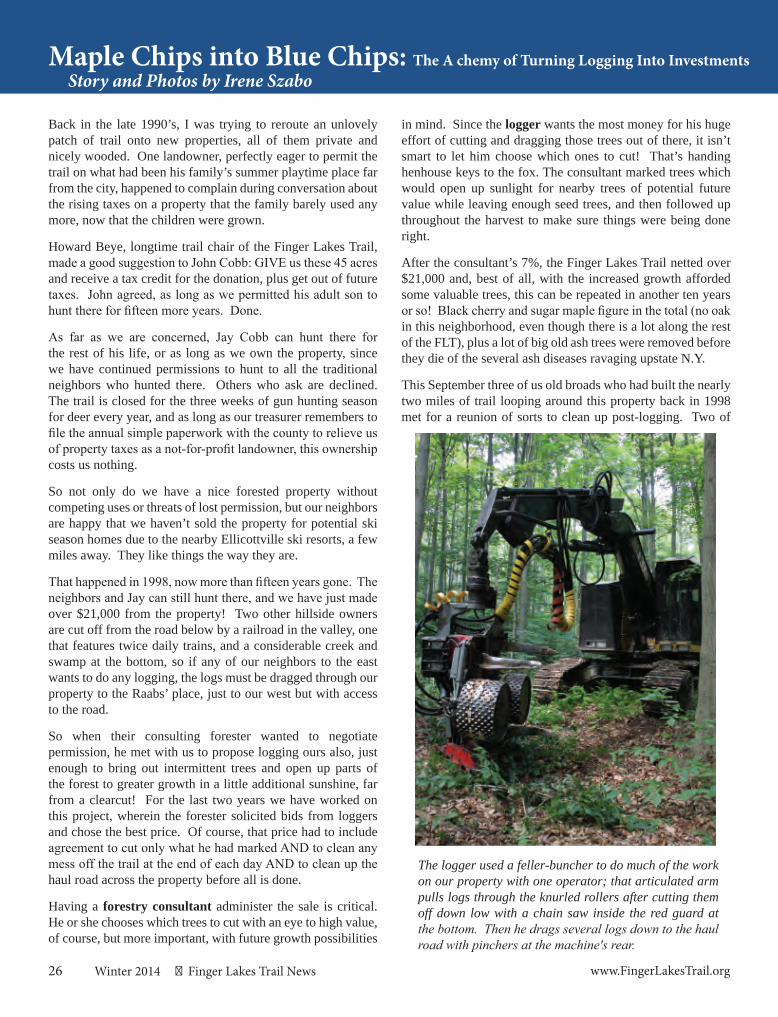
26 Winter 2014 Finger Lakes Trail News www.FingerLakesTrail.org
Maple Chips into Blue Chips: The A chemy of Turning Logging Into InvestmentsStory and Photos by Irene Szabo
Back in the late 1990’s, I was trying to reroute an unlovely patch of trail onto new properties, all of them private and nicely wooded. One landowner, perfectly eager to permit the trail on what had been his family’s summer playtime place far from the city, happened to complain during conversation about the rising taxes on a property that the family barely used any more, now that the children were grown.
Howard Beye, longtime trail chair of the Finger Lakes Trail, made a good suggestion to John Cobb: GIVE us these 45 acres and receive a tax credit for the donation, plus get out of future taxes. John agreed, as long as we permitted his adult son to hunt there for fifteen more years. Done.
As far as we are concerned, Jay Cobb can hunt there for the rest of his life, or as long as we own the property, since we have continued permissions to hunt to all the traditional neighbors who hunted there. Others who ask are declined. The trail is closed for the three weeks of gun hunting season for deer every year, and as long as our treasurer remembers to file the annual simple paperwork with the county to relieve us of property taxes as a not-for-profit landowner, this ownership costs us nothing.
So not only do we have a nice forested property without competing uses or threats of lost permission, but our neighbors are happy that we haven’t sold the property for potential ski season homes due to the nearby Ellicottville ski resorts, a few miles away. They like things the way they are.
That happened in 1998, now more than fifteen years gone. The neighbors and Jay can still hunt there, and we have just made over $21,000 from the property! Two other hillside owners are cut off from the road below by a railroad in the valley, one that features twice daily trains, and a considerable creek and swamp at the bottom, so if any of our neighbors to the east wants to do any logging, the logs must be dragged through our property to the Raabs’ place, just to our west but with access to the road.
So when their consulting forester wanted to negotiate permission, he met with us to propose logging ours also, just enough to bring out intermittent trees and open up parts of the forest to greater growth in a little additional sunshine, far from a clearcut! For the last two years we have worked on this project, wherein the forester solicited bids from loggers and chose the best price. Of course, that price had to include agreement to cut only what he had marked AND to clean any mess off the trail at the end of each day AND to clean up the haul road across the property before all is done.
Having a forestry consultant administer the sale is critical. He or she chooses which trees to cut with an eye to high value, of course, but more important, with future growth possibilities
in mind. Since the logger wants the most money for his huge effort of cutting and dragging those trees out of there, it isn’t smart to let him choose which ones to cut! That’s handing henhouse keys to the fox. The consultant marked trees which would open up sunlight for nearby trees of potential future value while leaving enough seed trees, and then followed up throughout the harvest to make sure things were being done right.
After the consultant’s 7%, the Finger Lakes Trail netted over $21,000 and, best of all, with the increased growth afforded some valuable trees, this can be repeated in another ten years or so! Black cherry and sugar maple figure in the total (no oak in this neighborhood, even though there is a lot along the rest of the FLT), plus a lot of big old ash trees were removed before they die of the several ash diseases ravaging upstate N.Y.
This September three of us old broads who had built the nearly two miles of trail looping around this property back in 1998 met for a reunion of sorts to clean up post-logging. Two of
The logger used a feller-buncher to do much of the work on our property with one operator; that articulated arm pulls logs through the knurled rollers after cutting them off down low with a chain saw inside the red guard at the bottom. Then he drags several logs down to the haul road with pinchers at the machine's rear.
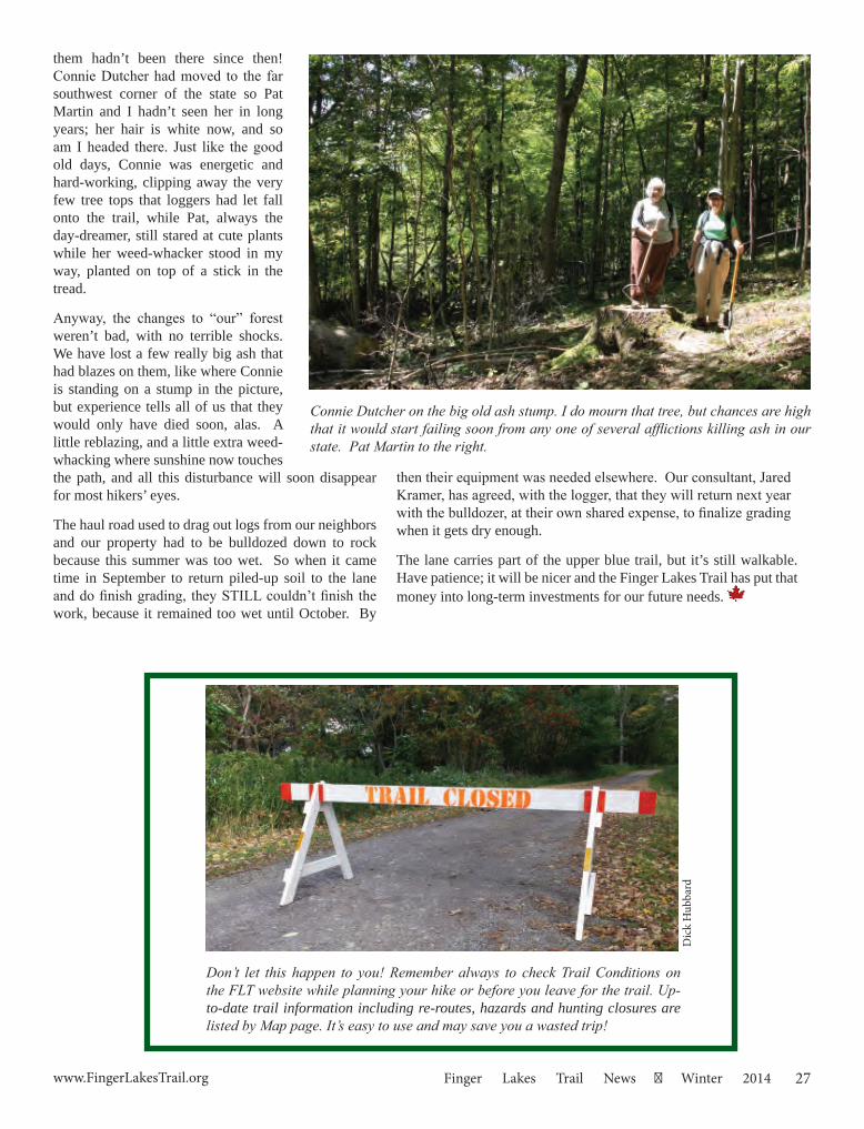
27www.FingerLakesTrail.org Finger Lakes Trail News Winter 2014
Maple Chips into Blue Chips: The A chemy of Turning Logging Into Investments them hadn’t been there since then! Connie Dutcher had moved to the far southwest corner of the state so Pat Martin and I hadn’t seen her in long years; her hair is white now, and so am I headed there. Just like the good old days, Connie was energetic and hard-working, clipping away the very few tree tops that loggers had let fall onto the trail, while Pat, always the day-dreamer, still stared at cute plants while her weed-whacker stood in my way, planted on top of a stick in the tread.
Anyway, the changes to “our” forest weren’t bad, with no terrible shocks. We have lost a few really big ash that had blazes on them, like where Connie is standing on a stump in the picture, but experience tells all of us that they would only have died soon, alas. A little reblazing, and a little extra weed-whacking where sunshine now touches the path, and all this disturbance will soon disappear for most hikers’ eyes.
The haul road used to drag out logs from our neighbors and our property had to be bulldozed down to rock because this summer was too wet. So when it came time in September to return piled-up soil to the lane and do finish grading, they STILL couldn’t finish the work, because it remained too wet until October. By
Connie Dutcher on the big old ash stump. I do mourn that tree, but chances are high that it would start failing soon from any one of several afflictions killing ash in our state. Pat Martin to the right.
Don’t let this happen to you! Remember always to check Trail Conditions on the FLT website while planning your hike or before you leave for the trail. Up-to-date trail information including re-routes, hazards and hunting closures are listed by Map page. It’s easy to use and may save you a wasted trip!
then their equipment was needed elsewhere. Our consultant, Jared Kramer, has agreed, with the logger, that they will return next year with the bulldozer, at their own shared expense, to finalize grading when it gets dry enough.
The lane carries part of the upper blue trail, but it’s still walkable. Have patience; it will be nicer and the Finger Lakes Trail has put that money into long-term investments for our future needs.
Dic
k H
ubba
rd
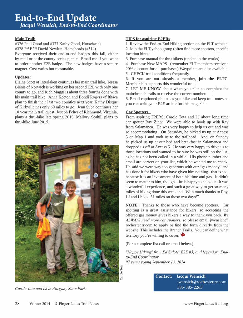
28 Winter 2014 Finger Lakes Trail News www.FingerLakesTrail.org
End-to-End UpdateJacqui Wensich, End-to-End Coordinator
Contact: Jacqui Wensich [email protected] 585-385-2265
Main Trail:#376 Paul Good and #377 Kathy Good, Horseheads#378 2nd E2E David Newlun, Horseheads (#314) Everyone received their end-to-end badges this fall, either by mail or at the county series picnic. Email me if you want to order another E2E badge. The new badges have a secure magnet. Cost varies but reasonable.
Updates:Elaine Scott of Interlaken continues her main trail hike, Teresa Blenis of Norwich is working on her second E2E with only one county to go, and Rich Maggi is about three fourths done with his main trail hike. Anna Keeton and Bohdi Rogers of Ithaca plan to finish their last two counties next year. Kathy Disque of Kirkville has only 60 miles to go. Jenn Suba continues her 10 year main trail quest. Joseph Feher of Richmond, Virginia, plans a thru-hike late spring 2015. Mallory Scahill plans to thru-hike June 2015.
Carole Tota and LJ in Allegany State Park.
Car
ole
Tota
TIPS for aspiring E2ERs: 1. Review the End-to-End Hiking section on the FLT website. 2. Join the FLT yahoo group (often find more spotters, specific location hints. 3. Purchase manual for thru hikers (update in the works). 4. Purchase New MAPS (remember FLT members receive a 20% discount for all purchases) Waypoints are also available. 5. CHECK trail conditions frequently. 6. If you are not already a member, join the FLTC. Membership supports this wonderful trail. 7. LET ME KNOW about when you plan to complete the main/branch trails to receive the correct number. 8. Email captioned photos as you hike and keep trail notes so you can write your E2E article for this magazine.
Car Spotters: From aspiring E2ERS, Carole Tota and LJ about long time car spotter Ray Zinn: “We were able to hook up with Ray from Salamanca. He was very happy to help us out and was so accommodating. On Saturday, he picked us up at Access 5 on Map 1 and took us to the trailhead. And, on Sunday he picked us up at our bed and breakfast in Salamanca and dropped us off at Access 5. He was very happy to drive us to those locations and wanted to be sure he was still on the list, as he has not been called in a while. His phone number and email are correct on your list, which he wanted me to check. He said we were way too generous with our “gas money” and has done it for hikers who have given him nothing...that is sad, because it is an investment of both his time and gas. It didn’t seem to matter to him, though....he is happy to help out. It was a wonderful experience, and such a great way to get so many miles of hiking done this weekend. With much thanks to Ray, LJ and I hiked 31 miles on those two days!”
NOTE: Thanks to those who have become spotters. Car spotting is a great assistance for hikers, so accepting the offered gas money gives hikers a way to thank you back. We ALWAYS need more car spotters, so please email [email protected] to apply or find the form directly from the website. This includes the Branch Trails. You can define what territory you’re willing to cover.
(For a complete list call or email below.)
"Happy Hiking" from Ed Sidote, E2E #3, and legendary End-to-End Coordinator97 years young September 13, 2014
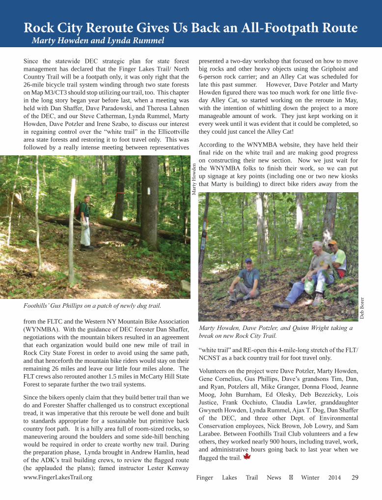
29www.FingerLakesTrail.org Finger Lakes Trail News Winter 2014
Rock City Reroute Gives Us Back an All-Footpath RouteMarty Howden and Lynda Rummel
Marty Howden, Dave Potzler, and Quinn Wright taking a break on new Rock City Trail.
Deb
Bor
er
Foothills’ Gus Phillips on a patch of newly dug trail.
Mar
ty H
owde
n
Since the statewide DEC strategic plan for state forest management has declared that the Finger Lakes Trail/ North Country Trail will be a footpath only, it was only right that the 26-mile bicycle trail system winding through two state forests on Map M3/CT3 should stop utilizing our trail, too. This chapter in the long story began year before last, when a meeting was held with Dan Shaffer, Dave Paradowski, and Theresa Lahnen of the DEC, and our Steve Catherman, Lynda Rummel, Marty Howden, Dave Potzler and Irene Szabo, to discuss our interest in regaining control over the “white trail” in the Ellicottville area state forests and restoring it to foot travel only. This was followed by a really intense meeting between representatives
from the FLTC and the Western NY Mountain Bike Association (WYNMBA). With the guidance of DEC forester Dan Shaffer, negotiations with the mountain bikers resulted in an agreement that each organization would build one new mile of trail in Rock City State Forest in order to avoid using the same path, and that henceforth the mountain bike riders would stay on their remaining 26 miles and leave our little four miles alone. The FLT crews also rerouted another 1.5 miles in McCarty Hill State Forest to separate further the two trail systems.
Since the bikers openly claim that they build better trail than we do and Forester Shaffer challenged us to construct exceptional tread, it was imperative that this reroute be well done and built to standards appropriate for a sustainable but primitive back country foot path. It is a hilly area full of room-sized rocks, so maneuvering around the boulders and some side-hill benching would be required in order to create worthy new trail. During the preparation phase, Lynda brought in Andrew Hamlin, head of the ADK’s trail building crews, to review the flagged route (he applauded the plans); famed instructor Lester Kenway
presented a two-day workshop that focused on how to move big rocks and other heavy objects using the Griphoist and 6-person rock carrier; and an Alley Cat was scheduled for late this past summer. However, Dave Potzler and Marty Howden figured there was too much work for one little five-day Alley Cat, so started working on the reroute in May, with the intention of whittling down the project to a more manageable amount of work. They just kept working on it every week until it was evident that it could be completed, so they could just cancel the Alley Cat!
According to the WNYMBA website, they have held their final ride on the white trail and are making good progress on constructing their new section. Now we just wait for the WNYMBA folks to finish their work, so we can put up signage at key points (including one or two new kiosks that Marty is building) to direct bike riders away from the
“white trail” and RE-open this 4-mile-long stretch of the FLT/NCNST as a back country trail for foot travel only.
Volunteers on the project were Dave Potzler, Marty Howden, Gene Cornelius, Gus Phillips, Dave’s grandsons Tim, Dan, and Ryan, Potzlers all, Mike Granger, Donna Flood, Jeanne Moog, John Burnham, Ed Olesky, Deb Bezezicky, Lois Justice, Frank Occhiuto, Claudia Lawler, granddaughter Gwyneth Howden, Lynda Rummel, Ajax T. Dog, Dan Shaffer of the DEC, and three other Dept. of Environmental Conservation employees, Nick Brown, Job Lowry, and Sam Larabee. Between Foothills Trail Club volunteers and a few others, they worked nearly 900 hours, including travel, work, and administrative hours going back to last year when we flagged the trail.
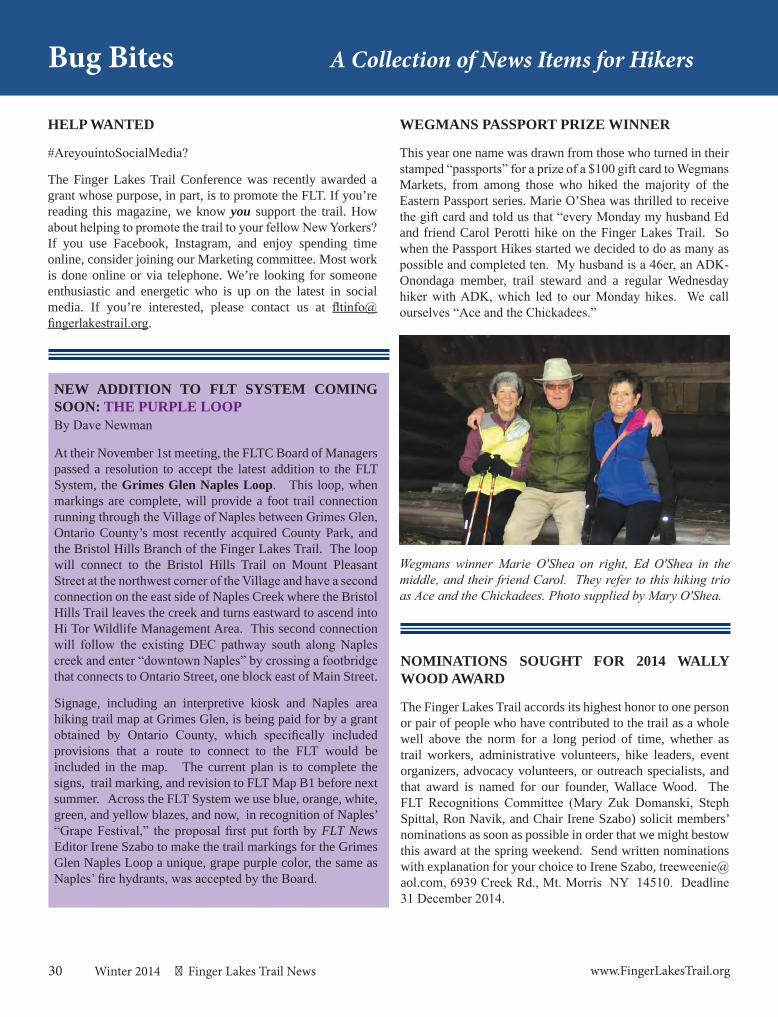
30 Winter 2014 Finger Lakes Trail News www.FingerLakesTrail.org
HELP WANTED
#AreyouintoSocialMedia?
The Finger Lakes Trail Conference was recently awarded a grant whose purpose, in part, is to promote the FLT. If you’re reading this magazine, we know you support the trail. How about helping to promote the trail to your fellow New Yorkers? If you use Facebook, Instagram, and enjoy spending time online, consider joining our Marketing committee. Most work is done online or via telephone. We’re looking for someone enthusiastic and energetic who is up on the latest in social media. If you’re interested, please contact us at [email protected].
NOMINATIONS SOUGHT FOR 2014 WALLY WOOD AWARD
The Finger Lakes Trail accords its highest honor to one person or pair of people who have contributed to the trail as a whole well above the norm for a long period of time, whether as trail workers, administrative volunteers, hike leaders, event organizers, advocacy volunteers, or outreach specialists, and that award is named for our founder, Wallace Wood. The FLT Recognitions Committee (Mary Zuk Domanski, Steph Spittal, Ron Navik, and Chair Irene Szabo) solicit members’ nominations as soon as possible in order that we might bestow this award at the spring weekend. Send written nominations with explanation for your choice to Irene Szabo, [email protected], 6939 Creek Rd., Mt. Morris NY 14510. Deadline 31 December 2014.
Bug Bites A Collection of News Items for Hikers
WEGMANS PASSPORT PRIZE WINNER
This year one name was drawn from those who turned in their stamped “passports” for a prize of a $100 gift card to Wegmans Markets, from among those who hiked the majority of the Eastern Passport series. Marie O’Shea was thrilled to receive the gift card and told us that “every Monday my husband Ed and friend Carol Perotti hike on the Finger Lakes Trail. So when the Passport Hikes started we decided to do as many as possible and completed ten. My husband is a 46er, an ADK-Onondaga member, trail steward and a regular Wednesday hiker with ADK, which led to our Monday hikes. We call ourselves “Ace and the Chickadees.”
NEW ADDITION TO FLT SYSTEM COMING SOON: THE PURPLE LOOPBy Dave Newman At their November 1st meeting, the FLTC Board of Managers passed a resolution to accept the latest addition to the FLT System, the Grimes Glen Naples Loop. This loop, when markings are complete, will provide a foot trail connection running through the Village of Naples between Grimes Glen, Ontario County’s most recently acquired County Park, and the Bristol Hills Branch of the Finger Lakes Trail. The loop will connect to the Bristol Hills Trail on Mount Pleasant Street at the northwest corner of the Village and have a second connection on the east side of Naples Creek where the Bristol Hills Trail leaves the creek and turns eastward to ascend into Hi Tor Wildlife Management Area. This second connection will follow the existing DEC pathway south along Naples creek and enter “downtown Naples” by crossing a footbridge that connects to Ontario Street, one block east of Main Street.
Signage, including an interpretive kiosk and Naples area hiking trail map at Grimes Glen, is being paid for by a grant obtained by Ontario County, which specifically included provisions that a route to connect to the FLT would be included in the map. The current plan is to complete the signs, trail marking, and revision to FLT Map B1 before next summer. Across the FLT System we use blue, orange, white, green, and yellow blazes, and now, in recognition of Naples’ “Grape Festival,” the proposal first put forth by FLT News Editor Irene Szabo to make the trail markings for the Grimes Glen Naples Loop a unique, grape purple color, the same as Naples’ fire hydrants, was accepted by the Board.
Wegmans winner Marie O'Shea on right, Ed O'Shea in the middle, and their friend Carol. They refer to this hiking trio as Ace and the Chickadees. Photo supplied by Mary O'Shea.
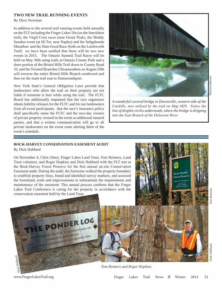
31www.FingerLakesTrail.org Finger Lakes Trail News Winter 2014
TWO NEW TRAIL RUNNING EVENTSBy Dave Newman In addition to the several trail running events held annually on the FLT including the Finger Lakes 50s (on the Interloken trail), the Virgil Crest races (near Greek Peak), the Muddy Sneaker event (at Hi Tor, near Naples) and the Sehgahunda Marathon and the Dam Good Race (both on the Letchworth Trail) we have been notified that there will be two new events in 2015. The Ontario Summit Trail Races will be held on May 30th using trails at Ontario County Park and a short portion of the Bristol Hills Trail down to County Road 33, and the Twisted Branches Ultramarathon on August 29th will traverse the entire Bristol Hills Branch southward and then on the main trail east to Hammondsport.
New York State’s General Obligation Laws provide that landowners who allow the trail on their property are not liable if someone is hurt while using the trail. The FLTC Board has additionally requested that the race organizers obtain liability releases for the FLTC and for our landowners from all event participants, that the race’s insurance policy shall specifically name the FLTC and the race-day owners of private property crossed in the event as additional insured parties, and that a written communication will go to all private landowners on the event route alerting them of the event’s schedule.
BOCK-HARVEY CONSERVATION EASEMENT AUDIT By Dick Hubbard
On November 4, Chris Olney, Finger Lakes Land Trust, Tom Reimers, Land Trust volunteer, and Roger Hopkins and Dick Hubbard with the FLT met at the Bock-Harvey Forest Preserve for the first annual on-site Conservation Easement audit. During the audit, the foursome walked the property boundary to establish property lines, found and identified survey markers, and assessed the forestland, trails and improvements to substantiate the requirements and maintenance of the easement. This annual process confirms that the Finger Lakes Trail Conference is caring for the property in accordance with the conservation easement held by the Land Trust.
Tom
Rei
mer
s
Tom Reimers and Roger Hopkins.
A wonderful covered bridge in Downsville, western side of the Catskills, now utilized by the trail on Map M29. Notice the line of droplet circles underneath, where the bridge is dripping into the East Branch of the Delaware River.
War
ren
John
sen
Dic
k H
ubba
rd
Dic
k H
ubba
rd
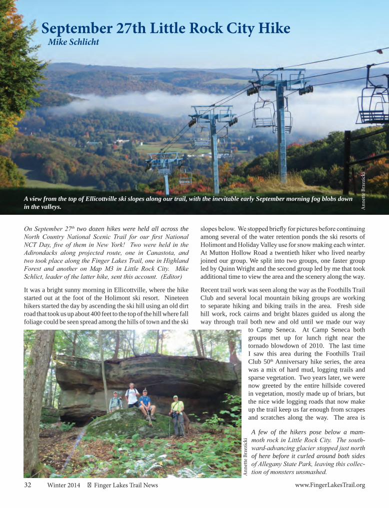
32 Winter 2014 Finger Lakes Trail News www.FingerLakesTrail.org
September 27th Little Rock City HikeMike Schlicht
On September 27th two dozen hikes were held all across the North Country National Scenic Trail for our first National NCT Day, five of them in New York! Two were held in the Adirondacks along projected route, one in Canastota, and two took place along the Finger Lakes Trail, one in Highland Forest and another on Map M3 in Little Rock City. Mike Schlict, leader of the latter hike, sent this account. (Editor)
It was a bright sunny morning in Ellicottville, where the hike started out at the foot of the Holimont ski resort. Nineteen hikers started the day by ascending the ski hill using an old dirt road that took us up about 400 feet to the top of the hill where fall foliage could be seen spread among the hills of town and the ski
A view from the top of Ellicottville ski slopes along our trail, with the inevitable early September morning fog blobs down in the valleys.
A few of the hikers pose below a mam-moth rock in Little Rock City. The south-ward-advancing glacier stopped just north of here before it curled around both sides of Allegany State Park, leaving this collec-tion of monsters unsmashed.
slopes below. We stopped briefly for pictures before continuing among several of the water retention ponds the ski resorts of Holimont and Holiday Valley use for snow making each winter. At Mutton Hollow Road a twentieth hiker who lived nearby joined our group. We split into two groups, one faster group led by Quinn Wright and the second group led by me that took additional time to view the area and the scenery along the way.
Recent trail work was seen along the way as the Foothills Trail Club and several local mountain biking groups are working to separate hiking and biking trails in the area. Fresh side hill work, rock cairns and bright blazes guided us along the way through trail both new and old until we made our way
to Camp Seneca. At Camp Seneca both groups met up for lunch right near the tornado blowdown of 2010. The last time I saw this area during the Foothills Trail Club 50th Anniversary hike series, the area was a mix of hard mud, logging trails and sparse vegetation. Two years later, we were now greeted by the entire hillside covered in vegetation, mostly made up of briars, but the nice wide logging roads that now make up the trail keep us far enough from scrapes and scratches along the way. The area is
Ann
ette
Brz
ezic
ki
Ann
ette
Brz
ezic
ki
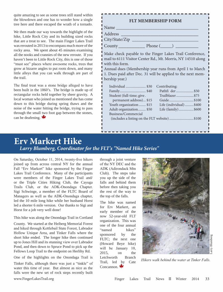
33www.FingerLakesTrail.org Finger Lakes Trail News Winter 2014
through a joint venture of the NY DEC and the ADK (Adirondack Mtn Club). The steps take you up the side of the falls and behind them before then taking you the rest of the way to the top of the falls.
The hike was named for Erv Markert, an early member of the now 52-year-old FLT organization. This was one of the four annual “named hikes” sponsored by the FLTC; the next one (Howard Beye hike) will be January 10, 2015, on the Letchworth Branch Trail, led by Cate Concannon.
On Saturday, October 11, 2014, twenty-five hikers joined up from across central NY for the annual Fall “Erv Markert” hike sponsored by the Finger Lakes Trail Conference. Many of the participants were members of the Finger Lakes Trail and/or the Triple Cities Hiking Club, the Cayuga Trails Club, or the ADK-Onondaga Chapter. Sigi Schwinge, a member of the FLTC Board of Managers as well as the ADK-Onondaga chapter, led the 10 mile long hike while her husband Horst led a shorter 6 mile version. Our thanks to Sigi and Horst for a job very well done!
This hike was along the Onondaga Trail in Cortland County. We started at the Heiberg Memorial Forest and hiked through Kettlebail State Forest, Labrador Hollow Unique Area, and Tinker Falls where the short hike ended. The longer hike then continued up to Jones Hill and its stunning view over Labrador Pond, and then down to Spruce Pond to pick up the Fellows Loop Trail to the endpoint on Herlihy Rd. One of the highlights on the Onondaga Trail is Tinker Falls, although there was just a “tinkle” of water this time of year. But almost as nice as the falls were the new set of rock steps recently built
Erv Markert Hike
Hikers walk behind the water at Tinker Falls.
Larry Blumberg, Coordinator for the FLT's "Named Hike Series"
quite amazing to see as some trees still stand within the blowdown and one has to wonder how a single tree here and there escaped the wrath of a tornado.
We then made our way towards the highlight of the hike, Little Rock City and its building sized rocks that are a treat to see. The main Finger Lakes Trail was rerouted in 2013 to encompass much more of the rocky area. We spent about 45 minutes examining all the nooks and crannies of the new reroute. If you haven’t been to Little Rock City, this is one of those “must see” places where awesome rocks, trees that grow at bizarre angles to put roots down, and many little alleys that you can walk through are part of the trail.
The final treat was a stone bridge alleged to have been built in the 1860’s. The bridge is made up of rectangular rocks held together by sheer gravity. A local woman who joined us mentioned she has come down to this bridge during spring thaws and the noise of the water hitting the bridge, trying to pass through the small two foot gap between the stones, can be deafening.
FLT MEMBERSHIP FORMName ____________________________________Address _____________________________ City/State/Zip _____________________________ County __________ Phone (_____) __________
Make check payable to the Finger Lakes Trail Conference, mail to 6111 Visitor Center Rd., Mt. Morris, NY 14510 along with this form.Annual dues (Membership year runs from April 1 to March 1. Dues paid after Dec. 31 will be applied to the next mem-bership year.)
Individual ....................... $30 Contributing:Family .............................. $40 Pathfi der ....................$50 Student (full-time; give . Trailblazer ....................$75 permanent address) ... $15 Guide ............................$100Youth organization ........ $15 Life (individual) ..........$400Adult organization ......... $50 Life (family) .................$600Business/Commercial (includes a listing on the FLT website) ............................$100
Larr
y B
lum
berg
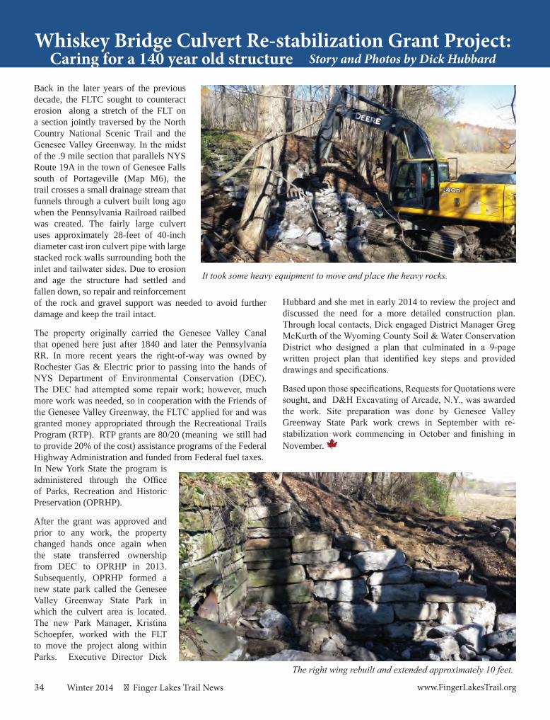
34 Winter 2014 Finger Lakes Trail News www.FingerLakesTrail.org
Whiskey Bridge Culvert Re-stabilization Grant Project:Story and Photos by Dick Hubbard
Back in the later years of the previous decade, the FLTC sought to counteract erosion along a stretch of the FLT on a section jointly traversed by the North Country National Scenic Trail and the Genesee Valley Greenway. In the midst of the .9 mile section that parallels NYS Route 19A in the town of Genesee Falls south of Portageville (Map M6), the trail crosses a small drainage stream that funnels through a culvert built long ago when the Pennsylvania Railroad railbed was created. The fairly large culvert uses approximately 28-feet of 40-inch diameter cast iron culvert pipe with large stacked rock walls surrounding both the inlet and tailwater sides. Due to erosion and age the structure had settled and fallen down, so repair and reinforcement of the rock and gravel support was needed to avoid further damage and keep the trail intact.
The property originally carried the Genesee Valley Canal that opened here just after 1840 and later the Pennsylvania RR. In more recent years the right-of-way was owned by Rochester Gas & Electric prior to passing into the hands of NYS Department of Environmental Conservation (DEC). The DEC had attempted some repair work; however, much more work was needed, so in cooperation with the Friends of the Genesee Valley Greenway, the FLTC applied for and was granted money appropriated through the Recreational Trails Program (RTP). RTP grants are 80/20 (meaning we still had to provide 20% of the cost) assistance programs of the Federal Highway Administration and funded from Federal fuel taxes.In New York State the program is administered through the Office of Parks, Recreation and Historic Preservation (OPRHP).
After the grant was approved and prior to any work, the property changed hands once again when the state transferred ownership from DEC to OPRHP in 2013. Subsequently, OPRHP formed a new state park called the Genesee Valley Greenway State Park in which the culvert area is located. The new Park Manager, Kristina Schoepfer, worked with the FLT to move the project along within Parks. Executive Director Dick
Caring for a 140 year old structure
The right wing rebuilt and extended approximately 10 feet.
Hubbard and she met in early 2014 to review the project and discussed the need for a more detailed construction plan. Through local contacts, Dick engaged District Manager Greg McKurth of the Wyoming County Soil & Water Conservation District who designed a plan that culminated in a 9-page written project plan that identified key steps and provided drawings and specifications.
Based upon those specifications, Requests for Quotations were sought, and D&H Excavating of Arcade, N.Y., was awarded the work. Site preparation was done by Genesee Valley Greenway State Park work crews in September with re-stabilization work commencing in October and finishing in November.
It took some heavy equipment to move and place the heavy rocks.

The F T on Sinnott FarmAlex Gonzalez
For quite a few years now, the Sinnott family has been nurturing the FLT, which runs on their farm for about 1.2 miles (off Lake Rd., Map M19, just east of Dryden). In addition to allowing the trail to run on his land, John Sinnott has been mowing the trail since he bought the property, a great relief to trail sponsors me and Michele; there’s lot of mowing involved! John was also flexible regarding the trail’s route through his property; at first he wanted the route changed, but when he saw some of the problems involved in his proposed route, he thought it best to leave the trail where it was. Regarding logging, Michele and I have had to endure much more than our fair share of damage done to the FLT’s trail bed from multiple logging operations elsewhere in our section, so when John’s son Eric told me that the top of their hill was going to be logged but that his dad had instructed the logger to avoid damaging the trail, I was hopeful that only minimal damage would be done. Later I was ecstatic to see that no damage whatsoever
had been done! I did not have to pick up even a single twig when I inspected the route. In terms of a logging operation that was supposed to be careful about the trail, it was by far the best that I have ever seen. Thanks, John!
The Sinnott family also allowed Michele and me to use some of their scrap lumber to construct a rudimentary bridge over a muddy spot. Then Eric went one much better by constructing a handsome wooden bridge to replace it, another
part of his Eagle Scout project! Not only that, but some switchbacks on a steep hillside had been damaged by horses and dirt bikes, so to complete his project, Eric did a fabulous rehab job on those switchbacks, making them a pleasure to walk once again. What’s brewing next on Sinnott Farm? According to Eric, we may be seeing a bench or two along the steeper part of the trail, an improvement sure to be welcomed by hikers. The Finger Lakes Trail owes a big thank-you to the Sinnott family!
New York’s Premier FootpathFINGER LAKES TRAIL
35www.fi gerlakestrail.org Finger Lakes Trail News Winter 2014
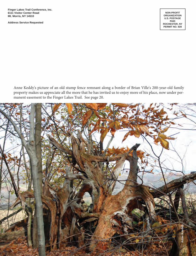
Finger Lakes Trail Conference, Inc.6111 Visitor Center RoadMt. Morris, NY 14510
Address Service Requested
NON-PROFITORGANIZATIONU.S. POSTAGE
PAIDROCHESTER, NYPERMIT NO. 928
Ann
e K
eedd
y
Anne Keddy's picture of an old stump fence remnant along a border of Brian Ville's 200-year-old family property makes us appreciate all the more that he has invited us to enjoy more of his place, now under per-manent easement to the Finger Lakes Trail. See page 20.


