Embed Size (px)
Citation preview
Sorin N emeti
FINDING ARCOBADARA Essay on the Geography and Administration of Roman Dacia
SORIN NEMET!
FINDING ARCOBADARA Essay on the Geography
and Administration of Roman Dacia

Sorin Nemeti
FINDING ARCOBADARA Essay on the Geography
and Administration of Roman Dacia
Mega Publishing House Cluj-Napoca
2014

"Babeş-Bolyai" University, Cluj-Napoca Faculty of History and Philosophy
Volume printed with the financial support of the UEFISCDI, grant PN-II-RU-TE-2011-3-0131
DTP: Francisc Baja
©Sorin Nemeti, 2014
Translated by Ana-Maria Gruia
Descrierea CIP a Bibliotecii Naţionale a României NEMETI, SORIN
Finding Arcobadara : essay on the geography and administration of Roman Dacia I Sorin Nemeti. - Cluj-Napoca: Mega, 2014
Bibliogr.
902
Index ISBN 978-606-543-514-8
EDITURA MEGA I www.edituramega.ro e-mail: [email protected]
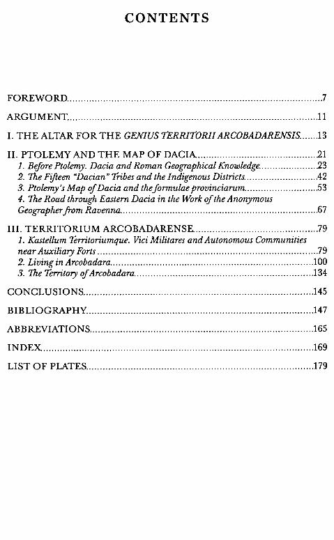
CONTENTS
FOREWORD .. „ .... „ ....... „.„ .. „ .... „ .. „„„„„ ......... „ ........ „ ............. „„ .... „„ .. 7
ARGUMENT„.„„ ... „„ ... „ .. „„ ..... „.„ ...... „.„ .... „.„„ ...... „„„„ .. „„.„„ ...... „.11
I. THE ALTAR FOR THE GF.NIUS TERRITORII ARCOBADARF.NSIS„„„.13
II. PTOLEMY AND THE MAP OF DACIA„„„„„„„„„„„„„„„„„„„„„.21 1. Before Ptolemy. Dacia and Roman Geographical Knowledge ..................... 23 2. 1he Fifteen "Dacian" Tribes and the Indigenous Districts ....................... .... 42 3. Ptolemy's Map of Dacia and thejormulae provinciarum ........................ „.53 4. 1he Road through Eastern Dacia in the Work ofthe Anonymous Geographer ]rom Ravenna ....................................................................... . 67
III. TERRITORIUM ARCOBADARENSE ............................................. 79 1. Kastellum Territoriumque. Viei Militares and Autonomous Communities near Auxiliary Forts ..................................... „ ......................................... 79 2. Living in Arcobadara ......................................................................... . 100 3. 1he Territory of Arcobadara ................................................................ .134
CONCLUSIONS .................................................................................. .145
BIBLIOGRAPHY ................................................................................. .147
ABBREVIATIONS ................................................................................ .165
INDEX ................................................................................................. .169
LIST OF PLATES ................................................................................. .179

FOREWORD
A little while ago, reading the inscription of an altar found in Ilişua (Bistriţa-Năsăud County), specialists have discovered the ancient name of the Roman settlement there: Arcobadara ( maybe Arco bara), that provided the name of a territorium. The ancient names of thousands of settlements in the Roman Empire remain unknown. Inscriptions, Tabula Peutingeriana, and data recorded by Ptolemy and the "geographer from Ravenna" provide the ancient names of around 100 settlements from Dacia, large and small, cities, quasi-urban settlements, viei militares, pagi, etc. Around 30 of them can only he located, with great approximation, on the map of the province of Dacia, some only in the area where they were found, while others seem (or seemed) to fall outside the boundaries of the province. There are numerous suggestions of identification, but it is rare case for an epigraphic inscription to confirm such identification. On the one hand, many of the un-localized toponyms are those of small settlements, never mentioned or mentioned injust few inscriptions. On the other hand, even in cases when stane inscription have been preserved in abundance, it can happen that none of them mention the name of the settlement in question. This has been - until recently - the case of the settlement in Ilişua as well. Out of the many inscriptions found there, the one mentioned above is the only one to reveal the ancient toponym. Therefore, to our satisfaction, we now know with certainty where Ptolemy's ÂpKo~a8apa was.
Starting from this discovery, Sorin Nemeti investigates two layers in his new book: the ancient geography of the province of Dacia and the provincial administration in the Danubian region of the Empire. His familiarity with issues of ancient geography and with those of landscape and environment during Antiquity has been facilitated by two research stays, one at the Laval U niversity in Quebec and the other in Paris.
8 SORIN NEMET!
Thousands of pages have been written on the exceptional source that is Ptolemy's Geog;rofia. For Dacia, the author provides precious pieces of information that are nevertheless accompanied by various questions and interpretations. Sorin Nemeti is among the Romanian specialists who have dissected Ptolemy's text: he dedicates an entire chapter to the ancient author (Ptolemy and the Map of Dacia). Sorin Nemeti corroborates the data in Ptolemy's Geog;rafia with older sources, dated to the first century (Agrippa's Geog;rafia, Pliny the Elder), but also with later sources (Orosius, Eutropius, Festus, Iordanes, the geographer from Ravenna etc.) in order to clarify the extent of the Roman province, the issue of the "Dacian tribes" mentioned by Ptolemy, and - in direct connection to the latter - the existence of civitates pereg;rinae in the province etc. Do the 15 tribes under discussion reflect the situation before the Roman conquest or are they administrative structures (civitates) from the second century? To what degree did the ancient geographer use official documents such as formula provinciae or itineraria? The answers remain in the sphere of hypotheses.
In order to identify and understand the administrative structure called territorium Arcobadarense, the author researches the meaning of castellum and kastella, the meaning and dating of conventus civium Romanorum, few of which are attested in Dacia, and the status of the mral settlements near auxiliary camps - focusing on the cases of Micia, Arcobadara, and Samum - and of their territories. The investigation is not limited to Dacia, but extends to the group of provinces on the Lower Danube. The analyzed inscriptions do not refer to military territoria, but to autonomous or semi-autonomous territories organized according to the municipal model, with similar structures of leadership. The author's incursion into "the life of Arcobadara" allows him to research, on epigraphic grounds, the onomastic structure of the population, the origin of the inhabitants, their social status, and their spirituality. There are no Dacian anthroponyms preserved, but the presence of the autochthons is attested archaeologically, especially by handmade pottery items of La Tene tradition. In order to place the territories in space, the author introduces a modern method, borrowed from British archaeology ("Thiesscn's polygons").
A new reading of Ptolemy's map of Dacia, after having proven that Arcobadara was the (ancient, Dacian) name of a rural settlement near the auxiliary fort in Ilişua, lending its name to a territorium inhabited by a community of Roman citizens and peregrines with restricted
Finding Arcobadara 9
autonomy, has convinced Sorin Nemeti of the correctness of data recorded by Ptolemy. A new drawing of Ptolemy's map requires certain adjustments: the ancient geographer's toponyms placed by modern research in Moldavia are, according to Nemeti, those of small settlements on the eastern border of the province of Dacia, towards the Oriental Carpathians. Estimating the distortions of the ancient map, Sorin Nemeti suggests that other among Ptolemy's toponyms should be located between the 481h and 491h parallels thus: Rucconium in Bologa, Docidava in Buciumi, Triphulum in Orheiu Bistriţei, Patridava in Brâncoveneşti and Carsidava in Sărăţeni, while Ulpianum seems to have been located not in Bologa, but in Gilău.
Sorin Nemeti's book can be included among similar studies dealing with the geography of Dacia, ancient landscape, and the organization of territory. Ali are significant parts of a field of study that takes shape under our very eyes, reinvigorated with patience and competence.
Prof. Mihai Bărbulescu Corresponding member of the Romanian Academy

ARGUMENT
The odyssey of finding the small town called Arcobadara, located on the north-eastern border of the Roman Empire, started în 2005. Since then I reflected on the consequences of this discovery. Many conclusions were already published în special studies, în volumes and reviews. 1 Researchers adopted some of my observations, rejected some hypothesis and theories, but, în the end, I believe that modern knowledge on the geography and administration of ancient Dacia was improved and pushed forward.
Data gathering for this study was possible through a research assignment în Laval University (Quebec, Canada) between September 2008 and February 2009 and a project financed by the Fondation Maison des Sciences de l'Homme (Paris), through a Mellon scholarship between April and June 2009. I want to thank Professor Ella Hermon from Laval U niversity for hosting me there, and for constructive discussions that oriented me în this new, for me at least, field of studies. In Paris I benefited from the kind help of Professors Alexandru Avram (University Le Mans, France) and Jean-Michel Carrie (EHESS, Paris). I had most fruitful discussions with my old friend and colleague, Dan Dana (CNRS, Paris). Corneliu Gaiu provided me with photos and hosted me during the field trip în Ilişua. My gratitude goes to all of them. Last but not least, I wish to thank my professor, Mihai Bărbulescu, from whom I learned, during time, pretty much everything I know. Even the reading of this inscription îs due to our common efforts.
Given the fact that the entire book is centered around a single votive inscription ( though not an ordinary one) and I use a lot of epigraphic analogies for explaining the geographical and administrative
1 Nemeti 2006, 86-98; Nemeti 2006a, 271-288; Nemeti, Bărbulescu 2006-2007, 107-118; Nemeti, Bărbulescu 2010, 446-457; Nemeti 2010, 395-433; Nemeti 2011, 37-49; Dana, Nemeti 2012, 431-437.
12 SORIN N EMETI
situations, the final steps in writing and assembling this book were macle in the context of project PN-Il-RU-TE-2011-3-013 entitled Digital Corpus for the Virtual Exploration ef the Antiquity. Art and Text on Roman Monumentsjrom Dacia.
I choose to preserve the ancient name in the form Arcobadara, instead of the more probable rebuilt form of * Arkobara, that figures in the first place in Ptolemy's manuscripts, in order not to contradict an ancient source. * Arkobara is probably a Dacian name, corrupted through the centuries in the process of transmission of handwritten copies of the Geography. I hope that future epigraphic discoveries will reveal the real name of this small town. U ntil then I will still use the strange, and improbable form of Arcobadara.
I. THE ALTAR FOR THE GEN/US TERRITORII ARCOBADARENSIS
The sources for the study of the administrative organization of the territory of the province of Dacia are few and lacunars. After reviewing the possible rural communal autonomies, Radu Ardevan noticed the fact that: "large areas of the territory of Roman Dacia remain shadowed to us. One cannot specify anything yet as to the settling and the administration of some vast territories, such as the east ofTransylvania, the west of Banat, central Oltenia, and western Muntenia". 2 Given the lack of enlightening documents, R. Ardevan proposes the existence of some rural structures which he conventionally names civitates which have as residences a vicus functioning as caput civitatis, taking into consideration that, in certain situations, particularly in eastern Transylvania, "ou Ies seules agglomerations humaines plus remarquables a l'epoque de la province sont celles de la proximite des camps -c'est-a-dire Ies uici militaires, gui ... auraient du jouer le role de centres administratifs, faute de toute autre structure".3
*
Recently discovered documents seem to confirm these correct intuitions. An inscription found in the autumn of 1989 in the area of the civil settlement near the Roman camp of Ilişua (Bistriţa-Năsăud County), brings new important data about the administrative organization of the rural territory and, even more, it enable us to localize a toponym mentioned in the list transmitted by Ptolemy's Geography. The inscription was read in five steps, several persons being involved in the process of the successive readings which offered, at the end, the complete text of the half right part of the votive altar from Ilişua.
2 Ardevan 1998, 104. 3 Ardevan 1998a, 54-55.
14 SORIN NEMET!
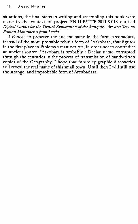
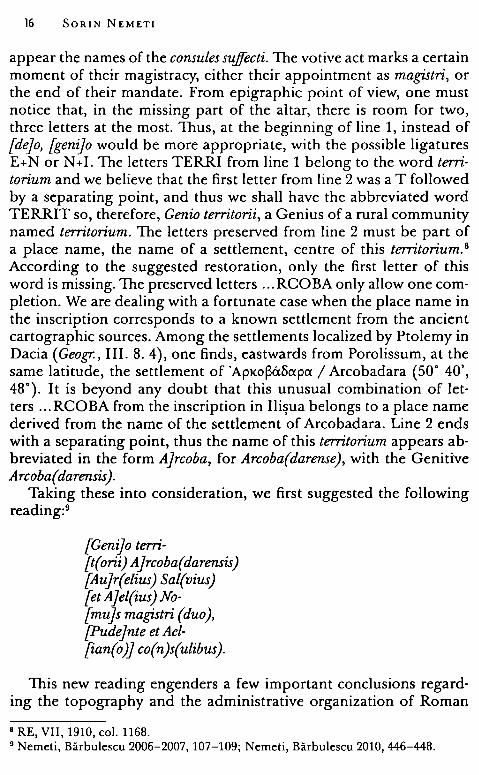
Fig. l
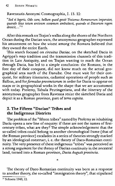
1. Tue discovery consists of a fragmentary altar, of which only the right side has been preserved, found at ground level in 1989. Tue excavations of that year led to the discovery of three pottery kilns, two houses with earthen and wooden walls, and one house with walls made of stone and a hypocaustum, that were placed at approximately 150 m to the south of the Roman camp. In the publication of the research from the Roman camp and the civil settlement from Ilişua, the fragmentary altar was only mentioned, and reproduced as follows: 4
[ ... ]O· TERRI [.„] ROCBA [ ... ] R ·SAL [„.] AEL ·NO [„.] S · MAGG [„.] AET · TAEL [„.] cos
The text of the inscription was abstracted in the same form, without additional comments, in a recent collection of inscriptions. 5
2. Decisive steps towards the correct deciphering of the inscription were taken once V. Wollmann and R. Ardevan resumed its analysis.
The altar, made of volcanic tufa, described and illustrated, has the preserved dimensions of 0.95 x 0.32 x 0.32 m with the inscription field of 0.52 x 0.128 x 0.26 m, the letters being 6.5 cm tall (in the 7th line,
4 Protase, Gaiu, Marinescu 1996-1997, 56-57, 78-79, 109. 5 Petolescu 2005, 295, no. 800.
Finding Arcobadara 15
only 5.5 cm tall). 6 The altar has a base and a capital, the latter being decorated with a triangular pediment with vegetal motifs.
The ligatures, as it results from the photograph and the drawing are the following: în line 1 - T+E, în line 2 - C+O, în line 6 - N+T+E and E+ T. In order to complete the inscription, the authors suggest other probable ligatures în the missing part of the altar, i. e. line 4 -E+ T, line 6 - V+D+E, and line 7 - I+A+N.
The new reading restores, în lines 3-5, the names of the persons who dedicated the altar, Aurelius Salvius and Aelius Nomus, named magistri în line 5, and, în lines 6-7, the names of the consules sujfecti from 195-196 A. D., Pudens and Aelianus. The completion suggested for the inscription, which does not salve, however, the problem of the votive dedication from lines 1-2, îs as follows:
[De]o Terri-[. Jrcoba(e) [Au]r(elius) Sal(uius) [et A)el(ius) No[mu]s mag(istri duo), Pudejnte et Ael-[ian(o )] co(n)s(ulibus).
For the completion of line 1 the authors suggest the word (de)O, followed by "with great difficulty" the name of a divinity which begins with the letters TERRI and continues în the following line with ... RCOBA. As for the origin of this god, taking into consideration the fact that ala I Tungrorum Frontoniana was stationed at Ilişua, the authors state that "mussten wir mit einer keltischen ader germanischen Gottheit und U nteren Rhein rechnene", but do nat exclude the hypothesis of an Oriental or Microasian god.7
3. Concerning the reading of the inscription, a few observations are necessary. First it represents an inscription with votive character, an altar dedicated by two magistri, the appointed leaders of a community. It îs nat a personal act of faith, but an obligation, a votum made on behalf of the community by its representatives who alsa supervised its relations with the divine world. The official character of the gesture îs highlighted by the dating comprised în lines 6-7, where
6 Preserved in the Bistriţa-Năsăud Museum, inv. no. 15993. 7 Wollmann, Ardevan 2005, 673-675, 678, fig. 13-14.
16 SORIN NEMET!
appear the names of the consules sujfecti. The votive act marks a certain moment of their magistracy, either their appointment as magistri, or the end of their mandate. From epigraphic point of view, one must notice that, in the missing part of the altar, there is room for two, three letters at the most. Thus, at the beginning of line 1, instead of {dejo, [genijo would be more appropriate, with the possible ligatures E+N or N+I. The letters TERRI from line 1 belong to the word territorium and we believe that the first letter from line 2 was a T followed by a separating point, and thus we shall have the abbreviated word TERRIT so, therefore, Genio territorii, a Genius of a rural community named territorium. The letters preserved from line 2 must be part of a place name, the name of a settlement, centre of this territorium. 8
According to the suggested restoration, only the first letter of this word is missing. The preserved letters ... RCOBA only allow one completion. We are dealing with a fortunate case when the place name in the inscription corresponds to a known settlement from the ancient cartographic sources. Among the settlements localized by Ptolemy in Dacia (Geogr., III. 8. 4), one finds, eastwards from Porolissum, at the same latitude, the settlement of 'ApKo~a8apa / Arcobadara (50° 40', 48°). It is beyond any doubt that this unusual combination of letters ... RCOBA from the inscription in Ilişua belongs to a place name derived from the name of the settlement of Arcobadara. Line 2 ends with a separating point, thus the name of this territorium appears abbreviated in the form A)rcoba, for Arcoba(darense), with the Genitive Arcoba( darensis ).
Taking these into consideration, we first suggested the following reading:9
[Geni)o terri-[t(orii) A}rcoba( darensis) {Aujr(elius) Sal(vius) [et A)el(ius) No-[mu]s magistri (duo), [Pudejnte et Ael-[ian(o )] co(n)s(ulibus).
This new reading engenders a few important conclusions regarding the topography and the administrative organization of Roman
0 RE, VII, 1910, col. 1168. 9 Nemeti, Bărbulescu 2006-2007, 107-109; Nemeti, Bărbulescu 2010, 446-448.
Finding Arcobadara 17
Dacia. Firstly, the fact that the military vicus beside the Roman camp from Ilişua was named Arcobadara, secondly the fact that the belonging area was organized as a rural structure with certain autonomy, named territorium Arcobadarense.
The new reading was accepted by colleague specialists, 10 but not everyone agreed with the on-site identification of the settlement named Arcobadara. For C. C. Petolescu, for example, Arcobadara is the name of some rural settlement, center of a civil territory, located somewhere in the area of the Roman camp in Ilişua, meanwhile the auxiliary vicus next to the camp took the name of the encamped troop, ala I Tungrorum Frontoniana. Petolescu repeatedly supported an unattested toponym *Ad Tungros, following the pattern Ad Pannonios (Teregova, Caraş-Severin County) and Ad Batavos / Ad Vatabos (maybe Războieni-Cetate, Alba County). He found presumable written evidence for his new theory in the Cosmography written by Anonymus Ravennas that lists two toponyms, Sturium (sic) and Congri, on the so-called "road from Eastern Dacia". For Petolescu, Congri could be a corrupt form of *Tungri (*Ad Tungros), meanwhile Sturium (sic) should be somehow related to ala I Asturum, deployed in Hoghiz (Braşov County). 11 The caducity of these identifications will be emphasized in the chapter dedicated to the so-called Phira - Certie road from Ravenna's Cosmography. 12
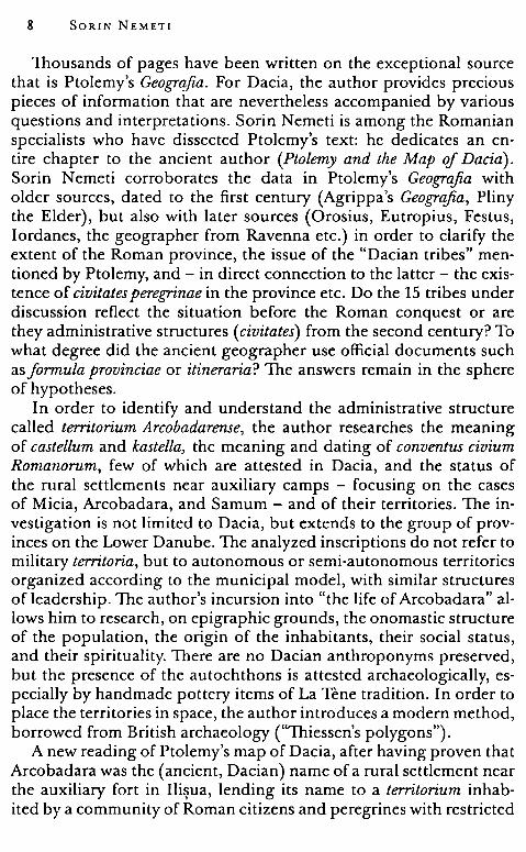
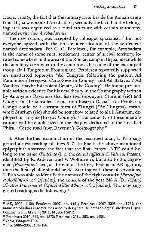
4. After further examination of the inscribed altar, I. Piso suggested a new reading of lines 6-7. In line 6 the above mentioned epigraphist observed the fact that the final letters -NTE could belong to the name [Pudejnte (i. e. the consul suffectus C. Valerius Pudens, identified by R. Ardevan and V. Wollmann), but also to the cognomen [Praese]nte. Then, at the end of the line, there is no AE ligature, thus the first syllable should be Al-. Starting with these observations, I. Piso was able to identify the names of the right consuls: [Praese]nte et Al/[bin(o)J co(n)s(ulibus), the consuls of the year 246 A. D., [C(aio) Bjrottio Pracsente et {C(aio) A}llio Albino co(n)s(ulibus). The new suggested reading is the following: 13
10 AE, 2006, 1130; Petolescu 2007, no. 1191; Petolescu 2007-2008, no. 1272; the name Arcobadara is sometimes used to designate the archaeological site from Ilişua: Găzdac, Gaiu, Marchiş 2011; Mustaţă 2012. 11 Petolescu 2010, 312, no. 1373; Petolescu 2011, 303, no. 1436. 12 lnjra, Chapter II. 4. 13 Piso 2006-2007, 163-166.
18 SORIN NEMETI
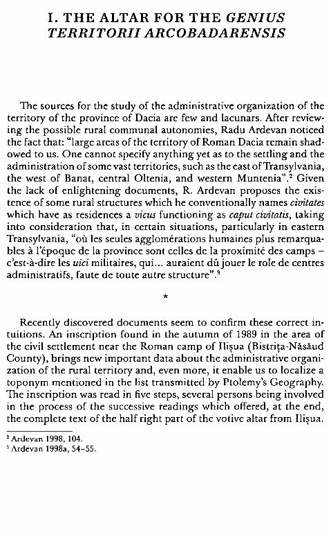
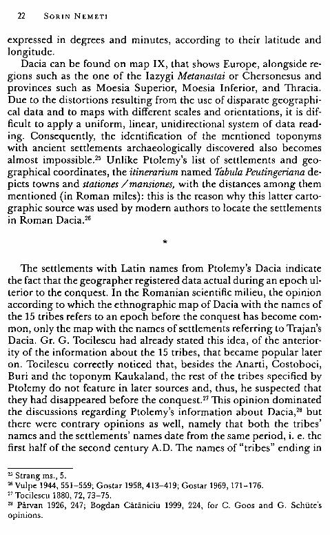
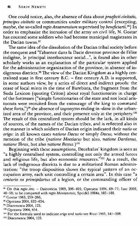
-··-· · - - -----l-
Fig. 2
[Genijo terri-[tor(ii) A Jrcoba( darensis) [M(arcus)? Aujr(elius) Sal(..) [et P(ublius)? Ajel(ius)No[.Js magg(istri) [Praesejnte et Al-[bin( o)] co(n)s(ulibus).
The consular dating established by I. Piso was unanimously accepted14 and it demonstrates that a civil ian settlement from North-Eastern Dacia was epigraphically designed in the middle of the third century A. D. with an indigenous toponym, mentioned by a geographical source from the very beginning of the new province.
5. The last attempt at reading the text of the altar from Ilişua was made from an etymological perspective. Since V. Pârvan, the name Arcobadara was interpreted as being Dacian. The above mentioned
scholar found the partide arco- in local toponyms such as Arcidava, Arcinna, and Arcunae, and -badara in the adjectival stern rrcxmpcx Qust like in the name of the Bithynian hero from Tios, mii:apoc;). The connection with the edonic name BtBcxvpo<; seems to him less probable.15
For the explanation of the toponym we have initially suggested an approach related to the Celtic radicals: arco- like in the toponym Arcobriga from Hispania or in names such as Arco, Arcontia, Arconsinius, Arcotamia; the particles bada- / badu- / bodu- are frequent in Celtic toponymy -Badacus (settlement in Noricum), Baduhennae fucus, Badonibus mons. 16
The hypothesis of the Dacian origin seems more probable if one takes into consideration the possibility that the name Arcobadara was transmitted down to us corrupted through the handwritten tradition. In the ancient editions of C. F. A. Nobbe and C. Muller the toponym
14 AE 2007, 1190; Petolescu 2010, no. 1373; Ardevan, Wollmann 2007, 246-247, no. 5; Nemeti, Bărbulescu 2010, 447, note 5; Nemeti 2010, 409, no. 9; Gaiu, Zăgreanu 2011, 70-71, no. I. 2.1. 1> Pârvan 1926, 256-257. 16 Holder 1896, 533-534, 325-326, 183-184.
Finding Arcobadara 19
was transcribed 'ApKo~a8i:xpi:x / Arcobadara, following the majority of manuscripts. In a recent edition of the Geography the toponym was transcribed - 'ApKo~api:x{8i:x} and suspected of corruption.17 The corrupt word would be Arkobara{ da} and its origin would have been * Arkobara. 18 In this case * Arkobara could be a composed toponym, with two known elements: ark- (from 'ApKtv(v)i:x - Ptol., Geogr. 3. 8. 10) and -bara (from Zovp6~i:xpi:x /Zourobara - Ptol., Geogr. 3. 8. 10). The toponym Zourobara has a very transparent etymology - "the village of Zura'', where Zura is a Dacian personal name, 19 and -bara might be the Dacian version of the well known Thracian word for "village" - para. 20
Another argument for the reading * Arkobara is the abbreviation used in the inscription ARCOBA, not ARCOBAD, as it would have been more natural if the name were Arcobadara.
The suggested reading with the rebuilding of the presumptive original form of the ancient toponym is:
[Genijo terri-[tor(ii) Ajrcoba(rensis?) [ .. Aujr(elius) Sal-[ .. etj Ael(ius) No-[.Js magg(istri), [Praes]ente et Al-[bin(o )j co(n)s(ulibus).
Since the time when the inscription was read, the ancient toponym having been found in Ptolemy's list, new information came into light, regarding, firstly, the way of understanding Ptolemy's map of Dacia, secondly, the way oflocalizing the ancient toponyms, but also regarding the administration of the rural area of the province and the status of the "small towns" horn near the auxiliary forts. In order to illuminate the notions contained by the text of the altar from Ilişua, we have started an extended, two-fold research: on provincial geography and its sources, and on the Roman provincial administration on the Danube area. The following pages contain the conclusions we have reached until the present moment.
17 Stiickelberger, GraBhoff 2006: sic X: 'ApKo~apa:{Ba} codd. sec. nn.: lineam om. Q; Cod. X: Vaticanus Graecus 191 (thirteenth century), codex unicus for recension X. 18 Dana, Nemeti 2012, 434-436. 19 Dana, Matei-Popescu 2009, 230-231. 20 Detschew 1976, 356-357; Russu 1967a, 29, 114, 163, 166.

II. PTOLEMY AND THE MAP OF DACIA
Ptolemy (Klaudios Ptolemaios) was an astronomer, astrologist, geographer, and musical theorist who lived and wrote in Alexandria, Egypt, in the second century A.D., during the time of emperors Hadrianus, Antoninus Pius, and Marcus Aurelius. 21 The data of his astronomica! observations, reported in Almagest, are essential for establishing the chronology of his life: a moon eclipse from 125 A.D. (the oldest date) and an observation about the planet Mercury from 141 A.D. (the most recent one). The "Stars Catalogue" enlists all the coordinates for the year 138 A.D. It is presumed that he was horn around 100 A.D. in Alexandria and that he lived until circa 180 A. D. (the Arabian geographers comments that he lived 78 years). 22
Among his many contributions to his time's science one should mention his three major treaties: the Mathematical Syntaxis (or Almagest - a catalogue of astronomic data for studying the geometry of the Sky - Earth system), Apotelesmatica (or Tetrabiblos - an astrologica! breviary for studying the astral influences on the geographical areas of the oikumene and on theirs inhabitants) and, of course, Geâgraphike Hyphegesis (or Geographia - a catalogue of geographical data - toponyms and coordinates - and a set of indications for drawing general and regional maps of the known world). 23
In the Geography, in fact a manual for drawing an atlas of the known world, Ptolemy followed the principles exposed in the Almagest and transposed landforms, rivers and settlements, that he knew from the depictions of travellers or from previous geographical works, particularly the one by Marinus of Tyr24 into geographical coordinates,
21 Folkerts 2001, 559-570. 22 Aujac 1993, 8; Pagani 1990, III (floruit 125-151 A.D.); Dilke 1985, 75, suggested the years 90-168 A.D. 23 Aujac 1993, 9-10. 24 Riley 1995, 230-236.
22 SORIN NEMET!
expressed in degrees and minutes, according to their latitude and longitude.
Dacia can he found on map IX, that shows Europe, alongside regions such as the one of the Iazygi Metanastai or Chersonesus and provinces such as Moesia Superior, Moesia Inferior, and Thracia. Due to the distortions resulting from the use of disparate geographical data and to maps with different scales and orientations, it is difficult to apply a uniform, linear, unidirectional system of data reading. Consequently, the identification of the mentioned toponyms with ancient settlements archaeologically discovered also becomes almost impossible.25 Unlike Ptolemy's list of settlements and geographical coordinates, the itinerarium named Tabula Peutingeriana depicts towns and stationes / mansiones, with the distances among them mentioned (in Roman miles): this is the reason why this latter cartographic source was used by modern authors to locate the settlements in Roman Dacia. 26
*
The settlements with Latin names from Ptolemy's Dacia indicate the fact that the geographer registered data actual during an epoch ulterior to the conquest. In the Romanian scientific milieu, the opinion according to which the ethnographic map of Dacia with the names of the 15 tribes refers to an epoch before the conquest has become common, only the map with the names of settlements referring to Trajan's Dacia. Gr. G. Tocilescu had already stated this idea, of the anteriority of the information about the 15 tribes, that became popular later on. Tocilescu correctly noticed that, besides the Anarti, Costoboci, Buri and the toponym Kaukaland, the rest of the tribes specified by Ptolemy do not feature in later sources and, thus, he suspected that they had disappeared before the conquest.27 This opinion dominated the discussions regarding Ptolemy's information about Dacia,28 but there were contrary opinions as well, namely that both the tribes' names and the settlements' names date from the same period, i. e. the first half of the second century A.D. The names of "tribes" ending in
25 Strang ms„ 5. 26 Vulpe 1944, 551-559; Gostar 1958, 413-419; Gostar 1969, 171-176. 27 Tocilescu 1880, 72, 73-75. 28 Pârvan 1926, 247; Bogdan Cătăniciu 1999, 224, for C. Goos and G. Schi.ite's opinions.
Finding Arcobadara 23
the suffix: -ensioi /-enses would rather he the names of some territorial Roman structures.29
In my opinion the so-called Dacian "tribes" belong to the same chronological frame. In Ptolemy's work one could find, besides the list of the settlements from Dacia (with Dacian and Roman names), also a list of 15 "peoples" which were living in Ptolemy's Dacia. For almost all of the scholars these peoples / tribes' names are those of the tribes of pre-Roman Dacia, before the Roman conquest, only the names of the towns being those of the settlements from the Roman province. In order to explain this situation the first task I assumed was to explore the geographical and historical data from the first century A.D. First of all one has to search through the historical literature in order to compile a "catalogue of barbarian peoples" which lived north of the Danube during that time. I have to state from the beginning that, except for the Anarti and the Taurisci, the geographical and literary sources from first century A.D. contain no clues for the presence of Ptolemy's tribes.
Thus, I have to emphasise severa! aspects of the ancient geography of the area north of the Danube: for example, the problem of the Roman knowledge of this area in the first century A.D. Searching for Ptolemy's sources for Dacia I encountered a poor traditional geographical image of Dacia, envisaged like a narrow zone between the Danube and the Northern Ocean. These data transmitted by Pliny the Elder and the minor Roman geographers from Late Antiquity are to he analyzed in order to correctly appreciate the problem of Ptolemy's sources.
1. Before Ptolemy. Dacia and Roman Geographical Knowledge
Before the conquest of the regions north of the Danube in the beginning of the second century A.D., the Romans' geographic notions on the areas north of the Lower Danube were limited. The modern image of the map of ancient Dacia is built starting from cartographic sources that reflect the realities during the Roman conquest, after the conquest, and after redactio in provinciam (Ptolemy's Geography on Daciae situs and the most important settlements and the two itineraria: the so-called Tabula Peutingeriana and the one compiled in the Cosmography written by an anonymous geographer from Ravenna).
29 Daicoviciu 1960, 266; Russu 1981, 181; Bogdan Cătăniciu 1987-1988, 145-162; Bogdan Cătăniciu 1991, 59-67.
24 SORIN NEMETI
All these geographical sources are due to the exploratio activities performed during the two conquest wars and the agrimensores' measuring the new provincial territory in order that it might be divided. 30 But what was the Roman perception of this geographical area before the conquest? I will attempt to provide an answer by analyzing certain minor geographical texts and fragments collected from the works of ancient authors that contain geographical data .
. . . decies centena milia passuum.
When referring to the province of Dacia conquered by Trajan, Eutropius provided a short piece of information on the perimeter of this province in his Breviarium:
Eutropius, Breviarium ab Urbe condita, VIII. 2, 2:
"[Traianus] Daciam Decibalo victo subegit provincia trans Danubium Jacta in his agris, quos nune Taijali, Victoali et Tervingi habent. Ea provincia decies centena milia passuum in circuitu tenuit". 31
Festus included the same piece of information in his own Breviarum severa} years later:
Festus, Breviarium, VIII, 1-5:
'"JTaianos Dacos sub rege Decibalo uicit et Daciam trans Danuuium in solo barbariae prouinciam fecit, quae in circuitu habuit decies centena milia passum ". 32
One can find similar data on the province's surface in Iordanes, Romana, 217:
"Daces autem post haec iam sub imperio suo Traianus, Decebalo eorum rege devie to, in terras ultra Danubium, quae habent miile milia spatia, in prouinciam redegit". 33
J. W. Eadie, editor of Festus' Breviarium, believes that the latter was based on Eutropius' text (VIII. 2. 2) for this information in
30 Nicolct 1988a, 101, 167; Austin, Rankov 1995, 112-120. 31 Ruchl 1887, 54; Bird 1993, 48-49: " ... after dcfcating Dcccbalus, (Trajan) subdued Dacia and crcatcd a province beyond the Danube in those tcrritories which thc Taifali, Victohali and thc Thervingi now hold. That province was a thousand miles in circumferencc". 32 Eadic 1967, 52; Zugravu 2003, 166-167, 288, n. 166. 33 FHDR, II, 406-407.
Finding Arcobadara 25
particular. The direct relation between the two fragments in Eutropius VIII. 2.2 and Festus, VIIl.1-5 is easily perceived: only the word order is slightly changed. What could have been Eutropius' source for this geographic piece of information related to the perimeter of Dacia? H. W. Bird eludes the issue of the precise sources and supposes that Eutropius knew these facts from official sources ("probably derived from his administrative duties"). 34 But one still wonders on the origin of this information featuring in the works of late Roman abbreviators. In order to find the answer, one must analyze Roman geographical sources that make reference to the dimensions of the area known during Antiquity as Dacia.
Modern historians took ad litteram this value of Dacia's perimeter, of "one million feet" and tried to identify it on the archaeological map of the province.35 M. Bărbulescu transformed the 1000 Roman miles into kilometres and believed that the value of 1479 kilometres of the perimeter "probably" refers to the territories of the three Dacias (Superior, Inferior, and Porolissensis) during the reign of Hadrian.36
D. Protase accepted the idea that the circuit refers to the length of the Dacian border after Hadrian's reorganization, but believed that "the 1479 kilometres match neither the circuit of Trajan's Dacia, nor the perimeter of the province during later periods; the on-site length of the borders must beat least double that figure".37 For C. C. Petolescu the information on the perimeter of the province reflects the situation from around 140/143 A.D. and until the beginning of the third century when the borders of Dacia extended to western Walachia as well, along with the construction of the so-called limes transalutanus. 38
In my analysis of the data contained in the paragraphs from Eutropius and Festus concerning Dacia's perimeter I will not follow the same path, i. e. I will not compare the ancient figure with the real value of Dacia's perimeter as measured on the archaeological map, since I believe the Romans, and people of Antiquity in general, had an essentially different vision of geographic space.
34 Bird 1993, 119-120; an old idea - Hodgkin 1887, 101: "this number is found in all the MSS. of Eutropius, ... , and may very probably have been borrowed from some official record to which Eutropius had access". 35 Hodgkin 1887, 100-101, 102 (Dacia is Transylvania, not Dacia on Ptolemy's map); against Haverfield 1887, 734-736. 36 Bărbulescu 1998, 53-54. 37 Protase 2001, 42. 38 Petolescu 1999, 167.
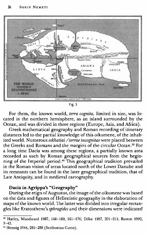
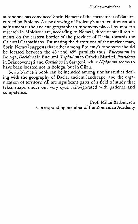
26 SORIN NEMETI
ID ~ERATOITH!NES a.mac:.
.,,,..„ •••
Fig. 3
For them, the known world, terra cognita, limited in size, was located in the northern hemisphere, as an island surrounded by the Ocean, and was divided in three regions (Europe, Asia, and Africa).
Creek mathematical geography and Roman recording of itinerary distances led to the partial knowledge of this oikumene, of the inhabited world. N umerous eskhatiai / terrae incognitae were placed between the Greeks and Romans and the margins of the circular Ocean.39 For a long time Dacia was among these regions, a partially known area recorded as such by Roman geographical sources from the beginning of the Imperial period.40 This geographical tradition prevailed in the Roman vision of areas located north of the Lower Danube and its remnants can he found in the later geographical tradition, that of Late Antiquity, and in medieval cartography.
Dacia in Agrippa's "Geography" During the reign of Augustus, the image of the oikumene was based
on the data and figures of Hellenistic geography in the elaboration of maps of the known world. The latter was divided into irregular rectangles like Eratosthene's sphragi,des and their dimensions were indicated
39 Harley, Woodward 1987, 148-160, 161-176; Dilke 1987, 201-211; Romm 1992, 3-42. 40 Hennig1944, 285-288 (Scribonius Curio).
Finding Arcobadara 27
:;:: „ "t
-:
•i\ . . 1 z . ... -(
-:
;.>
"' ;::
-(
.!
28 SORIN NEMET!
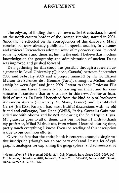
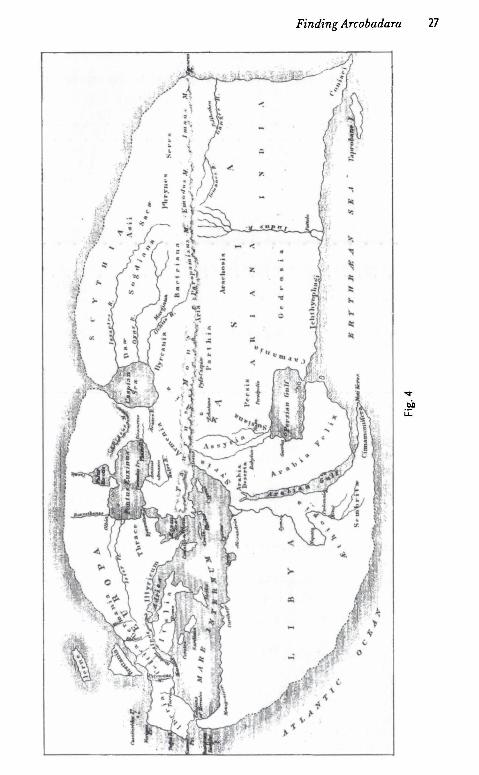
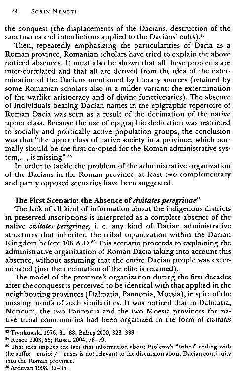
by the values oflongitude and latitude.41 The map reconstructed from preserved fragments of Pliny the Elder's Naturalis Historia and the two geographic opuscula of Late Antiquity (Demensuratio provinciarum and Divisio orbis terrarum) is known as Agrippa's map. An uncertain geographical work was attributed by modern science to M. Vipsanius Agrippa, though a consensus has not been reached on the nature of that work. Data preserved in Pliny the Elder's text show that the author chose to place the chorographical description of the known world under the authority of Agrippa, citing him in 31 paragraphs from books III-VI in his encyclopaedia. For a century, German philology tried to explain which was the geographical work attributed to Agrippa or Augustus, attempting to decide whether it was an orbis pictus depicted in porticus Vipsania, if there were only some geographic commentarii, or both. V. Frandsen, K. Mannert, F. Ritschl, C. Petersen, Th. Mommsen, K. Mi.illenhoff, D. Detlefsen, A. Klotz, and E. Schweder gathered and interpreted the fragments of this lost geography starting from Pliny the Elder's text, the opuscula Demensuratio and Divisio, and the so-called Strabo's Chorographs.42
In order to establish Agrippa's geographical initiative, researchers have discussed the semantics of the Latin terms in Naturalis Historia, III. 17: ... cum orbem orbi spectandum propositurus esset, where proponere is understood as a public depiction of the world. 43 Further on in this paragraph, Pliny states that Augustus completed this public display project: he finished the portico containing the "world" (image of the world?); Agrippa's sister Vipsania Polla started the construction of this portico on the basis of Agrippa's commentarii and destinatio: 44
"(Divus Augustus) Is namque complexam eum (se. orbem) porticum ex destinatione et commentariis M. Agrippae a sorore eius inchoatam peregi,t''. 45
P. Arnaud correctly observed that nowhere in the text is this orbis described as pictus, but still the terms used belong to the vocabulary of maps. 46 It was believed that this map in the portico was the prototype of the only ancient map of the known world preserved until today,
41 Dilkc 1988, 196. 42 Arnaud 2007 - 2008, 74-79; Paliu de Lcsscrt 1909, 223-245; Nicolet 1988a, 103-131; Cinque 2002, 357-363. 43 Nicolet 1988 a, 109: proponere orbem spectandum - "rnettre sous Ies ycux, pour qu 'on le regarde". 44 Riesc1964, VII-XVII; Klotz 1930-1931, 38-45; Tierney 1967, 17-22; Nicolet 1988, 134-136. 45 Plinius, Naturalis Historia, III. 17: 46 Arnaud 2007-2008, 83.
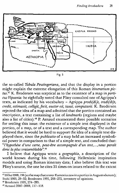
\,~ AETHIOPIA „ ... _ ----"-------Fig. 5
Finding Arcobadara 29
I
' ---------+- _____ __)
' , I
/ INDIA
( /J
1(.5_
the so-called Tabula Peutingeriana, and that the display in a portico might explain the extreme elongation of this Roman itinerarium pictus.47 K. Brodersen was sceptica} as to the existence of a map in porticus Vipsania: he rightfully noted that Pliny consulted one of Agrippa's texts, as indicated by his vocabulary - Agrippa prodi(di)t, tradi(di)t, credit, estimavit, colligit,fecit, auctor est, taxat, computavit. K. Brodersen rejected the idea of a map and admitted that the portico contained an inscription, a text containing a list of landmarks (regions and maybe also a list of cities). 48 P. Arnaud enumerated three possible scenarios for settling this issue: the existence of a simple text displayed in the portico, of a map, or of a text and a corresponding map. The author believed that it would he hard to support the idea of a simple text displayed there, since the publicatio of a map held an increased symbolical power in comparison to that of a simple text, and concluded that: "l'hypothese d'une carte, peut-etre accompagnee d'un text, ... ,nous paraît donc la plus vraisemblable". 49
I believe that Agrippa wrote a geographia, a description of the world known during his time, following Hellenistic inspiration models and using Roman itinerary data; I also believe this text was Pliny's source, the one he cites 31 times on issues related to the extent
47 Dilke1988, 196 (as themap thatorator Eumeniussawina portico inAugustodunum); Stahl 1983, 29-32; Brodersen 1995, 268-272, inventory of opinions. 46 Brodersen 1995, 274-285. 49 Arnaud 2007-2008, 117-118.
30 SORIN NEMET!
of regions, distances given in Roman miles, and other geographical data. Also, there is nothing against the existence of a map; rather on the contrary, I consider that such a map did exist.50 M. C. Pallu de Lessert's analysis of the diverging opinions on citations from Agrippa in Pliny, Divisio, and Demensuratio is a significant argument in support of this. The author believed that these citations are difficult to explain in the context of a presumed common source in shape of a didactica} treatise, but easily explained if the above mentioned authors worked on a map that each of them used according to his own comfort and whim.51
*
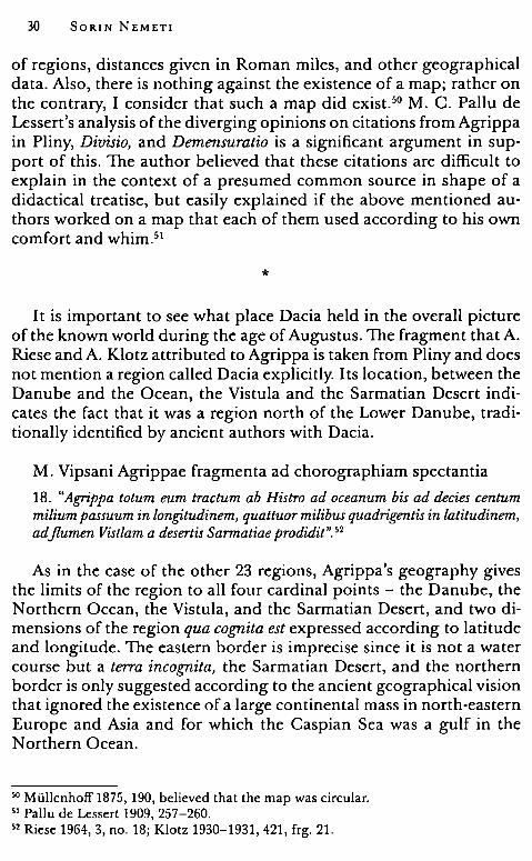
I t is important to see what place Dacia held in the overall picture of the known world during the age of Augustus. The fragment that A. Riese and A. Klotz attributed to Agrippa is taken from Pliny and does not mention a region called Dacia explicitly. Its location, between the Danube and the Ocean, the Vistula and the Sarmatian Desert indicates the fact that it was a region north of the Lower Danube, traditionally identified by ancient authors with Dacia.
M. Vipsani Agrippae fragmenta ad chorographiam spectantia
18. "Agrippa totum eum tractum ab Histro ad oceanum bis ad decies centum milium passuum in longi,tudinem, quattuor milibus quadrigentis in latitudinem, adflumen Vistlam a desertis Sarmatiae prodidit". 52
As in the case of the other 23 regions, Agrippa's geography gives the limits of the region to all four cardinal points - the Danube, the Northern Ocean, the Vistula, and the Sarmatian Desert, and two dimensions of the region qua cognita est expressed according to latitude and longitude. The eastern border is imprecise since it is not a water course but a terra incognita, the Sarmatian Desert, and the northern border is only suggested according to the ancient geographical vision that ignored the existence of a large continental mass in north-eastern Europe and Asia and for which the Caspian Sea was a gulf in the Northern Ocean.
50 Miillenhoff1875, 190, believed that the map was circular. 51 Paliu de Lessert 1909, 257-260. 52 Riese 1964, 3, no. 18; Klotz 1930-1931, 421, frg. 21.
Finding Arcobadara 31
One can find the same image in Pliny's detailed paragraph that also enumerates Scytharum gentes that inhabit the region between Germania and Sarmatia, a region that the author does not explicitly labei as Dacia either.
Plinii Naturalis Historia, IV. XII. 80-81:
''Ah eo in plenum quidem omnes Scytharum sunt gentes, variae tamen litori apposita tenuere, alias Getae, Daci Romanis dicti, alias Sannatae, Graecis Sauromatae, eorumque Hamaxobii aut Aorsi, alias Scythae degeneres et a servis orti aut Troglodytae, mox Alani et Rhoxolani. Superiora autem inter Danuvium et Hercynium saltum usque ad Pannonica hiberna Carnunti Gennanorumque ibi confinium campos et plana Iazyges Sannatae, montes vero et (81) saltus pulsi ah his Daci ad Pathissum amnem. A Maro, sive Duria est a Suebis regnoque Vanniano dirimens eos, aversa Basternae tenent aliique inde Gennani. Agrippa totum eum tractum ah Histro ad oceanum bis ad decies centenum millium passuum in longi.tudinem, quattuor milibus minus CCCC in latitudinem, ad flumen Vist/am a desertis Sannatiae prodidit". 53
In order to understand these excerpts correctly, fragments from the above mentioned late opuscula Divisio orbis terrarum and Demensuratio provinciarum are relevant. These two abridged geographical descriptions have been considered as missing links between Pliny's text and Agrippa's lost geography, both derived from the latter through a channel independent of Pliny.
Demensuratio provinciarum or demonstratio provinciarum Hieronymi presbyteris was first published by Schelstrate in his Antiquitates ecclesiasticae in 1697.54 The opusculum was preserved in several manuscripts, among
53 Rackman 1947, 178-181: "From this point all the races in general are Scythian, though various sections have occupied the lands adjacent to the coast, in one place the Getae, called by the Romans Dacians, at another the Sarmatae, called by the Greeks Sauromatae, and the section of them called Waggon-dwellers or Aorsi, at another the base·born Scythians, descended from slaves, or else the Cave-dwellers, and then the Alani and Rhoxolani. The higher parts between the Danube and the Hercynian Forest as far as the winter quarters of Pannonia at Carnuntum and the plains and levei country of the German frontiers are occupied by the Sarmatian Iazyges, while the Dacians whom they have driven out hold the mountains and forests as far as the river Theiss. From the river Maros, or else the Dora if it is that which separates them from the Suebi and the Kingdom of Vannius, the opposite side of the country is occupied by the Basternae and then other German tribes. Agrippa describes the whole of this area from the Danube to the sea as being 1200 miles in length by 396 in breadth, as far as the river Vistula in the direction of the Sarmatian desert". 54 Paliu de Lessert 1909, 218.
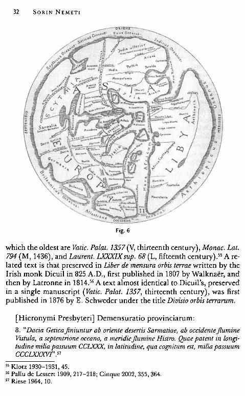
32 SORIN NEMET!
Fig. 6
which the oldest are Vatic. Palat. 1357 (V, thirteenth century), Monac. Lat. 794 (M, 1436), and Laurent. LXXXIX sup. 68 (L, fifteenth century).55 A related text is that preserved in Liber de mensura orbis terrae written by the Irish monk Dicuil in 825 A.D., first published in 1807 by Walknaer, and then by Latronne in 1814.56 A text almost identica} to Dicuil's, preserved in a single manuscript (Vatic. Palat. 1357, thirteenth century), was first published in 1876 by E. Schweder under the title Divisio orbis terrarum.
[Hieronymi Presbyteri] Demensuratio provinciarum:
8. "Dacia Getica.finiuntur ab oriente desertis Sarmatiae, ab occidenteflumine Vistula, a septentrione oceano, a meridieflumine Histro. Quae patent in long;i,· tudine milia passuum CCLXXX, in latitudine, qua cog;nitum est, milia passuum CCCLXXXVF'. 57
55 Klotz 1930-1931, 45. 56 Paliu de Lcsscrt 1909, 217-218; Cinquc 2002, 355, 364. 57 Riese 1964, 10.
Finding Arcobadara 33
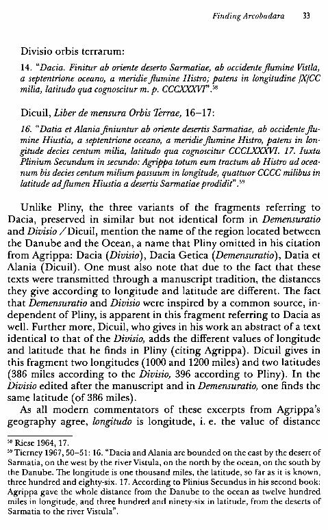
Divisio orbis terrarum:
14. "Dacia. Finitur ab oriente deserto Sarmatiae, ab occidenteflumine Vistla, a septentrione oceano, a meridie flumine Histro; patens in longi,tudine /X/CC milia, latitudo qua cognoscitur m. p. CCCXXXVF'. 58
Dicuil, Liber de mensura Orbis Terrae, 16-17:
16. "Datia et Alaniafiniuntur ab oriente desertis Sarmatiae, ab occidenteflumine Hiustia, a septentrione oceano, a meridie flumine Histro, patens in longi,tude decies centum milia, latitudo qua cognoscitur CCCLXXXVI. 17. Iuxta Plinium Secundum in secundo: Agrippa totum eum tractum ab Histro ad oceanum bis decies centum milium passuum in longi,tude, quattuor CCCC milibus in latitude ad flumen Hiustia a desertis Sarmatiae prodidit". 59
Unlike Pliny, the three variants of the fragments referring to Dacia, preserved in similar but not identica! form in Demensuratio and Divisio /Dicuil, mention the name of the region located between the Danube and the Ocean, a name that Pliny omitted in his citation from Agrippa: Dacia (Divisio), Dacia Getica (Demensuratio), Datia et Alania (Dicuil). One must also note that due to the fact that these texts were transmitted through a manuscript tradition, the distances they give according to longitude and latitude are different. The fact that Demensuratio and Divisio were inspired by a common source, independent of Pliny, is apparent in this fragment referring to Dacia as well. Further more, Dicuil, who gives in his work an abstract of a text identica! to that of the Divisio, adds the different values of longitude and latitude that he finds in Pliny ( citing Agrippa). Dicuil gives in this fragment two longitudes (1000 and 1200 miles) and two latitudes (386 miles according to the Divisio, 396 according to Pliny). In the Divisio edited after the manuscript andin Demensuratio, one finds the same latitude (of 386 miles).
As all modern commentators of these excerpts from Agrippa's geography agree, longi,tudo is longitude, i. e. the value of distance
58 Riese 1964, 17. 59 Tierney 1967, 50-51: 16. "Dacia and Alania are bounded on the east by the desert of Sarmatia, on the west by the river Vistula, on the north by the ocean, on the south by the Danube. The longitude is one thousand miles, the latitude, so far as it is known, three hundred and eighty-six. 17. According to Plinius Secundus în his second book: Agrippa gave the whole distance from the Danube to the ocean as twelve hundred miles în longitude, and three hundred and ninety-six in latitude, from the deserts of Sarmatia to the river Vistula".
34 SORIN NEMETI
measured along the west-east direction, while latitudo, the latitude, is the distance along the north-south direction.60 Ali graphic reconstructions of Agrippa's map ( envisaged as those of Erathostene, Strabo, or Mela as an ovoid representation of the oikumene located in the northern hemisphere in the Ocean) show Dacia as a rectangle measuring 1000 (Dicuil) / 1200 (Plinius, Divisio) Roman miles along its longitude and 396 (Plinius), 386 (Demensuratio, Divisio / Dicuil) Roman miles along its latitude. Giving the value of the latitude, late opuscula add the mention qua cognoscitur (Divisio / Dicuil) or qua cognitum est (Demensuratio), considered as a mark of their borrowing from Agrippa's geography. The excerpt from Pliny suggests another interpretation: for him, the entire region measures 1200000 feet in length (longitudo) "between the Danube and the Ocean" and 396000 feet in width (latitudo) "between the Sarmatians' Desert until RiverVistula". One might add qua cognoscitur and then the length and width given in this ancient text might he understood without reference to the cardinal points or the projection of geographic space on the terrestrial globe, according to the Creek mathematic geographic method with coordinates according to latitude and longitude. In Pliny, longi,tudo and latitudo would thus mean strictly the length ( the longer side) and width ( the shorter side) of a rectangle. Demensuratio and Divisio / Dicuil just give the limits towards the four cardinal points ( the Sarmatian Desert to the east, River Vistula to the west, the Ocean to the north, and the Danube to the south (in this order) and go on mentioning the longitude and latitude (also in this order). According to my interpretative key, the sides of the rectangle would consist of the Sarmatian Desert - Vistula, i. e. the longitude ( east-west) and Ocean - Danube (north-south), as known at the time. I therefore believe that in Pliny's inclusion of Agrippa's text, the dimensions of the rectangle were reversed, with the longitude understood as the northsouth distance (Danube - Ocean) and the latitude as the east-west distance (Vistula - the Sarmatian Desert).
In this case, one must take into consideration a smaller value of the latitude, of 396 (Pliny) / 386 Roman miles (Demensuratio, Divisio / Dicuil), i. e. 396 / 386 thousand feet from the Danube to the Ocean, qua cognitum est. Navigators did not explore the Northern Ocean beyond the Cimbrian Promontory, therefore Scandia (the Scandinavian Peninsula) was seen in Antiquity as an island, not as a peninsula. Greeks and Romans imagined that people could navigate around
60 Mattern 1999, 49.
Finding Arcobadara 35
the inhabited world. Several arguments support this idea, such as Pytheas's travels through the Northern Ocean, the news of Indian messengers reaching the Roman court from the N orthern Ocean, and maps depicting the Caspian Sea as a gulf in the Septentrional Ocean.61 Thus the Romans knew that the Ocean must have been located somewhere north of Dacia, but the extent of these areas along the north-south direction were only known over a distance of ca. 400 Roman miles.
Orosius alsa described this part of Europe in a similar fashion.
Pauli Orosii Historiarum adversus paganos libri primi caput al-terum. 21; Cosmographia. 21:
"A montibus Riphaeis ac flumine Tanai Maeotidisque paludibus, quae sunt ad orientem, per litus septemtrionalis oceani usque ad Galliam Belgicam et flumen Rhenum, quod est ab occasu, deinde usque ad Danubium quem et Histrum vocant, qui est a meridie et ad orientem directus ponto accipitur: ab oriente Alania est, in medio Dacia, ubi est Gothia; deinde Germania est, ubi plurimam parte Suevi tenent ( . .)". 62
Between the Rhine and Gallia Belgica to the west and Tanais, Palus Maeotis, and Montes Riphaei to the east stretched the following countries, in this order: Germania, Dacia (ubi et Gothia), and Alania. One must note that Orosius mentioned the meridional border (Danube and Pontus Euxinus), but did not set the northern limit which he alsa understood as being the Ocean. Orosius' geographical introduction, inspired by the Agrippan tradition,63 was the source of medieval depictions of the TO mappaemundi (Beatus' map, the mappamundi in Hereford etc.),64 in which Germania, Dacia, and Alania are bordered towards the north by the Ocean.
Pomponius Mela, in his chorography, described the area without mentioning Dacia. Germania and Sarmatia, separated by River Vistula, stretched between the Danube and the Ocean. Mela's image of Europe thus differs, through the absence of Dacia, from Agrippa's image, transmitted by Pliny and the late Roman opuscula, but not essentially: one finds the same flattened version of North-Eastern Europe between the Danube and the Ocean.
61 Mattern 1999, 51, 64. 62 Riese 1964, 62, frg. 21; 95, frg. 21. 63 Merrils 2005, 70-77. 64 Janvier 1982, 61, 266-267.
36 SORIN NEMET!
Fig. 7
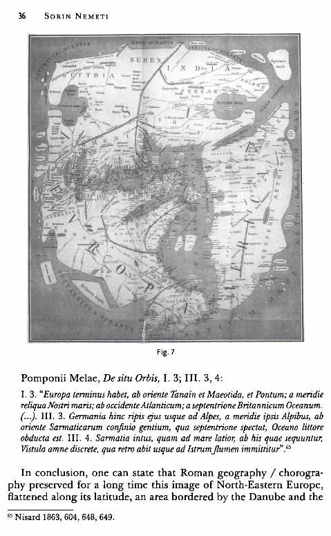
Pomponii Melae, De situ Orbis, I. 3; III. 3, 4:
I. 3. "Europa tenninus habet, ab oriente Tanain et Maeotida, et Pontum; a meridie reliquaNostri maris; ab accidente Atlanticum; a septentrione Britannicum Oceanum. (...). III. 3. Gennania hinc ripis ejus usque ad Alpes, a meridie ipsis Alpibus, ab oriente Sarmaticarum co'!finio gentium, qua septentrione spectat, Oceano littore obducta est. III. 4. Sarmatia intus, quam ad mare latior, ab his quae sequuntur, Vistula amne discrete, qua retro abit usque ad Istrumjlumen immittitur".65
In conclusion, one can state that Roman geography / chorography preserved for a long time this image of North-Eastern Europe, flattened along its latitude, an area bordered by the Danube and the
65 Nisard 1863, 604, 648, 649.
Finding Arcobadara 37
Pontus in the south and the Ocean in the north. Tabula Peutingeriana reproduces exactly this image of Dacia bordered towards the north by the Ocean, with the Caspian Sea depicted as a gulf in the latter. 66
The dimensions transmitted by Pliny and the late opuscula are not to be taken strictly, since they were corrupted through the manuscript transmission of Pliny's texts and of the treatises Demensuratio and Divisio. One must only note that the distance, along the latitude, is under-valued at ca. 396 / 386 Roman miles (a recurrent value), while the longitude is accompanied by formulae such as bis ad decies centenum millium passuum (Pliny) and decies centum milia (Dicuil). But how did fourth-century abbreviators come to the value of decies centena milia passuum in circuitu?
Theodulf's Mappamundi and in circuitu dimensions Roman geographic tradition (Agrippa / Plinius, Demensuratio,
Divisio) shows regions as irregular rectangles with dimensions given according to two coordinates (latitude and longitude). There are nevertheless a few cases, especially for islands, when the dimensions of a geographical unit are given in circuitu, thus stating their perimeter. Agrippa's map also included such perimeters (ambitus, circuitus): circuitus Siciliae (Plinius, Hist. Nat., III. 86), ambitus sinus ltaliae et Illyrici (Plinius, Hist. Nat., III. 150), and circuitus Ponti (Plinius, Hist. Nat., IV. 77). An excerpt from Suetonius, that P. Arnaud believes to have been directly inspired by Agrippa's geography, renders thus the dimensions of Gallia: 67
Suetonius, Vitae duodecim Caesares, XXV:
"(. . .) Omnem Galliam, quae saltu Pyrenaeo Alpibusque et monte Cebenna,jluminibus Rheno ac Rhodano continetur patetque circuitu ad bis et tricies centum milia passuum, praeter socias ac bene meritas civitates (. . .)". 68
Similar paragraphs in Pliny (Hist. Nat. IV. 105) and Divisio, 7 that mention the same borders ( the Pyrenees, Mons Cebenna, the Rhine,
66 Prontera 2003, 30 (Hellenistic model / Eratosthenes, Caspian Sea - gulf of the Northern Ocean, the continuous chain of the Taurus Mountains that divides Asia in two unequal parts). 67 Arnaud 2007-2008, 121. 66 Rolfe 1914, 32-33: "( ... ) Ali the part of Gaul which is bounded by the Pyrenees, the Alps and the Cervennes, and by the Rhine and Rhone rivers, a circuit of some 3200 miles, with the exception of some allied states which had rendered him good service ... . . ( )"
38 SORIN NEMET!
and the Rhone) but give the dimensions expressed in distances along longitude and latitude, support the idea of a borrowing in Suetonius:
M. Vipsani Agrippae fragmenta ad chorographiam spectantia:
"Agrippa Galliarum inter Rhenum et Pyrenaeum atque oceanum ac montes Cebennam et Jures, quibus Narbonensem Galliam excludit, longi,tudinem CCCCXX, latitudinem CCCXVIII computavit". 69
One must note that, in this case as well as that of Dacia, the added dimensions in Pliny and Divisio do not match the value of the perimeter in Suetonius, i. e. 3200 miles ( 420 miles in longitude, 318 miles in latitude in Plinius, 828 miles in longitude, 263 miles in latitude in Divisio).
Expressing the extent of regions through perimeter size is an exceptional trait of Roman cartography. One finds the same in Hyginus' fables for example, where the perimeter size of certain regions or islands is expressed in stadia:
Hygini Fabulae, CCLXXVI, 5-20:
5. "Mauretania posita ad solis occasum in circuitu stadia LXXVI. Aeg;yptus in sole et austro posita, quem Nilum circumlauat, circuitu st adia .... Sicilia in triscelo posita, circuitu stadia XXXDLXX. 2. Sardinia in circuitus stadia XCCL. 1 O. Creta in longi,tudine ... et oppida utraque parte centum possidet, circuitu stadia XXC. Cyprus posita est inter Aeg;yptum et Africam, similis sculo Gallico, circuitu stadia XLIC. Rhodos in rotundo posita, circuitu stadia XXC. 15. etc. "70
The presence of these fragments, disiecta membra of an ancient geographical tradition that used to present regions expressing the size of their perimeter (circuitus, ambitus), proves the existence în Antiquity of maps of the known world with dimensions expressed in circuitu. As the excerpt from Suetonius on Gal/ia comata indicates, the main source must have been the lost geography attributed to Agrippa or the map inside the above mentioned portico. Before establishing a direct connection between Agrippa's commentaries and the fragments including the dimensions of regions expressed in circuitu (Suetonius, Hyginus, Eutropius, Rufius Festus) by indicating the source that might he the "missing link'', one must return to the Carolingian treaty signed by monk Dicuil. In the prologue of his treatise, De mensura
69 Klotz 1930-1931, 392, frg. 7; Riesc 1964, 5, frg. 23. 70 Rose 1933, 169-170.
Finding Arcobadara 39
orbis terrae, he copied a text and a twelve-line epigram that explains that mensura orbis was done at the order of Theodosius II during his JSth consulship, i. e. in 425, by two of hisfamuli, according to older models (veterum monumenta).71 Two other manuscripts of the Divisio orbis terrarum (Vatic. Lat. 642 and Leyde, Bibi. Der Rijksuniv. Scaliger 39) also make reference to Theodosius II. 72
Thus, an early medieval tradition makes note of Theodosius II ordering the creation of a map of the known world by bringing up to date older information on the topic. Two manuscripts, dated to the ninth and eleventh centuries, bring to our knowledge a map known as Theodulf of Orleans' mappamundi: Leyde, Bibi. Der Rijkuniversiteit Voss. Lat. F. 12 d (L, ninth century), originating from the region of Orleans and Vatican, Reginensis latinus 123 (V, eleventh century), written in Santa Maria de Ripoll. 73 The latter manuscript (V) is not a copy of the first, but it derives from a shared model. The manuscripts include a circular mappamundi each, measuring 30 cm in diameter, surrounded by a blue ring representing the Ocean and protomae of the 12 winds. Under the drawing there are cartouches that contain the map legend and a Latin poetry written by Theodulf, bishop of Orleans. The manuscript in Ripoll also preserves an opusculum entitled Divisio orbis terrarum 7heodosiana that has the peculiarity of rendering the size of regions in in circuitu values.
After a short description of the division of the world in three parts - Europe, Asia, and Lybia - with the dimension of each expressed in longitude and latitude the manuscript includes the enumeration of Europe's regions, with size in circuitu. Hispania, Gallia, Italia, Retia et Vindelica (sic) are followed by Germania, Sarmatia, Thracia et Getica, Moesia, Macedonia, Illyricum, and Peloponensus (sic).
Divisio orbis terrarum Theodosiana:
"{18} Gennania utreque, proxima Gal/ie et +Senonica, patent in circuitum milia passus {19} /XXX/DLXXv. {20} Sarmatia omnis a flu mine Vistula perque Histrum jlumen et litora Pontici maris, et {21} ex parte Caspii et ore septentrionali in
71 Tierney 1967, 23-24: Dicuil, De mens. Orbis terrae, I, 1: "in quinto decimo anno regni imperatoris Theodosii praecepit ille suis missis prouintias orbis terrae in longitudinem et latitudinem mensurari". 72 Riese 1964, 15: Dicuil praef.: "cogitaui ut liber de mensura prouinciarum orbis terme sequeretur, secundum illorum auctoritatem quos Sanctus Theodosius imperator ad prouincias praedictes mesurandas miserat ... ". 73 Gautier Dalche 1994-1995, 91-93.
40 SORIN NEMET!
circuitum patent milia /L/DCCXII. [22) Thracia et Getica in unum patent milia passus /X/DCLXXXIIII. (ms. V - IXIDCLXXVIIII)".
Thus, the Carolingian geographical text that takes over a late Roman source mentions that Thracia and Getica (like in Demensuratio - Dacia Getica) have together a perimeter of 1684 Roman miles (1679 Roman miles in the manuscript in Ripoll). These figures have no real value for the actual geography of the North-Danubian area, no more than the distances along longitude and latitude provided by Agrippa /Plinius, Demensuratio and Divisio /Dicuil or Dacia's perimeter mentioned by Eutropius and Festus. Moesia, mentioned in the following paragraph, is located between Thracia and Getica (if it is indeed Dacia) in the actual geographical space.
The Carolingian map inspired by a late Roman source, a Divisio orbis terrarum Theodosiana, contains, in its main data, information transmitted by Agrippa's map tradition and the late geographical treaties, with the difference that the dimensions of the provinces are expressed in perimeters. It is irrelevant if it is the resuit of a mensura orbis ordered by Theodosius II, as the medieval tradition claims, but it is proof of a rich and varied production of geographical compendia and opuscula spread in late Roman libraries. Divisio orbis terrarum, Demensuratio provinciarum, Cosmographia Julii Caesaris, Excerpta eius spherae vei continentia by Iulius Honorius, Aethici Cosmographia are but a few examples of such works. 74 Excerpts from historians that provide the size of regions in circuitu (Suetonius, Eutropius, and Rufius Festus) and the existence of geographic descriptions such as Divisio orbis terrarum Theodosiana allow me to suspect the fact that fragments referring to Dacia's circuitus of 1000 Roman miles also come from a Latin geographical opusculum that could be found at the imperial court in Constantinople during the fourth century.
The value of Dacia's perimeter in Eutropius and Festus, the 1,000,000 feet (decimum centena milia passuum) they mention, cannot be found in the figures provided by the Roman tradition. One could calculate the perimeter of rectangular Dacia and thus Pliny's data lead to asize of 3192 Roman miles, almost as much as Gallia's perimeter in Suetonius. Close figures can be found in Divisio - 3172 miles and Dicuil - 2772 miles. The closest value to the 1000 miles found in the writings of fourth-century abbreviators can also be found in Demensuratio, where Dacia measures only 1332 miles in perimeter.
74 Dilke 1987, 243-244.
Finding Arcobadara 41
Also, in Divisio orbis terrarum Theodosiana, Thracia and Getica together measure only 1684 miles.
Traianus ... litus totum arctoum oceanum ambulavit. One peculiarity of this Roman geographical vision is their imagin
ing the northern and north-eastern parts of Et.ţrope as a narrow strip between the Danube and the Pontus to the south and the Ocean to the north. All mentioned sources - Agrippa / Plinius, Demensuratio, Divisio / Dicuil underestimate the latitude distance between the Danube and the Northern Ocean, qua cognita est: 396 or 386 Roman miles. The tendency towards flattening the northern regions continues as one goes from west to east: Romans only navigated up to the Cimbrian Promontory and were not aware of the fact that Scandinavia was a peninsula or that present-day Russia was such a vast territory. The unexplored territories north of the Black Sea were populated by Amazons and Hyperboreans and included the Riphaei Mountains. The Caspian Sea was just a gulf in the Northern Ocean for Plinius, Mela, Seneca, and Aelius Aristides and on the Tabula Peutingeriana.75
This sketched vision of the world influenced, according to Susan P. Mattern, Roman strategy and statesmen's decisions. When Julius Caesar wanted to conquer the Persian Empire, he intended to start with conquering Dacia and then to surround the Persians from the north (Suet. Caes. 44.3). Conquering the territories up to the Ocean was a source of glory and pride for the emperors. Dacia's location on a modern map is bizarre because it extended the empire's border and was a vulnerable province, exposed to attacks. According to Susan P. Mattern, Trajan wanted to conquer the entire territory between the Danube and the Northern Ocean by conquering Dacia: "but the most likely frontier imagined by Trajan when he invaded this territory was the Ocean itself. I t is likely that he shared the prevalent view of a flattened northern Europe; Agrippa had, after all, placed the ocean only 396 miles from the Danube River". 76 An echo of this ancient tradition can be found in a passage from the anonymous cosmographer from Ravenna:
75 Mattern 1999, 54-55; Nicolet 1988a, 88-89 (the Hyrcanian / Caspian Sea communicates freely with the Northern Ocean through a straight called "Northern Hercules' Columns" - Strabo, II. 1. 17; VII. 2. 4; XI. 6. 1; Tacitus, Germ., 34; Lucan, IIl.278); Raczka 2000, 189-199. 76 Mattern 1999, 61.
42 SORIN NEMETI
Ravennatis Anonymi Cosmographia, I. 13. 12:
"Sed si legeris, Odo care, bellum quod gessit Traianus Romanorum imperator, quando litus totum arctoum oceanum ambulavit, quando et Dacorum regem devicit, ... "77
After this remark on Trajan's walks along the shores of the Northern Ocean during the Dacian wars, the anonymous geographer expressed his amazement on how the wisest among the Romans believed that they owned the entire Earth.
This search focused on circuitus Daciae, on the sketched Dacia in Agrippa's map tradition and the transmission channels of this tradition in Late Antiquity, and on Trajan wanting to reach the Ocean through Dacia, has led to a simple conclusion: the Romans, in the fore day of their conquest, did not know much on the actual geographical area north of the Danube. One must wait for their conquest, for military itineraries, cadastral operations of people such as Bal bus, and forformulae provinciarum in order for Dacia to appear on maps or in geographical works in the shape that we are accustomed with today. Ptolemy, Tabula Peutingeriana, and the itinerary of the anonymous geographer from Ravenna resize the sketched Dacia and depict it as a Roman province, part of terra cognita.
2. The Fifteen "Dacian" Tribes and the Indigenous Districts
The problem of the "fifteen tribes" named by Ptolemy as inhabiting Dacia opens a new line of enquiry: if these are not the names of firstcentury tribes, what are they? The simple acknowledgement that the so-called tribes could belong to another chronological frame ( that of the Roman province) escalades in a series of theories strongly marked by an ideological construct, i. e. the theory of Daco-Romanian continuity. The very presence of these indigenous "tribes" was perceived as a strong argument for the theory of Dacian continuity in the ancestral land, turned into a Roman province, Dacia Augusti provincia.
*
The theory of Daco-Romanian continuity was horn as a response to another theory, the so-called "immigration theory'', that stipulated 77 Schnetz 1940, 12.
Finding Arcobadara 43
that the Dacians were exterminated and vanished during the Roman conquest wars. One of the fathers of this theory was R. Roesler, who asserted that the year 106 A.D. marks the end of the Dacian State and of the Dacian people. 78
This idea of the Dacians' extermination during the conquest wars, expressed organically in the second half of the nineteenth century by the Austrian and Hungarian scholars and, equally by those belonging to the Transylvanian Aufklărung, continues to exist even among today's historians. 79 This old idea is still shaping the few historical data concerning the fate of the Dacian people in the Roman Era.
Excepting the three literary fragments80 that suggest "the huge losses suffered by the Dacians during the conquest wars", the arguments used in modern historical speech for the extermination of the Dacians are the ex silentio arguments. The three main Dacian elements missing in the Roman province are: a) individuals with Dacian names, b) indigenous names or epithets of the gods (or any kind of historical source for certifying the gods of the Dacians) and, c) indigenous districts (administrative units that preserved the Dacians tribal structures). 81
Representatives of Romanian historiography have always supported the persistence and continuity of the Dacians in the new Roman province of Dacia, in spite of the fact that this opinion was contradicted by the ancient sources.82 The notable absences, namely Dacian proper names, Dacian gods, and the indigenous districts, made them try to explain the singular position of this province among the others, from the point of view of the survival of the native peoples. All the explanations have as a starting point the particular position of Dacia, before the Roman conquest, in the Barbarian World (a kingdom, highly centralized, characterized by the dissolution of the tribal society), the special context of the wars against Romans (a huge amount of casualties especially among the male population, warriors and aristocracy), and the special measures taken by the Romans after
78 Roesler 1871, 44. 79 Boia 1997, 83-114. 80 Eutropius, Breviarum, 8. 6. 2; Iulian, Caes. 28, 327 C·D, p. 59-60 ed. Lacornbrade; Scholia in Lucianum, ed. H. Rabe, Leipzig, 1906, 24. 16. 81 Balia 1974-1975, 142; about the absence of Dacian names and Dacian gods in the province of Dacia - Dana 2003, 166-186; Dana 2004, 430-448; Nemeti 2005, 185-218 ( the chapter "The Religion of the Dacians in the Roman Period and interpretatio Dacica"); Nemeti 2013, 136-155. 82 Protase 2000, 15-168.
44 SORIN NEMET!
the conquest (the displacements of the Dacians, destruction of the sanctuaries and interdictions applied to the Dacians' cults).83
Then, repeatedly emphasizing the particularities of Dacia as a Roman province, Romanian scholars have tried to explain the above noticed absences. It must also he shown that all these problems are inter-correlated and that all are derived from the idea of the extermination of the Dacians mentioned by literary sources ( retained by some Romanian scholars also in a milder variant: the extermination of the warlike aristocracy and of divine functionaries). The absence of individuals bearing Dacian names in the epigraphic repertoire of Roman Dacia was seen as a result of the decimation of the native upper class. Because the use of epigraphic dedication was restricted to socially and politically active population groups, the conclusion was that "the upper class of native society in a province, which normally should he the first co-opted for the Roman administrative sys-
. . . „ 84 tem, ... , is m1ssmg . In order to tackle the problem of the administrative organization
of the Dacians in the Roman province, at least two complementary and partly opposed scenarios have been suggested.
'Ihe First Scenario: the Absence of civitates perewi-nae85
The lack of all kind of information about the indigenous districts in preserved inscriptions is interpreted as a complete absence of the native civitates peregrinae, i. e. any kind of Dacian administrative structures that inherited the tribal organization within the Dacian Kingdom before 106 A.D.86 This scenario proceeds to explaining the administrative organization of Roman Dacia taking into account this absence, without assuming that the entire Dacian people was exterminated Gust the decimation of the elite is retained).
The model of the province's organization during the first decades after the conquest is perceived to be identical with that applied in the neighbouring provinces (Dalmatia, Pannonia, Moesia), in spite of the missing proofs of such similarities. It was noticed that in Dalmatia, Noricum, the two Pannonia and the two Moesia provinces the native tribal communities had been organized in the form of civitates
83 Trynkowski 1976, 81-88; Babeş 2000, 323-338. 84 Ruscu 2003, 55; Ruscu 2004, 78-79. 85 That idea implies the fact that information about Ptolemy's "tribes" ending with the suffix - ensioi / - enses is not relevant to the discussion about Dacian continuity into the Roman province. 86 Ardevan 1998, 92-95.
Finding Arcobadara 45
pereg;rinae, ruled during the military occupation by praefecti civitatis (supervising officers selected from the centurions of the troops dislocated in the area). The tribal councils were preserved, its members having been called principes. During a second phase of development, these communities gained a higher degree of autonomy, these civitates being now ruled by local aristocracy, principes civitatis. The subsequent evolution of these settlements towards the municipal status led to the transformation of the local council into ordo decurionum and of the principes into decuriones.
The impossibility of identifying such a model in the Dacian case is explained through "the absence of native structures able to sustain self-government, ... , and then to undergo a process of Romanization and to dedicate epigraphic inscriptions". 87 Although, "the absence of the upper class of the native society" should he the explanation also for "the particular aspects of the organization of the province of Dacia after the conquest, different from the usual model". 88
U nfortunately, there are no historical sources available to attest this scenario either. The word civitas is known from two inscriptions: civitas Paralissensium89 and civitas Romulensium Malvensium. 90 The general opinion is that in both cases the term was used in relation to two settlements which had gained the municipal status, and not to civitates pereg;rinae. 91 Four individuals called principes are attested in Dacia, all treated as "the chieftains of some migrated peregrine clans",92 but this quality is certain, in our opinion, just for Titus Flavius Aper from Splonum (Dalmatia).93 For M. Antonius Sabinianus and Aurelius Manneus, the title princeps could also mean magistrate in a rural settlement (like principes locorum from Moesia lnferior94) or sub-officer in an auxiliary unit (e.g. decurio princeps).95
87 Ruscu 2003, 56-60. 88 Ruscu 2003, 55-56. 89 IDRE II, 293 (Nedinum, Dalmatia). 90 IDRE I, 179 (Hispalis, Baetica). 91 Cocceius Umbrianus is decurio, augur and pontifex in civitas Paralis(s)ensium, then in municipium Septimium Porolissensis; only D. Tudor believed that civitas from this inscription is the name of a rural self-governing community; the opposed opinion was largely expressed by many scholars, from Daicoviciu 1944, 17-21 to C. C. Petolescu, IDRE, I, p. 183. 92 IDR111/1, 165, 111/3, 345, CIL III 110, 838; Ardevan 1998, 94-95; Ardevan 1998a, 47. 93 Popescu 1967, 191-192. 94 Avram 1984, 160-161. 95 Speidel 1984, 189-195.
46 SORIN NEMETI
One could notice, also, the absence of data about praefecti civitatis, principes civitatis or communities under military control ( excepting, maybe, the so-called regio Ansamensium supervised by beneficiarii. 96
) In order to emphasize the intrusion of the army on civil life, N. Gostar has counted some soldiers who had become municipal magistrates in the Dacian towns. 97
The same idea of the dissolution of the Dacian tribal society before the conquest and "l'absence dans la Dacie devenue province de l'elite indigene, le principal interlocuteur social...", is found also in other scholarly works as an explanation of the particular system applied for the administrative organization of the province, in absence of indigenous districts. 98 The view of the Dacian Kingdom as a highly centralized state in first century B.C. - first century A.D. is supported, in some authors view, by a series of direct and indirect proofs: the cease of local mints in the time of Burebista, the fragment from the Suda Lexicon ( quoting Criton) about royal functionaries in charge of the fortresses ("simple functionaries of the state and not local aristocrats were recruited from the entourage of the king to command these forts,") 99 the absence of toponyms ending in -dava in the urbanized area of the province, and their presence only at the periphery. 100
The resuit of this centralized system should he the lack, in all kinds of sources, of the names of the Dacian tribes, and is reflected also in the manner in which soldiers of Dacian origin indicated their natio or origo: in all known cases natione Dacus or simply Dacus, without the mention of the tribe (natione Moesiacus but also, natione Dardanus, natione Thrax, but also natione Bessus. ) 101
Beginning with these assumptions, Decebalus' kingdom is seen as "a highly centralised system, controlling not only the armed forces and religious life, but also economic resources." 102 As a resuit, the Iack of indigenous districts is due to a militarised Roman administration: "the troop disposition shows the typical pattern of an occupation army, each unit controlling a certain area". In this case "a centurio or primipilarius of a Iegion, or the commanding officer of
96 On this regi.o Ans. - Daicoviciu 1969, 396-401; Opreanu 1994, 69-77; Isac 2003, 48-58; tobe compared with regi.o Montanensis, Speidel 1984a, 185-188. 97 Gostar 1963, 259-266, 98 Opreanu 2004, 652-654. 99 Diaconescu 2004, 123. 100 Opreanu 2004, 654. 101 For the formula used to indicate origo and natio see Ricci 1993, 141-208. 102 Diaconescu 2004, 125.
Finding Arcobadara 47
equestrian rank of an auxiliary unit, had under his jurisdiction non only the auxiliary fort and its Kastellvicus but also a larger territory, including local communities of dediticii, or civitates stipendiariae, which were not self-governing communities. Excepting for the territoria of the towns, the provincial territory could be covered by Roman troops under such praefecturae" .103 In order to support this assertion one possible argument would be the disposal of the alae in the north-western part of the Transylvanian Plain (in Gherla, Ilişua, Brâncoveneşti, Cristeşti, and Războieni-Cetate). Another is the pattern observed in south-western Transylvania where the auxiliary forts are placed near the former Dacian fortresses but in open space ( the fort of Cincşor next to the Dacian fortress from Breaza, the fort of Feldioara next to those from Arpaşu de Sus). This pattern "seems to show that in most cases the army of occupation had taken over the administrative function of the citadels of the Dacian kingdom ( ... ). In this way the pre-Roman administrative units, each associated with a citadel, were directly incorporated into the province, natives in the territory of an auxiliary unit probably received the inferior status of dediticii. 104 ( ••• ) Probably the Kastellvici of the auxiliary forts played the role of the civitas capitals of the Roman West, attracting natives from the surrounding region and ultimately contributing to their Romanisation" .105 This variant of the first scenario is grounded on the fact that the civitates pereg;rinae are unattested, a fact explained through the idea of the dissolution of the tribal society in the age of the Dacian Kingdom. The idea of the extermination of the Dacian elite, even if not explicitly expressed, is implied by this scenario, where the Dacians are seen as a mass of dediticii under military control.106 But, one should keep in mind that preserved inscriptions mention no praefectura107 and no commanding officer of an auxiliary unit as chief of an administrative rural community (Sextus Iulius Possesor is curator civitatis Romulensium Malvensium at the time when Romu la is a self-governing city, a municipium) .108
103 Diaconescu 2004, 127. 104 Diaconescu 2004, 128. 105 Diaconescu 2004, 128. 106 The !atest critique of this scenario - Bogdan Cătăniciu 2006, 959-967. 107 Jacques, Scheid 1990, 190: "Les prefets militaires ne sont plus attestes dans Ies provinces europeennes apres Ies Flaviens". 10° C. C. Petolescu, IDRE I, p. 183.
48 SORIN NEMET!
The Second Scenario: Presence of civitates peregrinae Complementary and partly opposed, a second scenario was built
on the assumption that some native administrative structures existed in the province of Dacia.
The inscription from Almaşu Mare attests the existence of a vicus An[.., that A. v. Domaszewski read as vicus Anartorum. 109 C. Patsch thought that this vicus Anartorum was the chief-place of a district of the tribe of the Anartoi / Anartes mentioned by Ptolemy and localised in the north-western part of the province. 11° For H. Wolff, who criticised C. Patsch's opinion, this case should not he treated as proof of such an organisation, the viei ( vicus Anartorum, vicus Patavissensium and vicus Pirustarum) being just rural settlements, and not civitates. Wolff believed the task of Sextus Iulius Possessor as curator civitatis Romulensium Malvensium was to supervise a neighbouring region ( contemporary with the command of numeros Syrorum sag;i,ttariorum ), a rural non-self-governing unit called with a general term civitas, instead of regia or territorium. 111 Wolff's conclusion was that "in Dacien sind nicht nur curatores civitatis anderweitig unbekannt, sondern auch, ... , keine weiteren peregrinen Stammesgemeinden bekegt". 112
The second scenario founded on the idea of the presence of the natives, of their elite and their administrative structures in the Roman province of Dacia, relies, as a main proof, on the list of the Dacian "tribes" from Ptolemy's Geog;raphy. In Ptolemy's work one could find, besides the list of the settlements from Dacia (with Dacian and Roman names), also a list of 15 "peoples" which inhabited Ptolemy's Dacia. 113
Ptolemaeus, Geographia, III. 8. 3:
"Habitant Daciam in septentrionali parte, si ab occasu incipimus, Anarti et Teurisci atque Coestoboci; infra hos Predavenses et Rhatacenses et Caucoenses; infra quos eodem ordine Biephi et Buridavenses et Cotenses, atque infra hos Albocenses et Potulatenses et Senses; infra quos in meridiana regi.one Saldenses et Ciagi.si et Piephigi!'. 11 4
109 CIL III 8060. 110 Patsch 1937, 140; I. Piso has recently suggested a new reading of the last line -vicus Au[relianus]- rejecting "la lecture ... improbable" vicoAn[artorum], see Piso 2011, 323-324. 111 Wolff1976, 111-116; see also Alfoldi 1940, 29-30. 112 Wolff 1976, 114. 113 M i.iller 1883, 442-451. 114 Stevenson 1991, 82: "The Anarti, the Teurisci and the Coestoboci inhabit Dacia in the northern part, beginning from the west; bellow these are the Praedavenses,
Finding Arcobadara 49
For almost all scholars these peoples / tribes' names are the tribes of pre-Roman Dacia, before the Roman conquest, while only the names of the towns are those from the Roman province.115
Few Romanian scholars have claimed the contrary. For C. Daicoviciu the names with the -ensioi / -enses suffix should be assigned to "rural administrative structures (civitates), and not to genuine Dacian tribes,"116 meanwhile for R. Florescu the peoples' names are "rural circumscriptions under military authority" .117 I. I. Russu thought that the map of Dacia that Ptolemy transmitted us is to be dated between 106-117 (including the tribal names ), and drew the conclusion that "the Daco-Getian tribes are already named with forms of ethnika - demotika with Roman suffixes -ensioi (ensi)" being "more probably territorial structures, ... , a kind of civitates pereg;rinae" .118
The task of analysing and demonstrating this idea (i.e. that the Dacian "tribes" from Ptolemy's list are in fact civitates pereg;rinae from Roman Dacia) was assumed by Ioana Bogdan Cătăniciu. 119 In her opinion, the toponyms and the names of the "tribes" from Ptolemy's Geography belong to the first half of the second century A.D. For establishing the chronological frame of Ptolemy's information regarding the Danubian area, Ioana Bogdan Cătăniciu takes into account the mention of three settlements on the bank of the Hierasos river, Zargidava, Tamasidava, and Piroboridava. The Romanian scholar considers that the three settlements are located by Ptolemy north of Danube, in the vicinity of the province of Moesia Inferior (ad Moesiam). As it is well known from Hunt's Papyrus, Piroboridava belonged to Moesia Inferior between 102-117/118 A.D., then Ptolemy's map of the Northern Danubian area should be dated after 117 /118 when emperor Hadrian gave up the Moesian territories north of Danube.120 After the analysis of Ptolemy's information, Ioana Bogdan Cătăniciu reaches the conclusion: " ... le suffixe - enses ajoute au nom d'une localite forme le nom de la majeure partie des "peuplades" de la Dacie ptolemaique ( ... ), mais ces noms
the Rhatacenses, and the Caucoenses; below these, in this order, are the Biephi, the Burideenses, and the Cotenses, and below these are the Albocenses, the Potulatenses, and the Senses; below these, in the southern region, are the Saldenses, the Ciagisi, and the Piephigi". 115 Bogdan Cătăniciu 1999, 224; Bogdan Cătăniciu 1987-1988, 145-147. 116 Daicoviciu 1960, 266. 117 Florescu 1982, 544, n. 176, 547, n. 203. 118 Russu 1961, 92-93; Russu 1981, 182-183. 119 Bogdan Cătăniciu 1999, 223-231; Bogdan Cătăniciu 1987-1988, 145-162; Bogdan Cătăniciu 1997, 11-12; Bogdan Cătăniciu 1999a, 64-83. 120 Bogdan Cătăniciu 1991, 60.
so SORIN NEMET!
sont propres a des creations territoriales romaines et non a des tribus daces" (i. e. "divisions territoriales, c'est a <lire civitates de la Dacie au commencement du regne d'Hadrien„. "). 121 Thus, all these "tribes" are located on a modern map inside the province of Dacia: Anarti and Teurisci in the western and north - western part, the Coestoboci in the north-eastern part, near Orheiul Bistriţei, Predavenses in the Apuseni Mountains, Rhatacenses in the central zone of Transylvania, Caucoenses in Harghita County, Buridavenses on River Olt, Cotenses on Pârâul Negru and the upper valley of the Olt, Albocenses on River Timiş, Saldenses, near the Danube, Potulatenses in the north - western part of Oltenia, Senses near Slatina, Ciagisi and Piephigi in the Oltenian Plain. Ali these names are no more than Dacian tribes organised by the Romans in the form of civitates peregrinae (some bearing genuine tribal names such as Anarti, Teurisci, Coestoboci, Biephi, Piephigi, Ciagisi, some names derived after the tribal capital, Predavenses from Predava, Buridavenses from Buridava, Potulatenses from Potula etc.). 122
This scenario does nat provide information on the evolution of such civitates, on their transformation into administrative Roman structures. Ali the sources are connected to the time when Ptolemy drew his ninth map of Europe.
Today's Data or the Third Scenario? The two main ideas of modern historical Dacian logos, that of the
extermination of the Dacian population during the conquest wars and that of a highly centralised state in the time of Decebalus' reign found little support in the repertoire of ancient sources.
An honest historian can't salve the problem of the cruel fa te of the Dacians after the conquest basing his analysis only upon a general assertion (Eutropius), a rhetoric statement (Emperor Julian) and an anecdote (Lucian, quoting Crito). There is another example where modern historians are going tao far with their conclusions: following Crito's text about the existence of a "function aristocracy" in the Dacian kingdom during Decebalus' reign, namely some functionaries charged with controlling the fortifications, other controlling the pastures, 123 they create a picture of a centralised state with no parallel in the barbarian world. 124
121 Bogdan Cătăniciu 1991, 62. 122 Bogdan Cătăniciu, 1987-1988, 154-158. 123 Crito, FrgHist 200, F 5, see Petre 2004, 669. 124 Dana 2000, 48-50.

Finding Arcobadara 51
The issue of Ptolemy's data is far more complicated. For drawing the IXth map of Europe Ptolemy use severa} independent sets of information connected with the period 106-118 A.D. [the existence of the province of Dacia/ after 106 A.D. and the town Nicopolis ad Istrum / after 110 A.D., the absence of the province of Dacia Inferior / before 118-120 A.D., legio IV Flavia garrisoned at Singidunum / after 117-118 A.D.] 125 The so-called Dacian "tribes" belong to the same chronological frame, and their presence raises two different set of problems: a) what is hidden behind these ethnonyms? and b) where could the tribes he located on the modern map of the NorthDanubian region?
a) Out of the 15 names of the "tribes", only six are genuine ethnonyms: Anarti, Teurisci, Coestoboci, Biephi, Ciagisi, and Piephigi, the other nine being names derived from a town name and the suffix - i/V<rtot / - enses: Predavenses, Ratacenses, Caucoenses, Buridavenses, Cotenses, Albocenses, Potulatenses, Saldenses, and maybe S(i)enses. From other sources one only knows of Buridava, 126 Potula, 127 and Saldae, 128 but *Predava (or *Piedava, ms. X llte8avfrvcrtot), *Rataca, *Alboca, and the others should be similar, unattested settlements. A lot of tribes with genuine tribal names, not derived from localities, are known in the neighbouring provinces: for example Sevaces, Alauni, Noriei, Ambidravi in Noricum, Azali, Latobici, Varciani, Boii, Oseriates in Pannonia Superior, Amantini, Hercuniates, Breuci, Aravisci, Scordisci in Pannonia Inferior, Iapydes, Maezaei, Dindari, Ditiones, Cerauni, Daursii, Pirustae, Scirtiones in Dalmatia, and many others quoted by Ptolemy. 129 In Dalmatia there are also the Narensi and the Docleatae, with the names derived from N arona and Dodea. The same situation can be found in the two Moesiae, where the tribal names are combined with ethnonyms built with suffix -enses. In Moesia Superior besides Dardani and Moesi, there are also the Tricomenses (from Tricornium) and the Picenses (from Pincum), meanwhile in Moesia Inferior, besides the Tribalii, Troglodytae,
123 Strang ms., 30-31. 126 Miller 1916, 554. 127 Anonymus Ravennas, Cosmographia, IV, 14, 6 (Pinder, Parthey 1860, 204); Daicoviciu 1969, 298 interpreted Canonia Potula from Geographus Ravennas as a distortion ofCentum Putea from Tabula Peutingeriana, quite improbable because of the existence of Potulatenses in Ptolemy's Geography. 128 Pârvan 1926, 247. 129 Ptol„ Geogr. II, 13, 2; II, 14, 2; II, 15, 2; II, 16, 5 (Muller 1883, 286-287; 290-291; 298; 309-312).
52 SORIN NEMET!
Peucini and Crobyzi, one could also find the Oetenses, Obulenses, Dimenses and Appiarenses. 130
The fact that the "tribes" recorded by Ptolemy at the beginning at the second century A.D. in Noricum, Dalmatia, the two Pannonia, and the two Moesia are civitates pereg;rinae, indigenous administrative structures in the Roman provinces is a communis opinio. 131 This interpretation is even more obvious when one talks about the "tribal" names build with the suffix -enses. Narensi are those who living along the Narenta river, in conventus Narona, 132 and the names Tricornenses, Picenses, Dimenses etc. designate some indigenous administrative structures developed around the settlements of Tricornium, Pincum or Dimum, garrisons of some auxiliary units. These Moesian districts were created before the year 86 A.D. 133 or after the re-organization of the Danubian limes during Trajan's Dacian Wars. 134 The similar manner of designation and the same chronological frame show that Predavenses, Buridavenses or Potulatenses are also some districts from the new province or Dacia duringTrajan's reign, probably under military control.
b) As far as the location of these "tribes" on the modem map is concemed, I have to notice since the beginning the fact that Ptolemy does not provide precise information, i. e. co-ordinates expressed in latitude and longitude, like for settlements, only a vague distribution from north to south: "Habitant Daciam in septentrionali parte, si ab occasu incipimus ... , infra hos .. . , infra quos eodem ordinem, ... atque infra hos, „. infra quos in meridiana regi,one„." 135 The whole map of Dacia reconstructed after Ptolemy's co-ordinates has nine rectangular grids on longitude and five on latitude. It is obvious that Ptolemy has placed the names of the "tribes" in order to cover the entire, very distorted along the longitude map of Dacia, following his system: 3 grids on longitude / 1 grid on latitude. Thus, all the names of the "tribes" were conventionally placed in 3/1 grids in order to fill up the entire space divided then in 15 geometrica! units (1 unit= 3 grids on longitude / 1 grid on latitude). This purely conventional system is responsible for the presence of the Buridavenses in the centre of Transylvania, near Apulum and Germisara, and not in Oltenia where others sources
130 Ptol., Geogr., III, 9, 2; III, 10, 4 (Mi.iller 1883, 452-453; 463). 131 M6csy1974, 66-70. 132 Wilkes 1969, 165. J33 M6csy 1974, 66, 68. 134 Poulter 1980, 729-744. rn Ptol„ Geogr., III, 8, 3(Mi.iller1883, 444).
Finding Arcobadara 53
loca te the settlement of Buridava ( on River Olt, at Stolniceni, as one can see on the Tabula Peutingeriana). Thus, an attempt to transfer Ptolemy's Dacian "tribes" onto a modern map is meant to fail.
Interpreting in this manner Ptolemy's map of Dacia, a modern historian could conclude that there were some districts with names derived from settlements (Predavenses, Potulatenses, Albocenses etc.) and, maybe, some neighbouring tribes (Anarti, Teurisci, Coestoboci etc.) in Dacia during Trajan's reign. The poleis' names and the tribes' names are indigenous, so one can conclude that the natives were still living in the province at that time. It is hard to say if these districts were under military control, but they probably were, through comparison with the Moesian districts of Tricornenses, Picenses, Dimenses, or Appiarenses. These districts co-existed with the territory of colonia Ulpia Traiana Sarmizegetusa and there is no information on them after Hadrian's re-organization of the Dacian provinces. Beside new municipia like Napoca, Drobeta and maybe Romula, some rural self-governing communities, having territoria or regiones sprang from these Trajanic districts: the territory of Arcobadara, territorium Sucidavense, the territory around Samum called regio Ans(amense).
3. Ptolemy's Map of Dacia and theformulae provinciarum
Fonnulae provinciarum It has long been accepted that for the drawing of their books an
cient geographers used official sources, including the so-calledformulae provinciarum.
This type of official records were probably kept in the imperial archives and some people could have had access to this information, such as Pliny the Elder for example. The text of the Naturalis Historia suggests the existence of an official source apart from M. Vipsanius Agrippa's geographical work. The formulae were of course associated with other sources and mixed with them, thus becoming hardly recognizable. 136
In order to explain the map of Pannonia in Ptolemy's Geography, the Hungarian historian Bence Feher has supposed that the ancient geographer had extensively usedformulae provinciarum, and he tried to explain, starting from this, the many faults in his work. Feher assumed the existence of a map of lllyricum dating back to the Augustan era, a survey of Pannonia (before 20 A.D.) and, finally, of two surveys
136 Christol 1994, 45-46.
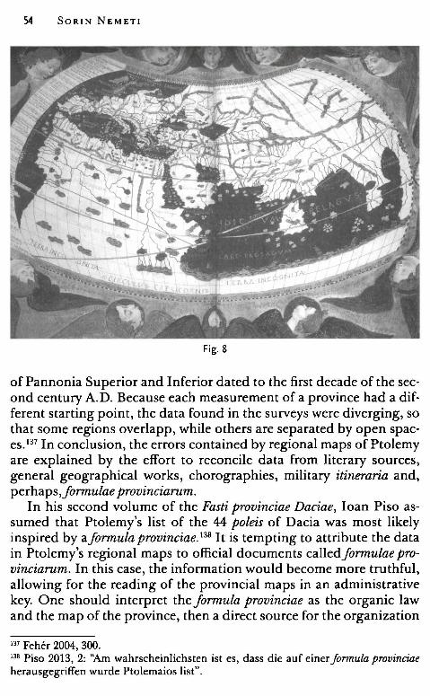
54 SORIN NEMETI
Fig. 8
of Pannonia Superior and Inferior dated to the first decade of the second century A.D. Because each measurement of a province had a different starting point, the data found in the surveys were diverging, so that some regions overlapp, while others are separated by open spaces.137 In conclusion, the errors contained by regional maps of Ptolemy are explained by the effort to reconcile data from literary sources, general geographical works, chorographies, military itineraria and, perhaps,Jonnulae provinciarum.
In his second volume of the Fasti provinciae Daciae, Ioan Piso assumed that Ptolemy's list of the 44 poleis of Dacia was most likely inspired by afonnula provinciae. 138 It is tempting to attribute the data in Ptolemy's regional maps to official documents calledfonnulae provinciarum. In this case, the information would become more truthful, allowing for the reading of the provincial maps in an administrative key. One should interpret the fonnula provinciae as the organic law and the map of the province, then a direct source for the organization
m Feher 2004, 300. 138 Piso 2013, 2: ''Am wahrscheinlichsten ist es, dass die auf einer formula provinciae herausgegriffen wurde Ptolemaios list".
Finding Arcobadara 55
of a conquered territory. Theformula includes the setting of the territory's boundaries through survey work and the official nomenclature of the administrative and judicial districts with the indication of the hierarchical rank of the units in each district. 139
The use of a formula provinciae in Pliny the Elder's book is textually attested in the description of Gallia Narbonnensis, where it is stated that Emperor Gal ba added to the formula the Alpine peoples of the Avantici and Bodiontici, whose main town was Dinia. 140 The description of Gallia Narbonnensis is organized, therefore, as follows:
(1) a very brief introduction; (2) a geographic presentation, with many notations ( rivers, towns ); (3) the proper description of the province, from south to north,
divided into regions (regiones), as well as a long list of communities ( towns and peoples);
( 4) the paragraph closes with the words of Agrippa concerning the dimensions of the province. 141
Ptol. Geogr. III. 8. 1-2:
Daciae situs (Europae tabula nona) 1. Dacia.finitur septentriones versus Sarmatiae Europaeae parte ea, quae est a Carpate monte usque ad terminum, in quo 7Jramjluvium injlecti demonstravimus, quae injlexio sita est, ut diximus, 53, 48.30, ab occasu Iazygi,bus Metanastis iuxta 'Iîbiscum jluvium; a meridie vero Danubii jluminis parte ea, quae est a 'Iîbiscijluvii ostio usque ad Pontum et ostia sua Danubius iam appellatur Ister; cuius partis positio ita se habet: 2. Post 'Iîbiscijluvii ostium primaAfricum versus injlexio 47. 20, 44. 45, injlexio ad injluentem Rabonemjluvium, qui ex Dacia decurrit 49, 43.30, injlexio ad Ciabrum injluentem 49. 30, 43. 45, injlexion ad Alutam jluvium injluentem, qui a septentrionibus prefectus per Daciam decurrit 50. 15, 44, injlexion prope Oescum 51, 44, injlexion prope Axiopolim 54. 20, 45. 45 inde a qua Danubium
jlumen usque ad ostia Istrum vocari diximus; ah oriente autem Dacia .finitur Istro jlumine, qui hinc est usque ad jlexum apud Dinogetiam oppidum, cuius jlexus position est 53, 46.40 et deinceps Hieraso jluvio, qui apud Dinogetiam in Istrum sese ejfundit a septentrionibus et oriente decurrens, usque as indicatam 'IJraejluminis injlexionem. 142
139 Paliu de Lessert 1909, 279-281. 140 Plin. Nat. Hist., 3 5. 37: adiecitformulae Galba Imperator ex Inalpinis Auanticos atque Bodionticos, quorum oppidum Dinia. 141 Christol 1994, 51. 142 Stevenson 1991, 81-82: "Dacia îs bounded on the north by that part of the European Sarmatia, which extends from the Carpathian mountains to the terminus where, as we has shown, the Tyras river îs deflected în its course în 53 48. 30 on the
56 SORIN NEMET!
Ptolemy's text on Dacia is comparable to this description of Gallia Narbonensis macle by Plinius the Elder. It contains a brief geographical outline, where the limits of the province are indicated using rivers (Danubius, Tibiscus, Hierasus, and Tyras). The communities were only listed afterwards: the 15 tribes living in Dacia, arranged in three columns,143 and the 44 poleis (towns and other kinds of settlements). 144
As for the general geographical description, one should clarify from the start that in Ptolemy's geography Dacia has a reduced area as compared to that of Dacia known in the earlier geographical tradition (Strabo, Agrippa, etc.). In Ptolemy's Geography, Dacia lies along nine degrees in longitude (675 Roman miles) and five degrees in latitude (312.5 Roman miles). If one compares these values to the dimensions of Dacia in Agrippa's geography, 1200/1000 Roman miles in length and 396/386 Roman miles in width, 145 it becomes pretty clear that Ptolemy actually indicated the dimensions of the Roman province and not those of the abstract region called Dacia, located between River Vistula and the Sarmatian Desert, between the Danube and the Ocean, Dacia known from Agrippa's map and the short geographical treatises of late Antiquity, like Divisio orbis terrarum and Demensuratio provinciarum. 146
west by Iazyges Metanastae along the Tibiscus river; on the south by that part of the Danube river between the mouth of the Tibiscus river and Axiopolis, from which town as far as the Pontus and the mouth of Danube it is called Ister; the severa! sections of this southern boundary are: after the rnouth of the Tibiscus river the first turn which is west-southwcst is in 47 .20 44.45 thcn a bcnd ncar thc cntrance of Rabon river which flows from Dacia in 49 43.30 an a bcnd at thc cntrancc of thc Ciabrus rivcr which is in 49.30 43.45, a bcnd ncar thc cntrancc of thc Alutas river which comcs from thc north in Dacia 50.15 44, a bcnd ncar Ocscus 51 44, a bcnd ncar Axiopolirn 54.20 44.45, thcncc thc Danubc river to its rnouth is callcd Istcr as wc said. On thc cast Dacia is boundcd by thc Ister rivcr ncar thc bcnd closc to the town Dinogetia, the location of which is in 53 46.40, then by the river Hierasus, which near Dinogetia flows into the Ister from the north, and turning castwards extends as far as the indicatcd bend of the Tyras river". 143 Ptol. Geogr. III. 8. 3; supra, Chapter 11.2. 144 Ptol. Geogr. III. 8. 4. 145 Riese 1964, 4 (M. Vipsani Agrippaefragmenta ad chorog;raphiam spectantia, 18); 10 (Demensuratio provinciarum, 8); 17 (Divisio orbis terrarum, 14); Tierney 1967, 50-51 (Dicuil, Liber de mensura Orbis Terrae, 16-17); supra, Chapter Il.1. 146 Nemeti 2011, 37-49.
The "Tribes" Dacia Ptol. Geogr. III. 8. 3:
Finding Arcobadara 57
"Habitant Daciam in septentrionali parte, si ab occasu incipimus, Anarti et Teurisci atque Coestoboci; infra hos Predavenses et Rhatacenses et Caucoenses; infra quos eodem ordine Biephi et Buridavenses et Cotenses, atque infra hos Albocenses et Potulatenses et Senses; infra quos in meridiana reg;i.one Saldenses et Ciagisi et Piephig;i.". 147
Germania Magna Ptol. Geogr. II. 11. 11:
" ( .. ) infra Orcynium Saltum Quadi, infra quos Jerri Jodinae et Luna Silva, infra quam magna gens Baemorum Danubio tenus, et finitimi eis iuxta fluvium Racatriae quique ad fluminis flexiones habitant Racatae. ". 148
Sarrnatia Europaea Ptol. Geogr. III. 5. 7:
"Habitant Sannatiam gentes maximae Venedae propter totum Venedicum sinum; atque supra Daciam Peucini et Basternae; et praeter totum !acum Maeotidis I azyges et Rhoxolani; atque magis ab his intorsum H amaxobii et Ala ni Scythae". 149
Ptol. Geogr. III. 5. 8:
"Minores autem gentes Sarmatiam incolunt iuxta Vistulamfluvium infra Venetes Gythiones, deinde Finni, deinde Suiones (?); infra quos Phrugundiones, deinde Avarinijuxta initium Vistulaefluvii; infra quos Ombrones, deinde Anartophracti, deinde Burg;i.ones, deinde Arsietae, deinde Saboci, deinde Pieng;i.tae et Biessi praeter Carpaten montem". 150
147 Stevenson 1991, 82: "The Anarti, the Teurisci and the Coestoboci inhabit Dacia in the northern part, beginning from the west; bellow these are the Praedavenses, the Rhatacenses, and the Caucoenses; below these, in this order, are the Biephi, the Burideenses, and the Cotenses, and below these are the Albocenses, the Potulatenses, and the Senses; below these, in the southern region, are the Saldenses, the Ciagisi, and the Piephigi". 148 Stevenson 1991, 64: " ... below the Orcynium forest are the Quadi, and below these are the iron mines and the Luna forest, below which is the great race of the Baemi extending as far as the Danube, and the Racatriae bordering them on the river, and the Racatae near the bending of the river". 149 Stevenson 1991, 80: "The Greater Venedae races inhabit Sarmatia along the entire Venedicus bay; and above Dacia are the Peucini and the Basternae; and along the entire coast of Maeotis are the Iazyges and the Rhoxolani; more toward the interior are the Amaxobi and the Scythian Alani". 150 Stevenson 1991, 80: "Lesser races inhabit Sarmatia near the Vistula r'lver. Below the Venedae are the Gythiones, then the Finni, then the Sulones; below whom are the
58 SORIN NEMET!
Ptol. Geogr. III. 5. 9:
"Ab his quos diximus ad ortum sunt infra Venedas Galindae et Sudini et Stavani Alanis tenus; infra quos Ig;ylliones, deinde Costoboci et Transmontani usque ad Peucinos montes". 151
Ptol. Geogr. III. 5. 10:
" ... inter Hamaxobios et Rhoxolanos Rheucanali et Exobygi,tae; atque rursum Peucinos inter et Basternas Carpiani, supra quos Gevini, deinde Rodini; inter Basternas vero et Rhoxolanos Chuni, atque infra montes ab ipsis cognominatos Amadoci et Navari". 152
The enumeration of the 15 commumt1es, five on each column, from north to south and from west to east, poses severa! problems.153 First of all, some are real tribes, bearing the tribal names known also from other sources, such as the Anarti, the Teurisci, 154
and the Costoboci155, or even previously unknown, as the Biephi, the Ciagisi, the Piephigi.156 One can easily observe that these names are deployed on the limits of the territory that Ptolemy called Dacia, i. e. the Roman province and its surroundings. My hypothesis is that Ptolemy has found these names in written sources: further east, near Dacia, lived the Amadoci157 and the Bodini (Budinoi),158 peoples
Phrungundiones; then the Avarini near the source of the Vistula river; below these are the Ombrones, then the Anartophracti, then the Burgiones, then the Arsietae, then the Saboci, then the Piengitae and the Biessi near the Carpathian Mountain." m Stevenson 1991, 80: "Among those we have named to the east: below the Venedae are the Galindae, the Sudini, and the Stavani, extended as far as the Alauni; below these are the Igylliones, then the Coestoboci and the Transmontani extending as far as the Peuca mountains." 152 Stevenson 1991, 80: " ... between the Amaxobi and the Rhoxolani are the Rheucanali and the Exobygitae; and between the Peucini and the Basternae are the Carpiani, above whom are the Gevini, then the Bodini; between the Basternae and the Rhoxolani are the Chuni, and below the mountains named from these are the Amadoci and the Navari." 153 Supra, Chapter II. 2. l!.4 Unattested in the written sources for more than a century: Teurisci are mentioned for the last time in Strabo VII. 3. 11 (Burebista's campaign against the Celtic Taurisci / Teurisci); on the other hand thc Anarti arc listed in the inscription of the M. Vinucius in 19 B.C. (see Gostar 1956, 184). 155 Russu 1959, 341-352; Macrea 1968, 187-191. 156 Gostar 1980, 25-32. 157 RE I. 1-2, 1894, s.v. Amadokoi, c. 1712-1713 (Tomaschek). 158 Hdt. IV. 21; RE III. 1, 1897, s.v. Bodinoi, c. 592 (Tomaschek); s.v. Budinoi, c. 989-991 (Tomaschek).
Finding Arcobadara 59
known from the time of Hellanicos and Herodotus. Ptolemy's ethnographic pieces of information therefore overlap: the Anarti and the Costoboci inhabit the far north, while one can find theirs duplicates in southern European Sarmatia: the Anartophracti, the Costoboci Transmontani, 159 the Saboci, the Piengitae, and the Biessi. 160 There is also a duplicate for the RacatensesjRatacenses from Dacia: a people called Racatae is mentioned on the banks of the Danube, near the bend of the river, in Germania Magna. 161 One may wonder if these names are really tribes living near the Roman province of Dacia 162 or, simply, the corrupt form of the tribes names confusedly placed by writers and geographers in a poorly known Barbaricum.
On the other hand, in the central part of the territory of Dacia one finds the names of communities built with the suffix -enses / -fivq101: Predavenses, Racatenses, Caucoenses, Buridavenses, Cotenses, Albocenses, Potulatenses, Saldenses, and S(i)enses. 163 In my opinion, they are not strictly tribes, but regions of the new province conquered by Trajan, a sort of administrative and judicial districts. 164 Due to subsequent changes in municipal life, I am inclined to believe that they are not the civitates peregrinae, 165 despite their names that are derived from those of the Dacian centers, such as *Predava, Buridava, * Alboca or *Potulata.
The distribution of the peripheral tribes and districts on the Ptolemaic map is quite vague from the point of view of current geography, but they are not random. The territory of the province, lying along nine degrees in longitude and five degrees in latitude, is divided into 15 geometric units: a unit consisting of three degrees in
159 One must observe that, in this case Ptolemy enlists the peoples from north to south: then infra Igylliones are the Coestoboci Transmontani (in this case located to the south of the Carpathian Mountains, probably, somewhere in Northern Moldavia). 160 The Saboci, the Piengitae and the Biessi were interpreted as duplicates from the time of V. Pârvan (Pârvan 1926, 223). 161 Tribes duplicated in Sarmatia in Bagrow 1945, 377. 162 For the problem of the peripheral tribes, see: Opreanu 1994a, 193-220. 163 Ptol. Geogr. III. 8. 3. For *Siensioi, see Russu 1947, 398-403. 164 Supra, Chapter II. 2. 165 See, for example, the opinions of Ioana Bogdan Cătăniciu, expressed many times: Bogdan Cătăniciu 1987-1988, 158; Bogdan Cătăniciu 1991, 59-67; Bogdan Cătăniciu 2002, 723: "„.l'organisation administrative de la province est fondee sur des communautes territoriales autonomes - civitates - dont le nom derive generalement de celui de la localite centrale„."; Bogdan Cătăniciu 2007, 55: "civitate peregrinaes (sic!)", (against any material evidence; there are no inscriptions in Dacia mentioning autochthonous civitates - Ardevan 1998, 92-95; Piso 1995, 69-70; Piso 2008, 317-318, des districts peregrins, 325).
60 SORIN NEMET!
longitude per one degree in latitude. Each unit of 3/1 degree is de· fined by a tribal name, or a district. U sing this purely conventional system, the geographer was able to cover the entire map. 166 The total absence of a precise relationship between communities should be noted, whether they are tribes or districts and settlements mentioned shortly thereafter, with geographical indications according to longitude and latitude. For example, in the territory of Buridavenses, one could find Apulum and Germisara (Iocated, in fact, in the centre of Transylvania), and not Buridava, placed by the Tabula Peutingeriana on River Olt (Alutus), in Oltenia. 167
'Ihe towns I tried to show on another occasion that the list of 44 towns re·
flects a situation recorded during the conquest of Dacia and in the first years after Trajan's wars. 168 I have already suggested an early dating of Ptolemy's prototype at the beginnings of the Roman province. The list of 44 towns contains a series of Roman toponyms, therefore should refer to realities arosen after the conquest (like, for example, Ulpianum, Salinae, Praetoria Augusta, Angustiae, Pirum, Aquae, Pontes, Pinum) .169 There are some internai criteria available for dating the prototype: termina postquem are provided by men· tions of the Iazyges in the Tisza Plain ( after the reign of Tiberius) and the very existence of Dacia as the Roman province ( after 106 A.D.). An important terminusantequem is, in my opinion, the listing of three poleis ending with the partide -dava among the towns from Moesia Inferior: i. e. Zargidava, Tamasidava, and Piroboridava, on the left bank of River Hierasus. 170 This chronological clue is
166 Nemeti 2006, 94-95. 167 Berciu 1931, 1-28; Tudor 1964, 404-405. 168 Nemeti 2006a, 271-289. 169 Pârvan 1926, 251. 170 Bogdan·Cătăniciu 1987-1988, 148, believed that three towns are listed under the formula ad Moesiam, and, strangely, she preferred a dating after 117-118 A.D. (the abandonment of some territories in the Wallachian Plain by Hadrian in the context of the Sarmatian Wars, and the organization of the new procuratorial province of Dacia Inferior). But, the X•h chapter of the Geography's IIl'd book, is entitled simply Moesiae lnferioris situs, and contains severa[ sub-chapters. The first faur sub-chapters contains the general geographical description in order to outline the surface of the province (rivers injlexiones, promontories, etc.); the sub-chapters from five to eight enlist the oppida from the province of Moesia Inferior, meanwhile sub-chapter IX describes "Jnsulae adiacent Moesiae Inferioris". Sub-chapter VII shows the realities from a region called ora maritima ab Jstri ostio, Iocated between the mouth of River
Finding Arcobadara 61
really valuable, even if one is not able to locate precisely the mentioned toponyms (Hierasus is usually identified with River Siret, in today's Moldavia171 and Piroboridava with the native settlement from Poiana, Galaţi County172 or even with the Roman centre from Barboşi-Galaţi173). The important fact is that Piroboridava is recorded in Hunt's pridianum174 as intra provinciam, with the province being Moesia Inferior, therefore during Trajan's reign, after the Dacian Wars (106-117 A.D. )175 A wider terminus antequem is suggested by the fact that legio V Macedonica is garrisoned in Troesmis (Moesia Inferior) (106-169 A.D.). The impressive number of towns with indigenous names, many of them ending in -dava, not listed in the subsequent sources like Tabula Peutingeriana or the Cosmography of Anonymus Ravennas, suggests that Ptolemy's information is close to the date of the conquest. The towns, settlements, and stationes like Rucconium, Dokidava, Arcobadara, Patridava, Karsidava, Petrodava, Sangidava, Utidava, Markodava, Singidava, Komidava, Ramidava, Zusidava, Polonda, Zurobara, Netindava, Arkinna, and Sornum are spread in the territory of the new province, Trajan's Dacia. None of the listed towns belong to the area of the future Dacia Inferior, and none of the toponyms are among those known from this southern region, like Sucidava, Romula, and Malva. Ptolemy does not include Buridava in the category of the "most important poleis from Dacia".
Borysthene and River Hierasus, a territory inhabited by the tribes of the Harpii, the Tyragetas Sarmatas, the Britolagae and the Peucini. Sub-chapter VIII, listing the poleis of this ora maritima, is still a part of chapter X, "Moesiae Inferioris situs: 8. Oppida sunt huius quoque partis mediterranea eaque propter Hierasumjluvium Zargidava 54.40, 47.45, Tamasidava 54.20, 47.30, Piroboridava 54, 47 ... ". Three oppida located between Hierasus and Tyras (Niconium, Ophiussa and Tyras oppidum) are also listed beside the town from the left bank of the Hierasus - Ptol. Geogr., X, 1-9; Muller 1883, 456-471. In my opinion, the ancient source clearly states that these areas belong to the province of Moesia Inferior. 171 Pârvan 1923, 10-11. 172 Vulpe 1931, 237-276; Vulpe 1964, 223-246. 173 Gostar 1965, 146. 174 FHDR, I, 466-471; Popescu-Spineni 1978, 32-33, with the bibliography. 175 Cantacuzenc1928, 38-74 (67, datingofthe papyrus: 110-117 A.D.; 86, Piroboridava in Southern Moldavia, maybe Poiana, Galaţi County); the same interpretation in Syme 1959, 26-33 (32-33: after the conquest of Dacia, probably 105-108 A.D.); a different dating in Fink 1958, 102-116 (113: Faustinus is identified with A. Caecilius Faustinus, consul suffect in August 99 A.D.; Fink pointed out that "buton the other hand the fact that Piroboridava, Burida,·a and the parties trans Danuvium ... are all Iikewise intra provinciam in 99 A.D. is, to say the least, unexpected".
62 SORIN NEMETI
On the other hand, one should note the absence from Ptolemy's list of poleis ending with suffix -ianus /-iana, prevalent in other, later geographical sources (Blandiana, Optatiana, Largiana)176 or known through epigraphy (Bassiana) .177 The absence of toponyms designating properties, derived from the name of landowners (Blandus, Optatus, Largus, and Bassus) 178 also speaks of an earlier dating of the cartographic source used by Ptolemy in preparing the list of settlements.
According to Ioan Piso, the list was compiled immediately after the creation of the province, but before the foundation of Colonia Ulpia Traiana Augusta Dacica Sarmizegetusa. The argument actually resides in the words Zcxpi.u~e:yE0ovcrcx To BcxcrL\e:Lov, considered, in this context, as being the ancient capital of the Dacian kings. 179 One could envisage an earlier dating of the main source used for the cities of Dacia, maybe a military itinerari.um, as suggested by the double presence of Tibiscum (an error, probably, due to the calculus of the coordinates starting from the geographical data taken from an itinerari.um similar to the Tabula Peutingeriana180
). However, the presence of ZcxpµL~e:yE0ovcrcx TO BcxcrL\e:Lov is, in my opinion, simply a terminus postquem. One can follow în this matter A. Strang, who believes that the information contained in the IXth map could he linked to the years 118-120 A.D., because legio IV Flavia Felix îs already deployed at Singidunum and Dacia Inferior, resulted from Hadrian's administrative reforms, îs not visible on the map. 181
In addition, the city called just ZcxpµL~e:yE0ovcrcx appears among the cities mentioned in another of Ptolemy's works, Kavrov rr6A.e:wv tmcrTiµwv, 9. 2 (Catalogue ef remarkable cities). In book VIII of the Geography, ZcxpµL~e:yE0ovcrcx TO Bcxcri.A.e:Lov reappears, but this time with the position expressed not in degrees but în the difference of equinoctial hours. 182
To sum up, as far as the list of the "most important poleis of Dacia" is concerned, one has to remark that this comprises names of settlements founded by the Romans in Dacia and, therefore, the Latin toponyms, soit must refer to an epoch after the year 106 A.D.
176 On the Tabula Peutingeriana, see Miller 1916, 548-550. 177 Facella, Speidel 2011, 207-215, pi. 1-2, 42. 178 Arnaud 1998, 201-224. 179 Piso 2008, 321-322. 180 Florescu 1997, 365; Ptolemy's use of a military map for Britain - Strang 1998, 43-45. 181 Strang ms., 30-31. 182 Dana, Nemeti 2014, 98-103.
Finding Arcobadara 63
Almost without exception, specialists have dated the prototype of the settlement map used by Ptolemy in an epoch close to the turning of the territory north to the Danube into a Roman province. Gr. Gh. Tocilescu thought that all the data refers to Trajan's epoch.183 V. Pârvan thought the same, i. e. "as far as the towns of Dacia are concerned, Ptolemaeus knows the oldest phase of the Roman province, right after the conquest."184 A. Strang claimed that in order to create the IXth map of Europe Ptomely used information connected to the years 106-118 A.D. 185
]. Lennart Berggren and Al. Jones, discussing Ptolemy's sources, drew the conclusion that Ptolemy included in his geographical atlas data which reflect the state of the Roman Empire in the first decade of the second century A.D., extremely few data being added after 110 A.D. Honigman emphasized the existence in the Geographia of toponyms regarding Trajan's Dacian campaigns ended in 106 A.D. and the complete absence of the ones referring to the Parthian campaigns begun in 114, while Desange set for the description of Northern Africa a similar tenninus ante quem, the year 110 A.D. 186
This important epigraphic discovery, i. e. the identification of the toponym Arcobadara to Ilişua (Bistriţa-Năsăud County),187 opens the way for the new interpretation of Ptolemy's map of Dacia. From the same source one can establish that Arcobadara is the name of a small rural settlement, horn near an auxiliary camp, a community with a restricted autonomy, but still the centre of a territory, territorium Arcobadarense. Thanks to a recently published inscription, a new territory cand be added, the territorium Bassianae, in Dacia Superior. 188
Concerning the location of the toponyms on a modern map, the old and widespread opinion in Romanian historiography was that Ptolemy's Dacia is, in fact, the Dacian Kingdom from the first century A.D., before the Roman conquest. 189 The Roman names of towns, such as Angustia, Augusta Praetoria, Pontes, Aquae, and Ulpianum, are just late additions made by Marinus of Tyr and Ptolemy. 190 Thus, Ptolemy's Dacia would be the ideal Dacia, imagined by Vasile Pârvan
183 Tocilescu 1880, 71. 184 Pârvan 1926, 250. m Strang ms., 30-31. 186 Lennart Berggren, Jones 2000, 23. 187 AE, 2006, 1130; AE 2007, 1190. 188 Facella, Speidel 2011, 207-215, pi. 1-2, 42; Matei-Popescu 2011, 351-361. 189 Tocilescu 1880, 72-75. 190 Pârvan 1926, 251.
64 SORIN NEMET!
and others, a projection of great, modern Romania in antiquity. 191 In this way, toponyms like Petrodava and Utidava have been placed in Moldavia, in the territories of the so-called "free Dacians", Petrodava being identified with the fortress of Bâtca Doamnei (Piatra Neamţ) and Utidava with that of Tiseşti (1ărgu Ocna). 192 For N. Gostar, six of Ptolemy's toponyms must he placed in Moldavia, east of the Carpathian Mountains, namely Triphulum, Patridava, Carsidava, Petrodava, Utidava, and Polonda. 193
The location of Arcobadara on the eastern border of Roman Dacia shows that none of these places was in fact located to the east of the Carpathian Mountains, but in Eastern Transylvania. A very simple calculation, made on the basis of four settlements whose positions are known, in the northern and central part of the province, allows for the replacement of the entire group of eastern toponyms. On the 48° parallel, between Porolissum and Arcobadara, Ptolemy established a distance of 1°40', then a distance of 1000 stadia, that equals approximately 185 km. The actual distance between Moigrad (Sălaj County) and Ilişua (Bistriţa-Năsăud County), is as the crows flies of about 70 km194 or 110 km195 on the modern road. In the centre of the province, at the latitude 46°40', between Apulum and Cumidava, Ptolemy established a distance of 2°15', then a distance of 1350 stadia, which means approximately 250 km. The actual distance from Alba Iulia (Alba County) to Râşnov (Braşov County) is about 156 km as the crow flies 196 and 218 km on the modern road. Since Ptolemy transposed road distances into his geographical projection system, one could estimate the correction. The error for the distance between Porolissum and Arcobadara is about 40%, and between Apulum and Cumidava about 17%. Applying the correction, all localities between Ilişua and Râşnov become Roman settlements in the eastern part of the province of Dacia (in Transylvania), and not davae from Moldavia.
Out of all 44 settlements listed by Ptolemy in Dacia, one can only locate twelve, grace to the epigraphic discoveries that confirm the ancient toponyms: 197
191 Pârvan 1926, 247. 192 Vulpe 1964, 243. 193 Gostar 1974, 38. 194 45 miles = 72.42 km (calculation macle online, at http://tjpeiffer.com/crowflies. html). 195 Calculus macle with the website http://www.viamichelin.com. 196 97 miles = 156.10 km. 197 Miller 1916, 544, 546-552; Popescu - Spineni 1978, 41.
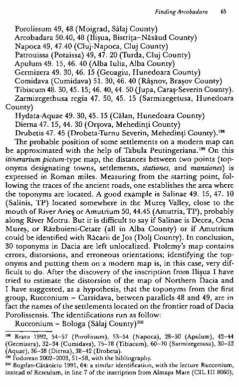
Finding Arcobadara 65
Porolissum 49, 48 (Moigrad, Sălaj County) Arcobadara 50.40, 48 (Ilişua, Bistriţa-Năsăud County) Napoca 49, 47.40 (Cluj-Napoca, Cluj County) Patrouissa (Potaissa) 49, 47. 20 (Turda, Cluj County) Apulum 49. 15, 46. 40 (Alba Iulia, Alba County) Germizera 49. 30, 46. 15 (Geoagiu, Hunedoara County) Comidava (Cumidava) 51. 30, 46. 40 (Râşnov, Braşov County) Tibiscum 48. 30, 45. 15; 46. 40, 44. 50 (Jupa, Caraş-Severin County). Zarmizegethusa regia 47. 50, 45. 15 (Sarmizegetusa, Hunedoara
County) Hydata-Aquae 49. 30, 45. 15 (Călan, Hunedoara County) Dierna 47. 15, 44. 30 (Orşova, Mehedinţi County) Drubetis 47. 45 (Drobeta-Turnu Severin, Mehedinţi County). 198
The probable position of some settlements on a modern map can be approximated with the help of Tabula Peutingeriana. 199 On this itinerarium pictum-type map, the distances between two points (toponyms designating towns, settlements, stationes, and mansiones) is expressed in Roman miles. Measuring from the starting point, following the traces of the ancient roads, one establishes the area where the toponyms are located. A good example is Salinae 49. 15, 47. 10 (Salinis, TP) located somewhere in the Mureş Valley, close to the mouth of River Arieş or Amutrium 50, 44.45 (Amutria, TP), probably along River Motru. But it is difficult to say if Salinae is Decea, Ocna Mureş, or Războieni-Cetate (all in Alba County) or if Amutrium could be identified with Răcarii de Jos (Dolj County). In conclusion, 30 toponyms in Dacia are left unlocalized. Ptolemy's map contains errors, distorsions, and erroneous orientations; identifying the toponyms and putting them on a modern map is, in this case, very difficult to do. After the discovery of the inscription from Ilişua I have tried to estimate the distorsion of the map of Northern Dacia and I have suggested, as a hypothesis, that the toponyms from the first group, Rucconium - Carsidava, between parallels 48 and 49, are in fact the names of the settlements located on the frontier road of Dacia Porolissensis. The identifications run as follow:
Rucconium - Bologa (Sălaj County) 200
198 Bratu 1992, 54-57 (Porolissum), 53-54 (Napoca), 28-30 (Apulum), 42-44 (Germisara), 32-34 (Cumidava), 75-78 (Tibiscum), 60-70 (Sarmizegetusa), 30-32 (Aquae), 36-38 (Dierna), 38-42 (Drobeta). 199 Fodorean 2002-2003, 51-58, with the bibliography. 200 Bogdan-Cătăniciu 1991, 64: a similar identification, with the lecture Rucconium, instead of Resculum, în line 7 of the inscription from Almaşu Mare (CIL III 8060);
66 SORIN NEMET!
Docidava - Buciumi (Sălaj County) Porolissum - Moigrad (Sălaj County) Arcobadara - Ilişua (Bistriţa-Năsăud County) Triphulum - Orheiu Bistriţei (Bistriţa-Năsăud County) Patridava - Brâncoveneşti (Mureş County) Carsidava - Sărăţeni (Mureş County). From the second group, between parallels 47 and 48, one knows
for sure the position of two settlements: Napoca and Patrouissa, and the approximate position of Salinae can he guessed. It is nevertheless quite difficult to estimate the distortion and the error in distances, and thus the position of Praetoria Augusta, Sangidava and Utidava remain unknown. On the other hand, two settlements with Latin names, Ulpianum and Angustiae, should he located on the western and eastern frontiers, respectively. In this case, Ulpianum is, probably, a castellum Ulpianum on the western border (as N. Gostar believed a long time ago201
), not Bologa (Sălaj County), but Gilău (Cluj County). These new settlements, created near camps (a normal situation in a
newly conquered province), borrowed the names of previous Dacian settlements.202 The nudei of these new foundations were groups of Roman citizens ( cives Romani consistentes) and peregrins, developing, after a certain time, autonomous communities, well attested in Dacia and the Danube region. 203 These small settlements were centres of rural territories ( called territoria or regiones), and theirs administration was inspired by a municipal one ( elected magistri, an ordo composed of curiales). This type of rural communities are to he found everywhere in the Danubian provinces, as we shall see in the following chapters.204
Conclusions In order to conclude, I will try to answer the question announced
since the beginning: was Ptolemy's map of Dacia inspired by a formula
the reading vico Ruccojni was suggested for a recently discovered altar from Jebucu (Cluj County), Ardevan, Zăgreanu 2012, 78, fig.l, 6. 201 Gostar1969, 171-176. 202 Settlemcnts connected to forts: Arcobadara - Ilişua (Bistri\a-Năsăud County) - Nemeti, Bărbulescu 2006-2007, 107-118; Nemeti, Bărbulescu 2010, 446-456; Angustia - Breţcu (Covasna County) - Vulpe 1944, 551-559; Cumidava - Râşnov (Braşov County) - Macrea 1941-1943, 234-261. 203 Nemeti 2010 b. 204 Nemeti, Bărbulescu 2006-2007, 112-116; Nemeti, Bărbulescu 2010, 452-455; Matei-Popescu 2010, 61-67; Matei-Popescu 2011, 353-359.
Finding Arcobadara 67
provinciae? It is nevertheless difficult to salve this issue in the absence of additional data.
The presentation form in the Geog;raphy is similar to Pliny the Elder's text: a geographical introduction, the regions (the tribes), and the communities (the towns). However, Pliny mentions theformula of Gallia N arbonensis, but there is no certainty that he followed the structure of aformula. The only trace of an official document of the formula provinciae-type in Ptolemy's map of Dacia is, perhaps, the presence of seven regions, administrative-judicial districts named after Dacian centres, i. e. Buridavenses, Potulatenses, Albocenses, etc. The geographical description is, therefore, tributary to previous works ( the tradition of Agrippa's map ), while externai tribes names are borrowed from the current ethnographic tradition and literary sources. It is very likely that Ptolemy transposed in his work the data taken from itineraria. At the origin of his list of "towns" was, most likely, a military itinerarium written during Trajan's wars and immediately after the conquest. Marinus of Tyr and Ptolemy probably had acces to very up to date itineraria. I agree with Pascal Arnaud that nothing indicates the fact that they had privileged access to administrative documents, such as, for example, theformulae provinciarum. "C'est bien de documents du domaine public qu'ils semblent avoir tire Ies renseignements necessaires a leur description du monde". 205
4. The Road through Eastem Dacia in the Work of the Anonymous Geographer from Ravenna
As previously indicated, the settlements mentioned by Ptolemy in eastern Dacia are those between Arcobadara (Ilişua, Bistriţa-Năsăud County) and Cumidava (Râşnov, Braşov County). They reveal a limes road in the eastern side of the province, at least between Arcobadara and Breţcu (to he identified with Angustia). 206 Without being able to identify exactly the location of each Ptolemaic toponym, it is certain that the settlements of Triphulum, Patridava, Carsidava, Petrodava, U tidava, and Angustia should he located inside the province of Dacia (thus inside the Carpathian Arch) on the limes road from Orheiul Bistriţei to Breţcu and not beyond the Carpathians, in Moldavia.
The general acceptance of this solution in the Hungarian historiography in Transylvania and in the Romanian historiography
205 Amaud 1993, 34. 206 Vulpe 1944, 551-559.
68 SORIN NEMET!
was delayed, among other factors, by the chimerical existence of a road through eastern Dacia, a road from Tyras (Olbia, Ukraine) to Porolissum (Moigrad, Sălaj County), a road entering Transylvania through the Oituz Pass and following the line of the eastern and northern frontiers of the Roman province.
Since Carl Goos and Josef Ornstein's attempts and until today, the identifications of the settlements mentioned in the work of the geographer from Ravenna have differed. ]. Ornstein, for example, identified the settlements thus ( and established the numbers of the lost distances in Roman miles):
Congri - Szamosujvâr XIV (Gherla, Cluj County) Sturum - Als6 Kosâly XV (Căşeiu, Cluj County) Urgum - Als6 Ilosva XXXVI (Ilişua, Bistriţa-Năsăud County) Ermerium- Vârhely XXIV (Orheiu Bistriţei, Bistriţa-Năsud County) Alincum - Vecs XIX (Marosvecs, Brâncoveneşti, Mureş County) Capora - Gorgeny Szt. Imre XX (Gurghiu, Mureş County) Iscina - Mikhâza XIII (Călugăreni, Mureş County) Tirepsum - S6vârad VII (Sărăţeni, Mureş County) Phira - Sikl6d (Şiclod, Harghita County).207
The line of the forts along the eastem limes of Dacia, identified as such since the second half of the nineteenth century,208 was seen as identica} to the road mentioned by the anonymous geographer from Ravenna, that started in Tyras, along the Trotuş and Siret, entered Transylvania through the Oituz Pass and continued through eastern and northern Transylvania until Porolissum.209
V. Pârvan, in his study dedicated to the fort in Poiana and the Roman road through southern Moldavia, identified a segment of the Roman road along the Siret, but is reticent on the topic of the existence of a road eastwards, until Tyras, the existence of which had been postulated starting from the text of the anonymous geographer from Ravenna. 210 In his work Getica, nevertheless, V. Pârvan saw the line of settlements Phira - Certie as "the direct road Tyras - Porolissum -Certie, through the north-eastem part of Dacia". Still, he noted the fact that the geographer from Ravenna was the only one mentioning
207 Ornstein 1897, 393; Ornstein 1898, 10. 208 Goos 1877, 30-35. 209 Schuchhardt 1885, 224-225: "Diese ganze Linie konnte identisch sein mit dem beim anonymen Geographen von Ravenna erwăhnten Strassenzuge von Porolissum nach Tyras". 210 Pârvan 1913a, 120.
Finding Arcobadara 69
it. 211 In the same work V. Pârvan alsa discussed the issue of the commercial road between the lazyges and the Roxolani, mentioned by Cassius Dio (LXXI. 19. 2) under the rule of Marcus Aurelius. Since the road passed "through Roman Dacia" he suggested two solutions: 1. Szolnok - Oradea Mare - Cluj - Reghin - Bicaz sau Ghimeş -Bacău, then, through Moldova, until the Dniester and 2. Szeged - Arad -Mureş Valley until Alba Iulia, then along lărnava Mare, through Oituz, Valea Trotuşului, Poiana on River Siret, Folteşti on River Prut, and then until Cetatea Albă.212 One should note that the solutions suggested by Pîrvan only partially overlap the presumed road from Certie to Tyras through eastern Dacia and that the direct connection between the two sources (GR. IV. 5 and Cassius Dio, LXXI. 19. 2) has not been yet made.
In 1929, V. Christescu discussed the two fragments together. In his opinion, the road mentioned by the geographer from Ravenna, from Tyras to Porolissum, passed through severa} settlements in north-eastern Dacia and entered Transylvania at Breţcu, through the Oituz Pass ( according to the hypotheses formulated by C. Goos and C. Schuchhardt), running from Tyras, along River Siret, through Poiana (according to V. Pârvan's theory). V. Christescu remarked the fact that "inside Transylvanian Dacia, this road is nevertheless more difficult to define" and that "the Iazyges Sarmatians were probably conducted along this road when they passed through Dacia in order to make commerce with their Roxolani brothers from the Ukrainian steppe" (Cassius Dio, LXXI, 19). In order to identify the intermediary points, he quoted the opinions of J. Ornstein and C. Torma, according to which Ermerium is Domneşti (Bistriţa-Năsăud County) and Urgum is Ilişua (Bistriţa-Năsăud County).213
Due to the scarcity of data on the geography and toponymy of Dacia, this interpretation was easily accepted in historiography, without more detailed enquiries into the context of the passage related to the so-called Tyras - Porolissum road or into the nature of the source and the method of the anonymous geographer from Ravenna.
For M. Macrea, the geographer from Ravenna mentioned a road that started in the country of the Iazyges, entered the province in Porolissum and passed through a series of unidentified settlements (Congri, Sturum, Urgum etc.) among which the first can he located
211 Pârvan 1926, 240. 212 Pârvan 1926, 110. 213 Christescu 1929, 101-102.

70 SORIN NEMETI
"in northern Dacia, on River Someş, the others in the eastern part of the province, as the road exited into the Barbaricum in Angustia (Breţcu), from where it probably continued until Tyras, at the mouth of River Dniester". This was "probably" the commerce road of the Iazyges with the Roxolani mentioned by Cassius Dio (LXXI. 19. 2).214
This transmitted idea solidified, so that nobody questioned the existence of this road through eastern Dacia, either as the commercial road of the Roxolani with the Iazyges or otherwise.215 One also notes the persistence of the alluring existence of some toponyms, even if corrupted, yet unidentified in the northern and eastern parts of Dacia.216 Recently, Ioana Bogdan Cătăniciu remarked in passing that none of the toponyms transmitted by the anonymous geographer from Ravenna "for the road on which people could travel from Tyras, through eastern Dacia, to Porolissum" is tobe encountered in Ptolemy. Her conclusion is that either it is a different route, or the geographer from Ravenna chose other settlements, that developed subsequent to the era when Ptolemy recorded them, in order to illustrate the stages of the road.217
... iuxta regionem Meotidam est patria ma.rima que dicitur Dardania A closer look at the context of this paragraph (GRIV. 5) indicates,
nevertheless, that the series of settlements between Phira and Certie does not belong to either one of the real patria, Dacia ("Datia") or Moesia Inferior, but to a legendary patria, that the geographer called Dardania and located near the land of the Amazons and near Palus Maeotis. He claims that the description of this legendary patria is made with data from Porphyrius, Libanios and Eutropius, mentioning the fact that the towns (civitates) are described after Libanios. The first series of settlement names is followed, with the mention ad aliam partem, by the list of 11 civitates that starts in Phira and ends in
214 Macrea 1969, 153. 215 Bogdan Cătăniciu 2002, 725: "le Geographe de Ravenne ... on a considere necessaire de noter une route reliant Tyras a Porolissum ... "; Hiigel 2003, 86; Fodorean 2006, 61-62. 216 Protase, Gudea, Ardevan 2008, 14 (discussion of the identification - Gherla, Cluj County - Congri, corrupted from a hypothetical Ad Congruentem); Petolescu 2010, 312; Petolescu 2011, 303: (on the identification of the toponyms Congri, corrupted from Tungri / Ad Tungros with Ilişua, Bistriţa-Năsăud County and Sturium, corrupted from Ad Asturos with Hoghiz, Braşov County). 217 Bogdan Cătăniciu 2007, 67.
Finding Arcobadara 71
Certie. The text continues with the third series of settlements from Dardania, where, despite some corrupted forms, one recognizes toponyms from Moesia Inferior, in present-day Dobrudja (for example Storna Peuci, Salsovia, Novioduno, Dinogessia, Arubion, Carsion, and Cappidava). The enumeration of the large rivers, taken from Jordanes, indicates where the anonymous geographer located this fictitious country: Borystenes, Tyras, Tanais, Danapris, that flows in Mare Ponticum, near regi,o Meotida.
In order to understand how two Dacian civitates, Porolissum and Certiae, known from the Tabula Peutengeriana and located in the north-western part of the province of Dacia feature in a legendary country north of the Black Sea, between Tyras (Olbia) and the settlements in northern Dobrudja (Salsovia, Aegyssus, Dinogetia, Noviodunum) one must analyze the method and sources employed by this anonymous geographer.
The cosmography of the anonymous geographer from Ravenna, a cleric who lived in Italy around 700 A.O., is known today through three manuscripts (A. codex Vaticanus urbinas 961, fourteenth century, B. codex Parisinus biblioth. nation. 4794, thirteenth century, and C. codex Basiliensis F. V. 6, fourteenth century). Until now it has been edited five times, among which, the most important are those published by P. Porcheron (1688), M. Pinder, G. Parthey (1860), andJ. Schnetz (1940). 218
Due to the partial and confused knowledge of the quoted sources, to the unequal method of describing the countries and of populating them with civitates, settlements from Dacia feature in three distinct patriae: Dacia "Datia", Moesia "Mysia", and Dardania.
[RAC] IV. 10-14 (§ 201-203, § 203-207). 14. Iterum ad partem quasi meridianam, ut dicamus ad spatiosissimam terram, sunt patriae spatiosissimae que dicuntur Datia prima e secunda, que {30} et Gipidia appellatur, ubi modo Uni, que et Avari, inhabitant. Quas utrasque Datias plurimi descripserunt philosophi, ex quibus ego legi Menelac et Aristarchum Gothorum philoso[35jphos. Sedego secundum Sardatium ipsas patrias designavi. In quas Dacorum patrias antiquitus plurimas
.fuisse civitates legimus, ex quibus aliquantas designare volumes, id est {40) 7 Drubetis 8 Medilas 9 Pretorich 10Panonin 11 Gazanam 12 Masclunis 131îbis, quae coniungitur cum civitate
218 Stolte 1949, 2-4; Dilke 1987a, 260; Dilleman 1997, 13.
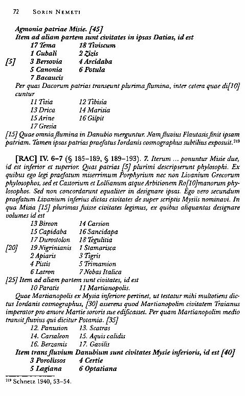
72 SORIN NEMET!
Agmonia patriae Misie. {45) /tem ad aliam partem sunt civitates in ipsas Datias, id est
17 'l'ema 18 7îviscum 1 Gubali 2 -tkis
{S J 3 Bersovia 4 Arcidaba S Canonia 6 Potula 7 Bacaucis
Per quas Dacorum patrias transeunt plurima flumina, inter cetera quae di{l O} cuntur
11 r isia 12 1îbisia 13Drica 15 Arine 17Gresia
14Marisia 16 Gilpit
{15} Quae omniajlumina in Danubio merguntur. Namfluvius Flautasis.finit ipsam patriam. Tamen ipsas patrias praejatus Iordanis cosmog;raphus subtilius exposuit. 219
(RAC] IV. 6-7 (§ 185-189, § 189-193). 7. Iterum „. ponuntur Misie due, id est inferior et superior. Quas patrias {5} plurimi descripserunt phylosophi. Ex quibus ego legi praefatum miserrimum Porphyrium nec non Livanium Grecorum phylosophos, sed et Castorium et Lollianum atque Arbitionem Ro{l Ojmanorum phy· losophos. Sed non concordarunt equaliter in designare ipsas. Ego vero secundum praefatum Livanium iriferius dictas civitates de super scriptis Mysiis nominavi. In qua Misia {15} plurimas juisse civitates legimus, ex quibus aliquantas designare volumes id est
13 Bireon 14 Carsion 15 Capidaba 16 Sancidapa 17 Durostolon 18 Tegulitia
[20) 19 Nigrinianis 1 Stamarisca 2 Apiaris 3 1îgris 4 Pistis 5 Trimamion 6 Latron 7 Nobas Italica
[25} /tem ad aliam pariem sunt civitates, id est 10 Paratis 11 Martianopolis.
Quae Martianopolis ex Mysia inferiore pertinet, ut testatur mihi multotiens dic· tus Iordanis cosmog;raphus, (30) asserens quod Martianopolim civitatem Traianus imperator pro amore Martie sororis sue edijicasset. Per quam Martianopolim medio transit fluvius qui dicitur Pot am ia. (35)
12. Panusion 13. Scatras 14. Carsaleon 15. Aquis calidis 16. Berzamis 17. Gavilis
/tem transjluvium Danubium sunt civitates Mysie itiferioris, id est [40} 3 Porolissos 4 Certie S Lagiana 6 Optatiana
219 Schnetz 1940, 53-54.
7 Macedonica 9 Patabissa 11 Brutia 13 Sacidaba 15 Caput Stenarum 17 Aluti 18 Romu/as
8 .Napoca 10 Salinis 12 Apulon {45} 14 Cedonia 16 Betere
Finding Arcobadara 73
/tem iuxta ipsam Cedoniam est civi{50Jtas que dicitur 1 Burticum 2 Blandiana 3 Germigera 4 Petris 5 Aquas 6 Sarmazege 7 Augmonia 8 Augusti. 220
[RAC] IV. 3-6 (§ 176-180) [p. 46-47]. 5. /tem adfrontem Roxolanorum re[35)gionis sunt patriae, id est Sithotrogorum, item patria Campi Campanidon, nec non Getho Githorum, Sugdabon, Fanaguron, paludis Meotidon. Qui Meotida regio, vei si in hoc loco nomi{40Jnata est, [que] tamen dum satis spatiosa existit, usque ad praefata Bosphoranam patriam pertingit. Nec no iuxta regionem Meotidam est patria {5} maxima que dicitur Dardania. In qua diverse patrie usque ad Mare Magnum Ponticum pertingunt; quarum multifuerunt ascriptores, id est superius nominatus nefandissimus Porphirius et [10} Livanius atque Eutropius. Sed nos ea· rundem regionum civitates secundum praenominatum Livanium exposuimus. In quas diversas patrias et plurimasfuisse civitates <legimus>, ex quibus {15} aliquantas designare volumes, id est
4 Stamuamum 5 Lamsacum 6 Ancarum 7 Anlansum 8 Saram 9 Numuracum 1 O Alecturum 11 Dandarium
{20} 12 Oluvium 13 Totale 14 Furice 16 So/ana
15 Nicerantici
/tem ad aliam partem sunt civitates quae dicuntur [25} 19 Phira 1 'Iirepsum
2 Iscina 3 Capora 4 Alincum 5 Ermerium 6 Urgum 7 Sturum 8 Congri 9 Porollisum
{30} 10 Certie /tem ad aliam partem sunt civitates, id est
13 Storna Peuci 14 Salsovia 15 Eg;ypsum 16Novioduno
[35} 17 Dinogessia 18 Arubion
220 Schnetz 1940, 49-50.
74 SORIN NEMET!
19 Roranus 1 Birafon 2 Carsion 3 Cappidava.
Per quas divers as patrias transeunt plurima ]lumina, inter cetera que dicuntur {40) 7 Ava 8 Oristhenis 9 Danapris, qui cedunt in Mare Ponticum
Et desuper ipsum fluvium Danapri per long;um intervallum est superius {45} nominatusjluvius maximus
14 Tanais, item 15 Tiram, item jluvius 16 Bagossolam.
De quibusfluminibus testatur mihi supra scriptus Jordanis sapientissimus {50) cosmographus. /temfluvius
19 Mariscus. 221
One should first note that the authors that the anonymous geographer pretends to use in the description of these patriae are largely fictitious (Menelac, Aristarch, the Goth philosophers, Hylas and Sardatius for Dacia, Castorius and the consuls of 355, Lollianus and Arbitio, for Mysia) or known authors, but without geographical contributions (Porphyrius, Libanios, and Eutropius). To some degree one can recognize for the three patriae data from J ordanes and an itinerary source of the Tabula Peutingeriana type (the so-called Castorius, who is nevertheless quoted only for "Mysia", and not for "Datia").
As previously noted, it is hard to believe that the anonymous geographer made direct use of an itinerarium pictum of the Tabula Peutingeriana type, but rather segments noted in the form of a notebook, easier to handle, like the ItinerariumAntonini. For the description of the known world he certainly used a circular or elliptical map.222 The fact that 18 settlements from inter-Carpathian Dacia were moved to Mysia can only he explained if the geographer did not have access to a map where the roads were depicted through zigzag lines and the distance in Roman miles was marked between settlements.223 Just settlements from Banat and north-western Oltenia remain in Dacia proper.
The confusion between the settlements in Dacia, Moesia, and Dardania, resides, as B. H. Stolte noted, on the paragraph from Jordanes, Romana, 217, referring to Gallienus loosing "the Dacians" and Aurelianus founding south-Danubian Dacia:
221 Schnetz 1940, 46-47. 222 Dillemann 1997, 39, 29; on a possible itinerarium at the origin of books II-V see Dillemann 1975, 165. 223 Stolte 1949, 121.
Finding Arcobadara 75
"sed Gallienus eos (seif. Daci) dum regnaret amissit, Aurelianusque imperator, evocatis exinde legi.onibus, in Mysia conlocavit ibique aliquam partem Daciam mediterraneam Daciamque ripensem constituit et Dardaniam iunxit". 224
Dardania is, as previously indicated, an imaginary patria, just like Mauretania Gaditana. As in the case of another province, Patria Carneola, the author transcribes in corrupted form toponyms taken from known sources and enumerated out of order in a patria with uncertain boundaries (in this case, all the toponyms are related to Noricum, the territory of the tribe of the Carni, a so-called patria Carnium on one hand, and of another, of the Julian Alps, on the other).225
The identification of the toponyms from Dardania under these corrupted names is the accomplishment of L. Dillemann. Some were taken from Jordanes, others from Tabula Peutingeriana or Ptolemy's Geographia, such as Stamuamum - Sta(gnum) Mu(rsi)anum (lord. Get. 5. 30), Lamsacum- La(cu)m (Nu)sacum (TPVII C) or Ancarum and Saram instead of Azagarium and Sarum (Ptol. III. 5. 14).226
The nine toponyms between Phira and Congri were similarly identified as part of a road that crossed eastern and northern Dacia, only because the anonymous geographer added two civitates that, in his opinion, were part of Mysia Inferior, transjluvium Danubium, namely "Porolissos" and "Certie". Right after them one finds other settlements located in present-day Dobrudja (thus in Moesia Inferior), among which Carsium and Capidava are also repeated in the Moesian list, as Porolissum and Certiae.
Among the identifications suggested by L. Dillemann, the majority can be taken into consideration. The corruption fashion of the toponyms is found everywhere in the anonymous geographical work and they are sometimes horn of the transliteration into Latin alphabet of names found in Creek sources (such as Ptolemy's Geographia or Arrian's Periplus).
Phira - Thira ('fyras) Tirepsum - Tira ipsum ('fyras ipsum), in other words, the river
after the city (Plin. N. H. IV. XII. 82: ... clarus amnis 1jra, oppido nomen inponens ubi antea Ophiusa dicebatur). 227
224 Stolte 1949, 71. 225 Dillemann 1972, 320, 322. 226 Dillemann 1997, 135. 227 Rackham 1961, 180: " ... and the famous river Tyras, which gives its name to the town on the site which previously was called Ophiusa".
76 SORIN NEMET!
Iscina - the harbor of certain Isiakoi (Arrian, Peripl. 20.2: 'Icrtmc&v A.tµitv).22s
Capora - Tagorae (Plin. N. H., VI. VII. 22: ... Tanaim vero transisse Satharcheos, Herticheos, Spondolicos, Synhietas, Anasos, Issos, Cataeetas, Tagoras, Caroni, Neripi, Agandei, Meandareos, Satharcheos Spalaeos). 229
Alincum - Leianon, in European Sarmatia (Ptol. Geogr. III. 5. 12: AEiavov 1t6A.t<;).
Ermerium - Hermisium (Plin. N. H. IV. XII. 87: Bospori Cimerii longi,tudo XII D passuum oppida habet Hennisium Myrmecium et intus insu/am Alopecem;230 Mela, II. 1. 3: ... in Bosphorum Cimmerica oppida Murmecion, Panticapaeon, Theodosia, Hermisium. 231 )
Urgum - Hyrgis (Hdt. IV. 57), affluent of River Tanais; 'YpyEî<; 1t6A.t<; (Ptol. Geogr. III. V. 13); Ourgoi, for Strabon a nomad people between Borysthene and Istros (Geogr. VII. 2. 17: Oupyot).
Sturum - :E'toupvot (Ptol. Geogr. III. V. 23, Sturnoi, people from European Sarmatia).
Congri - Taypot (Ptol. Geogr. III. V. 25, Tagroi, people from European Sarmatia, living south of the Bastarnae, near Dacia).
Even if not all the corrupted toponyms from Dardania are identified by L. Dillemann with certainty, one must note that under these hypothetical names of civitates from the imaginary patria of Dardania lay hidden fortifications, water courses, and tribes names that are all tobe found in the narrow area between Tyras and the Danube Delta (Storna Peuci). They are borrowed by the anonymous geographer, through intermediaries, from Ptolemy and Arrian and transliterated into Latin. Others come from known sources such as Plinius or Mela and are all used to fill the area of this patria located between Palus Maeotis and Mare Ponticum, on one hand, and between patria Amawnum and Datia and Mysia, on the other. One certain thing, for the time being, is that the paragraph mentioning the road from Phira to Certie provides no clue for the reconstruction of the real ancient 226 Silberman 1995, 18: 20. 2. "Sur Ie Borysthene quand on Ic remonte par bateau, est etabli un cite grecque du nom d'Olbia. ( ... ) Apres Odessos vient Port des Istriens. Jusque la, 250 stades. 3. Ensuite vient Port de Isiaques. Jusque la, 50 stades. De la jusqu'a la bouche de I'Islcr appelee Psilon, 1200. L'intervalle est desert et sans nom". 229 Rackham 1961, 352-353: " ... but the Tanais has passcd through the Hertichean tribe of Satharchei, the Spondolici, Synhietae, Anasi, Issi, Cataeetae, Tagorae, Caroni, Neripi, Agandei, Meandaraei and Spalaeam Satharchei". 230 Rackham 1961, 184-185: "On the Cimerian Bosphorus, the length ofwhich is 12 ~ miles, are the towns of Hermisium and Myrmecium, and insidc the Straits the island of Alopcce". 231 Silberman 1988, 34-35.
Finding Arcobadara 77
geography of the province of Dacia. The Phira - Certie road is not the commerce road of the Roxolani with the Iazyges through Dacia, neither is it a road through eastern and northern Dacia, along the limes, as previously thought. Ilişua is Arcobadara, not Urgum or Congri, and Ermerium is not Domneşti, but Hermisium, a Greek polis north of the Pontus Euxinus, located between Theodosia and Kalos Limen.

III. TERRITORIUM ARCOBADARENSE
1. Kastellum territoriumque. Viei militares and Autonomous Communities near Auxiliary Forts
There are, in Dacia, severa! civilian rural settlements that developed near auxiliary camps. Mast of them are anonymous, their names not attested by inscriptions and their administrative status not very clearly defined. 232 The aim of this chapter is to establish how the civilian settlements horn near auxiliary camps in Dacia and in the Danubian provinces were organized.233
I started with the phrase kastellum territoriumque (inspired by civitas territoriumque), known from lex Rubria (lex de Gallia Cisalpina) that lists severa! types of urban and rural settlements, for example, o(ppido), m(unicipio) c(olonia) p(raefectura)J(oro) v(eico) c(onciliabulo) c(astello) t(erritorio)ve (XXI, 1. 1-2),234 in order to suggest the existence of an administrative unit composed of a castellum (a civilian settlement arisen near an auxiliary camp) and its territory. 235
How can one designate the civilian settlements horn near auxiliary camps in Dacia andin the Danube region? The term commonly used in today's scientific jargon is vicus militaris. This is mostly a convention, because everyone realizes that the syntagm is a modern creation (Militărvici / viei militares; vicus being a Latin noun frequently used in order to designate military settlements arisen near legionary and auxiliary camps in Germania236). Indeed, in my opinion, it is unlikely that the ancient inhabitants of Dacia used the term vicus for naming these small civilian settlements.
232 Macrea 1969, 147-148; Tudor 1968. 233 Benea 1993 267-292; Benea 2000, 31-61; Tamba 2001, 249-274. 234 Bruna 1972, 32, 33, 36. 235 For the Roman Empire as a "cellular space" corn posed of thousand of territorial units (the city - polis/ civitas and its territory - ager, territorium, pertica, ch6ra) see Corbier 1991, 629-634. 236 Berard 1993, 67-82.
80 SORIN NEMET!
Among the military centers of the Danubian provinces one must distinguish those horn around legionary camps, systematically called kanabae in the Latin inscriptions. 237 Although, the word is used for civilian habitations arisen near auxiliary camp (for example, the case in Dimum is very clear: fines canabarum Dimensium in the horothesia of M. Laberius Maximus238), one can observe that the rule is to call kanabae the pre-municipal civilian settlement belonging to a legionary camp. 239
Castellum and kastella Regarding the civilian settlements developed near auxiliary forts,
usually called viei in the Latin inscriptions from the Rhine area, one should observe that the epigraphy from the Danube area seems to favor the word castellum: see, for example, the case of Castellum Vixillum (Pannonia Inferior) and Castellum Abrittanorum (Moesia Inferior). 240
Rome, Italy. CIL VI 2544:
D(is) M(anibus) / Pletorio Primo.fisei/ curatori coh(ortis) / IIII pr(aetoriae) (centuria)/ Silvani oriundus ex pro/vincia Panno(nia) injeriore / natus castello Vzxillo qui / vixit annis XXXV m(ensibus) III!/ mil(itavit) an(nis) XV m( ensibus) VIII Veturia / Digna marita b( ene) m( erenti) J(ecit).
Aquileia (Regia X), Italy. CIL V 942; ILS 2670:
D(is) M(anibus) s(acrum) /Val(erius) Longinianus /vixit annos XLV /militavit optio leg(ionis) XI Clau(diae) ann(os) XV centuria/ ord(inatus) ann(os) VI natus in M[oe]si[a] / Infer(iore) castel!( o) Abritanor( um ).
Hisarlîk, near Razgrad, Bulgaria. AE 1957, 97:
[Her]culi sacrum / [pjro salute Antoni[ni} / Aug(usti) Pii et Veri Caes(ari) /veterani el c(ives) R(omani) / et consistentes / Abrito ad c[ast(ellum)) / posueru[nt].
The first meaning of the word castellum is given by Vegetius (III. 8): a castris diminutivo vocabulo sunt nuncupata kastella, castellum - being,
237 Vittinghoff1971, 299-318; Berard 1993, 61-67. 238 ISM I, 67, lines 71-72; ISM I, 68 lines 71-72. 239 Contra, Suceveanu, Zahariade 1986, 114, 116; Suceveanu 1998, 12-15. 240 AE 1957, 97: ... veterani and cives Romani consistentes Abrito ad ca[stellumj; MateiPopescu 2010, 61-67.
Finding Arcobadara 81
therefore, the name for a small auxiliary fort. A more complex definition can be found in the work of Isidorus, (Etymologi,ae XV, 2, 11 ): viei et castella and pagi, sunt, quae nulla dignitate civitatis ornantur, sed vulgari hominum conventu incoluntur and propter parvitatem sui maioribus civitatibus attribuuntur. One finds the same word, castellum, in legal texts and also in agrimensores treaties, listed among other communities with different statutes. In Lex Rubria (XXI, 1.1-2) castellum and territorium are the last tobe mentioned, afterforum, v(e)icus and conciliabulum. 241
Paulus (Sent. IV. 6. 2) places castellum between vicus and conciliabulum, while Frontinus (De controv. agr., p. 35, 13) distinguishes between ager colonicus, aut municipalis aut alicuis castelli aut conciliabuli. According to the official vocabulary of land administration during the Imperial era, castellum usually means a civilian agglomeration that does not forma res publica, lacking proper jurisdiction, with limited autonomy, and located on the territory of a settlement of municipal status.242
There are many different castella attested by inscriptions scattered throughout the provinces of the Roman Empire, from Hispania to Armenia and from N umidia to Germania. 243
In literary works, such as those of Virgil (Georg. III. 474-475) and Livy (XXI. 33. 2) for example, one encounters another use of the word castellum with a totally different meaning: mountain village / settlement (Gebirgsdorfer). F. J. Bruna considers that in Lex Rubria castellum was used to designate, probably, this type of mountain village common in the Southern Alps and in the Ligurian and Tuscan - Emil ian Apennines area. 244
In the province of Dacia, the occurrence of the word castellum in epigraphy is linked mainly to the second meaning. Several toponyms determined by the abbreviated K(astellum) appear on wax tablets and in inscriptions discovered in Alburnus Maior. The following toponyms were attested there in inscriptions known in the nineteenth century: Kartum, Kavieretium245 or Kansum (Platinonis Verwnis Kanso). 246 In 1958, C. Daicoviciu completed the dedication made by Seneca Bisonis as Genio collegi,i Kastelli Baridustarum, thus providing the solution for the reading of the other toponyms: Kastella Ansum,
241 Bruna 1972, 32, 33, 36. 242 Langhammer 1973, 5; Tarpin 2002, 78. 243 DizEp, 11.1, 1900, s.v. castellum, 129-132; RE III. 2, 1989, s.v. castellum, c. 1754 -1760 [Kubitschek]. 244 Bruna 1972, 261; the same interpretation in Deszpa 2012, 29. 245 IDR I, TC VI. 246 CIL III, 1271; IDR III/3, 422.
82 SORIN NEMET!
Artum, Avieretium. 247 Later discoveries have confirm ed C. Daicoviciu 's correct intuition. A significant moment was the discovery of the lot of altars on the plateau of Hăbad Hill, published by V. Wollmann, which added new data on the location of that K(astellum) Ansum, the village of the kastellani Ansi (or Ansienses).248 Besides the Ansi, an altar discovered in the above mentioned location attests the existence of a Dalmatian gens called Maniates, 249 which might be identified with the Mcxvwi..250
The completion of the picture and the real topography of the Alburnus Maior area through the on-site location of these kastella and their corresponding cemeteries were facilitated by discoveries made in recent years. 251 New altars were found on the Hăbad Hill plateau attesting a kastellum Ansum while archaeological research revealed the existence of a religious building there. 252 Two funerary monuments found in the necropolis in the area of Ţarina attest people from the Delmatae tribe, natives of kastellum Starva. 253 Another altar, from the same place, attests a k(astellum) Man(iatium). 254 A religious building was discovered in Valea Nanului, on the spot called Szekely, where a collegium kastelli Barisdustarum was previously known. 255 Several altars discovered in various points in Valea Nanului attest the Sardiatae, grouped in a collegium Sardiatarum. 256 Kastellum Artum is attested on a wax tablet (Actum K(astello) Arto) and the religious center of the Artani can be identified with edifice TII in Valea Nanului ( on the spot called Dalea), where an altar dedicated to Dii Artani (the gods of certain Artanes) has been found. 257
In short, at the present state of research one can maintain the existence in the gold extraction area of several tribes or gentes with origins
247 Daicoviciu 1958, 259-266. 248 Wollmann 1985-1986, 263-295; Wollmann 1995, 68; Piso 2004, 294. 249 Wollmann 1985-1986, 263, no. 5, fig. 8; Petolescu 2005, no. 363. 250 Russu 1969, 224; Wollmann 1985-1986, 265; Ardevan 1998, 292, footnote 127 (for the identity Maniates / Manioi). 251 Ardevan 2004, 593-598. 252 Pescaru et alii 2003, 123-148; Cociş, Ursuţiu, Cosma, Ardevan 2003, 149-191; Ardevan, Cociş, Cosma, Ursuţiu 2007, 67-72. 253 Timofan, Barbu 2007, 185-191; Ciongradi, Timofan, Bârcă 2008, 249-266: kastellum Staroa identified in Dalmatia. 254 Beu·Dachin 2003, 189-192, reads k(a.stellum) Man(iatium). 255 IDR III/3 388; Crăciun et alii 2003, 255-285. 256 Crăciun, Sion 2003, 287-337; Ardevan, Crăciun 2003, 227-240; Ciongradi 2009, 15, no. 8, 16,22,58,64,85, 109, 119. 257 Nemeti 2010a, 98-104.
Finding Arcobadara 83
in the Dalmatian area: the Pirustae, Delmatae, Baridustae, Sardiatae, Maniates, Ansi, and Artani. Their communities bear various names taken from the municipal Latin vocabulary: one vicus Pirustarum, one collegium Sardiatarum, and severa! kastella: Ansum, Maniatium ("), Baridustarum and Artum. 258
Civilian Settlements near Auxiliary Forts in Dacia. Their Names and Status The word castellum, used to designate a civilian settlement, is
not attested in the province of Dacia outside the mining area of the Apuseni Mountains.
After recording the failure to establish the true name of such a civil ian settlement, I will open the epigraphic dossier of the so-called viei militares from Dacia. Despite the fact that many auxiliary forts are archaeologically attested, not much is known about their civilian environment.259 For the issues related to theirs status, administration and territory one has to interrogate the written (i.e. epigraphic) sources. The data contained by inscriptions available today provide information for three settlements of this type, mentioning the ancient name, the type of the civilian settlement ( according to the municipal vocabulary), and details about their administrative institutions. The word vicus is never used, but there are instead three different types of rural self-governing communities: a pag;us, a regia, and a territorium, somehow related to three auxiliary forts, those in Micia, Samum and, of course, Arcobadara.
MICIA The auxiliary fort and the surrounding civilian settlement from
Micia are located in the Mureş Valley, in the western part of the new province. Some inscriptions found there speak of a settlement called Micia designated as pag;us, a pag;us Miciense. 260 Six votive al tars are known so far dedicated to Jupiter Optimus Maximus by the people of this community, represented, in front of the supreme god, by their elected magistri. 261
IDR 111/3 81; Russu 1983, 448-449, no. 1:
258 Dacicoviciu 1958, 259-266; Piso 2003, 292-295; Ciongradi 2009, 9-18; Nemeti, Nemeti 2010, 111-114. 259 Gudea 1997, passim. 260 Ardevan 1998, 75-78. 261 Macrea 1960, 346-349; Russu 1983, 445-454; Piso 1995, 72-74.
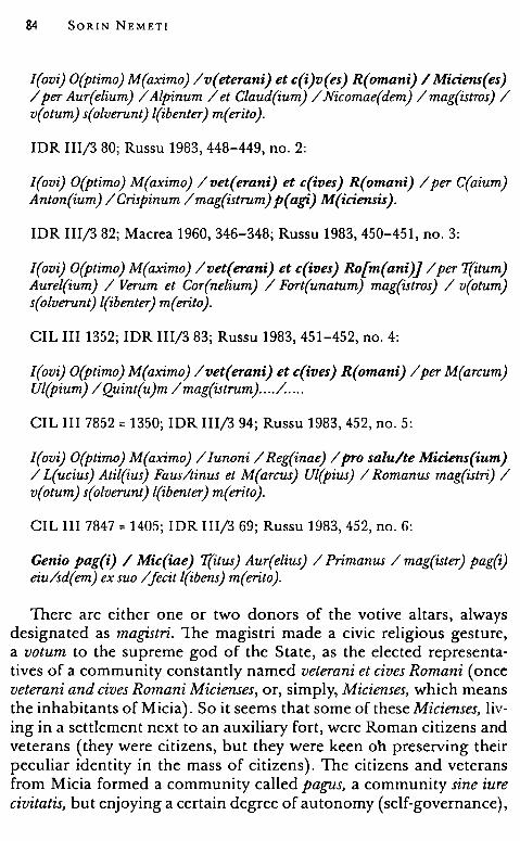
84 SORIN NEMET!
I(ovi) O(ptimo) M(aximo) /v(eterani) et c(i)v(es) R(omani) I Miciens(es) /per Aur(elium) / Alpinum / et Claud(ium) / Nicomae(dem) / mag(istros) / v(otum) s(olverunt) l(ibenter) m( erito ).
IDR III/3 80; Russu 1983, 448-449, no. 2:
I(ovi) O(ptimo) M(aximo) /vet(erani) et c(ives) R(omani) /per C(aium) Anton(ium) /Crispinum /mag(istrum) p(agi) M(iciensis).
IDR III/3 82; Macrea 1960, 346-348; Russu 1983, 450-451, no. 3:
I(ovi) O(ptimo) M(aximo) /vet(erani) et c(ives) Ro[m(ani)] /per 'I(itum) Aurel(ium) / Verum et Cor(nelium) / Fort(unatum) mag(istros) / v(otum) s(olverunt) l(ibenter) m( erito ).
CIL III 1352; IDR IIl/3 83; Russu 1983, 451-452, no. 4:
I(ovi) O(ptimo) M(aximo) /vet(erani) et c(ives) R(omani) /per M(arcum) Ul(pium) /Quint(u)m /mag(istrum) .... /. ....
CIL III 7852 = 1350; IDR III/3 94; Russu 1983, 452, no. 5:
I(ovi) O(ptimo) M(aximo) / Iunoni / Reg(inae) /pro salu/te Miciens(ium) / L(ucius) Atil(ius) Faus/tinus et M(arcus) Ul(pius) / Romanus mag(istri) / v(otum) s(olverunt) l(ibenter) m(erito).
CIL III 7847 = 1405; IDR III/3 69; Russu 1983, 452, no. 6:
Genio pag(i) I Mic(iae) 'I(itus) Aur(elius) / Primanus / mag(ister) pag(i) eiu/sd(em) ex suo /fecit l(ibens) m(erito).
There are either one or two donors of the votive altars, always designated as magistri. The magistri macle a civic religious gesture, a votum to the supreme god of thc State, as the elected representatives of a community constantly named veterani et cives Romani ( once veterani and cives Romani Micienses, or, simply, Micienses, which means the inhabitants of Micia). Soit seems that some of these Micienses, living in a settlement next to an auxiliary fort, were Roman citizens and veterans (they were citizens, but they were keen oh preserving their peculiar identity in the mass of citizens). The citizens and veterans from Micia formed a community called pag;us, a community sine iure civitatis, but enjoying a certain degree of autonomy (self-governance),
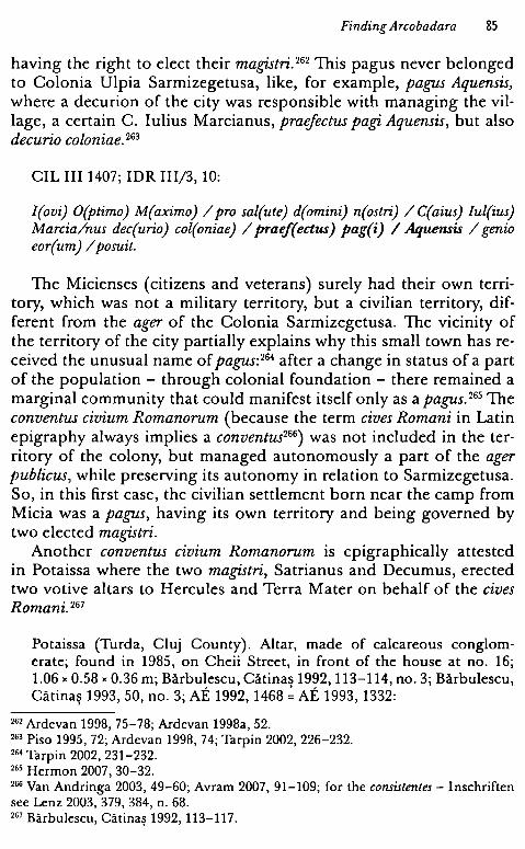
Finding Arcobadara 85
having the right to elect their magistri. 262 This pagus never belonged to Colonia Ulpia Sarmizegetusa, like, for example, pagus Aquensis, where a decurion of the city was responsible with managing the village, a certain C. Iulius Marcianus, praefectus pagi Aquensis, but also decurio coloniae. 263
CIL III 1407; IDR III/3, 10:
I(ovi) O(ptimo) M(aximo) /pro sal(ute) d(omini) n(ostri) / C(aius) Iul(ius) Marcia/nus dec(urio) col(oniae) / praef(ectus) pag(i) I Aquensis / genio eor(um) / posuit.
The Micienses ( citizens and veterans) surely had their own territory, which was not a military territory, but a civilian territory, different from the ager of the Colonia Sarmizegetusa. The vicinity of the territory of the city partially explains why this small town has received the unusual name of pagus:264 after a change in status of a part of the population - through colonial foundation - there remained a marginal community that could manifest itself only as a pagus. 265 The conventus civium Romanorum (because the term cives Romani in Latin epigraphy always implies a conventus266 ) was not included in the territory of the colony, but managed autonomously a part of the ager publicus, while preserving its autonomy in relation to Sarmizegetusa. So, in this first case, the civilian settlement horn near the camp from Micia was a pagus, having its own territory and being governed by two elected magistri.
Another conventus civium Romanorum is epigraphically attested in Potaissa where the two magistri, Satrianus and Decumus, erected two votive altars to Hercules and Terra Mater on behalf of the cives Romani. 267
Potaissa (Turda, Cluj County). Altar, macle of calcareous conglomerate; found in 1985, on Cheii Street, in front of the house at no. 16; 1.06" 0.58 "0.36 m; Bărbulescu, Cătinas 1992, 113-114, no. 3; Bărbulescu, Cătinas 1993, 50, no. 3; AE 1992, 1468 ~ AE 1993, 1332: ,
262 Ardevan 1998, 75-78; Ardevan 1998a, 52. 263 Pisa 1995, 72; Ardevan 1998, 74; Tarpin 2002, 226-232. 264 Tarpin 2002, 231-232. 263 Hermon 2007, 30-32. 266 Van Andringa 2003, 49-60; Avram 2007, 91-109; for the consistentes - Inschriften see Lenz 2003, 379, 384, n. 68. 2G7 Bărbulescu, Cătinaş 1992, 113-117.
86 SORIN NEMETI
Herculi / cives Rom[a)/ni per Satria/(a)num et Dec(u)m/um mag(istros).
Potaissa (Turda, Cluj County). Altar, roade of calcareous conglomerate; found in 1985, on Cheii Street, in front of the house at no. 16; 1.12 "0.59 x 0.40 m; Bărbulescu, Cătinas 1992, 114-115, no. 4; Bărbulescu, Cătinaş 1993, 50, no. 4; AE 1992, 1469 ~ AE 1993, 1332:
Terrae / Matri / c(ives) R( omani) per/ [Sjatrianu[mj / [et Dejcumum / [mj ag(istros).
Cives Romani consistentes from Potaissa lived either in a civilian settlement268 near an auxiliary fort269 ( therefore before 170 A. O.) or in the kanabae of legi.o VM acedonica ( after 170 A. D.). 270 The second hypothesis is preferable, in spite of the fact that kanabae or kanabenses have not been yet attested epigraphically in Potaissa.271
ARCOBADARA The second case is that of the civilian settlement that grew around
the auxiliary camp from Ilişua on the north-eastern limes of Dacia. The ancient name of the town was Arcobadara or * Arcobara, as mentioned in the inscription dedicated to Genius territorii Arcoba(da)rense by two magistri in 246 A.D.272
Ilişua (Arcobadara), Bistriţa-Năsăud County; Right side of an altar, roade of volcanic tufa; found in 1990, near the camp, in the civilian area; 0.95 " 0.32 x 0.32 m; Bistriţa-Năsăud County Museum, inv. no. 15993; Wollmann, Ardevan 2005, 673-675, 678, fig. 13-14; Nemeti, Bărbulescu 2007, 107-109; Nemeti, Bărbulescu 2010, 448; Pisa 2008, 165-166:
{Geni)o terril[t( orii) A)rcoba( darensis) / [Aujr(elius) Sal( . .)/ [et A)el(ius) No/[.js magistri (duo)/ [Praesejnte et Al/[bin(o)j co(n)s(ulibus).
Ilişua (Arcobadara), Bistriţa-Năsăud County; Fragmentary inscription; CIL III 820, 4; Torma 1866, 49, no. 31; Nemeti 2010, 419, no. 53:
/[.j/[.jg/[. . .Jem /[.. magi,Jster.
268 Bărbulescu, Cătinas 1992, 111-124; Bărbulescu, Cătinas 1993, 49-64. 269 Nemeti 1999, 194-204. ' 270 Petolescu 2011a, 97. 271 The same idea was recently expressed by I. Piso - Piso 2014, 73. 272 Nemeti, Bărbulescu 2010, 446-456.
Finding Arcobadara 87
The inscription also shows that there was a civilian territory administrated by the elected magistri of an autonomous community; the altar belongs to the so-called category of "territory inscriptions", a fairly well documented category in the Danubian provinces.
Another very fragmentary inscription mentions one magister. In the end of row 4 I can distinguish two letters ... EM and in the next row I see 4 letters ... STER, so an anonymous magister.
The municipal status of Arcobadara remains unknown because of the poor state of the epigraphic documentation. Was it a pag;us like Micia, a vicus, or simply a castellum? In the province of Dacia only Sucidava, as communal autonomy, is epigraphically designated as territorium.
Celei (Sucidava), Olt County; Limestone slab, decorated with a tabula ansata; 54 " 83 " 14 cm; from the ruins of the castellum. IDR II 190; AE 1914, 122; Pârvan 1913b, 23-25:
{D]eae Nemesi / pro salute Augg(ustorum) / curial(es) territ(orii) Suc(idavensis) / templum a solo / restituerunt.
The inscription which speaks of a territorium Sucidavense also mentions the curiales territorii. 273 As far as the administration of this civilian settlement is concerned, one can presume the existence of magistri ( one or two) and an ordo made of curiales. 274
There is also a new discovery attesting a rural structure called territorium in Dacia. A funerary inscription from Tell-Diiliik (Doliche), in Syria, mentions a territorium Bassianae (Bassianense) in Dacia Superior, probably at the beginning of the third century A.D. One can speculate about the location of this Bassiana, in the proximity of the main city of the province, i. e. Apulum, because Aelius Vitalis and Aurelius Valerianus were soldiers in legio XIII Gemina. 275
Tell-Diiliik (Doliche), Syria. Facella, Speidel 2011, 207-215, pl. 1-2, 42. Limestone stele, with a relief depicting a soldier in the upper register. 1.54 " 48.5 " 41.5 m; found in 2008, at the foot of the Keber Tepe Hill, near Diiliik; Gaziantep Archaeological Museum, inv. no. 2009. 34. 1:
273 Tudor 1965, 34-35; Tudor 1968, 209-210. 274 Tudor 1965, 35. 275 Facella, Speidel 2011, 207-215; Matei-Popescu 2011, 351-361; Dana 2014a, 166-167, no. 22; Petolescu 2012, 137-140.
88 SORIN NEMET!
D(is) M(anibus) I secur(itati) (a)e<t>e(rnae?) I et [quiejti I+ A{eliujs /Vitalis I ex provine/ia Dacia sup(eriore) /te(r)i(torio) Bassia/na(e) vixit an/nis XXIII I Aur(elius) Valeri/anus dupla(rius) leg(ionis) I XIII c(o)ho(rtis) III jrat(ri) I carissimo I ff(aciendum) vel p(onendum)j c(uravit).
SAMVM" In the northern part of Dacia, on River Someş, two inscriptions
mention a civilian settlement growing near the camp of cohors II Brittanorum milliaria, which was later replaced by cohors I Britannica milliaria civium Romanorum equitata. 276 The name of this settlement is written on two altars erected by the beneficiarii consularis.
Căşei (Samum), Cluj County; CIL III 827 = 7633:
Deae [Nem]esi I reg[in(ae)J M. Val(erius) Va/l,en{tijnus b(ene)f(iciarius) I co(n)s(ularis) [mijl[es] le[g(ionis)} I XIII G(eminae) Gordi(anae) I aed{il(is)} col(oniae) Nap(ocae) I agens sub sig(nis) I Samum cum reg(ione) Ans(amensium) v(otum) s(olvit) l(ibens) m(erito) I [Ijmp(eratore) d(omino) n(ostro) M(arco) A{nt(onio)j Gordi(ano) Aug;us/[to et A}viol[a] co(n)s(ulibus) XIII(?}
Căşei (Samum), Cluj County; Russu 1956, 120-123, no. 1, fig. 1:
I(oui) o(ptimo) m(aximo) I P(ublius) Ae(lius) Marcellinus I b(ene)!(iciarius) co(n)s(ularis) leg(ionis) V M(acedonicae) I Gord(ianae) agens Sa/mo cum reg(ione) Ans(amensium) I sub seg(nis) pro salute sua I et suorum u(otum) l(ibens) p(osuit) I Arriano et Papo co(n)s(ulibus).
The employed formulae are: agens Samo cum regione Ans(. . .) sub signo and agens sub signis Samum cum regione Ans(. . .). Other inscriptions discovered in the area of Căşei contain information on beneficiarii consularis and their statio on the northern frontier of the province. 277 The toponym was recognized since the beginning and linked to the hydronym Samus (today Someş), the name of the river that flows through the neighboring area. Attested in the Ablative (Samo) and Nominative (Samum) cases, the name is interpreted as being that
276 Isac 2003, 33-47. 277 Isac 2003, 49-50; Cupcea 2010, 390-391, correctly pointed out that during the reign of Scverus Alexander beneficiarii were dctached in a statio (agentes in curam stationis, in munere stationis). After that, in thc time of Gordianus, "by thc authority granted by their signum, they would extend their competencc over the vicus Samum and the surrounding regia Ansamensium".
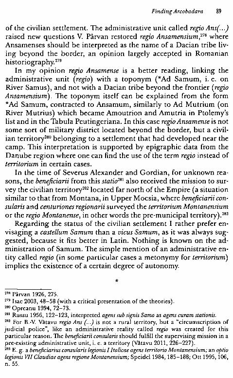
Finding Arcabadara 89
of the civilian settlement. The administrative unit called regia Ans(..) raised new questions V. Pârvan restored regia Ansamensium,278 where Ansamenses should be interpreted as the name of a Dacian tribe living beyond the border, an opinion largely accepted in Romanian historiography. 279
In my opinion regia Ansamense is a better reading, linking the administrative unit (regia) with a toponym (*Ad Samum, i. e. on River Samus), and not with a Dacian tribe beyond the frontier (regia Ansamensium). The toponym itself can be explained from the form *Ad Samum, contracted to Ansamum, similarly to Ad Mutrium ( on River Mutrius) which became Amoutrion and Amutria in Ptolemy's list andin the Tabula Peutingeriana. In this case regia Ansamense is not some sort of military district located beyond the border, but a civilian territory280 belonging to a settlement that had developed near the camp. This interpretation is supported by epigraphic data from the Danube region where one can find the use of the term regia instead of territarium in certain cases.
In the time of Severus Alexander and Gordian, for unknown reasons, the beneficiarii from this statia281 also received the mission to survey the civilian territory282 located far north of the Empire (a situation similar to that from Montana, in U pper Moesia, where beneficiarii cansularis and centurianes regianarii surveyed the territarium Mantanensium or the regia Mantanense, in other words the pre-municipal territory). 283
Regarding the status of the civilian settlement I rather prefer envisaging a castellum Samum than a vicus Samum, as it was always suggested, because it fits better in Latin. Nothing is known on the administration of Samum. The simple mention of an administrative entity called regia (in some particular cases a metonymy for territarium) implies the existence of a certain degree of autonomy.
* 278 Pârvan 1926, 275. 279 I sac 2003, 48-58 (with a criticai presentation of the theories). 280 Opreanu 1994, 72-73. 281 Russu 1956, 122-123, interpreted ageru sub signis Sama as agens curam statianis. 282 For B.-V. Vătavu regia Ans (...) is not a rural territory, but a "circumscription of judicial police", like an administrative reality called regia was created for this particular reason. The benefi,ciarii cansularis should fulfill the supervising mission in a pre-existing administrative unit, i. e. a territory (Vătavu 2011, 226-227). 283 E. g. a benefi,ciarius cansularis legianis I /talicae agens territaria Mantanensium; an aptia legianis VII Claudiae agens regiane Mantanensium; Speidel 1984, 185-188; Ott 1995, 106, n. 55.
90 SORIN NEMET!
I have to clearly state that none of these settlements (a pagur, or the centers of a regi.o, or a territorium) are the type of habitation that modern scholars commonly understand under the syntagm vicus militaris. 284 All three realities - Micia, Arcobadara, and Samum - are rural settlements that developed in the neighboring areas of military camps, buton the ager publicus. Next to the fort, in its nearest proximity, on the military territory, there are civilian buildings, strip houses, public buildings, deposits, and wooden barracks, populated with civilians strongly related with some of the soldiers' activities, that all together form a separate community. We should labei this different anonymous civilian reality ( that bears the name of the encamped troop - Ad Pannonios, Ad Batavos, or is understood under the term castris designating the soldiers' origo) with the term vicus militaris.
The "Territory" Inscriptions The problem of the civilian settlements horn near auxiliary forts in
Dacia should be presented in the context of the so-called "territory inscriptions", well attested in the Danubian provinces.
In Antiquity, the word territorium was used to designate, according to the tradition set by Pomponius, "uniuersitas agrorum intra cuiusque ciuitatis" (Digeste, L 16, 239). 285 The word appears both referring to the territory of a town and to that of a province. It was not only towns that had a territorium; this word also designated a certain stretch of land, limited and connected to a human community, town, tribe, military unit, sacerdotal college or mine. 286 In epigraphy, this word is used to designate the territory of towns, but there are other territories of different communities which enjoyed autonomy relative to the central power ( the territories of the tribal communities, the military
2114 A slightly different opinion in Berard 1992, 88-89: "On sait que Ies garnisons romaines etaient entourees d'agglomerations civiles, dont nous avons trouve de nombreuses traces archfologiques aux portes meme des camps. On appelle traditionnellement ces agglomerations uici quand ii s'agit de camps auxiliaires et kanabaequand ii s'agit de castra Iegionnaires. Mais, „„ on remarquera que,„„ ii y a un point commun a toutes ces agglomerations etablies aux portes des camps militaires romains c'est que, loin d'etre administrees directement par l'armce, comme on !'acru, elles disposent, comme du reste beaucoup d'autres uici, d'une organisation quasimunicipale, avec un ordo et des decurions, des magistrats, des finances publiques, etc. ( „.) N'avaient-elles pas aussi cet autre element indissociable de la cite que constitue son territoire?" 285 Forcellini 1875, 71. 286 DA, V, 124.
Finding Arcobadara 91
territories). 287 A territorium existed also around every auxiliary Roman camp, a community with quasi-municipal organization, which had magistri and ordo decurionum. 288 The word îs used quite frequently în the epigraphy of the Danubian provinces to designate the territory of civilian settlements horn near auxiliary camps. This territory îs a civilian one, and one should not confuse it with the so-called military territory, viewed by A. Schulten or A. M6csy as a part of provincial soii administered directly by the army. 289 In my opinion, territorium Arcobadarense în the inscription from Ilişua seems to he such a community developed near the Roman camp of ala I Tungrorum Frontoniana.
As I have already mentioned, the word territorium does not appear for the first time în Dacia. At the beginning of the twentieth century, V. Pârvan published an inscription which attested a territorium Sucidavense, whose curiales were rebuilding a temple of goddess Nemesis.290 Similarly, în the provinces around the Danube, the word îs present în epigraphy, designating territories of the settlements next to the auxiliary Roman camps. In Moesia Inferior, C. Iulius Quadratus was quinquennalis territorii Capidavensis, 291 and other inscriptions attest ex magister territorio Dianensium (Dimensium?), a territorium Abritanorum292 , and, recently, a territorium Aegyssense. 293
Capidava, Constanta County, Romania. Tocilescu 1900, 111, no. 5; Tocilescu 1891, 17; CIL III 12491; AE 1891, 41; AE 1901, 44; ISM V 77. Limestone funerary altar, found in 1893, among the ruins of the Roman camp, 1.91 " 1.16 m; Constanţa Museum, inv. no. 2062:
C(aius) Jul(ius) C(ai)J(ilius) Quadr[at(us )} / memoriam si/bi et Juliae Te/rentiae con/iugi suae se vi/vo per liberos / suosfecit lo/ci princeps/ quinquenn/ alis territo[riij I Capidavensis.
Pleven (Storgosia), Bulgaria. AE 1911, 16; ILB 223. Limestone base, found in the Roman camp, built in the walls. 0.93 "0.53 "0.40 m; 198-209 A.D.:
287 Leveau 1993, 466. 299 Langhammer 1973, 5. 289 Schulten 1894, 481-516; M6csy 1953, 179-199 (the historiography and the present status quaestionis in Berard 1993, 63; for the main five theories about the military territory see Le Bohec 2005, 238-239). 290 Pârvan 1913, 23-25, no. 27. 291 Munteanu 1970, 211-222. 292 i. e. the territory of the castellum Abrittanorum, inhabitated by cives Romani et consistentes Abritto. 293 Conrad 2004, 183, no. 219.
92 SORIN NEMETI
[. J /{pro salute?)/ {dominorum nn(ostrorum)?j /Severi et Anto/nini [[et Getae Caejj/[[saris]J et Iuli[aej / Aug(ustae) territorio I Dianensiu(m) P(ublius) Aeli/us Victorinu[s] /ex mag(istratu) et [ex]/ decur(ionatu) [suo pos(uit)J.
Razgrad (Abritus), Bulgaria. AE 1985, 712. Milliarum, found near Razgrad, 1.31 " 0.45 m; 15 August 244 - 30 August 247 A.D.:
Imp(eratori) Caes(ari) / M(arco) Iulio / Philippo / Pio Fil(ici) (sic) inuicto / Aug(usto) et M(arco) /Iulio Philipo (sic) nob(ilissimo) Caesa/res (sic) per/ ter(ritorium) Abri(tanorum) /m(ille) p(assuum) I.
Tulcea (Aegyssus), Tulcea County, Romania. Baumann 1984, 223-224, no. 3, fig. 55; Conrad 2004, 183, no. 219. Funerary stela, fragmentary; O. 75 >< 0.49 m; found in 1970 in the southern part of the city of Tulcea, on M. Costin Street. In the upper part: a depiction of the Hero Rider:
[ . .] Fl(avio) R[..] / dec(urioni) ter<r >i(itori) A{eg(yssensis) v(ixit) ann(os)J XL. Sciati[s quodj / dum vive[bat vicj/o VRBIIN[.j / Obitu[s ad vil/am s(uam)j / F(ieri) i(ussit) IM{. J / ses[quiplicariusj.
A similar community could he identified in Halmyris (Noviodunum ), where severa} magistri from vicus classicorum erected altars for the supreme god of the Roman state.294
The territory of Troesmis raises different problems; it was clearly related to a community of veterani et cives Romani consistentes Troesmi, ad legionem V Macedonicam (then, probably, ad canabas). Troesmis became municipium after the departure of legio V Macedonica, during the joint reign of Marcus Aurelius and Commodus, in 177-180 A.D., as indicated in the recently discovered text of the municipal law.295
In this case, territorium Troesmense is the civilian territorium of a selfgoverning community composed of veterani et cives Romani consistentes ad canabas. 296
Igliţa (Trqesmis), Tulcea County, Romania. Pârvan 1913, 493-502, no. 2, fig. 10-ll;AE 1920, 54; ISMV135; AE 1980, 818. Marbleslab, 0.76" 0.84" O.OS m; 161-163 A.D.:
294 Suceveanu, Zahariade 1986, 110-113, no. 1-8. 295 Eck 2013, 201: municipium M(arcum) Aurelium Antoninum et L(ucium) Aurelium Commodum Aug(ustum) Troesm(ensium). 296 A different opinion in Doruţiu-Boilă 1972, 46-55 (a military territorium).
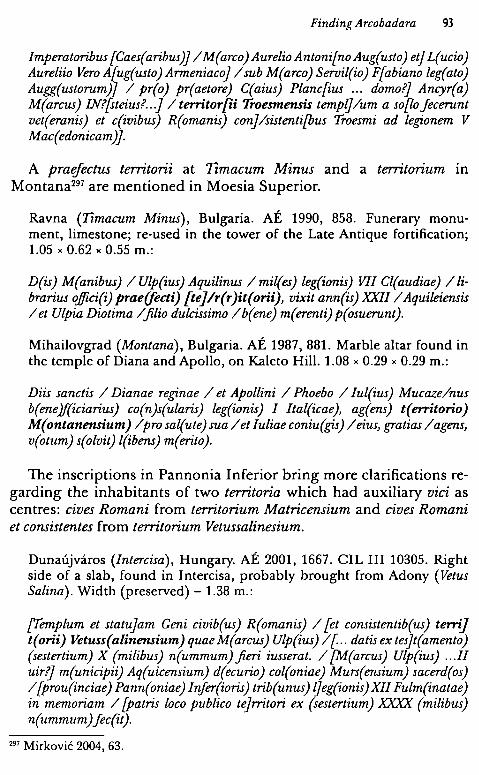
Finding Arcobadara 93
Imperatoribus [Caes(aribus)J /M(arco)AurelioAntoni[noAug(usto) et] L(ucio) Aureliio Vero A{ug(usto) Armeniacoj /sub M(arco) Seroil(io) F{abiano leg(ato) Augg(ustorum)j / pr(o) pr(aetore) C(aius) Planc[ius ... domo?) Anryr(a) M(arcus) IN?[steius? .. .J / territor[ii Troesmensis templj/um a so[!,o jecerunt vet(eranis) et c(ivibus) R(omanis) conj/sistenti[bus Troesmi ad legi,onem V Mac(edonicam)J.
A praefectus territorii at 1Îmacum Minus and a territorium in Montana297 are mentioned in Moesia Superior.
Ravna (Tîmacum Minus), Bulgaria. AE 1990, 858. Funerary monument, limestone; re-used in the tower of the Late Antique fortification; 1.05 " 0.62 " 0.55 m.:
D(is) M(anibus) / Ulp(ius) Aquilinus / mil(es) leg(ionis) VII Cl(audiae) /librarius o.Jfici(i) prae(fecti) [te]/r(r )it(orii), vixit ann(is) XXII/ Aquileiensis / et Ulpia Diotima /filio dulcissimo /b(ene) m(erenti) p(osuerunt).
Mihailovgrad (Montana), Bulgaria. AE 1987, 881. Marble altar found in the temple of Diana and Apollo, on Kaleto Hill. 1.08 "0.29" 0.29 m.:
Diis sanctis / Dianae regi,nae / et Apollini / Phoebo / Iul(ius) Mucaze/nus b(ene)f(iciarius) co(n)s(ularis) leg(ionis) I Ital(icae), ag(ens) t(erritorio) M( ontanensium) /pro sal(ute) sua / et Iuliae coniu(gis) / eius, gratias / agens, v(otum) s(olvit) l(ibens) m(erito).
The inscriptions in Pannonia Inferior bring more clarifications regarding the inhabitants of two territoria which had auxiliary viei as centres: cives Romani from territorium Matricensium and cives Romani et consistentes from territorium Vetussalinesium.
Dunaujvaros (Intercisa), Hungary. AE 2001, 1667. CIL III 10305. Right side of a slab, found in Jntercisa, probably brought from Adony (Vetus Salina). Width (preserved) - 1.38 m.:
['femplum et statujam Geni civib(us) R(omanis) / [et consistentib(us) terrij t(orii) Vetuss(alinensium) quae M(arcus) Ulp(ius) /[.. datisex tesjt(amento) (sestertium) X (milibus) n(ummum) fieri iusserat. / {M(arcus) Ulp(ius) ... II uir?j m(unicipii) Aq(uicensium) d(ecurio) col(oniae) Murs(ensium) sacerd(os) /{prou(inciae) Pann(oniae) Injer(ioris) trib(unus) ljeg(ionis)XII Fulm(inatae) in memoriam / [patris loco publico tejrritori ex (sestertium) XXXX (milibus) n(ummum)Jec(it).
297 Mirkovic 2004, 63.
94 SORIN NEMET!
Szazhalombatta (Matrica), Hungary. AE 1980, 712. Limestone block, found in 1969 near the Roman camp; 0.38 " 0.35 " 0.25 m. 267 or 268 A.D. Pater[no et Arcesilao cos.] or Pater[ no II et Mariniano cos.].:
[..pro salute] / ciuerom[an]/orum (sic) territ(orii) I Matric/ensium / Ael(ius) Vic[t]or uet(eranus) [leg(ionis)} /II Ad{i(utricis)} / Pater[no .. .].
An inscription from Rome mentions a territorium Arrabonensium from Pannonia Superior.
CIL VI 36351, Kovacs 2006, 165-170. Rome, Italy. Fragmentary marble slab:
D(is) M(anibus) /Silvania Cresce[ntina vix)/zt annis LX nata [Pannoj/nia Su[pe]r[i)ore ter[ritorio] I Ar(r)abone(nsium) Silbanfius .. .j/ us Silbania Rom[ana .. j/es matri et do{minae b(ene)merenjti posuerun[t].
AU these inscriptions refer not to military territories, but to autonomous territories of some settlements, governed after the rules of municipal communities (led by magistri, quaestores, quinquennales chosen from among the cives Romani et veterani, 298 having ordines composed of decuriones or curiales).
In the municipal vocabulary, the word regia designated the territory where the jurisdiction of the magistrates was performed and it was synonymous, in some particular cases, to territorium. 299 In the Danubian provinces, the word regia seems to have cover two precise meanings: the division of the territory of a civitas and the territory of a rural community horn around a military uicus. In Thracia the word regia was used for the territory of cities (Serdica - regia Serdicense, Marcianopolis - regia Marcinopolitana), but also for the parts that divided that territory. Three inscriptions dated to 152 A.D. show that the territory of the towns Serdica, Marcianopolis, and Augusta Traiana were divided into regiones, just like the territory of towns from the western provinces were divided into pagi:300 .fines ciuitatis Serdicensium regione Dyptensium or regia Gelegetiorum, ciuitas Marcianopolitanorum.
CIL VI 2605.Rome, Italy:
298 Kovacs 2000, 40-42; Kovacs 2006, 165-170. 299 DA, V, 124; Leveau 1993, 465; Kovacs 2000, 48-49, enumerates severa) words used to designate territory: territorium, regio, civitas, fi.nes, pertica, so/um, leuga; see alsa Mirkovic 2004, 63. 3oo Leveau 1993, 465.
Finding Arcobadara 95
D(is) M(anibus) Aur(elius) Victorinus mil(es) coh(ortis) VI pr(aetoriae) natione Dacisca, regione Serdicen(se) vixit an(nis) XXX, mil(itavit) in legione an(nis) VI, in pr(aetorio) an(nis) IIII,fecit memoria Valerius Augustus mil(es) coh(ortis) pr( aetoriae) .fratri benemerenti fec(it).
AE 1957, 279; AE 2000, 1291; ILB 211; 152 A.D.:
lmp(erator) Caes(ar) T(itus) Ael(ius) Hadri(a)n(us) / Antoninus Aug(ustus) Pius p(ater) p(atriae), trib(unicia) / potestate XV, co(n)s(ul) /III, praesidia / et burgos ob tutelam provinc(iae) /Thraciaefecit curante C(aio) Gallonio / Fron(to)ne Qfuinto) M(a)rcio Turbane leg(ato) / A[u]g(usti) pr(o) pr(aetore). Per fi nes ciuitatis / Serd(ic )ensium regione Dyptens(ium) / praesidia n(umero) IIII, burgi n(umero)XII, phruri /n(umero) CIX.
CIL VI 2808; 32583. Tabula marmorea. On the relief, goddess luna with a sceptre in her left hand:
De( a )<h>e sanct( a )e Iunoni ex (sic) / reg(ione) Marcianopolita[n( ae )] / [. J NI cives posuerunt.
AE 2000, 1268. Marble plate, found in Nevsa, near Vama (in the territory of Marcianopolis). 152 A. D:
... /Turbane leg(ato) A[ug(usti) pro pr(aetore)J. /Per .fi.nes ciuitat[is Mar]/ cianopolitano[rum rej/gion[e] Gelegetio[rnm in propij/nquo phruri n(umero) [.]/ ...
The same meaning of the word regi,o is also encountered in Moesia, where some municipal territories are designated in this way: regio Viminacense, regio Ratiarense, and regio Nicopolitana.
Cyrrhus (Khoros), Syria. CIL III 195:
D(is) M(anibus) / U[ljp(io) Victor(e) im[ag}ini/ffer]o leg(ionis) VII ex (centurione) (cohorte) II pr(incipi) / post(eriori) vixit ann(os) XXXVIII/ militavit ann(os) XVI Aur(elius) / Martinus mil(es) leg(ionis) IIII / Fl(aviae).frater et Secundus / heres .fratri ex pr/ovincia Moes(ia) Super(iore) / reg(ione) Viminac(ense) /f(ratri) b(ene) m(erenti) p(osuit)
Rome, Italy. CIL VI 2730; tabula marmorea. ln domo de Ursinis, in monte Cordano:
D(is) m(anibus) /Antonius Paterio m(iles) / coh(ortis) X pr(aetoriae) (centuria) Artemonis / vix(it) an(nos) XXXV mil(itavit) an(nos) XI/ nat(us) Mysia (sic)
96 SORIN NEMET!
Superiore / reg(ione) Ratiarense vico Ca[.] /nisco Aurelia Vener[a] / co(n)iux co(n)iugi karissimo [] /RES b(ene) m(erenti) p(osuit).
Rome, Italy. CIL VI 2933; Ricci 1993, 153, no. 2. In regione Parionis in domo d. Pauli Tifernatis:
D(is) M(anibus) / Aurr(elii) Diza ne[g]otia(ns) et / Putine coniugi. Natus ex /provincia Moesia Inferiore / regione Nicopolitane, vico / Saprisara. Vixit annos XXXX / et co(n)iux vix(it) annos XXX. / Aur(elius) Herculanus mil(es) coh(ortis) XIIII urb(anae), bene merentib(us) posuit.
In Moesia Superior and Inferior, the word, however, designates also communities whose territory lay near an auxiliary Roman camp, named, in other inscriptions, territoria, the synonymy regio - territo· rium being, thus, confirmed: 301 for example, regio Montanense from Montana and a regio Dimense.
Lom (A/mus), Bulgaria. AE 1969-1970, 577. Marble altar:
Dianae et Apo/llini sacrum / G(aius) Val(erius) Valens / optio leg(ionis) XI Cl(audiae), agens re(gione) Mont[an(ensium)) / v(otum) s(olvit) l(ibens) [m(erito)J.
Mihailovgrad (Montana), Bulgaria. AE 1985, 738. Marble altar; 0.93 X 0.35 X 0.34 m.:
Apo/lini / sancto / C(aius) Iulius / Saturni/nus (centurio) I region/arius / ex uoto.
Rome, Italy. Laterculus of the pretorians (10 fragments). CIL VI 32549:
Provin[cia] Mysi[a] Infer[i.orje reg(ione) Dime(n)si(s) / Imp(eratore) D(omino) N(ostro) Gordiano Aug(usto) (iterum) et [Pomjpeiano / consu[libus] / ... (nomina praetorianorum).
The debate around the meaning of regio Hi.striae remains open. In order to explain the duality, the coexistence of two distinct administrative units in Histria, a chora and a regio, one hypothesis stated that regio could be "a former strategy from the time of the Odryssian Kingdom" (a territory belonging to Histria, returned nominally to 301 In two cases, Dimum and Montana, the territory is called either territorium (territorium Dimensium AE 1911, 16; territorium Montanensium, AE 1987, 881) or regio (regio Dimense, CIL VI 32549; regio Montanense, AE 1969-1970, 577).
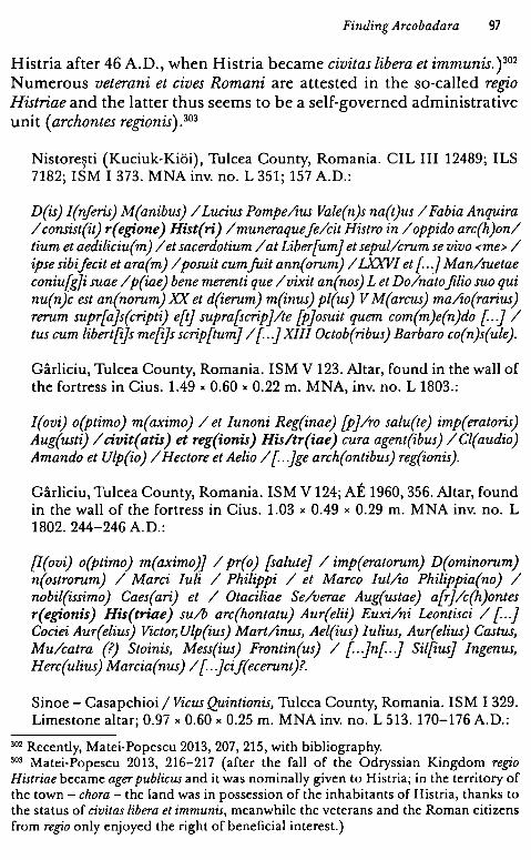
Finding Arcabadara 97
Histria after 46 A.D., when Histria became civitas libera et immunis. ) 302
Numerous veterani et cives Romani are attested in the so-called regia Histriae and the latter thus seems to be a self-governed administrative unit ( archontes regionis). 303
Nistoreşti (Kuciuk-Kiăi), Tulcea County, Romania. CIL III 12489; ILS 7182; ISM I 373. MNA inv. no. L 351; 157 A.D.:
D(is) I(nferis) M(anibus) / Lucius Pompe/zus Vale(n)s na(t)us / Fabia Anquira / consist(it) r( egi.one) Hist( ri) / muneraque fe/cit Histro in / oppido arc(h)on/ tium et aediliciu(m) / et sacerdotium / at Liber[umj et sepul/crum se vivo <me> / ipse sibifecit et ara(m) / posuit cumfuit ann(orum) /LXXVI et [ . .] Man/suetae coniu{gji suae / p(iae) bene merenti que / vixit an(nos) L et Do/nato .filio suo qui nu(n)c est an(norum) XX et d(ierum) m(inus) pl(us) V M(arcus) ma/zo(rarius) rerum supr[a]s(cripti) e[tj supra[scripj/te [pjosuit quem com(m)e(n)do [ . .] / tus cum libert[ijs me[ijs scrip[tumj /[..]XIII Octob(ribus) Barbaro co(n)s(ule).
Gârliciu, Tulcea County, Romania. ISM V 123. Altar, found in the wall of the fortress in Cius. 1.49 x 0.60 x 0.22 m. MNA, inv. no. L 1803.:
I(ovi) o(ptimo) m(aximo) / et lunoni Reg(inae) [pj/ro salu(te) imp(eratoris) Aug(usti) / civit(atis) et reg(ionis) His/tr(iae) cura agent(ibus) /Cl(audio) Amando et Ulp(io) / Hectore et Aelio / [ . .Jge arch(ontibus) reg(ionis).
Gârliciu, Tulcea County, Romania. ISM V 124; AE 1960, 356. Altar, found in the wall of the fortress in Cius. 1.03 x 0.49 x 0.29 m. MNA inv. no. L 1802. 244-246 A.D.:
[I(ovi) o(ptimo) m(aximo)j / pr(o) [salute] / imp(eratorum) D(ominorum) n(ostrorum) / Marei Juli / Philippi / et Marco Iul/zo Philippia(no) / nobil(issimo) Caes(ari) et / Otaciliae Se/verae Aug(ustae) a[rj/c(h)ontes r(egi.onis) His(triae) su/b arc(hontatu) Aur(elii) Euxi/ni Leontisci / [..] Cociei Aur(elius) Victor, Ulp(ius) Mart/znus, Ael(ius) Iulius, Aur(elius) Castus, Mu/catra (?) Stoinis, Mess(ius) Frontin(us) / [..Jn[ . .J Sil{iusj Ingenus, Herc(ulius) Marcia(nus) / [..Jcif(ecerunt)?.
Sinoe - Casapchioi / Vicus Quintionis, Tulcea County, Romania. ISM I 329. Limestone altar; 0.97 x 0.60 x 0.25 m. MNA inv. no. L 513. 170-176 A.D.:
302 Recently, Matei-Popescu 2013, 207, 215, with bibliography. 303 Matei-Popescu 2013, 216-217 (after the fall of the Odryssian Kingdom regia Histriae became ager publicus and it was nominally given to Histria; in the territory of the town - chara - the land was in possession of the inhabitants of Histria, thanks to the status of civitas libera et immunis, meanwhile the veterans and the Roman citizens from regia only enjoyed the right of beneficiai interest.)
98 SORIN NEMET!
I(oui) o(ptimo) m(aximo) / et Iunoni Re/gi(nae) pro sa(lute) Imp(eratoris) / Aug(usti) ciuit(atis) / et reg(ionis) His(triae) cur/agen(tibus) Cl(audio) Ia/ nuar(io) et Lupo T[ . .] / [magi(stris) et quaest(ore)J.
Histria, Tulcea County, Romania. ISM I 343. Altar, found in the walls of precinct K, near tower I. 0.58 " 0.40 " 0.35 m. Histria Museum, inv. no. 21. 198-211 A.D.:
[I]oui optimo maxi/mo c(iues) R(omani) et Lai consi/stentes reg(ione) Si(tri?) (sic) /uico Secundini / posueru[nt pjro salutem (sic) Dominorum no/strorum Imperato/rum Luci Septumi (sic)/ Severi Pertenaci[s] (sic)/ [et impera]t(oris) Ma[rcij Aur[elij / {Antonini} „.
Only two regfones are clearly attested in Dacia: regia Ans(amensium) with the centre at Samum, and the recently identified regiaNeridanisense. A new reading for an inscription discovered long ago has lead to the founding of a new regia, just near territarium Arcabadarense, and a new un-localized toponym, Nerido, on the north-eastern border of Dacia Porolissensis. 304
Domneşti, Bistriţa-Năsăud County, Romania. CIL III 7625. Altar, volcanic tufa; 1.32 >< 0.49 >< 0.54 m; found in 1886 in the household of the Reformed priest from Domneşti:
I(oui) o(ptimo) m(aximo) / Dulcen/o P(ublius) Gaius/ Valerianu/s (centuria) leg(ionis) X Fre/tensis re/g(ionarius) r(egionis) Neridon/is(---) u(otum) s(oluit) l(ibens) m(erito).
It is still unclear if regio Scodrihense should be localized in the province of Dacia before the Aurelian retreat, or in the new province created south of the Danube after 271 A.D. (as specialists have believed since V. Pârvan).305 In my opinion there is no strong argument for dating the inscription to the end of the third century A.D. The name of the attested praetorian is known from Dacia (he was one of the many Aurelii recruited after Constitutio Antoniniana), meanwhile the word cammanipularius is common in the vocabulary of the legionaries from Dacia. 306
304 Piso, Cupcea, 2014. 305 Pârvan 1926, 229-230; Ricci 1993, 189. 306 Beu-Dachin 2011, 79-85.

Finding Arcobadara 99
Rome, Italy. CIL VI 2698, in villa Pellucchia:
D(is) M(anibus) / Aur(elius) Passar mil(es) coh(ortis) VIIII / pr(aetoriae) / (centuria) Hilariani vix(it) an(nos) /XXX mil(itavit) an(nos) VIIII domo / Daciae regione Scodri/he(n)se. Tullius Lupus/ et Masculinus Ter/tullinus et Claudius /Lon~nus / commani/pul(ar)i b(ene)m(e)r(en)t(i)J(e)c(e)r(unt).
One knows of a regia Bassianensis in Pannonia Inferior and a regia Aquense in Moesia Superior.
Dunaujvaros (Intercisa), Hungary. CIL III 3336; RIU VI 1552a; AE 2001, 1669. Left side of a funerary inscription; 0.45 x 0.60 x 0.24 rn; third century A.D.:
[.} / [ .. Saturj/nin(us) / q(uon)d(am) armat(ura) / leg(ionis) II Ad(iutricis) stip(endiorum) XVI, o[r)Aundus ex regio/ne Bassiane(n)si desi/deratus in Dacia q(uon)d(am) / qui vixit ann(os) XXXIII! / Sept(imius) Maximi[a) n[usj/ ..
Turicevac, Bulgaria. AE 1981, 724; AE 1982, 841. Altar; 0.60 x 0.40 x 0.40 rn. 1 February 225 A.D.:
[I(ovi) o(ptimo )} M(aximo) et G( enio) Illyr(ici) /[pro] salute Belli/{ciAu)g(usti) n(ostri), vil(ici) stati/onis Petobionen/sis et Moes(iae) r(egionis) Aq(uensis) / Castricius Bel/lici vik(arius) v(otum) s(olvit) l(ibens) m(erito),/ anni XXV, [le} al(endis) F(ebruariis), Fusco II Dextro co(n)s(ulibus).
After this brief examination of the occurrences of the words territorium and regia connected to the viei militares from the Danubian provinces, one can notice that the territoria from Arcobadara, Capidava, Dimum, Abrittus, Aegyssus, Matrica, or Vetus Salina and those regiones from Montana, Samum or Bassiana are administrative units horn around rural settlements developed next to auxiliary Roman camps. As for the administration of some territoria, such as the one of Arcobadara, it îs obvious that there are institutions which replicate the municipal ones: representatives chosen from among the best people (magistri at Arcobadara, Dimum, Micia, quinquennalis at Capidava, maybe with censorial attributes, a quaestor at Micia), an ordo macle of curiales (Sucidava) or decuriones (Dimum).
100 SORIN N EMETI
2. Living in Arcobadara
Over the last two centuries a considerable number of epigraphic and sculptural monuments have been found in the settlement estabIished near the auxiliary camp in Ilişua. The camp was built a few years after the Roman conquest of the Dacian Kingdom by a vexillatio of legio XIII Gemina or by cohors II Britannica. From the time of Emperor Hadrianus, the Ilişua castrum was occupied by ala I Tungrorum Frontoniana. 307 The civilian settlement, an Auxiliarvicus, was a rural self-governing community with its own territory, run by two elected magistri. The name of the settlement, Arcobadara (*Arcobara), is indigenous, and is also mentioned by Ptolemy. 308
Ala I Tungrorum Frontoniana was created by Augustus, the auxiliary soldiers being recruited from the German tribe of Tungri. The first garrison was probably in Germania Inferior, at Asciburgium (Asberg) and Bonn, until 71 - 72 A.D.; then it was moved to Dalmatia, and after that to Pannonia, at Carnuntum and Campona. In 114 A.D. this auxiliary unit was part of the Exercitus Pannoniae Inferioris. During the 117 - 118 A.D. war against the Iazyges, the unit was brought to Western Dacia ( traces discovered at Vrfac/Vârşeţ and Pojejena in today's Banat), then, probably after the end of the war and after the organization of Dacia Porolissensis, it was deployed at Ilişua. 309
Data on the inhabitants of this rural settlement in a modern historical reconstruction is available only through the epigraphic and sculptural monuments they produced. Their onomastic and religious preferences could tell us today something about the people who Iived in Ilişua during the second - third centuries A.D. The material anaIyzed here contains 99 monuments, both epigraphic and sculptural. Comparing the vicus of Ilişua with other rural settlements which developed near auxiliary forts, one can estimate that the number of inscriptions is rather high. This may be due to a more intensive research of the site (by C. Torma between 1858 and 1862 and a team led by D. Protase since 1978).310 Then, one has access to relevant evidence which allows statistic analyses. But two types of limitations have to be taken into account: the limits of statistic and onomastic analyses. From the onomastic point of view, I will follow the principie which proclaims that we are able to know today only the origin of the name
307 Protase, Gaiu, Marinescu 1997, 45-47; Marcu 2009, 78-85. 308 Nemeti, Bărbulescu 2007, 107-118. 309 Petolescu 2002, 78-80; Husar 1999, 118-120, with bibliography; Marcu 2009, 84-85. 310 Torma 1866, 11-55; Protase, Gaiu, Marinescu 1997, 6-44.
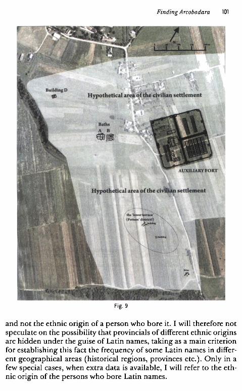
Finding Arcobadara 101
Fig. 9
and not the ethnic origin of a person who hore it. I will therefore not speculate on the possihility that provincials of different ethnic origins are hidden under the guise of Latin names, taking as a main criterion for estahlishing this fact the frequency of some Latin names in different geographical areas (historical regions, provinces etc.). Only in a few special cases, when extra data is availahle, I will refer to the ethnic origin of the persons who hore Latin names.
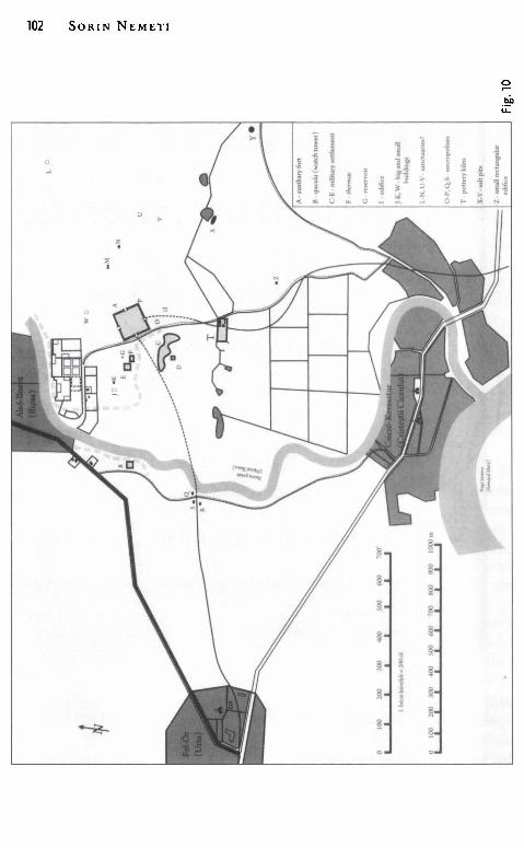
102 SORIN NEMET!
" I
• >- I t t i
~
§
ş
ş
~
!!
~
~
§
~ ş
. ~ f ~ J - !!
~
Finding Arcobadara 103
Onomastics and the Origin of the Inhabitants The problem of the ethnic/provincial origin of the colons from
Dacia is not very well studied. Only few centers in Dacia benefit from detailed and accurate analyses of their population. One has to note bere some general onomastic studies,311 some signed by Adela Paki for Ulpia Traiana Sarmizegetusa,312 Porolissum,313 and the eastern rural area of the province, 314 by Mihai Bărbulescu for Potaissa, 315 and by Ioan Piso for Ulpia Traiana Sarmizegetusa and Apulum.316 Different methods used in these analyses led to slightly divergent conclusions, therefore one must he aware of the limits of onomastic analyses.
The names of the soldiers from ala I Tungrorum Frontoniana recruited during the first century - beginning of the second century B. C. (when the ala was garrisoned in Asciburgium and Carnuntum) are of Celtic and German origin.317 The known military diplomas andinscriptions mention the names of Reburrus Friattonis f., 318 C. Petillius C. f. Vindex, Batavus,319 Nertomarus Irducissae f., Boius,320 Tersus Precionis f., Scordiscus,321 Flavus Blandi f., domo Batavus.322
Only 74 names were partially or completely reconstituted from the entire lot of well-preserved inscriptions in Ilişua. A classification according to the origin of the names shows the following percentages:
Latin names 46 62.16% Greek names 7 9.45% Thracian names 6 8.10% Celtic names 5 6.75% Syrian names 2 2.70% Illyrian names 1 1.35% U ncertain names 7 9.45%
311 Kerenyi 1941; Russu 1944, 186-233; Russu 1949, 282-295; Russu 1977, 353-363; Paki 1995, 19-37; Paki2001,61-85. 312 Alicu, Paki 1995, 49-91. 313 Paki 1988, 215-227. 314 Paki 1996, 283-296. 315 Bărbulescu 1995, 119-130. 316 Piso 2005, 209-229. 317 Wollmann 1975, 167. 318 AE 1963, 49. 319 CIL XVI 164. 32° CIL XVI 61. 321 CIL III 3400. 322 AE 1938, 125.
104 SORIN NEMET!
Only în two cases there are certain extra pieces of information available on the non-Roman origin of a bearer of a Latin name: Iustus was a Celt because he was the brother of a certain Cittius Ioivai, if the word "brother" îs not used with the meaning "comrade", and Aurelius Maximianus was a Thracian, because he was the son of Aurelius Brisanus and brother of Aurelius Mucatius. These observations modify the first four entries în our table:
Latin names Greek names Thracians Celts
44 7 7 6
59.45% 9.45% 9.45%. 8.10%
One can note therefore the tendency to decrease the number of people who bear Latin names în favor of the Romanized provincial ones with visible Celtic and Thracian origin. Once more data becomes available, the percentage of "Romans" will decrease and that of the Romanized provincials arrived from the western provinces will increase (persons like Aurelius Respectus, C. Iulius Atianus, and Montanius Via tor etc.).
Recent citizens are also those with strange tria nomina, like Aelius Publius or P. Caius Valerinus. Still, if we try to keep în mind the limits of onomastic analyses ( especially regarding the hypothetical attribution of ethnic/tribal origins of persons based on the frequency of certain Latin names în a province), some already expressed opinions who found at Ilişua mainly individuals of Celtic and German origin are exaggerated. In this regard, Adela Paki considers that "such onomastic analyses allowed the hypothesis that almost all persons attested at Ilişua (20 out of 39) were of Celto-German origin and Rhenish provenance". 323
In the case of the gentilicia, one can observe a particular frequency of some nomina like Aelius (15 occurrences Aelius/Aelia) and Aurelius (14 occurrences, exclusively Aurelius), followed by Iulius/Iulia (7 occurrences) and Valerius (6 occurrences). One has to note the high percentage of imperial gentilicia (Iulius, Aelius, Aurelius, Septimius ), forming 69.81% of all preserved names. The names Aelius and Aurelius are very frequent (54.71%) showing the provincial origin of these new citizens and suggesting the way they received citizenship -i. e. through military service. Some rare gentilicia ( such as Vetullenus,
323 Paki 1998, 307.
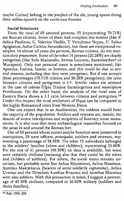
Finding Arcobadara 105
maybe Cutius) belong to the praefecti of the ala, young equites doing their militia equestris on the north-east frontier.
Social Structures From the total of 69 attested persons, 55 (representing 79.71%)
are Roman citizens. Some of them had complete tria nomina (like P. Aelius Paulinus, C. Valerius Vitallis, T. Vettulenus Nepos, C. Iulius Apigianus, Aulus Cuttius Secundanus), but these are exceptional examples. In almost all cases the persons, Roman citizens, do not mention theirpraenomen. Some ofthe other 14 persons (20.28%) are clearly peregrines (like Soia Mucatralis, Serena Licconis, Zanariniethes? or Mucapuis). Only one personal name is sometimes mentioned, like Aponius, Iustina, Iustus, or Iovinus, and this could be due to several reasons, including that they were peregrines. But if one accepts these percentages (79.71% citizens and 20.28% peregrines), the ratio between citizens and peregrines is 4:1. Similar ratios are attested in the case of colonia Ulpia Traiana Sarmizegetusa and municipium Porolissum. On the other hand, the analysis of the rural area of Eastern Dacia shows a 1:1 ratio between citizens and peregrines. 324
U nder this respect the rural settlement of Ilişua can be compared to the highly Romanized cities from Western Dacia.
One can expect that in an Auxiliaroicus, the soldiers would form the majority of the population. Soldiers and veterans are, mainly, the donors of votive inscriptions and recipients of funerary stone monuments. It is also true that most archaeological researches focused on the areas in and around the Roman fort.
Out of 83 persons whose names and/or function were preserved in inscriptions, 29 were officers, principales, soldiers and veterans, representing a percentage of 34.93%. The other 13 individuals belonged to the soldiers' families (wives and children), representing 15.66%. For the rest of 41 persons ( 49.39%) no data is available, but some were certainly civilians ( meaning also that they could be the wives and children of soldiers). For others, the social status remains uncertain, but probably some like Aelius Maximinus, Aelius Maximus, Aurelius Maximianus (bearers of some soldierly cognomina), Aelius Ursinus and the Thracians Aurelius Brisanus and Aurelius Mucatius were also soldiers. With this precaution in mind, I suggest a percentage of 42.16% civilians, compared to 56.62% military (soldiers and theirs families).
324 Paki 1996, 285.
106 SORIN NEMET!
Fig. 11
Beyond the Statistics Some particular cases underline
the fact that conclusions based only on statistics are not strong enough. Why, for example, the Thracian veteran Soia M ucatralis still used in the text of a votive altar (no. 3) his peregrine name (build according to the barbarian system with a personal name and a patronym in Genitive), instead the tria nomina of Roman citizen, since the civitas Romana was granted to him after discharging with honesta missio? At the time the altar was erected in honor of Apollo, Soia Mucatralis was a veteran, therefore a Roman citizen. In which
group should he be included? Amang the citizens I suppose, in spite of his peregrine name.
The case of the family of Aurelius Themaes (no. 35) is also very interesting: this librarius of Palmyrean origin325 <lied at the age of 50. His wife Aelia Iulia had also <lied, at an unspecified age, like her daughter Aelia Pupula who lived only for two years. The funerary monument was erected by Aurelius Themaes's respectful son, Aurelius Thementianus ( also a soldier?) and dedicated parentibus benemerentibus. At Aurelius Themaes' death, his son ordered a stane monument for the entire family, his stepmother and his infant stepsister. The iconography (following the description in CIL) shows four persons in the upper register: a mature man, a mature woman, a young man and a child, therefore a standard Roman family, a cliche of sepulchral imagery. But the lower register shows a sitting woman holding an infant child, therefore Aelia Iulia and her daughter Aelia Pupula. Al. Stănescu believes that Aurelius Thementianus was the son horn to Themaes by his first wife, who <lied before Themaes ended his military carrier, and that the concubinatus between Themaes and Aelia Iulia also existed before the honesta missio. Therefore Aelia Pupula took her mother's
325 Sanie 1981, 241-242.
nomen gentile. 326 At the time Aurelius Themaes <lied, he was a citizen, but the inscription in question shows a long history of his peregrine status. This case raises the problem of the soldiers' inscriptions: some are present in our frozen images of the past as peregrines, but sometime they had become citizens.
Another problem is that of homonyms: one can he sure that Aelius Celer, the praefectus equitum who erected an altar to Fortuna Redux (no. 5) is the same person as T. Aelius Celer from the inscription on a statue base (no. 6). But nobody can he sure that Valerius Valerianus veteranus ex decurione, husband of Bonosa, who <lied at 42 (no. 36), is identical
Finding Arcobadara 107
Fig. 12
to Valerius Valerianus vet. ex. dec., father of Iulia Mansueta (no. 39). The name is rather common, as other four Valerii are attested in Ilisua
' and one can wonder why the daughter of Valerius Valerianus he ars the nomen gentile Iulia. Is I ul ia Mansueta the daughter of (Iulia) Bonosa? Valerius Valerianus was a veteran, but he had no imperial nomen like Aelius or Aurelius; was he then recruited as a citizen? Still, why did his daughter not inherit his nomen?
Many other unsolved issues could be added as examples from this inscription corpus from Ilişua to suggest not only the limits of statistic analyses but also the large spectrum of exceptions in the Roman system of civil rights and our modern ignorance as well.
The Pantheon The statistic of the names of the peoples from Ilişua vicus, accord
ing to the origin criterion, indicates over 60% persons with Latin
326 Stănescu 2003, 137-138.
108 SORIN NEMET!
names. A higher percentage (79.71%) seems to he that of Roman citizens.
The picture of the worshipped deities shows also a classical, GreekRoman aspect for the pantheon of this military vicus located in a remote area on the north-eastern limes of Dacia. 327 In spite of the fact that an ala recruited, at least in the beginning, among the German tribe of the Tungri, was deployed there, nothing indicates the preservation of native German cults. An altar for Epona, the Celtic goddess of horses, is dedicated by ala I Tungrorum Frontoniana through the praefectus C. Iulius Apigianus, who bears a cognomen typical for the western provinces. But one must not forget that Epona was known in Rome until the end of the first century A.D. andin the time of the Principate she used to he worshipped by the units of horsemen.328 A bronze statue of Mercurius, in his Pantheus hypostasis, belongs to the Gallic iconographic repertory and could have been an import from the West, but the depicted god is essentially the Greek-Roman Hermes - Mercurius (young, beardless, nude, with caduceus and petasos). The context of Epona's worship indicates also an official religious attitude: the altar erected in the name of the entire unit by praefectus C. Iulius Apigianus was discovered in the civilian settlement, in the N point (according to Torma's indications329) east of the Roman camp. An altar dedicated to Mars was found in the same spot, also erected in the name of the entire unit, by prafectus T. Vettulenus Nepos. This kind of religious gestures - connected with the official state religion -are know from other places where they had been explained as related to "the official religious observance of the garrison, on the fort's parade ground", like in the cases of Maryport and Birdoswald. 330 Three other votive al tars, dedicated to I upiter Optimus Maximus, Liber Pater and Libera, and Apollo were found north of this N point, in the M point. Their donors were Aurelius Vitellianus sesquiplicarius, Soia Mucatralis veteranus, both soldiers, and Montanius Viator. One can postulate here the existence of at least one cultic place.331
Other monuments can he interpreted as symbolically placed between state religion and poli tical loyalty: the bases of the honorific statues erected in the honor of the "earthen gods", the emperors. There are
327 Popescu 2004, 234-236, 299-300. 328 Husar 1999, 229-234; Nemeti 2005, 158-160, with bibliography. 329 Torma 1866, plate (for all these references in our text and repertory see Fig. 10). 330 Wilmott 2001, 107-108. 331 Rusu-Pescaru, Alicu 2000, 160-161.
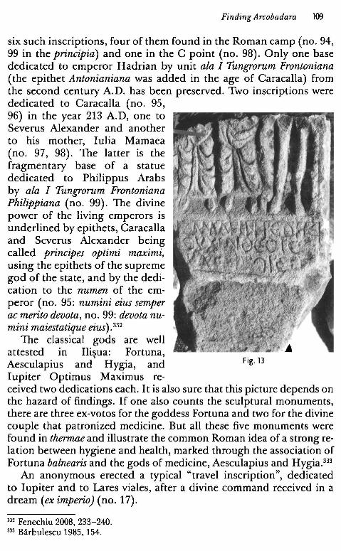
Finding Arcobadara 109
six such inscriptions, four of them found in the Roman camp (no. 94, 99 in the principia) and one in the C point (no. 98). Only one base dedicated to emperor Hadrian by unit ala I Tungrorum Frontoniana (the epithet Antonianiana was added in the age of Caracalla) from the second century A.D. has been preserved. Two inscriptions were dedicated to Caracalla (no. 95, 96) in the year 213 A.D, one to Severus Alexander and another to his mother, Iulia Mamaea (no. 97, 98). The latter is the fragmentary base of a statue dedicated to Philippus Arabs by ala I Tungrorum Frontoniana Philippiana (no. 99). The divine power of the living emperors is underlined by epithets, Caracalla and Severus Alexander being called principes optimi maximi, using the epithets of the supreme god of the state, and by the dedication to the numen of the emperor (no. 95: numini eius semper ac merita devota, no. 99: devota numini maiestatique eius). 332
The classical gods are well attested m Ilisua: Fortuna,
' Aesculapius and Hygia, and Fig. 13
Iupiter Optimus Maximus re-ceived two dedications each. I t is also sure that this picture depends on the hazard of findings. If one also counts the sculptural monuments, there are three ex-votos for the goddess Fortuna and two for the divine couple that patronized medicine. But all these five monuments were found in thermae and illustrate the common Roman idea of a strong relation between hygiene and health, marked through the association of Fortuna balnearis and the gods of medicine, Aesculapius and Hygia.333
An anonymous erected a typical "travel inscription", dedicated to Iupiter and to Lares viales, after a divine command received in a dream (eximperio) (no. 17).
332 Fenechiu 2008, 233-240. 333 Băr~ulescu 1985, 154.
110 SORIN NEMET!
The Hellenophones seem to have formed a homogenous group in Ilişua (seven names of Creek origin), where two votive Creek inscriptions have heen discovered. The altar dedicated to Asklepios and Hygeia hy Kointos/Quintus is also an evidence of hilingualism. The monument of Zanariniethes (?),a Creek-speaking person from Asia Minor or Near East, is dedicated to some anonymous gods called Theoi Epekooi (no. 16). R. Ardevan and V. Wollmann read in the last row Theois Chth[onijois, 334 hut the correct reading is Theois Epekoois. 335
The upper part of the relief is hroken and one can see (from left to right) two tunica-dressed persons and a nude man. They could he identified with Aesculapius, Hygia and Telesphorus, for example.
The numher of ex-votos, epigraphic and figurative items (29 pieces), indicates a clear preference for classical gods (ca. 83%, 24 pieces). Only three epigraphic monuments (ca. 10%) are dedicated to foreign gods: lupiter Dolichenus (a Syrian cult adopted and spread hy the Roman army), the Celtic mother-goddess Epona (also a memher of the soldiers' pantheon) and the unknown Theoi Epekooi, prohahly from Asia Minor.
There is also a slight possihility that other local deities of different origins are hidden under the names of Roman gods, hut this situation is very difficult to attest in the ahsence of epichoric epithets or specific attrihutes. Sola Mucatralis worshiped Apollo and Aulus Cuttius Secundanus worshiped Silvanus, hut gods from these donors' homelands could he hidden under the names of Roman gods. But, for the rest, everything is at first glance classic and official.
The World of Shadows The monuments related to the other world do not contradict this
image of a consolidated Roman provincial society. One does not know, yet, of any hurial ground or isolated grave found in Ilişua. The cemeteries of the auxiliary vicus remain undiscovered. A hurial area is supposedly situated heyond the Ilişua rivulet, along the Roman road, in today's U riu village (hut only three funerary monuments were found there - no. 34, 41, and 74). All the others monuments were found in secondary positions in the Roman camp and concentrated in two points (O and P) near the south-western and south-eastern corners of the camp's precinct (see the repertory). This position does not indicate the place of the cemetery, just near the walls, hut the fact
334 Ardevan, Wollmann 2006, 260, 263, pi. 1-4. 335 Dana 2014, 85-95.
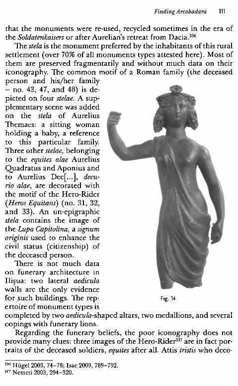
Finding Arcobadara 1ll
that the monuments were re-used, recycled sometimes in the era of the Soldatenkaisers or after Aurelian's retreat from Dacia.336
The stela is the monument preferred by the inhabitants of this rural settlement ( over 70% of all monuments types attested here). Most of them are preserved fragmentarily and without much data on their iconography. The common motif of a Roman family ( the deceased person and hisjher family - no. 43, 47, and 48) is depicted on four stelae. A supplementary scene was added on the stela of Aurelius Themaes: a sitting woman holding a baby, a reference to this particular family. Three other stelae, belonging to the equites alae Aurelius Quadratus and Aponius and to Aurelius Dec[ ... ], decurio alae, are decorated with the motif of the Hero-Rider (Heros Equitans) (no. 31, 32, and 33). An un-epigraphic stela contains the image of the Lupa Capitolina, a signum originis used to enhance the civil status ( citizenship) of the deceased person.
There is not much data on funerary architecture in Ilisua: two lateral aedicula
' walls are the only evidence for such buildings. The rep- Fig. 14
ertoire of monument types is completed by two aedicula-shaped altars, two medallions, and severa} copings with funerary lions.
Regarding the funerary beliefs, the poor iconography does not provide many clues: three images of the Hero-Rider337 are in fact portraits of the deceased soldiers, equites after all. Attis tristis who deco-
33'" Hilgel 2003, 74-78; Isac 2009, 789-792.
337 Nemeti 2003, 294-320.
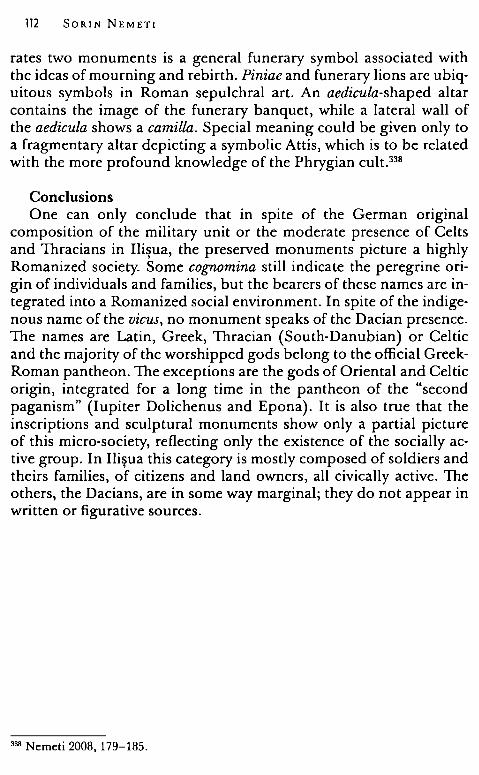
112 SORIN NEMET!
rates two monuments is a general funerary symbol associated with the ideas of mourning and rebirth. Piniae and funerary lions are ubiquitous symbols in Roman sepulchral art. An aedicula-shaped altar contains the image of the funerary banquet, while a lateral wall of the aedicula shows a camilla. Special meaning could be given only to a fragmentary altar depicting a symbolic Attis, which is to he related with the more profound knowledge of the Phrygian cult. 338
Conclusions One can only conclude that in spite of the German original
composition of the military unit or the moderate presence of Celts and Thracians in Ilişua, the preserved monuments picture a highly Romanized society. Some cognomina still indicate the peregrine origin of individuals and families, but the bearers of these names are integrated into a Romanized social environment. In spite of the indigenous name of the vicus, no monument speaks of the Dacian presence. The names are Latin, Creek, Thracian (South-Danubian) or Celtic and the majority of the worshipped gods belong to the official GreekRoman pantheon. The exceptions are the gods of Oriental and Celtic origin, integrated for a long time in the pantheon of the "second paganism" (Iupiter Dolichenus and Epona). It is also true that the inscriptions and sculptural monuments show only a partial picture of this micro-society, reflecting only the existence of the socially active group. In Ilişua this category is mostly composed of soldiers and theirs families, of citizens and land owners, all civically active. The others, the Dacians, are in some way marginal; they do not appear in written or figurative sources.
338 Nemeti 2008, 179-185.
Finding Arcobadara 113
Appendix I. N ames
Nomina Aelius/Aelia 15 (no. 5-6, 9, 30, 31, 35, 46, 50, 53, 64). Aurelius 14 (no. 9, 10, 33, 34, 35, 43, 47, 51, 65). Iulius/Iulia 7 (no. 1, 4, 39, 50, 49, 63). Valerius 6 (no. 11, 36, 42) Antonius (no. 50), Calpurnia (no. 48), Cittius (no. 38), Cocceius
(no. 37), Cutius (no. 15), Herenia (no. 46), Montanius (no. 12), Pompeius (no. 50), Rocius? (no. 66), Septimius (no. 41), Vettulenus (no. 13).
Cognomina, personal names and patronyms
Latin names Publius Aelius Paulinus Aelia Iulia Aelia Pupula Aelia Rufilla Aelius Celer Aelius Maximinus Aelius Maximus Aelius Mercurius Aelius No( ... )s Aelius Publius Aelius Respectus Aelius Quadratus Aelius Ursinus Augu(rinus?) Aurelius Iustinus Aurelius Maximus Aurelius Maximianus Aurelius Sal( ... ) Aurelius Vitellianus Bonosa Publius Caius Valerinus Calpurnia Macrina Cocceius Iulius Herenia Ianuaria Iulia Mansueta
Caius Iulius (2) Caius Iulius Apigianus Caius Iulius Atianus Caius Iulius V. .. Iovinus Iulius Iustina Iustus Kointos (Quintus) Montanius Viator Pompeius ... Primus Septimius Sine .. . Titus Valerius ... ani .. Valerius Avitus Valerius Laetillus Valerius Saturninus Valerius Valerianus (2) Caius Valerius Vitalis Valerius Vitalianus Titus Vettulenus Nepos Uncertain and fragmentary names Aelius A( ... ) Aurelius .. . Aurelius .... anus
114 SORIN NEMET!
Aurelius Dec ... Aurelius De .. Ro(cius) (Satu)rio? Se(verus) R( ... ) Greek-Oriental names Aelia Fronime Amarantus Antonius Mem[ non? Aurelius Castor Hediste Iulia Ammia Zanariniethes Celtic and German names Al. Cuttius Secundanus Aponius
Aponia Lelius Cittius Ioivai Thracian names Aelius Mu ... Aurelius Brisanus Aurelius M ucatius So la M ucatralis ... s Mucaporis Mucapuis Syrian names Aurelius Themaes Aurelius Thementianus Illyrian names Serena Licconi
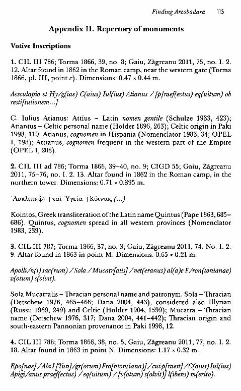
Finding Arcobadara ll5
Appendix II. Repertory of monuments
Votive Inscriptions
1. CIL III 786; Torma 1866, 39, no. 8; Gaiu, Zăgreanu 2011, 75, no. I. 2. 12. Altar found in 1862 in the Roman camp, near the western gate (Torma 1866, pl. III, point c). Dimensions: 0.47 " 0.44 m.
Aesculapio et Hylg(iae) C(aius) Iul(ius) Atianus I [p]raef(ectus) eq(uitum) ob resti[tutionem .. .]
C. Iulius Atianus: Attius - Latin nomen gentile (Schulze 1933, 423); Atiantus - Celtic personal name (Holder 1896, 263); Celtic origin in Paki 1998, 110. Atianus, cognomen in Hispania (Nomenclator 1983, 34; OPEL I, 198); Attianus, cognomen frequent in the western part of the Empire (OPEL I, 208).
2. CIL III ad 786; Torma 1866, 39-40, no. 9; CIGD 55; Gaiu, Zăgreanu 2011, 75-76, no. I. 2. 13. Altar found in 1862 in the Roman camp, in the northern tower. Dimensions: O. 71 " 0.395 m.
'AJKĂ.Em(ci'>) I Kal. YyEia I K6i:vto~ ( . .)
Kointos, Greek transliteration ofthe Latin name Quintus (Pape 1863, 685-686). Quintus, cognomen spread in all western provinces (Nomenclator 1983, 239).
3. CIL III 787; Torma 1866, 37, no. 3; Gaiu, Zăgreanu 2011, 74. No. I. 2. 9. Altar found in 1863 in point M. Dimensions: 0.65 "0.21 m.
Apolli/n(i) sac(rum) /Soia /Mucatr[alisj /vet(eranus) al(a)e F /ron(tonianae) v(otum) s(olvit).
Soia Mucatralis -Thracian personal name and patronym. Soia -Thracian (Detschew 1976, 465-466; Dana 2004, 443), considered alsa Illyrian (Russu 1969, 249) and Celtic (Holder 1904, 1599); Mucatra - Thracian name (Detschew 1976, 317; Dana 2004, 441-442); Thracian origin and south·eastern Pannonian provenance in Paki 1998, 12.
4. CIL III 788; Torma 1866, 38, no. 5; Gaiu, Zăgreanu 2011, 77, no. I. 2. 18. Altar found in 1863 in point N. Dimensions: 1.17 " 0.32 m.
Epo[naej /Ala! [Tunj/gr(orum)Fro[nton(iana)j /cuip[raestj IC(aius)Iul(ius) Apigilanus praef(ectus) I eq(uitum) I [v(otum) s(olvit)j l(ibens) m( erito ).
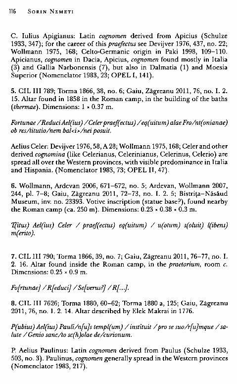
116 SORIN NEMET!
C. Iulius Apigianus: Latin cog;nomen derived from Apicius (Schulze 1933, 347); for the career of this praejectus see Devijver 1976, 437, no. 22; Wollmann 1975, 168; Celto-Germanic origin in Paki 1998, 109-110. Apicianus, cog;nomen in Dacia, Apicius, cog;nomen found mostly in Italia (3) and Gallia Narbonensis (7), but alsa in Dalmatia (1) and Moesia Superior (Nomenclator 1983, 23; OPEL I, 141).
5. CIL III 789; Torma 1866, 38, no. 6; Gaiu, Zăgreanu 2011, 76, no. I. 2. 15. Altar found in 1858 in the Roman camp, in the building of the baths (thermae). Dimensions: 1 " 0.37 m.
Fortunae /ReduciAel(ius) /Celerpraef(ectus) /eq(uitum)alae Fro/nt(onianae) ob res/titutio/nem bal<i>/nei posuit.
Aelius Celer: Devijver 1976, 58, A 28; Wollmann 1975, 168; Celer and other derived cog;nomina (like Celerianus, Celerinianus, Celerinus, Celerio) are spread all over the Western provinces, with visible predominance in Italia and Hispania. (Nomenclator 1983, 73; OPEL II, 47).
6. Wollmann, Ardevan 2006, 671-672, no. 5; Ardevan, Wollmann 2007, 244, pi. 7-8; Gaiu, Zăgreanu 2011, 72-73, no. I. 2. 5; Bistriţa-Năsăud Museum, inv. no. 23393. Votive inscription (statue base?), found nearby the Roman camp (ca. 250 m). Dimensions: 0.23 "0.38 "0.3 m.
T(itus) Ael(ius) Celer / praef(ectus) eq(uitum) / u(otum) s(oluit) l(ibens) m(erito).
7. CIL III 790; Torma 1866, 39, no. 7; Gaiu, Zăgreanu 2011, 76-77, no. I. 2. 16. Altar found inside the Roman camp, in the praetorium, room c. Dimensions: 0.25 " 0.9 m.
Fo[rtunaej / R{educij / Se[verus?j / R{. J.
8. CIL III 7626; Torma 1880, 60-62; Torma 1880 a, 125; Gaiu, Zăgreanu 2011, 76, no. I. 2. 14. Altar described by Elek Makrai in 1776.
P(ubius) Ael(ius) Pauli/n[u]s templ(um) /instituit /pro se suo/r[ujmque /salute / Genio sanc/to sc(h)olae de/curionum.
P. Aelius Paulinus: Latin cog;nomen derived from Paulus (Schulze 1933, 503, no. 3). Paulinus, cog;nomen generally spread in the Western provinces (Nomenclator 1983, 217).
Finding Arcobadara 117
9. Protase, Gaiu, Marinescu 1997, 56-57, 78-79, 109; ILD 800; Wollmann, Ardevan 2006, 673-675, 678, fig. 13-14; Nemeti, Bărbulescu 2007, 107-109; Pisa 2008, 163-166. Gaiu, Zăgreanu 2011, 70, no. I. 2. l. Altar found in 1989 in the area of the civilian settlement. Dimensions: 0.95 "0.32" 0.32 m; Bistriţa-Năsăud Museum, inv. no. 15993.
{Genijo terri/{t(orii) Ajrcoba(darensis) / {Aujr(elius) Sal(..)/ [et Ajel(ius) No/ [..Js magistri (duo)/ {Praesejnte et Al/[bin(o)j co(n)s(ulibus).
Sal( ... ): possible restitution Salius, Saluius (frequently used as cognomen). No[ ... ]s: various possible cognomina could be suggested, the mast fre-quent being Nomus, Nomys, Nomas, Nonius, Nonnus, Nothus, Nouius (Nomenclator 1983, 202-204; OPEL III, 103-104).
10. CIL III 791. Torma 1866, 36, no. l; Gaiu, Zăgreanu 2011, 73-74, no. I. 2. 7. Altar found in 1863 in the so-called M point (in the civilian settlement). Dimensions: 0.73" 0.30 m.
I(ovi) o(ptimo) m(aximo) / Aurel<l>(ius) /Vitell/zanus /sesq(uiplicarius) p(ro) [s(e)j / et sor(ore) s(ua) /v(otum) s(olvit) l(ibens) [m(erito)J.
Aurelius Vitellianus: Latin cognomen derived from Vitellius (Schulze 1933, 153, 257, 445); Vitellius is generally spread in the Western provinces, Vitellianus is rather rare, with a few occurrences in Pannonia and Noricum (Nomenclator 1983, 316).
11. CIL III 7627; Gaiu, Zăgreanu 2011, 74, no. I. 2. 8. Altar found in Ilişu a.
I(ovi) o(ptimo) m(aximo) / et Iuno(ni) / R{ejg(inae) Val(erius) A/vitu[s] ve[t(eranus)j /v(otum) s(olvit) l(ibens) m(erito).
Valerius Avitus: Latin cognomen (Schulze 1933, 34, no. 6). Celtic origin and Rhenan provenance in Paki 1998, 113. Avitus, cognomen spread in all Western provinces with a noted preponderance in Hispania (148 occurrences), Gallia Belgica (27) and Gallia Narbonensis (36) (Nomenclator 1983, 39; OPEL I, 231-232).
12. CIL III 792. Torma 1866, 36, no. 2; Gaiu, Zăgreanu 2011, 75, no. I. 2. 11. Altar found in 1863 in the M point (in the civilian settlement). Dimensions: 0.78 "0.475 m.
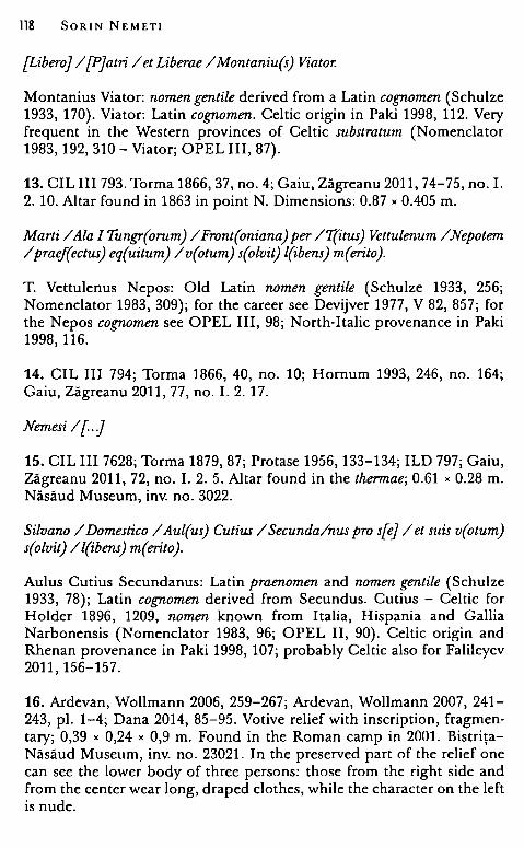
118 SORIN NEMETI
{Libero]/ [P]atri / et Liberae / Montaniu(s) Viator.
Montanius Viator: nomen gentile derived from a Latin cognomen (Schulze 1933, 170). Viator: Latin cognomen. Celtic origin in Paki 1998, 112. Very frequent in the Western provinces of Celtic substratum (Nomenclator 1983, 192, 310 - Viator; OPEL III, 87).
13. CIL III 793. Torma 1866, 37, no. 4; Gaiu, Zăgreanu 2011, 74-75, no. I. 2. 10. Altar found in 1863 in point N. Dimensions: 0.87 x 0.405 m.
Marti /Ala I Tungr(orum) / Front(oniana) per /T(itus) Vettulenum / Nepotem / praef(ectus) eq(uitum) /v(otum) s(olvit) l(ibens) m(erito).
T. Vettulenus Nepos: Old Latin nomen gentile (Schulze 1933, 256; Nomenclator 1983, 309); for the career see Devijver 1977, V 82, 857; for the Nepos cognomen see OPEL III, 98; North-Italic provenance in Paki 1998, 116.
14. CIL III 794; Torma 1866, 40, no. 10; Hornum 1993, 246, no. 164; Gaiu, Zăgreanu 2011, 77, no. I. 2. 17.
Nemesi /[.}
15. CIL III 7628; Torma 1879, 87; Protase 1956, 133-134; ILD 797; Gaiu, Zăgreanu 2011, 72, no. I. 2. 5. Altar found in the thermae; 0.61 x 0.28 m. Năsăud Museum, inv. no. 3022.
Silvano /Domestico/ Aul(us) Cutius / Secunda/nus pro s[e] / et suis v(otum) s(olvit) / l(ibens) m( erito ).
Aulus Cutius Secundanus: Latin praenomen and nomen gentile (Schulze 1933, 78); Latin cognomen derived from Secundus. Cutius - Celtic for Holder 1896, 1209, nomen known from Italia, Hispania and Gallia Narbonensis (Nomenclator 1983, 96; OPEL II, 90). Celtic origin and Rhenan provenance in Paki 1998, 107; probably Celtic alsa for Falileyev 2011, 156-157.
16. Ardevan, Wollmann 2006, 259-267; Ardevan, Wollmann 2007, 241-243, pi. 1-4; Dana 2014, 85-95. Votive relief with inscription, fragmentary; 0,39 x 0,24 x 0,9 m. Found in the Roman camp in 2001. BistriţaNăsăud Museum, inv. no. 23021. In the preserved part of the relief one can see the lower body of three persons: those from the right side and from the center wear long, draped clothes, while the character on the left is nude.
Finding Arcobadara 119
ZANAPINIE8HE I EUXÎJV I ernîc; I (hedera) E7t1]1C(0)0tc; (hedera).
Zamannistes: Pape 1863, 437 (Zamameixon, Zamaspes).
17. Gaiu, Zăgreanu 2011, 77-78, no. I. 2. 19, pl. V. I. 2. 19; Pisa 2013 b, 48-49, no. 12. Altar, now lost (the picture is preserved in Iulian Marţian's photographic collection).
[I(ovi)} o(ptimo) m(aximo) / et Lari viali /ex imperio /muro/ {in pristinujm [statum refecto?j / [.].
18. Gaiu, Zăgreanu 2011, 78, no. I. 2. 20, pl. V. I. 2. 20. Altar, now lost (the picture is preserved in Iulian Marţian's fotographic collection).
I(ovi) o(ptimo) m(aximo) / [.] Silvano [.]
Bronze statues 19. Iupiter Dolichenus. Torma 1866, 58, no. lb, pl. X; Isac 1971, 571-576; Popa, Berciu 1978, 23, no. 21; Hărig, Schwertheim 1987, 93, no. 133, pl. XXIX; Ţeposu-Marinescu, Pop 2000, 110, no. 133; Bronze statue (H-15.5 cm) found in the Roman camp in the area of the eastern gate. MNIT Cluj-Napoca, inv. no. v 1126. Jupiter Dolichenus wears a Phrygian cap and a crown and is dressed with a Muskelpam:.er. His attributes are missing.
20. Libera. Torma 1866, 57-58 pl. IX; Pop 1973, 596-598, pl. 2; ŢeposuMarinescu, Pop, 2000, 108-109, no. 130; MNIT Cluj-Napoca, inv. no. v 1125. Bronze statue (H - 16.8 cm), found in the Roman camp, by the eastern gate, depicting a female deity wearing leaves and grapes on her head.
21. Mercurius. Gaiu 1997, 39, no. 241, pl. XI; Ţeposu-Marinescu, Pop, 49, no. 38. Bronze statue (H - 9 cm) depicting Mercurius, found in the Roman camp. Bistriţa-Năsăud Museum, inv. no. 18239. The god wears a chlamys and a winged petasos and holds a cornucopia and a caduceus in his right hand.
22. Venus. Gaiu 1997, no. 243; Protase, Gaiu, Marinescu 1997, 42, 70; Ţeposu-Marinescu, Pop 2000, 92, no. 103. Bistriţa-Năsăud Museum, inv. no. 20647. Bronze statue (H - 15 cm) depicting a nude Venus anadyomene found in the Roman camp, near porta praetoria.
23. Venus. Protase 1961, 137-138, no. 6, pl. 6 a, b. Ţeposu-Marinescu, Pop, 2000, 95, no. 110. Bistriţa-Năsăud Museum, inv. no. 6905. Bronze
120 SORIN NEMETI
statue (H - 12 cm) found in 1948 in the village. Nude Venus anadyomene wearing a crescent diadem on her head.
Stane reliefs 24. Fortuna. Gaiu 2003, 15-19; Gaiu, Zăgreanu 2011, 107-108, no. IV. 1. 1, pl. XVII/IV. 1. 1. Relief. Dimensions: 1.10 " O. 74 " 0.38 m. BistriţaNăsăud Museum, inv. no. 23022. Found in the Roman camp's thermae, in the eastern wall of the praefurnium. The relief depicts a goddess dressed with chiton and himation, wearing a modius, holding in her left hand a cornucopia. In the upper left side, near the goddess' head there is the depiction of a small genius sitting on the globe, wearing a calathos, and holding in his hands a scepter and an unidentified spherical object.
25. Liber Pater. Pop, Milea 1965, 201-202, no. 2; Gaiu, Zăgreanu 2011, 108-109, no. IV. 1. 3, pl. XVII/IV. 1. 3 .. MNIT Cluj-Napoca, inv. no. v 19613 ( =3195). Marble votive relief, fragmentary, found in Ilişua (Torma's excavations). Dimensions: 0.115 "0.12" 0.015 m; The preserved part of the relief depicts god Liber Pater with a nebrys on the left shoulder and the thyrsos in his left hand.
26. Liber Pater?. Gaiu, Zăgreanu 2006, p. 168-169, no. 6, fig. 6; Gaiu, Zăgreanu 2011, 108, no. IV. 1. 2, pl. XVII/IV. 1. 2. Limestone relief found in the Roman camp in 1984, in the principia. Dimensions: 0.44" 0.43 "O.OS m. Bistrita-Năsăud Museum, inv. no. 23456. The relief depicts a nude bearded m~n, facing left, holding a stick (scepter?, thyrsos?) in his right hand (hypothetically identified with Liber Pater).
Terracotta 27-29. Venus. Protase, Gaiu, Marinescu 1997, p. XLII. Three fragmentary clay statues depicting Venus pudica, found in the Roman camp.
Funerary monuments
Stelae 30. CIL III 799; Torma 1866, 48, no. 27; Russu 1967, 91; Ţeposu -Marinescu 1982, 129, S 110; Gaiu, Zăgreanu 2011, 81-82, no. I. 3. b. 1. Found in 1830 near the eastern gate of the Roman camp; dimensions: 1.51 " 0.61 m; Dej Museum. Two-register stela: on the left side bordered by a pilaster decorated with ivy leaves. The relief depicts a man with a thyrsos in his left hand and a woman.
{D(is )} M (anibus) / [. Js Mucaporis / [eq(ues)? al(ae )} Front(onianae) / [vix(it) ann(is) .. JIII Ael(ius) Mu/[ .. eq(ues) ajlae eiusd(em) / [.].
Finding Arcobadara 121
Mucapor: Thracian name (Detschew 1976, 314-316; Dana 2004, 441-442).
31. CIL III 800; Torma 1866, 48, no. 25; Gaiu, Zăgreanu 2011, 85-86, no. I. 3. b. 11. Stela found in 1863 in point O. Dimensions: O. 73 " 0.60 m. Eques et protome mulieris.
D(is) M(anibus) s(acrom) / Ael(ius) Quadrat/us eq(ues) alae Fro/ntonian(a)e T(itus) /Val(erius) [.Jani[.]/[.].
32. CIL III 801; Torma 1866, 48, no. 26; Gaiu, Zăgreanu 2011, 86, no. I. 3. b. 12.; Stela found in 1830. Puer equum tenens.
D(is) M(anibus) / Apon[zus?j / eques alae [Front(onianae)J /vix(it) an(nis) L Aponia [. J / et Lelius patri [. J / posueront / b( ene )m( erenti).
Aponius/Aponia - Schulze 1933, 66; Aponius - very much spread as nomen in the Western provinces; used also as cog;nomen in a few case in Italia, Hispania and Moesia Inferior (Nomenclator 1983, 24; OPEL I, 147). Lelius, maybe a Latin version of the Celtic name Lella (Paki 1998, 100; Nomenclator 1983, 161; OPEL III, 22: Lella); Lelius, -a are Celtic names for Falileyev 2011, 158.
33. CIL III 802; Torma 1866, 45, no. 18; Gaiu, Zăgreanu 2011, 85, no. I. 3. b. 10. Stela found in 1863 in point O. Dimensions: 1.46" 0.40 m. Eques.
[D(is) M(anibus)J /Aur(elius) Dec[„] /vix(it) [an(nis) „] / Me[.J /Ma[.] /vix(it) an(nis) [„] / Aur(elius) De[„] / dec(urio) alae [Front(onianae)?Iusj/ tina m[ater filiis pientisj/simis po{suitj.
34. CIL III 803; Torma 1866, 53, no. 47; Gaiu, Zăgreanu 2011, 79, no. I. 3. a. 3. Stela, volcanic tufa. Rediscovered in 1947 in the yard of the Horvath family. Dimensions: 1.18 "0.80 m. Bistriţa-Năsăud Museum, inv. no. 9.
D(is) M(anibus) / Aurel(ius) Iustin(us) / eques N(umeri) P(almyrenorom) P(orolissensium) /vix(it) ann(is) XL/ Aurel(ius) Maxi/musfrater / et heres
J(aciendum) c(uravit).
Iustinus/lustina - very common cog;nomina in the Latin speaking provinces (Nomenclator 1983, 155; OPEL II, 209-210); Maximus - OPEL III, 70-72.
35. CIL III 804; Torma 1866, 46, no. 20; Gaiu, Zăgreanu 2011, 83, no. I. 3. b. 5. Stela found in 1863 in point P. Dimensions: 1.11 " 0.85 m. Protomae quattuor viri barbati, iuvenis, uxoris, pueri, qui manibus tenent pocula; infra
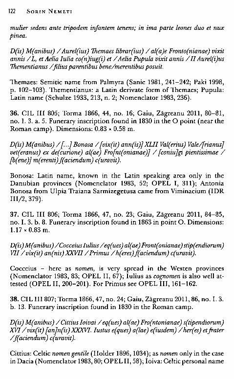
122 SORIN NEMET!
mulier sederts ante tripodem infantem tenens; in ima parte leones duo et nux pi nea.
D(is) M(anibus) / Aurel(ius) Themaes librar(ius) / al(a)e Fronto(nianae) vixit annis / L, et Aelia Iulia co(n)iug(i) et / Aelia Pupula vixit annis /II Aurel(i)us Thementianus / .filius parentibus bene/merentibus posuit.
Themaes: Semitic name from Palmyra (Sanie 1981, 241-242; Paki 1998, p. 102-103). Thementianus: a Latin derivate form of Themaes; Pupula: Latin name (Schulze 1933, 213, n. 2; Nomenclator 1983, 236).
36. CIL III 805; Torma 1866, 44, no. 16; Gaiu, Zăgreanu 2011, 80-81, no. I. 3. a. 5. Funerary inscription found in 1830 in the O point (near the Roman camp). Dimensions: 0.83 "0.58 m.
D(is) M(anibus) / [ . .] Bonosa / [vix(it) ann(is)} XLII Val(erius) Vale/[rianus] vet(eranus) ex de(curione) al(ae) Fro[nt(onianae)j / [coniujg;i, pientissimae / [b(ene)j m(erenti)J(aciendum) c(uravit).
Bonosa: Latin name, known in the Latin speaking area only in the Danubian provinces (Nomenclator 1983, 52; OPEL I, 311); Antonia Bonosa from Ulpia Traiana Sarmizegetusa came from Viminacium (IDR 111/2, 379).
37. CIL III 806; Torma 1866, 47, no. 23; Gaiu, Zăgreanu 2011, 84-85, no. I. 3. b. 8. Funerary inscription found in 1863 in point O. Dimensions: 1.17 "0.83 m.
D(is)M(anibus)/Cocceiuslulius/eq(ues)al(ae)Front(onianae)stip(endiorum) VII /vix(it) an(nis)XXVII /Primus /h(eres)J(aciendum) c(uravit).
Cocceius - here as nomen, is very spread in the Westen provinces (Nomenclator 1983, 83; OPEL II, 67); Iulius as cognomen is also well attested (OPEL II, 200-201). For Primus see OPEL III, 161-162.
38. CIL III 807; Torma 1866, 47, no. 24; Gaiu, Zăgreanu 2011, 86, no. I. 3. b. 13. Funerary inscription found in 1830 in the Roman camp.
D(is) M(anibus) /Cittius Ioivai / eq(ues) al(ae) Fro(ntonianae) s(tipendiorum) XVI /vix(it) [anjn(is)XXXVI. Iustus e(ques) a(lae) e(iusdem) /her(es) etfrater /f(aciendum) c(uravit).
Cittius: Celtic nomen gentile (Holder 1896, 1034); as nomen only in the case in Dacia (Nomenclator 1983, 80; OPEL II, 58); Ioiva: Celtic personal name
Finding Arcobadara 123
(see Ioimarus, Ioitus, Ioincorix, Ioincius - Holder 1904, 63; Nomenclator 1983, 152; OPEL II, 195). Celtic - German origin and Rhenan provenance in Paki 1998, 105. Iustus - a frequent Latin cognomen (Paki 1998, 119; OPEL II, 210); see also, Falileyev 2005, 76 (Cittius), 93 (Ioivai).
39. CIL III 808; Torma 1866, 45, no. 17; Gaiu, Zăgreanu 2011, 81, no. I. 3. a. 6. Funerary inscription found in 1863 in point O (near the Roman camp ). Dimensions: 0.26 x 0.89 m.
{D(is) M(anibus)j / lul(ia) [Mjansueta vix(it) / an(nis) [}XIII Val(erius) Valerian(us) / [ . .] vet(eranus) ex de[c(urione) alae] / [Frontonianjae / [..]
Mansueta - Latin cognomen (Paki 1998, 108-109), well-spread in the Celtic speaking provinces (Nomenclator 1983, 177; OPEL III, 51 ).
40. CIL III 809; Torma 1866, 49, no. 28; Russu 1967, 91; Gaiu, Zăgreanu 2011, 86-87, no. I. 3. b. 15. Fragmentary stela found in 1863 in point O. Dimensions: 0.87 x O. 77 m.
{D(is) M(anibus)j / [ . .] / eq(ues) alae [Froj/nt(onianae) ic situs est vix/zt annis XXXX Muc/apuis coniugi bene/merenti posuit.
Mucapuis: Thracian personal name (Detschew 1976, 316; Dana 2004, 441; Paki 1998, 119)
41. CIL III 810; Torma 1866, 46, no. 21; Gaiu, Zăgreanu 2011, 85, no. I. 3. b. 9. Two fragments of a funerary inscription found in 1863 in point P. Dimensions: 0.57 x 0.85 m; 0.36 x 0.39 m.
{D(is) M(anibus)J / [. .jnirus vet(eranus) [.. vixijt ann(is) X[..] /[..]ne coniun[gi .. .J Sept(imius) Sin[ . .]/ [secujndum volun[tatem] testator[i,sj.
42. CIL III 811; Torma 1866, 43-44, no. 15; Gaiu, Zăgreanu 2011, 80, no. I. 3. a. 4. Inscription found in 1830, near the southern gate of the Roman camp. Dimensions: 2.43 x 0.37 m.
D(is) [M(anibus)j / C(aius) Val(erius) V[i,tajlis /vet(eranus) ex {dec(urione)j alae / Front(onianae) [vix(it)j ann(is) / L et Val(erius) V[i,talijan[u]s / .fil(ius) huiu[s vijx(it) an(nis) II et me(n)si[busj VII /Val(erius) Laet[Ujlus / dec(urio) al(ae) s(upra)[s(criptae) Vjal(erius) Sa/turni[nujs dupl(icarius) / d(ecuriae) e(iusdem) ba[rejntibus /jratr[i,q(ue) piejntis/si[mijs /b(ene) m(erentibus).
Valerius Laetillius: Latin cognomen replacing a Celtic name (the people of Laeti in Belgica); well known as nomen (Laetilius), only once as cognomen
124 SORIN NEMET!
(Laetilius) (Nomenclator 1983, 158; OPEL III, 17). Celtic origin and Rhenan provenance in Paki 1998, 114.
43. CIL III 812; Torma 1866, 47, no. 22; Gaiu, Zăgreanu 2011, 84, no. I. 3. b. 6. Stela found in 1863 in the Roman camp. Dimensions: 1.25 x 0.44 m. Vir barbatus poculum tenens.
{D(is) M (anibus )} / [ . .Jius vet( eranus) / [vixit anni)s LX Aur(elius) / [ . .Janus Jil(ius) / [patri b(ene)) m(erenti).
44. CIL III 813; Torma 1866, 45, no. 19; Gaiu, Zăgreanu 2011, 91-92, no. I. 4. 15. Fragmentary inscription found in 1863 in point O. Dimensions: 0.22 X 0.22 m.
[..)/[ . .)XX/[..) XXII/ [..)sig{nifer)
45. CIL III 814; Torma 1866, 49, no. 29; Gaiu, Zăgreanu 2011, 89, no. I. 4. 6. Fragmentary funerary inscription found in 1863 in the Roman camp. Dimensions: 0.14 x 0.21 m.
{D(is) M(anibus)J / [ . .JEN[..J / [eques?) al(a)e Fro[nt(onianae)) / [stip(endiorum)?) XIII vi[x(it) annis) / [ . .]
46. CIL III 815; Torma 1866, 50, no. 34; Gaiu, Zăgreanu 2011, 82, no. I. 3. b. 3. Funerary inscription found in 1863 in point O. Dimensions: 0.65 x 0.54 m. Bistriţa-Năsăud Museum, inv. no. 13291.
D(is) M(anibus) / Ael(ius) Mercuri/us vix(it) ann(is) XXXX / Ael(ia) Ru.filla vix(it) / annis VIII/ Ael(ius) / Publius vix(it) ann(is) / VI / Nennia (?) Ianua[ria) / [ . .]
Mercurius and Publius - well known as cognomina (Nomenclator 1983, 187, 235; OPEL III, 77, 170); The nomen Nennius / Nennia is only known from this inscription (Nomenclator 1983, 199; OPEL III, 96). In CIL the name is read as Herenia Ianuaria, where Herenia is a common Latin nomen gentile (Schulze 1933, 282).
47. CIL III 816; Torma 1866, 51, no. 36; Gaiu, Zăgreanu 2011, 84, no. I. 3. b. 7. Stela found in 1863 in point O. Dimensions: 1.80 x 0.43 m. Mulier, infans pocula tenentes; protome tertia deest.
D(is) [M(anibus)) / Augu[rinus? vix(it)) / ann(is) III[..] / Aur(elius) [..] / VPF
Finding Arcobadara 125
Augurinus or Augurius are well-known cognomina, but the preserved part of the name could be read as some name derived from the theme August* (like Augustus, Augustalis, Augustanius, Augustianus, Augustinus etc.) (OPEL I, 225-228).
48. CIL III 817; Torma 1866, 50, no. 33; Gaiu, Zăgreanu 2011, 83, no. I. 3. b. 4. Stela found in 1834. Dimensions: 1. 79 " 0.88 m. Protome duae.
D(is) M(anibus) /Calpur(nia) Macri/na vix(it) ann(is)XL / Ael(ius) Respectus / coni(ugi) b(ene) m(erenti) p(osuit).
Calpurnius / Calpurnia - Latin nomen gentile, probably of Etruscan origin (Schulze 1933, 138; OPEL II, 25-26); Macrinus / Macrina - Latin cognomen (Nomenclator 1983, 172; OPEL III, 43).
49. CIL III 818; Torma 1866, 51, no. 35; Gaiu, Zăgreanu 2011, 87, no. I. 3. b. 16. Funerary monument found in 1863 in point P. Dimensions: 0.66 " 0.60 m.
{D(is) M(anibus)j / [Ijovinus / [vjix(it) ann(is) II m(ensibus) /II Aur(elius) Castor / posuit.
Iovinus - Latin cognomen (Nomenclator 1983, 152; OPEL II, 196); Celtic origin and Rhenan provenance in Paki 1998, 118. Castor - cognomen of Greek origin (Ruscu 1998, 158), known alsa from Latin speaking provinces (OPEL II, 42).
50. CIL III 819; Torma 1866, 50, no. 32; Gaiu, Zăgreanu 2011, 86-87, no. I. 3. b. 14. Funerary inscription found in 1862 in point Q Dimensions: 0.96 " 0.52 m.
D(is) [M(anibus)J /Pompe[ius .. J /vix(it) a[nn(is) .. ] /[.)N[.J /{Ajel(ia) Fronime VM[.]/ et Iul(ia)Ammia V[.]/ Antonius Mem[.J /SB M.
Pompeius - Latin nomengentile (OPEL III, 150-151 ); Fronime -cognomen ofGreek origin (Pape 1870, 1648; Ruscu 1998, 165; Paki 1998, 95). Ammia - Celtic cognomen for Holder I, 130; related forms like Ammus, Amma, Ammias known from provinces of Celtic substratum (Nomenclator 1983, 16; OPEL I, 96-98); possible Celtic origin in Paki 1998, 108; Ammia -considered as a Greek cognomen (Ruscu 1998, 152); the cognomen Mem* - could be read as Memnon (Greek - Ruscu 1998, 170) or Memorand the derivates (Latin) (OPEL III, 75) etc.; in this association probably Aelia Fronime, Iulia Ammia and Antonius Memnon are Greeks.
126 SORIN NEMET!
51. CIL III 819 a; Torma 1866, 51, no. 37; Gaiu, Zăgreanu 2011, 87-88, no. I. 3. b. 17. Funerary monument found in point P.
D(is) [M(anibus)J /C(aius) Iul(ius) [.] / et Da[.]/[..].
52. CIL III 820, 1; Torma 1866, 52, no. 39; Gaiu, Zăgreanu 2011, 90, no. I. 4. 10. Fragment of a funerary inscription found in 1863 in Qpoint. Dimensions: 0.28 x 0.25 m.
{D(is) M(anibus)J / {Am?jarantus / [He?jdiste / [..].
Amarantus - Greek cognomen (Ruscu 1998, 152; Nomenclator 1983, 15; OPEL I, 88-89); Hediste - Greek cognomen (feminine) (Ruscu 1998, 166; Nomenclator 1983, 141; OPEL II, 174).
53. CIL III 820, 2; Torma 1866, 52, no. 40; Gaiu, Zăgreanu 2011, 88, no. I. 4. 3. Fragment of a funerary inscription found in 1863 in point P. Dimensions: 0.30 x 0.36 m.
D(is) [M(anibus)J / Ael(ius)A[.. vix(it)J / an[n(is) .. ] / [..].
54. CIL III 820, 3; Torma 1866, 51, no. 38; Gaiu, Zăgreanu 2011, 90, no. I. 4. 9. Fragment of a funerary inscription found in 1863. Dimensions: 0.29 X 0.11 m.
[. .j / { . .)gii { . .j /[..)XXX[. .j /[..)CM[. .j
55. CIL III 820, 4; Torma 1866, 49, no. 31; Gaiu, Zăgreanu 2011, 90, no. I. 4. 8. Fragmentary inscription. Dimensions: 0.21 x 0.13 m.
[..] / [. .Jg / [. .Jem / [.. magi]ster / [..]
56. CIL III 820, 5; Torma 1866, 52, no. 43; Gaiu, Zăgreanu 2011, 90, no. I. 4. 12. Fragment of a funerary inscription found in 1863. Dimensions: 0.19 X 0.23 m.
{D(is) M(anibus)j / [..JBET[..j /[..]AT[..]/[..]
57. CIL III 820, 6; Torma 1866, 53, no. 44; Gaiu, Zăgreanu 2011, 90, no. I. 4. 13. Fragment of a funerary inscription found in 1863. Dimensions: 0.25 X 0.27 m.
{D(is) M(anibus)j / [..JTAV[..j / [.) P[..j.
Finding Arcobadara 127
58. CIL III 820, 7; Torma 1866, 52, no. 42; Gaiu, Zăgreanu 2011, 89, no. I. 4. 5. Fragment of a funerary inscription found in 1863. Dimensions: 0.40 X 0.30 m.
{D(is) M(anibus)J / [..JSN[..J / [eques] al[ae Front(onianae)J / [..]
59. CIL III 820, 8; Torma 1866, 49, no. 30; Gaiu, Zăgreanu 2011, 92, no. I. 4. 16. Fragment of a funerary inscription found in 1863. Dimensions: 0.25 X 0.27 fi.
D(is) [M(anibus)J /T[ . .J /[..]
60. CIL III 820, 9; Torma 1866, 52, no. 41; Gaiu, Zăgreanu 2011, 91, no. I. 4. 12. Fragment of a funerary inscription found in 1863. Dimensions: 0.12 X 0.32 m.
{D(is) M(anibus)J / [..] / [..vix(it)J ann(is) [..]/[..)di[..]/[..].
61. CIL III 820, 10; Torma 1866, 53, no. 45; Gaiu, Zăgreanu 2011, 91, no. I. 4. 14. Fragment of a funerary inscription found in 1863. Dimensions: 0.19 X 0.17 m.
{D(is) M(anibus)J / [ .. vijx(it) [ann(is) ... ]/[..]MA[ . .].
62. CIL III 820, 11; Torma 1866, 53, no. 46; Gaiu, Zăgreanu 2011, 88-89, no. I. 4. 7. Fragment of a funerary inscription found in 1863. Dimensions: 0.45 X 0.31 m.
{D(is)J M(anibus) / [ . .].
63. CIL III 7629; Gaiu, Zăgreanu 2011, 89, no. I. 4. 4. "Alro - Ilosvaeprope castra in balneis rep."
[..] /C(aius)Iul(ius) V[..] /stip(endiorum)X[V. . .J /stip(endiorum)XV[..J / et Iul(ius?) [ . .].
64. Protase 1957, 320, no. 1, pi. 1 a-b; AE 1960, 218; ILD 798; Protase 2005, 42-43; Gaiu, Zăgreanu 2011, 78, no. I. 3. a. 1. Altar, gritstone. Dimensions: 1.20 x 0.80 x 0.20 m. Found in 1948. Bistriţa-Năsăud Museum, inv. no. 7.
D(is) M(anibus) / Ael(ius) Maximi/nus vix(it) ann(is) / VL et Aeli Maxi/mus vix(it) ann(is) VII /Ursinus vix(it) / ann(is) III/. Serena / Licconis co(n)i(ugi) / et.filis b(ene) m(erentibus) p(osuit).
128 SORIN NEMET!
Serena - Latin cog;nomen related to moral qualities; Licco - lllyrian personal name (Russu 1969, 222; for diffusion see OPEL III, 26); Celtic origin and Pannonian provenance in Paki 1998, 120; for some Celtic etymologies see Falileyev 2007, 99.
65. Protase 1957, 320-323, no. 2, pl. 2 a-b; AE 1960, 218; Russu 1967, 90; Protase 2005, 43-45; ILD 799; Gaiu, Zăgreanu 2011, 79, no. I. 3. a. 2. Altar, gritstone. Dimensions: 1.30 " 0.87 " 0.17 m. Bistriţa-Năsăud Museum, inv. no. 6.
D(is) M(anibus) /Aurelius/ Brisanus / vixit annis / L Aur(elius) Mucatius / ed Aurelius/ Maximianus /fiii et heredes / p(atri) p(ientissimo) p(osuerunt).
Brisanus - Thracian personal name (Dana 2004, 438), Thracian origin (Paki 1998, 100); see also Brisanus Aulusani from Tibiscum (IDR 111/1 163); Falileyev 2007, 62-63.
66. Ardevan, Wollmann 2007, 245, no. 4, pl. 9-10; Gaiu, Zăgreanu 2011, 73, no. I. 2. 6; Bistriţa-Năsăud Museum, inv. no. 23427. Funerary inscription, gritstone. Found in the Roman camp, in the principia, in 1986. Dimensions: 0.27 " 0.33 " 0.075 m .
... / .. (hedera) Ro[..?) / [. .. ?jrio m(iles) [num(eri)J / [Palm(yrenorum)j Poro[liss(ensium)j / {p(ientissimae)j p(osuit).
Rocius but also Roscius, Romanius are frequently used nomina (Nomenclator 1983, 244-245); Saturio - Nomenclator 1983, 255, but also many others cog;nomina ending in -rio (like Glabrio, Celerio, Curio, Surio etc.) (Nomenclator 1983, 335-336).
67. Wollmann, Ardevan 2006, 675, no. 8; Ardevan, Wollmann 2007, 247-248, no. 6, pl. 13-14; Gaiu, Zăgreanu 2011, 82, no. I. 3. b. 2. Funerary inscription, gritstone. Found in the Roman camp, near porta principalis dextra. Dimensions: 50 " 26 " 11.5 m. Bistriţa-Năsăud Museum, inv. no. 23427.
{D(is) M(anibus)j / ... /N[..j /OR{ . .] /NET[..] /FN[..j /P[..j.
68. Ardevan, Wollmann 2007, 248, no. 8, pl. 16; Gaiu, Zăgreanu 2011, 88, no. I. 4. 2. Funerary inscription, limestone. Found in the Roman camp. Dimensions: 0.134" 0.17 "0.11 m. Bistriţa-Năsăud Museum, inv. no. 23432.
[D(is) M(anibus)] / .. / .. nis vi/{xit an(nis)J ... anus /[..]avu[..]/[..].
Finding Arcobadara 129
69. Pop 1971, 178, no. 3, pl. 4; Ţeposu - Marinescu 1982, 151, no. 213; Bărbulescu 2003, 166, no. 8; Gaiu, Zăgreanu 2011, 109, no. IV. 2. 1, pl. XVIII/IV. 2. 1. Limestone stela. Dimensions: 1.20 " 0.65 " 0.25 m. Dej M useum, inv. no. 11/88. The fragment shows the she-wolf facing right and the twins.
70. Protase 1961, 135, no. 4, pl. 4; Protase 2005, Chiş 2007, 171, no. 31; Gaiu, Zăgreanu 2011, 96, no. II. 2. 3, pl. XII/li. 2. 3. Side wall of an aedicula, limestone. Dimensions: 0.92 " 0.55 " 0.30 m. Bistriţa-Năsăud Museum, inv. no. 10. The relief shows Attis tristis holding a pedum.
71. Dănilă 1973, 605-609; Pop, Moga, Aldea 1972, 510, no. 28; Ţeposu - Marinescu 1982, 196, M 34; Gaiu, Zăgreanu 2011, 100-101, no. III. 1. 1, pl. XIV /III. 1. 1. Fragmentary medallion. Dimensions: 0.60 " 0.38 m. Bistriţa-Năsăud Museum, inv. no. 5113. Found in 1950 nearby the Roman camp, in the south-western area. A family, consisting of a bearded man on the right, a woman on the left, and a child in the center, is depicted in the coping round field.
72. Gaiu, Zăgreanu 2011, 101, no. III. 1. 2, pl. XIV /3. 1. 2. Fragmentary coping (a picture is preserved in I. Marţian's archive). A man and a woman holding an object (probably a glass).
73. Protase 1961, 127-134, no. 1, pl. 1 a-c; Protase 2005, 56-62; ŢeposuMarinescu 1982, 171, no. 44, pl. XXI; Gaiu, Zăgreanu 2011, 94-95, no. II. 2. 1, pl. X/li. 2. 1. Bistriţa-Năsăud Museum, inv. no. 11. Aediculashaped altar, found in the Roman camp in 1949. Gritstone. Dimensions: 1.20" 0.70" 0.37 m. The main field shows the funerary banquet (a man between two women in front of a mensa tripes; below, a wine-jar and a panarium). On the lateral sides Attis tristis holding a pedum and a kantharos with wine·stalk and grapes.
74. Gaiu, Zăgreanu 2006, p. 169, no. 7, fig. 7; Nemeti 2008, 179-185; Gaiu, Zăgreanu 2011, 95-96, no. II. 2. 2, pl. XI/li. 2. 2. Fragment of a funerary pilaster, limestone. Dimensions: 0.95 " 0.53 " 0.14 m. Found in Uriu village. Bistriţa-Năsăud Museum, inv. no. 15062. The relief shows a bull's head surmounted by a pine tree with a pine cone. Interpreted as a symbolic image of Attis.
75. Protase 1956, 133; Ţeposu-Marinescu 1982, 189, M 6; Protase 2005, 39-40. Independent medallion, gritstone. Dimensions: 0.58 m. Năsăud Museum. Tree persons, a man (on the right), a woman (on the left), andin front of them a child are represented in a medallion (a shell·shaped niche).
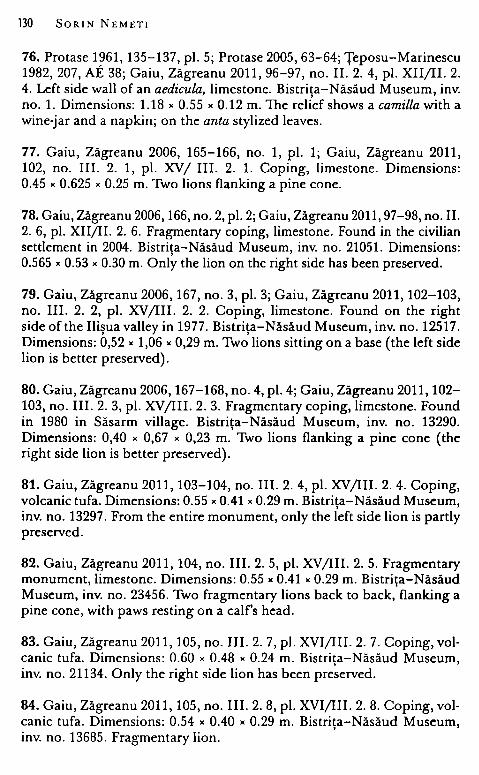
130 SORIN NEMET!
76. Protase 1~61, 135-137, pi. 5; Protase 2005, 63-64; Ţeposu-Marinescu 1982, 207, AE 38; Gaiu, Zăgreanu 2011, 96-97, no. II. 2. 4, pi. XII/li. 2. 4. Left side wall of an aedicula, limestone. Bistriţa-Năsăud Museum, inv. no. l. Dimensions: 1.18 " 0.55 " 0.12 m. The relief shows a camilla with a wine-jar and a napkin; on the anta stylized leaves.
77. Gaiu, Zăgreanu 2006, 165-166, no. 1, pi. 1; Gaiu, Zăgreanu 2011, 102, no. III. 2. 1, pi. XV/ III. 2. l. Coping, limestone. Dimensions: 0.45 x 0.625 " 0.25 m. Two lions flanking a pine cane.
78. Gaiu, Zăgreanu 2006, 166, no. 2, pi. 2; Gaiu, Zăgreanu 2011, 97-98, no. II. 2. 6, pi. XII/li. 2. 6. Fragmentary coping, limestone. Found in the civilian settlement in 2004. Bistriţa-Năsăud Museum, inv. no. 21051. Dimensions: 0.565 " 0.53 x 0.30 m. Only the lion on the right side has been preserved.
79. Gaiu, Zăgreanu 2006, 167, no. 3, pi. 3; Gaiu, Zăgreanu 2011, 102-103, no. III. 2. 2, pi. XV /III. 2. 2. Coping, limestone. Found on the right side of the Ilişua valley in 1977. Bistriţa-Năsăud Museum, inv. no. 12517. Dimensions: 0,52 " 1,06 " 0,29 m. Two lions sitting on a base ( the left side lion is better preserved).
80. Gaiu, Zăgreanu 2006, 167-168, no. 4, pi. 4; Gaiu, Zăgreanu 2011, 102-103, no. III. 2. 3, pi. XV /III. 2. 3. Fragmentary coping, limestone. Found in 1980 in Săsarm village. Bistriţa-Năsăud Museum, inv. no. 13290. Dirnensions: 0,40 " 0,67 " 0,23 m. Two lions flanking a pine cane ( the right side lion is better preserved).
81. Gaiu, Zăgreanu 2011, 103-104, no. III. 2. 4, pi. XV /III. 2. 4. Coping, volcanic tufa. Dimensions: 0.55 "0.41 "0.29 m. Bistriţa-Năsăud Museum, inv. no. 13297. From the entire monument, only the left side lion is partly preserved.
82. Gaiu, Zăgreanu 2011, 104, no. III. 2. 5, pi. XV/III. 2. 5. Fragmentary monument, limestone. Dimensions: 0.55 "0.41 "0.29 m. Bistriţa-Năsăud Museum, inv. no. 23456. Two fragrnentary lions back to back, flanking a pine cone, with paws resting on a calf's head.
83. Gaiu, Zăgreanu 2011, 105, no. III. 2. 7, pi. XVI/III. 2. 7. Coping, volcanic tufa. Dimensions: 0.60 " 0.48 " 0.24 m. Bistriţa-Năsăud Museum, inv. no. 21134. Only the right side lion has been preserved.
84. Gaiu, Zăgreanu 2011, 105, no. III. 2. 8, pi. XVI/III. 2. 8. Coping, volcanic tufa. Dimensions: 0.54 " 0.40 " 0.29 m. Bistriţa-Năsăud Museum, inv. no. 13685. Fragmentary lion.
Finding Arcobadara 131
85. Gaiu, Zăgreanu 2011, 105, no. III. 2. 9, pi. XVI/III. 2. 9. Coping, volcanic tufa. Dimensions: 0.47 " 0.32 " 0.17 m. Bistriţa-Năsăud Museum, inv. no. 23453. Head of a funerary lion.
86. Gaiu, Zăgreanu 2011, 106, no. III. 2. 12, pi. XVI/III. 2. 12. Coping, now lost (a picture is preserved in I. Marţian's archive). Two lions flanking a human figure.
87. Gaiu, Zăgreanu 2006, 168, no. 5, pi. 5; Gaiu, Zăgreanu 2011, 104, no. III. 2. 6, pi. XVI/III. 2. 6. Fragmentary coping, limestone. Found in the Roman camp in 2001. Bistriţa-Năsăud Museum, inv. no. 23438. Dimensions: 0.60 x 0.48 " 0.24 m. Only the left side lion sitting on a base has been preserved.
88. Gaiu, Zăgreanu 2006, 169-170, no. 8, pi. 8; Gaiu, Zăgreanu 2011, 106, no. III. 2. 10, pi. XVI/III. 2. 10. Fragmentary coping, limestone. Found near the porta principalis dextra of the Roman camp in 1988. BistriţaNăsăud Museum, inv. no. 23458. Dimensions: 0.24 x 0.17 "0.13 m. Only the upper part of the lion's head has been preserved.
89. Protase 1961, 134, no. 2, pi. 2; Protase 2005, 62-63; Gaiu, Zăgreanu 2011, 97, no. II. 2. 5, pi. XII/li. 2. 5. Fragmentary coping, gritstone. Dimensions: 0.46 " 0.51 m. Bistriţa-Năsăud Museum, inv. no. 16. Only the left side lion has been preserved.
90. Protase 1961, 134, no. 3, pi. 3 a-b; Protase 2005, 63; Gaiu, Zăgreanu 2011, 98, no. II. 2. 7, pi. XIII/li. 2. 7. Bistriţa-Năsăud Museum, inv. no. 2. Two fragments from the lower part of a funerary monument. Found in the Roman camp, in 1949. The first fragment (0.49 " 0.42 " 0.47 m) shows a sitting lion stepping on an animal's head. The second fragment (0.49 "0.44 "0.47 m) is decorated with a kantharos, wine-stalk and a lion stepping on a ram's head.
91. Gaiu, Zăgreanu 2006, 170, no. 9, pi. 9; Gaiu, Zăgreanu 2011, 106, no. III. 2. 11, pi. XVI/III. 2. 11. Fragmentary coping, limestone. BistriţaNăsăud Museum, inv. no. 11514. Dimensions: 0.34 x 0.35 x 0.48 m. Only the pine cane has been preserved.
92. Gaiu 2003, 17, pi. 8; Gaiu, Zăgreanu 2011, 109, no. IV. 2. 2, pi. XVII/ IV. 2. 2. Fragment of a funerary monument. Found in the Roman camp baths, in the tepidarium. H - 23 cm. Bistriţa-Năsăud Museum, mv. no. 23433. The fragmentary relief shows the head of a bearded man.
132 SORIN NEMET!
93. Ardevan, Wollmann 2007, 248, no. 7, pi. 15; Gaiu, Zăgreanu 2011, 88, no. I. 4. 1. Fragmentary inscription, limestone. Found in the Roman camp. Dimensions: 0.138 x 0.167 x 0.075 m. Bistriţa-Năsăud Museum, inv. no. 23431.
{ . .j /[..JON[. .j / [. .)DEX[. .j / [..).
Honori.fic inscriptions 94. Protase 1985, 249-253; ILD 796; Gaiu, Zăgreanu 2011, 67, no. I. 1. 1. Honorific inscription, tufa. Dimensions: 0.86 x O. 73 x 0.59 m. Found in 1983 in the atrium of the principia.
[Imp(eratori) Caesarji divi Traian(i) / [Parthic}i.filio divi N[ervae] / nepoti /Traiano Hadriano [Aug(usto)j / pont(ifici) maximo trib(uniciae) pot(estatis) X{Vlj / co(n)s(uli) III p(atri) p(atriae) /ala I Tungrorum Frontoni(ana) / Antoniniana.
95. CIL III 795; Torma 1866, 40-41, no. 11; Gaiu, Zăgreanu 2011, 67-68, no. I. 1.2. Inscription found in 1830 in the Roman camp. Dimensions: 0.71 x 1.16 m. Bistriţa-Năsăud Museum, inv. no. 23020.
lmp(eratori) Caes(ari) Marco / Aurel<l>io Antonino / pio feliei Aug(usto) Partico / max(imo), Brit(anico) max(imo), pont(ifici) max(imo), / trib(unicia) pot(estate) XVI, co(n)s(uli) /III, optimo / maximoq(ue) principi ala I Tung(rorum) Front(oniana) / Antoniniana numini eius semper ac merita devota.
Dated: 213 A.D.
96. CIL III 796; Torma 1866, 41, no. 12; Gaiu, Zăgreanu 2011, 70, no. I. 1. 6. Inscription found in 1830. Dimensions: 0.49 x 0.84 m.
Imp(eratori) Caes(ari) Mar(co) Aur(elio) An[toninoj / pio feliei Aug(usto) Part[zco max(imo)J / Brit<t>(anico) max(imo), pont(ifici) [max(imo)], t{rib(unicia) pojt(state) [X}VI co(n)s(uli) /III/ ... / ....
Dated: 213 A.D.
97. CIL III 797; Torma 1866, 43, no. 14; Gaiu, Zăgreanu 2011, 69-70, no. I. 1. 5. Inscription found in 1830 in the Roman camp. Dimensions: 0.55 X 0.59 m.
[Imp(eratori) Caes(ari) M(arco) Aurelio} /[Severo Alexandro] / {pio feliei augusto optimo] / [maxijmoque princi{pi} / {induljgentiis eius aucta / !Jibej
Finding Arcobadara 133
ralitatibusque di/[tat]a ala Frontoniana I {Alexjandriana ex quaestur(a) I [sua] I dedicante Iasdio I [Domijtiano leg(ato) Aug(usti) pr(o) pr(aetore).
98. CIL III 798; Torma 1866, 42, no. 13; Gaiu, Zăgreanu 2011, 68-69, no. I. 1. 3. Inscription found in 1830 in point C. Dimensions: 1.16 "0.84 m.
Iuliae Mameae Au/gustae matri sanc/tissimi lmp(eratoris) Caes(aris) I Severi Alexandri I Aug(usti) et castrorum I Senatusque ala I Frontoniana Ale/xandriana ex I quaestura sua I dedicante I [Iajsdio Domitia/[no ljeg(ato) Aug(usti) pr(o) pr(aetore).
99. Ardevan, Wollmann 2007, 243-244, no. 2, pi. 5-6; Gaiu, Zăgreanu 2011, 69, no. I. 1. 4; Piso 2013b, 49-50, no. 13. Honorific inscription, fragmentary. Limestone. Dimensions: 0.38 " 0.31 " 0.045 m. Found in the Roman camp, in the principia, in 1986.
[[[Imp(eratori) Caes(ari)} I M(arco) Iulio Phi}l[!.i}ppo [Aug(usto)JJJ I ala [Frontoj/nian[a {[Phi}}}l{[!.ippia[na]J dej/vota [numij/ni m[aiestajl[tique eiusj.
134 SORIN NEMET!
3. The territory of Arcobadara
In order to establish the limits of the territory of a Roman city, the distribution of inscriptions that mention the magistrates of that city in the rural areas, milestones (termini) that mark the boundaries between territories belonging to different communities, traces of ancient centuriation, and the routes of the communications ways provide very important indications. In the attempt to delimitate the territory of colonia Sarmizegetusa, I. Piso observes that in the absence of milestones and traces of the centuriations, inscriptions ( especially funerary ones) that mention the high dignitaries of the Colonia Dacica, owners of properties in its rural territory are very important sources.339 Other significant indications are provided by the natural relief, such as mountain ridges or water courses. They can be corridors of terrestrial communication or they can separate the territories of two communities. In the same manner, the watersheds (divergia aquarum), often mentioned in land-survey treatises as landmarks for the drawing of the borders340, also fulfilled the role of separating different territories. Data from subsequent eras, such as the medieval county organization or the domains of royal fortifications is less important due to the repeated discontinuities that have marked the history of the North Danubian area between Antiquity and the Middle Ages (by comparison, at least, with some of the areas from the western part of the former Roman Empire).
In the attempt to establish the borders of this epigraphically mentioned administrative entity, i. e. territorium Arcobadarense, most of the enumerated indications are missing or are irrelevant. As Arcobadara was a rural settlement, without a municipal status, it did not have a centuriated territory and one finds no inscriptions of wealthy people from Arcobadara who were owners of agricultural properties in the territory of the rural community. In order to indicate the limits of this territory one must rely on the natural features (mountains, water courses, divergia aquarum) and the spatia} analysis of the distribution of archaeological vestiges (spatia! archaeology) around the center of Arcobadara and in the neighboring areas in order to identify other centers of territoria in its proximity. The traces of the Roman roads along rivers and valleys, in connection to the distribution pattern of
339 Piso 1995, 71. 340 Siculus Flaccus, De cond. ag;r. 290; Hyginus, De !imit. De cond. ag;r. De generib. controv„ 74.27, 76.40, 91.151, 89.130, 97.199.
Finding Arcobadara 135
the vestiges can be used rather to establish a center's area of economical influence than its rural territory per se.
It is more difficult to circumscribe the extent of the rural territory of the settlement of Arcobadara. R. Ardevan presumed the existence, in north-eastern Dacia, of just one rural civitas with the center in the settlement of Căşei (Cluj County), the ancient Samum. 341 D. Tudor established for territorium Sucidavense a rather restricted area, taking as reference lines the courses of rivers Danube, Olt, and Jiu, and towards the north the territory of colonia Romula, the border between them being located on the line connecting the villages of Scărişoara (on the Olt) and Amărăştii de Jos (near Caracal).342 The territory of Arcobadara is bordered to the north and north-west by the border of the province, as suggested by the towers in CiceuGiurgeşti, Negrileşti, and Zagra343 • No Roman discoveries have been noted north of this line. To the west, the edge of the territory must have been bordered by the limits of the territories of the settlements in Căşeiu (attested epigraphically as regio Ansamense) and Gherla, while to the east by the limit of the territory with the center in the settlement near the auxiliary fort in Orheiul Bistriţei. According to the spots with Roman discoveries I had previously estimated that the territory of Arcobadara included the villages and the farms with traces found in the present-day settlements of Reteag, Braniştea, Cristestii Ciceului, Căianu Mic, Beclean, Rusu de Jos, Nuseni, , , Feleac, Bretea, Chiraleş, Cristur Şieu, Şieu Sfântu, Şieu Odorhei, Şintereag, Tăure, Tărpiu, Cepari, Rebrişoara, Nimigea de Jos, and Piatra. The border that might have separated this territory from the one of Orheiul Bistriţei could he the line connecting the villages of Ţigău, Arcalia, and Şieu Măgheruş. 344 Due to these vicinities with the territoria of equivalent settlements ( at least on the basis of available information) one must envisage this territory of Arcobadara as rather restricted in size, a rural community administered by Roman citizens who lived in the village near the fort of ala I Tungrorum Frontoniana.
341 Ardevan 1998a, 53, fig. 1. 342 Tudor 1965, 57-70, fig. 1.
***
343 Ferenczi, Ferenczi, Baias 1974, 181-189. 344 Nemeti, Bărbulescu 2006 - 2007, 113; Nemeti, Bărbulescu 2010, 455; for the map of discoveries - Bărbulescu et alii 2005, 108, C7.
136 SORIN NEMET!
In order to farm a more exact image on the settlements / farms of rural habitation that gravitated, economically, around the more important settlements in north-eastern Dacia, I shall create a hierarchy of the discoveries from a qualitative perspective, according to three categories. 345
Category I. Spots with concentrations of archaeologi,cal discoveries Settlements included in Category I are those that have revealed, in
one or more archaeological spots grouped over a restricted area, all of the faur categories of discoveries envisaged here: a) traces of habitation (i.e. spots, identified an-site, with on-surface discoveries that mainly consisted of Roman pottery, tegular material - especially roof tiles, quarry stones and /or stane blocks with traces of processing, iron and bronze artefacts; cases where wall substructures were alsa signaled are more conclusive); b)Junerary-type discoveries (necropolises and isolated tombs, but alsa funerary monuments, in cases when they might have been faund în the cemetery of some rural settlement in the area); c) discovered epigraphic and sculptural items ( statuettes and votive reliefs, altars ); d) monetary discoveries (hoards or isolated finds consisting of coi ns) and e) depositions of tools (or tools and other artefacts ma de of iron and bronze, discovered independently). If all these types of discoveries are concentrated in a restricted area, then it is probable that a kind of rural habitation existed in that area ( though one is unable to specify the character of that rural settlement -pagus, vicus, villa rustica etc.), just on the basis of such on-surface finds or isolated discoveries).
Category II. Secondary spots The second category includes settlements where just three of the
faur types of discoveries have been mentioned. The distinction between categories I and II is sometimes due to hazard or to the stage of research. Category II includes spots with the fallowing three types of discoveries: a) habitation traces, b)funerary discoveries or epigraphic/ sculptural items or artejacts and c) monetary discoveries.
Category III. Settlements with Jew discoveries I included here settlements where just traces of habitation have
been mentioned, maybe associated with another type of discoveries (mainly discoveries of isolated coins from the same area).
343 A method that I have used before, in defining the territory of the city of Potaissa - Nemeti, Nemeti, Fodorean 2003, 69-75.
Finding Arcobadara 137
Category I. Performing this hierarchy of the distribution of archaeological discoveries according to their importance in the territory located in the north-eastem part of Dacia Porolissensis, north and north-east of the large urban center of Napoca, one can easily observe the existence of certain nudei illustrated by the five types of discoveries (a-e). From west to east, these are: Gherla and Căşeiu (Samum ), Cluj County, Ilişua (Arcobadara) and Orheiul Bistriţei, Bistrita-Năsăud County, and Brâncovenesti, Mures County346 • It is , , , not by chance that military units were located in those spots, i. e. auxiliary forts, garrisons of some alae (ala II Pannoniorum, ala I Tungrorum Frontoniana, ala I numeri Illyricorum) and cohortes (cohors I Britannica milliaria equitata, cohors I Hispanorum milliaria equitata, located, with the exception of the one in Gherla, along the northem and northeastem limes of Dacia. Civilian settlements developed in the proximity of these forts347
, just like in Ilişua, through the settlement of groups of cives Romani, veterans and peregrines. Besides Ilişua and Căşeiu, where the territories of such communities are attested epigraphically (territorium Arcobadarense and regio Ansamense), in the other three cases one does not know the ancient toponyms and there is no epigraphic confirmation of the existence of a civilian settlement and of the fact that it was the center of a rural territory. But, through analogy, one can presume that it was so, especially since, after mapping all the discoveries published as belonging to the Roman Era in this region, it becomes apparent that smaller settlements gravitated around these centers.
Category II. The limited stage of research in the rural environment renders the identification of the centers belonging to this intermediary category more difficult. When such researches exist, they are rather due to hazard (rural habitations tested or researched archaeologically unlike more numerous cases of other habitations that are only mentioned through on-surface researches). Near the center of Gherla one can just mention the rural settlement in Ţaga, where several discoveries have been made: traces of a settlement (in two spots), a coin hoard consisting of denarii and antoniniani, a funerary
346 Gudea 1997, 102-103 (Gherla), 51-53 (Căşei), 53-54 (Ilişua), 55-56 (Orheiul Bistriţei), 56-57 (Brâncoveneşti); Crişan et alii 1992, 88-92 (Căşei), 212-216 (Gherla); Protase, Gaiu, Marinescu 1996-1997, 27-114 (Ilişua); Dănilă 1989, 171-175 (Orheiul Bistriţei); Lazăr 1995, 84-88 (Brâncoveneşti). 347 Tamba 2001, 260 (Brâncoveneşti), 268 (Căşei).
138 SORIN NEMET!
monument, and Roman iron tools. 348 No such center can he noted in the proximity of Căşei and Ilişua. An interesting situation seems to he that in Domneşti (Bistriţa-Năsăud County)349 where traces of Roman hahitation have heen mentioned in three spots on the territory of the present-day village. Suhstructures of a huilding with stone walls were identified in the center of the village, where an altar dedicated to Iupiter Dolichenus and two hronze statuettes were found. An altar,350
the one dedicated hy P. Aelius Marius, conductor pascui et salinarum, to the Capitoline Triad, was found on the spot called "La slatină". 351 It is interesting to note that the altar for the god of Doliche is dedicated hy Puhlius Caius Valerianus, centurion of legio X Fretensis352
, who was, according to a new reading of the inscription, reg(ionarius) re(gionis) Neridonis(ensium). 353 Thus, regio Neridonisense can he a new rural territory in north-eastem Dacia, with the center right in Domneşti, where the altar was found, or, more likely, in Orheiului Bistriţei (in case Nerido is not somewhere in the Near East, where legio X Fretensis had heen encamped).
Category III. The majority of spots signaled in the rural environment in north-eastem Dacia can he included in the third category. For a hetter visualization of the horders of the territories, I will apply, as an experiment, the graphic model of the Thiessen polygons, a technique of mathematical analysis of geographic space suggested hy the British direction New Archaeology (C. Renfrew, B. W. Cunliffe, I. R. Hodder, N. D. C. Hammond etc.). The method is geometric and consists of drawing parallel lines through the median points of the lines that connect neighhoring centers. One thus constructs parts of territories in the shape of polygons, where each point inside the polygon is closer to the center of that polygon than to any other nearhy center. In order to delineate the territories as precisely as possihle, another variahle can he introduced, i. e. the size and importance of the centers, and thus one can correct the purely geometric model hy constructing the so-called "pondered polygons", with main centers, enjoying larger areas of influence than the secondary centers. In order to draw the horders of the territories one can also take into
348 Crişan et alii 1992, 412-414. 349 Dănilă 1989, 93-95. 330 AE 1930, 10 = ILD 804. m Marinescu 1989, 14, no. 34; Popa 2002, 79, no. 243. m CIL III 7625. m Piso, Cupcea 2014.
Finding Arcobadara 139
consideration the natural environment, the water courses, mountain ranges, and watersheds ( divergia aquarum). 354 These polygons, as models of habitation, of space occupation, can be interpreted as optimal areas to serve the center and "service areas" around a central settlement that enjoys centralized services (functions as foodstuffs market, market for artisan and specialized products, administrative, mi li tary, police-like, and religious services).
The territory of the settlement of Samum (regio Ansamense) can be included in a polygon. To the north it is bordered by the province limes, where several watchtowers have been noted (in Rugăşeşti, Chiuieşti, Cetan, Fălcuşa, Căpâlna, Bârsău Mare, and Ileanda)355
• The border between regio Ansamense and territorium Arcobadarense should be somewhere in the area of the village of Ciceu - Mihăieşti. In the region, in the clase proximity of the center in Căşeiu, discoveries have been made on the territory of the villages of U rişor, Cuzdrioara, Peştera, Nireş, and Ocna Dejului.356
South of the center in Căseiu and south-west of the center in Ilisua ' ' is the important Roman center of Gherla, maybe a pagus in the ter-
ritory of colonia Napoca, taking into consideration the fact that severa! inscriptions that mention magistrates and collegia (nocturni) from Napoca were found, over time, in Gherla. The small settlement in the valley of Someşul Mic and its tributary, the Fizeş, gravitate around this center. More numerous discoveries were made in Pintic, Sic, and Ţaga357 , but Roman traces have also been mentioned in Buneşti, Băiţa, Iclod, Iclozel, Bonţ, Fizeşu Gherlii, Sântejude, Mureşenii de Câmpie, Pălatca (villa rustica), Buza, Sava and Feldioara. 358 Coin hoards were found in Ţaga, Iclod, Lujerdiu,359 and Diviciorii Mari. 360
Eastwards, territorium Arcobadarense borders a territory formed around the settlement in Orheiul Bistritei. The settlement on the
'
354 Filippi 1988, 62-63, 71.
355 Crişan et alii 1992, 329 (Rugăşeşti), 110-111 (Chiuieşti), 93 (Cetan); Luca, Gudea 2010, 103 (Fălcuşa), 37-38 (Căpâlna), 26-27 (Bârsău Mare), 61 (Ileanda). 356 Crişan et alii 1992, 417 (Urişor), 172 (Cuzdrioara), 311(Peştera),295-296 (Nireş), 298 (Ocna Dejului); Popa 2002, 72, 133-134, 207. 357 Crişan et alii 1992, 313-314 (Pintic), 347, 350-351 (Sic), 412-414 (Ţaga); Popa 2002, 147, 174-175, 202; Protase 1980, 70; Gudea 2008, 78, no. 31. 358 Crişan et alii 1992, 74 (Buneşti), 53 (Băiţa), 242-243 (Iclod), 244-245 (Iclozel), 68 (Bonţ), 209 (Fizeşu Gherlii), 358 (Sântejude), 286 (Mureşenii de Câmpie), 303 (Pălatca), 76 (Buza); Popa 2002, 83 (Feldioara), 47, 33, 102, 85, 170; Protase 1980, 50; Gudea 2008, 77-78, no. 28, 78, no. 29, no. 30 (Sava). 359 Crişan et alii 1992, 256; Popa 2002, 113. 360 Crişan et alii 1992, 186; Popa 2002, 79.
140 SORIN NEMETI
territory of the village of Domneşti is much too close to that in Orheiul Bistritei in order to believe that it was the center of a
' secondary territory. The presence of a regfonarius and of P. Aelius Marius, conductor pascui et salinarum, makes me rather think of a check point connected to the exploitation and selling of salt. 361 On the basis of available data, it is difficult to say if Or hei ul Bistriţei was called Triphulum or Nerido, but it is clear that between Ilişua and Brâncoveneşti there is room for just one rural territory. The border between the latter and the territory of Arcobadara was somewhere in the area of the villages of Chiraleş and Arcalia. The settlements in Bistriţei Valley and on the U pper Şieu probably belonged to the territory with the center in Orheiul Bistriţei. The southern !imit of this territory and that on the Mureş and its northern tributaries, with the center probably in Cristeşti, is on the watersheds, i. e. on the Budeşti - Sânmihaiu de Câmpie - Stupini - Ocniţa line. Similarly, for the south-eastern area, where it borders the territory of the settlement in Brâncovenesti, the !imit can be drawn on the
' watersheds, i. e. the line connecting the villages of Logic - Uila -Monor - Gledin.
The settlements in the valley of River Mureş, from Deda to Voivodeni, belong to a territory with the center in Brâncoveneşti.
Through this geometric method, i. e. of the Thiessen polygons, I have attempted to define the territories created around the significant settlements in northern and north-eastern Dacia. One can thus select the polygon that represents the territorium Arcobadarense. There, the only important settlement is the one in Ilişua, while around it one can find secondary settlements and villae distributed along the valley of River Someşul Mare and along its tributaries (Ilişua, Şieu, and Meleş). The northern limit is given by the line of watchtowers in Ciceu-Giurgeşti, Negrileşti, and Zagra, that also marks the border of the province. The !imit between the territories of Arcobadara and Samum is the Ciceu-Mihăieşti - Reteag area and continues southwards along the watershed that separates it from the territory centered în Gherla. The eastern limit, that separates it from the territory centered in Orheiul Bistritei is in the Chirales - Arcalia area and
' ' continues to the south-west along the watersheds. There, the settle-ments in Meleşului Valley signaled on the territory of the villages of Rusu de Jos, Nuseni, Feleac, Bidiu, Bozies, Corvinesti, Apatiu,
' ' '
361 Balia 2000, 136-141; Benea 2010, 45-74.
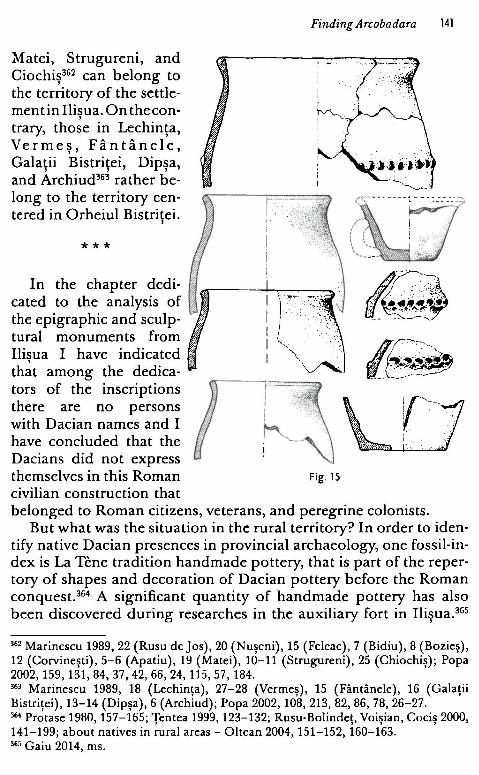
Matei, Strugureni, and Ciochiş362 can belong to the territory of the settlement in Ilisua. On thecon-
' trary, those in Lechinţa, Vermes, Fântânele,
' Galatii Bistritei, Dipsa, ' ' ' and Archiud363 rather be-
long to the territory centered in Orheiul Bistritei.
'
***
In the chapter dedicated to the analysis of the epigraphic and sculptural monuments from Ilisua I have indicated
' that among the dedica-tors of the inscriptions there are no persons with Dacian names and I have concluded that the Dacians did not express themselves in this Roman civilian construction that
Finding Arcobadara 141
1 f
i
l, '\~
Fig. 15
<'·~ --- ----:- --- ---- -...
belonged to Roman citizens, veterans, and peregrine colonists. But what was the situation in the rural territory? In order to iden
tify native Dacian presences in provincial archaeology, one fossil-index is La Tene tradition handmade pottery, that is part of the repertory of shapes and decoration of Dacian pottery before the Roman conquest. 364 A significant quantity of handmade pottery has also been discovered during researches in the auxiliary fort in Ilişua. 365
362 Marinescu 1989, 22 (Rusu de Jos), 20 (Nuşeni), 15 (Feleac), 7 (Bidiu), 8 (Bozieş), 12 (Corvineşti), 5-6 (Apatiu), 19 (Matei), 10-11 (Strugureni), 25 (Chiochiş); Popa 2002, 159, 131,84,37,42,66,24, 115,57, 184. 363 Marinescu 1989, 18 (Lechinţa), 27-28 (Vermeş), 15 (Fântânele), 16 (Galaţii Bistriţei), 13-14 (Dipşa), 6 (Archiud); Popa 2002, 108, 213, 82, 86, 78, 26-27. 364 Protase 1980, 157-165; Ţentea 1999, 123-132; Rusu-Bolindeţ, Voişian, Cociş 2000, 141-199; about natives in rural areas - Oltean 2004, 151-152, 160-163. 365 Gaiu 2014, ms.
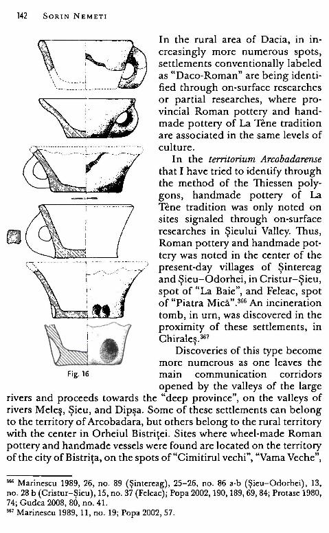
142 SORIN NEMET!
~' \\\"··-------t
~------ - ••• L - --- - • --· -·
In the rural area of Dacia, in increasingly more numerous spots, settlements conventionally labeled as "Daco-Roman" are being identified through on-surface researches or partial researches, where provincial Roman pottery and handmade pottery of La Tene tradition are associated in the same levels of cultu re.
In the territorium Arcobadarense that I have tried to identify through the method of the Thiessen polygons, handmade pottery of La Tene tradition was only noted on sites signaled through on-surface rcsearches in Şieului Valley. Thus, Roman pottery and handmade pot-
-.....o~=""'----_ _,__ ____ _ _ __ tery was noted in the center of the '::::-:·- --- - ·· ----"Ţ" -~~-:. _ ·' present-day villages of Şintereag
I and Sieu-Odorhei, in Cristur-Sieu, spot 'of "La Baie", and Feleac, 'spot of "Piatra Mică". 366 An incineration tomb, in urn, was discovered in the proximity of these settlements, in Chirales. 367 ,
Discoveries of this type become more numerous as one leaves the
Fig. 16 main communication corridors opened by the valleys of the large
rivers and proceeds towards the "deep province'', on the valleys of rivers Meleş, Şieu, and Dipşa. Some of these settlements can belong to the territory of Arcobadara, but others belong to the rural territory with the center in Orheiul Bistritei. Sites where wheel-made Roman , pottery and handmade vessels were found are located on the territory of the city of Bistriţa, on the spots of "Cimitirul vechi'', "Vama Veche",
366 Marinescu 1989, 26, no. 89 (Şintereag), 25-26, no. 86 a-b (Şieu-Odorhei), 13, no. 28 b (Cristur-Şieu), 15, no. 37 (Feleac); Popa 2002, 190, 189, 69, 84; Protase 1980, 74; Gudea 2008, 80, no. 41. 367 Marinescu 1989, 11, no. 19; Popa 2002, 57.
Finding Arcobadara 143
and "La Han", 368 and also on the territory of the village of Ghinda, on the spot of "Podul Paielor".369 A nucleus of such sites is also encountered in the valley of Şieu, around the secondary center in Domneşti: in Monariu, Herina "Crucile Drumului", and even in the territory of the village of Domneşti, on the spot of "Tabla Pietroasă"370 • An incineration tomb, in urn, was discovered in the vicinity, in Mărişelu, on the spot of "Dealul Calului". 371 Settlements that can he dated to the Roman Era where handmade pottery is also associated become more numerous in the isolated area in the border parts of these territoria: two settlements were identified on the territory of the village of Matei, one in Fântânele, on the spot of "Rât", 372 and one in Vermeş. 373
Severa} incineration tombs in urns were destroyed in this area as well, on the territory of the village of Vermeş, during the construction of the annexes of the former collective farm. 374 Similar discoveries (handmade and wheelmade Roman pottery on the surface) were made in Bungard, the spot of "În vii", Sânmihaiu de Câmpie, the spot of "Podişele'', and Archiud, the spot of "Bidişcut". 375 The settlement in Stupini, the spot of "Fânaţele Archiudului", is located in the same area, and it has been systematically researched. The rectangular huts and the storage pits there have revealed pottery and artefacts common during the Roman Era associated with handmade pottery of La Tene tradition. 376
Through this brief repertory of "Daco-Roman" settlements and of discoveries of incineration tombs in urns I have tried to sketch the division manner of the territory in the rural area in the north-eastern part of Dacia Porolissensis, in the region of these rural communes that are epigraphically attested as territoria and regiones. Auxiliaroici were horn in the close proximity of the forts and colonists and
360 Marinescu 1989, 7-8; Popa 2002, 38. 369 Marinescu 1989, 16, pi. XVIl/1-4; Popa 2002, 90. 370 Marinescu 1989, 19, no. 54, pi. XXl/4-5 (Monariu), 16-17, no. 44b, pi. XVIl/6-10, XVIII/1-7, 8-10, XIX/1-3 (Herina), 14, no. 34c (Domneşti); Popa 2002, 128, 97-98, 79. 371 Marinescu 1989, 19, no. 52; Popa 2002, 117. 372 Marinescu 1989, 19, no. 51 a·b (Matei), 15, no. 39 b (Fântânele); Popa 2002, 115, 82; Protase 1980, 54 (Matei). 373 Gaiu 2005, 121-137. 374 Marinescu 1989, 27-28, no. 96; Popa 2002, 213; Gudea 2008, 80, no. 43. m Marinescu 1989, 10, no. 15 (Bungard), 24, no. 80 a (Sânmihaiu de Câmpie), 6, no. 3 (Archiud); Popa 2002, 47, 167, 26-27; Protase 1980, 42-43, 71; Gudea 2008, 74, no. 5. 376 Gaiu 1999, 84-90; Gaiu 2004, 77-93; Gudea 2008, 79, no. 37.
144 SORIN NEMET!
veterans settled there. The forts and the civilian settlements are located along the main roads that followed the corridors of the large rivers. Habitation branches in a capillary fashion towards the inner parts of the rural areas, along the valleys of the tributaries and creeks, and in these isolated regions one can encounter archaeological indications of the native presence, communities of Dacians caught in the inertia of traditional life, village communities living in huts, preserving their provisions in storage pits, but using Roman pottery, jewelry items, and coins that they obtained in the centers of these "service areas", in Ilişua (Arcobadara) or Orheiul Bistriţei.
CONCLUSIONS
Historical knowledge advances unpredictably, in a non-linear way, according to sinuous and capricious rhythms. New important discoveries are separated by decades, and the moments when the discoveries are made are dictated by hazard. The very moment of a discovery and its publication in the specialized historical literature does not always determine the raise of new conclusions, of new interpretative breakthroughs in the veil of traditional knowledge, that is well seated and even sedimented thanks to the work of generations of scholars. The importance of such discoveries sometimes remains unobserved, either because of insufficient and erroneous interpretations, or just because the lack of other sources that are essential for the picturing of ancient reality, for arranging the complex puzzle of modern knowledge regarding classical antiquity. Even after the correct setting of new information the scientific community usually needs a time of reflection and a time of reaction. Similar data will arise from the dusty boxes, from museums deposits and will be arranged in the new dossier. It is, simply, about the difference between inventio and inovatio, the assimilation of the invention.
Identifying Arcobadara with the small town that arose near the auxiliary camp from Ilişua (Bistriţa-Năsăud County) has enabled me to re-draw Ptolemy's map of Dacia. Consequently, all the toponyms previously located by modern scholarship in today's Moldavia are, in fact, small Roman settlements from eastern Transylvania, on the border of the province of Dacia. The mention of the word territorium associated with toponyms designating an auxiliary vicus or an autonomous settlement horn near a camp has opened a new dossier: that of the administrative organization of the rural area of the province. The context of this rural commune is offered by the so-called "territory inscriptions", quite common in the Danubian area. The purpose of this book was to explain, with the sources available at the present,
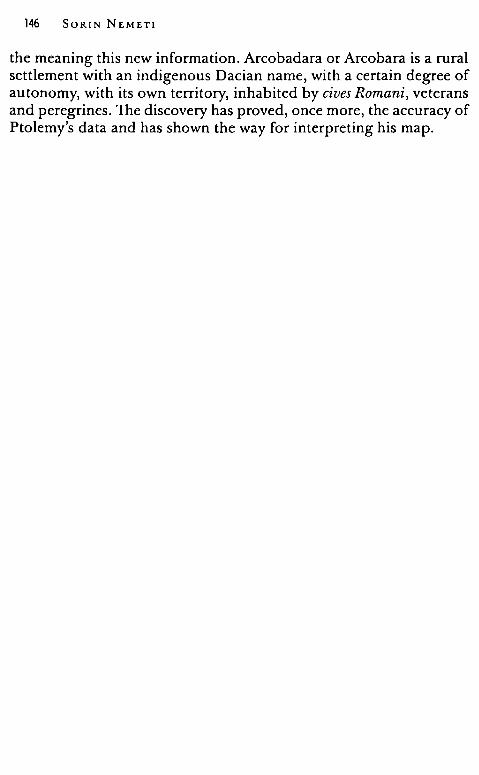
146 SORIN NEMET!
the meaning this new information. Arcobadara or Arcobara is a rural settlement with an indigenous Dacian name, with a certain degree of autonomy, with its own territory, inhabited by cives Romani, veterans and peregrines. The discovery has proved, once more, the accuracy of Ptolemy's data and has shown the way for interpreting his map.
BIBLIOGRAPHY
Alfoldi 1940 - A. Alfoldi, Daci e romani in Transilvania, Budapest. Alicu, Paki 1995 - D. Alicu, Adela Paki, Town Planning and Population in
Ulpia Traiana Sarmizegetusa, BAR Int. S. 55, Oxford. Aparaschivei 2010 - D. Aparaschivei, Oraşele romane de la Dunărea
inferioară (secolele I - III p. Chr.), laşi. Ardevan 1998 - R. Ardevan, Viaţa municipală în Dacia romană, Timişoara. Ardevan 1998a - R. Ardevan, Civitas et vicus dans la Dacie romaine, in V.
H. Baumann (ed.) La politique edilitaire dans Ies provinces de l'Empire romain, II eme - IV eme siecle apres J. C., Actes du lile Colloque Roumano-Suisse. La vie rurale dans Ies provinces romaines: viei et villae (Tulcea, 8-15 octobre 1995), Tulcea, 1998, 45-55.
Ardevan 2004 - R. Ardevan, Die Illyrier von Alburnus Maior: Herkunft und Status, in H. Heftner, K. Tomaschitz (eds.), Adfontes ! Festchrift fiir Gerhardt Dobesch zum fiinfundzechzigsten Geburtstag am 15. September 2004, Wien, 593-598.
Ardevan, Crăciun 2003 - R. Ardevan, Cristina Crăciun, Le collegi,um Sardiatarum a Alburnus Maior, in C. Alonso de! Real et alii (eds.), Vrbs Aeterna. Actas y colaboraciones de! coloquio internacional Roma entre la literatura y la historia. Homenaje a la Professora Carmen Castillo, Pamplona, 2003, 227-240.
Ardevan, Cocis, Cosma, Ursutiu 2007 - R. Ardevan, S. Cocis, C. Cosma, A. Ursuţiu, Ta'ujours sur le "iucus" d'Alburnus Maior (Da~ie), in Acta XII Congressus Internationalis Epigraphiae Graecae et Latinae, Barcelona, 2007, 67-72.
Ardevan, Zăgreanu 2012 - R. Ardevan, R. Zăgreanu, Eine rămische Inschrift vonjebucu (Sălaj kreis), AB, 20, 73-83.
Ardevan, Wollmann 2006 - R. Ardevan, V. Wollmann, Eine griechische Inschrift aus Ilişua (Dakien), in L. Mihăilescu-Bârliba, O. Bounegru (eds.), Studia Historiae et Religi,onis Daco-Romanae, Bucarest, 259-267.
Ardevan, Wollmann 2007 - R. Ardevan, V. Wollmann, Câteva inscripţii descoperite la Ilişua, RB, 21/1, 241-253.
Arnaud 1993 - P. Arnaud, L'Itineraire d'Antonin: un temoin de la litterature itineraire du Bas-Empire, Geographia Antiqua, 2, 33-49.
148 SORIN NEMET!
Arnaud 1998 - P. Arnaud, Les toponyms en -iana / -ianis des itineraires: des villes de Ptolemee aux grand domaines?, dans P. Arnaud, P. Counillon (eds.), Geographica historica, Bordeaux - Nice, 201-224.
Arnaud 2007-2008 - P. Arnaud, Texte et carte de Marcus Agrippa: historiographie et donnees textuelles, Geographia Antiqua, 27-28, 73-126.
Aujac 1992 - Germaine Aujac, L'imagine delia terra nella scienza greca, in A.aV.v., Optima hereditas. Sapienza giuridica romana e conoscenza dell'ecumene, Milano, 145-202.
Aujac 1993 - Germaine Aujac, Claude Ptolemee astronome, astrologue, geographe: connaissance et representation du monde habite, Paris.
Austin, Rankov 1995 - N. J. E. Austin, N. B. Rankov, Exploratio. Military and political intelligence in the Roman World from the Second Punic War to the battle of Adrianopole, London - New York.
Avram 1984 - Al. Avram, Observaţii cu privire la autonomiile rurale din Dobrogea romană (secolele I - III e. n.), SCIVA, 35, 2, 158-169.
Avram 2007 - Al. Avram, Les cives Romani consistentes de Scythie Mineure: Ctat de la question, în Rita Compatangelo-Soussignan, Chr.-G. Schwentzel (eds.), Etrangers dans la cite romaine. Actes du Colloque de Valenciennes (14-15 octobre 2005): Habiter une autre patrie: des incolae de la Republique aux peuples federes du Bas-Empire, Rennes, 91-109.
Babeş 2000 - M. Babeş, Devictis Dacis. La conquete trajane vue par l'archeologie, in A. Avram, M. Babeş (eds.), Civilisation grecque et cultures antiques peripheriques (Hommage a Petre Alexandrescu a son 70e anniversaire), Bucarest, 323-338.
Bagrow 1945 - L. Bagrow, The origin of Ptolemy's Geographia, Geografiska Annaler, 27, 318-387.
Balia 1974-1975 - L. Balia, L'importance de la colonisations en Dacie, ACD, 21, 139-143.
Balia 2000 - L. Balia, Contributions a l'histoire de l'extraction du sel et de fer dans Ies mines de la Dacie romaine, in L. Balia, Studia dacica. Collected Papers (ed. By Edit Szabo), Debrecen, 135-143.
Baumann 1984 - V. H. Baumann, Piese sculpturale şi epigrafice în colecţia Muzeului de istorie şi arheologie Tulcea, Peuce, 9, 207-233.
Bărbulescu 1985 - M. Bărbulescu, Cultele greco-romane în provincia Dacia, PhD diss. Cluj-Napoca.
Bărbulescu 1995 - M. Bărbulescu, La colonisation a Potaissa et ses effets sur le developpement de la viile, in Regula Frei-Stolba, H. H. Herzig (eds.), La politique edilitaire dans Ies provinces de l'Empire romain, Ileme -Veme siecle apres J.-C. Actes du 2e colloque roumano-suisse, Berne, 12-19 septembre 1993, Berne, 119-130.
Bărbulescu 1998 - M. Bărbulescu, De la începuturile civilizaţiei la sinteza românească, in M. Bărbulescu, D. Deletant, K. Hitchins, Ş. Papacostea, P. Teodor, Istoria României, Bucureşti, 7-139.
Finding Arcobadara 149
Bărbulescu 2003 - M. Bărbulescu, Signum originis, in M. Bărbulescu (ed.), Funeraria Dacoromana. Arheologia funerară a Daciei romane, Cluj· Napoca, 164-169.
Bărbulescu, Cătinaş 1992 - M. Bărbulescu, Ana Cătinaş, Inscripţii dintr-un templu de la Potaissa, EN, 2, 111-124.
Bărbulescu et alii 2005 - M. Bărbulescu (ed.), Atlas - dicţionar al Daciei romane, Cluj Napoca.
Benea 1993 - Doina Benea, Vicus 1îbiscensis. Contribuţii la istoria viei-lor militari în Dacia, SCIVA, 44, 3, 267-292.
Benea 2000 - Doina Benea, Die lnnere Organisierung cler Militărvici aus Dakien (I. Die Wohnungen), in H. Ciugudean, V. Moga (eds.), Army and Urban Development in the Danubian Provinces of the Roman Empire, Alba Iulia, 31-61.
Benea 2010 - Doina Benea, Organizarea păşunilor din Dacia romană şi importanţa lor pentru economia provinciei, BHAUT, 12, 45-74.
Berard 1992 - F. Berard, Territorium legi.onis: camps militaries et agglomera· tions civiles aux premiers siecles de l'empire, Cahiers Glotz, 3, 75-105.
Berard 1993 - F. Berard, Vikani, kanabenses, consistentes: remarques sur l'organisation des agglomerations militaires romaines, in A. Cal bi, Angela Donati, Gabriella Porna (eds.), L'epigrafia del villaggio, Bologna, 61-90.
Berciu 1931 - D. Berciu, Burii (Buridava - Buridavenses - Burebista), Memoriul III. Muzeul Regional al Olteniei Craiova, Craiova, 1-28.
Beu - Dachin 2003 - Eugenia Ileu - Dachin, Două inscripţii votive inedite de la Alburnus Maior, EN, 13, 189-192.
Beu-Dachin 2011 - Eugenia Beu-Dachin, Commanipulares / commanipuli in Roman Dacia and the fragmentary preserved forms. Terminology, Caiete ARA. Arhitectură. Restaurare. Arheologie, Bucureşti, 2, 79-85.
Bird 1993 - The Breviarium ab Urbe condita of Eutropius, translated with an Introduction and Commentary by H. W. Bird, Liverpool.
Bogdan Cătăniciu 1987-1988 - Ioana Bogdan Cătăniciu, Ptolemeu şi pro· vincia Dacia, ActaMN, 24-25, 145-162.
Bogdan Cătăniciu 1991 - Ioana Bogdan Cătăniciu, Apropos de civitates en Dacie, EN, 1, 59-67.
Bogdan Cătăniciu 1999 - Ioana Bogdan Cătăniciu, Ptolemee et la province de Dacie, Dacia N. S., 34, 223-231.
Bogdan Cătăniciu 2002 - Ioana Bogdan Cătăniciu, Geographie antique (Ptolemee, Tabula Peutingeriana, Ravennatus) et strategie imperiale en Dade, dans Ph. Freeman,]. Bennett, Zb. T. Fiema, B. Hoffmann ( eds. ), Limes XVIII. Proceedings of the XVIIIth International Congress of Roman Frontier Studies held in Amman, Jordan (September 2000), I, BAR International Series 1084 (I), 719-736.
Bogdan Cătăniciu 2006 - Ioana Bogdan Cătăniciu, Where is the research on the history of the Dacia province headed?, in C. Gaiu, C. Găzdac
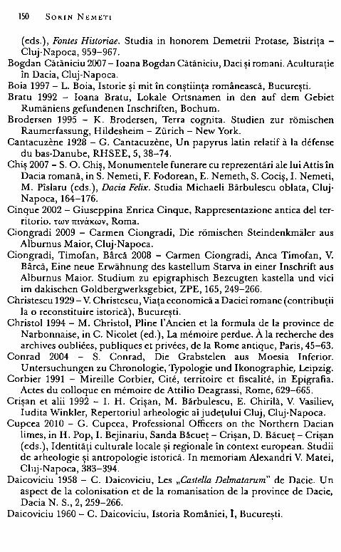
150 SORIN NEMETI
(eds.), Fontes Historiae. Studia in honorem Demetrii Protase, Bistriţa -Cluj-Napoca, 959-967.
Bogdan Cătăniciu 2007 - Ioana Bogdan Cătăniciu, Daci şi romani. Aculturaţie în Dacia, Cluj-Napoca.
Boia 1997 - L. Boia, Istorie şi mit în conştiinţa românească, Bucureşti. Bratu 1992 - Ioana Bratu, Lokale Ortsnamen in den auf dem Gebiet
Rumăniens gefundenen Inschriften, Bochum. Brodersen 1995 - K. Brodersen, Terra cognita. Studien zur rămischen
Raumerfassung, Hildesheim - Ziirich - New York. Cantacuzene 1928 - G. Cantacuzene, Un papyrus latin relatif a la defense
du bas-Danube, RHSEE, 5, 38-74. Chiş 2007 - S. O. Chiş, Monumentele funerare cu reprezentări ale lui Attis în
Dacia romană, in S. Nemeti, F. Fodorean, E. Nemeth, S. Cocis, I. Nemeti, M. Pîslaru (eds.), Dacia Felix. Studia Michaeli Bărbulescu ~biata, ClujNapoca, 164-176.
Cinque 2002 - Giuseppina Enrica Cinque, Rappresentazione antica del territorio. t'WV mvil'.xwv, Roma.
Ciongradi 2009 - Carmen Ciongradi, Die rămischen Steindenkmăler aus Alburnus Maior, Cluj-Napoca.
Ciongradi, Timofan, Bârcă 2008 - Carmen Ciongradi, Anca Timofan, V. Bârcă, Eine neue Erwăhnung des kastellum Starva in einer Inschrift aus Alburnus Maior. Studium zu epigraphisch Bezeugten kastella und viei im dakischen Goldbergwerksgebiet, ZPE, 165, 249-266.
Christescu 1929 - V. Christescu, Viaţa economică a Daciei romane (contribuţii la o reconstituire istorică), Bucureşti.
Christol 1994 - M. Christol, Pline l'Ancien et la formula de la province de Narbonnaise, inc. Nicolet (ed.), La memoire perdue. A la recherche des archives oubliees, publiques et privees, de la Rome antique, Paris, 45-63.
Conrad 2004 - S. Conrad, Die Grabstelen aus Moesia Inferior. U ntersuchungen zu Chronologie, Typologie und Ikonographie, Leipzig.
Corbier 1991 - Mireille Corbier, Cite, territoire et fiscalite, in Epigrafia. Actes du colloque en memoire de Attilio Deagrassi, Rome, 629-665.
Crişan et alii 1992 - I. H. Crişan, M. Bărbulescu, E. Chirilă, V. Vasiliev, ludita Winkler, Repertoriul arheologic ai judeţului Cluj, Cluj-Napoca.
Cupcea 2010 - G. Cupcea, Professional Officers on the Northern Dacian limes, in H. Pop, I. Bejinariu, Sanda Băcueţ - Crişan, D. Băcueţ - Crişan ( eds. ), Identităţi culturale locale şi regionale în context european. Studii de arheologie şi antropologie istorică. In memoriam Alexandri V. Matei, Cluj-Napoca, 383-394.
Daicoviciu 1958 - C. Daicoviciu, Les „Castella Delmatarum" de Dacie. Un aspect de la colonisation et de la romanisation de la province de Dacie, Dacia N. S., 2, 259-266.
Daicoviciu 1960 - C. Daicoviciu, Istoria României, I, Bucureşti.
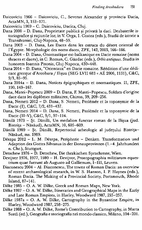
Finding Arcobadara 151
Daicoviciu 1966 - Daicoviciu, C., Severus Alexander şi provincia Dacia, ActaMN, 3, 153-171.
Daicoviciu 1969 - C. Daicoviciu, Dacica, Cluj. Dana 2000 - D. Dana, Proprietate publică şi privată la daci. Dezbaterile is
toriografice şi raţiunile lor, in V. Orga, I. Costea ( eds. ), Studii de istorie a Transilvaniei, Cluj-Napoca, 48-59.
Dana 2003 - D. Dana, Les Daces dans Ies ostraca du desert oriental de l'Egypte. Morphologie des noms daces, ZPE, 142, 2003, 166-186.
Dana 2004 - D. Dana, Onomastique est-balkanique en Dacie romaine (noms thraces et daces ), in C. Roman, C. Găzdac ( eds. ), Orbis antiquus. Studia in honorem Ioannis Pisonis, Cluj-Napoca, 430-448.
Dana 2014 - D. Dana, "Orientaux" en Dacie romaine. Reedition d'une dedicace grecque d'Arcobara / Ilişua (SEG LVII 683 = AE 2006, 1131 ), C&C, 9/1, 85-95.
Dana 2014a - D. Dana, Notices epigraphiques et onomastiques. II, ZPE, 190, 149-167.
Dana, Matei-Popescu 2009 - D. Dana, F. Matei-Popescu, Soldats d'origine dace dans Ies diplâmes militaires, Chiron, 39, 209-256.
Dana, Nemeti 2012 - D. Dana, S. Nemeti, Ptolemee et la toponymie de la Dacie (I), C&C, 7/2, 431-437.
Dana, Nemeti 2014 - D. Dana, S. Nemeti, Ptolemee et la toponymie de la Dacie (II-V), C&C, 9/1, 97-114.
Dănilă 1973 - Şt. Dănilă, Un medalion funerar roman de la Ilişua Uud. Bistriţa - Năsăud), ActaMN, 10, 605-609.
Dănilă 1989 - Şt. Dănilă, Repertoriul arheologic al judeţului Bistriţa
Năsăud, ms. 1989. Deszpa 2012 - L. M. Deszpa, Peripherie - Denken. Transformation und
Adaption des Gottes Silvanus in cler Donauprovinzen (1.-4. Jahrhundert n. Chr.), Stuttgart.
Detschew 1976 - D. Detschew, Die thrakischen Sprachreste, Wien. Devijver 1976, 1977, 1980 - H. Devijver, Prosopographia militiarum eques
trium quae fuerunt ab Augusto ad Gallienum, I-III, Leuven. Diaconescu 2004 - Al. Diaconescu, The towns of Roman Dacia: an overview
of recent archaeological research, in W. S. Hanson, I. P. Haynes ( eds. ), Roman Dacia. The Making of a Provincial Society, Portsmouth, Rhode Island, 87-141.
Dilke 1985 - O. A. W. Dilke, Greek and Roman Maps, New York. Dilke 1987 - O. A. W. Dilke, Itineraries and Geographical Maps in the Early
and Late Roman Empires, in Harley, Woodward 1987, 235-257. Dilke 1987a - O. A. W. Dilke, Cartography in the Byzantine Empire, in
Harley, Woodward 1987, 258-275. Dilke 1988 - O. A. W. Dilke, Rome's Contribution to Cartography, in Marta
Sordi (ed.), Geografia e storiografia ne! mondo classico, Milano, 104-201.
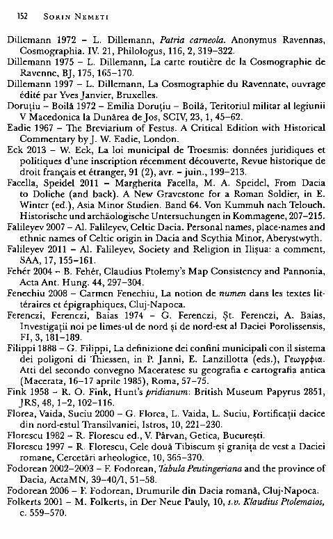
152 SORIN NEMET!
Dillemann 1972 - L. Dillemann, Patria cameola. Anonymus Ravennas, Cosmographia. IV. 21, Philologus, 116, 2, 319-322.
Dillemann 1975 - L. Dillemann, La carte routiere de la Cosmographie de Ravenne, BJ, 175, 165-170.
Dillemann 1997 - L. Dillemann, La Cosmographie du Ravennate, ouvrage edite par Yves Janvier, Bruxelles.
Doruţiu - Boilă 1972 - Emilia Doruţiu - Boilă, Teritoriul militar al legiunii V Macedonica la Dunărea de Jos, SCIV, 23, 1, 45-62.
Eadie 1967 - The Breviarium of Festus. A Criticai Edition with Historical Commentary by J. W. Eadie, London.
Eck 2013 - W. Eck, La loi municipal de Troesmis: donnees juridiques et politiques d'une inscription recemment decouverte, Revue historique de droit frarn;ais et etranger, 91 (2), avr. - juin., 199-213.
Facella, Speidel 2011 - Margherita Facella, M. A. Speidel, From Dacia to Doliche (and back). A New Gravestone for a Roman Soldier, in E. Wintcr (ed.), Asia Minor Studien. Band 64. Von Kummuh nach Telouch. Historische und archăologische Untersuchungen in Kommagene, 207-215.
Falileyev 2007 -Al. Falileyev, Celtic Dacia. Personal names, place·names and ethnic names of Celtic origin in Dacia and Scythia Minor, Aberystwyth.
Falileyev 2011 - Al. Falileyev, Society and Religion in Ilişua: a comment, SAA, 17, 155-161.
Feher 2004 - B. Feher, Claudius Ptolemy's Map Consistency and Pannonia, Acta Ant. Hung. 44, 297-304.
Fenechiu 2008 - Carmen Fenechiu, La notion de numen dans les textes lit· teraires et epigraphiques, Cluj-Napoca.
Ferenczi, Ferenczi, Baias 1974 - G. Ferenczi, Şt. Ferenczi, A. Baias, Investigaţii noi pe limes-ul de nord şi de nord-est al Daciei Porolissensis, FI, 3, 181-189.
Filippi 1888 - G. Filippi, La definizione <lei confini municipali con il sistema <lei poligoni di Thiessen, in P. Janni, E. Lanzillotta (eds.), rEwypqncr. Atti del seconda convegno Maceratese su geografia e cartografia antica (Macerata, 16-17 aprile 1985), Roma, 57-75.
Fink 1958 - R. O. Fink, Hunt's pridianum: British Museum Papyrus 2851, JRS, 48, 1-2, 102-116.
Florea, Vaida, Suciu 2000 - G. Florea, L. Vaida, L. Suciu, Fortificaţii dacice din nord-estul Transilvaniei, Istros, 10, 221-230.
Florescu 1982 - R. Florescu cd., V. Pârvan, Getica, Bucureşti. Florescu 1997 - R. Florescu, Cele două Tibiscum şi graniţa de vest a Daciei
romane, Cercetări arheologice, 10, 365-370. Fodorean 2002-2003 - F. Fodorean, Tabula Peutingeriana and the province of
Dacia, ActaMN, 39-40/1, 51-58. Fodorean 2006 - F. Fodorean, Drumurile din Dacia romană, Cluj-Napoca. Folkerts 2001 - M. Folkerts, in Der Neue Pauly, 10, s.v. Klaudius Ptolemaios,
c. 559-570.
Finding Arcobadara 153
Forcellini 1875 - Forcellini, Totius Latinitatis Lexicon, 6. Gaiu 1997 - C. Gaiu, in C. Pop (ed.), Miles romanus in provincia Dacia,
Cluj-Napoca. Gaiu 1999 - C. Gaiu, Aşezarea daco-romană de la Stupini Uud. Bistriţa
Năsăud), in D. Protase, D. Brudaşcu (eds.), Napoca. 1880 de ani de la începutul vieţii urbane, Cluj-Napoca, 84-90.
Gaiu 2003 - C. Gaiu, Reliefuri romane din termele de la Ilişua, in C. Firea, C. Opreanu (eds.), Artă, religie, cultură. Studii în onoarea lui Marius Porumb, Cluj-Napoca, 15-19.
Gaiu 2004 - C. Gaiu, Provincia profundă - imaginea unui sat daco-roman în lumina arheologiei, in C. Gaiu, H. Bodale (eds.), Centru şi periferie. Lucrările colocviului naţional, Bistriţa, 23-25 aprilie 2004, Cluj-Napoca, 77-93.
Gaiu 2005 - C. Gaiu, O aşezare daco-romană la Vermeş,jud. Bistriţa-Năsăud, RB, 19, 121-137.
Gaiu 2014 - C. Gaiu, Ceramica lucrată cu mâna din castrul de la Arcobadara, RB, 28 (under print).
Gaiu, Zăgreanu 2006 - C. Gaiu, R. Zăgreanu, Noi monumente sculpturale descoperite la Ilişua, RB, 20, 165-176.
Gaiu, Zăgreanu 2011 - C. Gaiu, R. Zăgreanu, Inscripţii şi piese sculpturale din castrul roman de la llişua, Cluj.
Gautier Dalche 1994-1995 - P. Gautier Dalche, Notes sur la "carte de Theodose II" et sur la "mappemonde de Theodulf d 'Orleans'', Geographia Antiqua, 3-4, 91-108.
Găzdac, Gaiu, Marchis 2011 - C. Găzdac, C. Gaiu, Elena Marchis, Arcobadara (Ilişua), Cluj (Coi~s from Roman Sites and Collections of Roman Coins from Romania, 6).
Gooss 1877 - C. Gooss, Corpus Inscriptionum Latinarum. III, AEM, 1, 30-35. Gostar 1956 - N. Gostar, Ramura nordică a dacilor - costobocii, Buletinul
Universităţilor V. Babeş şi Bolyai Cluj. Seria ştiinţelor sociale, 1, 1-2, 183-199.
Gostar 1958 - N. Gostar, Singidunum şi Singidava, SCIV, 9, 2, p. 413-419. Gostar 1963 - N. Gostar, Milites - decuriones coloniae. Contribuţie la isto
ria decurionatului în Dacia, Studii şi cercetări ştiinţifice. Istorie, 16, 2, 259-266.
Gostar 1965 - N. Gostar, Cetăţile dacice din Moldova şi cucerirea romană la nordul Dunării de Jos, Apulum, 5, 137-149.
Gostar 1969 - N. Gostar, Ulpianum (Ptolemeu, Geogr. III. 8. 4), Analele U niversitătii Iasi, 15, 2, 171-176.
Gostar 1974 ~ N. Gostar, Toponimia antică a Moldovei, Studii şi cercetări stiintifice. Seria istorie filologie, Bacău, 37-42.
Go~tar '1980 - N. Gostar, La population de la Dacie avant la conquete romaine (Ptolemee, Geogr. III. 8. 3), in R. Vulpe (ed.), Actes du Ile
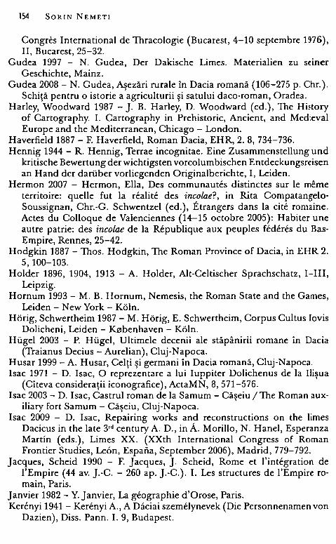
154 SORIN NEMETI
Congres lnternational de Thracologie (Bucarest, 4-10 septembre 1976), II, Bucarest, 25-32.
Gudea 1997 - N. Gudea, Der Dakische Limes. Materialien zu seiner Geschichte, Mainz.
Gudea 2008 - N. Gudea, Aşezări rurale în Dacia romană (106-275 p. Chr. ). Schiţă pentru o istorie a agriculturii şi satului daco-roman, Oradea.
Harley, Woodward 1987 - J. B. Harley, D. Woodward (ed.), The Hi~tory of Cartography. I. Cartography in Prehistoric, Ancient, and Med:eval Europe and the Mediterranean, Chicago - London.
Haverfield 1887 - F. Haverfield, Roman Dacia, EHR, 2. 8, 734-736. Hennig 1944 - R. Hennig, Terrae incognitae. Eine Zusammenstellung und
kritische Bewertung cler wichtigsten vorcolumbischen Entdeckungsreisen an Hand cler dariiber vorliegenden Originalberichte, I, Leiden.
Hermon 2007 - Hermon, Ella, Des communautes distinctes sur le meme territoire: quelle fut la realite des incolae?, in Rita CompatangeloSoussignan, Chr.-G. Schwentzel (ed.), Etrangers dans la cite romaine. Actes du Colloque de Valenciennes (14-15 octobre 2005): Habiter une autre patrie: des incolae de la Republique aux peuples federes du BasEmpire, Rennes, 25-42.
Hodgkin 1887 - Thos. Hodgkin, The Roman Province of Dacia, in EHR 2. 5, 100-103.
Holder 1896, 1904, 1913 - A. Holder, Alt-Celtischer Sprachschatz, 1-111, Leipzig.
Hornum 1993 - M. B. Hornum, Nemesis, the Roman State and the Games, Leiden - New York - Kăln.
Hărig, Schwertheim 1987 - M. Hărig, E. Schwertheim, Corpus Cultus Jovis Dolicheni, Leiden - K0benhaven - Kăln.
Hiigel 2003 - P. Hiigel, Ultimele decenii ale stăpânirii romane în Dacia (Traianus Decius - Aurelian), Cluj-Napoca.
Husar 1999 - A. Husar, Celţi şi germani în Dacia romană, Cluj-Napoca. lsac 1971 - D. lsac, O reprezentare a lui luppiter Dolichenus de la Ilişua
(Cîteva consideraţii iconografice), ActaMN, 8, 571-576. I sac 2003 - D. I sac, Castrul roman de la Samum - Căşeiu / The Roman aux
iliary fort Samum - Căşeiu, Cluj-Napoca. lsac 2009 - D. lsac, Repairing works and reconstructions on the limes
Dacicus in the late 3rd century A. D., in A. Morillo, N. Hanel, Esperanza Martin (eds.), Limes XX. (XXth lnternational Congress of Roman Frontier Studies, Leon, Espafia, September 2006), Madrid, 779-792.
Jacques, Scheid 1990 - F. Jacques, J. Scheid, Rome et l'integration de l'Empire (44 av. J.-C. - 260 ap. J.-C.). I. Les structures de l'Empire romain, Paris.
Janvier 1982 - Y. Janvier, La geographie d'Orose, Paris. Kerfoyi 1941 - Kerfoyi A., A Daciai szemelynevek (Die Personnenamen von
Dazien), Diss. Pann. I. 9, Budapest.
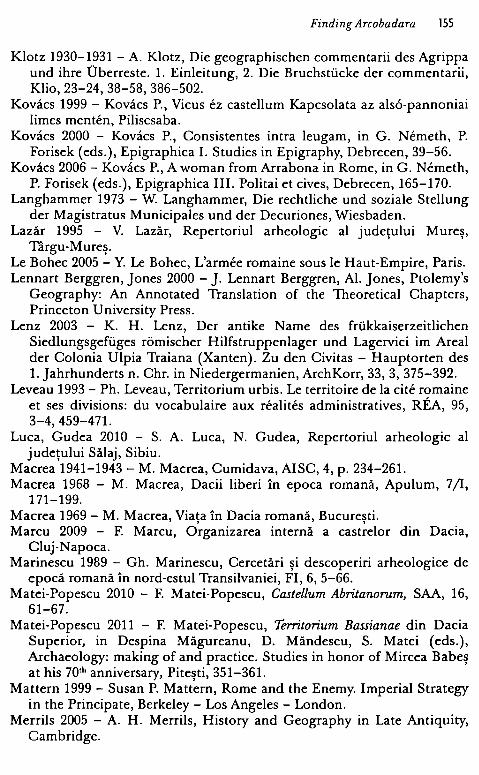
Finding Arcobadara 155
Klotz 1930-1931 - A. Klotz, Die geographischen commentarii des Agrippa und ihre Dberreste. l. Einleitung, 2. Die Bruchstiicke cler commentarii, Klio, 23-24, 38-58, 386-502.
Kovacs 1999 - Kovacs P., Vicus ez castellum Kapcsolata az als6-pannoniai limes menten, Piliscsaba.
Kovacs 2000 - Kovacs P., Consistentes intra leugam, in G. Nemeth, P. Forisek ( eds. ), Epigraphica I. Studies in Epigraphy, Debrecen, 39-56.
Kovacs 2006 - Kovacs P., A woman from Arrabona in Rome, in G. Nemeth, P. Forisek ( eds. ), Epigraphica III. Politai et cives, Debrecen, 165-170.
Langhammer 1973 - W. Langhammer, Die rechtliche und soziale Stellung cler Magistratus Municipales und cler Decuriones, Wiesbaden.
Lazăr 1995 - V. Lazăr, Repertoriul arheologic al judeţului Mureş,
Târgu-Mureş.
Le Bohec 2005 - Y. Le Bohec, L'armee romaine sous le Haut-Empire, Paris. Lennart Berggren, Jones 2000 - J. Lennart Berggren, Al. Jones, Ptolemy's
Geography: An Annotated Translation of the Theoretical Chapters, Princeton U niversity Press.
Lenz 2003 - K. H. Lenz, Der antike Name des friikkaiserzeitlichen Siedlungsgefiiges romischer Hilfstruppenlager und Lagervici im Areal cler Colonia Ulpia Traiana (Xanten). Zu den Civitas - Hauptorten des l. Jahrhunderts n. Chr. in Niedergermanien, ArchKorr, 33, 3, 375-392.
Leveau 1993 - Ph. Leveau, Territorium urbis. Le territoire de la cite romaine et ses divisions: du vocabulaire aux realites administratives, REA, 95, 3-4,459-471.
Luca, Gudea 2010 - S. A. Luca, N. Gudea, Repertoriul arheologic al judeţului Sălaj, Sibiu.
Macrea 1941-1943 - M. Macrea, Cumidava, AISC, 4, p. 234-261. Macrea 1968 - M. Macrea, Dacii liberi în epoca romană, Apulum, 7/I.,
171-199. Macrea 1969 - M. Macrea, Viaţa în Dacia romană, Bucureşti. Marcu 2009 - F. Marcu, Organizarea internă a castrelor din Dacia,
Cluj-Napoca. Marinescu 1989 - Gh. Marinescu, Cercetări şi descoperiri arheologice de
epocă romană în nord-estul Transilvaniei, FI, 6, 5-66. Matei-Popescu 2010 - F. Matei-Popescu, Castellum Abritanorum, SAA, 16,
61-67. Matei-Popescu 2011 - F. Matei-Popescu, Territorium Bassianae din Dacia
Superior, in Despina Măgureanu, D. Măndescu, S. Matei (eds.), Archaeology: making of and practice. Studies in honor of Mircea Babeş at his 70'h anniversary, Piteşti, 351-361.
Mattern 1999 - Susan P. Mattern, Rome and the Enemy. Imperial Strategy in the Principate, Berkeley - Los Angeles - London.
Merrils 2005 - A. H. Merrils, History and Geography in Late Antiquity, Cambridge.
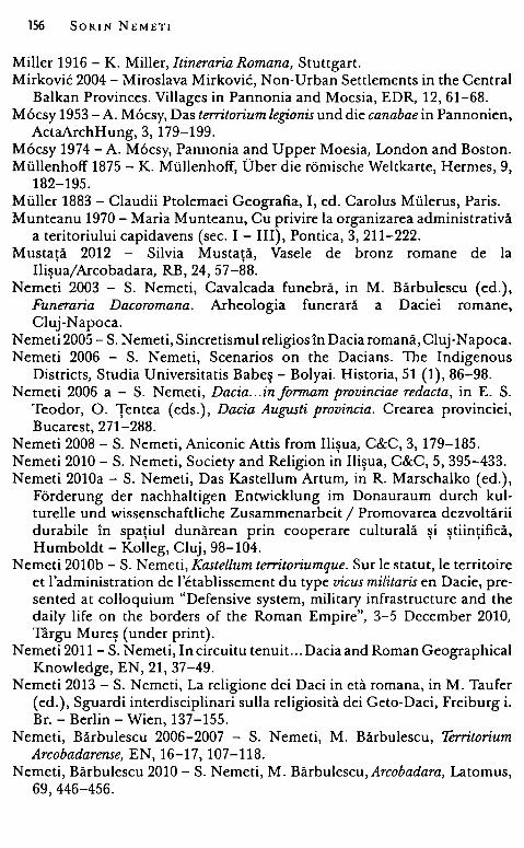
156 SORIN NEMET!
Miller 1916 - K. Miller, Itineraria Romana, Stuttgart. Mirkovic 2004 - Miroslava Mirkovic, Non-Urban Settlements in the Central
Balkan Provinces. Villages in Pannonia and Moesia, EDR, 12, 61-68. M6csy 1953 -A. M6csy, Das territorium legionis und die canabae in Pannonien,
ActaArchHung, 3, 179-199. M6csy 1974 -A. M6csy, Pannonia and Upper Moesia, London and Boston. Miillenhoff 1875 - K. Miillenhoff, Ober die romische Weltkarte, Hermes, 9,
182-195. Muller 1883 - Claudii Ptolemaei Geografia, I, ed. Carolus Miilerus, Paris. Munteanu 1970 - Maria Munteanu, Cu privire la organizarea administrativă
a teritoriului capidavens (sec. I - III), Pontica, 3, 211-222. Mustaţă 2012 - Silvia Mustaţă, Vasele de bronz romane de la
Ilişua/Arcobadara, RB, 24, 57-88. Nemeti 2003 - S. Nemeti, Cavalcada funebră, in M. Bărbulescu (ed.),
Funeraria Dacoromana. Arheologia funerară a Daciei romane, Cluj-Napoca.
N emeti 2005 - S. N emeti, Sincretismul religios în Dacia romană, CI u j-Napoca. Nemeti 2006 - S. Nemeti, Scenarios on the Dacians. The lndigenous
Districts, Studia Universitatis Babeş - Bolyai. Historia, 51 (1), 86-98. Nemeti 2006 a - S. Nemeti, Dacia ... informam provinciae redacta, in E. S.
Teodor, O. Ţentea (eds.), Dacia Augusti provincia. Crearea provinciei, Bucarest, 271-288.
Nemeti 2008 - S. Nemeti, Aniconic Attis from Ilişua, C&C, 3, 179-185. Nemeti 2010 - S. Nemeti, Society and Religion in Ilişua, C&C, 5, 395-433. Nemeti 2010a - S. Nemeti, Das Kastellum Artum, in R. Marschalko (ed.),
Forderung der nachhaltigen Entwicklung im Donauraum durch kulturelle und wissenschaftliche Zusammenarbeit / Promovarea dezvoltării durabile în spaţiul dunărean prin cooperare culturală şi ştiinţifică,
Humboldt - Kolleg, Cluj, 98-104. Nemeti 2010b - S. Nemeti, Kastellum territoriumque. Sur le statut, le territoire
et l'administration de l'etablissement du type vicus militaris en Dacie, presented at colloquium "Defensive system, military infrastructure and the daily life on the borders of the Roman Empire", 3-5 December 2010, Targu Mureş (under print).
Nemeti 2011 - S. Nemeti, In circuitu ten uit... Dacia and Roman Geographical Knowledge, EN, 21, 37-49.
Nemeti 2013 - S. Nemeti, La religione dei Daci in eta romana, in M. Taufer (ed.), Sguardi interdisciplinari sulla religiosita dei Geto-Daci, Freiburg i. Br. - Berlin - Wien, 137-155.
Nemeti, Bărbulescu 2006-2007 - S. Nemeti, M. Bărbulescu, Territorium Arcobadarense, EN, 16-17, 107-118.
Nemeti, Bărbulescu 2010 - S. Nemeti, M. Bărbulescu, Arcobadara, Latomus, 69, 446-456.
Finding Arcobadara 157
Nemeti, Nemeti 2010 - Irina Nemeti, S. Nemeti, The Barbarians within. Illyrian Colonists in Roman Dacia, Studia Historica. Historia Antigua, Salamanca, 28, 107-130.
Nemeti, Nemeti, Fodorean 2003 - S. Nemeti, Irina Nemeti, F. Fodorean, Territorium Potaissae, RB, 17, 69-75.
Nicolet 1988 - C. Nicolet, De Verone au Champ de Mars: Chorographia et carte d'Agrippa, MEFRA, 100, 1, 127-138.
Nicolet 1988 a - C. Nicolet, L'inventaire du monde. Geographie et politique aux origines de l'Empire romain, Paris.
Nisard 1863 - Macrobe, Oeuvres completes. Varron, De la langue latine. Pomponius Mela, Oeuvres completes, avec la traduction en frarn;ais de M. Nisard, Paris.
Nomenclator 1983 - A. M6csy, R. Feldmann, Elisabetha Marton, Maria Szilagyi, Nomenclator provinciarum Europae Latinarum et Galliae Cisalpinae, Budapest.
Oltean 2004 - Ioana A. Oltean, Rural settlement in Roman Dacia: some considerations, in W. S. Hanson, I. P. Haynes (eds.), Roman Dacia. The Making of a Provincial Society, Portsmouth, Rhode Island, 143-164.
Opreanu 1994 - C. H. Opreanu, Misiunile beneficiarilor consulari pe limesul de nord al Daciei în secolul al Iii-lea, ActaMN, 31/1, 69-77.
Opreanu 1994 a - C. Opreanu, Neamurile barbare de la frontierele Daciei romane şi relaţiile lor politico-diplomatice cu Imperiul, EN, 4, 193-220.
Opreanu 2004 - C. Opreanu, Colonisation et acculturation en Dacie. Les mecanismes de l'integration dans le monde romaine, C. Roman, C. Găzdac ( eds. ), Orbis antiquus. Studia in honorem Ioannis Pisonis, ClujNapoca, 651-661.
Ornstein 1897 - J. Ornstein, A Ravennai Geog;raphus ismeretlen Daciai utvonala, ArchErt, 17, 391-394.
Ornstein 1898 - ]. Ornstein, Zur Bestimmung der Grenzen Daciens in Siebenbiirgen, Szamosujvar, Aurora Buchdrukerei A. Todoran.
Ott 1995 - ]. Ott, Die Beneficiarier. Untersuchungen zu ihrer Stellung innerhalb der Rangordnung des Rămischen Heeres und zu ihrer Funktion, Stuttgart.
Pagani 1990 - Claudii Ptolemaei, Cosmog;raphia. Tabulae, Leicester, introduction by Lelio Pagani.
Paki 1988 - Adela Paki, Populaţia Daciei Porolissensis. I. Porolissum, ActaMP, 2, 215-227.
Paki 1995 - Adela Paki, La colonisation de la Dacie romaine, in Regula FreiStolba, H. H. Herzig (eds.), La politique edilitaire dans Ies provinces de l'Empire romain, Ileme - Veme siecle apres J.-C. Actes du 2e colloque roumano-suisse, Berne, 12-19 septembre 1993, Berne, 19-37.
Paki 1996 - Adela Paki, Quelques remarques sur la population rurale de la region de la Dacie orientale, Specimina Nova, 12, 283-294.
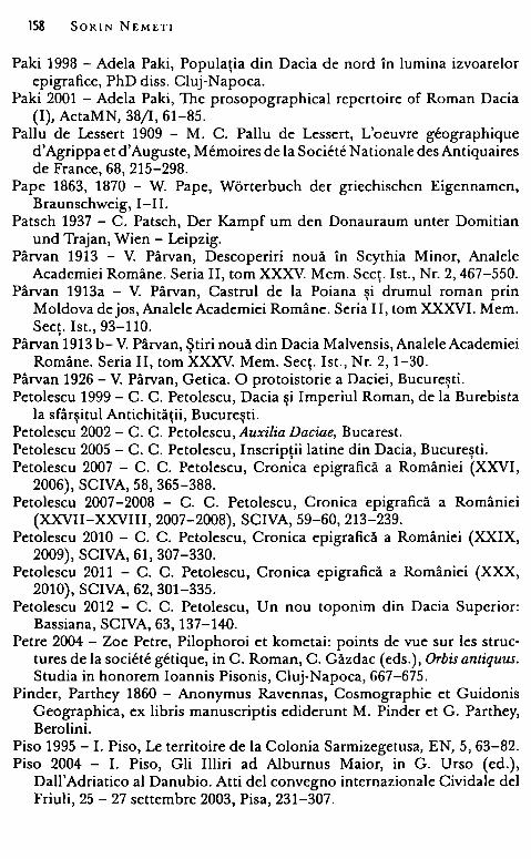
158 SORIN NEMET!
Paki 1998 - Adela Paki, Populaţia din Dacia de nord în lumina izvoarelor epigrafice, PhD diss. Cluj-Napoca.
Paki 2001 - Adela Paki, The prosopographical repertoire of Roman Dacia (I), ActaMN, 38/1, 61-85.
Paliu de Lessert 1909 - M. C. Paliu de Lessert, L'oeuvre geographique d'Agrippa et d'Auguste, Memoires de la Societe Nationale des Antiquaires de France, 68, 215-298.
Pape 1863, 1870 - W. Pape, Worterbuch der griechischen Eigennamen, Braunschweig, I-II.
Patsch 1937 - C. Patsch, Der Kampf um den Donauraum unter Domitian und Trajan, Wien - Leipzig.
Pârvan 1913 - V. Pârvan, Descoperiri nouă în Scythia Minor, Analele Academiei Române. Seria II, tom XXXV. Mem. Secţ. Ist., Nr. 2, 467-550.
Pârvan 1913a - V. Pârvan, Castrul de la Poiana şi drumul roman prin Moldova de jos, Analele Academiei Române. Seria II, tom XXXVI. Mem. Secţ. Ist., 93-110.
Pârvan 1913 b- V. Pârvan, Ştiri nouă din Dacia Malvensis, Analele Academiei Române. Seria II, tom XXXV. Mem. Secţ. Ist., Nr. 2, 1-30.
Pârvan 1926 - V. Pârvan, Getica. O protoistorie a Daciei, Bucureşti. Petolescu 1999 - C. C. Petolescu, Dacia şi Imperiul Roman, de la Burebista
la sfârşitul Antichităţii, Bucureşti. Petolescu 2002 - C. C. Petolescu, Auxilia Daciae, Bucarest. Petolescu 2005 - C. C. Petolescu, Inscripţii latine din Dacia, Bucureşti. Petolescu 2007 - C. C. Petolescu, Cronica epigrafică a României (XXVI,
2006), SCIVA, 58, 365-388. Petolescu 2007-2008 - C. C. Petolescu, Cronica epigrafică a României
(XXVII-XXVIII, 2007-2008), SCIVA, 59-60, 213-239. Petolescu 2010 - C. C. Petolescu, Cronica epigrafică a României (XXIX,
2009), SCIVA, 61, 307-330. Petolescu 2011 - C. C. Petolescu, Cronica epigrafică a României (XXX,
2010), SCIVA, 62, 301-335. Petolescu 2012 - C. C. Petolescu, Un nou toponim din Dacia Superior:
Bassiana, SCIVA, 63, 137-140. Petre 2004 - Zoe Petre, Pilophoroi et kometai: points de vue sur Ies struc
tures de la societe getique, in C. Roman, C. Găzdac ( eds.), Orbis antiquus. Studia in honorem Ioannis Pisonis, Cluj-Napoca, 667-675.
Pinder, Parthey 1860 - Anonymus Ravennas, Cosmographie et Guidonis Geographica, ex libris manuscriptis ediderunt M. Pinder et G. Parthey, Berolini.
Piso 1995 - I. Pisa, Le territoire de la Colonia Sarmizegetusa, EN, 5, 63-82. Piso 2004 - I. Piso, Gli Illiri ad Albumus Maior, in G. Urso (ed.),
Dall'Adriatico al Danubio. Atti del convegno intemazionale Cividale del Friuli, 25 - 27 settembre 2003, Pisa, 231-307.
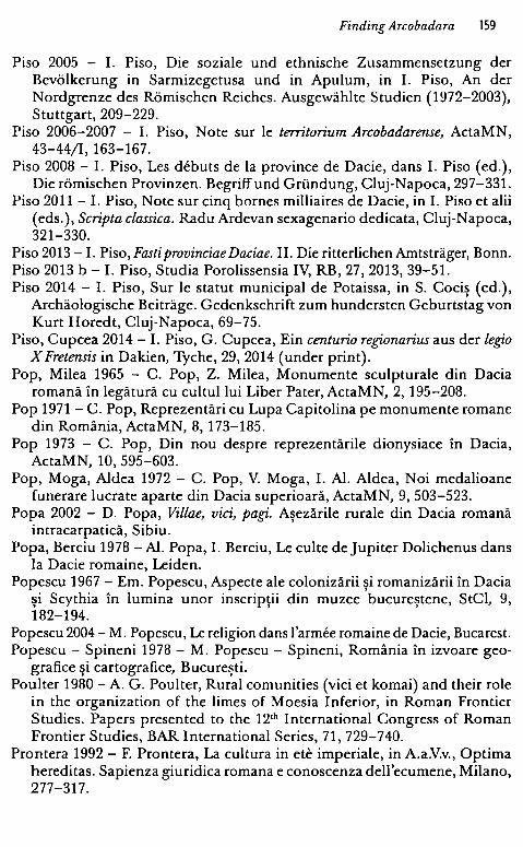
Finding Arcobadara 159
Pisa 2005 - I. Pisa, Die soziale und ethnische Zusammensetzung cler Bevălkerung in Sarmizegetusa und in Apulum, in I. Pisa, An cler Nordgrenze des Rămischen Reiches. Ausgewăhlte Studien (1972-2003), Stuttgart, 209-229.
Pisa 2006-2007 - I. Pisa, Note sur le territorium Arcobadarense, ActaMN, 43-44/1, 163-167.
Pisa 2008 - I. Pisa, Les debuts de la province de Dacie, dans I. Pisa (ed.), Die rămischen Provinzen. Begriffund Griindung, Cluj-Napoca, 297-331.
Pisa 2011 - I. Pisa, Note sur cinq bornes milliaires de Dacie, in I. Pisa et alii (eds.), Scripta classica. Radu Ardevan sexagenario dedicata, Cluj-Napoca, 321-330.
Pisa 2013 -1. Pisa, Fasti provinciae Daciae. II. Die ritterlichen Amtstrăger, Bonn. Pisa 2013 b - I. Pisa, Studia Porolissensia IV, RB, 27, 2013, 39-51. Pisa 2014 - I. Piso, Sur le statut municipal de Potaissa, in S. Cociş (ed.),
Archăologische Beitrăge. Gedenkschrift zum hundersten Geburtstag von Kurt Horedt, Cluj-Napoca, 69-75.
Pisa, Cupcea 2014 - I. Pisa, G. Cupcea, Ein centuria regfonarius aus cler legio X Fretensis in Dakien, Tyche, 29, 2014 (under print).
Pop, Milea 1965 - C. Pop, Z. Milea, Monumente sculpturale din Dacia romană în legătură cu cultul lui Liber Pater, ActaMN, 2, 195-208.
Pop 1971 - C. Pop, Reprezentări cu Lupa Capitolina pe monumente romane din România, ActaMN, 8, 173-185.
Pop 1973 - C. Pop, Din nou despre reprezentările dionysiace în Dacia, ActaMN, 10, 595-603.
Pop, Moga, Aldea 1972 - C. Pop, V. Moga, I. Al. Aldea, Noi medalioane funerare lucrate aparte din Dacia superioară, ActaMN, 9, 503-523.
Popa 2002 - D. Popa, Villae, viei, pagi. Aşezările rurale din Dacia romană intracarpatică, Sibiu.
Popa, Berciu 1978 -Al. Popa, I. Berciu, Le culte de Jupiter Dolichenus dans la Dacie romaine, Leiden.
Popescu 1967 - Em. Popescu, Aspecte ale colonizării şi romanizării în Dacia şi Scythia în lumina unor inscripţii din muzee bucureştene, StCl, 9, 182-194.
Popescu 2004 - M. Popescu, Le religion dans l'armee romaine de Dacie, Bucarest. Popescu - Spineni 1978 - M. Popescu - Spineni, România în izvoare geo
grafice şi cartografice, Bucureşti. Poulter 1980 - A. G. Poulter, Rural comunities (viei et komai) and their role
in the organization of the limes of Moesia Inferior, in Roman Frontier Studies. Papers presented to the 12'h International Congress of Roman Frontier Studies, BAR International Series, 71, 729-740.
Prontera 1992 - F. Prontera, La cultura in ete imperiale, in A.a.V.v., Optima hereditas. Sapienza giuridica romana e conoscenza dell'ecumene, Milano, 277-317.
160 SORIN NEMET!
Prontera 2003 - F. Prontera, La Tabula Peutingeriana nella storia delia cartografia antica, in F. Prontera (ed.), Tabula Peutingeriana. Le antiche vie del mondo, Firenze, 17-41.
Protase 1956 - D. Protase, Materiale arheologice romane în Muzeul din Năsăud, Activitatea Muzeelor, 2, 132-134.
Protase 1961 - D. Protase, Noi monumente sculpturale din nordul Daciei, Apulum, 4, 127-143.
Protase 1957 - D. Protase, Două inscripţii latine inedite de la Ilişua,
Materiale, 4, 319-323. Protase 1980 - D. Protase, Autohtonii în Dacia. I. Dacia romană, Bucureşti. Protase 1985 - D. Protase, Date noi despre ala I Tungrorum Frontoniana în
Dacia, SCIVA, 36, 3, 249-253. Protase 2000 - D. Protase, La continuite daco-romaine, Cluj-Napoca. Protase 2001 - D. Protase, Începuturile stăpânirii romane în nordul Dunării,
in D. Protase, Al. Suceveanu ( eds. ), Istoria românilor. II. Daco-romani, romanici, alogeni, Bucureşti, 35-43.
Protase 2005 - D. Protase, Orizonturi daco-romane, II, Cluj-Napoca. Protase, Gaiu, Marinescu 1996-1997 - D. Protase, C. Gaiu, G. Marinescu,
Castrul roman si asezarea civilă de la Ilisua Uud. Bistrita - Năsăud), RB, , , , , 10-11, 27-114.
Rackham 1947 - Pliny Natural History, with an English Translation in Ten Volumes, London - Cambridge, volume II.
Raczka 2000 - W. Raczka, A sea or a lake? The Caspian's long odyssey, Central Asian Survey, 19, 2, 189-221.
Ricci 1993 - Cecilia Ricci, Balcanici e danubiani a Roma. Attestazioni epigraphiche di abitanti delie province Rezia, Norico, Pannonia, Dacia, Dalmazia, Mesia, Macedonia, Tracia (I - III sec.), II. 1. militari, Prosopographica, Poznan, 175-208.
Riese 1964 - A. Riese, Geographi Latini Minores, Hildesheim (reprint. ed. 1878).
Riley 1995 - M. T. Riley, Ptolemy's use of his predecessors' data, TAPA, 125, 221-250.
Rivet 1974 - A. L. F. Rivet, Some Aspects of Ptolemy's Geography of Britain, in R. Chevallier (ed.), Litterature greco-romaine et geographie historique. Melanges offerts a Roger Dion (Caesarodunum, IX), Paris, 55-81.
Roesler 1871 - R. Roesler, Romănische Studien. Untersuchungen zur ălteren Geschichte Romăniens, Leipzig.
Rolfe 1914 - Suetonius, with an English translation by]. C. Rolfe, London - New York.
Romm 1992 - ]. S. Romm, The Edges of the Earth in Ancient Thought. Geography, Exploration and Fiction, Princeton, New Jersey.
Rose 1933 - Hygini Fabulae, recensuit, prolegomenis, commentario, appendice instruxit H. I. Rose, Lugduni Batavorum.
Finding Arcobadara 161
Ruehl 1887 - Eutropi Breviarium ah Urbe condita, recognovit Franciscus Ruehl, Lipsiae, 1887.
Ruscu 1998 - Ligia Ruscu, Die griechischen Namen in cler Provinz Dakien, ActaMN, 35/1, 147-186.
Ruscu 2003- D. Ruscu, Provincia Dacia în istoriografia antică, Cluj-Napoca. Ruscu 2004 - D. Ruscu, The supposed extermination of the Dacians: the
literary tradition, in W. S. Hanson, I. P. Haynes (eds.), Roman Dacia. The Making of a Provincial Society, Portsmouth, Rhode Island, 75-85.
Rusu-Bolindeţ, Voişian, Cociş 2000 - Viorica Rusu-Bolindeţ, V. Voişian, S. Cociş, The pottery in late La Tene tradition of Napoca, ActaMN, 37/1, 141-199.
Rusu-Pescaru, Alicu 2000 - Adriana Rusu-Pescaru, D. Alicu, Templele romane din Dacia, Deva.
Russu 1944 - I. I. Russu, Onomasticon Daciae. Numele de persoane din inscripţiile provinciei, AISC, 4, 186-233.
Russu 1947 - I. I. Russu, Miscellanea Dacica. I. Tribul "-sensioi". II. Interpres Dacorum. III. Constantin cel Mare "Dacicus", AIIN, 11, 1946-1947, 398-415.
Russu 1949 - I. I. Russu, Rectificări şi adause la "Onomasticon Daciae'', AISC, 5, 282-295.
Russu 1956 - I. I. Russu, Materiale epigrafice în Muzeul Raional Dej, Activ Muz, Cluj, 118-131.
Russu 1959 - I. I. Russu, Les Costoboces, Dacia, 3, 341-352. Russu 1961 - I. I. Russu, Dacius Appulus. Contribuţii la onomastica traco-
dacă şi illiră, Apulum, 4, 85-93. Russu 1967 - I. I. Russu, Tracii în Dacia romană, ActaMN, 4, 85-105. Russu 1967 a - I. I. Russu, Limba traco-dacilor, Bucureşti. Russu 1969 - I. I. Russu, Illirii. Istoria - limba şi onomastica - romanizarea,
Bucuresti. Russu 1977 - I. I. Russu, L'onomastique de la Dacie romame, m
L'onomastique latine, Paris, 353-363. Russu 1981- I. I. Russu, Etnogeneza românilor, Bucureşti. Sanie 1981 - S. Sanie, Cultele orientale în Dacia romană, I, Bucarest. Schnetz 1940 - Itineraria Romana, II. Ravennatis Anonymi Cosmographia
et Guidonis Geographica, ediditjoseph Schnetz, Stuttgardiae in aedibus B. G. Teubneri.
Schuchhardt 1885 - C. Schuchhardt, Wălle und Chausseen in siidlichen und ăstlichen Dacien, AEM, 9, 202-233.
Schulten 1894 -A. Schulten, Das Territorium Legionis, Hermes, 29, 481-516. Schulze 1933 - W. Schulze, Zur Geschichte lateinischer Eigennamen, Berlin. Schiitte 1917 - G. Schiitte, Ptolemy's Maps ofNorthern Europe, Copenhagen. Silberman 1988 - Pomponius Mela, Chorographie, texte etabli, traduit et
annote par A. Silberman, Paris.
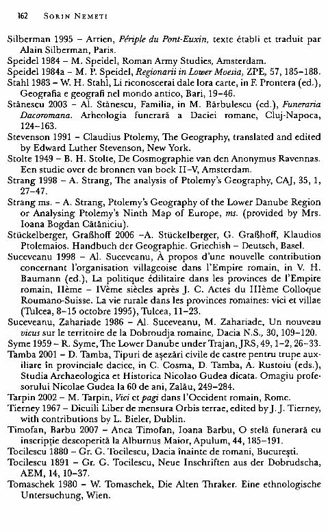
162 SORIN NEMETI
Silberman 1995 - Arrien, Ptfriple du Pont-Euxin, texte etabli et traduit par Alain Silberman, Paris.
Speidel 1984 - M. Speidel, Roman Army Studies, Amsterdam. Speidel 1984a - M. P. Speidel, Regfonarii in Lower Moesia, ZPE, 57, 185-188. Stahl 1983 - W. H. Stahl, Li riconoscerai dale lora carte, in F. Prontera (ed.),
Geografia e geografi nel mondo antico, Bari, 19-46. Stănescu 2003 - Al. Stănescu, Familia, in M. Bărbulescu (ed.), Funeraria
Dacoromana. Arheologia funerară a Daciei romane, Cluj-Napoca, 124-163.
Stevenson 1991 - Claudius Ptolemy, The Geography, translated and edited by Edward Luther Stevenson, New York.
Stol te 1949 - B. H. Stolte, De Cosmographie van den Anonymus Ravennas. Een studie over de bronnen van boek II-V, Amsterdam.
Strang 1998 - A. Strang, The analysis of Ptolemy's Geography, CAJ, 35, 1, 27-47.
Strang ms. - A. Strang, Ptolemy's Geography of the Lower Danube Region or Arialysing Ptolemy's Ninth Map of Europe, ms. (provided by Mrs. Ioana Bogdan Cătăniciu).
Sti.ickelberger, GraBhoff 2006 -A. Sti.ickelberger, G. GraBhoff, Klaudios Ptolemaios. Handbuch der Geographie. Griechish - Deutsch, Basel.
Suceveanu 1998 - Al. Suceveanu, A. propos d'une nouvelle contribution concernant l'organisation villageoise dans l'Empire romain, in V. H. Baumann (ed.), La politique edilitaire dans Ies provinces de l'Empire romain, Ileme - IVeme siecles apres ]. C. Actes du Illeme Colloque Roumano-Suisse. La vie rurale dans Ies provinces romaines: viei et villae (Tulcea, 8-15 octobre 1995), Tulcea, 11-23.
Suceveanu, Zahariade 1986 - Al. Suceveanu, M. Zahariade, Un nouveau vicus sur le territoire de la Dobroudja romaine, Dacia N.S., 30, 109-120.
Syme 1959- R. Syme, The Lower Danube underTrajan,JRS, 49, 1-2, 26-33. Tamba 2001 - D. Tamba, Tipuri de aşezări civile de castre pentru trupe aux
iliare în provinciale dacice, in C. Cosma, D. Tamba, A. Rus toiu ( eds. ), Studia Archaeologica et Historica Nicolao Gudea dicata. Omagiu profesorului Nicolae Gudea la 60 de ani, Zalău, 249-284.
Tarpin 2002 - M. Tarpin, Viei et pagi. dans I' Occident romain, Rome. Tierney 1967 - Dicuili Liber de mensura Orbis terrae, edited by].]. Tierney,
with contributions by L. Bieler, Dublin. Timofan, Barbu 2007 - Anca Timofan, Ioana Barbu, O stelă funerară cu
inscripţie descoperită la Alburnus Maior, Apulum, 44, 185-191. Tocilescu 1880 - Gr. G. Tocilescu, Dacia înainte de romani, Bucureşti. Tocilescu 1891 - Gr. G. Tocilescu, Neue Inschriften aus der Dobrudscha,
AEM, 14, 10-37. Tomaschek 1980 - W. Tomaschek, Die Alten Thraker. Eine ethnologische
Untersuchung, Wien.
Finding Arcobadara 163
Torma 1866 -Torma K., Az Alsa-Ilosvai ramai allatabor s muemlekei, EME, 3-4, 1864-1865, 10-67.
Torma 1879 -Torma C., Neue Inschriften aus Dacien, AEM, 3, 86-122. Torma 1880 - Torma K., Ramai felirat Alsa-Ilosvaral, ArchErt, 14, 60-62. Torma 1880a - C. Torma, Revidirte und neue Inschriften zu Corpus
Inscriptionum Latinarum III (Dacia), AEM, 4, 125-126. Trynkowski 1976 - J. Trynkowski, Urmările demografice ale cuceririi Daciei
de către romani, ActaMN, 13, 81-88. Tudor 1964 - D. Tudor, Les garnisons de Buridava a l'epoque de la conquete
de la Dacie, în Akte des IV. Internationalen Kongresses fiir griechische und lateinische Epigraphik (Wien, 17. bis 22. September 1962), Wien, 404-410.
Tudor 1965 - D. Tudor, Sucidava. Une cite daco-romaine et byzantine en Dacie, Bruxelles - Berchem.
Tudor 1968 - D. Tudor, Orase, târguri si sate în Dacia romană, Bucuresti. Tudor 1968a - D. Tudor, Oltenia roma~ă3, Bucureşti. ' Ţentea 1999 - O. Ţentea, Semnificaţia prezenţei ceramicii de tradiţie Latene
în Dacia romană, RB, 12-13, 123-132. Ţeposu-Marinescu 1982 - Lucia Ţeposu - Marinescu, Funerary Monuments
în Dacia Superior and Dacia Porolissensis, BAR Int. S. 128, Oxford. Ţeposu-Marinescu, Pop 2000 - Lucia Ţeposu-Marinescu, C. Pop, Statuete
de bronz din Dacia romană, Bucuresti. Van Andringa 2003 - W. Van Andring~, Cites et communautes d'expatries
installees dans l'Empire romain: Ies cas de cives Romani consistentes, în Nicole Belayche, S. C. Mimouni (eds.), Les communautes religieuses dans le monde greco-romain. Essais de definition, Turnhout, 49-60.
Vătavu 2011 - B. - V. Vătavu, Reg;i,o şi beneficiari consulari pe frontiera nordică a provinciei Dacia, în Aurora Peţan, Al. Berzovan ( eds.), Arheologie şi studii clasice, I, Bucureşti, 225-234.
Vittinghoff 1971 - Fr. Vittinghoff, Die rechtliche Stellung der canabae le[!;i,onis und die Herkunftsangabe castris, Chiron, 1, 299-318.
Vulpe 1931 - R. Vulpe, Piroboridava, RA, 34, 2, 237-276. Vulpe 1944 - R. Vulpe, Angustia, în În amintirea lui Constantin Giurescu
la douăzeci şi cinci de ani dela moartea lui (1875-1918), Bucureşti, p. 551-559.
Vulpe 1964 - Al. Vulpe, Ptolemy and the Ancient Geography of Moldavia, StCI, 6, 233-246.
Wilkes 1969 - -J. J. Wilkes, Dalmatia, London. Wilmott 2001 - T. Wilmott, Cohors I Aelia Dacorum: a Dacian unit on
Hadrian's Wali, ActaMN, 38/1, 103-122. Wolff 1976 - - H. Wolff, Miscellanea Dacica II, ActaMN, 13, 99-123. Wollmann 1975 - V. Wollmann, Germanische Volks- und Kulturelemente im
rămischer Dakien, Germania, 53, 1-2, 166-174.
Wollmann 1985-1986 - V. Wollmann, Un fucus la Alburnus Maior, AIIA Cluj, 27, 263-295.
Wollmann 1996 - V. Wollmann, Mineritul metalifer, extragerea sării şi carierele de piatră în Dacia romană, Cluj-Napoca.
Wollmann, Ardevan 2006 - V. Wollmann, R. Ardevan, Disiecta membra. Inschriftenfragmente aus Dakien, in C. Gaiu, C. Găzdac (eds.), Fontes Historiae. Studia in honorem Demetrii Protase, Bistriţa - Cluj-Napoca, 667-678.
Zugravu 2003 - N. Zugravu ed., Festus, Breviarium rerum gestarum Populi Romani/ Scurtă istorie a poporului roman, transl. M. Alexianu, R. Curcă, Iasi.
'
ABBREVIATIONS
Corp ora AE - L'Annee Epigraphique, Paris. CIGD- Ligia Ruscu, Corpus Inscriptionum Graecarum Dacicarum (CIGD),
Debrecen, 2003. CIL - Corpus Inscriptionum Latinarum, Berlin. IDR - Inscripţiile Daciei romane, Bucureşti, I, 1975 - III/5, 2001. IDRE - C. C. Petolescu, Inscriptions de la Dacie romaine. Inscriptions ex-
ternes concernant l'histoire de la Dacie, I-II, 1996, 2000. ILB - B. Gerov, Inscriptiones Latinae in Bulgaria repertae, Sofia, 1989. ILD - C. C. Petolescu, Inscripţii latine din Dacia, Bucureşti, 2005. ILS - Inscriptiones Latinae selectae, ed. H. Dessau, Berlin, I (1882) - IV
(1916). ISM - Inscripţiile Sciţiei Minor, D. M. Pippidi et alii, Bucureşti. RIU - Die Rămische Inschriften Ungarns, Budapest.
Dictionnaries DA - Ch. Daremberg, Edm. Saglio, Dictionnaire des Antiquites grecques et
romaines, Paris, I-V, 1877-1919. FHDR - Fontes Historiae Dacoromanae /Izvoarele istoriei României, II,
Bucureşti, 1970. OPEL - Onomasticon provinciarum Europae Latinarum, I, Budapest, 1994
(eds. B. L6rincz and Fr. Red6); II, Wien, 1999 (ed. B. L6rincz); III, Wien, 2000 (ed. B. L6rincz).
RE - Realencyclopădie der classischen Altertumswissenschaft (Pauly -Wissowa - Kroll), Stuttgart - Mi.inchen, 1893-1972.
Reviews AB - Analele Banatului, Timişoara. ACD - Acta Classica Universitatis Scientarum Debreceniensis, Debrecen. Acta Ant. Hung. - Acta Antiqua Academiae Scientiarum Hungaricae,
Budapest. Acta Arch. Hung. -Acta Archaeologica Academiae Scientiarum Hungaricae,
Budapest.
166 SORIN NEMETI
ActaMN - Acta Musei Napocensis, Cluj-Napoca. ActaMP - Acta Musei Porolissensis, Zalău. ActivMuz - Activitatea Muzeelor, Cluj. AEM - Archăologische - Epigraphische Mitteilungen aus Osterreich -
Ungarn, Wien. AIIA Cluj - Anuarul Institutului de Istorie şi Arheologie, Cluj-Napoca. AIIN - Anuarul Institutului de Istorie Naţională, Cluj. AISC - Anuarul Institutului de Studii Clasice, Cluj (Sibiu) Apulum - Apulum. Buletinul Muzeului Regional Alba Iulia. ArchErt - Archaeol6giai Ertesit6, Budapest. Arch Korr - Archaălogische Korrespondenzblatt, Mainz. BHAUT - Bibliotheca Historica et Archaelogica Universitatis Timisiensis,
Timisoara. , BJ - Bonner Jahrbucher, Bonn. Cahiers Glotz - Cahiers du Centre Gustave Glotz, Paris. CAJ - The Cartographicjournal, Leeds. Cercetări arheologice - Cercetări arheologice, Bucureşti. Chiron - Chiron. Mitteilungen der Kommission fiir alte Geschichte und
Epigraphik des Deutschen Archăologischen Instituts, Miinchen. C&C - Classica & Christiana. Revista Centrului de Studii Clasice şi Creştine,
Iasi. , Dacia - Dacia. Recherches et decouvertes archeologiques en Roumanie,
Bucureşti, I-XII, 1924-1948; Nouvelle serie: Revue d'archeologie et d'histoire ancienne, Bucureşti.
EDR - Ephemeris Dacoromana. Annuario delia Scuola Romena di Roma, Roma.
EHR - The English Historical Review, Oxford. EME - Erde!yi Muzeum - Evkănyve, Kolozsvar. EN - Ephemeris Napocensis, Cluj-Napoca. FI - File de Istorie, Bistriţa. Geographia Antiqua - Geografia Antiqua. Rivista di geografia storica de!
mondo antico e di storia delia geografia, Firenze. Geografiska Annaler - Geografiska Annaler, Stockholm. Germania - Germania. Anzeiger der Rămisch-Germanischen Kommission,
Frankfurt am Main. Hermes - Hermes. Zeitschrift fiir klassische Philologie, Stuttgart. Istros - Istros. Buletinul Muzeului Brăilei. Studii, comunicări, note, Brăila. JRS - Journal of Roman Studies, London. Klio - Klio. Beitrăge zur alten Geschichte, Leipzig - Wiesbaden - Berlin. Latomus - Latomus. Revue d'etudes latines, Bruxelles. M~teriale - Materiale şi cercetări arheologice, Bucureşti., MEFRA - Melanges d'archeologie et d'histoire de l'Ecole Franc;aise de
Rome. Antiquite, Paris. Peuce - Peuce. Studii şi comunicări de istorie şi arheologie, Tulcea.
Finding Arcobadara 167
Pontica - Pontica. Studii şi materiale de istorie, arheologie şi muzeografie, Constanţa.
RA - Revue Archeologique, Paris. R~ - Revista Bistriţei. Muzeul Judeţean Bistriţa, Bistriţa. REA - Revue des etudes anciennes, Bordeaux - Paris. RHSEE - Revue Historique du Sud-Est Europeen, Bucharest. SAA - Studia Antiqua et Archaeologica, Iaşi. SCIV(A) - Studii şi cercetări de istorie veche (şi arheologie), Bucureşti Specimina Nova - Specimina Nova, Pecs. StCl - Studii Clasice, Bucureşti. Studia Historica. Historia Antigua - Studia Historica. Historia Antigua,
Salamanca. TAPA - Transactions and Proceedings of the American Philological
Association, Atlanta. Tyche - Tyche. Beitrăge zur Alten Geschichte, Papyrologie und Epigraphik,
Wien. ZPE - Zeitschrift fiir Papyrologie und Epigraphik, Bonn.

INDEX
A Ad Batavos, Ad Vatabos 17, 90 Ad Mutrium, Amutrium,
Amoutrion, Amutria 65, 89 Ad Pannonios 17, 90 *Ad Tungros 17 Aegyssus 71, 92, 99 Aelius Aristides 41 Aesculapius, Asklepios, 'AaKÂ.E1ttcp
109, 110 Africa 26, 63 Agrippa, M. Vipsanius Agrippa 26,
28,29,30,31,33,34,35,37, 38,40,41,42,53,55,56,67, 148, 155, 157, 158, 179
Alania 33, 35 Alani, Alanis 31, 57, 58 Alauni 51, 58 Alba Iulia 64, 65, 69, 149, 166 *Alboca 51, 59 Albocenses 48,49, 50,51,53,57,
59,67 Albumus Maior 81, 82, 147, 149,
150, 158, 162, 163 Alexandria 21 Alincum 68, 73, 76 Almaşu Mare 48, 65 Almus 96 Alpes 36 Aluta,Alutas,Alutus 55,56,60 Amadoci 58
Amantini 51 Amărăştii de Jos 135 Amazons 41, 70 Ambidravi 51 Anarti, Anartoi, Anartes 22, 23, 48,
50,51,53,57,58, 59 Anartophracti 57, 58, 59 Ancarum 73, 75 Angustia, Angustiae 60, 63, 66, 67,
70, 163 Annonymus Ravennas, cosmo
grapher from Ravenna, geographer from Ravenna, Ravennatis Anonymi Cosmographia 17, 23, 41, 42, 51,61,67,68,69,70,71, 152, 158, 161, 162
Ansi, Ansienses 82, 83 Aorsi 31 Apatiu 140, 141 Apollo, Apollo Phoebus 93, 106,
108, 110 Appiarenses 52, 53 Apulum 52, 60, 64, 65, 87, 103, 153,
155, 159, 160, 161, 162, 166 Aquae, Hydata-Aquae 60, 63, 65 Aquileia 80 Arad 69 Aravisci 51 Arbitio 74 Arcalia 135, 140 Archiud 141, 143
170 SORIN NEMET!
Arcidava 18 Arcinna, Arkinna, Apxtv(v)o: 18, 19,
61 Arcobara, Arcobadara, Arkobara,
Arkobadara,Apxo~a8o:po:,
Arkobara{da} Apxo~apo:{8o:} 11, 12, 16, 17, 18, 19, 53, 61, 63,64,65, 66,67, 77, 83, 86, 87, 90, 99, 100, 134, 135, 137, 140, 142, 144, 145, 146, 151, 153, 156
Arcobriga 18 Arcunae 18 Arieş 65 Aristarch 7 4 Arrian 75, 76 Arsietae 57, 58 Artani 82, 83 Arubion 71, 73 Asberg 100 Asciburgium 100, 103 Asia 26, 30, 37, 39, 110, 152 Atlanticum (Oceanum) 36 Attis 111, 112, 129, 150, 156 Augusta Traiana 94 Avantici 55 Avarini, Avari 57, 58, 71 Azali 51
B Bacău 69, 153 Badacus 18 Badonibus mons 18 Baemi, gens Baemorum 57 Băiţa 139 Barboşi 61 Bârsău Mare 139 Bassiana 62, 87, 99 Basternae, Bastarni, Basternas 31,
57,58 Bâtca Doamnei 64 Beatus 35 Beclean 135
Bicaz 69 Bidiu 140, 141 Biephi 48, 49, 50, 51, 57, 58 Biessi 57, 58, 59 Bistriţa, Bistriţei Valley 15, 64, 66,
67, 68, 69, 70, 86, 116, 117, 118, 120, 121, 124, 127, 128, 130, 131, 132, 137, 138, 142, 145, 151, 153, 166
Blandiana 62, 73 Bodini, Boudinoi 58 Bodiontici 55 Baduhennaelucus 18 Boii 51 Bologa 65, 66 Bonn 100, 159, 167 Bonţ 139 Borystenes 71 Bozieş 140, 141 Brâncoveneşti, Vecs 47, 66, 68, 137,
140 Braniştea 135 Breaza 47 Bretea 135 Breuci 51 Britannicum Oceanum 36 Buciumi 66 Budeşti 140 Buneşti 139 Buri 22 Buridava 50, 51, 53, 59, 60, 61, 149,
163 Buridavenses 48, 50, 51, 52, 57, 59,
60, 67, 149 Buza 139
c Căianu Mic 135 Călan 65 Călugăreni, Mikhaza 68 Campona 100 Căpâlna 139 Capidava 75,91,99
Capitoline Triad 138 Capora 68, 73, 76 Caracal 135 Carni 75 Carnium 75 Carnuntum 31, 100, 103 Carpiani 58 Carsidava 64, 65, 66, 67 Căşei, Als6 Kosaly 68, 88, 135, 137,
138, 139, 154 Caspian Sea 30, 35, 37, 41 Castellum Abrittanorum 80 Castellum (Kastellum) Ansum,
Artum, Avieretium 81, 82, 83, 156
Castellum (Kastellum) Barisdustarum 82
Castellum (Kastellum) Maniatium 83
Castellum (Kastellum) Starva 82, 150
Castellum Vixillum 80 Castorius 74 Caucoenses 48,49,50,51,57,59 Celei 87 Cepari 135 Cerauni 51 Cersiae 17 Cetan 139 Chersonesus 22 Chiraleş 135, 140, 142 Chiuiesti 139 Chuni,' Uni 58, 71 Ciabrus 56 Ciagisi 48, 49, 50, 51, 57, 58 Ciceu-Giurgeşti 135, 140 Ciceu-Mihăieşti 140 Cimbrian Promontory 34, 41 Ciochiş 141 Civitas Paralissensium 45 Civitas Romulensium Malvensium
45,47,48 Cluj, Cluj-Napoca 3, 4, 65, 66, 68,
69, 70,85,86, 88, 119, 120,
Finding Arcobadara 171
135, 137, 148, 149, 150, 151, 152, 153, 154, 155, 156, 157, 158, 159, 160, 161, 162, 163, 164, 166
Coestoboci, Costoboci 22, 48, 50, 51,53,57, 58, 59
Congri 17, 68, 69, 70, 73, 75, 76 Constantinople 40 conventus Narona 52 Corvineşti 140, 141 Cotenses 48, 49, 50, 51, 57, 59 Creta 38 Cristeşti 47, 140 Cristestii Ciceului 135 , Cristur Şieu 135, 142 Criton 46 Crobyzi 52 Cumidava, Comidava 64, 65, 66,
67, 155 Cuzdrioara 139 Cyprus, Cypru 38 Cyrrhus 95
D Dacia, Datia 1, 3, 11, 12, 13, 16, 17,
18, 19,22,23,24,25,26, 30, 31,32, 33, 34,35,37, 38,40, 41,42,43,44,45,48,49,50, 51, 52, 53, 54, 55, 56, 57, 58, 59,60,61,62,63,64,65,66, 67,68,69, 70, 71, 74, 75, 76, 77, 79,81,83,86,87,88,90, 91,98, 99, 100, 103, 105, 108, 111, 116, 122, 135, 136, 137, 138, 140, 142, 143, 145, 147, 148, 149, 150, 151, 152, 153, 154, 155, 156, 157, 158, 159, 160, 161, 162, 163, 165, 166
Dacia Inferior 51, 60, 61, 62 Dacian Kingdom 44, 46, 47, 63, 100 Dacia Porolissensis 65, 98, 100, 137,
143, 163 Dacia Superior 63, 87, 155, 163
172 SORIN NEMET!
Daci, Dacian, Dacians, Dacian people, Dacus, Daco-Getian 12, 18, 19,23,25,31,42,43,44, 45,46,47,48,49,50,51,52, 53, 59, 61, 62,63,64,66,67, 71, 74, 75, 89, 100, 112, 141, 144, 146, 147, 150, 156, 161, 163
Dalmatia 44, 45, 51, 52, 82, 100, 116, 163
Danapris 71, 74 Danube, Danubium, Danuvium 19,
23,24,26,30,31,33,34,35, 36,41,42,49,50,55,56, 57, 59,61, 63, 66, 72, 75, 79, 80, 89, 91, 98, 135, 150, 162
Danube Delta 76 Dardani 51 Dardania 70, 71, 73, 74, 75, 76 Daursii 51 Decea 65 Deda 140 Diana 93 Dkuil 32,33,34,37,38,39,40,41,
56 Dimum, Dimenses 52, 53, 80, 96, 99 Dindari 51 Dinia 55 Dinogetia, Dinogessia 56, 71, 73 Dipşa 141, 142 Ditiones 51 Diviciorii Mari 139 Dniester, Nistru 69, 70 Docidava 61, 66 Dodea 51 Docleatae 51 Doliche 87, 138, 152 Domneşti 69, 77, 98, 138, 140, 143 Drobeta, Drubeta, Drobeta-Turnu
Severin 53, 65 Dunaujvaros 93, 99 Duria 31
E Egypt, Aegyptus 21, 38 Epona 108, 110, 112 Erathostene 34, 37 Ermerium 68, 69, 73, 76, 77 Europe 22,26,30,35,36,39,41,50,
51,63, 154, 161, 162 Eutropius 24, 25, 38, 40, 43, 50, 70,
73, 74, 149 Exobygitae 58
F Fălcusa 139 , Fântânele 141, 143 Feldioara 47, 139 Feleac 135, 140, 141, 142 Festus, Rufius Festus 24, 25, 38, 40,
152, 164 Finni 57 Fizesu Gherlii 139 , Foltesti 69 Fortu'na Redux, Fortuna Balnearis
107 Frontinus 81
G Galatii Bistritei 141 , , Galindae 58 Gallia, Gallia Narbonensis, Gallia
Cisalpina 35, 37, 38, 39, 40, 55, 56, 67, 79, 116, 117, 118, 157
Gârliciu 97 Geoagiu 65 Germani 31 Germania, Germania Inferior,
Germania Superior 31, 35, 36, 39, 57, 59, 79, 81, 100, 163, 166
Germisara, Germizera 52, 60, 65 Getae 31, 92
Getica 32, 33, 39, 40, 41, 68, 152, 158
Gherla, Szamosujvar 47, 68, 70, 135, 137, 139, 140, 157
Ghimes 69 ' Gipidia 71
Gledin 140 Gothia 35 Greeks 26,31,34, 125 Gurghiu, Gorgeny Szt. Imre 68 Gythiones 5 7
H Hamaxobii, Amaxobi 31, 57, 58 Hellanicos 59 Hercules 41, 85 Hercuniates 51 Hercynium 31 Hermisium 76, 77 Herodotus 59 Heros Equitans, Hero Rider 92, 111 Hierasus 56, 60, 61 Hisarlîk 80 Hispania 18, 39, 81, 115, 116, 117,
118, 121 Histria 96, 97, 98 Histro, Ister, Istrum 30, 31, 32, 33,
36,51,55,56, 76,97 Hiustia 33 Hoghiz 17, 70 Hygia, YyEia 109, 110 Hylas 74 Hyperboreans 41 Hyrgis, 'YyEîc; 76
Iazygi, Iazyges 22, 31, 56, 57, 60, 69, 70, 77, 100
Iclod 139 Iclozel 139 Igliţa 92 Igylliones 58, 59 Ileanda 139
Finding Arcobadara 173
Ili~ua,Als6Ilosva 11, 13, 14, 15, 16, 17, 18, 19,47,63,64,65,66, 67,68, 69, 70, 77,86, 91, 100, 103, 104, 105, 107, 109, 110, 111, 112, 117, 120, 130, 137, 138, 139, 140, 141, 144, 145, 147, 151, 152, 153, 154, 156, 160, 179
Intercisa 93, 99 Iordanes 24 Iscina 68, 73, 76 Isiakoi, 'Icrtax:&v A.tµTiv 76 Isidorus 81 Italia, Italy 39, 71, 80, 94, 95, 96, 99,
116, 118, 121 Iuno, Iuno Regina 95, 117 Iupiter Dolichenus 110, 112, 119,
138, 154, 159, 179 Iupiter, Iupiter Optimus Maximus,
Jupiter 108, 109
J Jiu 135 Jordanes, Iordanes 24, 71, 74, 75 Jupa 65
K Kalos Limen 77 Karsidava 61 Kaukaland 22 Khoros 95 Komidava 61 Kuciuk-Kioi 97
L Lamsacum, Lacum Nusacum 73, 75 Largiana 62 Latobici 51 Lechinţa 141 Leianon, AEiavov 76 Libanios 70, 74 Libera 108, 119, 179
174 SORIN NEMET!
Liber Pater 108, 120, 159 Logic 140 Lollianus 74 Lom 96 Lucian 50 Lujerdiu 139 Lupa Capitolina 111, 159 Lybia 39
M Maeotis (palus Maeotis), (regia)
Maeotida 35, 36, 57, 70, 76 Maezaei 51 Malva 61 Maniates, Mavtoi. 82, 83 Marcianopolis 94, 95 Marinus ofTyr 21, 63, 67 Mărişelu 143 Markodava 61 Maro 31 Mars 108, 157 Matei 141, 143, 150, 151, 155 Matrica, Szazhalombatta 94, 99 Mauretania 38, 75 Meleş 140, 142 Menelac 71, 74 Mercurius 108, 113, 119, 124 Metanastes 22 Micia, Pagus Miciense 83, 84, 85,
87,90, 99 Micienses 84, 85 Mihailovgrad 93, 96 Moesia, Mysia, Moesia Superior,
Moesia Inferior, Moesii 22, 39,40,44,45,49,51,52,60, 61, 70, 71, 72, 74, 75, 76,80, 89,91,93,95,96,99, 116, 121, 150, 156, 159, 162
Moigrad 64, 65,66,68 Monariu 143 Monor 140 Mons Cebenna 37 Mons Peucinos 58
Montana 89,93,96,99 Motru 65 Mureş 65,66,68,69,83, 137, 140,
155, 156 Mureşenii de Câmpie 139
N Napoca 3,4,53,65,66, 73, 119,
120, 137, 139, 148, 149, 150, 151, 152, 153, 154, 155, 156, 157, 158, 159, 160, 161, 162, 163, 164, 166
Narensi, Narenses 51, 52 Narenta 52 Narona 51, 52 Navari 58 Negrileşti 135, 140 Nemesis, Dea Nemesis 91, 154 Netindava 61 Nevsa 95 Nicopolis ad Istrum 51 Nil 38 Nimigea de Jos 135 Nires 139 , Nistoreşti 97 Noriei 51 Noricum 18, 44, 51, 52, 75, 117 Northern Ocean 23, 30, 34, 35, 37,
41,42 Noviodunum, Novioduno 71, 73,
92 Nuşeni 135, 140, 141
o Obulenses 52 Ocean 23, 26, 30, 33, 34, 35, 37, 39,
41,42,56 Ocna Dejului 139 Ocniţa 140 Oescus 56 Oetenses 52 Oituz 68, 69 Olbia 68, 71, 76
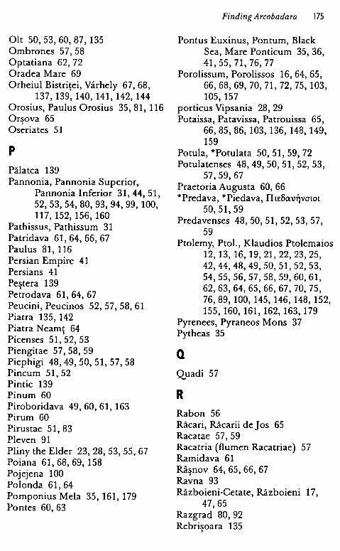
Olt 50, 53, 60, 87' 135 Ombrones 57, 58 Optatiana 62, 72 Oradea Mare 69 Orheiul Bistriţei, Varhely 67, 68,
137, 139, 140, 141, 142, 144 Orosius, Paulus Orosius 35, 81, 116 Orşova 65 Oseriates 51
p
Pălatca 139 Pannonia, Pannonia Superior,
Pannonia Inferior 31, 44, 51, 52,53,54,80,93,94,99, 100, 117, 152, 156, 160
Pathissus, Pathissum 31 Patridava 61, 64, 66, 67 Paulus 81, 116 Persian Empire 41 Persians 41 Pestera 139 . Petrodava 61, 64, 67 Peucini, Peucinos 52, 57, 58, 61 Piatra 135, 142 Piatra Neamţ 64 Picenses 51,52, 53 Piengitae 57, 58, 59 Piephigi 48, 49, 50, 51, 57, 58 Pincum 51, 52 Pintic 139 Pinum 60 Piroboridava 49, 60, 61, 163 Pirum 60 Pirustae 51, 83 Pleven 91 Pliny the Elder 23, 28, 53, 55, 67 Poiana 61, 68,69, 158 Pojejena 100 Polonda 61, 64 Pomponius Mela 35, 161, 179 Pontes 60, 63
Finding Arcobadara 175
Pontus Euxinus, Pontum, Black Sea, Mare Ponticum 35, 36, 41, 55, 71, 76, 77
Porolissum, Porolissos 16, 64, 65, 66,68, 69, 70, 71, 72, 75, 103, 105, 157
porticus Vipsania 28, 29 Potaissa, Patavissa, Patrouissa 65,
66,85,86, 103, 136, 148, 149, 159
Potula, *Potulata SO, 51, 59, 72 Potulatenses 48,49,50,51,52, 53,
57,59,67 Praetoria Augusta 60, 66 *Predava, *Piedava, IlLEBC\'.\l~VO'lOL
50,51,59 Predavenses 48,50,51, 52,53,57,
59 Ptolemy, Ptol., Klaudios Ptolemaios
12, 13, 16, 19,21,22,23,25, 42,44,48,49,50,51,52,53, 54,55,56,57,58, 59,60,61, 62,63,64,65,66,67, 70, 75, 76,89, 100, 145, 146, 148, 152, 155, 160, 161, 162, 163, 179
Pyrenees, Pyraneos Mons 37 Pytheas 35
Q
Quadi 57
R Rabon 56 Răcari, Răcarii de Jos 65 Racatae 57, 59 Racatria (flumen Racatriae) 57 Ramidava 61 Râşnov 64,65,66,67 Ravna 93 Războieni-Cetate, Războieni 17,
47,65 Razgrad 80, 92 Rebrişoara 135
176 SORIN NEMET!
Reghin 69 regia Ansamensium, Ansamense 46,
88,89, 135, 137, 139 regia Aquense, Aquensis 85, 99 regia Bassianense, Bassianensis 87,
99 regia Dimense 96 regia Dyptensium 94 regia Gelegetiorum 94 regia Histriae 96, 97 regia Marcinopolitana 94 regia Montanense 89, 96 regia Neridonisense 98, 138 regia Nicopolitana 95 regia Ratiarense 95 regia Scodrihense 98 regia Serdicense 94 regia Viminacense 95 Reteag 135, 140 Rhataca 51 Rhatacenses 48, 49, 50, 51, 57 Rhenus, Rheno, Rhine 35, 37, 80 Rheucanali 58 Rhodanus, Rhodano, Rhon 37 Rhodos 38 Roxolani, Roxolanos 31, 57, 58 Romans 23, 25, 26, 31, 34, 35, 41,
42,43,50,62, 104 Roma, Rome 80, 94, 95, 96, 99, 108,
147, 150, 151, 152, 154, 155, 160, 162, 166
Romula 47, 53, 61, 135 Rucconium 61, 65 Rugăşeşti 139 Russia 41 Rusu de jos 135, 140, 141
s Saboci 57, 58, 59 Saldae 51 Saldenses 48,49,50,51, 57,59 Salinae, Salinis 60, 65, 66, 73 Salsovia 71, 73
Samum, Samo, Ansamum 53, 83, 88, 89,90, 98,99, 135, 137, 139, 140, 154
Sangidava 61, 66 Sânmihaiu de Câmpie 140, 143 Sântejude 139 Saprisara 96 Saram, Sarum 73, 75 Sărăţeni, S6varad 68 Sardiatius, Sardiatae 82, 83 Sardinia 38 Sarmatae, Sauromatae 31 Sarmatia 31, 33, 35, 36, 39, 55, 57,
59, 76 Sarmatian Desert 30, 34, 56 Sarmizegetusa (Ulpia Traiana) 53,
103, 105, 122, 147 Sarmizegetusa, :Ecxpf.LL~E)'i0ov<;cx t'O
~CXO'lAELOV 62, 65, 85, 134, 158, 159
Sava 139 Scandia, Scandinavian Peninsula
34 Scărisoara 135
' Scirtiones 51 Scordisci 51 Senses, Sienses 48, 49, 50, 57 Septentrional Ocean 35 Serdica 94 Sevaces 51 Sic 139 Sicilia 38 Şiclod, Sikl6d 68 Şieu 140, 142, 143 Şieu Măgheruş 135 Şieu Odorhei 135 Şieu Sfântu 135 Silvanus 110, 151 Singidava 61, 153 Singidunum 51, 62, 153 Sinoe, Casapchioi 97 Şintereag 142 Siret 61, 68, 69 Siria, Syria 87, 95
Someş 70, 88 Someşul Mic 139 Sornum 61 Splonum 45 Stamuamum, Stagnum Mursianum
73, 75 Stavani 58 Storna Peuci 71, 73, 76 Storgosia 91 Strugureni 141 Stupini 140, 143, 153, 179 Sturnoi, l:wupvol 76 Sturum 68, 69, 73, 76 Sucidava, Sucidavense 53, 61, 87,
91,99, 135, 163 Suda 46 Sudini 58 Suebi 31 Suetonius 37, 38, 40, 160 Suiones 57 Szolnok 69
T Ţaga 137, 139 Tagorae 76 Taifali 24 Tamasidava 49, 60, 61 Tanais, Tanain 35, 36, 71, 74, 76 Târnava Mare 69 Tărpiu 135 Tăure 135 Taurisci, Teurisci 23, 48, 50, 51, 53,
57,58 Telesphorus 110 Tell-Diiliik 87 Teregova 17 Terra Mater 85 territorium Abritanorum 91 territorium Aegyssense 91 te.rritorium Arcobadarense,
Arco badarensis 13, 17, 63, 91,98, 134, 137, 139, 140, 142, 156, 159
Finding Arcobadara 177
territorium Bassianae 63, 87 territorium Capidavensis 91 territorium Dianensium 91 territorium Matricensium 93 territorium Montanensium 89, 96 territorium Sucidavense 53, 87, 91,
135 territorium Troesmensis 93 territorium Vetussalinesium 93 Tervingi 24 Theodosia 76, 77 Theodulf, Theodulf of Orleans 37,
39 Theoi Epekooi 110, 179 Thracia 22, 39, 40, 41, 94 Tibiscum 55, 62, 65, 128, 152 Timacum Minus 93 Tios 18 Tiseşti 64 Tfrypol 76 Transmontani (Costoboci) 58, 59 Tribalii 51 Tricornenses 51, 52, 53 Tricornium 51, 52 Triphulum 64, 66, 67, 140 Troesmis 61, 92, 152 Trotuş 68 Tulcea 92, 97, 98, 147, 148, 162, 166 Tungri 17, 70, 100, 108 Turieevac 99 Tyras, Tira, Thira, Phira 55, 56, 61,
68,69, 70, 71, 73, 75, 76, 77
u Uila 140 Ulpianum 60, 63, 66, 153 Urgum 68,69, 73, 76, 77 Urişor 139 Utidava 61, 64, 66, 67
V Varciani 51 Vegetius 80
178 SORIN NEMET!
Venetae, Venedae, Venetes 57, 58 Venus 119, 120 Vergiliu, Virgil 81 Vermeş 141, 143 Victoali 24 Vicus Anartorum 48 Vicus Patavissensium 48 Vicus Pirustarum 48 83 Vicus Quintionis 97 ' Vistula, Vistla 30, 31, 32, 33, 34, 35,
36,39,56,57,58
Voivodeni 140 Vr5ac 100
z Zagra 135, 140 Zargidava 49, 60, 61 Zourobara,Zovp6~apa 19 Zusidava 61
LIST OF PLATES
1. The fragmentary altar (Photo C. Gaiu). 2. The drawing of the altar's inscription (after Piso 2006-2007). 3. The map of the oikumene after Eratosthenes (after Au jac 1992). 4. The world in Strabon's Geography (after Mattern 1999). 5. Agrippa's map of the known world (after Mattern 1999). 6. Divisio orbis terrarum (after Prontera 1992). 7. The world after Pomponius Mela (after Prontera 1992). 8. Ptolemy's map of the world (after Aujac 1992). 9. The site of Ilişua (after Găzdac, Gaiu, Marchiş 2011). 10. The Carl Torma's plan of Ilişua (after Găzdac, Gaiu, Marchiş 2011 ). 11. Bronze statue of Jupiter Dolichenus (Photo S. Odenie, MNIT). 12. The relief of the goddess Fortuna (Photo C. Gaiu). 13. The monument of the Theoi Epekooi (Photo C. Gaiu). 14. Bronze statue of the goddess Libera (Photo S. Odenie, MNIT). 15. Handmade pots from Stupini (after Gaiu 2004). 16. Handmade cups from Stupini (after Gaiu 2004). 17. Ma p - The north-eastern Dacia ( after Bărbulescu 2005).

Legend
o Rural settlement
o Rural settlement (surface researches)
® Stray finds
(Î) Auxiliary camp
I Watch tower
~ Salt mine
ţtţ Stone quarry
~
!!!! Baths (termae)
~ Farm (vil/a rustica)
III.III Temple
• Cemetery
~ Workshop
-$- Milliarum
D Coin hoard
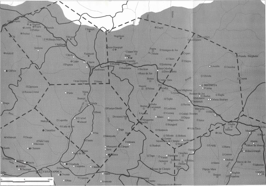
®Deuşu ®satu~ Micicaşu
•Chinteni
- -PÎlltlC
............
®Ohinda
®Ţiglu
®Lechinl8 ® ®Vermeş ®Galaţii Bisflet
®Dipşa ®Jeica · eorzuNou
®Bungard •viii Tecii