Embed Size (px)
Citation preview
TECHNICAL STAFF REPORT
Ellicott City Watershed Master Plan
Planning Board Meeting of October 15, 2020
Petitioner: Amy Gowan, Director, Howard County Department of Planning and Zoning (DPZ) DPZ Contacts: Kate Bolinger, Planning Supervisor, [email protected]
Peter Conrad, Deputy Director, [email protected] 410-313-2350
Request: Request of the Planning Board to hold a public meeting for input and
recommendation to the County Council on an amendment to PlanHoward 2030, the general plan for Howard County, to incorporate the Ellicott City Watershed Master Plan (the Plan) by reference.
Description: The proposed amendment to PlanHoward 2030 includes new text to incorporate
the Ellicott City Watershed Master Plan by reference. If the amendment is approved, PlanHoward 2030 text will be amended in the first page of the Executive Summary. (Refer to exhibit A and exhibit B for copies of the Ellicott City Watershed Master Plan and the proposed amendment, respectively.)
The Plan provides policies and implementing actions for protecting and enhancing flood-impacted Ellicott City and the surrounding Tiber-Hudson Watershed. To accomplish this, the plan integrates strategies for community character and placemaking, flood mitigation, environmental stewardship, economic development and transportation and parking frameworks. Strategies are then illustrated through options for specific geographic areas including streetscapes, riverfront, lower and upper main, Ellicott Mills gateway, the West End and the courthouse areas. The plan is guided by and builds upon the EC Safe and Sound plan currently underway. The EC Safe and Sound plan is a multi-phase plan built around four primary focus areas: ensuring public safety, supporting business and property owners, maintaining Ellicott City’s historic charm, and developing a more inclusive, community-driven process. The EC Safe and Sound plan provides the framework for flood mitigation projects that will increase the watershed's retention capacity and will improve water conveyance.
DocuSign Envelope ID: 094A2526-306B-4632-A44A-7E71A5BD4132
While the EC Safe and Sound flood mitigation plan serves as the foundation for the master plan, the flood mitigation plan—and associated Section 106 process— is on a separate, yet parallel track. The master plan is likely to be adopted prior to the resolution of the Section 106 process and is distinct in the following ways:
• Flexible Document: The master plan is intended to be a fluid, flexible document containing a menu of options with policies and goals that are designed to be adaptable.
• Early Guidance: The master plan offers early guidance on design for projects such as the lower main channel, but the master plan is not meant to represent the final design or only design option for the project. If some element of the flood mitigation plan does not come to fruition, the overall comprehensive nature of the master plan—its goals, desired outcomes and policies—should be looked upon for guidance.
• Detailed Building Information: The master plan is not intended to include detailed information on the impacted buildings (history, mitigation options, etc.). This information will be included as part of the Section 106 process.
Background: Ellicott City is an historic community in Howard County, Maryland, located at the
confluence of multiple tributaries that feed into the Patapsco River. The community is steeped in history, with much of its original architecture intact. Notable for its connections to the National Road, the original B&O Railroad line and rich mill heritage, the unincorporated town traces its origins to 1772. Today, Ellicott City is a regional tourism destination, a center for entrepreneurial endeavors, and a nationally significant active historic district. These unique characteristics warranted a highly context-sensitive approach to planning and urban design provided in this master plan. The planning effort was initiated in 2017 following a deadly, historic flash flood which devastated the town in 2016. After the initial emergency response, a series of community action groups were developed to begin addressing the town’s flood-prone nature. Numerous idea-generating workshops were held with focus groups and the general public, which identified potential strategies for flood mitigation and improved public amenities in town. The Plan was underway for approximately one year and nearing completion when a second devastating flash flood occurred in May 2018.
The Plan addresses a complex set of inter-related challenges, including the opportunity to invest in attractive amenity spaces while being sensitive to the community’s rich history. The watershed-wide recommendations directly respond to the two historic floods and the County’s vision for a future Ellicott City that exists in closer balance with the hydraulic forces that have shaped the town through the generations. Though Ellicott City will never be without flooding risk, the recommendations in the Plan will help generate a more resilient response to flood events should they occur again in the future.
Public Outreach: The Plan is the result of a multi-year outreach process. Since launching the plan in
May of 2017, DPZ has hosted eight public workshops to shape the vision, gather input on emerging ideas, and review the draft plan. The eighth and final public workshop, held in August 2020, was held virtually as a result of public health measures to reduce the spread of COVID-19.
DocuSign Envelope ID: 094A2526-306B-4632-A44A-7E71A5BD4132
In addition to meetings, the public was invited to provide input through online tools throughout the planning effort. Over 600 responses to online surveys were received. An email distribution list was used to keep approximately 1,500 people apprised of opportunities for input.
The draft Ellicott City Watershed Master Plan was released in July 2020 and available for public comment for over 30 days (from July 21 to August 28). DPZ compiled nearly 450 public comments and synthesized these comments into a public comment summary (see exhibit C). An 11-member appointed master plan advisory team (MPAT) served as a sounding board for the project. When the original executive order establishing MPAT expired, a new MPAT was formed. The two MPAT groups met a combined total of eight times over the course of the project (with the eighth and final meeting occurring virtually). MPAT discussed the draft plan at the group’s final meeting on August 26, 2020 (see exhibit D). DPZ sought input from the Historic Preservation Commission (HPC) throughout the planning effort and encouraged members to follow the process. In July 2017, HPC members were invited to participate, along with other preservationists, in a focus group regarding historic preservation. On November 7, 2019, DPZ participated in a workshop with the HPC to discuss the master planning effort. At the August 6, 2020 HPC meeting, DPZ requested advisory comments from the HPC on the draft Ellicott City Watershed Master Plan. The HPC’s advisory comments to DPZ were summarized in a letter dated September 3, 2020, and further documented in minutes from the August 6, 2020 meeting (see exhibit E). On August 20, 2020, DPZ staff provided an overview of the Public Draft and the adoption process to the Planning Board to seek input in advance of an advisory recommendation from the Board. At that meeting, Planning Board members expressed appreciation for:
• the plan’s ability to find new opportunities in response to change, • the incorporation of the EC Safe and Sound plan, • the multi-objective vision statement, • the thoroughness of the plan’s contents, and • the overall approach to a complex set of challenges in Ellicott City.
Planning Board Review: §16.900(j)(1)(llI) states that a bill proposing amendment of the general plan shall
not be added to the Council’s legislative agenda until the County Council has received a recommendation and report from the Planning Board.
DPZ Recommendation: That the Planning Board recommend approval of the Ellicott City Watershed
Master Plan (Exhibit A) and an amendment to PlanHoward 2030, the general plan for Howard County, to include the Ellicott City Watershed Master Plan (the Plan) by reference (Exhibit B).
________________________________________ Amy Gowan, Director Date Department of Planning and Zoning
DocuSign Envelope ID: 094A2526-306B-4632-A44A-7E71A5BD4132
10/1/2020
Directly Attached
Draft Council Bill
Exhibits
A. Ellicott City Watershed Master Plan – Council Draft, September 2020B. Proposed Text Amending the General Plan, PlanHoward 2030C. Summary of Comments Received on the Draft Plan, September 2020D. Master Plan Advisory Team Minutes, August 26, 2020E. Historic Preservation Commission Letter and Meeting Minutes, September 3, 2020
DocuSign Envelope ID: 094A2526-306B-4632-A44A-7E71A5BD4132
Introduced
Public Hearing
Council Action
Executive Action
Effective Date
County Council of Howard County, Maryland
2020 Legislative Session Legislative Day No. _ Bill No. -2020 Introduced by: The Chairperson at the request of the County Executive
AN ACT amending PlanHoward 2030, the general plan for Howard County, to include The Ellicott
City Watershed Master Plan and recognizing that the Plan is a comprehensive, long-range
document created by a community-driven vision for historic Ellicott City and the Tiber
Branch Watershed; and generally relating to planning, zoning and land use in Howard
County.
Introduced and read first time , 2020. Ordered posted and hearing scheduled. By order Diane Schwartz Jones, Administrator Having been posted and notice of time & place of hearing & title of Bill having been published according to Charter, the Bill was read for a second time at a public hearing on , 2020. By order Diane Schwartz Jones, Administrator This Bill was read the third time on ____________, 2020 and Passed ___, Passed with amendments _______, Failed _______. By order Diane Schwartz Jones, Administrator Sealed with the County Seal and presented to the County Executive for approval this day of , 2020 at ___ a.m./p.m. By order Diane Schwartz Jones, Administrator Approved/Vetoed by the County Executive , 2020 Calvin Ball, County Executive NOTE: [[text in brackets]] indicates deletions from existing law; TEXT IN SMALL CAPITALS indicates additions to existing law; Strike-out indicates material deleted by amendment; Underlining indicates material added by amendment
DocuSign Envelope ID: 094A2526-306B-4632-A44A-7E71A5BD4132
1
WHEREAS, Howard County has prepared The Ellicott City Watershed Master Plan (the 1
“Plan”) to provide policies and implementing actions for protecting and enhancing flood-2
impacted Ellicott City and the surrounding Tiber-Hudson Watershed; and 3
4
WHEREAS, Ellicott City and the surrounding Tiber-Hudson Watershed have important 5
cultural, economic, environmental and recreational resources, as well as significant historical 6
sites and a district on the National Register of Historic Places; and 7
8
WHEREAS, Ellicott City and the surrounding Tiber-Hudson Watershed include a State-9
recognized Main Street and State-approved Sustainable Community Area; and 10
11
WHEREAS, the Plan integrates strategies for community character and placemaking, 12
flood mitigation, environmental stewardship, economic development and transportation and 13
parking frameworks; and 14
15
WHEREAS, the Plan is guided by and builds upon the EC Safe and Sound plan currently 16
underway; and 17
18
WHEREAS, the Plan is the result of a multi-year outreach process that included eight 19
public workshops and input through online tools throughout the planning effort; and 20
21
WHEREAS, in July of 2012, by passage of Council Bill No. 26-2012, the Howard 22
County Council adopted PlanHoward2030, a new general plan for Howard County; and 23
24
WHEREAS, the County Council now wishes to amend PlanHoward2030 in order to 25
include the Plan. 26
27
NOW, THEREFORE, 28
29
DocuSign Envelope ID: 094A2526-306B-4632-A44A-7E71A5BD4132
2
Section 1. Be It Enacted by the County Council of Howard County, Maryland, that 1
PlanHoward2030 is hereby amended to include the Ellicott City Watershed Master Plan, as 2
attached to this Act as Exhibit A, and the following amendments are made to PlanHoward2030: 3
1. The first page of the Executive Summary is amended as shown in the attached 4
Exhibit B; and 5
2. The Ellicott City Watershed Master Plan shall be attached to and incorporated 6
into PlanHoward2030. 7
8
Section 2. And Be It Further Enacted by the County Council of Howard County, Maryland that the 9
Director of the Department of Planning and Zoning may correct obvious errors, capitalization, 10
spelling, grammar, headings and similar matters and may publish this amendment to 11
PlanHoward2030 by adding or amending covers, title pages, a table of contents, and graphics to 12
improve readability. 13
14
Section 3. And Be It Further Enacted by the County Council of Howard County, Maryland, 15
that this amendment be attached to and made part of PlanHoward2030. 16
17
Section 4. And Be It Further Enacted by the County Council of Howard County, Maryland, that 18
this Act shall become effective 61 days after its enactment. 19
DocuSign Envelope ID: 094A2526-306B-4632-A44A-7E71A5BD4132

Exhibit A
Ellicott City Watershed Master Plan
DocuSign Envelope ID: 094A2526-306B-4632-A44A-7E71A5BD4132
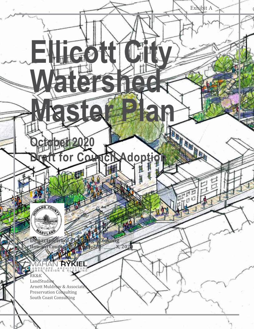
Department of Planning & ZoningHoward County, MD — Adopted: ______ X, 2020
RK&KLandStudiesArnett Muldrow & AssociatesPreservation ConsultingSouth Coast Consulting
Ellicott City Watershed Master PlanOctober 2020Draft for Council Adoption
Exhibit A

2 Ellicott City Watershed Master Plan
3Ellicott City Watershed Master Plan
Ellicott City Watershed Master Plan
For More Information: Howard County Department of Planning and Zoning
3430 Court House Drive, Ellicott City, MD 21043410-313-2350, [email protected]
Howard County, Maryland
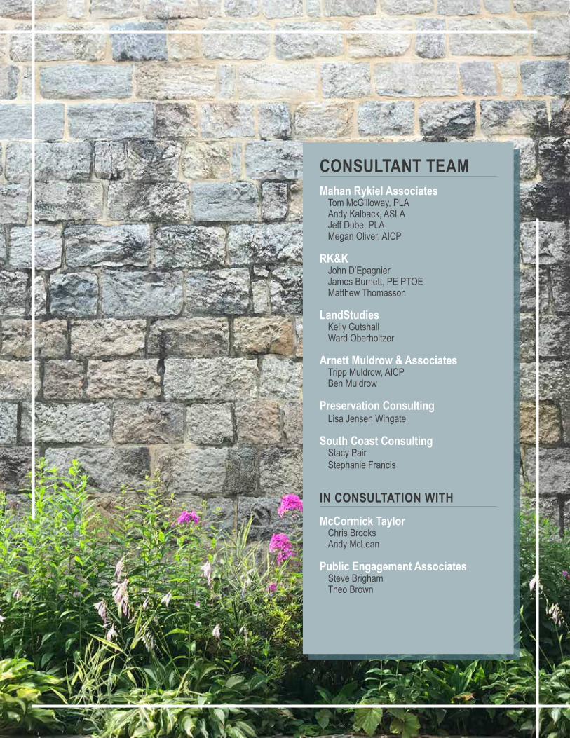
CONSULTANT TEAMMahan Rykiel Associates
Tom McGilloway, PLAAndy Kalback, ASLAJeff Dube, PLAMegan Oliver, AICP
RK&KJohn D’EpagnierJames Burnett, PE PTOEMatthew Thomasson
LandStudiesKelly GutshallWard Oberholtzer
Arnett Muldrow & AssociatesTripp Muldrow, AICPBen Muldrow
Preservation ConsultingLisa Jensen Wingate
South Coast ConsultingStacy PairStephanie Francis
IN CONSULTATION WITHMcCormick Taylor
Chris BrooksAndy McLean
Public Engagement AssociatesSteve BrighamTheo Brown
7Ellicott City Watershed Master Plan
For More Information: Howard County Department of Planning and Zoning
3430 Court House Drive, Ellicott City, MD 21043410-313-2350, [email protected]
All photographs by Howard County Government or Mahan Rykiel Associates unless otherwise noted.
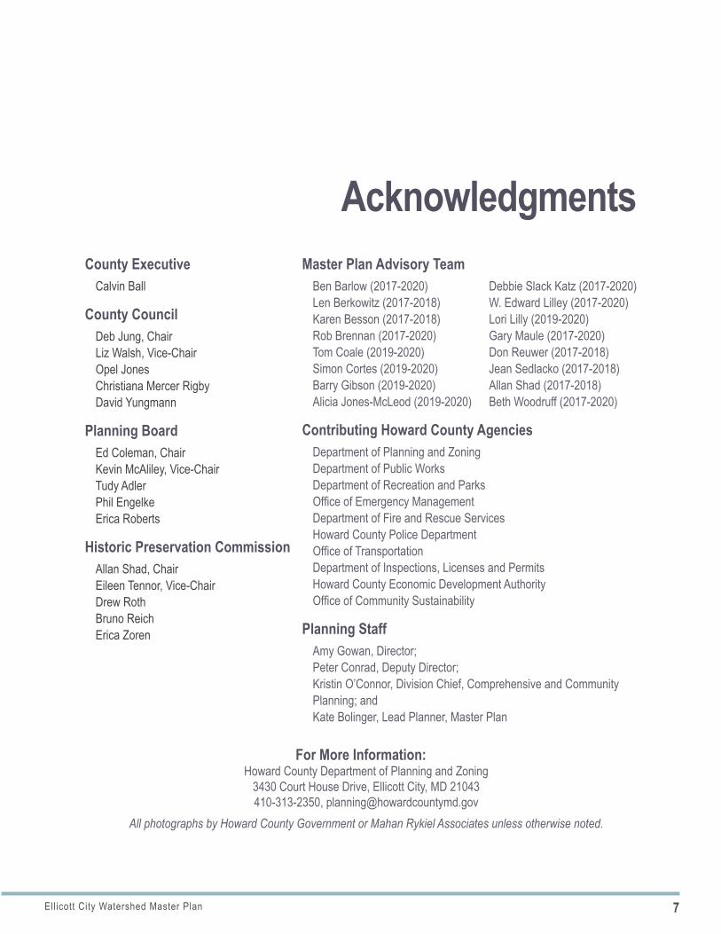
Master Plan Advisory TeamBen Barlow (2017-2020)Len Berkowitz (2017-2018)Karen Besson (2017-2018)Rob Brennan (2017-2020)Tom Coale (2019-2020)Simon Cortes (2019-2020)Barry Gibson (2019-2020) Alicia Jones-McLeod (2019-2020)
Contributing Howard County AgenciesDepartment of Planning and ZoningDepartment of Public WorksDepartment of Recreation and ParksOffice of Emergency ManagementDepartment of Fire and Rescue ServicesHoward County Police DepartmentOffice of TransportationDepartment of Inspections, Licenses and PermitsHoward County Economic Development AuthorityOffice of Community Sustainability
Planning StaffAmy Gowan, Director; Peter Conrad, Deputy Director; Kristin O’Connor, Division Chief, Comprehensive and Community Planning; and Kate Bolinger, Lead Planner, Master Plan
County ExecutiveCalvin Ball
County CouncilDeb Jung, ChairLiz Walsh, Vice-ChairOpel JonesChristiana Mercer RigbyDavid Yungmann
Planning BoardEd Coleman, ChairKevin McAliley, Vice-ChairTudy AdlerPhil EngelkeErica Roberts
Historic Preservation CommissionAllan Shad, ChairEileen Tennor, Vice-ChairDrew RothBruno ReichErica Zoren
Acknowledgments Debbie Slack Katz (2017-2020)W. Edward Lilley (2017-2020)Lori Lilly (2019-2020)Gary Maule (2017-2020)Don Reuwer (2017-2018)Jean Sedlacko (2017-2018)Allan Shad (2017-2018)Beth Woodruff (2017-2020)
9Ellicott City Watershed Master Plan
Forward
1Forward
ABSTRACTThis Plan contains text, graphics and supporting maps for an amendment to the county’s General Plan, PlanHoward 2030. This General Plan Amendment provides policies and implementing actions for protecting and enhancing flood-impacted Ellicott City and the surrounding Tiber-Hudson Watershed. To accomplish this protection and enhancement, the plan integrates strategies for community character and placemaking, flood mitigation, environmental sustainability, economic development and transportation and parking. Strategies are then illustrated through options for specific geographic areas. The plan is guided by and builds upon the EC Safe and Sound plan currently underway.
NOTICE TO READERS (HOW TO USE THIS DOCUMENT)Howard County master plans reflect a vision for the future that responds to the unique character of the local community within the context of a countywide perspective. These plans convey guiding policies and implementing actions for defined geographic areas.
Master plans are designed to “look ahead” through a shared vision for the county’s growth and conservation. As communities and markets change and unexpected events occur, the approach to implementation of a master plan needs to be flexible over time. Generally, graphics provided in an adopted plan are for illustrative purposes only; they are intended to convey a general approach or character rather than an obligation to a specific detailed outcome.
REPORT STRUCTUREThis master plan report includes four primary sections, preceded by an Executive Summary.
I. INTRODUCTIONThis section identifies the purpose and scope of the master plan, describes the importance of a master plan and describes plan geographies that are referenced throughout the document.
II. INFORMING THE VISIONThis section provides an overview of previous, current, and ongoing planning efforts, studies and initiatives and the public outreach process that set a baseline and direction for the master plan.
III. A VISION FOR THE FUTUREThis is the primary section of the master plan. It identifies a vision statement, master plan goals, assessments of existing conditions and recommendations in the form of policy statements and implementing actions. Because Ellicott City’s built and natural environments are closely interwoven, every action is interrelated with and dependent upon other actions. The Vision for the Future, therefore, is divided into 12 Master Plan frameworks that are based on both topics and geographic areas. Since the policy statements and implementing actions respond to challenges and opportunities identified through the existing conditions assessment, the order of policies generally follows the order of existing conditions issues.
III.1–5. TOPIC-RELATED PLAN FRAMEWORKSThese frameworks include assessments of existing conditions and outline policies and actions by topic such as community character and placemaking, flood mitigation, environmental sustainability, economic development and transportation and parking as they apply to the entire watershed.
10 Ellicott City Watershed Master Plan
Forward
ILLUSTRATIVE EXAMPLEThe following is intended as an illustration to keep in mind when reviewing the options outlined in this plan and represents one of many ways that master plan recommendations might be implemented.
OPTION: Widen the Hudson Branch stream channel and create more green space, amenity space and green infrastructure in Lot D.
IMPACTS: There exists a sufficient amount of parking spaces within the core, however, if a significant amount of parking were removed from one area, such as Lot D, then that lost parking may need to be accommodated in another location.
RESULTING OPTIONS FOR PARKING RELOCATION: This could be accomplished in a number of ways: a shuttle system could be implemented to draw upon distant parking resources such as the Courthouse Lot, a parking deck could be constructed, or the parking might be accommodated as part of the reuse of the Wilkins Rogers mill site on a short-term or long-term basis, negating the need for a parking deck.
POTENTIAL APPROACH: Assuming a parking deck is the desired solution, there are three locations where a parking deck would be logical – Lot A, Lot F and Lot D. Each location presents a different set of opportunities and challenges.
POTENTIAL RECOMMENDATION: Develop a parking deck on Lot A to provide more parking for Lower Main Street and allow visitors to park before arriving at congested Main Street.
IMPLICATIONS: A parking deck on Lot A may further justify a new pedestrian bridge spanning the Patapsco River, better connecting Lot A with Lower Main. Lot F and Lot D would likely remain as surface parking.
III.6–12. GEOGRAPHIC AREA-RELATED FRAMEWORKSThese frameworks include assessments of existing conditions and address how the topic-related strategies could apply to specific geographic locations and project areas. In some instances, options are shown for geographic areas because how the vision is implemented in one geographic area may depend upon how the vision is implemented in other geographic areas. None of the options are intended to be preferred over other options. Their appropriateness depends upon what might be implemented elsewhere. An example of how this might apply is illustrated below.
IV. IMPLEMENTATION PLANThe implementation plan outlines each policy, primary implementation responsibilities, implementation partners and timeframes for implementation (short,
mid, or long term). For many policies, implementation is ongoing or will occur in phases in which case the timeframes may include ranges. Because the master plan is a long-range guiding document, implementation timeframes may change as the result of unforeseen opportunities or challenges that may arise.
EC SAFE AND SOUNDThe EC Safe and Sound plan is a multi-phase plan built around the need for public safety, supporting business and property owners, preparing the County for a changing climate, and creating a more inclusive, community-driven process for decisions regarding Ellicott City’s future. There are four primary focus areas of the plan: ensuring public safety, supporting business and property owners, maintaining Ellicott City’s historic charm, and developing a more inclusive, community-driven process.
11Ellicott City Watershed Master Plan
Forward
GLOSSARY OF ACRONYMSThis master plan includes numerous acronyms for departments, agencies and programs. While each are defined when they are introduced, the summary below provides a complete list for reference.
A&E Arts and Entertainment
ADA Americans with Disabilities Act
AE Architectural Engineering Firm
AVs Autonomous Vehicles
BMC Baltimore Metropolitan Council
BPAG Bicycle and Pedestrian Advisory Group
BRTB Baltimore Regional Transportation Board
CAG Community Advisory Group
CDC Community Development Corporation
CRS Community Rating System (NFIP)
DFIRM Digital Flood Insurance Rate Map
DILP Howard County Department of Licenses and Permits
DPW Howard County Department of Public Works
DPZ Howard County Department of Planning and Zoning
DRP Howard County Department of Recreation and Parks
ECP Ellicott City Partnership
EPA Environmental Protection Agency
ESD Environmental Site Design
FEMA Federal Emergency Management Agency
FRM Flood Risk Management
GIN Green Infrastructure Network
GIS Geographic Information Systems
H&H Hydrology and Hydraulic Study
HCC Howard Community College
HCEDA Howard County Economic Development Authority
HPC Howard County Historic Preservation Commission
MDE Maryland Department of the Environment
MHT Maryland Historic Trust
MPAT Master Plan Advisory Team
MS4 Municipal Separate Storm Sewer System Permits
MTA Maryland Transit Administration
NFIP National Flood Insurance Program
NHPA National Historic Preservation Act
NPDES National Pollutant Discharge Elimination System
OCS Howard County Office of Community Sustainability
PFI Patapsco Female Institute
PRGP Patapsco Regional Greenway Plan
READY Restoring the Environment and Developing Youth (Howard EcoWorks Workforce Program)
RFI Request for Information
RFP Request for Proposals
RTA Regional Transportation Agency
SBDC Small Business Development Center
SHPO State Historic Preservation Office
SWM Stormwater Management
SWP Strategic Watershed Program
TAP ULI Technical Assistance Panel Report
TNC Traditional Neighborhood Center
Tourism Howard County Tourism Council
ULI Urban Land Institute
UMBC University of Maryland Baltimore County
USGS United States Geological Survey
WAT Watershed Action Team (Howard EcoWorks Workforce Program)
12 Ellicott City Watershed Master Plan
Forward
CONSIDERATIONS FOR THE COVID-19 PANDEMICThe master plan’s recommendations were mostly identified by late 2019, when the novel coronavirus that causes COVID-19 first emerged in Wuhan, China. By March 2020, when disruptions to everyday life in Maryland began, the draft master plan was already in production. Therefore, addressing the pandemic is not woven into the policies, illustrations and considerations contained throughout the document. While not minimizing the significant impacts of the health crisis, the current disruption is anticipated to be relatively short in duration as compared to the 20-year timeline for this long-term master plan. Yet, Howard County acknowledges that certain goals, policies and implementing actions contained herein have greater importance as a result of the pandemic and that they align with worldwide trends in adapting to life in the COVID-19 era.
PARKS AND OPEN SPACES: There is a renewed appreciation of parks and open spaces and recognition that many people are dependent upon parks and green spaces to provide much-needed relief mentally, physically and emotionally. Research shows that communities are experiencing significant increases in park and trail usage.
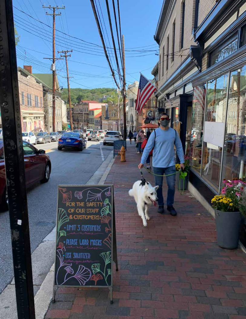
PEDESTRIAN SAFETY: Social distancing, or the ability to maintain physical distance between people, is fundamental to minimizing the spread of COVID. This distancing applies to sidewalk areas and outdoor public spaces, where pedestrians might need to move away from each other or cross the street to maintain a safe distance.
BICYCLE ACCOMMODATIONS: Cycling has increased as a way for people to move about, in some cases out of necessity and in others for recreational purposes.
ECONOMIC DEVELOPMENT: Restaurants and retail businesses are adapting and utilizing ‘found space’—usually parking areas—to provide safer dining areas with the potential for improved social distancing. Retail communities are adapting façade grant programs and public art to include sanitizing stations, better accommodations for take-out and curbside services, and COVID-related signage and social distancing-related pavement markings.
Along with many communities in Central Maryland, Ellicott City is already following some of these above trends and responding to COVID-19. As readers review many of the policies and implementing actions in the plan, they will notice an emphasis on flexibility, particularly related to how parking areas—surface parking lots and street parking—can be used for other activities on a temporary basis including events, additional park space, outdoor dining, and expanded pedestrian areas. Readers will also notice an emphasis on improved and connected park spaces, access to nature, better pedestrian connectivity with sidewalks, trails and crosswalks, attention to bicycle accommodations, messaging through awareness campaigns, and support to existing businesses and property owners. While these policies and actions were not developed with COVID in mind, they support the trends outlined above, although some background studies, such as the market analysis, may need to be updated once the county recovers from the COVID-related economic disruption. Specific relevant policies are listed below:
Policy 1.5 Public Realm Design, Amenities & User ComfortsPolicy 1.6 Public Art Policy 1.7 Green Cultural TrailPolicy 4.1 Existing Business SupportPolicy 4.5 Community Brand ExtensionPolicy 5.1 Pedestrian Accessibility and SafetyPolicy 5.2 Sidewalk and Trail ConnectivityPolicy 5.3 Bicycle AccommodationsPolicy 5.5 Parking ManagementPolicy 5.6 Wayfinding SystemPolicy 6.1 Main Street StreetscapePolicy 6.2 Maryland AvenuePolicy 7.1 Patapsco River Pedestrian and Bicycle CrossingPolicy 7.2 Regional Trail NetworkPolicy 7.4 Ellicott City Riverfront ParkPolicy 7.5 Lot B Policy 8.3 Tiber ParkPolicy 9.1 Lot E EnhancementPolicy 9.3 Lot D EnhancementPolicy 10.7 Lot G Temporary ParkingPolicy 11.1 Frederick Road/Main Street StreetscapePolicy 12.1 Courthouse Property Reuse
13Ellicott City Watershed Master Plan
Forward
15Ellicott City Watershed Master Plan
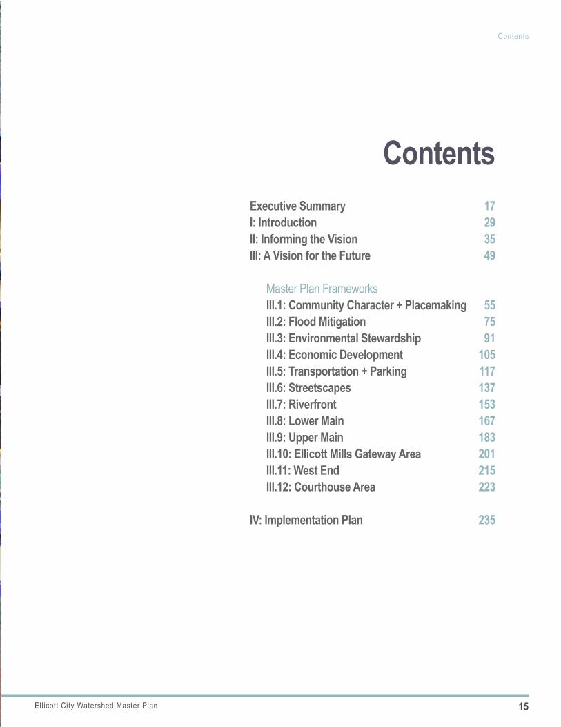
Contents
Executive Summary 17I: Introduction 29II: Informing the Vision 35III: A Vision for the Future 49
Master Plan Frameworks III.1: Community Character + Placemaking 55III.2: Flood Mitigation 75III.3: Environmental Stewardship 91III.4: Economic Development 105III.5: Transportation + Parking 117III.6: Streetscapes 137III.7: Riverfront 153III.8: Lower Main 167III.9: Upper Main 183III.10: Ellicott Mills Gateway Area 201III.11: West End 215III.12: Courthouse Area 223
IV: Implementation Plan 235
Contents
17Ellicott City Watershed Master Plan
Executive Summary
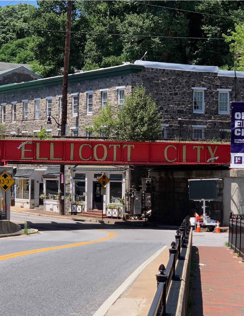
ELLICOTT CITY WATERSHED MASTER PLANEllicott City is an historic community in Howard County, Maryland, located at the confluence of multiple tributaries that feed into the Patapsco River. The community is steeped in history, with much of its original architecture intact. Notable for its connections to the National Road, the original B&O Railroad line and rich mill heritage, the unincorporated town dates back to 1772. Today, Ellicott City is a regional tourism destination, a center for entrepreneurial endeavors, and a nationally significant historic district. All of these unique characteristics warranted a highly context-sensitive approach to planning and urban design provided in this master plan.
The planning effort was initiated following a deadly, historic flood which hit the town in 2016. After the initial emergency response, a series of action groups were developed to begin addressing the town’s flood-prone nature. Numerous idea-generating workshops were held with focus groups and the general public, resulting in several resources outlining potential strategies for flood mitigation and improved public amenities in town. The Plan was underway for approx-imately one year and nearing completion when a second devastating flash flood occurred in May 2018.
This Watershed Master Plan addresses a complex set of inter-related challenges, including the opportunity to invest in useful and attractive amenity spaces while being sensitive to the community’s rich history. The watershed-wide recommendations developed in this Plan are in direct response to the two historic floods and the County’s vision for a future Ellicott City that lives in closer balance with the hydraulic forces that have shaped the town through the generations. Though Ellicott City will never be without flooding risk, the recommendations in this Plan will help generate a more resilient response to flood events should they occur again in the future.
PURPOSE AND SCOPEOVERVIEWThe Ellicott City Watershed Master Plan process officially kicked off on May 31, 2017 with the goal of developing a comprehensive, community-driven vision for rebuilding a stronger and more resilient Ellicott City. Triggered by the devastating July 30, 2016 flood, the master plan effort was designed to take a fresh and creative look at potential long-term flood solutions and strategies. The effort was grounded by information gathered in the 2016 flood recovery phase, interrupted by the May 2018 flood, and then restarted with direction from the EC Safe and Sound plan for flood mitigation.
Executive Summary
18 Ellicott City Watershed Master Plan
Executive Summary
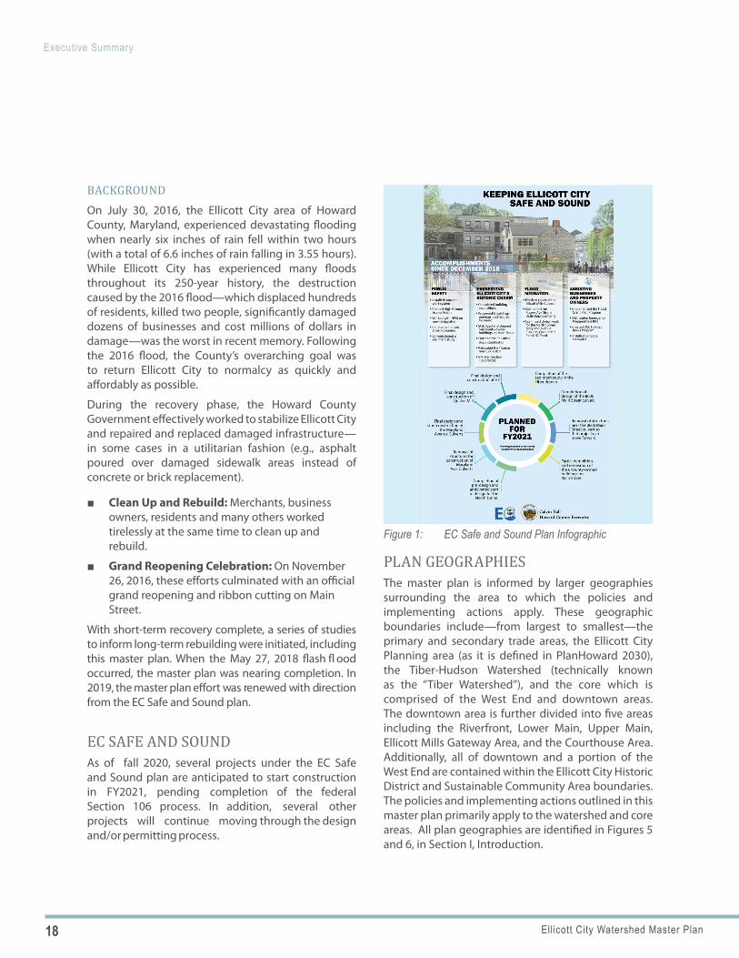
Figure 1: EC Safe and Sound Plan Infographic
BACKGROUNDOn July 30, 2016, the Ellicott City area of Howard County, Maryland, experienced devastating flooding when nearly six inches of rain fell within two hours (with a total of 6.6 inches of rain falling in 3.55 hours). While Ellicott City has experienced many floods throughout its 250-year history, the destruction caused by the 2016 flood—which displaced hundreds of residents, killed two people, significantly damaged dozens of businesses and cost millions of dollars in damage—was the worst in recent memory. Following the 2016 flood, the County’s overarching goal was to return Ellicott City to normalcy as quickly and affordably as possible.
During the recovery phase, the Howard County Government effectively worked to stabilize Ellicott City and repaired and replaced damaged infrastructure—in some cases in a utilitarian fashion (e.g., asphalt poured over damaged sidewalk areas instead of concrete or brick replacement).
■ Clean Up and Rebuild: Merchants, businessowners, residents and many others workedtirelessly at the same time to clean up andrebuild.
■ Grand Reopening Celebration: On November26, 2016, these efforts culminated with an officialgrand reopening and ribbon cutting on MainStreet.
With short-term recovery complete, a series of studies to inform long-term rebuilding were initiated, including this master plan. When the May 27, 2018 flash fl ood occurred, the master plan was nearing completion. In 2019, the master plan effort was renewed with direction from the EC Safe and Sound plan.
EC SAFE AND SOUNDAs of fall 2020, several projects under the EC Safe and Sound plan are anticipated to start construction in FY2021, pending completion of the federal Section 106 process. In addition, several other projects will continue moving through the design and/or permitting process.
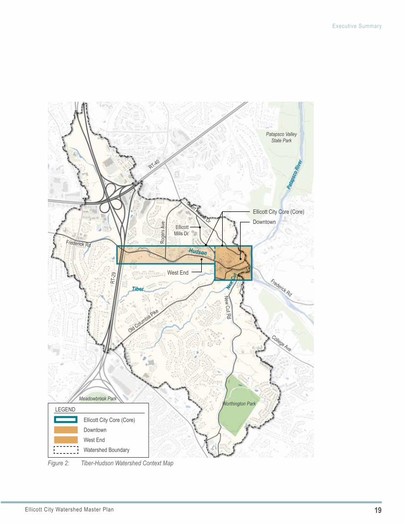
PLAN GEOGRAPHIESThe master plan is informed by larger geographies surrounding the area to which the policies and implementing actions apply. These geographic boundaries include—from largest to smallest—the primary and secondary trade areas, the Ellicott City Planning area (as it is defined in PlanHoward 2030), the Tiber-Hudson Watershed (technically known as the “Tiber Watershed”), and the core which is comprised of the West End and downtown areas. The downtown area is further divided into five areas including the Riverfront, Lower Main, Upper Main, Ellicott Mills Gateway Area, and the Courthouse Area. Additionally, all of downtown and a portion of the West End are contained within the Ellicott City Historic District and Sustainable Community Area boundaries. The policies and implementing actions outlined in this master plan primarily apply to the watershed and core areas. All plan geographies are identified in Figures 5 and 6, in Section I, Introduction.
19Ellicott City Watershed Master Plan
Executive Summary
Figure 2: Tiber-Hudson Watershed Context Map
Ellicott City Core (Core)Downtown
West End
RT-40Ro
gers
Ave
Court House DrEllicott
Mills Dr
Old Columbia Pike
RT-2
9
Frederick Rd
Frederick RdNew Cut Rd
College Ave
Patapsco Valley State Park
Worthington ParkMeadowbrook Park
Patap
sco R
iver
New
Cut
Tiber
Hudson
DowntownEllicott City Core (Core)
West End
LEGEND
Watershed Boundary
20 Ellicott City Watershed Master Plan
Executive Summary
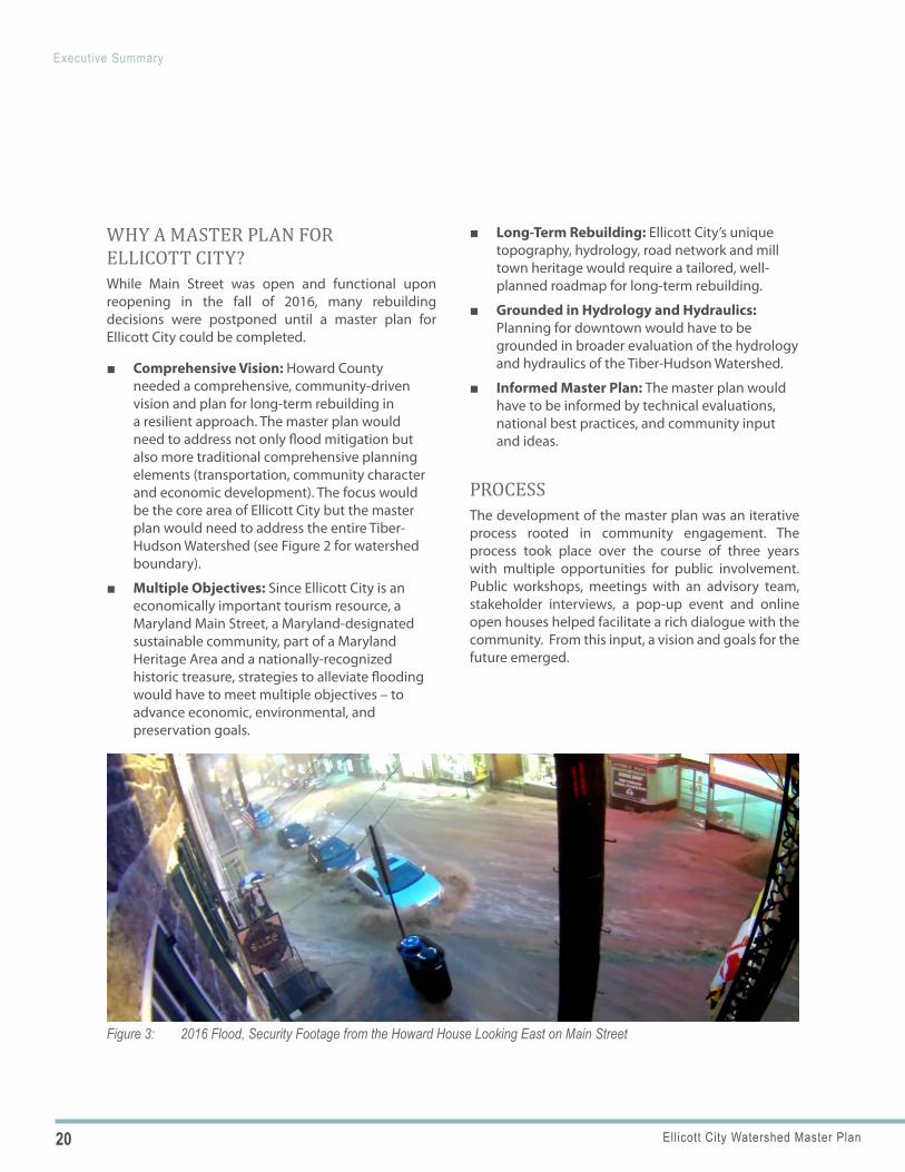
Figure 3: 2016 Flood, Security Footage from the Howard House Looking East on Main Street
WHY A MASTER PLAN FOR ELLICOTT CITY?While Main Street was open and functional upon reopening in the fall of 2016, many rebuilding decisions were postponed until a master plan for Ellicott City could be completed.
■ Comprehensive Vision: Howard County needed a comprehensive, community-driven vision and plan for long-term rebuilding in a resilient approach. The master plan would need to address not only flood mitigation but also more traditional comprehensive planning elements (transportation, community character and economic development). The focus would be the core area of Ellicott City but the master plan would need to address the entire Tiber-Hudson Watershed (see Figure 2 for watershed boundary).
■ Multiple Objectives: Since Ellicott City is an economically important tourism resource, a Maryland Main Street, a Maryland-designated sustainable community, part of a Maryland Heritage Area and a nationally-recognized historic treasure, strategies to alleviate flooding would have to meet multiple objectives – to advance economic, environmental, and preservation goals.
■ Long-Term Rebuilding: Ellicott City’s unique topography, hydrology, road network and mill town heritage would require a tailored, well-planned roadmap for long-term rebuilding.
■ Grounded in Hydrology and Hydraulics: Planning for downtown would have to be grounded in broader evaluation of the hydrology and hydraulics of the Tiber-Hudson Watershed.
■ Informed Master Plan: The master plan would have to be informed by technical evaluations, national best practices, and community input and ideas.
PROCESS The development of the master plan was an iterative process rooted in community engagement. The process took place over the course of three years with multiple opportunities for public involvement. Public workshops, meetings with an advisory team, stakeholder interviews, a pop-up event and online open houses helped facilitate a rich dialogue with the community. From this input, a vision and goals for the future emerged.

21Ellicott City Watershed Master Plan
Executive Summary
Quote from the letterMASTER PLAN GOALS
Building upon Recovery Phase studies and community input during the master plan process and grounded in EC Safe and Sound, six primary goals were developed to achieve the vision. Associated with each goal, a listing of desirable outcomes is provided. When future projects or activities are undertaken to implement the master plan, project managers should strive to advance these goals and work towards these outcomes.
1. Protect residents, employees and visitorsSafer buildings, advanced warnings of flood threat, clear access to high ground, greater preparedness, safer pedestrian and bicycle infrastructure
2. Manage water quantity and protect water qualityBroader awareness of the water’s beauty and strength, national resiliency model, resilient infrastructure, reduced flood impacts, managed stream debris, healthy natural resources, increased green space
3. Plan for economic successVariety of uses , diversity of businesses, new and existing business investment, thriving small businesses and entrepreneurs, opportunities for business expansion
4. Enhance the experienceWelcoming and attractive downtown, walkable destination, more accessible physical design, improved public amenities, increased cultural offerings, places for people
5. Preserve and promote the identityDistinctive community, showcase for heritage, town setting, steep terrain and river valley, widespread appreciation for historic preservation, celebrated past, present and future
6. Organize for successSustained focus on Ellicott City, flexibility to adapt to the unforeseen, multi-objective mindset, new collaborations, regional partnerships, ongoing and multi-disciplinary partnerships
22 Ellicott City Watershed Master Plan
Executive Summary
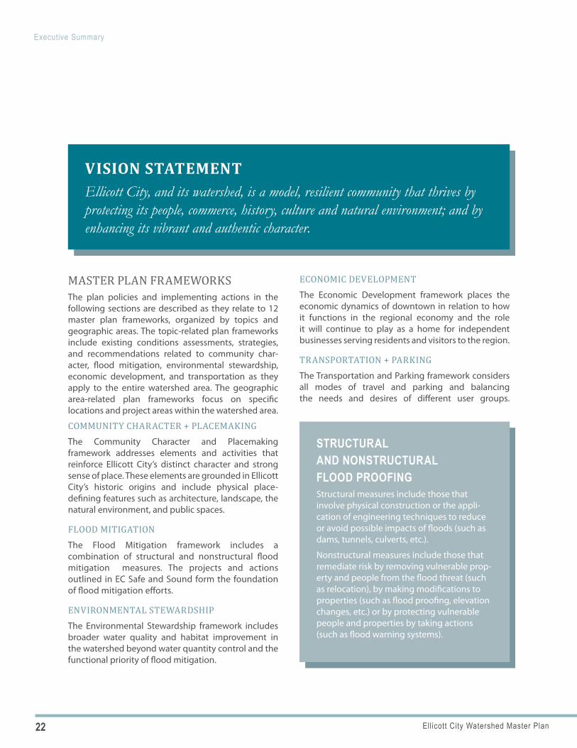
VISION STATEMENTEllicott City, and its watershed, is a model, resilient community that thrives by protecting its people, commerce, history, culture and natural environment; and by enhancing its vibrant and authentic character.
STRUCTURAL AND NONSTRUCTURAL FLOOD PROOFINGStructural measures include those that involve physical construction or the appli-cation of engineering techniques to reduce or avoid possible impacts of floods (such as dams, tunnels, culverts, etc.).
Nonstructural measures include those that remediate risk by removing vulnerable prop-erty and people from the flood threat (such as relocation), by making modifications to properties (such as flood proofing, elevation changes, etc.) or by protecting vulnerable people and properties by taking actions (such as flood warning systems).
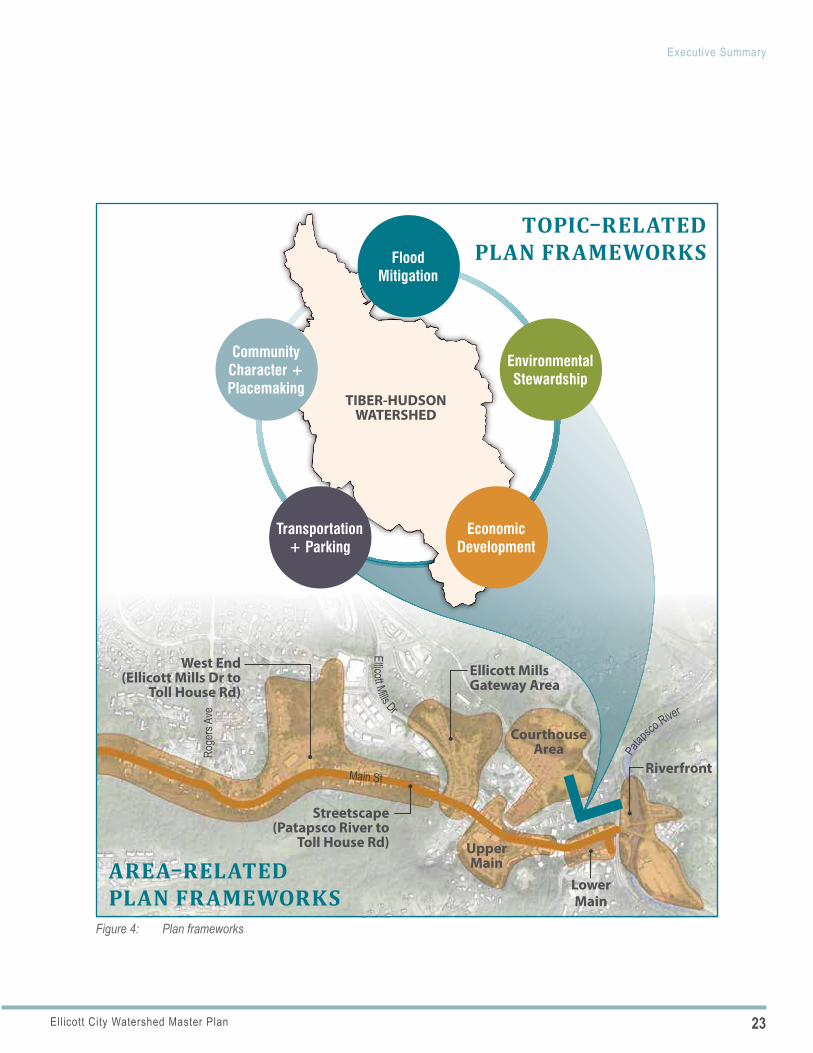
MASTER PLAN FRAMEWORKSThe plan policies and implementing actions in the following sections are described as they relate to 12 master plan frameworks, organized by topics and geographic areas. The topic-related plan frameworks include existing conditions assessments, strategies, and recommendations related to community char-acter, flood mitigation, environmental stewardship, economic development, and transportation as they apply to the entire watershed area. The geographic area-related plan frameworks focus on specific locations and project areas within the watershed area.
COMMUNITY CHARACTER + PLACEMAKINGThe Community Character and Placemaking framework addresses elements and activities that reinforce Ellicott City’s distinct character and strong sense of place. These elements are grounded in Ellicott City’s historic origins and include physical place-defining features such as architecture, landscape, the natural environment, and public spaces.
FLOOD MITIGATIONThe Flood Mitigation framework includes a combination of structural and nonstructural flood mitigation measures. The projects and actions outlined in EC Safe and Sound form the foundation of flood mitigation efforts.
ENVIRONMENTAL STEWARDSHIPThe Environmental Stewardship framework includes broader water quality and habitat improvement in the watershed beyond water quantity control and the functional priority of flood mitigation.
ECONOMIC DEVELOPMENTThe Economic Development framework places the economic dynamics of downtown in relation to how it functions in the regional economy and the role it will continue to play as a home for independent businesses serving residents and visitors to the region.
TRANSPORTATION + PARKINGThe Transportation and Parking framework considers all modes of travel and parking and balancing the needs and desires of different user groups.
23Ellicott City Watershed Master Plan
Executive Summary
Figure 4: Plan frameworks
West End (Ellicott Mills Dr to
Toll House Rd)
Courthouse Area
Lower Main
Riverfront
Ellicott Mills Gateway Area
Streetscape (Patapsco River to
Toll House Rd) Upper Main
Roge
rs Av
e
Main St
Patap
sco River
Ellicott Mills Dr
TOPIC–RELATED PLAN FRAMEWORKS
AREA–RELATED PLAN FRAMEWORKS
TIBER-HUDSON WATERSHED
Economic Development
Flood Mitigation
Environmental Stewardship
Transportation + Parking
Community Character + Placemaking
24 Ellicott City Watershed Master Plan
Executive Summary
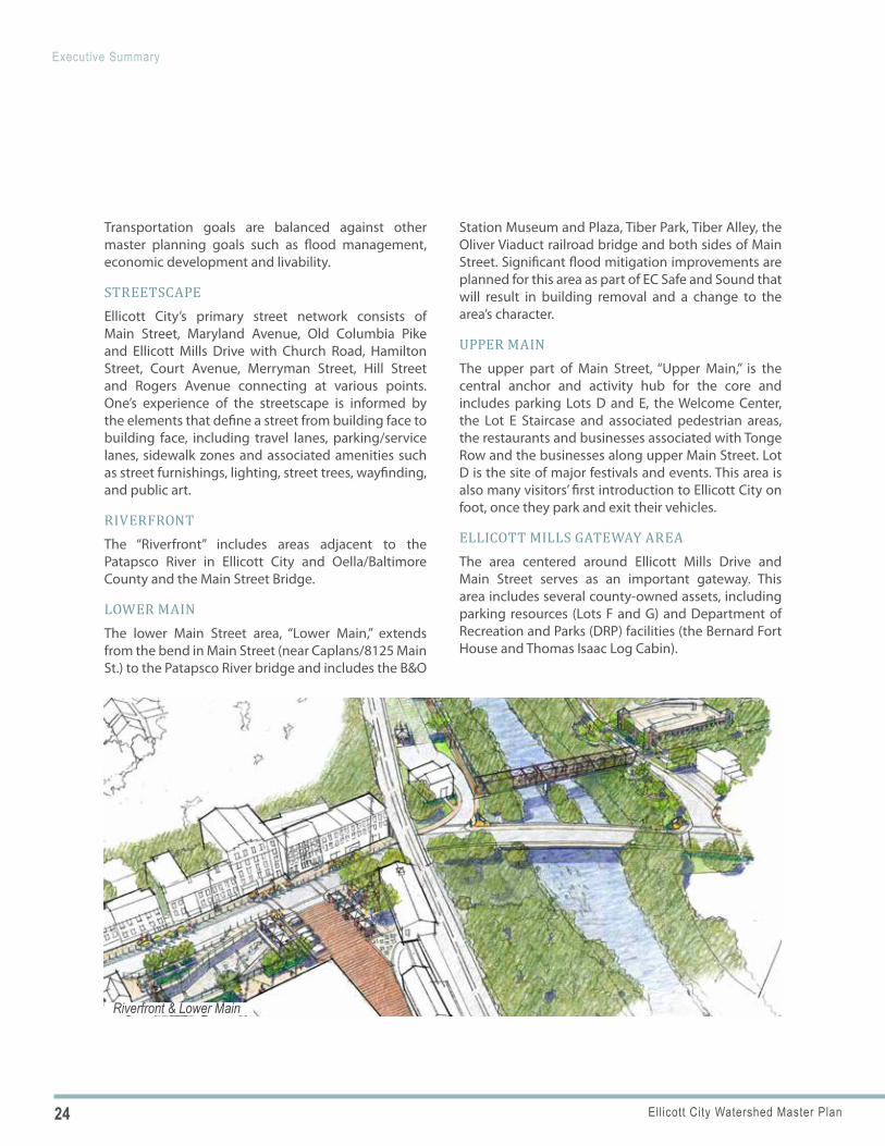
Riverfront & Lower Main
Transportation goals are balanced against other master planning goals such as flood management, economic development and livability.
STREETSCAPEEllicott City’s primary street network consists of Main Street, Maryland Avenue, Old Columbia Pike and Ellicott Mills Drive with Church Road, Hamilton Street, Court Avenue, Merryman Street, Hill Street and Rogers Avenue connecting at various points. One’s experience of the streetscape is informed by the elements that define a street from building face to building face, including travel lanes, parking/service lanes, sidewalk zones and associated amenities such as street furnishings, lighting, street trees, wayfinding, and public art.
RIVERFRONTThe “Riverfront” includes areas adjacent to the Patapsco River in Ellicott City and Oella/Baltimore County and the Main Street Bridge.
LOWER MAINThe lower Main Street area, “Lower Main,” extends from the bend in Main Street (near Caplans/8125 Main St.) to the Patapsco River bridge and includes the B&O
Station Museum and Plaza, Tiber Park, Tiber Alley, the Oliver Viaduct railroad bridge and both sides of Main Street. Significant flood mitigation improvements are planned for this area as part of EC Safe and Sound that will result in building removal and a change to the area’s character.
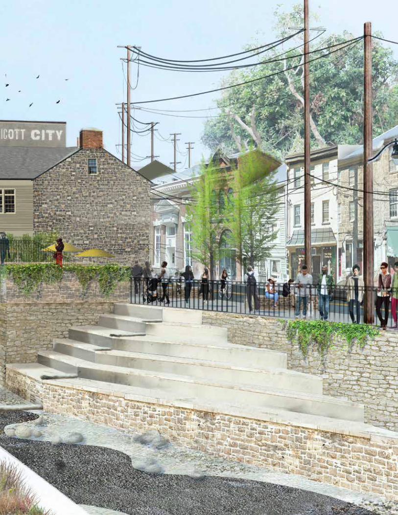
UPPER MAINThe upper part of Main Street, “Upper Main,” is the central anchor and activity hub for the core and includes parking Lots D and E, the Welcome Center, the Lot E Staircase and associated pedestrian areas, the restaurants and businesses associated with Tonge Row and the businesses along upper Main Street. Lot D is the site of major festivals and events. This area is also many visitors’ first introduction to Ellicott City on foot, once they park and exit their vehicles.
ELLICOTT MILLS GATEWAY AREAThe area centered around Ellicott Mills Drive and Main Street serves as an important gateway. This area includes several county-owned assets, including parking resources (Lots F and G) and Department of Recreation and Parks (DRP) facilities (the Bernard Fort House and Thomas Isaac Log Cabin).
25Ellicott City Watershed Master Plan
Executive Summary
Courthouse Area
West End
Upper Main
Lower Main
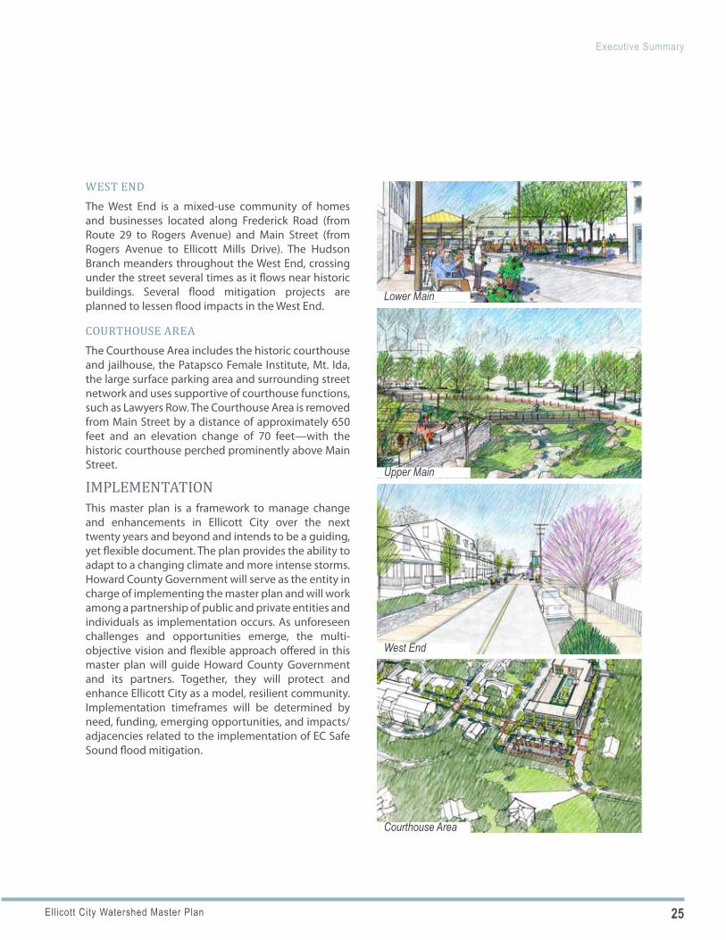
WEST ENDThe West End is a mixed-use community of homes and businesses located along Frederick Road (from Route 29 to Rogers Avenue) and Main Street (from Rogers Avenue to Ellicott Mills Drive). The Hudson Branch meanders throughout the West End, crossing under the street several times as it flows near historic buildings. Several flood mitigation projects are planned to lessen flood impacts in the West End.
COURTHOUSE AREAThe Courthouse Area includes the historic courthouse and jailhouse, the Patapsco Female Institute, Mt. Ida, the large surface parking area and surrounding street network and uses supportive of courthouse functions, such as Lawyers Row. The Courthouse Area is removed from Main Street by a distance of approximately 650 feet and an elevation change of 70 feet—with the historic courthouse perched prominently above Main Street.
IMPLEMENTATIONThis master plan is a framework to manage change and enhancements in Ellicott City over the next twenty years and beyond and intends to be a guiding, yet flexible document. The plan provides the ability to adapt to a changing climate and more intense storms. Howard County Government will serve as the entity in charge of implementing the master plan and will work among a partnership of public and private entities and individuals as implementation occurs. As unforeseen challenges and opportunities emerge, the multi-objective vision and flexible approach offered in this master plan will guide Howard County Government and its partners. Together, they will protect and enhance Ellicott City as a model, resilient community. Implementation timeframes will be determined by need, funding, emerging opportunities, and impacts/ adjacencies related to the implementation of EC Safe Sound flood mitigation.
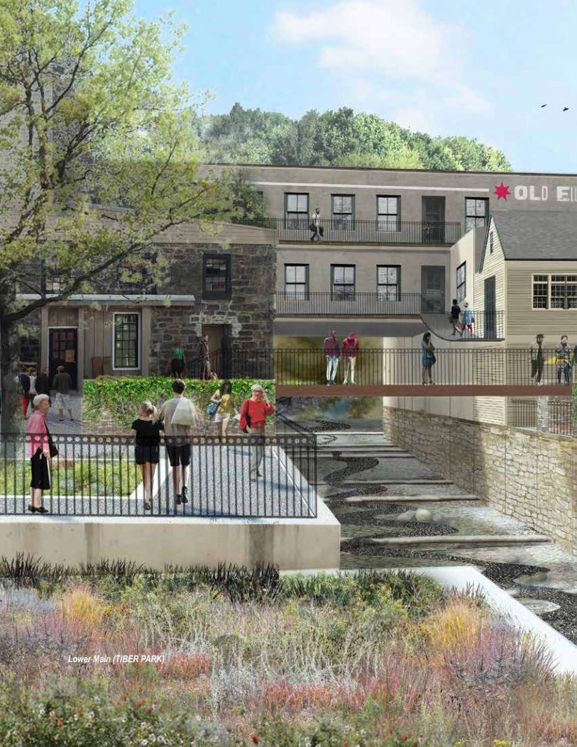
Lower Main (TIBER PARK)
29Ellicott City Watershed Master Plan
IIntroduction
ELLICOTT CITY WATERSHED MASTER PLANEllicott City is an historic community in Howard County, Maryland, located at the confluence of multiple tributaries that feed into the Patapsco River. The community is steeped in history, with much of its original architecture intact. Notable for its connections to the National Road, the original B&O Railroad line and rich mill heritage, the unincorporated town dates back to 1772. Today, Ellicott City is a regional tourism destination, a center for entrepreneurial endeavors, and a nationally significant active historic district. All of these unique characteristics warranted a highly context-sensitive approach to planning and urban design provided in this master plan.
The planning effort was initiated following a deadly, historic flood which hit the town in 2016. After the initial emergency response, a series of action groups were developed to begin addressing the town’s flood-prone nature. Numerous idea-generating workshops were held with focus groups and the general public, resulting in several resources outlining potential strategies for flood mitigation and improved public amenities in town. The Plan was underway for approx-imately one year and nearing completion when a second devastating flash flood occurred in May 2018.
This Watershed Master Plan includes a complex set of inter-related challenges, including the opportu-nity to invest in useful and attractive amenity spaces while being sensitive to the community’s rich history. The watershed-wide recommendations developed in this Plan are in direct response to the two historic floods and the County’s vision for a future Ellicott City that lives in closer balance with the hydraulic forces that have shaped the town through the generations. Though Ellicott City will never be without flooding risk, the recommendations in this Plan will help generate a more resilient response to flood events should they occur again in the future.
PURPOSE AND SCOPEOVERVIEWThe Ellicott City Watershed Master Plan process officially kicked off on May 31, 2017 with the goal of developing a comprehensive, community-driven vision for rebuilding a stronger and more resilient Ellicott City. Triggered by the devastating July 30, 2016 flood, the master plan effort was designed to take a fresh and creative look at potential long-term flood solutions and strategies. The effort was grounded by information gathered in the 2016 flood recovery phase, interrupted by the May 2018 flood, and then restarted with direction from the EC Safe and Sound plan for flood mitigation.
BACKGROUNDOn July 30, 2016, the Ellicott City area of Howard County, Maryland, experienced devastating flooding when nearly six inches of rain fell within two hours (with a total of 6.6 inches of rain falling in 3.55 hours). While Ellicott City has experienced many floods throughout its 250-year history, the destruction caused by the 2016 flood—which displaced hundreds of residents, killed two people, significantly damaged dozens of businesses and cost millions of dollars in damage—was the worst in recent memory. Following the 2016 flood, the County’s overarching goal was to return Ellicott City to normalcy as quickly and affordably as possible:
During the recovery phase, the Howard County Government effectively worked to stabilize Ellicott City and repaired and replaced damaged infrastructure—in some cases in a utilitarian fashion (e.g., asphalt poured over damaged sidewalk areas instead of concrete or brick replacement).
30 Ellicott City Watershed Master Plan
■ Clean Up and Rebuild: Merchants, business owners, residents and many others worked tirelessly at the same time to clean up and rebuild.
■ Grand Reopening Celebration: On November 26, 2016, these efforts culminated with an official grand reopening and ribbon cutting on Main Street.
WHY A MASTER PLAN FOR ELLICOTT CITY?While Main Street was open and functional, many rebuilding decisions were postponed until a master plan for Ellicott City could be completed:
■ Comprehensive Vision: Howard County needed a comprehensive, community-driven vision and plan for long-term rebuilding in a resilient approach. The master plan would need to address not only flood mitigation but also more traditional comprehensive planning elements (transportation, community character and economic development). The focus would be the core area of Ellicott City but the master plan would need to address the entire Tiber-Hudson Watershed (see Figures 5 and 6 for watershed boundary).
■ Multiple Objectives: Since old Ellicott City is an economically important tourism resource, a Maryland Main Street, a Maryland-designated sustainable community, part of a Maryland Heritage Area and a nationally-recognized historic treasure, strategies to alleviate flooding would have to meet multiple objectives – to advance economic, environmental, and preservation goals.
■ Long-Term Rebuilding: Ellicott City’s unique topography, hydrology, road network and mill town heritage would require a tailored, well-planned roadmap for long-term rebuilding.
■ Grounded in Hydrology and Hydraulics: Planning for downtown would have to be grounded in broader evaluation of the hydrology and hydraulics of the Tiber-Hudson Watershed.
■ Informed Master Plan: The master plan would have to be informed by technical evaluations, national best practices, and community input and ideas.
PLAN GEOGRAPHIESThe master plan is informed by larger geographies than the area to which the policies and implementing actions apply. These geographic areas are described below—from largest to smallest—and illustrated in Figures 5 and 6.
■ Trade Area: The Trade Area that informed the market analysis includes the Secondary Trade Area (Zip Codes 21044, 21045, 21075, 21163, and 21228) and the Primary Trade Area (Zip Codes 21042 and 21043).
■ Ellicott City Planning Area: The boundary for greater Ellicott City defined in PlanHoward 2030.
■ The Watershed: The focus of this master plan is technically the Tiber Watershed; this document uses the name more commonly used, the “Tiber-Hudson Watershed.”
■ The Sustainable Community Area: The “Sustainable Community” designation is a place-based designation offering a comprehensive package of resources that support holistic strategies for community development, revitalization and sustainability.
■ The Ellicott City Historic District: This district is a national and local historic district within Ellicott City. The Howard County Local District was established in 1974 and the National Register District was established in 1978.
■ Core: From east to west, the “core” extends from the Patapsco River to Toll House Road and includes West End, downtown, and the streetscapes within.
■ Streetscapes: Streetscapes include Main Street/Frederick Road (through the length of the core), Maryland Avenue and other downtown streets connecting to Main Street.
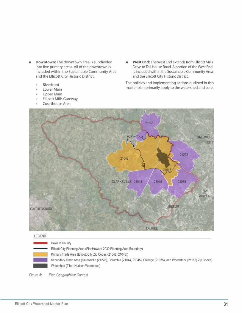
31Ellicott City Watershed Master Plan
Figure 5: Plan Geographies: Context
Watershed (Tiber-Hudson Watershed)
Howard CountyEllicott City Planning Area (PlanHoward 2030 Planning Area Boundary)Primary Trade Area (Ellicott City Zip Codes (21042, 21043))Secondary Trade Area (Catonsville (21228), Columbia (21044, 21045), Elkridge (21075), and Woodstock (21163) Zip Codes)
LEGEND
21042
GAITHERSBURG
CLARKSVILLE 21044 21045
BWI AIRPORT
JESSUP
LAUREL
BALTIMORECITY
21075
21043
21228
21163
■ Downtown: The downtown area is subdivided into five primary areas. All of the downtown is included within the Sustainable Community Area and the Ellicott City Historic District.
» Riverfront » Lower Main » Upper Main » Ellicott Mills Gateway » Courthouse Area
■ West End: The West End extends from Ellicott Mills Drive to Toll House Road. A portion of the West End is included within the Sustainable Community Area and the Ellicott City Historic District.
The policies and implementing actions outlined in this master plan primarily apply to the watershed and core.
32 Ellicott City Watershed Master Plan
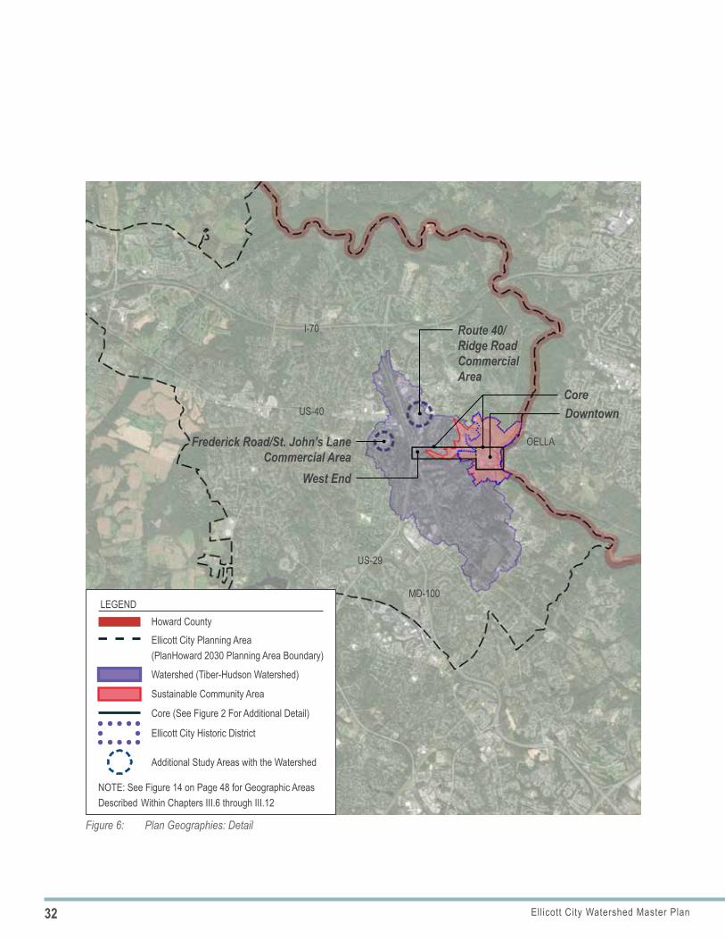
Figure 6: Plan Geographies: Detail
US-29
MD-100
US-40
OELLA
I-70
Downtown
Route 40/Ridge Road Commercial Area
Core
West End
Frederick Road/St. John’s Lane Commercial Area
Howard CountyEllicott City Planning Area (PlanHoward 2030 Planning Area Boundary)
Watershed (Tiber-Hudson Watershed)
LEGEND
Core (See Figure 2 For Additional Detail)
Sustainable Community Area
Additional Study Areas with the Watershed
NOTE: See Figure 14 on Page 48 for Geographic Areas Described Within Chapters III.6 through III.12
Ellicott City Historic District
35Ellicott City Watershed Master Plan
In addition to garnering stakeholder input, the master plan consultant team reviewed current and previous documents focused on Ellicott City. Some of the most relevant as they pertain to the Ellicott City Watershed Master Plan are summarized below, followed by a list of others.
PLANNING AND OUTREACH PROCESS A robust public engagement process has been critical to the development of the watershed master plan and a goal of Howard County since the early days of flood recovery. Input from the public has been considered, alongside technical analysis and national best practices, to help define a comprehensive, community-driven vision for rebuilding a stronger and more resilient Ellicott City.
RECOVERY PHASE STUDIES AND ACTIVITIES – PRECURSORS TO THE MASTER PLAN Before the master plan process began, Howard County hired outside professionals to engage the community, assess stream corridors, study the watershed’s hydrology and hydraulics, propose ideas for flood alleviation, and identify flood proofing options:
■ Ellicott City Recovery Community Advisory Group (CAG): As part of the recovery effort, Howard County established the Ellicott City Recovery Community Advisory Group (CAG). CAG included representatives from local organizations, preservation groups, businesses, residents and the faith-based community. It was chaired by former County Executive Jim Robey. CAG’s mission was to: “foster community awareness and provide input for the future of Historic Ellicott City to make it a model resilient town through an emphasis on mitigation practices that integrates people, organizations, and local government.” CAG concluded its
work with the production of a final report in early 2017.
■ Targeted Community Engagement: As part of the CAG process, the County retained Public Engagement Associates to assist with the recovery process, specifically to identify objectives, frame the issues, and design and facilitate the meetings. At each meeting, and via an online comment form, the County invited ideas for long-term rebuilding. As project ideas were generated, they were categorized as either master plan projects (to be evaluated through the master plan effort) and non-master plan projects (those that could be implemented immediately, as the master plan process was underway). The process resulted in the collection of 315 ideas, memorialized in CAG’s final report. The CAG process represented a significant and important precursor to the master plan public outreach strategy.
■ Assessments and Case Studies: Smith Planning and Design produced the “Tiber-Hudson Branch Stream Corridor Assessment” in January 2017 and the “Case Study—the 2016 Ellicott City Flood Event” in April 2017.
■ Hydraulic and Hydrology Study: McCormick Taylor completed the “Ellicott City Hydrology & Hydraulic Study and Concept Mitigation Analysis” in June 2017. The study included the creation of a two-dimensional hydraulic computer model to help inform decision-making. The model was used to identify and test opportunities to better convey stormwater and where to store it (whether in a stream channel, or underground, or via tunnel conveyance).
While potential projects were identified in concept, they were not vetted for constructibility.
IIInforming the Vision
36 Ellicott City Watershed Master Plan
II Informing the Vision
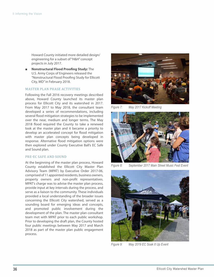
Figure 7: May 2017 Kickoff Meeting
Figure 8: September 2017 Main Street Music Fest Event
Figure 9: May 2019 EC Soak It Up Event
Howard County initiated more detailed design/engineering for a subset of “H&H” concept projects in July 2017.
■ Nonstructural Flood Proofing Study: The U.S. Army Corps of Engineers released the “Nonstructural Flood Proofing Study for Ellicott City, MD” in February 2018.
MASTER PLAN PHASE ACTIVITIESFollowing the Fall 2016 recovery meetings described above, Howard County launched its master plan process for Ellicott City and its watershed in 2017. From May 2017 to May 2018, the consultant team developed a series of recommendations, including several flood mitigation strategies to be implemented over the near, medium and longer terms. The May 2018 flood required the County to take a renewed look at the master plan and it became a priority to develop an accelerated concept for flood mitigation with master plan concepts being developed in response. Alternative flood mitigation options were then explored under County Executive Ball’s EC Safe and Sound plan.
PRE-EC SAFE AND SOUND At the beginning of the master plan process, Howard County established the Ellicott City Master Plan Advisory Team (MPAT) by Executive Order 2017-06, comprised of 11 appointed residents, business owners, property owners and non-profit representatives. MPAT’s charge was to advise the master plan process, provide input at key intervals during the process, and serve as a liaison to the community. These individuals provided a local understanding of the broader issues concerning the Ellicott City watershed, served as a sounding board for emerging ideas and concepts, and promoted public involvement during the development of the plan. The master plan consultant team met with MPAT prior to each public workshop. Prior to developing the draft plan, the County hosted four public meetings between May 2017 and March 2018 as part of the master plan public engagement process.
37Ellicott City Watershed Master Plan
II Informing the Vision
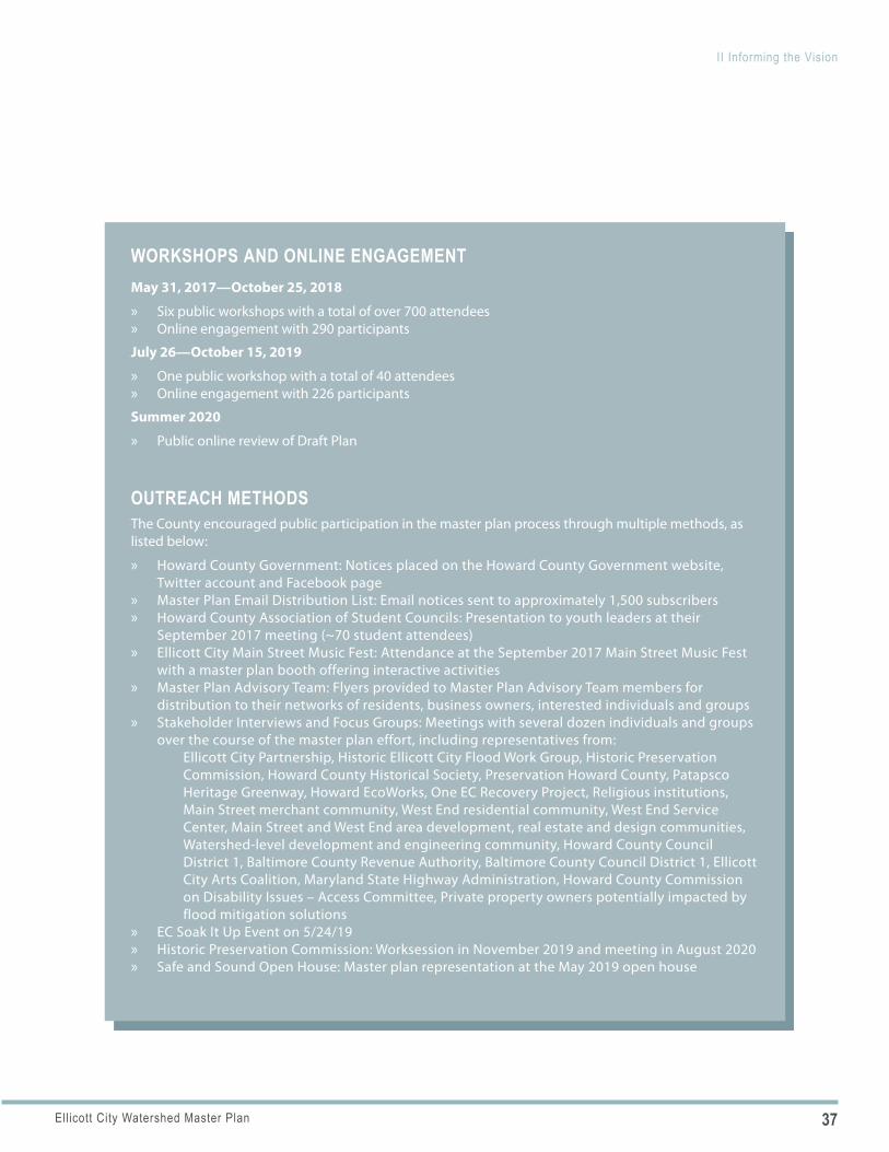
WORKSHOPS AND ONLINE ENGAGEMENTMay 31, 2017—October 25, 2018
» Six public workshops with a total of over 700 attendees » Online engagement with 290 participants
July 26—October 15, 2019
» One public workshop with a total of 40 attendees » Online engagement with 226 participants
Summer 2020
» Public online review of Draft Plan
OUTREACH METHODSThe County encouraged public participation in the master plan process through multiple methods, as listed below:
» Howard County Government: Notices placed on the Howard County Government website, Twitter account and Facebook page
» Master Plan Email Distribution List: Email notices sent to approximately 1,500 subscribers » Howard County Association of Student Councils: Presentation to youth leaders at their
September 2017 meeting (~70 student attendees) » Ellicott City Main Street Music Fest: Attendance at the September 2017 Main Street Music Fest
with a master plan booth offering interactive activities » Master Plan Advisory Team: Flyers provided to Master Plan Advisory Team members for
distribution to their networks of residents, business owners, interested individuals and groups » Stakeholder Interviews and Focus Groups: Meetings with several dozen individuals and groups
over the course of the master plan effort, including representatives from: Ellicott City Partnership, Historic Ellicott City Flood Work Group, Historic Preservation
Commission, Howard County Historical Society, Preservation Howard County, Patapsco Heritage Greenway, Howard EcoWorks, One EC Recovery Project, Religious institutions, Main Street merchant community, West End residential community, West End Service Center, Main Street and West End area development, real estate and design communities, Watershed-level development and engineering community, Howard County Council District 1, Baltimore County Revenue Authority, Baltimore County Council District 1, Ellicott City Arts Coalition, Maryland State Highway Administration, Howard County Commission on Disability Issues – Access Committee, Private property owners potentially impacted by flood mitigation solutions
» EC Soak It Up Event on 5/24/19 » Historic Preservation Commission: Worksession in November 2019 and meeting in August 2020 » Safe and Sound Open House: Master plan representation at the May 2019 open house
38 Ellicott City Watershed Master Plan
II Informing the Vision
These meetings allowed the public the opportunity to: 1) stay informed on technical analysis, ideas and concepts throughout the planning process, 2) understand implications of concepts, and 3) provide feedback for consideration. At each meeting, the County collected comments from the public. The County also offered periodic online opportunities for public comment. The County included a robust project website to help boost public participation. The website contained many of the prior studies, policies and reports concerning Ellicott City. This allowed project participants access to projects and materials that formed the basis for much of the master plan effort. In addition, following each of the public meetings, meeting materials were posted to the project website to keep the broader public informed and allow participants to keep up with planning progress.
Following the 2018 flood, the master planning process continued, informed by the County’s plans to accelerate flood mitigation. MPAT continued to advise the master plan process, provide input at key intervals during the process, and serve as a liaison to the community.
POST-EC SAFE AND SOUNDCounty Executive Calvin Ball developed the EC Safe and Sound plan for flood mitigation following the change in administration. In addition he appointed a new MPAT by Executive Order 2019-06 since the previous MPAT had expired in late 2018. The new MPAT continued to serve as a sounding board in the process, in collaboration with the master plan consultant team and County staff. The master plan consultant team met with MPAT either prior to or following the public workshops.
EC SAFE AND SOUNDThe EC Safe and Sound plan is a multi-phase plan built around the need for public safety, supporting business and property owners, preparing the County for a changing climate, and creating a more inclusive, community-driven process for decisions regarding Ellicott City’s future. There are four primary focus areas of the plan: ensuring public safety, supporting business and property owners, maintaining Ellicott
39Ellicott City Watershed Master Plan
II Informing the Vision
City’s historic charm, and developing a more inclusive, community-driven process.
PHASE I
» Building Acquisitions» Emergency Public Alert System» Clearing the Waterways» Flood Mitigation Assistance Program» Working with State Partners» Supporting Main Street Businesses» Creative Options for Lower Main Street» Renovating and Reinvigorating Historic Buildings» Section 106 Process» Creation of a Community Development
Corporation Exploration Committee
PHASE 2
» Flood Mitigation Projects» High Ground Access Points» West End Property Acquisitions» Ellicott City Watershed Master Plan» Capital Projects Tracker
Specific plan components that are particularly relevant to the master plan are summarized below. Their direct relevancy is described in more in detail as it relates to recommendations outlined in section III. A Vision for the Future.
BUILDING ACQUISITIONSHoward County acquired ten buildings in the lower Main Street area that were heavily damaged during the 2018 floods, would be vulnerable to future flooding and are needed to implement fl ood mitigation projects. Four of these buildings will be removed and six altered to improve flood w ater conveyance, dramatically changing the character of the area centered on Tiber Alley.
EMERGENCY PUBLIC ALERT SYSTEM An outdoor tone-based alert system is being implemented to complement existing alert and warning tools. A temporary system was tested and an intermediate solution has been developed and is under construction with completion scheduled for late 2020.
CLEARING THE WATERWAYSHoward County has increased the inspection of and debris removal from specific stream channels after major weather events at approximately 55 points, all but one having public access. This work is being done in partnership with Howard EcoWorks (see Page 91 for more information).
SECTION 106 PROCESSSection 106 specifies that federal agencies must take into account the effect their undertakings will have on historic and culturally significant resources. Section 106 requires the lead federal agency to identify historic properties, assess their proposed undertaking’s impacts upon those historic resources, and seek to avoid, minimize or mitigate any adverse effects. This is done through coordination with the State Historic Preservation Office (SHPO – Maryland Historical Trust), consulting parties, and the public. This is one step in moving forward with flood mitigation plans. The process is as follows:
1. Initiate the process
2. Identify historic properties
3. Assess adverse effects
4. Resolve adverse effects
While the EC Safe and Sound flood mitigation plan serves as the foundation for the master plan, the flood mitigation plan—and associated Section 106 process— is on a separate, yet parallel track. The master plan is likely to be adopted prior to the resolution of the Section 106 process and is distinct in the following ways:
■ Flexible Document: The master plan is intendedto be a fluid, flexible document containing amenu of options with policies and goals that aredesigned to be adaptable.
■ Early Guidance: The master plan offers earlyguidance on design for projects such as thelower main channel, but the master plan is notmeant to represent the final design or onlydesign option for the project. If some elementof the flood mitigation plan does not come to
40 Ellicott City Watershed Master Plan
II Informing the Vision
Figure 10: The 2016 H&H Study Outlined Conceptual Interventions to Address Flooding in Ellicott City
fruition, the overall comprehensive nature of the master plan—its goals, desired outcomes and policies—should be looked upon for guidance.
■ Detailed Building Information: The master plan is not intended to include detailed information on the impacted buildings (history, mitigation options, etc.). This information will be included as part of the Section 106 process.
FLOOD MITIGATION PROJECTSSeveral flood mitigation projects are being implemented and include large detention facilities and conveyance improvements (including the north diversion tunnel from Lot F to the Patapsco River). In 2019, the County issued grants to property owners to flood proof or otherwise make structures more flood resilient.
HIGH GROUND ACCESS POINTSThe County has identified high ground access points throughout the core that include parking lot information signs, high-ground access signs and directions on how to exit the floodplain.
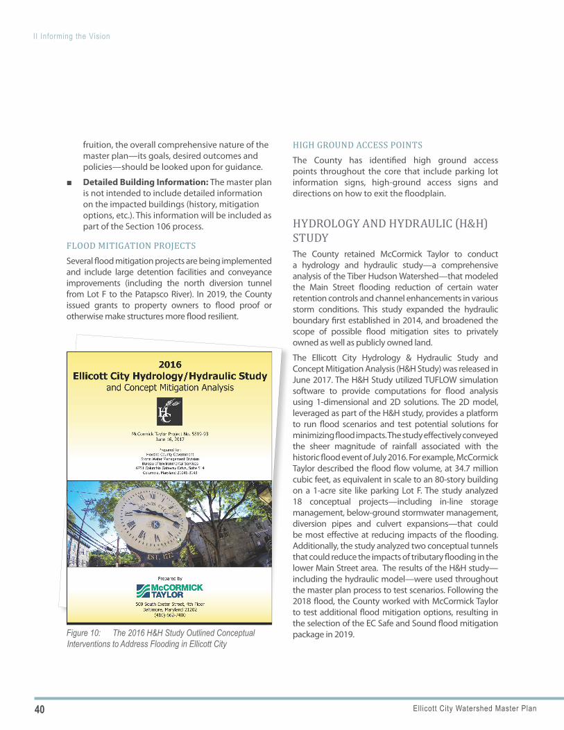
HYDROLOGY AND HYDRAULIC (H&H) STUDYThe County retained McCormick Taylor to conduct a hydrology and hydraulic study—a comprehensive analysis of the Tiber Hudson Watershed—that modeled the Main Street flooding reduction of certain water retention controls and channel enhancements in various storm conditions. This study expanded the hydraulic boundary first established in 2014, and broadened the scope of possible flood mitigation sites to privately owned as well as publicly owned land.
The Ellicott City Hydrology & Hydraulic Study and Concept Mitigation Analysis (H&H Study) was released in June 2017. The H&H Study utilized TUFLOW simulation software to provide computations for flood analysis using 1-dimensional and 2D solutions. The 2D model, leveraged as part of the H&H study, provides a platform to run flood scenarios and test potential solutions for minimizing flood impacts. The study effectively conveyed the sheer magnitude of rainfall associated with the historic flood event of July 2016. For example, McCormick Taylor described the flood flow volume, at 34.7 million cubic feet, as equivalent in scale to an 80-story building on a 1-acre site like parking Lot F. The study analyzed 18 conceptual projects—including in-line storage management, below-ground stormwater management, diversion pipes and culvert expansions—that could be most effective at reducing impacts of the flooding. Additionally, the study analyzed two conceptual tunnels that could reduce the impacts of tributary flooding in the lower Main Street area. The results of the H&H study—including the hydraulic model—were used throughout the master plan process to test scenarios. Following the 2018 flood, the County worked with McCormick Taylor to test additional flood mitigation options, resulting in the selection of the EC Safe and Sound flood mitigation package in 2019.
41Ellicott City Watershed Master Plan
II Informing the Vision
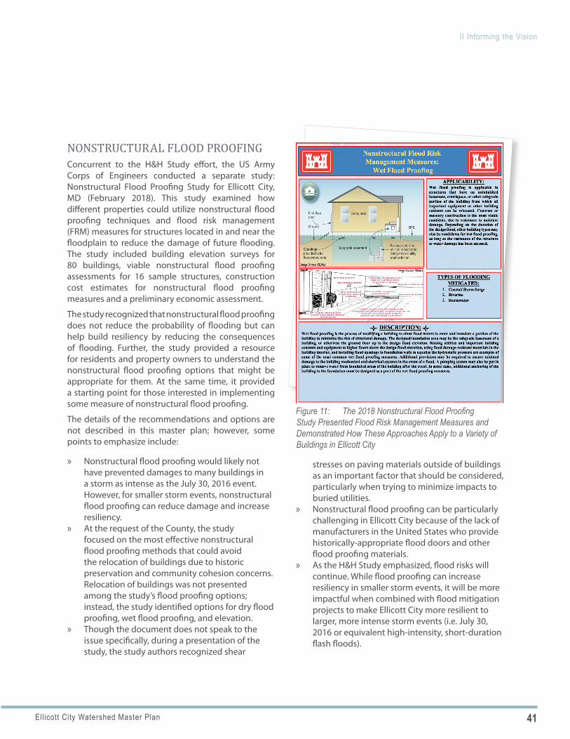
Figure 11: The 2018 Nonstructural Flood Proofing Study Presented Flood Risk Management Measures and Demonstrated How These Approaches Apply to a Variety of Buildings in Ellicott City
NONSTRUCTURAL FLOOD PROOFINGConcurrent to the H&H Study effort, the US Army Corps of Engineers conducted a separate study: Nonstructural Flood Proofing Study for Ellicott City, MD (February 2018). This study examined how different properties could utilize nonstructural flood proofing techniques and flood risk management (FRM) measures for structures located in and near the floodplain to reduce the damage of future flooding. The study included building elevation surveys for 80 buildings, viable nonstructural flood proofing assessments for 16 sample structures, construction cost estimates for nonstructural flood proofing measures and a preliminary economic assessment.
The study recognized that nonstructural flood proofing does not reduce the probability of flooding but can help build resiliency by reducing the consequences of flooding. Further, the study provided a resource for residents and property owners to understand the nonstructural flood proofing options that might be appropriate for them. At the same time, it provided a starting point for those interested in implementing some measure of nonstructural flood proofing.
The details of the recommendations and options are not described in this master plan; however, some points to emphasize include:
» Nonstructural flood proofing would likely not have prevented damages to many buildings in a storm as intense as the July 30, 2016 event. However, for smaller storm events, nonstructural flood proofing can reduce damage and increase resiliency.
» At the request of the County, the study focused on the most effective nonstructural flood proofing methods that could avoid the relocation of buildings due to historic preservation and community cohesion concerns. Relocation of buildings was not presented among the study’s flood proofing options; instead, the study identified options for dry flood proofing, wet flood proofing, and elevation.
» Though the document does not speak to the issue specifically, during a presentation of the study, the study authors recognized shear
stresses on paving materials outside of buildings as an important factor that should be considered, particularly when trying to minimize impacts to buried utilities.
» Nonstructural flood proofing can be particularly challenging in Ellicott City because of the lack of manufacturers in the United States who provide historically-appropriate flood doors and other flood proofing materials.
» As the H&H Study emphasized, flood risks will continue. While flood proofing can increase resiliency in smaller storm events, it will be more impactful when combined with flood mitigation projects to make Ellicott City more resilient to larger, more intense storm events (i.e. July 30, 2016 or equivalent high-intensity, short-duration flash floods).
42 Ellicott City Watershed Master Plan
II Informing the Vision
Figure 12: The 2012 PlanHoward2030 Report Identifies the Downtown Core of Ellicott City as a Growth and Revitalization Area (Areas in Pink)
Downtown Core
726: Growth
Downtown Core
Figure 13: The 2012 PlanHoward2030 Report Identifies the Downtown Core of Ellicott City as a Tier 1 Sustainable Growth Area (Areas in Tan)
While this study did not often reference the role of the Historic Preservation Commission, their role is significant within the historic district. All exterior alterations to buildings within the Ellicott City historic district must be approved by the Historic Preserva-tion Commission. The district includes the majority of flood-impacted properties in Ellicott City.
COMMUNITY ADVISORY GROUP (CAG) REPORTThe CAG Report outlined 315 separate ideas orga-nized around “Four “Pillars” of recovery: rebuilding, environment, preservation, and economy. An “other” category was added to capture ideas that did not fit into those four pillars. In broad terms, the CAG ideas suggested need for resilience and placemaking in rebuilding, protection of the environment, preserva-tion of Ellicott City’s heritage, and revitalization of the downtown economy.
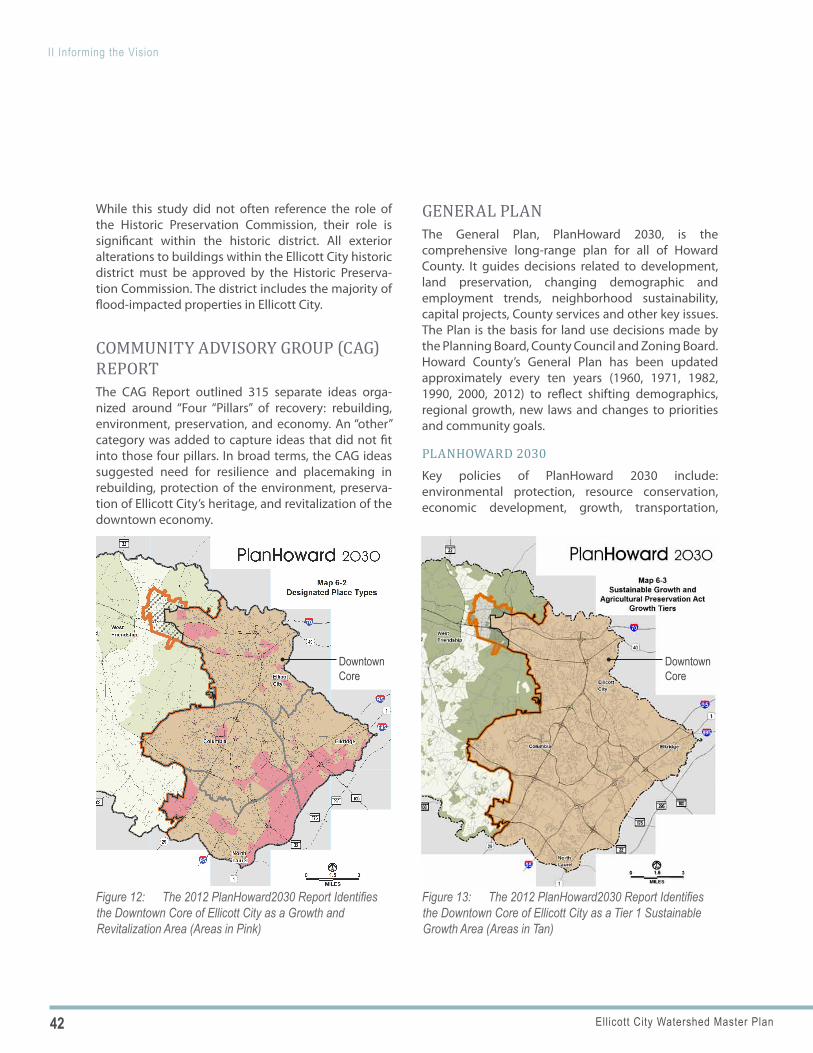
GENERAL PLANThe General Plan, PlanHoward 2030, is the comprehensive long-range plan for all of Howard County. It guides decisions related to development, land preservation, changing demographic and employment trends, neighborhood sustainability, capital projects, County services and other key issues. The Plan is the basis for land use decisions made by the Planning Board, County Council and Zoning Board. Howard County’s General Plan has been updated approximately every ten years (1960, 1971, 1982, 1990, 2000, 2012) to reflect shifting demographics, regional growth, new laws and changes to priorities and community goals.
PLANHOWARD 2030Key policies of PlanHoward 2030 include: environmental protection, resource conservation, economic development, growth, transportation,
43Ellicott City Watershed Master Plan
II Informing the Vision
public facilities and services, housing, community design and implementation and stewardship.
Within the Plan, Designated Place Types describe Ellicott City’s core as an area targeted for “Growth and Revitalization” while neighborhoods surrounding the core are predominantly “Established Community” place types. In addition to the core, the Route 40 corridor, the commercial area at St. John’s Lane and Frederick Road, and the area around Sheppard Pratt Hospital are identified as areas targeted for “Growth and Revitalization” (see Figure 12).
Additionally, the Sustainable Growth and Agricultural Preservation Act Growth Tiers describe Ellicott City as “Tier 1” which is a designated growth area served by public sewer (see Figure 13).
GENERAL PLAN UPDATE: HOCO BY DESIGNPlanHoward2030 established land use policies and goals over a two-decade period and was scheduled for an update by 2022. The County is accelerating this schedule and on July 6, 2020, the Howard County Council approved the Guidelines for the General Plan Update. The Guidelines provide a framework for collecting and organizing information to develop the County’s new General Plan, HoCo By Design. They also emphasize a comprehensive strategy to stakeholder engagement; highlight the value of data and analysis to promote more informed decision making; and encourage strategies that sustain the flow of information to stakeholders throughout the planning process.
DOWNTOWN ELLICOTT CITY PARKING STUDY, APRIL 2009The Howard County Revenue Authority retained DESMAN Associates in 2009 to assess current and future public parking supply and deficit conditions in Ellicott City, to prepare a preliminary evaluation of structured parking opportunities and to provide recommendations regarding operations, management, and technology costs and benefits.
HISTORIC DISTRICT DESIGN GUIDELINESThe County, the Historic Preservation Commission, their partners and citizen stakeholders protect Ellicott City’s character-defining elements and rigorous review process.
■ Current Guidelines Document: The Ellicott City Historic District Design Guidelines were adopted in 1998.
■ Guidelines Document Update: In 2017 the Historic Preservation Commission and the Department of Planning and Zoning launched an update of the Historic District Design Guidelines. The update is ongoing and will provide for a more user-friendly document, reflect current preservation standards, and incorporate guidelines addressing accommodations for flood resiliency.
PATAPSCO REGIONAL GREENWAY CONCEPT PLANThe Patapsco Regional Greenway Concept Plan is a community-driven concept plan initiated by the Bicycle and Pedestrian Advisory Group (BPAG) of the Baltimore Regional Transportation Board (BRTB) and the Baltimore Metropolitan Council (BMC) that identifies opportunities to connect the entire Patapsco Valley with one trail system, ultimately linking Baltimore’s Inner Harbor with Sykesville. Ellicott City plays a prominent role in the plan as there are several existing trails terminating near Ellicott City but not connecting through.
THE PATAPSCO HERITAGE AREA MANAGEMENT PLANEllicott City falls within the boundaries of the Patapsco Valley Heritage Area, an approximately 24.6 square mile area along the Patapsco River from below Elkridge to above Daniels. Primary components of the heritage area include the places where natural resources supported industrial development in the 18th and 20th centuries, communities such as Ellicott City that developed as a result of industrial development,
44 Ellicott City Watershed Master Plan
II Informing the Vision
ADDITIONAL PLANS AND STUDIESIn addition to the plans and studies described above, the master plan consultant team also drew upon numerous resources prepared both before and after the 2016 flood, spanning over 40 years.
POST-2016 FLOOD
» Rebuilding Meeting Summaries » Recovery Project Idea Themes » The Economic Impact of the 2016
Ellicott City Flood, Jacob France Institute » “WalkHoward” Howard County
Pedestrian Master Plan, 2019 » Case Study—The 2016 Ellicott City Flood
Event, April 2017 » Tiber-Hudson Branch Stream Corridor
Assessment, January 2017 » Ellicott City Flood Recovery Community
Advisory Group: Final Report, January 30, 2017
» ULI Ellicott City TAP, January 11-12, 2017
PRE-2016 FLOOD
» Flood Working Group report, 2015 » Main Street Maryland Application, 2014 » Flood Study, 2013 » Downtown Ellicott City Revitalization
Initiative Process Summary, 2013 » Tiber Hudson Subwatershed Restoration
Plan, 2013 » Sustainable Community Application,
2012 » Versar’s Concept Plan for Old Ellicott City
LID Project, 2012 » Improvements to Patapsco Open Space-
Concept Design, 2005 » Ellicott City Plan, 2003 » Ellicott City Improvements:
Recommendations, 1988 » Ellicott City Master Plan, 1981 » Ellicott City: New Life for an Old Town, 1977
adjacent rural lands, and the travel routes—notably the National Road and B&O rail line—that connected the valley to Baltimore. These resources within the valley and Ellicott City already offer many heritage experiences to residents and visitors and have the potential to offer more and higher quality experiences.
The Patapsco Heritage Area Management Plan outlines the vision as well as the goals and objectives for the heritage area. The Plan was created through a cooperative public process, and unanimously approved by Howard County and Baltimore County government as well as by the Maryland Heritage Authority Areas—the governing body for all Maryland Heritage Areas.
The regional non-profit Patapsco Heritage Greenway, Inc. serves as the managing entity and is charged with the implementation of the Management Plan.
CB56-2018 REPORT, MAY 2019The Tiber Branch Watershed and Plumtree Branch Watershed Safety Act (CB-56-2018) was passed in response to the May 27, 2018 flood—the second major flash flood in two years. The Act directed the Departments of Public Works and Planning and Zoning to study the interrelated factors of land use, storm water management, drainage infrastructure, and flood mitigation in the Tiber Branch and Plumtree Branch Watersheds and make recommendations about changes in law and procedures that may help protect the Watershed from the effects of future flood events. In that study, the agencies looked at the intersection of existing land use, historical storm water management requirements and future potential watershed development. The results of the evaluation are available at www.howardcountymd.gov/ecmp under “Resources.”
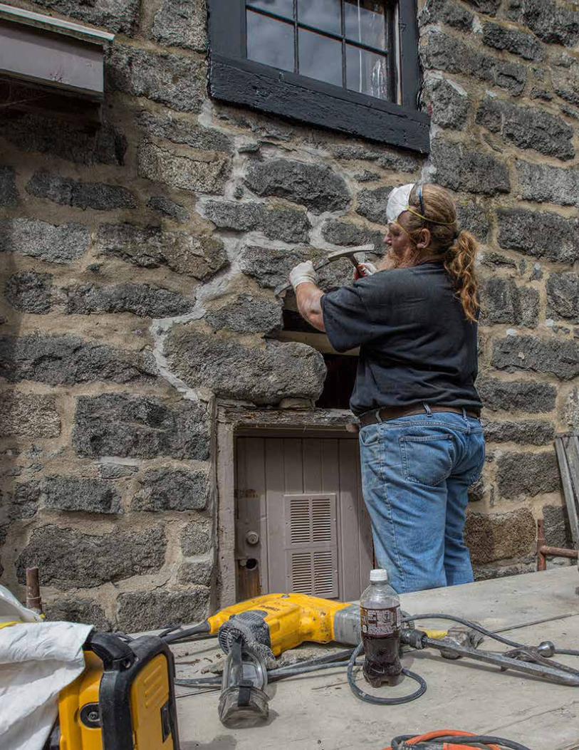
45Ellicott City Watershed Master Plan
II Informing the Vision
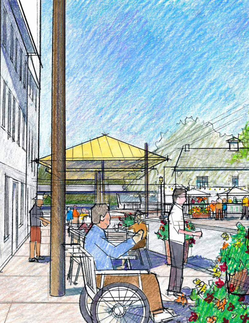
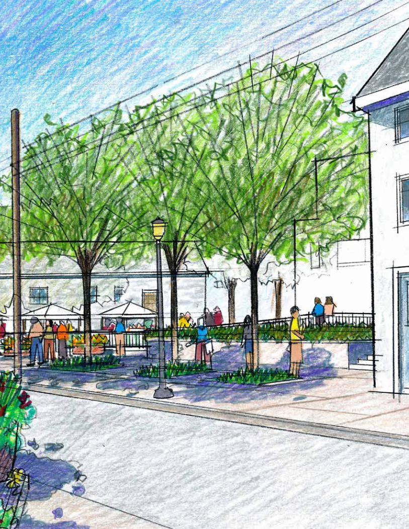
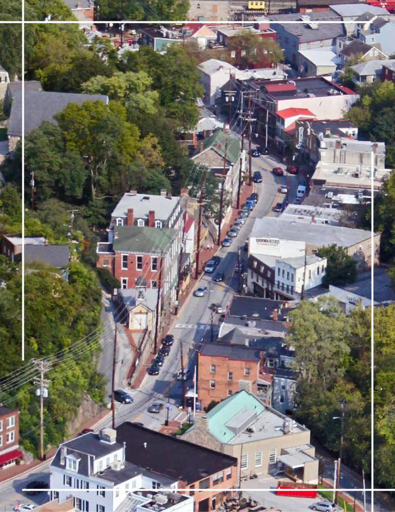

49Ellicott City Watershed Master Plan
Ellicott City, and its watershed, is a model, resilient community that thrives by protecting its people, commerce, history, culture and natural environment; and by enhancing its vibrant and authentic character.
VISION STATEMENT
The Ellicott City Watershed Master Plan addresses challenges and opportunities within the Tiber-Hudson Watershed, an area that covers 3.7 square miles in eastern Howard County. While the planning, assessment, and overall recommendations address the entire watershed area, Ellicott City’s core along Main Street and the West End are a significant focus of the effort. The core has been given a higher level of specificity for a few reasons. First, the core is a significant economic driver for the broader region and all of Howard County as well as a nationally- and locally-recognized historic and cultural resource.
Second, the core is located at the confluence of three tributaries—the Hudson, Tiber and New Cut Branches—which feed into the Patapsco River at the bottom of Main Street. This condition makes the area particularly at risk of flooding—and the primary driver behind the master plan has been enhancing resiliency in the flood-impacted Ellicott City core. Lastly, this area contains the Ellicott City Historic District, an important locally and nationally-recognized historic and cultural resource. As such, all exterior alternations to a site and structure require approval from the Historic Preservation Commission.
IIIA Vision for the Future
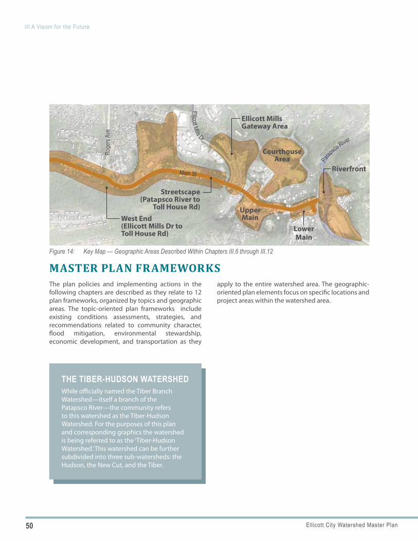
50 Ellicott City Watershed Master Plan
III A Vision for the Future
THE TIBER-HUDSON WATERSHEDWhile officially named the Tiber Branch Watershed—itself a branch of the Patapsco River—the community refers to this watershed as the Tiber-Hudson Watershed. For the purposes of this plan and corresponding graphics the watershed is being referred to as the ‘Tiber-Hudson Watershed.’ This watershed can be further subdivided into three sub-watersheds: the Hudson, the New Cut, and the Tiber.
Figure 14: Key Map — Geographic Areas Described Within Chapters III.6 through III.12
West End (Ellicott Mills Dr to Toll House Rd)
Courthouse Area
Lower Main
Riverfront
Ellicott Mills Gateway Area
Streetscape (Patapsco River to
Toll House Rd) Upper Main
Roge
rs Av
e
Main St
Patap
sco River
Ellicott Mills Dr
MASTER PLAN FRAMEWORKSThe plan policies and implementing actions in the following chapters are described as they relate to 12 plan frameworks, organized by topics and geographic areas. The topic-oriented plan frameworks include existing conditions assessments, strategies, and recommendations related to community character, flood mitigation, environmental stewardship, economic development, and transportation as they
apply to the entire watershed area. The geographic-oriented plan elements focus on specific locations and project areas within the watershed area.
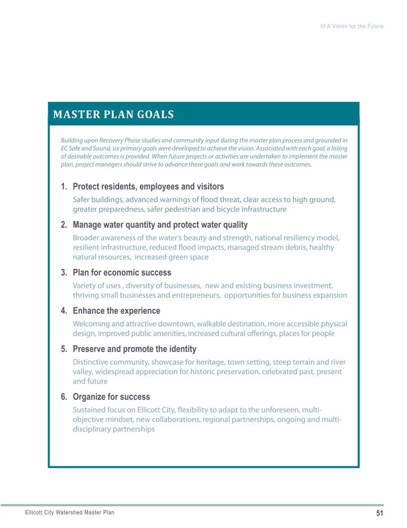
51Ellicott City Watershed Master Plan
III A Vision for the Future
Quote from the letterMASTER PLAN GOALS
Building upon Recovery Phase studies and community input during the master plan process and grounded in EC Safe and Sound, six primary goals were developed to achieve the vision. Associated with each goal, a listing of desirable outcomes is provided. When future projects or activities are undertaken to implement the master plan, project managers should strive to advance these goals and work towards these outcomes.
1. Protect residents, employees and visitorsSafer buildings, advanced warnings of flood threat, clear access to high ground, greater preparedness, safer pedestrian and bicycle infrastructure
2. Manage water quantity and protect water qualityBroader awareness of the water’s beauty and strength, national resiliency model, resilient infrastructure, reduced flood impacts, managed stream debris, healthy natural resources, increased green space
3. Plan for economic successVariety of uses , diversity of businesses, new and existing business investment, thriving small businesses and entrepreneurs, opportunities for business expansion
4. Enhance the experienceWelcoming and attractive downtown, walkable destination, more accessible physical design, improved public amenities, increased cultural offerings, places for people
5. Preserve and promote the identityDistinctive community, showcase for heritage, town setting, steep terrain and river valley, widespread appreciation for historic preservation, celebrated past, present and future
6. Organize for successSustained focus on Ellicott City, flexibility to adapt to the unforeseen, multi-objective mindset, new collaborations, regional partnerships, ongoing and multi-disciplinary partnerships
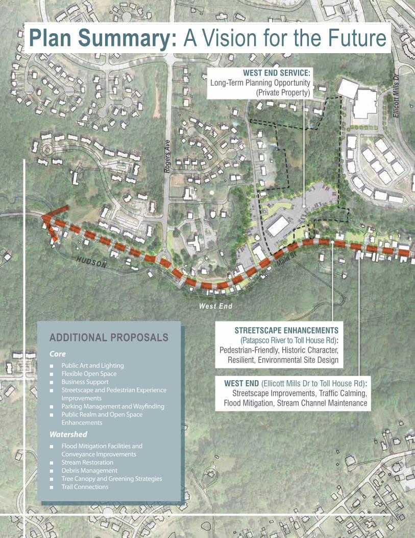
ADDITIONAL PROPOSALSCore
■ Public Art and Lighting ■ Flexible Open Space ■ Business Support ■ Streetscape and Pedestrian Experience
Improvements ■ Parking Management and Wayfinding ■ Public Realm and Open Space
Enhancements
Watershed ■ Flood Mitigation Facilities and
Conveyance Improvements ■ Stream Restoration ■ Debris Management ■ Tree Canopy and Greening Strategies ■ Trail Connections
WEST END (Ellicott Mills Dr to Toll House Rd): Streetscape Improvements, Traffic Calming,
Flood Mitigation, Stream Channel Maintenance
WEST END SERVICE: Long-Term Planning Opportunity
(Private Property)
STREETSCAPE ENHANCEMENTS (Patapsco River to Toll House Rd):
Pedestrian-Friendly, Historic Character, Resilient, Environmental Site Design
HUDSON
Ellic
ott M
ills D
r
Roge
rs A
ve
Main St
Plan Summary: A Vision for the Future
West End
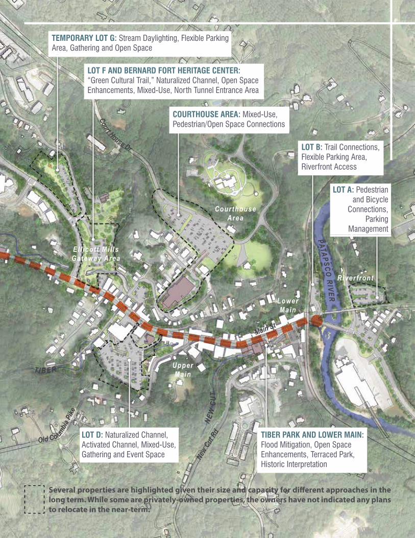
Several properties are highlighted given their size and capacity for different approaches in the long term. While some are privately-owned properties, the owners have not indicated any plans to relocate in the near-term.
TEMPORARY LOT G: Stream Daylighting, Flexible Parking Area, Gathering and Open Space
LOT D: Naturalized Channel, Activated Channel, Mixed-Use, Gathering and Event Space
TIBER PARK AND LOWER MAIN: Flood Mitigation, Open Space Enhancements, Terraced Park, Historic Interpretation
LOT F AND BERNARD FORT HERITAGE CENTER: “Green Cultural Trail,” Naturalized Channel, Open Space Enhancements, Mixed-Use, North Tunnel Entrance Area
Court House Dr
Old Columbia Pi
ke
New
Cut R
dNE
W C
UT
T I B E R
PATAPSCO RIVER
Main St
COURTHOUSE AREA: Mixed-Use, Pedestrian/Open Space Connections
LOT B: Trail Connections, Flexible Parking Area, Riverfront Access
LOT A: Pedestrian and Bicycle
Connections, Parking
Management
Courthouse Area
El l icot t Mi l ls Gateway Area
Upper Main
Lower Main
River f ront
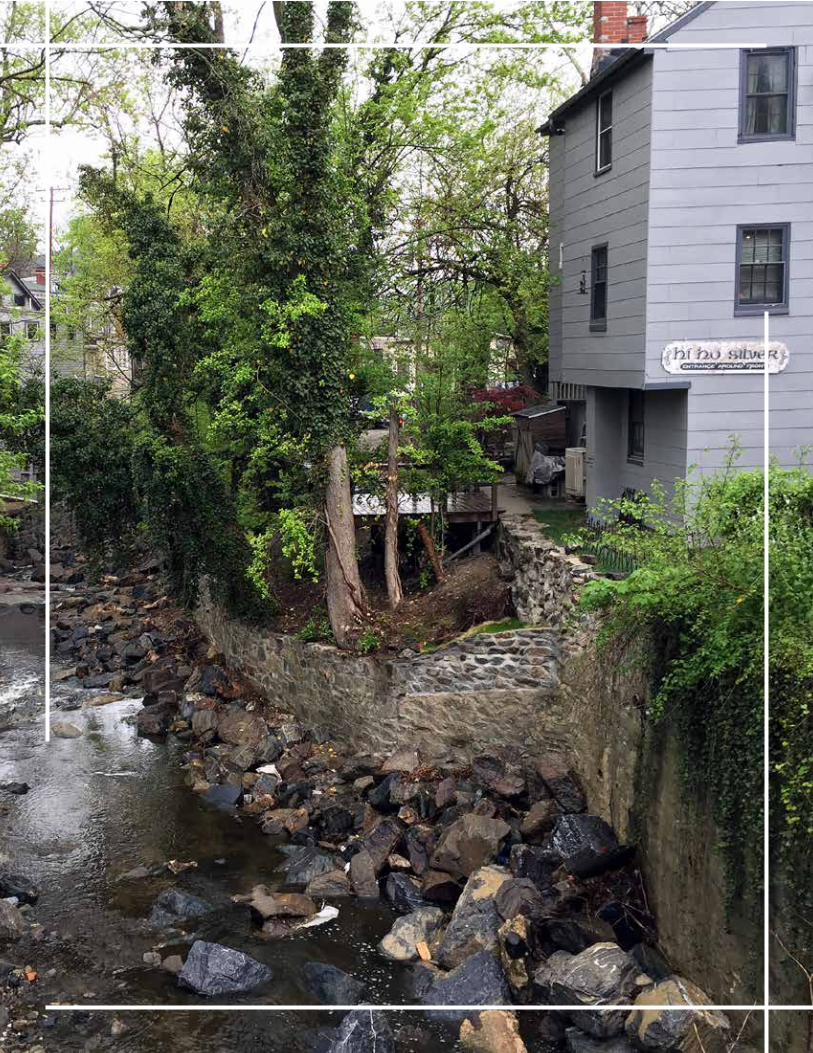
55Ellicott City Watershed Master Plan
Figure 15: Historic Drawing and Photo of Downtown Core, Credit: MD Covered Bridges (Left), George Stewart (Right)
DESCRIPTIONThe Community Character and Placemaking framework addresses elements and activities that reinforce Ellicott City’s distinct character and strong sense of place. These elements are grounded in Ellicott City’s historic origins and include physical place-defining features such as architecture, landscape, the natural environment, and public spaces. They also include events and programming that enhance one’s experience of Ellicott City.
ELLICOTT CITY TODAY HISTORIC ORIGINSAt its core Ellicott City is a well-preserved mill town with much of its original architecture still intact. It stands out among others as an historic community that has retained significant integrity and authenticity.
■ Significance: Ellicott City’s historic significance is notable in the broad span of time reflected and the many influences that shaped the town. The industrious, practical and inventive Ellicott family established their various businesses and supporting settlement in the late 1700s along the Patapsco River and its tributaries, utilizing their waters as a source of power.
■ Role of Natural Resources: Available natural resources of stone and timber shaped the appearance of the town and spurred nearby quarries and sawmills.
■ Mills: From its settlement in 1772, Ellicott Mills expanded to become the milling, manufacturing, and cultural seat of the Patapsco Valley.
■ Historic National Road: In 1805 the Ellicott family, along with other prominent
III.1Community Character
+ Placemaking
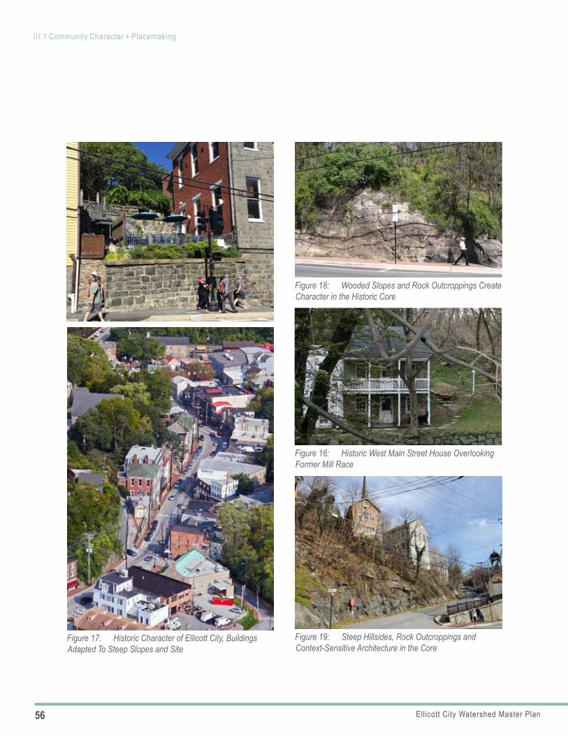
56 Ellicott City Watershed Master Plan
III.1 Community Character + Placemaking
Figure 16: Historic West Main Street House Overlooking Former Mill Race
Figure 17: Historic Character of Ellicott City, Buildings Adapted To Steep Slopes and Site
Figure 18: Wooded Slopes and Rock Outcroppings Create Character in the Historic Core
Figure 19: Steep Hillsides, Rock Outcroppings and Context-Sensitive Architecture in the Core
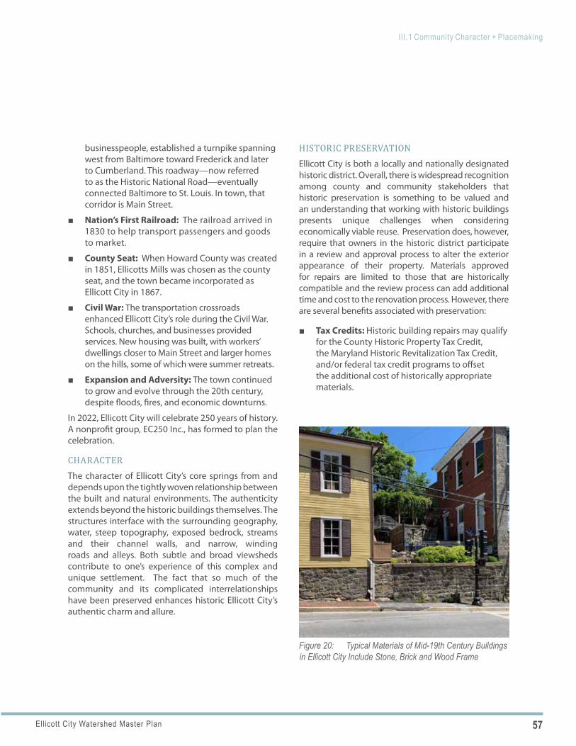
57Ellicott City Watershed Master Plan
III.1 Community Character + Placemaking
Figure 20: Typical Materials of Mid-19th Century Buildings in Ellicott City Include Stone, Brick and Wood Frame
businesspeople, established a turnpike spanning west from Baltimore toward Frederick and later to Cumberland. This roadway—now referred to as the Historic National Road—eventually connected Baltimore to St. Louis. In town, that corridor is Main Street.
■ Nation’s First Railroad: The railroad arrived in 1830 to help transport passengers and goods to market.
■ County Seat: When Howard County was created in 1851, Ellicotts Mills was chosen as the county seat, and the town became incorporated as Ellicott City in 1867.
■ Civil War: The transportation crossroads enhanced Ellicott City’s role during the Civil War. Schools, churches, and businesses provided services. New housing was built, with workers’ dwellings closer to Main Street and larger homes on the hills, some of which were summer retreats.
■ Expansion and Adversity: The town continued to grow and evolve through the 20th century, despite floods, fires, and economic downturns.
In 2022, Ellicott City will celebrate 250 years of history. A nonprofit group, EC250 Inc., has formed to plan the celebration.
CHARACTERThe character of Ellicott City’s core springs from and depends upon the tightly woven relationship between the built and natural environments. The authenticity extends beyond the historic buildings themselves. The structures interface with the surrounding geography, water, steep topography, exposed bedrock, streams and their channel walls, and narrow, winding roads and alleys. Both subtle and broad viewsheds contribute to one’s experience of this complex and unique settlement. The fact that so much of the community and its complicated interrelationships have been preserved enhances historic Ellicott City’s authentic charm and allure.
HISTORIC PRESERVATIONEllicott City is both a locally and nationally designated historic district. Overall, there is widespread recognition among county and community stakeholders that historic preservation is something to be valued and an understanding that working with historic buildings presents unique challenges when considering economically viable reuse. Preservation does, however, require that owners in the historic district participate in a review and approval process to alter the exterior appearance of their property. Materials approved for repairs are limited to those that are historically compatible and the review process can add additional time and cost to the renovation process. However, there are several benefits associated with preservation:
■ Tax Credits: Historic building repairs may qualify for the County Historic Property Tax Credit, the Maryland Historic Revitalization Tax Credit, and/or federal tax credit programs to offset the additional cost of historically appropriate materials.
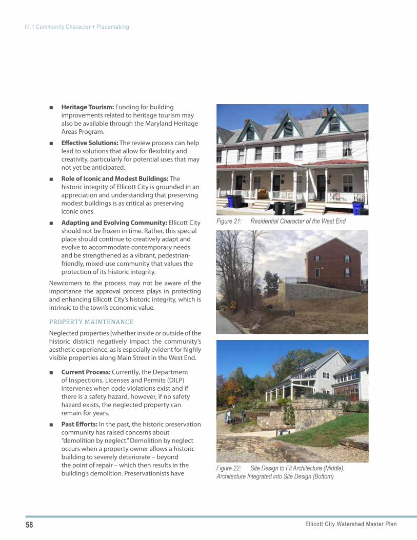
58 Ellicott City Watershed Master Plan
III.1 Community Character + Placemaking
Figure 21: Residential Character of the West End
Figure 22: Site Design to Fit Architecture (Middle), Architecture Integrated into Site Design (Bottom)
■ Heritage Tourism: Funding for building improvements related to heritage tourism may also be available through the Maryland Heritage Areas Program.
■ Effective Solutions: The review process can help lead to solutions that allow for flexibility and creativity, particularly for potential uses that may not yet be anticipated.
■ Role of Iconic and Modest Buildings: The historic integrity of Ellicott City is grounded in an appreciation and understanding that preserving modest buildings is as critical as preserving iconic ones.
■ Adapting and Evolving Community: Ellicott City should not be frozen in time. Rather, this special place should continue to creatively adapt and evolve to accommodate contemporary needs and be strengthened as a vibrant, pedestrian-friendly, mixed-use community that values the protection of its historic integrity.
Newcomers to the process may not be aware of the importance the approval process plays in protecting and enhancing Ellicott City’s historic integrity, which is intrinsic to the town’s economic value.
PROPERTY MAINTENANCENeglected properties (whether inside or outside of the historic district) negatively impact the community’s aesthetic experience, as is especially evident for highly visible properties along Main Street in the West End.
■ Current Process: Currently, the Department of Inspections, Licenses and Permits (DILP) intervenes when code violations exist and if there is a safety hazard, however, if no safety hazard exists, the neglected property can remain for years.
■ Past Efforts: In the past, the historic preservation community has raised concerns about “demolition by neglect.” Demolition by neglect occurs when a property owner allows a historic building to severely deteriorate – beyond the point of repair – which then results in the building’s demolition. Preservationists have
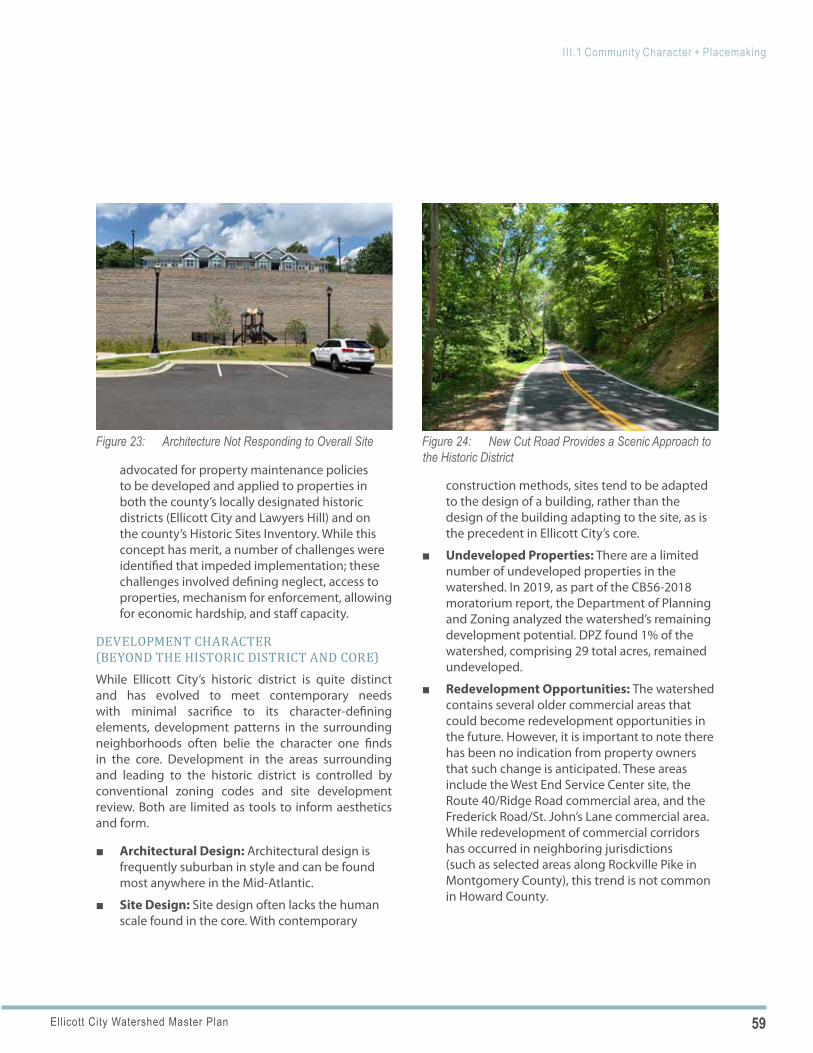
59Ellicott City Watershed Master Plan
III.1 Community Character + Placemaking
Figure 23: Architecture Not Responding to Overall Site Figure 24: New Cut Road Provides a Scenic Approach to the Historic District
advocated for property maintenance policies to be developed and applied to properties in both the county’s locally designated historic districts (Ellicott City and Lawyers Hill) and on the county’s Historic Sites Inventory. While this concept has merit, a number of challenges were identified that impeded implementation; these challenges involved defining neglect, access to properties, mechanism for enforcement, allowing for economic hardship, and staff capacity.
DEVELOPMENT CHARACTER (BEYOND THE HISTORIC DISTRICT AND CORE)While Ellicott City’s historic district is quite distinct and has evolved to meet contemporary needs with minimal sacrifice to its character-defining elements, development patterns in the surrounding neighborhoods often belie the character one finds in the core. Development in the areas surrounding and leading to the historic district is controlled by conventional zoning codes and site development review. Both are limited as tools to inform aesthetics and form.
■ Architectural Design: Architectural design is frequently suburban in style and can be found most anywhere in the Mid-Atlantic.
■ Site Design: Site design often lacks the human scale found in the core. With contemporary
construction methods, sites tend to be adapted to the design of a building, rather than the design of the building adapting to the site, as is the precedent in Ellicott City’s core.
■ Undeveloped Properties: There are a limited number of undeveloped properties in the watershed. In 2019, as part of the CB56-2018 moratorium report, the Department of Planning and Zoning analyzed the watershed’s remaining development potential. DPZ found 1% of the watershed, comprising 29 total acres, remained undeveloped.
■ Redevelopment Opportunities: The watershed contains several older commercial areas that could become redevelopment opportunities in the future. However, it is important to note there has been no indication from property owners that such change is anticipated. These areas include the West End Service Center site, the Route 40/Ridge Road commercial area, and the Frederick Road/St. John’s Lane commercial area. While redevelopment of commercial corridors has occurred in neighboring jurisdictions (such as selected areas along Rockville Pike in Montgomery County), this trend is not common in Howard County.
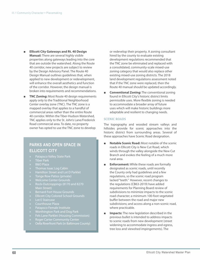
60 Ellicott City Watershed Master Plan
III.1 Community Character + Placemaking
PARKS AND OPEN SPACE IN ELLICOTT CITY
» Patapsco Valley State Park » Tiber Park » B&O Plaza » Thomas Isaac Log Cabin » Hamilton Street and Lot D Parklet » Tonge Row Patios (private) » Welcome Center Grounds » Rock-Outcroppings (8170 and 8270
Main Street) » Bernard Fort House Grounds » Ellicott City Colored School Grounds » Lot E Staircase » Courthouse Plaza » Patapsco Female Institute » Worthington Park and Dog Park » Fels Lane Parklet (Housing Commission) » Roger Carter Community Center » Oella Riverfront Park (in Baltimore County)
■ Ellicott City Gateways and Rt. 40 Design Manual: There are several highly visible properties along gateways leading into the core that are outside the watershed. Along the Route 40 corridor, new projects are subject to review by the Design Advisory Panel. The Route 40 Design Manual outlines guidelines that, when applied to new development or redevelopment, will enhance the overall aesthetics and function of the corridor. However, the design manual is broken into requirements and recommendations.
■ TNC Zoning: Most Route 40 design requirements apply only to the Traditional Neighborhood Center overlay zone (TNC). The TNC zone is a mapped overlay that applies to a handful of commercial areas rather than the entire Route 40 corridor. Within the Tiber-Hudson Watershed, TNC applies only to the St. John’s Lane/Frederick Road commercial area. To date, no property owner has opted to use the TNC zone to develop
or redevelop their property. A zoning consultant hired by the county to evaluate existing development regulations recommended that the TNC zone be eliminated and replaced with a consolidated, community-scale mixed-use zoning category that would also replace other existing mixed-use zoning districts. The 2018 land development regulations assessment noted that if the TNC zone were replaced, then the Route 40 manual should be updated accordingly.
■ Conventional Zoning: The conventional zoning found in Ellicott City’s historic district limits permissible uses. More flexible zoning is needed to accommodate a broader array of future uses which will make historic buildings more adaptable and resilient to changing needs.
SCENIC ROADSThe topography and wooded stream valleys and hillsides provide for scenic approaches into the historic district from surrounding areas. Several of these approaches have Scenic Road designation.
■ Notable Scenic Road: Most notable of the scenic roads in Ellicott City is New Cut Road, which winds through the valley alongside the New Cut Branch and evokes the feeling of a much more rural area.
■ Enforcement: While these roads are formally designated as scenic roads, until recently the County only had guidelines and a few regulations, so the scenic road program lacked “teeth.” However, recent changes to the regulations (CB63-2019) have added requirements for Planning Board review of subdivisions to minimize impacts to the scenic road character; a minimum 100-foot vegetated buffer between the road and major new subdivisions; and access along a non-scenic road, where practicable.
■ Impacts: The new legislation described in the previous bullet is intended to address impacts to scenic roads from new development (street widening to accommodate ingress and egress, tree loss and viewshed impingements). The
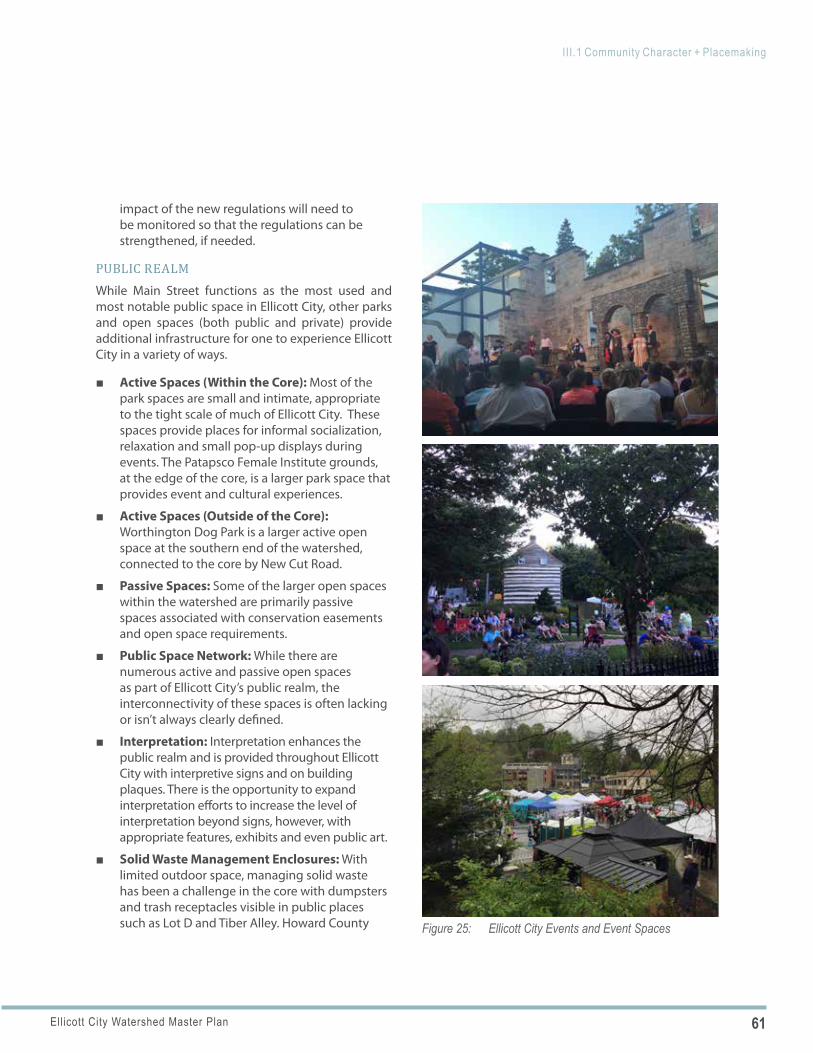
61Ellicott City Watershed Master Plan
III.1 Community Character + Placemaking
Figure 25: Ellicott City Events and Event Spaces
impact of the new regulations will need to be monitored so that the regulations can be strengthened, if needed.
PUBLIC REALMWhile Main Street functions as the most used and most notable public space in Ellicott City, other parks and open spaces (both public and private) provide additional infrastructure for one to experience Ellicott City in a variety of ways.
■ Active Spaces (Within the Core): Most of the park spaces are small and intimate, appropriate to the tight scale of much of Ellicott City. These spaces provide places for informal socialization, relaxation and small pop-up displays during events. The Patapsco Female Institute grounds, at the edge of the core, is a larger park space that provides event and cultural experiences.
■ Active Spaces (Outside of the Core): Worthington Dog Park is a larger active open space at the southern end of the watershed, connected to the core by New Cut Road.
■ Passive Spaces: Some of the larger open spaces within the watershed are primarily passive spaces associated with conservation easements and open space requirements.
■ Public Space Network: While there are numerous active and passive open spaces as part of Ellicott City’s public realm, the interconnectivity of these spaces is often lacking or isn’t always clearly defined.
■ Interpretation: Interpretation enhances the public realm and is provided throughout Ellicott City with interpretive signs and on building plaques. There is the opportunity to expand interpretation efforts to increase the level of interpretation beyond signs, however, with appropriate features, exhibits and even public art.
■ Solid Waste Management Enclosures: With limited outdoor space, managing solid waste has been a challenge in the core with dumpsters and trash receptacles visible in public places such as Lot D and Tiber Alley. Howard County
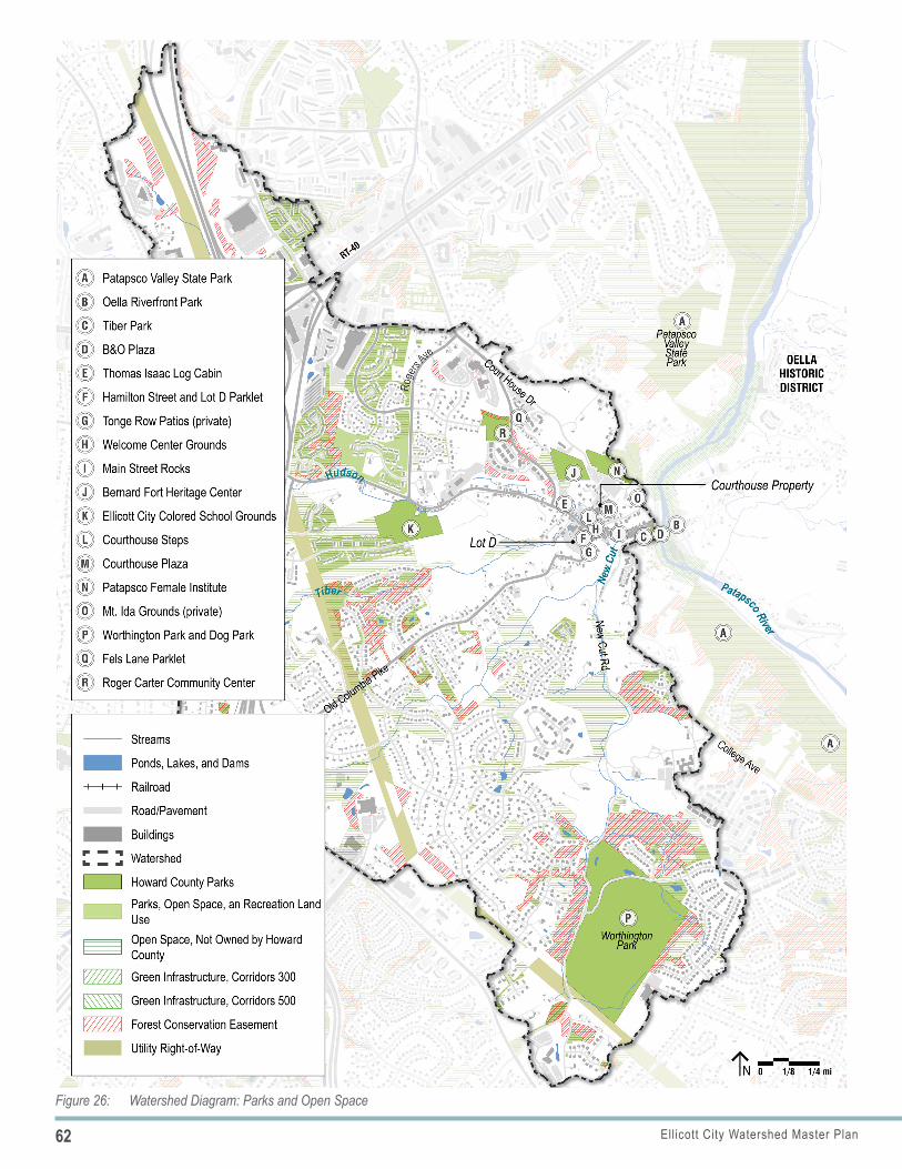
62 Ellicott City Watershed Master Plan
III.1 Community Character + Placemaking
Figure 26: Watershed Diagram: Parks and Open Space
63Ellicott City Watershed Master Plan
III.1 Community Character + Placemaking
recently installed dumpster enclosures in Lot D and added dumpsters in Lot B. With removal of the four buildings as part of EC Safe and Sound, the need for solid waste management may be diminished along Tiber Alley, however, this will be dependent upon future uses in that area.
ACCESSIBILITYAccessibility and ADA compliance is a challenge throughout the core. Narrow sidewalks with obstructions such as protruding steps and utility poles coupled with steep inclines make navigating the core difficult for pedestrians with special needs. Opportunities to address these challenges as best as possible need to be considered as changes to the physical environment occur. Some improvements to accessibility are already underway as Howard County continues to make sidewalk repairs following the floods. Several ADA compliant ramps have been upgraded or added along Main Street and uneven asphalt sidewalk pavement has been replaced with concrete in several areas.
PUBLIC ARTArt plays a prominent role in Ellicott City, evident by the numerous galleries located throughout the core and West End and art-related events. While attention to the arts is becoming more and more prominent in the community, public art is less pronounced than it could be, particularly within a community as unique as Ellicott City. Part of this can be attributed to limited space within the core’s public realm.
■ Role of Public Art: Public art plays a valuable cultural, economic and social role in communities, providing a vehicle to highlight history, environment and evolving culture and activate the public realm. In Ellicott City public art plays an important role in adding vibrancy, engaging its citizens and connecting them to the places that make the community iconic and memorable.
■ Art-Related Events: Ellicott City hosts notable art-related events including Paint It!, an annual Plein Air paint-out and the Patapsco River Rock Building event.
■ Past Initiatives: Howard County considered pursuing a Maryland State Arts Council, Arts and Entertainment District designation for Ellicott City prior to the recent initiatives described above, however, the County determined at the time that there were not enough existing arts and entertainment uses upon which to base the application.
■ Recent Initiatives: Property owners with the support of state bond funds and donations through “The Fund for Art in Ellicott City” recently installed two murals, based on historic themes, along Main Street bringing the total to three. Ellicott City also participated in the Howard County Arts Council’s ARTsites program and acquired the Aubergine sculpture for display at the Welcome Center.
PROGRAMMING AND EVENTSIn addition to physical infrastructure, the programming of the public realm plays a prominent role in one’s experience of a community. Ellicott City’s geography and extensive historic district provides a dramatic setting for these to occur.
Regardless of the theme, events play a role in activating the community and reinforcing it as a special place in all seasons. Some events play an important role in bringing awareness to cultural and natural resources. For example, the Patapsco River Rock Building event (sometimes referred to as Cairn Constructing) was designed in memory of a local artist and educator who inspired watershed awareness and involvement.
■ Programming: The Department of Recreation and Parks (DRP) offers special programs at their sites that engage and educate visitors. Additionally, private businesses, such as Little Market Café along Tonge Row, create weekly programming throughout the summer.
■ Significant Events: Numerous events, both large and small, occur in the core throughout the year; the largest events, Springfest, Main Street Music Fest and Midnight Madness, draw thousands of visitors.
64 Ellicott City Watershed Master Plan
III.1 Community Character + Placemaking
POLICY 1.1
■ Event Purpose: Events are important for Ellicott City. They attract visitors, support businesses, and build community pride. While many businesses don’t attract shoppers during the event itself, events provide opportunities to increase awareness of and promote the businesses for return visits. Events also generate revenues for Ellicott City Partnership (ECP) which helps fund direct business support. Lastly, events increase awareness of Ellicott City, its historic district and natural resources.
■ Event Locations: Lot D is the primary location for large events, while smaller movie events take place adjacent to The Wine Bin. Holiday events take place throughout the core, primarily along Main Street.
■ Event Challenges: While events are important, they also require a tremendous amount of volunteer effort, are resource-intensive and can be time consuming. Organizers often question and discuss the cost/benefit in terms of benefit to Main Street businesses vs. the time and organizational resources required to implement the event.
THE VISITOR EXPERIENCE While one of Ellicott City’s most compelling traits is the overall integrity of its historic district, there are numerous historic ‘gems’ throughout the district that serve as individual attractions. These include significant cultural resources such as the B&O Station Museum, the Ellicott City Colored School, the Patapsco Female Institute and the former Ellicott City Post Office (which contains oil on canvas mural paintings that were installed as part of Franklin D. Roosevelt’s New Deal and are protected by interior MHT easements), just to name a few. These attractions are well-maintained and curated by Howard County and its partners, however, visitors don’t always recognize them as part of a connected experience. In addition to these significant attractions, visitors’ experiences of Ellicott City are heightened by the numerous humble, but equally important, structures and small open spaces throughout the core.
ELLICOTT CITY TOMORROW: PLAN POLICIES AND ACTIONS
PRESERVATION FACILITATION Continue and build upon efforts to facilitate historic preservation and communicate its importance.
Implementing Actions
a. Historic Sites Inventory Updates: As the existing county-wide Historic Sites Inventory is updated, include information and/or a link to promote information that DPW maintains as it relates to flood reduction. DPW’s webpage includes information on how people can get access to DFIRM and flood elevation certificate information, which might be helpful to make newcomers aware of, in addition to the Historic Preservation Commission (HPC) process.
b. Stakeholder Education: Prepare concise messaging for use when conveying the importance and value of historic preservation, the importance of the historic district itself, opportunities for the historic district, description of best practices and ongoing threats. This messaging can be used to educate new property owners, new residents, new businesses, newly-elected officials and new County employees whose responsibilities impact the Historic District.
c. Public Interpretation: Incorporate interpretive signage, markers and displays and explore ways to highlight historic features to increase the awareness of Ellicott City’s heritage.
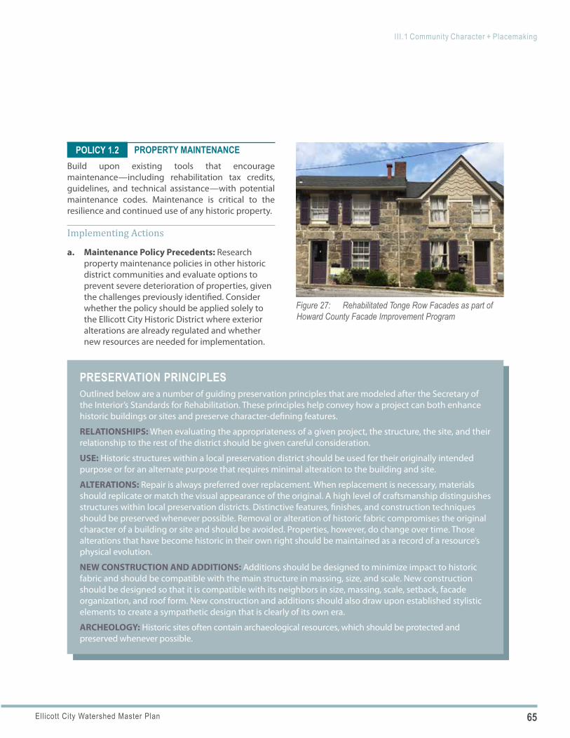
65Ellicott City Watershed Master Plan
III.1 Community Character + Placemaking
PRESERVATION PRINCIPLESOutlined below are a number of guiding preservation principles that are modeled after the Secretary of the Interior’s Standards for Rehabilitation. These principles help convey how a project can both enhance historic buildings or sites and preserve character-defining features.
RELATIONSHIPS: When evaluating the appropriateness of a given project, the structure, the site, and their relationship to the rest of the district should be given careful consideration.
USE: Historic structures within a local preservation district should be used for their originally intended purpose or for an alternate purpose that requires minimal alteration to the building and site.
ALTERATIONS: Repair is always preferred over replacement. When replacement is necessary, materials should replicate or match the visual appearance of the original. A high level of craftsmanship distinguishes structures within local preservation districts. Distinctive features, finishes, and construction techniques should be preserved whenever possible. Removal or alteration of historic fabric compromises the original character of a building or site and should be avoided. Properties, however, do change over time. Those alterations that have become historic in their own right should be maintained as a record of a resource’s physical evolution.
NEW CONSTRUCTION AND ADDITIONS: Additions should be designed to minimize impact to historic fabric and should be compatible with the main structure in massing, size, and scale. New construction should be designed so that it is compatible with its neighbors in size, massing, scale, setback, facade organization, and roof form. New construction and additions should also draw upon established stylistic elements to create a sympathetic design that is clearly of its own era.
ARCHEOLOGY: Historic sites often contain archaeological resources, which should be protected and preserved whenever possible.
Figure 27: Rehabilitated Tonge Row Facades as part of Howard County Facade Improvement Program
POLICY 1.2 PROPERTY MAINTENANCEBuild upon existing tools that encourage maintenance—including rehabilitation tax credits, guidelines, and technical assistance—with potential maintenance codes. Maintenance is critical to the resilience and continued use of any historic property.
Implementing Actions
a. Maintenance Policy Precedents: Research property maintenance policies in other historic district communities and evaluate options to prevent severe deterioration of properties, given the challenges previously identified. Consider whether the policy should be applied solely to the Ellicott City Historic District where exterior alterations are already regulated and whether new resources are needed for implementation.
66 Ellicott City Watershed Master Plan
III.1 Community Character + Placemaking
POLICY 1.3
POLICY 1.4
POLICY 1.5
DEVELOPMENT CHARACTER AND ZONING
Further assess community character countywide and identify applicable next steps for the subsequent zoning code rewrite.
Implementing Actions
a. Assessment of Community Character: Conduct a qualitative and quantitative assessment of the elements of community character. The assessment may include evaluation of: topography; street and block patterns; open space, tree canopy and natural resources; lot size and building placement; building scale and massing; private frontages; historic preservation; and gateways.
b. Place Type Palette: Develop a place type palette. The place type palette should go beyond land use and density controls to include other place-making features that reinforce intended design and character elements for future development and redevelopment.
c. Character-Based Codes: Explore the potential applicability of character-based codes through the subsequent zoning code rewrite. As part of the general plan update, HoCo By Design, DPZ and its consultant team will assess Howard County’s community character and develop a “character area palette” to inform the general plan update. The character area palette will help Howard County and its citizens define the physical qualities (natural and built environments) of the county that are desirable and worth protecting and replicating. Ultimately, this can inform the code rewrite with an emphasis on physical form rather than focusing primarily on land use.
SCENIC ROADSMonitor the impact of the recent CB63-2019 legislation’s changes and the effectiveness of those changes in protecting scenic roads and the views from scenic roads within the watershed. Monitor the impacts and effectiveness with respect to site
ingress and egress, placement of buildings and roads, protection of vegetation, grading, location and design of utilities, parking and service areas, and preservation of open views.
PUBLIC REALM DESIGN, AMENITIES AND USER COMFORTS
Design public spaces and park enhancements with a sensitivity to their context, potential for activation by a broad range of people, flexibility, durability, user comforts, and potential for interpretation and education on a variety of topics.
Implementing Actions
a. Community Engagement: Engage relevant stakeholders and user groups in the design of public spaces.
b. Adjacent Uses: Consider the potential for adjacent uses or future uses that could front onto the spaces, activate them, leverage value from them and provide potential revenue sources to help fund their implementation.
c. Visibility: Plan for visibility into and out of the public space.
d. Resiliency: Utilize resilient materials and design approaches and seek opportunities to make these visible and educational.
e. Open Space Network: Consider the role of the public spaces in and potential connections to an overall open space network that includes a series of interconnected public outdoor spaces, parks and open areas with a hierarchy of sidewalks and paths.
f. Accessibility: Ensure that parks and open spaces include amenities that are appealing and accessible to all ages and abilities and are ADA-compliant.
g. Public Amenities: Incorporate public amenities and user comforts into or near existing and new park spaces to make the spaces attractive and functional to a wide group of users. Consider seating, particularly movable chairs and tables, bicycle accommodations, wayfinding signage,
67Ellicott City Watershed Master Plan
III.1 Community Character + Placemaking
CHARACTER-BASED CODESCharacter-based codes can create and reinforce ‘sense of place’ through dimensional standards to define spaces between buildings and control how buildings relate to each other, to streets, to other public spaces and to site topography. As compared to conventional zoning, character-based codes focus more on the size, form and placement of buildings and site elements, and less on land use and density. Character-based codes help create predictable outcomes by focusing on form rather than function. Although land use is a consideration, it is not the overriding regulatory element.
» ARCHITECTURAL DESIGN STANDARDS: Character-based codes can incorporate architectural design standards for new buildings and parking garages, particularly related to how they are designed to fit the site and natural grades, respond to their context and reinforce area design characteristics.
» SITE GRADING: Character-based codes can provide guidance on appropriate site grading that responds and transitions to the natural landform, rather than responding to a building design that is not appropriate for the site.
» SITE DESIGN DETAILS: Character-based codes can identify site design details, materials and standards that are appropriate for specific areas vs. “one-size-fits-all” standards such as granite curb vs. concrete curb and gutter or use of retaining walls, to name a few.
» ACCESSIBILITY: Character-based codes can supplement other regulations to provide guidance on how to sensitively incorporate ADA compliance.
» WALKABILITY: Character-based codes can guide the elements that contribute to greater community walkability including not just the necessary infrastructure (sidewalks and trails), but also connecting meaningful destinations, interesting and engaging adjacent land uses, and safety and comfort.
» LANDSCAPE STANDARDS: Character-based codes can describe landscape standards that, in addition to quantity, canopy coverage, buffering, habitat and environmental criteria, emphasize design and aesthetics that are appropriate to the context.
» ENVIRONMENTAL SITE DESIGN (ESD) PRACTICES: Character-based codes can provide guidance on enhanced protection of environmental features – streams, wetlands, steep slopes, and forests – and on the design of ESD practices and green technologies, such as stormwater management facilities, green roofs and living walls that can be integrated into the overall building and landscape design.
» SIGNAGE STANDARDS: Character-based codes can include standards for signage that is integrated into the overall site and building designs.
» INCENTIVES: Character-based codes can identify incentives to encourage stronger architectural design, buildings that better fit the landform, and/or better integrated environmental features.
water features, shade (trees and shade structures) and public restrooms.
h. Restaurant Partnerships: Explore partnerships with nearby restaurants to provide opportunities for outdoor dining and the provision of food and drink, an important component of successful urban open spaces.
i. Pop-Up Spaces /Multi-Use Design: Utilize “pop-up” or temporary public spaces to activate an area during a specific time of day, days of the week or seasonally. These could occur in place of a parking space, multiple spaces or an entire parking area. Explore how new or reorganized parking lots can be designed to function as parking resources most of the time and public gathering spaces some of the time.
68 Ellicott City Watershed Master Plan
III.1 Community Character + Placemaking
PUBLIC ART CONSIDERATIONSPublic art should be of the highest quality in design and execution and may include:
» Three-dimensional artwork such as sculpture in the round, bas-relief, mobile and kinetic in any material or combinations of material;
» Two-dimensional artwork including paintings, prints, photographs, murals and mosaics;
» Fine crafts including clay, fiber and textiles, wood, stone, metal, plastics, glass and other materials;
» Functional and nonfunctional artwork; » Artwork involving lighting, audio
properties and water; and » Interactive artworks.
POLICY 1.6
j. Demonstration Projects: Consider opportunities to incorporate demonstration projects as part of the public realm design, such as that described in Policy 3.6.
k. Naming: Elevate the importance of public spaces by naming those not yet named and including them on wayfinding maps and directories, regardless of how small they are.
PUBLIC ARTIncorporate public art into a wide range of improvement projects to highlight and increase awareness of historic resources, natural and geologic features, flood risk, and prominent citizens, and to create attractions in and of themselves.
Implementing Actions
a. Permanent and Temporary Installations: Consider temporary and permanent installations.
b. Context: Integrate public art thoughtfully and sensitively to the context of Ellicott City and the historic district.
c. Quality: Public art should demonstrate artistic excellence and technical competence.
d. Arts District: Explore pursuing a Maryland State Arts Council, Arts and Entertainment District designation for the downtown core that includes Main Street and the West End, once additional arts and entertainment uses open.
e. ARTsites Program: Continue to participate in the Howard County Arts Council’s ARTsites program which provides outdoor sculpture exhibits at locations throughout Howard County.
f. Public Arts Plan: Consider developing a community-engaged Public Arts Plan for the core as a complement to this Master Plan. This plan would allow the community to methodically consider permanent and temporary art in the public domain, targeting existing and new spaces, infrastructure and development within the core or future arts district and, possibly, the entire community. The purpose,
goals and elements of the plan would need to be established by art district promoters and partners. Additionally, the plan should include a component of Howard County Historic Preservation Commission (HPC) Advisory review to ensure the plan complies with the guidelines. Consider a process for incorporating public art, particularly as part of major new infrastructure projects; opportunities to use art to bring awareness to cultural, historic and environmental resources as well as ongoing initiatives for making the community more resilient; and specific focused initiatives such as introducing more color or more interactive art into the core.
g. Lighting Program: As part of the Public Arts Plan or as a separate initiative, develop a plan for using limited lighting to enliven the core and highlight natural and architectural resources. It will be important to utilize lighting methods, such as downlighting and new technologies to minimize light pollution. A coordinated effort should examine lighting holistically; however, some specific opportunities are outlined within
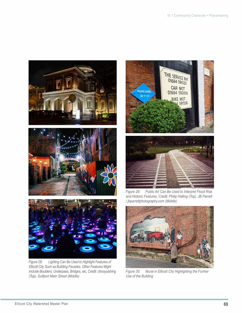
69Ellicott City Watershed Master Plan
III.1 Community Character + Placemaking
Figure 28: Lighting Can Be Used to Highlight Features of Ellicott City Such as Building Facades. Other Features Might Include Boulders, Underpass, Bridges, etc, Credit: chooyutshing (Top), Gulfport Main Street (Middle)
Figure 29: Public Art Can Be Used to Interpret Flood Risk and Historic Features, Credit: Philip Halling (Top), JB Parrett / jbparrettphotography.com (Middle)
Figure 30: Mural in Ellicott City Highlighting the Former Use of the Building
70 Ellicott City Watershed Master Plan
III.1 Community Character + Placemaking
POLICY 1.7
POLICY 1.8
each geographic area. As with the Public Arts Plan, the program should include a component of HPC Advisory review. Additionally, carefully place lighting to avoid creating obstacles for emergency vehicles and first responders.
h. Interpretation: Incorporate interpretive signs, displays and features throughout the core and watershed to increase public awareness of Ellicott City’s flood risk. Consider art to mark high water levels during past floods, or to mark the location of a stream channel that is covered by a structure or roadway.
i. Attracting Arts and Entertainment Uses: Promote attraction of artist housing or arts-based businesses.
GREEN CULTURAL TRAILPhase-in the establishment of an inter-connected “green cultural trail” for residents and visitors to experience Ellicott City through a connected trail network extending from the Patapsco River to the West End and beyond.
Implementing Actions
a. Historic and Cultural Resources: Connect historic and cultural resources (physically and programmatically) to allow for a broader understanding.
b. Main Street Connections: Consider appropriate design treatments and signage for areas where the trail intersects with and crosses Main Street and for areas where it coincides with Main Street when it is not possible to create a separate trail.
c. Open Spaces: Link existing and potential open spaces, both active and passive.
d. Natural Areas: Incorporate daylighted channels, naturalized channels, rock outcrops and associated open spaces.
e. Stewardship and Interpretation: Highlight environmental demonstration projects and provide interpretive displays to provide educational opportunities on flood mitigation and
cultural, historic and environmental elements.
f. Access: Consider guided access through the expanded Tiber Branch channel in Lower Main for maintenance and educational purposes.
g. Branding: Consider an extension of the branding developed by ECP to brand and name the trail.
Refer to the geographic area frameworks to understand how the green cultural trail interfaces with each of these specific areas.
PROGRAMMING AND EVENTSWork with all entities responsible for special events within Ellicott City and evaluate existing events and their benefit to the businesses, downtown, West End and the community as a whole.
Implementing Actions
a. Events Assessment: Work with ECP to conduct a full assessment of each event including costs, logistics (access, parking, event location, etc.), attendance from outside visitors and benefits to the businesses and community. Consider eliminating events that are under-attended or overly costly. Choose events that have a strong visitor and retail focus and rebuild the event calendar from this standpoint to reap the most benefits.
b. Annual Events Calendar: Following the completion of the assessment, create and maintain an annual events calendar, keeping in mind that there are differences in special events, retail events and community events.
c. New Events: Following completion of an events calendar, discuss the need for any additional events, changes in events, restructuring of previous events, etc. While no new programs or events should be added until this assessment is completed, some considerations that evolved during this master planning process include new events to highlight some of the major infrastructure projects. Events could occur while
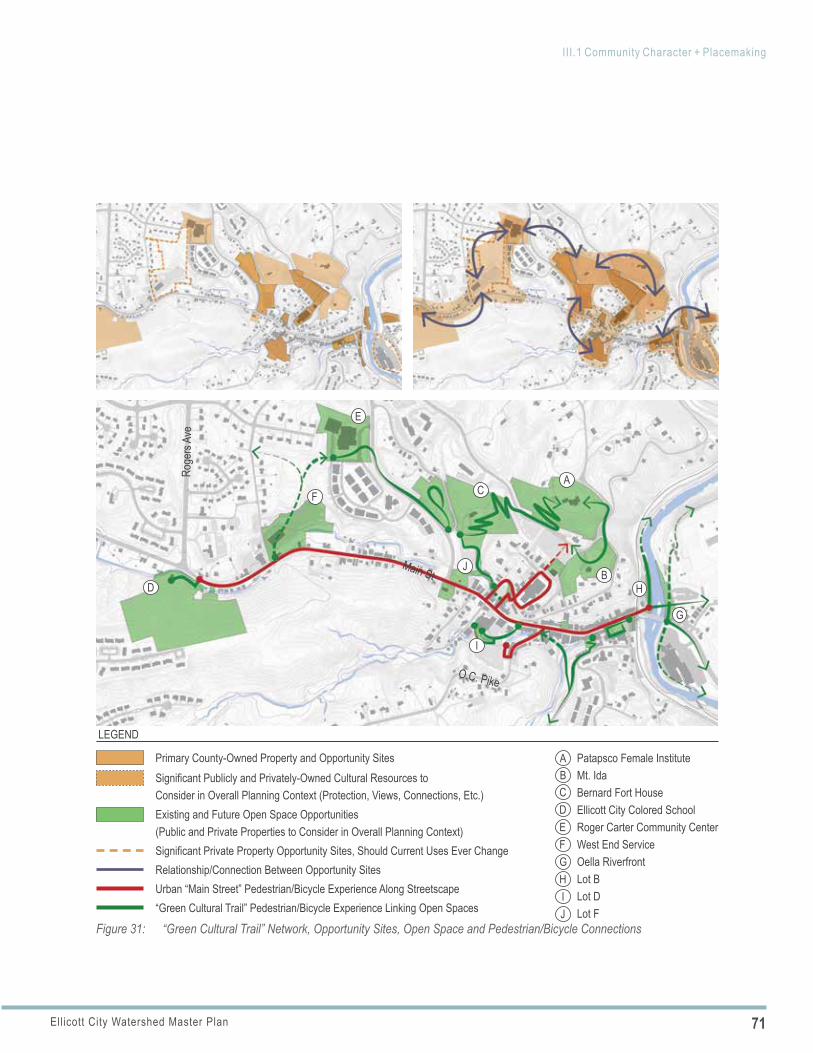
71Ellicott City Watershed Master Plan
III.1 Community Character + Placemaking
Figure 31: “Green Cultural Trail” Network, Opportunity Sites, Open Space and Pedestrian/Bicycle Connections
Primary County-Owned Property and Opportunity SitesSignificant Publicly and Privately-Owned Cultural Resources to Consider in Overall Planning Context (Protection, Views, Connections, Etc.) Existing and Future Open Space Opportunities (Public and Private Properties to Consider in Overall Planning Context)Significant Private Property Opportunity Sites, Should Current Uses Ever Change Relationship/Connection Between Opportunity SitesUrban “Main Street” Pedestrian/Bicycle Experience Along Streetscape“Green Cultural Trail” Pedestrian/Bicycle Experience Linking Open Spaces
LEGEND
ABCDE
Patapsco Female InstituteMt. IdaBernard Fort HouseEllicott City Colored School Roger Carter Community CenterWest End ServiceOella Riverfront Lot B Lot DLot F
FGHIJ
J
A
B
C
D
E
F
G
H
I
Main St
Roge
rs Av
e
O.C. Pike
72 Ellicott City Watershed Master Plan
III.1 Community Character + Placemaking
WHAT’S HAPPENING IN ELLICOTT CITY?Current events include, but are not limited to:
» Stroll Down Main » Girls Night Out » Mardi Gras Scavenger Hunt » Springfest » Musicfest » Trick or Treat on Main » Plein Air Event » Small Business Saturday » Midnight Madness » Haunted House » Arts Gallery Hop » Patapsco River Rock Building Event » Shakespeare at Patapsco Female
Institute » Wizarding Weekend on Magical Main
Street » History Walking Tours » Ghost Tours/Pub Crawls » Maryland History Tours
construction is underway to help stimulate business and later to celebrate the completion of projects.
d. Excursion Train Service : Explore the possibility of special event tourist train service linking the B&O Station Museum in Ellicott City and the B&O Railroad Museum in Baltimore to highlight the Patapsco Valley’s significance in the development of U.S. railroads. Partnering with heritage groups such as Patapsco Heritage Greenway and the Howard County Historical Society, this long-term recommendation would require extensive coordination with the CSX Railroad. Its logical target implementation would be for the EC250 celebration.
e. Shuttle Service: Explore the feasibility of providing shuttle service to major community events.
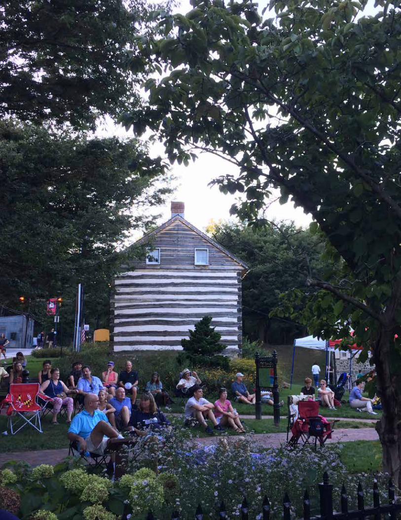
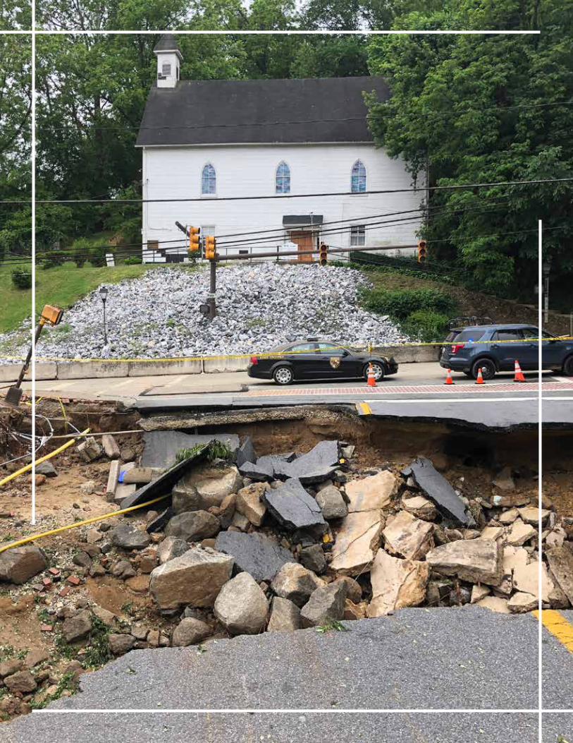
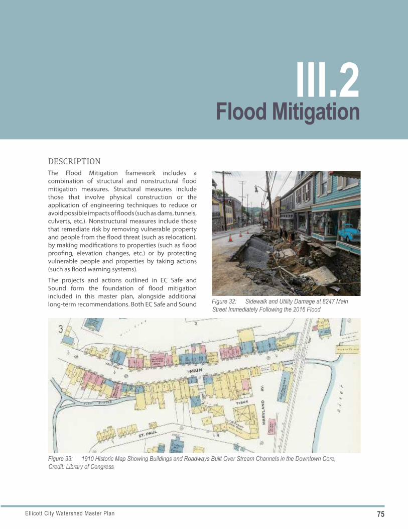
75Ellicott City Watershed Master Plan
Figure 32: Sidewalk and Utility Damage at 8247 Main Street Immediately Following the 2016 Flood
Figure 33: 1910 Historic Map Showing Buildings and Roadways Built Over Stream Channels in the Downtown Core, Credit: Library of Congress
DESCRIPTIONThe Flood Mitigation framework includes a combination of structural and nonstructural flood mitigation measures. Structural measures include those that involve physical construction or the application of engineering techniques to reduce or avoid possible impacts of floods (such as dams, tunnels, culverts, etc.). Nonstructural measures include those that remediate risk by removing vulnerable property and people from the flood threat (such as relocation), by making modifications to properties (such as flood proofing, elevation changes, etc.) or by protecting vulnerable people and properties by taking actions (such as flood warning systems).
The projects and actions outlined in EC Safe and Sound form the foundation of flood mitigation included in this master plan, alongside additional long-term recommendations. Both EC Safe and Sound
III.2Flood Mitigation
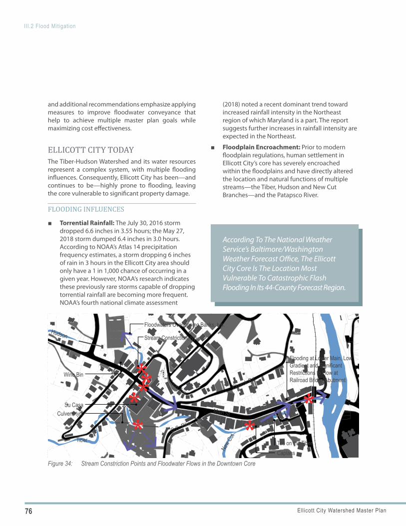
76 Ellicott City Watershed Master Plan
III.2 Flood Mitigation
According To The National Weather Service’s Baltimore/Washington Weather Forecast Office, The Ellicott City Core Is The Location Most Vulnerable To Catastrophic Flash Flooding In Its 44-County Forecast Region.
| NAME OF THE MAPPREPARED FOR: Howard County Department of Planning and ZoningEllicott City Watershed Master PlanGIS Sources: Howard County Department of Planning and Zoning; Howard County Data Download and Viewer; Baltimore County Office of Information Technology.
Main St
Church Rd
O.C. Pike
Court Ave
CaplansTea on the Tiber
Flooding at Lower Main, Low Gradient and Significant Restrictions to Flow at Railroad Bridge Abutment
Wine Bin
Floodwaters Overtopping Banks, typ.
Stream Constriction, typ.
Su CasaCulvert, typ.
Tiber
Hudson
New C
ut
*
***
**
*
Figure 34: Stream Constriction Points and Floodwater Flows in the Downtown Core
and additional recommendations emphasize applying measures to improve floodwater conveyance that help to achieve multiple master plan goals while maximizing cost effectiveness.
ELLICOTT CITY TODAY The Tiber-Hudson Watershed and its water resources represent a complex system, with multiple flooding influences. Consequently, Ellicott City has been—and continues to be—highly prone to flooding, leaving the core vulnerable to significant property damage.
FLOODING INFLUENCES
■ Torrential Rainfall: The July 30, 2016 storm dropped 6.6 inches in 3.55 hours; the May 27, 2018 storm dumped 6.4 inches in 3.0 hours. According to NOAA’s Atlas 14 precipitation frequency estimates, a storm dropping 6 inches of rain in 3 hours in the Ellicott City area should only have a 1 in 1,000 chance of occurring in a given year. However, NOAA’s research indicates these previously rare storms capable of dropping torrential rainfall are becoming more frequent. NOAA’s fourth national climate assessment
(2018) noted a recent dominant trend toward increased rainfall intensity in the Northeast region of which Maryland is a part. The report suggests further increases in rainfall intensity are expected in the Northeast.
■ Floodplain Encroachment: Prior to modern floodplain regulations, human settlement in Ellicott City’s core has severely encroached within the floodplains and have directly altered the location and natural functions of multiple streams—the Tiber, Hudson and New Cut Branches—and the Patapsco River.
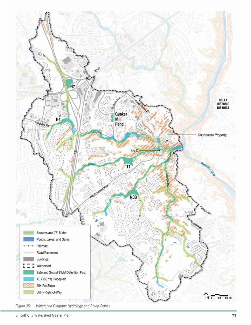
77Ellicott City Watershed Master Plan
III.2 Flood Mitigation
Figure 35: Watershed Diagram: Hydrology and Steep Slopes
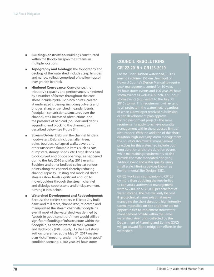
78 Ellicott City Watershed Master Plan
III.2 Flood Mitigation
COUNCIL RESOLUTIONS CR122-2019 + CR123-2019 For the Tiber-Hudson watershed, CR123 amends Volume I (Storm Drainage) of Howard County’s Design Manual to require peak management control for 10-year, 24-hour storm events and 100 year, 24-hour storm events as well as 6.6-inch, 3.55-hour storm events (equivalent to the July 30, 2016 storm). This requirement will extend to all projects in the watershed, regardless of when a developer received subdivision or site development plan approval. For redevelopment projects, the same requirements apply to achieve quantity management within the proposed limit of disturbance. With the addition of this short duration, high-intensity storm management, the county’s stormwater management practices for this watershed include both long duration and short duration events while maintaining requirements to also provide the state mandated one-year, 24-hour event and water quality using small scale, filtering devices known as Environmental Site Design (ESD).
CR122 works as a companion to CR123 by more than doubling the fees-in-lieu to construct stormwater management from $72,000 to $175,000 per acre foot of water storage. The fees will only be paid if geotechnical issues exist that make managing the short duration, high intensity storm impossible on-site and there are no opportunities to implement stormwater management off-site within the same watershed. Any funds collected by the Department of Planning and Zoning (DPZ) will go toward flood mitigation efforts in the watershed.
■ Building Construction: Buildings constructed within the floodplain span the streams in multiple locations.
■ Topography and Geology: The topography and geology of the watershed include steep hillsides and narrow valleys comprised of shallow topsoil over granite bedrock.
■ Hindered Conveyance: Conveyance, the tributary’s capacity and performance, is hindered by a number of factors throughout the core. These include hydraulic pinch points (created at undersized crossings including culverts and bridges, sharp entrenched meander bends, floodplain constrictions, structures over the channel, etc.), increased obstructions and the presence of bedload (boulders and debris aggrading and blocking the channel), as described below (see Figure 34).
■ Stream Debris: Debris in the channel hinders floodwaters. Debris includes fallen trees, poles, boulders, collapsed walls, pavers and other unsecured floatable items, such as cars, dumpsters, storage sheds, etc. Large debris can block culvert and bridge openings, as happened during the July 2016 and May 2018 events. Boulders and other bedload collect at various points along the channel, thereby reducing channel capacity. Existing and modeled shear stresses show levels significant enough to move boulders through the stream channel and dislodge cobblestone and brick pavement, turning it into debris.
■ Watershed Development and Redevelopment: Because the earliest settlers in Ellicott City built dams and mill races, channelized, relocated and manipulated the stream channels/floodplains, even if most of the watershed was defined by “woods in good condition,” there would still be significant flooding of infrastructure within the floodplain, as demonstrated in the Hydraulic and Hydrology (H&H) study. As the H&H study authors presented at the May 31, 2017 master plan kickoff meeting, under the “woods in good” condition scenario, a 100-year, 24-hour storm
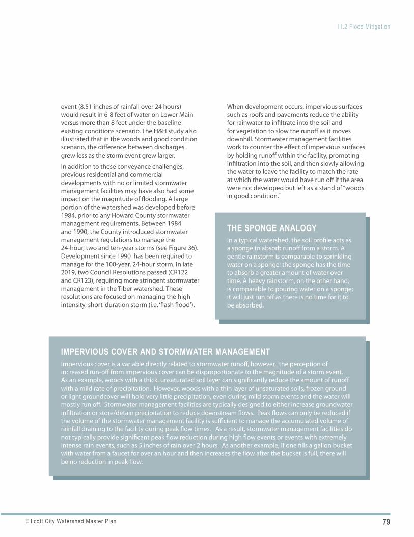
79Ellicott City Watershed Master Plan
III.2 Flood Mitigation
THE SPONGE ANALOGY In a typical watershed, the soil profile acts as a sponge to absorb runoff from a storm. A gentle rainstorm is comparable to sprinkling water on a sponge; the sponge has the time to absorb a greater amount of water over time. A heavy rainstorm, on the other hand, is comparable to pouring water on a sponge; it will just run off as there is no time for it to be absorbed.
IMPERVIOUS COVER AND STORMWATER MANAGEMENT Impervious cover is a variable directly related to stormwater runoff, however, the perception of increased run-off from impervious cover can be disproportionate to the magnitude of a storm event. As an example, woods with a thick, unsaturated soil layer can significantly reduce the amount of runoff with a mild rate of precipitation. However, woods with a thin layer of unsaturated soils, frozen ground or light groundcover will hold very little precipitation, even during mild storm events and the water will mostly run off. Stormwater management facilities are typically designed to either increase groundwater infiltration or store/detain precipitation to reduce downstream flows. Peak flows can only be reduced if the volume of the stormwater management facility is sufficient to manage the accumulated volume of rainfall draining to the facility during peak flow times. As a result, stormwater management facilities do not typically provide significant peak flow reduction during high flow events or events with extremely intense rain events, such as 5 inches of rain over 2 hours. As another example, if one fills a gallon bucket with water from a faucet for over an hour and then increases the flow after the bucket is full, there will be no reduction in peak flow.
event (8.51 inches of rainfall over 24 hours) would result in 6-8 feet of water on Lower Main versus more than 8 feet under the baseline existing conditions scenario. The H&H study also illustrated that in the woods and good condition scenario, the difference between discharges grew less as the storm event grew larger.
In addition to these conveyance challenges, previous residential and commercial developments with no or limited stormwater management facilities may have also had some impact on the magnitude of flooding. A large portion of the watershed was developed before 1984, prior to any Howard County stormwater management requirements. Between 1984 and 1990, the County introduced stormwater management regulations to manage the 24-hour, two and ten-year storms (see Figure 36). Development since 1990 has been required to manage for the 100-year, 24-hour storm. In late 2019, two Council Resolutions passed (CR122 and CR123), requiring more stringent stormwater management in the Tiber watershed. These resolutions are focused on managing the high-intensity, short-duration storm (i.e. ‘flash flood’).
When development occurs, impervious surfaces such as roofs and pavements reduce the ability for rainwater to infiltrate into the soil and for vegetation to slow the runoff as it moves downhill. Stormwater management facilities work to counter the effect of impervious surfaces by holding runoff within the facility, promoting infiltration into the soil, and then slowly allowing the water to leave the facility to match the rate at which the water would have run off if the area were not developed but left as a stand of “woods in good condition.”
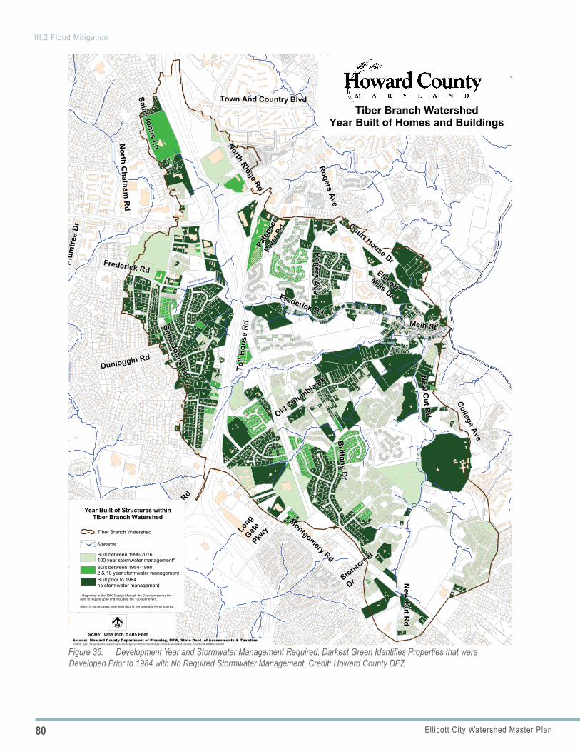
80 Ellicott City Watershed Master Plan
III.2 Flood Mitigation
Figure 36: Development Year and Stormwater Management Required, Darkest Green Identifies Properties that were Developed Prior to 1984 with No Required Stormwater Management, Credit: Howard County DPZ
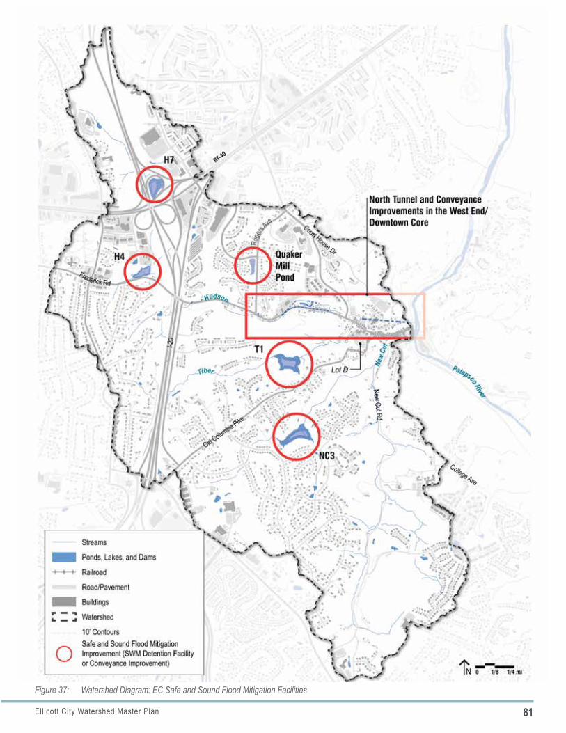
81Ellicott City Watershed Master Plan
III.2 Flood Mitigation
Figure 37: Watershed Diagram: EC Safe and Sound Flood Mitigation Facilities
82 Ellicott City Watershed Master Plan
III.2 Flood Mitigation
■ Patapsco River Flooding: Since the early settlement of Ellicott City, significant amounts of fill material, bridges and buildings located in the Patapsco River floodplain have created constrictions and increases in the water surface elevation at these constrictions. This results in a “backwater” or ponding effect upstream, during high flow events. Thus, the fill and structures located within the riverfront area, just downstream of the lower Main Street area, have reduced the capacity of the floodplain. These impacts may have significantly increased the vulnerability of the lower Main Street area to Patapsco River high flow events.
Additionally, flooding associated with the Patapsco River is very different from the flash floods associated with the tributaries. Patapsco River floodwaters typically rise at a slower rate and primarily impact the lower Main Street area. These impacts, however, have been significant in past events such as 1972’s Hurricane Agnes. The H&H study had not analyzed the flooding of the Patapsco River or potential ways to mitigate it. Therefore, this plan does not provide recommendations in the following section for a river rise event.
FLOOD MITIGATION MEASURESConsidering the various factors influencing flooding, a combination of techniques and approaches for managing floodwaters—interventions both large and small as the County is currently pursuing—is the best approach to optimize impact. Implementation of a single measure, or single type of measure, will not have an effective impact on flooding in this watershed. Small-scale stormwater management facilities—such as bioretention, rain gardens, permeable pavements, cisterns, and similar environmental site design (ESD) practices —while valuable, do not measurably reduce flooding during large storms in this watershed. Further, permeable paving may not be appropriate in some locations due to the presence of shallow granite bedrock. In order to significantly improve public safety and reduce the devastating flood damage to Ellicott City typically caused by intense rainfall events,
a combination of large-scale storage facilities and, most importantly, flood conveyance improvements in critical locations are required.
Measures currently underway are described in the following paragraphs.
FLOODPLAIN DEVELOPMENT REGULATIONSHoward County currently prohibits development in the 100-year regulatory floodplain which includes all areas subject to inundation by water of the one-percent annual flood, as delineated by the most recent revision of the Flood Insurance Study for Howard County and the accompanying Flood Insurance Rate Maps or the floodplain studies and requirements of DPW and DPZ, whichever is more restrictive.
EC SAFE AND SOUND FLOOD MITIGATION Howard County explored numerous flood mitigation scenarios developed by the master plan team and McCormick Taylor following the 2016 flood. Following the 2018 flood, the County and McCormick Taylor then developed additional scenarios; all of these informed the foundation for the EC Safe and Sound flood mitigation plan. EC Safe and Sound is comprised of a balanced system of mitigation—dry flood mitigation facilities (within the stream channel) and both large and small scale conveyance projects including a tunnel (15 to 18 foot diameter diversion tunnel, intercepting storm water the Hudson from Parking Lot F and diverting it below grade directly to the Patapsco River). These proposed projects and systems are significant, large and costly construction projects and therefore must be sensitively integrated into the community.
■ Dry Flood Mitigation Facilities: Four dry flood mitigation facilities (H-7, H-4, T-1 and NC-3) and one expanded detention facility (Quaker Mill) are planned for the Hudson, Tiber and New Cut branches (see Figure 37 for a map of mitigation facilities).
■ Conveyance Improvements: Conveyance improvements include the North Tunnel which will divert floodwaters from the Hudson Branch to the Patapsco River, the Maryland Avenue
83Ellicott City Watershed Master Plan
III.2 Flood Mitigation
NATIONAL FLOOD INSURANCE PROGRAM COMMUNITY RATING SYSTEM As a part of the National Flood Insurance Program (NFIP), the Community Rating System (CRS) is a voluntary incentive program that recognizes and encourages community floodplain management activities that exceed the minimum program requirements.
As a result, flood insurance premium rates are discounted to reflect the reduced flood risk resulting from the community actions meeting the three goals of the Community Rating System:
» Reduce flood damage to insurable property
» Strengthen and support the insurance aspects of the National Flood Insurance Program
» Encourage a comprehensive approach to floodplain management
Source: FEMA; for more information about the flood insurance program, visit FloodSmart.gov.
culverts which will convey a portion of the Tiber Branch to the Patapsco River, and West End conveyance projects located near 8777 Main Street, 8600 Main Street, and 8534 Main Street.
■ Nonstructural Flood Proofing: Many properties, particularly within the lower Main Street area, will still be impacted by severe floods after EC Safe and Sound flood mitigation is implemented. Howard County’s “Flood Mitigation Assistance Pilot Program” offered matching grants to fund private non-structural flood resiliency improvements in specified flood zone areas, including the Tiber-Hudson watershed. Examples of eligible projects included flood doors and windows, sealant, relocation of HVAC units, flood shields and drainage systems. This program was recently reinstated in 2020 for a second round of matching grants.
■ Flood Insurance: Howard County participates in the National Flood Insurance Program (NFIP) and the NFIP’s Community Rating System (CRS). As a participating jurisdiction, property owners can obtain flood insurance at a reduced rate. Since Howard County is a Class 6 community in the CRS, NFIP policyholders receive up to a 20% discount on their flood insurance in FEMA-mapped high risk flood hazard area, and up to a 10% discount outside the high risk area.
CHANNEL MAINTENANCE Monitoring and removing debris can be a challenge as many sections of channel are located on private property and covered by roadways, parking lots or buildings. Another challenge is finding appropriate staging areas to place materials as they are removed from the channels. In many instances, bedload is removed and placed immediately adjacent to the stream, making it vulnerable to being washed back into the channel during the next storm. Additionally, large storm events may carry bedload and debris back into recently cleared areas, making the benefits of dredging short-lived if not paired with an ongoing monitoring and removal program.
■ Unstable Stream Banks: The master plan consultant team noted some sections of unstable and eroded stream banks along the tributaries, such as along the New Cut Branch shortly before it joins the Tiber. The team did not, however, conduct a stream stability assessment as part of this master planning effort.
■ EC Safe and Sound Channel Maintenance: Howard County, in partnership with Howard EcoWorks, has increased the inspection of and debris removal from specific stream channels after major weather events at approximately 55 points, all but one having public access (see Page 91 for more information regarding EcoWorks).
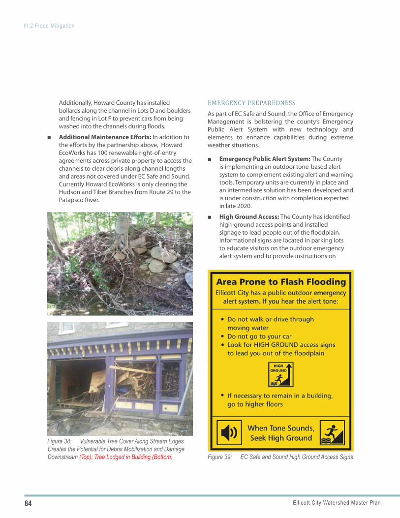
84 Ellicott City Watershed Master Plan
III.2 Flood Mitigation
Figure 39: EC Safe and Sound High Ground Access Signs
Figure 38: Vulnerable Tree Cover Along Stream Edges Creates the Potential for Debris Mobilization and Damage Downstream (Top); Tree Lodged in Building (Bottom)
Additionally, Howard County has installed bollards along the channel in Lots D and boulders and fencing in Lot F to prevent cars from being washed into the channels during floods.
■ Additional Maintenance Efforts: In addition to the efforts by the partnership above, Howard EcoWorks has 100 renewable right-of-entry agreements across private property to access the channels to clear debris along channel lengths and areas not covered under EC Safe and Sound. Currently Howard EcoWorks is only clearing the Hudson and Tiber Branches from Route 29 to the Patapsco River.
EMERGENCY PREPAREDNESSAs part of EC Safe and Sound, the Office of Emergency Management is bolstering the county’s Emergency Public Alert System with new technology and elements to enhance capabilities during extreme weather situations.
■ Emergency Public Alert System: The County is implementing an outdoor tone-based alert system to complement existing alert and warning tools. Temporary units are currently in place and an intermediate solution has been developed and is under construction with completion expected in late 2020.
■ High Ground Access: The County has identified high-ground access points and installed signage to lead people out of the floodplain. Informational signs are located in parking lots to educate visitors on the outdoor emergency alert system and to provide instructions on
85Ellicott City Watershed Master Plan
III.2 Flood Mitigation
POLICY 2.1 POLICY 2.2
POLICY 2.3
what to do if the tone sounds (“when the tone sounds, seek high ground.”). The County continued implementing additional high ground access points through agreements with private property owners in 2020.
FLOOD ELEVATION CERTIFICATES: Howard County provides flood elevation certificates at no cost based on Federal Emergency Management Agency (FEMA) mapping as a resource to businesses and residents throughout the watershed. This is a service typically not provided by jurisdictions.
ELLICOTT CITY TOMORROW: PLAN POLICIES AND ACTIONS
EC SAFE AND SOUND IMPLEMENTATION
Implement EC Safe and Sound. As part of this effort, consider aesthetics in the design of the dry flood mitigation facilities.
Implementing Actions
a. Grading: Utilize grading that is as environmentally sensitive as practical during all aspects of construction.
b. Tree Canopy: Follow the Forest Conservation Manual as facilities are designed and implemented.
c. Maintenance Program: Establish a maintenance program that includes frequent inspection, access and management of woody growth that could impact the facilities’ function over time, and keep debris from base flow openings.
d. Hazard Mitigation and Water Quality Planning: Integrate hazard mitigation planning and water quality planning into the design of each detention facility.
e. Interpretation: Include opportunities for interpretation to highlight the role these facilities play in flood mitigation, should there be any interface with public access along existing or future trails.
STORMWATER MANAGEMENT FACILITY DESIGN
Provide thoughtful aesthetic design for public and private stormwater management (SWM) facilities throughout the watershed taking into consideration the context of their location, particularly within highly-visible public areas and the historic district.
Implementing Actions
a. Design: Integrate SWM facilities into the overall site design.
b. Interpretation: Provide interpretation in the form of signage and/or public art to bring greater exposure to SWM facilities and demonstrate the role they play in improving flood mitigation and water quality.
CHANNEL MAINTENANCE AND DEBRIS MANAGEMENT
Continue to strengthen and expand current methods of routine channel maintenance throughout the watershed and provide ongoing expansion of debris management.
Implementing Actions
a. Debris Management Plan: Develop a debris management plan that includes a description of the situation, assumptions (what kind of debris is expected), and definitions of roles and responsibilities. Expand maintenance efforts to
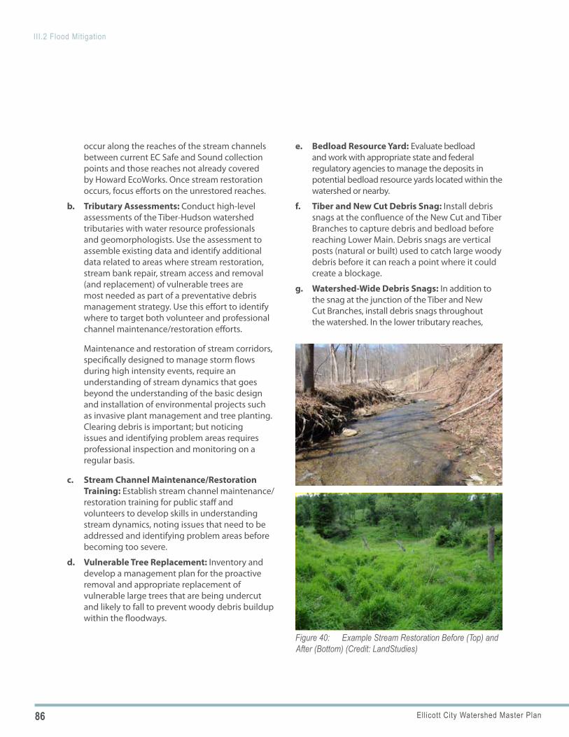
86 Ellicott City Watershed Master Plan
III.2 Flood Mitigation
Figure 40: Example Stream Restoration Before (Top) and After (Bottom) (Credit: LandStudies)
occur along the reaches of the stream channels between current EC Safe and Sound collection points and those reaches not already covered by Howard EcoWorks. Once stream restoration occurs, focus efforts on the unrestored reaches.
b. Tributary Assessments: Conduct high-level assessments of the Tiber-Hudson watershed tributaries with water resource professionals and geomorphologists. Use the assessment to assemble existing data and identify additional data related to areas where stream restoration, stream bank repair, stream access and removal (and replacement) of vulnerable trees are most needed as part of a preventative debris management strategy. Use this effort to identify where to target both volunteer and professional channel maintenance/restoration efforts.
Maintenance and restoration of stream corridors, specifically designed to manage storm flows during high intensity events, require an understanding of stream dynamics that goes beyond the understanding of the basic design and installation of environmental projects such as invasive plant management and tree planting. Clearing debris is important; but noticing issues and identifying problem areas requires professional inspection and monitoring on a regular basis.
c. Stream Channel Maintenance/Restoration Training: Establish stream channel maintenance/restoration training for public staff and volunteers to develop skills in understanding stream dynamics, noting issues that need to be addressed and identifying problem areas before becoming too severe.
d. Vulnerable Tree Replacement: Inventory and develop a management plan for the proactive removal and appropriate replacement of vulnerable large trees that are being undercut and likely to fall to prevent woody debris buildup within the floodways.
e. Bedload Resource Yard: Evaluate bedload and work with appropriate state and federal regulatory agencies to manage the deposits in potential bedload resource yards located within the watershed or nearby.
f. Tiber and New Cut Debris Snag: Install debris snags at the confluence of the New Cut and Tiber Branches to capture debris and bedload before reaching Lower Main. Debris snags are vertical posts (natural or built) used to catch large woody debris before it can reach a point where it could create a blockage.
g. Watershed-Wide Debris Snags: In addition to the snag at the junction of the Tiber and New Cut Branches, install debris snags throughout the watershed. In the lower tributary reaches,
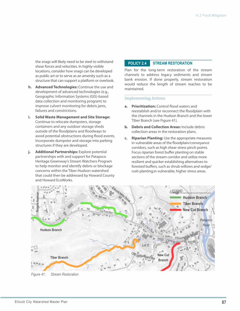
87Ellicott City Watershed Master Plan
III.2 Flood Mitigation
Main Street
Old Columbia Pike
Patapsco River
Lot D
Lot F
Roge
rs Av
enue
Ellicott Mills Drive
Figure 41: Stream Restoration
Hudson Branch
Tiber BranchNew Cut Branch
Hudson BranchTiber BranchNew Cut Branch
LEGEND
POLICY 2.4the snags will likely need to be steel to withstand shear forces and velocities. In highly-visible locations, consider how snags can be developed as public art or to serve as an amenity such as a structure that can support a platform or overlook.
h. Advanced Technologies: Continue the use and development of advanced technologies (e.g., Geographic Information Systems (GIS)-based data collection and monitoring program) to improve culvert monitoring for debris jams, failures and constrictions.
i. Solid Waste Management and Site Storage: Continue to relocate dumpsters, storage containers and any outdoor storage sheds outside of the floodplains and floodways to avoid potential obstructions during flood events. Incorporate dumpster and storage into parking structures if they are developed.
j. Additional Partnerships: Explore potential partnerships with and support for Patapsco Heritage Greenway’s Stream Watchers Program to help monitor and identify debris or blockage concerns within the Tiber-Hudson watershed that could then be addressed by Howard County and Howard EcoWorks.
STREAM RESTORATIONPlan for the long-term restoration of the stream channels to address legacy sediments and stream bank erosion. If done properly, stream restoration would reduce the length of stream reaches to be maintained.
Implementing Actions
a. Prioritization: Control flood waters and reestablish and/or reconnect the floodplain with the channels in the Hudson Branch and the lower Tiber Branch (see Figure 41).
b. Debris and Collection Areas: Include debris collection areas in the restoration plans.
c. Riparian Planting: Use the appropriate measures in vulnerable areas of the floodplain/conveyance corridors, such as high shear stress pinch points. Focus riparian forest buffer planting on stable sections of the stream corridor and utilize more resilient and quicker establishing alternatives to forested buffers, such as shrub willows and sedge/rush planting,in vulnerable, higher stress areas.
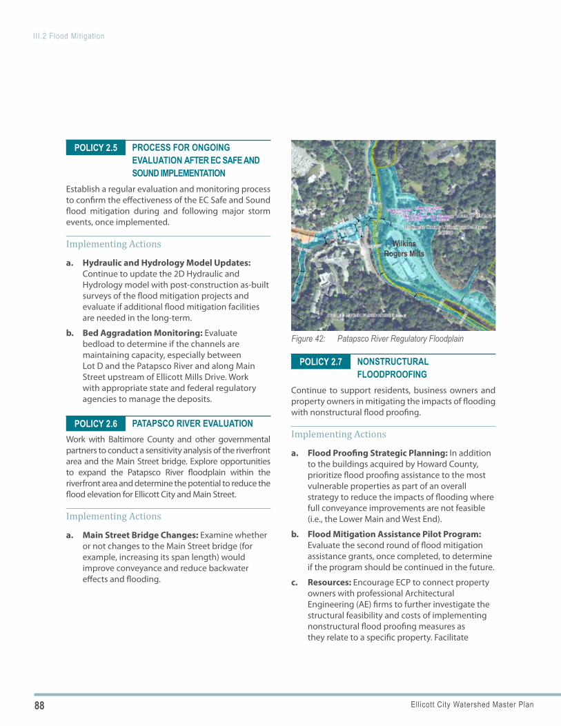
88 Ellicott City Watershed Master Plan
III.2 Flood Mitigation
Figure 42: Patapsco River Regulatory Floodplain
Wilkins Rogers Mills
POLICY 2.7
POLICY 2.5
POLICY 2.6
PROCESS FOR ONGOING EVALUATION AFTER EC SAFE AND SOUND IMPLEMENTATION
Establish a regular evaluation and monitoring process to confirm the effectiveness of the EC Safe and Sound flood mitigation during and following major storm events, once implemented.
Implementing Actions
a. Hydraulic and Hydrology Model Updates: Continue to update the 2D Hydraulic and Hydrology model with post-construction as-built surveys of the flood mitigation projects and evaluate if additional flood mitigation facilities are needed in the long-term.
b. Bed Aggradation Monitoring: Evaluate bedload to determine if the channels are maintaining capacity, especially between Lot D and the Patapsco River and along Main Street upstream of Ellicott Mills Drive. Work with appropriate state and federal regulatory agencies to manage the deposits.
PATAPSCO RIVER EVALUATIONWork with Baltimore County and other governmental partners to conduct a sensitivity analysis of the riverfront area and the Main Street bridge. Explore opportunities to expand the Patapsco River floodplain within the riverfront area and determine the potential to reduce the flood elevation for Ellicott City and Main Street.
Implementing Actions
a. Main Street Bridge Changes: Examine whether or not changes to the Main Street bridge (for example, increasing its span length) would improve conveyance and reduce backwater effects and flooding.
NONSTRUCTURAL FLOODPROOFING
Continue to support residents, business owners and property owners in mitigating the impacts of flooding with nonstructural flood proofing.
Implementing Actions
a. Flood Proofing Strategic Planning: In addition to the buildings acquired by Howard County, prioritize flood proofing assistance to the most vulnerable properties as part of an overall strategy to reduce the impacts of flooding where full conveyance improvements are not feasible (i.e., the Lower Main and West End).
b. Flood Mitigation Assistance Pilot Program: Evaluate the second round of flood mitigation assistance grants, once completed, to determine if the program should be continued in the future.
c. Resources: Encourage ECP to connect property owners with professional Architectural Engineering (AE) firms to further investigate the structural feasibility and costs of implementing nonstructural flood proofing measures as they relate to a specific property. Facilitate
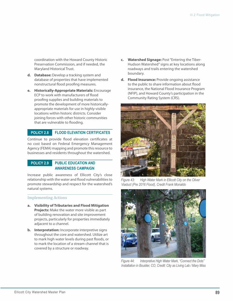
89Ellicott City Watershed Master Plan
III.2 Flood Mitigation
Figure 43: High Water Mark in Ellicott City on the Oliver Viaduct (Pre 2016 Flood), Credit Frank Monaldo
Figure 44: Interpretive High Water Mark, “Connect the Dots” Installation in Boulder, CO, Credit: City as Living Lab / Mary Miss
POLICY 2.8
POLICY 2.9
coordination with the Howard County Historic Preservation Commission, and if needed, the Maryland Historical Trust.
d. Database: Develop a tracking system and database of properties that have implemented nonstructural flood proofing measures.
e. Historically-Appropriate Materials: Encourage ECP to work with manufacturers of flood proofing supplies and building materials to promote the development of more historically-appropriate materials for use in highly-visible locations within historic districts. Consider joining forces with other historic communities that are vulnerable to flooding.
FLOOD ELEVATION CERTIFICATES Continue to provide flood elevation certificates at no cost based on Federal Emergency Management Agency (FEMA) mapping and promote this resource to businesses and residents throughout the watershed.
PUBLIC EDUCATION AND AWARENESS CAMPAIGN
Increase public awareness of Ellicott City’s close relationship with the water and flood vulnerabilities to promote stewardship and respect for the watershed’s natural systems.
Implementing Actions
a. Visibility of Tributaries and Flood Mitigation Projects: Make the water more visible as part of building renovation and site improvement projects, particularly for properties immediately adjacent to a channel.
b. Interpretation: Incorporate interpretive signs throughout the core and watershed. Utilize art to mark high water levels during past floods, or to mark the location of a stream channel that is covered by a structure or roadway.
c. Watershed Signage: Post “Entering the Tiber-Hudson Watershed” signs at key locations along roadways and trails entering the watershed boundary.
d. Flood Insurance: Provide ongoing assistance to the public to share information about flood insurance, the National Flood Insurance Program (NFIP), and Howard County’s participation in the Community Rating System (CRS).

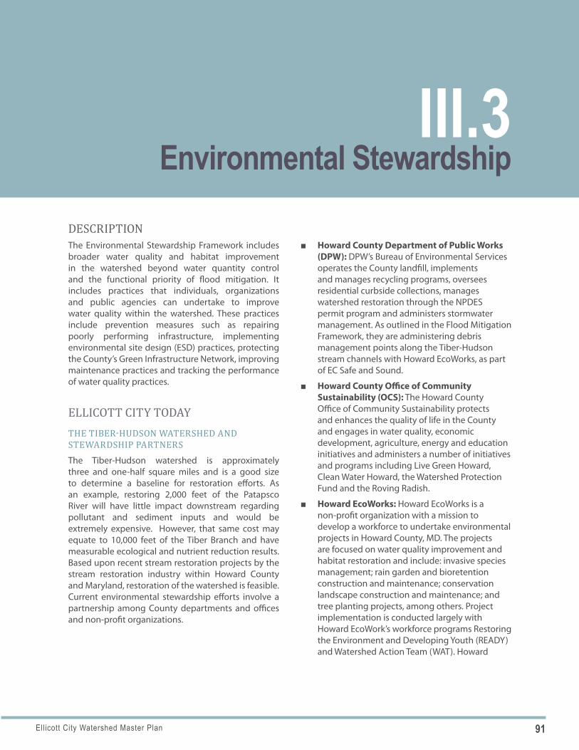
91Ellicott City Watershed Master Plan
DESCRIPTIONThe Environmental Stewardship Framework includes broader water quality and habitat improvement in the watershed beyond water quantity control and the functional priority of flood mitigation. It includes practices that individuals, organizations and public agencies can undertake to improve water quality within the watershed. These practices include prevention measures such as repairing poorly performing infrastructure, implementing environmental site design (ESD) practices, protecting the County’s Green Infrastructure Network, improving maintenance practices and tracking the performance of water quality practices.
ELLICOTT CITY TODAYTHE TIBER-HUDSON WATERSHED AND STEWARDSHIP PARTNERSThe Tiber-Hudson watershed is approximately three and one-half square miles and is a good size to determine a baseline for restoration efforts. As an example, restoring 2,000 feet of the Patapsco River will have little impact downstream regarding pollutant and sediment inputs and would be extremely expensive. However, that same cost may equate to 10,000 feet of the Tiber Branch and have measurable ecological and nutrient reduction results. Based upon recent stream restoration projects by the stream restoration industry within Howard County and Maryland, restoration of the watershed is feasible. Current environmental stewardship efforts involve a partnership among County departments and offices and non-profit organizations.
■ Howard County Department of Public Works (DPW): DPW’s Bureau of Environmental Services operates the County landfill, implements and manages recycling programs, oversees residential curbside collections, manages watershed restoration through the NPDES permit program and administers stormwater management. As outlined in the Flood Mitigation Framework, they are administering debris management points along the Tiber-Hudson stream channels with Howard EcoWorks, as part of EC Safe and Sound.
■ Howard County Office of Community Sustainability (OCS): The Howard County Office of Community Sustainability protects and enhances the quality of life in the County and engages in water quality, economic development, agriculture, energy and education initiatives and administers a number of initiatives and programs including Live Green Howard, Clean Water Howard, the Watershed Protection Fund and the Roving Radish.
■ Howard EcoWorks: Howard EcoWorks is a non-profit organization with a mission to develop a workforce to undertake environmental projects in Howard County, MD. The projects are focused on water quality improvement and habitat restoration and include: invasive species management; rain garden and bioretention construction and maintenance; conservation landscape construction and maintenance; and tree planting projects, among others. Project implementation is conducted largely with Howard EcoWork’s workforce programs Restoring the Environment and Developing Youth (READY) and Watershed Action Team (WAT). Howard
III.3Environmental Stewardship
92 Ellicott City Watershed Master Plan
III.3 Environmental Stewardship
EcoWorks is partnering with DPW to manage stream channel debris points as part of EC Safe and Sound as well as undertaking debris removal along the channel length of the Hudson Branch. Recently, EcoWorks partnered with the University of Delaware to study the use of biochar on a property within the watershed to determine the benefits of this as a soil amendment for greater water infiltration. Biochar is a charcoal-like substance used as a soil amendment to sequester carbon.
■ Patapsco Heritage Greenway: The Stream Watch initiative focuses on volunteers walking, cleaning and reporting issues for various sections of streams throughout the Patapsco River Valley.
WATER QUALITYWater quality describes the condition of water in terms of chemical, physical, and biological characteristics in respect to the suitability for a particular purpose such as habitat.
■ Stream Classification: According to the Maryland Classification of Streams, which utilizes “use classes,” the Tiber-Hudson Watershed and Patapsco River tributaries are Use Class I and the Patapsco River main stem is Use Class IV. The use class is a grouping or set of designated uses that apply to a water body which individually may or may not be supported now, but should be attainable. Use Class I is defined as “Water Contact Recreation and Protection of Nontidal Warmwater Aquatic Life.” Through efforts to implement its TMDLs and MS4 projects, the County aims to improve water quality which directly impacts meeting stream classification. The individual designated uses within Class I are:
» Growth and propagation of fish (not trout) and other aquatic life and wildlife
» Water contact sports » Leisure activities involving direct contact
with surface water » Fishing » Agricultural water supply » Industrial water supply
Use Class IV waters include all of the individual uses for Class I waters described above in addition to being capable of supporting adult trout for a put and take fishery.
■ Roadway Pollutants: Preventing pollutants from entering the tributaries and river in the first place is one of the most effective ways of improving water quality and keeping pollutants from entering the drainage system. Street sweeping occurs four times per year in Howard County. It has occurred more frequently on Main Street, where additional street sweeping occurred following major flood events.
■ Road Salt: Salt application harms the environment when it comes into contact with soil and water sources. In shallow soils along roadways, salt will continuously collect and build until a salt bank is formed. It remains in the soils through rain and snow events entering streams, waterways and groundwater as a direct result of melting and runoff. Salt that enters water sources can change the chemical composition and water quality, harming the aquatic organisms that live within the stream.
Contamination of groundwater from salt can take a long time to dissipate, and the time period varies significantly based upon conditions of the watershed such as the depth and type of soils; frequency, concentrations and local inputs of salt; and frequency and volume of precipitation. It is difficult to identify a time period for the dissipation of contamination, however, the conditions of the Tiber-Hudson watershed which includes shallow soils and steep valleys are not as severe as they would be in a watershed with deeper soils and gradual slopes.
DPW has begun using brine and other practices to reduce road salt use on County roads.
■ MS4: The US Clean Water Act, which is managed by the Environmental Protection Agency (EPA), mandates municipal separate stormwater sewer system (MS4) permits to communities with a population greater than 50,000 for Phase 2 permits and greater than 100,000 for Phase

93Ellicott City Watershed Master Plan
III.3 Environmental Stewardship
Figure 45: Ellicott Mills Drive Culvert After the 2018 Flood
Figure 46: Existing Culverted Stream Outfall in Lot F After the Reconstruction Following the 2018 Flood
Figure 47: Daylighted Section of the Hudson Branch in Lot F After the Reconstruction Following the 2018 Flood
1 permits. MS4 permits are also referred to as National Pollutant Discharge Elimination System (NPDES) permits. The purpose of MS4 permits is to mandate that holders of MS4 permits comply with programs which mitigate and treat stormwater to remove pollutants which are carried by stormwater runoff such as fertilizers, chemicals (such as herbicides, pesticides or petrochemicals), sediment, and biological waste.
Howard County is one of nine jurisdictions in Maryland that are MS4 Phase 1 permit holders. A requirement of permit holders is that they develop a program to provide funding to pay for projects that improve the quality of stormwater runoff. In Howard County the MS4 funding is collected through the Watershed Protection and Restoration Fee as an annual payment required from property owners on their tax bills. In addition to stormwater projects funded through MS4, Howard County has outreach initiatives that promote stormwater management including READY (discussed above), rain garden assistance and rain barrel distribution.
CULVERTED STREAMSThroughout the watershed there are streams and tributaries which have been put into culverts to convey flow under roadways, parking lots, building structures, and other infrastructure. While many of these culverts are necessary to support the vehicular road network, they interrupt or encroach upon the ability of the natural valley to maintain a natural stream bottom and habitat and convey floodwaters, as described in the Flood Mitigation Framework.
■ Opportunities to Daylight Stream Channels: Culverted stream channels in the core that could be considered for daylighting include the segment of the Hudson Branch in Lot D and the small tributary along Ellicott Mills Drive, under the former Roger Carter Center site. A portion of the Hudson Branch was recently daylighted as part of the reconstruction of Ellicott Mills Drive following the 2018 flood. Potential benefits include improved habitat and water quality, flood conveyance and placemaking.
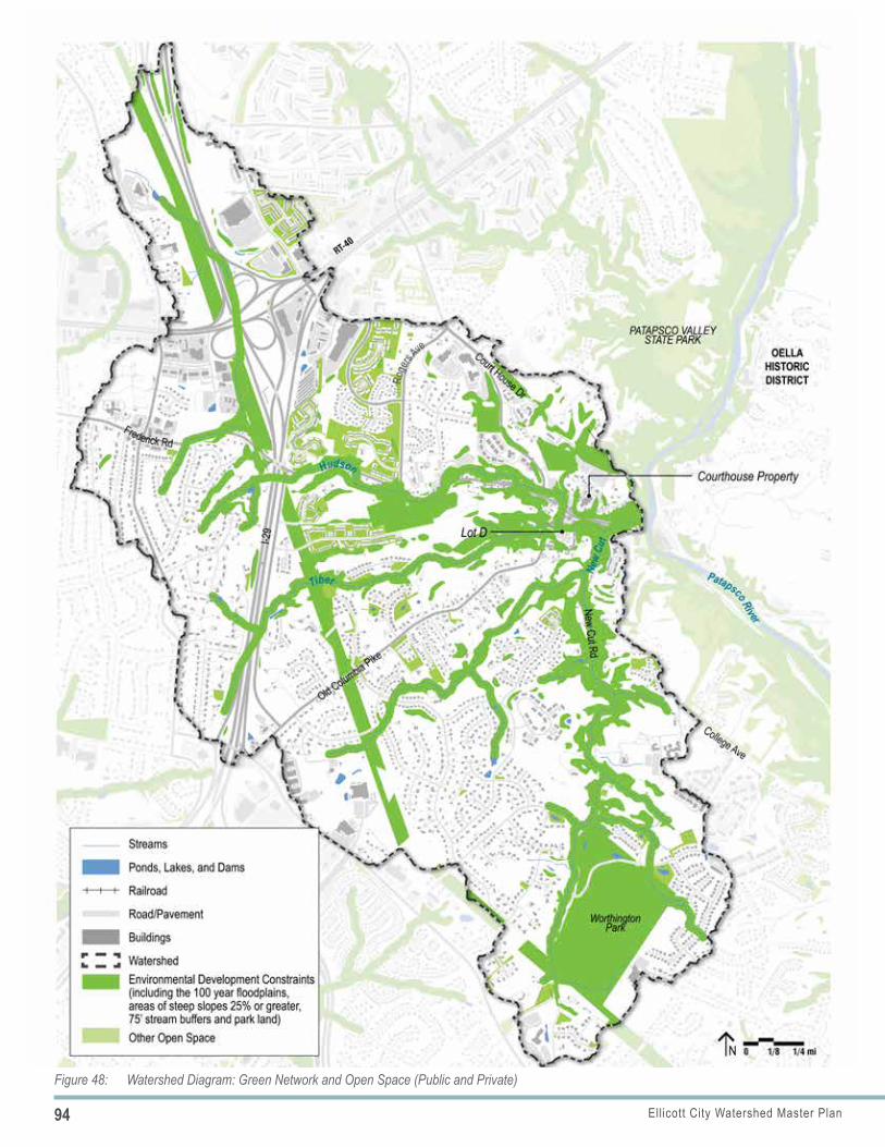
94 Ellicott City Watershed Master Plan
III.3 Environmental Stewardship
Figure 48: Watershed Diagram: Green Network and Open Space (Public and Private)
95Ellicott City Watershed Master Plan
III.3 Environmental Stewardship
■ Stream Channel Bottom: Even after daylighting culverted sections of a stream, the channel bottom will still convey significant floodwaters and require armoring with a hard surface to resist sheer stresses. The exception is the portion of the stream channel immediately downstream of the proposed North Tunnel entrance at Lot F to the confluence with the Tiber channel. As the floodwaters will be diverted into the tunnel, this section of stream channel will not be subjected to flood flows and is suitable for a naturalized stream bottom.
ENVIRONMENTAL SITE DESIGN (ESD) PRACTICES AND GREEN TECHNOLOGIESESD practices include green roofs, green walls, rain gardens, flow-through planters, permeable paving, rain barrels etc. and is an effective tool to improve localized water quality—particularly because some of these practices can be implemented throughout the watershed and by almost everyone. Additionally, solar panels can be used to reduce energy costs and emissions.
Currently, the use of ESD practices within the core is limited. For example, permeable pavements can be successful water quality treatment devices in larger scale applications such as parking lots and in smaller scale installments by individual property owners. However, critical to the success of permeable pavements is that they be installed in the appropriate setting and where the geologic condition allows them to be successful. Areas, such as Ellicott City’s core, with slopes greater than 5% and locations with shallow bedrock and soils that do not achieve the minimum percolation rates should be avoided. Limited space, maintenance requirements and noted failures of permeable pavements at previous installation sites in the County must be considered as well.
■ Community Interest: There is widespread community interest in incorporating ESD practices throughout the watershed for improved water quality and to heighten awareness of water quality issues.
■ Opportunities in the Core: While opportunities to utilize ESD practices within much of the core are limited, areas within the Patapsco River floodplain and the broader floodplains of the contributing tributaries, such as in Lot D and Lot F may be suitable. The floodplains are characterized by fluvial soils, which are more conducive to ESD practices. Howard County utilized permeable paving in a portion of Lot B, located within the Patapsco River floodplain where it is highly visible to visitors.
■ Innovative Stormwater Techniques: Howard County is currently exploring emerging stormwater management techniques to retrofit existing stormwater facilities using smart technology to monitor the quantity and quality of the water which they treat. The County is also exploring soil amendments which have shown promise in filtering runoff and increasing the ability for the soils to retain water.
It is important to note that typically ESD practices apply to water quality but have negligible effect on flood flows.
TREE COVERHoward County adopted the Forest Conservation Act in 1992 to protect and conserve forest resources within the county. The law contains incentives to retain existing forest and requirements to plant new forests when forest is cleared or a minimum forest cover is not present, or pay a fee-in-lieu that supports the Forest Mitigation program. Howard County adopted an update to strengthen and improve the Forest Conservation Act, effective February 2020. This update added site design requirements to increase forest retention, increased reforestation requirements for clearing, and added the Green Infrastructure Network as the first priority for forest retention and planting sites. The update also substantially increased the fee-in-lieu, while limiting its use for residential development. The County has also implemented several planting programs to reforest properties that are not classified as open space, including schools, homeowner associations and private properties.
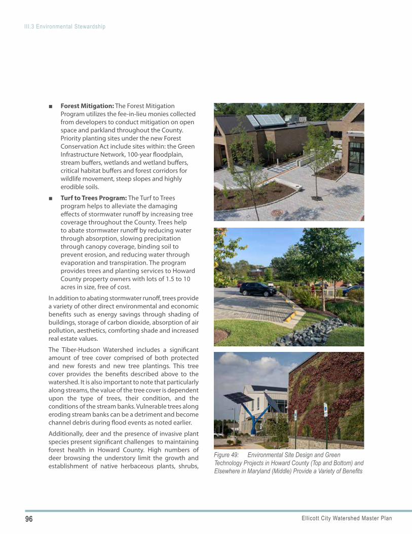
96 Ellicott City Watershed Master Plan
III.3 Environmental Stewardship
Figure 49: Environmental Site Design and Green Technology Projects in Howard County (Top and Bottom) and Elsewhere in Maryland (Middle) Provide a Variety of Benefits
■ Forest Mitigation: The Forest Mitigation Program utilizes the fee-in-lieu monies collected from developers to conduct mitigation on open space and parkland throughout the County. Priority planting sites under the new Forest Conservation Act include sites within: the Green Infrastructure Network, 100-year floodplain, stream buffers, wetlands and wetland buffers, critical habitat buffers and forest corridors for wildlife movement, steep slopes and highly erodible soils.
■ Turf to Trees Program: The Turf to Trees program helps to alleviate the damaging effects of stormwater runoff by increasing tree coverage throughout the County. Trees help to abate stormwater runoff by reducing water through absorption, slowing precipitation through canopy coverage, binding soil to prevent erosion, and reducing water through evaporation and transpiration. The program provides trees and planting services to Howard County property owners with lots of 1.5 to 10 acres in size, free of cost.
In addition to abating stormwater runoff, trees provide a variety of other direct environmental and economic benefits such as energy savings through shading of buildings, storage of carbon dioxide, absorption of air pollution, aesthetics, comforting shade and increased real estate values.
The Tiber-Hudson Watershed includes a significant amount of tree cover comprised of both protected and new forests and new tree plantings. This tree cover provides the benefits described above to the watershed. It is also important to note that particularly along streams, the value of the tree cover is dependent upon the type of trees, their condition, and the conditions of the stream banks. Vulnerable trees along eroding stream banks can be a detriment and become channel debris during flood events as noted earlier.
Additionally, deer and the presence of invasive plant species present significant challenges to maintaining forest health in Howard County. High numbers of deer browsing the understory limit the growth and establishment of native herbaceous plants, shrubs,
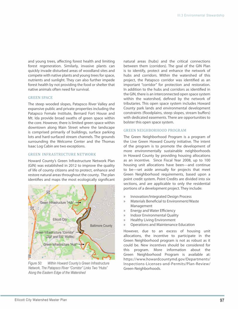
97Ellicott City Watershed Master Plan
III.3 Environmental Stewardship
Figure 50: Within Howard County’s Green Infrastructure Network, The Patapsco River “Corridor” Links Two “Hubs” Along the Eastern Edge of the Watershed
Green Infrastructure “Hub”
Green Infrastructure “Hub”
Green Infrastructure “Corridor”(300’ and 500’ Widths)
Baltimore County
Ellicott City
and young trees, affecting forest health and limiting forest regeneration. Similarly, invasive plants can quickly invade disturbed areas of woodland sites and compete with native plants and young trees for space, nutrients and sunlight. They can also further impede forest health by not providing the food or shelter that native animals often need for survival.
GREEN SPACEThe steep wooded slopes, Patapsco River Valley and expansive public and private properties including the Patapsco Female Institute, Bernard Fort House and Mt. Ida provide broad swaths of green space within the core. However, there is limited green space within downtown along Main Street where the landscape is comprised primarily of buildings, surface parking lots and hard-surfaced stream channels. The grounds surrounding the Welcome Center and the Thomas Isaac Log Cabin are two exceptions.
GREEN INFRASTRUCTURE NETWORKHoward County’s Green Infrastructure Network Plan (GIN) was established in 2012 to improve the quality of life of county citizens and to protect, enhance and restore natural areas throughout the county. The plan identifies and maps the most ecologically significant
natural areas (hubs) and the critical connections between them (corridors). The goal of the GIN Plan is to identify, protect and enhance the network of hubs and corridors. Within the watershed of this project, the Patapsco corridor was identified as an important “corridor” for protection and restoration. In addition to the hubs and corridors as identified in the GIN, there is an interconnected open space system within the watershed, defined by the network of tributaries. This open space system includes Howard County park lands and environmental development constraints (floodplains, steep slopes, stream buffers) with dedicated easements. There are opportunities to bolster this open space system.
GREEN NEIGHBORHOOD PROGRAMThe Green Neighborhood Program is a program of the Live Green Howard County initiative. The intent of the program is to promote the development of more environmentally sustainable neighborhoods in Howard County by providing housing allocations as an incentive. Since Fiscal Year 2008, up to 100 housing unit allocations have been—and continue to be—set aside annually for projects that meet Green Neighborhood requirements, based upon a point credit system. Point Credits are divided into six sections, and are applicable to only the residential portions of a development project. They include:
» Innovation/Integrated Design Process» Materials Beneficial to Environment/Waste
Management» Energy and Water Efficiency» Indoor Environmental Quality» Healthy Living Environment» Operations and Maintenance Education
However, due to an excess of housing unit allocations, the incentive to participate in the Green Neighborhood program is not as robust as it could be. New incentives should be considered for this program. More information about the Green Neighborhood Program is available at: https://www.howardcountymd.gov/Departments/Inspections-Licenses-and-Permits/Plan-Review/Green-Neighborhoods.
98 Ellicott City Watershed Master Plan
III.3 Environmental Stewardship
POLICY 3.1
ELLICOTT CITY TOMORROW: PLAN POLICIES AND ACTIONS
STRATEGIC WATERSHED PROGRAM
Continue to build upon current efforts to improve water quality in a more comprehensive and strategic approach, using a Strategic Watershed Program (SWP) for the Tiber-Hudson watershed as a case study for other areas within the county. The SWP needs to be iterative and adaptive and will require coordination at various levels and types of government, non-profit and community groups, human service agencies and the private sector. The SWP also provides an opportunity to engage residents and the public to better understand the connection between their actions and its impact on the environment.
Implementing Actions
a. Restoration Efforts Coordination: Synchronizemultiple restoration efforts including ecological,stormwater, wastewater, industrial, drinkingwater and land use. For example, the design/construction of replacement or new water/wastewater lines for industrial or residentialuses adjacent to any of the streams within thewatershed should coordinate with any potentialstream or floodplain improvement projects.These efforts may include relocating the utilitiesfar from the stream banks; relocating the linessuch that groundwater (thermal improvement tostreams) is not captured, collected and divertedaway from entering the streams by the utilitylines and/or restoring the stream for multipleimprovements to reduce the potential forflooding downstream or improving the ecology.
b. Watershed-Based Permit Process: Stormwatermanagement and watershed restoration ismanaged through the NPDES permit program asdescribed in Ellicott City Today on the previouspages. Permitting for individual environmentalprojects can be streamlined with a watershed- based permit process to achieve watershed-widegoals. The process should adhere to EPA’s NPDES
Permitting Implementation Guidance. The following links provide additional guidance.
» https://www.epa.gov/sites/production/files/2015-09/documents/watershedpermitting_finalguidance.pdf
» https://www.epa.gov/sites/production/files/2015-09/documents/watershed_techguidance_entire.pdf
c. Monitoring and Maintenance Efficiency:Improve monitoring and maintenance efficiencyassociated with infrastructure, especially sanitarysewer repairs. Conduct regular inspections andaddress failures as soon as they occur.
d. Street Sweeping: Consider increasing streetsweeping throughout the watershed from fourto six times per year and to eight times per yearwithin the core in addition to that which is donefollowing large storm events.
e. Salt Application: Explore opportunities to reducethe use of salt in parking lots and on sidewalkswithin the watershed. These opportunitiescould include reducing salt stockpiles in parkinglots, increasing awareness among the publicand private property owners of the damagingeffects of salt usage and considering post wintercleanups to remove remaining salt rather thanallowing for it to wash away over time.
f. Salt Application Alternatives: Exploresalt application alternatives and additionalremediation/management efforts within thewatershed and monitor effectiveness andcompare with other areas in the county wheresalt is used. Streams that have high seasonal baseflow conditions with moderate to high velocitiescan remove or flush the toxins to downstreamwaters quickly and return the waters to similarconditions prior to the intrusion of salt.
g. Water Quality Monitoring/Report Card:Consider preparing a detailed plan for outliningCounty water quality objectives and the
99Ellicott City Watershed Master Plan
III.3 Environmental Stewardship
SALT ALTERNATIVES CHEESE BRINE ADDITIVE: Wisconsin has found that mixing salt with cheese brine is effective at reducing the amount of salt that bounces off the road when applied, allowing less to be used.
BEET-HEAT: Many States are starting to use “Beet-Heat”, which is a mixture of sugar beet juice and molasses. This mixture allows salt to stick to the roads and increases salt’s ability to melt ice at extreme temperatures (below 15 degrees).
ECO-TRACTION: Eco-Traction is made from hydrothermal volcanic material, and while it is mainly sold to individuals, the company is beginning to make contracts with municipalities. Eco-Traction does not cause any negative environmental impacts and can even improve the condition of the environment directly related to the road. Eco-traction is more efficient than salt therefore saving the amount of material deposited on the roadways; however the cost is almost double.
POLICY 3.2monitoring of water quality. For events that may significantly change the water quality, consider monitoring seasonally for a couple years following the event, then every 5 years afterwards. Monitor sewer breaks or overflows quarterly until returning to pre-event conditions. Consider a Water Quality Report Card every five to ten years where measurable results may be identified and include the different events that occurred during that period.
h. Private Landowner Incentives: Explore options to encourage stormwater improvements on private property that is already developed, such as through increased reimbursement for stormwater improvements or an expansion of eligible items for reimbursement.
FOREST MANAGEMENT Consider a comprehensive forest management program within the watershed to inventory and assess existing tree canopy, identify vulnerable trees and provide guidance for future tree planting that considers water quality and flood resiliency goals. Build upon and reinforce current planting programs to establish beneficial and functional landscapes that produce food, support habitat, prevent erosion and increase canopy coverage.
Implementing Actions
a. Urban Forestry Services: Engage the services of an Urban Forester or Board-Certified Arborist to assist the County and community partners with long-term goals and strategies to preserve and enhance existing tree cover.
b. Inventory Platforms: Utilize digital mapping and inventory platforms (such as GIS and Autocad) to map and record existing conditions and long-term maintenance.
c. Tree Canopy Management: Manage the tree canopy for long term sustainability, managing invasive species, predatory insects and diseases that threaten the health of the urban forest. Proactively inventory and remove trees that are vulnerable to falling into stream channels and becoming damaging debris.
d. Invasive Plant Management: Manage invasive plants as the best first step toward improving biodiversity and creating more resilient landscapes.
e. Urban Wildlife Management: Consult an urban wildlife specialist to determine the threat of pest wildlife and most effective approaches for the unique needs of the community. Certain urban and suburban wildlife pest species that thrive and reproduce in protected urban environments can be detrimental to establishing a bio-diverse plant community and effective restoration. Measures to deter the proliferation of resident pest wildlife include using native plant species, fencing, trapping, controlled hunts, reducing reproduction, discouraging overwintering and others. Measures
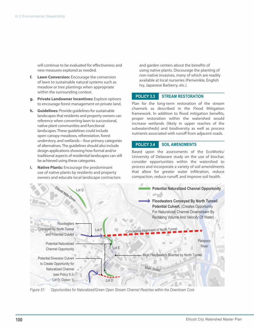
100 Ellicott City Watershed Master Plan
III.3 Environmental Stewardship
Figure 51: Opportunities for Naturalized/Green Open Stream Channel Reaches within the Downtown Core
Lot G
Lot F
Patapsco RiverLot E
Lot D
Potential Diversion Culvert to Create Opportunity for
Naturalized Channel (see Policy 9.3, Lot D: Option 1)
Potential Naturalized Channel Opportunity
Ellicott Mills Drive
Main Street
Conceptual Alignment of North Tunnel
Most Floodwaters Diverted by North Tunnel
Floodwaters Conveyed by North Tunnel
and Potential Culvert
Potential Naturalized Channel Opportunity
Floodwaters Conveyed By North Tunnel/Potential Culvert, (Creates Opportunity For Naturalized Channel Downstream By Reducing Volume And Velocity Of Water)
POLICY 3.3
POLICY 3.4
will continue to be evaluated for effectiveness and new measures explored as needed.
f. Lawn Conversion: Encourage the conversion of lawn to sustainable natural systems such as meadow or tree plantings when appropriate within the surrounding context.
g. Private Landowner Incentives: Explore options to encourage forest management on private land.
h. Guidelines: Provide guidelines for sustainable landscapes that residents and property owners can reference when converting lawn to successional, native plant communities and functional landscapes. These guidelines could include open-canopy meadows, reforestation, forest understory, and wetlands—four primary categories of alternatives. The guidelines should also include design applications showing how formal and/or traditional aspects of residential landscapes can still be achieved using these categories.
i. Native Plants: Encourage the predominant use of native plants by residents and property owners and educate local landscape contractors
and garden centers about the benefits of using native plants. Discourage the planting of non-native invasives, many of which are readily available at local nurseries (Periwinkle, English Ivy, Japanese Barberry, etc.).
STREAM RESTORATION Plan for the long-term restoration of the stream channels as described in the Flood Mitigation framework. In addition to flood mitigation benefits, proper restoration within the watershed would increase wetlands (likely in upper reaches of the subwatersheds) and biodiversity as well as process nutrients associated with runoff from adjacent roads.
SOIL AMENDMENTSBased upon the assessments of the EcoWorks/University of Delaware study on the use of biochar, consider opportunities within the watershed to process and incorporate a variety of soil amendments that allow for greater water infiltration, reduce compaction, reduce runoff, and improve soil health.
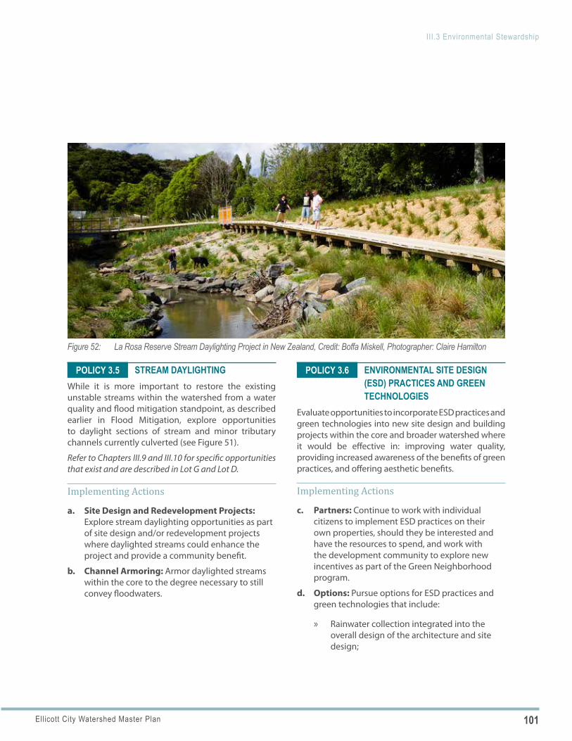
101Ellicott City Watershed Master Plan
III.3 Environmental Stewardship
Figure 52: La Rosa Reserve Stream Daylighting Project in New Zealand, Credit: Boffa Miskell, Photographer: Claire Hamilton
POLICY 3.5 POLICY 3.6STREAM DAYLIGHTINGWhile it is more important to restore the existing unstable streams within the watershed from a water quality and flood mitigation standpoint, as described earlier in Flood Mitigation, explore opportunities to daylight sections of stream and minor tributary channels currently culverted (see Figure 51).
Refer to Chapters III.9 and III.10 for specific opportunities that exist and are described in Lot G and Lot D.
Implementing Actions
a. Site Design and Redevelopment Projects: Explore stream daylighting opportunities as part of site design and/or redevelopment projects where daylighted streams could enhance the project and provide a community benefit.
b. Channel Armoring: Armor daylighted streams within the core to the degree necessary to still convey floodwaters.
ENVIRONMENTAL SITE DESIGN (ESD) PRACTICES AND GREEN TECHNOLOGIES
Evaluate opportunities to incorporate ESD practices and green technologies into new site design and building projects within the core and broader watershed where it would be effective in: improving water quality, providing increased awareness of the benefits of green practices, and offering aesthetic benefits.
Implementing Actions
c. Partners: Continue to work with individual citizens to implement ESD practices on their own properties, should they be interested and have the resources to spend, and work with the development community to explore new incentives as part of the Green Neighborhood program.
d. Options: Pursue options for ESD practices and green technologies that include:
» Rainwater collection integrated into the overall design of the architecture and site design;
102 Ellicott City Watershed Master Plan
III.3 Environmental Stewardship
POLICY 3.7
POLICY 3.8
» Permeable paving within surface parking lots and pedestrian gathering areas (the limited areas where it might be feasible); and
» Micro-bioretention and flow-through planters integrated into the overall site design. Refer to Chapters III.6-12 for opportunities that exist within specific geographic areas.
e. Demonstration Project: Consider integrating environmental site design, native plans and public art as part of demonstration gardens within the public realm that contribute to outdoor education and help the public visualize how everyone can contribute to water quality improvements and water management.
DEDICATED OPEN SPACE AND CONSERVATION EASEMENTS
Evaluate opportunities to increase the network of publicly and privately-owned dedicated open space and conservation easements throughout the watershed.
Implementing Actions
a. Partnership to Expand Network: Work with Baltimore County, State partners, and other partners to continue seeking opportunities to acquire additional land and/or easements that can be incorporated into and reinforce an interconnected open space system.
b. Strengthen Connections: Seek opportunities that strengthen environmental corridors and public access between park and amenity spaces, particularly along both sides of the Patapsco River and along the tributaries. Opportunities might include establishing a Conservation Easement within the 100 year floodplain as a starting point. These floodplain conservation easements would then allow for consistent management and regional opportunities for restoration managed by an umbrella organization that oversees the operation and maintenance. The first steps of establishing
landowner agreements can be challenging, but could result in more comprehensive and consistent implementation and oversight.
PUBLIC EDUCATIONMake a consistent effort to educate existing and new property owners in the watershed regarding stormwater and environmental stewardship. Property owners should understand the role they can play in improving water quality and detaining stormwater, and be familiar with the programs available to assist them in being environmental stewards.
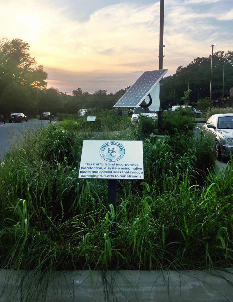
103Ellicott City Watershed Master Plan
III.3 Environmental Stewardship

105Ellicott City Watershed Master Plan
DESCRIPTIONThe Economic Development framework places the economic dynamics of downtown in relation to how it functions in the regional economy and the role it will continue to play as a home for independent businesses serving residents and visitors to the region. The framework also addresses the community marketing efforts that support promoting the downtown to investors, residents, and visitors. Lastly, it considers the importance of partnerships necessary for the master plan implementation and for Ellicott City staying on track as an environmentally, socially and economically sustainable community
ELLICOTT CITY TODAYEllicott City’s downtown is an economic engine for Howard County. It is the County’s largest collection of independent merchants and restaurants located in a historic environment. As such, it is a regional tourism destination, a center for entrepreneurial endeavors, and a nationally-significant, active historic commercial district.
MARKET ASSESSMENT SUMMARYThe Plan effort included a market study to examine existing and projected retail patterns in Ellicott City and the region. The findings of the market study, summarized here, inform the Economic Development framework. The market study explores the core as a hub for tourism and locally-based businesses, and places the core in the broader market context of Howard County and the region.
The market study provides demographic and segmentation data as well as retail trade patterns and projections that help understand the current market climate and guide future opportunities, business
recruitment and development. The primary source for the data in the retail market report is Environics Analytics, a trusted resource for data, analytics and market projections.
The market definition portion of the study was conducted after the 2016 flood to establish the basic trade areas for the core. After the 2018 flood, this data was updated with 2019 numbers.
The master plan consultant team also conducted a ZIP code survey with the assistance of the Howard County Department of Planning and Zoning (DPZ) and the Ellicott City Partnership (ECP). This survey serves as the foundation for defining the Trade Area for downtown. Merchants in the core completed two surveys—one in July 2017 and a follow-up in September of 2017.
■ Trade Area: The ZIP Code survey identified a primary trade area (21043 Ellicott City and 21042 Ellicott City) and a secondary trade area (21228 Catonsville, 21045 Columbia, 21044 Columbia, 21163 Woodstock, and 21075 Elkridge) for downtown.
■ Visitor Destination: The retail market assessment confirms that downtown is indeed a strong visitor destination, with businesses participating in the ZIP code survey recording customers from 396 unique ZIP codes, 38 states and 4 foreign countries. While downtown is a strong visitor destination, Ellicott City currently offers no accommodations options within or near downtown.
■ Regional Destination: Having affirmed through the ZIP code survey that out-of-state visitors comprise a significant 10% of the market, it is important to recognize that downtown remains primarily a regional destination, where the
Economic DevelopmentIII.4
106 Ellicott City Watershed Master Plan
III.4 Economic Development
COMMUNITY DEVELOPMENT CORPORATION (CDC) EXPLORATORY COMMITTEE REPORTRecognizing the need for a holistic, community-driven advocate for Ellicott City—as stakeholders confirmed in the master planning process—the County launched the “Ellicott City Community Development Corporation Exploration Committee.” This representative and diverse group of stakeholders examined whether there is a need for a Community Development Corporation in Ellicott City and, if created, what its role would be, and how it would interact with other existing organizations already working for the residents and businesses owners of Ellicott City. The committee concluded that Ellicott City would benefit from the creation of a new entity focused on addressing the unique economic development and revitalization challenges of Ellicott City and the Tiber-Hudson Watershed.
independent merchants and restaurants serve customers from Howard and Baltimore Counties.
■ National Market Trends: Retail districts similar to Ellicott City’s downtown are thriving amidst a national retail climate that is rapidly eroding the traditional big box retailer and shopping mall in lieu of highly specialized, customer-oriented independent businesses. Other national trends include the development of creative spaces such as coworking spaces, accelerators, makerspace and hybrid concepts that are thriving throughout the United States. These spaces continue to grow as they provide unique spaces for entrepreneurs. Such spaces are expected to have robust growth as businesses and entrepreneurs rethink the traditional work environment.
■ Importance of Adaptation: Market forces alone will not sustain a district as unique as downtown— the community must continually evolve and adapt to retain existing customers and attract new customers to be the vibrant place it is today. The flood events in recent years have also highlighted the need for business resiliency and the importance of having an online presence.
■ Retail Market Opportunities: A retail leakage analysis identified key retail sectors that have existing unmet demand in the primary trade area. This analysis indicates that opportunities exist downtown in the following key categories:
» Restaurants (both full-service and limited service)
» Home furnishings » Specialty shops » Clothing stores » Antique stores » Jewelry stores » Specialty grocers and food stores
■ Demographics: Population in the primary trade area increased by nearly 12% from 2010 to 2017 and is projected to increase another 7% by 2022. Additionally, the median household income in Ellicott City’s primary trade area ($121,296) is near the top for the United States, further accenting the potential for downtown to continue to thrive in the local market.
■ Projected Household Growth: Population growth projections provided by Environics Analyitcs indicate the primary trade area will grow by 2,358 households from 2017 to 2022. A conservative estimate of five percent of projected household growth indicates potential for 118 housing units over this five-year period.
■ Housing Product Type Opportunities: Additional housing product types are likely to be similar to existing housing units in the area and could be within walking distance to local businesses. There is a possibility that the courthouse may be an opportunity for new
107Ellicott City Watershed Master Plan
III.4 Economic Development
housing as an adaptive reuse, but this use has yet to be identified. A more detailed housing study could shed light on the potential for new housing units in downtown and the broader core.
MIXED-USE INFILL NEW CONSTRUCTION AND REDEVELOPMENTSignificant development opportunities within downtown are limited because of topographic and environmental constraints and lack of sites. Here, geography and historic buildings limit areas for growth. The exceptions are large surface parking lots where redevelopment could occur without physically impacting historic resources or encroaching on areas where development is prohibited (such as floodplains, steep slopes, and stream buffers).
Beyond Ellicott City’s downtown and broader core, there are two older commercial areas within the watershed that are well-suited for long-term redevelopment, should property owners be interested in the future. These older commercial areas are located at Frederick Road and St. John’s Lane and at Ridge Road and Route 40.
Any commercial redevelopment, whether within or outside of downtown, presents opportunities to capture some of the retail uses that are underrepresented as described in the market analysis.
COMMUNITY BRANDECP developed a brand for the core —“Old Ellicott City: Individually Crafted Since 1772”—just prior to the flood of 2016. The brand uses a custom typeface, bold colors and an iconic seven-pointed star that over time can evolve into a stand-alone feature. The Old Ellicott City brand system provides a platform for expansion to businesses, products and services available in the district and uses colors and icons that are ideally suited for partnerships with private businesses. Many communities and organizations keep these identities strictly as a tool to communicate from an entity directly to a constituency. The most successful communities share the identity with businesses and partners that reach a larger audience.
The master plan consultant team is comfortable with the brand as a marketing concept and believes the brand has elements that can be deployed to better promote Ellicott City, as identified below.
COMMUNITY MARKETINGEllicott City has protected its identity and image through careful attention to historic preservation. As stated above, ECP has also put the new brand to use on the web and in other collateral materials. While this is an excellent first step in marketing the community, there are opportunities to better promote and market “the place.” There is an opportunity to further deploy the brand and extend it to make it even more user-friendly for businesses in Ellicott City, extend it to the adjacent West End and demonstrate that the community is an important part of the broader Patapsco Heritage Area. Specifically, the “Independently Crafted” tagline can be leveraged into a more robust marketing product that businesses in the community can use.
POST-FLOOD PARTNERSHIPSHoward County, ECP and numerous public and private stakeholders in Ellicott City partnered to get the community back on its feet following the 2016 and 2018 flood events. In addition to its broader responsibilities, the County repaired utilities, roads and sidewalks, improving the ability for streams to convey stormwater in targeted areas; and launched EC Safe and Sound. The Howard County Economic Development Authority (HCEDA) and Small Business Development Center (SBDC) provided “boots on the ground” from the early stages of recovery. ECP’s activities centered on fundraising with the business community, and Howard Community College (HCC) utilized students to assist with the construction of websites for several businesses.
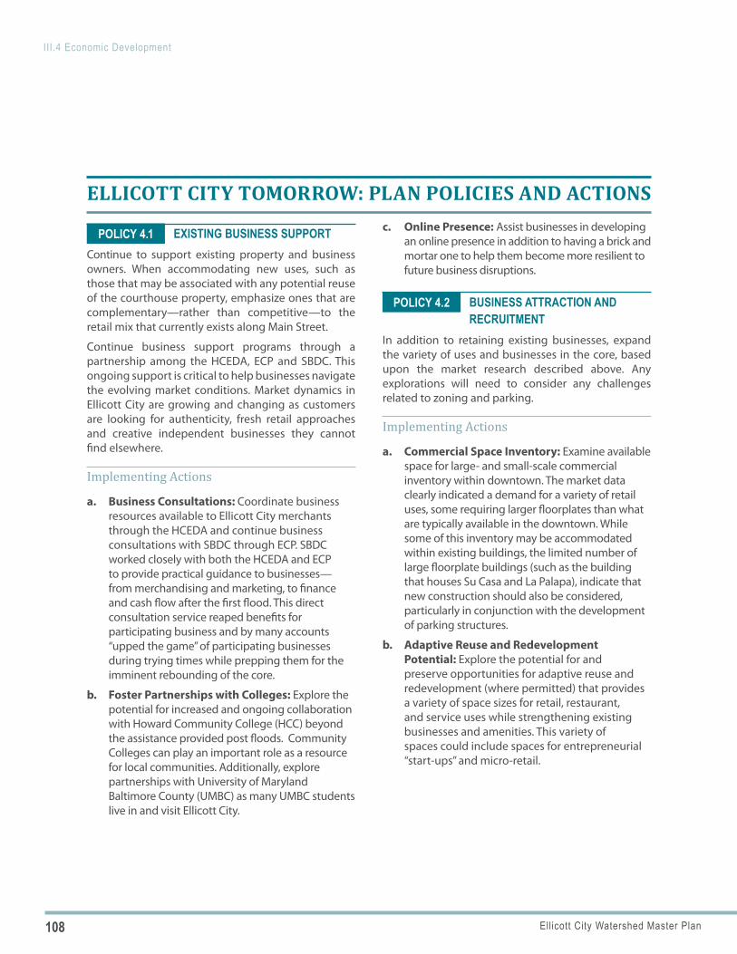
108 Ellicott City Watershed Master Plan
III.4 Economic Development
POLICY 4.1
POLICY 4.2
ELLICOTT CITY TOMORROW: PLAN POLICIES AND ACTIONS
EXISTING BUSINESS SUPPORTContinue to support existing property and business owners. When accommodating new uses, such as those that may be associated with any potential reuse of the courthouse property, emphasize ones that are complementary—rather than competitive—to the retail mix that currently exists along Main Street.
Continue business support programs through a partnership among the HCEDA, ECP and SBDC. This ongoing support is critical to help businesses navigate the evolving market conditions. Market dynamics in Ellicott City are growing and changing as customers are looking for authenticity, fresh retail approaches and creative independent businesses they cannot find elsewhere.
Implementing Actions
a. Business Consultations: Coordinate business resources available to Ellicott City merchants through the HCEDA and continue business consultations with SBDC through ECP. SBDC worked closely with both the HCEDA and ECP to provide practical guidance to businesses—from merchandising and marketing, to finance and cash flow after the first flood. This direct consultation service reaped benefits for participating business and by many accounts “upped the game” of participating businesses during trying times while prepping them for the imminent rebounding of the core.
b. Foster Partnerships with Colleges: Explore the potential for increased and ongoing collaboration with Howard Community College (HCC) beyond the assistance provided post floods. Community Colleges can play an important role as a resource for local communities. Additionally, explore partnerships with University of Maryland Baltimore County (UMBC) as many UMBC students live in and visit Ellicott City.
c. Online Presence: Assist businesses in developing an online presence in addition to having a brick and mortar one to help them become more resilient to future business disruptions.
BUSINESS ATTRACTION AND RECRUITMENT
In addition to retaining existing businesses, expand the variety of uses and businesses in the core, based upon the market research described above. Any explorations will need to consider any challenges related to zoning and parking.
Implementing Actions
a. Commercial Space Inventory: Examine available space for large- and small-scale commercial inventory within downtown. The market data clearly indicated a demand for a variety of retail uses, some requiring larger floorplates than what are typically available in the downtown. While some of this inventory may be accommodated within existing buildings, the limited number of large floorplate buildings (such as the building that houses Su Casa and La Palapa), indicate that new construction should also be considered, particularly in conjunction with the development of parking structures.
b. Adaptive Reuse and Redevelopment Potential: Explore the potential for and preserve opportunities for adaptive reuse and redevelopment (where permitted) that provides a variety of space sizes for retail, restaurant, and service uses while strengthening existing businesses and amenities. This variety of spaces could include spaces for entrepreneurial “start-ups” and micro-retail.
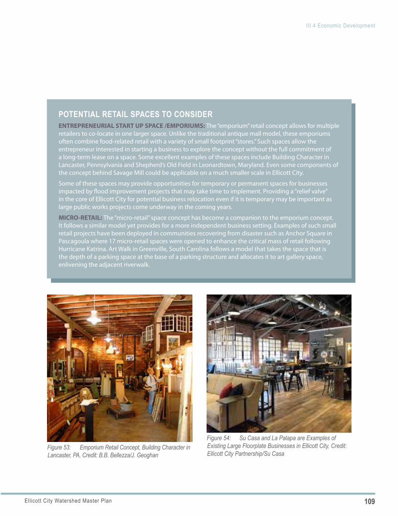
109Ellicott City Watershed Master Plan
III.4 Economic Development
Figure 53: Emporium Retail Concept, Building Character in Lancaster, PA, Credit: B.B. Bellezza/J. Geoghan
POTENTIAL RETAIL SPACES TO CONSIDERENTREPRENEURIAL START UP SPACE /EMPORIUMS: The “emporium” retail concept allows for multiple retailers to co-locate in one larger space. Unlike the traditional antique mall model, these emporiums often combine food-related retail with a variety of small footprint “stores.” Such spaces allow the entrepreneur interested in starting a business to explore the concept without the full commitment of a long-term lease on a space. Some excellent examples of these spaces include Building Character in Lancaster, Pennsylvania and Shepherd’s Old Field in Leonardtown, Maryland. Even some components of the concept behind Savage Mill could be applicable on a much smaller scale in Ellicott City.
Some of these spaces may provide opportunities for temporary or permanent spaces for businesses impacted by flood improvement projects that may take time to implement. Providing a “relief valve” in the core of Ellicott City for potential business relocation even if it is temporary may be important as large public works projects come underway in the coming years.
MICRO-RETAIL: The “micro-retail” space concept has become a companion to the emporium concept. It follows a similar model yet provides for a more independent business setting. Examples of such small retail projects have been deployed in communities recovering from disaster such as Anchor Square in Pascagoula where 17 micro-retail spaces were opened to enhance the critical mass of retail following Hurricane Katrina. Art Walk in Greenville, South Carolina follows a model that takes the space that is the depth of a parking space at the base of a parking structure and allocates it to art gallery space, enlivening the adjacent riverwalk.
Figure 54: Su Casa and La Palapa are Examples of Existing Large Floorplate Businesses in Ellicott City, Credit: Ellicott City Partnership/Su Casa
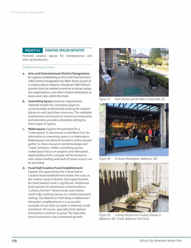
110 Ellicott City Watershed Master Plan
III.4 Economic Development
Figure 55: Culinary Kitchen and Cooking Classes in Baltimore, MD, Credit: Baltimore Chef Shop
Figure 56: R-House Marketplace, Baltimore, MD
Figure 57: Artist Studios and Art Walk in Greenville, SC
POLICY 4.3 CREATIVE SPACES INITIATIVEPromote creative spaces for entrepreneurs and start-up businesses.
Implementing Actions
a. Arts and Entertainment District Designation: Re-explore establishing an Arts and Entertainment (A&E) District Designation for Main Street as part of a creative places initiative. Maryland’s A&E Districts provide local tax-related incentives to attract artists, arts organizations, and other creative enterprises to towns and cities within the State.
b. Coworking Space: Examine regional and national models for coworking space to accommodate professionals looking for creative places to work and share resources. The walkable environment and access to numerous restaurants and amenities provide a desirable setting for these types of spaces.
c. Makerspace: Explore the potential for a “makerspace” in downtown or the West End. An alternative to coworking space is a makerspace. Makerspaces are physical locations where people gather to share resources and knowledge and “make” products. Unlike coworking spaces, makerspaces focus on projects and fabrication. Applicability of this concept will be limited to sites where loading and back of house access can be provided.
d. Food Hall/Creative Food Establishment: Explore the opportunity for a food hall or creative food establishment within the core, as the market study indicates that opportunities for food-related retail is significant. Additional food options for downtown could involve a “culinary kitchen” where locals and visitors could take cooking classes in a retail/restaurant setting. The Baltimore Chef Shop in Baltimore’s Hampden neighborhood is a successful example of one that occupies a relatively small storefront. Of course, specialty food options themselves continue to grow. The Specialty Food Association cites continued growth
111Ellicott City Watershed Master Plan
III.4 Economic Development
POLICY 4.4
across all categories of specialty food including cheese, bread, meat, snacks, coffee and alcoholic beverages.
e. Technical Assistance: Strive to make this initiative sustainable and equitable by helping build the capacity of all entrepreneurs involved in creative spaces by coordinating with business consultations described under Policy 4.1 and learning from successful models for technical assistance. Successful models include the Build Institute in Detroit, the Cultivate Lancaster Entrepreneurship Coalition (Pennsylvania) and the Maryland SBDC.
MIXED-USE NEW CONSTRUCTION AND REDEVELOPMENT
Provide for long-term opportunities for a complementary mix of uses within downtown and within other commercial areas offering the potential for redevelopment supportive of a vibrant core. Consider retail (complementary to what currently exists and located so not to create an area competitive to Main Street), lodging, office, attractions and a greater diversity of residential products appropriate for a walkable core.
Implementing Actions
a. In-Town Residential: Explore opportunities for in-town residential uses within the walkable core. Residential use is essential for an authentic and vibrant walkable community. Ellicott City’s core has long been a place of residents and there is the potential for additional creative places for people to live—above retail, in mixed use buildings and in repurposed buildings—to expand the variety of options available. Market rate, mixed income and affordable housing options should be explored.
b. Office: Explore opportunities for in-town office uses within the core that could support daytime patronage of businesses. Explore opportunities for shared parking arrangements with nearby retail uses.
c. Accommodations: Pursue accommodations or lodging options for the core. With a strong visitor market, and unique setting, the core has the opportunity to capitalize on lodging as a means to “round out” the offerings of the community with options that are close to tourist attractions and are within walking distance of downtown businesses and restaurants. The lodging industry is evolving and includes many options such as accommodations through online platforms (Airbnb and VRBO), boutique hotels, self-catering inns, specialty lodging and lodging tied to experience.
d. Core and Watershed Redevelopment Opportunities: Plan for the potential long-term redevelopment of key sites within the core and watershed in a sensitive and strategic manner and explore how each could accommodate some of the market demand to provide for a healthy mix of uses. These sites include:
» Courthouse Site (adaptively reusing the historic courthouse and jail)
» Parking Lot D » West End Service site (should the property
owner wish to redevelop) » The commercial properties at St. John’s Lane
and Frederick Road and along Ridge Road at Route 40 (should the property owners wish to redevelop)
The Courthouse site and Lot D, in particular, represent significant opportunities for Ellicott City’s core. This idea is reinforced by the findings of the Urban Land Institute’s (ULI) Technical Assistance Panel report (TAP).
Each of these areas is described in Chapters III.6-12.
112 Ellicott City Watershed Master Plan
III.4 Economic Development
POLICY 4.5 COMMUNITY BRAND EXTENSIONContinue to deploy and expand the “Old Ellicott City” community brand and provide a variety of ways for the ECP to create intentional partnerships with allies to successfully deploy the brand in as many formats as possible, creating a seamless impression on the local community, visitors and investors.
Implementing Actions
a. Brand Extension Partnerships: Support the cooperation of the many partners of ECP, which currently serves as the prime steward of the brand, to allow for successful continued implementation of the brand. The Howard County Tourism Council (Tourism) should play a greater and more direct role in the promotion of Ellicott City businesses and events. Given the limited financial and staff capacities of the ECP, Tourism can assume those responsibilities that are in alignment with their financial resources and mission to promote Howard County’s leading tourist attraction.
b. Character Narrative: Adopt a narrative that frames the community brand based upon input from stakeholders throughout the planning process and conveys the environment, history, and discoveries associated with Old Ellicott City. Such a narrative can be used by ECP as a way to define its mission and the community and provide context for the adopted brand tagline of “Individually Crafted Since 1772.”
c. Brand Roundtable: Work with ECP partners to convene a kick-off brand roundtable to share the brand style guide, brainstorm ways for the brand to be launched in a variety of formats and share additional brand concepts developed through the master plan process. Key partners include, but are not limited to, ECP, DPZ, DRP, HCEDA, and Tourism. While ECP may be the steward of the brand, it should share this brand freely with partner groups while maintaining the brand standards.
Over time, explore turning this initial meeting into a quarterly or biannual meeting to check on the brand’s deployment, reassess its use and explore new ways to deploy it.
d. Brand Extension for Districts and Attractions: Expand the brand for Old Ellicott City and deploy it to cover geographic areas within the core and attraction and attractions in the community. For districts, retain the existing base brand (the typeface, color scheme and five-pointed star icon), but adapt it as needed. Geographic areas include:
» West End Main » Upper Main » Courthouse Area » Lower Main » Riverfront
e. Brand Extension for Events: Utilize the style guide provided by the original designers of the graphic and the additional brand elements as guidance for expanded brand uses for specific events. The nostalgic imagery, color scheme and layouts present opportunities to keep a consistent theme throughout the brand’s deployment. Specific events that attract visitors may allow ECP to partner with Tourism on events that may attract visitors in from outside Howard County.
f. Brand Extension for Awareness Campaigns: Facilitate a partnership among ECP, Howard County, HCEDA and other entities to share project information, track investment and share information in a quick and concise way. Develop and use information cards that keep customers informed about the recovery process, the impact of the floods and implementation of EC Safe and Sound. This step is important to communicate to customers that the core is open for business. Such information should utilize short messages to customers (that will serve the dual purpose of keeping merchants and others apprised of progress).
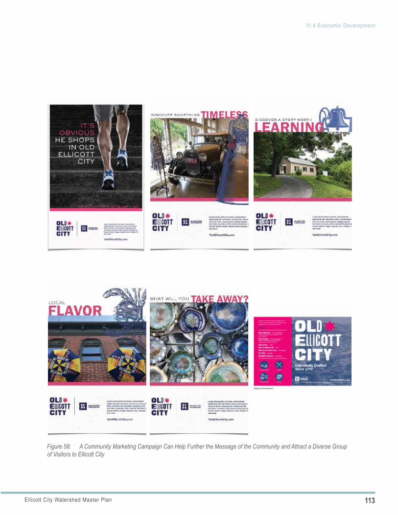
113Ellicott City Watershed Master Plan
III.4 Economic Development
Figure 58: A Community Marketing Campaign Can Help Further the Message of the Community and Attract a Diverse Group of Visitors to Ellicott City
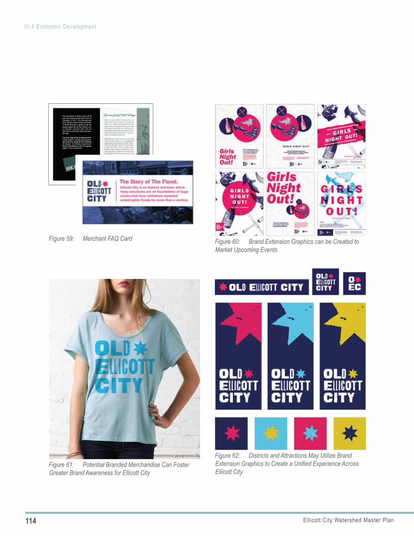
114 Ellicott City Watershed Master Plan
III.4 Economic Development
Figure 59: Merchant FAQ Card Figure 60: Brand Extension Graphics can be Created to Market Upcoming Events
Figure 61: Potential Branded Merchandise Can Foster Greater Brand Awareness for Ellicott City
Figure 62: Districts and Attractions May Utilize Brand Extension Graphics to Create a Unified Experience Across Ellicott City
115Ellicott City Watershed Master Plan
III.4 Economic Development
POLICY 4.6 COMMUNITY TOURISM AND MARKETING CAMPAIGN
Launch a community marketing campaign to provide a variety of ways for Tourism to leverage the brand beyond its conventional partners, allowing it to evolve through the private sector to further the message of the community. This will engage the business community directly along with partner groups so that the burden of creating brand equity is shared. Moreover, it gives partners a set of clear tools to use that maintain the integrity of the Old Ellicott City Brand while expanding its reach.
Implementing Actions
a. Brand Share with Partner Entities: Share the brand style guide with partner entities including Tourism, the Patapsco Valley/Heritage Area, Visit Baltimore and the Maryland Office of Tourism Development. The objectives for this effort include:
» Position the core as one of a series of gems along the Patapsco River Valley
» Continue to curate the “destination status” of downtown and the broader core
» As facilities expand, market the core as a center for heritage, recreation, bicycling and environmental tourism
Such a partnership may extend within Howard County to include DRP to showcase the critical mass of heritage sites more comprehensively as happens in places like Harpers Ferry, WV. This could “connect the dots” between heritage sites, encourage foot traffic throughout the core and better tell the overall story.
b. Old Ellicott City Branded Merchandise: Create Old Ellicott City branded merchandise and brand extension. Over time ECP may consider a simple licensing agreement to allow local businesses to use the Ellicott City brand in merchandise. A simple licensing agreement would allow merchants to use the logo system and color scheme on branded items. This could even
extend to items like craft beer or a special food item. ECP should not look at this as a revenue stream but rather a way to have the brand extended to the business community and foster greater brand awareness.
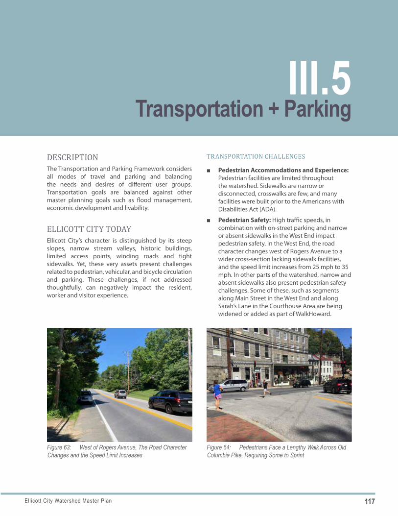
117Ellicott City Watershed Master Plan
Figure 63: West of Rogers Avenue, The Road Character Changes and the Speed Limit Increases
Figure 64: Pedestrians Face a Lengthy Walk Across Old Columbia Pike, Requiring Some to Sprint
DESCRIPTIONThe Transportation and Parking Framework considers all modes of travel and parking and balancing the needs and desires of different user groups. Transportation goals are balanced against other master planning goals such as flood management, economic development and livability.
ELLICOTT CITY TODAYEllicott City’s character is distinguished by its steep slopes, narrow stream valleys, historic buildings, limited access points, winding roads and tight sidewalks. Yet, these very assets present challenges related to pedestrian, vehicular, and bicycle circulation and parking. These challenges, if not addressed thoughtfully, can negatively impact the resident, worker and visitor experience.
TRANSPORTATION CHALLENGES
■ Pedestrian Accommodations and Experience: Pedestrian facilities are limited throughout the watershed. Sidewalks are narrow or disconnected, crosswalks are few, and many facilities were built prior to the Americans with Disabilities Act (ADA).
■ Pedestrian Safety: High traffic speeds, in combination with on-street parking and narrow or absent sidewalks in the West End impact pedestrian safety. In the West End, the road character changes west of Rogers Avenue to a wider cross-section lacking sidewalk facilities, and the speed limit increases from 25 mph to 35 mph. In other parts of the watershed, narrow and absent sidewalks also present pedestrian safety challenges. Some of these, such as segments along Main Street in the West End and along Sarah’s Lane in the Courthouse Area are being widened or added as part of WalkHoward.
Transportation + ParkingIII.5
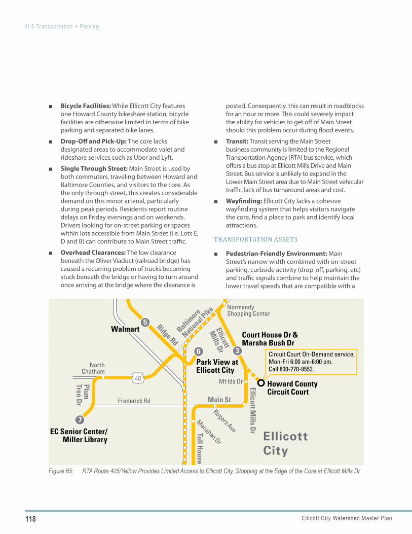
118 Ellicott City Watershed Master Plan
III.5 Transportation + Parking
Figure 65: RTA Route 405/Yellow Provides Limited Access to Ellicott City, Stopping at the Edge of the Core at Ellicott Mills Dr
Town and Country Blvd
Ridge Rd
Main St
Toll House Rd
Ellicott
Mills Dr
Old Annapolis Rd
Clarksville Pike
Frederick Rd
Montgomery Rd
Old Columbia Pike
Long Gate Pkwy
Little
Patuxent
Pkwy
Baltimore
National P
ike
Rouse Pkwy
29
40
108
PlumTree Dr
103
Colu
mbia
Pik
e
Ellicott Mills Dr
1 Mall inColumbia
2Long GateShoppingCenter
3
NormandyShopping Center
Court House Dr & Marsha Bush Dr
Circuit Court On-Demand service,Mon-Fri 6:00 am-6:00 pm.Call 800-270-9553.
Ellicott CityHealthcare Center
5
6
7
Walmart
Park View at Ellicott City
NorthChatham
Howard CountyCircuit Court
EC Senior Center/Miller Library Manahan Dr
Rogers Ave
Mt Ida Dr
401, 402A, 402B,403, 404, 406, 407,408, 414, 501, 503
MTA: 203, 305, 310,315, 320, 325
4
Town & Country Blvd & W Springs Dr
Vantage Point Rd
Columbia
EllicottCity
Transfer Routes
schematic mapnot to scale
401
Bus Stop & Timepoint
Bus Stop
Bus Route
Bus Route - Sunday and Evening Service
Monday–Sunday Service Effective November 2019
Mall in Columbia
Long Gate
Ellicott City
Miller Library/EC Senior Center
Normandy Shopping Center
Walmart
800.270.9553transitRTA.comfor RTA transit information
Route 405
Route 405
FIXED ROUTE FARESFare (Per Trip) $2.00 cash
Day Pass (Ride All Day)* Available for purchase on bus only* Transfers are no longer available
$5.00 cash
Monthly Pass $40.00
10-Ride Ticket Booklet $15.00
Monthly Student Pass* Must show current student ID
$20.00
Children Age 5 and Under Free
Seniors 60+ years of age orPersons with a Disability RideFixed Route for FREE with valid ID.Accepted forms of ID: State Driver’s License,State ID, Passport or Medicare Card.ID must be shown to driver when boarding.
Free
All customers must pay full fare to board the bus. Exact change only. Please have your fare, ticket or pass ready when boarding. NO REFUNDS OR EXCHANGES.
For ADA /GPT Certifi cation please call RTA Mobility at 800-270-9553.* Prior certifi cation is required to purchase ADA/GPT tickets.* Rider must show ID to board.
To order tickets/passes online or for a list of walk-in locations, go to www.transitRTA.com.
For more information call 800-270-9553.
People with a speech or hearing disability, please use Relay 7-1-1.
This schedule was printed on recycled paper using recycled ink.
RTA is your connection to all corners of Central Maryland, including Howard County, Anne Arundel County, City of Laurel and Northern Prince George’s County. Hop on and let us take you to work, school, shopping or anywhere else you need to go!
Welcome Aboard! BUS SCHEDULE
• Call us at 800-270-9553• Visit our website at www.transitRTA.com• For Service Alerts, follow us @RTA_Alert• Real-time bus info is available on RouteShout 2.0 Mobile App• Timetable info is available on Transit App, Google Maps, Apple
Maps & Citymapper!
STAY INFORMED:
Download the FREE App Enable “locate me” Select RTA as agency Track arrival/departure times
Tow
n an
dCo
untr
y Bl
vd
Tow
n an
d Co
untr
y B
lvd
&W
est S
prin
gs D
r
Fred
eric
k Dr
Dorsey
Hall Dr
Mai
n St
Ridge Rd
EllicottMills Dr
Toll House Rd
Old Annapolis Rd
Clar
ksvi
lle P
ike
Montgomery Rd
Old Columbia Pike
Long Gate Pkwy
Little
Patuxent Pkwy
Red
Bran
ch R
d Centre Park Dr
Baltimore N
ational P
ike
Rouse Pkwy
Columbia 100 PkwyUS RTE 100
Exec
utiv
e Par
k Dr
Columbia Rd
Rogers Ave
29
40
108
PlumTree Dr
NorthChatham
Rd
103
1Co
lum
bia
Mal
l
2
3
4
Dor
sey’
s Se
arch
Villa
ge C
ente
r
Red
Bra
nch
Rd &
Rum
sey
Rd5
Cent
re P
ark
Dr
& M
D 10
8
6 Long
Gat
e
MTA
9957
8
Ellic
ott M
ills
Dr
& M
ain
St
11N
orm
andy
Shop
ping
Cen
ter
How
ard
Coun
tyCo
urth
ouse
10
9
Hea
rtLa
nds
Villa
ge
12
1314
15
Wal
mar
t
Park
View
Apt
s
Nor
thCh
atha
m
Mill
er L
ibra
ry/
EC S
enio
r Cen
ter
Selb
orne
Hou
se
Tark
ingt
on P
l
Broo
k Way
Thunder Hill R
d
Blue
Win
g Ct
Manahan DrRogers Ave
St John’s L
n
Mt I
da D
r
Broo
k Way
401,
404,
406
,40
7, 40
8, 5
01, 5
03C
olu
mb
ia
Ell
ico
ttC
ity
Bus
Rout
e
Bus
Stop
& T
imep
oint
Bus
Stop
Tran
sfer
Rou
tes
sche
mat
ic m
apno
t to
scal
e
401
Rout
e 40
5/Ye
llow
Mon
day–
Satu
rday
Ser
vice
Ef
fect
ive
July
1, 2
016
BU
S
SC
HE
DU
LE
Colu
mbi
a M
all
Dors
ey’s
Sear
ch V
illag
e Ce
nter
Long
Gat
e
Ellic
ott C
ity
Mill
er L
ibra
ry/E
C Se
nior
Cen
ter
Nor
man
dy S
hopp
ing
Cent
er
Wal
mar
t
For i
nfor
mat
ion
on ro
ute
chan
ges
durin
g in
clem
ent
wea
ther
, con
tact
RTA
at 8
00.2
70.9
553
or li
sten
for
notifi
cat
ions
on
loca
l rad
io a
nd te
levi
sion
sta
tions
.
Incl
emen
t W
eath
er
Whe
n yo
u ta
ke R
TA to
wor
k an
d yo
u ha
ve a
n em
erge
ncy,
you
are
elig
ible
for t
he G
uara
ntee
d Ri
de
Hom
e Pr
ogra
m th
roug
h Co
mm
uter
Con
nect
ions
.To
regi
ster
, cal
l 1-8
00-7
45-R
IDE
(743
3).
Gu
aran
teed
Rid
e H
om
e
RTA
is
your
con
nect
ion
to a
ll co
rner
s of
Ce
ntra
l M
aryl
and,
in
clud
ing
How
ard
Coun
ty, A
nne
Arun
del C
ount
y, C
ity o
f Lau
rel
and
Nor
ther
n Pr
ince
Geo
rge’
s Co
unty
. Hop
on
and
let
us
take
you
to
wor
k, s
choo
l, sh
oppi
ng o
r any
whe
re e
lse
you
need
to g
o!
Wel
com
e A
bo
ard
!
800.
270.
9553
tran
sitR
TA.c
omfo
r RTA
tran
sit i
nfor
mat
ion
Follo
w u
s on
Tw
itte
r@
tran
sitR
TA.c
om
FAR
ES
Reg
ula
r Fa
re (
Per
Tri
p).
......
......
......
$2.0
0
On
e-W
ay R
edu
ced
......
......
......
......
.$1
.00
Tran
sfer
......
......
......
......
......
......
......
.Va
lid w
ithin
two
hour
s fo
r con
tinua
tion
of a
one
-way
trip
Free
Ch
ildre
n U
nd
er 5
......
......
......
......
....
Free
Redu
ced
fare
s ar
e av
aila
ble
for s
enio
rs, p
erso
ns w
ith
disa
bilit
ies
and
a va
lid m
edic
are
card
.
All c
usto
mer
s m
ust p
ay fu
ll fa
re in
ord
er to
boa
rd th
e bu
s. E
xact
fare
is re
quire
d; p
leas
e ha
ve y
our f
are
or p
ass
read
y w
hen
boar
ding
. Cas
h re
fund
s ar
e no
t ava
ilabl
e.
MTA
Cha
rm C
ard
and
WM
ATA
Smar
Trip
Car
ds a
re
acce
pted
at d
esig
nate
d tr
ansf
er p
oint
s on
ly.
Mon
thly
Pas
ses
are
avai
labl
e. C
onta
ct R
TA fo
r mor
e in
form
atio
n on
fare
opt
ions
.
Peop
le w
ho h
ave
a sp
eech
or h
earin
g di
sabi
lity,
plea
se
use
Rela
y or
7-1
-1.
Rout
e 40
5/Ye
llow
Tow
n an
dCo
untr
y Bl
vd
Tow
n an
d Co
untr
y B
lvd
&W
est S
prin
gs D
r
Fred
eric
k Dr
Dorsey
Hall Dr
Mai
n St
Ridge Rd
EllicottMills Dr
Toll House Rd
Old Annapolis Rd
Clar
ksvi
lle P
ike
Montgomery Rd
Old Columbia Pike
Long Gate Pkwy
Little
Patuxent Pkwy
Red
Bran
ch R
d Centre Park Dr
Baltimore N
ational P
ike
Rouse Pkwy
Columbia 100 PkwyUS RTE 100
Exec
utiv
e Par
k Dr
Columbia Rd
Rogers Ave
29
40
108
PlumTree Dr
NorthChatham
Rd
103
1Co
lum
bia
Mal
l
2
3
4
Dor
sey’
s Se
arch
Villa
ge C
ente
r
Red
Bra
nch
Rd &
Rum
sey
Rd5
Cent
re P
ark
Dr
& M
D 10
8
6 Long
Gat
e
MTA
9957
8
Ellic
ott M
ills
Dr
& M
ain
St
11N
orm
andy
Shop
ping
Cen
ter
How
ard
Coun
tyCo
urth
ouse
10
9
Hea
rtLa
nds
Villa
ge
12
1314
15
Wal
mar
t
Park
View
Apt
s
Nor
thCh
atha
m
Mill
er L
ibra
ry/
EC S
enio
r Cen
ter
Selb
orne
Hou
se
Tark
ingt
on P
l
Broo
k Way
Thunder Hill R
d
Blue
Win
g Ct
Manahan DrRogers Ave
St John’s L
n
Mt I
da D
r
Broo
k Way
401,
404,
406
,40
7, 40
8, 5
01, 5
03C
olu
mb
ia
Ell
ico
ttC
ity
Bus
Rout
e
Bus
Stop
& T
imep
oint
Bus
Stop
Tran
sfer
Rou
tes
sche
mat
ic m
apno
t to
scal
e
401
Rout
e 40
5/Ye
llow
Mon
day–
Satu
rday
Ser
vice
Ef
fect
ive
July
1, 2
016
BU
S
SC
HE
DU
LE
Colu
mbi
a M
all
Dors
ey’s
Sear
ch V
illag
e Ce
nter
Long
Gat
e
Ellic
ott C
ity
Mill
er L
ibra
ry/E
C Se
nior
Cen
ter
Nor
man
dy S
hopp
ing
Cent
er
Wal
mar
t
For i
nfor
mat
ion
on ro
ute
chan
ges
durin
g in
clem
ent
wea
ther
, con
tact
RTA
at 8
00.2
70.9
553
or li
sten
for
notifi
cat
ions
on
loca
l rad
io a
nd te
levi
sion
sta
tions
.
Incl
emen
t W
eath
er
Whe
n yo
u ta
ke R
TA to
wor
k an
d yo
u ha
ve a
n em
erge
ncy,
you
are
elig
ible
for t
he G
uara
ntee
d Ri
de
Hom
e Pr
ogra
m th
roug
h Co
mm
uter
Con
nect
ions
.To
regi
ster
, cal
l 1-8
00-7
45-R
IDE
(743
3).
Gu
aran
teed
Rid
e H
om
e
RTA
is
your
con
nect
ion
to a
ll co
rner
s of
Ce
ntra
l M
aryl
and,
in
clud
ing
How
ard
Coun
ty, A
nne
Arun
del C
ount
y, C
ity o
f Lau
rel
and
Nor
ther
n Pr
ince
Geo
rge’
s Co
unty
. Hop
on
and
let
us
take
you
to
wor
k, s
choo
l, sh
oppi
ng o
r any
whe
re e
lse
you
need
to g
o!
Wel
com
e A
bo
ard
!
800.
270.
9553
tran
sitR
TA.c
omfo
r RTA
tran
sit i
nfor
mat
ion
Follo
w u
s on
Tw
itte
r@
tran
sitR
TA.c
om
FAR
ES
Reg
ula
r Fa
re (
Per
Tri
p).
......
......
......
$2.0
0
On
e-W
ay R
edu
ced
......
......
......
......
.$1
.00
Tran
sfer
......
......
......
......
......
......
......
.Va
lid w
ithin
two
hour
s fo
r con
tinua
tion
of a
one
-way
trip
Free
Ch
ildre
n U
nd
er 5
......
......
......
......
....
Free
Redu
ced
fare
s ar
e av
aila
ble
for s
enio
rs, p
erso
ns w
ith
disa
bilit
ies
and
a va
lid m
edic
are
card
.
All c
usto
mer
s m
ust p
ay fu
ll fa
re in
ord
er to
boa
rd th
e bu
s. E
xact
fare
is re
quire
d; p
leas
e ha
ve y
our f
are
or p
ass
read
y w
hen
boar
ding
. Cas
h re
fund
s ar
e no
t ava
ilabl
e.
MTA
Cha
rm C
ard
and
WM
ATA
Smar
Trip
Car
ds a
re
acce
pted
at d
esig
nate
d tr
ansf
er p
oint
s on
ly.
Mon
thly
Pas
ses
are
avai
labl
e. C
onta
ct R
TA fo
r mor
e in
form
atio
n on
fare
opt
ions
.
Peop
le w
ho h
ave
a sp
eech
or h
earin
g di
sabi
lity,
plea
se
use
Rela
y or
7-1
-1.
Rout
e 40
5/Ye
llow
■ Bicycle Facilities: While Ellicott City features one Howard County bikeshare station, bicycle facilities are otherwise limited in terms of bike parking and separated bike lanes.
■ Drop-Off and Pick-Up: The core lacks designated areas to accommodate valet and rideshare services such as Uber and Lyft.
■ Single Through Street: Main Street is used by both commuters, traveling between Howard and Baltimore Counties, and visitors to the core. As the only through street, this creates considerable demand on this minor arterial, particularly during peak periods. Residents report routine delays on Friday evenings and on weekends. Drivers looking for on-street parking or spaces within lots accessible from Main Street (i.e. Lots E, D and B) can contribute to Main Street traffic.
■ Overhead Clearances: The low clearance beneath the Oliver Viaduct (railroad bridge) has caused a recurring problem of trucks becoming stuck beneath the bridge or having to turn around once arriving at the bridge where the clearance is
posted. Consequently, this can result in roadblocks for an hour or more. This could severely impact the ability for vehicles to get off of Main Street should this problem occur during flood events.
■ Transit: Transit serving the Main Street business community is limited to the Regional Transportation Agency (RTA) bus service, which offers a bus stop at Ellicott Mills Drive and Main Street. Bus service is unlikely to expand in the Lower Main Street area due to Main Street vehicular traffic, lack of bus turnaround areas and cost.
■ Wayfinding: Ellicott City lacks a cohesive wayfinding system that helps visitors navigate the core, find a place to park and identify local attractions.
TRANSPORTATION ASSETS
■ Pedestrian-Friendly Environment: Main Street’s narrow width combined with on-street parking, curbside activity (drop-off, parking, etc) and traffic signals combine to help maintain the lower travel speeds that are compatible with a
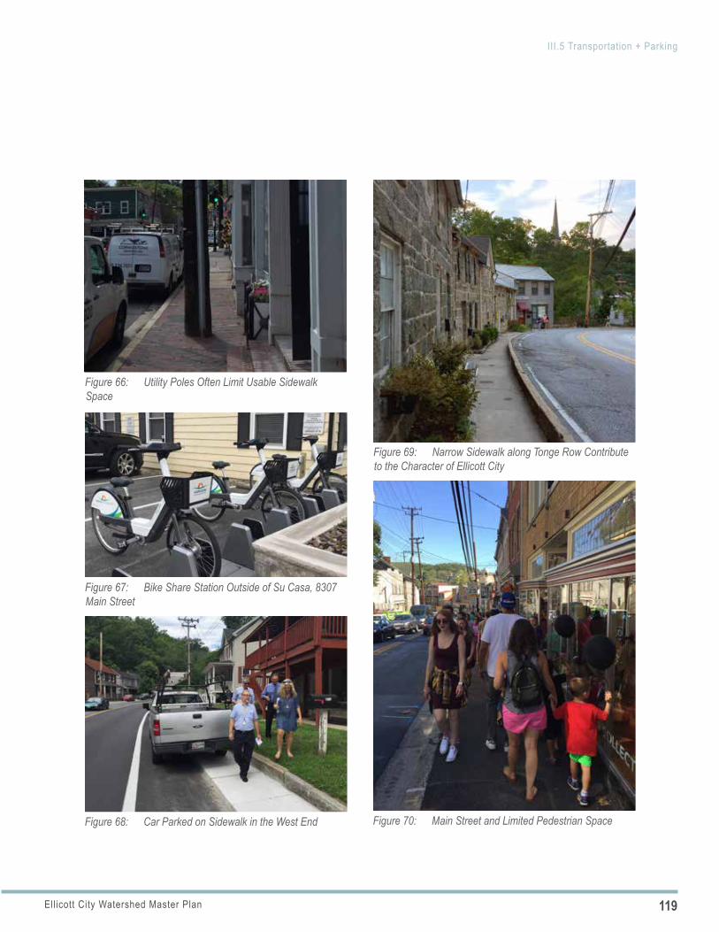
119Ellicott City Watershed Master Plan
III.5 Transportation + Parking
Figure 66: Utility Poles Often Limit Usable Sidewalk Space
Figure 67: Bike Share Station Outside of Su Casa, 8307 Main Street
Figure 68: Car Parked on Sidewalk in the West End
Figure 69: Narrow Sidewalk along Tonge Row Contribute to the Character of Ellicott City
Figure 70: Main Street and Limited Pedestrian Space
120 Ellicott City Watershed Master Plan
III.5 Transportation + Parking
pedestrian-friendly environment, east of Ellicott Mills Drive.
■ Pedestrian Scale: While the narrow sidewalks create challenges when there are high volumes of pedestrian traffic adjacent to vehicular travel lanes, the tight spaces throughout the core do distinguish Ellicott City’s scale from other places in the region.
■ Road Network Capacity: Following the 2016 flood, Main Street was closed temporarily and traffic diverted to surrounding roads. During Main Street’s closure, the surrounding road network was able to absorb diverted traffic. This experience suggests temporary closures for construction projects, including traffic calming measures, can be managed.
■ Trolley Line #9 Trail: The former #9 streetcar line has been converted to a popular multi-use trail that connects Catonsville with Oella and downtown.
■ Regional Trail Network: The Baltimore Metropolitan Council’s Patapsco Regional Greenway Plan proposes a primary trail network connecting regional attractions, including the Trolley Line #9 Trail, with segments along the Patapsco River. Several segments are near the core of Ellicott City and would provide improved pedestrian connectivity and access to regional attractions and natural resources.
WALKHOWARD PLAN RECOMMENDATIONSThe Howard County Pedestrian Master Plan, WalkHoward, identifies several structured projects and priority connections to address gaps in the pedestrian framework within the core and connecting to the core from other areas within the watershed.
■ Proposed Sidewalks: New sidewalks are proposed or have been recently completed along streets where none currently exist/recently existed including, Frederick Road/Main Street (west of Ellicott Mills Drive and Rogers Avenue), Rogers Avenue, Court House Drive and Sarah’s Lane.
■ Proposed Sidewalk Improvements: Sidewalk widenings and improvements are proposed or
have been recently completed along Main Street west of Ellicott Mills Drive, Court House Drive, and Ellicott Mills Drive.
■ Intersection Improvements: Intersection improvements are proposed or have been recently completed at intersections along Main Street including Rogers Avenue and Klein Avenue.
WalkHoward does not identify any sidewalk improvements or new sidewalks along Old Columbia Pike or College Avenue within or leading to the core.
MAIN STREET NAMEThe “Main Street” name designation applies to the section of Frederick Road between the Patapsco River and Rogers Avenue, covering all downtown but not the entirety of the West End. This can lead to some confusion and creates an artificial “divide” within the core.
PARKING CHALLENGES
■ Parking Supply: Ellicott City’s surface parking lots were added over time as opportunities arose. Several of the existing lots replaced outdoor storage buildings that were demolished. There is currently an adequate number of total spaces; however, they are not well distributed. With a parking surplus in some areas and a deficit in others during peak periods, there is a perception that the amount of parking is insufficient (see Figure 73).
■ Parking Facility Naming: The naming of parking lot facilities by letters (“Lot D”, “Lot F”, etc.) is not memorable to visitors.
■ Employee and Resident Parking: Residents, business owners and/or staff frequently occupy premium on-street parking spaces and centrally-located surface lot spaces when these spaces ideally would be available to visitors or customers.
■ Remote Parking: Some parking areas are remote to core activity areas and involve difficult pedestrian access because of topography.
■ Parking Fees: Parking is free throughout the district, leaving no incentive to park in remote or less desirable locations.
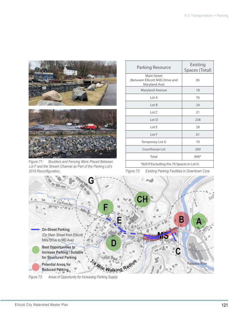
121Ellicott City Watershed Master Plan
III.5 Transportation + Parking
Figure 71: Boulders and Fencing Were Placed Between Lot F and the Stream Channel as Part of the Parking Lot’s 2019 Reconfiguration. Figure 72: Existing Parking Facilities in Downtown Core
Parking Resource Existing Spaces (Total)
Main Street (Between Ellicott Mills Drive and
Maryland Ave)85
Maryland Avenue 18
Lot A 76
Lot B 24
Lot C 21
Lot D 238
Lot E 28
Lot F 61
Temporary Lot G 70
Courthouse Lot 269
Total 890*
*820 If Excluding the 70 Spaces in Lot G
Main St
Patapsco River
Ellicott Mills Dr
O.C. Pike
Figure 73: Areas of Opportunity for Increasing Parking Supply
Best Opportunities to Increase Parking / Suitable for Structured ParkingPotential Areas for Reduced Parking
On-Street Parking (On Main Street from Ellicott Mills Drive to MD Ave)
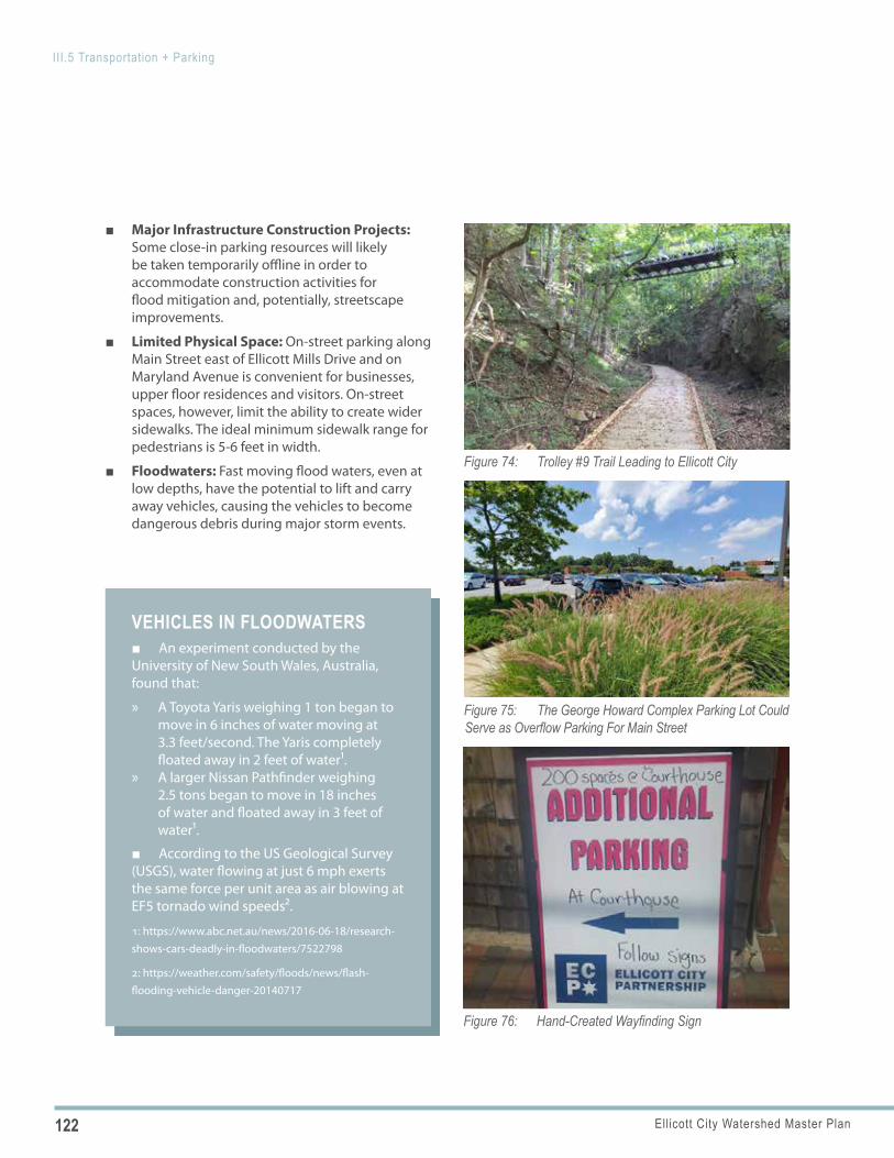
122 Ellicott City Watershed Master Plan
III.5 Transportation + Parking
VEHICLES IN FLOODWATERS ■ An experiment conducted by the University of New South Wales, Australia, found that:
» A Toyota Yaris weighing 1 ton began to move in 6 inches of water moving at 3.3 feet/second. The Yaris completely floated away in 2 feet of water1.
» A larger Nissan Pathfinder weighing 2.5 tons began to move in 18 inches of water and floated away in 3 feet of water1.
■ According to the US Geological Survey (USGS), water flowing at just 6 mph exerts the same force per unit area as air blowing at EF5 tornado wind speeds2.
1: https://www.abc.net.au/news/2016-06-18/research-shows-cars-deadly-in-floodwaters/7522798
2: https://weather.com/safety/floods/news/flash-flooding-vehicle-danger-20140717
Figure 74: Trolley #9 Trail Leading to Ellicott City
Figure 75: The George Howard Complex Parking Lot Could Serve as Overflow Parking For Main Street
Figure 76: Hand-Created Wayfinding Sign
■ Major Infrastructure Construction Projects: Some close-in parking resources will likely be taken temporarily offline in order to accommodate construction activities for flood mitigation and, potentially, streetscape improvements.
■ Limited Physical Space: On-street parking along Main Street east of Ellicott Mills Drive and on Maryland Avenue is convenient for businesses, upper floor residences and visitors. On-street spaces, however, limit the ability to create wider sidewalks. The ideal minimum sidewalk range for pedestrians is 5-6 feet in width.
■ Floodwaters: Fast moving flood waters, even at low depths, have the potential to lift and carry away vehicles, causing the vehicles to become dangerous debris during major storm events.
123Ellicott City Watershed Master Plan
III.5 Transportation + Parking
POLICY 5.1
POLICY 5.2
PARKING ASSETS
■ Large Surface Parking Lots: Large, County-owned parking lots offer the future potential for redevelopment to support economic development efforts and/or to be reconfigured to serve multiple uses. Area plan chapters include options for the reconfiguration of selected large parking lots to provide flood conveyance, restored streams, pedestrian connections, amenities and/or new construction. Several of the lots are large enough to accommodate a parking garage, should one be needed in the future.
■ Additional Parking Resource Opportunities: Additional parking resources exist outside of the core at the George Howard Building complex lot and, potentially, in Baltimore County with the recent closing of the Wilkins Rogers mills.
■ Ridesharing Impacts: In cities throughout the country, there are visible impacts from ridesharing services. Every trip that is converted into a rideshare trip reduces the demand for parking.
■ Autonomous Vehicle Influences: There is growing evidence that autonomous vehicles (AVs)will be part of the future. Like valet service, AVs can drop off and pick up passengers—potentially reducing demand for close-in parking while increasing the need for drop-off/pick-up zones. The timing of AV adoption remains an unknown. As such, planning for AVs is not considered a short- or mid-term solution. However, the design of parking lots, garages and on-street spaces should consider the potential long-term implications of AVs.
ELLICOTT CITY TOMORROW: PLAN POLICIES AND ACTIONS
PEDESTRIAN ACCESSIBILITY AND SAFETY
Within the core, prioritize people on foot over automobiles.
Implementing Actions
a. Pedestrian Crossings: Provide additional well-marked pedestrian crossings, including mid-block crossings, throughout the length of Main Street. The crosswalks should be very visible, with parking restricted at/near the crosswalk to maintain lines of sight between pedestrians and motorists. Raised crosswalks should also be considered, particularly for mid-block crossings, to further draw attention to the crosswalks.
b. Improved Accessibility: Provide improved accessibility for pedestrians, particularly those with disabilities. The primary way to accomplish this is by providing wider sidewalks with fewer
obstructions such as signs and utility poles. While this will be challenging in several areas due to the numerous constraints along Main Street, such as existing buildings (most of which are historic), stairs and even the rocky slopes, any streetscape modifications should seek opportunities to provide greater sidewalk width, as well as opportunities to relocate or remove signs and utilities that restrict pedestrian flow.
SIDEWALK AND TRAIL CONNECTIVITY
Better connect destinations and neighborhoods to the core.
Implementing Actions
a. Multi-Experience Network: Build upon and expand the existing pedestrian network within the watershed, with new and improved sidewalks, natural surface trails, hard surface
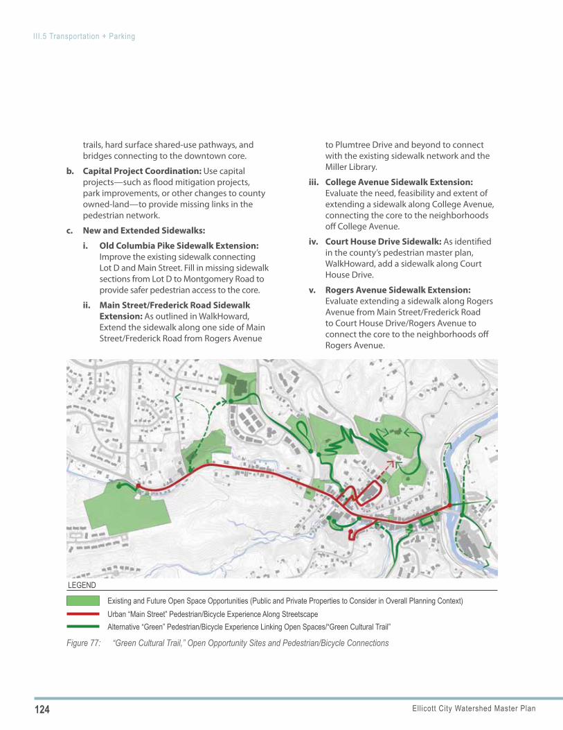
124 Ellicott City Watershed Master Plan
III.5 Transportation + Parking
Figure 77: “Green Cultural Trail,” Open Opportunity Sites and Pedestrian/Bicycle Connections
Existing and Future Open Space Opportunities (Public and Private Properties to Consider in Overall Planning Context)Urban “Main Street” Pedestrian/Bicycle Experience Along StreetscapeAlternative “Green” Pedestrian/Bicycle Experience Linking Open Spaces/“Green Cultural Trail”
LEGEND
trails, hard surface shared-use pathways, and bridges connecting to the downtown core.
b. Capital Project Coordination: Use capital projects—such as flood mitigation projects, park improvements, or other changes to county owned-land—to provide missing links in the pedestrian network.
c. New and Extended Sidewalks:
i. Old Columbia Pike Sidewalk Extension: Improve the existing sidewalk connecting Lot D and Main Street. Fill in missing sidewalk sections from Lot D to Montgomery Road to provide safer pedestrian access to the core.
ii. Main Street/Frederick Road Sidewalk Extension: As outlined in WalkHoward, Extend the sidewalk along one side of Main Street/Frederick Road from Rogers Avenue
to Plumtree Drive and beyond to connect with the existing sidewalk network and the Miller Library.
iii. College Avenue Sidewalk Extension: Evaluate the need, feasibility and extent of extending a sidewalk along College Avenue, connecting the core to the neighborhoods off College Avenue.
iv. Court House Drive Sidewalk: As identified in the county’s pedestrian master plan, WalkHoward, add a sidewalk along Court House Drive.
v. Rogers Avenue Sidewalk Extension: Evaluate extending a sidewalk along Rogers Avenue from Main Street/Frederick Road to Court House Drive/Rogers Avenue to connect the core to the neighborhoods off Rogers Avenue.
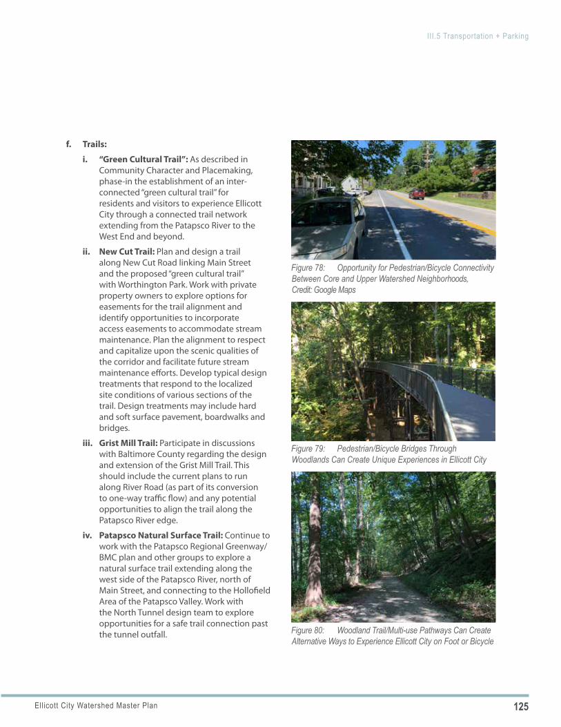
125Ellicott City Watershed Master Plan
III.5 Transportation + Parking
Figure 78: Opportunity for Pedestrian/Bicycle Connectivity Between Core and Upper Watershed Neighborhoods, Credit: Google Maps
Figure 79: Pedestrian/Bicycle Bridges Through Woodlands Can Create Unique Experiences in Ellicott City
Figure 80: Woodland Trail/Multi-use Pathways Can Create Alternative Ways to Experience Ellicott City on Foot or Bicycle
f. Trails:
i. “Green Cultural Trail”: As described in Community Character and Placemaking, phase-in the establishment of an inter-connected “green cultural trail” for residents and visitors to experience Ellicott City through a connected trail network extending from the Patapsco River to the West End and beyond.
ii. New Cut Trail: Plan and design a trail along New Cut Road linking Main Street and the proposed “green cultural trail” with Worthington Park. Work with private property owners to explore options for easements for the trail alignment and identify opportunities to incorporate access easements to accommodate stream maintenance. Plan the alignment to respect and capitalize upon the scenic qualities of the corridor and facilitate future stream maintenance efforts. Develop typical design treatments that respond to the localized site conditions of various sections of the trail. Design treatments may include hard and soft surface pavement, boardwalks and bridges.
iii. Grist Mill Trail: Participate in discussions with Baltimore County regarding the design and extension of the Grist Mill Trail. This should include the current plans to run along River Road (as part of its conversion to one-way traffic flow) and any potential opportunities to align the trail along the Patapsco River edge.
iv. Patapsco Natural Surface Trail: Continue to work with the Patapsco Regional Greenway/BMC plan and other groups to explore a natural surface trail extending along the west side of the Patapsco River, north of Main Street, and connecting to the Hollofield Area of the Patapsco Valley. Work with the North Tunnel design team to explore opportunities for a safe trail connection past the tunnel outfall.
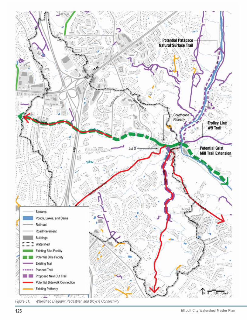
126 Ellicott City Watershed Master Plan
III.5 Transportation + Parking
Figure 81: Watershed Diagram: Pedestrian and Bicycle Connectivity
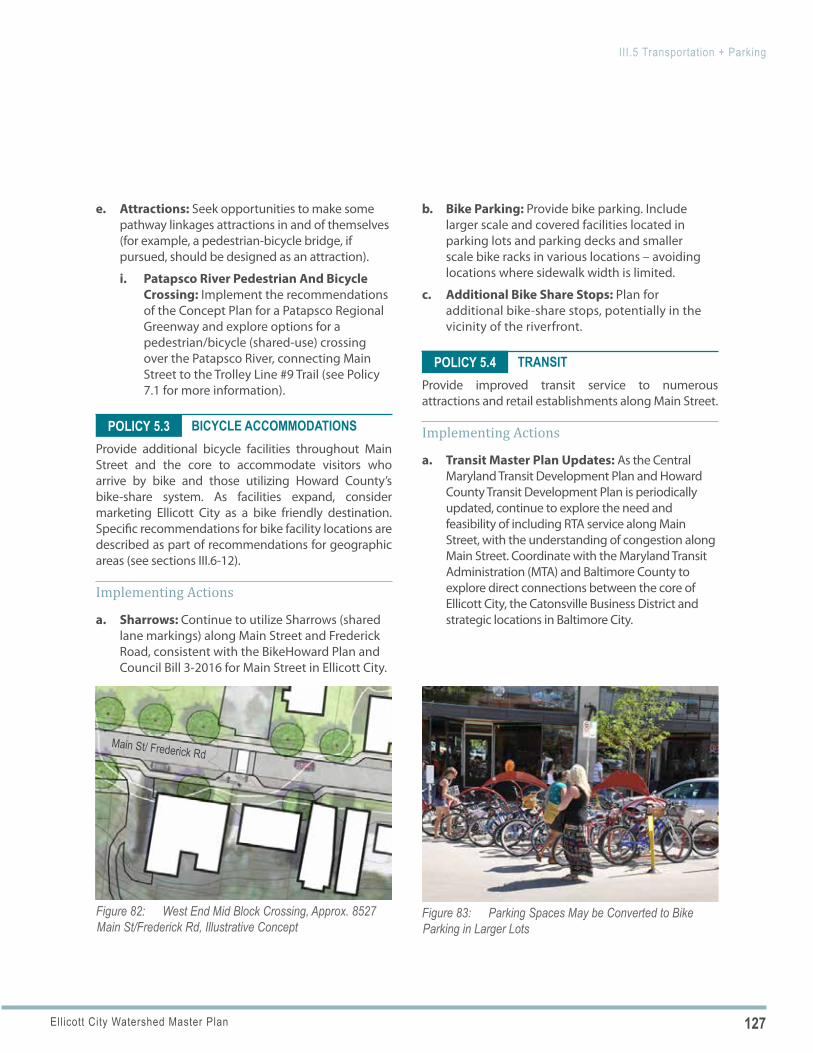
127Ellicott City Watershed Master Plan
III.5 Transportation + Parking
Figure 82: West End Mid Block Crossing, Approx. 8527 Main St/Frederick Rd, Illustrative Concept
Main St/ Frederick Rd
Figure 83: Parking Spaces May be Converted to Bike Parking in Larger Lots
POLICY 5.3
POLICY 5.4
e. Attractions: Seek opportunities to make some pathway linkages attractions in and of themselves (for example, a pedestrian-bicycle bridge, if pursued, should be designed as an attraction).
i. Patapsco River Pedestrian And Bicycle Crossing: Implement the recommendations of the Concept Plan for a Patapsco Regional Greenway and explore options for a pedestrian/bicycle (shared-use) crossing over the Patapsco River, connecting Main Street to the Trolley Line #9 Trail (see Policy 7.1 for more information).
BICYCLE ACCOMMODATIONSProvide additional bicycle facilities throughout Main Street and the core to accommodate visitors who arrive by bike and those utilizing Howard County’s bike-share system. As facilities expand, consider marketing Ellicott City as a bike friendly destination. Specific recommendations for bike facility locations are described as part of recommendations for geographic areas (see sections III.6-12).
Implementing Actions
a. Sharrows: Continue to utilize Sharrows (shared lane markings) along Main Street and Frederick Road, consistent with the BikeHoward Plan and Council Bill 3-2016 for Main Street in Ellicott City.
b. Bike Parking: Provide bike parking. Include larger scale and covered facilities located in parking lots and parking decks and smaller scale bike racks in various locations – avoiding locations where sidewalk width is limited.
c. Additional Bike Share Stops: Plan for additional bike-share stops, potentially in the vicinity of the riverfront.
TRANSITProvide improved transit service to numerous attractions and retail establishments along Main Street.
Implementing Actions
a. Transit Master Plan Updates: As the Central Maryland Transit Development Plan and Howard County Transit Development Plan is periodically updated, continue to explore the need and feasibility of including RTA service along Main Street, with the understanding of congestion along Main Street. Coordinate with the Maryland Transit Administration (MTA) and Baltimore County to explore direct connections between the core of Ellicott City, the Catonsville Business District and strategic locations in Baltimore City.
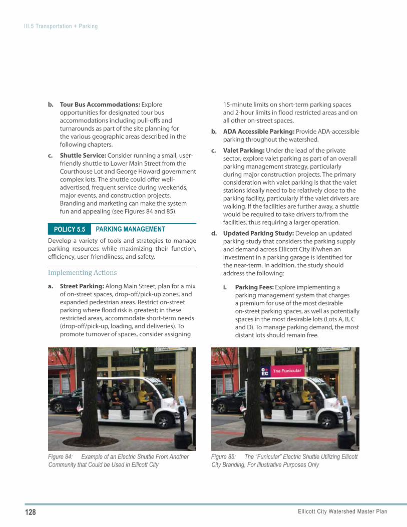
128 Ellicott City Watershed Master Plan
III.5 Transportation + Parking
Figure 84: Example of an Electric Shuttle From Another Community that Could be Used in Ellicott City
Figure 85: The “Funicular” Electric Shuttle Utilizing Ellicott City Branding, For Illustrative Purposes Only
POLICY 5.5
b. Tour Bus Accommodations: Explore opportunities for designated tour bus accommodations including pull-offs and turnarounds as part of the site planning for the various geographic areas described in the following chapters.
c. Shuttle Service: Consider running a small, user-friendly shuttle to Lower Main Street from the Courthouse Lot and George Howard government complex lots. The shuttle could offer well-advertised, frequent service during weekends, major events, and construction projects. Branding and marketing can make the system fun and appealing (see Figures 84 and 85).
PARKING MANAGEMENTDevelop a variety of tools and strategies to manage parking resources while maximizing their function, efficiency, user-friendliness, and safety.
Implementing Actions
a. Street Parking: Along Main Street, plan for a mix of on-street spaces, drop-off/pick-up zones, and expanded pedestrian areas. Restrict on-street parking where flood risk is greatest; in these restricted areas, accommodate short-term needs (drop-off/pick-up, loading, and deliveries). To promote turnover of spaces, consider assigning
15-minute limits on short-term parking spaces and 2-hour limits in flood restricted areas and on all other on-street spaces.
b. ADA Accessible Parking: Provide ADA-accessible parking throughout the watershed.
c. Valet Parking: Under the lead of the private sector, explore valet parking as part of an overall parking management strategy, particularly during major construction projects. The primary consideration with valet parking is that the valet stations ideally need to be relatively close to the parking facility, particularly if the valet drivers are walking. If the facilities are further away, a shuttle would be required to take drivers to/from the facilities, thus requiring a larger operation.
d. Updated Parking Study: Develop an updated parking study that considers the parking supply and demand across Ellicott City if/when an investment in a parking garage is identified for the near-term. In addition, the study should address the following:
i. Parking Fees: Explore implementing a parking management system that charges a premium for use of the most desirable on-street parking spaces, as well as potentially spaces in the most desirable lots (Lots A, B, C and D). To manage parking demand, the most distant lots should remain free.
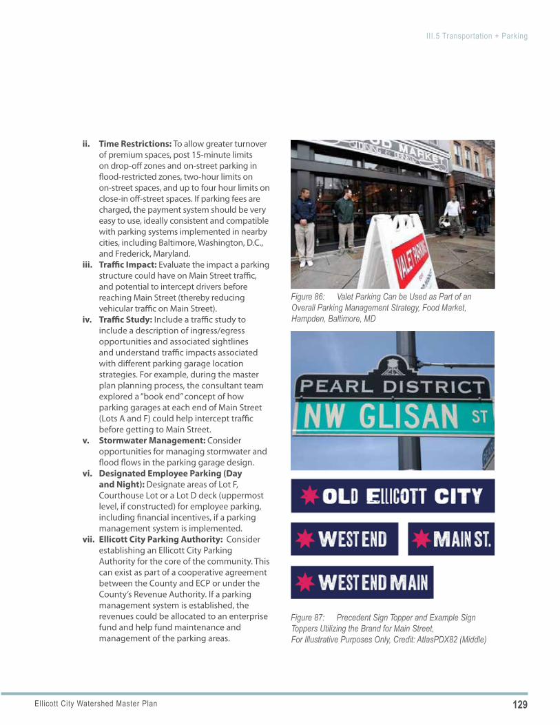
129Ellicott City Watershed Master Plan
III.5 Transportation + Parking
Figure 86: Valet Parking Can be Used as Part of an Overall Parking Management Strategy, Food Market, Hampden, Baltimore, MD
Figure 87: Precedent Sign Topper and Example Sign Toppers Utilizing the Brand for Main Street, For Illustrative Purposes Only, Credit: AtlasPDX82 (Middle)
ii. Time Restrictions: To allow greater turnover of premium spaces, post 15-minute limits on drop-off zones and on-street parking in flood-restricted zones, two-hour limits on on-street spaces, and up to four hour limits on close-in off-street spaces. If parking fees are charged, the payment system should be very easy to use, ideally consistent and compatible with parking systems implemented in nearby cities, including Baltimore, Washington, D.C., and Frederick, Maryland.
iii. Traffic Impact: Evaluate the impact a parking structure could have on Main Street traffic, and potential to intercept drivers before reaching Main Street (thereby reducing vehicular traffic on Main Street).
iv. Traffic Study: Include a traffic study to include a description of ingress/egress opportunities and associated sightlines and understand traffic impacts associated with different parking garage location strategies. For example, during the master plan planning process, the consultant team explored a “book end” concept of how parking garages at each end of Main Street (Lots A and F) could help intercept traffic before getting to Main Street.
v. Stormwater Management: Consider opportunities for managing stormwater and flood flows in the parking garage design.
vi. Designated Employee Parking (Day and Night): Designate areas of Lot F, Courthouse Lot or a Lot D deck (uppermost level, if constructed) for employee parking, including financial incentives, if a parking management system is implemented.
vii. Ellicott City Parking Authority: Consider establishing an Ellicott City Parking Authority for the core of the community. This can exist as part of a cooperative agreement between the County and ECP or under the County’s Revenue Authority. If a parking management system is established, the revenues could be allocated to an enterprise fund and help fund maintenance and management of the parking areas.
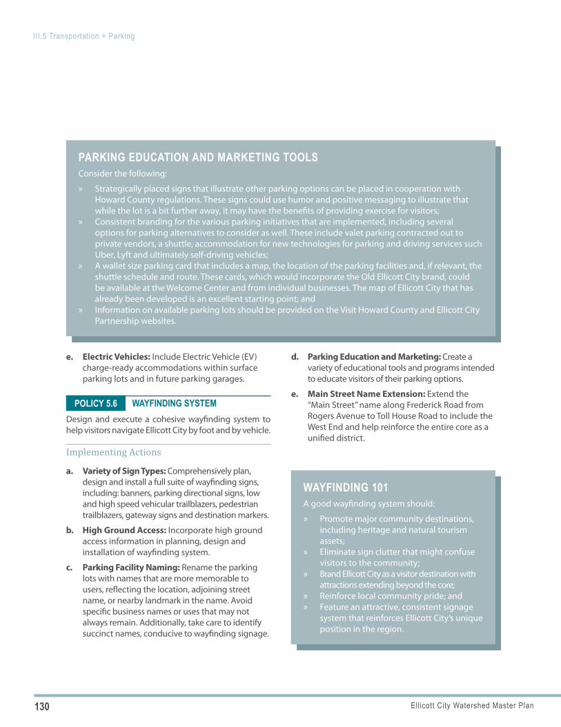
130 Ellicott City Watershed Master Plan
III.5 Transportation + Parking
PARKING EDUCATION AND MARKETING TOOLSConsider the following:
» Strategically placed signs that illustrate other parking options can be placed in cooperation with Howard County regulations. These signs could use humor and positive messaging to illustrate that while the lot is a bit further away, it may have the benefits of providing exercise for visitors;
» Consistent branding for the various parking initiatives that are implemented, including several options for parking alternatives to consider as well. These include valet parking contracted out to private vendors, a shuttle, accommodation for new technologies for parking and driving services such Uber, Lyft and ultimately self-driving vehicles;
» A wallet size parking card that includes a map, the location of the parking facilities and, if relevant, the shuttle schedule and route. These cards, which would incorporate the Old Ellicott City brand, could be available at the Welcome Center and from individual businesses. The map of Ellicott City that has already been developed is an excellent starting point; and
» Information on available parking lots should be provided on the Visit Howard County and Ellicott City Partnership websites.
WAYFINDING 101 A good wayfinding system should:
» Promote major community destinations, including heritage and natural tourism assets;
» Eliminate sign clutter that might confuse visitors to the community;
» Brand Ellicott City as a visitor destination with attractions extending beyond the core;
» Reinforce local community pride; and » Feature an attractive, consistent signage
system that reinforces Ellicott City’s unique position in the region.
POLICY 5.6
e. Electric Vehicles: Include Electric Vehicle (EV) charge-ready accommodations within surface parking lots and in future parking garages.
WAYFINDING SYSTEMDesign and execute a cohesive wayfinding system to help visitors navigate Ellicott City by foot and by vehicle.
Implementing Actions
a. Variety of Sign Types: Comprehensively plan, design and install a full suite of wayfinding signs, including: banners, parking directional signs, low and high speed vehicular trailblazers, pedestrian trailblazers, gateway signs and destination markers.
b. High Ground Access: Incorporate high ground access information in planning, design and installation of wayfinding system.
c. Parking Facility Naming: Rename the parking lots with names that are more memorable to users, reflecting the location, adjoining street name, or nearby landmark in the name. Avoid specific business names or uses that may not always remain. Additionally, take care to identify succinct names, conducive to wayfinding signage.
d. Parking Education and Marketing: Create a variety of educational tools and programs intended to educate visitors of their parking options.
e. Main Street Name Extension: Extend the “Main Street” name along Frederick Road from Rogers Avenue to Toll House Road to include the West End and help reinforce the entire core as a unified district.
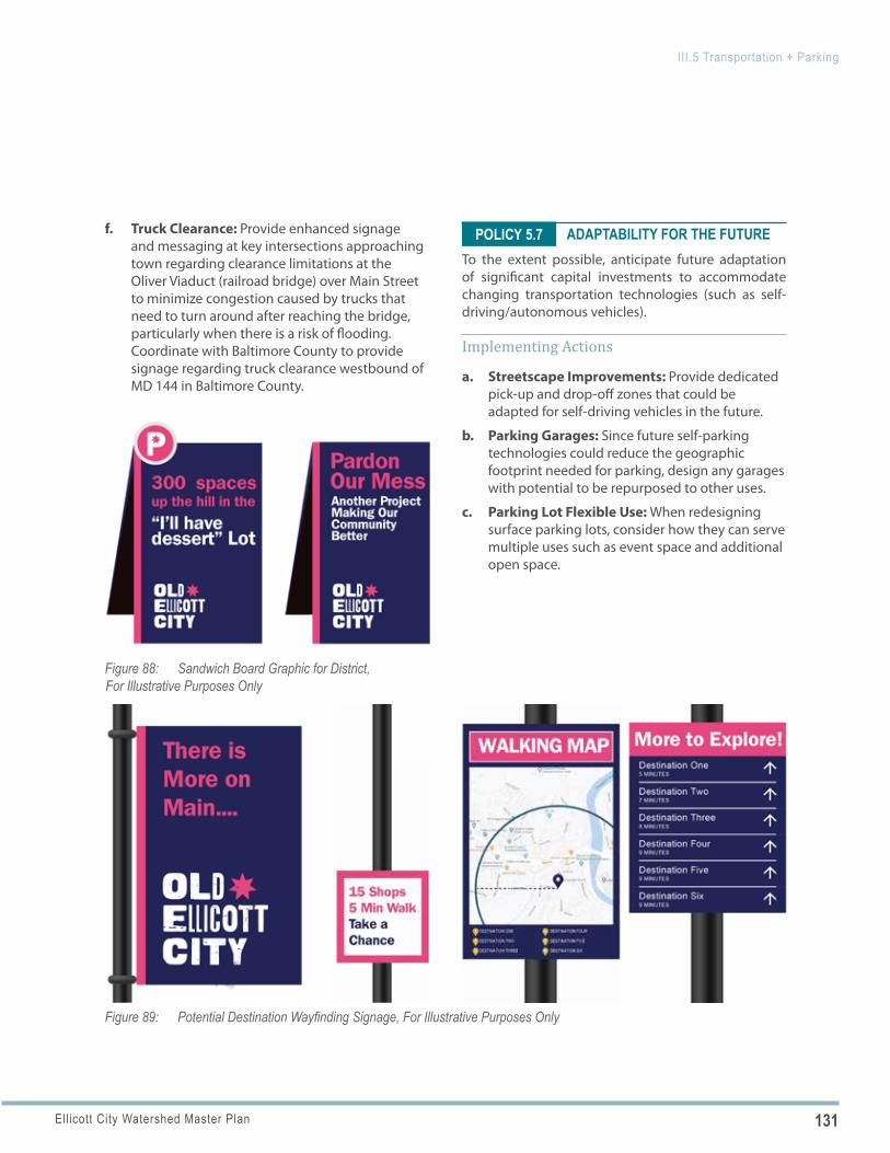
131Ellicott City Watershed Master Plan
III.5 Transportation + Parking
Figure 89: Potential Destination Wayfinding Signage, For Illustrative Purposes Only
Figure 88: Sandwich Board Graphic for District, For Illustrative Purposes Only
POLICY 5.7f. Truck Clearance: Provide enhanced signage and messaging at key intersections approaching town regarding clearance limitations at the Oliver Viaduct (railroad bridge) over Main Street to minimize congestion caused by trucks that need to turn around after reaching the bridge, particularly when there is a risk of flooding. Coordinate with Baltimore County to provide signage regarding truck clearance westbound of MD 144 in Baltimore County.
ADAPTABILITY FOR THE FUTURETo the extent possible, anticipate future adaptation of significant capital investments to accommodate changing transportation technologies (such as self-driving/autonomous vehicles).
Implementing Actions
a. Streetscape Improvements: Provide dedicated pick-up and drop-off zones that could be adapted for self-driving vehicles in the future.
b. Parking Garages: Since future self-parking technologies could reduce the geographic footprint needed for parking, design any garages with potential to be repurposed to other uses.
c. Parking Lot Flexible Use: When redesigning surface parking lots, consider how they can serve multiple uses such as event space and additional open space.
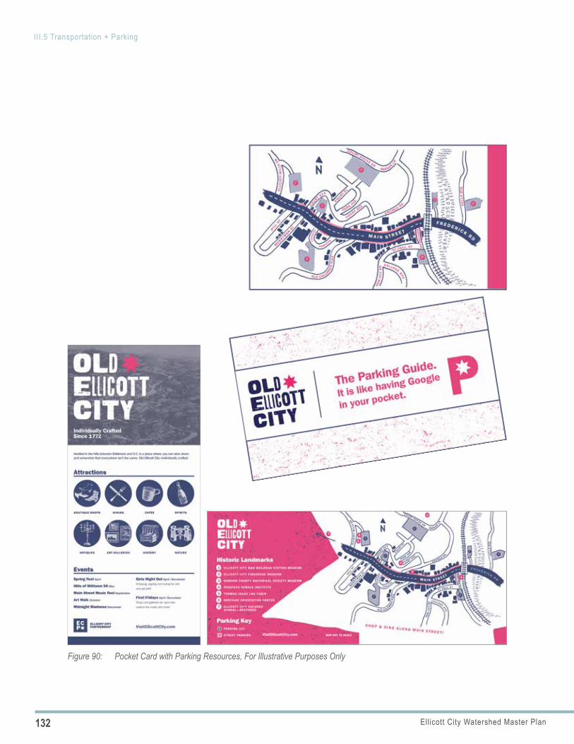
132 Ellicott City Watershed Master Plan
III.5 Transportation + Parking
Figure 90: Pocket Card with Parking Resources, For Illustrative Purposes Only
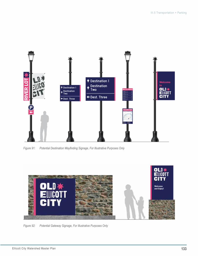
133Ellicott City Watershed Master Plan
III.5 Transportation + Parking
Figure 91: Potential Destination Wayfinding Signage, For Illustrative Purposes Only
Figure 92: Potential Gateway Signage, For Illustrative Purposes Only
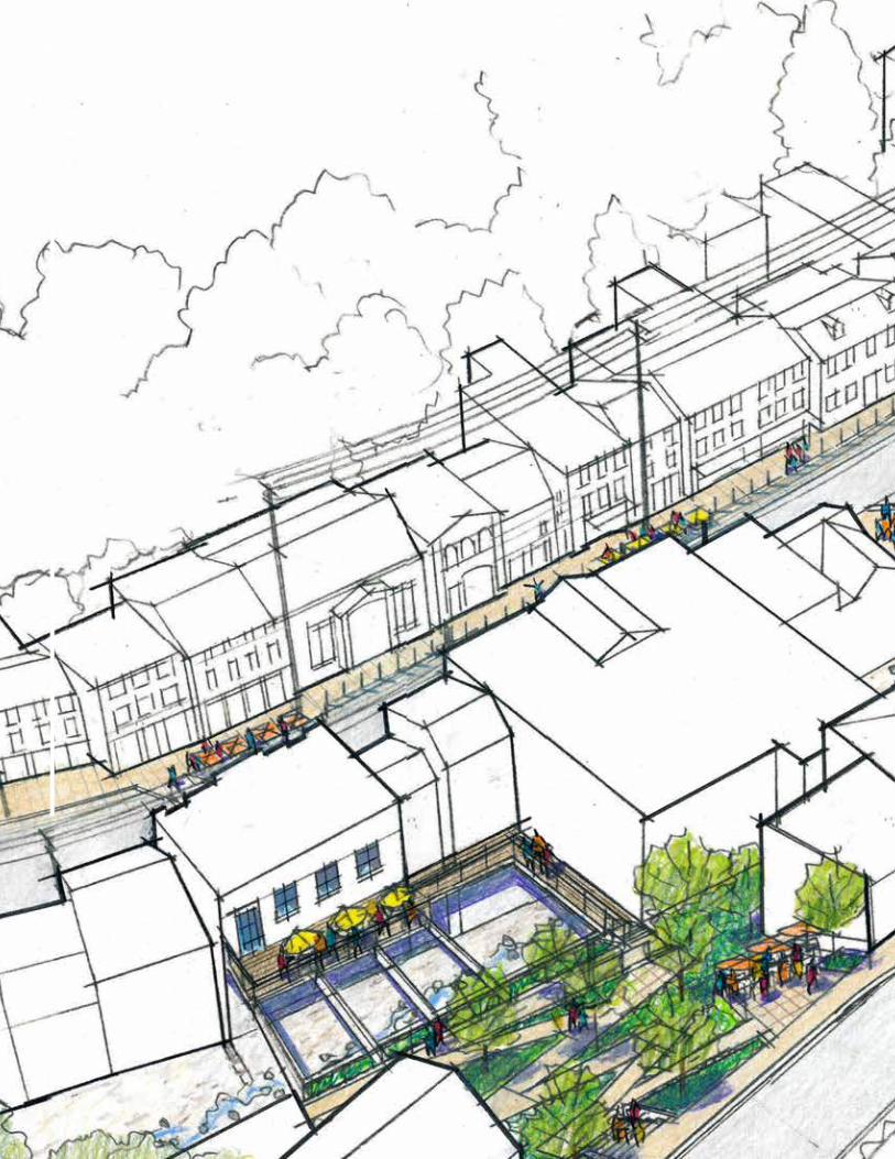
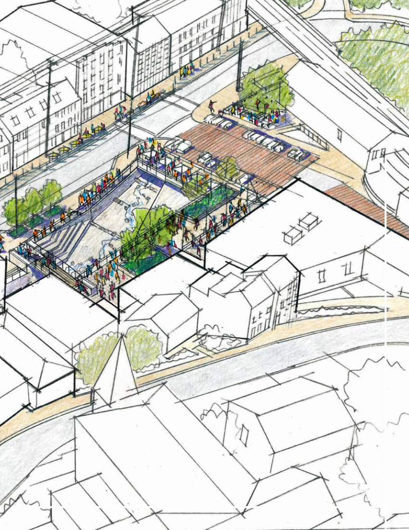
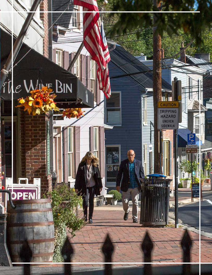
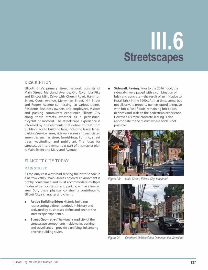
137Ellicott City Watershed Master Plan
Figure 93: Main Street, Ellicott City, Maryland
Figure 94: Overhead Utilities Often Dominate the Viewshed
DESCRIPTIONEllicott City’s primary street network consists of Main Street, Maryland Avenue, Old Columbia Pike and Ellicott Mills Drive with Church Road, Hamilton Street, Court Avenue, Merryman Street, Hill Street and Rogers Avenue connecting at various points. Residents, business owners and employees, visitors and passing commuters experience Ellicott City along these streets—whether as a pedestrian, bicyclist or motorist. The streetscape experience is informed by the elements that define a street from building face to building face, including travel lanes, parking/service lanes, sidewalk zones and associated amenities such as street furnishings, lighting, street trees, wayfinding, and public art. The focus for streetscape improvements as part of this master plan is Main Street and Maryland Avenue.
ELLICOTT CITY TODAYMAIN STREETAs the only east-west road serving the historic core in a narrow valley, Main Street’s physical environment is tightly constrained and must accommodate multiple modes of transportation and parking within a limited area. Still, these physical constraints contribute to Ellicott City’s character and charm.
■ Active Building Edge: Historic buildings representing different periods in history and activated by businesses define and anchor the streetscape experience.
■ Street Geometry: The visual simplicity of the streetscape components – sidewalks, parking and travel lanes – provide a unifying link among diverse building styles.
■ Sidewalk Paving: Prior to the 2016 flood, the sidewalks were paved with a combination of brick and concrete—the result of an initiative to install brick in the 1990s. At that time, some, but not all, private property owners opted to repave with brick. Post-floods, remaining brick adds richness and scale to the pedestrian experience. However, a simple concrete scoring is also appropriate to the district where brick is not possible.
StreetscapesIII.6
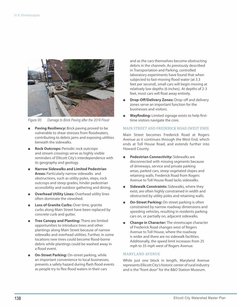
138 Ellicott City Watershed Master Plan
III.6 Streetscapes
Figure 95: Damage to Brick Paving after the 2018 Flood
■ Paving Resiliency: Brick paving proved to be vulnerable to shear stresses from floodwaters, contributing to debris jams and exposing utilities beneath the sidewalks.
■ Rock Outcrops: Periodic rock outcrops and stream crossings serve as highly visible reminders of Ellicott City’s interdependence with its geography and geology.
■ Narrow Sidewalks and Limited Pedestrian Areas: Particularly narrow sidewalks and obstructions, such as utility poles, steps, rock outcrops and steep grades, hinder pedestrian accessibility and outdoor gathering and dining.
■ Overhead Utility Lines: Overhead utility lines often dominate the viewshed.
■ Loss of Granite Curbs: Over time, granite curbs along Main Street have been replaced by concrete curb and gutter.
■ Tree Canopy and Planting: There are limited opportunities to introduce trees and other plantings along Main Street because of narrow sidewalks and overhead utilities. Further, in some locations new trees could become flood-borne debris while plantings could be washed away in a flood event.
■ On-Street Parking: On-street parking, while an important convenience to local businesses, presents a safety hazard during flash flood events as people try to flee flood waters in their cars
and as the cars themselves become obstructing debris in the channels. As previously described in Transportation and Parking, controlled laboratory experiments have found that when subjected to fast-moving flood water (at 3.3 feet per second), small cars will begin moving at relatively low depths (6 inches). At depths of 2-3 feet, most cars will float away entirely.
■ Drop-Off/Delivery Zones: Drop-off and delivery zones serve an important function for the businesses and visitors.
■ Wayfinding: Limited signage exists to help first-time visitors navigate the core.
MAIN STREET AND FREDERICK ROAD (WEST END)Main Street becomes Frederick Road at Rogers Avenue as it continues through the West End, which ends at Toll House Road, and extends further into Howard County.
■ Pedestrian Connectivity: Sidewalks are disconnected with missing segments because of driveways, service and private parking areas, parked cars, steep vegetated slopes and retaining walls. Frederick Road from Rogers Avenue to Toll House Road lacks sidewalks.
■ Sidewalk Constraints: Sidewalks, where they exist, are often highly constrained in width and obstructed by utility poles and retaining walls.
■ On-Street Parking: On-street parking is often constrained by narrow roadway dimensions and speeding vehicles, resulting in residents parking cars on, or partially on, adjacent sidewalks.
■ Change in Character: The streetscape character of Frederick Road changes west of Rogers Avenue to Toll House, where the roadway is wider and there are no sidewalk facilities. Additionally, the speed limit increases from 25 mph to 35 mph west of Rogers Avenue.
MARYLAND AVENUEWhile just one block in length, Maryland Avenue represents Ellicott City’s historic center of rural industry and is the “front door” for the B&O Station Museum.
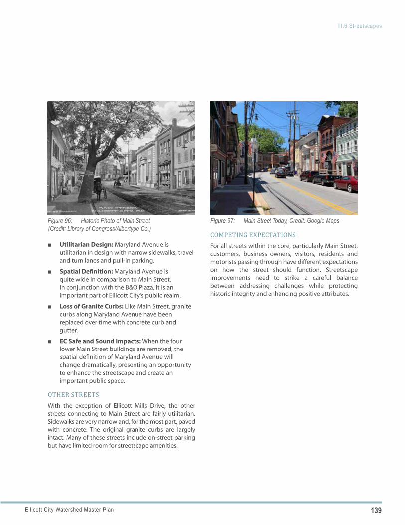
139Ellicott City Watershed Master Plan
III.6 Streetscapes
Figure 96: Historic Photo of Main Street (Credit: Library of Congress/Albertype Co.)
Figure 97: Main Street Today, Credit: Google Maps
■ Utilitarian Design: Maryland Avenue is utilitarian in design with narrow sidewalks, travel and turn lanes and pull-in parking.
■ Spatial Definition: Maryland Avenue is quite wide in comparison to Main Street. In conjunction with the B&O Plaza, it is an important part of Ellicott City’s public realm.
■ Loss of Granite Curbs: Like Main Street, granite curbs along Maryland Avenue have been replaced over time with concrete curb and gutter.
■ EC Safe and Sound Impacts: When the four lower Main Street buildings are removed, the spatial definition of Maryland Avenue will change dramatically, presenting an opportunity to enhance the streetscape and create an important public space.
OTHER STREETSWith the exception of Ellicott Mills Drive, the other streets connecting to Main Street are fairly utilitarian. Sidewalks are very narrow and, for the most part, paved with concrete. The original granite curbs are largely intact. Many of these streets include on-street parking but have limited room for streetscape amenities.
COMPETING EXPECTATIONSFor all streets within the core, particularly Main Street, customers, business owners, visitors, residents and motorists passing through have different expectations on how the street should function. Streetscape improvements need to strike a careful balance between addressing challenges while protecting historic integrity and enhancing positive attributes.
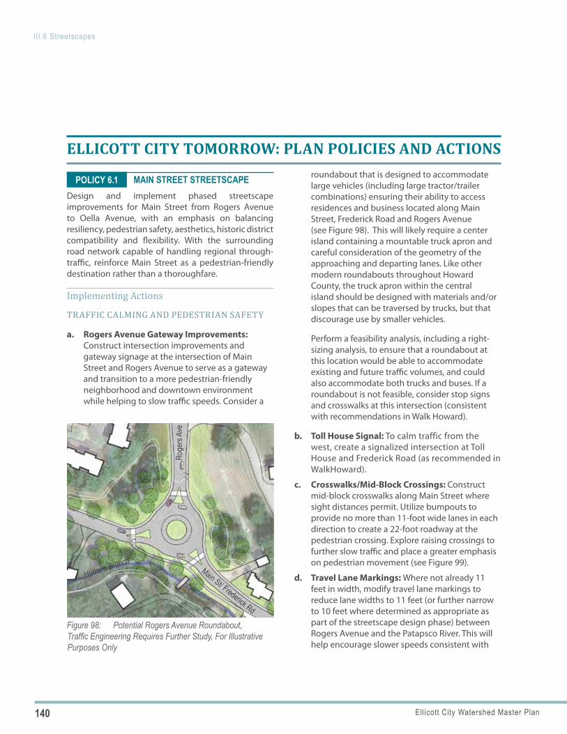
140 Ellicott City Watershed Master Plan
III.6 Streetscapes
Figure 98: Potential Rogers Avenue Roundabout, Traffic Engineering Requires Further Study, For Illustrative Purposes Only
Roge
rs Av
e
Main St/ Frederick Rd
Hudson Branch
POLICY 6.1
ELLICOTT CITY TOMORROW: PLAN POLICIES AND ACTIONS
MAIN STREET STREETSCAPEDesign and implement phased streetscape improvements for Main Street from Rogers Avenue to Oella Avenue, with an emphasis on balancing resiliency, pedestrian safety, aesthetics, historic district compatibility and flexibility. With the surrounding road network capable of handling regional through-traffic, reinforce Main Street as a pedestrian-friendly destination rather than a thoroughfare.
Implementing Actions
TRAFFIC CALMING AND PEDESTRIAN SAFETY
a. Rogers Avenue Gateway Improvements: Construct intersection improvements and gateway signage at the intersection of Main Street and Rogers Avenue to serve as a gateway and transition to a more pedestrian-friendly neighborhood and downtown environment while helping to slow traffic speeds. Consider a
roundabout that is designed to accommodate large vehicles (including large tractor/trailer combinations) ensuring their ability to access residences and business located along Main Street, Frederick Road and Rogers Avenue (see Figure 98). This will likely require a center island containing a mountable truck apron and careful consideration of the geometry of the approaching and departing lanes. Like other modern roundabouts throughout Howard County, the truck apron within the central island should be designed with materials and/or slopes that can be traversed by trucks, but that discourage use by smaller vehicles.
Perform a feasibility analysis, including a right-sizing analysis, to ensure that a roundabout at this location would be able to accommodate existing and future traffic volumes, and could also accommodate both trucks and buses. If a roundabout is not feasible, consider stop signs and crosswalks at this intersection (consistent with recommendations in Walk Howard).
b. Toll House Signal: To calm traffic from the west, create a signalized intersection at Toll House and Frederick Road (as recommended in WalkHoward).
c. Crosswalks/Mid-Block Crossings: Construct mid-block crosswalks along Main Street where sight distances permit. Utilize bumpouts to provide no more than 11-foot wide lanes in each direction to create a 22-foot roadway at the pedestrian crossing. Explore raising crossings to further slow traffic and place a greater emphasis on pedestrian movement (see Figure 99).
d. Travel Lane Markings: Where not already 11 feet in width, modify travel lane markings to reduce lane widths to 11 feet (or further narrow to 10 feet where determined as appropriate as part of the streetscape design phase) between Rogers Avenue and the Patapsco River. This will help encourage slower speeds consistent with
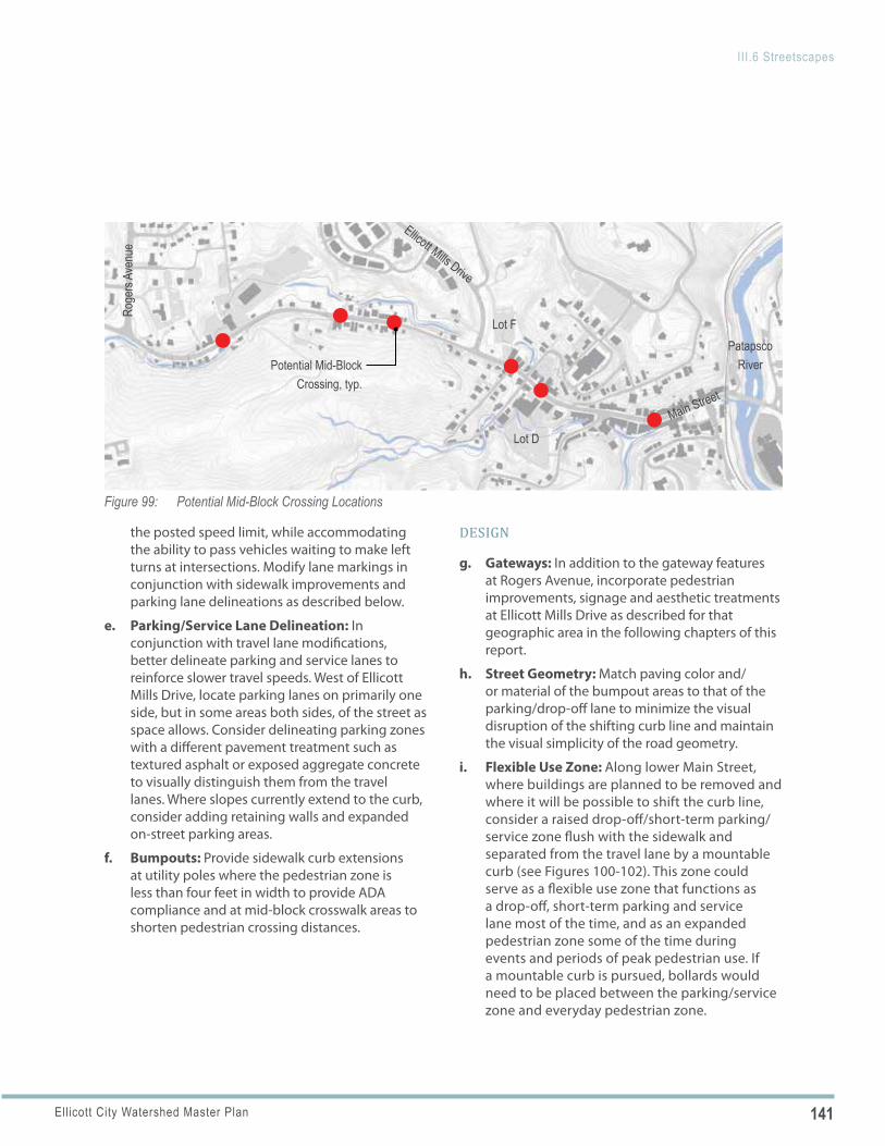
141Ellicott City Watershed Master Plan
III.6 Streetscapes
Figure 99: Potential Mid-Block Crossing Locations
Potential Mid-Block Crossing, typ.
Main Street
Patapsco River
Lot D
Lot F
Roge
rs Av
enue
Ellicott Mills Drive
the posted speed limit, while accommodating the ability to pass vehicles waiting to make left turns at intersections. Modify lane markings in conjunction with sidewalk improvements and parking lane delineations as described below.
e. Parking/Service Lane Delineation: In conjunction with travel lane modifications, better delineate parking and service lanes to reinforce slower travel speeds. West of Ellicott Mills Drive, locate parking lanes on primarily one side, but in some areas both sides, of the street as space allows. Consider delineating parking zones with a different pavement treatment such as textured asphalt or exposed aggregate concrete to visually distinguish them from the travel lanes. Where slopes currently extend to the curb, consider adding retaining walls and expanded on-street parking areas.
f. Bumpouts: Provide sidewalk curb extensions at utility poles where the pedestrian zone is less than four feet in width to provide ADA compliance and at mid-block crosswalk areas to shorten pedestrian crossing distances.
DESIGN
g. Gateways: In addition to the gateway features at Rogers Avenue, incorporate pedestrian improvements, signage and aesthetic treatments at Ellicott Mills Drive as described for that geographic area in the following chapters of this report.
h. Street Geometry: Match paving color and/or material of the bumpout areas to that of the parking/drop-off lane to minimize the visual disruption of the shifting curb line and maintain the visual simplicity of the road geometry.
i. Flexible Use Zone: Along lower Main Street, where buildings are planned to be removed and where it will be possible to shift the curb line, consider a raised drop-off/short-term parking/service zone flush with the sidewalk and separated from the travel lane by a mountable curb (see Figures 100-102). This zone could serve as a flexible use zone that functions as a drop-off, short-term parking and service lane most of the time, and as an expanded pedestrian zone some of the time during events and periods of peak pedestrian use. If a mountable curb is pursued, bollards would need to be placed between the parking/service zone and everyday pedestrian zone.
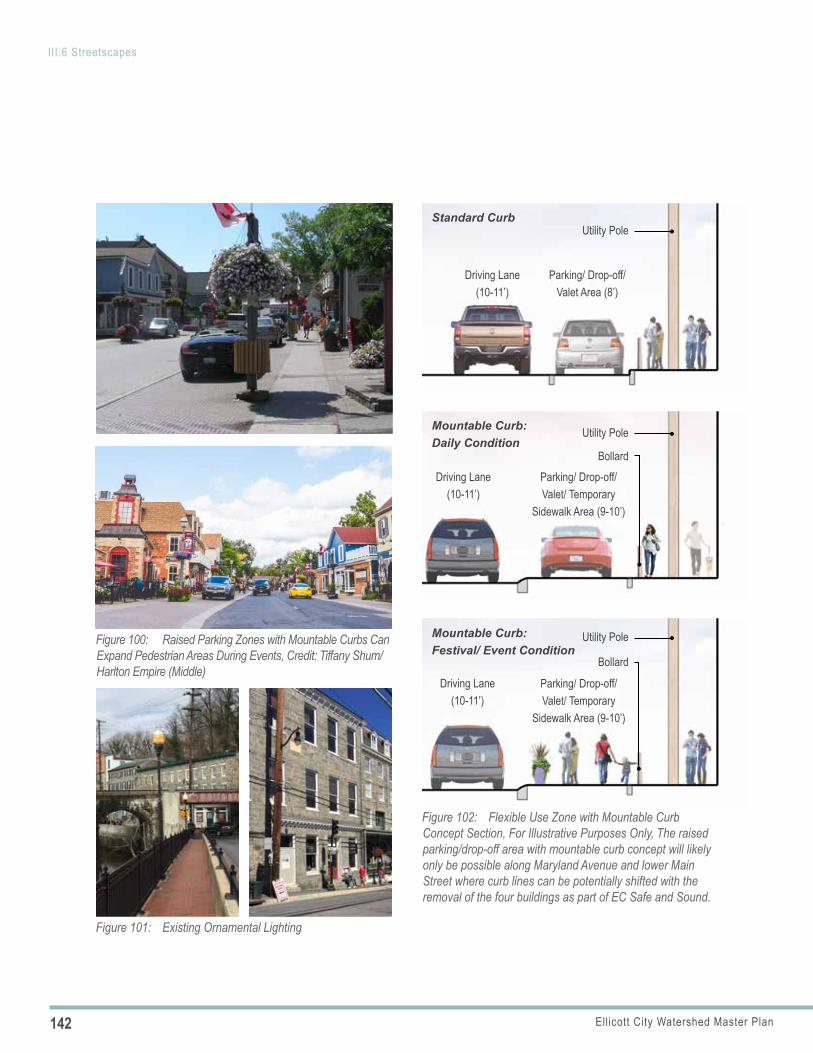
142 Ellicott City Watershed Master Plan
III.6 Streetscapes
Figure 100: Raised Parking Zones with Mountable Curbs Can Expand Pedestrian Areas During Events, Credit: Tiffany Shum/Harlton Empire (Middle)
Figure 101: Existing Ornamental Lighting
Mountable Curb: Festival/ Event Condition
Driving Lane(10-11’)
Parking/ Drop-off/ Valet/ Temporary
Sidewalk Area (9-10’)
Bollard
Utility Pole
Figure 102: Flexible Use Zone with Mountable Curb Concept Section, For Illustrative Purposes Only, The raised parking/drop-off area with mountable curb concept will likely only be possible along Maryland Avenue and lower Main Street where curb lines can be potentially shifted with the removal of the four buildings as part of EC Safe and Sound.
Mountable Curb:Daily Condition
Driving Lane(10-11’)
Parking/ Drop-off/ Valet/ Temporary
Sidewalk Area (9-10’)
Bollard
Utility Pole
Standard Curb
Driving Lane(10-11’)
Parking/ Drop-off/ Valet Area (8’)
Utility Pole
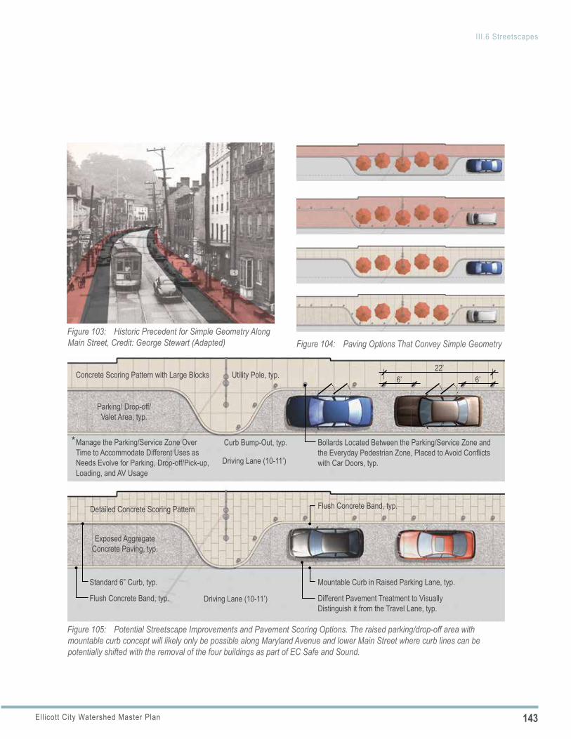
143Ellicott City Watershed Master Plan
III.6 Streetscapes
Figure 103: Historic Precedent for Simple Geometry Along Main Street, Credit: George Stewart (Adapted) Figure 104: Paving Options That Convey Simple Geometry
Bollards Located Between the Parking/Service Zone and the Everyday Pedestrian Zone, Placed to Avoid Conflicts with Car Doors, typ.
Exposed Aggregate Concrete Paving, typ.
Detailed Concrete Scoring Pattern
Concrete Scoring Pattern with Large Blocks
Mountable Curb in Raised Parking Lane, typ.
22’6’ 6’
Standard 6” Curb, typ.
Flush Concrete Band, typ.
Flush Concrete Band, typ.
Utility Pole, typ.
Driving Lane (10-11’)
Driving Lane (10-11’)
Parking/ Drop-off/ Valet Area, typ.
Curb Bump-Out, typ.
Figure 105: Potential Streetscape Improvements and Pavement Scoring Options. The raised parking/drop-off area with mountable curb concept will likely only be possible along Maryland Avenue and lower Main Street where curb lines can be potentially shifted with the removal of the four buildings as part of EC Safe and Sound.
Different Pavement Treatment to Visually Distinguish it from the Travel Lane, typ.
Manage the Parking/Service Zone Over Time to Accommodate Different Uses as Needs Evolve for Parking, Drop-off/Pick-up, Loading, and AV Usage
*
144 Ellicott City Watershed Master Plan
III.6 Streetscapes
During special events, the flexible use zone could be closed temporarily to vehicles with physical barriers such as roping, fencing, movable planters or other similar means. Any bollards should be designed to withstand anticipated flood depths and velocities. Additionally, a visual impact study should be performed to determine any potential impact of installing bollards in the historic district. This flexible use zone would be an alternative to widening the sidewalk for pedestrian use only.
j. Temporary “Parklets”: As an alternative to the raised flexible use zones, or in areas where raised flexible use zones can’t be used, consider platforms to raise the drop-off, short-term parking/service zone to sidewalk level that can function as temporary “parklets” during events, periods of peak pedestrian use or on a seasonal basis. These platforms could temporarily replace 1-2 short-term parking spaces and serve as outdoor dining areas or could be connected over a longer segment of Main Street to provide expanded pedestrian zones. Around the world there are examples of street parking spots temporarily becoming public spaces. Each year in September, designers celebrate “Park(ing) Day” with creative installations that transform parking to park.
k. Public Art: Work with local artists and incorporate public art into the streetscape design. Art may be incorporated into the pavement, crosswalk treatments and streetscape elements such as trash receptacles, bollards and planter pots. In particular, art could be used to highlight where the street covers the water to call attention to the fact that Ellicott City is built over the tributaries in many instances. Similarly, art could be used to delineate historic features no longer present.
l. Main Street Rocks: Consider using subtle lighting to highlight the rock outcrops along Main Street.
m. Wayfinding Signage: Incorporate wayfinding signage into the streetscape design with careful consideration to minimizing additional sidewalk obstructions.
n. Materials: Because of excessive shear stresses associated with floodwaters, utilize scored concrete paving for sidewalks as part of streetscape improvements made prior to flood mitigation. If streetscape improvements are implemented following the completion of EC Safe and Sound flood mitigation, consider brick paving (no mortar joints) for sidewalks, as depicted in historic photographs, and for the parking/service lane. Based on the preliminary hydraulic modeling utilized in the development of EC Safe and Sound, the flood mitigation included in the plan will reduce shear stresses on the paving materials of Main Street to levels acceptable for the use of brick paving. However, the hydraulic model must be kept updated as the design and construction of the mitigation measures advance to ensure shear stresses remain at acceptable levels for brick paving. Utilize granite curbs, regardless of the sidewalk paving material and maintain continuity of materials along Main Street between Rogers Avenue and the Patapsco River.
o. Emergency Messaging: Integrate visual and audible emergency messaging as part of the overall streetscape design.
p. Overhead Utilities: Recognize the presence of the overhead utilities and challenges associated with moving them; work with utility companies to explore how utilities can be consolidated.
PLANTING AND ENVIRONMENTAL SITE DESIGN (ESD) PRACTICES
q. Planters and Flower Baskets: Incorporate planters with seasonal color at select locations along Main Street intersections where space allows and where they would not create obstacles for pedestrians. Consider flower baskets affixed to utility poles in addition to or as an alternative to planter pots.
145Ellicott City Watershed Master Plan
III.6 Streetscapes
Figure 106: Images Top to Bottom: Potential Location for Mature Shade Trees, Large Impact from A Few Mature Shade Trees (Annapolis, MD), and Upright Trees Near Utility Lines (Greenville, SC)
Visitor Center
Hamilton Street
Main Street
Figure 107: Temporary “Parklets” Can Extend the Pedestrian Realm
Figure 108: Uplighting of Rock Outcropping to Highlight the Natural Features of the Area, Credit: Beste Cicek/Istandist
Figure 109: Modest ESD Practices Can Serve as Demonstration Projects in Lower Main
146 Ellicott City Watershed Master Plan
III.6 Streetscapes
POLICY 6.2
r. Street Trees: Punctuate the streetscape with canopy trees in the few locations where space allows to provide shade and visual interest. Potential locations include the front lawn of the Welcome Center and on private property easements (in cooperation with the property owners) throughout the West End. All of these locations should consider canopy trees with upright or columnar habit, set behind the overhead utility lines and set back from historic buildings to avoid root and limb damage to buildings over time. Avoid small ornamental trees with low canopies that block—rather than frame—views of historic buildings. See Figure 96 for historical precedent of a canopy tree punctuating the streetscape.
s. Environmental Site Design (ESD) Practices: Explore opportunities to incorporate ESD practices (such as flow-through planters) as a demonstration/educational project in part of the redesign of lower Main Street once the buildings are removed. This area will provide adequate space without conflicting with pedestrian movement and where fluvial soils, if present, may allow the facility to function properly.
AMENITIES
t. Street Furnishings: Incorporate street furnishings, such as benches, trash and recycling receptacles and movable tables and chairs throughout the streetscape as space allows. For benches, tables and chairs, limit placement to areas adjacent to wider public spaces, extended bumpouts, flexible use zones and parklets.
u. Bicycle Facilities: In addition to the “sharrow” markings on the travel lanes, provide bicycle parking in areas just off of Main Street where space allows as described for specific geographic areas in the following sections of this report. Bicycle parking should be located in highly visible locations, ideally with overhead shelter, to encourage use.
v. Lighting: Extend the installation of ornamental lighting along Main Street, between Ellicott
Mills Drive and Rogers Avenue. To avoid creating additional obstacles in the sidewalk, continue to utilize ornamental brackets attached to existing utility poles. In areas where space allows, consider stand-alone ornamental poles and fixtures.
BRANDING
w. Street Sign Toppers: Utilize street sign toppers to distinguish different districts along Main Street, such as those found in Charleston, SC, which distinguish between the different neighborhoods in the city (see Figure 87, Page 129).
MARYLAND AVENUEDesign and implement streetscape improvements for Maryland Avenue, from Main Street to St. Paul Street, in conjunction with the implementation of the Tiber Branch channel improvements as part of Safe and Sound.
Implementing Actions
a. Raised Parking Zone: Incorporate raised parking zones flush with the sidewalk separated from the travel lane by a mountable curb on each side of Maryland Avenue (see Figure 110). These could serve as flexible use zones that function as parking most of the time, and as expanded pedestrian zones some of the time during events and other periods of peak pedestrian use, while allowing the travel lanes to remain open. If a raised parking zone is pursued, bollards would need to be placed between the parking/service zone and everyday pedestrian zone. During special events, the parking/service zone could be closed temporarily to vehicles with physical barriers such as roping, fencing, movable planters or other similar means. Any bollards should be designed to withstand anticipated flood depths and velocities. Additionally, a visual impact study should be performed to determine any potential impact of installing bollards in the historic district.
b. Materials: Assuming that streetscape improvements will be implemented as part
147Ellicott City Watershed Master Plan
III.6 Streetscapes
Parking/ Drop-off/ Temporary
Sidewalk Area 18’
Parking/ Drop-off/ Temporary
Sidewalk Area 18’
30’ Roadway
Travel LaneTravel Lane
Mountable Curb, typ.
Flush Concrete Band, typ.Fixed or Removable Bollard, 6’ On Center, typ. Deck Platform Over Channel
and Culvert Openings
Mountable Curb: Festival/ Event Condition
Mountable Curb: Daily Condition
Temporary Sidewalk Area Utilized for Festivals and Events to Expand Public Open Space
Figure 110: Potential Maryland Avenue Improvements to Expand the Pedestrian Realm
POLICY 6.3
of or following the completion of EC Safe and Sound flood mitigation, utilize brick paving for sidewalks and consider special paving, such as cobblestone, for the raised parking zones. If feasible, explore utilizing the same special paving across the travel lanes of Maryland Avenue to create a continuous “plaza.” Utilize granite curbs for both raised and flush curbing. Preliminary hydraulic modeling indicates that the EC Safe and Sound mitigation measures will reduce shear stresses on the paving materials to levels acceptable for brick, cobblestone and specialty pavers. The hydraulic model must be kept updated as the design and construction of the mitigation measures advance to ensure shear stresses remain at acceptable levels for brick and cobblestone.
c. Emergency Messaging: Integrate visual and audible emergency messaging as part of the overall streetscape design.
d. Wayfinding Signage: Incorporate wayfinding signage into the streetscape design with careful consideration to minimizing additional sidewalk obstructions.
Refer to Chapter III.8: Lower Main for additional master plan recommendations for adjacent channel area.
OTHER STREETSFor the other streets connecting to Main Street, continue to utilize concrete or brick paving as sidewalks are replaced. Evaluate the decision to use brick or concrete at the time of the streetscape improvement project, considering the context and goals of the project. Protect the remaining granite curbing and, over time, replace segments of concrete curb and gutter with granite curb, particularly along Old Columbia Pike between the access to Lot D and Main Street.
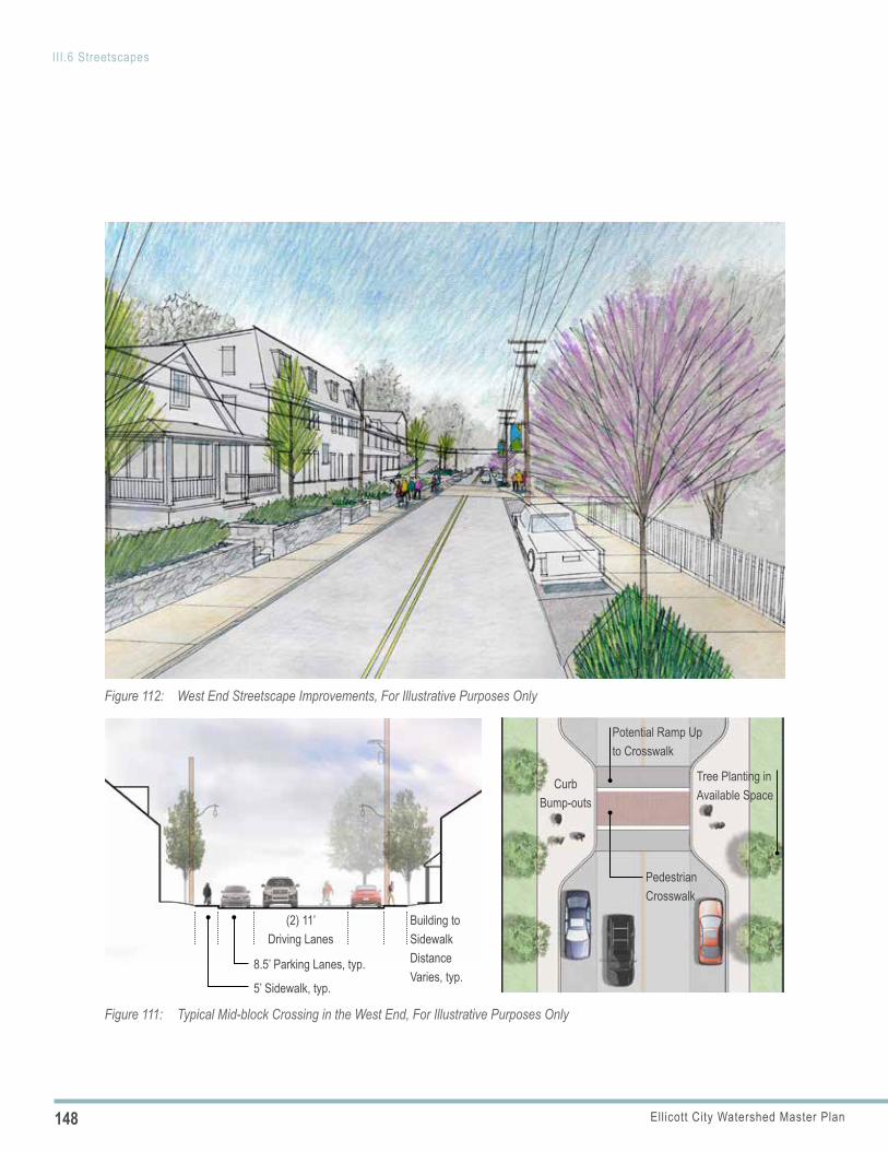
148 Ellicott City Watershed Master Plan
III.6 Streetscapes
(2) 11’ Driving Lanes
8.5’ Parking Lanes, typ.
5’ Sidewalk, typ.
Building to Sidewalk Distance Varies, typ.
Pedestrian Crosswalk
Curb Bump-outs
Tree Planting in Available Space
Potential Ramp Up to Crosswalk
Figure 111: Typical Mid-block Crossing in the West End, For Illustrative Purposes Only
Figure 112: West End Streetscape Improvements, For Illustrative Purposes Only
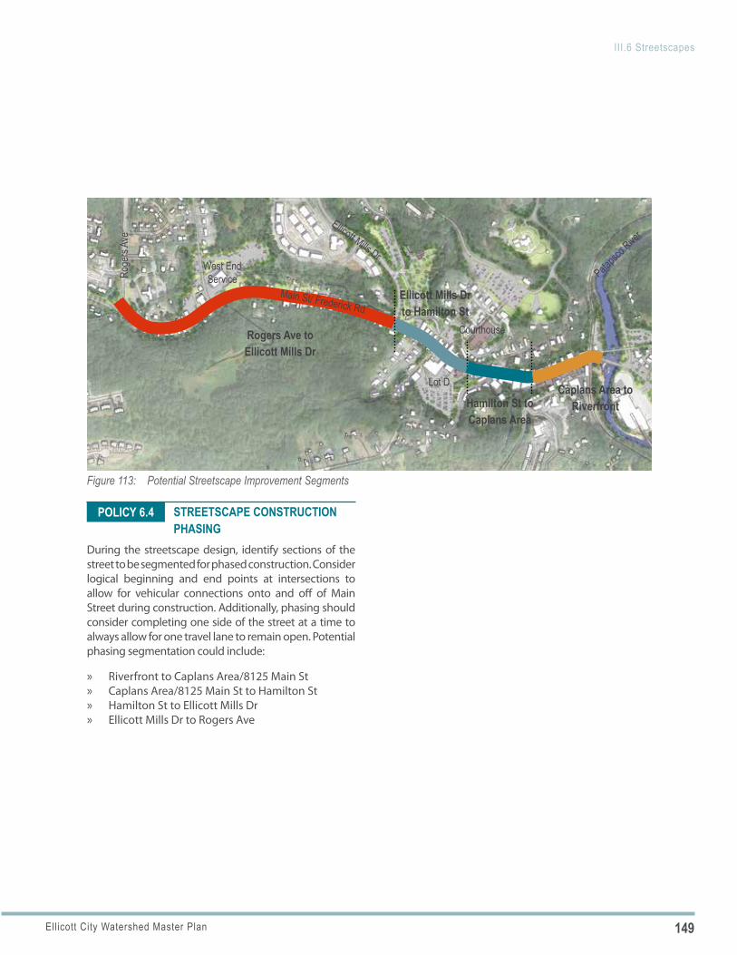
149Ellicott City Watershed Master Plan
III.6 Streetscapes
Figure 113: Potential Streetscape Improvement Segments
Roge
rs Av
e
Ellicott Mills Dr
Lot D
Courthouse
West End Service
Rogers Ave to Ellicott Mills Dr
Hamilton St to Caplans Area
Ellicott Mills Dr to Hamilton St
Caplans Area to Riverfront
Main St/ Frederick Rd
Patapsc
o Rive
r
POLICY 6.4 STREETSCAPE CONSTRUCTION PHASING
During the streetscape design, identify sections of the street to be segmented for phased construction. Consider logical beginning and end points at intersections to allow for vehicular connections onto and off of Main Street during construction. Additionally, phasing should consider completing one side of the street at a time to always allow for one travel lane to remain open. Potential phasing segmentation could include:
» Riverfront to Caplans Area/8125 Main St » Caplans Area/8125 Main St to Hamilton St » Hamilton St to Ellicott Mills Dr » Ellicott Mills Dr to Rogers Ave
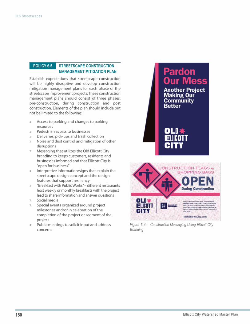
150 Ellicott City Watershed Master Plan
III.6 Streetscapes
Figure 114: Construction Messaging Using Ellicott City Branding
POLICY 6.5 STREETSCAPE CONSTRUCTION MANAGEMENT MITIGATION PLAN
Establish expectations that streetscape construction will be highly disruptive and develop construction mitigation management plans for each phase of the streetscape improvement projects. These construction management plans should consist of three phases: pre-construction, during construction and post construction. Elements of the plan should include but not be limited to the following:
» Access to parking and changes to parking resources
» Pedestrian access to businesses » Deliveries, pick-ups and trash collection » Noise and dust control and mitigation of other
disruptions » Messaging that utilizes the Old Ellicott City
branding to keeps customers, residents and businesses informed and that Ellicott City is “open for business”
» Interpretive information/signs that explain the streetscape design concept and the design features that support resiliency
» “Breakfast with Public Works” – different restaurants host weekly or monthly breakfasts with the project lead to share information and answer questions
» Social media » Special events organized around project
milestones and/or in celebration of the completion of the project or segment of the project
» Public meetings to solicit input and address concerns
151Ellicott City Watershed Master Plan
III.6 Streetscapes
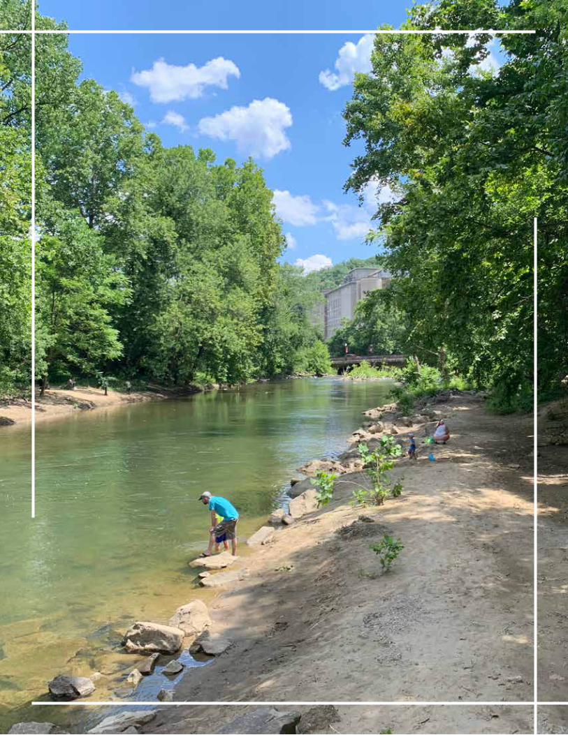
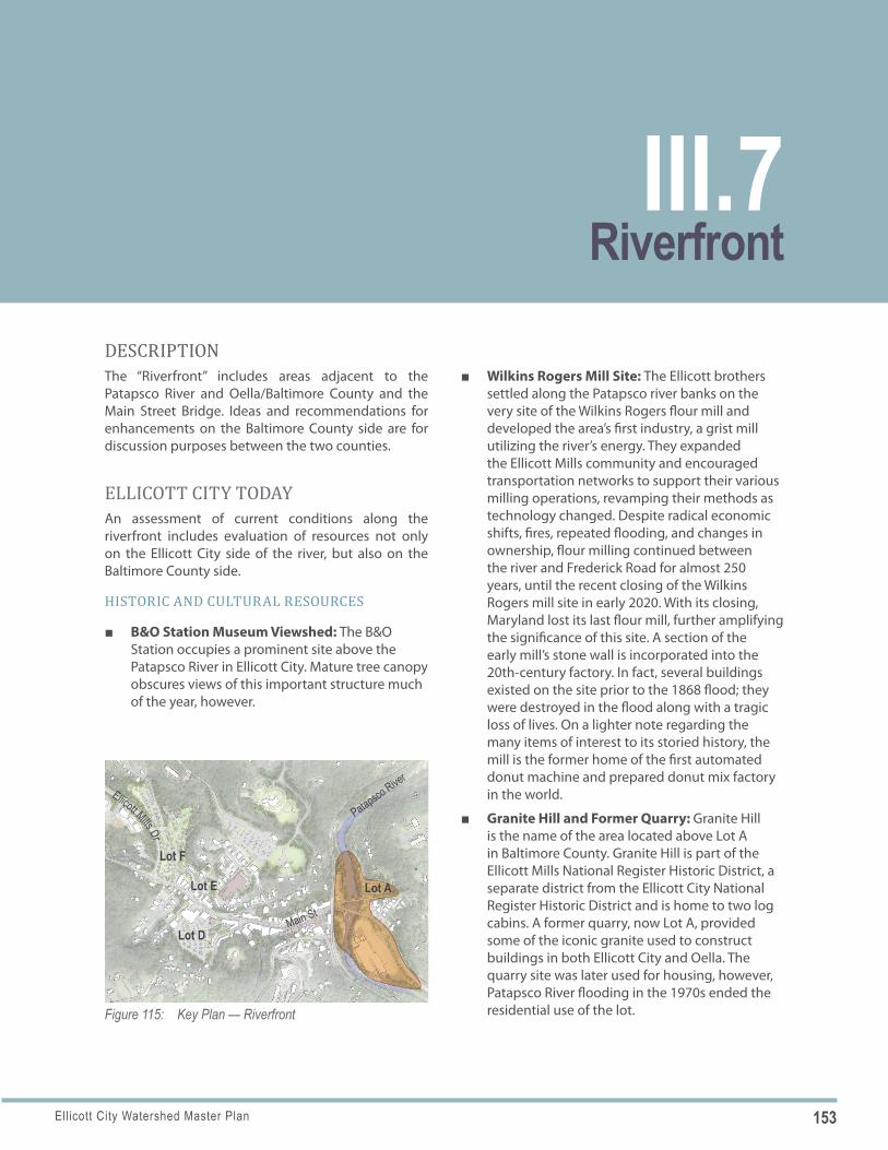
153Ellicott City Watershed Master Plan
Figure 115: Key Plan — Riverfront
Lot F
Lot E
Main St
Lot D
Lot A
Patapsco River
Ellicott Mills Dr
DESCRIPTIONThe “Riverfront” includes areas adjacent to the Patapsco River and Oella/Baltimore County and the Main Street Bridge. Ideas and recommendations for enhancements on the Baltimore County side are for discussion purposes between the two counties.
ELLICOTT CITY TODAYAn assessment of current conditions along the riverfront includes evaluation of resources not only on the Ellicott City side of the river, but also on the Baltimore County side.
HISTORIC AND CULTURAL RESOURCES
■ B&O Station Museum Viewshed: The B&O Station occupies a prominent site above the Patapsco River in Ellicott City. Mature tree canopy obscures views of this important structure much of the year, however.
■ Wilkins Rogers Mill Site: The Ellicott brothers settled along the Patapsco river banks on the very site of the Wilkins Rogers flour mill and developed the area’s first industry, a grist mill utilizing the river’s energy. They expanded the Ellicott Mills community and encouraged transportation networks to support their various milling operations, revamping their methods as technology changed. Despite radical economic shifts, fires, repeated flooding, and changes in ownership, flour milling continued between the river and Frederick Road for almost 250 years, until the recent closing of the Wilkins Rogers mill site in early 2020. With its closing, Maryland lost its last flour mill, further amplifying the significance of this site. A section of the early mill’s stone wall is incorporated into the 20th-century factory. In fact, several buildings existed on the site prior to the 1868 flood; they were destroyed in the flood along with a tragic loss of lives. On a lighter note regarding the many items of interest to its storied history, the mill is the former home of the first automated donut machine and prepared donut mix factory in the world.
■ Granite Hill and Former Quarry: Granite Hill is the name of the area located above Lot A in Baltimore County. Granite Hill is part of the Ellicott Mills National Register Historic District, a separate district from the Ellicott City National Register Historic District and is home to two log cabins. A former quarry, now Lot A, provided some of the iconic granite used to construct buildings in both Ellicott City and Oella. The quarry site was later used for housing, however, Patapsco River flooding in the 1970s ended the residential use of the lot.
RiverfrontIII.7
154 Ellicott City Watershed Master Plan
III.7 Riverfront
THE PATAPSCO REGIONAL GREENWAY
Figure 116: The Patapsco Regional Greenway Plan Outlines the Potential for Several Trail Connections in Ellicott City Figure 117: Oella Entrance Garden and Passive Park
■ Trolley Line #9: The Trolley Line #9 connected Ellicott City (in the vicinity of the former fire house) to Catonsville and Baltimore for more than half of a century. The trolley service was discontinued in the 1950’s and the truss bridge that spanned the Patapsco was demolished. Some of the stone piers that supported the truss bridge remain and offer a tangible link to an important transportation story for Ellicott City.
PATAPSCO VALLEY STATE PARKPatapsco Valley State Park is an extensive nearby park resource along the Patapsco River, extending to the north and south of Ellicott City. The boundary is largely fragmented and does not extend into Ellicott City’s core. The park has constructed an “Ellicott City Link” which opened in 2020. The link includes
a trail network from the rear of the park adjacent to Park Drive which travels southeast along the Sucker Branch and discharges at the base of Sylvan Lane at the Sucker Branch. The trail guide and signage will indicate a link to Ellicott City by walking along Sylvan Lane to Church Road.
TRAIL CONNECTION OPPORTUNITIESThe Patapsco Regional Greenway Plan (PRGP) outlines the potential for several trail connections on both sides of the Patapsco River, connecting Ellicott City to the existing Grist Mill Trail and Trolley Line #9 Trails and northward along the river to other trails. Additionally, other potential trail connections discussed by stakeholders present an opportunity to expand the trail network within the Ellicott City area.
■ Grist Mill Trail: The Grist Mill Trail is a paved trail linking Ilchester with the Avalon Area of Patapsco State Park. Plans include extending the trail along River and Frederick Roads into Oella.
■ Supplemental Trail: While not included in the Greenway master plan, there has been some conversation regarding a secondary trail linking Ellicott City and Ilchester on the west side of the Patapsco River.
■ Trolley Line #9 Trail: The former rail line is now the Trolley Line #9 Trail, providing a significant recreational amenity between Oella and
155Ellicott City Watershed Master Plan
III.7 Riverfront
Figure 118: Historic Photo of Trolley #9 Bridge, Credit: Baltimore County Public Library/MD Covered Bridges
Figure 119: View to River and Main Street Bridge from Lot B
Figure 120: Sense of Enclosure and Bedrock in Lot A
Catonsville. While there is ADA access to the trolley trail from Westchester Avenue, none exists between the trail and Lot A.
■ Nature Trail (Howard County): With limited railroad right-of-way and steep wooded slopes, the plans call for a nature trail connection between Ellicott City, northward, before connecting to a proposed “Trail by Rail” where there is more space associated with the railroad right-of-way.
■ Oella Avenue and Mill Race Trail (Baltimore County): A trail route on Oella Avenue will connect Oella to the existing Mill Race Trail further to the north. Ongoing conversations with private property owners have not been successful regarding northward trail easements along the river.
As planning for future trail connections continue, the intersection of Oella Avenue and Main Street needs to be considered. Turning movements at the Oella Avenue intersection can be difficult resulting in challenging conditions for pedestrians.
OELLA ENTRANCE GARDENThe Oella Entrance Garden is an important open space that serves as a visible gateway to Ellicott City from the east. The once neglected park area has been transformed and continues to be cared for by volunteers.
■ Passive Park: The entrance garden serves as an inviting community asset, enticing passersby to linger and enjoy the views of Ellicott City, passing trains, and the river.
■ Monarch Waystation: The garden has rebounded into a designated Monarch waystation and is planted primarily with pollinator-friendly native plants.
■ Patapsco River Viewshed: Existing trees behind the sign screen the roadway from those enjoying the space but also block views of the river from those approaching Ellicott City from the east.
156 Ellicott City Watershed Master Plan
III.7 Riverfront
POLICY 7.1
EC SAFE AND SOUND OUTFALLSHoward County is planning the North Tunnel to divert the flood flows of the Hudson Branch through a tunnel which outfalls into the Patapsco River on the north side of Parking Lot B. The Maryland Avenue culvert will outfall into the Patapsco River south of the vehicular bridge (Frederick Road/Main Street).
■ Outfall Location: The North Tunnel outfall will be set into the hillside between the CSX rail line and the edge of the river.
■ Construction Staging: As Lot B is the only feasible point of access for the construction of the tunnel outfall, Howard County will likely utilize Lot B as a staging area for materials and equipment for the duration of the tunnel construction.
PARKING RESOURCES
■ Lot B: Lot B is a surface lot with 24 spaces and serves the lower Main Street area. It is located on the east side of the CSX Railroad tracks and is the only area within the core that allows for Patapsco River access. It is spatially well-defined by mature trees and stone walls. Prior to the 2016 flood, Howard County installed permeable paving within the parking spaces.
■ Lot A: Lot A provides 76 parking spaces and was created through a private/public partnership that spanned county lines. Its location within the floodplain makes it unsuitable for occupied construction, though it is ideally situated to provide overflow parking for the adjacent businesses and Ellicott City activities, intercepting visitors from the east before arriving at Main Street. The parking area is set back into the carved cavity of the former quarry. Canopy trees within the lot provide a human scale and cooling shade.
ELLICOTT CITY TOMORROW: PLAN POLICIES AND ACTIONS
PATAPSCO RIVER PEDESTRIAN AND BICYCLE CROSSING
Implement the recommendations of the Concept Plan for a Patapsco Regional Greenway and explore options for a pedestrian/bicycle (shared-use) crossing over the Patapsco River. This crossing would provide a more direct and safer connection for pedestrians and bicyclists between Oella and Ellicott City, particularly if parking resources are expanded in Lot A.
OPTION 1—NEW BRIDGE Construct a new bridge dedicated to pedestrians and cyclists where the trolley bridge once stood as a direct extension from the Trolley Line #9 Trail.
Implementing Actions
a. Signature Design: Design a bridge that could be an attraction in and of itself, using contemporary technologies to create an iconic design, potentially stylistically referencing the former Trolley Bridge removed once trolley service was suspended. That former steel truss bridge was constructed to replace the original wooden covered bridge with the latest technology available to its builders at that time. Illuminate the structure using dark sky approaches to enhance the gateway to both Ellicott City and Oella. Consider how the bridge could serve as a venue for periodic art installations.
b. Existing Infrastructure: Investigate the feasibility of utilizing the existing stone piers. Evaluate them for structural stability and ability
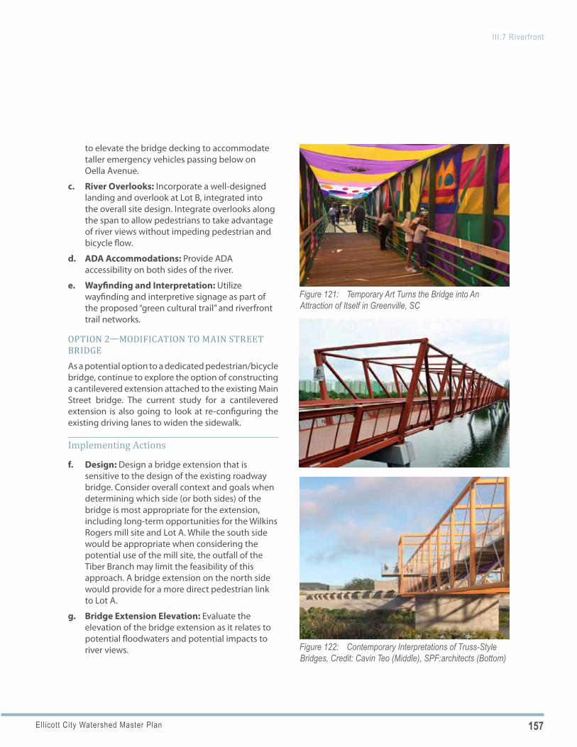
157Ellicott City Watershed Master Plan
III.7 Riverfront
Figure 121: Temporary Art Turns the Bridge into An Attraction of Itself in Greenville, SC
Figure 122: Contemporary Interpretations of Truss-Style Bridges, Credit: Cavin Teo (Middle), SPF:architects (Bottom)
to elevate the bridge decking to accommodate taller emergency vehicles passing below on Oella Avenue.
c. River Overlooks: Incorporate a well-designed landing and overlook at Lot B, integrated into the overall site design. Integrate overlooks along the span to allow pedestrians to take advantage of river views without impeding pedestrian and bicycle flow.
d. ADA Accommodations: Provide ADA accessibility on both sides of the river.
e. Wayfinding and Interpretation: Utilize wayfinding and interpretive signage as part of the proposed “green cultural trail” and riverfront trail networks.
OPTION 2—MODIFICATION TO MAIN STREET BRIDGEAs a potential option to a dedicated pedestrian/bicycle bridge, continue to explore the option of constructing a cantilevered extension attached to the existing Main Street bridge. The current study for a cantilevered extension is also going to look at re-configuring the existing driving lanes to widen the sidewalk.
Implementing Actions
f. Design: Design a bridge extension that is sensitive to the design of the existing roadway bridge. Consider overall context and goals when determining which side (or both sides) of the bridge is most appropriate for the extension, including long-term opportunities for the Wilkins Rogers mill site and Lot A. While the south side would be appropriate when considering the potential use of the mill site, the outfall of the Tiber Branch may limit the feasibility of this approach. A bridge extension on the north side would provide for a more direct pedestrian link to Lot A.
g. Bridge Extension Elevation: Evaluate the elevation of the bridge extension as it relates to potential floodwaters and potential impacts to river views.
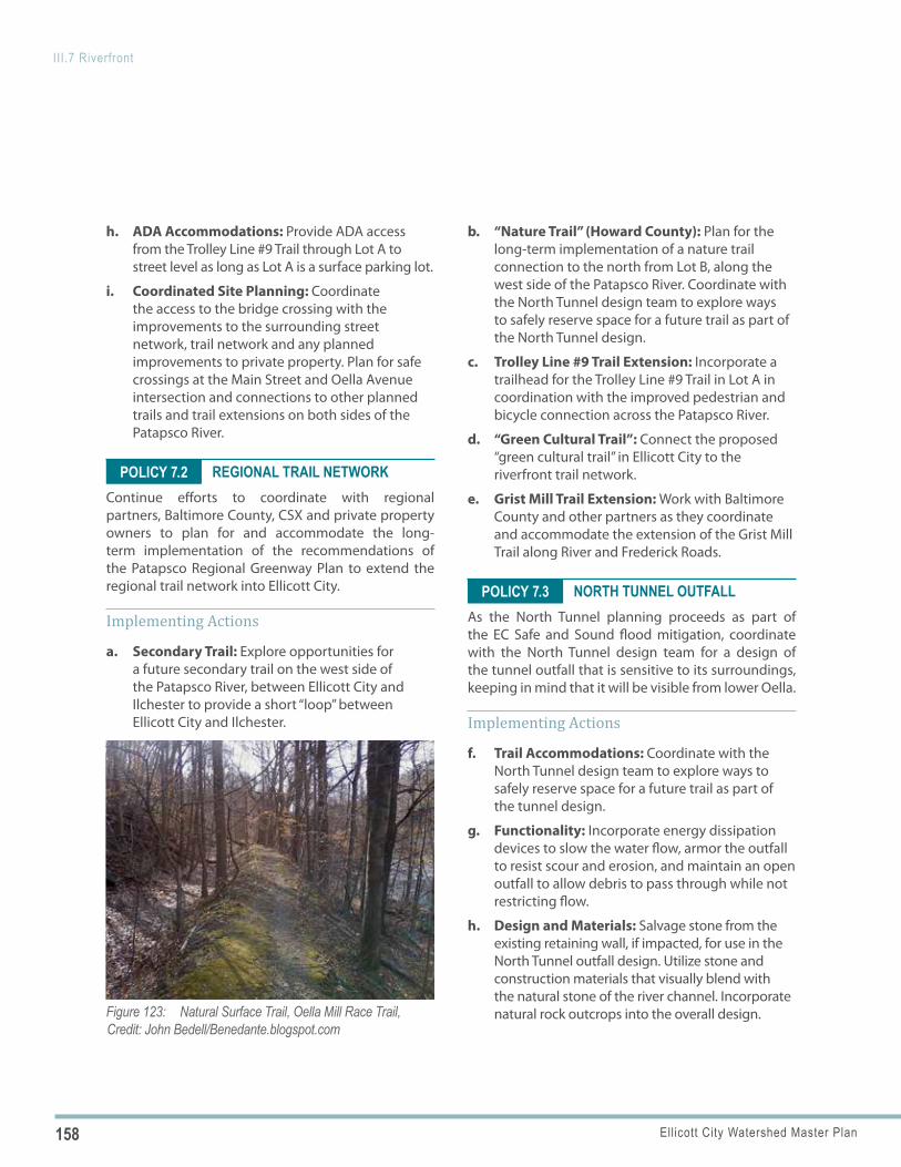
158 Ellicott City Watershed Master Plan
III.7 Riverfront
Figure 123: Natural Surface Trail, Oella Mill Race Trail, Credit: John Bedell/Benedante.blogspot.com
POLICY 7.2
POLICY 7.3
h. ADA Accommodations: Provide ADA access from the Trolley Line #9 Trail through Lot A to street level as long as Lot A is a surface parking lot.
i. Coordinated Site Planning: Coordinate the access to the bridge crossing with the improvements to the surrounding street network, trail network and any planned improvements to private property. Plan for safe crossings at the Main Street and Oella Avenue intersection and connections to other planned trails and trail extensions on both sides of the Patapsco River.
REGIONAL TRAIL NETWORKContinue efforts to coordinate with regional partners, Baltimore County, CSX and private property owners to plan for and accommodate the long-term implementation of the recommendations of the Patapsco Regional Greenway Plan to extend the regional trail network into Ellicott City.
Implementing Actions
a. Secondary Trail: Explore opportunities for a future secondary trail on the west side of the Patapsco River, between Ellicott City and Ilchester to provide a short “loop” between Ellicott City and Ilchester.
b. “Nature Trail” (Howard County): Plan for the long-term implementation of a nature trail connection to the north from Lot B, along the west side of the Patapsco River. Coordinate with the North Tunnel design team to explore ways to safely reserve space for a future trail as part of the North Tunnel design.
c. Trolley Line #9 Trail Extension: Incorporate a trailhead for the Trolley Line #9 Trail in Lot A in coordination with the improved pedestrian and bicycle connection across the Patapsco River.
d. “Green Cultural Trail”: Connect the proposed “green cultural trail” in Ellicott City to the riverfront trail network.
e. Grist Mill Trail Extension: Work with Baltimore County and other partners as they coordinate and accommodate the extension of the Grist Mill Trail along River and Frederick Roads.
NORTH TUNNEL OUTFALLAs the North Tunnel planning proceeds as part of the EC Safe and Sound flood mitigation, coordinate with the North Tunnel design team for a design of the tunnel outfall that is sensitive to its surroundings, keeping in mind that it will be visible from lower Oella.
Implementing Actions
f. Trail Accommodations: Coordinate with the North Tunnel design team to explore ways to safely reserve space for a future trail as part of the tunnel design.
g. Functionality: Incorporate energy dissipation devices to slow the water flow, armor the outfall to resist scour and erosion, and maintain an open outfall to allow debris to pass through while not restricting flow.
h. Design and Materials: Salvage stone from the existing retaining wall, if impacted, for use in the North Tunnel outfall design. Utilize stone and construction materials that visually blend with the natural stone of the river channel. Incorporate natural rock outcrops into the overall design.
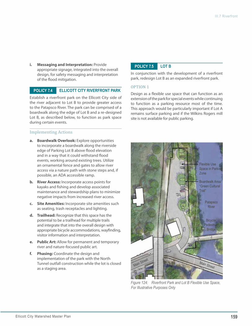
159Ellicott City Watershed Master Plan
III.7 Riverfront
Figure 124: Riverfront Park and Lot B Flexible Use Space, For Illustrative Purposes Only
Bicycle/Pedestrian
Bridge
Patapsco River
Boardwalk Area/ “Green Cultural Trail”
Main StreetMain Street
Flexible Use Space in Parking Zone
POLICY 7.4
POLICY 7.5i. Messaging and Interpretation: Provide appropriate signage, integrated into the overall design, for safety messaging and interpretation of the flood mitigation.
ELLICOTT CITY RIVERFRONT PARKEstablish a riverfront park on the Ellicott City side of the river adjacent to Lot B to provide greater access to the Patapsco River. The park can be comprised of a boardwalk along the edge of Lot B and a re-designed Lot B, as described below, to function as park space during certain events.
Implementing Actions
a. Boardwalk Overlook: Explore opportunities to incorporate a boardwalk along the riverside edge of Parking Lot B above flood elevation and in a way that it could withstand flood events, working around existing trees. Utilize an ornamental fence and gates to allow river access via a nature path with stone steps and, if possible, an ADA accessible ramp.
b. River Access: Incorporate access points for kayaks and fishing and develop associated maintenance and stewardship plans to minimize negative impacts from increased river access.
c. Site Amenities: Incorporate site amenities such as seating, trash receptacles and lighting.
d. Trailhead: Recognize that this space has the potential to be a trailhead for multiple trails and integrate that into the overall design with appropriate bicycle accommodations, wayfinding, visitor information and interpretation.
e. Public Art: Allow for permanent and temporary river and nature-focused public art.
f. Phasing: Coordinate the design and implementation of the park with the North Tunnel outfall construction while the lot is closed as a staging area.
LOT BIn conjunction with the development of a riverfront park, redesign Lot B as an expanded riverfront park.
OPTION 1Design as a flexible use space that can function as an extension of the park for special events while continuing to function as a parking resource most of the time. This approach would be particularly important if Lot A remains surface parking and if the Wilkins Rogers mill site is not available for public parking.
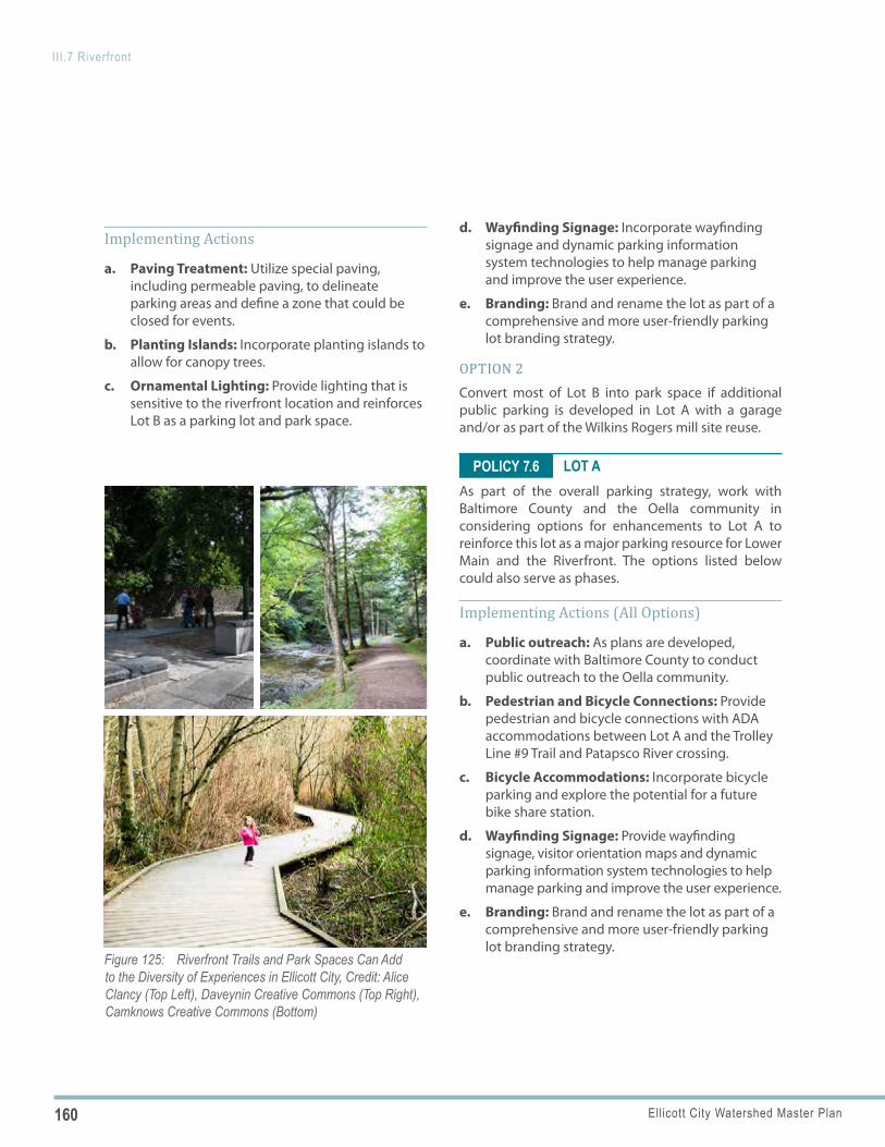
160 Ellicott City Watershed Master Plan
III.7 Riverfront
Figure 125: Riverfront Trails and Park Spaces Can Add to the Diversity of Experiences in Ellicott City, Credit: Alice Clancy (Top Left), Daveynin Creative Commons (Top Right), Camknows Creative Commons (Bottom)
POLICY 7.6
Implementing Actions
a. Paving Treatment: Utilize special paving, including permeable paving, to delineate parking areas and define a zone that could be closed for events.
b. Planting Islands: Incorporate planting islands to allow for canopy trees.
c. Ornamental Lighting: Provide lighting that is sensitive to the riverfront location and reinforces Lot B as a parking lot and park space.
d. Wayfinding Signage: Incorporate wayfinding signage and dynamic parking information system technologies to help manage parking and improve the user experience.
e. Branding: Brand and rename the lot as part of a comprehensive and more user-friendly parking lot branding strategy.
OPTION 2Convert most of Lot B into park space if additional public parking is developed in Lot A with a garage and/or as part of the Wilkins Rogers mill site reuse.
LOT AAs part of the overall parking strategy, work with Baltimore County and the Oella community in considering options for enhancements to Lot A to reinforce this lot as a major parking resource for Lower Main and the Riverfront. The options listed below could also serve as phases.
Implementing Actions (All Options)
a. Public outreach: As plans are developed, coordinate with Baltimore County to conduct public outreach to the Oella community.
b. Pedestrian and Bicycle Connections: Provide pedestrian and bicycle connections with ADA accommodations between Lot A and the Trolley Line #9 Trail and Patapsco River crossing.
c. Bicycle Accommodations: Incorporate bicycle parking and explore the potential for a future bike share station.
d. Wayfinding Signage: Provide wayfinding signage, visitor orientation maps and dynamic parking information system technologies to help manage parking and improve the user experience.
e. Branding: Brand and rename the lot as part of a comprehensive and more user-friendly parking lot branding strategy.
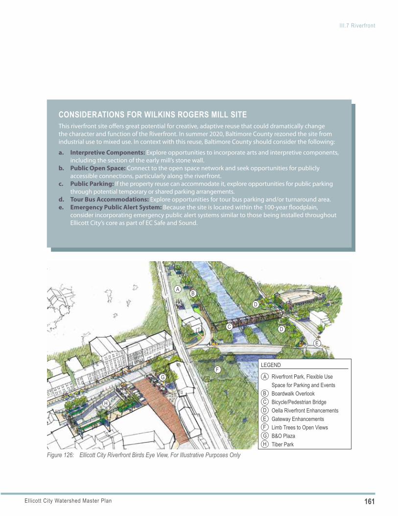
161Ellicott City Watershed Master Plan
III.7 Riverfront
Figure 126: Ellicott City Riverfront Birds Eye View, For Illustrative Purposes Only
AB
C
D
D
A
BCD
LEGEND
Riverfront Park, Flexible Use Space for Parking and EventsBoardwalk OverlookBicycle/Pedestrian BridgeOella Riverfront EnhancementsGateway EnhancementsLimb Trees to Open ViewsB&O PlazaTiber Park
EF
F
G
G
H
H
E
CONSIDERATIONS FOR WILKINS ROGERS MILL SITEThis riverfront site offers great potential for creative, adaptive reuse that could dramatically change the character and function of the Riverfront. In summer 2020, Baltimore County rezoned the site from industrial use to mixed use. In context with this reuse, Baltimore County should consider the following:
a. Interpretive Components: Explore opportunities to incorporate arts and interpretive components, including the section of the early mill’s stone wall.
b. Public Open Space: Connect to the open space network and seek opportunities for publicly accessible connections, particularly along the riverfront.
c. Public Parking: If the property reuse can accommodate it, explore opportunities for public parking through potential temporary or shared parking arrangements.
d. Tour Bus Accommodations: Explore opportunities for tour bus parking and/or turnaround area.e. Emergency Public Alert System: Because the site is located within the 100-year floodplain,
consider incorporating emergency public alert systems similar to those being installed throughout Ellicott City’s core as part of EC Safe and Sound.
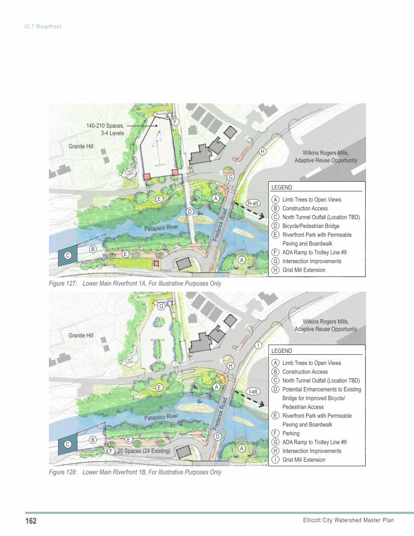
162 Ellicott City Watershed Master Plan
III.7 Riverfront
Figure 127: Lower Main Riverfront 1A, For Illustrative Purposes Only
Patapsco River
Granite Hill
Fred
erick
Roa
d
A
A
BC
D
E
E
140-210 Spaces, 3-4 Levels
Wilkins Rogers Mills, Adaptive Reuse Opportunity
F
H
ABCDE
FGH
LEGEND
Limb Trees to Open ViewsConstruction AccessNorth Tunnel Outfall (Location TBD)Bicycle/Pedestrian BridgeRiverfront Park with Permeable Paving and BoardwalkADA Ramp to Trolley Line #9Intersection ImprovementsGrist Mill Extension
G
H-alt
I-alt
C
Figure 128: Lower Main Riverfront 1B, For Illustrative Purposes Only
Granite Hill
Patapsco River
Fred
erick
Roa
d
A
A
B
G
20 Spaces (24 Existing)
E
E
F
D
ABCD
E
LEGEND
Limb Trees to Open ViewsConstruction AccessNorth Tunnel Outfall (Location TBD)Potential Enhancements to Existing Bridge for Improved Bicycle/Pedestrian AccessRiverfront Park with Permeable Paving and BoardwalkParkingADA Ramp to Trolley Line #9Intersection ImprovementsGrist Mill Extension
FGHI
I
H
Wilkins Rogers Mills, Adaptive Reuse Opportunity
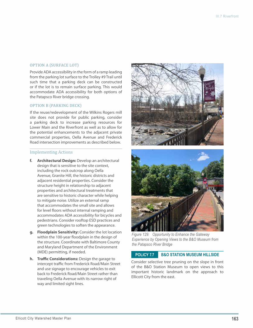
163Ellicott City Watershed Master Plan
III.7 Riverfront
Figure 129: Opportunity to Enhance the Gateway Experience by Opening Views to the B&O Museum from the Patapsco River Bridge
POLICY 7.7
OPTION A (SURFACE LOT)Provide ADA accessibility in the form of a ramp leading from the parking lot surface to the Trolley #9 Trail until such time that a parking deck can be constructed or if the lot is to remain surface parking. This would accommodate ADA accessibility for both options of the Patapsco River bridge crossing.
OPTION B (PARKING DECK)If the reuse/redevelopment of the Wilkins Rogers mill site does not provide for public parking, consider a parking deck to increase parking resources for Lower Main and the Riverfront as well as to allow for the potential enhancements to the adjacent private commercial properties, Oella Avenue and Frederick Road intersection improvements as described below.
Implementing Actions
f. Architectural Design: Develop an architectural design that is sensitive to the site context, including the rock outcrop along Oella Avenue, Granite Hill, the historic districts and adjacent residential properties. Consider the structure height in relationship to adjacent properties and architectural treatments that are sensitive to historic character while helping to mitigate noise. Utilize an external ramp that accommodates the small site and allows for level floors without internal ramping and accommodates ADA accessibility for bicycles and pedestrians. Consider rooftop ESD practices and green technologies to soften the appearance.
g. Floodplain Sensitivity: Consider the lot location within the 100-year floodplain in the design of the structure. Coordinate with Baltimore County and Maryland Department of the Environment (MDE) permitting, if needed.
h. Traffic Considerations: Design the garage to intercept traffic from Frederick Road/Main Street and use signage to encourage vehicles to exit back to Frederick Road/Main Street rather than traveling Oella Avenue with its narrow right of way and limited sight lines.
B&O STATION MUSEUM HILLSIDEConsider selective tree pruning on the slope in front of the B&O Station Museum to open views to this important historic landmark on the approach to Ellicott City from the east.
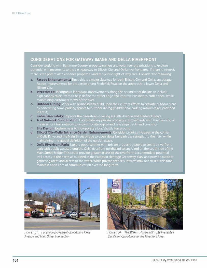
164 Ellicott City Watershed Master Plan
III.7 Riverfront
Figure 131: Facade Improvement Opportunity, Oella Avenue and Main Street Intersection
CONSIDERATIONS FOR GATEWAY IMAGE AND OELLA RIVERFRONTConsider working with Baltimore County, property owners and volunteer organizations to explore potential enhancements to the east gateway to Ellicott City and Oella riverfront area. If there is interest, there is the potential to enhance properties and the public right-of-way area. Consider the following:
a. Façade Enhancements: Since this is a major Gateway for both Ellicott City and Oella, encourage façade improvements for properties along Frederick Road on the approach to lower Oella and Ellicott City.
b. Streetscape: Incorporate landscape improvements along the perimeter of the lots to include high canopy street trees to help define the street edge and improve businesses’ curb appeal while maintaining customers’ views of the river.
c. Outdoor Dining: Work with businesses to build upon their current efforts to activate outdoor areas by converting some parking spaces to outdoor dining (if additional parking resources are provided in Lot A).
d. Pedestrian Safety: Improve the pedestrian crossing at Oella Avenue and Frederick Road.e. Trail Network Coordination: Coordinate any private property improvements with the planning of
the riverfront trail network to accommodate logical and safe alignments and crossings.f. Site Design: Explore ways to incorporate a bus/shuttle turnaround.g. Ellicott City-Oella Entrance Garden Enhancements: Consider pruning the trees at the corner
of Oella Drive and the Main Street bridge to open views beneath the canopies to the river, while maintaining the spatial definition of the garden space.
h. Oella Riverfront Park: Explore opportunities with private property owners to create a riverfront park with public access along the Oella riverfront northward to Lot A and on the south side of the Main Street Bridge. This could provide greater access to the riverfront, accommodate potential trail access to the north as outlined in the Patapsco Heritage Greenway plan, and provide outdoor gathering areas and access to the water. While private property interest may not exist at this time, maintain open lines of communication over the long-term.
Figure 130: The Wilkins Rogers Mills Site Presents a Significant Opportunity for the Riverfront Area
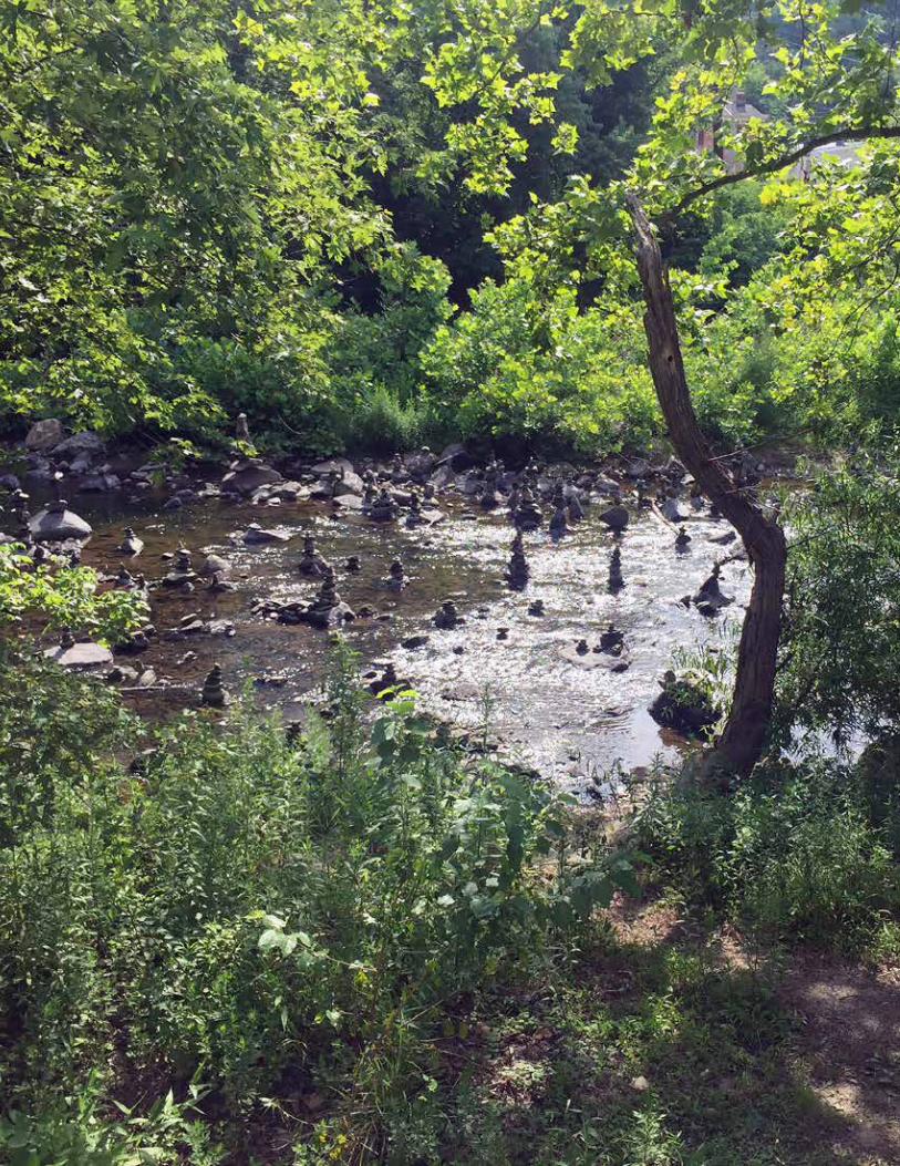
165Ellicott City Watershed Master Plan
III.7 Riverfront
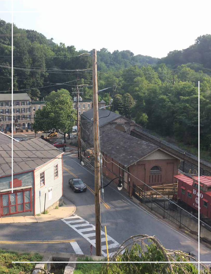
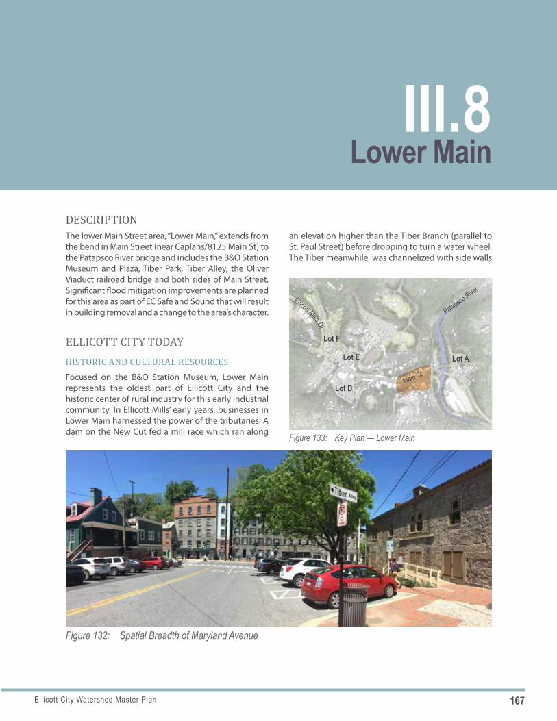
167Ellicott City Watershed Master Plan
Figure 132: Spatial Breadth of Maryland Avenue
Figure 133: Key Plan — Lower Main
Lot F
Lot E
Main St
Lot D
Lot A
Patapsco River
Ellicott Mills Dr
DESCRIPTIONThe lower Main Street area, “Lower Main,” extends from the bend in Main Street (near Caplans/8125 Main St) to the Patapsco River bridge and includes the B&O Station Museum and Plaza, Tiber Park, Tiber Alley, the Oliver Viaduct railroad bridge and both sides of Main Street. Significant flood mitigation improvements are planned for this area as part of EC Safe and Sound that will result in building removal and a change to the area’s character.
ELLICOTT CITY TODAYHISTORIC AND CULTURAL RESOURCESFocused on the B&O Station Museum, Lower Main represents the oldest part of Ellicott City and the historic center of rural industry for this early industrial community. In Ellicott Mills’ early years, businesses in Lower Main harnessed the power of the tributaries. A dam on the New Cut fed a mill race which ran along
an elevation higher than the Tiber Branch (parallel to St. Paul Street) before dropping to turn a water wheel. The Tiber meanwhile, was channelized with side walls
Lower MainIII.8
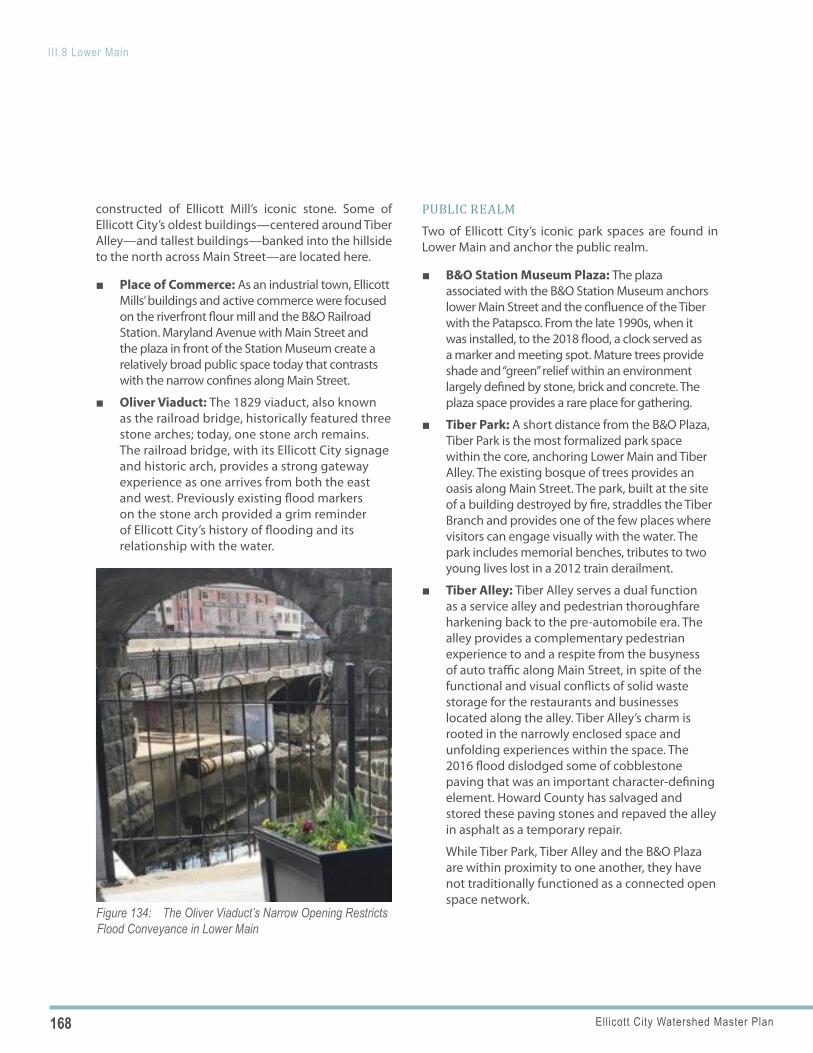
168 Ellicott City Watershed Master Plan
III.8 Lower Main
Figure 134: The Oliver Viaduct’s Narrow Opening Restricts Flood Conveyance in Lower Main
constructed of Ellicott Mill’s iconic stone. Some of Ellicott City’s oldest buildings—centered around Tiber Alley—and tallest buildings—banked into the hillside to the north across Main Street—are located here.
■ Place of Commerce: As an industrial town, Ellicott Mills’ buildings and active commerce were focused on the riverfront flour mill and the B&O Railroad Station. Maryland Avenue with Main Street and the plaza in front of the Station Museum create a relatively broad public space today that contrasts with the narrow confines along Main Street.
■ Oliver Viaduct: The 1829 viaduct, also known as the railroad bridge, historically featured three stone arches; today, one stone arch remains. The railroad bridge, with its Ellicott City signage and historic arch, provides a strong gateway experience as one arrives from both the east and west. Previously existing flood markers on the stone arch provided a grim reminder of Ellicott City’s history of flooding and its relationship with the water.
PUBLIC REALMTwo of Ellicott City’s iconic park spaces are found in Lower Main and anchor the public realm.
■ B&O Station Museum Plaza: The plaza associated with the B&O Station Museum anchors lower Main Street and the confluence of the Tiber with the Patapsco. From the late 1990s, when it was installed, to the 2018 flood, a clock served as a marker and meeting spot. Mature trees provide shade and “green” relief within an environment largely defined by stone, brick and concrete. The plaza space provides a rare place for gathering.
■ Tiber Park: A short distance from the B&O Plaza, Tiber Park is the most formalized park space within the core, anchoring Lower Main and Tiber Alley. The existing bosque of trees provides an oasis along Main Street. The park, built at the site of a building destroyed by fire, straddles the Tiber Branch and provides one of the few places where visitors can engage visually with the water. The park includes memorial benches, tributes to two young lives lost in a 2012 train derailment.
■ Tiber Alley: Tiber Alley serves a dual function as a service alley and pedestrian thoroughfare harkening back to the pre-automobile era. The alley provides a complementary pedestrian experience to and a respite from the busyness of auto traffic along Main Street, in spite of the functional and visual conflicts of solid waste storage for the restaurants and businesses located along the alley. Tiber Alley’s charm is rooted in the narrowly enclosed space and unfolding experiences within the space. The 2016 flood dislodged some of cobblestone paving that was an important character-defining element. Howard County has salvaged and stored these paving stones and repaved the alley in asphalt as a temporary repair.
While Tiber Park, Tiber Alley and the B&O Plaza are within proximity to one another, they have not traditionally functioned as a connected open space network.
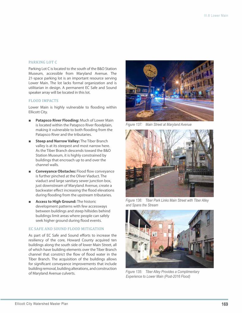
169Ellicott City Watershed Master Plan
III.8 Lower Main
Figure 135: Tiber Alley Provides a Complimentary Experience to Lower Main (Post-2016 Flood)
Figure 136: Tiber Park Links Main Street with Tiber Alley and Spans the Stream
Figure 137: Main Street at Maryland Avenue
PARKING LOT CParking Lot C is located to the south of the B&O Station Museum, accessible from Maryland Avenue. The 21-space parking lot is an important resource serving Lower Main. The lot lacks formal organization and is utilitarian in design. A permanent EC Safe and Sound speaker array will be located in this lot.
FLOOD IMPACTSLower Main is highly vulnerable to flooding within Ellicott City.
■ Patapsco River Flooding: Much of Lower Main is located within the Patapsco River floodplain, making it vulnerable to both flooding from the Patapsco River and the tributaries.
■ Steep and Narrow Valley: The Tiber Branch valley is at its steepest and most narrow here. As the Tiber Branch descends toward the B&O Station Museum, it is highly constrained by buildings that encroach up to and over the channel walls.
■ Conveyance Obstacles: Flood flow conveyance is further pinched at the Oliver Viaduct. The viaduct and large sanitary sewer junction box, just downstream of Maryland Avenue, create a backwater effect increasing the flood elevations during flooding from the upstream tributaries.
■ Access to High Ground: The historic development patterns with few accessways between buildings and steep hillsides behind buildings limit areas where people can safely seek higher ground during flood events.
EC SAFE AND SOUND FLOOD MITIGATIONAs part of EC Safe and Sound efforts to increase the resiliency of the core, Howard County acquired ten buildings along the south side of lower Main Street, all of which have building elements over the Tiber Branch channel that constrict the flow of flood water in the Tiber Branch. The acquisition of the buildings allows for significant conveyance improvements that include building removal, building alterations, and construction of Maryland Avenue culverts.
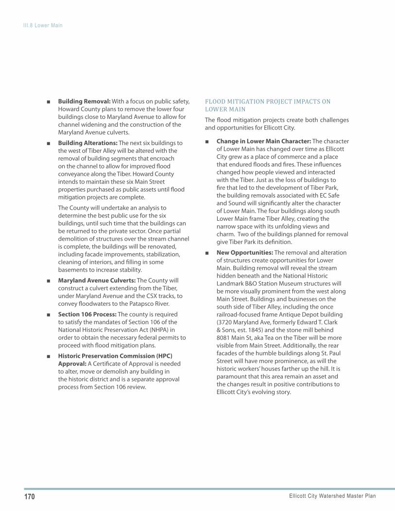
170 Ellicott City Watershed Master Plan
III.8 Lower Main
■ Building Removal: With a focus on public safety, Howard County plans to remove the lower four buildings close to Maryland Avenue to allow for channel widening and the construction of the Maryland Avenue culverts.
■ Building Alterations: The next six buildings to the west of Tiber Alley will be altered with the removal of building segments that encroach on the channel to allow for improved flood conveyance along the Tiber. Howard County intends to maintain these six Main Street properties purchased as public assets until flood mitigation projects are complete.
The County will undertake an analysis to determine the best public use for the six buildings, until such time that the buildings can be returned to the private sector. Once partial demolition of structures over the stream channel is complete, the buildings will be renovated, including facade improvements, stabilization, cleaning of interiors, and filling in some basements to increase stability.
■ Maryland Avenue Culverts: The County will construct a culvert extending from the Tiber, under Maryland Avenue and the CSX tracks, to convey floodwaters to the Patapsco River.
■ Section 106 Process: The county is required to satisfy the mandates of Section 106 of the National Historic Preservation Act (NHPA) in order to obtain the necessary federal permits to proceed with flood mitigation plans.
■ Historic Preservation Commission (HPC) Approval: A Certificate of Approval is needed to alter, move or demolish any building in the historic district and is a separate approval process from Section 106 review.
FLOOD MITIGATION PROJECT IMPACTS ON LOWER MAINThe flood mitigation projects create both challenges and opportunities for Ellicott City.
■ Change in Lower Main Character: The character of Lower Main has changed over time as Ellicott City grew as a place of commerce and a place that endured floods and fires. These influences changed how people viewed and interacted with the Tiber. Just as the loss of buildings to fire that led to the development of Tiber Park, the building removals associated with EC Safe and Sound will significantly alter the character of Lower Main. The four buildings along south Lower Main frame Tiber Alley, creating the narrow space with its unfolding views and charm. Two of the buildings planned for removal give Tiber Park its definition.
■ New Opportunities: The removal and alteration of structures create opportunities for Lower Main. Building removal will reveal the stream hidden beneath and the National Historic Landmark B&O Station Museum structures will be more visually prominent from the west along Main Street. Buildings and businesses on the south side of Tiber Alley, including the once railroad-focused frame Antique Depot building (3720 Maryland Ave, formerly Edward T. Clark & Sons, est. 1845) and the stone mill behind 8081 Main St, aka Tea on the Tiber will be more visible from Main Street. Additionally, the rear facades of the humble buildings along St. Paul Street will have more prominence, as will the historic workers’ houses farther up the hill. It is paramount that this area remain an asset and the changes result in positive contributions to Ellicott City’s evolving story.
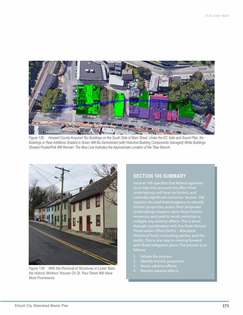
171Ellicott City Watershed Master Plan
III.8 Lower Main
SECTION 106 SUMMARYSection 106 specifies that federal agencies must take into account the effect their undertakings will have on historic and culturally significant resources. Section 106 requires the lead federal agency to identify historic properties, assess their proposed undertaking’s impacts upon those historic resources, and seek to avoid, minimize or mitigate any adverse effects. This is done through coordination with the State Historic Preservation Office (SHPO – Maryland Historical Trust), consulting parties, and the public. This is one step in moving forward with flood mitigation plans. The process is as follows:
1. Initiate the process2. Identify historic properties3. Assess adverse effects4. Resolve adverse effects
Figure 138: Howard County Acquired Ten Buildings on the South Side of Main Street. Under the EC Safe and Sound Plan, the Buildings or Rear Additions Shaded in Green Will Be Demolished (with Historical Building Components Salvaged) While Buildings Shaded Purple/Pink Will Remain. The Blue Line Indicates the Approximate Location of the Tiber Branch.
Figure 139: With the Removal of Structures in Lower Main, the Historic Workers’ Houses On St. Paul Street Will Have More Prominence
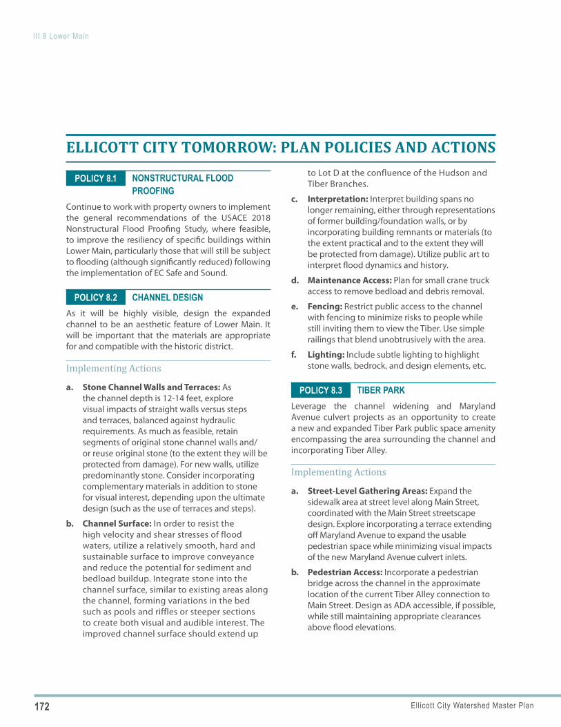
172 Ellicott City Watershed Master Plan
III.8 Lower Main
POLICY 8.1
POLICY 8.2
POLICY 8.3
ELLICOTT CITY TOMORROW: PLAN POLICIES AND ACTIONS
NONSTRUCTURAL FLOOD PROOFING
Continue to work with property owners to implement the general recommendations of the USACE 2018 Nonstructural Flood Proofing Study, where feasible, to improve the resiliency of specific buildings within Lower Main, particularly those that will still be subject to flooding (although significantly reduced) following the implementation of EC Safe and Sound.
CHANNEL DESIGNAs it will be highly visible, design the expanded channel to be an aesthetic feature of Lower Main. It will be important that the materials are appropriate for and compatible with the historic district.
Implementing Actions
a. Stone Channel Walls and Terraces: As the channel depth is 12-14 feet, explore visual impacts of straight walls versus steps and terraces, balanced against hydraulic requirements. As much as feasible, retain segments of original stone channel walls and/or reuse original stone (to the extent they will be protected from damage). For new walls, utilize predominantly stone. Consider incorporating complementary materials in addition to stone for visual interest, depending upon the ultimate design (such as the use of terraces and steps).
b. Channel Surface: In order to resist the high velocity and shear stresses of flood waters, utilize a relatively smooth, hard and sustainable surface to improve conveyance and reduce the potential for sediment and bedload buildup. Integrate stone into the channel surface, similar to existing areas along the channel, forming variations in the bed such as pools and riffles or steeper sections to create both visual and audible interest. The improved channel surface should extend up
to Lot D at the confluence of the Hudson and Tiber Branches.
c. Interpretation: Interpret building spans no longer remaining, either through representations of former building/foundation walls, or by incorporating building remnants or materials (to the extent practical and to the extent they will be protected from damage). Utilize public art to interpret flood dynamics and history.
d. Maintenance Access: Plan for small crane truck access to remove bedload and debris removal.
e. Fencing: Restrict public access to the channel with fencing to minimize risks to people while still inviting them to view the Tiber. Use simple railings that blend unobtrusively with the area.
f. Lighting: Include subtle lighting to highlight stone walls, bedrock, and design elements, etc.
TIBER PARKLeverage the channel widening and Maryland Avenue culvert projects as an opportunity to create a new and expanded Tiber Park public space amenity encompassing the area surrounding the channel and incorporating Tiber Alley.
Implementing Actions
a. Street-Level Gathering Areas: Expand the sidewalk area at street level along Main Street, coordinated with the Main Street streetscape design. Explore incorporating a terrace extending off Maryland Avenue to expand the usable pedestrian space while minimizing visual impacts of the new Maryland Avenue culvert inlets.
b. Pedestrian Access: Incorporate a pedestrian bridge across the channel in the approximate location of the current Tiber Alley connection to Main Street. Design as ADA accessible, if possible, while still maintaining appropriate clearances above flood elevations.
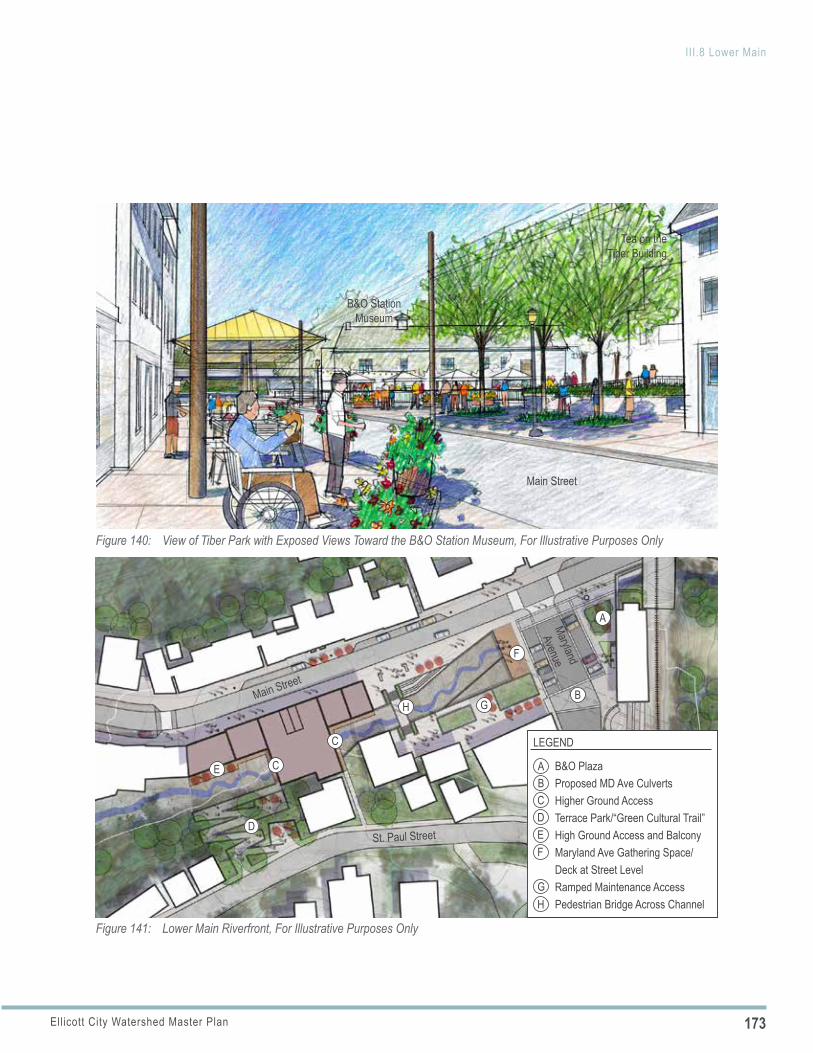
173Ellicott City Watershed Master Plan
III.8 Lower Main
Figure 140: View of Tiber Park with Exposed Views Toward the B&O Station Museum, For Illustrative Purposes Only
Tea on the Tiber Building
B&O Station Museum
Main Street
Figure 141: Lower Main Riverfront, For Illustrative Purposes Only
ABCDEF
G
LEGEND
B&O PlazaProposed MD Ave CulvertsHigher Ground AccessTerrace Park/“Green Cultural Trail”High Ground Access and Balcony Maryland Ave Gathering Space/Deck at Street LevelRamped Maintenance AccessPedestrian Bridge Across Channel
St. Paul Street
Maryland
Avenue
Main Street
A
B
C
D
E
C
F
G
H
H
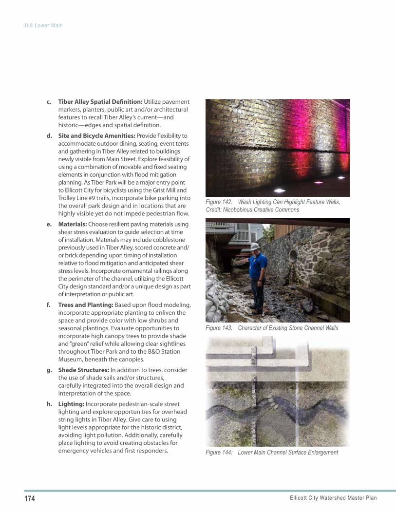
174 Ellicott City Watershed Master Plan
III.8 Lower Main
Figure 142: Wash Lighting Can Highlight Feature Walls, Credit: Nicobobinus Creative Commons
Figure 143: Character of Existing Stone Channel Walls
Figure 144: Lower Main Channel Surface Enlargement
c. Tiber Alley Spatial Definition: Utilize pavement markers, planters, public art and/or architectural features to recall Tiber Alley’s current—and historic—edges and spatial definition.
d. Site and Bicycle Amenities: Provide flexibility to accommodate outdoor dining, seating, event tents and gathering in Tiber Alley related to buildings newly visible from Main Street. Explore feasibility of using a combination of movable and fixed seating elements in conjunction with flood mitigation planning. As Tiber Park will be a major entry point to Ellicott City for bicyclists using the Grist Mill and Trolley Line #9 trails, incorporate bike parking into the overall park design and in locations that are highly visible yet do not impede pedestrian flow.
e. Materials: Choose resilient paving materials using shear stress evaluation to guide selection at time of installation. Materials may include cobblestone previously used in Tiber Alley, scored concrete and/or brick depending upon timing of installation relative to flood mitigation and anticipated shear stress levels. Incorporate ornamental railings along the perimeter of the channel, utilizing the Ellicott City design standard and/or a unique design as part of interpretation or public art.
f. Trees and Planting: Based upon flood modeling, incorporate appropriate planting to enliven the space and provide color with low shrubs and seasonal plantings. Evaluate opportunities to incorporate high canopy trees to provide shade and “green” relief while allowing clear sightlines throughout Tiber Park and to the B&O Station Museum, beneath the canopies.
g. Shade Structures: In addition to trees, consider the use of shade sails and/or structures, carefully integrated into the overall design and interpretation of the space.
h. Lighting: Incorporate pedestrian-scale street lighting and explore opportunities for overhead string lights in Tiber Alley. Give care to using light levels appropriate for the historic district, avoiding light pollution. Additionally, carefully place lighting to avoid creating obstacles for emergency vehicles and first responders.
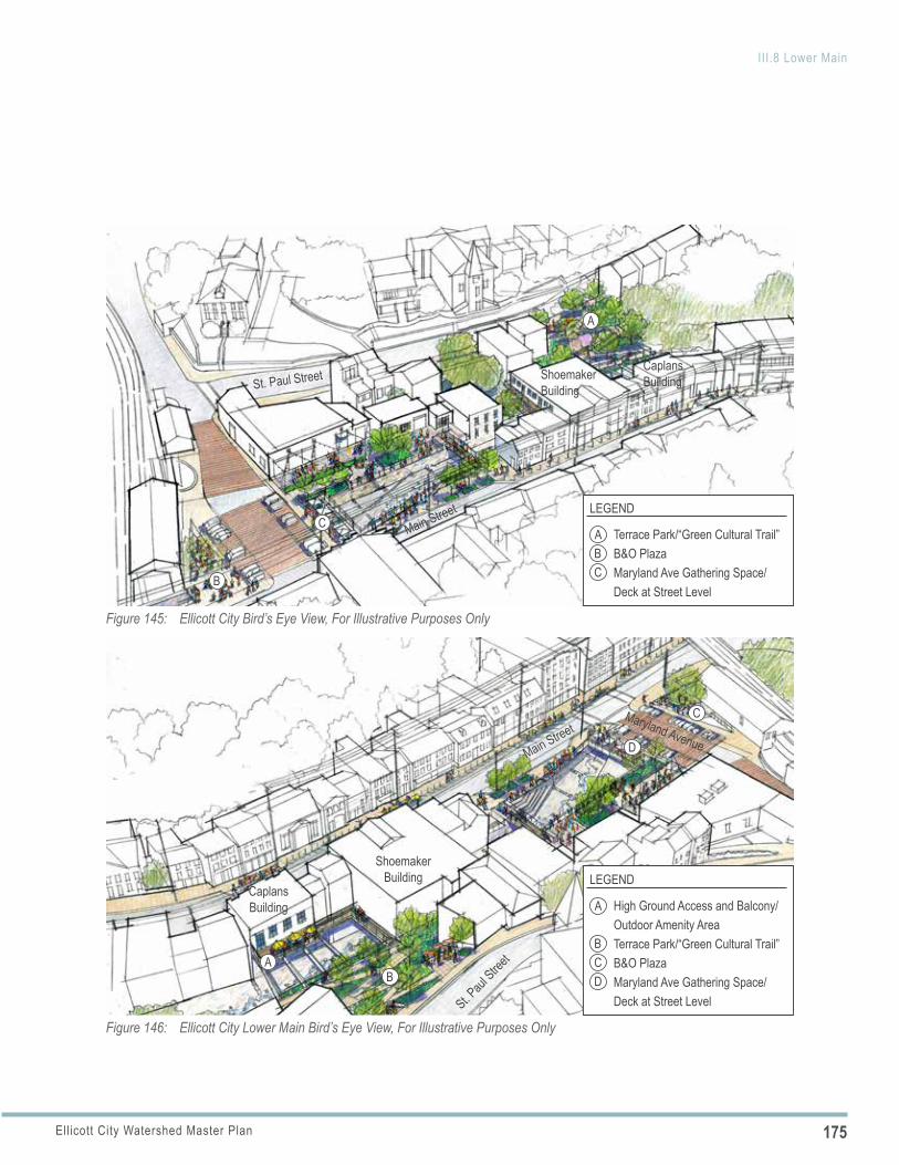
175Ellicott City Watershed Master Plan
III.8 Lower Main
Figure 145: Ellicott City Bird’s Eye View, For Illustrative Purposes Only
St. Paul Street Shoemaker Building
Caplans Building
Main Street
A
AB
B C
CLEGEND
Terrace Park/“Green Cultural Trail”B&O PlazaMaryland Ave Gathering Space/Deck at Street Level
Figure 146: Ellicott City Lower Main Bird’s Eye View, For Illustrative Purposes Only
A
BC
C
D
D
LEGEND
High Ground Access and Balcony/Outdoor Amenity AreaTerrace Park/“Green Cultural Trail”B&O PlazaMaryland Ave Gathering Space/Deck at Street Level
Maryland AvenueMain Street
St. Paul
Street
Shoemaker Building
Caplans Building
AB
176 Ellicott City Watershed Master Plan
III.8 Lower Main
Figure 147: Historic Interpretation Precedents for Lower Main Street; Recall Former Building Outlines and Site Features, Credit: Design by RIOS (Second From Top), JB Parrett / jbparrettphotography.com (Left Image, Third From Top)
Existing Rail Lines In Lot C
i. Water Features: Consider incorporating water features to highlight the presence of the Tiber Branch. Water features could provide visual and audible interest and, if appropriate, opportunities to engage and touch.
j. Environmental Site Design (ESD) Practices: Explore opportunities to incorporate small “demonstration ESD practices,” potentially in the form of a flow-through planter in the expanded Main Street sidewalk area, if feasible.
k. Interpretation: Provide interpretation of buildings slated for removal in a thoughtful manner, integrated into the overall design context. Interpretation might include signage, use of frame outline structures and/or special lighting. A frame structure representing a portion of the Phoenix outline could be effective in anchoring the street corner while providing a structural element for shade. Interpretation could also include preservation of facade segments, such as the first-floor, limestone deco facade at 8059 Main Street (Easton & Sons) and/or portions of the granite side walls of 8069 Main Street. Reestablish the flood mark levels alongside the Oliver Viaduct.
l. Archaeological Resources: As building and partial building demolition occurs, protect and preserve archaeological resources uncovered during the construction process and explore ways to incorporate them into Tiber Park as appropriate. Locate preserved building facades or elements where they will be protected from damage away from areas needed for flood water conveyance.
m. Wayfinding: Coordinate with the B&O Plaza design and incorporate wayfinding signage, especially a visitor orientation sign with visitor map, directory and high ground access points.
n. Emergency Alert System: Incorporate into the overall design visible and audible flood warning systems and high ground access signs as part of the overall emergency alert system.
177Ellicott City Watershed Master Plan
III.8 Lower Main
Figure 148: Concept Rendering of Tiber Park, For Illustrative Purposes Only, Existing View Above
178 Ellicott City Watershed Master Plan
III.8 Lower Main
Figure 149: Tiber Park and B&O Plaza, For Illustrative Purposes Only
E
AB
CDE
LEGEND
B&O PlazaMaryland Ave Gathering Space/Deck at Street LevelPedestrian Bridge Across ChannelRamped Maintenance AccessTiber Alley Spatial Definition
A
D
Main Street
Maryland Avenue
Antique Depot
C
B
POLICY 8.4 B&O PLAZA Enhance the existing B&O Plaza in conjunction with Tiber Park and Maryland Avenue upgrades to expand upon the network of usable open space in Lower Main (see Figures 145, 146, 149).
Implementing Actions
a. Clock: Restore and/or replace the clock. Though not historic, the clock has become an icon of Ellicott City’s resilience, having been recovered twice after being swept away by flood water. Place the clock where it will not be at risk of damage.
b. Materials: In coordination with the Maryland Avenue streetscape design, if on-street parking is raised to sidewalk level, incorporate bollards to demarcate the sidewalk and raised parking area. Any bollards should be designed to withstand anticipated flood depths and velocities.
c. Interpretation: Utilize public art in the pavement to highlight where the channel passes beneath the plaza and roadway and to increase awareness of Ellicott City’s close relationship to the water. Historically, the channel was open at this location (as shown in the 1887 Sanborn fire insurance map); public art can raise awareness of this heritage.
d. Site and Bicycle Amenities: Incorporate a combination of fixed and movable site furnishings, including ornamental accent lighting, movable cafe tables and chairs, and bicycle parking. Consider a bike parking facility located within high visibility of pedestrian activity within Tiber Park and the B&O plaza.
e. Wayfinding: Coordinate with the Tiber Park design and provide a wayfinding signage/visitor orientation map.
179Ellicott City Watershed Master Plan
III.8 Lower Main
Figure 150: Terraced Park and “Green Cultural Trail” Connection, For Illustrative Purposes Only
A
A
BC
LEGEND
High Ground Access Balcony/Outdoor Amenity AreaTerrace Park/“Green Cultural Trail”
Main Street
St. Paul Street
Shoemaker Building
Caplans Building
C
B
POLICY 8.5
f. Shade: Maintain the existing canopy shade trees or replace with new canopy trees that provide shade relief and an overhead plane while allowing for views of the museum beneath the canopy.
g. Façade Lighting: Coordinate the pedestrian lighting in the plaza with the façade lighting of the B&O Station Museum to avoid the excessive glare that currently exists.
h. Water Features: Consider incorporating a water feature/fountain to highlight the presence of the Tiber Branch. The water features could provide visual and audible interest and, if appropriate, opportunities to engage and touch.
COUNTY-OWNED LOWER MAIN STREET BUILDINGS
As the publicly owned Main Street properties are adapted to improve flood conveyance, enhance the functionality of the buildings and their appearance.
Implementing Actions
a. High Ground Access: Incorporate an accessway along the rear façades of the buildings above flood elevation to connect multiple upper floors. Provide for a publicly accessible elevator and stair in one of the altered buildings for daily and emergency access from Main Street via the upper floor shared accessway.
b. Pedestrian Bridge: Incorporate a pedestrian bridge, as part of a cohesive pedestrian network, across the Tiber Branch to connect the rear façade accessway with the terraced St. Paul Street access described below.
c. Amenity Spaces: Construct balconies along upper floors to serve a dual function: provide emergency access and support future businesses with outdoor amenity areas overlooking the Tiber.
d. Interpretation: Where feasible, retain building elements to recall that buildings once spanned the channel, such as the existing steel beams
180 Ellicott City Watershed Master Plan
III.8 Lower Main
POLICY 8.6
POLICY 8.7
POLICY 8.8
and support wall associated with the portion of Caplans/8125 Main St that currently spans the channel.
e. Rear and Side Façades: Improve rear (south) and side facades that will be visible when additions over the channel and other buildings are removed, including the upper floor east façade of the Shoemaker Building/8101 Main Street which will be highly visible. Care should be given to avoid creating a false sense of historical development. The newly visible side and rear facades should read as side and rear facades.
f. Lighting: Consider subtle accent lighting to highlight unique architectural features in the rear, such as the steel beams that may remain crossing the channel behind Caplans/8125 Main Street.
ACCESS TO ST. PAUL STREETAs an addition to the existing EC Safe and Sound high ground access points, incorporate pedestrian access to St. Paul Street from Main Street.
Implementing Actions
a. High Ground Access: Connect to the pedestrian bridge and rear façade accessways described above and incorporate high-ground access signage and directional arrows.
ST. PAUL PLACEMAKINGCreate a new public space on county-owned land along St. Paul Street.
Implementing Actions
a. Terraced Park: Develop and brand a new hillside park space on the County-owned land along St. Paul Street. Incorporate ramps, stairs, decks and landscaped terraces as a cohesive amenity and part of the “green cultural trail” network.
b. Interpretation: Within the terraced park, consider opportunities for heritage interpretation regarding the former mill race that started on the New Cut and once fed the mills of Lower Main.
c. Lighting: Utilize downlighting for pedestrian safety and to highlight specific design features.
d. Wayfinding: Incorporate wayfinding signage and a visitor directory at St. Paul Street, connecting visitors to Main Street and any future trail connections as they are added.
LOT CMaintain Lot C as a surface parking lot that continues to serve Lower Main.
Implementing Actions
a. Interpretation: Capitalize upon the visibility and proximity of the existing railroad tracks and the rails that cross some parking spaces as an interpretive opportunity to reinforce the railroad history of the community.
b. Parking Management: Allow for the incorporation of dynamic parking information system technologies as part of the overall Ellicott City parking strategy and consider long-term opportunities for autonomous vehicle parking.
c. Solid Waste Management: Explore locations in Lot C for a consolidated and flood resilient waste management system (trash and recycling)to serve Lower Main businesses, particularly any new restaurant uses that may locate along Tiber Alley following the implementation of EC Safe and Sound. To screen the system, select a location where it will be least visible from Lower Main and design an enclosure that is compatible with the character of the historic district and B&O Station Museum complex. Seek to minimize loss of parking spaces in Lot C.
d. Patapsco Heritage Greenway Trailhead: Consider the potential to incorporate a trailhead for a secondary alignment of a future trail on the west side of the Patapsco River. This trail, if realized, would extend between Ellicott City and Ilchester as part of the Patapsco Heritage Greenway.
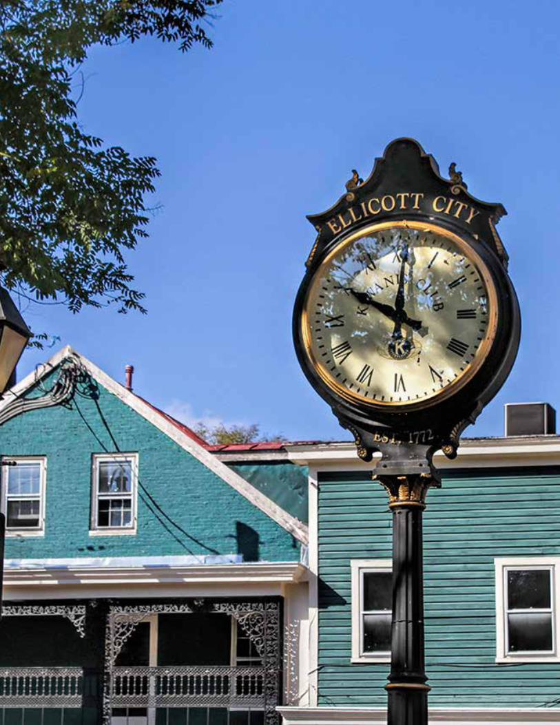
181Ellicott City Watershed Master Plan
III.8 Lower Main
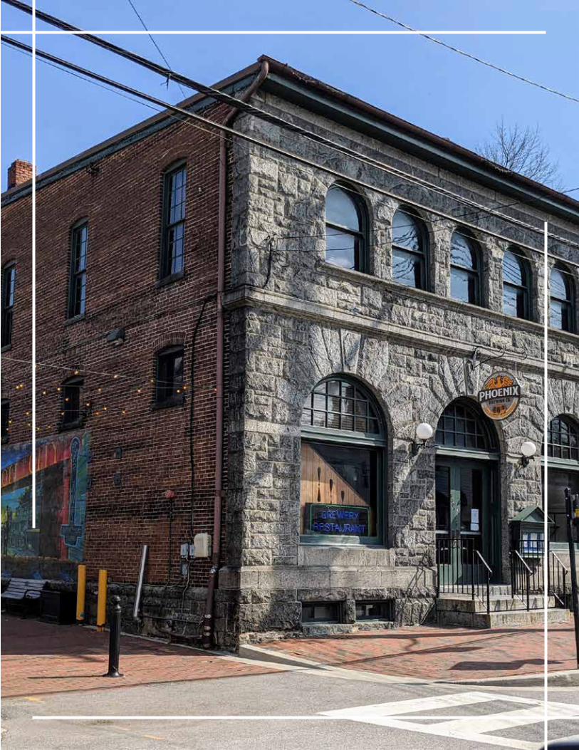
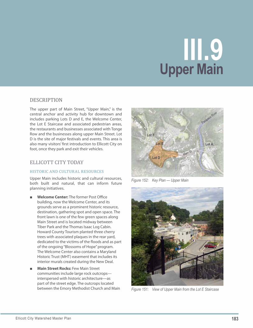
183Ellicott City Watershed Master Plan
Figure 151: View of Upper Main from the Lot E Staircase
Figure 152: Key Plan — Upper Main
Lot F
Lot E
Main St
Lot D
Lot A
Patapsco River
Ellicott Mills Dr
DESCRIPTIONThe upper part of Main Street, “Upper Main,” is the central anchor and activity hub for downtown and includes parking Lots D and E, the Welcome Center, the Lot E Staircase and associated pedestrian areas, the restaurants and businesses associated with Tonge Row and the businesses along upper Main Street. Lot D is the site of major festivals and events. This area is also many visitors’ first introduction to Ellicott City on foot, once they park and exit their vehicles.
ELLICOTT CITY TODAYHISTORIC AND CULTURAL RESOURCESUpper Main includes historic and cultural resources, both built and natural, that can inform future planning initiatives.
■ Welcome Center: The former Post Office building, now the Welcome Center, and its grounds serve as a prominent historic resource, destination, gathering spot and open space. The front lawn is one of the few green spaces along Main Street and is located midway between Tiber Park and the Thomas Isaac Log Cabin. Howard County Tourism planted three cherry trees with associated plaques in the rear yard, dedicated to the victims of the floods and as part of the ongoing “Blossoms of Hope” program. The Welcome Center also contains a Maryland Historic Trust (MHT) easement that includes its interior murals created during the New Deal.
■ Main Street Rocks: Few Main Street communities include large rock outcrops—interspersed with historic architecture—as part of the street edge. The outcrops located between the Emory Methodist Church and Main
Upper MainIII.9
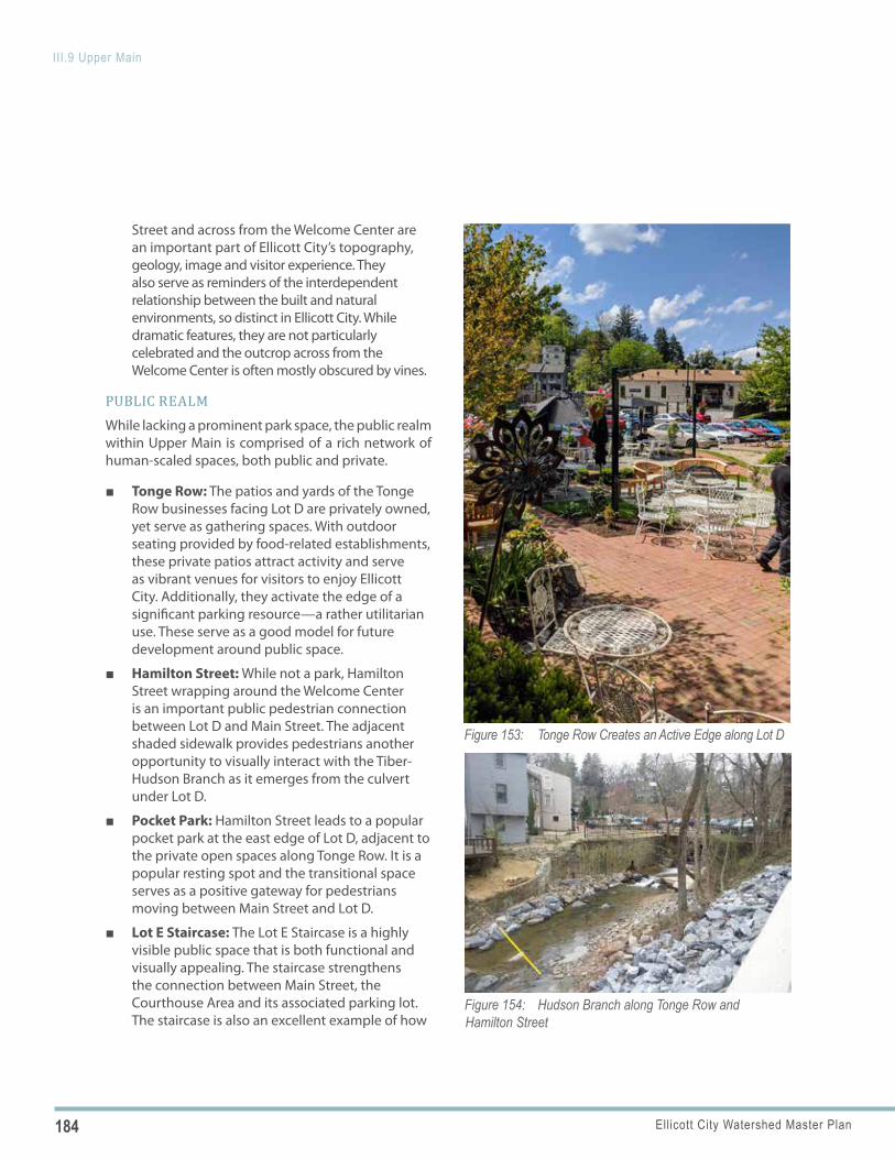
184 Ellicott City Watershed Master Plan
III.9 Upper Main
Figure 153: Tonge Row Creates an Active Edge along Lot D
Figure 154: Hudson Branch along Tonge Row and Hamilton Street
Street and across from the Welcome Center are an important part of Ellicott City’s topography, geology, image and visitor experience. They also serve as reminders of the interdependent relationship between the built and natural environments, so distinct in Ellicott City. While dramatic features, they are not particularly celebrated and the outcrop across from the Welcome Center is often mostly obscured by vines.
PUBLIC REALMWhile lacking a prominent park space, the public realm within Upper Main is comprised of a rich network of human-scaled spaces, both public and private.
■ Tonge Row: The patios and yards of the Tonge Row businesses facing Lot D are privately owned, yet serve as gathering spaces. With outdoor seating provided by food-related establishments, these private patios attract activity and serve as vibrant venues for visitors to enjoy Ellicott City. Additionally, they activate the edge of a significant parking resource—a rather utilitarian use. These serve as a good model for future development around public space.
■ Hamilton Street: While not a park, Hamilton Street wrapping around the Welcome Center is an important public pedestrian connection between Lot D and Main Street. The adjacent shaded sidewalk provides pedestrians another opportunity to visually interact with the Tiber-Hudson Branch as it emerges from the culvert under Lot D.
■ Pocket Park: Hamilton Street leads to a popular pocket park at the east edge of Lot D, adjacent to the private open spaces along Tonge Row. It is a popular resting spot and the transitional space serves as a positive gateway for pedestrians moving between Main Street and Lot D.
■ Lot E Staircase: The Lot E Staircase is a highly visible public space that is both functional and visually appealing. The staircase strengthens the connection between Main Street, the Courthouse Area and its associated parking lot. The staircase is also an excellent example of how
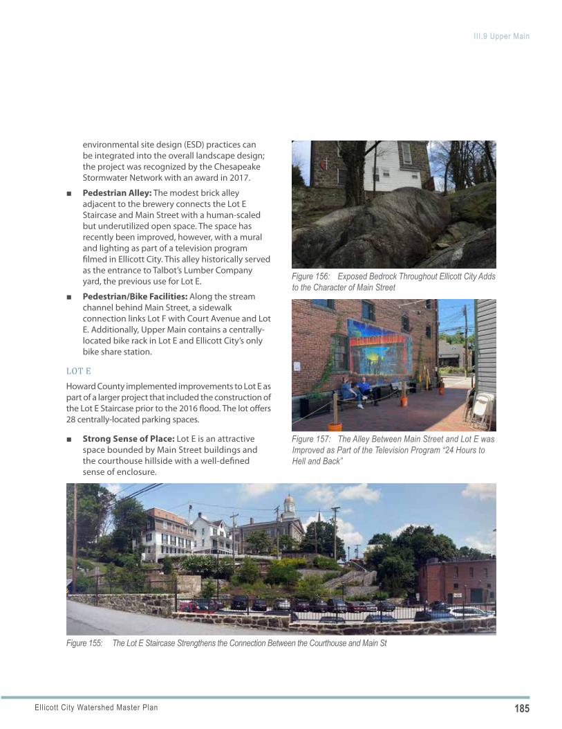
185Ellicott City Watershed Master Plan
III.9 Upper Main
Figure 155: The Lot E Staircase Strengthens the Connection Between the Courthouse and Main St
Figure 156: Exposed Bedrock Throughout Ellicott City Adds to the Character of Main Street
Figure 157: The Alley Between Main Street and Lot E was Improved as Part of the Television Program “24 Hours to Hell and Back”
environmental site design (ESD) practices can be integrated into the overall landscape design; the project was recognized by the Chesapeake Stormwater Network with an award in 2017.
■ Pedestrian Alley: The modest brick alley adjacent to the brewery connects the Lot E Staircase and Main Street with a human-scaled but underutilized open space. The space has recently been improved, however, with a mural and lighting as part of a television program filmed in Ellicott City. This alley historically served as the entrance to Talbot’s Lumber Company yard, the previous use for Lot E.
■ Pedestrian/Bike Facilities: Along the stream channel behind Main Street, a sidewalk connection links Lot F with Court Avenue and Lot E. Additionally, Upper Main contains a centrally-located bike rack in Lot E and Ellicott City’s only bike share station.
LOT EHoward County implemented improvements to Lot E as part of a larger project that included the construction of the Lot E Staircase prior to the 2016 flood. The lot offers 28 centrally-located parking spaces.
■ Strong Sense of Place: Lot E is an attractive space bounded by Main Street buildings and the courthouse hillside with a well-defined sense of enclosure.
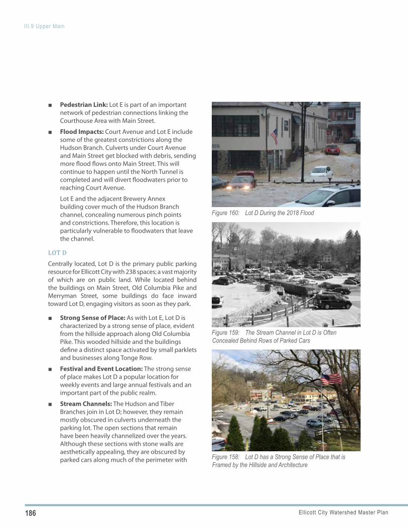
186 Ellicott City Watershed Master Plan
III.9 Upper Main
Figure 158: Lot D has a Strong Sense of Place that is Framed by the Hillside and Architecture
Figure 159: The Stream Channel in Lot D is Often Concealed Behind Rows of Parked Cars
Figure 160: Lot D During the 2018 Flood
■ Pedestrian Link: Lot E is part of an important network of pedestrian connections linking the Courthouse Area with Main Street.
■ Flood Impacts: Court Avenue and Lot E include some of the greatest constrictions along the Hudson Branch. Culverts under Court Avenue and Main Street get blocked with debris, sending more flood flows onto Main Street. This will continue to happen until the North Tunnel is completed and will divert floodwaters prior to reaching Court Avenue.
Lot E and the adjacent Brewery Annex building cover much of the Hudson Branch channel, concealing numerous pinch points and constrictions. Therefore, this location is particularly vulnerable to floodwaters that leave the channel.
LOT DCentrally located, Lot D is the primary public parking resource for Ellicott City with 238 spaces; a vast majority of which are on public land. While located behind the buildings on Main Street, Old Columbia Pike and Merryman Street, some buildings do face inward toward Lot D, engaging visitors as soon as they park.
■ Strong Sense of Place: As with Lot E, Lot D is characterized by a strong sense of place, evident from the hillside approach along Old Columbia Pike. This wooded hillside and the buildings define a distinct space activated by small parklets and businesses along Tonge Row.
■ Festival and Event Location: The strong sense of place makes Lot D a popular location for weekly events and large annual festivals and an important part of the public realm.
■ Stream Channels: The Hudson and Tiber Branches join in Lot D; however, they remain mostly obscured in culverts underneath the parking lot. The open sections that remain have been heavily channelized over the years. Although these sections with stone walls are aesthetically appealing, they are obscured by parked cars along much of the perimeter with
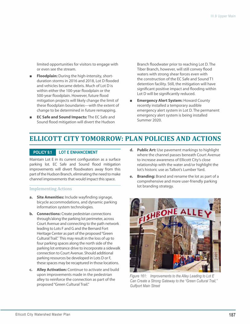
187Ellicott City Watershed Master Plan
III.9 Upper Main
Figure 161: Improvements to the Alley Leading to Lot E Can Create a Strong Gateway to the “Green Cultural Trail,” Gulfport Main Street
POLICY 9.1
limited opportunities for visitors to engage with or even see the stream.
■ Floodplain: During the high-intensity, short-duration storms in 2016 and 2018, Lot D flooded and vehicles became debris. Much of Lot D is within either the 100-year floodplain or the 500-year floodplain. However, future flood mitigation projects will likely change the limit of these floodplain boundaries—with the extent of change to be determined in future remapping.
■ EC Safe and Sound Impacts: The EC Safe and Sound flood mitigation will divert the Hudson
Branch floodwater prior to reaching Lot D. The Tiber Branch, however, will still convey flood waters with strong shear forces even with the construction of the EC Safe and Sound T1 detention facility. Still, the mitigation will have significant positive impact and flooding within Lot D will be significantly reduced.
■ Emergency Alert System: Howard County recently installed a temporary audible emergency alert system in Lot D. The permanent emergency alert system is being installed Summer 2020.
ELLICOTT CITY TOMORROW: PLAN POLICIES AND ACTIONS
LOT E ENHANCEMENTMaintain Lot E in its current configuration as a surface parking lot. EC Safe and Sound flood mitigation improvements will divert floodwaters away from this part of the Hudson Branch, eliminating the need to make channel improvements that would impact this space.
Implementing Actions
a. Site Amenities: Include wayfinding signage, bicycle accommodations, and dynamic parking information system technologies.
b. Connections: Create pedestrian connections through/along the parking lot perimeter, across Court Avenue and connecting to the path network leading to Lots F and G and the Bernard Fort Heritage Center as part of the proposed “Green Cultural Trail.” This may result in the loss of up to four parking spaces along the north side of the parking lot entrance drive to incorporate a sidewalk connection to Court Avenue. Should additional parking resources be developed in Lots D or F, these spaces may be recaptured in those locations.
c. Alley Activation: Continue to activate and build upon improvements made in the pedestrian alley to reinforce the connection as part of the proposed “Green Cultural Trail.”
d. Public Art: Use pavement markings to highlight where the channel passes beneath Court Avenue to increase awareness of Ellicott City’s close relationship with the water and/or highlight the lot’s historic use as Talbot’s Lumber Yard.
e. Branding: Brand and rename the lot as part of a comprehensive and more user-friendly parking lot branding strategy.
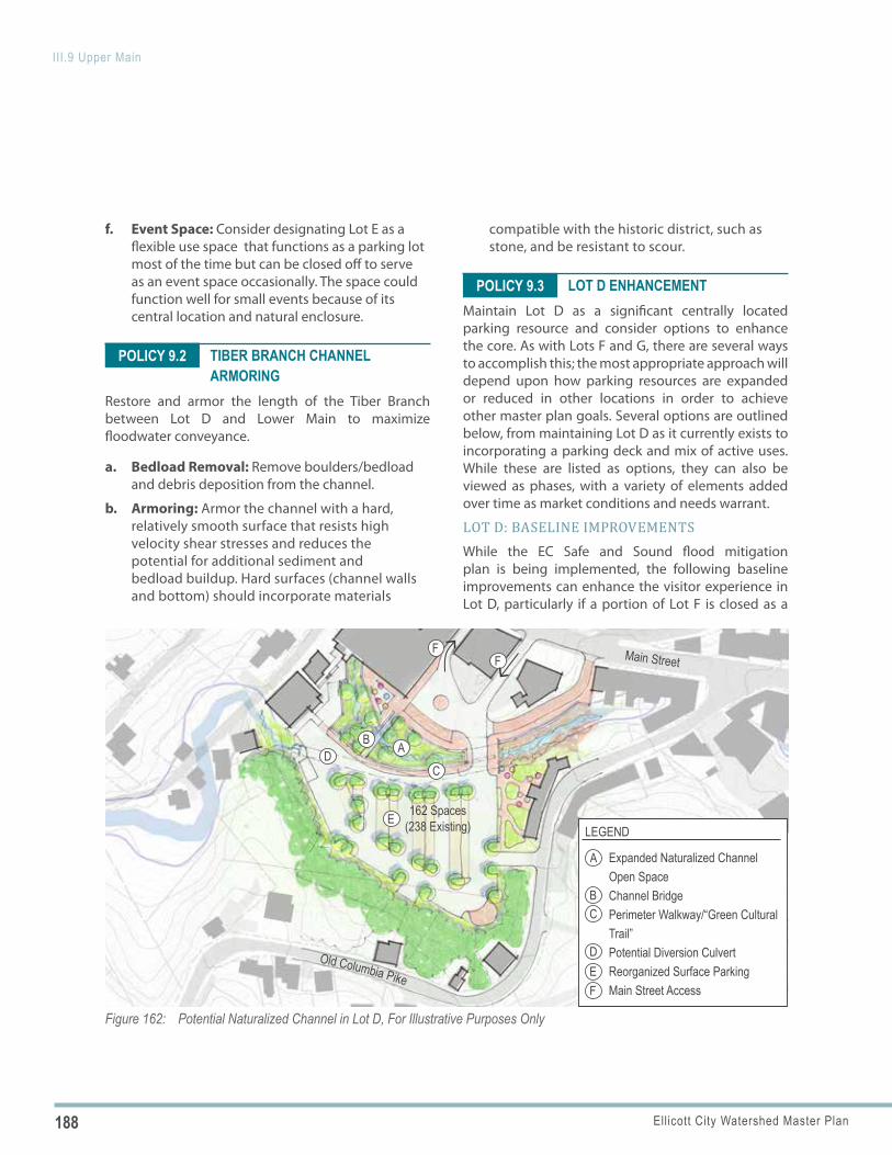
188 Ellicott City Watershed Master Plan
III.9 Upper Main
Figure 162: Potential Naturalized Channel in Lot D, For Illustrative Purposes Only
Main Street
Old Columbia Pike
AB
CD
FF
A
BC
DEF
LEGEND
Expanded Naturalized Channel Open SpaceChannel BridgePerimeter Walkway/“Green Cultural Trail”Potential Diversion CulvertReorganized Surface ParkingMain Street Access
E 162 Spaces (238 Existing)
POLICY 9.2
POLICY 9.3
f. Event Space: Consider designating Lot E as a flexible use space that functions as a parking lot most of the time but can be closed off to serve as an event space occasionally. The space could function well for small events because of its central location and natural enclosure.
TIBER BRANCH CHANNEL ARMORING
Restore and armor the length of the Tiber Branch between Lot D and Lower Main to maximize floodwater conveyance.
a. Bedload Removal: Remove boulders/bedload and debris deposition from the channel.
b. Armoring: Armor the channel with a hard, relatively smooth surface that resists high velocity shear stresses and reduces the potential for additional sediment and bedload buildup. Hard surfaces (channel walls and bottom) should incorporate materials
compatible with the historic district, such as stone, and be resistant to scour.
LOT D ENHANCEMENTMaintain Lot D as a significant centrally located parking resource and consider options to enhance the core. As with Lots F and G, there are several ways to accomplish this; the most appropriate approach will depend upon how parking resources are expanded or reduced in other locations in order to achieve other master plan goals. Several options are outlined below, from maintaining Lot D as it currently exists to incorporating a parking deck and mix of active uses. While these are listed as options, they can also be viewed as phases, with a variety of elements added over time as market conditions and needs warrant.
LOT D: BASELINE IMPROVEMENTSWhile the EC Safe and Sound flood mitigation plan is being implemented, the following baseline improvements can enhance the visitor experience in Lot D, particularly if a portion of Lot F is closed as a
189Ellicott City Watershed Master Plan
III.9 Upper Main
staging area for the tunnel construction. These can be implemented in the short-term and remain relevant in the long-term regardless of the option pursued.
Implementing Actions (All Options)
a. Floodplain Remapping: Initiate conversations with FEMA and the State to remap the 100-year regulatory floodplain to determine new boundaries following the implementation of the EC Safe and Sound North Tunnel.
b. Tiber Branch Evaluation: Evaluate the potential for a diversion culvert under Lot D that redirects flows, including flood flows, from Tiber Branch to downstream of Lot D. Evaluate the size and alignment of a culvert for the feasibility of the following potential benefits and opportunities: 1) the length of Hudson Branch through Lot D that can be restored to a more natural condition in place of hard armoring; 2) the reduction of frequency and magnitude of flooding in Lot D and adjacent areas; and 3) the increase in the level of public interaction that might be possible with new channel improvements and the creation of associated green space.
c. Coordinated Site Planning: When considering any changes to Lot D, work with adjacent businesses and property owners to create a coordinated site plan for Lot D and surrounding properties. The goal should be to best integrate access, parking resources, open space amenities and potential new uses into a cohesive district that is sensitive to and integrates with the surrounding context.
d. Site Amenities: Include wayfinding signage, bicycle accommodations, dynamic parking information system technologies, and solid waste management.
e. Event Accommodation: Plan for the continued accommodation of events within Lot D and around any amenity spaces created around the channel.
f. Main Street Access: Explore a redesign of the Lot D access from Main Street via a reorganized Forrest Street/Hamilton Street “loop,” using
Forrest Street and a new street between the Welcome Center and the building to the west, allowing Hamilton Street to become pedestrian space/emergency access only. Continue to utilize Forrest Street as the egress, however, confirm sight distances to determine the most appropriate directional flow.
g. Branding: Brand and rename the lot as part of a comprehensive and more user-friendly parking lot branding strategy.
LOT D: OPTION 1—NATURALIZED CHANNELOnce EC Safe and Sound flood mitigation is in place, and if additional parking resources are developed in other lots, widen the Hudson Branch and restore it as a naturalized channel and open space amenity.
Implementing Actions
a. Pedestrian Access: When considering future improvements, evaluate whether to allow pedestrian access within the channel.
b. Interpretive Amenity: While this represents only a limited section of stream channel and would offer limited ecological benefits, it could serve as an interpretive amenity in addition to serving as a functional open space and focal point that prominently showcases the stream as it meanders through the core.
c. Reorganized Surface Parking: Reorganize the surface parking to allow for a widened channel and amenity space (resulting in approximately 162 parking spaces alongside a new amenity).
d. Diversion Culvert: If the Tiber Branch Evaluation described above shows promising results, design and construct a diversion culvert for the Tiber Branch with an outfall into the Hudson Branch at the eastern end of Lot D. This will redirect floodwaters to the Hudson Branch just downstream of Lot D and allow for the maximum length of naturalized channel.
e. Naturalized Channel: Create a naturalized channel with an expanded channel bed and appropriate vegetation, including canopy trees
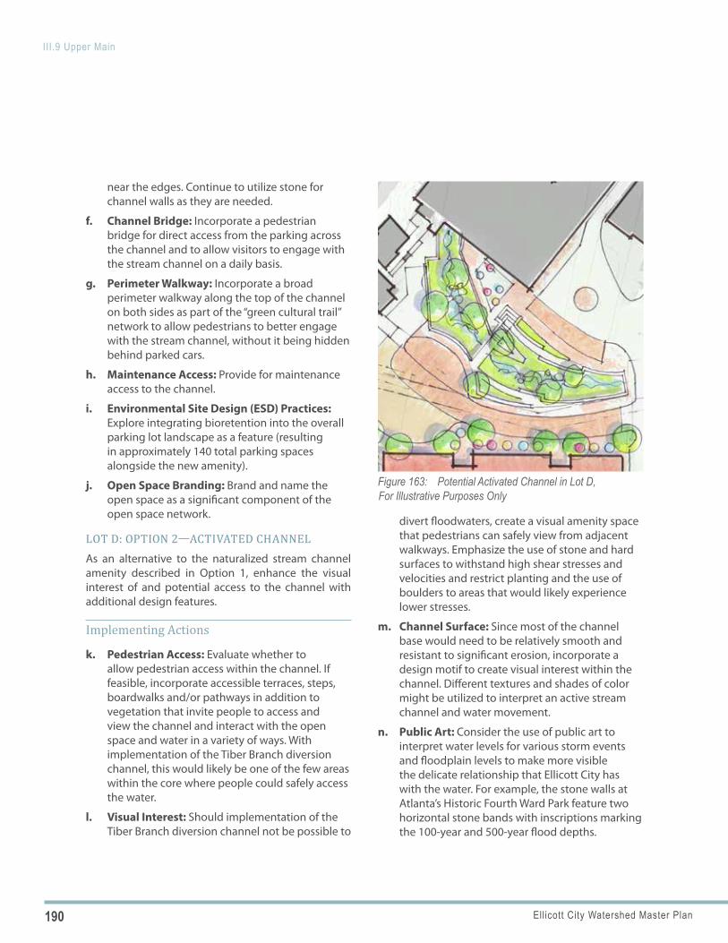
190 Ellicott City Watershed Master Plan
III.9 Upper Main
Figure 163: Potential Activated Channel in Lot D, For Illustrative Purposes Only
near the edges. Continue to utilize stone for channel walls as they are needed.
f. Channel Bridge: Incorporate a pedestrian bridge for direct access from the parking across the channel and to allow visitors to engage with the stream channel on a daily basis.
g. Perimeter Walkway: Incorporate a broad perimeter walkway along the top of the channel on both sides as part of the “green cultural trail” network to allow pedestrians to better engage with the stream channel, without it being hidden behind parked cars.
h. Maintenance Access: Provide for maintenance access to the channel.
i. Environmental Site Design (ESD) Practices: Explore integrating bioretention into the overall parking lot landscape as a feature (resulting in approximately 140 total parking spaces alongside the new amenity).
j. Open Space Branding: Brand and name the open space as a significant component of the open space network.
LOT D: OPTION 2—ACTIVATED CHANNELAs an alternative to the naturalized stream channel amenity described in Option 1, enhance the visual interest of and potential access to the channel with additional design features.
Implementing Actions
k. Pedestrian Access: Evaluate whether to allow pedestrian access within the channel. If feasible, incorporate accessible terraces, steps, boardwalks and/or pathways in addition to vegetation that invite people to access and view the channel and interact with the open space and water in a variety of ways. With implementation of the Tiber Branch diversion channel, this would likely be one of the few areas within the core where people could safely access the water.
l. Visual Interest: Should implementation of the Tiber Branch diversion channel not be possible to
divert floodwaters, create a visual amenity space that pedestrians can safely view from adjacent walkways. Emphasize the use of stone and hard surfaces to withstand high shear stresses and velocities and restrict planting and the use of boulders to areas that would likely experience lower stresses.
m. Channel Surface: Since most of the channel base would need to be relatively smooth and resistant to significant erosion, incorporate a design motif to create visual interest within the channel. Different textures and shades of color might be utilized to interpret an active stream channel and water movement.
n. Public Art: Consider the use of public art to interpret water levels for various storm events and floodplain levels to make more visible the delicate relationship that Ellicott City has with the water. For example, the stone walls at Atlanta’s Historic Fourth Ward Park feature two horizontal stone bands with inscriptions marking the 100-year and 500-year flood depths.
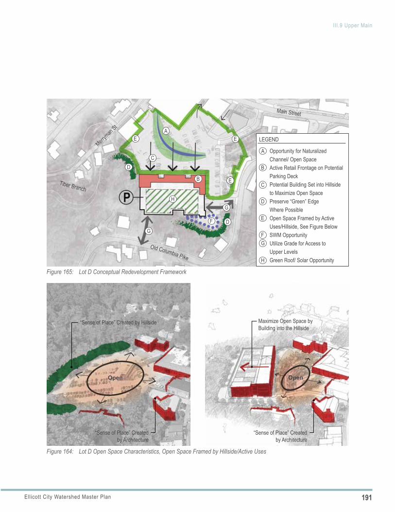
191Ellicott City Watershed Master Plan
III.9 Upper Main
Figure 164: Lot D Open Space Characteristics, Open Space Framed by Hillside/Active Uses
Maximize Open Space by Building into the Hillside
“Sense of Place” Created by Architecture
Open
“Sense of Place” Created by Hillside
“Sense of Place” Created by Architecture
Open
Figure 165: Lot D Conceptual Redevelopment Framework
Main Street
Merrym
an St
Tiber Branch
Old Columbia Pike
A
B
F
F
C
G
G
G
D
H
H
E
E
D
D
E E LEGEND
Opportunity for Naturalized Channel/ Open SpaceActive Retail Frontage on Potential Parking DeckPotential Building Set into Hillside to Maximize Open SpacePreserve “Green” Edge Where PossibleOpen Space Framed by Active Uses/Hillside, See Figure BelowSWM OpportunityUtilize Grade for Access to Upper LevelsGreen Roof/ Solar Opportunity
A
B
C
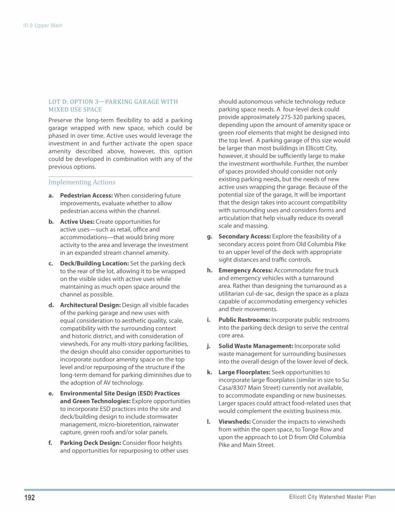
192 Ellicott City Watershed Master Plan
III.9 Upper Main
LOT D: OPTION 3—PARKING GARAGE WITH MIXED USE SPACEPreserve the long-term flexibility to add a parking garage wrapped with new space, which could be phased in over time. Active uses would leverage the investment in and further activate the open space amenity described above, however, this option could be developed in combination with any of the previous options.
Implementing Actions
a. Pedestrian Access: When considering future improvements, evaluate whether to allow pedestrian access within the channel.
b. Active Uses: Create opportunities for active uses—such as retail, office and accommodations—that would bring more activity to the area and leverage the investment in an expanded stream channel amenity.
c. Deck/Building Location: Set the parking deck to the rear of the lot, allowing it to be wrapped on the visible sides with active uses while maintaining as much open space around the channel as possible.
d. Architectural Design: Design all visible facades of the parking garage and new uses with equal consideration to aesthetic quality, scale, compatibility with the surrounding context and historic district, and with consideration of viewsheds. For any multi-story parking facilities, the design should also consider opportunities to incorporate outdoor amenity space on the top level and/or repurposing of the structure if the long-term demand for parking diminishes due to the adoption of AV technology.
e. Environmental Site Design (ESD) Practices and Green Technologies: Explore opportunities to incorporate ESD practices into the site and deck/building design to include stormwater management, micro-bioretention, rainwater capture, green roofs and/or solar panels.
f. Parking Deck Design: Consider floor heights and opportunities for repurposing to other uses
should autonomous vehicle technology reduce parking space needs. A four-level deck could provide approximately 275-320 parking spaces, depending upon the amount of amenity space or green roof elements that might be designed into the top level. A parking garage of this size would be larger than most buildings in Ellicott City, however, it should be sufficiently large to make the investment worthwhile. Further, the number of spaces provided should consider not only existing parking needs, but the needs of new active uses wrapping the garage. Because of the potential size of the garage, It will be important that the design takes into account compatibility with surrounding uses and considers forms and articulation that help visually reduce its overall scale and massing.
g. Secondary Access: Explore the feasibility of a secondary access point from Old Columbia Pike to an upper level of the deck with appropriate sight distances and traffic controls.
h. Emergency Access: Accommodate fire truck and emergency vehicles with a turnaround area. Rather than designing the turnaround as a utilitarian cul-de-sac, design the space as a plaza capable of accommodating emergency vehicles and their movements.
i. Public Restrooms: Incorporate public restrooms into the parking deck design to serve the central core area.
j. Solid Waste Management: Incorporate solid waste management for surrounding businesses into the overall design of the lower level of deck.
k. Large Floorplates: Seek opportunities to incorporate large floorplates (similar in size to Su Casa/8307 Main Street) currently not available, to accommodate expanding or new businesses. Larger spaces could attract food-related uses that would complement the existing business mix.
l. Viewsheds: Consider the impacts to viewsheds from within the open space, to Tonge Row and upon the approach to Lot D from Old Columbia Pike and Main Street.
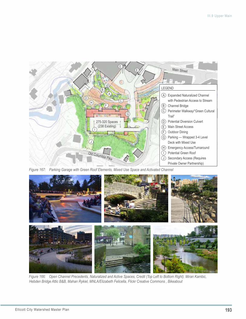
193Ellicott City Watershed Master Plan
III.9 Upper Main
Figure 166: Open Channel Precedents, Naturalized and Active Spaces, Credit (Top Left to Bottom Right): Miran Kambic, Hebden Bridge Attic B&B, Mahan Rykiel, MNLA/Elizabeth Felicella, Flickr Creative Commons , Bikeabout
Figure 167: Parking Garage with Green Roof Elements, Mixed Use Space and Activated Channel
275-320 Spaces (238 Existing)
Main Street
Old Columbia Pike
AB
CD
EE
F
G
H
A
BC
D
LEGEND
Expanded Naturalized Channel with Pedestrian Access to StreamChannel BridgePerimeter Walkway/“Green Cultural Trail”Potential Diversion CulvertMain Street AccessOutdoor DiningParking — Wrapped 3-4 Level Deck with Mixed UseEmergency Access/TurnaroundPotential Green RoofSecondary Access (Requires Private Owner Partnership)
EFG
HIJ
J
I
194 Ellicott City Watershed Master Plan
III.9 Upper Main
FORMER POST OFFICE BUILDING REUSEShould the Howard County Welcome Center ever relocate to another space in the core, consider reuse with a signature use to add to the commercial business mix. Uses might include a destination restaurant or attraction use and consider the following:
a. Accessibility: Explore redesign of the ADA accessible entrance and parking to make more functional with the new building use and to allow for the redesigned Lot D ingress street.
b. Outdoor Uses: Incorporate usable open space as part of the site use, including use of Hamilton Street for outdoor gallery or dining space (if closed to allow for redesign of the Lot D ingress and egress, described below).
c. Screening: Screen and enclose service areas and integrate into overall site and architectural design. POLICY 9.4
m. Relationship with Tonge Row: Respect the spatial relationship with Tonge Row, its businesses and amenity spaces, and the corner store facing onto the lot (3774 Old Columbia Pike). Use street, pedestrian and architectural edges to respond to and enhance this active edge. Avoid the creation of new structures whose height would put Tonge Row in a constant shadow or obscure the view to the historic buildings.
n. Outdoor Dining: Plan for outdoor dining to complement Tonge Row and leverage the open space investment.
o. Event Accommodation: Consider how the area could continue to serve as an event venue; existing and new events should take advantage of the enhanced stream channel, open space and additional businesses. Consider how events might utilize both outdoor space and the lower (or upper) level of the deck.
p. Branding: Brand and name the entire area with careful attention to authenticity to Ellicott City.
FORMER POST OFFICE SIGNATURE USE (CURRENT WELCOME CENTER)
Consider enhancements to the former Post Office grounds to improve the functionality and aesthetics of this Main Street open space.
Implementing Actions
a. Tree Canopy: Consider one to two specimen upright canopy trees (not small ornamental trees) in the front setback area as this is one of the few areas along Main Street where canopy trees can be located and make a positive impact in terms of adding tree canopy along Main Street and shade for small gatherings that occur in the space. Consider species and locations as they relate to overhead utilities, tree forms that frame—rather than block—views to the building and potential root impacts to building foundation.
b. Lot D Ingress: Redesign the parking area to accommodate the Lot D ingress street in place of Hamilton Street as described above. If necessary, ensure that the memorial cherry trees are relocated or replaced to accommodate this change.
c. Bike Facilities: Consider installing bike racks in this location to accommodate bicyclists visiting Upper Main.
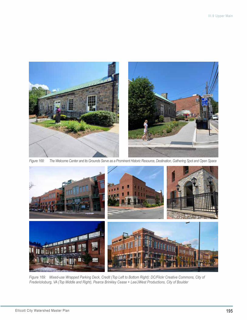
195Ellicott City Watershed Master Plan
III.9 Upper Main
Figure 169: Mixed-use Wrapped Parking Deck, Credit (Top Left to Bottom Right): DC/Flickr Creative Commons, City of Fredericksburg, VA (Top Middle and Right), Pearce Brinkley Cease + Lee/JWest Productions, City of Boulder
Figure 168: The Welcome Center and its Grounds Serve as a Prominent Historic Resource, Destination, Gathering Spot and Open Space
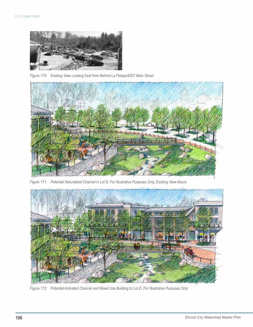
196 Ellicott City Watershed Master Plan
III.9 Upper Main
Figure 170: Existing View Looking East from Behind La Palapa/8307 Main Street
Figure 171: Potential Naturalized Channel in Lot D, For Illustrative Purposes Only, Existing View Above
Figure 172: Potential Activated Channel and Mixed Use Building In Lot D, For Illustrative Purposes Only
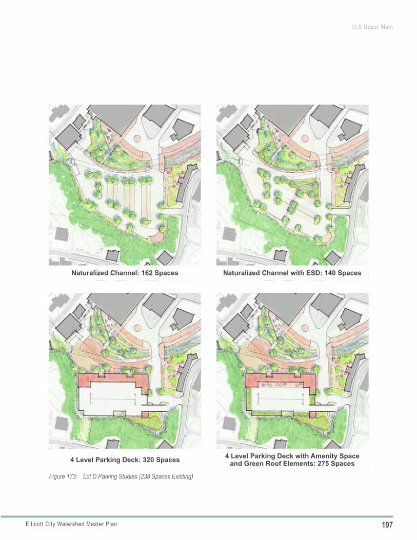
197Ellicott City Watershed Master Plan
III.9 Upper Main
Naturalized Channel: 162 Spaces Naturalized Channel with ESD: 140 Spaces
Figure 173: Lot D Parking Studies (238 Spaces Existing)
4 Level Parking Deck: 320 Spaces 4 Level Parking Deck with Amenity Space and Green Roof Elements: 275 Spaces
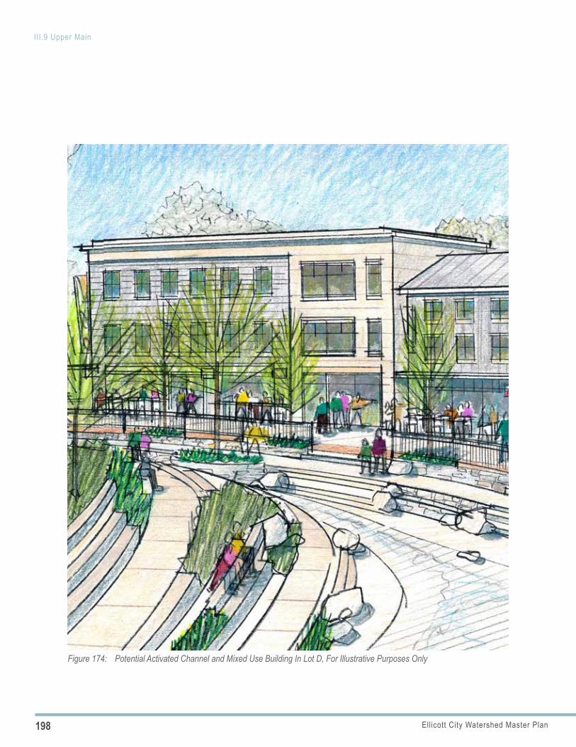
198 Ellicott City Watershed Master Plan
III.9 Upper Main
Figure 174: Potential Activated Channel and Mixed Use Building In Lot D, For Illustrative Purposes Only
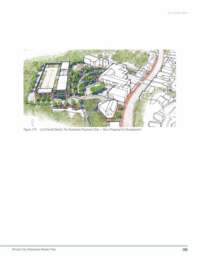
199Ellicott City Watershed Master Plan
III.9 Upper Main
Figure 175: Lot D Aerial Sketch, For Illustrative Purposes Only — Not a Proposal for Development
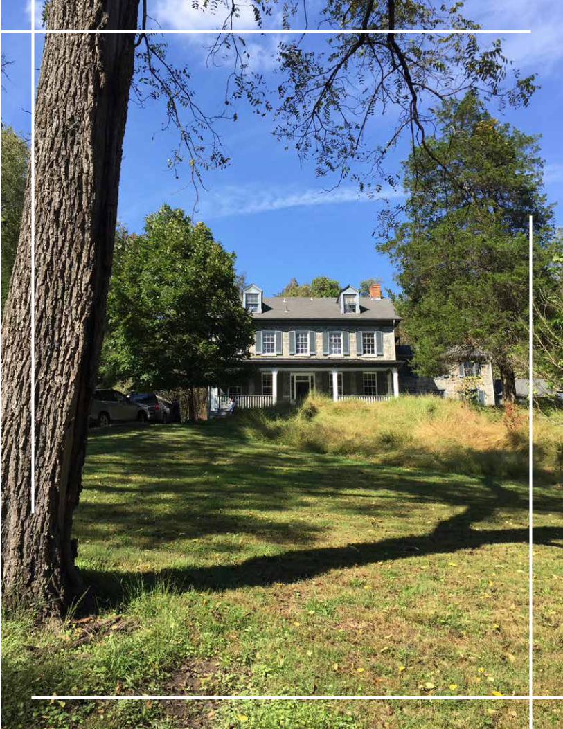
201Ellicott City Watershed Master Plan
Figure 176: Lot F and Potential North Tunnel Entrance Area after 2019 ReconstructionFigure 177: Key Plan — Ellicott Mills Gateway Area
Lot F
Lot E
Main St
Lot D
Lot A
Patapsco River
Ellicott Mills Dr
Lot G
DESCRIPTIONThe area centered around Ellicott Mills Drive and Main Street serves as an important gateway. This area includes several county-owned assets, including parking resources (Lots F and G) and Department of Recreation and Parks (DRP) facilities (the Bernard Fort House and Thomas Isaac Log Cabin).
ELLICOTT CITY TODAYThe intersection of Ellicott Mills Drive and Main Street had been a green, park-like gateway featuring two DRP resources—the historic courthouse building and Thomas Isaac Log Cabin—along with landscaping and pedestrian pathways. This area changed dramatically following the 2018 flood, which washed out Ellicott Mills Drive, several sidewalk segments, pedestrian paths and trees. Flood waters destroyed the historic courthouse building. Since then, a box culvert has been constructed under Ellicott Mills Drive, approximately 200 feet of the Hudson Branch has been daylit and armored, and streets and sidewalks reconstructed.
HISTORIC AND CULTURAL RESOURCESNumerous historic and cultural resources and their grounds are located within this gateway area and, together, establish an important framework for creating a meaningful transition area between the West End, Upper Main, and the Courthouse Area.
■ Bernard Fort House and Bernard Fort Heritage Center: DRP recently acquired the Bernard Fort House and will use this building and extensive grounds—the “Bernard Fort Heritage Center”—as an as an orientation center for the DRP’s historic resources within Ellicott City, special events and offices/meeting space for the Patapsco Heritage Greenway. A master plan is currently being prepared for the property, including building a wing to replace the existing one, additional parking, ADA accommodations and an event lawn and pathways. The location at the base of Fels Lane and above Lots F and G is well suited to becoming an integral part of
Ellicott Mills Gateway AreaIII.10
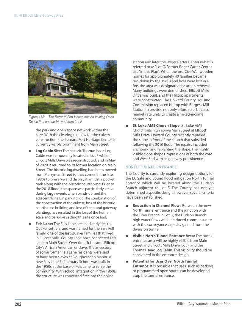
202 Ellicott City Watershed Master Plan
III.10 Ellicott Mills Gateway Area
Figure 178: The Bernard Fort House has an Inviting Open Space that can be Viewed from Lot F
the park and open space network within the core. With the clearing to allow for the culvert construction, the Bernard Fort Heritage Center is currently visibly prominent from Main Street.
■ Log Cabin Site: The historic Thomas Isaac Log Cabin was temporarily located in Lot F while Ellicott Mills Drive was reconstructed, and in May of 2020 it returned to its former location on Main Street. The historic log dwelling had been moved from Merryman Street to that corner in the late 1980s to preserve and display it amidst a pocket park along with the historic courthouse. Prior to the 2018 flood, the space was particularly active during large events when bands utilized the adjacent Wine Bin parking lot. The combination of the construction of the culvert, loss of the historic courthouse building and loss of trees and gateway plantings has resulted in the loss of the human scale and park-like setting this site once had.
■ Fels Lane: The Fels Lane area had early ties to Quaker settlers, and was named for the Ezra Fell family, one of the last Quaker families that lived in Ellicott Mills. County Lane once connected Fels Lane to Main Street. Over time, it became Ellicott City’s African American enclave. The ancestors of some former Fels Lane residents were said to have been slaves at Doughoregan Manor. A new Fels Lane Elementary School was built in the 1950s at the base of Fels Lane to serve the community. With school integration in the 1960s, the structure was converted first into the police
station and later the Roger Carter Center (what is referred to as “Lot G/Former Roger Carter Center site” in this Plan). When the pre-Civil War wooden homes for approximately 40 families became run-down by the 1960s and lives were lost in a fire, the area was designated for urban renewal. Many buildings were demolished, Ellicott Mills Drive was built, and the Hilltop apartments were constructed. The Howard County Housing Commission replaced Hilltop with Burgess Mill Station to provide not only affordable, but also market rate units to create a mixed-income community.
■ St. Luke AME Church Slope: St. Luke AME Church sets high above Main Street at Ellicott Mills Drive. Howard County recently repaired the slope in front of the church that subsided following the 2016 flood. The repairs included anchoring and replanting the slope. The highly visible slope shapes impressions of both the core and West End with its gateway prominence.
NORTH TUNNEL ENTRANCEThe County is currently exploring design options for the EC Safe and Sound flood mitigation North Tunnel entrance which will be located along the Hudson Branch adjacent to Lot F. The County has not yet determined a specific design, however, several criteria have been established.
■ Reduction in Channel Flow: Between the new North Tunnel entrance and the junction with the Tiber Branch in Lot D, the Hudson Branch high water flows will be reduced commensurate with the conveyance capacity gained from the diversion tunnel.
■ Visible North Tunnel Entrance Area: The tunnel entrance area will be highly visible from Main Street and Ellicott Mills Drive, Lot F and the Thomas Isaac Log Cabin. This visibility should be considered in the entrance design.
■ Potential for Uses Over North Tunnel Entrance: It is possible that uses, such as parking or programmed open space, can be developed atop the tunnel entrance.
203Ellicott City Watershed Master Plan
III.10 Ellicott Mills Gateway Area
Figure 179: View from Lot F Looking to the Bernard Fort Heritage Center
Figure 180: Existing Constrained Tributary East of Lot F
Figure 181: View of St. Luke’s Slope from Ellicott Mills Drive
■ Flood Infrastructure Functions: The recently constructed crossing of Hudson Branch at Ellicott Mills Drive is designed to handle a 100-year storm event. However, a temporary headwall was built to meter flow until the North Tunnel and other downstream improvements are completed. Flows exceeding 100-year storm event volumes flow over Ellicott Mills Drive into the channel/floodplain behind the Thomas Isaac Log Cabin prior to 1) entering the Hudson Branch north tunnel; or 2) the channel upstream of Court Avenue or 3) both, depending upon the capacity of the North Tunnel and the magnitude of the flood flow. The recently constructed roadway and channel are designed to accommodate this overflow.
■ Public Safety: The North Tunnel entrance design will incorporate appropriate safety measures and signage restricting public access.
LOT FLot F is a significant parking resource and provided 96 parking spaces prior to the 2018 flood. The parking lot is well-located as visitors can park their cars before arriving at Main Street which is often congested. Since the 2018 flood, much of the parking lot had been closed as a construction staging area for culvert improvements and a portion may be closed again as a staging area for the tunnel construction. The County recently resurfaced this lot for 61 spaces and incorporated boulders and fencing to reduce the likelihood of vehicles washing into the channel. Existing conditions to consider for future improvements to the lot include:
■ Redundant Drive Aisles: The lot includes a stand-alone redundant drive aisle along the west side of the lot, resulting in a paved area that exceeds what is normally required for a two-bay parking lot.
■ Constrained Tributary: A constrained tributary exists along the eastern perimeter of the lot at the base of a wooded slope. The channel was recently armored with rock.
204 Ellicott City Watershed Master Plan
III.10 Ellicott Mills Gateway Area
POLICY 10.1
■ Storm Drain in Need of Repair: An existing 36” diameter storm drain located under the western edge of the lot was recently inspected and is in need of repair.
■ 100-Year Floodplain: A portion of the lot lies within the current 100-year floodplain. Floodplain boundaries will likely change once the North Tunnel is constructed.
■ Strong Spatial Definition: The lot sits below the adjacent slopes of Ellicott Mills Drive and the Bernard Fort Heritage Center, and wooded slope to the northeast, creating a strong spatial definition.
■ Mature Canopy: The treed embankment along Ellicott Mills Drive creates a natural sense of enclosure and partially screens parking from the road.
■ Viewshed: With the canopy no longer in place at the intersection of Ellicott Mills Drive and Main Street, there are relatively unobstructed views between the Bernard Fort Heritage Center and Main Street.
LOT G/FORMER ROGER CARTER CENTER SITEFollowing the 2016 flood, Lot G was created as a temporary parking resource providing 71 parking spaces.
■ Prominent Location: The site is located at the base of the Fels Lane neighborhood and at the entrance to the Bernard Fort Heritage Center and Lot F.
■ Strong Spatial Definition: The site sits in a valley and is flanked by wooded steep slopes to the west and, across Fels Lane to the east, giving it a strong spatial definition and sense of place. It is visually prominent along both Fels Lane and Ellicott Mills Drive and serves as part of the gateway to the Bernard Fort Heritage Center and Lot F.
■ Stream Tributary: A stream tributary passes through the site, however, much of it is culverted below grade.
■ Utilitarian Parking Lot Design: Built to provide temporary parking, Lot G is utilitarian in design and does not incorporate other site enhancements for the property.
ELLICOTT CITY TOMORROW: PLAN POLICIES AND ACTIONS
BERNARD FORT HERITAGE CENTER
Enhance visual and physical connections to Bernard Fort House, allowing the future Bernard Fort Heritage Center to flourish as a centrally located point of orientation for heritage tourists.
Implementing Actions
a. Open Space Connections: Connect the Bernard Fort Heritage Center to the proposed “green cultural trail” and open space network with nature trail connections to the Courthouse Area and the Patapsco Female Institute.
b. Wayfinding: Utilize wayfinding to connect the Bernard Fort House to other historic sites within the core along the “Green Cultural Trail”.
c. Canopy Tree Planting: Plant canopy trees to frame views of Main Street while buffering views of parking lots.
d. Natural Amphitheater: Use the hillside as an amphitheater and performance space, with the natural environment of the adjacent wooded stream valley as a backdrop.
e. Play Space: Integrate a nature-based playground into the overall landscape and amphitheater area.
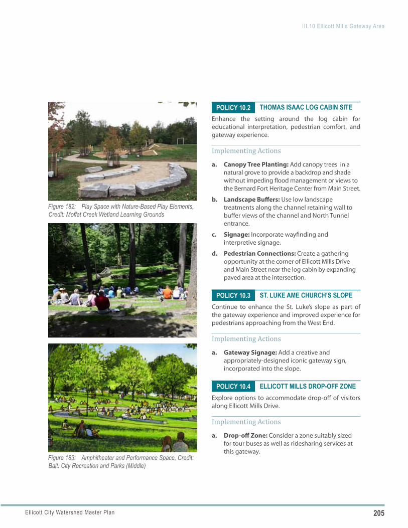
205Ellicott City Watershed Master Plan
III.10 Ellicott Mills Gateway Area
Figure 182: Play Space with Nature-Based Play Elements, Credit: Moffat Creek Wetland Learning Grounds
Figure 183: Amphitheater and Performance Space, Credit: Balt. City Recreation and Parks (Middle)
POLICY 10.2
POLICY 10.3
POLICY 10.4
THOMAS ISAAC LOG CABIN SITEEnhance the setting around the log cabin for educational interpretation, pedestrian comfort, and gateway experience.
Implementing Actions
a. Canopy Tree Planting: Add canopy trees in a natural grove to provide a backdrop and shade without impeding flood management or views to the Bernard Fort Heritage Center from Main Street.
b. Landscape Buffers: Use low landscape treatments along the channel retaining wall to buffer views of the channel and North Tunnel entrance.
c. Signage: Incorporate wayfinding and interpretive signage.
d. Pedestrian Connections: Create a gathering opportunity at the corner of Ellicott Mills Drive and Main Street near the log cabin by expanding paved area at the intersection.
ST. LUKE AME CHURCH’S SLOPEContinue to enhance the St. Luke’s slope as part of the gateway experience and improved experience for pedestrians approaching from the West End.
Implementing Actions
a. Gateway Signage: Add a creative and appropriately-designed iconic gateway sign, incorporated into the slope.
ELLICOTT MILLS DROP-OFF ZONE Explore options to accommodate drop-off of visitors along Ellicott Mills Drive.
Implementing Actions
a. Drop-off Zone: Consider a zone suitably sized for tour buses as well as ridesharing services at this gateway.
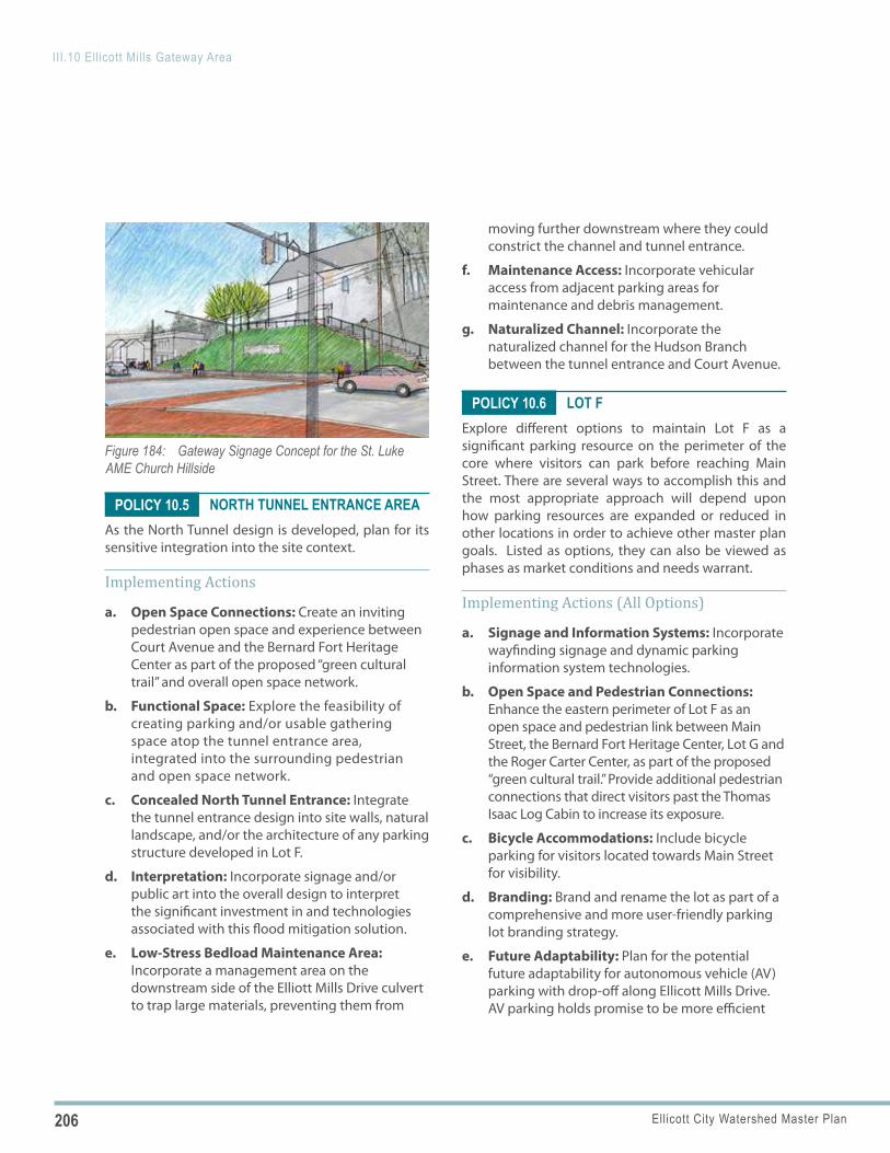
206 Ellicott City Watershed Master Plan
III.10 Ellicott Mills Gateway Area
Figure 184: Gateway Signage Concept for the St. Luke AME Church Hillside
POLICY 10.5
POLICY 10.6
NORTH TUNNEL ENTRANCE AREAAs the North Tunnel design is developed, plan for its sensitive integration into the site context.
Implementing Actions
a. Open Space Connections: Create an inviting pedestrian open space and experience between Court Avenue and the Bernard Fort Heritage Center as part of the proposed “green cultural trail” and overall open space network.
b. Functional Space: Explore the feasibility of creating parking and/or usable gathering space atop the tunnel entrance area, integrated into the surrounding pedestrian and open space network.
c. Concealed North Tunnel Entrance: Integrate the tunnel entrance design into site walls, natural landscape, and/or the architecture of any parking structure developed in Lot F.
d. Interpretation: Incorporate signage and/or public art into the overall design to interpret the significant investment in and technologies associated with this flood mitigation solution.
e. Low-Stress Bedload Maintenance Area: Incorporate a management area on the downstream side of the Elliott Mills Drive culvert to trap large materials, preventing them from
moving further downstream where they could constrict the channel and tunnel entrance.
f. Maintenance Access: Incorporate vehicular access from adjacent parking areas for maintenance and debris management.
g. Naturalized Channel: Incorporate the naturalized channel for the Hudson Branch between the tunnel entrance and Court Avenue.
LOT FExplore different options to maintain Lot F as a significant parking resource on the perimeter of the core where visitors can park before reaching Main Street. There are several ways to accomplish this and the most appropriate approach will depend upon how parking resources are expanded or reduced in other locations in order to achieve other master plan goals. Listed as options, they can also be viewed as phases as market conditions and needs warrant.
Implementing Actions (All Options)
a. Signage and Information Systems: Incorporate wayfinding signage and dynamic parking information system technologies.
b. Open Space and Pedestrian Connections: Enhance the eastern perimeter of Lot F as an open space and pedestrian link between Main Street, the Bernard Fort Heritage Center, Lot G and the Roger Carter Center, as part of the proposed “green cultural trail.” Provide additional pedestrian connections that direct visitors past the Thomas Isaac Log Cabin to increase its exposure.
c. Bicycle Accommodations: Include bicycle parking for visitors located towards Main Street for visibility.
d. Branding: Brand and rename the lot as part of a comprehensive and more user-friendly parking lot branding strategy.
e. Future Adaptability: Plan for the potential future adaptability for autonomous vehicle (AV) parking with drop-off along Ellicott Mills Drive. AV parking holds promise to be more efficient
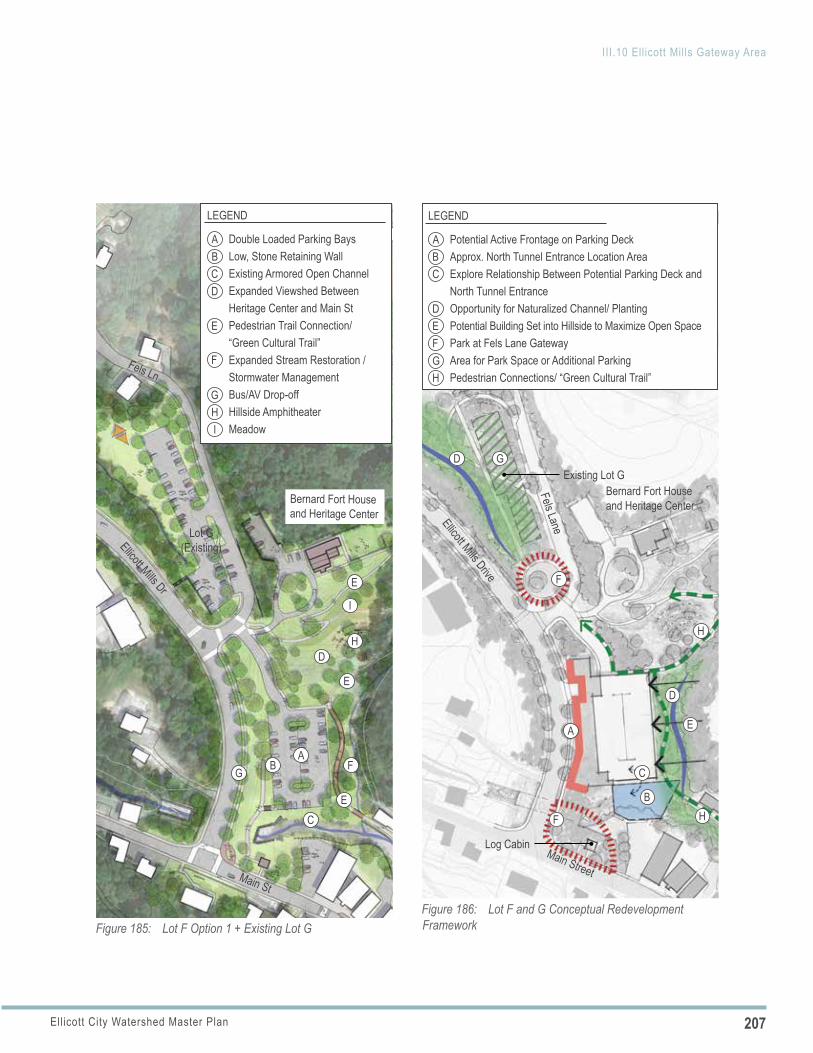
207Ellicott City Watershed Master Plan
III.10 Ellicott Mills Gateway Area
Figure 185: Lot F Option 1 + Existing Lot G
A
A
G
G
B
B
I
I
H
H
C
C
D
D
E
F
F
E
E
E
LEGEND
Double Loaded Parking BaysLow, Stone Retaining WallExisting Armored Open ChannelExpanded Viewshed Between Heritage Center and Main StPedestrian Trail Connection/ “Green Cultural Trail”Expanded Stream Restoration / Stormwater ManagementBus/AV Drop-offHillside AmphitheaterMeadow
Ellicott Mills Dr
Fels Ln
Lot G(Existing)
Main St
Bernard Fort House and Heritage Center
Potential Active Frontage on Parking DeckApprox. North Tunnel Entrance Location AreaExplore Relationship Between Potential Parking Deck and North Tunnel EntranceOpportunity for Naturalized Channel/ PlantingPotential Building Set into Hillside to Maximize Open SpacePark at Fels Lane GatewayArea for Park Space or Additional ParkingPedestrian Connections/ “Green Cultural Trail”
Figure 186: Lot F and G Conceptual Redevelopment Framework
Ellicott Mills Drive
Main Street
A
A
C
F
F
F
GH
H
H
G
D
D
D
B
E
E
B
C
LEGEND
Bernard Fort House and Heritage Center
Fels Lane
Existing Lot G
Log Cabin
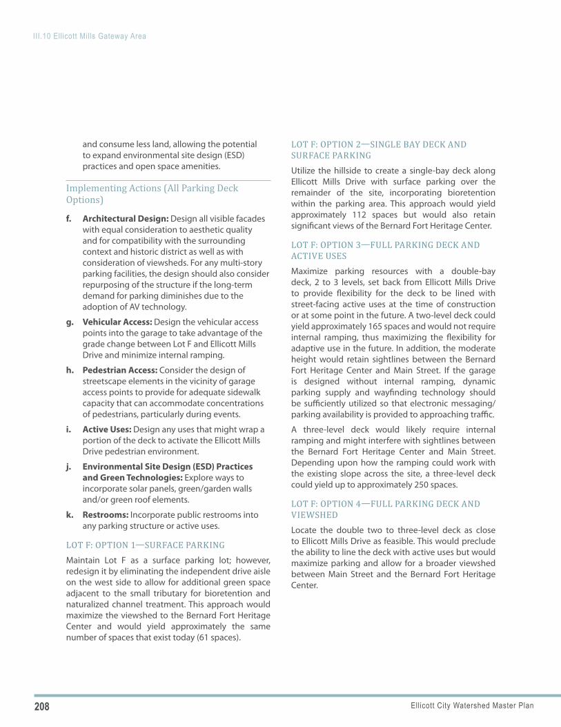
208 Ellicott City Watershed Master Plan
III.10 Ellicott Mills Gateway Area
and consume less land, allowing the potential to expand environmental site design (ESD) practices and open space amenities.
Implementing Actions (All Parking Deck Options)
f. Architectural Design: Design all visible facades with equal consideration to aesthetic quality and for compatibility with the surrounding context and historic district as well as with consideration of viewsheds. For any multi-story parking facilities, the design should also consider repurposing of the structure if the long-term demand for parking diminishes due to the adoption of AV technology.
g. Vehicular Access: Design the vehicular access points into the garage to take advantage of the grade change between Lot F and Ellicott Mills Drive and minimize internal ramping.
h. Pedestrian Access: Consider the design of streetscape elements in the vicinity of garage access points to provide for adequate sidewalk capacity that can accommodate concentrations of pedestrians, particularly during events.
i. Active Uses: Design any uses that might wrap a portion of the deck to activate the Ellicott Mills Drive pedestrian environment.
j. Environmental Site Design (ESD) Practices and Green Technologies: Explore ways to incorporate solar panels, green/garden walls and/or green roof elements.
k. Restrooms: Incorporate public restrooms into any parking structure or active uses.
LOT F: OPTION 1—SURFACE PARKINGMaintain Lot F as a surface parking lot; however, redesign it by eliminating the independent drive aisle on the west side to allow for additional green space adjacent to the small tributary for bioretention and naturalized channel treatment. This approach would maximize the viewshed to the Bernard Fort Heritage Center and would yield approximately the same number of spaces that exist today (61 spaces).
LOT F: OPTION 2—SINGLE BAY DECK AND SURFACE PARKINGUtilize the hillside to create a single-bay deck along Ellicott Mills Drive with surface parking over the remainder of the site, incorporating bioretention within the parking area. This approach would yield approximately 112 spaces but would also retain significant views of the Bernard Fort Heritage Center.
LOT F: OPTION 3—FULL PARKING DECK AND ACTIVE USESMaximize parking resources with a double-bay deck, 2 to 3 levels, set back from Ellicott Mills Drive to provide flexibility for the deck to be lined with street-facing active uses at the time of construction or at some point in the future. A two-level deck could yield approximately 165 spaces and would not require internal ramping, thus maximizing the flexibility for adaptive use in the future. In addition, the moderate height would retain sightlines between the Bernard Fort Heritage Center and Main Street. If the garage is designed without internal ramping, dynamic parking supply and wayfinding technology should be sufficiently utilized so that electronic messaging/parking availability is provided to approaching traffic.
A three-level deck would likely require internal ramping and might interfere with sightlines between the Bernard Fort Heritage Center and Main Street. Depending upon how the ramping could work with the existing slope across the site, a three-level deck could yield up to approximately 250 spaces.
LOT F: OPTION 4—FULL PARKING DECK AND VIEWSHEDLocate the double two to three-level deck as close to Ellicott Mills Drive as feasible. This would preclude the ability to line the deck with active uses but would maximize parking and allow for a broader viewshed between Main Street and the Bernard Fort Heritage Center.
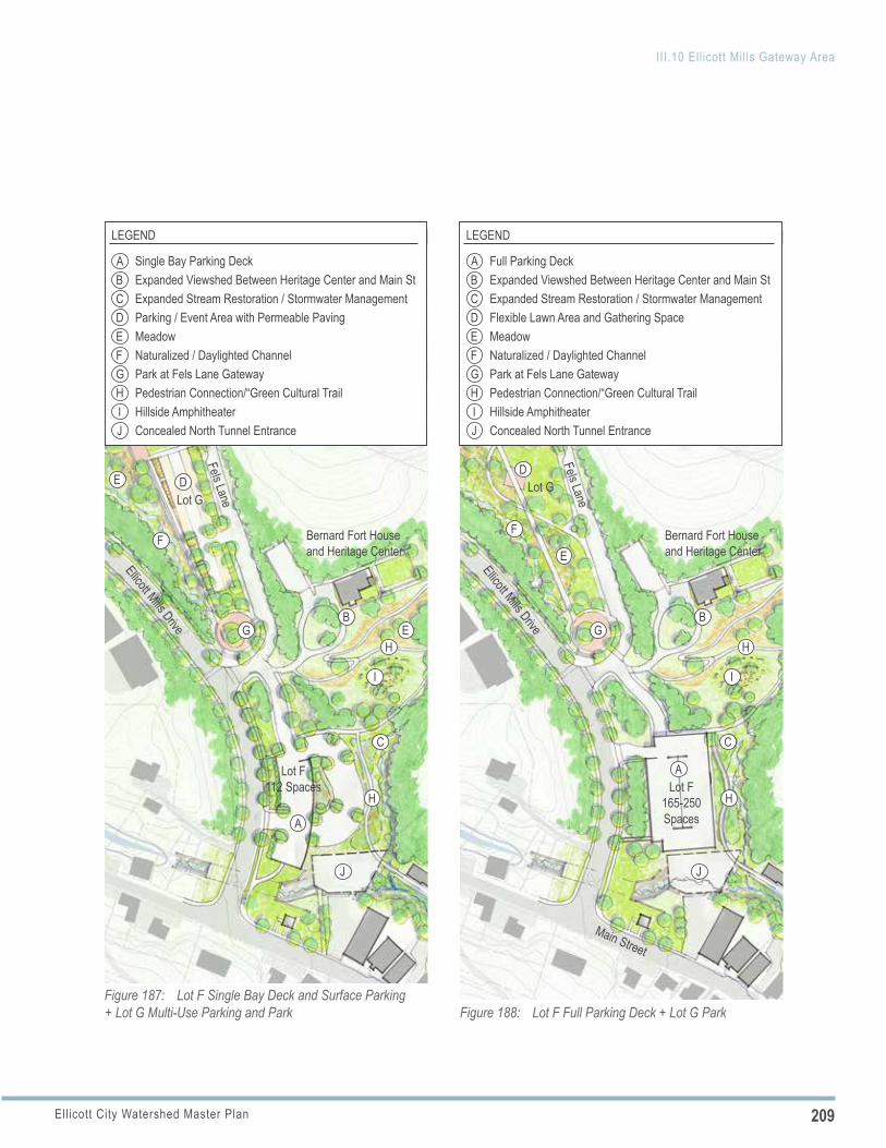
209Ellicott City Watershed Master Plan
III.10 Ellicott Mills Gateway Area
Ellicott Mills Drive
Figure 187: Lot F Single Bay Deck and Surface Parking + Lot G Multi-Use Parking and Park
Lot G
Lot F 112 Spaces
Bernard Fort House and Heritage Center
E
J
H
H
ABC
LEGEND
Single Bay Parking DeckExpanded Viewshed Between Heritage Center and Main StExpanded Stream Restoration / Stormwater ManagementParking / Event Area with Permeable PavingMeadowNaturalized / Daylighted ChannelPark at Fels Lane GatewayPedestrian Connection/“Green Cultural Trail Hillside AmphitheaterConcealed North Tunnel Entrance
DEFGH
JI
I
A
B
C
DE
F
G
Fels Lane
Figure 188: Lot F Full Parking Deck + Lot G Park
Lot G
Ellicott Mills Drive
Main Street
A
B
C
D
E
F
G
Bernard Fort House and Heritage Center
Fels Lane
Lot F165-250 Spaces
J
H
H
ABC
LEGEND
Full Parking DeckExpanded Viewshed Between Heritage Center and Main StExpanded Stream Restoration / Stormwater ManagementFlexible Lawn Area and Gathering SpaceMeadowNaturalized / Daylighted ChannelPark at Fels Lane GatewayPedestrian Connection/“Green Cultural Trail Hillside AmphitheaterConcealed North Tunnel Entrance
DEFGH
JI
I
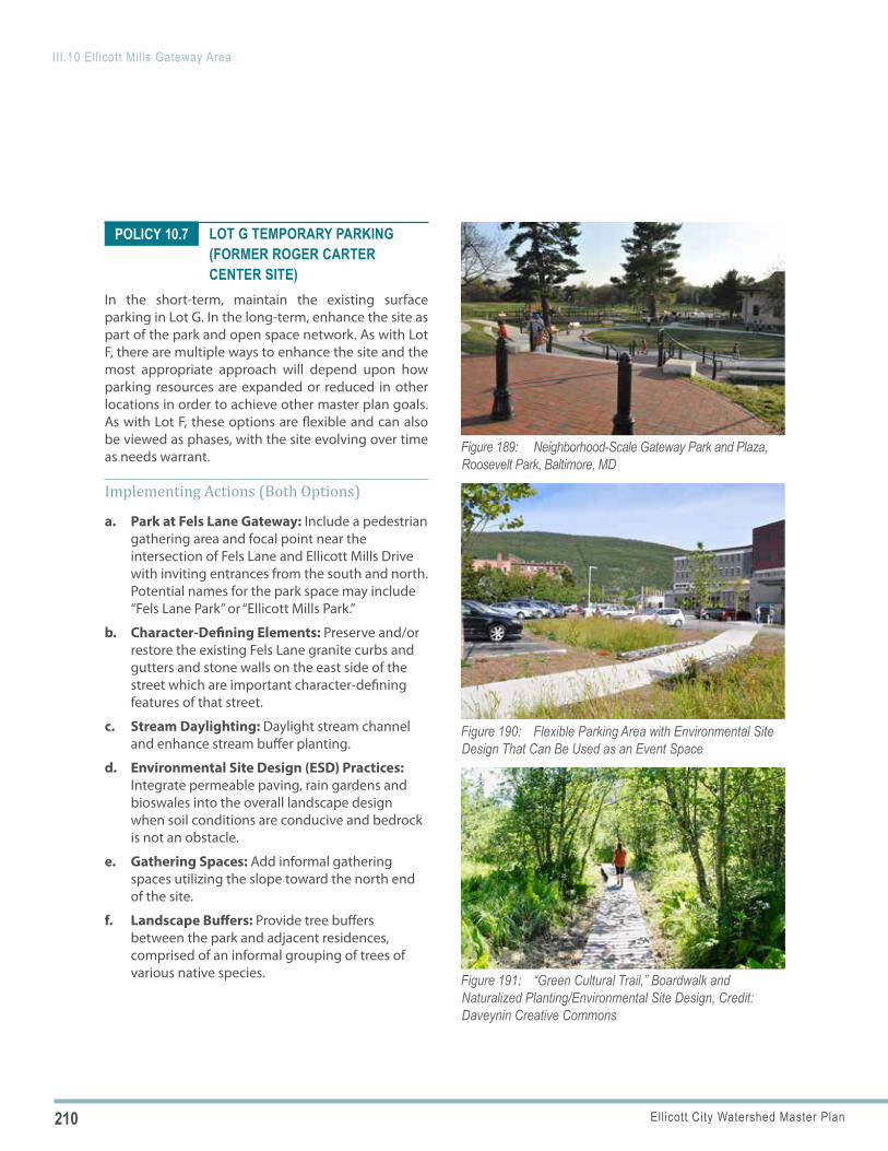
210 Ellicott City Watershed Master Plan
III.10 Ellicott Mills Gateway Area
Figure 189: Neighborhood-Scale Gateway Park and Plaza, Roosevelt Park, Baltimore, MD
Figure 190: Flexible Parking Area with Environmental Site Design That Can Be Used as an Event Space
Figure 191: “Green Cultural Trail,” Boardwalk and Naturalized Planting/Environmental Site Design, Credit: Daveynin Creative Commons
POLICY 10.7 LOT G TEMPORARY PARKING (FORMER ROGER CARTER CENTER SITE)
In the short-term, maintain the existing surface parking in Lot G. In the long-term, enhance the site as part of the park and open space network. As with Lot F, there are multiple ways to enhance the site and the most appropriate approach will depend upon how parking resources are expanded or reduced in other locations in order to achieve other master plan goals. As with Lot F, these options are flexible and can also be viewed as phases, with the site evolving over time as needs warrant.
Implementing Actions (Both Options)
a. Park at Fels Lane Gateway: Include a pedestrian gathering area and focal point near the intersection of Fels Lane and Ellicott Mills Drive with inviting entrances from the south and north. Potential names for the park space may include “Fels Lane Park” or “Ellicott Mills Park.”
b. Character-Defining Elements: Preserve and/or restore the existing Fels Lane granite curbs and gutters and stone walls on the east side of the street which are important character-defining features of that street.
c. Stream Daylighting: Daylight stream channel and enhance stream buffer planting.
d. Environmental Site Design (ESD) Practices: Integrate permeable paving, rain gardens and bioswales into the overall landscape design when soil conditions are conducive and bedrock is not an obstacle.
e. Gathering Spaces: Add informal gathering spaces utilizing the slope toward the north end of the site.
f. Landscape Buffers: Provide tree buffers between the park and adjacent residences, comprised of an informal grouping of trees of various native species.
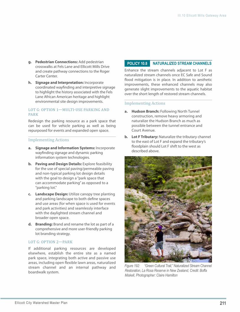
211Ellicott City Watershed Master Plan
III.10 Ellicott Mills Gateway Area
Figure 192: “Green Cultural Trail,” Naturalized Stream Channel Restoration, La Rosa Reserve in New Zealand, Credit: Boffa Miskell, Photographer: Claire Hamilton
POLICY 10.8g. Pedestrian Connections: Add pedestrian crosswalks at Fels Lane and Ellicott Mills Drive and create pathway connections to the Roger Carter Center.
h. Signage and Interpretation: Incorporate coordinated wayfinding and interpretive signage to highlight the history associated with the Fels Lane African American heritage and highlight environmental site design improvements.
LOT G: OPTION 1—MULTI-USE PARKING AND PARKRedesign the parking resource as a park space that can be used for vehicle parking as well as being repurposed for events and expanded open space.
Implementing Actions
a. Signage and Information Systems: Incorporate wayfinding signage and dynamic parking information system technologies.
b. Paving and Design Details: Explore feasibility for the use of special paving/permeable paving and non-typical parking lot design details with the goal to design a “park space that can accommodate parking” as opposed to a “parking lot.”
c. Landscape Design: Utilize canopy tree planting and parking landscape to both define spaces and use areas (for when space is used for events and park activities) and seamlessly interface with the daylighted stream channel and broader open space.
d. Branding: Brand and rename the lot as part of a comprehensive and more user-friendly parking lot branding strategy.
LOT G: OPTION 2—PARK If additional parking resources are developed elsewhere, establish the entire site as a named park space, integrating both active and passive use areas, including open flexible lawn areas, naturalized stream channel and an internal pathway and boardwalk system.
NATURALIZED STREAM CHANNELSEnhance the stream channels adjacent to Lot F as naturalized stream channels once EC Safe and Sound flood mitigation is in place. In addition to aesthetic improvements, these enhanced channels may also generate slight improvements to the aquatic habitat over the short length of restored stream channels.
Implementing Actions
a. Hudson Branch: Following North Tunnel construction, remove heavy armoring and naturalize the Hudson Branch as much as possible between the tunnel entrance and Court Avenue.
b. Lot F Tributary: Naturalize the tributary channel to the east of Lot F and expand the tributary’s floodplain should Lot F shift to the west as described above.
212 Ellicott City Watershed Master Plan
III.10 Ellicott Mills Gateway Area
Figure 193: “Green Cultural Trail,” Naturalized Stream Channel Restoration, Credit: Bricoleurbanism Creative Commons
Figure 194: Lot F Full Parking Deck + Active Uses
Main Street
C
C D
E
AB
Ellicott Mills Drive
A
BC
LEGEND
Full Parking Deck with Potential Future Active Uses, Parking Shifted Closer To StreetExpanded Stream Restoration / Stormwater ManagementPedestrian Connection/“Green Cultural TrailHillside AmphitheaterConcealed North Tunnel Entrance
DE
Figure 195: Lot F Full Parking Deck + Active Uses
Main Street
ABC
LEGEND
Full Parking Deck with Potential Future Active UsesExpanded Stream Restoration / Stormwater ManagementPedestrian Connection/“Green Cultural TrailHillside AmphitheaterConcealed North Tunnel Entrance
DE
C
C D
E
A
B
Ellicott Mills Drive
c. Canopy Tree Planting: Incorporate canopy tree planting and other appropriate planting along naturalized channels.
d. Channel Bed: Integrate variations in the channel beds, including pools and riffles or steeper sections to create both visual and audible interest.
e. “Green Cultural Trail”: Coordinate the channel designs with the proposed “green cultural trail” which should meander alongside and across these channels to create an inviting user experience.
213Ellicott City Watershed Master Plan
III.10 Ellicott Mills Gateway Area
Figure 196: Lot G Multi-Use Parking and Park
A
A
B
B
C
C
LEGEND
Naturalized / Daylighted ChannelPark at Fels Lane GatewayGathering AreaPotential Amphitheater/ Hillside SeatingMeadowParking / Event Area with SWM
D
D
E
E
F
F
Fels Lane
Ellicott Mills Drive
Figure 197: Lot G Park
A
A
B
B
C
C
LEGEND
Naturalized / Daylighted ChannelPark at Fels Lane GatewayGathering AreaPotential Amphitheater/ Hillside SeatingMeadowOpen Flexible Lawn Area
D
D
E
E
E
F
F
F
Fels Lane
Ellicott Mills Drive
215Ellicott City Watershed Master Plan
Figure 198: Existing House Spanning the Hudson Branch Channel in the West End
Figure 199: Key Plan — West End
Lot F
Lot E
Main St
Lot D
RT-2
9
Ellicott Mills Dr
Toll H
ouse
Rd
Roge
rs Av
eDESCRIPTIONThe West End is a mixed-use community of homes and businesses located along Frederick Road (from Route 29 to Rogers Avenue) and Main Street (from Rogers Avenue to Ellicott Mills Drive). The Hudson Branch meanders throughout the West End, crossing under the street several times as it flows near historic buildings. Several flood mitigation projects are planned to lessen flood impacts in the West End.
ELLICOTT CITY TODAY HISTORIC AND CULTURAL RESOURCES Settled by mill workers, the West End was a logical extension of the town as it grew along Main Street and Frederick Road. Most of the buildings are modest and of frame construction, however, numerous older stone houses and estates are located throughout, remnants of Ellicott City’s rural past. Historically, Burgess Mill operated near the intersection of Ellicott Mills Drive
and Main Street with a mill race extending from the Hudson Branch. The eastern portion of the West End falls within the Ellicott City Historic District.
West EndIII.11
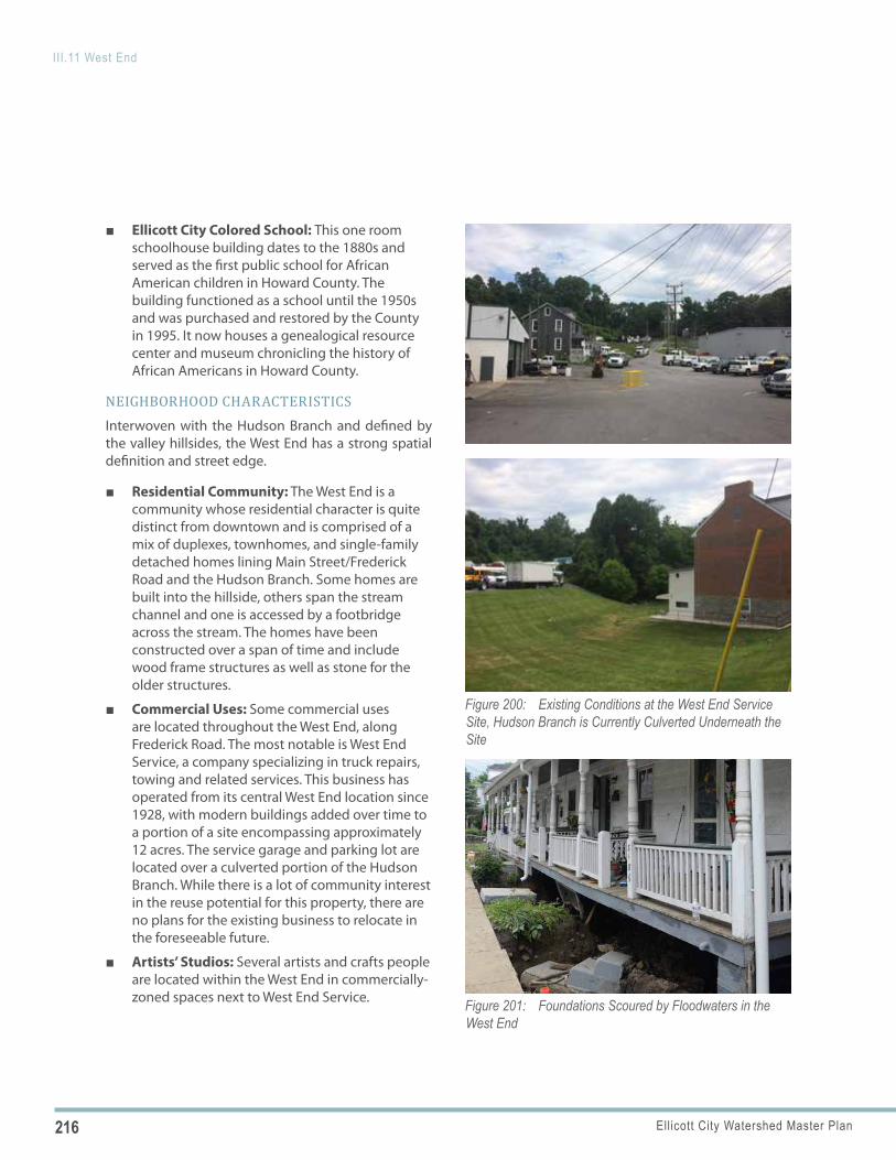
216 Ellicott City Watershed Master Plan
III.11 West End
Figure 200: Existing Conditions at the West End Service Site, Hudson Branch is Currently Culverted Underneath the Site
Figure 201: Foundations Scoured by Floodwaters in the West End
■ Ellicott City Colored School: This one room schoolhouse building dates to the 1880s and served as the first public school for African American children in Howard County. The building functioned as a school until the 1950s and was purchased and restored by the County in 1995. It now houses a genealogical resource center and museum chronicling the history of African Americans in Howard County.
NEIGHBORHOOD CHARACTERISTICSInterwoven with the Hudson Branch and defined by the valley hillsides, the West End has a strong spatial definition and street edge.
■ Residential Community: The West End is a community whose residential character is quite distinct from downtown and is comprised of a mix of duplexes, townhomes, and single-family detached homes lining Main Street/Frederick Road and the Hudson Branch. Some homes are built into the hillside, others span the stream channel and one is accessed by a footbridge across the stream. The homes have been constructed over a span of time and include wood frame structures as well as stone for the older structures.
■ Commercial Uses: Some commercial uses are located throughout the West End, along Frederick Road. The most notable is West End Service, a company specializing in truck repairs, towing and related services. This business has operated from its central West End location since 1928, with modern buildings added over time to a portion of a site encompassing approximately 12 acres. The service garage and parking lot are located over a culverted portion of the Hudson Branch. While there is a lot of community interest in the reuse potential for this property, there are no plans for the existing business to relocate in the foreseeable future.
■ Artists’ Studios: Several artists and crafts people are located within the West End in commercially-zoned spaces next to West End Service.
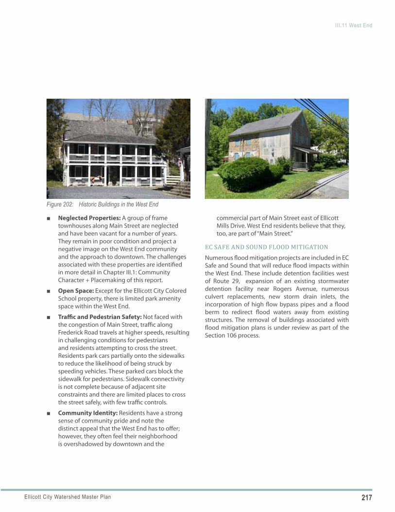
217Ellicott City Watershed Master Plan
III.11 West End
Figure 202: Historic Buildings in the West End
■ Neglected Properties: A group of frame townhouses along Main Street are neglected and have been vacant for a number of years. They remain in poor condition and project a negative image on the West End community and the approach to downtown. The challenges associated with these properties are identified in more detail in Chapter III.1: Community Character + Placemaking of this report.
■ Open Space: Except for the Ellicott City Colored School property, there is limited park amenity space within the West End.
■ Traffic and Pedestrian Safety: Not faced with the congestion of Main Street, traffic along Frederick Road travels at higher speeds, resulting in challenging conditions for pedestrians and residents attempting to cross the street. Residents park cars partially onto the sidewalks to reduce the likelihood of being struck by speeding vehicles. These parked cars block the sidewalk for pedestrians. Sidewalk connectivity is not complete because of adjacent site constraints and there are limited places to cross the street safely, with few traffic controls.
■ Community Identity: Residents have a strong sense of community pride and note the distinct appeal that the West End has to offer; however, they often feel their neighborhood is overshadowed by downtown and the
commercial part of Main Street east of Ellicott Mills Drive. West End residents believe that they, too, are part of “Main Street.”
EC SAFE AND SOUND FLOOD MITIGATIONNumerous flood mitigation projects are included in EC Safe and Sound that will reduce flood impacts within the West End. These include detention facilities west of Route 29, expansion of an existing stormwater detention facility near Rogers Avenue, numerous culvert replacements, new storm drain inlets, the incorporation of high flow bypass pipes and a flood berm to redirect flood waters away from existing structures. The removal of buildings associated with flood mitigation plans is under review as part of the Section 106 process.
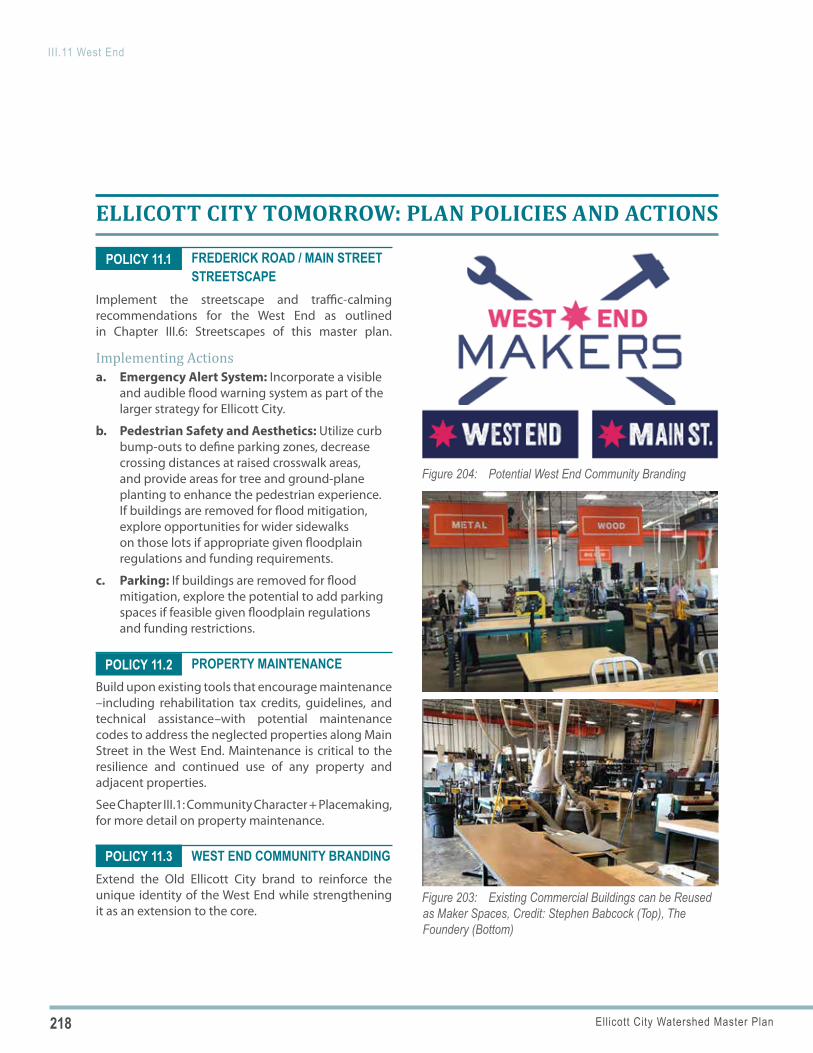
218 Ellicott City Watershed Master Plan
III.11 West End
Figure 203: Existing Commercial Buildings can be Reused as Maker Spaces, Credit: Stephen Babcock (Top), The Foundery (Bottom)
Figure 204: Potential West End Community Branding
POLICY 11.2
POLICY 11.1
POLICY 11.3
ELLICOTT CITY TOMORROW: PLAN POLICIES AND ACTIONS
FREDERICK ROAD / MAIN STREET STREETSCAPE
Implement the streetscape and traffic-calming recommendations for the West End as outlined in Chapter III.6: Streetscapes of this master plan.
Implementing Actionsa. Emergency Alert System: Incorporate a visible
and audible flood warning system as part of the larger strategy for Ellicott City.
b. Pedestrian Safety and Aesthetics: Utilize curb bump-outs to define parking zones, decrease crossing distances at raised crosswalk areas, and provide areas for tree and ground-plane planting to enhance the pedestrian experience. If buildings are removed for flood mitigation, explore opportunities for wider sidewalks on those lots if appropriate given floodplain regulations and funding requirements.
c. Parking: If buildings are removed for flood mitigation, explore the potential to add parking spaces if feasible given floodplain regulations and funding restrictions.
PROPERTY MAINTENANCEBuild upon existing tools that encourage maintenance –including rehabilitation tax credits, guidelines, and technical assistance–with potential maintenance codes to address the neglected properties along Main Street in the West End. Maintenance is critical to the resilience and continued use of any property and adjacent properties.
See Chapter III.1: Community Character + Placemaking, for more detail on property maintenance.
WEST END COMMUNITY BRANDINGExtend the Old Ellicott City brand to reinforce the unique identity of the West End while strengthening it as an extension to the core.
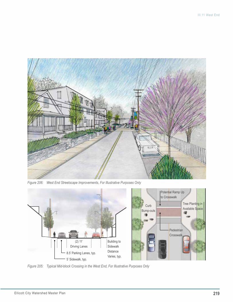
219Ellicott City Watershed Master Plan
III.11 West End
(2) 11’ Driving Lanes
8.5’ Parking Lanes, typ.
5’ Sidewalk, typ.
Building to Sidewalk Distance Varies, typ.
Pedestrian Crosswalk
Curb Bump-outs
Tree Planting in Available Space
Potential Ramp Up to Crosswalk
Figure 205: Typical Mid-block Crossing in the West End, For Illustrative Purposes Only
Figure 206: West End Streetscape Improvements, For Illustrative Purposes Only

220 Ellicott City Watershed Master Plan
III.11 West End
WEST END SERVICE SITE CONSIDERATIONSShould the private property owner’s interests and existing use change, consider a coordinated, master planned redevelopment of the West End Service site. This 12.9-acre site spans seven properties and offers the potential to provide a central community anchor for the West End, accommodating a mix of uses including open space, water management, commercial and residential uses. Given its size and strategic location, this site is too important to not identify opportunities. The narrative and concept diagram below illustrate long-term considerations for the property.
a. Context-Sensitive Site Plan and Organization: Consider a cohesive site plan that responds to the topography and connects adjacent neighborhoods and the Roger Carter Community Center.
b. Character-Based Codes: Explore the applicability of character-based codes as an alternative to conventional zoning for this site.
c. Additional Flood Mitigation: Explore opportunities to daylight the culverted section of Hudson Branch and restore some of its floodplain.
d. Open Space Network: Create open space in association with the channel and floodplain that includes both active and passive uses, serves as a focal point for the West End, and connects to the Roger Carter Center and adjacent neighborhoods.
e. Increased Tree Canopy: Incorporate significant new tree canopy within the overall site development plan and use to reinforce site circulation and definition of open spaces.
f. Mixed-Use Infill: Plan for an appropriately-scaled mix of uses that would complement and be sensitive to adjacent existing uses. Consider arts and maker spaces in the reuse of some of the existing commercial buildings or in newly constructed neighborhood-scaled commercial buildings to build upon the existing small cluster of artists.
g. Public Parking Resource: Incorporate a public parking resource into the overall site to serve the open space network, associated amenity spaces and residents within the West End.
h. Path Network: Connect paths to existing neighborhoods, Main Street, the Roger Carter Center and, ultimately, to Lot G and the Bernard Fort Heritage Center as part of the proposed “green cultural trail” network.
New Land Uses Integrated with
Surrounding Neighborhoods
New Land Uses Integrated with Surrounding Context (Potential Maker’s Space)
Potential Park Space and Floodplain Restoration
Frederick Road
Hudson Branch
Roger Carter Community Center
Interconnected Pedestrian and
Open Space Network/ “Green
Cultural Trail”
Figure 207: Conceptual Redevelopment Framework for West End Service Site, Should Use Ever Change
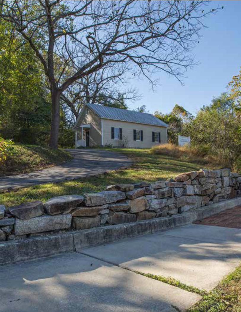
221Ellicott City Watershed Master Plan
III.11 West End
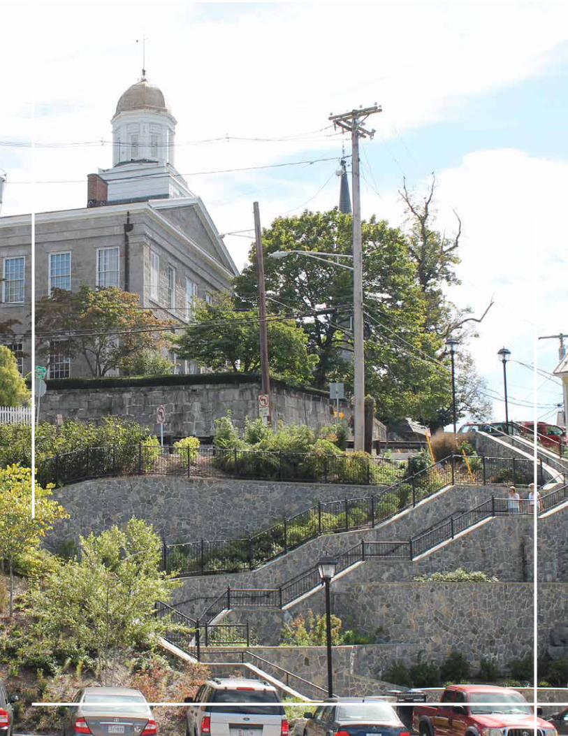
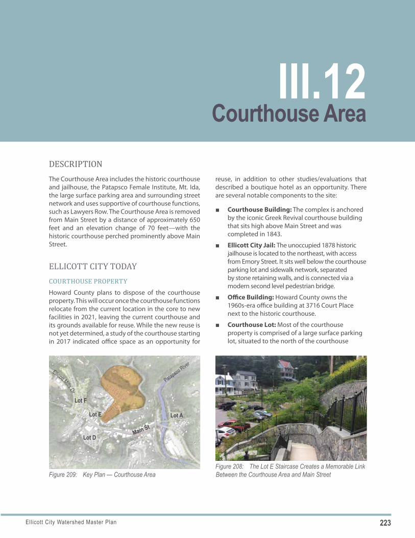
223Ellicott City Watershed Master Plan
Figure 208: The Lot E Staircase Creates a Memorable Link Between the Courthouse Area and Main StreetFigure 209: Key Plan — Courthouse Area
Lot F
Lot E
Main StLot D
Lot A
Patapsco River
Ellicott Mills Dr
DESCRIPTIONThe Courthouse Area includes the historic courthouse and jailhouse, the Patapsco Female Institute, Mt. Ida, the large surface parking area and surrounding street network and uses supportive of courthouse functions, such as Lawyers Row. The Courthouse Area is removed from Main Street by a distance of approximately 650 feet and an elevation change of 70 feet—with the historic courthouse perched prominently above Main Street.
ELLICOTT CITY TODAYCOURTHOUSE PROPERTYHoward County plans to dispose of the courthouse property. This will occur once the courthouse functions relocate from the current location in the core to new facilities in 2021, leaving the current courthouse and its grounds available for reuse. While the new reuse is not yet determined, a study of the courthouse starting in 2017 indicated office space as an opportunity for
reuse, in addition to other studies/evaluations that described a boutique hotel as an opportunity. There are several notable components to the site:
■ Courthouse Building: The complex is anchored by the iconic Greek Revival courthouse building that sits high above Main Street and was completed in 1843.
■ Ellicott City Jail: The unoccupied 1878 historic jailhouse is located to the northeast, with access from Emory Street. It sits well below the courthouse parking lot and sidewalk network, separated by stone retaining walls, and is connected via a modern second level pedestrian bridge.
■ Office Building: Howard County owns the 1960s-era office building at 3716 Court Place next to the historic courthouse.
■ Courthouse Lot: Most of the courthouse property is comprised of a large surface parking lot, situated to the north of the courthouse
Courthouse AreaIII.12
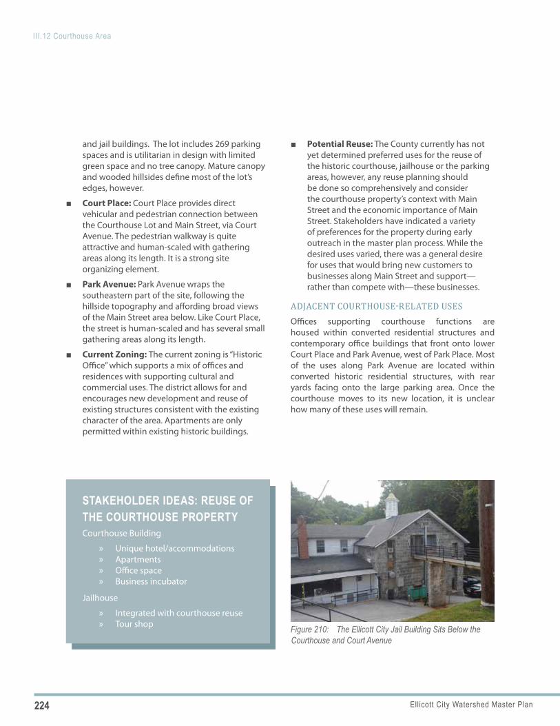
224 Ellicott City Watershed Master Plan
III.12 Courthouse Area
Figure 210: The Ellicott City Jail Building Sits Below the Courthouse and Court Avenue
STAKEHOLDER IDEAS: REUSE OF THE COURTHOUSE PROPERTYCourthouse Building
» Unique hotel/accommodations » Apartments » Office space » Business incubator
Jailhouse
» Integrated with courthouse reuse » Tour shop
and jail buildings. The lot includes 269 parking spaces and is utilitarian in design with limited green space and no tree canopy. Mature canopy and wooded hillsides define most of the lot’s edges, however.
■ Court Place: Court Place provides direct vehicular and pedestrian connection between the Courthouse Lot and Main Street, via Court Avenue. The pedestrian walkway is quite attractive and human-scaled with gathering areas along its length. It is a strong site organizing element.
■ Park Avenue: Park Avenue wraps the southeastern part of the site, following the hillside topography and affording broad views of the Main Street area below. Like Court Place, the street is human-scaled and has several small gathering areas along its length.
■ Current Zoning: The current zoning is “Historic Office” which supports a mix of offices and residences with supporting cultural and commercial uses. The district allows for and encourages new development and reuse of existing structures consistent with the existing character of the area. Apartments are only permitted within existing historic buildings.
■ Potential Reuse: The County currently has not yet determined preferred uses for the reuse of the historic courthouse, jailhouse or the parking areas, however, any reuse planning should be done so comprehensively and consider the courthouse property’s context with Main Street and the economic importance of Main Street. Stakeholders have indicated a variety of preferences for the property during early outreach in the master plan process. While the desired uses varied, there was a general desire for uses that would bring new customers to businesses along Main Street and support—rather than compete with—these businesses.
ADJACENT COURTHOUSE-RELATED USESOffices supporting courthouse functions are housed within converted residential structures and contemporary office buildings that front onto lower Court Place and Park Avenue, west of Park Place. Most of the uses along Park Avenue are located within converted historic residential structures, with rear yards facing onto the large parking area. Once the courthouse moves to its new location, it is unclear how many of these uses will remain.
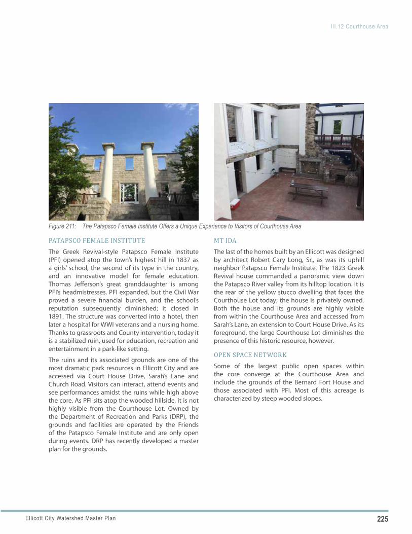
225Ellicott City Watershed Master Plan
III.12 Courthouse Area
Figure 211: The Patapsco Female Institute Offers a Unique Experience to Visitors of Courthouse Area
PATAPSCO FEMALE INSTITUTEThe Greek Revival-style Patapsco Female Institute (PFI) opened atop the town’s highest hill in 1837 as a girls’ school, the second of its type in the country, and an innovative model for female education. Thomas Jefferson’s great granddaughter is among PFI’s headmistresses. PFI expanded, but the Civil War proved a severe financial burden, and the school’s reputation subsequently diminished; it closed in 1891. The structure was converted into a hotel, then later a hospital for WWI veterans and a nursing home. Thanks to grassroots and County intervention, today it is a stabilized ruin, used for education, recreation and entertainment in a park-like setting.
The ruins and its associated grounds are one of the most dramatic park resources in Ellicott City and are accessed via Court House Drive, Sarah’s Lane and Church Road. Visitors can interact, attend events and see performances amidst the ruins while high above the core. As PFI sits atop the wooded hillside, it is not highly visible from the Courthouse Lot. Owned by the Department of Recreation and Parks (DRP), the grounds and facilities are operated by the Friends of the Patapsco Female Institute and are only open during events. DRP has recently developed a master plan for the grounds.
MT IDA The last of the homes built by an Ellicott was designed by architect Robert Cary Long, Sr., as was its uphill neighbor Patapsco Female Institute. The 1823 Greek Revival house commanded a panoramic view down the Patapsco River valley from its hilltop location. It is the rear of the yellow stucco dwelling that faces the Courthouse Lot today; the house is privately owned. Both the house and its grounds are highly visible from within the Courthouse Area and accessed from Sarah’s Lane, an extension to Court House Drive. As its foreground, the large Courthouse Lot diminishes the presence of this historic resource, however.
OPEN SPACE NETWORKSome of the largest public open spaces within the core converge at the Courthouse Area and include the grounds of the Bernard Fort House and those associated with PFI. Most of this acreage is characterized by steep wooded slopes.
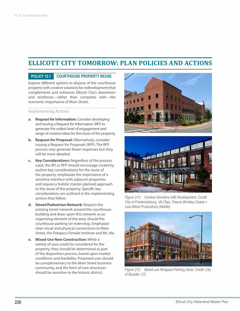
226 Ellicott City Watershed Master Plan
III.12 Courthouse Area
Figure 212: Mixed-use Wrapped Parking Deck, Credit: City of Boulder, CO
Figure 213: Context-Sensitive Infill Development, Credit: City of Fredericksburg, VA (Top), Pearce Brinkley Cease + Lee/JWest Productions (Middle)
POLICY 12.1
ELLICOTT CITY TOMORROW: PLAN POLICIES AND ACTIONS
COURTHOUSE PROPERTY REUSEExplore different options to dispose of the courthouse property with creative solutions for redevelopment that complements and enhances Ellicott City’s downtown and reinforces—rather than competes with—the economic importance of Main Street.
Implementing Actions
a. Request for Information: Consider developing and issuing a Request for Information (RFI) to generate the widest level of engagement and range of creative ideas for the reuse of the property.
b. Request for Proposal: Alternatively, consider issuing a Request for Proposals (RFP). The RFP process may generate fewer responses but they will be more detailed.
c. Key Considerations: Regardless of the process used, the RFI or RFP should encourage creativity, outline key considerations for the reuse of the property, emphasize the importance of a sensitive interface with adjacent properties and require a holistic master-planned approach to the reuse of the property. Specific key considerations are outlined in the implementing actions that follow.
d. Street/Pedestrian Network: Respect the existing street network around the courthouse building and draw upon this network as an organizing element of the area, should the courthouse parking lot redevelop. Emphasize clear visual and physical connections to Main Street, the Patapsco Female Institute and Mt. Ida.
e. Mixed-Use New Construction: While a variety of uses could be considered for the property, they should be determined as part of the disposition process, based upon market conditions and feasibility. Proposed uses should be complementary to the Main Street business community, and the form of new structures should be sensitive to the historic district.
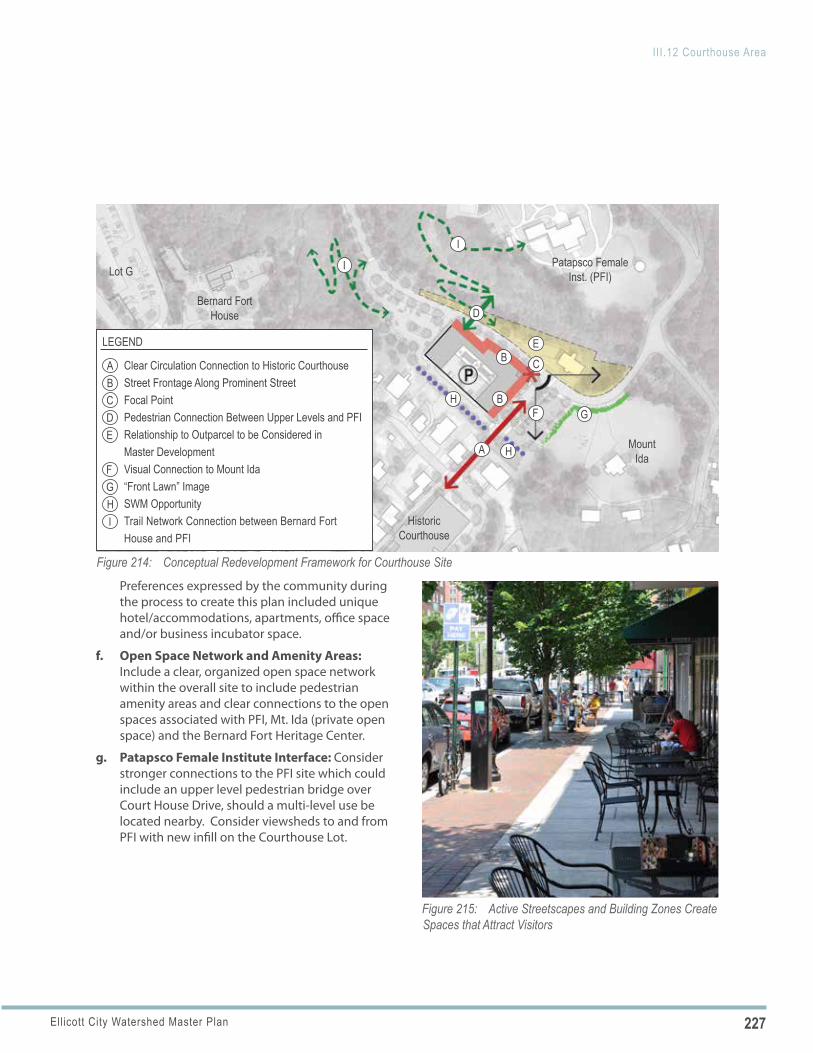
227Ellicott City Watershed Master Plan
III.12 Courthouse Area
Bernard Fort House
Historic Courthouse
Patapsco Female Inst. (PFI)
Mount Ida
Lot G
Figure 214: Conceptual Redevelopment Framework for Courthouse Site
A
GFB
B
H
H
I
I
C
D
E
A
GF
B
HI
CDE
LEGEND
Clear Circulation Connection to Historic CourthouseStreet Frontage Along Prominent StreetFocal PointPedestrian Connection Between Upper Levels and PFIRelationship to Outparcel to be Considered in Master DevelopmentVisual Connection to Mount Ida“Front Lawn” ImageSWM OpportunityTrail Network Connection between Bernard Fort House and PFI
Figure 215: Active Streetscapes and Building Zones Create Spaces that Attract Visitors
Preferences expressed by the community during the process to create this plan included unique hotel/accommodations, apartments, office space and/or business incubator space.
f. Open Space Network and Amenity Areas: Include a clear, organized open space network within the overall site to include pedestrian amenity areas and clear connections to the open spaces associated with PFI, Mt. Ida (private open space) and the Bernard Fort Heritage Center.
g. Patapsco Female Institute Interface: Consider stronger connections to the PFI site which could include an upper level pedestrian bridge over Court House Drive, should a multi-level use be located nearby. Consider viewsheds to and from PFI with new infill on the Courthouse Lot.
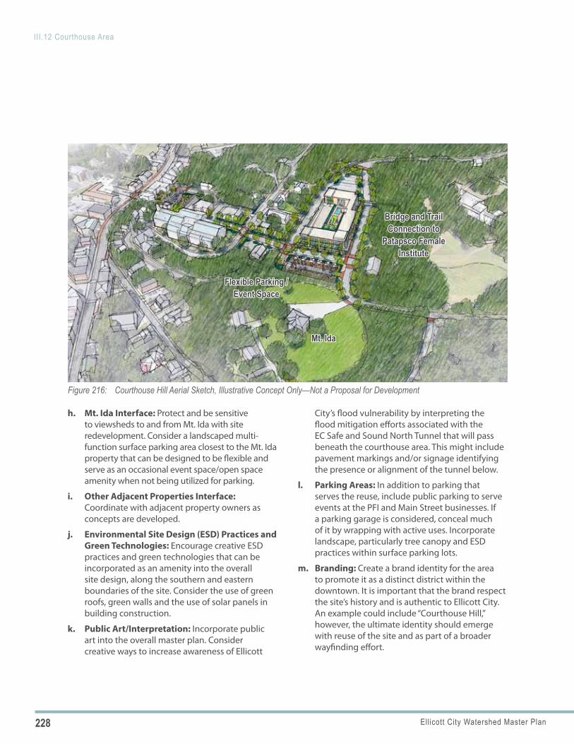
228 Ellicott City Watershed Master Plan
III.12 Courthouse Area
Figure 216: Courthouse Hill Aerial Sketch, Illustrative Concept Only—Not a Proposal for Development
Mt. IdaMt. Ida
Flexible Parking / Flexible Parking / Event SpaceEvent Space
Bridge and Trail Bridge and Trail Connection to Connection to
Patapsco Female Patapsco Female InstituteInstitute
h. Mt. Ida Interface: Protect and be sensitive to viewsheds to and from Mt. Ida with site redevelopment. Consider a landscaped multi-function surface parking area closest to the Mt. Ida property that can be designed to be flexible and serve as an occasional event space/open space amenity when not being utilized for parking.
i. Other Adjacent Properties Interface: Coordinate with adjacent property owners as concepts are developed.
j. Environmental Site Design (ESD) Practices and Green Technologies: Encourage creative ESD practices and green technologies that can be incorporated as an amenity into the overall site design, along the southern and eastern boundaries of the site. Consider the use of green roofs, green walls and the use of solar panels in building construction.
k. Public Art/Interpretation: Incorporate public art into the overall master plan. Consider creative ways to increase awareness of Ellicott
City’s flood vulnerability by interpreting the flood mitigation efforts associated with the EC Safe and Sound North Tunnel that will pass beneath the courthouse area. This might include pavement markings and/or signage identifying the presence or alignment of the tunnel below.
l. Parking Areas: In addition to parking that serves the reuse, include public parking to serve events at the PFI and Main Street businesses. If a parking garage is considered, conceal much of it by wrapping with active uses. Incorporate landscape, particularly tree canopy and ESD practices within surface parking lots.
m. Branding: Create a brand identity for the area to promote it as a distinct district within the downtown. It is important that the brand respect the site’s history and is authentic to Ellicott City. An example could include “Courthouse Hill,” however, the ultimate identity should emerge with reuse of the site and as part of a broader wayfinding effort.
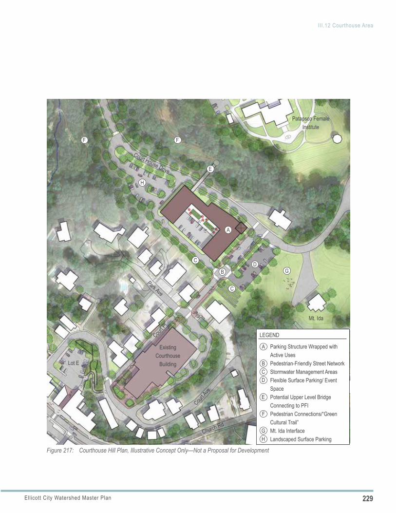
229Ellicott City Watershed Master Plan
III.12 Courthouse Area
Figure 217: Courthouse Hill Plan, Illustrative Concept Only—Not a Proposal for Development
A
D
H
FF
E
B
C
C
Mt. Ida
Patapsco Female Institute
Existing Courthouse
Building
Court House Drive
Court Ave
Church Rd
Court P
l
Park Ave
Lot E
A
BCD
E
F
LEGEND
Parking Structure Wrapped with Active UsesPedestrian-Friendly Street NetworkStormwater Management Areas Flexible Surface Parking/ Event SpacePotential Upper Level Bridge Connecting to PFIPedestrian Connections/“Green Cultural Trail”Mt. Ida InterfaceLandscaped Surface Parking
GH
G
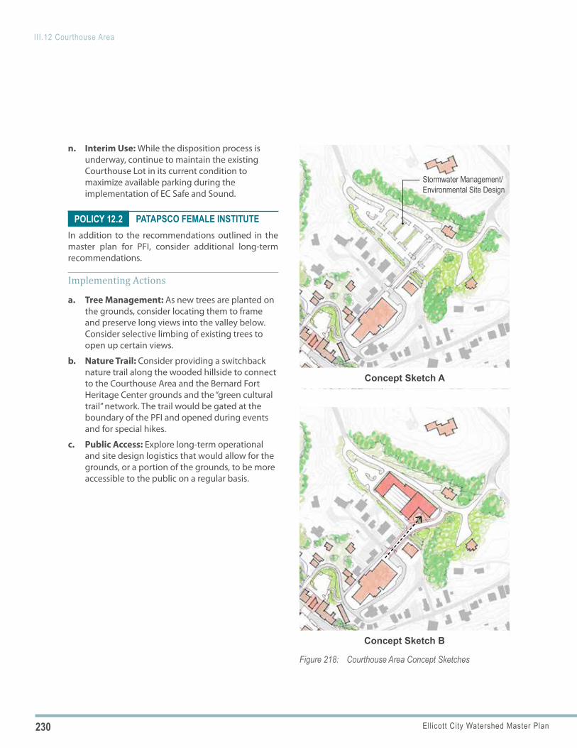
230 Ellicott City Watershed Master Plan
III.12 Courthouse Area
Figure 218: Courthouse Area Concept Sketches
Concept Sketch B
Concept Sketch A
Stormwater Management/Environmental Site Design
POLICY 12.2
n. Interim Use: While the disposition process is underway, continue to maintain the existing Courthouse Lot in its current condition to maximize available parking during the implementation of EC Safe and Sound.
PATAPSCO FEMALE INSTITUTEIn addition to the recommendations outlined in the master plan for PFI, consider additional long-term recommendations.
Implementing Actions
a. Tree Management: As new trees are planted on the grounds, consider locating them to frame and preserve long views into the valley below. Consider selective limbing of existing trees to open up certain views.
b. Nature Trail: Consider providing a switchback nature trail along the wooded hillside to connect to the Courthouse Area and the Bernard Fort Heritage Center grounds and the “green cultural trail” network. The trail would be gated at the boundary of the PFI and opened during events and for special hikes.
c. Public Access: Explore long-term operational and site design logistics that would allow for the grounds, or a portion of the grounds, to be more accessible to the public on a regular basis.
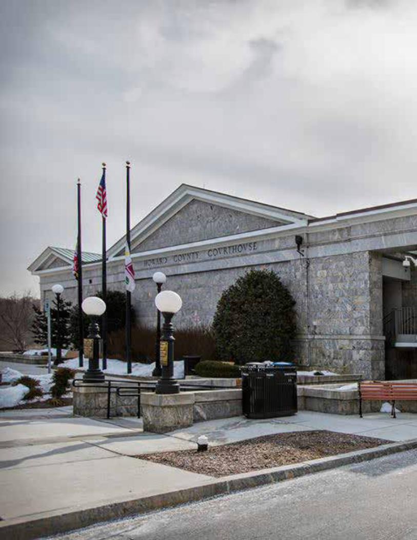
231Ellicott City Watershed Master Plan
III.12 Courthouse Area
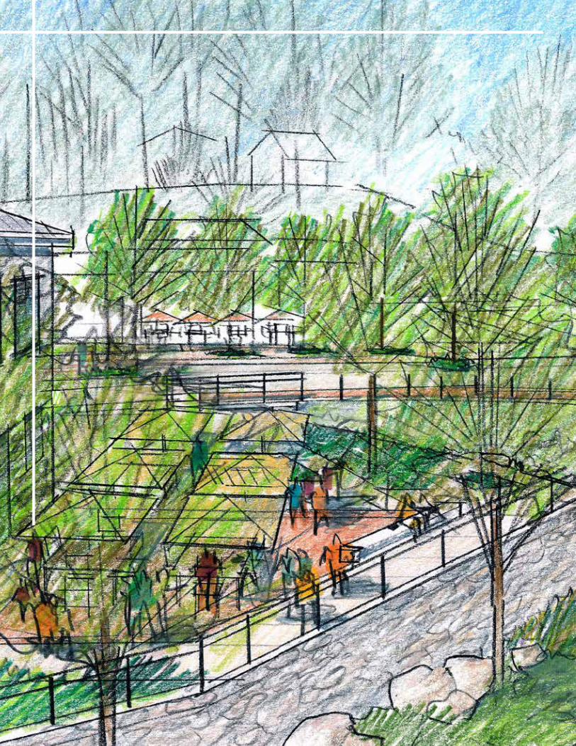
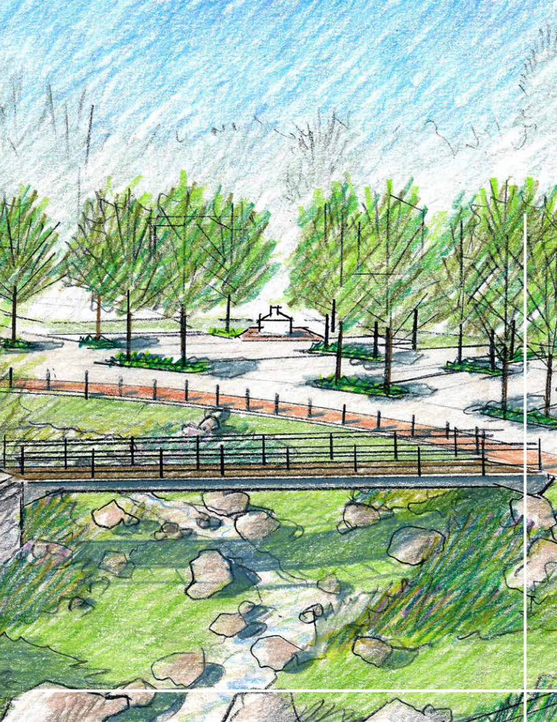
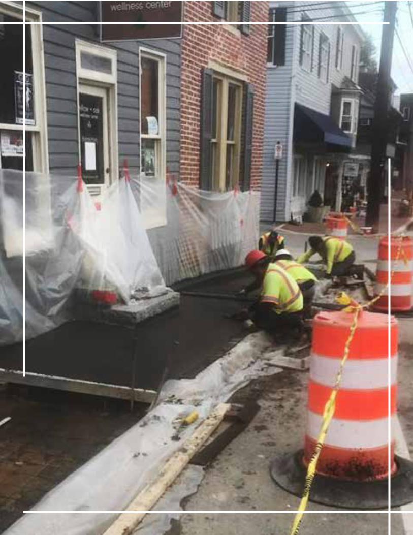
235Ellicott City Watershed Master Plan
OVERVIEWThis master plan is a framework to manage change and enhancements in Ellicott City over the next twenty years and beyond and intends to be a guiding, yet flexible document. Howard County Government will be the entity in charge of incrementally implementing the master plan, however, private sector, non-profit entities and individuals will have a partnership role for many projects. Many of the concepts illustrated will be further refined and vetted should they become projects. Should opportunities arise, the plan also includes redevelopment concepts shown for inspiration. It is important to view the master plan as a “menu” of projects, particularly given current public sector fiscal constraints and the unknown opportunities and challenges that may arise over time. Implementation partners may likewise need to consider new technologies and/or strategies that may arise that are better suited for certain projects or that encourage innovation. As unforeseen challenges and opportunities emerge, the multi-objective vision and flexible approach offered in this master plan will guide Howard County Government and its partners. Together, they will protect and enhance Ellicott City as a model, resilient community.
IMPLEMENTATION TIMEFRAMESImplementation timeframes will be determined by need, funding, emerging opportunities, and impacts/adjacencies related to the implementation of EC Safe and Sound flood mitigation. As of fall 2020, several projects under the EC Safe and Sound plan are anticipated to start construction in FY2021, pending completion of the federal Section 106 process. In addition, several other projects will continue moving through the design and/or permitting process.
IMPLEMENTATION PARTNERSAs the entity in charge of implementing the master plan, Howard County Government will work among a partnership of public and private entities and individuals. Implementation partners will vary depending upon the specific project and may include residential neighborhoods, business owners, property owners, advocacy groups, and the private sector.
IMPLEMENTATION MATRIXThe Implementation Matrix, divided among the following page spreads, is a summary of the recommendations and timeframes for implementation. The matrix is organized by plan frameworks and plan areas and outlines the key plan policies and actions for each. Implementing timeframes are noted as short (completion within five years), medium (six to ten years for completion) or long (11 or more years to implement fully). These periods align with Howard County’s anticipated Capital Budget. In some instances, implementation will occur over a span of time (i.e. short-mid, mid-long, or short-long). Others may be listed as ongoing to indicate they won’t necessarily have a completion date.
With this implementation matrix, it is important to note:
» Recommendations will not be implemented all atonce. Rather, they will be implemented in phasesover many years.
» The plan frameworks, elements and actions areoften interrelated; therefore, implementation willoccur simultaneously and require coordinationamong recommendations in many instances.
» The order that the plan policies and actions arelisted does not indicate a prioritization.
IVImplementation Plan
236 Ellicott City Watershed Master Plan
IV Implementation Plan
As plan policies are implemented, progress can be tracked and reviewed during an “Annual Forum on Ellicott City” as described below.
ANNUAL FORUM ON ELLICOTT CITYHoward County Government should consider hosting an annual “Forum on Ellicott City” to discuss ongoing partnerships; highlight past challenges and celebrate successes; and outline future projects, potential challenges and potential opportunities. All partners involved in working with Howard County to implement this plan should participate in this forum.
Tracking the success of this master plan will be critical to maintain the momentum of its implementation and keep partners energized. Such a forum could introduce ongoing baseline reporting on business conditions in the district, including value per square foot, retail sales within the district, net business openings, new jobs and investment dollars spent (public and private). As is the case in many communities, such a forum should discuss the status of parking resources as needs shift, construction projects continue and improvements take place. This is also an opportunity to celebrate partnerships, present the annual work program and provide a “report card” on the progress of recommendations in this plan.
BI-COUNTY FORUMHoward County Government should consider facilitating a bi-county summit with both public and private stakeholders to discuss and coordinate common goals, challenges and solutions and celebrate successes. Explore holding the summit every two to five years.
Ellicott City is at the border between Howard and Baltimore Counties, with the historic community of Oella located just across the river and Catonsville’s business district only a few miles east along Frederick Road. Each of these communities is part of the broader Patapsco Heritage Area. While the communities are distinct in many ways, the visitor experiences they offer are similar, and the three communities have similarities in terms of geography, environmental
qualities and sharing the Patapsco River as a central amenity. Their individual successes are tied to the success of the whole area.
The forum focus could be a on a wide variety of issues including, but not limited to:
» Reuse of Wilkins Rogers Mill Site; » Patapsco River flooding; » Water Quality and Habitat; » Recreational Amenities, Connections/Trails; » Traffic Management and Pedestrian Safety; » Transit; » Parking; » Complementary Business Districts; and » Co-marketing.
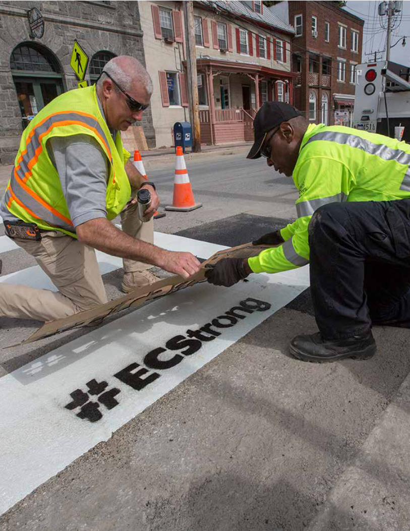
237Ellicott City Watershed Master Plan
IV Implementation Plan
238 Ellicott City Watershed Master Plan
IV Implementation Plan
FRAMEWORK POLICY # PLAN ELEMENT/ACTION TIMEFRAMEPRIMARY
RESPONSIBILITYPARTNERS
REFERENCE
IN REPORT
1. COMMUNITYCHARACTER +PLACEMAKING
1.1
1.2
1.3
1.4
1.5
1.6
1.7
1.8
Preservation Facilitation
Property Maintenance
Development Character and Zoning
Scenic Roads
Public Realm Design, Amenities and User Comforts
Public Art
Green Cultural Trail
Programming and Events
Ongoing
Short—Long
Short
Short— Mid
Ongoing
Ongoing
Short—Long
Ongoing
DPZ
DPZ
DPZ
DPZ
DPZ, DRP
DPZ
DRP
Nonprofit Sector
Nonprofit Sector
DILP, Property Owners
Nonprofit Sector, Private Sector, Property Owners
Nonprofit Sector, Private Sector
OOT, OCS, DPZ
Tourism, EDA, Private Sector
“Policy 1.1” on page 64
“Policy 1.2” on page 65
“Policy 1.3” on page 66
“Policy 1.4” on page 66
“Policy 1.5” on page 66
“Policy 1.6” on page 68
“Policy 1.7” on page 70
“Policy 1.8” on page 70
2. FLOODMITIGATION
2.1
2.2
2.3
2.4
2.5
2.6
2.7
2.8
2.9
EC Safe And Sound Implementation
Stormwater Management Facility Design
Channel Maintenance and Debris Management
Stream Restoration
Process for Ongoing Evaluation after
EC Safe and Sound Implementation
Patapsco River Evaluation
Nonstructural Flood Proofing
Flood Elevation Certificates
Public Education and Awareness Campaign
Ongoing—Short
Short—Long
Ongoing
Mid—Long
Ongoing
Short— Mid
Ongoing
Ongoing
Ongoing—Short
DPW
DPW
DPW
DPW
DPW
DPW
DPW
DPW
DPW
OCS, DPZ
Property Owners
DRP, OCS, Highways, Nonprofit Sector, Advocacy
Nonprofit Sector, Property Owners, Advocacy
Baltimore County, Property Owners
DPZ, DILP, Property Owners
Property Owners
DPZ, Nonprofit Sector
“Policy 2.1” on page 85
“Policy 2.2” on page 85
“Policy 2.3” on page 85
“Policy 2.4” on page 87
“Policy 2.5” on page 88
“Policy 2.6” on page 88
“Policy 2.7” on page 88
“Policy 2.8” on page 89
“Policy 2.9” on page 89
3. ENVIRONMENTALSTEWARDSHIP
3.1
3.2
3.3
3.4
3.5
3.6
3.7
3.8
Strategic Watershed Program
Forest Management
Stream Restoration
Soil Amendments
Stream Daylighting
Environmental Site Design (ESD) Practices
and Green Technologies
Dedicated Open Space and Conservation Easements
Public Education
Mid
Short—Long
Mid—Long
Ongoing
Long
Short—Long
Mid—Long
Ongoing
DPW
OCS
DPW
OCS
DPW
DPW
DPZ, DRP
OCS
OCS, Nonprofit Sector, Advocacy
DRP, Nonprofit Sector, Advocacy, Property Owners
Nonprofit Sector, Property Owners
DPW, DRP, Nonprofit Sector, Property Owners
DPZ, OCS, Nonprofit Sector, Property Owners
DPZ, OCS, Private Sector
OCS, Property Owners, Advocacy
DPZ, Advocacy, Nonprofit
“Policy 3.1” on page 98
“Policy 3.2” on page 99
“Policy 3.3” on page 100
“Policy 3.4” on page 100
“Policy 3.5” on page 101
“Policy 3.6” on page 101
“Policy 3.7” on page 102
“Policy 3.8” on page 102
Ongoing: No Completion Timeframe; Short: 0–5 Years; Medium (Mid): 6–10 Years; Long: 11+ Years
KEY» Baltimore County, Maryland (Baltimore County)» Dept. of Inspections, Licenses and Permits (DILP)» Department of Public Works (DPW)» Department of Planning and Zoning (DPZ)
» Department of Recreation and Parks (DRP)» Economic Development Authority (EDA)» Historic Preservation Commission (HPC)» Howard County Tourism Council (Tourism)
239Ellicott City Watershed Master Plan
IV Implementation Plan
FRAMEWORK POLICY # PLAN ELEMENT/ACTION TIMEFRAMEPRIMARY
RESPONSIBILITYPARTNERS
REFERENCE
IN REPORT
1. COMMUNITY CHARACTER + PLACEMAKING
1.1
1.2
1.3
1.4
1.5
1.6
1.7
1.8
Preservation Facilitation
Property Maintenance
Development Character and Zoning
Scenic Roads
Public Realm Design, Amenities and User Comforts
Public Art
“Green Cultural Trail”
Programming and Events
Ongoing
Short—Long
Short
Short— Mid
Ongoing
Ongoing
Short—Long
Ongoing
DPZ
DPZ
DPZ
DPZ
DPZ, DRP
DPZ
DRP
Nonprofit Sector
Nonprofit Sector
DILP, Property Owners
Nonprofit Sector, Private Sector, Property Owners
Nonprofit Sector, Private Sector
OOT, OCS, DPZ
Tourism, EDA, Private Sector
“Policy 1.1” on page 64
“Policy 1.2” on page 65
“Policy 1.3” on page 66
“Policy 1.4” on page 66
“Policy 1.5” on page 66
“Policy 1.6” on page 68
“Policy 1.7” on page 70
“Policy 1.8” on page 70
2. FLOOD MITIGATION
2.1
2.2
2.3
2.4
2.5
2.6
2.7
2.8
2.9
EC Safe And Sound Implementation
Stormwater Management Facility Design
Channel Maintenance and Debris Management
Stream Restoration
Process for Ongoing Evaluation after
EC Safe and Sound Implementation
Patapsco River Evaluation
Nonstructural Flood Proofing
Flood Elevation Certificates
Public Education and Awareness Campaign
Ongoing—Short
Short—Long
Ongoing
Mid—Long
Ongoing
Short— Mid
Ongoing
Ongoing
Ongoing—Short
DPW
DPW
DPW
DPW
DPW
DPW
DPW
DPW
DPW
OCS, DPZ
Property Owners
DRP, OCS, Highways, Nonprofit Sector, Advocacy
Nonprofit Sector, Property Owners, Advocacy
Baltimore County, Property Owners
DPZ, DILP, Property Owners
Property Owners
DPZ, Nonprofit Sector
“Policy 2.1” on page 85
“Policy 2.2” on page 85
“Policy 2.3” on page 85
“Policy 2.4” on page 87
“Policy 2.5” on page 88
“Policy 2.6” on page 88
“Policy 2.7” on page 88
“Policy 2.8” on page 89
“Policy 2.9” on page 89
3. ENVIRONMENTAL STEWARDSHIP
3.1
3.2
3.3
3.4
3.5
3.6
3.7
3.8
Strategic Watershed Program
Forest Management
Stream Restoration
Soil Amendments
Stream Daylighting
Environmental Site Design (ESD) Practices
and Green Technologies
Dedicated Open Space and Conservation Easements
Public Education
Mid
Short—Long
Mid—Long
Ongoing
Long
Short—Long
Mid—Long
Ongoing
DPW
OCS
DPW
OCS
DPW
DPW
DPZ, DRP
OCS
OCS, Nonprofit Sector, Advocacy
DRP, Nonprofit Sector, Advocacy, Property Owners
Nonprofit Sector, Property Owners
DPW, DRP, Nonprofit Sector, Property Owners
DPZ, OCS, Nonprofit Sector, Property Owners
DPZ, OCS, Private Sector
OCS, Property Owners, Advocacy
DPZ, Advocacy, Nonprofit
“Policy 3.1” on page 98
“Policy 3.2” on page 99
“Policy 3.3” on page 100
“Policy 3.4” on page 100
“Policy 3.5” on page 101
“Policy 3.6” on page 101
“Policy 3.7” on page 102
“Policy 3.8” on page 102
» Maryland State Highway Administration (SHA) » Office of Community Sustainability (OCS) » Office of Emergency Management (OEM) » Office of Transportation (OOT) » Other Advocacy Groups (Advocacy)
240 Ellicott City Watershed Master Plan
IV Implementation Plan
4. ECONOMIC DEVELOPMENT
4.1
4.2
4.3
4.4
4.5
4.6
Existing Business Support
Business Attraction and Recruitment
Creative Spaces Initiative
Mixed-Use New Construction and Redevelopment
Community Brand Extension
Community Tourism And Marketing Campaign
Ongoing
Ongoing
Mid
Mid—Long
Short
Short
EDA
EDA
Private Sector
Private Sector
Nonprofit Sector
Tourism
Nonprofit Sector, SBDC, HCC, UMBC
Nonprofit Sector
EDA, Nonprofit Sector
DPZ, EDA, Nonprofit Sector
EDA, Tourism
Nonprofit Sector, State Tourism, EDA
“Policy 4.1” on page 108
“Policy 4.2” on page 108
“Policy 4.3” on page 110
“Policy 4.4” on page 111
“Policy 4.5” on page 112
“Policy 4.6” on page 115
5. TRANSPORTATION + PARKING
5.1
5.2
5.3
5.4
5.5
5.6
5.7
Pedestrian Accessibility and Safety
Sidewalk and Trail Connectivity
Bicycle Accommodations
Transit
Parking Management
Wayfinding System
Adaptability for the Future
Short— Mid
Mid
Short— Mid
Short— Mid
Mid
Short— Mid
Mid—Long
DPW
DPW, OOT
OOT
OOT
Finance
DPW
DPW, OOT
DPZ, OOT
DRP, DPZ, Property Owners
DPW, DRP, Property Owners
Nonprofit Sector
DPW, DPZ, Nonprofit Sector
DPZ, Nonprofit Sector, MDOT
DRP
“Policy 5.1” on page 123
“Policy 5.2” on page 123
“Policy 5.3” on page 127
“Policy 5.4” on page 127
“Policy 5.5” on page 128
“Policy 5.6” on page 130
“Policy 5.7” on page 131
6. STREETSCAPE
6.1
6.2
6.3
6.4
6.5
Main Street Streetscape
Maryland Avenue
Other Streets
Streetscape Construction Phasing
Streetscape Construction Management Mitigation Plan
Short— Mid
Short— Mid
Mid—Long
Short— Mid
Short— Mid
DPW
DPW
DPW
DPW
DPW
OOT, DPZ, OEM, Property Owners
OOT, DPZ, OEM
OOT, DPZ, OEM, Property Owners
OOT, OEM, Nonprofit Sector
OOT, OEM, Nonprofit Sector, Private Sector
“Policy 6.1” on page 140
“Policy 6.2” on page 146
“Policy 6.3” on page 147
“Policy 6.4” on page 149
“Policy 6.5” on page 150
7. RIVERFRONT
7.1
7.2
7.3
7.4
7.5
7.6
7.7
Patapsco River Pedestrian and Bicycle Crossing
Regional Trail Network
North Tunnel Outfall
Ellicott City Riverfront Park
Lot B
Lot A
B&O Station Museum Hillside
Mid—Long
Short—Long
Short
Short—Long
Short—Long
Long
Mid
DPW, OOT
OOT
DPW
DRP
DPW
DPW
DRP
OCS, MDE, SHA, DRP, Baltimore County, Nonprofit Sector
OCS, MDE, DPW
OCS, MDE, Private Sector
OCS, MDE, DPZ, Private Sector
OOT, OCS, MDE, DPZ, DRP
OOT, OCS, MDE, Baltimore County, Community Members
OCS, MDE
“Policy 7.1” on page 156
“Policy 7.2” on page 158
“Policy 7.3” on page 158
“Policy 7.4” on page 159
“Policy 7.5” on page 159
“Policy 7.6” on page 160
“Policy 7.7” on page 163
FRAMEWORK/AREA POLICY # PLAN ELEMENT/ACTION TIMEFRAME
PRIMARY
RESPONSIBILITYPARTNERS
REFERENCE
IN REPORT
Ongoing: No Completion Timeframe; Short: 0–5 Years; Medium (Mid): 6–10 Years; Long: 11+ Years
KEY » Baltimore County, Maryland (Baltimore County) » Dept. of Inspections, Licenses and Permits (DILP) » Department of Public Works (DPW) » Department of Planning and Zoning (DPZ)
» Department of Recreation and Parks (DRP) » Economic Development Authority (EDA) » Historic Preservation Commission (HPC) » Howard County Tourism Council (Tourism)
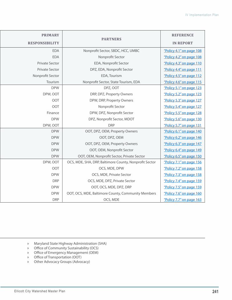
241Ellicott City Watershed Master Plan
IV Implementation Plan
4. ECONOMIC DEVELOPMENT
4.1
4.2
4.3
4.4
4.5
4.6
Existing Business Support
Business Attraction and Recruitment
Creative Spaces Initiative
Mixed-Use New Construction and Redevelopment
Community Brand Extension
Community Tourism And Marketing Campaign
Ongoing
Ongoing
Mid
Mid—Long
Short
Short
EDA
EDA
Private Sector
Private Sector
Nonprofit Sector
Tourism
Nonprofit Sector, SBDC, HCC, UMBC
Nonprofit Sector
EDA, Nonprofit Sector
DPZ, EDA, Nonprofit Sector
EDA, Tourism
Nonprofit Sector, State Tourism, EDA
“Policy 4.1” on page 108
“Policy 4.2” on page 108
“Policy 4.3” on page 110
“Policy 4.4” on page 111
“Policy 4.5” on page 112
“Policy 4.6” on page 115
5. TRANSPORTATION + PARKING
5.1
5.2
5.3
5.4
5.5
5.6
5.7
Pedestrian Accessibility and Safety
Sidewalk and Trail Connectivity
Bicycle Accommodations
Transit
Parking Management
Wayfinding System
Adaptability for the Future
Short— Mid
Mid
Short— Mid
Short— Mid
Mid
Short— Mid
Mid—Long
DPW
DPW, OOT
OOT
OOT
Finance
DPW
DPW, OOT
DPZ, OOT
DRP, DPZ, Property Owners
DPW, DRP, Property Owners
Nonprofit Sector
DPW, DPZ, Nonprofit Sector
DPZ, Nonprofit Sector, MDOT
DRP
“Policy 5.1” on page 123
“Policy 5.2” on page 123
“Policy 5.3” on page 127
“Policy 5.4” on page 127
“Policy 5.5” on page 128
“Policy 5.6” on page 130
“Policy 5.7” on page 131
6. STREETSCAPE
6.1
6.2
6.3
6.4
6.5
Main Street Streetscape
Maryland Avenue
Other Streets
Streetscape Construction Phasing
Streetscape Construction Management Mitigation Plan
Short— Mid
Short— Mid
Mid—Long
Short— Mid
Short— Mid
DPW
DPW
DPW
DPW
DPW
OOT, DPZ, OEM, Property Owners
OOT, DPZ, OEM
OOT, DPZ, OEM, Property Owners
OOT, OEM, Nonprofit Sector
OOT, OEM, Nonprofit Sector, Private Sector
“Policy 6.1” on page 140
“Policy 6.2” on page 146
“Policy 6.3” on page 147
“Policy 6.4” on page 149
“Policy 6.5” on page 150
7. RIVERFRONT
7.1
7.2
7.3
7.4
7.5
7.6
7.7
Patapsco River Pedestrian and Bicycle Crossing
Regional Trail Network
North Tunnel Outfall
Ellicott City Riverfront Park
Lot B
Lot A
B&O Station Museum Hillside
Mid—Long
Short—Long
Short
Short—Long
Short—Long
Long
Mid
DPW, OOT
OOT
DPW
DRP
DPW
DPW
DRP
OCS, MDE, SHA, DRP, Baltimore County, Nonprofit Sector
OCS, MDE, DPW
OCS, MDE, Private Sector
OCS, MDE, DPZ, Private Sector
OOT, OCS, MDE, DPZ, DRP
OOT, OCS, MDE, Baltimore County, Community Members
OCS, MDE
“Policy 7.1” on page 156
“Policy 7.2” on page 158
“Policy 7.3” on page 158
“Policy 7.4” on page 159
“Policy 7.5” on page 159
“Policy 7.6” on page 160
“Policy 7.7” on page 163
FRAMEWORK/AREA POLICY # PLAN ELEMENT/ACTION TIMEFRAME
PRIMARY
RESPONSIBILITYPARTNERS
REFERENCE
IN REPORT
» Maryland State Highway Administration (SHA) » Office of Community Sustainability (OCS) » Office of Emergency Management (OEM) » Office of Transportation (OOT) » Other Advocacy Groups (Advocacy)
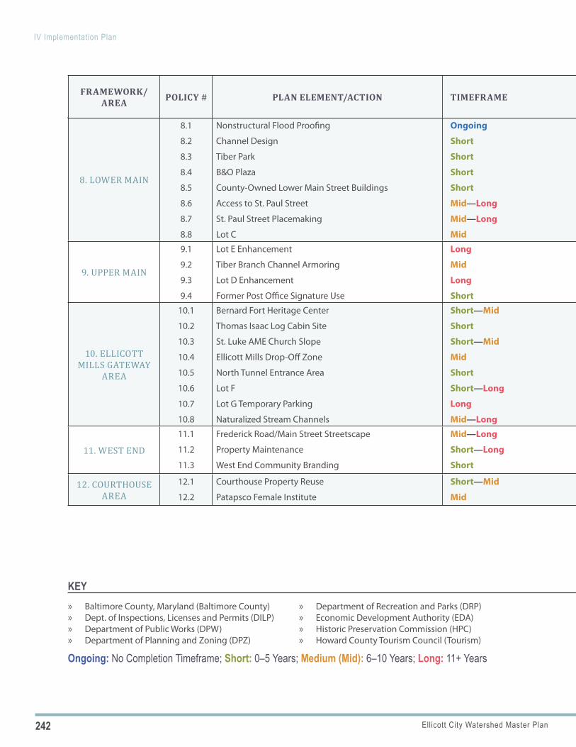
242 Ellicott City Watershed Master Plan
IV Implementation Plan
8. LOWER MAIN
8.1
8.2
8.3
8.4
8.5
8.6
8.7
8.8
Nonstructural Flood Proofing
Channel Design
Tiber Park
B&O Plaza
County-Owned Lower Main Street Buildings
Access to St. Paul Street
St. Paul Street Placemaking
Lot C
Ongoing
Short
Short
Short
Short
Mid—Long
Mid—Long
Mid
DPW
DPW
DPW, DRP
DPW, DRP
DPW
DPW
DPW
DPW
DPZ, DILP, Property Owners
DPZ, Property Owners
DPZ, OEM, Property Owners
DPZ, OEM, Tourism
DRP, OEM
DRP, DPZ
DRP
“Policy 8.1” on page 172
“Policy 8.2” on page 172
“Policy 8.3” on page 172
“Policy 8.4” on page 178
“Policy 8.5” on page 179
“Policy 8.6” on page 180
“Policy 8.7” on page 180
“Policy 8.8” on page 180
9. UPPER MAIN
9.1
9.2
9.3
9.4
Lot E Enhancement
Tiber Branch Channel Armoring
Lot D Enhancement
Former Post Office Signature Use
Long
Mid
Long
Short
DPW
DPW
DPW, Private Sector
DPW
DPZ, DRP
DPZ, DRP
DPZ, DRP, EDA, OCS, OEM
DPZ, DRP, EDA, Nonprofit Sector
“Policy 9.1” on page 187
“Policy 9.2” on page 188
“Policy 9.3” on page 188
“Policy 9.4” on page 194
10. ELLICOTT MILLS GATEWAY
AREA
10.1
10.2
10.3
10.4
10.5
10.6
10.7
10.8
Bernard Fort Heritage Center
Thomas Isaac Log Cabin Site
St. Luke AME Church Slope
Ellicott Mills Drop-Off Zone
North Tunnel Entrance Area
Lot F
Lot G Temporary Parking
Naturalized Stream Channels
Short—Mid
Short
Short—Mid
Mid
Short
Short—Long
Long
Mid—Long
DRP
DRP
DPW
DPW
DPW
DPW
DPW
DPW
DPW, DPZ
DPW, DPZ
DPZ, Property Owners
OOT, DPZ, Tourism
DPZ, OCS, DRP, OEM
DPZ, OCS, DRP, Private Sector
DPZ, DRP, Community Members
DPZ, OCS, DRP
“Policy 10.1” on page 204
“Policy 10.2” on page 205
“Policy 10.3” on page 205
“Policy 10.4” on page 205
“Policy 10.5” on page 206
“Policy 10.6” on page 206
“Policy 10.7” on page 210
“Policy 10.8” on page 211
11. WEST END
11.1
11.2
11.3
Frederick Road/Main Street Streetscape
Property Maintenance
West End Community Branding
Mid—Long
Short—Long
Short
DPW
DPZ
Nonprofit Sector
OOT, DPZ, OEM, Property Owners
DILP, Property Owners
EDA, Tourism
“Policy 11.1” on page 218
“Policy 11.2” on page 218
“Policy 11.3” on page 218
12. COURTHOUSE AREA
12.1
12.2
Courthouse Property Reuse
Patapsco Female Institute
Short—Mid
Mid
DPW
DRP
DPZ, EDA, DRP, Private Sector
DPZ
“Policy 12.1” on page 226
“Policy 12.2” on page 230
Ongoing: No Completion Timeframe; Short: 0–5 Years; Medium (Mid): 6–10 Years; Long: 11+ Years
KEY » Baltimore County, Maryland (Baltimore County) » Dept. of Inspections, Licenses and Permits (DILP) » Department of Public Works (DPW) » Department of Planning and Zoning (DPZ)
» Department of Recreation and Parks (DRP) » Economic Development Authority (EDA) » Historic Preservation Commission (HPC) » Howard County Tourism Council (Tourism)
FRAMEWORK/AREA POLICY # PLAN ELEMENT/ACTION TIMEFRAME
PRIMARY
RESPONSIBILITYPARTNERS
REFERENCE
IN REPORT
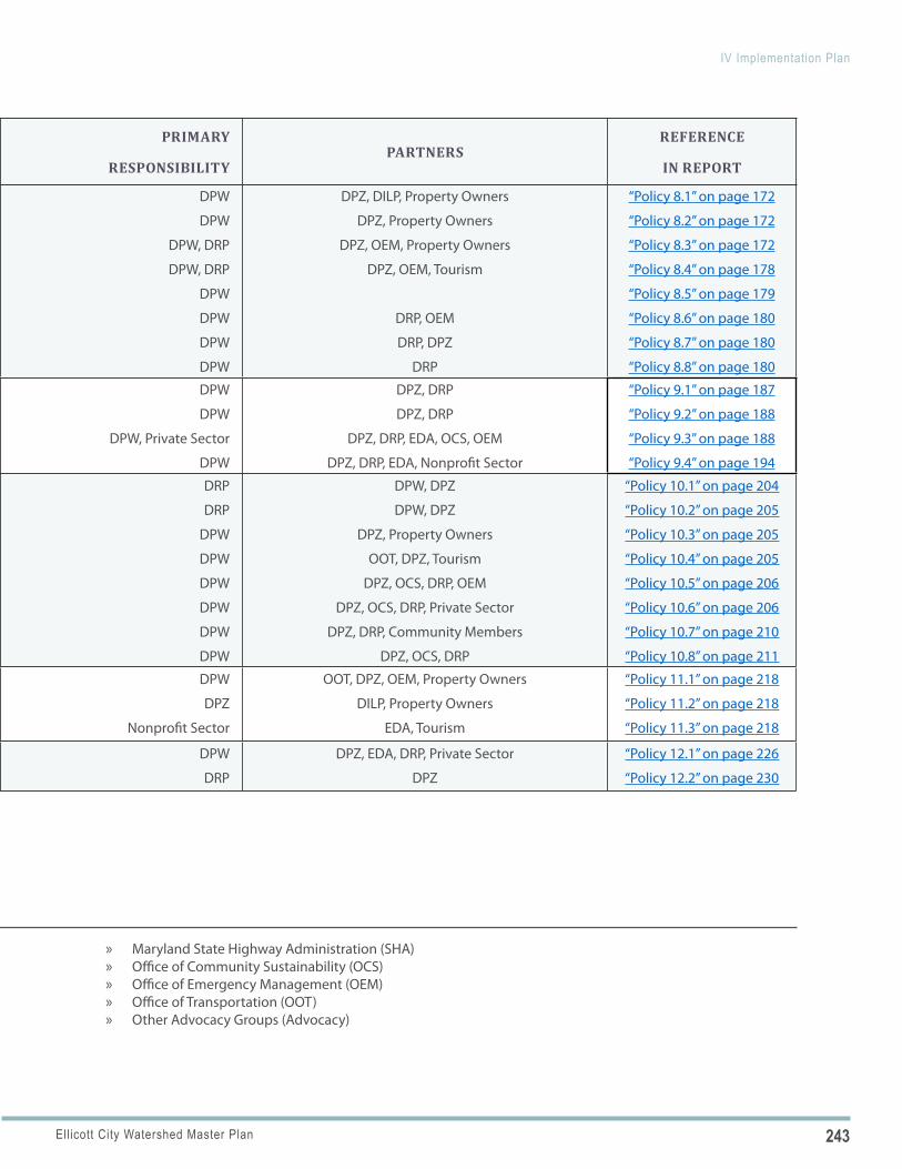
243Ellicott City Watershed Master Plan
IV Implementation Plan
8. LOWER MAIN
8.1
8.2
8.3
8.4
8.5
8.6
8.7
8.8
Nonstructural Flood Proofing
Channel Design
Tiber Park
B&O Plaza
County-Owned Lower Main Street Buildings
Access to St. Paul Street
St. Paul Street Placemaking
Lot C
Ongoing
Short
Short
Short
Short
Mid—Long
Mid—Long
Mid
DPW
DPW
DPW, DRP
DPW, DRP
DPW
DPW
DPW
DPW
DPZ, DILP, Property Owners
DPZ, Property Owners
DPZ, OEM, Property Owners
DPZ, OEM, Tourism
DRP, OEM
DRP, DPZ
DRP
“Policy 8.1” on page 172
“Policy 8.2” on page 172
“Policy 8.3” on page 172
“Policy 8.4” on page 178
“Policy 8.5” on page 179
“Policy 8.6” on page 180
“Policy 8.7” on page 180
“Policy 8.8” on page 180
9. UPPER MAIN
9.1
9.2
9.3
9.4
Lot E Enhancement
Tiber Branch Channel Armoring
Lot D Enhancement
Former Post Office Signature Use
Long
Mid
Long
Short
DPW
DPW
DPW, Private Sector
DPW
DPZ, DRP
DPZ, DRP
DPZ, DRP, EDA, OCS, OEM
DPZ, DRP, EDA, Nonprofit Sector
“Policy 9.1” on page 187
“Policy 9.2” on page 188
“Policy 9.3” on page 188
“Policy 9.4” on page 194
10. ELLICOTT MILLS GATEWAY
AREA
10.1
10.2
10.3
10.4
10.5
10.6
10.7
10.8
Bernard Fort Heritage Center
Thomas Isaac Log Cabin Site
St. Luke AME Church Slope
Ellicott Mills Drop-Off Zone
North Tunnel Entrance Area
Lot F
Lot G Temporary Parking
Naturalized Stream Channels
Short—Mid
Short
Short—Mid
Mid
Short
Short—Long
Long
Mid—Long
DRP
DRP
DPW
DPW
DPW
DPW
DPW
DPW
DPW, DPZ
DPW, DPZ
DPZ, Property Owners
OOT, DPZ, Tourism
DPZ, OCS, DRP, OEM
DPZ, OCS, DRP, Private Sector
DPZ, DRP, Community Members
DPZ, OCS, DRP
“Policy 10.1” on page 204
“Policy 10.2” on page 205
“Policy 10.3” on page 205
“Policy 10.4” on page 205
“Policy 10.5” on page 206
“Policy 10.6” on page 206
“Policy 10.7” on page 210
“Policy 10.8” on page 211
11. WEST END
11.1
11.2
11.3
Frederick Road/Main Street Streetscape
Property Maintenance
West End Community Branding
Mid—Long
Short—Long
Short
DPW
DPZ
Nonprofit Sector
OOT, DPZ, OEM, Property Owners
DILP, Property Owners
EDA, Tourism
“Policy 11.1” on page 218
“Policy 11.2” on page 218
“Policy 11.3” on page 218
12. COURTHOUSE AREA
12.1
12.2
Courthouse Property Reuse
Patapsco Female Institute
Short—Mid
Mid
DPW
DRP
DPZ, EDA, DRP, Private Sector
DPZ
“Policy 12.1” on page 226
“Policy 12.2” on page 230
» Maryland State Highway Administration (SHA) » Office of Community Sustainability (OCS) » Office of Emergency Management (OEM) » Office of Transportation (OOT) » Other Advocacy Groups (Advocacy)
FRAMEWORK/AREA POLICY # PLAN ELEMENT/ACTION TIMEFRAME
PRIMARY
RESPONSIBILITYPARTNERS
REFERENCE
IN REPORT
Department of Planning & ZoningHoward County, MD — Adopted: ______ X, 2020
RK&KLandStudiesArnett Muldrow & AssociatesPreservation ConsultingSouth Coast Consulting
PlanHoward 2030 is the County’s new general plan. With this new name comes a new, forward-looking approach and an exciting launch into a greener and more sustainable future – environmentally, economically, and for our communities. PlanHoward 2030 celebrates accomplishments and charts the next steps forward so Howard County can continue to enhance our high quality of life. Howard County’s plan includes many of the new planning approaches from PlanMaryland, the new statewide developmentplan. This document is available online, as are all PlanHoward 2030-related materials, at www.planhoward.org.
This plan highlights key issues and goals for future planning efforts. In other words, PlanHoward 2030 is a framework that sets out a scope of work and policies for the next two decades. Each policy includes appropriate implementation actions that are prioritized as one of three categories: short-term (one to three years), mid-term (four to seven years), and long-term (eight years or more). For a quick overview, summary matrices of policies and implementing actions are in Appendix A.
O v e r v i e w
PlanHoward 2030 is structurally organized into three major parts to address the three key aspects of sustainability – environment, economy, and community quality of life. With an introductory section and concluding implementation section, the plan is comprised of a total of five sections. PlanHoward 2030 uses the 12 Maryland State Planning Visions to structure 12 chapters.
Section I, Introduction, includes the two overarching Maryland visions that guide PlanHoward 2030: Quality of Life & Sustainability and Public Participation. The second section, Environment, addresses twovisions: Environmental Protection and Resource Conservation. The third, Economy, is comprised of three visions: Economic Development, Growth, and Transportation. The fourth, Community, addresses three visions: Public Facilities and Services, Housing, and Community Design. The last section, Action!, ends with two visions: Implementation and Stewardship.
Executive SummaryPlanHoward 2030 is an update to General Plan 2000. Two recently adopted general plan amendments, the Water Resource Element (WRE) and the Downtown Columbia Plan (DCP) will not be modified or replaced. These are included in PlanHoward 2030 by reference. ADOPTED AS A GENERAL PLAN AMENDMENT IN 2020, THE ELLICOTT CITY WATERSHED MASTER PLAN IS FURTHER INCLUDED IN PLANHOWARD 2030 BY REFERENCE.
K e y I s s u e s
Since adoption of General Plan 2000, changing circumstances, new priorities and approaches, and the recent recession have modified what is needed in Howard County to sustain its high quality of life. For thenext 20 years, the population will continue to increase and become more diverse with more diverse needs. The recent recession and slow recovery means State and local funding will likely remain constricted in the near term while needs are increasing. Partnerships and collaboration are essential to achieving PlanHoward 2030 goals. Howard County has a progressive and innovative culture on which to build. Key initiatives include:
� Environmental Protection. New actions focus onimplementation of a Watershed Implementation Plan to achievemandatory water quality goals and promotion of environmentalstewardship by diverse stakeholders.
� Resource Conservation. A new Green Infrastructure NetworkPlan is proposed; the land and character of the Rural West willbe protected through strategies to enhance the farm economyand to balance agricultural, residential, and commercial uses;and expanded historic preservation initiatives are proposed.
� Economic Development. Strategies are recommended topromote business innovation and growth, and to make HowardCounty a leader in 21st century technologies. Particularattention is given to the US 1 Corridor and changing economicconditions identified by a market study. Workforce developmentand the promotion of training in science, technology,engineering, and math (STEM) are another focus.
Exhibit B
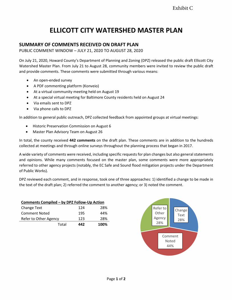
Page 1 of 2
ELLICOTT CITY WATERSHED MASTER PLAN
SUMMARY OF COMMENTS RECEIVED ON DRAFT PLAN PUBLIC COMMENT WINDOW – JULY 21, 2020 TO AUGUST 28, 2020
On July 21, 2020, Howard County’s Department of Planning and Zoning (DPZ) released the public draft Ellicott City Watershed Master Plan. From July 21 to August 28, community members were invited to review the public draft and provide comments. These comments were submitted through various means:
• An open-ended survey• A PDF commenting platform (Konveio)• At a virtual community meeting held on August 19• At a special virtual meeting for Baltimore County residents held on August 24• Via emails sent to DPZ• Via phone calls to DPZ
In addition to general public outreach, DPZ collected feedback from appointed groups at virtual meetings:
• Historic Preservation Commission on August 6• Master Plan Advisory Team on August 26
In total, the county received 442 comments on the draft plan. These comments are in addition to the hundreds collected at meetings and through online surveys throughout the planning process that began in 2017.
A wide variety of comments were received, including specific requests for plan changes but also general statements and opinions. While many comments focused on the master plan, some comments were more appropriately referred to other agency projects (notably, the EC Safe and Sound flood mitigation projects under the Department of Public Works).
DPZ reviewed each comment, and in response, took one of three approaches: 1) identified a change to be made in the text of the draft plan; 2) referred the comment to another agency; or 3) noted the comment.
Comments Compiled – by DPZ Follow-Up Action Change Text 124 28% Comment Noted 195 44% Refer to Other Agency 123 28%
Total 442 100%
Change Text28%
Comment Noted44%
Refer to Other
Agency28%
Exhibit C
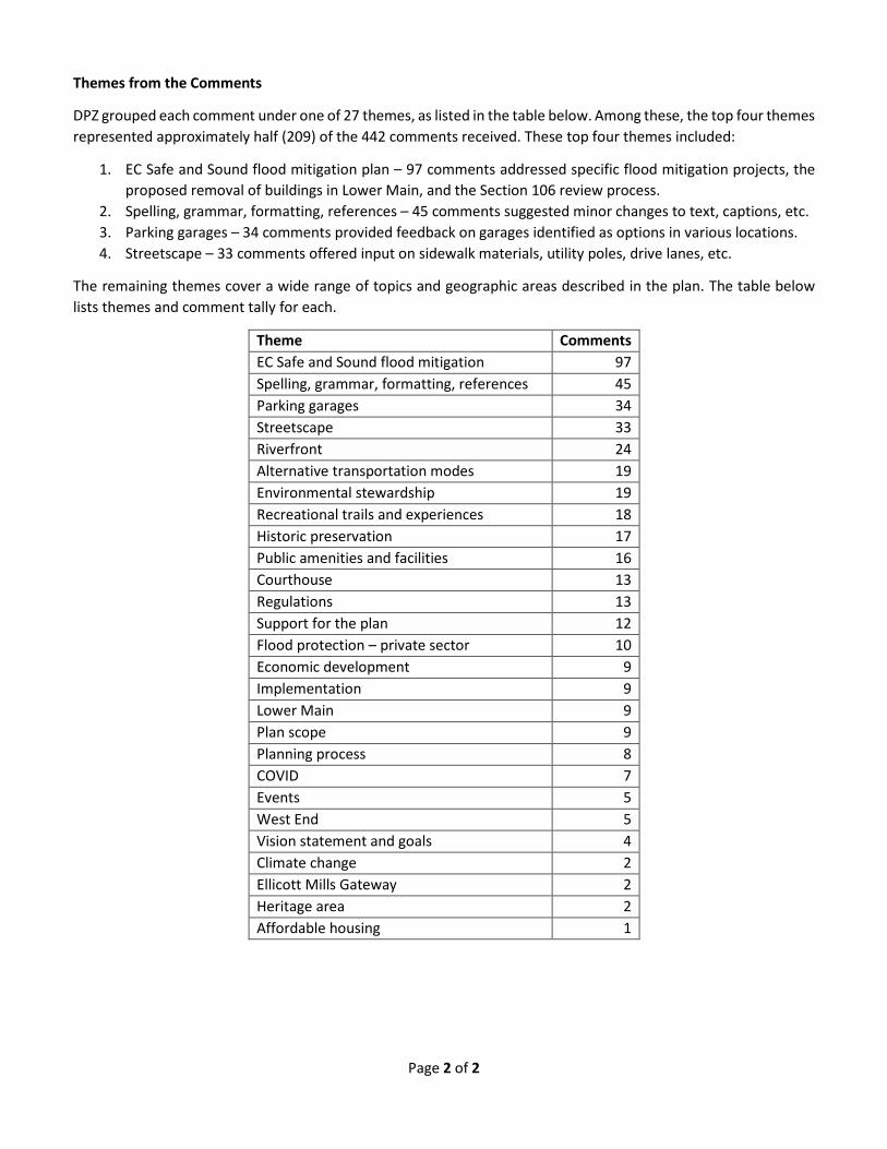
Page 2 of 2
Themes from the Comments
DPZ grouped each comment under one of 27 themes, as listed in the table below. Among these, the top four themes represented approximately half (209) of the 442 comments received. These top four themes included:
1. EC Safe and Sound flood mitigation plan – 97 comments addressed specific flood mitigation projects, the proposed removal of buildings in Lower Main, and the Section 106 review process.
2. Spelling, grammar, formatting, references – 45 comments suggested minor changes to text, captions, etc. 3. Parking garages – 34 comments provided feedback on garages identified as options in various locations. 4. Streetscape – 33 comments offered input on sidewalk materials, utility poles, drive lanes, etc.
The remaining themes cover a wide range of topics and geographic areas described in the plan. The table below lists themes and comment tally for each.
Theme Comments EC Safe and Sound flood mitigation 97 Spelling, grammar, formatting, references 45 Parking garages 34 Streetscape 33 Riverfront 24 Alternative transportation modes 19 Environmental stewardship 19 Recreational trails and experiences 18 Historic preservation 17 Public amenities and facilities 16 Courthouse 13 Regulations 13 Support for the plan 12 Flood protection – private sector 10 Economic development 9 Implementation 9 Lower Main 9 Plan scope 9 Planning process 8 COVID 7 Events 5 West End 5 Vision statement and goals 4 Climate change 2 Ellicott Mills Gateway 2 Heritage area 2 Affordable housing 1
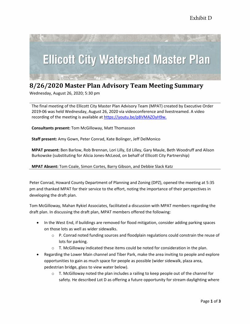
Page 1 of 3
8/26/2020 Master Plan Advisory Team Meeting Summary Wednesday, August 26, 2020; 5:30 pm
The final meeting of the Ellicott City Master Plan Advisory Team (MPAT) created by Executive Order 2019-06 was held Wednesday, August 26, 2020 via videoconference and livestreamed. A video recording of the meeting is available at https://youtu.be/pBVMAZOyH9w.
Consultants present: Tom McGilloway, Matt Thomasson
Staff present: Amy Gown, Peter Conrad, Kate Bolinger, Jeff DelMonico
MPAT present: Ben Barlow, Rob Brennan, Lori Lilly, Ed Lilley, Gary Maule, Beth Woodruff and Alison Burkowske (substituting for Alicia Jones-McLeod, on behalf of Ellicott City Partnership)
MPAT Absent: Tom Coale, Simon Cortes, Barry Gibson, and Debbie Slack Katz
Peter Conrad, Howard County Department of Planning and Zoning (DPZ), opened the meeting at 5:35 pm and thanked MPAT for their service to the effort, noting the importance of their perspectives in developing the draft plan.
Tom McGilloway, Mahan Rykiel Associates, facilitated a discussion with MPAT members regarding the draft plan. In discussing the draft plan, MPAT members offered the following:
• In the West End, if buildings are removed for flood mitigation, consider adding parking spaceson those lots as well as wider sidewalks.
o P. Conrad noted funding sources and floodplain regulations could constrain the reuse oflots for parking.
o T. McGilloway indicated these items could be noted for consideration in the plan.• Regarding the Lower Main channel and Tiber Park, make the area inviting to people and explore
opportunities to gain as much space for people as possible (wider sidewalk, plaza area,pedestrian bridge, glass to view water below).
o T. McGilloway noted the plan includes a railing to keep people out of the channel forsafety. He described Lot D as offering a future opportunity for stream daylighting where
Exhibit D
Page 2 of 3
people could interact with the water. He added that upper story balconies shown in the plan represent an opportunity to view the water.
• Make the Lower Main channel visually enticing (a set of stone steps from Maryland Avenue to the channel, a softened view with terracing, a more visually open channel).
o T. McGilloway said a separate design team would develop the detailed design for the channel that would take hydraulic dynamics into account. He said the terrace shown in the master plan is meant to visually break up the design.
• Provide water features to draw people (an impoundment, a pump feature, active water sounds, water fountains, an interactive water feature in front of the B&O).
o T. McGilloway noted the plan recommends riffles and pools be considered as part of the channel design.
• Regarding a parking garage option for Lot A, ensure the parking garage design would respect the historic context and consider nearby residential uses, potentially softening the design with a green roof or rooftop park.
o T. McGilloway noted a parking garage in Lot A could allow Oella businesses to expand outdoor dining in place of existing parking. He noted the reuse of the Wilkins Rogers mill could change the dynamic of the area. He further described that the intent of the plan was not to add a parking garage in every lot, but to illustrate a menu of options should a garage be needed in the future.
• Community members question how the master plan will remain relevant if elements of the EC Safe and Sound flood mitigation plan are not implemented.
o T. McGilloway noted that the master plan builds upon the EC Safe and Sound flood mitigation plan.
o Kate Bolinger (DPZ) noted that the master plan is meant to be flexible with its menu of options, policies and goals that may be carried forward to adaptively manage implementation.
• The master plan implementation strategy with near, mid and long-term items offers the ability to revisit topics in the future, while not losing today’s discussion.
o T. McGilloway said the plan includes an annual forum and a bi-county forum. o P. Conrad noted that bi-county collaboration has begun, as DPZ met with Baltimore
County staff and held a special jointly hosted meeting for Baltimore County residents. • With respect to environmental stewardship, provide greater incentives for stormwater
improvements by property owners in the watershed – such as increasing reimbursable amount, expanding eligible items for reimbursement – under the County's CleanScapes program. Emphasize forest management as an important effort to make the entire watershed more resilient and provide incentives for forest management such as removal of invasive vines that shorten the lifespans of existing trees on private land - recognize the importance, through programs and incentives, of stewarding our existing natural infrastructure in addition to protection and new restoration activities. Finally, make a consistent effort to educate watershed property owners including new property owners and include education as a priority throughout the Master Plan.

Page 3 of 3
P. Conrad asked MPAT members to approve the July 31, 2019 and October 24, 2019 meeting minutes. Beth Woodruff motioned to approve the minutes and Rob Brennan seconded. The motion carried (7 in favor, 0 opposed). The meeting adjourned at 6:35 pm.
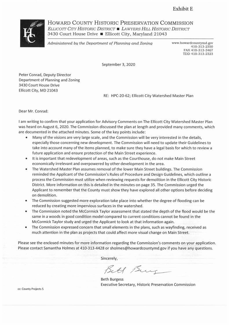
HOWARD COUNTY HISTORIC PRESERVATION COMMISSIONELLICOTr CITY HISTORIC DISTRICT a LAWyERS HILL HISTORIC DISTRICT3430 Court House Drive • Ellicott City, Maryland 21043
Administered by the Department of Planning and Zoning www.howardcountymd.gov410-313-2350
FAX 410-313-3467TDD 410-3 13-2323
September 3, 2020
Peter Conrad, Deputy DirectorDepartment of Planning and Zoning3430 Court House Drive
Ellicott City, MD 21043RE: HPC-20-62; Ellicott City Watershed Master Plan
Dear Mr. Conrad:
I am writing to confirm that your application for Advisory Comments on The Ellicott City Watershed Master Planwas heard on August 6, 2020. The Commission discussed the plan at length and provided many comments, whichare documented in the attached minutes. Some of the key points include:
• Many of the visions are very large scale, and the Commission will be very interested in the details,especially those concerning new development. The Commission will need to update their Guidelines totake into account many of the items planned, to make sure they have a legal basis for which to review afuture application and ensure protection of the Main Street experience.
• it is important that redevelopment of areas, such as the Courthouse, do not make Main Streeteconomically irrelevant and overpowered by other development in the area.
• The Watershed Master Plan assumes removal of the lower Main Street buildings. The Commissionreminded the Applicant of the Commission’s Rules of Procedure and Design Guidelines, which outline aprocess the Commission must utilize when reviewing requests for demolition in the Ellicott City HistoricDistrict. More information on this is detailed in the minutes on page 35. The Commission urged theApplicant to remember that the County must show they have explored all other options before decidingon demolition.
• The Commission suggested more exploration take place into whether the degree of flooding can bereduced by creating more impervious surfaces in the watershed.
• The Commission noted the McCormick Taylor assessment that stated the depth of the flood would be thesame in a woods in good condition model compared to current conditions cannot be found in theMcCormick Taylor study and urged the Applicant to look at that information again.
• The Commission expressed concern that small elements in the plans, such as wayfinding, received asmuch attention in the plan as projects that could affect more visual change on Main Street.
Please see the enclosed minutes for more information regarding the Commission’s comments on your application.Please contact Samantha Holmes at 410-313-4428 or [email protected] if you have any questions.
Sincerely,
VrBeth BurgessExecutive Secretary, Historic Preservation Commission
cc: County Projects 5
Exhibit E
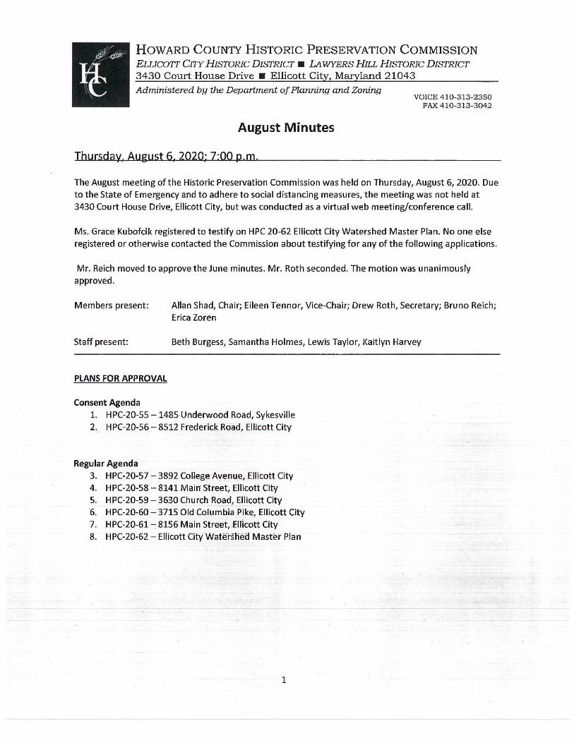
HOWARD COUNTY HISTORIC PRESERVATION COMMISSION ELLICOIT CITY HISTORIC DISTRICT ■ LA WYERS HILL HISTORIC DISTRICT 3430 Court House Drive ■ Ellicott City, Maryland 21043 Administered by the Department of Planning and Zoning
August Minutes
Thursday. August 6. 2020; 7:00 p.m.
VOICE 410-313-2350 FAX 410-313-3042
The August meeting of the Historic Preservation Commission was held on Thursday, August 6, 2020. Due to the State of Emergency and to adhere to social distancing measures, the meeting was not held at 3430 Court House Drive, Ellicott City, but was conducted as a virtual web meeting/conference call.
Ms. Grace Kubofcik registered to testify on HPC 20-62 Ellicott City Watershed Master Plan. No one else registered or otherwise contacted the Commission about testifying for any of the following applications.
Mr. Reich moved to approve the June minutes. Mr. Roth seconded. The motion was unanimously approved.
Members present:
Staff present:
PLANS FOR APPROVAL
Consent Agenda
Allan Shad, Chair; Eileen Tennor, Vice-Chair; Drew Roth, Secretary; Bruno Reich; Erica Zaren
Beth Burgess, Samantha Holmes, Lewis Taylor, Kaitlyn Harvey
1. HPC-20-55 -1485 Underwood Road, Sykesville 2. HPC-20-56- 8512 Frederick Road, Ellicott City
Regular Agenda 3. HPC-20-57 - 3892 College A\fenue, Ellicott City 4. HPC-20-58 - 8141 Main Street, Ellicott City 5. H PC-20-59 - 3630 Church Road, Ellicott City 6. H PC-20-60 - 3715 Old Columbia Pike, Ellicott City 7. H PC-20-61 - 8156 Main Street, .Ellicott City 8. H PC-20-62 - Ellicott City Watersliea Master Plan
1
CONSENT AGENDA
HPC-20-55 -1485 Underwood Road, Sykesville, HO-1173 Applicant: Ann H. Jones
Request: The Applicant, Ann H. Jones, requests 20.112 and 20.113 tax credit pre-approval for the rehabilitation of the historic house at 1485 Underwood Road, Sykesville.
Background and Site Description: This property is listed on the Howard County Historic Sites Inventory as HO-1173, Bowling Green.
Scope of Work: The Applicant seeks tax credit pre-approval for the following work: 1) Septic - Install a septic system and connect it to the house, following Health Department
Regulations. 2) Well - Drill a new well, as required by the Health Department, and install supply lines to the
house. 3) Electricity - Run a grounded electrical service to the house, including a metered panel and
rewire the house. The house was only wired at some point in time to run a radio and a light and is inadequate for modern needs and is not to code.
4) HVAC- Install an HVAC system to provide heating and cooling to the house. In order to minimize duct work, one air handler will handle the first floor and a second air handler will be installed in the attic knee wall to service the second floor and attic. Returns will be located in the existing changes adjacent to the chimneys on both sides of the house. The HVAC system will consist of: two heat pump systems, backup gas or electric furnace, ductwork and return vents as needed, dryer box, standard range dryer bath venting and fans, secondary drain pans with float switches under both indoor units, low voltage wiring of all components and high-density outdoor unit pads.
HPC Review Criteria and RecQmmendations:
Sec. 20.112. - Historically valuable, architecturally valuable, or architecturally compatible structures (ii} Eligible work includes:
a. The repair or replacement of exterior features of the structure; b. Work that is necessary to maintain the physical integrity of the structure with regard to
safety, durability, or weatherproofing; c. Maintenance of the exterior of the s tructure, including routine maintenance as defined
in section 16.601 of the eounty Code; (iii) Eligible work does not include:
a. New construction; b. Interior finish work that is not necessary to maintain the structural integrity of the building.
Sec. 20.113. - Restorations and rehabilitations of historic or heritage properties. _ (b)(S} Qualified expenses means the amount of money paid by the owner of an eligible property to a licensed contractor for improvem~nts, restoration, or the rehabilitation of the property or f or materials used to improve, restore, or rehabilitate the property.
Based on the above code criteria for the 20.112 tax credit Items 1 and 2 (the septic and well) do not appear eligible for the 20.112 tax credit as they do not relate work that is needed to maintain the phys_ical integrity of the structure with regard to safety, durability or weatherproofing or relate to the
2
exterior repair of the structure. However, Items 3 and 4 (electricity and HVAC} do appear eligible as electricity and HVAC will assist in maintaining the physical integrity by controlling air temperature and moisture.
Based on the above code criteria for the 20.113 tax credit, Items 1-4 appear to be eligible for the 20.113 tax credit, as these improvements will assist in improvement, restoration and rehabilitation of the property, which is currently lacking all four requested items.
Staff Recommendation to the HPC: Staff recommends the HPC pre-approve 20.112 tax credits for Items 3 and 4 and 20.113 tax credits for Items 1-4.
Testimony: Ms. Jones was in attendance but no further information was given or discussed.
Motion: Mr. Roth moved to approve. Mr. Reich seconded. The motion was unanimously approved.
HPC-20-56- 8512 Frederick Road, Ellicott City
Applicant: Robert Z. Hollenbeck, Howard County Department of Public Works
Request: The Applicant, Robert Z. Hollenbeck on the behalf of the Howard County Department of Public Works, requests a retroactive Certificate of Approval for exterior alteration at 8512 Frederick Road, Ellicott City.
Background and Site Description: This property is located in the Ellicott City Historic District. According to SDAT, the primary structure on the property dates to 1960. However, this date is incorrect, as the primary structure is a historic building that the County Architectural Historian has dated the building to circa 1900-1910, with a possibility of circa 1895-1915. Regardless, the building subject to the retroactive approval is an outbuilding that is located behind the primary structure. The outbuilding may be historic, but this is not definitively known.
This property fronts Frederkk 'ifoad/Main Street and spans the Hudson Branch stream.
Scope of W~rk: The application explains that on June 25, 2020, DPW was alerted that a large tree fell on the property. The stump of the tree pulled out of the hillside, causing the foundation and side/back wall of a lean-to on the side of the outbuilding to separate and become structurally compromised. On June 26, 2020 DPW removed the lean-to structure. The application explains that the lean-to structu_re appeared to have been constructed using modern framing and contemporary-framing anchors and did not appearto be part of the main structure of the outbuilding. DPW has since removed the fallen tree· and
Lean-to Structure removeQ
Main slruciure Is structurally sound and remeiM
stump from fa!!\!in tru
Figure 1 - View looking east at lean toward constructed on stream~ wall
3
repaired the damage to the stream wall that was caused by the tree. No other alterations are planned and the outbuilding will remain in place.
exterior wall pulled ~~-;;::::;-- away from adjacent
c-+1:-'1:.t~T~ wall /foundation
Figure 2 - View looking west at tree root and damage to lean-to
HPC Review Criteria and Recommendations:
Rules of Procedure1 Section 302, Demolition and Relocation of Structures in Historic Districts; Classification of Structure
1) Section 302 states, "Before acting on an application for demolition or relocation, the Commission shall determine whether the structure is a Structure of Unusual Importance. Structures of Unusual Importance are structures deemed by the Commission to be of .unusual importance to the Nation, State or County, whose loss would cause great damage to· the character and integrity of the historic district. Determination that a structure is a Structure of Unusual Importance shall be based on criteria in its adopted Guidelines, the testimony of expert witnesses or other documentary evidence presented to the Commission.
Based on the physical evidence presented from DPW, the Jean-to appe<!rs to be a modern addition tacked onto the side of an old_er outbuilding. The lean-to does not appear to be a Structure of Unusual Importance. The outbuilding itself does not advertently read as historic. The exterior architecture and building materials do not reference a specific time period or style. A review of aerial photography did not provide any additional clues to the potential age of the overall structure; the structure:is visible in 1984 aerials, but the aerials that pre-date 1984 are not clear enough to determine if the structure was there.
Rules of Procedure, Section 304, Demolition and Relocation of Structures in Historic Districts; Demolition of Other Structures
2) -Section 304 of the Commission's Rales·of Procedures state, "If the Commiss"ion-detertnines that the structyre is not a Structure of Unusual Importance, it shall vote to approve or deny i:he application based on the standards set forth in §16.607 of the Howard County Coile and its adopted Guidelines.
4
Sec. 16. 607. - Standards for Review. (a) Elements for Consideration. In reviewing an application for a certificate of approval, the Commission shall give consideration to:
(1) The historic, architectural, or archeological value or significance of the structure and its relationship to historic value of the surrounding area. (2) The relationship of the exterior architectural features of such structure to the remainder of the structure and to the surrounding area. (3) The general compatibility of exterior design, scale, proportion, arrangement, texture and materials proposed to be used. (4) Whether the requested action is necessary to protect against threats to public safety. (5) Any other factors, including aesthetic factors, which the Commission deems to be pertinent.
The lean-to appeared to be a modern addition, located on the edge of the building on the stream wall. The removal of the lean-to does not affect the overall integrity of the outbuilding or the main historic house, and in fact, may improve the overall site by removing a modern alteration.
Staff Recommendation to the HPC: Staff recommends the HPC determine the lean-to structure is not one of Unusual Importance and approve the application as submitted.
Testimony: Mr. Hollenbeck was in attendance, but no further information was given or discussed.
Motion: Mr. Roth moved to approve. Mr. Reich seconded. The motion was unanimously approved.
REGULAR AGENDA
HPC-20-57 - 3892 College Avenue, Ellicott City Applicant: Matthew Wehland
Request: The Applicant, Matthew Wehland, requests a Certificate of Approval to construct a new outbuilding at 38"92 College Avenue, Ellicott City.
Background and Site Description: This property is located in the Ellicott City Historic District. According to SDAT, the building on the property dates to 1900. The house fronts College Avenue and the property backs up to New Cut Road. Because of this location, there is a significant change in grade throughout the property. The street sits at approximately 264 feet in elevation, the house at 262-264, and the proposed garage at approximately 256 feet.
Scope of Work: The Applicant proposes to construct a 24-foot by 24-foot Amish kit garage. The garage will be one-story tall and two bays wide. The Applicant does not anticipate extending the existing driveway at this time. The concrete pad for the garage will be built to code on the existing gravel stone driveway (installed in 1967 by the Applicant's father). The application states that there will not be any grading or retaining walls needed~ The garage will be set back about 100 feet from College Avenue and will be tocated toward the rear-of-the hou_se; next to the rear deck.
The garage construction will consist of the following components: 1) Siding- LP SmartSide siding, an engineered wood product, painted Early American Blue. Walls
will be 7 feet tall. . .
5
2} Roof- Gable roof with an overhang. Shingles to be asphalt architectural shingles in the color Earthtone Cedar
3) Trim -Wood painted white. 4) Side door- White wood board and batten style door with a 3-foot wide single transom 5) Windows - 24"x36" Vinyl white, but Applicant will use wood if available from the builder 6) Shutters - Wood board and batten style painted black. 7) Garage Doors - Two 9-foot by 7-foot Stockton arch raised panel doors
Figure 3 - Front view of house froil1 College Avenue, Google Streetview. Garage to be located to the right of the house, 100 feet back from the street.
HPC Review Criteria and Recommendations:
Chapter 7.C: New Construction: Additions, Porches and Outbuildings; Construction of New Garages, Sheds and Other Outbuildings
1) Chapter 7.C states, "New garages and sheds should follow the historic pattern of being detached from the main building, and if practical, loca~ed in a sisf~~or rear yard."
2) Chapter 7.C recommends: a. "If allowed by the size and shape of the
property, place new outbuildings to the side or rear of the main building,
. . ":: "' :: I 6,r~ -- {A t-(4,filv-,/ ~ • ~
= .........
...... _, --......
!
~ ., ,-, ..... ·-
,.,
Figure 4 - Proposed location of garage
separatedfrom the main building bya Figure 5- View of garage location from side of house. substantial setback."
b. "Do not place a new outbuilding where it blocks or obscures views of a historlc building. c. "Design outbuildings to be subordinate in size and detail to principle buildings in the
immedidte-viEinity."
6
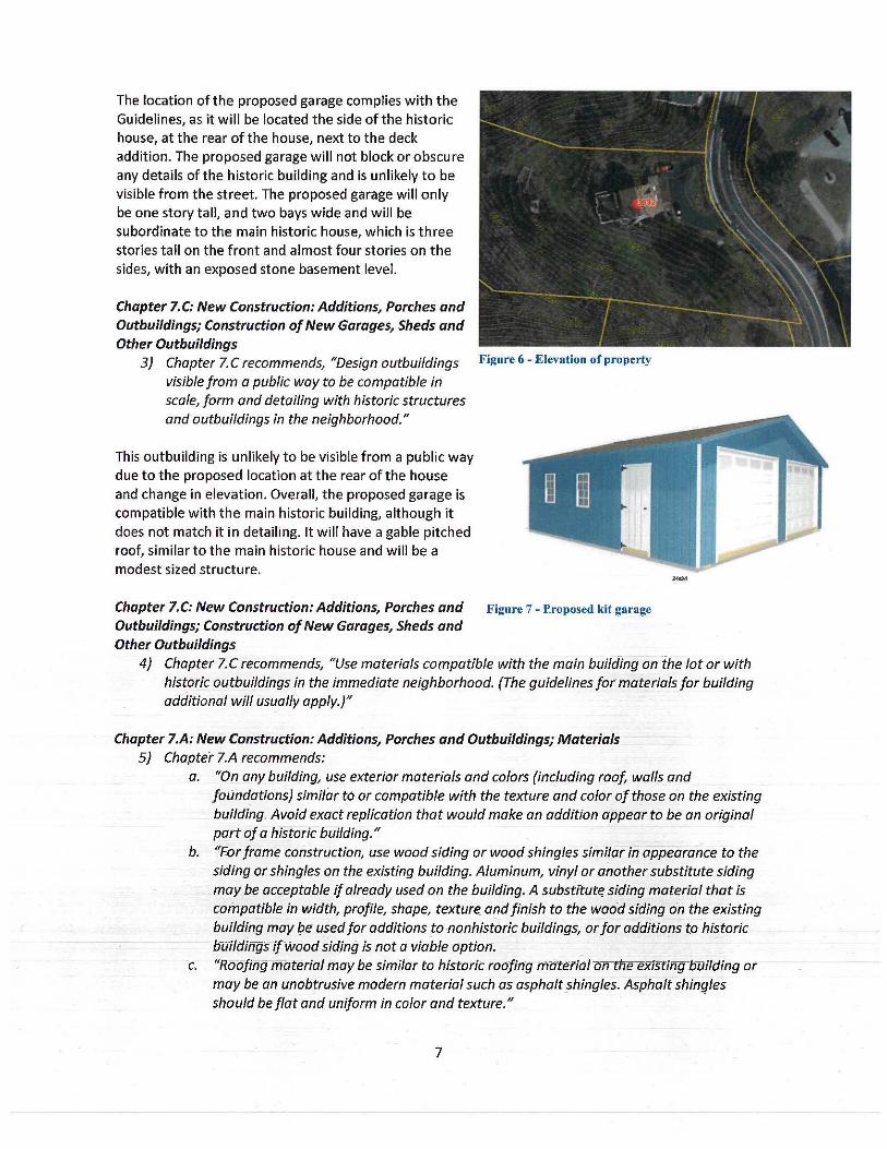
The location of the proposed garage complies with the Guidelines, as it will be located the side of the historic house, at the rear of the house, next to the deck addition. The proposed garage will not block or obscure any details of the historic building and is unlikely to be visible from the street. The proposed garage will only be one story tall, and two bays wide and will be subordinate to the main historic house, which is three stories tall on the front and almost four stories on the sides, with an exposed stone basement level.
Chapter 7.C: New Construction: Additions, Porches and Outbuildings; Construction of New Garages, Sheds and Other Outbuildings
3) Chapter 7. C recommends, "Design outbuildings Figure 6 - Elevation of property
visible from a public way to be compatible in scale, form and detailing with historic structures and outbuildings in the neighborhood."
This outbuilding is unlikely to be visible from a public way due to the proposed location at the rear of the house and change in elevation. Overall, the proposed garage is compatible with the main historic building, although it does not match it in detailing. It will have a gable pitched roof, similar to the main historic house and will be a modest sized structure.
Chapter 7.C: New Construction: Additions, Porches and Figure 7 - f>roposed kit garage
Outbuildings; Construction of New Garages, Sheds and Other Outbuildings
4} Chapter 7.C recommends, "Use materials compatible with the main building on ihe lot or with historic outbuildings in the immediate neighborhood. {The guidelines for materials for building additional will usually apply.)"
Chapter 7.A: New Construction: Additions, Porches and Outbuildings; Materials 5} Chapter 7.A recommends:
a. "On any building, use exterior materials and colors (including roof, walls and foundations) similar to or compatible with the texture and color of those on the existing building. Avoid exact replication that would make an addition appear to be an original part of a historic building."
b. "For frame construction, use wood siding or wood shingles similar in appearance to the siding or shingles on the existing building. Aluminum, vinyl or another substitute siding may be acceptable if already used on the building. A substrtut~ siding material that is compatible in width, profile, shape, texture. and finish to the wood siding on the existing building may be used for additions to nonhistoric buildings, or for additions t9 historic b-uildings ifWood siding is not a viable optiotf.
~c. "Roofing material may be similar to historit roofing matetial onfne existing-bUilding or may be an unobtrusive modern material such as asphalt shingles. Asphalt shingles should be flat and uniform in color and texture."
7
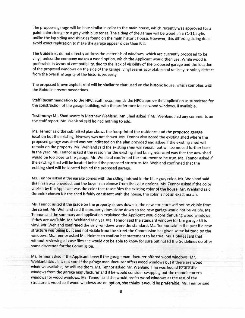
The proposed garage will be blue similar in color to the main house, which recently was approved for a paint color change to a gray with blue tones. The siding of the garage will be wood, in a Tl-11 style, unlike the lap siding and shingles found on the main historic house. However, this differing siding does avoid exact replication to make the garage appear older than it is.
The Guidelines do not directly address the materials of windows, which are currently proposed to be vinyl, unless the company makes a wood option, which the Applicant would then use. While wood is preferable in terms of compatibility, due to the lack of visibility of the proposed garage and the location of the proposed windows on the side of the garage, vinyl seems acceptable and unlikely to solely detract from the overall integrity of the historic property.
The proposed brown asphalt roof will be similar to that used on the historic house, which complies with the Guideline recommendations.
Staff Recommendation to the HPC: Staff recommends the HPC approve the application as submitted for the construction of the garage building, with the preference to use wood windows, if available.
Testimony: Mr. Shad swore in Matthew Wehland. Mr. Shad asked if Mr. Wehland had any comments on the staff report. Mr. Wehland said he had nothing to add.
Ms. Tennor said the submitted plan shows the footprint of the residence and the proposed garage location but the existing driveway was not shown. Ms. Ten nor also noted the existing shed where the proposed garage was sited was not indicated on the plan provided and asked if the existing shed will remain on the property. Mr. Wehland said the existing shed will remain but will be moved further back in the yard. Ms. Tennor asked if the reason for the existing shed being relocated was that the new shed would be too close to the garage. Mr. Wehland confirmed the statement to be true. Ms. Ten nor asked if the existing shed will be located behind the proposed structure. Mr. Wehland confirmed that the existing shed wfll be located behind the proposed garage.
Ms. Tennor asked if the garage comes with the siding finished in the blue gray color. Mr. Wehland said the finish was provided, and the buyer can choose from the color options. Ms. Tennor asked if the color chosen by the Applicant was the color that resembles the existing color of the -house. Mr. Wehland said the color chosen for the shed is fairly consistent with the house, the color is not an exact match.
Ms. Tennor asked if the grade on the property slopes down so the new structure will not be visible from the street. Mr. Wehland said the property does slope down so the new garage would not be visible. Ms. Tennor said the summary and application explained the Applicant would con~ider us ing wood windows if they are available. Mr. Wehland _s-aid yes. Ms. Tenn or said the standard window for the garage kit is vinyl. Mr. Wehland confirmed the vinyl windows were the standard. Ms. Tenn or said in the past if a new structure was be-ing buiH: and not visible from the street the Commission has given some latitude on the windows. Ms. Ten nor asked Ms. Holmes to confirm her statement to be true; Ms. Holmes said that without reviewing all case files she would not be able to know for sure but noted the Guidelines do offer some discretion for the Commission.
Ms. Ten nor asked if the Applrcant knew if the garage manufacturer offered wood windows. Mr. Wehlan-d said he is notsure if the_ga'rage manufacturer offers-wood win-dows but ifthere are wood windows available, he Will use them. Ms. Terrnor asked Mr. Wehland ifhe was oound to usetlie windmt1Js from the garage manufacturer and if he would consider swapping out the manufacturer's windows for wood windows. Ms. Ten nor said she would prefer wood win_dows-as the rest of the structure is wood so if wood windows are an option, she thinks it would be preferable. Ms. Tennor said
8
she can understand the constraints the Applicant may have from the manufacturer, and she would not veto vinyl windows.
Ms. Holmes clarified that Mr. Wehland would need to submit an application for moving the location of the existing shed, it could possibly be a Minor Alteration application. Mr. Wehland said he would submit another application for the relocation of the existing shed. Ms. Tennor asked Mr. Wehland to include the driveway on the site plan of the new application.
Mr. Roth said the proposal was consistent with the Guidelines and he had no objection to the application.
Mr. Reich said he took issue with the applications documentation as the location ofthe proposed garage was shown on an out of scale sketch. Mr. Reich told Mr. Wehland he would have to submit an accurate site plan for permitting and he was trying to understand the plan from the photo submitted. Ms. Burgess referenced the Agenda, figure 5, siting the existing red shed and where the proposed garage will be located. Mr. Reich said the existing shed is much smaller than the proposed garage and the site plan shows about 5 or 6 feet space between the house and the garage but the photo makes it look like there is 20-25 feet spacing. Mr. Wehland explained the layout of his property and where the garage will be in reference to the stairwell, gate and property line; the garage would be behind the gate, between the deck stairwell and the northern property line.
Mr. Reich said he believes the garage location will not be visible from the front, follows the Guidelines, is small in scale and will have no view damage to the existing historic structure. Mr. Reich said he wished he could have a more accurate site plan. Mr. Wehland explained he built the garage on line and chose the placement of the doors and windows. Mr. Reich said the garage looks to be 8-foot wide with a 3 to 12 roof pitch with overhang. Mr. Wehland said that was their standard pitch.
Mr. Taylor asked for the record if the black fence remains where it is and Mr. Wehland confirmed that the fence will remain in place. Mr. Wehland said the shed is 10 feet from the fence. Mr. Taylor asked if the garage is going to sit on the shed footprint and asked how much closer the garage will be to the house. Mr. Wehland said the garage will be approximately 10 feet out from the deck staircase. Mr. Reich asked that to get to the garage one would have to walk through the gate of the fence. Mr. Wehland said yes, the fence and gates will stay where they are or be removed entirely though he likes where the gate's 10-foot opening is located.
Mr. Reich said in principal the request follows the Guidelines, but he does think the Applicant should submit the site plan drawings to the Commission that will be sent to Department of Inspection, Licenses and Permits.
Ms. Zoren said she agreed with Mr. Reich; the Commission needs a site plan showing the actual proposed conditions for the record. Ms. Zoren said she wol!ld like to see a side by side of the paint swatch of the proposed garage. Mr. Wehland said he could ask the builder if they have a sample color and referred to figure 3, noting the garage will not be seen from College Avenue so the only color comparison will be seen from the backyard.
Ms·. Zoren said fhe packermeritio"ns wood shutte_rtolors btit, in the r~nde-ringf3D ·drawing~ there are no shutters shown. Mr. Wehland said the shutters will be black to match the· house. Ms·. Zaren said her last recommendation is to change the raised panel garage door to a less modern style. There are a lot of other garage style doors such as flat panel or carriage house style that would be more appropriate for this garage.

Mr. Shad said he agreed the garage will not be seen from College Avenue, however it would help to have a better site plan to see where the garage will sit in correlation with the deck and the existing shed. Mr. Shad asked if the application could be extended in order to get a more accurate site plan.
Mr. Taylor said it appears the Commission has two issues, the color and the site plan. Mr. Taylor noted that in the past the Commission has approved certain things contingent on Staff approval. Staff approval could be that Commissioners do not have an objection or have the application come back through the Minor Alteration process. Mr. Taylor said the facts are known or the Commission could continue the case and have it on schedule for next month's meeting. Mr. Wehland said he would like to have Staff approval as the Commission has an idea of color and site plan.
Mr. Shad asked if the Applicant will be able to produce an accurate site plan to Staff. Mr. Wehland said he will have to. Ms. Zaren said she would be okay with Staff approval ofthe garage.
Motion: Ms. Zaren moved to approve the application as submitted contingent on the Applicant providing a more accurate site plan for Staff approval as well as a garage color sample for Staff approval. Mr. Reich seconded. The motion was unanimously approved.
HPC-20-58 - 8141 Main Street. Ellicott City Applicant: Mohammed Alanesi
Request: The Applicant, Mohammed Alanesi, requests a Certificate of Approval to install signs at 8141 Main Street, Ellicott City.
Background and Site Description: This property is located in the Ellicott City Historic District. According to SDAT, the building dates to 1987. This building was constructed after a fire resulted in the demolition of the previously existing historic building.
Scope of Work: The Applicant seeks approval to install three signs on the front fa~ade of the building, to consist of one flat mounted sign, one window decal and one door decal. The Applicant initially proposed to install four total signs, the three mentioned above and a projecting sign, but worked with staff to reduce the number of signs. The proposed signs are:
Sign #1- Flat Mounted Sign This sign will be 22.5 inches high by 151 inches wide, for a total of 23.59 square feet. This sign will utilize the existing wood sign board applied to the front fa~ade oflhe building. The sign will have a light beige background ana dark brown ·text and graphics. The sign will be a decal that is adhered to the existing sign board. The sign will read on one line: [logo] SMOKE CAPITAL
10
..- SMOKE CAPITAL
Figure 8 - Proposed signs
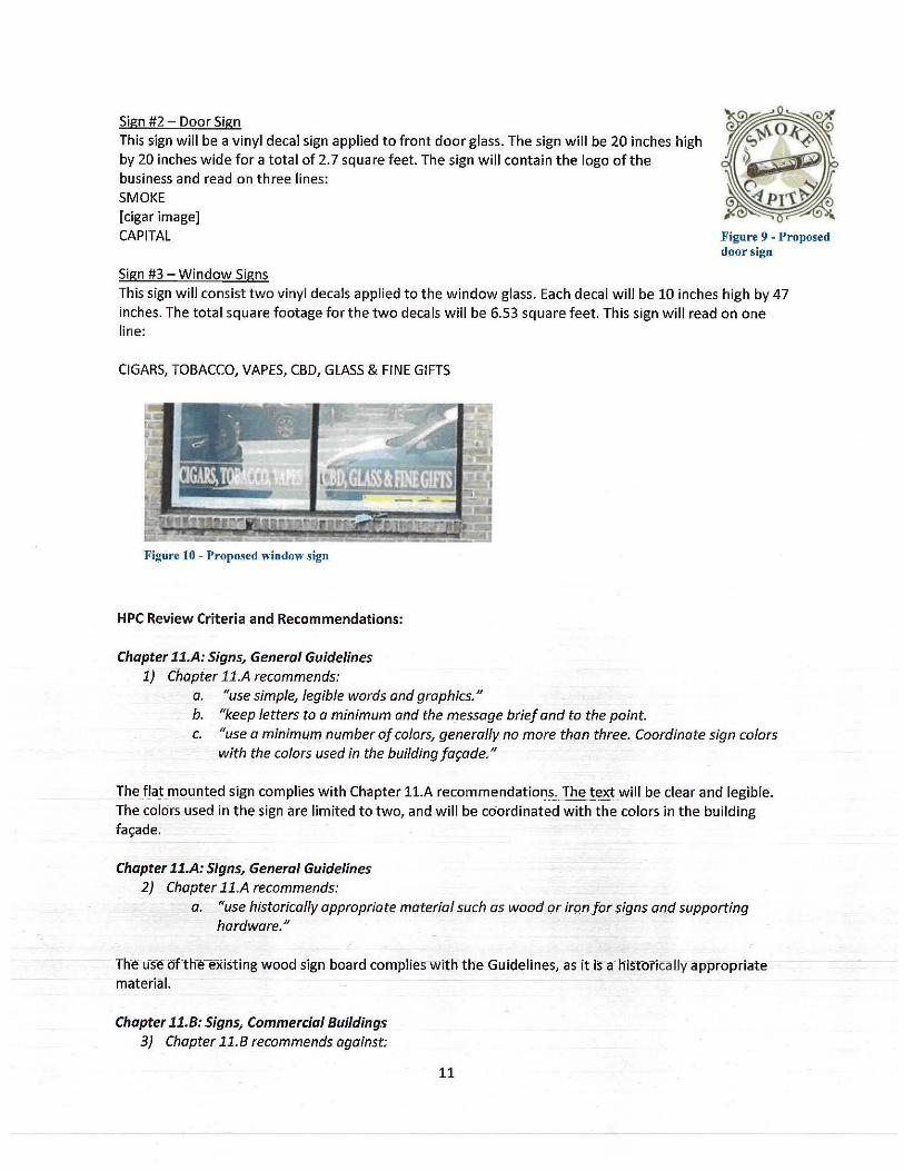
Sign #2 - Door Sign This sign will be a vinyl decal sign applied to front door glass. The sign will be 20 inches high by 20 inches wide for a total of 2. 7 square feet. The sign will contain the logo of the business and read on three lines: SMOKE [cigar image] CAPITAL
Sign #3 -Window Signs
Figure 9 - Proposed door sign
This sign will consist two vinyl decals applied to the window glass. Each decal will be 10 inches high by 47 inches. The total square footage for the two decals will be 6.53 square feet. This sign will read on one line:
CIGARS, TOBACCO, VAPES, CBD, GLASS & FINE GIFTS
Figure 10 - Proposed window sign
HPC Review Criteria and Recommendations:
Chapter 11.A: Signs, General Guidelines 1) Chapter 11.A recommends:
a. "use simple, legible words and graphics." b. "keep letters to a minimum and the 11)essage brief and to the point. c. "use a minimum number of colors, generally no more than three. Coordinate sign colors
with the colors used in the building fa<;ade."
The flat mounted sign complies with Chapter 11.A recommendatior:,?_'._ Ihe !e~t will be clear and legible. The colors used in the sign are limited to two, and will be coordinated with the colors ln the building fa<;:ade.
Chapter 11.A: Signs, General Guidelines 2) Chapter 11.A recommends:
a. "use historically appropriate material such as wood or ironfor signs and supporting hardware."
Th-e u-~re ofthe-existing wood sign board complies with the Guidelines, as it is a· hi.stbrically appropriate material. ~ ~
Chapter 11.B: Signs, Commercial Buildings 3) Chapter 11.B recommends against;
11
a. "Two signs where one is sufficient to provide an easily visible identification of the business."
b. "More than two signs per business per far;ade."
Chapter 11.A: Signs~ General Guidelines 4) Chapter 11.A recommends, "Emphasize the identification of the establishment rather than an
advertising message on the face of the sign."
The window decals serve as an advertising message across the face of the windows and do not comply with the Guideline recommendations. The door decal also serves as a sign, which seems unnecessary given that the building could have the large flat mounted sign and only has one entrance. The use of two signs, in addition to the flat mounted sign, does not comply with the Guidelines.
Chapter 11.8: Signs~ Commercial Buildings 5) Chapter 11.B recommends:
a. "Incorporate signs into the fafade of the building. Signs should fit within the lines and panels of the fafade as defined by the building frame and architectural details."
b. "In most cases, limit the area of signage to one-half square footage of sign area for each linear foot of primary street frontage, with a limit of eight square feet in area for any one sign. More sign area is appropriate for some of Ellicott City's larger buildings, where these limits would result in signs that are ineffective or not in scale with the building."
The proposed flat mounted sign will be located on the existing sign board, which complies with the recommendation to utilize the lines, panels and other architectural details on the building for the placement of signs. Recent businesses have not used this sign board and it has remained a blank, brown rectangle on the front of the building. The Guidelines recommend that more sign area is appropriate for larger buildings along Main Street, and this building is one of the smaller buildings. However, if a smaller sign was placed in the sign board, it would result in an odd proportion that would not be in scale with the building and the sign board. The use of the sign board for a sign that fills it is more visually attractive than leaving the board vacant.
Staff Recommendation to the HPC: Staff recommends the HPC approve Sign #1 and have the HPC determine if an additional sign is appropriate to this storefront.
Testimony: Mr; Shad swore in Mohammed Alanesi and asked if Mr. Alanesi had any comments on the staff report. Mr. Alanesi said he agreed with the recommendations to the Commission but was hoping the CQmmj§~ion would consider having a dual sign the logo of th~_~sines~ on the door itself.
Ms. Tennor agreed with Staff with the new graphic on the existing sign panel, the graphic is clear, and does not think window graphics are needed.
Mr. Roth said the sign on the fa<;:ade is sufficient and per the Guidelines, additional signs are not compliant. Mr. Roth said the content of the applique in the windows could be done in a compliant way with placards inside the window frame.
Mr. Reich-saidthe r,frred panel looks like part of the design of the fa<;:ade as it is above-the display window, but below a three:panel-window and th-e colors are in coordination with the composition of the brown and cream of the building. Mr. Reich said the Guidelines state the sign limit is 8 square feet and questioned if this fa<;:ade was allowed a larger sign because of the existing 23 square foot placard panel on the storefront. Ms. Burgess said signs in this location historically have been the size ohhe raised
12
panel. Mr. Reich said if the Commission were to follow the Guidelines the sign approval should be for an 8 square foot sign within the area of the panel and does not necessarily fill up the entire square footage of the panel. Mr. Reich noted the approval of larger signs on wider buildings like 8307 Main and questioned how that applies to this smaller building. Mr. Reich said if the Applicant wanted to put up a sign in the panel area and filling the space to its entirety it would be within one of the Guidelines but not another. A 23 square foot sign would be visually distracting and the other two signs for approval would be over the top with what the Commission otherwise approves.
Ms. Zoren said there should only be one sign on the building, and the proposed 23 square foot sign matches nicely with the architectural features of the fa!;ade. However, the proposed sign is almost triple in size of the recommended in the Guidelines. Ms. Zaren noted the original application included a hanging sign that looks like it would be within Guideline recommendations. Ms. Zaren asked why the Applicant changed the request from a hanging sign to a flat sign. Mr. Alanesi thought the flat sign looked much better than a projecting sign. When Mr. Alanesi worked on the sign design, he had considered the circle signs and thought the flat-mounted sign was a better fit than the hanging sign. Mr. Alanesi said he chose the colors to fit the building.
Ms. Zoren asked if Mr. Reich thought a hanging sign was more appropriate for the building. Mr. Reich said the drawing was convincing and did not understand why the Applicant would want a flat sign in lieu of a hanging sign. Ms. Tennor said she wondered if the sign of the size was reduced how the sign would relate to the existing panel. Ms. Tennor asked Mr. Reich for clarification on having the panel removed . Mr. Reich said the panel makes the whole composition. Ms. Ten nor asked if the panel would remain and stay brown in color like the door and the windowpane like a large brown outline around the sign, but the graphics of the sign were reduced in size, how much smaller with the sign be.
Mr. Roth referenced page 83 of the Guidelines where the recommendation is to limit the size of signage to 8 square feet. Within that section, it is also recommended to incorporate the sign into the fa~ade of the building, like the panel. Mr. Roth said if the Commission requires the sign complies with the fa!;ade recommendation_ that option fits nicely but if the Commission reduces the size of the sign, the sign will not fit within the fa!;ade recommendation.
Mr. Shad said he recommends shrinking the size of the sign and the panel would look like a brown frame around the sign. Mr. Shad said if the Commission approves the sign at 23 square feet in size, the approved sign will set a precedent of larger signs on smaller buildings.
Mr. Reich said,taking into account the street photograph of the building, if the colors of the sign were rever~ed with the background of the sign being a dark b_row~_~_nd t_!ie letters being an off-white color, the Applicant would be closer in compl iance. This effect would be similar to the ballroom, where the letters were attached directly to the brick and the Applicants were within the square footage. Mr. Reich suggestea f~e lettering of the sign could be put on the panel.
Mr. Taylor said the Commission was doing a good job balancing the various aspects of the Guidelines and every situation, building and sign will have to be cons-ic:let~d on a case by case basis. Mr. Taylor asked the Commission to consider what impact the color of the sign would have on the streetscape. Mr. Taylor asked Ms. Holmes for the size of the sign. Ms. Holmes referred to the staff report. Mr. Taylor said h·e is assuming the site in-the Staff report is the-size of the pan·e1 and-the sign is not 23 square feet and remmasthe-commission to balance the-Guideline recommendatio·ns-flitativlHothe specific building and sign.
13
Mr. Reich said the photograph of the building is a light beige color and the Google Street View of the property has the brick looking darker with panel looking black. Mr. Reich said the drawing submitted is convincing. Mr. Alanesi said he wanted the sign to fit well with the building and be visible. A brown color is going to stick out and not be as clear which is why he chose the color of the sign background to match the brick instead. Mr. Alanesi said he thinks the color combination is the perfect match for the building.
Mr. Reich said the sign complies with all the Guidelines except for the 8 square foot rule. Mr. Reich said the Commission could make an exception for the size of the sign. Mr. Shad asked the Commissioners what they think of the other two signs proposed. Mr. Reich said the Commission should approve one sign. Mr. Roth said to approve the one sign on the existing panel. Mr. Reich said the Applicant could put displays in the windows and behind the door instead of using the other two signs.
Mr. Alanesi said he would not consider the other signs. Mr. Taylor asked if Mr. Alanesi was withdrawing the other proposed signs from the application. Mr. Alanesi said yes.
Motion: Mr. Roth moved to approve the first sign to fit the fa~ade as submitted. Mr. Reich seconded. The motion was unanimously approved.
HPC-20-59 - 3630 Church Road, Ellicott City Applicant: Gary Segal
Request: The Applicant, Gary Segal, requests Tax Credit Pre-Approval to make roof repairs and PreApplication Advice for the future treatment of the roof at 3630 Church Road, Ellicott City.
Background and Site Description: This property is located in the Ellicott City Historic District. According to SDAT, the building on the property dates to 1937.
The house has a Church Road address, but it does not front Church Road. It is located off of the road that leads to the Patapsco Female Institute. The house is set back significantly from Church Road.
Scope of Work: The Applicant proposes to make repairs to the slate roof to resolve the current leaking. The current repairs would consist of replacing damaged slates with new slate to match the existing, and replacing the underlc!yment in leak area. Other areas damaged as a result of the lea_k would also be repaired. Flaking paint is visible in the eave at the rear of the house. The application explains that water damage and slate particles have been found in the attic; slate dust has been found on attic insulation. T~~ application explains that the roof is made of Pennsylvani_a slate and is 82 years old, at the end of its life expectancy.
Tne Applicant also seeks Pre-Application Advice from the Com-mission regarding the next steps for the roof, as a replacement is needed as the long-tl:!rm soiution. The-Applicant _has outlined three options:
1) Option 1-This option is preferred by the Applicant and would consist of stripping the entire roof from the main portion of the house and replacing the slate with a contemporary roofing material.
2) Option 2 - This option would consist of making a temporary repair of leak using slate, then replacing the existing roof With a new slate· roof1 using either Vermont or Pennsylvania slate.
3} Option 3 - This option would consist of repairinffthe-leal<iiig a-rea and lettingthe·roof rertfaih asis un!il the next issue arises. The application explains this is what has happened since the last repairs were made in 2014.
14
Figure 11 - Aerial view of roof damage.
HPC Review Criteria and Recommendations:
Chapter 6.E: Rehabilitation and Maintenance of Existing Buildings; Roofs, Dormers and Gutters 1) Chapter 6.E states that the following is Routine Maintenance, "Repairing roofs, including the
replacement of small areas of roofing material, using material similar to the existing roofing in dimensions, shape, color and texture."
The proposed in-kind repair of the slate roof and underlayment would be considered Routine Maintenance and is eligible for 20.112 tax credit pre-approval.
Some of the collateral damage items may also be eligible. However, as they are currently unknown, the Applicant should submit a new application, which may be considered for approval through the Minor Alteration/Executive Secretary Tax Credit Pre-Approval process.
Chapter 6.E: Rehabilitation and Maintenance of Existing Buildings; Roofs, Dormers and Gutters 2) Chapter 6.E explains, "Historic roofing materials include wood shingles, metal and slate ... Metal
(including copper, terne metal and later, galvanized steel) and slate because common roofing materials in the mid-19th century. The original roof material has been replaced by asphalt shingles on many pre-1910 buildings. Wood shingle roofs are now rare in the historic district. TO
retain the district's historic character, every effort should be made to repair and preserve historic wood, metal or slate roofing, particularly for roofs visible from public ways, and to replace historic roofing with similar material."
3) Chapter 6.E recommends, "replace historic roof materials only when n~cessary due to extensive deterioration; use replacement material that matches or is similar to the original. If this is not possible, a different material characteristic of the building's style, construction methods and period may be used. (For example, replacing wood shingles witn standing seam metal may be appropriate for some early 1800s buifdings.r
4) Chapter 6.E recommends, "replace historic roofing with asphalt shingles or other modern materials only if historically accurate materials cannot reasonably be used. Use asphalt shingles that are flat, uniform in color and texture and of a neutral coior. A modern material similar in appearance to the original, such as a synthetic that reproduces the appearance of slate, may be usea:"
The above Guidelines provide advice for the future Options 1-3 for the roof. While the Guidelines infer that a synthetic slate may be appropriate, a review of synthetic slate produ~ts has not y~t revealed a
15
product that shares the same visual characteristic of real slate in terms of color variation, texture and dimension.
In-kind replacement of the slate roof with new slate would also be eligible for the County's 25% Historic Property Tax Credit (20.112 of the Code) and potentially the 20.113 Assessment Tax Credit (this is unknown until the structure is re-assessed). This work may also be eligible for the State's 20% Homeowner Tax Credit (income tax credit), administered by the Maryland Historical Trust. More information on the State's program can be found here: https://mht.maryland.gov/taxcredits homeowner.shtml.
Staff Recommendation to the HPC: Staff recommends the HPC pre-approve 20.112 tax credits for the in-kind repair of the slate roof.
Staff recommends the HPC provide advice on Options 1-3 as described by the Applicant for the future of the slate roof.
Testimony: Mr. Shad swore in Gary Segal and asked if Mr. Segal had any comments on the staff report. Mr. Segal said he had no comments; the repair aspect of the discussion is straight forward, and pictures have been included in the presentation he submitted. Mr. Segal asked if the Commission had a print out of the PowerPoint presentation he had submitted. Mr. Shad said the Commission had copies of the presentation.
Mr. Segal said the slide titled "The Problem" showed what initially caused a problem, a tree above the house had dropped branches onto the roof causing puddling and started a leak. Mr. Segal said the leak has caused lots of discoloration and lots of delamination of the slate; the submission requests to replace the damaged slate. Mr. Segal said it is very difficult to match the slate as there is a lot of colors to match. Mr. Segal is not sure what the original color of the slate was. Mr. Segal said the initial solution is a temporary repair to the leaks as currently, he is collecting water with a pan when it rains. Mr. Shad said he did not think emergency repairs will be an issue.
Ms. Ten nor asked if Mr._ Segal was seeking permission to do temporary repairs and get adv_ice from the Commission on long term solutions. Mr. Segal said he is treating the solutions as two separate items. He would like to do the repairs as fast as pQssible and then have a separate discussion on what he can do long term whicJ:i may be more involved. Ms. Tennor asked if Mr. Segal had indjcated tax credits for short term repairs. Ms. Holmes said short term repairs only require tax credit preapproval of 20.112. She said the 20.113 would be applicable potentially if the whole roof must be replaced in slate, it-would depend on what Mr. Segal is seeking for long term repairs. Ms. Holmes explained that depending on the type of repair, either an entire new slate roof or patcli and repair with asphalt, it is unknown if a- new roof would trigger an increase in the assessment.
Ms. Tennor said the slide in the presentation "Comparing Thoughts" has an estimation for a new slate roof for $40,000. Ms. Ten nor asked if the tax credits Mr. Segal included were accurate. Mr. Segal said the tax credit was 20% of the roof estimates.· Ms. Holmes explained Mr. Segal was referencing the Maryland Historic Trust tax credit. Ms. Tenn or asked what would happen if the tax credit is exhausted. Ms. H_olmes said the homeowner's tax credit does not get exhausteq. Mr. Segal said if the tax credit-is available itwould require the MarylancJ-Historic Trust to.deemlhe property historically sig-nificant. Mr. Segal sa id he has not gone through the Ma-ryland Historic Trusrbefore~ so he is not sure if his house is a contributing structure to the character of the Historic District.
16
Ms. Ten nor said Mr. Segal should do temporary repairs as soon as possible and get tax credits for the temporary repairs. She said the historic value of his structure will remain if he replaces with a slate roof. Mr. Segal said he evaluated his neighbors' houses on upper Church Road and there might be one slate roof, all of the other old houses, built in 1910 or before do not have slate roofs. His neighbor two houses down got an asphalt roof after claiming hardship. Mr. Segal said he wants fair consideration. Mr. Segal has done considerable research on slate roofs and talked to four different contractors with estimates ranging from $10,000 - $40,000. The details to install and replicate the roof built in 1937 leave a lot of issues to consider when selecting the right company. Mr. Segal is concerned about details such as the proper placement and number of snow guards and what would happen if an insufficient number of snow guards are placed the roof. Mr. Segal said he is afraid of what it will take to get a good slate roof installed on his house. Ms. Ten nor said she was concerned with all of Mr. Segal's considerations and asked for Mr. Roth's input as he knows more about slate roofs.
Mr. Roth asked if Mr. Segal had any knowledge of slate other than Pennsylvania slate. Mr. Roth explained that Peach Bottom slate was quarried at Conowingo dam. It is a famously high-quality slate and some people sell salvaged and reconditioned peach bottom slate tiles. Mr. Segal said the existing roof is soft slate so either Bangor or Pennsylvania slate. Mr. Roth said that Peach Bottom slate is a hard slate. Mr. Segal said pieces that have been picked off the roof show porosity. Mr. Roth said it sounded like the roof was at the end of its life.
Mr. Reich said there are quite a few buildings around that have Bangor slate, it is a lower quality of slate and deteriorates more easily. A slate roof should last 100 years if installed correctly. Mr. Reich asked how big the roof was. Mr. Segal said the roof was about 1,200 square feet. Mr. Reich said at the estimate of $40,000 that would be about $350 a square. Mr. Segal said he has not tried to negotiate with anyone yet, but it seemed priced higher than it should be and one contractor does not have a firm price. Mr. Reich said a SO-year asphalt roof might cost Mr. Segal half of the slate roof estimates. Mr. Segal said he did get a quote for $8,700 for an asphalt roof. Mr. Reich told Mr. Segal to look at the life cycle of a slate roof as it will last 200 years_. Mr. Reich had to source black slate from Vermont and said it would be a shame to go with an asphalt roof instead as there are nice copper finishings around the chimney.
Mr. Segal asked what color the slate should be if he replaced the existing slate roof. He said that the flat black roof holds a lot of heat in the s1,1mmer and was not sure if a lighter slate would reduce the surface temperature. Mr. Reich said in keeping with the architecture, any color of slate would go with the house but Mr. Segal should be consistent with the historical design and period of the house, an emerald slate, or a multicolor would work. Mr. Reich said he would rather see the same material in a different color, than a different material like asphalt shingle. Mr. Segal said his biggest anxiety is if the reputable companies will be reputable enough.
Ms. Tennor suggested that Mr. Segal interview references from installers. Ms. Zoren said while there are nof many slate roofs in Howard County, Mr. Segal could look at different areas of Baltimore City like Roland Park, where there are a lot of slate roofs. Ms. Zoren said Mr. Segal should stick with a slate roof, any muted historic style color will go well with his home and to look at life cycle cost, a SO-year shingle roof does not exist more than 15-20 years regardless of warranty. With a slate roof with 80 plus years, Mr. Segal will see a return on investment if he stays in the house and he will not have to replace it in his lifetime.
Motion: Ms. Tennor moved t o approve the emergency repairs and the tax credits for the repairs. Mr. Reich seconded. The motion was unanimously approved.
17
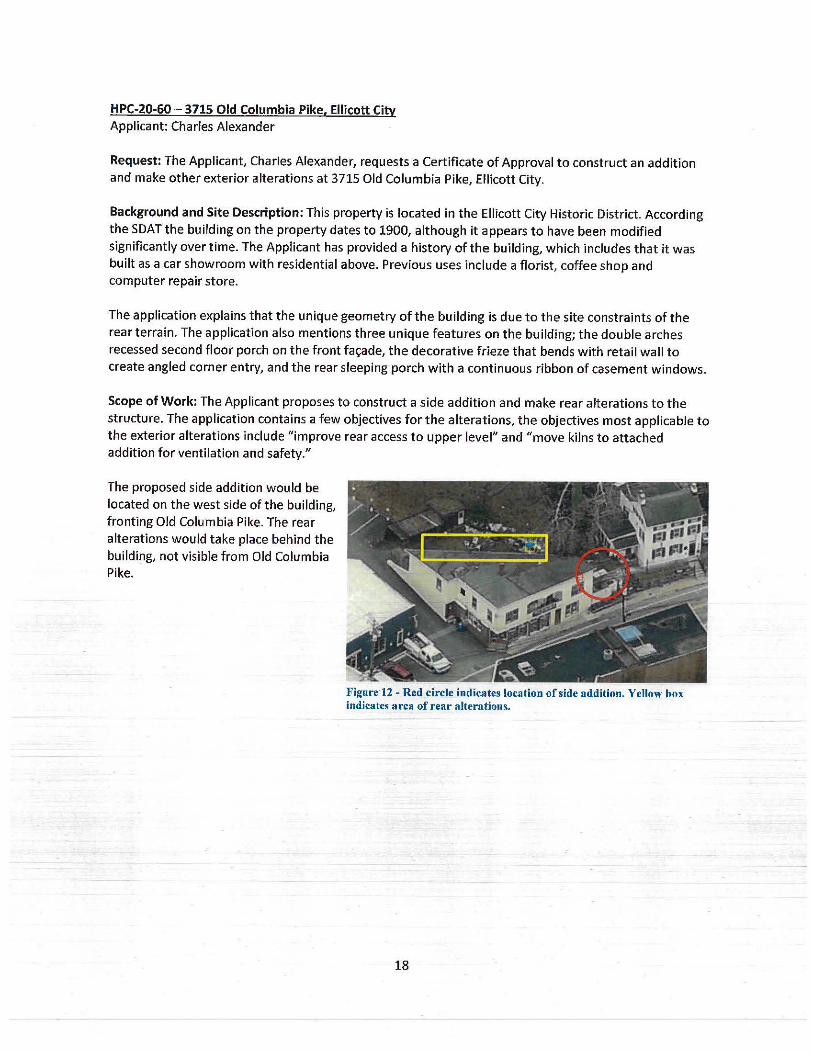
HPC-20-60 - 3715 Old Columbia Pike, Ellicott City Applicant: Charles Alexander
Request: The Applicant, Charles Alexander, requests a Certificate of Approval to construct an addition and make other exterior alterations at 3715 Old Columbia Pike, Ellicott City.
Background and Site Description: This property is located in the Ellicott City Historic District. According the SDAT the building on the property dates to 1900, although it appears to have been modified significantly over time. The Applicant has provided a history of the building, which includes that it was built as a car showroom with residential above. Previous uses include a florist, coffee shop and computer repair store.
The application explains that the unique geometry of the building is due to the site constraints of the rear terrain. The application also mentions three unique features on the building; the double arches recessed second floor porch on the front fa~ade, the decorative frieze that bends with retail wall to create angled corner entry, and the rear sleeping porch with a continuous ribbon of casement windows.
Scope of Work: The Applicant proposes to construct a side addition and make rear alterations to the structure. The application contains a few objectives for the alterations, the objectives most applicable to the exterior alterations include "improve rear access to upper level" and "move kilns to attached addition for ventilation and safety."
The proposed side addition would be located on the west side of the building, fronting Old Columbia Pike. The rear alterations would take place behind the building, not visible from Old Columbia Pike.
Figure 12 - Red circle indicates location of side addition. Yellow box indicates area of rear alterations.
18
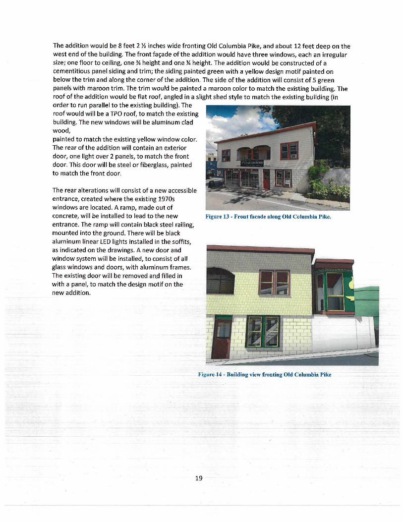
The addition would be 8 feet 2 ½ inches wide fronting Old Columbia Pike, and about 12 feet deep on the west end of the building. The front fa~ade of the addition would have three windows, each an irregular size; one floor to ceiling, one¾ height and one¼ height. The addition would be constructed of a cementitious panel siding and trim; the siding painted green with a yellow design motif painted on below the trim and along the corner of the addition. The side of the addition will consist of 5 green panels with maroon trim. The trim would be painted a maroon color to match the existing building. The roof of the addition would be flat roof, angled in a slight shed style to match the existing building (in order to run parallel to the existing building). The roof would will be a TPO roof, to match the existing building. The new windows will be aluminum clad wood, painted to match the existing yellow window color. The rear of the addition will contain an exterior door, one light over 2 panels, to match the front door. This door will be steel or fiberglass, painted to match the front door.
The rear alterations will consist of a new accessible entrance, created where the existing 1970s windows are located. A ramp, made out of concrete, will be installed to lead to the new entrance. The ramp will contain black steel railing, mounted into the ground. There will be black aluminum linear LED lights installed in the soffits, as indicated on the drawings. A new door and window system will be installed, to consist of all glass windows and doors, with aluminum frames. The existing door will be removed and filled in with a panel, to match the design motif on the new addition.
Figure 13 - Front facade along Old Columbia Pike.
Figur.e-l.4 - Building view fronting Old Columbia Pike
19
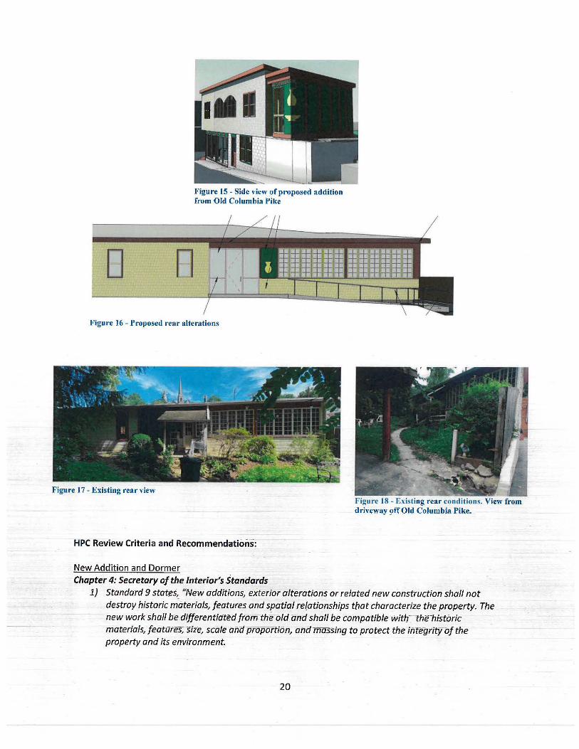
D n
Figure 15 • Side view of proposed addition from Old Columbia Pike
Figure 16 - Proposed rear alterations
Figure I 7 - Existing reai: view
HPC Review Criteria and Recommendations:
New Addition and Dormer
Chapter 4: Secretary of the Interior's Stan(lards
Figure 18 - Existing rear conditions. View from driveway !)ff Old Columbia Pike.
1) Standard 9 states, "New additions, exterior alterations or related new construction shall not destroy historic materials, features and spatial relationships that characterize the property. The new work shall be differentiated from the old and-shall be compatible with~ the-historic materials, featates; size, scale anclproportibn, and m assing to protect the iiltegrityof the property and its environment.
20
Chapter 7: New Construction: Additions, Porches and Outbuildings 2) Chapter 7 recommends:
a. "Design and fit additions to avoid damaging or obscuring key architectural features of a historic building."
b. "Attach additions to the side or rear of a historic building to avoid altering the primary far;:ade. Consider the impact of the addition on side, rear and rooftop views of the building from public ways."
The proposed addition will be located on the side of the building and will not be highly visible when looking at the front entrance. Due to the unique shape of this building, which is triangular in form, there are two sides of the building that are always highly visible from the public right of way. The addition will be located on the end of the west side of the building. The proposed addition will not damage of obscure any key architectural features, as none are present on that side of the building. Additionally, the building has been altered significantly over the years, as evident by the rusticated concrete block foundation, asbestos siding, and possibly enclosed second story front porch.
Chapter 7: New Construction: Additions, Porches and Outbuildings 3) Chapter 7 recommends:
a. "Design an addition to be subordinate to the historic building in size, height, scale and detail and to allow the form of the original structure to be seen. Distinguish the addition from the original structure by using a setback or offset or a line of vertical trim between the old section and the new."
b. "For any building, design the addition so that its proportions (relationship of width to height), the arrangement of windows and doors, and the relationship of solids (wall area) to void (window are) are compatible with the existing structure. Use a roof design that echoes or complements the original roof line. Gable and shed roofs are common for additions in Ellicott City."
The proposed addition complies with the above Guidelines and will be subordinate to the historic building; it will sit slightly lower than the historic building and will be recessed on the front corner where it attaches to th_e building. The roof design wilrrun parallel to the historic building, echoing the shape of the original roofline as recommended. The window design on the front of the addition loosely mimics the shape and size of the st9refront windows on the first floor.
Chapter 7: New Construction: Additions, Porches and Outbuildings 4) Chapter 7 recommends, "Use doors and simple entrance design that are compatible with those
on the existing buil(iing or similar buildings nearby."
Chapter 6.G: Rehabilitation and Maintenance of Existing Buildings; Entrances 5) Chapter 6.G explains possible exception as, 1'lvlany historic buildings have secondary entrances
not visible from streets or other properties. Where these entrances already have a modern replacement door, a new door does not necessarily need to be of a historically appropriate style."
6) Chapter 6.G explains, "When a new door is needed, it should reflect the character of the original door. Simple paneled doors of wood or window and glass are usually ~est, but metal doors with an appropriate style and finish can convey a similan:tppearance."
Both new doors comply with Guidelines. The door on the rear addition will match the design of the front door with the light and panel arrangement. The new door will either be fiberglass or steet While the material is modern, the Guideline above gives an exception for secondary entrances located on historic
21

buildings not needing to be of a historic style. In this case, the style will be historic, but the material modern.
The proposed rear door for the new accessible entrance will be modern, but will not be visible from the public right of way.
Chapter 7: New Construction: Additions, Porches and Outbuildings 7) Chapter 7 recommends, "On any building, use exterior materials and colors (including roof, walls
and foundations) similar to or compatible with the texture and color of those on the existing building. Avoid exact replication that would make an addition appear to be an original part of a historic building.,,
The materials on the addition will be made of modern, cementitious products, which are compatible, but distinguishable from the historic building. The historic building has been altered and is currently sided in asbestos siding, which is also a cementitious product.
In general, the paint colors to be used on the addition will match those on the existing building. There is a new design motif being introduced on the addition, and the Commission should determine if it is appropriate for the building.
Chapter 7: New Construction: Additions, Porches and Outbuildings 8) Chapter 7 recommends, "Roofing material may be similar to historic roofing material on the
existing building or may be an unobtrusive modern material such as asphalt shingles"
The proposed roofing material is TPO, which is appropriate for a flat roof system and was recently approved and installed on the main historic structure.
Staff Recommendation to the_HPC: Staff recommends the HPC determine if the painted design motif is appropriate and otherwise recommends the HPCapprove the application as submitted.
Testimony: Mr. Shad swore in Charles Alexander. Mr. Shad asked if Mr. Ale~ander had any comments to add to the Staff report. Mr. Alexander said he had no comments to add and concurred with everything the Staff had said.
Ms. Tennor asked how the Applicant decided that the addition would be completely distinct from the existing building and how did the design decision come about as the existing building is rather symmetrical. Mr. Alexan_der said he has done a number of additions on historic structures, and the plans concur with National Park Service recommendations that additions be completely distinct from the historic structure. M r. Alexander said there are wonderful motifs in the frieze, and he wanted to pull from the architecture on th.e building already. the addition is hyphenated from the bui'lding, but it is located there for functionally for the kilns. Mr. Alexander said there is an existing wall and patio, so it was an ideal location for the addition. The full-height window forms a slot between the new addition and the existing and the other window recalls the proportions. The colors and frieze motifs are drawn from the details in the first-floor cornice.
Ms. Tennor asked if the existing wall where the addition will be constructec:1-wcis a lattice wall. Mr. Alexander said the wall is a parged block wall c:fl'ia has been··alterea a lot and thEnattice h-as been added to allow something to grow. Ms. Ten nor asked if the wa_ll will be required to provide any structu!al support to the addition. Mr. Alexander said behind the lattice is a 12-inch concrete wall. Ms. Tennor said-
22
she was not entirely persuaded that the graphic and color of the addition are in-keeping with the rest of the building and said she would defer to the architects on the Commission.
Mr. Roth said he would like to hear deeper insights provided by the HPC architects.
Mr. Reich said for the most part the application complies with the Guidelines and the addition differentiates itself from the main building. Mr. Reich asked ifthe building is historic as a comment in the staff report says the main building has been modified several times and Mr. Reich thinks the building looks like a duplex. Mr. Alexander said the building started as a car dealership and had apartments above the dealership. The big double doors placed on an angle towards Main Street was how the cars were rolled into the showroom.
Mr. Reich said that a large part of the fa~ade is historic and Mr. Alexander did the right thing by making the addition look modern, not historic, and subservient to the larger historic structure by placing it back using a hyphen and lowering the roof. The fenestration looks compatible but different. Mr. Reich said the ADA accessibility was nice and would not be visible. Mr. Reich said the only question was the graphics, which are said to be derived from the building, but look like a painted-on frieze from an urn. Mr. Alexander said in the frieze there are wrap around diamonds and the real color is better than the printed graphics. Since this is a maker space for pottery the idea was to play off the design, though the Applicant is not 100% set on the pottery motif (possibly medallions on the lower level but also considering playing off the auto history).
Mr. Reich asked if the panels on the addition were raised, as they looked painted on. Mr. Alexander said the panels are cut out pieces and raised about half an inch. Mr. Reich asked for the material of the panels. Mr. Alexander said the panels were cementitious and were painted. Mr. Reich asked if the Commission had gotten samples or specifications on the panels. Mr. Alexander said he included the information on the last page of the application, the panels are a flat panel made of larger batten pieces that have the same finish like wood. Hardie has a new product that is more wood like thatis milled and routed to look like it was wood. Mr. Reich clarified if the panel was made out of Hardie trim or a composite. Mr. Alexander said he is not stuck with that particular brand and there are better products made with fly-ash.
Mr. Reich asked if Mr. _Alexander was decided on the motif. Mr. Alexander said the Applicant had a few ideas, but was not decided on a specific design. Mr. Reich said he would defer to the other Commissioners. Mr. Reich the basic architectur:e of the addition complies with the Guidelines and suggested Mr. Alexander make a separate submittal for the motif as there was no final decision on the design. The motif rides the line betw~~n sfgnage and architecture and the Commissipn has had a lot_ 9( problems pop up with murals. Mr. Reich said it is easy to approve architecture, but Mr. Alexander should make a separate submittal for graphics. Mr. Alexander agreed to Mr. Reich's approach.
Ms. Zoren agreed with Mr. Reich's suggestion about the motif being a separate submittal as the motif seems almost like additional signage advertising the function of the building. Ms. Zoren said the architecture was very interesting asR has a chamfered corner, but the corner does not look at anything. Ms. Zoren noted Jn figure 15 is a perfect place for the chamfered corner, the hill of Old Columbia Pike wou Id allow for more of a view on that side. Ms. ·zoren asked if the Applicant was thinking of following her suggestion: Mr. ·Alitxander said it was t1otthe-,n:.mb1rr one reason for-his design, bunh·e owr:,e·rs are close -enough to the property line that there can ben·owindow on that side of the building. Mr: Alexander wants the building t_o be seen. When one walks up Main Street the building is obliquely seen, which is the view one would have. The proposed addition wraps around the primary kiln and allows it-to be visible, which is why the addition faces the direction it does. Ms. Zaren asked if Mr. Alexander was
23
building up to the property line. Mr. Alexander clarified the addition is not at the property line but with the angular property line wedging along at an angle, the building varies from 2-foot to 5-foot to the property line. There is a tree in a tree planter and well at the end of the addition.
Ms. Zaren referenced figure 14 in the Agenda, the figure shows a chamfered corner with two window types, a full glass panel and then a horizontal window facing straight out towards Main Street. Ms. Zaren asked if the windows could be one type or the other. Mr. Alexander said the tall one was the hyphen window and the other window recalls the sill and the proportion of the double-hung windows and he wanted to pull the porch and double-hung windows across into the fai;:ade and reference that horizontal line. Ms. Zoren said she was concerned with how having two different styles of windows next to each other will read. She suggested the Applicant choose one or the other, and asked for the other Commissioner's input. Ms. Zaren referenced figure 15 and asked what the height of the green panels was and how the seam was being treated. Mr. Alexander said the panels are 10 foot high and would be seamless; the max height would be 9'4".
Mr. Shad agreed that the windows should be one of the styles, not both, and suggested to eliminate the horizontal piece. Ms. Zoren said she could go either way with the w indow type, but the windows should be consistent in such a small area.
Mr. Shad asked if Mr. Alexander would be doing anything with the existing parged retaining wall. Mr. Alexander said he was not going to alter the wall. Mr. Shad asked if the Applicant did not want to make the retaining wall blend into the wall. Mr. Alexander said the retaining wall was finished different with false ashlar block and then it goes to this lump concrete. Mr. Alexander said it would be better not to rip off vines and plantings. Mr. Shad said that 50% of the wall would not be seen either.
Motion: Ms. Zaren moved to approve the application as submitted with the exception that the two windows of the addition be the same style arid type and the motif graphic be submitted at a later date for review. Mr. Reich seconded. The motion was unanimously approved.
HPC-20-61- 8156 Main Street, Ellicott City Applicant: Donald R. Reuwer Jr.
Request: The Applicant, Donald R. Reuwer Jr., requests a Certificate of Approval to make exterior alterations at 8156 Main Street, Ellicott City.
Background and Site Description: This property is located in the Ellicott City Historic District. Thi_s property is located in the Ellicott City Historic District. According to S-DAT, the building on-the property dates to 1890.
Last month the Applicant was approved for the retroactive installation of a 42-inch high black aluminum fence (HPC-20-52) and a mural to cover the retaining wall and building foundation white parged wall (HPC-20-53).
Scope of Work: The Applicant requests approval to remove the smal~ brick retaining walls on top of the existing patio area and-ecfnstruct a newstone wa11,-10 be about 5 feet in-h-eighc Thefe)cisting concrete foundation, from ,rprevious building, will rema1n-in place. The area insidethe nev.r5-fooftall retainin~g wall will be filled in to be le\(el a bluestone tiies will be installed to create a new patio area~ A set of stairs made of stone will be constructed to lead to the new patio area. The proposed stone wall and stairs would be gray to match that is typically found in Ellicott City.
24
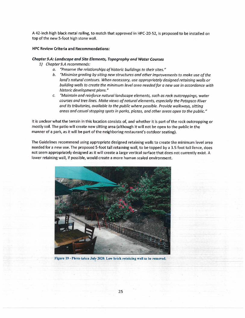
A 42-inch high black metal railing, to match that approved in HPC-20-52, is proposed to be installed on top of the new 5-foot high stone wall.
HPC Review Criteria and Recommendations:
Chapter 9.A: Landscape and Site Elements, Topography and Water Courses 1) Chapter 9.A recommends:
a. "Preserve the relationships of historic buildings to their sites." b. "Minimize grading by siting new structures and other improvements to make use of the
land's natural contours. When necessary, use appropriately designed retaining walls or building walls to create the minimum level area needed for a new use in accordance with historic development plans."
c. "Maintain and reinforce natural landscape elements, such as rock outcroppings, water courses and tree lines. Make views of natural elements, especially the Patapsco River and its tributaries, available to the public where possible. Provide walkways, sitting areas and casual stopping spots in parks, plazas, and other areas open to the public."
It is unclear what the terrain in this location consists of, and whether it is part of the rock outcropping or mostly soil. The patio will create new sitting area (although it will not be open to the public in the manner of a park, as it will be part of the neighboring restaurant's outdoor seating).
The Guidelines recommend using appropriate designed retaining walls to create the minimum level area needed for a new use. The proposed 5-foot tall retaining wall, to be topped by a 3.5 foot tall fence, does not seem appropriately designed as it will create a large vertical surface that does not currently exist. A lower retaining wall, if possible, would create a more human scaled environment.
Figure 19 - Photo taken JoJy 2020. Low brick retaining wall to be removed.
25
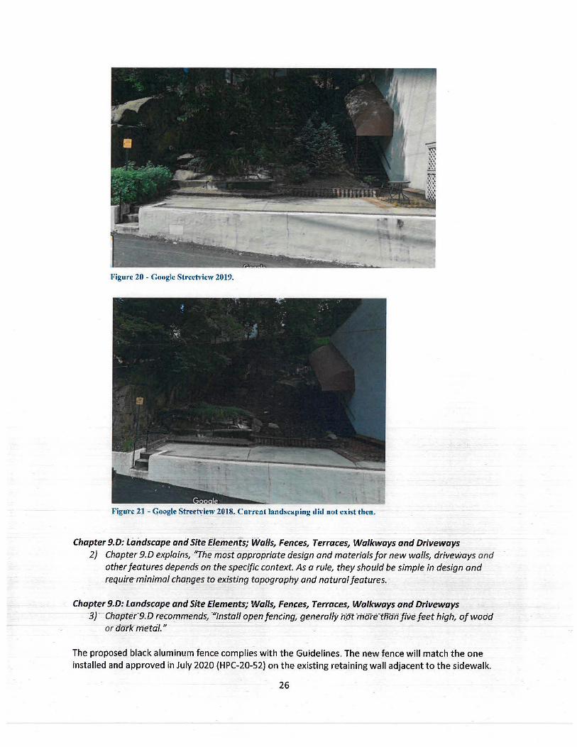
Figure 20 - Google Streetview 2019.
Figure 21 - Google Streetyiew 2018. Current landscaping did not exist then.
Chapter 9.D: landscape and Site EleriieriJs; Walls, Fences, Terraces, Walkways and Driveways 2) Chapter 9.D explains, "The most appropriate design and materials for new walls, driveways and
other features depends on the specific context. As a rule, they should be simple in design and require-minimal changes to existing topography and natural features.
Chapter 9.D: landscape and Site Elements; Walls, Fences, Terr'!ces, Walkways and Driveways 3} Chapte,-9.D recommends, ""JnsW/1 open fencing, generally h_ot mtfte-th'an five feet high, of wodcl
or ilark-metdl."
The proposed black aluminum fence complies with the Guidelines. The new fence will match the one installed and approved in July 2020 (HPC-20-52) on the existing retaining wall adjacent to the sidewalk.
26
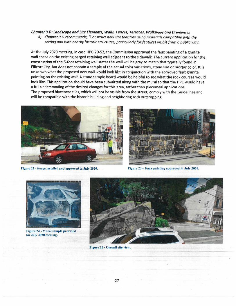
Chapter 9.D: Landscape and Site Elements; Walls, Fences, Terraces, Walkways and Driveways 4) Chapter 9. D recommends, "Construct new site features using materials compatible with the
setting and with nearby historic structures, particularly for features visible from a public way.
At the July 2020 meeting, in case HPC-20-53, the Commission approved the faux painting of a granite wall scene on the existing parged retaining wall adjacent to the sidewalk. The current application for the construction of the 5-foot retaining wall states the wall will be gray to match that typically found in Ellicott City, but does not contain a sample of the actual color variations, stone size or mortar color. It is unknown what the proposed new wall would look like in conjunction with the approved faux granite painting on the existing wall. A stone sample board would be helpful to see what the rock courses would look like. This application should have been submitted along with the mural so that the HPC would have a full understanding of the desired changes for this area, rather than piecemeal applications. The proposed bluestone tiles, which will not be visible from the street, comply with the Guidelines and will be compatible with the historic building and neighboring rock outcropping.
Figure 22 - Fen .. e installed and approved in July 2020.
Figure 24 - Mural sample provided for July 2020 mee_ting._
Figure 23 - Faux painting approve~ in July 2020.
F igure25 - Overall site view.
27
Additional Information and Requirements According to the Department of Inspections, Licenses and Permits (DILP), since this wall is proposed at 5 feet in height, an engineer would need to certify that the existing foundation can support this additional load. DILP would need to have an engineered sealed drawing for this wall for their building permit review, if approved by the HPC. The Applicant should contact DILP for additional information.
Staff Recommendation to the HPC: Staff recommends the HPC determine if the new wall and patio comply with the Guidelines and approve, deny or modify accordingly. If the wall is approved, Staff recommend the HPC approve the proposed fence, which complies with the Guidelines.
Testimony: Mr. Shad swore in Donald Reuwer Jr. Mr. Shad asked if Mr. Reuwer had any comments on the staff report. Mr. Reuwer said the previous owner of the property added mulch every year on the property and Mr. Reuwer had the mulch removed to see what was underneath. Due to the COVID situation, the outdoor dining for Syriana has been very popular. Mr. Reuwer said there was no longer dead space on the street, with a big empty rock and an office building. Along with the recently renovated building at 8156 Main Street, the outdoor seating created a continuation of retail and activity on the street. Mr. Reuwer would like to expand the outdoor seating and wanted to see if the size of the deck could be increased. He explained there was previously a building located in the currently unused space. Mr. Reuwer said he would like to build a stone wall that would step into the hillside to allocate more outdoor dining space. He said the wall would have to be 4.5 feet tall, and then there would be another three-foot wall for a second deck. Mr. Reuwer said what was submitted was not what he wanted to do at this point, based on recent discoveries. Mr. Reuwer asked if a tiered stone wall would be appropriate.
Ms. Burgess said she had conducted a site visit that day and Mr. Reuwer had been previously requesting a 5-foot wall, which is a structural wall and quite high. The property had a lot of mulch and dirt and it is unknown what the base soil type was. Ms. Burgess said after removing the mulch and dirt, it seemed that Mr. Reuwer could change the height of the request, but that would chaoge the width, and having a tiered patio might be a better option. Ms. Burgess said Mr. Reuwer wanted to withdraw_ his application, but she had suggested Mr. Reuwer attend to get Advisory Comments on the tiered patio instead.
Mr. Shad asked if Mr. Reuwer was changing his application to Advisory Comments. Mr. Reower said he wanted Advisory Comments as he would need to get more details to th~ Commission than what was provided for the tiered patio request, but wanted to get their thoughts before he commissioned new drawings.
Ms. Tennor had some questions based on Mr. Reuwer's recent excavations. Ms. Ten nor asked if the section drawing provided in the application is what the Commission should be referencing. Mr. Reuwer said they should not reference it, and that he would need to do some new measurements on the tiered patio. He said that it seems the ffrsf wall would not need to be as high because he does not want the patio sloping down and needs a level area to build on. Mr. Reuwer said that after removing the mulch and dirt, his team dug down until they got to rock they could not penetrate. The tiered patio would need to be about 4-feet to 4 and a half feet to prevent water running down and then tlie pl_an to make a second tier would require going back about 10 feet and then up another 3 feet.
Ms. Ten nor asked if there would be three-level areas; the existing dee~, a new pat)b, and then anbther patio above. Mr. Reuwer s·aid yes anc:i-tharit seems possible. Ms.Ten nor asked if the levels would have stone retaining on the street fa~ade of the patios. Mr. Reuwer said that was correct. Ms. Ten nor aske~ if the patio would be accessed from the existing stair or if a new stair at ~he side of the buff ding, shown in figure 20, would be used to access the patio. Mr. Reuwer said he could put a stair between level one to
28
level two and then level two to level three could be made out of stone. Ms. Tennor and Mr. Reuwer discussed the proposed stairs. Mr. Reuwer said he would need to get the Commission a new plan based on his tiered design.
Ms. Ten nor asked if there would be a railing at the front edge of each patio. Mr. Reuwer said that anything over three feet in height would need a railing, but possibly not the top patio. Ms. Tennor asked what the depth of the top patio would be. Mr. Reuwer said 8 to 10 feet back. Ms. Tennor asked how many serving stations would those two added levels accommodate. Mr. Reuwer asked if the Commission was seeking the number of stations pre or post-COVID. Mr. Reuwer elaborated that with a required 6-foot separation there would be fewer serving stations but without the 6-foot separation, there could be quite a few. Ms. Ten nor said she was trying to get an idea of what the patios would look like. Ms. Tennor asked if the existing landscaping will be gone. Mr. Reuwer said the landscaping was added at Christmas because the trees die every year as they sit directly on rock.
Ms. Tennor said at the top of the hill, there is a crest, that would be above the upper level of the patio and asked how many retaining walls are being requested. Mr. Reuwer said two. Ms. Ten nor asked if there would be a retaining wall at the back of the top patio. Mr. Reuwer said that was probably not necessary because that area is all rock. Ms. Burgess said the original proposal was one five-foot waif with a 10 to 12 foot deep patio. Now the request had been updated to be two shorter tiered waifs that fit within existing conditions.
Ms. Ten nor said it was an intriguing proposal and would be a wonderful place post-pandemic. Ms. Ten nor asked about the paving. Mr. Reuwer said the paving would be bluestone set in stone dust to be adjusted over time, the paving information had been included in the original submittal. Ms. Tennor said stone retaining walls would be a big improvement over brickwork.
Mr. Roth said the proposal was a tough sell given the Guidelines, and referenced Chapter 9. Mr. Roth read Ellicott City natural setting is essential to its character ... "care should _be taken to protect natural features". Mr. Roth said he had driven by.the site today and the mulch is gone, and tbe area now shows natural bedrock. Mr. Roth said the staff report points out recommendations from Chapter 9.A of the Guidelines. Mr. Roth said the proposal would bury the ncJtural feature of the rock outcropping under the retaining walls and patio and would be tough to reconcile with words in the Guidelines. Mr. Roth said Mr. R~uwer should approach this project cautiously and think hard b_efore going down this path.
Mr. Reich said he had a different perspective on the tiered wall proposal. Mr. Reich said he thought the rock outcropping is to the left, and the subject area had been buried under mulch and vegetation. Mr. Reich noted there used t9 be a building there. Mr. Reich said if the proposal is done right, it would be a great enhancement to Main Street without covering any important natural features. Mr. Reich recommended Mr. Reuwer use indigenous stone. Ellicott City is moving more toward outdoor spaces and it would give more lifeto M~in Street. Mr. Reich said he did not see this proposal as destroying natural features and noted the site had been a dead space for a long time. The stairs to the top of the 8156 Main Street building is the only life the space has gotten. Mr. Reich said if Mr. Reuwer submits detailed plans showing retaining walls, layout, materials to be used, it could sell th-I:! idea. Mr. Reich mentioned black railing fits in with about everything. Mr. Reich said Ellicott City granite is not as hard as most granite. Mr. Reich said it is possible to pour concrete to make levels that Mr. Reuwer was proposing.
Ms. Tennor said this proposal could help people interact with the dramatic stones and make it more accessible without infringing on them. Currently, the location is dead space and the rocks are an amazing feature on Main Street. The proposal would be a .compliment. Mr. Reich said the huge rock that
29
outcrops right next to it, an iconic part of Main Street that was faded into the background with the vegetation around it.
Ms. Zaren said she is on board with the overall concept. She asked that when Mr. Reuwer return with a finalized plan, he include site sections including the steps, multiple scaling, dimensions showing steps, the height of the railings, how many railings, what is being done with the dirt at the back of the retaining wall. She asked if there will be planting; what are the plantings, and materials such as the stone walls and bluestone pavers. Ms. Zaren stated a couple of concerns with the multiple tiers and multiple levels of the railing, as she is afraid that it will look overwhelming with three rows of metal railing. She said the first black railing on the edge is good, but suggested a glass railing that blends on the other levels, so that only the primary edge of the railing is seen.
Ms. Zaren had a concern from the previous month's approval of the faux finish stone painting juxtaposing with real stone and was wondering how that will look. Ms. Zaren was afraid that the stone painting will cheapen the rock. Ms. Zoren urged Mr. Reuwer to face the front of the parged wall with stone or natural material, instead of painting the mural/faux finish and to take into context what he is trying to create and how it will look.
Ms. Ten nor agreed with Ms. Zaren about the paintings with the elevation of natural stone behind it. Mr. Shad also agreed; he liked the plan overall as it had a good concept of the space and it could be an attractive addition between the buildings. Mr. Shad agreed with Erica's ideas on the railing and wall. Mr. Shad said Mr. Reuwer should reconsider painting the faux stone mural and apply a stone to the wall as it will be in keeping with new stone walls up and above that area. Mr. Shad said he was looking forward to seeing the new plan and concept.
Mr. Reuwer asked if he can face the area that was to be painted with a thin stone and apply it to the front of the wall, but still paint the brick on the adjacent building, 8156 Main. Mr. Shad said the adjacent building was a separate fa~ade and he would be okay with that plan if the painted brick matched the sample Mr. Reuwer provided. Mr. Reuwer said that was what he would like to do; face the front parged retaining wall with a stone wall. Mr. Reuwer suggested an alternate fence style he had used in other projects, it is a contemporary thin wire post railing patnted back. Ms. Holmes referenced the photo Mr. Reuwer submitted by the stairs. Ms. Burgess clarified Mr. Reuwer was referencing the black cable railing from the photo. Mr. Reuwer said he would make the railing as bla~k wire instead of silver, as the photo showed silver. Mr. Shad asked if Mr. Reuwer was referring to the railing for the upper two terraces. Mr. Reuwer confirmed Mr. Shad .to be correct. Ms. Ten nor agreed it would have a less visual impact than three sets of metal railings. Ms. Zoren said Mr. Reuwer's suggestion would solve a lot of visibility issues with vertical picket and would make sense to do the cable railing. Mr. Reuwer said when he came back with the certificate of approval application, he could show the Commission both railings for them to decide.
Mr. Shad asked if the .Commission had any other comments, the Commission had no more comments.
Motion: There w·as no motion as this was an Advisory Comments application.
HPC-20-62 - Ellicott City Watershed Master Plan Applicant: Peter Conrad, Howard-Co1rnty Department of Planning and Z6nirr~r
Re~uest: The Applicant, Peter Conrad from the Howard County Department of Planning and Zoning, requests Advisory Comments from the HPC on the Ellicott City Watershed Master Plan, pursuant to
30
Howard County Code §16.606(d)(2)(11}, which allows the HPC to "review and provide advice to the Planning Board and County Council on other proposals affecting historic preservation, including County general plans and area master plans." Additionally, Code §16.606 (d)(l}(I} allows the HPC to "advise and assist in developing plans for the preservation of historic resources within Howard County upon the request of an Agency, Board or Commission of Howard County Government."
Background and Site Description: The Ellicott City Watershed Master Plan encompasses the area within the Tiber Branch Watershed, with contains a majority of the Ellicott City Historic District. The Master Plan is a long-range plan that creates a multi-objective vision for Ellicott City and the Tiber Branch Watershed. The application explains that the plan represents the culmination of a multi-year public outreach process that began in 2016 and builds upon the 2019 Ellicott City Safe and Sound plan. The application states, "the master plan establishes goals, desired outcomes and policies for the next twenty years. It also features conceptual illustration that can serve as inspiration should specific opportunities arise over time."
The Department of Planning and Zoning held a workshop with the HPC on the Master Plan in November 2019.
Likewise, the Department of Public Works has received Advisory Comments/Pre-Application Advice on the Ellicott City Safe and Sound Plan in case HPC-19-48 (October 2019}.
Scope of Work: The plan is organized around five topic areas (watershed wide, which includes areas outside the Historic District), and seven geographic areas located within the Ellicott City Historic District.
The five topic areas are: 1) Character & Placemaking 2) Flood Mitigation 3) Economic Development 4} Environmental Stewardship 5} Transportation
The seven geographic areas are: 1} Streetscapes
31
2} Riverfront 3} Lower Main 4} Upper Main 5) Ellicott Mills Gateway 6} West End 7} Courthouse
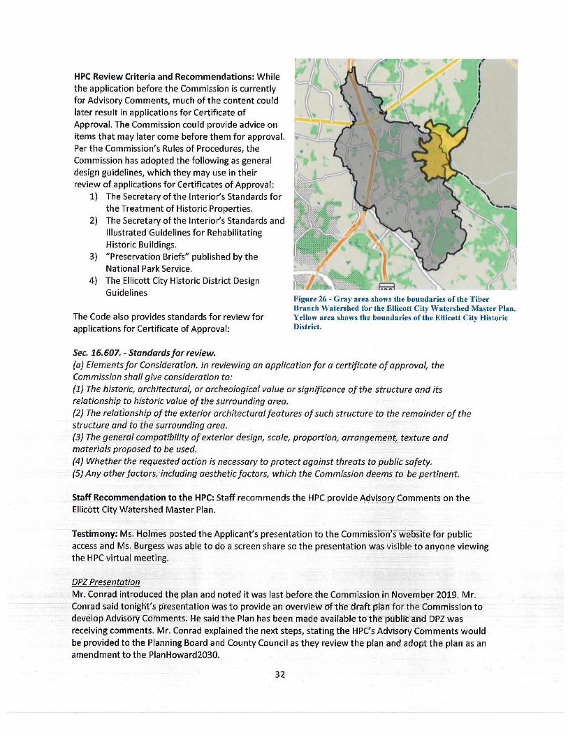
HPC Review Criteria and Recommendations: While the application before the Commission is currently for Advisory Comments, much of the content could later result in applications for Certificate of Approval. The Commission could provide advice on items that may later come before them for approval. Per the Commission's Rules of Procedures, the Commission has adopted the following as general design guidelines, which they may use in their review of applications for Certificates of Approval:
1) The Secretary of the Interior's Standards for the Treatment of Historic Properties.
2) The Secretary of the Interior's Standards and Illustrated Guidelines for Rehabilitating Historic Buildings.
3) "Preservation Briefs" published by the National Park Service.
4) The Ellicott City Historic District Design Guidelines
The Code also provides standards for review for applications for Certificate of Approval:
Sec. 16. 607. - Standards for review.
Figure 26 - Gray area shows the boundaries of the Tiber Branch Watershed for the Ellicott City Watershed Master Plan. Yellow area shows the boundaries of the Ellicott City Historic District.
(a) Elements for Consideration. In reviewing an application for a certificate of approval, the Commission shall give consideration to: (1) The historic, architectural, or archeological value or significan_ce of the structure and its relationship tQ historic value of the surrounding area. (2) The rela(ionship of the exterior architectural features of such structure to the remainder of the structure and to i:he surrounding area. {3} The general compatibility of exterior design, scale, proportion, arrangement, texture and materials proposed to be used. (4) Whether the requested action is necessary to protect against threats to public safety. (5) Any other factors, including aesthetic factors, which the Commission deems to be pertinent.
Staff Recom_~en~_a_!ip_n to the HPC: Staff recommends the HPC provide Adv!sgry Comments on the Ellicott City Watershed Master Plan.
Testimony: Ms. Holmes posted the Applicant's presentation to_ the Commission's website for public access and Ms. Burgess was able to do a screen share so the presentation was visible to anyone viewing the HPC virtual meeting.
DPZ Presentation Mr. Conrad introduced the plan and noted it was last before the Commission in Novemb~r-2019. Mr._ Conrad said tonight's presentation was to provide an overview of the draft plan fo-r the Commission to develop AdvisoryComments. He said the Plan has been made availabletcnl'ie puof1c and DPZ was receiv!ng comments. Mr. Conrad explained the next steps, stating the HPC'sAdvisory Comf!lents would be provided to the Planning Board and County Council as they review the plan and adopt the plan as an amendment to the PlanHoward2030.
32
Mr. Conrad began his presentation providing background on the plan, Main Street, the Historic District, and the watershed surrounding the District. Mr. Conrad said it was a multi-objective process. Mr. Conrad detailed the numerous public workshops and events that had taken place prior to the meeting. He explained the planning process began in 2016, and explained that DPZ was nearing a release of the draft plan in 2018, when the second flood hit. He said the Master Planning effort was rebooted in 2019 to build upon the Ellicott City Safe and Sound Plan.
Mr. Conrad said the Master Plan team created a community-driven vision, which includes six goals with desired outcomes. Mr. Conrad walked the Commission through the six goals. first goal encompasses public safety aspects, the second goal focuses on water management quality and quantity, the third goal focuses on economic success for Main Street, the fourth goal is to enhance the Main Street experience, the fifth goal is to preserve and promote the identity of Ellicott City and the sixth goal is to organize for success for coordinated efforts to achieve the goals.
Mr. Conrad said the body of the plan is organized into twelve chapters that make up five topic and seven focus area components. Polices and implementation actions, as well as non-policy considerations, are included in the plan.
Commission Comments Mr. Reich said he did not currently have questions, but said Mr. Conrad presented high-level goals and the Commission's problems have always been in the details. Mr. Reich said the details would be of concern to the Commission the most. He said in reviewing the whole draft master plan, the things the HPC would be most concerned about are the areas where there are ideas for proposed new development, such as the Courthouse area and the West End, parking lots and opening up the river basin. The Commission will have to figure out how to deal with those ideas and when and how will they develop Guidelines. He felt those were the items that would most concern the Commission. He said throughout this process, they have seen a lot of big ideas. Even though the history of Ellicott City has been stated as one of the driving factors of the Master Plan, it seems like the big ideas are overpowered compared to the character of the small scale of the historic district. He explained that most of the focus ofthe Commission has been preserving that Main Sfreet experience. The plan seems like a giant watershed development idea, and somehow the Commission needs to bridge those issues as a Commission; it presents a lot of challenges for the Commission.
Mr. Conrad said the Master Plan is considered to be a 20-year plan and elements that are to be implemented from Safe and Sound wilrbe the initial drivers, such as goa Is lowering flood levels either through conveyance or storage, which are largely en_gineering issues. The Master Plan will work in conjunction with the Safe and Sound Plan and provide the place making compon-ents, the way to enhance or achieve other objectives when-the engineering work is taking place.
Ms. Ten nor said the tommisslon does not focus on economic development, but was not antithetical or antagonistic to it. Ms. Ten nor referred to Mr. Reich's comments for the expansive ideas for new amenities, an-d redevelopment of areas such as the Courthouse area, it is her hope as a Commissioner that Historic Main Street does not become economically irrelevant and overpowered by other development that is being considered in this area. The work needs to be done cohesive_ly a!)d not
-competitively.
Mr. Conrad agreed with that statement and said that is a challenge in a_pproaching a planning process such as this, because there are so many influences, such as historic, but the plan i_s being driven by the focus to address flooding in order to retain the historic core. He explained that the Master Plan Team
33
looked at the Master Plan as an adaptive management plan. The plan is supposed to provide a framework or guidance for changes or opportunities that might arise, driven by engineering decisions. For example, if a flood mitigation project requires a loss in parking spaces in Parking Lot F, to counterbalance the spots lost, the plan could trigger a solution like a parking garage.
Mr. Shad said he was concerned with development up and above Ellicott City, as this has not been addressed, and as far as environmental stewardship that has to be vital ,as the new development will be tying into the Tiber Watershed, which is a key component in this whole process. Mr. Shad said it was his opinion that the development has led to the floods that have been seen in the last 40 years.
DPZ Presentation
Ms. Bolinger presented the five topics and seven focus areas that the Master Plan w ill focus on to provide policies and offer guidance. Ms. Bolinger presented the twelve chapters, the first being Community Character and Placemaking. This chapter introduced a range of topics such as preservation, property maintenance, development character, scenic roads, public realm, public art, green cultural trail and programming. Ms. Bolinger provided an example from each chapter.
The second chapter focused on flood mitigation. Ms. Bolinger said the Ellicott City Safe and Sound sets a foundation for flood mitigation in the watershed. Stream restoration and floodproofing were also discussed in the chapter. In regards to Mr. Shad's comment on development, she explained that it was not listed as a policy, but is described in the existing conditions, Ellicott City Today section. She said that the new stormwater management standards that were put in place last year are referenced, and that new development/redevelopment is required to manage the equivalent of the July 30, 2016 storm; 6 inches in 3.55 hours, as well as a few other requirements for water quality. Ms. Bolinger explained that the reason it is not listed as a policy is because the stormwater management requirement has already been adopted.
Ms. Bolinger presented the remainder of the chapters. The third chapter covered environmental stewardship in regards to forest management, conservation easements and stream daylighting. Ms. Bolinger noted the plan describes opportunities to daylight streams that are culverted and covered.
The fourth chapter, Economic Development, discussed the creation of creative spaces, community branding, tourism and marketing. Ms. Bolinger said the chapter calls for continuing to deploy and expand the old Ellicott brand developed by the Ellicott City Partnership.
The fifth chapter, Transportation and Parking, covers pedestrian accessibility, bicycling, parking management and wayfinding. With wayfinding, the plan calls for designing an_<! executing a cohesive wayfinding system that would help visitors navigate on foot and by vehicle.
The next section adcfresses the the seven focus areas made up of the West End, Streetscapes, Ellicott Mills Gateway, Upper Main, Courthouse Area, Lower Main and Riverfront in the Historic District.
Ms. Bolinger provided an overview of each focus area. Ms. Bolinger explai_ned that there were a number of options within the Master Plan for each area, since it is an adaptive management looking ahead for 20 years. The plan recognizes if there were to be a project in one of these areas, there could be a domino-effecn~lsewhere, so the ideas is to document all ohho"Se options in- tlnfplan so th-e aesigh ccfnsidetation assoc1ateaWith them can be-thoughtthrough.
34
Commission Comments Mr. Roth said there are policies in place for what the Commission does. He said the parts of the watershed plan that are most relevant are the proposals to demolish structures on lower Main Street that contribute to the character of Ellicott City, which especially incudes the B&O turntable and the structures proposed for demolition. Mr. Roth quoted the Rules of Procedure "Before an application of demolition or relocation of a building, HPC shall determine if the structures are of unusual importance." Mr. Roth noted the B&O turntable is integral to the B&O Station warehouse, which is a designated National Historic Landmark, and the buildings on lower Main Street are part of the area included in the designated National Register Historic District for Ellicott City. He said it would be reasonable for those structures to be identified as of Unusual Importance. Mr. Roth quoted the Guidelines on demolition, where it states the Commission will consider approving demolition only after all possible alternatives to preserve the structure have been exhausted. Mr. Roth said the watershed plan basically says the buildings will be torn down. Mr. Roth explained that the Commission cannot issue a Certificate of Approval for demolition until a case has been made to them that all the alternatives have been examined or considered.
Mr. Roth noted the Maryland Avenue culvert is proposed to run underneath the turntable, but there has been no information shown on how the culvert will be constructed. The culvert has been used as the justification to tear down the lower Main Street buildings. Mr. Roth said he cannot find any information on the value that is added to the Maryland Avenue culvert and what effect it will have on flood mitigation. He could not find any information on it in the McCormick Taylor repo_rt. Mr. Roth said the access to the Maryland Avenue culvert will be lower than the former Phoenix building and he does not see how the Maryland Avenue culvert has any contribution to flood mitigation. He said that argument needs to be made.
In regards to the buildings proposed to be torn down, Mr. Roth said the Phoenix previous location looks like two buildings combined into one. He said the back half has a federal style roofline with American bond brickwork, which suggested the back of the building is from the first half of the 19th century, making the building particularly worth consideration of preservation. He said the building the used to contain Great Panes should also be given more consideration for preservation. He said the building that used to be Tea on the Tiber is being save~, but only 20 feet away from it, is a similar building.made of granite, under-stucco. Mr. Roth questioned why the one building is proposed to be torn down instead of preserved when they are so close in proximity.
Mr. Roth said one alternative that he has not heard explored is whether the degree of flooding can be reduced by creating more impervious surfaces in the watershed. Mr. Roth asked what specific benefits to flood mitigation result from the removal of the buildings on lower Mair:! ~t!eet. He said that these comments rieed to be considered in making the watershed plan. Mr. Roth said if the Master _Plan team does not have arguments in hand that enable the Commission to approve the demolition, then the team should fhirikthrough if the watershed plan should talk about tearing buildings dowri.
Mr. Roth appreciated the citation on page 74 of the Master Plan; the 2018 NOAA climate assessment as opposed_ making to bald statements that climate change will produce more flooding. He appreciated having an actual cite to a real document. Mr. Roth referenced page 76 indicating tlie McCormick Taylor 2016 Hydrology & Hydraulics document that compares woods in good condition versus the conditions of 2016 measuringlhe water depth during the flood. Mr. Roth said he could·.not find th-,rt refer_ence in the McCormick Taylor-plan andasked if the-Applicants- knowwhere th·at reference is in"theplan. Ms. Bo!inger said the reference Mr. Roth was referring to was presented at the kickoff meeting of the Master Plan, the dual kickoff to the Master Plan and the H&H Presentation.
35
Mr. Roth noted he found flow rates of woods in good condition compared to current conditions on page 10. Mr. Roth thinks that someone converted the McCormick Taylor statement about the difference in flow rates through the channel, to a statement about the depth of the water on Main Street. Mr. Roth said if that is what is going on, that is not sound reasoning and provided an explanation why. He said that Main Street is not the whole channel and the reference is misleading, because it understates the benefit that could be added by increasing the amount of pervious surface in the watershed. He said it keeps the question open as to whether or not decreasing the impervious surface in the watershed could provide enough benefit to keep from having to tear down historic structures.
Mr. Roth said the polices in the watershed should align with the policies that are currently guided by the Commission. Mr. Roth noted that adjusting the HPC Guidelines or the Watershed Plan could make that happen and cautioned it will cause problems if they are not aligned when the HPC has to make decisions.
Mr. Roth referenced pages 195-196, which references placing a parking garage in Parking Lot D, and he said the examples shown in the plan were inappropriate due to the overwhelming scale and context. Mr. Roth said of the implementation plan in Section Six, he cannot find the Maryland Avenue culvert.
Ms. Tennor that if it is possible to keep all the lower Main Street buildings together, having the buildings together is important for the context. Ms. Tennor agreed with Mr. Roth, that the Commission needs to be absolutely certain that demolition is the only option before those buildings are removed. Ms. Tennor was not optimistic about a four-story parking structure. She said there is nothing like a four-story parking structure on Main Street. Ms. Tennor hopes over the course of the next 20 years that the community will make a big effort to integrate the experience on Main Street with a good redevelopment program for the Rogers Wilkins Mill. Ms. Tennor understands there is a border between Baltimore and Howard County, but said there are lots of groups between those two communities to reach coordination. She said there is not a good connection between the historic parts of Baltimore County and the historic Main Street in Ellicott City. She said it could really help the economic development of the area where the two counties come together, if visitors to Main Str~et could experience Oella and other areas within walking distance. Ms. Tennor said she had other individual concerns but maybe she can address them in hand written form.
Mr. Reich said that other than the demolition of lower Main Street buildings, that most of the stormWater management and flood mitigation plans will not affect the Commission. The tunnel will be out of sight and the stream enhancements are good. Mr. Reich said he ha_s never liked that visitors cannot experience the stream. ·He noted the stream and water was the beginning point of all development 300 years ago. The places in the plan wbere the channel is being opened up, other than where the buildings are being demolished, is a good idea and won't hurt the architectural heritage.
Mr. Reich said things that will create extra work in thinking about the Guidellnes are icfeas about the streetscape. Howard County has pushed to take out the brick sidewalk and put in concrete because it is felt to be more flood-proof. The document mentions mountable curbs, parking and landscaping the street that need to be addressed in the Guidelines. Mr. ·Reich doesn't want to be caught off guard with things ttie County may propose that are not addr_essed by the Guidelines. Mr. Reich said the major development ideas, such as the Courthouse area will create big areas of concern with not overpowering thE!'histcfric nature, Mr. Reich said the Commission might need se_parate Gu1clelines for each of these focu-s aTeasm order to address everything in the-plan.
Mr. Reich mentioned that he did not see ideas-to create a 4-story buildfng in Parking Lot D anymore, as it seems the idea has changed to opening up the channel and keeping it as a parking area to allow
36
people to see and enjoy the river in a gathering area. He said that would be much easier if development was not proposed there anymore.
Mr. Reich said the Master Plan Team has listed several other things in the Gateway Area, Thomas Isaac, Bernard Fort, Lot F &G and all of these areas will be separate areas of concern. Mr. Reich wondered how the Commission will develop Guidelines if the Commission is not sure what the ultimate plan for those areas is. Mr. Reich said he was concerned as the proposals come in the Commission will be blindsided because they have no point reference for which to consider the proposals.
Ms. Zoren agreed with the other Commissioners. She explained her biggest concern was that the plan seemed to focus on items such as wayfinding as much as it does on big changes that could have an impact on the character of the District. The next time DPZ presents to the HPC, Ms. Zoren would like to see more time spent on each area, explaining ideas more pertinent to the Commission like new construction, parking, and streetscape. Ms. Zoren said she wished the Commission had more time to go into depth with DPZ on those issues. Ms. Zaren said once these new construction elements are put in the Master Plan, the Master Plan Team has planted a seed and the ideas are never going to go away. She said the Commission does not have the ability to approve the Master Plan and the Guidelines and the Master Plan could be at odds. Ms. Zaren says there is a need to mesh the Guidelines and the Master Plan so that the Commission can approve plans that come to them legally per the Guidelines.
Ms. Zaren said she agreed with the Mr. Roth's earlier statement about exploring all other options and does not think the County has explored all other options other than demolition on lower Main Street. Ms. Zaren said demolishing the buildings might be the easier or less intrusive solution, but it will have a large impact. Ms. Zaren said she has not seen the County go through great lengths to improve things up the hill and upstream. Ms. Zaren said she has not seen what will happen when all the water is rushing down the culvert to the Patapsco River. She asked if this problem was being pushed downstream and what the implications of that are. She has not seen that addressed in the plan.
Mr. Shad said he had nothing to add to what has been said by the previous (ommissioners, but wanted
to echo concern with the lower Main Street demolitions. Mr. Shad noted how the Commission's Guide-lines are connected to the Master Plan and that the Master Plan will help the Commission know what some of the focus in the Guidelines could be. Mr. Shad said the Commission is not going to be totally guided by all the proposals in the Master Plan, especially when it comes to resilient materials. Mr. Shad said he believes brick is just as resilient as concrete, if installed properly and when all the other mitigation measures are implemented.
Grace Kubofcik signed up to give testimony on the )Vlaster Plan. Ms~ Kubpfcik said the overall goals were good except she would add on goal number 4, the notion bf cultural arts, which enhances the experience in the County and particularly on Main Street. Ms. Kubofcik said she was not a fan of demolition and aoes not know the status of Section 106 review. She was not afan of what is proposed as the opening of a river park. She said the designs look wonde_rful, but she has seen the river in July and there is not much to see until there is a thunderstorm. Ms. Kubofcik said she was seeing the same ideas that were presented back in 2017 and was hoping to see somethfng more. Ms. Kubofcik was a big fan of the river area, particularly the pedestrian bridge connectivity for pedestrians and bicycles. Ms. Kubofcik was hoping Parki11g Lot A would be a priority. She said that it has the most parki_ng between _Baltimore and Howard counties and when there is-any kind of festival, Howard County has the opportunity to use that space, ancnhinksBaltimore County was supportive ofit. Ms. Kul:lofcil< sa10 she sEfes it as a long:. range alternative and it should be the first priority.
37
Ms. Kubofcik referenced flood mitigation on page 80, which had statements related to dry flood mitigation that was concnering. She said when there is talk about what is going to help the water quantity that will come up Main Street, the dry flood mitigation ponds will take 30% off of the street. She saidthe plan gave the project one small paragraph and it should have had a lot more than that. Ms. Kubofcik said she loved the stream bank restoration, all the comments on the restoration and the green infrastructure and connectivity.
Regarding property maintenance, Ms. Kubofcik said the Commission constantly deals with properties that are not being maintained through demolition by neglect, and she was hoping the Master Plan would address that issue as the Master Plan is supposed to be for the next 20 years and should mention properties that are neglected. Ms. Kubofcik noted a comment in the plan only addressed the West End and she clarified that property neglect happens everywhere. Ms. Kubofcik suggested the Master Plan be bold and say it is going to address the issue and says that ties into the Guidelines. Ms. Kubofcik said her comments were based on the thought that if were a Commission member and how she would want the plans to work together. She alluded to the Guidelines and Master Plan as being a chicken and egg situation and she was unsure of which comes first. The Guidelines have to be addressed and that falls on the Commission side.
Ms. Kubofcik provided two final comments. She liked what was being proposed in the Ellicott Mills Gateway area. It is one of the areas t hat opens up opportunities for better for engagement with the public and the upper part of Main Street and enhances environmental opportunities and public space amenities. Her other comment was that the implementation schedule cannot have stormwater management becoming a short and long term plan from 0-5 years and also 11-12 years. It will not give tourists or businesses any sense of safety; stormwater management needs to be completed in the next 5 years.
Mr. Conrad had a few follow up comments. He said a logistical question came up a number of times about Section 106 and noted that it has taken longer to get into gear. There is a hearing scheduled on September 9, so the process will be starting back up. Mr. Conrad said there would be more announcements in the coming weeks regarding the Section 106 process.
Mr. Conrad addressed the larger context that the Master Plan was started after the initial flood of 2016. He said the goal and objective of the Master Plan_ was to integrate a lot of goals and strategies and that it was hard to address all of the goals equally, as they all interweave and affect one another. After the second flood, Ellicott City Safe and Sound became the driver for engineering decisions. He explained that it was not seen that the Master Plan would make those decisions, particularly on the demolition of the lower Main Street buildings, but the Master Plan would move ahead_ ~nd design with the consideration that those mitigations projects would continue, assuming the mitigatj ons projects continued to go through the necessary public process, such as HPC and Section 106 ..
Mr, Reich said the Master Plan has received a lot of criticism, but noted this plan was a monumental effort and a fantastic thing the County has tried to pull together to preserve Ellicott City. Mr. Reich thanked the Master Plan Team for putting the plan together.
Mr. Conrad said he could understand as a Commission with a focus on Historic Preservation where a lot of their perspectives were coming from_.
Mr. Shad moved to adjourn the meeting at 11:02 pm. Ms, Ten nor seconded. The motion was unanimously approved.
38
Amended minutes for the Ellicott City Watershed Master Plan Advisory Comments submitted by Ms. Tennor on September 3, 2020.
Comments from the Perspective of Historic Preservation:
Curbs and gutters are under estimated elements of place setting. The poured concrete mountable curbs suggested in the Watershed Master Plan are antithetical to the historic character of Main Street. It is evident that a good deal of thought and effort went into developing the various parking configurations on Main Street, as illustrated in the plan. And the goal of maximizing on-street parking to accommodate overflow traffic of events is valid, but in making the downtown as accessible as a suburban mall we risk erasure of the very character and feel of this historic place to which people are now drawn.
Though much of the granite curbing has been removed over the years, the impending rebuild of the streetscape is a GOLDEN opportunity to restore this critical historic element to the downtown streetscape. If, indeed, even Ellicott City cannot implement granite curbs, what then is the goal and definition of historic preservation in Howard County?
There are two other considerations which favor granite curbs: First, the scale and mass of granite curb stones makes them as flood resistant as the poured concrete alternative and second, life cycle cost analysis shows they are just as cost-effective as concrete over the life of the streetscape.
Parking in center of town (Lot D) versus at edges, including West End ... Large parking facilities, including the four level parking structure proposed for Lot D, are another suburban solution that is antithetical to Historic Downtown Ellicott City. Historically, the only facilities in town providing for transportation were the Tiber Alley stables, an area that is miniscule compared to the scale needed for modern transport, but large lots and structured parking should be restricted to the periphery of the downtown as much as possible. Ideally, the redevelopment of the Wilkins Rogers Mill could provide parking as well as the future redevelopment near the Courthouse.
Integration of Streams into Downtown Daylighting of streams is problematic during dry seasons and still not convincingly rendered as aesthetically acceptable in Lot D and at the foot of Main in front the B&O Station. Could fountains be introduced in these areas to relieve some of the severe appearance of these vast concrete spaces? If such amenities cannot be made flood proof, perhaps they could be considered periodically replaceable focal points - visual amenities that complement the historic essentials like the B&O Station.
Tunnel North of Main The massive new drain tunnel north of Main Street reminds me of the heroic public works projects undertaken in the nineteenth and twentieth centuries to deal with challenges of the modern age in cities like Boston (MTA), New York (the Brooklyn Bridge and the NYT) and Baltimore (the Jones Falls became the Jones Fall Expressway). Subways, tunnels and bridges allowed these cities to grow and prosper while protecting the public and public works. Reasonable concerns have been expressed for the outfall of this drain into the Patapsco River but this storm runoff will occur with or without the tunnel. I believe the tunnel will offer a better opportunity to manage that runoff while minimizing loss of life and property.
The Process of Rehabilitation of the Streetscape Careful staging of the streetscape rehabbing process should be employed to minimize impact on merchants. Merchants need to be assured that visitors will have good access to their retail space during
39
reconstruction. Public outreach in the form of advertising should be used to make the process a positive experience for the public and the retailers.
Redevelopment of the Historic Courthouse Area Care must be taken to ensure the correct balance between redevelopment around the Courthouse and support of Main Street so that the two retail centers will complement each other rather than compete.
Retain as much of the historic character near the Courthouse as possible. Again, minimize resemblance
to a suburban mall environment.
Connecting Downtown with Its Surtoundings The proposed bridge for pedestrians and bikes on the existing bridge abutments would be a great plus, especially if it can mimic the old trolley bridge while meeting modern safety codes and permitting views of the river and surrounding landscape. Such a bridge would be the best explication and illustration of the origin of the massive stone abutments and the bygone days of the trolley connecting Ellicott City to
Baltimore.
Connecting Main Street with historic sites and visitor destinations on the Baltimore County side of the river would be a catalyst to the economic and cultural vitality of the area. Oella is a natural extension of the Main Street experience, which the pedestrian bridge could facilitate. A secure bike parking area near the Trolley Trail might encourage bikers to continue up the steep hill on foot to Oella and Banneker
Park.
Maintaining the Continuous Streetscape on Main Street The care and skill so far invested in stabilization of flood-damaged buildings on Main is impressive, heartening and greatly appreciated. As one of the last intact vestiges of the historic National Road, this tiny strip of retail buildings is a national treasure. While the EC Safe and Sound program is essential for survival not only of people but also for retailers, the proposed removal of four buildings at foot of Main Street is a catastrophic remedy that is hoped may yet prove unnecessary. If this drastic action cannot be avoided, it might be killing the g_o_Q~e to save her from extinction.
Mr. Shad moved to adjourn the meeting at 11:02 pm. Ms. Tennor seconded. The motion was
unanimously approved.
40


