Embed Size (px)
Citation preview
Çatalhöyük 2017 Archive Report by members of the Çatalhöyük Research Project
2
Edited and compiled by Scott D. HaddowCover image: clay stamp seal from TPC Area (photo by Jason Quinlan)
(Red hand logo designed by Ian Kirkpatrick)
3
CONTENTS
IntroductionChapter 1 - Ending 25 Years of Fieldwork at Çatalhöyük 9
2017 Field team 13
ExcavationsChapter 2 - Excavations in the North Area 17
Introduction 17Building 132, Spaces 633 and 531 and underlying external area Space 630 19 Building 139: Spaces 623 and 624 30Building 131 36Space 625 45External Spaces 636, 631 and 610 47Building 52 and preceding structures and spaces 53
Chapter 3 - Excavations in the South Area 63Introduction 63Building 162 (Spaces 621 and 622) 64Building 161 (Spaces 605 and 606) 66External areas below Building 17 68Building 17 (Spaces 170 and 182) 72Building 80 (Spaces 135 and 373) 76
Chapter 4 - Excavations in the TPC Area 83Introduction 83Excavations in Trench 4 84Excavations in Trench 3 92Excavations in the South Area 97Final remarks 98
Cultural and Environmental MaterialsChapter 5 - Human Remains 103
Introduction 103North Area Neolithic burials 103South Area Neolithic burials 118TPC Area Neolithic burials 126Research projects 140
Chapter 6 - Faunal Remains from the North and South Areas 143North and South Areas 143TPC Area 147Bone tool analysis 148
4
Chapter 7 - Faunal Remains from the GDN Area 151 Introduction 151 GDN Area: material and methods 151 GDN Area: analysis of animal bones and implements 152 Other activities 155
Chapter 8 - Shells 159 Introduction 159 Summary of archaeomalacological work for 2017 159 Aims of research 159 Methods 160 Sampling for isotope analysis 161 Preliminary observations 162 Concluding remarks 168
Chapter 9 - Macro-Botanical Remains 171 Sample scanning 171 Priority sample analysis 172 Analysis of priority publication samples 173 Priority burial units for publication 174 TPC adjusted level 2 scanning (Priority + C level) 175 Fullanalysisofsamplesfromspecificlevels 175
Chapter 10 - Anthracology 177 In situ charred wood remains 177 Fuelwood use at Çatalhöyük 179
Chapter 11 - Cordage, Basketry, Textiles and Hides 181
Cordage and threads 181 Basketry 182 Textiles and twining 182
Chapter 12 - Figurines and Clay Stamps 185
Introduction 185 Building 150 Figurines 185 Unit(32806)withstonefigurines 186 Clay stamps 190 Project: Figurines as functional objects 192
Chapter 13 - Chipped Stone from the North and South Areas 195
Introduction 195 Overview 195 North Area 196 South Area 202
5
Chapter 14 - The Chipped Stone from TPC Area 207 Introduction 207 The special purpose room 207 Level by level analysis of the TPC Area chipped stone assemblages 216 Diachronic changes 221
Chapter 15 - Use-Wear Analysis of Chipped Stone Tools from the Neolithic Levels 223 Introduction 223 Experiments with replicas of obsidian chipped tools 224 The selection of the archaeological material and the preliminary analysis 224
Chapter 16 - West Mound Use-Wear Analysis 227
Chapter 17 - Ground Stone Technologies 231 Introduction 231 TPC Area 232 GDN Area 235 North Area 235 Perforating prehistory: an experimental project investigating bead technologies at Neolithic Çatalhöyük 237
Chapter 18 - Ceramics 243 2017 ceramics 243 2017 season and 2012-2017 “study season” pottery studies 249
Chapter 19 - Clay Balls and Clay Objects 255 Introduction 255 Season summary 256
Support TeamsChapter 20 - Finds Lab 263
Chapter 21 - Conservation 265 Introduction 265 Conservation challenges 265 Environmental monitoring 265 Current treatment strategies 266 Site opening 267 Excavation support 267 Smallfindconservation 268 Other projects carried out during the 2017 season 269
Chapter 22 - Heavy Residue 273 Introduction 273

6
Chapter 23- Site Visualisation and Presentation 279 Introduction 279 Çatalhöyük visitor numbers and demographics 280 Çatalhöyük visitor observations 288 Interview with site guards 289 EMOTIVE Project 290 Interpretation of Çatalhöyük’s new replica houses 300 Facebook and Twitter 303 Blog posts 304 The on-site visitor experience 304 Experimental house 307
Research ProjectsChapter 24 - Gdansk Area Study Season 311
Chapter 25 - Modelling Chronology 315
Chapter 26 - Çatalhöyük East: Assessment of the Potential for Scientific Dating of Neolithic Deposits in the North Area 317
Introduction 317 Methods 317 Preliminary assessment 319 Deciding the scope of the North Area dating programme 325 Further assessment 325 Assessment of sample viability 328 Thefirstroundofsampleselectionanddating 329 Yet more assessment 330
Chapter 27 - Zoomorphic Plaster Heads 333 Introduction 333 Methodology 334 Zoomorphic plaster heads from 2017 excavation season 334 Zoomorphic plaster heads from previous excavation seasons 338 Final considerations 340
Chapter 28 - Built Environment and Livestock Dung: Integrated Micromorphology, Phytolith and Chemical Analyses 343
Introduction 343 Methodology 343 Microstratigraphicandfield-laboratoryresultsandobservations 345
7
Chapter 29 - Biofuels and Respiratory Health: The Potentials of the Archaeological Record at Çatalhöyük 353
The prehistory of ‘biofuels’ 353 Çatalhöyük – an ideal case study 353 Ash and biomarkers as archaeobotanical tools 354 Experimental studies in 2017 354
Chapter 30 - Geoarchaeology/Landscape Reconstruction 357 Introduction 357 Fieldwork in 2017 359 Continuing analyses 362
Chapter 31 - Beads 363 Introduction 363 The North Area 364 The South Area 370 The TPC Area 371
Chapter 32 - Contextualizing Sustainability in Heritage Practice at Çatalhöyük 375 Introduction 375 Methodology 375 Archaeologists’ views on sustainability 377 Local residents’ views on sustainability 377 Potential local solutions 378

8
9
Chapter 1
Introduction: Ending 25 Years of Fieldwork at Çatalhöyük
Ian HodderStanford University
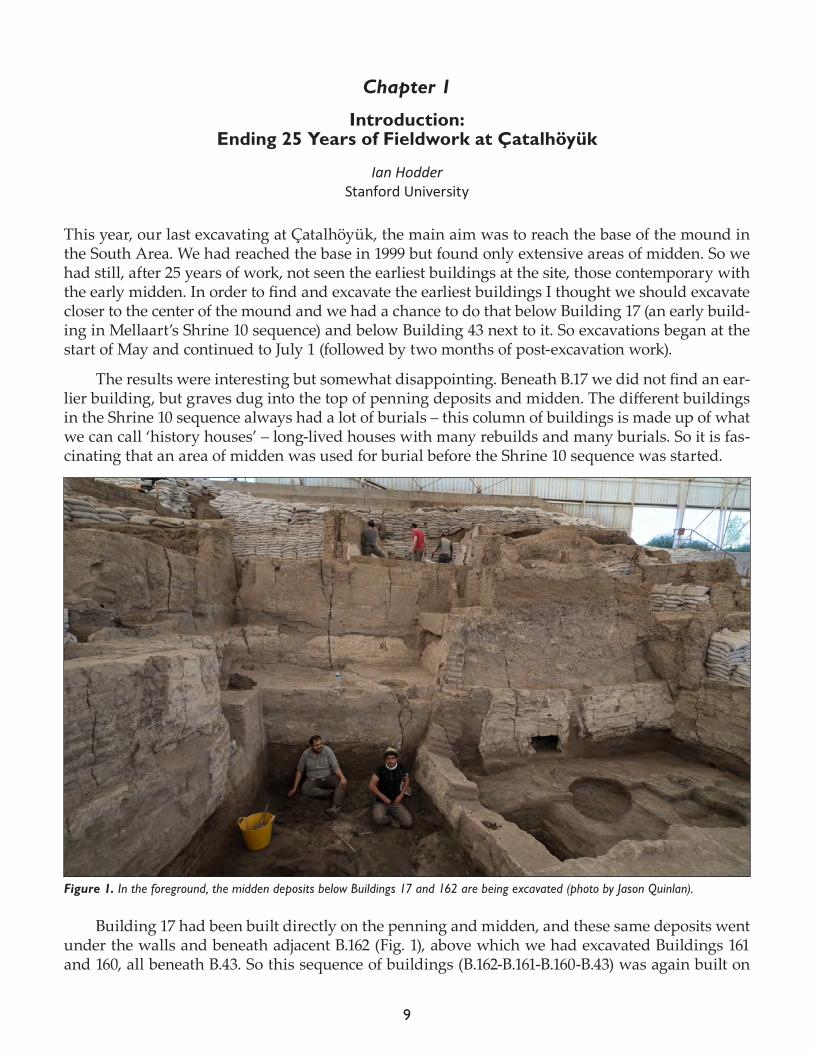
This year, our last excavating at Çatalhöyük, the main aim was to reach the base of the mound in the South Area. We had reached the base in 1999 but found only extensive areas of midden. So we had still, after 25 years of work, not seen the earliest buildings at the site, those contemporary with the early midden. In order to find and excavate the earliest buildings I thought we should excavate closer to the center of the mound and we had a chance to do that below Building 17 (an early build-ing in Mellaart’s Shrine 10 sequence) and below Building 43 next to it. So excavations began at the start of May and continued to July 1 (followed by two months of post-excavation work).
The results were interesting but somewhat disappointing. Beneath B.17 we did not find an ear-lier building, but graves dug into the top of penning deposits and midden. The different buildings in the Shrine 10 sequence always had a lot of burials – this column of buildings is made up of what we can call ‘history houses’ – long-lived houses with many rebuilds and many burials. So it is fas-cinating that an area of midden was used for burial before the Shrine 10 sequence was started.
Building 17 had been built directly on the penning and midden, and these same deposits went under the walls and beneath adjacent B.162 (Fig. 1), above which we had excavated Buildings 161 and 160, all beneath B.43. So this sequence of buildings (B.162-B.161-B.160-B.43) was again built on
Figure 1. In the foreground, the midden deposits below Buildings 17 and 162 are being excavated (photo by Jason Quinlan).
10
midden. Buildings 162 and 17 are the earliest buildings we have excavated and it is of great interest that they seem to be the ‘wrong’ way round. In most dwellings at the site, the oven and hearth with associated ‘dirty’ floors are to the south with burial platforms to the north. In B.162 and B.17 ovens were found to the north, and the ‘clean’ floors to the south. This latter arrangement is also what is found at the earlier site of Boncuklu.
Interesting as all this was, it was clear that we still had not found the earliest houses at the site; we had again just found meters of midden and dump at the base of the mound. All this sug-gests that the earliest buildings in the South Area might be in quite a small area or dispersed. We halted the excavations of the early midden as we had dug the same midden extensively in 1999. This change of plan allowed us to concentrate on excavations in the North Area that proved very productive. Interestingly we found a similar pattern to that in B.17 in the excavation of the deposits below B.77. The building (B.132) prior to B.77 had collapsed and been abandoned with some mid-den deposition within its decaying walls. The area was used a cemetery before B.77 was built, and the burial area in B.77 was placed exactly over the earlier cemetery. So once again it seems that an important house was built over earlier graves. It is almost as if the primary purpose of the house is for the dead rather than for the living!
Below B.77 we excavated B.132 which was very large and solid but which had suffered from extensive wall collapse. As is often the case in these early buildings (also seen in B.17 and B.162), the platform and floor segments are less well defined than in later buildings. Building 132 was no ex-ception and several burials were discovered and an extensive ‘dirty’ area near the hearths and ov-ens (this time the ‘right’ way round). Beneath B.132 we came across an open area made of a smooth clay surface over layers of midden. There was evidence of informal structures in these open areas, and much the same was found in a neighbouring set of middens (beneath Sp.85). In the latter case, many firespots and a small structure or windbreak indicated extensive use, even though many of the midden layers were quite fresh and must have been quickly covered. Indeed the overall cycle of use of open spaces seems to have involved throwing out small lenses of refuse including organic material and then covering with ash and clay to create work surfaces. The term ‘open space’ may in the end be more appropriate than ‘midden’, although these open spaces were less frequently used than is implied by Mellaart’s term ‘courtyard’.
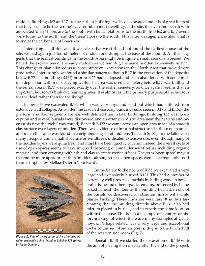
Immediately to the north of B.77, we excavated a very large and extensively burned B.131. This had a number of extremely well preserved burials including wooden bowls, brain tissue and other organic remains, preserved by being baked beneath the floor as the building burned. In one of the burials we discovered an obsidian mirror with white plaster backing. These finds are very rare. It is thus fas-cinating that the building directly above B.131 also had mirrors placed in burials, and in exactly the same location within the house. This is a clear example of memory- or his-tory-making, of which there are many examples at Çatal-höyük. Perhaps related was a very large and exceptional cache of unused obsidian points, dug into the burned fill of the western side room (Fig. 2).
Beneath B.131 we started the excavation of B.139 with the aim of placing it on display after the end of the project.
Figure 2. Part of a very large cache of unused ob-sidian projectile points found in Building 131 (photo by Jason Quinlan).
11
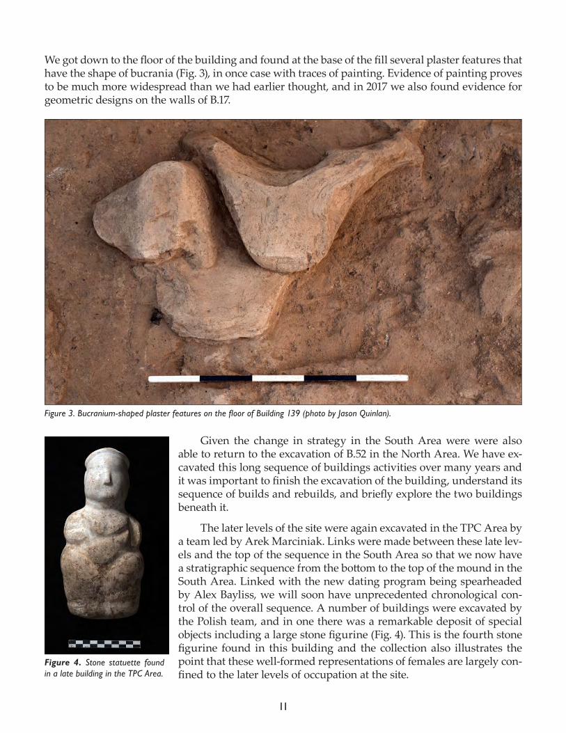
We got down to the floor of the building and found at the base of the fill several plaster features that have the shape of bucrania (Fig. 3), in once case with traces of painting. Evidence of painting proves to be much more widespread than we had earlier thought, and in 2017 we also found evidence for geometric designs on the walls of B.17.
Given the change in strategy in the South Area were were also able to return to the excavation of B.52 in the North Area. We have ex-cavated this long sequence of buildings activities over many years and it was important to finish the excavation of the building, understand its sequence of builds and rebuilds, and briefly explore the two buildings beneath it.
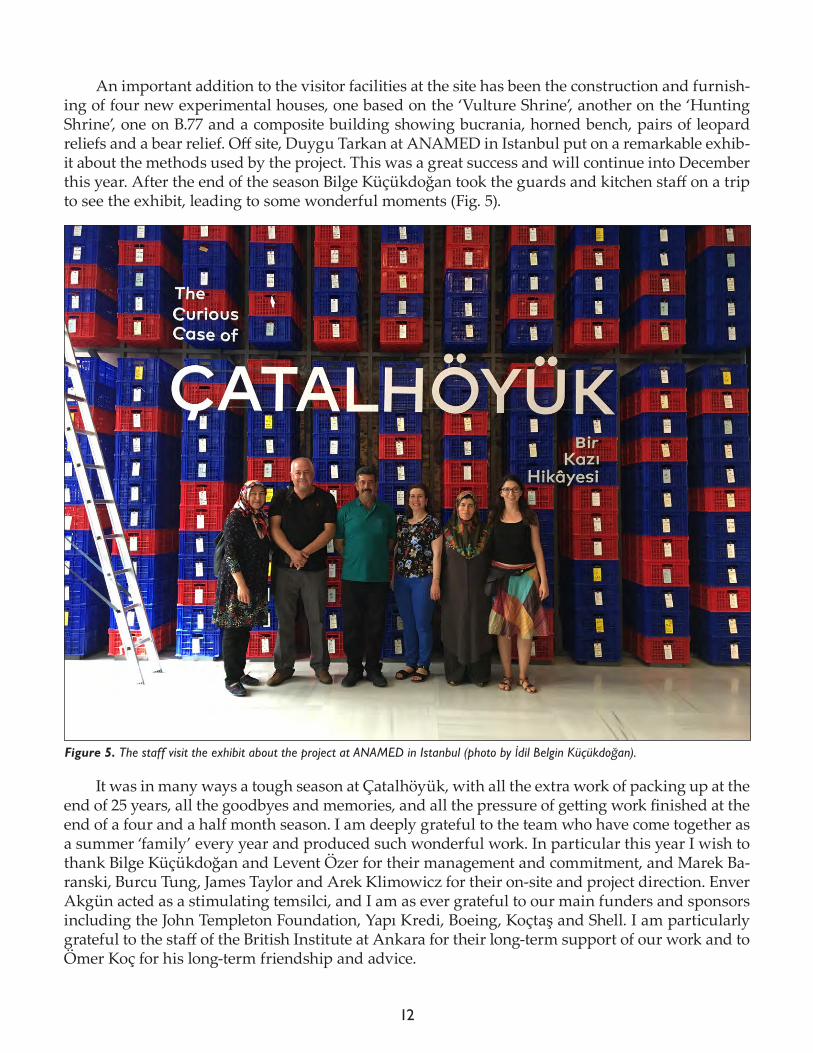
The later levels of the site were again excavated in the TPC Area by a team led by Arek Marciniak. Links were made between these late lev-els and the top of the sequence in the South Area so that we now have a stratigraphic sequence from the bottom to the top of the mound in the South Area. Linked with the new dating program being spearheaded by Alex Bayliss, we will soon have unprecedented chronological con-trol of the overall sequence. A number of buildings were excavated by the Polish team, and in one there was a remarkable deposit of special objects including a large stone figurine (Fig. 4). This is the fourth stone figurine found in this building and the collection also illustrates the point that these well-formed representations of females are largely con-fined to the later levels of occupation at the site.
Figure 3. Bucranium-shaped plaster features on the floor of Building 139 (photo by Jason Quinlan).
Figure 4. Stone statuette found in a late building in the TPC Area.
12
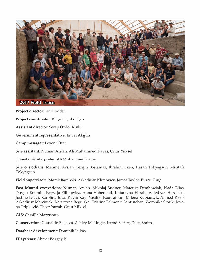
An important addition to the visitor facilities at the site has been the construction and furnish-ing of four new experimental houses, one based on the ‘Vulture Shrine’, another on the ‘Hunting Shrine’, one on B.77 and a composite building showing bucrania, horned bench, pairs of leopard reliefs and a bear relief. Off site, Duygu Tarkan at ANAMED in Istanbul put on a remarkable exhib-it about the methods used by the project. This was a great success and will continue into December this year. After the end of the season Bilge Küçükdoğan took the guards and kitchen staff on a trip to see the exhibit, leading to some wonderful moments (Fig. 5).
It was in many ways a tough season at Çatalhöyük, with all the extra work of packing up at the end of 25 years, all the goodbyes and memories, and all the pressure of getting work finished at the end of a four and a half month season. I am deeply grateful to the team who have come together as a summer ‘family’ every year and produced such wonderful work. In particular this year I wish to thank Bilge Küçükdoğan and Levent Özer for their management and commitment, and Marek Ba-ranski, Burcu Tung, James Taylor and Arek Klimowicz for their on-site and project direction. Enver Akgün acted as a stimulating temsilci, and I am as ever grateful to our main funders and sponsors including the John Templeton Foundation, Yapı Kredi, Boeing, Koçtaş and Shell. I am particularly grateful to the staff of the British Institute at Ankara for their long-term support of our work and to Ömer Koç for his long-term friendship and advice.
Figure 5. The staff visit the exhibit about the project at ANAMED in Istanbul (photo by İdil Belgin Küçükdoğan).
13
Project director: Ian Hodder
Project coordinator: Bilge Küçükdoğan
Assistant director: Serap Özdöl Kutlu
Government representative: Enver Akgün
Camp manager: Levent Özer
Site assistant: Numan Arslan, Ali Muhammed Kavas, Onur Yüksel
Translator/interpreter: Ali Muhammed Kavas
Site custodians: Mehmet Arslan, Sezgin Boşlamaz, İbrahim Eken, Hasan Tokyağsun, Mustafa Tokyağsun
Field supervisors: Marek Barański, Arkadiusz Klimovicz, James Taylor, Burcu Tung
East Mound excavations: Numan Arslan, Mikolaj Budner, Mateusz Dembowiak, Nada Elias, Duygu Ertemin, Patrycja Filipowicz, Anna Haberland, Katarzyna Harabasz, Jedrzej Hordecki, Justine Issavi, Karolina Joka, Kevin Kay, Vasiliki Koutrafouri, Milena Kubiaczyk, Ahmed Kzzo, Arkadiusz Marciniak, Katarzyna Regulska, Cristina Belmonte Santisteban, Weronika Stosik, Jova-na Tripković, Thaer Yartah, Onur Yüksel
GIS: Camilla Mazzucato
Conservation: Gesualdo Busacca, Ashley M. Lingle, Jerrod Seifert, Dean Smith
Database development: Dominik Lukas
IT systems: Ahmet Bozgeyik
2017 Field Team
14
Image and media: Jason Quinlan
Illustration: Jennie Anderson, Caroline Hebron, Katy Killackey, Danica Mihailović
Finds: Sermin Dinç, Lisa Guerre
Heavy residue: Jovana Tripković, Milena Vasić
Faunal remains: Moussab Albesso, Virginia Garcia-Díaz, Kim Hosking, Emma Jenkins, Mikołaj Lisowski, Jacqui Mulville, David Orton, Kamilla Pawlowska, Jesse Wolfhagen
Malacology: Rena Veropoulidou
Human remains: Donovan Adams, Irene Dori, Michelle Gamble, Evan Garofalo, Scott Haddow, Christopher Knüsel, Marco Milella, Sophie Moore, Jessica Pearson, Marin Pilloud, Eline Schots-mans, Cassie Skipper, Belinda Tibbets
Ancient DNA: Mehmet Somel, Maciej Chyleński
Palaeoethnobotany: Amy Bogaard, Michael Charles, Ezgi Demirörs, Dragana Filipović, Dorian Fuller, Lara González Carretero, Ceren Kabukcu, Elizabeth Stroud, Talu Tüntas
Micromorphology: Wendy Matthews, Marta Portillo Ramirez
Textiles, basketry and hide: Lise Bender Jørgensen, Antoinette Rast-Eicher
Chipped stone: Davide D’Errico, Sean Doyle, Cristina Lemorini, Heeli C. Schechter, Alice Vinet
Ground stone: Matilda Siebrecht, Markéta Šťovíčková, Christina Tsoraki
Ceramics: Sermin Dinç, Nergis Gürses, Serap Özdöl Kutlu, Duygu Tarkan
Figurines and clay objects: Monique Arntz, Lucy Bennison-Chapman, Lynn Meskell, Carolyn Na-kamura, Didem Turan
Dating: Alex Bayliss
Site visualization: Emmeline Batchelor, Jessica Chatborn, Meghan Dennis, Hermione Elderton, Ashley Fisher, Katrina Gargett, Ian Kirkpatrick, Vassilis Kourtis, Sara Perry, Laia Pujol-Tost
Bio-fuels project: Lisa-Marie Shillito, Helen Mackay
Archaeology workshop: Selda Eken, Nuray Kaygaz, Sıla Kurtuluş, Gülay Sert
Interns: Tolga Bayram, Fatma Eken, Ali Muhammet Kavas, Özlem Özben, Hatice Tokyağsun, Ül-can Türkkan, Ekin Ünal
House staff: Ümmügülsüm Eken, Mavili Gemiz, Keziban Sivaz
Site workers: Galip Kiraz, Mevlüt Sivaz, Mustafa Sivaz, Zekeriya Sivaz, Hulusi Yaşlı, Hüseyin Yaşlı, Mustafa Yaşlı, Osman Yaşlı, Mustafa Zeytin
Sorters: Saliha Sivaz, Şenay Yaşlı, Havva Sivaz, Ebru Sivaz, Fatma Eken, Fadimana Eken, Emine Bülüç
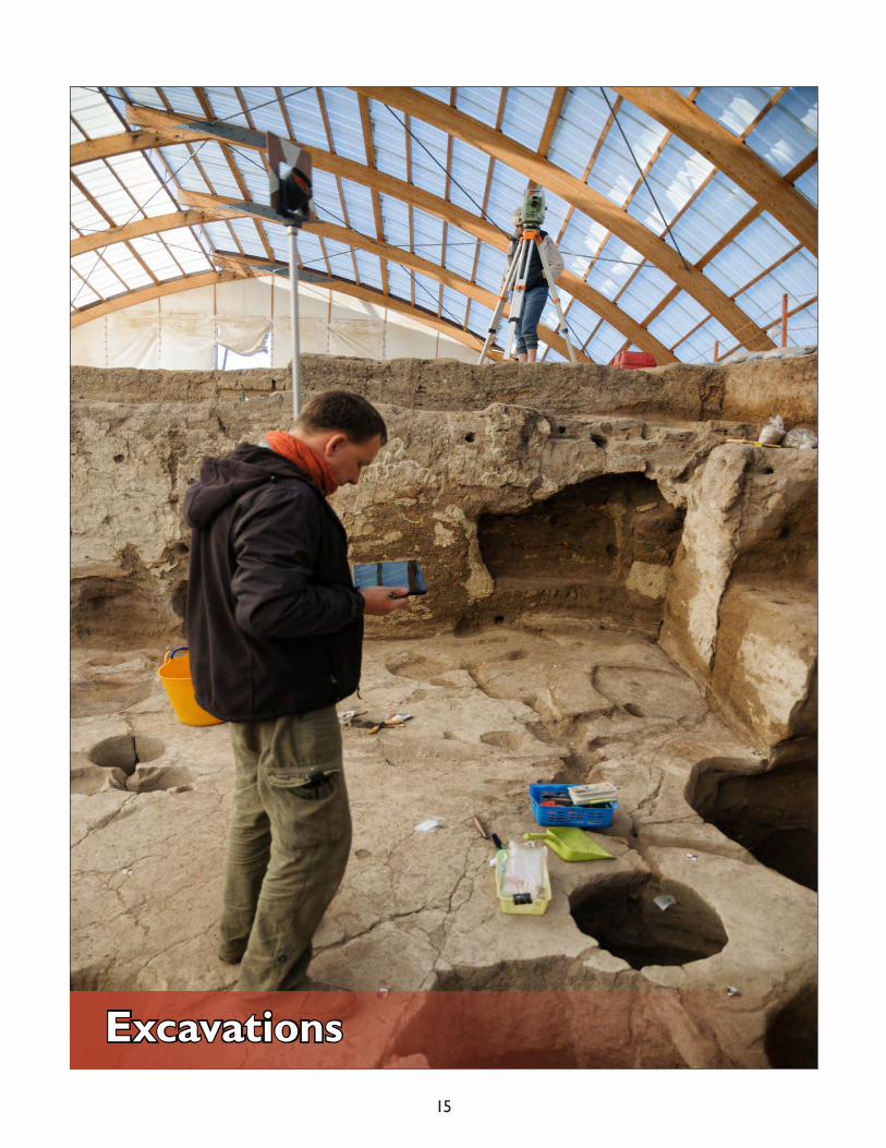
15
Excavations

16
17
Chapter 2
Excavations in the North Area
Marek Baranski1, Cristina Belmonte2, Justine Issavi3, Arkadiusz Klimovicz4 and Jovana Tripković2
1 Academy of Fine Arts in Gdańsk, 2Independent researcher, 3Stanford University, 4Adam Mickiewicz University
Introduction
Arkadiusz Klimowicz
The results of the 2017 season within the North Area have filled a number of gaps in our knowledge of the social and spatial organization of the Neolithic settlement and provided valuable insight into the stratigraphy. The idea for opening a new excavation area on the northern prominence of the East Mound in 2003 was aimed at providing a broader picture of the Neolithic neighborhood including a range of interrelated aspects. The depiction had been conducted gradually in the course of individually excavated buildings and spaces through the years.
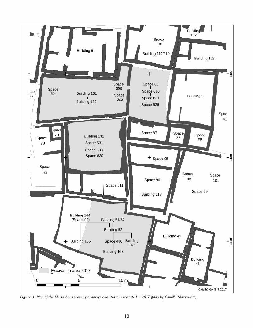
In 2017 the work focused particularly on the structures and open spaces of special importance for the North Area (Fig. 1). The strategy aimed to define the spatial and chronological interrelations within the hitherto adopted stratigraphical sequence. For that reason, since the start of excavations in May, there were three major goals that characterized the first half of the season:
1. Completion of excavations within Building 132. These aimed to accomplish the excavation of the earliest phases of the occupation within Sp.531 and underlying Sp.633. Equally important was the recognition of an archaeological formation assigned as Sp.630 uncovered below B.132. 2. Completion of excavations within Building 131, located immediately to the north of B.132. The work was undertaken with the intention to recognize the construction phase and reveal the underlying structure B.139. The added value of the effort permitted the correlation of devel-opment phases with neighboring buildings (B.5, B.132) and external areas (Sp.85, Sp.610, Sp.625, Sp.631).3. Continued microstratigraphic excavation of the external space located immediately to the east of B.131. Due to the thickness of the midden deposits that covered this region, the area was assigned separate space numbers that run from top to bottom: Sp.85, Sp.610, Sp.631, Sp.636. The proposed differentiation corresponds with the sequence and interrelationships with neigh-boring architectural structures and their modification through time. As such, these external areas are key to our understanding of the stratigraphic relationships between a number of the buildings exposed in the North Shelter.
The second stage of research in the North Area began in June when excavations in the South Area were completed. With the support - both physical and intellectual - of field team members joining us from the South Area, the task of achieving the first three goals was made easier. The extra per-sonnel also allowed for renewed excavations in B.52, which had been left open for public display after the 2015 season. The effort focused on in-depth scrutiny of the architectural development of the building, as well as a comprehensive revision of the phases of use within the clustered struc-tural complex conventionally acknowledged as B.52.
18
7765 76
74
75
79
78
82
29 3332
10199
38
41
17
35
36
Space
Space
Space
SpaceSpace Space Space
Space
Space
Space Space
Space
Space
Space
Space Space
Space
!
!
!
!
!
!
!
!
!
!
!
!!
!!
!!
!!
!!
!!!!!!!!!!
!!
!!
!!
!!
!
!
!
!
!
!
!
!
!
!
!
!
!
!!
!!
!
!
!
!
!
!
!
!
!
!
!
!
!
!
!
!
!
!
!!
!!
!
!
!
!
!
!
!
!
!
! ! !
!
!!
!!
!!
!!
!!
!!
!
!
!
!
!
!
!
!
!
!
!
!
!
!!
!!
!!
!
!
!
!
!
!
!
!
!
!
!
!
!
!
!
!
!
!
!
!!
!!
!
!
!
!
!
!
!
!
!
1040 1050
1170
1180
1190
E
E
E
E
E
E
N
0 5 10 m
Building 49
Building 51/52
Building48
Space 96
Building 113
Building 3
Space88 Space
89
Building 5
Building102
Building 112/119Building 128
Space 85
Space 87
Space 95
Çatalhöyük GIS 2017
Building 132
Space 511
Building 131
Space 556Space
504
Space 99
Space 630
Building 139
Space 610
Space 631
Space 636
Excavation area 2017
Space 625
Space 531
Space 633
Building 164 (Space 90)
Building 52
Space 480
Building 163
Building 165 Building167
Figure 1. Plan of the North Area showing buildings and spaces excavated in 2017 (plan by Camilla Mazzucato).
19
Building 132, Spaces 633 and 531 and underlying external area Space 630
Arkadiusz Klimowicz
The excavation conducted this season within B.132 focused on investigating the earliest phases of occupation. The second scope of the archaeological works concentrated on the architectural details that shed more light on the construction stage of the structure. Along with the above-mentioned objectives there was an equally important attempt undertaken which paid special attention to spec-ify and complete the sequences of use and development of the Building. All of the initiatives had been undertaken bearing in mind the fact that the final season necessitated to take most advantages of the last moment to define accurately the revealing archaeological evidence. On the other hand, pressure of the given time required accelerating the effort and optimize the resources in order to achieve the projected goals. Correspondingly, the hitherto adopted recording system must have been modified to be more effective for a complex nature of the objectives, especially acknowledging a perspective of the time constraints.
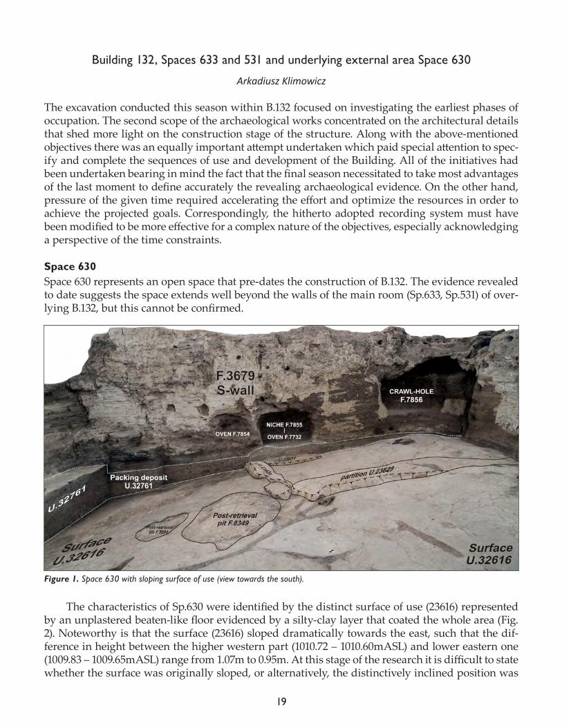
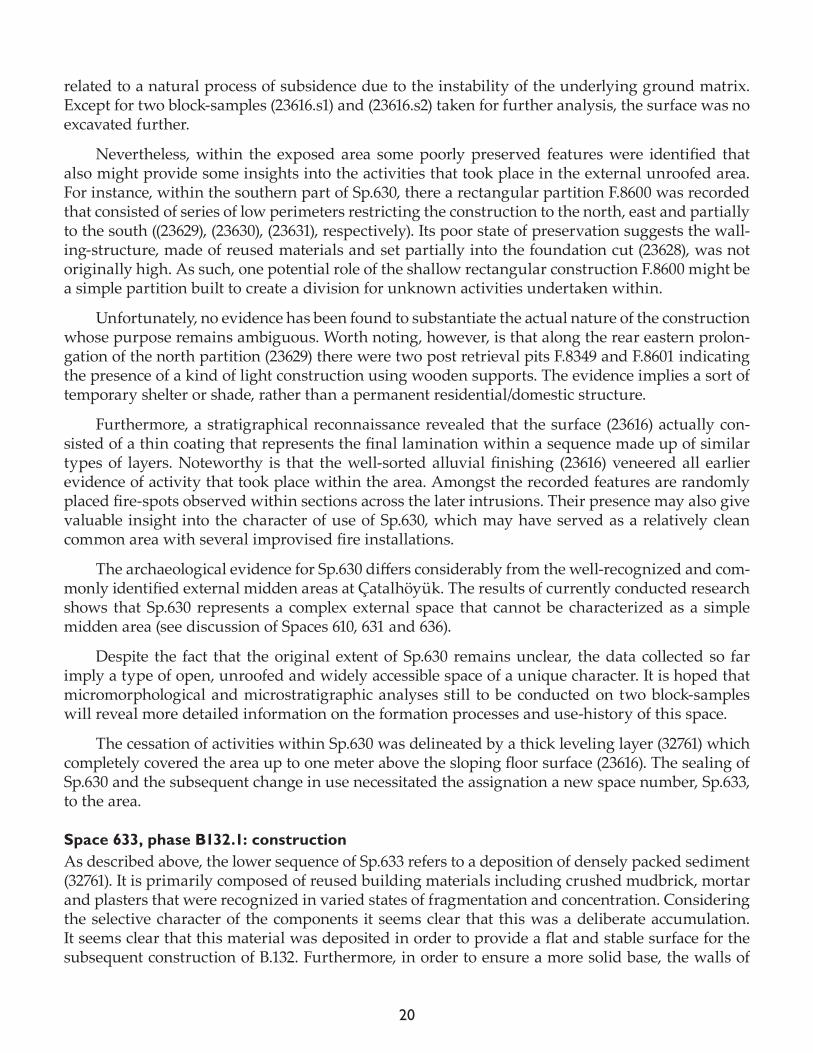
Space 630 Space 630 represents an open space that pre-dates the construction of B.132. The evidence revealed to date suggests the space extends well beyond the walls of the main room (Sp.633, Sp.531) of over-lying B.132, but this cannot be confirmed.
The characteristics of Sp.630 were identified by the distinct surface of use (23616) represented by an unplastered beaten-like floor evidenced by a silty-clay layer that coated the whole area (Fig. 2). Noteworthy is that the surface (23616) sloped dramatically towards the east, such that the dif-ference in height between the higher western part (1010.72 – 1010.60mASL) and lower eastern one (1009.83 – 1009.65mASL) range from 1.07m to 0.95m. At this stage of the research it is difficult to state whether the surface was originally sloped, or alternatively, the distinctively inclined position was
Figure 1. Space 630 with sloping surface of use (view towards the south).
20
related to a natural process of subsidence due to the instability of the underlying ground matrix. Except for two block-samples (23616.s1) and (23616.s2) taken for further analysis, the surface was no excavated further.
Nevertheless, within the exposed area some poorly preserved features were identified that also might provide some insights into the activities that took place in the external unroofed area. For instance, within the southern part of Sp.630, there a rectangular partition F.8600 was recorded that consisted of series of low perimeters restricting the construction to the north, east and partially to the south ((23629), (23630), (23631), respectively). Its poor state of preservation suggests the wall-ing-structure, made of reused materials and set partially into the foundation cut (23628), was not originally high. As such, one potential role of the shallow rectangular construction F.8600 might be a simple partition built to create a division for unknown activities undertaken within.
Unfortunately, no evidence has been found to substantiate the actual nature of the construction whose purpose remains ambiguous. Worth noting, however, is that along the rear eastern prolon-gation of the north partition (23629) there were two post retrieval pits F.8349 and F.8601 indicating the presence of a kind of light construction using wooden supports. The evidence implies a sort of temporary shelter or shade, rather than a permanent residential/domestic structure.
Furthermore, a stratigraphical reconnaissance revealed that the surface (23616) actually con-sisted of a thin coating that represents the final lamination within a sequence made up of similar types of layers. Noteworthy is that the well-sorted alluvial finishing (23616) veneered all earlier evidence of activity that took place within the area. Amongst the recorded features are randomly placed fire-spots observed within sections across the later intrusions. Their presence may also give valuable insight into the character of use of Sp.630, which may have served as a relatively clean common area with several improvised fire installations.
The archaeological evidence for Sp.630 differs considerably from the well-recognized and com-monly identified external midden areas at Çatalhöyük. The results of currently conducted research shows that Sp.630 represents a complex external space that cannot be characterized as a simple midden area (see discussion of Spaces 610, 631 and 636).
Despite the fact that the original extent of Sp.630 remains unclear, the data collected so far imply a type of open, unroofed and widely accessible space of a unique character. It is hoped that micromorphological and microstratigraphic analyses still to be conducted on two block-samples will reveal more detailed information on the formation processes and use-history of this space.
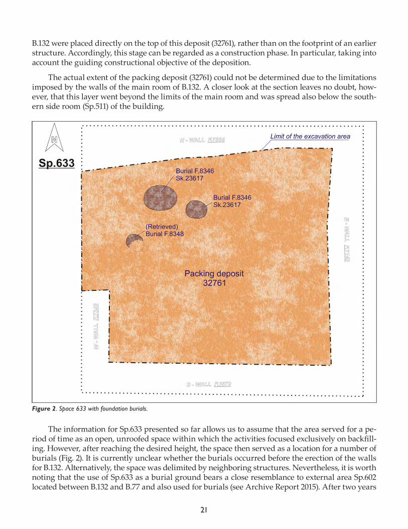
The cessation of activities within Sp.630 was delineated by a thick leveling layer (32761) which completely covered the area up to one meter above the sloping floor surface (23616). The sealing of Sp.630 and the subsequent change in use necessitated the assignation a new space number, Sp.633, to the area.
Space 633, phase B132.1: constructionAs described above, the lower sequence of Sp.633 refers to a deposition of densely packed sediment (32761). It is primarily composed of reused building materials including crushed mudbrick, mortar and plasters that were recognized in varied states of fragmentation and concentration. Considering the selective character of the components it seems clear that this was a deliberate accumulation. It seems clear that this material was deposited in order to provide a flat and stable surface for the subsequent construction of B.132. Furthermore, in order to ensure a more solid base, the walls of
21
B.132 were placed directly on the top of this deposit (32761), rather than on the footprint of an earlier structure. Accordingly, this stage can be regarded as a construction phase. In particular, taking into account the guiding constructional objective of the deposition.
The actual extent of the packing deposit (32761) could not be determined due to the limitations imposed by the walls of the main room of B.132. A closer look at the section leaves no doubt, how-ever, that this layer went beyond the limits of the main room and was spread also below the south-ern side room (Sp.511) of the building.
The information for Sp.633 presented so far allows us to assume that the area served for a pe-riod of time as an open, unroofed space within which the activities focused exclusively on backfill-ing. However, after reaching the desired height, the space then served as a location for a number of burials (Fig. 2). It is currently unclear whether the burials occurred before the erection of the walls for B.132. Alternatively, the space was delimited by neighboring structures. Nevertheless, it is worth noting that the use of Sp.633 as a burial ground bears a close resemblance to external area Sp.602 located between B.132 and B.77 and also used for burials (see Archive Report 2015). After two years
Figure 2. Space 633 with foundation burials.
22
of intensive excavation, the use of these external spaces for burials suggests some sort of symbolic meaning, in my opinion, perhaps the inhumations served as a special kind foundation ‘deposits’.
The three burial cuts ((23609), (23611), (23615)) were identified as distinct oval truncations on the surface of packing deposit (32761). The features F.8345, F.8346, F.8348 were concentrated within the northwestern part of the excavation area. Although the evidence suggested these were grave cuts, F.8348 did not contain human remains. There was evidence, however, that suggests that it was originally intended as a burial; for example, a bell-shaped cut (23614) within which there was uncovered a large fragment of in situ basket disturbed by the cut (32732) for a later pit F.8324, which may have been dug in order to retrieve human remains from F.8348. Pit F.8324 was recorded as a circular truncation of the floor related to one of the earlier occupational phase of Sp.531, the main room of B.132.
Conversely, the two others pits, F.8345 and F.8346, were revealed to contain primary burials. An adult of unknown sex Sk (32777) was recovered from F.8345, and a young adult of unknown sex from F.8346 (see Chapter 5, Human Remains, for further details).
Figure 3. Building 132, Space 633 construction phase.
23
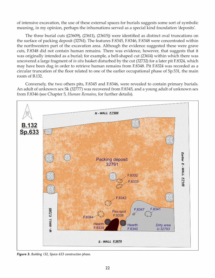
In addition to the burial features, there were also a number of other small pits and depressions identified within Sp.633 and concentrated within the southern part of the research area (e.g. F.8332, F.8333, F.8341, F.8342, F.8344, F.8347). All of these may be regarded as the remnants of construction activity for B.132 (Fig. 3). It is highly plausible that at the same time the walls were being set, a range of activities related to food preparation were conducted within the construction space. A substan-tiation of this assumption was evidenced by the excavation of three fire installations F.8338, F.8339 and F.8340 beside the south wall F.3679 of the main room. The role of the in situ installations was obvious due to the revelation an accompanying layer (32793) that formed a dirty area with an abun-dance of charred organic materials and waste located in the southeast corner of Sp.633.
The features revealed on the top surface of the packing (32761) to the south have an enigmatic and ephemeral nature, implying makeshift activities for urgent cooking proceedings within the remodeled area. Underlined above the southern location of the fire installations and cuts leaves no doubt that they might have something to do with food processing. The hypothesis concerning the cuts as negative impressions left by the placement of vessels is based on their regular shapes. However, among the recorded cuts there were circular shapes ((23603), (23605)/(32779)), as well as oval ((32772), (32774), (23601), (23607)). The latter type might be regarded as odd, especially taking into consideration that pottery vessel bases should be circular/round. But worth recalling are the wooden vessels described by Mellaart (1967) as being oval in shape: “(...), they varied in shape and depth, some of them were like sauce boats, others boat–shaped.” (Mellaart 1967: 194-5, plate 106-8, 215).
In general, these shallow circular depressions set within the packing deposits preceding the floors, been seen previously. The closest example might be the pit features F.7602, F.7600, F.7601 re-corded below the floors of B.77. These were recognized in close vicinity to fire-spot (22092) in the southern part of the vast area within the layer (22080). Whatever their interpretation, their presence indicates a wide spectrum of activities took place in these spaces during the construction phase of the building.
As regards to the walls that eventually restricted Sp.633 and had delineated the initial stage of occupation within the main-room of B.132 one can enumerate solid and thick mudbrick structures to the south, east, north and west (F.3679, F.7149, F.7584 and F.7346 respectively). Noteworthy is the fact that the extent of the latter wall covered only the southern part of Sp.633 and post retrieval pits were uncovered along its northern length. Considering the northeast alignment of the revealed cuts ((31591), and (31593)) it is clear that they represent a continuation of the wall structure F.2346 based on a light division (screen) that restricted the main room of B.132 to the west. The opening between the wall F.7346 and northern wall F.7584 was not clear. However, the cuts indicate that there must have been some sort of constructional elements made of wooden beams.
It is worth noting that the majority of the post retrieval pits recorded in 2016 must have been linked to the construction phase of B.132 described here. Their presence and particular location share a resemblance with construction phases seen in other buildings at Çatalhöyük.
Sp.633, phase B132.2: occupation 1 The 2017 excavation season revealed the initial occupation stages of the main room of B.132 (Fig. 4). The collected data allowed correlating the respective features and layers with the particular se-quences of use of Sp.633. The earliest internal arrangement of the room was characterized by a clear division between the dirty area located to the south and clean area situated in center and to the north. Special attention was paid to the dirty floors (32782) that made up the same well-stratified sequence as identified in 2016 in the southeast part of the main room. The presence of several
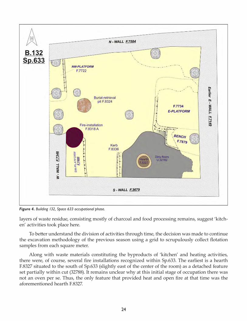
24
layers of waste residue, consisting mostly of charcoal and food processing remains, suggest ‘kitch-en’ activities took place here.
To better understand the division of activities through time, the decision was made to continue the excavation methodology of the previous season using a grid to scrupulously collect flotation samples from each square meter.
Along with waste materials constituting the byproducts of ‘kitchen’ and heating activities, there were, of course, several fire installations recognized within Sp.633. The earliest is a hearth F.8327 situated to the south of Sp.633 (slightly east of the center of the room) as a detached feature set partially within cut (32788). It remains unclear why at this initial stage of occupation there was not an oven per se. Thus, the only feature that provided heat and open fire at that time was the aforementioned hearth F.8327.
Figure 4. Building 132, Space 633 occupational phase.
25
Instead, within the southern part of Sp.633 there was recognized a shallow kerb F.8336 adja-cent to the southern wall F.3679 that divided the area into more dirty (eastern) and relatively cleaner (western) segments. The delineation between these two areas was easily defined by supplementary observation of the varied intensity of usage on the flooring surfaces, expressed by the difference in number and thickness of layers. Together with the placement of kerb F.8336, a raised area was con-structed within the southwest corner of Sp.633 that transformed over time into southwest platform F.7880. Within its northwestern part, an oven F.8318 was built adjacent to the western wall F.7346.
As regards the other architectural features of Sp.633, further to the north there was, for in-stance, the bench F.7879 excavated and recorded in 2016. However, at this early stage of occupation the bench was much smaller in size than in later sequences. Interestingly, despite its smaller size the northern edge of the bench already marked the limit of the slightly raised position of the floor (32785) that would later be transformed into eastern platform F.7734. Probably at the same time, plat-form F.7722 was constructed within the northwest corner. It shares similarities with bench F.7879 in that it started out small in size and eventually increased over the course of the occupation of B.132.
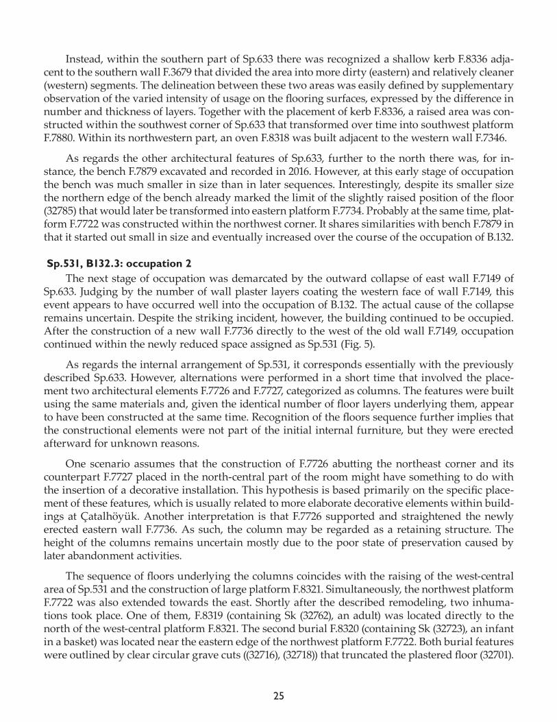
Sp.531, B132.3: occupation 2The next stage of occupation was demarcated by the outward collapse of east wall F.7149 of
Sp.633. Judging by the number of wall plaster layers coating the western face of wall F.7149, this event appears to have occurred well into the occupation of B.132. The actual cause of the collapse remains uncertain. Despite the striking incident, however, the building continued to be occupied. After the construction of a new wall F.7736 directly to the west of the old wall F.7149, occupation continued within the newly reduced space assigned as Sp.531 (Fig. 5).
As regards the internal arrangement of Sp.531, it corresponds essentially with the previously described Sp.633. However, alternations were performed in a short time that involved the place-ment two architectural elements F.7726 and F.7727, categorized as columns. The features were built using the same materials and, given the identical number of floor layers underlying them, appear to have been constructed at the same time. Recognition of the floors sequence further implies that the constructional elements were not part of the initial internal furniture, but they were erected afterward for unknown reasons.
One scenario assumes that the construction of F.7726 abutting the northeast corner and its counterpart F.7727 placed in the north-central part of the room might have something to do with the insertion of a decorative installation. This hypothesis is based primarily on the specific place-ment of these features, which is usually related to more elaborate decorative elements within build-ings at Çatalhöyük. Another interpretation is that F.7726 supported and straightened the newly erected eastern wall F.7736. As such, the column may be regarded as a retaining structure. The height of the columns remains uncertain mostly due to the poor state of preservation caused by later abandonment activities.
The sequence of floors underlying the columns coincides with the raising of the west-central area of Sp.531 and the construction of large platform F.8321. Simultaneously, the northwest platform F.7722 was also extended towards the east. Shortly after the described remodeling, two inhuma-tions took place. One of them, F.8319 (containing Sk (32762), an adult) was located directly to the north of the west-central platform F.8321. The second burial F.8320 (containing Sk (32723), an infant in a basket) was located near the eastern edge of the northwest platform F.7722. Both burial features were outlined by clear circular grave cuts ((32716), (32718)) that truncated the plastered floor (32701).
26
Both cuts occupy the same stratigraphical sequence and as such they must have taken place within a short period of time (or even simultaneously).
As regards to the southern area of Sp.531, there were not many changes in the arrangement of the ‘kitchen’ area. Two fire installations, F.8318 and F.8327, were in use for some time. At some point, however, the role of the kerb must have lost its functional importance, due to the placement of an intra-wall oven F.7732 in the central part of the mudbrick structure F.3679. The fire installation partially incorporated the kerb F.8336 overlying its shallow rim by the superstructure of the dome (Fig. 6).
Noteworthy is that the demarcation between east and west was still noticeable in a lower posi-tion of the southwestern segment. The space was considerably sunken and sloped within the area delineated by the eastern edge of platform F.7880 (to the west), the newly-constructed oven F.7732 (to the east) and the west-central platform F.8321 (to the north). The area with its distinct form of
Figure 5. Building 132, Space 531 occupational phase.
27
concave depression seems to have been intentionally produced and may have provided for a range of as yet unknown activities.
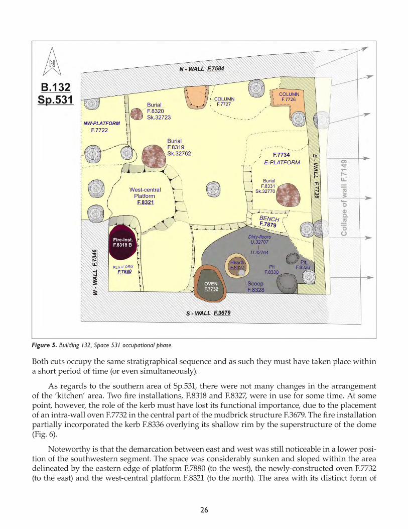
An intense usage of the increased number of fire installations is evidenced by densely packed multiple layers in the dirty floor sequence assigned under two separate unit numbers ((32764), (32707)). They covered the same area of southeast segment, exactly as the previously recognized counterpart layers. The dirty floors were again the grid system (1m x 1m). The goal was to specify the type of activities undertaken within the area thorough time. An equally important objective was to correlate these observations with the changing location of the fire installations and others features (e.g. bench F.7879).
The issue of remodeling and the shifting locations of hearths and ovens requires more atten-tion. Even more intriguing is the evidence of special acts of closure involving the fire installations. The closing of oven F.8318 and hearth F.8327 may have had symbolic implications. The interpreta-tion finds some validation in the fact that the last hard-backed bases of these features were trun-
Figure 6. Building 132, Space 531 advanced occupational phase.
28
cated by circular, concave cuts ((32721) and (32748), respectively). Apart from accumulated min-eral sediments, charcoal and burned organic remains were identified within the peculiar scoops F.8322 and F.8328. Worth noting is that within the infill (32720) an assemblage of lithic material was recorded that recalls an intentionally gathered waste of obsidian flakes from a knapping/flaking process. Conversely, the second scoop F.8328, truncating the hearth F.8327, contained fragments of broken clay balls that completely covered the bottom of the cut (32748).
The fact that these sediments and artifacts contained in the scoops were not heat-affected sug-gests these depositions took place after these fire installations stopped being used. In the above-pre-sented light, the evidence might be regarded as a kind of symbolic closure that finalized the use of the fire installations. Shortly after these features went out of use, new fire installations, an oven F.7868 and hearth F.7871 were created (see 2016 Archive Report).
A range of remodeling activities took place during this occupation phase. One example is bench F.7879, which was extended considerably westwards at some point. This created a stronger delineation between the southern dirty floors and the north-protruding position of east platform F.7734. The significance of platform F.7734 is related to clearly identified sequences of its develop-ment that find correspondence with neighboring bench F.7879, dirty floors and the layers of floor-ing in the central part of the room.
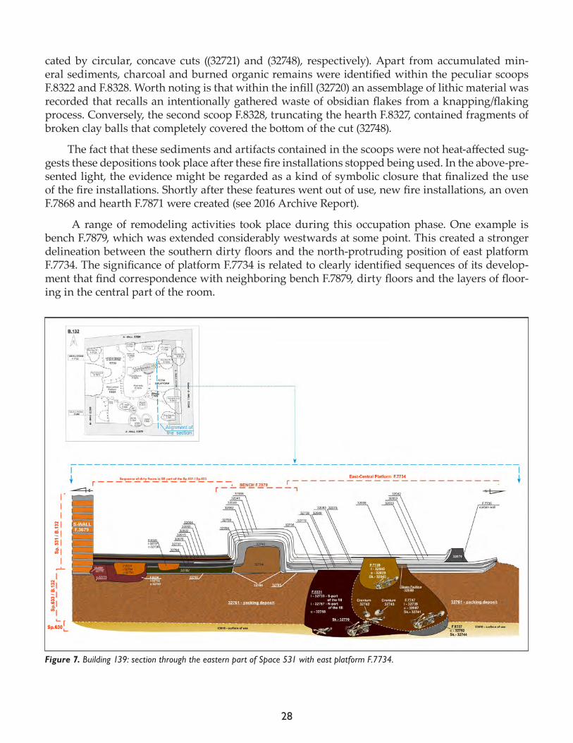
Figure 7. Building 139: section through the eastern part of Space 531 with east platform F.7734.
29
An attempt to plot stratigraphical correlations and successions allowed us to better understand the development and adaptation the structure of east platform F.7734 (Fig. 7). It was revealed that the most noticeable series of remodelings coincided with burials that took place in this area.
There is no doubt that among the burials in this area the earliest inhumation (F.8337) was rep-resented by incomplete and badly disturbed human remains Sk (32744). Due to the evidence of later truncations, the original (undisturbed) extent of burial F.8337 was identified only within the scope of c.0.60m2. Only the bones of the feet of Sk (32744) remained in situ. It is obvious that the osteolog-ical material represents a primary burial placed within a bell-shaped (undercut) pit in the northern part of platform F.7734. Apparently, the rest of the skeleton was disinterred by subsequent burials in the same location. Validation of this sequence of events is testified by the presence of loose hu-man bones within later burial fills.
The next burial feature, F.8331, refers to the primary disturbed inhumation of adult Sk (32770) (see Human Remains report for more detail). This burial, similarly to F.8337, was placed within a large bell-shaped cut (32768), whose edges were extremely undercut. The human remains, however, were placed in the middle of the pit, leaving a lot of empty space. Within the southernmost part of the grave there were revealed loose, disarticulated bones likely from the earlier inhumation(s) (e.g. Sk (32744)). Sk (32770) was truncated at the western end by the last burial F.7747 in this area (see below).
An interesting range of outstanding artifacts (32767.x1-x17) associated with Sk (32770) was re-covered from F.8331. These consisted of a number of stone beads, bone and shell pendants that rep-resented most plausibly bracelets and necklaces. Furthermore, amongst these extraordinary finds one can enumerate in addition: one plain and three pillared bone rings discovered on the fingers of the individual, two obsidian tools, and a wide spectrum of elaborately worked bone objects. The abundance of artifacts recovered with Sk (32770) stands in contrast to other burials in this area that completely lacked artifacts.
Lastly, burial F.7747 constitutes the final inhumation revealed this season within platform F.7734. The burial contained a poorly preserved primary adult individual Sk (32741) in flexed posi-tion with a large amount of disarticulated human bones pushed deliberately to the southern edge of the cut (32087). Again, the disarticulated remains indicates that the bones came from earlier in-humations F.8337 and F.8331. In particular, the presence of two disarticulated crania Sk (32742) and Sk (32743), that were discovered in the fill of F.7747, substantiate the notion of multiple truncations that disturbed the inhumations of the two individuals described above (Sk (32744), Sk (32770)).
The badly preserved bones of the primary skeleton Sk (32741) were probably constrained by some sort of wrapping, evidenced by the presence of phytoliths and organic material (perhaps animal hide). In addition, the inside surface of the wrappings adjacent to the body appear to have been coated with red pigment, traces of which were observable on the material. Amongst the burial goods one can enumerate different types of stone beads and bone pendants, as well as two worked-bone objects (32741.x1-x7).
ConclusionsWe may preliminarily state that the thoroughly examined layers and features within the main room sequence of B.132 (Sp.633 and Sp.531) demonstrate a varied range of dynamics. Accordingly, the remodelings and specific traces of use indicate frequent limitations concentrated sometimes ex-clusively on selected parts of the interior. The notion relies mainly on differences between episodes
30
of coating and plastering observed on surfaces and features. For this reason, the phases presented here must be considered preliminary in nature, and may change based on subsequent analyses.
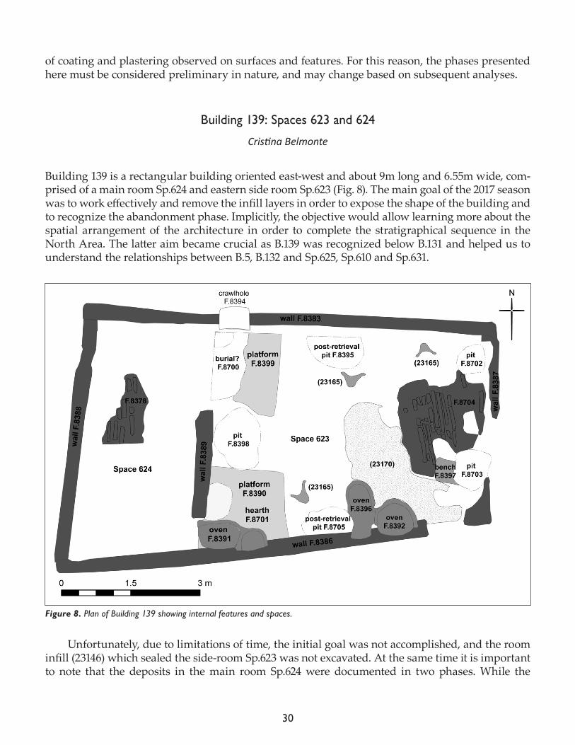
Building 139: Spaces 623 and 624
Cristina Belmonte
Building 139 is a rectangular building oriented east-west and about 9m long and 6.55m wide, com-prised of a main room Sp.624 and eastern side room Sp.623 (Fig. 8). The main goal of the 2017 season was to work effectively and remove the infill layers in order to expose the shape of the building and to recognize the abandonment phase. Implicitly, the objective would allow learning more about the spatial arrangement of the architecture in order to complete the stratigraphical sequence in the North Area. The latter aim became crucial as B.139 was recognized below B.131 and helped us to understand the relationships between B.5, B.132 and Sp.625, Sp.610 and Sp.631.
Unfortunately, due to limitations of time, the initial goal was not accomplished, and the room infill (23146) which sealed the side-room Sp.623 was not excavated. At the same time it is important to note that the deposits in the main room Sp.624 were documented in two phases. While the
Figure 8. Plan of Building 139 showing internal features and spaces.

31
southern part was excavated stratigraphically in order to expose and properly record the section, the northern part was removed as an arbitrary layer (23155) (Fig. 9).
Despite these limitations, a range of activities undertaken after the abandonment of the build-ing and prior to the construction of B.131 were documented. One of the most significant was the evidence of a heavy and intentional demolition of the features during the abandonment process.
In many aspects, B.139 differs from the overlying B.131. In particular, it is noticeable in the shape, dimensions and number of the side rooms. However, it shares general resemblances with others Çatalhöyük houses in terms of internal arrangement, internal features (e.g. platforms, bench, fire installations), as well as an overall north-south division of the interior.
In terms of shape, the northern, southern and eastern walls (F.8385, F.8386 and F.8388, re-spectively) were uncovered directly beneath the walls of B.131, preserved to a maximum height of 1.40m. The exception was the eastern wall F.8387, which was constructed a little further to the west and thus reducing the size of B.139 in relation to B.131. Worth noting is that east wall F.8388 is the worst preserved amongst the walls. An alignment of the mudbrick structure was recognized only by the position of the corners, because the entire central portion of the perimeter F.8387 was com-pletely demolished. To the west, the main room Sp.624 was separated from the side room (Sp.623) by partition wall F.8389, within which there was an access uncovered in its northern extent that provided a connection between both spaces.
These architectural features were made up of characteristic grayish mudbricks and whitish mortar whose internal faces were coated by multiple layers of white (lime) wall plaster. The white coating on the northern and southern wall were distinctly thicker than on the others sides. Al-though there were no traces of wall paintings, some protuberances and clear recesses suggest the presence of elaborated decorations that may originally have been attached to the walls.
As mentioned above, the archaeological recognition of B.139 is preliminary in nature due to time constraints. As a result, while some occupational phases were tentatively identified, they could not be examined in detail. The assumption finds its substantiation in a number of fire installations, and the multiple sequences of floors visible in the sections of post retrieval pits. A description of the features that formed the internal arrangement of the main room (Sp.624) follows. As such, any further recognition of the records with their stratigraphical specifications cannot be provided at this stage of the research (Fig. 10).
Figure 9. Building 139, Space 624 section.
32
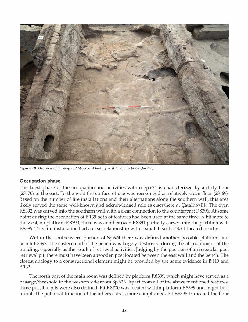
Occupation phaseThe latest phase of the occupation and activities within Sp.624 is characterized by a dirty floor (23170) to the east. To the west the surface of use was recognized as relatively clean floor (23169). Based on the number of fire installations and their alternations along the southern wall, this area likely served the same well-known and acknowledged role as elsewhere at Çatalhöyük. The oven F.8392 was carved into the southern wall with a clear connection to the counterpart F.8396. At some point during the occupation of B.139 both of features had been used at the same time. A bit more to the west, on platform F.8390, there was another oven F.8391 partially carved into the partition wall F.8389. This fire installation had a clear relationship with a small hearth F.8701 located nearby.
Within the southeastern portion of Sp.624 there was defined another possible platform and bench F.8397. The eastern end of the bench was largely destroyed during the abandonment of the building, especially as the result of retrieval activities. Judging by the position of an irregular post retrieval pit, there must have been a wooden post located between the east wall and the bench. The closest analogy to a constructional element might be provided by the same evidence in B.119 and B.132.
The north part of the main room was defined by platform F.8399, which might have served as a passage/threshold to the western side room Sp.623. Apart from all of the above mentioned features, three possible pits were also defined. Pit F.8700 was located within platform F.8399 and might be a burial. The potential function of the others cuts is more complicated. Pit F.8398 truncated the floor
Figure 10. Overview of Building 139 Space 624 looking west (photo by Jason Quinlan).
33
as well as the north and southeast platforms, while F.8393 was located in front of oven F.8391 and appears to cut the platform F.8390.
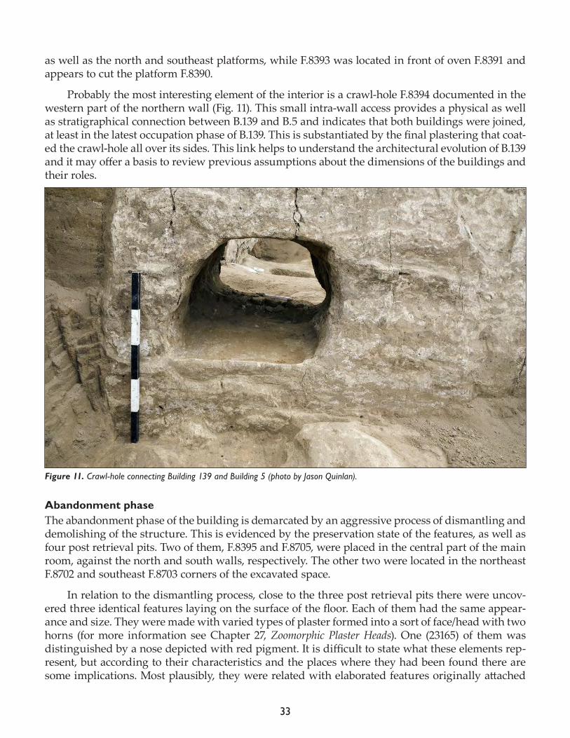
Probably the most interesting element of the interior is a crawl-hole F.8394 documented in the western part of the northern wall (Fig. 11). This small intra-wall access provides a physical as well as stratigraphical connection between B.139 and B.5 and indicates that both buildings were joined, at least in the latest occupation phase of B.139. This is substantiated by the final plastering that coat-ed the crawl-hole all over its sides. This link helps to understand the architectural evolution of B.139 and it may offer a basis to review previous assumptions about the dimensions of the buildings and their roles.
Abandonment phase The abandonment phase of the building is demarcated by an aggressive process of dismantling and demolishing of the structure. This is evidenced by the preservation state of the features, as well as four post retrieval pits. Two of them, F.8395 and F.8705, were placed in the central part of the main room, against the north and south walls, respectively. The other two were located in the northeast F.8702 and southeast F.8703 corners of the excavated space.
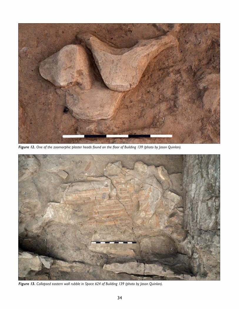
In relation to the dismantling process, close to the three post retrieval pits there were uncov-ered three identical features laying on the surface of the floor. Each of them had the same appear-ance and size. They were made with varied types of plaster formed into a sort of face/head with two horns (for more information see Chapter 27, Zoomorphic Plaster Heads). One (23165) of them was distinguished by a nose depicted with red pigment. It is difficult to state what these elements rep-resent, but according to their characteristics and the places where they had been found there are some implications. Most plausibly, they were related with elaborated features originally attached
Figure 11. Crawl-hole connecting Building 139 and Building 5 (photo by Jason Quinlan).
34
Figure 13. Collapsed eastern wall rubble in Space 624 of Building 139 (photo by Jason Quinlan).
Figure 12. One of the zoomorphic plaster heads found on the floor of Building 139 (photo by Jason Quinlan).
35
to wooden posts in a form of decorative installations of deep symbolic meaning. Intriguingly, it appears that the decorations had been violently ripped off and thrown away on the floor during the abandonment phase (Fig. 12).
Special attention should be paid to the eastern wall which was collapsed westward onto the floor surface. Although not enough information is available, there are two possible hypotheses to explain the disposition of the rubble. The first is that the wall was partially demolished during the abandonment process. The second and rather more plausible interpretation is that the wall col-lapsed, necessitating the abandonment of the building. It is interesting to see that the composition of the building materials evidenced in the collapsed wall (23166) are completely different from the bricks and mortar noticeable in the remains of the lower portion of eastern wall F.8387. The per-ceived differentiation might imply that the wall had been repaired several times during the use of the building.
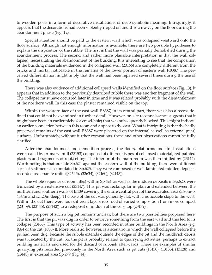
There was also evidence of additional collapsed walls identified on the floor surface (Fig. 13). It appears that in addition to the previously described rubble there was another fragment of the wall. The collapse must have occurred later in time and it was related probably with the dismantlement of the northern wall. In this case the plaster remained visible on the top.
Within the western face of the east wall F.8387, in its central part, there was also a recess de-fined that could not be examined in further detail. However, on-site reconnaissance suggests that it might have been an earlier niche (or crawl-hole) that was subsequently blocked. This might indicate an earlier connection between this room and a space to the east. What is intriguing is that the badly preserved remains of the east wall F.8387 were plastered on the internal as well as external (rear) surfaces. Unfortunately, without further excavations, these and other observations cannot be fully clarified.
After the abandonment and demolition process, the floors, platforms and fire installations were sealed by primary infill (23153) composed of different types of collapsed material, red-painted plasters and fragments of roof/ceiling. The interior of the main room was then infilled by (23144). Worth noting is that outside Sp.624 against the eastern wall of the building, there were different sorts of sediments accumulated in Sp.625. They were composed of well-laminated midden deposits recorded as separate units ((32645), (32634), (32160), (32143)).
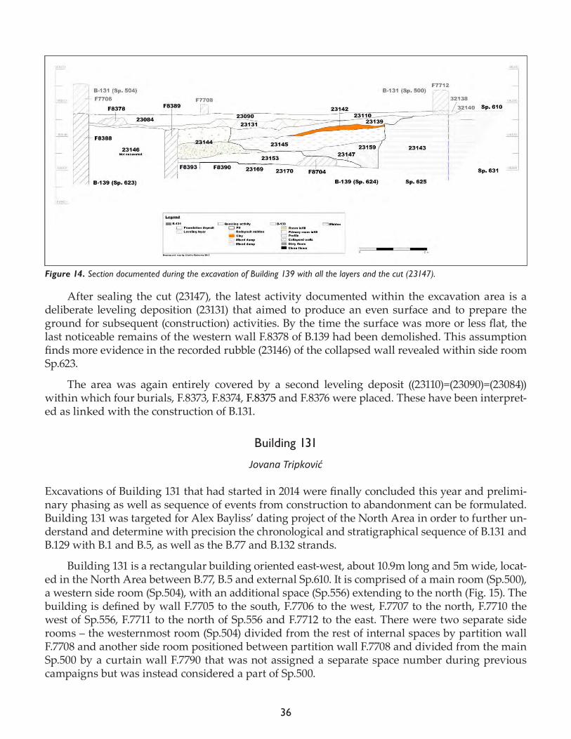
The whole sequence of room fill(s) within Sp.624, as well as the midden deposits in Sp.625, were truncated by an extensive cut (23147). This pit was rectangular in plan and extended between the northern and southern walls of B.139 covering the entire central part of the excavated area (3.80m- x 4.87m and c.1.20m deep). The base of the cut was generally flat, with a noticeable slope to the west. Within the cut there were four different layers recorded of varied composition from more compact ((23159), (23145), (23142)) to a redeposit of midden at the very top (23139).
The purpose of such a big pit remains unclear, but there are two possibilities proposed here. The first is that the pit was dug in order to retrieve something from the east wall and this led to its collapse (23166). This type of activity has been recorded in other buildings in the North Area (e.g. B.64 or the cut (10387)). More realistic, however, is a scenario in which the wall collapsed before the pit had been dug, because the rubble extends outside the edges of the pit and the mudbrick debris was truncated by the cut. So, the pit is probably related to quarrying activities, perhaps to extract building materials and used for the discard of rubbish afterwards. There are examples of similar quarrying pits recorded previously in the North Area such as pit cuts (13130), (13135), (13128) and (13148) in external area Sp.279 (Fig. 14).
36
After sealing the cut (23147), the latest activity documented within the excavation area is a deliberate leveling deposition (23131) that aimed to produce an even surface and to prepare the ground for subsequent (construction) activities. By the time the surface was more or less flat, the last noticeable remains of the western wall F.8378 of B.139 had been demolished. This assumption finds more evidence in the recorded rubble (23146) of the collapsed wall revealed within side room Sp.623.
The area was again entirely covered by a second leveling deposit ((23110)=(23090)=(23084)) within which four burials, F.8373, F.8374, F.8375 and F.8376 were placed. These have been interpret-ed as linked with the construction of B.131.
Building 131
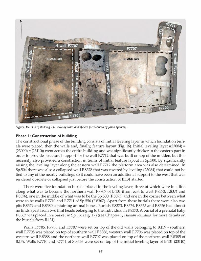
Jovana Tripković
Excavations of Building 131 that had started in 2014 were finally concluded this year and prelimi-nary phasing as well as sequence of events from construction to abandonment can be formulated. Building 131 was targeted for Alex Bayliss’ dating project of the North Area in order to further un-derstand and determine with precision the chronological and stratigraphical sequence of B.131 and B.129 with B.1 and B.5, as well as the B.77 and B.132 strands.
Building 131 is a rectangular building oriented east-west, about 10.9m long and 5m wide, locat-ed in the North Area between B.77, B.5 and external Sp.610. It is comprised of a main room (Sp.500), a western side room (Sp.504), with an additional space (Sp.556) extending to the north (Fig. 15). The building is defined by wall F.7705 to the south, F.7706 to the west, F.7707 to the north, F.7710 the west of Sp.556, F.7711 to the north of Sp.556 and F.7712 to the east. There were two separate side rooms – the westernmost room (Sp.504) divided from the rest of internal spaces by partition wall F.7708 and another side room positioned between partition wall F.7708 and divided from the main Sp.500 by a curtain wall F.7790 that was not assigned a separate space number during previous campaigns but was instead considered a part of Sp.500.
Figure 14. Section documented during the excavation of Building 139 with all the layers and the cut (23147).
37
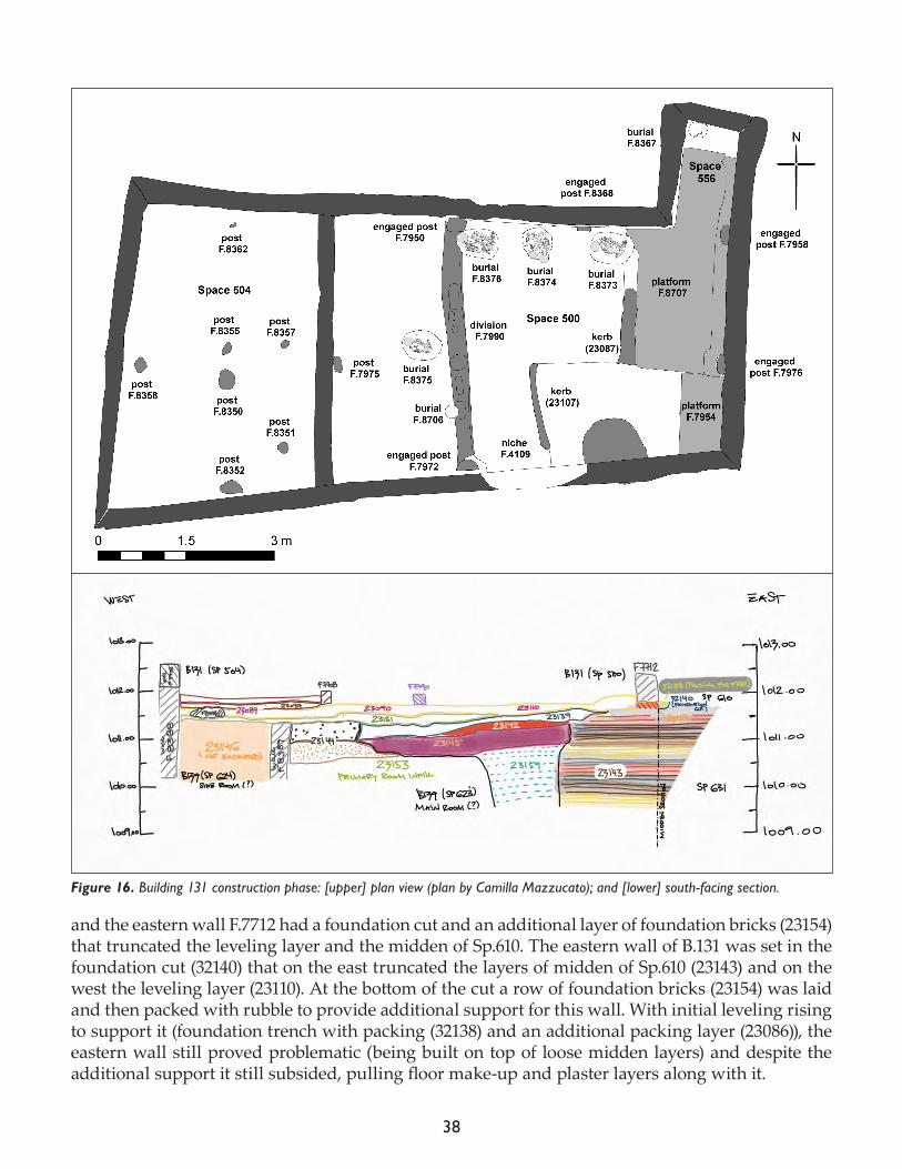
Phase 1: Construction of buildingThe constructional phase of the building consists of initial leveling layer in which foundation buri-als were placed, then the walls and, finally, feature layout (Fig. 16). Initial leveling layer ((23084) = (23090) = (23110)) went across the entire building and was significantly thicker in the eastern part in order to provide structural support for the wall F.7712 that was built on top of the midden, but this necessity also provided a constriction in terms of initial feature layout in Sp.500. By significantly raising the leveling layer along the eastern wall F.7712 the platform area was also determined. In Sp.504 there was also a collapsed wall F.8378 that was covered by leveling (23084) that could not be tied to any of the nearby buildings so it could have been an additional support to the west that was rendered obsolete or collapsed just before the construction of B.131 started.
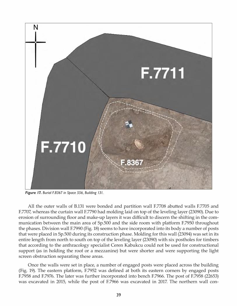
There were five foundation burials placed in the leveling layer, three of which were in a line along what was to become the northern wall F.7707 of B.131 (from east to west F.8373, F.8374 and F.8376), one in the middle of what was to be the Sp.500 (F.8375) and one in the corner between what were to be walls F.7710 and F.7711 of Sp.556 (F.8367). Apart from these burials there were also two pits F.8379 and F.8380 containing animal bones. Burials F.8373, F.8374, F.8375 and F.8376 had almost no finds apart from two flint beads belonging to the individual in F.8373. A burial of a prenatal baby F.8367 was placed in a basket in Sp.556 (Fig. 17) (see Chapter 5, Human Remains, for more details on the burials from B.131).
Walls F.7705, F.7706 and F.7707 were set on top of the old walls belonging to B.139 - southern wall F.7705 was placed on top of southern wall F.8386, western wall F.7706 was placed on top of the western wall F.8388 and the northern wall F.7707 was placed on top of the northern wall F.8385 of B.139. Walls F.7710 and F.7711 of Sp.556 were set on top of the initial leveling layer of B.131 (23110)
Figure 15. Plan of Building 131 showing walls and spaces (orthophoto by Jason Quinlan).
38
and the eastern wall F.7712 had a foundation cut and an additional layer of foundation bricks (23154) that truncated the leveling layer and the midden of Sp.610. The eastern wall of B.131 was set in the foundation cut (32140) that on the east truncated the layers of midden of Sp.610 (23143) and on the west the leveling layer (23110). At the bottom of the cut a row of foundation bricks (23154) was laid and then packed with rubble to provide additional support for this wall. With initial leveling rising to support it (foundation trench with packing (32138) and an additional packing layer (23086)), the eastern wall still proved problematic (being built on top of loose midden layers) and despite the additional support it still subsided, pulling floor make-up and plaster layers along with it.
Figure 16. Building 131 construction phase: [upper] plan view (plan by Camilla Mazzucato); and [lower] south-facing section.
39
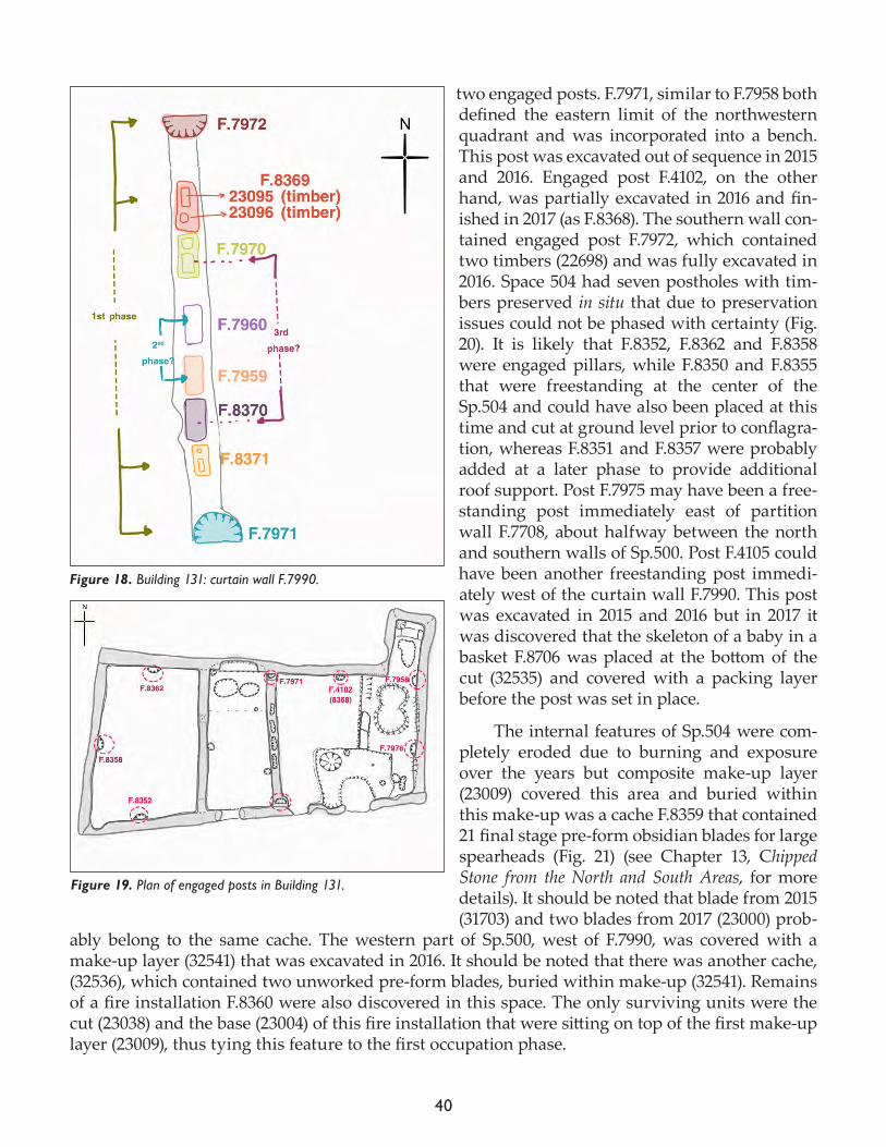
All the outer walls of B.131 were bonded and partition wall F.7708 abutted walls F.7705 and F.7707, whereas the curtain wall F.7790 had molding laid on top of the leveling layer (23090). Due to erosion of surrounding floor and make-up layers it was difficult to discern the shifting in the com-munication between the main area of Sp.500 and the side room with platform F.7950 throughout the phases. Division wall F.7990 (Fig. 18) seems to have incorporated into its body a number of posts that were placed in Sp.500 during its construction phase. Molding for this wall (23094) was set in its entire length from north to south on top of the leveling layer (23090) with six postholes for timbers that according to the anthracology specialist Ceren Kabukcu could not be used for constructional support (as in holding the roof or a mezzanine) but were shorter and were supporting the light screen obstruction separating these areas.
Once the walls were set in place, a number of engaged posts were placed across the building (Fig. 19). The eastern platform, F.7952 was defined at both its eastern corners by engaged posts F.7958 and F.7976. The later was further incorporated into bench F.7966. The post of F.7958 (22653) was excavated in 2015, while the post of F.7966 was excavated in 2017. The northern wall con-
Figure 17. Burial F.8367 in Space 556, Building 131.
40
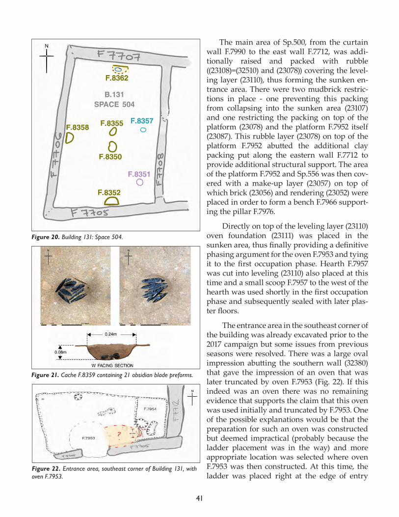
tained two engaged posts. F.7971, similar to F.7958 both defined the eastern limit of the northwestern quadrant and was incorporated into a bench. This post was excavated out of sequence in 2015 and 2016. Engaged post F.4102, on the other hand, was partially excavated in 2016 and fin-ished in 2017 (as F.8368). The southern wall con-tained engaged post F.7972, which contained two timbers (22698) and was fully excavated in 2016. Space 504 had seven postholes with tim-bers preserved in situ that due to preservation issues could not be phased with certainty (Fig. 20). It is likely that F.8352, F.8362 and F.8358 were engaged pillars, while F.8350 and F.8355 that were freestanding at the center of the Sp.504 and could have also been placed at this time and cut at ground level prior to conflagra-tion, whereas F.8351 and F.8357 were probably added at a later phase to provide additional roof support. Post F.7975 may have been a free-standing post immediately east of partition wall F.7708, about halfway between the north and southern walls of Sp.500. Post F.4105 could have been another freestanding post immedi-ately west of the curtain wall F.7990. This post was excavated in 2015 and 2016 but in 2017 it was discovered that the skeleton of a baby in a basket F.8706 was placed at the bottom of the cut (32535) and covered with a packing layer before the post was set in place.
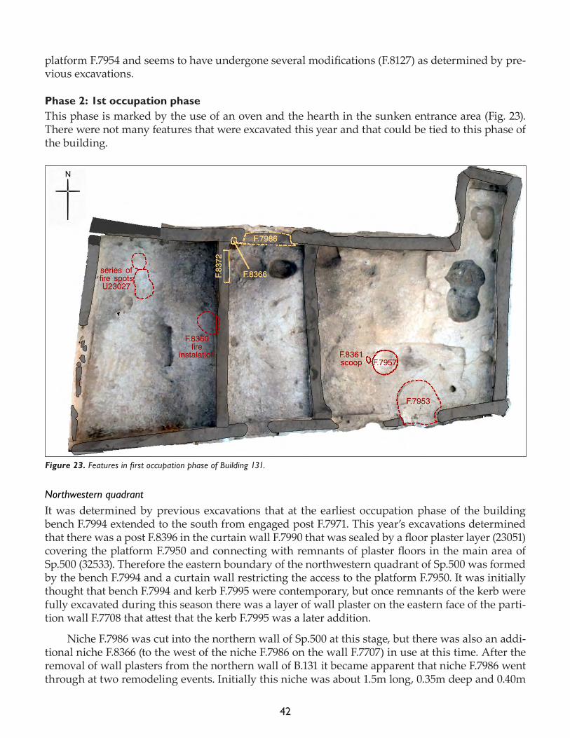
The internal features of Sp.504 were com-pletely eroded due to burning and exposure over the years but composite make-up layer (23009) covered this area and buried within this make-up was a cache F.8359 that contained 21 final stage pre-form obsidian blades for large spearheads (Fig. 21) (see Chapter 13, Chipped Stone from the North and South Areas, for more details). It should be noted that blade from 2015 (31703) and two blades from 2017 (23000) prob-
ably belong to the same cache. The western part of Sp.500, west of F.7990, was covered with a make-up layer (32541) that was excavated in 2016. It should be noted that there was another cache, (32536), which contained two unworked pre-form blades, buried within make-up (32541). Remains of a fire installation F.8360 were also discovered in this space. The only surviving units were the cut (23038) and the base (23004) of this fire installation that were sitting on top of the first make-up layer (23009), thus tying this feature to the first occupation phase.
Figure 18. Building 131: curtain wall F.7990.
Figure 19. Plan of engaged posts in Building 131.
41
The main area of Sp.500, from the curtain wall F.7990 to the east wall F.7712, was addi-tionally raised and packed with rubble ((23108)=(32510) and (23078)) covering the level-ing layer (23110), thus forming the sunken en-trance area. There were two mudbrick restric-tions in place - one preventing this packing from collapsing into the sunken area (23107) and one restricting the packing on top of the platform (23078) and the platform F.7952 itself (23087). This rubble layer (23078) on top of the platform F.7952 abutted the additional clay packing put along the eastern wall F.7712 to provide additional structural support. The area of the platform F.7952 and Sp.556 was then cov-ered with a make-up layer (23057) on top of which brick (23056) and rendering (23052) were placed in order to form a bench F.7966 support-ing the pillar F.7976.
Directly on top of the leveling layer (23110) oven foundation (23111) was placed in the sunken area, thus finally providing a definitive phasing argument for the oven F.7953 and tying it to the first occupation phase. Hearth F.7957 was cut into leveling (23110) also placed at this time and a small scoop F.7957 to the west of the hearth was used shortly in the first occupation phase and subsequently sealed with later plas-ter floors.
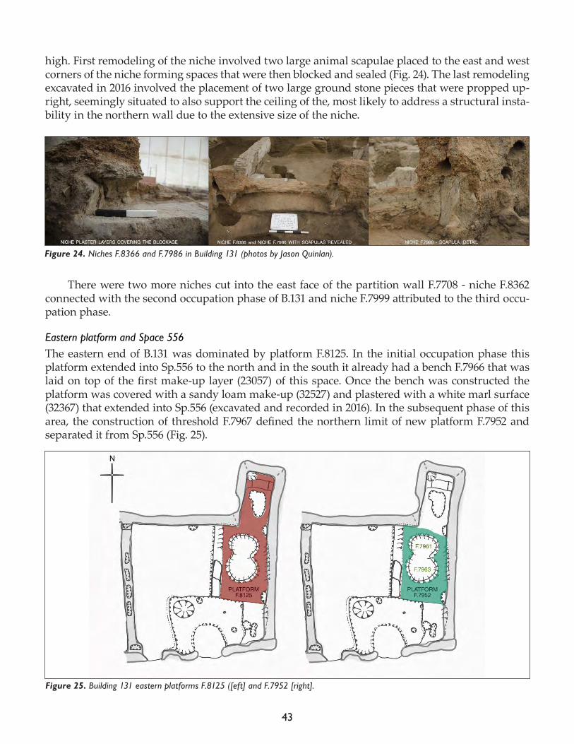
The entrance area in the southeast corner of the building was already excavated prior to the 2017 campaign but some issues from previous seasons were resolved. There was a large oval impression abutting the southern wall (32380) that gave the impression of an oven that was later truncated by oven F.7953 (Fig. 22). If this indeed was an oven there was no remaining evidence that supports the claim that this oven was used initially and truncated by F.7953. One of the possible explanations would be that the preparation for such an oven was constructed but deemed impractical (probably because the ladder placement was in the way) and more appropriate location was selected where oven F.7953 was then constructed. At this time, the ladder was placed right at the edge of entry
Figure 22. Entrance area, southeast corner of Building 131, with oven F.7953.
Figure 20. Building 131: Space 504.
Figure 21. Cache F.8359 containing 21 obsidian blade preforms.
42
platform F.7954 and seems to have undergone several modifications (F.8127) as determined by pre-vious excavations.
Phase 2: 1st occupation phaseThis phase is marked by the use of an oven and the hearth in the sunken entrance area (Fig. 23). There were not many features that were excavated this year and that could be tied to this phase of the building.
Northwestern quadrantIt was determined by previous excavations that at the earliest occupation phase of the building bench F.7994 extended to the south from engaged post F.7971. This year’s excavations determined that there was a post F.8396 in the curtain wall F.7990 that was sealed by a floor plaster layer (23051) covering the platform F.7950 and connecting with remnants of plaster floors in the main area of Sp.500 (32533). Therefore the eastern boundary of the northwestern quadrant of Sp.500 was formed by the bench F.7994 and a curtain wall restricting the access to the platform F.7950. It was initially thought that bench F.7994 and kerb F.7995 were contemporary, but once remnants of the kerb were fully excavated during this season there was a layer of wall plaster on the eastern face of the parti-tion wall F.7708 that attest that the kerb F.7995 was a later addition.
Niche F.7986 was cut into the northern wall of Sp.500 at this stage, but there was also an addi-tional niche F.8366 (to the west of the niche F.7986 on the wall F.7707) in use at this time. After the removal of wall plasters from the northern wall of B.131 it became apparent that niche F.7986 went through at two remodeling events. Initially this niche was about 1.5m long, 0.35m deep and 0.40m
Figure 23. Features in first occupation phase of Building 131.
43
high. First remodeling of the niche involved two large animal scapulae placed to the east and west corners of the niche forming spaces that were then blocked and sealed (Fig. 24). The last remodeling excavated in 2016 involved the placement of two large ground stone pieces that were propped up-right, seemingly situated to also support the ceiling of the, most likely to address a structural insta-bility in the northern wall due to the extensive size of the niche.
There were two more niches cut into the east face of the partition wall F.7708 - niche F.8362 connected with the second occupation phase of B.131 and niche F.7999 attributed to the third occu-pation phase.
Eastern platform and Space 556The eastern end of B.131 was dominated by platform F.8125. In the initial occupation phase this platform extended into Sp.556 to the north and in the south it already had a bench F.7966 that was laid on top of the first make-up layer (23057) of this space. Once the bench was constructed the platform was covered with a sandy loam make-up (32527) and plastered with a white marl surface (32367) that extended into Sp.556 (excavated and recorded in 2016). In the subsequent phase of this area, the construction of threshold F.7967 defined the northern limit of new platform F.7952 and separated it from Sp.556 (Fig. 25).
Figure 24. Niches F.8366 and F.7986 in Building 131 (photos by Jason Quinlan).
Figure 25. Building 131 eastern platforms F.8125 ([eft] and F.7952 [right].
44
Extremely complex burials F.7961 and F.7963 that were cut into platform F.7952 were finally fully excavated this season. Burials F.7961 to the north and F.7963 to the south were only partially excavated due to their complexity and time restraints during the previous two campaigns. The phasing of these burials will be revised in the post-excavation season but with the vast number of inhumations it is probable that their use spans from the first occupation phase until abandonment. See Chapter 5, Human Remains, for further details.
Burial F.7961At the beginning of the season a few disarticulated remains were visible but it turned out that there was a considerable amount of secondary disarticulated skeletal remains within this feature (and fill). The burial fill consisted of redeposited midden material (since the burial was cut into the midden layers) filled with animal bones, obsidian debitage and other material. Primary inhumation of this feature was a skeleton of an adolescent female Sk (23126) that had several burial inclusions associated with it - an obsidian mirror with ochre, beads, pigment, wooden bowl and a large pot-tery fragment placed underneath the cranium. It was remarkable to see how the burials within later B.129 on the eastern platform F.3630 reflect the continuation of this practice - from features being in the almost exact position within the building to similarity of artifacts placed within the burial (this feature also had two obsidian mirrors). Apart from the primary burial Sk (23126) there were five more disarticulated crania found along the edges of this feature. There was one adolescent female cranium Sk (23123), two adolescent male crania (Sk (23124), Sk (23125), one infant Sk (23148) and one child cranium Sk (23149).
Burial F. 8708 (formerly F.7963)Uncovered but only partially excavated in 2016, a cranium and mandible with red pigment Sk (32330) and thin white layer was fully excavated this year. Further excavations revealed additional infracranial skeletal elements in articulation with Sk (32330). While much of the spine, ribs and low-er lying left side of the skeleton remained in situ, parts of the right side of the skeleton are missing as a result of subsequent burials, and may also have been pushed to the north side into F.7961. This burial was originally assigned to F.7963 during the 2016 season but in 2017 it was assigned a sepa-rate feature number because it likely represents an earlier burial event – predating F.7963.
Phase 3 and later: from 2nd to final occupation phaseThere was only one feature left unexcavated from the later phases of B.131 - niche F.8381 in the eastern wall F.7712. The niche was cut through wall F.7712 and into the rubble/packing in Sp.610 to the east (Fig. 26). It had a very thick plastering with many fine laminations including several red painted layers that correspond with the red-paneled wall plasters in the northeast quadrant of B.131 around the major burial platform. The niche was about 0.40m wide, 0.40m deep and 0.30m high and was packed with clay and rubble material prior to the abandonment of the B.131.
Concluding notesThe burning of B.131 was both intentional and controlled by partial roof collapse (and probably some other method such as the distribution of highly flammable organic material) prior to the setting of the fire as attested by color differences in the heat-affected layers of Sp.504 and sunken entrance area of Sp.500. It is possible, but not proven, that B.131 and B.77 shared a temporal connec-tion and that both were in use when B.131 was set on fire. This issue remains to be resolved in the post-excavation season.
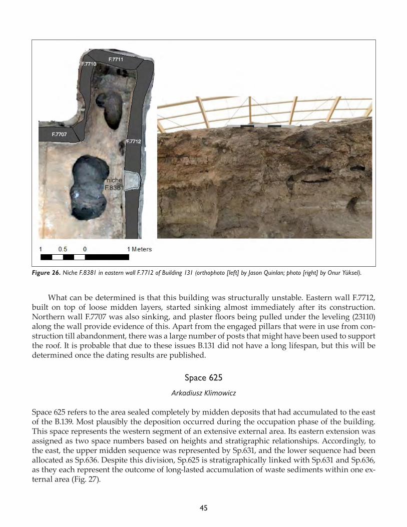
45
What can be determined is that this building was structurally unstable. Eastern wall F.7712, built on top of loose midden layers, started sinking almost immediately after its construction. Northern wall F.7707 was also sinking, and plaster floors being pulled under the leveling (23110) along the wall provide evidence of this. Apart from the engaged pillars that were in use from con-struction till abandonment, there was a large number of posts that might have been used to support the roof. It is probable that due to these issues B.131 did not have a long lifespan, but this will be determined once the dating results are published.
Space 625
Arkadiusz Klimowicz
Space 625 refers to the area sealed completely by midden deposits that had accumulated to the east of the B.139. Most plausibly the deposition occurred during the occupation phase of the building. This space represents the western segment of an extensive external area. Its eastern extension was assigned as two space numbers based on heights and stratigraphic relationships. Accordingly, to the east, the upper midden sequence was represented by Sp.631, and the lower sequence had been allocated as Sp.636. Despite this division, Sp.625 is stratigraphically linked with Sp.631 and Sp.636, as they each represent the outcome of long-lasted accumulation of waste sediments within one ex-ternal area (Fig. 27).
Figure 26. Niche F.8381 in eastern wall F.7712 of Building 131 (orthophoto [left] by Jason Quinlan; photo [right] by Onur Yüksel).
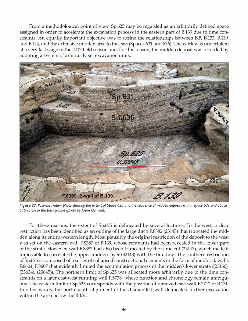
46
From a methodological point of view, Sp.625 may be regarded as an arbitrarily defined space assigned in order to accelerate the excavation process in the eastern part of B.139 due to time con-straints. An equally important objective was to define the relationships between B.5, B.132, B.139, and B.114, and the extensive midden area to the east (Spaces 631 and 636). The work was undertaken at a very last stage in the 2017 field season and, for this reason, the midden deposit was recorded by adopting a system of arbitrarily set excavation units.
For these reasons, the extent of Sp.625 is delineated by several features. To the west, a clear restriction has been identified as an outline of the large ditch F.8382 (23147) that truncated the mid-den along its entire western length. Most plausibly the original restriction of the deposit to the west was set on the eastern wall F.8387 of B.139, whose remnants had been revealed in the lower part of the strata. However, wall F.8387 had also been truncated by the same cut (23147), which made it impossible to correlate the upper midden layer (32143) with the building. The southern restriction of Sp.625 is composed of a series of collapsed constructional elements in the form of mudbrick walls F.8604, F.8607 that evidently limited the accumulation process of the midden’s lower strata ((23160), (23634), (23645)). The northern limit of Sp.625 was allocated more arbitrarily due to the time con-straints on a later east-west running wall F.5778, whose function and chronology remain ambigu-ous. The eastern limit of Sp.625 corresponds with the position of removed east wall F.7712 of B.131. In other words, the north-south alignment of the dismantled wall delineated further excavation within the area below the B.131.
Figure 27. Post-excavation photo showing the extent of Space 625 and the sequence of midden deposits within Space 631 and Space 636 visible in the background (photo by Jason Quinlan).
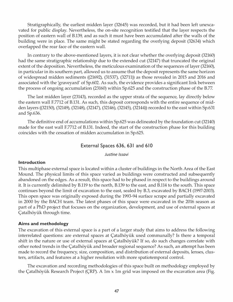
47
Stratigraphically, the earliest midden layer (32645) was recorded, but it had been left unexca-vated for public display. Nevertheless, the on-site recognition testified that the layer respects the position of eastern wall of B.139, and as such it must have been accumulated after the walls of the building were in place. The same might be stated regarding the overlying deposit (32634) which overlapped the rear face of the eastern wall.
In contrary to the above-mentioned layers, it is not clear whether the overlying deposit (32160) had the same stratigraphic relationship due to the extended cut (32147) that truncated the original extent of the deposition. Nevertheless, the meticulous examination of the sequences of layer (32160), in particular in its southern part, allowed us to assume that the deposit represents the same horizon of widespread midden sediments ((21692), (31537), (32711)) as those revealed in 2015 and 2016 and associated with the ‘graveyard’ of Sp.602. As such, the evidence provides a significant link between the process of ongoing accumulation (23160) within Sp.625 and the construction phase of the B.77.
The last midden layer (23143), recorded as the upper strata of the sequence, lay directly below the eastern wall F.7712 of B.131. As such, this deposit corresponds with the entire sequence of mid-den layers ((32150), (32149), (32148), (32147), (32146), (32145), (32144)) recorded to the east within Sp.631 and Sp.636.
The definitive end of accumulations within Sp.625 was delineated by the foundation cut (32140) made for the east wall F.7712 of B.131. Indeed, the start of the construction phase for this building coincides with the cessation of midden accumulation in Sp.625.
External Spaces 636, 631 and 610
Justine Issavi
IntroductionThis multiphase external space is located within a cluster of buildings in the North Area of the East Mound. The physical limits of this space varied as buildings were constructed and subsequently abandoned on the edges. As a result, this space had to be phased in respect to the buildings around it. It is currently delimited by B.119 to the north, B.139 to the east, and B.114 to the south. This space continues beyond the limit of excavation to the east, sealed by B.3, excavated by BACH (1997-2003). This open space was originally exposed during the 1993-94 surface scrape and partially excavated in 2000 by the BACH team. The latest phases of this space were excavated in the 2016 season as part of a PhD project that focuses on the organization, development, and use of external spaces at Çatalhöyük through time.
Aims and methodologyThe excavation of this external space is a part of a larger study that aims to address the following interrelated questions: are external spaces at Çatalhöyük used communally? Is there a temporal shift in the nature or use of external spaces at Çatalhöyük? If so, do such changes correlate with other noted trends in the Çatalhöyük and broader regional sequence? As such, an attempt has been made to record the frequency, size, composition, and distribution of external deposits, lenses, clus-ters, artifacts, and features at a higher resolution with more spatiotemporal control.
The excavation and recording methodologies of this space built on methodology employed by the Çatalhöyük Research Project (ÇRP). A 1m x 1m grid was imposed on the excavation area (Fig.
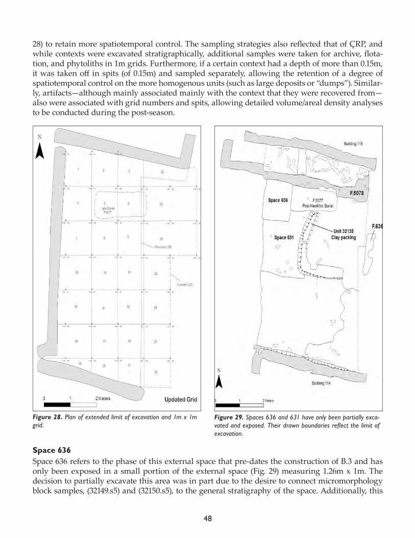
48
28) to retain more spatiotemporal control. The sampling strategies also reflected that of ÇRP, and while contexts were excavated stratigraphically, additional samples were taken for archive, flota-tion, and phytoliths in 1m grids. Furthermore, if a certain context had a depth of more than 0.15m, it was taken off in spits (of 0.15m) and sampled separately, allowing the retention of a degree of spatiotemporal control on the more homogenous units (such as large deposits or “dumps”). Similar-ly, artifacts—although mainly associated mainly with the context that they were recovered from—also were associated with grid numbers and spits, allowing detailed volume/areal density analyses to be conducted during the post-season.
Space 636Space 636 refers to the phase of this external space that pre-dates the construction of B.3 and has only been exposed in a small portion of the external space (Fig. 29) measuring 1.26m x 1m. The decision to partially excavate this area was in part due to the desire to connect micromorphology block samples, (32149.s5) and (32150.s5), to the general stratigraphy of the space. Additionally, this
Figure 28. Plan of extended limit of excavation and 1m x 1m grid.
Figure 29. Spaces 636 and 631 have only been partially exca-vated and exposed. Their drawn boundaries reflect the limit of excavation.
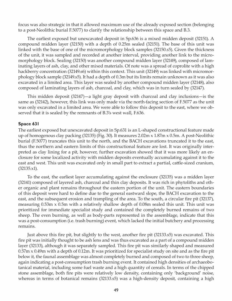
49
focus was also strategic in that it allowed maximum use of the already exposed section (belonging to a post-Neolithic burial F.5077) to clarify the relationship between this space and B.3.
The earliest exposed but unexcavated deposit in Sp.636 is a mixed midden deposit (32151). A compound midden layer (32150) with a depth of 0.25m sealed (32151). The base of this unit was linked with the base of one of the micromorphology block samples (32150.s5). Given the thickness of the unit, it was sampled and recorded at another interval, providing another link to the micro-morphology block. Sealing (32150) was another compound midden layer (32149), composed of lam-inating layers of ash, clay, and other mixed materials. Of note was a spread of coprolite with a high hackberry concentration (32149.s6) within this context. This unit (32149) was linked with micromor-phology block sample (32149.s5). It had a depth of 0.3m but its limits remain unknown as it was also excavated in a limited area. This layer was sealed by another compound midden layer (32148), also composed of laminating layers of ash, charcoal, and clay, which was in turn sealed by (32147).
This midden deposit (32147)—a light gray deposit with charcoal and clay inclusions—is the same as (32142), however, this link was only made via the north-facing section of F.5077 as the unit was only excavated in a limited area. We were able to follow this deposit to the east, where we ob-served that it is sealed by the remnants of B.3’s west wall, F.636.
Space 631The earliest exposed but unexcavated deposit in Sp.631 is an L-shaped constructional feature made up of homogenous clay packing (32135) (Fig. 30). It measures 2.02m x 1.87m x 0.5m. A post-Neolithic burial (F.5077) truncates this unit to the north, and the BACH excavations truncated it to the east, thus the northern and eastern limits of this constructional feature are lost. It was originally inter-preted as clay lining for a pit, however, further excavation showed that it was more likely an en-closure for some localized activity with midden deposits eventually accumulating against it to the east and west. This unit was excavated only in small part to extract a partial, cattle-sized cranium, (32135.x1).
To the east, the earliest layer accumulating against the enclosure (32135) was a midden layer (32141) composed of layered ash, charcoal and thin clay deposits. It was rich in phytoliths and oth-er organic and plant remains throughout the eastern portion of the unit. The eastern boundaries of this deposit were hard to define due to the general eastward slope, the BACH excavation to the east, and the subsequent erosion and trampling of the area. To the south, a circular fire pit (32137), measuring 0.53m x 0.5m with a relatively shallow depth of 0.08m sealed this unit. This unit was prioritized for immediate specialist study and contained the completely burned remains of two sheep. The even burning, as well as body-parts represented in the assemblage, indicate that this was a post-consumption (i.e. trash burning) event, which lacked the initial butchery and processing remains.
Just above this fire pit, but slightly to the west, another fire pit (32133.s5) was excavated. This fire pit was initially thought to be ash lens and was thus excavated as a part of a compound midden layer (32133), although it was separately sampled. This fire pit was similarly shaped and measured 0.57m x 0.49m with a depth of 0.12m. It was prioritized for specialist study on site and as the fire pit below it, the faunal assemblage was almost completely burned and composed of two to three sheep, again indicating a post-consumption trash burning event. It contained high densities of archaeobo-tanical material, including some fuel waste and a high quantity of cereals. In terms of the chipped stone assemblage, both fire pits were relatively low density, containing only ‘background’ noise, whereas in terms of botanical remains (32133.s5) was a high-density deposit, containing a high
50
quantity of cereals as well as fuel waste. To the east, this pit is partially sealed by a midden deposit (32134) rich in phytoliths and faunal material. The boundaries of this unit, located in the eastern portion of grids 23-26, were difficult to define due to the eastward slope, long-term exposure and trampling of the area. Thus, we initially interpreted this unit as a pit fill, but upon later excavation
Figure 30. Plan view of L-shaped clay packing (32135) in Space 631 (orthophoto by Jason Quinlan).
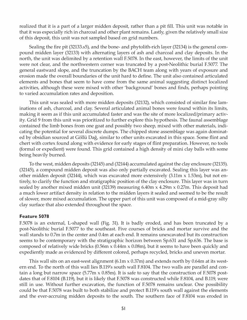
51
realized that it is a part of a larger midden deposit, rather than a pit fill. This unit was notable in that it was especially rich in charcoal and other plant remains. Lastly, given the relatively small size of this deposit, this unit was not sampled based on grid numbers.
Sealing the fire pit (32133.s5), and the bone- and phytolith-rich layer (32134) is the general com-pound midden layer (32133) with alternating layers of ash and charcoal and clay deposits. In the north, the unit was delimited by a retention wall F.5078. In the east, however, the limits of the unit were not clear, and the northwestern corner was truncated by a post-Neolithic burial F.5077. The general eastward slope, and the truncation by the BACH team along with years of exposure and erosion made the overall boundaries of the unit hard to define. The unit also contained articulated elements and bones that seem to have come from the same animal suggesting distinct localized activities, although these were mixed with other ‘background’ bones and finds, perhaps pointing to varied accumulation rates and deposition.
This unit was sealed with more midden deposits (32132), which consisted of similar fine lam-inations of ash, charcoal, and clay. Several articulated animal bones were found within its limits, making it seem as if this unit accumulated faster and was the site of more localized/primary activ-ity. Grid 9 from this unit was prioritized to further explore this hypothesis. The faunal assemblage contained the limb bones from one goat and possibly two sheep, mixed with other materials, indi-cating the potential for several discrete dumps. The chipped stone assemblage was again dominat-ed by obsidian sourced at Göllü Dağ, similar to other units excavated in this space. Some flint and chert with cortex found along with evidence for early stages of flint preparation. However, no tools (formal or expedient) were found. This grid contained a high density of mini clay balls with some being heavily burned.
To the west, midden deposits (32145) and (32144) accumulated against the clay enclosure (32135). (32145), a compound midden deposit was also only partially excavated. Sealing this layer was an-other midden deposit (32144), which was excavated more extensively (3.11m x 1.53m), but not en-tirely, to clarify the function and stratigraphic position of the clay enclosure. This layer was in turn sealed by another mixed midden unit (32139) measuring 6.40m x 4.29m x 0.27m. This deposit had a much lower artifact density in relation to the midden layers it sealed and seemed to be the result of slower, more mixed accumulation. The upper part of this unit was composed of a mid-gray silty clay surface that also extended throughout the space.
Feature 5078F.5078 is an external, L-shaped wall (Fig. 31). It is badly eroded, and has been truncated by a post-Neolithic burial F.5077 to the southeast. Five courses of bricks and mortar survive and the wall stands to 0.7m in the center and 0.4m at each end. It remains unexcavated but its construction seems to be contemporary with the stratigraphic horizon between Sp.631 and Sp.636. The base is composed of relatively wide bricks (0.56m x 0.44m x 0.08m), but it seems to have been quickly and expediently made as evidenced by different colored, perhaps recycled, bricks and uneven mortar.
This wall sits on an east-west alignment (6.1m x 0.37m) and extends north by 0.64m at its west-ern end. To the north of this wall lies B.119’s south wall F.8104. The two walls are parallel and con-tain a long but narrow space (5.77m x 0.85m). It is safe to say that the construction of F.5078 post-dates that of F.8104 (B.119), but it is likely that F.5078 was constructed while F.8104, and B.119, were still in use. Without further excavation, the function of F.5078 remains unclear. One possibility could be that F.5078 was built to both stabilize and protect B.119’s south wall against the elements and the ever-accruing midden deposits to the south. The southern face of F.8104 was eroded in
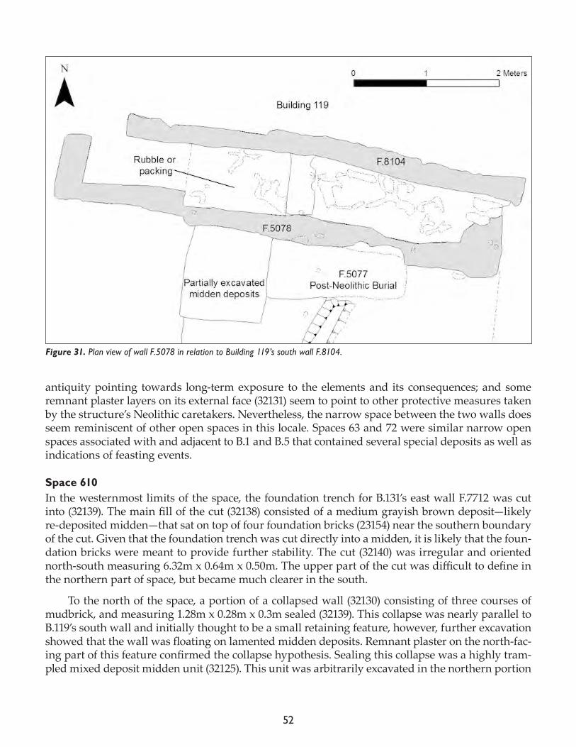
52
antiquity pointing towards long-term exposure to the elements and its consequences; and some remnant plaster layers on its external face (32131) seem to point to other protective measures taken by the structure’s Neolithic caretakers. Nevertheless, the narrow space between the two walls does seem reminiscent of other open spaces in this locale. Spaces 63 and 72 were similar narrow open spaces associated with and adjacent to B.1 and B.5 that contained several special deposits as well as indications of feasting events.
Space 610In the westernmost limits of the space, the foundation trench for B.131’s east wall F.7712 was cut into (32139). The main fill of the cut (32138) consisted of a medium grayish brown deposit—likely re-deposited midden—that sat on top of four foundation bricks (23154) near the southern boundary of the cut. Given that the foundation trench was cut directly into a midden, it is likely that the foun-dation bricks were meant to provide further stability. The cut (32140) was irregular and oriented north-south measuring 6.32m x 0.64m x 0.50m. The upper part of the cut was difficult to define in the northern part of space, but became much clearer in the south.
To the north of the space, a portion of a collapsed wall (32130) consisting of three courses of mudbrick, and measuring 1.28m x 0.28m x 0.3m sealed (32139). This collapse was nearly parallel to B.119’s south wall and initially thought to be a small retaining feature, however, further excavation showed that the wall was floating on lamented midden deposits. Remnant plaster on the north-fac-ing part of this feature confirmed the collapse hypothesis. Sealing this collapse was a highly tram-pled mixed deposit midden unit (32125). This unit was arbitrarily excavated in the northern portion
Figure 31. Plan view of wall F.5078 in relation to Building 119’s south wall F.8104.
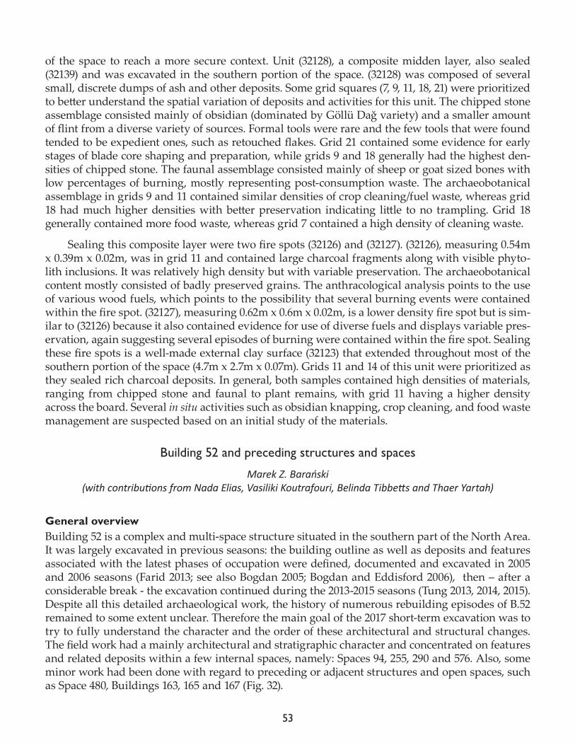
53
of the space to reach a more secure context. Unit (32128), a composite midden layer, also sealed (32139) and was excavated in the southern portion of the space. (32128) was composed of several small, discrete dumps of ash and other deposits. Some grid squares (7, 9, 11, 18, 21) were prioritized to better understand the spatial variation of deposits and activities for this unit. The chipped stone assemblage consisted mainly of obsidian (dominated by Göllü Dağ variety) and a smaller amount of flint from a diverse variety of sources. Formal tools were rare and the few tools that were found tended to be expedient ones, such as retouched flakes. Grid 21 contained some evidence for early stages of blade core shaping and preparation, while grids 9 and 18 generally had the highest den-sities of chipped stone. The faunal assemblage consisted mainly of sheep or goat sized bones with low percentages of burning, mostly representing post-consumption waste. The archaeobotanical assemblage in grids 9 and 11 contained similar densities of crop cleaning/fuel waste, whereas grid 18 had much higher densities with better preservation indicating little to no trampling. Grid 18 generally contained more food waste, whereas grid 7 contained a high density of cleaning waste.
Sealing this composite layer were two fire spots (32126) and (32127). (32126), measuring 0.54m x 0.39m x 0.02m, was in grid 11 and contained large charcoal fragments along with visible phyto-lith inclusions. It was relatively high density but with variable preservation. The archaeobotanical content mostly consisted of badly preserved grains. The anthracological analysis points to the use of various wood fuels, which points to the possibility that several burning events were contained within the fire spot. (32127), measuring 0.62m x 0.6m x 0.02m, is a lower density fire spot but is sim-ilar to (32126) because it also contained evidence for use of diverse fuels and displays variable pres-ervation, again suggesting several episodes of burning were contained within the fire spot. Sealing these fire spots is a well-made external clay surface (32123) that extended throughout most of the southern portion of the space (4.7m x 2.7m x 0.07m). Grids 11 and 14 of this unit were prioritized as they sealed rich charcoal deposits. In general, both samples contained high densities of materials, ranging from chipped stone and faunal to plant remains, with grid 11 having a higher density across the board. Several in situ activities such as obsidian knapping, crop cleaning, and food waste management are suspected based on an initial study of the materials.
Building 52 and preceding structures and spaces
Marek Z. Barański(with contributions from Nada Elias, Vasiliki Koutrafouri, Belinda Tibbetts and Thaer Yartah)
General overviewBuilding 52 is a complex and multi-space structure situated in the southern part of the North Area. It was largely excavated in previous seasons: the building outline as well as deposits and features associated with the latest phases of occupation were defined, documented and excavated in 2005 and 2006 seasons (Farid 2013; see also Bogdan 2005; Bogdan and Eddisford 2006), then – after a considerable break - the excavation continued during the 2013-2015 seasons (Tung 2013, 2014, 2015). Despite all this detailed archaeological work, the history of numerous rebuilding episodes of B.52 remained to some extent unclear. Therefore the main goal of the 2017 short-term excavation was to try to fully understand the character and the order of these architectural and structural changes. The field work had a mainly architectural and stratigraphic character and concentrated on features and related deposits within a few internal spaces, namely: Spaces 94, 255, 290 and 576. Also, some minor work had been done with regard to preceding or adjacent structures and open spaces, such as Space 480, Buildings 163, 165 and 167 (Fig. 32).
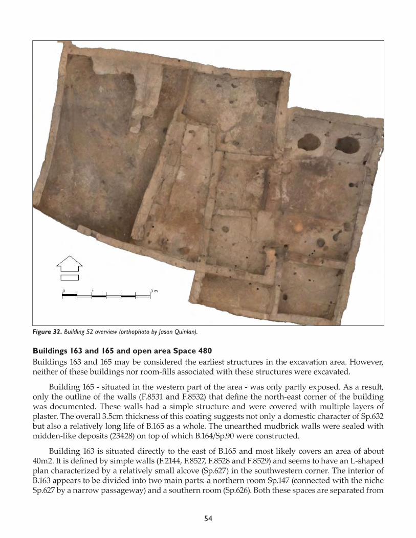
54
Buildings 163 and 165 and open area Space 480Buildings 163 and 165 may be considered the earliest structures in the excavation area. However, neither of these buildings nor room-fills associated with these structures were excavated.
Building 165 - situated in the western part of the area - was only partly exposed. As a result, only the outline of the walls (F.8531 and F.8532) that define the north-east corner of the building was documented. These walls had a simple structure and were covered with multiple layers of plaster. The overall 3.5cm thickness of this coating suggests not only a domestic character of Sp.632 but also a relatively long life of B.165 as a whole. The unearthed mudbrick walls were sealed with midden-like deposits (23428) on top of which B.164/Sp.90 were constructed.
Building 163 is situated directly to the east of B.165 and most likely covers an area of about 40m2. It is defined by simple walls (F.2144, F.8527, F.8528 and F.8529) and seems to have an L-shaped plan characterized by a relatively small alcove (Sp.627) in the southwestern corner. The interior of B.163 appears to be divided into two main parts: a northern room Sp.147 (connected with the niche Sp.627 by a narrow passageway) and a southern room (Sp.626). Both these spaces are separated from
Figure 32. Building 52 overview (orthophoto by Jason Quinlan).
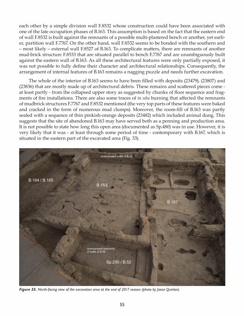
55
each other by a simple division wall F.8532 whose construction could have been associated with one of the late occupation phases of B.163. This assumption is based on the fact that the eastern end of wall F.8532 is built against the remnants of a possible multi-plastered bench or another, yet earli-er, partition wall F.7767. On the other hand, wall F.8532 seems to be bonded with the southern and – most likely – external wall F.8527 of B.163. To complicate matters, there are remnants of another mud-brick structure F.8533 that are situated parallel to bench F.7767 and are unambiguously built against the eastern wall of B.163. As all these architectural features were only partially exposed, it was not possible to fully define their character and architectural relationships. Consequently, the arrangement of internal features of B.163 remains a nagging puzzle and needs further excavation.
The whole of the interior of B.163 seems to have been filled with deposits (23479), (23807) and (23836) that are mostly made up of architectural debris. These remains and scattered pieces come - at least partly - from the collapsed upper story as suggested by chunks of floor sequence and frag-ments of fire installations. There are also some traces of in situ burning that affected the remnants of mudbrick structures F.7767 and F.8532 mentioned (the very top parts of these features were baked and cracked in the form of numerous mud clumps). Moreover, the room-fill of B.163 was partly sealed with a sequence of thin pinkish-orange deposits (23482) which included animal dung. This suggests that the site of abandoned B.163 may have served both as a penning and production area. It is not possible to state how long this open area (documented as Sp.480) was in use. However, it is very likely that it was - at least through some period of time - contemporary with B.167, which is situated in the eastern part of the excavated area (Fig. 33).
Figure 33. North-facing view of the excavation area at the end of 2017 season (photo by Jason Quinlan).
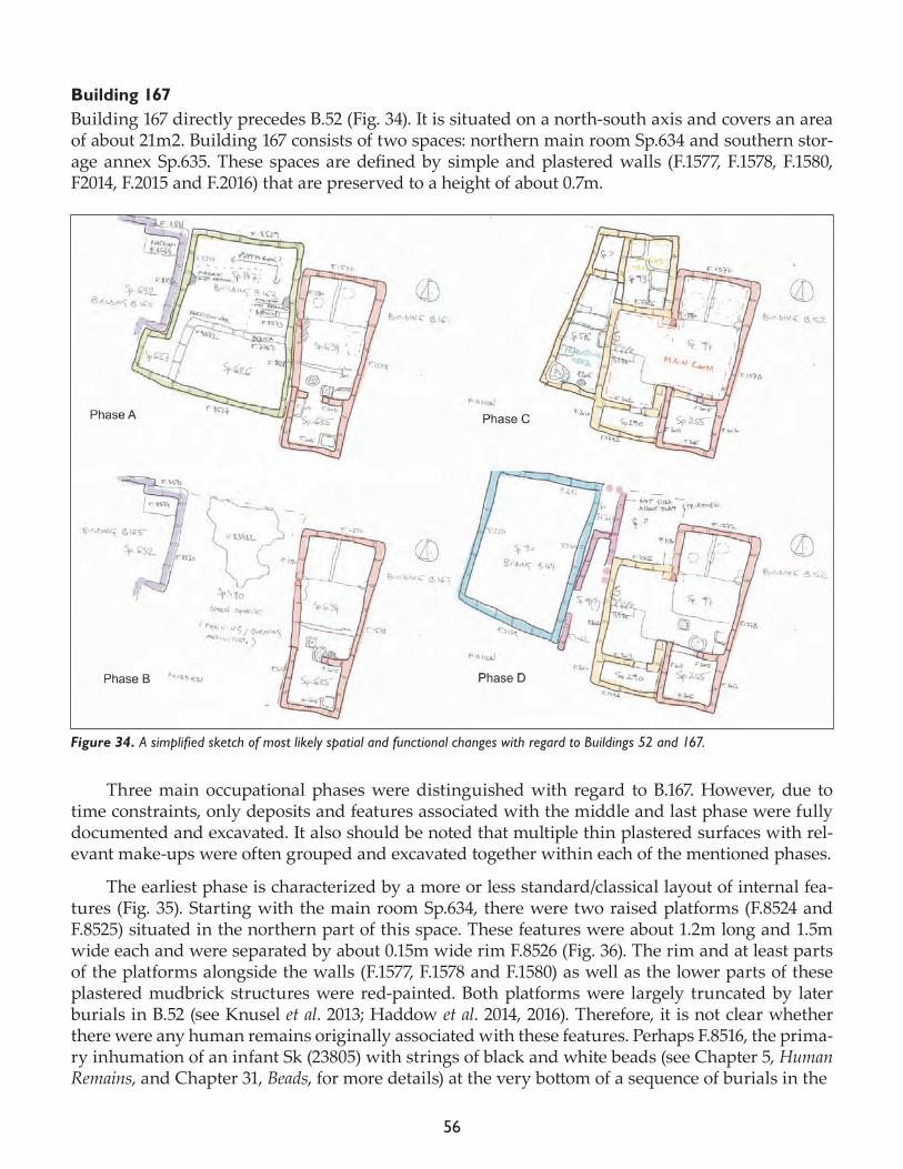
56
Building 167 Building 167 directly precedes B.52 (Fig. 34). It is situated on a north-south axis and covers an area of about 21m2. Building 167 consists of two spaces: northern main room Sp.634 and southern stor-age annex Sp.635. These spaces are defined by simple and plastered walls (F.1577, F.1578, F.1580, F2014, F.2015 and F.2016) that are preserved to a height of about 0.7m.
Three main occupational phases were distinguished with regard to B.167. However, due to time constraints, only deposits and features associated with the middle and last phase were fully documented and excavated. It also should be noted that multiple thin plastered surfaces with rel-evant make-ups were often grouped and excavated together within each of the mentioned phases.
The earliest phase is characterized by a more or less standard/classical layout of internal fea-tures (Fig. 35). Starting with the main room Sp.634, there were two raised platforms (F.8524 and F.8525) situated in the northern part of this space. These features were about 1.2m long and 1.5m wide each and were separated by about 0.15m wide rim F.8526 (Fig. 36). The rim and at least parts of the platforms alongside the walls (F.1577, F.1578 and F.1580) as well as the lower parts of these plastered mudbrick structures were red-painted. Both platforms were largely truncated by later burials in B.52 (see Knusel et al. 2013; Haddow et al. 2014, 2016). Therefore, it is not clear whether there were any human remains originally associated with these features. Perhaps F.8516, the prima-ry inhumation of an infant Sk (23805) with strings of black and white beads (see Chapter 5, Human Remains, and Chapter 31, Beads, for more details) at the very bottom of a sequence of burials in the
Figure 34. A simplified sketch of most likely spatial and functional changes with regard to Buildings 52 and 167.
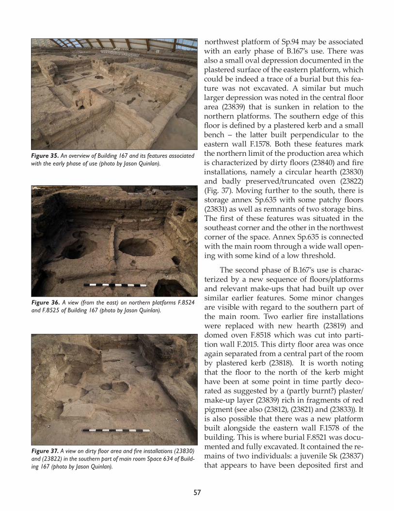
57
northwest platform of Sp.94 may be associated with an early phase of B.167’s use. There was also a small oval depression documented in the plastered surface of the eastern platform, which could be indeed a trace of a burial but this fea-ture was not excavated. A similar but much larger depression was noted in the central floor area (23839) that is sunken in relation to the northern platforms. The southern edge of this floor is defined by a plastered kerb and a small bench – the latter built perpendicular to the eastern wall F.1578. Both these features mark the northern limit of the production area which is characterized by dirty floors (23840) and fire installations, namely a circular hearth (23830) and badly preserved/truncated oven (23822) (Fig. 37). Moving further to the south, there is storage annex Sp.635 with some patchy floors (23831) as well as remnants of two storage bins. The first of these features was situated in the southeast corner and the other in the northwest corner of the space. Annex Sp.635 is connected with the main room through a wide wall open-ing with some kind of a low threshold.
The second phase of B.167’s use is charac-terized by a new sequence of floors/platforms and relevant make-ups that had built up over similar earlier features. Some minor changes are visible with regard to the southern part of the main room. Two earlier fire installations were replaced with new hearth (23819) and domed oven F.8518 which was cut into parti-tion wall F.2015. This dirty floor area was once again separated from a central part of the room by plastered kerb (23818). It is worth noting that the floor to the north of the kerb might have been at some point in time partly deco-rated as suggested by a (partly burnt?) plaster/make-up layer (23839) rich in fragments of red pigment (see also (23812), (23821) and (23833)). It is also possible that there was a new platform built alongside the eastern wall F.1578 of the building. This is where burial F.8521 was docu-mented and fully excavated. It contained the re-mains of two individuals: a juvenile Sk (23837) that appears to have been deposited first and
Figure 35. An overview of Building 167 and its features associated with the early phase of use (photo by Jason Quinlan).
Figure 36. A view (from the east) on northern platforms F.8524 and F.8525 of Building 167 (photo by Jason Quinlan).
Figure 37. A view on dirty floor area and fire installations (23830) and (23822) in the southern part of main room Space 634 of Build-ing 167 (photo by Jason Quinlan).
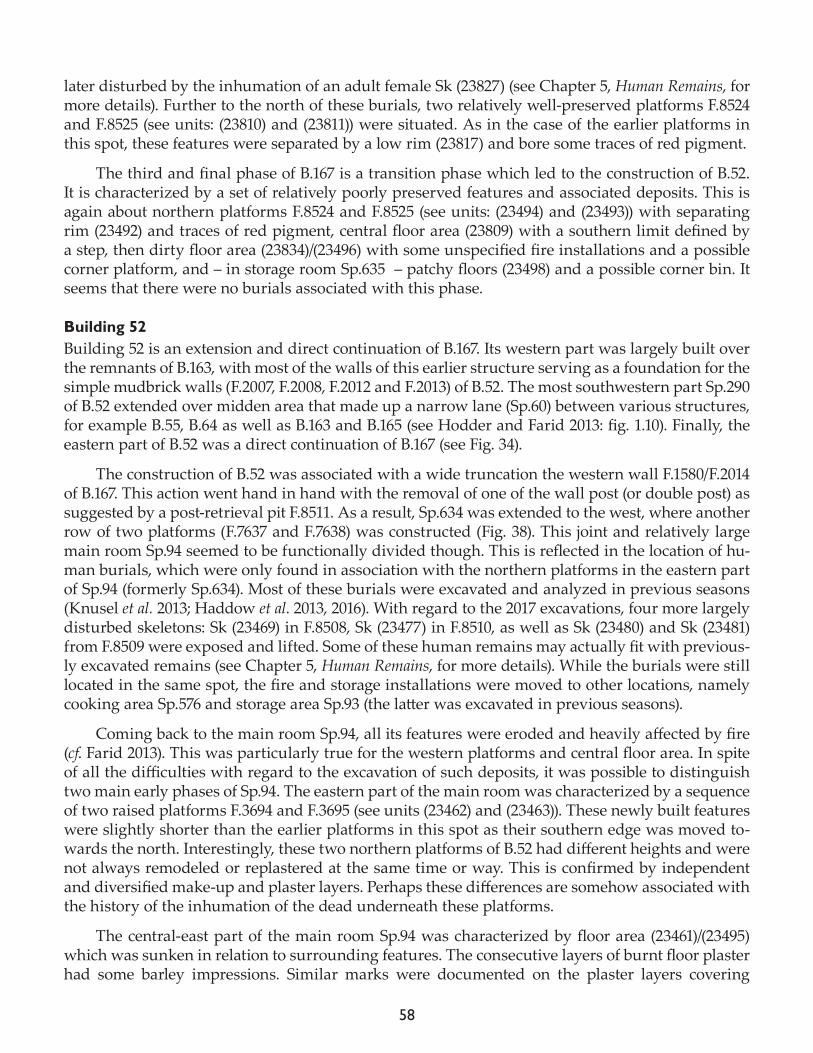
58
later disturbed by the inhumation of an adult female Sk (23827) (see Chapter 5, Human Remains, for more details). Further to the north of these burials, two relatively well-preserved platforms F.8524 and F.8525 (see units: (23810) and (23811)) were situated. As in the case of the earlier platforms in this spot, these features were separated by a low rim (23817) and bore some traces of red pigment.
The third and final phase of B.167 is a transition phase which led to the construction of B.52. It is characterized by a set of relatively poorly preserved features and associated deposits. This is again about northern platforms F.8524 and F.8525 (see units: (23494) and (23493)) with separating rim (23492) and traces of red pigment, central floor area (23809) with a southern limit defined by a step, then dirty floor area (23834)/(23496) with some unspecified fire installations and a possible corner platform, and – in storage room Sp.635 – patchy floors (23498) and a possible corner bin. It seems that there were no burials associated with this phase.
Building 52Building 52 is an extension and direct continuation of B.167. Its western part was largely built over the remnants of B.163, with most of the walls of this earlier structure serving as a foundation for the simple mudbrick walls (F.2007, F.2008, F.2012 and F.2013) of B.52. The most southwestern part Sp.290 of B.52 extended over midden area that made up a narrow lane (Sp.60) between various structures, for example B.55, B.64 as well as B.163 and B.165 (see Hodder and Farid 2013: fig. 1.10). Finally, the eastern part of B.52 was a direct continuation of B.167 (see Fig. 34).
The construction of B.52 was associated with a wide truncation the western wall F.1580/F.2014 of B.167. This action went hand in hand with the removal of one of the wall post (or double post) as suggested by a post-retrieval pit F.8511. As a result, Sp.634 was extended to the west, where another row of two platforms (F.7637 and F.7638) was constructed (Fig. 38). This joint and relatively large main room Sp.94 seemed to be functionally divided though. This is reflected in the location of hu-man burials, which were only found in association with the northern platforms in the eastern part of Sp.94 (formerly Sp.634). Most of these burials were excavated and analyzed in previous seasons (Knusel et al. 2013; Haddow et al. 2013, 2016). With regard to the 2017 excavations, four more largely disturbed skeletons: Sk (23469) in F.8508, Sk (23477) in F.8510, as well as Sk (23480) and Sk (23481) from F.8509 were exposed and lifted. Some of these human remains may actually fit with previous-ly excavated remains (see Chapter 5, Human Remains, for more details). While the burials were still located in the same spot, the fire and storage installations were moved to other locations, namely cooking area Sp.576 and storage area Sp.93 (the latter was excavated in previous seasons).
Coming back to the main room Sp.94, all its features were eroded and heavily affected by fire (cf. Farid 2013). This was particularly true for the western platforms and central floor area. In spite of all the difficulties with regard to the excavation of such deposits, it was possible to distinguish two main early phases of Sp.94. The eastern part of the main room was characterized by a sequence of two raised platforms F.3694 and F.3695 (see units (23462) and (23463)). These newly built features were slightly shorter than the earlier platforms in this spot as their southern edge was moved to-wards the north. Interestingly, these two northern platforms of B.52 had different heights and were not always remodeled or replastered at the same time or way. This is confirmed by independent and diversified make-up and plaster layers. Perhaps these differences are somehow associated with the history of the inhumation of the dead underneath these platforms.
The central-east part of the main room Sp.94 was characterized by floor area (23461)/(23495) which was sunken in relation to surrounding features. The consecutive layers of burnt floor plaster had some barley impressions. Similar marks were documented on the plaster layers covering

59
Figure 39. View (from the west) on a latter addition to partition wall F.2015 with a doorway that connects Space 94 and Space 255 (photo by Vasiliki Koutrafouri).
Figure 38. View (from the north) of western platforms F.7637 and F.7638 within main room Space 94 of Building 52 (photo by Vasiliki Koutrafouri).
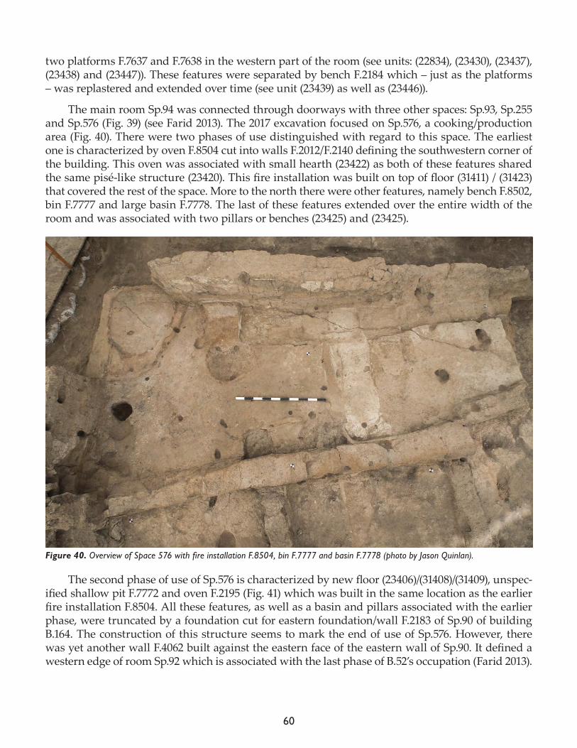
60
two platforms F.7637 and F.7638 in the western part of the room (see units: (22834), (23430), (23437), (23438) and (23447)). These features were separated by bench F.2184 which – just as the platforms – was replastered and extended over time (see unit (23439) as well as (23446)).
The main room Sp.94 was connected through doorways with three other spaces: Sp.93, Sp.255 and Sp.576 (Fig. 39) (see Farid 2013). The 2017 excavation focused on Sp.576, a cooking/production area (Fig. 40). There were two phases of use distinguished with regard to this space. The earliest one is characterized by oven F.8504 cut into walls F.2012/F.2140 defining the southwestern corner of the building. This oven was associated with small hearth (23422) as both of these features shared the same pisé-like structure (23420). This fire installation was built on top of floor (31411) / (31423) that covered the rest of the space. More to the north there were other features, namely bench F.8502, bin F.7777 and large basin F.7778. The last of these features extended over the entire width of the room and was associated with two pillars or benches (23425) and (23425).
The second phase of use of Sp.576 is characterized by new floor (23406)/(31408)/(31409), unspec-ified shallow pit F.7772 and oven F.2195 (Fig. 41) which was built in the same location as the earlier fire installation F.8504. All these features, as well as a basin and pillars associated with the earlier phase, were truncated by a foundation cut for eastern foundation/wall F.2183 of Sp.90 of building B.164. The construction of this structure seems to mark the end of use of Sp.576. However, there was yet another wall F.4062 built against the eastern face of the eastern wall of Sp.90. It defined a western edge of room Sp.92 which is associated with the last phase of B.52’s occupation (Farid 2013).
Figure 40. Overview of Space 576 with fire installation F.8504, bin F.7777 and basin F.7778 (photo by Jason Quinlan).
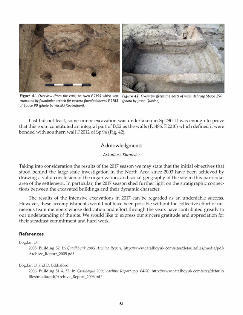
61
Last but not least, some minor excavation was undertaken in Sp.290. It was enough to prove that this room constituted an integral part of B.52 as the walls (F.1486, F.2010) which defined it were bonded with southern wall F.2012 of Sp.94 (Fig. 42).
Acknowledgments
Arkadiusz Klimovicz
Taking into consideration the results of the 2017 season we may state that the initial objectives that stood behind the large-scale investigation in the North Area since 2003 have been achieved by drawing a valid conclusion of the organization, and social geography of the site in this particular area of the settlement. In particular, the 2017 season shed further light on the stratigraphic connec-tions between the excavated buildings and their dynamic character.
The results of the intensive excavations in 2017 can be regarded as an undeniable success. However, these accomplishments would not have been possible without the collective effort of nu-merous team members whose dedication and effort through the years have contributed greatly to our understanding of the site. We would like to express our sincere gratitude and appreciation for their steadfast commitment and hard work.
References
Bogdan D. 2005. Building 52. In Çatalhöyük 2005 Archive Report, http://www.catalhoyuk.com/sites/default/files/media/pdf/Archive_Report_2005.pdf
Bogdan D. and D. Eddisford2006. Building 51 & 52. In Çatalhöyük 2006 Archive Report, pp. 64-70. http://www.catalhoyuk.com/sites/default/files/media/pdf/Archive_Report_2006.pdf
Figure 41. Overview (from the east) on oven F.2195 which was truncated by foundation trench for eastern foundation/wall F.2183 of Space 90 (photo by Vasiliki Koutrafouri).
Figure 42. Overview (from the east) of walls defining Space 290 (photo by Jason Quinlan).
62
Farid S.2013. Building 52/51. In Çatalhöyük Excavations: the 2000-2008 Seasons, edited by I. Hodder. London: British Insti-tute at Ankara; Los Angeles: Institute of Archaeology Press, pp. 359-98.
Knusel, C.J., S.D. Haddow, J.W. Sadvari and B. Betz 2013. Human remains, In Çatalhöyük 2013 Archive Report, pp. 111-33. http://www.catalhoyuk.com/sites/default/files/media/pdf/Archive_Report_2013.pdf
Haddow, S.D., C.J. Knusel and M. Milella 2014. Human remains, In Çatalhöyük 2014 Archive Report, 80-92. http://www.catalhoyuk.com/sites/default/files/media/pdf/Archive_Report_2014.pdf
Haddow S.D., J.W. Sadvari, C.J. Knüsel and R. Hadad 2016. A tale of two platforms: commingled remains and the life-course of houses at Neolithic Çatalhöyük, In Theoretical Approaches to Analysis and Interpretation of Commingled Human Remains, edited by A. Osterholtz. New York: Springer, 5-29.
Hodder I. and S. Farid2013. Questions, history of work and summary of results. In Çatalhöyük Excavations: the 2000-2008 Seasons, edited by I. Hodder. London: British Institute at Ankara; Los Angeles: Cotsen Institute of Archaeology Press, pp. 1-34.
Tung B. 2013. Excavations in the North Area: Building 52. In Çatalhöyük 2013 Archive Report, pp. 8-17. http://www.catal-hoyuk.com/sites/default/files/media/pdf/Archive_Report_2013.pdf
2014. Excavations in the North Area: Building 52. In Çatalhöyük 2014 Archive Report, pp. 13-17. http://www.catal-hoyuk.com/sites/default/files/media/pdf/Archive_Report_2014_0.pdf
2015. Excavations in the North Area: Building 52. In Çatalhöyük 2015 Archive Report, pp. 18-22. http://www.catal-hoyuk.com/sites/default/files/media/pdf/Archive_Report_2015.pdf
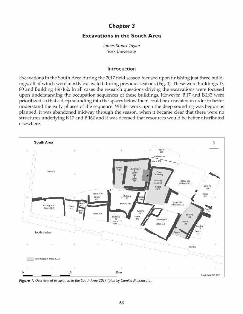
63
Chapter 3
Excavations in the South Area
James Stuart TaylorYork University
Introduction
Excavations in the South Area during the 2017 field season focused upon finishing just three build-ings, all of which were mostly excavated during previous seasons (Fig. 1). These were Buildings 17, 80 and Building 161/162. In all cases the research questions driving the excavations were focused upon understanding the occupation sequences of these buildings. However, B.17 and B.162 were prioritized so that a deep sounding into the spaces below them could be excavated in order to better understand the early phases of the sequence. Whilst work upon the deep sounding was begun as planned, it was abandoned midway through the season, when it became clear that there were no structures underlying B.17 and B.162 and it was deemed that resources would be better distributed elsewhere.
!
!
!
!
!
!
!
!
!
!
!
!
!
!
!
!
!
!
!
!
!
!
!
!
!
!
!
!
!
!
!
!
!!
!!
!
!
!
!
!!
!
!!
!
!
!
!
!
!
!!
!
!
!!
!
!
!
!
!
!
!
! !!
!
!
!
!
!
!
!
!
!
!
!
!
!
!
!
!
!
!
!
!
!
!
!
!
!
!
!
!
!
!
!
!!
!
!
!
!
!
!
!
!
!
!
!
!
!
!
!
!
!
!
!
!
!
!
!
!
!
!
!
!
!
!
!
!
!
!
!
!!
!
!
!
!
!
!
!
!
!
!
!
!
!
!
!
!
!
!
!
!
!
!
!
!
!
!
!
!
!
!
!
!
!
!
!
!
!
!
!
!
!
!
!
!
!
!
!
!
!
!
!
!
!
!
!
!
!
!
!
!
!
!
!
!
!
!
!
!
!
!
!
!
!
!
!
!
!!
!!
!!
!!
!!
!
!!
!
!
!
!
!
!
!
!
!
!
!
!
!
!
!!
!!
!!
!!
!
!
!
!!
!
!
!
!
!
Building 100Space 382
Building86
Building80
Building79
Building96
Building87
Building97
Space 474
Space471
Space472
Space473
Space374
N
0 10 20 mÇatalhöyük GIS 2017
905/970
935/955
Space 470
Space370
Space 379
Space444
Space135
Space373
Space134
Space375
Space376
South Area
Building161/162
Building 118
South shelter
Space492
Building 130
Building 89
Building 17
Space 565(Mellaart S.32)
Space 561(Mellaart S.31)
Space510
Space 559
Space182
Space628
Excavation area 2017
Space620
Space628
Deepsounding
Figure 1. Overview of excavation in the South Area 2017 (plan by Camilla Mazzucato).
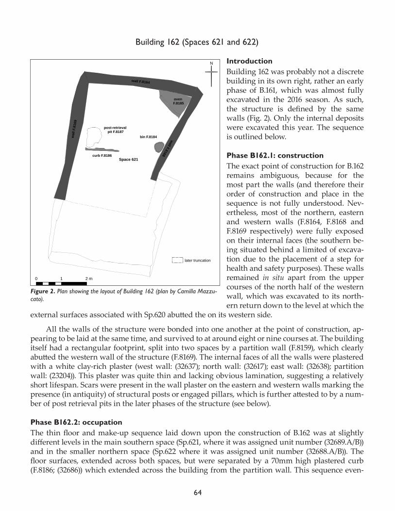
64
Building 162 (Spaces 621 and 622)
IntroductionBuilding 162 was probably not a discrete building in its own right, rather an early phase of B.161, which was almost fully excavated in the 2016 season. As such, the structure is defined by the same walls (Fig. 2). Only the internal deposits were excavated this year. The sequence is outlined below.
Phase B162.1: constructionThe exact point of construction for B.162 remains ambiguous, because for the most part the walls (and therefore their order of construction and place in the sequence is not fully understood. Nev-ertheless, most of the northern, eastern and western walls (F.8164, F.8168 and F.8169 respectively) were fully exposed on their internal faces (the southern be-ing situated behind a limited of excava-tion due to the placement of a step for health and safety purposes). These walls remained in situ apart from the upper courses of the north half of the western wall, which was excavated to its north-ern return down to the level at which the
external surfaces associated with Sp.620 abutted the on its western side.
All the walls of the structure were bonded into one another at the point of construction, ap-pearing to be laid at the same time, and survived to at around eight or nine courses at. The building itself had a rectangular footprint, split into two spaces by a partition wall (F.8159), which clearly abutted the western wall of the structure (F.8169). The internal faces of all the walls were plastered with a white clay-rich plaster (west wall: (32637); north wall: (32617); east wall: (32638); partition wall: (23204)). This plaster was quite thin and lacking obvious lamination, suggesting a relatively short lifespan. Scars were present in the wall plaster on the eastern and western walls marking the presence (in antiquity) of structural posts or engaged pillars, which is further attested to by a num-ber of post retrieval pits in the later phases of the structure (see below).
Phase B162.2: occupationThe thin floor and make-up sequence laid down upon the construction of B.162 was at slightly different levels in the main southern space (Sp.621, where it was assigned unit number (32689.A/B)) and in the smaller northern space (Sp.622 where it was assigned unit number (32688.A/B)). The floor surfaces, extended across both spaces, but were separated by a 70mm high plastered curb (F.8186; (32686)) which extended across the building from the partition wall. This sequence even-
!
!
!
!
!
!
!
!
!
!
!
!
!
!
!
!
!
!
!
!
!
!
!
!
N
Space 621
0 1 2 m
wall F.8164
wall F.8168
wal
l F.8
169
curb F.8186
oven F.8185
later truncation
post-retrieval pit F.8187
bin F.8184
Figure 2. Plan showing the layout of Building 162 (plan by Camilla Mazzu-cato).
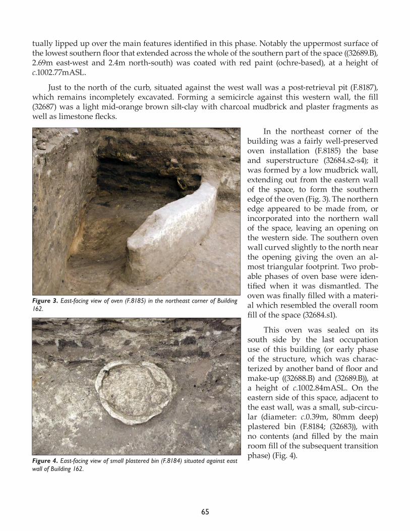
65
tually lipped up over the main features identified in this phase. Notably the uppermost surface of the lowest southern floor that extended across the whole of the southern part of the space ((32689.B), 2.69m east-west and 2.4m north-south) was coated with red paint (ochre-based), at a height of c.1002.77mASL.
Just to the north of the curb, situated against the west wall was a post-retrieval pit (F.8187), which remains incompletely excavated. Forming a semicircle against this western wall, the fill (32687) was a light mid-orange brown silt-clay with charcoal mudbrick and plaster fragments as well as limestone flecks.
In the northeast corner of the building was a fairly well-preserved oven installation (F.8185) the base and superstructure (32684.s2-s4); it was formed by a low mudbrick wall, extending out from the eastern wall of the space, to form the southern edge of the oven (Fig. 3). The northern edge appeared to be made from, or incorporated into the northern wall of the space, leaving an opening on the western side. The southern oven wall curved slightly to the north near the opening giving the oven an al-most triangular footprint. Two prob-able phases of oven base were iden-tified when it was dismantled. The oven was finally filled with a materi-al which resembled the overall room fill of the space (32684.s1).
This oven was sealed on its south side by the last occupation use of this building (or early phase of the structure, which was charac-terized by another band of floor and make-up ((32688.B) and (32689.B)), at a height of c.1002.84mASL. On the eastern side of this space, adjacent to the east wall, was a small, sub-circu-lar (diameter: c.0.39m, 80mm deep) plastered bin (F.8184; (32683)), with no contents (and filled by the main room fill of the subsequent transition phase) (Fig. 4).
Figure 3. East-facing view of oven (F.8185) in the northeast corner of Building 162.
Figure 4. East-facing view of small plastered bin (F.8184) situated against east wall of Building 162.
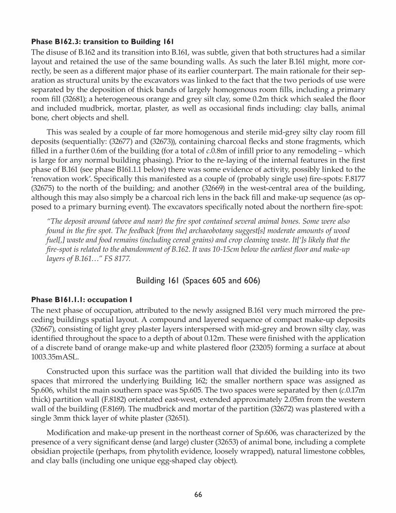
66
Phase B162.3: transition to Building 161The disuse of B.162 and its transition into B.161, was subtle, given that both structures had a similar layout and retained the use of the same bounding walls. As such the later B.161 might, more cor-rectly, be seen as a different major phase of its earlier counterpart. The main rationale for their sep-aration as structural units by the excavators was linked to the fact that the two periods of use were separated by the deposition of thick bands of largely homogenous room fills, including a primary room fill (32681); a heterogeneous orange and grey silt clay, some 0.2m thick which sealed the floor and included mudbrick, mortar, plaster, as well as occasional finds including: clay balls, animal bone, chert objects and shell.
This was sealed by a couple of far more homogenous and sterile mid-grey silty clay room fill deposits (sequentially: (32677) and (32673)), containing charcoal flecks and stone fragments, which filled in a further 0.6m of the building (for a total of c.0.8m of infill prior to any remodeling – which is large for any normal building phasing). Prior to the re-laying of the internal features in the first phase of B.161 (see phase B161.1.1 below) there was some evidence of activity, possibly linked to the ‘renovation work’. Specifically this manifested as a couple of (probably single use) fire-spots: F.8177 (32675) to the north of the building; and another (32669) in the west-central area of the building, although this may also simply be a charcoal rich lens in the back fill and make-up sequence (as op-posed to a primary burning event). The excavators specifically noted about the northern fire-spot:
“The deposit around (above and near) the fire spot contained several animal bones. Some were also found in the fire spot. The feedback [from the] archaeobotany suggest[s] moderate amounts of wood fuel[,] waste and food remains (including cereal grains) and crop cleaning waste. It[‘]s likely that the fire-spot is related to the abandonment of B.162. It was 10-15cm below the earliest floor and make-up layers of B.161…” FS 8177.
Building 161 (Spaces 605 and 606)
Phase B161.1.1: occupation IThe next phase of occupation, attributed to the newly assigned B.161 very much mirrored the pre-ceding buildings spatial layout. A compound and layered sequence of compact make-up deposits (32667), consisting of light grey plaster layers interspersed with mid-grey and brown silty clay, was identified throughout the space to a depth of about 0.12m. These were finished with the application of a discrete band of orange make-up and white plastered floor (23205) forming a surface at about 1003.35mASL.
Constructed upon this surface was the partition wall that divided the building into its two spaces that mirrored the underlying Building 162; the smaller northern space was assigned as Sp.606, whilst the main southern space was Sp.605. The two spaces were separated by then (c.0.17m thick) partition wall (F.8182) orientated east-west, extended approximately 2.05m from the western wall of the building (F.8169). The mudbrick and mortar of the partition (32672) was plastered with a single 3mm thick layer of white plaster (32651).
Modification and make-up present in the northeast corner of Sp.606, was characterized by the presence of a very significant dense (and large) cluster (32653) of animal bone, including a complete obsidian projectile (perhaps, from phytolith evidence, loosely wrapped), natural limestone cobbles, and clay balls (including one unique egg-shaped clay object).
67
This was sealed by a very compact orange brown (perhaps baked?) ash-rich make-up, (32654), was clearly associated with the subsequent construction of a large well preserved oven (F.8160), which superseded it, after the deposition of a subsequent ‘make-up’ (32654). This deposit marked the foundation level of the oven at c.1003.48mASL. The oven itself was (like its counterpart in B.162 below) once again unusual because of its situation in the northeast corner of the building, and the good preservation of its superstructure ((32632)/(32643)). Of its construction the excavators noted:
“The oven was quite big and very well preserved. Seems that first they buil[t] a foundation struc-ture, made with brown and light brown bricks. This foundation had the dimension of the oven and we think that the line of bricks that there are still in situ, are part of this foundation…
The oven was composed by a light orange dome around 0.15cm thick which was preserved at least 0.45cm. We only documented one floor/base for this feature (32631) but at least two different plas-tering phases of the dome.” FS 8160.
It is likely that the oven was associated with a further small hearth, identified in this early occupation phase, in the northeast corner of the Sp.606 (F.8160). Being constructed at a broadly con-temporary stratigraphic horizon to the oven this hearth had multiple phases of use, the earliest be-ing represented by dark brown 30mm thick make-up with an orange brown rim (32649); this discol-oration probably being a result of scorching. This rim itself was oval in shape around 0.12cm (with a diameter ranging from 0.60-0.88m thick) and was clearly build abutting the oven’s superstructure.
Elsewhere in the building at this phase, were a number of small pits, including a small oval pit (F.8175; cut: (32670)), which yielded a cluster of artifacts, predominantly clay balls and burned ground stone fragments (32688), and a second small pit (F.8173), both of which might be interpreted as foundational ‘placed’ deposits, or perhaps a discrete ‘cooking assemblage’. Also present was a post-retrieval pit situated again the western wall (F.8174; cut: 32658, fill: 32657), although it seems likely that this belongs to a higher phase.
A single adult burial was identified in this phase (F.8176), the burial cut (32676) being truncated on its northern edge by later burial activity. This truncation affected the preservation of the skele-ton itself Sk (32674) and it was noted by the excavators that: “the cranium [was] not preserved[,] as well as the vertebral column, the thorax, and the scapular zone.” FS 8176. The excavators also noted that “[t]he global position of the skeleton indicate[d] that the individual was wrapped by an organic envelope. The patterns of the phytoliths were criss-crossing” FS 8176.
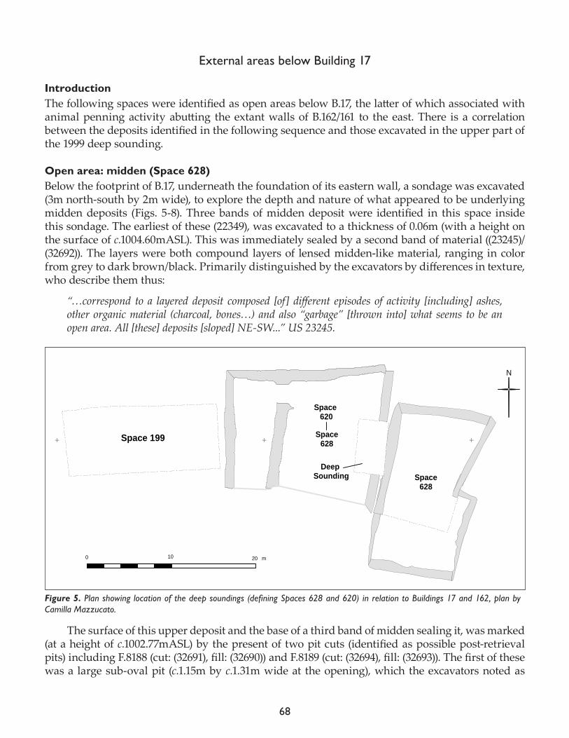
68
External areas below Building 17
IntroductionThe following spaces were identified as open areas below B.17, the latter of which associated with animal penning activity abutting the extant walls of B.162/161 to the east. There is a correlation between the deposits identified in the following sequence and those excavated in the upper part of the 1999 deep sounding.
Open area: midden (Space 628)Below the footprint of B.17, underneath the foundation of its eastern wall, a sondage was excavated (3m north-south by 2m wide), to explore the depth and nature of what appeared to be underlying midden deposits (Figs. 5-8). Three bands of midden deposit were identified in this space inside this sondage. The earliest of these (22349), was excavated to a thickness of 0.06m (with a height on the surface of c.1004.60mASL). This was immediately sealed by a second band of material ((23245)/(32692)). The layers were both compound layers of lensed midden-like material, ranging in color from grey to dark brown/black. Primarily distinguished by the excavators by differences in texture, who describe them thus:
“…correspond to a layered deposit composed [of] different episodes of activity [including] ashes, other organic material (charcoal, bones…) and also “garbage” [thrown into] what seems to be an open area. All [these] deposits [sloped] NE-SW...” US 23245.
The surface of this upper deposit and the base of a third band of midden sealing it, was marked (at a height of c.1002.77mASL) by the present of two pit cuts (identified as possible post-retrieval pits) including F.8188 (cut: (32691), fill: (32690)) and F.8189 (cut: (32694), fill: (32693)). The first of these was a large sub-oval pit (c.1.15m by c.1.31m wide at the opening), which the excavators noted as
!
!
!
!!
!! ! ! !
!!
!!
!!
!
!!
!!
!!
!!
!!
!!
!!
!!
!!
!!
!!
!
!
!
!
!
!
!
!
!
!
!
!
!
!
!
!
!
!
!
!
!
!
!
Ñ Ñ Ñ
N
Space 199
m0 10 20
!
!
!
!
!
!
!
!
!
!
!
Space 620
Space628
Space628
Deep Sounding
Figure 5. Plan showing location of the deep soundings (defining Spaces 628 and 620) in relation to Buildings 17 and 162, plan by Camilla Mazzucato.
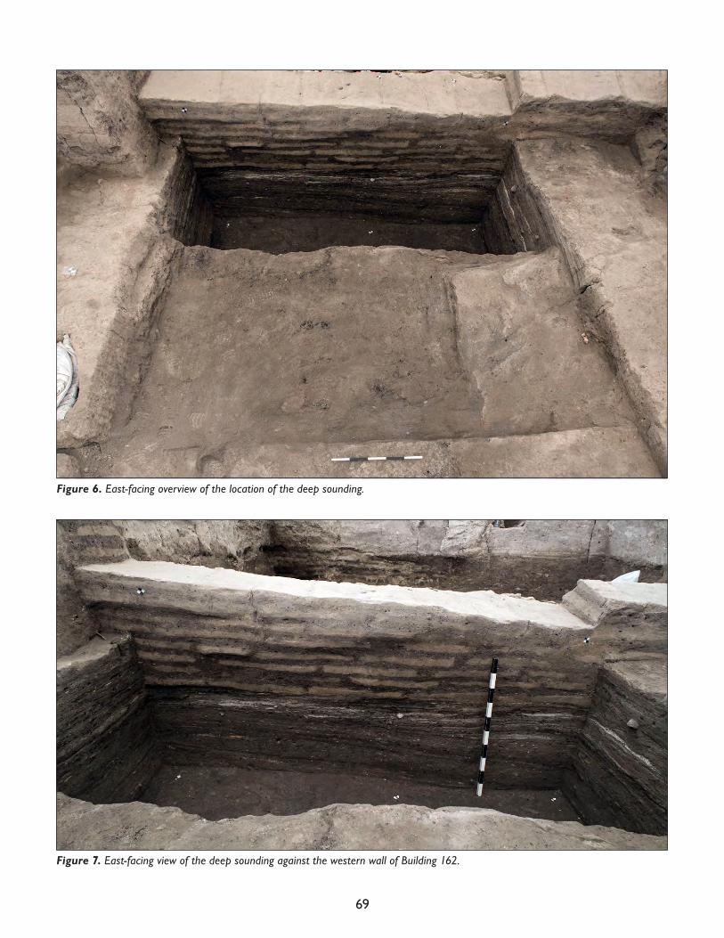
69
Figure 6. East-facing overview of the location of the deep sounding.
Figure 7. East-facing view of the deep sounding against the western wall of Building 162.
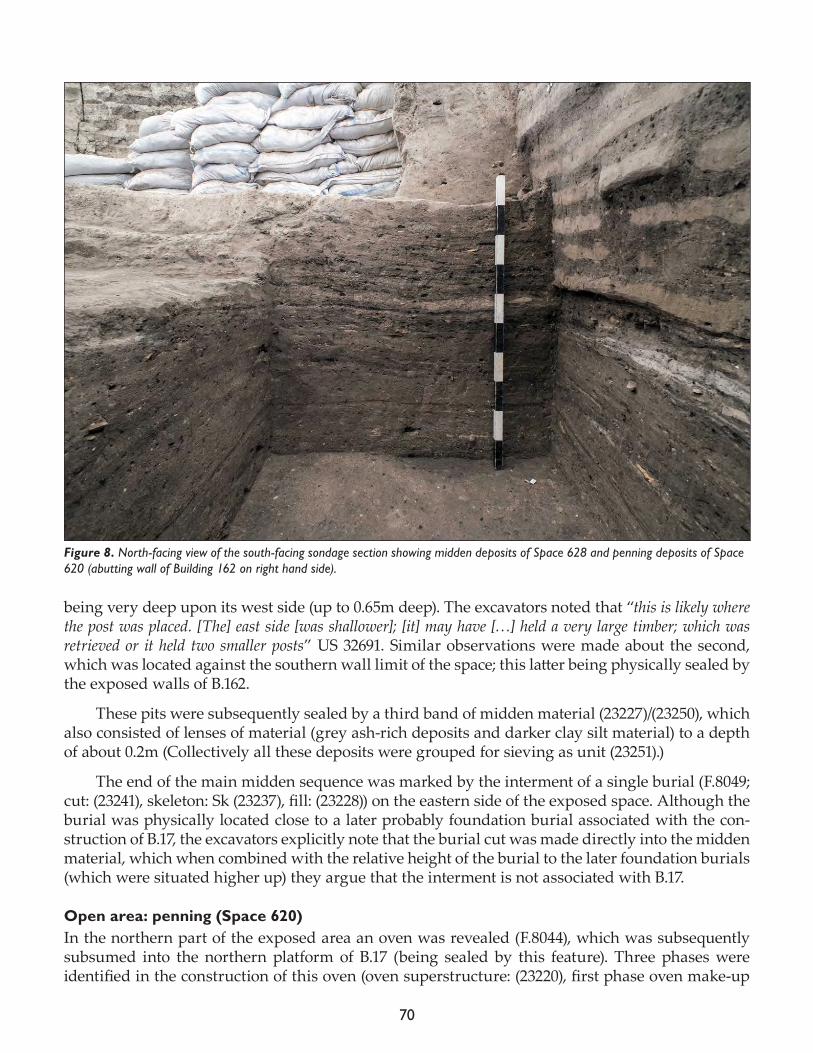
70
being very deep upon its west side (up to 0.65m deep). The excavators noted that “this is likely where the post was placed. [The] east side [was shallower]; [it] may have […] held a very large timber; which was retrieved or it held two smaller posts” US 32691. Similar observations were made about the second, which was located against the southern wall limit of the space; this latter being physically sealed by the exposed walls of B.162.
These pits were subsequently sealed by a third band of midden material (23227)/(23250), which also consisted of lenses of material (grey ash-rich deposits and darker clay silt material) to a depth of about 0.2m (Collectively all these deposits were grouped for sieving as unit (23251).)
The end of the main midden sequence was marked by the interment of a single burial (F.8049; cut: (23241), skeleton: Sk (23237), fill: (23228)) on the eastern side of the exposed space. Although the burial was physically located close to a later probably foundation burial associated with the con-struction of B.17, the excavators explicitly note that the burial cut was made directly into the midden material, which when combined with the relative height of the burial to the later foundation burials (which were situated higher up) they argue that the interment is not associated with B.17.
Open area: penning (Space 620)In the northern part of the exposed area an oven was revealed (F.8044), which was subsequently subsumed into the northern platform of B.17 (being sealed by this feature). Three phases were identified in the construction of this oven (oven superstructure: (23220), first phase oven make-up
Figure 8. North-facing view of the south-facing sondage section showing midden deposits of Space 628 and penning deposits of Space 620 (abutting wall of Building 162 on right hand side).
71
and floor: (23216), second phase oven make-up and floor: (23215), third phase oven make-up and floor: 23212). The oven was deemed to predate the construction of B.17, being associated with the uppermost midden deposits and subsequent ‘penning activity’ (which marked the start of Sp.620 – see below). The visible extents of this feature were: c.0.4m wide by c.1.3m long (up to 0.2m deep) .Although the excavators noted: “The oven [was] very truncated from different features, mostly burials, from B.17, […] that made […] the documentation of this fire installation [more difficult].” FS 8044.
At the same stratigraphic level as this and abutting the western wall of Sp.162 was a series of deposits which were identified as penning surfaces, or rough floor (23203). This deposit were best preserved under the foundations of the walls of B.17, which immediately sealed it. The excavators describe:
“...a floor which surface [that was] orange on the top. [It] seems that this different coloration is not related with any kind of pigment. We exposed this floor directly below the foundation of the eastern wall of B.17 (32680) but we also documented other remains of the same floor (23214) in the SW cor-ner of the building. Both extended below the walls of B.17 and seems that are in phase with the oven F8044, so we think that they are related with an open area Sp.620 [up]on which they buil[t] B.17... Regarding with the remnants documented below the eastern wall of B.17 the orange coloration was only preserved in the northern part, and was very thin […]. The rest of the floor, even that was quite easy to follow had less presence of this orange surface and was more thick and layered in the south, with quite a lot visible remains of phytoliths. The color changed a bit, [being] a mix between very light brown and white[…]” US 23203.
The uppermost deposit in this penning deposit sequence (which effectively completed the en-tire midden sequence as it was exposed) was marked by a lighter, pinkish layer (c.0.12m thick) that contained orange or pinkish-white ‘stains’ at the basal level (23214). This was interpreted as “a thin layer of phytoliths and coprolites of which the preservation was extraordinarily good” US 23214. Regarding its preservation the excavators note in more detail:
“Within the top 2-4cm of thickness of this layer, many, extremely thin and laminated layers of the same material could be observed. (23214) was distinct because of its color (red-pink, orange and white) and also because of its superficial texture: it appeared shiny. (23214) seems to have been preserved better under large plastered features, such as Oven F.8038 and Platform F.21898. In con-sistency, (23214) hardly differs from midden (23227); in fact, (23214), seems to be the very top, i.e. the surface of midden (23227), which must have been under immediate pressure from large features such as those mentioned above. They, in turn, must have flattened its surface (at places of contact) and contributed to its preservation. It was noticed that small areas of shiny and white lences, were also found within (23227).” US 23214.
Despite a break in the stratigraphic sequence across the western side room of B.17 (which re-mains unexcavated) it seems likely that these deposits might be associated with the penning de-posits discovered in Sp.199 during the excavation of the 1999 deep sounding. It is interesting to note that the uppermost penning deposit below B.17 (23214) had a height on the surface ranging between 100.2.53-1002.68mASL, which can be compared with the height on those deposits in the 1999 deep sounding, identified as ‘accumulation/stabling’, ranging between 1002.45-1002.95mASL, physically placing them at a comparable level in the sequence.
These features were sealed on their western side by the foundation deposits and make-up for the floors of B.17, and abutted the western side of B.162’s western wall, suggesting that B.161 was extant whilst the penning area lay open (see Fig. 8).
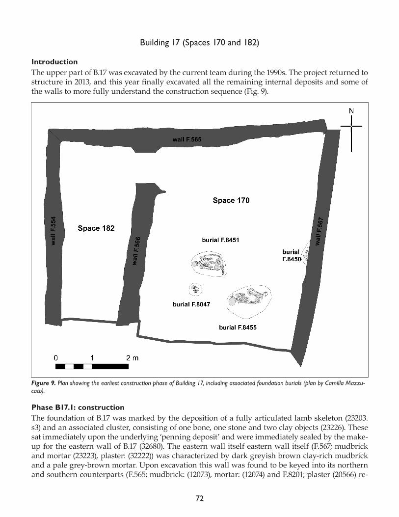
72
Building 17 (Spaces 170 and 182)
IntroductionThe upper part of B.17 was excavated by the current team during the 1990s. The project returned to structure in 2013, and this year finally excavated all the remaining internal deposits and some of the walls to more fully understand the construction sequence (Fig. 9).
Phase B17.1: constructionThe foundation of B.17 was marked by the deposition of a fully articulated lamb skeleton (23203.s3) and an associated cluster, consisting of one bone, one stone and two clay objects (23226). These sat immediately upon the underlying ‘penning deposit’ and were immediately sealed by the make-up for the eastern wall of B.17 (32680). The eastern wall itself eastern wall itself (F.567; mudbrick and mortar (23223), plaster: (32222)) was characterized by dark greyish brown clay-rich mudbrick and a pale grey-brown mortar. Upon excavation this wall was found to be keyed into its northern and southern counterparts (F.565; mudbrick: (12073), mortar: (12074) and F.8201; plaster (20566) re-
Figure 9. Plan showing the earliest construction phase of Building 17, including associated foundation burials (plan by Camilla Mazzu-cato).
73
spectively) which remain unexcavated along with the western wall (F.554; mudbrick: (5206)/(5207), mortar: (5205), plaster: (5208)) and the internal partition wall (F.8047; plaster (17348)).
Internally the walls were initially sealed by a packing/make-up layer (21898), in the southwest corner of Sp.170 (which appeared to represent the preliminary layout of the platform in this corner of the space. Also at this level four burials were identified, which could represent foundational activity. F.8047 (cut: (23230), skeleton: (23234), fill: (23229)) was a baby and basket burial. The exca-vators noted that the basket “seems to have been an elongated type of basket with a lid on top. The lid and the upper part of the basket would have extended above the opening of the small pit where it was placed, and therefore above the surface of the midden ((23203) / (23214)).” FS 8047.
They went on to observe that: “The upper part of the basket along with the lid, had collapsed within the pit; it was folded towards the interior of the basket, and was found under the fill, covered with a sticky, clayish homogenous fill. Top of basket and lid along with baby bones were in the middle of the basket, in the center of this small pit-feature. Although unrelated to the other burials below, this burial may also have been part of a tradition necessitating human burials within the midden or foundation burials prior to the construc-tion of a new house.” FS 8047.
Of the other burials F.8451 (cut: (23427), skeleton: Sk (23236), fill: (23233)) and F.8455 (cut: (23256), skeleton: (23246), fill: (23255)) were both flexed adults, situated at the same stratigraphic level. The last interment F.8450 (cut: (23242), skeleton: (23238), fill: (23235)) contained a flexed juvenile skeleton, and was sealed by the western wall of the building and by the subsequent floor, lending credence to the argument that these were foundation burials. This burial truncated the earlier burial situated in the midden deposits below in Sp.628 (F.8049). However, it was physically situated much higher than the former, and thus was deemed a different (foundational) stratigraphic event.
Phase B17.2.1: occupation IAll the excavations of B.17’s earliest phases focus upon the main eastern space (Sp.170) (Fig. 10). Sometime during the early occupation of this building (because it was subsequently sealed by wall plaster) a niche cut in the southern wall (F.8043; cut (23257)), c.0.82m long by c.0.66m deep and 0.3m high, the irregular cut formed a square opening in the northern face of the wall.
A discrete make-up and floor (21895) sealed the earlier Phase B17.1 foundation burials to a height of between 1002.74-1002.92mASL. This represented the surface upon which all the remaining plat-forms were set out, including: northern platform (F.8041; mudbrick: (23206), packing: (21897)) and western platform (F.8040; make-up and surface: (21896). Stratigraphically, these were subsequently sealed by the northeast platform (F.8457; platform superstructure: (23207)) (Fig. 11). Stratigraphically the relationship between these platforms and the complex activities identified in the south/south-western parts of the space were hard to establish due in part to the large amount of truncation by burial activity in the center of the space, and due to poor levels of preservation due to long term exposure of the building.
What is clear is that the northeastern platform was sealed, or abutted, by an oven to the east of the space (F.8038). The surviving extents of the oven were c.1.2m long by c.1m wide (only surviving to a height of 50mm). Despite the deflation of its superstructure (mainly by heavy truncation in antiquity) four phases of activity were identified in the use-life of this oven (the first phase oven superstructure make-up and floor: (21899); a second phase oven make-up and floor: (21894); a third phase oven make-up and floor: (21893); and finally a fourth phase oven make-up and floor: (21874); associated rake out: (23201)).
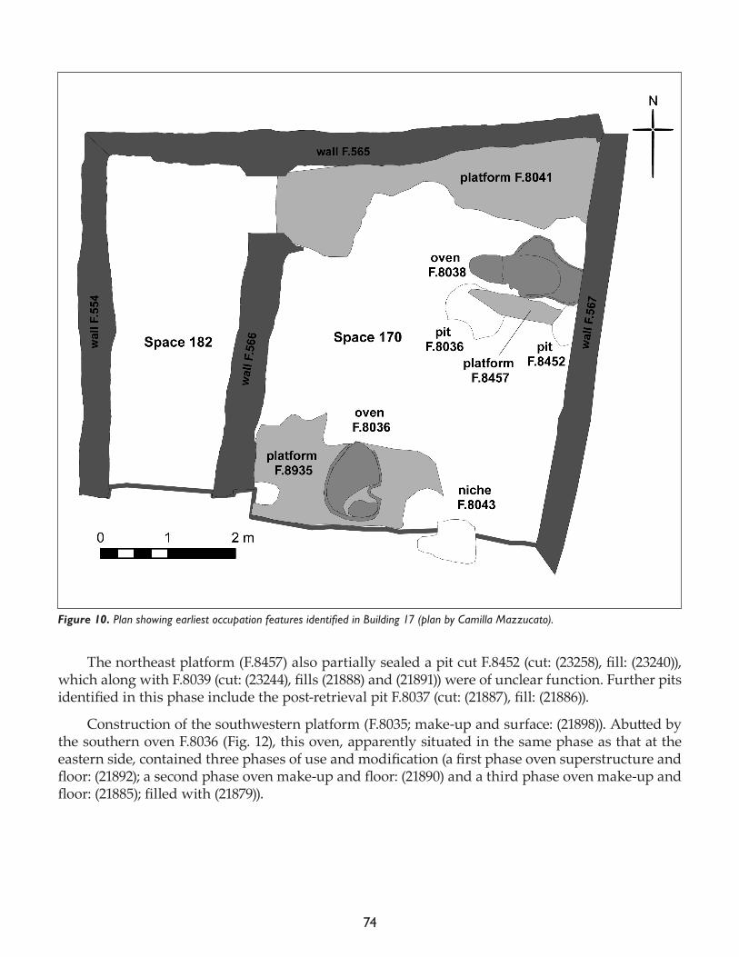
74
The northeast platform (F.8457) also partially sealed a pit cut F.8452 (cut: (23258), fill: (23240)), which along with F.8039 (cut: (23244), fills (21888) and (21891)) were of unclear function. Further pits identified in this phase include the post-retrieval pit F.8037 (cut: (21887), fill: (21886)).
Construction of the southwestern platform (F.8035; make-up and surface: (21898)). Abutted by the southern oven F.8036 (Fig. 12), this oven, apparently situated in the same phase as that at the eastern side, contained three phases of use and modification (a first phase oven superstructure and floor: (21892); a second phase oven make-up and floor: (21890) and a third phase oven make-up and floor: (21885); filled with (21879)).
Figure 10. Plan showing earliest occupation features identified in Building 17 (plan by Camilla Mazzucato).
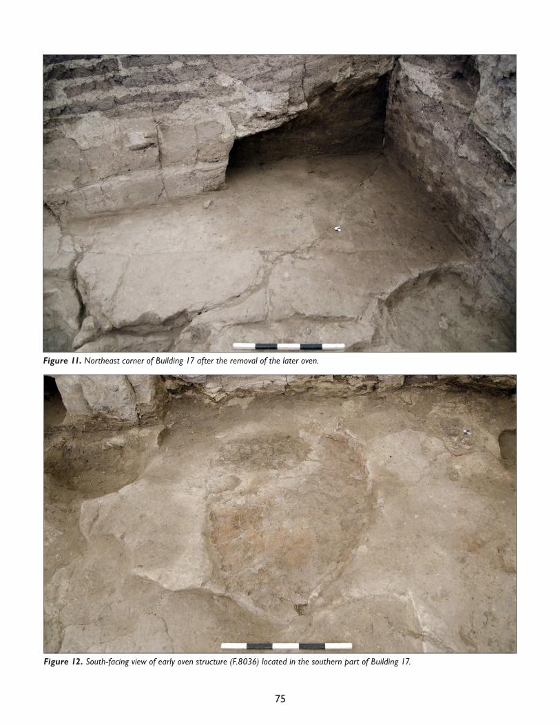
75
Figure 11. Northeast corner of Building 17 after the removal of the later oven.
Figure 12. South-facing view of early oven structure (F.8036) located in the southern part of Building 17.
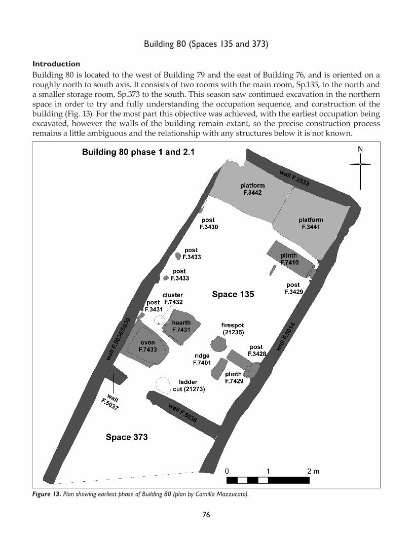
76
Building 80 (Spaces 135 and 373)
IntroductionBuilding 80 is located to the west of Building 79 and the east of Building 76, and is oriented on a roughly north to south axis. It consists of two rooms with the main room, Sp.135, to the north and a smaller storage room, Sp.373 to the south. This season saw continued excavation in the northern space in order to try and fully understanding the occupation sequence, and construction of the building (Fig. 13). For the most part this objective was achieved, with the earliest occupation being excavated, however the walls of the building remain extant, so the precise construction process remains a little ambiguous and the relationship with any structures below it is not known.
Figure 13. Plan showing earliest phase of Building 80 (plan by Camilla Mazzucato).
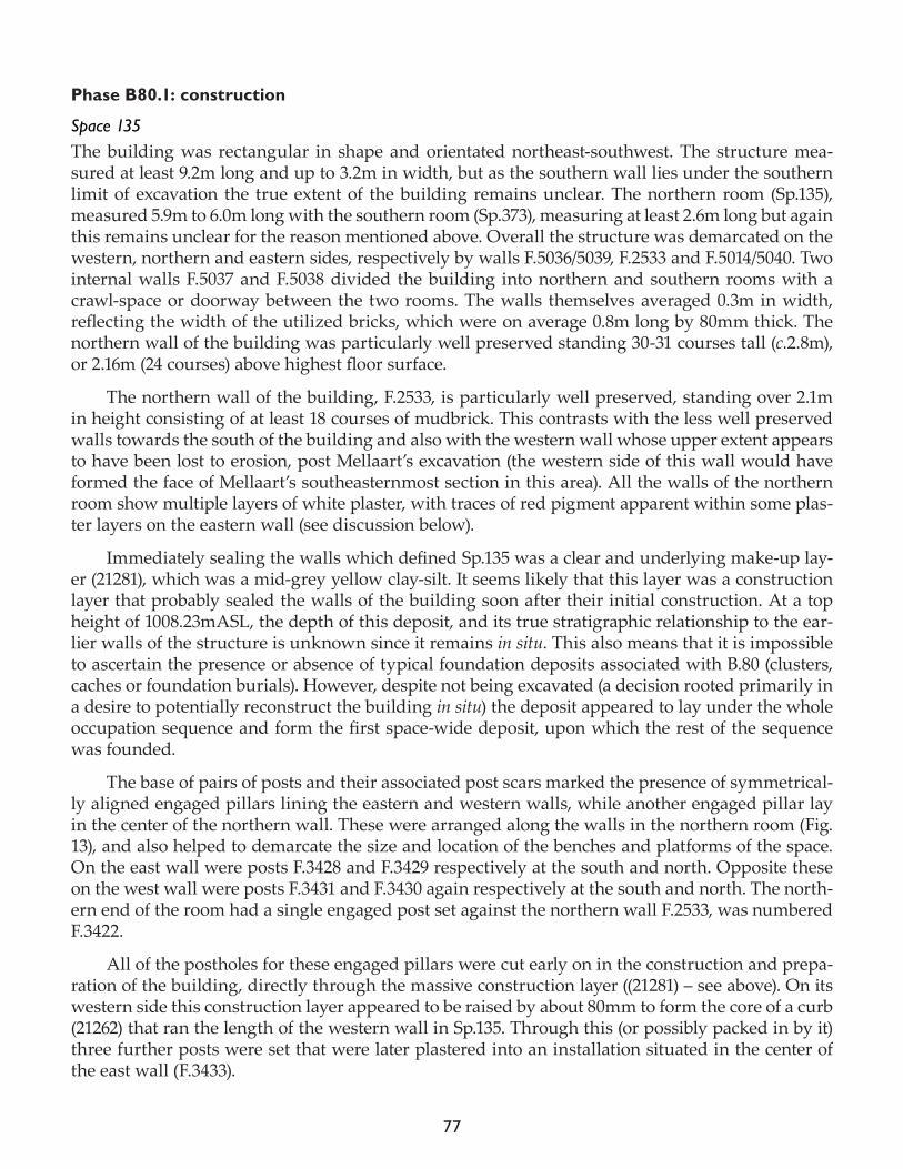
77
Phase B80.1: construction
Space 135The building was rectangular in shape and orientated northeast-southwest. The structure mea-sured at least 9.2m long and up to 3.2m in width, but as the southern wall lies under the southern limit of excavation the true extent of the building remains unclear. The northern room (Sp.135), measured 5.9m to 6.0m long with the southern room (Sp.373), measuring at least 2.6m long but again this remains unclear for the reason mentioned above. Overall the structure was demarcated on the western, northern and eastern sides, respectively by walls F.5036/5039, F.2533 and F.5014/5040. Two internal walls F.5037 and F.5038 divided the building into northern and southern rooms with a crawl-space or doorway between the two rooms. The walls themselves averaged 0.3m in width, reflecting the width of the utilized bricks, which were on average 0.8m long by 80mm thick. The northern wall of the building was particularly well preserved standing 30-31 courses tall (c.2.8m), or 2.16m (24 courses) above highest floor surface.
The northern wall of the building, F.2533, is particularly well preserved, standing over 2.1m in height consisting of at least 18 courses of mudbrick. This contrasts with the less well preserved walls towards the south of the building and also with the western wall whose upper extent appears to have been lost to erosion, post Mellaart’s excavation (the western side of this wall would have formed the face of Mellaart’s southeasternmost section in this area). All the walls of the northern room show multiple layers of white plaster, with traces of red pigment apparent within some plas-ter layers on the eastern wall (see discussion below).
Immediately sealing the walls which defined Sp.135 was a clear and underlying make-up lay-er (21281), which was a mid-grey yellow clay-silt. It seems likely that this layer was a construction layer that probably sealed the walls of the building soon after their initial construction. At a top height of 1008.23mASL, the depth of this deposit, and its true stratigraphic relationship to the ear-lier walls of the structure is unknown since it remains in situ. This also means that it is impossible to ascertain the presence or absence of typical foundation deposits associated with B.80 (clusters, caches or foundation burials). However, despite not being excavated (a decision rooted primarily in a desire to potentially reconstruct the building in situ) the deposit appeared to lay under the whole occupation sequence and form the first space-wide deposit, upon which the rest of the sequence was founded.
The base of pairs of posts and their associated post scars marked the presence of symmetrical-ly aligned engaged pillars lining the eastern and western walls, while another engaged pillar lay in the center of the northern wall. These were arranged along the walls in the northern room (Fig. 13), and also helped to demarcate the size and location of the benches and platforms of the space. On the east wall were posts F.3428 and F.3429 respectively at the south and north. Opposite these on the west wall were posts F.3431 and F.3430 again respectively at the south and north. The north-ern end of the room had a single engaged post set against the northern wall F.2533, was numbered F.3422.
All of the postholes for these engaged pillars were cut early on in the construction and prepa-ration of the building, directly through the massive construction layer ((21281) – see above). On its western side this construction layer appeared to be raised by about 80mm to form the core of a curb (21262) that ran the length of the western wall in Sp.135. Through this (or possibly packed in by it) three further posts were set that were later plastered into an installation situated in the center of the east wall (F.3433).
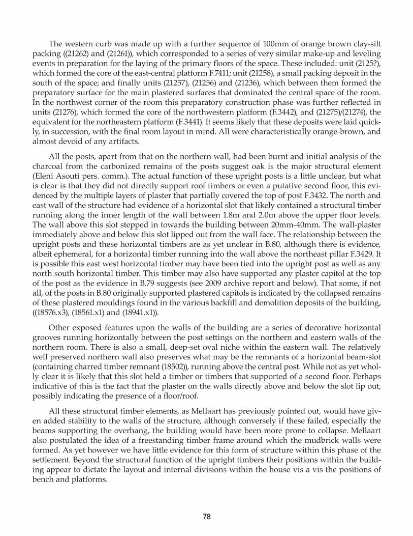
78
The western curb was made up with a further sequence of 100mm of orange brown clay-silt packing ((21262) and (21261)), which corresponded to a series of very similar make-up and leveling events in preparation for the laying of the primary floors of the space. These included: unit (2125?), which formed the core of the east-central platform F.7411; unit (21258), a small packing deposit in the south of the space; and finally units (21257), (21256) and (21236), which between them formed the preparatory surface for the main plastered surfaces that dominated the central space of the room. In the northwest corner of the room this preparatory construction phase was further reflected in units (21276), which formed the core of the northwestern platform (F.3442), and (21275)/(21274), the equivalent for the northeastern platform (F.3441). It seems likely that these deposits were laid quick-ly, in succession, with the final room layout in mind. All were characteristically orange-brown, and almost devoid of any artifacts.
All the posts, apart from that on the northern wall, had been burnt and initial analysis of the charcoal from the carbonized remains of the posts suggest oak is the major structural element (Eleni Asouti pers. comm.). The actual function of these upright posts is a little unclear, but what is clear is that they did not directly support roof timbers or even a putative second floor, this evi-denced by the multiple layers of plaster that partially covered the top of post F.3432. The north and east wall of the structure had evidence of a horizontal slot that likely contained a structural timber running along the inner length of the wall between 1.8m and 2.0m above the upper floor levels. The wall above this slot stepped in towards the building between 20mm-40mm. The wall-plaster immediately above and below this slot lipped out from the wall face. The relationship between the upright posts and these horizontal timbers are as yet unclear in B.80, although there is evidence, albeit ephemeral, for a horizontal timber running into the wall above the northeast pillar F.3429. It is possible this east west horizontal timber may have been tied into the upright post as well as any north south horizontal timber. This timber may also have supported any plaster capitol at the top of the post as the evidence in B.79 suggests (see 2009 archive report and below). That some, if not all, of the posts in B.80 originally supported plastered capitols is indicated by the collapsed remains of these plastered mouldings found in the various backfill and demolition deposits of the building, ((18576.x3), (18561.x1) and (18941.x1)).
Other exposed features upon the walls of the building are a series of decorative horizontal grooves running horizontally between the post settings on the northern and eastern walls of the northern room. There is also a small, deep-set oval niche within the eastern wall. The relatively well preserved northern wall also preserves what may be the remnants of a horizontal beam-slot (containing charred timber remnant (18502)), running above the central post. While not as yet whol-ly clear it is likely that this slot held a timber or timbers that supported of a second floor. Perhaps indicative of this is the fact that the plaster on the walls directly above and below the slot lip out, possibly indicating the presence of a floor/roof.
All these structural timber elements, as Mellaart has previously pointed out, would have giv-en added stability to the walls of the structure, although conversely if these failed, especially the beams supporting the overhang, the building would have been more prone to collapse. Mellaart also postulated the idea of a freestanding timber frame around which the mudbrick walls were formed. As yet however we have little evidence for this form of structure within this phase of the settlement. Beyond the structural function of the upright timbers their positions within the build-ing appear to dictate the layout and internal divisions within the house vis a vis the positions of bench and platforms.
79
The exception to this is perhaps seen with the three plastered posts (F.3433) seen on the cen-tral west wall, which did not appear to be physically related to any divisions we can see across the floor area. A similar installation of three plastered posts on the west wall was evidenced in B.79, while evidence of burnt posts against the west wall of B.76 may have been the remains of a similar feature. In B.76 it was postulated that these may have had a primarily decorative function although the presence of horizontal timber slots in the west wall of B.79 above that installation suggests a de-gree of structural integrity. In B.80 a decorative function is suggested by the presence of a collapsed burnt cattle horn core and a similarly collapsed plaster moulding containing a sheep/goat horns (18576.x1) and (18576.x2). The plaster moulding containing the sheep/goat horn had evidence of two wooden pegs that likely attached it to one of the upright posts in the installation.
All of the internal wall faces of Sp.135 were eventually plastered with multiple coatings of white plaster, to a total thickness of approximately 20mm. The northern and eastern walls of the room were divided into panels lying either sides of the engaged posts by horizontal groove-rails, these likely cut into the walls prior to being plastered. On the northern wall the groove-rail to the west of post F.3432 is lower than that to the east, perhaps suggesting that the panel divisions are related to the heights of the respective platform floors they lie above. Three sets of groove-rails were present on the eastern wall, these again situated between the engaged posts where any height difference between the groove-rails are less apparent. The wall above the central east platform is further sub-divided by a lower moulding or lip that runs between posts F.3428 and F.3429. The eastern wall also held a niche F.3434 lying south of center the central section of the eastern wall below the rail. Two small plastered holes in the wall (up to 30-50mm diameter) were also noted in the wall, these per-haps holding a small post or peg. A second niche F.3443 was also present within the western wall this accessible at floor level. While there was no decoration on the upper plaster surfaces, there was evidence of red pigment on earlier plastered surfaces (where the latest plaster surfaces had flaked off). Any decoration appeared to be confined to the eastern wall, with evidence of pigment within the horizontal rails, around the engaged posts, around the within the lower central panel.
Installation post structure F.3433Further work was also carried out and the post structure F.3433, situated against the eastern wall of Sp.135, and also partially excavated in 2010. The post-hole itself (19198) was shaped to accommo-date three posts, which were subsequently plastered over. Two of the burnt posts were recorded this season, (18960) and (18961), and set into cut (19198). These were subsequently filled with a loose mid-grey brown slay silt (19194/18965), associated with cluster of obsidian and small pebbles found in the upper part of the fill which sealed the carbonized post (18965). These, in the words of the excavator, were described as being “distributed throughout the deposit… [apparently] …a group of objects left over on the remains of the post then trickling down the sides and back of the post as it degrade[d]” (18965). This observation is consistent with the finding of clusters or ‘placed deposits’ in the niches elsewhere in the building and in the voids associated with the burnt out posts of the structure (ap-parently at the end of its use-life).
These were sealed with further post-hole fills: loose orange and grey white with brick debris (18950) and light grey clay silt (19197), before being finally sealed by the plaster (19199) on the curb that lipped up along the base of the western wall of B.80, F.5036.
80
Phase B80.2.1: occupation I
Space 135As noted above, Sp.135 (the northern room of B.80), containing a variety of typical room furniture platforms, benches, and central floor area, as well as southern dirty floors and pyrotechnic instal-lations. In many ways, the well-preserved features and the layout of this space reflect those of the typical Çatalhöyük house. It may be easier to discuss the stratigraphy of this space by the natural ‘zones’ that these features appeared to delineate.
Northern areaApparently one of the earliest occupation deposits to be laid in Sp.135 was a pale orangey surface (21247) and associated dirty floor (21222) in the southern part of the space. Forming a working space at a height of approximately 1008.22mASL, this deposit covered most of the southern part of the building being c.1.19m long by c.0.90m wide. It formed the first in a long sequence of activity (prob-ably associated with the subsequent hearths and ovens) in the southern part of the space. This ac-tivity was apparently (stratigraphically) contiguous with the formal finishing of the northern part of the room, apparently predating the application of white plaster to the curb on the western side of the room (19199), and on the northern platforms ((21271), (21270) northwest, F.3442; and (21272) northeast F.3441 and (21255) on its associated bench, F.7410). These final plastering events effectively mark the end of the construction process and tie in with the first formal plaster surface in the cen-tral floor space ((19195)/(19186)).
At the same time and defining the southern end of the eastern-central platform (F.7411), an-other bench was constructed (Fig. 14). Unlike the one to the north (diving the eastern-central and north-eastern platform the core of this bench, F.7429 (F.7435), was not moulded from the same or-ange-brown clay as all the other furniture, but rather was constructed with a mudbrick core (21263), set on a 30mm thick plaster preparation surface (21264), before being sealed by a grey-brown clay-silt coating (21231) to even out the shape. It seems unlikely that the bench was used in this state, since there was no application of formal white plaster at this point. Rather the bench appears to have been quickly modified with the addition of a further row of mudbrick (21234) and packing material (21232), which was finally finished with a ‘pisé-like’ moulded pale orange-grey clay (21228), which was in linked to and sealed by the first main white plaster surface (with orange-brown make-up – possibly the same deposit) of the eastern-central bench (19193), also keyed into the primary central floor ((19195) above). At this early point in its development the bench was approximately 0.58m long (east-west) and 0.26 m wide. It is worth noting that both this bench and its counterpart on the north end of the east-central platform (F.7410) were both adjacent to (and extended out from) the engaged posts on the eastern wall (F.3428, south, and F.3429, north), which were subsequently embedded into the bench superstructure with each successive plastering and painting even on the east side of the building.
It is possible that this early finish of the space is associated with the first wall painting event on the northeastern engaged pillar ((21278), upon F.3429). This paint is in turn probably contemporary with the earliest sections of the large painted façade above the east central platform (F.7411), and perhaps that on the southern engaged pillar on that side also (F.3428); although it should be noted that the stratigraphic relationships here are difficult to ascertain for sure (particularly in relation to the associated floor surfaces, due to erosion and scouring of the plaster at the base of the wall). For this reason it should also be noted that no clear relationship can be drawn with any of the later burial sequences, which have a clear relationship with the later platform plasters. If the earliest in-
81
carnations of the paintings are applied this early in the sequence, then it may be that they are not (in this instance, as has often been speculated), explicitly linked to the interment of burials beneath the platform. However, it should be noted that that the timespan between these preparation layers and first occupation of the space, and the subsequent interment of the first inhumation cannot be known, but that they are not far removed from one another stratigraphically (occurring early on the next phase B80.2.2 – see below), so there may still be an intangible association.
Early pyrotechnic installationsAdjacent to the western end of the bench was a fire spot ((21235)/(21272)), which may have been linked to the primary construction of the space (perhaps predating any of the fire installations of the space). At around this point the first hearth and oven in Sp.135 were set out and constructed (F.7426 and F.7433) respectively. The hearth, F.7426 (later F.7402), was situated immediately adjacent to the center of the southern edge of the central floors, and marked the beginning of a long se-quence of incarnations of this feature in this spot. As such it was a typical structured hearth, with a raised plaster rim and flat plaster base (forming a rounded square in plan, approximately 0.6m across, raised from the floor up to 110mm, the base was at a height of c.1008.21mASL). The southern edge of the hearth appear to be reinforced with a prominent plaster ridge that serve two of its in-carnations (as F.7426 and F.7402).
Figure 14. North-facing view of the foundations of the southern bench against the eastern wall (F.7429/F.7435 – mid excavation), illustrating bench modification in plan.
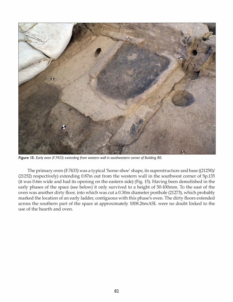
82
The primary oven (F.7433) was a typical ‘horse-shoe’ shape, its superstructure and base ((21250)/(21252) respectively) extending 0.87m out from the western wall in the southwest corner of Sp.135 (it was 0.6m wide and had its opening on the eastern side) (Fig. 15). Having been demolished in the early phases of the space (see below) it only survived to a height of 50-100mm. To the east of the oven was another dirty floor, into which was cut a 0.30m diameter posthole (21273), which probably marked the location of an early ladder, contiguous with this phase’s oven. The dirty floors extended across the southern part of the space at approximately 1008.26mASL were no doubt linked to the use of the hearth and oven.
Figure 15. Early oven (F.7433) extending from western wall in southwestern corner of Building 80.
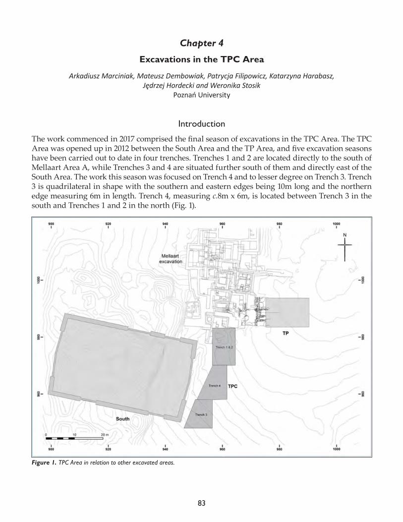
83
Chapter 4
Excavations in the TPC Area
Arkadiusz Marciniak, Mateusz Dembowiak, Patrycja Filipowicz, Katarzyna Harabasz, Jędrzej Hordecki and Weronika Stosik
Poznań University
Introduction
The work commenced in 2017 comprised the final season of excavations in the TPC Area. The TPC Area was opened up in 2012 between the South Area and the TP Area, and five excavation seasons have been carried out to date in four trenches. Trenches 1 and 2 are located directly to the south of Mellaart Area A, while Trenches 3 and 4 are situated further south of them and directly east of the South Area. The work this season was focused on Trench 4 and to lesser degree on Trench 3. Trench 3 is quadrilateral in shape with the southern and eastern edges being 10m long and the northern edge measuring 6m in length. Trench 4, measuring c.8m x 6m, is located between Trench 3 in the south and Trenches 1 and 2 in the north (Fig. 1).
Figure 1. TPC Area in relation to other excavated areas.
84
One of the main goals of work in the TPC Area was to link the stratigraphy of the TP Area, excavated between 2001 and 2008, with the stratigraphic sequence of the South Area. In particular, it aimed at recognizing the relations between the end of the South sequence (B.10, Level South T) and the beginning of the TP sequence (B.81, Level TP M) (for more information see Marciniak et al. 2012, 2015). The work carried out in the first five seasons revealed a sequence of Neolithic build-ings and features. Altogether, the remains of four Neolithic buildings (B.121, B.110, B.115, B.109) in Trenches 1 and 2, two (B.122, Sp.520) in Trench 3 and another two (B.150, B.152) in Trench 4 have been unearthed.
The work in Trench 4 in the 2016 season focused on excavating the Neolithic architecture. In particular, this involved exposure and study of the uppermost occupational levels of large B.150 (Marciniak et al. 2016). The building was luckily almost entirely placed within the limit of the trench but on the other hand, it has been destroyed by numerous post-Neolithic pits, in particularly a large pit (F.7378) placed between its western and northern walls (see Filipowicz et al. 2014). The work carried out in B.150 to date revealed some details of its construction as well as a number of features dated back to the final phase of its occupation (Sp.594). This phase consisted of a solid floor (F.8276) in its central part and a sequence of in-built structures including four platforms against the eastern wall of the building and three platforms in its southern and central area (see also below).
Building 150 is the earliest building in this part of the TPC Area and is one of the largest struc-tures found on the top of the East Mound in both the TP and TPC Areas. It was most likely used for a long time, as indicated by a sequence of floor deposits, platforms and fire installations. Based upon its stratigraphic position and the character of its construction, the building can be dated to Level TP M, which is equivalent to Level III/IV in the Mellaart’s phasing scheme. This level seems to represent the final phase of the classic Çatalhöyük occupation. The building appears to be con-temporary with B.121 in TPC Trench 2 (Marciniak et al. 2013) and with B.122 from Trench 3.
The excavation carried out in the TPC Area in the past five seasons revealed also numerous post-Neolithic activities, including Islamic burial ground, Hellenistic storage part of unspecified settlement as well as remains dated back to the Chalcolithic and Bronze Age periods (see Marciniak et al. 2012),
The excavation this year began on the 11th of June and continued until the 12th of July. It was carried out in Trenches 3 and 4, as well as in the southeast corner of the South Shelter. The latter area was excavated in order to investigate a connection between the structures revealed in Trench 3 and a sequence of buildings excavated in the South Area (see Regan 2013). Trenches 1 and 2 were not excavated in the 2017 season.
Excavations in Trench 4
The aim of the 2017 field season in Trench 4 was to excavate all remaining occupational phases of B.150 and, in particular, to recognize the construction phase of the building. The work carried out this year made it made possible to identify four complex occupational phases of its occupation designated, from the earliest to the latest, as Spaces 639, 637, 612 and 594. As the stratigraphy of the building turned out to be even more complex than envisioned and due time constraints, the building has not been completely excavated and its construction phase not recognized. Therefore, neither the detailed reconstruction of its full occupational history nor the recognition of the layout of the building in its earliest phase were made possible.
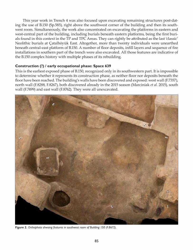
85
This year work in Trench 4 was also focused upon excavating remaining structures post-dat-ing the use of B.150 (Sp.585), right above the southwest corner of the building and then its south-west room. Simultaneously, the work also concentrated on excavating the platforms in eastern and west-central part of the building, including burials beneath eastern platforms, being the first buri-als found in this context in the TP and TPC Areas. They can rightly be attributed as the last ‘classic’ Neolithic burials at Çatalhöyük East. Altogether, more than twenty individuals were unearthed beneath central-east platform of B.150. A number of floor deposits, infill layers and sequence of fire installations in southern part of the trench were also excavated. All those features are indicative of the B.150 complex history with multiple phases of its rebuilding.
Construction (?) / early occupational phase: Space 639This is the earliest exposed phase of B.150, recognized only in its southwestern part. It is impossible to determine whether it represents its construction phase, as neither floor nor deposits beneath the floor have been reached. The building’s walls have been discovered and exposed: west wall (F.7357), north wall (F.8288, F.8267), both discovered already in the 2015 season (Marciniak et al. 2015), south wall (F.7499) and east wall (F.8762). They were all unexcavated.
Figure 2. Orthophoto shwoing features in southwest room of Building 150 (F.8672).
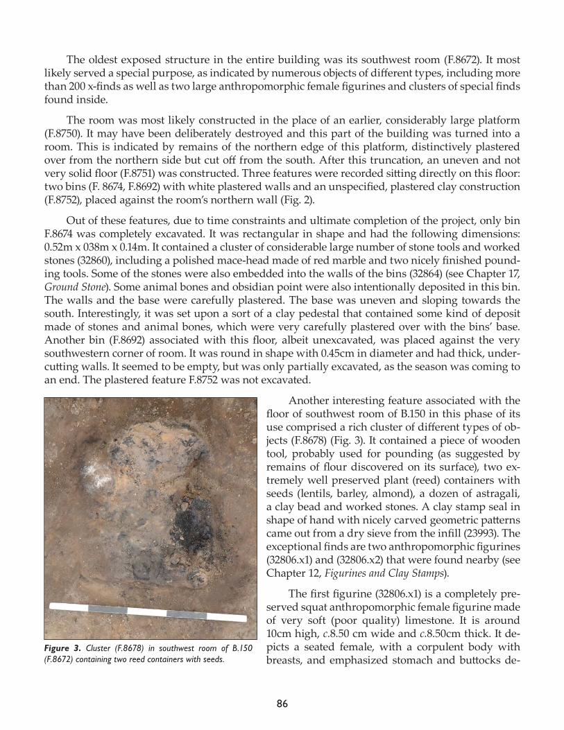
86
The oldest exposed structure in the entire building was its southwest room (F.8672). It most likely served a special purpose, as indicated by numerous objects of different types, including more than 200 x-finds as well as two large anthropomorphic female figurines and clusters of special finds found inside.
The room was most likely constructed in the place of an earlier, considerably large platform (F.8750). It may have been deliberately destroyed and this part of the building was turned into a room. This is indicated by remains of the northern edge of this platform, distinctively plastered over from the northern side but cut off from the south. After this truncation, an uneven and not very solid floor (F.8751) was constructed. Three features were recorded sitting directly on this floor: two bins (F. 8674, F.8692) with white plastered walls and an unspecified, plastered clay construction (F.8752), placed against the room’s northern wall (Fig. 2).
Out of these features, due to time constraints and ultimate completion of the project, only bin F.8674 was completely excavated. It was rectangular in shape and had the following dimensions: 0.52m x 038m x 0.14m. It contained a cluster of considerable large number of stone tools and worked stones (32860), including a polished mace-head made of red marble and two nicely finished pound-ing tools. Some of the stones were also embedded into the walls of the bins (32864) (see Chapter 17, Ground Stone). Some animal bones and obsidian point were also intentionally deposited in this bin. The walls and the base were carefully plastered. The base was uneven and sloping towards the south. Interestingly, it was set upon a sort of a clay pedestal that contained some kind of deposit made of stones and animal bones, which were very carefully plastered over with the bins’ base. Another bin (F.8692) associated with this floor, albeit unexcavated, was placed against the very southwestern corner of room. It was round in shape with 0.45cm in diameter and had thick, under-cutting walls. It seemed to be empty, but was only partially excavated, as the season was coming to an end. The plastered feature F.8752 was not excavated.
Another interesting feature associated with the floor of southwest room of B.150 in this phase of its use comprised a rich cluster of different types of ob-jects (F.8678) (Fig. 3). It contained a piece of wooden tool, probably used for pounding (as suggested by remains of flour discovered on its surface), two ex-tremely well preserved plant (reed) containers with seeds (lentils, barley, almond), a dozen of astragali, a clay bead and worked stones. A clay stamp seal in shape of hand with nicely carved geometric patterns came out from a dry sieve from the infill (23993). The exceptional finds are two anthropomorphic figurines (32806.x1) and (32806.x2) that were found nearby (see Chapter 12, Figurines and Clay Stamps).
The first figurine (32806.x1) is a completely pre-served squat anthropomorphic female figurine made of very soft (poor quality) limestone. It is around 10cm high, c.8.50 cm wide and c.8.50cm thick. It de-picts a seated female, with a corpulent body with breasts, and emphasized stomach and buttocks de-
Figure 3. Cluster (F.8678) in southwest room of B.150 (F.8672) containing two reed containers with seeds.
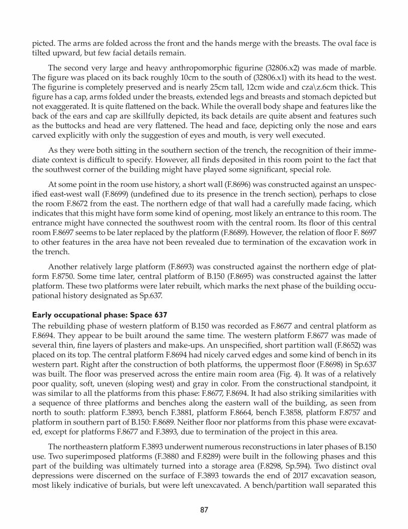
87
picted. The arms are folded across the front and the hands merge with the breasts. The oval face is tilted upward, but few facial details remain.
The second very large and heavy anthropomorphic figurine (32806.x2) was made of marble. The figure was placed on its back roughly 10cm to the south of (32806.x1) with its head to the west. The figurine is completely preserved and is nearly 25cm tall, 12cm wide and cza\z.6cm thick. This figure has a cap, arms folded under the breasts, extended legs and breasts and stomach depicted but not exaggerated. It is quite flattened on the back. While the overall body shape and features like the back of the ears and cap are skillfully depicted, its back details are quite absent and features such as the buttocks and head are very flattened. The head and face, depicting only the nose and ears carved explicitly with only the suggestion of eyes and mouth, is very well executed.
As they were both sitting in the southern section of the trench, the recognition of their imme-diate context is difficult to specify. However, all finds deposited in this room point to the fact that the southwest corner of the building might have played some significant, special role.
At some point in the room use history, a short wall (F.8696) was constructed against an unspec-ified east-west wall (F.8699) (undefined due to its presence in the trench section), perhaps to close the room F.8672 from the east. The northern edge of that wall had a carefully made facing, which indicates that this might have form some kind of opening, most likely an entrance to this room. The entrance might have connected the southwest room with the central room. Its floor of this central room F.8697 seems to be later replaced by the platform (F.8689). However, the relation of floor F. 8697 to other features in the area have not been revealed due to termination of the excavation work in the trench.
Another relatively large platform (F.8693) was constructed against the northern edge of plat-form F.8750. Some time later, central platform of B.150 (F.8695) was constructed against the latter platform. These two platforms were later rebuilt, which marks the next phase of the building occu-pational history designated as Sp.637.
Early occupational phase: Space 637The rebuilding phase of western platform of B.150 was recorded as F.8677 and central platform as F.8694. They appear to be built around the same time. The western platform F.8677 was made of several thin, fine layers of plasters and make-ups. An unspecified, short partition wall (F.8652) was placed on its top. The central platform F.8694 had nicely carved edges and some kind of bench in its western part. Right after the construction of both platforms, the uppermost floor (F.8698) in Sp.637 was built. The floor was preserved across the entire main room area (Fig. 4). It was of a relatively poor quality, soft, uneven (sloping west) and gray in color. From the constructional standpoint, it was similar to all the platforms from this phase: F.8677, F.8694. It had also striking similarities with a sequence of three platforms and benches along the eastern wall of the building, as seen from north to south: platform F.3893, bench F.3881, platform F.8664, bench F.3858, platform F.8757 and platform in southern part of B.150: F.8689. Neither floor nor platforms from this phase were excavat-ed, except for platforms F.8677 and F.3893, due to termination of the project in this area.
The northeastern platform F.3893 underwent numerous reconstructions in later phases of B.150 use. Two superimposed platforms (F.3880 and F.8289) were built in the following phases and this part of the building was ultimately turned into a storage area (F.8298, Sp.594). Two distinct oval depressions were discerned on the surface of F.3893 towards the end of 2017 excavation season, most likely indicative of burials, but were left unexcavated. A bench/partition wall separated this
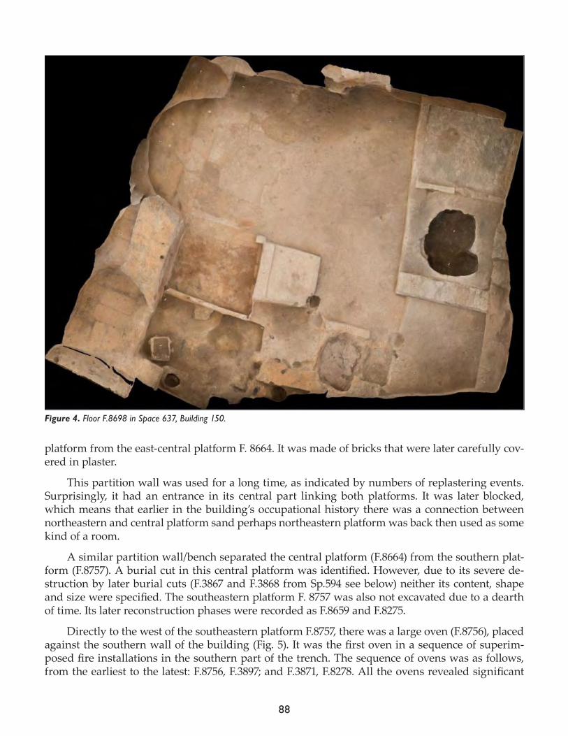
88
platform from the east-central platform F. 8664. It was made of bricks that were later carefully cov-ered in plaster.
This partition wall was used for a long time, as indicated by numbers of replastering events. Surprisingly, it had an entrance in its central part linking both platforms. It was later blocked, which means that earlier in the building’s occupational history there was a connection between northeastern and central platform sand perhaps northeastern platform was back then used as some kind of a room.
A similar partition wall/bench separated the central platform (F.8664) from the southern plat-form (F.8757). A burial cut in this central platform was identified. However, due to its severe de-struction by later burial cuts (F.3867 and F.3868 from Sp.594 see below) neither its content, shape and size were specified. The southeastern platform F. 8757 was also not excavated due to a dearth of time. Its later reconstruction phases were recorded as F.8659 and F.8275.
Directly to the west of the southeastern platform F.8757, there was a large oven (F.8756), placed against the southern wall of the building (Fig. 5). It was the first oven in a sequence of superim-posed fire installations in the southern part of the trench. The sequence of ovens was as follows, from the earliest to the latest: F.8756, F.3897; and F.3871, F.8278. All the ovens revealed significant
Figure 4. Floor F.8698 in Space 637, Building 150.
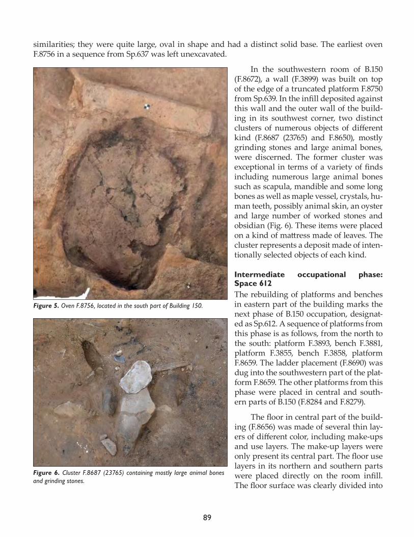
89
similarities; they were quite large, oval in shape and had a distinct solid base. The earliest oven F.8756 in a sequence from Sp.637 was left unexcavated.
In the southwestern room of B.150 (F.8672), a wall (F.3899) was built on top of the edge of a truncated platform F.8750 from Sp.639. In the infill deposited against this wall and the outer wall of the build-ing in its southwest corner, two distinct clusters of numerous objects of different kind (F.8687 (23765) and F.8650), mostly grinding stones and large animal bones, were discerned. The former cluster was exceptional in terms of a variety of finds including numerous large animal bones such as scapula, mandible and some long bones as well as maple vessel, crystals, hu-man teeth, possibly animal skin, an oyster and large number of worked stones and obsidian (Fig. 6). These items were placed on a kind of mattress made of leaves. The cluster represents a deposit made of inten-tionally selected objects of each kind.
Intermediate occupational phase: Space 612The rebuilding of platforms and benches in eastern part of the building marks the next phase of B.150 occupation, designat-ed as Sp.612. A sequence of platforms from this phase is as follows, from the north to the south: platform F.3893, bench F.3881, platform F.3855, bench F.3858, platform F.8659. The ladder placement (F.8690) was dug into the southwestern part of the plat-form F.8659. The other platforms from this phase were placed in central and south-ern parts of B.150 (F.8284 and F.8279).
The floor in central part of the build-ing (F.8656) was made of several thin lay-ers of different color, including make-ups and use layers. The make-up layers were only present its central part. The floor use layers in its northern and southern parts were placed directly on the room infill. The floor surface was clearly divided into
Figure 5. Oven F.8756, located in the south part of Building 150.
Figure 6. Cluster F.8687 (23765) containing mostly large animal bones and grinding stones.
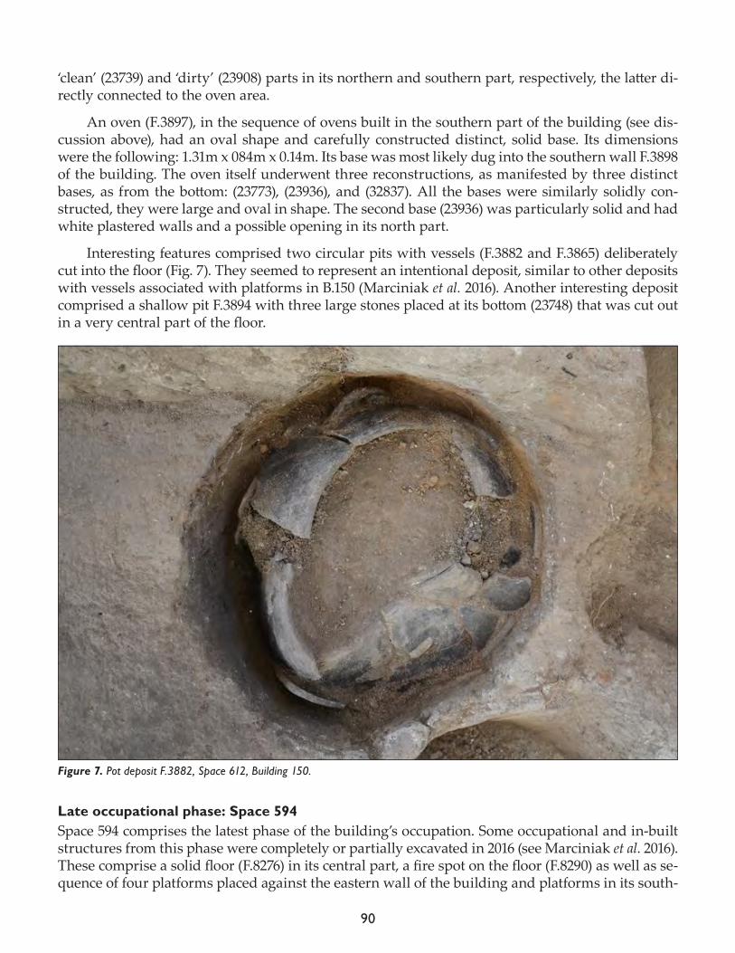
90
‘clean’ (23739) and ‘dirty’ (23908) parts in its northern and southern part, respectively, the latter di-rectly connected to the oven area.
An oven (F.3897), in the sequence of ovens built in the southern part of the building (see dis-cussion above), had an oval shape and carefully constructed distinct, solid base. Its dimensions were the following: 1.31m x 084m x 0.14m. Its base was most likely dug into the southern wall F.3898 of the building. The oven itself underwent three reconstructions, as manifested by three distinct bases, as from the bottom: (23773), (23936), and (32837). All the bases were similarly solidly con-structed, they were large and oval in shape. The second base (23936) was particularly solid and had white plastered walls and a possible opening in its north part.
Interesting features comprised two circular pits with vessels (F.3882 and F.3865) deliberately cut into the floor (Fig. 7). They seemed to represent an intentional deposit, similar to other deposits with vessels associated with platforms in B.150 (Marciniak et al. 2016). Another interesting deposit comprised a shallow pit F.3894 with three large stones placed at its bottom (23748) that was cut out in a very central part of the floor.
Late occupational phase: Space 594Space 594 comprises the latest phase of the building’s occupation. Some occupational and in-built structures from this phase were completely or partially excavated in 2016 (see Marciniak et al. 2016). These comprise a solid floor (F.8276) in its central part, a fire spot on the floor (F.8290) as well as se-quence of four platforms placed against the eastern wall of the building and platforms in its south-
Figure 7. Pot deposit F.3882, Space 612, Building 150.
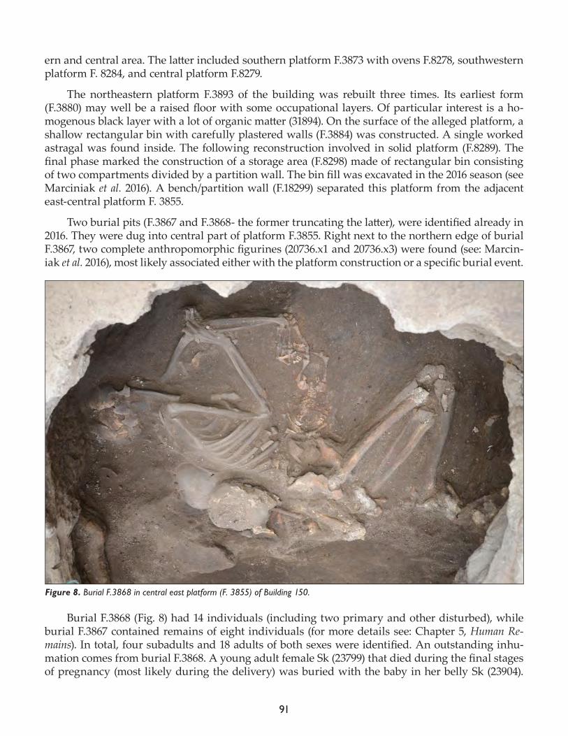
91
ern and central area. The latter included southern platform F.3873 with ovens F.8278, southwestern platform F. 8284, and central platform F.8279.
The northeastern platform F.3893 of the building was rebuilt three times. Its earliest form (F.3880) may well be a raised floor with some occupational layers. Of particular interest is a ho-mogenous black layer with a lot of organic matter (31894). On the surface of the alleged platform, a shallow rectangular bin with carefully plastered walls (F.3884) was constructed. A single worked astragal was found inside. The following reconstruction involved in solid platform (F.8289). The final phase marked the construction of a storage area (F.8298) made of rectangular bin consisting of two compartments divided by a partition wall. The bin fill was excavated in the 2016 season (see Marciniak et al. 2016). A bench/partition wall (F.18299) separated this platform from the adjacent east-central platform F. 3855.
Two burial pits (F.3867 and F.3868- the former truncating the latter), were identified already in 2016. They were dug into central part of platform F.3855. Right next to the northern edge of burial F.3867, two complete anthropomorphic figurines (20736.x1 and 20736.x3) were found (see: Marcin-iak et al. 2016), most likely associated either with the platform construction or a specific burial event.
Burial F.3868 (Fig. 8) had 14 individuals (including two primary and other disturbed), while burial F.3867 contained remains of eight individuals (for more details see: Chapter 5, Human Re-mains). In total, four subadults and 18 adults of both sexes were identified. An outstanding inhu-mation comes from burial F.3868. A young adult female Sk (23799) that died during the final stages of pregnancy (most likely during the delivery) was buried with the baby in her belly Sk (23904).
Figure 8. Burial F.3868 in central east platform (F. 3855) of Building 150.
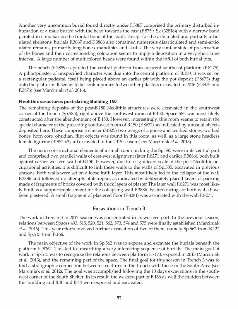
92
Another very uncommon burial found directly under F.3867 comprised the primary disturbed in-humation of a male buried with the head towards the east (F.8759, Sk (32818)) with a narrow band painted in cinnabar on the frontal bone of the skull. Except for the articulated and partially artic-ulated skeletons, burials F.3867 and F.3868 also contained numerous disarticulated and semi-artic-ulated remains, primarily long bones, mandibles and skulls. The very similar state of preservation of the bones and their corresponding coloration seems to imply a deposition in a very short time interval. A large number of multicolored beads were found within the infill of both burial pits.
The bench (F.3859) separated the central platform from adjacent southeast platform (F.8275). A pillar/pilaster of unspecified character was dug into the central platform of B.150. It was set on a rectangular pedestal, itself being placed above an earlier pit with the pot deposit (F.8673) dug onto the platform. It seems to be contemporary to two other pilasters excavated in 2016 (F.3875 and F.3876) (see Marciniak et al. 2016).
Neolithic structures post-dating Building 150The remaining deposits of the post-B.150 Neolithic structures were excavated in the southwest corner of the trench (Sp.585), right above the southwest room of B.150. Space 585 was most likely constructed after the abandonment of B.150. However, interestingly, this room seems to retain the special character of the preceding southwest room of B.150 (F.8672), as indicated by unusual objects deposited here. These comprise a cluster (31825) two wings of a goose and worked stones, worked bones, horn core, obsidian, flint objects was found in this room, as well, as a large stone headless female figurine (31852.x3), all excavated in the 2015 season (see: Marciniak et al. 2015).
The main constructional elements of a small room making the Sp.585 were in its central part and comprised two parallel walls of east-west alignment (later F.8271 and earlier F.3886), both built against earlier western wall of B.150. However, due to a significant scale of the post-Neolithic oc-cupational activities, it is difficult to link these walls to the walls of Sp.585, excavated in previous seasons. Both walls were set on a loose infill layer. This most likely led to the collapse of the wall F.3886 and followed up attempts of its repair, as indicated by deliberately placed layers of packing made of fragments of bricks covered with thick layers of plaster The later wall F.8271 was most like-ly built as a support/replacement for the collapsing wall F.3886. Eastern facings of both walls have been plastered. A small fragment of plastered floor (F.8281) was associated with the wall F.8271.
Excavations in Trench 3
The work in Trench 3 in 2017 season was concentrated in its western part. In the previous season, relations between Spaces 493, 515, 520, 521, 562, 573, 574 and 575 were finally established (Marciniak et al. 2016). This year efforts involved further excavation of two of them, namely Sp.562 from B.122 and Sp.515 from B.166.
The main objective of the work in Sp.562 was to expose and excavate the burials beneath the platform F. 8262. This led to unearthing a very interesting sequence of burials. The main goal of work in Sp.515 was to recognize the relations between platform F.7173, exposed in 2013 (Marciniak et al. 2013), and the remaining part of the space. The final goal for this season in Trench 3 was to find a stratigraphic connection between structures in the trench with those in the South Area (see Marciniak et al. 2012). The goal was accomplished following the 10 days excavations in the south-west corner of the South Shelter. In its result, the western part of B.166 as well the midden between this building and B.10 and B.44 were exposed and excavated.
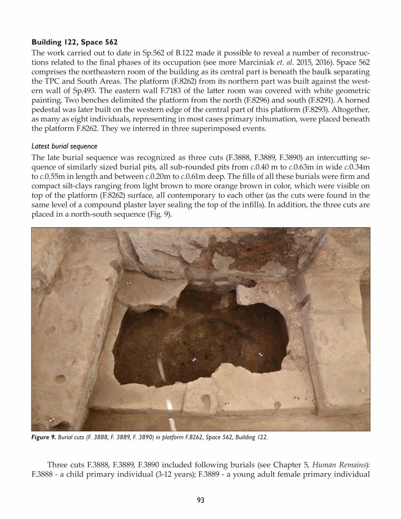
93
Building 122, Space 562The work carried out to date in Sp.562 of B.122 made it possible to reveal a number of reconstruc-tions related to the final phases of its occupation (see more Marciniak et. al. 2015, 2016). Space 562 comprises the northeastern room of the building as its central part is beneath the baulk separating the TPC and South Areas. The platform (F.8262) from its northern part was built against the west-ern wall of Sp.493. The eastern wall F.7183 of the latter room was covered with white geometric painting. Two benches delimited the platform from the north (F.8296) and south (F.8291). A horned pedestal was later built on the western edge of the central part of this platform (F.8293). Altogether, as many as eight individuals, representing in most cases primary inhumation, were placed beneath the platform F.8262. They we interred in three superimposed events.
Latest burial sequenceThe late burial sequence was recognized as three cuts (F.3888, F.3889, F.3890) an intercutting se-quence of similarly sized burial pits, all sub-rounded pits from c.0.40 m to c.0.63m in wide c.0.34m to c.0.55m in length and between c.0.20m to c.0.61m deep. The fills of all these burials were firm and compact silt-clays ranging from light brown to more orange brown in color, which were visible on top of the platform (F.8262) surface, all contemporary to each other (as the cuts were found in the same level of a compound plaster layer sealing the top of the infills). In addition, the three cuts are placed in a north-south sequence (Fig. 9).
Three cuts F.3888, F.3889, F.3890 included following burials (see Chapter 5, Human Remains): F.3888 - a child primary individual (3-12 years); F.3889 - a young adult female primary individual
Figure 9. Burial cuts (F. 3888, F. 3889, F. 3890) in platform F.8262, Space 562, Building 122.
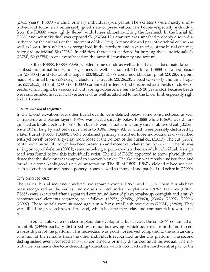
94
(20-35 years); F.3890 - a child primary individual (3-12 years). The skeletons were mostly undis-turbed and found in a remarkably good state of preservation. The bodies (especially individual from the F.3888) were tightly flexed, with knees almost touching the forehead. In the burial fill F.3889 another individual was exposed Sk (23754). His cranium was smashed probably due to dis-turbance by the animals or the interment of Sk (23751). A mandible and part of vertebral column as well as lower limb, which was recognized in the northern and eastern edge of the burial cut, may belong to individual Sk (23754). In addition, there is an evidence for burying those individuals Sk (23751), Sk (23754) in one event based on the same fill consistency and texture.
The fill of F.3888, F.3889, F.3890, yielded some x-finds as well as in all cases mixed material such as obsidian, animal bones, pottery, stones as well as charcoal. The fill of F.3888 contained obsid-ian (23780.x1) and cluster of astragals (23780.x2); F.3889 contained obsidian point (23728.x1), point made of animal bone (23728.x2), a cluster of astragals (23728.x3), a bead (23728.x4), and an astraga-lus (23728.x5). The fill (23917) of F.3890 contained thirteen x finds recorded as a beads or cluster of beads, which might be associated with young adolescence female (12- 20 years old), because beads were surrounded first cervical vertebrae of as well as attached to her the lower limb especially right and left knee.
Intermediate burial sequenceIn the lowest elevation level other burial events were defined below some constructional as well as make-up and plaster layers. F.8676 was placed directly below F. 3888 while F. 8691 was distin-guished as located below F. 3890. Both burials were situated in a fairly small sub-ovoid cut (c.0.56m wide c.0.7m long by and between c.0.24m to 0.30m deep). All of which were possibly disturbed by a later burial (F.3888, F.3890). F.8691 contained primary disturbed loose individual and was filled with yellowish brown silty-clay, more loose at the bottom of the burial cut (32857). The cut (32802) contained a burial fill, which has been brownish and more wet, clayish on top (23999). The fill was sitting on top of skeleton (32801), remains belong to primary disturbed an adult individual. A single bead was found below this individual’s wrist. The fill of F.8676 appeared to show phytolith evi-dence that the skeleton was wrapped in a woven blanket. The skeleton was mostly undisturbed and found in a remarkably good state of preservation. The fill of F.8691, F.8676, yielded mixed material such as obsidian, animal bones, pottery, stones as well as charcoal and patch of red ochre in (23999).
Early burial sequenceThe earliest burial sequence involved two separate events: F.8671 and F.8685. Those burials have been recognized as the earliest individuals buried under the platform F.8262. Features (F.8671, F.8685) were excavated after a separated compound layer of plaster/make-up/ orangish and grayish constructional elements sequence, as it follows: (23952), (23958), (23960), (23962), (23992), (23996), (23997). These burials were situated again in a fairly small sub-ovoid cuts (23981), (32828). They were filled by greyish-brown silty sand, which became more clay and compact rich towards the base.
The burial cuts were not clear in plan, due overlapping burial cuts. Burial F.8671 contained an infant Sk (23983) partially disturbed by animal burrowing, which occurred from the north-cen-tral-south part of the platform. This individual was poorly preserved compared to the outstanding condition of the remains from the other individuals recognized under this platform. The second distinguished event recorded as F.8685 contained a primary disturbed adult individual. The dis-turbance was made due to undercutting truncation, which occurred in the north-central part of the
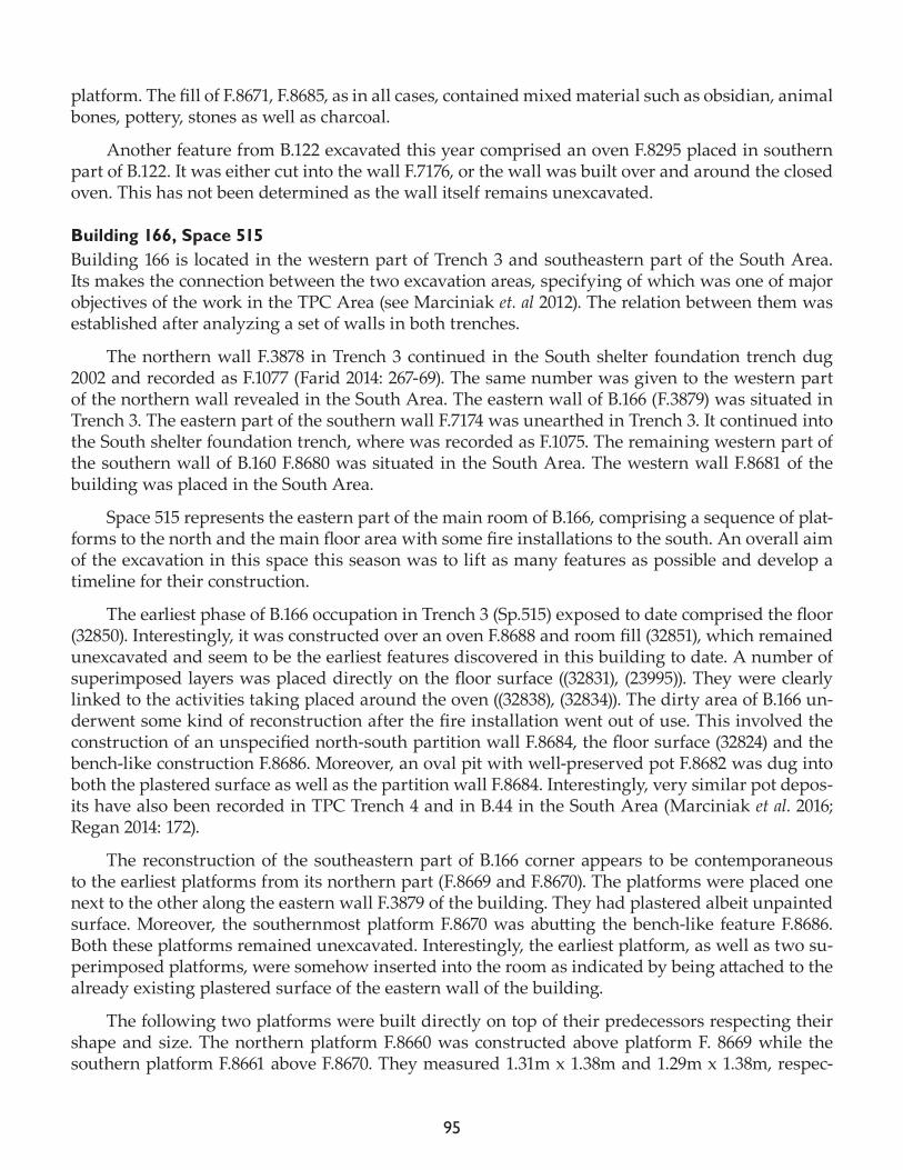
95
platform. The fill of F.8671, F.8685, as in all cases, contained mixed material such as obsidian, animal bones, pottery, stones as well as charcoal.
Another feature from B.122 excavated this year comprised an oven F.8295 placed in southern part of B.122. It was either cut into the wall F.7176, or the wall was built over and around the closed oven. This has not been determined as the wall itself remains unexcavated.
Building 166, Space 515 Building 166 is located in the western part of Trench 3 and southeastern part of the South Area. Its makes the connection between the two excavation areas, specifying of which was one of major objectives of the work in the TPC Area (see Marciniak et. al 2012). The relation between them was established after analyzing a set of walls in both trenches.
The northern wall F.3878 in Trench 3 continued in the South shelter foundation trench dug 2002 and recorded as F.1077 (Farid 2014: 267-69). The same number was given to the western part of the northern wall revealed in the South Area. The eastern wall of B.166 (F.3879) was situated in Trench 3. The eastern part of the southern wall F.7174 was unearthed in Trench 3. It continued into the South shelter foundation trench, where was recorded as F.1075. The remaining western part of the southern wall of B.160 F.8680 was situated in the South Area. The western wall F.8681 of the building was placed in the South Area.
Space 515 represents the eastern part of the main room of B.166, comprising a sequence of plat-forms to the north and the main floor area with some fire installations to the south. An overall aim of the excavation in this space this season was to lift as many features as possible and develop a timeline for their construction.
The earliest phase of B.166 occupation in Trench 3 (Sp.515) exposed to date comprised the floor (32850). Interestingly, it was constructed over an oven F.8688 and room fill (32851), which remained unexcavated and seem to be the earliest features discovered in this building to date. A number of superimposed layers was placed directly on the floor surface ((32831), (23995)). They were clearly linked to the activities taking placed around the oven ((32838), (32834)). The dirty area of B.166 un-derwent some kind of reconstruction after the fire installation went out of use. This involved the construction of an unspecified north-south partition wall F.8684, the floor surface (32824) and the bench-like construction F.8686. Moreover, an oval pit with well-preserved pot F.8682 was dug into both the plastered surface as well as the partition wall F.8684. Interestingly, very similar pot depos-its have also been recorded in TPC Trench 4 and in B.44 in the South Area (Marciniak et al. 2016; Regan 2014: 172).
The reconstruction of the southeastern part of B.166 corner appears to be contemporaneous to the earliest platforms from its northern part (F.8669 and F.8670). The platforms were placed one next to the other along the eastern wall F.3879 of the building. They had plastered albeit unpainted surface. Moreover, the southernmost platform F.8670 was abutting the bench-like feature F.8686. Both these platforms remained unexcavated. Interestingly, the earliest platform, as well as two su-perimposed platforms, were somehow inserted into the room as indicated by being attached to the already existing plastered surface of the eastern wall of the building.
The following two platforms were built directly on top of their predecessors respecting their shape and size. The northern platform F.8660 was constructed above platform F. 8669 while the southern platform F.8661 above F.8670. They measured 1.31m x 1.38m and 1.29m x 1.38m, respec-
96
tively. Platform F.8660 from the very northeast corner of the building was constructed of a friable constructional layer (23969) and much more compact layer (23967) of molding making the structure solid. The platform surface was covered by silty and very firm layer of plaster (23968). The platform F.8661 was very badly affected by the post-Neolithic truncation F.8665 (destruction cut 30887), which significantly damaged almost entire central part of the building. Due to this destruction only its northernmost part survived. It was made of a constructional layer (23967) (same as in the platform F.8660) and fairly thin plaster layer adjacent to platform F.8660 in its northern part (23966). Despite severe damage, two burial events were defined (F.3896 and F.8661) (see more: Chapter 5, Human Remains). The burial F.3896 was situated in a distinct pit (c.0.92m long, 0.58m wide and c.0.36m deep). The cut included two burials: (i) a completely preserved adult Sk (23921) laying on his back, slightly sloping on left side, and (ii) a headless adult Sk (23772) placed directly beneath the former one. The bones were in an exceptionally good state of preservation. The burial cut was filled with distinct silty-clay (23914) and (23770) layers. The second burial F.8662 contained an infant skeleton Sk (23961). It was in a flexed position and was interred in a shallow cut (23945), itself placed directly on the surface of the earlier platform F.8670.
The latest platform F.7173 is mostly likely the only in-built structure representing the final phase of the B.166 use (Fig. 10). The first constructional layer was made of fragile and soft material (23912), placed directly above the surface of the earlier platform F.8660. It was followed by a very firm layer of clay, layered down at the edges (23918), and the strong cement like constructional layer (23777). Two individuals were in one burial pit F.3891: (i) an adult Sk (23752) with tightly flexed posi-tion aligned with the cut, with head to the west facing south and placed directly above this skeleton
Figure 10. Platform F.7173 with burial F.3891 visible on its surface.
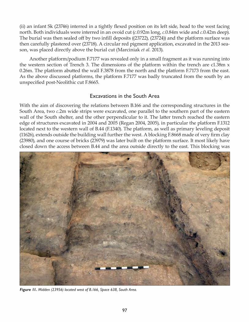
97
(ii) an infant Sk (23746) interred in a tightly flexed position on its left side, head to the west facing north. Both individuals were interred in an ovoid cut (c.0.92m long, c.0.84m wide and c.0.42m deep). The burial was then sealed off by two infill deposits ((23722), (23724)) and the platform surface was then carefully plastered over (23718). A circular red pigment application, excavated in the 2013 sea-son, was placed directly above the burial cut (Marciniak et al. 2013).
Another platform/podium F.7177 was revealed only in a small fragment as it was running into the western section of Trench 3. The dimensions of the platform within the trench are c1.38m x 0.26m. The platform abutted the wall F.3878 from the north and the platform F.7173 from the east. As the above discussed platforms, the platform F.7177 was badly truncated from the south by an unspecified post-Neolithic cut F.8665.
Excavations in the South Area
With the aim of discovering the relations between B.166 and the corresponding structures in the South Area, two c.2m wide strips were excavated, one parallel to the southern part of the eastern wall of the South shelter, and the other perpendicular to it. The latter trench reached the eastern edge of structures excavated in 2004 and 2005 (Regan 2004, 2005), in particular the platform F.1312 located next to the western wall of B.44 (F.1340). The platform, as well as primary leveling deposit (11626), extends outside the building wall further the west. A blocking F.8668 made of very firm clay (23980), and one course of bricks (23979) was later built on the platform surface. It most likely have closed down the access between B.44 and the area outside directly to the east. This blocking was
Figure 11. Midden (23956) located west of B.166, Space 638, South Area.
98
later truncated by foundation cut for later wall F.8667, most likely used to stabilize and strengthen the blocking wall.
The remains of later activity comprised a large truncation destroying the packing F.8667 and floor surface (32808). It was made deliberately for the dumping area. The cut was later filled in with a number of superimposed midden layers deposited against both the packing F.8667 as well as the western F.8681 and the northern F.1077 walls of B.166. The midden was excavated by arbitrary layers. A sequence of the two layers (23998) and (23990) at the bottom was followed by another lay-er (23984) and then two uppermost layers of midden (23956) and (23950) (Fig. 11). A small wall of north-south alignment F.8663 was placed directly on top of the midden (Sp.126). It was unrelated to any other feature.
Final remarks
The work carried out in the 2017 season marks the completion of the project in the TPC Area. The planned objectives for the year were largely completed. In particular, the connection between the southernmost trench in the TPC Area and the South Area was established thanks to B.166, which parts are located in both areas. A satisfactory number of details were collected from that building. Similarly, a sequence of burials were unearthed beneath the northeastern platform of B.122. As the occupational history of B.150 was longer and much more complicated that originally envisioned, the planned goal of getting into the construction phase of the building was not achieved. However, this season made it possible to recognize four phase of the building’s complex occupational history.
References
Farid S. 2014. The South Shelter foundation trenches. In Çatalhöyük Excavations: the 2000-2008 Seasons, edited by I. Hod-der. London: British Institute at Ankara; Los Angeles: Cotsen Institute of Archaeology Press, pp. 247-81.
Marciniak A., P. Filipowicz and A. Mickel2012. The excavations of the TPC Area in the 2012 season. In Çatalhöyük 2012 Archive Report, pp.61-75.
Marciniak A., Filipowicz P., Johansson E. and A. Mickel2013. The excavations of the TPC Area in the 2013 season. In Çatalhöyük 2013 Archive Report, pp. 74-93.
Filipowicz P., Harabasz K and J. Hordecki 2014. Excavations in the TPC Area. In Çatalhöyük 2014 Archive Report, pp. 72-9.
Marciniak A., P. Filipowicz, J. Hordecki and A. Mickel 2015. The excavations of the TPC Area in the 2015 season. In Çatalhöyük 2015 Archive Report, pp. 72-83.
Marciniak A, Dembowiak M., Hordecki J. and Stosik W.2016. Excavations in the TPC Area. In Çatalhöyük 2016 Archive Report, pp. 73-84.
Regan R.2004. Building 44, South Summit Area. In Çatalhöyük 2004 Archive Report 2004, http://www.catalhoyuk.com:8080/archive_reports/2004/ar04_12.html.

99
2005. Buildings 44 & 56. In Çatalhöyük 2005 Archive Report 2005, http://www.catalhoyuk.com:8080/archive_re-ports/2005/ar05_14.html.
2013. The Sequence of Buildings 75, 65, 56, 69, 44 and 10 and external Spaces 119, 129, 130, 144, 299, 314, 319, 329, 333, 339, 367, 371 and 427. In Çatalhöyük Excavations: the 2000–2008 Seasons, edited by I. Hodder. London: British Institute at Ankara; Los Angeles: Cotsen Institute of Archaeology Press,. pp. 131-90.

100
101
Cultural and Environmental Materials

102
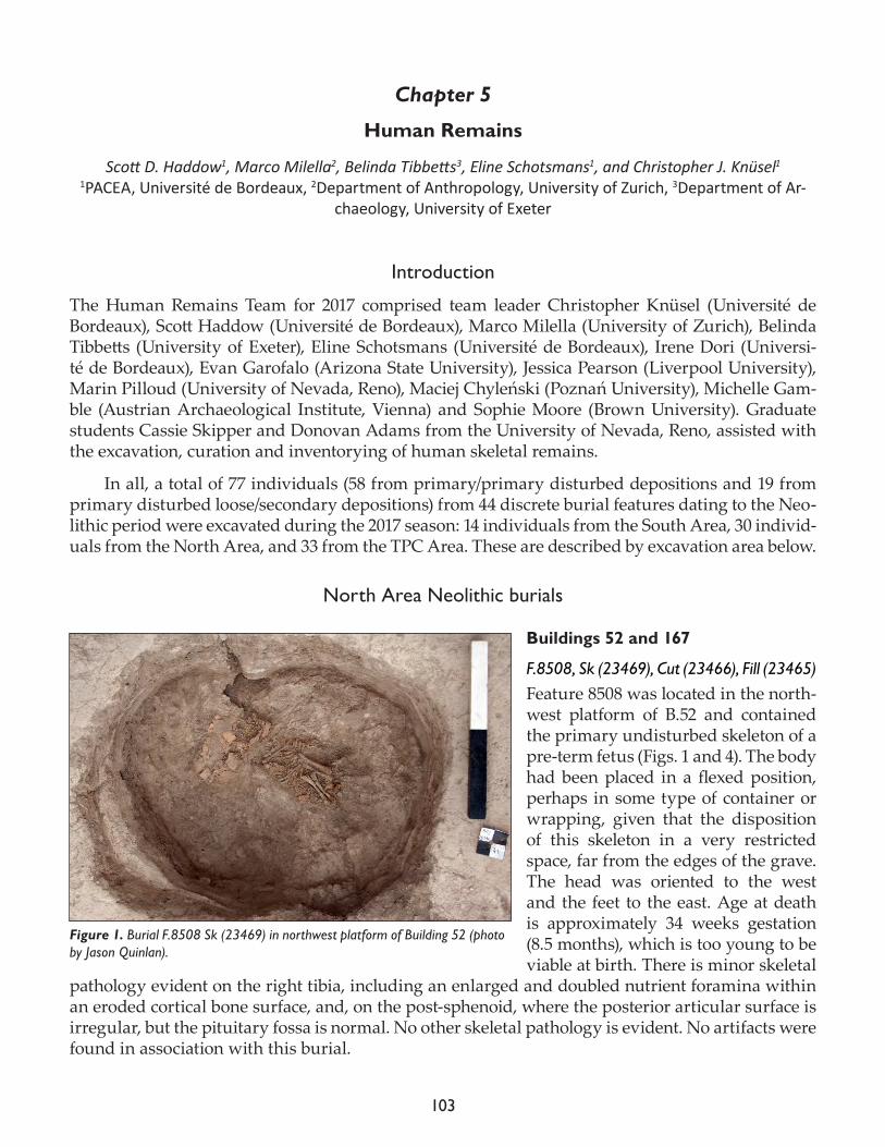
103
Chapter 5
Human Remains
Scott D. Haddow1, Marco Milella2, Belinda Tibbetts3, Eline Schotsmans1, and Christopher J. Knüsel11PACEA, Université de Bordeaux, 2Department of Anthropology, University of Zurich, 3Department of Ar-
chaeology, University of Exeter
Introduction
The Human Remains Team for 2017 comprised team leader Christopher Knüsel (Université de Bordeaux), Scott Haddow (Université de Bordeaux), Marco Milella (University of Zurich), Belinda Tibbetts (University of Exeter), Eline Schotsmans (Université de Bordeaux), Irene Dori (Universi-té de Bordeaux), Evan Garofalo (Arizona State University), Jessica Pearson (Liverpool University), Marin Pilloud (University of Nevada, Reno), Maciej Chyleński (Poznań University), Michelle Gam-ble (Austrian Archaeological Institute, Vienna) and Sophie Moore (Brown University). Graduate students Cassie Skipper and Donovan Adams from the University of Nevada, Reno, assisted with the excavation, curation and inventorying of human skeletal remains.
In all, a total of 77 individuals (58 from primary/primary disturbed depositions and 19 from primary disturbed loose/secondary depositions) from 44 discrete burial features dating to the Neo-lithic period were excavated during the 2017 season: 14 individuals from the South Area, 30 individ-uals from the North Area, and 33 from the TPC Area. These are described by excavation area below.
North Area Neolithic burials
Buildings 52 and 167
F.8508, Sk (23469), Cut (23466), Fill (23465)Feature 8508 was located in the north-west platform of B.52 and contained the primary undisturbed skeleton of a pre-term fetus (Figs. 1 and 4). The body had been placed in a flexed position, perhaps in some type of container or wrapping, given that the disposition of this skeleton in a very restricted space, far from the edges of the grave. The head was oriented to the west and the feet to the east. Age at death is approximately 34 weeks gestation (8.5 months), which is too young to be viable at birth. There is minor skeletal
pathology evident on the right tibia, including an enlarged and doubled nutrient foramina within an eroded cortical bone surface, and, on the post-sphenoid, where the posterior articular surface is irregular, but the pituitary fossa is normal. No other skeletal pathology is evident. No artifacts were found in association with this burial.
Figure 1. Burial F.8508 Sk (23469) in northwest platform of Building 52 (photo by Jason Quinlan).
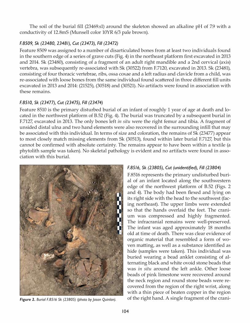
104
The soil of the burial fill (23469.s1) around the skeleton showed an alkaline pH of 7.9 with a conductivity of 12.8mS (Munsell color 10YR 6/3 pale brown).
F.8509, Sk (23480, 23481), Cut (23473), Fill (23472)Feature 8509 was assigned to a number of disarticulated bones from at least two individuals found in the southern edge of a series of grave cuts (Fig. 4) in the northeast platform first excavated in 2013 and 2014. Sk (23480), consisting of a fragment of an adult right mandible and a 2nd cervical (axis) vertebra, was subsequently re-associated with Sk (30522) from F.7120, excavated in 2013. Sk (23481), consisting of four thoracic vertebrae, ribs, ossa coxae and a left radius and clavicle from a child, was re-associated with loose bones from the same individual found scattered in three different fill units excavated in 2013 and 2014: (21525), (30518) and (30521). No artifacts were found in association with these remains.
F.8510, Sk (23477), Cut (23475), Fill (23474)Feature 8510 is the primary disturbed burial of an infant of roughly 1 year of age at death and lo-cated in the northwest platform of B.52 (Fig. 4). The burial was truncated by a subsequent burial in F.7127, excavated in 2013. The only bones left in situ were the right femur and tibia. A fragment of unsided distal ulna and two hand elements were also recovered in the surrounding infill that may be associated with this individual. In terms of size and coloration, the remains of Sk (23477) appear to most closely match missing elements from Sk (30513), found within later burial F.7127, but this cannot be confirmed with absolute certainty. The remains appear to have been within a textile (a phytolith sample was taken). No skeletal pathology is evident and no artifacts were found in asso-ciation with this burial.
F.8516, Sk (23805), Cut (unidentified), Fill (23804)F.8516 represents the primary undisturbed buri-al of an infant located along the southwestern edge of the northwest platform of B.52 (Figs. 2 and 4). The body had been flexed and lying on its right side with the head to the southwest (fac-ing northeast). The upper limbs were extended so that the hands overlaid the feet. The crani-um was compressed and highly fragmented. The infracranial remains were well-preserved. The infant was aged approximately 18 months old at time of death. There was clear evidence of organic material that resembled a form of wo-ven matting, as well as a substance identified as hide (samples were taken). This individual was buried wearing a bead anklet consisting of al-ternating black and white ovoid stone beads that was in situ around the left ankle. Other loose beads of pink limestone were recovered around the neck region and round stone beads were re-covered from the region of the right wrist, along with a thin piece of beaten copper in the region of the right hand. A single fragment of the crani-Figure 2. Burial F.8516 Sk (23805) (photo by Jason Quinlan).
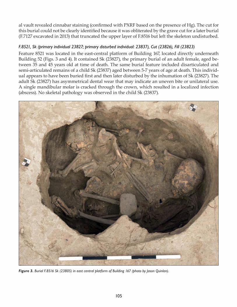
105
al vault revealed cinnabar staining (confirmed with PXRF based on the presence of Hg). The cut for this burial could not be clearly identified because it was obliterated by the grave cut for a later burial (F.7127 excavated in 2013) that truncated the upper layer of F.8516 but left the skeleton undisturbed.
F.8521, Sk (primary individual 23827; primary disturbed individual: 23837), Cut (23826), Fill (23823)Feature 8521 was located in the east-central platform of Building 167, located directly underneath Building 52 (Figs. 3 and 4). It contained Sk (23827), the primary burial of an adult female, aged be-tween 35 and 45 years old at time of death. The same burial feature included disarticulated and semi-articulated remains of a child Sk (23837) aged between 5-7 years of age at death. This individ-ual appears to have been buried first and then later disturbed by the inhumation of Sk (23827). The adult Sk (23827) has asymmetrical dental wear that may indicate an uneven bite or unilateral use. A single mandibular molar is cracked through the crown, which resulted in a localized infection (abscess). No skeletal pathology was observed in the child Sk (23837).
Figure 3. Burial F.8516 Sk (23805) in east central platform of Building 167 (photo by Jason Quinlan).
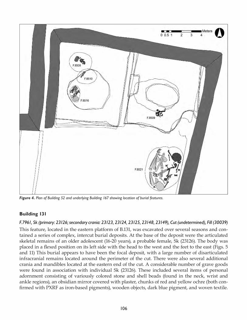
106
Building 131
F.7961, Sk (primary: 23126; secondary crania: 23123, 23124, 23125, 23148, 23149), Cut (undetermined), Fill (30039)This feature, located in the eastern platform of B.131, was excavated over several seasons and con-tained a series of complex, intercut burial deposits. At the base of the deposit were the articulated skeletal remains of an older adolescent (16-20 years), a probable female, Sk (23126). The body was placed in a flexed position on its left side with the head to the west and the feet to the east (Figs. 5 and 11) This burial appears to have been the focal deposit, with a large number of disarticulated infracranial remains located around the perimeter of the cut. There were also several additional crania and mandibles located at the eastern end of the cut. A considerable number of grave goods were found in association with individual Sk (23126). These included several items of personal adornment consisting of variously colored stone and shell beads (found in the neck, wrist and ankle regions), an obsidian mirror covered with plaster, chunks of red and yellow ochre (both con-firmed with PXRF as iron-based pigments), wooden objects, dark blue pigment, and woven textile.
Figure 4. Plan of Building 52 and underlying Building 167 showing location of burial features.
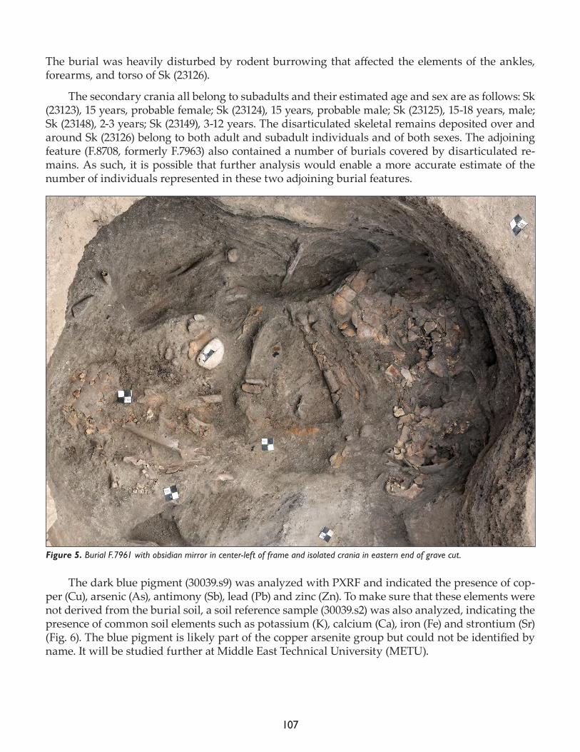
107
The burial was heavily disturbed by rodent burrowing that affected the elements of the ankles, forearms, and torso of Sk (23126).
The secondary crania all belong to subadults and their estimated age and sex are as follows: Sk (23123), 15 years, probable female; Sk (23124), 15 years, probable male; Sk (23125), 15-18 years, male; Sk (23148), 2-3 years; Sk (23149), 3-12 years. The disarticulated skeletal remains deposited over and around Sk (23126) belong to both adult and subadult individuals and of both sexes. The adjoining feature (F.8708, formerly F.7963) also contained a number of burials covered by disarticulated re-mains. As such, it is possible that further analysis would enable a more accurate estimate of the number of individuals represented in these two adjoining burial features.
The dark blue pigment (30039.s9) was analyzed with PXRF and indicated the presence of cop-per (Cu), arsenic (As), antimony (Sb), lead (Pb) and zinc (Zn). To make sure that these elements were not derived from the burial soil, a soil reference sample (30039.s2) was also analyzed, indicating the presence of common soil elements such as potassium (K), calcium (Ca), iron (Fe) and strontium (Sr) (Fig. 6). The blue pigment is likely part of the copper arsenite group but could not be identified by name. It will be studied further at Middle East Technical University (METU).
Figure 5. Burial F.7961 with obsidian mirror in center-left of frame and isolated crania in eastern end of grave cut.
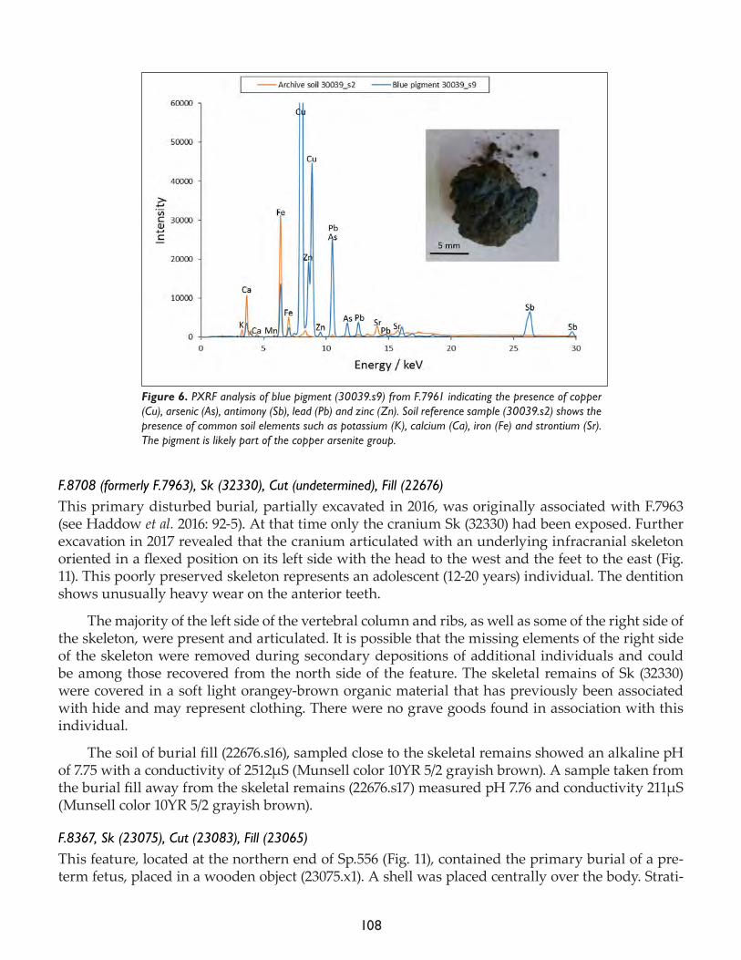
108
F.8708 (formerly F.7963), Sk (32330), Cut (undetermined), Fill (22676)This primary disturbed burial, partially excavated in 2016, was originally associated with F.7963 (see Haddow et al. 2016: 92-5). At that time only the cranium Sk (32330) had been exposed. Further excavation in 2017 revealed that the cranium articulated with an underlying infracranial skeleton oriented in a flexed position on its left side with the head to the west and the feet to the east (Fig. 11). This poorly preserved skeleton represents an adolescent (12-20 years) individual. The dentition shows unusually heavy wear on the anterior teeth.
The majority of the left side of the vertebral column and ribs, as well as some of the right side of the skeleton, were present and articulated. It is possible that the missing elements of the right side of the skeleton were removed during secondary depositions of additional individuals and could be among those recovered from the north side of the feature. The skeletal remains of Sk (32330) were covered in a soft light orangey-brown organic material that has previously been associated with hide and may represent clothing. There were no grave goods found in association with this individual.
The soil of burial fill (22676.s16), sampled close to the skeletal remains showed an alkaline pH of 7.75 with a conductivity of 2512μS (Munsell color 10YR 5/2 grayish brown). A sample taken from the burial fill away from the skeletal remains (22676.s17) measured pH 7.76 and conductivity 211μS (Munsell color 10YR 5/2 grayish brown).
F.8367, Sk (23075), Cut (23083), Fill (23065)This feature, located at the northern end of Sp.556 (Fig. 11), contained the primary burial of a pre-term fetus, placed in a wooden object (23075.x1). A shell was placed centrally over the body. Strati-
Figure 6. PXRF analysis of blue pigment (30039.s9) from F.7961 indicating the presence of copper (Cu), arsenic (As), antimony (Sb), lead (Pb) and zinc (Zn). Soil reference sample (30039.s2) shows the presence of common soil elements such as potassium (K), calcium (Ca), iron (Fe) and strontium (Sr). The pigment is likely part of the copper arsenite group.
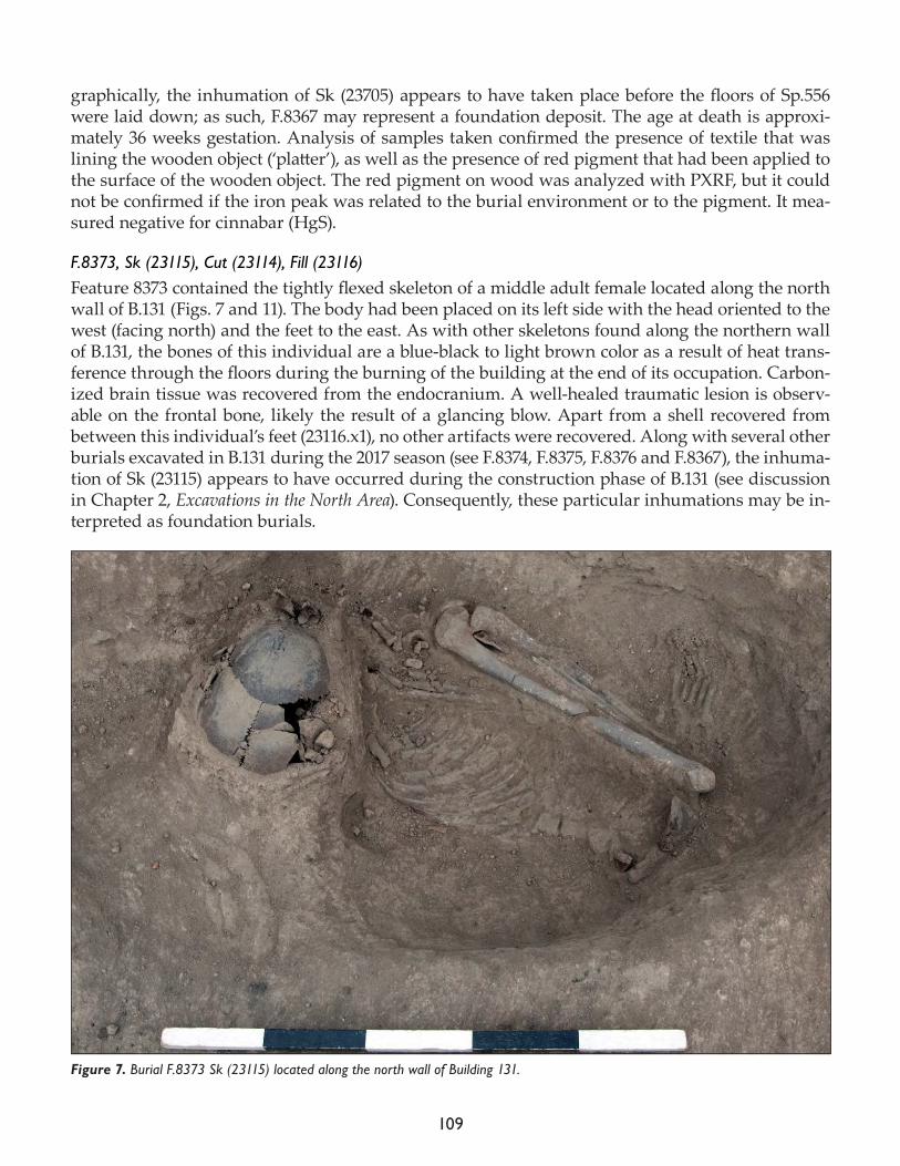
109
graphically, the inhumation of Sk (23705) appears to have taken place before the floors of Sp.556 were laid down; as such, F.8367 may represent a foundation deposit. The age at death is approxi-mately 36 weeks gestation. Analysis of samples taken confirmed the presence of textile that was lining the wooden object (‘platter’), as well as the presence of red pigment that had been applied to the surface of the wooden object. The red pigment on wood was analyzed with PXRF, but it could not be confirmed if the iron peak was related to the burial environment or to the pigment. It mea-sured negative for cinnabar (HgS).
F.8373, Sk (23115), Cut (23114), Fill (23116)Feature 8373 contained the tightly flexed skeleton of a middle adult female located along the north wall of B.131 (Figs. 7 and 11). The body had been placed on its left side with the head oriented to the west (facing north) and the feet to the east. As with other skeletons found along the northern wall of B.131, the bones of this individual are a blue-black to light brown color as a result of heat trans-ference through the floors during the burning of the building at the end of its occupation. Carbon-ized brain tissue was recovered from the endocranium. A well-healed traumatic lesion is observ-able on the frontal bone, likely the result of a glancing blow. Apart from a shell recovered from between this individual’s feet (23116.x1), no other artifacts were recovered. Along with several other burials excavated in B.131 during the 2017 season (see F.8374, F.8375, F.8376 and F.8367), the inhuma-tion of Sk (23115) appears to have occurred during the construction phase of B.131 (see discussion in Chapter 2, Excavations in the North Area). Consequently, these particular inhumations may be in-terpreted as foundation burials.
Figure 7. Burial F.8373 Sk (23115) located along the north wall of Building 131.
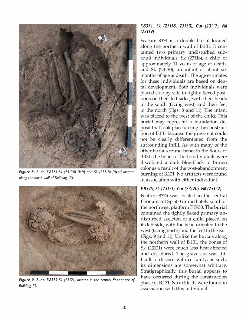
110
F.8374, Sk (23118, 23130), Cut (23117), Fill (23119)
Feature 8374 is a double burial located along the northern wall of B.131. It con-tained two primary undisturbed sub-adult individuals: Sk (23118), a child of approximately 11 years of age at death, and Sk (23130), an infant of about six months of age at death. The age estimates for these individuals are based on den-tal development. Both individuals were placed side-by-side in tightly flexed posi-tions on their left sides, with their heads to the south (facing west) and their feet to the north (Figs. 8 and 11). The infant was placed to the west of the child. This burial may represent a foundation de-posit that took place during the construc-tion of B.131 because the grave cut could not be clearly differentiated from the surrounding infill. As with many of the other burials found beneath the floors of B.131, the bones of both individuals were discolored a dark blue-black to brown color as a result of the post-abandonment burning of B.131. No artifacts were found in association with either individual.
F.8375, Sk (23121), Cut (23120), Fill (23122)Feature 8375 was located in the central floor area of Sp.500 immediately south of the northwest platform F.7950. The burial contained the tightly flexed primary un-disturbed skeleton of a child placed on its left side, with the head oriented to the west (facing north) and the feet to the east (Figs. 9 and 11). Unlike the burials along the northern wall of B.131, the bones of Sk (23121) were much less heat-affected and discolored. The grave cut was dif-ficult to discern with certainty; as such, its dimensions are somewhat arbitrary. Stratigraphically, this burial appears to have occurred during the construction phase of B.131. No artifacts were found in association with this individual.
Figure 8. Burial F.8374 Sk (23130) [left] and Sk (23118) [right] located along the north wall of Building 131.
Figure 9. Burial F.8375 Sk (23121) located in the central floor space of Building 131.
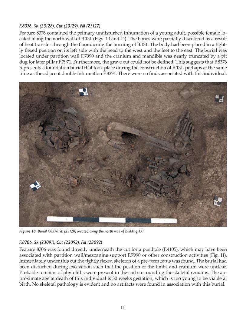
111
F.8376, Sk (23128), Cut (23129), Fill (23127)Feature 8376 contained the primary undisturbed inhumation of a young adult, possible female lo-cated along the north wall of B.131 (Figs. 10 and 11). The bones were partially discolored as a result of heat transfer through the floor during the burning of B.131. The body had been placed in a tight-ly flexed position on its left side with the head to the west and the feet to the east. The burial was located under partition wall F.7990 and the cranium and mandible was nearly truncated by a pit dug for later pillar F.7971. Furthermore, the grave cut could not be defined. This suggests that F.8376 represents a foundation burial that took place during the construction of B.131, perhaps at the same time as the adjacent double inhumation F.8374. There were no finds associated with this individual.
F.8706, Sk (23091), Cut (23093), Fill (23092)Feature 8706 was found directly underneath the cut for a posthole (F.4105), which may have been associated with partition wall/mezzanine support F.7990 or other construction activities (Fig. 11). Immediately under this cut the tightly flexed skeleton of a pre-term fetus was found. The burial had been disturbed during excavation such that the position of the limbs and cranium were unclear. Probable remains of phytoliths were present in the soil surrounding the skeletal remains. The ap-proximate age at death of this individual is 30 weeks gestation, which is too young to be viable at birth. No skeletal pathology is evident and no artifacts were found in association with this burial.
Figure 10. Burial F.8376 Sk (23128) located along the north wall of Building 131.
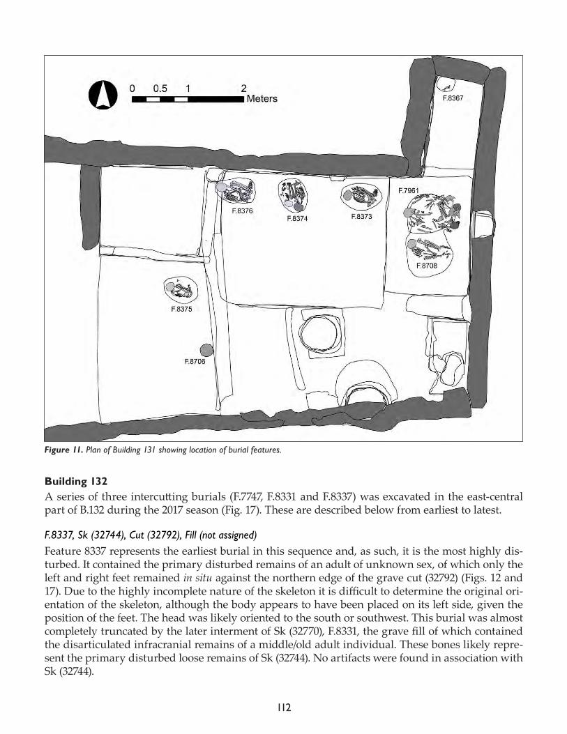
112
Building 132A series of three intercutting burials (F.7747, F.8331 and F.8337) was excavated in the east-central part of B.132 during the 2017 season (Fig. 17). These are described below from earliest to latest.
F.8337, Sk (32744), Cut (32792), Fill (not assigned)Feature 8337 represents the earliest burial in this sequence and, as such, it is the most highly dis-turbed. It contained the primary disturbed remains of an adult of unknown sex, of which only the left and right feet remained in situ against the northern edge of the grave cut (32792) (Figs. 12 and 17). Due to the highly incomplete nature of the skeleton it is difficult to determine the original ori-entation of the skeleton, although the body appears to have been placed on its left side, given the position of the feet. The head was likely oriented to the south or southwest. This burial was almost completely truncated by the later interment of Sk (32770), F.8331, the grave fill of which contained the disarticulated infracranial remains of a middle/old adult individual. These bones likely repre-sent the primary disturbed loose remains of Sk (32744). No artifacts were found in association with Sk (32744).
Figure 11. Plan of Building 131 showing location of burial features.
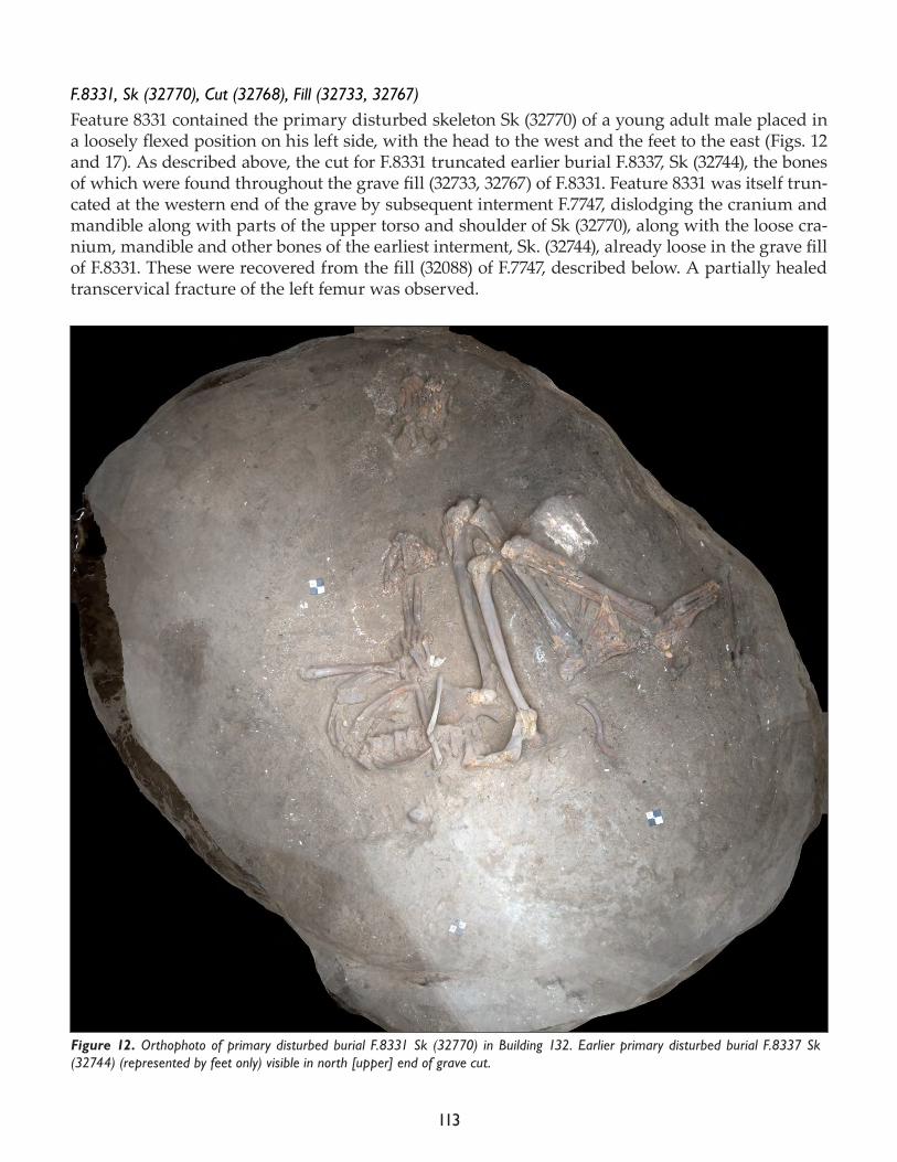
113
F.8331, Sk (32770), Cut (32768), Fill (32733, 32767)Feature 8331 contained the primary disturbed skeleton Sk (32770) of a young adult male placed in a loosely flexed position on his left side, with the head to the west and the feet to the east (Figs. 12 and 17). As described above, the cut for F.8331 truncated earlier burial F.8337, Sk (32744), the bones of which were found throughout the grave fill (32733, 32767) of F.8331. Feature 8331 was itself trun-cated at the western end of the grave by subsequent interment F.7747, dislodging the cranium and mandible along with parts of the upper torso and shoulder of Sk (32770), along with the loose cra-nium, mandible and other bones of the earliest interment, Sk. (32744), already loose in the grave fill of F.8331. These were recovered from the fill (32088) of F.7747, described below. A partially healed transcervical fracture of the left femur was observed.
Figure 12. Orthophoto of primary disturbed burial F.8331 Sk (32770) in Building 132. Earlier primary disturbed burial F.8337 Sk (32744) (represented by feet only) visible in north [upper] end of grave cut.
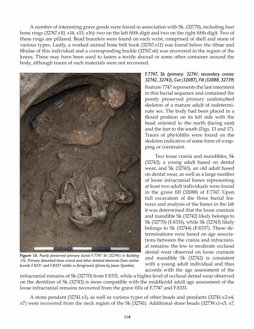
114
A number of interesting grave goods were found in association with Sk. (32770), including four bone rings (32767.x10, x14, x15, x16): two on the left fifth digit and two on the right fifth digit. Two of these rings are pillared. Bead bracelets were found on each wrist, comprised of shell and stone of various types. Lastly, a worked animal bone belt hook (32767.x11) was found below the tibiae and fibulae of this individual and a corresponding buckle (32767.x6) was recovered in the region of the knees. These may have been used to fasten a textile shroud or some other container around the body, although traces of such materials were not recovered.
F.7747, Sk (primary: 32741; secondary crania: 32742, 32743), Cut (32087), Fill (32088, 32739)Feature 7747 represents the last interment in this burial sequence and contained the poorly preserved primary undisturbed skeleton of a mature adult of indetermi-nate sex. The body had been placed in a flexed position on its left side with the head oriented to the north (facing east) and the feet to the south (Figs. 13 and 17). Traces of phytoliths were found on the skeleton indicative of some form of wrap-ping or constraint.
Two loose crania and mandibles, Sk (32742), a young adult based on dental wear, and Sk (32743), an old adult based on dental wear, as well as a large number of loose infracranial bones representing at least two adult individuals were found in the grave fill (32088) of F.7747. Upon full excavation of the three burial fea-tures and analysis of the bones in the lab it was determined that the loose cranium and mandible Sk (32742) likely belongs to Sk (32770) (F.8331), while Sk (32743) likely belongs to Sk (32744) (F.8337). These de-terminations were based on age associa-tions between the crania and infracrani-al remains: the low to moderate occlusal dental wear observed on loose cranium and mandible Sk (32742) is consistent with a young adult individual and thus accords with the age assessment of the
infracranial remains of Sk (32770) from F.8331, while a higher level of occlusal dental wear observed on the dentition of Sk (32743) is more compatible with the middle/old adult age assessment of the loose infracranial remains recovered from the grave fills of F.7747 and F.8331.
A stone pendant (32741.x1), as well as various types of other beads and pendants (32741.x2-x4, x7) were recovered from the neck region of the Sk (32741). Additional stone beads (32739.x1-x5, x7,
Figure 13. Poorly preserved primary burial F.7747 Sk (32741) in Building 132. Primary disturbed loose crania and other skeletal elements from earlier burials F.8331 and F.8337 visible in foreground (photo by Jason Quinlan).
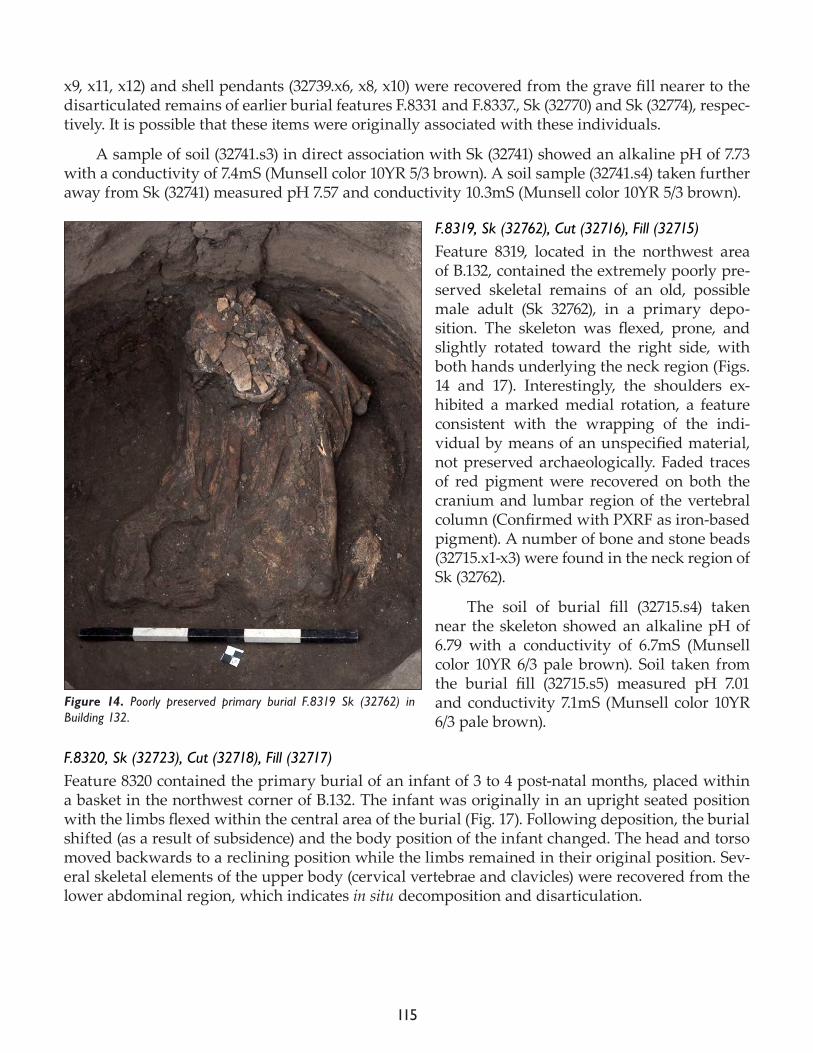
115
x9, x11, x12) and shell pendants (32739.x6, x8, x10) were recovered from the grave fill nearer to the disarticulated remains of earlier burial features F.8331 and F.8337., Sk (32770) and Sk (32774), respec-tively. It is possible that these items were originally associated with these individuals.
A sample of soil (32741.s3) in direct association with Sk (32741) showed an alkaline pH of 7.73 with a conductivity of 7.4mS (Munsell color 10YR 5/3 brown). A soil sample (32741.s4) taken further away from Sk (32741) measured pH 7.57 and conductivity 10.3mS (Munsell color 10YR 5/3 brown).
F.8319, Sk (32762), Cut (32716), Fill (32715)Feature 8319, located in the northwest area of B.132, contained the extremely poorly pre-served skeletal remains of an old, possible male adult (Sk 32762), in a primary depo-sition. The skeleton was flexed, prone, and slightly rotated toward the right side, with both hands underlying the neck region (Figs. 14 and 17). Interestingly, the shoulders ex-hibited a marked medial rotation, a feature consistent with the wrapping of the indi-vidual by means of an unspecified material, not preserved archaeologically. Faded traces of red pigment were recovered on both the cranium and lumbar region of the vertebral column (Confirmed with PXRF as iron-based pigment). A number of bone and stone beads (32715.x1-x3) were found in the neck region of Sk (32762).
The soil of burial fill (32715.s4) taken near the skeleton showed an alkaline pH of 6.79 with a conductivity of 6.7mS (Munsell color 10YR 6/3 pale brown). Soil taken from the burial fill (32715.s5) measured pH 7.01 and conductivity 7.1mS (Munsell color 10YR 6/3 pale brown).
F.8320, Sk (32723), Cut (32718), Fill (32717)Feature 8320 contained the primary burial of an infant of 3 to 4 post-natal months, placed within a basket in the northwest corner of B.132. The infant was originally in an upright seated position with the limbs flexed within the central area of the burial (Fig. 17). Following deposition, the burial shifted (as a result of subsidence) and the body position of the infant changed. The head and torso moved backwards to a reclining position while the limbs remained in their original position. Sev-eral skeletal elements of the upper body (cervical vertebrae and clavicles) were recovered from the lower abdominal region, which indicates in situ decomposition and disarticulation.
Figure 14. Poorly preserved primary burial F.8319 Sk (32762) in Building 132.
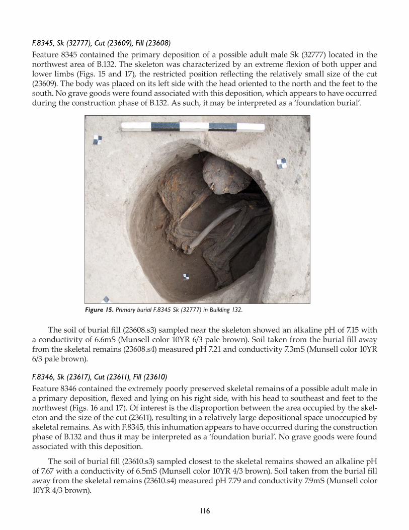
116
F.8345, Sk (32777), Cut (23609), Fill (23608)Feature 8345 contained the primary deposition of a possible adult male Sk (32777) located in the northwest area of B.132. The skeleton was characterized by an extreme flexion of both upper and lower limbs (Figs. 15 and 17), the restricted position reflecting the relatively small size of the cut (23609). The body was placed on its left side with the head oriented to the north and the feet to the south. No grave goods were found associated with this deposition, which appears to have occurred
during the construction phase of B.132. As such, it may be interpreted as a ‘foundation burial’.
The soil of burial fill (23608.s3) sampled near the skeleton showed an alkaline pH of 7.15 with a conductivity of 6.6mS (Munsell color 10YR 6/3 pale brown). Soil taken from the burial fill away from the skeletal remains (23608.s4) measured pH 7.21 and conductivity 7.3mS (Munsell color 10YR 6/3 pale brown).
F.8346, Sk (23617), Cut (23611), Fill (23610)Feature 8346 contained the extremely poorly preserved skeletal remains of a possible adult male in a primary deposition, flexed and lying on his right side, with his head to southeast and feet to the northwest (Figs. 16 and 17). Of interest is the disproportion between the area occupied by the skel-eton and the size of the cut (23611), resulting in a relatively large depositional space unoccupied by skeletal remains. As with F.8345, this inhumation appears to have occurred during the construction phase of B.132 and thus it may be interpreted as a ‘foundation burial’. No grave goods were found associated with this deposition.
The soil of burial fill (23610.s3) sampled closest to the skeletal remains showed an alkaline pH of 7.67 with a conductivity of 6.5mS (Munsell color 10YR 4/3 brown). Soil taken from the burial fill away from the skeletal remains (23610.s4) measured pH 7.79 and conductivity 7.9mS (Munsell color 10YR 4/3 brown).
Figure 15. Primary burial F.8345 Sk (32777) in Building 132.
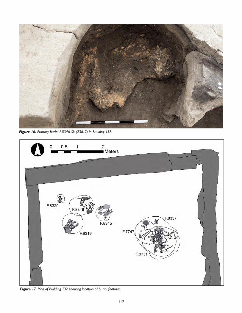
117
Figure 17. Plan of Building 132 showing location of burial features.
Figure 16. Primary burial F.8346 Sk (23617) in Building 132.
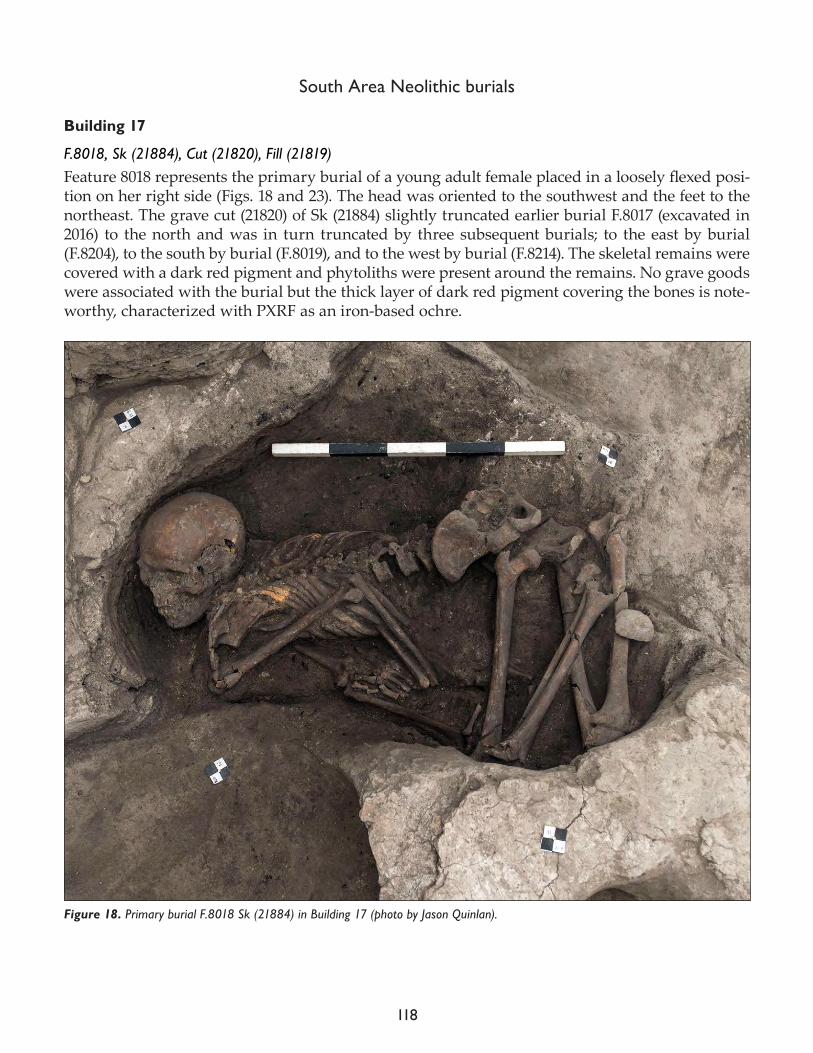
118
South Area Neolithic burials
Building 17
F.8018, Sk (21884), Cut (21820), Fill (21819)Feature 8018 represents the primary burial of a young adult female placed in a loosely flexed posi-tion on her right side (Figs. 18 and 23). The head was oriented to the southwest and the feet to the northeast. The grave cut (21820) of Sk (21884) slightly truncated earlier burial F.8017 (excavated in 2016) to the north and was in turn truncated by three subsequent burials; to the east by burial (F.8204), to the south by burial (F.8019), and to the west by burial (F.8214). The skeletal remains were covered with a dark red pigment and phytoliths were present around the remains. No grave goods were associated with the burial but the thick layer of dark red pigment covering the bones is note-worthy, characterized with PXRF as an iron-based ochre.
Figure 18. Primary burial F.8018 Sk (21884) in Building 17 (photo by Jason Quinlan).
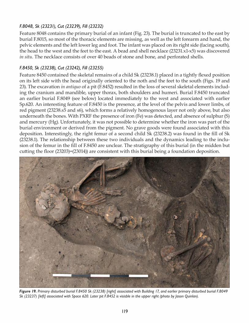
119
F.8048, Sk (23231), Cut (23239), Fill (23232)Feature 8048 contains the primary burial of an infant (Fig. 23). The burial is truncated to the east by burial F.8015, so most of the thoracic elements are missing, as well as the left forearm and hand, the pelvic elements and the left lower leg and foot. The infant was placed on its right side (facing south), the head to the west and the feet to the east. A bead and shell necklace (23231.x1-x5) was discovered in situ. The necklace consists of over 40 beads of stone and bone, and perforated shells.
F.8450, Sk (23238), Cut (23242), Fill (23255)Feature 8450 contained the skeletal remains of a child Sk (23238.1) placed in a tightly flexed position on its left side with the head originally oriented to the noth and the feet to the south (Figs. 19 and 23). The excavation in antiquo of a pit (F.8452) resulted in the loss of several skeletal elements includ-ing the cranium and mandible, upper thorax, both shoulders and humeri. Burial F.8450 truncated an earlier burial F.8049 (see below) located immediately to the west and associated with earlier Sp.620. An interesting feature of F.8450 is the presence, at the level of the pelvis and lower limbs, of red pigment (23238.s5 and s6), which forms a relatively homogenous layer not only above, but also underneath the bones. With PXRF the presence of iron (Fe) was detected, and absence of sulphur (S) and mercury (Hg). Unfortunately, it was not possible to determine whether the iron was part of the burial environment or derived from the pigment. No grave goods were found associated with this deposition. Interestingly, the right femur of a second child Sk (23238.2) was found in the fill of Sk (23238.1). The relationship between these two individuals and the dynamics leading to the inclu-sion of the femur in the fill of F.8450 are unclear. The stratigraphy of this burial (in the midden but cutting the floor (23203)=(23014)) are consistent with this burial being a foundation deposition.
Figure 19. Primary disturbed burial F.8450 Sk (23238) [right] associated with Building 17, and earlier primary disturbed burial F.8049 Sk (23237) [left] associated with Space 620. Later pit F.8452 is visisble in the upper right (photo by Jason Quinlan).
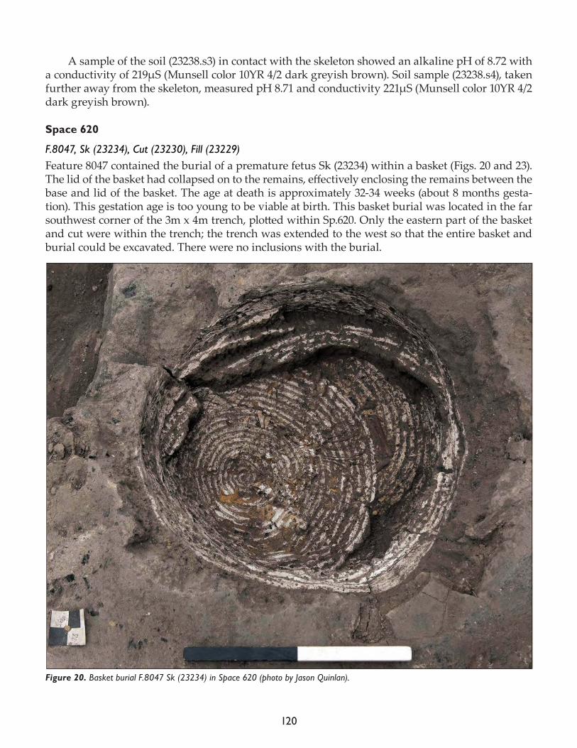
120
A sample of the soil (23238.s3) in contact with the skeleton showed an alkaline pH of 8.72 with a conductivity of 219μS (Munsell color 10YR 4/2 dark greyish brown). Soil sample (23238.s4), taken further away from the skeleton, measured pH 8.71 and conductivity 221μS (Munsell color 10YR 4/2 dark greyish brown).
Space 620
F.8047, Sk (23234), Cut (23230), Fill (23229)Feature 8047 contained the burial of a premature fetus Sk (23234) within a basket (Figs. 20 and 23). The lid of the basket had collapsed on to the remains, effectively enclosing the remains between the base and lid of the basket. The age at death is approximately 32-34 weeks (about 8 months gesta-tion). This gestation age is too young to be viable at birth. This basket burial was located in the far southwest corner of the 3m x 4m trench, plotted within Sp.620. Only the eastern part of the basket and cut were within the trench; the trench was extended to the west so that the entire basket and burial could be excavated. There were no inclusions with the burial.
Figure 20. Basket burial F.8047 Sk (23234) in Space 620 (photo by Jason Quinlan).
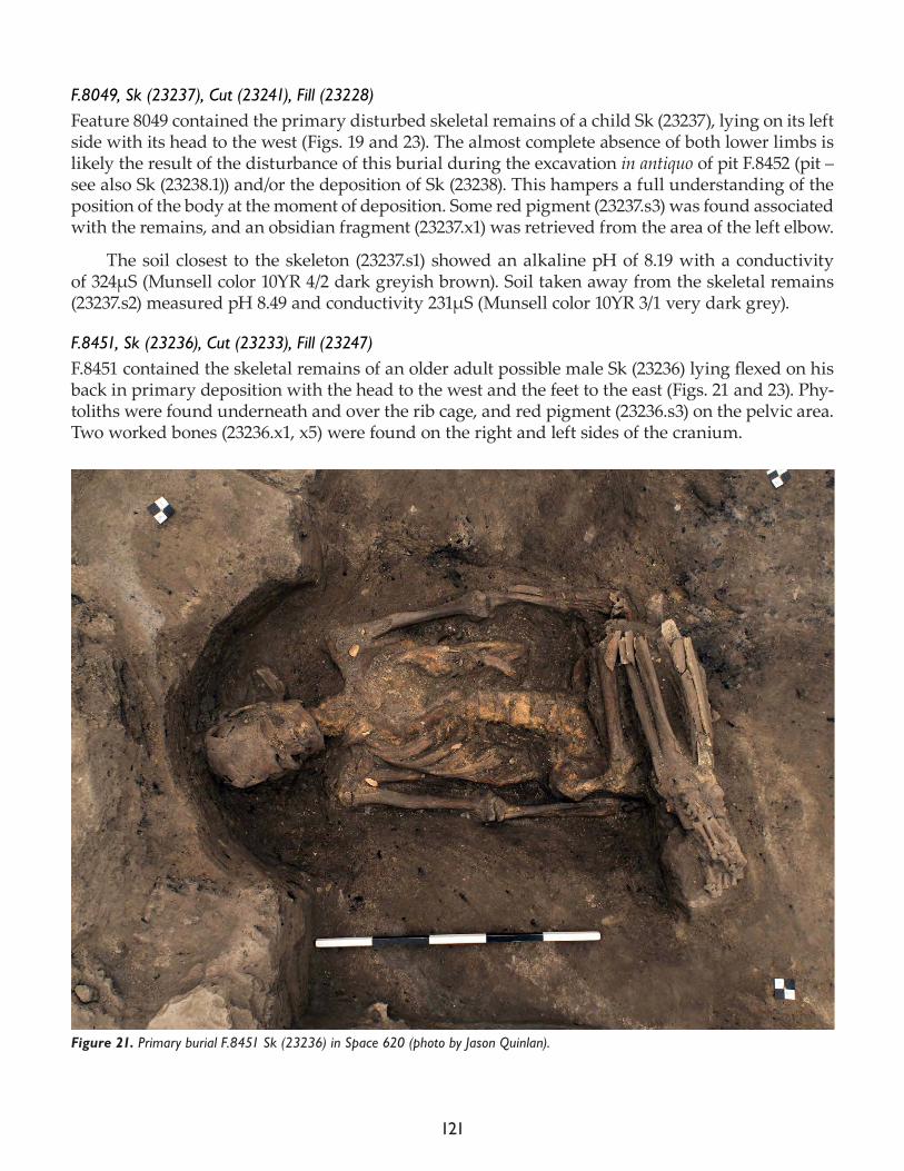
121
F.8049, Sk (23237), Cut (23241), Fill (23228)Feature 8049 contained the primary disturbed skeletal remains of a child Sk (23237), lying on its left side with its head to the west (Figs. 19 and 23). The almost complete absence of both lower limbs is likely the result of the disturbance of this burial during the excavation in antiquo of pit F.8452 (pit – see also Sk (23238.1)) and/or the deposition of Sk (23238). This hampers a full understanding of the position of the body at the moment of deposition. Some red pigment (23237.s3) was found associated with the remains, and an obsidian fragment (23237.x1) was retrieved from the area of the left elbow.
The soil closest to the skeleton (23237.s1) showed an alkaline pH of 8.19 with a conductivity of 324μS (Munsell color 10YR 4/2 dark greyish brown). Soil taken away from the skeletal remains (23237.s2) measured pH 8.49 and conductivity 231μS (Munsell color 10YR 3/1 very dark grey).
F.8451, Sk (23236), Cut (23233), Fill (23247)F.8451 contained the skeletal remains of an older adult possible male Sk (23236) lying flexed on his back in primary deposition with the head to the west and the feet to the east (Figs. 21 and 23). Phy-toliths were found underneath and over the rib cage, and red pigment (23236.s3) on the pelvic area. Two worked bones (23236.x1, x5) were found on the right and left sides of the cranium.
Figure 21. Primary burial F.8451 Sk (23236) in Space 620 (photo by Jason Quinlan).
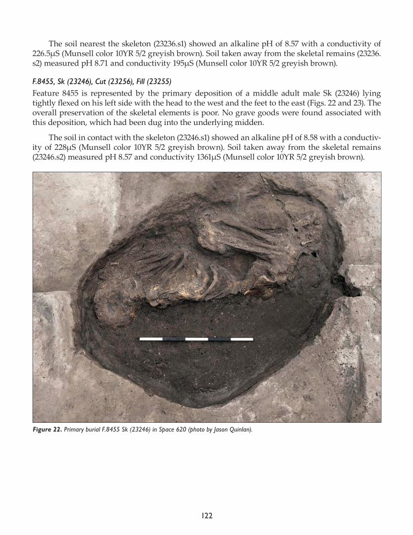
122
The soil nearest the skeleton (23236.s1) showed an alkaline pH of 8.57 with a conductivity of 226.5μS (Munsell color 10YR 5/2 greyish brown). Soil taken away from the skeletal remains (23236.s2) measured pH 8.71 and conductivity 195μS (Munsell color 10YR 5/2 greyish brown).
F.8455, Sk (23246), Cut (23256), Fill (23255)Feature 8455 is represented by the primary deposition of a middle adult male Sk (23246) lying tightly flexed on his left side with the head to the west and the feet to the east (Figs. 22 and 23). The overall preservation of the skeletal elements is poor. No grave goods were found associated with this deposition, which had been dug into the underlying midden.
The soil in contact with the skeleton (23246.s1) showed an alkaline pH of 8.58 with a conductiv-ity of 228μS (Munsell color 10YR 5/2 greyish brown). Soil taken away from the skeletal remains (23246.s2) measured pH 8.57 and conductivity 1361μS (Munsell color 10YR 5/2 greyish brown).
Figure 22. Primary burial F.8455 Sk (23246) in Space 620 (photo by Jason Quinlan).
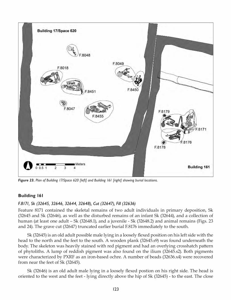
123
Building 161
F.8171, Sk (32645, 32646, 32644, 32648), Cut (32647), Fill (32636)Feature 8171 contained the skeletal remains of two adult individuals in primary deposition, Sk (32645 and Sk (32646), as well as the disturbed remains of an infant Sk (32644), and a collection of human (at least one adult – Sk (32648.1), and a juvenile - Sk (32648.2) and animal remains (Figs. 23 and 24). The grave cut (32647) truncated earlier burial F.8176 immediately to the south.
Sk (32645) is an old adult possible male lying in a loosely flexed position on his left side with the head to the north and the feet to the south. A wooden plank (32645.s9) was found underneath the body. The skeleton was heavily stained with red pigment and had an overlying crosshatch pattern of phytoliths. A lump of reddish pigment was also found on the ilium (32645.s2). Both pigments were characterized by PXRF as an iron-based ochre. A number of beads (32636.x4) were recovered from near the feet of Sk (32645).
Sk (32646) is an old adult male lying in a loosely flexed postion on his right side. The head is oriented to the west and the feet - lying directly above the hip of Sk (32645) - to the east. The close
Figure 23. Plan of Building 17/Space 620 [left] and Building 161 [right] showing burial locations.
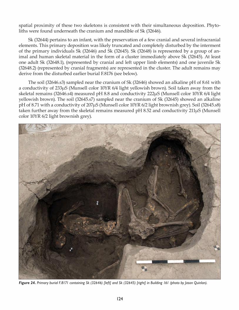
124
spatial proximity of these two skeletons is consistent with their simultaneous deposition. Phyto-liths were found underneath the cranium and mandible of Sk (32646).
Sk (32644) pertains to an infant, with the preservation of a few cranial and several infracranial elements. This primary deposition was likely truncated and completely disturbed by the interment of the primary individuals Sk (32646) and Sk (32645). Sk (32648) is represented by a group of an-imal and human skeletal material in the form of a cluster immediately above Sk (32645). At least one adult Sk (32648.1), (represented by cranial and left upper limb elements) and one juvenile Sk (32648.2) (represented by cranial fragments) are represented in the cluster. The adult remains may derive from the disturbed earlier burial F.8176 (see below).
The soil (32646.s3) sampled near the cranium of Sk (32646) showed an alkaline pH of 8.61 with a conductivity of 233μS (Munsell color 10YR 6/4 light yellowish brown). Soil taken away from the skeletal remains (32646.s4) measured pH 8.8 and conductivity 222μS (Munsell color 10YR 6/4 light yellowish brown). The soil (32645.s7) sampled near the cranium of Sk (32645) showed an alkaline pH of 8.71 with a conductivity of 207μS (Munsell color 10YR 6/2 light brownish grey). Soil (32645.s8) taken further away from the skeletal remains measured pH 8.52 and conductivity 211μS (Munsell color 10YR 6/2 light brownish grey).
Figure 24. Primary burial F.8171 containing Sk (32646) [left] and Sk (32645) [right] in Building 161 (photo by Jason Quinlan).
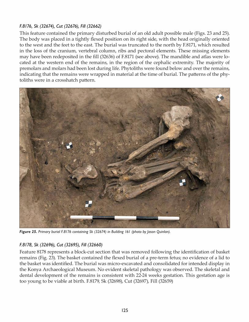
125
F.8176, Sk (32674), Cut (32676), Fill (32662)This feature contained the primary disturbed burial of an old adult possible male (Figs. 23 and 25). The body was placed in a tightly flexed position on its right side, with the head originally oriented to the west and the feet to the east. The burial was truncated to the north by F.8171, which resulted in the loss of the cranium, vertebral column, ribs and pectoral elements. These missing elements may have been redeposited in the fill (32636) of F.8171 (see above). The mandible and atlas were lo-cated at the western end of the remains, in the region of the cephalic extremity. The majority of premolars and molars had been lost during life. Phytoliths were found below and over the remains, indicating that the remains were wrapped in material at the time of burial. The patterns of the phy-toliths were in a crosshatch pattern.
F.8178, Sk (32696), Cut (32695), Fill (32660)Feature 8178 represents a block-cut section that was removed following the identification of basket remains (Fig. 23). The basket contained the flexed burial of a pre-term fetus; no evidence of a lid to the basket was identified. The burial was micro-excavated and consolidated for intended display in the Konya Archaeological Museum. No evident skeletal pathology was observed. The skeletal and dental development of the remains is consistent with 22-24 weeks gestation. This gestation age is too young to be viable at birth. F.8179, Sk (32698), Cut (32697), Fill (32659)
Figure 25. Primary burial F.8176 containing Sk (32674) in Building 161 (photo by Jason Quinlan).
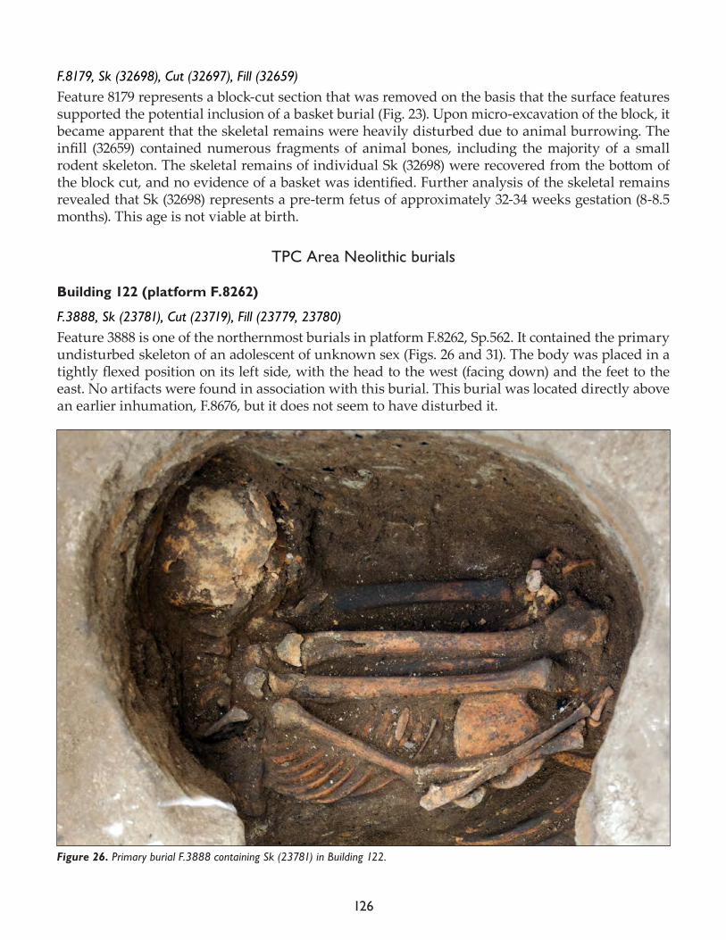
126
F.8179, Sk (32698), Cut (32697), Fill (32659) Feature 8179 represents a block-cut section that was removed on the basis that the surface features supported the potential inclusion of a basket burial (Fig. 23). Upon micro-excavation of the block, it became apparent that the skeletal remains were heavily disturbed due to animal burrowing. The infill (32659) contained numerous fragments of animal bones, including the majority of a small rodent skeleton. The skeletal remains of individual Sk (32698) were recovered from the bottom of the block cut, and no evidence of a basket was identified. Further analysis of the skeletal remains revealed that Sk (32698) represents a pre-term fetus of approximately 32-34 weeks gestation (8-8.5 months). This age is not viable at birth.
TPC Area Neolithic burials
Building 122 (platform F.8262)
F.3888, Sk (23781), Cut (23719), Fill (23779, 23780)Feature 3888 is one of the northernmost burials in platform F.8262, Sp.562. It contained the primary undisturbed skeleton of an adolescent of unknown sex (Figs. 26 and 31). The body was placed in a tightly flexed position on its left side, with the head to the west (facing down) and the feet to the east. No artifacts were found in association with this burial. This burial was located directly above an earlier inhumation, F.8676, but it does not seem to have disturbed it.
Figure 26. Primary burial F.3888 containing Sk (23781) in Building 122.
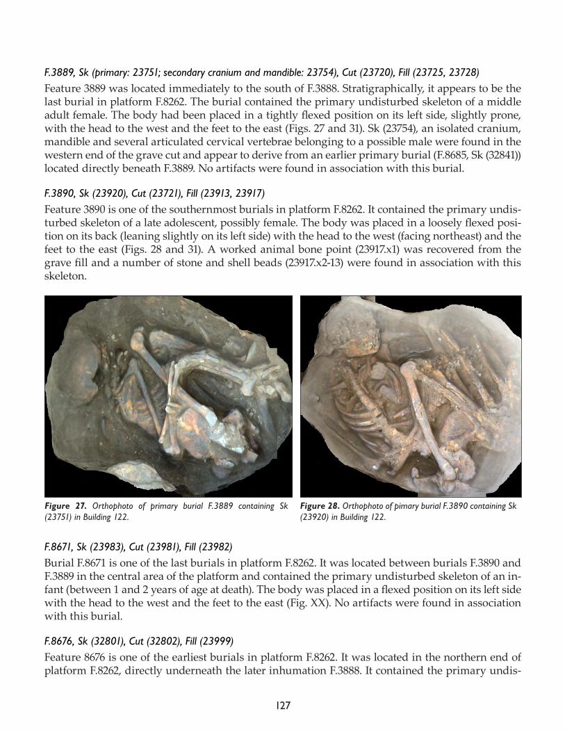
127
F.3889, Sk (primary: 23751; secondary cranium and mandible: 23754), Cut (23720), Fill (23725, 23728)Feature 3889 was located immediately to the south of F.3888. Stratigraphically, it appears to be the last burial in platform F.8262. The burial contained the primary undisturbed skeleton of a middle adult female. The body had been placed in a tightly flexed position on its left side, slightly prone, with the head to the west and the feet to the east (Figs. 27 and 31). Sk (23754), an isolated cranium, mandible and several articulated cervical vertebrae belonging to a possible male were found in the western end of the grave cut and appear to derive from an earlier primary burial (F.8685, Sk (32841)) located directly beneath F.3889. No artifacts were found in association with this burial.
F.3890, Sk (23920), Cut (23721), Fill (23913, 23917)Feature 3890 is one of the southernmost burials in platform F.8262. It contained the primary undis-turbed skeleton of a late adolescent, possibly female. The body was placed in a loosely flexed posi-tion on its back (leaning slightly on its left side) with the head to the west (facing northeast) and the feet to the east (Figs. 28 and 31). A worked animal bone point (23917.x1) was recovered from the grave fill and a number of stone and shell beads (23917.x2-13) were found in association with this skeleton.
F.8671, Sk (23983), Cut (23981), Fill (23982)Burial F.8671 is one of the last burials in platform F.8262. It was located between burials F.3890 and F.3889 in the central area of the platform and contained the primary undisturbed skeleton of an in-fant (between 1 and 2 years of age at death). The body was placed in a flexed position on its left side with the head to the west and the feet to the east (Fig. XX). No artifacts were found in association with this burial.
F.8676, Sk (32801), Cut (32802), Fill (23999)Feature 8676 is one of the earliest burials in platform F.8262. It was located in the northern end of platform F.8262, directly underneath the later inhumation F.3888. It contained the primary undis-
Figure 27. Orthophoto of primary burial F.3889 containing Sk (23751) in Building 122.
Figure 28. Orthophoto of pimary burial F.3890 containing Sk (23920) in Building 122.
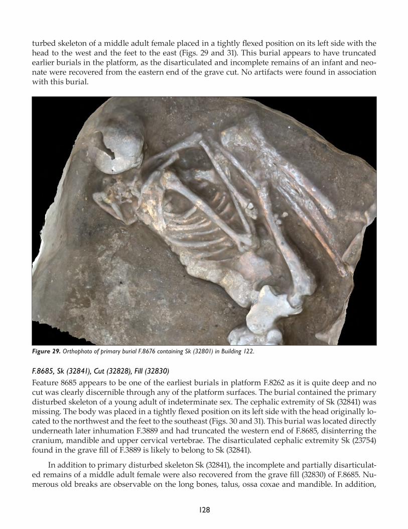
128
turbed skeleton of a middle adult female placed in a tightly flexed position on its left side with the head to the west and the feet to the east (Figs. 29 and 31). This burial appears to have truncated earlier burials in the platform, as the disarticulated and incomplete remains of an infant and neo-nate were recovered from the eastern end of the grave cut. No artifacts were found in association with this burial.
F.8685, Sk (32841), Cut (32828), Fill (32830)Feature 8685 appears to be one of the earliest burials in platform F.8262 as it is quite deep and no cut was clearly discernible through any of the platform surfaces. The burial contained the primary disturbed skeleton of a young adult of indeterminate sex. The cephalic extremity of Sk (32841) was missing. The body was placed in a tightly flexed position on its left side with the head originally lo-cated to the northwest and the feet to the southeast (Figs. 30 and 31). This burial was located directly underneath later inhumation F.3889 and had truncated the western end of F.8685, disinterring the cranium, mandible and upper cervical vertebrae. The disarticulated cephalic extremity Sk (23754) found in the grave fill of F.3889 is likely to belong to Sk (32841).
In addition to primary disturbed skeleton Sk (32841), the incomplete and partially disarticulat-ed remains of a middle adult female were also recovered from the grave fill (32830) of F.8685. Nu-merous old breaks are observable on the long bones, talus, ossa coxae and mandible. In addition,
Figure 29. Orthophoto of primary burial F.8676 containing Sk (32801) in Building 122.
129
old gouge marks are visible on the broken talus. These observations are suggestive of an aggressive disturbance to these bones in Neolithic times, perhaps resulting from the disinterment and reloca-tion of this individual from an earlier grave. However, no trace of an earlier burial was found in this immediate vicinity of F.8685. As such, these bones may represent a secondary deposit. However, until the platform has been completely excavated, this cannot be ascertained. No artifacts were found in association with burial F.8685.
F.8691, Sk (32856), Cut (32857), Fill (32855)Feature 8691 was located in the southern end of platform F.8682, directly underneath F.3890. As with F.8685, it appears to be one of the earliest burial features in the platform. It contained the par-tial cranium of a young adult possible female Sk (32856) and the isolated and partially articulated infracranial remains of at least two adults recovered from the grave fill and assigned as (32855.1) and (32855.2). Sk (32855.1) consists of an articulated right lower limb, a left femur and partial left foot. Sk (32855.2) is a semi-articulated and partially complete infracranial skeleton belonging to a possible female (Fig. 31). The bones of Sk (32855.2) have extensive but irregular black staining, and this matches the staining pattern of the isolated cranium Sk (32856). The black color on the bones
Figure 30. Orthophoto of primary disturbed burial F.8685 containing Sk (32841) in Building 122.
130
was confirmed as manganese (Mn) with PXRF. The levels of manganese are much higher on the black parts of the bone than on the non-stained parts of the bone and in the burial soil (32855). It is likely that this black staining was caused by the diagenetic accumulation of manganese from the soil, a phenomenon often observed at Çatalhöyük and other archaeological sites (e.g. Shahack-Gross 1997; Dupras and Schultz 2013). The irregular staining, and the fact that no manganese nodules have been found on site, makes it less likely that this black staining was intentional. The other set of infracranial bones Sk (32855.1) is much less stained. This suggests that one set of bones had been moved to this location from a different location.
Figure 31. Plan of platform F.8262 in Builidng 122 showing location of burial features (plan by Camilla Mazzucato).
131
Building 150 (platform F.8664)
F.3867, Sk (primary disturbed/secondary individuals: 23760, 23905, 23909, 23911; primary disturbed loose/second-ary crania and mandibles: 23910, 23957), Cut (20763), Fill (31884)Feature 3867 is located in the southern half of platform F.8664 along the eastern wall of Building 150. It includes skeletal remains related to different (at least two) depositional events. Sk (23760) is represented by the flexed, incomplete skeleton of a middle adult of unknown sex, lacking the cra-nium and mandible (see Sk (23957), below, which may represent the cephalic elements of this indi-vidual), and its stratigraphic position is consistent with one of the last (or the last) deposition events in F.3867. Sk (23905) is represented by few cranial elements, coxal bones, and femora of a middle adult individual of indeterminate sex. Sk (23909) and Sk (23911) are the incomplete skeletal remains of two children (Sk (23909), which was flexed, while the incompleteness and scattered position of the remains of Sk (23911) hampered an understanding of their original position). Two crania and mandibles Sk (23910) and Sk (23957) pertain to middle and old adult males, respectively. Their rela-tive position and relative age-at-death suggest that they may be associated with Sk (23760) (cranium and mandible Sk (23957)) and Sk. (23905) (cranium and mandible Sk (23910)), respectively (Figs. 32 and 35). The isolated skeletal remains of Sk (31884.1-91) were recovered in the fill (31884) of this fea-ture and pertain to various anatomical regions of at least six adults and one child (a minimum number calculated on the basis of right femoral elements).
The overall interpretation of F.3867 is complicated by the chaotic overlapping of partially artic-ulated and disarticulated remains and by their extreme fragmentation. Sk (23905), Sk (23909), and Sk (23911) may relate to primary inhumations disturbed by the later deposition of Sk (23760). The disturbance of the latter is more difficult to explain due to the absence of subsequent depositions above this individual, (but note the presence of isolated and scattered skeletal remains in the fill above). Accordingly, the absence of various skeletal elements in the context of overall anatomical
Figure 32. Mid-excavation view of burial F.3867 with loose and semi-articulated skeletal remains (photo by Jason Quinlan).
132
connection may relate to the secondary deposition of a partially fleshed individual. Similarly, the most parsimonious interpretation of the isolated human remains in fill (31884) is their link to two different processes: the disturbance of Sk (23905), Sk (23909), and Sk (23911), or their secondary deposition as isolated skeletal/body parts. It is essential in this context to note: a) that the fragmen-tation of these skeletal findings, and the partial overlapping of the age-at-death determinations of these individuals make it almost impossible to confidently assign any of the loose elements to a specific individual, and b) the incomplete excavation of platform F.3855 means that other individu-als may still lie beneath. Several beads (31884.x1-x29, x31-x36) and one flint artifact (31884.x30) were collected from the fill (31844), their position being inconsistent with any association with a specific individual.
F.3868, Sk (primary individuals: 23799, 23904, 23798; primary disturbed loose/secondary crania: 23900, 23901, 23902, 23903, 23965, 23972, 23783, 32835, 32848) Cut (20796), Fill (31888)Feature 3868 represents a complex burial deposit of primary and secondary skeletal remains of adults and subadults. This feature adjoins F.3867 located immediately to the south (described above). Excavation of this feature was not completed during the 2017 season, and it is expected that the skeletal remains of other individuals are still present within this context. There were three primary inhumations within the lower levels of this feature. These were the burial of a pregnant adult female, Sk (23799) and her full-term fetus, Sk (23904) (Figs. 33 and 35) and an adult female, Sk (23798).
Individual Sk (23799) died during the final stages of pregnancy and was buried with the baby in utero. The body position is loosely flexed and the cephalic extremity is hyper-extended. Further analysis revealed that she died between 25 and 35 years. Significant skeletal pathology included posterior fusion of the thoracic and lumbar vertebral column with preservation of the intervertebral space but leaving the anterior parts of the vertebrae unaffected. There was also advanced wide-spread osteoporosis affecting the majority of skeletal elements. Lastly, the glenoid of the left scapula and the sternal end of the left clavicle are expanded, likely as an osteophytic response to trauma, and six consecutive left ribs have healed mid-shaft fractures.
The full-term fetus (40 weeks gestation), Sk (23904) died in utero. The fetus does not display any evidence of skeletal pathology. The position of the fetal head (engaged within the mother’s pelvic cavity) and the nuchal position of the right hand (behind the head, elbow at chin) strongly suggest that if the mother was in labor, the baby could not have been delivered without interven-tion (manipulation of the trapped upper limb). The third primary inhumation represents a partially articulated adult female, Sk (23798) of 35+ years of age at death). The lower limbs were not in artic-ulation with the remainder of the skeleton and may be represented in the disarticulated remains within the fill (31888) of this feature. The skeletal pathology of Sk (23798) includes a partially healed fractures of the lateral border of the left scapula and a middle right rib. This individual was depos-ited after the pregnant female, Sk (23799), which is in a lower stratigraphic position within the cut.
The disarticulated crania belong to subadults and adults and their estimated age at death and sex are as follows: Sk (23972) (red pigment on external cranial vault), 18-25 years, male; Sk (23903), 35-45 years, male; Sk (23965), 16-22 years, male; Sk (23783) (cranium and mandible), 35-50 years, female; Sk (23901), 20+ years, female; Sk (23902), Sk (32848) and Sk (32835), all 35-50 years, and Sk (23900), adult. The disarticulated skeletal remains deposited in feature 3868 represent several indi-viduals of multiple ages. It is possible that single individuals may be represented in the disarticu-lated remains of both features.
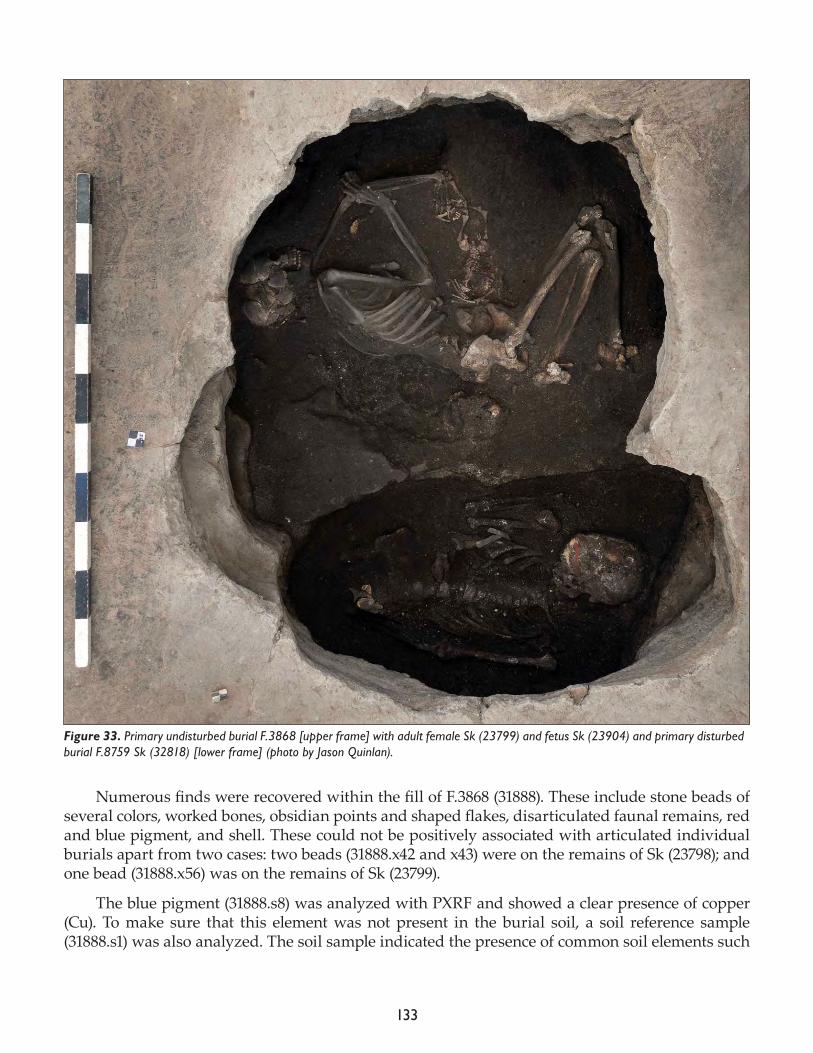
133
Numerous finds were recovered within the fill of F.3868 (31888). These include stone beads of several colors, worked bones, obsidian points and shaped flakes, disarticulated faunal remains, red and blue pigment, and shell. These could not be positively associated with articulated individual burials apart from two cases: two beads (31888.x42 and x43) were on the remains of Sk (23798); and one bead (31888.x56) was on the remains of Sk (23799).
The blue pigment (31888.s8) was analyzed with PXRF and showed a clear presence of copper (Cu). To make sure that this element was not present in the burial soil, a soil reference sample (31888.s1) was also analyzed. The soil sample indicated the presence of common soil elements such
Figure 33. Primary undisturbed burial F.3868 [upper frame] with adult female Sk (23799) and fetus Sk (23904) and primary disturbed burial F.8759 Sk (32818) [lower frame] (photo by Jason Quinlan).
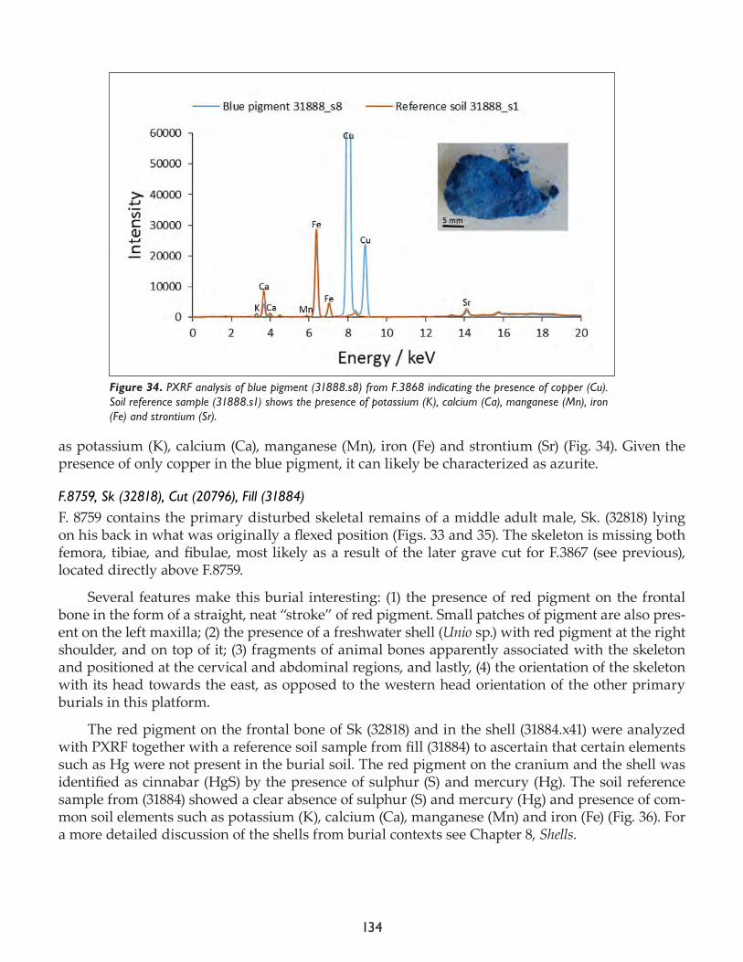
134
as potassium (K), calcium (Ca), manganese (Mn), iron (Fe) and strontium (Sr) (Fig. 34). Given the presence of only copper in the blue pigment, it can likely be characterized as azurite.
F.8759, Sk (32818), Cut (20796), Fill (31884)F. 8759 contains the primary disturbed skeletal remains of a middle adult male, Sk. (32818) lying on his back in what was originally a flexed position (Figs. 33 and 35). The skeleton is missing both femora, tibiae, and fibulae, most likely as a result of the later grave cut for F.3867 (see previous), located directly above F.8759.
Several features make this burial interesting: (1) the presence of red pigment on the frontal bone in the form of a straight, neat “stroke” of red pigment. Small patches of pigment are also pres-ent on the left maxilla; (2) the presence of a freshwater shell (Unio sp.) with red pigment at the right shoulder, and on top of it; (3) fragments of animal bones apparently associated with the skeleton and positioned at the cervical and abdominal regions, and lastly, (4) the orientation of the skeleton with its head towards the east, as opposed to the western head orientation of the other primary burials in this platform.
The red pigment on the frontal bone of Sk (32818) and in the shell (31884.x41) were analyzed with PXRF together with a reference soil sample from fill (31884) to ascertain that certain elements such as Hg were not present in the burial soil. The red pigment on the cranium and the shell was identified as cinnabar (HgS) by the presence of sulphur (S) and mercury (Hg). The soil reference sample from (31884) showed a clear absence of sulphur (S) and mercury (Hg) and presence of com-mon soil elements such as potassium (K), calcium (Ca), manganese (Mn) and iron (Fe) (Fig. 36). For a more detailed discussion of the shells from burial contexts see Chapter 8, Shells.
Figure 34. PXRF analysis of blue pigment (31888.s8) from F.3868 indicating the presence of copper (Cu). Soil reference sample (31888.s1) shows the presence of potassium (K), calcium (Ca), manganese (Mn), iron (Fe) and strontium (Sr).
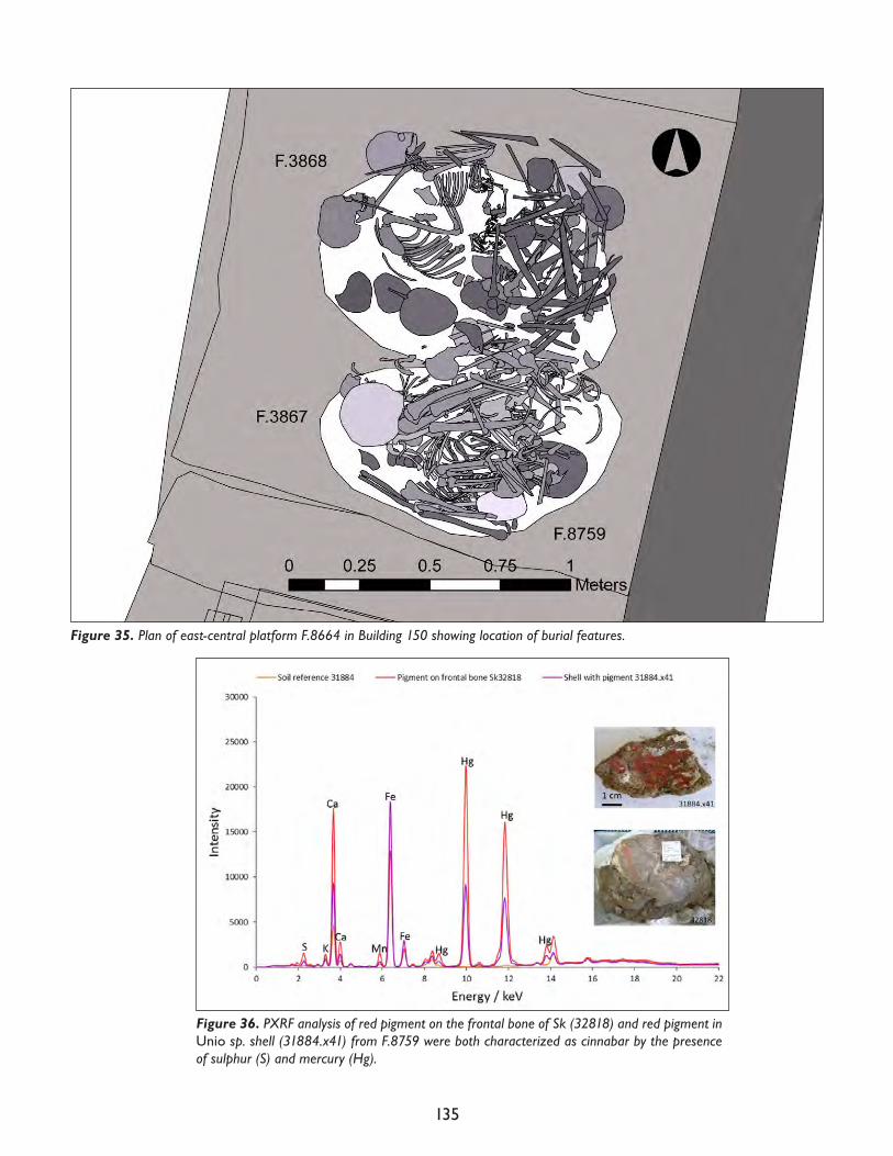
135
Figure 35. Plan of east-central platform F.8664 in Building 150 showing location of burial features.
Figure 36. PXRF analysis of red pigment on the frontal bone of Sk (32818) and red pigment in Unio sp. shell (31884.x41) from F.8759 were both characterized as cinnabar by the presence of sulphur (S) and mercury (Hg).
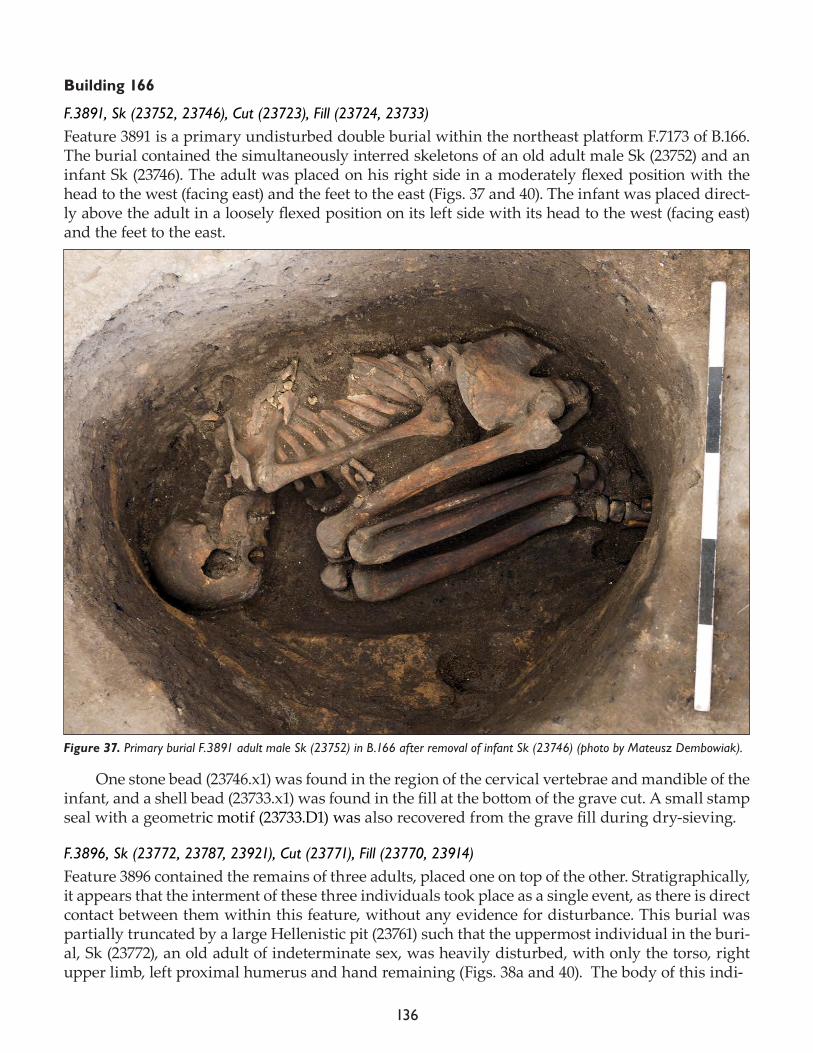
136
Building 166
F.3891, Sk (23752, 23746), Cut (23723), Fill (23724, 23733)Feature 3891 is a primary undisturbed double burial within the northeast platform F.7173 of B.166. The burial contained the simultaneously interred skeletons of an old adult male Sk (23752) and an infant Sk (23746). The adult was placed on his right side in a moderately flexed position with the head to the west (facing east) and the feet to the east (Figs. 37 and 40). The infant was placed direct-ly above the adult in a loosely flexed position on its left side with its head to the west (facing east) and the feet to the east.
One stone bead (23746.x1) was found in the region of the cervical vertebrae and mandible of the infant, and a shell bead (23733.x1) was found in the fill at the bottom of the grave cut. A small stamp seal with a geometric motif (23733.D1) was also recovered from the grave fill during dry-sieving.
F.3896, Sk (23772, 23787, 23921), Cut (23771), Fill (23770, 23914)Feature 3896 contained the remains of three adults, placed one on top of the other. Stratigraphically, it appears that the interment of these three individuals took place as a single event, as there is direct contact between them within this feature, without any evidence for disturbance. This burial was partially truncated by a large Hellenistic pit (23761) such that the uppermost individual in the buri-al, Sk (23772), an old adult of indeterminate sex, was heavily disturbed, with only the torso, right upper limb, left proximal humerus and hand remaining (Figs. 38a and 40). The body of this indi-
Figure 37. Primary burial F.3891 adult male Sk (23752) in B.166 after removal of infant Sk (23746) (photo by Mateusz Dembowiak).
137
vidual had been placed on its back with its upper limbs crossed above its chest. The head was oriented to the west and the feet to the east. Although the lower limbs were missing, it seems that the body had been placed in a flexed position, given the oval shape of the grave cut. Two flat, sheet-like pieces of mineral (23772.x1, x2), perhaps mica, were recovered in association with this individual; both were found near the left shoulder.
Directly underneath Sk (23772) was Sk (23787), an old adult female without her cephalic extremity, placed in a tightly flexed position on her right side original-ly oriented with the cephalic extremity to the west and the feet to the east (Figs. 38b and 40). It is unclear whether the cephalic extremity of Sk (23787) was removed prior to its interment or was missing as a result of the Hellenistic truncation of the buri-al. No artifacts were found in association with this individual.
Sk (23921), a mature adult female, was found at the bottom of the grave cut (23771) for F.3896, directly beneath Sk (23787). It is the only completely intact individual found within this burial feature. As with the other two individuals from F.3896, Sk (23921) was oriented with its head to the west and its feet to the east (Figs. 38c and 40). The body had been placed on its back with the lower limbs flexed at the knee and drawn tightly up against the chest. The right upper limb was extended along-side the body, and the left upper limb was extended with the hand placed above the lower abdomen. An anklet of stone beads of various types was found around the left ankle (23914.x1, x2, x3). Due to its ex-ceptional preservation, this individual was consolidated and lifted with the as-sistance of the conservation team and will be put on display in the Konya Archaeo-logical Museum.
Figure 38. Primary burial F.3896 containing (a) old adult Sk (23772), (b) old adult female Sk (23787); (c) mature adult female Sk (23921) (photos by Mateusz Dembowiak).
138
F.8662, Sk (23961), Cut (23945), Fill (23946)Feature 8662 contained the loosely flexed primary undisturbed skeleton of an infant located in the northeast corner of platform F.8661. The burial was located directly above the earlier platform F.8670. The body had been placed on its back (and slightly on its left side) with the head oriented to the northwest and the feet to the southeast (Figs. 39 and 40). The lower limbs were slightly flexed at the knees. The left upper limb was extended alongside the body, while the right upper limb was loose-ly flexed, with the hand placed above the right ilium. Much of the facial skeleton and the left hand were missing, likely due to rodent activity. No artifacts were found in association with this burial.
Figure 39. Primary burial F.8662 infant Sk (23961) in Building 166 (photo by Mateusz Dembowiak).
139
Figure 40. Plan of Building 166 showing location of burials.
140
Research projects
A number of projects aimed at addressing aspects of the biology of the population sample formed an important part of the 2017 season, the last field season of the Hodder excavations. Irene Dori conducted analysis of dental remains for indications of dental health. Her analysis of remains ex-cavated from 2014 to the present season (2017) will link with those previously collected by Josh Sadvari (Ohio State University) up to 2013. She and Marco Milella are also collecting data on dental fluctuating asymmetry, differences in the size of tooth antimeres (those on opposing sides of the mouth) as an indicator of developmental stress during childhood (when the adult teeth form and erupt). Christopher Knüsel continued work commenced with Bonnie Glencross (Wilfrid Laurier University) recording crania for signs of traumatic injury. Belinda Tibbetts continued her study of pre-term fetuses, neonates, and infants to assess maternal health as well as inform fertility and mortality profiles of the community that inhabited Neolithic Çatalhöyük. Marin Pilloud completed her analysis of dental non-metric morphological traits. Evan Garofalo completed her analysis of cross-sectional geometric properties of human limb bones to assess the extent of population sample mobility through time. Final aDNA sampling was completed to support the joint Middle East Tech-nical University (METU) project collaboration with Mehmet Somel and colleagues and a separate, but ultimately linked, doctoral project with Maciej Chyleński. Maciej joined the laboratory in July in order to sample petrous temporal bones for aDNA analysis. His efforts have resulted in the sam-pling of over 500 individual skeletons, Neolithic, Bronze Age, Roman, and two phases dating to the medieval Seljuk and later Ottoman periods, respectively. Mehmet Somel (METU) and members of his aDNA laboratory visited the site in July to discuss the ancient DNA programme for the coming years. Jessica Pearson completed sampling for stable light isotope analyses of diet (δ15C and δ15N) and radiogenic strontium (87Sr/86Sr), sulfur, and oxygen isotope analyses for studying migration/residential mobility. In addition, Scott Haddow worked with Cassie Skipper on documenting the taphonomic effects of burning on the skeletal remains of individuals found in subfloor burials. A poster presentation on this topic was given at the Western Bioarchaeology Group (WeBiG) confer-ence in Reno, Nevada, in October 2017.
Topics addressing funerary practices include examination of pigment presence and distribu-tion on human skeletal remains and in the burial environment (Eline Schotsmans: elemental anal-ysis and distribution of pigment on adults, Belinda Tibbetts: distribution of pigment on infants and Marco Milella: statistical analysis). With X-Ray Fluorescence (XRF) Eline Schotsmans examined the elemental analysis of pigments, colorants on ground stone tools, in shell, on clay balls, on wooden objects and on stamp seals. In addition, she collected additional femoral cortical bone samples for a histological analysis of bone bioerosion and crystallinity measurements for Haddow, Schotsmans and Knüsel’s IdEx (Initiative d’Excellence of the University of Bordeaux) project on delayed burial. Marco Milella examined the relationship between cutmarks and evidence for post-depositional manipulation of the corpse. In addition, Scott Haddow continued his documentation of spatio-tem-poral trends in secondary and tertiary burial depositions.
This year, the HR team completed final selection and sampling of human remains to support Alex Bayliss’ (Historic England) Bayesian-based radiocarbon dating of the site. Christopher Knüsel and Scott Haddow also took time off from fieldwork to present an overview of Neolithic mortuary practices at Çatalhöyük in Cambridge, England, as part of the Templeton Foundation-funded con-ference entitled: Consciousness and Creativity at the Dawn of Settled Life: The Example from Çatalhöyük. Lastly, Michelle Gamble and Sophie Moore completed the osteological and funerary analyses, re-spectively, of the more recent burials at the site dating from the Roman and Islamic periods.
141
On-site soil analysisTo obtain a general idea of the soil conditions, basic soil analysis was carried out (pH and con-ductivity) of 23 soil samples from burials in the North Area (N=11) and the South Area (N=12). In the North Area the results show a pH between 6.79 and 7.90 and conductivity between 211μS and 12.8mS. In the South Area the results show a pH between 8.19 and 8.80 and conductivity between 195 and 1361μS (for the individual measurements see burial descriptions above). The results are very similar to the results of 2016 (Haddow et al. 2016: 111-13), indicating an alkaline soil pH in both shelters and an elevated conductivity in the North Area due to increased leaching caused by the local microclimate created within the excavation shelter. These differences were also observed and confirmed by the conservation team (pers. comm. Ashley Lingle).
On-site elemental analysis with portable X-ray fluorescencePortable X-ray fluorescence (PXRF) is non-destructive and can rapidly detect chemical elements. At the site, PXRF was very useful to distinguish between ochre and cinnabar (HgS), both reddish in color. On the other hand, the fact that it only detects elements is limiting. For example, the results can indicate that a pigment is iron-based, but cannot distinguish between goethite (yellow ochre), hematite (red ochre) or magnetite (black ochre). In the case of the absence of other analytical instru-ments, this distinction can only be made visually.
PXRF was used for semi-quantitative analysis on a wide range of skeletal remains and buri-al artifacts. The elemental composition of the colorant samples was investigated using a portable SPECTRO xSORT X-ray fluorescence spectrometer from Ametek equipped with a silicon drift de-tector (SDD) and a low power W X-ray tube with an excitation source of 40kV. Samples were posi-tioned above a 7mm diameter aperture and analyzed over an acquisition time of 60 to 300sec.
References
Dupras, T.L. and J.J. Schultz 2013. Taphonomic bone staining and color changes in forensic contexts, In Manual of Forensic Taphonomy, edited by J. Pokines and S.A. Symes. Boca Raton: CRC Press, pp. 315-40.
Haddow, S.D., B. Betz, M. Milella, E.M.J. Schotsmans, C.J. Knüsel and S.V. Moore 2016. Human remains. In Çatalhöyük 2016 Archive Report, pp. 87-113.
Shahack-Gross, R., O. Bar-Yosef and S. Weiner 1997. Black-coloured bones in Hayonim Cave, Israel: differentiating between burning and oxide staining. Journal of Archaeological Science 24: 439-66.

142
143
Chapter 6
Faunal Remains from the North and South Areas
Jesse Wolfhagen1, Moussab Albesso2, Virginia Garcia-Díaz3, David Orton4, Jacqui Mulville5, Mikołaj Lisows-ki6, Kim Hosking4, G. Arzu Demirergi1, Katheryn Twiss1
1Stony Brook University, 2Université de Lyon, 3Leiden University, 4University of York, 5Cardiff University, 6University of Sheffield
North and South Areas
The primary goal of the 2017 season for the faunal team was the analysis of the Priority Units for Publication (PUPs). These units are to be recorded in sufficient detail by each of the specialist labo-ratories to provide a basis for multivariate analysis.
The East Mound faunal team completed the analysis of all 380 Priority Units for Publication from the both the North Area and South Area, with an additional 45 Priority Units for Publication from the TPC Area recorded by Moussab Albesso. All units have been analyzed to “2014 Assess-ment” level (Archive Report 2014) protocol as a minimum, a methodology that focuses on unit-level summaries. In this methodology each unit has an overall description was recorded, as well as an estimate of the proportion of burning and gnawing, a general surface condition level, and estimates of the proportions of faunal remains from different body-size classes. The aggregated weight of bones from each animal body size class was also recorded for the unit.
During the 2017 season 144 previously unanalyzed North Area PUPs were examined. Of these, 18 (13%) yielded no bone, 84 (58%) were subject to 2014 Assessment, and 42 (29%) were fully record-ed (Tier 1 or Long-form) (Archive Report 2012). A further 236 South Area PUPs were also examined, 34 (14%) of which contained no bone, 133 (56%) were “2014 Assessed”, and 69 (29%) were fully re-corded.
The newly recorded North Area PUPs included significantly more bone-containing midden units than the South Area, based on 95% bootstrap-derived confidence intervals (North Area: 12-27% midden, South Area: 2-7%). This is due in large part to differences in excavation priorities be-tween the two Areas. Midden units in the basal South Area remained largely unexcavated when it became clear that further excavation in this area would not meet research priorities, whereas excavation of midden units in the North Area (particularly Sp.610, and Sp.631) were crucial for stratigraphically connecting different buildings.
Preliminary comparisons suggest that there is a difference in the proportion of burnt bone between the two areas. Significantly more South Area PUPs were identified as “>50% burned” (26-39%), than North Area PUPs (10-23%), (Table 1), based on 95% bootstrap-derived confidence intervals: and significantly fewer units in the South were identified as “0% burned” (South Area: 19-31%, North Area: 38-56%). There were however clusters of unburnt units within the North Area, for example 14 of the 21 PUP units from the B.132 were recorded as “0% burned”; excluding these units lowered the proportion of entirely unburnt units to the range estimated for the South Area (North Area excluding B.132 units: 22-37%).
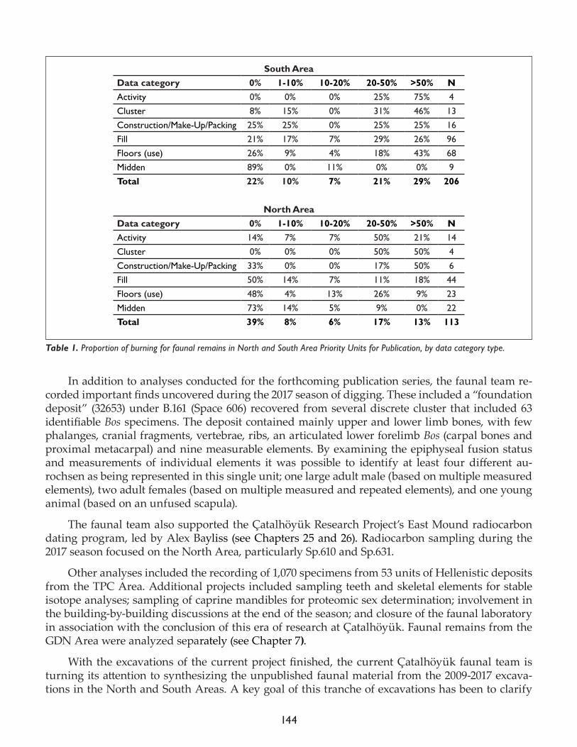
144
In addition to analyses conducted for the forthcoming publication series, the faunal team re-corded important finds uncovered during the 2017 season of digging. These included a “foundation deposit” (32653) under B.161 (Space 606) recovered from several discrete cluster that included 63 identifiable Bos specimens. The deposit contained mainly upper and lower limb bones, with few phalanges, cranial fragments, vertebrae, ribs, an articulated lower forelimb Bos (carpal bones and proximal metacarpal) and nine measurable elements. By examining the epiphyseal fusion status and measurements of individual elements it was possible to identify at least four different au-rochsen as being represented in this single unit; one large adult male (based on multiple measured elements), two adult females (based on multiple measured and repeated elements), and one young animal (based on an unfused scapula).
The faunal team also supported the Ҫatalhöyük Research Project’s East Mound radiocarbon dating program, led by Alex Bayliss (see Chapters 25 and 26). Radiocarbon sampling during the 2017 season focused on the North Area, particularly Sp.610 and Sp.631.
Other analyses included the recording of 1,070 specimens from 53 units of Hellenistic deposits from the TPC Area. Additional projects included sampling teeth and skeletal elements for stable isotope analyses; sampling of caprine mandibles for proteomic sex determination; involvement in the building-by-building discussions at the end of the season; and closure of the faunal laboratory in association with the conclusion of this era of research at Ҫatalhöyük. Faunal remains from the GDN Area were analyzed separately (see Chapter 7).
With the excavations of the current project finished, the current Ҫatalhöyük faunal team is turning its attention to synthesizing the unpublished faunal material from the 2009-2017 excava-tions in the North and South Areas. A key goal of this tranche of excavations has been to clarify
South AreaData category 0% 1-10% 10-20% 20-50% >50% NActivity 0% 0% 0% 25% 75% 4Cluster 8% 15% 0% 31% 46% 13Construction/Make-Up/Packing 25% 25% 0% 25% 25% 16Fill 21% 17% 7% 29% 26% 96Floors (use) 26% 9% 4% 18% 43% 68Midden 89% 0% 11% 0% 0% 9Total 22% 10% 7% 21% 29% 206
North Area
Data category 0% 1-10% 10-20% 20-50% >50% NActivity 14% 7% 7% 50% 21% 14Cluster 0% 0% 0% 50% 50% 4Construction/Make-Up/Packing 33% 0% 0% 17% 50% 6Fill 50% 14% 7% 11% 18% 44Floors (use) 48% 4% 13% 26% 9% 23Midden 73% 14% 5% 9% 0% 22Total 39% 8% 6% 17% 13% 113
Table 1. Proportion of burning for faunal remains in North and South Area Priority Units for Publication, by data category type.
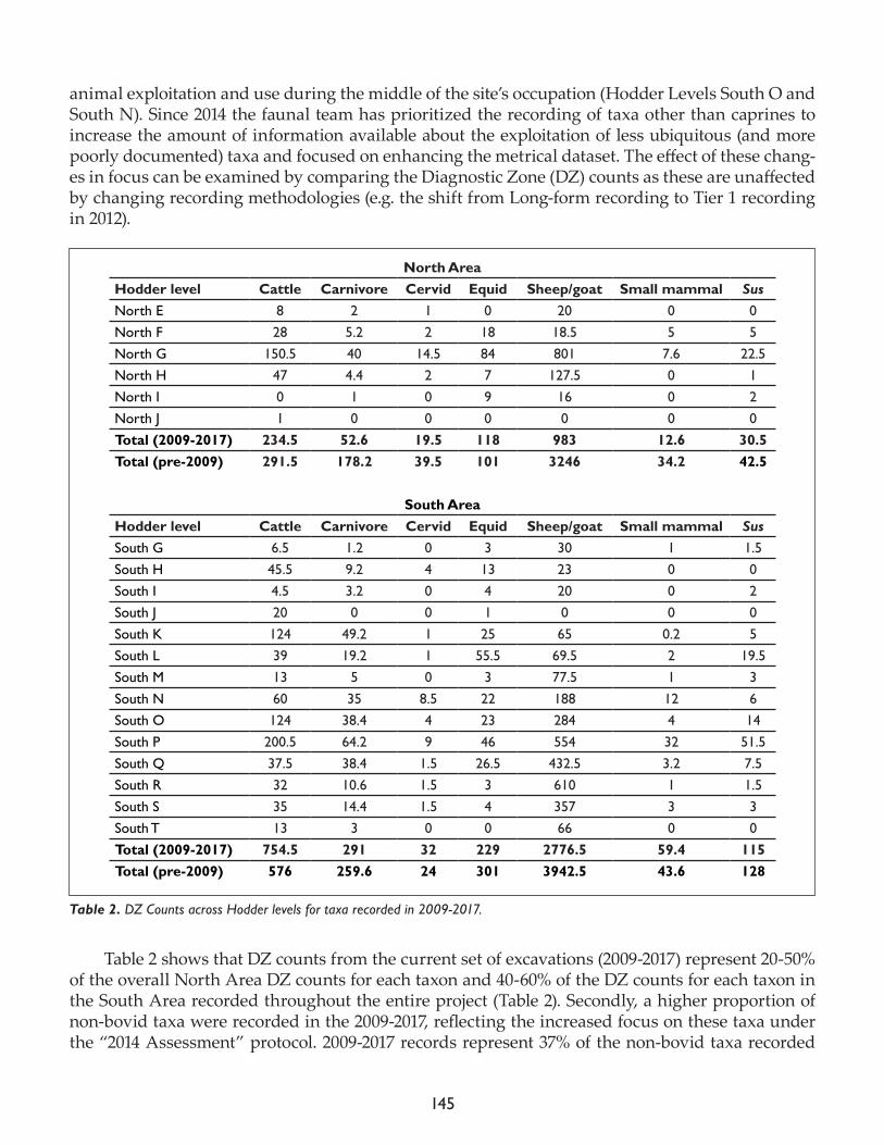
145
animal exploitation and use during the middle of the site’s occupation (Hodder Levels South O and South N). Since 2014 the faunal team has prioritized the recording of taxa other than caprines to increase the amount of information available about the exploitation of less ubiquitous (and more poorly documented) taxa and focused on enhancing the metrical dataset. The effect of these chang-es in focus can be examined by comparing the Diagnostic Zone (DZ) counts as these are unaffected by changing recording methodologies (e.g. the shift from Long-form recording to Tier 1 recording in 2012).
Table 2 shows that DZ counts from the current set of excavations (2009-2017) represent 20-50% of the overall North Area DZ counts for each taxon and 40-60% of the DZ counts for each taxon in the South Area recorded throughout the entire project (Table 2). Secondly, a higher proportion of non-bovid taxa were recorded in the 2009-2017, reflecting the increased focus on these taxa under the “2014 Assessment” protocol. 2009-2017 records represent 37% of the non-bovid taxa recorded
North AreaHodder level Cattle Carnivore Cervid Equid Sheep/goat Small mammal SusNorth E 8 2 1 0 20 0 0North F 28 5.2 2 18 18.5 5 5North G 150.5 40 14.5 84 801 7.6 22.5North H 47 4.4 2 7 127.5 0 1North I 0 1 0 9 16 0 2North J 1 0 0 0 0 0 0Total (2009-2017) 234.5 52.6 19.5 118 983 12.6 30.5Total (pre-2009) 291.5 178.2 39.5 101 3246 34.2 42.5
South Area
Hodder level Cattle Carnivore Cervid Equid Sheep/goat Small mammal SusSouth G 6.5 1.2 0 3 30 1 1.5South H 45.5 9.2 4 13 23 0 0South I 4.5 3.2 0 4 20 0 2South J 20 0 0 1 0 0 0South K 124 49.2 1 25 65 0.2 5South L 39 19.2 1 55.5 69.5 2 19.5South M 13 5 0 3 77.5 1 3South N 60 35 8.5 22 188 12 6South O 124 38.4 4 23 284 4 14South P 200.5 64.2 9 46 554 32 51.5South Q 37.5 38.4 1.5 26.5 432.5 3.2 7.5South R 32 10.6 1.5 3 610 1 1.5South S 35 14.4 1.5 4 357 3 3South T 13 3 0 0 66 0 0Total (2009-2017) 754.5 291 32 229 2776.5 59.4 115Total (pre-2009) 576 259.6 24 301 3942.5 43.6 128
Table 2. DZ Counts across Hodder levels for taxa recorded in 2009-2017.
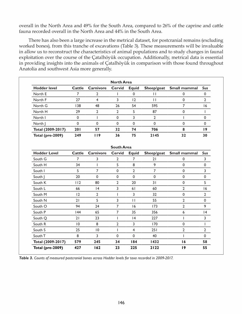
146
overall in the North Area and 49% for the South Area, compared to 26% of the caprine and cattle fauna recorded overall in the North Area and 44% in the South Area.
There has also been a large increase in the metrical dataset, for postcranial remains (excluding worked bones), from this tranche of excavations (Table 3). These measurements will be invaluable in allow us to reconstruct the characteristics of animal populations and to study changes in faunal exploitation over the course of the Ҫatalhöyük occupation. Additionally, metrical data is essential in providing insights into the animals of Ҫatalhöyük in comparison with those found throughout Anatolia and southwest Asia more generally.
North AreaHodder level Cattle Carnivore Cervid Equid Sheep/goat Small mammal SusNorth E 7 2 1 0 11 0 0North F 27 4 3 12 11 0 2North G 138 48 26 54 595 7 16North H 29 2 2 5 87 0 1North I 0 1 0 3 2 1 0North J 0 0 0 0 0 0 0Total (2009-2017) 201 57 32 74 706 8 19Total (pre-2009) 249 119 36 75 2145 32 30
South Area
Hodder Level Cattle Carnivore Cervid Equid Sheep/goat Small mammal SusSouth G 7 3 2 7 21 0 3South H 34 1 5 8 9 0 0South I 5 7 0 2 7 0 3South J 20 0 0 0 0 0 0South K 112 80 2 20 31 0 5South L 66 14 3 61 60 2 16South M 12 2 1 3 32 0 2South N 21 5 3 11 55 2 0South O 94 24 7 16 173 2 9South P 144 65 7 35 356 6 14South Q 21 23 1 14 227 1 3South R 10 8 2 3 170 0 1South S 25 10 1 4 251 2 2South T 8 3 0 0 40 1 0Total (2009-2017) 579 245 34 184 1432 16 58Total (pre-2009) 427 162 23 225 2122 19 55
Table 3. Counts of measured postcranial bones across Hodder levels for taxa recorded in 2009-2017.
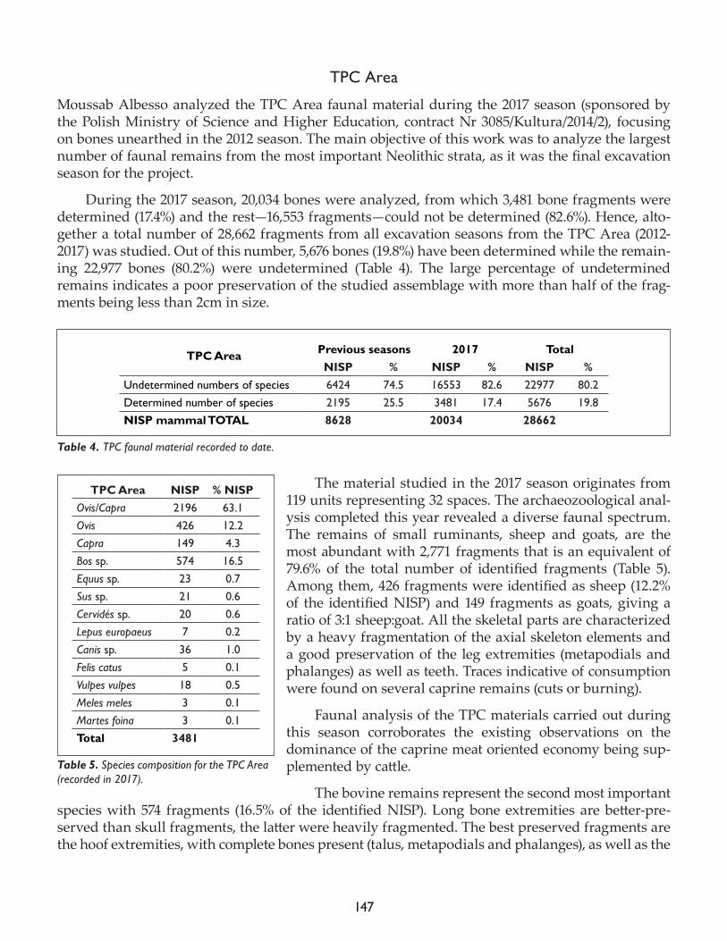
147
TPC Area
Moussab Albesso analyzed the TPC Area faunal material during the 2017 season (sponsored by the Polish Ministry of Science and Higher Education, contract Nr 3085/Kultura/2014/2), focusing on bones unearthed in the 2012 season. The main objective of this work was to analyze the largest number of faunal remains from the most important Neolithic strata, as it was the final excavation season for the project.
During the 2017 season, 20,034 bones were analyzed, from which 3,481 bone fragments were determined (17.4%) and the rest—16,553 fragments—could not be determined (82.6%). Hence, alto-gether a total number of 28,662 fragments from all excavation seasons from the TPC Area (2012-2017) was studied. Out of this number, 5,676 bones (19.8%) have been determined while the remain-ing 22,977 bones (80.2%) were undetermined (Table 4). The large percentage of undetermined remains indicates a poor preservation of the studied assemblage with more than half of the frag-ments being less than 2cm in size.
The material studied in the 2017 season originates from 119 units representing 32 spaces. The archaeozoological anal-ysis completed this year revealed a diverse faunal spectrum. The remains of small ruminants, sheep and goats, are the most abundant with 2,771 fragments that is an equivalent of 79.6% of the total number of identified fragments (Table 5). Among them, 426 fragments were identified as sheep (12.2% of the identified NISP) and 149 fragments as goats, giving a ratio of 3:1 sheep:goat. All the skeletal parts are characterized by a heavy fragmentation of the axial skeleton elements and a good preservation of the leg extremities (metapodials and phalanges) as well as teeth. Traces indicative of consumption were found on several caprine remains (cuts or burning).
Faunal analysis of the TPC materials carried out during this season corroborates the existing observations on the dominance of the caprine meat oriented economy being sup-plemented by cattle.
The bovine remains represent the second most important species with 574 fragments (16.5% of the identified NISP). Long bone extremities are better-pre-served than skull fragments, the latter were heavily fragmented. The best preserved fragments are the hoof extremities, with complete bones present (talus, metapodials and phalanges), as well as the
TPC Area Previous seasons 2017 TotalNISP % NISP % NISP %
Undetermined numbers of species 6424 74.5 16553 82.6 22977 80.2Determined number of species 2195 25.5 3481 17.4 5676 19.8NISP mammal TOTAL 8628 20034 28662
Table 4. TPC faunal material recorded to date.
TPC Area NISP % NISPOvis/Capra 2196 63.1Ovis 426 12.2Capra 149 4.3Bos sp. 574 16.5Equus sp. 23 0.7Sus sp. 21 0.6Cervidés sp. 20 0.6Lepus europaeus 7 0.2Canis sp. 36 1.0Felis catus 5 0.1Vulpes vulpes 18 0.5Meles meles 3 0.1Martes foina 3 0.1Total 3481
Table 5. Species composition for the TPC Area (recorded in 2017).
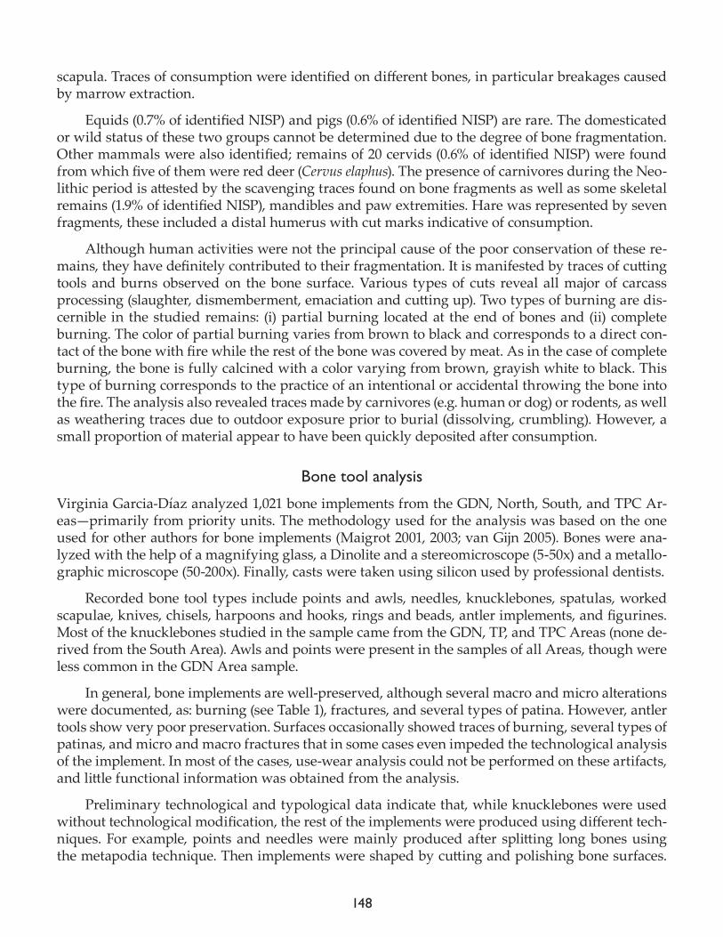
148
scapula. Traces of consumption were identified on different bones, in particular breakages caused by marrow extraction.
Equids (0.7% of identified NISP) and pigs (0.6% of identified NISP) are rare. The domesticated or wild status of these two groups cannot be determined due to the degree of bone fragmentation. Other mammals were also identified; remains of 20 cervids (0.6% of identified NISP) were found from which five of them were red deer (Cervus elaphus). The presence of carnivores during the Neo-lithic period is attested by the scavenging traces found on bone fragments as well as some skeletal remains (1.9% of identified NISP), mandibles and paw extremities. Hare was represented by seven fragments, these included a distal humerus with cut marks indicative of consumption.
Although human activities were not the principal cause of the poor conservation of these re-mains, they have definitely contributed to their fragmentation. It is manifested by traces of cutting tools and burns observed on the bone surface. Various types of cuts reveal all major of carcass processing (slaughter, dismemberment, emaciation and cutting up). Two types of burning are dis-cernible in the studied remains: (i) partial burning located at the end of bones and (ii) complete burning. The color of partial burning varies from brown to black and corresponds to a direct con-tact of the bone with fire while the rest of the bone was covered by meat. As in the case of complete burning, the bone is fully calcined with a color varying from brown, grayish white to black. This type of burning corresponds to the practice of an intentional or accidental throwing the bone into the fire. The analysis also revealed traces made by carnivores (e.g. human or dog) or rodents, as well as weathering traces due to outdoor exposure prior to burial (dissolving, crumbling). However, a small proportion of material appear to have been quickly deposited after consumption.
Bone tool analysis
Virginia Garcia-Díaz analyzed 1,021 bone implements from the GDN, North, South, and TPC Ar-eas—primarily from priority units. The methodology used for the analysis was based on the one used for other authors for bone implements (Maigrot 2001, 2003; van Gijn 2005). Bones were ana-lyzed with the help of a magnifying glass, a Dinolite and a stereomicroscope (5-50x) and a metallo-graphic microscope (50-200x). Finally, casts were taken using silicon used by professional dentists.
Recorded bone tool types include points and awls, needles, knucklebones, spatulas, worked scapulae, knives, chisels, harpoons and hooks, rings and beads, antler implements, and figurines. Most of the knucklebones studied in the sample came from the GDN, TP, and TPC Areas (none de-rived from the South Area). Awls and points were present in the samples of all Areas, though were less common in the GDN Area sample.
In general, bone implements are well-preserved, although several macro and micro alterations were documented, as: burning (see Table 1), fractures, and several types of patina. However, antler tools show very poor preservation. Surfaces occasionally showed traces of burning, several types of patinas, and micro and macro fractures that in some cases even impeded the technological analysis of the implement. In most of the cases, use-wear analysis could not be performed on these artifacts, and little functional information was obtained from the analysis.
Preliminary technological and typological data indicate that, while knucklebones were used without technological modification, the rest of the implements were produced using different tech-niques. For example, points and needles were mainly produced after splitting long bones using the metapodia technique. Then implements were shaped by cutting and polishing bone surfaces.
149
Although needle bases were perforated in different ways, the main technique probably employed a one-direction perforation after making an incision with an obsidian tool to create a tear-shape perforation. Preforms of bone beads and rings—as well as finished products—were documented, suggesting local production. Macro- and microscopic traces of production were observed on both preforms and finished products (e.g. cutting, polishing, and shaping marks). Some antler fragments also exhibited evidence for the groove-and-splinter production technique.
Functional analysis of the bone implements point to their usage on several types of surfaces: on plant material (both soft plants and wood), hide, and minerals (including pottery). Evidence for different stages of plant processing are found on points, awls, needles, bi-pointed tools and some spatulas. The importance of basketry is suggested by use-wear evidence for working fibers or in-determinate soft plant parts, though there is also evidence for wood peeling and carving on some spatulas. Hide-working was documented on a lower number of tools, typically needles; some ex-ceptional spatulas and worked scapulae were also used to process hides, as well. A large number of tools, primarily knucklebones, show traces of mineral-working; the traces on knucklebones suggest that these implements were used to burnish the surface of pottery vessels. Although some exper-imentation is still necessary, traces are similar to the ones documented on other sites for the same function. Finally, a number of bone tools were also used for decorative purposes, primarily small rings and beads but also the pins and bracelet fragments found in smaller numbers.
References
Maigrot, Y. 2001. Technical and functional study of ethnographic (Irian Jaya, Indonesia) and archaeological (Chalain and Clairvaux, Jura, France, 30th century BC) tools made from boars’ tusks. In Ethno-Archaeology and its Transfers, 5th Annual Meeting of European Association Archaeologists, Bournemouth, 14h-19th September 1999 (BAR International Series 983), edited by S. Beyries and P. Pétrequin. Oxford: Archaeopress, pp 67-79.
Maigrot, Y. 2003. Étude Technologique et Fonctionnelle de l’Outillageen Matières Dures Animales, la Station 4 de Chalain (Néolithique Final, Jura, France), PhD Thesis, Université de Paris 1.
Van Gijn, A.L. 2005. A functional analysis of some late Mesolithic bone and antler implements from the Dutch coastal zone. In From Hooves to Horns, from Mollusc to Mammoth. Manufacture and Use of Bone Artifacts from Prehistoric Times to the Present. Proceedings of the 4th Meeting of the ICAZ Worked Bone Research Group at Tallinn, 26th-31st of August 2003 (Series: Muinasaja Teadus 15), edited by H. Luik, A.M. Choyke, C.E. Batey, L. Lougas. Tartu: Ajaloo Instituut, pp. 47-66.

150
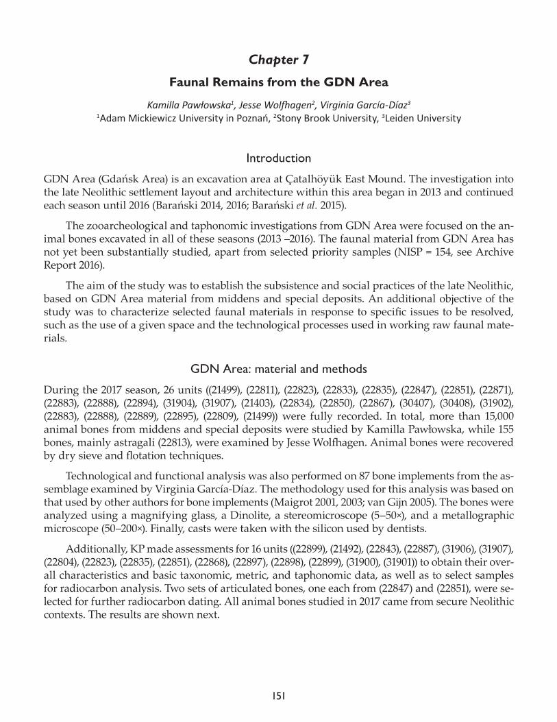
151
Chapter 7
Faunal Remains from the GDN Area
Kamilla Pawłowska1, Jesse Wolfhagen2, Virginia García-Díaz3
1Adam Mickiewicz University in Poznań, 2Stony Brook University, 3Leiden University
Introduction
GDN Area (Gdańsk Area) is an excavation area at Çatalhöyük East Mound. The investigation into the late Neolithic settlement layout and architecture within this area began in 2013 and continued each season until 2016 (Barański 2014, 2016; Barański et al. 2015).
The zooarcheological and taphonomic investigations from GDN Area were focused on the an-imal bones excavated in all of these seasons (2013 –2016). The faunal material from GDN Area has not yet been substantially studied, apart from selected priority samples (NISP = 154, see Archive Report 2016).
The aim of the study was to establish the subsistence and social practices of the late Neolithic, based on GDN Area material from middens and special deposits. An additional objective of the study was to characterize selected faunal materials in response to specific issues to be resolved, such as the use of a given space and the technological processes used in working raw faunal mate-rials.
GDN Area: material and methods
During the 2017 season, 26 units ((21499), (22811), (22823), (22833), (22835), (22847), (22851), (22871), (22883), (22888), (22894), (31904), (31907), (21403), (22834), (22850), (22867), (30407), (30408), (31902), (22883), (22888), (22889), (22895), (22809), (21499)) were fully recorded. In total, more than 15,000 animal bones from middens and special deposits were studied by Kamilla Pawłowska, while 155 bones, mainly astragali (22813), were examined by Jesse Wolfhagen. Animal bones were recovered by dry sieve and flotation techniques.
Technological and functional analysis was also performed on 87 bone implements from the as-semblage examined by Virginia García-Díaz. The methodology used for this analysis was based on that used by other authors for bone implements (Maigrot 2001, 2003; van Gijn 2005). The bones were analyzed using a magnifying glass, a Dinolite, a stereomicroscope (5–50×), and a metallographic microscope (50–200×). Finally, casts were taken with the silicon used by dentists.
Additionally, KP made assessments for 16 units ((22899), (21492), (22843), (22887), (31906), (31907), (22804), (22823), (22835), (22851), (22868), (22897), (22898), (22899), (31900), (31901)) to obtain their over-all characteristics and basic taxonomic, metric, and taphonomic data, as well as to select samples for radiocarbon analysis. Two sets of articulated bones, one each from (22847) and (22851), were se-lected for further radiocarbon dating. All animal bones studied in 2017 came from secure Neolithic contexts. The results are shown next.
152
GDN Area: analysis of animal bones and implements
The middens were analyzed in two dimensions—through time and space. This means that their occurrence in the occupational sequence and their contextual analysis in relation to architecture has been taken into account. Although the detailed results of this analysis are still being prepared, the main conclusion is that there are significant taxonomic and taphonomic differences between the older ((31902), (30408), (21403)) and the younger ((22867), (22850), (22834)) midden groups in the strati-graphic sequence.
Taking into account the results from all the studied middens from GDN Area, it is possible to indicate that subsis-tence practice was mainly based on caprines. This is consistent with results obtained on com-parable late Neolithic TP Area material (Pawłowska, in press a). Caprines predominate over cattle, equids, and other taxa, as shown by the GDN Area results based on diagnostic zones (DZs, sensu Watson) (Table 1). The dis-tribution of taxa also suggests that cattle were also involved in the process of consumption, as their remains are quite com-mon in the daily refuse which makes up the middens. The significance of other taxa in subsistence in the late Neolithic should be considered by the dis-tribution of body parts, which will also be applied to the main taxa.
Some bones displayed pathological phenomena, as exemplified by the sheep bones that show periodontal disease (Fig. 1) and tendinopathy (Fig. 2). The pattern of pathology cases from the GDN assemblage is generally consistent with results previously obtained on the site, and recently sum-marized through the Neolithic sequence (Pawłowska, in press b). This means that the presence of animal pathologies is generally low, and that dental anomalies and oral pathology predominate over arthropathies, inflammatory diseases, traumatic lesions, and diseases associated with the en-vironment. Specific differences, such as a larger number of cases of arthropathy, will be discussed in detail in relation to animal age in a publication dedicated to this issue.
Evidence of the use of animal parts in relation to architecture has been well attested in two GDN Area buildings: B.81 and B.142. The diversity in terms of species involved and contextual ap-pearances is evident. Generally speaking, aurochs play the main role in GDN Area special deposits, and especially their horn cores, which are unfortunately poor preserved. Their diversification will
GDN animal bones NISP %NISP DZ %DZSheep (Ovis) 241 7.9 172 43.2Goat (Capra) 91 3.0 23 5.8Sheep or goat 865 28.3 135.5 34.0Total caprines 1197 39.2 330.5 83.0Cattle (Bos primigenius and Bos taurus) 1732 56.7 45.5 11.4Roe deer (Capreolus capreolus) 6 0.2 3 0.8Red deer (Cervus elaphus) 26 0.9 0 0.0Cervids 4 0.1 3 0.8
Pig (Sus sp.) 12 0.4 0 0.0
Equids (Equus sp.) 35 1.1 3 0.8
Canids 10 0.3 4 1.0Wolf (Canis lupus) 1 0.0 1 0.3
Fox (Vulpes vulpes) 9 0.3 4.4 1.1
Carnivore 3 0.1 0.6 0.2
Hare (Lepus) 1 0.0 1 0.3
Small artiodactyl 1 0.0 1 0.3
Human (Homo sapiens) 1 0.0 1 0.3
Bird 17 0.6 0 0.0Total 3055 100 398 100
Table 1. Taxonomic composition of GDN Area faunal material recorded in 2017. The other specimens, almost 15,800 in number, were not diagnostic to species or even genus. NISP: number of identified specimens; DZ: diagnostic zone.
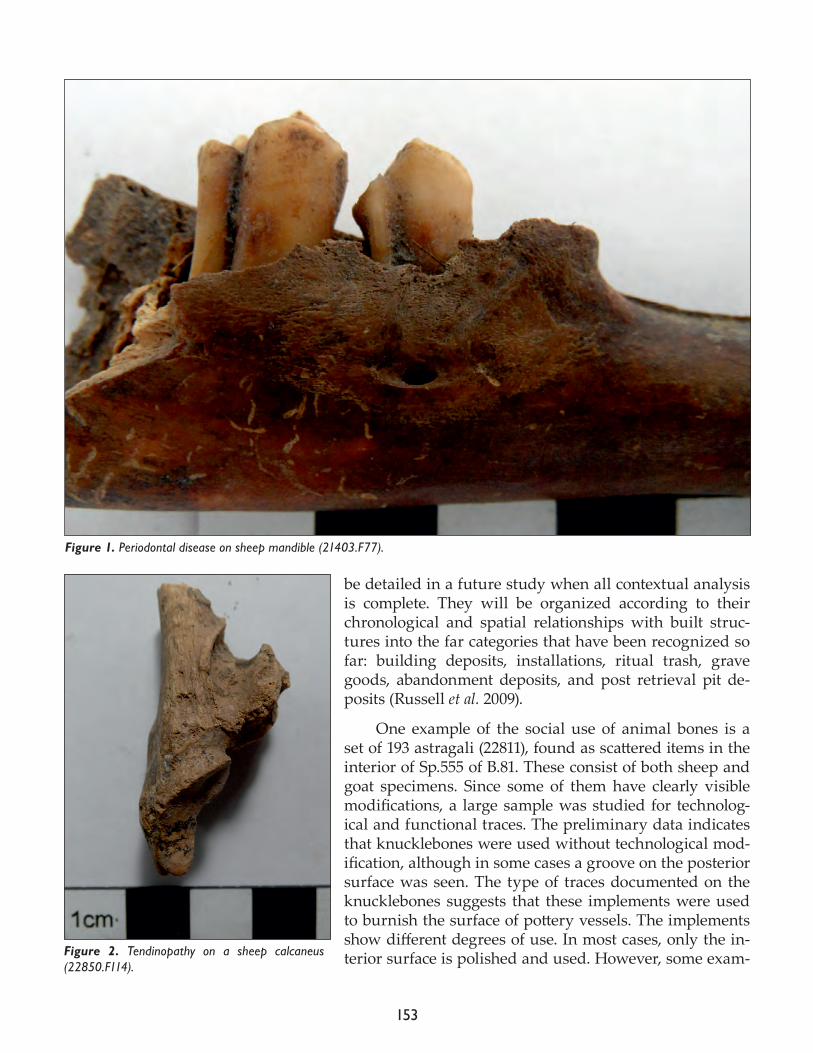
153
be detailed in a future study when all contextual analysis is complete. They will be organized according to their chronological and spatial relationships with built struc-tures into the far categories that have been recognized so far: building deposits, installations, ritual trash, grave goods, abandonment deposits, and post retrieval pit de-posits (Russell et al. 2009).
One example of the social use of animal bones is a set of 193 astragali (22811), found as scattered items in the interior of Sp.555 of B.81. These consist of both sheep and goat specimens. Since some of them have clearly visible modifications, a large sample was studied for technolog-ical and functional traces. The preliminary data indicates that knucklebones were used without technological mod-ification, although in some cases a groove on the posterior surface was seen. The type of traces documented on the knucklebones suggests that these implements were used to burnish the surface of pottery vessels. The implements show different degrees of use. In most cases, only the in-terior surface is polished and used. However, some exam-Figure 2. Tendinopathy on a sheep calcaneus
(22850.F114).
Figure 1. Periodontal disease on sheep mandible (21403.F77).
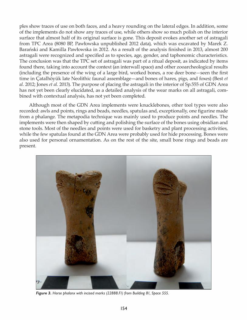
154
ples show traces of use on both faces, and a heavy rounding on the lateral edges. In addition, some of the implements do not show any traces of use, while others show so much polish on the interior surface that almost half of its original surface is gone. This deposit evokes another set of astragali from TPC Area (8080 BP, Pawłowska unpublished 2012 data), which was excavated by Marek Z. Barański and Kamilla Pawłowska in 2012. As a result of the analysis finished in 2013, almost 200 astragali were recognized and specified as to species, age, gender, and taphonomic characteristics. The conclusion was that the TPC set of astragali was part of a ritual deposit, as indicated by items found there, taking into account the context (an interwall space) and other zooarcheological results (including the presence of the wing of a large bird, worked bones, a roe deer bone—seen the first time in Çatalhöyük late Neolithic faunal assemblage—and bones of hares, pigs, and foxes) (Best et al. 2012; Jones et al. 2013). The purpose of placing the astragali in the interior of Sp.555 of GDN Area has not yet been clearly elucidated, as a detailed analysis of the wear marks on all astragali, com-bined with contextual analysis, has not yet been completed.
Although most of the GDN Area implements were knucklebones, other tool types were also recorded: awls and points, rings and beads, needles, spatulas and, exceptionally, one figurine made from a phalange. The metapodia technique was mainly used to produce points and needles. The implements were then shaped by cutting and polishing the surface of the bones using obsidian and stone tools. Most of the needles and points were used for basketry and plant processing activities, while the few spatulas found at the GDN Area were probably used for hide processing. Bones were also used for personal ornamentation. As on the rest of the site, small bone rings and beads are present.
Figure 3. Horse phalanx with incised marks (22888.F1) from Building 81, Space 555.
155
Among the worked bones recovered from GDN Area, the horse phalanx (22888.F1; Fig. 3) is as significant as the astragali. The phalanx of a small–medium equid was used to make this artifact, which shows a polished surface and has been incised. It was recovered from a flotation sample that came from a bin container, one of four recognized in Space 555 of B.81. This finding is similar to the other horse phalanges discovered in the North, IST, and TPC Areas. However, a detailed exam-ination revealed that only this phalanx from GDN Area possesses incision marks shaped in such way as to resemble eyes. In contrast to this, the TPC equid phalanx has no lines and has only been modified to the extent that half of the original width of phalanx was preserved, as shown by our results (Best et al. 2012). The North and IST Areas specimens have curving incised lines (Russell and Griffitts 2000). Compared to these artifacts, the GDN Area phalanx is more elaborate in terms of its shaped decorative marks which appear on the lateral and medial side of the proximal end. The decoration was probably made using an obsidian tool, taking into account the v-shape of the grooves. We believe that this artifact has profound significance for our understanding, not only of animal use and technological processes, but also of the figurine as an object. This will be elaborated on in future.
Other activities
Other activities in the 2017 season included the selection of cat samples for DNA study as part of a contribution (KP) to a research project currently in progress. In total, ten samples were select-ed after full examination of the dataset. Sampling covered, among others, a nearly complete felid skeleton (32496) found in 2016 in a foundation pit in the annex of B.160 (South Area) (Wolfhagen and Demirergi, 2016). The main goal of the project, which focuses on the Mediterranean region, is to document how the apparently successful C-clade expanded. However, the samples will also be used for geometric morphometric analysis, as the cat mandibles were also present in selected sam-ples of the Çatalhöyük assemblages, and for stable isotope analysis. The involvement of zooarche-ologists in this project, as well as the inclusion of other sites from Turkey in this study, is promising to achieve the goals.
GDN Team publicationsTaking into account the fact that 2017 was the last season when animal bones were recorded in the faunal lab, it is good to take the opportunity to summarize the contribution of some of us to the Çatalhöyük Research Project. For example, Kamilla Pawłowska has worked in the TP Area for eleven research seasons (2001–2011), as well as in the TPC Area in the 2012 –2013 seasons, making a significant contribution to the results by analyzing almost half of the TPC material that has been studies (4,044 animal bones from the total of 8,628—for details see Archive Reports 2012, 2013, 2016), including a set of astragali from the interwall deposit mentioned above. Between 2001 and 2013, she also examined units from various contexts in other excavation areas (South and North Area). Finally, material from the GDN Area was the main focus of her study in the lab in 2017, as well as remotely in 2016.
All members of the GDN Project, as part of the Faunal team at Çatalhöyük, worked on various excavation areas of the East Mound. They have published articles and chapters and have also given conference presentations on Çatalhöyük research that are worth summarizing here:
Arbuckle, B.S., S.W. Kansa, E. Kansa, D.C. Orton, C. Çakırlar, L. Gourichon, L. Atici, A. Galik, A. Marciniak, J. Mul-ville., H. Buitenhuis, D. Carruthers, B. de Cupere, A. Demirergi, S. Frame, D. Helmer, L. Martin, J. Peters, N. Pöllath, K. Pawłowska, N. Russell, K. Twiss and D. Würtenberger
156
2014. Data sharing reveals complexity in the westward spread of domestic animals across Neolithic Turkey. PLoS ONE 9 6), e99845, doi:10.1371/journal.pone.0099845
Barański M.Z., A. García-Suárez, A. Klimowicz, S. Love and K. Pawłowska2015. The architecture of Neolithic Çatalhöyük as a process. Complexity in apparent simplicity. In Assembling Çatalhöyük. Themes in Contemporary Archaeology, edited by I. Hodder and A. Marciniak. Leeds: Maney Press, 111–26.
Barański, M.Z, Suárez, A.G., Klimowicz, A., Love, S., Pawłowska, K.2014. Complexity in Simplicity. Reflections on Çatalhöyük Architecture as Process. 20th Annual Meeting of EAA (European Association of Archaeologists), Turkey (Istanbul).
Marciniak, A. and K. Pawłowska2011. Human–animals relations in the Late Neolithic at Çatalhöyük East. 10th International ASWA (Archaeozoolo-gy of Southwestern Asia and Adjacent Areas) Conference, Belgium (Brussels).
Pawłowska, K.2004–2007, project manager for a grant from the Committee for Scientific Research (KBN): Neolithic Economic and Environmental Transformations of Çatalhöyük in the Light of Zooarchaeological Analysis.
2010. Late Hellenistic/ Early Roman bone deposit from kilns infills in Catalhoyuk (TP Area). 11th Conference of the International Council for Archaeozoology, France (Paris).
2013. Smell of Neolithic Çatalhöyük (Turkey). Time and space of human activity. 11th International ASWA (Archae-ozoology of Southwestern Asia and Adjacent Areas) Conference, Israel (Haifa).
2014. The smells of Neolithic Çatalhöyük, Turkey: Time and space of human activity. Journal of Anthropological Archaeology 36: 1–11.
2015. Time of change: cattle in the social practices of Late Neolithic Çatalhöyük. 12th International ASWA (Archae-ozoology of Southwestern Asia and Adjacent Areas- ICAZ Working Group) Conference, Holland (Groningen).
2016. Animal diseases in Neolithic societies: Çatalhöyük (Turkey) in the spotlight. 6th Meeting of ICAZ Animal Palaeopathology Working Group (APWG) Conference, Hungary (Budapest).
2016. Evaluation of Neolithic Çatalhöyük smells: a zooarchaeological perspective. Sensory Histories of Place Work-shop, Koç University’s Research Center for Anatolian Civilizations (RCAC) (ANAMED), Turkey (Istanbul), invit-ed speaker.
2017. Small carnivores from a Late Neolithic burial chamber at Çatalhöyük, Turkey: Pelts, rituals, and rodents. 13th International ASWA (Archaeozoology of Southwestern Asia and Adjacent Areas- ICAZ Working Group) Conference, Cyprus (Nicosia).
in press (a.) Animals at Late Neolithic Çatalhöyük: subsistence, food processing and depositional practices. In Late Neolithic at Çatalhöyük East: Excavations of Upper Levels in the Team Poznań Area, edited by L. Czerniak and A. Marciniak. Los Angeles: Cotsen Institute of Archaeology Press.
157
in press (b). Animal diseases in Neolithic societies: Çatalhöyük (Turkey) in the spotlight. In Proceedings of the Sixth ICAZ Animal Paleopathology Working Group Conference, edited by L. Bartosiewicz, L and E. Gál. Oxford: Oxbow Book.
Pawłowska, K. and A. Marciszak2017. Small carnivores from a Late Neolithic burial chamber at Çatalhöyük, Turkey: pelts, rituals, and rodents. Archaeological and Anthropological Sciences, DOI: 10.1007/s12520-017-0526-1
Pawłowska, K. and L.-M. Shillito2014. Midden taphonomy at Çatalhöyük: integrating zooarchaeological and micromorphological perspectives. 12th Conference of the International Council for Archaeozoology, Argentina (San Rafael).
Twiss, K.C., J. Wolfhagen, R. Madgwick, H. Foster, G.A. Demirergi, N. Russell, J.L. Everhart, J. Pearson and J. Mulville2017. Horses, hemiones, hydruntines? Assessing the reliability of dental criteria for assigning species to South-west Asian equid remains. International Journal of Osteoarchaeology 27: 298–304. doi: 10.1002/oa.2524.
Acknowledgments
Kamilla Pawłowska would like to thank Marek Z. Barański for inviting her to the GDN Research Project under his leadership, within the Çatalhöyük Research Project. This allowed her to conduct the zooarcheological study on the GDN Area. The GDN Research Project entitled Çatalhöyük in Late Neolithic (c.6.500 – 5.900 cal. BC): Reconstruction of the Settlement Layout Based on Architectural and Structural Aspects of Buildings is funded by the National Science Centre in Poland (PRELUDIUM 6: DEC-2013/11/N/HS#/04889), as well as by private entities. Financial support was also provided by Adam Mickiewicz University in Poznań. We would like to acknowledge Christopher Knüsel for his wonderful scientific discussions and exchange of thoughts, and Kasia Regulska for her technical and logistical assistance. It was our pleasure to work with Marek Barański and Christina Tsoraki, and with the other members of the GDN team. Last but not least, our special thanks go to the Direc-tor of the Çatalhöyük Archaeological Project, Ian Hodder, for the chance to be part of this project.
References
Barański, M.Z.2014. Late Neolithic architecture. Çatalhöyük 2013 Archive Report, pp. 194–202.
2016. GDN research on the Late Neolithic architecture. Çatalhöyük 2016 Archive Report, pp. 269–78.
Barański, M.Z., A. Nowak, K. Regulska and M. Saj2015. GDN Area: Research on Late Neolithic Architecture. Çatalhöyük 2015 Archive Report, Çatalhöyük Re-search Project, pp. 248–260.
Best, J., A. Demirergi, J. Jones, D. Orton, J. Mulville, K. Pawłowska, A. Powell, K. Twiss and J. Wolfhagen2012. Faunal remains, 2012. Çatalhöyük 2012 Archive Report, Çatalhöyük Research Project, pp. 155–176.
van Gijn, A.L. 2005. A functional analysis of some late Meso-lithic bone and antler implements from the Dutch coastal zone. In: Luik, H., Choyke, A.M., Batey, C.E., Lougas, L. (Eds.), From hooves to horns, from mollusc to mammoth. Manufacture and use of bone artifacts from prehistoric times to the present. Proceedings of the 4th Meeting of
158
the ICAZ Worked Bone Research Group at Tallinn, 26th-31st of August 2003, Tallinn (Muinasaja teadus 15), pp 47–66.
Jones, J., R. Madgwick, J. Mulville, K. Pawłowska, A. Powell and K. Twiss 2013. East mound faunal remains. Çatalhöyük 2013 Archive Report, pp. 134–50.
Maigrot, Y.2001. Technical and functional study of ethnographic (Irian Jaya, Indonesia) and archaeological (Chalain and Clairvaux, Jura,France, 30th century BC) tools made from boars’ tusks. In: Ethno-archaelogy and its Transfers. 5th Annual Meeting of European Association Archaeologists, Bournemouth, 14h-19th September 1999 (BAR International Series 983), edited by S. Beyries and P. Pétrequin. Oxford: Archaeopress, pp. 67–79.
2003. Étude Technologique et Fonctionnelle de l’Outillage en Matières Dures Animales, La Station 4 de Chalain (Néo-lithique Fnal, Jura, France). PhD Thesis, Université de Paris 1.
Pawłowska, K.in press (a.) Animals at Late Neolithic Çatalhöyük: subsistence, food processing and depositional practices. In Late Neolithic at Çatalhöyük East: Excavations of Upper Levels in the Team Poznań Area, edited by L. Czerniak and A. Marciniak. Los Angeles: Cotsen Institute of Archaeology Press.
in press (b). Animal diseases in Neolithic societies: Çatalhöyük (Turkey) in the spotlight. In Proceedings of the Sixth ICAZ Animal Paleopathology Working Group Conference, edited by L. Bartosiewicz, L and E. Gál. Oxford: Oxbow Book.
Russell, N. and J.L. Griffitts2000. Çatalhöyük worked bone: South and 4040 Areas. In Substantive Technologies at Çatalhöyük: Reports from the 2000-2008 Seasons, edited by I. Hodder. London: British Institute at Ankara; Los Angeles: Cotsen Institute of Archaeology Press, pp 277–306.
Russell, N., L. Martin and K.C. Twiss2009. Building memories: commemorative deposits at Çatalhöyük. Anthropozoologica 44 (1): 103–25.
Wolfhagen, J. and G.A. Demirergi2016. Faunal remains from the North and South Areas. Çatalhöyük 2016 Archive Report, pp 115–18.
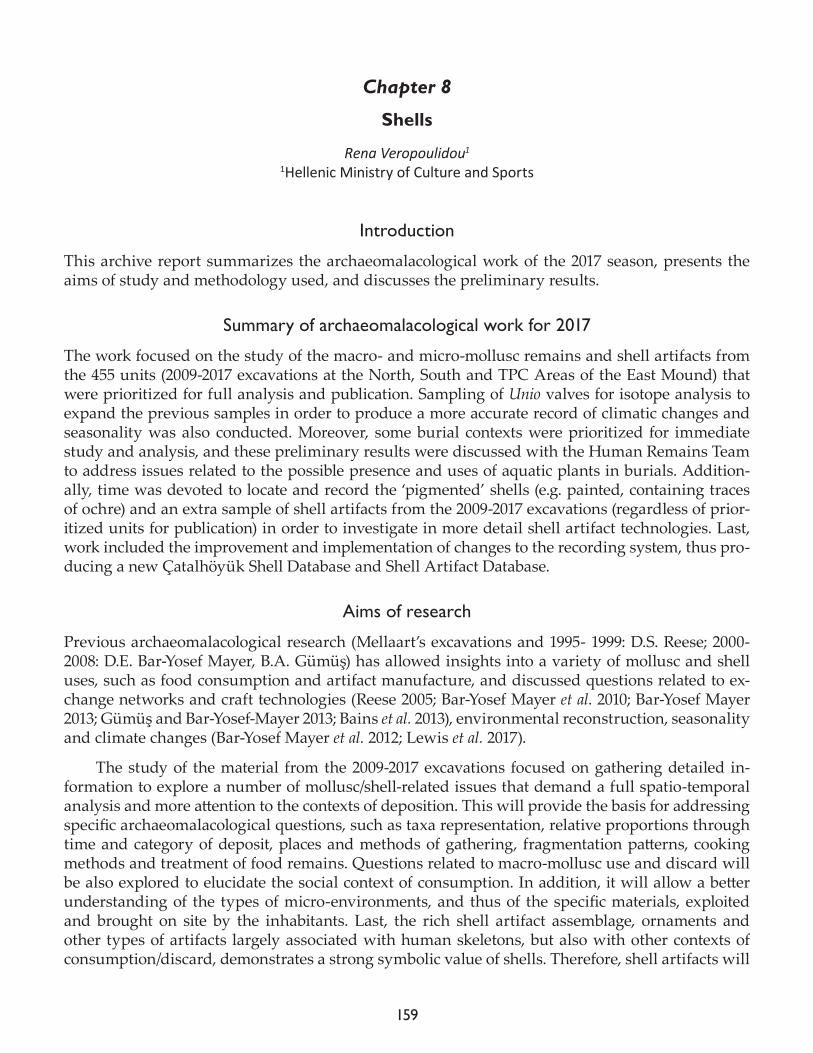
159
Chapter 8
Shells
Rena Veropoulidou1
1Hellenic Ministry of Culture and Sports
Introduction
This archive report summarizes the archaeomalacological work of the 2017 season, presents the aims of study and methodology used, and discusses the preliminary results.
Summary of archaeomalacological work for 2017
The work focused on the study of the macro- and micro-mollusc remains and shell artifacts from the 455 units (2009-2017 excavations at the North, South and TPC Areas of the East Mound) that were prioritized for full analysis and publication. Sampling of Unio valves for isotope analysis to expand the previous samples in order to produce a more accurate record of climatic changes and seasonality was also conducted. Moreover, some burial contexts were prioritized for immediate study and analysis, and these preliminary results were discussed with the Human Remains Team to address issues related to the possible presence and uses of aquatic plants in burials. Addition-ally, time was devoted to locate and record the ‘pigmented’ shells (e.g. painted, containing traces of ochre) and an extra sample of shell artifacts from the 2009-2017 excavations (regardless of prior-itized units for publication) in order to investigate in more detail shell artifact technologies. Last, work included the improvement and implementation of changes to the recording system, thus pro-ducing a new Çatalhöyük Shell Database and Shell Artifact Database.
Aims of research
Previous archaeomalacological research (Mellaart’s excavations and 1995- 1999: D.S. Reese; 2000-2008: D.E. Bar-Yosef Mayer, B.A. Gümüş) has allowed insights into a variety of mollusc and shell uses, such as food consumption and artifact manufacture, and discussed questions related to ex-change networks and craft technologies (Reese 2005; Bar-Yosef Mayer et al. 2010; Bar-Yosef Mayer 2013; Gümüş and Bar-Yosef-Mayer 2013; Bains et al. 2013), environmental reconstruction, seasonality and climate changes (Bar-Yosef Mayer et al. 2012; Lewis et al. 2017).
The study of the material from the 2009-2017 excavations focused on gathering detailed in-formation to explore a number of mollusc/shell-related issues that demand a full spatio-temporal analysis and more attention to the contexts of deposition. This will provide the basis for addressing specific archaeomalacological questions, such as taxa representation, relative proportions through time and category of deposit, places and methods of gathering, fragmentation patterns, cooking methods and treatment of food remains. Questions related to macro-mollusc use and discard will be also explored to elucidate the social context of consumption. In addition, it will allow a better understanding of the types of micro-environments, and thus of the specific materials, exploited and brought on site by the inhabitants. Last, the rich shell artifact assemblage, ornaments and other types of artifacts largely associated with human skeletons, but also with other contexts of consumption/discard, demonstrates a strong symbolic value of shells. Therefore, shell artifacts will

160
be also examined as the materials of body decoration and of incorporation in everyday and more special contexts.
Methods
The aim was to recover as much shell data as possible. Thus, all hand-picked and dry-sieved mate-rial (4mm mesh) as well as all shells recovered from the sorting of the 1mm, 2mm and 4mm sieves of the heavy residue samples were fully studied. For archival purposes and quick documentation of qualitative information of each sample, of artifact types and techniques of shell working digital photography was used. Photographs for publication purposes were taken by Jason Quinlan.
All shells were examined under a stereoscope and studied following a specific archaeomala-cological methodology (Veropoulidou 2011). Species identification was based on comparisons with various publications and web databases (e.g. AnimalBase Project Group). Recording of specimens included: intact, partially preserved (and which part is missing), diagnostic body parts (apices and apertures for gastropods and scaphopods; right and left umbos for bivalves) and all non-diagnostic fragmented material. Apart from Number of Identified Specimens (NISP), quantification calculated Minimum Number of Individuals (MNI), Number of Intact (NI) and Number of Fragments (NF). All these are expressed in absolute numbers, as well as Density per 1 liter of soil that allows valid comparisons among different in size contexts. Measurements of the majority of intact and partially preserved specimens (height, length/width, depth), as well as of a large sample of fragments from each unit were taken using a digital Vernier caliper (in mm) to allow discussing gathering methods and the formation of deposits respectively. Taphonomic attributes included the separation of fresh and worn collected shells (where possible) and of fossils, recording of surface condition and wear, of any human (e.g. different degrees of burning, shape and edges of fragments) and natural modi-fications (abrasion, corrosion, bio-erosion, encrustation).
Despite the anthropogenic origin of the assemblage, some palaeoenvironmental data can be extracted especially from species that seem to have been introduced unintentionally on site (mi-cro-molluscs, i.e. adult and juvenile species less than 10-15mm in size). The first aim is to provide interpretations on how these species were incorporated into the anthropogenic deposits (e.g. along with sediments, plants). In this pursue, apart from the integration of archaeological information, the detailed recording of taphonomic attributes is expected to allow a deeper understanding of the sources of origin. Then, indirect palaeoenvironmental data can be extrapolated through the analysis of the patterns of taxonomic composition and abundance of specimens coupled with the analysis of taphonomic attributes of the material in archaeological deposits, in particular primary.
Shell artifacts and any specimen with evidence of human modification received a more elab-orate treatment. Each artifact was given a unique number, studied individually, and basic mala-cological information (taxon, body part, state during collection, i.e. fresh, worn, fossil, and surface condition) was noted. Additional attributes recorded include: all dimensions in terms of plan and longitudinal sections (length, width, thickness, and measurements of additional features, such as perforations and projections) for both complete and incomplete objects; typology and morpholog-ical characteristics of artifacts; technology (manufacturing techniques, such as facets, cuts, shape of perforation, projections, incisions, surface treatment); use history of artifacts (primary and sec-ondary use, repairs, types of use-wear) and post-depositional variables (degree of wear, breakage patterns, trampling, chemical weathering); qualitative attributes, such as color, degree of finish; qualitative description of each artifact. To record all these information, a Shell Artifact Database
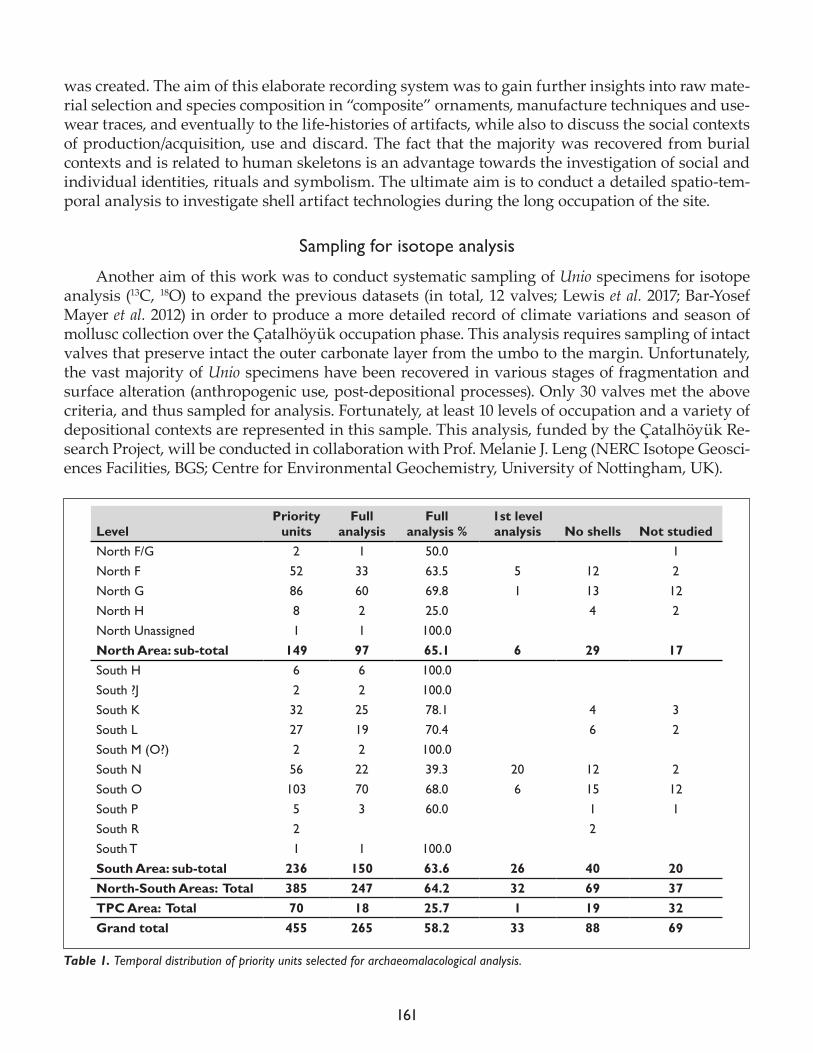
161
was created. The aim of this elaborate recording system was to gain further insights into raw mate-rial selection and species composition in “composite” ornaments, manufacture techniques and use-wear traces, and eventually to the life-histories of artifacts, while also to discuss the social contexts of production/acquisition, use and discard. The fact that the majority was recovered from burial contexts and is related to human skeletons is an advantage towards the investigation of social and individual identities, rituals and symbolism. The ultimate aim is to conduct a detailed spatio-tem-poral analysis to investigate shell artifact technologies during the long occupation of the site.
Sampling for isotope analysis
Another aim of this work was to conduct systematic sampling of Unio specimens for isotope analysis (13C, 18O) to expand the previous datasets (in total, 12 valves; Lewis et al. 2017; Bar-Yosef Mayer et al. 2012) in order to produce a more detailed record of climate variations and season of mollusc collection over the Çatalhöyük occupation phase. This analysis requires sampling of intact valves that preserve intact the outer carbonate layer from the umbo to the margin. Unfortunately, the vast majority of Unio specimens have been recovered in various stages of fragmentation and surface alteration (anthropogenic use, post-depositional processes). Only 30 valves met the above criteria, and thus sampled for analysis. Fortunately, at least 10 levels of occupation and a variety of depositional contexts are represented in this sample. This analysis, funded by the Çatalhöyük Re-search Project, will be conducted in collaboration with Prof. Melanie J. Leng (NERC Isotope Geosci-ences Facilities, BGS; Centre for Environmental Geochemistry, University of Nottingham, UK).
LevelPriority
unitsFull
analysisFull
analysis %1st level analysis No shells Not studied
North F/G 2 1 50.0 1North F 52 33 63.5 5 12 2North G 86 60 69.8 1 13 12North H 8 2 25.0 4 2North Unassigned 1 1 100.0 North Area: sub-total 149 97 65.1 6 29 17South H 6 6 100.0 South ?J 2 2 100.0 South K 32 25 78.1 4 3South L 27 19 70.4 6 2South M (O?) 2 2 100.0 South N 56 22 39.3 20 12 2South O 103 70 68.0 6 15 12South P 5 3 60.0 1 1South R 2 2 South T 1 1 100.0 South Area: sub-total 236 150 63.6 26 40 20North-South Areas: Total 385 247 64.2 32 69 37TPC Area: Total 70 18 25.7 1 19 32Grand total 455 265 58.2 33 88 69
Table 1. Temporal distribution of priority units selected for archaeomalacological analysis.
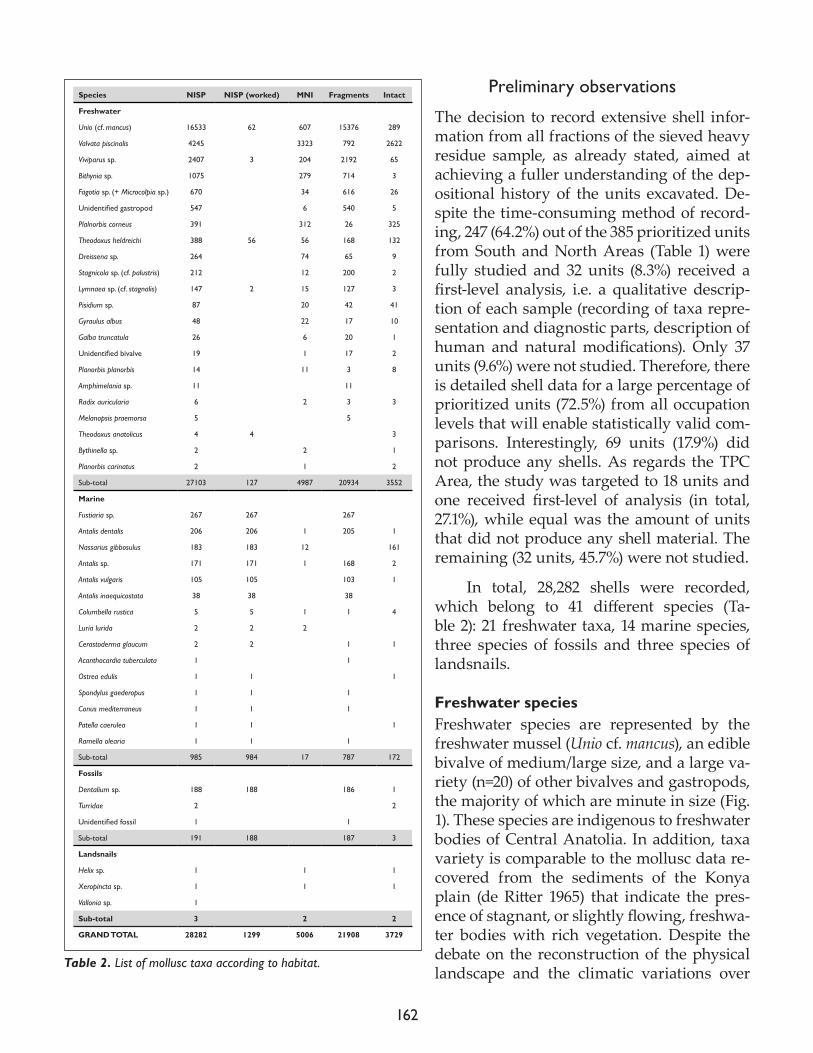
162
Preliminary observations
The decision to record extensive shell infor-mation from all fractions of the sieved heavy residue sample, as already stated, aimed at achieving a fuller understanding of the dep-ositional history of the units excavated. De-spite the time-consuming method of record-ing, 247 (64.2%) out of the 385 prioritized units from South and North Areas (Table 1) were fully studied and 32 units (8.3%) received a first-level analysis, i.e. a qualitative descrip-tion of each sample (recording of taxa repre-sentation and diagnostic parts, description of human and natural modifications). Only 37 units (9.6%) were not studied. Therefore, there is detailed shell data for a large percentage of prioritized units (72.5%) from all occupation levels that will enable statistically valid com-parisons. Interestingly, 69 units (17.9%) did not produce any shells. As regards the TPC Area, the study was targeted to 18 units and one received first-level of analysis (in total, 27.1%), while equal was the amount of units that did not produce any shell material. The remaining (32 units, 45.7%) were not studied.
In total, 28,282 shells were recorded, which belong to 41 different species (Ta-ble 2): 21 freshwater taxa, 14 marine species, three species of fossils and three species of landsnails.
Freshwater speciesFreshwater species are represented by the freshwater mussel (Unio cf. mancus), an edible bivalve of medium/large size, and a large va-riety (n=20) of other bivalves and gastropods, the majority of which are minute in size (Fig. 1). These species are indigenous to freshwater bodies of Central Anatolia. In addition, taxa variety is comparable to the mollusc data re-covered from the sediments of the Konya plain (de Ritter 1965) that indicate the pres-ence of stagnant, or slightly flowing, freshwa-ter bodies with rich vegetation. Despite the debate on the reconstruction of the physical landscape and the climatic variations over
Species NISP NISP (worked) MNI Fragments Intact
Freshwater
Unio (cf. mancus) 16533 62 607 15376 289
Valvata piscinalis 4245 3323 792 2622
Viviparus sp. 2407 3 204 2192 65
Bithynia sp. 1075 279 714 3
Fagotia sp. (+ Microcolpia sp.) 670 34 616 26
Unidentifiedgastropod 547 6 540 5
Plalnorbis corneus 391 312 26 325
Theodoxus heldreichi 388 56 56 168 132
Dreissena sp. 264 74 65 9
Stagnicola sp. (cf. palustris) 212 12 200 2
Lymnaea sp. (cf. stagnalis) 147 2 15 127 3
Pisidium sp. 87 20 42 41
Gyraulus albus 48 22 17 10
Galba truncatula 26 6 20 1
Unidentifiedbivalve 19 1 17 2
Planorbis planorbis 14 11 3 8
Amphimelania sp. 11 11
Radix auricularia 6 2 3 3
Melanopsis praemorsa 5 5
Theodoxus anatolicus 4 4 3
Bythinella sp. 2 2 1
Planorbis carinatus 2 1 2
Sub-total 27103 127 4987 20934 3552
Marine
Fustiaria sp. 267 267 267
Antalis dentalis 206 206 1 205 1
Nassarius gibbosulus 183 183 12 161
Antalis sp. 171 171 1 168 2
Antalis vulgaris 105 105 103 1
Antalis inaequicostata 38 38 38
Columbella rustica 5 5 1 1 4
Luria lurida 2 2 2
Cerastoderma glaucum 2 2 1 1
Acanthocardia tuberculata 1 1
Ostrea edulis 1 1 1
Spondylus gaederopus 1 1 1
Conus mediterraneus 1 1 1
Patella caerulea 1 1 1
Ramella olearia 1 1 1
Sub-total 985 984 17 787 172
Fossils
Dentalium sp. 188 188 186 1
Turridae 2 2
Unidentifiedfossil 1 1
Sub-total 191 188 187 3
Landsnails
Helix sp. 1 1 1
Xeropincta sp. 1 1 1
Vallonia sp. 1
Sub-total 3 2 2
GRAND TOTAL 28282 1299 5006 21908 3729
Table 2. List of mollusc taxa according to habitat.
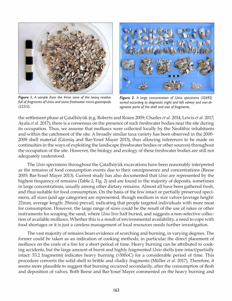
163
the settlement phase at Çatalhöyük (e.g. Roberts and Rosen 2009; Charles et al. 2014; Lewis et al. 2017; Ayala et al. 2017), there is a consensus on the presence of such freshwater bodies near the site during its occupation. Thus, we assume that molluscs were collected locally by the Neolithic inhabitants and within the catchment of the site. A broadly similar taxa variety has been observed in the 2000-2008 shell material (Gümüş and Bar-Yosef Mayer 2013), thus allowing inferences to be made on continuities in the ways of exploiting the landscape (freshwater bodies or other sources) throughout the occupation of the site. However, the biology and ecology of these freshwater bodies are still not adequately understood.
The Unio specimens throughout the Çatalhöyük excavations have been reasonably interpreted as the remains of food consumption events due to their omnipresence and concentrations (Reese 2005; Bar-Yosef Mayer 2013). Current study has also documented that Unio are represented by the highest frequency of remains (Table 2, Fig. 2) and are found in the majority of deposits, sometimes in large concentrations, usually among other dietary remains. Almost all have been gathered fresh, and thus suitable for food consumption. On the basis of the few intact or partially preserved speci-mens, all sizes (and age categories) are represented, though medium in size valves (average height: 22mm, average length: 29mm) prevail, indicating that people targeted individuals with more meat for consumption. However, the large range of sizes could be the result of the use of rakes or other instruments for scraping the sand, where Unio live half buried, and suggests a non-selective collec-tion of available molluscs. Whether this is a result of environmental availability, a need to cope with food shortages or it is just a careless management of local resources needs further investigation.
The vast majority of remains bears evidence of scorching and burning, in varying degrees. The former could be taken as an indication of cooking methods, in particular the direct placement of molluscs on the coals of a fire for a short period of time. Heavy burning can be attributed to cook-ing accidents, but the large amount of burnt and highly fragmented Unio shells (one intact/partially intact: 53.2 fragments) indicates heavy burning (>300oC) for a considerable period of time. This procedure converts the solid shell to brittle and chalky fragments (Müller et al. 2017). Therefore, it seems more plausible to suggest that burning occurred secondarily, after the consumption of flesh and deposition of valves. Both Reese and Bar-Yosef Mayer commented on the heavy burning and
Figure 1. A sample from the 4mm sieve of the heavy residue full of fragments of Unio and some freshwater micro-gastropods (22512).
Figure 2. A large concentration of Unio specimens (32692) sorted according to diagnostic (right and left valves) and non-di-agnostic parts of the shell and size of fragments.
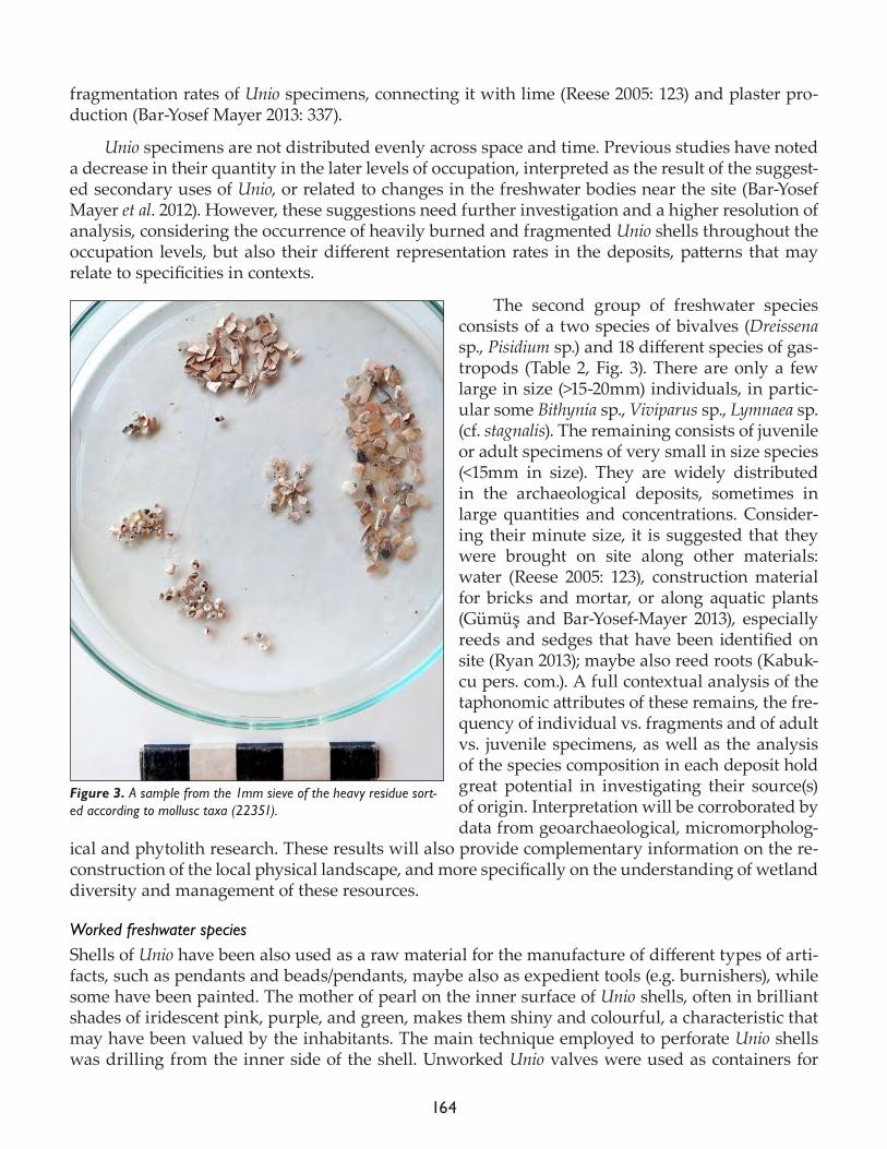
164
fragmentation rates of Unio specimens, connecting it with lime (Reese 2005: 123) and plaster pro-duction (Bar-Yosef Mayer 2013: 337).
Unio specimens are not distributed evenly across space and time. Previous studies have noted a decrease in their quantity in the later levels of occupation, interpreted as the result of the suggest-ed secondary uses of Unio, or related to changes in the freshwater bodies near the site (Bar-Yosef Mayer et al. 2012). However, these suggestions need further investigation and a higher resolution of analysis, considering the occurrence of heavily burned and fragmented Unio shells throughout the occupation levels, but also their different representation rates in the deposits, patterns that may relate to specificities in contexts.
The second group of freshwater species consists of a two species of bivalves (Dreissena sp., Pisidium sp.) and 18 different species of gas-tropods (Table 2, Fig. 3). There are only a few large in size (>15-20mm) individuals, in partic-ular some Bithynia sp., Viviparus sp., Lymnaea sp. (cf. stagnalis). The remaining consists of juvenile or adult specimens of very small in size species (<15mm in size). They are widely distributed in the archaeological deposits, sometimes in large quantities and concentrations. Consider-ing their minute size, it is suggested that they were brought on site along other materials: water (Reese 2005: 123), construction material for bricks and mortar, or along aquatic plants (Gümüş and Bar-Yosef-Mayer 2013), especially reeds and sedges that have been identified on site (Ryan 2013); maybe also reed roots (Kabuk-cu pers. com.). A full contextual analysis of the taphonomic attributes of these remains, the fre-quency of individual vs. fragments and of adult vs. juvenile specimens, as well as the analysis of the species composition in each deposit hold great potential in investigating their source(s) of origin. Interpretation will be corroborated by data from geoarchaeological, micromorpholog-
ical and phytolith research. These results will also provide complementary information on the re-construction of the local physical landscape, and more specifically on the understanding of wetland diversity and management of these resources.
Worked freshwater speciesShells of Unio have been also used as a raw material for the manufacture of different types of arti-facts, such as pendants and beads/pendants, maybe also as expedient tools (e.g. burnishers), while some have been painted. The mother of pearl on the inner surface of Unio shells, often in brilliant shades of iridescent pink, purple, and green, makes them shiny and colourful, a characteristic that may have been valued by the inhabitants. The main technique employed to perforate Unio shells was drilling from the inner side of the shell. Unworked Unio valves were used as containers for
Figure 3. A sample from the 1mm sieve of the heavy residue sort-ed according to mollusc taxa (22351).
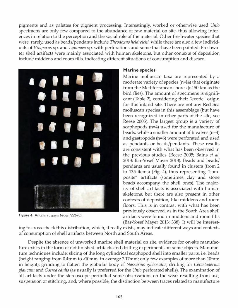
165
pigments and as palettes for pigment processing. Interestingly, worked or otherwise used Unio specimens are only few compared to the abundance of raw material on site, thus allowing infer-ences in relation to the perception and the social role of the material. Other freshwater species that were, rarely, used as beads/pendants include Theodoxus heldreichi, while there are also a few individ-uals of Viviparus sp. and Lymnaea sp. with perforations and some that have been painted. Freshwa-ter shell artifacts were mainly associated with human skeletons, but other contexts of deposition include middens and room fills, indicating different situations of consumption and discard.
Marine speciesMarine molluscan taxa are represented by a moderate variety of species (n=14) that originate from the Mediterranean shores (c.150 km as the bird flies). The amount of specimens is signifi-cant (Table 2), considering their “exotic” origin for this inland site. There are not any Red Sea molluscan species in this assemblage (but have been recognized in other parts of the site, see Reese 2005). The largest group is a variety of scaphopods (n=4) used for the manufacture of beads, while a smaller amount of bivalves (n=4) and gastropods (n=6) were perforated and used as pendants or beads/pendants. These results are consistent with what has been observed in the previous studies (Reese 2005; Bains et al. 2013; Bar-Yosef Mayer 2013). Beads and beads/pendants are usually found in clusters (from 2 to 135 items) (Fig. 4), thus representing “com-posite” artifacts (sometimes clay and stone beads accompany the shell ones). The major-ity of shell artifacts is associated with human skeletons, but there are also present in other contexts of deposition, like middens and room floors. This is in contrast with what has been previously observed, as in the South Area shell artifacts were found in middens and room fills (Bar-Yosef Mayer 2013: 338). It will be interest-
ing to cross-check this distribution, which, if really exists, may indicate different ways and contexts of consumption of shell artifacts between North and South Areas.
Despite the absence of unworked marine shell material on site, evidence for on-site manufac-ture exists in the form of not finished artifacts and drilling experiments on some objects. Manufac-ture techniques include: slicing of the long cylindrical scaphopod shell into smaller parts, i.e. beads (height ranging from 0.4mm to >10mm, in average 3.17mm; only few examples of more than 10mm in height); grinding to flatten the globular body of Nassarius gibbosulus; drilling for Cerastoderma glaucum and Ostrea edulis (as usually is preferred for the Unio perforated shells). The examination of all artifacts under the stereoscope permitted some observations on the wear resulting from use, suspension or stitching, and, where possible, the distinction between traces related to manufacture
Figure 4. Antalis vulgaris beads (22678).
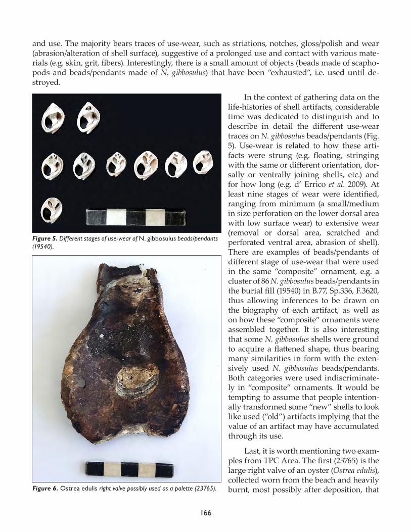
166
and use. The majority bears traces of use-wear, such as striations, notches, gloss/polish and wear (abrasion/alteration of shell surface), suggestive of a prolonged use and contact with various mate-rials (e.g. skin, grit, fibers). Interestingly, there is a small amount of objects (beads made of scapho-pods and beads/pendants made of N. gibbosulus) that have been “exhausted”, i.e. used until de-stroyed.
In the context of gathering data on the life-histories of shell artifacts, considerable time was dedicated to distinguish and to describe in detail the different use-wear traces on N. gibbosulus beads/pendants (Fig. 5). Use-wear is related to how these arti-facts were strung (e.g. floating, stringing with the same or different orientation, dor-sally or ventrally joining shells, etc.) and for how long (e.g. d’ Errico et al. 2009). At least nine stages of wear were identified, ranging from minimum (a small/medium in size perforation on the lower dorsal area with low surface wear) to extensive wear (removal or dorsal area, scratched and perforated ventral area, abrasion of shell). There are examples of beads/pendants of different stage of use-wear that were used in the same “composite” ornament, e.g. a cluster of 86 N. gibbosulus beads/pendants in the burial fill (19540) in B.77, Sp.336, F.3620, thus allowing inferences to be drawn on the biography of each artifact, as well as on how these “composite” ornaments were assembled together. It is also interesting that some N. gibbosulus shells were ground to acquire a flattened shape, thus bearing many similarities in form with the exten-sively used N. gibbosulus beads/pendants. Both categories were used indiscriminate-ly in “composite” ornaments. It would be tempting to assume that people intention-ally transformed some “new” shells to look like used (“old”) artifacts implying that the value of an artifact may have accumulated through its use.
Last, it is worth mentioning two exam-ples from TPC Area. The first (23765) is the large right valve of an oyster (Ostrea edulis), collected worn from the beach and heavily burnt, most possibly after deposition, that
Figure 5. Different stages of use-wear of N. gibbosulus beads/pendants (19540).
Figure 6. Ostrea edulis right valve possibly used as a palette (23765).
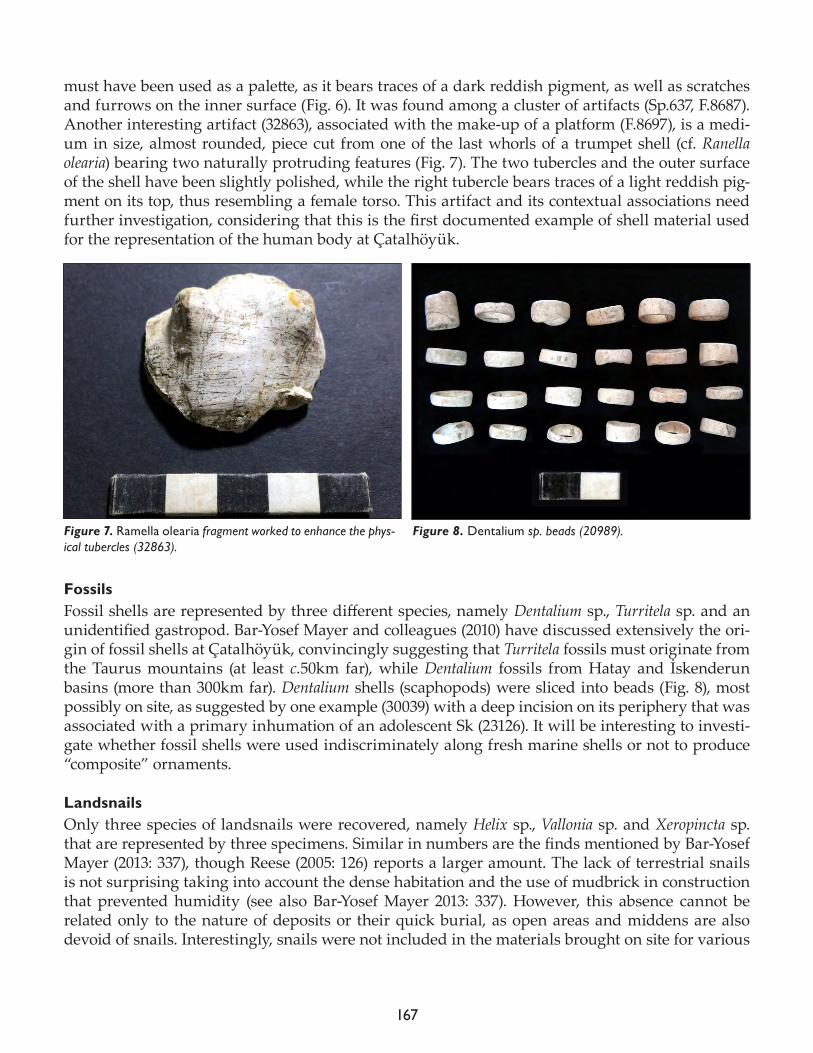
167
must have been used as a palette, as it bears traces of a dark reddish pigment, as well as scratches and furrows on the inner surface (Fig. 6). It was found among a cluster of artifacts (Sp.637, F.8687). Another interesting artifact (32863), associated with the make-up of a platform (F.8697), is a medi-um in size, almost rounded, piece cut from one of the last whorls of a trumpet shell (cf. Ranella olearia) bearing two naturally protruding features (Fig. 7). The two tubercles and the outer surface of the shell have been slightly polished, while the right tubercle bears traces of a light reddish pig-ment on its top, thus resembling a female torso. This artifact and its contextual associations need further investigation, considering that this is the first documented example of shell material used for the representation of the human body at Çatalhöyük.
FossilsFossil shells are represented by three different species, namely Dentalium sp., Turritela sp. and an unidentified gastropod. Bar-Yosef Mayer and colleagues (2010) have discussed extensively the ori-gin of fossil shells at Çatalhöyük, convincingly suggesting that Turritela fossils must originate from the Taurus mountains (at least c.50km far), while Dentalium fossils from Hatay and İskenderun basins (more than 300km far). Dentalium shells (scaphopods) were sliced into beads (Fig. 8), most possibly on site, as suggested by one example (30039) with a deep incision on its periphery that was associated with a primary inhumation of an adolescent Sk (23126). It will be interesting to investi-gate whether fossil shells were used indiscriminately along fresh marine shells or not to produce “composite” ornaments.
LandsnailsOnly three species of landsnails were recovered, namely Helix sp., Vallonia sp. and Xeropincta sp. that are represented by three specimens. Similar in numbers are the finds mentioned by Bar-Yosef Mayer (2013: 337), though Reese (2005: 126) reports a larger amount. The lack of terrestrial snails is not surprising taking into account the dense habitation and the use of mudbrick in construction that prevented humidity (see also Bar-Yosef Mayer 2013: 337). However, this absence cannot be related only to the nature of deposits or their quick burial, as open areas and middens are also devoid of snails. Interestingly, snails were not included in the materials brought on site for various
Figure 7. Ramella olearia fragment worked to enhance the phys-ical tubercles (32863).
Figure 8. Dentalium sp. beads (20989).
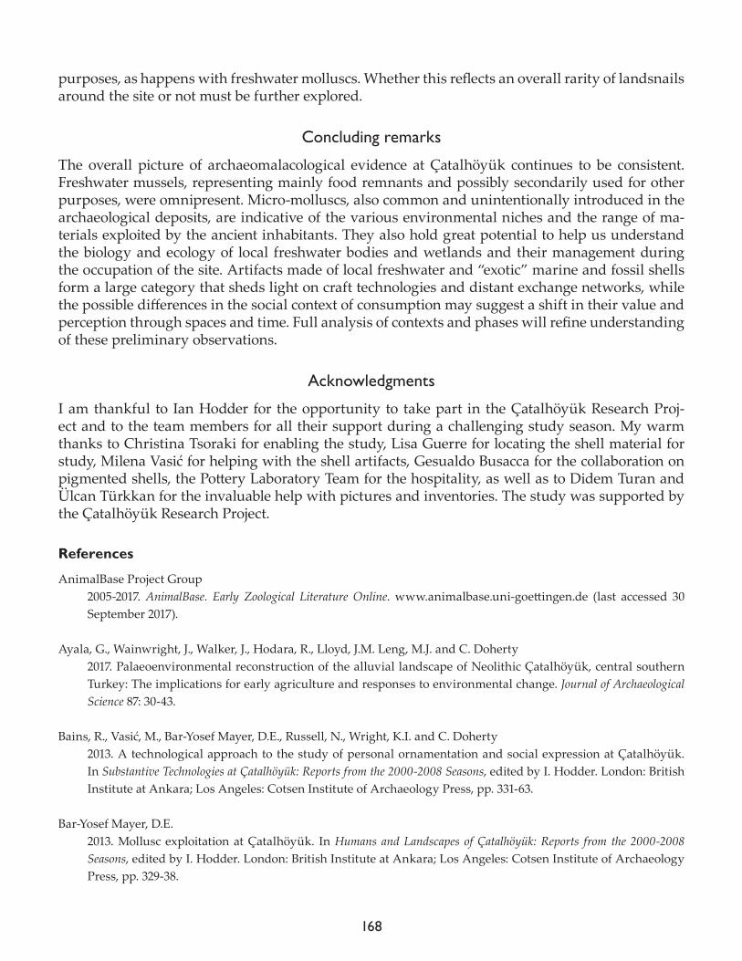
168
purposes, as happens with freshwater molluscs. Whether this reflects an overall rarity of landsnails around the site or not must be further explored.
Concluding remarks
The overall picture of archaeomalacological evidence at Çatalhöyük continues to be consistent. Freshwater mussels, representing mainly food remnants and possibly secondarily used for other purposes, were omnipresent. Micro-molluscs, also common and unintentionally introduced in the archaeological deposits, are indicative of the various environmental niches and the range of ma-terials exploited by the ancient inhabitants. They also hold great potential to help us understand the biology and ecology of local freshwater bodies and wetlands and their management during the occupation of the site. Artifacts made of local freshwater and “exotic” marine and fossil shells form a large category that sheds light on craft technologies and distant exchange networks, while the possible differences in the social context of consumption may suggest a shift in their value and perception through spaces and time. Full analysis of contexts and phases will refine understanding of these preliminary observations.
Acknowledgments
I am thankful to Ian Hodder for the opportunity to take part in the Çatalhöyük Research Proj-ect and to the team members for all their support during a challenging study season. My warm thanks to Christina Tsoraki for enabling the study, Lisa Guerre for locating the shell material for study, Milena Vasić for helping with the shell artifacts, Gesualdo Busacca for the collaboration on pigmented shells, the Pottery Laboratory Team for the hospitality, as well as to Didem Turan and Ülcan Türkkan for the invaluable help with pictures and inventories. The study was supported by the Çatalhöyük Research Project.
References
AnimalBase Project Group2005-2017. AnimalBase. Early Zoological Literature Online. www.animalbase.uni-goettingen.de (last accessed 30 September 2017).
Ayala, G., Wainwright, J., Walker, J., Hodara, R., Lloyd, J.M. Leng, M.J. and C. Doherty2017. Palaeoenvironmental reconstruction of the alluvial landscape of Neolithic Çatalhöyük, central southern Turkey: The implications for early agriculture and responses to environmental change. Journal of Archaeological Science 87: 30-43.
Bains, R., Vasić, M., Bar-Yosef Mayer, D.E., Russell, N., Wright, K.I. and C. Doherty2013. A technological approach to the study of personal ornamentation and social expression at Çatalhöyük. In Substantive Technologies at Çatalhöyük: Reports from the 2000-2008 Seasons, edited by I. Hodder. London: British Institute at Ankara; Los Angeles: Cotsen Institute of Archaeology Press, pp. 331-63.
Bar-Yosef Mayer, D.E.2013. Mollusc exploitation at Çatalhöyük. In Humans and Landscapes of Çatalhöyük: Reports from the 2000-2008 Seasons, edited by I. Hodder. London: British Institute at Ankara; Los Angeles: Cotsen Institute of Archaeology Press, pp. 329-38.
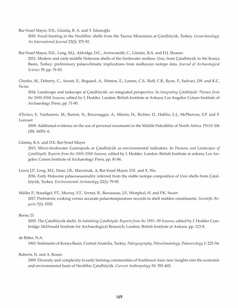
169
Bar-Yosef Mayer, D.E., Gümüş, B. A. and Y. İslamoğlu2010. Fossil hunting in the Neolithic: shells from the Taurus Mountains at Çatalhöyük, Turkey. Geoarchaeology: An International Journal 25(3): 375-92.
Bar-Yosef Mayer, D.E., Leng, M.J., Aldridge, D.C., Arrowsmith, C., Gümüs¸ B.A. and H.J. Sloanec2012. Modern and early-middle Holocene shells of the freshwater mollusc Unio, from Çatalhöyük in the Konya Basin, Turkey: preliminary palaeoclimatic implications from molluscan isotope data. Journal of Archaeological Science 39, pp. 76-83.
Charles, M., Doherty, C., Asouti, E., Bogaard, A., Henton, E., Larsen, C.S., Ruff, C.B., Ryan, P., Sadvari, J.W. and K.C. Twiss
2014. Landscape and taskscape at Çatalhöyük: an integrated perspective. In Integrating Çatalhöyük: Themes from the 2000-2008 Seasons, edited by I. Hodder. London: British Institute at Ankara; Los Angeles: Cotsen Institute of Archaeology Press, pp. 71-90.
d’Errico, F., Vanhaeren, M., Barton, N., Bouzouggar, A., Mienis, H., Richter, D., Hublin, J.-J., McPherron, S.P. and P. Lozouet
2009. Additional evidence on the use of personal ornaments in the Middle Paleolithic of North Africa. PNAS 106 (38): 16051–6.
Gümüş, B.A. and D.E. Bar-Yosef Mayer2013. Micro-freshwater Gastropods at Çatalhöyük as environmental indicators. In Humans and Landscapes of Çatalhöyük: Reports from the 2000-2008 Seasons, edited by I. Hodder. London: British Institute at ankara; Los An-geles: Cotsen Institute of Archaeology Press, pp. 81-86.
Lewis J.P., Leng, M.J., Dean, J.R., Marciniak, A, Bar-Yosef Mayer, D.E. and X. Wu2016. Early Holocene palaeoseasonality inferred from the stable isotope composition of Unio shells from Çatal-höyük, Turkey. Environmental Archaeology 22(1): 79-95.
Müller P., Staudigel, P.T., Murray, S.T., Vernet, R., Barusseau, J.P., Westphal, H. and P.K. Swart2017. Prehistoric cooking versus accurate palaeotemperature records in shell midden constituents. Scientific Re-ports 7(1): 3555.
Reese, D.2005. The Çatalhöyük shells. In Inhabiting Çatalhöyük: Reports from the 1995–99 Seasons, edited by I. Hodder Cam-bridge: McDonald Institute for Archaeological Research; London: British Institute at Ankara, pp. 123-8.
de Ritter, N.A.1965. Sediments of Konya Basin, Central Anatolia, Turkey. Paleogeography, Paleoclimatology, Palaeoecology 1: 225-54.
Roberts, N. and A. Rosen2009. Diversity and complexity in early farming communities of Southwest Asia: new insights into the economic and environmental basis of Neolithic Çatalhöyük. Current Anthropology 50: 393-402.
170
Ryan, P.2013. Plant exploitation from household and landscape perspectives: the phytolith evidence. In Humans and Landscapes of Çatalhöyük: Reports from the 2000-2008 Seasons, edited by I. Hodder. London: British Institute at An-kara; Los Angeles: Cotsen Institute of Archaeology Press, pp. 163-90.
Veropoulidou, R.2011. Shells from the Settlement of the Thermaic Gulf. Reconstructing Molluscan Exploitation During the Neolithic and the Bronze Age. Ph.D. thesis. Aristotle University of Thessaloniki.
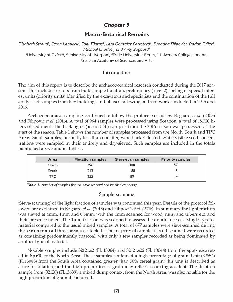
171
Chapter 9
Macro-Botanical Remains
Elizabeth Stroud1, Ceren Kabukcu2, Tolu Tüntas3, Lara Gonzalez Carretero4, Dragana Filipović5, Dorian Fuller4, Michael Charles1, and Amy Bogaard1
1University of Oxford, 2University of Liverpool, 3Freie Universität Berlin, 4University College London, 5Serbian Academy of Sciences and Arts
Introduction
The aim of this report is to describe the archaeobotanical research conducted during the 2017 sea-son. This includes results from bulk sample flotation, preliminary (level 2) sorting of special inter-est units (priority units) identified by the excavators and specialists and the continuation of the full analysis of samples from key buildings and phases following on from work conducted in 2015 and 2016.
Archaeobotanical sampling continued to follow the protocol set out by Bogaard et al. (2005) and Filipović et al. (2016). A total of 964 samples were processed using flotation, a total of 18,020 li-ters of sediment. The backlog of (around 50) samples from the 2016 season was processed at the start of the season. Table 1 shows the number of samples processed from the North, South and TPC Areas. Small samples, normally less than one liter, were bucket-floated, while visible seed concen-trations were sampled in their entirety and dry-sieved. Such samples are included in the totals mentioned above and in Table 1.
Sample scanning
‘Sieve-scanning’ of the light fraction of samples was continued this year. Details of the protocol fol-lowed are explained in Bogaard et al. (2015) and Filipović et al. (2016). In summary the light fraction was sieved at 4mm, 1mm and 0.3mm, with the 4mm scanned for wood, nuts, and tubers etc. and their presence noted. The 1mm fraction was scanned to assess the dominance of a single type of material compared to the usual mixed samples. A total of 677 samples were sieve-scanned during the season from all three areas (see Table 1). The majority of samples sieved-scanned were recorded as containing predominantly charcoal, with only a few samples recorded as being dominated by another type of material.
Notable samples include 32121.s2 (Fl. 13064) and 32121.s22 (Fl. 13044) from fire spots excavat-ed in Sp.610 of the North Area. These samples contained a high percentage of grain. Unit (32654) (Fl.13088) from the South Area contained greater than 50% cereal grain; this unit is described as a fire installation, and the high proportion of grain may reflect a cooking accident. The flotation sample from (32128) (Fl.13639), a mixed dump context from the North Area, was also notable for the high proportion of grain it contained.
Area Flotation samples Sieve-scan samples Priority samples North 496 400 57South 213 188 15TPC 255 89 14
Table 1. Number of samples floated, sieve scanned and labelled as priority.
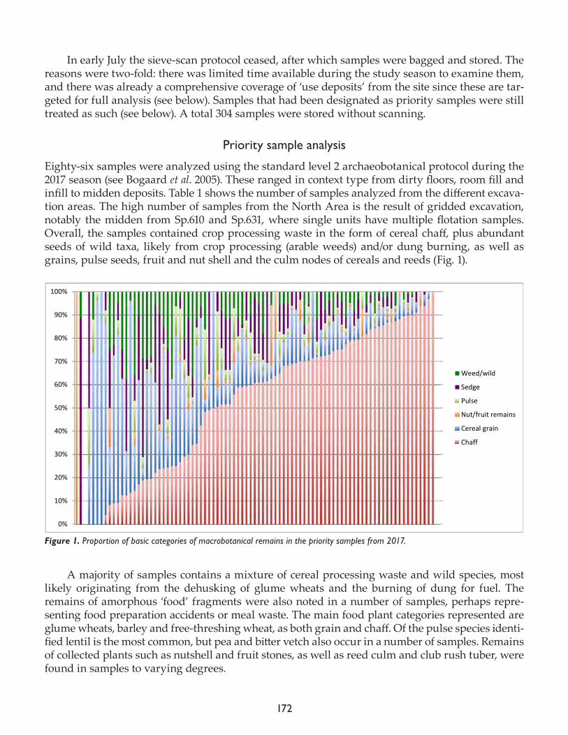
172
In early July the sieve-scan protocol ceased, after which samples were bagged and stored. The reasons were two-fold: there was limited time available during the study season to examine them, and there was already a comprehensive coverage of ‘use deposits’ from the site since these are tar-geted for full analysis (see below). Samples that had been designated as priority samples were still treated as such (see below). A total 304 samples were stored without scanning.
Priority sample analysis
Eighty-six samples were analyzed using the standard level 2 archaeobotanical protocol during the 2017 season (see Bogaard et al. 2005). These ranged in context type from dirty floors, room fill and infill to midden deposits. Table 1 shows the number of samples analyzed from the different excava-tion areas. The high number of samples from the North Area is the result of gridded excavation, notably the midden from Sp.610 and Sp.631, where single units have multiple flotation samples. Overall, the samples contained crop processing waste in the form of cereal chaff, plus abundant seeds of wild taxa, likely from crop processing (arable weeds) and/or dung burning, as well as grains, pulse seeds, fruit and nut shell and the culm nodes of cereals and reeds (Fig. 1).
A majority of samples contains a mixture of cereal processing waste and wild species, most likely originating from the dehusking of glume wheats and the burning of dung for fuel. The remains of amorphous ‘food’ fragments were also noted in a number of samples, perhaps repre-senting food preparation accidents or meal waste. The main food plant categories represented are glume wheats, barley and free-threshing wheat, as both grain and chaff. Of the pulse species identi-fied lentil is the most common, but pea and bitter vetch also occur in a number of samples. Remains of collected plants such as nutshell and fruit stones, as well as reed culm and club rush tuber, were found in samples to varying degrees.
Figure 1. Proportion of basic categories of macrobotanical remains in the priority samples from 2017.
0%
10%
20%
30%
40%
50%
60%
70%
80%
90%
100%
Weed/wild
Sedge
Pulse
Nut/fruit remains
Cereal grain
Chaff
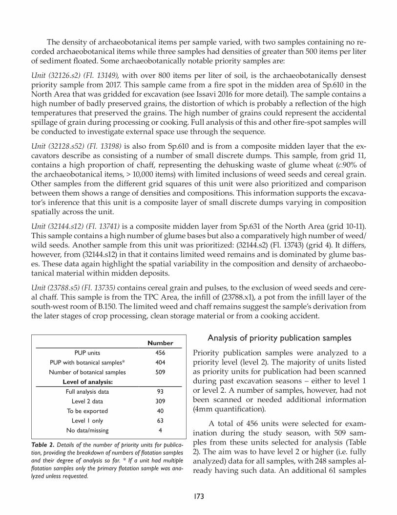
173
The density of archaeobotanical items per sample varied, with two samples containing no re-corded archaeobotanical items while three samples had densities of greater than 500 items per liter of sediment floated. Some archaeobotanically notable priority samples are:
Unit (32126.s2) (Fl. 13149), with over 800 items per liter of soil, is the archaeobotanically densest priority sample from 2017. This sample came from a fire spot in the midden area of Sp.610 in the North Area that was gridded for excavation (see Issavi 2016 for more detail). The sample contains a high number of badly preserved grains, the distortion of which is probably a reflection of the high temperatures that preserved the grains. The high number of grains could represent the accidental spillage of grain during processing or cooking. Full analysis of this and other fire-spot samples will be conducted to investigate external space use through the sequence.
Unit (32128.s52) (Fl. 13198) is also from Sp.610 and is from a composite midden layer that the ex-cavators describe as consisting of a number of small discrete dumps. This sample, from grid 11, contains a high proportion of chaff, representing the dehusking waste of glume wheat (c.90% of the archaeobotanical items, > 10,000 items) with limited inclusions of weed seeds and cereal grain. Other samples from the different grid squares of this unit were also prioritized and comparison between them shows a range of densities and compositions. This information supports the excava-tor’s inference that this unit is a composite layer of small discrete dumps varying in composition spatially across the unit.
Unit (32144.s12) (Fl. 13741) is a composite midden layer from Sp.631 of the North Area (grid 10-11). This sample contains a high number of glume bases but also a comparatively high number of weed/wild seeds. Another sample from this unit was prioritized: (32144.s2) (Fl. 13743) (grid 4). It differs, however, from (32144.s12) in that it contains limited weed remains and is dominated by glume bas-es. These data again highlight the spatial variability in the composition and density of archaeobo-tanical material within midden deposits.
Unit (23788.s5) (Fl. 13735) contains cereal grain and pulses, to the exclusion of weed seeds and cere-al chaff. This sample is from the TPC Area, the infill of (23788.x1), a pot from the infill layer of the south-west room of B.150. The limited weed and chaff remains suggest the sample’s derivation from the later stages of crop processing, clean storage material or from a cooking accident.
Analysis of priority publication samples
Priority publication samples were analyzed to a priority level (level 2). The majority of units listed as priority units for publication had been scanned during past excavation seasons – either to level 1 or level 2. A number of samples, however, had not been scanned or needed additional information (4mm quantification).
A total of 456 units were selected for exam-ination during the study season, with 509 sam-ples from these units selected for analysis (Table 2). The aim was to have level 2 or higher (i.e. fully analyzed) data for all samples, with 248 samples al-ready having such data. An additional 61 samples
Number PUP units 456
PUP with botanical samples* 404Number of botanical samples 509
Level of analysis:Full analysis data 93
Level 2 data 309To be exported 40
Level 1 only 63No data/missing 4
Table 2. Details of the number of priority units for publica-tion, providing the breakdown of numbers of flotation samples and their degree of analysis so far. * If a unit had multiple flotation samples only the primary flotation sample was ana-lyzed unless requested.
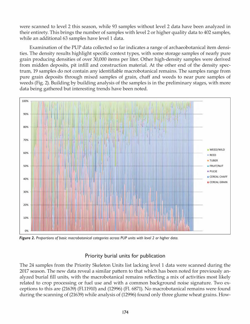
174
were scanned to level 2 this season, while 93 samples without level 2 data have been analyzed in their entirety. This brings the number of samples with level 2 or higher quality data to 402 samples, while an additional 63 samples have level 1 data.
Examination of the PUP data collected so far indicates a range of archaeobotanical item densi-ties. The density results highlight specific context types, with some storage samples of nearly pure grain producing densities of over 30,000 items per liter. Other high-density samples were derived from midden deposits, pit infill and construction material. At the other end of the density spec-trum, 19 samples do not contain any identifiable macrobotanical remains. The samples range from pure grain deposits through mixed samples of grain, chaff and weeds to near pure samples of weeds (Fig. 2). Building by building analysis of the samples is in the preliminary stages, with more data being gathered but interesting trends have been noted.
Priority burial units for publication
The 24 samples from the Priority Skeleton Units list lacking level 1 data were scanned during the 2017 season. The new data reveal a similar pattern to that which has been noted for previously an-alyzed burial fill units, with the macrobotanical remains reflecting a mix of activities most likely related to crop processing or fuel use and with a common background noise signature. Two ex-ceptions to this are (21639) (Fl.11910) and (12996) (Fl. 6871). No macrobotanical remains were found during the scanning of (21639) while analysis of (12996) found only three glume wheat grains. How-
Figure 2. Proportions of basic macrobotanical categories across PUP units with level 2 or higher data.
0%
10%
20%
30%
40%
50%
60%
70%
80%
90%
100%
WEED/WILD
REED
TUBER
FRUIT/NUT
PULSE
CEREAL CHAFF
CEREAL GRAIN
175
ever, given the small subsample examined (1/64), it is likely that this is unrepresentative of the en-tire sample. Further analysis of the data is required to understand whether the substrate into which the burial cut was made has a similar archaeobotanical signature to the burial infill, or whether the burial cut was filled with different material.
TPC adjusted level 2 scanning (Priority + C level)
Due to the ongoing excavation of the TPC Area during the study season and the requirement of additional information for Lara Gonzalez Carretero’s PhD research, 63 samples were selected for this form of analysis. The level 2 scanning protocol was adjusted to reflect the research questions being addressed. This “TPC protocol” was an adaptation of the level 2 priority analysis. The 4mm fraction and a c.10ml subsample of the 1mm were sorted for remains but, unlike a level 2 sort, cereal remains found were identified to species where possible. A minimum number 30 identified cereal grains were aimed for – if this was not reached more of the 1mm fraction was sorted. Not all sam-ples were analyzed using such criteria due to many of the samples undergoing full analysis (see below).
Fullanalysisofsamplesfromspecificlevels
Analysis of samples from specific levels was continued during the 2017 season, building on work started in 2015 and 2016 (see Bogaard et al. 2015 and Filipović́ et al. 2016). The aim was to build on work from previous years and close any gaps in the chronological archaeobotanical dataset. Sam-ples from in situ deposits were targeted, in particular areas of burning, floor deposits and storage deposits. One hundred and seven samples were analyzed during the season, with items of un-known identity photographed for further investigation.
The aim for full analysis was a subsample containing around 300 crop and 30 wild items as a minimum number of items, with no more than a multiplication factor of eight between the frac-tions to be amalgamated. For the samples in which non-crop material dominated, 300 items were the aim. Some samples contained less than the targeted threshold, and were sorted in their entirety if from an important level or context. Samples from the GDN Area were examined this year, with a number of samples containing high amounts of charcoal and reed culm but limited carpological remains.
A number of TPC Area samples were fully analyzed this year. Of note is unit (32803), which de-rives from the southwest corner of B.150 (F.8672). The unit is a cluster of objects including a wooden tool, two baskets, shell, bone and worked stone. The samples from this unit represent storage ma-terial found in and around the two baskets. The samples examined, (32803.s3, s4, s5, s6, s7, s8, and s9), are dominated by naked barley grains while four of the samples also yielded significant pulse seed proportions – predominantly lentil, but (32803.s3) (Fl.13851) and (32803.s8) (Fl.13885) contain, as well as lentil, grass pea. Unit (32803.s5) (Fl.13887) also contains the charred remains of possible fruit flesh and seeds.
A number of samples from burned B.79 in the South Area contain high numbers of Helianthe-mum (rock rose) seeds. Unit (18597) contains c.40,000 seeds of rock rose and indicates the collection and storage of this species. Other samples from this building contain high-density concentrations of emmer and bread wheat (Bogaard et al. 2017).
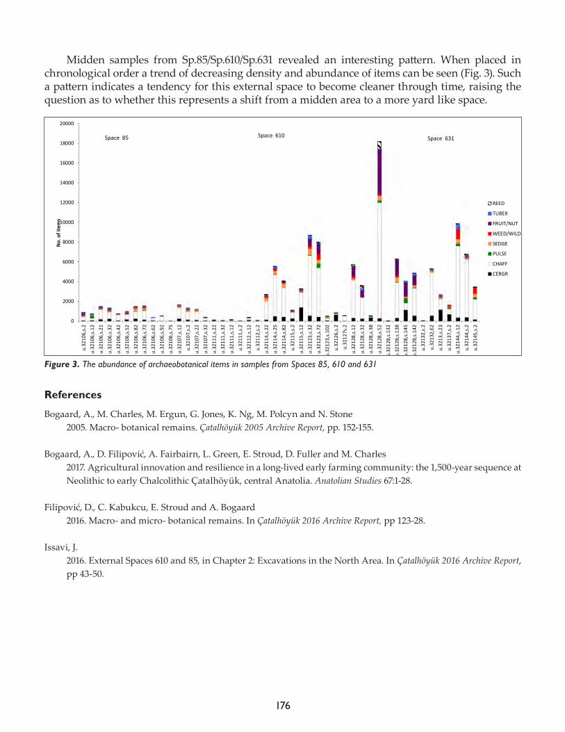
176
Midden samples from Sp.85/Sp.610/Sp.631 revealed an interesting pattern. When placed in chronological order a trend of decreasing density and abundance of items can be seen (Fig. 3). Such a pattern indicates a tendency for this external space to become cleaner through time, raising the question as to whether this represents a shift from a midden area to a more yard like space.
References
Bogaard, A., M. Charles, M. Ergun, G. Jones, K. Ng, M. Polcyn and N. Stone 2005. Macro- botanical remains. Çatalhöyük 2005 Archive Report, pp. 152-155.
Bogaard, A., D. Filipović, A. Fairbairn, L. Green, E. Stroud, D. Fuller and M. Charles 2017. Agricultural innovation and resilience in a long-lived early farming community: the 1,500-year sequence at Neolithic to early Chalcolithic Çatalhöyük, central Anatolia. Anatolian Studies 67:1-28.
Filipović, D., C. Kabukcu, E. Stroud and A. Bogaard 2016. Macro- and micro- botanical remains. In Çatalhöyük 2016 Archive Report, pp 123-28.
Issavi, J. 2016. External Spaces 610 and 85, in Chapter 2: Excavations in the North Area. In Çatalhöyük 2016 Archive Report, pp 43-50.
Figure 3. The abundance of archaeobotanical items in samples from Spaces 85, 610 and 631
0
2000
4000
6000
8000
10000
12000
14000
16000
18000
20000
u.32
106,s.2
u.32
106,s.12
u.32
106,s.21
u.32
106,s.32
u.32
106,s.42
u.32
106,s.52
u.32
106,s.82
u.32
106,s.72
u.32
106,s.62
u.32
106,s.92
u.32
106,s.75
u.32
107,s.12
u.32
107,s.2
u.32
107,s.22
u.32
107,s.32
u.32
111,s.22
u.32
111,s.32
u.32
111,s.12
u.32
111,s.2
u.32
112,s.12
u.32
112,s.2
u.32
114,s.22
u.32
114,s.25
u.32
114,s.82
u.32
115,s.2
u.32
115,s.12
u.32
123,s.32
u.32
123,s.72
u.32
123,s.10
2
u.32
126,s.2
u.32
127s.2
u.32
128,s.12
u.32
128,s.32
u.32
128,s.38
u.32
128,s.52
u.32
128,s.13
2u.32
128,s.13
8u.32
128,s.14
5
u.32
128,s.14
2u.32
132,s.2
u.32
132,62
u.32
13,s.23
u.32
137,s.2
u.32
144,s.12
u.32
144,s.2
u.32
145,s.2
No. o
f items
REED
TUBER
FRUIT/NUT
WEED/WILD
SEDGE
PULSE
CHAFF
CERGR
Space 610 Space 631Space 85
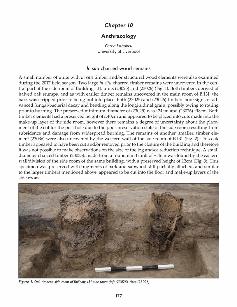
177
Chapter 10
Anthracology
Ceren KabukcuUniversity of Liverpool
In situ charred wood remains
A small number of units with in situ timber and/or structural wood elements were also examined during the 2017 field season. Two large in situ charred timber remains were uncovered in the cen-tral part of the side room of Building 131: units (23025) and (23026) (Fig. 1). Both timbers derived of halved oak stumps, and as with earlier timber remains uncovered in the main room of B.131, the bark was stripped prior to being put into place. Both (23025) and (23026) timbers bore signs of ad-vanced fungal/bacterial decay and bending along the longitudinal grain, possibly owing to rotting prior to burning. The preserved minimum diameter of (23025) was ~24cm and (23026) ~18cm. Both timber elements had a preserved height of c.40cm and appeared to be placed into cuts made into the make-up layer of the side room, however there remains a degree of uncertainty about the place-ment of the cut for the post hole due to the poor preservation state of the side room resulting from subsidence and damage from widespread burning. The remains of another, smaller, timber ele-ment (23036) were also uncovered by the western wall of the side room of B.131 (Fig. 2). This oak timber appeared to have been cut and/or removed prior to the closure of the building and therefore it was not possible to make observations on the size of the log and/or reduction technique. A small diameter charred timber (23035), made from a round elm trunk of ~14cm was found by the eastern wall/division of the side room of the same building, with a preserved height of 12cm (Fig. 3). This specimen was preserved with fragments of bark and sapwood still partially attached, and similar to the larger timbers mentioned above, appeared to be cut into the floor and make-up layers of the side room.
Figure 1. Oak timbers, side room of Building 131 side room (left (23025), right (23026).
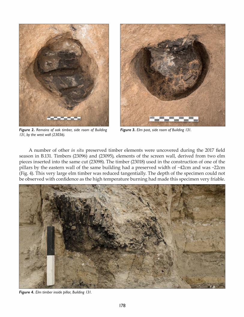
178
A number of other in situ preserved timber elements were uncovered during the 2017 field season in B.131. Timbers (23096) and (23095), elements of the screen wall, derived from two elm pieces inserted into the same cut (23098). The timber (23018) used in the construction of one of the pillars by the eastern wall of the same building had a preserved width of ~42cm and was ~22cm (Fig. 4). This very large elm timber was reduced tangentially. The depth of the specimen could not be observed with confidence as the high temperature burning had made this specimen very friable.
Figure 2. Remains of oak timber, side room of Building 131, by the west wall (23036).
Figure 3. Elm post, side room of Building 131.
Figure 4. Elm timber inside pillar, Building 131.
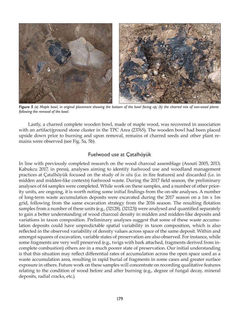
179
Lastly, a charred complete wooden bowl, made of maple wood, was recovered in association with an artifact/ground stone cluster in the TPC Area (23765). The wooden bowl had been placed upside down prior to burning and upon removal, remains of charred seeds and other plant re-mains were observed (see Fig. 5a, 5b).
Fuelwood use at Çatalhöyük
In line with previously completed research on the wood charcoal assemblage (Asouti 2005, 2013; Kabukcu 2017, in press), analyses aiming to identify fuelwood use and woodland management practices at Çatalhöyük focused on the study of in situ (i.e. in fire features) and discarded (i.e. in midden and midden-like contexts) fuelwood waste. During the 2017 field season, the preliminary analyses of 64 samples were completed. While work on these samples, and a number of other prior-ity units, are ongoing, it is worth noting some initial findings from the on-site analyses. A number of long-term waste accumulation deposits were excavated during the 2017 season on a 1m x 1m grid, following from the same excavation strategy from the 2016 season. The resulting flotation samples from a number of these units (e.g., (32128), (32123)) were analysed and quantified separately to gain a better understanding of wood charcoal density in midden and midden-like deposits and variations in taxon composition. Preliminary analyses suggest that some of these waste accumu-lation deposits could have unpredictable spatial variability in taxon composition, which is also reflected in the observed variability of density values across space of the same deposit. Within and amongst squares of excavation, variable states of preservation are also observed. For instance, while some fragments are very well preserved (e.g., twigs with bark attached, fragments derived from in-complete combustion) others are in a much poorer state of preservation. Our initial understanding is that this situation may reflect differential rates of accumulation across the open space used as a waste accumulation area, resulting in rapid burial of fragments in some cases and greater surface exposure in others. Future work on these samples will concentrate on recording qualitative features relating to the condition of wood before and after burning (e.g., degree of fungal decay, mineral deposits, radial cracks, etc.).
Figure 5 (a) Maple bowl, in original placement showing the bottom of the bowl facing up; (b) the charred mix of non-wood plants following the removal of the bowl.
180
Anthracological analyses in the next year will be focused on completing the botanical identifi-cation and dendroecological examination of wood charcoals from priority units, midden sequences from the North, TPC and GDN areas of excavations, as these areas are currently underrepresented in anthracological analyses to date.
References
Asouti, E.2005. Woodland vegetation and the exploitation of fuel and timber at Neolithic Çatalhöyük: report on the wood-charcoal macro-remains. In Inhabiting Çatalhöyük: Reports from the 1995–99 Seasons, edited by I. Hodder. Cambridge: McDonald Institute of Archaeology; London: British Institute of Archaeology at Ankara, pp. 213-58.
2013. Woodland vegetation, firewood management and woodcrafts at Neolithic Çatalhöyük. In Humans and Landscapes of Çatalhöyük: Reports from the 2000-2008 Seasons, edited by I. Hodder. London: British Institute a tAn-kara; Los Angeles: Cotsen Institute of Archaeology Press, pp. 129-62.
Kabukcu, C. 2017. Identification of woodland management practices and tree growth conditions in archaeological fuel waste remains: a case study from the site of Çatalhöyük in central Anatolia, Turkey. Quaternary International (http://dx.doi.org/10.1016/j.quaint.2017.03.017).
In press. Woodland vegetation history and human impacts in south-central Anatolia 16,000 – 6500 cal BP: An-thracological results from five prehistoric sites in the Konya Plain. Quaternary Science Reviews (manuscript ac-cepted for publication, JQSR5132).
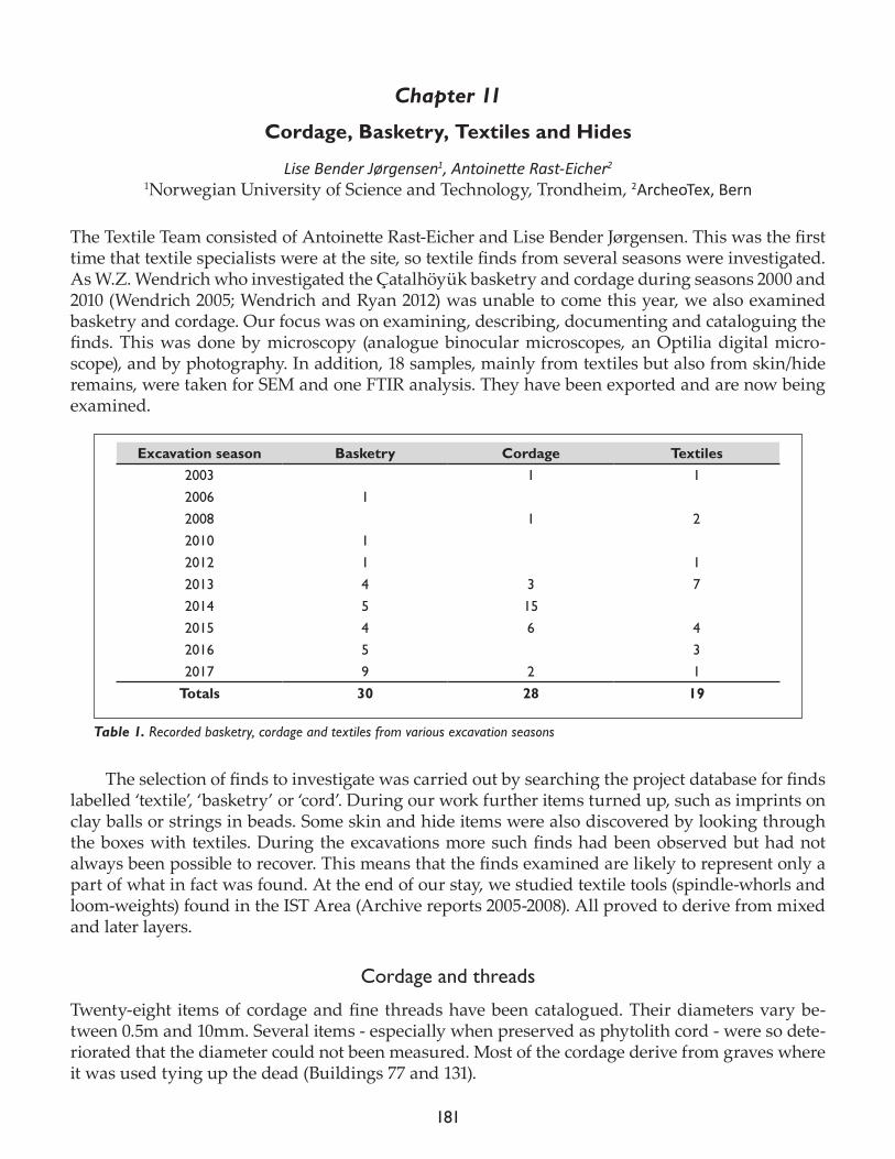
181
Chapter 11
Cordage, Basketry, Textiles and Hides
Lise Bender Jørgensen1, Antoinette Rast-Eicher2
1Norwegian University of Science and Technology, Trondheim, 2ArcheoTex, Bern
The Textile Team consisted of Antoinette Rast-Eicher and Lise Bender Jørgensen. This was the first time that textile specialists were at the site, so textile finds from several seasons were investigated. As W.Z. Wendrich who investigated the Çatalhöyük basketry and cordage during seasons 2000 and 2010 (Wendrich 2005; Wendrich and Ryan 2012) was unable to come this year, we also examined basketry and cordage. Our focus was on examining, describing, documenting and cataloguing the finds. This was done by microscopy (analogue binocular microscopes, an Optilia digital micro-scope), and by photography. In addition, 18 samples, mainly from textiles but also from skin/hide remains, were taken for SEM and one FTIR analysis. They have been exported and are now being examined.
The selection of finds to investigate was carried out by searching the project database for finds labelled ‘textile’, ‘basketry’ or ‘cord’. During our work further items turned up, such as imprints on clay balls or strings in beads. Some skin and hide items were also discovered by looking through the boxes with textiles. During the excavations more such finds had been observed but had not always been possible to recover. This means that the finds examined are likely to represent only a part of what in fact was found. At the end of our stay, we studied textile tools (spindle-whorls and loom-weights) found in the IST Area (Archive reports 2005-2008). All proved to derive from mixed and later layers.
Cordage and threads
Twenty-eight items of cordage and fine threads have been catalogued. Their diameters vary be-tween 0.5m and 10mm. Several items - especially when preserved as phytolith cord - were so dete-riorated that the diameter could not been measured. Most of the cordage derive from graves where it was used tying up the dead (Buildings 77 and 131).
Excavation season Basketry Cordage Textiles2003 1 12006 12008 1 22010 12012 1 12013 4 3 72014 5 152015 4 6 42016 5 32017 9 2 1
Totals 30 28 19
Table 1. Recorded basketry, cordage and textiles from various excavation seasons
182
Three items were found inside beads. They consist of a plied thread (7580), and fine strings composed from multiple-2-ply threads ((17457) and (21682)). The diameters of these plant fiber strings indicate that they were used for stringing the beads rather than for sewing them on to a textile or hide.
Basketry
In addition to W.Z. Wendrich’s work in previous seasons and partly published (Wendrich (2006; Wendrich and Ryan 2012), we examined a number of new finds. A total of 29 items were recorded, in addition to one (from 2006) that had been seen previously by Wendrich. They consisted of two categories, coiled baskets and mats. Two of them were imprints on clay balls. Most of the basketry was preserved as phytoliths:
• 15 coiled baskets• 8 mats (all in tabby)
Textiles and twining
Textiles include woven textiles as well as certain other techniques (twining, soumak). Twining is a basketry technique that is used for a wide variety of purposes and made from many different materials. When made from fine fibers it forms flexible fabrics and appears to be an intermediate to true weaving (Rast-Eicher 2005; Rast-Eicher and Dietrich 2015). For definitions, see Seiler-Baldinger 1994 or Rast-Eicher and Dietrich 2015). Nineteen textiles were recorded. Thirteen were tabby, two twining, one tabby or twining, and three were other/ indeterminable. To these can be added nine textiles from the excavations in the 1960s and published by H.B. Burnham (1965). Two of these were in twining and soumak technique, the others woven in tabby.
Two of the textiles from the 1993-2017 excavations ((8770.s3) and (19586.s3)) stem from non-Neo-lithic layers; the rest are Neolithic. Finds (17457.x3 and x10) derive from B.49, F.4023; (22661.s2, s3 and s5) from B.131, F.7956; (22676.s4 and s12) are from B.131, F.7961/7963, (30039.s10) from B.131, (30503.x9), (30503.s5, s6, s7, s8, s9 and s10) from B.52, F.7122, and (32373.x1) from B.131, F.7997.
References
Burnham, H.B. 1965. Çatal Hüyük – The textiles and twined fabrics. Anatolian Studies XV, 169-74.
Rast-Eicher, A. 2005. Bast before wool: the first textiles. In Hallstatt Textiles. Technical Analysis, Scientific Investigation and Experi-ment on Iron Age Textiles (BAR International Series 1351), edited by P. Bichler, K. Grömer, R. Hofmann-De Keijzer, A. Kern and H. Reschreiter. Oxford: Archaeopress, pp. 117-32.
Rast-Eicher, A. and Dietrich, A.2015. Neolithische und bronzezeitliche Gewebe und Geflechte. Die Funde aus den Ufersiedlungen im Kanton Zürich. Mo-nographien der Kantonsarchäologie Zürich, Zürich und Egg.
Seiler-Baldinger, A. 1994. Textiles. A Classification of Techniques. Bathurst: Crawford House Press.
183
Wendrich, W. 2005. Çatalhöyük basketry. In Changing Materialities at Çatalhöyük: Reports from the 1995-99 Seasons, edited by I Hodder. Cambridge: McDonald Institute for Archaeological Research; London: The British Institute at Ankara, pp. 333-8 and 589-96.
Wendrich, W. and Ryan, P. 2012. Phytoliths and basketry materials at Çatalhöyük (Turkey): timelines of growth, harvest and objects life histories. Paléorient 38(1-2), 55-63.

184
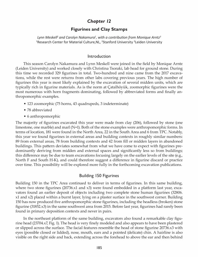
185
Chapter 12
Figurines and Clay Stamps
Lynn Meskell2 and Carolyn Nakamura1, with a contribution from Monique Arntz3
1Research Center for Material Culture,NL, 2Stanford University 3Leiden University
Introduction
This season Carolyn Nakamura and Lynn Meskell were joined in the field by Monique Arntz (Leiden University) and worked closely with Christina Tsoraki, lab head for ground stone. During this time we recorded 329 figurines in total. Two-hundred and nine came from the 2017 excava-tions, while the rest were returns from other labs covering previous years. The high number of figurines this year is most likely explained by the excavation of several midden units, which are typically rich in figurine materials. As is the norm at Çatalhöyük, zoomorphic figurines were the most numerous with horn fragments dominating, followed by abbreviated forms and finally an-thropomorphic examples.
• 123 zoomorphic (75 horns, 43 quadrupeds, 3 indeterminate)• 78 abbreviated• 6 anthropomorphic
The majority of figurines excavated this year were made from clay (206), followed by stone (one limestone, one marble) and marl (N=1). Both of the stone examples were anthropomorphic forms. In terms of location, 181 were found in the North Area, 22 in the South Area and 6 from TPC. Notably, this year we found figurines in external areas and building contexts in roughly similar numbers: 89 from external areas, 78 from building contexts and 42 from fill or midden layers in abandoned buildings. This pattern deviates somewhat from what we have come to expect with figurines pre-dominantly deriving from midden and external spaces and significantly less so from buildings; this difference may be due to team excavations focusing largely on the earlier levels of the site (e.g., North F and South H-K), and could therefore suggest a difference in figurine discard or practice over time. This possibility will be explored more fully in the forthcoming excavation publications.
Building 150 Figurines
Building 150 in the TPC Area continued to deliver in terms of figurines. In this same building, where two stone figurines (20736.x1 and x3) were found embedded in a platform last year, exca-vators found an earlier deposit of objects including two complete stone human figurines (32806.x1 and x2) placed within a burnt layer, lying on a plaster surface in the southwest corner. Building 150 has now produced five anthropomorphic stone figurines, including the headless (broken) stone figurine (31852.x3) in the same southwest area from 2015. Before last year, figurines had rarely been found in primary deposition contexts and never in pairs.
In the northeast platform of the same building, excavators also found a remarkable clay figu-rine head (23704.x7, Fig. 1). The head is very finely modeled and also appears to have been plastered or slipped across the surface. The facial features resemble the head of stone figurine 20736.x3 with eyes (possible closed or lidded), nose, mouth, ears and a pointed (delicate) chin. A hairline is also visible on the right side and back, extending across the forehead to above the ear and then behind
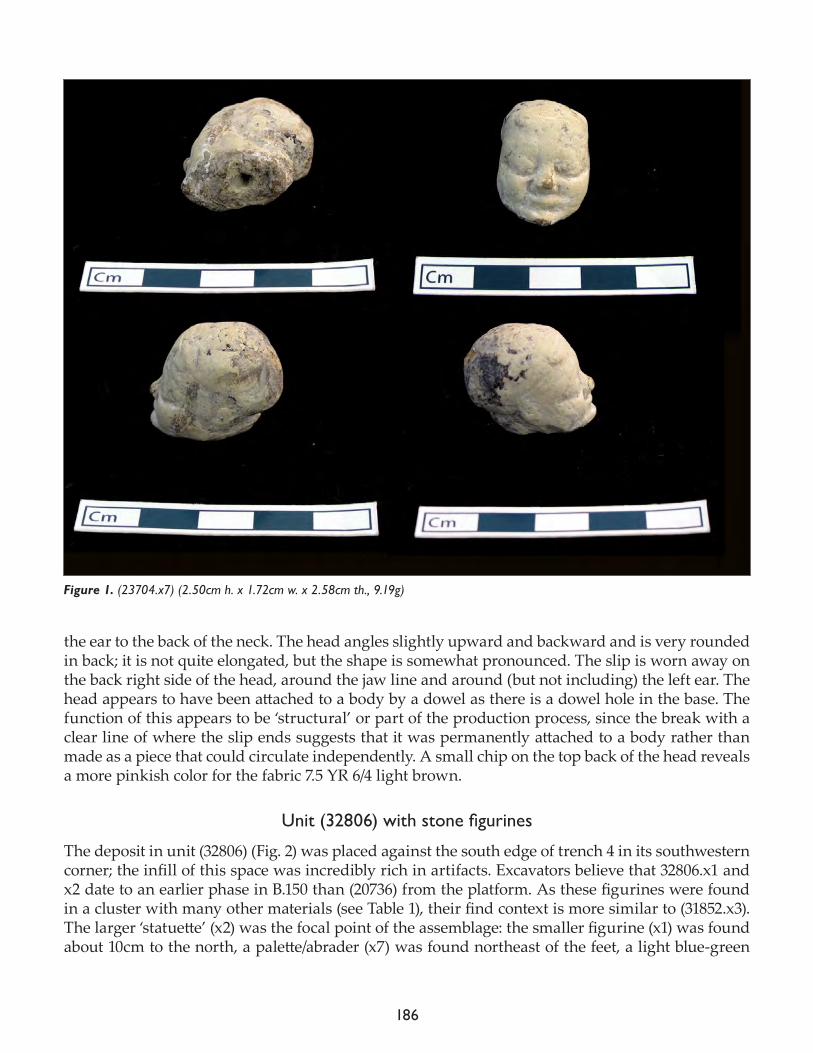
186
the ear to the back of the neck. The head angles slightly upward and backward and is very rounded in back; it is not quite elongated, but the shape is somewhat pronounced. The slip is worn away on the back right side of the head, around the jaw line and around (but not including) the left ear. The head appears to have been attached to a body by a dowel as there is a dowel hole in the base. The function of this appears to be ‘structural’ or part of the production process, since the break with a clear line of where the slip ends suggests that it was permanently attached to a body rather than made as a piece that could circulate independently. A small chip on the top back of the head reveals a more pinkish color for the fabric 7.5 YR 6/4 light brown.
Unit(32806)withstonefigurines
The deposit in unit (32806) (Fig. 2) was placed against the south edge of trench 4 in its southwestern corner; the infill of this space was incredibly rich in artifacts. Excavators believe that 32806.x1 and x2 date to an earlier phase in B.150 than (20736) from the platform. As these figurines were found in a cluster with many other materials (see Table 1), their find context is more similar to (31852.x3). The larger ‘statuette’ (x2) was the focal point of the assemblage: the smaller figurine (x1) was found about 10cm to the north, a palette/abrader (x7) was found northeast of the feet, a light blue-green
Figure 1. (23704.x7) (2.50cm h. x 1.72cm w. x 2.58cm th., 9.19g)
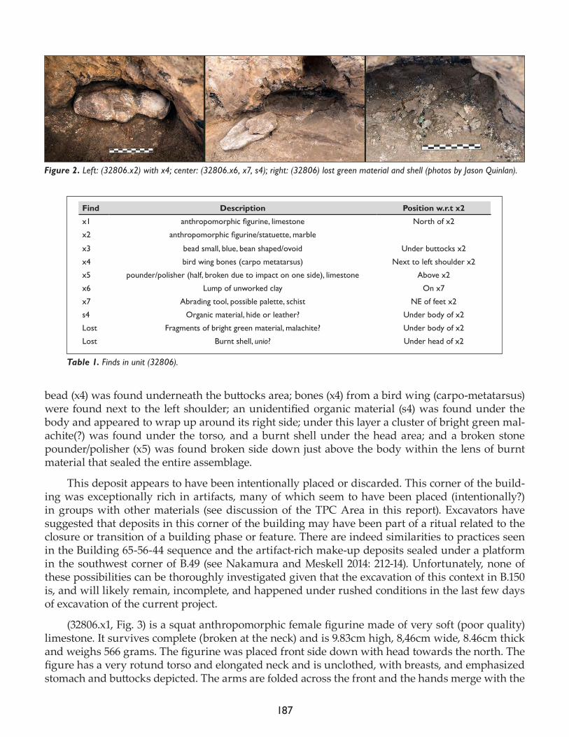
187
bead (x4) was found underneath the buttocks area; bones (x4) from a bird wing (carpo-metatarsus) were found next to the left shoulder; an unidentified organic material (s4) was found under the body and appeared to wrap up around its right side; under this layer a cluster of bright green mal-achite(?) was found under the torso, and a burnt shell under the head area; and a broken stone pounder/polisher (x5) was found broken side down just above the body within the lens of burnt material that sealed the entire assemblage.
This deposit appears to have been intentionally placed or discarded. This corner of the build-ing was exceptionally rich in artifacts, many of which seem to have been placed (intentionally?) in groups with other materials (see discussion of the TPC Area in this report). Excavators have suggested that deposits in this corner of the building may have been part of a ritual related to the closure or transition of a building phase or feature. There are indeed similarities to practices seen in the Building 65-56-44 sequence and the artifact-rich make-up deposits sealed under a platform in the southwest corner of B.49 (see Nakamura and Meskell 2014: 212-14). Unfortunately, none of these possibilities can be thoroughly investigated given that the excavation of this context in B.150 is, and will likely remain, incomplete, and happened under rushed conditions in the last few days of excavation of the current project.
(32806.x1, Fig. 3) is a squat anthropomorphic female figurine made of very soft (poor quality) limestone. It survives complete (broken at the neck) and is 9.83cm high, 8,46cm wide, 8.46cm thick and weighs 566 grams. The figurine was placed front side down with head towards the north. The figure has a very rotund torso and elongated neck and is unclothed, with breasts, and emphasized stomach and buttocks depicted. The arms are folded across the front and the hands merge with the
Figure 2. Left: (32806.x2) with x4; center: (32806.x6, x7, s4); right: (32806) lost green material and shell (photos by Jason Quinlan).
Find Description Position w.r.t x2
x1 anthropomorphicfigurine,limestone North of x2
x2 anthropomorphicfigurine/statuette,marble
x3 bead small, blue, bean shaped/ovoid Under buttocks x2
x4 bird wing bones (carpo metatarsus) Next to left shoulder x2
x5 pounder/polisher (half, broken due to impact on one side), limestone Above x2
x6 Lump of unworked clay On x7
x7 Abrading tool, possible palette, schist NE of feet x2
s4 Organic material, hide or leather? Under body of x2
Lost Fragments of bright green material, malachite? Under body of x2
Lost Burnt shell, unio? Under head of x2
Table 1. Finds in unit (32806).
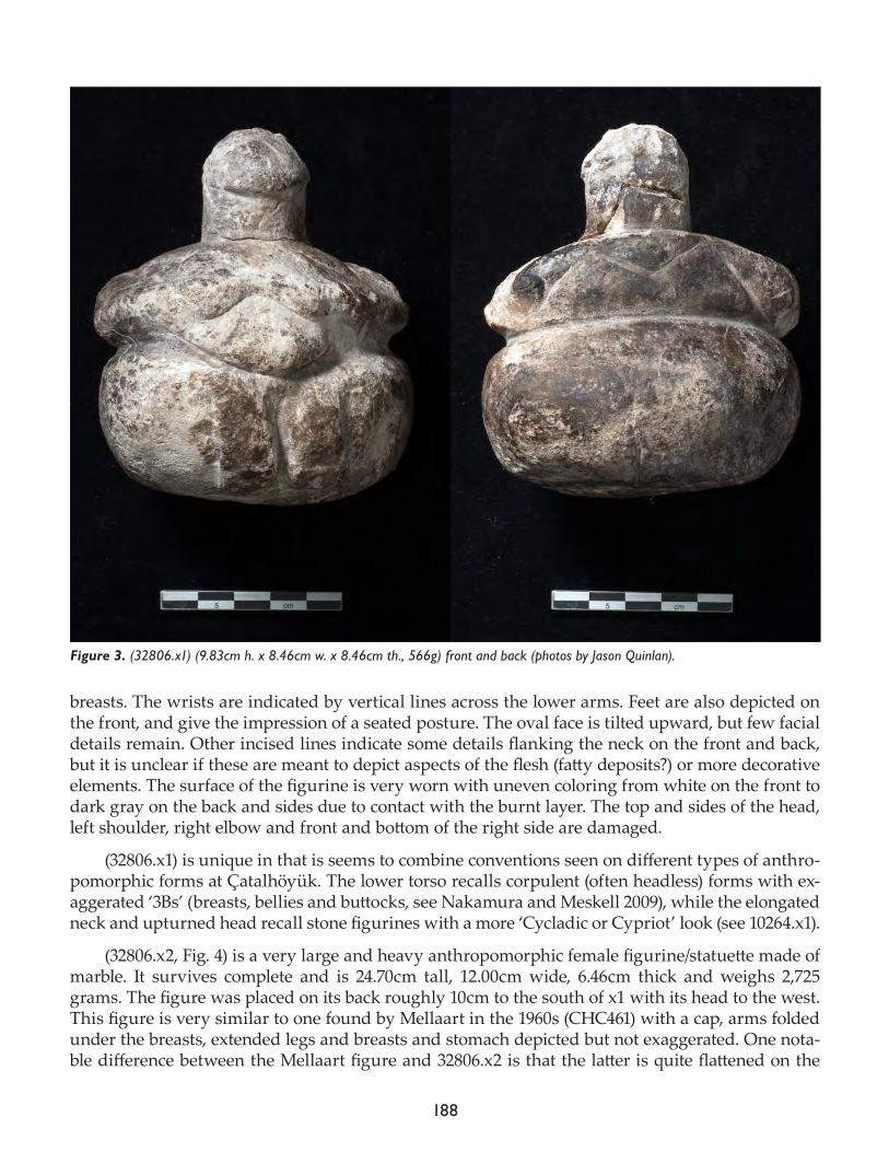
188
breasts. The wrists are indicated by vertical lines across the lower arms. Feet are also depicted on the front, and give the impression of a seated posture. The oval face is tilted upward, but few facial details remain. Other incised lines indicate some details flanking the neck on the front and back, but it is unclear if these are meant to depict aspects of the flesh (fatty deposits?) or more decorative elements. The surface of the figurine is very worn with uneven coloring from white on the front to dark gray on the back and sides due to contact with the burnt layer. The top and sides of the head, left shoulder, right elbow and front and bottom of the right side are damaged.
(32806.x1) is unique in that is seems to combine conventions seen on different types of anthro-pomorphic forms at Çatalhöyük. The lower torso recalls corpulent (often headless) forms with ex-aggerated ‘3Bs’ (breasts, bellies and buttocks, see Nakamura and Meskell 2009), while the elongated neck and upturned head recall stone figurines with a more ‘Cycladic or Cypriot’ look (see 10264.x1).
(32806.x2, Fig. 4) is a very large and heavy anthropomorphic female figurine/statuette made of marble. It survives complete and is 24.70cm tall, 12.00cm wide, 6.46cm thick and weighs 2,725 grams. The figure was placed on its back roughly 10cm to the south of x1 with its head to the west. This figure is very similar to one found by Mellaart in the 1960s (CHC461) with a cap, arms folded under the breasts, extended legs and breasts and stomach depicted but not exaggerated. One nota-ble difference between the Mellaart figure and 32806.x2 is that the latter is quite flattened on the
Figure 3. (32806.x1) (9.83cm h. x 8.46cm w. x 8.46cm th., 566g) front and back (photos by Jason Quinlan).
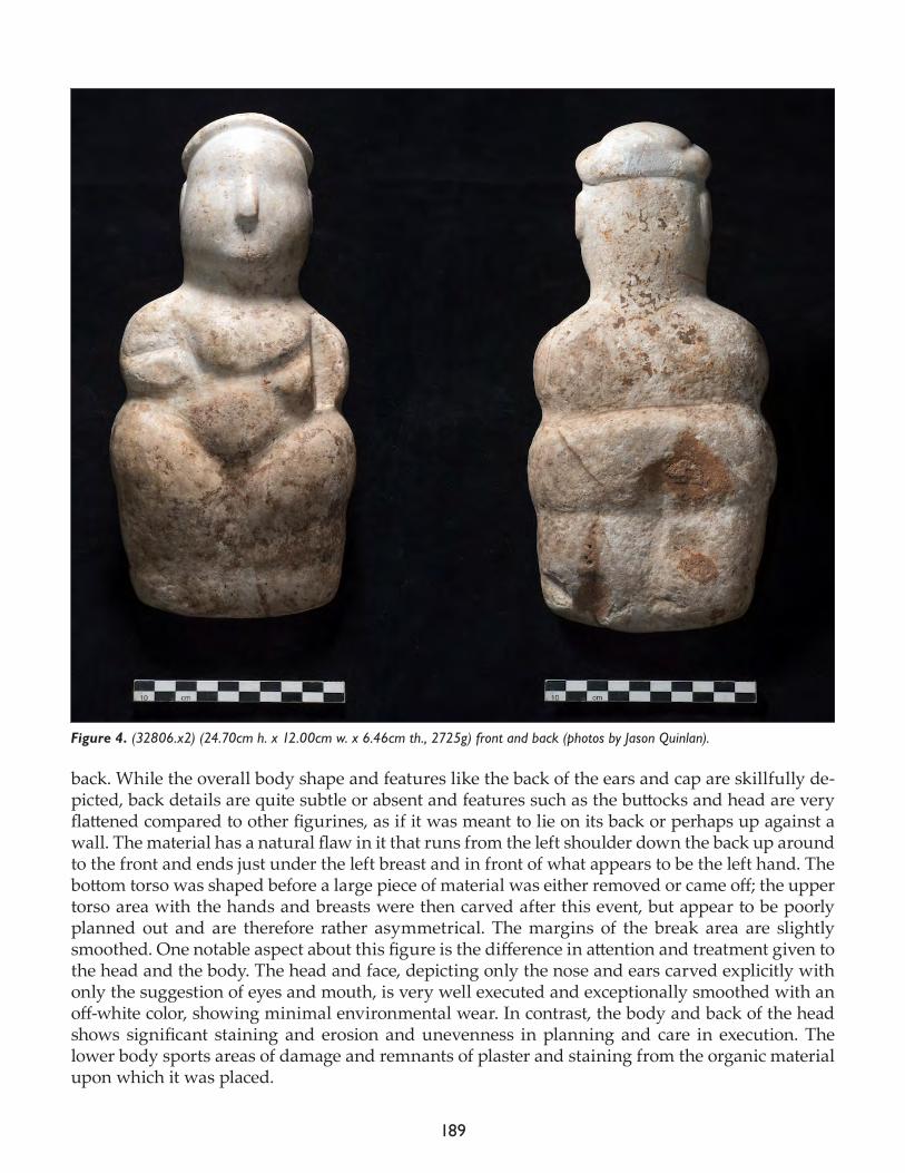
189
back. While the overall body shape and features like the back of the ears and cap are skillfully de-picted, back details are quite subtle or absent and features such as the buttocks and head are very flattened compared to other figurines, as if it was meant to lie on its back or perhaps up against a wall. The material has a natural flaw in it that runs from the left shoulder down the back up around to the front and ends just under the left breast and in front of what appears to be the left hand. The bottom torso was shaped before a large piece of material was either removed or came off; the upper torso area with the hands and breasts were then carved after this event, but appear to be poorly planned out and are therefore rather asymmetrical. The margins of the break area are slightly smoothed. One notable aspect about this figure is the difference in attention and treatment given to the head and the body. The head and face, depicting only the nose and ears carved explicitly with only the suggestion of eyes and mouth, is very well executed and exceptionally smoothed with an off-white color, showing minimal environmental wear. In contrast, the body and back of the head shows significant staining and erosion and unevenness in planning and care in execution. The lower body sports areas of damage and remnants of plaster and staining from the organic material upon which it was placed.
Figure 4. (32806.x2) (24.70cm h. x 12.00cm w. x 6.46cm th., 2725g) front and back (photos by Jason Quinlan).
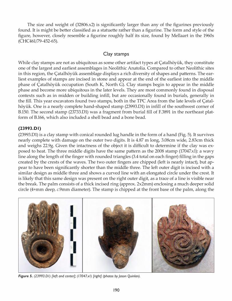
190
The size and weight of (32806.x2) is significantly larger than any of the figurines previously found. It is might be better classified as a statuette rather than a figurine. The form and style of the figure, however, closely resemble a figurine roughly half its size, found by Mellaart in the 1960s (CHC461/79-452-65).
Clay stamps
While clay stamps are not as ubiquitous as some other artifact types at Çatalhöyük, they constitute one of the largest and earliest assemblages in Neolithic Anatolia. Compared to other Neolithic sites in this region, the Çatalhöyük assemblage displays a rich diversity of shapes and patterns. The ear-liest examples of stamps are incised in stone and appear at the end of the earliest into the middle phase of Çatalhöyük occupation (South K, North G). Clay stamps begin to appear in the middle phase and become more ubiquitous in the later levels. They are most commonly found in disposal contexts such as in midden or building infill, but are occasionally found in burials, generally in the fill. This year excavators found two stamps, both in the TPC Area from the late levels of Çatal-höyük. One is a nearly complete hand-shaped stamp (23993.D1) in infill of the southwest corner of B.150. The second stamp (23733.D1) was a fragment from burial fill of F.3891 in the northeast plat-form of B.166, which also included a shell bead and a bone bead.
(23993.D1)(23993.D1) is a clay stamp with conical rounded lug handle in the form of a hand (Fig. 5). It survives nearly complete with damage on the outer two digits. It is 4.87 m long, 3.08cm wide, 2.83cm thick and weighs 22.9g. Given the intactness of the object it is difficult to determine if the clay was ex-posed to heat. The three middle digits have the same pattern as the 2008 stamp (17047.x1): a wavy line along the length of the finger with rounded triangles (3.4 total on each finger) filling in the gaps created by the crests of the waves. The two outer fingers are chipped (left is nearly intact), but ap-pear to have been significantly shorter than the middle three. The left outer digit is incised with a similar design as middle three and shows a curved line with an elongated circle under the crest. It is likely that this same design was present on the right outer digit, as a trace of a line is visible near the break. The palm consists of a thick incised ring (approx. 2x2mm) enclosing a much deeper solid circle (4+mm deep, c.9mm diameter). The stamp is chipped at the front base of the palm, along the
Figure 5. (23993.D1) [left and center]; (17047.x1) [right] (photos by Jason Quinlan).
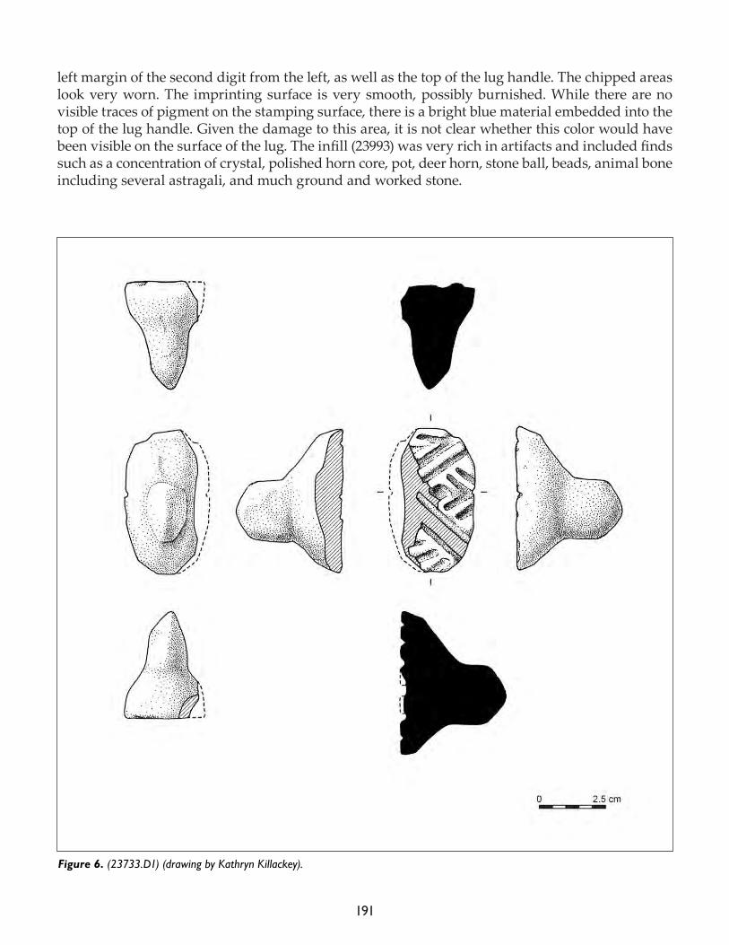
191
left margin of the second digit from the left, as well as the top of the lug handle. The chipped areas look very worn. The imprinting surface is very smooth, possibly burnished. While there are no visible traces of pigment on the stamping surface, there is a bright blue material embedded into the top of the lug handle. Given the damage to this area, it is not clear whether this color would have been visible on the surface of the lug. The infill (23993) was very rich in artifacts and included finds such as a concentration of crystal, polished horn core, pot, deer horn, stone ball, beads, animal bone including several astragali, and much ground and worked stone.
Figure 6. (23733.D1) (drawing by Kathryn Killackey).
192
This stamp is significant for being the most complete of this hand-type found on site to date. It is very similar to a stamp from 2008 retrieved from midden (17047.x1, Fig. 5), and displays the same pattern of a wavy line with triangles filling in the peaks on the fingers. But instead of a spiral ele-ment, (23993.D1) sports a circular element on the palm. Mellaart also found two possible fragments of this hand-type in the 1960s. Previously, Türkan (2014) has interpreted this form as a ‘bear paw’. But the significantly more intact example of 23993.D1 strongly suggests a more human rather than animal interpretation for this form. The middle three digits are much longer than previously es-timated, giving the distinct impression of a human hand, rather than an animal paw. In fact, this stamp is very reminiscent of the hand forms found on wall paintings. Another notable aspect of the stamp is a trace of bright blue pigment or material embedded in the top of the lug handle. Giv-en that the top of this lug is damaged, it is unclear whether this color would have been visible on the surface. This feature has not been noted previously, but after looking more closely at stamps from previous years, we have since found four others that bear similar traces of blue-green pig-ment on top of the lug handles. Eline Schotsmans (University of Bradford), who is working with the human remains team, scanned these material traces with a portable XRF, but given the minute amounts in some cases and/or conservation treatment, results about the identification of the blue-green material were not immediately forthcoming. Further study is thus required and will be presented in forthcoming publications.
The stamp fragment (Fig. 6) from burial F.3891 in B.166 was not examined during the field season.
Project: Figurines as functional objects
Monique Arntz
This year my research looked at figurines as functional objects, focusing on their production, use and deposition. It forms part of my doctoral project on Neolithic Figurines from Tell Sabi Abyad (Syria) and Çatalhöyük. My aim is to research figurines as artifacts and to integrate the data from their production, use and discard into life trajectories, analyzing within and between types of figurines. These phases in the ‘life’ of a figurine are connected and might to be studied as an in-tegrated whole if we are to understand the role of figurines in Neolithic society. The Çatalhöyük figurine database is extensive, with detailed information on each object, including fragments and I spent this season recording data on clay fabric, inclusions and heat exposure.
Clay typesFollowing previous work by Doherty (see 2008, 2009 Archive Reports) figurines were made from a range of different clay types that were locally available and that there is no evidence for tempering of the clay. Using the references for recognizing these different clay types, this information was recorded in the database where it was felt identification was secure. By looking at the entire corpus of figurines at the site, it may be possible to identify patterns – or lack thereof – in selecting clay types for different types of figurines.
Heat exposure Figurines were never baked like ceramics; however they were commonly exposed to heat in some form. Heat exposure can occur in a variety of ways, very often indirectly through proximity to
193
fires, ovens and hearths. There are also instances where figurines were in direct contact with heat/fire leaving them (partially) baked or burnt. With broken figurines there can be differences in sur-face and core color. Furthermore, differences in surface color on a single object indicate uneven heat exposure. In order to ascertain any intentionality in this process it is again necessary to look at pat-terns over a large data set. This season I noted uneven heat exposure: some zoomorphic figurines had been more exposed on one side than the other. With this data now recorded for a large number of figurines we can start to examine whether this is unintentional and/or post-depositional, since most of the figurines are recovered in middens with ashes and burnt material, or if it appears in-tentional.
Production and useThis season I focused on modelling techniques, looking at whether figurines are made from one piece of clay or are composite pieces and if they were made by hand or if tools were also used. Very often pieces are well smoothed, essentially removing evidence of how they were shaped. This in itself is of course also proof of their shaping, but only of the final step. Zoomorphic figurines reveal the most information. Clear pinch marks, smears of clay and fingerprints show how the pieces were molded into shape. Zoomorphic figurines are also the most diverse in their shape, size range and production methods. From the tiny, only a few centimeters and finely smoothed to the large, up to 15 centimeters, and not smoothed at all. Abbreviated forms are the most standardized. Very often the same shaping techniques were observed. The divided base where ‘legs’ where shaped, clay smeared upwards between the legs and the legs then pushed together. A pinch mark on the back and bottom of the base often indicates where the object was likely held whilst shaping. Often, a tri-angular scoop mark above the legs was made with a fingernail. The clear pinch marks on each side of the nose, indicating how it was shaped from the main piece. Finally, when present, the folded head element where clay was pinched out, flattened, and pushed back against the head.
Evidence was found for tool use in both zoomorphic and anthropomorphic figurines. Incising objects to delineate features being the most common one along with using tools to puncture figu-rines. This was done to indicate facial features as well as decoration. Burnishing is infrequent and only observed in two examples: a zoomorphic head fragment and an anthropomorphic figurine.
The Çatalhöyük dataset, coupled with the figurines from Tell Sabi Abyad, comprise a corpus of several thousand figurines. With this dataset I hope to create a comparative overview of how figurines operated within their social settings at both sites. With the established frameworks we can examine patterns by answering key questions in a systematic way. How were figurines shaped, were there set ways or sequences of actions and movements involved? What markings are present on figurines and how do they relate to figurine production, use and deposition? By examining con-textual settings, we can understand in what social contexts figurines operated.
References
Nakamura C. and L. Meskell2009. Articulate bodies: forms and figures at Çatalhöyük. Journal of Archaeological Method and Theory 16(3): 205-230.
Türkan A.U.

194
2014. Çatalhöyük stamp seals from 2000 to 2008. In Substantive Technologies at Çatalhöyük: Reports From the 2000-2008 Seasons; edited by I. Hodder. London: British Institute at Ankara; Los Angeles: Cotsen Institute of Archae-ology Press, 235-46.
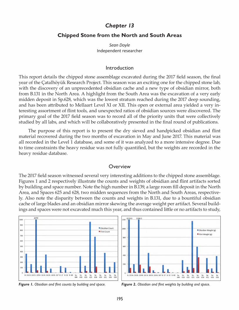
195
Chapter 13
Chipped Stone from the North and South Areas
Sean DoyleIndependent researcher
Introduction
This report details the chipped stone assemblage excavated during the 2017 field season, the final year of the Çatalhöyük Research Project. This season was an exciting one for the chipped stone lab, with the discovery of an unprecedented obsidian cache and a new type of obsidian mirror, both from B.131 in the North Area. A highlight from the South Area was the excavation of a very early midden deposit in Sp.628, which was the lowest stratum reached during the 2017 deep sounding, and has been attributed to Mellaart Level XI or XII. This open or external area yielded a very in-teresting assortment of flint tools, and unexpected ratios of obsidian sources were discovered. The primary goal of the 2017 field season was to record all of the priority units that were collectively studied by all labs, and which will be collaboratively presented in the final round of publications.
The purpose of this report is to present the dry sieved and handpicked obsidian and flint material recovered during the two months of excavation in May and June 2017. This material was all recorded in the Level 1 database, and some of it was analyzed to a more intensive degree. Due to time constraints the heavy residue was not fully quantified, but the weights are recorded in the heavy residue database.
Overview
The 2017 field season witnessed several very interesting additions to the chipped stone assemblage. Figures 1 and 2 respectively illustrate the counts and weights of obsidian and flint artifacts sorted by building and space number. Note the high number in B.139, a large room fill deposit in the North Area, and Spaces 625 and 628, two midden sequences from the North and South Areas, respective-ly. Also note the disparity between the counts and weights in B.131, due to a bountiful obsidian cache of large blades and an obsidian mirror skewing the average weight per artifact. Several build-ings and spaces were not excavated much this year, and thus contained little or no artifacts to study,
Figure 1. Obsidian and flint counts by building and space. Figure 2. Obsidian and flint weights by building and space.
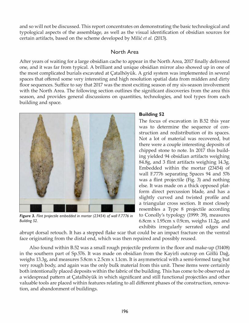
196
and so will not be discussed. This report concentrates on demonstrating the basic technological and typological aspects of the assemblage, as well as the visual identification of obsidian sources for certain artifacts, based on the scheme developed by Milić et al. (2013).
North Area
After years of waiting for a large obsidian cache to appear in the North Area, 2017 finally delivered one, and it was far from typical. A brilliant and unique obsidian mirror also showed up in one of the most complicated burials excavated at Çatalhöyük. A grid system was implemented in several spaces that offered some very interesting and high resolution spatial data from midden and dirty floor sequences. Suffice to say that 2017 was the most exciting season of my six-season involvement with the North Area. The following section outlines the significant discoveries from the area this season, and provides general discussions on quantities, technologies, and tool types from each building and space.
Building 52The focus of excavation in B.52 this year was to determine the sequence of con-struction and redistribution of its spaces. Not a lot of material was recovered, but there were a couple interesting deposits of chipped stone to note. In 2017 this build-ing yielded 94 obsidian artifacts weighing 84.8g, and 3 flint artifacts weighing 14.3g. Embedded within the mortar (23454) of wall F.7776 separating Spaces 94 and 576 was a flint projectile (Fig. 3) and nothing else. It was made on a thick opposed plat-form direct percussion blade, and has a slightly curved and twisted profile and a triangular cross section. It most closely resembles a Type 8 projectile according to Conolly’s typology (1999: 39), measures 6.8cm x 1.95cm x 0.9cm, weighs 11.2g, and exhibits irregularly serrated edges and
abrupt dorsal retouch. It has a stepped flake scar that could be an impact fracture on the ventral face originating from the distal end, which was then repaired and possibly reused.
Also found within B.52 was a small rough projectile preform in the floor and make-up (31408) in the southern part of Sp.576. It was made on obsidian from the Kayirli outcrop on Göllü Dağ, weighs 13.3g, and measures 5.8cm x 2.5cm x 1.1cm. It is asymmetrical with a semi-formed tang but very rough body, and again was the only bulk material from this unit. These items were certainly both intentionally placed deposits within the fabric of the building. This has come to be observed as a widespread pattern at Çatalhöyük in which significant and still functional projectiles and other valuable tools are placed within features relating to all different phases of the construction, renova-tion, and abandonment of buildings.
Figure 3. Flint projectile embedded in mortar (23454) of wall F.7776 in Building 52.

197
Building 131The excavations of Building 131’s occupation phases were completed this year, which provided a large amount of material culture. From the dry sieved and handpicked samples came 357 obsidian artifacts weighing 2219.9g, and 22 flint artifacts weighing 112.1g. The surprisingly high average weight of 6.2g per obsidian artifact is heavily skewed by a cache that was discovered here, whose characteristics exceeded all expectations. For years we had been waiting for one to appear in B.77, and then B.132, but it never appeared. The decision to begin excavations in B.131 two years ago has now proven to be an extremely important one. The previous two years had seen some interesting developments in this building, but this year’s cache completely blew the others out of the water. It was found under the heavily burnt floor of the western side room Sp.504. Due to the poor con-ditions of this floor it was very difficult to identify a cut for this cache, which was only observed when the first blade appeared from the soil. The fill of the cache was loose and not burnt, unlike the surrounding matrix, and so there likely was a cut that was simply too subtle to notice.
Following some of the previously known hoarding behavior, this cache was found in the south-west corner of a space where the dirty floor would normally be, but considering the lack of any nearby fire installations or a clear delineation between clean and dirty floors in this space, it be-comes slightly difficult to place within the larger pattern. Regardless, the cache contained at least 21 blades – not including two from floor (23000) that were found a few days earlier just a couple centi-meters higher – and it was excavated and 3D modelled in four layered phases (Fig. 4).
Figure 4. Obsidian cache (23034) in situ at each stage of the excavation process (photos by Jason Quinlan).
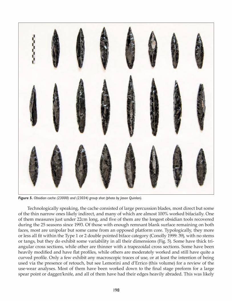
198
Technologically speaking, the cache consisted of large percussion blades, most direct but some of the thin narrow ones likely indirect, and many of which are almost 100% worked bifacially. One of them measures just under 22cm long, and five of them are the longest obsidian tools recovered during the 25 seasons since 1993. Of those with enough remnant blank surface remaining on both faces, most are unipolar but some came from an opposed platform core. Typologically, they more or less all fit within the Type 1 or 2 double pointed biface category (Conolly 1999: 39), with no stems or tangs, but they do exhibit some variability in all their dimensions (Fig. 5). Some have thick tri-angular cross sections, while other are thinner with a trapezoidal cross sections. Some have been heavily modified and have flat profiles, while others are moderately worked and still have quite a curved profile. Only a few exhibit any macroscopic traces of use, or at least the intention of being used via the presence of retouch, but see Lemorini and d’Errico (this volume) for a review of the use-wear analyses. Most of them have been worked down to the final stage preform for a large spear point or dagger/knife, and all of them have had their edges heavily abraded. This was likely
Figure 5. Obsidian cache (23000) and (23034) group shot (photo by Jason Quinlan).
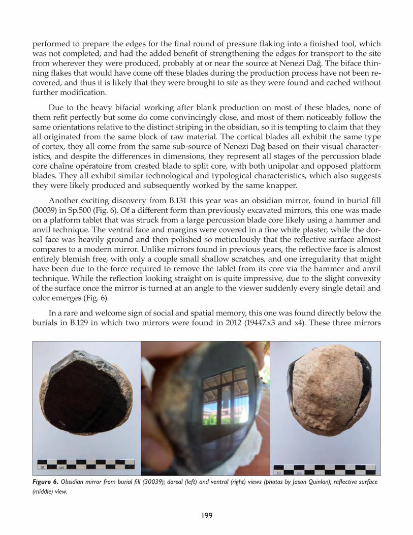
199
performed to prepare the edges for the final round of pressure flaking into a finished tool, which was not completed, and had the added benefit of strengthening the edges for transport to the site from wherever they were produced, probably at or near the source at Nenezi Dağ. The biface thin-ning flakes that would have come off these blades during the production process have not been re-covered, and thus it is likely that they were brought to site as they were found and cached without further modification.
Due to the heavy bifacial working after blank production on most of these blades, none of them refit perfectly but some do come convincingly close, and most of them noticeably follow the same orientations relative to the distinct striping in the obsidian, so it is tempting to claim that they all originated from the same block of raw material. The cortical blades all exhibit the same type of cortex, they all come from the same sub-source of Nenezi Dağ based on their visual character-istics, and despite the differences in dimensions, they represent all stages of the percussion blade core chaîne opératoire from crested blade to split core, with both unipolar and opposed platform blades. They all exhibit similar technological and typological characteristics, which also suggests they were likely produced and subsequently worked by the same knapper.
Another exciting discovery from B.131 this year was an obsidian mirror, found in burial fill (30039) in Sp.500 (Fig. 6). Of a different form than previously excavated mirrors, this one was made on a platform tablet that was struck from a large percussion blade core likely using a hammer and anvil technique. The ventral face and margins were covered in a fine white plaster, while the dor-sal face was heavily ground and then polished so meticulously that the reflective surface almost compares to a modern mirror. Unlike mirrors found in previous years, the reflective face is almost entirely blemish free, with only a couple small shallow scratches, and one irregularity that might have been due to the force required to remove the tablet from its core via the hammer and anvil technique. While the reflection looking straight on is quite impressive, due to the slight convexity of the surface once the mirror is turned at an angle to the viewer suddenly every single detail and color emerges (Fig. 6).
In a rare and welcome sign of social and spatial memory, this one was found directly below the burials in B.129 in which two mirrors were found in 2012 (19447.x3 and x4). These three mirrors
Figure 6. Obsidian mirror from burial fill (30039); dorsal (left) and ventral (right) views (photos by Jason Quinlan); reflective surface (middle) view.
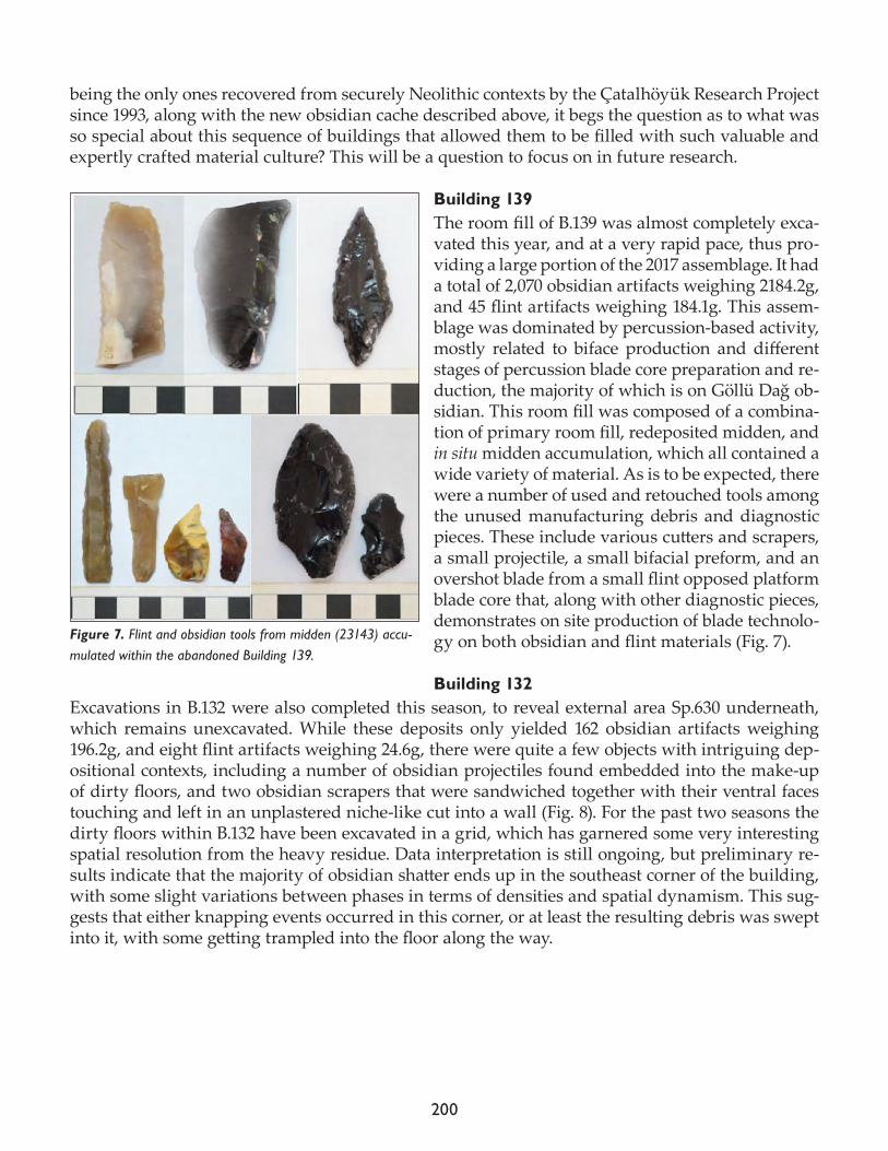
200
being the only ones recovered from securely Neolithic contexts by the Çatalhöyük Research Project since 1993, along with the new obsidian cache described above, it begs the question as to what was so special about this sequence of buildings that allowed them to be filled with such valuable and expertly crafted material culture? This will be a question to focus on in future research.
Building 139The room fill of B.139 was almost completely exca-vated this year, and at a very rapid pace, thus pro-viding a large portion of the 2017 assemblage. It had a total of 2,070 obsidian artifacts weighing 2184.2g, and 45 flint artifacts weighing 184.1g. This assem-blage was dominated by percussion-based activity, mostly related to biface production and different stages of percussion blade core preparation and re-duction, the majority of which is on Göllü Dağ ob-sidian. This room fill was composed of a combina-tion of primary room fill, redeposited midden, and in situ midden accumulation, which all contained a wide variety of material. As is to be expected, there were a number of used and retouched tools among the unused manufacturing debris and diagnostic pieces. These include various cutters and scrapers, a small projectile, a small bifacial preform, and an overshot blade from a small flint opposed platform blade core that, along with other diagnostic pieces, demonstrates on site production of blade technolo-gy on both obsidian and flint materials (Fig. 7).
Building 132Excavations in B.132 were also completed this season, to reveal external area Sp.630 underneath, which remains unexcavated. While these deposits only yielded 162 obsidian artifacts weighing 196.2g, and eight flint artifacts weighing 24.6g, there were quite a few objects with intriguing dep-ositional contexts, including a number of obsidian projectiles found embedded into the make-up of dirty floors, and two obsidian scrapers that were sandwiched together with their ventral faces touching and left in an unplastered niche-like cut into a wall (Fig. 8). For the past two seasons the dirty floors within B.132 have been excavated in a grid, which has garnered some very interesting spatial resolution from the heavy residue. Data interpretation is still ongoing, but preliminary re-sults indicate that the majority of obsidian shatter ends up in the southeast corner of the building, with some slight variations between phases in terms of densities and spatial dynamism. This sug-gests that either knapping events occurred in this corner, or at least the resulting debris was swept into it, with some getting trampled into the floor along the way.
Figure 7. Flint and obsidian tools from midden (23143) accu-mulated within the abandoned Building 139.
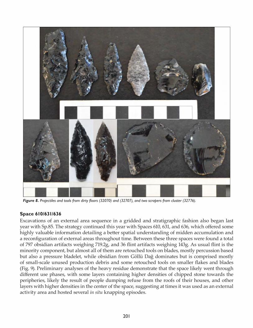
201
Space 610/631/636Excavations of an external area sequence in a gridded and stratigraphic fashion also began last year with Sp.85. The strategy continued this year with Spaces 610, 631, and 636, which offered some highly valuable information detailing a better spatial understanding of midden accumulation and a reconfiguration of external areas throughout time. Between these three spaces were found a total of 797 obsidian artifacts weighing 719.2g, and 36 flint artifacts weighing 143g. As usual flint is the minority component, but almost all of them are retouched tools on blades, mostly percussion based but also a pressure bladelet, while obsidian from Göllü Dağ dominates but is comprised mostly of small-scale unused production debris and some retouched tools on smaller flakes and blades (Fig. 9). Preliminary analyses of the heavy residue demonstrate that the space likely went through different use phases, with some layers containing higher densities of chipped stone towards the peripheries, likely the result of people dumping refuse from the roofs of their houses, and other layers with higher densities in the center of the space, suggesting at times it was used as an external activity area and hosted several in situ knapping episodes.
Figure 8. Projectiles and tools from dirty floors (32070) and (32707), and two scrapers from cluster (32776).
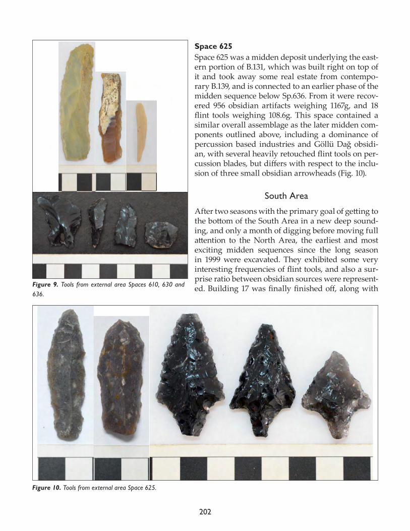
202
Space 625Space 625 was a midden deposit underlying the east-ern portion of B.131, which was built right on top of it and took away some real estate from contempo-rary B.139, and is connected to an earlier phase of the midden sequence below Sp.636. From it were recov-ered 956 obsidian artifacts weighing 1167g, and 18 flint tools weighing 108.6g. This space contained a similar overall assemblage as the later midden com-ponents outlined above, including a dominance of percussion based industries and Göllü Dağ obsidi-an, with several heavily retouched flint tools on per-cussion blades, but differs with respect to the inclu-sion of three small obsidian arrowheads (Fig. 10).
South Area
After two seasons with the primary goal of getting to the bottom of the South Area in a new deep sound-ing, and only a month of digging before moving full attention to the North Area, the earliest and most exciting midden sequences since the long season in 1999 were excavated. They exhibited some very interesting frequencies of flint tools, and also a sur-prise ratio between obsidian sources were represent-ed. Building 17 was finally finished off, along with Figure 9. Tools from external area Spaces 610, 630 and
636.
Figure 10. Tools from external area Space 625.
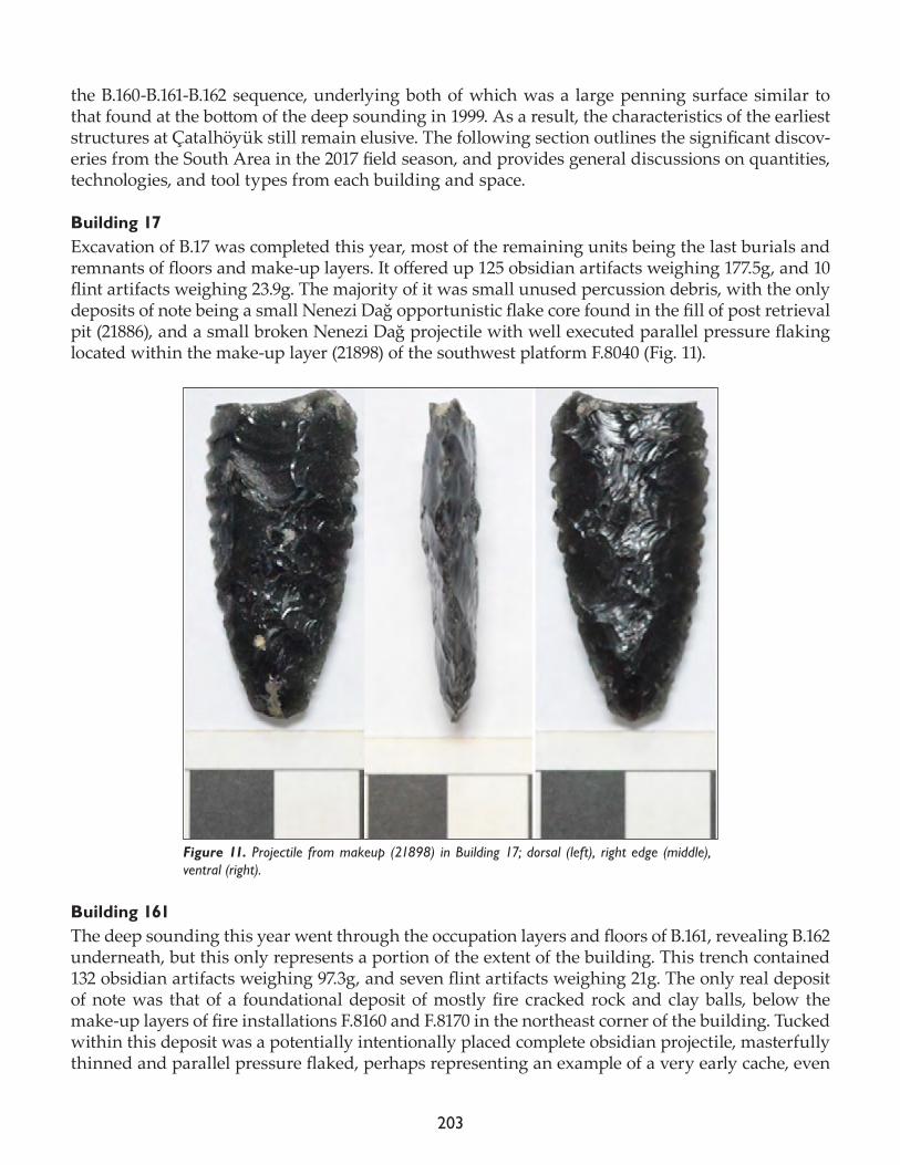
203
the B.160-B.161-B.162 sequence, underlying both of which was a large penning surface similar to that found at the bottom of the deep sounding in 1999. As a result, the characteristics of the earliest structures at Çatalhöyük still remain elusive. The following section outlines the significant discov-eries from the South Area in the 2017 field season, and provides general discussions on quantities, technologies, and tool types from each building and space.
Building 17Excavation of B.17 was completed this year, most of the remaining units being the last burials and remnants of floors and make-up layers. It offered up 125 obsidian artifacts weighing 177.5g, and 10 flint artifacts weighing 23.9g. The majority of it was small unused percussion debris, with the only deposits of note being a small Nenezi Dağ opportunistic flake core found in the fill of post retrieval pit (21886), and a small broken Nenezi Dağ projectile with well executed parallel pressure flaking located within the make-up layer (21898) of the southwest platform F.8040 (Fig. 11).
Building 161The deep sounding this year went through the occupation layers and floors of B.161, revealing B.162 underneath, but this only represents a portion of the extent of the building. This trench contained 132 obsidian artifacts weighing 97.3g, and seven flint artifacts weighing 21g. The only real deposit of note was that of a foundational deposit of mostly fire cracked rock and clay balls, below the make-up layers of fire installations F.8160 and F.8170 in the northeast corner of the building. Tucked within this deposit was a potentially intentionally placed complete obsidian projectile, masterfully thinned and parallel pressure flaked, perhaps representing an example of a very early cache, even
Figure 11. Projectile from makeup (21898) in Building 17; dorsal (left), right edge (middle), ventral (right).
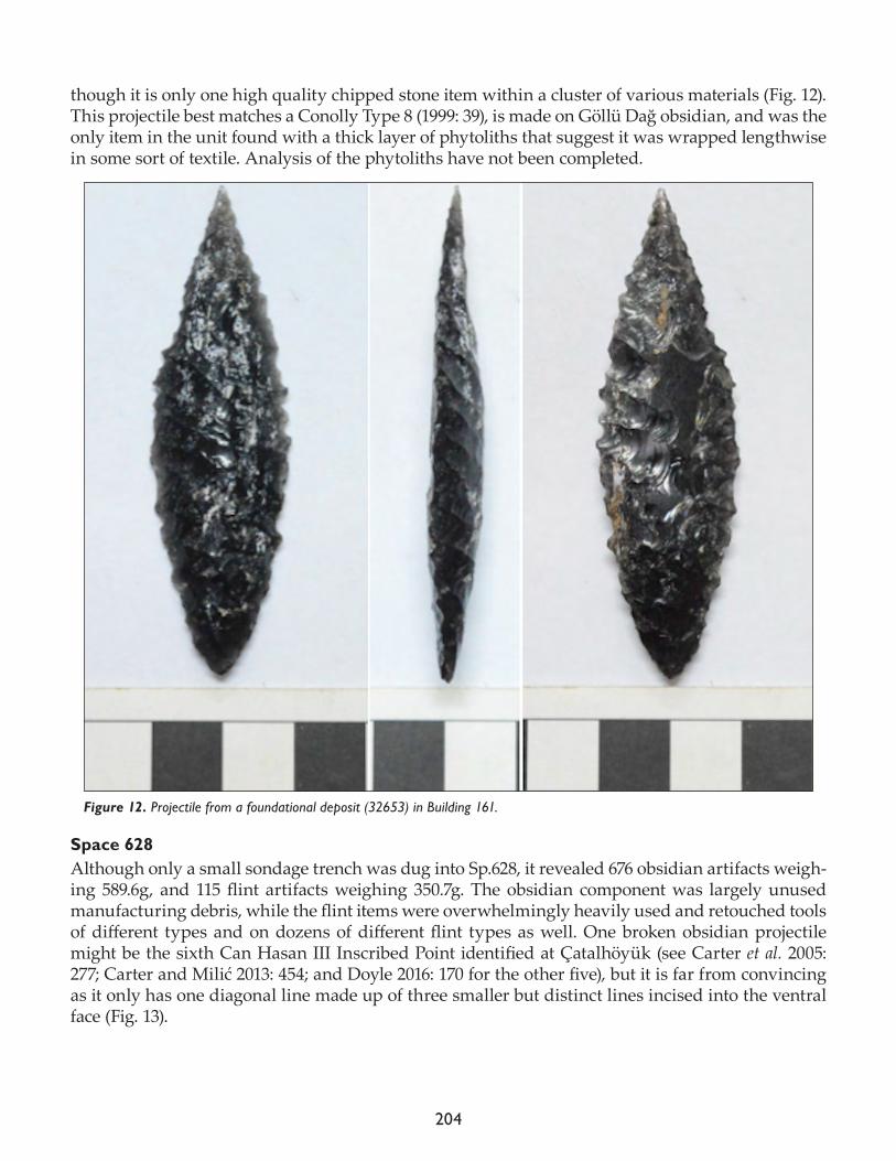
204
though it is only one high quality chipped stone item within a cluster of various materials (Fig. 12). This projectile best matches a Conolly Type 8 (1999: 39), is made on Göllü Dağ obsidian, and was the only item in the unit found with a thick layer of phytoliths that suggest it was wrapped lengthwise in some sort of textile. Analysis of the phytoliths have not been completed.
Space 628Although only a small sondage trench was dug into Sp.628, it revealed 676 obsidian artifacts weigh-ing 589.6g, and 115 flint artifacts weighing 350.7g. The obsidian component was largely unused manufacturing debris, while the flint items were overwhelmingly heavily used and retouched tools of different types and on dozens of different flint types as well. One broken obsidian projectile might be the sixth Can Hasan III Inscribed Point identified at Çatalhöyük (see Carter et al. 2005: 277; Carter and Milić 2013: 454; and Doyle 2016: 170 for the other five), but it is far from convincing as it only has one diagonal line made up of three smaller but distinct lines incised into the ventral face (Fig. 13).
Figure 12. Projectile from a foundational deposit (32653) in Building 161.

205
References
Carter, T., J. Conolly, and A. Spasojević.2005. The chipped stone. In Changing Materialities at Çatalhöyük: Reports from the 1995-99 Seasons, edited by I. Hod-der. Cambridge: McDonald Institute for Archaeological Research; London: British Institute for Archaeology at Ankara, pp. 221-83; 467-533.
Carter, T. and M. Milić.2013. The chipped stone. In Substantive Technologies at Çatalhöyük: Reports from the 2000-2008 Seasons, edited I. Hodder. London: British Institute at Ankara; Los Angeles: Cotsen Institute of Archaeology, pp. 417-78.
Conolly, J. 1999. The Çatalhöyük Flint and Obsidian Industry: Technology and Typology in Context (BAR International Series 787). Oxford: Hadrian Books Ltd.
Doyle, S.2016. Chipped stone from the North and South Areas. Çatalhöyük 2016 Archive Report, pp. 165-174. http://www.catalhoyuk.com/sites/default/files/media/pdf/Archive_Report_2016.pdf
Figure 13. Space 628 tools.

206
Milić, M., K. Brown and T. Carter2013. The chipped stone. Appendix 21.1: a visual characterisation of the Çatalhöyük obsidian. In Substantive Tech-nologies at Çatalhöyük: Reports from the 2000-2008 Seasons, edited by I. Hodder. London: British Institute at Ankara; Los Angeles: Cotsen Institute of Archaeology.
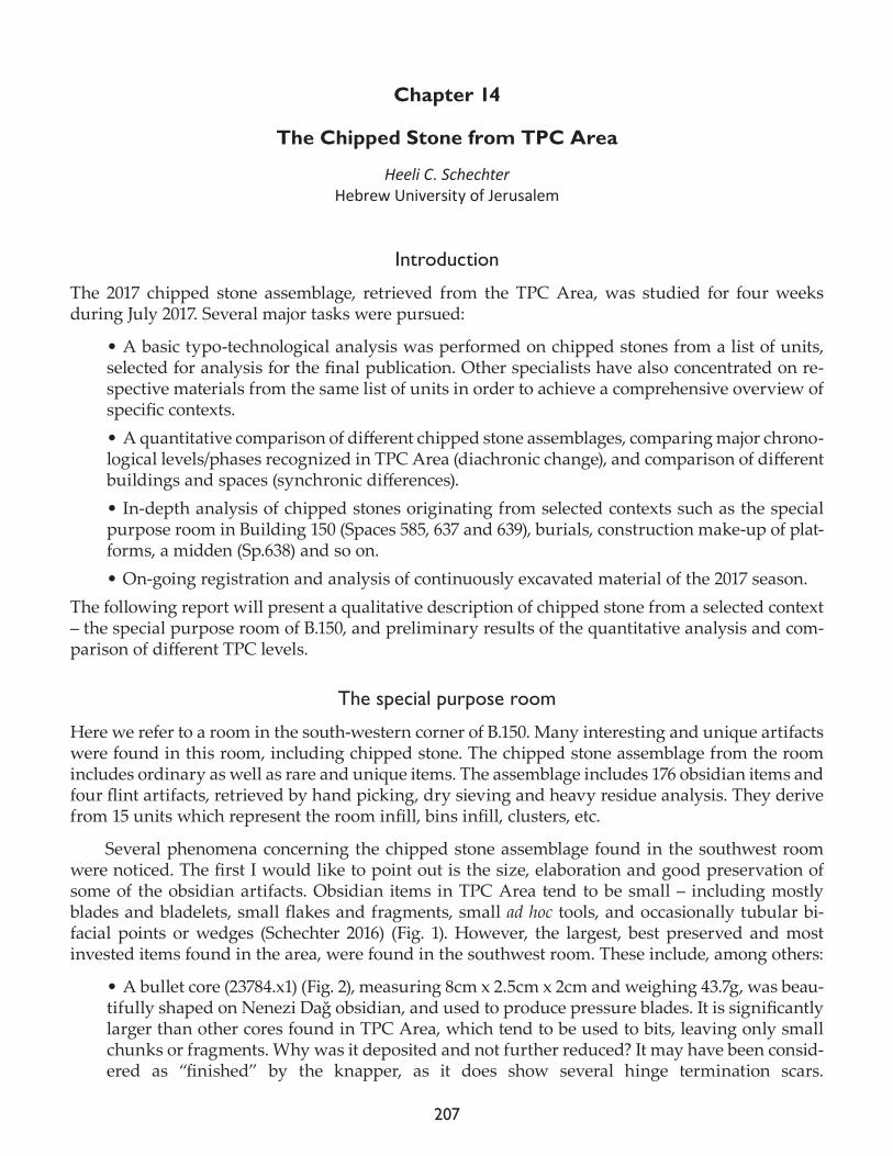
207
Chapter 14
The Chipped Stone from TPC Area
Heeli C. SchechterHebrew University of Jerusalem
Introduction
The 2017 chipped stone assemblage, retrieved from the TPC Area, was studied for four weeks during July 2017. Several major tasks were pursued:
• A basic typo-technological analysis was performed on chipped stones from a list of units, selected for analysis for the final publication. Other specialists have also concentrated on re-spective materials from the same list of units in order to achieve a comprehensive overview of specific contexts. • A quantitative comparison of different chipped stone assemblages, comparing major chrono-logical levels/phases recognized in TPC Area (diachronic change), and comparison of different buildings and spaces (synchronic differences).• In-depth analysis of chipped stones originating from selected contexts such as the special purpose room in Building 150 (Spaces 585, 637 and 639), burials, construction make-up of plat-forms, a midden (Sp.638) and so on. • On-going registration and analysis of continuously excavated material of the 2017 season.
The following report will present a qualitative description of chipped stone from a selected context – the special purpose room of B.150, and preliminary results of the quantitative analysis and com-parison of different TPC levels.
The special purpose room
Here we refer to a room in the south-western corner of B.150. Many interesting and unique artifacts were found in this room, including chipped stone. The chipped stone assemblage from the room includes ordinary as well as rare and unique items. The assemblage includes 176 obsidian items and four flint artifacts, retrieved by hand picking, dry sieving and heavy residue analysis. They derive from 15 units which represent the room infill, bins infill, clusters, etc.
Several phenomena concerning the chipped stone assemblage found in the southwest room were noticed. The first I would like to point out is the size, elaboration and good preservation of some of the obsidian artifacts. Obsidian items in TPC Area tend to be small – including mostly blades and bladelets, small flakes and fragments, small ad hoc tools, and occasionally tubular bi-facial points or wedges (Schechter 2016) (Fig. 1). However, the largest, best preserved and most invested items found in the area, were found in the southwest room. These include, among others:
• A bullet core (23784.x1) (Fig. 2), measuring 8cm x 2.5cm x 2cm and weighing 43.7g, was beau-tifully shaped on Nenezi Dağ obsidian, and used to produce pressure blades. It is significantly larger than other cores found in TPC Area, which tend to be used to bits, leaving only small chunks or fragments. Why was it deposited and not further reduced? It may have been consid-ered as “finished” by the knapper, as it does show several hinge termination scars.
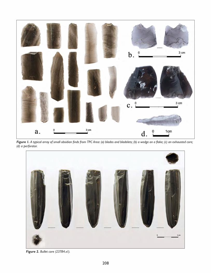
208
Figure 2. Bullet core (23784.x1).
Figure 1. A typical array of small obsidian finds from TPC Area: (a) blades and bladelets; (b) a wedge on a flake; (c) an exhausted core; (d) a perforator.
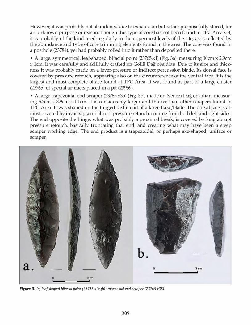
209
However, it was probably not abandoned due to exhaustion but rather purposefully stored, for an unknown purpose or reason. Though this type of core has not been found in TPC Area yet, it is probably of the kind used regularly in the uppermost levels of the site, as is reflected by the abundance and type of core trimming elements found in the area. The core was found in a posthole (23784), yet had probably rolled into it rather than deposited there. • A large, symmetrical, leaf-shaped, bifacial point (23765.x1) (Fig. 3a), measuring 10cm x 2.9cm x 1cm. It was carefully and skillfully crafted on Göllü Dağ obsidian. Due to its size and thick-ness it was probably made on a lever-pressure or indirect percussion blade. Its dorsal face is covered by pressure retouch, appearing also on the circumference of the ventral face. It is the largest and most complete biface found at TPC Area. It was found as part of a large cluster (23765) of special artifacts placed in a pit (23959). • A large trapezoidal end-scraper (23765.x35) (Fig. 3b), made on Nenezi Dağ obsidian, measur-ing 5.7cm x 3.9cm x 1.1cm. It is considerably larger and thicker than other scrapers found in TPC Area. It was shaped on the hinged distal end of a large flake/blade. The dorsal face is al-most covered by invasive, semi-abrupt pressure retouch, coming from both left and right sides. The end opposite the hinge, what was probably a proximal break, is covered by long abrupt pressure retouch, basically truncating that end, and creating what may have been a steep scraper working edge. The end product is a trapezoidal, or perhaps axe-shaped, uniface or scraper.
Figure 3. (a) leaf-shaped bifacial point (23765.x1); (b) trapezoidal end-scraper (23765.x35).
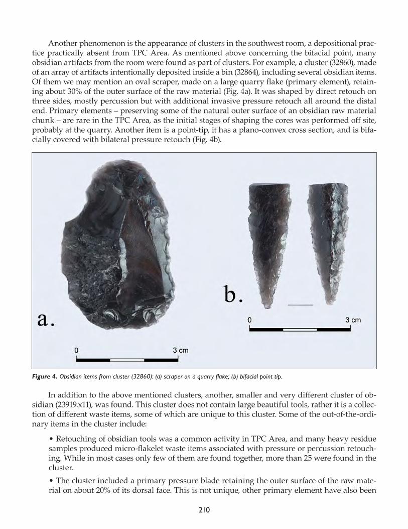
210
Another phenomenon is the appearance of clusters in the southwest room, a depositional prac-tice practically absent from TPC Area. As mentioned above concerning the bifacial point, many obsidian artifacts from the room were found as part of clusters. For example, a cluster (32860), made of an array of artifacts intentionally deposited inside a bin (32864), including several obsidian items. Of them we may mention an oval scraper, made on a large quarry flake (primary element), retain-ing about 30% of the outer surface of the raw material (Fig. 4a). It was shaped by direct retouch on three sides, mostly percussion but with additional invasive pressure retouch all around the distal end. Primary elements – preserving some of the natural outer surface of an obsidian raw material chunk – are rare in the TPC Area, as the initial stages of shaping the cores was performed off site, probably at the quarry. Another item is a point-tip, it has a plano-convex cross section, and is bifa-cially covered with bilateral pressure retouch (Fig. 4b).
In addition to the above mentioned clusters, another, smaller and very different cluster of ob-sidian (23919.x11), was found. This cluster does not contain large beautiful tools, rather it is a collec-tion of different waste items, some of which are unique to this cluster. Some of the out-of-the-ordi-nary items in the cluster include:
• Retouching of obsidian tools was a common activity in TPC Area, and many heavy residue samples produced micro-flakelet waste items associated with pressure or percussion retouch-ing. While in most cases only few of them are found together, more than 25 were found in the cluster.• The cluster included a primary pressure blade retaining the outer surface of the raw mate-rial on about 20% of its dorsal face. This is not unique, other primary element have also been
Figure 4. Obsidian items from cluster (32860): (a) scraper on a quarry flake; (b) bifacial point tip.
211
found in TPC Area, such as the scraper mentioned above, but it is definitely rare and probably intentional. • A pressure blade fragment resembling a side-blow-blade-flake (SBBF) was found in the clus-ter. SBBFs are a type of spall, a waste product, of blade-segmenting procedures, usually found in the Levant (Nishiaki 1996; Vardi and Gilead 2011). • A group of six small overshooting flakes was found in the cluster. They were all removed from the side of an item – meaning they all have a plunging part with a flat face, and a lateral side with a flat face. This is not a common waste product in TPC Area, and is not a standard-ized waste type usually referred to in lithic studies, yet for some reason, the inhabitants of the building chosen to collect these six similar items and place them together in this cluster. • An elongated core trimming element was found in the cluster, detached along the line of points of percussion, removing the front of the striking platform as well as the proximal end of the debitage plane. The removed striking platform was completely flat and untouched, perhaps reflecting early stages of production. The proximal end of the debitage plane had intensively retouched perpendicular bladelet scars, probably as preparation for further bladelet removals. In TPC Area, most platform rejuvenation flakes reflect multi-facetted platforms, without the retouching preparation for further detachments on the debitage plane. This means that the CTE found in the cluster reflects a different tradition or core reduction/maintenance technolo-gy than the one typical to TPC Area. It is not the only one of its type to be found in TPC Area, yet it is definitely rare.
These and other finds included in the cluster, are not beautiful or impressive, yet they are all rare, sometimes unique, and possibly foreign, compared to the typical waste products usually found in TPC. The reason for clustering them all together is unknown.
Of the four flint items, I would like to mention two:
• A rounded, leaf-shaped point of some sort (Fig. 5a) found in (23736). It was made on an or-ange speckled, medium-grain flint, using a standardized blade blank, probably produced by indirect percussion. It was shaped by bilateral, direct, semi-abrupt retouch, converging to a blunted distal end. It was probably not a perforator as it is not pointy, however, it does have some micro-chipping on the distal blunted end pointing to its use.• A very large flake, of Palaeolithic proportions (6cm x 7.5cm x 1.5cm, 62.2g), found in (32858). It was detached from a corticated nodule of light and dark beige, medium-grain flint. The proximal end of the debitage plane was heavily retouched as preparation for detachment – the knapper wanted a thick flake, and know it was going to be difficult to produce. The flake also retains a double-bulb, reflecting the use of a large heavy hammer. Possible retouch or use wear appears in a few spots.As mentioned above, parts of the assemblage are completely ordinary, representing the gener-
al obsidian presence at the site. General statements, concerning standard lithic analysis, may also be mentioned:
• 78% of the obsidian items come from Nenezi Dağ and 22% from Göllü Dağ. These are typical proportions for TPC Area.• 45% of the assemblage was produced by pressure and includes blank and retouched blades, bladelets and cores. The use of pressure is more dominant on material from Göllü Dağ (56%) than on material from Nenezi Dağ (41%). The rest were produced by direct percussion (32%),
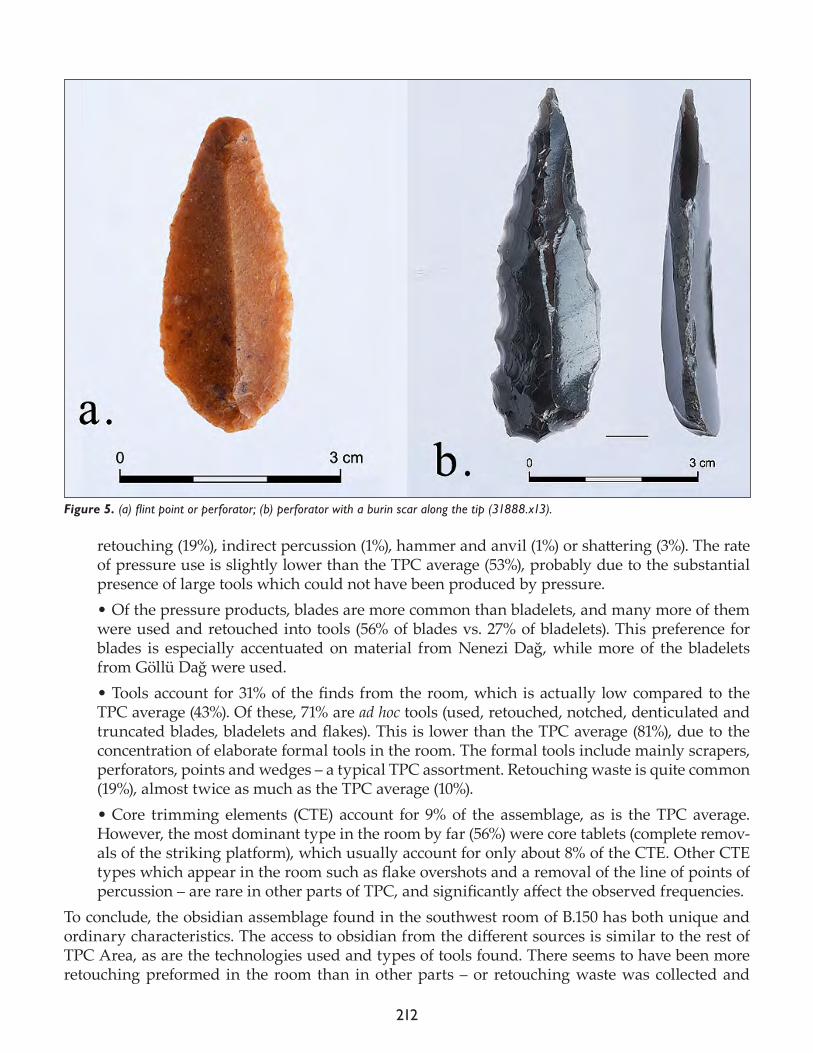
212
retouching (19%), indirect percussion (1%), hammer and anvil (1%) or shattering (3%). The rate of pressure use is slightly lower than the TPC average (53%), probably due to the substantial presence of large tools which could not have been produced by pressure. • Of the pressure products, blades are more common than bladelets, and many more of them were used and retouched into tools (56% of blades vs. 27% of bladelets). This preference for blades is especially accentuated on material from Nenezi Dağ, while more of the bladelets from Göllü Dağ were used. • Tools account for 31% of the finds from the room, which is actually low compared to the TPC average (43%). Of these, 71% are ad hoc tools (used, retouched, notched, denticulated and truncated blades, bladelets and flakes). This is lower than the TPC average (81%), due to the concentration of elaborate formal tools in the room. The formal tools include mainly scrapers, perforators, points and wedges – a typical TPC assortment. Retouching waste is quite common (19%), almost twice as much as the TPC average (10%). • Core trimming elements (CTE) account for 9% of the assemblage, as is the TPC average. However, the most dominant type in the room by far (56%) were core tablets (complete remov-als of the striking platform), which usually account for only about 8% of the CTE. Other CTE types which appear in the room such as flake overshots and a removal of the line of points of percussion – are rare in other parts of TPC, and significantly affect the observed frequencies.
To conclude, the obsidian assemblage found in the southwest room of B.150 has both unique and ordinary characteristics. The access to obsidian from the different sources is similar to the rest of TPC Area, as are the technologies used and types of tools found. There seems to have been more retouching preformed in the room than in other parts – or retouching waste was collected and
Figure 5. (a) flint point or perforator; (b) perforator with a burin scar along the tip (31888.x13).
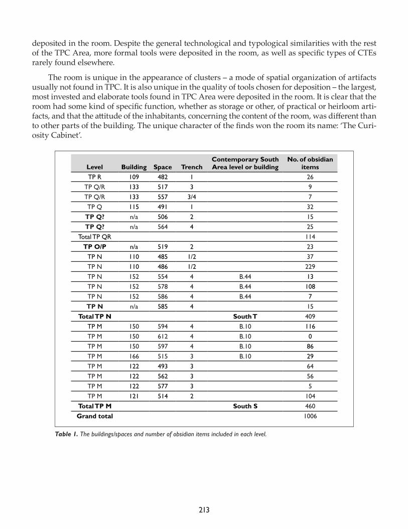
213
deposited in the room. Despite the general technological and typological similarities with the rest of the TPC Area, more formal tools were deposited in the room, as well as specific types of CTEs rarely found elsewhere.
The room is unique in the appearance of clusters – a mode of spatial organization of artifacts usually not found in TPC. It is also unique in the quality of tools chosen for deposition – the largest, most invested and elaborate tools found in TPC Area were deposited in the room. It is clear that the room had some kind of specific function, whether as storage or other, of practical or heirloom arti-facts, and that the attitude of the inhabitants, concerning the content of the room, was different than to other parts of the building. The unique character of the finds won the room its name: ‘The Curi-osity Cabinet’.
Level Building Space TrenchContemporary South Area level or building
No. of obsidian items
TP R 109 482 1 26TP Q/R 133 517 3 9TP Q/R 133 557 3/4 7TP Q 115 491 1 32
TP Q? n/a 506 2 15TP Q? n/a 564 4 25
Total TP QR 114TP O/P n/a 519 2 23
TP N 110 485 1/2 37TP N 110 486 1/2 229TP N 152 554 4 B.44 13TP N 152 578 4 B.44 108TP N 152 586 4 B.44 7TP N n/a 585 4 15
Total TP N South T 409TP M 150 594 4 B.10 116TP M 150 612 4 B.10 0TP M 150 597 4 B.10 86TP M 166 515 3 B.10 29TP M 122 493 3 64TP M 122 562 3 56TP M 122 577 3 5TP M 121 514 2 104
Total TP M South S 460Grand total 1006
Table 1. The buildings/spaces and number of obsidian items included in each level.
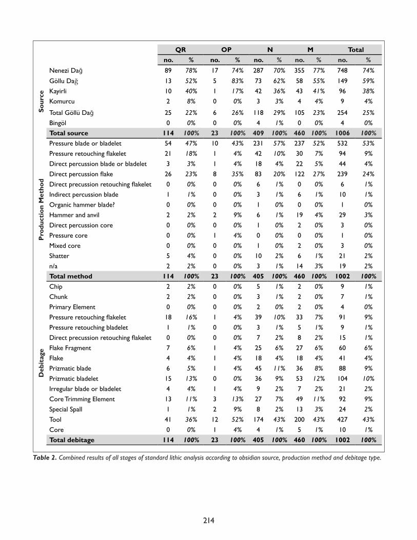
214
QR OP N M Total no. % no. % no. % no. % no. %
Sour
ce
Nenezi Dağ 89 78% 17 74% 287 70% 355 77% 748 74%
Göllu Dağ 13 52% 5 83% 73 62% 58 55% 149 59%Kayirli 10 40% 1 17% 42 36% 43 41% 96 38%Komurcu 2 8% 0 0% 3 3% 4 4% 9 4%
Total Göllü Dağ 25 22% 6 26% 118 29% 105 23% 254 25%Bingöl 0 0% 0 0% 4 1% 0 0% 4 0%Total source 114 100% 23 100% 409 100% 460 100% 1006 100%
Pro
duct
ion
Met
hod
Pressure blade or bladelet 54 47% 10 43% 231 57% 237 52% 532 53%Pressureretouchingflakelet 21 18% 1 4% 42 10% 30 7% 94 9%Direct percussion blade or bladelet 3 3% 1 4% 18 4% 22 5% 44 4%Directpercussionflake 26 23% 8 35% 83 20% 122 27% 239 24%Directprecussionretouchingflakelet 0 0% 0 0% 6 1% 0 0% 6 1%Indirect percussion blade 1 1% 0 0% 3 1% 6 1% 10 1%Organic hammer blade? 0 0% 0 0% 1 0% 0 0% 1 0%Hammer and anvil 2 2% 2 9% 6 1% 19 4% 29 3%Direct percussion core 0 0% 0 0% 1 0% 2 0% 3 0%Pressure core 0 0% 1 4% 0 0% 0 0% 1 0%Mixed core 0 0% 0 0% 1 0% 2 0% 3 0%Shatter 5 4% 0 0% 10 2% 6 1% 21 2%n/a 2 2% 0 0% 3 1% 14 3% 19 2%Total method 114 100% 23 100% 405 100% 460 100% 1002 100%
Deb
itag
e
Chip 2 2% 0 0% 5 1% 2 0% 9 1%Chunk 2 2% 0 0% 3 1% 2 0% 7 1%Primary Element 0 0% 0 0% 2 0% 2 0% 4 0%Pressureretouchingflakelet 18 16% 1 4% 39 10% 33 7% 91 9%Pressure retouching bladelet 1 1% 0 0% 3 1% 5 1% 9 1%Directprecussionretouchingflakelet 0 0% 0 0% 7 2% 8 2% 15 1%Flake Fragment 7 6% 1 4% 25 6% 27 6% 60 6%Flake 4 4% 1 4% 18 4% 18 4% 41 4%Prizmatic blade 6 5% 1 4% 45 11% 36 8% 88 9%Prizmatic bladelet 15 13% 0 0% 36 9% 53 12% 104 10%Irregular blade or bladelet 4 4% 1 4% 9 2% 7 2% 21 2%Core Trimming Element 13 11% 3 13% 27 7% 49 11% 92 9%Special Spall 1 1% 2 9% 8 2% 13 3% 24 2%Tool 41 36% 12 52% 174 43% 200 43% 427 43%Core 0 0% 1 4% 4 1% 5 1% 10 1%Total debitage 114 100% 23 100% 405 100% 460 100% 1002 100%
Table 2. Combined results of all stages of standard lithic analysis according to obsidian source, production method and debitage type.
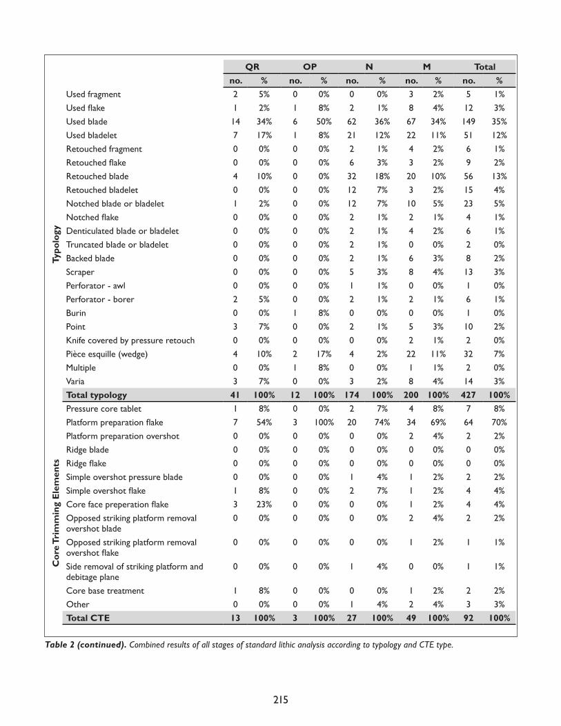
215
QR OP N M Total no. % no. % no. % no. % no. %
Typo
logy
Used fragment 2 5% 0 0% 0 0% 3 2% 5 1%Usedflake 1 2% 1 8% 2 1% 8 4% 12 3%Used blade 14 34% 6 50% 62 36% 67 34% 149 35%Used bladelet 7 17% 1 8% 21 12% 22 11% 51 12%Retouched fragment 0 0% 0 0% 2 1% 4 2% 6 1%Retouchedflake 0 0% 0 0% 6 3% 3 2% 9 2%Retouched blade 4 10% 0 0% 32 18% 20 10% 56 13%Retouched bladelet 0 0% 0 0% 12 7% 3 2% 15 4%Notched blade or bladelet 1 2% 0 0% 12 7% 10 5% 23 5%Notchedflake 0 0% 0 0% 2 1% 2 1% 4 1%Denticulated blade or bladelet 0 0% 0 0% 2 1% 4 2% 6 1%Truncated blade or bladelet 0 0% 0 0% 2 1% 0 0% 2 0%Backed blade 0 0% 0 0% 2 1% 6 3% 8 2%Scraper 0 0% 0 0% 5 3% 8 4% 13 3%Perforator - awl 0 0% 0 0% 1 1% 0 0% 1 0%Perforator - borer 2 5% 0 0% 2 1% 2 1% 6 1%Burin 0 0% 1 8% 0 0% 0 0% 1 0%Point 3 7% 0 0% 2 1% 5 3% 10 2%Knife covered by pressure retouch 0 0% 0 0% 0 0% 2 1% 2 0%Pièce esquille (wedge) 4 10% 2 17% 4 2% 22 11% 32 7%Multiple 0 0% 1 8% 0 0% 1 1% 2 0%Varia 3 7% 0 0% 3 2% 8 4% 14 3%Total typology 41 100% 12 100% 174 100% 200 100% 427 100%
Cor
e Tr
imm
ing
Ele
men
ts
Pressure core tablet 1 8% 0 0% 2 7% 4 8% 7 8%Platformpreparationflake 7 54% 3 100% 20 74% 34 69% 64 70%Platform preparation overshot 0 0% 0 0% 0 0% 2 4% 2 2%Ridge blade 0 0% 0 0% 0 0% 0 0% 0 0%Ridgeflake 0 0% 0 0% 0 0% 0 0% 0 0%Simple overshot pressure blade 0 0% 0 0% 1 4% 1 2% 2 2%Simpleovershotflake 1 8% 0 0% 2 7% 1 2% 4 4%Corefacepreperationflake 3 23% 0 0% 0 0% 1 2% 4 4%Opposed striking platform removal overshot blade
0 0% 0 0% 0 0% 2 4% 2 2%
Opposed striking platform removal overshotflake
0 0% 0 0% 0 0% 1 2% 1 1%
Side removal of striking platform and debitage plane
0 0% 0 0% 1 4% 0 0% 1 1%
Core base treatment 1 8% 0 0% 0 0% 1 2% 2 2%Other 0 0% 0 0% 1 4% 2 4% 3 3%Total CTE 13 100% 3 100% 27 100% 49 100% 92 100%
Table 2 (continued). Combined results of all stages of standard lithic analysis according to typology and CTE type.
216
Level by level analysis of the TPC Area chipped stone assemblages
The analysis includes over 1,000 obsidian items, divided into assemblages originating in four differ-ent Neolithic levels (Table 1). The material derives from 67 units, and was collected by hand picking, dry sieving, and heavy residue analysis.
Standard basic lithic analysis was performed on all the assemblages, recording obsidian source, production method, and debitage type for each item. When relevant, tool type (typology) and CTE type were also recorded. The full results may be found in Table 2.
The following report presents some preliminary observations concerning each level and sev-eral lines of comparison within and between the levels.
Level TP Q/R – 114 items (see Table 1 for buildings and spaces included in each level)
SourceSeventy-eight percent originate in the Nenezi Dağ source, while 22% come from Göllü Dağ.
TechnologyForty-seven percent of the assemblage is produced by pressure, including blades and bladelets, while 26% was produced by direct percussion (including mostly flakes and three blades), and the rest by other modes. Core trimming elements, attesting to the intensity and stage of on-site produc-tion, account for 11% of the assemblage, and include mainly striking platform preparation flakes (54%). Core face and base treatment flakes were also found – representing types and stages of core treatment which are not usually found in TPC Area. Cores are absent, as are primary elements and special spalls – reflecting very minor production activity on-site at this time.
TypologyThirty-six percent of the assemblage was used or retouched into tools, and 17% represent retouching waste. That is a low rate of tools and a high rate of shaping and resharpening. Prismatic blades and bladelets were preferred as tool blanks as 55% of them were used or retouched and they account for 73% of the tools. 71% of the tools are ad hoc, including used, retouched, notched, denticulated and truncated flakes, blades and bladelets. Formal tools include two perforators (borers), three points, four wedges and two abraded blades. Two of the points are of the tubular type, bifacially covered by pressure retouch, and one resembles a Jericho point (Gopher 1989). Formal tools are quite com-mon in this level (29% vs. 16% as TPC average). This may explain the high rate of retouching waste as they require heavier retouching than ad hoc tools.
Comparison between the use of Nenezi Dağ and Göllü Dağ materialItems produced by pressure are more common on Göllü Dağ obsidian (60%) than on Nenezi Dağ obsidian (44%). No production waste was found on Göllü Dağ material, and retouching waste (12%) appears less than on Nenezi Dağ material (20%). Göllü Dağ material is thus used but not knapped in this level. It was being shaped into tools, but not as intensively as the Nenezi Dağ material.
Comparison between spaces/buildingsAs there are only few items from each building or space, internal statistical comparison is irrele-vant. Qualitative analysis shows that they are very similar – single core trimming elements made only on Nenezi Dağ were found in each space/building and they each include a perforator and a
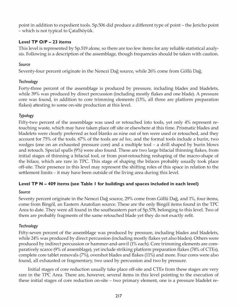
217
point in addition to expedient tools. Sp.506 did produce a different type of point – the Jericho point – which is not typical to Çatalhöyük.
Level TP O/P – 23 itemsThis level is represented by Sp.519 alone, so there are too few items for any reliable statistical analy-sis. Following is a description of the assemblage, though frequencies should be taken with caution.
Source Seventy-four percent originate in the Nenezi Dağ source, while 26% come from Göllü Dağ.
Technology Forty-three percent of the assemblage is produced by pressure, including blades and bladelets, while 39% was produced by direct percussion (including mostly flakes and one blade). A pressure core was found, in addition to core trimming elements (13%, all three are platform preparation flakes) attesting to some on-site production at this level.
Typology Fifty-two percent of the assemblage was used or retouched into tools, yet only 4% represent re-touching waste, which may have taken place off site or elsewhere at this time. Prismatic blades and bladelets were clearly preferred as tool blanks as nine out of ten were used or retouched, and they account for 75% of the tools. 67% of the tools are ad hoc, and the formal tools include a burin, two wedges (one on an exhausted pressure core) and a multiple tool – a drill shaped by burin blows and retouch. Special spalls (9%) were also found. These are two large bifacial thinning flakes, from initial stages of thinning a bifacial tool, or from post-retouching reshaping of the macro-shape of the biface, which are rare in TPC. This stage of shaping the bifaces probably usually took place off-site. Their presence in this level may represent the shifting roles of this space in relation to the settlement limits – it may have been outside of the living area during this level.
Level TP N – 409 items (see Table 1 for buildings and spaces included in each level)
SourceSeventy percent originate in the Nenezi Dağ source, 29% come from Göllü Dağ, and 1%, four items, come from Bingöl, an Eastern Anatolian source. These are the only Bingöl items found in the TPC Area to date. They were all found in the southeastern part of Sp.578, belonging to this level. Two of them are probably fragments of the same retouched blade yet they do not exactly refit.
TechnologyFifty-seven percent of the assemblage was produced by pressure, including blades and bladelets, while 24% was produced by direct percussion (including mostly flakes yet also blades). Others were produced by indirect percussion or hammer-and-anvil (1% each). Core trimming elements are com-paratively scarce (9% of assemblage), yet include striking platform preparation flakes (74% of CTEs), complete core tablet removals (7%), overshot blades and flakes (11%) and more. Four cores were also found, all exhausted or fragmentary, two used by percussion and two by pressure.
Initial stages of core reduction usually take place off-site and CTEs from these stages are very rare in the TPC Area. There are, however, several items in this level pointing to the execution of these initial stages of core reduction on-site – two primary element, one is a pressure bladelet re-
218
taining the outer surface of the raw material block on about 50% of its dorsal face – which is a lot; two CTEs retaining parts of a flat striking platform – different from the advanced-stage faceted core platforms usually found in this area; a protruding arris which may have been removed as a core-face opening blade; and a few used and un-used blades which seem to be less standardized, produced from the core full standardization and control were achieved.
TypologyForty-three percent of the assemblage was used or retouched into tools, and 12% represent retouch-ing waste. Prismatic blades and bladelets were clearly preferred as tool blanks, as 63% of them were used or retouched and they account for 83% of the tools. 90% of the tools are ad hoc. Formal tools include scrapers, perforators (awls and borers), points, wedges and abraded blades – the typical TPC Area repertoire.
Special spalls are not very common (2% of the assemblage), and seem to be mainly related to tool maintenance and reshaping. They include flakes struck off tools; a bladelet struck off the side of a bifacial projectile point; another bladelet struck off the side of a pressure retouched point or knife; a flake removed off the round working edge of a scraper; a secondary burin spall struck off a retouched pressure blade; and a double ventral flak (struck off the ventral face of an item) (Parush et al. 2015).
One retouching flakelet retains some of the outer surface of the raw material. This points to several things – (i) preliminary stages of reduction from a block of raw material were possibly per-formed on site, as was noticed and mentioned above; and, (ii) the presence of this outer surface does not prevent the people from shaping such items into tools.
Comparison between the use of Nenezi Dağ and Göllü Dağ material Statistically, the assemblages seem to be very similar, pointing to similar conceptual practices re-garding the material from the different sources. This is true for the similar frequency of pressure debitage, intensity of use of available blanks, and on-site production. Nenezi Dağ cores were, how-ever, reduced on-site from earlier stages of core reduction, stages which are usually not performed on-site, or at least are rarely found in other levels. Tools seem to appear slightly more frequently on Göllü Dağ material, complemented by slightly more retouching waste, and formal tools are signifi-cantly more frequent (20% vs. 8% on Nenezi Dağ obsidian).
Comparison between spaces/buildings The two buildings included in this level (B.110 and B.152) have large enough samples to be com-pared between them, and possibly offer some insights concerning synchronous differences.
Source of material Building 152 is unique, out of all contexts examined in the TPC Area, in the high frequency of mate-rial from Göllü Dağ found in the building. The Nenezi/Göllü Dağ ratio is almost equal, amounting to 49% and 48% respectively. It is also unique concerning the presence of material from Bingöl. This situation is therefore significantly different (X2=44.106, df=2, P<0.001) from the source distribution in B.110, which, though extreme, is quite typical to TPC, with 80% of the material originating in Nenezi Dağ and 20% in Göllü Dağ. We may therefore suggest that the inhabitants of the buildings had differentiated access to materials.
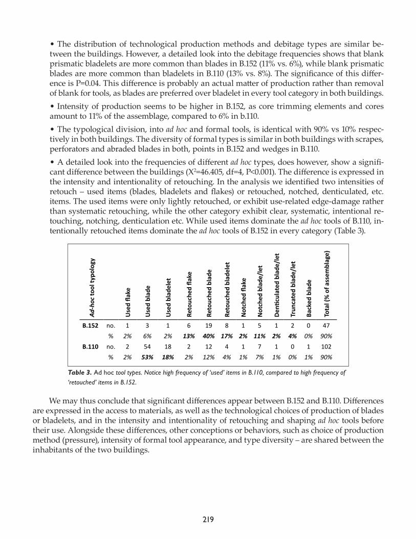
219
• The distribution of technological production methods and debitage types are similar be-tween the buildings. However, a detailed look into the debitage frequencies shows that blank prismatic bladelets are more common than blades in B.152 (11% vs. 6%), while blank prismatic blades are more common than bladelets in B.110 (13% vs. 8%). The significance of this differ-ence is P=0.04. This difference is probably an actual matter of production rather than removal of blank for tools, as blades are preferred over bladelet in every tool category in both buildings. • Intensity of production seems to be higher in B.152, as core trimming elements and cores amount to 11% of the assemblage, compared to 6% in b.110.• The typological division, into ad hoc and formal tools, is identical with 90% vs 10% respec-tively in both buildings. The diversity of formal types is similar in both buildings with scrapes, perforators and abraded blades in both, points in B.152 and wedges in B.110. • A detailed look into the frequencies of different ad hoc types, does however, show a signifi-cant difference between the buildings (X2=46.405, df=4, P<0.001). The difference is expressed in the intensity and intentionality of retouching. In the analysis we identified two intensities of retouch – used items (blades, bladelets and flakes) or retouched, notched, denticulated, etc. items. The used items were only lightly retouched, or exhibit use-related edge-damage rather than systematic retouching, while the other category exhibit clear, systematic, intentional re-touching, notching, denticulation etc. While used items dominate the ad hoc tools of B.110, in-tentionally retouched items dominate the ad hoc tools of B.152 in every category (Table 3).
We may thus conclude that significant differences appear between B.152 and B.110. Differences are expressed in the access to materials, as well as the technological choices of production of blades or bladelets, and in the intensity and intentionality of retouching and shaping ad hoc tools before their use. Alongside these differences, other conceptions or behaviors, such as choice of production method (pressure), intensity of formal tool appearance, and type diversity – are shared between the inhabitants of the two buildings.
Ad-h
oc to
ol ty
polo
gy
Use
d fla
ke
Use
d bl
ade
Use
d bl
adel
et
Reto
uche
d fla
ke
Reto
uche
d bl
ade
Reto
uche
d bl
adel
et
Not
ched
flak
e
Not
ched
bla
de/l
et
Denti
cula
ted
blad
e/le
t
Trun
cate
d bl
ade/
let
Back
ed b
lade
Tota
l (%
of a
ssem
blag
e)B.152 no. 1 3 1 6 19 8 1 5 1 2 0 47 % 2% 6% 2% 13% 40% 17% 2% 11% 2% 4% 0% 90%B.110 no. 2 54 18 2 12 4 1 7 1 0 1 102 % 2% 53% 18% 2% 12% 4% 1% 7% 1% 0% 1% 90%
Table 3. Ad hoc tool types. Notice high frequency of ‘used’ items in B.110, compared to high frequency of ‘retouched’ items in B.152.
220
Level TP M – 460 items (see Table 1 for buildings and spaces included in each level).
Source Seventy-seven percent of the obsidian from this level originated in Nenezi Dağ, and 23% in Göllü Dağ.
TechnologyFifty-two percent of the assemblage was produced by pressure, including blades and bladelets, while 32% was produced by direct percussion (including mostly flakes yet also blades). Others were produced by indirect percussion (1%) or hammer-and-anvil (4%). Core trimming elements account for 11% of the assemblage and include striking platform preparation flakes (69% of CTEs), complete core tablet removals (12%), overshot blades and flakes (4%) as well as core face and base treatment flakes. Five cores were also found, two are fragments, one was used by percussion, another by pres-sure – reflecting changing orientations of removal, and the last started as a pressure core but was ultimately exhausted by percussion removals.
TypologyForty-three percent of the assemblage was used or retouched into tools, and 10% represent retouch-ing waste. Prismatic blades and bladelets were generally preferred as tool blanks, as 57% of them were used or retouched and they account for 68% of the tools. The preference for laminar blanks for tools is apparent in all levels, yet is slightly less emphasized in this earlier stage. 76% of the tools are ad hoc. Formal tools include the usual scrapers, perforators (borers), points, wedges and abraded blades. Also found in this level are two knifes, covered by unilateral bifacial pressure retouch. One perforator, found in a grave (31888.x13) had its tip removed by a burin blow (Fig. 5b).
Special spalls account for 3% of the assemblage, and seem to be mainly related to tool mainte-nance and reshaping. They include a burin spall; several double-ventral flakes struck off of tools, at least one reflecting multiple occasions of resharpening; several tool spalls removing different parts of tools; two bifacial thinning flakes, one removed off the tang of a bifacial point, the other was probably a mistake – a strong percussion strike removed a thick flake off a biface, ruining the topography of the tool.
Comparison between the use of Nenezi Dağ and Göllü Dağ material The use of obsidian from the two sources seems to be very similar in most respects. There is a slightly heavier reliance on pressure production on the material from Nenezi Dağ (53% vs. 48%). Contrary to that, there seems to be slightly more on-site production performed on the material from Göllü Dağ (15% CTEs vs. 9%), yet the frequencies of different waste types are practically identical. The choice of blanks for tools is similar on both materials, as is the intensity of use, the ratio of ad hoc to formal tools, and the intensity of on-site retouching.
Comparison between spaces/buildingsThree buildings from this level may be compared statistically: B.150, B.122 and B.121. As with re-gard to the two sources of obsidian, there seem to be very little behavioral differences between the buildings.
• Source – All three buildings express dominance of obsidian from Nenezi Dağ over that of Göllü Dağ. B.150 shows a slight extreme with 80% vs. 20%, while B. 122 and B.121 equal the TPC average of 73-74% vs. 26-27%.
221
• The reliance on pressure production seems to be slightly higher in B.150 (57%) than the other two (48% and 46%). The only somewhat significant difference in production mode between the buildings (P=0.03) is expressed in the excess of shattering in B.121. This may be a matter of production failures or a simple case of poor preservation. • The distribution of debitage types between the buildings is significantly different (X2=28.196, df=14, P=0.01). However, it is not caused by a major difference between the assemblages, but is due to the accumulation of several small differences. Production seems to have been practiced less in B.150 as CTEs and cores are more scarce (together 7%) than in the other buildings (16% and 14%). Blank prismatic bladelets seem to be over represented in B.150 (15%) yet underrepre-sented in B.122 (6%). Retouching waste appears more frequently in B.150 (14% vs. 8% and 6%) and tool shaping may have been practiced there more intensively. • No significant typological difference was found between the buildings, not in the ratio of ad hoc to formal tools, not in the general distribution of types, not in the intensity of shaping and use, or the choice of blank (flake, blade or bladelet). There seems to be a clear common concep-tion of the typology used throughout this level.
Diachronic changes
There is no one aspect of the chipped stone industry of the TPC Area that shows a clear develop-ment or directional process throughout the levels. All aspects fluctuate, rise and fall, usually mod-erately, as time passes. The clear intensification in the use of Nenezi Dağ over Göllü Dağ obsidian, which coincided with an intensification of the use of pressure production, as was found in the South Area (Carter and Milić 2013: tables 21.2 and 21.13), is not repeated here. The inhabitants of the TPC Area lived after this major material culture change and the changes they experience are not as unified or vectored.
What does change is the internal relationship between buildings, expressed between Levels TP M and TP N. The assemblages from Level TP M reflect common or shared conceptions regarding technological and typological indiscrimination between material from different sources, or inhabi-tants of different houses. In Level TP N, however, this changes, and a different attitude is expressed regarding the different materials found in each building, the intensity of production, blank width choice (between the production of blades or bladelets), and investment in ad hoc tools. There seems to be a difference between houses, between people, their choices and behavior.
Level TP O/P is only represented by a few items. It includes some fire installations (Sp.519) without dwelling construction and may have been located outside of the built village limits at the time. This situation may be reflected in the chipped stone assemblage by the presence of large bifa-cial thinning flakes, a waste type rarely found inside the buildings, representing a production stage usually performed elsewhere.
In Level TP O/R, the latest Neolithic levels, there seems to be an emphasis on obsidian from Nenezi Dağ, not in quantity but in investment. All on-site production at this level is on Nenezi Dağ material, and more stages of production take place on-site than in earlier levels. There also seem to be more formal tools produced and used in this level than before. The fragmentary nature of parts of the assemblage may point to inferior preservation conditions, as expected in upper layers.
222
References
Carter, T. and M. Milić. 2013. The chipped stone. In Substantive Technologies at Çatalhöyük: Reports from the 2000-2008 Seasons, edited by I. Hodder. London: British Institute at Ankara; Los Angeles: Cotsen Institute of Archaeology, pp. 417-78.
Gopher, A. 1989. Neolithic arrowheads of the Levant: results and implications of a seriation analysis. Paléorient 15(1): 43-56.
Nishiaki, Y. 1996. Side-blow blade-flakes from Tell Kashkashok II, Syria: a technological study. In Neolithic Chipped Stone In-dustry of the Fertile Crescent, and their Contemporaries in Adjacent Regions, edited by H.G. Gebel and S.K. Kozlowski. Berlin: ex oriente (SENEPSE), Berlin, pp. 311–25.
Parush, Y., E. Assaf, V. Slon, A. Gopher and R. Barkai2014. Looking for sharp edges: modes of flint recycling at Middle Pleistocene Qesem Cave, Israel. Quaternary International 361: 61-87.
Schechter, H.C. 2016. The chipped stone from Trenches 3 and 4, TPC Area. In Çatalhöyük 2016 Archive Report, pp. 175-86.
Vardi, J. and I. Gilead 2011. Side-blow blade-flakes from the Ghassulian sichle blade workshop of Beit Eshel: a Chalcolithic solution to a Neolithic riddle. In The State of the Stone, Terminologies, Continuities and Contexts in Near Eastern Lithics. Studies in Early Near Eastern Production, Subsistence and Environment 13, edited by E. Healey, S. Campbell and O. Maeda. Berlin: ex oriente, pp. 343-56.
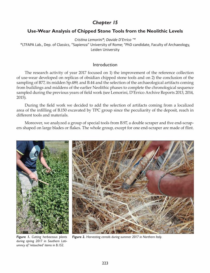
223
Chapter 15
Use-Wear Analysis of Chipped Stone Tools from the Neolithic Levels
Cristina Lemorini*; Davide D’Errico °**LTFAPA Lab., Dep. of Classics, “Sapienza” University of Rome; °PhD candidate, Faculty of Archaeology,
Leiden University
Introduction
The research activity of year 2017 focused on 1) the improvement of the reference collection of use-wear developed on replicas of obsidian chipped stone tools and on 2) the conclusion of the sampling of B77, its midden Sp.489, and B.44 and the selection of the archaeological artifacts coming from buildings and middens of the earlier Neolithic phases to complete the chronological sequence sampled during the previous years of field work (see Lemorini, D’Errico Archive Reports 2013, 2014, 2015).
During the field work we decided to add the selection of artifacts coming from a localized area of the infilling of B.150 excavated by TPC group since the peculiarity of the deposit, reach in different tools and materials.
Moreover, we analyzed a group of special tools from B.97, a double scraper and five end-scrap-ers shaped on large blades or flakes. The whole group, except for one end-scraper are made of flint.
Figure 1. Cutting herbaceous plants during spring 2017 in Southern Lati-umncy of ‘retouched’ items in B.152.
Figure 2. Harvesting cereals during summer 2017 in Northern Italy.

224
Experiments with replicas of obsidian chipped tools
During year 2017 we organized and we will organize various sections of experiments with the aim of gathering and harvesting various herbaceous plants potentially in use at Çatalhöyük for food or craft activities.
We had a first section in spring 2017 in the Natural Park “Parco degli Arunci” (LT) for gather-ing various plants from both humid and semi-dry environments (Fig. 1); a second section was ded-icated to the harvesting of barley and wheat from untreated fields of the research centre for cereals selection CREA-SCV (Sant’Angelo Lodigiano, Lodi) (Fig. 2); a third section was carried out nearby Çatalhöyük for gathering reeds and cereals. We will organize during autumn 2017 a fourth section for gathering autumn plants useful for food, health and craft activities.
The creation of a reference collection of use-wear related to the gathering of different types of plants it is extremely important for a better interpretation of the various use-wear observed on the archaeological tools.
The selection of the archaeological material and the preliminary analysis
For the early levels of Neolithic, we analyzed the whole chipped stone tools assemblages coming from Buildings 129, 131 and 139 and their associated middens respectively Spaces 85, 610, 631. We analyzed a selection of artifacts as well from B.132.
We observed each item with a stereomicroscope and with a metallographic microscope with a reflected light system to detect use-wear and to obtain a preliminary interpretation of the activities carried out and the materials worked.
A more detailed interpretation is in progress in the LTFAPA laboratory of “Sapienza” through the observation of two components silicon molds (Provil Novo Light Fast, Heraeus) of the actual used edges.
A first major difference between these earlier buildings and the later ones is the presence on the former of a huge quantity of débitage related to the shaping of the bifacial tools that was dis-carded unused. The used tools are found inside the buildings and are represented by retouched flakes or blades, end-scrapers on flakes, bifacial tools used as knifes. In the middens the used tools are rare; most of the chipped stone tools are by-products of the shaping of the bifacial tools. This is a very different picture from what we found in the later buildings that are characterized by a standardized blades production and the systematic use of blades or fragments of blades that are especially found in middens.
In the earlier buildings the materials worked are various: herbaceous plants working, wood, hide, hard animal material, butchering (Figs. 3 and 4). Some tools show very developed use-wear related to prolonged sessions of work (as an example for the hide working). There are tools re-shaped showing the remains of the previous activities.
In B.131, 22 big bifacial tools made of obsidian were found in a cache. Only one of them shows some use-wear; the other bifacial tools are unused; seven of them show traces of a light crushing on the edges and ridges and some abrasion (Figs. 5 and 6) tentatively due to a technological action of “mise en forme”. A further possible explanation could be the mechanical alteration due to the contact of the bifacial tools wrapped together in the cache.
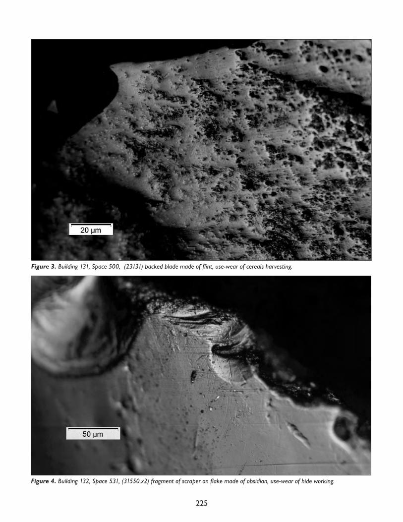
225
Figure 3. Building 131, Space 500, (23131) backed blade made of flint, use-wear of cereals harvesting.
Figure 4. Building 132, Space 531, (31550.x2) fragment of scraper on flake made of obsidian, use-wear of hide working.
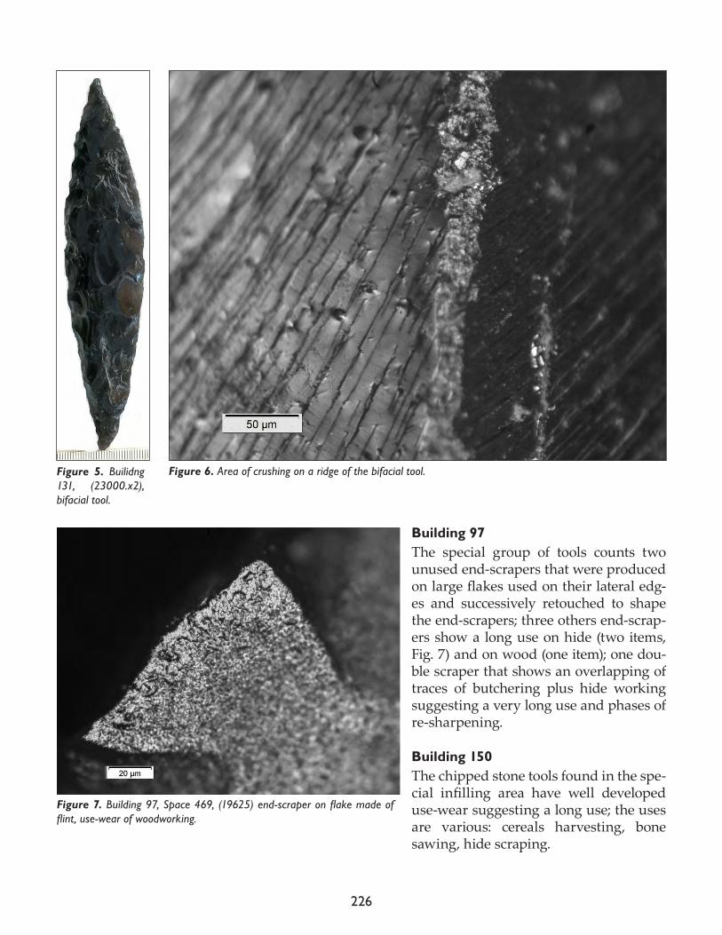
226
Building 97The special group of tools counts two unused end-scrapers that were produced on large flakes used on their lateral edg-es and successively retouched to shape the end-scrapers; three others end-scrap-ers show a long use on hide (two items, Fig. 7) and on wood (one item); one dou-ble scraper that shows an overlapping of traces of butchering plus hide working suggesting a very long use and phases of re-sharpening.
Building 150The chipped stone tools found in the spe-cial infilling area have well developed use-wear suggesting a long use; the uses are various: cereals harvesting, bone sawing, hide scraping.
Figure 7. Building 97, Space 469, (19625) end-scraper on flake made of flint, use-wear of woodworking.
Figure 5. Builidng 131, (23000.x2), bifacial tool.
Figure 6. Area of crushing on a ridge of the bifacial tool.
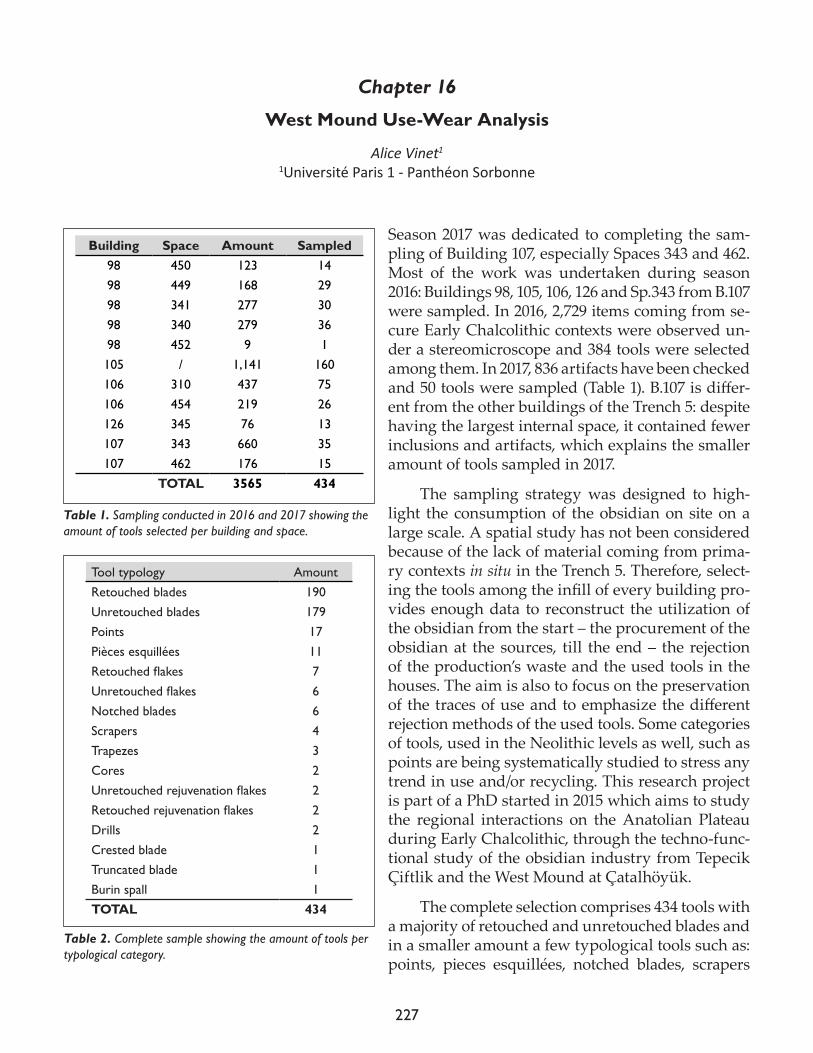
227
Chapter 16
West Mound Use-Wear Analysis
Alice Vinet1
1Université Paris 1 - Panthéon Sorbonne
Season 2017 was dedicated to completing the sam-pling of Building 107, especially Spaces 343 and 462. Most of the work was undertaken during season 2016: Buildings 98, 105, 106, 126 and Sp.343 from B.107 were sampled. In 2016, 2,729 items coming from se-cure Early Chalcolithic contexts were observed un-der a stereomicroscope and 384 tools were selected among them. In 2017, 836 artifacts have been checked and 50 tools were sampled (Table 1). B.107 is differ-ent from the other buildings of the Trench 5: despite having the largest internal space, it contained fewer inclusions and artifacts, which explains the smaller amount of tools sampled in 2017.
The sampling strategy was designed to high-light the consumption of the obsidian on site on a large scale. A spatial study has not been considered because of the lack of material coming from prima-ry contexts in situ in the Trench 5. Therefore, select-ing the tools among the infill of every building pro-vides enough data to reconstruct the utilization of the obsidian from the start – the procurement of the obsidian at the sources, till the end – the rejection of the production’s waste and the used tools in the houses. The aim is also to focus on the preservation of the traces of use and to emphasize the different rejection methods of the used tools. Some categories of tools, used in the Neolithic levels as well, such as points are being systematically studied to stress any trend in use and/or recycling. This research project is part of a PhD started in 2015 which aims to study the regional interactions on the Anatolian Plateau during Early Chalcolithic, through the techno-func-tional study of the obsidian industry from Tepecik Çiftlik and the West Mound at Çatalhöyük.
The complete selection comprises 434 tools with a majority of retouched and unretouched blades and in a smaller amount a few typological tools such as: points, pieces esquillées, notched blades, scrapers
Building Space Amount Sampled98 450 123 1498 449 168 2998 341 277 3098 340 279 3698 452 9 1105 / 1,141 160106 310 437 75106 454 219 26126 345 76 13107 343 660 35107 462 176 15 TOTAL 3565 434
Table 1. Sampling conducted in 2016 and 2017 showing the amount of tools selected per building and space.
Tool typology AmountRetouched blades 190Unretouched blades 179Points 17Pièces esquillées 11Retouchedflakes 7Unretouchedflakes 6Notched blades 6Scrapers 4Trapezes 3Cores 2Unretouchedrejuvenationflakes 2Retouchedrejuvenationflakes 2Drills 2Crested blade 1Truncated blade 1Burin spall 1TOTAL 434
Table 2. Complete sample showing the amount of tools per typological category.
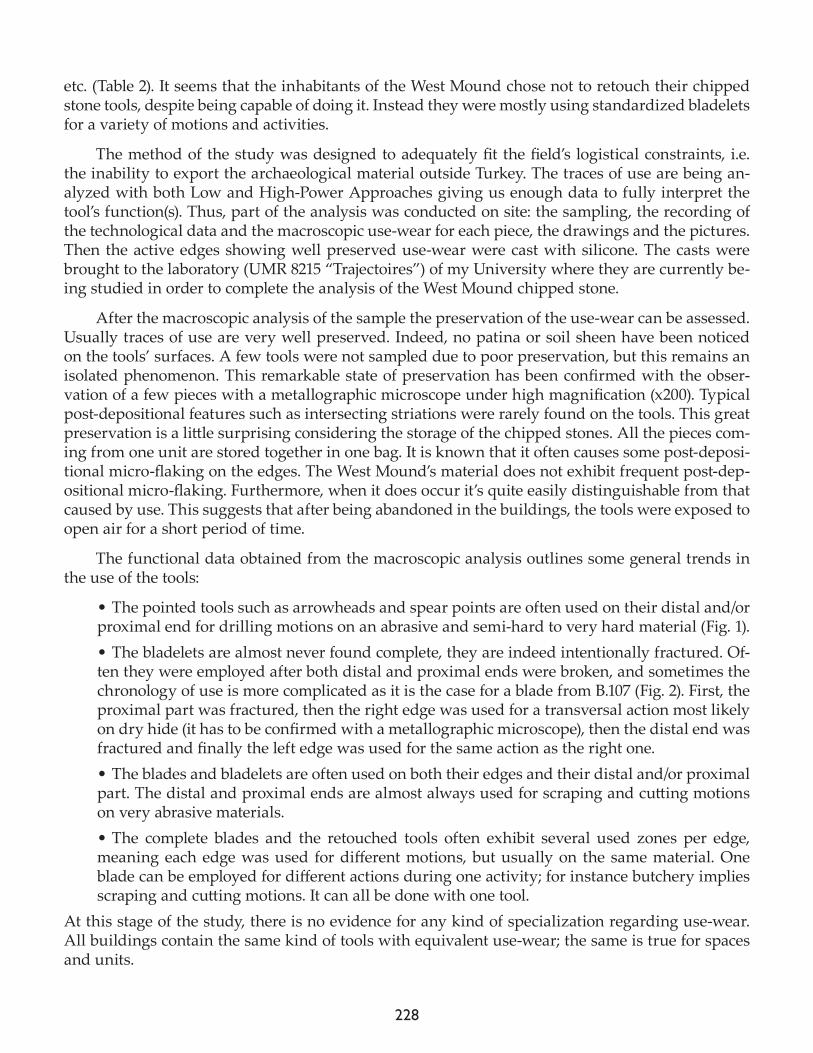
228
etc. (Table 2). It seems that the inhabitants of the West Mound chose not to retouch their chipped stone tools, despite being capable of doing it. Instead they were mostly using standardized bladelets for a variety of motions and activities.
The method of the study was designed to adequately fit the field’s logistical constraints, i.e. the inability to export the archaeological material outside Turkey. The traces of use are being an-alyzed with both Low and High-Power Approaches giving us enough data to fully interpret the tool’s function(s). Thus, part of the analysis was conducted on site: the sampling, the recording of the technological data and the macroscopic use-wear for each piece, the drawings and the pictures. Then the active edges showing well preserved use-wear were cast with silicone. The casts were brought to the laboratory (UMR 8215 “Trajectoires”) of my University where they are currently be-ing studied in order to complete the analysis of the West Mound chipped stone.
After the macroscopic analysis of the sample the preservation of the use-wear can be assessed. Usually traces of use are very well preserved. Indeed, no patina or soil sheen have been noticed on the tools’ surfaces. A few tools were not sampled due to poor preservation, but this remains an isolated phenomenon. This remarkable state of preservation has been confirmed with the obser-vation of a few pieces with a metallographic microscope under high magnification (x200). Typical post-depositional features such as intersecting striations were rarely found on the tools. This great preservation is a little surprising considering the storage of the chipped stones. All the pieces com-ing from one unit are stored together in one bag. It is known that it often causes some post-deposi-tional micro-flaking on the edges. The West Mound’s material does not exhibit frequent post-dep-ositional micro-flaking. Furthermore, when it does occur it’s quite easily distinguishable from that caused by use. This suggests that after being abandoned in the buildings, the tools were exposed to open air for a short period of time.
The functional data obtained from the macroscopic analysis outlines some general trends in the use of the tools:
• The pointed tools such as arrowheads and spear points are often used on their distal and/or proximal end for drilling motions on an abrasive and semi-hard to very hard material (Fig. 1). • The bladelets are almost never found complete, they are indeed intentionally fractured. Of-ten they were employed after both distal and proximal ends were broken, and sometimes the chronology of use is more complicated as it is the case for a blade from B.107 (Fig. 2). First, the proximal part was fractured, then the right edge was used for a transversal action most likely on dry hide (it has to be confirmed with a metallographic microscope), then the distal end was fractured and finally the left edge was used for the same action as the right one. • The blades and bladelets are often used on both their edges and their distal and/or proximal part. The distal and proximal ends are almost always used for scraping and cutting motions on very abrasive materials.• The complete blades and the retouched tools often exhibit several used zones per edge, meaning each edge was used for different motions, but usually on the same material. One blade can be employed for different actions during one activity; for instance butchery implies scraping and cutting motions. It can all be done with one tool.
At this stage of the study, there is no evidence for any kind of specialization regarding use-wear. All buildings contain the same kind of tools with equivalent use-wear; the same is true for spaces and units.
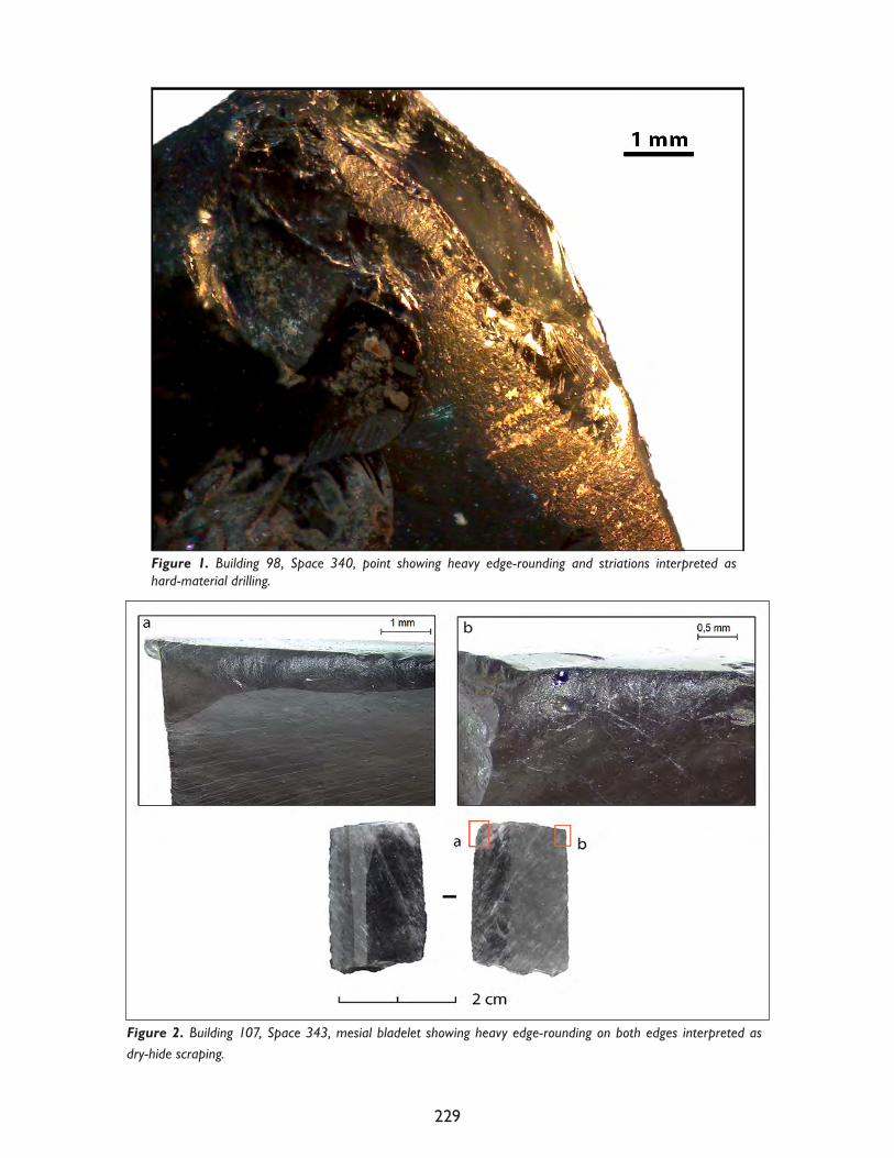
229
Figure 2. Building 107, Space 343, mesial bladelet showing heavy edge-rounding on both edges interpreted as dry-hide scraping.
Figure 1. Building 98, Space 340, point showing heavy edge-rounding and striations interpreted as hard-material drilling.

230
At this stage of the analysis a few activities have been identified such as hide working, butch-ery, harvesting of cereals and other rigid-tender plants, as well as wood-working.
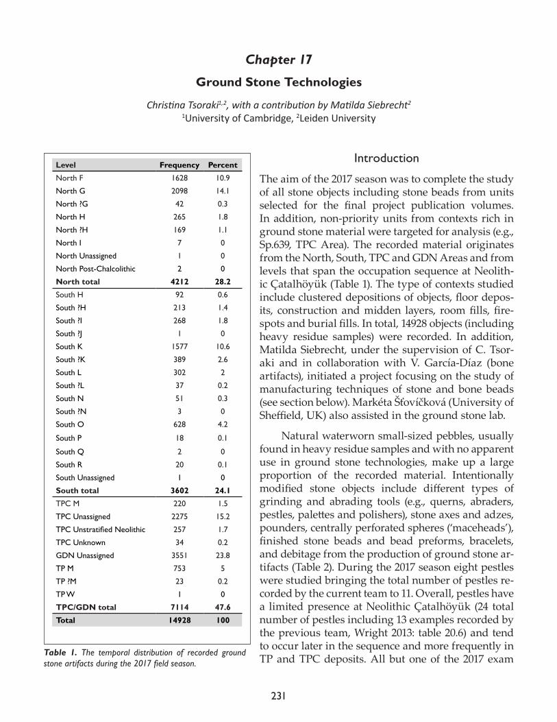
231
Chapter 17
Ground Stone Technologies
Christina Tsoraki1,2, with a contribution by Matilda Siebrecht2
1University of Cambridge, 2Leiden University
Introduction
The aim of the 2017 season was to complete the study of all stone objects including stone beads from units selected for the final project publication volumes. In addition, non-priority units from contexts rich in ground stone material were targeted for analysis (e.g., Sp.639, TPC Area). The recorded material originates from the North, South, TPC and GDN Areas and from levels that span the occupation sequence at Neolith-ic Çatalhöyük (Table 1). The type of contexts studied include clustered depositions of objects, floor depos-its, construction and midden layers, room fills, fire-spots and burial fills. In total, 14928 objects (including heavy residue samples) were recorded. In addition, Matilda Siebrecht, under the supervision of C. Tsor-aki and in collaboration with V. García-Díaz (bone artifacts), initiated a project focusing on the study of manufacturing techniques of stone and bone beads (see section below). Markéta Šťovíčková (University of Sheffield, UK) also assisted in the ground stone lab.
Natural waterworn small-sized pebbles, usually found in heavy residue samples and with no apparent use in ground stone technologies, make up a large proportion of the recorded material. Intentionally modified stone objects include different types of grinding and abrading tools (e.g., querns, abraders, pestles, palettes and polishers), stone axes and adzes, pounders, centrally perforated spheres (‘maceheads’), finished stone beads and bead preforms, bracelets, and debitage from the production of ground stone ar-tifacts (Table 2). During the 2017 season eight pestles were studied bringing the total number of pestles re-corded by the current team to 11. Overall, pestles have a limited presence at Neolithic Çatalhöyük (24 total number of pestles including 13 examples recorded by the previous team, Wright 2013: table 20.6) and tend to occur later in the sequence and more frequently in TP and TPC deposits. All but one of the 2017 exam
Level Frequency Percent
North F 1628 10.9
North G 2098 14.1
North ?G 42 0.3
North H 265 1.8
North ?H 169 1.1
North I 7 0
North Unassigned 1 0
North Post-Chalcolithic 2 0
North total 4212 28.2
South H 92 0.6
South ?H 213 1.4
South ?I 268 1.8
South ?J 1 0
South K 1577 10.6
South ?K 389 2.6
South L 302 2
South ?L 37 0.2
South N 51 0.3
South ?N 3 0
South O 628 4.2
South P 18 0.1
South Q 2 0
South R 20 0.1
South Unassigned 1 0
South total 3602 24.1
TPC M 220 1.5
TPC Unassigned 2275 15.2
TPCUnstratifiedNeolithic 257 1.7
TPC Unknown 34 0.2
GDN Unassigned 3551 23.8
TP M 753 5
TP ?M 23 0.2
TP W 1 0
TPC/GDN total 7114 47.6
Total 14928 100
Table 1. The temporal distribution of recorded ground stone artifacts during the 2017 field season.
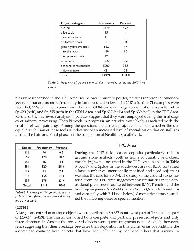
232
ples were unearthed in the TPC Area (see below). Similar to pestles, palettes represent another ob-ject type that occurs more frequently in later occupation levels. In 2017 a further 74 examples were recorded, 77% of which come from TPC and GDN contexts; large concentrations were found in Sp.420 (n=10) and Sp.555 (n=9) in the GDN Area, and Sp.637 (n=13) and Sp.639 (n=9) in the TPC Area. Results of the microwear analysis of palettes suggest that they were employed during the final stag-es of mineral processing (Tsoraki work in progress), an activity most likely associated with the creation of wall paintings. Among the questions the current project considers is whether the un-equal distribution of these tools is indicative of an increased level of specialization that crystallizes during the Late and Final phases of the occupation at Neolithic Çatalhöyük.
TPC Area
During the 2017 field season deposits particularly rich in ground stone artifacts (both in terms of quantity and object variability) were unearthed in the TPC Area. As seen in Table 3, Sp.637 and Sp.639 in the south-west area of B.150 contained a large number of intentionally modified and used objects as was also the case for Sp.594. The study of the ground stone ma-terial from the TPC Area suggests many similarities in the dep-ositional practices encountered between B.150/Trench 4 and the building sequence 65-56-44 (Levels South Q-South R-South S) and especially with B.44 (see below). Among the deposits stud-ied the following deserve special mention:
(23765)A large concentration of stone objects was unearthed in Sp.637 (southwest part of Trench 4) as part of (23765) (n=129). The cluster contained both complete and partially preserved objects and only three objects refit. Among the recovered objects were quern fragments none of which, however, refit suggesting that their breakage pre-dates their deposition in this pit. In terms of condition, the assemblage contains both objects that have been affected by heat and others that survive in
Object category Frequency Percentnatural 7379 49.4edge tools 15 .1percussive tools 11 .1perforated tools 1 .0grinding/abrasive tools 662 4.4miscellaneous 188 1.3multiple-use tools 22 .1ornaments 1229 8.2debitage/cores/nodules 5000 33.5indeterminate 421 2.8Total 14928 100.0
Table 2. Frequency of ground stone artefacts recorded during the 2017 field season
Space Frequency Percent515 74 6.6562 120 10.7585 46 4.1594 320 28.6612 23 2.1637 156 14.0639 379 33.9
Total 1118 100.0
Table 3. Frequency of TPC ground stone arti-facts per space (based on units studied during the 2017 season).
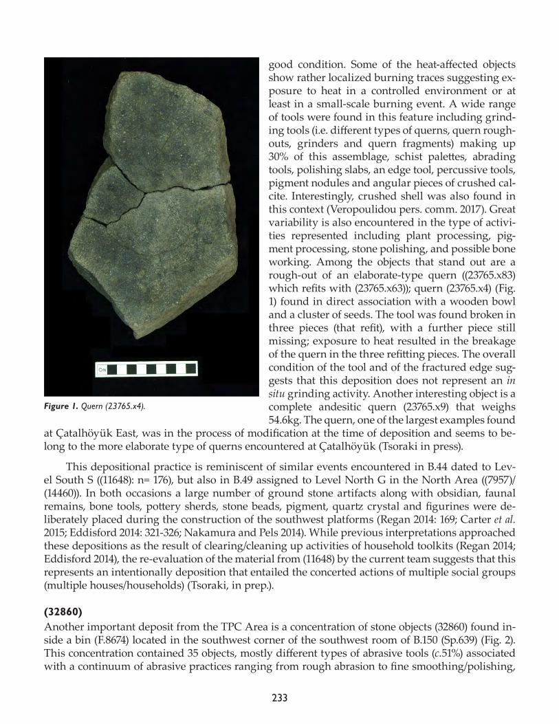
233
good condition. Some of the heat-affected objects show rather localized burning traces suggesting ex-posure to heat in a controlled environment or at least in a small-scale burning event. A wide range of tools were found in this feature including grind-ing tools (i.e. different types of querns, quern rough-outs, grinders and quern fragments) making up 30% of this assemblage, schist palettes, abrading tools, polishing slabs, an edge tool, percussive tools, pigment nodules and angular pieces of crushed cal-cite. Interestingly, crushed shell was also found in this context (Veropoulidou pers. comm. 2017). Great variability is also encountered in the type of activi-ties represented including plant processing, pig-ment processing, stone polishing, and possible bone working. Among the objects that stand out are a rough-out of an elaborate-type quern ((23765.x83) which refits with (23765.x63)); quern (23765.x4) (Fig. 1) found in direct association with a wooden bowl and a cluster of seeds. The tool was found broken in three pieces (that refit), with a further piece still missing; exposure to heat resulted in the breakage of the quern in the three refitting pieces. The overall condition of the tool and of the fractured edge sug-gests that this deposition does not represent an in situ grinding activity. Another interesting object is a complete andesitic quern (23765.x9) that weighs 54.6kg. The quern, one of the largest examples found
at Çatalhöyük East, was in the process of modification at the time of deposition and seems to be-long to the more elaborate type of querns encountered at Çatalhöyük (Tsoraki in press).
This depositional practice is reminiscent of similar events encountered in B.44 dated to Lev-el South S ((11648): n= 176), but also in B.49 assigned to Level North G in the North Area ((7957)/(14460)). In both occasions a large number of ground stone artifacts along with obsidian, faunal remains, bone tools, pottery sherds, stone beads, pigment, quartz crystal and figurines were de-liberately placed during the construction of the southwest platforms (Regan 2014: 169; Carter et al. 2015; Eddisford 2014: 321-326; Nakamura and Pels 2014). While previous interpretations approached these depositions as the result of clearing/cleaning up activities of household toolkits (Regan 2014; Eddisford 2014), the re-evaluation of the material from (11648) by the current team suggests that this represents an intentionally deposition that entailed the concerted actions of multiple social groups (multiple houses/households) (Tsoraki, in prep.).
(32860)Another important deposit from the TPC Area is a concentration of stone objects (32860) found in-side a bin (F.8674) located in the southwest corner of the southwest room of B.150 (Sp.639) (Fig. 2). This concentration contained 35 objects, mostly different types of abrasive tools (c.51%) associated with a continuum of abrasive practices ranging from rough abrasion to fine smoothing/polishing,
Figure 1. Quern (23765.x4).
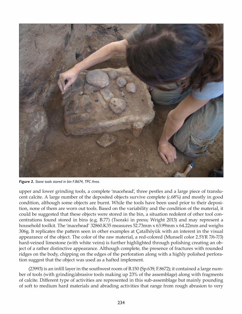
234
upper and lower grinding tools, a complete ‘macehead’, three pestles and a large piece of translu-cent calcite. A large number of the deposited objects survive complete (c.68%) and mostly in good condition, although some objects are burnt. While the tools have been used prior to their deposi-tion, none of them are worn out tools. Based on the variability and the condition of the material, it could be suggested that these objects were stored in the bin, a situation redolent of other tool con-centrations found stored in bins (e.g. B.77) (Tsoraki in press; Wright 2013) and may represent a household toolkit. The ‘macehead’ 32860.K35 measures 52.73mm x 63.99mm x 64.22mm and weighs 306g. It replicates the pattern seen in other examples at Çatalhöyük with an interest in the visual appearance of the object. The color of the raw material, a red-colored (Munsell color 2.5YR 7/6-7/3) hard-veined limestone (with white veins) is further highlighted through polishing creating an ob-ject of a rather distinctive appearance. Although complete, the presence of fractures with rounded ridges on the body, chipping on the edges of the perforation along with a highly polished perfora-tion suggest that the object was used as a hafted implement.
(23993) is an infill layer in the southwest room of B.150 (Sp.639, F.8672); it contained a large num-ber of tools (with grinding/abrasive tools making up 23% of the assemblage) along with fragments of calcite. Different type of activities are represented in this sub-assemblage but mainly pounding of soft to medium hard materials and abrading activities that range from rough abrasion to very
Figure 2. Stone tools stored in bin F.8674, TPC Area.
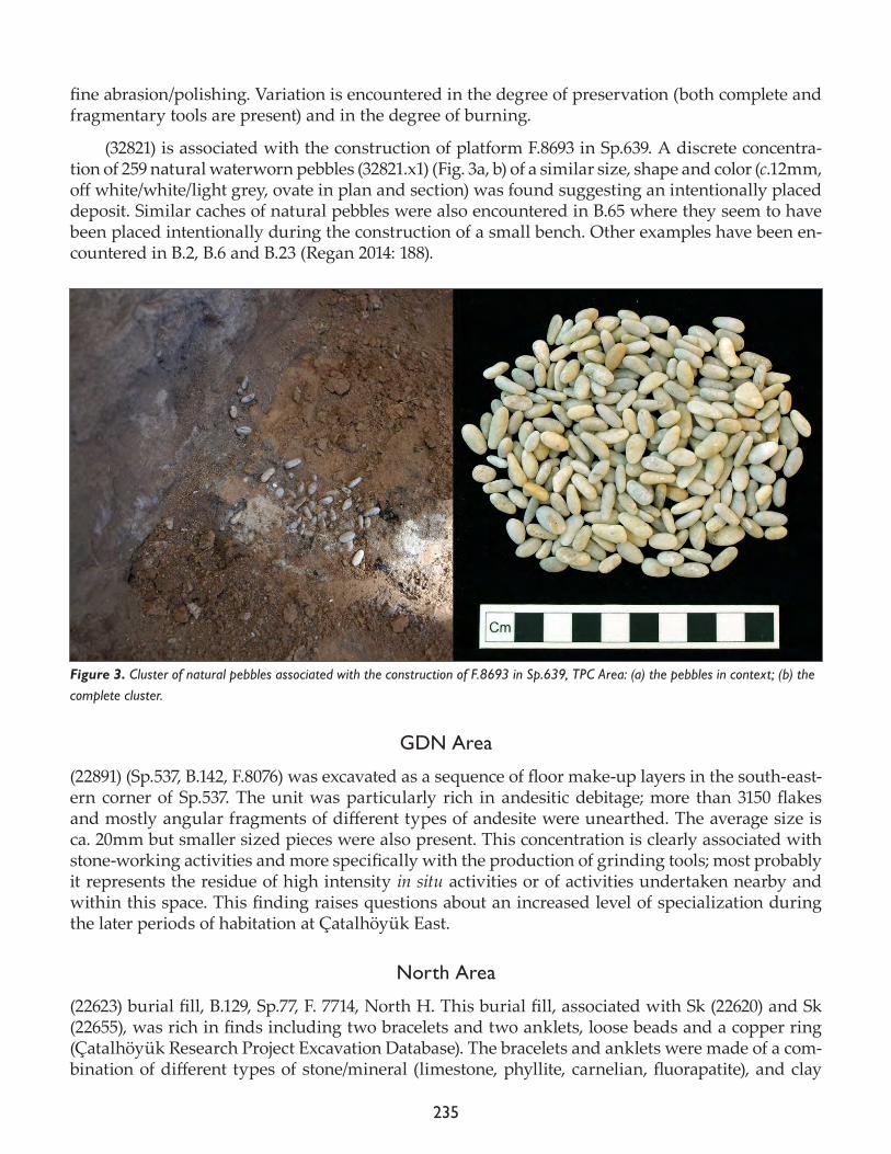
235
fine abrasion/polishing. Variation is encountered in the degree of preservation (both complete and fragmentary tools are present) and in the degree of burning.
(32821) is associated with the construction of platform F.8693 in Sp.639. A discrete concentra-tion of 259 natural waterworn pebbles (32821.x1) (Fig. 3a, b) of a similar size, shape and color (c.12mm, off white/white/light grey, ovate in plan and section) was found suggesting an intentionally placed deposit. Similar caches of natural pebbles were also encountered in B.65 where they seem to have been placed intentionally during the construction of a small bench. Other examples have been en-countered in B.2, B.6 and B.23 (Regan 2014: 188).
GDN Area
(22891) (Sp.537, B.142, F.8076) was excavated as a sequence of floor make-up layers in the south-east-ern corner of Sp.537. The unit was particularly rich in andesitic debitage; more than 3150 flakes and mostly angular fragments of different types of andesite were unearthed. The average size is ca. 20mm but smaller sized pieces were also present. This concentration is clearly associated with stone-working activities and more specifically with the production of grinding tools; most probably it represents the residue of high intensity in situ activities or of activities undertaken nearby and within this space. This finding raises questions about an increased level of specialization during the later periods of habitation at Çatalhöyük East.
North Area
(22623) burial fill, B.129, Sp.77, F. 7714, North H. This burial fill, associated with Sk (22620) and Sk (22655), was rich in finds including two bracelets and two anklets, loose beads and a copper ring (Çatalhöyük Research Project Excavation Database). The bracelets and anklets were made of a com-bination of different types of stone/mineral (limestone, phyllite, carnelian, fluorapatite), and clay
Figure 3. Cluster of natural pebbles associated with the construction of F.8693 in Sp.639, TPC Area: (a) the pebbles in context; (b) the complete cluster.
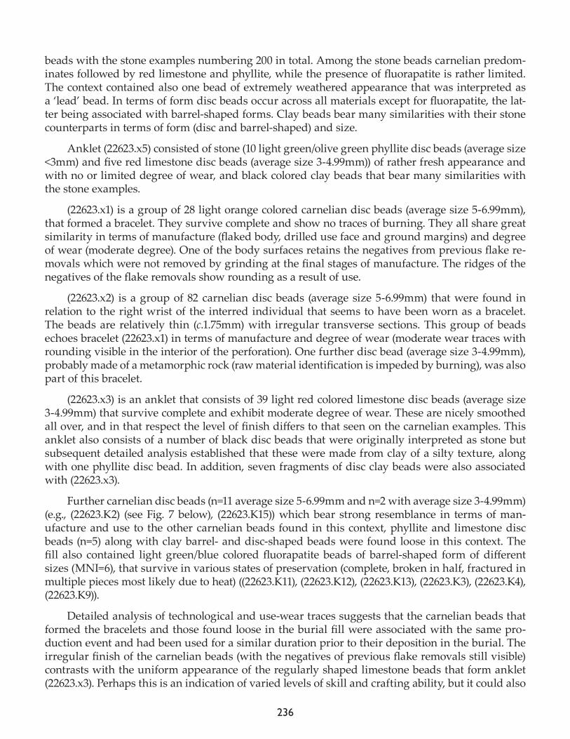
236
beads with the stone examples numbering 200 in total. Among the stone beads carnelian predom-inates followed by red limestone and phyllite, while the presence of fluorapatite is rather limited. The context contained also one bead of extremely weathered appearance that was interpreted as a ‘lead’ bead. In terms of form disc beads occur across all materials except for fluorapatite, the lat-ter being associated with barrel-shaped forms. Clay beads bear many similarities with their stone counterparts in terms of form (disc and barrel-shaped) and size.
Anklet (22623.x5) consisted of stone (10 light green/olive green phyllite disc beads (average size <3mm) and five red limestone disc beads (average size 3-4.99mm)) of rather fresh appearance and with no or limited degree of wear, and black colored clay beads that bear many similarities with the stone examples.
(22623.x1) is a group of 28 light orange colored carnelian disc beads (average size 5-6.99mm), that formed a bracelet. They survive complete and show no traces of burning. They all share great similarity in terms of manufacture (flaked body, drilled use face and ground margins) and degree of wear (moderate degree). One of the body surfaces retains the negatives from previous flake re-movals which were not removed by grinding at the final stages of manufacture. The ridges of the negatives of the flake removals show rounding as a result of use.
(22623.x2) is a group of 82 carnelian disc beads (average size 5-6.99mm) that were found in relation to the right wrist of the interred individual that seems to have been worn as a bracelet. The beads are relatively thin (c.1.75mm) with irregular transverse sections. This group of beads echoes bracelet (22623.x1) in terms of manufacture and degree of wear (moderate wear traces with rounding visible in the interior of the perforation). One further disc bead (average size 3-4.99mm), probably made of a metamorphic rock (raw material identification is impeded by burning), was also part of this bracelet.
(22623.x3) is an anklet that consists of 39 light red colored limestone disc beads (average size 3-4.99mm) that survive complete and exhibit moderate degree of wear. These are nicely smoothed all over, and in that respect the level of finish differs to that seen on the carnelian examples. This anklet also consists of a number of black disc beads that were originally interpreted as stone but subsequent detailed analysis established that these were made from clay of a silty texture, along with one phyllite disc bead. In addition, seven fragments of disc clay beads were also associated with (22623.x3).
Further carnelian disc beads (n=11 average size 5-6.99mm and n=2 with average size 3-4.99mm) (e.g., (22623.K2) (see Fig. 7 below), (22623.K15)) which bear strong resemblance in terms of man-ufacture and use to the other carnelian beads found in this context, phyllite and limestone disc beads (n=5) along with clay barrel- and disc-shaped beads were found loose in this context. The fill also contained light green/blue colored fluorapatite beads of barrel-shaped form of different sizes (MNI=6), that survive in various states of preservation (complete, broken in half, fractured in multiple pieces most likely due to heat) ((22623.K11), (22623.K12), (22623.K13), (22623.K3), (22623.K4), (22623.K9)).
Detailed analysis of technological and use-wear traces suggests that the carnelian beads that formed the bracelets and those found loose in the burial fill were associated with the same pro-duction event and had been used for a similar duration prior to their deposition in the burial. The irregular finish of the carnelian beads (with the negatives of previous flake removals still visible) contrasts with the uniform appearance of the regularly shaped limestone beads that form anklet (22623.x3). Perhaps this is an indication of varied levels of skill and crafting ability, but it could also
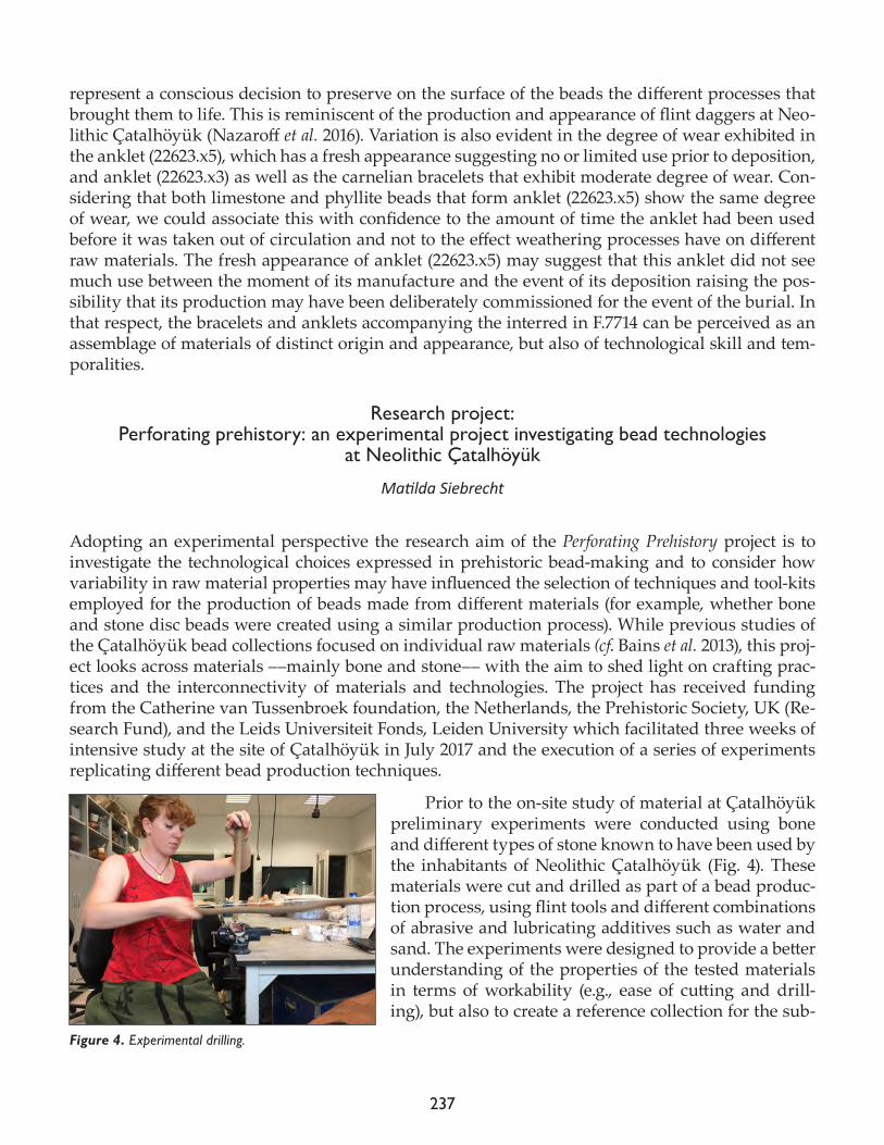
237
represent a conscious decision to preserve on the surface of the beads the different processes that brought them to life. This is reminiscent of the production and appearance of flint daggers at Neo-lithic Çatalhöyük (Nazaroff et al. 2016). Variation is also evident in the degree of wear exhibited in the anklet (22623.x5), which has a fresh appearance suggesting no or limited use prior to deposition, and anklet (22623.x3) as well as the carnelian bracelets that exhibit moderate degree of wear. Con-sidering that both limestone and phyllite beads that form anklet (22623.x5) show the same degree of wear, we could associate this with confidence to the amount of time the anklet had been used before it was taken out of circulation and not to the effect weathering processes have on different raw materials. The fresh appearance of anklet (22623.x5) may suggest that this anklet did not see much use between the moment of its manufacture and the event of its deposition raising the pos-sibility that its production may have been deliberately commissioned for the event of the burial. In that respect, the bracelets and anklets accompanying the interred in F.7714 can be perceived as an assemblage of materials of distinct origin and appearance, but also of technological skill and tem-poralities.
Research project: Perforating prehistory: an experimental project investigating bead technologies
at Neolithic Çatalhöyük
Matilda Siebrecht
Adopting an experimental perspective the research aim of the Perforating Prehistory project is to investigate the technological choices expressed in prehistoric bead-making and to consider how variability in raw material properties may have influenced the selection of techniques and tool-kits employed for the production of beads made from different materials (for example, whether bone and stone disc beads were created using a similar production process). While previous studies of the Çatalhöyük bead collections focused on individual raw materials (cf. Bains et al. 2013), this proj-ect looks across materials ––mainly bone and stone–– with the aim to shed light on crafting prac-tices and the interconnectivity of materials and technologies. The project has received funding from the Catherine van Tussenbroek foundation, the Netherlands, the Prehistoric Society, UK (Re-search Fund), and the Leids Universiteit Fonds, Leiden University which facilitated three weeks of intensive study at the site of Çatalhöyük in July 2017 and the execution of a series of experiments replicating different bead production techniques.
Prior to the on-site study of material at Çatalhöyük preliminary experiments were conducted using bone and different types of stone known to have been used by the inhabitants of Neolithic Çatalhöyük (Fig. 4). These materials were cut and drilled as part of a bead produc-tion process, using flint tools and different combinations of abrasive and lubricating additives such as water and sand. The experiments were designed to provide a better understanding of the properties of the tested materials in terms of workability (e.g., ease of cutting and drill-ing), but also to create a reference collection for the sub-
Figure 4. Experimental drilling.
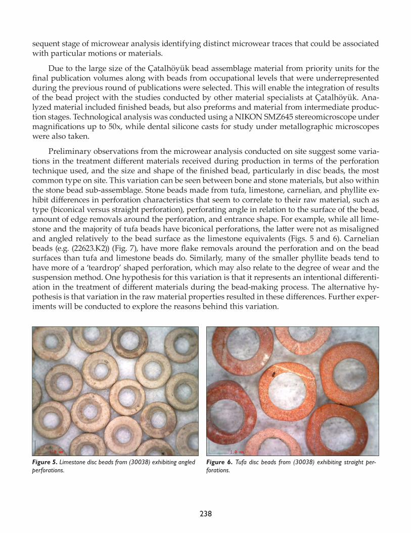
238
sequent stage of microwear analysis identifying distinct microwear traces that could be associated with particular motions or materials.
Due to the large size of the Çatalhöyük bead assemblage material from priority units for the final publication volumes along with beads from occupational levels that were underrepresented during the previous round of publications were selected. This will enable the integration of results of the bead project with the studies conducted by other material specialists at Çatalhöyük. Ana-lyzed material included finished beads, but also preforms and material from intermediate produc-tion stages. Technological analysis was conducted using a NIKON SMZ645 stereomicroscope under magnifications up to 50x, while dental silicone casts for study under metallographic microscopes were also taken.
Preliminary observations from the microwear analysis conducted on site suggest some varia-tions in the treatment different materials received during production in terms of the perforation technique used, and the size and shape of the finished bead, particularly in disc beads, the most common type on site. This variation can be seen between bone and stone materials, but also within the stone bead sub-assemblage. Stone beads made from tufa, limestone, carnelian, and phyllite ex-hibit differences in perforation characteristics that seem to correlate to their raw material, such as type (biconical versus straight perforation), perforating angle in relation to the surface of the bead, amount of edge removals around the perforation, and entrance shape. For example, while all lime-stone and the majority of tufa beads have biconical perforations, the latter were not as misaligned and angled relatively to the bead surface as the limestone equivalents (Figs. 5 and 6). Carnelian beads (e.g. (22623.K2)) (Fig. 7), have more flake removals around the perforation and on the bead surfaces than tufa and limestone beads do. Similarly, many of the smaller phyllite beads tend to have more of a ‘teardrop’ shaped perforation, which may also relate to the degree of wear and the suspension method. One hypothesis for this variation is that it represents an intentional differenti-ation in the treatment of different materials during the bead-making process. The alternative hy-pothesis is that variation in the raw material properties resulted in these differences. Further exper-iments will be conducted to explore the reasons behind this variation.
Figure 5. Limestone disc beads from (30038) exhibiting angled perforations.
Figure 6. Tufa disc beads from (30038) exhibiting straight per-forations.
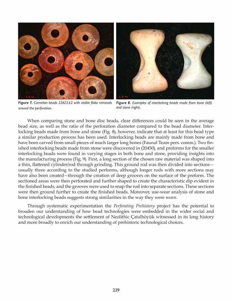
239
When comparing stone and bone disc beads, clear differences could be seen in the average bead size, as well as the ratio of the perforation diameter compared to the bead diameter. Inter-locking beads made from bone and stone (Fig. 8), however, indicate that at least for this bead type a similar production process has been used. Interlocking beads are mainly made from bone and have been carved from small pieces of much larger long bones (Faunal Team pers. comm.). Two fin-ished interlocking beads made from stone were discovered in (20450), and preforms for the smaller interlocking beads were found in varying stages in both bone and stone, providing insights into the manufacturing process (Fig. 9). First, a long section of the chosen raw material was shaped into a thin, flattened cylinder/rod through grinding. This ground rod was then divided into sections—usually three according to the studied performs, although longer rods with more sections may have also been created—through the creation of deep grooves on the surface of the preform. The sectioned areas were then perforated and further shaped to create the characteristic dip evident in the finished beads, and the grooves were used to snap the rod into separate sections. These sections were then ground further to create the finished beads. Moreover, use-wear analysis of stone and bone interlocking beads suggests strong similarities in the way they were worn.
Through systematic experimentation the Perforating Prehistory project has the potential to broaden our understanding of how bead technologies were embedded in the wider social and technological developments the settlement of Neolithic Çatalhöyük witnessed in its long history and more broadly to enrich our understanding of prehistoric technological choices.
Figure 7. Carnelian beads 22623.k2 with visible flake removals around the perforation.
Figure 8. Examples of interlocking beads made from bone (left) and stone (right).
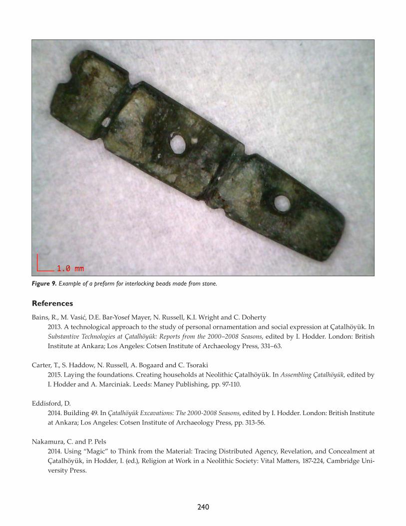
240
References
Bains, R., M. Vasić, D.E. Bar-Yosef Mayer, N. Russell, K.I. Wright and C. Doherty2013. A technological approach to the study of personal ornamentation and social expression at Çatalhöyük. In Substantive Technologies at Çatalhöyük: Reports from the 2000–2008 Seasons, edited by I. Hodder. London: British Institute at Ankara; Los Angeles: Cotsen Institute of Archaeology Press, 331–63.
Carter, T., S. Haddow, N. Russell, A. Bogaard and C. Tsoraki2015. Laying the foundations. Creating households at Neolithic Çatalhöyük. In Assembling Çatalhöyük, edited by I. Hodder and A. Marciniak. Leeds: Maney Publishing, pp. 97-110.
Eddisford, D.2014. Building 49. In Çatalhöyük Excavations: The 2000-2008 Seasons, edited by I. Hodder. London: British Institute at Ankara; Los Angeles: Cotsen Institute of Archaeology Press, pp. 313-56.
Nakamura, C. and P. Pels2014. Using “Magic” to Think from the Material: Tracing Distributed Agency, Revelation, and Concealment at Çatalhöyük, in Hodder, I. (ed.), Religion at Work in a Neolithic Society: Vital Matters, 187-224, Cambridge Uni-versity Press.
Figure 9. Example of a preform for interlocking beads made from stone.
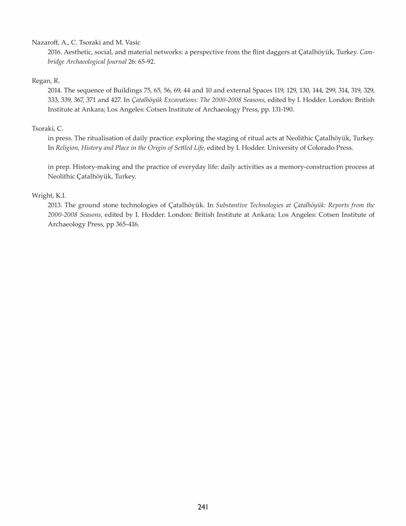
241
Nazaroff, A., C. Tsoraki and M. Vasic2016. Aesthetic, social, and material networks: a perspective from the flint daggers at Çatalhöyük, Turkey. Cam-bridge Archaeological Journal 26: 65-92.
Regan, R. 2014. The sequence of Buildings 75, 65, 56, 69, 44 and 10 and external Spaces 119, 129, 130, 144, 299, 314, 319, 329, 333, 339, 367, 371 and 427. In Çatalhöyük Excavations: The 2000-2008 Seasons, edited by I. Hodder. London: British Institute at Ankara; Los Angeles: Cotsen Institute of Archaeology Press, pp. 131-190.
Tsoraki, C. in press. The ritualisation of daily practice: exploring the staging of ritual acts at Neolithic Çatalhöyük, Turkey. In Religion, History and Place in the Origin of Settled Life, edited by I. Hodder. University of Colorado Press.
in prep. History-making and the practice of everyday life: daily activities as a memory-construction process at Neolithic Çatalhöyük, Turkey.
Wright, K.I.2013. The ground stone technologies of Çatalhöyük. In Substantive Technologies at Çatalhöyük: Reports from the 2000-2008 Seasons, edited by I. Hodder. London: British Institute at Ankara; Los Angeles: Cotsen Institute of Archaeology Press, pp 365-416.

242
243
Chapter 18
Ceramics
Serap Özdöl-Kutlu1 and Duygu Tarkan2
1Ege University, 2Koç University
2017 ceramics
Duygu Tarkan
This season, work carried out in the ceramics lab mainly focused on:
• complete detailed analysis and recording of all units excavated from North and South Areas between 2008-2017 • study of material from priority units excavated during the 2017 season• study of TPC Area priority units which were selected for publication by TPC field director, Arek Marciniak• complete the study of all GDN Area ceramic materials• in order to understand the variation of early clay sources that were missing in the study completed in 2015 (Tarkan 2015) samples were selected and brought to İstanbul.
In total, 1,657 individual ceramic sherds (32.359g) were recorded, which come from 88 units (Table 1). The ma-terial from North and South Area units mainly dated to the earlier levels; TPC and GDN Area material also dated to upper levels. This report includes a general summary of all processed and recorded ceramic mate-rials on site during the 2017 season.
North AreaIn 2017, 122 ceramic sherds (1415.5g) were found from North Area.
Space 85 and 610The excavation and recording methodologies of Sp.85 and Sp.610 were built on methodology cur-rently employed by the Çatalhöyük Research Project as a component of Justine Issavi’s dissertation project. According to Issavi the resolution for the excavation of middens and external spaces is typically coarser than that of the resolution for the excavation of houses and occupation deposits, as small-scale dumps in middens are generally grouped and excavated as one unit. In order to mitigate this and investigate external spaces on a finer scale, a 1m x 1m grid was imposed on the excavation area (Issavi 2016). Forty-five of the total 122 pieces coming from the North Area to the ceramic lab came from external midden spaces Sp.610 and Sp.85.
Following Issavi’s methodology, the individual groups according to grid and sample numbers were analyzed by looking for level-specific determinants. As a result of this analysis, it was under-stood that the different grids of the spaces show level differences (Fig. 1).
Area Total Body Sherds Weight (g)TPC 1236 19232
North 155 1874.5South 39 756
Table 1. Distribution of ceramics within areas.
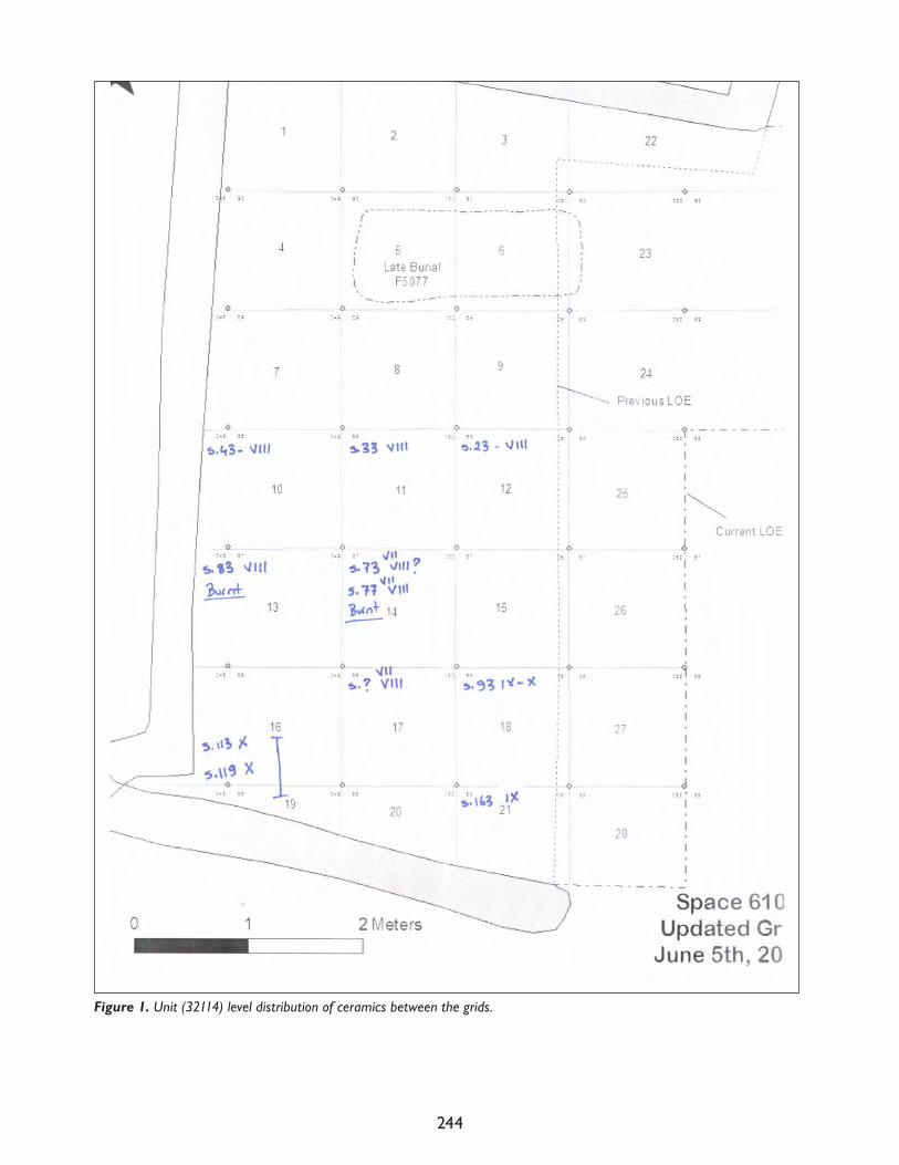
244
Figure 1. Unit (32114) level distribution of ceramics between the grids.
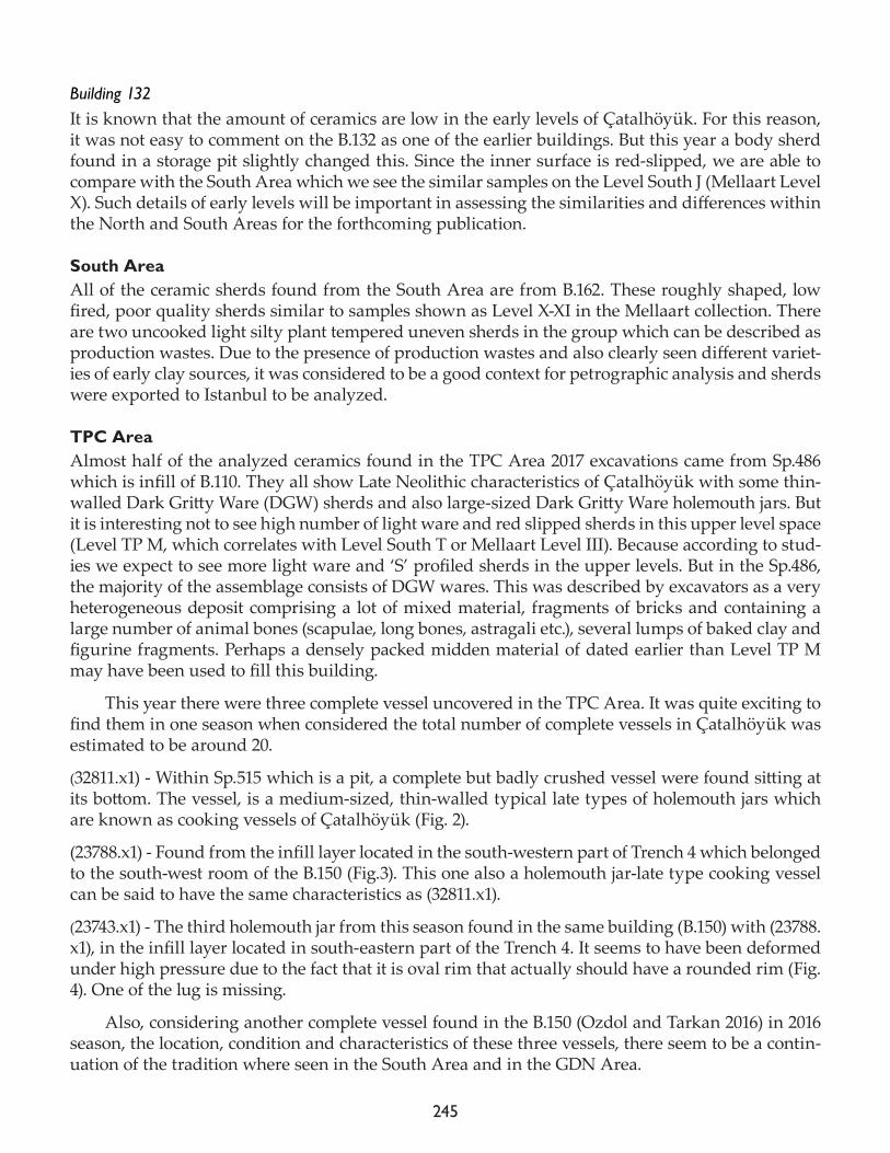
245
Building 132It is known that the amount of ceramics are low in the early levels of Çatalhöyük. For this reason, it was not easy to comment on the B.132 as one of the earlier buildings. But this year a body sherd found in a storage pit slightly changed this. Since the inner surface is red-slipped, we are able to compare with the South Area which we see the similar samples on the Level South J (Mellaart Level X). Such details of early levels will be important in assessing the similarities and differences within the North and South Areas for the forthcoming publication.
South AreaAll of the ceramic sherds found from the South Area are from B.162. These roughly shaped, low fired, poor quality sherds similar to samples shown as Level X-XI in the Mellaart collection. There are two uncooked light silty plant tempered uneven sherds in the group which can be described as production wastes. Due to the presence of production wastes and also clearly seen different variet-ies of early clay sources, it was considered to be a good context for petrographic analysis and sherds were exported to Istanbul to be analyzed.
TPC AreaAlmost half of the analyzed ceramics found in the TPC Area 2017 excavations came from Sp.486 which is infill of B.110. They all show Late Neolithic characteristics of Çatalhöyük with some thin-walled Dark Gritty Ware (DGW) sherds and also large-sized Dark Gritty Ware holemouth jars. But it is interesting not to see high number of light ware and red slipped sherds in this upper level space (Level TP M, which correlates with Level South T or Mellaart Level III). Because according to stud-ies we expect to see more light ware and ‘S’ profiled sherds in the upper levels. But in the Sp.486, the majority of the assemblage consists of DGW wares. This was described by excavators as a very heterogeneous deposit comprising a lot of mixed material, fragments of bricks and containing a large number of animal bones (scapulae, long bones, astragali etc.), several lumps of baked clay and figurine fragments. Perhaps a densely packed midden material of dated earlier than Level TP M may have been used to fill this building.
This year there were three complete vessel uncovered in the TPC Area. It was quite exciting to find them in one season when considered the total number of complete vessels in Çatalhöyük was estimated to be around 20.
(32811.x1) - Within Sp.515 which is a pit, a complete but badly crushed vessel were found sitting at its bottom. The vessel, is a medium-sized, thin-walled typical late types of holemouth jars which are known as cooking vessels of Çatalhöyük (Fig. 2).
(23788.x1) - Found from the infill layer located in the south-western part of Trench 4 which belonged to the south-west room of the B.150 (Fig.3). This one also a holemouth jar-late type cooking vessel can be said to have the same characteristics as (32811.x1).
(23743.x1) - The third holemouth jar from this season found in the same building (B.150) with (23788.x1), in the infill layer located in south-eastern part of the Trench 4. It seems to have been deformed under high pressure due to the fact that it is oval rim that actually should have a rounded rim (Fig. 4). One of the lug is missing.
Also, considering another complete vessel found in the B.150 (Ozdol and Tarkan 2016) in 2016 season, the location, condition and characteristics of these three vessels, there seem to be a contin-uation of the tradition where seen in the South Area and in the GDN Area.
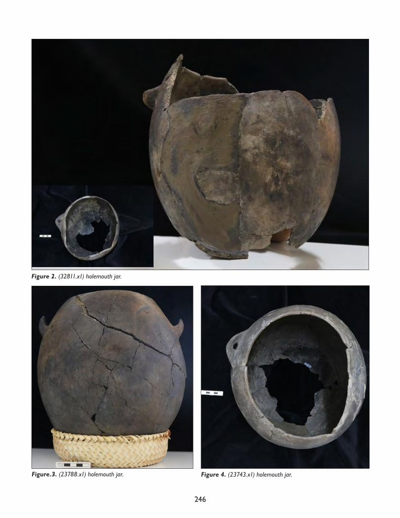
246
Figure 2. (32811.x1) holemouth jar.
Figure.3. (23788.x1) holemouth jar. Figure 4. (23743.x1) holemouth jar.
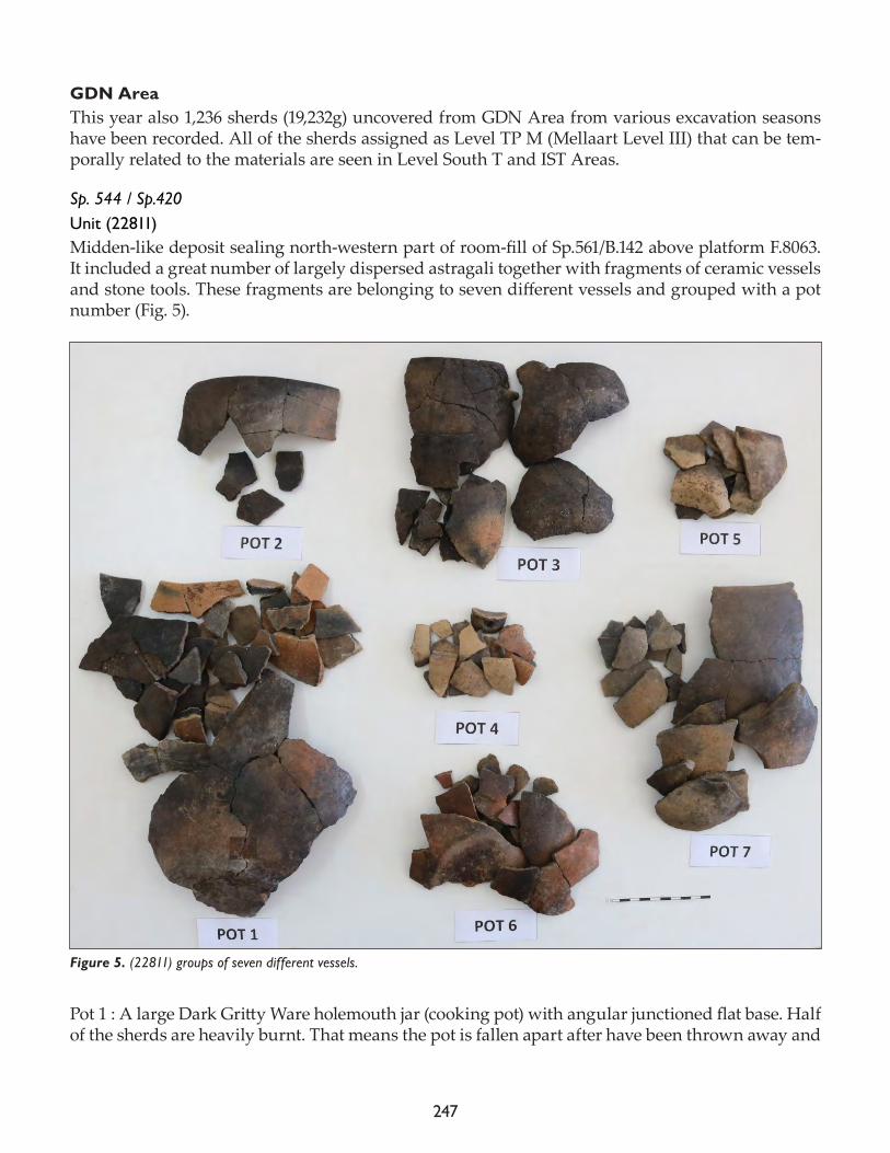
247
GDN AreaThis year also 1,236 sherds (19,232g) uncovered from GDN Area from various excavation seasons have been recorded. All of the sherds assigned as Level TP M (Mellaart Level III) that can be tem-porally related to the materials are seen in Level South T and IST Areas.
Sp. 544 / Sp.420Unit (22811)Midden-like deposit sealing north-western part of room-fill of Sp.561/B.142 above platform F.8063. It included a great number of largely dispersed astragali together with fragments of ceramic vessels and stone tools. These fragments are belonging to seven different vessels and grouped with a pot number (Fig. 5).
Pot 1 : A large Dark Gritty Ware holemouth jar (cooking pot) with angular junctioned flat base. Half of the sherds are heavily burnt. That means the pot is fallen apart after have been thrown away and
Figure 5. (22811) groups of seven different vessels.
248
then burnt in the midden. The rim diameter of the pot is 210mm and the base diameter is 110mm so it is a very big cooking pot.
Pot 2 : Dark Gritty Ware holemouth jar. Rim diameter is 190mm so it is another big pot. More look like Middle level versions of Dark Gritty Ware rather than Late levels. Irregular burnished.
Pot 3 : Dark limestone, unfortunately the pot cannot be completed but from the rim sherds we can say its small sized holemouth jar. Rim diameter is 120mm and base diameter is 90 mm. Will be compared with other contexts which have Dlms.
Pot 4 : Light silty buff slipped. They all body sherds no diagnostic.
Pot 5 : Light silty - Bowls with slightly ‘S’ profiled wall and everted rim. Rim diameter is 90mm.
Pot 6 : Dark gritty thin walled red slipped. Base diameter is 100mm. Look like the biggest sample of these group. Bowls with ‘S’ profiled wall and everted rim.
Pot 7 : Late Light Silty ware. Another big pot but no indication for cooking so it can be a storage pot. Very thick walled and the rim diameter is 230mm. Holemouth jar Late.
Unit (22831)In another unit (22831) of midden Sp.420 some of the sherds are slightly weathered but not all (Fig. 6). It can be seen from the sherd sections that they have been broken before they were thrown to the midden. There are many forms like; ring bases, footed bases, miniatures. In Dark Gritty and Light Silty group there are burnt sherds. Light Silty ware does not have Late light silty sherds. Dark grit-ty ones also not like the latest versions. Light silty slipped ones are all red slipped on both surfaces. There are two dark limestone sherds like (22811). Could be belonging to same pot. The whole as-semblage reminds the IST Area material rather than TP Area.
Unit 22834Typical midden material (Fig. 7). There are many forms like; ring bases, footed bases, miniatures, big upturned and small lugs, one rectangular knob, ‘S’ profiled bowls, big cone-shaped bowl, and
Figure 6. Unit (22831) ceramic groups. Figure 7. Unit (22834) ceramic groups.
249
also there is one uncooked production waste in light silty group. Seems later than (22831), (22850), (22857), (22867) because of the Late Light Silty, Late Sandy and Late Dark Gritty sherd amounts.
SummaryThis report contains only a short summary of the materials that were worked on during this last excavation season. Early level materials in the North and South Areas, and materials showing late level characteristics in the TPC and GDN Areas are very valuable in terms of comparison between different areas. This has also set the ground for both vertical and horizontal comparisons of areas in the forthcoming Çatalhöyük volumes.
2017 season and 2012-2017 “study season” pottery studies
Serap Özdöl-Kutlu
In 2017, between 10th July and 9th August, laboratory work of approximately four weeks was car-ried out encompassing both the 2017 ceramics and a study season. The work in question was car-ried out on all the 2012-2017 material from the North and South Areas and priority and safe units of the TPC Area assemblages. Because there is in fact very little material representing the early and middle levels of the North and South Levels, all the diagnostic sherds were studied without separating priority units. In the TPC Area which represents the late settlements, many units, par-ticularly the upper levels close to the surface in the excavation sequence, rubbish pits and disturbed grave deposits that contain mixed pottery sherds, were only evaluated generally. Even if each of the sherds from these units was not individually registered, some of distinctive diagnostic sherds were included in to the database. Additionally, the ceramic artifact assemblage again coming from the upper levels of the GT2 and GT4 areas and yielding mixed materials of different periods was generally evaluated and some pieces of value from the point of view of typology were recorded and drawing work carried out. Some mixed units from TPC were inspected to determine if there were materials of typological importance and the general character of the pottery was looked at. The GDN and GDA Areas were left outside the scope of these studies.
In reality, although this last ‘study season’ of the Çatalhöyük Excavation Project includes the 2009-2017 seasons, the work on the ceramics carried out in the previous study season (Yalman et al. 2013) encompassed the period up to 2010 and because no excavation was carried out in 2011, in this work the pottery assemblage of the 2012-2017 seasons was analysed.
In the 2017 season a total of 208 units were worked on and the pieces with profiles from the assemblage outlined above were all drawn, and photographed and those without descriptions were described.
Part of the drawing work was carried out with the help of Nergis Gürses, a student from the Protohistory and Archaeology of Asia Minor Department of Ege University.
Even those profile pieces within the assemblage too small to give a diameter were drawn in order to understand what sort of shape they may have had. Although some very common and extremely small sized pieces among the TPC material were not drawn, their measurements and forms were determined and registered. The reason for drawing all the diagnostic sherds is that, while each of the pieces is defined by technological and form characteristics in the database, with-out drawing the form of a pot we can only look at the stance of the rim and there is a real chance
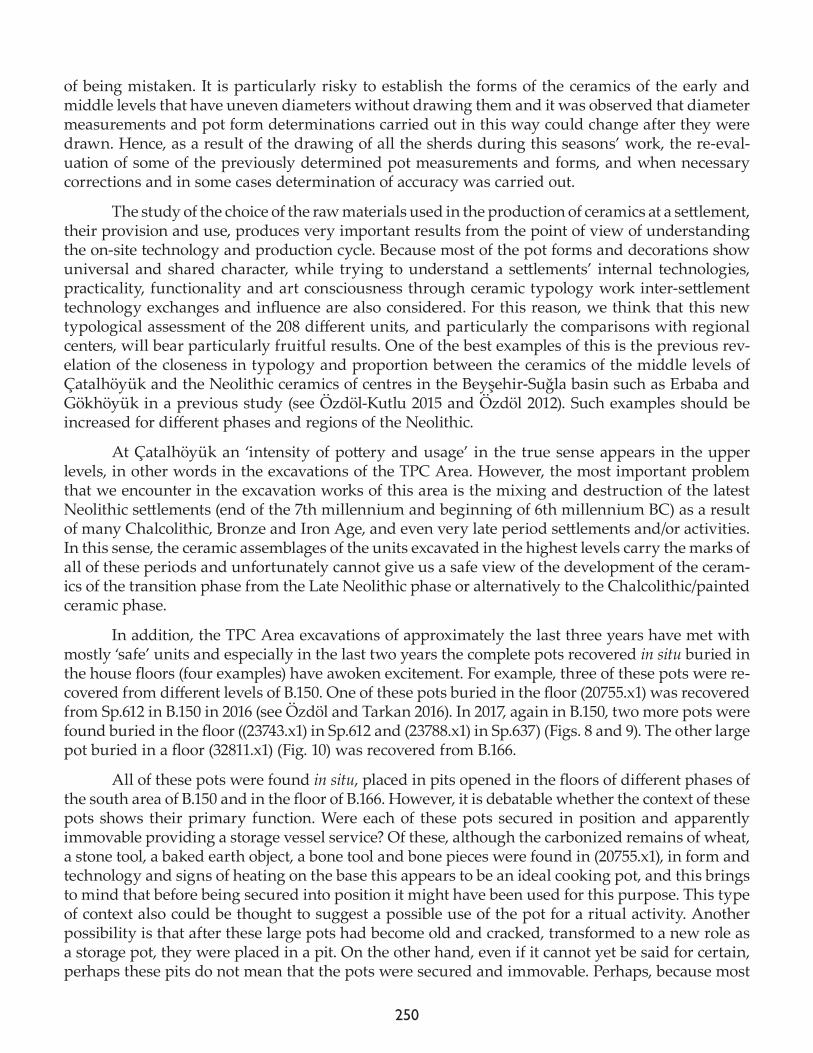
250
of being mistaken. It is particularly risky to establish the forms of the ceramics of the early and middle levels that have uneven diameters without drawing them and it was observed that diameter measurements and pot form determinations carried out in this way could change after they were drawn. Hence, as a result of the drawing of all the sherds during this seasons’ work, the re-eval-uation of some of the previously determined pot measurements and forms, and when necessary corrections and in some cases determination of accuracy was carried out.
The study of the choice of the raw materials used in the production of ceramics at a settlement, their provision and use, produces very important results from the point of view of understanding the on-site technology and production cycle. Because most of the pot forms and decorations show universal and shared character, while trying to understand a settlements’ internal technologies, practicality, functionality and art consciousness through ceramic typology work inter-settlement technology exchanges and influence are also considered. For this reason, we think that this new typological assessment of the 208 different units, and particularly the comparisons with regional centers, will bear particularly fruitful results. One of the best examples of this is the previous rev-elation of the closeness in typology and proportion between the ceramics of the middle levels of Çatalhöyük and the Neolithic ceramics of centres in the Beyşehir-Suğla basin such as Erbaba and Gökhöyük in a previous study (see Özdöl-Kutlu 2015 and Özdöl 2012). Such examples should be increased for different phases and regions of the Neolithic.
At Çatalhöyük an ‘intensity of pottery and usage’ in the true sense appears in the upper levels, in other words in the excavations of the TPC Area. However, the most important problem that we encounter in the excavation works of this area is the mixing and destruction of the latest Neolithic settlements (end of the 7th millennium and beginning of 6th millennium BC) as a result of many Chalcolithic, Bronze and Iron Age, and even very late period settlements and/or activities. In this sense, the ceramic assemblages of the units excavated in the highest levels carry the marks of all of these periods and unfortunately cannot give us a safe view of the development of the ceram-ics of the transition phase from the Late Neolithic phase or alternatively to the Chalcolithic/painted ceramic phase.
In addition, the TPC Area excavations of approximately the last three years have met with mostly ‘safe’ units and especially in the last two years the complete pots recovered in situ buried in the house floors (four examples) have awoken excitement. For example, three of these pots were re-covered from different levels of B.150. One of these pots buried in the floor (20755.x1) was recovered from Sp.612 in B.150 in 2016 (see Özdöl and Tarkan 2016). In 2017, again in B.150, two more pots were found buried in the floor ((23743.x1) in Sp.612 and (23788.x1) in Sp.637) (Figs. 8 and 9). The other large pot buried in a floor (32811.x1) (Fig. 10) was recovered from B.166.
All of these pots were found in situ, placed in pits opened in the floors of different phases of the south area of B.150 and in the floor of B.166. However, it is debatable whether the context of these pots shows their primary function. Were each of these pots secured in position and apparently immovable providing a storage vessel service? Of these, although the carbonized remains of wheat, a stone tool, a baked earth object, a bone tool and bone pieces were found in (20755.x1), in form and technology and signs of heating on the base this appears to be an ideal cooking pot, and this brings to mind that before being secured into position it might have been used for this purpose. This type of context also could be thought to suggest a possible use of the pot for a ritual activity. Another possibility is that after these large pots had become old and cracked, transformed to a new role as a storage pot, they were placed in a pit. On the other hand, even if it cannot yet be said for certain, perhaps these pits do not mean that the pots were secured and immovable. Perhaps, because most
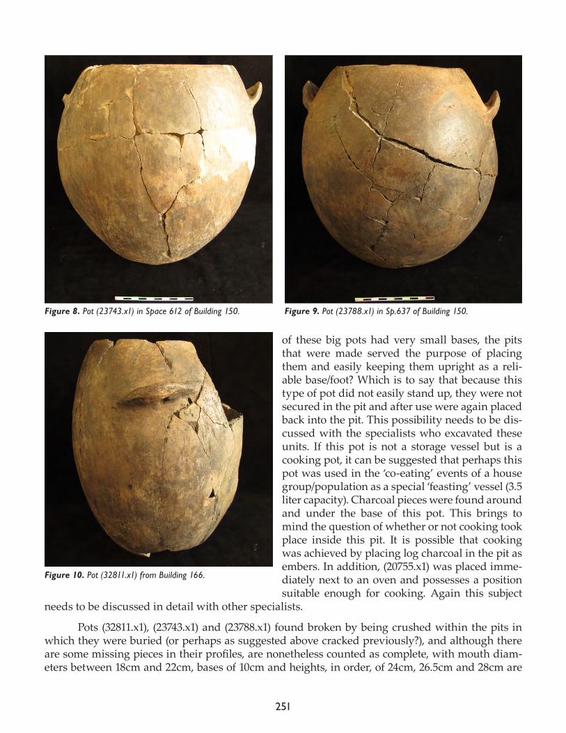
251
of these big pots had very small bases, the pits that were made served the purpose of placing them and easily keeping them upright as a reli-able base/foot? Which is to say that because this type of pot did not easily stand up, they were not secured in the pit and after use were again placed back into the pit. This possibility needs to be dis-cussed with the specialists who excavated these units. If this pot is not a storage vessel but is a cooking pot, it can be suggested that perhaps this pot was used in the ‘co-eating’ events of a house group/population as a special ‘feasting’ vessel (3.5 liter capacity). Charcoal pieces were found around and under the base of this pot. This brings to mind the question of whether or not cooking took place inside this pit. It is possible that cooking was achieved by placing log charcoal in the pit as embers. In addition, (20755.x1) was placed imme-diately next to an oven and possesses a position suitable enough for cooking. Again this subject
needs to be discussed in detail with other specialists.
Pots (32811.x1), (23743.x1) and (23788.x1) found broken by being crushed within the pits in which they were buried (or perhaps as suggested above cracked previously?), and although there are some missing pieces in their profiles, are nonetheless counted as complete, with mouth diam-eters between 18cm and 22cm, bases of 10cm and heights, in order, of 24cm, 26.5cm and 28cm are
Figure 8. Pot (23743.x1) in Space 612 of Building 150. Figure 9. Pot (23788.x1) in Sp.637 of Building 150.
Figure 10. Pot (32811.x1) from Building 166.
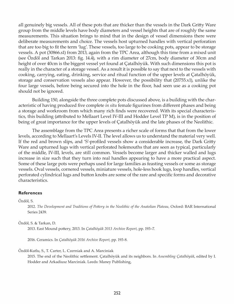
252
all genuinely big vessels. All of these pots that are thicker than the vessels in the Dark Gritty Ware group from the middle levels have body diameters and vessel heights that are of roughly the same measurements. This situation brings to mind that in the design of vessel dimensions there were deliberate measurements and choice. The vessels host upturned handles with vertical perforation that are too big to fit the term ‘lug’. These vessels, too large to be cooking pots, appear to be storage vessels. A pot (30866.s1) from 2013, again from the TPC Area, although this time from a mixed unit (see Özdöl and Tarkan 2013: fig. 14.4), with a rim diameter of 27cm, body diameter of 30cm and height of over 40cm is the biggest vessel yet found at Çatalhöyük. With such dimensions this pot is really in the character of a storage vessel. As a result it is possible to say that next to the vessels with cooking, carrying, eating, drinking, service and ritual function of the upper levels at Çatalhöyük, storage and conservation vessels also appear. However, the possibility that (20755.x1), unlike the four large vessels, before being secured into the hole in the floor, had seen use as a cooking pot should not be ignored.
Building 150, alongside the three complete pots discussed above, is a building with the char-acteristic of having produced five complete in situ female figurines from different phases and being a storage and workroom from which many rich finds were recovered. With its special characteris-tics, this building (attributed to Mellaart Level IV-III and Hodder Level TP M), is in the position of being of great importance for the upper levels of Çatalhöyük and the late phases of the Neolithic.
The assemblage from the TPC Area presents a richer scale of forms that that from the lower levels, according to Mellaart’s Levels IV-II. The level allows us to understand the material very well. If the red and brown slips, and ‘S’-profiled vessels show a considerable increase, the Dark Gritty Ware and upturned lugs with vertical perforated holemouths that are seen as typical, particularly of the middle, IV-III, levels, are still common. Vessels become larger and thicker walled and lugs increase in size such that they turn into real handles appearing to have a more practical aspect. Some of these large pots were perhaps used for large families as feasting vessels or some as storage vessels. Oval vessels, cornered vessels, miniature vessels, hole-less hook lugs, loop handles, vertical perforated cylindrical lugs and button knobs are some of the rare and specific forms and decorative characteristics.
References
Özdöl, S. 2012. The Development and Traditions of Pottery in the Neolithic of the Anatolian Plateau, Oxford: BAR International Series 2439.
Özdöl, S. & Tarkan, D.2013. East Mound pottery, 2013. In Çatalhöyük 2013 Archive Report, pp. 193–7.
2016. Ceramics. In Çatalhöyük 2016 Archive Report, pp. 193-8.
Özdöl-Kutlu, S., T. Carter, L. Czerniak and A. Marciniak2015. The end of the Neolithic settlement. Çatalhöyük and its neighbors. In Assembling Çatalhöyük, edited by I. Hodder and Arkadiusz Marciniak. Leeds: Maney Publishing,

253
Yalman, N., D. Tarkan and H. Gültekin2013. The Neolithic pottery of Çatalhöyük: recent studies. In Substantive Technologies at Çatalhöyük: Reports from the 2000–2008 Seasons, edited by I. Hodder. London: British Institute at Ankara; Los Angeles: Cotsen Institute of Archaeology Press, pp. 147–82.

254
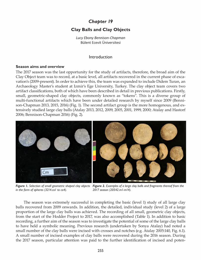
255
Chapter 19
Clay Balls and Clay Objects
Lucy Ebony Bennison-ChapmanBülent Ecevit Üniversitesi
Introduction
Season aims and overviewThe 2017 season was the last opportunity for the study of artifacts, therefore, the broad aim of the Clay Object team was to record, at a basic level, all artifacts recovered in the current phase of exca-vation’s (2009-present). In order to achieve this, the team was expanded to include Didem Turan, an Archaeology Master’s student at Izmir’s Ege University, Turkey. The clay object team covers two artifact classifications, both of which have been described in detail in previous publications. Firstly, small, geometric-shaped clay objects, commonly known as “tokens”. This is a diverse group of multi-functional artifacts which have been under detailed research by myself since 2009 (Benni-son-Chapman 2013, 2015, 2016) (Fig. 1). The second artifact group is the more homogenous, and ex-tensively studied large clay balls (Atalay 2013, 2012, 2009, 2005, 2001, 1999, 2000; Atalay and Hastorf 2006; Bennison-Chapman 2016) (Fig. 2).
The season was extremely successful in completing the basic (level 1) study of all large clay balls recovered from 2009 onwards. In addition, the detailed, individual study (level 2) of a large proportion of the large clay balls was achieved. The recording of all small, geometric clay objects, from the start of the Hodder Project to 2017, was also accomplished (Table 1). In addition to basic recording, a further aim of the season was to investigate the potential of some of the large clay balls to have held a symbolic meaning. Previous research (undertaken by Sonya Atalay) had noted a small number of the clay balls were incised with crosses and notches (e.g. Atalay 2005:140, Fig. 6.1). A small number of incised examples of clay balls were recovered during the 2016 season. During the 2017 season, particular attention was paid to the further identification of incised and poten-
Figure 1. Selection of small geometric shaped clay objects in the form of spheres (3214.co1 to co4).
Figure 2. Examples of a large clay balls and fragments thereof from the 2017 season (20542.m1-m14).
256
tially decorated clay balls, especially among the highly fragmentary examples, and full recording (descriptions, technical drawings and photography) of the decoration when identified, was under-taken.
Season summary
Small, geometric clay objectsOne hundred percent of 2017’s incoming clay materials were assessed and sorted according to artifact catego-ry, with artifacts falling into the classification of small, geometric clay objects, each studied individually, in full (level 2). In total, 728 clay objects (including some from 2016) were recorded in detail, bringing the total studied count to 2,028 objects (Table 1). In 2017’s clay objects av-erage 1.6cm in length (including both fragmented and complete examples), with an average weight of 3.4g. They exhibit a range of basic three-dimensional shapes. Rounded objects comprise the overwhelming majority with 45.2% spheres (Fig. 1), a further 20.6% ovoids and flattened/semi ovoids and spheres constituting a further 20.9% of 2017 studied objects combined. Discs, cuboids and cones are also present, though in far smaller propor-tions (Table 2).
Clay ballsLarge clay balls were a numerous find during the 2017 excavation season (Fig. 2). The long field season and in-creased size of the team meant that the research aim of studying at a basic, level 1 (count and total weight per unit) of all clay balls 2009-2017 season was achieved. A total of 8,510 clay balls or fragments thereof from over one thousand excavation units were logged, bringing the total count of clay balls recorded at a basic level to
(Large) Clay ball (Large) Clay ballLevel 2 object count Level 1 unit count object count
2017 season 1,565 2017 season 1,252 8,510Total 2,427 Total 1,383 9,012(Small) Clay object
Level 2 object count 2017 season 728
Total 2,028
Table 1. Number of objects recorded in 2017 season by level of detail (level 1: object/fragment count and combined weight per unit, level 2: detailed individual object/fragment recording).
Degree of object completeness Count % 100% complete 14 0.89
75-99% complete 16 1.02
50-74% complete 43 2.75
25-49% comlete 172 10.99
<24% complete 1,320 84.35
Total 1,565 100.00
Table 3. Large clay balls as studied in 2017: object completeness by relative percentage of the original ob-ject remaining.
Basic 3D shape Count %Sphere 329 45.19Flattened/semi-sphere 150 20.60Ovoid 78 10.71Flattened/semi-ovoid 74 10.16Disc 46 6.32Cone 16 2.20Cuboid 8 1.10Cylinder 3 0.41Cube 1 0.14Other 23 3.16Total 728 100.00
Table 2. 2017 studied small geometric clay objects according to basic three dimensional shape.
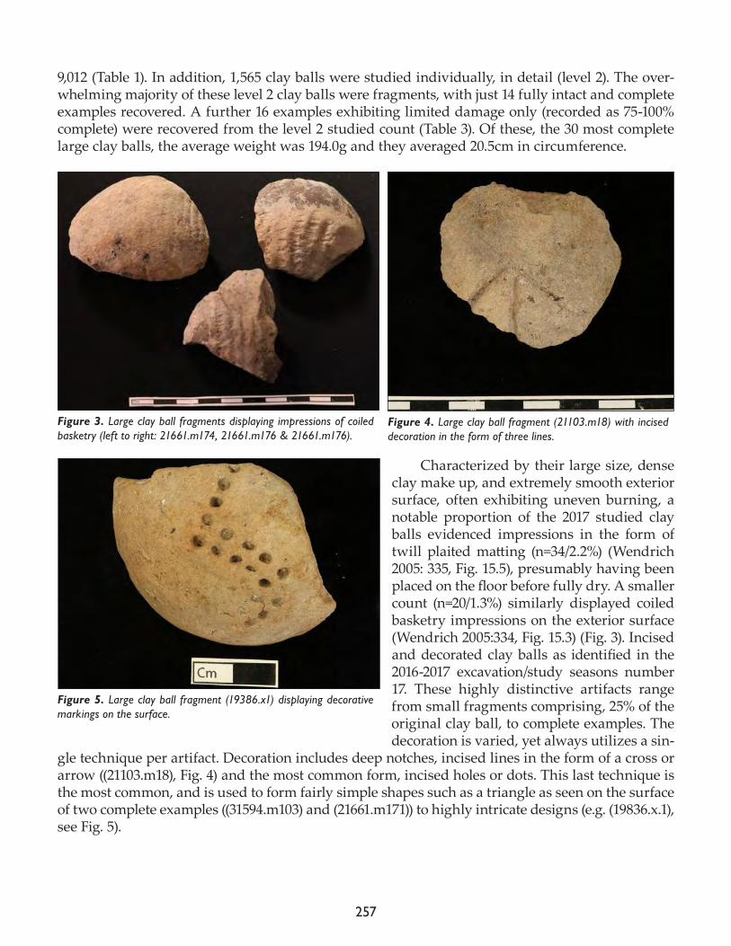
257
9,012 (Table 1). In addition, 1,565 clay balls were studied individually, in detail (level 2). The over-whelming majority of these level 2 clay balls were fragments, with just 14 fully intact and complete examples recovered. A further 16 examples exhibiting limited damage only (recorded as 75-100% complete) were recovered from the level 2 studied count (Table 3). Of these, the 30 most complete large clay balls, the average weight was 194.0g and they averaged 20.5cm in circumference.
Characterized by their large size, dense clay make up, and extremely smooth exterior surface, often exhibiting uneven burning, a notable proportion of the 2017 studied clay balls evidenced impressions in the form of twill plaited matting (n=34/2.2%) (Wendrich 2005: 335, Fig. 15.5), presumably having been placed on the floor before fully dry. A smaller count (n=20/1.3%) similarly displayed coiled basketry impressions on the exterior surface (Wendrich 2005:334, Fig. 15.3) (Fig. 3). Incised and decorated clay balls as identified in the 2016-2017 excavation/study seasons number 17. These highly distinctive artifacts range from small fragments comprising, 25% of the original clay ball, to complete examples. The decoration is varied, yet always utilizes a sin-
gle technique per artifact. Decoration includes deep notches, incised lines in the form of a cross or arrow ((21103.m18), Fig. 4) and the most common form, incised holes or dots. This last technique is the most common, and is used to form fairly simple shapes such as a triangle as seen on the surface of two complete examples ((31594.m103) and (21661.m171)) to highly intricate designs (e.g. (19836.x.1), see Fig. 5).
Figure 3. Large clay ball fragments displaying impressions of coiled basketry (left to right: 21661.m174, 21661.m176 & 21661.m176).
Figure 4. Large clay ball fragment (21103.m18) with incised decoration in the form of three lines.
Figure 5. Large clay ball fragment (19386.x1) displaying decorative markings on the surface.
258
Clay balls: functional interpretations and future researchOver the next few months, analysis will be carried out on the vast amount of data collected on clay balls from the 2009-2017 excavation seasons, incorporating both contextual and morphological in-formation. Preliminary analysis of burning, fragmentation, wear and deposition patterns suggest these objects were certainly heated and used inside buildings. They may have been used to heat or keep foodstuffs warm, yet other possibilities such as being used to heat the room, or the body in winter (held, placed under mats, underneath/inside bedding or wrapped in fabric) are equally plausible. In addition, though a common feature of buildings, new analysis suggests a significant proportion of clay balls come from middens and other external areas and once fragmented, clay balls continued to be heated and re-used (for example as building and packing material as seen in the ovens of B.17 and B.160 in the South Area). Detailed investigation into fragmentation patterning, contextual deposition, burning patterning and the presence of decoration will be undertaken in order to further investigate and revaluate past interpretation of the use, and re-use of clay balls at Çatalhöyük.
References
Atalay, S.1999. Clays, clay balls, and other clay objects. In Çatalhöyük 1999 Archive Report. Available at: http://www.catal-hoyuk.com/archive_reports/1999/ar99_16.html
2000. Clay balls and objects. In Çatalhöyük 2000 Archive Report: http://www.catalhoyuk.com/archive_reports/2000/ar00_15.html
2001. BACH Area clay balls, Mini balls and Geometric Objects” in Çatalhöyük Archive Report 2001. Available at: http: //www. catalhoyuk. com/archive_reports/2001/index. html
2005. Domesticating clay: the role of clay balls, mini balls and geometric objects in daily life at Çatalhöyük. In Changing Materialities at Çatalhöyük: Reports from the 1995-99 Seasons, edited by I. Hodder. Cambridge: McDonald Institute for Archaeological Research; London: British Institute at Ankara, pp. 139-68.
2012. Analysis of clay balls from the BACH Area. In Last House on the Hill: BACH Area Reports from Çatalhöyük, Turkey, edited by R. Tringham and M. Stevanovic. Los Angeles: Cotsen Institute of Archaeology Press, pp. 14/1-14/9.
2013. Clay balls, mini balls and geometric objects. In Substantive Technologies at Çatalhöyük: Reports from the 2000-2008 Seasons, edited by I. Hodder. London: British Institute at Ankara; Los Angeles: Cotsen Institute of Archae-ology Press, pp. 247-52.
Atalay, S. and C.A. Hastorf2006. Food, meals, and daily activities: Food habitus at Neolithic Çatalhöyük. American Antiquity 71(2): 283-319.
Bennison-Chapman, L.E. 2013. Geometric clay objects. In Substantive Technologies at Çatalhöyük: Reports from the 2000-2008 Seasons, edited by I. Hodder. London: British Institute at Ankara; Los Angeles: Cotsen Institute of Archaeology Press, pp. 253-76.
259
2014. The Role and Function of “Tokens” and Sealing Practices in the Neolithic of the Near East: The Question of Early Recording Systems, Symbolic Storage, Precursors to Writing, Gaming, or Monitoring Devices in the World’s First Villages. PhD thesis submitted to the Department of Archaeology, Classics and Egyptology; part of the School of Histo-ries, Languages and Cultures, University of Liverpool.
2016. Geometric clay objects at Çatalhöyük East. In Çatalhöyük 2016 Archive Report, pp. 199-205
Wendrich, W.2005. Çatalhöyük basketry. In Changing Materialities at Çatalhöyük: Reports from the 1995-99 Seasons, edited by I. Hodder. Cambridge: McDonald Institute for Archaeological Research; London: British Institute at Ankara, pp. 333-8.

260
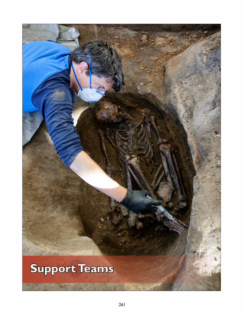
261
Support Teams

262
263
Chapter 20
Finds Lab
Lisa GuerreAECOM
The main responsibility of the Finds Lab is to initiate and maintain this system safeguarding all artifacts and their associated records while also supporting the various research initiatives of on-site specialists. The Finds Lab functions as a nodal point in the processing of all material recovered during excavation and their registration prior to distribution to relevant onsite specialists. In addi-tion, finds lab staff maintains the physical artifact depots working in collaboration with conserva-tion staff to monitor proper storage conditions for the preservation of project material, manages the digital inventory, and ensures the accessibility of all material kept onsite.
For the 2016 season, the Finds Lab continued to support the North and South Areas, as well as, the TPC Area. Karolina Joka of the TPC Team joined the lab staff part time to assist in the finds pro-cessing. While there are no clear metrics to gauge the total volume of excavated material at the time of initial registration, it can be noted that a total of 303 x-finds were logged, with 13 items chosen as Envanter for final curation at the Archaeological Museum in Konya.
The Finds Officer, together with the Head of Conservation Ashley Lingle, monitored environ-mental data for all three storage depots with both temperature and relative humidity collected via TinyTag™ data loggers (see the Conservation portion of this Archive Report). In addition, with the help of a volunteer (Joshua Meeklah) and conservator Jerrod Seifert, additional shelving was con-structed and installed in one depot to accommodate the increasing volume of oversized objects and wall painting fragments. While issues regarding available storage space were initiated in 2015 (all three depots are currently at or near capacity), the truncated season and low volume of finds negat-ed the need to act on discard policies for both building material and unsorted heavy residue. Both policies were approved by both the Project Director and the Ministry of Culture Representative at the beginning of the 2016 season.
Due to the early closing of the 2016 season, much of the time anticipated as being available to continue with data cleaning and inventory was lost. Physical inventories and data cleaning initia-tives were begun but were cut short midway and will need to be brought to completion during the 2017 season.
As always, the Finds Lab staff, along with the individual labs and specialists, will continue to strive to improve project collection management systems and efficiently and accurately contribute to the building of diverse datasets for current and future research while providing proper steward-ship for all material housed on site.

264
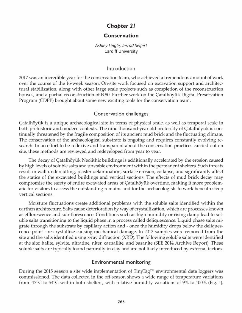
265
Chapter 21
Conservation
Ashley Lingle, Jerrod Seifert Cardiff University
Introduction
2017 was an incredible year for the conservation team, who achieved a tremendous amount of work over the course of the 16-week season. On-site work focused on excavation support and architec-tural stabilization, along with other large scale projects such as completion of the reconstruction houses, and a partial reconstruction of B.80. Further work on the Çatalhöyük Digital Preservation Program (CDPP) brought about some new exciting tools for the conservation team.
Conservation challenges
Çatalhöyük is a unique archaeological site in terms of physical scale, as well as temporal scale in both prehistoric and modern contexts. The nine thousand-year old proto-city of Çatalhöyük is con-tinually threatened by the fragile composition of its ancient mud brick and the fluctuating climate. The conservation of the archaeological substrate is ongoing and requires constantly evolving re-search. In an effort to be reflexive and transparent about the conservation practices carried out on site, these methods are reviewed and redeveloped from year to year.
The decay of Çatalhöyük Neolithic buildings is additionally accelerated by the erosion caused by high levels of soluble salts and unstable environment within the permanent shelters. Such threats result in wall undercutting, plaster delamination, surface erosion, collapse, and significantly affect the statics of the excavated buildings and vertical sections. The effects of mud brick decay may compromise the safety of entire excavated areas of Çatalhöyük overtime, making it more problem-atic for visitors to access the outstanding remains and for the archaeologists to work beneath steep vertical sections.
Moisture fluctuations create additional problems with the soluble salts identified within the earthen architecture. Salts cause deterioration by way of crystallization, which are processes known as efflorescence and sub-florescence. Conditions such as high humidity or rising damp lead to sol-uble salts transitioning to the liquid phase in a process called deliquescence. Liquid phase salts mi-grate through the substrate by capillary action and - once the humidity drops below the deliques-cence point - re-crystallize causing mechanical damage. In 2013 samples were removed from the site and the salts identified using x-ray diffraction (XRD). The following soluble salts were identified at the site: halite, sylvite, nitratine, niter, carnallite, and basanite (SEE 2014 Archive Report). These soluble salts are typically found naturally in clay and are not likely introduced by external factors.
Environmental monitoring
During the 2015 season a site wide implementation of TinyTag™ environmental data loggers was commissioned. The data collected in the off-season shows a wide range of temperature variations from -17°C to 54°C within both shelters, with relative humidity variations of 9% to 100% (Fig. 1).
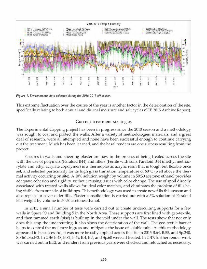
266
This extreme fluctuation over the course of the year is another factor in the deterioration of the site, specifically relating to both annual and diurnal moisture and salt cycles (SEE 2015 Archive Report).
Current treatment strategies
The Experimental Capping project has been in progress since the 2010 season and a methodology was sought to coat and protect the walls. After a variety of methodologies, materials, and a great deal of research, were all attempted and none have been successful enough to continue carrying out the treatment. Much has been learned, and the basal renders are one success resulting from the project.
Fissures in walls and sheering plaster are now in the process of being treated across the site with the use of polymers (Paraloid B44) and fillers (Perlite with soil). Paraloid B44 (methyl methac-rylate and ethyl acrylate copolymer) is a thermoplastic acrylic resin that is tough but flexible once set, and selected particularly for its high glass transition temperature of 60°C (well above the ther-mal activity occurring on site). A 10% solution weight by volume in 50:50 acetone: ethanol provides adequate cohesion and rigidity, without causing issues with color change. The use of spoil directly associated with treated walls allows for ideal color matches, and eliminates the problem of fills be-ing visible from outside of buildings. This methodology was used to create new fills this season and also replace or cover older fills. Plaster consolidation is carried out with a 5% solution of Paraloid B44 weight by volume in 50:50 acetone:ethanol.
In 2013, a small number of tests were carried out to create undercutting supports for a few walls in Space 90 and Building 5 in the North Area. These supports are first lined with geo-textile, and then rammed earth (pisé) is built up in the void under the wall. The tests show that not only does this stop the undercutting, it also slows the deterioration of the wall. The geo-textile barrier helps to control the moisture ingress and mitigates the issue of soluble salts. As this methodology appeared to be successful, it was more broadly applied across the site in 2015 B.64, B.55, and Sp.240, Sp.161, Sp.162. In 2016 B.48, B.82, B.49, B.4, B.5, and Sp.60 were all treated. In 2017, further render work was carried out in B.52, and renders from previous years were checked and retouched as necessary.
Figure 1. Environmental data collected during the 2016-2017 off-season.
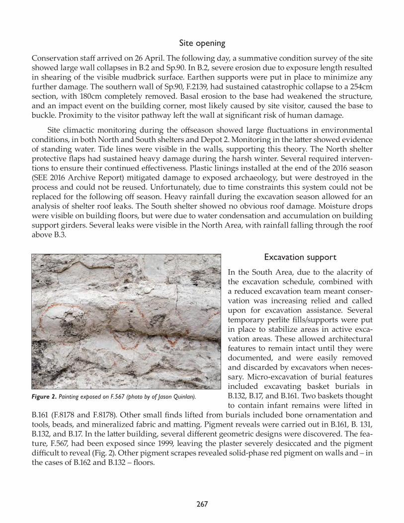
267
Site opening
Conservation staff arrived on 26 April. The following day, a summative condition survey of the site showed large wall collapses in B.2 and Sp.90. In B.2, severe erosion due to exposure length resulted in shearing of the visible mudbrick surface. Earthen supports were put in place to minimize any further damage. The southern wall of Sp.90, F.2139, had sustained catastrophic collapse to a 254cm section, with 180cm completely removed. Basal erosion to the base had weakened the structure, and an impact event on the building corner, most likely caused by site visitor, caused the base to buckle. Proximity to the visitor pathway left the wall at significant risk of human damage.
Site climactic monitoring during the offseason showed large fluctuations in environmental conditions, in both North and South shelters and Depot 2. Monitoring in the latter showed evidence of standing water. Tide lines were visible in the walls, supporting this theory. The North shelter protective flaps had sustained heavy damage during the harsh winter. Several required interven-tions to ensure their continued effectiveness. Plastic linings installed at the end of the 2016 season (SEE 2016 Archive Report) mitigated damage to exposed archaeology, but were destroyed in the process and could not be reused. Unfortunately, due to time constraints this system could not be replaced for the following off season. Heavy rainfall during the excavation season allowed for an analysis of shelter roof leaks. The South shelter showed no obvious roof damage. Moisture drops were visible on building floors, but were due to water condensation and accumulation on building support girders. Several leaks were visible in the North Area, with rainfall falling through the roof above B.3.
Excavation support
In the South Area, due to the alacrity of the excavation schedule, combined with a reduced excavation team meant conser-vation was increasing relied and called upon for excavation assistance. Several temporary perlite fills/supports were put in place to stabilize areas in active exca-vation areas. These allowed architectural features to remain intact until they were documented, and were easily removed and discarded by excavators when neces-sary. Micro-excavation of burial features included excavating basket burials in B.132, B.17, and B.161. Two baskets thought to contain infant remains were lifted in
B.161 (F.8178 and F.8178). Other small finds lifted from burials included bone ornamentation and tools, beads, and mineralized fabric and matting. Pigment reveals were carried out in B.161, B. 131, B.132, and B.17. In the latter building, several different geometric designs were discovered. The fea-ture, F.567, had been exposed since 1999, leaving the plaster severely desiccated and the pigment difficult to reveal (Fig. 2). Other pigment scrapes revealed solid-phase red pigment on walls and – in the cases of B.162 and B.132 – floors.
Figure 2. Painting exposed on F.567 (photo by of Jason Quinlan).
268
Excavations in the TPC Area kept the team busy with: a number of outstanding organic finds, two figurines, and lifting of a female skeleton in burial F.3896 (Fig. 3). Further conservation work focused in the North Area, chiefly on B.139. The expedited excavation rate, coupled with the nutri-tiously quick desiccation rate in the North Shelter resulted in deep fissures developing through the walls and floors of B.139. The additional discovery of three bovid plaster heads on the floor of the building required some field investigation, along with block lifting, and micro-excavation in the conservation laboratory (see Chapter 27, Zoomorphic Plaster Heads).
Smallfindconservation
The lab processed 63 small finds in the 2017 season. The finds include: shell, painted plaster, lithic material, clay objects, textile, baskets, glass, metal, work and un-worked faunal material, and hu-man remains. Notably, we again had two stone figurines (32806.x1 and x2) from B.150 in the TPC Area. The block lifted infant burial and partially block lifted female skeleton were taken for display to the Konya Archaeological Museum. Both were exciting and challenging projects.
Figure 3. Conservation team member Dean Smith consolidating and lifting Sk (23921), F.3896. (photo by Scott Haddow).
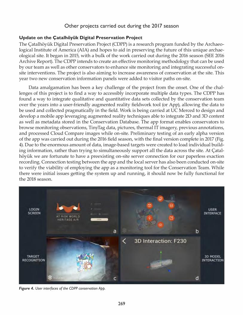
269
Other projects carried out during the 2017 season
Update on the Çatalhöyük Digital Preservation Project The Çatalhöyük Digital Preservation Project (CDPP) is a research program funded by the Archaeo-logical Institute of America (AIA) and hopes to aid in preserving the future of this unique archae-ological site. It began in 2015, with a bulk of the work carried out during the 2016 season (SEE 2016 Archive Report). The CDPP intends to create an effective monitoring methodology that can be used by our team as well as other conservators to enhance site monitoring and integrating successful on-site interventions. The project is also aiming to increase awareness of conservation at the site. This year two new conservation information panels were added to visitor paths on-site.
Data amalgamation has been a key challenge of the project from the onset. One of the chal-lenges of this project is to find a way to accessibly incorporate multiple data types. The CDPP has found a way to integrate qualitative and quantitative data sets collected by the conservation team over the years into a user-friendly augmented reality fieldwork tool (or App), allowing the data to be used and collected pragmatically in the field. Work is being carried at UC Merced to design and develop a mobile app leveraging augmented reality techniques able to integrate 2D and 3D content as well as metadata stored in the Conservation Database. The app format enables conservators to browse monitoring observations, TinyTag data, pictures, thermal IT imagery, previous annotations, and processed Cloud Compare images while on-site. Preliminary testing of an early alpha version of the app was carried out during the 2016 field season, with the final version complete in 2017 (Fig. 4). Due to the enormous amount of data, image-based targets were created to load individual build-ing information, rather than trying to simultaneously support all the data across the site. At Çatal-höyük we are fortunate to have a preexisting on-site server connection for our paperless exaction recording. Connection testing between the app and the local server has also been conducted on-site to verify the viability of employing the app as a monitoring tool for the Conservation Team. While there were initial issues getting the system up and running, it should now be fully functional for the 2018 season.
Figure 4. User interfaces of the CDPP conservation App.
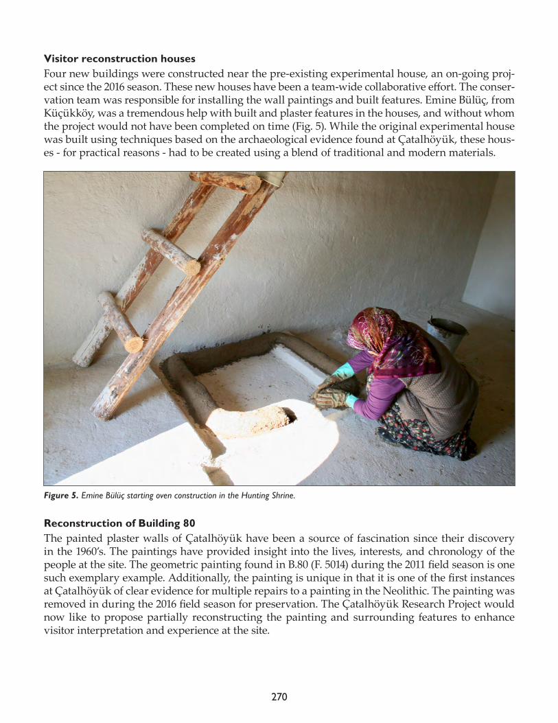
270
Visitor reconstruction housesFour new buildings were constructed near the pre-existing experimental house, an on-going proj-ect since the 2016 season. These new houses have been a team-wide collaborative effort. The conser-vation team was responsible for installing the wall paintings and built features. Emine Bülüç, from Küçükköy, was a tremendous help with built and plaster features in the houses, and without whom the project would not have been completed on time (Fig. 5). While the original experimental house was built using techniques based on the archaeological evidence found at Çatalhöyük, these hous-es - for practical reasons - had to be created using a blend of traditional and modern materials.
Reconstruction of Building 80 The painted plaster walls of Çatalhöyük have been a source of fascination since their discovery in the 1960’s. The paintings have provided insight into the lives, interests, and chronology of the people at the site. The geometric painting found in B.80 (F. 5014) during the 2011 field season is one such exemplary example. Additionally, the painting is unique in that it is one of the first instances at Çatalhöyük of clear evidence for multiple repairs to a painting in the Neolithic. The painting was removed in during the 2016 field season for preservation. The Çatalhöyük Research Project would now like to propose partially reconstructing the painting and surrounding features to enhance visitor interpretation and experience at the site.
Figure 5. Emine Bülüç starting oven construction in the Hunting Shrine.
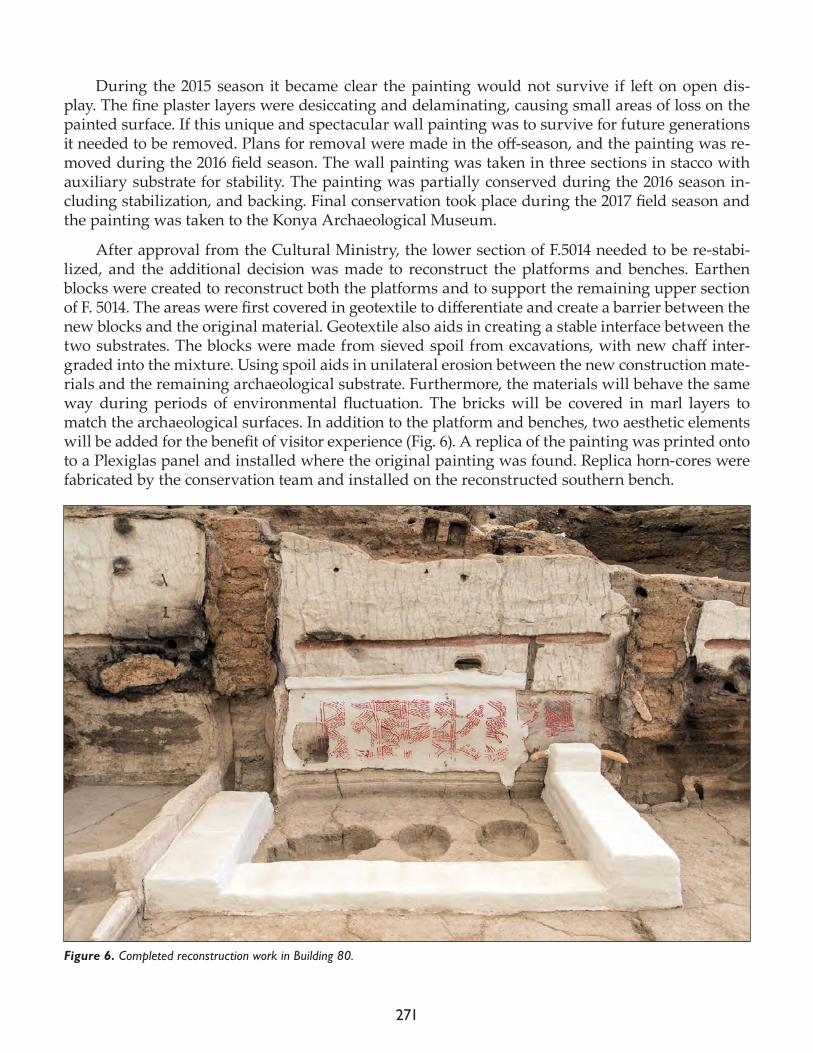
271
During the 2015 season it became clear the painting would not survive if left on open dis-play. The fine plaster layers were desiccating and delaminating, causing small areas of loss on the painted surface. If this unique and spectacular wall painting was to survive for future generations it needed to be removed. Plans for removal were made in the off-season, and the painting was re-moved during the 2016 field season. The wall painting was taken in three sections in stacco with auxiliary substrate for stability. The painting was partially conserved during the 2016 season in-cluding stabilization, and backing. Final conservation took place during the 2017 field season and the painting was taken to the Konya Archaeological Museum.
After approval from the Cultural Ministry, the lower section of F.5014 needed to be re-stabi-lized, and the additional decision was made to reconstruct the platforms and benches. Earthen blocks were created to reconstruct both the platforms and to support the remaining upper section of F. 5014. The areas were first covered in geotextile to differentiate and create a barrier between the new blocks and the original material. Geotextile also aids in creating a stable interface between the two substrates. The blocks were made from sieved spoil from excavations, with new chaff inter-graded into the mixture. Using spoil aids in unilateral erosion between the new construction mate-rials and the remaining archaeological substrate. Furthermore, the materials will behave the same way during periods of environmental fluctuation. The bricks will be covered in marl layers to match the archaeological surfaces. In addition to the platform and benches, two aesthetic elements will be added for the benefit of visitor experience (Fig. 6). A replica of the painting was printed onto to a Plexiglas panel and installed where the original painting was found. Replica horn-cores were fabricated by the conservation team and installed on the reconstructed southern bench.
Figure 6. Completed reconstruction work in Building 80.

272
Acknowledgments
Thank you to the people who made the tremendous amount of work we achieved this year possible: Dean Smith, Ülcan Türkkan, Gesualdo Busacca, Emine Bülüç and Ezgi Agüloğlu (even though you were only with us for a short time). I would also like to thank everyone who has helped with the CDPP: Dominik Lukas, Tolga Bayram, Arianna Campiani, Moataz Dahabra, Brendan Geck and Jad Aboulhosn. A special thanks to Phil Parkes, even though you could not join us this year, your great mentorship over the years in creativity and resourcefulness has been invaluable.
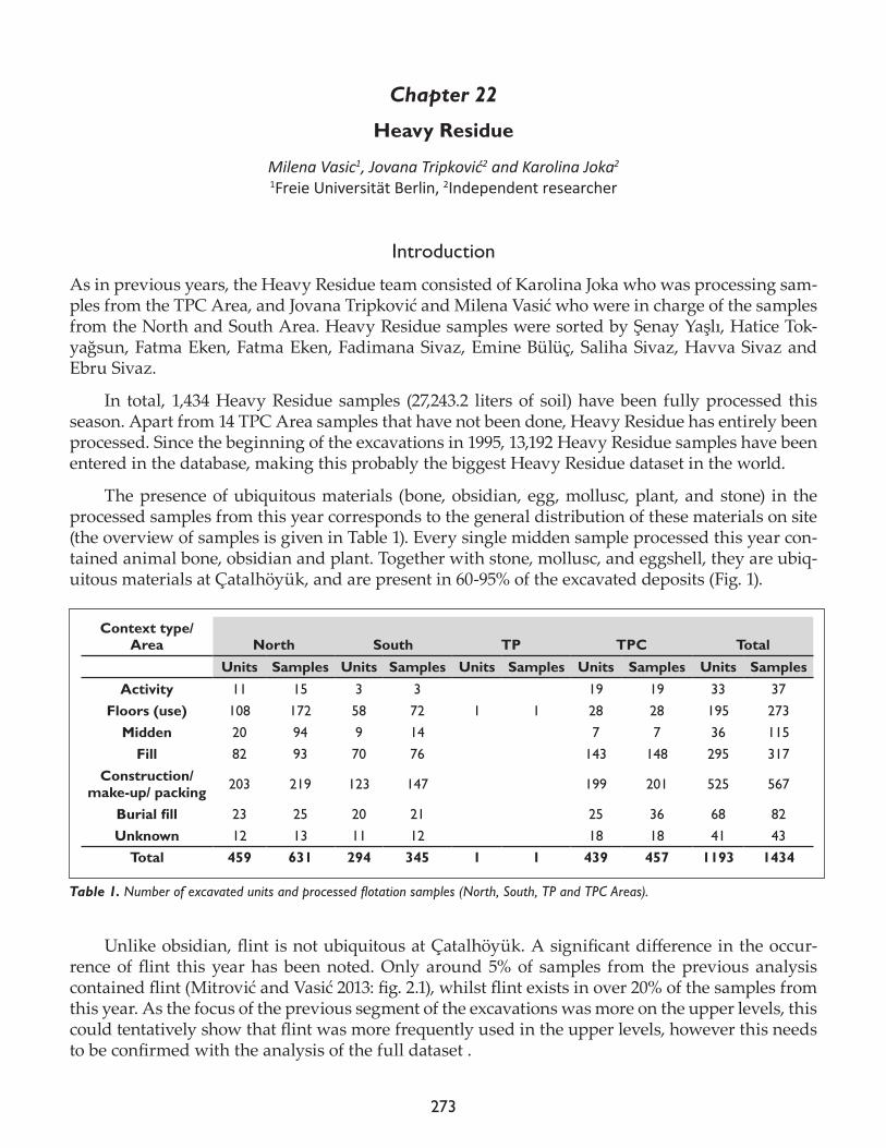
273
Chapter 22
Heavy Residue
Milena Vasic1, Jovana Tripković2 and Karolina Joka2
1Freie Universität Berlin, 2Independent researcher
Introduction
As in previous years, the Heavy Residue team consisted of Karolina Joka who was processing sam-ples from the TPC Area, and Jovana Tripković and Milena Vasić who were in charge of the samples from the North and South Area. Heavy Residue samples were sorted by Şenay Yaşlı, Hatice Tok-yağsun, Fatma Eken, Fatma Eken, Fadimana Sivaz, Emine Bülüç, Saliha Sivaz, Havva Sivaz and Ebru Sivaz.
In total, 1,434 Heavy Residue samples (27,243.2 liters of soil) have been fully processed this season. Apart from 14 TPC Area samples that have not been done, Heavy Residue has entirely been processed. Since the beginning of the excavations in 1995, 13,192 Heavy Residue samples have been entered in the database, making this probably the biggest Heavy Residue dataset in the world.
The presence of ubiquitous materials (bone, obsidian, egg, mollusc, plant, and stone) in the processed samples from this year corresponds to the general distribution of these materials on site (the overview of samples is given in Table 1). Every single midden sample processed this year con-tained animal bone, obsidian and plant. Together with stone, mollusc, and eggshell, they are ubiq-uitous materials at Çatalhöyük, and are present in 60-95% of the excavated deposits (Fig. 1).
Unlike obsidian, flint is not ubiquitous at Çatalhöyük. A significant difference in the occur-rence of flint this year has been noted. Only around 5% of samples from the previous analysis contained flint (Mitrović and Vasić 2013: fig. 2.1), whilst flint exists in over 20% of the samples from this year. As the focus of the previous segment of the excavations was more on the upper levels, this could tentatively show that flint was more frequently used in the upper levels, however this needs to be confirmed with the analysis of the full dataset .
Context type/Area North South TP TPC Total
Units Samples Units Samples Units Samples Units Samples Units SamplesActivity 11 15 3 3 19 19 33 37
Floors (use) 108 172 58 72 1 1 28 28 195 273Midden 20 94 9 14 7 7 36 115
Fill 82 93 70 76 143 148 295 317Construction/
make-up/ packing 203 219 123 147 199 201 525 567
Burial fill 23 25 20 21 25 36 68 82Unknown 12 13 11 12 18 18 41 43
Total 459 631 294 345 1 1 439 457 1193 1434
Table 1. Number of excavated units and processed flotation samples (North, South, TP and TPC Areas).
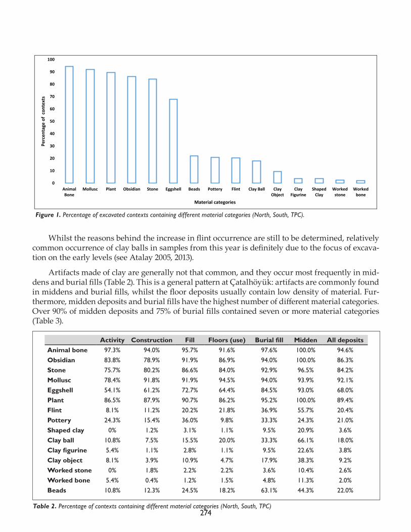
274
Whilst the reasons behind the increase in flint occurrence are still to be determined, relatively common occurrence of clay balls in samples from this year is definitely due to the focus of excava-tion on the early levels (see Atalay 2005, 2013).
Artifacts made of clay are generally not that common, and they occur most frequently in mid-dens and burial fills (Table 2). This is a general pattern at Çatalhöyük: artifacts are commonly found in middens and burial fills, whilst the floor deposits usually contain low density of material. Fur-thermore, midden deposits and burial fills have the highest number of different material categories. Over 90% of midden deposits and 75% of burial fills contained seven or more material categories (Table 3).
0
10
20
30
40
50
60
70
80
90
100
AnimalBone
Mollusc Plant Obsidian Stone Eggshell Beads Pottery Flint Clay Ball ClayObject
ClayFigurine
ShapedClay
Workedstone
Workedbone
Perc
enta
ge o
f co
ntex
ts
Material categories
Figure 1. Percentage of excavated contexts containing different material categories (North, South, TPC).
Activity Construction Fill Floors (use) Burial fill Midden All depositsAnimal bone 97.3% 94.0% 95.7% 91.6% 97.6% 100.0% 94.6%Obsidian 83.8% 78.9% 91.9% 86.9% 94.0% 100.0% 86.3%Stone 75.7% 80.2% 86.6% 84.0% 92.9% 96.5% 84.2%Mollusc 78.4% 91.8% 91.9% 94.5% 94.0% 93.9% 92.1%Eggshell 54.1% 61.2% 72.7% 64.4% 84.5% 93.0% 68.0%Plant 86.5% 87.9% 90.7% 86.2% 95.2% 100.0% 89.4%Flint 8.1% 11.2% 20.2% 21.8% 36.9% 55.7% 20.4%Pottery 24.3% 15.4% 36.0% 9.8% 33.3% 24.3% 21.0%Shaped clay 0% 1.2% 3.1% 1.1% 9.5% 20.9% 3.6%Clay ball 10.8% 7.5% 15.5% 20.0% 33.3% 66.1% 18.0%Clay figurine 5.4% 1.1% 2.8% 1.1% 9.5% 22.6% 3.8%Clay object 8.1% 3.9% 10.9% 4.7% 17.9% 38.3% 9.2%Worked stone 0% 1.8% 2.2% 2.2% 3.6% 10.4% 2.6%Worked bone 5.4% 0.4% 1.2% 1.5% 4.8% 11.3% 2.0%Beads 10.8% 12.3% 24.5% 18.2% 63.1% 44.3% 22.0%
Table 2. Percentage of contexts containing different material categories (North, South, TPC)
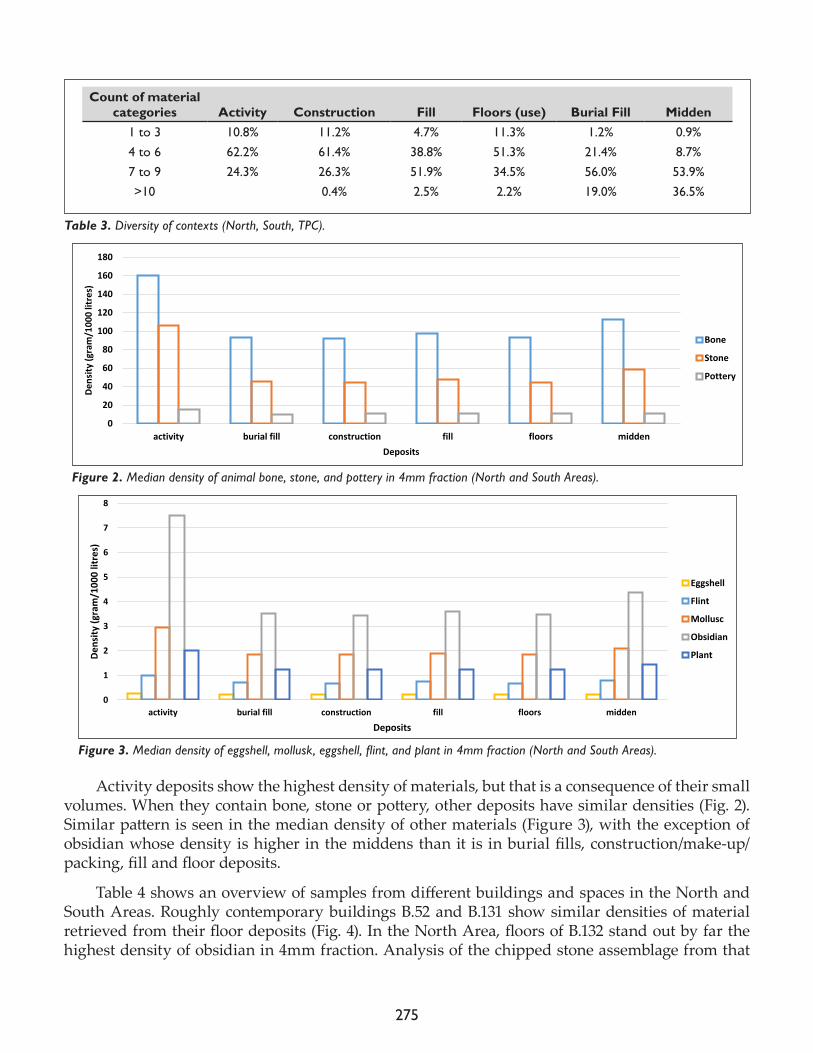
275
Activity deposits show the highest density of materials, but that is a consequence of their small volumes. When they contain bone, stone or pottery, other deposits have similar densities (Fig. 2). Similar pattern is seen in the median density of other materials (Figure 3), with the exception of obsidian whose density is higher in the middens than it is in burial fills, construction/make-up/packing, fill and floor deposits.
Table 4 shows an overview of samples from different buildings and spaces in the North and South Areas. Roughly contemporary buildings B.52 and B.131 show similar densities of material retrieved from their floor deposits (Fig. 4). In the North Area, floors of B.132 stand out by far the highest density of obsidian in 4mm fraction. Analysis of the chipped stone assemblage from that
Count of material categories Activity Construction Fill Floors (use) Burial Fill Midden
1 to 3 10.8% 11.2% 4.7% 11.3% 1.2% 0.9%4 to 6 62.2% 61.4% 38.8% 51.3% 21.4% 8.7%7 to 9 24.3% 26.3% 51.9% 34.5% 56.0% 53.9%>10 0.4% 2.5% 2.2% 19.0% 36.5%
Table 3. Diversity of contexts (North, South, TPC).
0
20
40
60
80
100
120
140
160
180
activity burial fill construction fill floors midden
Dens
ity (g
ram
/100
0 lit
res)
Deposits
4mm Density
Bone
Stone
Pottery
Figure 2. Median density of animal bone, stone, and pottery in 4mm fraction (North and South Areas).
0
1
2
3
4
5
6
7
8
activity burial fill construction fill floors midden
Dens
ity (g
ram
/100
0 lit
res)
Deposits
4mm Density
Eggshell
Flint
Mollusc
Obsidian
Plant
Figure 3. Median density of eggshell, mollusk, eggshell, flint, and plant in 4mm fraction (North and South Areas).
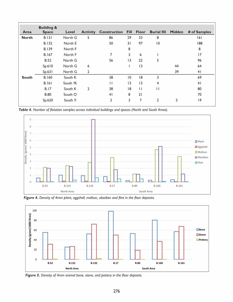
276
Figure 4. Density of 4mm plant, eggshell, mollusc, obsidian and flint in the floor deposits.
0
1
2
3
4
5
6
7
8
9
10
B.52 B.131 B.132 B.17 B.80 B.160 B.161
North Area South Area
Dens
ity (
gram
/ 100
0 lit
res)
Plant
Eggshell
Mollusc
Obsidian
Flint
0
20
40
60
80
100
120
B.52 B.131 B.132 B.17 B.80 B.160 B.161
North Area South Area
Dens
ity (g
ram
/100
0 lit
res)
Bone
Stone
Pottery
Figure 5. Density of 4mm animal bone, stone, and pottery in the floor deposits.
AreaBuilding &
Space Level Activity Construction Fill Floor Burial fill Midden # of SamplesNorth B.131 North G 5 86 29 33 8 161
B.132 North E 50 31 97 10 188B.139 North F 8 8B.167 North F 7 3 6 1 17B.52 North G 56 13 22 5 96
Sp.610 North G 6 1 13 44 64Sp.631 North G 2 39 41
South B.160 South K 38 10 18 3 69B.161 South ?K 11 13 13 4 41B.17 South K 2 38 18 11 11 80B.80 South O 41 8 21 70
Sp.620 South ?I 2 3 7 2 5 19
Table 4. Number of flotation samples across individual buildings and spaces (North and South Areas).
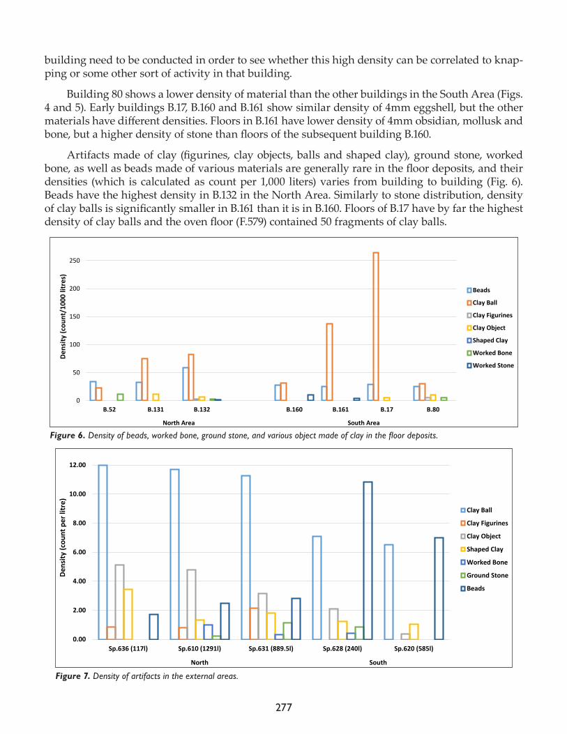
277
building need to be conducted in order to see whether this high density can be correlated to knap-ping or some other sort of activity in that building.
Building 80 shows a lower density of material than the other buildings in the South Area (Figs. 4 and 5). Early buildings B.17, B.160 and B.161 show similar density of 4mm eggshell, but the other materials have different densities. Floors in B.161 have lower density of 4mm obsidian, mollusk and bone, but a higher density of stone than floors of the subsequent building B.160.
Artifacts made of clay (figurines, clay objects, balls and shaped clay), ground stone, worked bone, as well as beads made of various materials are generally rare in the floor deposits, and their densities (which is calculated as count per 1,000 liters) varies from building to building (Fig. 6). Beads have the highest density in B.132 in the North Area. Similarly to stone distribution, density of clay balls is significantly smaller in B.161 than it is in B.160. Floors of B.17 have by far the highest density of clay balls and the oven floor (F.579) contained 50 fragments of clay balls.
0
50
100
150
200
250
300
B.52 B.131 B.132 B.160 B.161 B.17 B.80
North Area South Area
Dens
ity (c
ount
/100
0 lit
res)
Beads
Clay Ball
Clay Figurines
Clay Object
Shaped Clay
Worked Bone
Worked Stone
Figure 6. Density of beads, worked bone, ground stone, and various object made of clay in the floor deposits.
0.00
2.00
4.00
6.00
8.00
10.00
12.00
14.00
Sp.636 (117l) Sp.610 (1291l) Sp.631 (889.5l) Sp.628 (240l) Sp.620 (585l)
North South
Dens
ity (c
ount
per
litr
e)
Clay Ball
Clay Figurines
Clay Object
Shaped Clay
Worked Bone
Ground Stone
Beads
Figure 7. Density of artifacts in the external areas.
278
On the other hand, density of these artifacts is drastically higher in the external areas. Figure 7 shows densities of artifacts (count per liter) in the external areas (note the excavated volumes for each area). The North Area spaces are richer with material, with the only exception being beads whose density is higher in the external spaces in the South Area. This however might be a conse-quence of three burials being located in the South Area external spaces.
This is just an overview of the samples that were processed this year, whilst an in depth anal-yses will be conducted in the near future. Over 4,400 samples will be fully analyzed for the next round of volumes, which is a significantly larger dataset than the one analyzed for the previous publication (Mitrović and Vasić 2013).
Acknowledgments
Completion of heavy residue processing would not be possible without a remarkable effort of our flotation and sorting teams. We are grateful to Şenay Yaşlı and Saliha Sivaz who as experienced sorters trained the new team members. We thank Hatice Tokyağsun, Fatma Eken, Fadimana Sivaz, and Ebru Sivaz for taking on additional work and helping with the other segments of heavy resi-due processing. Without their help, heavy residue would not have been finished. We are especially grateful to Ebru Sivaz for her support and enormous over the last six seasons.
References
Atalay, S.2005. Domesticating clay: the role of clay balls, mini balls and geometric objects in daily life at Çatalhöyük. In Changing Materialities at Çatalhöyük: Reports from the 1995-99 Seasons, edited by I. Hodder. Cambridge: McDonald Institute for Archaeological Research; London: British Institute at Ankara, pp. 139-68
2013. Clay balls, mini balls and geometric objects. In Substantive Technologies at Çatalhöyük: Reports from the 2000–2008 Seasons, edited by I. Hodder. London: British Institute at Ankara; Los Angeles: Cotsen Institute of Archae-ology Press, pp. 247-52.
Mitrović, S. and M. Vasić2013. An integrated perspective on the uses of materials at Çatalhöyük based on the analysis of heavy residues. In Substantive Technologies at Çatalhöyük: Reports from the 2000-2008 Seasons, edited by I. Hodder. London: British Institute at Ankara; Los Angeles: Cotsen Institute of Archaeology Press, pp. 27-50.
279
Chapter 23
Site Visualisation and Presentation
Sara Perry, Katrina Gargett, Meghan Dennis, Ashley Fisher, Jessica Chatburn, Emmeline Batchelor, Hermione Elderton, Laia Pujol and Ian Kirkpatrick
University of York
Introduction
In 2017 the Visualisation Team returned for its ninth season at Çatalhöyük for several weeks of work in late July/early August. Our efforts focused on several key tasks:
• continuation of our ongoing analysis of Çatalhöyük’s visitor log books, including detailed study of visitor numbers and demographics• continuation of our programme of visitor and tour guide observations, including informal interviews with visitors while touring the site• continuation of our interviews with site guards to gather their input and ideas on proposed new site installations, and to assist in monitoring visitor trends• launch of the on-site EMOTIVE project (www.emotiveproject.eu) work, including (i) the for-mative evaluation of a prototype collaborative digital experience for visitors (conducted inside the replica houses), (ii) photogrammetric capture of the North Area for integration into an on-line virtual reality experience of Çatalhöyük, (iii) photo capture of a series of small finds from the site for integration into both on-site and off-site EMOTIVE experiences of Çatalhöyük• design and installation of visitor interpretation materials inside Çatalhöyük’s replica houses• creation of new social media content for Çatalhöyük’s Facebook and Twitter pages – follow-ing a model established in 2015 wherein we prioritize biographical-style presentation which brings attention to the many people and teams working on site• development of a series of new blog posts to be published monthly• updates to existing on-site signage and planning for the project’s transition period and vis-itor initiatives post-2017
These tasks are described in turn below. As always, our practice is grounded in rigorous data col-lection which provides an empirical foundation for every initiative that we pursue at Çatalhöyük. We are committed not only to such evidence-based work, but to a reflexive, sustainable approach that is defined entirely collaboratively and in equal partnership between Turkish and foreign team members.
This year our team was comprised of 13 people, including nine core contributors from the University of York (Sara Perry, Katrina Gargett, Meghan Dennis, Ashley Fisher, Jessica Chatburn, Emmeline Batchelor, Hermione Elderton, Laia Pujol and Ian Kirkpatrick), an EMOTIVE team mem-bers from the Athena Research and Innovation Center in Athens (Vassilis Kourtis), a Çatalhöyük Research Project intern from the Turkish university METU (Ülcan Türkkan), and the Çatalhöyük Research Project’s Ali Kavas and Bilge Küçükdoğan (Fig. 1). Together we represent a mixture of lecturers, postdocs, PhD, Masters and undergraduate students, and independent graphics and tech-nology specialists from Turkey, England, Canada, the USA, Greece, Catalonia and Belgium.
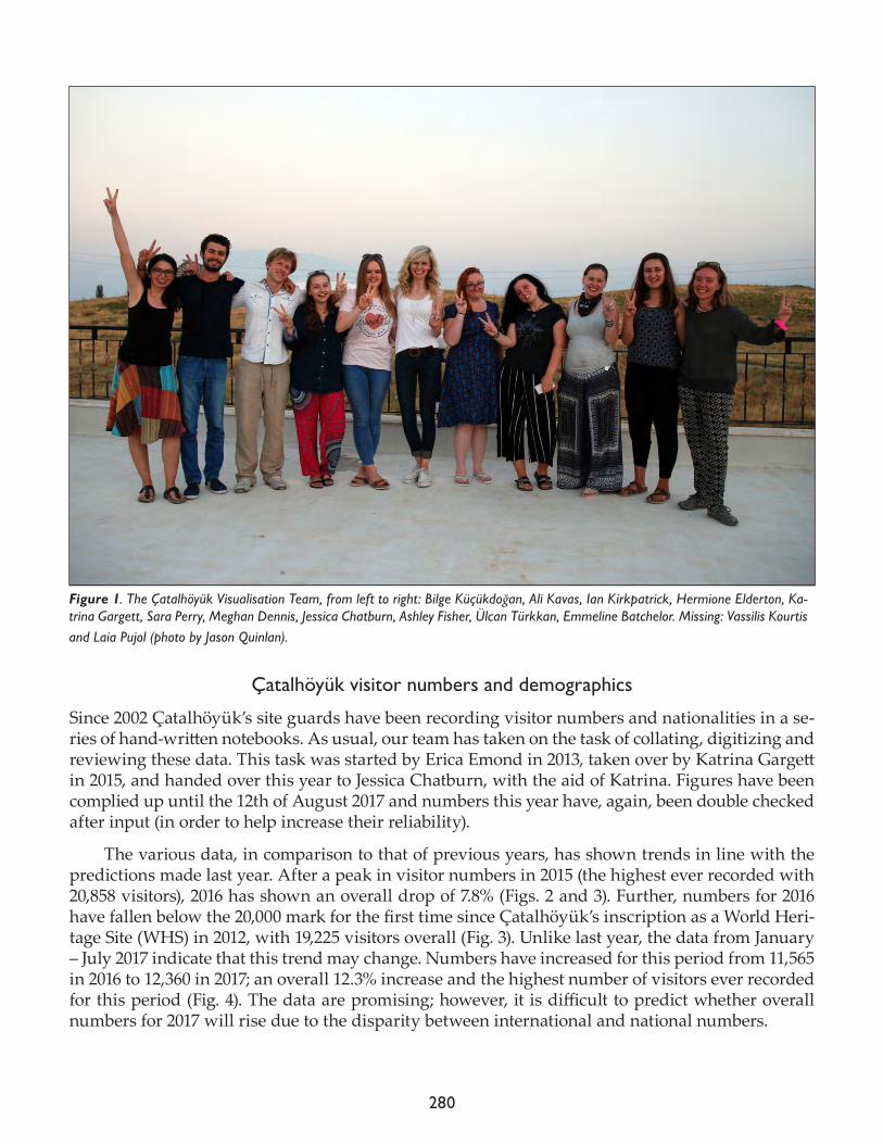
280
Çatalhöyük visitor numbers and demographics
Since 2002 Çatalhöyük’s site guards have been recording visitor numbers and nationalities in a se-ries of hand-written notebooks. As usual, our team has taken on the task of collating, digitizing and reviewing these data. This task was started by Erica Emond in 2013, taken over by Katrina Gargett in 2015, and handed over this year to Jessica Chatburn, with the aid of Katrina. Figures have been complied up until the 12th of August 2017 and numbers this year have, again, been double checked after input (in order to help increase their reliability).
The various data, in comparison to that of previous years, has shown trends in line with the predictions made last year. After a peak in visitor numbers in 2015 (the highest ever recorded with 20,858 visitors), 2016 has shown an overall drop of 7.8% (Figs. 2 and 3). Further, numbers for 2016 have fallen below the 20,000 mark for the first time since Çatalhöyük’s inscription as a World Heri-tage Site (WHS) in 2012, with 19,225 visitors overall (Fig. 3). Unlike last year, the data from January – July 2017 indicate that this trend may change. Numbers have increased for this period from 11,565 in 2016 to 12,360 in 2017; an overall 12.3% increase and the highest number of visitors ever recorded for this period (Fig. 4). The data are promising; however, it is difficult to predict whether overall numbers for 2017 will rise due to the disparity between international and national numbers.
Figure 1. The Çatalhöyük Visualisation Team, from left to right: Bilge Küçükdoğan, Ali Kavas, Ian Kirkpatrick, Hermione Elderton, Ka-trina Gargett, Sara Perry, Meghan Dennis, Jessica Chatburn, Ashley Fisher, Ülcan Türkkan, Emmeline Batchelor. Missing: Vassilis Kourtis and Laia Pujol (photo by Jason Quinlan).
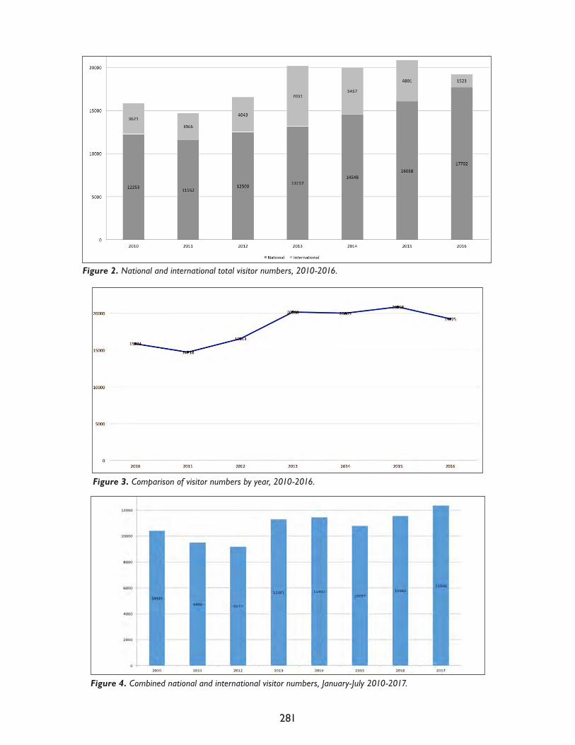
281
Figure 2. National and international total visitor numbers, 2010-2016.
Figure 3. Comparison of visitor numbers by year, 2010-2016.
Figure 4. Combined national and international visitor numbers, January-July 2010-2017.
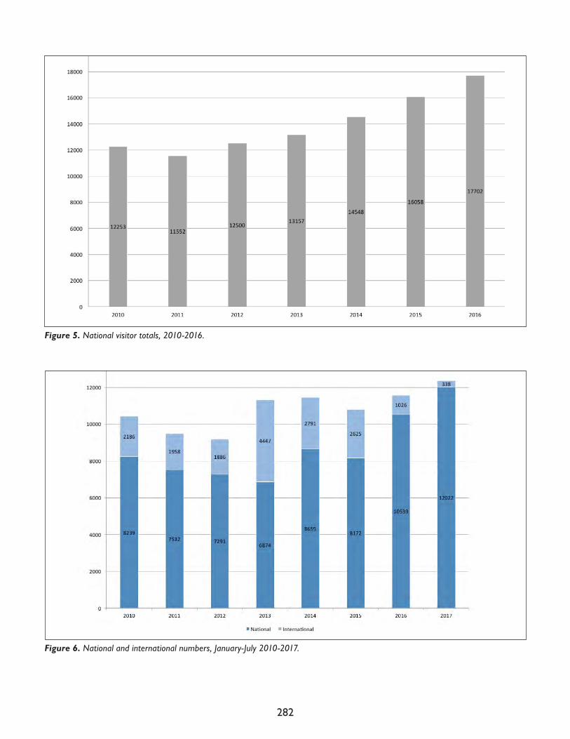
282
Figure 5. National visitor totals, 2010-2016.
Figure 6. National and international numbers, January-July 2010-2017.
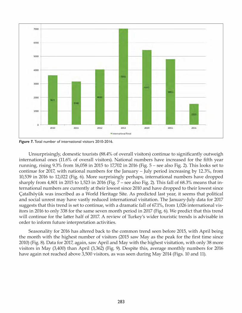
283
Unsurprisingly, domestic tourists (88.4% of overall visitors) continue to significantly outweigh international ones (11.6% of overall visitors). National numbers have increased for the fifth year running, rising 9.3% from 16,058 in 2015 to 17,702 in 2016 (Fig. 5 – see also Fig. 2). This looks set to continue for 2017, with national numbers for the January – July period increasing by 12.3%, from 10,539 in 2016 to 12,022 (Fig. 6). More surprisingly perhaps, international numbers have dropped sharply from 4,801 in 2015 to 1,523 in 2016 (Fig. 7 – see also Fig. 2). This fall of 68.3% means that in-ternational numbers are currently at their lowest since 2010 and have dropped to their lowest since Çatalhöyük was inscribed as a World Heritage Site. As predicted last year, it seems that political and social unrest may have vastly reduced international visitation. The January-July data for 2017 suggests that this trend is set to continue, with a dramatic fall of 67.1%, from 1,026 international vis-itors in 2016 to only 338 for the same seven month period in 2017 (Fig. 6). We predict that this trend will continue for the latter half of 2017. A review of Turkey’s wider touristic trends is advisable in order to inform future interpretation activities.
Seasonality for 2016 has altered back to the common trend seen before 2015, with April being the month with the highest number of visitors (2015 saw May as the peak for the first time since 2010) (Fig. 8). Data for 2017, again, saw April and May with the highest visitation, with only 38 more visitors in May (3,400) than April (3,362) (Fig. 9). Despite this, average monthly numbers for 2016 have again not reached above 3,500 visitors, as was seen during May 2014 (Figs. 10 and 11).
Figure 7. Total number of international visitors 2010-2016.
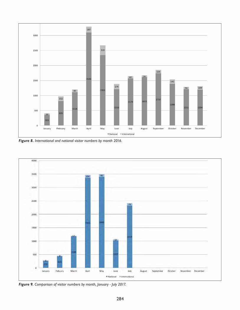
284
Figure 8. International and national visitor numbers by month 2016.
Figure 9. Comparison of visitor numbers by month, January - July 2017.
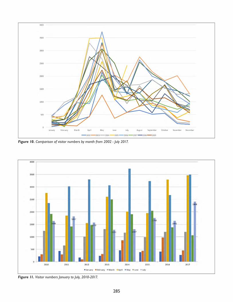
285
Figure 10. Comparison of visitor numbers by month from 2002 - July 2017.
Figure 11. Visitor numbers January to July, 2010-2017.
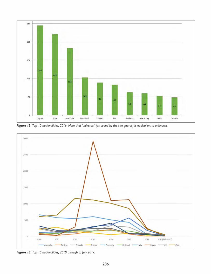
286
Figure 12. Top 10 nationalities, 2016. Note that ‘universal’ (as coded by the site guards) is equivalent to unknown.
Figure 13. Top 10 nationalities, 2010 through to July 2017.
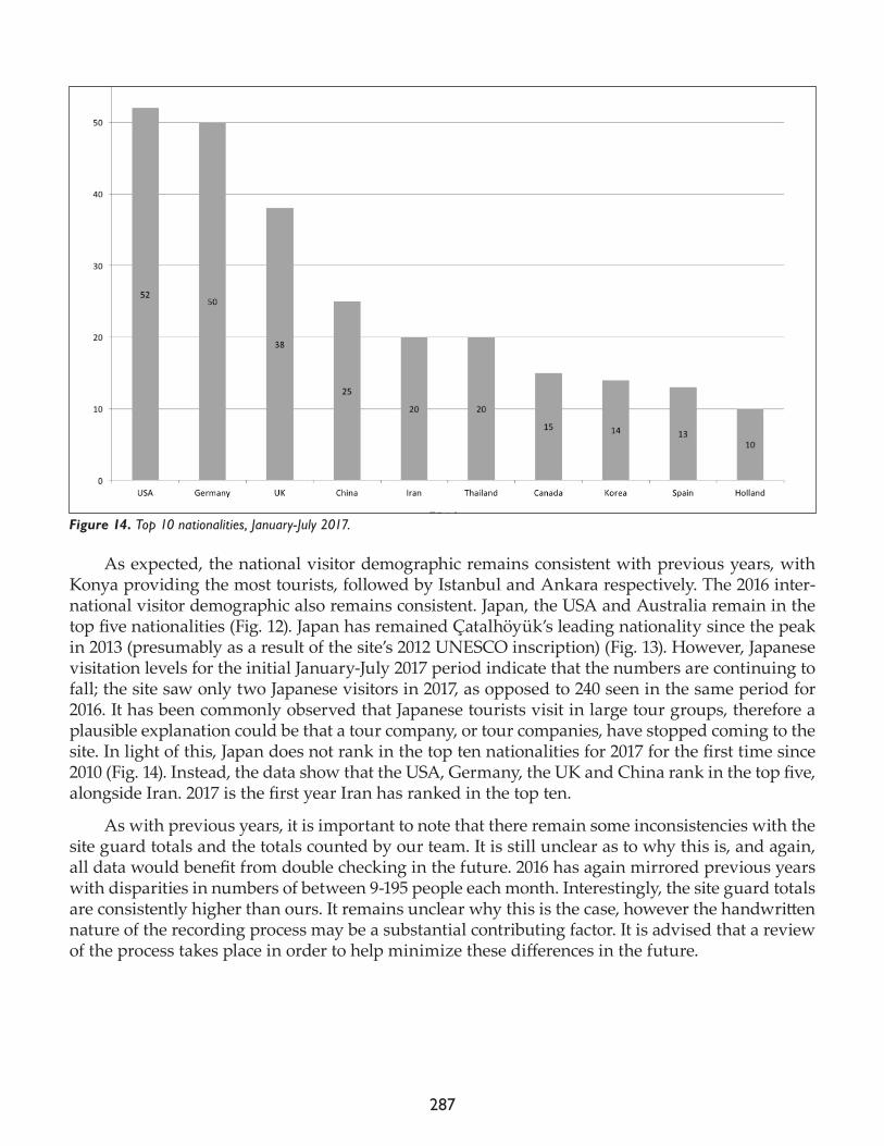
287
As expected, the national visitor demographic remains consistent with previous years, with Konya providing the most tourists, followed by Istanbul and Ankara respectively. The 2016 inter-national visitor demographic also remains consistent. Japan, the USA and Australia remain in the top five nationalities (Fig. 12). Japan has remained Çatalhöyük’s leading nationality since the peak in 2013 (presumably as a result of the site’s 2012 UNESCO inscription) (Fig. 13). However, Japanese visitation levels for the initial January-July 2017 period indicate that the numbers are continuing to fall; the site saw only two Japanese visitors in 2017, as opposed to 240 seen in the same period for 2016. It has been commonly observed that Japanese tourists visit in large tour groups, therefore a plausible explanation could be that a tour company, or tour companies, have stopped coming to the site. In light of this, Japan does not rank in the top ten nationalities for 2017 for the first time since 2010 (Fig. 14). Instead, the data show that the USA, Germany, the UK and China rank in the top five, alongside Iran. 2017 is the first year Iran has ranked in the top ten.
As with previous years, it is important to note that there remain some inconsistencies with the site guard totals and the totals counted by our team. It is still unclear as to why this is, and again, all data would benefit from double checking in the future. 2016 has again mirrored previous years with disparities in numbers of between 9-195 people each month. Interestingly, the site guard totals are consistently higher than ours. It remains unclear why this is the case, however the handwritten nature of the recording process may be a substantial contributing factor. It is advised that a review of the process takes place in order to help minimize these differences in the future.
Figure 14. Top 10 nationalities, January-July 2017.
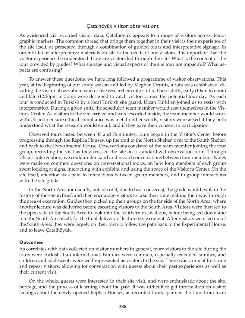
288
Çatalhöyük visitor observations
As evidenced via recorded visitor data, Çatalhöyük appeals to a range of visitors across demo-graphic markers. The common thread that brings them together in their visit is their experience of the site itself, as presented through a combination of guided tours and interpretative signage. In order to tailor interpretative materials on-site to the needs of our visitors, it is important that the visitor experience be understood. How are visitors led through the site? What is the content of the tour provided by guides? What signage and visual aspects of the site tour are impactful? What as-pects are confusing?
To answer these questions, we have long followed a programme of visitor observations. This year, at the beginning of our study season and led by Meghan Dennis, a rota was established, di-viding the visitor observation team of five researchers into shifts. These shifts, early (10am to noon) and late (12:30pm to 3pm), were designed to catch visitors across the potential tour day. As each tour is conducted in Turkish by a local Turkish site guard, Ülcan Türkkan joined us to assist with interpretation. During a given shift, the scheduled team member would seat themselves in the Vis-itor’s Center. As visitors to the site arrived and were escorted inside, the team member would work with Ülcan to ensure ethical compliance was met. In other words, visitors were asked if they both understood what the research would entail, and if they gave their consent to participation.
Observed tours lasted between 35 and 76 minutes; tours began in the Visitor’s Center before progressing through the Replica Houses, up the trail to the North Shelter, over to the South Shelter, and back to the Experimental House. Observations consisted of the team member joining the tour group, recording the visit as they crossed the site on a standardized observation form. Through Ülcan’s intervention, we could understand and record conversations between tour members. Notes were made on common questions, on conversational topics, on how long members of each group spent looking at signs, interacting with exhibits, and using the space of the Visitor’s Center. On the site itself, attention was paid to interactions between group members, and to group interactions with the site guide.
In the North Area (or usually, outside of it, due to heat concerns), the guide would explain the history of the site in brief, and then encourage visitors to take their time making their way through the area of excavation. Guides then picked up their groups on the far side of the North Area, where another lecture was delivered before escorting visitors to the South Area. Visitors were then led to the open side of the South Area to look into the southern excavations, before being led down and into the South Area itself, for the final delivery of lecture-style content. After visitors were led out of the South Area, they were largely on their own to follow the path back to the Experimental House, and to leave Çatalhöyük.
Outcomes As correlates with data collected on visitor numbers in general, more visitors to the site during the tours were Turkish than international. Families were common, especially extended families, and children and adolescents were well-represented as visitors to the site. There was a mix of first-time and repeat visitors, allowing for conversation with guests about their past experiences as well as their current visit.
On the whole, guests were interested in their site visit, and were enthusiastic about the site, heritage, and the process of learning about the past. It was difficult to get information on visitor feelings about the newly opened Replica Houses, as recorded tours spanned the time from team
289
arrival to departure, during which time the Replica Houses were alternately open and closed, and were under varying levels of construction and design.
Visitors are largely self-led within the North Area, due to issues with lack of space to congre-gate and heat. This means that signage within this area is alternately very important, for those who choose to engage with the North Area, and completely unimportant, for visitors who move quickly through the covered space to reengage with the guard at the far exit. As explained below, replace-ment and movement of signage will hopefully encourage visitors to interact in a more ordered and in-depth manner.
There are persistent issues with getting visitors to the South Area. The guards frequently do not guide visitors to the top entrance of the shelter, meaning that all signs and interpretative con-tent within the top-most space (eastern end of the shelter) are being underutilized. Visitors are led more frequently to the south side to view the newly reconstructed and repainted B.80, but even that is less common than just being led to the base of the South Area and escorted inside from there.
Visitors on multiple tours indicated frustration with being able to understand where they should go first, and what spaces they were allowed and not allowed to enter. While some of this can be put down to family and gender dynamics within the groups themselves, there was inconsisten-cy amongst site guides as to what order and for how long any given element of the tour experience should be.
As regards tour content, the majority of content provided by the guides followed the current archaeological interpretations of finds, save for some misunderstandings about how excavations are funded, and how much money archaeologists make personally in excavating at Çatalhöyük. The amount of previously acquired knowledge brought to the site by visitors varied: most had some understanding of basic excavation principles, though education levels clearly varied. There were guests who queried about dinosaur presence at the site, and guests who offered explanations of site features that indicated they had done advanced reading on the Neolithic. It would be a mistake to extrapolate visitor experience from perceived education levels, as there is no clear correlation be-tween site experience enjoyment and one group or the other.
Interview with site guards
Each year we work to develop our initiatives in concert with Çatalhöyük’s guards who are at the front lines of both visitor experience and site care. To implement new work or otherwise study visitor engagement without the support and initiative of the guards would lead to uninformed or unsustainable outputs. Our interviews in 2017, led by Emmeline Batchelor and Ashley Fisher, there-fore revolved primarily around the interpretative programme for the new replica houses, our major team task for the field season. We explored with the guards what visitor responses have been so far to the houses and if there are issues with visitor interaction with the houses that need consideration in their further development. In an effort to inform planning for the close of the Çatalhöyük Re-search Project and its transition to the new directors, we also explored current visitor experiences on the site itself: the coherence of the walking circuit, the questions being asked by visitors, the nature of the current site tour. Our interest is particularly in understanding the impact of existing interpretative interventions and how they might be improved and maintained in the future.
Emmeline, Ashley, Ali, Mustafa, Hassan, and Ibrahim sat down to review these matters to-gether on 6 August. Emmeline typically posed questions from prepared list of queries, Ali facilitat-
290
ed translation, and Ashley and Emmeline would then prompt for further explanation or discussion as needed. The interview was arranged flexibly such that new ideas could be explored as they arose over the course of the conversation.
OutcomesThe interviews revealed several concerns around the replica houses, including visitor confusion over the concept of doors in the Neolithic and the replica houses’ inauthentic entrances. The guards repeatedly mentioned this concern across the interview, suggesting the need for signage in the houses to explain the modern doorway entrances. Visitors also appeared to be entering the replica houses first – immediately upon arriving at Çatalhöyük – thereby breaking the typical visitor route. They would pop into and out of houses at random, suggesting that it would be pointless to try to fix a particular trail or house-by-house narrative around the homes. A flexible design for interpretation within the houses was thus a necessity.
Guards were concerned about some of the current installations in the replicas, including the bucrania displays which visitors were purposefully destroying. This lack of respect for the homes was perhaps a reflection of their general lack of interest in the historic importance of the site at large: many visitors appear to be uninterested by the actual archaeology and its implications, focusing in-stead on merely having a good day out where they can capture some nice photographs and selfies.
As regards the existing interpretation and walking circuit around the site itself, the guards continue to feel that these are meaningful, conveying all the relevant information. Our team had heard anecdotal reports that the family train, installed in 2016, was causing confusion because of our use of a horse icon to communicate with audiences. In other words, the icon was supposedly leading visitors to assume that horses lived inside homes. After discussion with the site guards, they suggested that this issue was not a real concern and the signage needed no adjustment.
EMOTIVE Project
In November 2016 the €2.6-million EMOTIVE project (www.emotiveproject.eu) was launched, fund-ed through the European Union’s Horizon 2020 research and innovation programme under grant agreement No 727188. Described in our 2016 archive report, EMOTIVE is a three-year collaborative endeavor between 8 institutional partners from six countries, working at two main UNESCO sites, Çatalhöyük and the Antonine Wall/Hunterian Museum in Scotland, alongside affiliated heritage sites including Jorvik in UK, and the Athenian Agora in Greece. EMOTIVE aims to research, de-sign, develop and evaluate methods and tools that support the cultural (museums, archeological sites) and creative industries in creating digitally-mediated experiences that draw on the power of ‘emotive storytelling’ (storytelling that can trigger visitors’ emotions). We are currently developing a series of specific test cases for Çatalhöyük, including an on-site collaborative digital experience for pairs of visitors touring the replica houses, an offsite virtual reality experience for single users, an offsite co-located experience for groups users, and a chatbot for the site’s Facebook page. Below, and led primarily by Katrina Gargett, Laia Pujol and Vassilis Kourtis, we describe the EMOTIVE-relat-ed data capture and formative evaluation activities that we led at Çatalhöyük this summer.
On-site collaborative experienceAided by the Visualisation Team at large, we have been working to test and evaluate a collaborative digital experience that transpires primarily in the site’s four new replica houses. Çatalhöyük, as
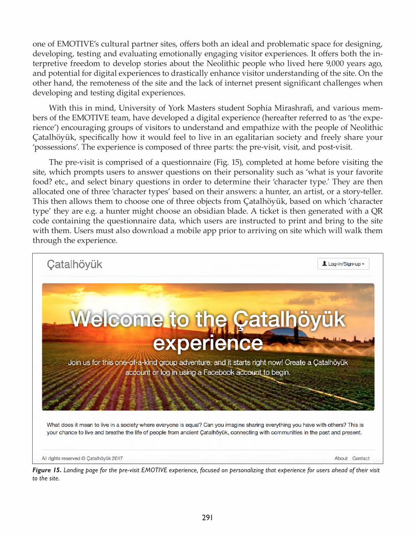
291
one of EMOTIVE’s cultural partner sites, offers both an ideal and problematic space for designing, developing, testing and evaluating emotionally engaging visitor experiences. It offers both the in-terpretive freedom to develop stories about the Neolithic people who lived here 9,000 years ago, and potential for digital experiences to drastically enhance visitor understanding of the site. On the other hand, the remoteness of the site and the lack of internet present significant challenges when developing and testing digital experiences.
With this in mind, University of York Masters student Sophia Mirashrafi, and various mem-bers of the EMOTIVE team, have developed a digital experience (hereafter referred to as ‘the expe-rience’) encouraging groups of visitors to understand and empathize with the people of Neolithic Çatalhöyük, specifically how it would feel to live in an egalitarian society and freely share your ‘possessions’. The experience is composed of three parts: the pre-visit, visit, and post-visit.
The pre-visit is comprised of a questionnaire (Fig. 15), completed at home before visiting the site, which prompts users to answer questions on their personality such as ‘what is your favorite food? etc., and select binary questions in order to determine their ‘character type.’ They are then allocated one of three ‘character types’ based on their answers: a hunter, an artist, or a story-teller. This then allows them to choose one of three objects from Çatalhöyük, based on which ‘character type’ they are e.g. a hunter might choose an obsidian blade. A ticket is then generated with a QR code containing the questionnaire data, which users are instructed to print and bring to the site with them. Users must also download a mobile app prior to arriving on site which will walk them through the experience.
Figure 15. Landing page for the pre-visit EMOTIVE experience, focused on personalizing that experience for users ahead of their visit to the site.
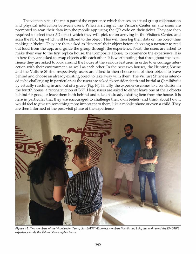
292
The visit on-site is the main part of the experience which focuses on actual group collaboration and physical interaction between users. When arriving at the Visitor’s Center on site users are prompted to scan their data into the mobile app using the QR code on their ticket. They are then required to select their 3D object which they will pick up on arriving in the Visitor’s Center, and scan the NFC tag which will be affixed to the object. This will then log their data on the object thus making it ‘theirs’. They are then asked to ‘decorate’ their object before choosing a narrator to read out loud from the app, and guide the group through the experience. Next, the users are asked to make their way to the first replica house, the Composite House, to commence the experience. It is in here they are asked to swap objects with each other. It is worth noting that throughout the expe-rience they are asked to look around the house at the various features, in order to encourage inter-action with their environment, as well as each other. In the next two houses, the Hunting Shrine and the Vulture Shrine respectively, users are asked to then choose one of their objects to leave behind and choose an already existing object to take away with them. The Vulture Shrine is intend-ed to be challenging in particular, as the users are asked to consider death and burial at Çatalhöyük by actually reaching in and out of a grave (Fig. 16). Finally, the experience comes to a conclusion in the fourth house, a reconstruction of B.77. Here, users are asked to either leave one of their objects behind for good, or leave them both behind and take an already existing item from the house. It is here in particular that they are encouraged to challenge their own beliefs, and think about how it would feel to give up something more important to them, like a mobile phone or even a child. They are then informed of the post-visit phase of the experience.
Figure 16. Two members of the Visualisation Team, plus EMOTIVE project members Vassilis and Laia, test and record the EMOTIVE experience inside the Vulture Shrine replica house.
293
The post-visit is intended for users to continue their experience once leaving the site. Still un-der development, this component will be designed for users to be able to log back into the system and scan the object they took home with them, thus discovering the person(s) who has touched and engaged with the object before them. Given its in-development status, the post-visit experience was not a part of the onsite evaluation in 2017. Participants were, however, asked what they would like to see happen during the post-visit in order to aid its development (see below). The main aim of the onsite-testing during the 2017 field season therefore, was to gauge participant responses to the concept, practicality and engagement levels of the pre-visit and on-site experience. The evaluation was conducted by members of the EMOTIVE project: Sara Perry, Katrina Gargett, Laia Pujol and Vassillis Kourtis. The method of testing, participants, results, and further points to consider are outlined below.
MethodThe method of onsite testing involved three main steps. Firstly, participants were asked to complete the online questionnaire, and print their ‘ticket’. Secondly, they completed the experience together whilst photographs and observation notes were taken (following a simple model that attended to five main points: facial expressions, gestures, evidence of sharing, interaction with the environment, and conversation) and their discussion was recorded using a Dictaphone. Finally, a semi-structured interview took place in which a series of pre-written questions were asked, and answers recorded using an audio recorder.
Initially, a series of pilot tests were conducted using members of the team. Katrina and Sara completed the experience together, followed by Laia Pujol and Emmeline Bat (a member of the Visualisation Team and an undergraduate in Archaeology and Heritage at the University of York, female, in her early 20s). Following this any technical issues or issues of comprehensibility were amended by Vassillis and Sara (to the text and the interview questions) and a work flow was de-veloped in order to aid testing. The work flow, written for those invigilating the experience, is as follows:
• Ensure you have cards, markers, mobile, Dictaphone and lapel mic, audio recorder for inter-view, observation sheets/pen, money to buy snacks, camera to take photos of users.• Visitor arrives in Visitor’s Center.• Team member confirms willingness to participate amongst the visiting group: “We are de-veloping activities using mobile phones and digital technologies to better visitors’ experiences of archaeological sites.” Notes that the activity will take about 30 minutes in total. They will receive a small token via participating in the experience. They can then tour the site as normal, and when their tour is done we will treat them to ice cream and drink in the café and ask some questions about their experience.• Allow visitors’ time to tour the Center. Ask them to meet you outside at the table when ready to begin.• As they walk up, turn on microphone, turn on lapel mic, start recording.• Let visitors know that we are collecting information for research purposes – to help improve the activity. We would like to record them, observe them and take one or two photos. This information will be stored securely and used to publicize and present our work to the world. We will ask them to sign a ‘consent form’ at the end of the experience and provide them with written information on how to contact us after if they want to follow our progress or ask ques-
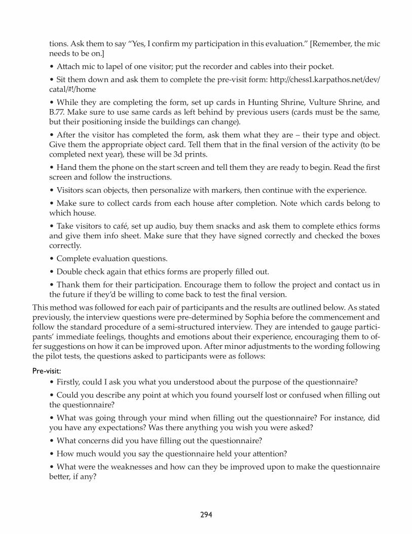
294
tions. Ask them to say “Yes, I confirm my participation in this evaluation.” [Remember, the mic needs to be on.]• Attach mic to lapel of one visitor; put the recorder and cables into their pocket.• Sit them down and ask them to complete the pre-visit form: http://chess1.karpathos.net/dev/catal/#!/home • While they are completing the form, set up cards in Hunting Shrine, Vulture Shrine, and B.77. Make sure to use same cards as left behind by previous users (cards must be the same, but their positioning inside the buildings can change).• After the visitor has completed the form, ask them what they are – their type and object. Give them the appropriate object card. Tell them that in the final version of the activity (to be completed next year), these will be 3d prints. • Hand them the phone on the start screen and tell them they are ready to begin. Read the first screen and follow the instructions.• Visitors scan objects, then personalize with markers, then continue with the experience.• Make sure to collect cards from each house after completion. Note which cards belong to which house.• Take visitors to café, set up audio, buy them snacks and ask them to complete ethics forms and give them info sheet. Make sure that they have signed correctly and checked the boxes correctly.• Complete evaluation questions.• Double check again that ethics forms are properly filled out.• Thank them for their participation. Encourage them to follow the project and contact us in the future if they’d be willing to come back to test the final version.
This method was followed for each pair of participants and the results are outlined below. As stated previously, the interview questions were pre-determined by Sophia before the commencement and follow the standard procedure of a semi-structured interview. They are intended to gauge partici-pants’ immediate feelings, thoughts and emotions about their experience, encouraging them to of-fer suggestions on how it can be improved upon. After minor adjustments to the wording following the pilot tests, the questions asked to participants were as follows:
Pre-visit: • Firstly, could I ask you what you understood about the purpose of the questionnaire?• Could you describe any point at which you found yourself lost or confused when filling out the questionnaire? • What was going through your mind when filling out the questionnaire? For instance, did you have any expectations? Was there anything you wish you were asked? • What concerns did you have filling out the questionnaire? • How much would you say the questionnaire held your attention? • What were the weaknesses and how can they be improved upon to make the questionnaire better, if any?
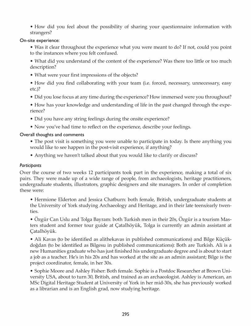
295
• How did you feel about the possibility of sharing your questionnaire information with strangers?
On-site experience:• Was it clear throughout the experience what you were meant to do? If not, could you point to the instances where you felt confused.• What did you understand of the content of the experience? Was there too little or too much description? • What were your first impressions of the objects? • How did you find collaborating with your team (i.e. forced, necessary, unnecessary, easy etc.)?• Did you lose focus at any time during the experience? How immersed were you throughout? • How has your knowledge and understanding of life in the past changed through the expe-rience? • Did you have any string feelings during the onsite experience? • Now you’ve had time to reflect on the experience, describe your feelings.
Overall thoughts and comments• The post visit is something you were unable to participate in today. Is there anything you would like to see happen in the post-visit experience, if anything? • Anything we haven’t talked about that you would like to clarify or discuss?
Participants Over the course of two weeks 12 participants took part in the experience, making a total of six pairs. They were made up of a wide range of people, from archaeologists, heritage practitioners, undergraduate students, illustrators, graphic designers and site managers. In order of completion these were:
• Hermione Elderton and Jessica Chatburn: both female, British, undergraduate students at the University of York studying Archaeology and Heritage, and in their late teens/early twen-ties.• Özgür Can Uslu and Tolga Bayram: both Turkish men in their 20s, Özgür is a tourism Mas-ters student and former tour guide at Çatalhöyük, Tolga is currently an admin assistant at Çatalhöyük.• Ali Kavas (to be identified as alithekavas in published communications) and Bilge Küçük-doğdan (to be identified as Bilgesu in published communications): Both are Turkish. Ali is a new Humanities graduate who has just finished his undergraduate degree and is about to start a job as a teacher. He’s in his 20s and has worked at the site as an admin assistant; Bilge is the project coordinator, female, in her 30s. • Sophie Moore and Ashley Fisher: Both female. Sophie is a Postdoc Researcher at Brown Uni-versity USA, about to turn 30, British, and trained as an archaeologist. Ashley is American, an MSc Digital Heritage Student at University of York in her mid-30s, she has previously worked as a librarian and is an English grad, now studying heritage.
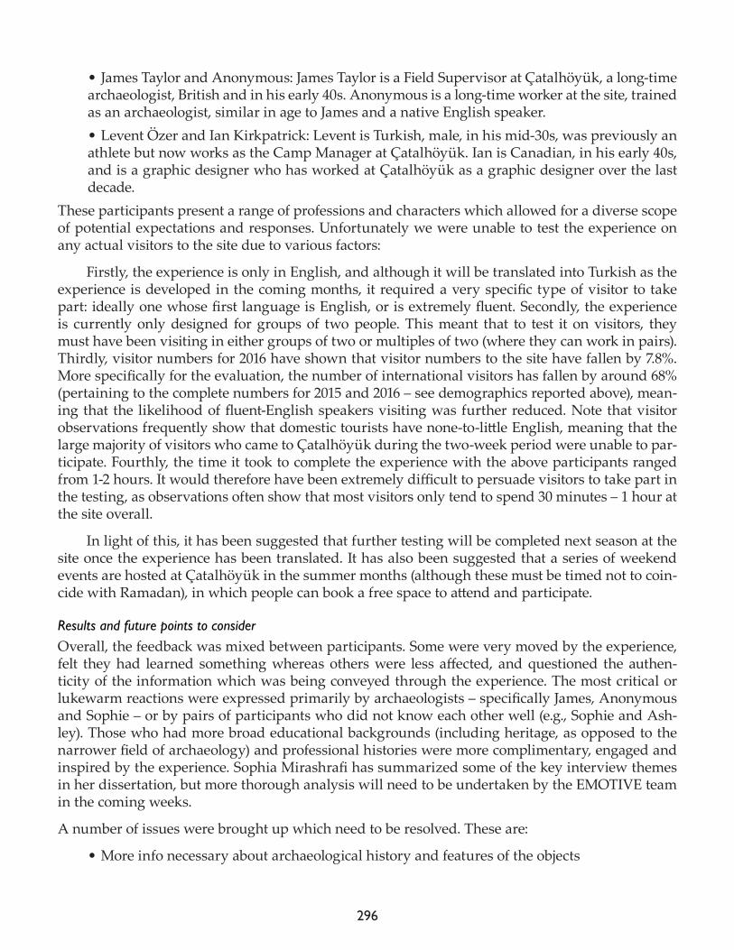
296
• James Taylor and Anonymous: James Taylor is a Field Supervisor at Çatalhöyük, a long-time archaeologist, British and in his early 40s. Anonymous is a long-time worker at the site, trained as an archaeologist, similar in age to James and a native English speaker. • Levent Özer and Ian Kirkpatrick: Levent is Turkish, male, in his mid-30s, was previously an athlete but now works as the Camp Manager at Çatalhöyük. Ian is Canadian, in his early 40s, and is a graphic designer who has worked at Çatalhöyük as a graphic designer over the last decade.
These participants present a range of professions and characters which allowed for a diverse scope of potential expectations and responses. Unfortunately we were unable to test the experience on any actual visitors to the site due to various factors:
Firstly, the experience is only in English, and although it will be translated into Turkish as the experience is developed in the coming months, it required a very specific type of visitor to take part: ideally one whose first language is English, or is extremely fluent. Secondly, the experience is currently only designed for groups of two people. This meant that to test it on visitors, they must have been visiting in either groups of two or multiples of two (where they can work in pairs). Thirdly, visitor numbers for 2016 have shown that visitor numbers to the site have fallen by 7.8%. More specifically for the evaluation, the number of international visitors has fallen by around 68% (pertaining to the complete numbers for 2015 and 2016 – see demographics reported above), mean-ing that the likelihood of fluent-English speakers visiting was further reduced. Note that visitor observations frequently show that domestic tourists have none-to-little English, meaning that the large majority of visitors who came to Çatalhöyük during the two-week period were unable to par-ticipate. Fourthly, the time it took to complete the experience with the above participants ranged from 1-2 hours. It would therefore have been extremely difficult to persuade visitors to take part in the testing, as observations often show that most visitors only tend to spend 30 minutes – 1 hour at the site overall.
In light of this, it has been suggested that further testing will be completed next season at the site once the experience has been translated. It has also been suggested that a series of weekend events are hosted at Çatalhöyük in the summer months (although these must be timed not to coin-cide with Ramadan), in which people can book a free space to attend and participate.
Results and future points to consider Overall, the feedback was mixed between participants. Some were very moved by the experience, felt they had learned something whereas others were less affected, and questioned the authen-ticity of the information which was being conveyed through the experience. The most critical or lukewarm reactions were expressed primarily by archaeologists – specifically James, Anonymous and Sophie – or by pairs of participants who did not know each other well (e.g., Sophie and Ash-ley). Those who had more broad educational backgrounds (including heritage, as opposed to the narrower field of archaeology) and professional histories were more complimentary, engaged and inspired by the experience. Sophia Mirashrafi has summarized some of the key interview themes in her dissertation, but more thorough analysis will need to be undertaken by the EMOTIVE team in the coming weeks.
A number of issues were brought up which need to be resolved. These are:
• More info necessary about archaeological history and features of the objects
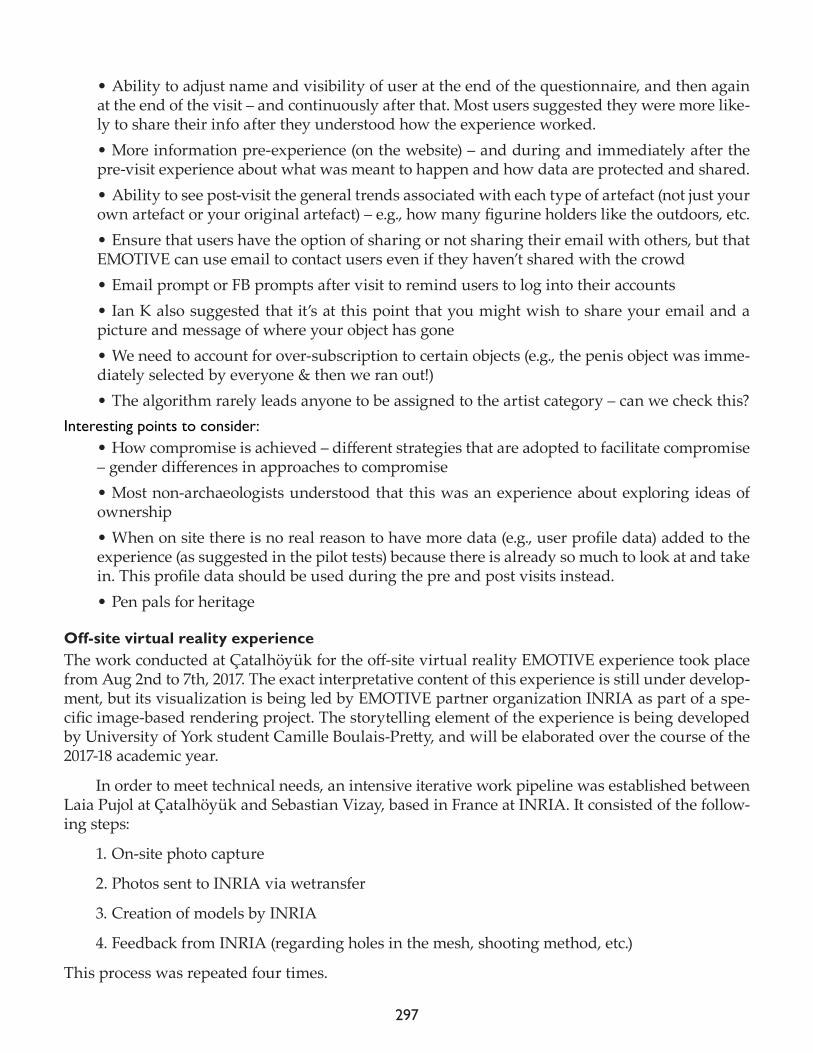
297
• Ability to adjust name and visibility of user at the end of the questionnaire, and then again at the end of the visit – and continuously after that. Most users suggested they were more like-ly to share their info after they understood how the experience worked. • More information pre-experience (on the website) – and during and immediately after the pre-visit experience about what was meant to happen and how data are protected and shared.• Ability to see post-visit the general trends associated with each type of artefact (not just your own artefact or your original artefact) – e.g., how many figurine holders like the outdoors, etc.• Ensure that users have the option of sharing or not sharing their email with others, but that EMOTIVE can use email to contact users even if they haven’t shared with the crowd• Email prompt or FB prompts after visit to remind users to log into their accounts • Ian K also suggested that it’s at this point that you might wish to share your email and a picture and message of where your object has gone• We need to account for over-subscription to certain objects (e.g., the penis object was imme-diately selected by everyone & then we ran out!)• The algorithm rarely leads anyone to be assigned to the artist category – can we check this?
Interesting points to consider:• How compromise is achieved – different strategies that are adopted to facilitate compromise – gender differences in approaches to compromise• Most non-archaeologists understood that this was an experience about exploring ideas of ownership• When on site there is no real reason to have more data (e.g., user profile data) added to the experience (as suggested in the pilot tests) because there is already so much to look at and take in. This profile data should be used during the pre and post visits instead.• Pen pals for heritage
Off-site virtual reality experienceThe work conducted at Çatalhöyük for the off-site virtual reality EMOTIVE experience took place from Aug 2nd to 7th, 2017. The exact interpretative content of this experience is still under develop-ment, but its visualization is being led by EMOTIVE partner organization INRIA as part of a spe-cific image-based rendering project. The storytelling element of the experience is being developed by University of York student Camille Boulais-Pretty, and will be elaborated over the course of the 2017-18 academic year.
In order to meet technical needs, an intensive iterative work pipeline was established between Laia Pujol at Çatalhöyük and Sebastian Vizay, based in France at INRIA. It consisted of the follow-ing steps:
1. On-site photo capture
2. Photos sent to INRIA via wetransfer
3. Creation of models by INRIA
4. Feedback from INRIA (regarding holes in the mesh, shooting method, etc.)
This process was repeated four times.
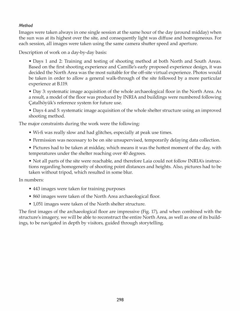
298
MethodImages were taken always in one single session at the same hour of the day (around midday) when the sun was at its highest over the site, and consequently light was diffuse and homogeneous. For each session, all images were taken using the same camera shutter speed and aperture.
Description of work on a day-by-day basis:
• Days 1 and 2: Training and testing of shooting method at both North and South Areas. Based on the first shooting experience and Camille’s early proposed experience design, it was decided the North Area was the most suitable for the off-site virtual experience. Photos would be taken in order to allow a general walk-through of the site followed by a more particular experience at B.119.• Day 3: systematic image acquisition of the whole archaeological floor in the North Area. As a result, a model of the floor was produced by INRIA and buildings were numbered following Çatalhöyük’s reference system for future use.• Days 4 and 5: systematic image acquisition of the whole shelter structure using an improved shooting method.
The major constraints during the work were the following:
• Wi-fi was really slow and had glitches, especially at peak use times. • Permission was necessary to be on site unsupervised, temporarily delaying data collection.• Pictures had to be taken at midday, which means it was the hottest moment of the day, with temperatures under the shelter reaching over 40 degrees. • Not all parts of the site were reachable, and therefore Laia could not follow INRIA’s instruc-tions regarding homogeneity of shooting point distances and heights. Also, pictures had to be taken without tripod, which resulted in some blur.
In numbers:
• 443 images were taken for training purposes• 860 images were taken of the North Area archaeological floor.• 1,051 images were taken of the North shelter structure.
The first images of the archaeological floor are impressive (Fig. 17), and when combined with the structure’s imagery, we will be able to reconstruct the entire North Area, as well as one of its build-ings, to be navigated in depth by visitors, guided through storytelling.
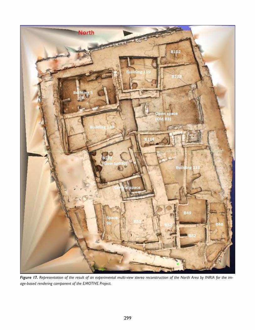
299
Figure 17. Representation of the result of an experimental multi-view stereo reconstruction of the North Area by INRIA for the im-age-based rendering component of the EMOTIVE Project.
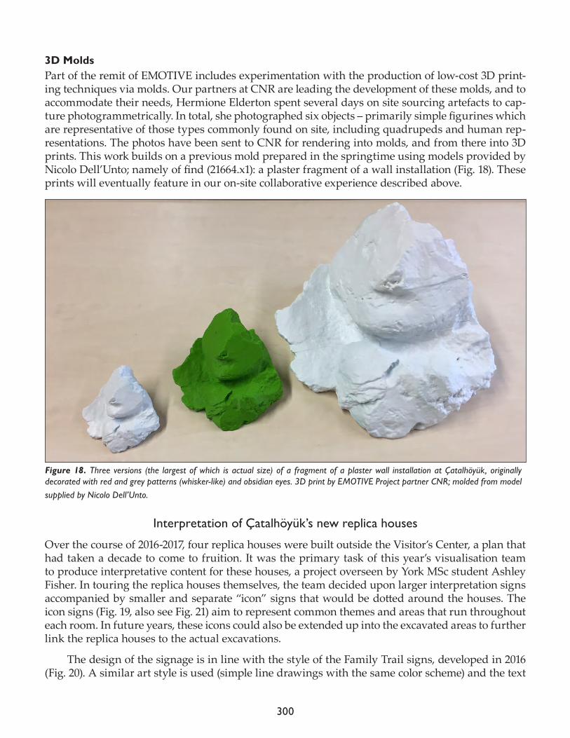
300
3D MoldsPart of the remit of EMOTIVE includes experimentation with the production of low-cost 3D print-ing techniques via molds. Our partners at CNR are leading the development of these molds, and to accommodate their needs, Hermione Elderton spent several days on site sourcing artefacts to cap-ture photogrammetrically. In total, she photographed six objects – primarily simple figurines which are representative of those types commonly found on site, including quadrupeds and human rep-resentations. The photos have been sent to CNR for rendering into molds, and from there into 3D prints. This work builds on a previous mold prepared in the springtime using models provided by Nicolo Dell’Unto; namely of find (21664.x1): a plaster fragment of a wall installation (Fig. 18). These prints will eventually feature in our on-site collaborative experience described above.
Interpretation of Çatalhöyük’s new replica houses
Over the course of 2016-2017, four replica houses were built outside the Visitor’s Center, a plan that had taken a decade to come to fruition. It was the primary task of this year’s visualisation team to produce interpretative content for these houses, a project overseen by York MSc student Ashley Fisher. In touring the replica houses themselves, the team decided upon larger interpretation signs accompanied by smaller and separate “icon” signs that would be dotted around the houses. The icon signs (Fig. 19, also see Fig. 21) aim to represent common themes and areas that run throughout each room. In future years, these icons could also be extended up into the excavated areas to further link the replica houses to the actual excavations.
The design of the signage is in line with the style of the Family Trail signs, developed in 2016 (Fig. 20). A similar art style is used (simple line drawings with the same color scheme) and the text
Figure 18. Three versions (the largest of which is actual size) of a fragment of a plaster wall installation at Çatalhöyük, originally decorated with red and grey patterns (whisker-like) and obsidian eyes. 3D print by EMOTIVE Project partner CNR; molded from model supplied by Nicolo Dell’Unto.
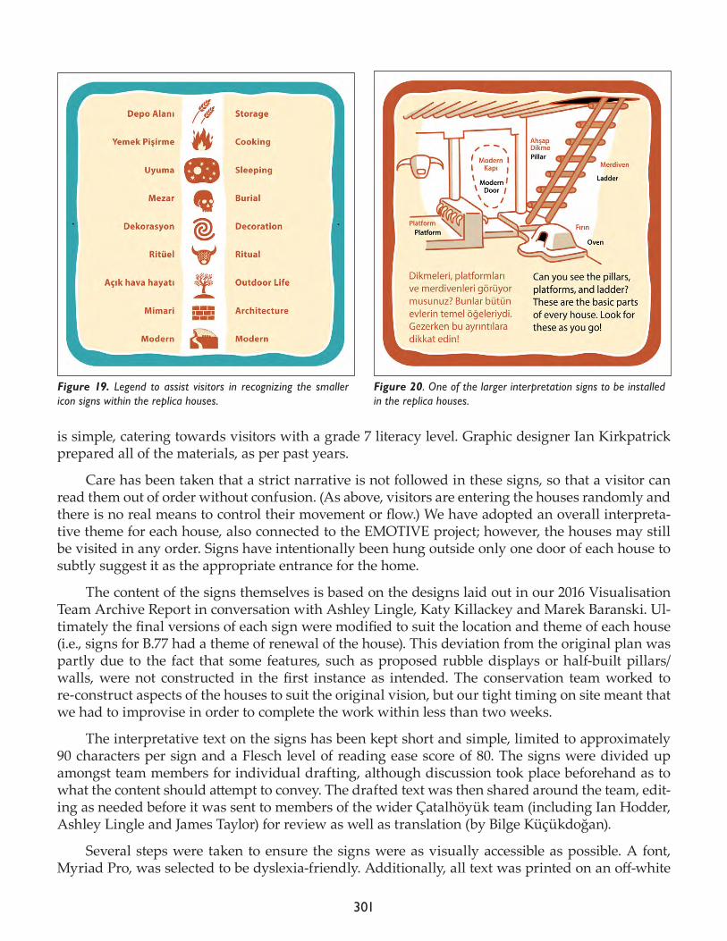
301
is simple, catering towards visitors with a grade 7 literacy level. Graphic designer Ian Kirkpatrick prepared all of the materials, as per past years.
Care has been taken that a strict narrative is not followed in these signs, so that a visitor can read them out of order without confusion. (As above, visitors are entering the houses randomly and there is no real means to control their movement or flow.) We have adopted an overall interpreta-tive theme for each house, also connected to the EMOTIVE project; however, the houses may still be visited in any order. Signs have intentionally been hung outside only one door of each house to subtly suggest it as the appropriate entrance for the home.
The content of the signs themselves is based on the designs laid out in our 2016 Visualisation Team Archive Report in conversation with Ashley Lingle, Katy Killackey and Marek Baranski. Ul-timately the final versions of each sign were modified to suit the location and theme of each house (i.e., signs for B.77 had a theme of renewal of the house). This deviation from the original plan was partly due to the fact that some features, such as proposed rubble displays or half-built pillars/walls, were not constructed in the first instance as intended. The conservation team worked to re-construct aspects of the houses to suit the original vision, but our tight timing on site meant that we had to improvise in order to complete the work within less than two weeks.
The interpretative text on the signs has been kept short and simple, limited to approximately 90 characters per sign and a Flesch level of reading ease score of 80. The signs were divided up amongst team members for individual drafting, although discussion took place beforehand as to what the content should attempt to convey. The drafted text was then shared around the team, edit-ing as needed before it was sent to members of the wider Çatalhöyük team (including Ian Hodder, Ashley Lingle and James Taylor) for review as well as translation (by Bilge Küçükdoğan).
Several steps were taken to ensure the signs were as visually accessible as possible. A font, Myriad Pro, was selected to be dyslexia-friendly. Additionally, all text was printed on an off-white
Figure 19. Legend to assist visitors in recognizing the smaller icon signs within the replica houses.
Figure 20. One of the larger interpretation signs to be installed in the replica houses.
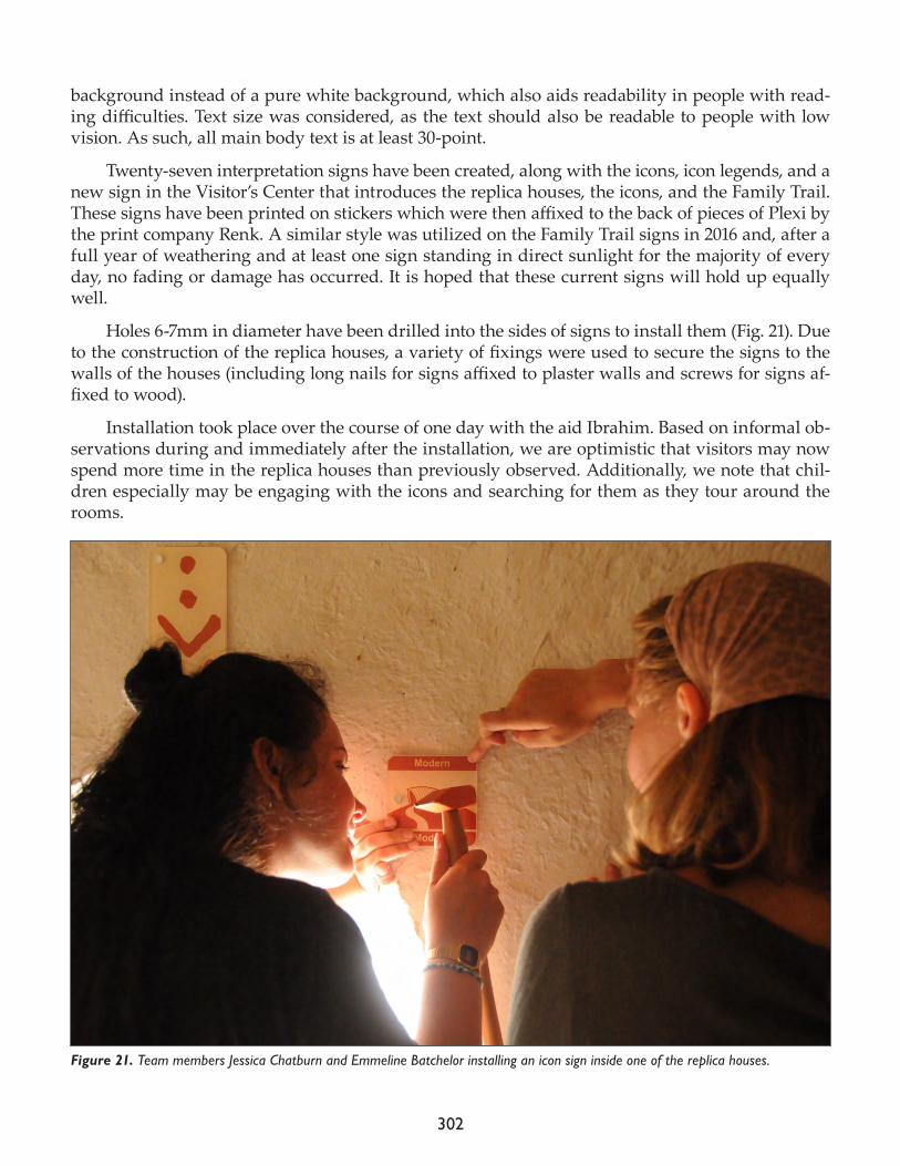
302
background instead of a pure white background, which also aids readability in people with read-ing difficulties. Text size was considered, as the text should also be readable to people with low vision. As such, all main body text is at least 30-point.
Twenty-seven interpretation signs have been created, along with the icons, icon legends, and a new sign in the Visitor’s Center that introduces the replica houses, the icons, and the Family Trail. These signs have been printed on stickers which were then affixed to the back of pieces of Plexi by the print company Renk. A similar style was utilized on the Family Trail signs in 2016 and, after a full year of weathering and at least one sign standing in direct sunlight for the majority of every day, no fading or damage has occurred. It is hoped that these current signs will hold up equally well.
Holes 6-7mm in diameter have been drilled into the sides of signs to install them (Fig. 21). Due to the construction of the replica houses, a variety of fixings were used to secure the signs to the walls of the houses (including long nails for signs affixed to plaster walls and screws for signs af-fixed to wood).
Installation took place over the course of one day with the aid Ibrahim. Based on informal ob-servations during and immediately after the installation, we are optimistic that visitors may now spend more time in the replica houses than previously observed. Additionally, we note that chil-dren especially may be engaging with the icons and searching for them as they tour around the rooms.
Figure 21. Team members Jessica Chatburn and Emmeline Batchelor installing an icon sign inside one of the replica houses.
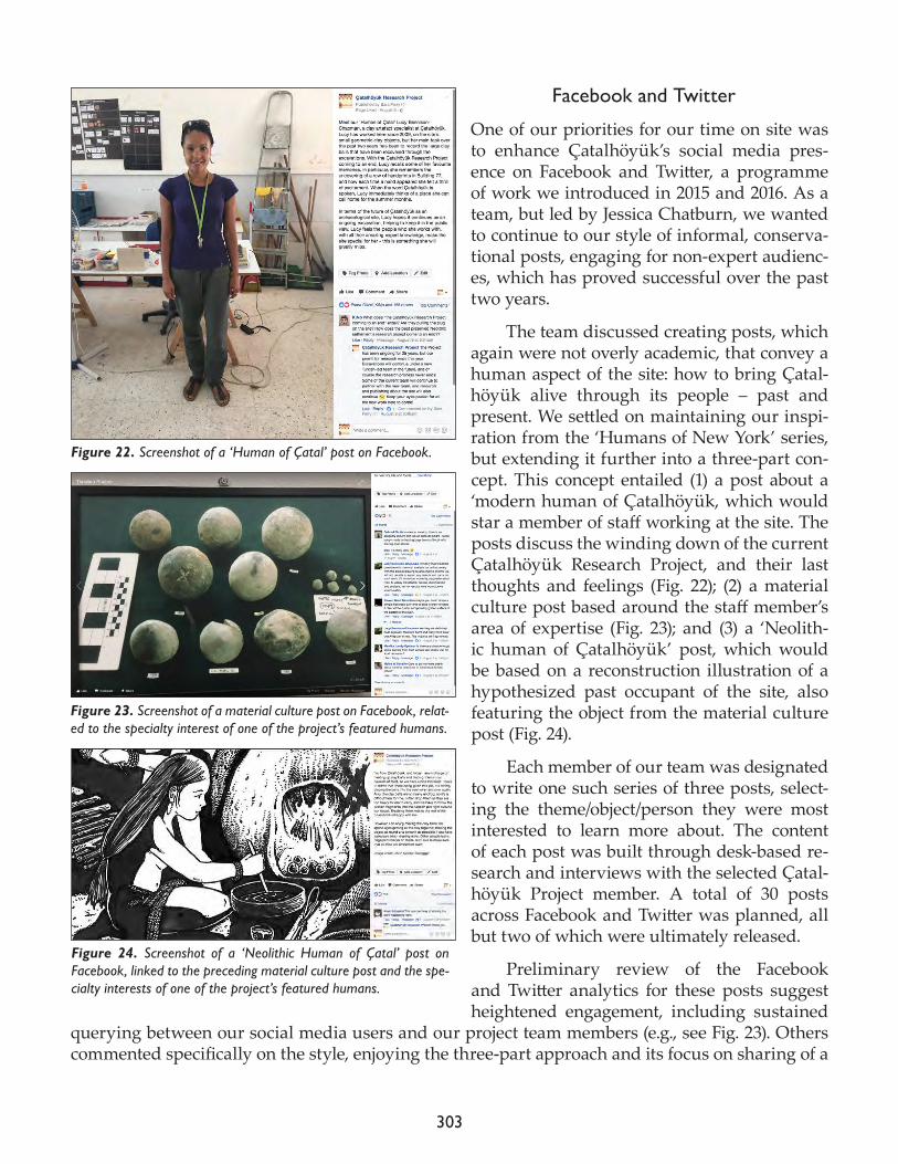
303
Facebook and Twitter
One of our priorities for our time on site was to enhance Çatalhöyük’s social media pres-ence on Facebook and Twitter, a programme of work we introduced in 2015 and 2016. As a team, but led by Jessica Chatburn, we wanted to continue to our style of informal, conserva-tional posts, engaging for non-expert audienc-es, which has proved successful over the past two years.
The team discussed creating posts, which again were not overly academic, that convey a human aspect of the site: how to bring Çatal-höyük alive through its people – past and present. We settled on maintaining our inspi-ration from the ‘Humans of New York’ series, but extending it further into a three-part con-cept. This concept entailed (1) a post about a ‘modern human of Çatalhöyük, which would star a member of staff working at the site. The posts discuss the winding down of the current Çatalhöyük Research Project, and their last thoughts and feelings (Fig. 22); (2) a material culture post based around the staff member’s area of expertise (Fig. 23); and (3) a ‘Neolith-ic human of Çatalhöyük’ post, which would be based on a reconstruction illustration of a hypothesized past occupant of the site, also featuring the object from the material culture post (Fig. 24).
Each member of our team was designated to write one such series of three posts, select-ing the theme/object/person they were most interested to learn more about. The content of each post was built through desk-based re-search and interviews with the selected Çatal-höyük Project member. A total of 30 posts across Facebook and Twitter was planned, all but two of which were ultimately released.
Preliminary review of the Facebook and Twitter analytics for these posts suggest heightened engagement, including sustained
querying between our social media users and our project team members (e.g., see Fig. 23). Others commented specifically on the style, enjoying the three-part approach and its focus on sharing of a
Figure 22. Screenshot of a ‘Human of Çatal’ post on Facebook.
Figure 24. Screenshot of a ‘Neolithic Human of Çatal’ post on Facebook, linked to the preceding material culture post and the spe-cialty interests of one of the project’s featured humans.
Figure 23. Screenshot of a material culture post on Facebook, relat-ed to the specialty interest of one of the project’s featured humans.
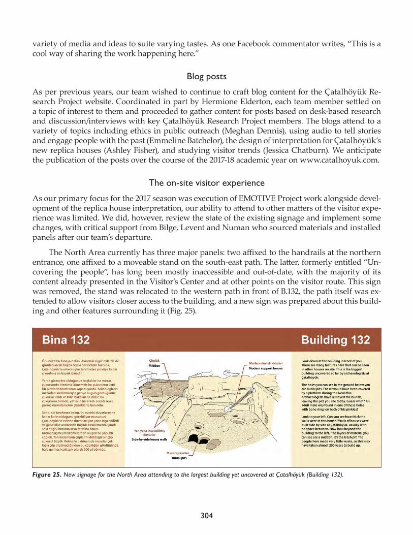
304
variety of media and ideas to suite varying tastes. As one Facebook commentator writes, “This is a cool way of sharing the work happening here.”
Blog posts
As per previous years, our team wished to continue to craft blog content for the Çatalhöyük Re-search Project website. Coordinated in part by Hermione Elderton, each team member settled on a topic of interest to them and proceeded to gather content for posts based on desk-based research and discussion/interviews with key Çatalhöyük Research Project members. The blogs attend to a variety of topics including ethics in public outreach (Meghan Dennis), using audio to tell stories and engage people with the past (Emmeline Batchelor), the design of interpretation for Çatalhöyük’s new replica houses (Ashley Fisher), and studying visitor trends (Jessica Chatburn). We anticipate the publication of the posts over the course of the 2017-18 academic year on www.catalhoyuk.com.
The on-site visitor experience
As our primary focus for the 2017 season was execution of EMOTIVE Project work alongside devel-opment of the replica house interpretation, our ability to attend to other matters of the visitor expe-rience was limited. We did, however, review the state of the existing signage and implement some changes, with critical support from Bilge, Levent and Numan who sourced materials and installed panels after our team’s departure.
The North Area currently has three major panels: two affixed to the handrails at the northern entrance, one affixed to a moveable stand on the south-east path. The latter, formerly entitled “Un-covering the people”, has long been mostly inaccessible and out-of-date, with the majority of its content already presented in the Visitor’s Center and at other points on the visitor route. This sign was removed, the stand was relocated to the western path in front of B.132, the path itself was ex-tended to allow visitors closer access to the building, and a new sign was prepared about this build-ing and other features surrounding it (Fig. 25).
Figure 25. New signage for the North Area attending to the largest building yet uncovered at Çatalhöyük (Building 132).
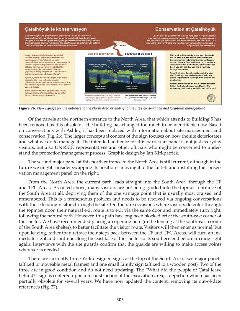
305
Of the panels at the northern entrance to the North Area, that which attends to Building 5 has been removed as it is obsolete – the building has changed too much to be identifiable now. Based on conversations with Ashley, it has been replaced with information about site management and conservation (Fig. 26). The larger conceptual content of the sign focuses on how the site deteriorates and what we do to manage it. The intended audience for this particular panel is not just everyday visitors, but also UNESCO representatives and other officials who might be concerned to under-stand the protection/management process. Graphic design by Ian Kirkpatrick.
The second major panel at this north entrance to the North Area is still current, although in the future we might consider swapping its position – moving it to the far left and installing the conser-vation management panel on the right.
From the North Area, the current path leads straight into the South Area, through the TP and TPC Areas. As noted above, many visitors are not being guided into the topmost entrance of the South Area at all, depriving them of the one vantage point that is usually most praised and remembered. This is a tremendous problem and needs to be resolved via ongoing conversations with those leading visitors through the site. On the rare occasions where visitors do enter through the topmost door, their natural exit route is to exit via the same door and immediately turn right, following the natural path. However, this path has long been blocked off at the south-east corner of the shelter. We have recommended placing an opening here (in the fencing at the south-east corner of the South Area shelter), to better facilitate the visitor route. Visitors will then enter as normal, but upon leaving, rather than retrace their steps back between the TP and TPC Areas, will turn an im-mediate right and continue along the east face of the shelter to its southern end before turning right again. Interviews with the site guards confirm that the guards are willing to make access points wherever is needed.
There are currently three York-designed signs at the top of the South Area, two major panels (affixed to moveable metal frames) and one small family sign (affixed to a wooden post). Two of the three are in good condition and do not need updating. The “What did the people of Çatal leave behind?” sign is centered upon a reconstruction of the excavation area, a depiction which has been partially obsolete for several years. We have now updated the content, removing its out-of-date references (Fig. 27).
Figure 26. New signage for the entrance to the North Area attending to the site’s conservation and long-term management.
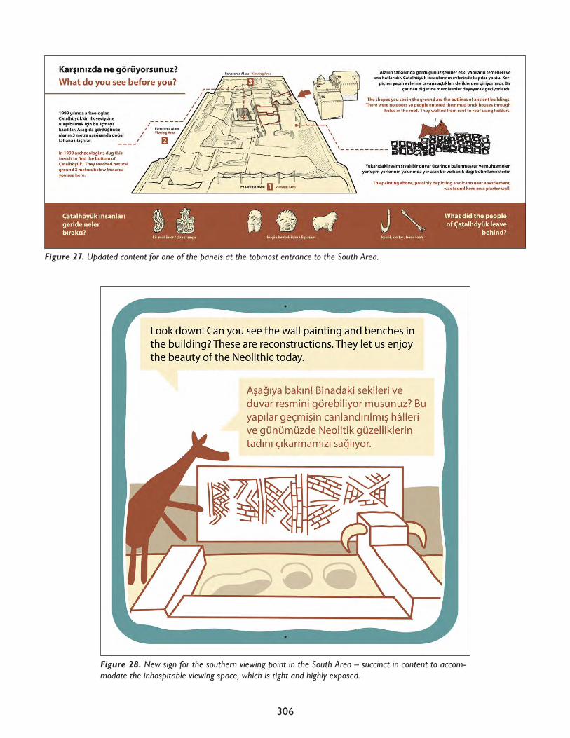
306
Figure 27. Updated content for one of the panels at the topmost entrance to the South Area.
Figure 28. New sign for the southern viewing point in the South Area – succinct in content to accom-modate the inhospitable viewing space, which is tight and highly exposed.
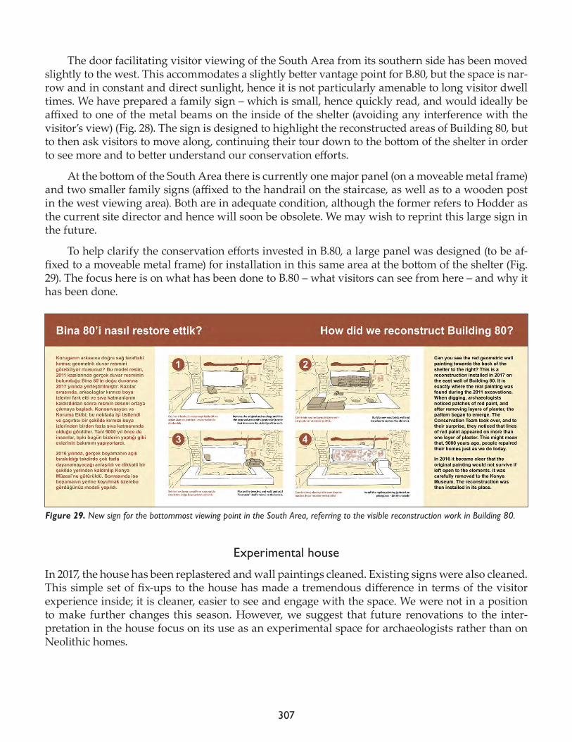
307
The door facilitating visitor viewing of the South Area from its southern side has been moved slightly to the west. This accommodates a slightly better vantage point for B.80, but the space is nar-row and in constant and direct sunlight, hence it is not particularly amenable to long visitor dwell times. We have prepared a family sign – which is small, hence quickly read, and would ideally be affixed to one of the metal beams on the inside of the shelter (avoiding any interference with the visitor’s view) (Fig. 28). The sign is designed to highlight the reconstructed areas of Building 80, but to then ask visitors to move along, continuing their tour down to the bottom of the shelter in order to see more and to better understand our conservation efforts.
At the bottom of the South Area there is currently one major panel (on a moveable metal frame) and two smaller family signs (affixed to the handrail on the staircase, as well as to a wooden post in the west viewing area). Both are in adequate condition, although the former refers to Hodder as the current site director and hence will soon be obsolete. We may wish to reprint this large sign in the future.
To help clarify the conservation efforts invested in B.80, a large panel was designed (to be af-fixed to a moveable metal frame) for installation in this same area at the bottom of the shelter (Fig. 29). The focus here is on what has been done to B.80 – what visitors can see from here – and why it has been done.
Experimental house
In 2017, the house has been replastered and wall paintings cleaned. Existing signs were also cleaned. This simple set of fix-ups to the house has made a tremendous difference in terms of the visitor experience inside; it is cleaner, easier to see and engage with the space. We were not in a position to make further changes this season. However, we suggest that future renovations to the inter-pretation in the house focus on its use as an experimental space for archaeologists rather than on Neolithic homes.
Figure 29. New sign for the bottommost viewing point in the South Area, referring to the visible reconstruction work in Building 80.
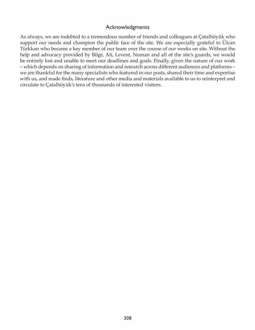
308
Acknowledgments
As always, we are indebted to a tremendous number of friends and colleagues at Çatalhöyük who support our needs and champion the public face of the site. We are especially grateful to Ülcan Türkkan who became a key member of our team over the course of our weeks on site. Without the help and advocacy provided by Bilge, Ali, Levent, Numan and all of the site’s guards, we would be entirely lost and unable to meet our deadlines and goals. Finally, given the nature of our work – which depends on sharing of information and research across different audiences and platforms – we are thankful for the many specialists who featured in our posts, shared their time and expertise with us, and made finds, literature and other media and materials available to us to reinterpret and circulate to Çatalhöyük’s tens of thousands of interested visitors.
309
Research Projects

310
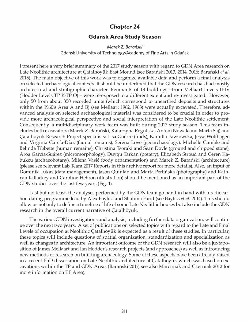
311
Chapter 24
Gdansk Area Study Season
Marek Z. BarańskiGdańsk University of Technology/Academy of Fine Arts in Gdańsk
I present here a very brief summary of the 2017 study season with regard to GDN Area research on Late Neolithic architecture at Çatalhöyük East Mound (see Barański 2013, 2014, 2016; Barański et al. 2015). The main objective of this work was to organize available data and perform a final analysis on selected archaeological contexts. It should be underlined that the GDN research has had mostly architectural and stratigraphic character. Remnants of 13 buildings –from Mellaart Levels II-IV (Hodder Levels TP K-TP O) – were re-exposed to a different extent and re-investigated. However, only 50 from about 350 recorded units (which correspond to unearthed deposits and structures within the 1960’s Area A and B) (see Mellaart 1962, 1963) were actually excavated. Therefore, ad-vanced analysis on selected archaeological material was considered to be crucial in order to pro-vide more archaeological perspective and social interpretation of the Late Neolithic settlement. Consequently, a multidisciplinary work team was built during 2017 study season. This team in-cludes both excavators (Marek Z. Barański, Katarzyna Regulska, Antoni Nowak and Marta Saj) and Çatalhöyük Research Project specialists: Lisa Guerre (finds), Kamilla Pawłowska, Jesse Wolfhagen and Virginia García-Díaz (faunal remains), Serena Love (geoarchaeology), Michelle Gamble and Belinda Tibbetts (human remains), Christina Tsoraki and Sean Doyle (ground and chipped stone), Aroa García-Suárez (micromorphology), Duygu Tarkan (pottery), Elizabeth Stroud and Ceren Ka-bukcu (archaeobotany), Milena Vasić (body ornamentation) and Marek Z. Barański (architecture) (please see relevant Lab Team 2017 Reports in this archive report for more details). Also, an input of Dominik Lukas (data management), Jason Quinlan and Marta Perlińska (photography) and Kath-ryn Killackey and Caroline Hebron (illustration) should be mentioned as an important part of the GDN studies over the last few years (Fig. 1).
Last but not least, the analyses performed by the GDN team go hand in hand with a radiocar-bon dating programme lead by Alex Bayliss and Shahina Farid (see Bayliss et al. 2014). This should allow us not only to define a timeline of life of some Late Neolithic houses but also include the GDN research in the overall current narrative of Çatalhöyük.
The various GDN investigations and analysis, including further data organization, will contin-ue over the next two years. A set of publications on selected topics with regard to the Late and Final Levels of occupation at Neolithic Çatalhöyük is expected as a result of these studies. In particular, these topics will include questions of spatial organization, standardization and specialization as well as changes in architecture. An important outcome of the GDN research will also be a juxtapo-sition of James Mellaart and Ian Hodder’s research projects (and approaches) as well as introducing new methods of research on building archaeology. Some of these aspects have been already raised in a recent PhD dissertation on Late Neolithic architecture at Çatalhöyük which was based on ex-cavations within the TP and GDN Areas (Barański 2017; see also Marciniak and Czerniak 2012 for more information on TP Area).
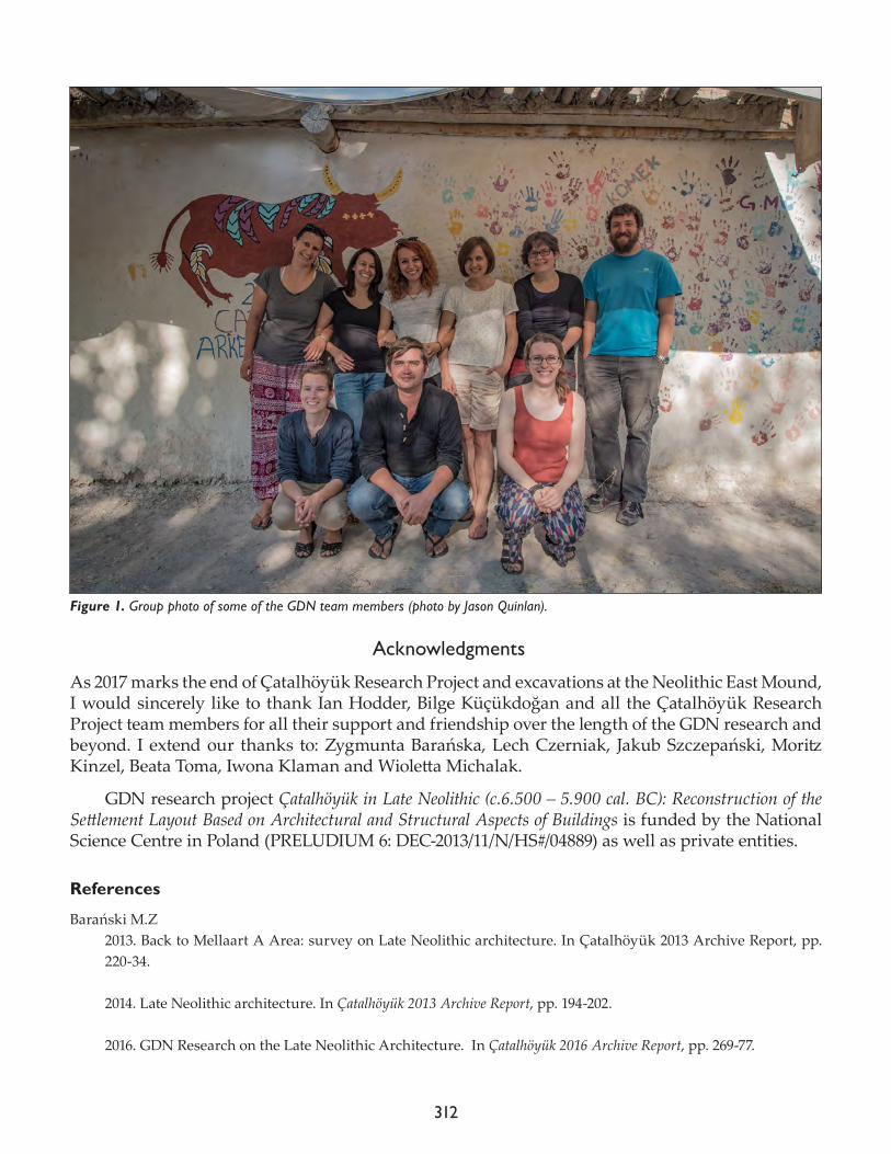
312
Acknowledgments
As 2017 marks the end of Çatalhöyük Research Project and excavations at the Neolithic East Mound, I would sincerely like to thank Ian Hodder, Bilge Küçükdoğan and all the Çatalhöyük Research Project team members for all their support and friendship over the length of the GDN research and beyond. I extend our thanks to: Zygmunta Barańska, Lech Czerniak, Jakub Szczepański, Moritz Kinzel, Beata Toma, Iwona Klaman and Wioletta Michalak.
GDN research project Çatalhöyük in Late Neolithic (c.6.500 – 5.900 cal. BC): Reconstruction of the Settlement Layout Based on Architectural and Structural Aspects of Buildings is funded by the National Science Centre in Poland (PRELUDIUM 6: DEC-2013/11/N/HS#/04889) as well as private entities.
References
Barański M.Z 2013. Back to Mellaart A Area: survey on Late Neolithic architecture. In Çatalhöyük 2013 Archive Report, pp. 220-34.
2014. Late Neolithic architecture. In Çatalhöyük 2013 Archive Report, pp. 194-202.
2016. GDN Research on the Late Neolithic Architecture. In Çatalhöyük 2016 Archive Report, pp. 269-77.
Figure 1. Group photo of some of the GDN team members (photo by Jason Quinlan).
313
2017. Późnoneolityczna architektura Çatalhöyük, Turcja – kontynuacja i zmiana u schyłku 7. tysiąclecia p.n.e. (Late Neo-lithic architecture of Çatalhöyük, Turkey – continuation and change at the end of 7th millennium BCE). PhD dissertation / Gdańsk University of Technology, Department of Architecture.
Barański M.Z., A. Nowa, K. Regulska and M. Saj 2015. GDN Area: Research on Late Neolithic Architecture. In Çatalhöyük 2015 Archive Report, pp. 248-60.
Bayliss A., S. Farid and T. Higham2014. Time will tell: practicing Bayesian chronological modeling on the East Mound. In Çatalhöyük Excavations: The 2000-2008 Seasons, edited by I. Hodder. London: British Institute of Archaeology at Ankara; Los Angeles: Cotsen Institute of Archaeology Press, pp. 53-89.
Marciniak, A. and L. Czerniak,2012. Çatalhöyük unknown. The late sequence on the East Mound. In Proceedings of the 7th International Congress on the Archaeology of the Ancient Near East, Vol. I: Mega-cities and Mega-sites. The Archaeology of Consumption and Disposal, Landscape, Transport and Communication, edited by R. Matthews and J. Curtis. Wiesbaden: Harrassowitz-Verlag, pp. 3-16.
Mellaart J.1962. Excavations at Çatal Hüyük. First preliminary report, 1961. Anatolian Studies 12: 41-65.
1963. Excavations at Çatal Hüyük. Second preliminary report, 1962.Anatolian Studies 13: 39-119.

314
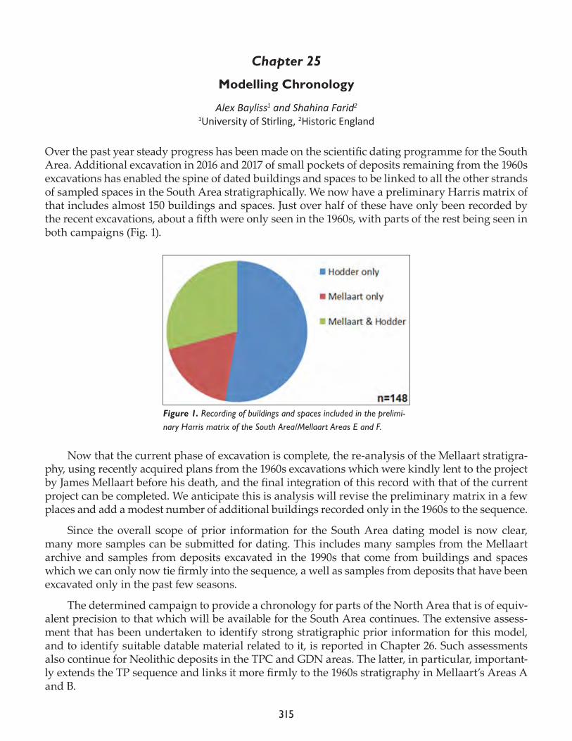
315
Chapter 25
Modelling Chronology
Alex Bayliss1 and Shahina Farid2
1University of Stirling, 2Historic England
Over the past year steady progress has been made on the scientific dating programme for the South Area. Additional excavation in 2016 and 2017 of small pockets of deposits remaining from the 1960s excavations has enabled the spine of dated buildings and spaces to be linked to all the other strands of sampled spaces in the South Area stratigraphically. We now have a preliminary Harris matrix of that includes almost 150 buildings and spaces. Just over half of these have only been recorded by the recent excavations, about a fifth were only seen in the 1960s, with parts of the rest being seen in both campaigns (Fig. 1).
Now that the current phase of excavation is complete, the re-analysis of the Mellaart stratigra-phy, using recently acquired plans from the 1960s excavations which were kindly lent to the project by James Mellaart before his death, and the final integration of this record with that of the current project can be completed. We anticipate this is analysis will revise the preliminary matrix in a few places and add a modest number of additional buildings recorded only in the 1960s to the sequence.
Since the overall scope of prior information for the South Area dating model is now clear, many more samples can be submitted for dating. This includes many samples from the Mellaart archive and samples from deposits excavated in the 1990s that come from buildings and spaces which we can only now tie firmly into the sequence, a well as samples from deposits that have been excavated only in the past few seasons.
The determined campaign to provide a chronology for parts of the North Area that is of equiv-alent precision to that which will be available for the South Area continues. The extensive assess-ment that has been undertaken to identify strong stratigraphic prior information for this model, and to identify suitable datable material related to it, is reported in Chapter 26. Such assessments also continue for Neolithic deposits in the TPC and GDN areas. The latter, in particular, important-ly extends the TP sequence and links it more firmly to the 1960s stratigraphy in Mellaart’s Areas A and B.
Figure 1. Recording of buildings and spaces included in the prelimi-nary Harris matrix of the South Area/Mellaart Areas E and F.
316
In addition to dating of samples from Neolithic deposits, in 2016/17 some additional samples were dated from post-Neolithic human burials as part of resolving a technical issue with a few measurements that had been reported by the Oxford laboratory. A preliminary model has also been constructed for Hellenistic occupation on the summit of the East Mound.
Acknowledgments
Funding for different components of the dating project has been provided by the John Templeton Foundation, the Albert Reckitt Archaeological Fund (administered by the British Academy), the Polish Academy of Sciences, the US National Science Foundation, the Arts and Humanities Re-search Council, UK, and the NERC Radiocarbon Facility.
317
Chapter 26
Çatalhöyük East: Assessment of the Potential for Scientific Dating of Neolithic Deposits in the North Area
Alex Bayliss1 and Burcu Tung2 (with a contribution by Shahina Farid3)
1University of Stirling, 2UC Merced, 3Historic England
Introduction
At the request of Ian Hodder a formal assessment of the potential for producing a calendar chronol-ogy for the buildings and spaces that have been revealed in the North Area was undertaken be-tween 2015 and 2017.
A preliminary assessment of the whole area excavated up to and including the 2014 field sea-son was carried out by Alex Bayliss and Burcu Tung on 12–14 April 2015 in Oakland, California, USA. Following the decision to target the strand centered on B.77, further assessment and sampling was carried out of these buildings and spaces during the field season at Çatalhöyük, Turkey on 11–13 August 2015. After the receipt of the %N measurements on the sampled bones and location of potential samples of charred plant remains and charcoal, a further stage of assessment and simula-tion was undertaken in London, UK on 20–21 December 2015, which led to the submission of pilot set of samples in January 2016.
Further excavation, assessment, and sampling of the part of the North Area centered on B.77 was undertaken at Çatalhöyük, Turkey during the 2016 field season (including selection of poten-tial samples on 9–15 July 2016), but an intended second field visit in September 2016 could not be undertaken, and work resumed in 2017. Stratigraphic analysis and assessment of suitable material for dating was undertaken at Çatalhöyük, Turkey on 30 June–5 July 2017 and on 4–11 August 2017.
This report thus details the detailed archive assessment needed before a sampling strategy for radiocarbon dating can be designed, rather than the dating programme itself.
Methods
The current dating programme for Çatalhöyük East is being undertaken within a Bayesian statisti-cal framework (Buck et al. 1996), implemented using the process illustrated in Figure 1 (Bayliss 2009; Bayliss et al. 2014).
The existing understanding of the chronology of the North Area is based on stratigraphic analysis. Buildings and spaces excavated between 2000 and 2008 have been fully analyzed and published (Hodder 2014: chapters 11–30).
These deposits have been phased into four successive Hodder Levels (North F to North J), which have been tentatively matched with their equivalent Hodder Levels in the South Area (South L to South T) based on associated material culture (Farid 2014). These are equivalent to the Mellaart Levels (VIII to IV) dated by Cessford (2005) in a previous cycle of radiocarbon dating and Bayesian statistical modelling. On this uncertain basis, we therefore expect the excavated Neolithic deposits in the area to date to between c.6700 and c.6300 cal BC (Fig. 2).
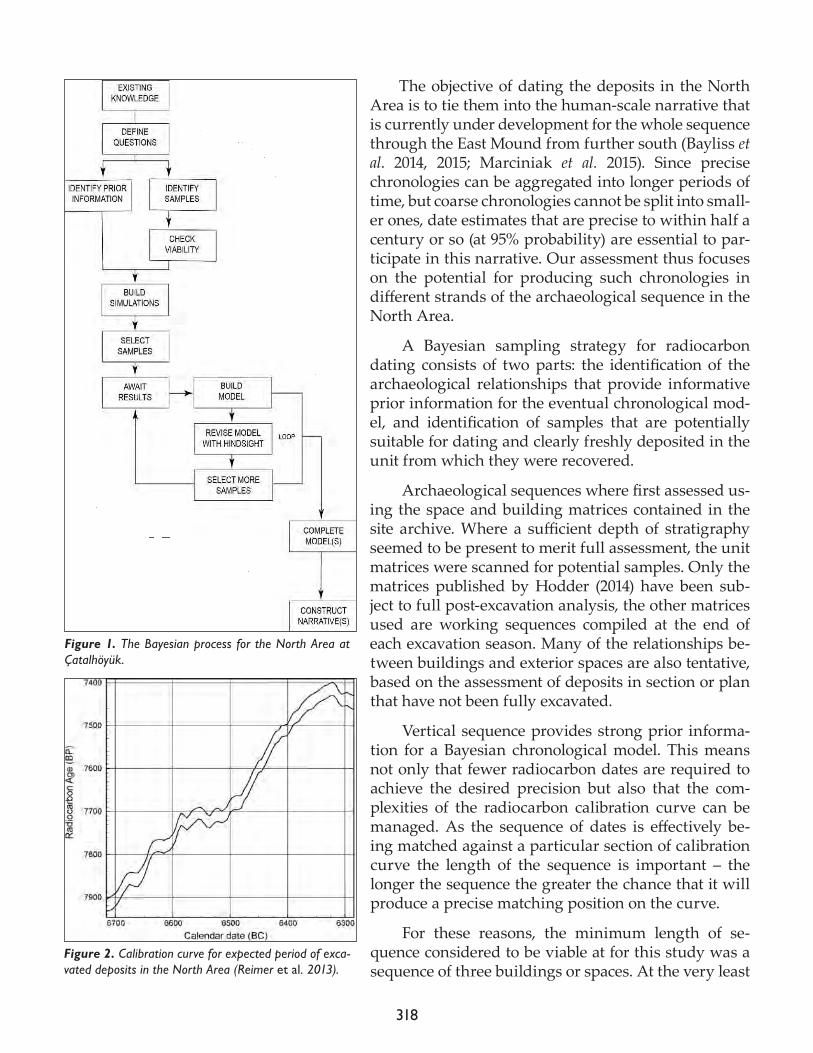
318
The objective of dating the deposits in the North Area is to tie them into the human-scale narrative that is currently under development for the whole sequence through the East Mound from further south (Bayliss et al. 2014, 2015; Marciniak et al. 2015). Since precise chronologies can be aggregated into longer periods of time, but coarse chronologies cannot be split into small-er ones, date estimates that are precise to within half a century or so (at 95% probability) are essential to par-ticipate in this narrative. Our assessment thus focuses on the potential for producing such chronologies in different strands of the archaeological sequence in the North Area.
A Bayesian sampling strategy for radiocarbon dating consists of two parts: the identification of the archaeological relationships that provide informative prior information for the eventual chronological mod-el, and identification of samples that are potentially suitable for dating and clearly freshly deposited in the unit from which they were recovered.
Archaeological sequences where first assessed us-ing the space and building matrices contained in the site archive. Where a sufficient depth of stratigraphy seemed to be present to merit full assessment, the unit matrices were scanned for potential samples. Only the matrices published by Hodder (2014) have been sub-ject to full post-excavation analysis, the other matrices used are working sequences compiled at the end of each excavation season. Many of the relationships be-tween buildings and exterior spaces are also tentative, based on the assessment of deposits in section or plan that have not been fully excavated.
Vertical sequence provides strong prior informa-tion for a Bayesian chronological model. This means not only that fewer radiocarbon dates are required to achieve the desired precision but also that the com-plexities of the radiocarbon calibration curve can be managed. As the sequence of dates is effectively be-ing matched against a particular section of calibration curve the length of the sequence is important – the longer the sequence the greater the chance that it will produce a precise matching position on the curve.
For these reasons, the minimum length of se-quence considered to be viable at for this study was a sequence of three buildings or spaces. At the very least
Figure 1. The Bayesian process for the North Area at Çatalhöyük.
Figure 2. Calibration curve for expected period of exca-vated deposits in the North Area (Reimer et al. 2013).
319
this would consist of a few samples from an eroded building on the surface that could provide ter-mini ante quos for the closure of an underlying building, the building itself, and a few samples from an underlying space or building (that did not necessarily have to be completely excavated) that could provide termini post quos for its construction.
Stratigraphic strings that met this criterion were then subject to preliminary assessment. The description of each unit on the matrix was considered with the aim of identifying the following classes of unit/potential samples:
• articulated or partially articulated human burials (†)• middens where the faunal assemblage could be scanned for articulating bone groups (no symbol)• black(ish) fills in hearths and fire-spots that might represent the fuel remnants of the last firing (*)• concentrations of botanical remains from the basal fills of bins or other contexts where they might represent in situ stores (*)• charred structural timbers (p)• faunal remains from installations (no symbol)• isolated human crania without mandibles from deposits that suggest that they might have been curated (†).
Each unit on the matrix which potentially contained such material was highlighted so that the stratigraphic relationships between potential samples are clearly apparent.
Preliminary assessment
Stratigraphic strings of buildings and sequences are considered from south to north through the North Area.
B.57, B.82, Sp. 60 (2B), Sp.133, Sp.146–7, Sp.240–2 and Sp.426The inferred sequence of these buildings and spaces used in this assessment is shown in Figure 3. At the time this was undertaken Sp.146–7 and Sp.426 were completely unexcavated, and only small parts of B.82 and Sp.282 had been excavated. Sp.133 was also only partially excavated.
In Sp.133, a total of 14 midden units and two fire-spots that had been sampled for carbonized plant remains were identified. Two midden units were identified from the overlying Sp.60, phase 2B. Above this, three midden units were identified from Sp.241 and one midden and one fire-spot from B.57. Above Sp.241, two midden units were identified from Sp.240. All midden units can be scanned for articulating groups of animal bone, and all flots can be scanned for carbonized seeds and charred twigs.
A matrix of units identified as likely to produce material suitable for radiocarbon dating from B.57, Sp. 60 (2B), Sp.133, and, Sp.240–2 is shown in Figure 4.
Suitable datable material may currently exist in archive from three successive buildings/spaces in this part of the North Area.
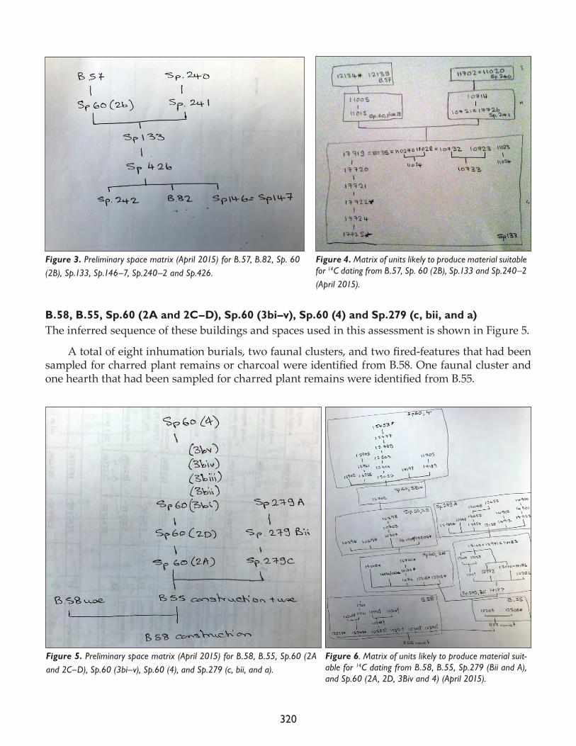
320
B.58, B.55, Sp.60 (2A and 2C–D), Sp.60 (3bi–v), Sp.60 (4) and Sp.279 (c, bii, and a) The inferred sequence of these buildings and spaces used in this assessment is shown in Figure 5.
A total of eight inhumation burials, two faunal clusters, and two fired-features that had been sampled for charred plant remains or charcoal were identified from B.58. One faunal cluster and one hearth that had been sampled for charred plant remains were identified from B.55.
Figure 3. Preliminary space matrix (April 2015) for B.57, B.82, Sp. 60 (2B), Sp.133, Sp.146–7, Sp.240–2 and Sp.426.
Figure 4. Matrix of units likely to produce material suitable for 14C dating from B.57, Sp. 60 (2B), Sp.133 and Sp.240–2 (April 2015).
Figure 5. Preliminary space matrix (April 2015) for B.58, B.55, Sp.60 (2A and 2C–D), Sp.60 (3bi–v), Sp.60 (4), and Sp.279 (c, bii, and a).
Figure 6. Matrix of units likely to produce material suit-able for 14C dating from B.58, B.55, Sp.279 (Bii and A), and Sp.60 (2A, 2D, 3Biv and 4) (April 2015).
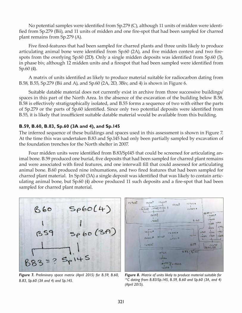
321
No potential samples were identified from Sp.279 (C), although 11 units of midden were identi-fied from Sp.279 (Bii), and 11 units of midden and one fire-spot that had been sampled for charred plant remains from Sp.279 (A).
Five fired-features that had been sampled for charred plants and three units likely to produce articulating animal bone were identified from Sp.60 (2A), and five midden context and two fire-spots from the overlying Sp.60 (2D). Only a single midden deposits was identified from Sp.60 (3), in phase biv, although 12 midden units and a firespot that had been sampled were identified from Sp.60 (4).
A matrix of units identified as likely to produce material suitable for radiocarbon dating from B.58, B.55, Sp.279 (Bii and A), and Sp.60 (2A, 2D, 3Biv, and 4) is shown in Figure 6.
Suitable datable material does not currently exist in archive from three successive buildings/spaces in this part of the North Area. In the absence of the excavation of the building below B.58, B.58 is effectively stratigraphically isolated, and B.55 forms a sequence of two with either the parts of Sp.279 or the parts of Sp.60 identified. Since only two potential deposits were identified from B.55, it is likely that insufficient suitable datable material would be available from this building.
B.59, B.60, B.83, Sp.60 (3A and 4), and Sp.145The inferred sequence of these buildings and spaces used in this assessment is shown in Figure 7. At the time this was undertaken B.83 and Sp.145 had only been partially sampled by excavation of the foundation trenches for the North shelter in 2007.
Four midden units were identified from B.83/Sp145 that could be screened for articulating an-imal bone. B.59 produced one burial, five deposits that had been sampled for charred plant remains and were associated with fired features, and one interwall fill that could assessed for articulating animal bone. B.60 produced nine inhumations, and two fired features that had been sampled for charred plant material. In Sp.60 (3A) a single deposit was identified that was likely to contain artic-ulating animal bone, but Sp.60 (4) above produced 11 such deposits and a fire-spot that had been sampled for charred plant material.
Figure 7. Preliminary space matrix (April 2015) for B.59, B.60, B.83, Sp.60 (3A and 4) and Sp.145.
Figure 8. Matrix of units likely to produce material suitable for 14C dating from B.83/Sp.145, B.59, B.60 and Sp.60 (3A, and 4) (April 2015).
322
A matrix of units identified as likely to produce material suitable for radiocarbon dating from B.83/Sp.145, B.59, B.60, and Sp.60 (3A and 4) is shown in Figure 8.
Suitable datable material may currently exist in archive from three successive buildings/spaces in this part of the North Area, although the viability of this sequence will depend on the presence of suitable datable material from the small area of B.83/Sp.145 currently excavated.
B.46, B.48 and Sp.242No matrices were available for B.46 or B.48 at the time of this assessment. Only mudbrick walls survived from B.46, which cut the partially excavated deposits of B.48. This building is in turn later than unexcavated midden Sp.242. No deposits likely to contain suitable datable material were iden-tified from the units assigned to either building.
It should be noted that additional excavation was undertaken in B.48 during the 2016 field sea-son, in which a skeleton Sk (32211) was lifted.
B.64, Sp.60 (2C and 3D), Sp.138 and Sp.279 (A, Bii, and C)The inferred sequence of these buildings and spaces used in this assessment is shown in Figure 9. At this time Sp.138 had only been observed in section.
No deposits likely to produce suitable samples were identified from Sp.138 (unexcavated) or Sp.60 (2C and 3D). A burial and a faunal cluster were, however, identified from B.64, and eleven midden layers that could be screen for articulating animal bone each from Sp.279 (Bii) and Sp.279 (A). Sp.279 (A) additionally produced a fire-spot that had been sampled for charred plant remains.
Figure 9. Preliminary space matrix (April 2015) for B.64, Sp.60 (2C and 3D), Sp.138, and Sp.279 (A, Bii, and C).
Figure 10. Matrix of units likely to produce material suitable for 14C dating from B.64 and Sp.279 (Bii and A) (April 2015).
323
A matrix of units identified as likely to produce material suitable for radiocarbon dating from B.64 and Sp.279 (Bii and A) is shown in Figure 10.
Suitable datable material does not currently exist in archive from three successive buildings/spaces in this part of the North Area. Only the sequence of B.64 and Sp.279 are likely to produce samples suitable for radiocarbon dating and, since only two potential deposits were identified from B.64, it is likely that insufficient suitable datable material would be available from this building.
B.51, B.52, B.113, B.114, Sp.60 (2E, Ci, and Cii), Sp.146=Sp.147, Sp, 240, Sp.291 and Sp.532The inferred sequence of these buildings and spaces used in this assessment is shown in Figure 11. At the time of this assessment, Sp.146, 147 and Sp.532 were unexcavated, and B.113, B.114, and Sp.291 were partially excavated.
No deposits likely to produce suitable samples were identified from Sp.146–7 and Sp.532 (unex-cavated) or Sp. 60 (3Cii) or Sp.291.
Sixteen burials, nineteen fired features that had been sampled for carbonized plant remains, and five deposits that might produce articulating faunal groups were identified from B.52, but only a single hearth that might contained carbonized plant material from B.51. Six deposits likely to con-tain carbonized material functionally related to the use of the context were identified from B.113, along with two inter-wall fills that might produce articulating animal bone. At the time of this as-sessment no matrix was available from B.114, although this building contained seven inhumation burials and six fire-features that had been sampled for charred plant material and was known to be earlier than B.113.
Six units with high potential for contain-ing articulating animal bone were identified from Sp.60 (2E), one from Sp.70 (3Ci), and two from Sp.240.
A matrix of units identified as likely to produce material suitable for radiocarbon dat-ing from B.51, B.52, B.113, B.114, Sp.60 (2E and 3Ci), and Sp.240 is shown in Figure 12.
Sufficient suitable datable material prob-ably does not currently exist in archive from three successive buildings/spaces in this part of the North Area. In the absence of the excava-tion of the building below B.52, B.52 forms se-quences of two buildings with each of B.51 and B.113. It forms a sequence of three buildings/spaces with Sp.60 (3Ci) and Sp.240, but since only one and two units likely to contain artic-ulating animal bone have been identified from these spaces respectively, it is likely insufficient viable samples would be located from these
Figure 11. Preliminary space matrix (April 2015) for B.51, B.52, B.113, B.114, Sp.60 (2E, Ci, and Cii), Sp.146=Sp.147, Sp.240, Sp.291 and Sp.532.
Figure 12. Matrix of units likely to produce material suitable for 14C dating from B.51, B.52, B.113, B.114, Sp.60 (2E and 3Ci) and Sp.240 (April 2015).
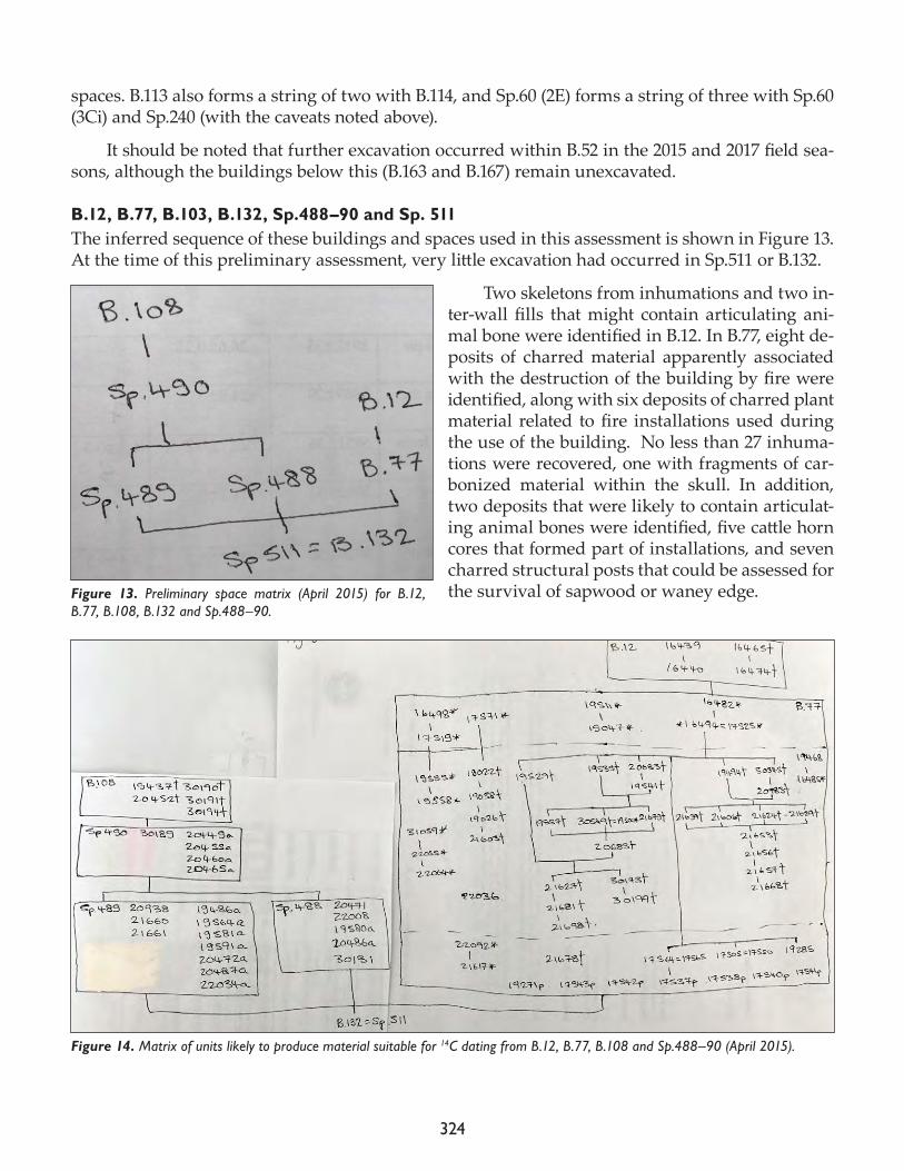
324
spaces. B.113 also forms a string of two with B.114, and Sp.60 (2E) forms a string of three with Sp.60 (3Ci) and Sp.240 (with the caveats noted above).
It should be noted that further excavation occurred within B.52 in the 2015 and 2017 field sea-sons, although the buildings below this (B.163 and B.167) remain unexcavated.
B.12, B.77, B.103, B.132, Sp.488–90 and Sp. 511The inferred sequence of these buildings and spaces used in this assessment is shown in Figure 13. At the time of this preliminary assessment, very little excavation had occurred in Sp.511 or B.132.
Two skeletons from inhumations and two in-ter-wall fills that might contain articulating ani-mal bone were identified in B.12. In B.77, eight de-posits of charred material apparently associated with the destruction of the building by fire were identified, along with six deposits of charred plant material related to fire installations used during the use of the building. No less than 27 inhuma-tions were recovered, one with fragments of car-bonized material within the skull. In addition, two deposits that were likely to contain articulat-ing animal bones were identified, five cattle horn cores that formed part of installations, and seven charred structural posts that could be assessed for the survival of sapwood or waney edge.Figure 13. Preliminary space matrix (April 2015) for B.12,
B.77, B.108, B.132 and Sp.488–90.
Figure 14. Matrix of units likely to produce material suitable for 14C dating from B.12, B.77, B.108 and Sp.488–90 (April 2015).
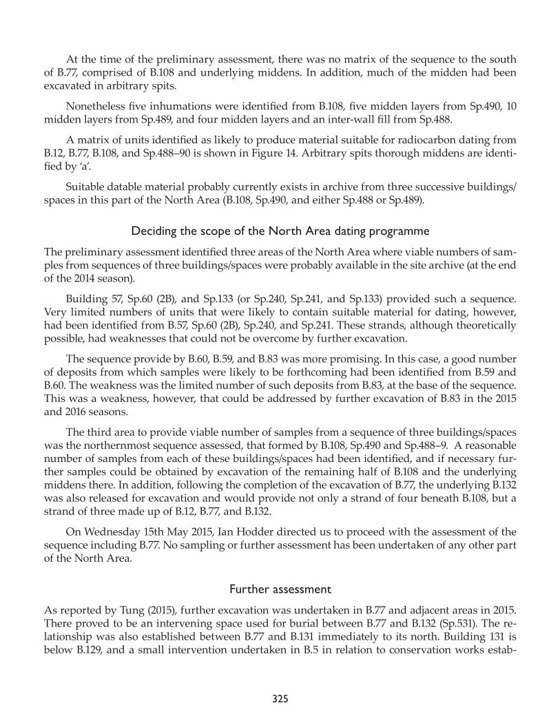
325
At the time of the preliminary assessment, there was no matrix of the sequence to the south of B.77, comprised of B.108 and underlying middens. In addition, much of the midden had been excavated in arbitrary spits.
Nonetheless five inhumations were identified from B.108, five midden layers from Sp.490, 10 midden layers from Sp.489, and four midden layers and an inter-wall fill from Sp.488.
A matrix of units identified as likely to produce material suitable for radiocarbon dating from B.12, B.77, B.108, and Sp.488–90 is shown in Figure 14. Arbitrary spits thorough middens are identi-fied by ‘a’.
Suitable datable material probably currently exists in archive from three successive buildings/spaces in this part of the North Area (B.108, Sp.490, and either Sp.488 or Sp.489).
Deciding the scope of the North Area dating programme
The preliminary assessment identified three areas of the North Area where viable numbers of sam-ples from sequences of three buildings/spaces were probably available in the site archive (at the end of the 2014 season).
Building 57, Sp.60 (2B), and Sp.133 (or Sp.240, Sp.241, and Sp.133) provided such a sequence. Very limited numbers of units that were likely to contain suitable material for dating, however, had been identified from B.57, Sp.60 (2B), Sp.240, and Sp.241. These strands, although theoretically possible, had weaknesses that could not be overcome by further excavation.
The sequence provide by B.60, B.59, and B.83 was more promising. In this case, a good number of deposits from which samples were likely to be forthcoming had been identified from B.59 and B.60. The weakness was the limited number of such deposits from B.83, at the base of the sequence. This was a weakness, however, that could be addressed by further excavation of B.83 in the 2015 and 2016 seasons.
The third area to provide viable number of samples from a sequence of three buildings/spaces was the northernmost sequence assessed, that formed by B.108, Sp.490 and Sp.488–9. A reasonable number of samples from each of these buildings/spaces had been identified, and if necessary fur-ther samples could be obtained by excavation of the remaining half of B.108 and the underlying middens there. In addition, following the completion of the excavation of B.77, the underlying B.132 was also released for excavation and would provide not only a strand of four beneath B.108, but a strand of three made up of B.12, B.77, and B.132.
On Wednesday 15th May 2015, Ian Hodder directed us to proceed with the assessment of the sequence including B.77. No sampling or further assessment has been undertaken of any other part of the North Area.
Further assessment
As reported by Tung (2015), further excavation was undertaken in B.77 and adjacent areas in 2015. There proved to be an intervening space used for burial between B.77 and B.132 (Sp.531). The re-lationship was also established between B.77 and B.131 immediately to its north. Building 131 is below B.129, and a small intervention undertaken in B.5 in relation to conservation works estab-
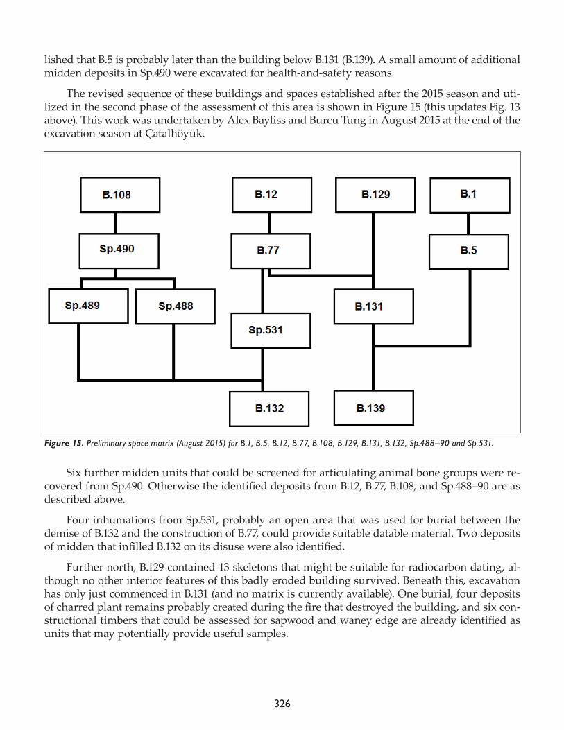
326
lished that B.5 is probably later than the building below B.131 (B.139). A small amount of additional midden deposits in Sp.490 were excavated for health-and-safety reasons.
The revised sequence of these buildings and spaces established after the 2015 season and uti-lized in the second phase of the assessment of this area is shown in Figure 15 (this updates Fig. 13 above). This work was undertaken by Alex Bayliss and Burcu Tung in August 2015 at the end of the excavation season at Çatalhöyük.
Six further midden units that could be screened for articulating animal bone groups were re-covered from Sp.490. Otherwise the identified deposits from B.12, B.77, B.108, and Sp.488–90 are as described above.
Four inhumations from Sp.531, probably an open area that was used for burial between the demise of B.132 and the construction of B.77, could provide suitable datable material. Two deposits of midden that infilled B.132 on its disuse were also identified.
Further north, B.129 contained 13 skeletons that might be suitable for radiocarbon dating, al-though no other interior features of this badly eroded building survived. Beneath this, excavation has only just commenced in B.131 (and no matrix is currently available). One burial, four deposits of charred plant remains probably created during the fire that destroyed the building, and six con-structional timbers that could be assessed for sapwood and waney edge are already identified as units that may potentially provide useful samples.
Figure 15. Preliminary space matrix (August 2015) for B.1, B.5, B.12, B.77, B.108, B.129, B.131, B.132, Sp.488–90 and Sp.531.
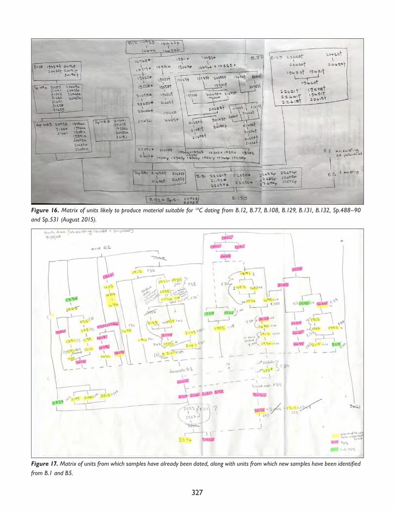
327
Figure 17. Matrix of units from which samples have already been dated, along with units from which new samples have been identified from B.1 and B5.
Figure 16. Matrix of units likely to produce material suitable for 14C dating from B.12, B.77, B.108, B.129, B.131, B.132, Sp.488–90 and Sp.531 (August 2015).
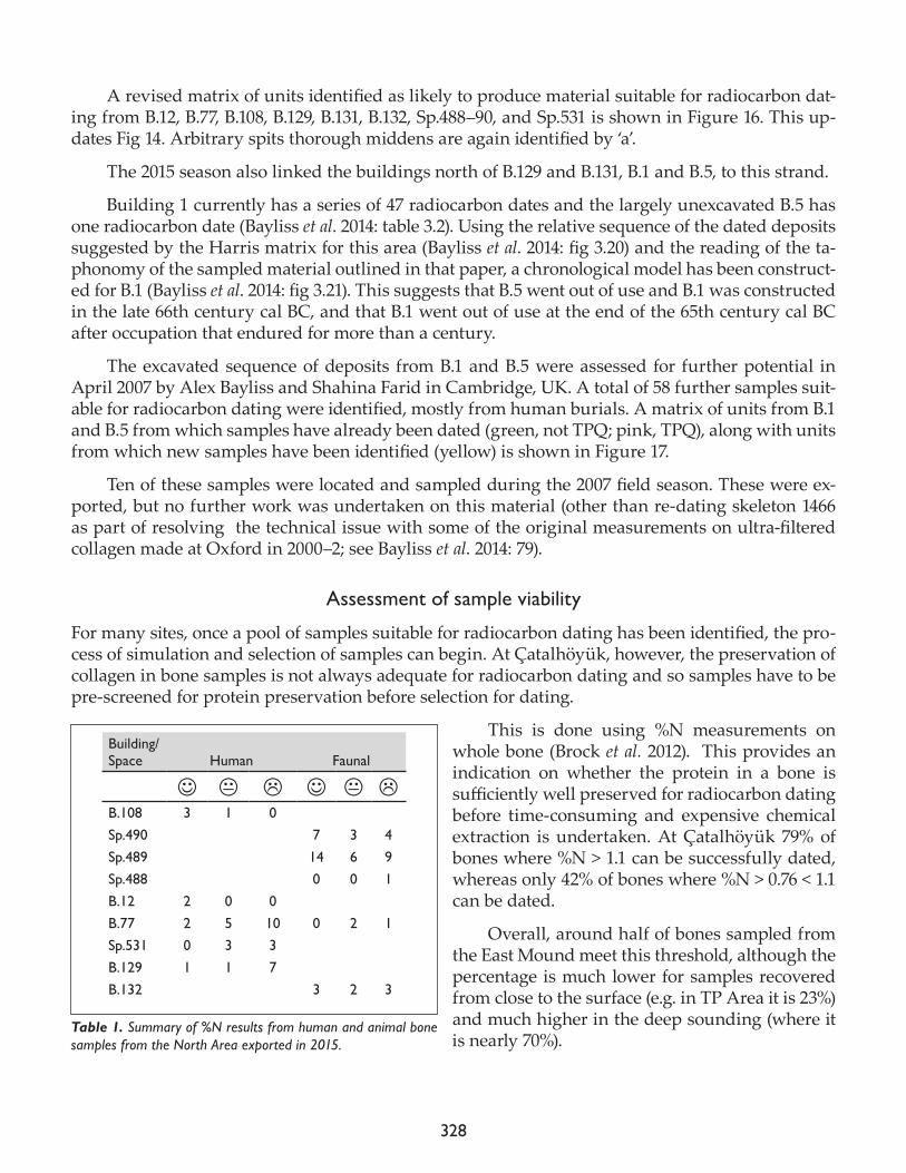
328
A revised matrix of units identified as likely to produce material suitable for radiocarbon dat-ing from B.12, B.77, B.108, B.129, B.131, B.132, Sp.488–90, and Sp.531 is shown in Figure 16. This up-dates Fig 14. Arbitrary spits thorough middens are again identified by ‘a’.
The 2015 season also linked the buildings north of B.129 and B.131, B.1 and B.5, to this strand.
Building 1 currently has a series of 47 radiocarbon dates and the largely unexcavated B.5 has one radiocarbon date (Bayliss et al. 2014: table 3.2). Using the relative sequence of the dated deposits suggested by the Harris matrix for this area (Bayliss et al. 2014: fig 3.20) and the reading of the ta-phonomy of the sampled material outlined in that paper, a chronological model has been construct-ed for B.1 (Bayliss et al. 2014: fig 3.21). This suggests that B.5 went out of use and B.1 was constructed in the late 66th century cal BC, and that B.1 went out of use at the end of the 65th century cal BC after occupation that endured for more than a century.
The excavated sequence of deposits from B.1 and B.5 were assessed for further potential in April 2007 by Alex Bayliss and Shahina Farid in Cambridge, UK. A total of 58 further samples suit-able for radiocarbon dating were identified, mostly from human burials. A matrix of units from B.1 and B.5 from which samples have already been dated (green, not TPQ; pink, TPQ), along with units from which new samples have been identified (yellow) is shown in Figure 17.
Ten of these samples were located and sampled during the 2007 field season. These were ex-ported, but no further work was undertaken on this material (other than re-dating skeleton 1466 as part of resolving the technical issue with some of the original measurements on ultra-filtered collagen made at Oxford in 2000–2; see Bayliss et al. 2014: 79).
Assessment of sample viability
For many sites, once a pool of samples suitable for radiocarbon dating has been identified, the pro-cess of simulation and selection of samples can begin. At Çatalhöyük, however, the preservation of collagen in bone samples is not always adequate for radiocarbon dating and so samples have to be pre-screened for protein preservation before selection for dating.
This is done using %N measurements on whole bone (Brock et al. 2012). This provides an indication on whether the protein in a bone is sufficiently well preserved for radiocarbon dating before time-consuming and expensive chemical extraction is undertaken. At Çatalhöyük 79% of bones where %N > 1.1 can be successfully dated, whereas only 42% of bones where %N > 0.76 < 1.1 can be dated.
Overall, around half of bones sampled from the East Mound meet this threshold, although the percentage is much lower for samples recovered from close to the surface (e.g. in TP Area it is 23%) and much higher in the deep sounding (where it is nearly 70%).
Building/Space Human Faunal
B.108 3 1 0Sp.490 7 3 4Sp.489 14 6 9Sp.488 0 0 1B.12 2 0 0B.77 2 5 10 0 2 1Sp.531 0 3 3B.129 1 1 7B.132 3 2 3
Table 1. Summary of %N results from human and animal bone samples from the North Area exported in 2015.
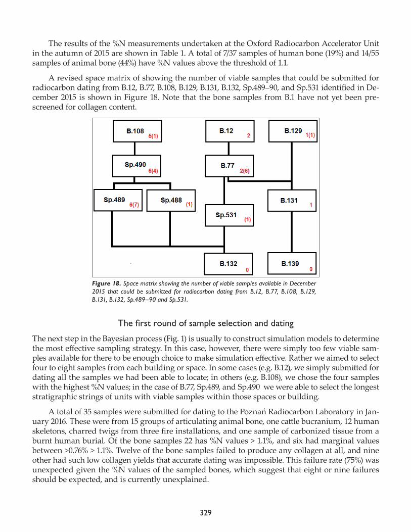
329
The results of the %N measurements undertaken at the Oxford Radiocarbon Accelerator Unit in the autumn of 2015 are shown in Table 1. A total of 7/37 samples of human bone (19%) and 14/55 samples of animal bone (44%) have %N values above the threshold of 1.1.
A revised space matrix of showing the number of viable samples that could be submitted for radiocarbon dating from B.12, B.77, B.108, B.129, B.131, B.132, Sp.489–90, and Sp.531 identified in De-cember 2015 is shown in Figure 18. Note that the bone samples from B.1 have not yet been pre-screened for collagen content.
Thefirstroundofsampleselectionanddating
The next step in the Bayesian process (Fig. 1) is usually to construct simulation models to determine the most effective sampling strategy. In this case, however, there were simply too few viable sam-ples available for there to be enough choice to make simulation effective. Rather we aimed to select four to eight samples from each building or space. In some cases (e.g. B.12), we simply submitted for dating all the samples we had been able to locate; in others (e.g. B.108), we chose the four samples with the highest %N values; in the case of B.77, Sp.489, and Sp.490 we were able to select the longest stratigraphic strings of units with viable samples within those spaces or building.
A total of 35 samples were submitted for dating to the Poznań Radiocarbon Laboratory in Jan-uary 2016. These were from 15 groups of articulating animal bone, one cattle bucranium, 12 human skeletons, charred twigs from three fire installations, and one sample of carbonized tissue from a burnt human burial. Of the bone samples 22 has %N values > 1.1%, and six had marginal values between >0.76% > 1.1%. Twelve of the bone samples failed to produce any collagen at all, and nine other had such low collagen yields that accurate dating was impossible. This failure rate (75%) was unexpected given the %N values of the sampled bones, which suggest that eight or nine failures should be expected, and is currently unexplained.
Figure 18. Space matrix showing the number of viable samples available in December 2015 that could be submitted for radiocarbon dating from B.12, B.77, B.108, B.129, B.131, B.132, Sp.489–90 and Sp.531.
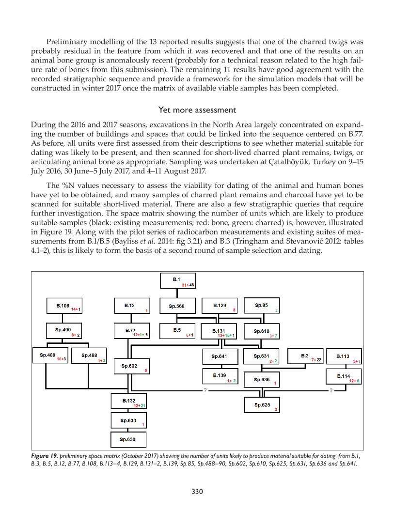
330
Preliminary modelling of the 13 reported results suggests that one of the charred twigs was probably residual in the feature from which it was recovered and that one of the results on an animal bone group is anomalously recent (probably for a technical reason related to the high fail-ure rate of bones from this submission). The remaining 11 results have good agreement with the recorded stratigraphic sequence and provide a framework for the simulation models that will be constructed in winter 2017 once the matrix of available viable samples has been completed.
Yet more assessment
During the 2016 and 2017 seasons, excavations in the North Area largely concentrated on expand-ing the number of buildings and spaces that could be linked into the sequence centered on B.77. As before, all units were first assessed from their descriptions to see whether material suitable for dating was likely to be present, and then scanned for short-lived charred plant remains, twigs, or articulating animal bone as appropriate. Sampling was undertaken at Çatalhöyük, Turkey on 9–15 July 2016, 30 June–5 July 2017, and 4–11 August 2017.
The %N values necessary to assess the viability for dating of the animal and human bones have yet to be obtained, and many samples of charred plant remains and charcoal have yet to be scanned for suitable short-lived material. There are also a few stratigraphic queries that require further investigation. The space matrix showing the number of units which are likely to produce suitable samples (black: existing measurements; red: bone, green: charred) is, however, illustrated in Figure 19. Along with the pilot series of radiocarbon measurements and existing suites of mea-surements from B.1/B.5 (Bayliss et al. 2014: fig 3.21) and B.3 (Tringham and Stevanović 2012: tables 4.1–2), this is likely to form the basis of a second round of sample selection and dating.
Figure 19. preliminary space matrix (October 2017) showing the number of units likely to produce material suitable for dating from B.1, B.3, B.5, B.12, B.77, B.108, B.113–4, B.129, B.131–2, B.139, Sp.85, Sp.488–90, Sp.602, Sp.610, Sp.625, Sp.631, Sp.636 and Sp.641.
331
Acknowledgments
We could not have done this alone! Many thanks to Romy McIntosh (2015), David Orton (2015 and 2017), and Jesse Wolfhagen (2016–17) for scanning crates of fauna for articulating bone groups; Scott Haddow and Christopher Knüsel kindly advised on suitable sampling locations for the hu-man remains; Liz Stroud and Dragana Filipović scanned flots for suitable short-lived charred plant macrofossils both at Çatalhöyük and in Oxford; Ceren Kabukcu similarly searched out charred twigs both on site and in Liverpool; and Ekin Unal provided various support above and beyond the call of duty on site in 2017. Peter Ditchfield and colleagues at the Oxford Radiocarbon Acceler-ator Unit have measured %N values on innumerable bones for many years to tight timescales and without complaint at the depressingly low percentage that turn into viable radiocarbon samples, and James Taylor compiled the matrix of sampled units in 2017.
References
Bayliss, A.2009. Rolling out revolution: using radiocarbon dating in archaeology. Radiocarbon 51: 123–47.
Bayliss, A., F. Brock, S. Farid, I. Hodder, J. Southon and R.E. Taylor2015. Getting to the bottom of it all: a Bayesian approach to dating the start of Çatalhöyük. Journal of World Pre-history 28: 1–26.
Bayliss, A., S. Farid and T. Higham2014. Time will tell: practising Bayesian chronological modeling on the East Mound. In Çatalhöyük Excavations: The 2000-2008 Seasons, edited by I. Hodder. London: British Institute at Ankara; Los Angeles: Cotsen Institute of Archaeology Press, pp. 53–90.
Brock, F., R. Wood, T.F.G. Higham, P. Ditchfield, A. Bayliss and C. Bronk Ramsey2012. Reliability of nitrogen content (%N) and carbon:nitrogen atomic ratios (C:N) as indicators of collagen pres-ervation suitable for radiocarbon dating. Radiocarbon 54: 879–86.
Bronk Ramsey, C.1995. Radiocarbon calibration and analysis of stratigraphy: the OxCal program. Radiocarbon 36: 425–30.
1998. Probability and dating. Radiocarbon 40: 461–74.
2001. Development of the radiocarbon calibration program OxCal. Radiocarbon 43: 355–63.
2008. Deposition models for chronological records. Quaternary Science Reviews 27: 42-60.
2009. Bayesian analysis of radiocarbon dates. Radiocarbon 51: 37–60.
Buck, C.E., W.G. Cavanagh C.D. and Litton1996. Bayesian Approach to Interpreting Archaeological Data. Chichester: Wiley.
Cessford, C. 2005. Absolute dating at Çatalhöyük. In Inhabiting Çatalhöyük: Reports from the 1995–99 Seasons, edited by I. Hod-der. Cambridge: McDonald Institute for Archaeological Research; London: British Institute at Ankara, pp. 65−99.
332
Farid, S. 2014. Timelines: phasing Neolithic Çatalhöyük. In Çatalhöyük Excavations: The 2000-2008 Seasons, edited by I. Hodder. London: British Institute at Ankara; Los Angeles: Cotsen Institute of Archaeology Press, pp. 91–129.
Hodder, I. (ed.) 2015. Çatalhöyük Excavations: The 2000-2008 Seasons. London: British Institute at Ankara; Los Angeles: Cotsen Institute of Archaeology Press.
Marciniak, A, M.Z. Barański, A. Bayliss, L. Czerniak, T. Goslar, J. Southon and R.E. Taylor2015. Fragmenting times: interpreting a Bayesian chronology for the late Neolithic occupation of Çatalhöyük East, Turkey. Antiquity 89: 154–76.
Reimer, P.J., E. Bard, A. Bayliss, J.W. Beck, P. Blackwell, C. Bronk Ramsey, C.E. Buck, H. Cheng, R.L. Edwards, M. Frie-drich, P.M. Grootes, T.P. Guilderson, H. Haflidason, I. Hajdas, C. Hatté, T.J. Heaton, D.L. Hoffmann, A.G. Hogg, K.A. Hughen, K.F. Kaiser, B. Kromer, S.W. Manning, M. Niu, R.W. Reimer, D.A. Richards, EM. Scott, J.R. Southon, RA. Staff, C.S.M. Turney and J. van der Plicht
2013. IntCal13 and Marine13 radiocarbon age calibration curves 0–50,000 years cal BP. Radiocarbon 55: 1869–87.
Tringham, R. and M. Stevanović2012. Last House on the Hill: BACH Archaeological Reports from Çatalhöyük, Turkey. Los Angeles: Cotsen Institute of Archaeology Press.
Tung, B. 2015. Excavations in the North Area. Çatalhöyük 2015 Archive Report, pp. 17–42.
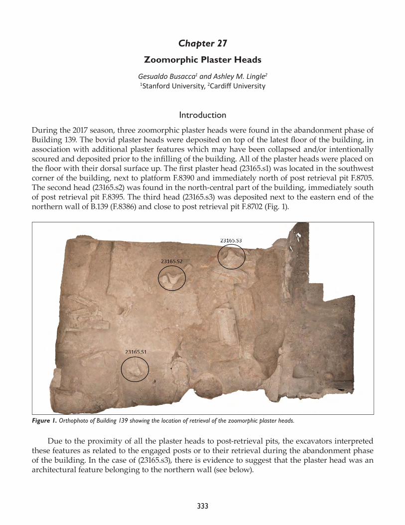
333
Chapter 27
Zoomorphic Plaster Heads
Gesualdo Busacca1 and Ashley M. Lingle2
1Stanford University, 2Cardiff University
Introduction
During the 2017 season, three zoomorphic plaster heads were found in the abandonment phase of Building 139. The bovid plaster heads were deposited on top of the latest floor of the building, in association with additional plaster features which may have been collapsed and/or intentionally scoured and deposited prior to the infilling of the building. All of the plaster heads were placed on the floor with their dorsal surface up. The first plaster head (23165.s1) was located in the southwest corner of the building, next to platform F.8390 and immediately north of post retrieval pit F.8705. The second head (23165.s2) was found in the north-central part of the building, immediately south of post retrieval pit F.8395. The third head (23165.s3) was deposited next to the eastern end of the northern wall of B.139 (F.8386) and close to post retrieval pit F.8702 (Fig. 1).
Due to the proximity of all the plaster heads to post-retrieval pits, the excavators interpreted these features as related to the engaged posts or to their retrieval during the abandonment phase of the building. In the case of (23165.s3), there is evidence to suggest that the plaster head was an architectural feature belonging to the northern wall (see below).
Figure 1. Orthophoto of Building 139 showing the location of retrieval of the zoomorphic plaster heads.
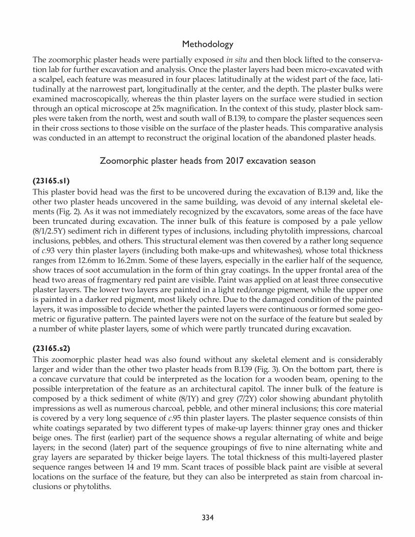
334
Methodology
The zoomorphic plaster heads were partially exposed in situ and then block lifted to the conserva-tion lab for further excavation and analysis. Once the plaster layers had been micro-excavated with a scalpel, each feature was measured in four places: latitudinally at the widest part of the face, lati-tudinally at the narrowest part, longitudinally at the center, and the depth. The plaster bulks were examined macroscopically, whereas the thin plaster layers on the surface were studied in section through an optical microscope at 25x magnification. In the context of this study, plaster block sam-ples were taken from the north, west and south wall of B.139, to compare the plaster sequences seen in their cross sections to those visible on the surface of the plaster heads. This comparative analysis was conducted in an attempt to reconstruct the original location of the abandoned plaster heads.
Zoomorphic plaster heads from 2017 excavation season
(23165.s1)This plaster bovid head was the first to be uncovered during the excavation of B.139 and, like the other two plaster heads uncovered in the same building, was devoid of any internal skeletal ele-ments (Fig. 2). As it was not immediately recognized by the excavators, some areas of the face have been truncated during excavation. The inner bulk of this feature is composed by a pale yellow (8/1/2.5Y) sediment rich in different types of inclusions, including phytolith impressions, charcoal inclusions, pebbles, and others. This structural element was then covered by a rather long sequence of c.93 very thin plaster layers (including both make-ups and whitewashes), whose total thickness ranges from 12.6mm to 16.2mm. Some of these layers, especially in the earlier half of the sequence, show traces of soot accumulation in the form of thin gray coatings. In the upper frontal area of the head two areas of fragmentary red paint are visible. Paint was applied on at least three consecutive plaster layers. The lower two layers are painted in a light red/orange pigment, while the upper one is painted in a darker red pigment, most likely ochre. Due to the damaged condition of the painted layers, it was impossible to decide whether the painted layers were continuous or formed some geo-metric or figurative pattern. The painted layers were not on the surface of the feature but sealed by a number of white plaster layers, some of which were partly truncated during excavation.
(23165.s2)This zoomorphic plaster head was also found without any skeletal element and is considerably larger and wider than the other two plaster heads from B.139 (Fig. 3). On the bottom part, there is a concave curvature that could be interpreted as the location for a wooden beam, opening to the possible interpretation of the feature as an architectural capitol. The inner bulk of the feature is composed by a thick sediment of white (8/1Y) and grey (7/2Y) color showing abundant phytolith impressions as well as numerous charcoal, pebble, and other mineral inclusions; this core material is covered by a very long sequence of c.95 thin plaster layers. The plaster sequence consists of thin white coatings separated by two different types of make-up layers: thinner gray ones and thicker beige ones. The first (earlier) part of the sequence shows a regular alternating of white and beige layers; in the second (later) part of the sequence groupings of five to nine alternating white and gray layers are separated by thicker beige layers. The total thickness of this multi-layered plaster sequence ranges between 14 and 19 mm. Scant traces of possible black paint are visible at several locations on the surface of the feature, but they can also be interpreted as stain from charcoal in-clusions or phytoliths.
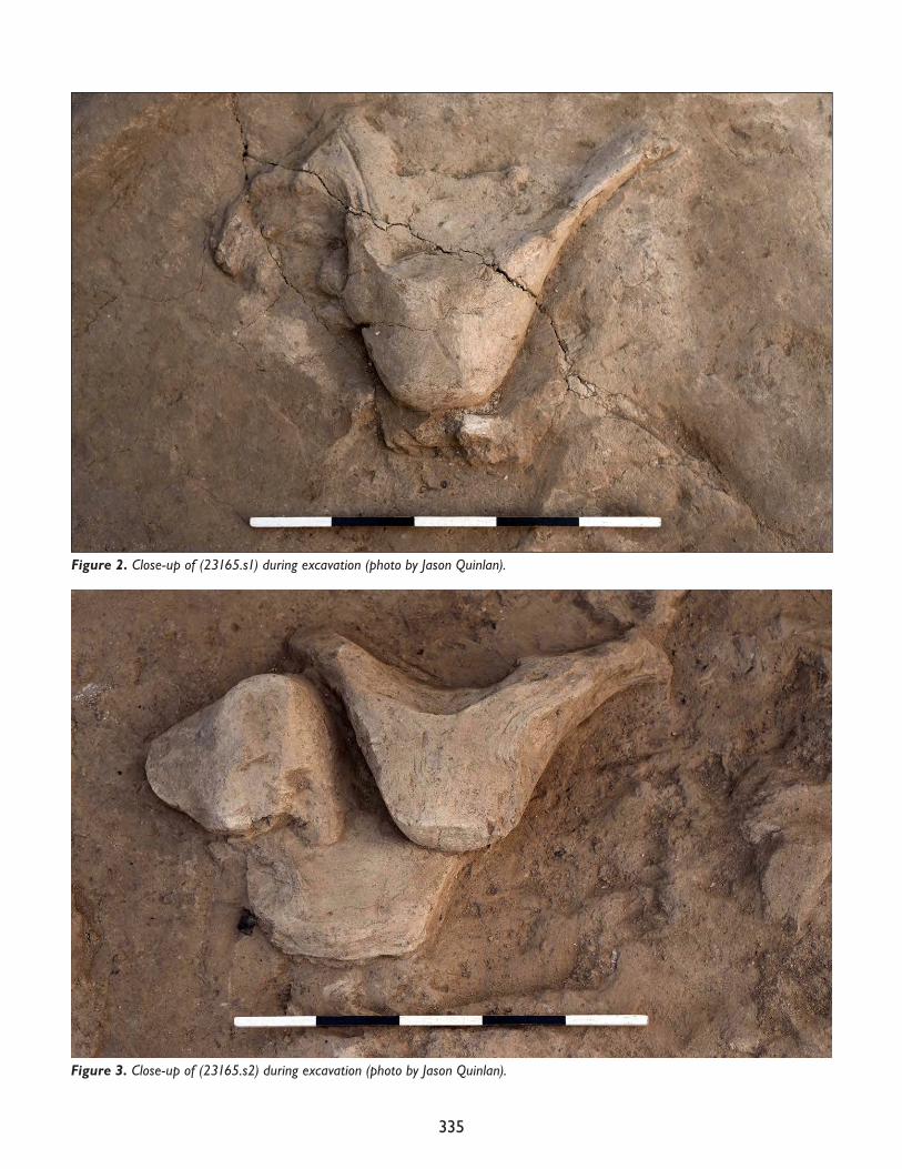
335
Figure 3. Close-up of (23165.s2) during excavation (photo by Jason Quinlan).
Figure 2. Close-up of (23165.s1) during excavation (photo by Jason Quinlan).
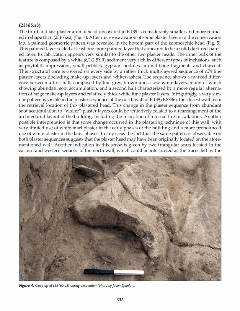
336
(23165.s3)The third and last plaster animal head uncovered in B.139 is considerably smaller and more round-ed in shape than (23165.s2) (Fig. 4). After micro-excavation of some plaster layers in the conservation lab, a painted geometric pattern was revealed in the bottom part of the zoomorphic head (Fig. 5). This painted layer sealed at least one more painted layer that appeared to be a solid dark red-paint-ed layer. Its fabrication appears very similar to the other two plaster heads. The inner bulk of the feature is composed by a white (8/1/2.5YR) sediment very rich in different types of inclusions, such as phytolith impressions, small pebbles, gypsum nodules, animal bone fragments and charcoal. This structural core is covered on every side by a rather thick multi-layered sequence of c.74 fine plaster layers (including make-up layers and whitewashes). The sequence shows a marked differ-ence between a first half, composed by fine grey, brown and a few white layers, many of which showing abundant soot accumulation, and a second half characterized by a more regular alterna-tion of beige make-up layers and relatively thick white lime plaster layers. Intriguingly, a very sim-ilar pattern is visible in the plaster sequence of the north wall of B.139 (F.8386), the closest wall from the retrieval location of this plastered head. This change in the plaster sequence from abundant soot accumulation to “whiter” plaster layers could be tentatively related to a rearrangement of the architectural layout of the building, including the relocation of internal fire installations. Another possible interpretation is that some change occurred in the plastering technique of this wall, with very limited use of white marl plaster in the early phases of the building and a more pronounced use of white plaster in the later phases. In any case, the fact that the same pattern is observable on both plaster sequences suggests that the plaster head may have been originally located on the afore-mentioned wall. Another indication in this sense is given by two triangular scars located in the eastern and western sections of the north wall, which could be interpreted as the traces left by the
Figure 4. Close-up of (23165.s3) during excavation (photo by Jason Quinlan).
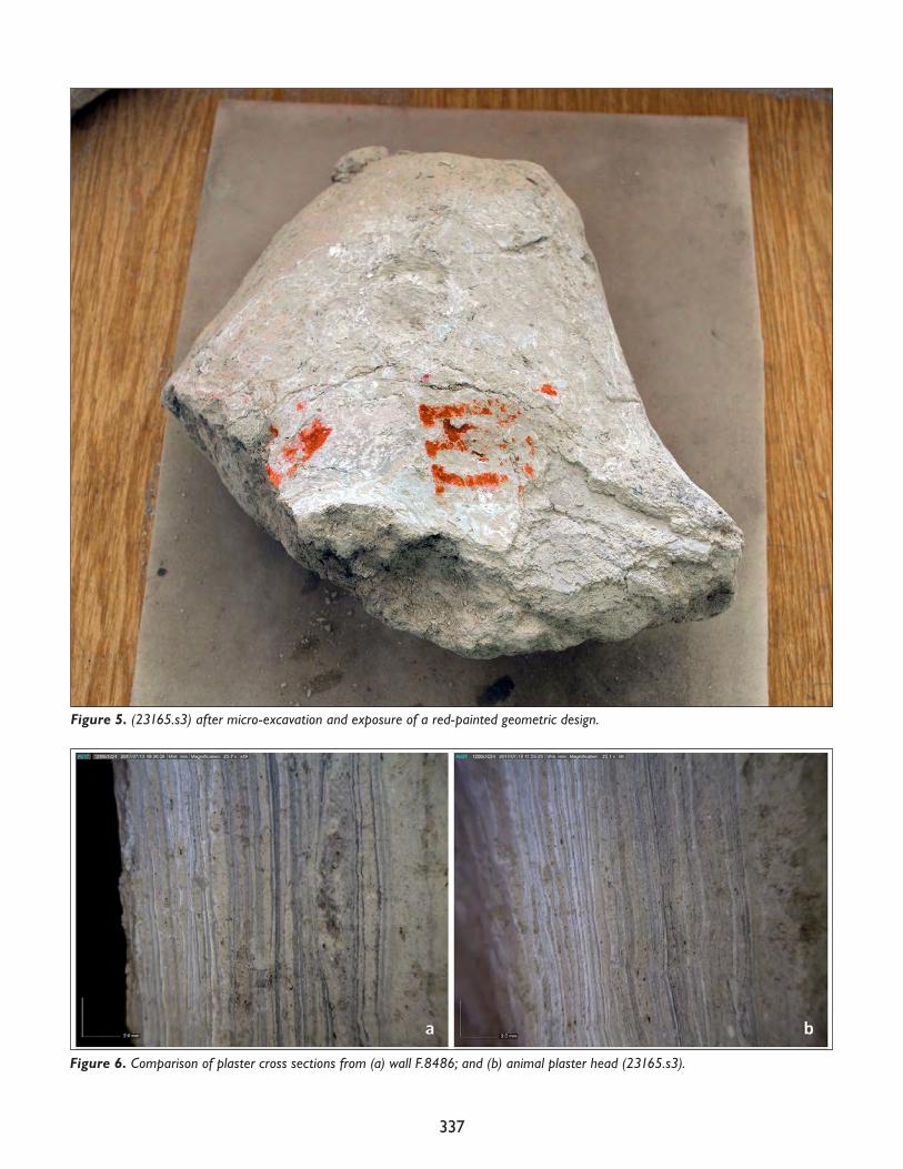
337
Figure 6. Comparison of plaster cross sections from (a) wall F.8486; and (b) animal plaster head (23165.s3).
Figure 5. (23165.s3) after micro-excavation and exposure of a red-painted geometric design.
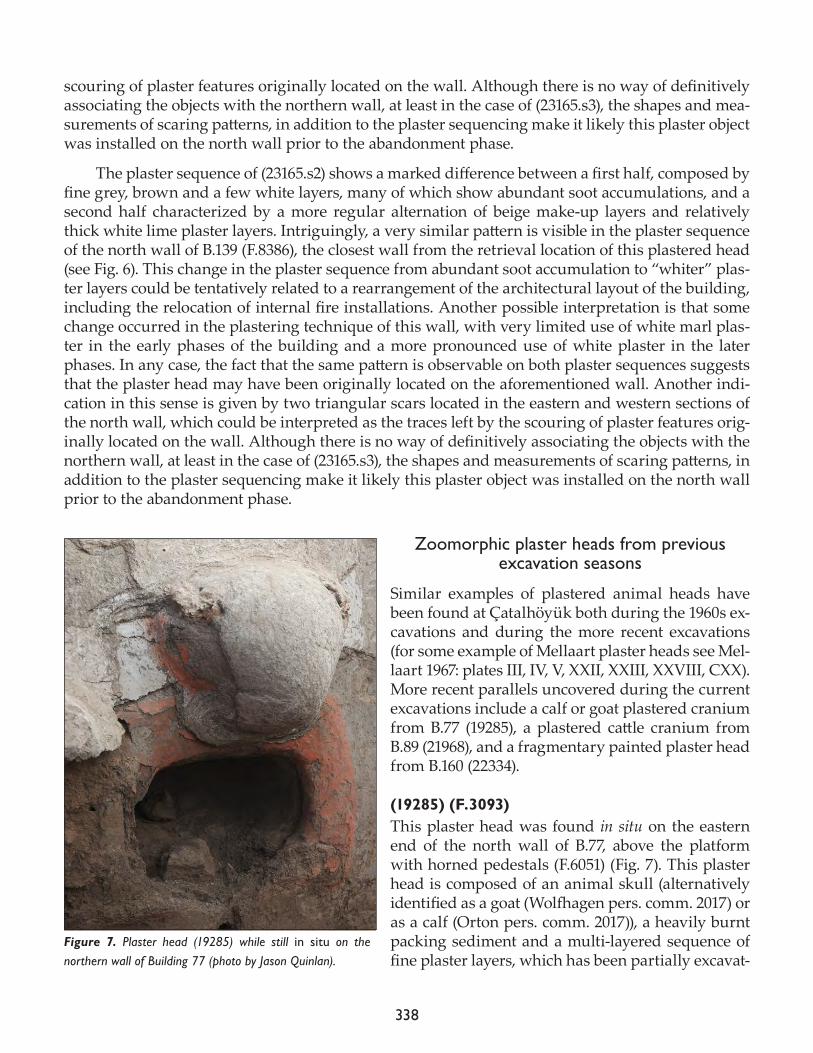
338
scouring of plaster features originally located on the wall. Although there is no way of definitively associating the objects with the northern wall, at least in the case of (23165.s3), the shapes and mea-surements of scaring patterns, in addition to the plaster sequencing make it likely this plaster object was installed on the north wall prior to the abandonment phase.
The plaster sequence of (23165.s2) shows a marked difference between a first half, composed by fine grey, brown and a few white layers, many of which show abundant soot accumulations, and a second half characterized by a more regular alternation of beige make-up layers and relatively thick white lime plaster layers. Intriguingly, a very similar pattern is visible in the plaster sequence of the north wall of B.139 (F.8386), the closest wall from the retrieval location of this plastered head (see Fig. 6). This change in the plaster sequence from abundant soot accumulation to “whiter” plas-ter layers could be tentatively related to a rearrangement of the architectural layout of the building, including the relocation of internal fire installations. Another possible interpretation is that some change occurred in the plastering technique of this wall, with very limited use of white marl plas-ter in the early phases of the building and a more pronounced use of white plaster in the later phases. In any case, the fact that the same pattern is observable on both plaster sequences suggests that the plaster head may have been originally located on the aforementioned wall. Another indi-cation in this sense is given by two triangular scars located in the eastern and western sections of the north wall, which could be interpreted as the traces left by the scouring of plaster features orig-inally located on the wall. Although there is no way of definitively associating the objects with the northern wall, at least in the case of (23165.s3), the shapes and measurements of scaring patterns, in addition to the plaster sequencing make it likely this plaster object was installed on the north wall prior to the abandonment phase.
Zoomorphic plaster heads from previous excavation seasons
Similar examples of plastered animal heads have been found at Çatalhöyük both during the 1960s ex-cavations and during the more recent excavations (for some example of Mellaart plaster heads see Mel-laart 1967: plates III, IV, V, XXII, XXIII, XXVIII, CXX). More recent parallels uncovered during the current excavations include a calf or goat plastered cranium from B.77 (19285), a plastered cattle cranium from B.89 (21968), and a fragmentary painted plaster head from B.160 (22334).
(19285) (F.3093) This plaster head was found in situ on the eastern end of the north wall of B.77, above the platform with horned pedestals (F.6051) (Fig. 7). This plaster head is composed of an animal skull (alternatively identified as a goat (Wolfhagen pers. comm. 2017) or as a calf (Orton pers. comm. 2017)), a heavily burnt packing sediment and a multi-layered sequence of fine plaster layers, which has been partially excavat-
Figure 7. Plaster head (19285) while still in situ on the northern wall of Building 77 (photo by Jason Quinlan).
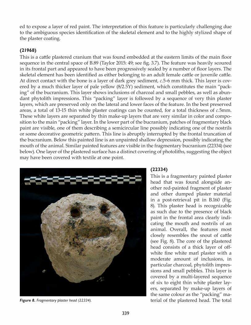
339
ed to expose a layer of red paint. The interpretation of this feature is particularly challenging due to the ambiguous species identification of the skeletal element and to the highly stylized shape of the plaster coating.
(21968)This is a cattle plastered cranium that was found embedded at the eastern limits of the main floor sequence in the central space of B.89 (Taylor 2015: 49; see fig. 3.7). The feature was heavily scoured in its frontal part and appeared to have been progressively sealed by a number of floor layers. The skeletal element has been identified as either belonging to an adult female cattle or juvenile cattle. At direct contact with the bone is a layer of dark grey sediment, c.5-6 mm thick. This layer is cov-ered by a much thicker layer of pale yellow (8/2.5Y) sediment, which constitutes the main “pack-ing” of the bucranium. This layer shows inclusions of charcoal and small pebbles, as well as abun-dant phytolith impressions. This “packing” layer is followed by a sequence of very thin plaster layers, which are preserved only on the lateral and lower faces of the feature. In the best preserved areas, a total of 13-15 thin white plaster coatings can be counted, for a total thickness of c.5mm. These white layers are separated by thin make-up layers that are very similar in color and compo-sition to the main “packing” layer. In the lower part of the bucranium, patches of fragmentary black paint are visible, one of them describing a semicircular line possibly indicating one of the nostrils or some decorative geometric pattern. This line is abruptly interrupted by the frontal truncation of the bucranium. Below this painted line is an unpainted shallow depression, possibly indicating the mouth of the animal. Similar painted features are visible in the fragmentary bucranium (22334) (see below). One layer of the plastered surface has a distinct covering of photoliths, suggesting the object may have been covered with textile at one point.
(22334)This is a fragmentary painted plaster head that was found alongside an-other red-painted fragment of plaster and other dumped plaster material in a post-retrieval pit in B.160 (Fig. 8). This plaster head is recognizable as such due to the presence of black paint in the frontal area clearly indi-cating the mouth and nostrils of an animal. Overall, the features most closely resembles the snout of cattle (see Fig. 8). The core of the plastered head consists of a thick layer of off-white fine white marl plaster with a moderate amount of inclusions, in particular charcoal, phytolith impres-sions and small pebbles. This layer is covered by a multi-layered sequence of six to eight thin white plaster lay-ers, separated by make-up layers of the same colour as the “packing” ma-terial of the plastered head. The total Figure 8. Fragmentary plaster head (22334).
340
thickness of the layered plaster is 6.4mm. At the end of sequence there are two or three layers of black paint applied on three holes in the frontal area: two circular ones, indicating the nostrils, and an elongated one, indicating the mouth. The multiple layers of black paint on the surface indicate that the painted decoration of mouth and nostrils was retouched or repainted multiple times. Along with these examples of animal plaster heads one would need to mention the painted and plastered head from B.132, which has been discussed at length elsewhere (Lingle et al. 2015). This obsidi-an-eyed face, however, has been interpreted as either animal or human, and perhaps intentionally ambiguous (Ibid.: 275).
Final considerations
During the 25 years of the Çatalhöyük Research Project, a total number of six or seven (according to the interpretation of the plaster head from B.132) plaster reliefs that may be interpreted as depicting animal heads have been uncovered, three of which were found in 2017 in B.139. Only two of them were attached to an animal cranium ((19285) and (21968)), while the others were devoid of any skel-etal element, although their interpretation as animal head is justified by their zoomorphic shape. In most cases, however, especially when the cranium is absent, species or even taxon identification is extremely challenging due to the highly schematic traits of the figures. It is indeed possible, as suggested in the case of the plaster head from B.132 (see Lingle et al. 2015), that the animal plaster heads were not meant to depict specific animal species but rather ambiguous or hybrid creatures. With regard to the construction process, all plaster heads show basic similarities: one or two layers of a thick, inclusion-rich sediment constitute the structural bulk of the feature, on top of which a variable number of thin white plaster and make-up layers are applied, resulting in multi-layered sequences that are similar to those found on wall and other architectural surfaces. Animal plaster heads are also often painted, sometimes with red-painted geometric motifs or wider applications of red paint (as in the cases of (23165.s1), (23165.s3), and (19285), and some other times with black-paint-ed traits depicting the facial traits of the animal (usually nostrils and mouth, as in the cases of (21968) and (22334)).
The retrieval contexts of the plaster heads are varied, but the majority of them have been found in secondary contexts whose formation is closely linked to the “closure activities” marking the abandonment and renovation of the house. In the case of B.139, the three plaster heads were scoured from the northern wall and/or from other locations (potentially outside of the building) and placed on top of the last floor of the building prior to the infilling of the building. In the case of B.160, the fragmentary plaster head and other fragmentary plaster features were placed in the fill of a pit that had been dug with the apparent purpose of removing a post. All the cases above are therefore linked to a secondary deposition associated to the abandonment/remaking of the house. In the rare case of B.77, a plaster head was found still mounted on the northern wall of the building, as it was also the case of the human or animal head discovered in B.132. The context of retrieval of the bucranium from B.89 is more difficult to interpret, as the feature was found lying on a floor but also partially covered by a number of plaster floors, suggesting a gradual process of ‘sinking into floors’ (Hodder 2015: 9).
References
Hodder, I. 2015. 2015 Season Review. In Catalhöyük 2015 Archive Report, pp. 8-12.
341
Mellaart, J.1967. Çatal Hüyük: A Neolithic Town in Anatolia. London: Thames and Hudson.
Taylor, J. 2015. Excavations in the South Area. In Çatalhöyük 2015 Archive Report, pp. 43-71.
Lingle, A., N. Dell’Unto, L. Der, S. Doyle, K. Killackey, A. Klimowicz, L. Meskell, P. Parkes and B. Tung2015. Painted plaster head. In Catalhöyük 2015 Archive Report, pp 275-89.

342
343
Chapter 28
Built Environment and Livestock Dung: Integrated Micromorphology, Phytolith and Chemical Analyses
Wendy Matthews and Marta PortilloUniversity of Reading
Introduction
The research this season was directed at two main research areas, investigating a) architectural technologies, building histories, open areas, and built environment, and b) ecology, diet, foddering, livestock management and discard practices, with special attention to the earliest excavated con-texts of the site. The focus in the application of a range of analytical techniques is on integrating high-resolution micro-contextual approaches, including micromorphology, SEM EDX, IR, GC-MS, microfossil plant and dung analyses, in order to identify the nature of the archaeological deposits and materials, their precise depositional histories and contextual associations, as well as their eco-logical and sociocultural significance more widely (Weiner 2010; Anderson et al. 2014; Matthews et al. 2014).
The aims in the University of Reading micromorphology team’s fieldwork research in summer 2017 reported in this section of the archive report were:
4. to study the early history of the site by analysing the microstratigraphy and micromorphol-ogy of surfaces and occupation deposits in the earliest buildings and open areas in the South Area excavated this season5. to examine and sample ancient livestock dung related deposits as part of the EU H2020 Marie Curie-Sklodowska Individual fellowship held by Dr Marta Portillo on Human-Animal Interactions in the Near East and North Africa: Microarchaeology of Livestock Dung (MICROARCHE-ODUNG, H2020-MSCA-IF-2015-702529), including animal pen deposits and dung fuel deposits6. to contribute to the wider research aims of the Çatalhöyük project by studying the microstra-tigraphy and micromorphology of high priority contexts7. to investigate health and the built environment at Çatalhöyük8. to contribute to the current John Templeton Foundation Project Consciousness and Creativity at the Dawn of Settled Life: The Test-case of Çatalhöyük, in collaboration with Dr Aroa Garcia-Suarez building on her and our previous research (Garcia-Suarez 2015).
Methodology
In the field, microstratigraphic sequences were cleaned with artist’s palette knives and air-blowers by Dr Wendy Matthews and Dr Marta Portillo and photographed at high-resolution in collaboration with the Çatalhöyük Research Project photographer Jason Quinlan, to record microstratigraphic and micromorphological details of deposit composition, boundaries and sequences to investigate site formation processes, micro-traces of activities and built environment.
344
Two types of micromorphological samples were collected:• Ten micromorphological block samples, c.15 x 7cm, for micromorphological examination in large 15cm x 7cm resin-impregnated thin-sections at magnifications of x 40-400, and micro-IR and other micro-analyses. The blocks were air-dried in the field-laboratory and wrapped in stretch film and clear tape to preserve the structure of the samples for analysis of intact mi-crostratigraphic sequence in thin-section, and to permit examination of the samples. Nine were exported for micromorphological analysis. The blocks of sediment have been impreg-nated with resin and are being cut and ground to large thin-sections 15 x 7cm, 25-30 microns thick by Dr Aroa Garcia-Suarez, QUEST, and analysed using internationally standardised mi-cromorphology protocols (Stoops 2003).• Thirty micromorphological spot samples, c.2-40 grams, for integrated phytolith and GC-MS analyses.
The samples collected comprise:South Area (6 blocks and 28 spot samples)
• Space 628 (sounding) » Open area deposits (one block (23249.s3), seven spot samples)
• Space 620 (open area below B.17) » Open area and animal dung deposits (two block samples (23214.s10-11); 11 spot samples) » Comparative mudbrick and mortar samples from B.17 (three spot samples) » Oven floors F.8044 (five spot samples)
• Building 162 » Floors (two blocks (32689.s3) and (32688.s3)) » Oven F.8183 (one spot sample)
• Space 629 below B.161 » Floors (one block (32653)) » Hearth (one spot sample)
North Area (four blocks)
• Space 636 » Open area/midden deposits (2 block samples (32149.s5), (32150.s5))
• Space 630 » Fire-spot (one block sample (23616.s1)) » Floors (one block sample (23616.s2))
Dung spherulite and phytolith analyses in the field laboratoryThe work also included the microscopic scanning of plant-related contexts and concentrations of vegetal and faecal microfossils (calcitic dung spherulites, and ash pseudomorphs and phytoliths) from suspected dung deposits in the field laboratory. A total number of 18 non-extracted spot sam-ples were mounted in non-permanent slides. Slides were examined at 400X magnification under the optical microscope with crossed polarized light (XPL) for spherulites, whereas phytoliths and
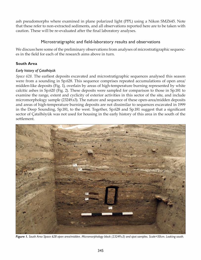
345
ash pseudomorphs where examined in plane polarized light (PPL) using a Nikon SMZ645. Note that these refer to non-extracted sediments, and all observations reported here are to be taken with caution. These will be re-evaluated after the final laboratory analyses.
Microstratigraphicandfield-laboratoryresultsandobservations
We discuss here some of the preliminary observations from analyses of microstratigraphic sequenc-es in the field for each of the research aims above in turn.
South Area
Early history of Çatalhöyük Space 628. The earliest deposits excavated and microstratigraphic sequences analysed this season were from a sounding in Sp.628. This sequence comprises repeated accumulations of open area/midden-like deposits (Fig. 1), overlain by areas of high-temperature burning represented by white calcitic ashes in Sp.620 (Fig. 2). These deposits were sampled for comparison to those in Sp.181 to examine the range, extent and cyclicity of exterior activities in this sector of the site, and include micromorphology sample (23249.s3). The nature and sequence of these open-area/midden deposits and areas of high-temperature burning deposits are not dissimilar to sequences excavated in 1999 in the Deep Sounding, Sp.181, to the west. Together, Sp.628 and Sp.181 suggest that a significant sector of Çatalhöyük was not used for housing in the early history of this area in the south of the settlement.
Figure 1. South Area Space 628 open area/midden. Micromorphology block (23249.s3) and spot samples. Scale=50cm. Looking south.
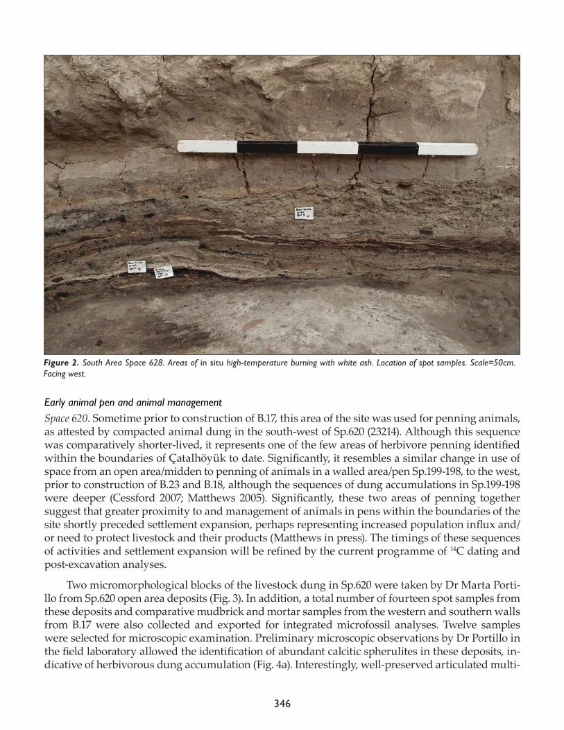
346
Early animal pen and animal managementSpace 620. Sometime prior to construction of B.17, this area of the site was used for penning animals, as attested by compacted animal dung in the south-west of Sp.620 (23214). Although this sequence was comparatively shorter-lived, it represents one of the few areas of herbivore penning identified within the boundaries of Çatalhöyük to date. Significantly, it resembles a similar change in use of space from an open area/midden to penning of animals in a walled area/pen Sp.199-198, to the west, prior to construction of B.23 and B.18, although the sequences of dung accumulations in Sp.199-198 were deeper (Cessford 2007; Matthews 2005). Significantly, these two areas of penning together suggest that greater proximity to and management of animals in pens within the boundaries of the site shortly preceded settlement expansion, perhaps representing increased population influx and/or need to protect livestock and their products (Matthews in press). The timings of these sequences of activities and settlement expansion will be refined by the current programme of 14C dating and post-excavation analyses.
Two micromorphological blocks of the livestock dung in Sp.620 were taken by Dr Marta Porti-llo from Sp.620 open area deposits (Fig. 3). In addition, a total number of fourteen spot samples from these deposits and comparative mudbrick and mortar samples from the western and southern walls from B.17 were also collected and exported for integrated microfossil analyses. Twelve samples were selected for microscopic examination. Preliminary microscopic observations by Dr Portillo in the field laboratory allowed the identification of abundant calcitic spherulites in these deposits, in-dicative of herbivorous dung accumulation (Fig. 4a). Interestingly, well-preserved articulated multi-
Figure 2. South Area Space 628. Areas of in situ high-temperature burning with white ash. Location of spot samples. Scale=50cm. Facing west.
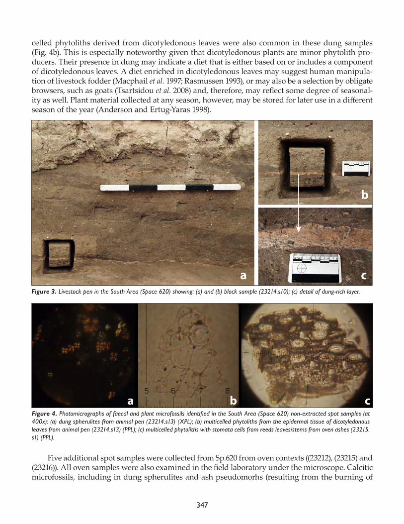
347
celled phytoliths derived from dicotyledonous leaves were also common in these dung samples (Fig. 4b). This is especially noteworthy given that dicotyledonous plants are minor phytolith pro-ducers. Their presence in dung may indicate a diet that is either based on or includes a component of dicotyledonous leaves. A diet enriched in dicotyledonous leaves may suggest human manipula-tion of livestock fodder (Macphail et al. 1997; Rasmussen 1993), or may also be a selection by obligate browsers, such as goats (Tsartsidou et al. 2008) and, therefore, may reflect some degree of seasonal-ity as well. Plant material collected at any season, however, may be stored for later use in a different season of the year (Anderson and Ertug-Yaras 1998).
Five additional spot samples were collected from Sp.620 from oven contexts ((23212), (23215) and (23216)). All oven samples were also examined in the field laboratory under the microscope. Calcitic microfossils, including in dung spherulites and ash pseudomorhs (resulting from the burning of
Figure 4. Photomicrographs of faecal and plant microfossils identified in the South Area (Space 620) non-extracted spot samples (at 400x): (a) dung spherulites from animal pen (23214.s13) (XPL); (b) multicelled phytoliths from the epidermal tissue of dicotyledonous leaves from animal pen (23214.s13) (PPL); (c) multicelled phytoliths with stomata cells from reeds leaves/stems from oven ashes (23215.s1) (PPL).
Figure 3. Livestock pen in the South Area (Space 620) showing: (a) and (b) block sample (23214.s10); (c) detail of dung-rich layer.
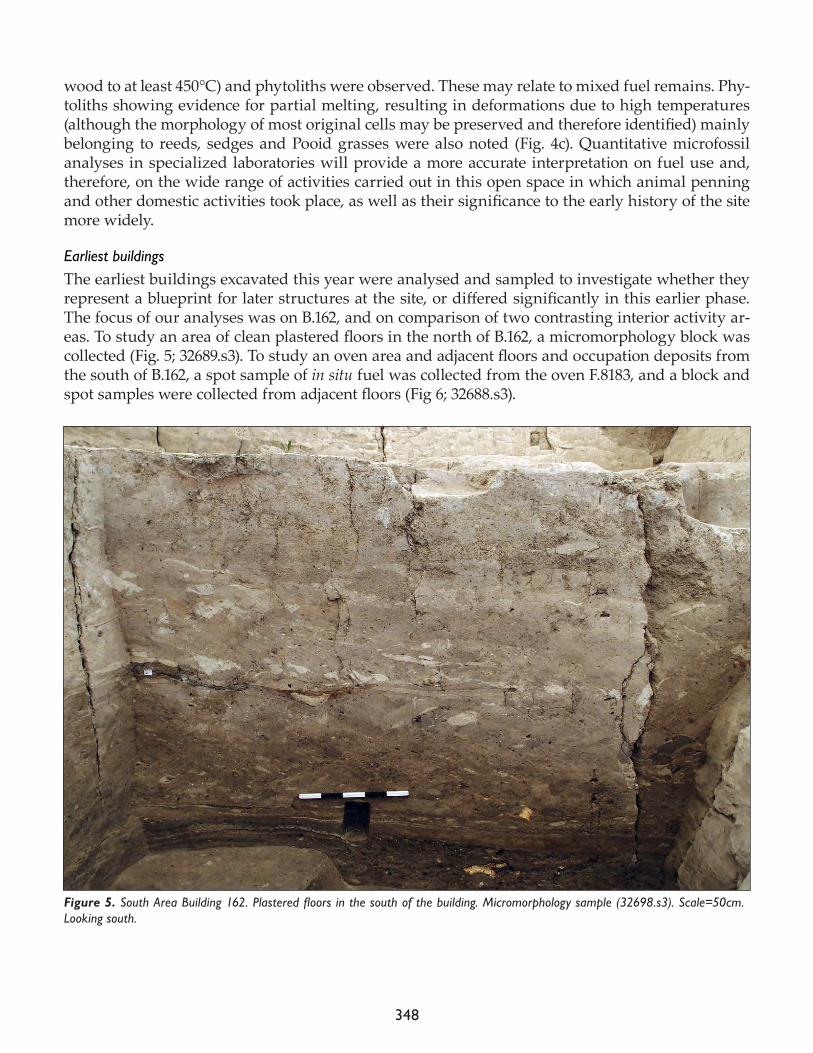
348
wood to at least 450°C) and phytoliths were observed. These may relate to mixed fuel remains. Phy-toliths showing evidence for partial melting, resulting in deformations due to high temperatures (although the morphology of most original cells may be preserved and therefore identified) mainly belonging to reeds, sedges and Pooid grasses were also noted (Fig. 4c). Quantitative microfossil analyses in specialized laboratories will provide a more accurate interpretation on fuel use and, therefore, on the wide range of activities carried out in this open space in which animal penning and other domestic activities took place, as well as their significance to the early history of the site more widely.
Earliest buildings The earliest buildings excavated this year were analysed and sampled to investigate whether they represent a blueprint for later structures at the site, or differed significantly in this earlier phase. The focus of our analyses was on B.162, and on comparison of two contrasting interior activity ar-eas. To study an area of clean plastered floors in the north of B.162, a micromorphology block was collected (Fig. 5; 32689.s3). To study an oven area and adjacent floors and occupation deposits from the south of B.162, a spot sample of in situ fuel was collected from the oven F.8183, and a block and spot samples were collected from adjacent floors (Fig 6; 32688.s3).
Figure 5. South Area Building 162. Plastered floors in the south of the building. Micromorphology sample (32698.s3). Scale=50cm. Looking south.
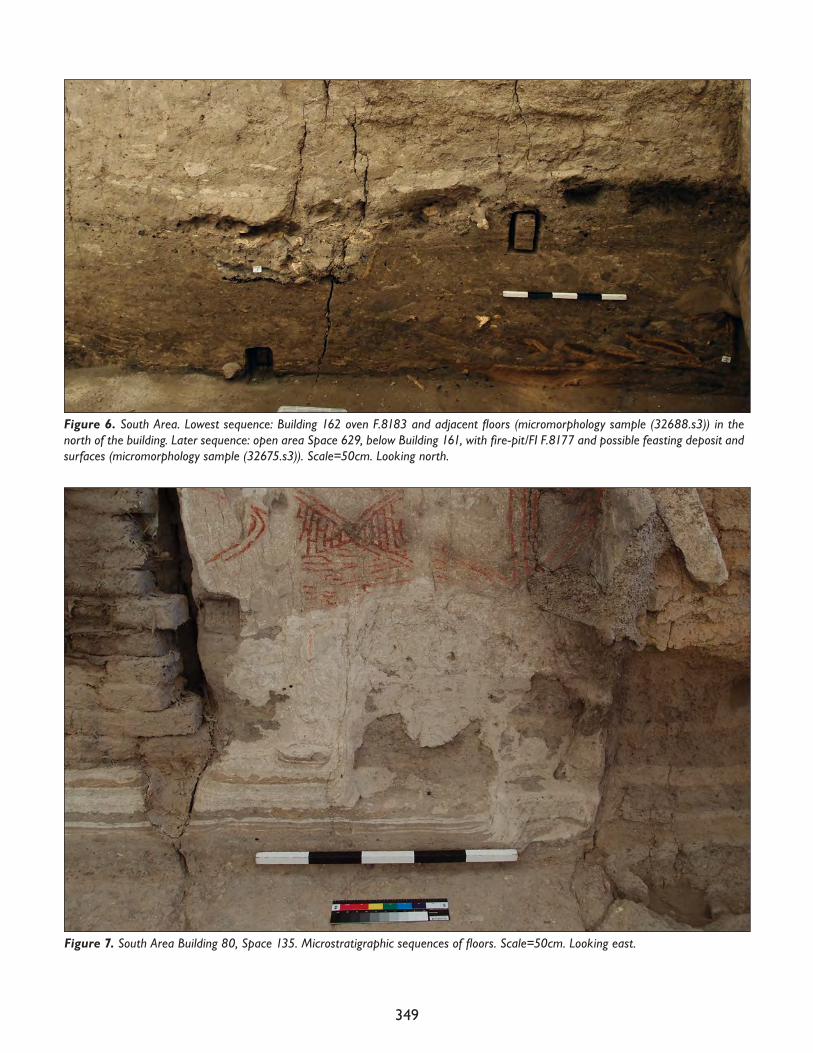
349
Figure 7. South Area Building 80, Space 135. Microstratigraphic sequences of floors. Scale=50cm. Looking east.
Figure 6. South Area. Lowest sequence: Building 162 oven F.8183 and adjacent floors (micromorphology sample (32688.s3)) in the north of the building. Later sequence: open area Space 629, below Building 161, with fire-pit/FI F.8177 and possible feasting deposit and surfaces (micromorphology sample (32675.s3)). Scale=50cm. Looking north.
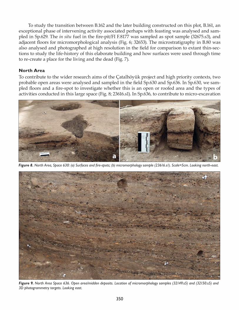
350
To study the transition between B.162 and the later building constructed on this plot, B.161, an exceptional phase of intervening activity associated perhaps with feasting was analysed and sam-pled in Sp.629. The in situ fuel in the fire-pit/FI F.8177 was sampled as spot sample (32675.s3), and adjacent floors for micromorphological analysis (Fig. 6; 32653). The microstratigraphy in B.80 was also analysed and photographed at high resolution in the field for comparison to extant thin-sec-tions to study the life-history of this elaborate building and how surfaces were used through time to re-create a place for the living and the dead (Fig. 7).
North Area To contribute to the wider research aims of the Çatalhöyük project and high priority contexts, two probable open areas were analysed and sampled in the field Sp.630 and Sp.636. In Sp.630, we sam-pled floors and a fire-spot to investigate whether this is an open or roofed area and the types of activities conducted in this large space (Fig. 8; 23616.s1). In Sp.636, to contribute to micro-excavation
Figure 8. North Area, Space 630: (a) Surfaces and fire-spots; (b) micromorphology sample (23616.s1). Scale=5cm. Looking north-east.
Figure 9. North Area Space 636. Open area/midden deposits. Location of micromorphology samples (32149.s5) and (32150.s5) and 3D photogrammetry targets. Looking east.
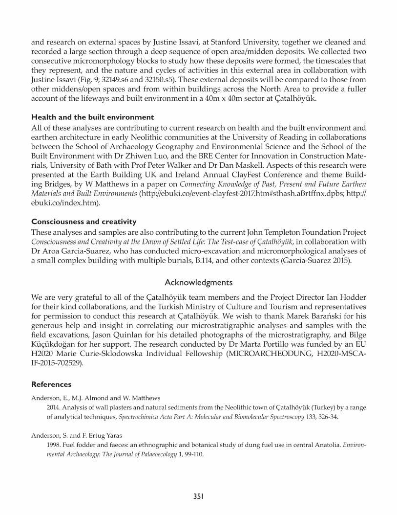
351
and research on external spaces by Justine Issavi, at Stanford University, together we cleaned and recorded a large section through a deep sequence of open area/midden deposits. We collected two consecutive micromorphology blocks to study how these deposits were formed, the timescales that they represent, and the nature and cycles of activities in this external area in collaboration with Justine Issavi (Fig. 9; 32149.s6 and 32150.s5). These external deposits will be compared to those from other middens/open spaces and from within buildings across the North Area to provide a fuller account of the lifeways and built environment in a 40m x 40m sector at Çatalhöyük.
Health and the built environmentAll of these analyses are contributing to current research on health and the built environment and earthen architecture in early Neolithic communities at the University of Reading in collaborations between the School of Archaeology Geography and Environmental Science and the School of the Built Environment with Dr Zhiwen Luo, and the BRE Center for Innovation in Construction Mate-rials, University of Bath with Prof Peter Walker and Dr Dan Maskell. Aspects of this research were presented at the Earth Building UK and Ireland Annual ClayFest Conference and theme Build-ing Bridges, by W Matthews in a paper on Connecting Knowledge of Past, Present and Future Earthen Materials and Built Environments (http://ebuki.co/event-clayfest-2017.htm#sthash.aBrtffnx.dpbs; http://ebuki.co/index.htm).
Consciousness and creativityThese analyses and samples are also contributing to the current John Templeton Foundation Project Consciousness and Creativity at the Dawn of Settled Life: The Test-case of Çatalhöyük, in collaboration with Dr Aroa Garcia-Suarez, who has conducted micro-excavation and micromorphological analyses of a small complex building with multiple burials, B.114, and other contexts (Garcia-Suarez 2015).
Acknowledgments
We are very grateful to all of the Çatalhöyük team members and the Project Director Ian Hodder for their kind collaborations, and the Turkish Ministry of Culture and Tourism and representatives for permission to conduct this research at Çatalhöyük. We wish to thank Marek Barański for his generous help and insight in correlating our microstratigraphic analyses and samples with the field excavations, Jason Quinlan for his detailed photographs of the microstratigraphy, and Bilge Küçükdoğan for her support. The research conducted by Dr Marta Portillo was funded by an EU H2020 Marie Curie-Sklodowska Individual Fellowship (MICROARCHEODUNG, H2020-MSCA-IF-2015-702529).
References
Anderson, E., M.J. Almond and W. Matthews 2014. Analysis of wall plasters and natural sediments from the Neolithic town of Çatalhöyük (Turkey) by a range of analytical techniques, Spectrochimica Acta Part A: Molecular and Biomolecular Spectroscopy 133, 326-34.
Anderson, S. and F. Ertug-Yaras 1998. Fuel fodder and faeces: an ethnographic and botanical study of dung fuel use in central Anatolia. Environ-mental Archaeology: The Journal of Palaeoecology 1, 99-110.
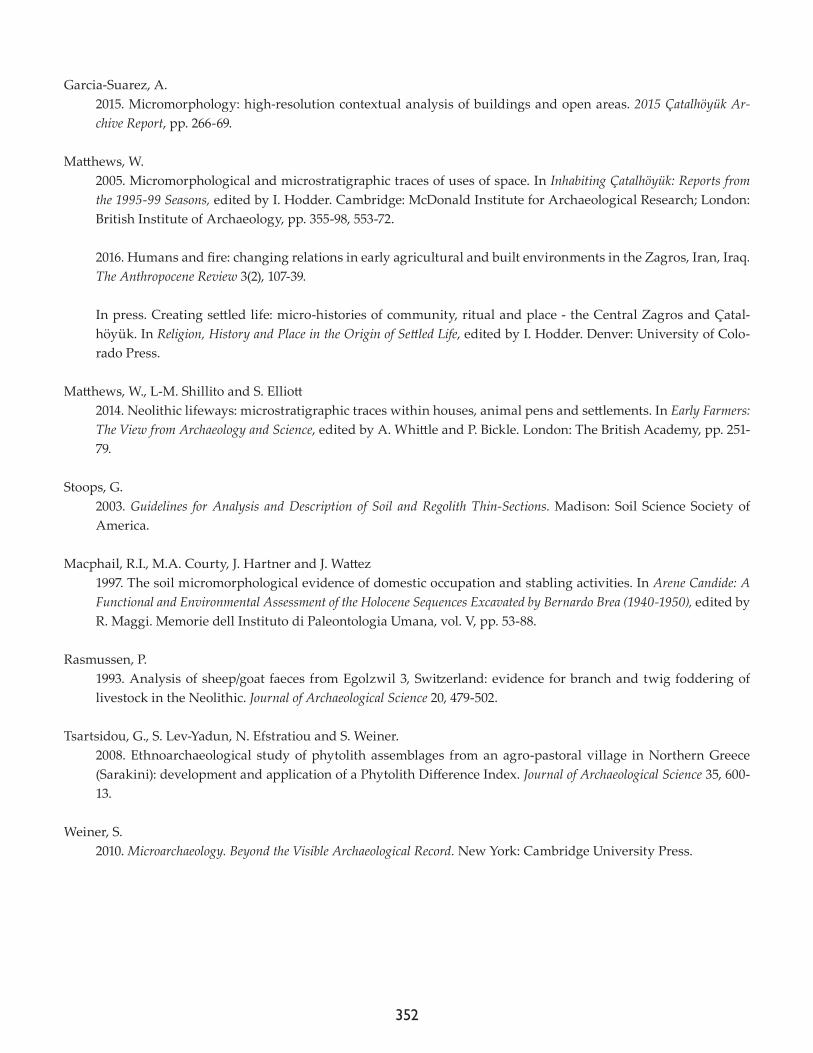
352
Garcia-Suarez, A. 2015. Micromorphology: high-resolution contextual analysis of buildings and open areas. 2015 Çatalhöyük Ar-chive Report, pp. 266-69.
Matthews, W. 2005. Micromorphological and microstratigraphic traces of uses of space. In Inhabiting Çatalhöyük: Reports from the 1995-99 Seasons, edited by I. Hodder. Cambridge: McDonald Institute for Archaeological Research; London: British Institute of Archaeology, pp. 355-98, 553-72.
2016. Humans and fire: changing relations in early agricultural and built environments in the Zagros, Iran, Iraq. The Anthropocene Review 3(2), 107-39.
In press. Creating settled life: micro-histories of community, ritual and place - the Central Zagros and Çatal-höyük. In Religion, History and Place in the Origin of Settled Life, edited by I. Hodder. Denver: University of Colo-rado Press.
Matthews, W., L-M. Shillito and S. Elliott 2014. Neolithic lifeways: microstratigraphic traces within houses, animal pens and settlements. In Early Farmers: The View from Archaeology and Science, edited by A. Whittle and P. Bickle. London: The British Academy, pp. 251-79.
Stoops, G. 2003. Guidelines for Analysis and Description of Soil and Regolith Thin-Sections. Madison: Soil Science Society of America.
Macphail, R.I., M.A. Courty, J. Hartner and J. Wattez 1997. The soil micromorphological evidence of domestic occupation and stabling activities. In Arene Candide: A Functional and Environmental Assessment of the Holocene Sequences Excavated by Bernardo Brea (1940-1950), edited by R. Maggi. Memorie dell Instituto di Paleontologia Umana, vol. V, pp. 53-88.
Rasmussen, P. 1993. Analysis of sheep/goat faeces from Egolzwil 3, Switzerland: evidence for branch and twig foddering of livestock in the Neolithic. Journal of Archaeological Science 20, 479-502.
Tsartsidou, G., S. Lev-Yadun, N. Efstratiou and S. Weiner. 2008. Ethnoarchaeological study of phytolith assemblages from an agro-pastoral village in Northern Greece (Sarakini): development and application of a Phytolith Difference Index. Journal of Archaeological Science 35, 600-13.
Weiner, S. 2010. Microarchaeology. Beyond the Visible Archaeological Record. New York: Cambridge University Press.
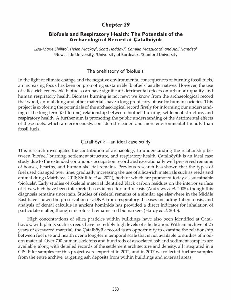
353
Chapter 29
Biofuels and Respiratory Health: The Potentials of the Archaeological Record at Çatalhöyük
Lisa-Marie Shillito1, Helen Mackay1, Scott Haddow2, Camilla Mazzucato3 and Anil Namdeo1
1Newcastle University, 2University of Bordeaux, 3Stanford University
The prehistory of ‘biofuels’
In the light of climate change and the negative environmental consequences of burning fossil fuels, an increasing focus has been on promoting sustainable ‘biofuels’ as alternatives. However, the use of silica-rich renewable biofuels can have significant detrimental effects on urban air quality and human respiratory health. Biomass burning is not new; we know from the archaeological record that wood, animal dung and other materials have a long prehistory of use by human societies. This project is exploring the potentials of the archaeological record firstly for informing our understand-ing of the long term (> lifetime) relationship between ‘biofuel’ burning, settlement structure, and respiratory health. A further aim is promoting the public understanding of the detrimental effects of these fuels, which are erroneously, considered ‘cleaner’ and more environmental friendly than fossil fuels.
Çatalhöyük – an ideal case study
This research investigates the contribution of archaeology to understanding the relationship be-tween ‘biofuel’ burning, settlement structure, and respiratory health. Çatalhöyük is an ideal case study due to the extended continuous occupation record and exceptionally well preserved remains of houses, hearths, and human skeletal remains. Previous research has shown that the types of fuel used changed over time, gradually increasing the use of silica-rich materials such as reeds and animal dung (Matthews 2010; Shillito et al. 2011), both of which are promoted today as sustainable ‘biofuels’. Early studies of skeletal material identified black carbon residues on the interior surface of ribs, which have been interpreted as evidence for anthracosis (Andrews et al. 2005), though this diagnosis remains uncertain. Studies of skeletal remains of a similar age elsewhere in the Middle East have shown the preservation of aDNA from respiratory diseases including tuberculosis, and analysis of dental calculus in ancient hominids has provided a direct indicator for inhalation of particulate matter, though microfossil remains and biomarkers (Hardy et al. 2015).
High concentrations of silica particles within buildings have also been identified at Çatal-höyük, with plants such as reeds have incredibly high levels of silicification. With an archive of 25 years of excavated material, the Çatalhöyük record is an opportunity to examine the relationship between fuel use and health over a long-term temporal scale that is not available to studies of mod-ern material. Over 700 human skeletons and hundreds of associated ash and sediment samples are available, along with detailed records of the settlement architecture and density, all integrated in a GIS. Pilot samples for this project were exported in 2012, and in 2017 we collected further samples from the entre archive, targeting ash deposits from within buildings and external areas.
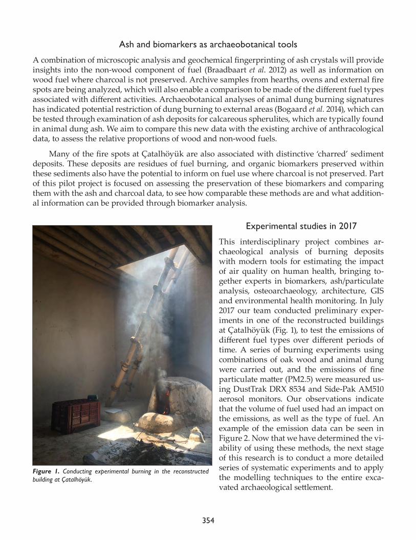
354
Ash and biomarkers as archaeobotanical tools
A combination of microscopic analysis and geochemical fingerprinting of ash crystals will provide insights into the non-wood component of fuel (Braadbaart et al. 2012) as well as information on wood fuel where charcoal is not preserved. Archive samples from hearths, ovens and external fire spots are being analyzed, which will also enable a comparison to be made of the different fuel types associated with different activities. Archaeobotanical analyses of animal dung burning signatures has indicated potential restriction of dung burning to external areas (Bogaard et al. 2014), which can be tested through examination of ash deposits for calcareous spherulites, which are typically found in animal dung ash. We aim to compare this new data with the existing archive of anthracological data, to assess the relative proportions of wood and non-wood fuels.
Many of the fire spots at Çatalhöyük are also associated with distinctive ‘charred’ sediment deposits. These deposits are residues of fuel burning, and organic biomarkers preserved within these sediments also have the potential to inform on fuel use where charcoal is not preserved. Part of this pilot project is focused on assessing the preservation of these biomarkers and comparing them with the ash and charcoal data, to see how comparable these methods are and what addition-al information can be provided through biomarker analysis.
Experimental studies in 2017
This interdisciplinary project combines ar-chaeological analysis of burning deposits with modern tools for estimating the impact of air quality on human health, bringing to-gether experts in biomarkers, ash/particulate analysis, osteoarchaeology, architecture, GIS and environmental health monitoring. In July 2017 our team conducted preliminary exper-iments in one of the reconstructed buildings at Çatalhöyük (Fig. 1), to test the emissions of different fuel types over different periods of time. A series of burning experiments using combinations of oak wood and animal dung were carried out, and the emissions of fine particulate matter (PM2.5) were measured us-ing DustTrak DRX 8534 and Side-Pak AM510 aerosol monitors. Our observations indicate that the volume of fuel used had an impact on the emissions, as well as the type of fuel. An example of the emission data can be seen in Figure 2. Now that we have determined the vi-ability of using these methods, the next stage of this research is to conduct a more detailed series of systematic experiments and to apply the modelling techniques to the entire exca-vated archaeological settlement.
Figure 1. Conducting experimental burning in the reconstructed building at Çatalhöyük.
355
Acknowledgments
Funded by Wellcome Trust seed award in Humanities and Social Science grant reference 205719/Z/16/Z
References
Bogaard A., P. Ryan, N. Yalman, E. Asouti, K.C. Twiss, C. Mazzucato and S. Farid2014. Assessing outdoor activities and their social implications at Çatalhöyük. In Integrating Çatalhöyük: Themes from the 2000-2008 seasons, edited by I. Hodder. London: British Institute at Ankara; Los Angeles: Cotsen Institute of Archaeolgoy Press, pp. 121-45.
Braadbaart, F., I. Poole, H.D.J. Huisman and B. van Os2012. Fuel, fire and heat: an experimental approach to highlight the potential of studying ash and char remains from archaeological contexts. Journal of Archaeological Science 39: 836-47.
P. Andrews, T. Molleson and B. Boz 2005. The human burials at Çatalhöyük. In Inhabiting Çatalhöyük: Reports from the 1995–99 Seasons, edited by I. Hodder. Cambridge: McDonald Institute for Archaeological Research; London: British Institute of Archaeology at Ankara, pp. 261–78.
Hardy K., A. Radini, S. Buckley, R. Sarig, L. Copeland, A. Gopher and R. Barkai2015a. Dental calculus reveals potential respiratory irritants and ingestion of essential plant-based nutrients at Lower Palaeolithic Qesem Cave Israel. Quaternary International 398(4): 129-35.
Figure 2. Example of one of the burning experiments conducted, showing particulate matter levels from the burning of oak wood fuel.

356
Matthews, W. 2010. Geoarchaeology and taphonomy of plant remains in early urban environments in the Ancient Near East. Quaternary International 214(1-2): 98-113.
Shillito L.-M., W. Matthews, M.J. Almond and I.D. Bull 2011. The microstratigraphy of middens: capturing daily routine in rubbish at Neolithic Çatalhöyük, Turkey. Antiquity 85(329): 1024-38.
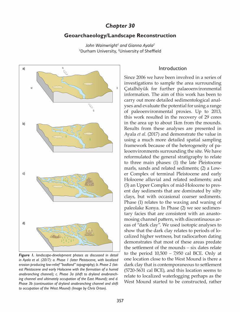
357
Chapter 30
Geoarchaeology/Landscape Reconstruction
John Wainwright1 and Gianna Ayala2
1Durham University, 2University of Sheffield
Introduction
Since 2006 we have been involved in a series of investigations to sample the area surrounding Çatalhöyük for further palaeoenvironmental information. The aim of this work has been to carry out more detailed sedimentological anal-yses and evaluate the potential for using a range of paleoenvironmental proxies. Up to 2013, this work resulted in the recovery of 29 cores in the area up to about 1km from the mounds. Results from these analyses are presented in Ayala et al. (2017) and demonstrate the value in using a much more detailed spatial sampling framework because of the heterogeneity of pa-leoenvironments surrounding the site. We have reformulated the general stratigraphy to relate to three main phases: (1) the late Pleistocene marls, sands and related sediments; (2) a Low-er Complex of terminal Pleistocene and early Holocene alluvial and related sediments; and (3) an Upper Complex of mid-Holocene to pres-ent day sediments that are dominated by silty clays, but with occasional coarser sediments. Phase (1) relates to the waxing and waning of paleolake Konya. In Phase (2) we see sedimen-tary facies that are consistent with an anasto-mosing channel pattern, with discontinuous ar-eas of “dark clay”. We used isotopic analyses to show that the dark clay relates to periods of lo-calized higher wetness, but radiocarbon dating demonstrates that most of these areas predate the settlement of the mounds – six dates relate to the period 10,500 – 7,950 cal BCE. Only at one location close to the West Mound is there a dark clay that is contemporaneous to settlement (5720-5631 cal BCE), and this location seems to relate to localized waterlogging perhaps as the West Mound started to be constructed, rather
Na)
b)
c)
d)
S
W E
Figure 1. landscape-development phases as discussed in detail in Ayala et al. (2017): a. Phase 1 (later Pleistocene, with localized erosion producing low-relief “badland” topography); b. Phase 2 (lat-est Pleistocene and early Holocene with the formation of a humid anabranching channel); c. Phase 3a (shift to dryland anabranch-ing channel and ultimately occupation of the East Mound); and d. Phase 3b (continuation of dryland anabranching channel and shift to occupation of the West Mound) (Image by Chris Orton).
358
than regional-scale wetness. A schematic representation of landscape evolution based on these analyses is presented in Figure 1.
A subsequent field campaign was carried out in summer 2015, in which we further sampled the landscape by taking cores at 33 locations (Fig. 2). These cores were targeted at providing further spatial detail as well as expanding the area of coverage of the palaeoenvironmental information. They are currently undergoing more detailed analysis in the laboratories in Durham and Sheffield. The aim of the study carried out in 2017 was twofold, and developed from the coring campaigns carried out in 2013 and 2015:
• To take advantage of the excavations in the new deep sounding in the South Shelter to reach the natural levels to take samples for sedimentary and geochemical analyses and dating. These samples would enable us to discover whether the “dark clay” was present under this part of the site, to evaluate whether we could recover a buried land surface, and to carry out compa-rable analyses if so to those presented in Ayala et al. (2017).• To take in situ samples from the sides of irrigation channels in order to carry out OSL dating of paleochannels observed in the cores from 2015, but also to collect comparable samples from sites previously studied (Boyer et al. 2006). OSL analysis is not possible on the cores from 2015 and earlier as they were necessarily exposed to light on extraction.
Figure 2. Map of coring locations from the 2015 field campaign.
359
Fieldwork in 2017
To achieve the first of these aims, we cored with a hand auger in the area between Buildings 17 and 161 that had previously been excavated by the main excavation team down to the midden levels. Before augering took place, we hand excavated an area of 1m x 0.5m x 0.31m through these midden deposits, as (23261) (Fig. 3). Two auger holes were hand-drilled using a Dutch auger with a 0.05m diameter by 0.2m long sampling tip. These auger holes were labelled ÇH17DSAH1 and ÇH17D-SAH2. AH1 is to the south of the sondage and AH2 to the north of the sondage making up (23261). AH1 penetrates to 2.70m and is collected as (23262). Landscape project labelling is ÇH17DSAH1 together with depths in centimeters. AH2 penetrates to 2.56m and is collected as (23263). Landscape project labelling is ÇH17DSAH2 together with depths in centimeters. In total, 28 samples were re-covered for analysis from AH1, and 34 samples from AH2.
In both AH1 and AH2, we successfully recovered alluvial sediment at depths of 1.12m and 1.30m, respectively. Dark Clay was recovered at depths of 2.10m and 2.29m, respectively. Marl from paleolake Konya was recovered at depths of 2.28m and 2.40m, respectively. Thus, our first aim was successfully achieved.
To achieve the second of these aims, we inspected irrigation channels to the south and west of the mounds on 28th June 2017 (Fig. 4). To the south, we were hoping to resample the channels ob-served in previous studies (e.g. Boyer et al. 2006), called 94PC1, and identified in our 2015 coring
Figure 3. Location of hand-augered samples in the South Shelter deep sounding: (a) general context and Dutch auger used; (b) AH1 (upper) and AH2 (lower) in the base of (23261).
360
campaign slightly further south. Unfortunately, water levels were too high in this irrigation chan-nel to permit sampling at appropriate elevations, and thus this part of the sampling here had to be abandoned.
To the west of the site, the irrigation channel was completely dry and we were more successful in identifying sediments appro-priate for dating that may relate to channel deposits identified in our cores ÇH2015/Q-S. To enable as full a reconstruction of the channel system, we took samples at four locations along the irri-gation ditch, over a distance of approximately 25m. Table 1 shows the location of samples.
We used the same hand auger to identify the appropriate sediments for sampling, in order to minimize disturbance of the surface. The sites then had small steps cut into the surface, usually about 0.5m tall and 0.3m deep in order to reach undisturbed sediments. At each letter, vertically separated samples were taken, so that sample 1 is closer to the top of the slope and higher numbers are progressively nearer to the base of the irrigation ditch. The number of samples at each location varied depending on the availability of suitable sediments. Sampling for OSL requires sediment that has not been exposed to light since deposition. Thus, we inserted 0.12m x 0.05m black tubing into the sediments to extract undisturbed material for subsequent analysis. Sites usually have two, duplicate samples for the dating (Fig. 5). We have taken a bulk sediment sample to relate to each pair of OSL dates, so that we can carry out particle size and geochemical analyses to give the sedi-mentary context of the date. Site CH17C1 only has a sediment sample to give the context of the sed-
Figure 4. Locations along irrigation channels targeted for OSL dating sampling.
ÇH17A 0484055 4169408
ÇH17B 0484042 4169405
ÇH17C 0484059 4169403
ÇH17D 0484023 4169414
Table 1. Locations of OSL samples: all recorded on UTM zone 36S.
361
iments above the paleochannel at this point. In total, 14 tube samples and 8 bulk sediment samples were collected.
Thus, the second aim was partially successful, but did provide material for dating for paleo-channel sediments only known through our previous coring campaign.
Figure 5. Sampling location ÇH17A3 showing the location of the two sampling tubes inserted into the profile to collect undisturbed material for OSL dating.
362
Continuing analyses
Four series of analysis is proposed for the samples that have been obtained this year.
1. Comparative analyses of the sediments in the Deep Sounding and the paleochannel to put them in the context of previous sedimentary analyses in cores from 1993-2015. These com parisons are necessary because of the apparent importance of understanding variability in the patterns of sediment deposited:
a. Particle size using laser granulometry
b. Loss on ignition to determine organic and mineral carbon contents
c. Magnetic susceptibility of bulk sediments
2. Dating to provide an overall chronological control on the patterns of sedimentation, with an emphasis on AMS radiocarbon dating of:
a. Bulk sediments in the dark clay horizons
b. Extracting charcoal inclusions in sediment in the silty-clay parts of the sediments
3. Isotopic and other geochemical analysis
We will collaborate with the British Geological Survey laboratories at Keyworth to carry out carbon and nitrogen isotopic analyses in particular to look at proxies for different plant groups and humidity conditions.
4. OSL dating of paleochannel deposits
We will collaborate with Prof. Mark Bateman of the Department of Geography, University of Sheffield, to provide OSL dates on the paleochannel deposits.
References
Ayala G., J. Wainwright, J. Walker, R. Hodara, J.M. Lloyd, M. Leng and C. Doherty 2017. Palaeoenvironmental reconstruction of the alluvial landscape of Neolithic Çatalhöyük, central southern Turkey: the implications for early agriculture and responses to environmental change. Journal of Archaeological Science 87:30-43.
Boyer, P., N. Roberts and D. Baird2006. Holocene environment and settlement on the Çarşamba alluvial fan, South-Central Turkey: integrating geoarchaeology and archaeological field survey. Geoarchaeology 21(7): 675-98.
363
Chapter 31
Beads
Milena VasićBerlin Free University
Introduction
Mellaart̀ s excavations in the 1960s produced over 25,000 beads. Over the last 25 years of excavations on the East Mound by the current project, more than 23,000 beads have been added to the assem-blage.
Excavation of burial features requires a significant amount of time, especially due to their heavily disturbance. However, whilst coordinates are always taken for objects directly associated with the buried individuals, due to large number of beads in burial features, it is impossible to fully record each individual bead on site. Therefore, the aim of the final season was to record as many details as possible in regards to the location, position, and the original order of beads in burials excavated this year.
Basic information (i.e. type, count, fragmentation, color, size, material) was recorded for all beads that have not been previously documented. As these beads are studied by several special-ists, the data is dispersed across several databases. The newly created bead database will serve as a centralized archive that contains basic information for every bead; detailed information on raw material, technology, and use-wear pulled from the specialists̀ databases; and the contextual infor-mation. In the case of burials, the database will also contain information about type of ornament this beads formed part of, their location and association with the body.
The first part of the study season was dedicated to the selection of material and contexts for the forthcoming publication. Due to the time limitation and the fact that this is the very last study sea-son, material needed to be selected carefully. Apart from burials, the aim was to select and analyze interesting contexts, and establish nature of their deposition (i.e. whether any of them represent deliberate placements).
In addition to the analyses conducted by Rena Veropoulidou on shell beads, Christina Tsoraki and Matilda Siebrecht and Virginia Garcia Diaz on bone beads, over 200 silicone casts were taken, in order to enable use-wear and technology analyses off-site. Furthermore, 34 animal bone beads were sampled for the Zooms analysis. Together with previously collected 81 samples of beads and rings, they will be analyzed in order to determine whether there were any preferences in the selec-tion of animal bone used in the manufacture of ornaments.
Larger groups of beads that came from the same unit were photographed, in order to have a better understanding of how the ornaments might have looked like. In addition, few objects that are stored in the Konya Museum were also photographed.
Over 7,000 beads have been recorded this season. The discussion below provides a brief over-view of beads that were found in 11 burial features.
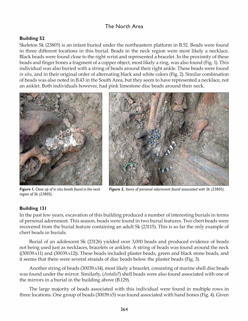
364
The North Area
Building 52Skeleton Sk (23805) is an infant buried under the northeastern platform in B.52. Beads were found in three different locations in this burial. Beads in the neck region were most likely a necklace. Black beads were found close to the right wrist and represented a bracelet. In the proximity of these beads and finger bones a fragment of a copper object, most likely a ring, was also found (Fig. 1). This individual was also buried with a string of beads around their right ankle. These beads were found in situ, and in their original order of alternating black and white colors (Fig. 2). Similar combination of beads was also noted in B.43 in the South Area, but they seem to have represented a necklace, not an anklet. Both individuals however, had pink limestone disc beads around their neck.
Building 131In the past few years, excavation of this building produced a number of interesting burials in terms of personal adornment. This season, beads were found in two burial features. Two chert beads were recovered from the burial feature containing an adult Sk (23115). This is so far the only example of chert beads in burials.
Burial of an adolescent Sk (23126) yielded over 3,000 beads and produced evidence of beads not being used just as necklaces, bracelets or anklets. A string of beads was found around the neck ((30039.x11) and (30039.x12)). These beads included plaster beads, green and black stone beads, and it seems that there were several strands of disc beads below the plaster beads (Fig. 3).
Another string of beads (30039.x14), most likely a bracelet, consisting of marine shell disc beads was found under the mirror. Similarly, (Antalis?) shell beads were also found associated with one of the mirrors in a burial in the building above (B.129).
The large majority of beads associated with this individual were found in multiple rows in three locations. One group of beads (30039.x5) was found associated with hand bones (Fig. 4). Given
Figure 1. Close up of in situ beads found in the neck region of Sk (23805).
Figure 2. Items of personal adornment found associated with Sk (23805).
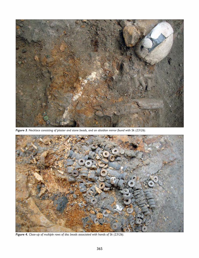
365
Figure 3. Necklace consisting of plaster and stone beads, and an obsidian mirror found with Sk (23126).
Figure 4. Close-up of multiple rows of disc beads associated with hands of Sk (23126).
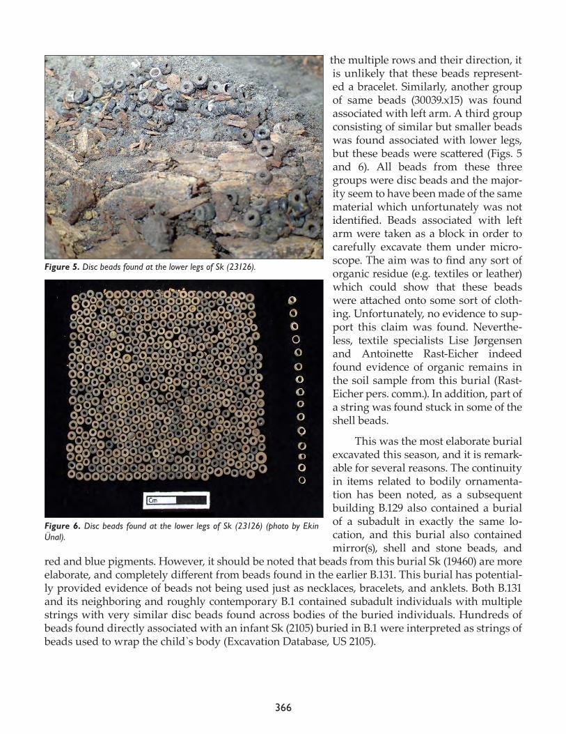
366
the multiple rows and their direction, it is unlikely that these beads represent-ed a bracelet. Similarly, another group of same beads (30039.x15) was found associated with left arm. A third group consisting of similar but smaller beads was found associated with lower legs, but these beads were scattered (Figs. 5 and 6). All beads from these three groups were disc beads and the major-ity seem to have been made of the same material which unfortunately was not identified. Beads associated with left arm were taken as a block in order to carefully excavate them under micro-scope. The aim was to find any sort of organic residue (e.g. textiles or leather) which could show that these beads were attached onto some sort of cloth-ing. Unfortunately, no evidence to sup-port this claim was found. Neverthe-less, textile specialists Lise Jørgensen and Antoinette Rast-Eicher indeed found evidence of organic remains in the soil sample from this burial (Rast- Eicher pers. comm.). In addition, part of a string was found stuck in some of the shell beads.
This was the most elaborate burial excavated this season, and it is remark-able for several reasons. The continuity in items related to bodily ornamenta-tion has been noted, as a subsequent building B.129 also contained a burial of a subadult in exactly the same lo-cation, and this burial also contained mirror(s), shell and stone beads, and
red and blue pigments. However, it should be noted that beads from this burial Sk (19460) are more elaborate, and completely different from beads found in the earlier B.131. This burial has potential-ly provided evidence of beads not being used just as necklaces, bracelets, and anklets. Both B.131 and its neighboring and roughly contemporary B.1 contained subadult individuals with multiple strings with very similar disc beads found across bodies of the buried individuals. Hundreds of beads found directly associated with an infant Sk (2105) buried in B.1 were interpreted as strings of beads used to wrap the child`s body (Excavation Database, US 2105).
Figure 5. Disc beads found at the lower legs of Sk (23126).
Figure 6. Disc beads found at the lower legs of Sk (23126) (photo by Ekin Ünal).
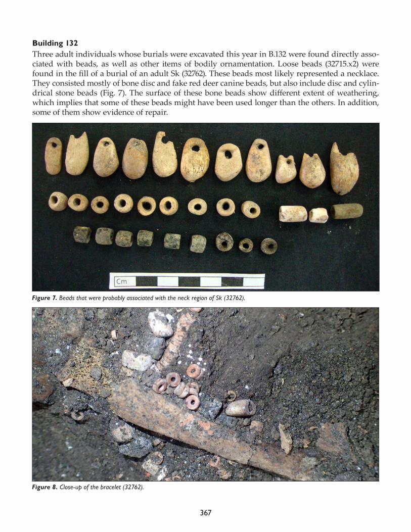
367
Building 132Three adult individuals whose burials were excavated this year in B.132 were found directly asso-ciated with beads, as well as other items of bodily ornamentation. Loose beads (32715.x2) were found in the fill of a burial of an adult Sk (32762). These beads most likely represented a necklace. They consisted mostly of bone disc and fake red deer canine beads, but also include disc and cylin-drical stone beads (Fig. 7). The surface of these bone beads show different extent of weathering, which implies that some of these beads might have been used longer than the others. In addition, some of them show evidence of repair.
Figure 7. Beads that were probably associated with the neck region of Sk (32762).
Figure 8. Close-up of the bracelet (32762).
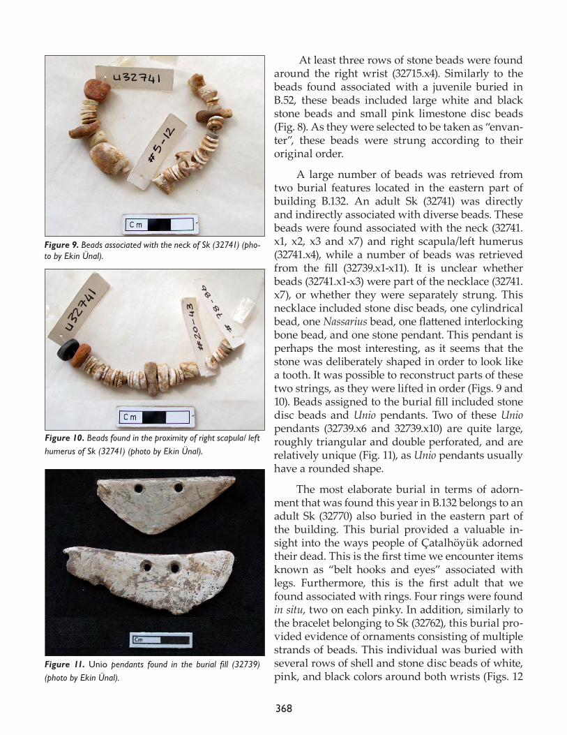
368
At least three rows of stone beads were found around the right wrist (32715.x4). Similarly to the beads found associated with a juvenile buried in B.52, these beads included large white and black stone beads and small pink limestone disc beads (Fig. 8). As they were selected to be taken as “envan-ter”, these beads were strung according to their original order.
A large number of beads was retrieved from two burial features located in the eastern part of building B.132. An adult Sk (32741) was directly and indirectly associated with diverse beads. These beads were found associated with the neck (32741.x1, x2, x3 and x7) and right scapula/left humerus (32741.x4), while a number of beads was retrieved from the fill (32739.x1-x11). It is unclear whether beads (32741.x1-x3) were part of the necklace (32741.x7), or whether they were separately strung. This necklace included stone disc beads, one cylindrical bead, one Nassarius bead, one flattened interlocking bone bead, and one stone pendant. This pendant is perhaps the most interesting, as it seems that the stone was deliberately shaped in order to look like a tooth. It was possible to reconstruct parts of these two strings, as they were lifted in order (Figs. 9 and 10). Beads assigned to the burial fill included stone disc beads and Unio pendants. Two of these Unio pendants (32739.x6 and 32739.x10) are quite large, roughly triangular and double perforated, and are relatively unique (Fig. 11), as Unio pendants usually have a rounded shape.
The most elaborate burial in terms of adorn-ment that was found this year in B.132 belongs to an adult Sk (32770) also buried in the eastern part of the building. This burial provided a valuable in-sight into the ways people of Çatalhöyük adorned their dead. This is the first time we encounter items known as “belt hooks and eyes” associated with legs. Furthermore, this is the first adult that we found associated with rings. Four rings were found in situ, two on each pinky. In addition, similarly to the bracelet belonging to Sk (32762), this burial pro-vided evidence of ornaments consisting of multiple strands of beads. This individual was buried with several rows of shell and stone disc beads of white, pink, and black colors around both wrists (Figs. 12
Figure 9. Beads associated with the neck of Sk (32741) (pho-to by Ekin Ünal).
Figure 10. Beads found in the proximity of right scapula/ left humerus of Sk (32741) (photo by Ekin Ünal).
Figure 11. Unio pendants found in the burial fill (32739) (photo by Ekin Ünal).
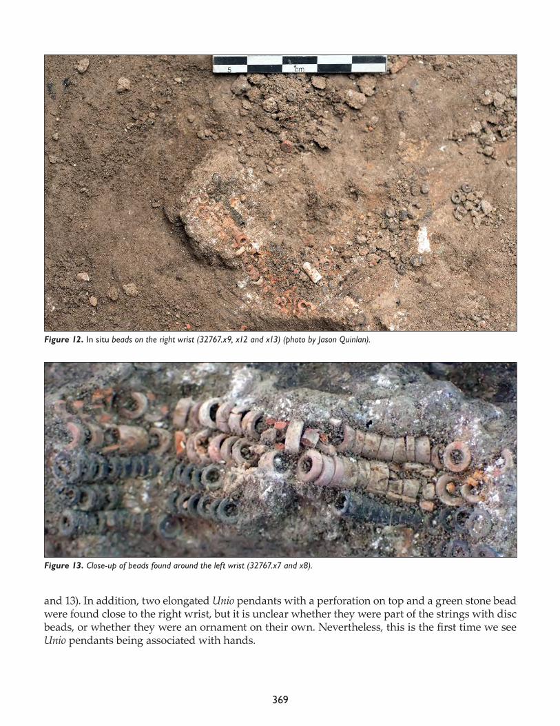
369
and 13). In addition, two elongated Unio pendants with a perforation on top and a green stone bead were found close to the right wrist, but it is unclear whether they were part of the strings with disc beads, or whether they were an ornament on their own. Nevertheless, this is the first time we see Unio pendants being associated with hands.
Figure 12. In situ beads on the right wrist (32767.x9, x12 and x13) (photo by Jason Quinlan).
Figure 13. Close-up of beads found around the left wrist (32767.x7 and x8).
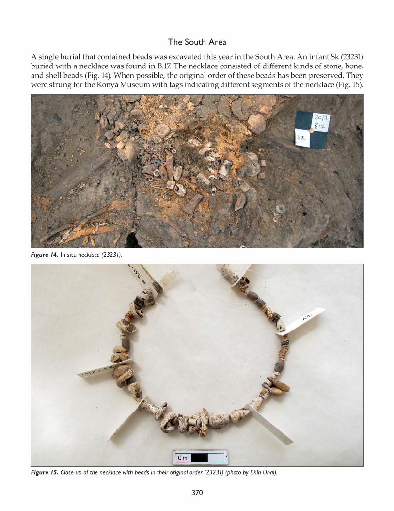
370
The South Area
A single burial that contained beads was excavated this year in the South Area. An infant Sk (23231) buried with a necklace was found in B.17. The necklace consisted of different kinds of stone, bone, and shell beads (Fig. 14). When possible, the original order of these beads has been preserved. They were strung for the Konya Museum with tags indicating different segments of the necklace (Fig. 15).
Figure 14. In situ necklace (23231).
Figure 15. Close-up of the necklace with beads in their original order (23231) (photo by Ekin Ünal).
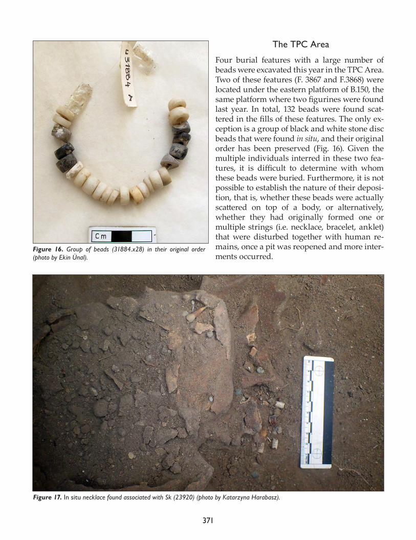
371
The TPC Area
Four burial features with a large number of beads were excavated this year in the TPC Area. Two of these features (F. 3867 and F.3868) were located under the eastern platform of B.150, the same platform where two figurines were found last year. In total, 132 beads were found scat-tered in the fills of these features. The only ex-ception is a group of black and white stone disc beads that were found in situ, and their original order has been preserved (Fig. 16). Given the multiple individuals interred in these two fea-tures, it is difficult to determine with whom these beads were buried. Furthermore, it is not possible to establish the nature of their deposi-tion, that is, whether these beads were actually scattered on top of a body, or alternatively, whether they had originally formed one or multiple strings (i.e. necklace, bracelet, anklet) that were disturbed together with human re-mains, once a pit was reopened and more inter-ments occurred.
Figure 16. Group of beads (31884.x28) in their original order (photo by Ekin Ünal).
Figure 17. In situ necklace found associated with Sk (23920) (photo by Katarzyna Harabasz).
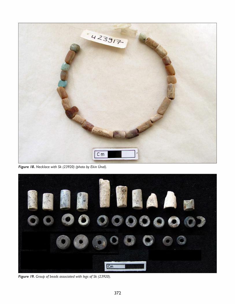
372
Figure 19. Group of beads associated with legs of Sk (23920).
Figure 18. Necklace with Sk (23920) (photo by Ekin Ünal).
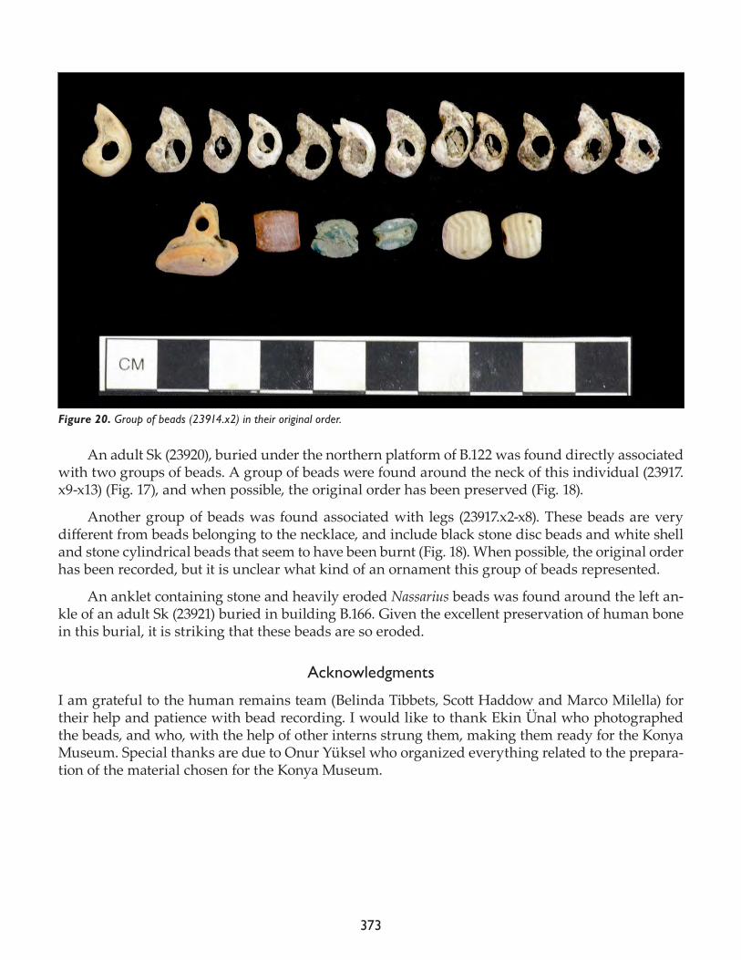
373
An adult Sk (23920), buried under the northern platform of B.122 was found directly associated with two groups of beads. A group of beads were found around the neck of this individual (23917.x9-x13) (Fig. 17), and when possible, the original order has been preserved (Fig. 18).
Another group of beads was found associated with legs (23917.x2-x8). These beads are very different from beads belonging to the necklace, and include black stone disc beads and white shell and stone cylindrical beads that seem to have been burnt (Fig. 18). When possible, the original order has been recorded, but it is unclear what kind of an ornament this group of beads represented.
An anklet containing stone and heavily eroded Nassarius beads was found around the left an-kle of an adult Sk (23921) buried in building B.166. Given the excellent preservation of human bone in this burial, it is striking that these beads are so eroded.
Acknowledgments
I am grateful to the human remains team (Belinda Tibbets, Scott Haddow and Marco Milella) for their help and patience with bead recording. I would like to thank Ekin Ünal who photographed the beads, and who, with the help of other interns strung them, making them ready for the Konya Museum. Special thanks are due to Onur Yüksel who organized everything related to the prepara-tion of the material chosen for the Konya Museum.
Figure 20. Group of beads (23914.x2) in their original order.

374
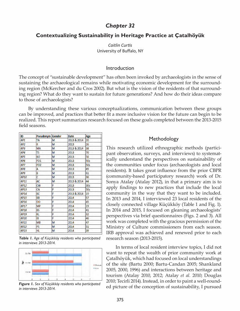
375
Chapter 32
Contextualizing Sustainability in Heritage Practice at Çatalhöyük
Caitlin CurtisUniversity of Buffalo, NY
Introduction
The concept of “sustainable development” has often been invoked by archaeologists in the sense of sustaining the archaeological remains while motivating economic development for the surround-ing region (McKercher and du Cros 2002). But what is the vision of the residents of that surround-ing region? What do they want to sustain for future generations? And how do their ideas compare to those of archaeologists?
By understanding these various conceptualizations, communication between these groups can be improved, and practices that better fit a more inclusive vision for the future can begin to be realized. This report summarizes research focused on these goals completed between the 2013-2015 field seasons.
Methodology
This research utilized ethnographic methods (partici-pant observation, surveys, and interviews) to systemat-ically understand the perspectives on sustainability of the communities under focus (archaeologists and local residents). It takes great influence from the prior CBPR (community-based participatory research) work of Dr. Sonya Atalay (Atalay 2012), in that a primary aim is to apply findings to new practices that include the local community in the way that they want to be included. In 2013 and 2014, I interviewed 23 local residents of the closely connected village Küçükköy (Table 1 and Fig. 1). In 2014 and 2015, I focused on gleaning archaeologists’ perspectives via brief questionnaires (Figs. 2 and 3). All work was completed with the gracious permission of the Ministry of Culture commissioners from each season. IRB approval was achieved and renewed prior to each research season (2013-2015).
In terms of local resident interview topics, I did not want to repeat the wealth of prior community work at Çatalhöyük, which had focused on local understandings of the site (Bartu 2000; Bartu-Candan 2005; Shankland 2005, 2000, 1996) and interactions between heritage and tourism (Atalay 2010, 2012; Atalay et al. 2010; Douglas 2010; Tecirli 2014). Instead, in order to paint a well-round-ed picture of the conception of sustainability, I pursued
Table 1. Age of Küçükköy residents who participated in interviews 2013-2014.
Figure 1. Sex of Küçükköy residents who participated in interviews 2013-2014.
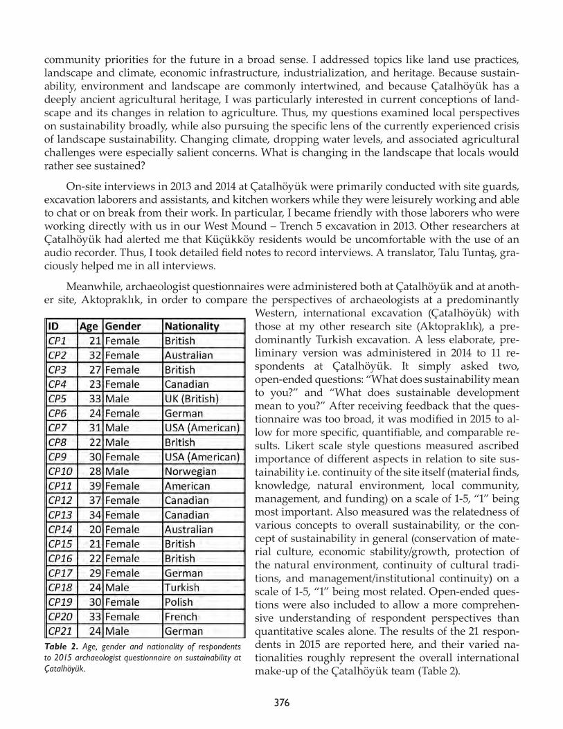
376
community priorities for the future in a broad sense. I addressed topics like land use practices, landscape and climate, economic infrastructure, industrialization, and heritage. Because sustain-ability, environment and landscape are commonly intertwined, and because Çatalhöyük has a deeply ancient agricultural heritage, I was particularly interested in current conceptions of land-scape and its changes in relation to agriculture. Thus, my questions examined local perspectives on sustainability broadly, while also pursuing the specific lens of the currently experienced crisis of landscape sustainability. Changing climate, dropping water levels, and associated agricultural challenges were especially salient concerns. What is changing in the landscape that locals would rather see sustained?
On-site interviews in 2013 and 2014 at Çatalhöyük were primarily conducted with site guards, excavation laborers and assistants, and kitchen workers while they were leisurely working and able to chat or on break from their work. In particular, I became friendly with those laborers who were working directly with us in our West Mound – Trench 5 excavation in 2013. Other researchers at Çatalhöyük had alerted me that Küçükköy residents would be uncomfortable with the use of an audio recorder. Thus, I took detailed field notes to record interviews. A translator, Talu Tuntaş, gra-ciously helped me in all interviews.
Meanwhile, archaeologist questionnaires were administered both at Çatalhöyük and at anoth-er site, Aktopraklık, in order to compare the perspectives of archaeologists at a predominantly
Western, international excavation (Çatalhöyük) with those at my other research site (Aktopraklık), a pre-dominantly Turkish excavation. A less elaborate, pre-liminary version was administered in 2014 to 11 re-spondents at Çatalhöyük. It simply asked two, open-ended questions: “What does sustainability mean to you?” and “What does sustainable development mean to you?” After receiving feedback that the ques-tionnaire was too broad, it was modified in 2015 to al-low for more specific, quantifiable, and comparable re-sults. Likert scale style questions measured ascribed importance of different aspects in relation to site sus-tainability i.e. continuity of the site itself (material finds, knowledge, natural environment, local community, management, and funding) on a scale of 1-5, “1” being most important. Also measured was the relatedness of various concepts to overall sustainability, or the con-cept of sustainability in general (conservation of mate-rial culture, economic stability/growth, protection of the natural environment, continuity of cultural tradi-tions, and management/institutional continuity) on a scale of 1-5, “1” being most related. Open-ended ques-tions were also included to allow a more comprehen-sive understanding of respondent perspectives than quantitative scales alone. The results of the 21 respon-dents in 2015 are reported here, and their varied na-tionalities roughly represent the overall international make-up of the Çatalhöyük team (Table 2).
Table 2. Age, gender and nationality of respondents to 2015 archaeologist questionnaire on sustainability at Çatalhöyük.
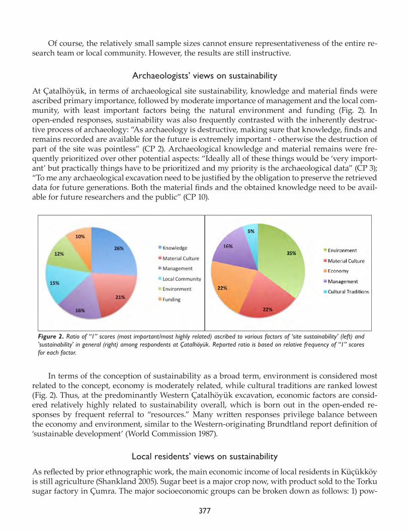
377
Of course, the relatively small sample sizes cannot ensure representativeness of the entire re-search team or local community. However, the results are still instructive.
Archaeologists’ views on sustainability
At Çatalhöyük, in terms of archaeological site sustainability, knowledge and material finds were ascribed primary importance, followed by moderate importance of management and the local com-munity, with least important factors being the natural environment and funding (Fig. 2). In open-ended responses, sustainability was also frequently contrasted with the inherently destruc-tive process of archaeology: “As archaeology is destructive, making sure that knowledge, finds and remains recorded are available for the future is extremely important - otherwise the destruction of part of the site was pointless” (CP 2). Archaeological knowledge and material remains were fre-quently prioritized over other potential aspects: “Ideally all of these things would be ‘very import-ant’ but practically things have to be prioritized and my priority is the archaeological data” (CP 3); “To me any archaeological excavation need to be justified by the obligation to preserve the retrieved data for future generations. Both the material finds and the obtained knowledge need to be avail-able for future researchers and the public” (CP 10).
In terms of the conception of sustainability as a broad term, environment is considered most related to the concept, economy is moderately related, while cultural traditions are ranked lowest (Fig. 2). Thus, at the predominantly Western Çatalhöyük excavation, economic factors are consid-ered relatively highly related to sustainability overall, which is born out in the open-ended re-sponses by frequent referral to “resources.” Many written responses privilege balance between the economy and environment, similar to the Western-originating Brundtland report definition of ‘sustainable development’ (World Commission 1987).
Local residents’ views on sustainability
As reflected by prior ethnographic work, the main economic income of local residents in Küçükköy is still agriculture (Shankland 2005). Sugar beet is a major crop now, with product sold to the Torku sugar factory in Çumra. The major socioeconomic groups can be broken down as follows: 1) pow-
Figure 2. Ratio of “1” scores (most important/most highly related) ascribed to various factors of ‘site sustainability’ (left) and 'sustainability' in general (right) among respondents at Çatalhöyük. Reported ratio is based on relative frequency of “1” scores for each factor.
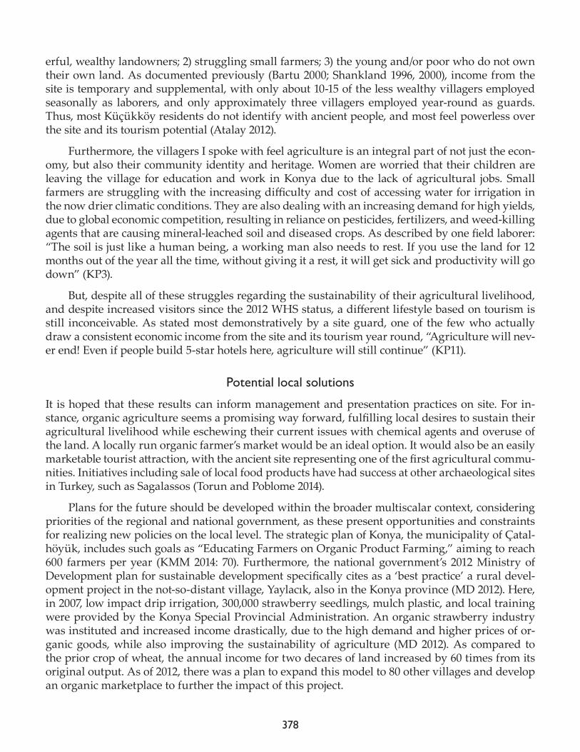
378
erful, wealthy landowners; 2) struggling small farmers; 3) the young and/or poor who do not own their own land. As documented previously (Bartu 2000; Shankland 1996, 2000), income from the site is temporary and supplemental, with only about 10-15 of the less wealthy villagers employed seasonally as laborers, and only approximately three villagers employed year-round as guards. Thus, most Küçükköy residents do not identify with ancient people, and most feel powerless over the site and its tourism potential (Atalay 2012).
Furthermore, the villagers I spoke with feel agriculture is an integral part of not just the econ-omy, but also their community identity and heritage. Women are worried that their children are leaving the village for education and work in Konya due to the lack of agricultural jobs. Small farmers are struggling with the increasing difficulty and cost of accessing water for irrigation in the now drier climatic conditions. They are also dealing with an increasing demand for high yields, due to global economic competition, resulting in reliance on pesticides, fertilizers, and weed-killing agents that are causing mineral-leached soil and diseased crops. As described by one field laborer: “The soil is just like a human being, a working man also needs to rest. If you use the land for 12 months out of the year all the time, without giving it a rest, it will get sick and productivity will go down” (KP3).
But, despite all of these struggles regarding the sustainability of their agricultural livelihood, and despite increased visitors since the 2012 WHS status, a different lifestyle based on tourism is still inconceivable. As stated most demonstratively by a site guard, one of the few who actually draw a consistent economic income from the site and its tourism year round, “Agriculture will nev-er end! Even if people build 5-star hotels here, agriculture will still continue” (KP11).
Potential local solutions
It is hoped that these results can inform management and presentation practices on site. For in-stance, organic agriculture seems a promising way forward, fulfilling local desires to sustain their agricultural livelihood while eschewing their current issues with chemical agents and overuse of the land. A locally run organic farmer’s market would be an ideal option. It would also be an easily marketable tourist attraction, with the ancient site representing one of the first agricultural commu-nities. Initiatives including sale of local food products have had success at other archaeological sites in Turkey, such as Sagalassos (Torun and Poblome 2014).
Plans for the future should be developed within the broader multiscalar context, considering priorities of the regional and national government, as these present opportunities and constraints for realizing new policies on the local level. The strategic plan of Konya, the municipality of Çatal-höyük, includes such goals as “Educating Farmers on Organic Product Farming,” aiming to reach 600 farmers per year (KMM 2014: 70). Furthermore, the national government’s 2012 Ministry of Development plan for sustainable development specifically cites as a ‘best practice’ a rural devel-opment project in the not-so-distant village, Yaylacık, also in the Konya province (MD 2012). Here, in 2007, low impact drip irrigation, 300,000 strawberry seedlings, mulch plastic, and local training were provided by the Konya Special Provincial Administration. An organic strawberry industry was instituted and increased income drastically, due to the high demand and higher prices of or-ganic goods, while also improving the sustainability of agriculture (MD 2012). As compared to the prior crop of wheat, the annual income for two decares of land increased by 60 times from its original output. As of 2012, there was a plan to expand this model to 80 other villages and develop an organic marketplace to further the impact of this project.
379
These multiscalar considerations present an interesting opportunity in which regional, nation-al, and archaeological priorities align with those of local residents. However, as of my interviews in 2014, no Küçükköy residents had heard of these nearby organic agriculture projects or been in-cluded in their benefits. Thus, further education on the subject of organic agriculture is needed if such practices are to take hold in the community. This would allow for progress toward both local priorities for the future and archaeologists’ goals for the site. It is hoped that such efforts can be incorporated into future heritage work at Çatalhöyük.
References
Atalay, S.2010. ’We don’t talk about Çatalhöyük, we live it’: sustainable archaeological practice through community-based participatory research. World Archaeology 42: 418–29.
2012. Community-based Archaeology: Research with, by, and for Indigenous and Local Communities. Berkeley and Los Angeles: University of California Press.
Atalay, S., D. Çamurcuoğlu, I. Hodder, S. Moser, A. Orbaşli and E. Pye 2010. Protecting and exhibiting Çatalhöyük. In TÜBA-KED (The Turkish Academy of Sciences-Journal of Cultural Inventory) Vol. 8, edited by M. Özdoğan, N. Akın, A. Debold-Kritter, L. Oosterbeek, N. Tuna, N. Yalçın. Ankara: TÜBA, pp. 155–66.
Bartu, A. 2000. Where is Çatalhöyük? Multiple sites in the construction of an archaeological site. In Towards a Reflexive Method in Archaeology: The Example at Çatalhöyük, edited by I. Hodder. Cambridge: McDonald Institute for Ar-chaeological Research; London: British Institute for Archaeology at Ankara, pp 101-10.
Bartu-Candan, A. 2005. Entanglements/encounters/engagements with prehistory: Çatalhöyük and its publics. In Çatalhöyük Per-spectives: Reports from the 1995-99 Seasons, edited by I. Hodder. Cambridge: McDoald Institute for Archaeological Research; London: British Institute of Archaeology at Ankara, pp. 27-38.
Douglas, M. 2010. Evaluating Çatalhöyük: Economic and Ethnographic Approaches to Understanding the Impact of Cultural Heritage. Master’s Thesis. Stanford University.
Konya Metropolitan Municipality (KMM). 2014. 2015-2019 Stratejik Planı. Konya, Turkey: Konya Büyükşehir Belediyesi.
McKercher, B. and H. du Cros 2002. Cultural Tourism: The Partnership Between Tourism and Cultural Heritage Management. Binghamton, NY: Ha-worth Hospitality Press.
Shankland, D. 1996. Çatalhöyük: the anthropology of an archaeological presence. In On the Surface: Çatalhöyük 1993-95, edited by I. Hodder. Ankara: British Institute of Archaeology at Ankara, pp. 349-58.
380
2000. Villages and the distant past: three seasons work at Küçükköy, Çatalhöyük, In Towards a Reflexive Method in Archaeology: The Example at Çatalhöyük, edited by I. Hodder. London: British Institute of Archaeology at Ankara, pp. 167-76.
2005. The Socio-ecology of Çatalhöyük, In Çatalhöyük Perspectives: Reports from the 1995-99 Seasons, edited by I. Hodder. Cambridge: McDoald Institute for Archaeological Research; London: British Institute of Archaeology at Ankara, pp. 15-26.
Tecirli, B.
2014. How effectively do ‘top-down’ participatory management initiatives for Turkey’s archaeological areas merge with ‘bottom-up’ management practices? A Çatalhöyük case study. In Integrating Çatalhöyük: Themes from the 2000-2008 Seasons, edited by I. Hodder. London: British Institute at Ankara; Los Angeles: Cotsen Institute of Archaeology Press, pp 37-46.
Torun, E. and J. Poblome2014. Sagalassos - Ağlasun: A case of transforming and transformative heritage. Public Archaeology: Theoretical Approaches ans Current Practices in Turkey Worshop, October 30-31 2014. RCAC, Istanbul.
Turkish Republic Ministry of Development (MD)2012. Turkey’s Sustainable Development Report: Claiming the Future. Ankara, Turkey: Turkish Republic Ministry of Development.
World Commission on Environment and Development (World Commission)1987. Our Common Future. Oxford: Oxford University Press.