Embed Size (px)
Citation preview

AN INNOVATIVE APPROACH TO REDUCING NUTRIENT LOSSES FROM
AGRICULTURAL LANDSCAPES
THE WATERSHED APPROACH

Why Do We Need a New Approach to Conservation?
• Growing awareness of problems associated with nitrogen losses from agricultural landscapes.
• Reducing nitrogen losses requires a different approach to agricultural conservation.
• Nitrogen moves primarily with subsurface flows• Nitrogen-related water quality problems are invisible on the
farm but affect downstream communities at a regional scale
• Past conservation efforts have been very successful in reducing soil erosion (and phosphorus losses).
• But much more needs to be done to reduce phosphorus losses from agricultural landscapes.

The Scale of the Solution Needs to Match the Scale of the Problem
45% reduction in downstream loads
Significant reductions in stream N and P concentrations needed to meet new nutrient criteria
We need to treat the causes, not the symptoms, of nutrient loss

How have these landscapes changed in the past 150 years?
What causes nutrient losses from Midwestern landscapes?

LANDSCAPE CHANGES
INCREASED NUTRIENT EXPORT
McLellan et al, JAWRA, 2015a

McLellan et al, JAWRA, 2015a

Decreased nitrogen transport
Decreased nitrogen transport
Decreased nitrogen sources
Increased nitrogen
sinks
WAYS TO DECREASE NUTRIENT LOSSES
EMPHASIS ON CRITICAL SOURCE
AREAS
NEED EMPHASIS ON CRITICAL SINK AREAS

Restoring sinks on 1-2% of the landscape can decrease downstream nutrient loads by 45% (McLellan et al, JAWRA, 2015)
If we reduce nutrient sources and transport by implementing improved fertilizer management and cover crops on all cropland in the Basin, we can reduce downstream nutrient loads by 30%.
Getting to 45%Reducing hypoxia in the Gulf of Mexico requires a 45% reduction in nitrogen loads from the Upper Mississippi-Ohio River Basin.
Is it realistic to think that all producers in the Basin will implement improved fertilizer management and cover crops on all their land?
How do we fill the gap?
McLellan et al, JAWRA, 2015b

Solving Regional Water Quality Problems Through Local Watershed Projects
McLellan et al, JAWRA, 2015b
• USGS SPARROW model
• Map land eligibility for practices at small watershed scale
• Model trade-offs between in-field and landscape-scale practices
• Target conservation efforts to where they will create the greatest load reductions
• Minimize cropland conversion
Why local (HUC-12) projects?

Decrease N sources:• Improve nutrient management• Use extended rotations and/or conservation cover• Use cover crops
Decrease N transport:• Use cover crops• Use conservation tillage (soil water storage)• Use controlled drainage• Use water storage structures in the landscape (e.g. ponds, wetlands)
Restore/create N sinks:• Riparian buffers• Pothole-type wetlands• Created wetlands• Two-stage ditches• Stream restoration• Floodplain reconnection
A Systems Approach at Small Watershed Scale

THE WATERSHED APPROACH:
Follow the nutrient flowpaths: reduce sources, reduce transport, restore sinks

Poorly Drained Soils Well Drained SoilsHigh relief (slopes > 5%) Farming on sloping lands in old
glacial landscapes, thin loess or paleosols, high runoff potential
Farming on sloping lands underlain by shallow bedrock or sands, potential karst, baseflow-dominated with high runoff potential during storm events
Low relief (slopes < 5%) Dissected (slopes 2<x<5% )
Non-dissected (slopes < 2%)
Farming on sand plains, floodplains, terraces, infiltration-dominated system, high baseflow
Farming on upland divides and stepped terraces, high runoff potential with tiling along waterways
Farming on hydric soils, widespread artificial drainage
Agro-hydrologic analysis: a simple approach to identifying dominant flowpaths
Schilling et al, Envtl. Mgmt., 2015

Distribution of Different Types of Watersheds Across the UMORB

Poorly Drained Soils Well Drained Soils
High relief (slopes > 5%) Grass waterways, contour filter strips, terraces, ponds, riparian buffers, cover crops
In-field source controls important, riparian buffers, springs, seeps, floodplain reconnection, in-stream practices
Low relief (slopes < 5%) Dissected (slopes 2<x<5% )
Non-dissected (slopes < 2%)
In-field source controls important, 2-stage ditches, floodplain reconnection, off-channel wetlands
Grass waterways, filter strips, ponds, cover crops, riparian buffers, wetlands, bioreactors
Drainage water management, treatment wetlands, bioreactors, 2-stage ditches
Different Priority Practices for Different Types of Watersheds

An integrated suite of practices across the landscape from field to
farm to ditch/stream/lake…
…that recognizes that a watershed is also a community where people live, work and play
The Watershed Approach


Solving nutrient pollution problems
Solving social and economic problems: food
production, economic viability,
flood/drought protection, recreational
opportunities etc.
A biophysical system at
watershed scale
A social system at watershed
scale
SOLVING MULTIPLE PROBLEMS IN A WAY THAT WORKS FOR THE COMMUNITY

Characteristics of the watershed approach
A systemic, strategic and comprehensive approach to conservation that:• Is goal-oriented• Broadens the focus of conservation from field- and farm-
scale to watershed-scale• Identifies priority conservation practices and practice
locations based on understanding of the flow of nutrients across the landscape
• Engages stakeholders in watershed planning• Engages public and private partners in education,
outreach, technical support and funding

Stages in the Process
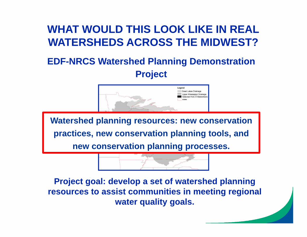
WHAT WOULD THIS LOOK LIKE IN REAL WATERSHEDS ACROSS THE MIDWEST?
Project goal: develop a set of watershed planning resources to assist communities in meeting regional
water quality goals.
EDF-NRCS Watershed Planning Demonstration Project
Watershed planning resources: new conservation practices, new conservation planning tools, and
new conservation planning processes.

Key Questions in Each Watershed
• Are stakeholders aware of water quality problems and invested in solving them?• Social capacity analysis
• What is a reasonable water quality goal?• Stakeholder-expert discussion
• What are the dominant sources and transport pathways of nutrients?• Hydrologic watershed classification (Schilling et al, 2015)
• How can we best reduce nutrient losses along these flowpaths?• Priority practices for each watershed class (Schilling et al, 2015)
• What are stakeholders’ attitudes and beliefs about these practices?• Structured interviews
• Where is it theoretically possible to put priority practices in the watershed?• LiDAR-based conservation planning tool (Tomer et al, 2014)
• What combination of priority practices and locations is needed to meet the water quality goal?• Alternative conservation scenarios (Tomer et al, 2015)


Stages in the Process

Watershed Planning and Plan Implementation in Beargrass Creek, IN
Supported by an NRCS Conservation Innovation Grant

The Story Continues…