Embed Size (px)
Citation preview
Natural Valley Procedure for Hydraulic Analysis and Floodplain Mapping
of Non-Accredited Levee Systems Using HEC-RAS 2-D
Dragi Stefanovic, Ph.D., P.E., D.WRE Director of Water Resources
EWRI 2015


Do not meet Title 44 CFR, Section 65.10
Inadequate toedownprotection, encroachments into embankment, vegetation

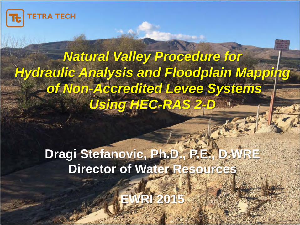
Perform 1-D hydraulic analysis for the main channel using unsteady HEC-RAS model.
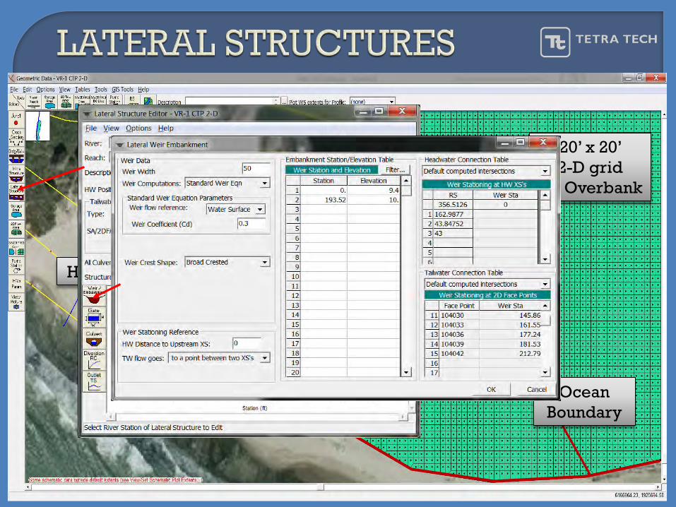
Add lateral structures (weirs) along the levee to capture the overtopping flows. This reflects the levee geometry in cross sections, but allows water to flow on either side of the levee- Natural Valley Procedure.
Weir overtopping flows from HEC-RAS 1-D feed the overbank 2-D model. 2-D inflows are uniformly distributed along the interface grid cells adjacent to the levee.
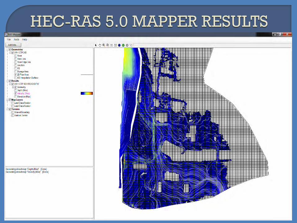
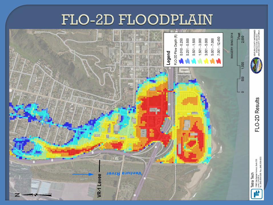
Develop floodplain maps (with BFEs) on the landward and riverward sides of the levee from the respective models.
Develop 100-year floodway by steady HEC-RAS 1-D.
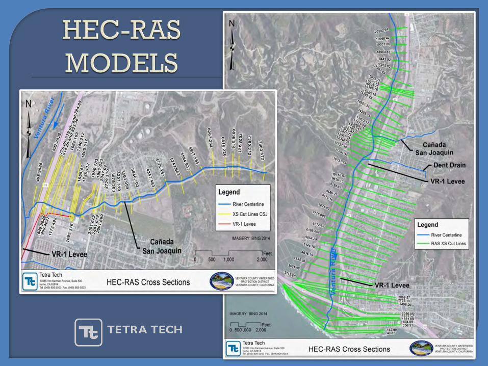

“WEIR” CREST ELEVATION AT THE LEVEE BASE2D INFLOW
CELL

The number one problem modelers have when interfacing 1-D riverreaches with 2-D areas, is using way too high weir coefficients. If thelateral structure is really just an overland flow interface between the 1-Driver and the 2-D floodplain, then weir coefficients in the range of 0.1 to0.5 must be used to get the right flow transfer Q and keep the unsteadymodel stable (HEC, 2013).
𝑄𝑄 =C L 𝐻𝐻 ⁄3 2
𝑄𝑄 = dischargeC = weir coefficientL = weir length𝐻𝐻 = energy head


20’ x 20’ 2-D grid
VR Overbank
Lateral Structures
1-D 2-D
HEC-RAS 1-D
OceanBoundary
20’ x 20’ 2-D grid
VR Overbank
Lateral Structures
1-D 2-DHEC-RAS 1-D
OceanBoundary
500
300


PARAMETAR FLO-2D HEC-RAS 2D
Grid Cell Shape Square Flexible+
Grid Refinement No Yes+
Grid Correction Needed No+ Yes
Terrain Interpolation One Cell Elevation Property Tables+Numerical Scheme Explicit Implicit+
Time Step Small Larger(DIFW)+
Hydraulic Structures Rating Tables Module+
Levee Eliminated Remains+
Weir Coefficient Hardwired User Defined+
Blocked Obstructions ARF/WRF+ Roughness
Streets Module+ Roughness
Rain/Infiltration Yes+ No

Refined 2-D technique for analysis and mapping of non-accredited levees
Levee does not have to be removed from cross section ground points to allow lateral overtopping and overland conveyance
Full control of flow transfer between the channel and overbank (energy gradient)
Synchronized floodplain mapping on landward and riverward sides (RAS Mapper)
Facilitates floodway analysis (HEC-RAS 1-D)