Embed Size (px)
Citation preview

ToolsTesTable and GEOQUAL
Mauricio Parra QuijanoInternational Treaty on Plant Genetic Resources for Food and Agriculture CAPFITOGEN Program Coordinator
http://www.capfitogen.net
INTRODUCTION TO

TesTable
Checks your table formats and optionally corrects them
TesTable
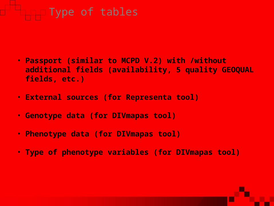
Type of tables
• Passport (similar to MCPD V.2) with /without additional fields (availability, 5 quality GEOQUAL fields, etc.)
• External sources (for Representa tool)
• Genotype data (for DIVmapas tool)
• Phenotype data (for DIVmapas tool)
• Type of phenotype variables (for DIVmapas tool)
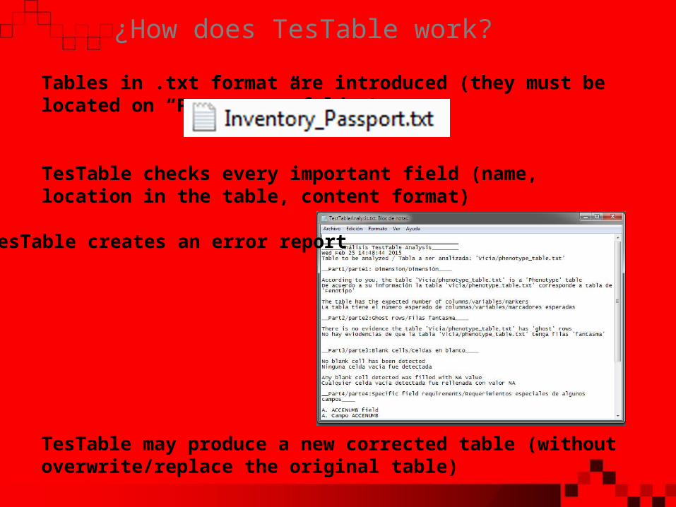
¿How does TesTable work?
Tables in .txt format are introduced (they must be located on “Pasaporte” folder)
TesTable checks every important field (name, location in the table, content format)
TesTable creates an error report
TesTable may produce a new corrected table (without overwrite/replace the original table)

Results
TesTable save its results on “Pasaporte” folder
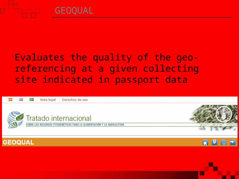
GEOQUAL
Evaluates the quality of the geo-referencing at a given collecting site indicated in passport data

Geo-referencing and passport data
40° 20’ 33.4’’ N03° 11’ 52.1’’ W

Why should we evaluate the geo-referencing quality?
Coordinates
True site
x km
1030
75
100
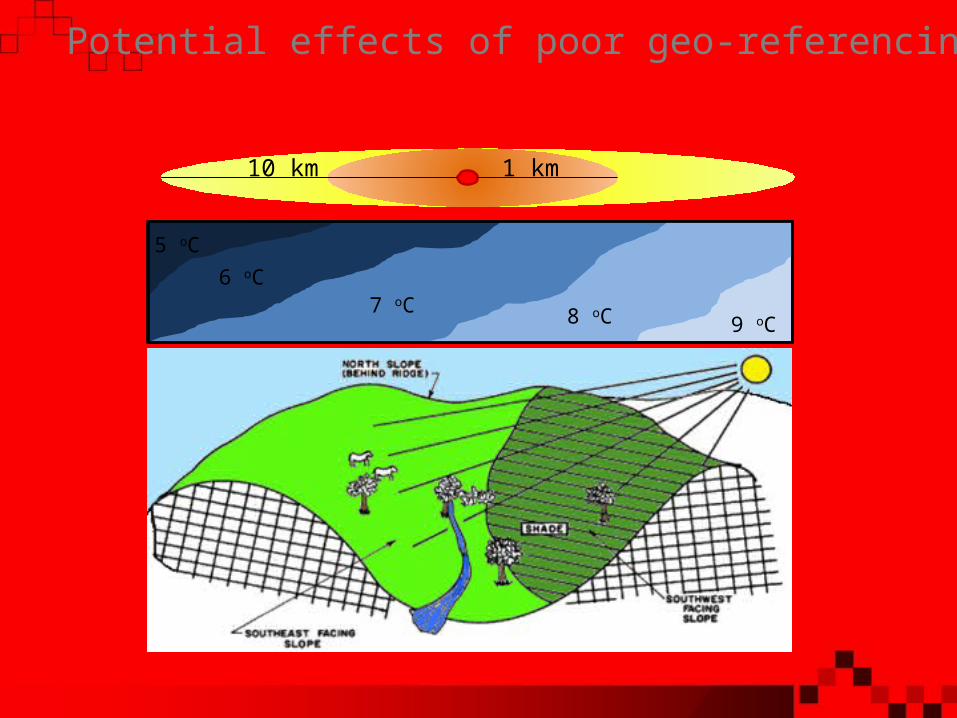
Potential effects of poor geo-referencing
10 km
5 oC6 oC
7 oC 8 oC 9 oC
1 km

Level Value
ORIGCTY CRI
ADM1 Punta Arenas
ADM2 Buenos Aires
ADM3 NA
ADM4 NA
Level Value
ORIGCTY CRI
ADM1 Punta Arenas
ADM2 Pérez Zeledón
ADM3 NA
ADM4 NA
Description of the collecting site
Error describing the collecting sites

GEOQUAL features
•GEOQUAL is a tool which assigns a quality value to the passport data of a germplasm collection that include coordinates.
•The user enters the passport data in FAO-Bioversity 2012 format.
•GEOQUAL calculates three parameters COORQUAL, LOCALQUAL and SUITQUAL along with other sub-parameters.
•The parameters are summarized to generate both TOTALQUAL (0-60 range) and TOTALQUAL100 (0-100 range)

Parameter that determines the intrinsic quality of the coordinates included in the passport data. Values from 0 to 20. Sub-parameters.:
• ERRORES: Values beyond the coordinate frame
• PRECIS: Accuracy level. Measured in degrees, minutes or seconds (sexagesimal)
• GEORBLE: Probability of correct coordinates from site description
• INTERTEMP: Quality of coordinates by collection year
• * GEOREFMETH: System by which coordinates are assigned
COORQUAL

SUITQUAL
Parameter that assigns a quality value to the coordinates according to the appropriateness of the collection site for plant growth. Values from 0 to 20.
• Difference between cultivated and wild plants (SAMPSTAT)
• It uses information on land use from Global Land Cover map (1 km)

> 30 km
10-20 km
5-10 km
0-1 km
Ground level
0 20
Distance from the coastline
SUITQUAL

Lower resolution
Higher resolution
zoom!
SUITQUAL

LOCALQUAL
Parameter that comes from the comparison of the site (locality) description and administrative data coming from the coordinates, both from user’s passport data.
• The administrative geo-referenced information is extracted from the GADM database
• The comparison is between character strings, generating a distance (Levenshtein). Insertions, deletions and changes are determined, to assume that a string is equal to another. Function "agrep" in R
• According to the number of correct matches, a value ranging from 0 to 20 is assigned.
Passport description
GADM from Coordinates
GADM (second option)
ORIGCTY ISO
ADM1 NAME1 VARNAME1
ADM2 NAME2 VARNAME2
ADM3 NAME3 VARNAME3
ADM4 NAME4 VARNAME4

LOCALQUAL
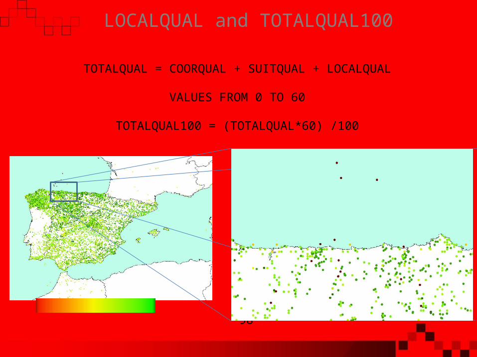
TOTALQUAL = COORQUAL + SUITQUAL + LOCALQUAL
VALUES FROM 0 TO 60
TOTALQUAL100 = (TOTALQUAL*60) /100
0 98
LOCALQUAL and TOTALQUAL100

0 100
TOTALQUAL100: Unified value of the geo-referencing quality
80 90
Use of GEOQUAL