Silvio O. Conte NationalFish and WildlifeRefuge
Nulhegan BasinDivision
Silvio O. Conte National Fish and Wildlife RefugeNulhegan Basin Division5396 Route 105Brunswick, VT 05905802/962 5240802/962 5006 Faxwww.fws.gov/r5soc
Silvio O. Conte NFWR Administrative Office103 E. Plumtree RoadSunderland, MA 01375
Federal Relay Servicefor the deaf and hard-of-hearing1 800/877 8339
U.S. Fish & Wildlife Service1 800/344 WILDhttp://www.fws.gov
July 2011
U.S. Fish & Wildlife ServiceU.S. Fish & Wildlife Service
Moose pair in winter©Roger Irwin
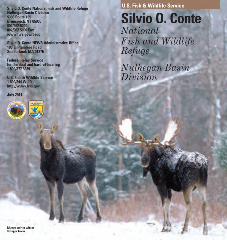
The Nulhegan Basin -Sculpted by Nature,Worked by HumanHands
A Unique LandscapeConserved for Wildlife,Habitat, and People
Lewis Pond Road©Paul Erickson
Silvio O. Conte - a Champion ofNatural Resources
What is your lifelong dream? For thelate congressman Silvio O. Conte, itwas to see to the preservation andrestoration of New England’s longestriver- the Connecticut River. To honortheir colleague, Congress passed theSilvio O. Conte National Fish andWildlife Refuge Act (Act) (P.L. 102-212)in 1991. The Act authorized the U.S.Fish and Wildlife Service (Service) toestablish a national fish and wildliferefuge to protect the diversity andabundance of native species within theConnecticut River watershed.
The Nulhegan (pronounced Nul-HEE-gan) Basin innortheastern Vermont (a NativeAmerican term referencing log ordeadfall traps used to capture smallgame) was identified as a highpriority special focus area within thewatershed when the Silvio O. ConteNational Fish and Wildlife Refugewas first established. The basin wasdetermined to possess highbiological value, because of thepresence of rare species, wetlands,and contiguous migratory birdhabitat.
When Champion InternationalCorporation announced that it wouldsell 132,000 acres of land in northernVermont, including the NulheganBasin, the Service was veryinterested in protecting it under theAct. The Nulhegan Basin Division(division) was established in 1999when the 26,000 acre area waspurchased. The Vermont Agency ofNatural Resources purchased 22,000acres adjacent to the division to formthe West Mountain WildlifeManagement Area, and Plum CreekTimber Company purchased theremaining 84,000 acres thatsurrounds the federal and stateproperties. The combination ofownerships will provide long-termconservation of important wildlifehabitat as well as preservation oftraditional uses of the land.
The basin was formed when a pool ofmagma solidified just below theearth’s surface more than 300 millionyears ago and slowly eroded away tocreate a crater-like “basin” roughly10 miles in diameter surrounded byhills. What was once bubbling withhot magma is now one of the coldestlowland areas in the Northeast.Annual snowfall averages 100 inchesand typically there are about 100frost-free days each year.
This blue goose,designed by J.N.“Ding” Darling, hasbecome the symbol ofthe National WildlifeRefuge System.
Nulhegan River
Tom LaPointe/USFWS
The NulheganBasin- A SpecialFocus Area
Basin History
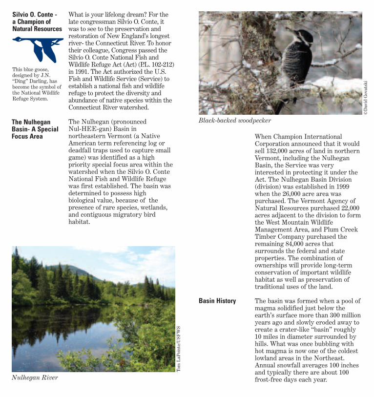
Black-backed woodpecker
©David Govatski

Temperatures range from the low90’s (F) in the late summer monthsto almost -40 degrees (F) in the deadof winter.
In the heart of what is known as theNortheast Kingdom, the basin hasbeen the home to hardworkingpeople for centuries. Logging,sawmill operation, home-basedtrades, hunting, trapping,railroading, crop farming, raisingdairy herds, extracting granite, andtapping sugar maple trees have allbeen a way of life here. Severalprivately owned hunting camps,some that have existed in the samefamily for generations, are stillpresent on the division.
The area is well known for being aremote and rugged landscape withan abundance of boreal bird species,mammals, reptiles, amphibians andrare plants. The black-backedwoodpecker, black-and-whitewarbler, black-throated blue andgreen warblers, blackburnian
warbler, blackpoll warbler, Canadawarbler, boreal chickadee, and manyother migratory songbirds can beseen and heard in the division’sforests. American woodcock, ruffedgrouse, waterfowl, and various birdsof prey also can be commonlyobserved. A variety of mammals suchas moose, black bear, white-taileddeer, snowshoe hare, red squirrel,beaver, fisher, bobcat, and coyote areyear round residents.
In addition to being namedVermont’s largest Important BirdArea, having some of the largeststatewide populations of moose andblack bear, and providing criticalhabitat for the state endangeredspruce grouse, the division alsoprovides important shelter forwintering deer. The largest deerwintering area (or deer yard) in thestate of Vermont occurs on thedivision.
Located just a few miles south of theCanadian border, the NulheganBasin’s vegetation contains elementsof the boreal forest that occurs fartherto the north. The basin ispredominately a forested habitatinterspersed with streams and various
Red eft
©Bryan Pfeiffer
Managing forWildlife, Habitatand People
Wildlife
Tamarac needles in fall
©Paul Erickson
Habitat
©Bryan P
feiffer
Williamson’semerald
Log Drive on the Connecticut River
©VT Historical Society
Quebec
NH
VT1
0 1 2 3 40.5Miles
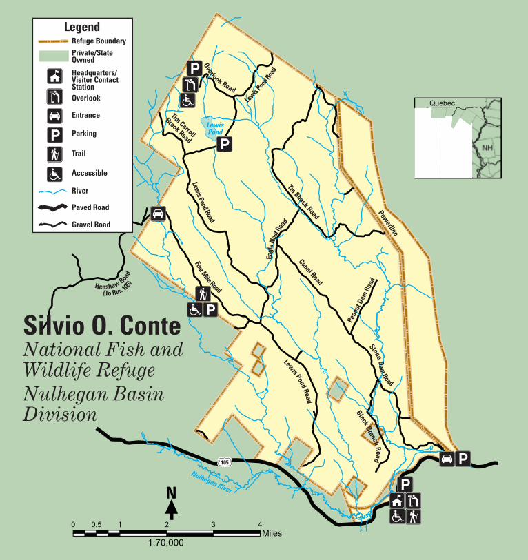
1:70,000
N
Overlook Road
Lewis P
ond R
oad
Lewis Pond Road
Four Mile Road
Tim Carroll
Brook Road
LewisPond
Nulhegan River
Powerline
Tin Shack Road
Canal Road
Pean
ut D
am R
oad
Lewis Pond Road
Stone Dam Road
Black Branch Road
Henshaw Road
(To Rte. 105)
Silvio O. Conte National Fish and Wildlife RefugeNulhegan BasinDivision
105
LegendRefuge BoundaryPrivate/State Owned
Headquarters/Visitor Contact StationOverlook
Entrance
Parking
Trail
Accessible
River
Paved Road
Gravel Road
Eagl
e Nes
t Roa
d

Is adding a Canada warbler to yourbirding life-list something you’ve onlydreamed about or is photographing aspruce grouse your idea of fun? Doesthat perfect vacation include thechance to see a moose or to hunt asnowshoe hare? Whether it’sobserving or photographing wildlifethat makes your heart skip a beat,planning that ideal hunting or fishingtrip, or hiking off the road for abackwoods experience, the divisionhas something for everyone.
Organizations and schools arewelcome to the division as an outdoorclassroom for a variety of activitiesfrom birding trips to snowshoe treksfor winter track identification togeology discussions. Interpretiveexhibits are located at theheadquarters/visitor contact station.Research and group events areevaluated on a case by case basis andmay require a Special Use Permit.Please contact the divisionheadquarters for more informationwhen planning such activities.
The division is part of a premierregion of the state for both huntingand fishing. Game species that can behunted include white-tailed deer,ruffed grouse, snowshoe hare, moose,black bear, and woodcock. Lewis Pondand the North and Black branches ofthe Nulhegan River offer great
©Roger Irw
in
Snowshoe hare
Keith Weaver/USFWS
Environmental Education
EnvironmentalEducation &Interpretation
Hunting andFishing
VisitorOpportunities
types of wetlands such as peatlands,bogs, beaver-influenced wetlands, andforested wetlands.
Northern hardwood forest, dominatedby sugar and red maple, beech, andyellow and paper birch, cloak themountains of the basin rim and thelarger hills of the basin interior. Oaks,commonly found in forests throughoutthe United States, are notably absentin the northern forest. The basinbottom is dominated by spruce-firforest. Red and black spruce andbalsam fir are the principal trees inthese forests. Tamarack, northernwhite cedar, black ash, and speckledalder also occur commonly in thebasin, but are restricted to thewetland areas.
Many rare plants, orchids, and otherwildflowers occur in the divisionincluding the sundew, pink, white, andyellow lady slippers (or moccasinflower), Canada lily, purple fringedorchid, cotton grass, rhodora, pitcherplant, trout lily, and many, many more.
With little intrusion by humandevelopment, the division offers someof the best opportunities for wildlife-dependent recreation in northernVermont. An extensive road systemgives visitors the ability to access andexperience the rugged and remotequality of the division.
Holly G
aboriault/USFWS
Keith Weaver/USFWS
Pitcher plant
Snowshoeing
People

opportunities for trout fishing.Trapping is allowed by Special UsePermit from division headquarters.For more information or to request acopy of the current divisionregulations for hunting and fishing,please contact the divisionheadquarters prior to your visit
Abundant public access gives visitorsthe opportunity to photograph andobserve wildlife, plants, and scenicvistas in a variety of settings duringany season. Best wildlife viewing
times are early morning and evening.Some of the best opportunities forobserving and photographing mooseoccur just west of the divisionheadquarters building along Route 105.
The Basin and Lewis Pond Overlooksprovide panoramic vistas of theNulhegan Basin and the surroundinglandscape. The Lewis Pond Overlookhas a small, fully accessible parkingarea and short trail leading to anobservation area. The Basin Overlookis accessible from the visitor contactstation parking lot.
Mollie Beattie Bog, recognized as astate significant site, is among themost significant black sprucewoodland bogs in Vermont. The self-guided, newly renovated, 200-foot,fully accessible boardwalk and trailincludes signs illustrating bogformation, the interesting rare plantsthat inhabit the black spruce bogarea, and the legacy of the late MollieBeattie. The 76-acre bog, donated tothe Service by ChampionInternational, was named after thefirst female director of the Service, aformer resident of Vermont. Visitorsto the interpretive site are requestedto remain on the boardwalk to avoiddisturbance to the sensitive wetlandhabitat. In addition, located behind
©Paul E
rickson
Lewis Pond
Kathy F
ournier/USFWS
Visitor Contact Station
Photographyand WildlifeObservation
DivisionDestinations
©Roger Irw
in
Bobcat
the visitor contact station is theNulhegan River Trail, worked on bymembers of the NorthwoodsStewardship Center’s Back CountryTrail Crew and the Nulhegan Basin’sU.S. Youth Conservation Corps(YCC). This trail is a shortinterpretive walk that offers visitors achance to experience the uniquenessof the basin without driving into thedivision if you are short on time.
The public is welcome to visit thedivision year-round, however; thetype of access (i.e., foot, automobile,snowmobile) permitted variesseasonally. Road conditions cansometimes change rapidly, either fromseasonal weather transitions, orflooding. Please be alert at all timesfor road hazards while traveling onthe division. Nearly 40 miles of gravelroads are open to driving or hiking inthe summer and fall months. Hikingcan also be done along unmarkedwooded pathways and stream courses.In the winter, access is bysnowmobile, cross country skis, orsnowshoes. The snowmobile trailsystem located on the division ismanaged by the Vermont Associationof Snow Travelers according to statewide and division specific regulations.
The division is closed to all vehicularaccess during “mud” season which isthe time period immediately aftersnowmobile season has ended. Duringthis time the division is still accessibleby foot. Please call 877/811 5222 formore information on current roadconditions within the division andsurrounding areas.
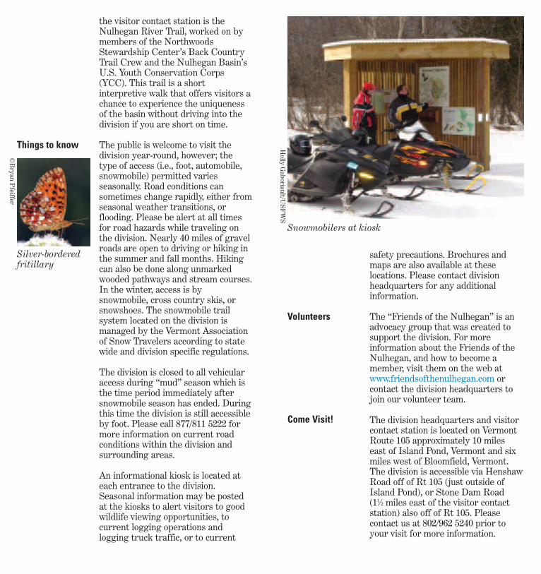
An informational kiosk is located ateach entrance to the division.Seasonal information may be postedat the kiosks to alert visitors to goodwildlife viewing opportunities, tocurrent logging operations andlogging truck traffic, or to current
safety precautions. Brochures andmaps are also available at theselocations. Please contact divisionheadquarters for any additionalinformation.
The “Friends of the Nulhegan” is anadvocacy group that was created tosupport the division. For moreinformation about the Friends of theNulhegan, and how to become amember, visit them on the web atwww.friendsofthenulhegan.com orcontact the division headquarters tojoin our volunteer team.
The division headquarters and visitorcontact station is located on VermontRoute 105 approximately 10 mileseast of Island Pond, Vermont and sixmiles west of Bloomfield, Vermont.The division is accessible via HenshawRoad off of Rt 105 (just outside ofIsland Pond), or Stone Dam Road (11⁄2 miles east of the visitor contactstation) also off of Rt 105. Pleasecontact us at 802/962 5240 prior toyour visit for more information.
Things to know
Volunteers
Come Visit!
Holly G
aboriault/USFWS
©Bryan P
feiffer
Snowmobilers at kiosk
Silver-borderedfritillary
Recommended