Embed Size (px)
Citation preview
Wings Over WetlandsProject Team Meeting
8 - 12 March 2010Wakkerstroom, South Africa
Abdoulaye NdiayeGabin AGBLONON
Wetlands International Africa
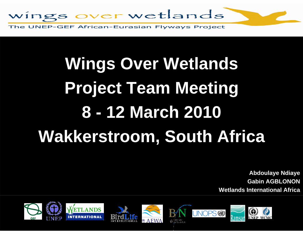
Subject related to WOW Regional Centre for Western and Central Africa – associated
demonstration projects:
- Saloum-Niumi (Senegal & The Gambia)- Banc D’Arguin (Mauritania), - Namga-Kokorou (Niger)
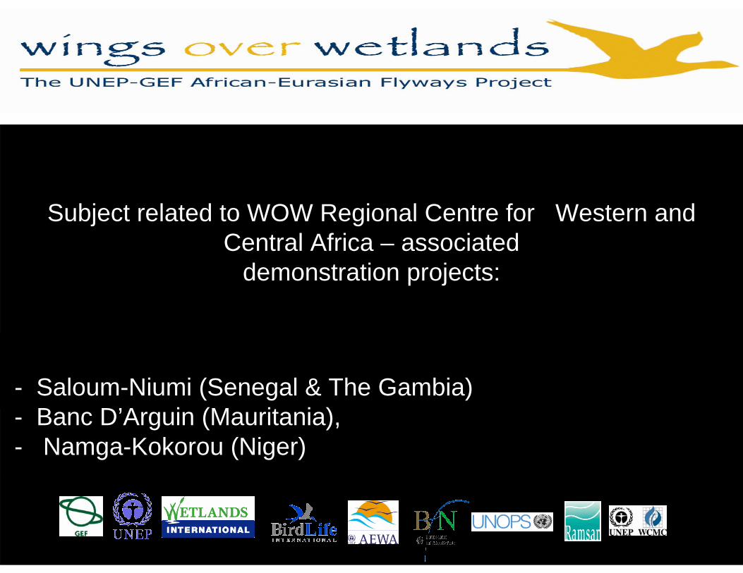
Presentation Outline
• Reminder of the West and Central Africa Hub• What exactly are our 3 components in the sub-
regional context?• Critical Site Network development• Capacity building in the WOW context• Processes undertaken to date, existing outputs• Expected final outputs• Demonstration projects• Some practical considerations• Questions
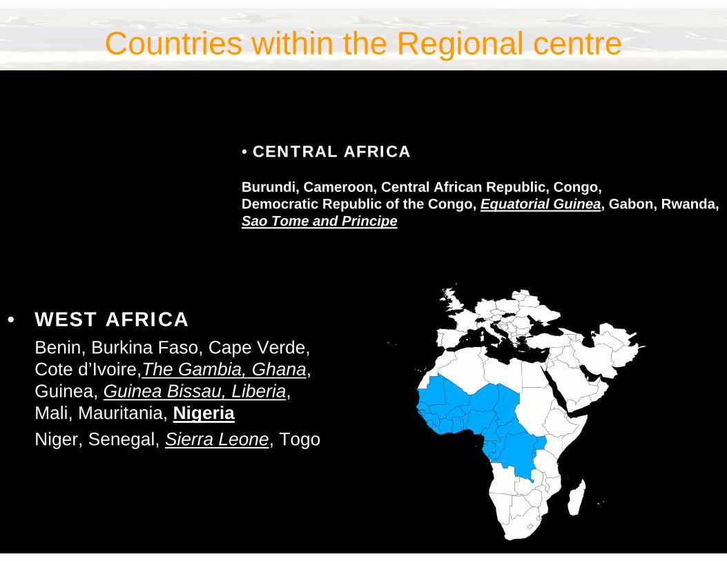
Countries within the Regional centre
• WEST AFRICABenin, Burkina Faso, Cape Verde, Cote d’Ivoire,The Gambia, Ghana, Guinea, Guinea Bissau, Liberia, Mali, Mauritania, NigeriaNiger, Senegal, Sierra Leone, Togo
• CENTRAL AFRICA
Burundi, Cameroon, Central African Republic, Congo,Democratic Republic of the Congo, Equatorial Guinea, Gabon, Rwanda,Sao Tome and Principe
Key steps
Critical Site Network: Capacity and knowledge Development
• Fill gaps in site network understanding– Gap identification (consultation);– Gap-filling (survey, inventory and census work)– Sub-regional focus.
• Enhance technical capacity– Harmonise IWC and IBA personnel networks and
protocols;– Train data gatherers (existing and new);– Develop resources to assist data gathering (manuals,
guides).– Sub-regional focus
• Develop site / species knowledge base– Compile existing ecological knowledge;– Seed funding to stimulate filling of knowledge gaps.
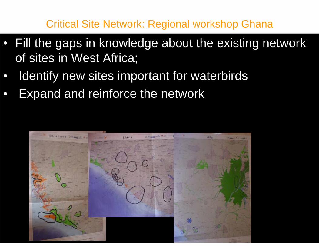
Critical Site Network: Regional workshop Ghana
• Fill the gaps in knowledge about the existing network of sites in West Africa;
• Identify new sites important for waterbirds• Expand and reinforce the network
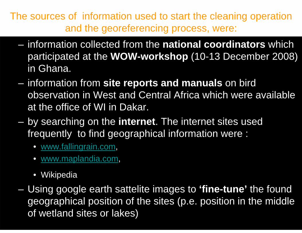
The sources of information used to start the cleaning operationand the georeferencing process, were:
– information collected from the national coordinators which participated at the WOW-workshop (10-13 December 2008) in Ghana.
– information from site reports and manuals on bird observation in West and Central Africa which were availableat the office of WI in Dakar.
– by searching on the internet. The internet sites used frequently to find geographical information were :
• www.fallingrain.com, • www.maplandia.com,
• Wikipedia
– Using google earth sattelite images to ‘fine-tune’ the foundgeographical position of the sites (p.e. position in the middle of wetland sites or lakes)
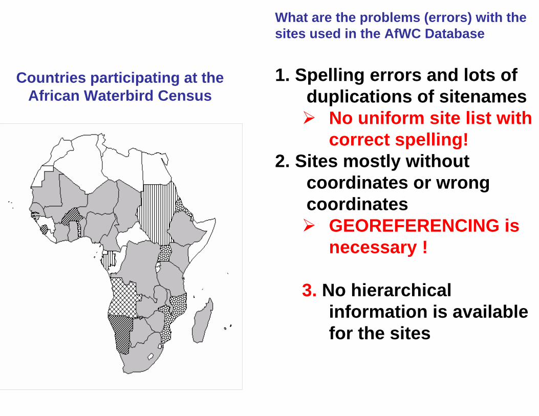
Countries participating at the African Waterbird Census
What are the problems (errors) with the sites used in the AfWC Database
1. Spelling errors and lots of duplications of sitenames
No uniform site list withcorrect spelling!
2. Sites mostly withoutcoordinates or wrongcoordinates
GEOREFERENCING isnecessary !
3. No hierarchicalinformation is availablefor the sites
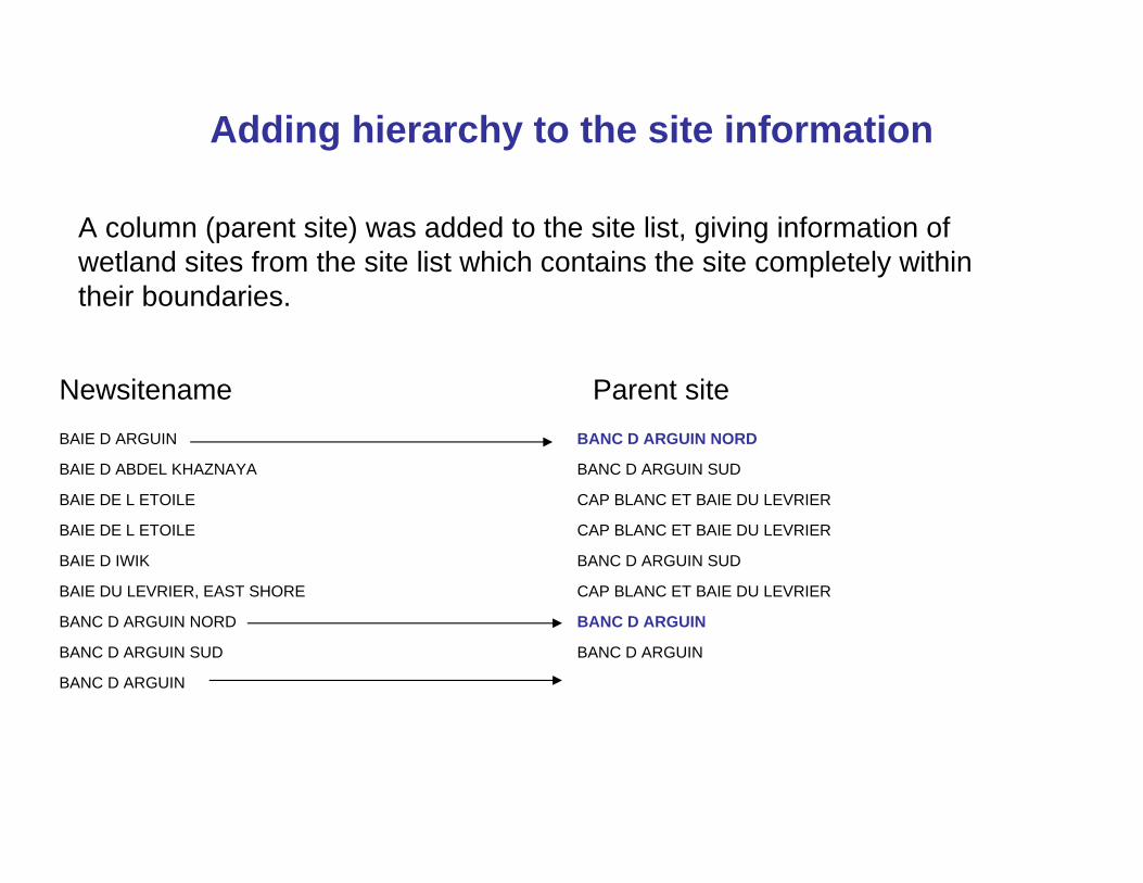
Adding hierarchy to the site information
BAIE D ARGUIN BANC D ARGUIN NORD
BAIE D ABDEL KHAZNAYA BANC D ARGUIN SUD
BAIE DE L ETOILE CAP BLANC ET BAIE DU LEVRIER
BAIE DE L ETOILE CAP BLANC ET BAIE DU LEVRIER
BAIE D IWIK BANC D ARGUIN SUD
BAIE DU LEVRIER, EAST SHORE CAP BLANC ET BAIE DU LEVRIER
BANC D ARGUIN NORD BANC D ARGUIN
BANC D ARGUIN SUD BANC D ARGUIN
BANC D ARGUIN
Parent siteNewsitename
A column (parent site) was added to the site list, giving information of wetland sites from the site list which contains the site completely within their boundaries.
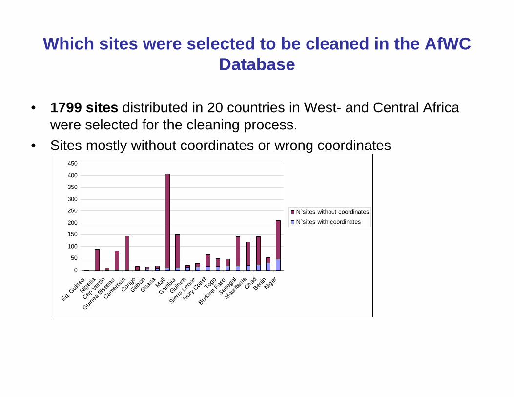
Which sites were selected to be cleaned in the AfWC Database
• 1799 sites distributed in 20 countries in West- and Central Africa were selected for the cleaning process.
• Sites mostly without coordinates or wrong coordinates
0
50
100
150
200
250
300
350
400
450
Eq. GuineaNigeri
aCap V
erde
Guinea
Bissea
uCamerou
nCong
oGab
onGha
na MaliGam
biaGuin
ea
Sierra Leo
neIvo
ry Coa
stTog
o
Burkina
Faso
Seneg
alMau
ritania
ChadBen
inNiger
N°sites without coordinatesN°sites with coordinates
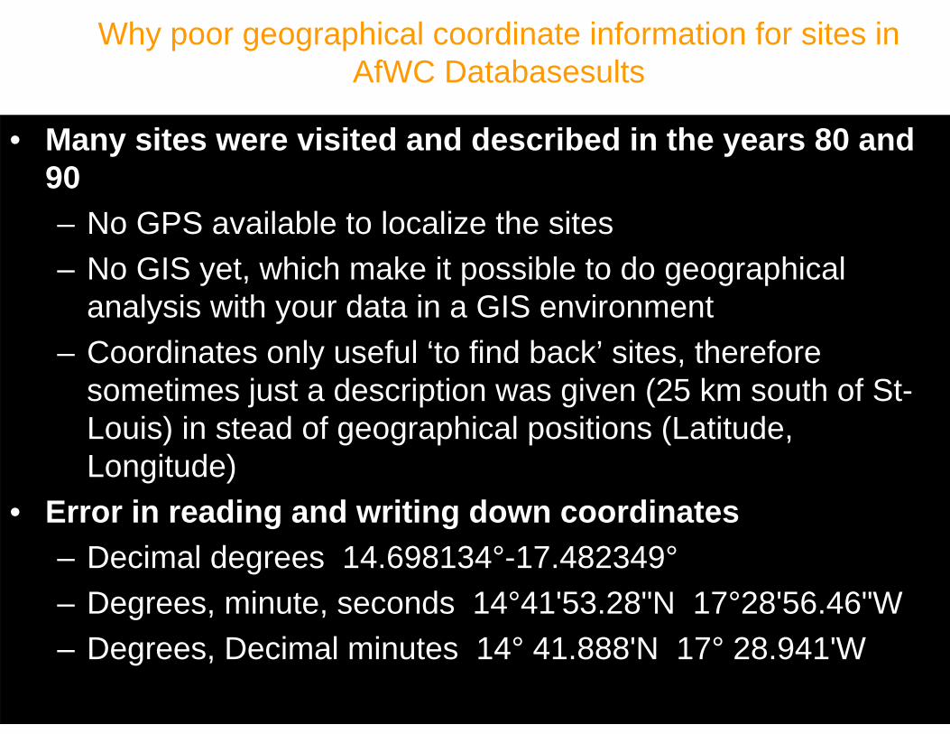
Why poor geographical coordinate information for sites in AfWC Databasesults
• Many sites were visited and described in the years 80 and 90– No GPS available to localize the sites– No GIS yet, which make it possible to do geographical
analysis with your data in a GIS environment– Coordinates only useful ‘to find back’ sites, therefore
sometimes just a description was given (25 km south of St-Louis) in stead of geographical positions (Latitude, Longitude)
• Error in reading and writing down coordinates– Decimal degrees 14.698134°-17.482349°– Degrees, minute, seconds 14°41'53.28"N 17°28'56.46"W– Degrees, Decimal minutes 14° 41.888'N 17° 28.941'W
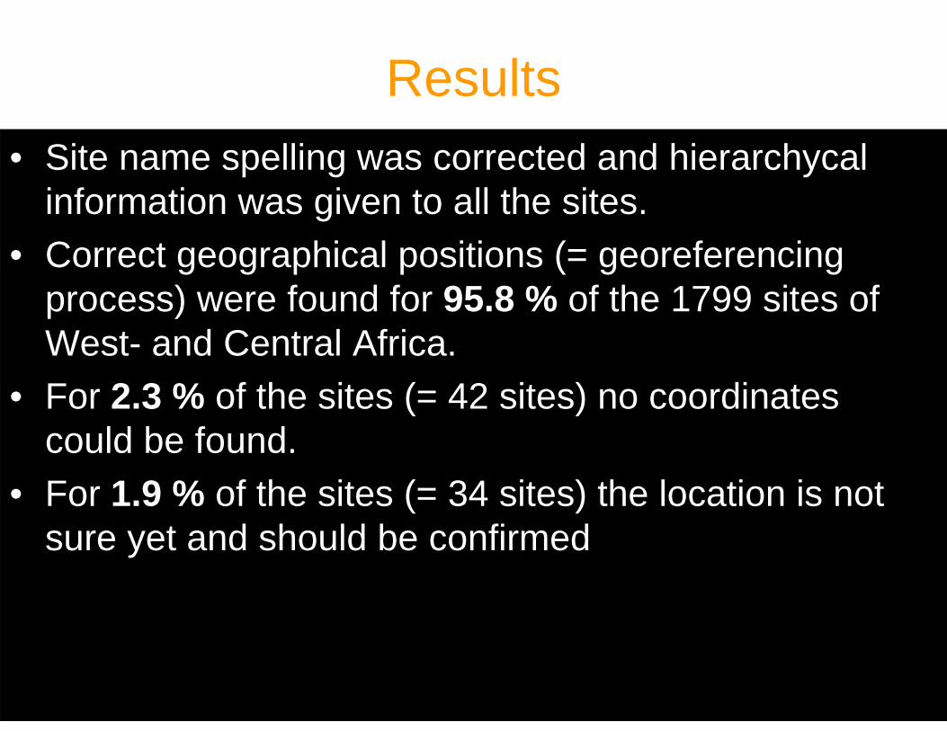
Results• Site name spelling was corrected and hierarchycal
information was given to all the sites.• Correct geographical positions (= georeferencing
process) were found for 95.8 % of the 1799 sites of West- and Central Africa.
• For 2.3 % of the sites (= 42 sites) no coordinates could be found.
• For 1.9 % of the sites (= 34 sites) the location is not sure yet and should be confirmed
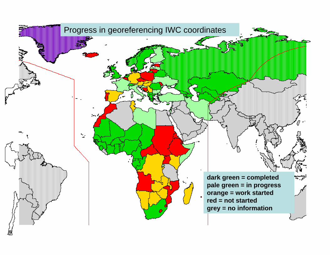
dark green = completedpale green = in progressorange = work startedred = not startedgrey = no information
Progress in georeferencing IWC coordinates
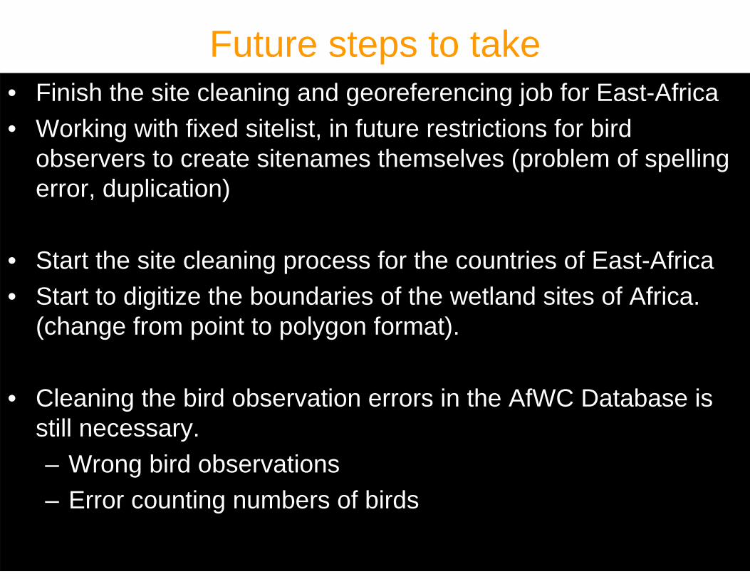
Future steps to take• Finish the site cleaning and georeferencing job for East-Africa• Working with fixed sitelist, in future restrictions for bird
observers to create sitenames themselves (problem of spelling error, duplication)
• Start the site cleaning process for the countries of East-Africa• Start to digitize the boundaries of the wetland sites of Africa.
(change from point to polygon format).
• Cleaning the bird observation errors in the AfWC Database is still necessary.– Wrong bird observations – Error counting numbers of birds
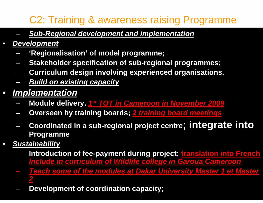
C2: Training & awareness raising Programme– Sub-Regional development and implementation
• Development– ‘Regionalisation’ of model programme;– Stakeholder specification of sub-regional programmes;– Curriculum design involving experienced organisations.– Build on existing capacity
• Implementation– Module delivery. 1st TOT in Cameroon in November 2009– Overseen by training boards; 2 training board meetings
– Coordinated in a sub-regional project centre; integrate into Programme
• Sustainability– Introduction of fee-payment during project; translation into French
Include in curriculum of Wildlife college in Garoua Cameroon– Teach some of the modules at Dakar University Master 1 et Master
2– Development of coordination capacity;
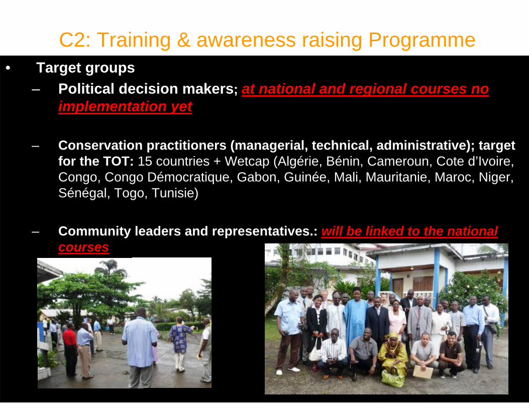
C2: Training & awareness raising Programme• Target groups
– Political decision makers; at national and regional courses no implementation yet
– Conservation practitioners (managerial, technical, administrative); target for the TOT: 15 countries + Wetcap (Algérie, Bénin, Cameroun, Cote d’Ivoire, Congo, Congo Démocratique, Gabon, Guinée, Mali, Mauritanie, Maroc, Niger, Sénégal, Togo, Tunisie)
– Community leaders and representatives.: will be linked to the national courses
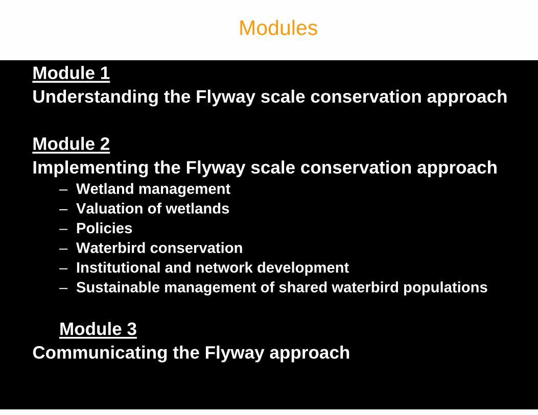
Modules
Module 1Understanding the Flyway scale conservation approach
Module 2Implementing the Flyway scale conservation approach
– Wetland management– Valuation of wetlands– Policies– Waterbird conservation– Institutional and network development– Sustainable management of shared waterbird populations
Module 3Communicating the Flyway approach
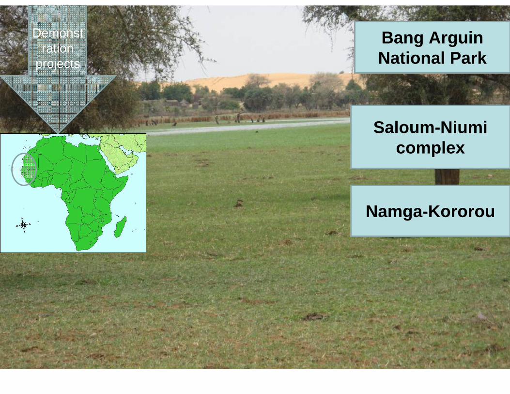
Namga-Kororou
Bang Arguin National Park
Saloum-Niumi complex
Demonstration
projects
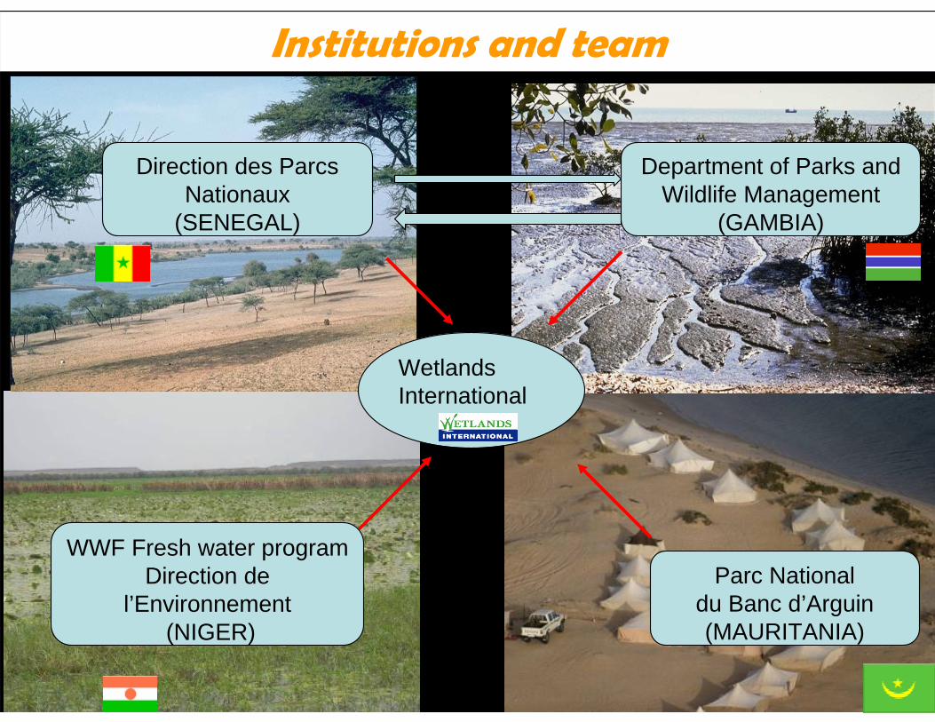
Wetlands International
Department of Parks and Wildlife Management
(GAMBIA)
Direction des Parcs Nationaux
(SENEGAL)
Parc National du Banc d’Arguin (MAURITANIA)
WWF Fresh water programDirection de
l’Environnement (NIGER)
Institutions and team
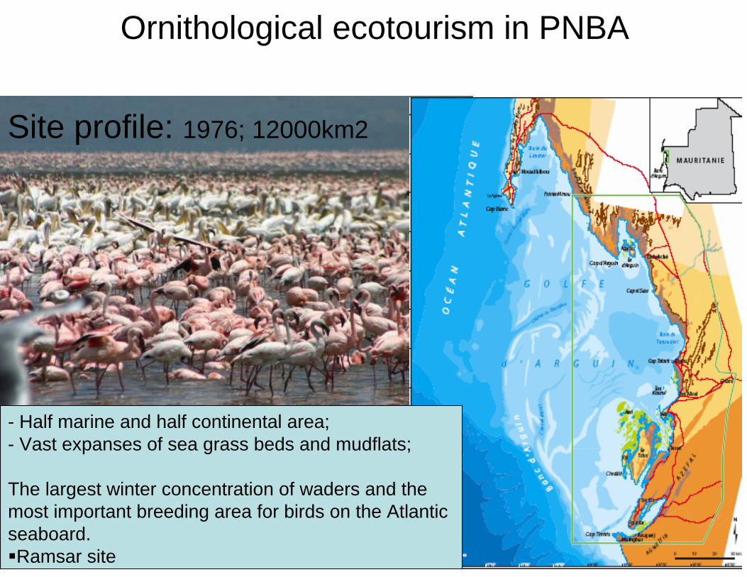
- Half marine and half continental area;- Vast expanses of sea grass beds and mudflats;
The largest winter concentration of waders and the most important breeding area for birds on the Atlantic seaboard.Ramsar site
Ornithological ecotourism in PNBA
Site profile: 1976; 12000km2
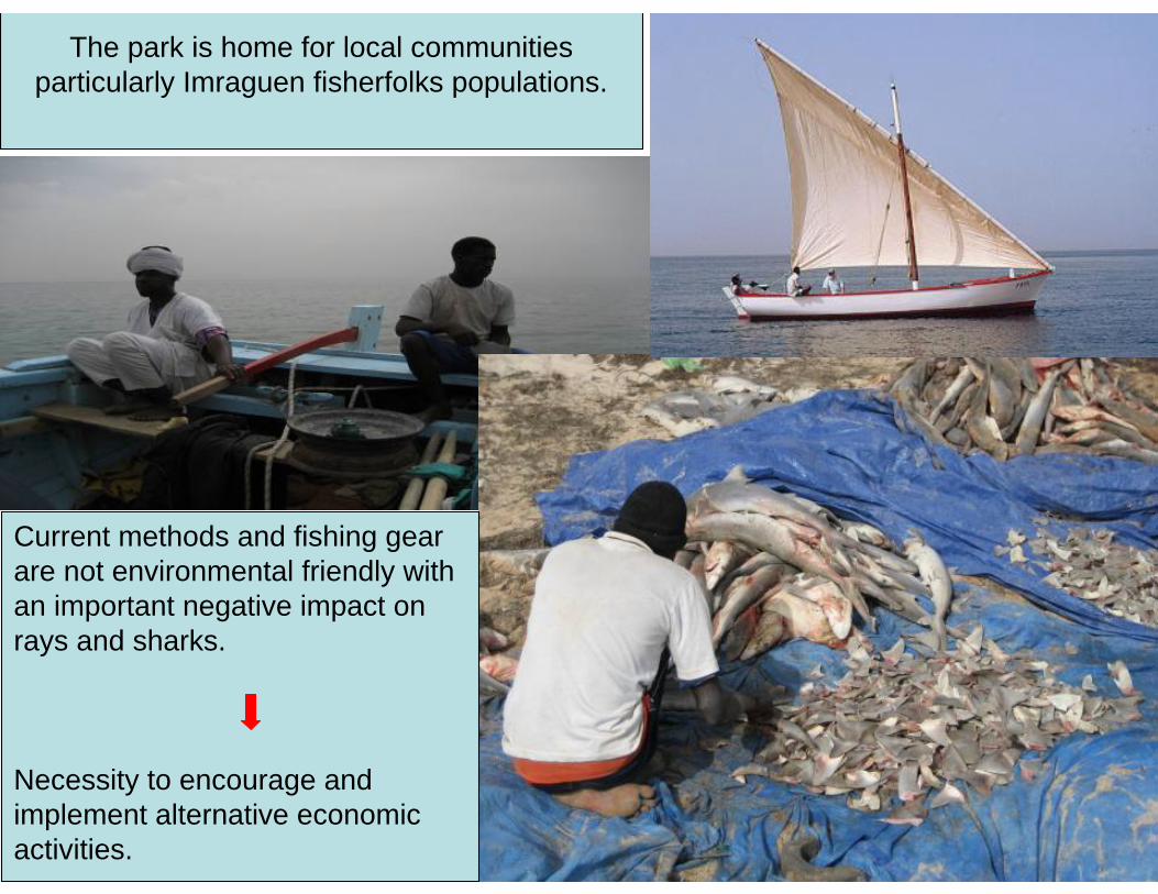
The park is home for local communities particularly Imraguen fisherfolks populations.
Current methods and fishing gear are not environmental friendly with an important negative impact on rays and sharks.
Necessity to encourage and implement alternative economic activities.
Objective
• To ensure conservation of biodiversity and natural resources whilst guaranteeing a livelihood for the local Imraguen population and the long-term economic role of the park, especially through its contribution as a key site of an international importance for fisheries.
• In fitting with these principles, the overall aim of the project is to enhance the viability and economic status of the park by supporting the implementation of key elements of the ecotourism strategy
.
Results
• Contribute to the development of a specific ornithological ecotourism implementation strategy for the park.
• Group of ecoguides in place• Training communities in French• Train them on tourism guide with developed tools for
one and half year period• Modules developed: 7 modules• Training manual for the duplication within west
Africa?
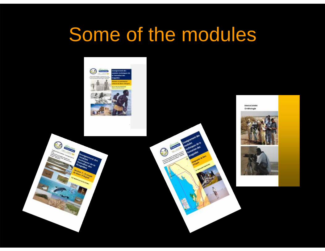
Some of the modules
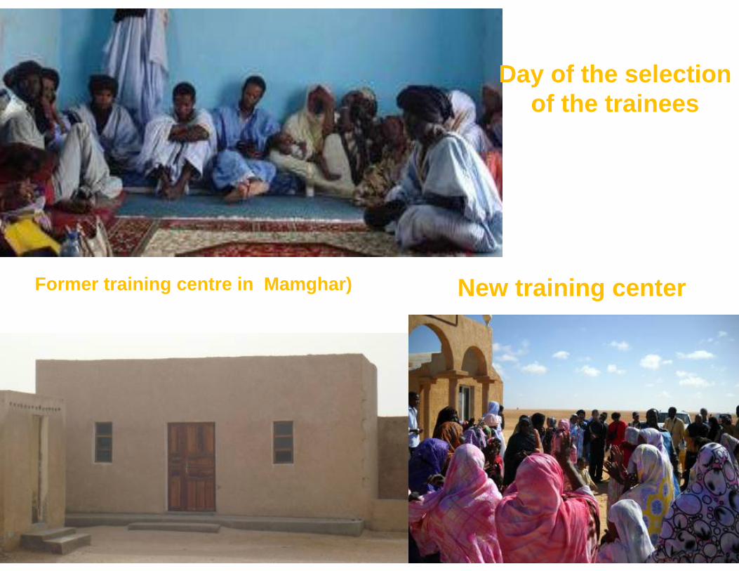
Day of the selection of the trainees
Former training centre in Mamghar) New training center
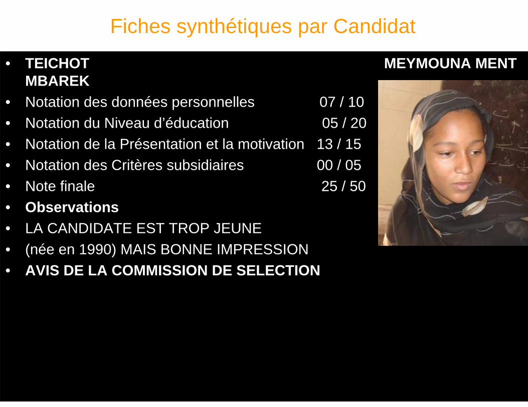
Fiches synthétiques par Candidat
• TEICHOT MEYMOUNA MENT MBAREK
• Notation des données personnelles 07 / 10• Notation du Niveau d’éducation 05 / 20• Notation de la Présentation et la motivation 13 / 15• Notation des Critères subsidiaires 00 / 05• Note finale 25 / 50• Observations • LA CANDIDATE EST TROP JEUNE • (née en 1990) MAIS BONNE IMPRESSION• AVIS DE LA COMMISSION DE SELECTION
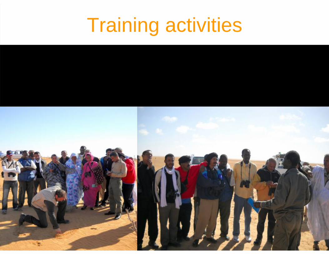
Training activities
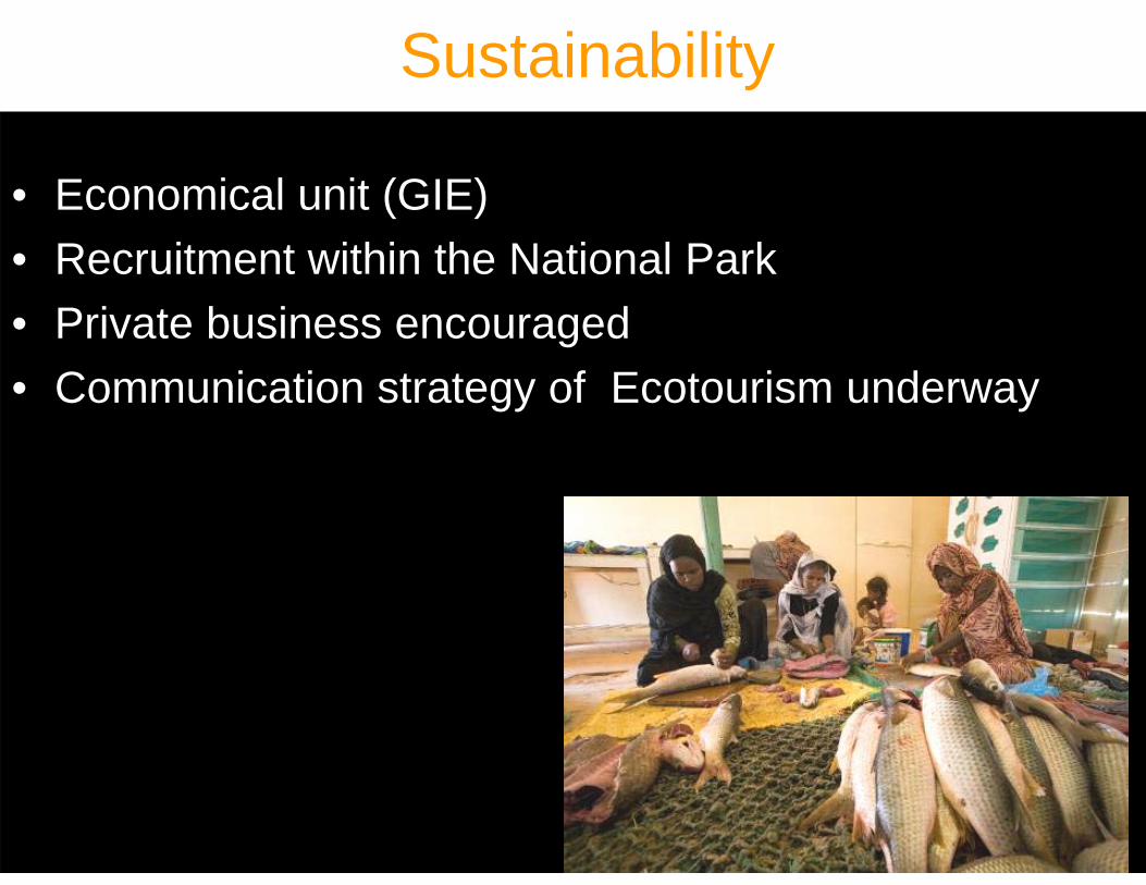
Sustainability
• Economical unit (GIE)• Recruitment within the National Park• Private business encouraged• Communication strategy of Ecotourism underway
Follow up• Recruitment of some of the ecoguide as park
staff
• GTZ and FIBA programme for ecotourism development
• Autonomy of some of the ecoguides to develop their own business with external support
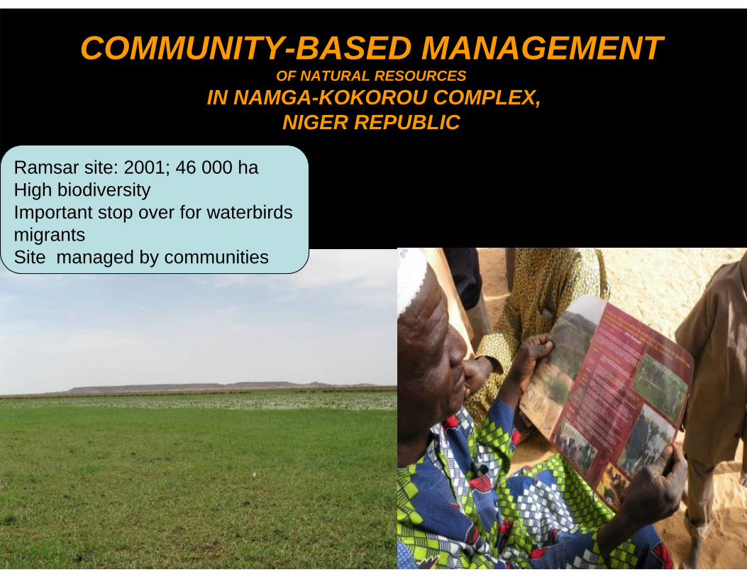
COMMUNITY-BASED MANAGEMENT OF NATURAL RESOURCES
IN NAMGA-KOKOROU COMPLEX, NIGER REPUBLIC
Ramsar site: 2001; 46 000 haHigh biodiversityImportant stop over for waterbirds migrantsSite managed by communities
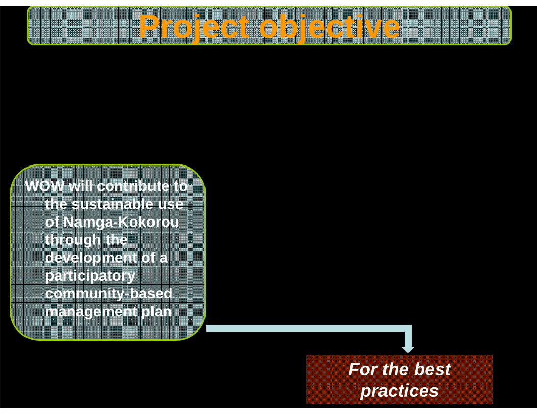
Project objective
WOW will contribute to the sustainable use of Namga-Kokorou through the development of a participatory community-based management plan
For the best practices
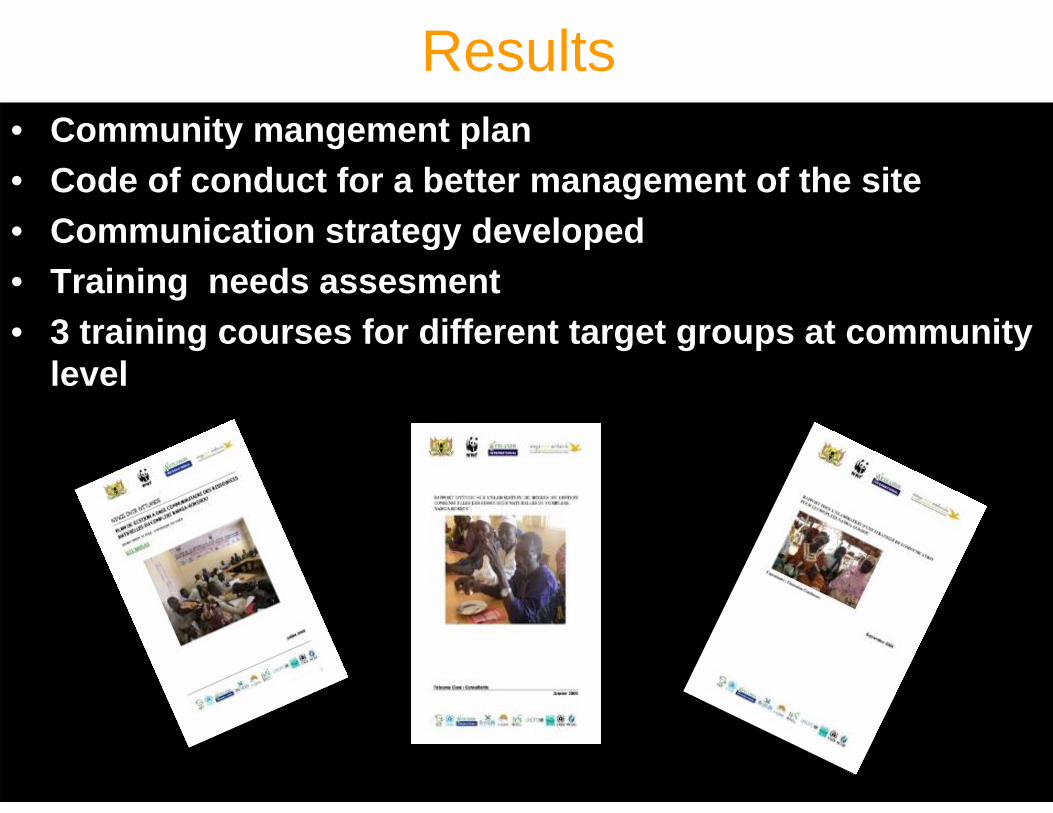
Results• Community mangement plan• Code of conduct for a better management of the site• Communication strategy developed• Training needs assesment• 3 training courses for different target groups at community
level
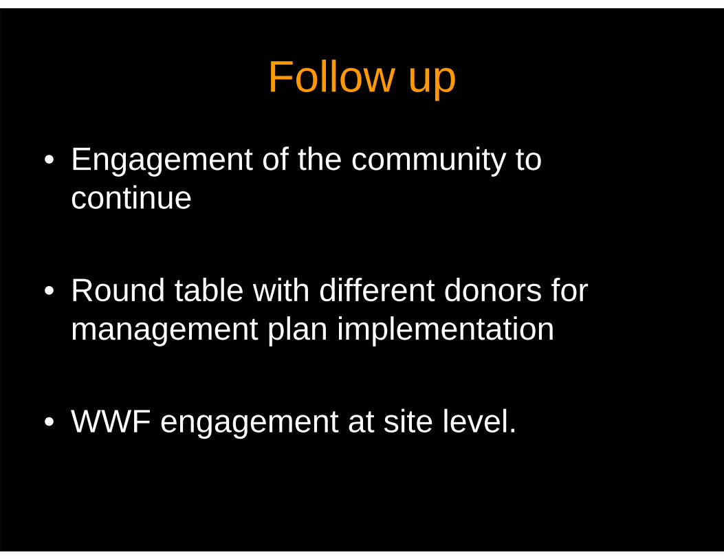
Follow up
• Engagement of the community to continue
• Round table with different donors for management plan implementation
• WWF engagement at site level.
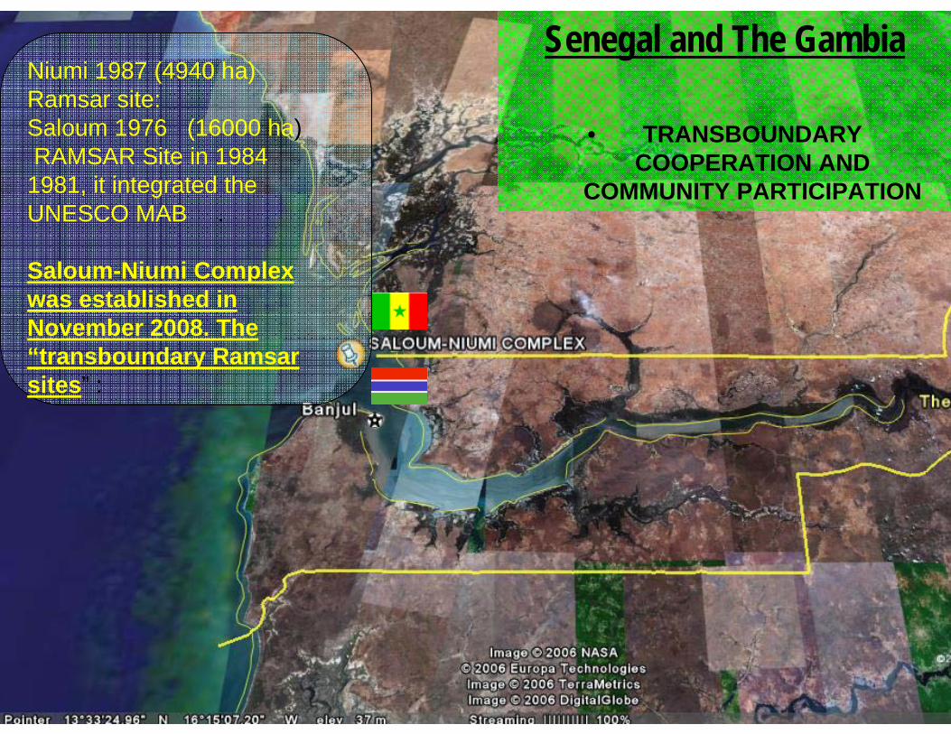
Senegal and The Gambia
• TRANSBOUNDARY COOPERATION AND
COMMUNITY PARTICIPATION
Niumi 1987 (4940 ha)Ramsar site: Saloum 1976 (16000 ha)RAMSAR Site in 1984
1981, it integrated the UNESCO MAB .
Saloum-Niumi Complex was established in November 2008. The “transboundary Ramsar sites” :
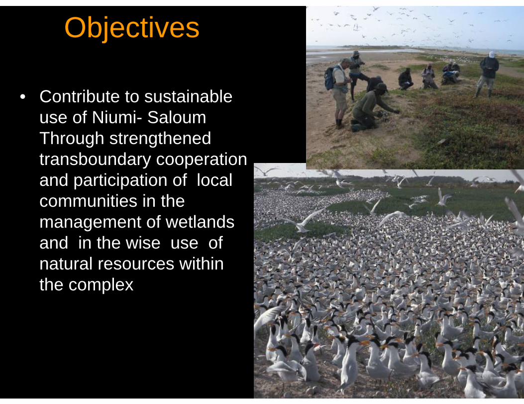
Objectives
• Contribute to sustainable use of Niumi- Saloum Through strengthened transboundary cooperation and participation of local communities in the management of wetlands and in the wise use of natural resources within the complex
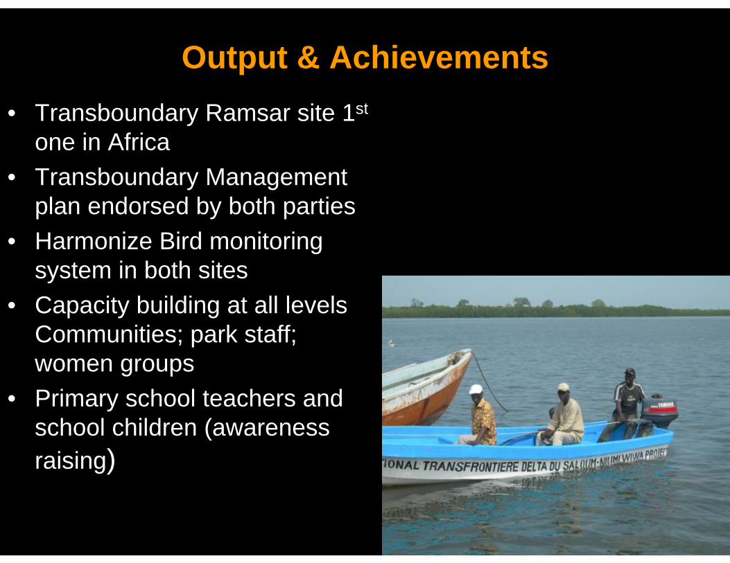
Output & Achievements• Transboundary Ramsar site 1st
one in Africa• Transboundary Management
plan endorsed by both parties• Harmonize Bird monitoring
system in both sites • Capacity building at all levels
Communities; park staff; women groups
• Primary school teachers and school children (awareness raising)
demonstration value/ Follow up • Integration of the different stakeholders of both
countries (park staff easy crossing borders -tolerance)
• Round table of donor after the entire process of endorsement of the transboundary management plan
• Link to the existing initiatives at site level like World Bank (GIRMAC)- FIBA and WWF
• Ecotourism of income generation for the communities (Ecoguards)

Main Challenges
• Language barrier at transboundary level and at sub regional level
• Political issues• Working with different currencies (money
transfer)• Lack of means for courses implementation• Limitation to Spanish and Portuguesespeaking countries to access to the material
THANK YOU FOR YOUR ATTENTION

Questions?