Embed Size (px)
Citation preview

What is the NHP?
Presented by
Helen Reeves, British Geological Survey
Helen Balmforth, Health and Safety Laboratory
Iain Lisk, UK Met Office

“The Environment Agency and
the Met Office should work
together, through a joint centre,
to improve their technical
capability to forecast, model and
warn against all sources of
flooding.”
Sir Michael Pitt
Cost of insured losses £3.25Bn
Events that started NHP – 2007 Floods

© NERC All rights reserved
Events that started NHP – Other events

© NERC All rights reserved
We need to ensure …”that a single source of real-time imaging is
available to help in the management of emergencies in the future”
“I see this as an extremely important opportunity to build a platform
that puts effective data analysis and presentation at the centre of
helping government react quickly to major disruptive events”Sir Mark Walport , February 2013
UK Government interest in hazards


Natural Hazard Partnership – Start1st December 2011 Strategic direction of NHP agreed.
December 2011 – MoU signed by 10 public sector chief executives.
Agreed that the NHP is focussed on improving delivery of natural hazard information and advice by public sector bodies.
NHP to be Led by the NHP Steering Group and delivered through four working groups.
• Hazard Impact Modelling Group (HIM Group)
• Scientific Strategy Group
• Communications & Outreach Group.
• Hazard Advice & Services Group

Natural Hazard Partnership – Projects
“What can we do in partnership to work more efficiently, delivernew capabilities, products & services?”
Over 40 ideas identified – 4 selected to work on between 2012 to 2015.
1. Daily Hazard Assessment2. Prepared Scientific Advice3. Contribute to National Risk Assessment4. Hazard Impact Modelling strategy & initial studies

Objectives:
• Provide an at a glance ‘All Hazards’ summary • Issue daily at 2pm to Partners only• To cover the following hazards with
contributions from all partners:• Flood • Weather• Volcanic Ash• Space weather• Wildfires• Geological hazards
Multi Hazard Strategic Daily Assessment
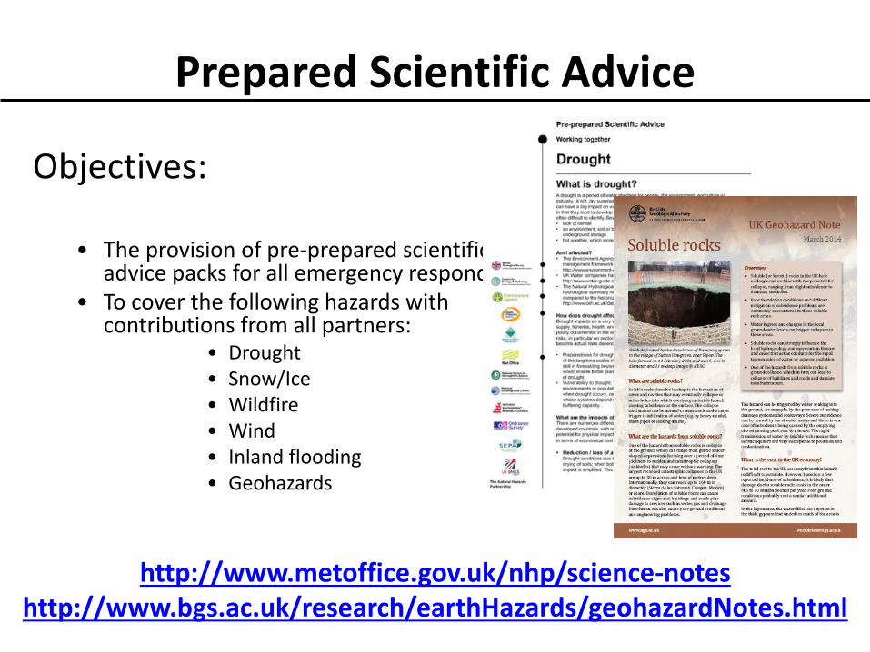
Objectives:
• The provision of pre-prepared scientific advice packs for all emergency responders
• To cover the following hazards with contributions from all partners:
• Drought• Snow/Ice• Wildfire• Wind• Inland flooding• Geohazards
Prepared Scientific Advice
http://www.metoffice.gov.uk/nhp/science-noteshttp://www.bgs.ac.uk/research/earthHazards/geohazardNotes.html

Hazard Impact Model
Adding the Impact – who and what is effected
Identification of receptors –people, property, infrastructure
Estimation of vulnerability
Modelling of Impact
HIM Members -

Wind hazard Landslide susceptibility
Flooding
What we had in 2011: the start
National Population Database
Rainfall

Landslides Work Package,
BGS
Surface Water Flooding
Work Package, CEH
Hazard Impact Model – Hazardhttp://www.metoffice.gov.uk/publicsector/devolved/scotland-flood-forecasting-service
Development of hazard footprints for three priority
hazards as part of individual work packages
Wind Work Package, MetOffice
http://www.bbc.co.uk/news/uk-england-16392074

Hazard Impact Model - Vulnerability & Impact
Risk (of Impact) = Hazard x Vulnerability (vulnerability includes exposure)
• Linking vulnerability and impact information with hazards
• Vulnerability Research - developing Impact Framework
• Development of prototype HIM – proof of concept
1) SWF HIM being developed by HSL and CEH for FFC
2) Vehicle Overturning HIM being developed by MO
HSL developing an Impact Library concept

Proof of Concept HIM
• SWF - CEH hazard footprint, HSL impact information
- PoC HIM developed, undergoing testing & initial verification.
- Currently case study approach
- Research report proposing methodology for
operational SWF HIM delivered to FFC
• High Winds - Vehicle Overturning HIM being
trialled in house at MO for NSWWS
- Models for Bridges and Camp sites
being developed
• Landslides - Hazard definition ongoing
- Development of landslides domains
- Once these defined domain
thresholds will be developed

Surface Water Flooding (SWF)
Updated Flood Map for Surface Water UFMfSW (EA)
Hazard FootprintBased on G2G surface runoff
Hazard Impact Outputs
Impact Library(HSL)
National Receptor Dataset (EA)
National Population Database (HSL)
Ensemble rainfall forecasts (MO)
Other impact datasets …
Demand for more robust, accurate and timely forecast and alert information on Surface Water Flooding (SWF) and its impacts at local, regional and national scales
Centre for Ecology & Hydrology (CEH) is leading the SWF Hazard Impact Model with the Health and Safety Laboratory (HSL) providing expertise on impact assessments.
SWF approach is based on dynamic gridded surface runoff estimates from the Grid-to-Grid model used by FFC
Methodologies for generating dynamic hazard & impact maps and regional summaries
Ensemble case study verification ongoing
Prototype operational trialplanned for late 2015 – feed into FGS

Delivery of:
• Proof of concept SWF HIM for testing & initial verification work
• Research report proposing methodology for operational SWF HIM - Presentation of initial collaborative SWF case study work at ICFR conference (by CEH) & at FRIEND-Water Conference (by FFC)
SWF Impacts & vulnerability Flood Impact on Population with vulnerability
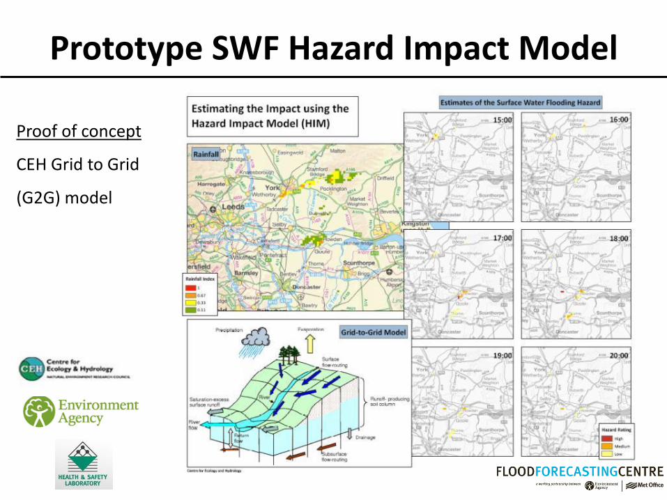
Prototype SWF Hazard Impact Model
Proof of concept
CEH Grid to Grid
(G2G) model

Adding the Impact
Flood Impact on Population with vulnerability
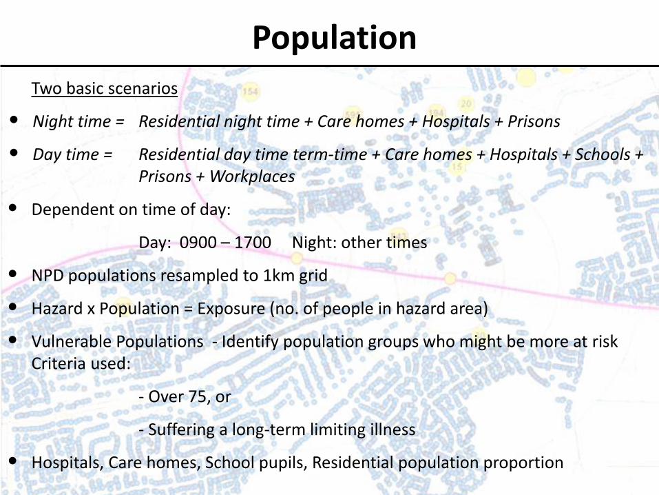
PopulationTwo basic scenarios
• Night time = Residential night time + Care homes + Hospitals + Prisons
• Day time = Residential day time term-time + Care homes + Hospitals + Schools + Prisons + Workplaces
• Dependent on time of day:
Day: 0900 – 1700 Night: other times
• NPD populations resampled to 1km grid
• Hazard x Population = Exposure (no. of people in hazard area)
• Vulnerable Populations - Identify population groups who might be more at risk Criteria used:
- Over 75, or
- Suffering a long-term limiting illness
• Hospitals, Care homes, School pupils, Residential population proportion

Reporting of outputs
By Region - Unitary Authorities in case study area
Time / Unitary Authority
Selby East Riding of Yorkshire
York Doncaster Ryedale
1200 . . . . .
1300 . . . . .
1400 3740 . . . .
1500 . . 68215 . 6
1600 . 8547 46344 . 4
1700 . 11328 41682 30 .
1800 0 4782 13735 3259 .
1900 0 13399 3259 2864 .
2000 0 9614 3259 . .
2100 0 9614 . . .
2200 0 5 . . .
2300 0 . . . .
0000 . . . . .
Note. ‘0’ indicates the Local Authority has flooding, but no population expected. ‘.’ indicates that no hazard was identified in the Local Authority.

Comparison with event - verification• Comparison with reports from media and other source

SWF reporting outputs
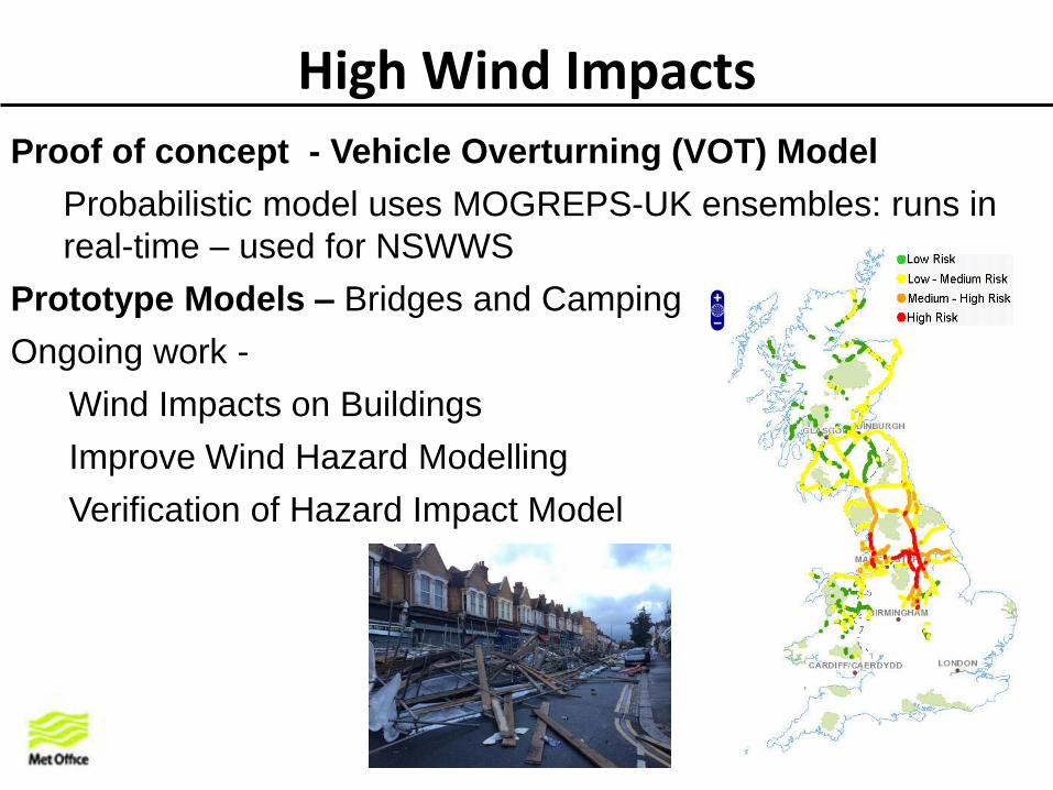
High Wind Impacts
Proof of concept - Vehicle Overturning (VOT) Model
Probabilistic model uses MOGREPS-UK ensembles: runs in
real-time – used for NSWWS
Prototype Models – Bridges and Camping
Ongoing work -
Wind Impacts on Buildings
Improve Wind Hazard Modelling
Verification of Hazard Impact Model

Landslides

Landslide (thresholds) • Use thresholds and PBMs to develop higher granularity in the NHP forecast
Landslide domains + hourly weather/thresholds + soil model + GIS data layers = NHP granular forecast
+ + + =
Initial discussions regarding development of impacts for landslides HIM with HSL

HIM Production System
• Agreement of broad architecture: Autumn 2013• Prototype HIM (VoT) running since Mid-December 2013• Successful visualisation of model outputs via desktop GIS, Web page
and specialised forecaster software.• Extending this to include the SWF HIM during the next year
How & to whom will be HIM be delivered?
Modelling / analysis organised into a series of Moduleswith standardised outputs.
Modules comply to a common Framework - a set of standards covering conceptualisation of hazard impact, output data formats, archiving protocols and visual design.
Web services delivered via internal (MO)& external networks
Expertoperationalusers
Researchusers
End users
Operational Production System

• Efficiency and effectiveness - One stop shop for natural hazards advice and inter-agency natural hazard science to services coordination
• Better informed mitigation and adaptation strategies for individual natural hazards and for linked and compounding hazards
• Increased natural hazard warning lead times with improved assessments of likelihood and predicted impact, location, type and severity
• Increased natural hazard data and visualisation interoperability.
NHP Benefits to the UK

NHP – ‘The UK’s trusted voice for coordinated natural hazard advice’

Available through Hazard Manager
Available at http://www.metoffice.gov.uk/nhp/
NHP Science to services
© NERC All rights reserved
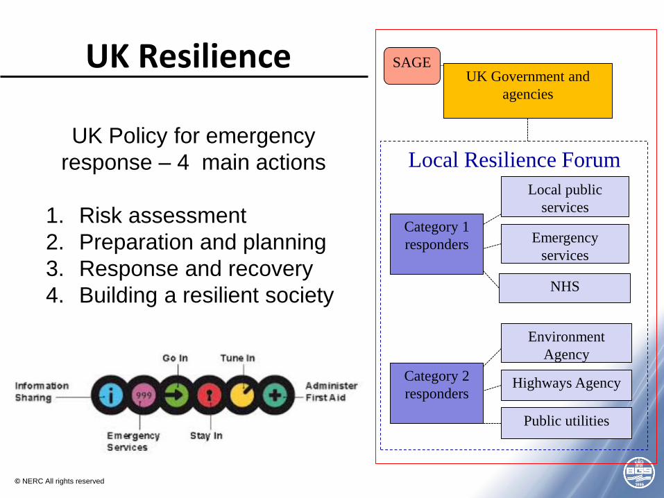
Local Resilience Forum
Category 1
responders
Local public
services
Emergency
services
NHS
Category 2
responders
Environment
Agency
Highways Agency
Public utilities
UK Government and
agencies
SAGE
UK Policy for emergency
response – 4 main actions
1. Risk assessment
2. Preparation and planning
3. Response and recovery
4. Building a resilient society
UK Resilience

• Joint working and synergies
• Daily UK natural hazards assessment
• Scientific advice on the NRA and SAGE/COBRA
• Move towards forecastinglikely common impacts
http://www.metoffice.gov.uk/nhp/
Natural Hazard Partnership

• Recognition and visibilityMigration to GOV.UK?
• Fully operational multi-hazard services
• Impact-based assessment infrastructure
• Private sector engagement
• Long-term funding
NHP Challenges…

© NERC All rights reserved
![HARMONIC fILTERING - NHP Electrical Quality/NHP-Schaffner... · [2] HARMONIC fILTERING Schaffner, established in 1962 and with over 1,700 employees worldwide, is the international](https://img.dokumen.tips/doc/110x75/5a70930d7f8b9aac538c0ad0/harmonic-filtering-nhp-electricalwwwnhpcomaufileseditoruploadfilepower.jpg)