Embed Size (px)
Citation preview
WELCOME TO ADVANCED PLACEMENT HUMAN GEOGRAPHY!
The following pages contain the summer assignment that you will submit during the first week of school. A digital copy of the summer assignment can also be found on the Ninth Grade Campus’s website https://www.clover.k12.sc.us/Domain/2637 _____________________________________________________________________________
You will receive an invitation to our Canvas course. Please make sure to accept the invitation, as this will be our main form of communication over the summer.
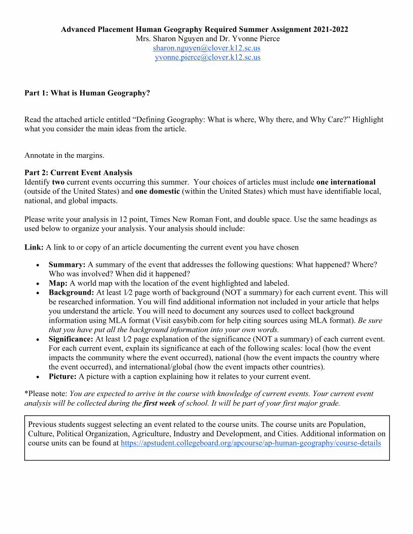
Advanced Placement Human Geography Required Summer Assignment 2021-2022 Mrs. Sharon Nguyen and Dr. Yvonne Pierce
[email protected] [email protected]
Part 1: What is Human Geography?
Read the attached article entitled “Defining Geography: What is where, Why there, and Why Care?” Highlight what you consider the main ideas from the article.
Annotate in the margins.
Part 2: Current Event Analysis Identify two current events occurring this summer. Your choices of articles must include one international (outside of the United States) and one domestic (within the United States) which must have identifiable local, national, and global impacts. Please write your analysis in 12 point, Times New Roman Font, and double space. Use the same headings as used below to organize your analysis. Your analysis should include: Link: A link to or copy of an article documenting the current event you have chosen
• Summary: A summary of the event that addresses the following questions: What happened? Where? Who was involved? When did it happened?
• Map: A world map with the location of the event highlighted and labeled. • Background: At least 1⁄2 page worth of background (NOT a summary) for each current event. This will
be researched information. You will find additional information not included in your article that helps you understand the article. You will need to document any sources used to collect background information using MLA format (Visit easybib.com for help citing sources using MLA format). Be sure that you have put all the background information into your own words.
• Significance: At least 1⁄2 page explanation of the significance (NOT a summary) of each current event. For each current event, explain its significance at each of the following scales: local (how the event impacts the community where the event occurred), national (how the event impacts the country where the event occurred), and international/global (how the event impacts other countries).
• Picture: A picture with a caption explaining how it relates to your current event.
*Please note: You are expected to arrive in the course with knowledge of current events. Your current event analysis will be collected during the first week of school. It will be part of your first major grade.
Previous students suggest selecting an event related to the course units. The course units are Population, Culture, Political Organization, Agriculture, Industry and Development, and Cities. Additional information on course units can be found at https://apstudent.collegeboard.org/apcourse/ap-human-geography/course-details
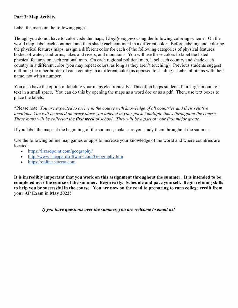
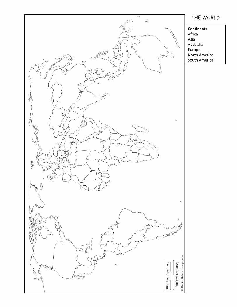
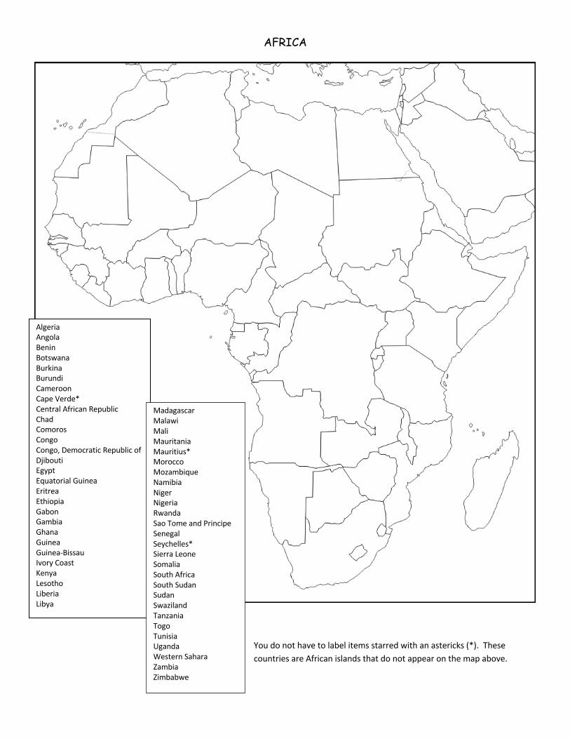
Part 3: Map Activity Label the maps on the following pages. Though you do not have to color code the maps, I highly suggest using the following coloring scheme. On the world map, label each continent and then shade each continent in a different color. Before labeling and coloring the physical features maps, assign a different color for each of the following categories of physical features: bodies of water, landforms, lakes and rivers, and mountains. You will use these colors to label the listed physical features on each regional map. On each regional political map, label each country and shade each country in a different color (you may repeat colors, as long as they aren’t touching). Previous students suggest outlining the inner border of each country in a different color (as opposed to shading). Label all items with their name, not with a number. You also have the option of labeling your maps electronically. This often helps students fit a large amount of text in a small space. You can do this by opening the maps as a word doc or as a pdf. Then, use text boxes to place the labels. *Please note: You are expected to arrive in the course with knowledge of all countries and their relative locations. You will be tested on every place you labeled in your packet multiple times throughout the course. These maps will be collected the first week of school. They will be a part of your first major grade. If you label the maps at the beginning of the summer, make sure you study them throughout the summer. Use the following online map games or apps to increase your knowledge of the world and where countries are located.
• https://lizardpoint.com/geography/ • http://www.sheppardsoftware.com/Geography.htm • https://online.seterra.com
It is incredibly important that you work on this assignment throughout the summer. It is intended to be completed over the course of the summer. Begin early. Schedule and pace yourself. Begin refining skills to help you be successful in the course. You are now on the road to preparing to earn college credit from your AP Exam in May 2022!
If you have questions over the summer, you are welcome to email us!
THE WORLD
Continents Africa Asia Australia Europe North America South America
AFRICA
Algeria Angola Benin Botswana Burkina Burundi Cameroon Cape Verde* Central African Republic Chad Comoros Congo Congo, Democratic Republic of Djibouti Egypt Equatorial Guinea Eritrea Ethiopia Gabon Gambia Ghana Guinea Guinea-Bissau Ivory Coast Kenya Lesotho Liberia Libya
Madagascar Malawi Mali Mauritania Mauritius* Morocco Mozambique Namibia Niger Nigeria Rwanda Sao Tome and Principe Senegal Seychelles* Sierra Leone Somalia South Africa South Sudan Sudan Swaziland Tanzania Togo Tunisia Uganda Western Sahara Zambia Zimbabwe
You do not have to label items starred with an astericks (*). These countries are African islands that do not appear on the map above.
**)
UNITED STATES
Alabama Alaska Arizona Arkansas California Colorado Connecticut Delaware District of Columbia Florida Georgia Hawaii Idaho Illinois Indiana Iowa Kansas Kentucky Louisiana Maine Maryland Massachusetts Michigan Minnesota Mississippi Missouri Montana Nebraska Nevada New Hampshire New Jersey New Mexico New York North Carolina North Dakota Ohio Oklahoma Oregon Pennsylvania Rhode Island South Carolina South Dakota Tennessee Texas Utah Vermont Virginia Washington West Virginia Wisconsin Wyoming
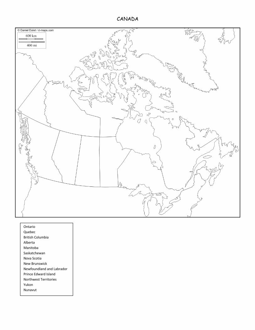
CANADA
Ontario Quebec British Columbia Alberta Manitoba Saskatchewan Nova Scotia New Brunswick Newfoundland and Labrador Prince Edward Island Northwest Territories Yukon Nunavut
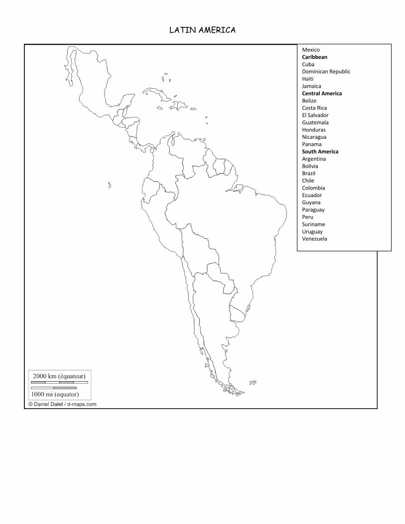
LATIN AMERICA
Mexico Caribbean Cuba Dominican Republic Haiti Jamaica Central America Belize Costa Rica El Salvador Guatemala Honduras Nicaragua Panama South America Argentina Bolivia Brazil Chile Colombia Ecuador Guyana Paraguay Peru Suriname Uruguay Venezuela
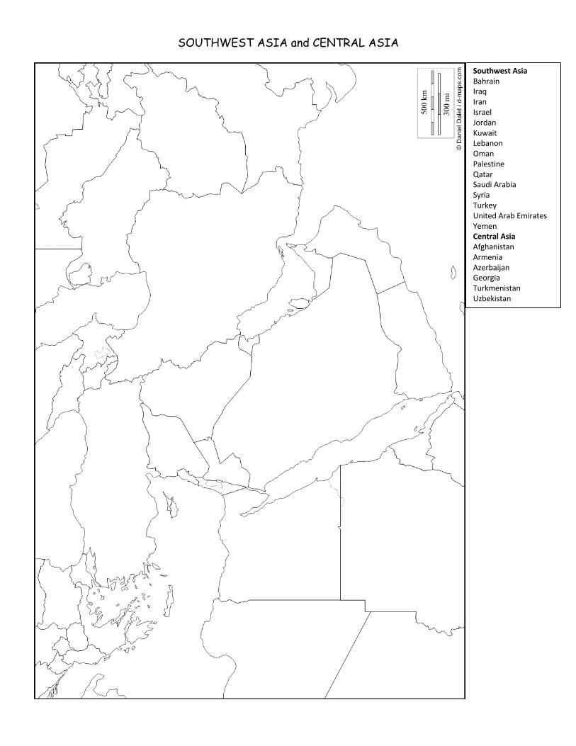
SOUTHWEST ASIA and CENTRAL ASIA
Southwest Asia Bahrain Iraq Iran Israel Jordan Kuwait Lebanon Oman Palestine Qatar Saudi Arabia Syria Turkey United Arab Emirates Yemen Central Asia Afghanistan Armenia Azerbaijan Georgia Turkmenistan Uzbekistan
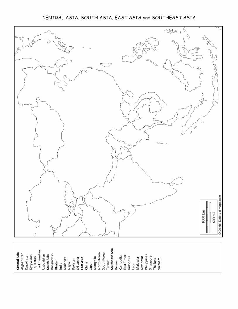
CENTRAL ASIA, SOUTH ASIA, EAST ASIA and SOUTHEAST ASIA
Cent
ral A
sia
Afgh
anist
an
Kaza
khst
an
Kyrg
yzst
an
Tajik
istan
Tu
rkm
enist
an
Uzbe
kist
an
Sout
h As
ia
Bang
lade
sh
Bhut
an
Indi
a M
aldi
ves
Nep
al
Paki
stan
Sr
i Lan
ka
East
Asia
Ch
ina
Japa
n M
ongo
lia
Nor
th K
orea
So
uth
Kore
a Ta
iwan
So
uthe
ast A
sia
Brun
ei
Cam
bodi
a Ea
st T
imor
In
done
sia
Laos
M
alay
sia
Mya
nmar
Ph
ilipp
ines
Si
ngap
ore
Thai
land
Vi
etna
m
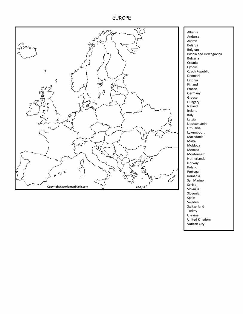
EUROPE
Albania Andorra Austria Belarus Belgium Bosnia and Herzegovina Bulgaria Croatia Cyprus Czech Republic Denmark Estonia Finland France Germany Greece Hungary Iceland Ireland Italy Latvia Liechtenstein Lithuania Luxembourg Macedonia Malta Moldova Monaco Montenegro Netherlands Norway Poland Portugal Romania San Marino Serbia Slovakia Slovenia Spain Sweden Switzerland Turkey Ukraine United Kingdom Vatican City
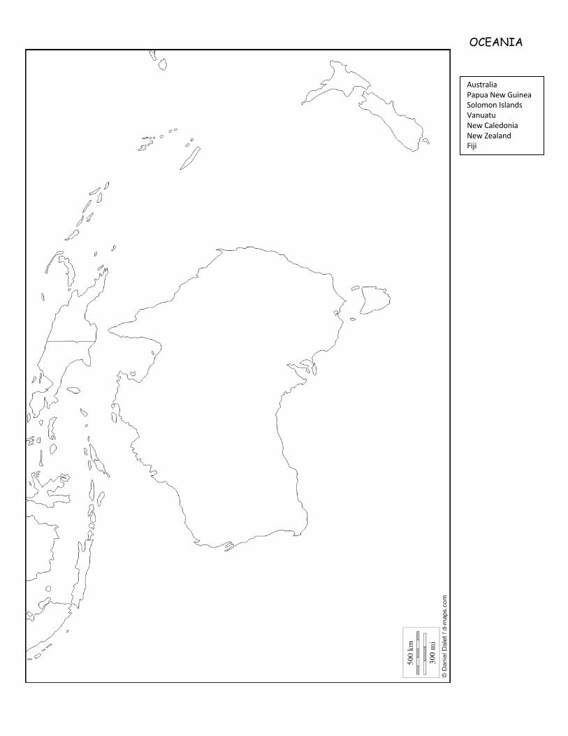
OCEANIA
Australia Papua New Guinea Solomon Islands Vanuatu New Caledonia New Zealand Fiji
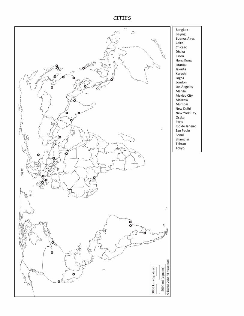
CITIES
Bangkok Beijing Buenos Aires Cairo Chicago Dhaka Essen Hong Kong Istanbul Jakarta Karachi Lagos London Los Angeles Manila Mexico City Moscow Mumbai New Delhi New York City Osaka Paris Rio de Janeiro Sao Paulo Seoul Shanghai Tehran Tokyo
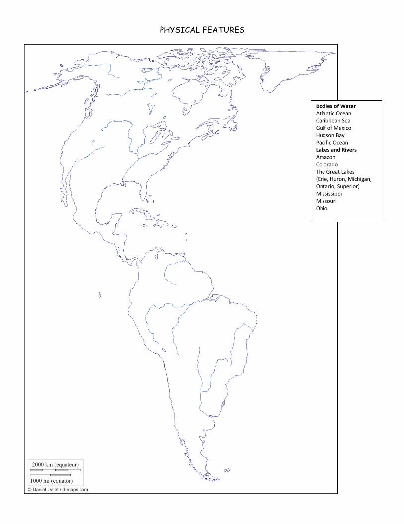
PHYSICAL FEATURES
Bodies of Water Atlantic Ocean Caribbean Sea Gulf of Mexico Hudson Bay Pacific Ocean Lakes and Rivers Amazon Colorado The Great Lakes (Erie, Huron, Michigan, Ontario, Superior) Mississippi Missouri Ohio
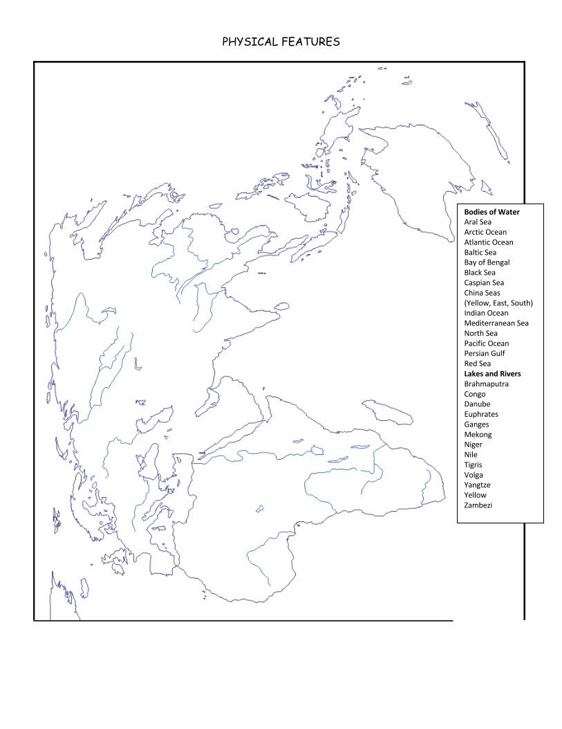
PHYSICAL FEATURES
Bodies of Water Aral Sea Arctic Ocean Atlantic Ocean Baltic Sea Bay of Bengal Black Sea Caspian Sea China Seas (Yellow, East, South) Indian Ocean Mediterranean Sea North Sea Pacific Ocean Persian Gulf Red Sea Lakes and Rivers Brahmaputra Congo Danube Euphrates Ganges Mekong Niger Nile Tigris Volga Yangtze Yellow Zambezi
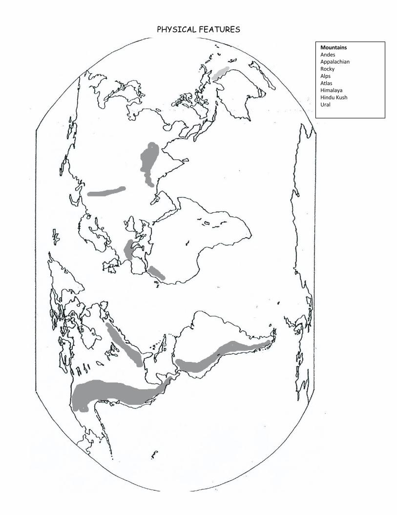
PHYSICAL FEATURES
Mountains Andes Appalachian Rocky Alps Atlas Himalaya Hindu Kush Ural
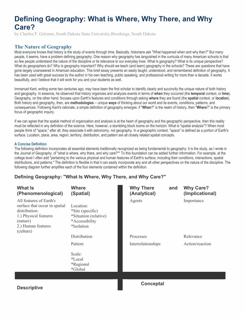
Defining Geography: What is Where, Why There, and Why Care? by Charles F. Gritzner, South Dakota State University,Brookings, South Dakota The Nature of Geography Most everyone knows that history is the study of events through time. Basically, historians ask "What happened when and why then?" But many people, it seems, have a problem defining geography. One reason why geography has languished in the curricula of many American schools is that so few people understand the nature of the discipline or its relevance to our everyday lives. What is geography? What is its unique perspective? What do geographers do? Why is geography important? Why should we teach (and learn) geography in the schools? These are questions that have gone largely unanswered in American education. This brief essay presents an easily taught, understood, and remembered definition of geography. It has been used with great success by the author in his own teaching, public speaking, and professional writing for more than a decade. It works beautifully, and I believe that it will work for you and your students as well. Immanuel Kant, writing some two centuries ago, may have been the first scholar to identify clearly and succinctly the unique nature of both history and geography. In essence, he observed that history organizes and analyzes events in terms of when they occurred (the temporal context, or time). Geography, on the other hand, focuses upon Earth's features and conditions through asking where they are found (the spatial context, or location). Both history and geography, then, are methodologies -- unique ways of thinking about our world and its events, conditions, patterns, and consequences. Following Kant's rationale, a simple definition of geography emerges: if "When?" is the realm of history, then "Where?" is the primary focus of geographic inquiry. If we can agree that the spatial method of organization and analysis is at the heart of geography and the geographic perspective, then this reality must be reflected in any definition of the science. Here, however, a stumbling block looms on the horizon: What is "spatial analysis"? When most people think of "space," after all, they associate it with astronomy, not geography. In a geographic context, "space" is defined as a portion of Earth's surface. Location, place, area, region, territory, distribution, and pattern are all closely related spatial concepts. A Concise Definition The following definition incorporates all essential elements traditionally recognized as being fundamental to geography: it is the study, as I wrote in the Journal of Geography, of "what is where, why there, and why care?"* To this foundation can be added further information. For example, at the college level I often add "pertaining to the various physical and human features of Earth's surface, including their conditions, interactions, spatial distributions, and patterns." The definition is flexible in that it can easily incorporate any and all other perspectives on the nature of the discipline. The following diagram further amplifies each of the four elements contained within the definition. Defining Geography: "What Is Where, Why There, and Why Care?" What Is Where
Why There and Why Care? (Phenomenological) (Spatial) (Analytical) (Implicational) All features of Earth's surface that occur in spatial distribution: 1.) Physical features (nature) 2.) Human features (culture)
Location: *Site (specific) *Situation (relative) *Accessibility *Isolation
Agents Importance
Distribution Processes Relevance
Pattern Interrelationships Action/reaction
Scale: *Local *Regional *Global
Descriptive Conceptal
Some definitions of geography (including that developed by the National Geographic Society) emphasize cultural ecology -- the relationship humans establish with the natural environment. Both geographers and cultural ecologists are concerned with the ways in which humans culturally adapt to, use, and modify the environments they occupy. Geographers, however, are particularly interested in what kinds of ecological practices occur within different cultures -- who is doing what, where, and why? The emphasis is on location and the characteristics of place. For example, "What is?" might be a particular type of ecological relationship, such as tropical shifting cultivation, pastoral nomadism, or mining. "Where?" then places the activity in a particular location and perhaps with a particular group, such as Amerindians of the Amazon Basin, Tuareg of the Western Sahara, or residents of Minnesota's Iron Range. "Why there?" can be quite complex because in most instances, many factors are involved. Shifting cultivation, for example, might include such factors as heavily leached, hence infertile, tropical soils; cultural isolation and tradition; or sustainability. In the case of the Tuareg, certainly the region's arid environment, a longstanding pastoral tradition, and the consequences of overgrazing are important. A concentration of iron ore, the need for iron in an industrial society, and proximity to Great Lakes shipping lanes all help shed light on northern Minnesota mining activity. Finally, "Why care?" provides an opportunity to establish the importance of the foregoing activities in their particular location, as well as in their natural and cultural geographic contexts. The Definition in Practice This definition of geography works well for several reasons. First, it emphasizes that geography is a methodology. It stresses the geographic way of organizing and analyzing information pertaining to the location, distribution, pattern, and interactions of the varied physical and human features of Earth's surface. All geographic inquiry should begin with the question, "Where?" Geographers and all other scientists ask "Why?" And, of course, most major Earth-bound events, features, and conditions can and often do have some impact on our lives, thereby begging the question, "Why care?" Second, the definition incorporates all traditional geographic subjects, themes, and traditions. In teaching, no matter what topic is being stressed or approach being taken, it can be easily integrated into the definition. Third, the definition functions at all scales. In studying towns and cities, for example, site (specific location and condition of a place) can often explain their presence. For example, New York City is located at the mouth of the Hudson River with a natural harbor protected by Long Island; San Diego and Seattle are on excellent natural harbors; and Denver is at the eastern terminus of a pass through the Rocky Mountains. South Dakota's largest and fastest growing city, Sioux Falls, affords a splendid example to illustrate the importance of "Where?" When the city was settled in 1856, eastern South Dakota was inhabited by people of the Sioux culture. The city's name, itself, implies the importance of location and place: the falls on the Big Sioux River provided power for a mill around which the city was originally established. Through time, the city grew primarily because of its location in the wettest, hence most agriculturally productive, area of the state. It also served as a major highway and rail hub. Finally, rapid growth continued because of its location at the intersection of two interstate highways. An example on the global scale, petroleum resources in the Middle East certainly have contributed to a host of conflicts, and "petro-politics" surely will be a major issue for decades to come. Production, distribution, consumption, and trade all impact the lives of several billion people daily. Geography has projected a very fuzzy image of its content and methodology for far too long. The definition presented here is clear and concise. It places no limitation on what geographers study (literally anything found on Earth's surface); it clearly identifies the discipline's unique methodology -- the spatial dimension of features, including where they are, in what patterns they occur, what important relationships exist between or among features, and so forth. If geography is to be taught as a science, the distribution of features must be explained -- that is, we must address the question, "Why there?" Finally, all geographic teaching and learning should relate to the human need to know, emphasizing "Why care?" The definition presented here identifies in simple, easily taught, and easily learned terms the extreme complexity of geography. *Charles F. Gritzner, "What Is Where, Why There, and Why Care?," Journal of Geography101, no. 1 (January/February 2002), pp. 38-40. Charles F. "Fritz" Gritzner received his Ph.D. from Louisiana State University and is now midway in his fifth decade of college teaching. Since 1980, he has been on the faculty of South Dakota State University, where he holds the rank of distinguished professor of geography. Gritzner is a past president of the National Council for Geographic Education (NCGE) and is a recipient of the council's George J Miller Award, which honors, according to the NCGE Web site, "a distinguished record of service to geography education."