Embed Size (px)
Citation preview

WaterWater InformationInformation SystemSystem StudiesStudiesin in TurkeyTurkey
26-27 June 2006Algiers
TURKEY National Focal Point

A number of governmental and non-governmental organizations have direct and indirect interest in the development and conservation of water resources in Turkey.
The institutional framework has three levels:• Decision making level: Prime Ministry, State Planning
Organization (DPT), and Ministries.• Executive level: Governmental organizations under the
ministries. (DSI, GDRS, Bank of Provinces, EIE)• User level: Both governmental and non-governmental
organizations concerned with the operation and maintenance of the projects.

General Directorate of Electric Power Resources Survey and DevelGeneral Directorate of Electric Power Resources Survey and Development opment Administration Administration ((EIEEIE)) is responsible for surveys on electric power and for is responsible for surveys on electric power and for rational use and conservation of it. EIE works in close coordinarational use and conservation of it. EIE works in close coordination with tion with DSI in collecting hydrometric data and development of hydropowerDSI in collecting hydrometric data and development of hydropower..
General Directorate of Bank of Provinces General Directorate of Bank of Provinces ((IllerIller BankBank)) isis responsibilities responsibilities include developing urban plans, supplying municipal water, constinclude developing urban plans, supplying municipal water, constructing ructing sewerage systems and treatment plants, and providing loans to sewerage systems and treatment plants, and providing loans to municipalities for the financing of such projects.municipalities for the financing of such projects.
General Directorate of Rural Services General Directorate of Rural Services ((GDRSGDRS)) (abolished), is administered (abolished), is administered under the Prime Ministry and responsible for the construction ofunder the Prime Ministry and responsible for the construction of rural rural roads, communal buildings, small reservoirs and smallroads, communal buildings, small reservoirs and small--scale irrigation scale irrigation schemes and for supplying drinking water to rural communities.schemes and for supplying drinking water to rural communities.
The Ministry of EnvironmentThe Ministry of Environment andand ForestryForestry ((MoEnvMoEnv)) is responsible, among is responsible, among other things, for setting policies, principles and rules, inspecother things, for setting policies, principles and rules, inspecting activities, ting activities, coordinating studies, and enhancing public awareness on environmcoordinating studies, and enhancing public awareness on environmental ental aspects of water resources.aspects of water resources. AlsoAlso, , the institution coordinated and supervised the institution coordinated and supervised the preparation of the National Environmental Action Plan (NEAP)the preparation of the National Environmental Action Plan (NEAP) in in cooperation with the Ministry of Environment.cooperation with the Ministry of Environment.
MainMain InstitutionsInstitutions RelatedRelated On On WaterWater SectorSector in in TurkeyTurkey..

The Turkish State Meteorological Service (DMI)The Turkish State Meteorological Service (DMI) : It is the only legal : It is the only legal organization which provides all meteorological information in Tuorganization which provides all meteorological information in Turkey. The rkey. The main objectives of the TSMS are to make observations, To providemain objectives of the TSMS are to make observations, To provide forecasts, forecasts, To provide To provide climatologicalclimatological data, archive data, and other information, To data, archive data, and other information, To communicate these to the public, To provide meteorological needscommunicate these to the public, To provide meteorological needs of army of army and civil and civil avitionavition. .
The State Institute of Statistics (The State Institute of Statistics (TURKSTATTURKSTAT--DIEDIE)) is a technical and scientific is a technical and scientific institute which produces publications to fulfill Turkey's informinstitute which produces publications to fulfill Turkey's information needs ation needs on social, economic, and cultural subjects. The main function ofon social, economic, and cultural subjects. The main function of SIS is to SIS is to comprehensively determine information needs, collect and compilecomprehensively determine information needs, collect and compile data, and data, and finally, to present information to its users according to the hifinally, to present information to its users according to the highest ghest international standards.international standards.
Urban water and sewage administrations in metropolitan municipalUrban water and sewage administrations in metropolitan municipalitiesities are are in charge ofin charge of such works as constructing, operating, and maintaining water such works as constructing, operating, and maintaining water supply and treatment facilities, and aresupply and treatment facilities, and are responsible for networks of industrial responsible for networks of industrial stablishmentsstablishments within the boundaries of metropolitanwithin the boundaries of metropolitan municipalities.municipalities.

GENERAL DIRECTORATE OFGENERAL DIRECTORATE OFSTATE HYDRAULIC WORKS (DSSTATE HYDRAULIC WORKS (DSII))The General Directorate of State Hydraulic Works is the main agency of the Turkey for Nation’s overall water resources planning, execution and operation.
The DSI's purpose "to develop water and land resources in Turkey" covers a wide range of interrelated functions. These includeirrigation, hydroelectric power generation; domestic and industrialwater supplies for large cities; recreation and research on water-related planning, design and construction materials.

Turkey Turkey has a has a subtropicalsubtropical, semi, semi--arid country arid country withwithextremesextremes in in tempraturestempratures: precipitation varies regionally : precipitation varies regionally
and timelyand timely
250 mm
2500 mm

BecauseBecause of of climaticclimatic conditioncondition in in TurkeyTurkey, , thetheprecipitationprecipitation--flowflow relationshipsrelationships whichwhich changechange seasonallyseasonallyalsoalso showshow considerableconsiderable differencesdifferences fromfrom yearyear toto yearyear. . CountryCountry’’ss waterwater resourcesresources areare veryvery sensitivesensitive toto droughtdroughtconditionsconditions andand droughtdrought is is seenseen everyevery fifteenfifteen yearyear periodperiodin in whichwhich meanmean annualannual waterwater yieldyield decreasesdecreases toto oneone thirdthirdof of annualannual averageaverage valuevalue of of longlong periodperiod. Beside . Beside irregularirregularregimeregime charactercharacter, , floodflood eventsevents, , whichwhich areare threateningthreateningnaturalnatural life life andand otherother activitiesactivities areare creatingcreating greatgreathazardshazards..
SoSo precipitationprecipitation andand riverriver flowsflows mustmust be be systematiclysystematiclyobservedobserved andand thatthat data data havehave toto be be gatheredgathered in a in a singlesingledatabasedatabase forfor hydrologichydrologic andand hydraulichydraulic studiesstudies..

WATER RESOURCES ASSESSMENT ACTIVITIES IN WATER RESOURCES ASSESSMENT ACTIVITIES IN TURKEY HYDROMETEOROLOGICAL TURKEY HYDROMETEOROLOGICAL
OBSERVATION SYSTEMOBSERVATION SYSTEMDSI OperatesDSI Operates
1117 stream flow stations,126 lake level gauging stations,150 snow gauging stations,392 meteorological stations,1000 water quality measurement stations...

InstitutionsInstitutions in in waterwater sectorsector havehave theirtheir ownown informationinformationandand processingprocessing systemssystems at at thethe moment moment seperatelyseperately. . AlsoAlso, , theythey developeddeveloped theirtheir ownown InformationInformation SystemSystem accordingaccordingtoto theirtheir institutionalinstitutional requirementsrequirements. . HovewerHovewer, , mostmost of of thetheinstitutioninstitution useuse DSDSİİ generatedgenerated data in data in theirtheir studiesstudies..
DSI DSI havehave beenbeen collectingcollecting vastvast amountsamounts of of waterwater quantityquantityandand qualityquality data since 1920data since 1920’’s. s. MostMost of of thesethese data data werewerecollectedcollected andand storedstored byby conventionalconventional waysways suchsuch as as reportsreports, , booksbooks, , manualsmanuals etcetc……
InIn thethe lastlast 10 10 yearsyears, data , data alsoalso werewere collectedcollected byby usingusingdifferentdifferent desktopdesktop basedbased applicationapplication programsprograms andand storedstoreddifferentdifferent formatsformats..
PRESENT SITUATION OF WATER DATAPRESENT SITUATION OF WATER DATA

CollectingCollecting of of allall waterwater data in DSI data in DSI WaterWater InformationInformation SystemSystem (DSI(DSI--WIS) is WIS) is importantimportant in in orderorder toto be be ableable toto developdevelop thethe countrycountry’’ss waterwaterresourcesresources in a in a moremore effectiveeffective andand efficientefficient mannermanner. .
TheThe firstfirst aimaim of of thethe DSI WIS is DSI WIS is toto collectcollect allall thethe data in a data in a singlesinglerelationalrelational databasedatabase model model andand shareshare thesethese data data withwith otherotherstakeholdersstakeholders..
TheThe DSI WIS DSI WIS willwill be be designeddesigned toto provideprovide easyeasy accessaccess toto waterwaterquantityquantity andand qualityquality informationinformation andand relatedrelated topicstopics. . TheThe primaryprimarymissionmission is is toto obtainobtain, , compilecompile andand interpretinterpret wholewhole waterwater realatedrealated data data andand conributeconribute toto nationalnational waterwater assessmentassessment programsprograms..
Purpose of Water Information System

TheThe characteristiccharacteristic of of thethe DSIDSI--WIS WIS projectproject
TheThe projectproject is is designeddesigned as a web as a web basedbased applicationsapplications withwith GIS GIS integrationintegration. .
UserUser interfaceinterface areare developeddeveloped byby usingusing Microsoft .Net platform .Microsoft .Net platform .
ASP.NET ASP.NET areare usedused as Web as Web developmentdevelopment tooltool..
DatabaseDatabase ManagementManagement SystemSystem ::OracleOracle 10g10g
Software Software DevelopmentDevelopment LanguageLanguage:C#:C#
XML format is XML format is usingusing forfor data transfer data transfer

DSI WIS DSI WIS databasedatabase can be can be queriedqueried onon--lineline..TheThe queryqueryresultresult can be can be downloadeddownloaded in in pdfpdf,,xlsxls formatsformats..AllAll applicationapplication willwill be be developeddeveloped forfor comparativecomparative analysisanalysisof of availableavailable countrycountry waterwater resourcesresources data has data has beenbeen carriedcarriedoutout..UsersUsers can can accessaccess thethe applicationapplication accordingaccording toto theirtheir useruserrightsrights andand authenticationsauthentications..DSI WIS software DSI WIS software willwill supportsupport assessmentassessment of of waterwateravailabilityavailability andand howhow toto managemanage it it appropriatelyappropriately forforenergyenergy, , domesticdomestic waterwater supplysupply, , agricultureagriculture,,industryindustry andandotherother sectorssectors..
TheThe propertyproperty of of thethe DSIDSI--WIS WIS applicationsapplications

DSI DSI WaterWater InformationInformation SystemSystem consistsconsists of of twotwo partsparts. . Hardware Hardware andand software .software .
On On thethe Hardware Hardware sideside ,,IntranetIntranet/Internet /Internet InfrastructureInfrastructurehavehave beenbeen alreadyalready completedcompleted andand 2Mb 2Mb transmissiontransmissioncapacitycapacity has has beenbeen establishedestablished withwith regionalregional directoratesdirectorates..
Video Video conferenceconference andand VoIPVoIP InfrastructureInfrastructure betweenbetweenheadquartersheadquarters andand regionalregional directoriesdirectories werewere takentaken intointooperationoperation..
TheThe currentcurrent statusstatus of of thethe DSI WIS ProjectDSI WIS Project--HardwareHardware

54 Mbps
MM
MM
MM
MM
MM
MM
MM
MM
MM
MM
MMMM
MM
MMMM MM
MM
2 Mbit2 Mbit
2 Mbit2 Mbit 2 Mbit 2 Mbit
2 Mbit
2 Mbit
2 Mbit
2 Mbit
2 Mbit
2 Mbit
2 Mbit
2 Mbit
2 Mbit
2 Mbit
2 Mbit
2 Mbit
2 Mbit
2 Mbit
2 Mbit2 Mbit2 Mbit MM MM
2 Mbit
MM
WANFrame Relay
(TTnet)
ModemModem
Bölge Router
2.Bölge
İzmir
3.Bölge
Eskişehir
4.Bölge
KonyaMMMM
1.Bölge
Bursa
MM
MM
MM
MM
MM
8.Bölge
Erzurum
6.Bölge
Adana
5.Bölge
Ankara
7.Bölge
Samsun
9.Bölge
Elazığ
10.Bölge
Diyarbakır
11.Bölge
Edirne
12.Bölge
Kayseri
13.BölgeAntalya
14.Bölgeİstanbul
15.BölgeUrfa
17.BölgeVan
18.BölgeIsparta
19.BölgeSivas 20.Bölge
Maraş21.BölgeAydın
22.BölgeTrabzon
23.BölgeKastamonu
24.BölgeKars
25.BölgeBalıkesir
TAKK
Etlik
LAN (Genel
Müdürlük)
Architecture of DSI Intranet/Internet Infrastructure
ModemModemInternet
İnternet Router -
FIREWALL
26.BölgeArtvin2 Mbit
2 Mbit

DSI DSI initiatedinitiated a a studystudy forfor developmentdevelopment a WIS in 2005 a WIS in 2005 withwith thethecollaborationcollaboration of of twotwo TurkishTurkish UniversitiesUniversities ;Gebze ;Gebze andand BahcesehirBahcesehir
Final Final SystemSystem AnalysisAnalysis reportreport willwill be be availableavailable withinwithin oneone monthmonth
SomeSome of of thethe applicationsapplications havehave beenbeen alreadyalready completedcompleted as as givengiven in in thethefollowingfollowing slidesslides
TheThe currentcurrent statusstatus of of thethe DSI WIS ProjectDSI WIS Project--SoftwareSoftware

WaterWater qualityquality ModuleModule
NowNow waterwater qualityquality web web applicationsapplications helpshelps usersusers totoreportingreporting andand toto interpretinterpret measurementmeasurement resultsresults..

GGroundwaterroundwater AAllocationllocation for for LLicensingicensing ModuleModule
GroundwaterGroundwater allocationallocation forfor licencinglicencing web web applicationsapplications areare usedused byby DSI DSI usersusers..

LoggerLogger InventoryInventory ModuleModule

Information on Information on hydrometrichydrometric observation networkobservation network

Water level information of DamsWater level information of Dams

DistiributionDistiribution of of HydrometricHydrometric stationsstations
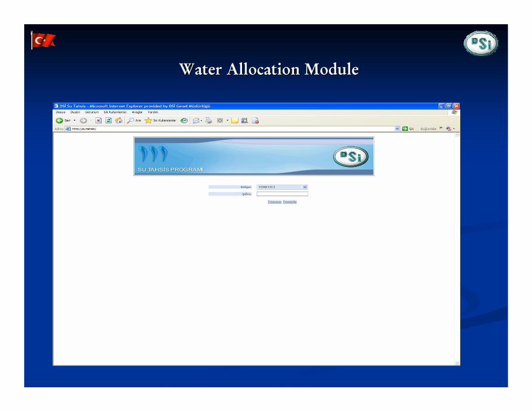
WaterWater AllocationAllocation ModuleModule

FutureFuture of of thethe DSI WIS ProjectDSI WIS Project
TheThe DSI WIS DSI WIS willwill be be entegretedentegreted withwith differentdifferent applicationapplication andandhydraulichydraulic&&HidrologicalHidrological modelsmodels. ( . ( FloodFlood model, model, BasinBasin managementmanagementapplicationsapplications, Dam , Dam enterpriseenterprise andand managementmanagement systemssystems))
ItIt willwill supplysupply somesome reportsreports toto DocumentDocument ManagementManagement SystemSystem..
AllAll otherother stakeholdersstakeholders can can obtainobtain data.data.
TurkeyTurkey is is oneone of of thethe candidatecandidate countrycountry of of EuropeanEuropean UnionUnion, , soso EU EU WaterWater FrameworkFramework DirectiveDirective andand otherother reportingreporting obligationsobligations mustmust be be takentaken intointo considerationconsideration in in thethe studiesstudies of WIS. of WIS.
TheThe informationinformation in in thethe databasedatabase can be can be usedused as a as a gaugegauge toto anyanychangeschanges in in thethe enviromentenviroment aroundaround thethe countrycountry AndAnd supportedsupportedfuturefuture studiesstudies andand researchresearch..

Thank You For
Your Attention.

PRELIMINARY SURVEYPRELIMINARY SURVEY

Map showing Map showing hydrogeologicalhydrogeological characteristics of formation characteristics of formation and operation areasand operation areas

Well log software with indicators Well log software with indicators
WL,discharge,WQ,pumpingWL,discharge,WQ,pumping test,geophysicaltest,geophysical logs,licensinglogs,licensing

Inventory study at groundwater allocation for licensingInventory study at groundwater allocation for licensing

Map showing Map showing Dams,HEPPDams,HEPP and other hydraulic structures and other hydraulic structures
search by search by name,region,province,basin,typename,region,province,basin,type etc.etc.

Water level information of DamsWater level information of Dams

Information on Information on hydrometrichydrometric observation networkobservation network

Map showing irrigation areas with indicator of Project stageMap showing irrigation areas with indicator of Project stage

Diagram:waterDiagram:water allocated for irrigation per Projectallocated for irrigation per Project

Diagram:waterDiagram:water allocated for domestic water supply per cityallocated for domestic water supply per city