Embed Size (px)
Citation preview

Velika pestrost v razporeditvi padavin na takomajhnem obmo~ju, kot je Slovenija, je znana leredkokje v svetu.
Povpre~na letna koli~ina padavin v hidrome-tri~nih zaledjih v obdobju 1971–2000 je bilav Sloveniji 1628 mm. Razmerje med najmanj innajbolj namo~enim hidrometri~nim zaledjem je1 : 3,75. Povpre~na letna koli~ina padavin izra-~unana iz hidrometri~nih zaledji je 1628mm.KerHMZ ne prekrivjejo celotne Slovenije, ponekodpa segajo preko dr`avne meje, je povpre~je zaSlovenijo nekoliko druga~no – 1579 mm.
Najbolj namo~eni so bili predeli v zahodnemin osrednjem delu Julijskih Alp. V povirnihpredelih Nadi`e, U~je, Koritnice, So~e,Tolmin-ke, Ba~e, Save Bohinjke in mojstran{ke Bistriceje padlo preko 2500 mm letno. Najbolj namo-~eni so predeli orografskih pregrad na ju`nemobrobju Julijcev, kjer koli~ina padavin prese`etudi 3000 mm letno (pore~ja Tolminke, U~je inNadi`e).
Preko 2000 mm padavin letno pade v {iro-kem pasu preostalih Julijskih Alp z zahodnimiKaravankami (povirje Save Dolinke) in predalp-skega hribovja vse od Tolminskega, preko Cer-kljansko-Idrijskega hribovja do Banj{ice,Trnov-skega gozda in Nanosa.Visoke koli~ine padavinima tudi Sne`nik ter povirje Kolpe s ^abranko.
Med 1800 in 2000 mm padavin letno ima-jo pore~ja v Kamni{kih Alpah (od Tr`i{ke Bistri-ce do Lu~nice), spodnja dela pore~ij obeh Sor,pore~je kra{ke Ljubljanice z Nano{~ico, zgornjidel Vipavske doline ter Gori{ka brda.
Manj kot 1800 in nad 1600mm padavin letnopade v osrednji Vipavski dolini (pore~je Vipa-ve, Branice itd.), v pore~jih Reke in Ri`ane,v srednjem delu pore~ja Kolpe, v povirju Vi{nji-ce, v Krimskem hribovju (Borovni{~ica, Cerk-ni{~ica, I{ka), v pore~ju Grada{~ice ter srednjemdelu Ljubljanske kotline (Kranjsko in Sor{kopolje). Podobno koli~ino padavin imajo tudisrednja Savinja od Nazarij do Sol~ave ter Dre-ta in povirje Me`e.
The great diversity in the distribution ofprecipitation within an area as small as Sloveniais rare across the world. The variation in thequantities of precipitation is reflected in the ratiobetween the least and most water-abundanthydrometric catchment areas – 1:3.75.The aver-age annual quantity of precipitation in hydro-metric catchment areas in the 1971–2000 periodwas 1628mm in Slovenia. Because te area of thehydrometric catchment areas is not equal to thenational territory the quantity of precipitationis slightly different: 1579 mm.
The most water-abundant are the areas in thewestern and central parts of the Julian Alps.In the headwater areas of the Nadi`a, U~ja,Koritnica, So~a,Tolminka, Ba~a, Sava Bohinjkaand the Bistrica in Mojstrana, there was inexcess of 2500mm of precipitation annually.Themost water-abundant were the areas of the oro-graphic barriers on the southern edge of theJulian Alps, where the quantity of precipitationcan even exceeds 3000 mm per year (the riverbasins of the Tolminka, U~ja and Nadi`a).
In excess of 2000 mm of precipitation fallsannually over a wide belt of the remaining JulianAlps, the western Karavanke Mountains (theheadwaters of the Sava Dolinka) and in thepre-Alpine hills up to Tolminsko, over theCerkljansko-Idrijsko hribovje hills to Banj{ice,Trnovski gozd and Nanos. Large quantities ofprecipitation are also found in the catchmentarea of Mount Sne`nik and the headwaters ofthe Kolpa with ^abranka.
The annual precipitation amounts between1800 and 2000 mm are exhibited by the riverbasins in the Kamni{ke Alps (from Tr`i{kaBistrica to Lu~nica), the lower parts of the riverbasins of both the Sora rivers, the river basin ofthe karstic Ljubljanica River with the Nano{~ica,the upper part of the Vipava Valley and theGori{ka brda.
Between 1600 and 1800mm of precipitationfalls annually in the central Vipava Valley (the
71
VODNA BILANCA OBDOBJA 1971–2000 / THE WATER BALANCE FOR THE 1971–2000 PERIOD
5Vodna bilanca obdobja 1971–2000The Water Balancefor the 1971–2000 Period
Peter Frantar
Obmo~je s povpre~no letno koli~ino pada-vin med 1400 in 1600 mm je v srednji Slove-niji. Sega od srednjega in zgornjega dela pore~jaKrke preko barjanske Ljubljanice, Save med Liti-jo in Mednim s P{ato, Ra~o in Nevljico do pore~-ja Drete in dela Savinje. Tudi pore~ja s povirjina Pohorju spadajo v ta razred.
Najve~ji del hidrometri~nih zaledij v Slove-niji ima letno med 1200 in 1400 mm padavin.To je pas, ki sega od Kolpe na jugu do Drave naseveru.Tu je ves spodnji del Kolpe, Krke, Savinjein Save; tu so pore~ja spodnje Me`e in celotneMislinje, Pake, Dravinje, Mestinj{~ice ter zgor-nji del pore~ja Sotle.
Pore~ji Pesnice ter spodjni del pore~ja Sot-le imata med 1000 in 1200 mm padavin letno,pod 1000mm padavin pa ima Pomurje, najmanjpredeli hidrometri~nega zaledja ^entibe, kiobsega ve~inoma ravninski del Prekmurja.
Prostorska razporeditev koli~in izhlapevanjapo Sloveniji ka`e obratno sliko razporeditvipadavin in odtoka. Kjer je ve~ padavin in odto-ka je ponavadi manj izhlapevanja. Prav ta imaizmed vseh treh osnovnih elementov vodnegakroga najmanj{o spremenljivost v Sloveniji.Razmerje med hidrometri~nim zaledjem z naj-ve~ in najmanj izhlapevanja je bilo v Slovenijiv obdobju 1971–2000 le 1 : 1,2.
Manj kot 675 mm vode v povpre~ju izhla-pi v povirjih So~e in Save, v pore~ju Nano{~i-ce ter v posameznih delih pore~ij SV Slovenije.V preostalem delu Alp, vrhov Pohorja, Kozjan-skega, v Slovenskih goricah ter srednjem Prek-murju izhlapi med 675 in 700 mm vode na leto.V osrednjem in vzhodnej{em delu Slovenije ima-mo do 725 mm izhlapevanja letno, ju`nej{i inzahodnej{i pa do 750 mm. Najve~ vode v Slo-veniji izhlapi iz pore~ja Nadi`e, Idrije, Branice,Mo~ilnika, Dragonje in Borovni{~ice ter povir-ja Sotle in vsega pore~ja Kolpe ter Rade{ce.
Razporeditev odto~nih zna~ilnosti je zelopodobna razporeditvi padavin. Najve~ji odtoki
river basin of the Vipava, Branica, etc.), in theriver basins of the Reka and Ri`ana rivers, in thecentral part of the Kolpa river basin, in the head-waters of the Vi{njica, in the Krim highlands(Borovni{~ica, Cerkni{~ica, I{ka), in the riverbasin of Grada{~ica and in the central part ofthe Ljubljana Basin (Kranjsko and Sor{ko poljelowland). A similar quantity of precipitationis also exhibited by the central Savinja fromNazarje to Sol~ava, Dreta and the headwatersof the Me`a river basin.
The belt of hydrometrical catchment areaswith an average annual quantity of precipitationof between 1400 and 1600 mm lies in centralSlovenia. It reaches all the way up to the cen-tral and upper parts of the Krka river basin, viathe Ljubljanica on the Ljubljana Marshes, theSava between Litija and Medno with P{ata, Ra~aand Nevljica to the Dreta river basin and a partof the Savinja.The river basins with headwatersin Pohorje also belong to this class.
The majority of the hydrometric catchmentareas in Slovenia experience between 1200 and1400 mm of precipitation a year. This is a beltstretching from the Kolpa River in the souththrough to the Drava River in the north. Thisarea covers the entire lower part of the Kolpa,Krka, Savinja and Sava; the lower part of riverbasins of the Me`a River and the entire Mislinja,Paka, Dravinja and Mestinj{~ica rivers as well asthe upper part of the Sotla river basin.
The river basins of the Pesnica and lower partof Sotla river basin receive between 1000 and1200 mm of precipitation a year, while precip-itation below 1000 mm is exhibited in Pomurje.The least precipitation occurs in parts of thehydrometric catchment area of the Ledava^entiba, which primarily encompasses the low-land part of Prekmurje.
The spatial distribution of evaporation acrossSlovenia shows a »reverse« picture of the dis-tribution of precipitation and runoff.Where theprecipitation and runoff are larger, the evapo-ration is usually smaller.Among the three basicelements of the water cycle, it is evaporation thatexhibits the smallest variation.The ratio betweenthe hydrometric catchment areas with the leastand the most evaporation was only 1 : 1.2 inthe 1971–2000 period.
Less than 675 mm of water evaporate onaverage in the headwaters of the So~a and Savarivers, in the Nano{~ica river basin and in indi-vidual areas of the river basins of south-easternSlovenia. In the remaining parts of the Alps, thepinnacles of Pohorje, in Kozjansko, in the Slo-venske gorice and in central Prekmurje, between675 and 700 mm of water evaporate annually.In the central and eastern parts of Slovenia, upto 725 mm of water evaporate annually, while
72
VODNA BILANCA SLOVENIJE 1971–2000 / WATER BALANCE OF SLOVENIA 1971–2000
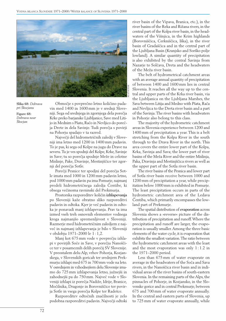
Slika 68: Dobravapri [kocjanu
Figure 68:Dobrava near[kocjan
BL
A@
KO
[AK
so v Alpah, odtod pa se koli~ina odtoka manj-{a proti jugu in vzhodu.
Bilan~na neskladnost
Bilan~no neskladje je pokazatelj metri~nih aliocenjevalnih te`av osnovnih elementov vodne-ga kroga in medsebojnega vpliva. Odstopanjamed posameznimi elementi so izra`ena v odstot-kih bilan~ne napake. Pozitivne vrednosti napa-ke lahko ka`ejo na preveliko oceno koli~inepadavin, na premajhno oceno koli~ine izhlape-vanja ali na podcenjene odtoke. Negativne vred-nosti napake pa ka`ejo mo`nost obratne ocenevodnobilan~nih elementov. Pri tem moramo {eposebej upo{tevati naravnogeografske razmere,zlasti dolo~evanje razvodnic, seveda pa imajotudi dru`benogeografski dejavniki, kot so odvze-mi vode ipd., lahko pomemben vpliv na izmer-jene koli~ine.
Pozitivna bilan~na odstopanjaNajve~je bilan~no odstopanje smo zaznali prihidrometri~nih zaledjih z vodomernimi postaja-mi, kjer je znana te`ava »zatekanje« vode v prodmimo merskega profila, bodisi pod strugo aliv bre`ini. Na Nadi`i je merski profil v produ,P{ata te~e po aluvialni ravnici, na Vi{njici,Temenici, Cerkni{~ici, Branici in Vipavi priMirnu pa je znano ponikanje v kras.V primeruReke so najverjetnej{i vzrok kra{ke razvodni-ce ter slab{a pokritost obmo~ja s klimatolo{kimipostajami. Na Savi med ̂ ate`em in gorvodni-mi postajami so najverjetnej{i vzrok veliki pre-toki.
in the southern and western parts the value risesto 750 mm. In Slovenia, the most water evap-orates from the river basins of the Nadi`a, Idrija,Branica, Mo~ilnik, Dragonja and Borovni{~icaand from the headwaters of the Sotla and theentire river basin of the Kolpa and Rade{ca.
The geographical distribution of runoff char-acteristics is similar to precipitations'. From thehighest runoffs in the Alps the amount is low-ering towards the south and east.
Water Balance Deviation
The water balance deviation is an indicator ofproblems with the measurement and assessmentof the basic elements of the water cycle and theirinteraction. Deviations between the individualelements are expressed in percentages of thewater balance error. Positive error values mayindicate too high an estimation of precipitation,too low an estimation of evaporation or under-estimated runoffs. Negative values of the errorindicate the possibility of the reverse estimatesof these water balance elements. Here, we mustespecially take into account the natural-geo-graphic conditions (especially when determin-ing water divides) as well as, of course, the social--geographic factors such as water abstraction etc.,which can have a significant impact on the quan-tities measured.
Positive Water Balance DeviationsThe greatest water balance deviation was observedin the hydrometric catchment areas with watergauging stations with known problems of the
73
VODNA BILANCA OBDOBJA 1971–2000 / THE WATER BALANCE FOR THE 1971–2000 PERIOD
Odtok / Runoff
Izhlapevanje / EvaporationPadavine / Precipitation
897
1244
726
748
1660
547
204
777871
878
757
716
697
693
1594
1534
2386
1619
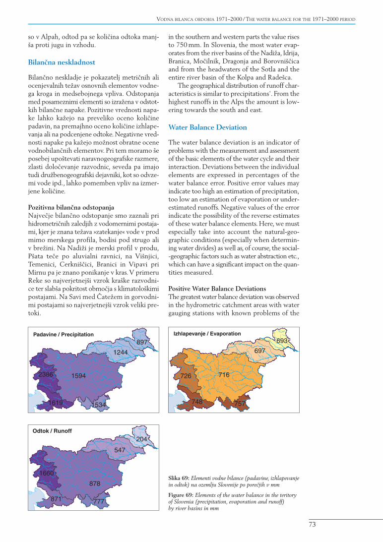
Slika 69: Elementi vodne bilance (padavine, izhlapevanjein odtok) na ozemlju Slovenije po pore~jih v mm
Figure 69: Elements of the water balance in the teritoryof Slovenia (precipitation, evaporation and runoff)by river basins in mm
Negativna bilan~na odstopanjaNajve~ja negativna odstopanja je zaznati v pore~-ju Tolminke.V njenem primeru je napaka veli-ka zaradi prodnatega korita struge in kra{kerazvodnice, kjer voda odteka iz pore~ja. Ve~jeodstopanje imajo zaradi kra{kih hidrogeolo{kihzna~ilnosti {e Pokolpje in del Krke, Kamni{kaBistrica ter Dreta.V primeru Savinje gorvodnood Velikega [irja gre najverjetneje za tok pod-talnice mimo vodomernih profilov.
5.1 Pregled vodne bilancepo pore~jih
Rezultati vodnobilan~nih elementov ka`ejo naveliko pestrost klimatogeografskih in hidro-geografskih razmer po posameznih pore~jih.
5.1.1 Pomurje
Pomurje je regija z najmanj{imi koli~inami vodev Sloveniji. V celotnem Pomurju imamo pov-pre~no 897 mm padavin, izhlapi 693 mm, inodte~e 204 mm vode letno. Na levem breguMure je padavin povsod pod 900 mm, na skraj-nem vzhodnem delu celo pod 850 mm. Najve~padavin v pore~ju prejme predel Slovenskihgoric v pore~ju Mure, kjer je ponekod tudi nekajmm nad 1000 letno. Letna koli~ina izhlapeva-nja je 693 mm in ima geografsko malo odstopa-nja – podobno je po vsem Pomurju. Pomembnaje pokrovnosti tal – najve~ vode izhlapi iz obmo-~ij pokritih z gozdom. Posledica takega izhlape-vanja in padavin so nizke vrednosti odtokov, kiso tu najni`je v dr`avi. Letno povpre~no odte-~e okrog 300 mm z desnega brega Mure, od tampa koli~ina odtoka pada proti vzhodu.
»seepage« of water into gravel past the meas-urement cross-section, either below the riverchannel or within the bank. The measurementcross-section on the Ndi`a is located on grav-el, the P{ata runs over an alluvial plain, whilethe Vi{njica, Temenica, Cerkni{~ica, Branicaand Vipava at Miren disappear into the Karst.In the case of the Reka River, the most proba-ble causes are the karstic water divides and poor-er coverage of the area by climatological stations.On the Sava River between ^ate` and theupstream stations, the most probable cause isthe large discharges.
Negative Water Balance DeviationsThe greatest negative deviations can be observedin the Tolminka river basin. In this case, the erroris significant because of the gravel river chan-nel and the karstic water divide where thewater runs off from the river basin. Because ofthe karstic hydrogeological properties, thePokolpje (Kolpa river basin) and a part of theKrka River, Kamni{ka Bistrica and Dreta expe-rience greater deviations. In case of the Savinjaupstream from Veliko [irje, the most probablecause is the flow of the groundwater past thehydrometric cross-sections.
5.1 Overview of the WaterBalance by River Basins
The results of the water balance elements indi-cate a great variety of climatic-geographical andhydrogeographical conditions in individualareas.
5.1.1 Pomurje (The MuraRiver Basin)
Pomurje is the region with the least water inSlovenia. On average, there is 897 mm of pre-cipitation, 693 mm of evaporation and 204 mmof runoff annually in the entire Pomurje.Throughout the left bank of the Mura, there isless than 900 mm of precipitation, while in theeastern-most part there is less than 850mm.Themost precipitation in the river basin occurs inthe Slovenske gorice area in the Mura river basin,where there is somewhat over 1000 mm of pre-cipitation annually in some places. The annualevaporation quantity is 693 mm and has onlyslight geographical deviation – the situationbeing similar throughout Pomurje. The landcover is important as the most water evaporatesin areas covered with forest. The result of thisevaporation and precipitation are the low runoffvalues – with the lowest in the country beingin this area.The average annual runoff is around
74
VODNA BILANCA SLOVENIJE 1971–2000 / WATER BALANCE OF SLOVENIA 1971–2000
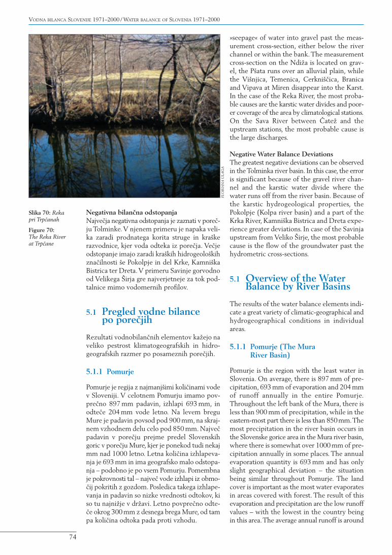
Slika 70: Rekapri Trp~anah
Figure 70:The Reka Riverat Trp~ane
FLO
RJA
NA
UL
AG
A
5.1.2 PodravjeSlovenski del pore~ja Drave zajema bolj razno-like pokrajine od Pomurja.V celotnem Podrav-ju pade povpre~no 1244 mm padavin, izhlapi697 mm, odte~e pa 547 mm vode letno. Povsodv Podravju izmerijo nad 1000 mm padavin naleto. Najmanj jih je v Slovenskih goricah, kjerjih je v ju`nem delu okrog 1000, v severnem paokoli 1100mm. Obmo~je ni`inskega dela Drav-sko-Ptujskega polja, Haloz in obronkov Pohorjaima dobrih 1200 mm padavin. Koli~ina padavinodtod raste proti vi{jim delom Pohorja in zahod-nih Karavank, kjer jih je nad 1600 mm. Izhla-pevanja je najmanj na obmo~ju Slovenskihgoric in Dravskega polja ter v najvi{jih prede-lih pore~ja Drave – na Pohorju in v Karavankah,kjer izhlapi tudi manj kot 650mm letno.V preo-stalem delu je izhlapevanja preko 700 mm let-no, najve~ na posameznih predelih Haloz – preko800 mm. Odtoki ka`ejo podobno sliko – naj-manj{i (okrog 300 mm letno) so na vzhodnemdelu, najvi{ji pa v vi{jih predelih Pohorja in Kara-vank, kjer dose`ejo tudi preko 1100 mm letno.
5.1.3 Posavje
Posavje je najve~je pore~je. V celotnem Posav-ju brez Kolpe je v obdobju 1971–2000 povpre~-no padlo 1594 mm padavin, izhlapelo 716 mmin odteklo 878 mm vode letno.V najbolj namo-~enih predelih Julijcev, v zahodnih predelihzaledij Savice, Bohinjske Bistrice in Mostnice
300 mm from the right bank of the Mura,though the runoff decreases as you move west-wards.
5.1.2 Podravje (The Drava River Basin)
The Slovenian part of the Drava river basinencompasses a more varied landscape thanPomurje. On average, there is 1244 mm of pre-cipitation in the entire Podravje area, where697mm evaporate and 547mm of water run offannually. Throughout Podravje, the measuredannual quantities of precipitation are in excessof 1000 mm. The least precipitation is inSlovenske gorice,where there is around 1000mmin the southern area and around 1100mm in thenorthern part. The area of the lowland part ofthe Dravsko-Ptujsko polje, Haloze and the hill-sides of Pohorje receive over 1200 mm of pre-cipitation.The quantity of precipitation increasesfrom here towards the higher-lying parts ofPohorje and the western Karavanke Mountains,where there is more than 1600 mm of precip-itation. Evaporation is lowest in the area ofSlovenske gorice and the Dravsko polje, as wellas in the highest reaches of the Drava riverbasin – on Pohorje and in the KaravankeMountains – where less than 650 mm evaporateper year. In the remaining area, evaporationexceeds 700 mm annually, with the most evap-oration occurring in individual areas of Haloze –more than 800 mm.The runoffs show a similar
75
VODNA BILANCA OBDOBJA 1971–2000 / THE WATER BALANCE FOR THE 1971–2000 PERIOD
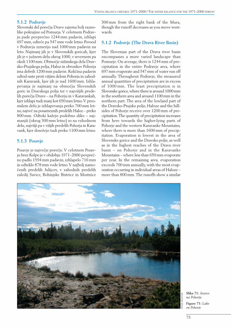
Slika 71: Jezercena Pohorju
Figure 71: Lakeon PohorjePE
TER
FR
AN
TAR

pade preko 3000 mm padavin. Preko 3500 mmv povpre~ju pade na grebenu med Komno inVoglom. Koli~ina padavin se od tod naglo zmanj-{uje proti severu in vzhodu. Preko 2500 mmpadavin je tako le {e v vi{jih predelih treh tri-glavskih dolin, na zahodni Pokljuki in na obmo~-ju Koble.Ve~ina planot Julijskih Alp, Karavankein Kamni{ke Alpe ter predeli predalpskega hri-bovja, Javornikov ter Goteni{ke gore, ima med2000 in 2500 mm padavin. Odtod koli~inapada proti vzhodu, tako da ima osrednji delPosavja med 1400 in 1800 mm padavin, velikvzhodni del pa pod 1400 mm. Najmanj pada-vin v Posavju je v Posotelju – pod 1200 mm naleto. Izhlapevanje je v Posavju najmanj{e v dvehve~jih obmo~jih: v visokogorskem alpskem sve-tu (pod 550 mm letno) in v Posotelju (okoli650mm letno). Iz Posavja v ve~ini izhlapeva med650 in 850 mm vode letno, manj na severu inve~ na ju`nem delu.V posameznih predelih izh-lapi tudi preko 850 mm vendar so to manj{ilokalni predeli (predeli na Kr{ko-Bre`i{kempolju). Odtok je v Posavju razporejen podob-no kot padavine. Najve~ odte~e iz alpskih (pre-ko 2500 mm) in predalpskih predelov, odtod pakoli~ina pada proti vzhodu, kjer je odtoka od300 do 600 mm.
5.1.4 Pokolpje
Pokolpje je del Posavja, ki se izliva v Savo naHrva{kem. Je kra{ko pore~je. V slovenskemdelu Pokolpja v povpre~ju pade 1534mm pada-vin, izhlapi 757 mm, odte~e pa 777 mm vodeletno. Najve~ padavin je na zahodu – na robuSne`ni{kega pogorja in na Ko~evskem – preko2000 mm letno. Najve~ po vrhovih Goteni{kegore, kjer pade tudi do 2400 mm letno. Osred-nji del ima okrog 1700 mm padavin, vzhodniz Lahinjo pa okrog 1300 mm. Izhlapevanje jezelo visoko – od 650 pa vse do preko 850 mmletno in je zelo odvisno od rastja in ekspozicije
picture – they are lowest (around 300 mm peryear) in the eastern part, and the highest of thehigher reaches of Pohorje and the KaravankeMountains, where they reach more than1100 mm per year.
5.1.3 Posavje (The Sava River Basin)
Posavje is the largest river basin. In the entirePosavje area, aside from the Kolpa River, therewas an average of 1594 mm of precipitation,716 mm of evaporation and 878 mm of runoffper year in the 1971–2000 period. In the wettestareas of the Julian Alps, the western parts of thecatchment areas of the Savica, Bohinjska Bistricaand Mostnica, there is more than 3000 mm ofprecipitation. There is, on average, more than3500 mm of precipitation on the ridge betweenKomna and Vogel.The quantity of precipitationdecreases rapidly from here towards the northand east. There is only more than 2500 mm ofprecipitation in the higher-lying parts of thethree Triglav valleys, on western Pokljuka andin the area of Kobla.The majority of the plateausin the Julian Alps, the Karavanke Mountains, theKamni{ke Alps and parts of the pre-Alpine hills,Javorniki and Goteni{ka gora have between2000 and 2500 mm of precipitation.The quan-tity drops from here towards the east, so thatthe central area of Posavje exhibits between1400 and 1800 mm of precipitation, while thelarge eastern area is below 1400 mm.The leastprecipitation in Posavje occurs in Posotelje –below 1200 mm per year. Evaporation in thisriver basin is the lowest in two larger areas: inthe high-mountain Alpine area (below 550 mmannually) and in Posotelje (around 650 mmannually). In general, between 650 and 850 mmof water evaporate from Posavje annually, withless evaporation observed in the north andmore in the south. In individual areas, more than850 mm of water can evaporate, though theseare localised (specific areas in the Kr{ko-Bre`iceBasin).The runoff in Posavje is distributed sim-ilar to the precipitation. The most water runsoff from the Alpine (in excess of 2500 mm) andpre-Alpine areas, with the quantity droppingfrom here towards the east, where the runoffis between 300 and 600 mm.
5.1.4 Pokolpje (The Kolpa River Basin)
Pokolpje is a part of Posavje as the Kolpa dis-charges into the Sava River in Croatia. It isa karstic river basin. In the Slovenian part ofPokolpje, there is an average of 1534mm of pre-cipitation, 757 mm of evaporation and 777 mmof water run off annually. The most precipita-tion is in the west – on the edge of the Sne`nik
76
VODNA BILANCA SLOVENIJE 1971–2000 / WATER BALANCE OF SLOVENIA 1971–2000
Slika 72: Po de`ju
Figure 72: Afterthe rain
AN
JA J
ERIN
– S
OK
OL

povr{ja. Odtoka je najve~ v zgornjem delupore~ja Kolpe, preko 1600mm, z obmo~ja Gote-ni{ke gore celo slabih 1700 mm letno, od todhitro pada proti vzhodu. Najmanj ga je v osred-nji Beli krajini, kjer odte~e zgolj okoli 400 mmvode letno.
5.1.5 Poso~je
Poso~je je na{e najbolj vodnato pore~je.V celot-nem Poso~ju v povpre~ju pade 2386 mm pada-vin, izhlapi 726 mm in odte~e 1660 mm vodeletno. Njegovi najvi{ji predeli imajo tudi najve~padavin – preko 3000 mm letno – visokogorskipredeli Julijcev celo preko 3500mm padavin let-no: Kanin, Krn, Vogel. V alpskih dolinah jih je`e manj, med 2300 in 2700 mm. Jugozahodnirob visokih dinarskih planot od Kambre{kega,Banj{ic do Trnovskega gozda ima padavin okrog2300 mm. Obmo~je predalpskega hribovja zadinarskim robom ter obmo~je Nanosa imapadavin manj – med 2000 in 2300 mm na leto.Pod 2000 mm padavin je v Gori{kih brdih inv zgornji Vipavski dolini. Najmanj padavin ima-ta spodnja Vipavska dolina in Vipavska brda,okoli 1500 mm letno. Izhlapevanje v Poso~ju jenajvi{je v ju`ni predelih, kjer v posameznihobmo~jih izhlapi preko 850 mm letno, od tu papada proti severu skladno z nadmorsko vi{ino –v gorskem svetu Julijcev ga je {e okrog 550 mmletno.Velike razlike so tudi v odtoku. Na obmo~-ju Kaninskega pogorja odte~e preko 3000 mm
mountain chain and in around Ko~evje – morethan 2000 mm annually.The most precipitationis on the tops of Mount Goteni{ka gora, withup to 2400 mm annually. The central area hasaround 1700mm of precipitation, while the east-ern area with Lahinja has around 1300 mm.Evaporation is very high – from 650 to up to over850 mm per year, and is strongly dependent onthe vegetation and the surface exposure. Therunoff is highest in the upper part of the Kolpariver basin, with more than 1600 mm. Therunoff from Mount Goteni{ka gora is around1700 mm per year and drops rapidly from heretowards the east.The least runoff occurs in cen-tral Bela krajina, where only around 400 mm ofwater run off annually.
5.1.5 Poso~je (The So~a River Basin)
Poso~je is our most water-abundant river basin.In the entire Poso~je, there is an average of2386 mm of precipitation, 726 mm of evapora-tion and 1660 mm of runoff annually.The high-est parts experience over 3000mm precipitationper year – while the top high-mountain partsof the Julian Alps even have over 3500 mm ofprecipitation annually: Kanin, Krn,Vogel.Thereis less precipitation in the Alpine valleys,between 2300 and 2700 mm. The south-west-ern edge of the high Dinaric plateaus fromKambre{ko and Banj{ice to Trnovski gozd havearound 2300 mm of precipitation. The area of
77
VODNA BILANCA OBDOBJA 1971–2000 / THE WATER BALANCE FOR THE 1971–2000 PERIOD
Slika 73: Led
Figure 73: IcePET
ER F
RA
NTA
R
letno, za ve~ino poso{kih Alp pa je odtok ve~jiod 2000mm (z izjemo dolinskih predelov). Pre-ko 1500 mm odte~e iz obmo~ja dinarskih pre-grad in osrednjega dela Poso~ja, severno inju`no od dinarskih pregrad pa je odtoka manj:v Idrijski kotlini okrog 1100 mm, v Vipavskihbrdih pa se koli~ina zni`a na vsega 650mm letno.
5.1.6 Povodje jadranskih rek brez Poso~ja
Najmanj{i hidrografski del Slovenije predstav-lja Reka z zaledjem, ki se v Jadran odtaka podKrasom, in obmo~je re~ic in potokov, ki se izli-vajo neposredno v slovensko morje.V celotnemPrimorju s Krasom povpre~no pade 1619 mmpadavin, izhlapi 748 mm, odte~e pa 871 mmvode letno. Najve~ padavin ima okolica Sne`-nika – preko 2500 mm. Najvi{ji predeli imajocelo preko 2800mm padavin letno. Od tam koli-~ina padavin pada proti zahodu. Obalni deli ima-jo dobrih 1000 mm padavin, zahodni Kras paokrog 1500 mm letno. Izhlapevanje je najve~jev posameznih predelih Koprskega primorja inna jugozahodnem delu Krasa (preko 850 mm).Proti severu in vzhodu obmo~ja koli~ina izhla-pevanja pada, najmanj{a je v Sne`ni{kem pogor-ju – pod 700 mm letno. Odtoki so najve~ji naskrajnem vzhodnem delu (okolica Sne`nika),kjer do nad 2000mm (najvi{ji predeli okrog vrha
the pre-Alpine hills behind the Dinaric edge andthe area of Nanos have between 2000 and2300 mm precipitation annually. Less than2000 mm of precipitation occur in the Gori{kabrda and in the Upper Vipava Valley. The low-est precipitation occurs in the Lower VipavaValley and in the Vipavska brda – around1500 mm annually. Evaporation in Poso~je ishighest in the southern areas, where more than850 mm evaporate annually in some places.Theamount drops as you move towards the northin accordance with the elevation – though in themountainous world of the Julian Alps there isstill around 550 mm of evaporation annually.Great differences occur in terms of runoff. In thearea of the Kanin mountain chain, the runoffexceeds 3000 mm per year, while in the major-ity of the Alps in Poso~je the runoff is over2000 mm (with the exception of the valleyareas). More than 1500 mm run off from thearea of the Dinaric barriers and the central partof Poso~je, while the runoff is lower to the northand south of these barriers. In the Idrija Valleyit is around 1100 mm and in the Vipavska brdathe quantity drops to a mere 650 mm per year.
5.1.6 The Catchment Area of theAdriatic Rivers Without Poso~je
The smallest hydrogeographical area of Sloveniais represented by the Reka River – with itscatchment area that flows into the Adriatic viathe Karst – and the area of small rivers andstreams that drain directly into the Slovenian sea.In the entire Primorje area with Karst, there isan average of 1619 mm of precipitation, while748 mm of water evaporates and 871 mm ofwater run off annually. The most precipitationfalls in the surroundings of Mount Sne`nik –more than 2500 mm, though the highest partshave over 2800 mm of precipitation per year.The quantity drops towards the west.The coastalareas receive a good 1000mm of precipitation andthe western Karst around 1500 mm of precipi-tation annually. Evaporation is highest in indi-vidual parts of the Koper coastal area and in thesouth-western part of the Karst (more than850mm).Towards the north and east, the quan-tity of evaporation drops, being lowest in theSne`nik mountain chain – below 700mm annu-ally.The runoffs are highest in the eastern-mostpart (surroundings of Mount Sne`nik), wheremore than 2000mm of water runs off (2100mmin the highest parts surrounding the top ofMount Sne`nik and Zatrep). Runoffs decreasefrom there towards the west.The groundwaterrunoff in the Karst is between 500 and 750mm,with the lowest being in the Koper coastalarea – between 200 and 500 mm annually.
78
VODNA BILANCA SLOVENIJE 1971–2000 / WATER BALANCE OF SLOVENIA 1971–2000
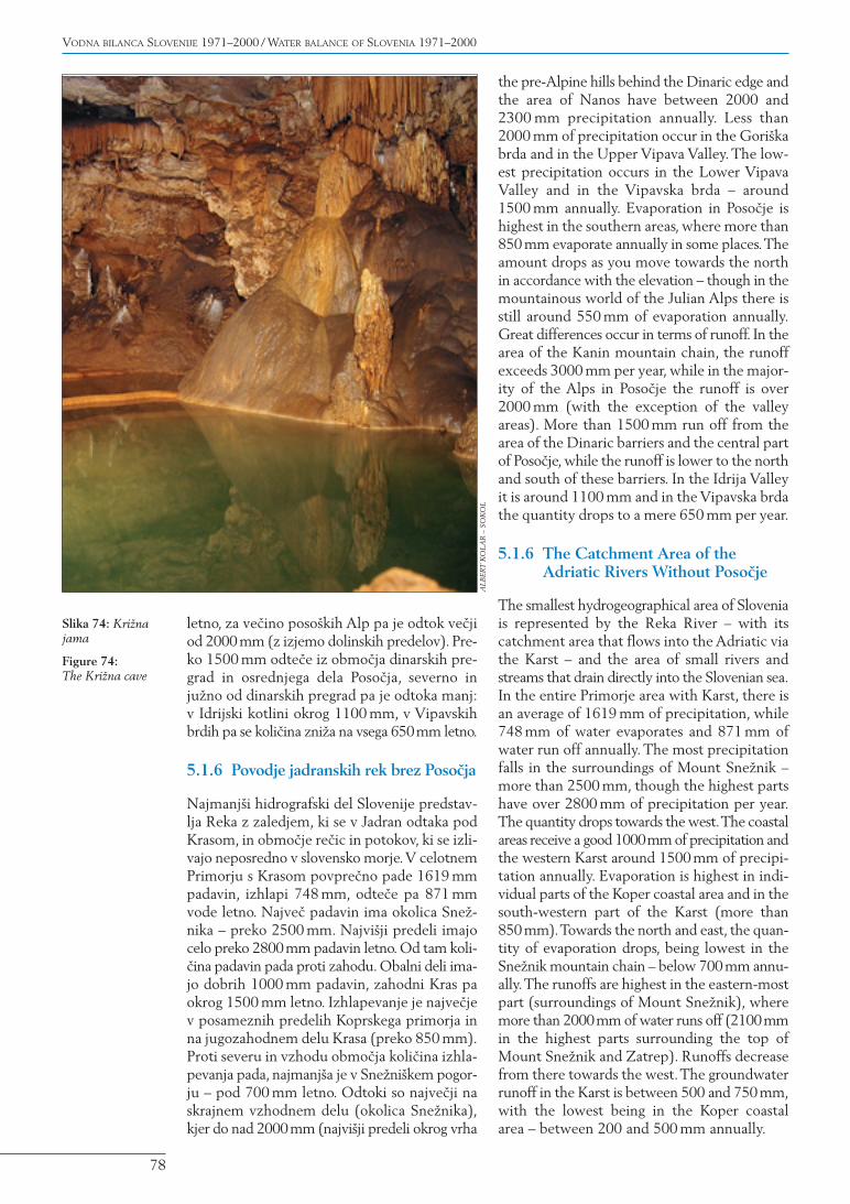
Slika 74: Kri`najama
Figure 74:The Kri`na cave
AL
BER
T K
OL
AR
– S
OK
OL
Sne`nika in Zatrepa 2100mm), od tam pa pada-jo proti zahodu. S Krasa podzemno odtekamed 500 in 750 mm, najmanj pa v Koprskemprimorju – med 200 in 500 mm letno.
5.1.7 Slovenija
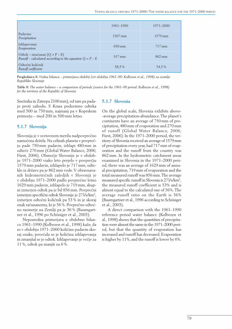
Slovenija je v svetovnem merilu nadpovpre~nonamo~ena de`ela. Na celinah planeta v povpre~-ju pade 750 mm padavin, izhlapi 480 mm inodte~e 270 mm (Global Water Balance, 2006;Fürst, 2006). Obmo~je Slovenije je v obdob-ju 1971–2000 vsako leto prejelo v povpre~ju1579 mm padavin, izhlapelo je 717 mm, odte-klo iz dr`ave pa je 862 mm vode.V obravnava-nih hidrometri~nih zaledjih v Sloveniji jev obdobju 1971–2000 padlo povpre~no letno1629 mm padavin, izhlapelo je 719 mm, skup-ni izmerjen odtok pa je bil 856 mm. Povpre~niizmerjen specifi~ni odtok Slovenije je 27 l/s/km2,izmerjen odto~ni koli~nik pa 53 % in je skorajenak ra~unanemu, ki je 56 %. Povpre~no odto~-no razmerje na Zemlji pa je 36 % (Baumgart-ner et al., 1996 po Schöniger et al., 2003).
Neposredna primerjava z obdobno bilan-co 1961–1990 (Kolbezen et al., 1998) ka`e, daso v obdobju 1971–2000 koli~ine padavin sko-raj enake, pove~ala se je koli~ina izhlapevanjain zmanj{al se je odtok. Izhlapevanje je ve~je za11 %, odtok pa manj{i za 6 %.
5.1.7 Slovenia
On the global scale, Slovenia exhibits above--average precipitation-abundance.The planet'scontinents have an average of 750 mm of pre-cipitation, 480 mm of evaporation and 270 mmof runoff (Global Water Balance, 2006;Fürst, 2006). In the 1971–2000 period, the ter-ritory of Slovenia received an average of 1579mmof precipitation every year, had 717mm of evap-oration and the runoff from the country was862 mm. In the hydrometric catchment areasexamined in Slovenia in the 1971–2000 peri-od, there was an average of 1629 mm of annu-al precipitation, 719 mm of evaporation and thetotal measured runoff was 856mm.The averagemeasured specific runoff in Slovenia is 27l/s/km2,the measured runoff coefficient is 53% and isalmost equal to the calculated one of 56%.Theaverage runoff ratio on the Earth is 36%(Baumgartner et al., 1996 according to Schönigeret al., 2003).
A direct comparison with the 1961–1990reference period water balance (Kolbezen etal., 1998) shows that the quantities of precipita-tion were almost the same in the 1971–2000 peri-od, but that the quantity of evaporation hasincreased and runoff has decreased. Evaporationis higher by 11%, and the runoff is lower by 6%.
79
VODNA BILANCA OBDOBJA 1971–2000 / THE WATER BALANCE FOR THE 1971–2000 PERIOD
1961–1990 1971–2000
Padavine 1567 mm 1579 mmPrecipitation
Izhlapevanje 650 mm 717 mmEvaporation
Odtok – izra~unan (Q = P – E) 917 mm 862 mmRunoff – calculated according to the equation Q = P – E
Odto~ni koli~nik 58,5 % 54,5 %Runoff coefficient
Preglednica 8: Vodna bilanca – primerjava obdobij (vir obdobja 1961–90: Kolbezen et al., 1998) za ozemljeRepublike Slovenije
Table 8: The water balance – a comparison of periods (source for the 1961–90 period: Kolbezen et al., 1998)for the territory of the Republic of Slovenia
Slika 75: Ledena rosa / Figure 75: Icy dew
TO
MA
@ K
RA
SNJA
– S
OK
OL