Embed Size (px)
Citation preview

Page 1 of 11
U.S. Army Corps of Engineers
South Pacific Division
Nationwide Permit Pre-Construction Notification (PCN) This form integrates requirements of the U.S. Army Corps of Engineers (Corps) Nationwide Permit Program within the South Pacific Division (SPD). Boxes 1-10 must be completed to include all information required by General Condition 32. Box 11 (or other sufficient information to show compliance with all General Conditions) must be completed for activities in Arizona, California, Nevada, and Utah, and is recommended for activities in Colorado and New Mexico. If additional space is needed, please provide as a separate attachment. Please refer to the Instructions for the South Pacific Division Nationwide Permit Pre-Construction Notification (PCN) (Instructions) for instructions for completing the PCN, as well as additional information on the attachments and tables included with this PCN that may be used.
0. To be filled by the CorpsApplication Number: Date Received: Date Complete:
1. Prospective Permittee and Agent Name and Addresses (see Instructions)
a. Prospective Permittee
First - Middle - Last -
Company - Email Address -
Address - City - State - Zip -
Phone (Residence/Mobile) - Phone (Business) -
b. Agent (if applicable)
First - Middle - Last -
Company - Email Address -
Address - City - State - Zip -
Phone (Residence/Mobile) - Phone (Business) -
c. Statement of Authorization: I hereby authorize , to act in my behalf as my agent for the proposed activity. (Optional, see instructions) Signature of Applicant Date

Page 2 of 11
2. Name and Location of the Proposed Activity (see Instructions)
The proposed work would involve multiple-single and complete projects. See attachment for the information required in Boxes 2 through 10, and 11, if applicable.
a. Project Name or Title: b. County, State:
c. Name of Waterbody:
d. Coordinates:
Unknown (please provide other location descriptions below)
Latitude - Longitude -
e. Other Location Description (optional, see instructions):
f. Driving Directions to the site (optional, see instructions):
3. Specific NWP(s) you want to use to authorize the proposed activity (see Instructions)
4. Description of the Proposed Activity (see Instructions)
a. Complete description of the Proposed Activity:
b. Purpose of the Proposed Activity:

Page 3 of 11
c. Direct and indirect adverse environmental effects the activity would cause, including the anticipated amount of loss of wetlands and other waters of the U.S. expected to result from the NWP(s) activity:
d. Description of any proposed mitigation measures intended to reduce the adverse environmental effects caused by the proposed activity: e. Any other NWP(s), Regional/Programmatic General Permit(s) or Individual Permit(s) used or intended to be used to authorize any part of the proposed activity or any related activity: f. Have sketches been provided containing sufficient detail to provide an illustrative description of the proposed activity?
Yes, Attached No
N/A; The activity is located in the Los Angeles District boundaries of Arizona and California, See Attachment 1
N/A, The activity is located in the San Francisco District boundaries of California, See Attachment 2
N/A, The activity is located in the Sacramento District boundaries of California, Nevada, or Utah, See Attachment 3
5. Aquatic Resource Delineation (see Instructions)
a. Has a delineation of aquatic resources been conducted in accordance with the current method required by the Corps? Yes No If yes, please attach a copy of the delineation Note: If no, your PCN is not complete. In accordance with General Condition 32, you may request the Corps delineate the special aquatic sites and other waters on the project site, but there may be a delay. In addition, the PCN will not be considered complete until the delineation has either been submitted to or completed by the Corps, as appropriate. b. If a delineation has been submitted, would you like the Corps to conduct a jurisdictional determination (preliminary or approved)? Yes No If yes, please complete, sign and return the attached Appendix 1 – Request for Corps Jurisdictional Determination (JD) sheet or provide a separate attachment with the information identified in Appendix 1.

Page 4 of 11
6. Compensatory Mitigation (see Instructions)
a. Will the proposed activity result in the loss of greater than 1/10-acre of wetlands? Yes No If yes, describe how you propose to compensate for the loss of each type of wetland: Note: for the loss of less than 1/10 acre of wetlands, or if no compensatory mitigation is proposed, the Corps may determine on a case-by-case basis that compensatory mitigation is required to ensure that the activity results in only minimal adverse environmental effects.
b. Will the proposed activity result in the loss of streams or other open waters of the U.S.? Yes No If yes, provide a description of any proposed compensatory mitigation for the loss of each type of stream or other open water: Note: if no compensatory mitigation is proposed, the Corps may determine on a case-by-case basis that compensatory mitigation is required to ensure that the activity results in no more than minimal adverse environmental effects.
7. Endangered Species Act (ESA) Compliance (see Instructions)
a. For non-Federal permittees (if Federal permittee, check N/A and skip to 7(d)): N/A (1) Is there any Federally-listed endangered or threatened species or critical habitat that might be affected or is in the vicinity of the activity? Yes No (2) Is the activity located in designated critical habitat for Federally-listed endangered or threatened species? Yes No If yes to either (1) or (2), include the name(s) of those endangered or threatened species that might be affected by the proposed activity or might utilize the designated critical habitat that might be affected by the proposed activity:
1. 2.
3. 4.
5. 6. If no to both (1) and (2), proceed to Box 8. Note: If yes to either (1) or (2), note per General Condition 18(c), you shall not begin work on the activity until notified by the Corps that the requirements of the ESA have been satisfied and that the activity is authorized.

Page 5 of 11
b. Has information sufficient to initiate consultation with the U.S. Fish and Wildlife Service/National Marine Fisheries Service for compliance with Section 7 of the ESA been prepared? Yes No If yes, please attach a copy of the information.
c. Additional information you wish to provide regarding compliance with the ESA, if applicable: d. For Federal permittees, you must provide documentation demonstrating compliance with ESA as a separate attachment.
8. Historic Properties (see Instructions)
a. For non-Federal permittees (if Federal permittee, check N/A and skip to 7(d)): N/A (1) Is there a known historic property listed on, determined to be eligible for listing on, or potentially eligible for listing on, the National Register of Historic Places that the NWP may have the potential to affect? Yes No If yes to (1), state which historic property may have the potential to be affected by the proposed activity:
1. 2.
3. 4.
5. 6.
OR
A vicinity map indicating the location of the historic property is enclosed (2) If no to (1), describe the potential for the proposed work to affect a previously unidentified historic property: Note: If yes to (1), note per General Condition 20(c), you shall not begin the activity until notified by the Corps that the activity has no potential to cause effects or that consultation under Section 106 of the National Historic Preservation Act (NHPA) has been completed. b. Has information sufficient to initiate consultation with the State Historic Preservation Officer/Tribal Preservation Officer for compliance with Section 106 of the National Historic Preservation Act (NHPA) been prepared?
Yes No If yes, please attach a copy of the information. c. Additional information you wish to provide regarding compliance with the NHPA, if applicable: d. For Federal permittees, you must provide documentation demonstrating compliance with NHPA in a separate attachment.
Page 6 of 11
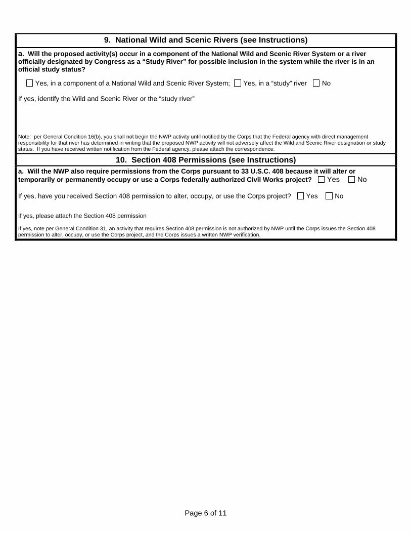
9. National Wild and Scenic Rivers (see Instructions)
a. Will the proposed activity(s) occur in a component of the National Wild and Scenic River System or a river officially designated by Congress as a “Study River” for possible inclusion in the system while the river is in an official study status? Yes, in a component of a National Wild and Scenic River System; Yes, in a “study” river No If yes, identify the Wild and Scenic River or the “study river” Note: per General Condition 16(b), you shall not begin the NWP activity until notified by the Corps that the Federal agency with direct management responsibility for that river has determined in writing that the proposed NWP activity will not adversely affect the Wild and Scenic River designation or study status. If you have received written notification from the Federal agency, please attach the correspondence.
10. Section 408 Permissions (see Instructions) a. Will the NWP also require permissions from the Corps pursuant to 33 U.S.C. 408 because it will alter or temporarily or permanently occupy or use a Corps federally authorized Civil Works project? Yes No If yes, have you received Section 408 permission to alter, occupy, or use the Corps project? Yes No If yes, please attach the Section 408 permission If yes, note per General Condition 31, an activity that requires Section 408 permission is not authorized by NWP until the Corps issues the Section 408 permission to alter, occupy, or use the Corps project, and the Corps issues a written NWP verification.

Page 7 of 11
11. Compliance with NWP General Conditions (see Instructions)
Check General Condition Rationale for Compliance with General Condition
1. Navigation
2. Aquatic Life Movements
3. Spawning Areas
4. Migratory Bird Breeding Areas
5. Shellfish Beds
6. Suitable Material

Page 8 of 11
7. Water Supply Intakes
8. Adverse Effects from Impoundments
9. Management of Water Flows
10. Fills Within 100-Year Floodplains
11. Equipment
12. Soil Erosion and Sediment Controls

Page 9 of 11
13. Removal of Temporary Fills
14. Proper Maintenance
15. Single and Complete Project
16. Wild and Scenic Rivers
17. Tribal Rights
18. Endangered Species See Box 7 above.
19. Migratory Bird and Bald and Golden Eagle Permits

Page 10 of 11
20. Historic Properties See Box 8 above.
21. Discovery of Previously Unknown Remains and Artifacts
22. Designated Critical Resource Waters
23. Mitigation See Boxes 4(d) and 6 above.
24. Safety of Impoundment Structures
25. Water Quality, including status of Section 401 Water Quality Certification
26. Coastal Zone Management, including status of CZM Consistency Certification from the State of California (for projects in or affecting the Coastal Zone)

Page 11 of 11
27. Regional and Case-by-CaseConditions
28. Use of Multiple NationwidePermits
29. Transfer of Nationwide PermitVerifications
30. Compliance Certification
31. Activities Affecting Structures orWorks Built by the United States
See Box 10 above.
32. Pre-Construction Notification


Page 1 of 11
U.S. Army Corps of Engineers
San Francisco District Attachment 2: Additional PCN Requirements for San Francisco District This attachment contains additional information required to be submitted with the PCN for proposed activities within the San Francisco District. You must submit the completed attachment, or other attachment containing the required information, for a complete PCN, per San Francisco District Regional Condition A(1). For multiple single and complete projects, provide the information identified below for each single and complete project. If additional space is needed, provide as an attachment to the form, and please reference each section accordingly.
1. Form of PCN (Regional Condition A(1))
Have you submitted a completed South Pacific Division PCN Checklist or an application form (ENG Form 4345) with an attachment providing information on compliance with all of the General and Regional Conditions?
Yes, see attached No
Note: If you check no, your PCN will be considered incomplete.
2. Avoidance and Minimization (Regional Condition A(1)(a))
Written statement describing how the activity has been designed to avoid and minimize adverse effects, both temporary and permanent, to waters of the U.S.:
3. Drawings (Regional Condition A(1)(b))
The following drawings are enclosed:
Plan-View drawing clearly depicting the location, size and dimensions of the proposed activity, as well as the location of delineated waters of the U.S. on the site
Cross-Section view drawings clearly depicting the location, size and dimensions of the proposed activity, as well as the location of delineated waters of the U.S. on the Site
The plan-view and cross-section view drawings contain the following
Title block: Yes No
Legend and scale: Yes No
Amount (in cubic yards) of fill in Corps jurisdiction (including permanent and temporary fills/structures): Yes No
Area (in acres) of fill in Corps jurisdiction (including permanent and temporary fill structures): Yes No
The ordinary high water mark (non-tidal waters) or mean high water mark and high tide line (tidal waters) shown in feet based on National Geodetic Vertical Datum (NGVD) or other appropriate reference elevation: Yes No
Do all drawings follow the South Pacific Division February 2016, Updated Map and Drawing Standards for the South Pacific Division Regulatory Program, or most recent update Yes No
If no, describe why this requirement is proposed to be waived):

Page 2 of 11
4. Photographs (Regional Condition A(1)(c))
Have you enclosed numbered and dated pre-project color photographs showing a representative sample of waters proposed to be impacted on the site, and all waters of the U.S. proposed to be avoided on and immediately adjacent to the project site?
Yes No
Is the compass angle and position of each photograph identified on the plan-view drawing(s) identified in Box 3?
Yes No
5. Essential Fish Habitat (EFH) (Regional Condition A(2))
N/A. The proposed activity will not occur in areas designated as EFH. (skip to Box 6)
The proposed activity will occur in areas designated as EFH and an EFH assessment and extent of proposed impacts to EFH is enclosed.
6. Waiver of linear foot limitations (Regional Condition A(7))(for NWPs 13, 21, 29, 39, 40, 42, 43, 44, 50, 51, 52, and 54)
The proposed activity would not require a waiver of the linear foot limitations for NWPs 13, 21, 29, 39, 40, 42, 43, 44, 50, 51, 52, or 54. (skip to Box 7)
a. A narrative description of the stream (including known information on: volume and duration of flow; the approximate length, width, anddepth of the waterbody and characteristics observed associated with an Ordinary High Water Mark (e.g. bed and bank, wrack line or scour marks); a description of the adjacent vegetation community and a statement regarding the wetland status of the adjacent areas (i.e. wetland, non-wetland);
surrounding land use; water quality; issues related to cumulative impacts in the watershed, and; any other relevant information):
b. Analysis of the proposed impacts to the waterbody, in accordance with General Condition 32 and RegionalCondition B(1):

Page 3 of 11
c. Measures taken to avoid and minimize losses to waters of the U.S., including other methods of constructing theproposed activity(s):
d. A compensatory mitigation plan describing how the unavoidable losses are proposed to be offset, in accordancewith 33 CFR § 332:
7. Activities in the San Francisco Bay diked baylands (Regional Condition B(1)) The proposed activity would not take place in waters or wetlands of the U.S. that are within the San Francisco Bay diked baylands. (skip to Box 8)
The proposed activity would take place in waters or wetlands of the U.S. that are within the San Francisco Bay diked baylands.
Information on how avoidance and minimization of waters or wetlands are taken into consideration to the maximum extent practicable:
8. Activities in the Santa Rosa Plain (Regional Condition B(2)) The proposed activity would not take place in waters or wetlands of the U.S. that are within the Santa Rosa Plain. (skip to Box 9)
The proposed activity would take place in waters or wetlands of the U.S. that are within the Santa Rosa Plain:
Information on how avoidance and minimization of waters or wetlands are taken into consideration to the maximum extent practicable:

Page 4 of 11
9. Activities in Eelgrass Beds (Regional Condition B(3))
The proposed activity would not take place within or adjacent to Eelgrass Beds. (skip to Box 10)
The proposed activity would take place within in adjacent to Eelgrass Beds:
Extent of the proposed impacts to Eelgrass Beds:
The following documents are enclosed:
Compensatory Mitigation Plan
Habitat Assessment
10. Nationwide Permit 3 Activities (Regional Conditions C(3)) The proposed activity would not involve maintenance activities under Nationwide Permit 3. (skip to Box 11)
a. Excavation equipment in waters of the U.S.
All excavation equipment associated with the NWP 3 activity will occur from an upland site (select and Skip to Box 11(b))
The excavation equipment will work from the top of the bank
The excavation equipment will work from road bed of a bridge or culverted crossing
The excavation equipment will work from:
Excavation equipment will be used within waters of the U.S.
Explanation as to the need to place excavation equipment in waters of the U.S.:
Statement of any additional necessary fill (e.g. cofferdams, access road, fill below the ordinary high water mark for a staging area, etc.):
b. Activities in special aquatic sites
The proposed maintenance activity would not occur in a special aquatic site. (skip to Box 12)
The proposed maintenance activity would occur in a special aquatic site.
Explanation of why the special aquatic site cannot be avoided:
Measures to be taken to minimize impacts to the special aquatic site:
Page 5 of 11
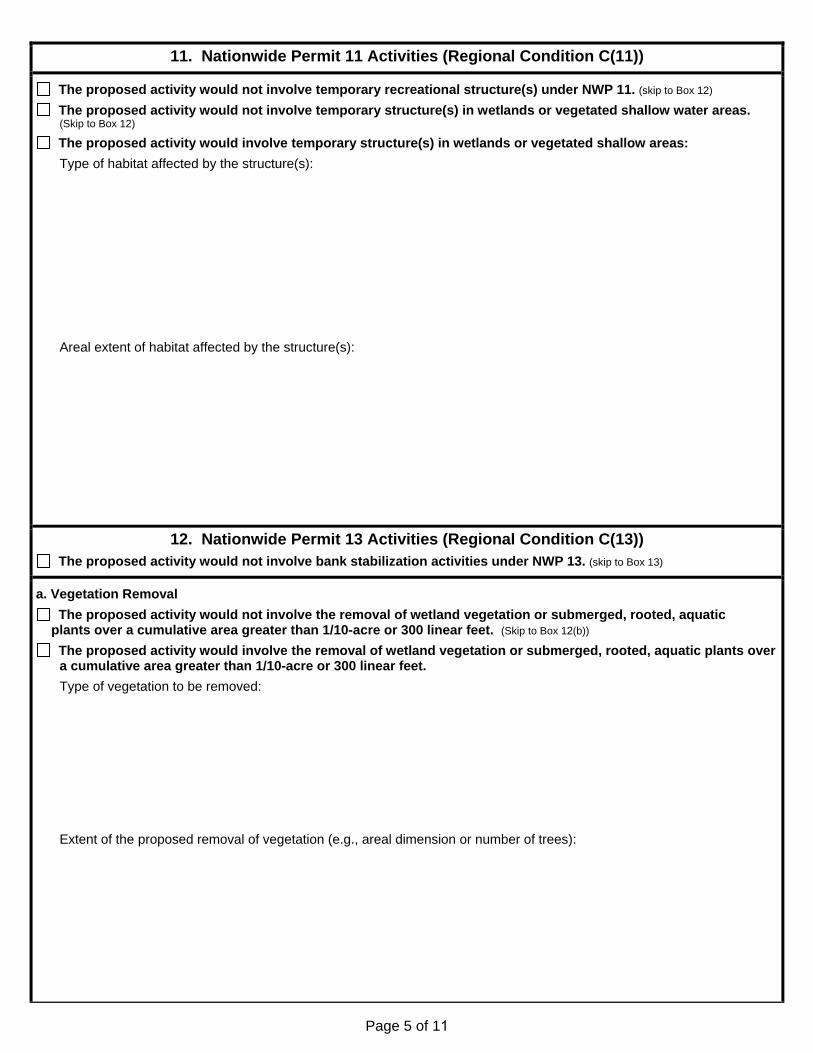
11. Nationwide Permit 11 Activities (Regional Condition C(11))
The proposed activity would not involve temporary recreational structure(s) under NWP 11. (skip to Box 12)
The proposed activity would not involve temporary structure(s) in wetlands or vegetated shallow water areas. (Skip to Box 12)
The proposed activity would involve temporary structure(s) in wetlands or vegetated shallow areas:
Type of habitat affected by the structure(s):
Areal extent of habitat affected by the structure(s):
12. Nationwide Permit 13 Activities (Regional Condition C(13)) The proposed activity would not involve bank stabilization activities under NWP 13. (skip to Box 13)
a. Vegetation Removal
The proposed activity would not involve the removal of wetland vegetation or submerged, rooted, aquatic plants over a cumulative area greater than 1/10-acre or 300 linear feet. (Skip to Box 12(b))
The proposed activity would involve the removal of wetland vegetation or submerged, rooted, aquatic plants over a cumulative area greater than 1/10-acre or 300 linear feet.
Type of vegetation to be removed:
Extent of the proposed removal of vegetation (e.g., areal dimension or number of trees):

Page 6 of 11
b. Effects of the bank stabilization activity:
Effects of the proposed bank stabilization activity on the stability of the opposite side of the streambank (if it is not part of the stabilization activity):
Effects of the proposed bank stabilization activity on adjacent properties upstream and downstream of the activity:
c. Disposal of excess material:
The proposed bank stabilization activity would not involve disposal of excess excavated material. (Skip to Box 12(d))
The proposed bank stabilization activity would involve the disposal of excess excavated material.
Location of the proposed disposal site:
d. Structure or modifications beneficial to fish and wildlife:
The proposed bank stabilization activity would incorporate structures or modification beneficial to fish andwildlife. See the project description.
The proposed bank stabilization activity would not incorporate structure or modification beneficial to fish andwildlife. See the project description.
Information to demonstrate why incorporation of structures or modifications beneficial to fish and wildlife were not considered practicable:

Page 7 of 11
13. NWP 14 Activities (Regional Condition C(14)) The proposed activity would not involve linear transportation projects under NWP 14. (skip to Box 14)
a. Bank stabilization activities
The proposed linear transportation project would not involve bank stabilization. (skip to Box 13(b))
The proposed linear transportation project would involve less than 300 linear feet of bank stabilization. (skip to Box13(b))
The proposed linear transportation project would involve more than 300 linear feet of bank stabilization.
Effects of the proposed bank stabilization activity on the stability of the opposite side of the streambank (if it is not part of the stabilization activity):
Effects of the proposed bank stabilization activity on adjacent properties upstream and downstream of the activity:
The proposed bank stabilization activity would incorporate structures or modification beneficial to fish and wildlife. See the project description.
The proposed bank stabilization activity would not incorporate structures or modification beneficial to fish and wildlife. See the project description.
Information to demonstrate why incorporation of structures or modifications beneficial to fish and wildlife were not considered practicable:
b. Previous segments within the same linear transportation project
NWP 14 has not been used to authorize previous project segments within the same linear transportation project.(skip to Box 14)
NWP 14 has been used to authorize previous project segments within the same linear transportation project.
Justification demonstrating that the cumulative impacts of the proposed and previously authorized segments do not result in more than minimal impacts to the aquatic system:

Page 8 of 11
14. NWP 23 Activities (Regional Condition C(23)) The proposed activity would not involve approved categorical exclusions under NWP 23. (skip to Box 15)
a. Required attachments
The following information is enclosed:
A copy of the Federal Categorical Exclusion (Cat/Ex) document signed by the appropriate federal agency.
A copy of the Categorical Exclusion (Cat/Ex) document signed by a state or local agency representative, as well of copies of all documentation authorizing alternative agency signature.
A copy of the jurisdictional delineation performed by qualified specialists showing the project limits and the location (delineated boundaries) of Corps jurisdiction within the overall project limits.
Maps showing the locations of potentially permanent and temporary project impacts to areas within Corps jurisdiction.
b. Corps authority:
c. Conditions described in the Cat/Ex and/or attachments outlining measures that must be taken prior to, during, orafter project construction to minimize impacts to the aquatic environment: (if this information is provided as an attachment, identifyhere and provide the date/name of the attachment)
d. Clear and concise description of all project impacts: (if this information is provided as an attachment, identify and provide thedate/name of the attachment):
Quantification and description of permanent project impacts to areas within Corps jurisdiction:
Quantification and description of temporary impacts to areas within Corps jurisdiction:
Linear extent of Corps jurisdiction affected by the project:
Other project impacts not described above:

Page 9 of 11
e. General description of activities covered by the Cat/Ex that do not require Corps authorization but are connectedor related to the activities in Corps jurisdiction: (if this information is provided as an attachment, identify here and provide the date/name ofthe attachment)
f. Complete description of any proposed mitigation and/or restoration, including, but not necessarily limited to,location of any proposed planting, short- and long-term maintenance, proposed monitoring, success criteria, and contingency plans: (if this information is provided as an attachment, identify here and provide the date/name of the attachment)
g. Justification of how the project complies with the NWP program, including less than minimal impact to the aquaticenvironment and compliance with the General Conditions: (if this information is provided as an attachment, identify here and provide thedate/name of the attachment)
h. Federal Highway Administration (FHWA) Cat/Ex projects
N/A, The activity is not an FHWA Cat/Ex project. (skip to Box 14(h))
Description of how the proposed project meets the description of the Cat/Ex activities published in 23 CFR § 771.117: (if this information is provided as an attachment, identify here and provide the date/name of the attachment)

Page 10 of 11
i. Final agency determinations regarding compliance with Section 7 of the ESA, EFH under the Magnuson-StevensAct, and Section 106 of the NHPA: (if this information is provided as an attachment, identify here and provide the date/name of the attachment)
Section 7 of the ESA:
EFH under the Magnuson-Stevens Act:
Section 106 of the NHPA:
15. NWP 27 Activities (Regional Condition C(27)) The proposed activity would not include aquatic habitat restoration, establishment, or enhancement activities
under NWP 27. (skip to Box 16)
a. Documentation of a review of project impacts to demonstrate that the project would result in a net increase inaquatic function: (if this information is provided as an attachment, identify here and provide the date/name of the attachment)
b. Review of project impacts on adjacent properties or structures: (if this information is provided as an attachment, identify here andprovide the date/name of the attachment)
c. Cumulative impacts associated with the project: (if this information is provided as an attachment, identify here and provide thedate/name of the attachment)

Page 11 of 11
16. NWP 29 Activities (Regional Condition C(29)) The proposed activity would not include residential development under NWP 29. (skip to Box 17)
Description of low impact development concepts proposed to be used: if this information is provided as an attachment, identify hereand provide the date/name of the attachment)
17. NWP 39 Activities (Regional Condition C(35)) The proposed activity would not include commercial or institutional developments under NWP 39. (skip to Box 18)
Description of low impact development concepts proposed to be used: (if this information is provided as an attachment, identifyhere and provide the date/name of the attachment)
18. NWP 41 Activities (Regional Condition C(41)) The proposed activity would not include reshaping existing drainage ditches under NWP 41. (skip to Box 19)
Explanation of the project’s benefit to water quality and a statement demonstrating the need for the project: (if thisinformation is provided as an attachment, identify here and provide the date/name of the attachment)
Projects benefit to water quality:
Need for the project:
19. NWP 42 Activities (Regional Condition C(42)) The proposed activity would not include recreational facilities under NWP 42.
No buildings are proposed to be constructed in waters of the U.S., including wetlands associated with NWP 42.
Buildings are proposed to be constructed in waters of the U.S., including wetlands associated with NWP 42.
Information to demonstrate there is no on-site practicable alternative that is less environmentally damaging. (if thisinformation is provided as an attachment, identify here and provide the date/name of the attachment)

Page 1 of 7
Compliance with San Francisco Regional Conditions
This checklist is intended to assist prospective permittees with documenting compliance with all San Francisco District Regional Conditions, as required by Regional Condition B(1). This checklist does not include the full text of each regional condition. Please refer to the San Francisco District Regional Conditions (http://www.spn.usace.army.mil/Missions/Regulatory/RegulatoryOverview/Nationwide.aspx) when completing this checklist.
Please check the box to indicate you have read and have/will comply with the Regional Condition and provide a rationale on how you have/will comply with the Regional Condition.
Ch
eck
Reg
ion
al
Co
nd
itio
n
Rat
ion
ale
for
Co
mp
lian
ce
A(1). Additional PCN Requirements: See Boxes 1 through 4
A(2). Designated EFH: Permittee shall submit a PCN for activities in areas designated as EFH. The PCN shall include an EFH assessment and extent of proposed impacts
See Box 5
A(3). Tribal Lands: Permittee shall submit a PCN for activities located on Tribal Lands.
A(4). Lead Federal Agency: Must submit documentation for compliance with Endangered Species Act, Magnuson-Stevens Fishery Conservation and Management Act, and National Historic Preservation Act if the Corps designates another Federal agency as the lead for compliance with these laws.
A(5). Linear Transportation Crossings. For activities in waters of the U.S. that are suitable habitat for Federally-listed fish species, including designated critical habitat, permittee shall design new linear transportation crossings to ensure passage of all life stages and/or spawning of fish is not hindered. In these area, the permittee shall employ bridge designs that span the stream or river, or designs that use a bottomless arch culvert with a natural stream bed, unless determined to be impracticable by the Corps.
A(6). Compensatory Mitigation: Permittee must complete the construction of compensatory mitigation before or concurrent with construction of authorized activity and submit proof of purchase of mitigation bank or in-lieu fee program credits prior to commencement of construction of the authorized activity.
A(7). Waiver of linear foot limit for NWPs 13, 21, 29, 39, 40,42, 43, 44, 50, 51, 52, and 54: Request for waiver must contain
Narrative description of the stream;
Analysis of the proposed impacts to the waterbody;
Measures taken to avoid and minimize losses to waters of the U.S.
Compensatory mitigation plan describing how the unavoidable losses are proposed to be offset.
See Box 6.

Page 2 of 7
Ch
eck
Reg
ion
al
Co
nd
itio
n
Rat
ion
ale
for
Co
mp
lian
ce
B(1). San Francisco Bay diked baylands: PCN is required for any activity permitted by NWP if it will take place in waters or wetlands of the U.S. within the San Francisco Bay diked baylands. The notification shall explain how avoidance and minimization of losses of waters or wetlands are taken into consideration to the maximum extent practicable (see Box 7).
B(2). Santa Rosa Plain: PCN is required for any activity permitted by NWP if it will take place in the Santa Rosa Plain. The notification will explain how avoidance and minimization of losses of waters or wetlands are taken into consideration to the maximum extent practicable (see Box 8).
B(3). Eelgrass Beds: PCN is required for any activity permitted by NWP if it will take place within or adjacent to Eelgrass Beds. The PCN must contain a compensatory mitigation plan, habitat assessment, and extent of proposed project impacts (see Box 9).
C(3)(1). NWP 3, Maintenance: To the extent practicable, excavation equipment shall work from an upland site. If it is not practicable to work from an upland site, or if working from the upland site would cause more environmental damage than working in the stream channel, the excavation equipment can be located within the stream channel but must minimize disturbance.
Notification must contain (see Box 10(a))
Explanation as to the need to place excavation equipment in waters of the U.S.
Statement of any additional necessary fill
C(3)(2). NWP 3, Maintenance: If the activity is proposed in a special aquatic site, the notification shall contain (See Box 10(b)):
Explanation of why the special aquatic site cannot be avoided
Measures taken to minimize impacts to the special aquatic site.
C(11)(1). NWP 11, Temporary Recreational Structures: Notification is required if any temporary structures proposed in wetlands or vegetated shallow water areas. The notification shall contain (see Box 11):
Type of habitat.
Areal extent affected by the structure(s).
C(12)(1). NWP 12, Utility Line Activities: Excess material from a trench associated with utility line construction shall be disposed of at an upland site away from any wetlands or other waters of the U.S.
C(12)(2). NWP 12, Utility Line Activities: NWP does not authorize the construction of substation facilities.

Page 3 of 7
Ch
eck
Reg
ion
al
Co
nd
itio
n
Rat
ion
ale
for
Co
mp
lian
ce
C(13)(1). NWP 13, Bank Stabilization: Notification is required for all activities stabilizing greater than 300 linear feet of channel.
Where the proposed removal of wetland vegetation or submerged, rooted, aquatic plants is over a cumulative area greater than 1/10-acre or 300 linear, the Corps shall be notified. The notification shall:
Include the type of vegetation of the proposed removal (see Box 12(a));
Include the extent (e.g. areal dimension or number of trees) of the proposed removal (see Box 12(a));
Address the effect of the bank stabilization on the stability of the opposite side of the streambank (if it is not part of the stabilization activity) (see Box 12(b));
Address the effect of the bank stabilization on adjacent property upstream and downstream (see Box 12(b)).
C(13)(2). NWP 13, Bank Stabilization: Permit allows excavating a toe trench in waters of the U.S., and, if necessary, to use the material for backfill behind the stabilizing structure. Excess material is to be disposed of in a manner that will have only minimal impacts to the aquatic environment. The notification shall include location of the disposal site (see Box 12(c)).
C(13)(3). NWP 13, Bank Stabilization: For man-made banks, roads, or levees damage by storms or high flow, the one cubic yard per running foot limit is counted only for that additional fill which encroaches (extends) beyond the pre-flood or pre-storm shoreline condition of the waterway. It is not counted for the fill that would be placed to reconstruct the original dimensions of the eroded, man-made shoreline.
C(13)(4). NWP 13, Bank Stabilization: For natural berms and banks, the one cubic yard per running foot limit applies to any added armoring.
C(13)(5). NWP 13, Bank Stabilization: To the maximum extent practicable, new or additional bank stabilization must incorporate structures or modifications beneficial to fish and wildlife. Where these structures or modifications are not used, the applicant shall demonstrate why they were not considered practicable (see Box 12(d)).
C(14)(1). NWP 14, Linear Transportation Projects: Notification is required for all projects filling greater than 300 linear feet of channel. For activities involving greater than 300 linear feet of bank stabilization, the project proponent shall (see Box 13(a)):
Address the effect of the bank stabilization on the stability of the opposite side of the streambank (if it is not part of the stabilization activity)
Address the effect of the bank stabilization on adjacent property upstream and downstream.

Page 4 of 7
Ch
eck
Reg
ion
al
Co
nd
itio
n
Rat
ion
ale
for
Co
mp
lian
ce
C(14)(2). NWP 14, Linear Transportation Projects: This permit does not authorize construction of new airport runways and taxiways.
C(14)(3). NWP 14, Linear Transportation Projects: If the NWP has been used to authorize previous project segments within the same linear transportation project, justification must be provided demonstrating that the cumulative impacts do not result in more than minimal impacts. (See Box 13(b))
See Box 13(b).
C(14)(4). NWP 14, Linear Transportation Projects: To the maximum extent practicable, new or additional bank stabilization for the crossing must incorporate structure or modifications beneficial to fish. Where these structures are not used, applicant shall demonstrate why they were not considered practicable. (see Box 13(a))
C(23)(1). NWP 23. Approved Categorical Exclusions: Use of this NWP requires notification. The notification shall include:
A copy of the Cat/Ex document signed by the appropriate Federal agency. If the Cat/Ex is signed by a state and local agency, then copies of all documentation authorizing alternative agency signature shall be provided (see Box 14(a));
Written description of Corps authority (see Box 14(b));
List of conditions described in Cat/Ex and/or attachment outlining measures to minimize impacts (See Box 14(c));
Copy of the jurisdictional delineation showing project limits and location of Corps jurisdiction within the overall project limits (see Box 14(a));
Maps showing locations of permanent and temporary impacts (see Box 14(a));
Clear and concise description of all project impacts (see Box 14(d));
General description of activities covered by the Cat/Ex that do not require Corps authorization but are connected or related to the activities in Corps jurisdiction (see Box 14(e));
Complete description of any proposed mitigation and/or restoration (see Box 14(f));
Written justification of how the project complies with the NWP Program (see Box 14(g));
For Federal Highway Administration Cat/Ex project, the notification should describe how the proposed project meets the description of the Cat/Ex activities published in 23 CFR § 771.117 (see Box 14(h)).

Page 5 of 7
Ch
eck
Reg
ion
al
Co
nd
itio
n
Rat
ion
ale
for
Co
mp
lian
ce
C(23)(2). NWP 23. Approved Categorical Exclusions: Only activities specifically identified in the Cat/Ex project description will be covered by NWP 23. If other activities not described in the Cat/Ex project description will be performed, these activities must receive separate NWP authorizations.
C(23)(3). NWP 23. Approved Categorical Exclusions: Notification must include a copy of the signed Cat/Ex document and final agency determination regarding compliance with Section 7 ESA, EFH under the Magnuson-Stevens Act, and Section 106 NHPA (see Box 14(i)).
C(27)(1). NWP 27. Aquatic Habitat Restoration, Establishment, and Enhancement Activities. Notification must include:
Documentation of a review of project impacts to demonstrate that at the conclusion of the work that the project would result in a net increase in aquatic functions (see Box 15(a));
Review of project impacts on adjacent properties or structures (see Box 15(b));
Discussion of cumulative impacts associated with the project (see Box 15(c)).
C(29)(1). NWP 29. Residential Developments. When discharge of fill results in the replacement of waters of the U.S. with impervious surfaces, the development shall incorporate low impact development concepts (LID) to the extent practicable. A description of LID concepts proposed shall be included with the permit application (see Box 16).
C(29)(2). NWP 29. Residential Developments. Use of this NWP is prohibited within the San Francisco Bay diked baylands.
C(33)(1). NWP 33. Temporary Construction, Access, and Dewatering. Access roads shall be the minimum width necessary and shall be designed to minimize changes to the hydraulic flow characteristics of the stream and degradation of water quality. The following Best Management Practices shall be followed to the maximum extent practicable:
Road shall be property stabilized and maintained during and following construction to prevent erosion;
Construction of the road fill shall occur in a manner that minimizes the encroachment of trucks, tractors, bulldozers, or other heavy equipment within waters of the United States (including adjacent wetlands) that lie outside the lateral boundaries of the fill itself.
C(33)(2). NWP 33. Temporary Construction, Access, and Dewatering. Vegetative disturbance in waters of the U.S. shall be kept to a minimum.

Page 6 of 7
Ch
eck
Reg
ion
al
Co
nd
itio
n
Rat
ion
ale
for
Co
mp
lian
ce
C(33)(3). NWP 33. Temporary Construction, Access, and Dewatering. Borrow material shall be taken from upland sources whenever feasible.
C(33)(4). NWP 33. Temporary Construction, Access, and Dewatering. Stream channelization is not authorized.
C(35)(1). NWP 35. Maintenance Dredging of Existing Basins. Use of this NWP will require notification to the Corps. The notification information should be provided on the Consolidated Dredging-Dredged Material Reuse/Disposal Application. This application and instructions for its completion can be found at: http://www.spn.usace.army.mil/Missions/Dredging-Work-Permits/Application/. The information must include the location of the proposed upland disposal site. A jurisdictional delineation of the proposed upland disposal site prepared in accordance with the current method required by the Corps may also be required.
C(35)(2). NWP 35. Maintenance Dredging of Existing Basins. The U.S. Coast Guard will be notified by the permittee at least 14 days before dredging commences if the activity occurs in navigable waters of the U.S. (Section 10 waters).
C(35)(3). NWP 35. Maintenance Dredging of Existing Basins. The permittee will be required to submit the following information to the Corps:
Dredge operation plan for approval: no earlier than 60 calendar days and no later than 20 calendar days before proposed commencement of dredging:
Pre-Dredge Survey: no earlier than 60 calendar days and no later than 20 calendar days before proposed commencement of dredging;
Solid Debris Management Plan: no earlier than 60 calendar days and no later than 20 calendar days before proposed commencement of dredging
Post-Dredge Survey: within 30-days of last disposal activity. A copy of the post-dredge survey should be sent to the National Ocean Service for chart updating.
The permittee or dredge contractor shall inform the Corps when (1) a dredge episode commences, (2) dredging is suspended, (3) when dredging is restarted, and (4) when dredging is complete. Each notification should include the Corps file number.

Page 7 of 7
Ch
eck
Reg
ion
al
Co
nd
itio
n
Rat
ion
ale
for
Co
mp
lian
ce
C(39)(1). NWP 39. Commercial and Institutional Developments. When discharge of fill results in the replacement of waters of the U.S. with impervious surfaces, the development shall incorporate low impact development concepts (LID) to the extent practicable. A description of LID concepts proposed shall be included with the permit application (see Box 17).
C(39)(2). NWP 39. Commercial and Institutional Developments. Use of this NWP is prohibited within the San Francisco Bay diked baylands.
C(40)(1). NWP 40. Agricultural Activities. This NWP does not authorize discharge of fill into the channel of a perennial or intermittent watercourse that could impede high flows. This limitation does not apply to watercourses that flow only when there is an irregular, extraordinary flood event.
C(41)(1). NWP 41. Reshaping Existing Drainage Ditches. Compensatory mitigation may be required if the Corps determines there will be a detrimental impact to aquatic habitat.
C(41)(2). NWP 41. Reshaping Existing Drainage Ditches. Notification to the Corps is required if the applicant proposes to re-grade, discharge, install channel lining, or redeposit fill material.
C(41)(3). NWP 41. Reshaping Existing Drainage Ditches. The notification shall include an explanation of the projects benefit to water quality and a statement demonstrating the need for the project. (see Box 18)
See Box 18.
C(42). Recreational Facilities. If buildings are proposed to be built in waters of the U.S., including wetlands, the applicant must demonstrate that there is no on-site practicable alternative that is less environmentally damaging. (see Box 19)
See Box 19.