Embed Size (px)
Citation preview

1
Upgrade and rehabilitation of the embankment and
spillway of the Jan van Riebeeck Park Dams,
Emmarentia.
PREPARED FOR: The Gauteng Department of Agriculture and Rural Development
PREPARED BY: Galago Environmental CC: Environmental Consultants and Specialists 638 Turf Street, Wingate Park, 0181 Contact Person: Vanessa Marais TEL: 012-345 4891 FAX: 086 675 6136 e-mail: [email protected]
DRAFT BASIC ASSESSMENT REPORT
August 2019
APPLICANT: City of Johannesburg Johannesburg Road Agency P/Bag x 70 Braamfontein 2017 Tel: (011) 298 5000 Fax: (011) 298 5178 Email: [email protected]

2
Basic Assessment Report in terms of the National Environmental Management
Act, 1998 (Act No. 107 of 1998), as amended, and the Environmental Impact
Assessment Regulations, 2014 (Version 1)
Kindly note that: 1. This Basic Assessment Report is the standard report required by GDARD in terms of the EIA Regulations, 2014.
2. This application form is current as of 8 December 2014. It is the responsibility of the EAP to ascertain whether
subsequent versions of the form have been published or produced by the competent authority.
3. A draft Basic Assessment Report must be submitted, for purposes of comments within a period of thirty (30) days, to all State Departments administering a law relating to a matter likely to be affected by the activity to be undertaken.
4. A draft Basic Assessment Report (1 hard copy and two CD’s) must be submitted, for purposes of comments within a period of thirty (30) days, to a Competent Authority empowered in terms of the National Environmental Management Act, 1998 (Act No. 107 of 1998), as amended to consider and decide on the application.
5. Five (5) copies (3 hard copies and 2 CDs-PDF) of the final report and attachments must be handed in at offices of the relevant competent authority, as detailed below.
6. The report must be typed within the spaces provided in the form. The size of the spaces provided is not necessarily indicative of the amount of information to be provided. The report is in the form of a table that can extend itself as each space is filled with typing.
7. Selected boxes must be indicated by a cross and, when the form is completed electronically, must also be highlighted.
8. An incomplete report may lead to an application for environmental authorisation being refused.
9. Any report that does not contain a titled and dated full colour large scale layout plan of the proposed activities including a coherent legend, overlain with the sensitivities found on site may lead to an application for environmental authorisation being refused.
10. The use of “not applicable” in the report must be done with circumspection because if it is used in respect of material information that is required by the competent authority for assessing the application, it may result in the application for environmental authorisation being refused.
11. No faxed or e-mailed reports will be accepted. Only hand delivered or posted applications will be accepted.
12. Unless protected by law, and clearly indicated as such, all information filled in on this application will become public information on receipt by the competent authority. The applicant/EAP must provide any interested and affected party with the information contained in this application on request, during any stage of the application process.
13. Although pre-application meeting with the Competent Authority is optional, applicants are advised to have these
meetings prior to submission of application to seek guidance from the Competent Authority.
DEPARTMENTAL DETAILS Gauteng Department of Agriculture and Rural Development Attention: Administrative Unit of the of the Environmental Affairs Branch P.O. Box 8769 Johannesburg 2000 Administrative Unit of the of the Environmental Affairs Branch Ground floor Diamond Building 11 Diagonal Street, Johannesburg Administrative Unit telephone number: (011) 240 3377 Department central telephone number: (011) 240 2500

3
If this BAR has not been submitted within 90 days of receipt of the application by the competent authority and permission was not requested to submit within 140 days, please indicate the reasons for not submitting within time frame.
Not Applicable.
Is a closure plan applicable for this application and has it been included in this report?
if not, state reasons for not including the closure plan.
The application is for the upgrading of the embankments, spillways and spillway channels and desilting of the existing Jan van Riebeeck Park Dams and installation of litter and silt trap upstream of the upper dam and does not relate to the decommissioning/closure of a facility.
Has a draft report for this application been submitted to a competent authority and all State Departments administering a law relating to a matter likely to be affected as a result of this activity? Is a list of the State Departments referred to above attached to this report including their full contact details and contact person?
If no, state reasons for not attaching the list.
Not Applicable.
Have State Departments including the competent authority commented?
If no, why?
(For official use only) NEAS Reference Number:
File Reference Number:
Application Number:
Date Received:
No
Yes
Yes
Yes

4
Section A: Activity information 1. PROPOSAL OR DEVELOPMENT DESCRIPTION
Project title (must be the same name as per application form):
Upgrade and rehabilitation of the embankment, spillway, spillway channels and desilting of the Jan van Riebeeck Park dams, Emmarentia: This Draft Basic Assessment Report is for the proposed upgrading of the embankments, spillways and spillway channels and desilting of the existing Jan van Riebeeck Park Dams and installation of a litter and silt trap upstream of the upper dam of the Jan van Riebeeck Park dam, Emmarentia, on Portion 53 of the Farm Braamfontein 53 IR. The site is 99 ha in extent of which the development footprint is 8.9ha. The site is located along Thomas Bowler Street and is situated north-east of Beyers Naude Drive (Figure 1) within the Johannesburg Botanical Gardens. The proposed scope of the activities include:
Desilting of the reservoir basins at the Upper and Lower Dam;
Construction of the auxiliary spillways at each dam. The auxiliary spillways are designed to pass the 1:20 year recurrence interval flood. The auxiliary spillway is to be constructed of rectangular precast portal culverts placed side-by-side thereby providing an access way for pedestrians and maintenance vehicles to cross the spillway;
Demolishing of the existing service spillways at the right abutments and replacing with embankment.
Raising of the embankments by a nominal height to provide a level crest elevation and additional attenuation capacity; and
Construction of a sand trap upstream of the Upper Dam to allow for trapping and removal of silt before deposition in the reservoir basin.
The rehabilitation works of the Upper and Lower dam at Jan Van Riebeeck park will seek to address:
Increasing the size of the spillway structures to safely pass the design floods;
Removal of sediment and aquatic vegetation from the upper reservoir and lower reservoirs to extend the serviceable life of the basins;
Raising of the embankment by a nominal height to provide uniform freeboard as well as additional flood attenuation capacity;
Rehabilitation of the spillway discharge channels at both the upper and lower reservoirs by removal of damaged lining, loose foundation materials, re-sizing of the channel to accommodate the design flood and designing an appropriate liner for the channel that will prevent further undermining of the channel; and
Construction of a sand trap upstream of the Upper Dam.

5
Figure 1: Locality Map

6
Select the appropriate box
The application is for an upgrade of an existing development
X The application is for a new development
Other, specify
Does the activity also require any authorisation other than NEMA EIA authorisation?
YES NO
If yes, describe the legislation and the Competent Authority administering such legislation
National Water Act, 1998 (Act No. 36 of 1998) - Department of Water and Sanitation (DWS)
National Heritage Resources Act,1999 (Act No.25 of 1999) - South African Heritage Resources Agency
If yes, have you applied for the authorisation(s)? YES X
NO
If yes, have you received approval(s)? (attach in appropriate appendix) YES NO X
2. APPLICABLE LEGISLATION, POLICIES AND/OR GUIDELINES
List all legislation, policies and/or guidelines of any sphere of government that are applicable to the application as contemplated in the EIA regulations: Title of legislation, policy or guideline: Administering authority: Promulgation
Date:
National Environmental Management Act No. 107 of 1998 as amended.
National & Provincial
27 November 1998
Constitution of Southern Africa Act No. 108 of 1996
National 18 December 1996
The National Water Act, 1998 (Act No. 36 of 1998)
National & Provincial
26 August 1998
The National Water Act, 1998 (Act No. 36 of 1998) General Notice 509 - development within 500 meters of a wetland
National & Provincial
26 August 2016
The National Water Act, 1998 (Act No. 36 of 1998) General Notice 276 – Regulations for Water Use Licence Applications and Appeals
National & Provincial
24 March 2017
National Environmental Management: Waste Act, Act No. 59 of 2008
National & Provincial
10 March 2009
National Environmental Management: Biodiversity Act, (Act No. 10 of 2004)
National & Provincial
7 June 2004
Gauteng Planning and Development Act , 2003 (Act No. 3 of 2003) (GPDA)
Provincial 14 October 2003
Conservation of Agricultural Resources Act, 1983 (Act No. 43 of 1983), as amended
National & Provincial
1 June 1984
The Gauteng Draft Red Data Policy
Provincial 2001
GDARD Conservation Plan, Version 3.3
Provincial October 2014
GDARD Requirements for Biodiversity Assessments (Version 3, 2014)
Provincial March 2014
Gauteng Agricultural Hubs Policy
Provincial 2006
City of Johannesburg Spatial Development Local 2040 and

7
Framework (JSDF) and Integrated Development Plan (IDP)
2018/19
Johannesburg Metropolitan Open Space Policy
Local 2002
Section 108 of the Town Planning and Townships Ordinance, 1986 (Ord. 15 of 1986).
National & Provincial
18 December 1986
The South African Heritage Resources Act (SAHRA), 1999 (Act No. 25 of 1999) protects the cultural resources on a proposed development site.
National & Provincial
14 April 1999
The Municipal Systems Act, 2000 (Act No. 32 of 2000) and the Integrated Development Plans (IDP)
National & Provincial
20 November 2000
World Heritage Convention Act, 1999 (Act No. 49 of 1999);
National & Provincial
9 December 1999
Description of compliance with the relevant legislation, policy or guideline:
Legislation, policy of guideline Description of compliance
National Environmental Management Act No. 107 of 1998 as amended (NEMA).
Environmental Authorization applied for in terms of NEMA - Government Notice R 983 (Listing Notice 1): 19. The infilling or depositing of any material of more than 10 cubic meters into, or excavation, removal or moving of soil, pebbles or rocks of more than 10 cubic meters from a water course. 49. The expansion of slipways by 100 square meters, boardwalks by more than 100 square meters or infrastructure or structures where the physical footprint is expanded by 100 square meters or more within a watercourse. Government Notice R 985 (Listing Notice 3):
12. The clearance or an area of 300 square meters or more of indigenous vegetation except where such clearance of indigenous vegetation is required for maintenance purposes undertaken in accordance with a maintenance management plan within:
1. CBA or ESA areas 2. On land that was zoned open
space. Constitution of Southern Africa Act No. 108 of 1996
The proposed development entails the provision of light industrial stands which is in line with the provisions of the Constitution of Southern Africa of socioeconomic development and the advancement of human rights and freedoms.
The National Water Act, 1998 (Act No. 36 of 1998) (NWA)
Water Use License required in terms of Section 21 of NWA.

8
The National Water Act, 1998 (Act No. 36 of 1998) General Notice 509 - development within 500 meters of a wetland
Development within 500 m of a watercourse requires a Water Use License. The proposed activities are located within a wetland, thus a Water Use License will be applied for.
The National Water Act, 1998 (Act No. 36 of 1998) General Notice 267 - Rehabilitation of a wetland area
Regulations to be followed for the Water Use License Application.
National Environmental Management: Biodiversity Act, (Act No. 10 of 2004
The identification of important ecological features on site.
Gauteng Planning and Development Act , 2003 (Act No. 3 of 2003) (GPDA)
Compliance with the planning and development principles of the GPDA.
Conservation of Agricultural Resources Act, 1983 (Act No. 43 of 1983)
Determination of the agricultural potential of proposed site.
The Gauteng Draft Red Data Policy
Identification of Red Data species.
GDARD Requirements for Biodiversity Assessments (Version 3, 2014)
Identification of biodiversity areas and determining the sensitivity thereof.
Gauteng Agricultural Hubs Policy
Determination of the agricultural potential of the proposed development site.
Johannesburg Spatial Development Framework (JSDF, 2040) and Integrated Development Plan (IDP, 2018/19)
The proposed development is in line with the development guidelines of the Spatial Development Framework and Integrated Development Plan of the EMM.
Johannesburg Metropolitan Open Space Policy (2002)
The upgrade and maintenance work is in line with the JMOSS.
Section 108 of the Town Planning and Townships Ordinance, 1986 (Ord. 15 of 1986).
Proposed residential development (township establishment) in line with Town Planning and Townships Ordinance.
The South African Heritage Resources Act (SAHRA), 1999 (Act No. 25 of 1999) protects the cultural resources on a proposed development site.
Heritage Impact Assessment conducted in line with SAHRA.
The Municipal Systems Act, 2000 (Act No. 32 of 2000) and the Integrated Development Plans (IDP)
Regulates the planning processes of the local Municipality. The site is earmarked for “Metro Mining” in the Ekurhuleni Metropolitan Spatial Development Framework (EMSDF).
World Heritage Convention Act, 1999 (Act No. 49 of 1999);
The heritage of the proposed development site was determined.
3. ALTERNATIVES
Describe the proposal and alternatives that are considered in this application. Alternatives should include a consideration of all possible means by which the purpose and need of the proposed activity could be accomplished. The determination of whether the site or activity (including different processes etc.) or both is appropriate needs to be informed by the specific circumstances of the activity and its environment. The no-go option must in all cases be included in the assessment phase as the baseline against which the impacts of the other alternatives are assessed. Do not include the no go option into the alternative table below.

9
Note: After receipt of this report the competent authority may also request the applicant to assess additional alternatives that could possibly accomplish the purpose and need of the proposed activity if it is clear that realistic alternatives have not been considered to a reasonable extent. Please describe the process followed to reach (decide on) the list of alternatives below
Activity alternatives were investigated and site alternatives are not investigated since the applicant is the landowner and the activity is required to improve the hydrology of the aquatic system. The following table is a comparable summary of the activity alternatives:
Activity DISQUALIFYING CONSIDERATIONS Preferred Alternative
Upgrading of the embankments, construction of a spillway and spillway channel on the eastern side of the lower dam embankment and relocating the spillway to the western side of the upper dam embankment, desilting of the existing Jan van Riebeeck Park Dams and installation of a litter and silt trap upstream of the upper dam of the Jan van Riebeeck Park.
Alternative 1 Upgrading of the embankments, repairing and redesign of spillways, but keeping the spillway channels as is on both embankments; desilting of the existing Jan van Riebeeck Park Dams and installation of a litter and silt trap upstream of the upper dam of the Jan van Riebeeck Park dam
No-go alternative Where the environment is left in the present condition and no interference is attempted; therefore the status quo is maintained. This will potentially result in hydrological flooding, reduced spillway discharge and auxiliary spillway overtopping and hydromorphological (erosion) impacts, which could have disastrous consequences in terms of flooding during the rainy season. Preferred option The preferred option is to upgrade embankments, construct only one spillway and channel on the western side of the embankment of the lower dam and one on the western side of the upper dam embankment, constructing a litter and silt trap upstream of the upper dam and desilting existing dams. The Preferred Alternative is considered the more feasible option from a construction point of view due to:
The reduced construction footprint; and
Shorter construction duration and reduced cost.
Impacts to biodiversity and migration are reduced. This alternative will result in the existing service spillways at the abutments being obsolete. Existing concrete works at these spillways will be demolished and replaced with earthfill embankments. There were concerns that these existing spillways are used by aquatic fauna as migratory paths between the reservoir basins and downstream areas. However, the presence of artificial waterfalls (approximately 2 m drops) at the downstream end of the existing spillway channels would mean that these animals could not use these structures as migratory paths. To accommodate the possibility of migratory paths over the new spillways, the discharge channels are stepped with drops in elevation not exceeding 300 mm. The downstream edges of each step will be raised to allow for pondage of water at successive steps to allow amphibians and other fauna and invertebrates to migrate. The designs for the Preferred Option took into consideration the requirements for biodiversity and migration and were done together with the aquatic specialist.

10
Alternative 1 will try to accommodate the status quo of the dams, but the dam designs as they are now were not necessarily the best design options. There will be no benefit for biodiversity and migration if only the embankments are fixed and the spillways redesigned. The outlets into the natural channels, will still be eroding and have large drops, cutting off migration of aquatic fauna. Conclusion: See Table below for a summary of the feasible alternatives identified for the study site. SUMMARY OF THE FEASIBLE ALTERNATIVE IDENTIFIED
ALTERNATIVE EVALUATION 1. No-go option (Status Quo)
Positive: o No access restrictions and traffic impacts o The status quo for dog walkers will stay the same.
Negative: o Reduced spillway discharge o Embankment erosion and vertical banks of the dam o Auxiliary spillway overtopping o Associated hydrological and hydromorphological impacts o Flooding during the rainy season o Reduced functioning of the two dams as silt traps. o Increased pressure from alien invasive species establishing in
the wetlands and dams. 2. Upgrade and rehabilitation of Embankments and redesign of spillways with a silt trap (Preferred option)
Positive: o Upgrading of hydrological conditions o Control of erosion and sedimentation o Improvement in biodiversity o Eradication of the alien invasive vegetation species in the
dams. o Siltation trap before the Upper dam will help to reduce silt
accumulation in the dams. o Removal of sediments in the dams will cause open / deeper
water, improving avifauna biodiversity and habitat.
Negative: o The access to the park will be restricted where construction is
taking place but this will be temporary during the construction phase.
This study therefore recommends that the preferred alternative be instituted. This assessment is not strictly conducted on the conventional impact assessment process, but integrates strengths of environmental planning from the inception phase to ensure that sensitive environmental features are excluded from development, and that environmental opportunities and constraints are integrated into the planning and design of the scheme.
Provide a description of the alternatives considered

11
No. Alternative type, either alternative: site on property, properties, activity, design, technology, energy, operational or other(provide details of “other”)
Description
1 Proposal (Preferred Option)
The preferred option, is to construct a spillway and spillway channel on the eastern side of the lower dam embankment and relocating the spillway to the western side of the upper dam embankment, desilting of the existing Jan van Riebeeck Park Dams and installation of a litter and silt trap upstream of the upper dam of the Jan van Riebeeck Park.
2 Alternative 1 To upgrade and rehabilitate the embankments and spillways, but to keep the status quo for the spillway channels with large drops to the natural watercourse (with no opportunities for migration), desilting of the existing Jan van Riebeeck Park Dams and installation of a litter and silt trap upstream of the upper dam of the Jan van Riebeeck Park dam.
3 Alternative 2 N/A
4 Alternative 3 N/A
In the event that no alternative(s) has/have been provided, a motivation must be included in the table below.
Not Applicable.
4. PHYSICAL SIZE OF THE ACTIVITY
Indicate the total physical size (footprint) of the proposal as well as alternatives. Footprints are to include all new infrastructure (roads, services etc), impermeable surfaces and landscaped areas: Size of the
activity:
Proposed activity (Total environmental (landscaping, parking, etc.) and the building footprint)
8.9 ha
Alternatives:
Alternative 1 (if any) 8.9 ha
Alternative 2 (if any) N/A
Ha/ m2
or, for linear activities: Not Applicable
Indicate the size of the site(s) or servitudes (within which the above footprints will occur):
Size of the site/servitude:
Proposed activity 99 ha
Alternatives:
Alternative 1 (if any) 99 ha
Alternative 2 (if any) N/A
Ha/m2

12
5. SITE ACCESS Proposal
Does ready access to the site exist, or is access directly from an existing road?
YES X
NO
If NO, what is the distance over which a new access road will be built
Describe the type of access road planned:
Existing access to the site is from Thomas Bowler Street (Figure 2).
Include the position of the access road on the site plan (if the access road is to traverse a sensitive feature the impact thereof must be included in the assessment). Alternative 1
Does ready access to the site exist, or is access directly from an existing road?
YES X
NO
If NO, what is the distance over which a new access road will be built
Describe the type of access road planned:
Existing access to the site is from Thomas Bowler Street (Figure 2). Include the position of the access road on the site plan. (if the access road is to traverse a sensitive feature the impact thereof must be included in the assessment). Alternative 2 - N/A
Does ready access to the site exist, or is access directly from an existing road?
YES
NO
If NO, what is the distance over which a new access road will be built
Describe the type of access road planned:
Include the position of the access road on the site plan. (if the access road is to traverse a sensitive feature the impact thereof must be included in the assessment).

13
Figure 2: Development layout plan showing the proposed upper and lower dam activities.
14
PLEASE NOTE: Points 6 to 8 of Section A must be duplicated where relevant for alternatives
(only complete when applicable)
6. LAYOUT OR ROUTE PLAN
A detailed site or route (for linear activities) plan(s) must be prepared for each alternative site or alternative activity. It must be attached to this document. The site or route plans must indicate the following: the layout plan is printed in colour and is overlaid with a sensitivity map (if applicable); layout plan is of acceptable paper size and scale, e.g.
o A4 size for activities with development footprint of 10sqm to 5 hectares; o A3 size for activities with development footprint of ˃ 5 hectares to 20 hectares; o A2 size for activities with development footprint of ˃20 hectares to 50 hectares); o A1 size for activities with development footprint of ˃50 hectares);
The following should serve as a guide for scale issues on the layout plan:
o A0 = 1: 500 o A1 = 1: 1000 o A2 = 1: 2000 o A3 = 1: 4000 o A4 = 1: 8000 (±10 000)
shapefiles of the activity must be included in the electronic submission on the CD’s; the property boundaries and Surveyor General numbers of all the properties within 50m of the site; the exact position of each element of the activity as well as any other structures on the site; the position of services, including electricity supply cables (indicate above or underground), water supply pipelines,
boreholes, sewage pipelines, septic tanks, storm water infrastructure; servitudes indicating the purpose of the servitude; sensitive environmental elements on and within 100m of the site or sites (including the relevant buffers as prescribed by
the competent authority) including (but not limited thereto): o Rivers and wetlands; o the 1:100 and 1:50 year flood line; o ridges; o cultural and historical features; o areas with indigenous vegetation (even if it is degraded or infested with alien species);
Where a watercourse is located on the site at least one cross section of the water course must be included (to allow the position of the relevant buffer from the bank to be clearly indicated)
FOR LOCALITY MAP (NOTE THIS IS ALSO INCLUDED IN THE APPLICATION FORM REQUIREMENTS)
the scale of locality map must be at least 1:50 000. For linear activities of more than 25 kilometres, a smaller scale e.g.
1:250 000 can be used. The scale must be indicated on the map; the locality map and all other maps must be in colour; locality map must show property boundaries and numbers within 100m of the site, and for poultry and/or piggery, locality
map must show properties within 500m and prevailing or predominant wind direction; for gentle slopes the 1m contour intervals must be indicated on the map and whenever the slope of the site exceeds
1:10, the 500mm contours must be indicated on the map; areas with indigenous vegetation (even if it is degraded or infested with alien species); locality map must show exact position of development site or sites; locality map showing and identifying (if possible) public and access roads; and the current land use as well as the land use zoning of each of the properties adjoining the site or sites.
7. SITE PHOTOGRAPHS
Colour photographs from the center of the site must be taken in at least the eight major compass directions with a description of each photograph. Photographs must be attached under the appropriate Appendix. It should be supplemented with additional photographs of relevant features on the site, where applicable. 8. FACILITY ILLUSTRATION
A detailed illustration of the activity must be provided at a scale of 1:200 for activities that include structures. The illustrations must be to scale and must represent a realistic image of the planned activity. The illustration must give a representative view of the activity to be attached in the appropriate Appendix.
Section A 6-8 has been duplicated 0 Number of times
15
Section b: description of receiving environment
Note: Complete Section B for the proposal and alternative(s) (if necessary) Instructions for completion of Section B for linear activities
1) For linear activities (pipelines etc) it may be necessary to complete Section B for each section of the site that has a significantly different environment.
2) Indicate on a plan(s) the different environments identified 3) Complete Section B for each of the above areas identified 4) Attach to this form in a chronological order 5) Each copy of Section B must clearly indicate the corresponding sections of the route at the top of the next page.
Instructions for completion of Section B for location/route alternatives 1) For each location/route alternative identified the entire Section B needs to be completed 2) Each alterative location/route needs to be clearly indicated at the top of the next page 3) Attach the above documents in a chronological order
(complete only when appropriate)
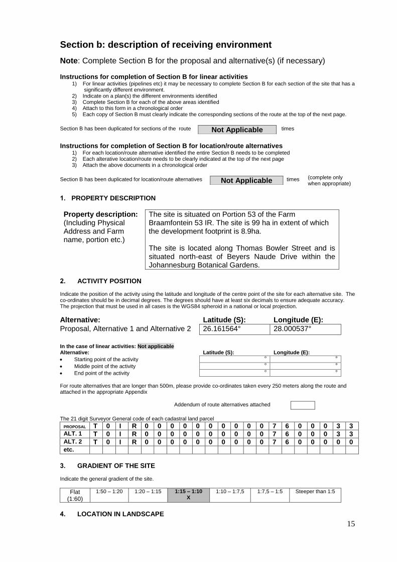
1. PROPERTY DESCRIPTION
Property description: (Including Physical Address and Farm name, portion etc.)
The site is situated on Portion 53 of the Farm Braamfontein 53 IR. The site is 99 ha in extent of which the development footprint is 8.9ha. The site is located along Thomas Bowler Street and is situated north-east of Beyers Naude Drive within the Johannesburg Botanical Gardens.
2. ACTIVITY POSITION Indicate the position of the activity using the latitude and longitude of the centre point of the site for each alternative site. The co-ordinates should be in decimal degrees. The degrees should have at least six decimals to ensure adequate accuracy. The projection that must be used in all cases is the WGS84 spheroid in a national or local projection.
Alternative: Latitude (S): Longitude (E):
Proposal, Alternative 1 and Alternative 2 26.161564° 28.000537°
In the case of linear activities: Not applicable Alternative: Latitude (S): Longitude (E):
Starting point of the activity o
o
Middle point of the activity o
o
End point of the activity o o
For route alternatives that are longer than 500m, please provide co-ordinates taken every 250 meters along the route and attached in the appropriate Appendix
Addendum of route alternatives attached The 21 digit Surveyor General code of each cadastral land parcel
PROPOSAL T 0 I R 0 0 0 0 0 0 0 0 0 0 7 6 0 0 0 3 3 ALT. 1 T 0 I R 0 0 0 0 0 0 0 0 0 0 7 6 0 0 0 3 3 ALT. 2 T 0 I R 0 0 0 0 0 0 0 0 0 0 7 6 0 0 0 0 0 etc.
3. GRADIENT OF THE SITE Indicate the general gradient of the site.
Flat (1:60)
1:50 – 1:20 1:20 – 1:15 1:15 – 1:10 X
1:10 – 1:7,5 1:7,5 – 1:5 Steeper than 1:5
4. LOCATION IN LANDSCAPE
Section B has been duplicated for sections of the route Not Applicable times
Section B has been duplicated for location/route alternatives Not Applicable times

16
Indicate the landform(s) that best describes the site.
Ridgeline Plateau Side slope of
hill/ridge Valley Plain
Undulating plain/low hills
River front X
5. GROUNDWATER, SOIL AND GEOLOGICAL STABILITY OF THE SITE
a) Is the site located on any of the following?
Shallow water table (less than 1.5m deep) YES X NO
Dolomite, sinkhole or doline areas YES NO X
Seasonally wet soils (often close to water bodies) YES X NO
Unstable rocky slopes or steep slopes with loose soil YES NO X
Dispersive soils (soils that dissolve in water) YES NO X
Soils with high clay content (clay fraction more than 40%) YES X
NO
Any other unstable soil or geological feature YES NO X
An area sensitive to erosion YES X
NO
(Information in respect of the above will often be available at the planning sections of local authorities. Where it exists, the 1:50 000 scale Regional Geotechnical Maps prepared by Geological Survey may also be used).
b) are any caves located on the site(s) YES NO X
If yes to above provide location details in terms of latitude and longitude and indicate location on site or route map(s) Latitude (S): Longitude (E):
o o
c) are any caves located within a 300m radius of the site(s) YES NO X
If yes to above provide location details in terms of latitude and longitude and indicate location on site or route map(s) Latitude (S): Longitude (E):
o o
d) are any sinkholes located within a 300m radius of the site(s) YES NO X
If yes to above provide location details in terms of latitude and longitude and indicate location on site or route map(s) Latitude (S): Longitude (E):
o o If any of the answers to the above are “YES” or “unsure”, specialist input may be requested by the Department
6. AGRICULTURE
Does the site have high potential agriculture as contemplated in the Gauteng Agricultural Potential Atlas (GAPA 4)?
YES
NO X
Please note: The Department may request specialist input/studies in respect of the above. 7. GROUNDCOVER To be noted that the location of all identified rare or endangered species or other elements should be accurately indicated on the site plan(s).

17
Indicate the types of groundcover present on the site and include the estimated percentage found on site
Natural veld - good condition
% =
Natural veld with scattered aliens
% = 50
Natural veld with heavy alien infestation
% =
Veld dominated by alien species
% = 25
Landscaped (vegetation)
% = 25
Sport field % =
Cultivated land % =
Paved surface (hard landscaping)
% =
Building or other structure
% =
Bare soil % = 30
Please note: The Department may request specialist input/studies depending on the nature of the groundcover and potential impact(s) of the proposed activity/ies.
Are there any rare or endangered flora or fauna species (including red list species) present on the site
YES x
NO X
If YES, specify and explain:
Are there any rare or endangered flora or fauna species (including red list species) present within a 200m (if within urban area as defined in the Regulations) or within 600m (if outside the urban area as defined in the Regulations) radius of the site.
YES x
NO X
If YES, specify and explain:
Are there any special or sensitive habitats or other natural features present on the site? YES
X NO
If YES, specify and explain:
Was a specialist consulted to assist with completing this section YES
X NO
If yes complete specialist details
Name of the specialist: Mr Bertus Fourie (Wetland specialist)
Qualification(s) of the specialist: M.Sc. Aquatic Health, Pr. Sci. Nat Postal address: 638 Turf Street, Wingate Park
Postal code: 0180
Telephone: 012 345 4891 Cell: 082 322 5688
E-mail: [email protected] Fax: 086 675 6136
Are any further specialist studies recommended by the specialist? YES NO x
If YES, specify:
If YES, is such a report(s) attached? YES NO
If YES list the specialist reports attached below
Signature of specialist:
Date: 31/09/2019

18
Name of the specialist: Mrs. P. Lemmer (Botanist) Qualification(s) of the specialist:
B.Sc., Cert.Sci.Nat.
Postal address: 638 Turf Street, Wingate Park Postal code: 0180 Telephone: 012 345 4891 Cell: 082 322 5688 E-mail: [email protected] Fax: 086 675 6136 Are any further specialist studies recommended by the specialist? YES NO
X
If YES, specify:
If YES, is such a report(s) attached? YES NO
If YES list the specialist reports attached below
Signature of specialist:
Date: 31/09/2019
8. LAND USE CHARACTER OF SURROUNDING AREA Using the associated number of the relevant current land use or prominent feature from the table below, fill in the position of these land-uses in the vacant blocks below which represent a 500m radius around the site
1. Vacant land 2. River, stream,
wetland 3. Nature conservation
area 4. Public open
space 5. Koppie or
ridge
6. Dam or reservoir 7. Agriculture 8. Low density
residential 9. Medium to high density residential
10. Informal residential
11. Old age home 12. Retail 13. Offices 14. Commercial &
warehousing 15. Light industrial
16. Heavy industrialAN
17. Hospitality
facility 18. Church
19. Education facilities
20. Sport facilities
21. Golf course/polo fields
22. AirportN
23. Train station or shunting yard
N
24. Railway lineN
25. Major road (4 lanes or more)
N
26. Sewage treatment plant
A
27. Landfill or waste treatment
siteA
28. Historical building 29. Graveyard 30. Archeological
site
31. Open cast mine 32. Underground
mine 33.Spoil heap or
slimes damA
34. Small Holdings
Other land uses (describe):
Note: More than one (1) Land-use may be indicated in a block
NORTH
WEST
8 8 8 8 8
EAST
8 29 4 6 8
8 29 4 8
8 29 20 4 8
8 5 5 5 8
SOUTH
NOTE: Each block represents an area of 250m X 250m, if your proposed development is larger than this please use the appropriate number and orientation of hashed blocks
= Site

19
Please note: The Department may request specialist input/studies depending on the nature of the land use character of the area and potential impact(s) of the proposed activity/ies. Specialist reports that look at health & air quality and noise impacts may be required for any feature above and in particular those features marked with an “
A“ and with an “
N” respectively.
Have specialist reports been attached YES X
NO
If yes indicate the type of reports below
Vegetation study Fauna studies (Mammals & Avifauna)
Wetland delineation study & Aquatic Assessment including SASS5, Fish, Water quality, dam assessment etc. Heritage Study Geotechnical Investigations Flood design Report
9. SOCIO-ECONOMIC CONTEXT Describe the existing social and economic characteristics of the area and the community condition as baseline information to assess the potential social, economic and community impacts.
The area surrounding the site consists of West Park cemetery, Melville koppies low to
medium density residential with sports fields.
History:
The land on which the Johannesburg Botanical garden is situated was once part of the farm
Braamfontein, which dated back to 1853. In 1886, Louw Geldenhuys, a farmer, acquired a
portion of Braamfontein Farm and named it Emmarentia, after the woman he married in 1887.
At the end of the Anglo Boer War, in 1902, many landless farmers returned home, and
Geldenhuys offered them employment to build the 7,5ha Emmarentia Dam. Great blocks of
stone were brought down from the nearby Melville Koppies, which were then fitted together to
construct the dam wall. The men who worked well on the dam wall were chosen to join a
farm-sharing experiment Geldenhuys had initiated on his farm.
Emmarentia Dam is fed by the Westdene Spruit, the catchment of which stretches to the
suburb of Westdene, to the south of the dam. In earlier times, a furrow from the stream
beside the Parkview Golf Course also led water to the dam. Today this furrow no longer
exists but the storm water drains from the surrounding roads also feed the dam. The dam and
an area of land to the west of it formed an endowment from Geldenhuys to the City Council
for park and garden purposes. In 1952, the area was named Jan van Riebeeck Park in
celebration of the tri-centenary of Van Riebeeck's historic landing at the Cape.
On 19 November 1968, a report by the director of the parks and recreation department was
submitted to the management committee of the Johannesburg City Council on the feasibility
of establishing of a botanical garden. In response, the management committee resolved that
"a botanic garden be established at Jan van Riebeeck Park and that the Parks and
Recreation Department continue with the development of a botanic garden as indicated in the
report". Then, in 1969, a resolution was passed for the building of the Johannesburg
Botanical Garden on this land.

20
Social and economic characteristics of the area
The Johannesburg Botanical Garden is located in the suburb of Emmarentia in
Johannesburg, which falls within Region B of the City Of Johannesburg Metropolitan
Municipality.
According to City of Johannesburg, Region B is well noted for its diversity, ranging from
upmarket houses in both historic and newer suburbs. The Region consists of significant open
spaces and parks, and wetlands and watercourses around Emmarentia link the Region with
the rest of the city in terms of a green belt and stormwater drainage.
The Emmarentia area is approximately 3.81km2 in extent and holds a total population of
about 5116 people (Census 2011) dominated by 40.9% White, 26.1% Black Africans, 27.4%
Indian/Asian with the Coloured community making up 2.5% of this population. English is the
most commonly spoken language in the area followed by Afrikaans. Over much of the area
the population is stable and economically active, with high levels of education and disposable
income.
10. Cultural/Historical Features Please be advised that if section 38 of the National Heritage Resources Act 25 of 1999 is applicable to your proposal or alternatives, then you are requested to furnish this Department with written comment from the South African Heritage Resource Agency (SAHRA) – Attach comment in appropriate annexure 38. (1) Subject to the provisions of subsections (7), (8) and (9), any person who intends to undertake a development categorised as- (a) the construction of a road, wall, powerline, pipeline, canal or other similar form of linear development or barrier exceeding
300m in length; (b) the construction of a bridge or similar structure exceeding 50m in length; (c) any development or other activity which will change the character of a site- (i) exceeding 5 000 m2 in extent; or (ii) involving three or more existing erven or subdivisions thereof; or (iii) involving three or more erven or divisions thereof which have been consolidated within the past five years; or (iv) the costs of which will exceed a sum set in terms of regulations by SAHRA or a provincial heritage resources
authority; (d) the re-zoning of a site exceeding 10 000 m2 in extent; or (e) any other category of development provided for in regulations by SAHRA or a provincial heritage resources authority,
must at the very earliest stages of initiating such a development, notify the responsible heritage resources authority and furnish it with details regarding the location, nature and extent of the proposed development.
Are there any signs of culturally (aesthetic, social, spiritual, environmental) or historically significant elements, as defined in section 2 of the National Heritage Resources Act, 1999, (Act No. 25 of 1999), including archaeological or palaeontological sites, on or close (within 20m) to the site?
YES X
NO
If YES, explain: The dam wall requires a SAHRA permit for alterations. The Melville Koppies Nature Reserve, a national heritage site, is situated about 350m from the site.
If uncertain, the Department may request that specialist input be provided to establish whether there is such a feature(s) present on or close to the site. Briefly explain the findings of the specialist if one was already appointed:
It is recommended that the original dam wall be subjected to a second phase of documentation before any work commences. Due to its historic value, a permit for any alterations to the dam wall will have to be applied for through SAHRA and the Gauteng Provincial Heritage Resources Agency’s Built Environment Committee – This study is already underway.

21
Will any building or structure older than 60 years be affected in any way?
YES X
NO
Is it necessary to apply for a permit in terms of the National Heritage Resources Act, 1999 (Act 25 of 1999)?
YES X
NO
If yes, please attached the comments from SAHRA in the appropriate Appendix Comments from SAHRA are attached in the AppendiX F.
SECTION C: PUBLIC PARTICIPATION (SECTION 41)
1. The Environmental Assessment Practitioner must conduct public participation process in accordance with the requirement of the EIA Regulations, 2014.
2. LOCAL AUTHORITY PARTICIPATION
Local authorities are key interested and affected parties in each application and no decision on any application will be made before the relevant local authority is provided with the opportunity to give input. The planning and the environmental sections of the local authority must be informed of the application at least thirty (30) calendar days before the submission of the application to the competent authority.
Was the draft report submitted to the local authority for comment? YES X
NO
If yes, has any comments been received from the local authority? YES NO X
If “YES”, briefly describe the comment below (also attach any correspondence to and from the local authority to this application):
See the Issues and Comments register in Appendix E – Annexure E6
If “NO” briefly explain why no comments have been received or why the report was not submitted if that is the case.
The Draft BAR is out for comment and comments will only be included in the Final BAR

22
3. CONSULTATION WITH OTHER STAKEHOLDERS
Any stakeholder that has a direct interest in the activity, site or property, such as servitude holders and service providers, should be informed of the application at least thirty (30) calendar days before the submission of the application and be provided with the opportunity to comment.
Has any comment been received from stakeholders? YES X
NO
If “YES”, briefly describe the feedback below (also attach copies of any correspondence to and from the stakeholders to this application):
A Public meeting was held in August 2019 to discuss design alternatives. Another meeting will be held with I&APS, EDGE and ERA during the Draft BAR comment period.
If “NO” briefly explain why no comments have been received
4. GENERAL PUBLIC PARTICIPATION REQUIREMENTS
The Environmental Assessment Practitioner must ensure that the public participation process is adequate and must determine whether a public meeting or any other additional measure is appropriate or not based on the particular nature of each case. Special attention should be given to the involvement of local community structures such as Ward Committees and ratepayers associations. Please note that public concerns that emerge at a later stage that should have been addressed may cause the competent authority to withdraw any authorisation it may have issued if it becomes apparent that the public participation process was flawed. The EAP must record all comments and respond to each comment of the public / interested and affected party before the application report is submitted. The comments and responses must be captured in a Comments and Responses Report as prescribed in the regulations and be attached to this application. 5. APPENDICES FOR PUBLIC PARTICIPATION All public participation information is to be attached in the appropriate Appendix. The information in this Appendix is to be
ordered as detailed below
Appendix 1 – Proof of site notice
Refer to Annexure E1
Appendix 2 – Written notices issued as required in terms of the regulations
Refer to Annexure E2
Appendix 3 – Proof of newspaper advertisements
Refer to Annexure E3
Appendix 4 –Communications to and from interested and affected parties
Refer to Annexure E4
Appendix 5 – Minutes of any public and/or stakeholder meetings
Refer to Annexure E5
Appendix 6 - Comments and Responses Report
Refer to Annexure E6
Appendix 7 –Comments from I&APs on Basic Assessment (BA) Report
Refer to Annexure E7
Appendix 8 –Comments from I&APs on amendments to the BA Report
Not Applicable – No amendments to BA Report Appendix 9 – Copy of the register of I&APs
Refer to Annexure E9
Appendix 10 – Comments from I&APs on the application Refer to Annexure E10 – Comments from I&APs on the application
Appendix 11 – Other Refer to Annexure E11 Not Applicable – No Other Information

23
SECTION D: RESOURCE USE AND PROCESS DETAILS
Note: Section D is to be completed for the proposal and alternative(s) (if necessary)
Instructions for completion of Section D for alternatives 1) For each alternative under investigation, where such alternatives will have
different resource and process details (e.g. technology alternative), the entire Section D needs to be completed
4) Each alterative needs to be clearly indicated in the box below 5) Attach the above documents in a chronological order
(complete only
when appropriate)
Section D Alternative No.
Proposal (complete only when appropriate for above)
1. WASTE, EFFLUENT, AND EMISSION MANAGEMENT Solid waste management
Will the activity produce solid construction waste during the construction/initiation phase?
YES X
NO
If yes, what estimated quantity will be produced per month? Unknown m3
How will the construction solid waste be disposed of (describe)?
Domestic waste generated during the construction phase will be separated and recycled to reduce materials taken to landfill sites. Construction materials will be used in the construction phase and where possible included in all the structures. Vegetation removed will be shredded to be used as compost, unless alien and invasive species that could spread to indigenous vegetation, which will be removed to registered landfill sites.
Where will the construction solid waste be disposed of (describe)?
Construction waste will be disposed of at an approved waste disposal site.
Will the activity produce solid waste during its operational phase? YES X
NO
If yes, what estimated quantity will be produced per month? Unknown
How will the solid waste be disposed of (describe)?
Domestic waste will be removed by contractor and disposed of at a registered landfill site
Has the municipality or relevant service provider confirmed that sufficient air space exists for treating/disposing of the solid waste to be generated by this activity?
YES X
NO
Where will the solid waste be disposed if it does not feed into a municipal waste stream (describe)?
Not applicable.
Section D has been duplicated for alternatives
0 times

24
Note: If the solid waste (construction or operational phases) will not be disposed of in a registered landfill site or be taken up in a municipal waste stream, the applicant should consult with the competent authority to determine whether it is necessary to change to an application for scoping and EIA.
Can any part of the solid waste be classified as hazardous in terms of the relevant legislation?
YES NO X
If yes, inform the competent authority and request a change to an application for scoping and EIA.
Is the activity that is being applied for a solid waste handling or treatment facility?
YES NO X
If yes, the applicant should consult with the competent authority to determine whether it is necessary to change to an application for scoping and EIA.
Describe the measures, if any, that will be taken to ensure the optimal reuse or recycling of materials:
None – Not Applicable.
Liquid effluent (other than domestic sewage)
Will the activity produce effluent, other than normal sewage, that will be disposed of in a municipal sewage system?
YES NO X
If yes, what estimated quantity will be produced per month? m3
If yes, has the municipality confirmed that sufficient capacity exist for treating / disposing of the liquid effluent to be generated by this activity(ies)?
YES NO
Will the activity produce any effluent that will be treated and/or disposed of on site?
Yes NO X
If yes, what estimated quantity will be produced per month? m3
If yes describe the nature of the effluent and how it will be disposed.
Note that if effluent is to be treated or disposed on site the applicant should consult with the competent authority to determine whether it is necessary to change to an application for scoping and EIA
Will the activity produce effluent that will be treated and/or disposed of at another facility?
YES NO X
If yes, provide the particulars of the facility:
Facility name:
Contact person:
Postal address:
Postal code:
Telephone: Cell:
E-mail: Fax:
Describe the measures that will be taken to ensure the optimal reuse or recycling of waste water, if any:

25
Liquid effluent (domestic sewage)
Will the activity produce domestic effluent that will be disposed of in a municipal sewage system?
YES
NO X
If yes, what estimated quantity will be produced per month?
If yes, has the municipality confirmed that sufficient capacity exist for treating / disposing of the domestic effluent to be generated by this activity(ies)?
YES NO
Will the activity produce any effluent that will be treated and/or disposed of on site?
YES NO X
If yes describe how it will be treated and disposed off.
Emissions into the atmosphere
Will the activity release emissions into the atmosphere? YES NO X
If yes, is it controlled by any legislation of any sphere of government? YES NO
If yes, the applicant should consult with the competent authority to determine whether it is necessary to change to an application for scoping and EIA.
If no, describe the emissions in terms of type and concentration:
2. WATER USE
Indicate the source(s) of water that will be used for the activity
Municipal x
Directly from water
board
groundwater river, stream, dam or lake
other the activity will not use water
If water is to be extracted from groundwater, river, stream, dam, lake or any other natural feature, please indicate
the volume that will be extracted per month: Not applicable liters
If Yes, please attach proof of assurance of water supply, e.g. yield of borehole, in the appropriate Appendix
Does the activity require a water use permit from the Department of Water Affairs?
YES NO X
If yes, list the permits required
If yes, have you applied for the water use permit(s)? YES NO
If yes, have you received approval(s)? (attached in appropriate appendix)
YES NO
3. POWER SUPPLY
Please indicate the source of power supply eg. Municipality / Eskom / Renewable energy source
N/A
If power supply is not available, where will power be sourced from?
26
4. ENERGY EFFICIENCY
Describe the design measures, if any, that have been taken to ensure that the activity is energy efficient:
None
Describe how alternative energy sources have been taken into account or been built into the design of the activity, if any:
None
SECTION E: IMPACT ASSESSMENT The assessment of impacts must adhere to the minimum requirements in the EIA Regulations, 2014, and should take applicable official guidelines into account. The issues raised by interested and affected parties should also be addressed in the assessment of impacts as well as the impacts of not implementing the activity (Section 24(4)(b)(i).
1. ISSUES RAISED BY INTERESTED AND AFFECTED PARTIES
Summarise the issues raised by interested and affected parties.
Concerns raised included: - Construction period and access restrictions during construction - Sign board with the design/layout should be put up for information during
construction - Ongoing maintenance of silt and litter traps - Silt trap should be located higher upstream where area is more suitable - Socializing and dog swimming activities are currently concentrated at the
western end of the embankment and structures must make provision for activities to continue.
Summary of response from the practitioner to the issues raised by the interested and affected parties (including the manner in which the public comments are incorporated or why they were not included) (A full response must be provided in the Comments and Response Report that must be attached to this report):
See Comments and Response Report in Appendix E – Annexure E6
IMPACTS THAT MAY RESULT FROM THE CONSTRUCTION AND OPERATIONAL
PHASE
Briefly describe the methodology utilised in the rating of significance of impacts
Impact Assessment Methodology: A description of the nature of the impact, any specific legal requirements and the stage (construction/decommissioning or operation) will be given. Impacts are considered to be the same during construction and decommissioning. The significance of the potential impacts will be considered before and after identified mitigation is implemented. The following criteria will be used to evaluate significance: o Nature: The nature of the impact will be classified as positive or negative, and
direct or indirect. o Extent and location: Magnitude of the impact and is classified as:
Local: the impacted area is only at the site – the actual extent of the activity
Regional: the impacted area extends to the surrounding, immediate and neighbouring properties.
National: the impact can be considered to be of national importance. o Duration: This measures the lifetime of the impact, and is classified as:

27
Short term: the impact will be for 0 – 3 years, or only last for the period of construction.
Medium term: three to ten years.
Long term: longer than 10 years or the impact will continue for the entire operational lifetime of the project.
Permanent: this applies to the impact that will remain after the operational lifetime of the project.
o Severity: This is the degree to which the project affects or changes the environment, and is classified as:
Low: the change is slight and often not noticeable, and the natural functioning of the environment is not affected.
Medium: The environment is remarkably altered, but still functions in a modified way.
High: Functioning of the affected environment is disturbed and can cease. o Probability: This is the likelihood or the chances that the impact will occur, and
is classified as:
Low: during the normal operation of the project, no impacts are expected.
Medium: the impact is likely to occur if extra care is not taken to mitigate them.
High: the environment will be affected irrespectively; in some cases such impact can be reduced.
o Confidence: This is the level knowledge/information, the environmental impact practitioner or a specialist had in his/her judgement, and is rated as:
Low: the judgement is based on intuition and not on knowledge or information.
Medium: common sense and general knowledge informs the decision.
High: Scientific and or proven information has been used to give such a judgment.
o Significance: Based on the above criteria the significance of issues will be determined. This is the importance of the impact in terms of physical extent and time scale, and is rated as:
Low: the impacts are less important.
Medium: the impacts are important and require attention; mitigation is required to reduce the negative impacts
High: the impacts are of great importance. Mitigation is therefore crucial.
o Cumulative Impacts: The possible cumulative impacts will also be considered.
o Mitigation: Mitigation for significant issues is incorporated into the EMP.
Negative impacts are shown with a (-) while positive ones are indicated as (+). Briefly describe and compare the potential impacts (as appropriate), significance rating of impacts, proposed mitigation and significance rating of impacts after mitigation that are likely to occur as a result of the construction phase for the various alternatives of the proposed development. This must include an assessment of the significance of all impacts.
The impacts for the Preferred Alternative are mostly centred within the footprint of the proposed activities and impacts can be mitigated during construction. However, the impacts of the No-Go Alternative (status quo) include embankment failure and spillway overtopping with associated hydrological and hydromorphological impacts, which could have disastrous consequences in terms of downstream flooding during the rainy season.

28
2.1 IMPACTS THAT MAY RESULT FROM THE CONSTRUCTION PHASE:
PROPOSAL
Potential impacts:
Significance rating of impacts
(positive or negative):
Proposed mitigation:
Significance rating of impacts after mitigation:
Risk of the impact and mitigation not being
implemented
BIODIVERSITY AND CONSERVATION
Destruction of habitat due to vegetation clearing.
Low (-) Dumping of builders’ rubble and other waste in the areas earmarked for exclusion must be prevented, through fencing or other management measures. These areas must be properly managed throughout the lifespan of the project in terms of fire, eradication of exotics etc. to ensure continuous biodiversity.
Declared weed and invader species must be removed.
All areas of disturbed and compacted soils need to be ripped and reseeded.
No dumping of waste should take place within the study area. If any spills or waste deposits occur, they should be immediately cleaned up.
During the construction phase of the proposed project erosion berms should be installed to prevent gully formation and erosion.
Low (+) Vegetation clearing will lead to the destruction of the existing habitat and erosion of sloped areas.
Loss of Fauna and Flora
Medium (-) Low (+) Site clearing will be minimal and there are no Red or Orange List species on the site. The preferred alternative provides for the possibility of migratory paths of aquatic organisms.
Irreversible loss of biodiversity Medium (-) Low (+) Site clearing will be minimal however biodiversity will not improve without alien vegetation removal.
Soil contamination
Medium (-) Low (-) Contamination of soil due to construction activities.
Soil disturbance
Medium (-) Low (-) Disturbance of soil by construction activities.
Gully formation and erosion Medium (-) Low (-) Erosion caused by construction activities. The eroded current

29
spillway of the eastern side of the upper dam will be replaced with an earth fill embankment and lower soil erosion with the preferred alternative.
AIR QUALITY
Fugitive particulate emissions (dust) related to construction activities.
Medium (-) Dust Control measures to be put in place as per the EMPr.
Dust and fume level monitoring
Low (-) Dust pollution caused by construction activities.
Construction vehicle gas emissions
Medium (-) Low (-) Vehicle gas emissions caused by construction vehicles.
HERITAGE RESOURCES
Destruction of unidentified heritage sites
Low (-) It is recommended that the original dam wall be subjected to a second phase of documentation before any work commences.
Due to its historic value, a permit for any alterations to the dam wall will have to be applied for through SAHRA and the Gauteng Provincial Heritage Resources Agency’s Built Environment Committee.
Low (-) Heritage resources destroyed by construction activities.
WATER RESOURCES
Surface and Groundwater contamination: Contamination of water resources through storm water runoff, spills and leaks.
Medium (-) Diversion of water from area of construction
Prevention and detection of spills/leaks.
Provide adequate sanitation.
Off-site vehicle maintenance.
Contain runoff water.
Environmental awareness.
Proper waste disposal.
Low (-) Contamination of water resources caused by construction activities.
HYDROLOGY
Alteration of watercourse characteristics
Medium (-) Specialist measures for diverting water to minimise alteration of water quality, quantity and velocity must be implemented. See the wetland rehabilitation plan attached to the EMPr in Appendix H.
Low (-) Increased turbidity, suspended and dissolved solids. Altered flow velocity. The preferred

30
alternative provides for a meandering flow with the spillway of the upper dam on the western side and the spillway of the lower dam on the eastern side.
Impeding and diverting the watercourse
Medium (-) Diversion of the watercourse for construction of litter and sediment traps must be done according to specialist recommendations and watercourse must be restored to conditions before construction by means of appropriate rehabilitation measures.
Low (-) Alteration of hydrological, geomorphological and water quality characteristics, ex. increased turbidity, suspended and dissolved solids.
WASTE MANAGEMENT
Soil/water/air pollution due to improper waste handling, storage and disposal
Medium (-)
General litter from construction workers as well as construction waste on site must be effectively controlled.
With the implementation of mitigation methods all impacts can be prevented.
Rubble and general construction waste on site should be removed at regular intervals.
All waste must be separated according to type and stored in separate drums, adequately marked according to waste sort.
The Contractor shall prevent littering and the random discard of solid waste on the site.
Waste collected during the construction phase will be recycled, re-used or recovered as far as economically feasible.
Medium (-) Pollution (soil/water/air) due to the improper handling of waste during the construction phase.
NOISE
Nuisance to neighbouring residents and businesses due to noise from construction activities.
Medium – High (-)
The contractor must be familiar with and adhere to any regulations (including Gauteng Noise Control Regulations and SANS 10103 provisions) and local by-laws regarding the generation of noise and hours of operation.
All construction activity will take place during normal working hours (between 8am and 5pm).
Medium (-) Nuisance noise caused by construction activities.

31
Transport vehicle tailgates will be kept closed where possible.
Surrounding communities must be notified in advance of noisy construction activities.
All equipment should be provided with standard silencers. Silencer units on vehicles and equipment must be kept in good working order.
Construction staff working in areas where the 8-hour ambient noise levels exceed 85 Dba should wear ear protection equipment.
TRAFFIC
Increased traffic in the project area and in the region
Medium (-) All contractors should commit to following road safety rules.
Traffic to and from the construction site should be limited to daylight hours.
Appropriate signage must be placed.
Contractor must ensure that trucks are not overloaded.
Medium (-) Traffic in and around the site will be increased.
Risks to the safety of pedestrians and road users
Medium – High (-)
Low (-) Reduced safety of pedestrians and road users.
SOCIAL: ACCESS TO FACILITIES
Restricted access during construction period
Medium (-) All construction areas, construction camp, stockpile areas and construction access roads must be fenced off.
No visitor access to the fenced off construction areas.
Appropriate signage must be placed.
Construction road access control must be instituted.
Medium (-) Risk of injury of visitors.
Risks to the safety of dog walkers and visitors
Medium – High (-)
Low (-) Reduced safety of visitors.
WASTE WATER (EFFLUENT)
Water contamination and health hazards due to inadequate sanitation
Medium – High (-)
Sufficient ablution facilities shall be provided to service the construction site.
Ablution facilities shall be serviced on a regular basis by an approved service provider.
Contents of ablution facilities (e.g. chemical toilets) shall be disposed of to a permitted/ licensed waste water treatment works and the necessary measures shall be taken to ensure that it will not impact on the operations of the waste water treatment works.
The designated service provider will make details of inspection reports available to the contractor.
Diversion of water from area where construction is taking place – specific specialist recommendations to be implemented
Low (-) Contamination of water caused by inadequate sanitation.

32
ALTERNATIVE 1
Potential impacts:
Significance rating of impacts
(positive or negative):
Proposed mitigation:
Significance rating of impacts after mitigation:
Risk of the impact and mitigation not being
implemented
BIODIVERSITY AND CONSERVATION
Destruction of habitat due to vegetation clearing.
Low (-) Dumping of builders’ rubble and other waste in the areas earmarked for exclusion must be prevented, through fencing or other management measures. These areas must be properly managed throughout the lifespan of the project in terms of fire, eradication of exotics etc. to ensure continuous biodiversity.
Declared weed and invader species must be removed.
All areas of disturbed and compacted soils need to be ripped and reseeded.
No dumping of waste should take place within the study area. If any spills or waste deposits occur, they should be immediately cleaned up.
During the construction phases of the proposed project erosion berms should be installed to prevent gully formation and erosion.
Low (+) Vegetation clearing will lead to the destruction of the existing habitat and erosion of sloped areas.
Loss of Fauna and Flora
Medium (-) Medium (+) Site clearing will be minimal and there are no Red or Orange List species on the site. The eroded eastern spillway of the upper dam does not provide migratory paths for aquatic organisms and further erosion is expected if flow is not diverted through a new, relocated spillway.
Irreversible loss of biodiversity Medium (-) Low (+) Site clearing will be minimal however biodiversity will not improve without alien vegetation removal.
Soil contamination
Medium (-) Medium (-) Contamination of soil due to construction activities. Erosion is expected to continue if flow is not diverted and

33
the earth fill embankment is not done.
Soil disturbance
Medium (-) Low (-) Disturbance of soil by construction activities.
Gully formation and erosion Medium (-) Low (-) Erosion caused by construction activities.
AIR QUALITY
Fugitive particulate emissions (dust) related to construction activities.
Medium (-) Dust Control measures to be put in place as per the EMPr.
Dust and fume level monitoring
Low (-) Dust pollution caused by construction activities.
Construction vehicle gas emissions
Medium (-) Low (-) Vehicle gas emissions caused by construction vehicles.
HERITAGE RESOURCES
Destruction of unidentified heritage sites
Low (-) It is recommended that the original dam wall be subjected to a second phase of documentation before any work commences.
Due to its historic value, a permit for any alterations to the dam walls will have to be applied for through SAHRA and the Gauteng Provincial Heritage Resources Agency’s Built Environment Committee.
Low (-) Heritage resources destroyed by construction activities.
WATER RESOURCES
Surface and Groundwater contamination: Contamination of water resources through storm water runoff, spills and leaks.
High (-) Diversion of water from area of construction
Prevention and detection of spills/leaks.
Provide adequate sanitation.
Off-site vehicle maintenance.
Contain runoff water.
Environmental awareness.
Proper waste disposal.
Medium (-) Contamination of water resources caused by construction activities.
WASTE MANAGEMENT
Soil/water/air pollution due to improper waste handling, storage and disposal
Medium (-) General litter from construction workers as well as construction waste on site must be effectively controlled.
With the implementation of mitigation methods all impacts can be prevented.
Medium (-) Pollution (soil/water/air) due to the improper handling of waste during the

34
Rubble and general construction waste on site should be removed at regular intervals.
All waste must be separated according to type and stored in separate drums, adequately marked according to waste sort.
The Contractor shall prevent littering and the random discard of solid waste on the site.
Waste collected during the construction phase will be recycled, re-used or recovered as far as economically feasible.
construction phase.
NOISE
Nuisance to neighbouring residents and businesses due to noise from construction activities.
Medium – High (-)
The contractor must be familiar with and adhere to any regulations (including Gauteng Noise Control Regulations and SANS 10103 provisions) and local by-laws regarding the generation of noise and hours of operation.
All construction activity will take place during normal working hours (between 8am and 5pm).
Transport vehicle tailgates will be kept closed where possible.
Surrounding communities must be notified in advance of noisy construction activities.
All equipment should be provided with standard silencers. Silencer units on vehicles and equipment must be kept in good working order.
Construction staff working in areas where the 8-hour ambient noise levels exceed 85 Dba should wear ear protection equipment.
Medium (-) Nuisance noise caused by construction activities.
TRAFFIC
Increased traffic in the project area and in the region
Medium (-) All contractors should commit to following road safety rules.
Traffic to and from the construction site should be limited to daylight hours.
Appropriate signage must be placed.
Contractor must ensure that trucks are not overloaded.
Medium (-) Traffic in and around the site will be increased.
Risks to the safety of pedestrians and road users
Medium – High (-)
Low (-) Reduced safety of pedestrians and road users.
WASTE WATER (EFFLUENT)
Water contamination and health hazards due to inadequate sanitation
Medium – High (-)
Sufficient ablution facilities shall be provided to service the construction site.
Ablution facilities shall be serviced on a regular basis by an approved service provider.
Contents of ablution facilities (e.g. chemical toilets) shall be
Low (-) Contamination of water caused by inadequate sanitation

35
disposed of to a permitted/ licensed waste water treatment works and the necessary measures shall be taken to ensure that it will not impact on the operations of the waste water treatment works.
The designated service provider will make details of inspection reports available to the contractor.
Clean and dirty water shall be separated and dirty water shall be contained and reused where practical possible.
2.2 IMPACTS THAT MAY RESULT FROM THE OPERATIONAL PHASE
PROPOSAL
Potential impacts:
Significance rating of impacts (positive or negative):
Proposed mitigation:
Significance rating of impacts after mitigation:
Risk of the impact and mitigation not being
implemented
BIODIVERSITY AND CONSERVATION
Removal of weed and invader species
Medium (+) Declared weed and invader species must be removed.
Vegetation growth should be promoted within the construction footprint in order to protect soils and to reduce the percentage of the surface area which is left as bare ground.
Only indigenous vegetation species may be used for post-construction rehabilitation.
Medium (+) Proliferation of invader species.
Promotion of indigenous vegetation species for landscaping
Medium – Low (+)
Medium (+) Soil erosion caused by bare soil.
Soil erosion Medium (-) Low (-) Erosion due to areas not vegetated.
HYDROLOGY
Alteration characteristics of the watercourse
Medium (-) Measures must be implemented to restore flow velocity, water quality and quantity to original watercourse conditions.
Low (-) Altered watercourse state.
Alternative 1

36
Potential impacts:
Significance rating of impacts (positive or negative):
Proposed mitigation:
Significance rating of impacts after mitigation:
Risk of the impact and mitigation not being implemented
BIODIVERSITY AND CONSERVATION
Removal of weed and invader species
Medium (+) Declared weed and invader species must be removed.
Vegetation growth should be promoted within the construction footprint in order to protect soils and to reduce the percentage of the surface area which is left as bare ground.
Only indigenous vegetation species may be used for post-construction rehabilitation.
Medium (+) Proliferation of invader species.
Promotion of indigenous vegetation species for landscaping
Medium – Low (+)
Medium (+) Soil erosion caused by bare soil.
Soil erosion at service spillway Medium (-) Low (-) Gully formation erosion downstream of the service spillway will continue to deteriorate and affect embankment stability.
HYDROLOGY
Alteration characteristics of the watercourse
Medium (-) Measures must be implemented to restore flow velocity, water quality and quantity to original watercourse conditions.
Low (-) Altered watercourse state and continued erosion from service spillway.

37
List any specialist reports that were used to fill in the above tables. Such reports are to be attached in the appropriate Appendix.
Aquatic ecosystem delineation
Flora Assessment
Fauna Assessments
Design Report
Heritage Impact Assessment
Geotechnical Report
Describe any gaps in knowledge or assumptions made in the assessment of the environment and the impacts associated with the proposed development.
None

38
3. IMPACTS THAT MAY RESULT FROM THE DECOMISSIONING AND CLOSURE PHASE Briefly describe and compare the potential impacts (as appropriate), significance rating of impacts, proposed mitigation and significance rating of impacts after mitigation that are likely to occur as a result of the decommissioning and closure phase for the various alternatives of the proposed development. This must include an assessment of the significance of all impacts.
Please note that this project is not subject to decommissioning or closure. Proposal
Potential impacts:
Significance rating of impacts(positive or negative):
Proposed mitigation:
Significance rating of impacts after mitigation:
Risk of the impact and mitigation not being implemented
Alternative 1
Potential impacts:
Significance rating of impacts(positive or negative):
Proposed mitigation:
Significance rating of impacts after mitigation:
Risk of the impact and mitigation not being implemented
Alternative 2
Potential impacts:
Significance rating of impacts (positive or negative):
Proposed mitigation:
Significance rating of impacts after mitigation:
Risk of the impact and mitigation not being implemented
List any specialist reports that were used to fill in the above tables. Such reports are to be attached in the appropriate Appendix.
N/A.
Where applicable indicate the detailed financial provisions for rehabilitation, closure and ongoing post decommissioning management for the negative environmental impacts.
Not applicable.

39
4. CUMULATIVE IMPACTS
Describe potential impacts that, on their own may not be significant, but is significant when added to the impact of other activities or existing impacts in the environment. Substantiate response:
Construction phase: - Biodiversity and Conservation – biodiversity will improve with the removal of
alien vegetation and proper design of spillways for migration of aquatic fauna. - The cumulative impact on the wetland/watercourse during construction is
negligible as all potential impacts on biodiversity will be mitigated on site. - The social impact will be temporary and will be mitigated on site. - Increase in ambient noise during the construction phase – impact to be managed
in accordance with the EMPr.
5. ENVIRONMENTAL IMPACT STATEMENT
Taking the assessment of potential impacts into account, please provide an environmental impact statement that sums up the impact that the proposal and its alternatives may have on the environment after the management and mitigation of impacts have been taken into account with specific reference to types of impact, duration of impacts, likelihood of potential impacts actually occurring and the significance of impacts. Proposal: Jan van Riebeeck Park Dams upgrade
The two dams lie at the upper end of the Jan Van Riebeeck Park. The upper catchment has been substantially transformed. Many of the impacts now affecting the dam, are in fact the result of activities and changes to the upstream catchment, such as loss of vegetation, encroachment into wetlands and floodplains, and increased hard surfacing. This has led to increased energy and volumes of runoff and erosion and weathering which have brought unnatural loads of sediment and sand deposition to the top dam. The spillways of the dams are poorly constructed and undersized for the flow regime and over time have been undermined, causing leaking and constant draining of the dams. Flows along the channel between the dams are super critical and there is bad erosion. The upstream dam wall face is badly eroded and the dam wall has been breached on the right bank. The breached area has been partially patched with sand bags. The inlet is highly silted and overgrown with vegetation. If the dam wall is breached to such an extent that the embankment fails, then downstream houses can be compromised. The proposed scope of the activities include:
Desilting of the reservoir basins at the Upper and Lower Dam;
Construction of the auxiliary spillways at each dam. The auxiliary spillways are designed to pass the 1:20 yr recurrence interval flood. The auxiliary spillway is to be constructed of rectangular precast portal culverts placed side-by-side thereby providing an access way for pedestrians and maintenance vehicles to cross the spillway;
Demolishing of the existing service spillways at the right abutments and replacing with embankments.
Raising of the embankments by a nominal height to provide a level crest elevation and additional attenuation capacity; and
Construction of a sand trap upstream of the Upper Dam to allow for trapping and removal of silt before deposition in the reservoir basin.

40
The proposal will have the following positive outcomes:
Upgrading of hydrological conditions
Control of erosion and sedimentation
Control of litter and debris in the aquatic system
Improvement in biodiversity and migration of aquatic fauna.
The proposal will have the following negative outcomes:
The access to the park will be restricted where construction is taking place but will be temporary.
Alternative 1
The activities include:
Upgrading of the embankments and repairs to the spillways and spillway channels.
Maintaining the service spillways (with repairs to damaged lining and overflow section) to discharge daily flows.
Desilting of the existing Jan van Riebeeck Park Dams
Installation of a litter and silt trap upstream of the upper dam of the Jan van Riebeeck Park dam.
The negative outcomes include:
The status quo with large drops to the natural watercourse from the spillway channels will continue with no opportunities for migration of aquatic fauna.
Continued erosion will lead to further gully formation and formalization of the service spillway channel to combat further erosion will have a much larger impact on the aquatic ecosystem.
Alternative 2
N/A
No-go (compulsory)
The situation where the environment is left in the present condition and no interference is attempted; therefore the status quo is maintained. The diminished capacity of the Jan van Riebeeck Park dams will impact on the hydrology of the downstream aquatic system and the influx of siltation and litter will continue. Hydrological flow conditions of the immediate catchment will remain affected. Should this site not be upgraded as proposed, the hydrological issues will also continue. There is a potential that the embankments or spillways could breach as a result on improper designs and cause mayor flooding downstream.
6. IMPACT SUMMARY OF THE PROPOSAL OR PREFERRED ALTERNATIVE
For proposal:
There is an urgent need for the rehabilitation and upgrading of the spillways and embankments of the Jan Van Riebeeck Park dams. The dams serve as important hydrological features in the landscape and help to manage flows to the downstream wetland system. The dams support considerable biodiversity and are hence also important from an ecosystem perspective. The proposed activities will increase hydrological / aquatic connectivity between the dams and downstream wetland and decrease the potential risk of flooding and failure of the embankments and restore hydrological functioning of the dam in the greater

41
wetland area on site, reducing erosion potential, siltation and the spread of alien invasive species. The proposal will have the following positive outcomes:
Upgrading of hydrological conditions
Control of erosion and sedimentation
Improvement in biodiversity and migration of aquatic fauna.
The proposal will have the following negative outcomes:
The access to the park will be restricted where construction is taking place but will be temporary.
For Alternative 1:
See section 5
Having assessed the significance of impacts of the proposal and alternative(s), please provide an overall summary and reasons for selecting the proposal or preferred alternative.
Embankments and construction of new improved spillways, properly designed to handle floods and migration.
Rehabilitation of site
Upgrade of hydrological function of the dam Erosion control by decommissioning service spillway
Control of litter and sediment in the aquatic system
7. SPATIAL DEVELOPMENT TOOLS
Indicate the application of any spatial development tool protocols on the proposed development and the outcome thereof.
A Geographic Information System (PlanetGIS) was utilized to identify areas of biodiversity concern that may be affected by the proposed development. 8. RECOMMENDATION OF THE PRACTITIONER
Is the information contained in this report and the documentation attached hereto sufficient to make a decision in respect of the activity applied for (in the view of the Environmental Assessment Practitioner as bound by professional ethical standards and the code of conduct of EAPASA).
YES X
NO
If “YES”, please list any recommended conditions, including mitigation measures that should be considered for inclusion in any authorisation that may be granted by the competent authority in respect of the application:
Refer to EMPr in Appendix H.

42
9. THE NEEDS AND DESIREBILITY OF THE PROPOSED DEVELOPMENT (as per notice 792 of 2012, or the updated version of this guideline)
Urbanized catchments have increased volumes and peak discharges in comparison with natural catchments – and the problem is exacerbated by the increased drainage efficiency of urbanized catchments. The spillways of these dams are sized for relatively frequent flood events so that for larger events, the balance of the floodwater spills over the embankment crest, creating erosive stress on the downstream slope of the embankment. Early stages of urban development expose soil. As development progresses surfaces are more protected from erosion. However this is generally by increased runoff, with the result that urban rivers that are free to erode often carry more sediment than natural rivers. Excess sediment is deposited where velocity is decreased, e.g. in impoundments. The cost of constructing and frequently desilting an upstream silt trap is likely to be similar to the cost of less frequent desilting of the impoundment immediately downstream.
10. THE PERIOD FOR WHICH THE ENVIRONMENTAL AUTHORISATION IS REQUIRED (CONSIDER WHEN THE ACITIVTY IS EXPECTED TO BE CONCLUDED)
11. ENVIRONMENTAL MANAGEMENT PROGRAMME (EMPr) (must include post construction monitoring requirements and when these will be concluded.)
If the EAP answers “Yes” to Point 7 above then an EMP is to be attached to this report as an Appendix
EMPr attached yes
10 years

43
SECTION F: APPENDIXES The following appendixes must be attached as appropriate (this list is inclusive, but not exhaustive): It is required that if more than one item is enclosed that a table of contents is included in the appendix
Appendix A: Site plan(s) – (must include a scaled layout plan of the proposed activities overlain on the site sensitivities indicating areas to be avoided including buffers) Appendix B: Photographs – Photographic Report Appendix C: Facility illustration(s) – Preferred alternative Appendix D: Facility illustrations – Alternative 1 Appendix E: Public participation information
Annexure E1 – Proof of site notice
Annexure E2 – Written notices issued as required in terms of the regulations
Annexure E3 – Proof of newspaper advertisements
Annexure E4 –Communications to and from interested and affected parties
Annexure E5 – Minutes of any public and/or stakeholder meetings
Annexure E6 - Comments and Responses Report
Annexure E7 –Comments from I&APs on Basic Assessment (BA) Report
Annexure E8 –Comments from I&APs on amendments to the BA Report
Not Applicable – No amendments to BA Report
Annexure E9 – Copy of the register of I&APs
Annexure E10 – Comments from I&APs on the application Annexure E11 – Other
Not Applicable – No Other Information
Appendix F: Water use license(s) authorisation, SAHRA information, service letters from municipalities, water supply information
No Water use license authorisation, service letters from municipalities or water supply information attached.
Appendix G: Specialist reports
Annexure G1: Geotechnical Report – Upper dam Annexure G2: Geotechnical Report – Lower dam
Annexure G3: Heritage Impact Assessment Annexure G4: Aquatic Ecosystem Delineation Report
Annexure G4: Flora Assessment Report Annexure G4: Mammal Assessment Report Annexure G4: Avifauna Assessment Report Annexure G5: Detail Design Report Appendix H: EMPr Appendix I: Other information
Not Applicable – No Other Information