Embed Size (px)
Citation preview

United States Department of Agriculture Natural Resources Conservation Service
National Water & Climate Center
Strategic Plan 2013 – 2017 Version 1.0
UNITED STATES DEPARTMENT OF AGRICULTURE Natural Resources Conservation Service
National Water and Climate Center 1201 NE Lloyd Blvd, Suite 802
Portland, OR 97232
NWCC Strategic Plan 2013-2017 Page 2 Version 1.0
More Information Direct comments or questions regarding this plan to:
Michael Strobel, Director National Water and Climate Center 1201 NE Lloyd, Suite 802 Portland, OR 97232-1274 [email protected] 503-414-3055
Revision History Version Description Date 0.1 Initial draft 11/20/2012 0.2 Integrated input from director and team leaders 11/27/2012 0.3 Removed reference to EMF laptops not being on USDA network;
corrected numerous typographical errors 12/6/2012
1.0 Incorporated comments from States review; rev bump to 1.0 Release 12/17/2012
NWCC Strategic Plan 2013-2017 Page 3 Version 1.0
Contents
Mission .......................................................................................................................................................... 5
Vision ............................................................................................................................................................. 5
Functions ....................................................................................................................................................... 5
Natural Resource Planning Support .......................................................................................................... 5
Data Acquisition and Management .......................................................................................................... 5
Field Operations Assistance ...................................................................................................................... 6
Technology Innovation ............................................................................................................................. 6
Partnerships and Joint Ventures ............................................................................................................... 6
Technology Transfer ................................................................................................................................. 6
Program-Wide Safety Training .................................................................................................................. 6
Data Collection Training ............................................................................................................................ 7
Strategy ......................................................................................................................................................... 7
Mission Goals ............................................................................................................................................ 7
Overarching Mission Goals ....................................................................................................................... 7
Approach ................................................................................................................................................... 7
Goals, Planned Efforts, Timelines ................................................................................................................. 8
Water and Climate Services ...................................................................................................................... 8
Forecasts ............................................................................................................................................... 8
Modeling ............................................................................................................................................... 9
Products .............................................................................................................................................. 10
Water and Climate Monitoring ............................................................................................................... 12
SNOTEL ................................................................................................................................................ 12
SCAN .................................................................................................................................................... 14
Snow Courses ...................................................................................................................................... 15
Master Stations ................................................................................................................................... 16
Telemetry ............................................................................................................................................ 16
Products (Site) ..................................................................................................................................... 16
Information Technology Services............................................................................................................ 17
Conservation Planning ............................................................................................................................ 19

NWCC Strategic Plan 2013-2017 Page 4 Version 1.0
Conservation Planning Analysis Support ............................................................................................ 20
Climate .................................................................................................................................................... 21
Center...................................................................................................................................................... 22
Appendix: Acronyms Defined ..................................................................................................................... 25
NWCC Strategic Plan 2013-2017 Page 5 Version 1.0
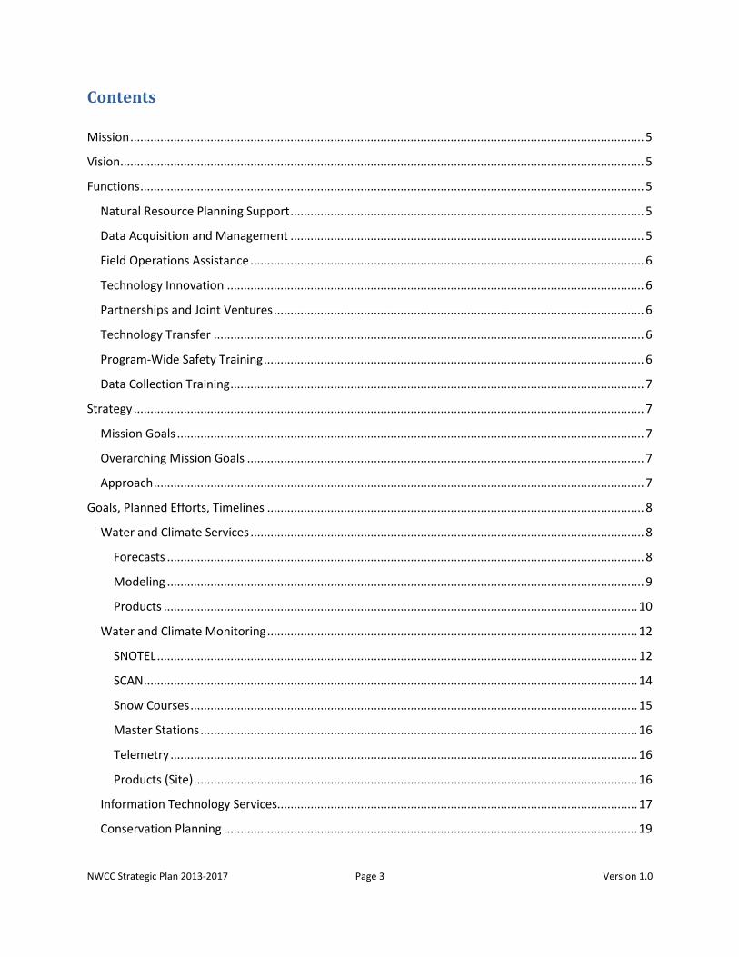
National Water and Climate Center Strategic Plan
2013-2017
Mission – To lead the development and transfer of water and climate information and technology which support natural resource conservation.
Vision – To be a globally-recognized source for a top quality spatial snow, water, climate, and hydrologic network of information and technology.
Functions The functions of the National Water and Climate Center are:
Natural Resource Planning Support
Assess the effectiveness of applied technology and support activities in relation to meeting our customer needs.
Provide water supply forecasts.
Provide water and climate analyses, information, and services to NRCS, our partners, and our customers.
Provide concepts and technical input for policy development and the legislative process.
Provide emergency support to our customers in response to extreme natural resource events.
Provide water quality and quantity expertise in support of farmstead, field level, watershed, and river basin evaluations.
Data Acquisition and Management
Operate the Snow Telemetry (SNOTEL) data collection system and Soil Climate Analysis Network (SCAN) for the United States.
Acquire, enhance, and manage specific data sets to support the resource planning for all resource areas including soil, water, air, plants, animals, and human.
Design and manage an online, quality controlled, national database for NRCS and partners in support of farm, watershed, and river basin scale planning.
Coordinate with other entities to develop procedures for integration of information from plant, animal, soil, water quality, and pesticide databases.

NWCC Strategic Plan 2013-2017 Page 6 Version 1.0
Field Operations Assistance Field Operations Assistance provided at the Electronics Maintenance Facility (EMF):
Test, calibrate, and maintain equipment, components, and sensors to ensure best quality data and performance.
Maintain Master Station data collection.
Provide technical assistance to field personnel on installation and maintenance of all electronic components at SNOTEL and SCAN stations.
Technology Innovation Identify and anticipate priority needs to support the Field Office Technical Guide (FOTG) and
customer requirements.
Assess and select technologies required to address resource concerns.
Adapt appropriate technologies.
Facilitate new technology development.
Maintain inventory of available and developing technologies.
Partnerships and Joint Ventures Cooperatively fund and develop new technology.
Establish and maintain joint strategic databases.
Share existing technology to meet user needs.
Develop cooperative support for technology transfer and implementation.
Partner with NRCS offices and other organizations for natural resource planning support.
Evaluate feedback from partners to improve effectiveness.
Technology Transfer Release new technology through means appropriate to customer needs.
Assist in training related to technological releases.
Market and promote new technology.
Provide expertise to support new technology.
Ensure technology transfer meets our customer needs and expectations.
Program-Wide Safety Training Arrange and manage annual West-Wide Snow Survey Training School.
Arrange and manage annual Tower Climbing and Safety Training.
NWCC Strategic Plan 2013-2017 Page 7 Version 1.0
Data Collection Training Train personnel on proper manual measurement techniques and note taking procedures.
Strategy With these main functions as an outline, the mission goals, overarching mission goals, and approach for the NWCC Strategic Plan 2013-2017 are:
Mission Goals Provide accurate water supply forecasts to our customers, as mandated by Federal law.
Collect snow, climate, and weather data.
Provide climate and water analyses for conservation planning.
Provide leadership in soil moisture/temperature data collection and analysis.
Overarching Mission Goals Increase automation of our tools and products.
Provide better documentation for making use of our data, tools, and products easier for our customers.
Improve how the public and partners understand what we provide and what we can do to contribute to efforts in conservation planning, climate assessment, and water management.
Leverage partnerships and collaboration with other agencies to improve communication, increase efficiency of government activities, and combine expertise and resources to produce better science.
Incorporate new technologies to improve delivery and utility of our data for our customers; for example through increased use of tools like RSS, GovDelivery, Twitter, apps, cellular phone notifications, map interfaces, and GIS products.
Develop a standard system for gathering and responding to customer input and needs to better serve our customers and provide what they want from us.
Approach The approach to the Strategic Plan is to define specific goals and steps that each of the focus areas within the National Water and Climate Center will need to accomplish from 2013 through 2017 in order to meet the overarching mission goals.
The focus areas are:
1. Water and Climate Services – Water supply forecasts, modeling, products, and risk analysis

NWCC Strategic Plan 2013-2017 Page 8 Version 1.0
2. Water and Climate Monitoring – SNOTEL, SCAN, snow courses, master stations, telemetry, and products
3. Information Technology Services – Failover/hosting, Report Generator, hardware, databases, database/application integration, web applications, and tools
4. Conservation Planning – Forecast interpretation, soil moisture interpretation, spatial climate interpretation, RUSLE, WEPS, APEX, and wetlands
5. Climate – Outlook reports, report automation, products, mobile applications, Drought Monitor involvement, partnerships, and FGDC update
6. Center – Documentation of core functions and employee roles, improve outreach and partnerships, coordinate programs with NRCS activities, training, and central file maintenance
Goals, Planned Efforts, Timelines The goals, planned efforts, and timelines for each focus area within the National Water and Climate Center for 2013-2017 are:
Water and Climate Services
Forecasts Short-term enhancements to the VIPER forecasting environment – Priorities for VIPER in the
next two years will focus on modifying current features that do not work properly, keeping the application current with newer versions of Windows and Excel, plus any security patches. The immediate goal is to have VIPER compatible to MS-Windows 7 and Excel 2010 by the start of forecast season on January 1, 2013 and to keep it current through September 2014. By October 2014, the NWCC forecast environment will move to a new web-based environment.
Long-term enhancements to the VIPER forecasting environment – The WCS Team has identified a number of forecasting enhancements required for VIPER. Along with the need to replace the water supply outlook legacy database and to support Report Generator products, these enhancements will include the development of a web-based forecasting tool that would download calibrated statistical models from AWDB, execute those models on request, and produce derivative products, e.g., charts and graphs. By October 2014, this will replace the current Excel version. From October 2014 through September 2017, forecasters will be able to devote more time to building robust statistical models, interpretation and analysis of forecast model output, basin-wide forecast discussion summaries, and climate change and variability research. This would also allow the States to have more control over the production of the water supply outlook reports.
Complete VIPER User Manual – Complete the VIPER User Manual by October 2013, documenting all of the features that are currently available in the Excel version of the tool. This

NWCC Strategic Plan 2013-2017 Page 9 Version 1.0
will be an ongoing effort through September 2017, as the software technology advances. In conjunction with VIPER documentation, training material, including online material, will be developed for people who use the application and those who want a broader understanding of the developed science and how it is used.
Provide daily water supply forecast products – The Daily Water Supply Forecast (DWSF) tool is a stand-alone Excel spreadsheet that gathers SNOTEL climate and USGS streamflow data, calibrates forecast models, generates fixed period seasonal volume forecasts on a daily basis, and exports various forecast products. Currently, the DWSF tool extracts data from files on the NWCC ftp server. The data used in the DWSF models needs to be extracted directly from AWDB. This will ensure that the best, most up-to-date data will be available for each forecast station. At the same time, the basic model calibration information and output should be stored into AWDB. By having the necessary data, statistical information, and output in AWDB, product generation can be shifted to an on-demand web-based application and away from the ftp server. Over the next five years, the goals of the WCS are to:
1. Refine DWSF to allow for easier production of mixed-past seasonal forecasts, future only forecasts.
2. Incorporate additional predictor parameters, e.g., climate indices and antecedent streamflow.
3. Allow calibration of models in PCA mode, allowing jack-knife validation as part of the calibration procedure.
These enhancements could eliminate the need for mid-month forecast models that rely on data projections for execution.
Ongoing support of our current forecasting services – The WCS forecast hydrologists will continue to provide seasonal water supply forecasts in support of the State DCO and WSS offices. The forecast guidance consists of bi-monthly seasonal water supply estimates from December 1st through July 1st. The forecasting services also provide collaboration with other Federal agencies, the production of water supply outlook reports in cooperation with the Western State NRCS offices, and training for State office personnel on how to translate the forecasts to explain the consequences and likelihood of possible outcomes (i.e., risk assessment).
Modeling NWCC forecasters will have a fully functional simulation modeling system in operational use
at select points across the West – The NWCC has already brought significant resources to bear in developing the infrastructure to support simulation modeling with PRMS. To have an operational system by January 2015, the following activities are required:
NWCC Strategic Plan 2013-2017 Page 10 Version 1.0
a) Development of utilities for retrieval of daily data from climate and streamflow stations. There has been significant work done on this item already. There are modules in OMS that fetch the daily data necessary from ACIS and the USGS. In addition, the current NRCS contract with Oregon State University will assure us of having quality controlled, daily data from each of our SNOTEL sites. This effort is targeted for completion in July 2014.
b) Implement the detrended kriging (DK) program, with necessary recoding for operational purposes, input data preparation, and output processing.
c) Development of techniques, analyses, and guidelines for estimating values of non-spatial model parameters. This includes development of a usable solar radiation module (allowing use of SNOTEL solar radiation data for parameterization) and investigation of how best to handle the snow cover depletion curve.
d) Development of techniques and guidelines for calibration with the PRMS automatic calibration tool.
e) Development and implementation of algorithms for ESP output post-processing to remove bias and adjust variance in the ensemble.
f) Continue development of BAGIS-H and BAGIS-P tools for HRU delineation and spatial parameter estimation.
g) Development of any necessary software at the NWCC to facilitate data flow into and out of AWDB and the generation of forecast products, e.g., threshold forecasts, timing forecasts, peak flow forecasts, and graphical representations of forecasts.
Products Move beyond the limitations of the original paper version of the Water Supply Outlook
Reports – Digital presentation on the Web gives NWCC the opportunity to redesign the Water Supply Outlook Reports. NWCC will provide additional explanatory details about the water supply forecast to help users assess the scope and confidence of the forecast. Hydrologic forecaster’s comments could contain such information as: surrounding conditions that may impact that forecast point, whether an outlier year was included in the statistical analysis, or if data input (to the forecast model) for a particular snow site was estimated because of equipment failure. In addition, tabular exceedance probability forecasts could be replaced with a graphical presentation to more clearly depict to users the certainty or potential spread of the forecast. NWCC will make improvements to the Water Supply Outlook Reports (WSOR). The Center is considering using Utah’s WSOR prototype for this.
Impacts of climate change and variability –Over the five-year period of this plan, the WCS Team will focus on an assessment of the impact of climate change on the mountain snowpack, specifically as to how it directly affects the runoff from streams and rivers in the West. The Snow Survey and Water Supply Forecasting (SSWSF) Program is the one agency within the Federal
NWCC Strategic Plan 2013-2017 Page 11 Version 1.0
government that can and should assess this relationship and answer the question of whether the mountain snowpack and subsequent runoff are changing due to changes in the climate drivers. The questions that need to be addressed are:
a) Is the mountain snowpack accumulation increasing or decreasing? b) Is the mountain snowpack melting out sooner or later? c) Is the mountain snowpack melt rate faster or slower? d) How strong is the correlation between accumulation, start of melt, and melt period with
regard to: i. Precipitation
ii. Air temperature iii. Relative humidity iv. Evapotranspiration v. Streamflow volume and rate
vi. Teleconnection/climate patterns e) Based on scientific analysis, is it possible to characterize the changes in range,
variability, and uncertainty in a way that can be associated with real-time operations? Deliver more peak volume/peak threshold products – The State offices have requested
automated products that define the average daily peak flow, timing of the peak flow, amount of flow volume above a threshold amount, and timing of flow volume below a threshold amount. These types of forecasts are important for reservoir and irrigation management. The delivery of these products is dependent on the progress of the NWCC modeling effort with PRMS and web-based VIPER software.
Integrate forecast products with the new report generator map interface – The Report
Generator map interface will integrate forecast points, analysis, and product output along with graphical and visual interpretations of forecasts. Initial interface will be completed by October 2013, with additional development finalized by October 2014.
Complete BAGIS analysis west-wide – Portland State University has completed the first phase
of the BAGIS project. Among other things, this software allows the WCS hydrologists to assist the States in locating locations for new climate reporting stations (i.e., SNOTEL). Up to this time, a basin analysis was prepared as each request for a new site was sent into the NWCC by the States. In order to make the process more efficient, each major basin should be analyzed to determine the correct density of climate sites. When the analysis for the entire west is complete, new data collection sites will be pre-determined, saving the forecasters many hours of on-demand analysis. Complete western analysis is targeted for completion by October 2013.
Expand external data fetch to include more data collection networks (e.g., OWRD, USBR, and
USACE) – The external data fetch software currently accesses data automatically from the USGS, Colorado DWR, and ACIS. These data are used to prepare water supply forecasts for NRCS State

NWCC Strategic Plan 2013-2017 Page 12 Version 1.0
offices that use them for water resource guidance for their many customers. These data sources account for a large amount of water and climate data used for forecasting. This effort will be ongoing through the plan period.
Reservoir operating guide development and support of existing guides – In August 2013, WCS
hydrologists will participate in HEC-ResSim training that will allow them to produce reservoir operation guides for stakeholders which are based on the water supply forecast risk assessment. HEC-ResSim uses a rule-based approach to mimic the actual decision-making process that reservoir operators must use to meet operating requirements for flood control, power generation, water supply, and environmental quality. Parameters that may influence flow requirements at a reservoir include time of year, hydrologic conditions, water temperature, and simultaneous operations by other reservoirs in a system. The reservoirs designated to meet the flow requirements may have multiple and/or conflicted constraints on their operation. HEC-ResSim describes these flow requirements and constraints for the operating zones of a reservoir, using a separate set of prioritized rules for each zone.
HEC-ResSim is a generalized reservoir simulation program that has been (and continues to be) developed to provide watershed managers an effective tool for real-time decision support and use in planning studies.
Water and Climate Monitoring
SNOTEL Enhance more sites with soil moisture and soil temperature sensors – At present,
approximately one-third of SNOTEL sites have soil sensors. Although not all sites can accommodate these sensors due to shallow soils, most could benefit from the inclusion of soil moisture and temperature in the data collection and transmission. During FY13, NWCC will develop a priority list of SNOTEL sites that require instrumentation. As funds become available, NWCC will purchase and install soil sensors based on this priority list. By the end of FY16, 90% of SNOTEL sites will have soil moisture and temperature as part of their data collection.
Convert water supply forecasting snow courses to SNOTEL sites – During FY12, NWCC identified manual snow courses for possible discontinuation. Excluded from the list were snow courses utilized for developing water supply forecasts. The states will continue to measure these snow courses; however, they will also be prioritized for conversion to SNOTEL sites. By FY17, NWCC will work with the States to convert these snow courses to SNOTEL sites, have them taken over by partners to perform monthly measurements, or discontinue the courses.
Improve efficiency in field operations so SNOTEL can continue to expand (Eliminate shelters for areas with little snow) – Depending on location (potential snow depth), some SNOTEL sites may not require shelters and could utilize boxes attached to towers to house electronics. This would reduce the cost for installing new sites and would reduce the footprint of SNOTEL sites.

NWCC Strategic Plan 2013-2017 Page 13 Version 1.0
Beginning in FY13, NWCC will determine the overall benefits of discontinuing shelters at only low snow locations, and the feasibility of doing this at locations with snow potential of under 36 inches.
Improve support from EMF (equipment and tools) – A main limitation for support from EMF is the limited personnel, which is addressed in other bullets. EMF is also limited by older and often outdated equipment for testing, calibration, and repair of field equipment. It will be a priority of the program to invest in EMF equipment and tools so that the staff can provide the best service possible to the field. NWCC leadership will work with EMF staff to develop a list of needed equipment and tools and will begin replacement during FY13. NWCC will review this process annually to keep EMF at optimum performance for field support.
Identify reimbursable sites – As program dollars become more limited each year, we need to identify where we can supplement funding by utilizing reimbursable agreements. Presently, we develop a number of reimbursable agreements for new installations and ongoing maintenance. In the future, we also need to examine sites within the present network that may be supported by cooperators as reimbursable agreements in order to help the program continue to manage the present network. NWCC staff will work with each State to identify possible SNOTEL sites that could be candidates for cooperator support and then will plan meetings with those cooperators to address developing new agreements. This will be an ongoing effort, and will begin in FY13.
Convert to fluidless precipitation gages and snow pillows – As we look to reduce annual maintenance costs and travel, conversion of sites to fluidless precipitation gages and snow pillows may be one potential option for minimizing the need for annual site visits. Much of this technology is still in development, but there may be emerging technologies that NWCC can explore and test. Fluidless snow pillows are now a reality, but more needs to be done to make these a viable option for remote sites. By FY17, it is planned that most new installations, especially in remote areas difficult to access for maintenance, will be utilizing these new technologies. Fluidless technology will be phased into existing SNOTEL stations and, where possible, the fluid systems will be continued for a period of time to compare sensor correlation.
Keep equipment abreast with technology developments – NWCC will invest in annual research and development (R&D) activities to develop new field sensors for SNOTEL sites. In addition, testing of different existing sensors will continue at EMF. As new and better sensors are developed, NWCC will convert SNOTEL sites to newer technology. This is an ongoing activity. Testing of new technology may be done through a Research and Development Committee.
Web cams at SNOTEL sites – Providing visual confirmation of site conditions will improve data analysis at SNOTEL sites. Installation of Web cams at selected SNOTEL sites could provide valuable information. By FY14, NWCC will explore and test this technology for feasibility (including power limitations) for our program at a number of SNOTEL sites. By FY17, NWCC will
NWCC Strategic Plan 2013-2017 Page 14 Version 1.0
install web cams at key SNOTEL sites in each State and include it in the information provided to the public.
SCAN
Develop a SCAN station identification, proposal, and approval process – The complete procedure for requesting a SCAN station (who), station site selection and approval (where). Also, a process to handle requests for station modification and addition of non-standard sensors (what). This process will be completed by the end of FY13.
Identify consistent funding mechanism – SCAN began as a pilot project in 1991 with 19 stations. Since that time, SCAN has expanded to more than 190 stations in over 40 states. SCAN continues to grow despite no defined program budget. For SCAN to continue in the present number of stations or to continue to expand, NWCC needs to identify sufficient funding for annual maintenance (personnel, travel, equipment, and supplies). NWCC will work with NHQ to establish an annual funding source for SCAN. Annual funding will be in place by 2015 and be part of the agency budget each year after.
Develop staffing plan and budget – Having an uncertain funding mechanism makes planning for staffing and budgets difficult. However, given the limitations of budgets, it is essential that SCAN is staffed with a number of key positions, including:
1. A program lead/manager
2. A soil scientist to oversee field operations and develop tools for examining soil data
3. An electronics technician to be housed at the EMF and who calibrates sensors and site equipment
4. Four individuals to perform site maintenance (these can be contractors or NRCS employees).
The cost for the positions described in 1-3 would cost approximately $500,000 per year. The contractors or employees, in addition to salary and benefits, would require travel, equipment, and supplies. These would be limited to only existing SCAN sites, as new sites would require contributions from the partner to cover maintenance costs. The annual cost for the maintenance team would be $500,000, and therefore SCAN would require $1,000,000 per year in support for personnel and associated costs. NWCC will implement this plan, either entirely or incrementally, over the next five years. The plan will be fully in place by 2017.
Develop 5-year implementation plan for SCAN (design for network) – At present, SCAN stations are installed based on the request of partners and not following an implementation plan. The growth and expansion of the SCAN network, as well as an analysis of the need of existing stations, needs to be addressed in a systematic and strategic process. By the end of FY13, NWCC will develop a strategic plan for the future implementation of SCAN installations. The plan will serve as the guide for SCAN growth and development.

NWCC Strategic Plan 2013-2017 Page 15 Version 1.0
Keep equipment abreast with technology developments – New developments and improvements in sensors and telemetry need to be reviewed and implemented into SCAN maintenance and new installations. During FY13 and FY14, NWCC will perform a review of present technology utilized by SCAN and potential upgrades. Starting in FY15, NWCC will implement a plan for improving current and future sites.
Develop support separate from EMF – At present, much of the time and effort of the current EMF staff is devoted to SCAN repairs, calibrations, and field maintenance/installations. As outlined in “Develop Staffing Plan and Budget” (above) an additional individual will need to be hired to support only SCAN, thus freeing up other EMF staff to support Snow activities. It would be beneficial to have this individual in place during FY13, but this will ultimately be a factor of budget and ability to increase staffing.
Clarify roles; merge with SNOTEL – In the Western US, combining SNOTEL and SCAN into a single network to provide data coverage for both higher and lower elevations improves both the coverage of data collection and provides ready maintenance support for SCAN in this region. Therefore, in the 12 states presently covered by the Snow Survey program, NWCC will include SCAN site maintenance in the maintenance schedule for the DCOs. An analysis will be done to determine the proper network definitions and naming conventions. As a network, SCAN will continue to exist in the remainder of the US and territories. This analysis will occur in FY13.
Establish a goal for the network (working with Soils) – Much of the data provided by SCAN are of use to a wide variety of customers, but especially to the National Soil Survey. NWCC will establish a liaison to work between NWCC and NSSC to develop more applications for SCAN, work with scientists from both Centers to develop strategies and tools for SCAN data, and better coordinate site installations and maintenance. Both Centers will fund the position, and it will utilize existing staff. NWCC will identify the liaison during FY13.
Snow Courses Reduce number of snow courses measured by NRCS – In FY12, a priority list of snow courses
that were neither measured by partners nor used in water supply forecasting was identified for potential discontinuation. Based on budgets, NWCC will work with the States to eliminate the identified snow courses over the period of FY13-FY15. Exceptions will be snow courses slated for replacement with SNOTEL sites. In these cases, the snow courses will remain for sufficient time to verify the accuracy of the new SNOTEL sites.
Automate aerial markers – NWCC will prioritize for replacement aerial markers that require airplane or helicopter travel at NRCS expense with automated sites that transmit data at specified time intervals. NWCC will equip these sites with meteor burst, satellite phone, or cellular phone systems to transmit data. NWCC will automate all aerial markers that fit the criteria by FY15.
NWCC Strategic Plan 2013-2017 Page 16 Version 1.0
Master Stations Relocate from private land to public land (analysis for best locations) – Presently, two Master
Stations (Tipton, Missouri and Mt. Gilead, Ohio) are on private land and require payments for leases. Having sites located on private property at a cost is not desirable and these two sites should be relocated to government property that has adequate security and long-term stability of land ownership. NWCC will move both sites by FY16.
Upgrade five full Master Stations to new configuration – NWCC has been working closely with Maiden Rock Communications (MRC) to develop the next generation of full Master Stations. The new technology is in the process of being tested. NWCC will upgrade all full Master Stations to the new configuration by the end of FY15.
Telemetry Diversify telemetry types – Presently, almost all SNOTEL sites in the lower 48 states use meteor
burst for telemetry. Alaska has converted all sites to satellite phone systems. Cellular technology has been tested at some sites. Also, some sites utilize the GOES satellite system. Each system has its strengths and weaknesses. Because the number of meteor burst radios is limited following the exit of Meteor Communications Corporation (MCC) from supporting NRCS, this has created pressure to expand into other telemetry systems. Over the period of FY13-FY15, the program will install different telemetry systems and test their application to our network. If trial systems work appropriately, the SNOTEL network will diversify into multiple telemetry systems.
Merge different telemetry systems into our databases – One issue with utilizing different telemetry systems is how to incorporate the data formats into existing databases. NWCC will work with field personnel to develop tools to manage different sources of data transmission. NWCC will implement a system that handles all the different sources of telemetered data by FY15.
Add GOES reception at one Master Station – One of the strengths of the meteor burst system is that NRCS is independent of other systems, such as satellites, in managing our own data transmission. With GOES, NRCS depends on other agencies to stream data to NWCC. Placing a GOES receiver at the Dugway Master Station will allow NRCS to stream our own data independent of other agencies, thus maintaining control of the data. NWCC will install a GOES receiver at Dugway by FY15.
Products (Site)
Health of network (sites and Master Stations) – NWCC will develop a tool to display the status of SNOTEL, SCAN, and Master Station sites, and deliver the tool on its web site. The tool will identify sites that are down or that have sensors that are not operating. The interactive map will allow users to select a site and get an update on its status and issues. NWCC will develop the tool by FY15.

NWCC Strategic Plan 2013-2017 Page 17 Version 1.0
Central access to metadata and site conditions – NWCC will incorporate and regularly update metadata for each site, including field notes, changes to the sites, sensor replacement, and other important information on its web site. The metadata will include annual photos from cardinal coordinates. NWCC will provide this additional site information for SNOTEL and SCAN by the end of FY15.
Soil moisture analysis and evapotranspiration (ET) calculations at a site – NWCC will develop tools for using soil moisture and temperature data, in conjunction with climate data at each site, for analyzing soil moisture conditions and calculating ET for a specific period. NWCC will link these tools to each site by the end of FY15.
Alert for amount of change for a specific period of time – As an alert system for potential threats from flooding, avalanches, and other potential risks, a tool will be developed that will display (as a regional map) sites where snow depth, SWE, and/or precipitation change by a determined percent over a period of time, such as hours or days. This map will be on the NWCC web site and will be useful to see areas that have undergone extreme change in conditions. The system will not only be useful to our snow survey personnel in evaluating field conditions, but also to emergency managers looking at indications of potential problems. NWCC will release the tool on its web site by FY16. NWCC will research the possibility of getting more frequent data when there is an event happening. Analysis by end of FY13
Help develop a detailed meta-database that include changes in site characteristics and station components or configuration changes over time – Currently the metadata is stored on metadata sheets and a metadata spreadsheet that is cumbersome and difficult to keep updated. Need to develop a database similar to what SNOTEL uses to track changes (site, maintenance, upgrades, components, sensors etc at SCAN stations. The meta-database development is slated for completion by the end of FY14.
Information Technology Services Water and Climate Information System (WCIS) failover or migration to USDA hosting – The
Water and Climate Information System (WCIS) does not currently have a good failover system for its servers. Also, International Technology Services (ITS) is not structured to provide twenty-four hour seven days a week (24/7) support. Therefore, WCIS is being migrated to a USDA hosting site (Kansas City) that can provide 24/7 support. The second (or failover) site has not been determined. One thought is that the WCIS system could be at a second hosting site, which would serve as the failover site. The migration is being done in several steps. Currently most of the servers and applications are located in Portland, Oregon. The SNOTEL and AWDB databases are being replicated to Kansas City. The AWDB database and all applications that read from/write to it will be migrated by the end of FY13. The SNOTEL database and all associated applications will be migrated by the end of FY14. The storage program rewrite which includes an alert system will be completed by the end of FY14.
NWCC Strategic Plan 2013-2017 Page 18 Version 1.0
Report Generator and product delivery – Report Generator may require changes in the database to support data and forecast interpretations and products by October 1, 2014. Continued development and enhancements of existing tools and products will continue through FY17. This will improve the user's ability to interpret the products.
Hardware – USDA has determined that the Portland Data Center will be decommissioned by the end of FY14. This provides another requirement for completing the WCIS migration to hosting.
o The Dynamic Data Distributor (DDD) may not be moved to hosting by the end of FY14. The MCC applications need to be able run on a Windows server before they can be migrated. NWCC is working with MRC to get this task completed as soon as possible.
o Computers are required for running EMF test equipment and doing field work. We recently purchased four laptops to run the test equipment. We currently provide computers to volunteers and contractors for performing field maintenance. We may be able to use some of the test computers for field work also. We will do an analysis to determine what equipment configuration is needed for EMF activities (FY13).
Databases – The SSWSF Program needs to verify that data is secure and stored in central relational databases.
As we migrate to hosting, we will be eliminating legacy databases such as wyfor, cdbs, and soilnarr. Most of the functionality of the programs that access these databases will be replaced by the Report Generator. NWCC will eliminate these databases by the end of FY14.
There is an effort to bring all the site metadata into a central database. The first phase of this is to incorporate the spreadsheets the DCOs/States have into a Microsoft Access database schema that will be used by all the States, so it can easily be loaded/updated into the central SQL Server database. NWCC will release Version 1 by 1/1/2013. Then we will look at adding more metadata fields, such as changes in site characteristics and station components, and configuration changes over time (FY14 through FY17).
Re-design the SCAN maintenance Excel spreadsheet into a database system similar to the SNOTEL metadata system. Much work has already been done on this with the first version of the system expected to rollout to users by early Spring, 2013.
Once WCIS is migrated to hosting, we will look at combining the SNOTEL and AWDB databases. This would eliminate duplication of tables and eliminate concerns about synchronization between the two databases (FY15).
NWCC Strategic Plan 2013-2017 Page 19 Version 1.0
Improve support from EMF (equipment and tools) - Create digital inventory system for EMF life cycle management of equipment, components, and other scientific devices critical to the mission of NWCC.
Operational Dashboard – Security concerns and restrictions in the hosting environment make developing web applications for our operations a necessity. Alarms that the duty officer receives about Master Station health and data receipt will be incorporated into the storage rewrite (FY14). An automated extension of the alarms and system will be incorporated into the Duty Officer dashboard (FY14 or FY15). The database managers also need a dashboard access to get to web applications to perform administrative tasks on the databases once they are migrated to hosting. They have some tools they have created and can be added to this dashboard. These tools need to be incorporated into the dashboard by FY13 for all tasks associated with the AWDB database. And by FY14 for all tasks related to the SNOTEL database.
Document the Data/Business Rules - There needs to be consistency throughout all the tools and products with how data is managed. Currently the business/data rules are documents by project. There is no guarantee the rules are consistent among all projects. Therefore we need a central document that states the standards. This document can then be referenced for all development projects. The initial document will incorporate the rules from current software packages/projects and be complete by 10/31/2014. This document will then be augmented with additional standards during FY2015 through FY2017.
Field Tool Vetting – There needs to be a better process for handling routines and products created by the States. We now have a Water Supply Specialist (WSS) vetting group reviewing submitted items. We will add a way for these items to be incorporated into the WCIS IRB proposals. NWCC will work with the WSS vetting group to determine a complete process by the end of FY13.
Improve support from EMF (equipment and tools) – Create digital inventory system for EMF life cycle management of equipment, components, and other scientific devices critical to the mission of NWCC.
New Site Approval Process – Cyber security requires audit trails for any changes. Therefore, we will automate the New Site Approval process into a web application, so that we can have an electronic audit trail that will allow us to more easily flow through the process and get reports on changes.
Conservation Planning Reestablish tools that provide soil moisture interpretations – The National Water and Climate
Center will become more directly involved in Conservation Planning. The first step will be to take the lead in reestablishing tools that provide soil moisture interpretations for conservation planning. By the end of 2014 soil moisture measurements will be interpreted in local reports by
NWCC Strategic Plan 2013-2017 Page 20 Version 1.0
county or by basin. By the end of 2015 soil moisture measurements will provide a single integrated soil moisture value that will represent the growth characteristics of plants established at that site. 2016 will see the spatial analysis of soil moisture for purposes of regional planning and drought analysis.
Forecasting interpretation tools – NWCC will provide tools to interpret standard forecasts to local delivery, translate the local forecasts into Risk levels for planning and operational purposes, and provide these tools as applications for local use on smart technology. These tools will begin development in 2015, with local forecast by the end of 2016, Risk-level evaluation by mid-2017, and transfer to locally useable applications by the end of 2017.
Spatial climate interpretation tools – NWCC will provide spatial climate interpretations (including ET values) for conservation planning including support of CDSI. This component will be a direct outgrowth of our work with the Risk Management Agency (RMA) and Oregon State University, and leveraging the development of the RMA Climate Portal for direct analysis and input to Conservation Plans. In 2013, NWCC will establish an agreement for the use of the climate portal by both the Farm Services Agency and NRCS. In 2014, the NRCS will work with RMA to establish Web Services providing standard interpretation into Conservation Plans. In 2015, the standard interpretations will include an analysis of operational risk based on climate forecast and operational requirements. In 2016, NWCC will apply forecasted values to implementation of alternative practices, depending on risk. By 2017, NWCC will include standards of operation in conservation plans based on available forecast information.
Conservation Planning Analysis Support Revised Universal Soil Loss Equation: Version II (RUSLEII) – RUSLE support will continue through
2017. Original RUSLE layers were provided in 2003 with continued use to the present. Beginning in 2013 climate layers covering the 1981 to 2010 and 1971 to 2000 period will be established for support of RUSLEII. Through 2017, support of these layers will continue with the transfer from RUSLE to the Wind Erosion Prediction System (WEPS).
Wind Erosion Prediction System (WEPS) – Spatial climate data will be made available to WEPS in 2013 for development into a spatially-oriented calculation more in line with the developing conservation planning tools. Beginning in 2014 and extending into 2017, NWCC will investigate and work with the latest online version of wind profiles and daily wind mapping for inclusion in the WEPS environment.
Agricultural Policy/Environment eXtender (APEX) – APEX support will begin in late 2013 and extend into 2014. This will be a combination of daily and monthly records for the historic period as alternate input to the APEX model. In 2015, through an agreement with RMA, Oregon State University and NWCC, the delivery of daily spatial datasets including potential
NWCC Strategic Plan 2013-2017 Page 21 Version 1.0
evapotranspiration will be incorporated into APEX along with risk levels association with climate for evaluation of conservation practices completing the project by 2017.
Swamp Buster – Wetlands analysis and evaluation support will continue through the update of the 1971 to 2000 period averages to the 1981 to 2010 normals. The two periods will be maintained, since the 1971 to 2000 period will remain the reference period for all Swamp Buster analysis. The 1981 to 2010 and 1961 to 1990 periods will also be included for comparison and reference analysis. Beginning in 2014, NWCC will support and begin transition from point values for wetlands determinations to spatial analyses using PRISM data. Values will be for areas of interest and integrate climate information for the areas as a table for fields, farms, or larger areas. This transition will complete by 2017 and be available to the conservation planning tools directly or by map interface through the National Water and Climate Center.
Available Water Index (AWI) – NWCC will convert the Surface Water Supply Index (SWSI) to an AWI starting in 2014 with completion in 2017. SWSI will be incorporated and a standard part of forecasting output by the end of 2014. The process will then translate the SWSI to a spatial index using streamflow forecasts and ultimately to AWI. AWI will use available PRISM data both daily and monthly (along with reservoir, streamflow, and soil moisture data) to provide an index to water available for runoff as well as dry-land agriculture.
Outlook reports – To help increase the accuracy and efficiency of the NWCC Hydrological (Water Supply) Forecaster’s predictions, there is an ongoing need for the Staff Meteorologist to provide an objective assessment of the forecasts provided from Federal, State, and non-governmental organization (NGO) activities, as these forecasts are often at odds with one another. The goal is to provide update assessments (seasonal outlooks) routinely and when required to the NWCC and DCO Staffs for internal, NRCS use. This is an ongoing effort, dependent on current staffing.
Automate soil climatology narrative report – There are several climate datasets used to develop these reports, but the process requires manually inserting climate data into a narrative template. This process is antiquated and time-consuming. The goal is to develop the appropriate scripting routine to automate the parsing of these datasets. This effort will complete by 2015.
Develop products that show trends – As users of climate data become more knowledgeable and the research into climate change and variability accelerate, there is a vital need to provide these stakeholders with trend analyses. NWCC’s solution is to provide the data (i.e., SNOTEL and SCAN) and a means to customize it through a Report Generator-type of dedicated server. This effort will require close coordination with the Ft. Worth Data Center and the NWCC Contract Support staff. This is an ongoing initiative.

NWCC Strategic Plan 2013-2017 Page 22 Version 1.0
Investigate a mobile application using PRISM data – Currently, the PRISM Group has a set of basic mobile applications (i.e., plant hardiness zone maps, older climate normals) available at a nominal fee. As they develop more near real-time spatial datasets, it is anticipated that Risk Management Agency (the Group’s primary funder) will encourage the development of more applications. The Center will need to assist RMA in satisfying users’ requirements. This is an ongoing effort, which would accelerate with additional funding after FY14.
Drought Monitoring engagement, participation, and commitment – For at least a decade, NWCC has been actively engaged with NIDIS, NDMC, Western Governor’s Association, and the Western States Water Council on matters pertaining to drought (impacts, risk assessments, mitigation, etc.). With the Great Plains 2012 Drought that devastated the agriculture community, there is an even greater need for an active partnership with the NDMC in the form of back channel discussions (access) and becoming a Drought Monitor Author. Currently, there are two USDA Authors and a potential need for another in the near future. However, efforts are currently underway to get increased access to the Authors by signing a non-disclosure agreement. The NWCC has communicated their intent and commitment to the NDMC. We await a response.
Enhance partnerships – essential meetings – As future budgets become more problematic, there is an urgent need to establish lasting relationships at various levels within the climate community (e.g., research (i.e., NCAR), services (i.e., AASC), data management (i.e., NCDC), and data standards (i.e., FGDC)). In order to accomplish this, a prioritized list of meetings (e.g., executive committees, working groups, advisory groups, etc.) is needed for maximizing travel opportunities. NWCC will develop this list in FY13 and update it annually.
FGDC 5-year update – The last update to the Geospatial Climate Data requirements was in 2007. An update is anticipated in FY13 once guidance is provided. Working closely with the PRISM Climate Group, this task is expected to continue with the requirements that were not met in the last update.
QC data support and coordination – The Federal mandate to ensure the best data quality is available for Federal activities that own and/or operate data networks is an ongoing effort. NWCC has committed CESU money to the PRISM Group to develop and standardize an automated QC system for SNOTEL through FY14. Once developed, and in concert with ongoing support to RMA, this system will reduce the manual labor that is currently required. With additional funding, NWCC will apply this technology to SCAN.
Center Document core functions – NWCC provides a wide variety of services, tools, and support to the
agency. Often, because the name captures all aspects of climate and water issues and topics, NWCC plays many roles in representing NRCS. NWCC participates on committees and working

NWCC Strategic Plan 2013-2017 Page 23 Version 1.0
groups, and routinely responds to information requests related to water resources, climate change, data collection networks, weather, drought, floods, and many other issues. Although many of these issues are related to the core mission of NWCC, others often are outside the primary focus of the Center. This can become time sinks for NWCC personnel. Similarly, there often is confusion in the Snow Survey and Water Supply Forecasting Program on what roles/responsibilities lay with NWCC and what issues are best handled by personnel in the States. The core functions of NWCC need to be well documented so that staff within NWCC and those requesting NWCC assistance can be informed of what issues fall under NWCC purview. NWCC leadership will prepare clear documentation of core functions and place it on the web site by the end of FY13.
Document employee roles/functions – People requesting information from NWCC often are not aware of who deals with each topic. Within NWCC, there often is misunderstanding about who oversees particular efforts and where oversight for activities lies. To provide efficient and accurate response to information requests, it is critical that employee roles and functions are clearly defined. NWCC leadership will prepare clear documentation of employee roles and functions and place it on the web site by the end of FY13.
Improve outreach/partnerships
o Local, regional, national - A critical role of NWCC is to represent the agency in interactions with other Federal, State, local and private groups at the local, regional, and national level. Two factors have resulted in NWCC falling short of performing this activity at an adequate level: limited staff and limited travel. However, this does not diminish the necessity of NWCC to improve in this role. With limited time and personnel, NWCC needs to develop priority lists for being represented at meetings, interacting with partners and groups, and maintaining relationships. In addition, NWCC needs to investigate other options for participating in meetings, including video conferencing, teleconferences, live meeting, and other technologies. NWCC leadership will solicit input from the staff and put together a priority list and calendar for NWCC and update it annually. NWCC will be complete this task at the start of each fiscal year.
o Marketing/education (video) – One part of our mission as a Federal agency is to provide information and education to the public in relation to water and climate issues. Often, people don’t know where to access this information and in general are not aware of the programs and activities we provide. Therefore, NWCC will improve the public awareness of our products and services by producing a number of informational videos on selected topics, such as the Snow Survey, drought, conservation planning, climate services, and others. These videos could be produced in conjunction with universities desiring thesis projects for students in the sciences and communications, at little or no cost to NRCS. NWCC will develop a priority list of outreach tools, such as videos, and will seek

NWCC Strategic Plan 2013-2017 Page 24 Version 1.0
involvement from universities to prepare productions. NWCC will initiate this effort during FY13; it will be ongoing.
Coordination with State programs and with other NRCS programs/activities – NWCC needs to improve at working with other State and agency programs and offices in providing expertise and services that have mutual benefit. NWCC, and specifically the Snow Survey and Water Supply Forecasting Program and SCAN, often seem to function outside of most other agency activities. There are many products and services NWCC provides that could be beneficial to other programs in the agency. Part of this is due to lack of awareness by the agency to the products and services that NWCC provides. Part of this is because NWCC focuses more on interactions with other Federal and State agencies working in water, rather than with NRCS offices focusing on conservation. NWCC will develop a plan for increasing agency awareness of our products and services at the local, State, and agency levels and will explore agency programs where NWCC could increase our involvement and interaction. This effort will be ongoing beginning in FY13.
Training (NRCS programs) – To increase awareness of NWCC programs and services, and to increase the potential of NRCS personnel utilizing these functions, NWCC will work with NEDC to include sections on NWCC programs in NRCS training classes, including “Orientation for New Employees” and “Conservation Boot Camp.” NWCC will examine the curriculum for other training classes and, if appropriate, add sections covering NWCC. NWCC will address this effort in FY14.
Central files maintenance – NWCC will organize the its central filing system using the accepted NRCS filing codes, with older materials placed into the system, and present and future documents stored in this central file system. NWCC will train all personnel in the filing system, with the Administrative Assistant in charge of maintaining document filing. NWCC will use filing codes on all documents to be filed. Personnel will be trained and the system fully updated and operational by the end of FY13.
NWCC Strategic Plan 2013-2017 Page 25 Version 1.0
Appendix: Acronyms Defined
AASC: American Association of State Climatologists
ACIS: Applied Climate Information System
APEX: Agricultural Policy/Environmental eXtender
AWDB: Air Water Database
AWI: Available Water Index
BAGIS: Basin Analysis Geographic Information System
CDSI: Conservation Delivery Streamlining Initiative
CESU: Cooperative Ecosystems Studies Units
DCO: Data Collection Office(r)
DK: Detrended Kriging
DWR: Department of Water Resources
DWSF: Daily Water Supply Forecast
EMF: Electronics Maintenance Facility
ESP: Ensemble Streamflow Prediction
ET: Evapotranspiration
FGDC: Federal Geographic Data Committee
FOTG: Field Office Technical Guide
ftp: File Transfer Protocol
FY: Fiscal Year
GIS: Geographic Information System
GOES: Geostationary Operational Environmental Satellite
HRU: Hydrologic Response Unit
IST: Information Systems Team
NWCC Strategic Plan 2013-2017 Page 26 Version 1.0
MCC: Meteor Communications Corporation
MRC: Maiden Rock Communications
MS: Microsoft
NCAR: National Center for Atmospheric Research
NCDC: National Climatic Data Center
NDMC: National Drought Mitigation Center
NGO: Non-Governmental Organization
NIDIS: National Integrated Drought Information System
NRCS: National Resources Conservation Service
NWCC: National Water and Climate Center
OMS: Object Modeling Systems
OSU: Oregon State University
OWRD: Oregon Water Resources Department
PCA: Principle Components Analysis
PRA: Probabilistic Risk Assessment
PRISM: Parameter-elevation Regressions on Independent Slopes Model
PRMS: Precipitation-Runoff Modeling System
QC: Quality Control
R&D: Research and Development
RMA: Risk Management Agency
RUSLE: Revised Universal Soil Loss Equation
RUSLEII: Revised Universal Soil Loss Equation, Version II
RSS: Rich Site Summary
SCAN: Soil Climate Analysis Network
NWCC Strategic Plan 2013-2017 Page 27 Version 1.0
SnowPAC: Snow Program Advisory Committee
SNOTEL: Snow Telemetry
SSWSF: Snow Survey Water Supply Forecasting
SWE: Snow Water Equivalent
SWSI: Surface Water Supply Index
USACE: United States Army Corps of Engineers
USBR: United States Bureau of Reclamation
USDA: United States Department of Agriculture
USGS: United States Geological Survey
VIPER: Visual Interactive Prediction and Estimation Routines WCIS: Water and Climate Information System
WCS: Water and Climate Services
WCM: Water and Climate Monitoring
WEPS: Wind Erosion Prediction System
WSS: Water Supply Specialist


![SPAWALNICTWO 10stan-mar.net/katalogi/rozne-spawalnicze.pdf · 2012. 8. 27. · VIPER 170D VIPER 170D VIPER 205D VIPER 225D PROFI Napięcie zasilania [V] 230/50Hz 230/50Hz 230/50Hz](https://img.dokumen.tips/doc/110x75/6125f2e6be651f2c7632063d/spawalnictwo-10stan-marnetkatalogirozne-2012-8-27-viper-170d-viper-170d.jpg)