Embed Size (px)
Citation preview

ATOKA, Inc.
Draft Environmental Assessment
Union County Judges Office New London Road Bridge Construction FEMA-1861-DR-AR / PW 1396-1 Union County, Arkansas
May 2012
Federal Emergency Management Agency
Department of Homeland Security
500 C Street, SW
Washington, DC 20472

ATOKA, Inc.
Table of Contents
1.0 Introduction……………………………………………………………………....1 1.1 Project Location…………………………………………………………..1 1.2 Project Setting…………………………………………………………….1
2.0 Purpose and Need………………………………………………………………....3 3.0 Alternatives………………………………………………………………………..4
3.1 Alternative 1: No Action……………...…………………………………..4 3.2 Alternative 2: Bridge Construction………..……………………………...4 3.3 Alternatives Considered and Dismissed…………………………………..4
4.0 Affected Environment and Impacts……………………………………………….5 4.1 Geology and Soils…………………………………………………………5 4.2 Air Quality………………………………………………………………...5 4.3 Water Resources………………………………………………………..….6
4.3.1 Water Quality……………………………………………….…6 4.3.2 Floodplain……………………………………………………...7 4.3.3 Waters of the U.S. Including Wetlands……………………......10
4.4 Biological Resources………………………………………………………11 4.4.1 Fish and Wildlife………………………………………………12 4.4.2 Threatened/Endangered Species and Critical Habitat…………13
4.5 Cultural Resources…………………………………………………………14 4.6 Socioeconomic Resources………………………………………………….14
4.6.1 Environmental Justice………………………………………….14 4.6.2 Noise……………………………………………………………15 4.6.3 Public Health and Safety……………………………………….16
4.7 Summary……………………………………………………………………17 4.8 Cumulative Impacts…………………………………………………………21
5.0 Agency Coordination………………………………………………………………..22 6.0 Public Involvement………………………………………………………………….23 7.0 Conclusion ………………………………………………………………………….24 8.0 References…………………………………………………………………………..25 9.0 List of Preparers…………………………………………………………………….26
Appendix
Appendix A: Consultation Letters Appendix B: Site Maps Appendix C: Site Photographs

ATOKA, Inc.
List of Acronyms
ADEQ Arkansas Department of Environmental Quality BMP Best Management Practices CAA Clean Air Act CERCLA Comprehensive Environmental Response, Compensation and Liability Act CMP Corrugated Metal Pipe CWA Clean Water Act DNL Day-Night Average Sound Level EA Environmental Assessment EIS Environmental Impact Statement EO Executive Order EPA Environmental Protection Agency ESA Endangered Species Act FEMA Federal Emergency Management Agency FIRM Flood Insurance Rate Maps FONSI Finding of No Significant Impact FPPA Farmland Protection Policy Act H&H Hydraulics and Hydrology HMP Hazard Mitigation Proposal MPIS Multiple Project Information Sheet NAAQS National Ambient Air Quality Standards NEPA National Environmental Policy Act NFIP National Flood Insurance Program NOAA National Oceanic and Atmospheric Administration Fisheries Service NPDES National Pollutant Discharge Elimination System NRCS Natural Resources Conservation Service NRHP National Register of Historic Places OHWM Ordinary High Water Mark OSHA Occupational Safety and Health Administration RCRA Resource Conservation and Recovery Act STAA Short Term Activity Authorization SWA Solid Waste Act SWPPP Storm Water Pollution Prevention Plan TSCA Toxic Substances Control Act USACE U.S. Army Corps of Engineers USDA U.S. Department of Agriculture USFWS U.S. Fish and Wildlife Service
ATOKA, Inc.
1
1.0 Introduction
On December 3, 2009, President Obama declared a major disaster as a result of damage due to severe thunderstorms, tornadoes, and flooding beginning October 29, 2009 to November 8, 2009 (FEMA-1861-DR-AR). During the incident period damage was incurred on New London Road in Union County, Arkansas in the form of two corrugated metal pipes (CMPs), each measuring 5-feet in diameter and 36 feet long being deformed. In addition, a section of asphalt road measuring 526 feet long, 20 feet wide, and up to 5 feet deep was damaged. Union County has prepared and submitted an application (PA-06-AR-1861-PW-1396-1) for Federal Emergency Management Agency (FEMA) funding under the Public Assistance program being administered in response to FEMA-1861-DR-AR. Under Section 406(e) of the Stafford Act, FEMA is considering funding the repair of New London Road at the site of the two damaged CMPs by the construction of a bridge, which will reinforce the road, prevent future washout and road damage, and deter future flood damage. Construction of a bridge in the project area is the method planned to alleviate future damage. Hazard Mitigation, Section 406 of the Stafford Act, is a funding source for cost-effective measures that would reduce or eliminate the threat of future similar damage to a facility damaged during a disaster.
This Environmental Assessment has been prepared in accordance with the National Environmental Policy Act (NEPA) of 1969, the President’s Council on Environmental Quality regulations to implement NEPA (40 Code of Federal Regulations Parts 1500-1508), and FEMA’s regulations implementing NEPA (44 CFR Part 10). FEMA is required to consider potential environmental impacts before funding or approving actions and projects. The purpose of this Environmental Assessment (EA) is to analyze the potential environmental impacts of the replacement of the New London Road CMPs by a bridge. FEMA will use the findings in this EA to determine whether to prepare an Environmental Impact Statement (EIS) or a Finding of No Significant Impact (FONSI).
1.1 Project Location
The project area is comprised of a section of New London Road, halfway between the intersection of New London Road and Phelps Road and the intersection of New London Road and CR-24 in Union County, Arkansas (latitude/longitude = 33.22104/-92.33021). See Project Location Map Appendix B.
1.2 Project Setting
The project area is located in Union County within the floodplain of an unnamed tributary of the Ouachita River. The floodplain is a large, forested region with naturally meandering streams. The culverts that are the subject of this document cross an unnamed tributary of the Ouachita River. The surrounding area is sparsely populated and features no other clearly defining

ATOKA, Inc.
2
characteristics. A group of chicken houses lie roughly 0.17 miles to the southeast of the project location with an additional group of chicken houses located roughly 0.68 miles to the southwest of the subject property.

ATOKA, Inc.
3
2.0 Purpose and Need
The President’s Council on Environmental Quality has developed regulations for implementing the National Environmental Policy Act (NEPA). These federal regulations, set forth in Title 40, Code of Federal Regulations (CFR) Parts 1500-1508, require an evaluation of alternatives and a discussion of the potential environment impacts of a proposed federal action, as part of the NEPA process. FEMA regulations for implementing NEPA are set forth in 44 CFR Subpart 10. This Environmental Assessment was prepared in accordance with FEMA’s regulations as required under NEPA. As part of this NEPA review, the requirements of other environmental laws and executive orders are addressed.
A preliminary hydraulics and hydrology (H&H) study conducted by the Arkansas Highway and Transportation Department (AHTD) determined that further erosion and flood control issues would occur due to the natural flow of the unnamed tributary of the Ouachita River. In order to prevent future damage, the H&H study has recommended a Hazard Mitigation Proposal (HMP) for a 78-foot. span “waterway opening” bridge. The construction of said bridge is intended to be a long term solution to future loss to the road and allow a higher flow rate to reduce flooding within the creek floodplain. The H&H study and its recommendations can be found in Appendix A.
The purpose and need for the project is to reduce the likelihood of future flood damage to the road and allow the rural community to maintain access to the area as there are multiple residents.

ATOKA, Inc.
4
3.0 Alternatives
This section describes the alternatives that were considered in addressing the purpose and need stated in Section 2 above. Two alternatives were considered as potential solutions to the road failure due to overtopping and damage to culverts and surrounding material on the unnamed tributary of the Ouachita River. Both alternatives are carried forward for further evaluation in this EA: The No Action Alternative (Alternative 1), and the Proposed Action Alternative (Alternative 2), which is the construction of a 78-foot span “waterway opening” (bridge) over the creek in place of the CMPs. The actual proposed solution is a bridge measuring 24 feet x 50 feet double span.
3.1 Alternative 1: No Action Alternative
Under the No Action Alternative, the flood affected area receiving damage would not be replaced or repaired in any way. Erosion would continue and eventually the road and CMPs would fail causing loss of access to homes and costly repairs. In addition, this scenario poses dangers to individuals required to cross the unnamed tributary of the Ouachita River to reach their homes. Eventually, a permanent road closure would occur.
3.2 Alternative 2: Bridge Construction
The county has proposed constructing a 24 feet x 50 feet double span bridge across the current location of the two CMPs to allow the water of the unnamed tributary of the Ouachita River to flow freely. The increased drainage capacity from the construction of the bridge will result in the county avoiding repeated repairs to this portion of New London Road due to erosion and alleviate flood waters during heavy rainfall events.
New London Road has incurred flood damage previously at the same location proposed above. To mitigate this damage the county has replaced the CMPs, installed additional clay gravel material, and rip rap. Additionally, PW #1396-1 details the installation of a temporary metal car tank, which is the material used for the culvert, as well as project costs. The referenced temporary metal car tank is a tank with the ends removed and then used as a culvert. The repeated failure of this repair method is the rationale for the placement of a bridge on location.
3.3 Alternatives Considered and Dismissed
Previous attempts to alleviate the erosion of the proposed construction area due to flooding and overtopping have been attempted. The replacement of the CMPs has been attempted and has proven both costly and ineffective in terms of preventing flood damage to this section of New London Road. The area is consistently eroded and the CMPs damaged therefore, preventing proper flow. Repairs to damaged CMPs were considered and dismissed due to their repeated failure.

ATOKA, Inc.
5
4.0 Affected Environment and Impacts
This section describes the potential impacts of the Proposed Action Alternative and the No-Action Alternative. Where potential impacts exist, conditions or mitigation measures to offset these impacts are detailed. A summary table is provided in Section 4.7.
4.1 Geology and Soils
The project area is in alluvium of the West Gulf Coastal Plain region of Arkansas. The deposits consist of alluvial sediments of present streams and include gravels, sands, silts, clays, and mixtures of any and all of these (AGS 2010).
According to the U.S. Department of Agriculture (USDA), Natural Resources Conservation Service (NRCS) online Web Soil Survey, the proposed project site contains soils classified as Guyton (USDA/NRC 2009). These soils are frequently flooded and have 0 to 1 percent slope. They are classified as silty loam or silty clay loam.
The Farmland Protection Policy Act (FPPA) states that federal agencies must “minimize the extent to which federal programs contribute to the unnecessary conversion of farmland to nonagricultural uses…” The Guyton soil is not classified as prime farmland soil and the FPPA does not apply.
Alternative 1: No Action Alternative
Under the No Action Alternative, no change in road construction methods would occur and the areas around the CMPs, including the rip rap and gravel, would continue to erode and wash downstream.
Alternative 2: Bridge Construction
Under the Proposed Action Alternative, construction activities would not be deep enough to impact underlying geologic resources. The placement of a bridge would return the soils of the project area more closely to its natural condition and therefore, geologic effects would be minimal at most. In addition, the creek bottom will likely have some disturbance and current soils and fill material will be removed. Implementation of Best Management Practices (BMPs) would be required at the construction location. The BMP's could include the installation of silt fences and the vegetation of disturbed soils to minimize the potential for erosion. Excavated soil and waste materials will be managed and disposed of in accordance with applicable local, state, and federal regulations. If contaminated materials are discovered during the construction activities, the work will cease until the appropriate procedures and permits can be implemented.
4.2 Air Quality
The Clean Air Act (CAA) requires that states adopt ambient air quality standards. The standards have been established to protect the public from potentially harmful amounts of pollutants.

ATOKA, Inc.
6
Under the CAA, the U.S. Environmental Protection Agency (EPA) establishes primary and secondary air quality standards. Primary air quality standards protect the public health, including the health of “sensitive populations, such as people with asthma, children, and older adults.” Secondary air quality standards protect public welfare by promoting ecosystem health, preventing decreased visibility, and damage to crops and buildings. The EPA has set national ambient air quality standards (NAAQS) for the following six criteria pollutants: ozone, particulate matter, nitrogen dioxide, carbon monoxide, sulfur dioxide, and lead. According to the EPA Green Book for non-attainment, Union County and adjacent counties are in attainment, meaning all criteria air pollutants do not exceed the NAAQS (EPA 2010).
Alternative 1: No Action Alternative
The No Action alternative would have no effect on air quality because no additional construction activities would occur.
Alternative 2: Bridge Construction
The proposed project is not expected to contribute emissions that would exceed the established NAAQS. Any effects to air quality from the operation of diesel engines or other construction equipment are expected to be localized and of short duration. Construction contractors would be required to implement measures such as watering down construction areas when necessary; reduce fuel-burning equipment running times; and properly maintain engines during construction of the project.
4.3 Water Resources
The proposed project area crosses the unnamed tributary of the Ouachita River in Union County, Arkansas. Due to the location of the site and the nature of the construction, different aspects of the projects effect on water resources and resource related landscape features, must be in compliance with local, state, and federal regulations.
4.3.1 Water Quality
The Clean Water Act (CWA), as amended in 1977, established the basic framework for regulating discharges of pollutants into the waters of the United States. The Arkansas Department of Environmental Quality (ADEQ) Water Division performs all state water quality certifications under Section 401 and Section 402 of the CWA. Activities that disturb water to include entry into water, debris removal from water or wetland, bridge construction/demolition, and other activities conducted in any water which might cause a violation of the Arkansas Water Quality Standards must be authorized by the ADEQ Director through a Short Term Activity Authorization (STAA).

ATOKA, Inc.
7
Due to the placement of the proposed bridge construction authorization has been obtained from ADEQ to exceed turbidity standards according to a short term activity authorization (Appendix A).
Alternative 1: No Action Alternative
Under the No Action Alternative, no construction would occur and the roadway would continue to erode into the creek and cause a steady increase in sediment in the surface water until the roadway washed away. Groundwater would remain unaffected if no construction occurs.
Alternative 2: Bridge Construction
Under the Proposed Action Alternative, minor short term impacts to the unnamed tributary of the Ouachita River may occur during the bridge construction period due to soil erosion. To reduce potential impacts to surface water, the applicant would implement appropriate BMPs, such as installing silt fences and re-vegetating bare soils. The applicant may also be required to obtain Storm Water Pollution Prevention Plan (SWPPP) and National Pollutant Discharge Elimination System (NPDES) permits prior to construction if necessary. A Short Term Activity Authorization Permit has been issued by the ADEQ regarding permitted activities associated with the construction of the bridge. After construction, soil erosion issues will be improved passed even current conditions, by removal of erodible materials and the placement of less erodible material.
4.3.2 Floodplain
Executive Order (EO) 11988 (Floodplain Management) requires federal agencies to avoid direct or indirect support of development within the 100-year floodplain whenever there is a practicable alternative. FEMA uses Flood Insurance Rate Maps (FIRM) to identify the regulatory 100-year floodplain for the National Flood Insurance Program (NFIP). The FIRM (Community Panel Number 05139C0400C), dated September 28, 2007 (Appendix B), identifies the project area within Zone A, an area within the 100-year floodplain (FEMA, 2007).
The construction of this project would take place within the 100-year floodplain. To comply with Executive Order 11988, Floodplain Management, FEMA is required to follow the procedure outlined in 44 CFR Part 9 to assure that alternatives to the proposed action have been considered.
Alternative 1: No Action Alternative
Under the No Action Alternative, no additional road construction would occur and there would be no impacts to the floodplain.
ATOKA, Inc.
8
Alternative 2: Bridge Construction
The proposed bridge construction lies within the 100-year floodplain. Per 44 CFR §9.6., EO 11988 requires federal agencies “to avoid to the extent possible the long and short term adverse impacts associated with the occupancy and modification of the floodplain and to avoid direct or indirect support of floodplain development wherever there is a practicable alternative.” In compliance with FEMA regulations implementing EO 11988, FEMA is required to carry out the Eight-step decision-making process for actions that are proposed in the floodplain.
The steps in the decision making process are as follows:
Step 1 Determine if the Proposed Action Alternative is located in the Base Floodplain
The proposed bridge construction project involves the removal of an existing corrugated metal drainage pipe underlying a rural road and replacing the pipe with a 50-foot spanned bridge consisting of bridge abutments on each side of the creek supporting a 50-foot bridge spanning over the entire original creek channel. The proposed project, including the modifications to adjacent roadway and construction of a new drainage system associated with a bridge placement, is within Zone A of the 100-year floodplain according to Flood Insurance Rate Map (FIRM) Community Panel Number 05139C0400C, dated September 28, 2007.
Step 2 Early public notice (Preliminary Notice)
A public notice for the proposed bridge construction will be published in the regional newspaper, El Dorado News-Times as part of the notice of availability for this Draft EA.
Step 3 Identify and evaluate alternatives to locating in the base floodplain
The proposed New London Road Bridge must take place in the floodplain because the road supported by the bridge is located in the floodplain. The floodplain is extensive in this area; therefore, there are no practicable alternatives to relocating the road beyond the floodplain that would provide access to residential communities. In addition, other resources such as potential wetlands and mature forested areas would be impacted if another road alignment was considered.
Step 4 Identify impacts of Proposed Action Alternative associated with occupancy or modification of the floodplain
Impact on natural function of the floodplain
The proposed bridge would not negatively affect the functions and values of the 100-year floodplain. The proposed bridge construction would not impede or redirect flood flows. Embankment material would be removed for bridge construction, resulting in no additional fill added to floodplains. A Hydraulics and Hydrology (H&H) study was conducted by the Arkansas Highway and Transportation Department (AHTD) regarding the implementation of a bridge in lieu of the existing culvert system. The study concluded that in order to facilitate the quantity of

ATOKA, Inc.
9
flow, a 50-foot span bridge would be required. The current culvert system would not support the determined carrying capacity of the stream and therefore, the installation of the bridge is a necessity. It is anticipated that the bridge would result in the decreased flooding frequency and therefore, be a beneficial effect to the floodplain in the immediate area. For additional information, see Appendix A for the H&H study by the AHTD.
The Union County Floodplain Administrator has concluded there will be no impacts to the floodplain. See Union County Floodplain Administrator’s letter dated December 12, 2011 included in Appendix A.
Impact of the flood water on the proposed facilities
The proposed bridge has been designed to minimize impacts from flooding. The H&H study prepared by the AHTD concluded that the proposed bridge would improve stormwater conveyance, thereby reducing the frequency of flood damage to the road. However, there is a potential that the proposed bridge could be damaged if a catastrophic flooding event were to occur.
Step 5 Design or modify the Proposed Action Alternative to minimize threats to life and property and preserve its natural and beneficial floodplain values
Various Flood Hazard Reduction techniques would be applied to minimize the flood impacts to the road and bridge. The increased hydraulic carrying capacity of the proposed bridge would decrease the frequency of flooding adjacent to the road. The Applicant must follow all applicable local, state, and federal laws, regulations and requirements and obtain and comply with all required permits and approvals, prior to initiating work on this project. No staging of equipment or project activities shall begin until all permits are obtained.
Step 6 Re-evaluate the Proposed Action Alternative
Per the discussions above, the proposed bridge will be appropriately designed for the 100-year floodplain. The action must take place within the floodplain and no limitations will occur as a result of the proposed action. It is anticipated that the proposed bridge will be beneficial to the floodplain because of the reduced flooding frequency.
Step 7 Findings and Public Explanation (Final Notification)
In accordance with 44 CFR §9.12, the Union County must prepare and provide a final public notice 15 days prior to the start of construction activities. Documentation of the public notices are to be forwarded to FEMA for inclusion in the permanent project files.
Step 8 Implement the action
The proposed bridge will be constructed in accordance with applicable floodplain development requirements. An H&H study was conducted by the Arkansas Highway and Transportation

ATOKA, Inc.
10
Department regarding the implementation of a bridge in lieu of the existing culvert system. The study concluded that in order to facilitate the quantity of flow, a 50-foot span bridge would be required. The current culvert system only exacerbates flooding in the area. For additional information, see Appendix A for the H&H study by the AHTD.
4.3.3 Waters of the U.S. Including Wetlands
The U.S. Army Corps of Engineers (USACE) regulates the discharge of dredged or fill material into waters of the U.S., including wetlands, pursuant to Section 404 of the Clean Water Act. Wetlands are identified as those areas that are inundated or saturated by surface or groundwater at a frequency and duration sufficient to support, and that under normal circumstances do support, a prevalence of vegetation typically adapted for life in saturated soil conditions. Under Section 404 of the CWA, a permit is required from the USACE for any activities involving the discharge of dredged or fill material into waters of the U.S., including wetlands and tidally influenced waters. Dependent on the scope and type of impacts to waters of the U.S., authorizations may be in one of three primary forms: general permit, a letter of permission, or a standard individual permit. If an applicant has a project either in or near a water body, the applicant is required to fill out and submit the Multiple Project Information Sheet (MPIS) to the USACE and ADEQ to establish which permit(s), if any, will be required.
EO 11990, Protection of Wetlands, directs federal agencies to take actions to minimize the destruction, loss, or degradation of wetlands.
The USACE also regulates Navigable Waters, as defined by Section 10 of the Rivers and Harbors Act of 1899. Section 10 requires that regulated activities conducted below the Ordinary High Water Mark (OHWM) elevation of navigable waters of the United States be approved or permitted by the USACE. The OHWM is defined as a line on the riverbank established by the fluctuations of water and can often be indicated by physical characteristics such as a clear, natural line impressed on the bank, shelving, changes in the characteristics of soil, destruction of terrestrial vegetation, and the presence of litter and debris. Navigable waters of the United States are those waters of the U.S. that are subject to the ebb and flow of the tide shoreward to the mean high water mark and/or are presently used, or have been used in the past or may be susceptible to use to transport interstate or foreign commerce. Regulated activities include the placement/removal of structures, work involving dredging, disposal of dredged material, filling, excavation, or any other disturbance of soils/sediments or modification of a navigable waterway. The unnamed tributary of the Ouachita River is not considered a navigable water of the U.S. by the USACE.
The U.S. Fish and Wildlife Service (USFWS) National Wetland Inventory (NWI) map of the area was reviewed to identify the potential for wetlands and/or other waters of the U.S. to occur within the project area. The NWI map indicated there is no data for the region (USFWS 2010).

ATOKA, Inc.
11
Alternative 1: No Action Alternative
Under the No Action Alternative, there would be no construction and no impacts to waters of the U.S. or navigable waters and no USACE Section 404 or Section 10 permit would be required.
Alternative 2: Bridge Construction
All construction work associated with the replacement of the culverts and placement of a bridge will remain within the footprint of the road. However, because the site is potentially located near wetlands, BMPs will be followed to ensure these areas are not encroached upon. In addition, the removal of the current material surrounding the CMPs will have the beneficial effect of reducing erosion significantly and decreasing sediment being introduced into the creek and potential adjacent wetlands.
In order to utilize BMPs several measures could be implemented on site as warranted during the construction phase. That includes temporary check dam, rock rip rap set in place for stabilization, seeding and re-vegetation, and the installing silt fences could all prove necessary to prevent environmental hazards. Barrier fencing will be required to keep all roadway construction out of adjacent wetland areas. Additionally, the contractor may have to locate maintenance areas to avoid the spillage of oil, fuel and other hazardous materials into wetlands and store operating supplies of such materials away from wetlands. The contractor may need to designate a specific location for draining lubricants and other fluids during routine maintenance and provide for collection, storage and proper disposal of said materials. This would also include providing containers to collect fluids when the inevitable breakdown occurs in the wetland and repairs must be made on the site. These actions would prevent various materials, such as eroded soil and hazardous chemicals used for equipment maintenance, from entering into the nearby waters.
A Nationwide Permit # 14 to perform construction or modification to forms of linear transportation, such as bridges, was issued by the USACE. The letter notifying the authorization of this permit can be found in Appendix A. The applicant will be required to comply with all applicable Special, General, and Regional Conditions enumerated in the USACE Nationwide Permit # 14 issued for this project.
It is anticipated that construction of the bridge would improve the flow of the unnamed tributary of the Ouachita River by allowing the stream to return to a more nature condition and improve the regional hydrologic connectivity of the stream.
4.4 Biological Resources
The proposed project area is a bottomland hardwood forest located in the floodplain of the Ouachita River. New London Road is a maintained gravel road that transects the area to provide access to several residential homes and the general public for recreational purposes.

ATOKA, Inc.
12
4.4.1 Fish and Wildlife
The regional vegetation is composed mostly of mature hardwood floodplain forest trees and understory. The area is dominated by overcup oak (Quercus lyrata), Nuttall’s Oak (Quercus nuttalli), baldcypress (Taxodium distichum), blackgum (Nyssa sylvatica), Southern red oak (Quercus falcate), red maple (Acer rubrum), and river birch (Betula nigra); with an understory of roundleaf greenbrier (Smilax rotundifolia), poison ivy (Toxicodendron radicans) switch cane (Arundinaria gigantean), and swamp privet (Forestiera acuminata). Herbaceous vegetation was not observed in the project area because the recent flooding events have deposited enough soil material to cover low growing vegetation.
The common animals in this region include beaver (Castor Canadensis), opossum (Ondatra zibethica), white-tailed deer (Odocoileus virginianus), mink (Neovison vison), raccon (Procyon lotor), and striped skunk (Mephitis mephitis). Resident and migratory bird species that are commonly found in the area include turkey (Meleagris gallopavo), bobwhite (Colinus virginianus), mourning dove (Zenaidura macroura), red-eyed vireo (Vireo olivaceus), and cardinal (Cardinalis cardinalis). Common reptiles and amphibians include box turtle (Terrapene carolina), garter snake (Thamnophis sirtalis), cottonmouth (Agkistrodon piscivorus) and American alligator (Alligator mississippiensis).
The dominant fish species representative of regional creeks include the gizzard shad (Dorosoma cepedianum), blacktail shiner (Cyprinella venustus), brook silverside (Labidesthes sicculus), bluegill (Lepomis macrochirus), largemouth bass (Micropterus salmoides), spotted gar (Lepisosteus oculatus), and threadfin shad (Dorosoma petenense). These species are typically associated with streams of intermediate water quality.
A comprehensive inventory list was obtained from The Department of Arkansas Heritage, Arkansas Natural Heritage Commission and is contained within Appendix A.
In regard to the Migratory Bird Treaty Act, the project area is located within the West Gulf Coastal Plain of the Mississippi Flyway and may provide resting, feeding, and breeding grounds for migratory birds (USFWS 2009). However, the immediate study area does not contain suitable habitat as it is a disturbed roadway.
Alternative 1: No Action Alternative
Under the No Action Alternative, the road would continue to erode into the creek, resulting in elevated levels of sediment that could have potential impacts to terrestrial or aquatic habitats along this section of creek.
Alternative 2: Bridge Construction
Under the Proposed Action Alternative terrestrial habitat impacts would be minimal because the proposed construction area will be approximately the same area as the existing road footprint.

ATOKA, Inc.
13
To reduce potential impacts, the applicant would implement BMPs, such as installing silt fences and re-vegetating bare soils for the protection of the creek. The applicant would also be required to obtain SWPPP and NPDES permits prior to construction if necessary.
No impacts to migratory bird species are anticipated due to bridge construction due to the low lying nature of the bridge, the lack of disturbance of any migratory bird migration pathways, and the scale of the project.
The amount of sediment entering the creek will also be significantly reduced once the current roadway is removed and a concrete bridge is in place. It is also anticipated the by improving the regional hydrologic connectivity of the creek, the proposed bridge will improve fish passage as well.
4.4.2 Threatened/Endangered Species and Critical Habitat
The Endangered Species Act (ESA) of 1973 provides a program for the conservation of threatened and endangered plants and animals and the habitats in which they are found. Section 7 of the ESA requires federal agencies, in consultation with the United States Fish and Wildlife Service (USFWS) and/or the National Oceanic and Atmospheric Administration Fisheries Service (NOAA), to ensure that actions they authorize, fund, or carry out are not likely to jeopardize the continued existence of any listed species or result in the destruction or adverse modification of designated critical habitat of such species. The ESA also prohibits any action that causes a “taking” of any listed species of endangered fish or wildlife.
The State of Arkansas relies upon federal legislation to protect animal and plant resources. The United States Fish and Wildlife service has stated that the only known threatened and endangered species to occur in the project area is the Red-Cockaded Woodpecker (Picoides borealis). BMPs, such as the implementation of silt fencing to minimize erosion as well as seeding, will be followed when working in areas that could potentially affect the project area habitat. Prior to construction, the surrounding tree cavities must be surveyed to ensure there would be no harmful effects to any nearby Red-Cockaded Woodpeckers.
Alternative 1: No Action Alternative
Under the No Action Alternative, there would be no impacts to federally protected species because no construction would occur.
Alternative 2: Bridge Construction
Under the Proposed Action Alternative, no impacts to federally protected species or their habitats are anticipated because the proposed construction area will be approximately the same area as the existing road footprint. The removal of the current material surrounding the CMPs will have the beneficial effect of reducing erosion significantly and decreasing sediment being introduced to the creek. This is anticipated to have positive impact to the native species and their habitat

ATOKA, Inc.
14
because the proposed bridge would return the creek and associated habitat to more stable condition. Only areas on the banks beneath the proposed bridge would be affected and would be minimal. BMP measures to be followed would include the placement of both silt fences and seeding to minimize the erosion of potential vegetation which could potentially provide a food source for surrounding wildlife.
4.5 Cultural Resources
Section 106 of the National Historic Preservation Act of 1966, as amended, requires federal agencies to take into account the effect that an undertaking would have on historic properties. Historic properties are those included in or eligible for inclusion in the National Register of Historic Places (NRHP) and may include archeological sites, buildings, structures, sites, objects, and districts. In accordance with the Advisory Council on Historic Preservation regulations pertaining to the protection of historic properties (36 CFR 800.4), federal agencies are required to identify and evaluate historic resources for NRHP eligibility and assess the effects the undertaking would have on historic properties.
Alternative 1: No Action Alternative
Under the No Action Alternative there would be no affect to historical properties as no exist within the project area.
Alternative 2: Bridge Construction
In response to a consultation letter dated February 3, 2011, the Department of Arkansas Heritage, Arkansas Historic Preservation Program, indicated on February 15, 2011 that “No known historic properties will be affected by this undertaking” (Appendix A). In the event that archeological deposits, including any Native American pottery, stone tools, bones, or human remains, are uncovered, the project shall be halted and the applicant shall stop all work immediately in the vicinity of the discovery and take reasonable measures to avoid or minimize harm to the finds. All archeological findings will be secured and access to the sensitive area restricted. The applicant will inform FEMA immediately and FEMA will consult with the SHPO or THPO and Tribes and work in sensitive areas cannot resume until consultation is completed and appropriate measures have been taken to ensure that the project is in compliance with the National Historic Preservation Act.
4.6 Socioeconomic Resources
4.6.1 Environmental Justice
EO 12898 (Federal Actions to Address Environmental Justice in Minority Populations and Low-Income Populations) mandates that federal agencies identify and address, as appropriate, disproportionately high and adverse human health or environmental effects of their programs, policies, and activities on minority and low-income populations.

ATOKA, Inc.
15
New London Road is located in a relatively remote location in Union County. It is geographically close to El Dorado, Arkansas. At the time of the most recent United States Census Survey, the number of people in El Dorado, AR was 21,530. The median household income in the community at the time of the last survey was $27,045. According to the most recent survey, families living below the poverty line in El Dorado numbered 1,166, or 20 percent of the population. Minorities represented 46.3 percent of the total population of El Dorado (USCB 2000).
Alternative 1: No Action Alternative
Under the No Action alternative, community residents and the general public could be denied access due to temporary road failure, which in turn could result in undue economic hardship for these people. Eventually, the project area would be washed away due to ongoing erosion and would result in permanent road closure. There would be no disproportionately high or adverse impact on minority or low-income portions of the population; all populations would continue to be equally affected.
Alternative 2: Bridge Construction
The Proposed Action Alternative would provide a road that is not susceptible to failure due to erosion and that would be accessible and beneficial to all members of the community. There would be no disproportionately high or adverse impact on minority or low-income portions of the population; all populations would benefit from this project.
4.6.2 Noise
Noise is generally defined as unwanted sound. Sound is most commonly measured in decibels (dB) on the A-weighted scale, which is the scale most similar to the range of sounds that the human ear can hear. The Day-Night Average Sound Level (DNL) is an average measure of sound. The DNL descriptor is accepted by federal agencies as a standard for estimating sound impacts and establishing guidelines for compatible land uses. EPA guidelines, and those of many other federal agencies, state that outdoor sound levels in excess of 55 dB DNL are “normally unacceptable” for sensitive receptors (e.g., noise-sensitive land uses) such as residences, schools, or hospitals.
The project site is in a rural area of the county and is not located near any sensitive receptors. The generation of noise during construction would be temporary and minor in nature.
Alternative 1: No Action Alternative
The No Action alternative would not result in noise impacts because no additional road construction would occur.

ATOKA, Inc.
16
Alternative 2: Bridge Construction
Sensitive receptors would not be affected as there are none located in proximity to the project area. Noise generated by the operation of equipment during the construction phase of the proposed project is expected to be temporary and minor. Construction would take place during normal business hours and equipment would meet all local, state, and federal noise regulations.
4.6.3 Public Health and Safety
Safety and security issues considered in this EA include the health and safety of area residents, the public-at-large, and the protection of personnel involved in the activities related to the proposed construction of the project.
Construction activities could present safety risks to those performing the activities as well as the public-at-large. To minimize risks to safety and human health, all construction activities would be performed using qualified personnel trained in the proper use of the appropriate equipment, including all appropriate safety precautions. Additionally, all activities would be conducted in a safe manner in accordance with the standards specified in the Occupational Safety and Health Administration (OSHA) regulations. The appropriate signage and barriers should be in place prior to construction activities to alert pedestrians and motorists of project activities.
Hazardous substances are defined as any solid, liquid, contained gaseous or semisolid waste, or any combination of wastes that pose a substantial present or potential hazard to human health and the environment. Hazardous substances are primarily generated by industry, hospitals, research facilities, and the government. Improper management and disposal of hazardous substances can lead to pollution of groundwater or other drinking water supplies, and the contamination of surface water and soil.
Hazardous materials and waste are regulated in Arkansas by a combination of federal and state laws. The primary federal regulations for the management and disposal of hazardous substances are the Comprehensive Environmental Response, Compensation and Liability Act (CERCLA), the Resource Conservation and Recovery Act (RCRA), the Solid Waste Act (SWA), and the Toxic Substances Control Act (TSCA).
Visual observations of the project area did not reveal obvious existing or potential hazardous materials, substances, or conditions. No drums or other sources of potential hazardous materials were observed in the project area.
The following is a list of federal and state databases reviewed for this project: EPA EnviroMapper (EPA 2010b), EPA National Priorities List (EPA 2010c), EPA Comprehensive Environmental Response, Compensation and Liability Information System List (EPA 2010d), and the Arkansas Department of Environmental Quality, Hazardous Waste Division databases (ADEQ Hazardous Waste Division). Based on this search, the proposed project site is not

ATOKA, Inc.
17
located within any land-use types with potential for generating hazardous substances that would pose a contamination threat to the project site. No hazardous substances have been identified in the project area and the proposed work itself is not expected to generate any hazardous substances. Therefore, no further background research is recommended.
Alternative 1: No Action Alternative
The No Action Alternative could have a negative effect on the general safety of the residents within the proposed project area because of the anticipated road failure from future flooding. No impacts from hazardous materials or waste are anticipated.
Alternative 2: Bridge Construction
Under the Proposed Action Alternative, short-term safety risks to residents, general public, and construction personnel would be present during construction. Protective measures to be implemented during project construction would minimize these risks. All construction activities would be performed using qualified personnel and in accordance with the standards specified in OSHA regulations; appropriate signage and barriers should be in place prior to construction activities to alert pedestrians and motorists of project activities. No hazardous materials or waste impacts are anticipated. Any hazardous materials discovered, generated, or used during construction would be handled and disposed of in accordance with applicable local, state, and federal regulations. Safety would be improved long-term under this alternative by removing road failure-related limitations on emergency vehicle access. There would be no disproportionate health and safety risks to children.
4.7 Summary
The following table summarizes the potential impacts of the Proposed Action Alternative and conditions or mitigation measures to offset those impacts.
Affected Environment
Impacts Mitigation
Geology and Soils
No Impacts to geology are anticipated. Soils on the projects site will be disturbed by grading during construction. In addition, the creek bottom will likely have some disturbance and current soils and fill material will be removed.
Proposed BMPs’ include the installation of silt fences and vegetation of disturbed areas.

ATOKA, Inc.
18
Affected Environment
Impacts Mitigation
Air Quality Short-term impacts to air quality would occur during the construction period.
Construction contractors would be required to water down construction areas when necessary; fuel-burning equipment running times would be kept to a minimum; engines would be properly maintained.
Water Quality Short-term impacts to surface water are anticipated. The removal of the current material surrounding the CMPs will have the beneficial effect of reducing erosion significantly and decreasing sediment being introduced into the creek. No impacts to groundwater are anticipated.
Appropriate BMPs, such as installing silt fences and re-vegetating bare soils, would minimize runoff; a SWPPP and a NPDES permit must be obtained prior to construction if necessary and measures for soil erosion and sediment controls should be in place and maintained during construction periods and re-vegetation is required along with stabilization practices on site to affected areas.
Floodplains An H&H study conclude that the proposed bridge would decrease the flooding frequency and would have a beneficial effect on the floodplain. The Floodplain Administrator has determined that the bridge will not impact the floodplain.
Various Flood Hazard Reduction techniques would be applied to minimize the flood impacts to the road and bridge.

ATOKA, Inc.
19
Affected Environment
Impacts Mitigation
Waters of the U.S. including Wetlands
No impacts to wetlands are anticipated. The removal of the current material surrounding the CMPs will have the beneficial effect of reducing erosion significantly and decreasing sediment being introduced into the creek.
Under USACE Nationwide Permit No. 14 regarding Linear Transportation Projects, soil erosion and sediment controls should be in place and maintained during construction periods and re-vegetation is required along with stabilization practices on site to affected areas. Additionally, any loss to wetlands exceeding 1/10 acre will result in a compensatory mitigation of a minimum one to one ratio. The complete explanation of Nationwide Permit No. 14 can be found in Appendix A. Barrier fencing will be required to keep all roadway construction out of adjacent wetland areas.
Fish and Wildlife
Terrestrial habitat impacts would be minimal because the proposed construction area will be approximately the same area as the existing road footprint.
To reduce potential impacts, the applicant would implement BMPs, such as installing silt fences and re-vegetating bare soils for the protection of the creek.
Threatened and Endangered Species
Not impacts to other biological resources or any federally protected species or their habitat are anticipated. The removal of the current material surrounding the CMPs will have the beneficial effect of reducing erosion significantly and decreasing sediment being introduced into the creek.
Appropriate BMPs, such as installing silt fences and re-vegetating bare soils, would minimize runoff; Proper mitigation procedures under Nationwide Permit No. 14 will be followed on site. The USFWS has recommended a Red-Cockaded Woodpecker cavity tree survey within the vicinity of the project area be performed prior to construction to determine that no harmful actions will take place.

ATOKA, Inc.
20
Affected Environment
Impacts Mitigation
Cultural Resources
No impacts to cultural resources are anticipated.
In the event that archeological deposits, including any Native American pottery, stone tools, bones, or human remains, are uncovered, the project shall be halted and the applicant shall stop all work immediately in the vicinity of the discovery and take reasonable measures to avoid or minimize harm to the finds. All archeological findings will be secured and access to the sensitive area restricted. In the event of human burials, Act 753 of the 1991 of the Arkansas Burial Law will be followed and the applicant will inform Arkansas Department of Emergency Management and FEMA immediately and FEMA will consult with the AHPP or THPO and Tribes and work in sensitive areas cannot resume until consultation is completed and appropriate measures have been taken to ensure that the project is in compliance with the National Historic Preservation Act.
Environmental Justice
All populations would benefit from the Proposed Action.
None
Noise Short-term impacts to air quality would occur during the construction period.
Construction would take place during normal business hours and equipment would meet all local, state, and federal noise regulations.
Public Health and Safety
No hazardous materials or waste impacts are anticipated. There is potential for temporary minor impacts to safety of residences and construction personnel during construction activities. Safety would be improved in the long-term by removing road failure-related limitations on emergency vehicle access.
Any hazardous materials discovered, generated, or used during construction would be disposed of and handled in accordance with applicable local, state, and federal regulations. All construction activities would be performed using qualified personnel and in accordance with the standards specified in OSHA regulations; appropriate signage and barriers should be in place prior to construction activities to alert pedestrians and motorists of project activities.

ATOKA, Inc.
21
4.8 Cumulative Impacts
According to Council on Environmental Quality regulations, cumulative impacts represent the “impact on the environment which results from the incremental impact of the action when added to other past, present, and reasonably foreseeable future actions, regardless of what agency (federal or non-federal) or person undertakes such other actions. Cumulative impacts can result from individually minor but collectively significant actions taking place over a period of time (40 CFR 1508.7).” In accordance with NEPA and to the extent reasonable and practical, this EA considered the combined effect of the Proposed Action Alternative and other actions occurring or proposed in the vicinity of the proposed project site.
The proposed project is the removal of CMPs, fill material, and a tank car and the subsequent construction of a 50 foot span bridge. The proposed project would return natural flow of the unnamed tributary of the Ouachita River and allow for safer travel across said creek. There are no other large-scale projects occurring or proposed by Union County in or near the project area. Therefore, the proposed project is not anticipated to result in cumulative impacts on the human or natural environment.

ATOKA, Inc.
22
5.0 Agency Coordination
As part of the development of the Environmental Assessment, federal and state resource protection agencies were contacted. Responses received to date are included in Appendix A.
• Arkansas Department of Environmental Quality, North Little Rock, AR • Arkansas Game and Fish Commission, Little Rock, AR • Arkansas Highway and Transportation Department, • The Department of Arkansas Heritage, Arkansas Historic Preservation Program, Little
Rock, AR • The Department of Arkansas Heritage, Arkansas Natural Heritage Commission, Little
Rock, AR • U.S. Army Corps of Engineers, Vicksburg District, Vicksburg, MS • U.S. Fish and Wildlife Service, Conway, AR • Union County Floodplain Administrator, Union County, AR
In accordance with applicable, local, state, and federal regulations, the applicant would be responsible for acquiring any necessary permits prior to commencing construction at the proposed project site.

ATOKA, Inc.
23
6.0 Public Involvement
FEMA is the lead federal agency for conducting the NEPA compliance process for the New London Road Bridge construction project in Union County, Arkansas. It is the goal of the lead agency to expedite the preparation and review of NEPA documents and to be responsive to the needs of the community and the purpose and need of the proposed action while meeting the intent of NEPA and complying with all NEPA provisions.
Union County will notify the public of the availability of the draft EA through publication of a notice in the local newspaper of record. The draft EA will be available at both a local repository and at FEMA.gov. A 30-day public comment period will commence on the initial date of the public notice. FEMA will consider and respond to all public comments either individually or in the Final EA.

ATOKA, Inc.
24
7.0 Conclusion
No adverse impacts to geology, groundwater, floodplains, waters of the U.S., including wetlands, migratory birds, threatened and endangered species, cultural resources, hazardous materials, or socioeconomic resources are anticipated with the Proposed Action Alternative. Positive impacts to surface water, waters of the U.S., transportation, environmental justice, biological resources, safety, and socioeconomic resources are expected. Permanent minor impacts are anticipated to soil and terrestrial habitat resources. During the construction period, short-term impacts to downstream surface water, transportation, air quality, noise and safety are anticipated. All short-term impacts require conditions to minimize and mitigate impacts to the proposed project site and surrounding areas.

ATOKA, Inc.
25
8.0 References
Arkansas Department of Environmental Quality (ADEQ). Hazardous Waste Division. http://www.adeq.state.ar.us/hazwaste/default.htm. Last updated on April 23, 2010. Accessed December 2010.
Arkansas Geological Survey (AGS). 2010. Geology Stratigraphy. http://www.geology.ar.gov/home/index.htm. Accessed December 2010
Arkansas Highway and Transportation Department. Culvert Size Selection (H&H Criteria). Document dated 8/6/2009.
Environmental Protection Agency (EPA). 2010. The Greenbook Non Attainment Areas For Criteria Pollutants, http://www.epa.gov/air/oaqps/greenbook. Accessed December 2010.
EPA. 2010b. EnviroMapper. http://www.epa.gov/emefdata/em4ef.home. Accessed December 2010.
EPA 2010c. National Priorities List. http://www.epa.gov/superfund/sites/npl/. Accessed December 2010.
EPA 2010d. Superfund Information Systems. http://www.epa.gov/superfund/sites/cursites/. Accessed December 2010.
Federal Emergency Management Agency (FEMA) 2007. FEMA Map Service Center. https://msc.fema.gov/webapp/wcs/stores/servlet/FemaWelcomeView?storeId=10001&catalogId=10001&langId=-1. Accessed December 2010.
U.S. Census Bureau (USCB). 2000. American Fact Finder, Arkansas. http://quickfacts.census.gov/qfd/states/05000.html. Accessed December 2010.
U.S. Department of Agriculture (USDA) Natural Resources Conservation Service (NRCS). 2009. Web Soil Survey. http://websoilsurvey.nrcs.usda.gov/app/. Accessed December 2010.
U.S. Fish and Wildlife Service (USFWS). 2010. National Wetland Inventory. U.S. Department of Interior, Fish and Wildlife Service, Washington, D. C. http://www.fws.gov/wetlands/data/Mapper.html.Accessed December 2010.
USFWS. 2009. Birds Protected by the Migratory Bird Treaty Act. http://www.fws.gov/migratorybirds/RegulationsPolicies/mbta/mbtintro.html. Accessed December 2010.

ATOKA, Inc.
26
9.0 List of Preparers
Document Preparer:
Project Manager Jim York ATOKA, Inc. Hot Springs, AR Senior Engineer Jason Temple, PE ATOKA, Inc. Hot Springs, AR Principal Investigators: Andrey Versalov, FEMA Project Officer Frank German, FEMA PAC Larry Pullon, State PAC Government Contributors: Kevin Jaynes, CHMM, Regional Environmental Officer, FEMA Region 6 Alan Hermely, Environmental Specialist, FEMA Region 6

ATOKA, Inc.
Appendix A
Consultation Letters

ADEQ ARK A N S A S Department of Environmental Quality
September 17, 2010
Jerry Thomas Union County 101 N Washington, Suite 101 E1 Dorado, AR 71730
RE: Short Term Activity Authorization-Union County Declared Disaster Projects on Multiple Streams
Dear Mr. Thomas:
The Arkansas Department of Environmental Quality (ADEQ) has completed its review of the request for a short term activity authorization for Union County to install bridges at three locations on unnamed tributaries associated with flood damaged structures as a result of a recent disaster declaration from FEMA. The projects are located on Mattie Robinson Lane, Urbana Road, and New London Road in Union County, Arkansas.
ADEQ hereby grants you a short term activity authorization to exceed the turbidity standard during the performance ofthe activities at the locations listed in your request dated July 27, 2010, pursuant to the following conditions:
1. The applicant will limit the construction activity to low flow conditions as much as possible.
2. The applicant will take all reasonable measures to limit equipment and machine usage in the wetted area of the streams.
3. The applicant will utilize best management practices to minimize the impacts of sedimentation and turbidity in the streams. The contractor's activities shall not cause violations of any other water quality standards.
4. The applicant will take all reasonable measures to prevent the spillage or leakage of any chemicals, oil, grease, gasoline, diesel, or other fuels. In the unlikely event such spillage or leakage occurs, the applicant will notify ADEQ immediately.
5. This short telID activity authorization is being issued pursuant to the Arkansas Pollution Control and Ecology Commission's Regulation # 2, Section 2.305(E). This authorization is for a period of three (3) months, beginning upon the initiation of repair activities. If the project is not completed within the four month period, the applicant should contact ADEQ to request an extension.
6. No construction activity is authorized in any stream designated as Extraordinary Resource Waters, Natural and Scenic Waterways, or Ecologically Sensitive Waterbodies.
ARKANSAS DEPARTMENT OF ENVIRONMENTAL QUALITY
5301 NORTHSHORE DRIVE / NORTH LlTILE ROCK / ARKANSAS 72118·5317/ TELEPHONE 501·682·0744 / FAX 501-682-0880 www.adeq.state.ar.us

7. The contractor shall cease construction activity immediately if the ADEQ Director rescinds or revokes this short term activity authorization in writing.
In issuing this authorization, ADEQ does not assume any liability for the following: (A) Damages to the proposed project, or uses thereof, as a result of other
permitted or unpermitted activities or from natural causes. (B) Damages to persons, property, or to other permitted or unpermitted activities
or structures caused by this authorization. (C) Design or construction deficiencies associated with this proposed project.
If you have any questions, please contact Mr. Jason Hooks of the Water Division at (501) 682-0028.
Sincerely,
~tA-M~ Teresa Marks Director
Cc: John Lamb, ADEQ District 8 Inspector

Keeping the Natural State natural. Loren Hitchcock Interim Director Arkansas Game and Fish Commission
January 12,2011
Mr. Jim York ATOKA, Inc. 2695 Airport Rd. Hot Springs, AR 71913
Re: Union County Purposed New London Rd. Bridge ATOKA, Inc, 10-370
Mr. York,
Mike A rmstrong Assistant Director
We have researched the following information regarding the location of the New London Rd. Bridge. The Commission does not have any ownership interest based upon our real estate records for this location. Should you have any additional questions please contact Clark McCarley, Real Estate Officer, at 501-978-7307.
Loren Hitchcock Interim Director
2 Nat ural Resources Drive • Little Rock, AR 72205 • www.agfc.com Phone (800) 364-4263 • (501) 223-6300. Fax (501) 223-6448
The mission of the Arkansas Game and Fish Commission is to wisely manage all the fish and wildlife resources of Arkansas while providing maximum enjoyment for the people.

02/08/2018 18:58 1-581-569-2348 AHTD STATE AID PAGE e~
CULVERT SIZE SELECTION (R&D CRITERIA)
This guidance should provide adequate iDformatioD for determiaml proper eulvert Slzinl to satisfy lEMA requirements for fundillg, where upsbfag is recGlIIJIlladed.
• DetermlnlB. proper culvert size for the fadUty may be based on topolP'apbic: dramge area, ralDfalllntenslty and runoll' volume.
• Arkansu'. recommeJIded erl1HI. for del"'" hqueney for minor coIIedor is hued upon 25--YI ... Cot eross vallIS, 100year lor sid. dra1118. Low road "alp freqaeacy Is IO-yar lor croat draln.s, 2-year for lide dralas.
• The recommended size could exeeed the desip year criteria If tbe upslzlJlg wouJd If elimidate 01" gte8tly reduce frtqaedt washouts. tfl
• the upsldng of c:utvert(s) an not create damaging Jmpaets to adjacent Pt'O)Jertles (Down Stream) RWDID<l.5
THE H&.H STtJDy SHOW STATE:
PhysiCAl LocatioD (road, street 1UIDIe, etc): UUg CPgm - New LoAdon Road
Recommended Size of Stracture Four dO" Cutverg or 78 Sq. '1. Waterway Opeplnl
Completed by: _J.1J..M...;;......£1.11IiJ{;...;;;;;;.....~.6~~,.... ______ _ pZ;;"

The Department of
Arkansas Heritage
Mike Beebe Governor
Cathie Matthews Director
Arkansas Arts Council
Arkansas Natural Heritage Commission
Delta Cultural Center
Historic Arkansas Museum
Mosaic Templars Cultural Center
Old State House Museum
Arkansas Historic Preservation Program
1500 Tower Building
323 Center Street
Little Rock, AR 72201
(50 I) 324-9880
fax: (50 I) 324-9184
tdd: (50 I) 324-9811
e-mail:
website:
www.arkansaspreservation.com
An Equal Opportunity Employer
February 3, 2011
Mr. Jim York ATOKA, Inc. 2695 Airport Road Hot Springs, Arkansas 71913
RE: Union County - General ~~A Section 106 Review - -U5DA ~~; AHPP Tracking#75127 Proposed New London Rd. Bridge Project (ATOKA, Inc. #10-371)
Dear Mr. York:
This letter is written in response to your inquiry, regarding properties of architectural, his torical, or archeological significance in the area of the proposed referenced project.
In order for the Arkansas Program (AHPP) to complete proposed project, we will information checked below:
Historic Preservation its review of the
need the additional
a 7.5 topographic project area;
minute map
1:24,000 clearly
scale U.S.G . S. delineating the
_ a proj ect description the proposed project;
V the structures demolished, project;
location, age, (if any) to or abandoned
detailing all aspects of
and photographs of be renovated, removed, as a result of this
_ photographs of any structures 50 years old or older on property directly adjacent to the project area.
Once we have received the above information, we will complete our review as expeditiously as possible. . If you have any questions, please contact me at (501) 324-9880.
~'ncrelY' W " /MA' /J()
lL I' ... '-- ~ L/ /J liS /11 George McCluskey Date 04.. . ' Section 106 Review Coordinato knownhistoricproperh~SWIIl~~e
affected by this undertaking. ThiS effec ' enninotiorv~a.
~s ne~rmation 0 e O~' .
. Frances M :iwain, Deputv State HistoriC Preservation Officer

I I~SI })~
I fin DII 'ART~ ARKANSA\
\HERITAGE Mike Beebe Governor
Cathie Matthews Director
Arkansas Arts Council
Arkansas Histori c Preservation Program
Delta Cultural Center
Mosaic Templars Cultural Center
Old State House Museum
Historic Arkansas Museum
Arkansas Natural Heritage Commission
1500 Tower Building
323 Center Street
Little Rock, AR 72201
(501) 324-9619
fax: (501)324-9618
tdd: (501) 324-9811
e-mail :
arkansas(@'naturalheritage .. com
website:
www.naturalheritage.com
An Equal Opportunity Employer
Date: January 28 , 2011 Subject: Elements of Special Concern
Proposed New London Rd. Bridge ATOKA Job #10-371 Union Co., AR
ANHC No.: P-CF..-I0-115
Mr. Jim York ATOKA, Inc. 2695 Airport Road Hot Springs, AR 71913
Dear Mr. York:
<'£
Staff members of the Arkansas Natural Heritage Commission have reviewed our files for records indicating the occurrence of rare plants and animals, outstanding natural communities, natural or scenic rivers, or other elements of special concern within or near the following site:
Project Name County Quad. Name Location New London Bridge Union New London 7.5' Tl7S/R12W/S22
We find no records at present time.
A Union County Element List is enclosed. Represented on this list are elements for which we have records in our database. The list has been annotated to indicate those elements knO\vn to occur within a one and a five mile radius of the project site. A legend is enclosed to help you interpret the codes used on this list.
Please keep in mind that the project area may contain important natural features of which we are unaware. Staff members of the Arkansas Natural Heritage Commission have not conducted a field survey of the study site. Our review is based on data available to the program at the time of the request. It should not be regarded as a final statement on the elements or areas under consideration. Because our files are updated constantly, you may want to check with us again at a later time.
Thank you for consulting us. It.has been a pleasure to work with you on this study.
Sincerely,
"Ij~.fj (''-~u ~.~ I~
Cindy Osborne Data ManagerlEnvironmental Review Coordinator
Enclosures: Legend Union County Element List (annotated) Invoice

812212010
Arkansas Natural Heritage Commission Department of Arkansas Heritage
Inventory Research Program Union County
SCientific Name Common Name Federal State Global State
Animals-Invertebrates
Cic/ode/a formosa pigmeotoslgoata big sand tiger beetle INV G5T5 8283
Fallicambarus peWicarpus a crayfish INV G1 S1
Pleurobema rubrum pyramid pigtoe INV G2G3 S2
Quadrula metaoevra monkeyface INV G4 S3S4
Animals-Vertebrates
Buto oebu/irer coastal plain toad INV G5 81 Cemophora coccinea copei northem scarlet snake INV G5T5 S3 Coluber constrictor anthicus buttermilk racer INV G5T4 53 Crystal/aria asprel/a crystal darter INV G3 82? Dendroica cerulea Cerulean Warbler INV G4 54B Etheostoma tusiforme swamp darter INV G5 S2?
Etheostoma paN/pinne goldstripe darter INV G4G5 82 Eurycea quadridigitafa dwarf salamander INV G5 53 Haliaeetus leucocephalus Bald Eagle INV G5 52B,84N Hyla avivoca bird-voiced treefrog !NV G5 83 Micrurus tener tener Texas coral snake INV G5T5 82 Moxostoma pisolabrum pea!ip red horse INV G5 S2? Myotis austroriparius southeastem myolis INV G3G4 53 Notropis maculafus taillight shiner INV G5 83 Picoides borealis Red-cockaded Woodpecker LE INV G3 82 Po/yodon spathula paddlefish INV G4 82? Pteronotropis hubbsi b!uehead shiner INV G3 83 Regina rigida sioicola gulf crayfish snake INV G5T5 83 Scaphiopus hurter!i Hurter's spadefoot INV G5 82
Plants-Vascular
Alophia drummondii pinewoods-lily INV G4 82 Aristida lanosa woolly three-awn INV G5 82 Asimina paNifiora dwarf pawpaw INV G5 8283 Astragalus soxmaniorum Saxman's milk-vetch INV G3 82 Bolboschoeous robustus salt-marsh bulrush INV G5 S1 Bulbostyfls ciliaiifolia var~ coarclata hairsedge INV G5T3T5 S1S2 Carex decomposita cypress-knee sedge INV G3 S2 Carex laevivaginata sedge INV G5 S2 Carex ieptalea sedge INV G5 S2S3 Cladium jamaicense saw-grass INV G5T5 SH Cooperia drummondii rain-lily INV G5 S182 Crataegus brachyacantha blueberry hawthorn INV G4 S2 Cyperus haspan flatsedge INV G5 82 Cyperus hystricinus bristly flatsedge INV G4 S2S3 Decumaria barbara climbing hydrangea INV G5 S1 Eleocharis equisetoides horsetail spike-rush INV G4 SH Eleocharis flavescens var~ flavescens spike-rush INV G5T5 S1S2 Eleocharis flavescens var~ olivacea spike-rush !NV G5 S1 Eryngium integrifo/ium blue-flower eryngo INV G5 S2

Union County (cont.)
Scientific Name Common Name Federal State Global State
Fuirena bushii
Fuirena pumila INV 8NR
Fuirena squarrosa umbrella sedge INV G4G5 SNR
Gymnopogon brevifolius short-leaf skeleton grass INV G5 S2
Hibiscus coccineus brilliant hibiscus INV G4? S1
Hypericum apocynifolium Johnos-wort INV GNR S1S2
Ipomoea cordato/riloba varo cordatotriloba tie-vine morning-glory INV G5T5 S1
Juncus canadensis Canadian rush INV G5 S1
Krigia occidentalis western dwarf-dandelion INV G5 83
Mitreo/a sessi/ifoNa swamp hornpod INV G4G5 82 Panlcum hemitomon maiden-cane INV G5? SNR Platanthera crlstata crested fringed orchid INV G5 S1S2 Platanthera flava southern tubercled orchid ST G4? S2S3 Polygala nana candyroot INV G5 S2S3 Pseudo/ycopodiella carolinlana slender bog club-moss INV G5T4 S1
Quercus arkansana Arkansas oak INV G3 S3 Quercus sinuata Durandos white oak ST G4G5 S2 Rudbeckia maxima great coneflower INV G4? S3 Schoenop/ectus califomicus California bulrush INV G5 S1S2 Seymeria cassioides seymeria INV G5 S1 Sisyrinch/um sagittiferum blue-eyed-grass INV G4? SH Smilax walter! red-berried greenbrier INV G5 S2S3 Solidago patula sspo strictula rough-leaf goldenrod INV G5T5 S1S2 Spiranthes lacera varo lacera northern slender ladies' -tresses INV G5T5 S1 Spiranthes odorata fragrant ladies'-tresses INV G5 S1 Spiranthes praecox giant ladiegO-tresses INV G5 S1S2 Styllsma aquatica water dawnflower INV G4 S1S2 Utricularia inflata swollen bladderwort INV G5 S1 Xyris baldwlniana Baldwin's yellow-eyed-grass ST G5 S1 Xyris difformis var difformis yellow-eyed-grass INV G5T5 S2
Special Elements-Natural Communities
Cattail Marsh INV GNR S1S2 Lowland Oak-Hickory Forest INV GNR S1 West Gulf Coastal Plain Seepage Swamp INV GNR SNR and Baygall
Willow Oak Forest INV GNR 82
Special Elements-Other
Colonia! nesting site, water birds INV GNR SNR
*-No elements of special concern have been recorded within one mile of the proposed New London Road Bridge °
if -These elements of special concern have been recorded within five miles of the proposed New London Road Bridgeo

LEGEND
STATUS CODES
FEDERAL STATUS CODES
C
LE
LT
-PO
PE
PT
TISA = EISA
::
::
=
:::
:::
Candidate species, The U,S, Fish and Wildlife Service has enough scientific information to warrant proposing th is species for listing as endangered or threatened under the Endangered Species Act.
Listed Endangered; the U,S, Fish and Wildlife Service has listed this species as endangered under the Endangered Species Act.
Listed Threatened; the U,S, Fish and Wildlife Service has listed this species as threatened under the Endangered Species Act.
Proposed for Delisting; the U,S, Fish and Wildlife Service has proposed that this species be removed from the list of Endangered or Threatened Species,
Proposed Endangered; the U,S, Fish and Wikllife Service has proposed this species for listing as endangered,
Proposed Threatened; the U,S, Fish and Wikllife Service has proposed this species for listing as threatened,
Threatened (or Endangered) because of similarity of appearance.
STATE STATUS CODES
INV ::
WAT =
MON ::
SE =
ST =
Inventory Element; The Arkansas Natural Heritage Commission is currently conducting active inventory work on these elements. Available data suggests these elements are of conservation concern, These elements may include outstanding examples of Natural Communities, colonial bird nesting sites, outstanding scenic and geologic features as well as plants and animals, which, according to current information, may be rare, peripheral, or of an undetermined status in the state. The ANHC is gathering detailed location information on these elements.
Watch List Species; The Arkansas Natural Heritage Commission is not conducting active inventory work on these species, however, available information suggests they may be of conservation concern. The ANHC is gathering ge neral information on status and trends of these elements. An H*" indicates the status of the species will be changed to "INV" if the species is verified as occurring in the state (this typically means the agency has received a verified breeding record for the species).
Monitored Species; The Arkansas Natural Heritage Commission is currently monitoring information on these species, These species do not have conservation concerns at present. They may be new species to the state, or species on which additional information is needed. The ANHC is gathering detailed location information on these elememts
State Endangered; the Arkansas Natural Heritage Commission applies this term to native plant taxa which are in danger of being extirpated from the state.
State Threatened; The Arkansas Natural Heritage Commission applies this term to native plant taxa which are believed likely to become endangered in Arkansas in the foreseeable future, based on current inventory information.
DEFINITION OF RANKS Global Ranks
G1
G2
G3
G4
G5
GH
GU
=
=
=
=
=
Critically imperiled globally, At a very high risk of extinction due to extreme rarity (often 5 or fewer populations), very steep declines, or other factors.
Imperiled globally. At high risk of extinction due to very restricted range, very few populations (often 20 or fewer), steep declines, or other factors.
Vulnerable globally. At moderate risk of extinction due to a restricted range, relatively few populations (often 80 or fewer), recent and widespread declines, or other factors,
Apparently secure globally. Uncommon but not rare; some cause for long-term concern due to declines or other factors.
Secure globally. Common. widespread and abundant,
Of historical occurrence, possibly extinct globally. Missing; known from only historical occurrences, but still some hope of rediscovery.
Unrankable, Currently unrankable due to lack of information or due to substantially conflicting information about status or trends.

GX =
GNR =
GNA :::
T-RANKS=
State Ranks
S1 =
S2 =
S3 :::
S4 :=
S5 =
SH =
SU =
SX =
SNR =
SNA
Presumed extinct globally. Not located despite intensive searches and virtually no likelihood of rediscovery.
Unranked. The global rank not yet assessed.
Not Applicable. A conservation status rank is not applicable.
T subranks are given to global ranks when a subspecies, variety, or race is considered at the state level. The subrank is made up of a "T" plus a number or letter (1, 2, 3,4, 5, H, U, X) with the same ranking rules as a full species.
Critically imperiled in the state due to extreme rarity (often 5 or fewer populations), very steep declines, or other factors making it vulnerable to extirpation.
Imperiled in the state due to very restricted range, very few populations (often 20 or fewer), steep declines, or otherfactors making it vulnerable to extirpation.
Vulnerable in the state due to a restricted range, relatively few populations (often 80 or fewer), recent and widespread declines, or other factors making it vulnerable to extirpation.
Apparently secure in the state. Uncommon but not rare; some cause for long-term concern due to declines or other factors.
Secure in the state. Common, widespread and abundant.
Of historical occurrence, with some possibility of rediscovery. Its presence may not have been verified in the past 20·40 years. A species may be assigned this rank without the 20-40 year delay if the only known occurrences were destroyed or if it had been extensively and unsuccessfully sought.
Unrankable. Currently unrankable due to lack of information or due to substantially conflicting information about status or trends.
Presumed extirpated from the state. Not located despite intensive searches and virtually no likelihood of rediscovery.
Unranked. The state rank not yet assessed.
Not Applicable. A conservation status rank is not applicable.
General Ranking Notes
Q =
RANGES=
? =
B =
N =
A "Q" in the global rank indicates the element's taxonomic classification as a species is a matter of conjecture among scientists.
Ranges are used to indicate a range of uncertainty about the status of the element.
A question mark is used to denote an inexact numeric rank.
Refers to the breeding population of a species in the state.
Refers to the non-breeding population of a species in the state.

DEPARTMENT OF THE ARMY
REPLY TO
ATTENTION OF:
Operations Division
VICKSBURG DISTRICT, CORPS OF ENGINEERS
4155 CLAY STREET
VICKSBURG, MISSISSIPPI 39183-3435
August 20, 2010
SUBJECT: Union County Highway Department - Replace Culverts on Three Roads (Mattie Roberson Lane, Urbana Road, and New London Road), Union County, Arkansas
Honorable Bobby J. Edmonds Judge, Union County 101 North Washington, Room 101 El Dorado, Arkansas 72015
Dear Judge Edmonds:
Based upon the information furnished on July 27, 2010 (enclosure 1), it appears that Department of the Army permit requirements for the proposed work will be authorized by Nationwide Permit No. 14, as specified in the March 12, 2007, Federal Register, Issuance of Nationwide Permits; Notice (72 FR 11092-11198), provided the activity complies with the Nationwide Permit Special Conditions (enclosure 2), the Nationwide Permit General Conditions (enclosure 3), and the Regional Conditions (enclosure 4). It is your responsibility to read and become familiar with the enclosed conditions in order for you to ensure that the activity authorized herein complies with the Nationwide Permits.
This verification is valid until the Nationwide Permit (NWP) is modified, reissued, or revoked. All of the existing NWPs are scheduled to be modified, reissued, or revoked prior to March 18, 2012. It is incumbent upon you to remain informed of changes to the NWPs. We will issue a public notice when the NWPs are reissued. Furthermore, if you commence or are under contract to commence this activity before the date that the relevant Nationwide Permit is modified or revoked, you will have twelve (12) months from the date of the modification or revocation of the NWP to complete the activity under the present terms and conditions of this Nationwide Permit. Upon completion of the activity authorized by this Nationwide Permit, please fill out the enclosed certification of compliance (enclosure 5) and return it to our office.

-2-
This verification of Department of the Army regulatory requirements does not convey any property rights, either in real estate or material or any exclusive privileges, and does not authorize any injury to property or invasion of rights or local laws or regulations, or obviate the requirement to obtain State or local assent required by law for the activity discussed herein.
This authorization was based upon a preliminary determination that there may be jurisdictional areas on the property subject to regulation pursuant to Section 10 of the Rivers and Harbors Act of 1899 and/or Section 404 of the Clean Water Act. An appeals form has been enclosed for your review (enclosure 6).
The Vicksburg District Regulatory Branch is committed to providing quality and timely service to our customers. In an effort to improve customer service, please take a moment to complete the Customer Service Survey found on our web site at http://per2.nwp.usace.army.mil/survey.html. If it is more convenient for you, please complete and return the enclosed postage-paid post card (enclosure 7) .
Thank you for advising us of your plans. If you change your plans for the proposed work, or if the proposed work does not comply with the conditions of the Nationwide Permit, please contact Ms. Cori Shiers of this office, telephone (601) 631-5369, fax (601) 631-5459, or e-mail address: [email protected]. In any future correspondence concerni~g this project, please refer to identification no. MVK-2010-1267.
I am forwarding a copy of this correspondence to Mr. Jason Hooks, Arkansas Department of Environmental Quality, 5301 Northshore Drive, North Little Rock, Arkansas 72118.
Enclosures
Sincerely,
q~M~~ David LOfton~ Chief, Permit Section Regulatory Branch

Certification of Compliance With Department of the Army Permit
Nationwide Permit Number:
Identification Number:
Name of Permittee:
Issued Date:
Evaluator name:
Expiration Date:
Compliance Location:
NW 14
MVK-2010-1267
Union County
08/20/2010
Cori Shiers
08/20/2012
Project located in Union County, Arkansas (33.13852 -92.91836 Mattie Roberson Ln), (33.19518 -92.42487 Urbana Rd), & (33.22103 -92.33021 New London Rd)
Upon completion of the activity authorized by this permit, sign this certification and return it to the following address:
USACE, Vicksburg District ATTN: Regulatory Branch 4155 Clay Street Vicksburg, Mississippi 39183-3435
Please note that your permitted activity is subject to a compliance inspection by an Army Corps of Engineers representative. If you fail to comply with this permit, you are subject to permit modification, suspension, or revocation.
I hereby certify that the work authorized by the above-referenced permit has been completed in accordance with the terms and conditions of the said permit including any required mitigation.
Date work was completed:
Signature of Permittee Date Signed
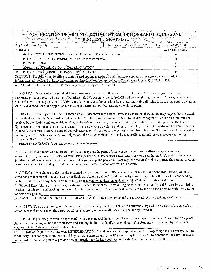
........, .. ; ........... ,." " .. '; ...... '. ' .......... , ..:'.. .' ... ". .., .. '
. "NQllFfGATIONQF<tWlVIINI8TRi\:'lJWEA.I>PEi\1JOPTIONSANDPROCESS AND .. , ",... ' " .. ,', .. ;' ·'REQuEST'FORAPPEAL< ..
Applicant: Union County I File Number: MVK-2010-1267 Date: August 20, 2010
Attached is: See Section Below
INITIAL PROFFERED PERMIT (Standard Permit or Letter ofpermission) A
PROFFERED PERMIT (Standard Permit or Letter of Permission) B
PERMIT DENIAL C
APPROVED JURISDICTIONAL DETERMINATION D
X PREL]]yfIN'ARYJuruSDICTIONALDETERMINATION E
SECTIONFTh~fo119>yingidenpfi<:sY9urrightsand options regarding an aqrninistrative appeal of the above decision. Additional information maybe found at http:l(usace.army.millinetlfunctions(cw(cecwo!reg or Corps regulations at 33 CFR Part 331.
A: INITIAL PROFFERED PERMIT: You may accept or object to the permit.
• ACCEPT: If you received a Standard Permit, you may sign the permit document and return it to the district engineer for final authorization. If you received a Letter of Penn iss ion (LOP), you may accept the LOP and your work is authorized. Your signature on the Standard Permit or acceptance of the LOP means that you accept the permit in its entirety, and waive all rights to appeal the permit, including its terms and conditions, and approved jurisdictional determinations (JD) associated with the permit.
• OBJECT: If you object to the permit (Standard or LOP) because of certain terms and conditions therein, you may request that the pennit be modified accordingly. You must complete Section II of this form and return the form to the district engineer. Your objections must be received by the district engineer within 60 days of the date of this notice, or you will forfeit your right to appeal the permit in the future. Upon receipt of your letter, the district engineer will evaluate your objections and may: (a) modifY the permit to address all of your concerns, (b) modifY the permit to address some of your objections, or (c) not modifY the permit having determined that the permit should be issued as previously written. After evaluating your objections, the district engineer will send you a proffered permit for your reconsideration, as
indicated in Section B below.
B: PROFFERED PERMIT: You may accept or appeal the permit.
• ACCEPT: If you received a Standard Permit, you may sign the permit document and return it to the district engineer for final authorization. If you received a Letter of Permission (LOP), you may accept the LOP and your work is authorized, Your signature on the Standard Permit or acceptance of the LOP means that you accept the permit in its entirety, and waive all rights to appeal the permit, including its terms and conditions, and approved jurisdictional determinations associated with the permit.
• APPEAL: If you choose to decline the proffered permit (Standard or LOP) because of certain terms and conditions therein, you may appeal the declined permit under the Corps of Engineers Administrative Appeal Process by completing Section II of this form and sending the form to the division engineer. This form must be received by the division engineer within 60 days of the date ofthis notice.
C: PERMIT DENIAL: You may appeal the denial of a permit under the Corps of Engineers Administrative Appeal Process by completing Section II of this form and sending the form to the division engineer. This form must be received by the division engineer within 60 days of
the date of this notice. D: APPROVED JURISDICTIONAL DETERMINATION: You may accept or appeal the approved JD or provide new information.
• ACCEPT: You do not need to notifY the Corps to accept an approved JD. Failure to notifY the Corps within 60 days ofthe date of this
notice, means that you accept the approved JD in its entirety, and waive all rights to appeal the approved JD.
• APPEAL: If you disagree with the approved JD, you may appeal the approved JD under the Corps of Engineers Administrative Appeal Process by completing Section II of this form and sending the form to the division engineer. This form must be received by the division
engineer within 60 days of the date ofthis notice. E: PRELIMINARY JURISDICTIONAL DETERMINATION: You do not need to respond to the Corps regarding the preliminary JD. The Preliminary JD is not appealable. If you wish, you may request an approved JD (which may be appealed), by contacting the Corps district for further instruction, Also you may provide new information for further consideration by the Corps to reevaluate the JD.
SECTIONll -REQUESTFORcAPPEALorOBJECTIQ~STO ANINITIAL,PROFF;ERED],>ERMIT
REASONS FOR APPEAL OR OBJECTIONS: (Describe your reasons for appealing the decision or your objections to an initial proffered penn it in clear concise statements. You may attach additional infonnation to this fonn to clarifY where your reasons or objections are addressed in the administrative record.)
ADDITIONAL INFORMATION: The appeal is limited to a review of the administrative record, the Corps memorandum for the record of the appeal conference or meeting, and any supplemental infonnation that the review officer has detennined is needed to clarifY the administrative record. Neither the appellant nor the Corps may add new infonnation or analyses to the record. However, you may provide additional infonnation to clarifY the location of infonnation that is already in the administrative record.
, , -- -- ,. ,<- :., .. >,.,' ",vc ',_,'
POINT OF CONTACT FOR QUESTIQNS ORINFORMA,TI(jN:: If you have questions regarding this decision and/or the appeal process you may contact:
Cori Shiers U.S. Anny Corps of Engineers Regulatory Branch 4155 Clay Street Vicksburg, MS 39183-3435 (601) 631-5369
If you only have questions regarding the appeal process you may also contact:
Division Engineer Attn: Appeals Review Officer Mississippi Valley Division Post Office Box 80 Vicksburg, MS 39181-0080 (601) 634-5820
RIGHT OF ENTRY: Your signature below grants the right of entry to Corps of Engineers personnel, and any government consultants, to conduct investigations of the project site during the course of the appeal process. You will be provided a IS-day notice of any site investigation, and will have the opportunity to participate in all site investigations.
Date: Telephone number:
Signature of appellant or agent.

United States Department of the Interior
IN REPLY REFER TO:
Reference: T A0451
Jim York ATOKA Inc. 2695 Airport Road Hot Springs, AR 71913
Dear Mr. York:
FISH AND WILDLIFE SERVICE 110 S. Amity Road, Suite 300
Conway, Arkansas 72032 Tel.: 50115 13-4470 Fax: 50 1/5 13-4480
February 01 , 2011
U.s. FISH .ok WJLDLIFE
SERVICE
~
The U.S. Fish and Wildlife Service (Service) has reviewed the information supplied in your letter dated December 28, 2010, regarding the proposed construction of new bridges over an existing culvert on Mattie Roberson Lane, New London Road, and Urbana Road, near EI Dorado, Union County, Arkansas. Our comments are submitted in accordance with the Endangered Species Act (87 Stat. 884, as amended 16 U.S.C. 1531 et seq.).
The following federally listed threatened and endangered species are known to occur in this region: Red-cockaded woodpecker (Picoides borealis).
Best management practices (BMPs) should be properly installed and maintained throughout construction to minimize erosion. These BMPs should be maintained until the site is adequately re-vegetated to prevent soil loss and sedimentation in nearby streams.
The RCW occurs in mature pine stands (greater than 30 years old). Projects in these areas have the potential to harm andlor harass RCWs as defined in the ESA. Harming andlor harassing species listed by the ESA are prohibited without authorization from the Service. Information provided in your project description and location indicates that suitable RCW habitat may exist within 0.5 mile of the project boundary. A RCW cavity tree search is required to commencing project site clearing andlor construction. The Service's RCW Private Land Guidelines must be followed if RCWs are located within 0.5 mile of the proposed project boundary. The guidelines are available at http://www.fws.gov/rcwrecovery/private lands guidelines.pdf . Due to the potential for harm and or harassment under the definition of "take" in the ESA, certain activities identified in the Private Lands Guidelines as "Potentially Harmful Activities" require concurrence andlor a permit from the Service.
The comments herein are for the sole purpose of providing technical assistance to the action agency or for individual pre-project planning assistance. These comments and opinions should not be misconstrued as an "effect determination" or considered as concurrence with any proceeding determination(s) by the action agency in accordance with Section 7 of the ESA. These comments do not authorize the "take" of a threatened or endangered species as defined under the ESA. In the absence of authorization (e.g., an ESA Section 10 Permit, a Biological

Opinion with "incidental take" provisions, a finding concurrence letter, etc.) from the Service, both lethal and nonlethal "take" of protected species are in violation of the ESA.
We appreciate your interest in the conservation of endangered species. If you have any questions, please contact Erin Leone at (501) 513-4472 or the Arkansas Ecological Services Staff at (501) 513-4487.
Sincerely,
~argarettIarney
Environmental Coordinator

2011-12-14 17:20 Union County Judge 8708641902 » 18173527925 P 1/1
Jerry Thomas Dire~t.,r of EnlergeDf::Y MUDllgement
Arkllnslls {;eriiiied Flooclplain Manager Surety {;oorclmuto .. Fire (; ...... din,lt .. ,r
12/12/2011
The proposed 50-feet span bridge design being installed at the existing top of road grade elevation is in agreement with the H&H Study provided by David Mayo, AR PE #5368 of the State Aid Division of the Arkansas Highway and Transportation Department to pass a 10 -year storm event. The increased crossed sectional area will improve the conveyance of storm water through the proposed bridge installations at the three proposed road crossings at New London Road, Urbana Road, and Mattie Roberson Road. The proposed bridge improvements will have no impact to the Floodplain at their locations.
11~& Arkansas Certified Floodplain Manager
101 N. Washington, Suite 101 El Dorado, Arkansas 71730 Telephone: 870-864-1901 Email: [email protected]
Cell: 870-881-2161 Fax: 870-864-1902 .

ATOKA, Inc.
Appendix B
Site Map

FEDERAL EMERGENCY MANAGEMENT AGENCY
)CATIONMAP 'PLICANT: UNION COUNTY, ARKANSAS
)S #: 139-99139-00
.' ... '
. ." ," ... ..... ...,.,
. " ......... 8Sv
15
...... m .' "'"
-$ / .
C'j1
~
Pigeon Hill,
.' , ... ,
Philadelphia f?c! I New London Rd '" ~ 33 ,22I04"N 92,33021 oW ~
22
€ -.J
::8 ~ u~. I,,) 4'! 0"q' 7. ~ '\~ COy-'i?:l-
R-55 ~ ~" Ii'~ Copvripht @and (P) 1988-2007 MCf'Osoft Corporation a'n1li~r its suppliers . .I'll rights 'i1,1'erved.
....... ' .....
Phelps Rd
"'" " "
}careyville .' /,Landing
LOCATION MAP PAGE 1
DATE: 111112010 PW REF #: A VV-003
UNION COUNTY, AR PA-ID 130-99139-00 PROJECT REFERENCE # AVV-003 EMERGENCY PROTECTIVE MEASURES
8enjamine ~ ~~
~~
'. " " ......
,"'. '.
'. ".
"'"
.......
." ",,,,'

_̂
Pvt
Pvt
Pvt
New
Lon
do
nR
d
Pvt
Pvt
Pvt
Winchester Rd
Pvt
Lond
on
Star
Rd
Car
eyvi
lleR
d
Pear
Tree
Rd
Pvt
Pvt
Norm
ansLndg
Poole
Rd
EdFullerRd
Pige
on
Hi ll
Rd
North Rd
PvtPvt
Pvt
Pvt
Pvt
Pvt
Pvt
Benjamin Lake Rd
Pvt
Ch
ristian
Rd
Pvt
Phelps Rd
Ph
elp
sR
d
No
rth
Rd
ProposedBridge Location92°19'48.13"W
33°13'15.816"N
±2,000 0 2,0001,000
Feet
DATE: 10-28-10 SCALE: 1'' = 2,000' JOB NO.: 10-370 SHEET: 1 OF 1
ATOKA, INC. 2695 AIRPORT RD
HOT SPRINGS AR, 71913-9272
501-623-1121
PROPOSED NEW LONON RD BRIDGE
UNION COUNTYEL DORADO
ARKANSAS
ENVIRONMENTAL AND ENGINEERING CONSULTING

_̂
Pvt
Poole Rd
New
Lond
onR
dProposedBridge Location92°19'48.13"W
33°13'15.816"N
±600 0 600300
Feet
PROPOSED BRIDGE LOCATION-SITE C
UNION COUNTYUNION COUNTY
ARKANSAS
ENVIRONMENTAL AND ENGINEERING CONSULTING
DATE: 10-23-10 SCALE: 1'' = 600' JOB NO.: 10-371 SHEET:
ATOKA, INC. 2695 AIRPORT RD
HOT SPRINGS AR, 71913-9272
501-623-1121

FEDERAL EMERGENCY MANAGEMENT AGENCY
. _ ....................... , •...... "'~"'~-.......... ~ ................ - .... ~........" .... , ....... .
FIRMETIE PAGE 1
~~:l\Ii~ll\. m~ ~<l-."'l.1:~w.i~, \lOl\t<!J>;l: "\'lloCA' lr.::~an~ :81 ·~~·:I)SMI~('B.) ..
•. :t~. ~~: ~', ~
" ..... ,
:fU@Mrm:r································:~;~··· ............................................ \ AAUE1. ~\!OO
t.fNll)N COljNT\~~ ARKA:::~SAS .:'I.sn r~COR'~».l<\·nm .. uu~.~f4i
~AHa~OF~ (;;&l:..I,'#-.~"WIr.I;: F:~~. !,:w, ?~~I .• v,,~n i s. .... '?~::}f')S; ~
.~~~~~~:%:~~~~=~~~= { ... i-:.-.... ;y, ."y;.: .~;. ~:tV .. ~i'o, ... • ,~,..,,;.»». w {.:~ N~;< ~ !..:.~:w:a:.: .... ; {
•
M/I.$lWM8a j 0513lC0400C ~
:; • ,";'" £FFECTWI; DATE 1
~:~:E:~r:!1~~!~~~~:~!. J ........................... , ...................... ' ... ' ..... ' ..•.......• ' ..•.•.• '.' ..... ' ..
ATOKA, Inc.
Appendix C
Site Photographs