Embed Size (px)
Citation preview
TRANSPORTATION PLAN OF NORD-DU-QUÉBECANALYSIS
ENGLISH VERSION
Transportation plan

AcknowledgementsWe wish to thank all those who have contributedin the making of the Analysis prepared by theCoordination du Nord-du-Québec – Ministèredes Transports.
For more information, contact:Ministère des TransportsCoordination du Nord-du-Québec80, avenue QuébecRouyn-Noranda (Québec) J9X 6R1Telephone: (819) 763-3237Fax: (819) 763-3493Email: [email protected] Site:www.mtq.gouv.qc.ca/fr/regions/abitibi/plan_nord.asp
Cette publication a été réalisée par le ministère des Transports du Québec. Dépôt légal – 1er trimestre 2005 Bibliothèque nationale du Québec ISBN 2-550-43888-4 Printed in February 2005Graphic design : www.agencesecrete.com
ContentsRegional Portrait . . . . . . . . . . . . . . . . . . . . . .1Safety . . . . . . . . . . . . . . . . . . . . . . . . . . . . .23Socioeconomic Growth . . . . . . . . . . . . . . .39Mobility of People and Goods . . . . . . . . .55Environment, Land-Use Planning and Sustainable Development . . . . . . . . . . . . . .75

Regional Portrait
Portrait of Population and Territory
• The administrative region of Nord-du-Québec covers 840 000 km2 and accounts for 55% of the area of Québec.
• Two distinct territories compose the region: - North of the 55th parallel, Nunavik covers nearly 490 000 km2 for a population of 10 410 inhabitants in 2001. The population is gathered in14 Inuit municipalities and a Cree village located along the coasts of Hudson Bay, Hudson Strait and Ungava Bay. They are Kuujjuarapik,Umiujaq, Inukjuak, Puvirnituq, Akulivik, Ivujivik, Salluit, Kangiqsujuaq, Quaqtaq, Kangirsuk, Aupaluk, Tasiujaq, Kuujjuaq and Kangiqsualujjuaq,and the Cree village of Whapmagoostui. These villages are not linked by road.
- Between the 49th and 55th parallel, covering approximately 350 000 km2, is located the James Bay territory. This territory consists of theMunicipalité de Baie-James (MBJ), of category I lands as they are defined by the James Bay and Northern Québec Agreement (JBNQA), as wellas enclaved cities of MBJ, that is to say Chibougamau, Chapais, Lebel-sur-Quévillon and Matagami. The Municipalité de Baie-James includes thelocalities of Radisson, Villebois and Valcanton (merge of Val-Paradis and Beaucanton), the hamlets of Miquelon, Desmaraisville and Rapide-des-Cèdres, as well as a vast uninhabited area. On the whole, MBJ and the enclaved cities count 16 314 persons in 2001. As for the Cree villageslocated on the James Bay territory, it counts 11 851 persons divided in eight communities: Mistissini, Oujé-Bougoumou, Waswanipi, Nemaska,Waskaganish, Eastmain, Wemindji and Chisasibi.
• Although there is a certain concentration of the population in the south of James Bay, it remains very scattered in the region.
• Three groups are established in the region: Cree, Inuit and Jamesian. Their sociocultural, territorial and economic realities differ, and their lifestylesgenerate their own needs. Naskapis, although they are not established in the region, practise economic and subsistence activities, and landscovered by the JBNQA are at their disposal in Nunavik.
1 REGIONAL PORTRAIT ◊ Portrait of Population and Territory

• The James Bay and Northern Québec Agreement defines a particular territorial regime. The category I lands are those with exclusive use orexclusive property of the Aboriginal, on which the villages are established. As for the category II lands, they are public lands where the Aboriginalhave exclusive rights for hunting, fishing and trapping. The category III lands, as for them, are also public lands where the Aboriginal have a rightof exploitation (right to hunt, fish and trap without licence, without limit and in any time). The categories II and III lands are located on the MBJterritory.
• The population forecasts for the Aboriginal communities foresee a considerable growth (31% over the period 1996-2021, as 21.7% for the Inuitand 38.7% for the Cree) and the population is very young —approximately 46% of the population is less than 20 years of age, compared to 24% forthe remainder of Québec. The Jamesian population is, as for it, in a fall — -40.6% over the period 1996-2021. This fall is explained by the emigration,ascribable to job losses. This tendency will be however re-examined according to new major projects on the territory.
• The cost of living in the region is higher than in the south of the province in particular because of the costs of consumer goods, of transport andthose related to energy consumption.
• The subarctic climate extends up to the 56th parallel (Umiujaq), and the arctic climate extends beyond this limit. Permafrost covers nearly 50% ofthe region. As elsewhere in the Arctic, the climate warming is becoming more acute.
• The boreal forest vegetation zone is found in the south of the region, up to the village of Eastmain. Further north, the taiga stretches to the southof Umiujaq, while the forest or Arctic tundra extends on the remainder of the region.
• The Nord-du-Québec region is rich in diversity of landscapes, in particular because of the high number of latitudes it covers. The ecosystems arefragile there. The elements which require a particular attention include lengthy revegetation, bank erosion, biodiversity, migratory circuits,endangered or vulnerable species, wetlands and streams.
2 REGIONAL PORTRAIT ◊ Portrait of Population and Territory

Air• There are 27 aerodromes in the region, of which 22 are public and 5 are private. Among the public aerodromes, the ones of Matagami
and Lebel-sur-Quévillon do not have the airport certification. The 5 private aerodromes are not certified. Several unofficial landingsites are scattered all over the territory.
• Of the 22 public aerodromes, 17 have a gravel runway while 4 have a paved runway. Kuujjuaq has a runway of both types. The5 private aerodromes have a gravel runway. More than half of the aerodromes have a runway of approximately 3500 feet by 100 feet.
• The region counted, in 2003, 2 registered water aerodromes and 3 heliports, all private and located in James Bay. There exist howeverseveral other active water aerodromes.
3 REGIONAL PORTRAIT ◊ Portrait of Networks, Infrastructures and Equipments
Portrait of Networks, Infrastructures and Equipments

• The low-level airspace of the region (less than 18 000 feet) is uncontrolled, except for the terminal region of La Grande Rivière airport.Pilots flying under instrument flight rules must thus make known their presence to the other pilots by the means of radiocommunications. As for the information transmitted to the pilots before landing, the operating modes vary. Of the 22 publicaerodromes, 3 have a Flight Service Station (FSS), 15 have a Community Aerodrome Radio Station (CARS), only one has a PrivateAdvisory Service located at uncontrolled aerodrome (UNICOM) and 3 do not have a station on the ground. Among the 5 privateaerodromes, 4 have a UNICOM and the fifth does not have a ground station. Automated weather information systems are alsoinstalled at the airports of Inukjuak, Chibougamau and Matagami. Weather information in flight is provided by the Flight InformationCentre (FIC) of Québec, up to 5 nautical miles from the destination aerodrome.
• The region is equipped with Very High Frequency Omnidirectional Range (VOR) near the La Grande Rivière, Kattiniq and Kuujjuaqaerodromes. It is also equipped with Non-Directional Beacons (NDB) everywhere but at Chisasibi, with an Instrument Landing System(ILS) at the Kuujjuaq airport and with Distance Measurement Equipment (DME) at Chibougamau, Kattiniq, Kuujjuaq, Puvirnituq andLa Grande Rivière aerodromes. There is a GPS approach for 15 of the 22 public aerodromes, and for the 5 private aerodromes.
• Concerning the lighting system, the majority of the aerodromes are equipped with Aircraft Radio Control Lighting (ARCAL) andRunway Identification Lighting (RIL).
• Among the public aerodromes, only one is equipped with an Omni-Directional Approach Lighting System (ODALS) and 7 are equippedwith a Precision Approach Patch Indicator (PAPI) or a Visual Approach Slope Indicator System (VASIS). The 5 private aerodromes areequipped with PAPI or VASIS. These instruments contribute to increase the reliability and the safety of landing operations.
4 REGIONAL PORTRAIT ◊ Portrait of Networks, Infrastructures and Equipments

Road• The agglomerations are generally located at important distances from each other. The Inuit villages as well as the Cree village of
Whapmagoostui are not connected between them by a road network nor to the network of Québec.
• In Nunavik, the northern villages can count on a public road network of local interest which profits from a provincial subsidy makingso that the roads will all be paved in 5 to 7 years.
• The James Bay territory has about 2 900 kilometres of roads. This vast road network is composed of: - the superior road network, which includes the national, regional, collector roads (534 km) and access to resources (440 km), under
the responsibility of the Ministère; - the road network without status (1 947 km). It is consisted of roads whose maintenance is under the responsibility of:
— Hydro-Québec (1 441 km), which includes the Route de la Baie-James (Matagami-Radisson) and the access road to Chisasibi,which are both paved, as well as the following two unpaved roads: Transtaïga, and the road leading to Némiscau station (startingfrom Route de la Baie-James);
5 REGIONAL PORTRAIT ◊ Portrait of Networks, Infrastructures and Equipments

6 REGIONAL PORTRAIT ◊ Portrait of Networks, Infrastructures and Equipments
— the localities or communities (25 km);— Ministère des Transports (481 km), that is to say the unpaved roads leading to the communities of Waskaganish, Wemindji and
Eastmain as well as the Route du Nord.
• This road network is supplemented by the municipal road network and an important network of permanent (2 182 kilometres) andnon-permanent (8 516 km) gravel forest roads.
• The sections of access roads to the Cree communities located on the category IA lands are under the responsibility of the federalgovernment.
• The road network without status is almost entirely located in little inhabited area and approximately 35% of its surfacing is paved(Route de la Baie-James and access road to Chisasibi). The Route de la Baie-James was built according to higher constructionstandards than those of the other roads of the province.
• All the road network (excluding the forest network) includes:- 10 parking or checking areas for heavy vehicles;- 15 rest areas;- 12 emergency telephones;- 2 passing lanes;- 95 bridges or engineering structures located on the road network of James Bay, of which 47 on the superior network and of access
to resources of the MTQ.
• The fleet of vehicles used in Nord-du-Québec is more made up of light trucks - utility light vans, vans and 4 X 4 vehicles - than all ofQuébec, 51% vs 23%.

Marine• In Nunavik, the Inuit communities are or will be equipped with access ramps and breakwaters. At the present time, 10 communities
are equipped with these types of marine infrastructures, which will be in medium-term of municipal property.
• In James Bay, the Cree coastal communities all have launching ramps and in certain cases, floating pontoons.
• A deepwater wharf of private property is located at Deception Bay in Nunavik.
REGIONAL PORTRAIT ◊ Portrait of Networks, Infrastructures and Equipments7

Off-Road Vehicles (ORVs)• In the Nord-du-Québec region, there are three types of ORV trails: federated, non-federated and unofficial.
• Snowmobile federated trails (1 360 km) and ATV federated trails (approximately 255 km) are located exclusively in the south of James Bay.
• The non-federated trails are generally developed to give access to the federated networks or to allow a closed-loop trail near anagglomeration.
• The unofficial trails are scattered across the region. There are, among others, the trails giving access to the resources and the territory,as well as links between certain villages. These unofficial trails are generally not provided with markers or road signs.
8 REGIONAL PORTRAIT ◊ Portrait of Networks, Infrastructures and Equipments
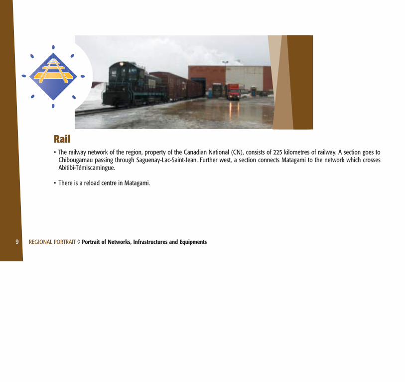
Rail• The railway network of the region, property of the Canadian National (CN), consists of 225 kilometres of railway. A section goes to
Chibougamau passing through Saguenay-Lac-Saint-Jean. Further west, a section connects Matagami to the network which crossesAbitibi-Témiscamingue.
• There is a reload centre in Matagami.
9 REGIONAL PORTRAIT ◊ Portrait of Networks, Infrastructures and Equipments
10 REGIONAL PORTRAIT ◊ Characteristic of Nord-du-Québec: Safety
Characteristic of Nord-du-Québec
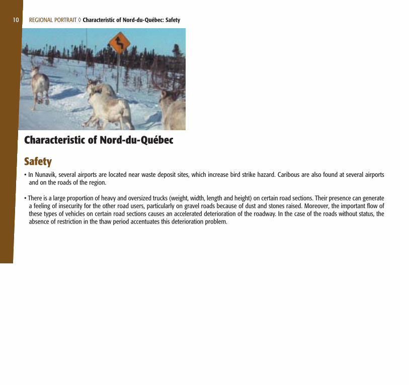
Safety• In Nunavik, several airports are located near waste deposit sites, which increase bird strike hazard. Caribous are also found at several airports
and on the roads of the region.
• There is a large proportion of heavy and oversized trucks (weight, width, length and height) on certain road sections. Their presence can generatea feeling of insecurity for the other road users, particularly on gravel roads because of dust and stones raised. Moreover, the important flow ofthese types of vehicles on certain road sections causes an accelerated deterioration of the roadway. In the case of the roads without status, theabsence of restriction in the thaw period accentuates this deterioration problem.

• On the overall network, more particularly in the Aboriginal communities, there is a high level of cohabitation of road vehicles and off-road vehicles(ORVs).
• The Road Safety Code applies to the MTQ roads. For the roads without status and forest roads, it does not apply entirely. The Code applies in theAboriginal villages, but its application is difficult being given the non-conformity of signage.
• The supply points for gasoline are sometimes located at long distances from each other.
• The use of barges to carry out the marine sealift operations can present risks under difficult climatic conditions.
• Currently, cellular phones do not work everywhere on the territory. The radio communication systems, used almost exclusively by the majorcompanies of the region, and satellites are as for them functional. Hydro-Québec is the company which has the most important network, devotedto its exclusive use.
• On the James Bay territory, the ORV users frequently drive on the roadsides.
11 REGIONAL PORTRAIT ◊ Characteristic of Nord-du-Québec: Safety

Socioeconomic Growth• The region’s economy is characterized by the cohabitation of two types of activities: the subsistence economic activity and the industrial resources
development.
• The co-operative movement in Nunavik remains very present and a growth of the private economic initiative is observed in all of the Aboriginalcommunities.
• Compared to the rest of Québec, the manufacturing industry is poorly represented and is primarily linked to the activities of major mining andtimber companies. The construction sector, as for it, is dependent on hydroelectricity developments or major local projects in transport, dwellingand public services sectors.
• Tourist industry preserves a certain importance and rests on several types of activities: hunting, fishing, snowmobiling, cultural and adventuretourism as well as the visits of hydroelectric complexes and natural sites. The region has a strong recreotouristic potential, which is supported bythe development of national parks and wildlife reserves.
12 REGIONAL PORTRAIT ◊ Characteristic of Nord-du-Québec: Socioeconomic Growth
• The small size market as well as the high costs of operation make difficult the establishment of diversified and profitable commercial businesses,restricting also considerably the availability of products and services on the local level.
• Shippers and conveyors must adapt to the high costs of operation related to northern constraints and characteristics in order to ensure theirprofitability and their efficiency.
• In 2001, the unemployment rate in Québec is of 8%. In comparison with the region, the unemployment rates are as follows:- Nord-du-Québec: 14.6%;- Cree villages: between 4.4 and 27.6%;- Northern villages: between 7.7 and 26.7%;- MBJ and enclaved cities: between 8.5 and 24.1%.
• The professional structure of the Nord-du-Québec region is fairly sexed, i.e. the women strongly find themselves in sales and services (35%), socialsciences, subordinate business, finance and administration positions (23%) and teaching and public administration (21%), whereas the men workmainly in trades, transport and machinery (32%), sales and services (18%) and trades specific to the primary sector (12%).
• Cree and Inuit hunting, fishing and trapping activities are supported by the means of the Income Security Program for Cree Hunters and Trappersand of the Northern Québec Hunter Income Support Program, financed by the gouvernement du Québec.
• A significant number of jobs related to forest, mining and hydroelectric resources development is filled by workers that do no live in the territoryon a permanent basis, which does not foster economic growth in the region. Moreover, the majority of the companies working in the north havea registered office outside the region. All in all, the Nord-du-Québec region fosters to the economic growth of all Québec.
13 REGIONAL PORTRAIT ◊ Characteristic of Nord-du-Québec: Socioeconomic Growth

14 REGIONAL PORTRAIT ◊ Characteristic of Nord-du-Québec: Socioeconomic Growth
• The pool of construction workers is not limited to the region, which harms the regional employability. Moreover, taking into account the extent ofthe projects and the contracts in Nord-du-Québec, it is difficult for the small regional companies to tender.
• In order to make sure that the economic repercussions of hydroelectricity development projects benefit to the region, maximization committeeswere set up over the passed years, of which more recently the Northern COMAX.
• The regional stakeholders wish to find inciting means aiming to slow down the emigration and to increase the pool of resident workers.
• The population of the Nord-du-Québec region has little schooling, as proof a variation of 17% exists between the average population of Québecwhich is 30% and the average of Nord-du-Québec which reaches 47%. It is not surprising to note the less percentages of secondary, collegial anduniversity graduates. Only exception, the percentage of trade post school graduates shows a higher proportion in Nord-du-Québec (14%)compared to the rest of Québec (12%). In a general way, for all the region, the education level does not agree with jobs offered and the latterhave to be filled by workers from outside of the region.
• The Cree and Nunavik school boards schedule annual holidays in order to make it possible for students to accompany their family in thesubsistence activities (e.g. Goose Break).
• Lack of residences and employment, as well as the limited offer of education services of higher level in the region, are factors which contributeto the exodus of young people.
• In 2001, average family income in Québec is $64,000. In comparison, in the region, the average family incomes are as follows:- Nord-du-Québec: $59,600;- Cree villages: $48,900 and $56,800;- Northern villages: between $41,100 and $57,800 (but Kuujjuaq $78,200);- Jamésie: between $51,200 and $62,000 (but Lebel-sur-Quévillon $78,600).

• In Nord-du-Québec, a significant part of the family budget is devoted to transport.
• The financial dependency rate in the Aboriginal communities is 0.62 compared to 0.45 for Québec. It provides information on the burden thatthe individuals in age to work must assume towards the young and elderly people. The burden that each member of the Aboriginal populationmust assume is generally heavier than that of the population of Québec.
• The residents of the region are entitled to certain tax deductions for remote regions, on federal and provincial level.
• The James Bay and Northern Québec Agreement (JBNQA) establishes an administrative and lawful framework which influences thesocioeconomic development, for example, by the presence of Aboriginal territorial administrations (KRG, CRA). These entities contributed to thesignature of collaboration agreements, in particular those between the gouvernement du Québec and the Crees on the one hand (Paix desBraves), and with the Inuits on the other hand (Sanarrutik). These agreements support the responsibility assumption of the socioeconomicdevelopment by the regional administrations, and, by extension, the local authorities.
• The companies created with the funds resulting from the JBNQA have an economic and social vocation. Moreover, a multitude of organizationsact as regards socioeconomic development. Those have roles, structures and operating modes which can sometimes differ from the organizationsof the south.
• A Regional Conference of Elected Officers (RCEO) is instituted for the territory of MBJ and that of the enclaved cities, whereas the Regional KativikGovernment (KRG) and the Cree Regional Authority (CRA) serves as RCEO for their respective community. The dialogue as regards regionalsocioeconomic development remains sporadic. A mechanism aiming at harmonizing the powers and the responsibilities for the three groups isforeseen.
15 REGIONAL PORTRAIT ◊ Characteristic of Nord-du-Québec: Socioeconomic Growth

16 REGIONAL PORTRAIT ◊ Characteristic of Nord-du-Québec: Socioeconomic Growth
• A reflexion process on the implementation of self-government in Nunavik began and, in a general way, the Aboriginal communities ask for moreautonomy in the realization and management of development projects.
• On the political level, the challenges (scientific, environmental, social, geostrategic) posed by the question of nordicity mobilize the attention ofdecision makers more and more and clarify the adjustments to be authorized in Nord-du-Québec in order to ensure a durable establishment inthe region and of interventions adapted to the Aboriginal context. This new awakening has taken for a few years the form of political engagements,agreements and adaptation of laws, etc.
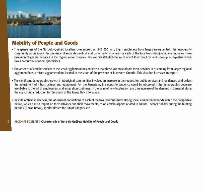
Mobility of People and Goods• The sparseness of the Nord-du-Québec localities over more than 840 000 km2, their remoteness from large service centres, the low-density
community populations, the presence of separate political and community structures in each of the four Nord-du-Québec communities makeprovision of general services in the region more complex. The various stakeholders must adapt their practices and develop an expertise whichtakes account of regional specificities.
• The absence of certain services in the small agglomerations makes so that these last must obtain these services in or coming from larger regionalagglomerations, or from agglomerations located in the south of the province or in eastern Ontario. This situation increases transport.
• The significant demographic growth in Aboriginal communities involves an increase in the request for public services and residences, and ordersthe adjustment of infrastructures and equipment. For the Jamesians, the opposite tendency could be observed if the demographic decreaseascribable to the fall of employment and emigration continues. In the paint of new localization plan, an increase of the demand in transport alongthe coasts but a reduction for the south of the James Bay is foreseen.
• In spite of their sparseness, the Aboriginal populations of each of the two territories have strong social and parental bonds within their respectivenation, which has an impact on their activities and their movements, as on certain aspects related to culture - school holiday during the huntingperiods (Goose Break), special classes for Junior Rangers, etc.
17 REGIONAL PORTRAIT ◊ Characteristic of Nord-du-Québec: Mobility of People and Goods

• Transport initiated by subsistence hunting, fishing and trapping is carried out over the whole territory, including areas sometimes deprived ofstructured and official transport networks.
• The economic structure of Nord-du-Québec is marked by the important development of the natural resources, primarily exercised in the south ofJames Bay and by subsistence economic activities mostly practised close to Aboriginal local communities, along the littoral and the roads. Thesetwo aspects introduce a certain degree of uncertainty into regional development since the economy connected to the development of resourcesis prone to unforeseen fluctuations, and that it is difficult to anticipate, in the long run, the share of the market between the subsistence economyand the procurement of extra-regional products. Moreover, the economic conditions of the region remain sometimes difficult and theunemployment rate is high.
• The supply process is currently undergoing major changes as much as on a national, regional and worldwide level. Nord-du-Québec does notprofit of the same opportunities to develop networks, to make strategic alliances and ensure competitive provision of services, nor does it havethe technological adjustment possibilities that other regions of Québec have.
• The demographic growth and the development projects will have a rising impact on the volumes of transported goods.
• In the region, there is a strong use of small boats for the practice of recreational and subsistence activities.
• There is an important use of ORVs in the Aboriginal villages
18 REGIONAL PORTRAIT ◊ Characteristic of Nord-du-Québec: Mobility of People and Goods

Environment, Land-Use Planning and Sustainable Development• Several tools for land-use planning exist and differ according to the planning framework of municipal and regional organizations. The Land-Use
Planning and Development Act does not apply north of the 55th parallel nor to category I lands in James Bay. In the first case, it is the Actrespecting Northern Villages and the Kativik Regional Government which frames the land-use planning. In the second case, it is The Cree Villagesand the Naskapi village Act. No Regional County Municipality (RCM) was formed in the Nord-du-Québec region. Within the context of theimplementation of the Paix des Braves, a discussion table gathering the Crees and the governmental authorities was set-up in order to define anddocument the stakes relating to access to the territory.
• In general, there is an important increase in population within the Aboriginal communities, causing problems with occupation of available spacein certain villages.
• The lack of integrated management of natural resources (hydroelectricity, forests, mines, etc.) raises problems related to the environmental stakes,land-use planning and occupation of the territory (recreotourism, subsistence activities, etc.). These various activities also cause use conflicts.
19 REGIONAL PORTRAIT ◊ Characteristic of Nord-du-Québec: Environment, Land-Use Planning and Sustainable Development

• The diversity of landscapes fosters the development of reserved and protected spaces (national parks, wildlife reserves, etc.) which commandsthe implementation of transport infrastructures and structures transport movements.
• The JBNQA provides a specific and distinct regime to north and south of the 55th parallel, with regard to the Environmental and Social ImpactAssessment and Review Procedure applicable to the various development projects. The JBNQA also determines, according to the project’scompetence (federal or provincial), the environmental evaluation procedure and the laws applicable at the time of the realization of projects.
• The simultaneous application of the federal and provincial environmental procedures for the same development project, in particular in transport,complexes planning and extends project realization time. However, a collaboration agreement between the federal and provincial governmentswas implemented in order to support the co-operation as well as the coordination of environmental evaluation procedures. This agreementexcludes however a significant part of the territory under the JBNQA.
• The needs of various industries and of the communities generate a use of hazardous material which must be carried by land and sea way.
• Under the Environment Quality Act (EQA), Nord-du-Québec is not required to establish a management plan for domestic residual hazardousmaterial and residual material as it is the case for the 90 Regional County Municipalities (RCM) and metropolitan communities of Québec, whichare eligible for funding to develop a management plan. Since the municipalities of Nord-du-Québec are not grouped together in a RCM structure,for the time being they are not eligible for such funding.
• In the Nord-du-Québec region, the management of residual material and hazardous residual material is almost unexisting. This situation is allottedin particular to the absence of a management plan for residual material and hazardous residual material, to the lack of means to sensitize thepopulation as well as the high transport costs towards the south for their recycling or elimination.
20 REGIONAL PORTRAIT ◊ Characteristic of Nord-du-Québec: Environment, Land-Use Planning and Sustainable Development

• Hazardous material were inventoried at many abandoned sites (mining exploration, hydroelectric development, weather station, etc.) scatteredin the region.
• Global warming has impacts in Nord-du-Québec. It generates important consequences on the natural environment notably causing permafrost tothaw in certain areas, bodies of water to thaw early, ice, precipitation and snow cover regime to change. These impacts have repercussions onthe way of life of the populations, as well as on the infrastructures. It is complex to quantify the extent of the impacts of climate warming and onecannot foresee its future trend.
21 REGIONAL PORTRAIT ◊ Characteristic of Nord-du-Québec: Environment, Land-Use Planning and Sustainable Development
Safety

23 SAFETY ◊ General
General
Highlights and Significant Elements
• The data resulting from accident analyses in Nord-du-Québec are not easily comparable with those of the remainder of Québec being given theregional context (population density, network type, etc.).
• The 48-hour term period enforced by the Sûreté du Québec and the Canadian Forces before undertaking search and rescue activities is notadapted to certain situations in the northern region. The local resources are thus mobilized to carry out interventions quickly.
• The increased use of the territory by the travelling public has an impact on the vocation of the network, which passes from specific to public, whichbrings changes as for the request for services related to safety in transport.
Other Community and Users’ Concern
• In order to reduce first-aid intervention time for emergencies or accidents, the population of James Bay expressed the interest to use the sameradio frequency all over the territory.

SAFETY ◊ Air
Air
Highlights and Significant Elements
• Currently, no aerodrome is required to offer on location firefighting services. Nearby agglomerations provide these services, except atLa Grande Rivière airport where the services are offered on location. The private aerodromes ensure their own services.
• In spite of the recommendation of Transport Canada to this effect, certain aerodromes are not equipped with emergency generatorsin the event of power failure.
• Transport Canada new regulations related to aerodromes safety and security will oblige the airports of the region to respect newrequirements, in particular the emergency response plans, the Safety Management System and wildlife control.
24

25 SAFETY ◊ Air
• Some landings are carried outside normal working hours of the observers-communicators (CARS), with the result that pilots do nothave access to the necessary data for instrument approaches, that is to say wind speed and direction, altimeter setting and the landingstrip condition.
• Except for gliders, balloons, airships, ultra-light aeroplanes and gyroplanes, all the aircrafts must be equipped with an EmergencyLocator Transmitter (ELT), making them easier to locate in case of incident. The search and rescue operations of aircraft are carriedout by the Canadian army.
• Incursions on landing strips by individuals or animals are observed at certain aerodromes. This situation occurs because someaerodromes are not fenced or because access to the airside is not respected.
Other Community and Users’ Concerns
• The main community concerns with regard to infrastructures and equipments are the improvement of emergency equipment atairports (generators, first-aid material) as well as deterioration of runway surface, maintenance equipment and lighting at someaerodromes.
• Regarding services, the main concern is the lack of availability of the observers-communicators (CARS) outside working hours andthe possibility to install automated weather information systems to offset the problem. Moreover, the marking of the landing stripcentre in winter would make it easier to locate.

26 SAFETY ◊ Road
Road Highlights and Significant Elements
• Given that the network is under the responsibility of several authorities, there is no uniformity with regard to maintenance level.
• Although the R-1005 (N-805) road is a forest road, it is used by the travelling public as a link between Matagami and Lebel-sur-Quévillon, and this, without adaptations of the construction standard according to the type of use. The users who prefer not to travelon this type of road must use the road network of Abitibi-Témiscamingue, which increases the distance by 200 kilometres.
• Given the traffic evolution, caused by the growth of resources exploitation, the bearing capacity of certain roads does not meet theneeds any more.

27 SAFETY ◊ Road
• The narrowness and the low bearing capacity of shoulders make difficult the clearing of the roads at the time of breakdowns or loadchecking by truck-drivers, particularly for heavy vehicles.
• In spring, autumn and in the event of abundant precipitations, it is difficult to maintain the maintenance level on gravel roads usedby heavy traffic.
• Given the low number of heavy vehicles parking or checking areas on the road network, the truck-drivers use roadside to carryingout checks on their vehicle. This situation compromises their safety as well as of the other users.
• The non-standardized signage of the roads in the region creates safety issues.
• Dust and stones raised by traffic on gravel roads frequently cause breakings to vehicles, mainly to windshields, and cause problemsof visibility, which increases the risk of accidents (collision, run-off-road accidents, etc.)
• Caribou hunting practised near the road network increases the risk of incidents with road users.
• Long journeys on the road can involve driver fatigue, sometimes causing distraction while driving. Moreover, in reason of thedistances, drivers may tend to drive at high speeds. Lastly, the users must adapt their driving to frequent and sometimes suddenchanges of the climatic conditions.
• On certain access roads to the airports of Nunavik, driving presents difficulties in fog or snow flurry conditions.
• The terminology used concerning road conditions on James-Bay roads without status is now standardized with the one of the MTQnetwork. This information is now accessible via the MTQ Internet site.

28 SAFETY ◊ Road
• Since several run-off-road accidents are not followed by an accident report or complaint, it is difficult to evaluate their exact numberand cause.
The road accidents declared in Nord-du-Québec between 1995 and 1999 and having been the subject of an accident report, reveal thefollowing facts:
• In general, the road accident reports contain few precise details, in particular concerning the exact location.
• The number of accidents reported is 3 759. From this number, 1% was fatal accidents and 4.6% caused serious injuries.
• The number of accidents by 100 inhabitants per year is 2.0 for Nord-du-Québec compared to 2.8 for Abitibi-Témiscamingue and 3.4for Côte-Nord. This finding is partly explained by the low density of traffic in the region. The death toll and the number of seriousinjuries are however higher in the region than for the province of Québec.
• Accidents involving bodily injuries have occurred mainly on a dry road and the majority of accidents involving material damagesoccurred on a snow or ice-covered road.
• There are more accidents in winter compared to the remainder of Québec, and this, by considering the same 4-month period.
• According to supplemental reports written by the police officers, most road accidents would be caused by human factors: - Inattention or distraction;- Careless/speed driving.
29 SAFETY ◊ Road
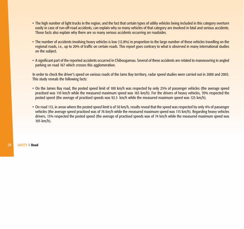
• The high number of light trucks in the region, and the fact that certain types of utility vehicles being included in this category overturneasily in case of run-off-road accidents, can explain why so many vehicles of that category are involved in fatal and serious accidents.Those facts also explain why there are so many serious accidents occurring on roadsides.
• The number of accidents involving heavy vehicles is low (12.8%) in proportion to the large number of these vehicles travelling on theregional roads, i.e., up to 20% of traffic on certain roads. This report goes contrary to what is observed in many international studieson the subject.
• A significant part of the reported accidents occurred in Chibougamau. Several of these accidents are related to manoeuvring in angledparking on road 167 which crosses this agglomeration.
In order to check the driver’s speed on various roads of the Jams Bay territory, radar speed studies were carried out in 2000 and 2003.This study reveals the following facts:
• On the James Bay road, the posted speed limit of 100 km/h was respected by only 25% of passenger vehicles (the average speedpractised was 110 km/h while the measured maximum speed was 165 km/h). For the drivers of heavy vehicles, 70% respected theposted speed (the average of practised speeds was 92.5 km/h while the measured maximum speed was 125 km/h).
• On road 113, in areas where the posted speed limit is of 50 km/h, results reveal that the speed was respected by only 4% of passengervehicles (the average speed practised was of 76 km/h while the measured maximum speed was 115 km/h). Regarding heavy vehiclesdrivers, 13% respected the posted speed (the average of practised speeds was of 74 km/h while the measured maximum speed was105 km/h).

30 SAFETY ◊ Road
Other Community and Users’ Concerns
• Certain Cree communities find that the access roads to their village are not in good condition. Moreover, they consider that the forestand mining roads which are no longer used by the companies should be the subject of maintenance in order to allow safe access toall the territory.
• The James Bay population would like that improvement and conservation work be carried out on the roads (in particular paving), andthat maintenance of certain roads be improved. Moreover, the application of the Highway Safety Code according to the status of theroad is not known of all the users. Lastly, the Code appears sometimes unsuited to the realities of the territory, notably concerningthe driving time and load limits.
• On certain roads, the number of passing lanes, rest areas, parking or checking areas for heavy vehicles as well as emergencytelephones is considered to be insufficient.
• The road signs appear inadequate, even insufficient in the northern villages of Nunavik and on certain forest roads of James Bay, inparticular at level crossings.
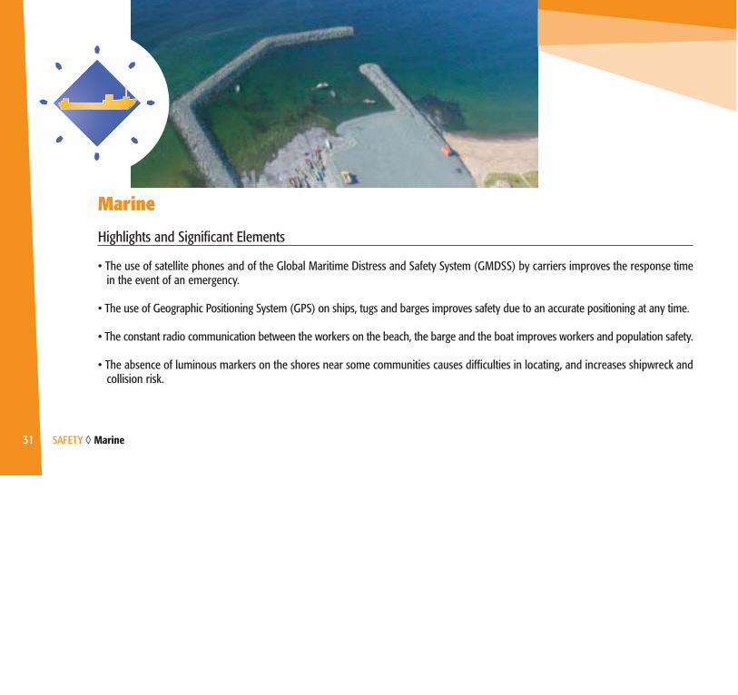
31 SAFETY ◊ Marine
Marine
Highlights and Significant Elements
• The use of satellite phones and of the Global Maritime Distress and Safety System (GMDSS) by carriers improves the response timein the event of an emergency.
• The use of Geographic Positioning System (GPS) on ships, tugs and barges improves safety due to an accurate positioning at any time.
• The constant radio communication between the workers on the beach, the barge and the boat improves workers and population safety.
• The absence of luminous markers on the shores near some communities causes difficulties in locating, and increases shipwreck andcollision risk.

32 SAFETY ◊ Marine
• In certain places in Nord-du-Québec, the use of barges to carry out sealift operations are sometimes risky, being given the extremeweather conditions (high waves, tide range, strong winds and currents, etc.), which can generate important safety risks, particularlywhere there is no marine infrastructure. These conditions can also be problematic for small boats users.
• The construction of marine infrastructures in Nunavik improves safety in the use of small boats and transhipment of goods.
• Some boat users do not provide themselves with safety equipments required by the regulation, such as life jackets, first-aid kits,lifeboat, etc. This situation is caused in particular by the important purchase cost of some of those equipments.
• All pleasure craft users must get their competency card as required by the Competency of Operators of Pleasure Craft Regulations.However, the Aboriginal which use them for subsistence activities are not subject to this regulation.
• Each coastal village of Nunavik will be provided with the necessary equipment for rescues at sea. In Deception Bay, Mine Raglan hassuch equipment and has a rescue team.
• For the majority of lakes in Nord-du-Québec, there are no bathymetric surveys, which sometimes makes navigation unsafe.
• The Regulation respecting the transport of passengers by water requires in obtaining a licence for the practice of such an activity.However, the outfitters are exempted of it.

Other Community and Users’ Concerns
• The buoys for floating petroleum supply hoses are not very visible in darkness or fog, which increases risks of boat collision.
• The pleasure craft users of the region consider that the training as to obtain their competency card, required by the Competency ofOperators of Pleasure Craft Regulation, is unsuited to the realities of the region and they wonder about the relevance to be subjectto this regulation.
33 SAFETY ◊ Marine

34 SAFETY ◊ Off-Road Vehicles (ORVs)
Off-Road Vehicles (ORVs)
Highlights and Significant Elements
• Several legislative provisions framing the use of ORVs are not always respected in the region: helmet wear, minimum driver age,number of passengers on one vehicle, etc. This situation is noticed even in the agglomerations which implemented ORV safetyregulations.
• The proposed Regulation on ORV provides that the majority of the provisions of the Act Respecting Off-Highway Vehicles will not applynorth of the 50th parallel. Revision work of the draft is not completed.
• In some agglomerations, ORV users drive illegally on the roads or roadsides.
35 SAFETY ◊ Off-Road Vehicles (ORVs)
From the ORV accidents reported in Nord-du-Québec between 1995 and 1999 and having been the subject of an accident report, thefollowing facts are observed:
• In general, the ORV accident reports contain few precise details, in particular concerning the exact location.
• Of the 248 ORV accidents, 12 caused death. Eight of these fatal accidents occurred in Nunavik.
• No accident occurred on one of the 37 authorized passageways, all located on the MTQ network.
• Since the ORV is commonly used in Nord-du-Québec, we notice more accidents per inhabitant than in Abitibi-Témiscamingue.
• About half of the accidents involving ORV occurred in Nunavik and involve mainly pedestrians and motor vehicles.
• The majority of ORV accidents is caused by human factors: - unsafe/speed driving;- impaired driving;- inattention or distraction.
• The drivers involved in ORV accidents are mainly young people, 29 years old and less, of which half are between 10 and 19 of age. Itshould be noted that the latter represent a significant part of the ORV users in Nord-du-Québec.
• The ATV accidents caused, proportionally with the number of vehicles, more bodily injuries that snowmobiles did.

36 SAFETY ◊ Off-Road Vehicles (ORVs)
Other Community and Users’ Concerns
• A regulation for ORVs applicable between the 49th and 50th parallel should take account of the particular use of these vehicles bythe inhabitants.
• Some aspects of the regulation related with the use of ORV should be applied north of the 55th parallel.
• The regulation concerning the circulation of ORVs on public ways should be made less strict in order to allow users to use certainbridges of the region.
• The absence of marking and shelters along ORV trails reduces safety and mobility of users.
• The relations between ORV federations and stakeholders of the communities on the Jams Bay territory should be improved.
• The important presence of ORVs on roads and roadsides sometimes causes insecurity of the road users.

37 SAFETY ◊ Rail
Rail
Highlight and Significant Element
• The fact that a certain volume of goods is taken in charge by the rail network fosters the improvement of safety on the road networkby reducing the number of heavy vehicles on the roads and contributes to the conservation of roads.
No Other Community or Users’ Concern
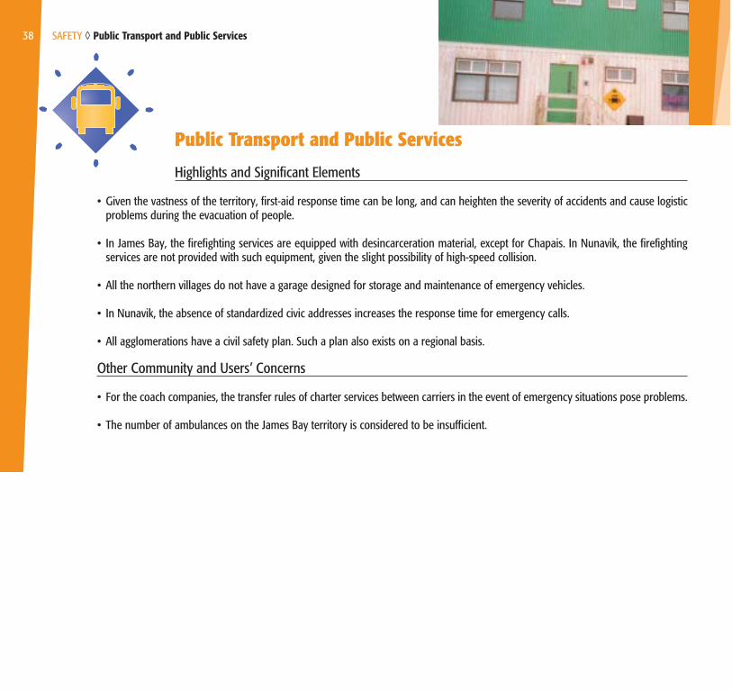
Public Transport and Public Services
Highlights and Significant Elements
• Given the vastness of the territory, first-aid response time can be long, and can heighten the severity of accidents and cause logisticproblems during the evacuation of people.
• In James Bay, the firefighting services are equipped with desincarceration material, except for Chapais. In Nunavik, the firefightingservices are not provided with such equipment, given the slight possibility of high-speed collision.
• All the northern villages do not have a garage designed for storage and maintenance of emergency vehicles.
• In Nunavik, the absence of standardized civic addresses increases the response time for emergency calls.
• All agglomerations have a civil safety plan. Such a plan also exists on a regional basis.
Other Community and Users’ Concerns
• For the coach companies, the transfer rules of charter services between carriers in the event of emergency situations pose problems.
• The number of ambulances on the James Bay territory is considered to be insufficient.
38 SAFETY ◊ Public Transport and Public Services
Socioeconomic Growth
General Highlights and Significant Elements
• Production of consumer goods in the region being low and poorly diversified, the supplying volume is important. For several consumers andusers, transportation costs bring prices of consumer goods up, and the taxes to be paid are increased as much. Moreover, the changes toAboriginal lifestyles, such as food habits, increase the supplying coming from outside the region.
• The strong demographic growth of the Aboriginal communities involves an increase in the request for public services and the request foradjustment of the infrastructures and transport facilities.
• The needs of new buildings and residences as well as improvement works to the existing buildings induce an important demand for transport.
• Tourism development is limited by high transportation and accommodation costs as well as by infrastructures that are at times inadequate orinsufficient.
39 SOCIOECONOMIC GROWTH ◊ General

• The concretization of various projects for the exploitation of the potential of hydroelectricity, of natural resources and of alternative energies (peat,wind mill, tidal force) will require the development of infrastructures and the creation of transport services.
• The manufacturing sector, primarily located in James Bay, is little developed. The raw natural resources thus leave the region, which has aninfluence on the type of transport for this sector. The lack of processing industries of these resources limits the regional economic repercussions.
• Competitive offer of transport services is more limited in Nord-du-Québec than in the southern regions of the province. It is noteworthy that therelatively low demand and the dispersion of the population do not support the establishment and the profitability of several haulage companies,whatever the means.
• The construction costs for transportation infrastructures are high in particular because of the region’s physical constraints (high number of riversand water levels, distance, permafrost) and the distance for supplying.
• In several communities, in particular the isolated communities, the supplying of parts and of manpower can be difficult and expensive.
• The residents of the northern villages of Nunavik profit from a provincial financial assistance aiming at the reduction of freight charges. Moreover,given that they are not connected to the road network, a provincial program grants a reduction of the cost of air transport for people, and a federalprogram aims at reducing the cost of the consumer goods (Food-Mail Program). This last program includes also the Cree village ofWhapmagoostui. Lastly, the Nord-du-Québec population cannot profit from the agreement Gouvernement du Québec–Air Canada since thiscarrier is not present in the region.
• There are several initiatives for the installation of vocational and technical training centres in the region.
• Regional organizations and businesses are now more involved in the sectors of construction and operation of transport infrastructures.
40 SOCIOECONOMIC GROWTH ◊ General
Other Community and Users’ Concerns
• The communities should be more involved in the planning and the realization of transport projects.
• In a general way, the population of Nord-du-Québec is aware of the importance to resort to the regional entrepreneurship to meet at the demandof transport services.
• Although the Ministère des Transports has a department on the territory, as the Centre de services de Chibougamau, a permanent presence iswished by various stakeholders of James Bay. In Nunavik, the responsibility assumption of all the aspects related to transport is wished within thecontext of the process of governmental autonomy.
41 SOCIOECONOMIC GROWTH ◊ General

42 SOCIOECONOMIC GROWTH ◊ Air
AirHighlights and Significant Elements
• The limited market makes improbable the coexistence of several regular air carriers in the region.
• The regional carriers, of Aboriginal property, contribute significantly to the social development and are sensitive to rate conditions.Although the rates per kilometre are comparable to those applied in other regions of Québec offering similar routes, the importantdistances to cover make air transport costly, particularly for the intraregional flights. Air transport can monopolize a significant partof the family budget, especially in the absence of other means of transport. For a number of Nord-du-Québec citizens, air transportis inaccessible.
• The airports of the Aboriginal villages are operated by Aboriginal organizations which has a positive impact on social developmentand local employability.

• Flight chartering occupies a significant place in the region to meet business and health needs. The main departure points are Montréal,Québec City, Abitibi-Témiscamingue, but also inside the region, notably from Kuujuaq. Certain factors (geographical position, gasolinecost, applicable taxes) make that it is more advantageous, for certain communities of Nunavik, to charter planes based in Iqaluit(Nunavut).
• Some large businesses offer interregional transport services to their personnel, thus limiting the development of regional public services.
• Seaplanes are vital for the activities carried out by the many outfitters of the region. The increase in the costs of small aircraftsexploitation could compromise the stability or the growth potential of this activity sector.
• ECOfly Aerotourism Canada works for the promotion and development of aerotourism. Certain routes were developed and include twodestinations in Nord-du-Québec, thus Radisson and Chibougamau. The challenges are notably related to the reception infrastructuresfor planes and pilots, as well as the availability of fuel.
• Although the airline companies are free from certain operation costs (landing fees, rental fees), those are generally higher than in the southof the province. Moreover, according to the international tendency, the expenses related to safety contributed to the increase in theoperation costs.
Other Community and Users’ Concern
• The main expectations of the population relate to the reduction of air fares as well as the lengthening of certain landing strips, with anaim of improving the services and thus supporting the socioeconomic development.
43 SOCIOECONOMIC GROWTH ◊ Air

44 SOCIOECONOMIC GROWTH ◊ Road
Road Highlights and Significant Elements
• The road network -particularly forest and mining roads- facilitates the access to the territory (implementation of new businesses,resources exploitation, hunting, trapping, fishing, ecotourism).
• The road network structures the economic growth of the southern area of James Bay because it supports activities that are tied toenergy and natural resources exploitation which generates a large volume of heavy material transported by road.
• The competitive offer for road transport is limited, which could have an impact on rates.
• The fact that all of the Cree communities, with the exception of Whapmagoostui, are now linked to the road network, has favoredcertain aspects of social and economic development.
• The fuel cost is high in all the region. In Nunavik, this fact is explained partly by the freight charges, but it is especially caused by thehigh costs of long-term storage.
• A large portion of the non-status road network is managed and operated by regional organizations and businesses.
• The fact that some large businesses offer interregional transport services by bus to their personnel limits the market potential of regionalbusinesses.
• The public insurance system only provides for compensation in case of injury or death when automotive vehicles are involved,although the ORVs are used as usual means of transport in the Aboriginal villages.
• The on road driving tests of the Société d’assurance automobile du Québec (SAAQ) cannot be undergone inside the Cree communitiesbecause their road network does not correspond to the applicable standards for such examinations. Elsewhere in James Bay, this serviceis offered in Radisson and Chibougamau thanks to a mobile unit. In Nunavik, Kuujjuaq is the only village where on road driving tests canbe passed for the moment.
• The roads and difficult weather conditions are elements explaining that several users purchase vehicle of the type “light truck” thatare more costly at purchase and at use.
• In Nunavik, several road users do not register their vehicle.
45 SOCIOECONOMIC GROWTH ◊ Road

Other Community and Users’ Concerns
• Some stakeholders mentioned that the inspection and maintenance of the James Bay road network should be performed by regionalbusinesses only, specifically by Aboriginal employees for the access roads to their community.
• Certain municipalities find insufficient the financial assistance granted for the maintenance of the double vocation roads and considerthat the rules of admissibility for the assistance program should be reviewed.
• James Bay communities and businesses are concerned with the contract awarding process and consider that they should be givenpriority.
• The number of service access points of the Société de l’assurance automobile du Québec (SAAQ) and the type of services offered inthe region are considered insufficient.
• Rules to obtain driving license, registration and insurance requirements are elements or processes that are unclear for the residentsof Nunavik.
• In Nunavik, it is difficult to obtain insurance for road vehicles. The same applies to the residents of James Bay who travel on gravelroads.
46 SOCIOECONOMIC GROWTH ◊ Road
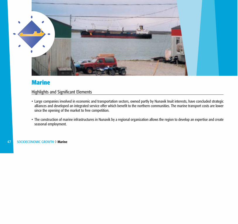
MarineHighlights and Significant Elements
• Large companies involved in economic and transportation sectors, owned partly by Nunavik Inuit interests, have concluded strategicalliances and developed an integrated service offer which benefit to the northern communities. The marine transport costs are lowersince the opening of the market to free competition.
• The construction of marine infrastructures in Nunavik by a regional organization allows the region to develop an expertise and createseasonal employment.
47 SOCIOECONOMIC GROWTH ◊ Marine

• Measures are taken to support the Aboriginal employability in the sector of marine transport.
• Commercial turbot and shrimp fishing contribute to Nunavik’s socioeconomic growth by fostering job creation, local manpowertraining and capital inflow.
• Small boat use is essential to conduct traditional subsistence activities and contribute to the growth of recreotouristic activities.
Other Community and Users’ Concerns
• Some stakeholders and promoters have expressed interest in having a major marine infrastructure built in one coastal village ofJames Bay. The proposed infrastructure would allow procurement of merchandise to communities of Nord-du-Québec and Nunavut,while contributing to development of natural resources by the facilitation of their export.
• Application of taxes for the purchase of small boats used for subsistence activities in Nunavik should be questioned. Moreover,insurance coverage for small boats raises difficulties at the end of the loan covering their purchase.
48 SOCIOECONOMIC GROWTH ◊ Marine

Off-Road Vehicles (ORVs)
Highlights and Significant Elements
• Off-road vehicles are used for conducting subsistence activities, which provide for up to 50% of meat and fish eaten by the Aboriginalpeople, sometimes even more for certain households.
• The recreational or tourist practice of ORV is a source of economic growth, which exists in James Bay and is under development inNunavik.
• The purchase, the maintenance and the use of ORVs can be cheaper than for a road vehicle, which proves to be advantageous for familieswith modest income living in isolated villages. Moreover, these multi-purpose vehicles give access to the territory to them.
• Several users of Nord-du-Québec do not register their ORV.
49 SOCIOECONOMIC GROWTH ◊ Off-Road Vehicles (ORVs)

50 SOCIOECONOMIC GROWTH ◊ Off-Road Vehicles (ORVs)
Other Community and Users’ Concerns
• Inuit consider that the purchase of ORV or gasoline intended for the practice of subsistence activities should be the subject to a taxreduction.
• The Cree and the Inuit mention that it is costly, even sometimes impossible, to obtain insurances for the off-road vehicles.
• Certain communities wish that the routes of federated trails cross Cree villages in order to support the tourist activities.
Public Transport and Public Services Highlights and Significant Elements
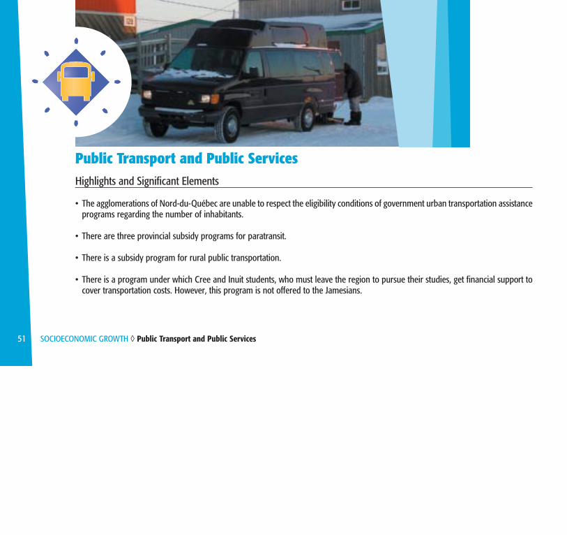
• The agglomerations of Nord-du-Québec are unable to respect the eligibility conditions of government urban transportation assistanceprograms regarding the number of inhabitants.
• There are three provincial subsidy programs for paratransit.
• There is a subsidy program for rural public transportation.
• There is a program under which Cree and Inuit students, who must leave the region to pursue their studies, get financial support tocover transportation costs. However, this program is not offered to the Jamesians.
51 SOCIOECONOMIC GROWTH ◊ Public Transport and Public Services

52 SOCIOECONOMIC GROWTH ◊ Public Transport and Public Services
• Firefighting services are available in every agglomeration of the region but Valcanton and Villebois, which are served by Normétal, inAbitibi-Témiscamingue and in certain agglomerations of the Municipalité de Baie-James (MBJ) which have an services agreement withenclaved cities located in the vicinity.
• The police forces are present in all the region, within three organizations: the Cree Police Force, the Kativik Regional Police Force andthe Sûreté du Québec. As for the RCMP, it intervenes in the occurrence of federal law offences.
• The Société de protection des forêts contre le feu (SOPFEU) is present in the region and intervenes as regards protection of thecommercial forest and important infrastructures or when populations are threatened.
Other Community and Users’ Concern
• Certain fire vehicles would be in bad condition in the villages of Nunavik.

RailHighlights and Significant Elements
• The Ministère des Transports of Québec recognized the railway lines located in the Nord-du-Québec region as being part of the basenetwork of Québec.
• Part of the rail network was dismantled a few years ago. That could affect adversely the growth of rail transportation in this area ofthe region.
• Rail transport is used by the mining and timber industry with freight volumes varying according to economic cycles, thus making railtransport profitability uncertain to achieve.
• The reload centre of Matagami is currently little used considering its potential for the shipping and handling of goods, of whichoversize goods.
Other Community and Users’ Concern
• The preservation of the railway links on the territory of James Bay remains an asset for the shippers and the economic growth.
53 SOCIOECONOMIC GROWTH ◊ Rail

Mobility of People and Goods

General Highlights and Significant Elements
• There is few data relating to the origins and destinations for Nord-du-Québec. The main reasons for travels are work, business as well asrecreotouristic activities.
• The movement of goods is characterized by supplying. With regard to shipments, they are carried out mainly from the south of the region andof Deception Bay.
- The supplying is mainly carried out by boat, plane and truck. Two great distribution networks exist in the province: the west of Québec startingfrom Montréal and the east of Québec starting from Québec City. Part of supplying comes from Québec bound for the Chapais-Chibougamausector via the Saguenay-Lac-Saint-Jean. However, the majority of the goods carried to the region comes directly from Montréal (whichconstitutes the supply centre) or passes through Val-d’Or and La Grande Rivière airport (which are transit centres).
- Shipments, as for them, are carried out mainly by truck and train. They come mainly from forest and mining industries as well as pulp andpaper. Shipments are thus likely to vary according to the market and to the production rate.
55 MOBILITY OF PEOPLE AND GOODS ◊ General

56 MOBILITY OF PEOPLE AND GOODS ◊ General
• The transport of oil products and heavy and nonperishable materials is done by boat in Nunavik and by land, mainly by road, in James Bay. Asfor the shipment of perishable goods, mail, daily consumer goods or sensitive to delivery periods, it is carried out by plane in Nunavik andprimarily by truck in James Bay.
• The movements related to transport of residual material intended for recycling or elimination, as well as products resulting from new economicprojects (mines, fisheries, etc.) remain difficult to evaluate.
• The use of technologies such as telemedecine and videoconference offers an alternative to the current practices requiring transport services onlong distance.
No Other Community or Users’ Concern

AirHighlights and Significant Elements
• Nunavik is completely tributary of the plane for the supply ofperishable goods, of daily consumer goods, as well as for mail andgoods requiring a fast transport.
• Air transport is the only means of ensuring the movement of peoplefrom or to Nunavik communities. This means is then essential forbusiness trips, studies, medical transport or personal travels on aregional and interregional level.
• Considering the hundreds of kilometres separating the Jamesian andCree agglomerations from the large political, economic, technologicaland business centres of Montréal, Québec City and Ottawa, airtransport is often the most appropriate means to ensure rapidtransport.
57 MOBILITY OF PEOPLE AND GOODS ◊ Air

• Almost all of the agglomerations have an airport served by airlines offering regular services or are located at a distance of less than120 km by road from an airport providing those services. Exceptions are Lebel-sur-Quévillon, Matagami and the area ofValcanton–Villebois. Most of the airports receive 40-seat multi-engine turboprop airplanes. Airlines have adapted themselves to therecent weaker demand at the James Bay Cree communities’ airports, now connected to the road network.
• La Grande Rivière airport is the gateway to James Bay and the west coast of Nunavik, whereas the airports of Puvirnituq and Kuujjuaqare the most important ones of Nunavik, in particular because of the presence of regional hospitals. The airports of Schefferville andWabush give as for them, access to the outfitters of the Nord-du-Québec region located north and west of Schefferville. The airportsregistering the higher number of flight movements in 2003 are Kuujjuaq and La Grande Rivière, followed by those of Kuujjuarapik,Chibougamau, Puvirnituq and Waskaganish.
• Six airports meet the needs of the major businesses exploiting natural resources, i.e. Mine Raglan and Hydro-Québec. Except forLa Grande Rivière airport, they are privately owned and are accessible to other aircrafts after authorization is granted.
• If all of the northern airports landing strips, generally of 3500 feet by 100 feet, fully met the needs when they were planned and built,it is possible that adjustments are today justified for some of them, as to take account of the demographic and economic changesand of new plane types.
• The analysis of flights revealed that air carriers offer a comprising schedule of flights at interesting frequencies, taking into accountthe served populations. Roundtrips within the day and weekend flights remain however limited. This report regarding the frequencyof the flights also applies to the James Bay territory, in spite of the fact that it is connected to the road network of the province. It isacknowledged that the number of cancelled flights remains low and that the flights reach a very good punctuality in spite of the harshweather conditions.
58 MOBILITY OF PEOPLE AND GOODS ◊ Air
• The air services offered by the carriers are generally of good quality and require only adjustments to make them still more effective.Primarily, the gaps of the offered services regard the flight time between Montréal and the west coast of the region, the high numberof stopovers on several flights and the age of the planes. These gaps do not affect the reliability of the air services at all, but haveimpacts on the comfort assured to the passengers.
• The charter flights carried out in Nord-du-Québec serve mainly for business purposes — private and public — or health. Althoughseveral are carried out inside the region, they have mainly the south as departure point. They come mainly from the Abitibi-Témiscamingue, Montréal, Québec and Kuujjuaq areas. The needs for direct flights and for the reduction of transport costs constitutethe most important reasons for using charter services.
• Specialized air transport (bush aircraft, helicopters) essentially meets the specific transport needs and the services offered in region,as well as the installations, seem to satisfy. If any weaknesses, they concern availability of docks, access ramps and 100LL airplanefuel for private owners practicing aerotourism. These gaps are noted province-wide, but they remain however more acute in Nord-du-Québec. It is still possible to rent helicopters at various air bases: Val-d’Or, La Sarre, Chibougamau, Radisson and Kuujjuaq. Bushaircrafts generally belong to outfitters and to some contractors offering charter flight services.
• The helicopter is primarily used for mining exploration, geotechnical and scientist surveys as well as for needs related to thedevelopment and operation of hydroelectric plants. This means of transport is also used by hunters, fishermen and trappers.
• The purchase of jet fuel is possible through the region, except at the Cree village airports. This last situation is explained by theavailability of this type of fuel in the vicinity, i.e. at La Grand Rivière airport. At Hydro-Québec private aerodromes, a prior notice isnecessary to purchase jet fuel. As for 100LL fuel for piston aircrafts, it is available at the pump at 5 aerodromes and in barrel at somenorthern villages. Majority of the water aerodromes offer it too.
59 MOBILITY OF PEOPLE AND GOODS ◊ Air

• Air transport is an essential means for medical transport. Nonurgent transport is carried out by a private company at Chibougamau,and by regular flights at the other airports of the region. As for emergency transport towards the regional health centres, it is carriedout by a plane on standby or on request by regular flights. In Nunavik, the planes are not adapted for this kind of transport. From theregional health centres, emergency transport outside the region is carried out either by the service of Évacuations aéromédicales duQuébec (EVAQ), offered by the Service aérien gouvernemental (SAG) towards Québec or Montréal, or by certain companies havingplanes designed to this end towards Abitibi-Témiscamingue or Montréal. The EVAQ service is not offered at certain airports becauseof the insufficient length of the landing strip. Moreover, the access of EVAC at Puvirnituq, where there is a regional health centre isposing problem mainly because of the landing strip type of surface, its condition and the absence of the necessary equipment forde-icing the planes.
• As regards the consumer goods transported by plane, there are two routes. For the villages of Ungava Bay, from Kangiqsualujjuaq toAupaluk, First Air carries out all cargo flights between Val-d’Or and Kuujjuaq, and goods in direction to the other villages aretransported by Air Inuit on its regular flights. For the Hudson coast, Air Inuit handles goods arrived by truck at La Grande Rivièreairport, with all cargo flights and combi-flights. These routes are determined by the Food-Mail Program within the framework of whicha significant part of freight for Nunavik is transported.
• As for the mail for the villages of Ungava, from Kangiqsualujjuaq to Salluit, it is transported by First Air starting from Montréal to Kuujjuaq,and from there, it is redistributed in the villages by Air Inuit. For the villages of the Hudson coast, from Kuujjuarapik/Whapmagoostui toIvujivik, the priority mail, express mail and letters are transported by Air Inuit starting from Montréal, except the mail coming from Abitibi-Témiscamingue, which is deposited in Kuujjuarapik by Air Creebec coming from Val-d’Or. The other postal products (magazines, parcels,etc.) are transported by truck to La Grande Rivière airport and taken in charge by Air Inuit. Kuujjuarapik/Whapmagoostui and Kuujjuaqare used as relay for the outgoing mail inside Nunavik.
60 MOBILITY OF PEOPLE AND GOODS ◊ Air

• In James Bay, only priority mail, express mail and letters for the villages of Wemindji, Eastmain, Waskaganish and Nemaska aredelivered by plane, and this, from Val-d’Or by Air Creebec. The other agglomerations are served by land transport starting fromMontréal and Val-d’Or, except for Oujé-Bougoumou, Chapais, Chibougamau and Mistissini, whose mail passes through Saguenay-Lac-Saint-Jean. The outgoing mail is conveyed by plane or truck towards Val-d’Or to be then forwarded towards Abitibi-Témiscamingue, Montréal or James Bay.
• Regarding logistic aspects in supplying goods by air in certain northern villages of Nunavik, the limits imposed by the infrastructuresand the storage equipment as well as the handling services pose problems in the quality of services.
Other Community and Users’ Concerns
• Certain communities that do no have an airport, heliport or water aerodrome, expressed the interest in the installation of such aninfrastructure in their community.
• Improvement of the airport infrastructures constitutes a request for several agglomerations.
• Reduction of travel time to the west coast of the region and the reduction of travel costs still constitute significant concerns for theinhabitants of Nord-du-Québec.
• Various stakeholders of Nunavik wish an improvement of air services in Puvirnituq.
61 MOBILITY OF PEOPLE AND GOODS ◊ Air

Road Highlights and Significant Elements
• The regional road network mostly concentrates in the James Bay territory, except for the road between Deception Bay and the Raglanmining project.
• The road network does not connect all the agglomerations: a Cree village and all the Inuit villages do not have a road link betweenthem, nor with the remainder of the province. The long distances as well as the low potential levels of traffic in the absence of majorprojects of economic development make so that the construction of new road infrastructures is not easily foreseen.
• In general and compared to the rest of Québec, road traffic is quite light. Through the years however, the network was morerequested, in particular following the increase of the hydroelectric, forest and mining exploitation as well as the development oftourism associated with hunting, fishing and recreotouristic activities. The construction of roads in certain Cree communities alsocontributed to traffic increase. More specifically, the operational startup, in 2003, of the Eastmain-1 hydroelectric project had anotable effect on the traffic of certain roads.
62 MOBILITY OF PEOPLE AND GOODS ◊ Road

• Among the principal links which are possible to establish with regard to the mobility of the users of the James Bay territory, let usnote the following sectors of mobility:
Intraregional: • Radisson – Matagami – Lebel-sur-Quévillon – Chibougamau• Chisasibi – Radisson• Nemaska, Oujé-Bougoumou, Mistissini and Chapais – Chibougamau• The Cree communities of the western coast (among them)
Interregional:• Valcanton–Villebois area to Abitibi-Ouest (La Sarre)• Matagami, Lebel-sur-Quévillon and Waswanipi to Abitibi-Témiscamingue (Amos, Rouyn-Noranda and Val-d’Or)• Waswanipi - Oujé-Bougoumou - Chapais - Chibougamau – Mistissini area to the Saguenay–Lac-Saint-Jean• Cree communities of the western coast and Radisson to Abitibi-Témiscamingue (Amos, Rouyn-Noranda, Val-d’Or)
• According to the data collected at the barrier of kilometre 6 on the James Bay road (Matagami-Radisson), the traffic for 2002 revealsa number of 54 700 entries of vehicles. The annual average daily traffic (AADT) estimated is 300 vehicles for the first 100 kilometresand approximately 100 vehicles for the remainder of the road. These figures represent an increase considering the counting of 1996.The displacements related to business account for 51% of the traffic (of which more than half would be ascribable to forestrydevelopment), those ascribable to holiday (camping, hunting, fishing) add up to 22% and the industrial visits account for 2%.Displacements motivated by other reasons, in particular those of transport of the residents, count for 25%. Let us mention thatcaribou hunting, which goes over a 3-month period, causes to increase the density of traffic for this period.
63 MOBILITY OF PEOPLE AND GOODS ◊ Road

64 MOBILITY OF PEOPLE AND GOODS ◊ Road
• The Route du Nord is used for the mobility needs of forest companies and a mining company but also by the tourists and for theneeds of hydroelectric exploitation and development. In 2002-2003, the AADT for this road was evaluated at approximately 210 forthe section south of kilometre 108 and at approximately 110 north of kilometre 108.
• As for the Transtaïga road, it is mainly used for the hydroelectric plants operation and increasingly requested to access outfitters ofthe area and for caribou hunting. It is also largely used by Aboriginal communities to access to their trap lines. There are no precisedata concerning the traffic ascribable to these users.
• Counts for the Ministère des Transports road network in 2002 reveal the following AADT:
Route Sector of trafic AADT 1992 AADT 1996 AADT 2002 Trends
113 South of Chapais 590 520 690 Light rise probably attributable to the creation of the Nord-du-Québec region
113 North of Chapais 1350 1490 1670 Light rise probably attributable to the development of the village of Oujé-Bougoumou
167 South of Chibougamau 1470 1480 1500 Stable167 North of Chibougamau 490 420 450 Stable109 North of the intersection 990 810 370 Important downward trend
of the road to Joutel attributable to the closing of Joutel109 South of the intersection 450 450 440 Stable
of the road to Joutel

• Load limits imposed to heavy trucks during spring thaw applies only to the network under the authority of the Ministère.
• Although the public road network of local interest is limited in Nunavik, these roads are of vital importance for water supply andsewage disposal by truck, for goods delivery, for access to airport and marine infrastructures as well as for daily needs.
• The road improvement or development projects do not always take account of all the current and potential needs of the various users(resource development, recreotouristic activities and mobility of people, etc.). This situation does not make it possible to optimizetheir use, nor the financial resources which are allocated.
Other Community and Users’ Concerns
• Improvement of the James Bay roads represents a recurring concern for the road users.
• The service level and granting of maintenance contracts for certain roads composing the James Bays road network, including theforest roads, constitute concerns of the population.
• The improvement of the intraregional links is a significant concern of the road users. This concern is in particular expressed by therequest for east-west road links between, on the one hand, Matagami and Lebel-sur-Quévillon (R-1005) and, on the other hand,Valcanton and Villebois. The development of links towards the north has also been the topic of representation for a few years, thatis to say:
- Caniapiscau towards Kuujjuaq with junction towards Schefferville;- Whapmagoostui/Kuujjuarapik towards Radisson;- Valcanton-Villebois sector towards the Rupert river;- Villebois towards Matagami through Joutel.
65 MOBILITY OF PEOPLE AND GOODS ◊ Road

MarineHighlights and Significant Elements
• Given the absence of a road network connecting the Nunavik villages to a major supply centre such as southern Québec, marinetransportation proves to be the most appropriate means of shipping bulky and ponderous merchandise and the one of petroleumand mining products. In general, the coastal villages of Nord-du-Québec can benefit from marine transport services from June toOctober. In certain cases, such services are provided by barge only. The most common connections are as follows:
1) Coastal villages of Nord-du-Québec;2) Northern communities of Nunavik, Nunavut and southern Québec;3) Some Cree villages and Moosonee.
MOBILITY OF PEOPLE AND GOODS ◊ Marine66

• The quantity of goods sent by boat to Nunavik tends to increase, but it also fluctuates according to construction projects.
• The small boats occupy a dominating place in the mobility of the population of Nord-du-Québec, because they are of a utility nature(for the practice of the subsistence activities and displacements between the villages) and because of the surrounding space whichfavors their recreational use. This aspect is particularly established for all coastal villages of Nord-du-Québec, but still littledocumented for the interior water (lakes, rivers).
• Tide range, current strength, lengthy freeze-up season affecting waterways, and limited maneuvering areas in certain communitiescount among the factors which cause major accessibility constraints and involve delays in performing sealift operations.
• The navigation period could be extended over the years to come because of the gradual reduction of ice cover.
Other Community and Users’ Concerns
• The construction of a large scale marine infrastructure along the James bay is wished by certain stakeholders.
• The installation of marinas is wished by certain Cree communities.
67 MOBILITY OF PEOPLE AND GOODS ◊ Marine

Off-Road Vehicles (ORVs)Highlights and Significant Elements
• In Nunavik, the ORVs are the main transport means used to get around in the villages. In all the region, the Aboriginal use theunofficial networks of ORV for the practice of subsistence activities. Jamesians use mainly the federated trails for walk, and also usethe non-federated and unofficial trails for the activities of hunting and sport fishing.
68 MOBILITY OF PEOPLE AND GOODS ◊ Off-Road Vehicles (ORVs)

• The snowmobile federated trails are accessible from Abitibi-Témiscamingue and Saguenay-Lac-Saint-Jean and connect the majorityof the agglomerations located in the south of James Bay. The locality of Radisson, has a non-federated network in closed loop. Theinland Cree communities join the snowmobile federated network by unofficial trails. The multitude of forest roads and the energytransport line corridors are used as unofficial trails as well as off-path trails. It is difficult to know the length and the extent of thesnowmobile and ATV unofficial networks, which are generally not marked out. Gas stations are found in all agglomerations.
Other Community and Users’ Concerns
• The principal concerns as for the ORVs are: - Installation, maintenance and marking of trails; - Construction of shelters along the trails.
• Considering the characteristics of the territory and population, some believe that a deregulation could be foreseen to allow ORV usersto legally use specific roadsides on the James Bay territory.
69 MOBILITY OF PEOPLE AND GOODS ◊ Off-Road Vehicles (ORVs)

70 MOBILITY OF PEOPLE AND GOODS ◊ Public Transport and Public Services
Public Transport and Public Services Highlights and Significant Elements
• There is a need for documenting the needs and for finding ways to reconcile and coordinate the regional public transport services.
• In general, provision of public transport services rests on a critical mass of demands, which in the case of Nord-du-Québec is hard toattain given the size of the population, small and scattered among a large number of towns and villages. However, considering thedemographic growth, the offer of certain public transport services should be adjusted to the demand.
• School bus service is the only public means of transport available in all the agglomerations.
• There are nine agglomerations of taxi in James Bay, counting 26 licenses. Taxis are often used to cover long distances. In Nunavik,two agglomerations of taxi have no license, at the present time. However, transport is offered in an unofficial way in certain villages.
• The paratransit services for disabled people are little developed in James Bay, where they are offered only in Chapais andChibougamau. In Nunavik, efforts are made in order to equip each village with an adapted vehicle to transport disabled people.
• Certain Cree villages have a bus to transport their residents.
• Regular routes of interurban transport by coach go to Matagami, Lebel-sur-Quévillon, Waswanipi, Chapais and Chibougamau toconnect these municipalities between them and to the remainder of Québec. The other agglomerations are not served. For the otheroffers of transport by bus, they are charter contracts or contract employee transport. In James Bay, part of these transport activitiesby bus depends on the exploitation of resources and industrial tourism. The Cree communities are also regular customers ofchartered bus transport.
• The inexistence of a direct road link between Lebel-sur-Quévillon and Matagami does not make it possible to improve the offer ofinterurban transport services in the south of the territory.
• The main out of the region destinations for medical reasons are the hospitals of Abitibi-Témiscamingue and Saguenay-Lac-Saint-Jeanand those of Québec and Montréal. As regards land pre-hospital transport, the services offered in the region vary:
- In James Bay, ambulances operated by ambulance technicians or first responders are present in the cities and the Municipalitéde Baie-James (mainly ambulance technicians) and in all the Cree villages (mainly first responders). Ambulance services aresometimes shared in certain neighboring zone. Each Cree village also has a 6 to 8 passenger van used for transport towardshealth centres and the airport, but they are not adapted for stretcher or wheelchair transport.
- In Nunavik, land pre-hospital transport is currently carried out in four villages, using emergency medical vehicles (of which ORV)operated by first responders. In the other villages of Nunavik, people ensure their own emergency transport for now, but a personis hired by village for the transfer of patients to the airport.
71 MOBILITY OF PEOPLE AND GOODS ◊ Public Transport and Public Services

Other Community and Users’ Concern
• The improvement of public transport service offer, the high cost of interurban transport and the maintenance of the existing routesconstitute concerns for the residents of James Bay.
72 MOBILITY OF PEOPLE AND GOODS ◊ Public Transport and Public Services

RailHighlights and Significant Elements
• There is no rail transport for passengers in the region, but Canadian National (CN) offers freight services. A section goes toChibougamau passing through Saguenay-Lac-Saint-Jean. Further west, a section connects Matagami to the network crossing Abitibi-Témiscamingue. For a few years, CN has tended to reduce its services and its investments in secondary networks like those of theNord-du-Québec region in favour of its main lines in Québec.
• Rail transport is primarily used by mining and timber industries as well as pulp and paper, whose volumes of goods fluctuateaccording to business cycles. This means of transport remains also essential for the transport of oil and chemical products as well asoversized materials used by the hydroelectric industry.
73 MOBILITY OF PEOPLE AND GOODS ◊ Rail

• Although several shippers prefer haulage to ensure the transport of material, the rail transport proposes a competitive offer to theroad transport of the goods, in particular for solid bulk and chemicals. It is particularly performing and advantageous for goodshippings on long routes (more than 700 km).
• The development of a railway link between Kuujjuaq and Schefferville often was the topic of discussions and exchanges betweenmany stakeholders and promoters. The interest of such a project needs to be given further comprehensive thought on the realizationof a land link between Nunavik and the south of Québec. This thought raises huge technical challenges and economic problems withregard, among other things, to profitability, partnership and impacts on other means of transport.
Other Community and Users’ Concern
• During the last years, the shippers of Nord-du-Québec, like those of Abitibi-Témiscamingue and Saguenay–Lac-Saint-Jean, expressedtheir dissatisfaction concerning the quality and maintenance level of infrastructures, the quality of wagons, the customer service andthe follow up of material. In spite of the improvements made, the concerns on the quality of service remain up to date.
74 MOBILITY OF PEOPLE AND GOODS ◊ Rail

Environment, Land-Use Planningand Sustainable Development

General
Highlights and Significant Elements
• In Nunavik, because of climate warming, thaw of permafrost is increasingly deep in certain places, which generates its instability and makestransport planning more complex. The continuation of such a warming causes impacts on the durability of transport infrastructures. The warmingalso has impacts on the access to the territory for the practice of the subsistence activities, given the hastier thaw period and later freezing as wellas to generally milder winters (the ice of the rivers is thinner, permafrost is unstable at certain places, etc.).
• In order to determine the extent of the impact of climate change on the infrastructures of transport, readings of temperatures of the ground underthe landing strips, the access roads and the surrounding natural sites are carried out.
• The increase of population in certain Aboriginal villages causes problems of occupation of inhabited spaces and could lead to, among others, anincreased request for the development of transportation infrastructures and facilities.
75 ENVIRONMENT, LAND-USE PLANNING AND SUSTAINABLE DEVELOPMENT ◊ General

• There is a difficulty of cohabitation between the practice of recreotouristic, subsistence and resource exploitation activities on public lands ofcategories II and III. The development of the access exacerbates this difficulty of cohabitation by the increase in the frequentation of the territory.
• Few residual material or residual hazardous material is conveyed out of the region for their recycling or their elimination.
• The transport of hazardous material through isolated or little inhabited areas is frequent. Since the emergency environmental services are sometimeslocated at important distances on the territory, the delay of intervention for accidental discharges can be important.
Other Community and Users’ Concerns
• The cleanup of former mining sites and plane crash sites in Nunavik, as well as the management of residual material are essential for theenvironmental protection.
• There is no funding for the transport of residual material and residual hazardous material towards the south of the province, where the servicesare located.
• The integration of federal and provincial environmental procedures for all the area covered by the agreements of the public domain is desirable(categories II and III lands).
76 ENVIRONMENT, LAND-USE PLANNING AND SUSTAINABLE DEVELOPMENT ◊ General

Air
Highlights and Significant Elements
• In Nunavik, deformations caused by the thawing of permafrost are observed on certain landing strips.
• The fuelling operations could have environmental risks if the procedures are not followed correctly.
• The glycol used for the de-icing of airplanes can contaminate surface water. However, this product is used only in small quantity in theregion. In addition, the use of urea as ice melter on paved movement areas involves nitrate formation in the surrounding grounds. Thesenitrates can migrate towards the water table and cause its contamination. The potassium format constitutes a valid substitute but stilllittle used, in particular because of its high price and its reduced effectiveness at certain temperatures.
77 ENVIRONMENT, LAND-USE PLANNING AND SUSTAINABLE DEVELOPMENT ◊ Air
78 ENVIRONMENT, LAND-USE PLANNING AND SUSTAINABLE DEVELOPMENT ◊ Air
• All the aerodromes and water aerodromes are not equipped with emergency intervention equipment in the event of accidentaldischarge, what increases the risk of contamination.
• The air movements on the gravel strips raise dust, which can have impacts on the quality of life of the population residing in thevicinity and can contribute to worsen certain health problems.
• During summer, the SOPFEU is present on the James Bay territory at his secondary base of Matagami as well as at the auxiliary basesof Chibougamau and Lebel-sur-Quévillon. A monitoring plane is based at the airport of La Grande Rivière.
• Planes or helicopters when used for low-level flights can disturb wildlife. Transport Canada did not pass a regulation regarding thealtitude of flight over herds of wild animals, such as there is one for the flights above the breeding of poultries or fur animals. Thereis however a practice recommended. Concerning the military flights at low altitude, NATO obtained a procedure aiming at limitingthe impacts on the herds of caribous.
• Waste products and abandoned materiel are frequently found on unofficial landing sites (camp sites, private sites of industrial activity,etc.).
Other Community and Users’ Concern
• Small aircraft users sometimes land on lakes that serve as drinking water source for certain Aboriginal villages, thus generating risksof water contamination in case of leaks or accidents.

Road
Highlights and Significant Elements
• In Nunavik, deformations caused by the thawing of permafrost are observed on certain road infrastructures.
• Dust raised by traffic on gravel roads and streets in communities can affect the quality of life of the population and can contribute toworsen certain health problems.
Other Community and Users’ Concern
• In Nunavik, the implementation of permanent ground links raises questionings as for the impacts which could be generated on thenatural environment and the way of occupying the territory.
79 ENVIRONMENT, LAND-USE PLANNING AND SUSTAINABLE DEVELOPMENT ◊ Road

Marine
Highlights and Significant Elements
• Climate warming generates currently a reduction of the ice cover in the Arctic.
• In certain coastal villages of Nord-du-Québec, the storage of containers and the docking of barges as of small boats are carried outdirectly on the beach. This situation causes to increase the erosion of the banks, the compaction of the ground and the quantity ofsuspended matter in water. The construction of marine infrastructures in Nunavik decreases these negative impacts on wildlife andthe surrounding physical environment.
80 ENVIRONMENT, LAND-USE PLANNING AND SUSTAINABLE DEVELOPMENT ◊ Marine
• In Nunavik, sealift operations of petroleum products are completed using a barge or floating hoses, thus increasing risks ofenvironment contamination in case of rupture or accidental spill.
• Oil tankers have equipment that meets standards for spill response. On the other hand, there is an equipment depot in Iqaluit to limitconsequences of petroleum marine spills. The Coast Guard icebreakers also have such equipment.
• The marine carriers must have an emergency measure plan and the necessary equipment in the event of accidental spill.
• The ships which serve the Raglan mining complex have prohibition of passage to certain places and at certain periods of the year inorder to protect seal breeding areas.
Other Community and Users’ Concern
• During darkness or fog, the small boats users are concerned by the lack of visibility of the hoses used for the sealift operations ofpetroleum products.
81 ENVIRONMENT, LAND-USE PLANNING AND SUSTAINABLE DEVELOPMENT ◊ Marine
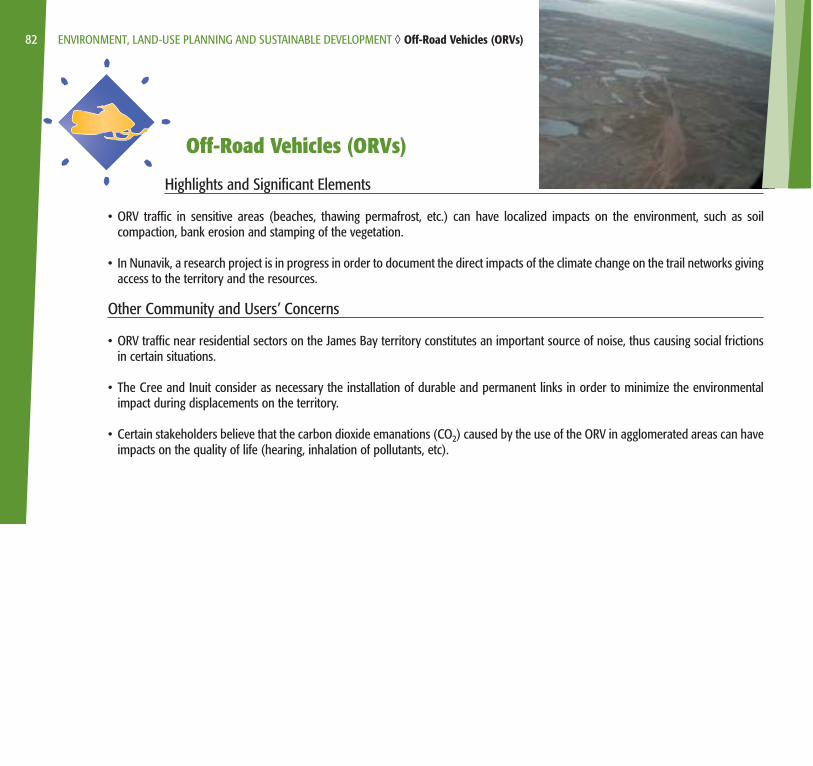
Off-Road Vehicles (ORVs)
Highlights and Significant Elements
• ORV traffic in sensitive areas (beaches, thawing permafrost, etc.) can have localized impacts on the environment, such as soilcompaction, bank erosion and stamping of the vegetation.
• In Nunavik, a research project is in progress in order to document the direct impacts of the climate change on the trail networks givingaccess to the territory and the resources.
Other Community and Users’ Concerns
• ORV traffic near residential sectors on the James Bay territory constitutes an important source of noise, thus causing social frictionsin certain situations.
• The Cree and Inuit consider as necessary the installation of durable and permanent links in order to minimize the environmentalimpact during displacements on the territory.
• Certain stakeholders believe that the carbon dioxide emanations (CO2) caused by the use of the ORV in agglomerated areas can haveimpacts on the quality of life (hearing, inhalation of pollutants, etc).
82 ENVIRONMENT, LAND-USE PLANNING AND SUSTAINABLE DEVELOPMENT ◊ Off-Road Vehicles (ORVs)
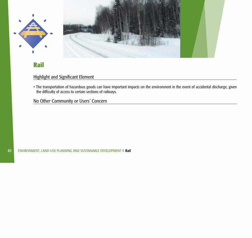
Rail
Highlight and Significant Element
• The transportation of hazardous goods can have important impacts on the environment in the event of accidental discharge, giventhe difficulty of access to certain sections of railways.
No Other Community or Users’ Concern
83 ENVIRONMENT, LAND-USE PLANNING AND SUSTAINABLE DEVELOPMENT ◊ Rail
ENVIRONMENT, LAND-USE PLANNING AND SUSTAINABLE DEVELOPMENT ◊ Public Transport and Public Services
Public Transport and Public Services
No highlight or significant element
Other Community and Users’ Concern
• The Aboriginal communities of James Bay are concerned by the fact that the SOPFEU does not always intervene at the time of firesin the non-commercial forest. These fires cause negative impacts, in the short run, on their supplying of subsistence resources.
84