Embed Size (px)
Citation preview


NMSU Rainfall
-2
0
2
4
6
8
10
12
14
1 19 37 55 73 91 109 127 145 163 181 199 217 235 253 271 289 307 325 343 361
Days since Jan 1
Cumulative Rainfall (Inches)
200620052004200320022001200020072008

Transition zones between desertsand humid areas are fragile


Soil gets eroded by wind and waterProductive land becomes degraded
Main culprits:OvergrazingOverplowing


Human activity can stress the ecosystem
• Grazing• Cutting trees for charcoal• Some agriculture


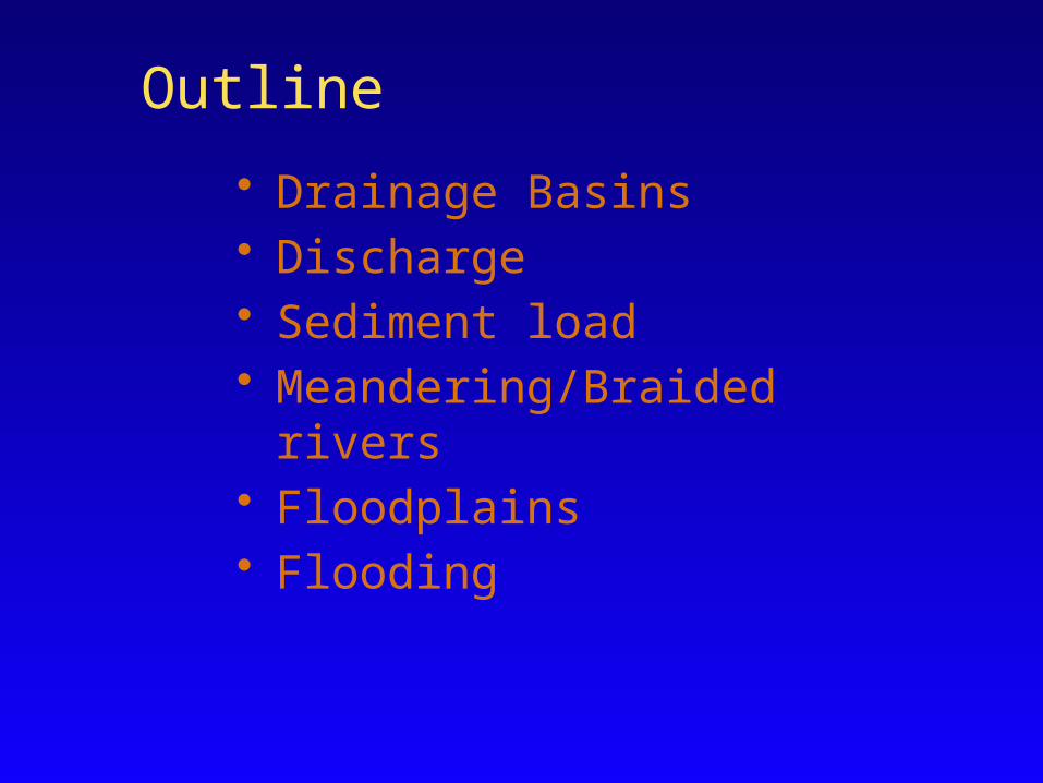
• Drainage Basins• Discharge• Sediment load• Meandering/Braided rivers• Floodplains• Flooding
Outline

SEA SEA LAND LAND+ 336 Runoff from land+ 398 Precipitation
over sea+ 434 Evaporation
+ 434 Evaporation– 398 Precipitation + 436 Excess to land
via precipitation
+ 107 Precipitation– 371 Evaporation
+ 436 Runoff toocean
+ 107 Precipitation– 336 Runoff to ocean
+ 471 Evaporation
Evaporation434
Precipitation398
Runoff 36
Groundwatertable Groundwater
flow
Infiltration
Surfacerunoff
Precipitation107
Evaporation71
Flux in and flux out over oceans is almost balanced.
Excess is moved toland and precipitates.
…or filters into soiland rock, where it moves as groundwater.
The precipitationruns off intolakes, streams,and oceans…
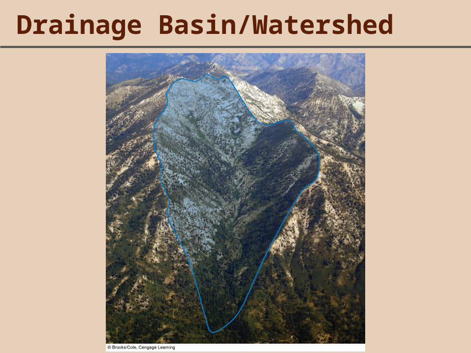
Drainage Basin/Watershed


Drainage Basins/Watersheds
• Rio Grande River basin includes:– Chama– Puerco– Pecos (and all of its tributaries)
• It doesn’t include the Gila, because it flows into Colorado
• Continental Divide (in NM) separates: – Rio Grande drainage– Colorado River drainage

Rio Grande
Rio Grande Pecos
ColoradoGila
San Juan

Rio Grande Watershed


Stream profile depends on location

• Q=VA• Q is discharge• V is average velocity (m/s)• A is cross-sectional area (m2)• units of Q?
Discharge/Total Flow

Discharge/Total Flow

Discharge/Total Flow

Sediment Load and Grain Size
• Streams can be provided with particles of any size from mud to giant boulders
• Volume and velocity of flow limit size and amount of sediment that stream can carry

Sediment Load and Grain Size

Sediment Transport and Flooding

Rivers
• Meandering: low sediment content, gentle gradient, more vegetation
• Braided: high sediment content, steep gradient, unstable channels

Nenana River, Alaska
Smaller rivers
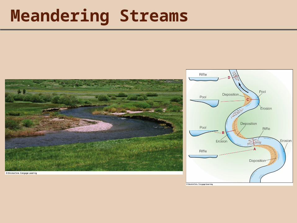
Meandering Streams

Green River, Utah
Meandering

Meandering Streams
• Size and shape of river meanders:– Meander wavelength, width and arc length– Ratios are constant regardless of stream size

Meandering Streams
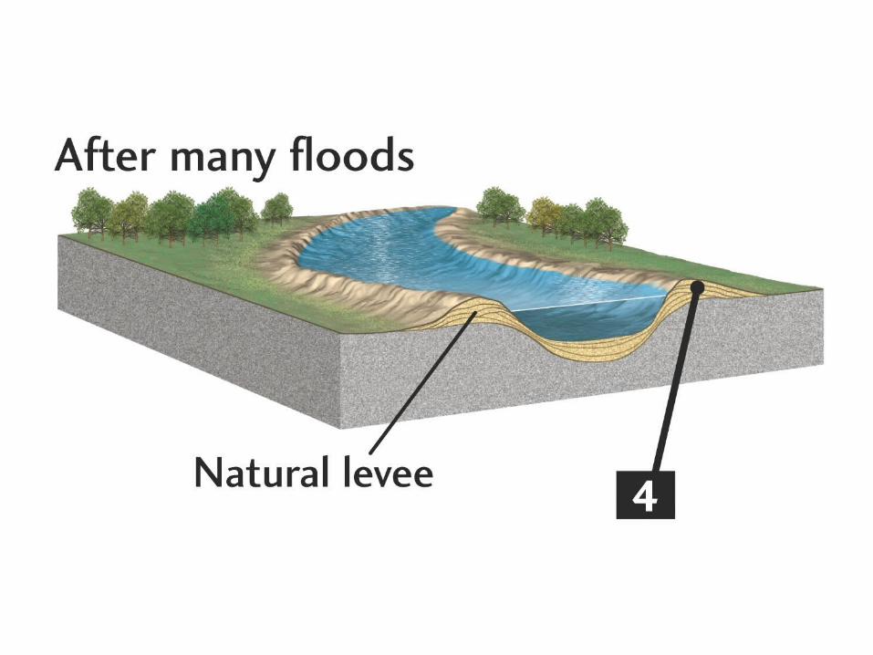
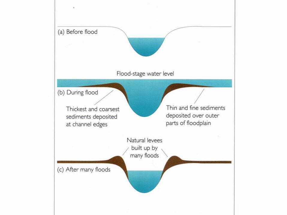
• Erosion/deposition of meanders creates floodplain• Slow water velocity forms natural levee • Keeps small floods within channel


LOW-SEDIMENT LOAD, LOW VELOCITYLow-velocity, low-sedimentstreams form meanders.
Meanders shift from side to side in a snaking motion.
Sediments get deposited in inside banks forming point bars.
The bends grow closer and the point bars bigger.
Point bars
During a major flood, the river cuts across the loop.
The current is faster at outsidebanks, which are eroded.
The abandoned loop remainsas an oxbow lake.

Meanders in an Alaskan river
Point bar High-velocityflow in channel

Floodplain
Oxbow lake

Braided Streams• Multi-channel paths• Overloaded with sediment that is deposited in islands• Promoted by dry climate, glacier outwash, alluvial fans

Braided river, Cook Inlet, Alaska

Sandy braided River: Red River, Texas-Oklahoma
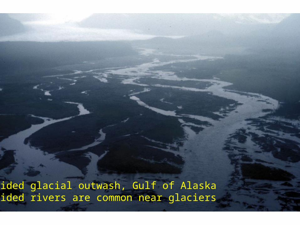
Braided glacial outwash, Gulf of AlaskaBraided rivers are common near glaciers

Alluvial fans have braided streams

Gravel delta at mouth of braided river, Cook Inlet, Alaska
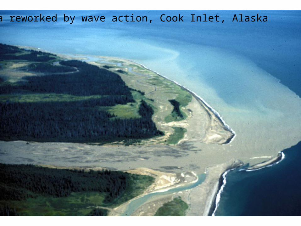
Delta reworked by wave action, Cook Inlet, Alaska
![Thermophysicalpropertiesofdryandhumidair ... · range of temperature and pressure. Data on gW of compressed humid air [7], humid nitrogen, humid argon, and humid carbon dioxide [9]](https://img.dokumen.tips/doc/110x75/5e626081cfea87225a37645c/thermophysicalpropertiesofdryandhumidair-range-of-temperature-and-pressure.jpg)