Embed Size (px)
Citation preview

TITLE 9
LAND USE CODE
Chapter 11: Subdivision Article 02: Title, Purpose and Jurisdiction Article 04: Procedure Article 06: Standards Article 08: Requirements and Improvements Article 10: Vacations and Dedications Article 12: Planned Unit Development Article 14: Manufactured Home Park Article 16: Special Developments


TITLE 9 LAND USE CODE - CHAPTER 11 SUBDIVISION
CHAPTER 11
ARTICLE 2
9-11-02-1:
TITLE
TITLE, PURPOSE AND JURIDICTION
9-11-02-2: 9-11-02-3: 9-11-02-4: 9-11-02-5:
9-11-02-1:
AUTHORITY AND PURPOSE JURISDICTION COMPLIANCE REQUIRED CONFLICTING PROVISIONS
TITLE
This chapter shall be cited as the TETONIA SUBDIVISION CODE.
9-11-02-2: AUTHORITY AND PURPOSE
A. These regulations are authorized by Title 50, Chapter 13 and Title 67, Chapter 65 of the Idaho Code, as amended or subsequently codified and Article 12, Section 2 of the Idaho Constitution.
B. The purposes of these regulations are to promote the public health, safety, general welfare, and to provide for but not be limited to the following:
1. Harmonious development of the area.
2. Coordination of streets and roads within the subdivision with other existing or planned streets and roads.
3. Adequate open space for travel, light, air, and recreation.
4. Conservation of or provisions for adequate transportation, water drainage, and sanitary facilities.
5. Avoidance of population congestion as would involve danger or injury to health, safety, or general welfare by reason of:
a. Lack of water supply, drainage, transportation, or other public services; or
b. Unnecessary imposition of an excessive expenditure of public funds for the supply of such services.
C. Requirements as to the extent and manner in which:
1. Roads shall be created and improved; and
2. Water and sewer and other utility mains, piping connections, or other facilities shall be installed as conditions precedent to the approval of a plot.
D. Manner and form of making a filing of any plat.
E. Administration of these regulations by defining the powers and duties of approval authorities including procedures for the equitable review and approval of all plats
of subdivisions covered by these provisions.
City of Tetonia Land Use Municipal Code

TITLE 9 LAND USE CODE - CHAPTER 11 SUBDIVISION
9-11-02-3 : JURISDICTION
These regulations shall apply to the subdividing of all land within the city and the city impact area and shall include the following:
A. The subdivision of land into more than two (2) tracts for transfer of ownership. All of such lots or parcels created pursuant to this ordinance shall front upon a publicly maintained street unless specifically approved by the council after recommendation of the commission.
B. The dedication of any street or alley through or along any tract of land except where such dedication is initiated at the request of a public body.
C. The resubdivision of a parcel of land into more than one (1) parcel except as provided in the exceptions listed below.
D. Condominium projects, as permitted by Idaho Code.
1. Additionally the council may regulate and attach conditions to the design concepts and locations of buildings, the creation, shape and size of condominium units, the provisions and maintenance of open space, and off- street parking.
2. Unless excepted pursuant to the provisions of this ordinance, the commission and council shall require the installation of public improvements and utilities for condominium projects as required under the provisions of this ordinance.
3. For the purpose of administering these subdivision regulations the city may consider a condominium development as a single building, requiring one (1) front yard, two (2) side yards, a rear yard, and other regulations pertinent to a given lot and may grant such exceptions as are necessary to the subdivision regulations to permit such development.
E. Exceptions:
1. A readjustment of lot lines, which does not reduce the area, a frontage, width, depth, or building setback lines below the minimums required.
2. A subdivision of land into parcels that are larger than one-quarter of one- quarter of the section of land or are lots in a section of land all as shown on the official U.S. Government General Office Township Survey Maps including resubdivisions thereof, or are parcels that are larger than forty (40) acres, all of which shall be designated exclusively for agricultural purposes, and which does not involve any new street dedication or the creation of private easement accesses to lots or parcels which could otherwise be provided access by a publicly dedicated street. (See definition of exclusive agriculture).
3. An allocation of land in the settlement of an estate or a court decree for the distribution of property thereunder with the stipulation that the land may not be divided into more than four (4) parcels with a minimum size per parcel to be five (5) acres.
4. The unwilling sale of land as a result of legal condemnation as defined and allowed in the Idaho Code and when the dedication of a right of way for public purposes is initiated by a public body.
City of Tetonia Land Use Municipal Code

TITLE 9 LAND USE CODE - CHAPTER 11 SUBDIVISION
5. The exchange of land for the purpose of straightening property boundaries or adding land to existing parcels by trade or sale which does not result in a change of the present land use or in any way result in land parcels which do not meet existing zoning and other regulations. (Ord. 22, 5-1981; Ord. 2008- 6)
9-11-02-4 : COMPLIANCE REQUIRED
No person shall subdivide any tract or parcel of land located wholly or in part in the city or city impact area, except in compliance with .the provisions of this chapter. No person shall purchase, sell or exchange any parcel of land which is any part of a subdivision or a proposed subdivision submitted to the planning and zoning commission, nor offer for recording in the office of the county recorder, any deed conveying such parcel of land or any fee interest therein, unless such subdivision has been created pursuant to and in accordance with the provisions of this title.
9-11-02-5 : CONFLICTING PROVISIONS
It is not intended by this chapter to impair or interfere with other regulations of state or local law, or with private restrictions on the use of land, improvements and structures. Where this chapter imposes greater restriction than that imposed by other law or private restrictions, this chapter shall prevail. (Ord. 2008-6)
City of Tetonia Land Use Municipal Code


TITLE 9 LAND USE CODE - CHAPTER 11 SUBDIVISION
CHAPTER 11
ARTICLE 4
9-11-04-1: 9-11-04-2: 9-11-04-3: 9-11-04-4:
9-11-04-1:
PROCEDURE
PLANNING OFFICE REVIEW PRELIMINARY PLAT FINAL PLAT FOUR OR LESS LOTS, PARCELS OR SITES
PLANNING OFFICE REVIEW
A. Prior to the filing of a preliminary plat, the developer shall submit to the city planning office a review application with generalized plans and data as required and pay a fee as established by resolution of city council.
1. The city planning office may request, in writing, more information from the subdivider before setting a review appointment.
a. The subdivider shall have sixty (60) days from the date of the written request to submit additional information to the city planning office.
b. Failure to provide the requested information within the allotted time shall nullify the review application and fee.
2. Review: Within thirty (30) days from submission of the review application and payment of the fee, the subdivider shall meet with the city planning office, by appointment, for review of the proposed development.
a. Within ten (10) days following the review, the city planning office shall advise the developer in writing as to the general conformance or nonconformance of the plans to this Title, the comprehensive plan or other regulatory information.
b. The review may include official and unofficial comments on polices and guidelines.
B. The time limits for acting on the review application may be extended by ·mutual consent of the developer and the city planning office.
9-11-04-2 : PRELIMINARY PLAT
Following review by the city planning office, a preliminary plat application may be submitted to the administrator.
A. A preliminary plat application and fee as established by resolution of city council shall be submitted to the administrator. The application and written documentation and data shall be submitted in booklet form within three ring binders.
City of Tetonia Land Use Municipal Code
TITLE 9 LAND USE CODE - CHAPTER 11 SUBDIVISION
B. Eight copies of the preliminary plat and other information, required as part of the
preliminary plat, shall be shown graphically or by note on plans. All mapped data for the same plat shall be drawn at the same standard engineering scale, having no more than one hundred (100) feet to an inch. Whenever practical, scales shall be adjusted to. produce an overall drawing measuring 24" x 36", but not exceeding 42" x 60".
1. Existing Conditions Data:
a. Topography by contours or other method approved by the city and shown on the same map as the proposed subdivision layout. Contour intervals shall be such as to adequately reflect the character and drainage of the land.
b. Location of water wells, streams, canals, irrigation laterals, private ditches, washes, lakes, or other water features; direction of flow; location and extent of known areas subject to inundation.
c. Location, widths, and names of all platted streets, railroads, utility rights- of-way of public record, public areas, permanent structures to remain including water wells, and municipal corporation lines within or adjacent the tract.
d. Name, book, and page numbers of any recorded adjacent subdivision having common boundary with the tract.
e. By note, the existing zoning classification of tract.
f. By note, the approximate acreage of the tract.
g. Boundaries of the tract to be subdivided shall show approximate dimensions.
h. Names and addresses of adjoining property owners within 300 feet of the exterior boundary of the subdivision.
2. Proposed Conditions Data:
a. Street layout, including location, right-of-way width, finished width and proposed names of public streets, alleys, pedestrian ways, and easements; connections to adjoining platted tract.
b. Typical lot dimensions to scale; dimensions of all corner lots and lots of curvilinear sections of streets; each lot numbered individually; total number of lots.
c. Location, width, and use of easements.
d. Designation of all land to be dedicated or reserved for public use with use indicated.
e. If plat includes land for which multi-family, commercial, or industrial use is proposed, such areas shall be clearly designated together with existing zoning classification and status of zoning change if any.
f. If the proposed subdivision is part of a larger area intended for development, a development master plan of the entire area including the following:
1. Zoning districts.
City of Tetonia Land Use Municipal Code

TITLE 9 LAND USE CODE - CHAPTER 11 SUBDIVISION
2. Minor arterial and major collector streets.
3. Open space areas including park identification, trails and pathways.
4. Appropriate information that sufficiently details any special development area, such as a hillside, planned unit development, flood plain, cemetery, manufactured home park, large-scale development, hazardous and unique areas.
3. Proposed Utility Methods:
a. Sewage Disposal: It shall be the responsibility of the developer to furnish the city such evidence as may be required relative to the design and operation of the sanitary sewage facilities proposed.
b. Water Supply: It shall be the responsibility of the developer to furnish the city such evidence as may be required relative to the design, operation, volume and quality of the water supply and facilities proposed.
c. Storm Water Disposal: It shall be the responsibility of the developer to furnish the city such evidence as may be required relative to the design and operation of any storm water system proposed ..
d. Irrigation system: It shall be the responsibility of the developer to furnish the city such evidence as may be required relative to the design and operation of any proposed irrigation system proposed as part of the subdivision.
4. Impact Study: An impact study may be required by the planning and zoning commission based on the size of the development proposal. The study may include, but not be limited to transportation and traffic, water, sanitary sewer, drainage and scenic and environmental conditions.
5. Development Agreement: A development agreement template shall be provided by the city. It is the responsibility of the developer to address general and specific conditions relative to the proposed development based on the city's format and submit an electronic (CD disc) and paper copy as part of the preliminary plat process.
C. Certification: Upon receipt of the preliminary plat with all required data as provided herein, the administrator shall certify the application as complete and shall affix the date of application acceptance thereon.
D. Agency Review: The administrator shall transmit one (1) copy of the application to city departments and such other agencies that have jurisdiction or an interest in the proposed subdivision for their review and recommendations.
1. If no written reply is received from any of the various departments or interested agencies within twenty (20) working days from the date of notification, approval of the preliminary plat by such department or agency will be considered to be granted.
a. Departments and agencies receiving copies of the preliminary plat should include city departments (streets, water, sewer, engineer), health department, emergency services, school district, State Highway Department, Teton County Planning, local utility companies, soil conservation service and irrigation districts.
City of Tetonia Land Use Municipal Code

TITLE 9 LAND USE CODE - CHAPTER 11 SUBDIVISION
E. Planning and Zoning Commission Action
1. The preliminary plat shall be placed on the planning and zoning commission agenda for initial review and consideration within forty (40) days from the date the application is certified by the administrator as complete.
a. A written and dated letter from the planning and zoning commission may be submitted to the applicant requesting more information, data, illustrations or clarifications. The applicant shall comply with the request within six (6) months or the preliminary plat application shall become null and void.
b. Within thirty-five (35) days from the time the preliminary plat is placed on the planning and zoning commission agenda, the planning and zoning commission shall hold one public hearing where affected and interested persons may be heard.
1. Property owners within 300 feet of the proposed development shall be notified by letter of the proposed development and the place, date and time of the public meeting.
2. One official notice stating the name of the proposed development, and the place, date and time of the public hearing shall be published in the official newspaper a minimum of ten (10) days prior to the meeting date.
2. Following the public hearing, the city engineer, city attorney and other city departments and staff, shall review and recommend special conditions, including site design standards, for the development agreement pertaining to the proposed development. If the proposed development is part of a larger area intended for development, the master plan of the entire development shall be reviewed and special conditions shall be drafted based on the master plan.
3. Within forty-five (45) days from the public hearing of the proposed subdivision the planning and zoning commission shall approve, approve conditionally or disapprove the preliminary plat. The reasons for such action shall be stated in writing, a copy of which shall be attached to one copy of the preliminary plat along with the development agreement draft and returned to the developer.
4. Upon approval, conditional approval or disapproval by the planning and zoning commission, the preliminary plat, together with a complete copy of the planning and zoning commission's findings and report, and the development agreement draft shall be transmitted to the city council. The reason for action taken shall specify:
a. The ordinance and standards used in evaluating the application;
b. The reasons for approval, conditional approval or denial; and
c. The actions, if any, that the applicant could take to gain approval.
F. City Council Action:
1. The city council shall act upon the report of the planning and zoning commission at its next regular meeting following receipt of the report. Within thirty-five (35) days the city council may sustain, modify or reject the
City of Tetonia Land Use Municipal Code

TITLE 9 LAND USE CODE - CHAPTER 11 SUBDIVISION
recommendations of the planning and zoning commission. The reason for action taken shall specify:
a. The ordinance and standards used in evaluating the application;
b. The reasons for approval, conditional approval or denial; and
c. The actions, if any, that the applicant could take to gain approval.
2. Extension of Time Limits: The time limits for acting on the preliminary plat may be extended by mutual consent of the developer and the planning and zoning commission and/or the city council.
3. The developer shall submit the final plat within one (1) year of preliminary plat approval; otherwise, approval of the preliminary plat and development agreement shall become null and void.
9-11-04-3 : FINAL PLAT
A. After approval or conditional approval of the preliminary plat, the developer may cause the subdivision master plan, or part thereof, to be surveyed and a final plat prepared in accordance with the preliminary plat as approved or conditionally approved.
B. Final Plat Application: The developer shall file a Final Plat Application, pay the final plat fee and submit eight (8) copies of the final plat with data as required.
C. Method and Medium of Presentation
1. All plats to be offered for recording shall be in accordance with the clarification that the transparent tracings shall show all information shown on the original "hard back" plat. Copies of the record plat shall be reproduced in the form of blueline or blackline prints on a white background.
2. The plat shall be drawn to an accurate scale having not more than one hundred feet to one inch (1" = 100'), unless otherwise approved as to scale.
D. Identification Data Required:
1. A title that includes the name of the subdivision and its location by number of section, township, range and county.
2. Name, address and official seal of the registered professional engineer or registered land surveyor preparing the plat.
3. Scale, north arrow and date of the plat preparation.
E. Survey Data Required:
1. Boundaries of the tract to be subdivided fully balanced and closed, showing all bearings and distances determined by an accurate survey in the field. All dimensions shall be expressed in feet and decimals.
2. Any excepted parcels within the plat boundaries shall show all bearings and distances, determined by an accurate survey in the field. All dimensions shall be expressed in feet and decimals.
City of Tetonia Land Use Municipal Code

TITLE 9 LAND USE CODE - CHAPTER 11 SUBDIVISION
3. Location and description of cardinal points to which all dimensions, angles,
bearings and similar data on the plat shall be referenced.
F. Descriptive Data Required:
1. Name, right-of-way lines, courses, lengths, width of all public streets, alleys, pedestrian ways and utility easements; radii, points of tangency and central angles of all curvilinear streets and alleys, and radii of all rounded street line intersections.
2. All drainage ways to be dedicated to the public shall be shown on the plat.
3. All easements for rights-of-way provided for public services or utilities and any limitations of the easements.
4. All lots and blocks shall be numbered throughout the plat in accordance with the Idaho Code. Exceptions, tracts and private parks shall be so designated, lettered or named and clearly dimensioned.
G. Dedication and Acknowledgment:
1. Dedication: A statement of dedication of all streets, alleys, drainage ways, pedestrian ways and other easements for public use by the person holding title of record and by persons holding title as vendees under land contract. If lands dedicated are mortgaged, the mortgagee shall also sign the plat.
2. Acknowledgment of Dedication: Execution of dedication shall be acknowledged and certified by a notary public.
H. Required Certifications:
1. Certification by the registered professional engineer or registered land surveyor stating on the plat that the plat is correct and accurate, and that the monuments described in it have been located and described.
2. Certification of plat approval by the city engineer.
3. Certification of plat approval by the county engineer.
4. Certification of plat approval by the planning and zoning commission.
5. Certification of plat approval by the city council.
6. Certification of plat approval by the fire marshal.
7. Certification of recordation by the county recorder.
I. Final Plat Submission:
1. The final plat, prepared in accordance with the Idaho Code and the provisions set forth herein and bearing all required certificates, acknowledgments and signatures, shall be submitted to the city.
2. Final plat submission shall include prints thereof as required, two (2) sets of prints of the plans and specifications for all proposed improvements as required by this Title and a current title report or other evidence acceptable to the city showing proof of ownership of the tract of land being platted.
City of Tetonia Land Use Municipal Code

TITLE 9 LAND USE CODE - CHAPTER 11 SUBDIVISION
3. In the event the final plat does not conform to the approved preliminary plat,
the city shall so inform the developer and proceed to assign the final plat to the planning and zoning commission agenda for its action as a preliminary plat.
J. Agency Review:
1. Submission: The administrator shall transmit one copy of the final plat for review by the city engineer and other departments and agencies, or others as may be deemed necessary to ensure compliance with the approved preliminary plat.
2. Time Limit for Response: If no written replies are received from any of the various departments or interested agencies within fifteen (15) days from the date of notification, approval of the final plat by such department or agency will be considered granted.
K. Planning and Zoning Commission Action:
1. The final plat shall be placed on the planning and zoning commission agenda for initial review and consideration within thirty-five (35) days from the date the application is certified by the administrator as complete.
2. The planning and zoning commission shall consult with the city engineer, the city attorney and any other agency or department of the city in order to finalize the development agreement specific to the proposed subdivision. A copy of the approved development agreement shall be sent to the developer ten (10) days prior to the date when the final plat shall be submitted to the city council. The final plat shall not be submitted to the city council until the planning and zoning commission approves a development agreement.
L. City Council Action:
1. Following action by the planning and zoning commission, the final plat and the development agreement shall be placed on the city council agenda at their next regularly scheduled meeting. The city council shall consider the final plat and development agreement and any changes from the preliminary plat approved by the planning and zoning commission. If the final plat and development agreement conforms to the requirements of this Title and the Idaho Code, the city council shall approve the plat within thirty (30) days after the date of the regular meeting.
2. At the time of approval and recording of the final plat, the city council shall accept the dedications shown thereon and shall, as a condition precedent to the approval of any final plat, require the developer to sign a development agreement.
M. Recording; Time Limitation: The final plat shall be filed with the county recorder within one (1) year after approval by the city council, otherwise such approval of the final plat and development agreement shall become null and void.
City of Tetonia Land Use Municipal Code

TITLE 9 LAND USE CODE - CHAPTER 11 SUBDIVISION
9-11-04-4 : FOUR OR LESS LOTS, PARCELS OR SITES
A. Conditions Required: The developer may request that the subdivision application be approved using metes and bounds descriptions and without the necessity of recording a final plat when the proposed subdivision has four (4) or less lots, parcels or sites and if the following conditions are met:
1. Any required street dedications or street widening involved are properly recorded as part of subdivision approval.
2. The proposed subdivision is not an obvious part of a larger parcel of land, which may be subdivided, following procedures otherwise set forth in this Title.
3. The proposed subdivision, if approved, will not conflict with the intent of this Title, the Comprehensive Plan, the Zoning Title or other existing regulations.
4. The public interest, including installation of any required offset improvements such as curb and gutter, sidewalk and street surfacing, can be properly met if the subdivision is approved.
B. Developer Request: The developer may request that the subdivision application be processed as both a preliminary and final plat if all the following exist:
1. The proposed subdivision does not exceed four (4) lots.
2. No new street dedication or street widening is involved.
3. No major special development considerations are involved, such as development in flood plain, hillside, etc.
4. All required information for both preliminary and final plat is complete and in an acceptable form.
C. Subdivision Application: If the developer elects to proceed with the platting process, he shall file a completed subdivision application form as prescribed by the planning and zoning commission and eight (8) copies of the preliminary/final plat with the administrator.
D. Review By Agencies: The Administrator shall transmit one copy of the application
to City departments and agencies for review. If no written reply is received from any of the various departments or interested agencies within thirty (30) days from the date of notification, approval of the proposal by such department or agency will be considered granted.
E. Planning And Zoning Commission Action: The preliminary/final plat shall be placed on the planning and zoning commission agenda for consideration at the next regular meeting. The planning and zoning commission shall approve, approve conditionally or disapprove the plat. Reasons for action shall be specified in writing within thirty (30) days.
F. City Council Action: At the next regular meeting of the Council, the city council shall act upon the recommendation of the planning and zoning commission within thirty (30) days after the meeting. The city council may approve, approve conditionally or disapprove the recommendation.
City of Tetonia Land Use Municipal Code

TITLE 9 LAND USE CODE - CHAPTER 11 SUBDIVISION
1. Approved or Approved Conditionally: A development agreement listing
specific conditions shall be approved by the city council.
2. Disapproved: The developer must submit a new proposal to the planning and zoning commission. (Ord. 2008-6)
City of Tetonia Land Use Municipal Code
,: '


TITLE 9 LAND USE CODE - CHAPTER 11 SUBDIVISION
CHAPTER 11
ARTICLE 6
9-11-06-1: 9-11-06-2:
GENERAL STREETS
SUBDIVISION STANDARDS
9-11-06-3: 9-11-06-4: 9-11-06-5: 9-11-06-6:
9-11-06-1:
BLOCK REQUIREMENTS LOT REQUIREMENTS PUBLIC SITES AND NATURAL FEATURES OPEN SPACE REQUIREMENTS
GENERAL
A. Subdivisions shall conform to the standards of the comprehensive plan, the zoning ordinance and other ordinances and regulations of the city.
B. Land the commission determines to be unsuitable for subdivision because of periodic flooding, poor drainage, excessively steep slopes or other features likely to be harmful to the safety and general health and welfare of the future residents, shall not e subdivided unless adequate methods are utilized to overcome these conditions.
9-11-06-2 : STREETS
A. Street Design Requirements: The arrangement, character, extent, width, grade and location of all streets shall conform to the intent of the adopted comprehensive plan and shall be constructed in relation to existing and planned streets, to topographical conditions, to public convenience and safety, and in their relation to the proposed uses of the land to be served by such streets. Local residential streets shall be so designed to discourage their use by through traffic.
1. Frontage Streets: Where a subdivision abuts or contains an existing or proposed arterial street, railroad, or limited access highway, the city may require frontage streets, or such other treatment for the appropriate use of the tract.
2. Half-street dedications shall be discouraged; provided, however, the city may accept a partial street dedication when such street forms the boundary of the proposed subdivision and is deemed to be necessary for the orderly development of the neighborhood, and provided the city finds it will be appropriate to require the dedication of the remainder of the right-of-way when the adjoining property is developed. When a partial street exists adjoining a proposed subdivision the remainder of the right-of-way shall be dedicated.
3. Rights-of-way Width: There shall be provided rights-of-way of such width as provided for in the adopted comprehensive plan; provided however, that the width of said rights-of-way shall in no case be less than the following:
City of Tetonia Land Use Municipal Code

TITLE 9 LAND USE CODE - CHAPTER 11 SUBDIVISION
Street Classification
Minimum width from back of
Minimum right-of-way width
curb to back of curb Major Arterial Minor Arterial Major Collector Minor Collector Local Street Village Street Alley
100' -180' 70'
55'
42' 38' -42'
30'
20'
120' -210' 95' 80'
60' 60' 50' 20'
4. A village street is only allowed by special condition of a development agreement.
a. No on street parking shall be allowed.
b. It is the responsibility of the developer to show that adequate off-street parking is available.
5. Cul-de-sac streets shall terminate in a circular turnaround with a right-of-way radius of at least fifty (50) feet. The city may approve an equally convenient form of turning space where extreme conditions justify. The maximum length shall be six hundred (600) feet from the intersection of the street centerlines to the center of the turn around.
6. Dead-end streets will not be approved except in locations designated by the city as necessary to future extensions in development of adjacent lands. In any case, a dead-end street serving more than four (4) lots shall provide by easement a temporary turning circle with a fifty (50) foot radius or other acceptable design to accomplish adequate access.
7. Loop Streets shall be limited to a maximum length of twelve hundred (1200) feet measured along the centerline of a street from centerline intersection to centerline intersection.
B. Street Intersections and alignments
1. Streets shall be planned to intersect as nearly as possible at right angles, but in no event at less than seventy (70) degrees. Streets intersecting an arterial street shall do so at not less than eighty-five (85) degrees.
2. Where any street deflects at an angle of ten (10) degrees or more, a connecting curve shall be required having a minimum center line radius of three hundred (300) feet for arterial and collector streets and one hundred twenty-five (125) feet for local streets.
3. Streets with center line offsets of less than one hundred twenty-five (125) feet shall be avoided.
4. A tangent at least one hundred fifty (150) to two hundred (200) feet long shall be provided between reverse curves on arterial and collector streets.
5. Street intersections with more than four (4) legs and Y-type intersections where legs meet at acute angles shall be avoided.
City of Tetonia Land Use Municipal Code

TITLE 9 LAND USE CODE - CHAPTER 11 SUBDIVISION
C. Street Grades: Street grades shall not exceed nine (9) percent or less than one
quarter (0.25) of one percent on local and collector streets. The grades for all other streets shall be as approved based on individual conditions and safe engineering practices.
D. Street Names: The naming of streets shall conform to the following:
1. Street names shall not duplicate any existing street name except where a new street is a continuation of an existing street; street names that may be spelled differently but sound the same as existing streets shall not be used.
2. All new streets shall comply with Teton County GIS street classification.
E. Bicycle Lane: A bicycle lane shall be provided along minor and major collectors as recommended by the commission and approved by city council. See the City of Tetonia Public Works Standard Specifications and Drawings.
9-11-06-3 : BLOCK REQUIREMENTS
A. Block Lengths and Design:
1. Block lengths should not exceed four hundred (400') feet as measured along the street centerline from centerline intersection to centerline intersection.
2. Block design shall provide for two (2) tiers of lots except under special conditions where this is not feasible or practical.
9-11-06-4 : LOT REQUIREMENTS
A. Lot Design:
1. The lot size, width, depth, shape and orientation and minimum setback lines shall comply with the minimum requirements of the zoning ordinance. The city shall have the authority to require a lot size larger than the minimum requirement to provide for harmonious development.
2. Side lot lines shall be substantially at right angles or radial to street lines, except where other treatment may be justified.
3. Double frontage lots shall be avoided wherever possible.
9-11-06-5: PUBLIC SITES AND NATURAL FEATURES
A. Where it is determined that a proposed park, playground, school or other public use as shown on future acquisition map, as authorized in Idaho Code, is located in whole or in part within a proposed subdivision the Commission shall notify the appropriate public agency concerning the land proposed to be acquired. Within thirty (30) days of the date of notice, the public agency may request the governing body to suspend consideration on the proposed subdivision for sixty (60) days. If an agreement is not reached within sixty (60) days, the commission shall resume consideration of the subdivision/
B. Existing natural features which add value to residential development and enhance the attractiveness of the community such as streets, watercourses,
City of Tetonia Land Use Municipal Code
TITLE 9 LAND USE CODE - CHAPTER 11 SUBDIVISION
historic spots, and similar irreplaceable assets shall be preserved, insofar as possible, in design of the subdivision. (Ord. 22, 5-1981; Ord. 2008-6)
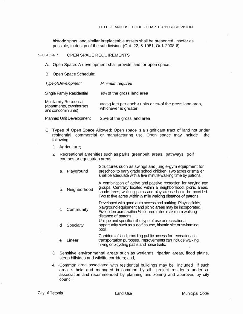
9-11-06-6 : OPEN SPACE REQUIREMENTS
A. Open Space: A development shall provide land for open space.
B. Open Space Schedule:
Type of Development
Single Family Residential
Multifamily Residential (apartments, townhouses and condominiums)
Planned Unit Development
Minimum required
10% of the gross land area
600 sq feet per each 4 units or 7% of the gross land area, whichever is greater
25% of the gross land area
C. Types of Open Space Allowed: Open space is a significant tract of land not under residential, commercial or manufacturing use. Open space may include the following:
1. Agriculture;
2. Recreational amenities such as parks, greenbelt areas, pathways, golf courses or equestrian areas;
Structures such as swings and jungle-gym equipment for a. Playground
b. Neighborhood
c. Community
d. Specialty
e. Linear
preschool to early grade school children. Two acres or smaller shall be adequate with a five minute walking time by patrons.
A combination of active and passive recreation for varying age groups. Centrally located within a neighborhood, picnic areas, shade trees, walking paths and play areas should be provided. Two to five acres within½ mile walking distance of patrons.
Developed with good auto access and parking. Playing fields, playground equipment and picnic areas may be incorporated. Five to ten acres within ½ to three miles maximum walking distance of patrons. Unique and specific in the type of use or recreational opportunity such as a golf course, historic site or swimming pool.
Corridors of land providing public access for recreational or transportation purposes. Improvements can include walking, hiking or bicycling paths and horse trails.
3. Sensitive environmental areas such as wetlands, riparian areas, flood plains, steep hillsides and wildlife corridors; and,
4. ·Common area associated with residential buildings may be included if such area is held and managed in common by all project residents under an association and recommended by planning and zoning and approved by city council.
City of Tetonia Land Use Municipal Code

TITLE 9 LAND USE CODE - CHAPTER 11 SUBDIVISION
D. Deeding or Dedication of Open Space: The land designated as open space
within a subdivision must be committed to open space by one or more recorded instruments.
1. Types of instruments:
a. The seller may retain the deed with a deed restriction to maintain open space;
b. Private easement.
c. A formal dedication of conservation easement (or a fee interest) to an appropriate governmental entity, charitable organization or homeowner's association; and/or,
d. Open space may be platted as one or more large privately held lots with specified building envelopes. Planning and zoning, in consultation with the developer and the project engineer, shall determine the number, size and locations of building envelopes when a privately owned lot is used as open space within a subdivision so as to protect the integrity of the open space and protect health, safety and general welfare of the city and county.
E. Open Space Management Plan: In all cases, a management plan for open space shall be provided as part of the development agreement for the subdivision. The plan shall contain funding proposals and sufficient guarantees that the land can be maintained in open space under a viable management plan and not become a burden to the city or county, or negatively impact the public health, safety and general welfare of the city or county.
1. Management of Agricultural Land: Where the designated open space is to be farmed, a provision for irrigation water shall be required, provided a water right existed on the land prior to development and provided the owner of the water right is willing to sell it.
2. Management of Recreation Facilities: If the open space is a recreation facility, satisfactory assurances of financial and functional viability must be described and provided for in the management plan.
F. Maintenance: Maintenance of open space areas shall be by agreement between the applicant and the city. The city is not required to maintain open space unless specified by the city council in a development agreement.
G. Open space shall not be used by the developer for sewer or water facilities, which may be required for development approval.
City of Tetonia Land Use Municipal Cod


TITLE 9 LAND USE CODE - CHAPTER 11 SUBDIVISION
CHAPTER 11
ARTICLE 8
9-11-08-1: 9-11-08-2: 9-11-08-3:
9-11-08-1:
REQUIREMENTS AND IMPROVEMENTS
GENERAL REQUIREMENTS REQUIRED IMPROVEMENTS CITY OF TETONIA PUBLIC WORKS STANDARD SPECIFICATIONS AND DRAWINGS
GENERAL REQUIREMENTS
A. City Specifications: All improvements such as streets, alleys, parks, easements and other facilities, which are required as a condition to plat approval, shall be the responsibility of the developer and shall meet city specifications and standards of construction.
B. Plan Preparation: Plans for the improvements herein required shall be prepared by an engineer registered and certified in the State of Idaho.
C. Construction Drawings: Prior to the time of commencing construction or if improvements are to be guaranteed for construction past the recording of the final plat, the developer shall file with the city, construction drawings for all improvements required in that portion of the subdivision contained in the final plat.
D. Performance Bonding: As a condition for granting approval of the final plat, the developer shall provide a guarantee of improvements, guaranteeing the construction and installation of all required improvements within two (2) years of final plat approval unless extended one year by mutual consent. Such guarantee shall be one hundred fifty percent (150%) of estimated cost as determined by the city engineer, and may include one or more security arrangements acceptable to the city council:
E. Surety Bond:
1. The bond shall accrue to the city covering construction, operation and maintenance of the specific public improvements;
2. The length in which the bond is in force shall be for a period to be specified by the city for the specific public improvements;
3. The bond shall be with a surety company authorized to do business in the state of Idaho, acceptable to the city; and
4. The escrow agreement shall be drawn and furnished by the city.
F. Cash Deposits, Certified Check, Negotiable Bond, or lrrev.ocable Bank Letter of Credit:
City of Tetonia Land Use Municipal Code

M2 M1 C3 BP C2 C1 MU CD
C
R3 R2
C
TITLE 9 LAND USE CODE - CHAPTER 11 SUBDIVISION
1. A cash deposit, certified check, negotiable bond, or an irrevocable bank letter
of credit made out solely to the city, of such surety acceptable by the city, shall be deposited with an escrow agent or trust company;
2. Escrow time for the deposit, check, bond or letter of credit shall be for a period to be specified by the city for the specific public improvements;
3. In the case of cash deposits or certified checks, an agreement between the city and the developer may provide the progressive payment out of the cash deposit or reduction of the certified check, negotiable bond or irrevocable bank letter of credit, to the extent of the cost of the completed portion of the public improvements, in accordance with a previously entered into agreement.
9-11-08-2 : REQUIRED IMPROVEMENTS
A. Curb, Gutter and Sidewalk: Concrete rolled curb and gutter, and sidewalk a minimum of four inches (4") in depth, shall be required based on the following schedule:
STANDARD DISTRICT
A TA R1 OS
C
4. Lots abutting a minor collector or local street shall provide rolled curb and gutter and a minimum 5' wide sidewalk.
- Required I C - Conditional Use Permit I Blank - Not required
B. Street Improvements: Asphalt plant mix pavement shall be required on all streets in a proposed development or newly dedicated street right-of-way.
C. Storm Water Disposal: Proper and adequate provision shall be made for disposal of storm waters. The type, extent, location and capacity of facilities shall be approved for individual development by the city.
D. Sewer System: Proper and adequate provision shall be made for sewage treatment. The type, extent, location and capacity of facilities shall be approved for individual subdivisions by the city.
City of Tetonia Land Use Municipal Code
C
a. Lots abutting a minor arteflal or
major collector shall provide rolled curb and gutter and a minimum 5'
wide sidewalk.
C 3. Lots abutting a major collector shall provide rolled curb and gutter and a minimum 8' wide sidewalk.
C
REQUIRED CURB, GUTTER AND SIDEWALK
1. Lots abutting a public right-of-way shall provide rolled curb and gutter.
2. Lots abutting a minor arterial shall provide rolled curb and gutter and a minimum 10' wide sidewalk.

TITLE 9 LAND USE CODE - CHAPTER 11 SUBDIVISION
E. Water Supply: Proper and adequate provision shall be made for water supply.
The type, extent and location of facilities shall be approved for individual subdivisions by the city.
F. Monuments: Monuments shall be installed in accordance with current standards at all corners, angle points and points of curve and all street intersections.
G. Fire Hydrants: The location, type and size of fire hydrants required to serve the subdivision shall be approved by the city.
H. Street Signs; Fee: Street names and traffic-control signs shall be installed by the city in appropriate locations at each street intersection in accordance with local standards. A fee shall be charged to the developer to reimburse the city for its costs.
I. Streetlights: Streetlights shall be installed by the developer at intersections throughout the subdivision, unless waived after recommendation of the planning and zoning commission and approval of the city council. The developer shall conform to the requirements of the city and the public or private utility servicing the area.
J. DRAINAGE AND GRADING
1. The developer shall investigate the existing and proposed use of any irrigation ditch or canal within the project limits to determine if they are to be perpetuated. If the irrigation system is to be continued, the developer is responsible to contact the water right holders or canal company to obtain their requirements for protection of the irrigation system.
2. The discharge of storm water into irrigation ditches shall not be allowed without special approval from the city. If an irrigation ditch is to be used as a storm water receptor, secure an agreement from the irrigation Ditch Company that the company will accept responsibility for receiving the water as a submittal requirement of all preliminary plats.
3. A storm drainage plan showing water flow directions, inlets, outlets, catch basins, waterways, culverts, detention basins, orifice plates, outlets to off-site facilities and off-site· drainage facilities planned to accommodate the project drainage. Drainage plans are to facilitate peak flow for the 25-year, 24-hour storm event. An off-site discharge rate of 0.2 cfs per acre of the gross project area is permitted included with hydraulic and hydrologic calculations. All detention basins are to facilitate the 100-year, 24-hour storm event. Adequate spillway provisions must be provided to pass the storm water in excess of the 100-year, 24-hour storm event.
4. Public water shall not be discharged onto or through private property without the appropriate easement. An easement with the right of access conveyed to the Tetonia City shall be provided whenever conveyance systems are constructed in lands of private ownership. A minimum easement width of twenty feet centered on the drain is required. The width may be in excess of the minimum when situations require.
5. In the event that proposed construction shall direct surface or storm water runoff to properties or facilities owned and maintained by agents other than
City of Tetonia Land Use Municipal Code

TITLE 9 LAND USE CODE - CHAPTER 11 SUBDIVISION
the City of Tetonia, written proof of permission, or approval from these agents must be provided prior to acceptance of drainage concepts, and subsequent issuance of city drainage approval.
6. It is city policy and the developer's responsibility wherever attainable to restore, protect and maintain the chemical, physical, and biological integrity of city and State waters and to restore their beneficial uses. To do so, drainage design shall address the treatment of surface and storm water runoff, both wet-weather and dry-weather discharges.
9-11-08-3 : CITY OF TETONIA PUBLIC WORKS STANDARD SPECIFICATIONS AND DRAWINGS
The City of Tetonia Public Works Standard Specifications and Drawings shall be the official reference manual for construction and quality control of public works infrastructure projects. (Ord. 2008-6)
City of Tetonia Land Use Municipal Code

TITLE 9 LAND USE CODE - CHAPTER 11 SUBDIVISION
CHAPTER 11
ARTICLE 10
9-11-10-1: 9-11-10-2:
9-11-10-1:
VACATIONS AND DEDICATIONS
APPLICATION PROCEDURE ACTION
APPLICATION PROCEDURE
A. Application: Any property owner desiring to have an existing subdivision, public right-of-way or easement vacated, or desiring to dedicate a street right-of-way, or easement shall complete and file an application with the city and also file such other applications as are otherwise required by law. These provisions shall not apply to any street right-of-way or easement to be shown on a recorded plat of a subdivision.
B. Upon receipt of the completed application and other information as may be required, the city shall affix the date of application acceptance thereon. Said application shall then be placed on the agenda for consideration at the next regular meeting of the commission.
9-11-10-2 : ACTION
A. Commission Recommendation: The commission shall review the request and any agency response and make a recommendation to the council for approval, conditional approval or denial.
B. Council Action:
1. When considering an application for vacation procedures, the council shall establish a date for a public hearing and give such public notice as required by law. The council may approve, or deny, the application. Whenever, public rights-of-way or lands are vacated, the council shall provide adjacent property owners with deeds for said vacated rights-of-way in such proportions as are prescribed by law.
2. When considering an application for dedication, the council may approve or deny the application. When a dedication is approved, any required street improvements shall be constructed or a bond furnished assuring construction, prior to acceptance of the dedication. To complete the acceptance of any dedication of land, the owner shall furnish to the council a deed describing and conveying such lands to be recorded with the county recorder. (Ord. 22, 5-1981; Ord. 2008-6)
City of Tetonia Land Use Municipal Code


TITLE 9 LAND USE CODE - CHAPTER 11 SUBDIVISION
CHAPTER 11
ARTICLE 12
9-11-12-1:
PURPOSE
PLANNED UNIT DEVELOPMENT
9-11-12-2:
9-11-12-3: 9-11-12-4: 9-11-12-5: 9-11-12-6: 9-11-12-7: 9-11-12-8: 9-11-12-9:
9-11-12-10:
9-11-12-1:
PROVISIONS MULTIPLE USE DISTRICT LIMITED COMMERCIAL AND OFFICE USES OWNERSHIP COMMUNITY FACILITIES PROCEDURE STANDARDS GENERAL REQUIREMENTS AND IMPROVEMENTS COMPLETION AND MAINTENANCE OF IMPROVEMENTS
PURPOSE
The purpose of planned unit development is to encourage the unified and organized development of a site under individual or corporate ownership at the time of development. Such development may be permitted without customary division into individual lots, subject to the regulations as hereafter provided. Planned unit development shall include the following:
A. A maximum choice of living environments by allowing a variety of housing and building types and permitting clustering and flexible area requirements.
B. A more useful pattern of open space and recreation areas and, if permitted as part of the project, more convenience in the location of accessory commercial uses, limited office and business park areas.
C. A development pattern which preserves and utilizes natural topography and geologic features, scenic vistas, trees and other vegetation and prevents the disruption of natural drainage patterns.
D. A more efficient use of land than is generally achieved through conventional development resulting in substantial savings through shorter utilities and streets.
E. A development pattern in harmony with land use density, transportation and community facility objectives of the comprehensive plan.
9-11-12-2 : PROVISIONS
Whenever there is a conflict or difference between the provisions of this article and those of other chapters of this Title, the provisions of this article shall prevail. The respective provisions found elsewhere in this code shall govern subjects not covered by this article.
9-11-12-3 : MULTIPLE USE DISTRICT
A. A planned unit development is allowed in a multiple use district.
City of Tetonia Land Use Municipal Code

TITLE 9 LAND USE CODE - CHAPTER 11 SUBDIVISION
B. All land uses that may be allowed within a multiple use district are determined by
conditional use permit procedure, outlined in 9-6, and documented within a development agreement. One application and fee shall be required for the approval of all land uses requiring a conditional use permit.
9-11-12-4 : LIMITED COMMERCIAL AND OFFICE USES
A. When planned unit developments include commercial or limited office uses, buildings and establishments shall be planned as groups having common parking areas and common ingress and egress points in order to reduce the number of potential accident locations at intersections. Planting screens or fences shall be provided on the perimeter of the commercial areas abutting residential areas.
B. The plan of the project shall provide for the integrated and harmonious design of buildings, and for adequate and properly arranged facilities for internal traffic circulation, landscaping and such other features and facilities as may be necessary to make the project attractive and efficient from the standpoint of the adjoining and surrounding noncommercial/office areas.
C. All areas designed for future expansion or not intended for immediate improvement or development shall be landscaped or otherwise maintained in a neat and orderly manner.
9-11-12-5 : OWNERSHIP
A planned unit development shall be under one ownership or under one unit control during the planning and development stage to ensure that the development can be accomplished. No application for a planned unit development shall be considered for approval unless a minimum of three contiguous acres of land is contained in any proposal.
9-11-12-6 : COMMUNITY FACILITIES
A planned unit development shall include site availability for needed community facilities not otherwise provided for such as, sites for schools, public safety, utilities, churches, parks and recreation areas.
9-11-12-7 : PROCEDURE
A. Conditional Use Permit: Land use approval by conditional use permit under 9-6 and platting may be submitted under one application with all required data.
B. Platting: Preliminary and final platting shall follow procedure requirements under 9-11-04,
9-11-12-8 : STANDARDS
A. Standards are set forth under 9-11-6. Modifications shall be by conditional use
permit and set forth in a development agreement.
B. Parking: There shall be a minimum of two (2) parking spaces provided for each dwelling, one of which shall be in a garage.
City of Tetonia Land Use Municipal Code

TITLE 9 LAND USE CODE - CHAPTER 11 SUBDIVISION
1. Off street guest parking shall be provided in residential areas at a standard of
one half (1/2) parking spaces for each dwelling. Parking for guests shall be located within one hundred fifty feet (150') of the dwellings served.
2. All parking spaces shall measure at least nine feet (9') by eighteen feet (18'). Developers shall pave with asphalt and/or concrete all parking spaces, parking areas, and driveways and provide proper drainage. Drainage shall not be channeled or caused to flow across pedestrian walk ways.
C. Site Development Plan: The subdivider shall provide the commission with a site plan, elevations, perspective drawings and such other illustrated information at adequate scale to show the proposed development that will include at least the following:
1. Architectural styles and building design concepts. The architecture of all garage structures shall be compatible with the architecture of the main structures within the planned unit development.
2. Architectural materials and color.
3. Type of landscaping.
4. Screening, if proposed.
5. Type of solid waste facilities.
6. Parking concept.
7. Open space areas.
D. Private Streets: Private street construction standards shall be based upon recommendations from the city. Adequate construction standards may vary depending on the size of the development and the demands placed on such improvements.
9-11-12-9 : GENERAL REQUIREMENTS AND IMPROVEMENTS
A. General requirements see 9-11-8.
B. Required improvements shall conform to 9-11-8.
C. Specific provisions recommended by the commission and approved by city council within a development agreement may modify or increase requirements.
D. Home Owners' Association: Home owners' association by-laws and other similar deed restrictions, which provide for the control and maintenance of all common areas, recreation facilities or open space, shall meet with the approval of the commission. Any and all power as specified in such agreements may be required to also be assigned to the jurisdictional agency to insure continued and adequate maintenance of all such common areas, recreational facilities and open spaces, ability to assess property for delinquencies, and enforcement of motor vehicle speed to the interest of the owners involved and of the general public.
9-11-12-10 : COMPLETION AND MAINTENANCE OF IMPROVEMENTS
A. The developer must complete all of the improvements required by the approved site plan for the final plat within two (2) years of the date of recording of the final
City of Tetonia Land Use Municipal Code

TITLE 9 LAND USE CODE - CHAPTER 11 SUBDIVISION
plat. If the improvements are not completed within the time specified, the city shall have the option of taking action on the bond to complete the improvements.
B. The planned unit development shall conform to the approved site plan. The applicant or any other person or entity shall not add any structures or make any improvements or changes to the planned unit development that did not appear on the approved site plan. The applicant and subsequent owners and applicable associations shall maintain all improvements shown on the site plan in a neat and attractive manner. Failure to complete or maintain a planned unit development in accordance with this chapter and with approved site plan is a violation of the terms of this title. The city may initiate criminal and/or civil legal proceedings against any person, firm, entity or corporation, whether acting as principal, agent, property owner, lessee, lesser, tenant, landlord, employee, employer or other wise, for failure to complete or maintain a planned unit development in accordance with this chapter and with the approved site plan. (Ord. 2008-6)
City of Tetonia Land Use Municipal Code

TITLE 9 LAND‚ USE CODE - CHAPTER 11 SUBDIVISION
CHAPTER 11
ARTICLE 14
9-11-14-1: 9-11-14-2: 9-11-14-3: 9-11-14-4: 9-11-14-5: 9-11-14-6: 9-11-14-7: 9-11-14-8: 9-11-14-9: 9-11-14-10: 9-11-14-11:
9-11-14-1:
MANUFACTURED HOME PARK
DEFINITIONS PROCEDURE REGULATIONS STANDARDS IMPROVEMENTS REQUIRED IMPROVEMENTS LICENSING OF MANUFACTURED HOME PARKS EXISTING MANUFACTURED HOME PARK TRANSFER OF LICENSE DISPLAY OF LICENSE REVOCATION OF LICENSE
DEFINITIONS
For this article the following words shall have the meaning described to them in this section.
ACCESS WAY:
CABANA:
RAMADA:
STAND:
9-11-14-2 : PROCEDURE
An unobstructed way of specified width containing a drive or roadway which provides vehicular access within a manufactured home park.
A stationary lightweight structure, which may be prefabricated or demountable, with two (2) or more walls, used adjacent to and in conjunction with a manufactured home, to provide additional living space and meant to be moved with the manufactured home.
A stationary structure having a roof extending over a manufactured home which may also extend over a patio or parking space for motor vehicles and is used principally for protection from the elements.
A part of a manufactured home space reserved for the placement of a manufactured home.
Preliminary and final platting procedure for a manufactured home park shall follow 9-11- 04.
9-11-14-3 : REGULATIONS
A. Size: A parcel of land for a manufactured home park shall not be less than two (2) acres or greater than five (acres).
City of Tetonia Land Use Municipal Code

TITLE 9 LAND USE CODE - CHAPTER 11 SUBDIVISION
B. Setback: Manufactured home parks shall observe the following setbacks
between manufactured home stands and the development boundary lines:
1. When abutting a residential or agricultural zone, thirty feet (30');
2. When abutting commercial or industrial zone, twenty feet (20');
3. The setback from any abutting street shall be twenty feet (20').
C. Fence: An ornamental site-obscuring fence or wall of not less than five feet (5'), nor more than six feet (6'), in height, or an evergreen planting screen of not less than five feet (5') in width, shall separate the manufactured home park from adjacent property. Such fence, wall or planting shall be approved by the City as part of the application procedure.
D. Access: The manufactured home park must access a public street with a minimum right of way width of fifty feet (50'). No manufactured home space shall be located in such a manner that a public street must be used to maneuver a manufactured home into a space.
E. Manufactured Homes:
1. Acceptable structures for a manufactured home park include manufactured homes that do not meet other residential zoning requirements.
2. Structures shall be placed on stands and not permanent foundations. Skirting shall be required within thirty (30) days of occupancy.
3. Commercial coaches, camping trailers, motor homes or other recreational vehicles shall not be allowed in a manufactured home park.
F. Parking: There shall be one vehicle parking space at least twenty feet by twenty feet (20' x 20') in size for each manufactured home space with clear and unobstructed access to an access way. Any parking in access ways shall not fulfill this requirement. Guest parking shall be provided in the manufactured home park, but not in required access ways, at the rate of one parking space for every four (4) manufactured home spaces. (Ord. 23, 5-1981; Ord. 2008-6)
9-11-14-4 : STANDARDS
A. Space Requirements: The minimum manufactured home space requirements for
a new manufactured home park or the expansion of an existing manufactured (mobile) home park are as follows:
1. No space shall be smaller than four thousand (4,000) square feet and no space shall have a width of less than thirty six feet (36').
2. Each manufactured home space shall be provided with a minimum outdoor living area of three hundred (300) square feet.
3. Stands shall be set back a minimum of six feet (6') from any street, common walkway or access wa.Y. The minimum space requirements between manufactured home stands are as follows:
a. End to end, fourteen feet (14').
b. Side to side, twenty five feet (25'); one side yard twenty feet (20') and one side yard five feet (5').
City of Tetonia Land Use Municipal Code

TITLE 9 LAND USE CODE - CHAPTER 11 SUBDIVISION
c. Across a street between two (2) stands, thirty six feet (36').
d. Temporary or permanent structures situated in one space shall be separated by at least five feet (5') from temporary or permanent structures or manufactured homes in an adjoining space.
B. Stands: Occupied manufactured homes shall be parked on stands paved with asphalt or concrete surfacing.
C. Recreation Area: A minimum of ten percent (10%) of the gross manufactured home park area shall be reserved for a common green.
D. Access Ways: Access ways shall be paved with asphalt and connect each manufactured home space to a public street with the following minimum pavement widths:
1. Access ways shall not be less than thirty six feet (36').
2. Cul-de-sac diameters shall not be less than fifty feet (50').
E. Structures:
1. Type: Structures located in any manufactured home space shall be limited to a storage building, garage or carport.
2. Support: No structural additions shall be built onto or become part of any manufactured home, and no manufactured home shall support any building in any manner. An awning, patio cover, deck or cabana adjacent to a manufactured home is allowed.
F. Storage:
1. Boats, camping trailers, recreational vehicles and related equipment owned by residents of the manufactured home park shall not be parked on a manufactured home space. Such items shall be parked in a storage area.
2. Storage Area: A storage area within the manufactured home park shall be screened by sight-obscuring fencing at a minimum height of six feet (6'). (Ord. 23, 5-1981; Ord. 2008-6)
9-11-14-5 : IMPROVEMENTS
A. Developer Responsibility:
1. All improvements, easements and other facilities, which are required as a condition to application approval shall be the responsibility of the developer and shall meet city specifications and standards of construction.
2. Plans for the improvements herein required shall be prepared by an engineer registered and certified in the state.
B. Record Plans and Specifications:
1. Prior to acceptance of the city of any improvements installed by the developer, two (2) sets of prints of the approved "record" plans and specifications shall be certified by the developer's engineer and filed with the city.
2. Within ten (10) days after completion of improvements and submission of "record" plans in accordance with city specifications, the city shall certify
City of Tetonia Land Use Municipal Code

TITLE 9 LAND USE CODE - CHAPTER 11 SUBDIVISION
9-11-14-6:
completion and acceptance of construction and shall transmit a copy of said certification to the developer. If a surety agreement has been executed by the developer, the same shall be forwarded to the administrator. The administrator shall thereafter release said surety or guarantee upon application by the developer.
REQUIRED IMPROVEMENTS
A. Curb And Gutter And Street Improvements: Concrete rolled curb and gutter and asphalt plant mix pavement shall be required on all access ways in a proposed manufactured home park.
B. Sidewalks: Concrete sidewalks should be provided. Sidewalks shall be three feet (3') in width and a minimum of three and one-half inches (3 1/2") inches in depth.
C. Storm Water Disposal: Proper and adequate provision shall be made for disposal of storm water. The type, extent, location and capacity of facilities shall be approved for individual development by the city.
D. Sewer System: Approved sewage treatment lines shall be connected to the city's present sewage system.
1. Each manufactured home space shall be provided with at least a three-inch (3") connection.
2. Suitable fittings shall be provided so a watertight connection can be made between the manufactured home drain and the sewer connection.
3. Connections shall be constructed so they can be closed when not linked to a manufactured home and shall be trapped in such a manner as to maintain them in an odor free condition.
E. Water Supply: A water supply approved by the city shall be provided for all spaces within the manufactured home park. All water piping shall be constructed and maintained in accordance with State and local law.
F. Fire Protection: The location of fire hydrants required to serve the manufactured home park shall be approved by the city.
G. Monuments: Monuments shall be installed in accordance with current standards at all corner, angle points, and points of curve and all street intersections.
H. Street Signs: Street names and traffic-control signs shall be installed by the city in appropriate locations at each street intersection in accordance with local standards. A fee shall be charged to the developer to reimburse the city for its costs.
I. Streetlights And Electrical Power: Streetlights and electrical power shall be installed by the developer as approved by the planning and zoning commission and city council.
J. Centralized Postal Service: The developer should locate and provide a centralized delivery center for mail.
1. Location shall be approved by the planning and zoning commission and city council.
City of Tetonia Land Use Municipal Code

TITLE 9 LAND USE CODE - CHAPTER 11 SUBDIVISION
2. There shall be a minimum of one mailbox per each space within the
manufactured home park.
3. Centralized delivery equipment shall be placed a minimum of six feet (6') from the curb. Equipment shall be on a stand or enclosed in a customized structure.
K. Refuse Collection And Disposal: The collection and disposal of refuse in the manufactured home park shall be so managed as to prevent health hazards, rodent harborage, insect breeding areas, accident hazards or air pollution. The location and design of refuse facilities shall be a part of the site plans submitted to the city for approval.
L. Garbage And Snow Removal: The owner of the manufactured home park shall be responsible for all garbage and snow removal within the manufactured home park area. (Ord. 23, 5-1981; Ord. 2008-6)
9-11-14-7 : LICENSING OF MANUFACTURED HOME PARKS
A. License Required; Fee: No persons shall construct, maintain, operate or alter any manufactured home park unless he holds a valid license for the manufactured home park. A license application for a manufactured home park shall be obtained from the administrator. Compliance by the applicant with provisions of this Title and of any regulations adopted pursuant thereto and the payment of a business license fee is required. Said fee shall be as established by resolution of the city council.
8. Renewal; Term: The business license must be renewed annually. The term of the business license is from January 1 to December 31 of the same year. If less than six (6) months of the business license period remains, the license fee is one-half (1 /2) the annual fee.
C. Newly-Proposed Park; Approval Procedure: A newly-proposed manufactured home park shall secure approval of the planning and zoning commission and city council before applying for a license. A license must be obtained before construction begins.
9-11-14-8 : EXISTING MANUFACTURED HOME PARK
A. Inspection: An application for a license to operate an existing mobile home park shall be filed with the administrator. Upon receipt of the application, a city representative shall inspect the mobile home park. If the inspection reveals that the conditions and facilities of the park meet the standards herein set forth, a regular license shall be issued after payment of the appropriate fee.
8. Conditional License: If the inspection reveals conditions and facilities are below the standards set forth in this Title, a conditional license shall be issued. The owner shall be required to meet the minimum standards within a reasonable period of time as determined by the city. At the end of the period set forth, the manufactured home park will be inspected. If requirements have been met, a license will be issued. If the requirements have not been met, the conditional license shall be suspended based upon a written notice by the city to the owner.
City of Tetonia Land Use Municipal Code

TITLE 9 LAND USE CODE - CHAPTER 11 SUBDIVISION
C. Reconstruction; Enlargement: Existing manufactured (mobile) home parks
developed to standards lower than established by this Title shall not be reconstructed or enlarged to standards lower than the standards of this Title.
9-11-14-9 : TRANSFER OF LICENSE
A. Application: Written application for transfer shall be filed with the administrator, accompanied by a fee as established by resolution of the city council. Such application shall be made within seven (7) days after any change in ownership, interest or control of any manufactured home park.
B. Contents Of Application:
1. Name and address of the present licensee.
2. Name and address of proposed licensee.
3. Location and address of the manufactured home park.
4. Date of transfer of ownership.
C. Inspection: A representative of the city shall inspect the manufactured home park.
1. If the park meets the standards and regulations of this Title, then the inspector shall certify approval and a license will be transferred to the new owner.
2. If the park does not meet the standards and regulations of this Title, then the administrator shall set forth in writing the reasons and necessary action required to receive approval. The owner shall be required to meet the minimum standards within a reasonable period of time as determined by the city. At the end of the period set forth, the manufactured home park will be inspected.
3. The applicant may appeal the ruling to the city council by filing a written notice of appeal with the administrator.
4. A new license shall be valid until January 1 of the year following.
9-11-14-10: DISPLAY OF LICENSE
Any required manufactured home park license shall be displayed in a conspicuous place on the manufactured home park premises.
9-11-14-11 : REVOCATION OF LICENSE
When the city finds conditions or practices exist which are in violation of the provisions of this Title or of the conditions of approval, the city may revoke the manufactured home park license.
A. Action Required: Any action to revoke a license shall:
1. Include a notice stating the reasons for revocation.
2. Be served upon the owner, his agent or the occupant as the case may require.
City of Tetonia Land Use Municipal Code

TITLE 9 LAND USE CODE - CHAPTER 11 SUBDIVISION
3. Contain an outline of actions required to meet the minimum standards and
regulations of this Title.
4. Allow a reasonable time for the performance of the required improvements.
B. Inspection: The city shall re-inspect the manufactured home park and if the requirements have not been met, the city shall give written notice to the licensee that the license is suspended. Upon receipt of the notice of suspension, such persons shall cease operation of the manufactured home park.
C. Hearing Request: Any person whose license has been suspended or who has received notice from the city that his license shall be suspended may request and shall be granted a hearing by the city council. A written request must be submitted to the administrator within ten (10) days after the notice of suspension.
1. The hearing shall commence not later than the next regular meeting of the city council.
2. The proceedings of the hearing, including findings and decisions of the city council, shall be reduced to writing and shall be entered as a matter of public record. Such record shall include a copy of every notice or order issued in connection with the matter.
3. The city council may sustain, modify or withdraw the notice of license revocation, depending upon its findings as to compliance or noncompliance with the provisions of this Title and shall affix such requirements to the manufactured home park license as may be necessary before the manufactured home park can be continued in operation. (Ord. 23, 5-1981; Ord. 2008-6)
City of Tetonia Land Use Municipal Code


TITLE 9 LAND USE CODE - CHAPTER 11 SUBDIVISION
CHAPTER 11
ARTICLE 16
9-11-16-1:
PURPOSE
SPECIAL DEVELOPMENTS
9-11-16-2: 9-11-16-3: 9-11-16-4: 9-11-16-5:
9-11-16-1:
CONDOMINIUM SUBDIVISION WITHIN A FLOOD PLAIN SUBDVISION FOR A CEMETERY AREAS OF CRITIAL CONCERN
PURPOSE
The purpose of this article is to identify various types of special developments that normally pose special concerns to the commission and the council when reviewing and acting upon subdivision requests. Therefore, this chapter outlines requirements and design standards that shall be taken into consideration when acting on special developments. The provisions of this chapter are in addition to other applicable requirements of this ordinance. Required information shall be submitted to the city with the preliminary plat.
9-11-16-2 : CONDOMINIUM
A. Site Development Plan: The subdivider shall provide the commission with a site plan, elevations, perspective drawings and such other illustrated information at adequate scale to show the proposed development that will include at least the following:
1. Architectural styles and building design concepts.
2. Architectural materials and color.
3. Type of landscaping.
4. Screening, if proposed.
5. Type of solid waste facilities.
6. Parking concept.
7. Open space areas.
B. Private Streets: Private street construction standards shall be based upon recommendations from the city. Adequate construction standards may vary depending on the size of the development and the demands placed on such improvements.
C. Home Owners' Association: Home owners' association by-laws and other similar deed restrictions, which provide for the control and maintenance of all common areas, recreation facilities or open space, shall meet with the approval of the commission. Any and all power as specified in such agreements may be required to also be assigned to the jurisdictional agency to insure continued and
City of Tetonia Land Use Municipal Code
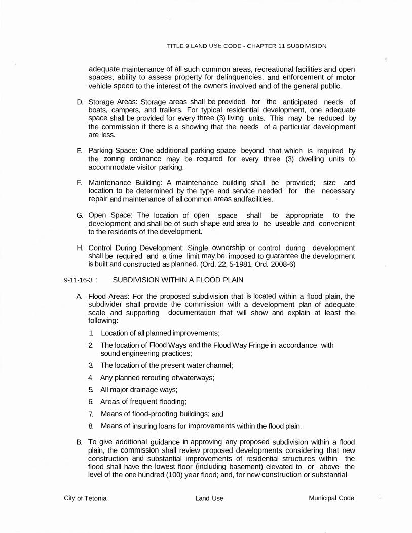
TITLE 9 LAND USE CODE - CHAPTER 11 SUBDIVISION
adequate maintenance of all such common areas, recreational facilities and open spaces, ability to assess property for delinquencies, and enforcement of motor vehicle speed to the interest of the owners involved and of the general public.
D. Storage Areas: Storage areas shall be provided for the anticipated needs of boats, campers, and trailers. For typical residential development, one adequate space shall be provided for every three (3) living units. This may be reduced by the commission if there is a showing that the needs of a particular development are less.
E. Parking Space: One additional parking space beyond that which is required by the zoning ordinance may be required for every three (3) dwelling units to accommodate visitor parking.
F. Maintenance Building: A maintenance building shall be provided; size and location to be determined by the type and service needed for the necessary repair and maintenance of all common areas and facilities.
G. Open Space: The location of open space shall be appropriate to the development and shall be of such shape and area to be useable and convenient to the residents of the development.
H. Control During Development: Single ownership or control during development shall be required and a time limit may be imposed to guarantee the development is built and constructed as planned. (Ord. 22, 5-1981, Ord. 2008-6)
9-11-16-3 : SUBDIVISION WITHIN A FLOOD PLAIN
A. Flood Areas: For the proposed subdivision that is located within a flood plain, the subdivider shall provide the commission with a development plan of adequate scale and supporting documentation that will show and explain at least the following:
1. Location of all planned improvements;
2. The location of Flood Ways and the Flood Way Fringe in accordance with sound engineering practices;
3. The location of the present water channel;
4. Any planned rerouting of waterways;
5. All major drainage ways;
6. Areas of frequent flooding;
7. Means of flood-proofing buildings; and
8. Means of insuring loans for improvements within the flood plain.
B. To give additional guidance in approving any proposed subdivision within a flood plain, the commission shall review proposed developments considering that new construction and substantial improvements of residential structures within the flood shall have the lowest floor (including basement) elevated to or above the level of the one hundred (100) year flood; and, for new construction or substantial
City of Tetonia Land Use Municipal Code

TITLE 9 LAND USE CODE - CHAPTER 11 SUBDIVISION
improvements of non-residential structures, the lowest floor (including basement) shall be elevated to or above the level of the one hundred (100) year flood, or together with attendant utility and sanitary facilities, shall be flood-proofed up to the level of the one hundred (100) year flood.
C. Justification for Development: Upon determination that buildings are planned within the flood plain or that alternations of any kind are anticipated within the flood plain area that will alter the flow of water, the subdivider shall demonstrate conclusively that such development will not present a hazard to life or limb, hazard to property, adverse affects on the safety, use or stability of a public way or drainage channel and not have an adverse impact on the natural environment.
D. Appropriateness of Subdivision: In determining the appropriateness of subdivision for land located within a flood plain, the commission and Council shall consider the objectives of this ordinance, and at least the following:
1. The danger to life and property due to the increased flood heights or velocities caused by subdivision fill, roads and intended uses;
2. The danger that intended uses may be swept on the other or downstream to the injury of others;
3. The adequacy of proposed water supply and sanitation systems and the ability of these systems to prevent disease, contamination and unsanitary conditions under flood conditions;
4. The susceptibility of the proposed facility and its contents to flood damage the and the effect of such damage on the individual owner;
5. The importance of the services provided by the proposed facility to the community;
6. The requirements of the subdivision for a waterfront location;
7. The availability of alternative locations not subject to flooding for the proposed subdivision and land uses;
8. The compatibility of the proposed uses with existing development and development anticipated in the foreseeable future;
9. The relationship of the proposed subdivision to the comprehensive plan and any flood plain management programs for the area;
10. The safety of access to the property for emergency vehicles in times of flood;
11. The expected heights, velocity, duration, rate of rise and sediment transport of the flood waters expected at the site; and
12. The Costs of providing governmental services during and after flood conditions including maintenance and repair of public utilities and facilities such as sewer, gas, electrical and water systems, and streets and bridges.
E. No subdivision or part thereof shall be approved if levees, fills, structures, or other features within the proposed subdivision will individually or collectively significantly increase flood flows, heights, or damages. If only part of the proposed subdivision can be s fely developed, development shall be limited to
City of Tetonia Land Use Municipal q,qde

TITLE 9 LAND USE CODE - CHAPTER 11 SUBDIVISION
that part and the city shall require development to proceed consistent with that determination.
F. Flood-Proofing Plans: Flood-proofing plans must be individually approved by the
Council upon recommendation from the commission before such uses are constructed. Flood-proofing may include but not be limited to the following:
1. Anchorage to resist flotation and lateral movement;
2. Installation of watertight doors, bulkheads and shutters, or similar methods of closure;
3. Reinforcement of walls to resist water pressure;.
4. Use of paints, membranes, or mortars to reduce seep-age of water through walls;
5. Addition of mass or weight to structures to resist flotation;
6. Installation of pumps to lower water levels in structures;
7. Construction of water supply and waste treatment systems so, as to prevent the entrance of flood waters;
8. Installation of pumps or comparable facilities for subsurface drainage systems to relieve external foundation wall and basement flood pressures
9. Building design and construction to resist rupture or collapse caused by water pressure or floating debris;
10. Installation of valves or controls on sanitary ad storm drains which permit the drains to be closed to prevent backup sewage and storm waters into buildings or structures;
11. Location and installation of all electrical equipment, circuits and electrical appliances so that they are protected from inundation by the regulatory flood; and,
G. Location of storage facilities for chemicals, explosive, buoyant materials, flammable liquids or other toxic materials which could be hazardous to public health, safety and welfare at elevations above the height associated with the regulatory protection elevation; or design such facilities to prevent flotation of storage containers, or damage to storage containers which could result in the escape of toxic materials into flood waters. (Ord. 22, 5-1981; Ord. 2008-6)
9-11-16-4 : SUBDVISION FOR A CEMETERY
A. Function: The developer shall provide the comm1ss1on with written documentation that will sufficiently explain if the proposed cemetery will be used for either human or animal remains and the functions that are anticipated on the property.
B. Compliance with Idaho Code: The developer shall submit a written statement that has been prepared by an attorney that adequately assures the compliance of the propose cemetery with the procedural platting requirements and management requirements that are outlined in Title 27, Idaho Code. (Ord. 22, 5- 1981; Ord. 2008-6)
City of Tetonia Land Use Municipal Code

TITLE 9 LAND USE CODE - CHAPTER 11 SUBDIVISION
9-11-16-5 : AREAS OF CRITIAL CONCERN
A. General: The development of any hazardous or unique areas that have previously been designated as areas of critical concern by the Council, as provided by Idaho Code shall demand that special considerations be given by the subdivider or assure that the development is necessary and desirable in the public interest in view of the existing unique conditions. Areas that may be designated by the Council, through due process, as hazardous or unique may be as follows:
1. Unstable soils;
2. Unique animal and wildlife habitat;
3. Unique plant life habitat;
4. Scenic areas;
5. Historical significance areas;
6. Flood Plains;
7. Other areas of critical concern.
B. Plan Submission: The subdivider shall prepare and submit an Environmental Impact Statement for those areas as above noted and designated along with the preliminary plat application.
C. Content of Environmental Impact Statement: The content of the Environmental Impact Statement shall usually be prepared by a team of professionals that will provide answers to the following questions:
1. What environmental impacts will probably occur (i.e., wildlife, plant life, social, economic, physical, etc.) as a result of the proposed development?
2. What corrective action or alternative plans could be developed so as not to significantly cause detrimental environmental impact?
3. What adverse effects of the proposed development cannot be avoided? (Ord. 22, 5-1981; Ord. 2008-6)
City of Tetonia Land Use Municipal Code