Embed Size (px)
Citation preview

Department of Geodesy and Mining Areas Protection
Faculty of Mining and Geology
The production modeling in the GIS system
Violetta Sokoła-SzewiołaMarian Poniewiera
Iwona Jelonek

Silesian University of Technology
GIS in Mining Industry
Geographic Information System is a set of tools for:
collection, processing and sharing of the datarequired for safe mining and modelling of:
• mine workings,
• structure and quality of the deposit,
• hydrogeological conditions,
• impact of the mining works to the surface.

Silesian University of Technology
Legal Regulations
Entrepreneur (Coal company) is obligated to maintain surveying and geological documentation.
Documents can be prepared in digital form if:
• are protected against damage and
destruction,
• there is a record of data changes in both:
archive and working files,
• files are printable.
June 9, 2011
Geological and mining law
October 28, 2015
Survey and geological documentation

Silesian University of TechnologyPKN - National Standards
Body in Poland
Silesian University of Technology
Digital Deposit Model in PGG SA
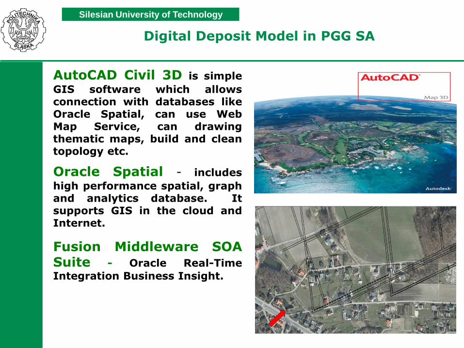
AutoCAD Civil 3D is simple
GIS software which allowsconnection with databases likeOracle Spatial, can use WebMap Service, can drawingthematic maps, build and cleantopology etc.
Oracle Spatial - includes
high performance spatial, graphand analytics database. Itsupports GIS in the cloud andInternet.
Fusion Middleware SOASuite - Oracle Real-Time
Integration Business Insight.
Silesian University of Technology
Digital Deposit Model in PGG SA
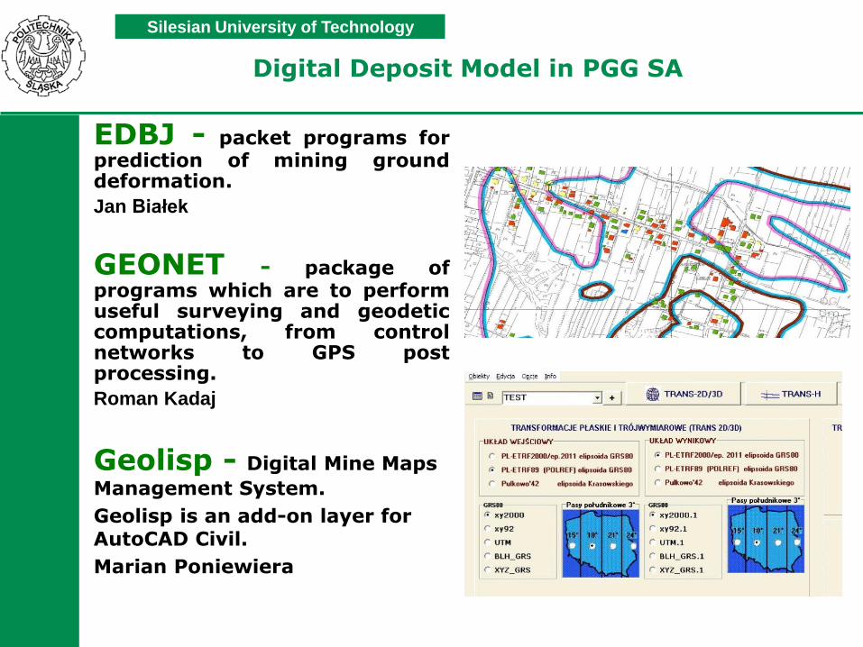
EDBJ - packet programs forprediction of mining grounddeformation.
Jan Białek
GEONET - package ofprograms which are to performuseful surveying and geodeticcomputations, from controlnetworks to GPS postprocessing.
Roman Kadaj
Geolisp - Digital Mine Maps
Management System.
Geolisp is an add-on layer for AutoCAD Civil.
Marian Poniewiera

Silesian University of Technology
Geolisp
1993 r – CM Katowice
2017 r – almost all coal mines in Poland
Digital Mine Maps
Management System

Silesian University of Technology
Menu: Open Pit Mine

Silesian University of TechnologySystem contains several thousand symbols for
survey, ventilation, geology, transportation, rail,
urban planning...
Silesian University of Technology
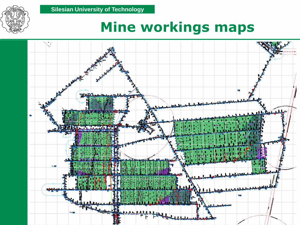
Mine workings maps

Silesian University of Technology
Mine workings maps

Silesian University of TechnologyTransformation between coordinate systems
Sucha Góra 1802 Poland CS 2000 Zone 6
Combined polynomial
Z = a0 + z (a1 + z ( a2 + z (a3 ... + z * an ))

Calibration of the seam map raster

14
Derivative maps
System can semiautomatically create derivative maps to the main map with different scale and annotations.

Silesian University of Technology
3D Model of mine workings
Generate automatically layout of workings in 3D based on flat map.
On this view we can present escape routes or we can design new workings.

Silesian University of Technology
Digital Deposit ModelTIN - Triangulated Irregular Network

Silesian University of Technology
Digital Deposit Model

Silesian University of Technology
Graph through multiple surfaces
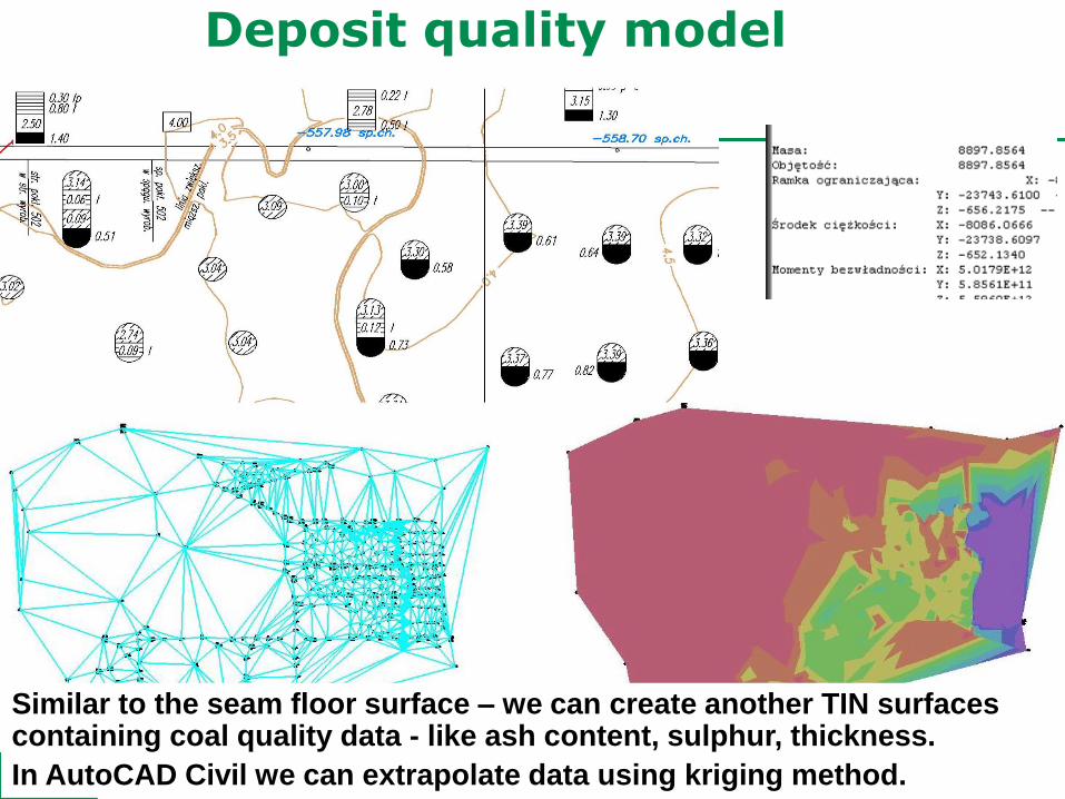
Silesian University of TechnologyDeposit quality model
Similar to the seam floor surface – we can create another TIN surfaces containing coal quality data - like ash content, sulphur, thickness.
In AutoCAD Civil we can extrapolate data using kriging method.

Silesian University of Technology
Isolines description

✓ Thickness, elevation of the floor in every point
✓ Surface area, volume, inclination of selected polygon
✓ Quick dimensioning of selected object
✓ Impact of the projected mine plan on deposit and on surface
What gives us a TIN surface?
Silesian University of Technology
22
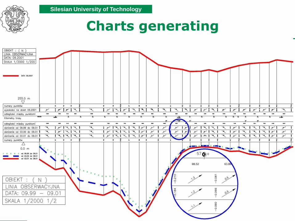
Charts generating

Silesian University of Technology
Longwall chart
Software can provide data about inclinations of the longwall in both directions, as well as longwall 3D length.

Silesian University of Technology
Data import from the surface
System automatically made plan of excavation.
Provides useful information: coal and rock tonnage, sulfur content, workings length etc.

Coordination between production,transportation, coal processingand sales.
Data startu ściany
Data stanu ściany
Data zakończenia eksploatacji ściany
Węgiel
Kamień
Data stanu informacji
Oś dat
Oś postępów
m/d m/d m/dm/d
Wart. opał [kJ/kg]
Popiół [%]
Siarka [%]
Wykresy jakości

Production and coal quality planning
Ściana Gęstość Zasoby 2020 2021
(nr) [t/m3] [tys. t] 1 2 3 4 5 6 7 8 9 10 11 12 1 2 3 4 5 6 7 8 9 10 11 12
sc1 1.41 1347.3 112 112 112 112 112 112 112 112 112 112 112 112
sc2 1.41 1332.9 133 133 133 133 133 133 133 133 133 133
sc3 1.41 1029.4 94 94 94 94 94 94 94 94 94 94 94
sc1 1.35 369.1 92 92 92 92
sc2 1.35 377.8 76 76 76 76 76
sc3 1.35 98.7 49 49
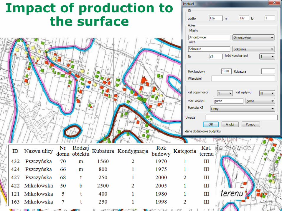
Impact of production to the surface

Silesian University of Technology
Overflow lands forecast

Queries generation
➢ We can verify correctness of the modelled geology – for example whether there is no empty space between blocks – topology.
➢ System can be linked with external database – for example Oracle.
➢ System can be queried - highlight with green all blocks with thickness greater than 3m and all others highlight with red.

Silesian University of Technology
Longwall thickness chart

Silesian University of Technology
Work with aerial photographs
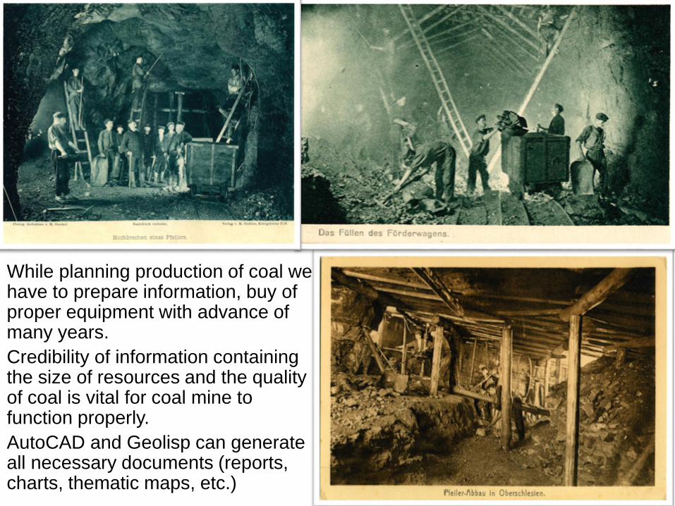
While planning production of coal we have to prepare information, buy of proper equipment with advance of many years.
Credibility of information containing the size of resources and the quality of coal is vital for coal mine to function properly.
AutoCAD and Geolisp can generate all necessary documents (reports, charts, thematic maps, etc.)

Silesian University of Technology
Thank you for your attention
The production modelling in the GIS system