Embed Size (px)
Citation preview
The Potential for Improved Short-term Atlantic Hurricane Intensity Forecasts
Using Recon-based Core MeasurementsAndrew Murray, Robert Hart, [email protected]
Florida State University
Department of Meteorology[Department of EOAS in May]
http://moe.met.fsu.edu[http://moe.eoas.fsu.edu in late 2010]
64th IHC, Savannah, GA, 3 March 2010
NASA NNX09AC43G [GRIP]
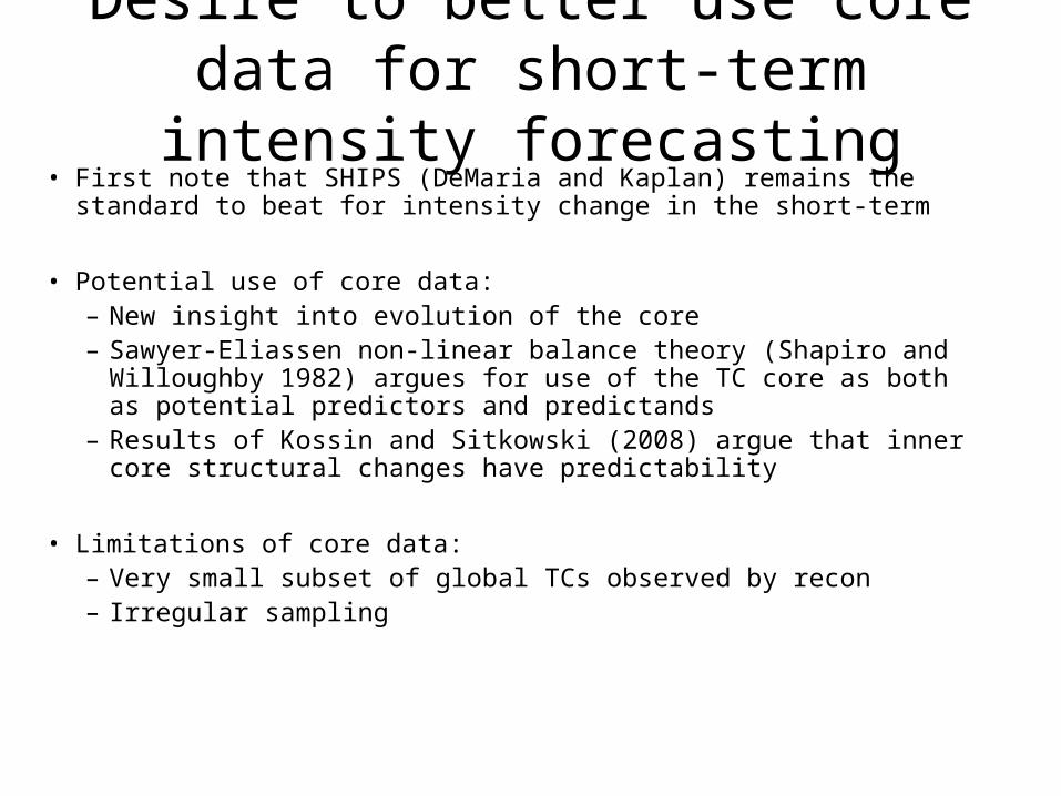
Desire to better use core data for short-term intensity forecasting
• First note that SHIPS (DeMaria and Kaplan) remains the standard to beat for intensity change in the short-term
• Potential use of core data:– New insight into evolution of the core– Sawyer-Eliassen non-linear balance theory (Shapiro and Willoughby 1982)
argues for use of the TC core as both as potential predictors and predictands– Results of Kossin and Sitkowski (2008) argue that inner core structural
changes have predictability
• Limitations of core data:– Very small subset of global TCs observed by recon– Irregular sampling
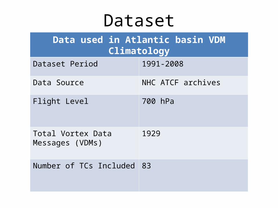
DatasetData used in Atlantic basin VDM Climatology
Dataset Period 1991-2008
Data Source NHC ATCF archives
Flight Level 700 hPa
Total Vortex Data Messages (VDMs)
1929
Number of TCs Included 83
Piech (2007)
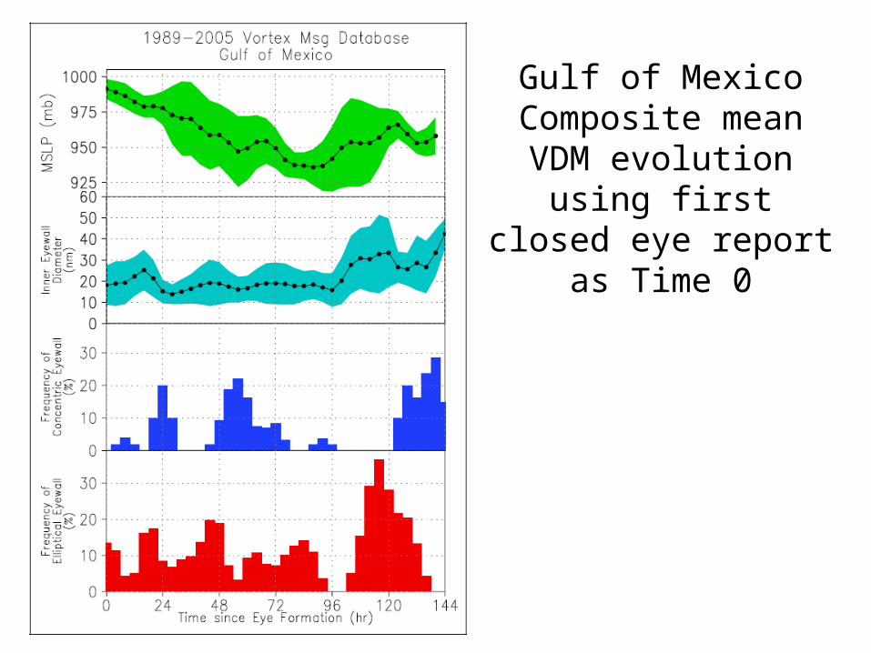
Gulf of Mexico Composite mean VDM
evolution using first closed eye report as
Time 0
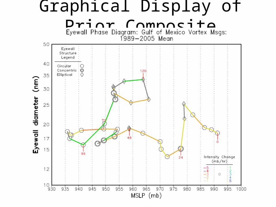
Graphical Display of Prior Composite
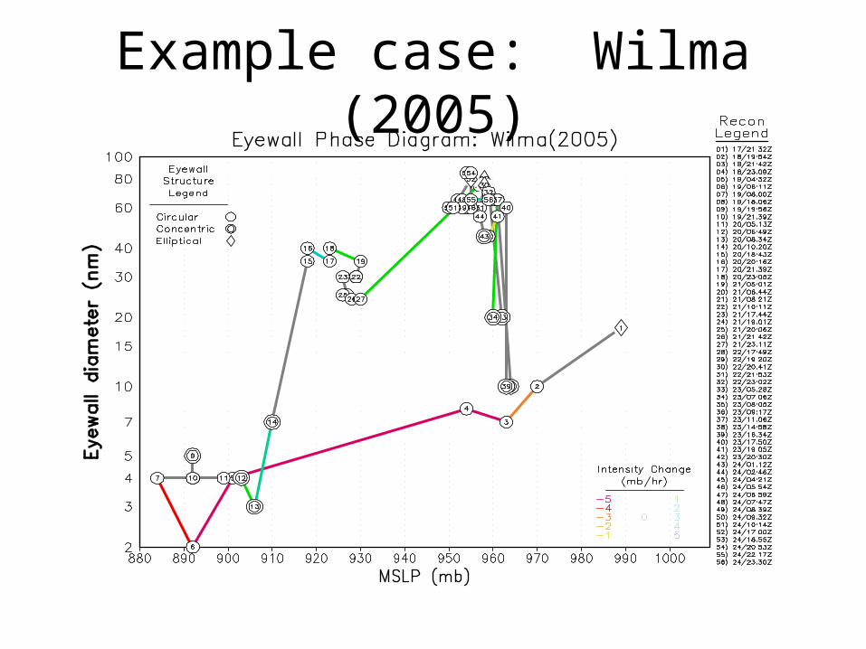
Example case: Wilma (2005)
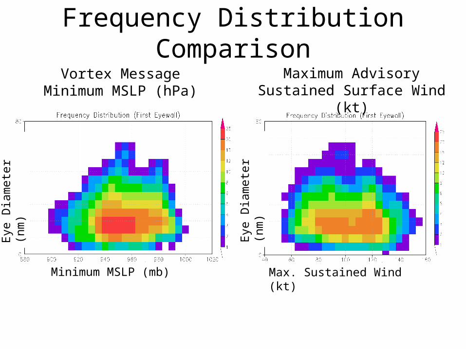
Frequency Distribution ComparisonVortex Message Minimum
MSLP (hPa)Maximum Advisory Sustained
Surface Wind (kt)
Eye
Dia
met
er (
nm)
Eye
Dia
met
er (
nm)
Minimum MSLP (mb) Max. Sustained Wind (kt)
Mean future 12-hr Intensity Change
12-hour mean wind rate (hr-1) 12-hour SE of the mean
Max. Sustained Wind (kt) Max. Sustained Wind (kt)
Eye
Dia
met
er (
nm)
Eye
Dia
met
er (
nm)
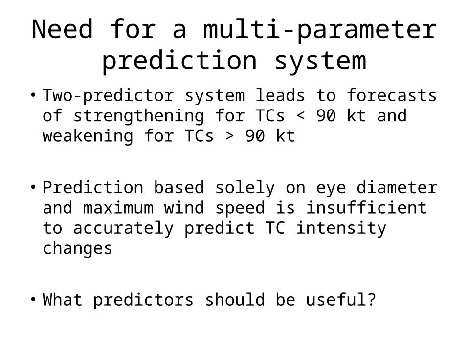
Need for a multi-parameter prediction system
• Two-predictor system leads to forecasts of strengthening for TCs < 90 kt and weakening for TCs > 90 kt
• Prediction based solely on eye diameter and maximum wind speed is insufficient to accurately predict TC intensity changes
• What predictors should be useful?
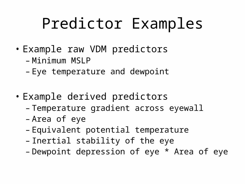
Predictor Examples
• Example raw VDM predictors– Minimum MSLP– Eye temperature and dewpoint
• Example derived predictors– Temperature gradient across eyewall– Area of eye– Equivalent potential temperature– Inertial stability of the eye– Dewpoint depression of eye * Area of eye
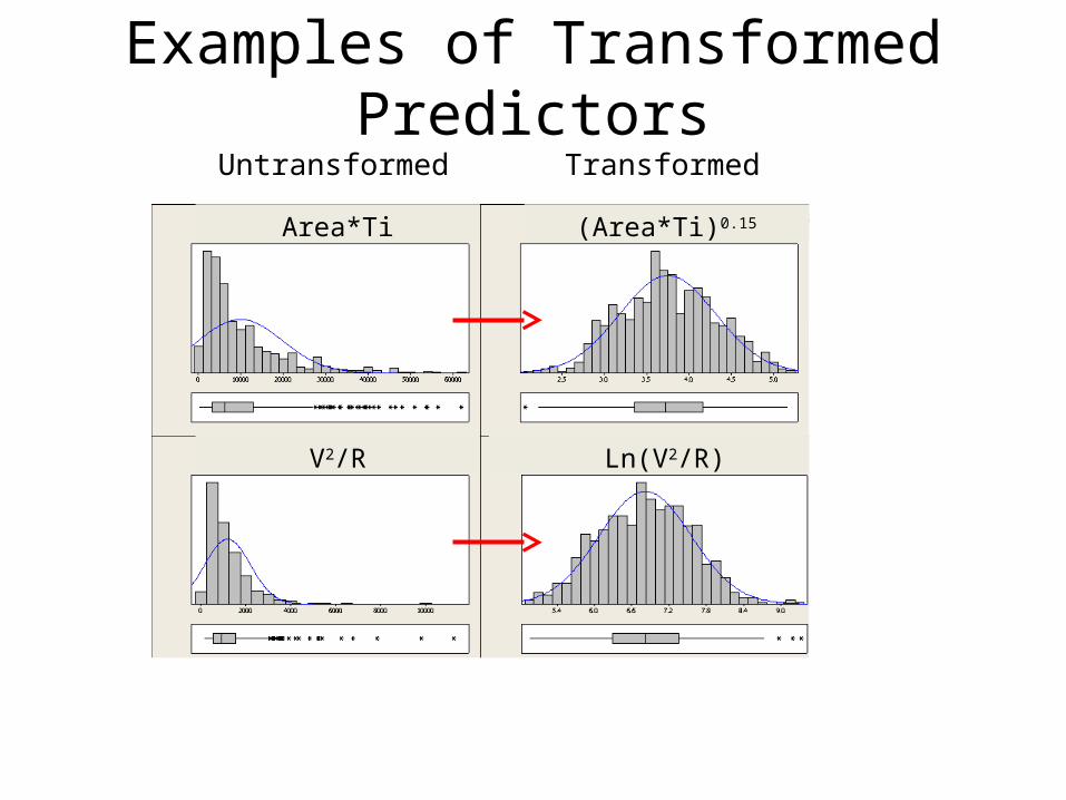
Examples of Transformed PredictorsUntransformed Transformed
Area*Ti
Ln(V2/R)V2/R
(Area*Ti)0.15
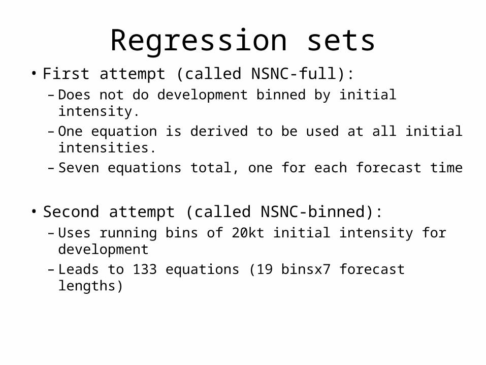
Regression sets• First attempt (called NSNC-full):
– Does not do development binned by initial intensity. – One equation is derived to be used at all initial intensities. – Seven equations total, one for each forecast time
• Second attempt (called NSNC-binned):– Uses running bins of 20kt initial intensity for development– Leads to 133 equations (19 binsx7 forecast lengths)
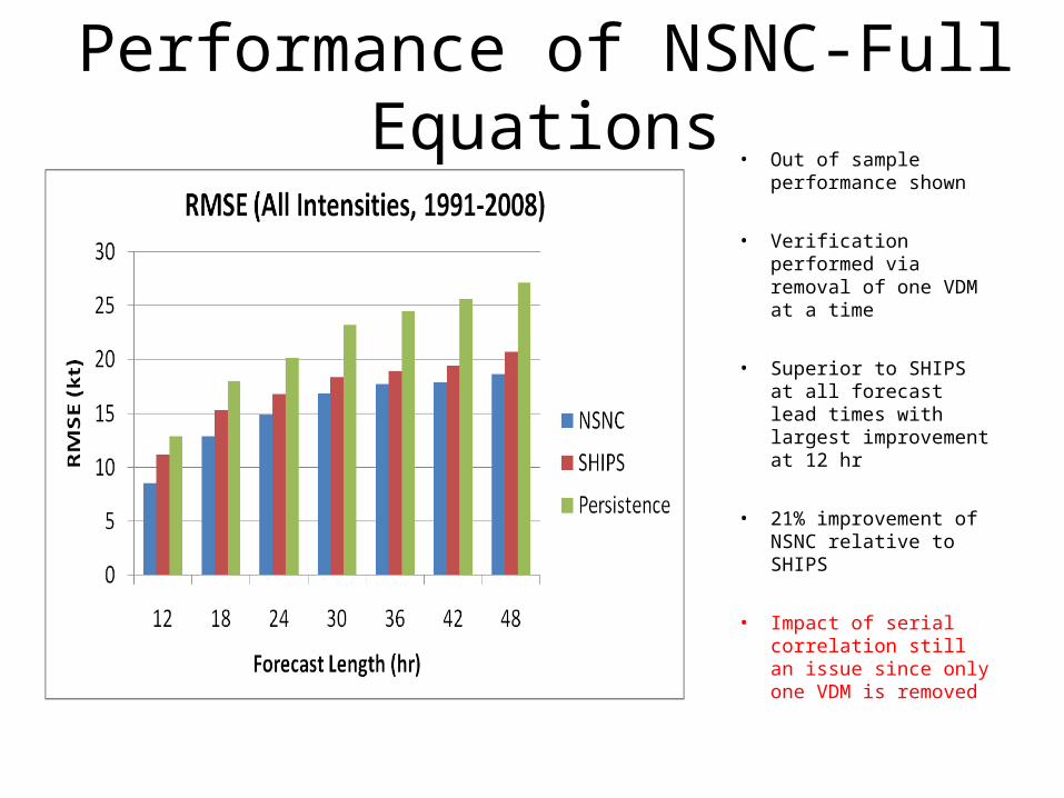
Performance of NSNC-Full Equations
• Out of sample performance shown
• Verification performed via removal of one VDM at a time
• Superior to SHIPS at all forecast lead times with largest improvement at 12 hr
• 21% improvement of NSNC relative to SHIPS
• Impact of serial correlation still an issue since only one VDM is removed
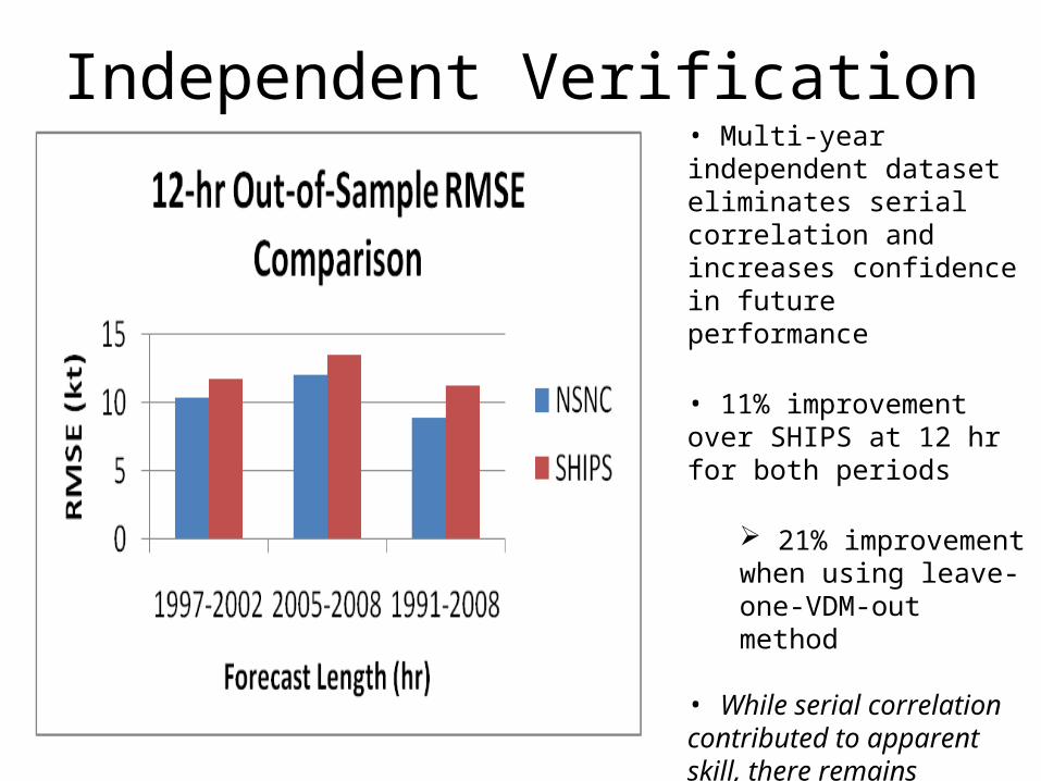
Independent Verification• Multi-year independent dataset eliminates serial correlation and increases confidence in future performance
• 11% improvement over SHIPS at 12 hr for both periods
21% improvement when using leave-one-VDM-out method
• While serial correlation contributed to apparent skill, there remains statistically significant improvement over SHIPS
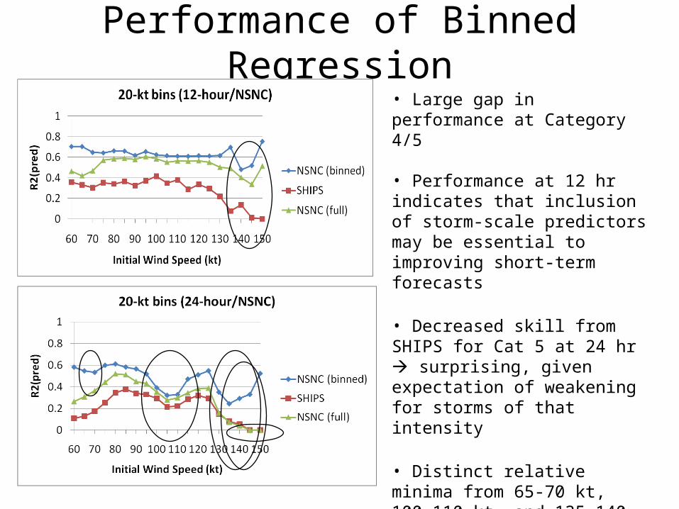
Performance of Binned Regression• Large gap in performance at Category 4/5
• Performance at 12 hr indicates that inclusion of storm-scale predictors may be essential to improving short-term forecasts
• Decreased skill from SHIPS for Cat 5 at 24 hr surprising, given expectation of weakening for storms of that intensity
• Distinct relative minima from 65-70 kt, 100-110 kt, and 135-140 kt
Related to ERC predictability (Kossin and Sitkowski 2009)?
Important Caveats• The apparent improvement over SHIPS is not an apples to
apples comparison
• SHIPS was developed using TCs over the entire basin, while this study (necessarily) only used TCs flown by recon
• Further, SHIPS did not have individual equations as function of initial intensity.
• Further, SHIPS has evolved over time as the science and observations have evolved
• A more apples to apples study would recalculate SHIPS style using the subset of storms used here, in full and binned, and then intercompare
Conclusions and Future Work• Nonetheless, independent testing showed that new technique is
comparable to or surpasses the skill of SHIPS for short-term forecasts for the subset of storms flown by recon.
• Utilization of running bins of 20 kt size provides additional benefit.
• Predictability of future TC intensity is strongly a function of initial intensity and is not linear.
• Future: Examine satellite proxies for VDMs to determine if the approach and skill can be extended to non-recon basins [GRIP]
• If not, potentially argues for more frequent Hurricane Hunter recon missions in the Atlantic basin and expanding recon flights to other basins.