Embed Size (px)
Citation preview
Forbes Environmental & Land Use Planning
Crosswicks/Doctors Creek Watershed Greenway Group
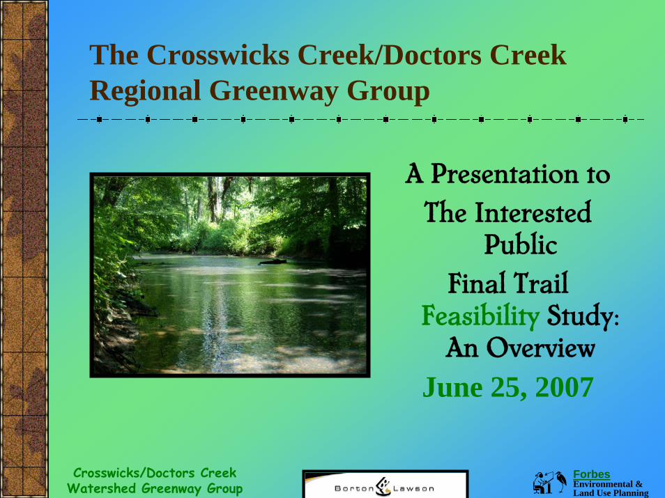
The Crosswicks Creek/Doctors Creek Regional Greenway Group
A Presentation toThe Interested
PublicFinal Trail
Feasibility Study: An Overview
June 25, 2007
Forbes Environmental & Land Use Planning
Crosswicks/Doctors Creek Watershed Greenway Group
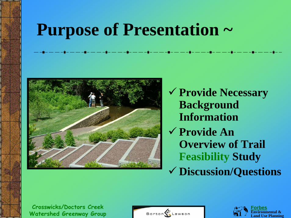
Purpose of Presentation ~
Provide Necessary Background InformationProvide An Overview of Trail Feasibility StudyDiscussion/Questions
Forbes Environmental & Land Use Planning
Crosswicks/Doctors Creek Watershed Greenway Group
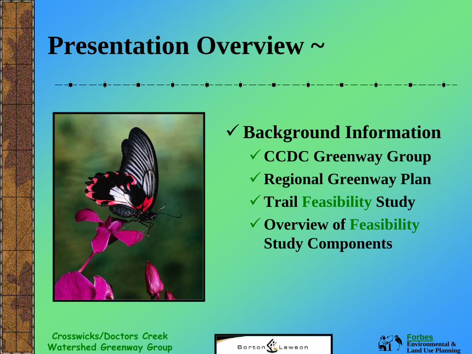
Presentation Overview ~
Background InformationCCDC Greenway GroupRegional Greenway PlanTrail Feasibility StudyOverview of Feasibility Study Components
Forbes Environmental & Land Use Planning
Crosswicks/Doctors Creek Watershed Greenway Group
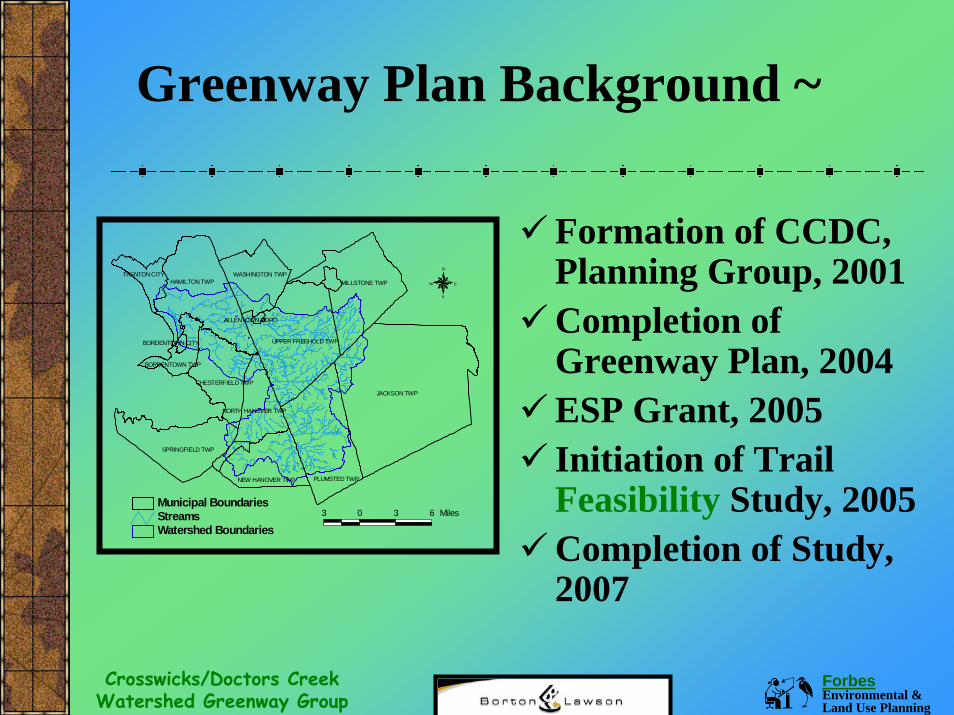
Greenway Plan Background ~
Formation of CCDC, Planning Group, 2001Completion of Greenway Plan, 2004ESP Grant, 2005Initiation of Trail Feasibility Study, 2005Completion of Study, 2007
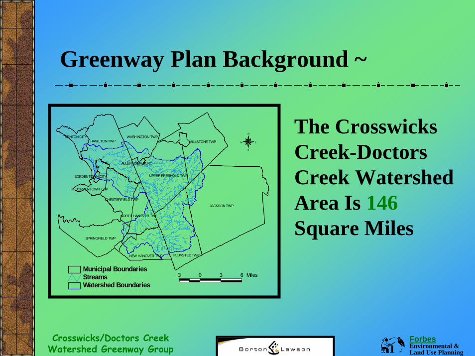
JACKSON TWP
HAMILTON TWP
PLUMSTED TWP
MILLSTONE TWP
UPPER FREEHOLD TWP
SPRINGFIELD TWP
NEW HANOVER TWP
WASHINGTON TWP
CHESTERFIELD TWP
NORTH HANOVER TWP
TRENTON CITY
BORDENTOWN TWP
BORDENTOWN CITY
ALLENTOWN BORO
Watershed BoundariesStreamsMunicipal Boundaries
N
EW
S
3 0 3 6 Miles
Forbes Environmental & Land Use Planning
Crosswicks/Doctors Creek Watershed Greenway Group
Greenway Plan Background ~
JACKSON TWP
HAMILTON TWP
PLUMSTED TWP
MILLSTONE TWP
UPPER FREEHOLD TWP
SPRINGFIELD TWP
NEW HANOVER TWP
WASHINGTON TWP
CHESTERFIELD TWP
NORTH HANOVER TWP
TRENTON CITY
BORDENTOWN TWP
BORDENTOWN CITY
ALLENTOWN BORO
Watershed BoundariesStreamsMunicipal Boundaries
N
W
S
E
3 0 3 6 Miles
The Crosswicks Creek-Doctors Creek Watershed Area Is 146Square Miles
Forbes Environmental & Land Use Planning
Crosswicks/Doctors Creek Watershed Greenway Group
Greenway Plan Background ~
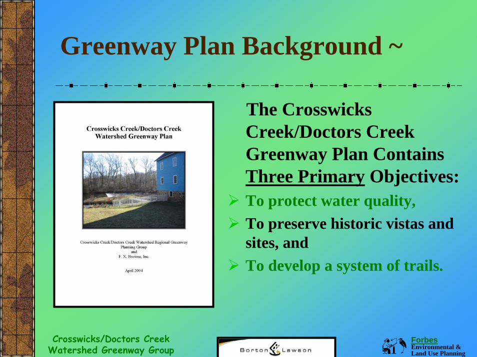
The Crosswicks Creek/Doctors Creek Greenway Plan Contains Three Primary Objectives: To protect water quality, To preserve historic vistas and sites, and To develop a system of trails.
Forbes Environmental & Land Use Planning
Crosswicks/Doctors Creek Watershed Greenway Group
Greenway Plan Background ~
The Greenway Plan Identifies Watershed Needs:Protection of Identified Ecological Features- Areas of Significance including: Headwater Areas, 35’Buffer, Steep Slopes, Water Quality Protection ZonesPreservation of Identified Historic Vistas & Sites-Preserve historic attributes in corridor and watershed. Development of Identified Trail Areas- Identified trails and connector trails for ecological protection and recreation.
Forbes Environmental & Land Use Planning
Crosswicks/Doctors Creek Watershed Greenway Group
Greenway Plan Background ~
The Greenway Plan contains: Management Plan Recommendations- Additional public outreach, conservation of stream corridors and headwater areas in their natural state, restoration of negatively impacted areas, acquisition of easements, adoption of more stringent local ordinances to address land development and resource impacts associated with land development & additional feasibility studies for specific greenway trails.

Forbes Environmental & Land Use Planning
Crosswicks/Doctors Creek Watershed Greenway Group
Feasibility Study Components (Introduction/Feasibility Study) ~
IMPORTANT!The definition of feasibility is a determination
of the degree to which something can be carried out.
Therefore the Doctors Creek-Assunpink Creek Trail Feasibility Study is intended to determine whether creating a trail may be carried out in the selected project area.
Forbes Environmental & Land Use Planning
Crosswicks/Doctors Creek Watershed Greenway Group
Project Background ~
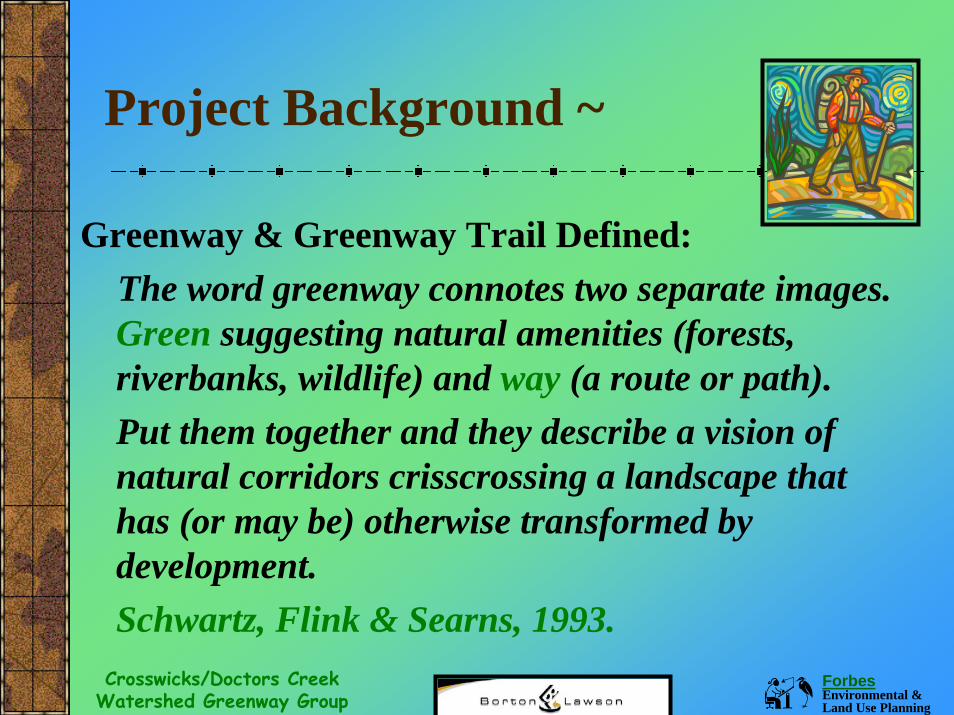
Greenway & Greenway Trail Defined: The word greenway connotes two separate images. Green suggesting natural amenities (forests, riverbanks, wildlife) and way (a route or path). Put them together and they describe a vision of natural corridors crisscrossing a landscape that has (or may be) otherwise transformed by development. Schwartz, Flink & Searns, 1993.
Forbes Environmental & Land Use Planning
Crosswicks/Doctors Creek Watershed Greenway Group
Project Background ~
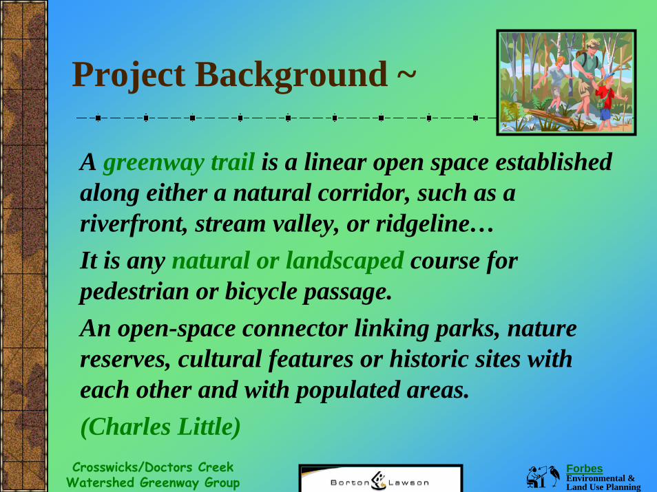
A greenway trail is a linear open space established along either a natural corridor, such as a riverfront, stream valley, or ridgeline…It is any natural or landscaped course for pedestrian or bicycle passage. An open-space connector linking parks, nature reserves, cultural features or historic sites with each other and with populated areas.(Charles Little)
Forbes Environmental & Land Use Planning
Crosswicks/Doctors Creek Watershed Greenway Group
Project Background ~
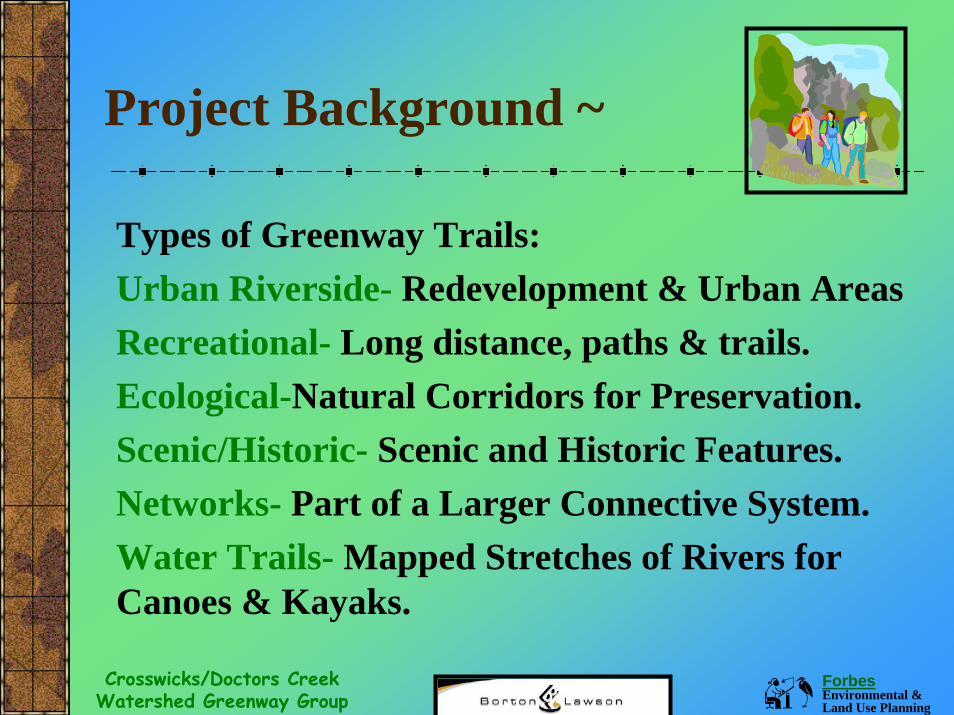
Types of Greenway Trails:Urban Riverside- Redevelopment & Urban AreasRecreational- Long distance, paths & trails.Ecological-Natural Corridors for Preservation.Scenic/Historic- Scenic and Historic Features.Networks- Part of a Larger Connective System.Water Trails- Mapped Stretches of Rivers for Canoes & Kayaks.
Forbes Environmental & Land Use Planning
Crosswicks/Doctors Creek Watershed Greenway Group
Project Background ~
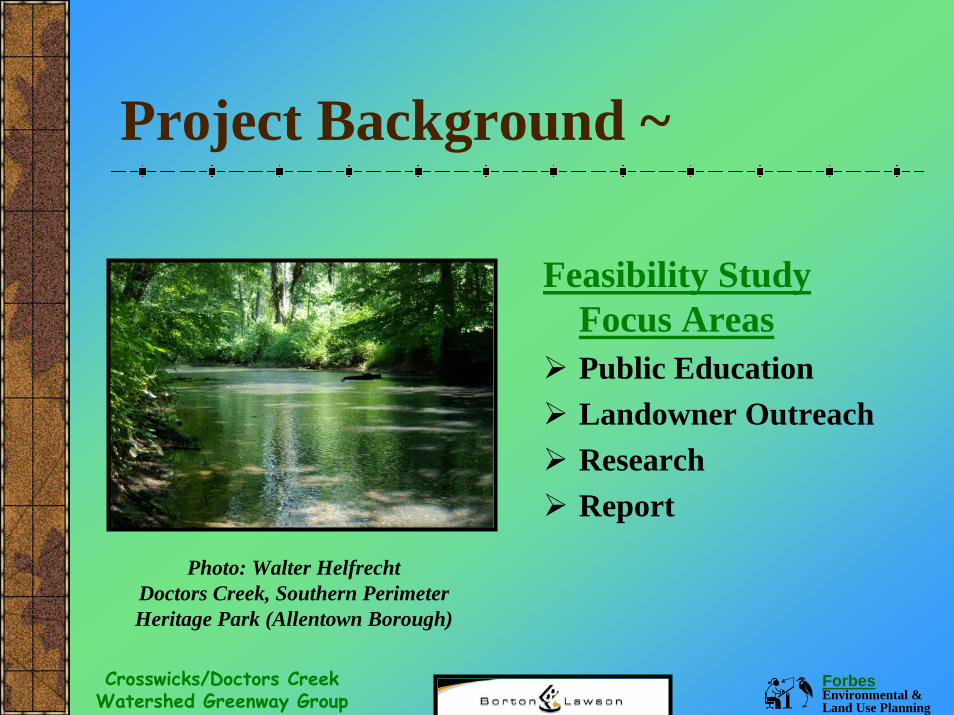
Feasibility Study Focus AreasPublic EducationLandowner OutreachResearchReport
Photo: Walter Helfrecht Doctors Creek, Southern Perimeter Heritage Park (Allentown Borough)
Forbes Environmental & Land Use Planning
Crosswicks/Doctors Creek Watershed Greenway Group
Feasibility Study Components (Introduction/Greenway Benefits) ~
In a time where natural communities are disappearing, remaining open areas are being negatively impacted by increased development and public access to waterways and other natural areas are often restricted, people are having a harder time experiencing the outdoors and obtaining the numerous benefits associated with passive and active outdoor recreation. The introductory section (Section 1) provides important background information.
Forbes Environmental & Land Use Planning
Crosswicks/Doctors Creek Watershed Greenway Group
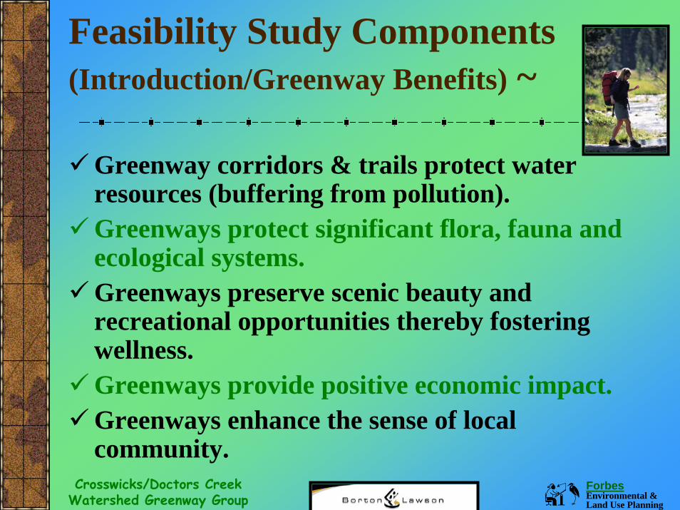
Feasibility Study Components (Introduction/Greenway Benefits) ~
Greenway corridors & trails protect water resources (buffering from pollution).Greenways protect significant flora, fauna and ecological systems.Greenways preserve scenic beauty and recreational opportunities thereby fostering wellness.Greenways provide positive economic impact.Greenways enhance the sense of local community.
Forbes Environmental & Land Use Planning
Crosswicks/Doctors Creek Watershed Greenway Group
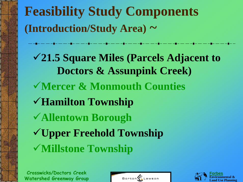
Feasibility Study Components (Introduction/Study Area) ~
21.5 Square Miles (Parcels Adjacent to Doctors & Assunpink Creek)
Mercer & Monmouth CountiesHamilton TownshipAllentown BoroughUpper Freehold TownshipMillstone Township
Forbes Environmental & Land Use Planning
Crosswicks/Doctors Creek Watershed Greenway Group
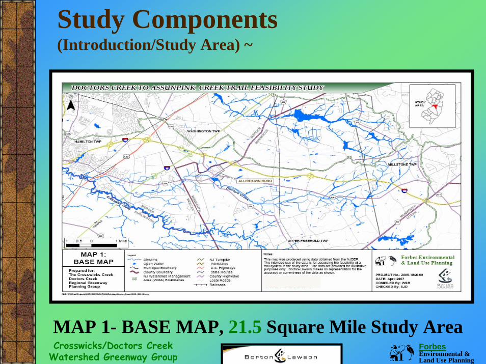
Study Components (Introduction/Study Area) ~
MAP 1- BASE MAP, 21.5 Square Mile Study Area
Forbes Environmental & Land Use Planning
Crosswicks/Doctors Creek Watershed Greenway Group
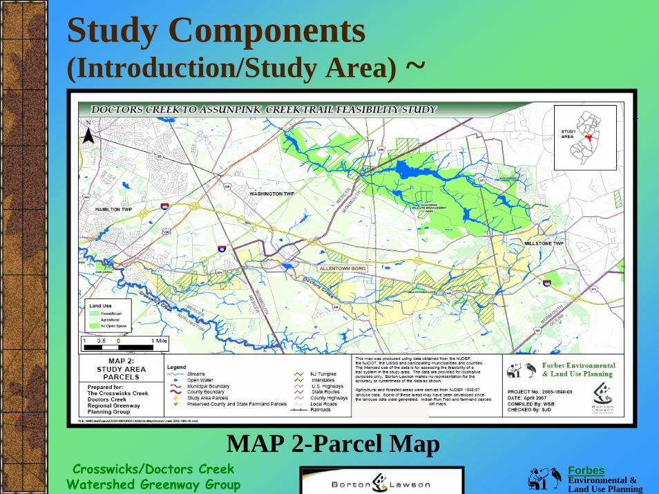
Study Components (Introduction/Study Area) ~
MAP 2-Parcel Map
Forbes Environmental & Land Use Planning
Crosswicks/Doctors Creek Watershed Greenway Group
Feasibility Study Components (Introduction/Successful Efforts) ~
Establishing strong support for regional and local greenway preservation is an important criteria for determining trail feasibility.
This section of the plan provides an overview of successful regional and CCDC group projects and efforts.
Forbes Environmental & Land Use Planning
Crosswicks/Doctors Creek Watershed Greenway Group
Feasibility Study Components (Introduction/Greenway Plan Consistency)
Establishing consistency (planning consistency criteria) between the greenway plan and the vision behind the implementation of the Doctors-Assunpink Creek Trail is also an important facet of trail feasibility, as it illustrates adoption of a guiding plan, and selecting implementation efforts consistent with the plan.
In this section of the plan, we list the major recommendations in the greenway plan and illustrate their consistency with the trail feasibility project.
Forbes Environmental & Land Use Planning
Crosswicks/Doctors Creek Watershed Greenway Group
Feasibility Study Components (Public Outreach) ~
Public involvement is a major step in the process of creating a multi-use trail (public acceptance criteria). If you institute and carry out a comprehensive public involvement campaign, you will create trust and support between your organization and the public. In this section of the plan (Section 3.0) we list the outreach tasks implemented during the course of the feasibility study & findings from those efforts.
Forbes Environmental & Land Use Planning
Crosswicks/Doctors Creek Watershed Greenway Group
Some Citizen Survey FindingsRespondents from four municipalitiesMajority in 51-60 year old rangeLiving in single-detached homes (> 20 years)Knew the definition of “watershed”Noted water is an important personal issueMost valued features: habitat, aesthetics, open space, recreational opportunities, drinking water and privacy.
Feasibility Study Components(Public Outreach Finding) ~
Forbes Environmental & Land Use Planning
Crosswicks/Doctors Creek Watershed Greenway Group
More Survey FindingsMost common recreational activities: walking/hiking, nature exploration, fishing, water sports, picnics, mountain biking, hunting & ATVs. Most respondents felt water quality was degrading due to low flows and stormwater runoff. Respondents recommended water quality improvements, less litter, and flood control.
Feasibility Study Components (Public Outreach Finding) ~
Forbes Environmental & Land Use Planning
Crosswicks/Doctors Creek Watershed Greenway Group
Feasibility Study Components (Public Outreach Finding) ~
Meeting Feedback/Concerns/QuestionsSupporters noting preference for low impact, multi-use trails, positive economic impacts, compensation for preserved property, and willingness to maintain the trail.Issues noted were impacts to property values, low return associated with preservation, litter, vandalism, loss of privacy and lawsuits.
Forbes Environmental & Land Use Planning
Crosswicks/Doctors Creek Watershed Greenway Group
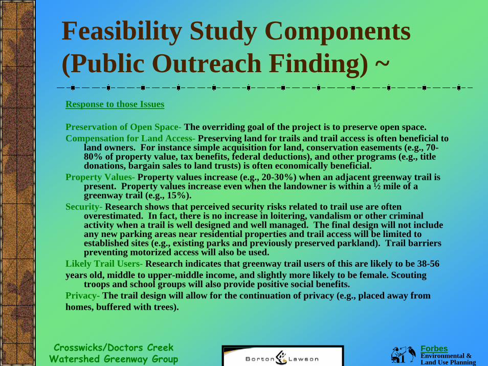
Feasibility Study Components (Public Outreach Finding) ~Response to those Issues
Preservation of Open Space- The overriding goal of the project is to preserve open space.Compensation for Land Access- Preserving land for trails and trail access is often beneficial to
land owners. For instance simple acquisition for land, conservation easements (e.g., 70-80% of property value, tax benefits, federal deductions), and other programs (e.g., title donations, bargain sales to land trusts) is often economically beneficial.
Property Values- Property values increase (e.g., 20-30%) when an adjacent greenway trail is present. Property values increase even when the landowner is within a ½ mile of a greenway trail (e.g., 15%).
Security- Research shows that perceived security risks related to trail use are often overestimated. In fact, there is no increase in loitering, vandalism or other criminal activity when a trail is well designed and well managed. The final design will not include any new parking areas near residential properties and trail access will be limited to established sites (e.g., existing parks and previously preserved parkland). Trail barriers preventing motorized access will also be used.
Likely Trail Users- Research indicates that greenway trail users of this are likely to be 38-56 years old, middle to upper-middle income, and slightly more likely to be female. Scouting
troops and school groups will also provide positive social benefits. Privacy- The trail design will allow for the continuation of privacy (e.g., placed away fromhomes, buffered with trees).
Forbes Environmental & Land Use Planning
Crosswicks/Doctors Creek Watershed Greenway Group
Feasibility Study Components (Public Outreach Finding) ~Response to those Issues
Perceived Issues- Several studies indicate that a clear majority end up supporting the trail (e.g., 90-95% approval rates once the trail is in place).Economic Values- Studies indicate that spending by trail users benefits local businesses (e.g., $10-25 per user in benefits to local businesses) and has other indirect positive benefits (e.g., exceeding $300,000/year).Trail Development & Design- Subsequent trail studies will include the following assurances:
Trail development will involve the least invasive machinery and techniques.When possible, previously cleared areas such as right of ways will be used.Trail surface will be the least invasive and would be altered in sensitive areas.Where needed, native species will be planted.Existing trees and other desirable features will be protected.Erosion control will be installed and monitored.Trails will function with existing drainage patterns.
Trail Maintenance- Subsequent trail studies will include trail maintenance and a maintenance support strategies.
Forbes Environmental & Land Use Planning
Crosswicks/Doctors Creek Watershed Greenway Group
Feasibility Study Components (Introduction/Feasibility Study) ~
Reminder!The definition of feasibility is a determination
of the degree to which something can be carried out.
Therefore the Doctors Creek-Assunpink Creek Trail Feasibility Study is intended to determine whether creating a trail may be carried out in the selected project area.
Forbes Environmental & Land Use Planning
Crosswicks/Doctors Creek Watershed Greenway Group
Feasibility Study Components (Project Area Evaluation) ~
Although some significant features may enhance the trail experience (e.g., scenic vistas, presence of natural and historic elements) others may present environmentally or economically prohibitive challenges (economic and physical criteria) to trail development (e.g., very steep slopes, obstructions, land ownership).
This section of the plan (4.0 Project Area Evaluation) provides the physical, natural, historic, cultural, land use, land ownership, planning, and regulatory features present in the study area.
Forbes Environmental & Land Use Planning
Crosswicks/Doctors Creek Watershed Greenway Group
Feasibility Study Components (Project Area Evaluation/Physical & Natural Features) ~
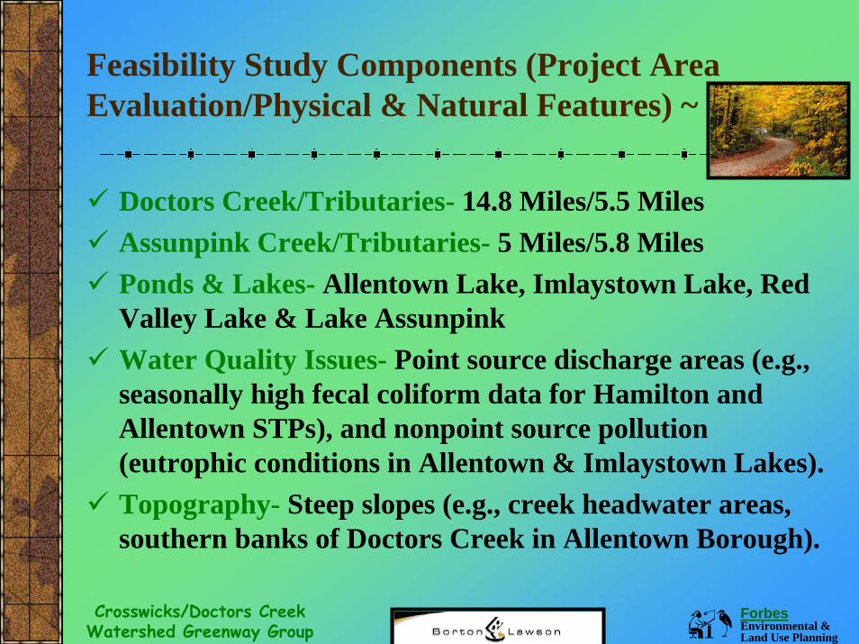
Doctors Creek/Tributaries- 14.8 Miles/5.5 MilesAssunpink Creek/Tributaries- 5 Miles/5.8 MilesPonds & Lakes- Allentown Lake, Imlaystown Lake, Red Valley Lake & Lake AssunpinkWater Quality Issues- Point source discharge areas (e.g., seasonally high fecal coliform data for Hamilton and Allentown STPs), and nonpoint source pollution (eutrophic conditions in Allentown & Imlaystown Lakes).Topography- Steep slopes (e.g., creek headwater areas, southern banks of Doctors Creek in Allentown Borough).
Forbes Environmental & Land Use Planning
Crosswicks/Doctors Creek Watershed Greenway Group
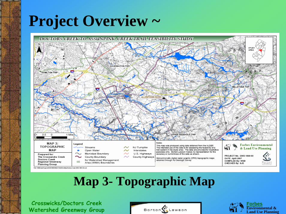
Project Overview ~
Map 3- Topographic Map
Forbes Environmental & Land Use Planning
Crosswicks/Doctors Creek Watershed Greenway Group
Feasibility Study Components (Project Area Evaluation/Physical & Natural Features) ~
One of the primary reasons the project area is under study for a potential trail is to conserve the myriad of significant natural, cultural and historic resources present. Also, when a trail meanders through areas affording significant features and takes advantage of proximity to them, the trail becomes more interesting to the user and provides numerous educational opportunities.
Forbes Environmental & Land Use Planning
Crosswicks/Doctors Creek Watershed Greenway Group
Feasibility Study Components (Project Area Evaluation/Physical & Natural Features) ~
The following inventory information is contained in Section 4.1 of the feasibility plan:
Watershed-Wide Flora & FaunaEcological SystemsThreatened & Endangered SpeciesHistoric & Recreational Resources
Forbes Environmental & Land Use Planning
Crosswicks/Doctors Creek Watershed Greenway Group
Feasibility Study Components (Project Area Evaluation/Local Land Use) ~
Land use, local planning and regulatory efforts, and land ownership are also important criteria for determining trail feasibility.
All of these items have a direct impact upon land availability and the feasibility of trail implementation.
Forbes Environmental & Land Use Planning
Crosswicks/Doctors Creek Watershed Greenway Group
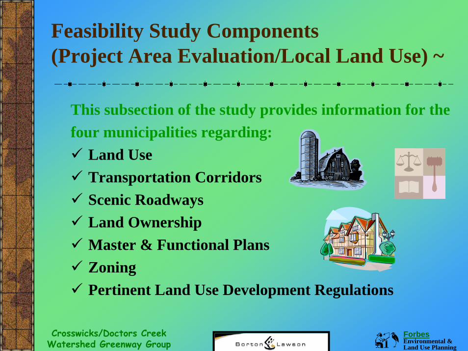
Feasibility Study Components (Project Area Evaluation/Local Land Use) ~
This subsection of the study provides information for thefour municipalities regarding:
Land UseTransportation CorridorsScenic RoadwaysLand OwnershipMaster & Functional PlansZoningPertinent Land Use Development Regulations
Forbes Environmental & Land Use Planning
Crosswicks/Doctors Creek Watershed Greenway Group
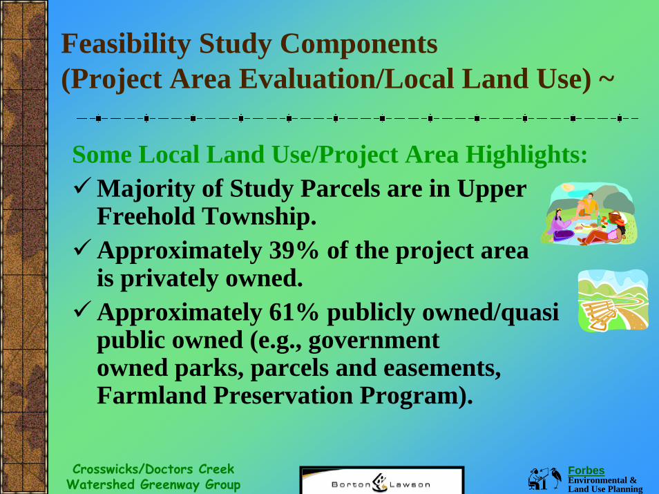
Feasibility Study Components (Project Area Evaluation/Local Land Use) ~
Some Local Land Use/Project Area Highlights: Majority of Study Parcels are in Upper Freehold Township.Approximately 39% of the project area is privately owned.Approximately 61% publicly owned/quasi public owned (e.g., government owned parks, parcels and easements, Farmland Preservation Program).
Forbes Environmental & Land Use Planning
Crosswicks/Doctors Creek Watershed Greenway Group
Feasibility Study Components (Project Area Evaluation/Local Planning & Regulations) ~
The following plans & regulations (4 municipalities) were researched: Municipal Master Plans- Policies regarding land use, historic preservation, conservation, open space and recreational planning elements. Functional Plans- Policies and mapping within natural & historic resources inventories, open space plans, and recreation plans, and watershed studies. Zoning Ordinances- The Zoning Districts in the project area & permitted uses for each district. Land Development Regulations- Regulations regarding land development, environmental impact, floodplain, storm water, and stream buffer regulations.
Forbes Environmental & Land Use Planning
Crosswicks/Doctors Creek Watershed Greenway Group
Feasibility Study Components (Project Area Evaluation/Local Planning & Regulations) ~
Policy & regulatory overview (Hamilton Township): Policies- Very supportive of open space preservation and recreational area development (e.g., farmland preservation, greenbelts along streams).Zoning Districts- Allow (permitted use) for parks, public recreation and conservation areas. Land Use Regulations- Flood plain & stream buffer overlay zones (floodway and flood fringe restrictions, 75 foot C-2 stream conservation zone with some use restrictions).
Forbes Environmental & Land Use Planning
Crosswicks/Doctors Creek Watershed Greenway Group
Feasibility Study Components (Project Area Evaluation/Local Planning & Regulations) ~
Policy & regulatory overview (Allentown Borough): Policies- Very supportive of small town character, open space and stream preservation (e.g., Historic District, Allentown historic greenbelt and recent adoption of Crosswicks Creek/Doctors Creek Regional Greenway Plan).Zoning Districts- Allow (permitted use) for parks and playgrounds.Land Use Regulations- Flood plain protection ordinance (prohibits structures within 50’ of floodplain and designated watercourses).
Forbes Environmental & Land Use Planning
Crosswicks/Doctors Creek Watershed Greenway Group
Feasibility Study Components (Project Area Evaluation/Local Planning & Regulations) ~
Policy & regulatory overview (Upper Freehold Township): Policies- Very supportive of land preservation and maintaining rural character of area (e.g., farmland preservation, passive and active recreational areas, easements along stream corridors, support for rails-to-trails ).Zoning Districts- Allow (permitted use) for parks, conservation areas, open space conservation).Land Use Regulations- Critical natural features and flood plain protection ordinances (floodplain, wetland, steep slope, aquatic buffers, historic and aesthetic protection).
Forbes Environmental & Land Use Planning
Crosswicks/Doctors Creek Watershed Greenway Group
Policy & regulatory overview (Millstone Township): Policies- Very supportive of rural character, multi-use trails, bio-diversity, farmland, and high water quality preservation.Zoning Districts- Allow (permitted use) for multi-use (hiking/biking/bridal) trails, woodland preserves, open space, conservation areas, and outdoor parks. Flood hazard and stream corridor overlay (protection and creation of trails and paths).Land Use Regulations- Easement and wildlife corridor provisions for preservation of significant features and development of trail networks for recreation and habitat.
Feasibility Study Components (Project Area Evaluation/Local Planning & Regulations) ~
Forbes Environmental & Land Use Planning
Crosswicks/Doctors Creek Watershed Greenway Group
Feasibility Study Components (Study Area Inventory & Trail Alternatives) ~
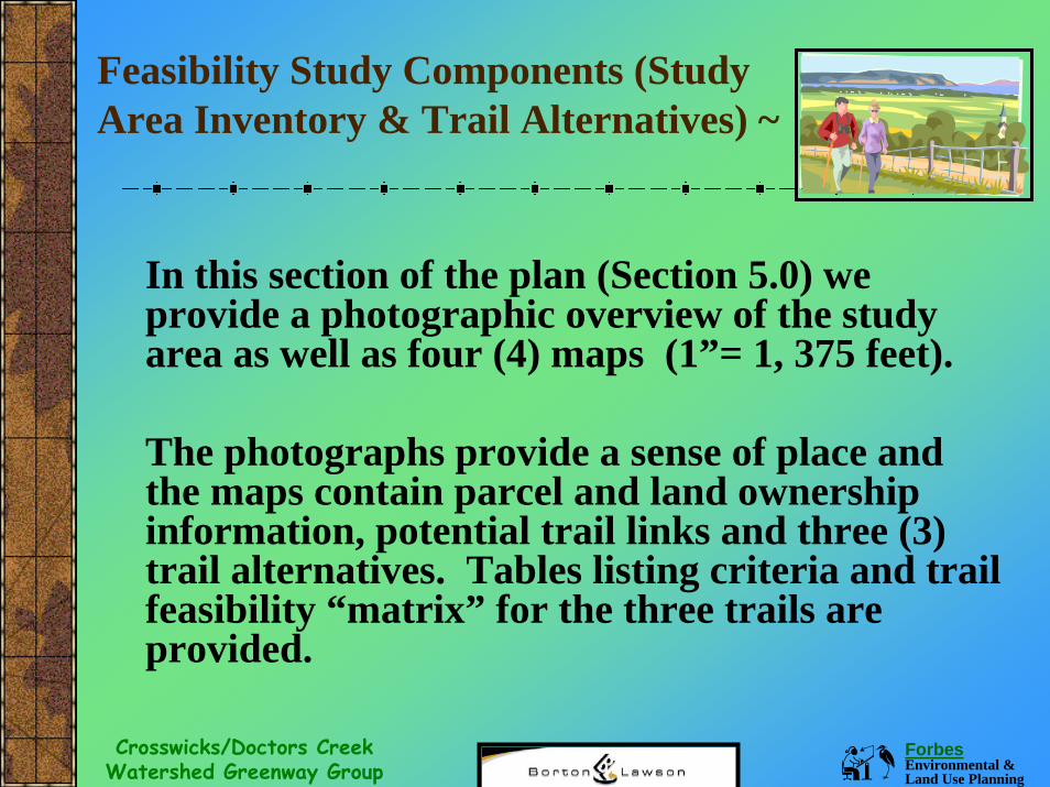
In this section of the plan (Section 5.0) we provide a photographic overview of the study area as well as four (4) maps (1”= 1, 375 feet).
The photographs provide a sense of place and the maps contain parcel and land ownership information, potential trail links and three (3) trail alternatives. Tables listing criteria and trail feasibility “matrix” for the three trails are provided.
Forbes Environmental & Land Use Planning
Crosswicks/Doctors Creek Watershed Greenway Group
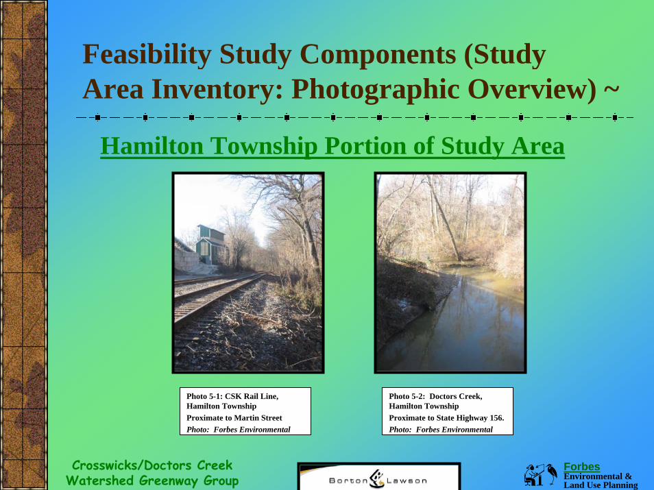
Feasibility Study Components (Study Area Inventory: Photographic Overview) ~
Hamilton Township Portion of Study Area
Photo 5-1: CSK Rail Line, Hamilton Township Proximate to Martin StreetPhoto: Forbes Environmental
Photo 5-2: Doctors Creek, Hamilton Township Proximate to State Highway 156.Photo: Forbes Environmental
Forbes Environmental & Land Use Planning
Crosswicks/Doctors Creek Watershed Greenway Group
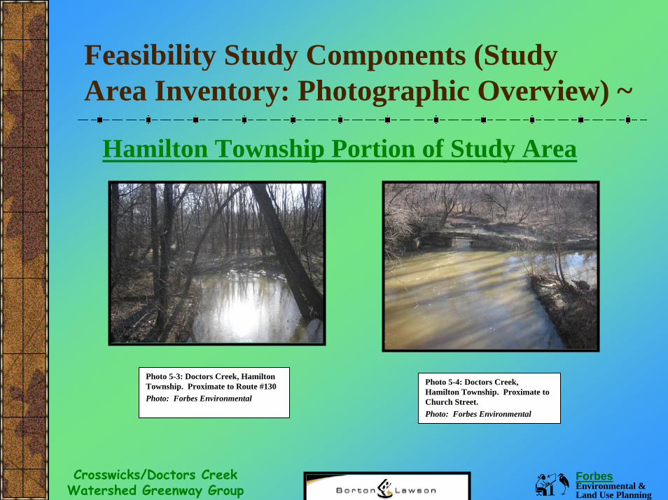
Feasibility Study Components (Study Area Inventory: Photographic Overview) ~
Hamilton Township Portion of Study Area
Photo 5-3: Doctors Creek, Hamilton Township. Proximate to Route #130 Photo: Forbes Environmental
Photo 5-4: Doctors Creek, Hamilton Township. Proximate to Church Street.Photo: Forbes Environmental
Forbes Environmental & Land Use Planning
Crosswicks/Doctors Creek Watershed Greenway Group
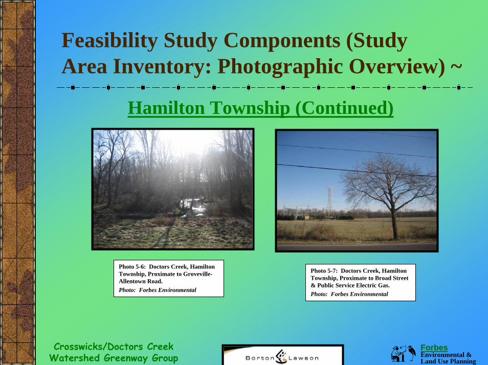
Feasibility Study Components (Study Area Inventory: Photographic Overview) ~
Hamilton Township (Continued)
Photo 5-6: Doctors Creek, Hamilton Township, Proximate to Groveville-Allentown Road. Photo: Forbes Environmental
Photo 5-7: Doctors Creek, Hamilton Township, Proximate to Broad Street & Public Service Electric Gas.Photo: Forbes Environmental
Forbes Environmental & Land Use Planning
Crosswicks/Doctors Creek Watershed Greenway Group
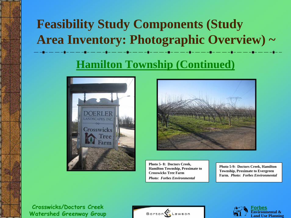
Feasibility Study Components (Study Area Inventory: Photographic Overview) ~
Hamilton Township (Continued)
Photo 5- 8: Doctors Creek, Hamilton Township, Proximate to Crosswicks Tree FarmPhoto: Forbes Environmental
Photo 5-9: Doctors Creek, Hamilton Township, Proximate to Evergreen Farm. Photo: Forbes Environmental
Forbes Environmental & Land Use Planning
Crosswicks/Doctors Creek Watershed Greenway Group
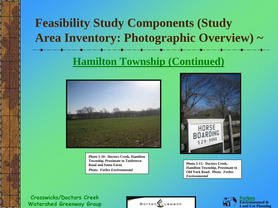
Feasibility Study Components (Study Area Inventory: Photographic Overview) ~
Hamilton Township (Continued)
Photo 5-10: Doctors Creek, Hamilton Township, Proximate to Tattletown Road and Samu Farm. Photo: Forbes Environmental
Photo 5-11: Doctors Creek, Hamilton Township, Proximate to Old York Road. Photo: Forbes Environmental
Forbes Environmental & Land Use Planning
Crosswicks/Doctors Creek Watershed Greenway Group
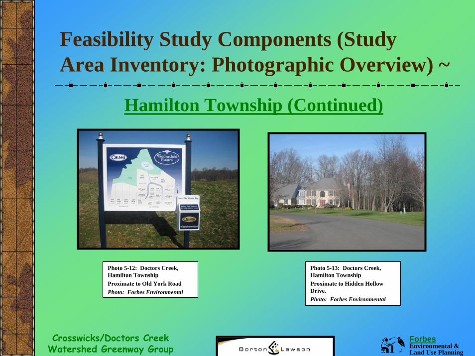
Feasibility Study Components (Study Area Inventory: Photographic Overview) ~
Hamilton Township (Continued)
Photo 5-12: Doctors Creek, Hamilton Township Proximate to Old York RoadPhoto: Forbes Environmental
Photo 5-13: Doctors Creek, Hamilton Township Proximate to Hidden Hollow Drive.Photo: Forbes Environmental
Forbes Environmental & Land Use Planning
Crosswicks/Doctors Creek Watershed Greenway Group
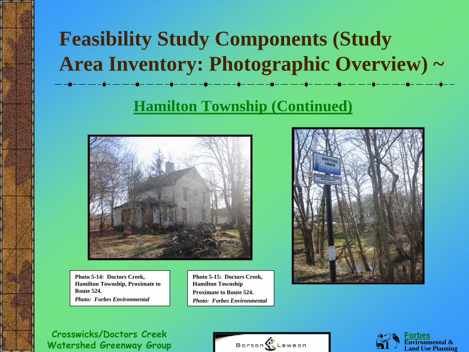
Feasibility Study Components (Study Area Inventory: Photographic Overview) ~
Hamilton Township (Continued)
Photo 5-14: Doctors Creek, Hamilton Township, Proximate to Route 524.Photo: Forbes Environmental
Photo 5-15: Doctors Creek, Hamilton Township Proximate to Route 524.Photo: Forbes Environmental
Forbes Environmental & Land Use Planning
Crosswicks/Doctors Creek Watershed Greenway Group
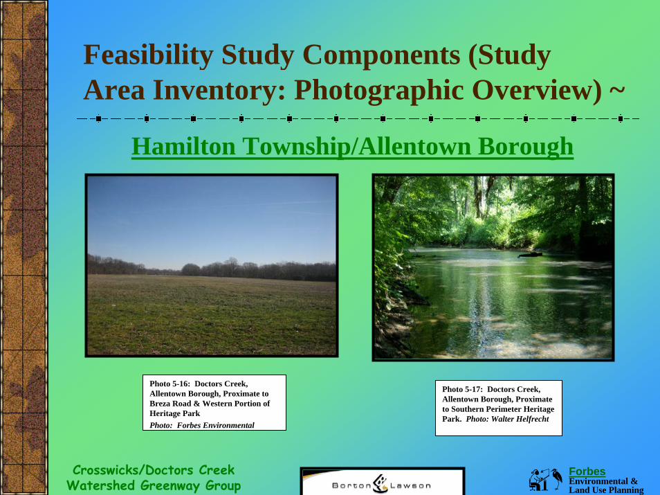
Feasibility Study Components (Study Area Inventory: Photographic Overview) ~
Hamilton Township/Allentown Borough
Photo 5-16: Doctors Creek, Allentown Borough, Proximate to Breza Road & Western Portion of Heritage ParkPhoto: Forbes Environmental
Photo 5-17: Doctors Creek, Allentown Borough, Proximate to Southern Perimeter Heritage Park. Photo: Walter Helfrecht
Forbes Environmental & Land Use Planning
Crosswicks/Doctors Creek Watershed Greenway Group
Feasibility Study Components (Study Area Inventory: Photographic Overview) ~
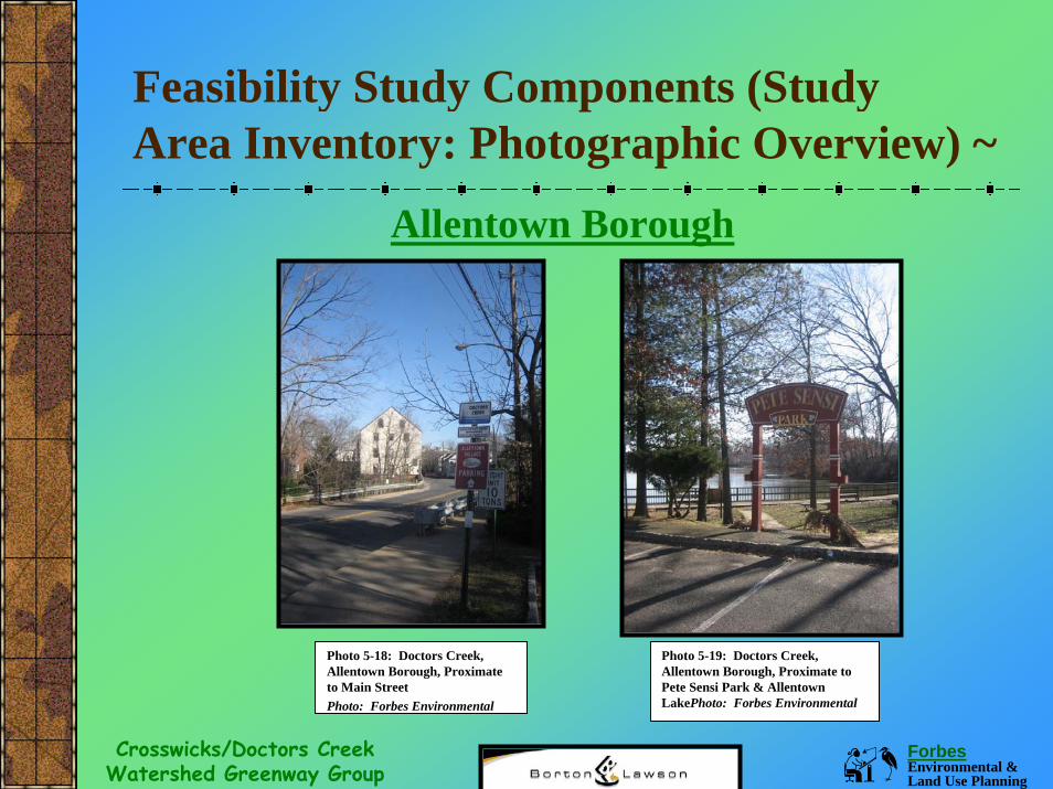
Allentown Borough
Photo 5-18: Doctors Creek, Allentown Borough, Proximate to Main Street Photo: Forbes Environmental
Photo 5-19: Doctors Creek, Allentown Borough, Proximate to Pete Sensi Park & Allentown LakePhoto: Forbes Environmental
Forbes Environmental & Land Use Planning
Crosswicks/Doctors Creek Watershed Greenway Group
Feasibility Study Components (Study Area Inventory: Photographic Overview) ~
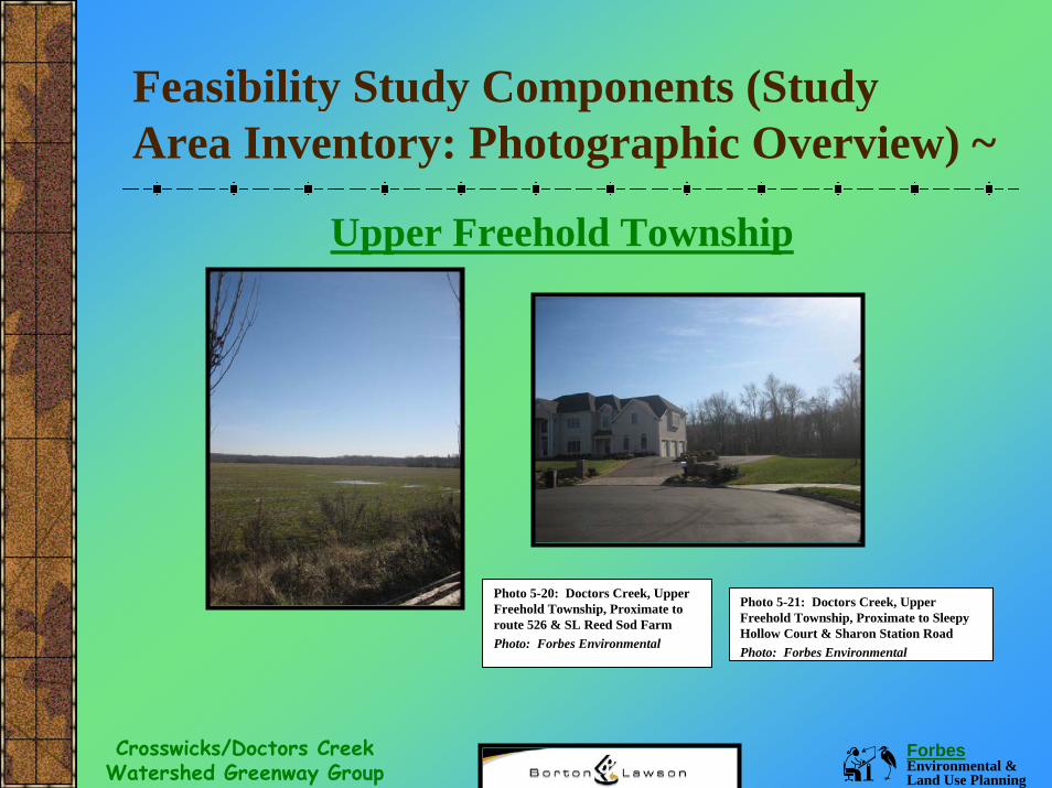
Upper Freehold Township
Photo 5-20: Doctors Creek, Upper Freehold Township, Proximate to route 526 & SL Reed Sod FarmPhoto: Forbes Environmental
Photo 5-21: Doctors Creek, Upper Freehold Township, Proximate to Sleepy Hollow Court & Sharon Station RoadPhoto: Forbes Environmental
Forbes Environmental & Land Use Planning
Crosswicks/Doctors Creek Watershed Greenway Group
Feasibility Study Components (Study Area Inventory: Photographic Overview) ~
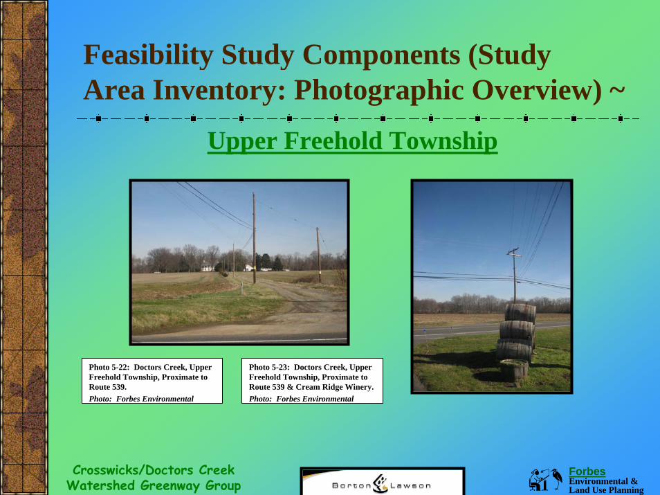
Upper Freehold Township
Photo 5-22: Doctors Creek, Upper Freehold Township, Proximate to Route 539. Photo: Forbes Environmental
Photo 5-23: Doctors Creek, Upper Freehold Township, Proximate to Route 539 & Cream Ridge Winery.Photo: Forbes Environmental
Forbes Environmental & Land Use Planning
Crosswicks/Doctors Creek Watershed Greenway Group
Feasibility Study Components (Study Area Inventory: Photographic Overview) ~
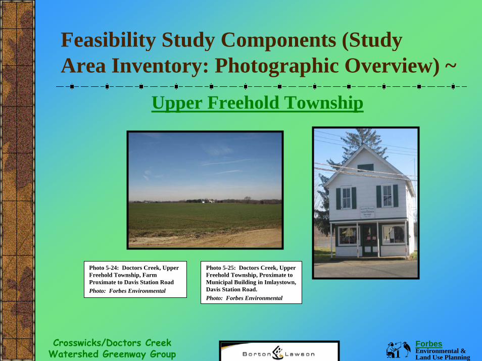
Upper Freehold Township
Photo 5-24: Doctors Creek, Upper Freehold Township, Farm Proximate to Davis Station RoadPhoto: Forbes Environmental
Photo 5-25: Doctors Creek, Upper Freehold Township, Proximate to Municipal Building in Imlaystown, Davis Station Road. Photo: Forbes Environmental
Forbes Environmental & Land Use Planning
Crosswicks/Doctors Creek Watershed Greenway Group
Feasibility Study Components (Study Area Inventory: Photographic Overview) ~
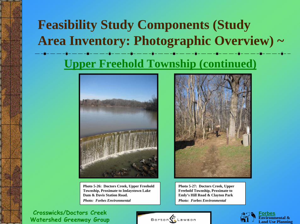
Upper Freehold Township (continued)
Photo 5-26: Doctors Creek, Upper Freehold Township, Proximate to Imlaystown Lake Dam & Davis Station Road. Photo: Forbes Environmental
Photo 5-27: Doctors Creek, Upper Freehold Township, Proximate to Emly’s Hill Road & Clayton ParkPhoto: Forbes Environmental
Forbes Environmental & Land Use Planning
Crosswicks/Doctors Creek Watershed Greenway Group
Feasibility Study Components (Study Area Inventory: Photographic Overview) ~
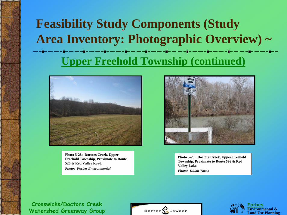
Upper Freehold Township (continued)
Photo 5-28: Doctors Creek, Upper Freehold Township, Proximate to Route 526 & Red Valley Road. Photo: Forbes Environmental
Photo 5-29: Doctors Creek, Upper Freehold Township, Proximate to Route 526 & Red Valley Lake. Photo: Dillon Torno
Forbes Environmental & Land Use Planning
Crosswicks/Doctors Creek Watershed Greenway Group
Feasibility Study Components (Study Area Inventory: Photographic Overview) ~
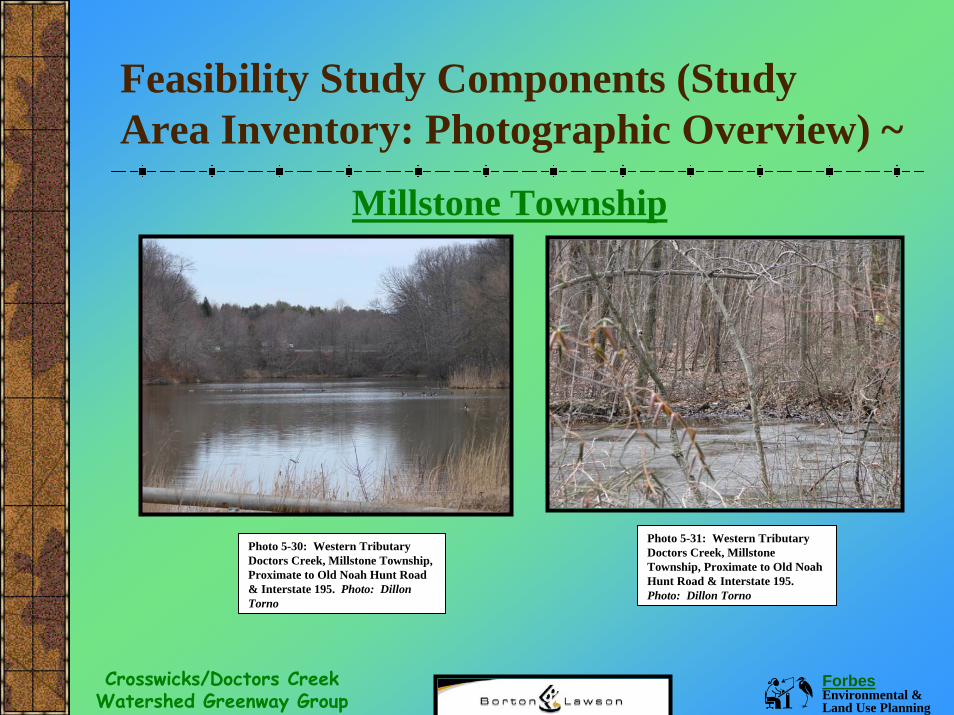
Millstone Township
Photo 5-31: Western Tributary Doctors Creek, Millstone Township, Proximate to Old Noah Hunt Road & Interstate 195. Photo: Dillon Torno
Photo 5-30: Western Tributary Doctors Creek, Millstone Township, Proximate to Old Noah Hunt Road & Interstate 195. Photo: Dillon Torno
Forbes Environmental & Land Use Planning
Crosswicks/Doctors Creek Watershed Greenway Group
Feasibility Study Components (Study Area Inventory: Photographic Overview) ~
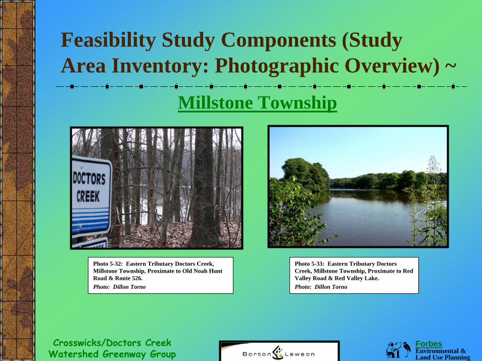
Millstone Township
Photo 5-32: Eastern Tributary Doctors Creek, Millstone Township, Proximate to Old Noah Hunt Road & Route 526. Photo: Dillon Torno
Photo 5-33: Eastern Tributary Doctors Creek, Millstone Township, Proximate to Red Valley Road & Red Valley Lake. Photo: Dillon Torno
Forbes Environmental & Land Use Planning
Crosswicks/Doctors Creek Watershed Greenway Group
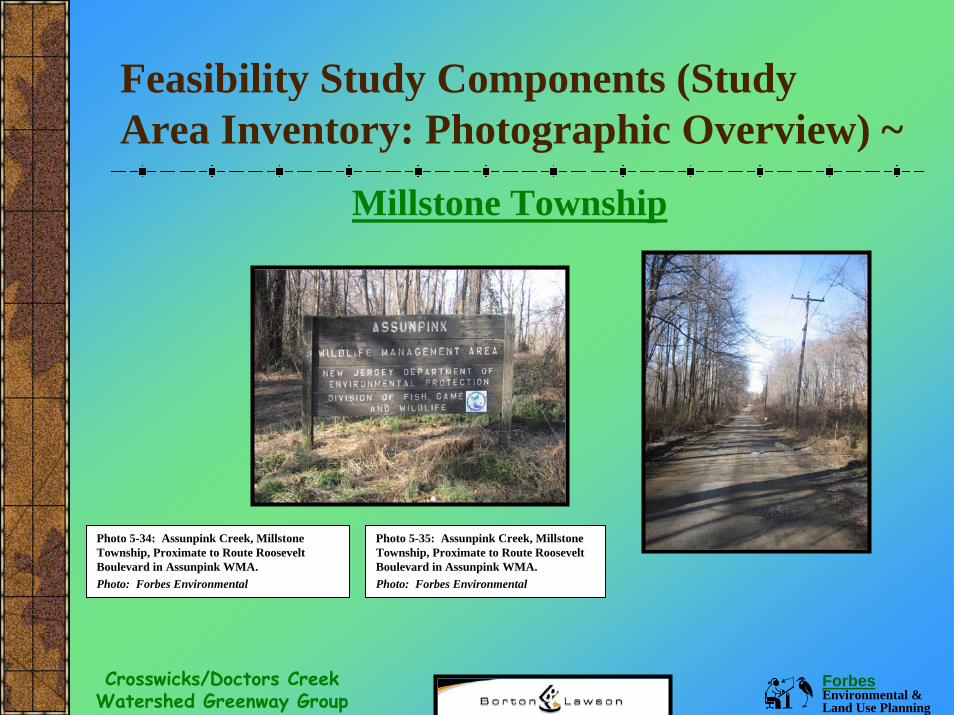
Feasibility Study Components (Study Area Inventory: Photographic Overview) ~
Millstone Township
Photo 5-34: Assunpink Creek, Millstone Township, Proximate to Route Roosevelt Boulevard in Assunpink WMA. Photo: Forbes Environmental
Photo 5-35: Assunpink Creek, Millstone Township, Proximate to Route Roosevelt Boulevard in Assunpink WMA. Photo: Forbes Environmental
Forbes Environmental & Land Use Planning
Crosswicks/Doctors Creek Watershed Greenway Group
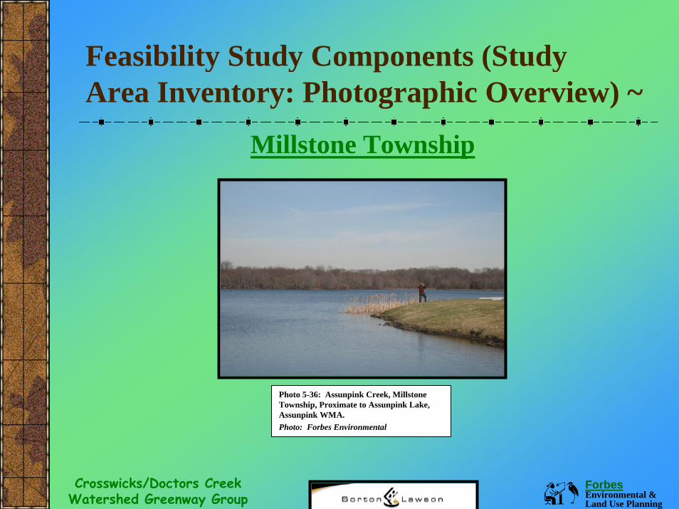
Feasibility Study Components (Study Area Inventory: Photographic Overview) ~
Millstone Township
Photo 5-36: Assunpink Creek, Millstone Township, Proximate to Assunpink Lake, Assunpink WMA. Photo: Forbes Environmental
Forbes Environmental & Land Use Planning
Crosswicks/Doctors Creek Watershed Greenway Group
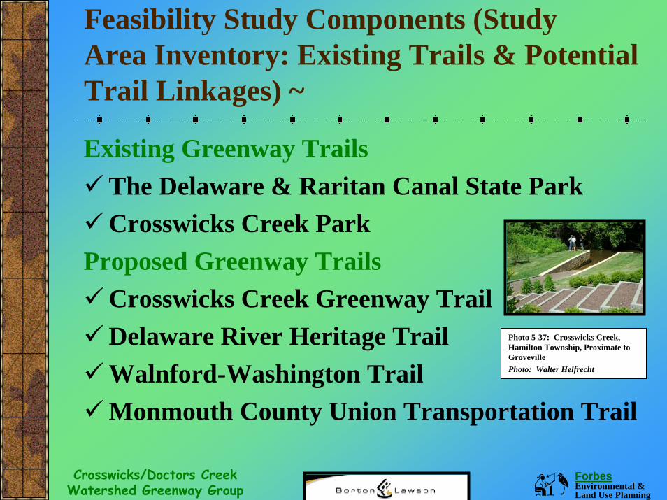
Feasibility Study Components (Study Area Inventory: Existing Trails & Potential Trail Linkages) ~
Existing Greenway TrailsThe Delaware & Raritan Canal State ParkCrosswicks Creek Park
Proposed Greenway TrailsCrosswicks Creek Greenway TrailDelaware River Heritage TrailWalnford-Washington TrailMonmouth County Union Transportation Trail
Photo 5-37: Crosswicks Creek, Hamilton Township, Proximate to Groveville Photo: Walter Helfrecht
Forbes Environmental & Land Use Planning
Crosswicks/Doctors Creek Watershed Greenway Group
Feasibility Study Components (Study Area Inventory: Existing Trails & Potential Trail Linkages) ~
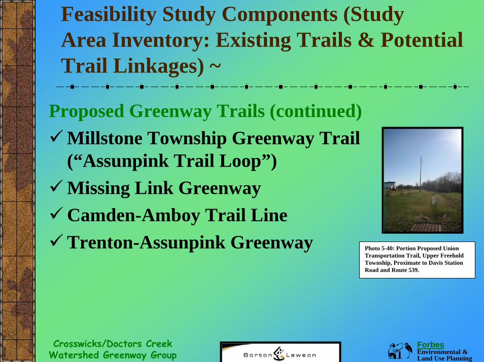
Proposed Greenway Trails (continued)Millstone Township Greenway Trail (“Assunpink Trail Loop”)Missing Link GreenwayCamden-Amboy Trail LineTrenton-Assunpink Greenway Photo 5-40: Portion Proposed Union
Transportation Trail, Upper Freehold Township, Proximate to Davis Station Road and Route 539.
Forbes Environmental & Land Use Planning
Crosswicks/Doctors Creek Watershed Greenway Group
Feasibility Study Components (Trail Feasibility Alternatives) ~
The information in Sections 1-5 of the study set the groundwork for determining the feasibility of various trail alternatives in the study area. Again, feasibility is the determination of the degree to which something can be carried out.By way of review, the information presented in the study became the criteria for determining trail feasibility. There were ten (10) primary areas of research and therefore 10 criteria used to determine trail feasibility.
Forbes Environmental & Land Use Planning
Crosswicks/Doctors Creek Watershed Greenway Group
Feasibility Study Components (Trail Feasibility Alternatives/10 Criteria) ~
1. Crosswicks Creek-Doctors Creek Greenway Plan: The selected trail alternative would be the one most consistent with the overriding policies within the guiding greenway plan.
2. CCDC Group: Ability of the Group to implement the selected trail alternative.
3. Accepted Definitions: Concurrence that the selected trail alternative is a low-impact trail that will protect the environment, offer a superb recreational opportunity, and provide benefits to landowners adjoining the creek.
Forbes Environmental & Land Use Planning
Crosswicks/Doctors Creek Watershed Greenway Group
Feasibility Study Components (Trail Feasibility Alternatives/ Criteria) ~
4. Projected Impacts: The selected trail route and trail type would have the least number of negative impacts and the highest number of positive ones.
5. Landowner & Citizen Input: The selected trail alternative is the one that is most consistent with landowner and public input received during outreach efforts.
6. Physical Features: The selected trail route would have the least number of impacts upon existing physical features.
Forbes Environmental & Land Use Planning
Crosswicks/Doctors Creek Watershed Greenway Group
Feasibility Study Components (Trail Feasibility Alternatives/Criteria) ~
7. Existing Open Space Ownership: The selected trail alternative would avoid those parcels with policies, rules, regulations or land uses inconsistent with a greenway trail.
8. Planning Policies: The trail alternative would be the one that is most consistent with local planning policies.
9. Land Use Regulations: The selected trail alternative is the one most consistent with the zoning ordinances and land use regulations.
10. Economic: The selected trail alternative would be the least costly.
Forbes Environmental & Land Use Planning
Crosswicks/Doctors Creek Watershed Greenway Group
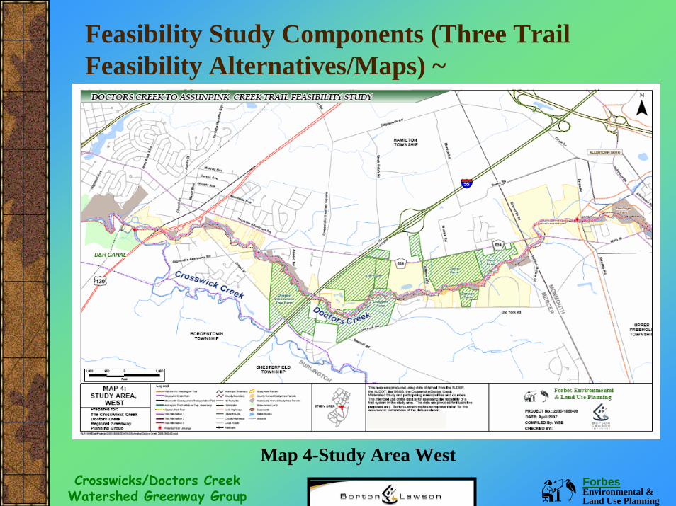
Feasibility Study Components (Three Trail Feasibility Alternatives/Maps) ~
Map 4-Study Area West
Forbes Environmental & Land Use Planning
Crosswicks/Doctors Creek Watershed Greenway Group
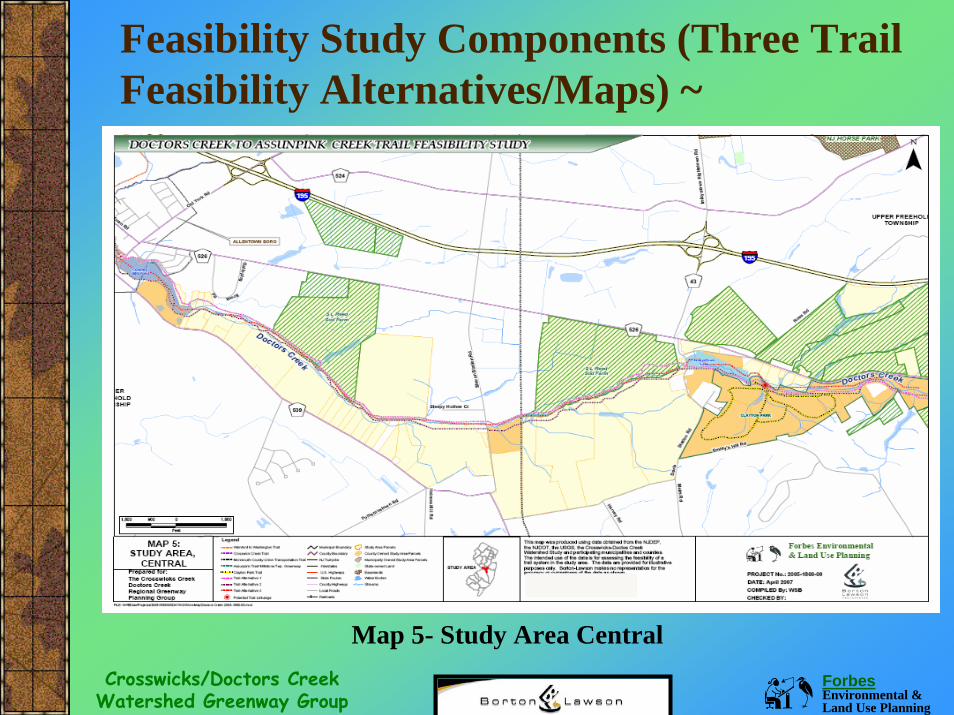
Feasibility Study Components (Three Trail Feasibility Alternatives/Maps) ~
Map 5- Study Area Central
Forbes Environmental & Land Use Planning
Crosswicks/Doctors Creek Watershed Greenway Group
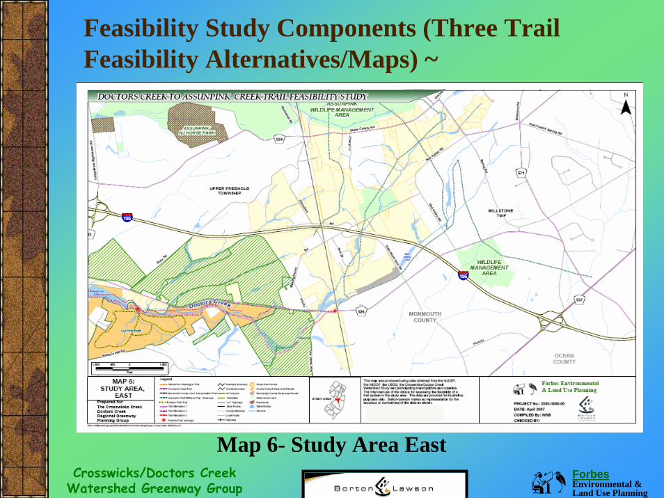
Feasibility Study Components (Three Trail Feasibility Alternatives/Maps) ~
Map 6- Study Area East
Forbes Environmental & Land Use Planning
Crosswicks/Doctors Creek Watershed Greenway Group
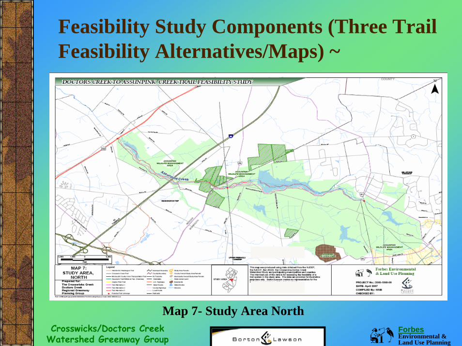
Feasibility Study Components (Three Trail Feasibility Alternatives/Maps) ~
Map 7- Study Area North
Forbes Environmental & Land Use Planning
Crosswicks/Doctors Creek Watershed Greenway Group
Feasibility Study Components (Trail Feasibility, Alternative 1) ~
The first alternative is primarily based on physical features (land cover, floodplains, topography). It is located within the 100 year floodplain and avoids obstructions (e.g., densely wooded areas, housing developments, water bodies). Alternative #1 generally stays to the north side of the Doctors Creek and the South Side of the Assunpink Creek. It is noted on the map as a pink and gray dotted line.
Forbes Environmental & Land Use Planning
Crosswicks/Doctors Creek Watershed Greenway Group
Feasibility Study Components (Trail Feasibility, Alternative 1) ~
It was determined that trail alternative #1 is most likely not feasible for the following reasons: Primary Reason- The majority of this proposed trail route passes through too many parcels previously preserved through the Farmland Preservation Program (these farmland preservation program easements do not allow for trail and trail access easements).Secondary Reason- The most gently sloping land (physical feature) is also the 100 year floodplain. Although trails throughout NJ have been placed in the 100 year floodplain, local regulations are not 100% supportive of allowing them.
Forbes Environmental & Land Use Planning
Crosswicks/Doctors Creek Watershed Greenway Group
Feasibility Study Components (Trail Feasibility, Alternative 2) ~
The second alternative is based primarily on physical features, open space land ownership, general zoning and land development regulations, rules and regulations guiding trail development on land owned by particular government entities. The remaining feasibility criteria were also considered.Alternative #2 generally stays to the south side of the Doctors Creek and the South Side of the Assunpink Creek. It crosses the creeks periodically to avoid parcels preserved in the farmland preservation program.It is noted on the map as a magenta and gray dotted line
Forbes Environmental & Land Use Planning
Crosswicks/Doctors Creek Watershed Greenway Group
Feasibility Study Components (Trail Feasibility, Alternative 2) ~
It was determined, based on the 10 feasibility parameters that Alternative #2 is more feasible than Alternative #1.However, it would also present a number of difficult development challenges (e.g., longer, creek crossings, and use of several busy roadways in order to bypass farmland preserved parcels).
Although the required creek crossings provide the opportunity to utilize parcels currently owned and managed by government groups, this option would also require “buy in” from a large number of private landowners.
Forbes Environmental & Land Use Planning
Crosswicks/Doctors Creek Watershed Greenway Group
Feasibility Study Components (Trail Feasibility, Alternative 3) ~
The third trail alternative is a water trail, and was based on the physical features associated with stream access (e.g., location, approximate mileage between access points, topography, ownership, availability of parking) and applicability of feasibility criteria applied to the two land trail alternatives.Alternative #3 is placed in navigable portions of the two creeks and takes into account obstructions and access points. It is noted on the map as a red and gray dotted line.
Forbes Environmental & Land Use Planning
Crosswicks/Doctors Creek Watershed Greenway Group
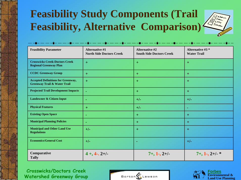
Feasibility Study Components (Trail Feasibility, Alternative Comparison) ~
Feasibility Parameter Alternative #1 North Side Doctors Creek
Alternative #2 South Side Doctors Creek
Alternative #3 *Water Trail
Crosswicks Creek-Doctors Creek Regional Greenway Plan
+ + +
CCDC Greenway Group + + +Accepted Definitions for Greenway, Greenway Trail & Water Trail
+ + +
Projected Trail Development Impacts - + +
Landowner & Citizen Input - +/- +/-
Physical Features + +/- -Existing Open Space - + +Municipal Planning Policies - + +Municipal and Other Land Use Regulations
+/- + +
Economics/General Cost +/- - +/-
ComparativeTally
4 +, 4-. 2+/- 7+, 1-, 2+/- 7+, 1-, 2+/- *
Forbes Environmental & Land Use Planning
Crosswicks/Doctors Creek Watershed Greenway Group
Feasibility Study Components (Trail Feasibility, Alternative 3) ~
It was determined, based on the feasibility parameters that Alternative #3 may only be feasible in the following two sections:Doctors Creek Water Trail- Doctors Creek from Allentown Lake to the end of the project area and potentially out to the Delaware River.Assunpink Creek Water Trail- Assunpink Lake to Route 130 and potentially west and beyond the study area. This alternative is not as feasible as Alternative #2 as it doesnot cover the entire project area, and the number of natural and man-made obstructions (e.g., 5 known dams) should be more comprehensively studied.
Forbes Environmental & Land Use Planning
Crosswicks/Doctors Creek Watershed Greenway Group
Feasibility Study Components (Trail Selection & Recommendations) ~
The research, public outreach, and feasibility analysis completed for this study indicate that Trail Alternative #2 is the most comprehensive and feasible alternative. This section of the plan (6.0 Conclusions & Recommendations) provides a number of recommendations to begin implementing the Doctors-Assunpink Creek Trail.
Forbes Environmental & Land Use Planning
Crosswicks/Doctors Creek Watershed Greenway Group
The CCDC does not expect that every municipality and every landowner will support the Doctors-Assunpink Trail right away. In addition, the trail selected may present engineering challenges as it is presently located in areas with steep slopes and will require a number of creek crossings.The group is also fully aware that funding will be needed to progress to future phases of the project. More study is definitely needed.
Feasibility Study Components (Conclusions) ~
Forbes Environmental & Land Use Planning
Crosswicks/Doctors Creek Watershed Greenway Group
Positive Attributes (Alternative #2):Significant Features- Selected trail has a myriad of natural, historical, cultural, & scenic vistas.Network Linkages- A number of trail linkages (e.g., existing and proposed).Open Space- Use of existing and proposed recreational and open space parcels.
Feasibility Study Components (Conclusions) ~
Forbes Environmental & Land Use Planning
Crosswicks/Doctors Creek Watershed Greenway Group
Feasibility Study Components (Recommendations) ~
Plan Adoption- Adoption of the regional greenway plan & facets of this study (e.g., incorporation of chosen trail route). Landowner Outreach- Continue educational efforts focusing upon the benefits of greenway protection and recreational trails. Local Regulations- Research regarding the consistency between trail placement and local regulations (e.g., zoning and environmental & recreational performance standards).Farmland Preservation Program Coordination- Between CCDC and County Farmland Preservation Boards & farmers (e.g., existing & future trail and trail access).
Forbes Environmental & Land Use Planning
Crosswicks/Doctors Creek Watershed Greenway Group
Feasibility Study Components (More Recommendations) ~
Open Space Coordination- CCDC coordination with municipalities and government landowners (e.g., existing land and pending acquisitions) regarding selected trail alternative. Additional Study- Master Trail Plan further refining the selected trail alternative (e.g., educational outreach, regulatory study, site surveys, engineering, projected costs, materials & maintenance). Capital Improvements- Additional funding is required for Phase II Master Trail Plan and Phase III trail implementation.
Forbes Environmental & Land Use Planning
Crosswicks/Doctors Creek Watershed Greenway Group
NEXT STEPS ~
Implement Recommendations.
Obtain Funding for Future Phases.
Forbes Environmental & Land Use Planning
Crosswicks/Doctors Creek Watershed Greenway Group
Acknowledgements ~
Thank you to the many individuals and organizations for their interest in preserving the Doctors and Assunpink Creeks. Many expressed their commitment by providing the time, interest, and expertise required to complete the Doctors Creek-Assunpink Creek Trail Feasibility Study.
QUESTIONS ?QUESTIONS ?