Embed Size (px)
Citation preview

ZONING CHANGE REVIEW SHEET
CASE: Cl4-2010-0034 — Stonegate Two Z.A.P. DATE: August 3, 2010August 17, 2010
ADDRESS: 2500 West William Cannon Drive
OWNER: ICC 1 Stonegate L.P. AGENT: Jim Bennett Consulting(John P. “Sean” Cummings, Jr.) (Jim Bennett)
ZONING FROM: LO-CO TO: LO-CO, to change a condition of zoning
AREA: 8.21 acres
SUMMARY STAFF RECOMMENDATION:
The Staffs recommendation is to grant limited office— conditional overlay (LO-O)combining district zoning. The Conditional Overlay prohibits access to Aldford Drive andlimits the number of daily vehicle trips to 2,509.
If the requested zoning is recommended for this site, then Staff recommends a RestrictiveCovenant to include all recommendations listed in the Traffic Impact Analysis memorandum,dated July 8, 2010, as provided in Attachment A.
ZONING AND PLATTING COMMISSION RECOMMENDATION:
August 3, 2010: APPROVED A POSTPONEMENT REQUEST BY THE NEIGHBORHOODTOAUGUSTI7, 2010.
[D. TIEMAVN; C BANKS - 2ND] (6-0) T. RABA GO - ABSENT
August 17, 2010:
ISSUES:
At the time the property was rezoned to LO-CO in September 1996, the property ownersentered into a private Restrictive Covenant with the Southwest Austin NeighborhoodAssociation. The covenant generally covers property use, construction standards andrestrictions, and includes a provision that no buildings may exceed one story or 18 feet inheight. Attic spaces have been built and are used for storage purposes and mechanicalequipment. A copy of the private Restrictive Covenant is provided as Attachment B.
DEPARTMENT COMMENTS:
The subject property consists of one platted tract that takes access to West William CannonDrive and was recently developed with a mixture of medical and professional office,although not all of the available space has been leased. The property was rezoned to the
C(

C14-2010-0034
limited office — conditional overlay (LO-CO) combining district in October 1996. As shownin Exhibit D, the Conditional Overlay limited the number of daily vehicle trips to 2,000 andprohibited vehicular access from the property to Aldford Drive.
There is a duplex development under construction and single family residences within theCherry Creek Phase 3, Section 3 subdivision to the north (SF-3; SF-2), duplexes andtownhomes to the east (SF-3; LO-MTJ-CO); a medical and professional office developmentto the south (LO-CO), and offices and apartments to the west (LO; MF-2). Please refer toExhibits A (Zoning Map) and A-I (Aerial View).
Although no additional building square footage is proposed, the current office developmentexceeds the 2,000 vehicle trip limit contained in the Conditional Overlay. Therefore, theApplicant has submitted a rezoning case with a Traffic Impact Analysis as the basis formodifying the Conditional Overlay to remove the 2,000 trip limit and increase the number ofvehicle trips per day. The proposed figure of 2,509 vehicle trips per day accounts for a mixof up to 85% medical office and up to 15% professional office space. The other itemcontained in the Conditional Overlay that prohibits access to Aldford Drive would remainunchanged.
Following an evaluation of the Applicant’s traffic impact analysis, the Staff recommendationcontained in Attachment A includes increasing the number of daily vehicle to 2,509 with therequirement to post fiscal surety for the pro rata share of an additional east bound left turnlane at the West Gate Boulevard / West William Cannon Drive intersection. The number ofdaily vehicle trips and intersection improvements from this development will maintainacceptable traffic conditions on adjacent roadways and intersections, and therefore, the Staffrecommends the Applicant’s request
EXISTING ZONING AND LAND USES:
1 ZONING LAND USESSite ILO-CO Medical office and office developmentNorth SF-2; SF-3 Single family residencesSouth LO-CO F Medical office and office development
SF-3; LO-MU-CO Duplexes; Townhousesj West LO; MF-2 f Office; Apartments
AREA STUDY: N/A TIA: Is required — please refer toAttachment A
WATERSHED: Williamson Creek DESIRED DEVELOPMENT ZONE: Yes
CAPITOL VIEW CORRIDOR: No SCENIC ROADWAY: No
NEIGHBORHOOD ORGANIZATIONS:
Page 2
12 — Brodie Lane Homeowners Association461 — Cherry Creek Neighborhood Association

511 — Austin Neighborhoods Council 627 — Onion Creek Homeowners Association742 —Austin Independent School District786— Home Builders Association of Greater Austin790— Cherry Creek Village Neighborhood Association943 — Save Our Springs Alliance 997 — Tanglewood Oaks Owners Association1037— Homeless Neighborhood Association 1075 — League of Bicycling Voters1113 — Austin Parks Foundation1134— Oak Parke / Brodie Wild Preservation Group, Inc.1200 Super Duper Neighborhood Directors and Appealers Organization1224— Austin Monorail Project 1228 — Sierra Club, Austin Regional Group1236— The Real Estate Council of Austin, Inc.
SCHOOLS:
Cunningham Elementary School Covington Middle School Crockett High School
CASE HISTORIES:
fl NUMBER REQUEST COMMISSION CITY COUNCILC14-2208-0142 — SF-3 to OR-CO To Grant OR-CO for Approved as6800 Manchaca for Tract 1, LO- Tract I, LO-MU-CO CommissionRoad MU-CO for for Tract 2, with the recommended (1 1-20-
Tract 2, as CO for a list of 08).amended conditional and
prohibited uses, and2,000 trips per day, andadditional r-o-w onManchaca Road
C 14-2007-0064 — SF-3 to MF-5 Applicant requested an N / AI Laurel Meadows — indefiniteSouth tenninus of postponement; CaseBlarwood Drive expiredC 14-96-0067 — SF-3 to LO-CO To Grant LO-CO Approved LO-CO withFord Tract South — CO prohibiting accessWest William to Watchwood DriveCannon Drive, and limitingbetween Westgate development to 2,000Boulevard and trips per day (9-26-96).Whispering OaksDrive
RELATED CASES:
As shown in Exhibit B, the Applicant is property is planed as Tract II, Block B, Lot I of TheArbors at Cannon’s Gate, a subdivision recorded in July2002 (C8-Ol-0264.OA).
C14-2010-0034 Page 3 cJ

C14-2010-0034
The site plan approved on June 4,2007 is for eight buildings and totals 71,697 square feet ofgross floor area (SP-06-0462C). Please refer to Exhibit C.
A previous rezoning case from SF-3 to LO-CO was approved on October 3, 1996 (04-96-0068). The Conditional Overlay limited the property to 2,000 trips and prohibited vehicularaccess to Alford Drive. Please refer to Exhibit D.
ABUTTING STREETS;
BikeName ROW Pavement Class Sidewalk? Bus Route? RouLJ
West William Cannon 120Drive feel MAD 4 Arterial Yes 103, 333 Yes
ACTION:
CASE MANAGER: Wendy Rhoadese-mail: wendy.rhoadesci.austin.txus
PHONE: 974-7719
CITY COUNCIL DATE: August 26, 2010
ORDINANCE READINGS: 1’
ORDINANCE NUMBER;
V” 3rd

%ZONING BOUNDARYI.. t
PENDING CASE
ZONING
ZONING CASE#:ADDRESS:
SUBJECT AREA:
MANAGER: WENDY RHOADES
-n
SR
—C
N SUBJECT TRACT a4iS4AC14-2010-00342500 W WILLIAM CANNON DR
ACRES8.21GRID: E17&F11
This map has been produd by the Communcalkns Technology Management Dept on behall of theP!anning Development Review Dept. for the sole purpose of geographic reference. No wanarty is made bythe City of Austin regarding specific accuracy or completeness.

C/
-
,‘-
‘I’
.A
.
--—
p-‘--‘it’
ta-
VA
K
-4-.
I-%
r
__
__
“I.

VI
va*f
7)
0N!HQZS
;
VI!I pd,
tu.
ii

owe—••
IP
d Iaa
ifl p9i’ih jd
r?(4Idiq
UIIL
HLi1;;q
‘‘a’ ,fC’)
‘a
•a!
•ø.Ip
Iii
I
Iq
Ia.;
iii
ii
S
I
5
U.
SI
F
(aa)
h i
fr THEARBORSATSTONEGATE(NORTH)EC M2SMLLL4C’1ONC€PtEHVI*NM.TA.
!J.PROJECTPHASINGPLANF?‘fljm4,4It,nn

cit’ORDINANCE NO.sGloo3—E
AN ORDINANCE REZONING AND CHANGING THE ZONING MAPACCOMPANYING CHAPTER 13-2 OF THE CITY CODE AS FOLLOWS:
8.211 ACRE TRACT OF LAN]) OUT OF THE ‘tHEODORE BISSELL LEAGUE INTRAVIS COUNTY, TEXAS FROM “SF-3” FAMILY RESIDENCE DISTRICT TO“LO-CO” LIMITED OFTECE DISTRICT-CONDITIONAL OVERLAY COMBININGDISTRICT, LOCALLY KNOWN AS TIlE PROPERTY LOCATED AT WESTWILLIAM CANNON DRiVE AND WESTGATE BOULEVARD, 1W THE CITY OFAUSTIN, TRAVIS COUNTY, TEXAS.
BE IT ORDAINED BY THE CITY COUNCIL OF THE CITY OF AUSTIN:
PART 1. The Zoning Map established by Chapter 13-2-22 of the City Code is amended tochange the base zoning district from “SF-3” Family Residence district to “LO-CO” LimitedOffice district-Conditional Overlay combining district on the property (the “Property”)described in File C 14-96-0068, as follows:
8.211 acre tract of land out of the Theodore Bissell League in Travis County,Texas, the tract of land being more particularly described by metes and boundsin Exhibit “A” incorporated into this ordinance,
locally known as the property located at West William Cannon Drive and WestgateBoulevard, in the City ofAustin, Travis County, Texas, and as more particularly identifiedin the map attached as Exhibit “13”.
PART 2. The Property within the boundaries of the Conditional Overlay combining districtestablished by this ordinance is subject to the following conditions:
1. Notwithstanding any other provision of the Land Development Code appli cable tothe Property on the effective date of this ordinance or at the time an application for approvalof a site plan or building permit is submitted, no site plan for development of the Property,or any portion of the Property, may be approved or released, and no building permit forconstruction ofa building on the Property, shall be issued if the completed development oruses authorized by the proposed site plan or building permit, considered cumulatively with
#28Page Iof2
c1sNL5’Wt

0all existing or previously authorized development and uses of the Property, generates trafficexceeding the total traffic generation of 2,000 vehicle trips per day.
2. There shall be no vehicular access from the Property to Alford Drive. All vehicularaccess to the Property shalt be from other adjacent public streets or through other adjacentproperty.
Except as specificaily restricted under this ordinance, the Property may be developed andused in accordance with the regulations established for the tO” base district and otherapplicable requirements of the Land Development Code.
PART 3. The Council waives the requirements of Sections 2-2-3, 2-2-5, and 2-2-7 of theCity Code for this ordinance.
PART 4. This ordinance takes effect on October 14, 1996.
PASSED AND APPROVED
§
October 3 ,1996. §
_____________________
Bruce ToddMayor
APPROVED:_______________ sT: QzL’w.tt <flofAndrew Martin
City AttorneyJames E..Aldridg(
City Clerk
S S
Page 2 of 2

1 —r4r k 00000
0
00
d.4oo0; 000 0 0
o ITh- 0 0 0 0 0
0 00000 00 0
I
00 700 0
SF2
00 0
OR00 0
000 0 000 be
—4%0
000 o0
o0 0 —.e1 4t 0 I
Si ;,
0 000 I
A. % 00 0 i
I0
1L00 0 0 0 0
‘14SF4 Oo0 0
0 0 00
0 0000
0000
I SF-3
00::°
0
0 MF-20 000
14
0 0 00 n. poo,.a
0 00
00od147
74-
0 00 0a
000UNDEVELOPED I-SF-3
000 0
k-C\ 000 0000
li-I,)
0 000 0 0
00
TM. jfl
oo.000000
.2
/
0
01AMTP05 /
a—
ot 000 0 00$ / a,.,
o /GR0000 0 00 0
00 0 00 0 0 o o SF-
00 0
0 000
%:°: A
0- 0 0
0
00 0
00 SUWECT TRACT
_________
PENINGCASE • • •cASEtC1496-OO6B
CIVYGRID 2FERENCE
ZONI&4QBOUNDAR’(SUS,JECTAREA(acrns):8.230 NUMBER ‘a.,
CASE MGR: IL ARRIAGAADDRESS W. WILLAM CANNON DR. & E & F 17
CYCLE: P-at m.sjs WEST GATE BLVft
a ta I Iit- r%. /n - ‘t- T F 2A fl-%flSk/ ?--. IX

C14-2010-0034 Page
Environmental
The site is partially located over the Edwards Aquifer Recharge Zone. The site is in theDesired Development Zone. The site is in the Williamson Creek Watershed of the ColoradoRiver Basin, which is classified as a Suburban Watershed by Chapter 25-8 of the City’s LandDevelopment Code. Under current watershed regulations, development or redevelopment onthis site will be subject to the following impervious cover limits:
Development Cla.ssfication % ofNet Site Area % with TransfersSingle-Family 50% 60%(minimum lot size 575Qq. ft.)Other Single-Family or Duplex 55%Multifamily 60% 70%Commercial 80% 90%
According to flood plain maps, there is a floodplain within or adjacent to the projectboundary. Based upon the close proximity of flood plain, offsite drainage should becalculated to determine whether transition zone exists within the project location. If transitionzone is found to exist within the project area, allowable impervious cover within said zoneshould be limited to 30%.
Standard landscaping and tree protection will be required in accordance with LDC 25-2 and25-8 for all development andlor redevelopment.
Trees will likely be impacted with a proposed development associated with this rezoningcase. Please be aware that an approved rezoning status does not eliminate a proposeddevelopment’s requirements to meet the intent of the tree ordinances. If further explanationor specificity is needed, please contact the City Arborist at 974-1876. At this time, sitespecific information is unavailable regarding other vegetation, areas of steep slope, or otherenvironmental features such as bluffs, springs, canyon rimrock, caves, sinkholes, andwetlands
Under current watershed regulations, development or redevelopment on this site will besubject to the following waler quality control requirements:
• Structural controls: Sedimentation and filtration basins with increased capture volumeand 2 year detention.
Transportation
A traffic impact analysis is required and has been received. Additional right-of-way,participation in roadway improvements, or limitations on development intensity may berecommended based on review of the TM {LDC, See. 25-6-1421. Comments are provided inAttachment A.

C14-2010-0034
Water and Wastewater
The landowner intends to serve the site with City of Austin water and wastewater utilities.The landowner, at his own expense, will be responsible for providing any water andwastewater utility improvements, offsite main extensions, utility relocations and orabandonments required by the land use. The water and wastewater utility plan must bereviewed and approved by the Austin Water Utility for compliance with City criteria. Allwaler and wastewater construction must be inspected by the City of Austin. The landownermust pay the City inspection fee with the utility construction. The landowner must pay thetap and impact fee once the landowner makes an application for a City of Austin water andwastewater utility tap permit.
Site Plan and Compatibility Standards
FYI — Any new development is subject to Subchapter E. Design Standards and Mixed Use.Additional comments will be made if a site plan is submittei
The site is subject to compatibility standards. Along the northern property line, the followingstandards apply:
No structure may be built within 25 feet of the property line.No structure in excess of two stories or 30 feet in height may be constructed within 50 feet
of the property line.• No structure in excess of three stories or 40 feet in height may be constructed within 100feet of the property line.
No parking or driveways are allowed within 25 feet of the property line.A landscape area is required along the property line. In addition, a fence, berm, or dense
vegetation must be provided to screen adjoining properties from views of parking,mechanical equipment, storage, and refuse collection.
Additional design regulations will be enforced at the time a site plan is submitted.
FYI — This site is located within the future planning area of Garrison Park. For moreinformation on the status of this neighborhood plan, please visit:http://www.ci.austin.tx,us/planning/neighborhoodlgarrisonpark.htm.
a,

lu’
The Transportation Review Section has reviewed the Traffic Impact Analysis for the Stonegate TwoTIA (aka Arbor at Stonegate), dated February 2010, prepared by Joan G Hudson Consulting, Inc. andRobert J. Halls Associates, and offers the following comments:
TRIP GENERATION
Stonegate Two is a 75,000 square feet retail development located in south Austin on the north side ofWilliam Cannon Drive, between West Gate Boulevard and Manchaca Road.The property is currently under construction and it is partially occupied with a mix of medical andprofessional offices. The existing zoning is Limited Office — Conditional Overlay (LO-CO). Theapplicant has requested a zoning change to remove the conditional overlay which currently limitsvehicle trips to less than 2,000 unadjusted trips per day.
‘The current plans for the site cafl for a mixture of office space with up to 85% medical office and up to15% professional office. Based on the standard trip generation rates established by the Institute ofTransportation Engineers CITE), the development will generate approximately 2,509 unadjustedaverage daily trips (ADT).
The table below shows the trip generation by land use for the proposed development:
Table 1. Trip Generation
) AM Peak PM PeakLAND USE Size ADT Enter Exit Enter ExitMedical Office 60,775 2,270 119 32 54 I 145
Professional Office 10,725 239 2B 4 15 75Total 2,509 147 36 69 220
ASSUMPTIONS
1. Traffic growth rates provided by CAMPO were as follows:
j Table 2. Growth Rates per Year
Roadway Segment Annual %
William Cannon Drive 2.0
[ Brodie Lane 2.0
j West Gate Boulevard 2.0
AtActWNT A
.‘..
Date: July 8, 2010
To: Wendy Rhoades, Case Manager
CC: Robert J. Halls, AICP, Robert J. Halls & Associates
Reference: Stonegate Two, C14-201 0-0034

Whispering Oaks Drive 0.5
Manchaca Drive 2.0
2. In addition to these growth rates, background traffic volumes for 2011volumes for the following projects:
6500 Manchaca SP-2009-01 65C (SP-2008-02780)
included estimated traffic
3. No reductions were taken for pass-by trips.
4. No reductions were taken for internal capture.
5. No reductions were taken for transit use.
EXISTING AND PLANNED ROADWAYS
William Cannon Drive — William Cannon Drive is an arterial roadway that is currently built as a fourlane divided section with additional improvements at various intersections in the study area. TheCAMPO Mobility 2030 Plan shows a planned widening to a six lane section east of Brodie Lane, butno widening of the roadway was assumed by 2011 in the study. The roadway is included in the CitysBicycle Plan.
Brodie Lane — Brodie Lane is an arterial roadway that is currently built as a four lane divided sectionin the study area. The CAMPO Mobility 2030 Plan does not show any planned widening with the studyarea. The roadway is included in the City’s Bicycle Plan.
West Gate Boulevard — West Gate Boulevard is an arterial roadway that is currently built as a fourlane divided section in the study area. The CAMPO Mobility 2030 Plan does not show any plannedimprovements within the study area. The roadway is included in the City’s Bicycle Plan.
Manchaca Road — Manchaca Road is an arterial roadway that is currently built as a four lane dividedsection in the study area. The CAMPO Mobility 2030 Plan shows a planned widening of the roadwayto a six lane divided section south of William Cannon Drive; however, no widening is planned to occurby 2011. The roadway is included in the City’s Bicycle Plan.
Whispering Oaks Drive — Whispering Oaks Drive is a residential collector Street that extends fromWilliam Carron Drive to Manassas Drive. No improvements were assumed for the roadway. It is notincluded in the City’s Bicycle Plan.
INThRSECTION LEVEL OF SERViCE (LOS)
The TIA analyzed six intersections, three of which are or will be signalized. Existing and projectedlevels of service are as follows, assuming that all improvements recommended in the TIA are built:
Table 4. Level of Service
2005 2008 Site +Intersection Existing Forecasted
AM PM AM PM
Brodie LanelWilliarn Cannon Drive C F C EWest Gate Bouievardilliam Cannon Drive D j E D
Stonegate Two (C14-2o10-0o34) Page 2

jWhispering Oaks Drive/WilLiam Cannon Drive
ER Left• WBI.eft B B A Bs NB LeftlThru/Right C 0 B Ca SBLeftlThru/Right D C C C
Manchaca Road/William Cannon Drivet - D 0 D 0Driveway 1! William Cannon Dr.:
B Bj • SB Right
Driveway 2/William Cannon Dr.:
• SO Right
Driveway 3/ William Cannon Drive:!
• EBLeft B B
•WBLeft B C A B• NB Left/Thru/Right C E B C. SBLeft/ThrulRight D C C F
Driveway 41 William Cannon Drive:B B B B• SB/Right
*= SIGAL1ZED
4
RECOMMENDATIONS
1) Prior to 3,d reading at City Council, fiscal is required to be posted for the following improvements:
ProIntersection Improvements
West Gate Boulevard and William Construct additional ER Left turn for 3.3Cannon Drive L-L-T-TR
EBEastbocjnd WBW&bound NBNoThbound SBSDO41IbOUnd
2) Joint access is required to be provided between all commercial lots.3) Final approval from ATD Signals is required prior to jSI Reading.4) For information: Two copies of the final version of the TIA incorporating all corrections and
additions must be submitted prior to final approval of the zoning case.5) Development of this property should be limited to uses and intensities which will not exceed orvary from the projected traffic conditions assumed in the TIA, including peak hour trip generations,
traffic distribution, roadway conditions, and other traffic related characteristics.
B B B B
Stonegate Two (c14-2olo.0o34) Page 3

If you have any questions or require additional information, please contact me at 974-2628.
Shandrian ,JarvisSr. Planner- Transportation Review S aftCity of Austin — Planning and Develo I Review Department
Stonegate Two (C14-2010-0034) Page 4

To:
MEMORANDUM
Fiscal OfficerPlanning & Development Review
From: Shandrian JarvisPlanning & Development Review Department
Date: August 1112010
Subject: Stonegate TwoCase No. C 14-2010-0034Fiscal Surety
Fiscal Requirements:
I Pro Rata I Pro Rata IIntersection I Improveniciits Total Cost I Share 04 Share S IWest Gate 3ouleya and William I Consct addidonal EB Left Turn I £162 254 I iCannon Drive far L-L-T-TB. I I ITOTAL Sl62,234 $5,354.38
Fiscal estimates provided/sealed by Alan Hughes, P.E. on July 28, 2010.The fiscal for these improvements is required to be posted prior to 3m Reading of thezoning case.
If you have any questions or require additional information, please do not hesitate to callme at 974-2628,
Shandrian Jarvis, Senior PlannerPlanning & Development Review DepartmentLand Use Review Division/One Stop Shop)Transportation Review Section

Alan C. Hughes, P.E.Transportation Engineering
To: Robert J. Halls, AICP
From: Alan C. Hughes, FE.
Date: July 28, 2010
Subject: Stonegate Cost Estimate
A cost estimate has been developed for the installation of an additional leftturn lane for eastbound traffic on William Cannon Drive at its intersectionwith Westgate Boulevard. This wifi convert the existing single left turn laneto a dual left turn lane at this location. The estimate is based on fieldobservations only and was done without the benefit of a survey. The estimatedoes include the relocation of an overhead electric illumination pole as well asa traffic signal closed circuit camera and pole.
The total cost estimate is $162,254. The 3.3% pro rata share amount istherefore $5,354.38.
The details of the cost estimate are attached. Please let me know if you haveany questions.
Sincerely,
aAlan C. Hughes, P.E.Transportation Engineering
attachment
6\
MEMORANDUM
2102 Whitestone Drive - Austin Texas - (512) 922-6243

Alan C. Hughes, RE.Transportation Enginoerthg
Cost estimate for additional eastbound left turn lane at the intersection ofWilliam Cannon Drive and Westgate Boulevard.
ternRemove Curb arid GutterStreet Excavation 20”12 Flexible baseHMAC 3.5 Type “C”HMAC 3,5” Type “0”Install Curb and GutterRelocate Signal CameraPoleRelocate Luminary Pole
_________
Engineering, Surveying, $39,018Traffic Control $5,000
$5354.38
UnitQuantity Unit Cost Total
250 LF $11 $2,7502223 CY $14 $31,1221334 CV $24 $32,016334 SY $11 $3,674334 SY $11 $3,674250 LF $20 $5,000
EA $20,000 $20,0001 EA $20,000 $20,000
$118,236
Inspection, and TestIng (33%)
3.3% pro ratashare
Total $162,254
2102 Whiteatone Drive - Austin Texas - (512) 9226243

DEClARATION OF PROTECTiVE COVENAFI’S
This declaration is made this it “ day of 3cpee, 1996, by the owners of
that certain property more specifically desaibal in Exhibit A’ (the Owners).
Witnesseth
WHEREAS, the Owners own that certain property fronting on William Cannon Drive in
Austin, Texas, (the Property) more specifically desalbed in Exhibit A’ attached hereto and made
a part of this declaration; and
WHEREAS, the Owners desire to adopt a uniform plan for the orderly development of the
Property and wish to insure the preservation of that plan to protect and enhance the value of the
Property for the benefit of the present and fuwre owners of portions of the Property, and
WHEREAS, the Owners have filed a rezoning application with the City of Austin, Texas
for the purpose of rezoning the Property from SF4, Single Family Residence District to U),
Limited Office district or LO-CO, Limited Office Conditional Overlay district; and
WHEREAS, the Owners have sought the support of the Southwest Austin Neigbbothood
Association (hereinafter the ‘Associailon or SWANA) for the rezoning application; and
WEAS, the Association has agreed to support the ruoning of the Property from SF4,
Single Family Residence District to LO, Limited Office district or LO-CO, Limited Office
Conditional Overlay district, subject to the adoption of a uniform plan of development and
declaration of restrictive covenants; and
WHEREAS, the Owners and the Association desire to evidence their agreement in the form
of restrictive covenants recorded in the real property records of Travis County, Texas;
NOW THEREFORE, Owners hereby adopt, and impose the following restrictions,
covenants and ccziditiocs upi the Property which shall constitute covenants running with the land
and shall be binding upon and inure to the benefit of and be a burden on Owners, their successors
and assigns, and each Owner of any portion of the Property and each owner of property within
300 feet of the Property and each such ownW s successors and assigns; and the Property shall be
held, conveyed and occupied subject to the restrictions, covenants and conditions set forth herein.
a4vAnn1 nnsiB
#826-4t.b-aJs-j dTS4fl we ‘ 1SsflH

Property Us& Consflction Standarth and Resthcffoim
—
(‘1. No buildings on the Property may excd one story or eight feet in height Building
eight shall be measured in accordance with Section 13-2-1 of the Austin City Code, or any
successor regulations adopted by the City (from an elevation derived form the average of the
highest and lowest grades adjacent to the building).
2. That portion of the pnçcdy descnbed in Exhibit B attached hereto and made a part of this
declaration is hereby designated as an undisturbed bdt area (the Greaibelt). Except for those
improvements relating to utility service and a new privacy fence, described in Sections 3 and 4
of this declaration (the Excepted Improvements), no development shall be permitted on the
Greesibelt If the Owners of the Property or any part thereof attempts to construct or build any
improvements in the Greenbelt other than the Excepted Improvements, the owner of the property
sharing a property line with the Property may require that Owner to remove the prohibited
improvements from the Greenbelt at the sole cost of that Owner. However, notwithstanding
anything to the county herein, the Owners of the Property (or any applicable part thereof) are
obligated to perform or to be performed minor m2intnrnlce within the tj of theEGmbelt Area owned by d Owners, id mhvnnce to inciucie the periodic reml of dead
or dying tePS, refhse, and dead animals. In no event shall such minor maintenance be consuued
to allow structures or parking within the Greenbelt Area.
3. For purpot of the definition ofExcepted Impwitmencs, the phrase ‘utility service’ shall
mean iergrcund water and wastewater pipes, electrical lines, gas lines and any other
underground public utility lines, and shall nc include detention ponds, or any other cirnllnr above
surface improvements and facilities. Any Owner of the Property who shall construct any
underground utility lines within the Grnbeh shall (1) exercise such Q%rg’5 best efforts to
preserve the natural vegetation and growth within the Greenbelt and (2) restore any area of the
Greenbelt that has been disturbed by the consuuction of utility lines to a condition reasonably
equivalent to its origin2l state.
4. Bdore development of the Property, Owners of the Pwperty shall install a 6 foot wooden
privacy fe along the rear property line of the Property (the line of the Property separating the
Property from adjacent rnidentiai property). If a privacy aheady exists along nid rear
property line, the Owners of the Property shall install a new privacy fence on the Property
immediately adjacent to the existing fence. To the extent legally permissible, the Owners shall
strive to that, despite differences in ground elevation on portions of the Property, the
fintche4 height and profile of the new privacy fence for the entire Property shall be as uniform as
reasonably possible. The intent of the preceding salience is to afford the owners of residential
property to the rear of the Property the benefit of uniform six-foot high privacy fose despite
cni&t dif zences ui elnuon on the Property and the Owners acknowledge that such intent may
involve the use of longer tice posts or longer fice slats to accommodate differences in elevation
on the Property. Maintenance of the new privacy fence shall be the responsibility of the Owner
of the respective portion of the Property upon which the new privacy fence is located.
2
frBaC-,b.*-eTS-T 1s3n Wd I 2.Jeqo UT 1f

Mar3110O7:l3pRobertHurstLPamUtsie1-512-444-3284p.4
I1XXOLSVTtIVAIe
3jSO2SqpauozZn3511PUTtPUTZ1Zfli2tzaU)
:tu3MojjoJqfitSagrpq3M0511tSUEZW°$!H05fl3U!38C1S(a)
‘Suunpçnuewsnjjosput‘uoflflq.øip‘SupupdsapnpxaLpp!Jdauopjupp!tw3gdnp
MosputqunutwtunuadOpauocmputsadm‘qppzutewRupnpu!sz2qxd
amalJossmndmoo;oZuuszputzuawdoja*apsutawwaxndopAac3flMJOS(p)
iuoissa;osdnpuiaput‘2ugunoooe‘tmnaudin‘at‘asnpzinpn‘t;orppyaip
itn,imsSupytisuo3so1VUOWSZJOSdSup&o4rtsuussowoffUOWflJOiJ(3)
aqAqaoaznd
qoniso;psinoqsutumqJOjSiltSuqgputnpowjosmuompesd.acjiwasosauomoqç
Imuapputnpaux‘swrnnp‘siopopLqSZOJAIaSliwuiwsflttuosiadapoazsoo50‘aAi3UaASJd
‘ognad?aqi‘nsouhq,‘uonzjnsuootzqpxAosdantesutams1t3TP0341(‘t)
aooasiBnquu1ptqijapaiewosse£mruwoisnz‘!paxpwpU4M51wjjwyp
0511flIpO3D‘SUDflVT3OSSTputSu0jiapi420‘Ljjqnd;osawowaunçput‘wpznpoithz
put£doDoloqdiupaMsueauoqdaitonijeuamos‘faza‘puuosnd‘watmsa&u
‘juuzhuetu£uaxd‘axnnsui‘.amxJwp.quisnmpsaogyoaspvwuwpu‘ii
sasitndLjsaonszptisrurwptso‘vnwa2sw‘aA4twflZpUOISIAOXdaqzso;Supiq
tpuonzodtsoSitqe;oanzip1Uwsaog()neupZApt3ISWWpV(t)
:saojyo;itanzphoupsny
t66Tawpz-nnzdmittso;paptAoldApuassuoitsannoqeaqiso;suoppijapattj
Az!3zipAgpmdope&ç.mssaoonshueso
apo£30upsuvt661n;or-nn$nrjupyapitaqITJ’“a.soqtzipso;suu9!uyaa
yj5flt3noudnos‘ax
(ens)Inodnox-T(Pa4wyJ)I.nuflOHdnoz
SaDWakz;ts£quxassySflOTSflfl
SAflShiqpJtDO
TASITZIUWDI
!4FLP!031AflS
OYuathaSflTEPQdSluzwdopAaaWS‘P
WOWUO!SVQIJ.3
WOTtTPQfl
wo
ssau!sngPt!!aAPtflSIUtUlpV
szsn2utoo;zipqpavuiqaqtqs£zsado.zaaqiprnawdozaAac

Mar3110O?:13RobertHurst8.PamUtsie1-512-444-3284p.S
I,gnntrntvna
(RXR)goLuoporn6twpaugapcv‘wzw1wTqms2uAvq
sepopn2axanoqmsoiuawndusrqonsppxooasvaixqoqsSnAD3eaitisofews,uoszdzpns
joasowsoauoinqjXgepamsqnsuuauuedw!acoqmsuowdaxewauu!tdw!iusoyeSqd
qumsuoczjrnzoqZuusynLsnojwsdt;oawnJTeq4uoUflMpzeooy!azoq
LL!ULsipawoqXpwcpuoppzgapqiU!pasrntzuutedwtqasuossadso;swoqtiv
flaaiv‘actzwoqhpuscj303U0UtJ2pSqlU3p0159lOUmuaUu!8dW!ytinurtLqdhue
suoszdso;awoqesapnpaspuo!iyLspsawoqLrçunnpat‘nposoaSep
09suosxadso;npjpSusmSax2uoD‘sawoqsaso;szpnpUu 9c.jpLLiauuoc.xad
LlosTssadnsoaputswapnsxiiuvipwowwuso;wawalu’emtwsaxozdCU!
snO’J-VtSupuwdhmnspceq-L 1wltSUW(psz!EfljtDwudnosfl(‘r)
•sQo!Ass
Z3UEUW!putjnpawLauatzuwputsaom.nsuoz)oId011)J)Utaaod2u!pnpur‘saoMm
£,ua2nwaputLispsogqndpsxpuosojngpwwssowasXwns(1)
asnkqwassesnoitqaspaouapaapt)twsdnupsuooeqs
Siviga*uensmdpsuinqouopduxznx4ndwdv-ij2’•npdpue‘aauIpwsnoLip
‘Lfl4IjpTLJk!unwwoo‘9!LPCJItUPEPaAxepuosssoLnw‘AZuJIgJa
:nq‘masomTt’PP”!uoannpzsnoiZii4putdiqssomsnotpxp’atudxonritaztmpuoxd
putZiqppuqLxexodwmso:uauemmdeupssnoantniaLqwaysnor2p)(r)
satodputcauqivqonsnxmztuiszoupiLiuontoAu!putiumudopmp
edi3uudisoddnsmLsnnoauaxeqqmtao-ncsuntutaounLiflp1e30I(‘i)
noupsputsinaipjoasowsosuoU!ISQflW!
i’mm’put4iununuoopswafqoZupqqxaput‘2misaswd‘IU!LBTdSWsinJtuopqucto
igosducupaxals!taxscuqs50‘wtaciiw•iCzucmCbLLWno!&flSTESIUtI1O(S)
ISpA
psitialPU!50ASKQuOqdaja430uoqnqtnpput‘saputn‘UD!5flUStI23SQ103appoxdot
51fl33fl535.10SutpjwqjoansoLizpçtsunwsaqtpotj50sflgUO!UTIWWOD(I)
LisadwdSq)prnL3Tpq1ppotshqdso‘s2v‘uopzuauopuns‘ut2uo
jvuOti-eu‘xzs‘uoçps‘sopo‘zp5!?Claipuowqtununsana(8)5flOOIJSSOa;oiuaondocsjwpoidnooosractmszput‘tansoojj
55012SQ30nZoSSd%flUetpSlowsatdnoooanjeioiauiwooaZuisON(0WJOSSSOOnSsiSO‘3Ua1udOpAaU!WSUIUB(kQaqi
JOUOuQM3!szguopeuodsuuijaLqpa&oxddeuqseq2uçiZ!So(9)ZlSUO!Zuwedpax!nbasOiflO:uosad%0Sw:vcc)
•flflputjitotiZpuoo;oijts9g’journimuimeseq33tSat(v)iu4irdp
aJoUflUUwtwvqozqM3SQSCWOaoJn-nLpsp!£uadwdzrj.(C)•Apuzpjoid-uouireLqpzzxadoputpatiozitsUsadosdaqj(z)
1’1;)

(I) Group Home Class I (General) means a family-based facility providing 24-hour
care in a protective living arrangement for not more than six but no more than fifteen residents
not morn than thne supervisory personnel. This classification includes foster homes, homes
for the physically and mentally impaired, homes for the developmentally dissb led, congregate
living fsdIffiec für persons &) years of age or older, and maternity homes. This classification also
includes emergency shelter during crisis intervention for not more than fifteen victims of crime,
abuse or neglect, and jtäñs1 rehabilitation for alcohol and chemical dependence for fifteen or
fewer individuals.
(m) Group Home Class U means a family-based facility providing 24-hour care in a
protective living arrangement for not more than fifteen rarknt and not more than three
supervisory panintL Ths “— hcm JUVeOile iMucits, halfway houses
providing residence in lieu of institutional sentencing, and halfway houses providing r.ei*nne to
those needing correctional and mental institutionalintion.
6. ‘flt Owners hereby ackitowledge that there is no intention on thdr part to use any of the
Property for the uses defined above as Group Home Class I (Liint.4), Group Home Class I
(General), and Group Home Class IL The Owners acknowledge that the only reason such uses
appear on (he list of permissible uses of the Property in SectionS, above, is that they have been
advised that excluding such uses is in legally permissible.
7. All dumpsters and any permanently placed refuse receptacles shall be located a minimum
of 50 ft. from the rear boundary line of the Property.
8. Exterior finida for all .iItfIng4 constructed on the Property must contain at Inst 50
peacit stone, stucco or other m’-7. Rnnior bnilling nistainli with high gloss finishes or
of bright piirnsry, or oW high inadty colors shall be prohibited. flighty reflective building
surfaces or roofing materials shall be prohibited. AU buildings and materials shall be generally
nni as to colors and nntali, and Earp of colors or materials shall be prohibited.
9. Ingress and egr tar the Property shall be llmfteA to William Cannon Drive. All
driveways shall be permanently paved. All parking lots shall be paved, curbed and internally
10. Lighting fixtures shah be loied so as to minimha glare onto adjacent p.updcs.
Expceed flood lighting on or from b.bty infls, sips, or ten shall not be permitted. No sign,
either temporary or permanent, on any portion of the Property, shall use f12qhi,g, blinking,
intermittent or moving light or other source of illumination, nor shall any sign create or aftempt
to create the effect of fitihing, intermittent, or moving light or other source of illu,nin2ioc by
mechanical or other mnns.
11. No teanponq structure of any kind shall be erected or placed upon the Property exct
as hereinafter provided. Any bn1r4.t or developer employed by an Owner to construct
improvements on the Property may conduct its construction operations and activities on the
Property and, in connection therewith, do all things reasonably necessary to most expeditiously
eIVAJ 2fl7Oi S
tsae-,n-atg-T aTsn Wd I Di ie aw

4cence, continue and complete such constuction operations, specifically including, but notlimited to, conswuction and maintenance of temporary buildings or trailers for storage of
consutction materials and equipment and open storage or uncovered building material. Allconstruction operations and storage shall be confined solely within the boundaries of the Property.
All temporary sifuctires shall be removed and cleared from the Property with ten days of thecompletion of consuucton.
12. All nonjnval ace c°’ of the Greenbelt shall remain as nnrty possible in its natural
state or shall be landed. Each Owner, IteInPaanniS1y with the completion of the building
improvements upon a portion of the Property, shall complete the I2nhlnping of any portion of
the Property not left in its natural arnie, including the planting of hedges, shrubs and trees andjfl3MIlSIiQfl of appropriate irrigation.
13. Inaease of sur5ce sturmwaxer drainage onto adjacent proycty is prohibited. Control of
ormwatc runoff is the responsibility of each Owner and shall be controlled in thenand
at the rates established by the City of Austin.
14. Iznpesvi.ous cover shall be ‘lintel to 67.5 pc.ceat of the surface of the Property.
15. No Owner of the Property may sell a portion of the Property in a lot tmsfln than 32400
square feet.
16. No illegal, noxious or offensive activity or nnianr of any kind shall be conducted or
permitted on the Pxupcsty. No use shall be permitted that is offensive by reason of odor, flumes,
vibrations, dust, smoke, vision, bright light, radiation, noise or pouution, or that is hdous by
reason of excessive danger of fire or explosion a that “‘ the discharge of toxic a noxiousm2ttn such concentration as to be detimenal to or endanger the public health, safrty or
welfare or no injury to the sunttinding property a its residents or that rnes or produces anutianee as to any other portion of the Property. Outdoor loudspeakers axe prohibited.
GnLems
17. The obliglinni of Ownas are expressly contingent upon a final approval of die xnLmng
of the Property horn SP-3’ to W, Umita Office district or ‘tO-CO,’ Tln,ltM Office
Cocdjtioml Overlay district by the City Council of Austin, Texas.
18. The Owics and the Asr’’ tpulate covannt, and agr that ifte is privily of estate
between the Ow’xn of dr prmiuty the owners of each l.a within 300 ket of the Property and
dt the djtions, and restrictions herein axe and shall be deemed and considered to
be real cowm running wiJh the land and t1 be binrfing on the Owners, the Association, each
owner of a lot within 300 feet of the Proptty and their respective heirs and assigns
19. These covenants may be enforced by the Owners, the Association, and each owner of a
lot within 300 feet of the Property and their respective heirs and nhigns. No failure to exercise,
and no delay in exercising any right hereunder shall operate as a waiver thereof, nor shall any
(VAU&.I 2U7aO1 6
Ld frBeE-n*-azs-r .Ts,n• d I ZSJflH IJequ 01 IC ,Jew

tingle or tnrtal exatse thereof preclude any other further exercise thereof or the exercise of any
other right
20. If any pnn endUed to enforce these awi2nN undertakes procedures in law or in equity
to prevent or tuminate their viohdaz, such person shall be entitled to seek injunctive relief,
damages, and such other relief as may be available at law or in equity. The prevailing pasty in
any action arising in connection with these covenants shall be entitled to receive reasonable
attorney& fees.
21. In the event any one or more of the provisions contained herein shall, for any reason, be
held to be invalid, illegal or unenforceable in any respect, such invalidity, illegality or lack of
enforceability shall not affect any other provision hereof.
22. The covenants and nsthctions within these declarations shall rim with and bind the
Property. These covenants may not be amended or modified, n& may any of the terms hereof
be waived, except by written inflments signed by the Oner and 75 pciwu of the owners of
property within 300 feet of the Property. These covenants shall be effective for a term of forty
years from the daze hereof, after which time they shall be automatically exaded for successive
-yaspods, w,less *umi or aai by a wiiuen insuument signed by the Owners and
75 percent of the owners of pwperty within 300 ftet of the Property and recorded in the Real
Pzupctty Records of Travis County, Tens.
23. By accepunce of a deed or by the acquiring of any ownership interest in any portion of
the Property, each person or entity for hfrnelf or itself, his heirs, personal representatives,
ew. ,-ain a4 acigna binds him&f, his heirs, poaa.al zwreseutadves, successors, and ndgnc
to all of the provisions, restrictions, covenants and ottions imposed by this declaration, and
any future 2nwdmcnts thereto. Notwithttandhtg anything to the conuary om”d in this
Agreement, any Owner of all or any portion of the Pluyctty shall not have any liability or
obflytirwi with 4pe’t to a violation of the decaxiai by any other Owner.
24. Owner’ and ‘Owner? shall mean any ant or future record owr, whether one or
more persons or entities, to the fee simple titlc to any portion of the PruUy.
25. ‘AJ.’In’ or ‘SWANA’ nt the Southwtst Austin Neighborhood Association, the
ndojihorhood association whose boundaries include the PLvpcfly or any prce,sor orgnniffon.
OWNSS
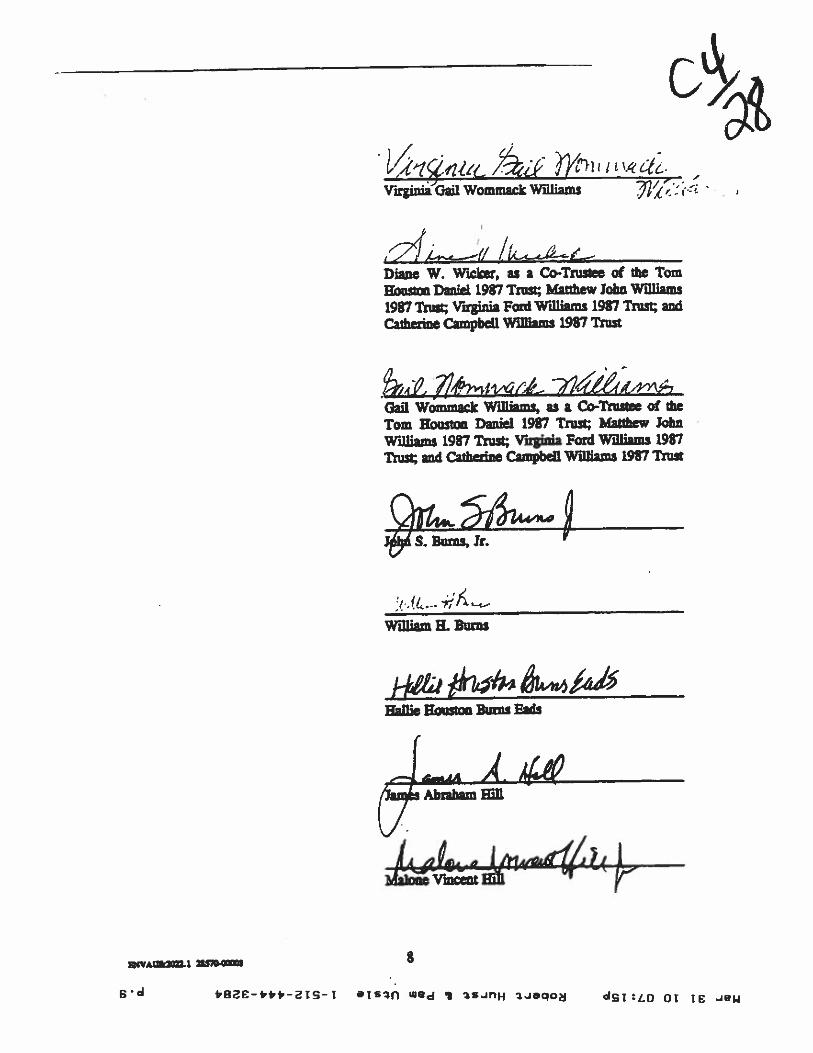
Diane Wanfn2efr WicJzr
4VAUS2fl1 nno.i 7
*8ac-*fr-Tj eTS1I wed ‘5 3.Jaqoj dfrz:to cc ic ..w
Mar311007:15pRobertHurstI.PamUtsipl-512-444-32s4
S
p-S
itctzrntvAua
ri
$1sunuosnoftwil
‘P1 011flflWBfl
•y!“‘iyJ
I‘susnasyQi
HvrrWU.L£861SWB!W&uaqdwtousaq1E3putwtu
1.861pwa!U2qfsTUL1.861iwcqp
uqoçsçqfsnzj£8611!QuosnoWOj
aw;oaulj-o3tvs4.ww 4yj,flB
9v97pg,L72€41’4fr/‘g
)SflIj1.8611P(PTWUOaunqzz)PU!WflSI1.851SUSE!flT.MP1OtP!ZflA$UL1.861bUflTH1AU1OMa4JJcflWL1.861W!U!GUOZSflOH
moj;ozmuj.ce
n/‘r’tI!BT11WOffiIWOEIUT2IIA
7?II{4I4tj/77jl 7—
a

?)Di4gtDavid Gaffey Fo/d’ V
Cta%a QnaauoAnne Russell Ford Panigin
mC3n.t4ke±!h1E½nor 0. Fad Uttle individually and as a Ca-Trustee of the David D. Ford Teswnenlary Trust,for the benefit of Ennor G. Ford little
P Natümal Bank of San (successor toCity Nivisi Bank of Austin); Co-Trustee of theDavid D. Rat Taennary Tn’S, for the befit ofRntw 0. Ford Little
Pro& Bank of San A41kØ (c”eesn toOty Nir.nI flank of Ausdn), adfl6kce of the DonJnflRyTestamentary Trust, for the benefitof loan Sam I.offlasd RylsndPr
Cj.n+th.aaZ i
Cynia Ford Brown
fl4VAW.j 1S51G1 9
ip Mark Ry’Wn, as the Independent Executorof die Pass of Norman Rylander, Dvewd
OT d 9-frfrfr-2IS-T ajs we tSJnH 3.saqof 01 Ic Je4

STATE OF TEXAS
COUNTY OF TRAVIS*
This insuumenz was acknowledged before me on thec2f2Z_day of
1996, by Thane Wommack Wlckt. I
C,
• MJywWSEL‘ NOTARY PUBLIC
*: State of Texas— - Comm. Ey. 04-1949
My Commicinn expres:
?h2 C- &6n-Natty thibnc in and forthe State of Texas
/27p,ZQ Jo/cr/sc! 9Aa,vsoNotary Pikc Typed or Printed Name
STATE OP TEXAS
COUNTY OF TRAVIS
III
This instrument was seknnwkdged befat me the 9zLday of
_____________
1996, by Virginia Gail Woinrn2& Williams.
tWMa.1 2S$7O-I
u, LOUIR ut
NOTARY PUBLICState of Teas
Ccnirn Es 04-19-99
10
ZN FI1?fl.OIJISEM:4 Nr)TARV PUBLIC
-
‘e of Texas04-19-99
My Conin,k.iat flfl
iç/1—_•9J
ZiM /rnqw a6rNotary AUic in and forthe State of Texas
—
)flsa-q JOw/stO 4ZOAJ .1°
Notary Pu6lic Typed or Printed Name
j *aae-,p,-is-j ais.;fl ‘e ‘ 3sflH ;Jaqo OT is iej1

STATE OF TEXAS
COUNTY OF TRAWS 5
This insuumaxt was acknowledged before me on thq,292Z. day of 614e...sC1996, by Diane W. Wicker, as a Co-Trustee of the Torn Houston Daniel 1987 *ist; Matthew
John Williams 1987 Trust; Virginia Ford WiIflnn 1987 Trust; and CaJherine Campbell Wi11i,mt
1987 Trust.
ThdL Sea.4-4/ntrwai icamNOTARY PUmJC
State ofComm. ba 041999
Notary J’tbilc in and forthe State of Thus
Th4iw J,re A’
STATE OP TEXAS
COUNTY OF TRAVIS
5**
This insmunuat was wknowkdged before me on the 19tL day ofl&iflr.n4
1996, by Gail Wommack Wiiliasns, as a Co-Trustee of the Tom Houston Daifel 1987 Trust;
Matthew John Williame 1987 Trait; Virginia Ford WUI2mI 1987 Trust; and Catherine Campbell
WIlliams 1987 Trust
My Commisñon expiret
9-/f- fl
½ L0cZZ%r
Notary in and forthe Staa of Texas
Ainq 2p,se AIOLIJO
Notary PtbliiTyped or Printed Name
84VAtm.1 2ISt1 11
My Commiteion expires:
9q
Notary Pblic Typed or Printed Name
NM! LCUISL 4CNOTARY PUBLIC
State of TensComm. Exp. 0ê1949
oac-frn-flq-[ Tsfl WWJ •9 tSJnH saqo UT Tg ew

STATE OP TEXAS
COUNTY OF TRAVIS
§i2
This insbument was acknOWledged before me on the 30 day of
1996, by John S. Bums, Jr..
iriCAW
My Commitdou expires:
7- 2W€too
STATE OF TEXAS
COUNTY OF TRAVIS
I
0
4
This insuument was acknowledged1996, by William H. Bums.
SDDCAD4
m.-— sn. U,. -
JULY 2&
My Conunicsinn expires:
IlL. .th-LNOarJUC in and forthe State of Texas
Th;iNotary Public Typed or Printed Name
befoitmeonthedD dayofQJ9iA.
L$SQokHoary Public in and forthe Stat of Texas
Tha;otary Public Typed or Printed Name
B4VA1n.t I S7O-I 12
C1d fr8E-frfrfr-2jq-j eTsa wej 1$ ISJflH -Jaqoj csT:tQ 01 Ic

STATE OF TEXAS *
COUNTY OF TRAVIS
This insuumeat was acknowledged before me on the 1) day of (31996, by W2111e sstao Bums Fads.
t
C,
a ncasc&awl eamanan4w “- -nw
My Commission expires:
Nowy1Public inand farthe Sn of Texas
Notazy Public Typed or Printed Name
STATE OP TEXASI
COUNTY OP TRAVIS I
This instument was acow1edged betbre me cc the at day of
1996, by James Abnham HilL
flCArsn::r
w
My Comrnitcinn axpirer
Nsai4 Public in and hrthe State of Texas
Notasy Public flped or Printed Name
13
fr8ac-frfr*-jq- 1 elsin wed I 3S.JflH Jqo 01 Ic ew

STATE OP TEXAS
COUNTY OP TRAVIS
**
This insuument was acknowledged before me on the4ay of1996, by Malone Vincent RID.
I43 ?6MSHA 6. KINtAWir•’t•iI’ kprbel,e
My Commission expires:
Notazy PLibIk in and forthe Sate of Texas
Notary Public Typed or Printed Name
STATh OF TEXAS
the £ttZ’day of
4&&r
t\ t:\4Nci Vfv.&AL.s.
COUNTY OF TRAVIS 5
This insuur was rfrnnwledged beion mc on1996, by David Caffey Ford.
My
NaaryP4licinandforthe Sate at Texas
Th,A-q louise ,OAe.yzoNotary Public ‘Typed or Printed Name
IVAIfli W7O.I 14
*aac-4n-arg- I ajs Wed ‘I ISJflH 3Jaqod 01 IE W

STATE OF TEXAS
COUNTY OP TRAVIS *
This instumait was acknowledged befon me on the 2 n day of CLnaJr1996. by Anne Rirtcell Ford Parrigia. (.1
C
a WA
WTrnTz
My Comm4tiioa expires:
No Publicinandforthe Sate of Texas
Th;iflNoary Public Typed or Printed Name
STATE OF TEXAS
COUNTY OF TRAVIS
I
This iustuma2 was acknowledged before me on the in day of
______________
19% by PtñUip Mark Rybnwin, as lit hidependait Executor of the Estate of llôkman Rylander,Deceased.
rrriI -rer I
ava
My Commissioc cipiici
t3
Notar?Publicinamdfcrthe Sate of Texas
Notary Public Typed or Printed Name
4VAtt2.I W%.1 15
beae-I.p,-ats-I atsin 8d ‘I 2SJnH Jeqojgj -d01 IC

STATE OF TEXAS
COUNTY OF TRAVISa
This hitument was acknowledged before me on the .3 C) day of__________1996, by Eleanor 0. Ford Little, Individually and as a Co-Trustee of the 1). FordTestamentary Trust, for the benefit of Bettor 0. Ford little.
StrflTfl
My Commkcon expires:
‘
Notad Public in and lbrthe Stare of Texas
Ci);c1E_C-awNary Public Typed or Printed Name
STATE OF TEXAS
COUNTY OF TRAVIS
This instrument n acknowledged before me cc the fl day of CI iqa.1-1996, by Frost National Bank of San Antccio (r’’- -a to City thñnI Bank of *ustin); as aCo-Trustee of die David D. Ford T.emiS.y Trust, for the benefit of Eleanor 0. Ford Unit
DUZCA
iw13.7*a
My Connnit.icn expires:
\L)h .CcJNcaf Public in aid forthe State at Texas
flrnvNary Public Typed or Printed Name
16
a t8C-**t-IS-j aTsfl WEd I SJflH Ijaqod ST TE ..1e14

STATE OF TECAS I
COUNTY OF TRAVIS f
This instrument was acknowledged before me on the
_____
day ofc2btIth L(h1996, by Frost Nadoaal Bank of San Antoajo (successor to City National k of Austn), as
Thutee of the Don Ri.tell Rylander Testamentary Trust, for the benefit of Join Elain LoftlaM
Rylander.
L
_____
Noty Eublic in and forthe State of Texas
My Commiciinn expires:
‘72(, -Co
‘!Iotary Publi Typed or Printed Name
STATE OF TEXAS
COUNTY OF TRAVIS
II*
1996, by Cynthia Fosd Brown.
My Cornmitsinn expires:
‘)lLLJNoary’Public in an4 forthe State of Texas
_UifNotary Public Typed or Printed Name
a
This iwumeit was acknowledged befoit me on the . p day
r1is flynn
of
n a-nô
i
17
I’BE-4*p-2Iq-i ars% we ‘ 2SJF)H seqog or te .4fl4

1 0 Cu 1 t t N U, 4’ m 4,-
E ID 0 d 13 L z I 4) L C a 0, N C C -.4 C,, C Iv r
P1 p—
——
K;
——
ft.’
na .4 —
SU
.’l [-I
U.
.5 PP
.. •4 .4 I I UI
04
i.--
flM
Oen
.N
’a
Ft
•ea
flU’ ZIP’ a .iiij
iip

C Cu L
P•‘“ a
oI
(U“I’
•I—
n.-
fl
aI
An
DI”
—t
——
nfl.
•—
—L
.a.-
I.• I
•S
CU
bIi
—
CUasn
gn
En
En
_aat
i1as
.nI
a—
£L
...a
4h
Pm
U)•
a—
Ien
aa
I
—:a
n!’:
’efl
——
“
°2
ZU
pa
UI
In.
.-—
‘.0
woe
fl<
_•1
—n
sa
Co
I.
4)
I•54o
•
D-
—a
oh
hIt.0
h1
OP
1
..r’—
’”
gO
N
Iq
n..n..
SI.
—a.—
n.j.-
“1 IDa
a&
g2
;_I.L
9_i—
CV
”;‘
nh
ai•
It;
4r
m—
nP
cn
csa
fufti
s‘..
2jg
f0M
eE
(4;—
3..
UI
—D
ca,
4)•1
—n
fl
DO
%*S
ai
•aW
flo
an
ens
L1
•4
0‘.Q
fins
a.aw
0R
ili
5)-a
n
II.
S
“r
—r
7—
fl••
I-
n_Lu
a—
•
U-
—rI
tI:
ij0)
aIt•
.4
5‘4
hi.
hJ*4
KK
lIt
hilL
El
:1.
n.m
oa
-
C I-.
—I
C.) 1. Iv £

liar3t1007:l9pRobertHursttPamUtsie1-5t2-444-3284p.?1
C
etigys
S6i‘SrMit
.pq.t;enia.tnpb.-T.,w.0’‘TnxflnJQ23V14•302flSilt!Rsti.t5SnDCB‘I—JTtZzflqc‘tIrJPTSS$0SIlT!flS*1112PUtfltYI(lint£C1T)P2’7•0D2U0TPAPQUflSIIVpjflSWIT
flea•nn’flfl(emare)pIaflpInjøCUT!flfllullU1T’ZZU
tann.Tqjoann,•Tbaeu.bu;aqnfl‘1-flflnflt•ttrpactnnen;.Sifl3Danzoo1le(1Jo4JIll!pU?P;o’lPIfl30IMLZDD2IlnetAtantnoeS142so7.nanozU7pun.;poxU027ftI0223•gçfla.fl.10b.p019‘flTflJoliWT;n
SnPUtflfl(na.•ret)P1“01USfllkCaflZSflyTII3*PUTT nfl•‘nPu.tzta(.xotc:ruPUflep113Jo.unnflSuntnptZ3N2fl3.
nn.tiret.fl
flit°IIxoAsanp

EXHIBIT B
GREENBELT
The Grea,belt shali be a 30 that wide tip of Piqklty adjia to and running panIjjto the rear boundary line of thdWäjäIflhje ins boundary line of the Property shall be theboundary lice sqnrathig the Propaly from the adjaccnta10 ñinily mddential proçtery frootingou Campdn Ddve.
a4V&aXU.1 ?S37O.
8ae-,n--jg- aISf1 Wd j SJflH 3Jeqo 01 TC JW

Mar3110O7:20pRobertHurstI.PamUtsie1-512-444_3294p.23
SN
OOSE-66V(zTc)TOLSLnXL‘UUSU
oorzow’s009$&npffosuquajOIIO11£JUZH
WIWUXUOUJUnI‘SUJçLIODa.I.iqj’y

PU
BL
ICH
EA
RIN
GIN
FO
RM
AT
ION
Thi
szo
ning
/rez
onin
gre
ques
tw
illbe
revi
ewed
and
acte
dup
onat
two
publ
iche
arin
gs:
befo
reth
eL
and
Use
Com
mis
sion
and
the
Cit
yC
ounc
il.
Alth
ough
appl
ican
tsan
d/or
thei
rag
ent(
s)ar
eex
pect
edto
atte
nda
publ
iche
arin
g,yo
uar
eno
tre
quir
edto
atte
nd.
How
ever
,if
you
doat
tend
,yo
uha
veth
eop
port
unity
tosp
eak
FOR
orA
GA
INST
the
prop
osed
deve
lopm
ent
orch
ange
.Y
oum
ayal
soco
ntac
ta
neig
hbor
hood
oren
viro
nmen
tal
orga
niza
tion
that
has
expr
esse
dan
inte
rest
inan
appl
icat
ion
affe
ctin
gyo
urne
ighb
orho
od.
Dur
ing
itspu
blic
hear
ing,
the
boar
dor
com
mis
sion
may
post
pone
orco
ntin
uean
appl
icat
ion’
she
arin
gto
ala
ter
date
,or
may
eval
uate
the
City
staf
f’s
reco
mm
enda
tion
and
publ
icin
put
forw
ardi
ngits
own
reco
mm
enda
tion
toth
eC
ityC
ounc
il.If
the
boar
dor
com
mis
sion
anno
unce
sa
spec
ific
date
and
time
for
apo
stpo
nem
ent
orco
ntin
uatio
nth
atis
not
late
rth
an60
days
from
the
anno
unce
men
t,no
furt
her
notic
eis
requ
ired
.
Dur
ing
itspu
blic
hear
ing,
the
City
Cou
ncil
may
gran
tor
deny
azo
ning
requ
est,
orre
zone
the
land
toa
less
inte
nsiv
ezo
ning
than
requ
este
dbu
tin
noca
sew
illit
gran
ta
mor
ein
tens
ive
zoni
ng.
How
ever
,in
orde
rto
allo
wfo
rm
ixed
use
deve
lopm
ent,
the
Cou
ncil
may
add
the
MIX
ED
USE
(MU
)C
OM
BIN
ING
DIS
TR
ICT
toce
rtai
nco
mm
erci
aldi
stri
cts.
The
MU
Com
bini
ngD
istr
ict
sim
ply
allo
ws
resi
dent
ial
uses
inad
ditio
nto
thos
eus
esal
read
yal
low
edin
the
seve
nco
mm
erci
alzo
ning
dist
rict
s.A
sa
resu
lt,th
eM
UC
ombi
ning
Dis
tric
tal
low
sth
eco
mbi
natio
nof
offi
ce,
reta
il,co
mm
erci
al,
and
resi
dent
ial
uses
with
ina
sing
lede
velo
pmen
t.
For
addi
tiona
lin
form
atio
non
the
City
ofA
ustin
’sla
ndde
velo
pmen
tpr
oces
s,vi
sit
our
web
site
:w
ww
.ci.
aust
in.t
x.us
/dev
elop
men
t
Writ
ten
com
men
tsm
ust
besu
bmitt
edto
the
boar
dor
com
mis
sion
(or
the
cont
actp
erso
nlis
ted
onth
eno
tice)
befo
reor
ata
publ
iche
arin
g.Y
our
com
men
tssh
ould
incl
ude
the
boar
dor
com
mis
sion
’sna
me,
the
sche
dule
dda
teof
the
publ
iche
arin
g,an
dth
eC
ase
Num
ber
and
the
cont
act p
erso
nlis
ted
onth
eno
tice.
Cas
eN
umbe
r:C
14-2
010-
0034
Con
tact
:W
endy
Rho
ades
,51
2-97
4-77
19j
Publ
icH
eari
ng:
Aug
.3,
2010
, Zon
ing
&P
latt
ing
Com
mis
sion
Aug
.26
,201
0,C
ityC
ounc
il
6*i3
Qje
stE
.14
1,0—il
nia
min
ravor
You
r Nam
e(p
leas
epr
int)
Iob
ject
t-z3
14fl
.t4de
q..-
You
rad
dres
s()
ecby
this
4pli
cauo
n
LL
_Si
gnat
ure
Dat
eD
aytim
eTe
leph
one:
o(Z
-3’7
-3c
o&_-
Com
men
ts:
Ifyo
uus
eth
isfo
rmto
com
men
t,it
may
bere
turn
edto
:C
ityof
Aus
tinPl
anni
ng&
Dev
elop
men
t Rev
iew
Dep
artm
ent
Wen
dyR
hoad
esP.
O.
Box
1088
Aus
tin, T
X78
767-
8810

‘
-
‘IC
,‘a
oG
&ct
tzc1
’La-I
a.-.
Wri
tten
com
men
tsm
ust
besu
bmitt
edto
the
boar
dor
com
mis
sion
(ort
heco
ntac
tpe
rson
liste
don
the
notic
e)be
fore
orat
apu
blic
hear
ing.
You
rco
mm
ents
shou
ldin
clud
eth
ebo
ard
orco
mm
issi
on’s
nam
e,th
esc
hedu
led
date
ofth
epu
blic
hear
ing,
and
the
Cas
eN
umbe
ran
dth
eco
ntac
tpe
rson
liste
don
the
notic
e.
PU
BL
ICH
EA
RIN
GIN
FO
RM
AT
ION
Thi
szo
ning
lrez
onin
gre
ques
tw
illbe
revi
ewed
and
acte
dup
onat
two
publ
iche
arin
gs:
befo
reth
eL
and
Use
Com
mis
sion
and
the
City
Cou
ncil.
Alth
ough
appl
ican
tsan
dlor
thei
rag
ent(
s)ar
eex
pect
edto
atte
nda
publ
iche
arin
g,yo
uar
eno
tre
quir
edto
atte
nd.
How
ever
,if
you
doat
tend
,yo
uha
veth
eop
port
unity
tosp
eak
FOR
orA
GA
INST
the
prop
osed
deve
lopm
ent
orch
ange
.Y
oum
ayal
soco
ntac
ta
neig
hbor
hood
oren
viro
nmen
tal
orga
niza
tion
that
has
expr
esse
dan
inte
rest
inan
appl
icat
ion
affe
ctin
gyo
urne
ighb
orho
od.
Dur
ing
itspu
blic
hear
ing,
the
boar
dor
com
mis
sion
may
post
pone
orco
ntin
uean
appl
icat
ion’
she
arin
gto
ala
ter
date
,or
may
eval
uate
the
City
staf
fsre
com
men
datio
nan
dpu
blic
inpu
tfo
rwar
ding
itsow
nre
com
men
datio
nto
the
City
Cou
ncil.
Ifth
ebo
ard
orco
mm
issi
onan
noun
ces
asp
ecif
icda
tean
dtim
efo
ra
post
pone
men
tor
cont
inua
tion
that
isno
tla
ter
than
60da
ysfr
omth
ean
noun
cem
ent,
nofu
rthe
rno
tice
isre
quir
ed.
Dur
ing
itspu
blic
hear
ing,
the
City
Cou
ncil
may
gran
tor
deny
azo
ning
requ
est,
orre
zone
the
land
toa
less
inte
nsiv
ezo
ning
than
requ
este
dbu
tin
noca
sew
illit
gran
ta
mor
ein
tens
ive
zoni
ng.
How
ever
,in
orde
rto
allo
wfo
rm
ixed
use
deve
lopm
ent,
the
Cou
ncil
may
add
the
MIX
ED
USE
(MU
)C
OM
BIN
ING
DIS
TR
ICT
toce
rtai
nco
mm
erci
aldi
stri
cts.
The
MU
Com
bini
ngD
istr
ict
sim
ply
allo
ws
resi
dent
ial
uses
inad
ditio
nto
thos
eus
esal
read
yal
low
edin
the
seve
nco
mm
erci
alzo
ning
dist
rict
s.A
sa
resu
lt,th
eM
UC
ombi
ning
Dis
tric
tal
low
sth
eco
mbi
natio
nof
offi
ce,
reta
il,co
mm
erci
al,
and
resi
dent
ial
uses
with
ina
sing
lede
velo
pmen
t.
For
addi
tiona
lin
form
atio
non
the
City
ofA
ustin
’sla
ndde
velo
pmen
tpro
cess
,vi
sit
our
web
site
:w
ww
.ci.a
usti
n.tx
.us/
deve
lopm
ent
Cas
eN
umbe
r:C
14-2
010-
0034
Con
tact
:W
endy
Rho
ades
,51
2-97
4-77
19P
ubli
cH
eari
ng:
Aug
.3, 2
010,
Zon
ing
&P
latt
ing
Com
mis
sion
Aug
.26,
2010
,C
ityC
ounc
il
CA
o_.u
sia.
K)L
,J€M
ZaI
Cla
min
favor
You
rN
ame
(ple
ase
pri
nt)
[1)4
oije
ct
flK
&D
_Y
our
addr
ess(
es)
affe
cted
byth
isap
pli
cati
on
‘7-2
6-)b
t&
igna
ture
Dat
e
Day
time
Tel
epho
ne:
SLZ.
..0LI
-.4L(
3X
TS
Com
ments
:________
C5
OO
-tt
<S
4Sat
aor
4V&
p-c
è\,
c4e-et4
n4
-.a
q-o
nts4e.
4e.
(jin.
Qan
non\\
fte
stc
rcrS
ôn
UP
fl*
-“-n°c4
a-a*
racX
Aca..ten
SJD
Wo
c5\
jc.
c.4.’
o—
,,-
.a..
ra-’
Ate\\
tG
ttk
à4cL
c*S
.t)
c.a
se
Ifyo
uus
eth
isfo
rmto
com
men
t,it
may
bere
turn
edto
:C
ityof
Aus
tinPl
anni
ng&
Dev
elop
men
tR
evie
wD
epar
tmen
tW
endy
Rho
ades
P.O
.B
ox10
88A
ustin
,TX
7876
7-88
10

PU
BL
ICH
EA
RIN
GIN
FO
RM
AT
ION
Thi
szo
ning
/rez
onin
gre
ques
tw
illbe
revi
ewed
and
acte
dup
onat
two
publ
iche
arin
gs:
befo
reth
eL
and
Use
Com
mis
sion
and
the
City
Cou
ncil.
Alth
ough
appl
ican
tsan
d/or
thei
rag
ent(
s)ar
eex
pect
edto
atte
nda
publ
iche
arin
g,yo
uar
eno
tre
quir
edto
atte
nd.
How
ever
,if
you
doat
tend
,yo
uha
veth
eop
port
unity
tosp
eak
FOR
orA
GA
INS
Tth
epr
opos
edde
velo
pmen
tor
chan
ge.
You
may
also
cont
act
ane
ighb
orho
odor
envi
ronm
enta
lor
gani
zatio
nth
atha
sex
pres
sed
anin
tere
stin
anap
plic
atio
naf
fect
ing
your
neig
hbor
hood
.
Dur
ing
itspu
blic
hear
ing,
the
boar
dor
com
mis
sion
may
post
pone
orco
ntin
uean
appl
icat
ion’
she
arin
gto
ala
ter
date
,or
may
eval
uate
the
City
staf
f’s
reco
mm
enda
tion
and
publ
icin
put
forw
ardi
ngits
own
reco
mm
enda
tion
toth
eC
ityC
ounc
il.If
the
boar
dor
com
mis
sion
anno
unce
sa
spec
ific
date
and
time
for
apo
stpo
nem
ent
orco
ntin
uatio
nth
atis
not
late
rth
an60
days
from
the
anno
unce
men
t,no
ffir
ther
notic
eis
requ
ired
.
Dur
ing
itspu
blic
hear
ing,
the
City
Cou
ncil
may
gran
tor
deny
azo
ning
requ
est,
orre
zone
the
land
toa
less
inte
nsiv
ezo
ning
than
requ
este
dbu
tin
noca
sew
illit
gran
ta
mor
ein
tens
ive
zoni
ng.
How
ever
,in
orde
rto
allo
wfo
rm
ixed
use
deve
lopm
ent,
the
Cou
ncil
may
add
the
MIX
ED
USE
(MU
)C
OM
BIN
ING
DIS
TR
ICT
toce
rtai
nco
mm
erci
aldi
stri
cts.
The
MU
Com
bini
ngD
istr
ict
sim
ply
allo
ws
resi
dent
ial
uses
inad
ditio
nto
thos
eus
esal
read
yal
low
edin
the
seve
nco
mm
erci
alzo
ning
dist
rict
s.A
sa
resu
lt,th
eM
UC
ombi
ning
Dis
tric
tal
low
sth
eco
mbi
natio
nof
offi
ce,
reta
il,co
mm
erci
al,
and
resi
dent
ial
uses
with
ina
sing
lede
velo
pmen
t.
For
addi
tiona
lin
form
atio
non
the
City
ofA
ustin
’sla
ndde
velo
pmen
tpr
oces
s,vi
sit
our
web
site
:w
ww
.cta
usti
n.tx
.us/
deve
lopm
ent
Writ
ten
com
men
tsm
ust
besu
bmitt
edto
the
boar
dor
com
mis
sion
(or t
heco
ntac
tpe
rson
liste
don
the
notic
e)be
fore
orat
apu
blic
hear
ing.
You
rco
mm
ents
shou
ldin
clud
eth
ebo
ard
orco
mm
issi
on’s
nam
e,th
esc
hedu
led
date
ofth
epu
blic
hear
ing,
and
the
Cas
eN
umbe
ran
dth
eco
ntac
tper
son
liste
don
the
notic
e.
Cas
eN
umbe
r:C
14-2
010-
0034
Con
tact
:W
endy
Rho
ades
, 512
-974
-771
9Pu
blic
Hea
ring
:A
ug. 3
, 201
0,Z
onin
g&
Plat
ting
Com
mis
sion
Aug
.26,
2010
, City
Cou
ncil
PL
cAt+
t4LC
t?k°
PFnZ
mfl
UI
amin
favor
You
rNam
e(p
leas
epr
int)
]t
obje
ct
3r-
ft(P
IL
‘w
in:p
--zvfl
5;
You
rad
dres
s(es
)af
fect
edby
this
appl
icat
ion
puJL4t
2-7
-10
Sign
atur
eD
ate
Day
time
Tel
ephone:
___________________
Com
men
ts:
tOe
ape.
tc1e4aia
sf
dcw
el4’
nafp
et5ay
,bu
F1vepS
*bo
&1tkz
t,[.o&
c.
tc’t
chJ2cJ
Qiü
tc&
5
c,
/&4oeahf
feo1
&kcck’i
zcd1ucfkt4cy
.cM
c7
zoLo4pvg.c
4-y
otc/
Thc
S(c
A0
waS
a
&dcw
1tw
mda
as!c
ckn,
,hIz
rman
.bccW
yfk
t1t&
tTh4f
4cJ
tO
Lnay
4k’t
hoooçr
&‘j
wpr
v71
vae p
e.
hcm
w4?z
ceTh
Ie2
sirs
u&
i
kjk
bnqq
.n*
av,j
a,C
La4
G.it
GL
m:V
,Ioa
t+’.
,(‘
4wpnA
*I?
b4okc
cUd
kf3
ccc
‘bdcC
i4coe
L*hc
k4uS
re,%
4b,j
aIf
you
use
this
form
toco
mm
ent,
itm
aybe
retu
rned
to:
pC
ityof
Aus
tinp.
-qca
tiçw
tQe.
.-
Plan
ning
&D
evel
opm
ent
Rev
iew
Dep
artm
ent
Wen
dyR
hoad
esj,c_
P.O
.B
ox10
88A
ustin
, TX
7876
7-88
104
I.4

PU
BL
ICH
EA
RIN
GIN
FO
RM
AT
ION
Thi
szo
ning
/rez
onin
gre
ques
tw
illbe
revi
ewed
and
acte
dup
onat
two
publ
iche
arin
gs:
befo
reth
eL
and
Use
Com
mis
sion
and
the
City
Cou
ncil
.A
ltho
ugh
appl
ican
tsan
d/or
thei
rag
ent(
s)ar
eex
pect
edto
atte
nda
publ
iche
arin
g,yo
uar
eno
tre
quir
edto
atte
nd.
How
ever
,if
you
doat
tend
,yo
uha
veth
eop
port
unity
tosp
eak
FOR
orA
GA
INST
the
prop
osed
deve
lopm
ent
orch
ange
.Y
oum
ayal
soco
ntac
ta
neig
hbor
hood
oren
viro
nmen
tal
orga
niza
tion
that
has
expr
esse
dan
inte
rest
inan
appl
icat
ion
affe
ctin
gyo
urne
ighb
orho
od.
Dur
ing
itspu
blic
hear
ing,
the
boar
dor
com
mis
sion
may
post
pone
orco
ntin
uean
appl
icat
ion’
she
arin
gto
ala
ter
date
,or
may
eval
uate
the
City
staf
fsre
com
men
dati
onan
dpu
blic
inpu
tfo
rwar
ding
itsow
nre
com
men
dati
onto
the
City
Cou
ncil.
Ifth
ebo
ard
orco
mm
issi
onan
noun
ces
asp
ecif
icda
tean
dtim
efo
ra
post
pone
men
tor
cont
inua
tion
that
isno
tla
ter
than
60da
ysfr
omth
ean
noun
cem
ent,
nofu
rthe
rno
tice
isre
quir
ed.
Dur
ing
itspu
blic
hear
ing,
the
City
Cou
ncil
may
gran
tor
deny
azo
ning
requ
est,
orre
zone
the
land
toa
less
inte
nsiv
ezo
ning
than
requ
este
dbu
tin
noca
sew
illit
gran
ta
mor
ein
tens
ive
zoni
ng.
How
ever
,in
orde
rto
allo
wfo
rm
ixed
use
deve
lopm
ent,
the
Cou
ncil
may
add
the
MIX
ED
USE
(MU
)C
OM
BIN
ING
DIS
TR
ICT
toce
rtai
nco
mm
erci
aldi
stri
cts.
The
MU
Com
bini
ngD
istr
ict
sim
ply
allo
ws
resi
dent
ial
uses
inad
ditio
nto
thos
eus
esal
read
yal
low
edin
the
seve
nco
mm
erci
alzo
ning
dist
rict
s.A
sa
resu
lt,th
eM
UC
ombi
ning
Dis
tric
tal
low
sth
eco
mbi
natio
nof
offi
ce,
reta
il,co
mm
erci
al,
and
resi
dent
ial
uses
with
ina
sing
lede
velo
pmen
t.
For
addi
tiona
lin
form
atio
non
the
City
ofA
ustin
’sla
ndde
velo
pmen
t pro
cess
,vi
sit
our
web
site
:w
ww
.ci.a
usti
n.tx
.us/
deve
lopm
ent
Writ
ten
com
men
tsm
ust
besu
bmitt
edto
the
boar
dor
com
mis
sion
(or
the
cont
actp
erso
nlis
ted
onth
eno
tice)
befo
reor
ata
publ
iche
arin
g.Y
our
com
men
tssh
ould
incl
ude
the
boar
dor
com
mis
sion
’sna
me,
the
sche
dule
dda
teof
the
publ
iche
arin
g,an
dth
eC
ase
Num
ber
and
the
cont
actp
erso
nlis
ted
onth
eno
tice.
:C
ase
Num
ber:
C14
-201
0-00
34C
onta
ct:
Wen
dyR
hoad
es,5
12-9
74-7
719
Publ
icH
eari
ng:
Aug
. 3,2
010,
Zon
ing
&P
latt
ing
Com
mis
sion
Aug
.26
,201
0,C
ityC
ounc
ilI
I
-3O
Com
pcki
1--
mjr
You
rad
dres
s(es
)af
fect
edby
this
appl
icat
ion
/}L
JJ/L
j-
8-7-
10D
ate
&41
dcao
;bv-
.73-
dek4
Iue
)4i2
M1
hcs.
set
u’.t
rka47,
pV
ttc
1ad
‘.€c4
L-
i_4“C4
Ifyo
uus
eth
isfo
rmto
com
men
t,it
may
bere
turn
edto
:C
ityof
Aus
tinPl
anni
ng&
Dev
elop
men
tR
evie
wD
epar
tmen
tW
endy
Rho
ades
P.O
.B
ox10
88A
ustin
,TX
7876
7-88
10
ThJ
ic4°P
R&
hP
rY
our
Nam
e(p
leas
epr
int)
C]
Iam
inra
vor
Iob
ject
ISi
gnat
ure
Day
time
Tele
phon
e:ctjq
—7cc
1
Com
men
ts:
Thy
f1aj
cqt
obje
Jw
vi
tzlL
ca4opacnt
‘isw
he/h
cw
wkca
jti
1cj1
owed
+vhatt
cu&
vi4o
#c‘T
h2
gce
F4c4fl
3]cueL
ltdC
4pc
DPk
iske
ckyQ
a2cl
??&
JJyo
ocx
z.c&
avi
cc-e
SuiI
Snj
wiT
hw
wdoc&
s-&
anj
yo-
pvv’*
bQ
ckvQ
n2
—.h
ea.c
s.ie
kycnc
ont
ajy7
b—’do7t7
cc
iyc,
ñq
4&it
7tt
sor.
Lc
svL
hosL
QsS
dt,
cth
iE
9-