Embed Size (px)
Citation preview

Southwest Aviation
Weather Safety Workshop
Salt River Project
Phoenix, AZ
April 10-11, 2010
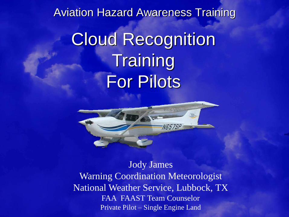
Aviation Hazard Awareness Training
Cloud Recognition
Training
For Pilots
Jody James
Warning Coordination Meteorologist
National Weather Service, Lubbock, TX FAA FAAST Team Counselor Private Pilot – Single Engine Land

Cloud Recognition Training for Pilots
Jody James
Private Pilot
(approx. 200 hours)
WCM - NWS Lubbock
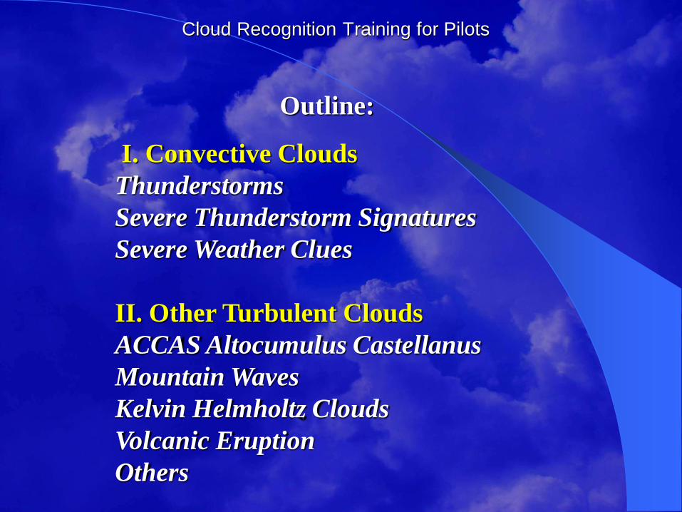
Cloud Recognition Training for Pilots
Outline:
I. Convective Clouds
Thunderstorms
Severe Thunderstorm Signatures
Severe Weather Clues
II. Other Turbulent Clouds
ACCAS Altocumulus Castellanus
Mountain Waves
Kelvin Helmholtz Clouds
Volcanic Eruption
Others
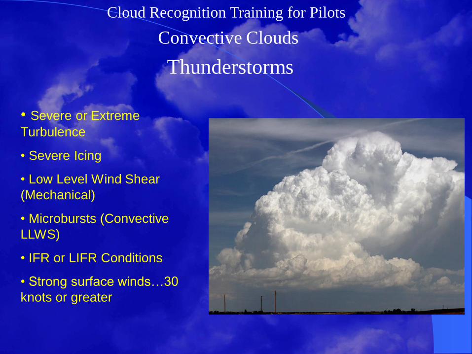
Cloud Recognition Training for Pilots
Convective Clouds
Thunderstorms
• Severe or Extreme
Turbulence
• Severe Icing
• Low Level Wind Shear
(Mechanical)
• Microbursts (Convective
LLWS)
• IFR or LIFR Conditions
• Strong surface winds…30
knots or greater
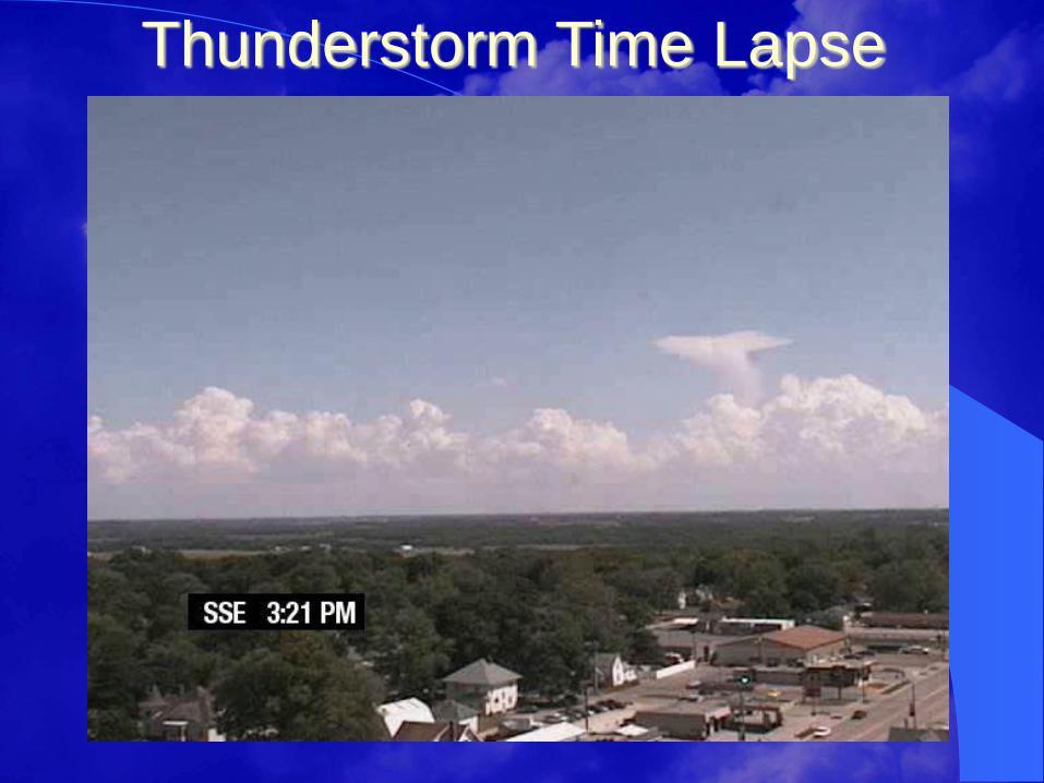
Thunderstorm Time Lapse

Cloud Recognition Training for Pilots
Image courtesy UCAR, photo by Carlye Calvin.
A pilot can expect:
updrafts to reach
4000 to 5000 feet per
minute
Severe or greater
turbulence
Moderate or greater
icing
Height of TCU and
texture may help
estimate
with severity of
conditions
Towering Cumulus
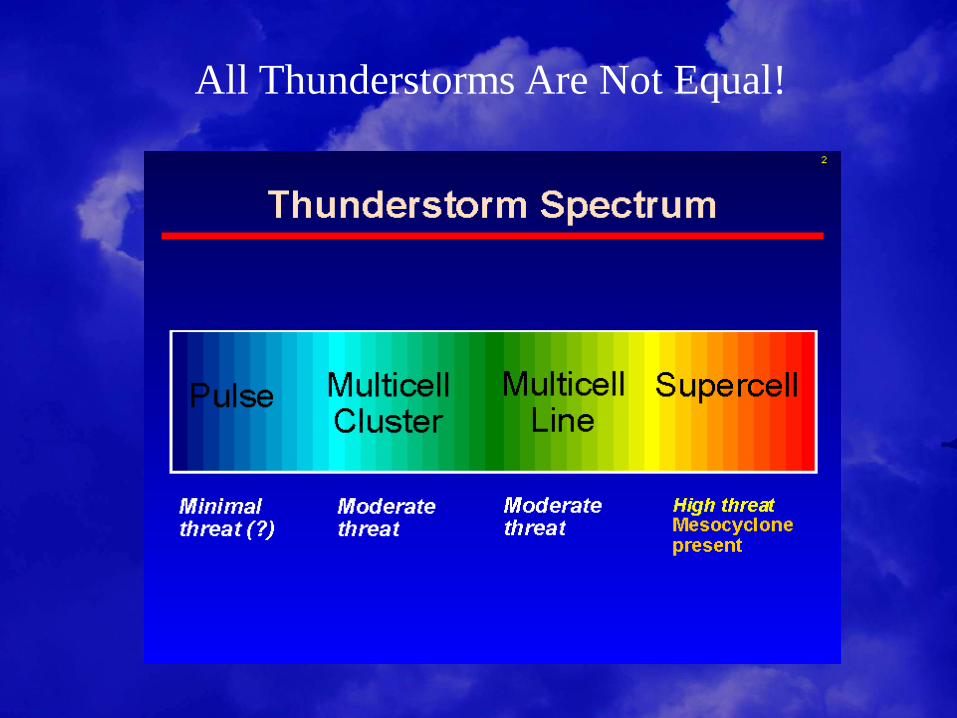
All Thunderstorms Are Not Equal!
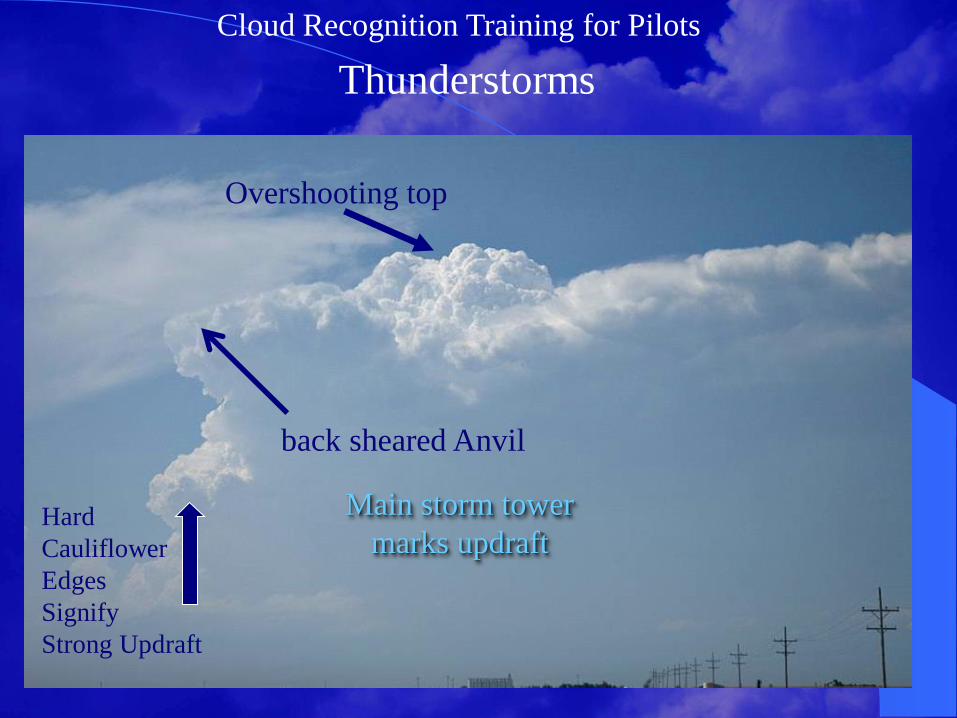
Cloud Recognition Training for Pilots
Thunderstorms
Overshooting top
Main storm tower
marks updraft Hard
Cauliflower
Edges
Signify
Strong Updraft
back sheared Anvil

Cloud Recognition Training for Pilots
Thunderstorm Avoidance
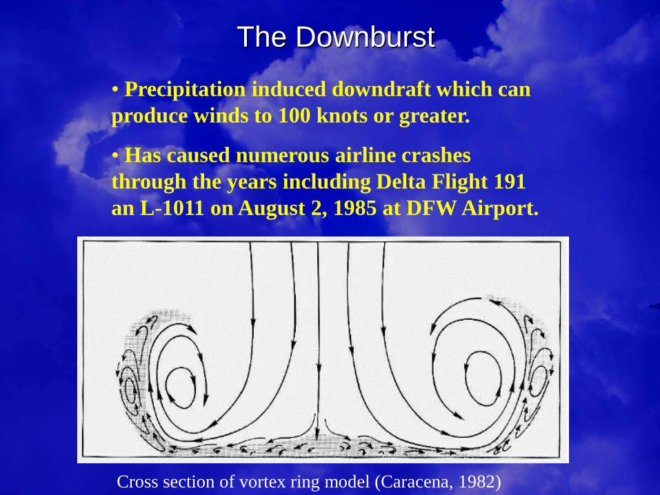
The Downburst
• Precipitation induced downdraft which can
produce winds to 100 knots or greater.
• Has caused numerous airline crashes
through the years including Delta Flight 191
an L-1011 on August 2, 1985 at DFW Airport.
Cross section of vortex ring model (Caracena, 1982)
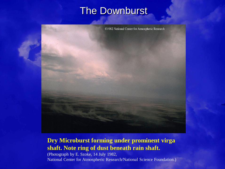
The Downburst
Dry Microburst forming under prominent virga
shaft. Note ring of dust beneath rain shaft. (Photograph by E. Szoke, 14 July 1982,
National Center for Atmospheric Research/National Science Foundation.)

Outward deflection of rain or
dust along ground.
Both indicate strong or
damaging winds are
underway.
Photo: NWS
Photo: © Sam Barricklow
The Downburst – Rain and Dust Foots
Cloud Recognition Training for Pilots
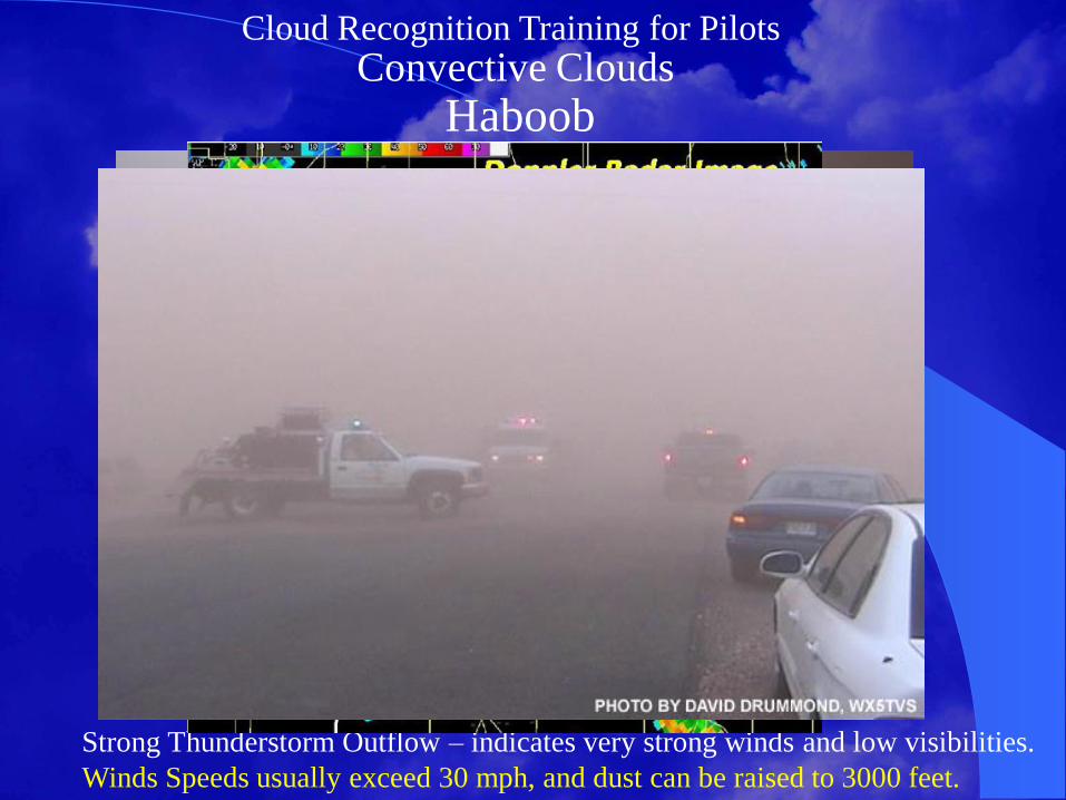
Convective Clouds
Haboob
Strong Thunderstorm Outflow – indicates very strong winds and low visibilities.
Winds Speeds usually exceed 30 mph, and dust can be raised to 3000 feet.
Picture of a habob as it rolled into the southwest side of Lubbock sometime around 8:20 pm
on 18 June 2009. The picture is by NWS meteorologist Todd Lindley.
Cloud Recognition Training for Pilots
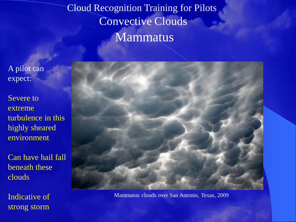
Convective Clouds
Mammatus
Mammatus clouds over San Antonio, Texas, 2009
A pilot can
expect:
Severe to
extreme
turbulence in this
highly sheared
environment
Can have hail fall
beneath these
clouds
Indicative of
strong storm

Cloud Recognition Training for Pilots
Convective Clouds
Wall Clouds/Funnels/Tornadoes
NOAA picture - May 3, 1999, central Oklahoma.
Cloud Recognition Training for Pilots
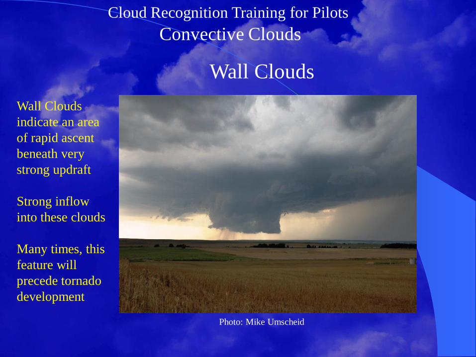
Convective Clouds
Wall Clouds
Wall Clouds
indicate an area
of rapid ascent
beneath very
strong updraft
Strong inflow
into these clouds
Many times, this
feature will
precede tornado
development
Photo: Mike Umscheid

Cloud Recognition Training for Pilots
Convective Clouds
Funnel Clouds
Indicates rapid
rotation
Connected to
cloud base
Violent rotation
not in contact
with ground
Often times, this
feature will
precede tornado
development
Funnel Cloud, NWS San Antonio, TX; NOAA Central Library

Cloud Recognition Training for Pilots
Convective Clouds
Tornadoes
Violent rotation
attached to cloud,
in contact with
ground
Usually develop
in association
with “Supercells”
Can develop
from towering
cumulus clouds
Landspout Tornado
Cloud Recognition Training for Pilots
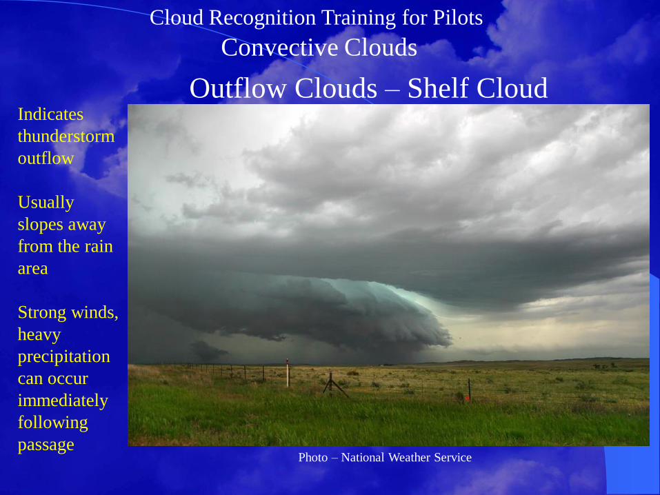
Convective Clouds
Outflow Clouds – Shelf Cloud Indicates
thunderstorm
outflow
Usually
slopes away
from the rain
area
Strong winds,
heavy
precipitation
can occur
immediately
following
passage
Photo – National Weather Service
Cloud Recognition Training for Pilots
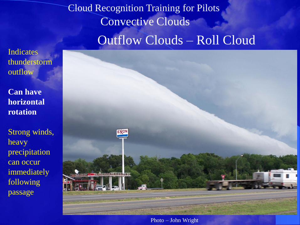
Convective Clouds
Outflow Clouds – Roll Cloud Indicates
thunderstorm
outflow
Can have
horizontal
rotation
Strong winds,
heavy
precipitation
can occur
immediately
following
passage
Photo – John Wright

Cloud Recognition Training for Pilots
Convective Clouds
Outflow Clouds – Gustnado Develops in
area of
thunderstorm
outflow
Circulation is
shallow
(200-300 ft) ,
and does not
extend to
cloud base
Winds
speeds can
reach 80 mph
Gustnado east of Tulia, TX – July 2009
Cloud Recognition Training for Pilots
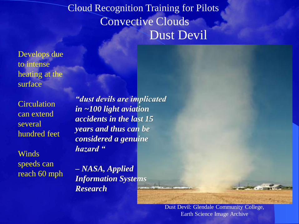
Convective Clouds
Dust Devil
Develops due
to intense
heating at the
surface
Circulation
can extend
several
hundred feet
Winds
speeds can
reach 60 mph
Dust Devil: Glendale Community College,
Earth Science Image Archive
“dust devils are implicated
in ~100 light aviation
accidents in the last 15
years and thus can be
considered a genuine
hazard “
– NASA, Applied
Information Systems
Research

Cloud Recognition Training for Pilots
Turbulent Clouds
Mountain Wave Clouds
Form in
stable
conditions
Can indicate
turbulence
near this
level
Photo of the Moul n'ga Cirque in the Tadrart region, Southeast Algeria, with
wave clouds above.

Cloud Recognition Training for Pilots
Turbulent Clouds
Mountain Wave Clouds
Lenticularis cloud formation over Mt Wash, 2004
Lenticular
Cloud is a
signpost in
the sky that
Indicates
Mountain
Wave
Activity
Extreme
turbulence
can exist

Cloud Recognition Training for Pilots
Turbulent Clouds
Mountain Wave Clouds
Lenticular
Cloud is a
signpost in
the sky that
Indicates
Mountain
Wave
Activity
Extreme
turbulence
can exist
Image Courtesy of UCAR
Cloud Recognition Training for Pilots
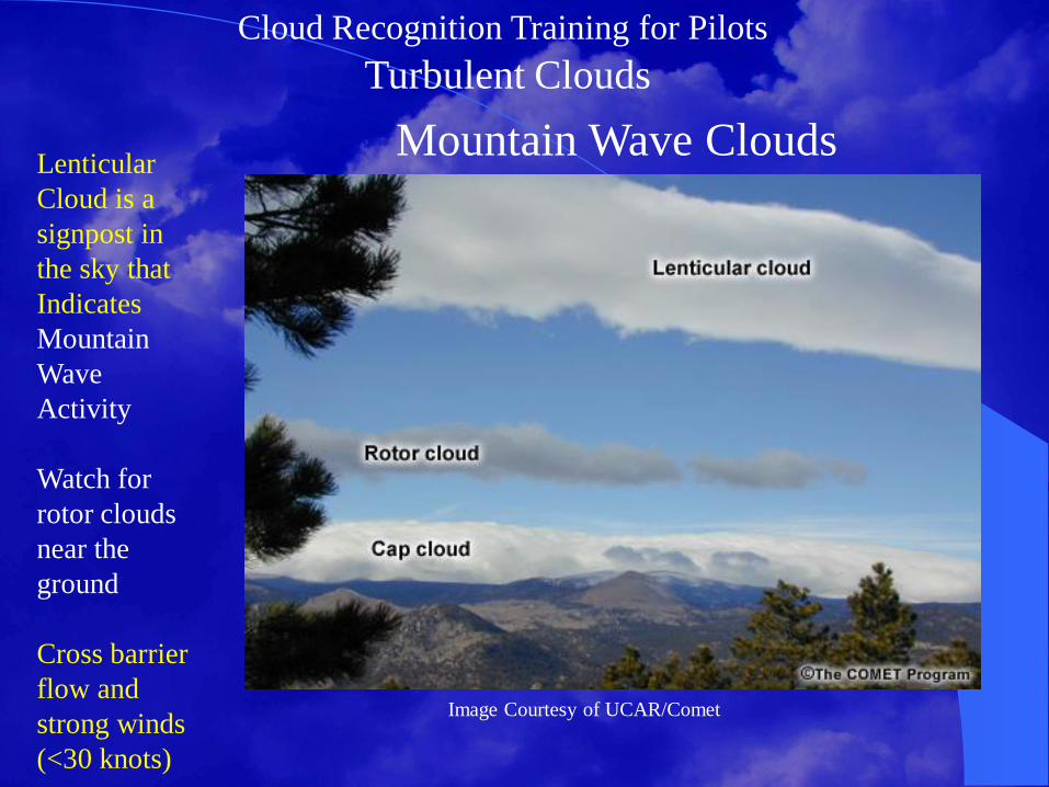
Turbulent Clouds
Mountain Wave Clouds
Image Courtesy of UCAR/Comet
Lenticular
Cloud is a
signpost in
the sky that
Indicates
Mountain
Wave
Activity
Watch for
rotor clouds
near the
ground
Cross barrier
flow and
strong winds
(<30 knots)

Cloud Recognition Training for Pilots
Turbulent Clouds
Kelvin-Helmholtz Wave Clouds KH clouds
also indicate
Severe Wind
Shear
Usually less
than 2 miles
Develop in
stable
environments
with balance
of wind shear
and stability
Use Caution!
Kelvin-Helmholtz breaking wave cloud over Laramie,
Wyoming; Photo by Brooks Martner
Cloud Recognition Training for Pilots
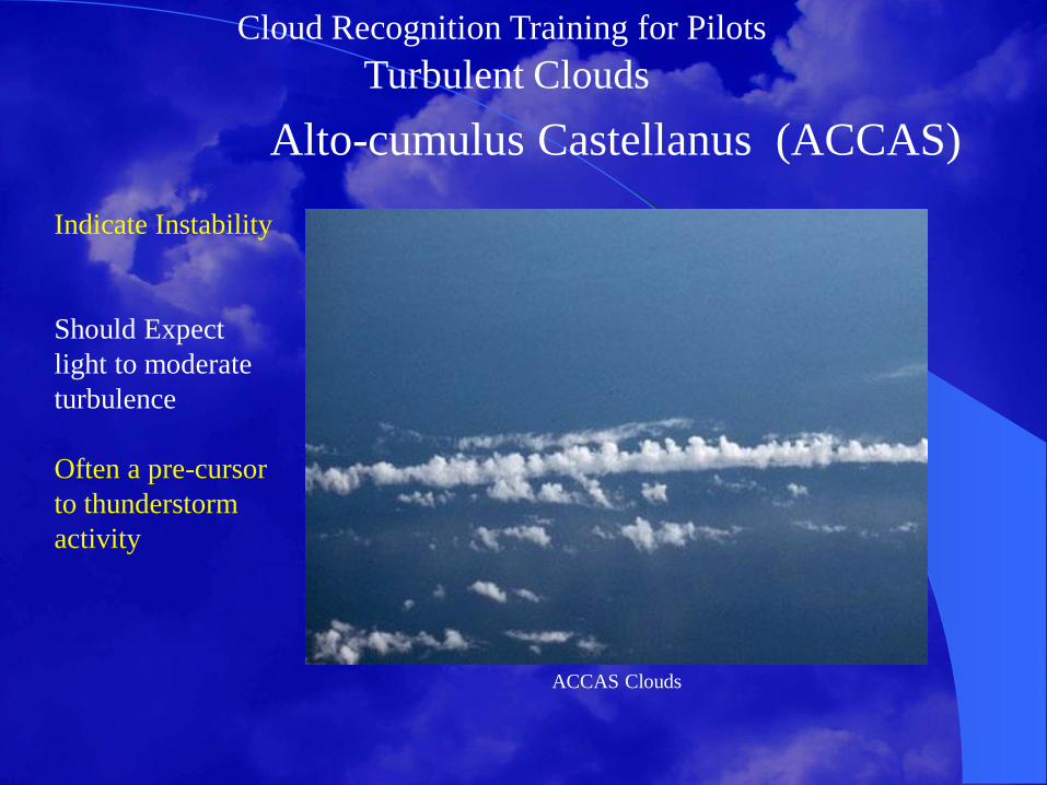
Turbulent Clouds
Alto-cumulus Castellanus (ACCAS)
Indicate Instability
Should Expect
light to moderate
turbulence
Often a pre-cursor
to thunderstorm
activity
ACCAS Clouds

Cloud Recognition Training for Pilots
Turbulent Clouds
Cirrus Fall Streaks
Indicate Strong
Winds Aloft
May
Encounter
Turbulence
near this
altitude
Usually well
into the Flight
Levels, FL180
and above
Cirrus with evaporating ice crystals; Photo by Ronald L. Holle, Univ. of Illinois Cloud Catalog
Cloud Recognition Training for Pilots
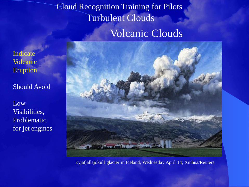
Turbulent Clouds
Volcanic Clouds
Indicate
Volcanic
Eruption
Should Avoid
Low
Visibilities,
Problematic
for jet engines
Eyjafjallajokull glacier in Iceland, Wednesday April 14; Xinhua/Reuters

Cloud Recognition Training for Pilots
Convective Clouds
CAT Clouds
Region with no
cumuloform
clouds
Most likely in
the upper
atmosphere
near tropopause
Cirrus can
indicate
potential for
CAT

Cloud Recognition Training for Pilots
Convective Clouds
CAT Clouds
Region with no
cumuloform
clouds
Most likely in
the upper
atmosphere
near tropopause
Cirrus can
indicate
potential
Cirrus will often develops along axis of stronger upper level winds;
RUC80 model with streamlines and water vapor satellite imagery

Cloud Recognition Training for Pilots
Questions?

Cloud Recognition Training for Pilots
Please Fly Safely!
Thank You…