Embed Size (px)
Citation preview
C O M M I S S I O N E D R E P O R T
For further information on this report please contact:
Helen DohertyScottish Natural HeritageBallochyleSandbankDUNOONPA23 8RDTelephone: 01369 705377E-mail: [email protected]
This report should be quoted as:
Bull, C. (2004). Electro-fishing survey in selected tributaries of the River Teith candidate Special Area of Conservation. Scottish Natural Heritage Commissioned Report No. 055(ROAME No. F03LG04).
This report, or any part of it, should not be reproduced without the permission of Scottish Natural Heritage.This permission will not be withheld unreasonably. The views expressed by the author(s) of this report shouldnot be taken as the views and policies of Scottish Natural Heritage.
© Scottish Natural Heritage 2004.
Commissioned Report No. 055
Electro-fishing survey in selectedtributaries of the River Teith candidate
Special Area of Conservation(ROAME No. F03LG04)


Background
An electric fishing survey for the presence and abundance of lamprey ammocoetes (Lampetra planeri, L. fluviatilis and Petromyzon marinus) and juvenile Atlantic salmon (Salmo salar) was conducted in namedtributaries of the River Teith candidate Special Area of Conservation during October 2003. This survey wasdesigned to increase current knowledge of the fish fauna in these tributaries and to complement the recentfish survey data made available to Scottish Natural Heritage by the Forth Fisheries Foundation.
A total of 37 sites were identified for lamprey survey, but no suitable lamprey habitat was found at 12 predetermined survey stretches. Therefore, lamprey surveys were conducted at 25 of the potential surveysites. Salmon habitat was found, and surveys conducted, at all 17 predetermined stretches. Where lampreyhabitat was optimal, quantitative sampling was undertaken within a 1m2 quadrat. Where lamprey habitatwas sub-optimal, or where the quadrat could not be used, semi-quantitative sampling was used over ameasured area. Ammocoetes were examined and identified as either Lampetra spp. or P. marinus.Transformers were identified as L. planeri, L. fluviatilis or P. marinus. Salmon were surveyed for 15 minutesin the most suitable areas of habitat across a varied area at each predetermined site. All fish encounteredwere retained and examined under anaesthesia.
Main findings
● A total of 728 Lampetra spp. ammocoetes and 27 transformers were recorded. Optimal lamprey habitatwas found at nine sites. L. planeri transformers were found at nine sites and one L. fluviatilis transformerwas identified at the Blair Drummond Lade site. No P. marinus ammocoetes or transformers wereencountered.
● A total of 553 Altantic salmon and 512 trout were sampled. Salmon were not present at four sites(Immerion, Greenock, Milton and Drunkie Burns) but where they were present, they were found over awide range of abundance, reaching a maximum of 7.33 per minute sampling at the Leny Burn. Salmonand trout fry were most abundant and trout were encountered at every site surveyed.
● Minnows (Phoxinus phoxinus) were found at six sites and eels (Anguilla anguilla) at one.
Electro-fishing survey in selected tributaries of the
River Teith candidate Special Area of Conservation
Commissioned Report No. 055 (ROAME No. F03LG04)Contractor: Forth Fisheries Foundation
C O M M I S S I O N E D R E P O R T
Summary
For further information on this project contact:Helen Doherty, Scottish Natural Heritage, Ballochyle, Sandbank, Dunoon, Argyll PA23 8RD.
Tel: 01369-705377
For further information on the SNH Research & Technical Support Programme contact:The Advisory Services Co-ordination Group, Scottish Natural Heritage, 2 Anderson Place, Edinburgh EH6 5NP.
Tel: 0131–446 2400 or [email protected]

Acknowledgements
We are grateful to SNH staff, particularly Helen Doherty, Paul Taylor and Colin Castle for their assistanceand advice during this project. Owners of all parts of the system sampled were co-operative and allowedsampling to take place and we wish to extend our thanks to all.
Scottish Natural Heritage Commissioned Report No. 055 (ROAME No. F03LG04)
Contents
Summar y
Acknowledgements
1 INTRODUCTION 1
2 METHODS 22.1 Lamprey surveys 22.2 Salmon survey 22.3 Data analysis 3
3 RESULTS 43.1 Lamprey survey 43.2 Salmon survey 7
4 DISCUSSION 114.1 Lamprey survey 114.2 Salmon survey 13
REFERENCES 25
Appendix 1 Site photographs 26
Appendix 2 Field recording sheets for lamprey and 39salmon sur vey sites
Appendix 3 Length frequency distributions for Lampetra 129ammocoetes and transformers from ever y site
Appendix 4 Length frequency distributions for salmon 136and trout from ever y site
Scottish Natural Heritage Commissioned Report No. 055 (ROAME No. F03LG04)

List of f iguresFigure 1 Length frequencies for Lampetra ammocoetes and transformers 23
from all sites combinedFigure 2 Length frequencies from salmon and trout for all sites 24
List of tablesTable 1 Watercourses where no suitable lamprey ammocoetes habitat 15
was foundTable 2 Details, location and sampling technique used at lamprey 16
survey sitesTable 3 Habitat characteristics of the lamprey sites sampled 17Table 4 Total numbers, Zippin estimates and minimum density 18
estimates (per m2) for all Lampetra, Lampetra ammocoetes and transformers
Table 5 Zippin density estimates for ammocoetes and transformers 19sampled from each quadrat (Q) at full quantitative sites
Table 6 Catch per unit effort (CPUE) expressed as fish per minute 19sampling for those sites where semi-quantitative sampling was undertaken
Table 7 Summary of fish species encountered at salmon sampling sites 20Table 8 Details and location of salmon survey sites 21Table 9 Total numbers of salmon and trout fry (underyearling) and parr 22
(1+ year and older) encountered
Scottish Natural Heritage Commissioned Report No. 055 (ROAME No. F03LG04)

1
1 INTRODUCTION
The River Teith is a candidate Special Area of Conservation (cSAC) for brook lamprey (Lampetra planeri),river lamprey (Lampetra fluviatilis), sea lamprey (Petromyzon marinus) and Atlantic salmon (Salmo salar).Whilst the lamprey populations in the main River Teith have been surveyed previously, no survey informationexists for lampreys in several tributary areas of the cSAC, and only limited data is available for Atlanticsalmon. The purpose of this project was to provide information on the distribution of lampreys and Atlanticsalmon by conducting an electric fishing survey in selected areas where there is no contemporary data.
Scottish Natural Heritage Commissioned Report No. 055 (ROAME No. F03LG04)

2 METHODS
Written or verbal permissions were obtained from the relevant owners of the river stretches identified forsurveying. Upon arrival at the predetermined stretch, one surveyor moved upstream and one downstream inorder to locate suitable lamprey and salmon habitat. Normally, suitable habitats were found close thenearest road crossing or access point, but on occasion, isolated areas of suitable lamprey habitat werelocated several hundred metres from the vehicular access point. Where no suitable lamprey habitat wasfound, surveying was not attempted.
2.1 Lamprey sur veys
Lamprey habitat suitability was assessed first visually and then by investigating the depth of the sediment withthe handle of a handnet. Where optimal lamprey habitat was present (defined as stable fine sediment orsand ≥15cm deep, low water velocity and the presence of organic detritus), a 1m2 quadrat frame withmosquito netting sides was assembled and positioned on the most downstream extent of habitat. Full quantitative electric fishing was undertaken using the protocol set out in Harvey & Cowx (2002). Surveyswere conducted using three quadrats and therefore covering 3m2 of optimal habitat, moving in an upstreamdirection. Lampreys from each sampling run were retained in buckets and data recorded separately.
Where sub-optimal lamprey habitat was encountered or the use of the quadrat was prevented, surveyingwas undertaken in a semi-quantitative manner. This was done by determining the locations to be sampledand proceeding in an upstream direction by energising the anode for durations of 20 seconds followed by5 seconds off, over the patches of habitat. A note was taken of the number of minutes of sampling conductedand the area of habitat sampled was accurately measured.
Wherever possible, sampling for lampreys was undertaken using the maximum output of pulsed DC fromElectracatch bankside electric fishing equipment. Where difficult access prevented the use of this equipment,the pulsed DC output was supplied by Electracatch backpack equipment.
Following completion of sampling, all lampreys were transferred to anaesthetic (benzocaine) and examinedwith the aid of a magnifying lens and the identification key (Gardiner, 2003). Identification of theammocoetes was made to genus level and transformer stages were examined for external characteristics thatallow identification to species level. At each site the total number of lamprey ammocoetes and transformersand the total length of each individual lamprey was recorded (to the nearest mm).
In addition to the information on the lampreys, data on the physical characteristics of each site wererecorded.
2.2 Salmon sur veys
Suitable salmon habitat was located and sampling was undertaken at each of the predetermined reachesby conducting electric fishing using pulsed DC from Electracatch backpack equipment. The two operatorsproceeded to sample in suitable salmonid habitat in an upstream direction for a total of 15 minutes. During this time all fish that were encountered were removed with a banner net, retained and transferredevery 5 minutes to streamside buckets from the carrier slung over one operator’s shoulder. This technique
2
Scottish Natural Heritage Commissioned Report No. 055 (ROAME No. F03LG04)

maintained sampling effort as near-constant as possible. All fish were identified and fork length measured(to the nearest mm) whilst under anaesthesia (benzocaine).
All fish encountered during the course of this survey were returned alive to the water following examinationand recovery from the anaesthetic.
2.3 Data analysis
Where full quantitative lamprey sampling was undertaken, an estimate of density was calculated using theZippin maximum likelihood method (Zippin, 1958). The results were individually calculated for each quadratand also for a combined sample where each quadrat run was summed with the other two and a Zippinestimate recalculated for this larger sample. Length frequency plots were produced from the data for lampreyammocoetes and transformer and for salmon and trout and used to ascertain age classes where this waspossible.
Each sample site has been recorded with a Unique Identifier (UID). Photographs of each site are presentedin Appendix 1. All survey data was recorded on field recording sheets, presented in Appendix 2.
3
Scottish Natural Heritage Commissioned Report No. 055 (ROAME No. F03LG04)

3 RESULTS
3.1 Lamprey sur vey
Surveying was carried out at 25 sites out of the 37 pre-selected stream reaches. Site photographs areprovided in Appendix 1. No suitable lamprey habitat was present in 12 of these reaches, preventingsampling taking place (Table 1). Descriptions of the survey sites and lamprey details are presented in tables2, 3, 4, 5 and 6. Length frequency distributions for total ammocoetes and transformers are provided inFigure 1 and for specific sites in Appendix 2.
3.1.1 Blair Drummond Lade UID 2003 L1
Lamprey habitat was abundant in this low gradient man-made channel. The presence of optimal lampreyhabitat allowed full quantitative sampling to be undertaken at this site. The highest density of Lampetraammocoetes and transformers were recorded at this site (67.2 and 2.79 per m2 respectively). The smallconfidence intervals around the Zippin density estimate for ammocoetes (6.0) indicated that it is a suitablevalue to use, although the large confidence intervals around the transformer estimate (6.49) in relation to thedensity figure would suggest that it be treated with caution and that the minimum estimate of 1.67 per m2
is more applicable here. One L. fluviatilis transformer was identified on the basis of body colouration andeye diameter, indicating that river and brook lampreys were present.
3.1.2 Ardoch Burn UID 2003 L2
Only a small patch of sub-optimal lamprey habitat was found to be present in the Ardoch Burn despiteinvestigation of approximately 2kms of the watercourse upstream and downstream from three separateaccess points within the designated reach. No lampreys were encountered during sampling.
3.1.3 Coilechat Burn UID 2003 L3
The only small patch of sub-optimal lamprey habitat found to be present was directly downstream from theA84 road bridge. No lampreys were encountered during sampling.
3.1.4 Keltie Water UID 2003 L4
Lamprey habitat was not encountered in the middle and upper reaches of the Keltie Water despiteinvestigation at a number of locations, but sub-optimal habitat was encountered in the lowermost reaches,enabling sampling. Reasonable densities of Lampetra ammocoetes were encountered (11.6 per m2) andthere appeared to be two distinct modal peaks in the length distribution of Lampetra ammocoetes at this site.Two very large ammocoetes were also encountered (176mm and 181mms) that were larger than anytransformers (recorded at a density of 1.2 per m2). All transformers sampled at this site were identified as L. planeri, suggesting that the ammocoete population consisted mostly of this species.
3.1.5 Greenock Burn UID 2003 L5
Small but isolated patches of sub-optimal lamprey habitat were distributed along the length of thiswatercourse. Sampling took place in three of these but no lampreys were encountered.
4
Scottish Natural Heritage Commissioned Report No. 055 (ROAME No. F03LG04)

3.1.6 Ardchullarie Burn UID 2003 L6
A small number of isolated patches of sub-optimal lamprey habitat were found in this stream reach and avery low density of small Lampetra ammocoetes (1.33 per m2) and a single L. planeri transformer weresampled.
3.1.7 Calair Burn UID 2003 L7
Suitable lamprey habitat was found in patches in the lower reaches of the Calair Burn. Lampetra ammocoeteswere encountered at a density of 5.78 per m2 and no transformers were found.
3.1.8 Immeroin Burn UID 2003 L8
Two moderately large patches of sub-optimal lamprey habitat were sampled in the lowermost reaches of thisstream. No other habitat patches suitable for sampling were found in the first 500m. No lampreys wereencountered.
3.1.9 Kirkton Burn UID 2003 L9
Two small patches of sub-optimal lamprey habitat were sampled in the lowermost reaches of this stream. Noother habitat patches suitable for sampling were found between the confluence with the River Balvag andthe point where the gradient increases rapidly north of the village of Balquhidder. No lampreys wereencountered.
3.1.10 Monachyle Burn UID 2003 L10
A suitable sampling location was encountered in the lower reaches of this watercourse where gravelextraction had created a back eddy area where sediment had accumulated. There did not appear to beany other suitable lamprey habitat in this watercourse. Lampetra ammocoetes were encountered at lowdensity (2.2 per m2) and no transformers were encountered. The ammocoetes were all of approximately thesame length and therefore may belong to the same year class.
3.1.11 Alt Carnaig UID 2003 L11
The only suitable lamprey habitat was encountered at the very lowermost section of the Alt Carnaig whereriver engineering (probably gravel extraction) upstream appeared to have resulted in the deposition ofadditional sediment in back eddies where the gradient and flow was reduced. Low densities of ammocoetes(4.67 per m2) and just two L. planeri transformers were encountered in this sub-optimal habitat. Unlike thesituation in the neighbouring Monachyle site, the ammocoetes appeared to be from several yearclasses.
3.1.12 River Larig UID 2003 L12
Suitable lamprey habitat was found in the lowermost reaches of this watercourse but was absent throughoutextensive reaches further upstream. Low densities of Lampetra ammocoetes were encountered (6 per m2) andone L. planeri transformer was recorded. Ammocoetes appeared to show a bimodal length distributionsuggesting the existence of at least two year classes.
5
Scottish Natural Heritage Commissioned Report No. 055 (ROAME No. F03LG04)

3.1.13 Inverlochlarig Burn UID 2003 L13
Only one suitable patch of lamprey habitat was found on this stream reach between the confluence and the
waterfall. Lampetra ammocoetes were present in low density (4.57 per m2) in this sub-optimal habitat and
no transformers were encountered. Ammocoetes appeared to show a bimodal length distribution suggesting
the existence of at least two year classes.
3.1.14 Eas Gobhain UID 2003 L14
Several patches of optimal lamprey habitat were encountered in this river stretch, enabling full quantitative
sampling to be undertaken. The resulting zippin density estimate of 38.64 per m2 should be treated
with caution on account of the large confidence interval (149.37). The minimum density estimate of
10.33 ammocoetes per m2 represents a moderate population density, of which there appeared to be no
very small individuals. L. planeri transformers were present at low density (1 per m2) suggesting that the
ammocoete population consisted largely of this species.
3.1.15 Loch Venachar UID 2003 L15
Abundant optimal lamprey habitat was identified on the shores of Loch Venachar as a result of the water
level being very low, exposing littoral sediments. However, high winds prevented the use of a quadrat
and the full quantitative sampling technique. High densities of Lampetra ammocoetes were encountered
(57 per m2) and the length frequency distribution would suggest the presence of multiple yearclasses.
L. planeri transformers were found to be present at low density (1.33 per m2) suggesting that the ammocoete
population consisted mostly of this species.
3.1.16 Milton Burn UID 2003 L16
Just one patch of sub-optimal lamprey habitat was encountered from 100m upstream of the road to the
confluence with Loch Venachar. Lampetra ammocoetes were found here in low density (4.67 per m2) and
the length frequency distribution suggested the presence of at least two year classes. No transformers were
encountered.
3.1.17 Drunkie Burn UID 2003 L17
Optimal lamprey habitat was found directly downstream from the road bridge but the slightly increased flows
associated with overnight rain prevented the use of the quadrat and the full quantitative sampling technique.
Low densities of Lampetra ammocoetes were encountered here (5.4 per m2) and the length distribution
suggested the presence of at least two year classes. L. planeri transformers were found to be present in low
density (0.8 per m2).
3.1.18 Loch Drunkie UID 2003 L18
Optimal lamprey habitat was encountered across a large length of the shoreline of the western edge of the
waterbody enabling full quantitative sampling. No lampreys were encountered.
6
Scottish Natural Heritage Commissioned Report No. 055 (ROAME No. F03LG04)

3.1.19 Black Water UID 2003 L19
Sub-optimal lamprey habitat was encountered close to the confluence with the Finglas Water. Lampetraammocoetes were encountered at low density (2.6 per m2) and the length distribution suggested thepresence of at least two year classes. No transformers were encountered.
3.1.20 Finglas Water (River Turk) UID 2003 L20
Optimal lamprey habitat was encountered upstream from the roadbridge and full quantitative sampling wasundertaken. The resulting zippin density estimate of 47.76 per m2 should be treated with caution on accountof the large confidence interval of 51.84. The minimum density estimate for ammocoetes at this site was25.67 per m2. The length distribution suggested the presence of at least three year classes. One L. planeritransformer was encountered (density of 0.33 per m2) suggesting that the ammocoete population was madeup largely of this species.
3.1.21 Finglas Water (Glen Finglas Burn) UID 2003 L21
A small number of isolated sub-optimal lamprey habitat patches were found on this watercourse. Samplingat the largest of these failed to produce any lampreys.
3.1.22 Glen Finglas Reser voir UID 2003 L22
Optimal lamprey habitat was abundant as a result of the very low water level of the reservoir exposing littoralsediments. However, as with Loch Venachar, strong winds prevented the use of the quadrat and the fullquantitative sampling technique. Sampling failed to produce any lampreys.
3.1.23 Loch Achray UID 2003 L23
Optimal lamprey habitat was present along the south-western shoreline but strong winds prevented the useof the quadrat and the full quantitative sampling technique. Lampetra ammocoetes were encountered at verylow density (0.25 per m2) and their similarity in length would suggest that they were of the same age class.No transformers were found.
3.1.24 Achray Water UID 2003 L24
A suitable patch of sub-optimal lamprey habitat was encountered downstream from the roadbridge, andsampling revealed a moderate density of small Lampetra ammocoetes (10.5 per m2) whose lengthdistribution suggested that they were all of the same age class.
3.1.25 Glengyle Burn UID 2003 L25
A suitable large patch of optimal lamprey habitat was located downstream from the road crossing, enablinguse of the quadrat and the full quantitative technique. No lampreys were encountered.
3.2 Salmon sur vey
Sampling for Atlantic salmon took place at 17 sites in the Teith catchment. A total of 553 juvenile salmonwere sampled, occurring at 13 sites. Juvenile trout (Salmo trutta) were found to be present at every site,
7
Scottish Natural Heritage Commissioned Report No. 055 (ROAME No. F03LG04)
minnows (Phoxinus phoxinus) at five and eel (Anguilla anguilla) at one (Table 7). Length frequencydistributions for all salmon and trout sampled are provided in Figure 2 and for each site in Appendix 3. Sitelocations and total numbers and catch-per-unit-effort data are provided in Tables 8 and 9.
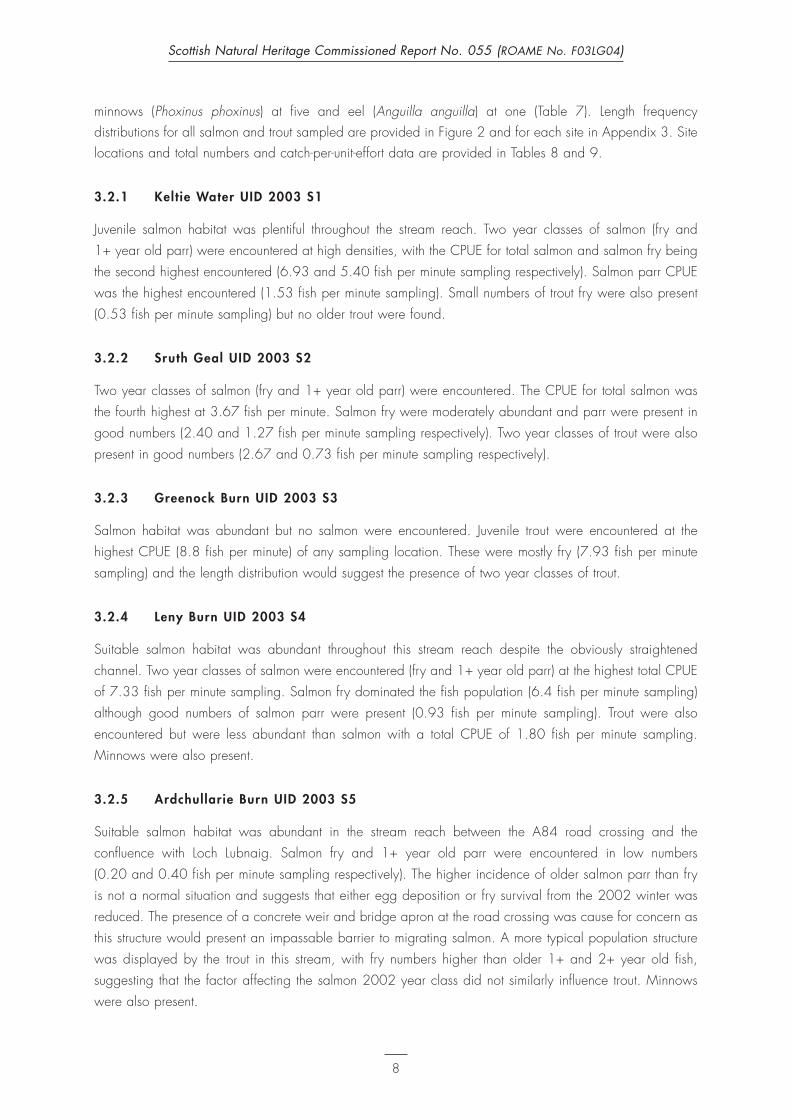
3.2.1 Keltie Water UID 2003 S1
Juvenile salmon habitat was plentiful throughout the stream reach. Two year classes of salmon (fry and
1+ year old parr) were encountered at high densities, with the CPUE for total salmon and salmon fry being
the second highest encountered (6.93 and 5.40 fish per minute sampling respectively). Salmon parr CPUE
was the highest encountered (1.53 fish per minute sampling). Small numbers of trout fry were also present
(0.53 fish per minute sampling) but no older trout were found.
3.2.2 Sruth Geal UID 2003 S2
Two year classes of salmon (fry and 1+ year old parr) were encountered. The CPUE for total salmon was
the fourth highest at 3.67 fish per minute. Salmon fry were moderately abundant and parr were present in
good numbers (2.40 and 1.27 fish per minute sampling respectively). Two year classes of trout were also
present in good numbers (2.67 and 0.73 fish per minute sampling respectively).
3.2.3 Greenock Burn UID 2003 S3
Salmon habitat was abundant but no salmon were encountered. Juvenile trout were encountered at the
highest CPUE (8.8 fish per minute) of any sampling location. These were mostly fry (7.93 fish per minute
sampling) and the length distribution would suggest the presence of two year classes of trout.
3.2.4 Leny Burn UID 2003 S4
Suitable salmon habitat was abundant throughout this stream reach despite the obviously straightened
channel. Two year classes of salmon were encountered (fry and 1+ year old parr) at the highest total CPUE
of 7.33 fish per minute sampling. Salmon fry dominated the fish population (6.4 fish per minute sampling)
although good numbers of salmon parr were present (0.93 fish per minute sampling). Trout were also
encountered but were less abundant than salmon with a total CPUE of 1.80 fish per minute sampling.
Minnows were also present.
3.2.5 Ardchullarie Burn UID 2003 S5
Suitable salmon habitat was abundant in the stream reach between the A84 road crossing and the
confluence with Loch Lubnaig. Salmon fry and 1+ year old parr were encountered in low numbers
(0.20 and 0.40 fish per minute sampling respectively). The higher incidence of older salmon parr than fry
is not a normal situation and suggests that either egg deposition or fry survival from the 2002 winter was
reduced. The presence of a concrete weir and bridge apron at the road crossing was cause for concern as
this structure would present an impassable barrier to migrating salmon. A more typical population structure
was displayed by the trout in this stream, with fry numbers higher than older 1+ and 2+ year old fish,
suggesting that the factor affecting the salmon 2002 year class did not similarly influence trout. Minnows
were also present.
8
Scottish Natural Heritage Commissioned Report No. 055 (ROAME No. F03LG04)

3.2.6 Allt Mor UID 2003 S6
Suitable salmon habitat was abundant in this channel but engineering works had degraded habitat quality
and will have reduced the overall carrying capacity for salmonids. Juvenile salmon fry and parr were
encountered in equally low numbers (both 0.73 fish per minute sampling) but were more abundant than trout.
The effects of the channel engineering appear to be greatest in the trout population, with overall low density
(1.13 fish per minute sampling) and only a single older trout parr present. Minnows were also present.
3.2.7 Immeroin Burn UID 2003 S7
Abundant salmon habitat was encountered in this stream section although some engineering work 100m
upstream from the confluence with the Calair Burn has reduced depth and reduced habitat quality over
a 50m section. No salmon were encountered during sampling, but low numbers of trout (0.93 fish per
minute sampling) were found with both fry and 1+ year old parr present.
3.2.8 Allt Fathan Ghlinne UID 2003 S8
Abundant salmon habitat was present throughout this stream reach with large areas of suitable spawning
gravels and shallow water that would favour salmon fry. Despite this, no salmon fry were encountered and
only low numbers of 1+ year old salmon were found (0.27 fish per minute sampling). Trout were present in
moderate densities (2.8 fish per minute sampling) and fry were abundant. Older 1+ and 2+ year old trout
were also present in lower density and a number of these were mature.
3.2.9 Allt a Ghlinne Dhuibh UID 2003 S9
As with the neighbouring Allt Fathan Ghlinne site, abundant salmon habitat was present throughout this
stream reach with large areas of suitable spawning gravels and shallow water that would favour salmon fry.
Despite this, no salmon fry were encountered and only low numbers of 1+ year old salmon were found
(0.33 fish per minute sampling). Trout were present in moderate densities (1.87 fish per minute sampling)
and fry were abundant. Older 1+ and 2+ trout were also present at lower densities and many of these were
mature.
3.2.10 Kirkton Burn UID 2003 S10
Salmon habitat was abundant throughout the stream reach. Good numbers of salmon fry and 1+ year old
parr were encountered (3.4 and 1.47 fish per minute sampling respectively). Trout fry and parr were present
but in greatly reduced numbers (0.33 and 0.20 fish per minute sampling) when compared to salmon.
3.2.11 Alt Carnaig UID 2003 S11
Abundant high quality salmon habitat was present in this stream reach. Salmon fry and 1+ year old parr
were encountered at low density (1.93 and 0.27 fish per minute sampling respectively). Trout fry and
1+ year old parr were present at approximately the same density (1.80 and 0.20 fish per minute sampling
respectively). Minnows were also present at this site.
9
Scottish Natural Heritage Commissioned Report No. 055 (ROAME No. F03LG04)

3.2.12 Invernenty Burn UID 2003 S12
Abundant habitat for salmon was present in this stream reach although areas of suitable water depth toprovide appropriate parr habitat were limited. The channel appeared to have been straightened to flowalong an existing field boundary. Only salmon fry were present at this site at moderate density (3.0 fish perminute sampling). Trout fry were present at low density and just two 1+ year old parr were encountered(0.93 and 0.13 fish per minute sampling respectively). Minnows were also present at this site.
3.2.13 Alt Sgoinie UID 2003 S13
Abundant suitable salmon habitat was present in this stream reach. Salmon fry and 1+ year old parr werefound to be present in low numbers (1.33 and 0.60 fish per minute sampling respectively). A number of themale 1+ parr were fully mature. Trout were also present, but less abundant than salmon. Trout fry and 1+ year old parr were encountered at 0.27 and 0.13 fish per minute sampling respectively.
3.2.14 Ishag Burn UID 2003 S14
Abundant suitable habitat for salmon was present in this stream reach. Low numbers of salmon fry wereencountered and good numbers of 1+ year old parr, of which many males were mature (0.67 and 1.33fish per minute sampling respectively). More 1+ year old salmon parr were encountered than fry, despiteplentiful fry habitat. This suggests that there may have been poor spawning or survival from the 2002 yearclass of salmon in this area, or that recruitment from the 2001 year class to parr was extremely high. Troutfry were more plentiful than salmon of the same age and a small number of older 1+ and 2+ year old troutwere encountered (1.0 and 0.33 fish per minute sampling respectively).
3.2.15 Alt a Chuil inn UID 2003 S15
Suitable salmon habitat was abundant throughout this stream reach. Low numbers of salmon fry but moderatenumbers of salmon parr were encountered (1.40 and 0.87 fish per minute sampling respectively) differingfrom the situation on the Ishag Burn, and suggesting normal spawning or rates of survival for both the 2001and 2002 salmon year classes. Trout fry and parr were present in low and moderate densities (0.20 and0.60 fish per minute sampling respectively) suggesting that there may have been poor spawning or survivalfrom the 2002 year class of trout in this area, or that recruitment from the 2001 year class to parr wasextremely high.
3.2.16 Milton Burn UID 2003 S16
Suitable salmon habitat was present throughout this stream reach. No salmon were encountered butmoderate numbers of trout fry and 1+ year old parr were present (1.87 and 0.60 fish per minute samplingrespectively).
3.2.17 Drunkie Burn UID 2003 S17
Suitable salmon habitat was present throughout this stream reach. No salmon were encountered but lownumbers of trout fry and 1+ year old parr were present (0.53 and 0.07 fish per minute samplingrespectively). Minnows and a single eel were also present here.
10
Scottish Natural Heritage Commissioned Report No. 055 (ROAME No. F03LG04)

4 DISCUSSION
4.1 Lamprey sur vey
Lampetra ammocoetes were present at 16 of the 25 sites where suitable habitat was encountered. The density of Lampetra ammocoetes varied widely and ranged from 0–67.2 per m2 (Blair Drummond ladeUID 2003 L1). Gardiner et al (1995) reported densities of Lampetra ammocoetes from optimal sites in themain River Teith during September, ranging from 38.9–195.7 per m2. This study used smooth DC currentwith a voltage of about 400v. Maitland & Lyle (2000) reported a maximum Lampetra density of 46 per m2,whilst surveying using pulsed DC current of 300v. The maximum voltage output from the bankside electricfishing equipment used for lamprey surveying in the current study was 220v pulsed DC. This may havelimited the effectiveness of capturing all the lamprey ammocoetes present.
The largest Lampetra ammocoete of 181mm was recorded at the Keltie Water site UID 2003 L4 (Figure 1).This was 35mm larger than the largest Lampetra ammocoete recorded by Maitland & Lyle (2000) duringtheir survey in July. Very small ammocoetes were not common and may have been due to a lack of the 0+ year class lampreys, or that capture efficiency for these small specimens was reduced. It was not possibleto determine age classes on the basis of a length frequency distribution of all Lampetra ammocoetes (Figure 1) but breakpoints between age classes were more distinct at some sites compared to others (see Appendix 2).
Lampetra spp. transformers were tentatively identified as L. planeri or L. fluviatilis on the basis of the patternof pigmentation and the eye diameter in relation to total body length (Gardiner, 2003). However, prior toNovember, the two species cannot always be distinguished from external appearance as brook lampreytransformers often show a transient silvering of the flanks and body proportions overlap (Gardiner, 2003).It is possible therefore that some transformers were misidentified and that river lampreys were actually presentin the sample of ammocoetes at some locations.
Maitland & Lyle (2000) recorded P. marinus ammocoetes in the mainstem of the River Teith as far upstreamas Callander, suggesting that the Deanston Weir was passable. The densities of P. marinus compared toLampetra spp. were very low, indicating that they were uncommon (Maitland & Lyle, 2000). No P. marinusammocoetes or transformers were encountered at any site during the current survey. This was despitesampling at several locations that would appear to have no restricted access from the main river within thepreviously proposed species distribution range (Blair Drummond Lade UID 2003 L1, Ardoch UID 2003 L2,Keltie UID 2003 L4, Greenock UID 2003 L5, Eas Gobhain UID 2003 L14).
Maitland & Lyle (2000) also suggested that all the Lampetra ammocoetes present upstream of the Leny Fallswere likely to be L. planeri. The results from the current survey are in agreement with this, as the only L. fluviatilis transformer that was tentatively identified was found at the lowermost site, Blair Drummond (UID 2003 L1), downstream from the Leny Falls.
Despite being present in reasonable numbers in the lowermost reaches of the Calair system (Calair UID2003 L7) no lampreys were found in suitable habitat patch on the Immeroin Burn (UID 2003 L8) and theupper stream reaches (Allt Fathan Ghlinne and Allt a Ghlinne Dhuibh) were not found to hold any suitablelamprey habitat. A set of waterfalls and a weir located in the lower reaches of the Calair might limit lampreydistribution in this system.
11
Scottish Natural Heritage Commissioned Report No. 055 (ROAME No. F03LG04)

Results from the current survey are in agreement with that of Maitland & Lyle (2000) who reported Lampetraammocoetes in the lowermost reaches of the River Larig and suggested that the upper limit for lamprey inthis system lay at the junction with the Allt Sgionie Burn. Lamprey habitat is non-existent in many tributariesand the upper reaches of the Larig system (Allt a Chuilinn, Ishag, Alt Sgoinie, Invernenty) as gradients arehigh and the predominant substrate is boulder. Lamprey habitat and distribution appears to be limited to thelowermost reaches of the River Larig, and to isolated patches on the Inverlochlarig Burn, Alt Carnaig andMonachyle Burns. Recent river engineering works in both the Monachyle and Alt Carnaig Burns (UID 2003L10 and 11 respectively) appeared to have provided (at least temporarily) some habitat for Lampetraammocoetes in tributaries where available suitable habitat is very limited. Maitland & Lyle (2000) recordedthe presence of Lampetra ammocoetes at the mouth of the Monachyle Burn where it meets Loch Voil. The size (and therefore probable age) of many of the lampreys present at these sites would indicate that theengineering work was originally carried out several years ago, although there was evidence of recentmachinery use at both sites.
As with the upper River Larig, lamprey distribution in the Leny, Annet, Coillechat and Ardoch Burns appearsto be naturally prevented by a lack of suitable habitat. Substrates are predominantly of large cobble andbedrock and the gradient is increased, preventing the accumulation of sediment to create suitable habitatpatches for ammocoetes. The Ardchullarie Burn (UID 2003 L6) supported a small population of Lampetraammocoetes where isolated patches of habitat had been created. Presumably this tributary is used as aspawning location for lampreys already established as being present in Loch Lubnaig (Maitland & Lyle, 2000).
A similar situation as found in the Ardchullarie Burn was recorded for the Milton Burn, a tributary of LochVenachar (Milton UID 2003 L16). Here only small patches of habitat were present, but Lampetraammocoetes were found. The high density of ammocoetes recorded at the Loch Venachar site (UID 2003L15) suggests that there is a large lamprey population in this waterbody, and presumably the Milton Burnprovides some spawning grounds. Although no L. fluviatilis transformers were found, it is still possible thatthe ammocoetes of both Lampetra species are present in Loch Venachar and its immediate surroundings asaccess to the main River Teith system is afforded by way of a fish ladder at the Venachar Dam. Once inLoch Venachar, passage through the Black water into Loch Achray, the lower reaches of the Finglas Waterand the Achray Water are all unimpeded. Although not inspected specifically for lamprey access in thisstudy, previous site visits would suggest that the fish ladder on the Venachar Dam presents no more of abarrier to lamprey movement than that at the Deanston weir lower down the system.
Lamprey distribution in the Keltie Water would be limited by the presence of the impassable Bracklinn Falls,but there appeared to be no suitable habitat for lamprey anmmoceates in the stretch upstream. Below thewaterfall, no suitable lamprey habitat was found in the Keltie water for several kilometres or in the Bracklandor Sruth Geal tributaries, suggesting that habitat availability is naturally limiting lamprey distribution in this system.
The distribution of lampreys appears to be limited by man-made obstructions on the Finglas Reservoir andLoch Katrine. Lampreys were present in the outflows from both waterbodies (Achray water UID 2003 L24and Finglas Water (Turk) UID 2003 L20) but not upstream. Isolated patches of suitable habitat were foundin tributaries of the lochs (Finglas Water UID 2003 L21 and Glengyle Burn UID 2003 L25) and abundanthabitat was present along the margins of the Finglas Reservoir (UID 2003 L22). However no lampreys wererecorded from these three survey sites. The absence of lampreys from Loch Drunkie (UID 2003 L18) may
12
Scottish Natural Heritage Commissioned Report No. 055 (ROAME No. F03LG04)

also have been due to a man-made obstruction as they were present in the lower reaches of the outflow(Drunkie Burn UID 2003 L17), but it was not possible to inspect the outflow from the dam into the Drunkie Burn.
Although every effort was made to standardise the sampling effort amongst quantitative and semi-quantitativesites, it was clear that there was some variation as a result of factors influencing the ease of specimencapture. These included:
1 The escape of specimens at the edge of the electric field.
2 Unavoidable disturbance of silt, limiting the capture of multiple specimens when densities were high.
3 The effect of strong winds creating a rippled water surface at the moment of capture.
4.2 Salmon sur vey
Salmon habitat was abundant at every stream reach surveyed. Salmon fry and older parr were encounteredat 13 of the 17 sites surveyed. Trout were present at all 17 survey sites. The abundance of salmon variedwidely from zero to a maximum of 7.33 per minute sampling (Leny Burn UID 2003 S4).
Water temperatures during the course of this survey for salmon were recorded in the range of 7–12°C andwere therefore above the 5°C threshold for the technique proposed on the basis of reduced fish activity(CEN, 2002). However, juvenile salmon and trout use temperature as a cue to alter behaviour and switchfrom diurnal to nocturnal activity as water temperatures approach 7°C (Fraser et al, 1993; Heggenes et al,1993). As a result, the capture efficiency of conventional electric fishing surveying at these lower watertemperatures is likely to be reduced, as fish are seeking daytime refuge in the streambed gravels.
Whilst it was beyond the scope of this project to determine the ages of all salmonids older than 0+ years,it was possible to distinguish fry from older parr on the basis of length for each site. Unsurprisingly, salmonand trout fry were found to be more abundant than parr (Figure 2) although some interesting local patternsin population structuring were found.
Salmon were absent from the surveyed stretches of the Greenock, Milton, Immeroin and Drunkie Burns (UID 2003 S3, S7, 16 and 17 respectively). Three of these watercourses appeared not to have any obviousobstruction downstream of the surveyed reach that would have prevented adult salmon access (Greenock,Milton and Drunkie Burns). The reasons for the absence of salmon in these burns can only be postulated, butit is of interest to note that electric fishing surveys by the Forth District Salmon Fishery Board (FDSFB) atneighbouring sites on the Drunkie (in 1996) and the Milton Burns (in 1997) failed to record the presence ofsalmon. In 1991, a FDSFB electric fishing survey at a neighbouring site in the Greenock Burn recordedsalmon fry density of approximately 0.65 fish per m2. The current absence of salmon from the GreenockBurn and the very low numbers of trout encountered in the Drunkie Burn are certainly cause for concern asthere would appear to be abundant spawning and rearing habitat in both these areas with good accessfrom the main River Teith and Loch Venachar respectively.
Survey results from sites on the upper Calair Burn give cause for concern. No salmon were found at theImmeroin Burn (UID 2003 S7) and low densities of just one year class (1+ year old) were found at both AlltFathan Ghlinne and Allt a Ghlinne Duibh (UID 2003 S8 and S9 respectively). Considering the presence of
13
Scottish Natural Heritage Commissioned Report No. 055 (ROAME No. F03LG04)

moderate trout populations and the abundance of suitable salmon habitat, such a result would indicate thatthere is some problem with access for salmon that is preventing full utilisation of the available headwaterhabitat in every year. A presence/absence survey at two sites the upper Calair Burn close to UID 2003 S8,carried out in June 1998 by the FDSFB, reported similarly low numbers of juvenile salmon with fry absentfrom one site. Monitoring by the Forth Fisheries Foundation in 2002 and 2003 also recorded poor fryrecruitment from the 2001 year class. Such consistent results indicate that the local salmon populations in theCalair system have not been achieving the maximum potential smolt recruitment for at least the last 5 years.
Habitat degradation in the form of channel straightening and deepening appeared to be reducing thecarrying capacity of the Alt Mor for juvenile salmonids (UID 2003 S6). Engineering was carried out to re-route the watercourse following a large landslide in 2001. The resulting stream channel provides adequatehabitat for salmon fry, but has limited deeper water for the retention of older fish (both salmon and trout).
An obstacle to salmon migration was identified just upstream from the survey site on the Ardchullarie Burn(UID 2003 S5) at the crossing of the A84. Investigation of the habitat upstream revealed that suitablespawning gravels are patchy but present in small quantities prior to the stream gradient increasing to createa naturally challenging ascent for adult fish.
14
Scottish Natural Heritage Commissioned Report No. 055 (ROAME No. F03LG04)

TABLES
Table 1 Watercourses where no suitable lamprey ammocoetes habitat was found
Name of watercourse Corresponding salmon site UID
Leny Burn 2003 S4
Alt Sgionie 2003 S13
Alt a Chuillin 2003 S15
Ishag Burn 2003 S14
Invernenty Burn 2003 S12
Allt a Ghlinne Duibh 2003 S9
Allt Fathan Ghlinne 2003 S8
Allt Mor 2003 S6
Sruth Geal 2003 S2
Keltie US falls None
Brackland Burn None
Annet Burn None
15
Scottish Natural Heritage Commissioned Report No. 055 (ROAME No. F03LG04)

16
Scottish Natural Heritage Commissioned Report No. 055 (ROAME No. F03LG04)
Tab
le 2
Det
ail
s, l
oca
tio
n a
nd s
am
pli
ng t
echn
ique
use
d a
t la
mp
rey
surv
ey s
ites
. A
ltit
ude
is g
iven
in
met
res
and
the
sa
mp
ling
tec
hniq
ueis
rec
ord
ed a
s ei
ther
ful
ly q
uant
ita
tive
or
sem
i-q
uant
ita
tive
Dat
eSi
teU
IDsi
te l
ocat
ion
100k
m2
East
ing
Nor
thin
gA
ltitu
deSa
mpl
ing
tech
niqu
e
13/
10/
2003
Blai
r D
rum
mon
d La
de20
03 L
110
0m d
owns
tream
from
out
take
from
riv
er,
at a
poi
nt w
here
trib
utar
y en
ters
lade
NN
2735
069
990
15Fu
ll Q
13/
10/
2003
Ard
och
Burn
2003
L2
Dire
ctly
dow
nstre
am o
f roa
dbrid
ge,
isola
ted
smal
l pat
ches
NN
2754
070
270
75Se
mi-Q
13/
10/
2003
Coi
lech
at B
urn
2003
L3
Dire
ctly
und
erne
ath
and
dow
nstre
am fr
om r
oadb
ridge
NN
2687
070
345
40Se
mi-Q
13/
10/
2003
Kelti
e W
ater
2003
L4
60m
dow
nstre
am fr
om b
ridge
lead
ing
to q
uarry
at s
ite o
f for
dN
N26
510
7052
065
Sem
i-Q
07/
10/
2003
Gre
enoc
k bu
rn20
03 L
5sa
mpl
ed 3
pat
ches
loca
ted
50m
dow
nstre
am o
f roa
dbrid
geN
N26
370
7052
075
Sem
i-Q
17/
10/
2003
Ard
chul
larie
2003
L6
site
loca
ted
100m
dow
nstre
am fr
om r
oad
brid
ge w
here
two
brai
ds m
eet
NN
2582
571
365
130
Sem
i-Q
20/
10/
2003
Cal
air
Burn
2003
L7
100
dow
nstre
am fr
om h
ouse
, ac
cess
from
Mr
Stro
ng,
Gar
tfaur
an F
arm
NN
2538
072
050
130
Sem
i-Q
20/
10/
2003
Imm
eroi
n Bu
rn20
03 L
810
m u
pstre
am fr
om c
onflu
ence
with
Cal
air
Burn
NN
2534
071
775
190
Sem
i-Q
17/
10/
2003
Kirk
ton
Burn
2003
L9
250m
dow
nstre
am fr
om r
oadb
ridge
, pa
rk in
layb
y an
d sit
e on
far
side
by s
edim
ent b
ank
NN
2535
072
070
130
Sem
i-Q
20/
10/
2003
Mon
achy
le B
urn
2003
L10
200m
dow
nstre
am fr
om r
oadb
ridge
at s
ite o
f rec
ent g
rave
l ext
ract
ion
NN
2477
571
955
130
Sem
i-Q
23/
10/
2003
Alt
Car
naig
2003
L11
30m
from
loch
side
whe
re g
rave
l has
bee
n ex
tract
edN
N24
625
7188
513
0Se
mi-Q
22/
10/
2003
Rive
r La
rig20
03 L
12D
irect
ly b
elow
brid
ge d
own
to 7
m d
owns
tream
on
the
right
ban
kN
N24
430
7182
013
0Se
mi-Q
22/
10/
2003
Inve
rloch
larig
Bur
n20
03 L
1320
m u
pstre
am fr
om fo
rd.
A c
orro
ding
met
al c
onta
iner
lies
on
the
left
bank
NN
2442
571
825
130
Sem
i-Q
07/
10/
2003
Eas
Gob
hain
2003
L14
Path
ent
ranc
e by
layb
y in
roa
d, fo
llow
dow
n to
riv
er a
nd s
ite 2
0m d
s on
the
right
ban
kN
N26
130
7074
070
Full
Q
08/
10/
2003
Loch
Ven
acha
r20
03 L
1530
m w
est o
f con
fluen
ce w
ith M
ilton
Bur
nN
N25
750
7058
590
Sem
i-Q
08/
10/
2003
Milt
on B
urn
2003
L16
30m
dow
nstre
am fr
om r
oadb
ridge
NN
2574
070
595
90Se
mi-Q
08/
10/
2003
Dru
nkie
Bur
n20
03 L
17Im
med
iate
ly d
owns
tream
from
roa
dbrid
ge in
poo
l abo
ve w
eir
NN
2564
070
498
90Se
mi-Q
08/
10/
2003
Loch
Dru
nkie
2003
L18
on s
outh
sho
re o
f mos
t wes
tern
bay
in L
och
NN
2531
570
425
130
Full
Q
08/
10/
2003
Blac
k W
ater
2003
L19
20m
ups
tream
from
con
fluen
ce w
ith th
e Ri
ver
Turk
on
left
bank
NN
2566
570
645
90Se
mi-Q
10/
10/
2003
Fing
las
Wat
er (T
urk)
2003
L20
60m
ups
tream
from
roa
dbrid
geN
N25
315
7066
511
0Fu
ll Q
10/
10/
2003
Fing
las
Wat
er20
03 L
21W
here
trac
k re
turn
s to
the
path
of t
he s
tream
- la
rge
corn
er p
ool r
ight
alo
ngsid
e tra
ckN
N25
012
7112
018
0Se
mi-Q
10/
10/
2003
Fing
las
Rese
rvoi
r20
03 L
2210
0m w
est o
f isla
nd T
om a
n Fh
aile
, la
rge
area
of s
edim
ent e
xpos
edN
N25
210
7103
517
0Se
mi-Q
10/
10/
2003
Loch
Ach
ray
2003
L23
40m
sou
th o
f inf
low
from
Ach
ray
wat
erN
N25
070
7064
090
Sem
i-Q
10/
10/
2003
Ach
ray
Wat
er20
03 L
2450
m d
owns
tream
from
roa
dbrid
ge o
n be
nd a
t bra
ided
sec
tion
NN
2505
070
650
90Se
mi-Q
07/
10/
2003
Gle
ngyl
e Bu
rn20
03 L
2550
m d
owns
tream
from
brid
ge o
n in
side
of b
end.
Acc
ess
by w
oode
n ga
te a
t roa
dN
N23
810
7135
014
0Fu
ll Q

Tab
le 3
Ha
bit
at
cha
ract
eris
tics
of
the
lam
pre
y si
tes
sam
ple
d.
Wet
wid
th i
s es
tim
ate
d i
n m
etre
s. T
ota
l a
rea
of
lam
pre
y ha
bit
at
is r
eco
rded
as
eith
er l
ess
tha
n 1
0m
2,
10
–50
m2
or
gre
ate
r th
an
50
m2.
Mic
roha
bit
at
dep
th i
s re
cord
ed a
s a
vera
ge
dep
th a
t sa
mp
ling
lo
cati
on
(in
cms)
. M
icro
hab
ita
t ca
nop
y co
ver
is g
iven
as
a %
ass
umin
g f
ull
sum
mer
fo
lia
ge.
Sub
stra
te i
s g
iven
as
% o
f H
igh
Org
ani
c (H
O),
Silt
and
Sa
nd (
SI+
SA),
Peb
ble
and
Gra
vel
(PE+
GR
) a
nd C
ob
ble
and
Bo
uld
er (
CO
+B
O).
Ap
pro
xim
ate
dep
th o
f se
dim
ent
is g
iven
in c
ms.
Wo
od
y d
ebri
s is
rec
ord
ed a
s p
rese
nt o
r a
bse
nt
UID
bank
wet
Down
strea
m o
bstru
ction
sLo
catio
nto
tal a
rea
Micr
ohab
itat
Micr
ohab
itat
Micr
ohab
itat
Subs
trate
su
bstra
te
Subs
trate
su
bstra
te
appr
ox d
epth
wood
y fis
hed
widt
hof
hab
itat
of h
abita
tde
pth
flow
cano
py co
ver
HOSI
+SA
PE+G
RCO
+BO
of se
dim
ent
debr
is
2003
L1le
ft3
none
mar
gin
10–5
030
slow
3010
900
020
pres
ent
2003
L2bo
th6
none
mar
gin
<10
40slo
w40
080
1010
10ab
sent
2003
L3bo
th5
none
mar
gin
<10
20slo
w0
1070
1010
10pr
esen
t
2003
L4rig
ht7
none
mar
gin
<10
20sta
tic20
1080
100
10pr
esen
t
2003
L5fu
ll w
idth
1.5
none
eddy
<10
15sta
tic50
1050
400
5pr
esen
t
2003
L6rig
ht2
Leny
Fal
lsed
dy<1
015
static
100
590
50
10pr
esen
t
2003
L7rig
ht10
Leny
Fal
lsch
anne
l10
–50
40slo
w10
00
7030
010
pres
ent
2003
L8rig
ht4
Cal
air
wei
r an
d fa
llsm
argi
n<1
030
slow
8010
7020
010
pres
ent
2003
L9le
ft4.
9Le
ny F
alls
mar
gin
<10
10slo
w50
080
200
5pr
esen
t
2003
L10
right
7Le
ny F
alls
mar
gin
<10
30slo
w30
080
200
10pr
esen
t
2003
L11
right
7Le
ny F
alls
mar
gin
10–5
020
slow
500
9010
010
pres
ent
2003
L12
right
9Le
ny F
alls
mar
gin
<10
40sta
tic40
1070
200
10pr
esen
t
2003
L13
left
5Le
ny F
alls
eddy
<10
40slo
w20
090
100
10ab
sent
2003
L14
right
15no
nem
argi
n<1
045
slow
2020
800
015
pres
ent
2003
L15
left
naVe
nach
ar D
amm
argi
n>5
030
static
010
900
040
abse
nt
2003
L16
left
5Ve
nach
ar D
amed
dy<1
020
slow
7020
6020
010
pres
ent
2003
L17
left
7Ve
nach
ar D
amm
argi
n<1
040
mod
erat
e60
3060
100
20pr
esen
t
2003
L18
left
naVe
nach
ar D
amm
argi
n>5
040
static
1010
900
015
pres
ent
2003
L19
left
10Ve
nach
ar D
amed
dy<1
040
static
5010
7020
010
pres
ent
2003
L20
left
10Ve
nnac
her
Dam
mar
gin
10–5
020
slow
100
1090
00
30pr
esen
t
2003
L21
right
7Ve
nach
ar a
nd F
ingl
as d
ams
mar
gin
<10
20slo
w50
1060
2010
10pr
esen
t
2003
L22
left
naVe
nach
ar a
nd F
ingl
as d
ams
mar
gin
>50
20sta
tic0
2080
00
30ab
sent
2003
L23
right
naVe
nach
ar D
amm
argi
n10
–50
30sta
tic0
1090
00
20pr
esen
t
2003
L24
right
5Ve
nach
ar D
ambr
aid
<10
20slo
w0
1070
200
10pr
esen
t
2003
L25
right
5Ve
nnac
her
and
Katri
ne d
ams
mar
gin
10–5
030
slow
00
9010
015
pres
ent
17
Scottish Natural Heritage Commissioned Report No. 055 (ROAME No. F03LG04)
18
Scottish Natural Heritage Commissioned Report No. 055 (ROAME No. F03LG04)
Tab
le 4
Tota
l nu
mb
ers,
Z
ipp
in
esti
ma
tes
and
m
inim
um
den
sity
es
tim
ate
s (p
er
m2)
for
all
La
mp
etra
, La
mp
etra
am
mo
coet
es
and
tra
nsfo
rmer
s. S
pec
ies
pre
sent
wa
s re
cord
ed o
n th
e b
asi
s o
f id
enti
fica
tio
n o
f L.
flu
via
tilu
so
r L.
pla
neri
tra
nsfo
rmer
s. W
here
neit
her
tra
nsfo
rmer
s w
ere
pre
sent
, B
roo
k o
r ri
ver
wa
s re
cord
ed a
s th
e sp
ecie
s a
re i
ndis
ting
uish
ab
le a
t th
e a
mm
oco
etes
sta
ge.
The
min
imum
est
ima
tes
are
ca
lcul
ate
d a
s N
umb
er o
f in
div
idua
ls/A
rea
sa
mp
led
. Z
ipp
in d
ensi
ty e
stim
ate
s a
re c
alc
ula
ted
by
firs
tp
oo
ling
the
res
ults
fro
m t
he i
ndiv
idua
l ru
ns a
cro
ss t
he t
hree
qua
dra
ts a
t ea
ch s
ite
and
95
% c
onf
iden
ce l
imit
s (C
L) a
re p
rovi
ded
for
tho
se Z
ipp
in e
stim
ate
s w
here
ca
lcul
ati
on
wa
s p
oss
ible
UID
Spec
ies
Tota
l To
tal
Tota
l ar
ea m
2M
in e
st
Am
m m
in
Tran
s m
in
Zip
pin
est
95%
CL
Zip
pin
est
95%
CL
Sam
plin
g vo
ltspr
esen
tla
mp
amm
tran
sla
mp
est
est
amm
tran
sge
ar
2003
L1
Rive
r &
Bro
ok18
718
25
362
.33
60.6
71.
6767
.26
2.79
6.49
Gen
erat
or22
0
2003
L2
Non
e0
00
30
00
NA
NA
NA
NA
Gen
erat
or22
0
2003
L3
Non
e0
00
40
00
NA
NA
NA
NA
Gen
erat
or22
0
2003
L4
Broo
k64
586
512
.811
.61.
2N
AN
AN
AN
AG
ener
ator
200
2003
L5
Non
e0
00
40
00
NA
NA
NA
NA
Back
pack
300
2003
L6
Broo
k7
61
4.5
1.55
1.33
0.22
NA
NA
NA
NA
Gen
erat
or24
0
2003
L7
Broo
k or
riv
er26
260
4.5
5.78
5.78
0N
AN
AN
AN
AG
ener
ator
200
2003
L8
Non
e0
00
50
00
NA
NA
NA
NA
Gen
erat
or22
0
2003
L9
Non
e0
00
2.5
00
0N
AN
AN
AN
AG
ener
ator
220
2003
L10
Broo
k or
riv
er11
110
52.
22.
20
NA
NA
NA
NA
Gen
erat
or20
0
2003
L11
Broo
k30
282
65
4.67
0.33
NA
NA
NA
NA
Back
pack
350
2003
L12
Broo
k25
241
46.
256
0.25
NA
NA
NA
NA
Gen
erat
or20
0
2003
L13
Broo
k or
riv
er16
160
3.5
4.57
4.57
0N
AN
AN
AN
AG
ener
ator
200
2003
L14
Broo
k34
313
311
.33
10.3
31
38.6
414
9.37
1.02
50.
24G
ener
ator
210
2003
L15
Broo
k17
517
14
358
.33
571.
33N
AN
AN
AN
AG
ener
ator
210
2003
L16
Broo
k or
riv
er14
140
34.
674.
670
NA
NA
NA
NA
Gen
erat
or21
0
2003
L17
Broo
k31
274
56.
25.
40.
8N
AN
AN
AN
AG
ener
ator
210
2003
L18
Non
e0
00
30
00
00
00
Gen
erat
or22
0
2003
L19
Broo
k or
riv
er13
130
52.
62.
60
NA
NA
NA
NA
Gen
erat
or22
0
2003
L20
Broo
k78
771
326
25.6
70.
3347
.76
51.8
4N
AN
AG
ener
ator
220
2003
L21
Non
e0
00
40
00
NA
NA
NA
NA
Gen
erat
or22
0
2003
L22
Non
e0
00
50
00
NA
NA
NA
NA
Back
pack
300
2003
L23
Broo
k or
riv
er2
20
80.
250.
250
NA
NA
NA
NA
Gen
erat
or22
0
2003
L24
Broo
k or
riv
er42
420
410
.510
.50
NA
NA
NA
NA
Gen
erat
or20
0
2003
L25
Non
e0
00
30
00
00
00
Gen
erat
or
220
All
site
s7
55
72
82
71
03

19
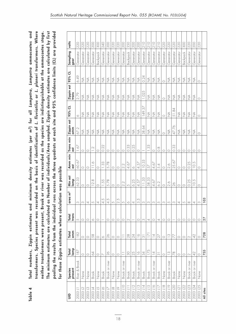
Scottish Natural Heritage Commissioned Report No. 055 (ROAME No. F03LG04)
Tab
le 5
Zip
pin
d
ensi
ty
esti
ma
tes
for
am
mo
coet
es
and
tr
ans
form
ers
sam
ple
d
fro
m
each
q
uad
rat
(Q)
at
full
q
uant
ita
tive
si
tes.
9
5%
co
nfid
ence
lim
its
(CL)
are
pro
vid
ed f
or
tho
se Z
ipp
in e
stim
ate
s w
here
ca
lcul
ati
on
wa
s p
oss
ible
UID
Q1
Zipp
in
95%
CL
Q1
Zipp
in
95%
CL
Q2
Zipp
in
95%
CL
Q2
Zipp
in
95%
CL
Q3
Zipp
in
95%
CL
Q3
Zipp
in
95%
CL
Zipp
in e
st
95%
CL
Zipp
in e
st95
% C
Les
t am
mes
t tra
nses
t am
mes
t tra
nses
t am
mes
t tra
nsTo
tal a
mm
Tota
l am
m
2003
L136
.69
2.11
NA
NA
105.
2110
.87
00
70.9
331
.61
NA
NA
67.2
62.
796.
49
2003
L14
NA
NA
NA
NA
14.6
946
.08
NA
NA
27.6
411
4.84
NA
NA
38.6
414
9.37
1.02
50.
24
2003
L18
00
00
00
00
00
00
00
00
2003
L20
NA
NA
NA
NA
108.
9641
2.59
00
50.3
714
2.29
00
47.7
651
.84
NA
NA
2003
L25
00
00
00
00
00
00
00
00
Tab
le 6
Ca
tch
per
uni
t ef
fort
(C
PUE)
exp
ress
ed a
s fi
sh p
er m
inut
e sa
mp
ling
for
thos
e si
tes
whe
re s
emi-
qua
ntit
ati
ve s
am
plin
g w
as
und
erta
ken
site
UID
area
sam
pled
m2
Tim
e fi
shed
CPU
E la
mp
CPU
E am
mC
PUE
tran
sSa
mpl
ing
gear
volts
habi
tat
qual
ity
Ard
och
Burn
2003
L2
310
00
0G
ener
ator
220
subo
ptim
alC
oile
chat
Bur
n20
03 L
34
100
00
Gen
erat
or22
0su
bopt
imal
Kelti
e W
ater
2003
L4
515
4.27
3.87
0.4
Gen
erat
or20
0su
bopt
imal
Gre
enoc
k bu
rn20
03 L
54
120
00
Back
pack
300
subo
ptim
alA
rdch
ulla
rie20
03 L
64.
510
0.7
0.6
0.1
Gen
erat
or24
0su
bopt
imal
Cal
air
Burn
2003
L7
4.5
151.
731.
730
Gen
erat
or20
0su
bopt
imal
Imm
eroi
n Bu
rn20
03 L
85
100
00
Gen
erat
or22
0su
bopt
imal
Kirk
ton
Burn
2003
L9
2.5
100
00
Gen
erat
or22
0su
bopt
imal
Mon
achy
le B
urn
2003
L10
515
0.73
0.73
0G
ener
ator
200
subo
ptim
alA
lt C
arna
ig20
03 L
116
152
1.87
0.13
Back
pack
350
sub-
optim
alRi
ver
Larig
2003
L12
415
1.67
1.6
0.07
Gen
erat
or20
0su
b-op
timal
Inve
rloch
larig
Bur
n20
03 L
133.
515
1.07
1.07
0G
ener
ator
200
sub-
optim
alLo
ch V
enac
har
2003
L15
315
11.6
711
.40.
27G
ener
ator
210
optim
alM
ilton
Bur
n20
03 L
163
101.
41.
40
Gen
erat
or21
0su
b-op
timal
Dru
nkie
Bur
n20
03 L
175
152.
071.
80.
27G
ener
ator
210
optim
alBl
ack
Wat
er20
03 L
195
150.
860.
860
Gen
erat
or22
0su
b-op
timal
Fing
las
Wat
er20
03 L
214
100
00
Gen
erat
or22
0su
b-op
timal
Fing
las
Rese
rvoi
r20
03 L
225
150
00
Back
pack
300
optim
alLo
ch A
chra
y20
03 L
238
150.
130.
130
Gen
erat
or22
0op
timal
Ach
ray
Wat
er20
03 L
244
152.
82.
80
Gen
erat
or20
0su
b-op
timal

Table 7 Summar y of f ish species encountered at salmon sampling sites
site UID Salmon Trout Minnow Eel
Keltie Water 2003 S1 yes yes no no
Sruth Geal 2003 S2 yes yes no no
Greenock Burn 2003 S3 no yes no no
Leny Burn 2003 S4 yes yes yes no
Ardchullarie 2003 S5 yes yes yes no
Allt Mor 2003 S6 yes yes yes no
Immeroin Burn 2003 S7 no yes no no
Allt Fathan Ghlinne 2003 S8 yes yes no no
Allt a Ghlinne Dhuibh 2003 S9 yes yes no no
Kirkton Burn 2003 S10 yes yes no no
Alt Carnaig 2003 S11 yes yes yes no
Invernenty Burn 2003 S12 yes yes yes no
Alt Sgoinie 2003 S13 yes yes no no
Ishag Burn 2003 S14 yes yes no no
Alt a Chuilinn 2003 S15 yes yes no no
Milton Burn 2003 S16 no yes no no
Drunkie Burn 2003 S17 no yes yes yes
20
Scottish Natural Heritage Commissioned Report No. 055 (ROAME No. F03LG04)

Tab
le 8
Det
ail
s a
nd l
oca
tio
n o
f sa
lmo
n su
rvey
sit
es
Dat
esi
teU
IDsi
te l
ocat
ion
100k
m2
East
ing
Nor
thin
gA
ltitu
detim
e
fish
ed
13/
10/
2003
Kelti
e W
ater
2003
S1
50m
dow
nstre
am fr
om b
ridge
lead
ing
to q
uarry
just
upstr
eam
from
ford
NN
2651
070
520
6515
13/
10/
2003
Srut
h G
eal
2003
S2
from
dire
ctly
und
erne
ath
road
brid
ge u
p to
poo
l bel
ow la
rge
wat
erfa
llN
N26
550
7076
590
15
07/
10/
2003
Gre
enoc
k Bu
rn20
03 S
3do
wns
tream
from
roa
dbrid
ge,
fishe
d 10
0m s
ectio
n up
to w
ithin
20m
of b
ridge
NN
2637
070
520
7515
07/
10/
2003
Leny
Bur
n20
03 S
4do
wns
tream
from
roa
dbrid
ge,
fishe
d to
with
in 5
0m o
f brid
geN
N26
150
7081
570
15
17/
10/
2003
Ard
chul
larie
2003
S5
site
loca
ted
dow
nstre
am fr
om r
oad
brid
ge:
fishe
d up
to w
ithin
30m
of b
ridge
NN
2582
571
365
130
15
17/
10/
2003
Allt
Mor
2003
S6
sam
pled
are
a di
rect
ly u
pstre
am fr
om b
ridge
with
cyc
le tr
ack
NN
2564
071
440
230
15
20/
10/
2003
Imm
eroi
n Bu
rn20
03 S
7sta
rted
sam
plin
g 15
m u
pstre
am fr
om c
onflu
ence
with
Cal
air
Burn
and
con
tinue
d up
strea
mN
N25
340
7177
519
015
26/
10/
2003
Allt
Fath
an G
hlin
ne20
03 S
8sta
rted
sam
plin
g 50
m u
pstre
am fr
om c
onflu
ence
with
Ghl
inne
Dhu
ibh
NN
2510
571
695
270
15
26/
10/
2003
Allt
a G
hlin
ne D
huib
h20
03 S
9sta
rted
sam
plin
g 50
m u
pstre
am w
ith c
onflu
ence
with
Allt
Fath
an G
hlin
neN
N25
110
7168
527
015
17/
10/
2003
Kirk
ton
Burn
2003
S10
starte
d sa
mpl
ing
15m
ups
tream
from
con
fluen
ce w
ith R
iver
Bal
vag
NN
2535
572
070
130
15
23/
10/
2003
Alt
Car
naig
2003
S11
30m
from
loch
side
and
sam
pled
up
from
the
area
whe
re g
rave
l has
bee
n ex
tract
edN
N24
625
7188
513
015
22/
10/
2003
Inve
rnen
ty B
urn
2003
S12
starte
d 50
m u
pstre
am fr
om fe
ncel
ine
in s
traig
hten
ed s
ectio
n an
d co
ntin
ued
for
30m
NN
2455
071
830
140
15
23/
10/
2003
Alt
Sgoi
nie
2003
S13
fishe
d 20
m d
own
and
upstr
eam
from
foot
brid
geN
N24
380
7179
014
015
22/
10/
2003
Ishag
Bur
n20
03 S
14fis
hed
sect
ion
50m
dow
nstre
am fr
om s
heep
fold
up
to w
here
cha
nnel
spl
itsN
N24
150
7176
017
015
22/
10/
2003
Alt
a C
huili
nn20
03 S
15fis
hed
from
50m
ups
tream
of c
onflu
ence
with
Riv
er L
arig
NN
2384
071
640
280
15
08/
10/
2003
Milt
on B
urn
2003
S16
fishe
d fro
m a
ppro
x 10
0m d
owns
tream
from
roa
dbrid
ge to
with
in 3
0m o
f roa
dbrid
geN
N25
740
7059
590
15
08/
10/
2003
Dru
nkie
Bur
n20
03 S
17fis
hed
from
app
rox
50m
dow
nstre
am o
f wei
r, up
to w
eir
struc
ture
NN
2564
070
501
9015
21
Scottish Natural Heritage Commissioned Report No. 055 (ROAME No. F03LG04)

22
Scottish Natural Heritage Commissioned Report No. 055 (ROAME No. F03LG04)
Tab
le 9
Tota
l nu
mb
ers
of
salm
on
and
tro
ut f
ry (
und
erye
arl
ing
) a
nd p
arr
(1
+ y
ear
and
old
er)
enco
unte
red
dur
ing
15
min
utes
of
elec
tric
fish
ing
in
typ
ica
l ju
veni
le s
alm
on
hab
ita
ts a
t ea
ch s
ite,
and
a m
easu
re o
f re
lati
ve a
bun
da
nce
of
each
as
CPU
E (c
atc
h p
er m
inut
esa
mp
ling
)
Site
UID
Tota
lSa
lmon
Sa
lmon
C
PUE
tota
l C
PUE
CPU
E To
tal
trou
tTr
out
fry
Trou
t pa
rrC
PUE
tota
l C
PUE
CPU
E sa
lmon
fry
parr
salm
onSa
lmon
Sa
lmon
tr
out
Trou
t fr
yTr
out
parr
fry
parr
Kelti
e W
ater
2003
S1
104
8123
6.93
5.40
1.53
88
00.
530.
530.
00
Srut
h G
eal
2003
S2
5536
193.
672.
401.
2751
4011
3.40
2.67
0.73
Gre
enoc
k Bu
rn20
03 S
30
00
0.00
0.00
0.00
132
119
138.
807.
930.
87
Leny
Bur
n20
03 S
411
096
147.
336.
400.
9327
243
1.80
1.60
0.20
Ard
chul
larie
2003
S5
93
60.
600.
200.
4055
523
3.67
3.47
0.20
Allt
Mor
2003
S6
2211
111.
470.
730.
7317
161
1.13
1.07
0.07
Imm
eroi
n Bu
rn20
03 S
70
00
0.00
0.00
0.00
1410
40.
930.
670.
27
Allt
Fath
an G
hlin
ne20
03 S
84
04
0.27
0.00
0.27
4232
102.
802.
130.
67
Allt
a G
hlin
ne D
huib
h20
03 S
95
05
0.33
0.00
0.33
2824
41.
871.
600.
27
Kirk
ton
Burn
2003
S10
7351
224.
873.
401.
478
53
0.53
0.33
0.20
Alt
Car
naig
2003
S11
3329
42.
201.
930.
2730
273
2.00
1.80
0.20
Inve
rnen
ty B
urn
2003
S12
4545
03.
003.
000.
0016
142
1.07
0.93
0.13
Alt
Sgoi
nie
2003
S13
2920
91.
931.
330.
606
42
0.40
0.27
0.13
Ishag
Bur
n20
03 S
1430
1020
2.00
0.67
1.33
2015
51.
331.
000.
33
Alt
a C
huili
nn20
03 S
1534
2113
2.27
1.40
0.87
123
90.
800.
200.
60
Milt
on B
urn
2003
S16
00
00.
000.
000.
0037
289
2.47
1.87
0.60
Dru
nkie
Bur
n20
03 S
170
00
0.00
0.00
0.00
98
10.
600.
530.
07
All
site
s5
53
40
31
50
51
24
32
80

Figure 1 Length frequencies for Lampetra ammocoetes (top) and transformers (bottom)from all sites combined
23
Scottish Natural Heritage Commissioned Report No. 055 (ROAME No. F03LG04)

Figure 2 Length frequencies for salmon and trout from all sites combined
24
Scottish Natural Heritage Commissioned Report No. 055 (ROAME No. F03LG04)

REFERENCES
European Committee for Standardization (CEN) (2002). Water Quality – Sampling Fish with ElectricityDocument 02/568019.
Fraser, N.H.C., Metcalfe, N.B. & Thorpe, J.E. (1993). Temperature-dependent switch between diurnaland nocturnal foraging in salmon. Proceedings of the Royal Society of London. Series B. BiologicalSciences, 252, 135–139.
Gardiner, R. (2003). Identifying Lamprey. A Field Key for Sea, River and Brook Lamprey. ConservingNatura 2000 Rivers Conservation Techniques Series No. 4. English Nature, Peterborough.
Gardiner, R., Taylor, R. & Armstrong, J. (1995). Habitat assessment and survey of lamprey populationsoccurring in areas of conservation interest. FRS Report 4/95 to Scottish Natural Heritage, April 1995.
Harvey, J. & Cowx, I. (2003). Monitoring the River, Brook and Sea Lamprey, Lampetra fluviatilis, L. planeriand Petromyzon marinus. Conserving Natura 2000 Rivers Monitoring Series No. 5. English Nature,Peterborough.
Heggenes, J. et al (1993). Homeostatic behavioural responses in a changing environment: brown trout(Salmo trutta) become nocturnal during winter. Journal of Animal Ecology, 62, 295–308.
Maitland, P. S. & Lyle, A. A. (2000). Distribution of lampreys in the River Teith. Report to Scottish NaturalHeritage. Scottish Natural Heritage.
Zippin, C. (1958). The removal method of population estimation. Journal of Wildlife Management, 22,82–90.
25
Scottish Natural Heritage Commissioned Report No. 055 (ROAME No. F03LG04)

APPENDIX 1 – Site photographs
26
Scottish Natural Heritage Commissioned Report No. 055 (ROAME No. F03LG04)
Site UID 2003 L1 Blairdrummond lade.
Site UID 2003 L2 Ardoch Burn.
Site UID 2003 L3 Coilechat.

27
Scottish Natural Heritage Commissioned Report No. 055 (ROAME No. F03LG04)
Site UID 2003 L4 Keltie Water. Site UID 2003 S1 is located immediately upstream in faster water.
Site UID 2003 S2 Sruth Geal. No lamprey habitat present.

28
Scottish Natural Heritage Commissioned Report No. 055 (ROAME No. F03LG04)
Site UID 2003 L5 Greenock Burn and site UID S3. Two discrete patches of sediment and leaf litter were located and surveyed forlampreys. Salmon sampling took place in a number of riffle and run areas throughout a 50m section.
Site UID 2003 L6 Ardchullarie Burn. Site UID 2003 S5: Salmon sampling took place in the riffles and runs either side of this area of sediment.
Site 2003 S4 Leny Burn. No lamprey habitat present.

29
Scottish Natural Heritage Commissioned Report No. 055 (ROAME No. F03LG04)
Site UID 2003 S6 Allt Mor. No lamprey habitat present.
Site UID 2003 L8 Immeroin Burn. Site UID 2003 S7 salmon sampling took place immediately upstream of this sediment patch in thefaster water.
Site UID 2003 L7 Calair Burn.

30
Scottish Natural Heritage Commissioned Report No. 055 (ROAME No. F03LG04)
Site UID 2003 S9 Ghlinne Dhuibh. No lamprey habitat present.
Site UID 2003 S8 Allt Fathan Ghlinne. No lamprey habitat present.

31
Scottish Natural Heritage Commissioned Report No. 055 (ROAME No. F03LG04)
Site UID 2003 L9 Kirkton Burn. Site UID 2003 S10 salmon sampling was carried out in faster water surrounding this site.
Site UID 2003 L11Allt Carnaig. Site UID 2003 S11 salmon sampling took place immediately upstream in faster water.
Site UID 2003 L10 Monachyle Burn.

32
Scottish Natural Heritage Commissioned Report No. 055 (ROAME No. F03LG04)
Site UID 2003 S12 Invernenty Burn. No lamprey habitat present.
Site UID 2003 L12 River Larig.

33
Scottish Natural Heritage Commissioned Report No. 055 (ROAME No. F03LG04)
Site 2003 S13 Allt Sgionie. No lamprey habitat was present.
Site UID 2003 S14 Ishag Burn. No lamprey habitat was present.
Site UID 2003 L13 Inverlochlarig Burn.

34
Scottish Natural Heritage Commissioned Report No. 055 (ROAME No. F03LG04)
Site UID 2003 S15 Alt a Chuilinn. No lamprey habitat was present.
Site UID 2003 L14 Eas Gobhain.
Site UID L15 Loch Venachar.

35
Scottish Natural Heritage Commissioned Report No. 055 (ROAME No. F03LG04)
Site UID L16 Milton Burn. Site UID 2003 S16 salmon sampling was carried out in the sections of fast water immediatelydownstream of this site.
Site UID 2003 L17 Drunkie Burn. Site UID 2003 S17 salmon sampling was carried out in faster water immediately downstreamfrom this site.
Site UID 2003 L18 Loch Drunkie.
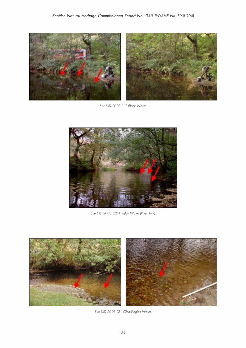
36
Scottish Natural Heritage Commissioned Report No. 055 (ROAME No. F03LG04)
Site UID 2003 L20 Finglas Water (River Turk).
Site UID 2003 L21 Glen Finglas Water.
Site UID 2003 L19 Black Water.

37
Scottish Natural Heritage Commissioned Report No. 055 (ROAME No. F03LG04)
Site UID 2003 L24 Achray Water.
Site UID 2003 L22 Glen Finglas Reservoir.
Site UID 2003 L23 Loch Achray.

38
Scottish Natural Heritage Commissioned Report No. 055 (ROAME No. F03LG04)
Site UID 2003 L25 Glengyle Burn.

APPENDIX 2 – Field recording sheets for lamprey and salmon sur vey sites
39
Scottish Natural Heritage Commissioned Report No. 055 (ROAME No. F03LG04)

40
Scottish Natural Heritage Commissioned Report No. 055 (ROAME No. F03LG04)

41
Scottish Natural Heritage Commissioned Report No. 055 (ROAME No. F03LG04)

42
Scottish Natural Heritage Commissioned Report No. 055 (ROAME No. F03LG04)

43
Scottish Natural Heritage Commissioned Report No. 055 (ROAME No. F03LG04)

44
Scottish Natural Heritage Commissioned Report No. 055 (ROAME No. F03LG04)

45
Scottish Natural Heritage Commissioned Report No. 055 (ROAME No. F03LG04)

46
Scottish Natural Heritage Commissioned Report No. 055 (ROAME No. F03LG04)

47
Scottish Natural Heritage Commissioned Report No. 055 (ROAME No. F03LG04)

48
Scottish Natural Heritage Commissioned Report No. 055 (ROAME No. F03LG04)

49
Scottish Natural Heritage Commissioned Report No. 055 (ROAME No. F03LG04)

50
Scottish Natural Heritage Commissioned Report No. 055 (ROAME No. F03LG04)

51
Scottish Natural Heritage Commissioned Report No. 055 (ROAME No. F03LG04)

52
Scottish Natural Heritage Commissioned Report No. 055 (ROAME No. F03LG04)
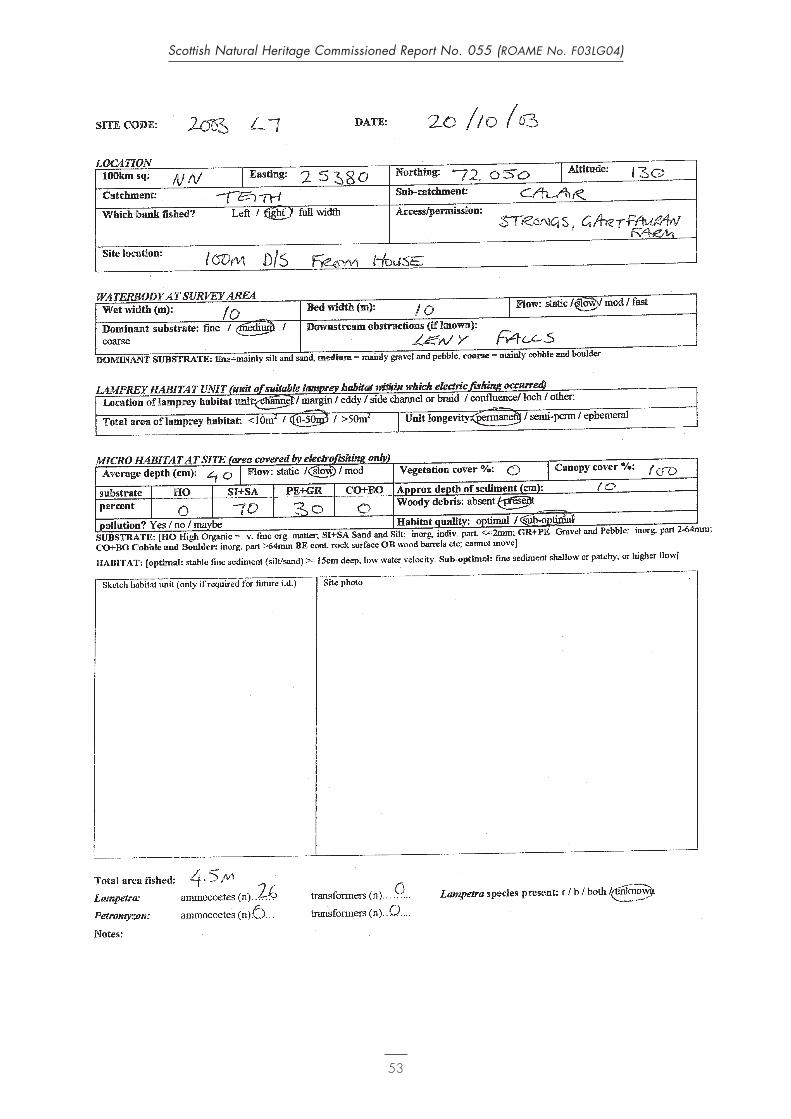
53
Scottish Natural Heritage Commissioned Report No. 055 (ROAME No. F03LG04)

54
Scottish Natural Heritage Commissioned Report No. 055 (ROAME No. F03LG04)

55
Scottish Natural Heritage Commissioned Report No. 055 (ROAME No. F03LG04)

56
Scottish Natural Heritage Commissioned Report No. 055 (ROAME No. F03LG04)

57
Scottish Natural Heritage Commissioned Report No. 055 (ROAME No. F03LG04)

58
Scottish Natural Heritage Commissioned Report No. 055 (ROAME No. F03LG04)

59
Scottish Natural Heritage Commissioned Report No. 055 (ROAME No. F03LG04)

60
Scottish Natural Heritage Commissioned Report No. 055 (ROAME No. F03LG04)

61
Scottish Natural Heritage Commissioned Report No. 055 (ROAME No. F03LG04)

62
Scottish Natural Heritage Commissioned Report No. 055 (ROAME No. F03LG04)

63
Scottish Natural Heritage Commissioned Report No. 055 (ROAME No. F03LG04)

64
Scottish Natural Heritage Commissioned Report No. 055 (ROAME No. F03LG04)
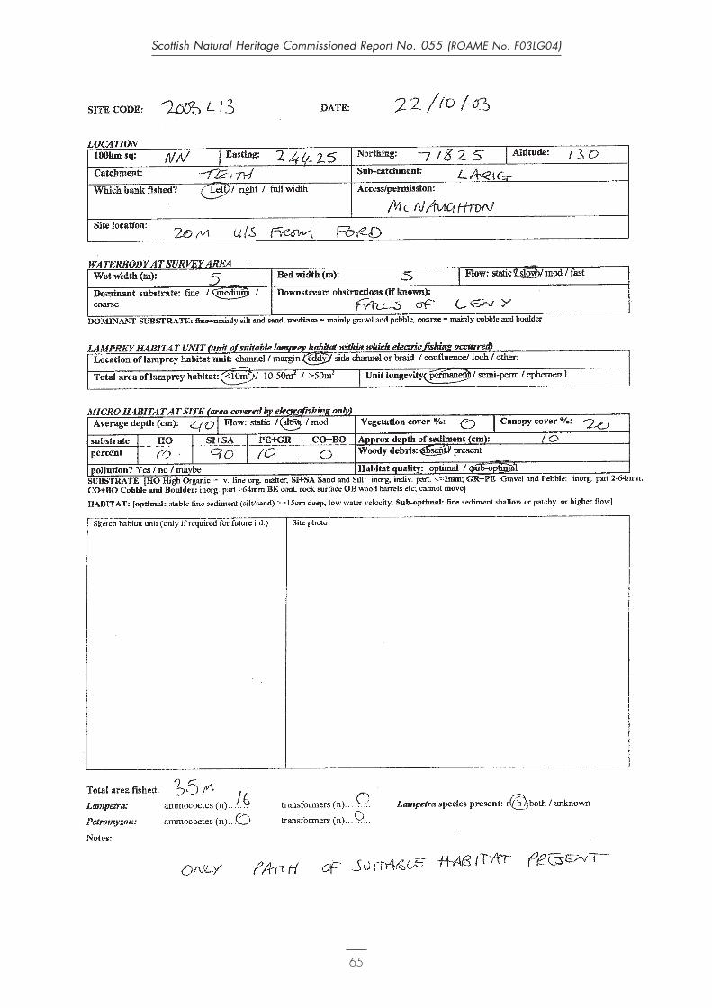
65
Scottish Natural Heritage Commissioned Report No. 055 (ROAME No. F03LG04)

66
Scottish Natural Heritage Commissioned Report No. 055 (ROAME No. F03LG04)

67
Scottish Natural Heritage Commissioned Report No. 055 (ROAME No. F03LG04)

68
Scottish Natural Heritage Commissioned Report No. 055 (ROAME No. F03LG04)

69
Scottish Natural Heritage Commissioned Report No. 055 (ROAME No. F03LG04)

70
Scottish Natural Heritage Commissioned Report No. 055 (ROAME No. F03LG04)

71
Scottish Natural Heritage Commissioned Report No. 055 (ROAME No. F03LG04)

72
Scottish Natural Heritage Commissioned Report No. 055 (ROAME No. F03LG04)
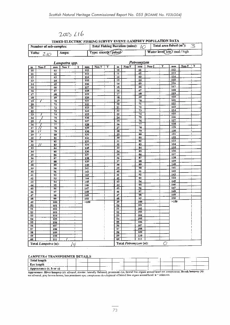
73
Scottish Natural Heritage Commissioned Report No. 055 (ROAME No. F03LG04)

74
Scottish Natural Heritage Commissioned Report No. 055 (ROAME No. F03LG04)