Embed Size (px)
Citation preview

Simulations of met conditions during a Simulations of met conditions during a Houston ozone episode and Houston ozone episode and
the NYC NYC DHS MSG tracer study the NYC NYC DHS MSG tracer study with urbanized MM5 (uMM5)with urbanized MM5 (uMM5)
R. BornsteinR. Bornstein**, R. Balmori , R. Balmori
E. Weinroth, H. TahaE. Weinroth, H. Taha
San Jose State UniversitySan Jose State University
San Jose, CASan Jose, CA
Presented atPresented atAMS Annual MeetingAMS Annual Meeting
January 2008January 2008

AcknowledgementsAcknowledgements
Data Data S. Burian, J. ChingS. Burian, J. Ching TCEQ, USFSTCEQ, USFS D. ByunD. Byun
Urbanization scheme ofUrbanization scheme of A. MartilliA. Martilli S. DupontS. Dupont
Funding:Funding: NSF, USAID, DHS NSF, USAID, DHS

OUTLINEOUTLINE
IntroductionIntroduction Current uMM5 ApplicationsCurrent uMM5 Applications
Houston ozoneHouston ozone NYC tracer studyNYC tracer study
Future: uWRFFuture: uWRF ConclusionConclusion

Recent Meso-met Model Urbanization
Need to urbanizeNeed to urbanize momentum, thermo , & TKE momentum, thermo , & TKE surface & SfcBL diagnostic-Eqs.surface & SfcBL diagnostic-Eqs. PBL prognostic-Eqs. PBL prognostic-Eqs.
Start: Start: veg-canopycanopy model (Yamada 1982) model (Yamada 1982) Veg-param Veg-param replacedreplaced with GIS/RS with GIS/RS
urban-param/data urban-param/data Brown and Williams (1998)Brown and Williams (1998) Masson (2000)Masson (2000) Martilli et al. (2001) in Martilli et al. (2001) in TVM/URBMETTVM/URBMET Dupont, Ching,Dupont, Ching, et al. (2003) in et al. (2003) in EPA/MM5EPA/MM5 Taha et al. (2005), Balmori et al. (2006) in Taha et al. (2005), Balmori et al. (2006) in
uMM5:uMM5:detailed input urban-parameters as f(x,y)
for two applications

uMM5 for Houston (AMS uMM5 for Houston (AMS 2007)2007)
Goal:Goal: Accurate urban/rural temps & winds for Accurate urban/rural temps & winds for Aug 2000 OAug 2000 O33 episode via episode via uMM5uMM5 Houston Houston LU/LC & urban morphology LU/LC & urban morphology
parameters from S. Burianparameters from S. Burian TexAQS2000TexAQS2000 field-study data field-study data USFS USFS urban-reforestation scenarios urban-reforestation scenarios
UHI & OUHI & O33 changes changes

uMM5 Simulation period: uMM5 Simulation period: 22-26 August22-26 August
20002000 Model configuration Model configuration
5 domains: 108, 36, 12, 4, 5 domains: 108, 36, 12, 4, 1 km1 km (x, y) grid points: (x, y) grid points:
(43x53, 55x55, 100x100, 136x151, 133x141(43x53, 55x55, 100x100, 136x151, 133x141 full-full- levels: 29 in D 1-4 & 49 in D-5; levels: 29 in D 1-4 & 49 in D-5; lowest ½ lowest ½
level=7 mlevel=7 m 2-way feedback in D 1-42-way feedback in D 1-4
Parameterizations/physics optionsParameterizations/physics options > Grell cumulus (D 1-2)> Grell cumulus (D 1-2) > ETA or MRF PBL (D 1-4)> ETA or MRF PBL (D 1-4) > > Gayno-Seaman PBLGayno-Seaman PBL (D-5) > Simple ice moisture, (D-5) > Simple ice moisture, > urbanization module> urbanization module NOAH LSM > RRTM radiative NOAH LSM > RRTM radiative
coolingcooling InputsInputs
> NNRP Reanalysis fields, ADP obs data > NNRP Reanalysis fields, ADP obs data > Burian > Burian morphologymorphology from from LIDAR building-data in D-5LIDAR building-data in D-5
> LU/LC modifications (from Byun)> LU/LC modifications (from Byun)

GC GC influences: smallinfluences: small Air-mass movement: Air-mass movement:
First First along-shorealong-shore (to west) from: flow along(to west) from: flow along
N-edge of N-edge of cold-core atm-lowcold-core atm-low Then: Ship-Channel to Houston by Then: Ship-Channel to Houston by
Bay BreezeBay Breeze & & UHI-convergence UHI-convergence max Omax O33 Finally: to NW of Houston Finally: to NW of Houston by Gulf Breezeby Gulf Breeze
D-5: UTC episode-day obs of meso Omeso O33 transport-patterns: transport-patterns:
influences of sea breeze & UHI-convergence

Urbanized Urbanized Domain 5:Domain 5: near-sfc 3-PM V, 4-days near-sfc 3-PM V, 4-days
EpisodeEpisode dayday
Cold-LCold-L
HotHot CoolCool

1 km uMM5 Houston UHI: 8 PM, 21 1 km uMM5 Houston UHI: 8 PM, 21 AugAug
Upper L:Upper L: MM5MM5 UHI (2.0 UHI (2.0 K)K)
Upper R: Upper R: uMM5 uMM5 UHI (3.5 UHI (3.5 K)K)
Lower L: Lower L: ((uMM5-MM5)uMM5-MM5) UHIUHI
LU/LC LU/LC errorerror

Base-case (current) veg-cover (0.1’s) urban min (red) rural max (green)
Modeled changes of veg-cover (0.01’s) > Urban-reforestation (green)> Rural-deforestation (purple)
min
maxincrease

Run 12 (urban reforestation) minus Run 10 (base case): Run 12 (urban reforestation) minus Run 10 (base case): 2-m ∆T at 4 PM2-m ∆T at 4 PM
reforested central urban-area reforested central urban-area coolscools & &surrounding deforested rural-areas surrounding deforested rural-areas warmwarm

UHI(t) for Base-case minus Runs 15-UHI(t) for Base-case minus Runs 15-1818
U1
sea
Ru
U2
• UHI =UHI = Average-T in urban-box minus that in Average-T in urban-box minus that in rural-box rural-box • Runs 15-18:Runs 15-18: different urban re-forestation different urban re-forestation scenariosscenarios• UHIUHI=Run-17 UHI minus Run-13 UHI (max =Run-17 UHI minus Run-13 UHI (max effect)effect) • Reduced UHIReduced UHI lower max-Olower max-O33 (not shown) (not shown)
EPA emission-reduction credits EPA emission-reduction credits $ $ savedsaved
Urban temp difference between runs at location 1 (3-pt smoothing)
-1.2
-1.0
-0.8
-0.6
-0.4
-0.2
0.0
0.2
0.4
0.6
0.8
20 0 4 8 12 16 20 0 4 8 12 16
LST
Tdi
ff (K
)
run14-run13s
run15-run13s
run16-run13s
run17-run13s
run18-run13s
Max-impact of –0.9 K of a 3.5 K Noon-UHI, of which1.5 K was from uMM5

uMM5 for NYC DHS MSG uMM5 for NYC DHS MSG UDSUDS
Goal:Goal: Accurate urban/rural temps & Accurate urban/rural temps & winds winds
for for 9-15 March ‘05 tracer releases via uMM5uMM5 NYC NYC LU/LC & urban morphology LU/LC & urban morphology
parameters from S. Burianparameters from S. Burian DHS MSG UDS DHS MSG UDS field-study data field-study data
met met tracertracer

GC influences during tracer periodsGC influences during tracer periods Midtown: weak, slow synoptic speedMidtown: weak, slow synoptic speed MSGMSG: strong, fast synoptic speeds: strong, fast synoptic speeds
Sea breeze & UHI influencesSea breeze & UHI influences Midtown: strong, with UHI-convergence Midtown: strong, with UHI-convergence MSGMSG: weak : weak
Urban-barrier influencesUrban-barrier influences Midtown: weakMidtown: weak MSGMSG: strong, with urban barrier divergence: strong, with urban barrier divergence
Modeling studies byModeling studies by Midtown: Pullen, Holt, Thompson at NRLMidtown: Pullen, Holt, Thompson at NRL MSGMSG: This presentation : This presentation (4 km at GMU07)(4 km at GMU07)
Obs of UDS Tracer Periods

NYC uMM5 DHS UDS MSG: NYC uMM5 DHS UDS MSG: 9-15 March9-15 March ‘05 ‘05 Model configuration Model configuration
4 domains: 36, 12, 4, 4 domains: 36, 12, 4, 1 km1 km (x, y) grid points: (x, y) grid points:
(110x85, 91x91, 91x91, 33x33)(110x85, 91x91, 91x91, 33x33) full-full- levels: 29 in D 1-3 & 48 in D-4; levels: 29 in D 1-3 & 48 in D-4; lowest ½ lowest ½
level=7 mlevel=7 m 2-way feedback in D 1-32-way feedback in D 1-3
Parameterizations/physics optionsParameterizations/physics options > Grell cumulus (D 1-2)> Grell cumulus (D 1-2) > ETA or MRF PBL (D 1-4)> ETA or MRF PBL (D 1-4) > > Gayno-Seaman PBLGayno-Seaman PBL (D-5) > Simple ice moisture, (D-5) > Simple ice moisture, > urbanization module> urbanization module NOAH LSM > RRTM radiative NOAH LSM > RRTM radiative
coolingcooling InputsInputs
> NNRP Reanalysis fields, ADP obs data > NNRP Reanalysis fields, ADP obs data > Burian > Burian morphologymorphology from from LIDAR building-data in D-5LIDAR building-data in D-5
> LU/LC modifications (from Byun)> LU/LC modifications (from Byun)
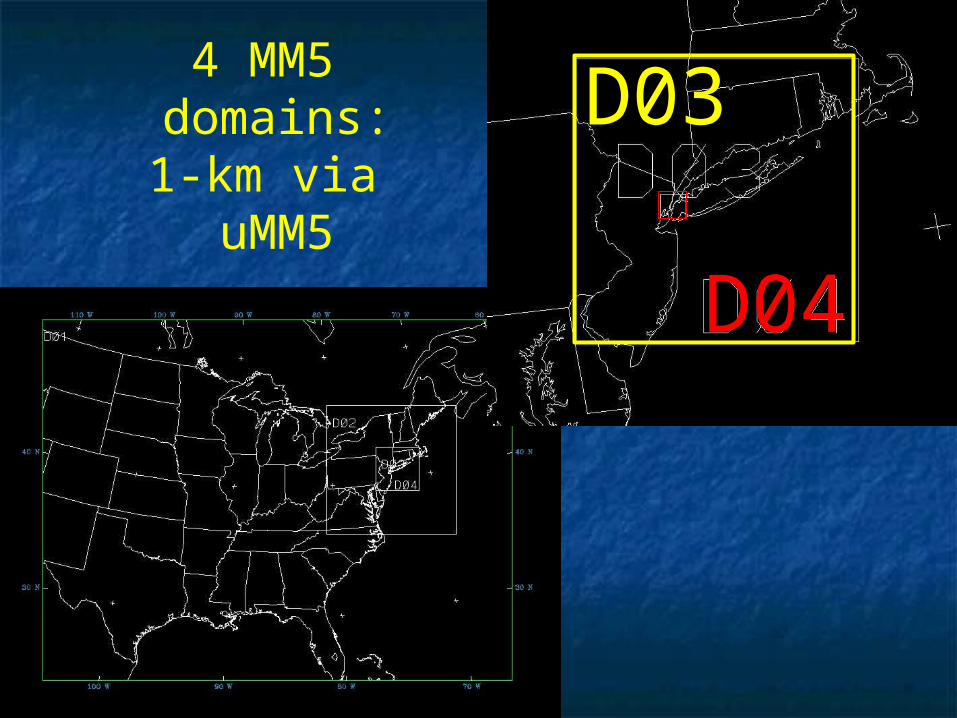
D04
D034 MM5
domains:1-km via
uMM5

14 EST, 3/14 EST, 3/1111/05, /05, 4 km4 km MM5: Sfc-T(K) MM5: Sfc-T(K) & synoptic & synoptic wave-cyclonewave-cyclone V ( flag = 5 V ( flag = 5
m/s)m/s)
WWWW
CC

Concurrent 4 km MM5 Streamlines Concurrent 4 km MM5 Streamlines z = 60 m AGL z = 60 m AGL
A
BSlowing & divergence
Downwind convergence

Concurrent 4 km MM5 Speed (flag = 5 m/s) Concurrent 4 km MM5 Speed (flag = 5 m/s) at 60 (left) & 700 (right) m AGLat 60 (left) & 700 (right) m AGL
slowslow slowslow
fastfastfastfast

NWS 700 hPa 3/NWS 700 hPa 3/1010/05: 00 & 12 /05: 00 & 12 UTCUTC
00 UTC = 19 EST00 UTC = 19 ESTon 3/9/05on 3/9/05
12 UTC = 07 12 UTC = 07 ESTEST
on 3/10/05on 3/10/05

MM5 36-km & NWS: Sfc, 3/10/05MM5 36-km & NWS: Sfc, 3/10/05
07 EST07 EST
13 EST13 EST

1 km uMM5 Domain1 km uMM5 Domain
Change in Change in synoptics?synoptics?

1 km uMM5 Domain1 km uMM5 Domain

1 km1 km uMM5 Speed (flag = 5 m/s) & T (K) uMM5 Speed (flag = 5 m/s) & T (K)09 EST, 3/09 EST, 3/1010/05, 4 levels/05, 4 levels
UHIUHI

1 km uMM5 Speed (flag = 5 m/s): 1 km uMM5 Speed (flag = 5 m/s): 1010 EST, 3/ EST, 3/1010/05, 4 /05, 4 levelslevels
SLOWSLOW

1 km uMM5 Speed (flag = 5 m/s) & Con/Div (1/s)1 km uMM5 Speed (flag = 5 m/s) & Con/Div (1/s)11 EST, 3/11 EST, 3/1010/05, 4 levels/05, 4 levels
CONCON

1 km uMM5 Speed (flag = 5 m/s) & w (m/s)1 km uMM5 Speed (flag = 5 m/s) & w (m/s)11 EST, 3/11 EST, 3/1010/05, 4 levels/05, 4 levels
UPUP

1 km uMM5 Speed (flag = 5 m/s) & T (K)1 km uMM5 Speed (flag = 5 m/s) & T (K)09 EST, 3/09 EST, 3/1414/05, 4 levels/05, 4 levels
UHIUHI

1 km uMM5 Speed (flag = 5 m/s): 1 km uMM5 Speed (flag = 5 m/s): 1010 EST, 3/ EST, 3/1414/05, 4 /05, 4 levelslevels
SLOWSLOW
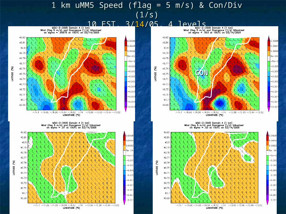
1 km uMM5 Speed (flag = 5 m/s) & Con/Div (1/s)1 km uMM5 Speed (flag = 5 m/s) & Con/Div (1/s)10 EST, 3/10 EST, 3/1414/05, 4 levels/05, 4 levels
CONCON

1 km uMM5 Speed (flag = 5 m/s) & w (m/s)1 km uMM5 Speed (flag = 5 m/s) & w (m/s)11 EST, 3/11 EST, 3/1010/05, 4 levels/05, 4 levels
UPUP

Summary of MSGSummary of MSG
Weak UHI Weak UHI small acceleration small acceleration Strong urban zStrong urban z00 & barrier effects & barrier effects
deceleration deceleration convergence convergence up up motion motion

SJSU (MM5 or uMM5) SJSU (MM5 or uMM5) met output fields are availablemet output fields are available
for ozone (design-day cases) and/or for ozone (design-day cases) and/or
4-D BCs for CFD &/or quick 4-D BCs for CFD &/or quick ER-modelsER-models forfor
SFBA (MM5)SFBA (MM5) Houston (Houston (uMM5uMM5)) NYC (NYC (uMM5uMM5)) LA Basin (MM5)LA Basin (MM5) Israel (RAMS & MM5)Israel (RAMS & MM5)

Future: uWRFFuture: uWRFuWRF with NCAR (F. Chen) uWRF with NCAR (F. Chen)
Martilli-Dupont urbanizationMartilli-Dupont urbanization Burian lidar urban-parameters as f(x,y)Burian lidar urban-parameters as f(x,y) Taha stat-generalization of Burian urban-Taha stat-generalization of Burian urban-
parameters for areas w/o lidar-obsparameters for areas w/o lidar-obs Freedman PBL-turbulence scheme into Freedman PBL-turbulence scheme into
Mellor-YamadaMellor-Yamada Zilitinkevich SfcBL stability-functions, zZilitinkevich SfcBL stability-functions, zoh, ,
etc.etc. Steyn diagnostic hSteyn diagnostic hi(x,y) scheme(x,y) scheme SST (x,y,t) from J. PullenSST (x,y,t) from J. Pullen

ThanksThanksQuestions?Questions?