Embed Size (px)
Citation preview
~ .. ..
A PROPOSAL
FOR
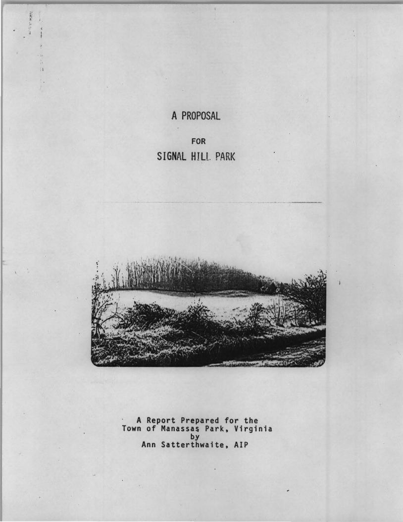
SIGNAL HILL PARK
A Report Prepared for the Town of Manassas Park, Virginia
by Ann Satterthwaite, AIP

INDEX
Surmaary
Descriptive Background
Recreation Needs and Potentials
Historic Significance
Schematic Plan
Acquisition and Development Program
Appendix
MAPS
No. l -- Manassas Park Open Space .System Plan
No. 2 -- Signal Hill, with trenches
No. 3 -- 1892 Plat for Signal Hill
No. 4 -- Signal Hill Park Schematic Plan
No. 5 -- Signal Hill Park ·overall Acquisition Plan

SU11111ary
The Town of Manassas Park proposes to acquire Signal Hill and adjacent
protective. property for a park for outdoor recreation use. The proposed Signal
Hill Park consists of 433.15 acres. The core section for i0111ediate acquisition
consists of 106.44 acres estimated to cost $560,000.
Signal Hill, a wooded ridge with 366' elevation, is a physical and
historic landmark in the Manassas area. Located in gently undulating country
which is fast developing into merging clusters of townhouses, apartments, houses
and shopping centers, Signal Hill is a significant terrain feature visible from
many points in the nearby area. Signal Hill, named for its famous Civil War
signal station, today retains its Civil War trenches and fortifications in I
remarkably good condition.
A park at Signal Hill can provide a passive outdoor recreation area, ... . .
protect the historic hill and its surroundings, and p~eserve the natural beauty
of the rural environment disappearing at a rapid rate in one of the fastest ~
growing areas in Prince William County and in the Washington metropolitan region. :.> -
The Town of Manassas Park hopes that with its initiative and efforts, :J •
as well as with state and federal assistance, a park can be created .at Signal . " ...... ....
Hill. Such a park can help meet the outdoor recreation needs of this part of
·' Prince William County which is desperately short of public outdoor recr,eation
areas today, and will be even more desperately short in the future.

Descriptive Background
The proposed Signal Hill Park is located west of Manassas Park in Prince
William County, about two miles from both Manassas Park and Manassas, and 25
miles from Washington.
The proposed park area consists of~ 4JJ.2 acre area of rolling open
fields, with occasional woods crowned by the ridge of Signal Hill. A ~irt road,
Route #616, currently traverses the site. It ·is a typical northern Viryinia
countryside -- pleasing,. gentle, and well tended by past generations. -·· -·- ·- ---

Its vi.ews, for which the Civil i·lar signal station was sited, stretch
past the nearby r idges to the distant Bull Run Mountains.
A 1 tho.ugh Si gna 1 Hi 11 and its surrounding area represent typi ca 1 northern
Virginia countryside, this countryside is becoming part of histor;_y with the rapid
pace of development. Prince William County's population doubled between 1960 and
1970, and is projected to more than t riple between 1970 and 1990, reaching a
population level of 430,000. In just five ·years -- from 1970-75 -- the. Manassas
planning area is expected to grow from 37,000 to 56,000, a 50 percent growth.
The evidence of this burgeoning development can be seen near Manassas Park and -; -
Si gna 1 H11 l .

To identify, plan and program outdoor recreation areas to meet the needs
of such a changing area 1s a difficult task. The Prince Will iam County Plann.ing
Department recognizes the recreation and O?an space needs of the Signal Hill area
by design.ting it 1 low densi ty zone and in its new draft Environmental Manage
ment Plan as a historic site, close to a major environmental area.
However, the steps to assure .. the.'protectfon of Signal Hill and the en
hancement of its recreation and open space opportunities have been taken by the
compact, working class town of Manassas Park.
,. I
_ _ _ /> __ _
Manassas Park 1s a proud, small conmunity (one square mile and 6,844
people in 1970), composed of a young (17.9 median age} .pop~lation, with 1970
median income of $10,376 ~nd 11.1 years of education, who live in 1,536 nearly
identical houses on 75' by 175' lots, built mostly in the ~950s after World War

II. It 1s this town which has provided land for the first county public library
building, swi1t111ing pool and active recreation program for its residents; main
~ained a high .quality of environment• and now wants to provide broadened open
space opportun1.t1es and new satisfying environmental amenities in acquisition
of Signal Hill Park for present and futur·e1 ~enerations· •.
,

Recreation Needs and Potential s
Outdoor recreation is the primary purpose for the proposed Signal Hill
Park.
Simple outdoor recreation attl~i1ties ~ like- wai~ing, picnicking and sight-- .. " ' .:.... , .• • ~-. Q~~ ~ P-11< ,, ., .,, ..•• .,. ; •. • r·
seeing would be the primary1· act1vit1es · at 'Sign~1 · A'111 ;:._the very activities .. . .; . '') .. , . : - .,,. . .
which the Outdoor Recreation Resources 'Review Convnission and the Bureau of - ' 'r,. .
Outdoor Recreation foOnd·'to be the most popular outdoor recreation activities, . -
regardless of ·1ncome, education, age or occupation. And ft f s these simple
outdoor recreation activities which ORRRC found to be most urgently needed near . .. . . . "' . . ~.... . ,; . . .
metropolitan areas. P1tri1ckfrig' wfth<.: the family_, walking in the open fields, o o, ~ .. , - O ,N ... • .. :":; : '
0o 0
•: - , .. f.. ... ;.• - ~,. O .~ · ' '•:t \ o?
following the signs of .the nature .trail; exploring the trenches, glimpsi ng at
past history, look·ingi-,acro~s .;to ; th~ bl~~,. haie'~ o:f/l~;~eu1(·Run: Mo1mtains --., ., :~ • .. 0 ; '
1.. ' .~ • ~ 'I• ; . 1,\.!l /' ·, :;, ,.• ~ · ~
these are the activities ·whkh''Signal · HilrParlf' carl"'offer. They provide the
escape,outlets and revf.goration so needed in the urban wo~ld.
The provision of open space and these outdoor recreation opportunities
at Signal Hill is espe~ially significant because of th~ compelling recreation . . . .
• .. .. ,, ·. ~ ~ · J~ .. ... .- i -~ . : . . 'J. ~' . •
needs in that part· of Prince William County. Signal Hill, located in the . •; ........ 1·::.,, r ; •. ~ · A.: ~~.""· --o ·~r ·,·~r',, ~" . ,i ...:t ...
Manassas Planning Area,. ·1·s·· irf'ont!' of the ·iargestaand ' fastest growing areas in
Pri nee Wi 11 i am County · ~..: :~i ch a 1 so has : the-=·i'.~~~~s-fJp~~ii!aJd deficit in the . ~ .. ::- .; ,., ~ ::. ~n ··r .. .; "l. .. •p,: .:· =:t, :. ~-t 1 .: ?"'~~: ~ .. ,. : :';-·.;:i
county, according · to ·open Space 1990; · A Comprehens1ve ·Park and Open Space Plan, •; ": ... .,.. ' f ,,.: I ._ • . • • ""\ IJ"f ~ I ' ,.. , ... 1• ' .. • \' ,.: • : ~
a county park plan completecJ"iri"l970." ' '' The Manassas .. Planning Area in this plan .. .... .:. .. . r·, .. ·. . .... :- ... . .... · . , _.
has a 1970 population -of ·37;000, with a park land .deficit of 555 acres and a
projected 1975 population of 56,000, with a proportionately larger deficit.
This defi~it is not being met by Prince William County. The 1970 county park
plan has not been approved by the county supervisors, nor has any comprehensive
acquisition program been launched.

The Town of Manassas Park, therefore, recognizing the need for open
space and outdoor recreation. has taken the initiative to assure adequate out
door recreation in its vicinity. It has followed an important finding of the
Outdoor Recreation Resources Review Comn1ssion: . ; ; t. ..
"Local government" according . :. ! ... \ 4 I., ,.~ f
to the ORfiRC Report, "has an ifllpor:.ta.nt responsibility for" providing adequate : .. .'.'" ! "'d . . : ... :2 .:.j . "'. " ; ·, ; ~· .. . .
outdoor recreation oppor-tun1ties. .Almqst every conmunity has suitable resources: J ~ .... / .:; .l -: • -·
small parks, places ~ ~~ere ~r~ture is not disturbed and where grass, trees and
bushes grow, and people can~ ~~lk, play or picnic. But many of these features
are giving way to the big subdivision, the industrial plant, the highway, the
airport, or the shopping center. The loss of natural assets narrows the oppor
tunity for physical exercise .qr ~s~a~e from tensions of urban living. But . ~.. . : .... ~ .• .:i 1'1r:· t:. .
• .. • • • ~ • '. ,I • • ' •
thoughtful and effectjye , Jocal~ lao~ . use pla~ning, zoning and pro~ramming can . • '. .. I. . . : ;.: I • } ~ ·• ; •• • 4 - • ,.. • •
often restore to a COll'1Jl.!n),ty, regardless of ~ts size or loc·ation, the natural • l
1·A':, 1 ·• .: ;_; :· , · : L :. : (.',"'.. , -
features that contribute so much to 1 ~aking an urban environment a better and
healthier place."
As Central Park is an island of open space in a dense urban city, so
Signal Hill can be· seen as a future island of open space amid'st dense suburban . . -
development. Signal H.·Hl, hpw~v~r . .s i.s not viewed as merely an isolated park, I •,, V : ; t t 1' (; f' ( • • './ • I
• • • \.r '.:._ • .. ,; I ..
but rather a 1 ink in ~ SYiSt~ 9-{. qpen space and parks, as· now envisioned by the .. . •. , V •)f~. ~j) 'J :~···~ (i'.":") r . ,, .. j:,.. , · ..
Town of Manass.as Par~. "fb~ following map indicates this system and its relation
to the Town of Mana~~§ iW:~:

,, :t ) ,• ~
.~i~ 4 } ·• ·'-· -~
-~· ~ .; ·•'t" . d! ~· .,,.. ·:.;-~P'·
·'· k ,·
-~
·.1:· .. i
\~~:~:f : • .. I
~ .' . ·.-t.·' '., .. · .... '
: ::: ··"
' ' ':' ·' ·r::: .. . i
. I
··'
·· ··-----
·--· - ·-
~ .. , ...
.. ' .. w
---~-
- .. '.\'::,•.· . .". ~ 't - ···- • : . : . --~·.
'-
-..----......-·· -.-~·-,
516NAL HILL
r.r .··.·.-·~ •.
CIRC,... lbGr>Z
: ~' -· .. ---:-· .-· . , ...

I
\ \
, .
f; >'. ,, ~
:•
' .'
The historical significance of Signal Hill has not always been
respected, as can be seen in Map #3, showing the plat for Signal Hill .and
adjacent land prepared in 1892 and still valid today.
A park at ~ignal Hill cannot only preserve the historic hill, but
also can provide opportunities for historic interpretation and restoration.
Despite the fact that Signal Hill is an integral part of Civil War history
in northern Virginia, the National Park Service cannot acquire Signa·1 Hill.
"Because this area is far beyond our Congressionally authorized boundary,"
says Richard E. Hoffman, Superintendent of Manassas National Battlefield Park,
"we have no authority or possibility of authority to preserve this historical
resource. Despite our deep interest in seeing it protected, we could only
hope that local action would be initiated. • • The National Park Service is
pleased that the local cOlllllunity is taking steps to preserve Signal Hilj •••
Our local co111T1unity should be congratulated for their efforts to insure that
this resource is preserved, and we would lend our encouragement and moral
support to this worthy cause."
..

1· .
r . • ,.
1·
' ..
_,,· \
..
.. , ·,
,.
:,.·
' . ' .,
.. , "
'' . . . " .. ..
• •" ; ' I f
.. ,( f : .. i i · I
..I ·;
,.
.•
. :·
~ ..... ' • ·: t • •
. ·· f,
'ts. ,, •
..
,' . ·"
. :
i· . ..
•. i
. ....
.. :
... ·,·: ... . "
. , .
. · ·.
··.• ,;. i . · J ....
" .. . ...
~ ", .
., . ' I ' ,' l ~· • .' I •;
• '.' ... • .. .. ' :
.-··· ·. ,.
·.· i ,.
·"
. ' :
. ' •
I I.
·'· .. I
~ • •• t o 'If I l t
1,,
' . ••• , • .A~ . . t ' .. ,.
,•
·.;
' I l I , . !
~ .' • ', I '
) . !
! ' . ... ·,.: . • • •, j •? '
~ . . ' ·I
" . I I ,' I • ·i . : .
\ .. ,, \ ' I ~ ' ·, ,: :
,,. : I I . . .. I .... . I .·:
I .. ' . ..
' . ...
t .:
•'.
~ I '
·. 1 I ·. . i ,.: . J: '. t
"· '~ ' ' . I . ·.· ,• • L 1· •! ' ! . .·· . . . ;I :• 1· I '•''
1' I ' I. ·.=. '· ·1 I , .
t •• •
1';/
' '
.. . '
" I I i'~ ~ .' . .
" I . I :i ' I I .. .
'", • 1 .... \, I . . 'I
,· , .. : . . . ' ,t' .j
i· . r I , ~· ~· . ' I
,:: . "I I •• I ·. ~ ~ . ·! . t
___ ....:.;:..:._ :.. •'

. Historical Signffi cance
Although other ridges offering opportunities for outdoor recreation and
environmental enhancement exist in northern Virginia, the historical signifi
cance of Signal Hill makes it a unique park site.
Signal Hill was the site of the Confederate signal station from which
the first message ever spel l ed out by flag conmunication on a battlefield was
sent during the Battle of First Manassas. Signalling between sites had peen in
use since the Trojan Wars, but at Sif1nal Hill signalling in a field situation
was tried for the first time in history -- and successfully.
Signal Hill, known as Wilcoxen Signal Station, was one of three stations
set up early in July, 1861, behind the Bull Run Defense Line by Captain E. P.
Alexander, an ordnance officer assigned to signal duty, later to'be a brigadier
general and then chief of a~tillery for Longstreet's Corps. Captain Alexander,
in his memoirs, described Signal Hill~ his own headquarters and base station in
the Battle of Manassas: • "About a mile east of Manassas, on a farm of a Mr. Wilcoxen,
was a high, rocky point having a good outlook over a valley to the North and West. I made this point a central station and by a little clearing here and there, got two straight six mile ranges. One was Northwest to a bluff over Bull Run valley on the extreme line of battle -- one in rear of McLean's Ford and one near Van Ness's house on a bluff a few hundred yards to the left and rear of Stone Bridge. Beyond the latter station, the broad level valley of Bull Run for some miles with its fields and pastures, as seen through the glass, was foreshortened into a narrow band of green."
Peering through his telescope at this view· from Signal Hill, Captain
Alexander, on the morning of July 21, 1961, was able to see the main Union
attack sweeping around the Confederate flank. He quickly sent a message to
the Van Pe 1 t Tower, "Look out for your 1 eft, you are turned. 11 This wai"ni ng

\ ... ..
I .,
enabled Colonel Nathan Evans, co1T111ander at Van Pelt Hill-Stone Bridge, to shift
his men to meet the Union at tack heci.d on.
Thus, ·signal Hill played a pivotal role in the Battle of First Manassas.
"Had it not been for the alert work 9f:an off!~e~ .. stationed at Signal Hill, the .. .
Union flanking attack may not have been discovere.d .. .and. the outcome of the battle • ·• ,j r ~: •: .. -~~• ~ •
would almost certainly have been differ~n.t," according to Richard Hoffman, the
current St1p~·rintendent of the Manassas National Battlefield Park.
Today, Signal Hill is well preserved, with its trenches and fortifica
tions in good condition.

· -~
Schematic Plan , .
The focus of the schematic p 1 an for the proposed S.i gna 1 Hill Park is
the 106.44 acres in the first acquisition phase of the park. This represents
the core of the park for active t!Se ·its it contains most of S.ignal Hill and key ·
land inmediately to the west of Signal Hill. The only other land for active
park use is the backside of Signal Hill, which is proposed for purchase in the
second acquisition phase. Most of the other acquisition proposals are for pro
tective lanrl secured by easements.
The priorities for the schematic plan follow the purposes for which
the park is to be established. These purposes are:
1. Provide open space and passive outdoor recreation.
2. Protect the historic hill.
3. Preserve the natural beauty of the rural environment. ,
4. Enhance the ecological and natural functions.
This cal ls for a natural park with simple developments. As Ma.P #4
indicates, the developments are limited to unobtrusive parking areas a~the
north and south ends of the park, adjacent to Route #6.16; picnic areas; nature
trails and lookouts; restoration of trenches and fortifications; and interpre
tive information on the hill.
Several aspects of the plan $hould be stressed:
1. To maintain the natural amenities of the park and preserve its historic
integrity, the existing Route #616 should be closed to vehicular traffic
through the park. The roadway within the park should be maintained as a
pedestrian way since Civil War records seem to indicate the road to
·wilcoxen's farm was located 'near the alignment of Route #616. Route
#616, if allowed to remain a vehicular road, pres.ents safety hazards,
as well as a jarring intrusion to the pastoral amenities of the park.
Route #616 can be rerouted southeast to Route #689 if an extension is .. considered necessary.

)
2. Clearing of trees in critical areas within the park can provide better
and histori cally accurate vistas. By clearing trees i n some of the
lower sections of the land west of Si gnal Hill, the vistas which
Cdp~ain Al exander saw in 1861 can be opened up. Although Signal Hill 1
itself, was partially wooded, accordi.ng to Captain Alexander's memoirs,
selective clearing of trees, especially at the lookout areas, should
be undertaken.
3. Some restoration work will be necessary on the trenches and fortifica
tions to assure historic accuracy.
4. The open lands should be kept open and farmed, if possible.
5. The entire park and all trails, in particular, should be considered for
nature education. The school system should be involved and adv~ce
should be sought from National Audubon. ' I I ~ '
To assure t~e enhancement of the park's environmental and historic . . . ;. ... ;
amenities and to maintain a quality passive outdoor recreation area, some pro-. .. tective public actions should b~ taken.
The Signal Hill . park area should be designated a critical environmental • •
area by the county and s~~t~, and a his~oric district by the county, state and
federal governments. The precedent of Green Springs should be. followed. . . '. . .-: ~
Route #616 should be made a scenic road. It provides a scenic approach
to the park .
.. All federally funded projects in the vicinity of Signal Hill Park
which could have an impact on Signal Hill should have environmental impact
statements.

1
) 0\ f ..
ICE'f :
P1C.NfC..... /t-2..e'~
&A>A-1-\CS /ltr~ 0 NPfn.>\'l..e 'T2.A"'-~
Loo-=cu T s. u.a • ""'>+ ,~TC"'2-'P2erau s IN.ro
T~~ i?~~~T\O~
PA~' loJ: Q.
.:.·.:
----
I
. , . ,,,
Map No. 4
Schematic Plan for Signal Hill Park
. \ \ ........-}

-
Acquisition and Development Program
The proposed Signal Hill Park encompasses 433.15 acres. The acquisi
tion program, however, is broken into three phases, determined by priority of
recreation need, degree of threat, and availability of financial resources.
PHASE I. 1974 ---Lot Code Estimated Proposed Type on Ma~ #5 Lot Descri~tion Acres Cost of Purchase
A Signal Hill 13.49 $110,000 Fee simple, under option
B Signal Hill West 92 .. 95 450,000 Fee simple, under option
TOTAL 106.44 $560,000
• PHASE II. 1975
c Backside of Signal Hill 10.00 $ 60,000 Fee simple not in A
0 North of Signal Hill 8.50 27,500 Fee simple
TOTAL 18.50 $ 87,500
PHASE III. 1976-9
E South of Signal Hill 13.35 Fee simple
F East Protective 58.86. Easement .
G East Protective 63.00 Easement
H Northeast Protective 48.00 . Easement
I Northwest Protective 58.00 Easer.Jent
J Southwest Protective 67.00 Easement
" TOTAL 308.21

•, I
=•· .. ·:'.· 0 ' I • •;'•
"'
· t I . ..
.. _
. ' ~.
-
Q. , .. . \
~'l ......... . . ""' . '
. J
ii 1'
' II ~ . I
. I
I ..
. :•
: . ~
·-~_. _ ... _~_· _._ ....... ..,

....
The development program will be focussed primarily on t he land to be
purchased in Phase I as it contains the core of the park. The ten acres of
the backside of Signal Hil l , to be purchased in Phase II, has trenches and
fortifications which will require some development work.
As the park is planned as a passive outdoor recreation area, no expen
sive facilities are progranmed at this time. Parking areas, picnic tables,
fireplaces, trails, trench and fortification restoration, tree clearing,
interpretative information and signs will be the bulk of the development
program. The estimated cost is $50,000 •
. ... . ~ - · ..

.I
Appendix
'·
..

Acknowledgements a
The .helpful and supportive advice from the following persons was gratefully received and useda
Henry G. Bibb.er, Planning Director, Prince William County · Rob R, Blackmore, Director, Commonwealth of Virginia, Commission
of Outdoor Recreation Colonel Clark, Planning Department, Prince William County ~oger J. Costello, Mayor, Town of Manassas Park Harry French, Director, Prince W~lliam County Parks and Recreation
Department Prince William County Public Library Reference Division Michael Tennent, Historian, National Park Service, Manassas
National Battlefield Park R. B. Thomas, Jr., R. B. ThJnas, Jr., Ltd, Engineers and Surveyors
..... ...
--- ·---- ------ -------
.~ .... If
"
..
A N A s 5 A s


![Ronen Talmon, Israel Cohen, Sharon Gannot, and …users.math.yale.edu/rt294/SPM_Jul2013.pdfIEEE SIGNAL PROCESSING MAGAZINE [76] juLy 2013 angles, rather than by each individual atom](https://img.dokumen.tips/doc/110x75/5aa372367f8b9a07758e51cb/ronen-talmon-israel-cohen-sharon-gannot-and-usersmathyaleedurt294spm.jpg)