Embed Size (px)
Citation preview
Section 13iLRS Station RepoRtS

13-1
Section 13
iLRS Station RepoRtS
Arequipa, PeruRaul Yanyachi/Universidad Nacional de San Agustin, David Carter/NASA GSFC
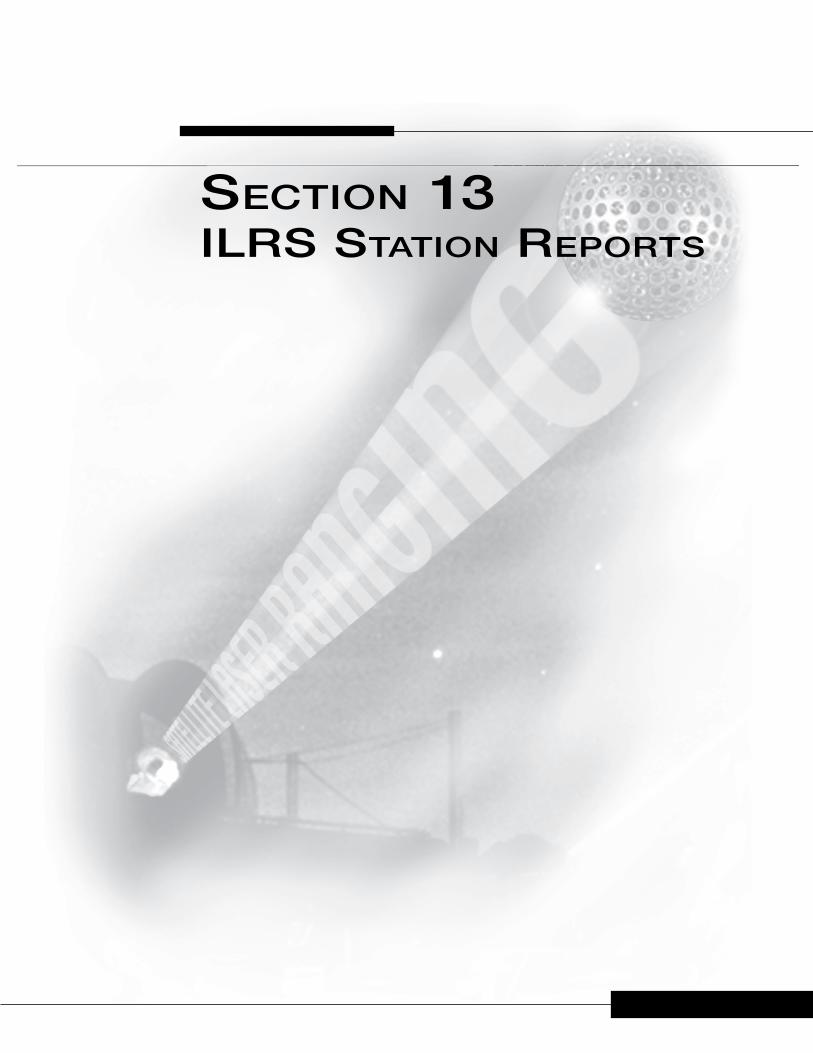
Figure 13-1. TLRS-3 in Arequipa Peru.
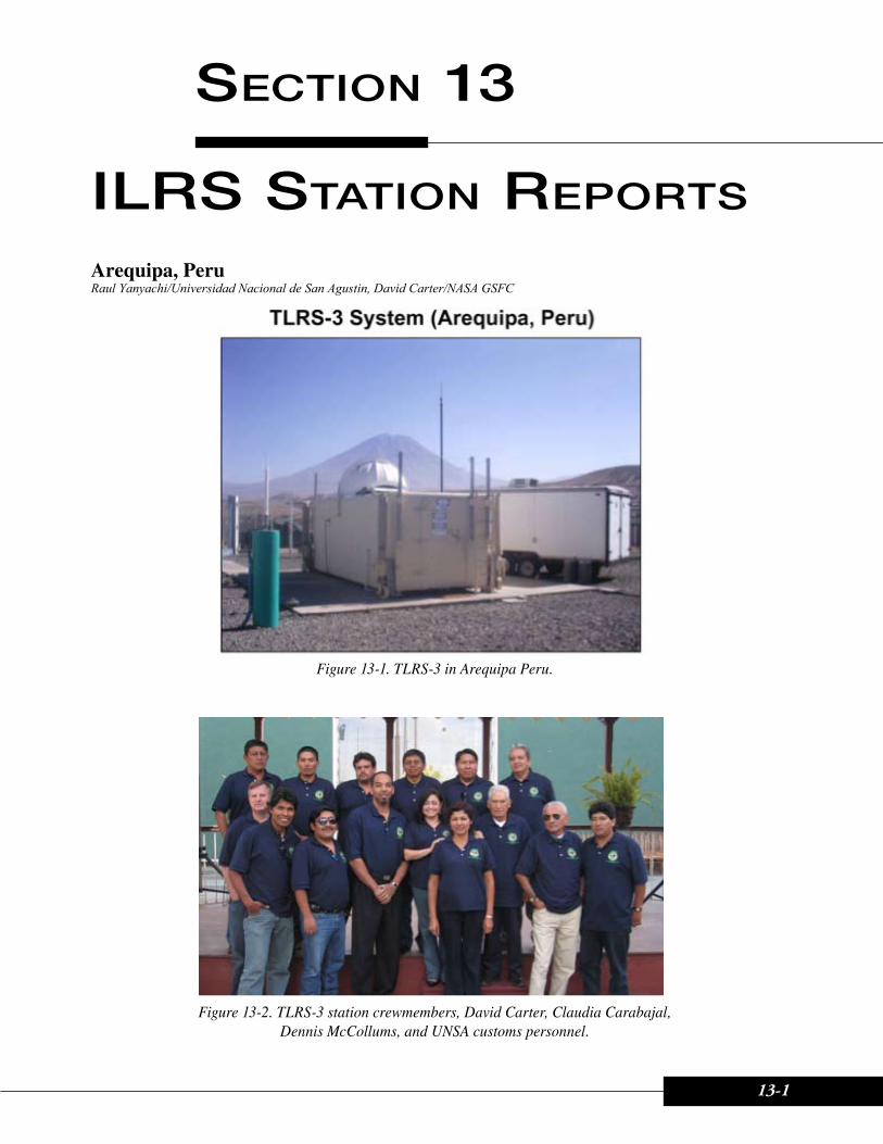
Figure 13-2. TLRS-3 station crewmembers, David Carter, Claudia Carabajal, Dennis McCollums, and UNSA customs personnel.
13-2 2007-2008 ILRS Annual Report
ILRS Station Reports
The TLRS-3 NASA station, located in Arequipa, Peru, officially reopened on February 12, 2007 in a formal re-dedication ceremony, with the presence of local dignitaries and the U.S. ambassador. Dennis McCollums from HTSI arrived in January 2007 to perform repairs and upgrades, while in February 2007 David Carter and Philip Liebrecht from NASA, Julie Horvath from HTSI, and Mike Pearlman from the ILRS, arrived at the station for the reopening ceremony.
During the 2007 and 2008 period, the TLRS-3 system underwent several upgrades and repairs, while steadily tracking satellites. The system was upgraded with a new chiller, a smart UPS, and a calibrated MET3 package. In April 2007, Jim Long and Troy Carpenter, from HTSI, arrived to perform a total station site survey for the TLRS-3 SLR system, the GPS receiver, and the DORIS antenna.
In January 2008, lightning struck near the SLR station and damaged the station power lines. Eventually, many of the station’s systems, including the PC controller, the CAMAC, and the time code generator, began experiencing problems. After several months the problem was solved by performing maintenance on the main transformer, the power panel, and system ground. The power cables were uncovered, replaced and inserted into a new protective tube. The time code generator was also replaced.
At the end of 2007 and early 2008, the crew identified a small telescope mount vibration in elevation due to tachometer problems. This problem became significantly worse by the end of September 2008, and SLR tracking was severely affected and was restricted to only daytime hours.
In March 2008, the SLR station manager, Dr. Raul Yanyachi, traveled to the Goddard Space Flight Center in Greenbelt, Maryland to participate in training at the HTSI facilities on all aspects of the SLR systems, including SLR operations, and SLR system and subsystem repair.
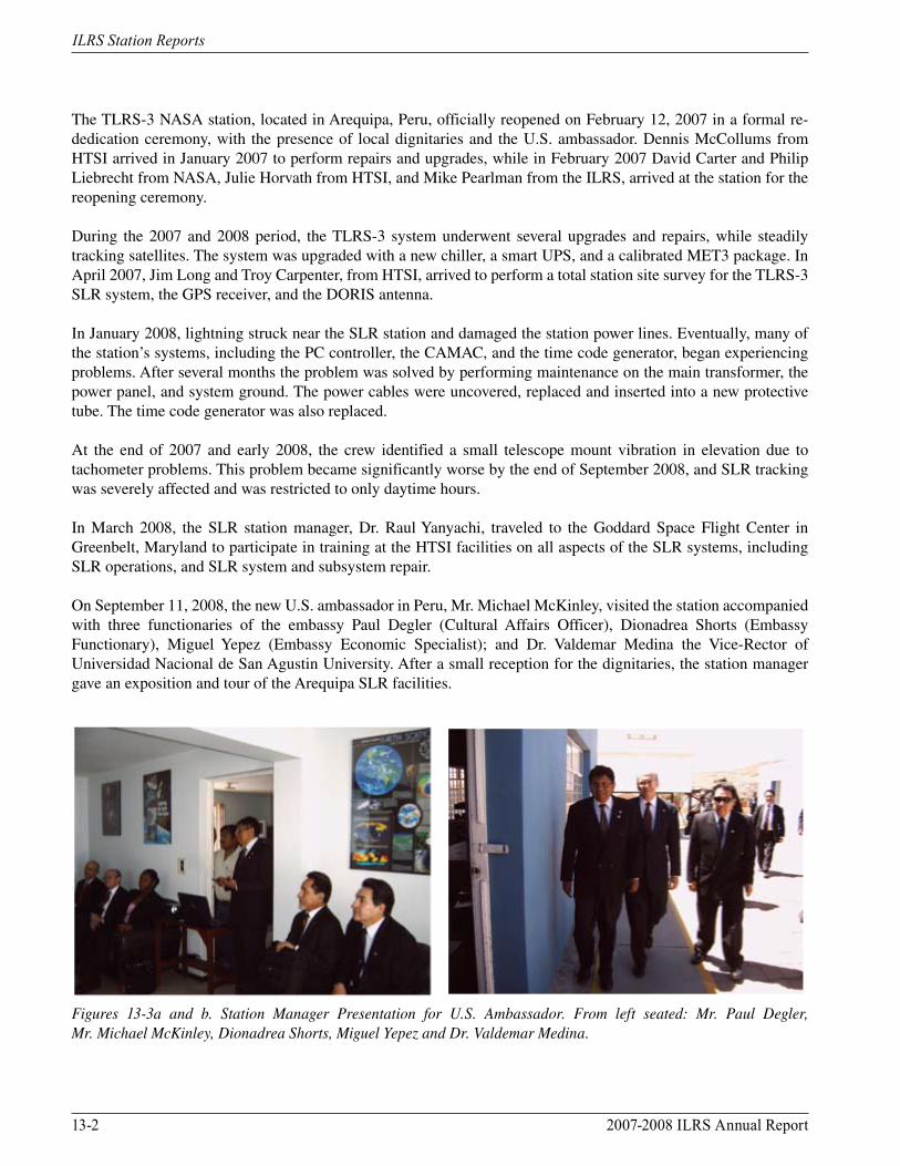
On September 11, 2008, the new U.S. ambassador in Peru, Mr. Michael McKinley, visited the station accompanied with three functionaries of the embassy Paul Degler (Cultural Affairs Officer), Dionadrea Shorts (Embassy Functionary), Miguel Yepez (Embassy Economic Specialist); and Dr. Valdemar Medina the Vice-Rector of Universidad Nacional de San Agustin University. After a small reception for the dignitaries, the station manager gave an exposition and tour of the Arequipa SLR facilities.
Figures 13-3a and b. Station Manager Presentation for U.S. Ambassador. From left seated: Mr. Paul Degler, Mr. Michael McKinley, Dionadrea Shorts, Miguel Yepez and Dr. Valdemar Medina.
2007-2008 ILRS Annual Report 13-3
ILRS Station Reports
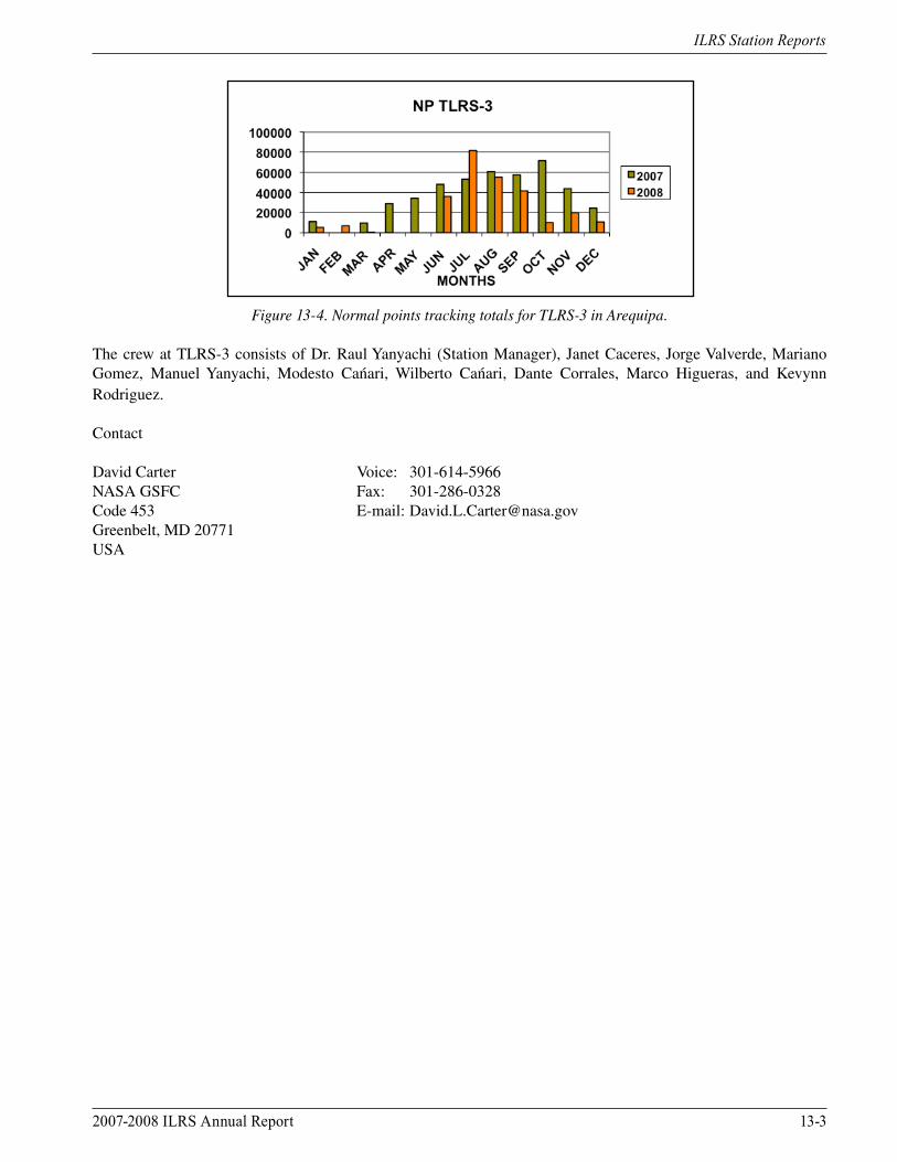
Figure 13-4. Normal points tracking totals for TLRS-3 in Arequipa.
The crew at TLRS-3 consists of Dr. Raul Yanyachi (Station Manager), Janet Caceres, Jorge Valverde, Mariano Gomez, Manuel Yanyachi, Modesto Cańari, Wilberto Cańari, Dante Corrales, Marco Higueras, and Kevynn Rodriguez.
Contact
David Carter Voice: 301-614-5966NASA GSFC Fax: 301-286-0328Code 453 E-mail: [email protected], MD 20771USA
13-4 2007-2008 ILRS Annual Report
ILRS Station Reports
Beijing, ChinaWang Tanqiang, Qu Feng/Chinese Academy of Surveying and Mapping (CASM)
The SLR Observations
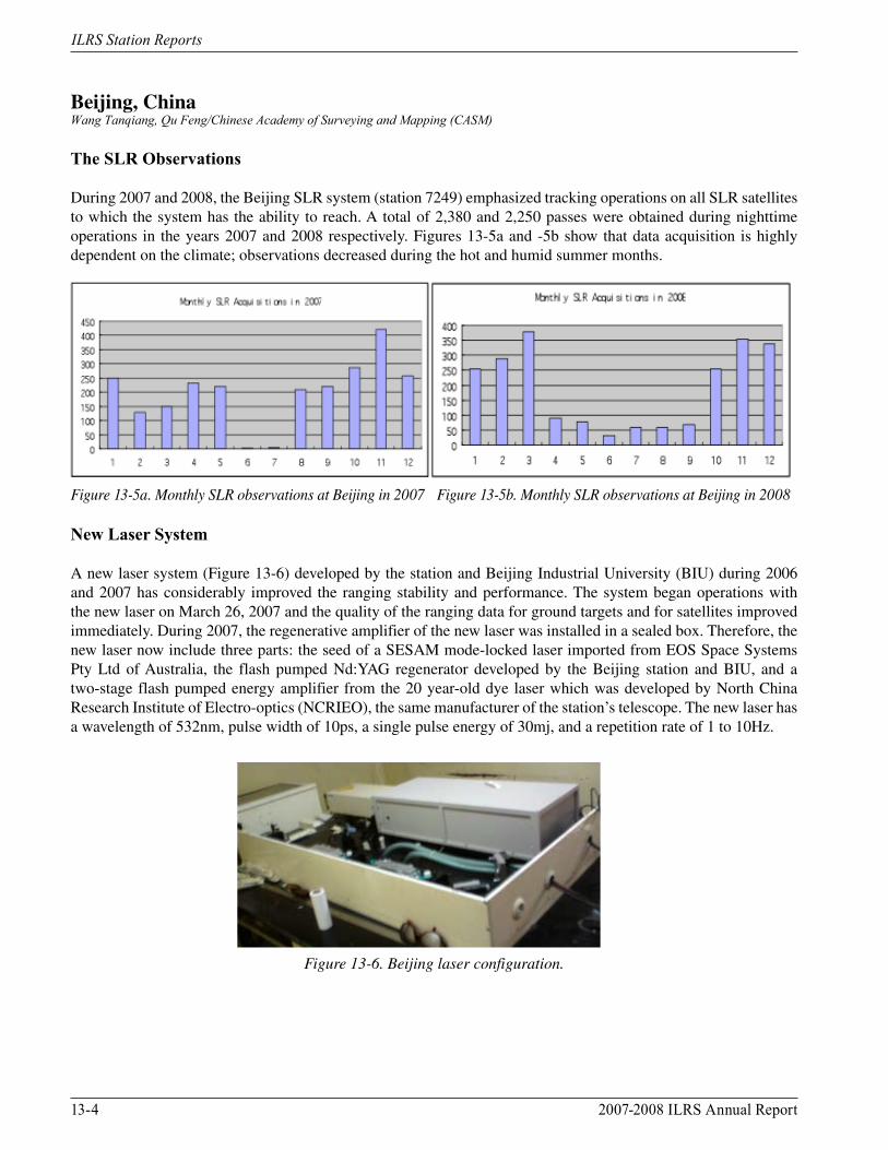
During 2007 and 2008, the Beijing SLR system (station 7249) emphasized tracking operations on all SLR satellites to which the system has the ability to reach. A total of 2,380 and 2,250 passes were obtained during nighttime operations in the years 2007 and 2008 respectively. Figures 13-5a and -5b show that data acquisition is highly dependent on the climate; observations decreased during the hot and humid summer months.
Figure 13-5a. Monthly SLR observations at Beijing in 2007 Figure 13-5b. Monthly SLR observations at Beijing in 2008
New Laser System
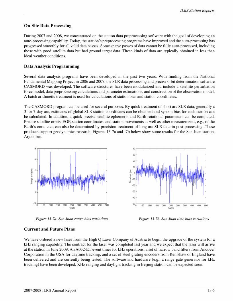
A new laser system (Figure 13-6) developed by the station and Beijing Industrial University (BIU) during 2006 and 2007 has considerably improved the ranging stability and performance. The system began operations with the new laser on March 26, 2007 and the quality of the ranging data for ground targets and for satellites improved immediately. During 2007, the regenerative amplifier of the new laser was installed in a sealed box. Therefore, the new laser now include three parts: the seed of a SESAM mode-locked laser imported from EOS Space Systems Pty Ltd of Australia, the flash pumped Nd:YAG regenerator developed by the Beijing station and BIU, and a two-stage flash pumped energy amplifier from the 20 year-old dye laser which was developed by North China Research Institute of Electro-optics (NCRIEO), the same manufacturer of the station’s telescope. The new laser has a wavelength of 532nm, pulse width of 10ps, a single pulse energy of 30mj, and a repetition rate of 1 to 10Hz.
Figure 13-6. Beijing laser configuration.
2007-2008 ILRS Annual Report 13-5
ILRS Station Reports
On-Site Data Processing
During 2007 and 2008, we concentrated on the station data preprocessing software with the goal of developing an auto-processing capability. Today, the station’s preprocessing programs have improved and the auto-processing has progressed smoothly for all valid data passes. Some sparse passes of data cannot be fully auto-processed, including those with good satellite data but bad ground target data. These kinds of data are typically obtained in less than ideal weather conditions.
Data Analysis Programming
Several data analysis programs have been developed in the past two years. With funding from the National Fundamental Mapping Project in 2006 and 2007, the SLR data processing and precise orbit determination software CASMORD was developed. The software structures have been modularized and include a satellite perturbation force model, data preprocessing calculations and parameter estimations, and construction of the observation model. A batch arithmetic treatment is used for calculations of station bias and station coordinates.
The CASMORD program can be used for several purposes. By quick treatment of short arc SLR data, generally a 3- or 7-day arc, estimates of global SLR station coordinates can be obtained and system bias for each station can be calculated. In addition, a quick precise satellite ephemeris and Earth rotational parameters can be computed. Precise satellite orbits, EOP, station coordinates, and station movements as well as other measurements, e.g., of the Earth’s core, etc., can also be determined by precision treatment of long arc SLR data in post-processing. These products support geodynamics research. Figures 13-7a and -7b below show some results for the San Juan station, Argentina.
Figure 13-7a. San Juan range bias variations Figure 13-7b. San Juan time bias variations
Current and Future Plans
We have ordered a new laser from the High Q Laser Company of Austria to begin the upgrade of the system for a kHz ranging capability. The contract for the laser was completed last year and we expect that the laser will arrive at the station in June 2009. An A032-ET event timer for kHz operations, a set of narrow band filters from Andover Corporation in the USA for daytime tracking, and a set of steel grating encoders from Renishaw of England have been delivered and are currently being tested. The software and hardware (e.g., a range gate generator for kHz tracking) have been developed. KHz ranging and daylight tracking in Beijing station can be expected soon.

13-6 2007-2008 ILRS Annual Report
ILRS Station Reports
Contact
Prof. Qu Feng Voice: +0086-10-88217725Beijing Station Fax: +0086-10-68218654Chinese Academy of Surveying and Mapping (CASM) E-mail: [email protected] 16 Beitaiping Road 100039 BeijingCHINA
2007-2008 ILRS Annual Report 13-7
ILRS Station Reports
Borowiec, PolandStanislaw Schillak/ Space Research Centre, Polish Academy of Sciences
Introduction
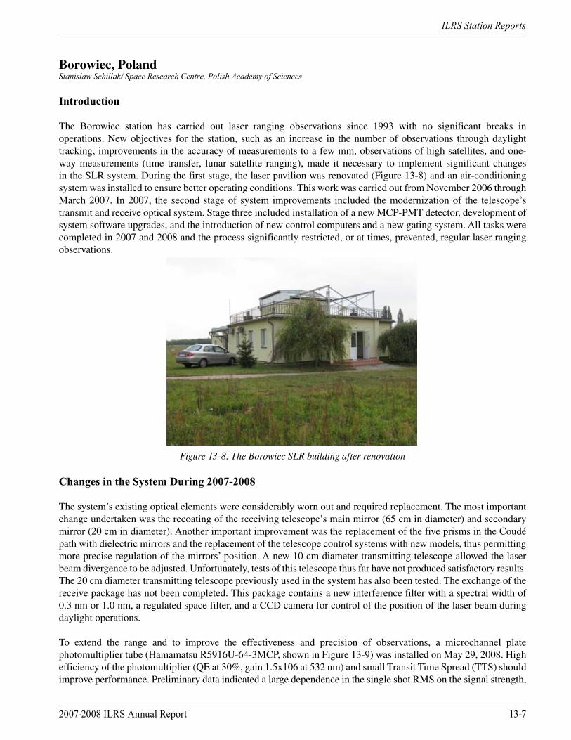
The Borowiec station has carried out laser ranging observations since 1993 with no significant breaks in operations. New objectives for the station, such as an increase in the number of observations through daylight tracking, improvements in the accuracy of measurements to a few mm, observations of high satellites, and one-way measurements (time transfer, lunar satellite ranging), made it necessary to implement significant changes in the SLR system. During the first stage, the laser pavilion was renovated (Figure 13-8) and an air-conditioning system was installed to ensure better operating conditions. This work was carried out from November 2006 through March 2007. In 2007, the second stage of system improvements included the modernization of the telescope’s transmit and receive optical system. Stage three included installation of a new MCP-PMT detector, development of system software upgrades, and the introduction of new control computers and a new gating system. All tasks were completed in 2007 and 2008 and the process significantly restricted, or at times, prevented, regular laser ranging observations.
Figure 13-8. The Borowiec SLR building after renovation
Changes in the System During 2007-2008
The system’s existing optical elements were considerably worn out and required replacement. The most important change undertaken was the recoating of the receiving telescope’s main mirror (65 cm in diameter) and secondary mirror (20 cm in diameter). Another important improvement was the replacement of the five prisms in the Coudé path with dielectric mirrors and the replacement of the telescope control systems with new models, thus permitting more precise regulation of the mirrors’ position. A new 10 cm diameter transmitting telescope allowed the laser beam divergence to be adjusted. Unfortunately, tests of this telescope thus far have not produced satisfactory results. The 20 cm diameter transmitting telescope previously used in the system has also been tested. The exchange of the receive package has not been completed. This package contains a new interference filter with a spectral width of 0.3 nm or 1.0 nm, a regulated space filter, and a CCD camera for control of the position of the laser beam during daylight operations.
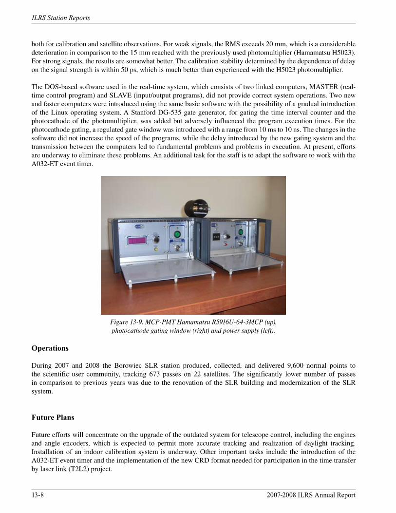
To extend the range and to improve the effectiveness and precision of observations, a microchannel plate photomultiplier tube (Hamamatsu R5916U-64-3MCP, shown in Figure 13-9) was installed on May 29, 2008. High efficiency of the photomultiplier (QE at 30%, gain 1.5x10⁶ at 532 nm) and small Transit Time Spread (TTS) should improve performance. Preliminary data indicated a large dependence in the single shot RMS on the signal strength,
13-8 2007-2008 ILRS Annual Report
ILRS Station Reports
both for calibration and satellite observations. For weak signals, the RMS exceeds 20 mm, which is a considerable deterioration in comparison to the 15 mm reached with the previously used photomultiplier (Hamamatsu H5023). For strong signals, the results are somewhat better. The calibration stability determined by the dependence of delay on the signal strength is within 50 ps, which is much better than experienced with the H5023 photomultiplier.
The DOS-based software used in the real-time system, which consists of two linked computers, MASTER (real-time control program) and SLAVE (input/output programs), did not provide correct system operations. Two new and faster computers were introduced using the same basic software with the possibility of a gradual introduction of the Linux operating system. A Stanford DG-535 gate generator, for gating the time interval counter and the photocathode of the photomultiplier, was added but adversely influenced the program execution times. For the photocathode gating, a regulated gate window was introduced with a range from 10 ms to 10 ns. The changes in the software did not increase the speed of the programs, while the delay introduced by the new gating system and the transmission between the computers led to fundamental problems and problems in execution. At present, efforts are underway to eliminate these problems. An additional task for the staff is to adapt the software to work with the A032-ET event timer.
Figure 13-9. MCP-PMT Hamamatsu R5916U-64-3MCP (up), photocathode gating window (right) and power supply (left).
Operations
During 2007 and 2008 the Borowiec SLR station produced, collected, and delivered 9,600 normal points to the scientific user community, tracking 673 passes on 22 satellites. The significantly lower number of passes in comparison to previous years was due to the renovation of the SLR building and modernization of the SLR system.
Future Plans
Future efforts will concentrate on the upgrade of the outdated system for telescope control, including the engines and angle encoders, which is expected to permit more accurate tracking and realization of daylight tracking. Installation of an indoor calibration system is underway. Other important tasks include the introduction of the A032-ET event timer and the implementation of the new CRD format needed for participation in the time transfer by laser link (T2L2) project.
2007-2008 ILRS Annual Report 13-9
ILRS Station Reports
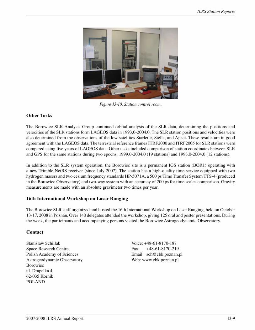
Figure 13-10. Station control room.
Other Tasks
The Borowiec SLR Analysis Group continued orbital analysis of the SLR data, determining the positions and velocities of the SLR stations form LAGEOS data in 1993.0-2004.0. The SLR station positions and velocities were also determined from the observations of the low satellites Starlette, Stella, and Ajisai. These results are in good agreement with the LAGEOS data. The terrestrial reference frames ITRF2000 and ITRF2005 for SLR stations were compared using five years of LAGEOS data. Other tasks included comparison of station coordinates between SLR and GPS for the same stations during two epochs: 1999.0-2004.0 (19 stations) and 1993.0-2004.0 (12 stations).
In addition to the SLR system operation, the Borowiec site is a permanent IGS station (BOR1) operating with a new Trimble NetRS receiver (since July 2007). The station has a high-quality time service equipped with two hydrogen masers and two cesium frequency standards HP-5071A, a 500 ps Time Transfer System TTS-4 (produced in the Borowiec Observatory) and two-way system with an accuracy of 200 ps for time scales comparison. Gravity measurements are made with an absolute gravimeter two times per year.
16th International Workshop on Laser Ranging
The Borowiec SLR staff organized and hosted the 16th International Workshop on Laser Ranging, held on October 13-17, 2008 in Poznan. Over 140 delegates attended the workshop, giving 125 oral and poster presentations. During the week, the participants and accompanying persons visited the Borowiec Astrogeodynamic Observatory.
Contact
Stanislaw Schillak Voice: +48-61-8170-187Space Research Centre, Fax: +48-61-8170-219Polish Academy of Sciences Email: [email protected] Observatory Web: www.cbk.poznan.plBorowiecul. Drapalka 462-035 KornikPOLAND
13-10 2007-2008 ILRS Annual Report
ILRS Station Reports
Changchun, ChinaCunbo Fan Cunbo/National Astronomical Observatories, Changchun Observatory, CAS
System Upgrades
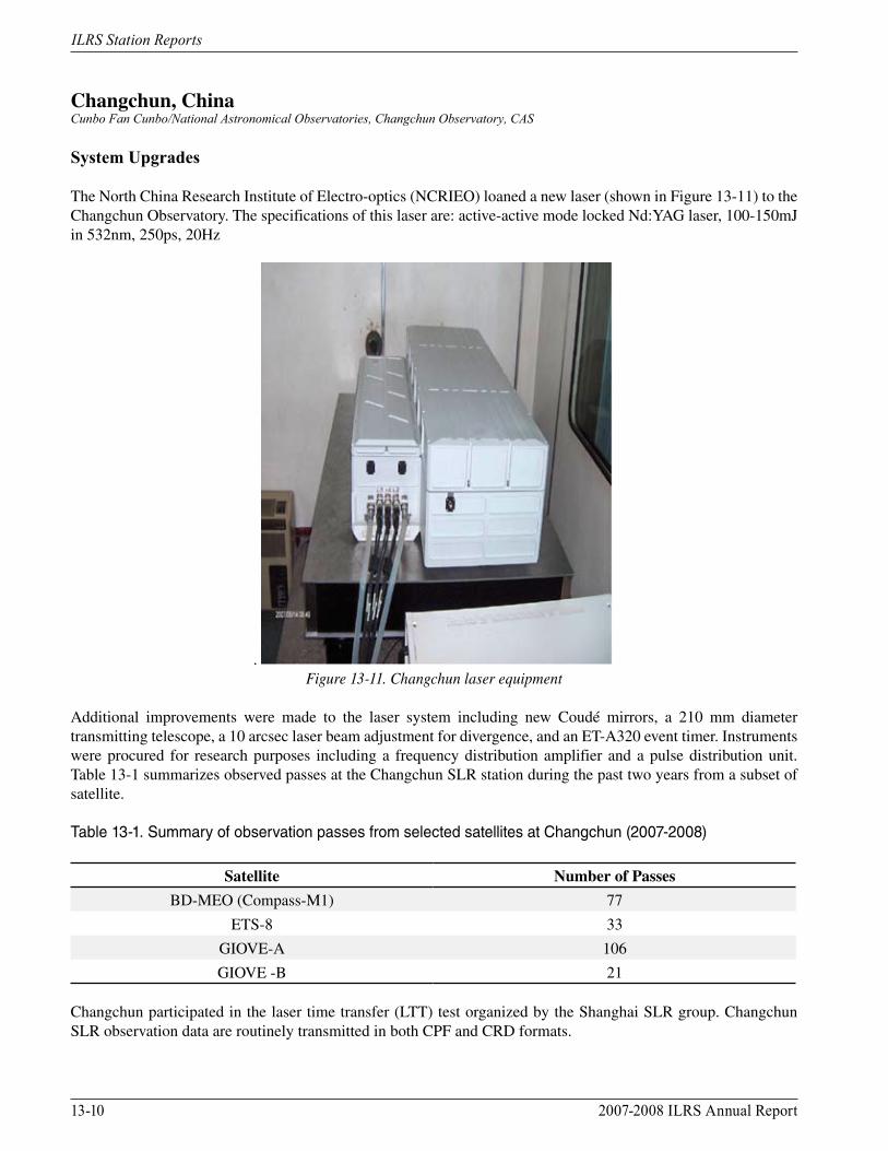
The North China Research Institute of Electro-optics (NCRIEO) loaned a new laser (shown in Figure 13-11) to the Changchun Observatory. The specifications of this laser are: active-active mode locked Nd:YAG laser, 100-150mJ in 532nm, 250ps, 20Hz
. Figure 13-11. Changchun laser equipment
Additional improvements were made to the laser system including new Coudé mirrors, a 210 mm diameter transmitting telescope, a 10 arcsec laser beam adjustment for divergence, and an ET-A320 event timer. Instruments were procured for research purposes including a frequency distribution amplifier and a pulse distribution unit. Table 13-1 summarizes observed passes at the Changchun SLR station during the past two years from a subset of satellite.
Table 13-1. Summary of observation passes from selected satellites at Changchun (2007-2008)
Satellite Number of Passes
BD-MEO (Compass-M1) 77
ETS-8 33
GIOVE-A 106
GIOVE -B 21
Changchun participated in the laser time transfer (LTT) test organized by the Shanghai SLR group. Changchun SLR observation data are routinely transmitted in both CPF and CRD formats.
2007-2008 ILRS Annual Report 13-11
ILRS Station Reports
Future Plans
The future plans for the Changchun Observatory include routine daylight tracking and high repetition-rate SLR operations.
KHz SLR
A high repetition-rate control system has been developed and is now operational at the Changchun SLR station. The system allows the SLR to operate at frequencies from 1 Hz to more than 2 kHz. The real-time control hardware and software runs under the Windows XP environment. The hardware control circuit includes three components: an accurate timing part, a range gate control, and a laser firing control. A 2 kHz laser, borrowed from the Wuhan SLR group, was used to function together with the control system to test the system performance. The experimental results show that the frequency fire rate control system operates very well at or less than 2 kHz.
Daylight Tracking
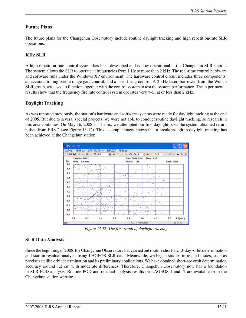
As was reported previously, the station’s hardware and software systems were ready for daylight tracking at the end of 2005. But due to several special projects, we were not able to conduct routine daylight tracking, so research in this area continues. On May 16, 2008 at 11 a.m., we attempted our first daylight pass; the system obtained return pulses from ERS-2 (see Figure 13-12). This accomplishment shows that a breakthrough in daylight tracking has been achieved at the Changchun station.
Figure 13-12. The first result of daylight tracking
SLR Data Analysis
Since the beginning of 2008, the Changchun Observatory has carried out routine short-arc (3-day) orbit determination and station residual analysis using LAGEOS SLR data. Meanwhile, we began studies in related issues, such as precise satellite orbit determination and its preliminary applications. We have obtained short-arc orbit determination accuracy around 1.2 cm with moderate differences. Therefore, Changchun Observatory now has a foundation in SLR POD analysis. Routine POD and residual analysis results on LAGEOS-1 and -2 are available from the Changchun station website.
13-12 2007-2008 ILRS Annual Report
ILRS Station Reports
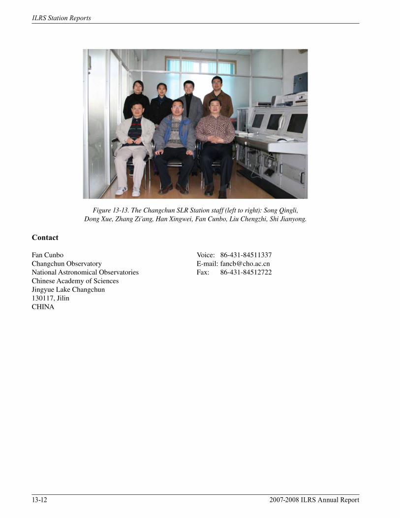
Figure 13-13. The Changchun SLR Station staff (left to right): Song Qingli, Dong Xue, Zhang Zi’ang, Han Xingwei, Fan Cunbo, Liu Chengzhi, Shi Jianyong.
Contact
Fan Cunbo Voice: 86-431-84511337Changchun Observatory E-mail: [email protected] Astronomical Observatories Fax: 86-431-84512722Chinese Academy of Sciences Jingyue Lake Changchun130117, Jilin CHINA
2007-2008 ILRS Annual Report 13-13
ILRS Station Reports
Concepción, ChileBernd Sierk/BKG
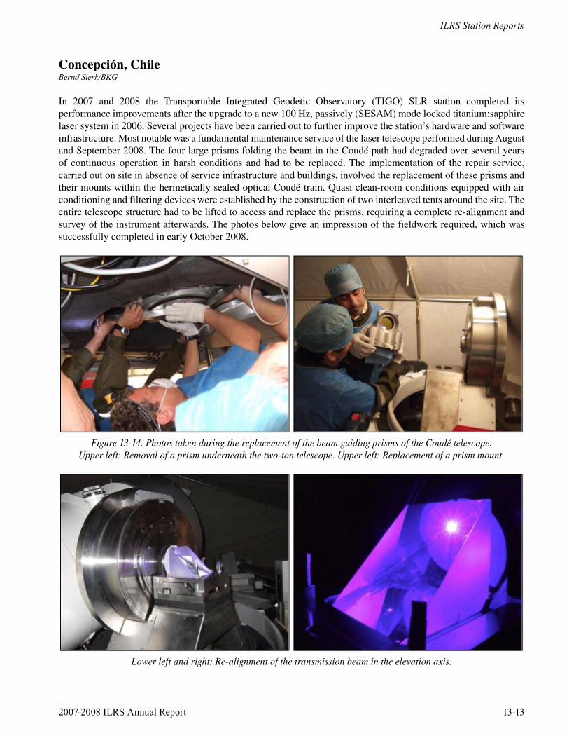
In 2007 and 2008 the Transportable Integrated Geodetic Observatory (TIGO) SLR station completed its performance improvements after the upgrade to a new 100 Hz, passively (SESAM) mode locked titanium:sapphire laser system in 2006. Several projects have been carried out to further improve the station’s hardware and software infrastructure. Most notable was a fundamental maintenance service of the laser telescope performed during August and September 2008. The four large prisms folding the beam in the Coudé path had degraded over several years of continuous operation in harsh conditions and had to be replaced. The implementation of the repair service, carried out on site in absence of service infrastructure and buildings, involved the replacement of these prisms and their mounts within the hermetically sealed optical Coudé train. Quasi clean-room conditions equipped with air conditioning and filtering devices were established by the construction of two interleaved tents around the site. The entire telescope structure had to be lifted to access and replace the prisms, requiring a complete re-alignment and survey of the instrument afterwards. The photos below give an impression of the fieldwork required, which was successfully completed in early October 2008.
Figure 13-14. Photos taken during the replacement of the beam guiding prisms of the Coudé telescope. Upper left: Removal of a prism underneath the two-ton telescope. Upper left: Replacement of a prism mount.
Lower left and right: Re-alignment of the transmission beam in the elevation axis.
13-14 2007-2008 ILRS Annual Report
ILRS Station Reports
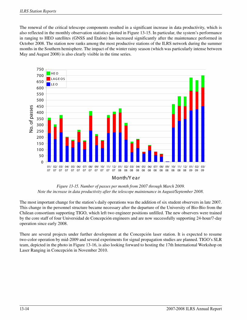
The renewal of the critical telescope components resulted in a significant increase in data productivity, which is also reflected in the monthly observation statistics plotted in Figure 13-15. In particular, the system’s performance in ranging to HEO satellites (GNSS and Etalon) has increased significantly after the maintenance performed in October 2008. The station now ranks among the most productive stations of the ILRS network during the summer months in the Southern hemisphere. The impact of the winter rainy season (which was particularly intense between May and August 2008) is also clearly visible in the time series.
01/07
02/07
03/07
04/07
05/07
06/07
07/07
08/07
09/07
10/07
11/07
12/07
01/08
02/08
03/08
04/08
05/08
06/08
07/08
08/08
09/08
10/08
11/08
12/08
01/09
02/09
03/09
050
100150200250300350400450500550600650700750
HE O
LA G E O S
LE O
Month/Y ear
No.
of p
asse
s
Figure 13-15. Number of passes per month from 2007 through March 2009.
Note the increase in data productivity after the telescope maintenance in August/September 2008.
The most important change for the station’s daily operations was the addition of six student observers in late 2007. This change in the personnel structure became necessary after the departure of the University of Bio-Bio from the Chilean consortium supporting TIGO, which left two engineer positions unfilled. The new observers were trained by the core staff of four Universidad de Concepción engineers and are now successfully supporting 24-hour/7-day operation since early 2008.
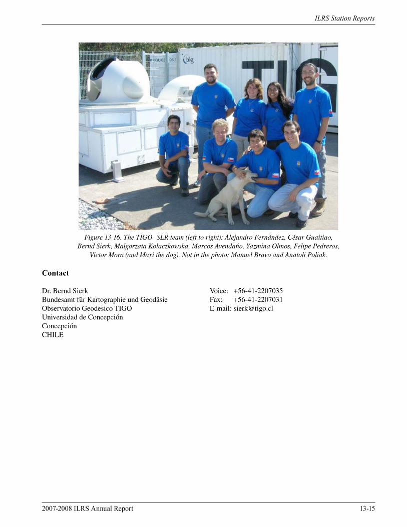
There are several projects under further development at the Concepción laser station. It is expected to resume two-color operation by mid-2009 and several experiments for signal propagation studies are planned. TIGO’s SLR team, depicted in the photo in Figure 13-16, is also looking forward to hosting the 17th International Workshop on Laser Ranging in Concepción in November 2010.
2007-2008 ILRS Annual Report 13-15
ILRS Station Reports
Figure 13-16. The TIGO- SLR team (left to right): Alejandro Fernández, César Guaitiao, Bernd Sierk, Malgorzata Kolaczkowska, Marcos Avendańo, Yazmina Olmos, Felipe Pedreros,
Víctor Mora (and Maxi the dog). Not in the photo: Manuel Bravo and Anatoli Poliak.
Contact
Dr. Bernd Sierk Voice: +56-41-2207035Bundesamt für Kartographie und Geodäsie Fax: +56-41-2207031Observatorio Geodesico TIGO E-mail: [email protected] de ConcepciónConcepciónCHILE
13-16 2007-2008 ILRS Annual Report
ILRS Station Reports
FTLRS, FranceFrancis Pierron/Observatoire de la Cote d’Azur
The FTLRS staff consists of F. Pierron, D. Feraudy, M. Furia, M. Pierron, M. Laplanche, J.M. Torre, F. Para, and J.C. Poyard (IGN).
Recent Activities
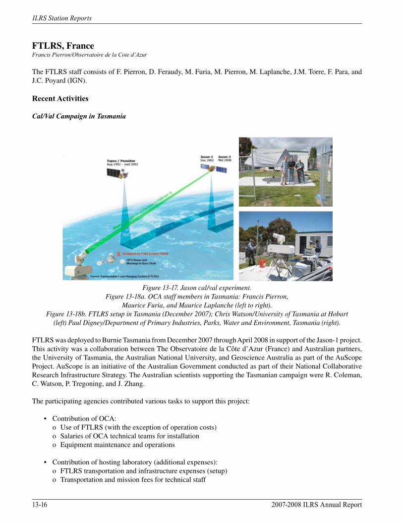
Cal/Val Campaign in Tasmania
Figure 13-17. Jason cal/val experiment. Figure 13-18a. OCA staff members in Tasmania: Francis Pierron,
Maurice Furia, and Maurice Laplanche (left to right).Figure 13-18b. FTLRS setup in Tasmania (December 2007); Chris Watson/University of Tasmania at Hobart
(left) Paul Digney/Department of Primary Industries, Parks, Water and Environment, Tasmania (right).
FTLRS was deployed to Burnie Tasmania from December 2007 through April 2008 in support of the Jason-1 project. This activity was a collaboration between The Observatoire de la Côte d’Azur (France) and Australian partners, the University of Tasmania, the Australian National University, and Geoscience Australia as part of the AuScope Project. AuScope is an initiative of the Australian Government conducted as part of their National Collaborative Research Infrastructure Strategy. The Australian scientists supporting the Tasmanian campaign were R. Coleman, C. Watson, P. Tregoning, and J. Zhang.
The participating agencies contributed various tasks to support this project:
• Contribution of OCA: o Use of FTLRS (with the exception of operation costs) o Salaries of OCA technical teams for installation o Equipment maintenance and operations
• Contribution of hosting laboratory (additional expenses): o FTLRS transportation and infrastructure expenses (setup) o Transportation and mission fees for technical staff
2007-2008 ILRS Annual Report 13-17
ILRS Station Reports
o Operational costs o Hardware maintenance (optic, flash, Yag rods, etc.) o Consumables, communications, etc. o Shelter installation
The results obtained from the Burnie occupation are:
• Total passes: 673 on Jason, ERS-2/Envisat, Stella/Starlette, LAGEOS-1/-2 • Total normal points: 9,200 • Bias and stability: 1/2 mm level with Stanford model • Number of OCA employees: eight engineers for operations • Number of Australian employees: Hobart and Canberra scientists plus one post-doc
Other Occupations
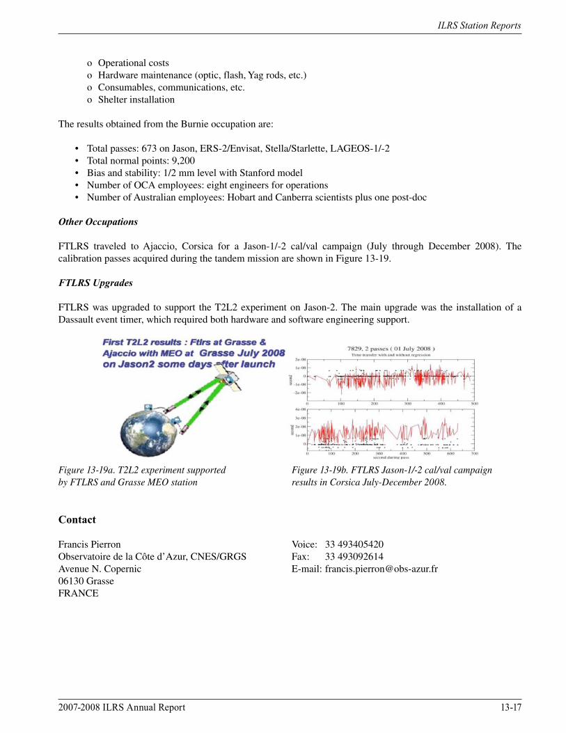
FTLRS traveled to Ajaccio, Corsica for a Jason-1/-2 cal/val campaign (July through December 2008). The calibration passes acquired during the tandem mission are shown in Figure 13-19.
FTLRS Upgrades
FTLRS was upgraded to support the T2L2 experiment on Jason-2. The main upgrade was the installation of a Dassault event timer, which required both hardware and software engineering support.
Figure 13-19a. T2L2 experiment supported Figure 13-19b. FTLRS Jason-1/-2 cal/val campaignby FTLRS and Grasse MEO station results in Corsica July-December 2008.
Contact
Francis Pierron Voice: 33 493405420Observatoire de la Côte d’Azur, CNES/GRGS Fax: 33 493092614Avenue N. Copernic E-mail: [email protected] GrasseFRANCE
13-18 2007-2008 ILRS Annual Report
ILRS Station Reports
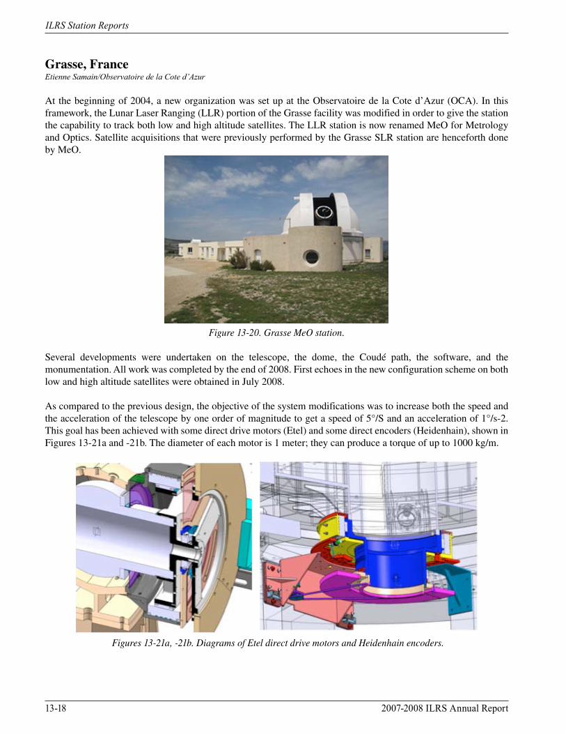
Grasse, FranceEtienne Samain/Observatoire de la Cote d’Azur
At the beginning of 2004, a new organization was set up at the Observatoire de la Cote d’Azur (OCA). In this framework, the Lunar Laser Ranging (LLR) portion of the Grasse facility was modified in order to give the station the capability to track both low and high altitude satellites. The LLR station is now renamed MeO for Metrology and Optics. Satellite acquisitions that were previously performed by the Grasse SLR station are henceforth done by MeO.
Figure 13-20. Grasse MeO station.
Several developments were undertaken on the telescope, the dome, the Coudé path, the software, and the monumentation. All work was completed by the end of 2008. First echoes in the new configuration scheme on both low and high altitude satellites were obtained in July 2008.
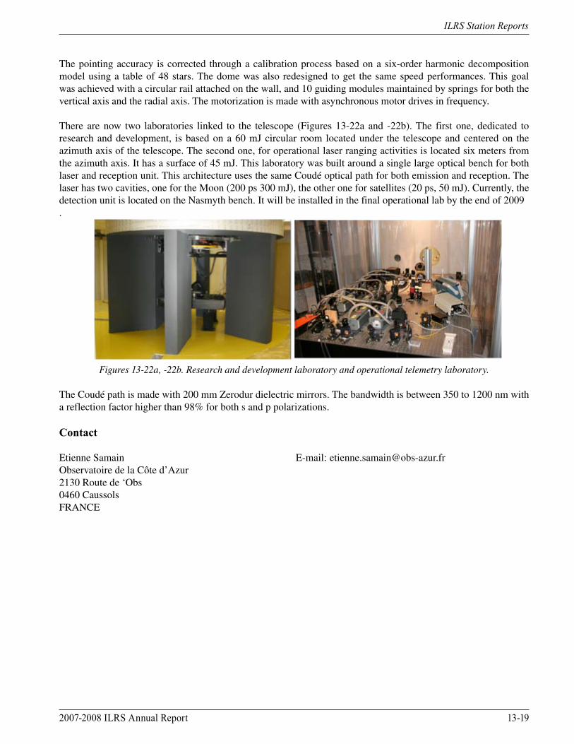
As compared to the previous design, the objective of the system modifications was to increase both the speed and the acceleration of the telescope by one order of magnitude to get a speed of 5°/S and an acceleration of 1°/s-2. This goal has been achieved with some direct drive motors (Etel) and some direct encoders (Heidenhain), shown in Figures 13-21a and -21b. The diameter of each motor is 1 meter; they can produce a torque of up to 1000 kg/m.
Figures 13-21a, -21b. Diagrams of Etel direct drive motors and Heidenhain encoders.
2007-2008 ILRS Annual Report 13-19
ILRS Station Reports
The pointing accuracy is corrected through a calibration process based on a six-order harmonic decomposition model using a table of 48 stars. The dome was also redesigned to get the same speed performances. This goal was achieved with a circular rail attached on the wall, and 10 guiding modules maintained by springs for both the vertical axis and the radial axis. The motorization is made with asynchronous motor drives in frequency.
There are now two laboratories linked to the telescope (Figures 13-22a and -22b). The first one, dedicated to research and development, is based on a 60 mJ circular room located under the telescope and centered on the azimuth axis of the telescope. The second one, for operational laser ranging activities is located six meters from the azimuth axis. It has a surface of 45 mJ. This laboratory was built around a single large optical bench for both laser and reception unit. This architecture uses the same Coudé optical path for both emission and reception. The laser has two cavities, one for the Moon (200 ps 300 mJ), the other one for satellites (20 ps, 50 mJ). Currently, the detection unit is located on the Nasmyth bench. It will be installed in the final operational lab by the end of 2009.
Figures 13-22a, -22b. Research and development laboratory and operational telemetry laboratory.
The Coudé path is made with 200 mm Zerodur dielectric mirrors. The bandwidth is between 350 to 1200 nm with a reflection factor higher than 98% for both s and p polarizations.
Contact
Etienne Samain E-mail: [email protected] de la Côte d’Azur2130 Route de ‘Obs0460 CaussolsFRANCE

13-20 2007-2008 ILRS Annual Report
ILRS Station Reports
Graz, AustriaGeorg Kirchner, Franz Koidl/Austrian Academy of Sciences
The kHz SLR System in Graz – Upgrades During 2007 and 2008
Several upgrades have been implemented in 2007 and 2008, both in hardware and in software. The field programmable gate array (FPGA) based PC board (Figure 13-23), developed and used by the Graz SLR station, has been upgraded again, replacing now two obsolete digital boards and offering new features. The board measures start and stop event times with sub-ns resolution (RMS: 250 ps) to allow for fast range gate settings (within a few µs after e.g., a start event). This capability is especially important for very low orbiting satellites like GOCE, which require range gate settings within less than 1 ms after laser fire; our high resolution and high precision event timer (Graz ET), which is used for high accuracy epoch time determination, needs more than 0.4 ms to do that.
Figure 13-23. FPGA board.
Other upgrades within the FPGA now allow full use of the integrated 64 bit serial buses for digital I/O; this in turn allows fully automatic control of field-of-view, laser beam divergence settings, laser beam pointing control, receive energy control, etc.
For spherical passive satellites, like Ajisai and LAGEOS-1/-2, we derived a new post-processing scheme, to achieve mm accuracy regardless of the cm target signatures. Basically, we accept only returns from the nearest retro-reflectors, and only until a “reflection depth” of 20 mm maximum (see the 2008 presentation from the 16th International Workshop on Laser Ranging for details).
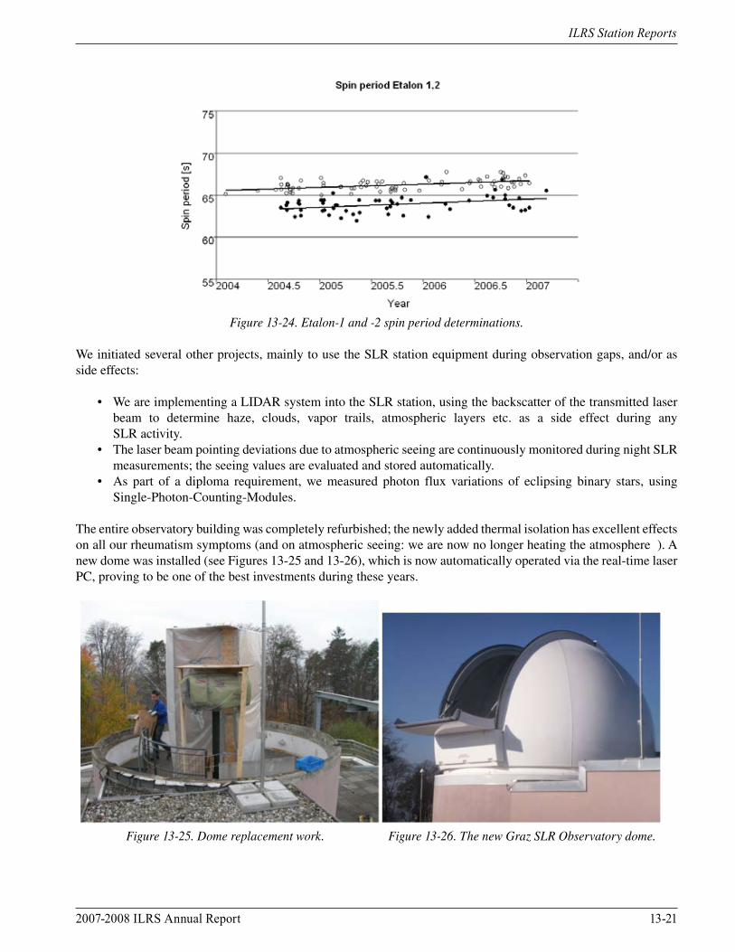
One of our main scientific results was the determination of spin parameters. We were able to determine spin periods of Etalon-1 and -2 (Figure 13-24); this is especially remarkable regarding their high orbits (> 20,000 km), which gives less than 0.1% average return rates. Nevertheless, comparing simulated and measured SLR data of these two identical satellites, we used the gaps between the different sets of retro-reflectors to derive the spin periods for last three years. In addition, we derived a complete spin history for both LAGEOS (15 years) and Ajisai (22 years).
2007-2008 ILRS Annual Report 13-21
ILRS Station Reports
Figure 13-24. Etalon-1 and -2 spin period determinations.
We initiated several other projects, mainly to use the SLR station equipment during observation gaps, and/or as side effects:
• We are implementing a LIDAR system into the SLR station, using the backscatter of the transmitted laser beam to determine haze, clouds, vapor trails, atmospheric layers etc. as a side effect during any SLR activity. • The laser beam pointing deviations due to atmospheric seeing are continuously monitored during night SLR measurements; the seeing values are evaluated and stored automatically. • As part of a diploma requirement, we measured photon flux variations of eclipsing binary stars, using Single-Photon-Counting-Modules.
The entire observatory building was completely refurbished; the newly added thermal isolation has excellent effects on all our rheumatism symptoms (and on atmospheric seeing: we are now no longer heating the atmosphere ☺). A new dome was installed (see Figures 13-25 and 13-26), which is now automatically operated via the real-time laser PC, proving to be one of the best investments during these years.
Figure 13-25. Dome replacement work. Figure 13-26. The new Graz SLR Observatory dome.

13-22 2007-2008 ILRS Annual Report
ILRS Station Reports
Contact
Dr. Georg Kirchner Phone: 43-316-873-4651 Austrian Academy of Sciences Fax: 43-316-873-4641 Department of Satellite Geodesy E-mail: [email protected] Lustbuhelstrasse 46A-8042 GrazAUSTRIA
2007-2008 ILRS Annual Report 13-23
ILRS Station Reports
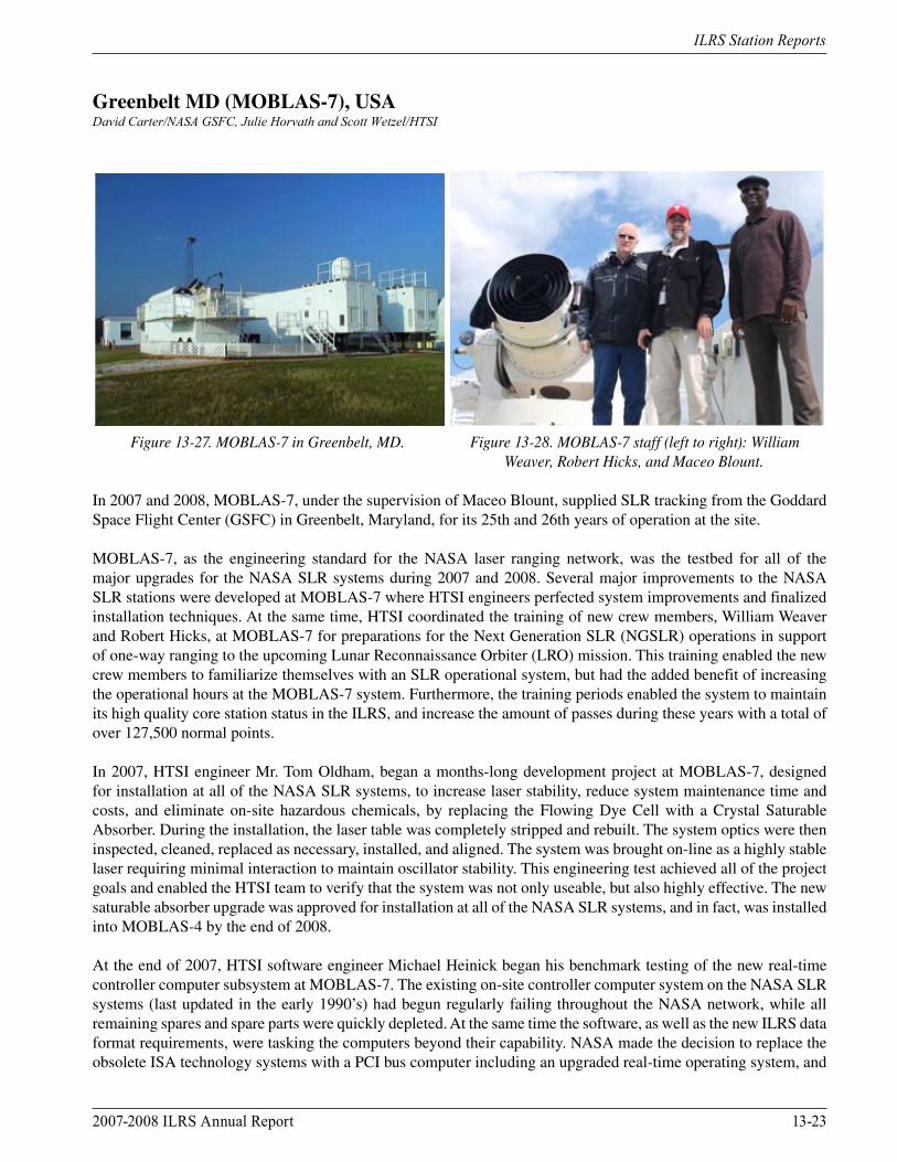
Greenbelt MD (MOBLAS-7), USADavid Carter/NASA GSFC, Julie Horvath and Scott Wetzel/HTSI
Figure 13-27. MOBLAS-7 in Greenbelt, MD. Figure 13-28. MOBLAS-7 staff (left to right): William Weaver, Robert Hicks, and Maceo Blount.
In 2007 and 2008, MOBLAS-7, under the supervision of Maceo Blount, supplied SLR tracking from the Goddard Space Flight Center (GSFC) in Greenbelt, Maryland, for its 25th and 26th years of operation at the site.
MOBLAS-7, as the engineering standard for the NASA laser ranging network, was the testbed for all of the major upgrades for the NASA SLR systems during 2007 and 2008. Several major improvements to the NASA SLR stations were developed at MOBLAS-7 where HTSI engineers perfected system improvements and finalized installation techniques. At the same time, HTSI coordinated the training of new crew members, William Weaver and Robert Hicks, at MOBLAS-7 for preparations for the Next Generation SLR (NGSLR) operations in support of one-way ranging to the upcoming Lunar Reconnaissance Orbiter (LRO) mission. This training enabled the new crew members to familiarize themselves with an SLR operational system, but had the added benefit of increasing the operational hours at the MOBLAS-7 system. Furthermore, the training periods enabled the system to maintain its high quality core station status in the ILRS, and increase the amount of passes during these years with a total of over 127,500 normal points.
In 2007, HTSI engineer Mr. Tom Oldham, began a months-long development project at MOBLAS-7, designed for installation at all of the NASA SLR systems, to increase laser stability, reduce system maintenance time and costs, and eliminate on-site hazardous chemicals, by replacing the Flowing Dye Cell with a Crystal Saturable Absorber. During the installation, the laser table was completely stripped and rebuilt. The system optics were then inspected, cleaned, replaced as necessary, installed, and aligned. The system was brought on-line as a highly stable laser requiring minimal interaction to maintain oscillator stability. This engineering test achieved all of the project goals and enabled the HTSI team to verify that the system was not only useable, but also highly effective. The new saturable absorber upgrade was approved for installation at all of the NASA SLR systems, and in fact, was installed into MOBLAS-4 by the end of 2008.
At the end of 2007, HTSI software engineer Michael Heinick began his benchmark testing of the new real-time controller computer subsystem at MOBLAS-7. The existing on-site controller computer system on the NASA SLR systems (last updated in the early 1990’s) had begun regularly failing throughout the NASA network, while all remaining spares and spare parts were quickly depleted. At the same time the software, as well as the new ILRS data format requirements, were tasking the computers beyond their capability. NASA made the decision to replace the obsolete ISA technology systems with a PCI bus computer including an upgraded real-time operating system, and
13-24 2007-2008 ILRS Annual Report
ILRS Station Reports
a new CAMAC controller, serial card, and timing card. The system greatly improved real-time operations, system stability and speed, and added much needed data storage capacity. By the beginning of 2008, the engineering tests were completed at MOBLAS-7 and the controller computer subsystems were configured for installation at all other MOBLAS systems in the network. By the end of 2008, all NASA SLR systems, except for MLRS and TLRS-3, were operating with the new technology.
In 2008, MOBLAS-7 was also used as the testbed for the upgraded processor computer system. The NASA SLR processor computers were very old systems that had out-lived their expected lifetime. With new ILRS data formats for both predictions and SLR data, the systems were not able to keep up with the upgraded software demands. The new computer system enabled MOBLAS-7 to download and process predictions, and process SLR data at very high rates of speed, without interfering with normal operations. It also enabled the crew to store and backup large amounts of SLR data for future needs. All NASA SLR systems will have the new processor computer systems by the end of 2009.
Contact
David Carter Voice: 301-614-5966NASA GSFC Fax: 301-286-0328Code 453 E-mail: [email protected], MD 20771USA
2007-2008 ILRS Annual Report 13-25
ILRS Station Reports
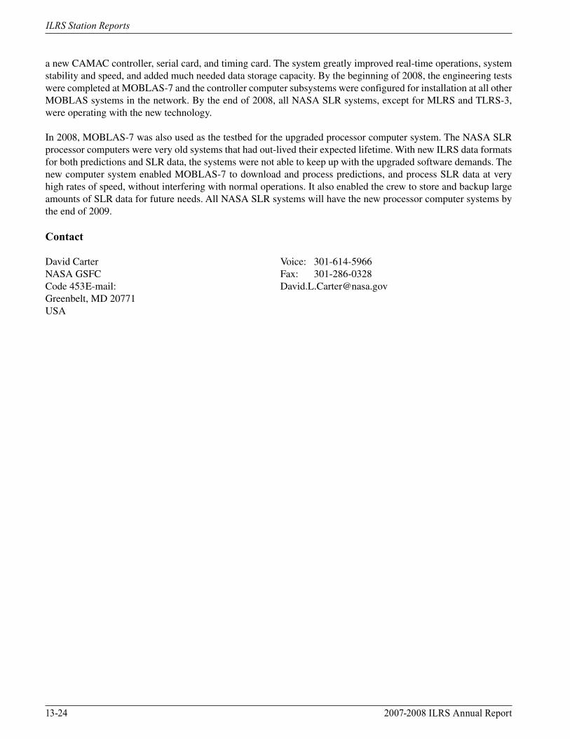
Greenbelt MD (NGSLR), USAJan McGarry/NASA GSFC
Figure 13-29. NGSLR staff (left to right): Tony Mallama, Tom Cuff, Loyal (Stu) Stewart, Tom Zagwodzki, Jack Cheek, Don Patterson, Jan McGarry, Jim Long, Mike Perry, Tony Mann, Renata Barski, Bud Donovan, John Hundertmark.
NGSLR advanced towards completion of its SLR capability during 2007 and 2008. The Risley Prism point-ahead of the transmit beam was successfully completed allowing the closure of the receiver field of view down to 11 arcseconds. This in turn made daylight ranging possible. Daylight ranging up to LAGEOS altitudes became routine during this period. Improvements in the Pulse Repetition Frequency (PRF) control, the alignment technique, the beam expander, and a new I/O chassis allowed routine hands-off tracking of satellites from LEO to LAGEOS and easy ground calibration capability. Although the system’s Q-Peak laser energy gradually decreased to less than 80 microJoules per pulse, the ability to set the laser divergence to 4 arcseconds, combined with very accurate predictions and arcsecond level mount control, gave the system the ability to track LAGEOS down to 20 degrees elevation and successfully track GLONASS.
Future efforts will concentrate on co-location of the system with MOBLAS-7 and completion of the automated closed-loop tracking.
During this period modifications to NGSLR for laser ranging to LRO were implemented. A 28 Hz, 50 milliJoule per pulse Northrop-Grumman laser was added to the system, along with a removable mirror to allow the system to use either the Q-Peak (2 kHz eyesafe SLR) or the Northrop-Grumman (LRO) laser. Since the new 28 Hz laser is not eyesafe, an aircraft avoidance radar was also added to the system. Software and I/O chassis changes were also made to implement laser ranging to LRO.

13-26 2007-2008 ILRS Annual Report
ILRS Station Reports
Contact
Jan McGarry Voice: 301-614-5867NASA GSFC Fax: 301-614-6015Code 694 E-mail: [email protected], MD 20771USA
2007-2008 ILRS Annual Report 13-27
ILRS Station Reports
Haleakala HI, USADaniel O’Gara/University of Hawaii Institute for Astronomy
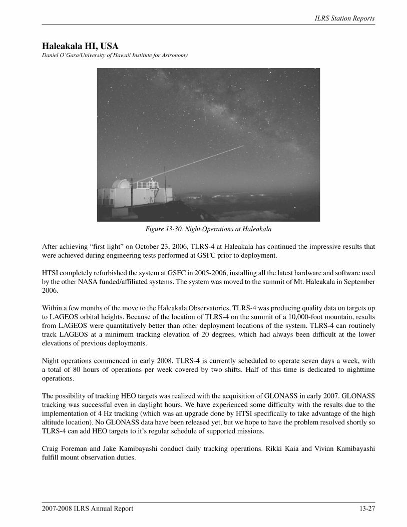
Figure 13-30. Night Operations at Haleakala
After achieving “first light” on October 23, 2006, TLRS-4 at Haleakala has continued the impressive results that were achieved during engineering tests performed at GSFC prior to deployment.
HTSI completely refurbished the system at GSFC in 2005-2006, installing all the latest hardware and software used by the other NASA funded/affiliated systems. The system was moved to the summit of Mt. Haleakala in September 2006.
Within a few months of the move to the Haleakala Observatories, TLRS-4 was producing quality data on targets up to LAGEOS orbital heights. Because of the location of TLRS-4 on the summit of a 10,000-foot mountain, results from LAGEOS were quantitatively better than other deployment locations of the system. TLRS-4 can routinely track LAGEOS at a minimum tracking elevation of 20 degrees, which had always been difficult at the lower elevations of previous deployments.
Night operations commenced in early 2008. TLRS-4 is currently scheduled to operate seven days a week, with a total of 80 hours of operations per week covered by two shifts. Half of this time is dedicated to nighttime operations.
The possibility of tracking HEO targets was realized with the acquisition of GLONASS in early 2007. GLONASS tracking was successful even in daylight hours. We have experienced some difficulty with the results due to the implementation of 4 Hz tracking (which was an upgrade done by HTSI specifically to take advantage of the high altitude location). No GLONASS data have been released yet, but we hope to have the problem resolved shortly so TLRS-4 can add HEO targets to it’s regular schedule of supported missions.
Craig Foreman and Jake Kamibayashi conduct daily tracking operations. Rikki Kaia and Vivian Kamibayashi fulfill mount observation duties.
13-28 2007-2008 ILRS Annual Report
ILRS Station Reports
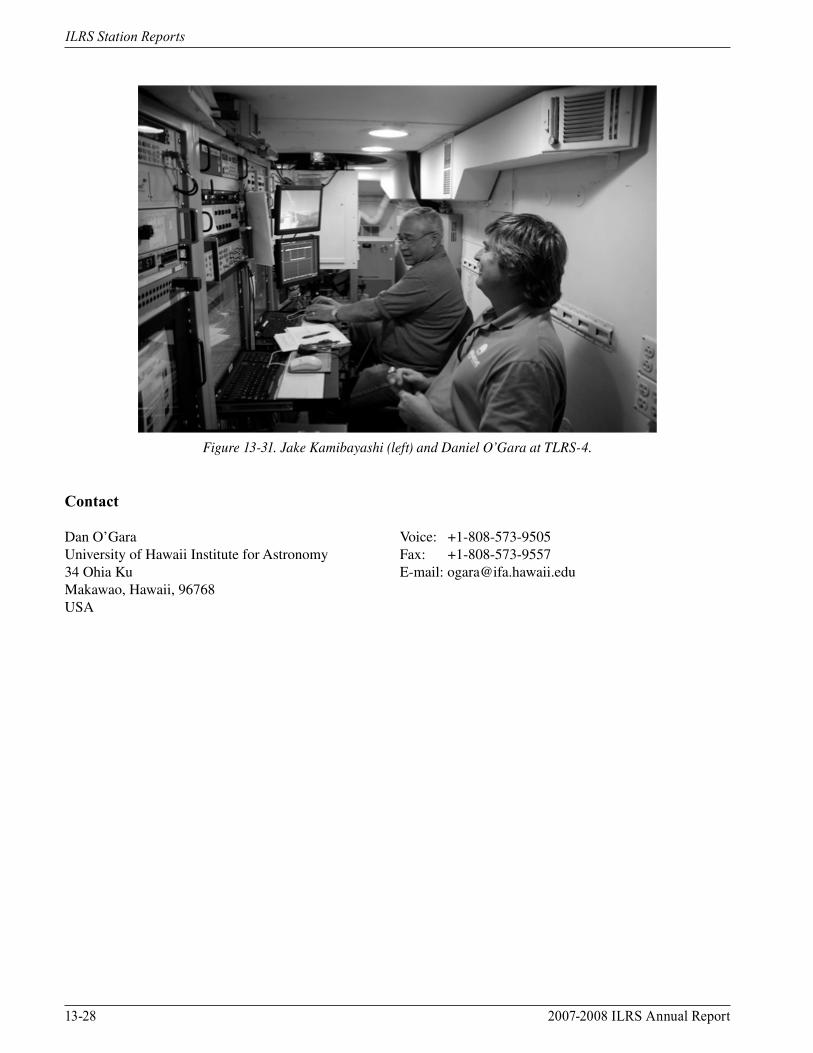
Figure 13-31. Jake Kamibayashi (left) and Daniel O’Gara at TLRS-4.
Contact
Dan O’Gara Voice: +1-808-573-9505University of Hawaii Institute for Astronomy Fax: +1-808-573-955734 Ohia Ku E-mail: [email protected], Hawaii, 96768USA
2007-2008 ILRS Annual Report 13-29
ILRS Station Reports
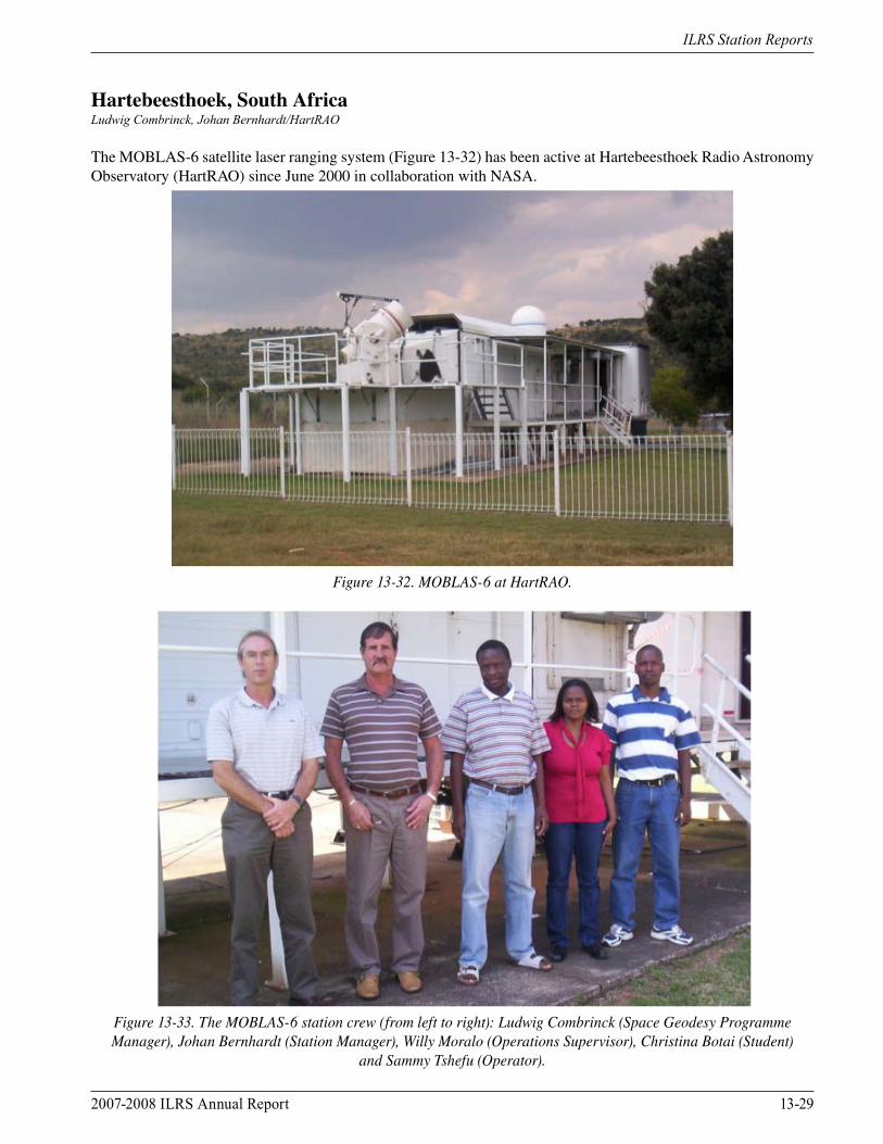
Hartebeesthoek, South AfricaLudwig Combrinck, Johan Bernhardt/HartRAO
The MOBLAS-6 satellite laser ranging system (Figure 13-32) has been active at Hartebeesthoek Radio Astronomy Observatory (HartRAO) since June 2000 in collaboration with NASA.
Figure 13-32. MOBLAS-6 at HartRAO.
Figure 13-33. The MOBLAS-6 station crew (from left to right): Ludwig Combrinck (Space Geodesy Programme Manager), Johan Bernhardt (Station Manager), Willy Moralo (Operations Supervisor), Christina Botai (Student)
and Sammy Tshefu (Operator).
13-30 2007-2008 ILRS Annual Report
ILRS Station Reports
History
During the last eight years, the MOBLAS-6 system has supplied high quality satellite laser ranging data from Hartebeesthoek, South Africa. Data volume and quality increased significantly during the first year of operations bringing MOBLAS-6 in line with the SLR global leaders.
We have noticed a decline in data volume over the past two years as a result of degradation in atmospheric conditions at HartRAO, in terms of cloud cover and pollution. A site survey at Matjiesfontein (semi-desert region) suggests a much more suitable location for satellite laser ranging in South Africa.
2008 Laser Upgrade
During late 2008, the MOBLAS-6 laser was upgraded with the support of Thomas Oldham from Honeywell STI. This opportunity was also used to perform a detailed inspection, which included the repair and service of all optical components used in the laser system to the extent that we had to remove all the optics from the laser table. The laser table layout was also affected by this upgrade and, in short, we basically had to rebuild the laser from scratch again. This resulted in a much more stable and reliable laser system.
Additional system upgrades were performed:
• New UPS installed • Walkway refurbished, new safety rails and signs installed • New CCTV systems installed • New operating computer and software upgrade
The MOBLAS-6 Ranging Capability
• Day-time ranging: low and medium orbit satellites • Nighttime ranging: low, medium and high orbit satellites • Operating shifts: 24-hour 5-day and 8-hour 2-day per week
Contact
Dr. Ludwig Combrinck E-mail: [email protected] Associate Director: Space Geodesy E-mail: [email protected] Bernhardt E-mail: [email protected] Manager, MOBLAS-6 Hartebeesthoek Radio Astronomy Observatory Voice: +27 12 326 0742P.O. Box 443 Fax: +27 12 326 0756Krugersdorp, 1740 Web: http://hartrao.ac.zaSOUTH AFRICA
2007-2008 ILRS Annual Report 13-31
ILRS Station Reports
Helwan, EgyptMakram Ibrahim, Magdy El-Saftawy, Makram Ibrahim Khalil Ibrahim/NRIAG
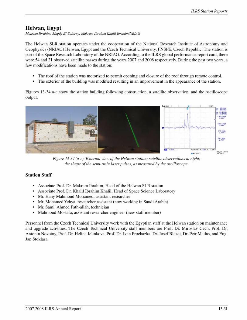
The Helwan SLR station operates under the cooperation of the National Research Institute of Astronomy and Geophysics (NRIAG) Helwan, Egypt and the Czech Technical University, FNSPE, Czech Republic. The station is part of the Space Research Laboratory of the NRIAG. According to the ILRS global performance report card, there were 54 and 21 observed satellite passes during the years 2007 and 2008 respectively. During the past two years, a few modifications have been made to the station:
• The roof of the station was motorized to permit opening and closure of the roof through remote control. • The exterior of the building was modified resulting in an improvement in the appearance of the station.
Figures 13-34 a-c show the station building following construction, a satellite observation, and the oscilloscope output.
Figure 13-34 (a-c). External view of the Helwan station; satellite observations at night; the shape of the semi-train laser pulses, as measured by the oscilloscope.
Station Staff
• Associate Prof. Dr. Makram Ibrahim, Head of the Helwan SLR station • Associate Prof. Dr. Khalil Ibrahim Khalil, Head of Space Science Laboratory • Mr. Hany Mahmoud Mohamed, assistant researcher • Mr. Mohamed Yehya, researcher assistant (now working in Saudi Arabia) • Mr. Sami Ahmed Fath-allah, technician • Mahmoud Mostafa, assistant researcher engineer (new staff member)
Personnel from the Czech Technical University work with the Egyptian staff at the Helwan station on maintenance and upgrade activities. The Czech Technical University staff members are Prof. Dr. Miroslav Cech, Prof. Dr. Antonin Novotny, Prof. Dr. Helina Jelinkova, Prof. Dr. Ivan Prochazka, Dr. Josef Blazej, Dr. Petr Matlas, and Eng. Jan Stoklasa.
13-32 2007-2008 ILRS Annual Report
ILRS Station Reports
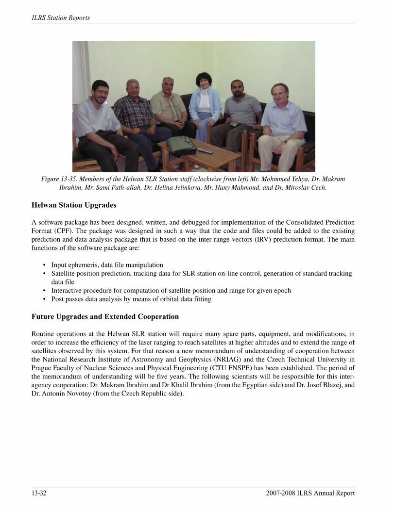
Figure 13-35. Members of the Helwan SLR Station staff (clockwise from left) Mr. Mohmmed Yehya, Dr. Makram
Ibrahim, Mr. Sami Fath-allah, Dr. Helina Jelinkova, Mr. Hany Mahmoud, and Dr. Miroslav Cech.
Helwan Station Upgrades
A software package has been designed, written, and debugged for implementation of the Consolidated Prediction Format (CPF). The package was designed in such a way that the code and files could be added to the existing prediction and data analysis package that is based on the inter range vectors (IRV) prediction format. The main functions of the software package are:
• Input ephemeris, data file manipulation • Satellite position prediction, tracking data for SLR station on-line control, generation of standard tracking data file • Interactive procedure for computation of satellite position and range for given epoch • Post passes data analysis by means of orbital data fitting
Future Upgrades and Extended Cooperation
Routine operations at the Helwan SLR station will require many spare parts, equipment, and modifications, in order to increase the efficiency of the laser ranging to reach satellites at higher altitudes and to extend the range of satellites observed by this system. For that reason a new memorandum of understanding of cooperation between the National Research Institute of Astronomy and Geophysics (NRIAG) and the Czech Technical University in Prague Faculty of Nuclear Sciences and Physical Engineering (CTU FNSPE) has been established. The period of the memorandum of understanding will be five years. The following scientists will be responsible for this inter-agency cooperation: Dr. Makram Ibrahim and Dr Khalil Ibrahim (from the Egyptian side) and Dr. Josef Blazej, and Dr. Antonin Novotny (from the Czech Republic side).
2007-2008 ILRS Annual Report 13-33
ILRS Station Reports
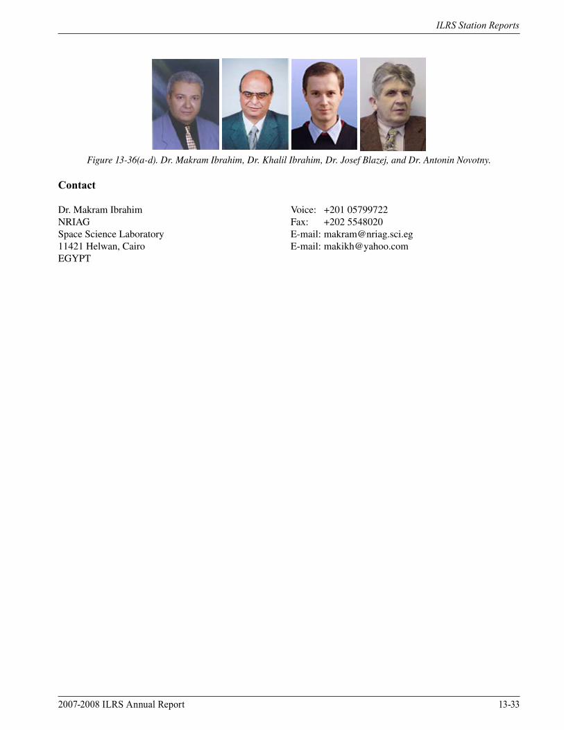
Figure 13-36(a-d). Dr. Makram Ibrahim, Dr. Khalil Ibrahim, Dr. Josef Blazej, and Dr. Antonin Novotny.
Contact
Dr. Makram Ibrahim Voice: +201 05799722NRIAG Fax: +202 5548020Space Science Laboratory E-mail: [email protected] Helwan, Cairo E-mail: [email protected]
13-34 2007-2008 ILRS Annual Report
ILRS Station Reports
Herstmonceux, UKGraham Appleby, David Benham, Philip Gibbs, Christopher Potter, Robert Sherwood, Toby Shoobridge, Vicki Smith, Matthew Wilkinson/NSGF
Introduction
During this period we have worked at the NERC Space Geodesy Facility (SGF) towards full implementation of an SLR system that can be changed rapidly under computer control between 10Hz and 2kHz rates. The software and hardware are now in place for this, but progress towards an operational and reliable kHz system was hampered until recently by a number of problems with the laser that resulted in frequent damage to optical surfaces. These problems have now been resolved, and the two-laser facility is fully operational. The decision to maintain this two-laser capability has proven correct as the kHz laser continues to achieve only very low return rates, such that, in particular, daytime ranging to LAGEOS and higher is extremely difficult. Link-budget calculations suggest that in practice the return rates are down relative to expectations by up to an order of magnitude at times. In response, a thorough evaluation of internal system losses is underway, to include measurement of losses at mirror surfaces, through the beam expander, etc. In parallel, an investigation into the use of fast optical filters and the possible use of an MCP detector was carried out (Wilkinson, 2008). Partly in an attempt to quantify the atmospheric losses at this low-elevation site, we are developing a LIDAR system to collect quasi-simultaneous backscatter data when ranging. Operation of the two IGS GNSS receivers continues, as does the FG5 absolute gravimeter.
Satellite Laser Ranging
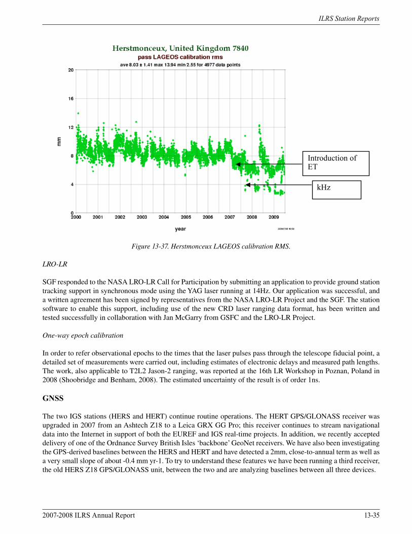
Event timer
Since February 2007, the SGF has used the HxET event timer, which at that time replaced the SR620 counters that had been in use since 1993. As can be seen from the ILRS plot in Figure 13-37, this change has improved the single-shot precision of the system from an average of about 10mm to an average of about 7mm. The use of an event timer was of course essential in the move to kHz repetition rates, and using that laser, with its very short (10ps) pulse-width, again improves the single-shot precision (to 3mm).
Stanford counters
A further major advantage of using the event timer is the possibility to measure and thus remove the non-linearity inherent in the SR620 counters, particularly in calibration measurements. However, attempts to back-calibrate the SR620 by collecting simultaneous data from HxET and SR620 were not as successful as we would like but we did obtain values for back calibrating the Herstmonceux data from 1993-2007 as part of the re-analysis of SLR data from 1983. More details of this work, including references to publications, are given in the SGF Analysis Center report elsewhere in this publication.
Two-laser system
Most of the development work during the period has focused on integrating both lasers, the ‘old’ YAG 10Hz system and the modern VAN 2kHz laser, including the ability for the observer to switch rapidly (in about 20s) between the two as conditions and missions dictate. Note that LRO, and T2L2 on Jason-2 require use of the 10Hz laser, the latter to ensure sufficient energy for the onboard detectors to measure. The two lasers are positioned in the laser room at 90° to each other and a computer-controlled mirror positioned at the entrance to the Coudé path is moved to select the required laser. All the controls and safety features of the lasers go into a single electronics box, which then communicates with the appropriate laser.
2007-2008 ILRS Annual Report 13-35
ILRS Station Reports
Introduction of
ET
kHz
Figure 13-37. Herstmonceux LAGEOS calibration RMS.
LRO-LR
SGF responded to the NASA LRO-LR Call for Participation by submitting an application to provide ground station tracking support in synchronous mode using the YAG laser running at 14Hz. Our application was successful, and a written agreement has been signed by representatives from the NASA LRO-LR Project and the SGF. The station software to enable this support, including use of the new CRD laser ranging data format, has been written and tested successfully in collaboration with Jan McGarry from GSFC and the LRO-LR Project.
One-way epoch calibration
In order to refer observational epochs to the times that the laser pulses pass through the telescope fiducial point, a detailed set of measurements were carried out, including estimates of electronic delays and measured path lengths. The work, also applicable to T2L2 Jason-2 ranging, was reported at the 16th LR Workshop in Poznan, Poland in 2008 (Shoobridge and Benham, 2008). The estimated uncertainty of the result is of order 1ns. GNSS
The two IGS stations (HERS and HERT) continue routine operations. The HERT GPS/GLONASS receiver was upgraded in 2007 from an Ashtech Z18 to a Leica GRX GG Pro; this receiver continues to stream navigational data into the Internet in support of both the EUREF and IGS real-time projects. In addition, we recently accepted delivery of one of the Ordnance Survey British Isles ‘backbone’ GeoNet receivers. We have also been investigating the GPS-derived baselines between the HERS and HERT and have detected a 2mm, close-to-annual term as well as a very small slope of about -0.4 mm yr-1. To try to understand these features we have been running a third receiver, the old HERS Z18 GPS/GLONASS unit, between the two and are analyzing baselines between all three devices.
13-36 2007-2008 ILRS Annual Report
ILRS Station Reports
Gravimetry
The FG5 absolute gravimeter has been collecting regular one-day per week, 24-hour data during this period. The instrument also took part in an AG inter-comparison meeting in Luxembourg at which 19 AGs collected simultaneous data for comparison. A broadband seismometer that may become part of the NERC British Geological Survey’s UK network has been installed in the basement to help with investigations into noise, including that from earthquakes, within the gravity data sets.
LIDAR
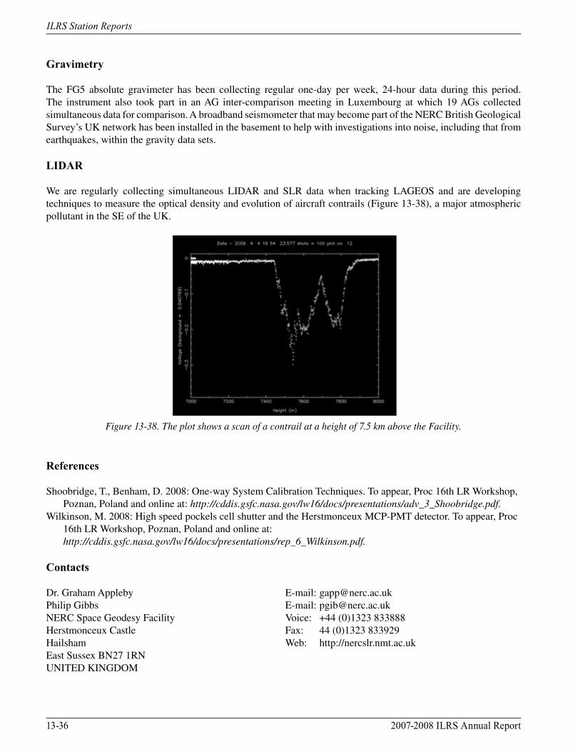
We are regularly collecting simultaneous LIDAR and SLR data when tracking LAGEOS and are developing techniques to measure the optical density and evolution of aircraft contrails (Figure 13-38), a major atmospheric pollutant in the SE of the UK.
Figure 13-38. The plot shows a scan of a contrail at a height of 7.5 km above the Facility.
References
Shoobridge, T., Benham, D. 2008: One-way System Calibration Techniques. To appear, Proc 16th LR Workshop, Poznan, Poland and online at: http://cddis.gsfc.nasa.gov/lw16/docs/presentations/adv_3_Shoobridge.pdf.Wilkinson, M. 2008: High speed pockels cell shutter and the Herstmonceux MCP-PMT detector. To appear, Proc 16th LR Workshop, Poznan, Poland and online at: http://cddis.gsfc.nasa.gov/lw16/docs/presentations/rep_6_Wilkinson.pdf.
Contacts
Dr. Graham Appleby E-mail: [email protected] Gibbs E-mail: [email protected] Space Geodesy Facility Voice: +44 (0)1323 833888Herstmonceux Castle Fax: 44 (0)1323 833929Hailsham Web: http://nercslr.nmt.ac.ukEast Sussex BN27 1RN UNITED KINGDOM
2007-2008 ILRS Annual Report 13-37
ILRS Station Reports
Kiev, UkraineMikhail Medvedsky, Viktor Pap/Agency Main Astronomical Observatory of NAS of Ukraine
Introduction
The Main Astronomical Observatory of Ukraine built the Kiev SLR station in 1985. Since April 1996, the station has performed routine satellite laser ranging operations and on January 22, 1999, the station began permanent laser tracking operations as part of the ILRS network. Today, most low-orbiting satellites as well as LAGEOS are tracked on routine basis. High-orbiting satellites, such as GPS, Etalon and GIOVE, are not tracked due to the lack of required technical resources. Four people work at the Kiev station; the system is operational 6 to 7 days per week, weather permitting. The station performs ranging activities at night in semiautomatic mode with only one operator.
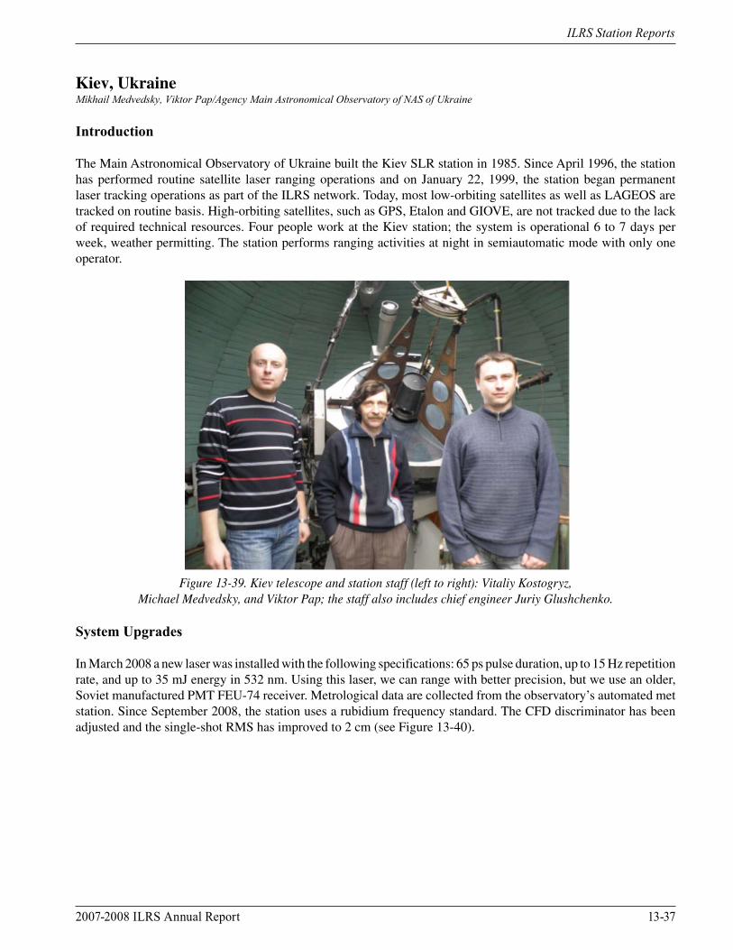
Figure 13-39. Kiev telescope and station staff (left to right): Vitaliy Kostogryz,
Michael Medvedsky, and Viktor Pap; the staff also includes chief engineer Juriy Glushchenko.
System Upgrades
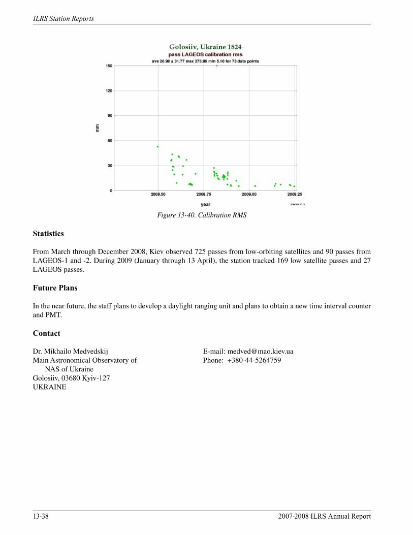
In March 2008 a new laser was installed with the following specifications: 65 ps pulse duration, up to 15 Hz repetition rate, and up to 35 mJ energy in 532 nm. Using this laser, we can range with better precision, but we use an older, Soviet manufactured PMT FEU-74 receiver. Metrological data are collected from the observatory’s automated met station. Since September 2008, the station uses a rubidium frequency standard. The CFD discriminator has been adjusted and the single-shot RMS has improved to 2 cm (see Figure 13-40).
13-38 2007-2008 ILRS Annual Report
ILRS Station Reports
Figure 13-40. Calibration RMS
Statistics
From March through December 2008, Kiev observed 725 passes from low-orbiting satellites and 90 passes from LAGEOS-1 and -2. During 2009 (January through 13 April), the station tracked 169 low satellite passes and 27 LAGEOS passes.
Future Plans
In the near future, the staff plans to develop a daylight ranging unit and plans to obtain a new time interval counter and PMT.
Contact
Dr. Mikhailo Medvedskij E-mail: [email protected] Astronomical Observatory of Phone: +380-44-5264759 NAS of UkraineGolosiiv, 03680 Kyiv-127UKRAINE
2007-2008 ILRS Annual Report 13-39
ILRS Station Reports
Kunming, ChinaXiong Yaoheng, Zheng Xiangming, Fu Honglin, Li Yuqiang/National Astronomical Observatories, Yunnan Observatory, CAS
Current Operations
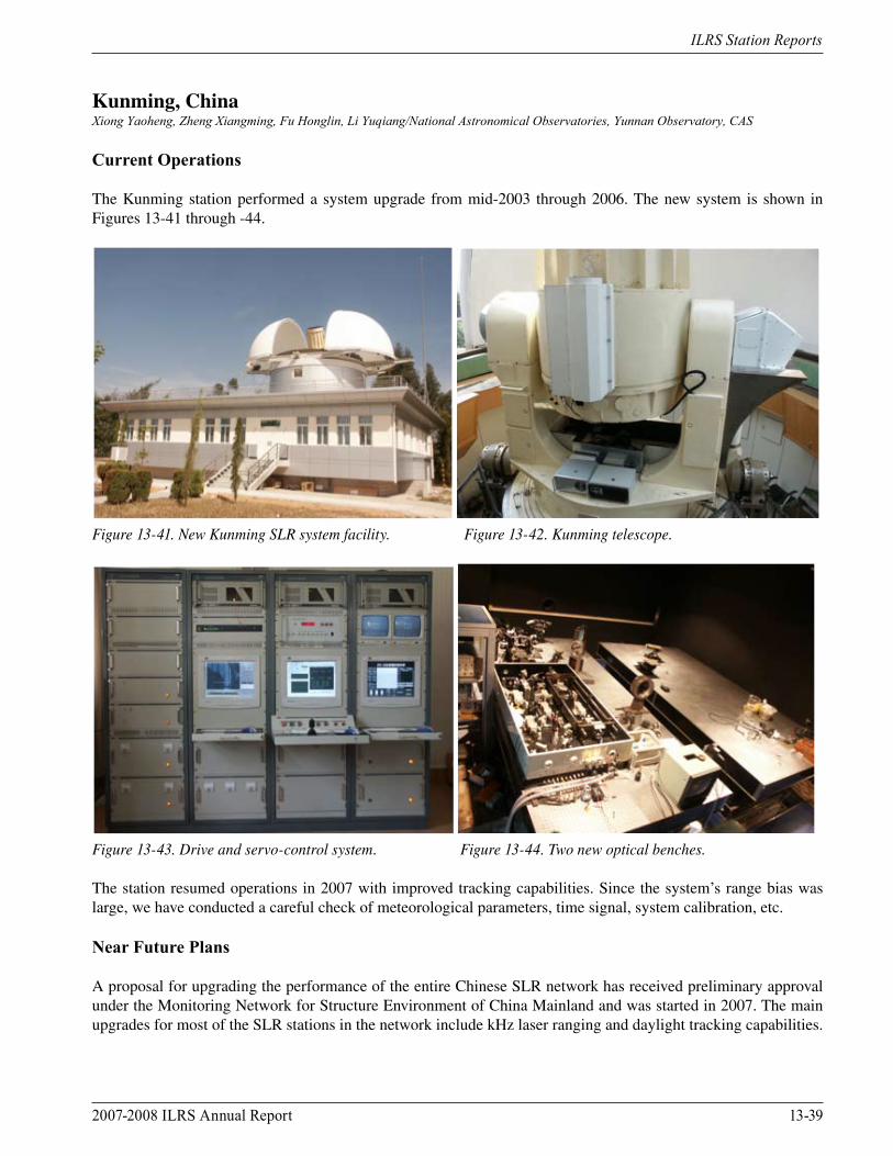
The Kunming station performed a system upgrade from mid-2003 through 2006. The new system is shown in Figures 13-41 through -44.
Figure 13-41. New Kunming SLR system facility. Figure 13-42. Kunming telescope.
Figure 13-43. Drive and servo-control system. Figure 13-44. Two new optical benches.
The station resumed operations in 2007 with improved tracking capabilities. Since the system’s range bias was large, we have conducted a careful check of meteorological parameters, time signal, system calibration, etc.
Near Future Plans
A proposal for upgrading the performance of the entire Chinese SLR network has received preliminary approval under the Monitoring Network for Structure Environment of China Mainland and was started in 2007. The main upgrades for most of the SLR stations in the network include kHz laser ranging and daylight tracking capabilities.
13-40 2007-2008 ILRS Annual Report
ILRS Station Reports
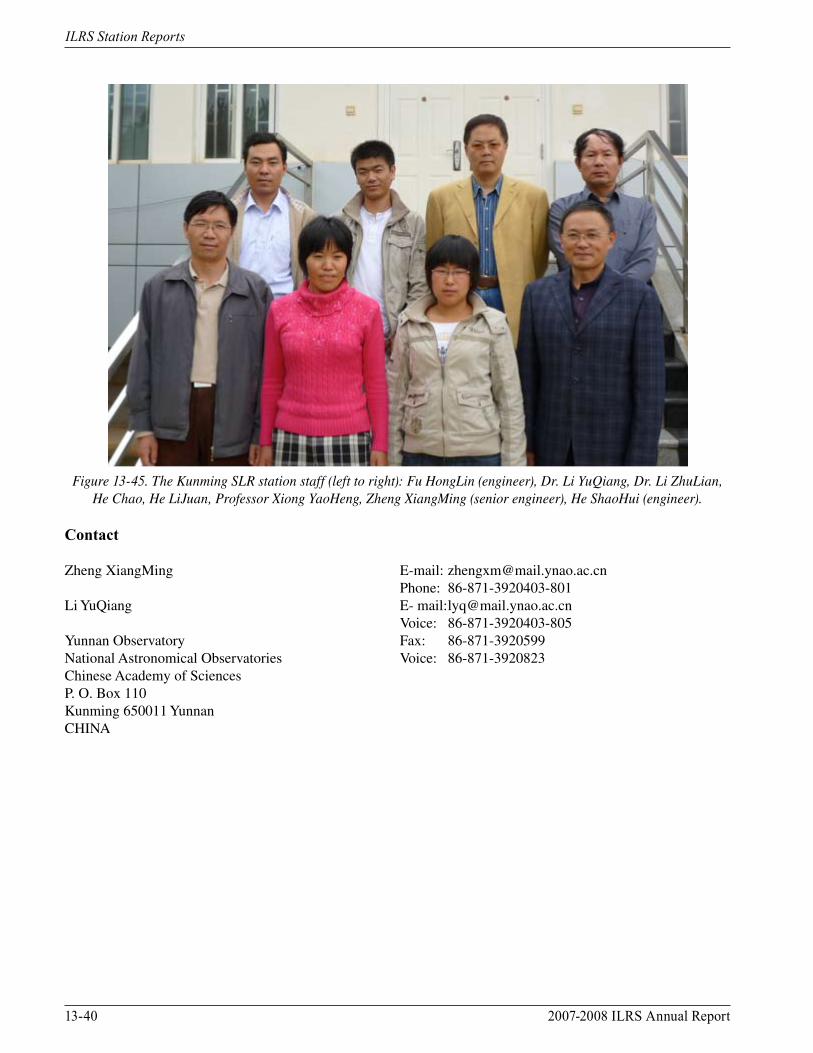
Figure 13-45. The Kunming SLR station staff (left to right): Fu HongLin (engineer), Dr. Li YuQiang, Dr. Li ZhuLian, He Chao, He LiJuan, Professor Xiong YaoHeng, Zheng XiangMing (senior engineer), He ShaoHui (engineer).
Contact
Zheng XiangMing E-mail: [email protected] Phone: 86-871-3920403-801Li YuQiang E- mail: [email protected] Voice: 86-871-3920403-805 Yunnan Observatory Fax: 86-871-3920599 National Astronomical Observatories Voice: 86-871-3920823Chinese Academy of Sciences P. O. Box 110Kunming 650011 Yunnan CHINA
2007-2008 ILRS Annual Report 13-41
ILRS Station Reports
Lviv, UkraineSofiya Apunevych, Andriy Bilinsky, Yaroslav Blagodyr, Natalia Virun, Eva Vovchyk, Konstiantyn Martyniuk-Lototsky/Astronomiсal Observatory of Ivan Franko National University of Lviv
Recent Developments
During 2007-2008 the Lviv station tracked 283 LEO satellite passes (with a total of 4,158 normal points) and 24 LAGEOS passes (218 normal points).
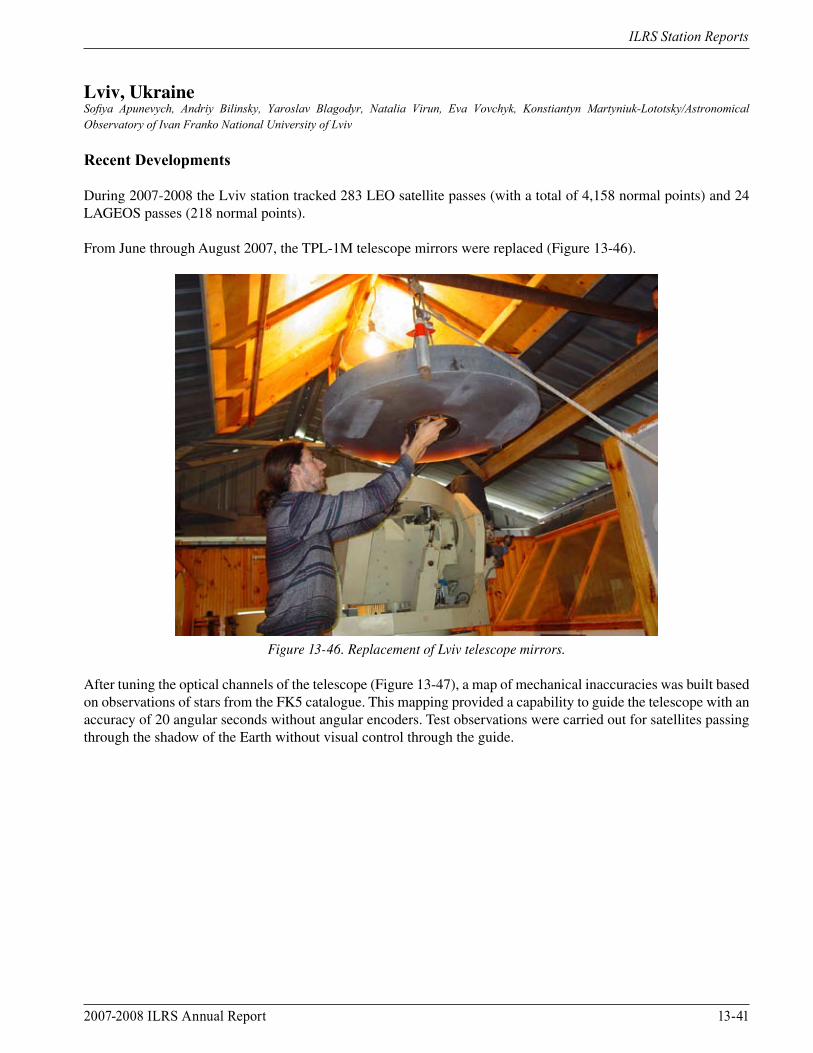
From June through August 2007, the TPL-1M telescope mirrors were replaced (Figure 13-46).
Figure 13-46. Replacement of Lviv telescope mirrors.
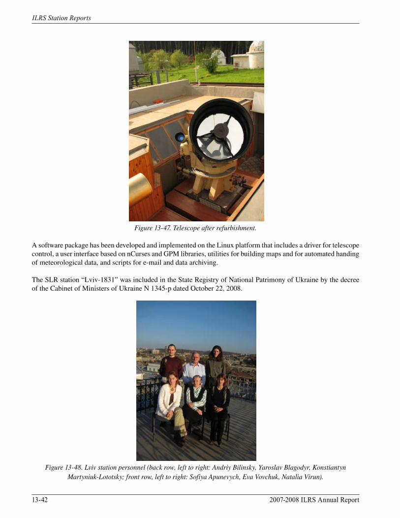
After tuning the optical channels of the telescope (Figure 13-47), a map of mechanical inaccuracies was built based on observations of stars from the FK5 catalogue. This mapping provided a capability to guide the telescope with an accuracy of 20 angular seconds without angular encoders. Test observations were carried out for satellites passing through the shadow of the Earth without visual control through the guide.
13-42 2007-2008 ILRS Annual Report
ILRS Station Reports
Figure 13-47. Telescope after refurbishment.
A software package has been developed and implemented on the Linux platform that includes a driver for telescope control, a user interface based on nCurses and GPM libraries, utilities for building maps and for automated handing of meteorological data, and scripts for e-mail and data archiving.
The SLR station “Lviv-1831” was included in the State Registry of National Patrimony of Ukraine by the decree of the Cabinet of Ministers of Ukraine N 1345-p dated October 22, 2008.
Figure 13-48. Lviv station personnel (back row, left to right: Andriy Bilinsky, Yaroslav Blagodyr, Konstiantyn
Martyniuk-Lototsky; front row, left to right: Sofiya Apunevych, Eva Vovchuk, Natalia Virun).

2007-2008 ILRS Annual Report 13-43
ILRS Station Reports
References
Blagodyr Ya., Bilinsky A., Martynyuk-Lototsky K., Lohvynenko O., Virun N. Overview and performance of the Ukrainian SLR station “Lviv-1831”, Artificial Satellites 2007, Vol. 42, N1, pp. 9-15.http://ilrs.gsfc.nasa.gov/stations/sitelist/LVIL_sitelog.htmlhttp://www.mao.kiev.ua/EOP/ENGLISH/slr/lviv/slr_lviv_location.htmhttp://astro.franko.lviv.ua
Contact
Yaroslav Blagodyr E-mail: [email protected] [email protected] Voice: +380 32 2600393Astronomical Observatory of Ivan Franko National University of LvivSt. Kyrylo i Mefodij, 8,79005, LvivUKRAINE
13-44 2007-2008 ILRS Annual Report
ILRS Station Reports
Matera, ItalyGiuseppe Bianco/Agenzia Spaziale Italiana, Centro di Geodesia Spaziale “Giuseppe Colombo“, Matera, Italy
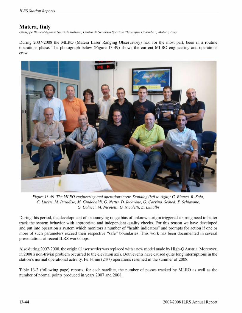
During 2007-2008 the MLRO (Matera Laser Ranging Observatory) has, for the most part, been in a routine operations phase. The photograph below (Figure 13-49) shows the current MLRO engineering and operations crew.
Figure 13-49. The MLRO engineering and operations crew. Standing (left to right): G. Bianco, R. Sala,
C. Luceri, M. Paradiso, M. Guidobaldi, G. Nettis, D. Iacovone, G. Corvino. Seated: F. Schiavone, G. Colucci, M. Nicoletti, G. Nicoletti, E. Lunalbi
During this period, the development of an annoying range bias of unknown origin triggered a strong need to better track the system behavior with appropriate and independent quality checks. For this reason we have developed and put into operation a system which monitors a number of “health indicators” and prompts for action if one or more of such parameters exceed their respective “safe” boundaries. This work has been documented in several presentations at recent ILRS workshops.
Also during 2007-2008, the original laser seeder was replaced with a new model made by High-Q Austria. Moreover, in 2008 a non-trivial problem occurred to the elevation axis. Both events have caused quite long interruptions in the station’s normal operational activity. Full-time (24/7) operations resumed in the summer of 2008.
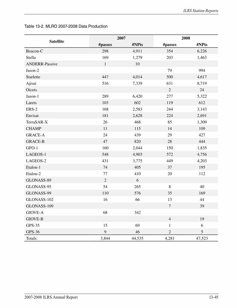
Table 13-2 (following page) reports, for each satellite, the number of passes tracked by MLRO as well as the number of normal points produced in years 2007 and 2008.
2007-2008 ILRS Annual Report 13-45
ILRS Station Reports
Table 13-2. MLRO 2007-2008 Data Production
Satellite2007 2008
#passes #NPts #passes #NPts
Beacon-C 298 4,911 354 6,226
Stella 169 1,279 203 1,463
ANDERR-Passive 1 10
Jason-2 79 994
Starlette 447 4,014 500 4,617
Ajisai 516 7,339 631 8,719
Oicets 2 24
Jason-1 289 6,420 277 5,322
Larets 103 602 119 612
ERS-2 168 2,583 244 3,143
Envisat 181 2,628 224 2,691
TerraSAR-X 26 468 85 1,309
CHAMP 11 115 14 109
GRACE-A 24 439 29 427
GRACE-B 47 820 28 444
GFO-1 160 2,044 150 1,835
LAGEOS-1 548 4,903 572 4,756
LAGEOS-2 431 3,775 449 4,203
Etalon-1 74 405 37 195
Etalon-2 77 410 20 112
GLONASS-89 2 6
GLONASS-95 54 265 8 40
GLONASS-99 110 576 35 169
GLONASS-102 16 66 13 44
GLONASS-109 7 39
GIOVE-A 68 342
GIOVE-B 4 19
GPS-35 15 69 1 6
GPS-36 9 46 2 5
Totals: 3,844 44,535 4,281 47,523
13-46 2007-2008 ILRS Annual Report
ILRS Station Reports
Contacts
Dr. Giuseppe Bianco Voice: +39-0835-377209Agenzia Spaziale Italiana (ASI) Fax: +39-0835-339005Centro di Geodesia Spaziale E-mail: [email protected] Terlecchia, 75100 Matera ITALY
Dr. Vincenza Luceri Voice: +39-0835-377231e-GEOS S.p.A. Fax: +39-06-40999961Centro di Geodesia Spaziale E-mail: [email protected] Terlecchia, 75100 MateraITALY

2007-2008 ILRS Annual Report 13-47
ILRS Station Reports
McDonald TX, USAPeter J. Shelus, Jerry R. Wiant, Randall L Ricklefs, John C. Ries, Judit G. Ries/Center for Space Research and McDonald Observatory, University of Texas at Austin
MLRS Activities
The McDonald Laser Ranging Station (MLRS) is located at McDonald Observatory in the Davis Mountains of west Texas, near the town of Fort Davis, TX (USA). In addition to ranging to artificial satellites (SLR), it is one of the very few stations that also performs laser ranging to the Moon (LLR).
Figure 13-50. MLRS.
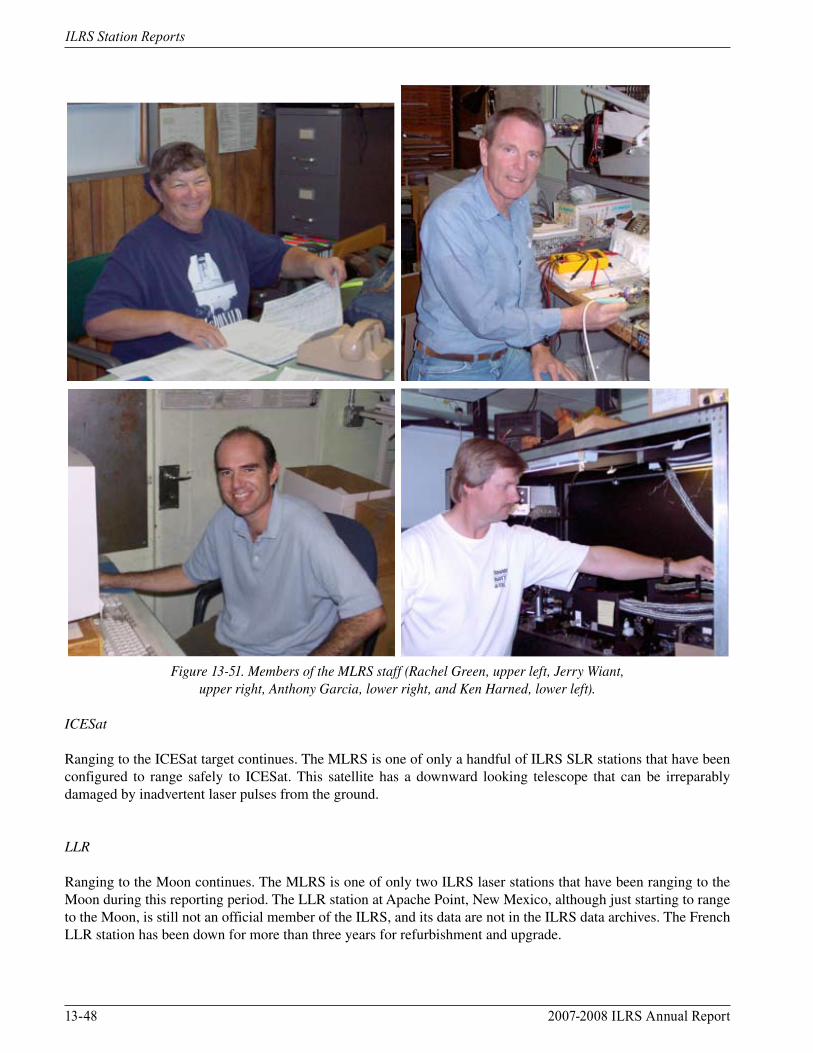
SLR support comes from a NASA operations contract; LLR support comes through a grant from the National Science Foundation. NASA support for LLR was discontinued several years ago. LLR data from MLRS has been the only lunar data deposited into the ILRS data archives during this reporting period. The MLRS staff (Figure 13-51) consists of: Dr. Peter J. Shelus (Project Manager), Mr. Randall L. Ricklefs (Software Manager), Mr. Jerry R. Wiant (Project Engineer), Mr. Ken T. Harned (observer), Mr. Anthony R. Garcia (observer), and Ms. Rachel M. Green (part-time Technical Assistant). SLR
SLR data volume from the MLRS continues to be less than optimal, due to the reduction in manpower that was forced by a sequence of funding cuts.
In addition, the station is showing its age. The MLRS is in need of a serious upgrade and refurbishment. Day-to-day activity is directed toward keeping the station operational and in a data-gathering mode. On the positive side, the MLRS has been one of the earliest adopters of the new ILRS prediction and data formats (CPF and CRD).
13-48 2007-2008 ILRS Annual Report
ILRS Station Reports
Figure 13-51. Members of the MLRS staff (Rachel Green, upper left, Jerry Wiant, upper right, Anthony Garcia, lower right, and Ken Harned, lower left).
ICESat
Ranging to the ICESat target continues. The MLRS is one of only a handful of ILRS SLR stations that have been configured to range safely to ICESat. This satellite has a downward looking telescope that can be irreparably damaged by inadvertent laser pulses from the ground.
LLR
Ranging to the Moon continues. The MLRS is one of only two ILRS laser stations that have been ranging to the Moon during this reporting period. The LLR station at Apache Point, New Mexico, although just starting to range to the Moon, is still not an official member of the ILRS, and its data are not in the ILRS data archives. The French LLR station has been down for more than three years for refurbishment and upgrade.

2007-2008 ILRS Annual Report 13-49
ILRS Station Reports
A Hamamatsu MCP has been made available by GSFC to the MLRS to replace the two Varian photomultiplier tubes that had been used over the past 25 years for LLR operations. Although not as sensitive as the Varian tubes and a bit noisier, it has allowed the continuation of LLR observations.
MLRS LLR data are available through the ILRS data centers. The data are transmitted to the centers in near real-time, using standard ILRS formats.
LRO-LR
The MLRS has been designated as a ground station to participate in the LRO Laser Ranging (LRO-LR) project. Extensive work has been performed to get the station ready for that project. LRO was launched in June 2009.
Data Quality Control
John Ries and Richard Eanes perform regular SLR data processing and quality control at the Center for Space Research (CSR) located at the University of Texas at Austin. The analogous LLR tasks are performed by Judit Ries.
Contact
Dr. Peter Shelus (Austin) Voice: 512-471-7599University of Texas, Center for Space Research Fax: 512-471-35703925 West Braker Lane, Suite 200 E-mail: [email protected], TX 78759-5321USA
Mr. Jerry R. Wiant (MLRS) Voice: 1-432 426 36689 Lunar Cir E-mail: [email protected] Obs., TX 78734USA
13-50 2007-2008 ILRS Annual Report
ILRS Station Reports
Metsähovi, FinlandK. Arsov, A. Raja-Halli, J. Näränen, M. Poutanen/Finnish Geodetic Institute, Finland
The Metsähovi research station was founded in the mid-1970s, and over the years it has become an essential part of the activities of the Finnish Geodetic Institute. The instrumentation of the station serves both the Institute’s own research and the international scientific community. The following instruments are currently installed at the Metsähovi research station: satellite laser ranging (SLR), geodetic Very Long Baseline Interferometry (VLBI) in a co-operation with the Helsinki University of Technology, GPS and GLONASS receivers, a DORIS beacon, and a superconducting gravimeter. Absolute gravity is regularly measured in the gravimetric laboratory where the national reference point of gravity exists. There is also a seismometer from the University of Helsinki. Metsähovi is one of the few fundamental stations in the world where all major geodetic observing instruments are installed in the same site.
The satellite laser ranging system operating through the middle of 2005 was acquired in 1994. It consists of a 1-meter telescope, made by the University of Latvia in Riga, and a mode-locked Nd:YAG laser with less than 50 ps pulse length. Ranging data showed a precision of about ± 20 mm. The system was designed and constructed by the late Dr. Matti Paunonen. Maintenance of the old system became more and more difficult, and in 2005 a decision was made to replace the laser with a more modern one.
Renewal of the laser started in mid-2005 and therefore observations were taken only during the first half of that year. Due to unexpected delays, the renewal has taken much longer to complete than originally anticipated. In 2006 a decision was made to purchase a modern kHz laser and a contract was arranged with the High Q Laser Production GmbH of Austria. The ordered laser is a diode-pumped Nd:VAN solid state laser with the pulse rate up to 2 kHz and the pulse energy > 0.5 mJ. The laser is of the same type that Graz and Herstmonceux are currently using.
The complete renovation of our old SLR system is progressing, including the 1 m telescope; the primary mirror has been re-coated, new motors and encoders have been purchased and are currently in the implementation. An optical/mechanical solution for a separate beam path for the outgoing and incoming beams is in an implementation phase. Unfortunately, due to these changes, the old telescope software is not operable, so complete programming of new telescope controlling software is also ongoing. At the same time, software capable of kHz data tracking is under development. We replaced our old PMT detector with a digital C-SPAD from the Czech Republic; this detector is capable of handling kHz data. For the timing, we purchased a new A032-ET event timer from Riga; software implementation regarding the interaction with A032-ET is ongoing. For gating, we purchased a Range Gate Generator FPGA card from Graz, hosted into an industry computer; this card is also currently being implemented into our new SLR system. The timing and meteo servers are completely renewed with a new GPS timing receiver together with the hydrogen maser signal; a new meteo server is being designed and implemented together with the timing server.
Currently, a software module incorporating and controlling all of the above-mentioned hardware is under development, together with a “smart” session planner as an integral part of our new SLR operational software. The platform chosen is Windows Vista and the programming language is visual C++ with usage of the MFC libraries.
Parallel to the renovation of the 1 m telescope, we are seeking funding for a new telescope and dome to host the 2 kHz system. If successful, we hope to continue to use the 1 m telescope with a slower but a more powerful laser for MEO type satellites, including current and future GNSS.
We do hope that we will start our first 2 kHz observations in 2010 and thus retain our operational status in ILRS.

2007-2008 ILRS Annual Report 13-51
ILRS Station Reports
Contact
Dr. Kirco Arsov Voice: +358-(0)9-2564995Finnish Geodetic Institute Fax: +358-(0)9-2955 5200Department of Geodesy and GeodynamicsP.O. Box 15Geodeetinrinne 202431 MasalaFINLAND
13-52 2007-2008 ILRS Annual Report
ILRS Station Reports
Monument Peak CA, USADavid Carter/NASA GSFC, Julie Horvath and Scott Wetzel/HTSI
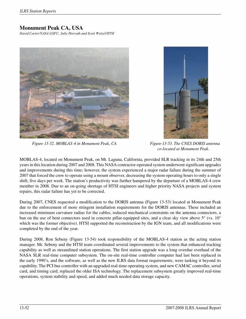
Figure 13-52. MOBLAS-4 in Monument Peak, CA Figure-13-53. The CNES DORIS antenna co-located at Monument Peak.
MOBLAS-4, located on Monument Peak, on Mt. Laguna, California, provided SLR tracking in its 24th and 25th years in this location during 2007 and 2008. This NASA contractor-operated system underwent significant upgrades and improvements during this time; however, the system experienced a major radar failure during the summer of 2007 that forced the crew to operate using a mount observer, decreasing the system operating hours to only a single shift, five days per week. The station’s productivity was further hampered by the departure of a MOBLAS-4 crew member in 2008. Due to an on-going shortage of HTSI engineers and higher priority NASA projects and system repairs, this radar failure has yet to be corrected.
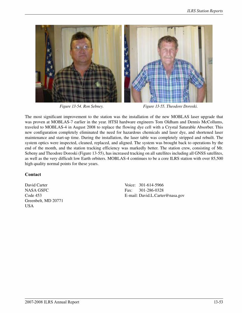
During 2007, CNES requested a modification to the DORIS antenna (Figure 13-53) located at Monument Peak due to the enforcement of more stringent installation requirements for the DORIS antennas. These included an increased minimum curvature radius for the cables, reduced mechanical constraints on the antenna connectors, a ban on the use of bent connectors used in concrete pillar-equipped sites, and a clear sky view above 5° (vs. 10° which was the former objective). HTSI supported the reconstruction by the IGN team, and all modifications were completed by the end of the year.
During 2008, Ron Sebeny (Figure 13-54) took responsibility of the MOBLAS-4 station as the acting station manager. Mr. Sebeny and the HTSI team coordinated several improvements to the system that enhanced tracking capability as well as streamlined station operations. The first station upgrade was a long overdue overhaul of the NASA SLR real-time computer subsystem. The on-site real-time controller computer had last been replaced in the early 1990’s, and the software, as well as the new ILRS data format requirements, were tasking it beyond its capability. The PCI bus controller with an upgraded real-time operating system, and new CAMAC controller, serial card, and timing card, replaced the older ISA technology. The replacement subsystem greatly improved real-time operations, system stability and speed, and added much needed data storage capacity.
2007-2008 ILRS Annual Report 13-53
ILRS Station Reports
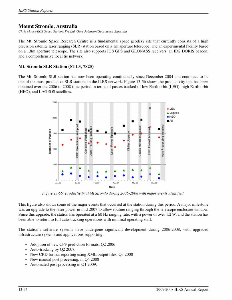
Figure 13-54. Ron Sebney. Figure 13-55. Theodore Doroski.
The most significant improvement to the station was the installation of the new MOBLAS laser upgrade that was proven at MOBLAS-7 earlier in the year. HTSI hardware engineers Tom Oldham and Dennis McCollums, traveled to MOBLAS-4 in August 2008 to replace the flowing dye cell with a Crystal Saturable Absorber. This new configuration completely eliminated the need for hazardous chemicals and laser dye, and shortened laser maintenance and start-up time. During the installation, the laser table was completely stripped and rebuilt. The system optics were inspected, cleaned, replaced, and aligned. The system was brought back to operations by the end of the month, and the station tracking efficiency was markedly better. The station crew, consisting of Mr. Sebeny and Theodore Doroski (Figure 13-55), has increased tracking on all satellites including all GNSS satellites, as well as the very difficult low Earth orbiters. MOBLAS-4 continues to be a core ILRS station with over 85,500 high quality normal points for these years.
Contact
David Carter Voice: 301-614-5966NASA GSFC Fax: 301-286-0328Code 453 E-mail: [email protected], MD 20771USA
13-54 2007-2008 ILRS Annual Report
ILRS Station Reports
Mount Stromlo, AustraliaChris Moore/EOS Space Systems Pty Ltd, Gary Johnston/Geoscience Australia
The Mt. Stromlo Space Research Centre is a fundamental space geodesy site that currently consists of a high precision satellite laser ranging (SLR) station based on a 1m aperture telescope, and an experimental facility based on a 1.8m aperture telescope. The site also supports IGS GPS and GLONASS receivers, an IDS DORIS beacon, and a comprehensive local tie network.
Mt. Stromlo SLR Station (STL3, 7825)
The Mt. Stromlo SLR station has now been operating continuously since December 2004 and continues to be one of the most productive SLR stations in the ILRS network. Figure 13-56 shows the productivity that has been obtained over the 2006 to 2008 time period in terms of passes tracked of low Earth orbit (LEO), high Earth orbit (HEO), and LAGEOS satellites.
Figure 13-56: Productivity at Mt Stromlo during 2006-2008 with major events identified.
This figure also shows some of the major events that occurred at the station during this period. A major milestone was an upgrade to the laser power in mid 2007 to allow routine ranging through the telescope enclosure window. Since this upgrade, the station has operated at a 60 Hz ranging rate, with a power of over 1.2 W, and the station has been able to return to full auto-tracking operations with minimal operating staff.
The station’s software systems have undergone significant development during 2006-2008, with upgraded infrastructure systems and applications supporting:
• Adoption of new CPF prediction formats, Q2 2006 • Auto-tracking by Q2 2007, • New CRD format reporting using XML output files, Q3 2008 • New manual post processing, in Q4 2008 • Automated post-processing in Q1 2009.
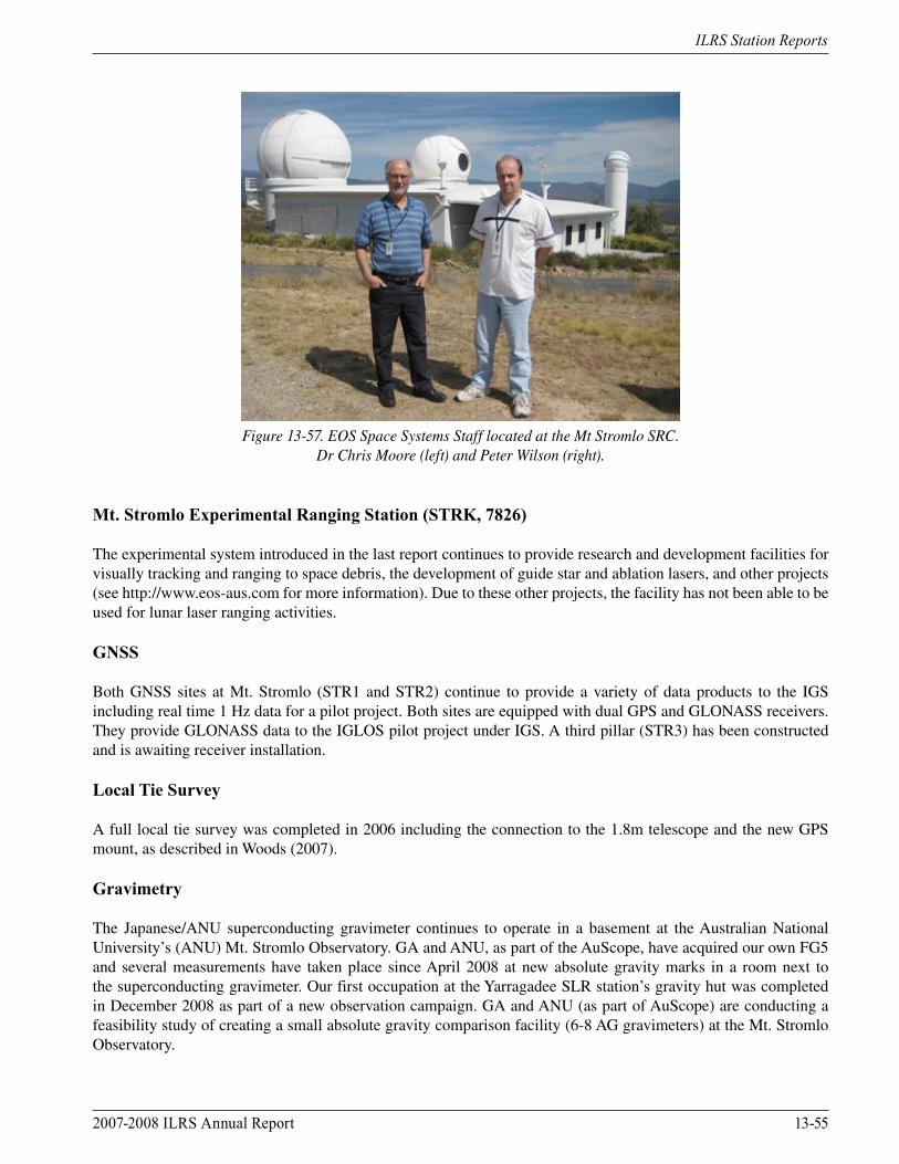
2007-2008 ILRS Annual Report 13-55
ILRS Station Reports
Figure 13-57. EOS Space Systems Staff located at the Mt Stromlo SRC. Dr Chris Moore (left) and Peter Wilson (right).
Mt. Stromlo Experimental Ranging Station (STRK, 7826)
The experimental system introduced in the last report continues to provide research and development facilities for visually tracking and ranging to space debris, the development of guide star and ablation lasers, and other projects (see http://www.eos-aus.com for more information). Due to these other projects, the facility has not been able to be used for lunar laser ranging activities.
GNSS
Both GNSS sites at Mt. Stromlo (STR1 and STR2) continue to provide a variety of data products to the IGS including real time 1 Hz data for a pilot project. Both sites are equipped with dual GPS and GLONASS receivers. They provide GLONASS data to the IGLOS pilot project under IGS. A third pillar (STR3) has been constructed and is awaiting receiver installation.
Local Tie Survey
A full local tie survey was completed in 2006 including the connection to the 1.8m telescope and the new GPS mount, as described in Woods (2007).
Gravimetry
The Japanese/ANU superconducting gravimeter continues to operate in a basement at the Australian National University’s (ANU) Mt. Stromlo Observatory. GA and ANU, as part of the AuScope, have acquired our own FG5 and several measurements have taken place since April 2008 at new absolute gravity marks in a room next to the superconducting gravimeter. Our first occupation at the Yarragadee SLR station’s gravity hut was completed in December 2008 as part of a new observation campaign. GA and ANU (as part of AuScope) are conducting a feasibility study of creating a small absolute gravity comparison facility (6-8 AG gravimeters) at the Mt. Stromlo Observatory.
13-56 2007-2008 ILRS Annual Report
ILRS Station Reports
References
Woods, A.R., (2007): “The 2006 Mount Stromlo Local Tie Survey”, Geoscience Australia Record 2007/18, 27pp.
Contacts
Dr. Christopher Moore Voice: +61 2 6287-2953EOS Space Systems Pty Ltd Fax: +61 2 6287-2951111 Canberra Avenue E-mail: [email protected], ACT 2603AUSTRALIA
Mr. Gary Johnston Voice: +61 62499049Geoscience Australia Fax: +61 62499929PO Box 378 Canberra ACT 2601 E-mail [email protected]
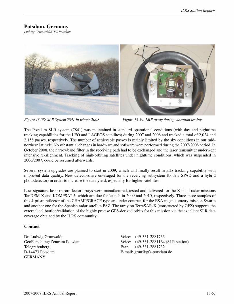
2007-2008 ILRS Annual Report 13-57
ILRS Station Reports
Potsdam, GermanyLudwig Grunwaldt/GFZ Potsdam
Figure 13-58: SLR System 7841 in winter 2008 Figure 13-59: LRR array during vibration testing
The Potsdam SLR system (7841) was maintained in standard operational conditions (with day and nighttime tracking capabilities for the LEO and LAGEOS satellites) during 2007 and 2008 and tracked a total of 2,024 and 2,158 passes, respectively. The number of achievable passes is mainly limited by the sky conditions in our mid-northern latitude. No substantial changes in hardware and software were performed during the 2007-2008 period. In October 2008, the narrowband filter in the receiving path had to be exchanged and the laser transmitter underwent intensive re-alignment. Tracking of high-orbiting satellites under nighttime conditions, which was suspended in 2006/2007, could be resumed afterwards.
Several system upgrades are planned to start in 2009, which will finally result in kHz tracking capability with improved data quality. New detectors are envisaged for the receiving subsystem (both a SPAD and a hybrid photodetector) in order to increase the data yield, especially for higher satellites.
Low-signature laser retroreflector arrays were manufactured, tested and delivered for the X-band radar missions TanDEM-X and KOMPSAT-5, which are due for launch in 2009 and 2010, respectively. Three more samples of this 4-prism reflector of the CHAMP/GRACE type are under contract for the ESA magnetometry mission Swarm and another one for the Spanish radar satellite PAZ. The array on TerraSAR-X (constructed by GFZ) supports the external calibration/validation of the highly precise GPS-derived orbits for this mission via the excellent SLR data coverage obtained by the ILRS community.
Contact
Dr. Ludwig Grunwaldt Voice: +49-331-2881733GeoForschungsZentrum Potsdam Voice: +49-331-2881164 (SLR station)Telegrafenberg Fax: +49-331-2881732D-14473 Potsdam E-mail: [email protected]
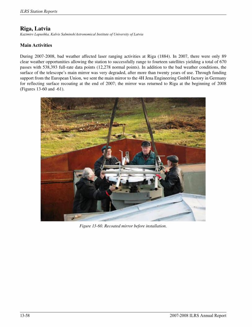
13-58 2007-2008 ILRS Annual Report
ILRS Station Reports
Riga, LatviaKazimirs Lapushka, Kalvis Salminsh/Astronomical Institute of University of Latvia
Main Activities
During 2007-2008, bad weather affected laser ranging activities at Riga (1884). In 2007, there were only 89 clear weather opportunities allowing the station to successfully range to fourteen satellites yielding a total of 670 passes with 538,393 full-rate data points (12,278 normal points). In addition to the bad weather conditions, the surface of the telescope’s main mirror was very degraded, after more than twenty years of use. Through funding support from the European Union, we sent the main mirror to the 4H Jena Engineering GmbH factory in Germany for reflecting surface recoating at the end of 2007; the mirror was returned to Riga at the beginning of 2008 (Figures 13-60 and -61).
Figure 13-60. Recoated mirror before installation.
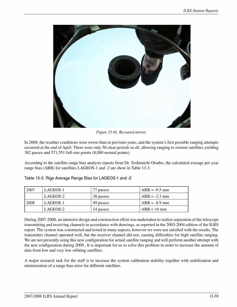
2007-2008 ILRS Annual Report 13-59
ILRS Station Reports
Figure 13-61. Recoated mirror.
In 2008, the weather conditions were worse than in previous years, and the system’s first possible ranging attempts occurred at the end of April. There were only 56 clear periods in all, allowing ranging to sixteen satellites yielding 382 passes and 571,551 full-rate points (8,080 normal points).
According to the satellite range bias analysis reports from Dr. Toshimichi Otsubo, the calculated average per year range bias (ARB) for satellites LAGEOS-1 and -2 are show in Table 13-3.
Table 13-3. Riga Average Range Bias for LAGEOS-1 and -2
2007 LAGEOS-1 77 passes ARB = -9.5 mm
LAGEOS-2 38 passes ARB = -2.3 mm
2008 LAGEOS-1 49 passes ARB = -8.9 mm
LAGEOS-2 14 passes ARB = 10 mm
During 2007-2008, an intensive design and construction effort was undertaken to realize separation of the telescope transmitting and receiving channels in accordance with drawings, as reported in the 2003-2004 edition of the ILRS report. The system was constructed and tested in many aspects, however we were not satisfied with the results. The transmitter channel operated well, but the receiver channel did not, causing difficulties for high satellite ranging. We are not presently using this new configuration for actual satellite ranging and will perform another attempt with the new configuration during 2009.. It is important for us to solve this problem in order to increase the amount of data from low and very low orbiting satellites.
A major research task for the staff is to increase the system calibration stability together with stabilization and minimization of a range bias error for different satellites.
13-60 2007-2008 ILRS Annual Report
ILRS Station Reports
A Vaisala WXT-510 weather transmitter station was installed in 2007 and since November 11, 2007, meteorological data are recorded at the site every 10 minutes.
Significant software efforts were made to accommodate the new ILRS data and prediction formats together with the development of new data processing and prediction software.
Contact
Dr. Kazimirs Lapushka Voice: 371 7 611984Astronomical Institute of University of Latvia Fax: 371 7 820180Blw. Rainis 19 E-mail: [email protected], LV-1586LATVIA
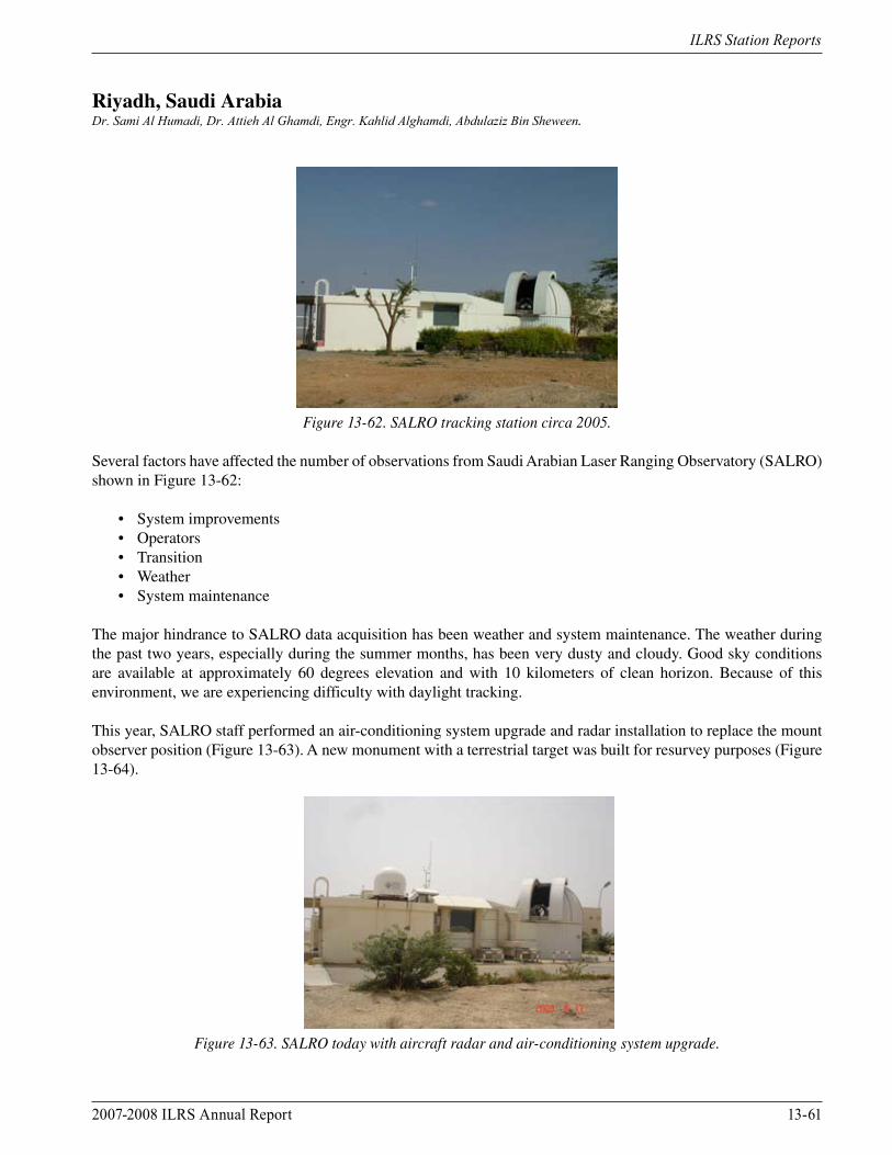
2007-2008 ILRS Annual Report 13-61
ILRS Station Reports
Riyadh, Saudi ArabiaDr. Sami Al Humadi, Dr. Attieh Al Ghamdi, Engr. Kahlid Alghamdi, Abdulaziz Bin Sheween.
Figure 13-62. SALRO tracking station circa 2005.
Several factors have affected the number of observations from Saudi Arabian Laser Ranging Observatory (SALRO) shown in Figure 13-62:
• System improvements • Operators • Transition • Weather • System maintenance
The major hindrance to SALRO data acquisition has been weather and system maintenance. The weather during the past two years, especially during the summer months, has been very dusty and cloudy. Good sky conditions are available at approximately 60 degrees elevation and with 10 kilometers of clean horizon. Because of this environment, we are experiencing difficulty with daylight tracking.
This year, SALRO staff performed an air-conditioning system upgrade and radar installation to replace the mount observer position (Figure 13-63). A new monument with a terrestrial target was built for resurvey purposes (Figure 13-64).
Figure 13-63. SALRO today with aircraft radar and air-conditioning system upgrade.
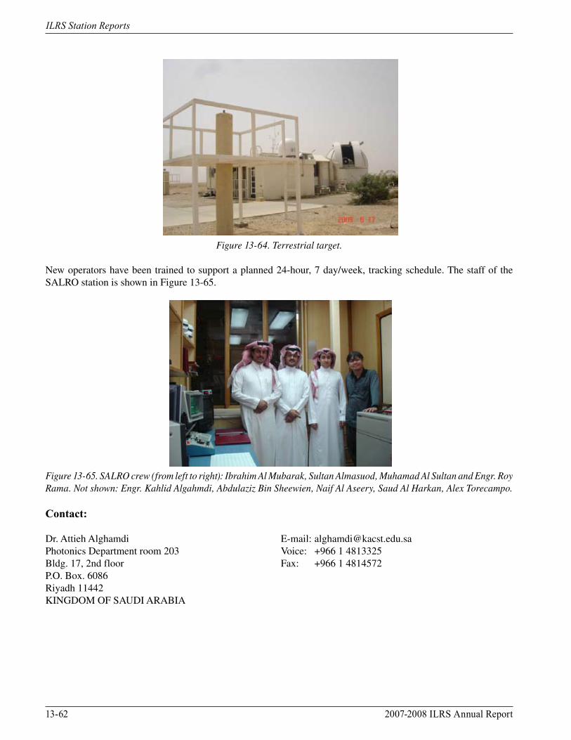
13-62 2007-2008 ILRS Annual Report
ILRS Station Reports
Figure 13-64. Terrestrial target.
New operators have been trained to support a planned 24-hour, 7 day/week, tracking schedule. The staff of the SALRO station is shown in Figure 13-65.
Figure 13-65. SALRO crew (from left to right): Ibrahim Al Mubarak, Sultan Almasuod, Muhamad Al Sultan and Engr. Roy Rama. Not shown: Engr. Kahlid Algahmdi, Abdulaziz Bin Sheewien, Naif Al Aseery, Saud Al Harkan, Alex Torecampo.
Contact:
Dr. Attieh Alghamdi E-mail: [email protected] Department room 203 Voice: +966 1 4813325Bldg. 17, 2nd floor Fax: +966 1 4814572P.O. Box. 6086Riyadh 11442KINGDOM OF SAUDI ARABIA
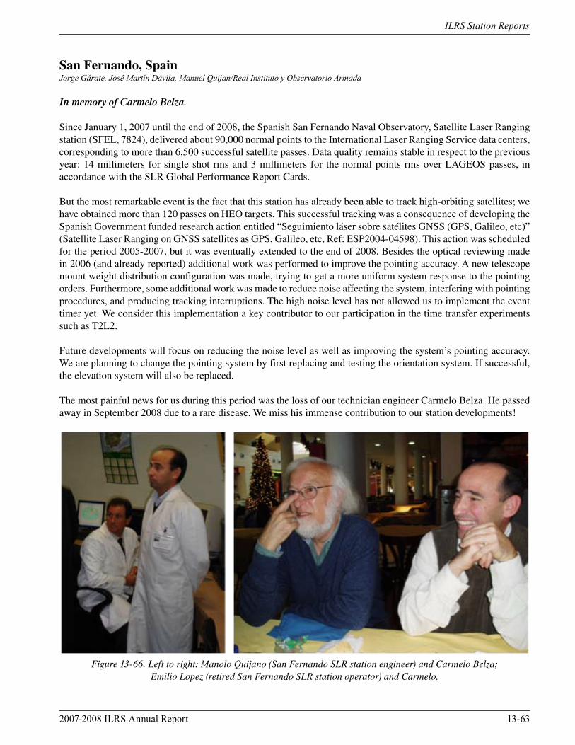
2007-2008 ILRS Annual Report 13-63
ILRS Station Reports
San Fernando, SpainJorge Gárate, José Martín Dávila, Manuel Quijan/Real Instituto y Observatorio Armada
In memory of Carmelo Belza.
Since January 1, 2007 until the end of 2008, the Spanish San Fernando Naval Observatory, Satellite Laser Ranging station (SFEL, 7824), delivered about 90,000 normal points to the International Laser Ranging Service data centers, corresponding to more than 6,500 successful satellite passes. Data quality remains stable in respect to the previous year: 14 millimeters for single shot rms and 3 millimeters for the normal points rms over LAGEOS passes, in accordance with the SLR Global Performance Report Cards.
But the most remarkable event is the fact that this station has already been able to track high-orbiting satellites; we have obtained more than 120 passes on HEO targets. This successful tracking was a consequence of developing the Spanish Government funded research action entitled “Seguimiento láser sobre satélites GNSS (GPS, Galileo, etc)” (Satellite Laser Ranging on GNSS satellites as GPS, Galileo, etc, Ref: ESP2004-04598). This action was scheduled for the period 2005-2007, but it was eventually extended to the end of 2008. Besides the optical reviewing made in 2006 (and already reported) additional work was performed to improve the pointing accuracy. A new telescope mount weight distribution configuration was made, trying to get a more uniform system response to the pointing orders. Furthermore, some additional work was made to reduce noise affecting the system, interfering with pointing procedures, and producing tracking interruptions. The high noise level has not allowed us to implement the event timer yet. We consider this implementation a key contributor to our participation in the time transfer experiments such as T2L2.
Future developments will focus on reducing the noise level as well as improving the system’s pointing accuracy. We are planning to change the pointing system by first replacing and testing the orientation system. If successful, the elevation system will also be replaced.
The most painful news for us during this period was the loss of our technician engineer Carmelo Belza. He passed away in September 2008 due to a rare disease. We miss his immense contribution to our station developments!
Figure 13-66. Left to right: Manolo Quijano (San Fernando SLR station engineer) and Carmelo Belza;
Emilio Lopez (retired San Fernando SLR station operator) and Carmelo.
13-64 2007-2008 ILRS Annual Report
ILRS Station Reports
Contact
Jorge Garate Voice: 34-956-599285Real Instituto y Observatorio Armada Fax: 34-956-599366Sec. Geofisica, C. Cecilio Pujazon S/N E-mail: [email protected] San Fernando, CadizSPAIN

2007-2008 ILRS Annual Report 13-65
ILRS Station Reports
San Juan, ArgentinaE. Alonso, E. Actis, R. Podesta, A. Pacheco/National University of San Juan, Weidong Liu, Yanben Han/National Astronomical Observatories, CAS (NAOC)
Introduction
The SLR station in San Juan Argentina (working under cooperation in astronomy between the National Astronomical Observatories of Chinese Academy of Sciences, NAOC, and the National University of San Juan of Argentina, NUSJA) has operated almost three years, since the end of February 2006. Under the support of the ministries of science and technology of the two countries, China and Argentina (MSTC and MSTA), the Chinese Academy of Sciences, NAOC, and NUSJA, the observations of the SLR station have made excellent contributions to the ILRS. These results are mainly due to the efforts of the station staff from NAOC and NUSJA. The maintenance of the station equipment and dedicated observation is an important contributor to the station’s excellent performance. Furthermore, San Juan has excellent weather, having the very dry characteristics of a desert climate with approximately 300 nights per year (a total of 303 mostly clear or partly cloudy nights in 2007, and 331 nights in 2008) where ranging is possible. The altitude is the most important contributor to the stability of the weather conditions. The area’s climate is warm, the rains are scarce and irregular and occur mostly in the summer; summaries of the average monthly weather conditions in San Juan are shown in Figures 13-67 and -68. These conditions are very important to successful daylight satellite tracking operations.
Operations
The San Juan station acquired 7,087 passes and 98,688 normal points on all satellites during 2007 due to the excellent work of the staff from NAOC, NUSJA, and CASM. In 2008, the station tracked 8,518 passes and 118,159 normal points with the support from personnel from the NAOC, NUSJA, and the Changchun SLR station. The station has added the GIOVE-A and -B satellites (in order to collaborate on the development of the new Galileo system developed by the European Space Agency, ESA), the Chinese satellite Compass-M1, and the Japanese SOHLA-1 into the station’s roster of observed satellites. Observational results from San Juan are shown in Figures 13-69, -70a, and -70b. The results clearly show that San Juan SLR station has become one of the fundamental and important stations of ILRS.
Figure 13-67. Summary of nighttime weather conditions at San Juan in 2007.
Figure 13-68. Summary of daytime weather conditions at San Juan in 2007.
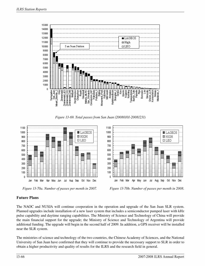
13-66 2007-2008 ILRS Annual Report
ILRS Station Reports
Figure 13-69. Total passes from San Juan (20080101-20081231)
Figure 13-70a. Number of passes per month in 2007. Figure 13-70b. Number of passes per month in 2008.
Future Plans
The NAOC and NUSJA will continue cooperation in the operation and upgrade of the San Juan SLR system. Planned upgrades include installation of a new laser system that includes a semiconductor pumped laser with kHz pulse capability and daytime ranging capabilities. The Ministry of Science and Technology of China will provide the main financial support for the upgrade; the Ministry of Science and Technology of Argentina will provide additional funding. The upgrade will begin in the second half of 2009. In addition, a GPS receiver will be installed near the SLR system.
The ministries of science and technology of the two countries, the Chinese Academy of Sciences, and the National University of San Juan have confirmed that they will continue to provide the necessary support to SLR in order to obtain a higher productivity and quality of results for the ILRS and the research field in general.
2007-2008 ILRS Annual Report 13-67
ILRS Station Reports
Contacts
Prof. E. Alonso, Prof. E. Actis E-mail: [email protected] Observatorio Astronómico Félix Aguilar E-mail: [email protected]ídez 8175 – Oeste Voice: +0054-264-42314675407 – Marquesado Fax: +0054-264-4238494San JuanARGENTINA
Prof. Yanben Han, Weidong Liu Voice: +0086-10-64888730National Astronomical Observatories, CAS E-mail: [email protected] Datun Road [email protected] District100012 BeijingCHINA

13-68 2007-2008 ILRS Annual Report
ILRS Station Reports
Shanghai, ChinaDr. Sami Al Humadi, Dr. Attieh Al Ghamdi, Engr. Kahlid Alghamdi, Abdulaziz Bin Sheween/KACST
During the 2007-2008 time period the Shanghai SLR station concentrated on upgrading the system through the support of the second stage of the national project “Crustal Movement Observation Network of China (CMONOC)”. The following sections detail improvements that have been done at Shanghai since 2007.
Event Timer
Since the beginning of 2007, the A032-ET event timer from the Riga University in Latvia replaced the old counters (HP5370B and SR620) in routine operations.
New Encoders
New encoders from Renishaw (UK) with a resolution of 0.7 arcsec and a diameter of 300mm replaced the very old optical encoders that were made by the Changchun Institute of Optics and Mechanics in 1982. The new encoders have been installed for routine observations since September 2009. The tracking accuracy of the telescope has been greatly upgraded to 1 arcsec.
KHz Ranging Upgrading
The hardware and software for kHz ranging capability have been under development since 2007. The controller and data preprocessing software have been built based on the FPGA, the range gate board with a resolution of 5ns for kHz ranging. Experimental kHz ranging to LAGEOS, Ajisai, BE-C was done in April-May 2008 with a Q-switched laser with a 1 kHz repetition rate.
A new kHz laser bought from Photonics Industries, USA (Figure 13-74) was received in August 2009. The output of the laser is as follows: 3mJ (532nm), 10-20ps, 1 kHz, 0.6mr divergence (beam diameter 2mm). The new laser has been used in routine operations since September 2009. Up to several hundred thousand points per pass can be obtained for LAGEOS, Ajisai, etc. The laser case is airtight and cannot be opened, while the output energy has been reduced since its operation. Therefore, the quality of the new laser still needs to be examined.
Daylight Tracking
The Shanghai station obtained some daylight tracking data from LAGEOS as well as LEO satellites during 1996-2000. Since that time we have not been able to continue daylight tracking due to the poor beam pointing stability of the old laser and the frequent alignments required with the Coudé system.
The new kHz laser has a very good beam pointing stability (about 5 arcsec). Therefore, in October 2009, we resumed daylight tracking with the new laser and have obtained some data from Ajisai and BE-C. We are working on further system upgrades for improved daylight tracking capability.
Other Projects
• Un-cooperative target ranging • Design and manufacture of the LRAs for all Compass satellites • Laser Time Transfer (LTT) experiment. We built the LTT payload for the Compass-M1 satellite launched in April 2007 and obtained the time comparison results between the space borne rubidium clock and the ground hydrogen maser at the Changchun SLR station. • Design, manufacture and installation of a new dedicated Compass SLR station in Beijing. The station has a 1-meter aperture telescope with a powerful laser and has the capability to track Compass GEO satellites.
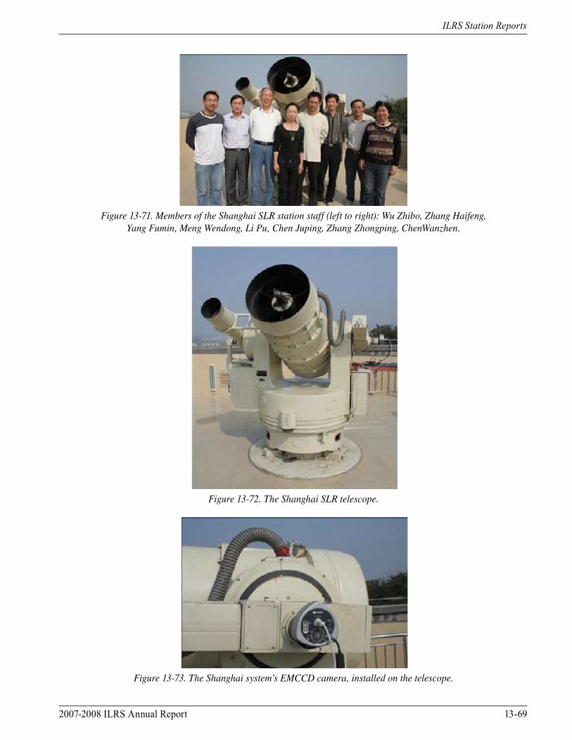
2007-2008 ILRS Annual Report 13-69
ILRS Station Reports
Figure 13-71. Members of the Shanghai SLR station staff (left to right): Wu Zhibo, Zhang Haifeng, Yang Fumin, Meng Wendong, Li Pu, Chen Juping, Zhang Zhongping, ChenWanzhen.
Figure 13-72. The Shanghai SLR telescope.
Figure 13-73. The Shanghai system’s EMCCD camera, installed on the telescope.
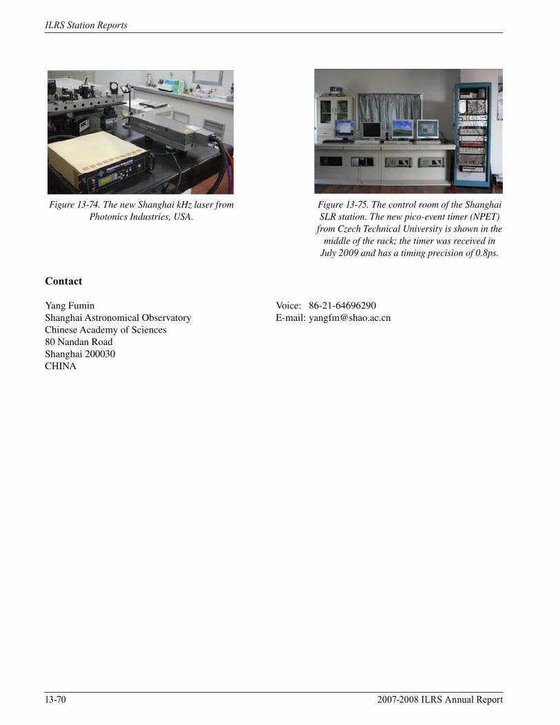
13-70 2007-2008 ILRS Annual Report
ILRS Station Reports
Contact
Yang Fumin Voice: 86-21-64696290Shanghai Astronomical Observatory E-mail: [email protected] Academy of Sciences80 Nandan RoadShanghai 200030CHINA
Figure 13-74. The new Shanghai kHz laser from Photonics Industries, USA.
Figure 13-75. The control room of the Shanghai SLR station. The new pico-event timer (NPET)
from Czech Technical University is shown in the middle of the rack; the timer was received in
July 2009 and has a timing precision of 0.8ps.
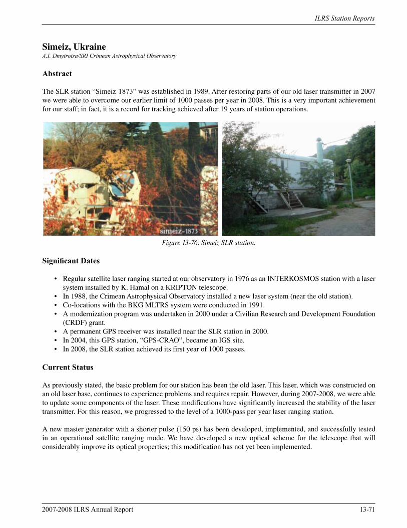
2007-2008 ILRS Annual Report 13-71
ILRS Station Reports
Simeiz, UkraineA.I. Dmytrotsa/SRI Crimean Astrophysical Observatory
Abstract
The SLR station “Simeiz-1873” was established in 1989. After restoring parts of our old laser transmitter in 2007 we were able to overcome our earlier limit of 1000 passes per year in 2008. This is a very important achievement for our staff; in fact, it is a record for tracking achieved after 19 years of station operations.
Figure 13-76. Simeiz SLR station.
Significant Dates
• Regular satellite laser ranging started at our observatory in 1976 as an INTERKOSMOS station with a laser system installed by K. Hamal on a KRIPTON telescope. • In 1988, the Crimean Astrophysical Observatory installed a new laser system (near the old station). • Co-locations with the BKG MLTRS system were conducted in 1991. • A modernization program was undertaken in 2000 under a Civilian Research and Development Foundation (CRDF) grant. • A permanent GPS receiver was installed near the SLR station in 2000. • In 2004, this GPS station, “GPS-CRAO”, became an IGS site. • In 2008, the SLR station achieved its first year of 1000 passes.
Current Status
As previously stated, the basic problem for our station has been the old laser. This laser, which was constructed on an old laser base, continues to experience problems and requires repair. However, during 2007-2008, we were able to update some components of the laser. These modifications have significantly increased the stability of the laser transmitter. For this reason, we progressed to the level of a 1000-pass per year laser ranging station.
A new master generator with a shorter pulse (150 ps) has been developed, implemented, and successfully tested in an operational satellite ranging mode. We have developed a new optical scheme for the telescope that will considerably improve its optical properties; this modification has not yet been implemented.
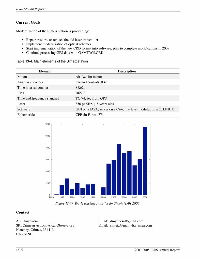
13-72 2007-2008 ILRS Annual Report
ILRS Station Reports
Current Goals
Modernization of the Simeiz station is proceeding:
• Repair, restore, or replace the old laser transmitter • Implement modernization of optical schemes • Start implementation of the new CRD format into software; plan to complete modifications in 2009 • Continue processing GPS data with GAMIT/GLOBK
Table 13-4. Main elements of the Simeiz station
Element Description
Mount Alt-Az. 1m mirror
Angular encoders Farrand controls, 0.4”
Time interval counter SR620
PMT H6533
Time and frequency standard TC-74, sec from GPS
Laser 350 ps 5Hz. (18 years old)
Software GUI on a JAVA, server on a C++, low level modules on a C. LINUX
Ephemerides CPF (in Fortran77)
Figure 13-77. Yearly tracking statistics for Simeiz (1991-2008)
Contact
A.I. Dmytrotsa Email: [email protected] Crimean Astrophysical Observatory Email: [email protected], Crimea, 334413UKRAINE
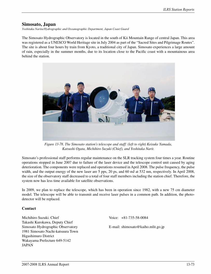
2007-2008 ILRS Annual Report 13-73
ILRS Station Reports
Simosato, JapanYoshitaka Narita/Hydrographic and Oceanographic Department, Japan Coast Guard
The Simosato Hydrographic Observatory is located in the south of Kii Mountain Range of central Japan. This area was registered as a UNESCO World Heritage site in July 2004 as part of the “Sacred Sites and Pilgrimage Routes”. The site is about four hours by train from Kyoto, a traditional city of Japan. Simosato experiences a large amount of rain, especially in the summer months, due to its location close to the Pacific coast with a mountainous area behind the station.
Figure 13-78. The Simosato station’s telescope and staff: (left to right) Keisuke Yamada,
Katsushi Ogata, Michihiro Suzuki (Chief), and Yoshitaka Narit.
Simosato’s professional staff performs regular maintenance on the SLR tracking system four times a year. Routine operations stopped in June 2007 due to failure of the laser device and the telescope control unit caused by aging deterioration. The components were replaced and operations resumed in April 2008. The pulse frequency, the pulse width, and the output energy of the new laser are 5 pps, 20 ps, and 60 mJ at 532 nm, respectively. In April 2008, the size of the observatory staff decreased to a total of four staff members including the station chief. Therefore, the system now has less time available for satellite observations.
In 2009, we plan to replace the telescope, which has been in operation since 1982, with a new 75 cm diameter model. The telescope will be able to transmit and receive laser pulses in a common path. In addition, the photo-detector will be replaced.
Contact
Michihiro Suzuki. Chief Voice: +81-735-58-0084Takashi Kurokawa, Deputy Chief Simosato Hydrographic Observatory E-mail: [email protected] Simosato Nachi-katsuura TownHigashimuro DistrictWakayama Prefecture 649-5142JAPAN

13-74 2007-2008 ILRS Annual Report
ILRS Station Reports
Tanegashima, JapanTakahiro Inoue, Shinichi Nakamura, Ryo Nakamura, Flight Dynamics Division, JAXA
Introduction
The Japan Aerospace Exploration Agency (JAXA) Satellite Laser Ranging system, GUTS-SLR (GMSL, Tanegashima), was completed in the spring of 2004. The GUTS-SLR, shown in Figure 13-79, is located on Tanegashima Island, the location of the Japanese launch site.
The GUTS-SLR is operated by remote control from the Tsukuba Space Center (TKSC). The distance between TKSC and the SLR station is approximately 1100 km. Routine SLR operations began on September 1, 2004.
Figure 13-79. GUTS-SLR system.
Facilities/Systems
GUTS-SLR is capable of ranging to satellites from low Earth orbit to geostationary orbit. The system can range to the LAGEOS satellites with a single-shot rms of less than 10 mm and less than 20 mm rms to ETS-8 (JAXA geostationary satellite). The GUTS-SLR station is primarily operated automatically using a predetermined schedule. An operator is needed to activate/deactivate the initial power supply, manually operate the initial acquisition when the orbit prediction has an error, and perform regular system maintenance. The station’s Master Control and Operation Planning Subsystem (COPS) generates an operational plan for the entire GUTS system. This system also monitors the operational conditions of each subsystem.
Current Activities
GUTS-SLR continued routine ranging operations during 2007 and 2008. GUTS-SLR successfully participated in the SOHLA-1 tracking campaign; the system obtained intermittent returns due to the satellite spin. GUTS-SLR is now taking part in the ETS-8 tracking campaign for the High Accuracy Clock (HAC) experiment; this is the first time JAXA has successfully tracked a geostationary satellite using SLR.
2007-2008 ILRS Annual Report 13-75
ILRS Station Reports
Contacts
Shinichi Nakamura Voice: +81-29-868-2625 E-mail: [email protected] Nakamura Voice: +81-29-868-2616 E-mail: [email protected] Inoue Voice: +81-29-868-2627 E-mail: [email protected] Dynamics Division Fax: +81-29-868-2990Consolidated Space Tracking and Data Acquisition DepartmentOffice of Space Flight and Operations, JAXAJAPAN
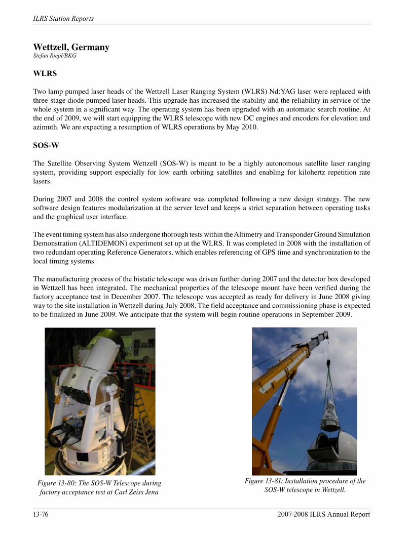
13-76 2007-2008 ILRS Annual Report
ILRS Station Reports
Wettzell, GermanyStefan Riepl/BKG
WLRS
Two lamp pumped laser heads of the Wettzell Laser Ranging System (WLRS) Nd:YAG laser were replaced with three-stage diode pumped laser heads. This upgrade has increased the stability and the reliability in service of the whole system in a significant way. The operating system has been upgraded with an automatic search routine. At the end of 2009, we will start equipping the WLRS telescope with new DC engines and encoders for elevation and azimuth. We are expecting a resumption of WLRS operations by May 2010.
SOS-W
The Satellite Observing System Wettzell (SOS-W) is meant to be a highly autonomous satellite laser ranging system, providing support especially for low earth orbiting satellites and enabling for kilohertz repetition rate lasers.
During 2007 and 2008 the control system software was completed following a new design strategy. The new software design features modularization at the server level and keeps a strict separation between operating tasks and the graphical user interface.
The event timing system has also undergone thorough tests within the Altimetry and Transponder Ground Simulation Demonstration (ALTIDEMON) experiment set up at the WLRS. It was completed in 2008 with the installation of two redundant operating Reference Generators, which enables referencing of GPS time and synchronization to the local timing systems.
The manufacturing process of the bistatic telescope was driven further during 2007 and the detector box developed in Wettzell has been integrated. The mechanical properties of the telescope mount have been verified during the factory acceptance test in December 2007. The telescope was accepted as ready for delivery in June 2008 giving way to the site installation in Wettzell during July 2008. The field acceptance and commissioning phase is expected to be finalized in June 2009. We anticipate that the system will begin routine operations in September 2009.
Figure 13-80: The SOS-W Telescope during factory acceptance test at Carl Zeiss Jena
Figure 13-81: Installation procedure of the SOS-W telescope in Wettzell.
2007-2008 ILRS Annual Report 13-77
ILRS Station Reports
Contact
Stefan Riepl E-mail: [email protected] für Kartographie und Geodäsie Voice: +49 (0) 9941 / 603-118Fundamentalstation Wettzell Fax: +49 (0) 9941 / 603-222Sackenrieder Str. 25D-93444 KötztingGERMANY
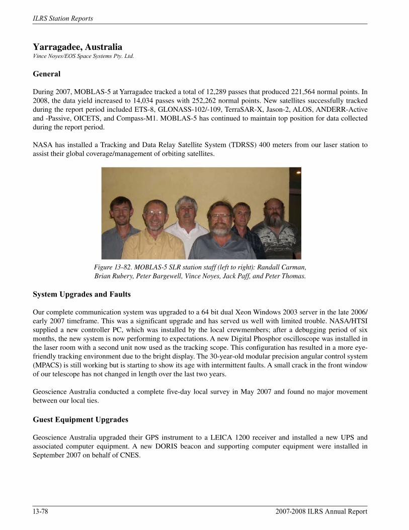
13-78 2007-2008 ILRS Annual Report
ILRS Station Reports
Yarragadee, AustraliaVince Noyes/EOS Space Systems Pty. Ltd.
General
During 2007, MOBLAS-5 at Yarragadee tracked a total of 12,289 passes that produced 221,564 normal points. In 2008, the data yield increased to 14,034 passes with 252,262 normal points. New satellites successfully tracked during the report period included ETS-8, GLONASS-102/-109, TerraSAR-X, Jason-2, ALOS, ANDERR-Active and -Passive, OICETS, and Compass-M1. MOBLAS-5 has continued to maintain top position for data collected during the report period.
NASA has installed a Tracking and Data Relay Satellite System (TDRSS) 400 meters from our laser station to assist their global coverage/management of orbiting satellites.
Figure 13-82. MOBLAS-5 SLR station staff (left to right): Randall Carman, Brian Rubery, Peter Bargewell, Vince Noyes, Jack Paff, and Peter Thomas.
System Upgrades and Faults
Our complete communication system was upgraded to a 64 bit dual Xeon Windows 2003 server in the late 2006/early 2007 timeframe. This was a significant upgrade and has served us well with limited trouble. NASA/HTSI supplied a new controller PC, which was installed by the local crewmembers; after a debugging period of six months, the new system is now performing to expectations. A new Digital Phosphor oscilloscope was installed in the laser room with a second unit now used as the tracking scope. This configuration has resulted in a more eye-friendly tracking environment due to the bright display. The 30-year-old modular precision angular control system (MPACS) is still working but is starting to show its age with intermittent faults. A small crack in the front window of our telescope has not changed in length over the last two years.
Geoscience Australia conducted a complete five-day local survey in May 2007 and found no major movement between our local ties.
Guest Equipment Upgrades
Geoscience Australia upgraded their GPS instrument to a LEICA 1200 receiver and installed a new UPS and associated computer equipment. A new DORIS beacon and supporting computer equipment were installed in September 2007 on behalf of CNES.
2007-2008 ILRS Annual Report 13-79
ILRS Station Reports
Future Plans for the Site
NASA/HTSI intends to upgrade the laser system by installing a new table and chiller unit and replacing the flowing dye cell with a saturable absorber unit. The MCP will also be replaced during this period to bring us up to date with the other MOBLAS stations. NASA’s Next Generation SLR system is planned for co-location testing at our site in late 2010 or early 2011.
Geoscience Australia intends to install a 12-meter antenna at the Yarragadee site for VLBI work. This project is underway with a planned completion date by early 2010.
Contacts
EOS Space Systems Pty Limited E-mail: [email protected]. Box 137Dongara, Western Australia 6525AUSTRALIA
Ron Thompson Voice: + 61-2-6222-7999Electro Optic Systems Pty Limited Fax: + 61-2-6299-7687111 Canberra Avenue E-mail: [email protected] ACT 2603AUSTRALIA
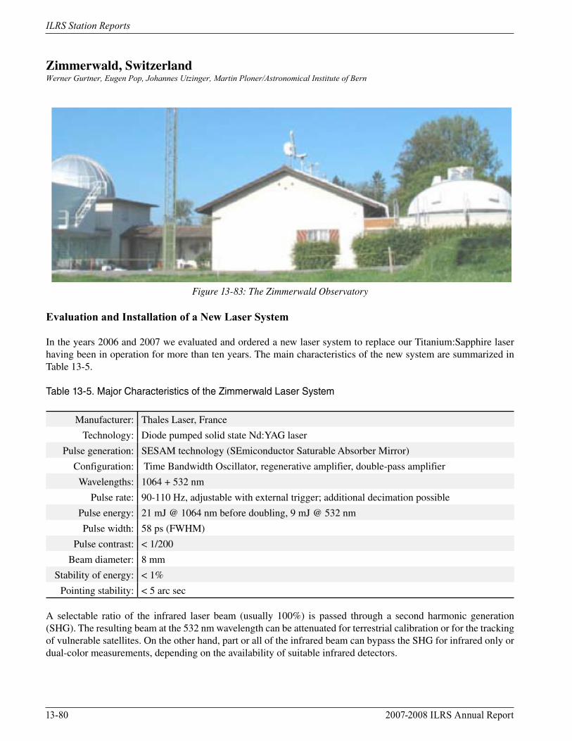
13-80 2007-2008 ILRS Annual Report
ILRS Station Reports
Zimmerwald, SwitzerlandWerner Gurtner, Eugen Pop, Johannes Utzinger, Martin Ploner/Astronomical Institute of Bern
Figure 13-83: The Zimmerwald Observatory
Evaluation and Installation of a New Laser System
In the years 2006 and 2007 we evaluated and ordered a new laser system to replace our Titanium:Sapphire laser having been in operation for more than ten years. The main characteristics of the new system are summarized in Table 13-5.
Table 13-5. Major Characteristics of the Zimmerwald Laser System
Manufacturer: Thales Laser, France
Technology: Diode pumped solid state Nd:YAG laser
Pulse generation: SESAM technology (SEmiconductor Saturable Absorber Mirror)
Configuration: Time Bandwidth Oscillator, regenerative amplifier, double-pass amplifier
Wavelengths: 1064 + 532 nm
Pulse rate: 90-110 Hz, adjustable with external trigger; additional decimation possible
Pulse energy: 21 mJ @ 1064 nm before doubling, 9 mJ @ 532 nm
Pulse width: 58 ps (FWHM)
Pulse contrast: < 1/200
Beam diameter: 8 mm
Stability of energy: < 1%
Pointing stability: < 5 arc sec
A selectable ratio of the infrared laser beam (usually 100%) is passed through a second harmonic generation (SHG). The resulting beam at the 532 nm wavelength can be attenuated for terrestrial calibration or for the tracking of vulnerable satellites. On the other hand, part or all of the infrared beam can bypass the SHG for infrared only or dual-color measurements, depending on the availability of suitable infrared detectors.
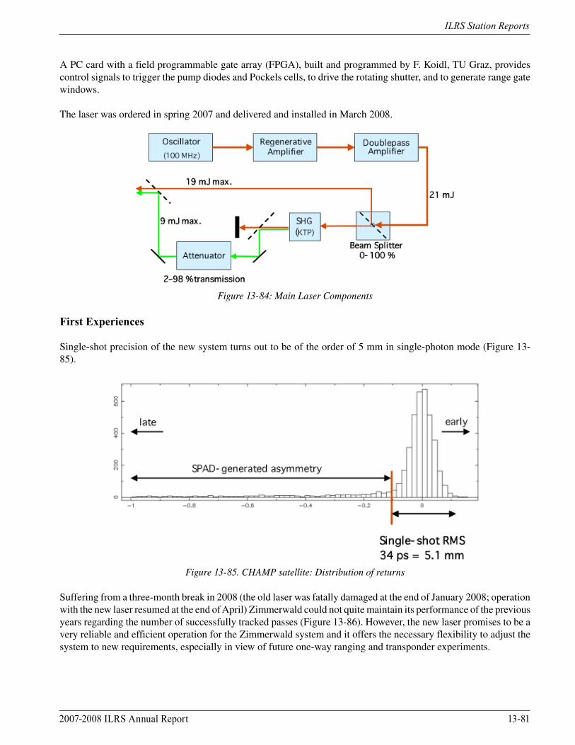
2007-2008 ILRS Annual Report 13-81
ILRS Station Reports
A PC card with a field programmable gate array (FPGA), built and programmed by F. Koidl, TU Graz, provides control signals to trigger the pump diodes and Pockels cells, to drive the rotating shutter, and to generate range gate windows.
The laser was ordered in spring 2007 and delivered and installed in March 2008.
Figure 13-84: Main Laser Components
First Experiences
Single-shot precision of the new system turns out to be of the order of 5 mm in single-photon mode (Figure 13-85).
Figure 13-85. CHAMP satellite: Distribution of returns
Suffering from a three-month break in 2008 (the old laser was fatally damaged at the end of January 2008; operation with the new laser resumed at the end of April) Zimmerwald could not quite maintain its performance of the previous years regarding the number of successfully tracked passes (Figure 13-86). However, the new laser promises to be a very reliable and efficient operation for the Zimmerwald system and it offers the necessary flexibility to adjust the system to new requirements, especially in view of future one-way ranging and transponder experiments.
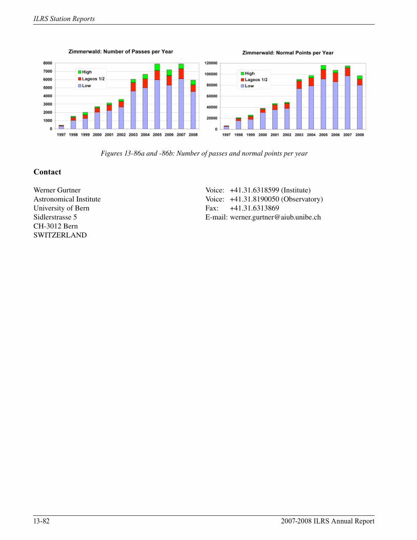
13-82 2007-2008 ILRS Annual Report
ILRS Station Reports
Figures 13-86a and -86b: Number of passes and normal points per year
Contact
Werner Gurtner Voice: +41.31.6318599 (Institute)Astronomical Institute Voice: +41.31.8190050 (Observatory)University of Bern Fax: +41.31.6313869Sidlerstrasse 5 E-mail: [email protected] Bern SWITZERLAND