Embed Size (px)
Citation preview

1
Scenario: M7.3 Central Mindanao Fault EarthquakeSIMULATED INTENSITY OF GROUNDSHAKING
PEIS VIII (very destructive) inDavao del Norte, Agusan del Sur and Bukidnon
PEIS VII (destructive) in ComVal, Davao City, Bukidnon
PEIS VI (very strong and slightly damaging) in some areas of Bukidnon, Surigao del
Lanao del Sur
Maguindanao Davao
Davao del Norte
Davao CIty Davao Oriental
ComVal
Bukidnon
Cotabato
Agusan del Sur
Zamboanga del Sur
Misamis Occ
Lanao del Norte
areas of Bukidnon, Surigao del Sur, ComVal, Davao Oriental, Davao City, Cotabato, Davao del Sur, Surigao del Sur
PEIS V (strong, able to cause panic) Lanao del Norte, Lanao del Sur, Maguindanao, South Cotabato
PEIS III (Weak) in Sultan Kudarat, Sarangani
Davao del Sur
Davao Occidental
South Cotabato
Sarangani
Sultan Kudarat
REDAS
0 1 2 3 4 5 6 7 8 Not felt I II III IV V VI VII VIII
INTENSITY (in PHIVOLCS Earthquake Intensity Scale or PEIS)

2
Scenario: M7.1 Earthquake in Mt. Province
ILOCOS NORTE
ILOCOS SUR
APAYAO
CAGAYAN
KALINGA
ABRA
IFUGAO
SIMULATED INTENSITY OF
GROUNDSHAKING (in PHIVOLCS Earthquake
Intensity Scale)
PEIS VIII (very destructive) in Mt. Province, Ifugao, Benguet and Nueva Vizcaya
PEIS VII (destructive) in western Isabela, southern Kalinga, eastern Ifugao, western Benguet, some parts of Pangasinan, IlocosILOCOS SUR
PANGASINAN
LA UNION
MT. PROVINCE
NUEVA VIZCAYA
ISABELA
QUIRINO
NUEVA ECIJA
BENGUET
AURORA
TARLAC
Benguet, some parts of Pangasinan, IlocosSur and Abra
PEIS VI (very strong and slightly damaging) in southern Abra, some parts of Cagayan, Isabela, Quirino, Pangasinan, Nueva Ecija, Aurora, Ilocos Norte, IlocosSur, La Union, Pangasinan, Nueva Ecija, Tarlac and Cagayan
PEIS V (strong, able to cause panic) in most parts of Ilocos Norte, Apayao, Cagayan, Aurora, Tarlac, Nueva Ecija
Map Produced using REDAS
0 1 2 3 4 5 6 7 8 Not felt I II III IV V VI VII VIII
INTENSITY (in PHIVOLCS Earthquake Intensity Scale)

3
Scenario 6: Magnitude 7.5 earthquake in CebuSIMULATEDINTENSITIES
PEIS High VII - VIII (very destructive) in most areas of Cebu, Bais and Dumaguete
PEIS VII (destructive) innorthern tip of Cebu, northern half and western
0 1 2 3 4 5 6 7 8 Not felt I II III IV V VI VII VIII (PEIS)
northern half and western areas of Bohol and many areas of Negros (eastern and central)
PEIS VI (very strong and slightly damaging) in western areas of Negros and Siquijor Island
PEIS V (strong, able to cause panic) in Leyte, Panay, northwest Mindanao

4
STRONG GROUND SHAKING
1995 Kobe Earthquake

5
• Loose, water-rich sediments behave like liquid during strong ground shaking.
• Sediments are rearranged into a more compact
LIQUEFACTION
state.
Subsidence of building, roads
Dagupan 1990
Fissuring of roads
Mindoro 1994

6
Tsunamis
Miyako, Japan
• Flooding of coastal areas
• Drowning of people• Damage to properties• Erosion of coastline
From APMiyako, Japan
Natori, Japan
From AP
From Kyodo NewsPHIVOLCS
Kessenuma, JapanFrom R Solidum

7
Multi-hazard MapsFault rupture
Ground Shaking
Liquefaction Tsunami
Landslide
1:50,000
8
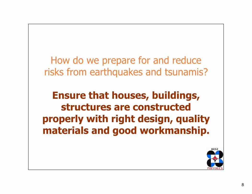
How do we prepare for and reduce risks from earthquakes and tsunamis?
Ensure that houses, buildings, Ensure that houses, buildings, structures are constructed
properly with right design, quality materials and good workmanship.
9
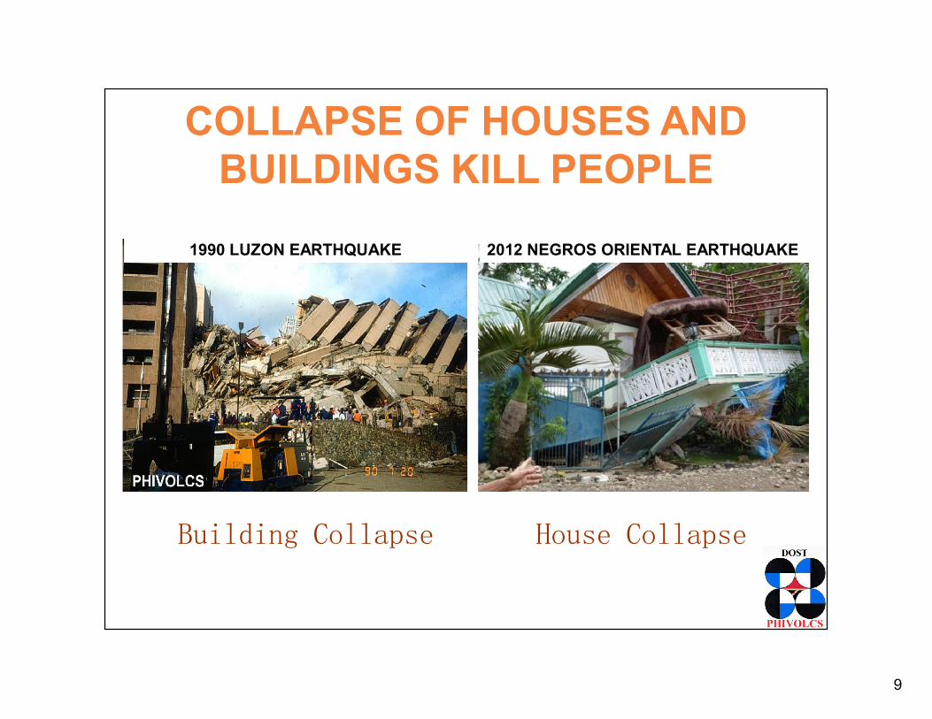
COLLAPSE OF HOUSES AND BUILDINGS KILL PEOPLE
2012 NEGROS ORIENTAL EARTHQUAKE1990 LUZON EARTHQUAKE
Building Collapse House Collapse

10
How do we prepare for and reduce risks from earthquakes and tsunamis?
Prepare individuals, families and communities. Inform, educate communities. Inform, educate
them of the hazards, what to do to be safer – before, during and after
strong earthquake events. Conduct drills.

11
• Determine alternative evacuation routes and evacuation area
• Determine roles
Prepare an evacuation plan. Imagine what the environment (rooms, outside) will look like after the earthquake and prepare plan.
Ground Level
Legend: Building:Direction:Evacuation Area:

12
EARTHQUAKE SIMULATION EXERCISES

13
COMMUNITY TSUNAMI PREPAREDNESS ACTIVITIES
• Study tsunami hazard maps, identify which communities are at risk
• Prepare evacuation plans and maps
• Install tsunami signage
• Conduct coastal village education campaigns
• Conduct tsunami drills
* Check PHIVOLCS Guidelines in Developing a Tsunami Prepared
Familiarization with Hazard and Evacuation Maps
Tsunami Signage Tsunami Drill
14
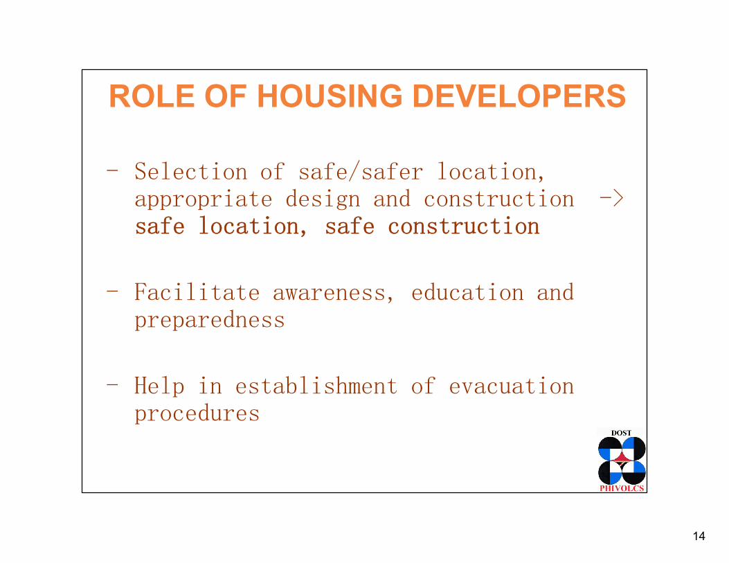
ROLE OF HOUSING DEVELOPERS
- Selection of safe/safer location, appropriate design and construction -> safe location, safe construction
- Facilitate awareness, education and - Facilitate awareness, education and preparedness
- Help in establishment of evacuation procedures

15
SUMMARY
• The country is exposed to earthquakes that can cause loss of lives, properties, and severely impact the economy.
• Appropriate preparedness, mitigation and response activities must be based on response activities must be based on appropriate hazard and impact scenarios.
• The property sector plays a major role in ensuring safety of people, assets and businesses. Location and construction safety must be ensured.

16
www.phivolcs.dost.gov.ph
Earthquake & Tsunami (24/7):
Tel. Numbers
+632 929-9254
+632 426-1468 loc 124 / 125
Fax number
+632 927-1087
/PHIVOLCS
@phivolcs.dost
Volcano (24/7):
Tel. Numbers
+632 426-1468 loc 127
Telefax number
+632 927-1095
IEC materials:
+632 426-1468 loc 128
+632 927-4524


![r (M7.3) ] 12,000 6.0 6 6.1 6.2 6.3 6.4 6.5 6.6 7 …...r (M7.3) ] 12,000 6.0 6 6.1 6.2 6.3 6.4 6.5 6.6 7 (M7.3) /JåJi(— 45 (vq) 33,000 1000m 20m DI-I: 20—10m —-10m 0 -20m -20](https://img.dokumen.tips/doc/110x75/5e38843ec7f8c0136410d017/r-m73-12000-60-6-61-62-63-64-65-66-7-r-m73-12000-60-6-61.jpg)