Embed Size (px)
Citation preview
Sand Management Plan (SMP)
Guidance Document
A comprehensive guide to sand management criteria
within the City of Norfolk’s Ocean View Bayfront Area

Table of Contents
1. Introduction …………………………………………………………………………………………………………… 1
2. Executive Summary ………………………………………………………………………………….……………..... 1
3. Management and Mitigation of Sand Encroachment ……………………………………….……….……………. 3
3.1 Monitoring ..………………………………………………………………………………….…….…………..... 4
3.2 Vegetation ………………………………………………………………………….…….…………….……….. 6
3.3 Sand Fencing ……………………………………………………………………………….………………….. 7
3.4 Breaches, Blowouts and Access ……………………………………………………………………….…….. 9
4. Sand and Dune Alteration Criteria ……………………………………………………….……..…………………. 11
4.1 Sand Relocation …………………………………………………………………….………………….……… 12
4.2. Replenishment and Berm Project Maintenance …………………………………..………..………………. 15
5. Primary Frontal Dunes (PFDs) and Flood Control ………………………………………..……………..……….. 16
Appendix A - Regulations ………………………………………………………………………………………………… 17
Appendix B - Definitions and Acronyms ………………………………………………………………………………… 19

Sand Management Plan Guidance Document
1
1. Introduction
This document was prepared by the Ocean View Sand Dune and Beach Advisory Committee, established by the
City of Norfolk in December 2014, to provide guidance and a long-term strategy for dealing with sand and dune
issues along the Chesapeake Bay shoreline. The Committee was formed by the Norfolk City Council as a result
of increasing issues regarding erosion, accretion, transport, and encroachment of sand along the Ocean View
Bayfront. The Sand Management Plan (SMP) supplements the Chesapeake Bay Coastal Management Area
(CBCMA) guidance document, which deals with regulations governing structures and permitted items on the
beaches and primary frontal sand dunes along the Chesapeake Bay.
This SMP recognizes that the dune-beach system varies along the Norfolk Ocean View Bayfront both physically
and temporally. The combinations of topography, existing dune profile, and sand transport conditions define five
different areas along the 7.3 mile beach in the Norfolk Ocean View Bayfront. The five areas are approximately
defined as follows:
East Beach and Vicinity (Little Creek Inlet to 14th Bay Street)
East Ocean View Area (14th Bay Street to Cape View Avenue)
Cottage Line Area (Cape View Avenue to Warwick Avenue)
Central Ocean View Area (Warwick Avenue to 4th View Street)
Willoughby Spit (4th View Street to the tip of Willoughby Spit)
2. Executive Summary
This SMP is intended to promote sand dune and beach stability, functionality, and resiliency consistent with local,
state, and federal laws and regulations. It is based on current science and monitoring of the specific shoreline
environment along Norfolk’s Ocean View Bayfront and utilizes guidelines and procedures designed in conjunction
with the provisions of law applicable to the protection of coastal dunes and beaches as well as the various benefits
and utility they provide. Criteria, standards, and guidance are also provided to define the goals, standards, and
processes relating to sand and dune management activities on both public and private property. The SMP is not
intended to resolve, nor even address, any aspect of ownership of the dune and beach areas it discusses. While
some activities and processes set out in the SMP vary depending on whether the subject area is on public or
private land, the plan itself contains no provisions for determining what land is public and what land is private.

Sand Management Plan Guidance Document
2
The Ocean View Sand, Dune, and Beach Advisory Committee, established by the City of Norfolk in 2014 and
made up of local civic league presidents, City staff, government agency representatives, residents, and technical
advisors, has advanced this document to guide sand management activities along the Bayfront.
The Ocean View Bayfront is a thriving urban beach community. The protection and amenities that are provided
by a healthy and robust beach and dune system directly contribute to the quality of life and the sustainability and
enhancement of properties. To promote this vision, the committee has adopted the following guiding principles
for sand management:
a. Optimize and promote the economic value, vitality, and ecological resilience of the Norfolk Ocean View
Bayfront shoreline environment as an urban beach community.
b. Recognize that the Norfolk Ocean View Bayfront shoreline has a variety of distinct physical and
geographical reaches with unique characteristics and issues that affect preservation and maintenance.
c. Involve residents as active partners in the formulation and administration of the SMP so as to promote
compatibility between the private enjoyment and public protection and resilience and the general
recreational use of all Bayfront areas.
d. Formulate and execute a dynamic and useful plan to ensure sand and dune stability and functionality by
adopting processes that:
1) Utilize, where appropriate, vegetation and sand fencing to retain sand in the dune system and mitigate
sand encroachment or movement landward;
2) Define functionally, appropriate dune crest heights and slopes along the different areas of the
shoreline;
3) Promote dune robustness that meets or exceeds FEMA primary frontal dune volume criteria; and
4) Ensure sand encroachment and/or dune migration does not result in relocation of the landward toe of
the primary frontal dune, such that it alters the FEMA flood zone boundary and changes the flood
zone designation.
The objectives of the SMP, listed in order of decreasing priority, are:
a. To maintain or improve on the ability of the primary frontal dune to protect properties from bay flooding,
wave erosion, and surge overtopping;
b. To minimize inundation of areas behind the primary frontal dune crest by accumulation of wind-blown
sand;
c. To maintain sand reservoirs, the stability of the shore, and the sandy upland;
d. To maintain and improve public access to the beach; and
e. To maintain or restore water views, to the extent possible, in conjunction with advancing one or more of
the other priorities listed.

Sand Management Plan Guidance Document
3
All activities that impact the dunes are subject to the provisions of Virginia’s Coastal Primary Sand Dune Protection
Act (Virginia Code Title 28.2, Chapter 14). In additional to establishing goals and standards for management
activities, this SMP clearly defines what processes govern activities that are undertaken on publically-owned
property, including those that are exempt from the permit requirement of the Dune Protection Act. Activities on
privately-owned property are subject to fewer exemptions from that permit process. As a result, some of the tools
available for management activities on public property will not be available on private property unless they are
approved by permit under the Dune Protection Act. This SMP is intended to encompass all aspects of the City’s
policies and procedures related to sand management. As a result, once this SMP is adopted the City Council
may elect to relinquish local control over any activity that can only be authorized by grant of a permit required by
the Dune Protection Act. Thereafter, permit applications would be filed directly with the Virginia Marine Resources
Commission and any violation of the Dune Protection Act shall be prosecuted by the Commission, as required by
in Virginia Code § 28.2-1416.
A determination that a sand management activity is consistent with this SMP and does not require a Dune
Protection Act permit is not an indication that no other permits or approvals are required. Some activities require
approvals in addition to the processes and compliance standards established in the SMP. All requirements of
state and federal law supersede this SMP.
The implementation of the SMP also provides an opportunity for cooperation between City staff and residents and
includes many elements intended to further such cooperation, enhance education for residents, and provide
increased data and documentation relative to the dynamic beach environment. This data can be used to further
the SMP objectives, optimize beach management activities, and improve the quality of the coastal environment.
Such engagement can take many forms. A volunteer task force can assist planting and maintenance projects to
supplement what can be accomplished by City staff and contractors working for the City. Maintenance could
include dune plant care and replacement, invasive plant identification or removal, beach access-way sand
management, and sand fence maintenance. A regular monitoring program of the dune-beach system is an
integral part of the comprehensive SMP and should include, at a minimum, continuing the current semi-annual
sand movement monitoring by the City of Norfolk and resident feedback on encroachment problems. An ongoing
Coastal Management and Review Board (CMRB) will be established, to meet semi-annually and at other
appointed times, to review data, assess progress, recommend adjustments to the SMP, and recommend
significant projects to be undertaken in a manner consistent with the goals and objectives of the SMP.
Such cooperative activities are consistent with the City’s objective to increase resilience and provide opportunities
for many types of recognition and pilot programs. Public outreach can be promoted by the attendance of a
representative of one of the cooperating agencies at local Civic League meetings as well as by submitting local
press releases about projects and goals.
The following sections provide specific tools and procedures for implementing best practices regarding dune
vegetation, fencing, maintaining the dunes, relocating encroaching sand, replenishment impacts, and flood zone
compliance.
3. Management and Mitigation of Sand Encroachment
As in many coastal areas, residential and commercial structures have been built along the Chesapeake Bay
shoreline for decades. Their presence and location have significantly altered the natural dune environment that
existed before development. These urban developments are constantly affecting and affected by the natural
dynamics of the beach, with sand shifting and moving onshore, alongshore, and offshore. Beach habitats also
are heavily impacted by episodic events such as nor'easters, hurricanes, and winter wind events.

Sand Management Plan Guidance Document
4
For structures sited behind the dune line, a robust beach and dune system is the primary, shoreline protection
against hazards resulting from severe wave action and flooding from the Chesapeake Bay. As such, they are a
meaningful public facility, as part of the City’s flood control and shore protection system.1 However, weather events
can move, add, or remove large amounts of sand within this system. When structures are built in the middle of a
beach ecosystem, such as the homes in the Norfolk Ocean View Bayfront community, changes in natural beach
forces should be expected. Before the Norfolk Ocean View Bayfront was developed in the early part of the 20th
Century, historical photographs show the beach and natural dunes extended hundreds of feet farther inland and
some of the dunes were over fifty feet high. This sand was subsequently mined and used as fill for a variety of
projects.
Dunes provide a reservoir of sand available to replace losses from the beach and serve as a valuable form of
protection from erosive wave action. Because of the crescent-shaped shoreline along Cottage Line and East
Ocean View, the sand reservoir in this area naturally contains more sand than in other parts of the system, due
to prevailing currents, winds, and wave action. Subsequently, these areas of accretion are experiencing the most
problematic sand encroachment issues. The beach areas in Willoughby and East Beach do not have this problem.
Instead, these areas, which are towards the ends of the crescent, are generally erosional, and a large dune sand
reservoir is not available since it lacks a natural dune-building process.
Sand from the dry beach tends to blow inland, with greater amounts of sand blowing from wider beaches, as
occurs in eastern Cottage Line and western East Ocean View. This wind-blown sand builds up against property
fencing, walls, porches, and homes. Compounding the issue is the fact that the houses present an artificial barrier
and, in effect, are an obstacle to sand movement. Blown sand also increases dune height, and this moving sand
then spills over and widens the dune as it migrates landward.
In a dune area influenced by human activity, capturing and controlling sand accumulation around a residential
area involves a combination of methods. Sand encroachment can be mitigated by ensuring dunes remain
vegetated and fenced, as needed, and by altering anomalous, unstable features of a dune and the subsequent
localized wind-driven sand transport patterns. Vegetated sand dunes tend to trap and immobilize sand and are
intrinsically more stable than bare sand dunes. Monitoring sand movement, to address migration before it
becomes a threat to properties, is also necessary. Any alteration of the dune profile, however, must consider the
protection provided by the dune. Therefore, modifications to the dune profile must maintain the robustness of the
dune profile.
3.1 Monitoring
The natural environment along the shore is not static. Changes in the environment often occur slowly over the
course of many years. This is true for both those changes that result from human efforts to protect or improve the
shore environment and those changes caused by climatological changes or the occurrence of specific weather
events. Thus, the process of monitoring the beach and dune system will likely be more effective if it can be done
in a way that is regular, consistent, continuous, and comprehensive.
By establishing a Coastal Management and Review Board (CMRB), each of these goals can be advanced. The
Board’s principal responsibility would be to monitor changes in the beach and dune environment and to assess
the progress of management projects in order to report on what is being achieved under the Sand Management
1 For example, but not by way of limitation, the phrase “public facility” as used in this SMP is not intended to be and is not an indication of title, and any action taken under this plan based upon the identification of property being a “public facility” does not transfer, convey, or otherwise convert private property into public property. Any question of title to such property is without prejudice to any person’s or entity’s right to assert title to such property.

Sand Management Plan Guidance Document
5
Plan. The CMRB should be required to have a certain number of meetings per year (at least two is recommended)
and should remain in place as a permanent body. This lends regularity and continuity to the process. Terms of
members should be staggered and of sufficient length to build institutional knowledge about the beach and dune
system, bringing consistency to the process. The CMRB should be comprised of representatives and designees
of those organizations, institutions, agencies, and citizen stakeholders that have regulatory and financial interests
in the responsible stewardship of the beach and dune system. This ensures that the base of knowledge available
to the monitoring body will be comprehensive. The CMRB should be composed of the following:
(a) 2 Political representatives: 2 members of Norfolk City Council (must be from Ward 1, Ward 5,
Super Ward 6, or Mayor); members shall be designated by the City Council)
(b) 3 Neighborhood representatives:
(1) President (or his/her designee) of East Ocean View Civic League
(2) President (or his/her designee) of Cottage Line Civic League
(3) President (or his/her designee) of Willoughby Civic League
(c) 3 City Staff representatives:
(1) Dept. of Public Works representative (designated by Department Director)
(2) Dept. of City Planning representative (designated by Department Director)
(3) Staff member of Office of the City Manager (designated by City Manager)
(d) 4 External Organizations representatives:
(1) Representative from Department of Ocean, Earth & Atmospheric Sciences of Old Dominion
University (designated by Department Chair)
(2) Staff member of Virginia Marine Resources Commission, Habitat Management Division (designated by Chief of Habitat Management)
(3) Staff member of Army Corp of Engineers, Norfolk District (designated by District Engineer)
(4) Staff member of Virginia Institute of Marine Science (designated by VIMS Director)
The CMRB should have the following duties and responsibilities:
(a) Meet no less than semi-annually. Additional meetings may be held when called by the chairperson for the purpose of reviewing any information or project where review at the next regular meeting would result in a delay which would likely cause a significant increase in cost or would continue exposing persons or property to an existing threat of injury or damage for an extended period of time.
(b) Initiate and recommend amendments to this Sand Management Plan. No changes to the Plan should be made without a review and recommendation from the Board prior to consideration by the City Planning Commission or the City Council.
(c) Receive and review annual reports which provide the following information:
(1) Topographical or LIDAR surveys showing any changes to the beach and dune environment, including erosion and accretion.
(2) Dune planting success and mortality and progress of invasive vegetation eradication efforts.
(3) Beach nourishment projects.
(4) Dune blowout repairs and other alteration activity in a dune.
(5) Sand fence locations and effects.
(6) Breakwater modification and performance measures.
(7) Effects of seasonal storms impacts.
(8) Alterations to, construction of, and removal of any beach access.
(9) Alterations to the profile of the crest or front face of a dune as set forth in section 4.1, below.
(10) Other projects or activities that impact the health or use of the dune environment.
Sand Management Plan Guidance Document
6
(d) Make recommendations regarding policies and procedures for:
(1) Adopt-a-Dune program to promote education and responsible stewardship of the shoreline
environment.
(2) Instructional or written materials to assist citizens with appropriate dune/vegetation plantings.
(3) Instructional events or written materials to assist citizens with maintenance of noncommercial
beach access walkways.
(4) Conducting training for citizens to assist City’s field operations for eradicating invasive vegetation
by identifying and locating problem areas.
(5) Guidelines for appropriate methods of performing other activities exempt from state Dune
Protection Act regulation. All such guidelines shall be posted on the City’s website and available
at the Bureau of Environmental Services.
(e) Review and recommend approval or denial of nonemergency construction of beach accesses as set forth in section 3.4, below.
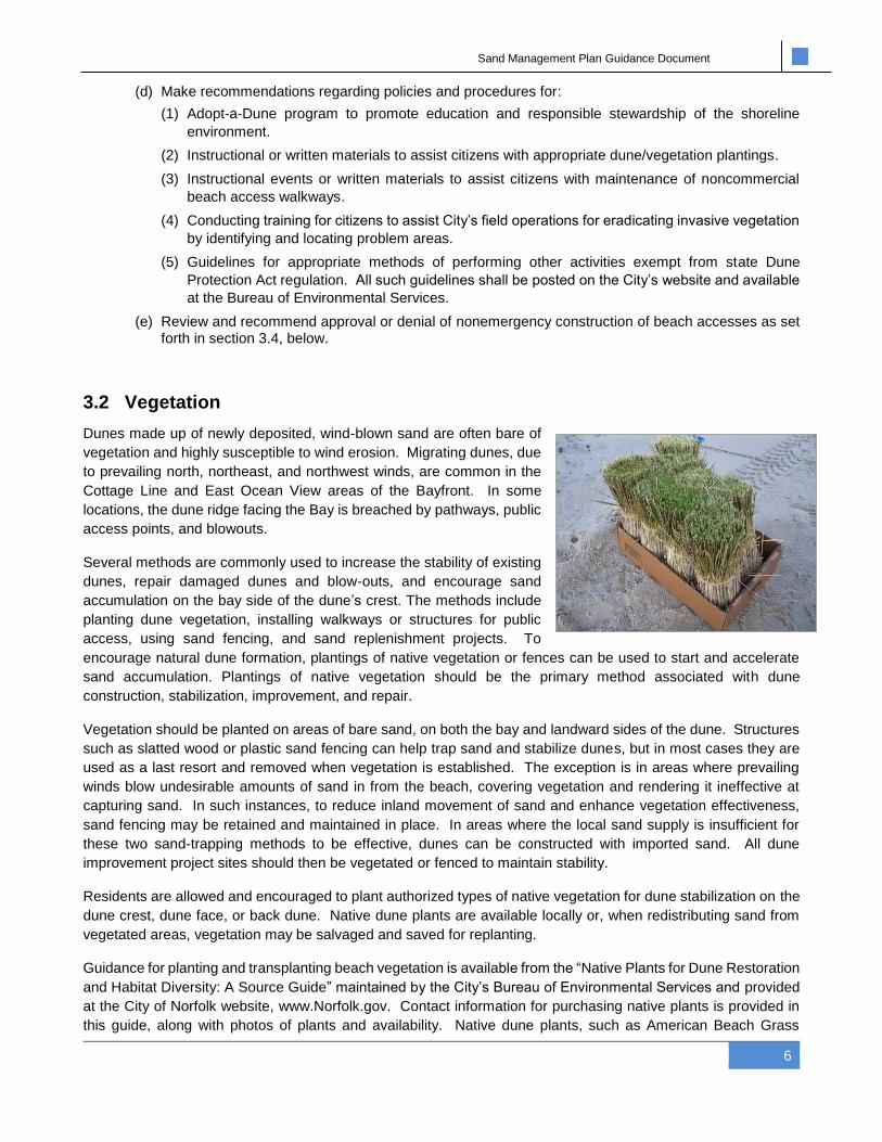
3.2 Vegetation
Dunes made up of newly deposited, wind-blown sand are often bare of
vegetation and highly susceptible to wind erosion. Migrating dunes, due
to prevailing north, northeast, and northwest winds, are common in the
Cottage Line and East Ocean View areas of the Bayfront. In some
locations, the dune ridge facing the Bay is breached by pathways, public
access points, and blowouts.
Several methods are commonly used to increase the stability of existing
dunes, repair damaged dunes and blow-outs, and encourage sand
accumulation on the bay side of the dune’s crest. The methods include
planting dune vegetation, installing walkways or structures for public
access, using sand fencing, and sand replenishment projects. To
encourage natural dune formation, plantings of native vegetation or fences can be used to start and accelerate
sand accumulation. Plantings of native vegetation should be the primary method associated with dune
construction, stabilization, improvement, and repair.
Vegetation should be planted on areas of bare sand, on both the bay and landward sides of the dune. Structures
such as slatted wood or plastic sand fencing can help trap sand and stabilize dunes, but in most cases they are
used as a last resort and removed when vegetation is established. The exception is in areas where prevailing
winds blow undesirable amounts of sand in from the beach, covering vegetation and rendering it ineffective at
capturing sand. In such instances, to reduce inland movement of sand and enhance vegetation effectiveness,
sand fencing may be retained and maintained in place. In areas where the local sand supply is insufficient for
these two sand-trapping methods to be effective, dunes can be constructed with imported sand. All dune
improvement project sites should then be vegetated or fenced to maintain stability.
Residents are allowed and encouraged to plant authorized types of native vegetation for dune stabilization on the
dune crest, dune face, or back dune. Native dune plants are available locally or, when redistributing sand from
vegetated areas, vegetation may be salvaged and saved for replanting.
Guidance for planting and transplanting beach vegetation is available from the “Native Plants for Dune Restoration
and Habitat Diversity: A Source Guide” maintained by the City’s Bureau of Environmental Services and provided
at the City of Norfolk website, www.Norfolk.gov. Contact information for purchasing native plants is provided in
this guide, along with photos of plants and availability. Native dune plants, such as American Beach Grass

Sand Management Plan Guidance Document
7
(Ammophila breviligulata) for example, are normally planted 12-18 inches apart and planted no less than nine (9)
inches deep, with a tablespoon of slow-release fertilizer placed in each hole. Closer placement is recommended
on the tops of dunes and on steep slopes.
The City’s Bureau of Environmental Services should be contacted prior to plant purchase to provide free
consultation and assistance regarding dune planting. Planting should be undertaken between the months of
December and March for optimal survival.
Activities
(1) Planting. The planting of beach grasses or other vegetation for the purpose of stabilizing coastal primary sand
dunes is permitted as follows:
(a) On city-owned property, planting may be done by City forces under supervision, provided it is done
for a public purpose.
(b) On privately-owned property, planting may be done by any person with the owner’s permission, limited
to the following noninvasive, acceptable species:
o American beach grass (Ammophila breviligulata)
o saltmeadow hay (Spartina patens)
o sea oats (Uniola paniculata)
o short dune grass (Panicum amarum)
(2) Controlling invasive vegetation. Eradication of invasive vegetation is permitted as follows:
(a) On city-owned property, eradication with controlled application of approved herbicides or by manual
extraction can be conducted by City forces under supervision, provided it is done for a public purpose.
(b) On privately-owned property with the owner’s permission:
(i) Eradication with controlled application of approved herbicides can be performed if approved by a
permit issued under the applicable provisions of Title 28.2, Chapter 14 of the Code of Virginia and
in accordance with any conditions place on such approved permit.
(ii) Manual removal of vegetation that is invasive and harmful to dune environment, including
impairing the health or growth of non-invasive dune grasses and plants, can be performed.
However, removal of any of the 13 species that are specifically identified in the definition of
“Coastal primary sand dune” (found in Virginia Code § 28.2-1400(A)) is prohibited unless
specifically authorized by a valid permit. (The definition is reprinted in Appendix B, at page 20 of
this SMP.)
Other Programs
The City will provide classes and field training for citizens interested in dune topics, including how to support city
staff’s dune planting and eradication efforts. Classes may be offered in conjunction with other environmental
education programs such as wetlands courses.
3.3 Sand Fencing
The planting of native vegetation to trap sand is always preferable to the use of man-made structures. For reasons
of aesthetics, safety, and possible interruption of public access, dune-building structures are normally installed

Sand Management Plan Guidance Document
8
temporarily while vegetation takes hold. After a storm event, structures, such as sand fencing, should be
reinstalled if lost or damaged, to allow for vegetation to recover.
Where wind-blown sand routinely or seasonally covers vegetation, a
combination of vegetation and fencing is necessary for dune stability
and prevention of sand migration inland. In such cases, sand fencing
may be required for a longer interval.
Sand fencing is intended for dune stabilization and sand control, and
is not appropriate for restricting public access, or outlining private
property boundaries. Sand fencing and posts may be purchased at
almost any large hardware store or ordered online. Materials, such
as Christmas trees and brush, are not effective at sand capture, are
unsightly, and not recommended for placement on the dunes.
Standard, slatted wood sand fencing is the preferred form, since it is cost-effective, readily available, easy to
handle, and can be erected quickly. A height of four feet, measured from the ground surface after installation,
normally is recommended for dune-building structures such as fences, although other heights might be used in
certain areas based on unusual conditions. The fencing can be supported with wooden posts at no more than 10-
foot intervals. The minimum practical length for posts is about 6 feet, although longer and more deeply embedded
posts are often advantageous. The fencing material may be secured by fastening it to each post with sturdy zip
ties, and the fencing should be woven between the posts so that every other post has fencing facing the bay-ward
side.
If the base of a sand fence is placed at ground level, dunes will build against and over the structure. In areas with
wind-blown sand migrating inland, fencing can be placed six to ten feet bay-ward below the dune crest, with a
second row halfway up the dune, so as to inhibit sand from blowing up and over the dune. The dune will then
grow in volume bay-ward instead of landward. Newly collected sand should be vegetated on the bay-ward side of
the sand accumulation.
At least 4- to 5-foot openings or gaps should be provided between 50-foot runs of fencing to allow for resident and
public access points. Openings can be overlapped to reduce sand blowing through the opening. Public vehicle
access points should be provided with fencing perpendicular to the access opening and far enough away from the
entrance to allow passage of vehicles. The intent is to inhibit sand from blowing into and building up at the access.
In some instances, to control sand and public traffic movement, fencing may be used effectively along either or
both sides of an access.
Activities
(1) General standards. The following general rules apply to all installations of sand fencing on public property:
(a) Sand fencing is a temporary structure and should be removed before it becomes so deteriorated or
inundated by sand accumulation that removal becomes exceptionally difficult.
(b) No sand fencing should be placed without consulting with the City’s Bureau of Environmental Services
or Department of Public Works prior to installation, for the purpose of reviewing the quality and
characteristics of the proposed fence construction, assessing the likelihood that the fencing will result
in stabilizing the dune or dune features, and evaluating any hazards to public health or safety that
might be created.
(c) If the fence placement project proceeds, the location of installation, including the location of each
post, must be documented so that, upon removal of the fence at a later time, all elements of the fence
can more easily be found and extracted.

Sand Management Plan Guidance Document
9
(2) Installation. Sand fences or other material on or adjacent to coastal primary sand dunes may be installed for
the purpose of stabilizing such features as follows:
(a) No sand fence that presents a hazard to public health or safety due to materials, the means of
construction, the means of installation, or any other characteristic of the fence may be installed.
(b) On city-owned property, fences may be installed by City forces.
(c) On privately-owned property, fences may be installed by any person with the owner’s permission,
provided that the location of installation, including the location of each post, must be documented so
that, upon removal of the fence at a later time, all elements of the fence can more easily be found and
extracted.
3.4 Breaches, Blowouts and Beach Access
Ideally, to maintain access and protect the dunes and vegetation from trampling, access to the beach should be
provided using articulated walkways or stairways. However, many property owners with lots directly abutting the
beach and dunes have historically enjoyed direct access from their land, through the dune, onto the beach. It is
not uncommon for this access to be a simple, at-grade path worn through the dune and denuded of vegetation.
This SMP does not eliminate those accesses. Rather, it acknowledges the ability of owners to continue those
accesses which are already in place at the time of its adoption. However, the SMP encourages the improvement
of at-grade access paths by incentivizing their replacement with walkovers and closing the gap where the old path
had been by filing the dune to a continuous, uniform, stable profile. Shared elevated or at-grade improved
walkways that serve multiple residences are encouraged. Chapters 8 and 9 of the CBCMA Guide provide details
on the regulations and requirements for installing various walkways and stairs. If a wooden walkway or stairway
is not feasible, sand fencing lining access ways through the dune can be installed. Existing accesses should be
maintained at an angle or with changes in their orientation, with fencing perpendicular to the prevailing winds, to
prevent a straight north-south blowout.
Where the City has created public emergency vehicle accesses that are lower than adjacent dunes, plans should
be established to ensure the breach is closed when significant storm surge is imminent. Sand berms can be
temporarily bulldozed into place until the threat has passed.
Breach and blow-out areas usually consist of wind-eroded ditches or cuts through higher dunes, or open areas of
non-vegetated sand vulnerable to transport by high winds. At breach and blowout areas, pathways should be
relocated if feasible and the original blow-outs repaired or allowed to recover.
Multiple tiers of dune-building structures can be used to increase sand entrapment and restore the blow-out. The
first structure should be placed at the landward end of the blowout. When sand has built up along this structure,
a second structure can be erected bay-ward. After sand accumulates there, a third structure is placed between
the first two. The breaks or openings in the tiers should be offset to facilitate sand entrapment and allow resident
and public access if that pathway remains in use. The dune-building structure should not extend bay-ward of the
dune line on either side of a breach or blowout. Open sand should be vegetated for natural stabilization.
Activities
(1) Closing of breaches. Breaches in the structure of the dune and blow-out areas that create or worsen a cut
through the dune structure can be filled and repaired as follows:
(a) On city-owned property, a breach or blow-out area can be repaired by City forces, provided it is done
for a public purpose.
(b) On privately-owned property with the owner’s permission, a breach or blow-out area can be repaired
as follows:

Sand Management Plan Guidance Document
10
(i) The work can be performed by City forces in either of the following instances:
(A) The repair activities are related to a declaration of emergency by the Norfolk City Council, the
Governor of the Commonwealth of Virginia, or any other public health officer for the purpose
of protecting public health or safety; or
(B) The City has acquired an easement upon the private property where the repair work is
contemplated allowing for the operation, repair, and maintenance of a public flood control and
shoreline protection facility.
(ii) If the work is done by the City, the criteria set forth in (a), above, also apply.
(iii) If no emergency has been declared and if the City has not acquired sufficient rights or interests
in the private property where the repair work is contemplated, then the work can be performed by
the owner if approved by a permit issued under the applicable provisions of Title 28.2, Chapter
14 of the Code of Virginia and in accordance with any conditions place on such approved permit.
(c) All breach and blow-out repair work shall be limited to adding sand to the dune to match the existing
height, slope, and profile of the stable part of the dune existing on either side of the repair area. No
sand should be added to the existing, vegetated crest area or vegetated front face of the dune except
in order to achieve the height, slope and profile described above.
(d) If repair work is needed on privately-owned property and the consent of the owner cannot be obtained,
the City may undertake work on portions of city-owned property proximate to the private property
boundary in order to minimize the effects of the breach or blow-out. In such cases, any activity
described in this Sand Management Plan may be utilized, in accordance with the applicable standards
and procedures.
(2) Replacements of at-grade pedestrian paths accessing private property. Any pedestrian access path from
privately-owned property to the sandy beach that crosses through the dune such that the opening for the path
constitutes a break in the structure and profile of the dune system similar to a breach can, at the election of
the property owner, be replaced with an elevated walkway as follows:
(a) On city-owned property, the at-grade crossing can be filled and the walkway can be constructed when
all of the following criteria are met:
(i) The project complies with the regulations of the United States Army Corps of Engineers (USACE)
and compliance with Title 33 § 408 of the Unites States Code (33 U.S.C. § 408) in order to
determine whether the replenishment work would be injurious to the public interest or would
impair the usefulness of the Berm Project undertaken by the USACE.
(ii) All costs associated with the project are paid by the owner of the private property that is accessed
by the walkway.
(iii) The governing body has granted an easement to the private property owner securing the right to
use the walkway as access across the entire width (north to south) of the dune and has granted
an encroachment authorizing the installation of the walkway structure on public property.
(iv) The walkway is elevated and constructed in such a manner that the contour of the dune is not
altered.
(v) No observation platform is accessed by or included as part of the walkway.
(vi) The project has been reviewed by the Coastal Management and Review Board and the Board
has made a recommendation to the City Manager that the project should be approved, approved
subject to any conditions, or denied.
(b) On privately-owned property with the owner’s permission:
(i) The at-grade crossing can be filled and the walkway can be constructed if approved by a permit
issued under the applicable provisions of Title 28.2, Chapter 14 of the Code of Virginia and in
accordance with any conditions place on such approved permit.

Sand Management Plan Guidance Document
11
(ii) The walkway can be constructed, without any part of the dune being filled, if it is done in such a
manner that the contour of the dune is not altered.
(3) Pedestrian walkways accessing the beach from public property or public right-of-way.
(a) Existing pedestrian walkways accessing the beach from public property or a public right-of-way may be
repaired or replaced provided that all portions of the walkway are located on public property.
(b) New pedestrian walkways accessing the beach from public property or a public right-of-way may be
constructed in accordance with the following standards:
(i) The project complies with the regulations of the USACE and compliance with Title 33 § 408 of the
Unites States Code (33 U.S.C. § 408) in order to determine whether the replenishment work would
be injurious to the public interest or would impair the usefulness of the Berm Project undertaken by
the USACE.
(ii) All portions of the walkway are located on public property.
(iii) The access is accessible and open to use by the general public to provide beach access.
(iv) The project has been reviewed by the Coastal Management and Review Board and the Board has
made a recommendation to the City Manager that the project should be approved, approved subject
to any conditions, or denied.
(4) Maintenance of elevated walkways, at grade walkways, and observation platforms.
(a) Non-commercial walkways and observation platforms may be maintained by sweeping or otherwise
clearing sand off of the walkway and stairs provided that the work does not result in any alteration to the
contour of the dune.
(b) Commercial walkways and observation platforms may only be maintained if approved by a permit issued
under the applicable provisions of Title 28.2, Chapter 14 of the Code of Virginia and in accordance with
any conditions place on such approved permit.
Other Programs
In order to protect the dunes, the City shall post “Keep Off the Dunes” signage for all areas of dunes on public
property, except at points of beach access for pedestrians or vehicles. Any activity in violation of this prohibition
will be investigated and prosecuted in order to promote compliance with the prohibition.
4. Sand and Dune Alteration Criteria
In areas where excess sand encroaches on private or public man-made structures, such as houses, sheds,
gazeboes, fences, stairways, walkways, and decks, the intent of this SMP is to:
a. Remove only as much sand as needed to reduce existing or impending threats of property damage or
property values;
b. Restore safe conditions to resident and public lane access ways; and
c. Create or restore native dune habitats in an effort to significantly reduce future sand encroachment.
The goal of this work is to remove or relocate sand that has built-up in front of businesses or private residences
to the point that the excess sand compromises the safe and appropriate use of the property. While aesthetics and
water views contribute to property values and resident enjoyment, altering dunes to restore bay views, mainly in
areas of sand build-up and encroachment must be done conservatively, and needs to be conducted in a manner
that enhances dune stability and preservation. Preserving dune height maintains the value of dunes as a means

Sand Management Plan Guidance Document
12
of intercepting sand and as a flood control facility to protect property from wave action, over-wash and flooding
that can result.
To accomplish the SMP’s objectives and to meet federal, state and local regulations, criteria are established in
this SMP to govern sand removal and dune alterations by both the City and any private concerns. This is
accomplished by setting minimum goals for dune crest elevation and side-slope contours for the dune system
along the Norfolk Ocean View Bayfront, where lowering dune crests can concurrently enhance vegetation and
improve dune stability, while increasing or maintaining property values. Dune heights vary widely along the
Norfolk Ocean View Bayfront. Various engineering studies have tried to determine optimal dune heights for this
area that would provide protection from storms and hurricanes based on potential wave height, wave run-up, and
wave overtopping.
The setting of one optimal dune elevation for the entire 7.3-mile stretch of the Norfolk Ocean View Bayfront does
not take into account how the flood potential differs in the areas with and without primary frontal dunes. To
accommodate the varying topography of the shoreline, setting of dune crest elevations for the entire Norfolk Ocean
View Bayfront should – at a minimum – be based on that applicable Base Flood Elevation (BFE), which is defined
as the expected highest elevation to which floodwater is anticipated to rise during a one percent (1%) annual
chance flood event) as published on current FEMA Flood Insurance Rate Maps (FIRMs). The Norfolk Ocean View
Bayfront is also designated as a Coastal High Hazard Area (CHHA). The CHHA is defined as a Special Flood
Hazard Area (SFHA) extending from offshore to the inland limit, or landward toe, of a primary frontal dune along
an open coast, and any other are subject to high-velocity wave action (i.e. subject to wave heights of 3 feet or
more, regardless of beach contour or existence of any dunes). The hazard zone is mapped with base flood
elevations (BFEs) that reflect the combined influence of stillwater flood elevations, primary frontal dunes, and
wave effects 3 feet or greater.
To preserve the protective barrier that dunes provide, the SMP is based on the current effective FIRM BFE for
developing minimum dune heights at the subject location. Since, the BFE only addresses a 100-year flood (1%
annual chance) coastal storm event, the potential for less frequent and more extreme storm events always exists,
Hence, a minimum 3 feet of freeboard has been added to the BFEs to establish and define the minimum dune
crest elevation for the different areas of the Ocean View shoreline. Freeboard is a factor of safety usually
expressed in feet above a flood level for purposes of floodplain management. Freeboard tends to compensate for
the many unknown factors that could contribute to flood heights greater than the height calculated for a selected
size flood and floodway conditions, such as wave action and sea level rise. Freeboard is not required by NFIP
standards, but communities are encouraged to adopt a freeboard to account for the one-foot rise built into the
concept of designating a floodway and the encroachment requirements where floodways have not been
designated. In areas where the NFIP Community Rating System is in place, freeboard requirements result in
significantly lower flood insurance rates due to lower flood risk.
4.1 Sand Relocation
Sand encroachment can be mitigated by removing sand from the base of private property fences, porches, or
foundations, by excavating the wedge of sand resting on properties or against walls. The newly exposed sand
surface should be contoured to restore a stable elevation. Approved drawings, submitted with the permit
application, will define the height, width, and slope of the affected primary frontal dune.
Sand excavation and dune reshaping work preferably should be performed within the planting season so that the
affected area can be vegetated and stabilized. If re-vegetation of disturbed sand is required, work should then
take place between the optimal planting season of October and March. Removal of the sand will be done in such
a way as to avoid impacting existing dunes, native dune plants or sensitive species, as detailed in each project’s
specific plans. The limits of excavation and sand deposition will be clearly staked prior to commencement of work.

Sand Management Plan Guidance Document
13
Work will be monitored by the City’s Bureau of Environmental Services to ensure adherence to pre-determined
conditions indicated on plans, such as (i) access and exit points for mechanized equipment, (ii) sand removal,
deposition and contouring methods, and (iii) sensitive species and planned re-vegetation locations.
Re-vegetation, and replacement of non-viable plants, using approved native dune plants is required to be
accomplished as soon as possible after sand disturbance and re-planted as needed. To minimize impacts on
dune stability and support newly planted vegetation, planting is to be accomplished between the months of
October and March.
Activities
(1) General standards. The following standards apply to any project that results in removing any sand from any
portion of a coastal primary sand dune:
(a) The anticipated public and private benefits of the project must exceed its anticipated public and private
detriments.
(b) The project shall not increase the potential that private property will suffer flood damage.
(c) Impacts to the crest area of the dune are discouraged except in cases where overall dune integrity
and contour is marked by an unnatural anomaly.
(d) At the completion of all projects involving the removal and replacement of sand, with the exception of
such projects conducted under an emergency declaration by the Norfolk City Council, the Governor
of the Commonwealth of Virginia, or any other public health officer for the purpose of protecting public
health or safety, the capacity of both the dune from which the sand was removed and the dune system
overall must maintain the same or greater capacity to provide protection from flooding and storm
surge. Assessment of the capacity of any dune from which sand is removed to provide protection from
flooding and storm surge shall be performed using technical analysis based on actual geological,
topographical, and biomorphic conditions at the site where the work is being performed.
(e) With the exception of projects conducted under an emergency declaration as set forth in (1)(d), above,
a volume of sand equal to the volume removed shall be replaced back into the dune system in a
location where additional sand will reduce the likelihood that public or private property might be
damaged by flooding.
(f) The project complies with the regulations of the USACE and compliance with Title 33 § 408 of the
Unites States Code (33 U.S.C. § 408) in order to determine whether the replenishment work would
be injurious to the public interest or would impair the usefulness of the Berm Project undertaken by
the USACE.
(2) Removal of encroaching sand. Sand located on the back side of the dune can be removed as follows:
(a) On city-owned property, the removal can be performed by City forces, provided that:
(i) The work is done for a public purpose.
(ii) The back toe of the dune is located either:
(A) Within five (5) feet of an accessory building, pool, or deck attached to a residential building;
or
(B) Within 15 feet of a principal residential building.
(b) On privately-owned property with the owner’s permission, the removal can be performed as follows:
(i) The work can be performed by City forces in either of the following instances:
(A) The repair activities are related to a declaration of emergency as set forth above; or

Sand Management Plan Guidance Document
14
(B) The City has acquired an easement upon the private property where the repair work is
contemplated allowing for the operation, repair, and maintenance of a public flood control and
shoreline protection facility.
(ii) If the work is done by the City, the criteria set for in (a), above, also apply.
(iii) If no emergency has been declared and if the City has not acquired sufficient rights or interests
in the private property where the removal work is contemplated, then the work can be performed
by the owner if approved by a permit issued under the applicable provisions of Title 28.2, Chapter
14 of the Code of Virginia and in accordance with any conditions place on such approved permit.
(c) Any removal of sand from the back side of the dune shall result in a stable condition after completion
such that the slope of the back side of the dune measure from toe to crest is no greater than 1-to-4.
No part of the crest area should be removed or otherwise impacted by the work except when done in
accordance with a dune alteration project under subsection (3), below.
(3) Alteration of dune. Sand located in the crest area or front face of the dune can be removed as follows:
(a) On city-owned property or on privately-owned property with the owner’s permission:
(i) The removal can be performed by City forces, provided that the activity is related to a declaration
of emergency as set forth in section (1)(d), above.
(ii) The removal can be performed if all of the following criteria are met:
(A) The dune is located on or immediately abutting a parcel of private property that is included
within a Dune Management Tax Service District defined and established pursuant to Norfolk
City Code §§ 24-211.1 through -211.4 or, if no such Tax Service District has been established,
within an area designed by the City’s Department of Public Works for the purpose of abating
ongoing sand accretion or dune growth.
(B) On private property, the City has acquired an easement where the alteration work is
contemplated allowing for the operation, repair, and maintenance of a public flood control and
shoreline protection facility.
(C) Any removal of sand from the dune shall result in a stable condition after completion such
that the slope of the back side of the dune measure from toe to crest is no greater than 1-to-
4.
(D) The final elevation of the dune measured at the crest immediately after completion of the
work remains no lower than three (3) feet above the lowest elevation determined to maintain
“No Increase in Flood Damage” as indicated by the SBEACH model dune erosion
methodology used to assess the flood damage impact from a prototypical 1% annual chance
coastal storm.
(1) The applicable elevation can be determined by using data sufficient to run the SBEACH
model that has been collected from either:
(a) The site where the project is proposed, or
(b) A table of extrapolated data compiled from representative samples and that has been
adopted by the CMARB as a valid reference source.
(2) The methodology used to determine the applicable elevation shall be such that it can be
independently reproduced and verified.
(E) The project has been reviewed by the Coastal Management and Review Board and the Board
has made a recommendation to the City Manager that the project should be approved,
approved subject to any conditions, or denied.
(b) On privately-owned property where no emergency has been declared as set forth in (1)(d), above,
the removal can be performed if approved by a permit issued under the applicable provisions of Title
28.2, Chapter 14 of the Code of Virginia and in accordance with any conditions place on such
approved permit.
Sand Management Plan Guidance Document
15
(4) Removal of sand below mean low water. Any removal of sand from below mean low water, such a project
intended to improve or restore functionality of piers or boat lifts that has been impaired due to the accumulation
of deposited sand, can be performed if approved by a permit issued under the applicable provisions of Title
28.2, Chapter 12 of the Code of Virginia and in accordance with any conditions place on such approved permit.
4.2 Replenishment and USACE Berm Project Maintenance
Some sections of the Norfolk Ocean View Bayfront shoreline, particularly along the extreme east and west ends,
are sand-starved. Natural sand accumulation occurs very slowly, and storm surge routinely erodes natural and
replenished sand. Even with dune-building structures, the process is slow. Where a natural sand reservoir does
not exist, dunes may be constructed of imported sand. Such dune building projects, in addition to construction of
offshore breakwaters, have been successful in East Beach, for example.
Sand for dune replenishment is normally taken from dredge sources in the Chesapeake Bay channels. Sand for
dune construction also can be obtained, if permitted, from areas where accretion has resulted in amounts of sand
that do not meaningfully contribute to the stability, resiliency or flood control characteristic of the dune, as may be
found in parts of the Cottage Line and East Ocean View areas, so long as the removal complies with the state
Dune Protection Act as well as the standards of this SMP.
The U.S. Army Corps of Engineers (USACE) has undertaken a coastal storm damage reduction project to provide
a protective berm along much of the 7.3 miles of the Norfolk Ocean View Bayfront shoreline. The project includes
the initial nourishment and the periodic, future re-nourishment of a protective beach berm along the entire
shoreline where an adequate berm did not exist. To maintain the integrity of the protective berm and dune system,
the USACE project authorization includes periodic re-nourishment. Annual monitoring will determine the actual
re-nourishment requirements. The Thimble Shoal Auxiliary Channel is the designated borrow area.
An issue that requires SMP monitoring and mitigation is the potential migration of sand due to waves, currents,
and wind. In the past, this migrating sand has added to the sand reservoir offshore of the Cottage Line and East
Ocean View area. When waves and winds then bring that sand onshore, the prevailing north, northeast, and
northwest winds blow that sand inland until it is stopped or impeded by a structure. Encroaching sand threatens
properties and builds high, steep dunes. The SMP is intended to address encroachment issues, monitor sand
migration, redistribute excavated encroaching sand, and use vegetation and fencing to stabilize and manage the
sand.
Activities
(1) Replenishment of sand on the beach along the Chesapeake Bay and Willoughby Bay. Sand may be added
outside the dune system but within the beach environment.
(a) All projects involving the placement of sand between the seaward boundary of the dune system and
the mean low water boundary of the Chesapeake Bay must comply with all applicable laws, including
the regulations of the USACE and compliance with Title 33 § 408 of the Unites States Code (33 U.S.C.
§ 408) in order to determine whether the replenishment work would be injurious to the public interest
or would impair the usefulness of the Berm Project undertaken by the USACE.
(b) All projects involving the placement of sand below the mean low water boundary of the Chesapeake
Bay or Willoughby Bay must comply with the applicable provisions of Title 28.2, Chapter 12 of the
Code of Virginia.
(2) Replenishment of sand within the dune system. Sand may be added into the dune or dune system as follows:
Sand Management Plan Guidance Document
16
(a) On city-owned property, by City forces. Whenever possible and economical, sand used for a
replenishment project undertaken by the City should utilize sand removed from other locations within
the dune system as a result of one or more of the activities allowable in paragraph 4.1, “Sand
Relocation,” above.
(b) On privately-owned property, with the owner’s permission the replenishment can be performed as
follows:
(i) The work can be performed by City forces provided that the City has acquired an easement upon
the private property where the replenishment is contemplated allowing for the operation, repair,
and maintenance of a public flood control and shoreline protection facility.
(ii) If the work is done by the City, the criteria set for in (a), above, also apply.
(iii) The work can be performed by the property owner.(c) No sand shall be removed from any
coastal primary sand dune as part of a project that only involves replenishment.
(d) Replenishment that results in adding sand in such locations and volumes or at such times during the
growing season that healthy, non-invasive dune vegetation is killed is discouraged.
(e) All sand added during a replenishment project should be placed and graded in a manner consistent
with the topography of the surrounding natural environment and designed to minimize the likelihood
that it will be lost from the dune system due to natural forces such as wind, waves, and tides.
5. Primary Frontal Dunes (PFDs) and Flood Control
A primary frontal dune (PFD), as defined by the National Flood Insurance Program (NFIP), is a continuous or
nearly continuous mound or ridge of sand with relatively steep seaward and landward slopes immediately
landward of and adjacent to the beach and subject to erosion and overtopping from high tides and waves during
major coastal storms. The NFIP, administered by FEMA, recognizes the importance of dunes in reducing coastal
flood hazards and has established special mapping, insurance, and floodplain management criteria designed to
help communities protect the dunes.
The FIRM depiction of the SFHA for coastal hazards mapping is determined by detailed studies of storm surge
flooding, storm-induced erosion, and wave effects. The VE Zone, also known as the coastal high hazard area, is
an area subject to high velocity water including waves. VE Zone Base Flood Elevations (BFEs), are defined by
the 1% annual chance (base) flood limits (also known as the 100-year flood) combined with certain wave effects.
The VE zone is mapped using criteria that reflect the combined influence of storm surge stillwater elevations,
primary frontal dunes, and the controlling wave heights (either breaking wave heights or wave run-up of 3 feet or
greater). The mapped inland boundary of the VE Zone is defined by the landward toe of the PFD, and thus the
PFD boundary (and mapped VE Zone) can shift as the landward toe of the dune migrates.
The Norfolk Ocean View Bayfront has areas where PFDs exist, and other areas where there are no dunes at all.
Some areas with defined PFDs are areas of sand accretion, where sand has migrated inland and built up against
homes and other structures. This migration can extend the landward toe of the PFD farther inland. As a
consequence, this has resulted in a change in the mapped location of the VE Zone over time. In some locations
where the landward PDF has migrated, the mapped VE Zone now extends inland of the property line of bayfront
properties.
In some instances, shifting of the landward toe of the PFD has placed portions of properties into the VE that were
previously in a Flood Zone X. One of the SMP criteria for relocating encroaching sand is to prevent migrating sand
from negatively impacting the flood zone designation for that insured structure. To ensure dune stability and an
equitable establishment of flood zone boundaries to maintain historic flood zone designations, the SMP
establishes guidance on an optimal distance for the landward toe of the PFD from principal structures and
significant accessory structures.
Sand Management Plan Guidance Document
17
Activities
(1) Identification of VE flood zone boundaries. Using the information available in the Flood Insurance Rate Map
(FIRM) then in effect, staff for the City’s Department of City Planning can identify those private properties on
which an impacted structure may be situated. For purposes of this provision, an impacted structure is any
structure other than a fence, wall, or landscaping feature that is situated within the boundary of a VE flood
zone.
(2) Preparation of Letter of Map Amendment. Upon request, city staff will review relevant, available information
and, when warranted based on such information, will prepare a letter for the purpose of seeking an
amendment to the FIRM in order to accurately locate the VE zone boundary, with a goal of locating the
boundary away from the impacted structure and off of private property.
Appendix A - Regulations
Commonwealth of Virginia
Coastal Primary Sand Dunes and Beaches (Dune Protection Act). All coastal sand dunes and beaches in the
Commonwealth of Virginia are currently regulated by the Code of Virginia, § 28.2-1400 et seq., Coastal Primary
Sand Dunes and Beaches. This regulation provides a model ordinance that certain localities may adopt. Changes
to the regulation and model ordinance require action by the Virginia General Assembly. § 28.2-1408 of the Code
of Virginia specifically states that:
“No permanent alteration of or construction upon any coastal primary sand dune shall take place
which would (i) impair the natural functions of the dune, (ii) physically alter the contour of the dune,
or (iii) destroy vegetation growing thereon unless the wetlands board or the Commission, whichever
is applicable, determines that there will be no significant adverse ecological impact, or that the
granting of a permit is clearly necessary and consistent with the public interest, considering all
material factors.”
Some uses and activities are permitted under the Dune Law, such as the construction of private walkways and
observation platforms, provided that they do not alter the contour of the coastal primary sand dune. It is important
to make clear that the entire dune is covered by this law, even if all or part of the dune is on private property.
Coastal Primary Sand Dune/Beach Act Guidelines, VMRC Eff. Sep 26, 1980, reprinted Sep 1993, Recommendations for Update Sep 2007 http://mrc.virginia.gov/regulations/dune_guidelines.pdf
http://www.vims.edu/research/departments/physical/programs/ssp/_docs/costal_primary_dune_beach_act.pdf
Chesapeake Bay Dune Systems: Evolution and Status, C.S. Hardaway et al., VIMS, Nov 2001 http://web.vims.edu/GreyLit/VIMS/Shoreline%20Evol%20Reports/CBDuneSystems2001.pdf
City of Norfolk
Coastal Primary Sand Dune Ordinance. As authorized by the Code of Virginia, § 28.2-1403, the City of
Norfolk adopted the Coastal Primary Sand Dune Ordinance in 1981. The City’s Dune Ordinance also covers
beaches. Development in these areas requires a permit from the Norfolk Wetlands Board. If a project involves
the use, development or any other activity that will impact a coastal primary sand dune or beach, a dune/beach
permit is required. The City’s Bureau of Environmental Services provides staff services to the Wetlands Board
and processed permit applications.
Sand Management Plan Guidance Document
18
Coastal Primary Sand Dune Protection Act 1980, from VA Code § 28.2-1400 to -1420 – re-codified as Coastal Primary Sand Dunes and Beaches Act in Code § 28.2-1400 to -1420, as amended 1994, 1998, 2008
http://leg1.state.va.us/cgi-bin/legp504.exe?000+cod+28.2-1403
Flood Insurance Study, City of Norfolk, VA, FEMA Flood Insurance Study Number 510104V000A,
preliminary 15 August 2012 https://www.rampp-
team.com/county_maps/virginia/norfolk/norfolk_va_fis_tables_1.pdf
Chesapeake Bay Coastal Management Area (CBCMA) Guidance Document
http://www.norfolk.gov/documentcenter/view/1722
Chapter 49 - WETLANDS AND COASTAL PRIMARY SAND DUNES Municipal Code, Chapter 49, Article III,
Sec. 49
https://www.municode.com/library/va/norfolk/codes/code_of_ordinances?nodeId=COCI_CH49WECOPRSADU_
ARTIIICOPRSADU.
Native Plants for Dune Restoration and Habitat Diversity: A Source Guide http://www.norfolk.gov/DocumentCenter/View/3830,
Federal Emergency Management Agency (FEMA) Related References 44 CFR Section 59.1 of the National Flood Insurance Program (NFIP) Regulations: Definitions of NFIP Terms, 2006 revision http://www.ecfr.gov/cgi-bin/text-idx?tpl=/ecfrbrowse/Title44/44cfr59_main_02.tpl FEMA Map Service Center, FIRM Panel 5101040030F https://msc.fema.gov/webapp/wcs/stores/servlet/FemaWelcomeView?storeId=10001&catalogId=10001&langId=
-1
Flood Hazard Zones – FEMA Coastal Flood Hazard Analysis and Guidelines: Focused Study Report, Feb 2005
http://www.fema.gov/media-library-data/20130726-1541-20490-5411/frm_p1zones.pdf

Sand Management Plan Guidance Document
19
Appendix B – Definitions and Acronyms
ACCRETION: The accumulation of (beach) sediment, deposited by natural fluid flow processes.
BACKSHORE: (1) The upper part of the active beach above the normal reach of the tides (high water), but
affected by large waves occurring during a high. (2) The accretion or erosion zone, located landward of ordinary
high tide, which is normally wetted only by storm tides.
BAY: A recess or inlet in the shore of a sea or lake between two capes or headlands, not as large as a gulf but
larger than a cove.
BASE FLOOD ELEVATION (BFE): The elevation in feet of the one percent (1%) annual chance flood level, as
shown in the FIS and FIRM
BEACH: (1) A deposit of non-cohesive material (e.g. sand, gravel) situated on the interface between dry land and
the sea (or other large expanse of water) and actively “worked” by present-day hydrodynamics processes (i.e.
wave, tides and currents) and sometimes by winds. (2) The zone of unconsolidated material that extends landward
from the low water line to the place where there is marked change in material or physiographic form, or to the line
of permanent vegetation. The seaward limit of a beach - unless otherwise specified - is the mean low water line.
A beach includes foreshore and backshore. (3) The zone of unconsolidated material that is moved by waves, wind
and tidal currents, extending landward to the coastline.
BEACH CREST: The point representing the limit of high tide storm wave run-up.
BEACH EROSION: The carrying away of beach materials by wave action, tidal currents, littoral currents or wind.
BEACH FACE: The section of the beach normally exposed to the action of wave uprush. The foreshore of the
beach.
BEACH HEAD: The cliff, dune or sea wall looming the landward limit of the active beach.
BEACH NOURISHMENT: The process of replenishing a beach by artificial means; e.g., by the deposition of
dredged materials, also called beach replenishment or beach feeding.
BEACH PROFILE: A cross-section taken perpendicular to a given beach contour; the profile may include the face
of a dune or sea wall, extend over the backshore, across the foreshore, and seaward underwater into the
nearshore zone.
BEACH RIDGE: A low extensive ridge of beach material piled up by storm waves landward of the berm. Usually
consists of very coarse sand, gravel or shells. Occurs singly or as a series of more or less parallel ridges.
BEACH SCARP: (1) An almost perpendicular slope along the beach foreshore; an erosional feature due to WAVE
action, it may vary in height from a few centimeters to several meters, depending on wave action and the nature
and composition of the beach. See “escarpment.” (2) A steep slope produced by wave erosion.
BEACH WIDTH: The horizontal dimension of the beach measured normal to the shoreline.
BERM: (1) On a beach: a nearly horizontal plateau on the beach face or backshore, formed by the deposition of
beach material by WAVE action or by means of a mechanical plant as part of a beach recharge scheme. (2) On

Sand Management Plan Guidance Document
20
a structure: a nearly horizontal area, often built to support or key-in an armor layer. (3) A linear mound or series
of mounds of sand or gravel generally paralleling the water at or landward of the line of ordinary high tide
BLOWOUT: A depression on the land surface caused by wind erosion.
COASTAL CURRENTS: (1) Those currents which flow roughly parallel to the shore and constitute a relatively
uniform drift in the deeper water adjacent to the surf zone. These currents may be tidal currents, transient, wind-
driven currents, or currents associated with the distribution of mass in local waters. (2) For navigational purposes,
the term is used to designate a current in coastwise shipping lanes where the tidal current is frequently rotary.
COASTAL HIGH HAZARD AREAS-- Those areas identified as VE Zones on the FIRM extending from offshore
to the inland limit of the Coastal Primary Sand Dune, as defined by state law (Code of Virginia Title 28.2), and
subject to wave heights of three (3) feet or more.
COASTAL MANAGEMENT: The development of a strategic, long-term and sustainable land use policy,
sometimes also called shoreline management.
COASTAL PRIMARY SAND DUNE, DUNE or PRIMARY FRONTAL DUNE means a mound of unconsolidated
sandy soil which is contiguous to mean high water, whose landward and lateral limits are marked by a change in
grade from ten percent or greater to less than ten percent, and upon which is growing any of the following species:
American beach grass (Ammophila breviligulata); beach heather (Hudsonia tomentosa); dune bean
(Strophostyles spp.); dusty miller (Artemisia stelleriana); saltmeadow hay (Spartina patens); seabeach sandwort
(Honckenya peploides); sea oats (Uniola paniculata); sea rocket (Cakile edentula); seaside goldenrod (Solidago
sempervirens); Japanese sedge or Asiatic sand sedge (Carex kobomugi); Virginia pine (Pinus virginiana); broom
sedge (Andropogon virginicus); and short dune grass (Panicum amarum). For purposes of this ordinance, "coastal
primary sand dune" shall not include any mound of sand, sandy soil, or dredge spoil deposited by any person for
the purpose of temporary storage, beach replenishment or beach nourishment, nor shall the slopes of any such
mound be used to determine the landward or lateral limits of a coastal primary frontal sand dune.
CURRENT: (1) The flowing of water, or other liquid or gas. (2) That portion of a stream of water which is moving
with a velocity much greater than the average or in which the progress of the water is principally concentrated. (3)
Ocean currents can be classified in a number of different ways. Some important types include the following:
o Periodic - due to the effect of the tides; such currents may be rotating rather than having a simple back
and forth motion. The currents accompanying tides are known as tidal currents.
o Temporary - due to seasonal winds.
o Permanent or ocean - constitute a part of the general ocean circulation. The term drift current is often
applied to a slow broad movement of the oceanic water.
o Nearshore - caused principally by waves breaking along a shore.
o Also, coastal currents that run parallel to the coast.
EROSION: Wearing away of the land by natural forces. On a beach, the carrying away of beach material by wave
action, tidal currents or by deflation. (2) The wearing away of land by the action of natural forces. The collapse,
undermining or subsidence of land along the shore of a lake or other body of water. Erosion is a covered peril if it
is caused by waves or currents of water exceeding their cyclical levels which result in flooding.
ESCARPMENT: A more or less continuous line of cliffs or steep slopes facing in one general direction which are
caused by erosion or faulting, also called scarp.

Sand Management Plan Guidance Document
21
FEDERAL EMERGENCY MANAGEMENT AGENCY (FEMA)--The federal agency under which the NFIP is
administered. In March 2003, FEMA became part of the newly created U.S. Department of Homeland
Security.
FLOOD or FLOODING:
(a) A general or temporary condition of partial or complete inundation of normally dry land areas from either
of the following:
(1) The overflow of inland or tidal waters; or
(2) The unusual and rapid accumulation or runoff of surface waters from any source.
(b) The collapse or subsidence of land along the shore of a lake or other body of water as a result of erosion
or undermining caused by waves or currents of water exceeding anticipated cyclical levels or suddenly
caused by an unusually high water level in a natural body of water, accompanied by a severe storm, or
by an unanticipated force of nature such as flash flood or an abnormal tidal surge, or by some similarly
unusual and unforeseeable event which results in flooding as defined in subparagraph (a)(1) of this
definition.
(c) Mudflows which are proximately caused by flooding as defined in subparagraph (a)(2) of this definition
and are akin to a river of liquid and flowing mud on the surface of normally dry land areas, as when earth
is carried by a current of water and disposed along the path of the current.
FLOOD INSURANCE RATE MAP (FIRM): The official map on which FEMA has delineated both the special
flood hazard areas and other flood areas within the city. The FIRM may be available digitally.
FLOODPLAIN: Floodplain or flood-prone area: Any land area susceptible to being inundated by water from any
source.
FLOOD ZONES:
Zone A – Under the National Flood Insurance Program, area subject to inundation by the 100-year flood
where wave action does not occur or where waves are less than 3 feet high, designated Zone A, AE, A1-
A30, A0, AH, or AR on a Flood Insurance Rate Map.
Zone AE – The portion of the Special Flood Hazard Area (SFHA) not mapped as Zone VE. It includes the
Moderate Wave Action area, the Minimal Wave Action area, and the riverine SFHA.
Zone B – Areas subject to inundation by the flood that has a 0.2-percent chance of being equaled or
exceeded during any given year, often referred to the as 500-year flood. Zone B is provided on older flood
maps, on newer maps this is referred to as “shaded Zone X.”
Zone C – Designates areas where the annual probability of flooding is less than 0.2 percent. Zone C is
provided on older flood maps, on newer maps this is referred to as “unshaded Zone X.”
Zone V – See “Coastal High Hazard Areas.”
Zone VE – The portion of the coastal Special Flood Hazard Area where base flood wave heights are 3
feet or greater, or where other damaging base flood wave effects have been identified, or where the
primary frontal dune has been identified.
Zone X – Under the National Flood Insurance Program, areas where the flood hazard is lower than that
in the Special Flood Hazard Area. Shaded Zone X shown on recent Flood Insurance Rate Maps (Zone B
on older maps) designate areas subject to inundation by the 500-year flood. Unshaded Zone X (Zone C
on older Flood Insurance Rate Maps) designate areas where the annual probability of flooding is less
than 0.2 percent.
Zone X (Shaded) – Areas subject to inundation by the flood that has a 0.2-percent chance of being
equaled or exceeded during any given year, often referred to the as 500-year flood. This area also
includes areas protected by accredited levee systems.
Zone X (Unshaded) – Designates areas where the annual probability of flooding is less than 0.2 percent

Sand Management Plan Guidance Document
22
FORESHORE: (1) The part of the shore, lying between the berm crest and the ordinary low water mark, which is
ordinarily traversed by the uprush and backwash of the waves as the tides rise and fall. (2) The same as the beach
face where unconsolidated material is present. (3) In general terms, the beach between mean higher high water
and mean lower low water.
FREEBOARD: The vertical distance between the BFE and the local minimum required lowest elevation in the AE,
AH, VE, and Coastal A Zones that provides additional protection for the unknown or unquantified factors that could
contribute to greater flood heights.
GRADIENT: (1) A measure of slope of soil in meters of rise or fall per meter of horizontal distance. (2) More
general, a change of a value per unit of distance, e.g. the gradient in longshore transport causes erosion or
accretion. (3) With reference to winds or currents, the rate of increase or decrease in speed, usually in the vertical;
or the curve that represents this rate.
HURRICANE: A cyclonic storm, usually of tropic origin, covering an extensive area, and containing winds in
excess of 75 miles per hour.
LITTORAL: (1) Of, or pertaining to, a shore, especially a seashore. (2) Living on, or occurring on, the shore.
LITTORAL CURRENTS: A current running parallel to the beach and generally caused by waves striking the shore
at an angle.
LITTORAL DEPOSITS: Deposits of littoral drift.
LITTORAL DRIFT: (1) The sedimentary material moved in the littoral zone under the influence of waves and
currents. (2) The mud, sand, or gravel material moved parallel to the shoreline in the nearshore zone by waves
and currents.
LITTORAL TRANSPORT: The movement of littoral drift in the littoral zone by waves and currents. Includes
movement parallel (long shore drift) and sometimes also perpendicular (cross-shore transport) to the shore.
LITTORAL TRANSPORT RATE: The rate of transport of sedimentary material parallel to or perpendicular to the
shore in the littoral zone. Usually expressed in cubic meters (yards) per year. Commonly used as synonymous
with longshore transport rate.
LITTORAL ZONE: An indefinite zone extending seaward from the shoreline to just beyond the breaker zone.
LOWER LOW WATER DATUM: An approximation to the plane of mean lower low water that has been adopted
as a standard reference plane for a limited area and is retained for an indefinite period regardless of the fact that
it may differ slightly from a better determination of mean lower low water from a subsequent series of observations.
MEAN HIGH WATER (MHW): The average elevation of all high waters recorded at a particular point or station
over a considerable period of time, usually 19 years. For shorter periods of observation, corrections are applied
to eliminate known variations and reduce the result to the equivalent of a mean 19-year value. All high water
heights are included in the average where the type of tide is either semidiurnal or mixed. Only the higher high
water heights are included in the average where the type of tide is diurnal. So determined, mean high water in the
latter case is the same as mean higher high water.

Sand Management Plan Guidance Document
23
MEAN LOWER LOW WATER (MLLW): The average height of the lower low waters over a 19-year period. For
shorter periods of observation, corrections are applied to eliminate known variations and reduce the result to the
equivalent of a mean 19-year value.
NATIONAL FLOOD INSURANCE PROGRAM (NFIP): The program of flood insurance coverage and floodplain
management administered under the Act and applicable federal regulations promulgated in Title 44 of the Code
of Federal Regulations, Subchapter B.
NORTH AMERICAN VERTICAL DATUM OF 1988 (NAVD 88) : Datum used as a basis for measuring flood,
ground, and structural elevations, previously referred to as Sea Level Datum or Mean Sea Level. The Base Flood
Elevations shown on most of the Flood Insurance Rate Maps issued by the Federal Emergency Management
Agency are referenced to NAVD 88.
NEARSHORE: (1) In beach terminology an indefinite zone extending seaward from the shoreline well beyond the
breaker zone. (2) The zone which extends from the swash zone to the position marking the start of the offshore
zone, typically at water depths of the order of 20 meters.
NOURISHMENT: The process of replenishing a beach. It may be brought about naturally, by longshore transport,
or artificially by the deposition of dredged materials.
OVERTOPPING: Water carried over the top of a coastal defense due to wave run-up or surge action exceeding
the crest height.
OVERWASH: (1) The part of the uprush that runs over the crest of a berm or structure and does not flow directly
back to the ocean or lake. (2) The effect of waves overtopping a coastal defense, often carrying sediment
landwards which is then lost to the beach system.
SAND: An unconsolidated (geologically) mixture of inorganic soil (that may include disintegrated shells and coral)
consisting of small but easily distinguishable grains ranging in size from about .062 mm to 2.0 mm.
SAND DUNE: See “dune.”
SEDIMENT: (1) Loose, fragments of rocks, minerals or organic material which are transported from their source
for varying distances and deposited by air, wind, ice and water. Other sediments are precipitated from the overlying
water or form chemically, in place. Sediment includes all the unconsolidated materials on the sea floor. (2) The
fine grained material deposited by water or wind.
SEDIMENT TRANSPORT: The main agencies by which sedimentary materials are moved are: gravity (gravity
transport); running water (rivers and streams); ice (glaciers); wind; the sea (currents and longshore drift). Running
water and wind are the most widespread transporting agents. In both cases, three mechanisms operate, although
the particle size of the transported material involved is very different, owing to the differences in density and
viscosity of air and water. The three processes are: rolling or traction, in which the particle moves along the bed
but is too heavy to be lifted from it; saltation; and suspension, in which particles remain permanently above the
bed, sustained there by the turbulent flow of the air or water.
SLOPE: The degree of inclination to the horizontal. Usually expressed as a ratio, such as 1:25, indicating one unit
rise in 25 units of horizontal distance; or in a decimal fraction (0.04). Also called gradient.
SPECIAL FLOOD HAZARD AREA (SFHA): The land in the floodplain subject to a one percent (1%) or greater
annual chance of being flooded. These are designated as AE, AH, VE, and Coastal A on the FIRM.

Sand Management Plan Guidance Document
24
STILLWATER LEVEL (SWL): The surface of the water if all wave and wind action were to cease. In deep water
this level approximates the midpoint of the wave height. In shallow water it is nearer to the trough than the crest.
Also called the undisturbed water level.
SURGE: (1) Long-interval variations in velocity and pressure in fluid flow, not necessarily periodic, perhaps even
transient in nature. (2) The name applied to wave motion with a period intermediate between that of an ordinary
wind wave and that of the tide. (3) Changes in water level as a result of meteorological forcing (wind, high or low
barometric pressure) causing a difference between the recorded water level and that predicted using harmonic
analysis, may be positive or negative.
TOE: (1) Lowest part of sea- and portside breakwater slope, generally forming the transition to the seabed. (2)
The point of break in slope between a dune and a beach face.
UNDERCUTTING: erosion of material at the foot of a cliff or bank, e.g., a sea cliff, or river bank on the outside of
a meander. Ultimately, the overhang collapses, and the process is repeated.
WAVE: (1) An oscillatory movement in a body of water manifested by an alternate rise and fall of the surface. (2)
A disturbance of the surface of a liquid body, as the ocean, in the form of a ridge, swell or hump. (3) The term
wave by itself usually refers to the term surface gravity wave (progressive).
WIND SETUP: (1) The vertical rise in the stillwater level on the leeward side of a body of water caused by wind
stresses on the surface of the water. (2) The difference in stillwater levels on the windward and the leeward sides
of a body of water caused by wind stresses on the surface of the water. (3) Synonymous with wind tide and storm
surge. Storm surge is usually reserved for use on the ocean and large bodies of water. Wind setup is usually
reserved for use on reservoirs and smaller bodies of water.
ACRONYMS
BFE – Base Flood Elevation
CBCMA - Chesapeake Bay Coastal Management Area
CHHA - Coastal High Hazard Area
CMRB – Coastal Management and Review Board
FEMA – Federal Emergency Management Agency
FIRM – Flood Insurance Rate Map
LIDAR – Light Detection and Ranging
NFIP – National Flood Insurance Program
PFD – Primary Frontal Dune
SBEACH – Storm-induced Beach Change mode
SFHA - Special Flood Hazard Area

Sand Management Plan Guidance Document
25
SMP – Sand Management Plan
USACE – United States Army Corps of Engineers
VIMS – Virginia Institute of Marine Science
VMRC – Virginia Marine Resources Commission


![Norfolk southern [norfolk and western] zone 8 (2015)](https://img.dokumen.tips/doc/110x75/5886974c1a28abf6158b76af/norfolk-southern-norfolk-and-western-zone-8-2015.jpg)