Embed Size (px)
Citation preview

Results of
OGC Web Services, Phase 2 (OWS2)
Interoperability Testbed
George Percivall
Open Geospatial Consortium
Executive Director, Interoperability Architecture
Presented to ISO TC211 Standards Tutorial
3 October 2004

OGC
The Open Geospatial Consortium Vision
A world in which everyone benefits from geographic information and services made
available across any network, application,
or platform.

OGC
What is OGC?
• Open Geospatial Consortium (OGC)
– Not-for-profit, international voluntary
consensus standards organization
– 261 industry, government, and university
members
– Founded in 1994, with 8 Charter members
MissionOGC Leads a
proven process to develop, harmonize and promote the use of open and freely available geoprocessing
standards throughout the
global community.

OGC
Iterative DevelopmentYielding Tested Specifications
Interoperability
Program
Specification
Program
Outreach
Program
Interoperability
Reports
Adopted
Specifications
Holes and
Enhancements
SCOTS
Implementations
Prototype
ImplementationsRequirements

OGC
OWS-2 Mission
Build on work from previous OGC initiatives and technical working groups to "ruggedize" and extendexisting and draft OGC standards into a robust and
complete interoperability framework for implementation within a multi-vendor enterprise and to
achieve interoperability between enterprises for geoprocessing solutions in government and business.
OGC
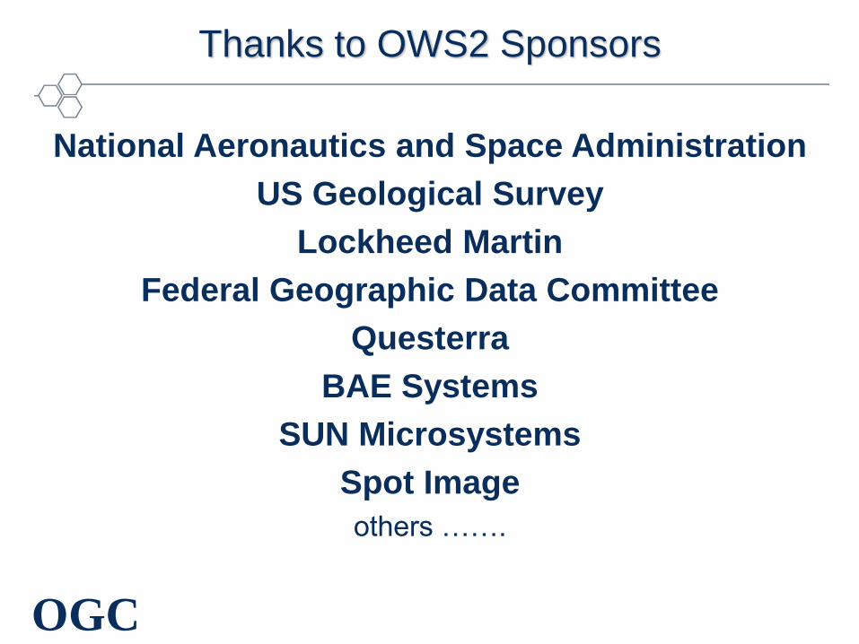
Thanks to OWS2 Sponsors
National Aeronautics and Space Administration
US Geological Survey
Lockheed Martin
Federal Geographic Data Committee
Questerra
BAE Systems
SUN Microsystems
Spot Image
others …….

OGC
OWS2 Threads and Demos
GeoScout
Common Architecture
Image Handling for Decision Support
Compliance & Interoperability Testing & Evaluation
OpenLS
Information Interoperability
Defense
Demo
Natural
Resources
Demo

OGC
Common Architecture
Mission: The objective of CA is to define a consistent adaptation and integration of Web Services standards, defined by leading organizations such as W3C, OASIS, Microsoft, IBM, Sun Microsystems, and the open-source community, with the OWS service framework in general and the set of core OGC specifications (WMS, WFS, CS-W, and WCS).
• OWS-2 Work Items
– SOAP and WSDL for WMS, WFS, WCS and CS-W
• Define SOAP profiles for the services
• Define WSDL for HTTP get/put profiles
• Develop WSDL for SOAP profiles
• Develop reference implementations of services using SOAP profiles
– Experiments using UDDI to discover OGC Web Services
– Identify and document any changes required to common architecture or specifications

OGC
Information Interoperability / GeoScout
Mission: Enable the interoperable expression, exchange and access of
geographic information within and across information communities
(Information communities are groups that share common geographic terms and
common spatial feature definitions). Promote the development of SCOTS
products that implement these capabilities.
• OWS-2 Work items
– Develop techniques for creating application specific information models
from a common model
• Create application schemas from UML models
• Create application schemas from GML schemas
– Extend SCOTS products to support application schemas

OGC
Developing GML Application Schemas from UML Data Models
• UGAS (UML to GML Application Schema) tool generated
GML Application Schemas from UML models
• Appropriate where a data model already exists
• Provides a repeatable automated process for generating
application schemas
• However: UGAS does identify flaws in your UML model.
Be prepared to do several iterations as you fix your model.
http://www.interactive-instruments.de/ugas

OGC
UGAS (AKA ShapeChange) Context
UML
Model
Output
Schema
UML to
GML Type
Mapping
UGAS
OGC
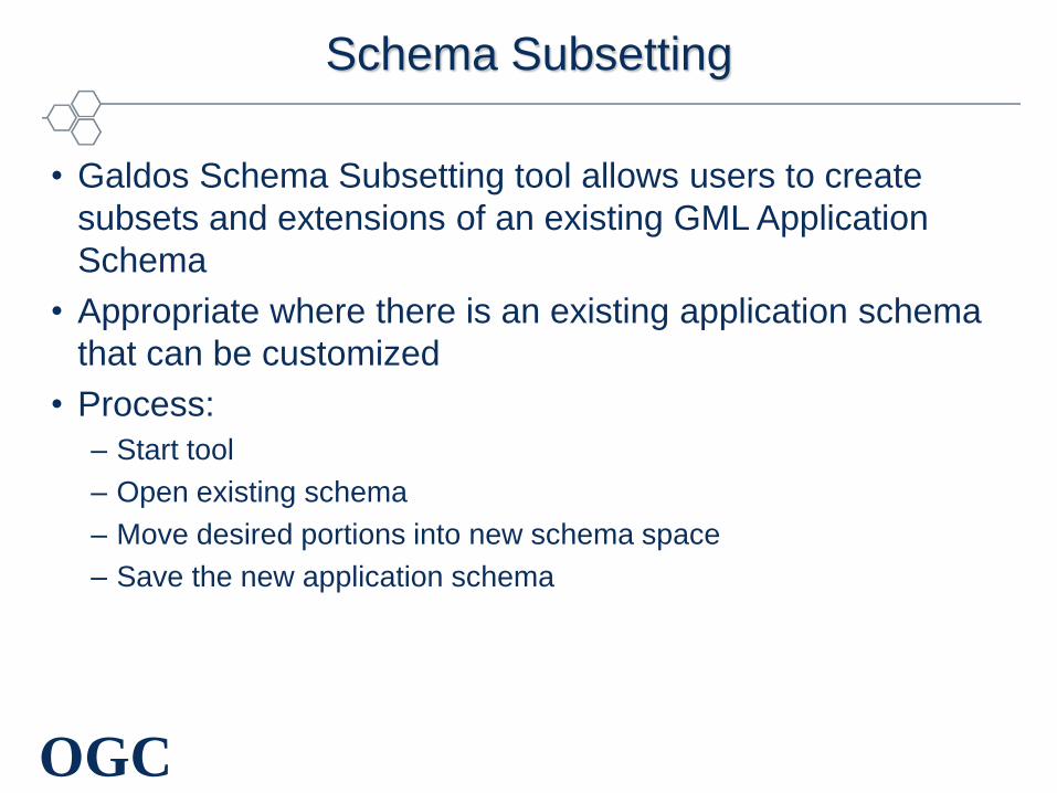
Schema Subsetting
• Galdos Schema Subsetting tool allows users to create
subsets and extensions of an existing GML Application
Schema
• Appropriate where there is an existing application schema
that can be customized
• Process:
– Start tool
– Open existing schema
– Move desired portions into new schema space
– Save the new application schema

OGC
Schema Subsetting Work Flow
GML Application
Schema
Schema
Subsetting Tool
GML Application
Schema
Information
Requirements
OGC
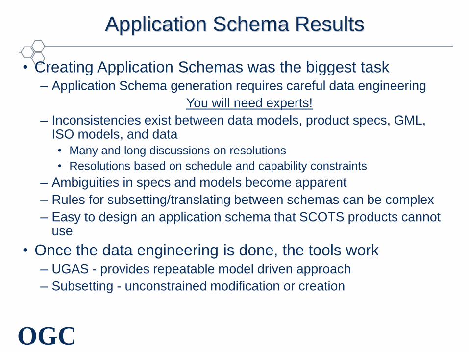
Application Schema Results
• Creating Application Schemas was the biggest task– Application Schema generation requires careful data engineering
You will need experts!
– Inconsistencies exist between data models, product specs, GML, ISO models, and data
• Many and long discussions on resolutions
• Resolutions based on schedule and capability constraints
– Ambiguities in specs and models become apparent
– Rules for subsetting/translating between schemas can be complex
– Easy to design an application schema that SCOTS products cannot use
• Once the data engineering is done, the tools work– UGAS - provides repeatable model driven approach
– Subsetting - unconstrained modification or creation

OGC
OWS-2 Web Service Components
WFSWFS
IntergraphESRI
WMS
Intergraph
H HTTP
ESRI
WCS WCS
H
SPOT Interactive
InstrumentsESRI Global
Mosaic
HH
WFS-T
Intergraph
GML 2
H H H
WMS
Intergraph
H

OGC
II/GS Summary
• Tools and techniques for developing GML Application
Schemas of NGA data products exist and they work
• SCOTS vendors are capable of accessing and using data
delivered in those application schemas
• SCOTS vendors are not able to post updates to a WFS-T
using those application schemas at this time
– User definition of topology use cases required
• Results will be provided to WFS 1.1 Working Group

OGC
Compliance and Interoperability Testing and Evaluation (CITE)
Mission: Develop conformance tests and reference implementations
for the core set of the OWS Technical Baseline that include: WMS,
WFS, CS-W and WCS
• OWS-2 Work items
– Develop test suites for:
• Web Map Service 1.3
• Web Feature Service 1.1
• Web Coverage Service 1.0
• Catalog Service 2.0
– Develop Reference Implementations of:
• Web Coverage Service 1.0
• Catalog Service 2.0

OGC
CITE System Architecture

OGC
OpenLS
Mission: The OGC Location Services (OpenLS) represent an open (middleware)
platform for location-based application services for mobile assets and
terminals. The primary goal of the OpenLS initiative series is to define the
specifications for the “Core Services and Abstract Data Types (ADT)” that
comprise this platform.
• Work Items:
– Positioning Service Modifications/Enhancements
– Develop Location Refinement Service
– Develop Navigation Service
– Presentation Service Enhancements

OGC
Image Handling for Decision Support
Mission: Use and, where appropriate, define and enhance interoperability specifications to increase the availability and usability of geographic imagery, enabling the use of information derived from imagery to be used with all other forms of geographic information by decision support tools and systems to derive information that enhances the human capacity to make decisions.
• OWS-2 Work items
– Demonstrate use of WCS 1.0 to access and handle images from NASA Synergy Data Pool image archive
– Exercise Imagery Metadata standards
– Develop enhancements to WCS
– Develop image processing services
• Web Coordinate Transformation Service (WCTS)
• Web Image Classification Service (WICS)
– Integrate OWS services into an automated workflow

OGC 21
Helping the World to Communicate
Geographically
Helping the World to Communicate
Geographically
…
WCS (NASA Data Pool)
WCTS
(Producer-B, Vendor-2)
WICS (Producer-C,Vendor-3)
WFS (Producer-n, Vendor-x)
Internet
Web Servers
OGC
Interfaces
Service chaining creates
Value-added products Decision Support
Client
OWS2 Image Handling for Decision Support

OGC
OWS2 Threads and Demos
GeoScout
Common Architecture
Image Handling for Decision Support
Compliance & Interoperability Testing & Evaluation
OpenLS
Information Interoperability
Defense
Demo
Natural
Resources
Demo

OWS-2
Natural Resources
Scenario
2 September 2004

OGC
OWS2 NR Demo Project Team
• Sponsors– NASA
– Spot Image
– USGS
• Management Team– OGC Staff
– Lockheed-Martin
– BAE Systems
– Image Matters
– Ecosystem Associates
• Participants– GMU
– Intergraph
– PCI
– Raytheon
– Ionic
– Galdos
– Oracle (was Collaxa)
– UAH VAST
– UAH ITSC
– ITT (was Kodak)

OGC
Scenario
This discussion will take place in the context of a real event. Between October 25 and November 5, 2003, fires
burned 336,978 acres in San Diego County, California. The following activities could have been executed as part
of the fire fighting efforts.
• Decision support using existing OGC specifications
– Web Browser - Thin Client
– Decision support application - Thick Client
• Decision support using value-added products produced using OWS2 technology developments
– Image processing services
– Workflow automation

OGC
Task 1: Assess Damage with Post-Fire Imagery
GMU
WFSWCS
1.0.0
Intergraph PCI
CSWWMS
H
NASA Data Pool
•MODIS
•ASTER
SPOT
• SPOT
CubeWerx
• Space Imaging
GMU
• AIRDAS
- MODIS
Intergraph
H HTTP
FEMA Hazardmaps
NASA WMS Global Mosaic
H
Galdos
Ionic
S SOAP
ITT(Kodak)
Ionic Galdos
CPSS
WMS Context
H
H
Identify burn scar fire damage.
–Search by service and location for relevant imagery
–Portrays post-fire imagery as a picture in thin client
–Save as WMS Context and mail to Resource Manager

OGC
Task 2: Analyze Terrain Effects
GMU
WFSWCS
1.0.0
Intergraph PCI
CSWWMS
H
NASA Data Pool
•MODIS
•ASTER
SPOT
• SPOT
CubeWerx
• Space Imaging
GMU
• AIRDAS
- MODIS
Intergraph
• VMAP1
H HTTP
FEMA Hazardmaps
NASA WMS Global Mosaic
H H
Galdos
Ionic
S SOAP
ITT(Kodak)
Ionic Galdos
S
Assess influence of terrain on fire
conditions using Decision Support Client
(Thick Client) to inspect descriptions of
imagery, access image archive and view
imagery

OGC
ITT Client Adaptor - DescribeCoverage

OGC
Spot DEM and Spot MSS

OGC
ITT ENVI Decision Support Client

OGC
Work Accomplished in OWS-2
• Enhanced WCS (WCS+)
– Return a file or return a reference to the file in a repository
– Multiple-measurements and multi-band requests
– Multi-file attachments
• Enhanced Metadata for Imagery Discovery and Processing
• New Image Processing Services
– Web Coordinate Transformation Service (WCTS)
– Web Image Classification Service (WICS)
• New workflow automation capability
– Business Process Execution Language (BPEL)
– Workflow Chaining Service - WfCS

OGC
OWS-2 IH4DS Web Clients and Services
GMU Intergraph PCI
WfCS
H HTTP binding
WCS+
H
NASA/Raytheon/Ionic
•MODIS
•ASTER
WICS
GMU
H
WCTS
GMU
H
WCS+
H
Spot/Ionic
• SPOT
WCS+
H
GMU
• AIRDAS
- MODIS
WCTS
PCI
H
Oracle/Integraph
Data
Services
Processing
Services
Workflow/task
Services
Client
ApplicationsITT
(Kodak)Ionic

OGC
NASA/Raytheon/Ionic
•MODIS
•ASTER
Task 3: Inspect Complex Imagery Products
GMU Intergraph PCI
WfCS
H HTTP
WCS+
H
WICS
GMU
H
WCTS
GMU
H
WCS+
H
Ionic/Spot
• SPOT
WCS+
H
GMU
• AIRDAS
- MODIS
WCTS
PCI
H
Oracle/Intergraph
Inspect “during-fire” imagery from NASA MODIS (MOD02)
containing multiple measurements, each with multiple band
•Accesses NASA MODIS (MOD02) imagery using WCS+
•Request multiple bands from multiple measurements.
•Display the visual bands. Fire location is obscured.
•Display thermal data. Hot spots show up as bright spots

OGC
Multi-measurement WCS

OGC
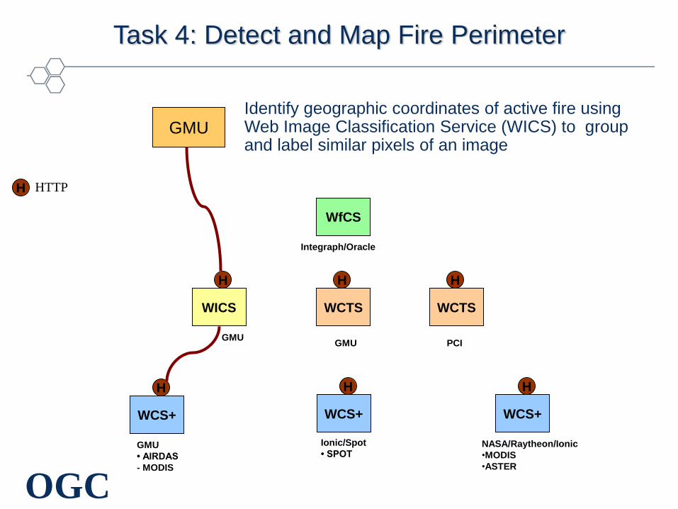
Task 4: Detect and Map Fire Perimeter
• Task
– Identify geographic coordinates of active fire
– Web Image Classification Service (WICS)
– Group and label similar pixels of an image
• Input image has radiance or reflectance values for each pixel
• Classification assigns each pixel to particular class or label
– Input image is ASTER Thermal IR product
• OGC Technology
– New service: WICS developed using OWS common elements
• Un-supervised classification is demonstrated
• Supervised classification discussed in deliverable report
– Input to WICS from source WCS
• GMU WICS demonstration
– Client allows specifying WICS parameters:
• Source URL, Source Format, Target, # of Cluster, Max Iterations
– WICS Service
OGC
NASA/Raytheon/Ionic
•MODIS
•ASTER
Task 4: Detect and Map Fire Perimeter
GMU Intergraph PCI
H HTTP
WCS+
H
WICS
GMU
H
WCTS
GMU
H
WCS+
H
Ionic/Spot
• SPOT
WCS+
H
GMU
• AIRDAS
- MODIS
WCTS
PCI
H
WfCS
Integraph/Oracle
Identify geographic coordinates of active fire using Web Image Classification Service (WICS) to group and label similar pixels of an image

OGC
WICS Input: multi-band ASTER

OGC
WICS Output: Classified Coverage

OGC
Task 5: Prepare Image for DS Client
GMU Intergraph PCI
WfCS
H HTTP
WCS+
H
WICS
GMU
H
WCTS
GMU
H
WCS+
H
Ionic/Spot
• SPOT HLS
• SPOT DEM
WCS+
H
GMU
• AIRDAS
- MODIS
WCTS
PCI
H
Intergraph/Oracle
NASA/Raytheon/Ionic
•MODIS
•ASTER
Change Coordinate Reference System (CRS) of an image
where input is Image in Source CRS (EPSG:4326) and output
is image in Target CRS (UTM-Z11= EPSG:32611)

OGC
Orthorectification with WCTS
PCI
WCTS
H
SPOT
WCS+
HDEM
(GeoTIFF)2.4
SPOT
WCS+
H
PCI
WebClient
& Geomatica
2
DIMAP
RawImage
(GeoTIFF)2.1
2.2
2.3
Transform(inputData=aURL,
sourceCRS=“ImageCRS”,
targetCRS=“32611”,
format=“GeoTIFF”,
GML.Transformation[DEM, DIMAP,
resX, resY, bandList])
1
Orthophoto
(GeoTIFF)
2.5
A URL to resulting
orthorectified GeoTIFF
1.1
Get Coverage at URL3

OGC
Task 6: Expert User Builds a Service Chain
• Task: Automate image processing
– In advance of actual fire, expert develops automated script for use
during fire management response
– Expert develops a valid script that creates a value-added product
• Open Standards Technology
– BPEL = Business Process Execution Language
– BPEL development in OASIS consortium
– Applicable to broader web services industry, not geospatial specific
• Intergraph demo using Oracle components
– Use Designer to build a BPEL script
– Use Process Manager to execute BPEL script
• Workflow Chaining Service (WfCS)

OGC
Hot-Spot Detection Flow
Intergraph
DSClient
Raytheon
WCS+
H
PCI
WCTS
H
GMU
WICS
H
WfCS
GMU
WCTS
H
GMU
WCS+
H
DS_Client WCS➔ GMU(HDF-EOS)➔ WICS➔ HDF-EOS➔WCTS➔ GeoTIFF➔ DS_Client
HDF-EOS2.1 3.1 4.1HDF-EOS3.2
GeoTIFF/
NITF
4.2
1 startFlow
2getCoverage
3getClassification
4Transform
5endFlow1.1
SPOT
WCS+
H

OGC
A BPEL Composite Service
WCS:
Get ASTER
Thermal Bands
WICS:
Classify ASTER
Thermal into 3
categories
WCTS:
Re-project classified
coverage to UTM
Zone 11.
Client
Invokes “HotSpot”
service (implements
GetCoverage request)
A Composite
Service (a BPEL
script)… …of these Image
Handling Services

OGC
Inside the HotSpot BPEL Composite Service
Receive input request from client.
WCS: Get ASTER Thermal BandsGetCoverage(boundingBox,coverageID,width,height,store=true,format=HDF/
EOS, measurename=“ImageData12, Imagedata13, ImageData14”,
BBOX,CRS=Lat/LonWGS84)
WICS: Classify ASTER Thermal into 3 categories. GetClassification(source=HDF/EOS, 3 clusters, target=HDF/EOS,
sourceURL)
WCTS: Re-project classified coverage to UTM Zone 11Transform(inputData=URL, outputFormat=GeoTIFF, inputCRS=“4326”,
outputCRS=“EPSG:32611”, resX=300, resY=300)
Returns classified and re-projected GeoTIFF!

OGC
Task 7: Decision Maker reviews Value-added Results
GMU Intergraph PCI
WfCS
H = HTTP WCS+
H
NASA/Raytheon/Ionic
•MODIS
•ASTER
WICS
GMU
H
WCTS
GMU
H
WCS+
H
Ionic/Spot
• SPOT
WCS+
H
GMU
• AIRDAS
- MODIS
WCTS
PCIH
WMS
FEMA Hazardmaps
WMS Global Mosaic
H
WFS
Intergraph
H
Identify Burn Areas and Assess Damage
– Integrate results from multiple services for
decision support
– Pull-in burning areas image from service chain
and display
– Add geospatial data from multiple sources to
map display WfCS
-Oracle/Intergraph
-GMU BPELpower

OGC
Decision Support Client accessing Multiple OWS Sources

OGC
Decision Support Client accessing Web Service Chain

OGC
Decision Support Client Displaying Service Chain Result

OGC
Exciting Development During Demo Preparation…
• Demonstrated portability of BPEL
• Intergraph
– BPEL document built with Oracle Designer and executed with
Orchestration Server
• GMU
– Same BPEL script is used in their BPELpower orchestration server
to execute service chain
• Power of open standards!

OGC
OWS-2 IH4DS Products
• Image Metadata IPR
– Describe Image Metadata Schema
– Submit for consideration as an OGC Specification and/or
recommendation paper
• WCS Change Request(s)
– Return a file or return a reference to a datastore
– Multiple-measurements
– Multi-file attachments
• Web Image Classification Service IPR
• Web Coordinate Transformation Service IPR
• Discussion Paper for Service Chaining with BPEL

OGC
OWS2 Threads and Demos
GeoScout
Common Architecture
Image Handling for Decision Support
Compliance & Interoperability Testing & Evaluation
OpenLS
Information Interoperability
Defense
Demo
Natural
Resources
Demo

OGC
Questions?
George Percivall
Executive Director
Interoperability Architecture
1+ 301-560-6439
Open Geospatial Consortium, Inc
www.opengeospatial.org