Embed Size (px)
Citation preview

CHANSON, H., and JAMES, P. (1998). "Rapid Reservoir Sedimentation of Four Historic Thin Arch Dams in Australia." Jl of Performance of Constructed Facilities, ASCE, Vol. 12, No. 2, May, pp. 85-92. Errata : Vol. 12, No. 3, p.169 (ISSN 0887-3828).
1
RAPID RESERVOIR SEDIMENTATION OF FOUR HISTORIC THIN ARCH DAMS IN
AUSTRALIA
by H. CHANSON1 and P. JAMES2
Abstract : Since the discovery of the Australian continent by Europeans, the development of the country has been
closely linked with the development of water resources. At the end of the 19th century, several arch dams were built in
New South Wales, four of which are described in this paper. The four dams (Moore Creek, Gap, Korrumbyn Creek,
Quipolly) had similar features : i.e., water supply storage with thin concrete arch wall. Despite their technological
sophistication at the time, they became fully-silted very quickly with each one being used for less than 25 years.
Although their structural design was advanced, the design of the reservoir systems (dam, lake and catchment) was a
failure. The designers did not take into account correctly the soil erosion and sediment transport processes, and no soil
conservation practice was considered. The experience gained from these failures may be of use today to prevent
practicing engineers from making similar mistakes.
INTRODUCTION
Since the discovery of the Australian continent by Europeans, the water supply of the early settlements was always an
important concern. The first inland expeditions usually followed the major rivers. The new settlers were attracted
further inland by the search for better pasture and later by the discovery of gold. The economical development of the
colony, however, was significantly affected by the lack of regular water supply.
The early settlements took place in the South-East (Victoria, New South Wales) (Fig. 1) and numerous dams were built
to provide regular water supply throughout the year. Nearly 90% of the 19th century reservoirs were built for water
supply (drinking water, stocking and irrigation primarily) but also for the mining industry (e.g. the two Sheba dams
1888, Junction Reefs dam 1897). Smaller dams were built for water supply for railway steam engines, at the end of the
19th and beginning of the 20th centuries (e.g. Gap weir, 1902). By tradition most Australian large dams were earth
embankments following the English experience. However several thin arch dams were built, in New South Wales
primarily (e.g. Moore Creek dam, 1898, Redbank Creek, 1899).
ARCH DAMS IN AUSTRALIA IN THE 19TH CENTURY AND EARLY 20TH CENTURY
One of the first significant dam structures built in Australia is the Parramatta dam, near Sydney. Built between 1851
and 1856, the 12.5-m high3 wall was contemporary to the Zola dam, in France. The dam was designed by P. SIMPSON
(1789-1877), E.O. MORIARTY (1824-1896) and W. RANDLE (ASH et HEINRICHS 1996) with a cylinder shape. It
1 Senior Lecturer, Fluid Mechanics, Hydraulics and Environmental Engineering, Department of Civil Engineering, The
University of Queensland, Brisbane QLD 4072, Australia.
2 Environmental Consultant, 5/2 Hardie St, Neutral Bay NSW 1089, Australia.
3before dam heightening of 3.35 m in 1898 (WADE 1909).

CHANSON, H., and JAMES, P. (1998). "Rapid Reservoir Sedimentation of Four Historic Thin Arch Dams in Australia." Jl of Performance of Constructed Facilities, ASCE, Vol. 12, No. 2, May, pp. 85-92. Errata : Vol. 12, No. 3, p.169 (ISSN 0887-3828).
2
is worth noting that SIMPSON was a former officer of the Royal Navy and MORIARTY was a naval engineer. The
authors believe that both engineers were familiar with the calculations of shells and ship hulls, hence with the thin
cylinder formula (see Appendix I).
The Parramatta dam is the precursor of a series of thin arch dams built in New South Wales by the NSW Public Works
Department under the successive supervisions of C.W. DARLEY, L.A.B. WADE and E.M. de BURGH between 1896
and 1920 (WADE 1909, de BURGH 1917). Altogether, more than 20 thin arch dams were built by the NSW Public
Works Department and the arch dam design example was followed in other states (e.g. Barossa dam, 1902, South
Australia; Sorell Creek dam, 1916, Tasmania) and by the NSW Railway Department.
The design of the Australian thin arch dams was based on the thin cylinder formula (WADE 1909, de BURGH 1917)
and it is probably a world-first in the standardization of this design technique. At the time, the dams were recognized as
advanced designs in Europe and in the USA (SCHUYLER 1909, WADE 1909, WEGMANN 1922, see also SMITH
1971, SCHNITTER 1994). WEGMANN (in the discussion of WADE 1909) stated that, in his opinion, "the curved
dams built [...] in New South Wales had been designed more logically" than any other arch dams or curved-gravity
dams.
Contemporary arch dams include the Zola dam (France, 1854), Abbeystead dam (UK, 1881), Bear Valley dam (USA,
1884), Sweetwater dam (USA, 1888) and Upper Otay dam (USA 1900). All were single-arch designs similar to the
Australian dams. The first double-curved arch dam was completed in 1903 (Ithaca dam, USA) and the first variable
radius arch dam was built in 1914 (Salmon Creek, USA) (WEGMANN 1922, SCHNITTER 1994).
RESERVOIR SEDIMENTATION
The primary characteristics of water supply dams is the reservoir storage capacity which is an economical and political
asset. A reservoir interacts, however, with its catchment, often acting as a sediment trap, and the life expectancy of a
reservoir is usually less than 100 years because of siltation. Reservoir sedimentation results from soil erosion, sediment
transport and sediment trapping by the reservoir. It is affected by the climate and hydrology of the catchment, water and
sediment chemistry, vegetation cover and land use including man-made erosion.
Altogether, reservoir sedimentation is associated with a loss of reservoir capacity and often with loss of fertile soils.
Several Australian thin arch dams are still in use today : e.g., the Parramatta dam. However some were used for less
than 25 years despite their advanced structural design. The reservoirs silted up very rapidly and the dams have become
a source of embarrassment. In the present paper, the authors describe the history of four reservoirs built between 1897
and 1932 and which are fully-silted today (Fig. 2 to 5). Later they analyze the causes of failure.
HISTORY OF FOUR DAMS
OVERVIEW
The characteristics of four reservoirs and dams are summarized in Tables 1 and 2. In Table 3, the chronology of main
dates are summarized and compared with major climatic events which affected the Australian continent: El-Niño, La
Nina, and drought. The El-Niño current and Southern Oscillation (ENSO) is a global climatic change caused by warmer

CHANSON, H., and JAMES, P. (1998). "Rapid Reservoir Sedimentation of Four Historic Thin Arch Dams in Australia." Jl of Performance of Constructed Facilities, ASCE, Vol. 12, No. 2, May, pp. 85-92. Errata : Vol. 12, No. 3, p.169 (ISSN 0887-3828).
3
waters in the Pacific Ocean which alternates with colder conditions called La Nina. In Eastern Australia, droughts are
experienced habitually during an El-Niño while floods are often observed during a La Nina.
Three dams were designed by the NSW Public Works Department; the fourth dam (Gap weir) was built by the NSW
Railways Department. Three reservoirs are located within inland catchments forming the Murray-Darling basin. The
fourth reservoir (i.e. Korrumbyn Creek) is within the Tweed River catchment which drains to the Pacific ocean (Fig. 1).
MOORE CREEK DAM
The Moore Creek dam was completed in 1898 to supply water to the town of Tamworth, NSW. The 18.6-m high dam
was designed with advanced structural features : i.e. thin single-arch wall (7.7-m thick at base, 0.89-m thick at spillway
crest, 0.87-m thick at dam crest), made of Portland cement concrete (Table 2). The arch wall has a vertical downstream
face and a battered upstream face (Fig. 2). The thin arch extends with a left-bank gravity cross-section with downstream
inclined face. The dam was equipped with an overfall spillway and two bottom outlets (a scour valve4 and a pipe
outlet).
Between 1898 and 1911, the reservoir was filled with 85,000 m3 of sediment. Observations recorded at the time
suggested that most siltation took place during the floods of February 1908 and January 1910. In 1924 the reservoir
ceased completely to supply water because it was fully silted. The dam is still standing today and listed in ICOLD
(1984).
GAP WEIR
Completed in 1902, the Gap weir is located near the Gap railway station, five kilometers from the railway junction of
Werris Creek (Fig. 3). It was built to supply water to the steam engines.
The dam wall is a single-arch concrete structure with upstream vertical face and inclined (battered) downstream face (~
73° angle with horizontal). The original spillway was an overfall spillway extending over most of the weir crest and
followed by a relatively deep plunge pool, but no scour outlet was built (although a drawing prior to construction
showed one).
The reservoir became fully-silted by 1924. It was abandoned and replaced by available water supply from Quipolly
Creek and later from the Quipolly dam5. Since 1924, the dam wall was blasted twice to facilitate the passage of flood
flow and to limit upstream flooding. Interestingly, the reservoir is located downstream of a long flat flood plain (slope <
0.2 degrees, streamwise length > 6 km). The river, cutting through into the reservoir sediment, highlights the silty
material caught by the weir, suggesting a siltation process by suspended-load.
4A scour valve is a bottom outlet structure used to release silty waters and to reduce the sedimentation rate.
5The change to engine motors occured in the 1970s and did not affect the decision.
CHANSON, H., and JAMES, P. (1998). "Rapid Reservoir Sedimentation of Four Historic Thin Arch Dams in Australia." Jl of Performance of Constructed Facilities, ASCE, Vol. 12, No. 2, May, pp. 85-92. Errata : Vol. 12, No. 3, p.169 (ISSN 0887-3828).
4
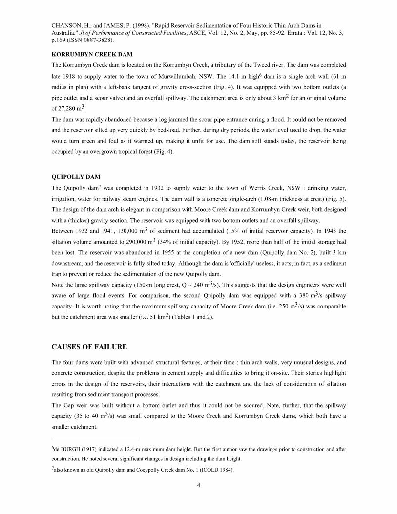
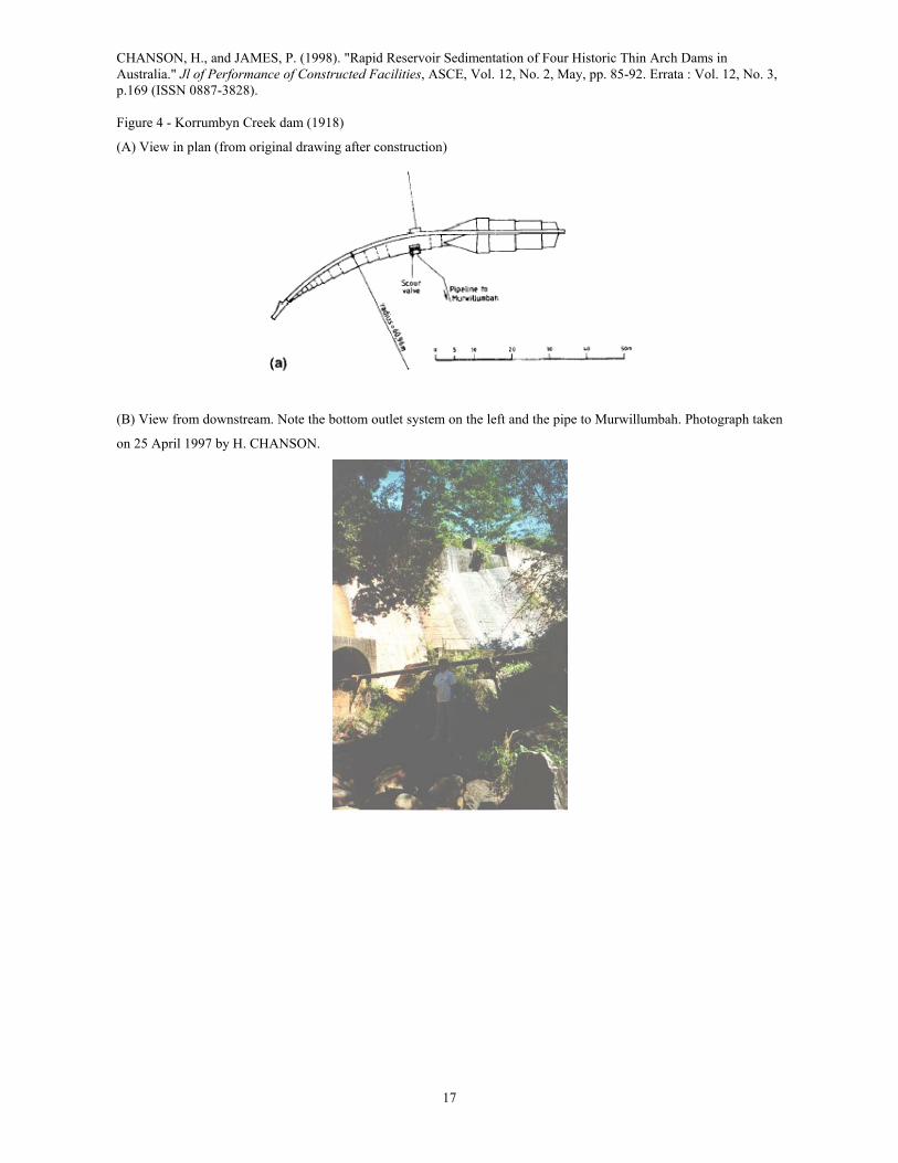
KORRUMBYN CREEK DAM
The Korrumbyn Creek dam is located on the Korrumbyn Creek, a tributary of the Tweed river. The dam was completed
late 1918 to supply water to the town of Murwillumbah, NSW. The 14.1-m high6 dam is a single arch wall (61-m
radius in plan) with a left-bank tangent of gravity cross-section (Fig. 4). It was equipped with two bottom outlets (a
pipe outlet and a scour valve) and an overfall spillway. The catchment area is only about 3 km2 for an original volume
of 27,280 m3.
The dam was rapidly abandoned because a log jammed the scour pipe entrance during a flood. It could not be removed
and the reservoir silted up very quickly by bed-load. Further, during dry periods, the water level used to drop, the water
would turn green and foul as it warmed up, making it unfit for use. The dam still stands today, the reservoir being
occupied by an overgrown tropical forest (Fig. 4).
QUIPOLLY DAM
The Quipolly dam7 was completed in 1932 to supply water to the town of Werris Creek, NSW : drinking water,
irrigation, water for railway steam engines. The dam wall is a concrete single-arch (1.08-m thickness at crest) (Fig. 5).
The design of the dam arch is elegant in comparison with Moore Creek dam and Korrumbyn Creek weir, both designed
with a (thicker) gravity section. The reservoir was equipped with two bottom outlets and an overfall spillway.
Between 1932 and 1941, 130,000 m3 of sediment had accumulated (15% of initial reservoir capacity). In 1943 the
siltation volume amounted to 290,000 m3 (34% of initial capacity). By 1952, more than half of the initial storage had
been lost. The reservoir was abandoned in 1955 at the completion of a new dam (Quipolly dam No. 2), built 3 km
downstream, and the reservoir is fully silted today. Although the dam is 'officially' useless, it acts, in fact, as a sediment
trap to prevent or reduce the sedimentation of the new Quipolly dam.
Note the large spillway capacity (150-m long crest, Q ~ 240 m3/s). This suggests that the design engineers were well
aware of large flood events. For comparison, the second Quipolly dam was equipped with a 380-m3/s spillway
capacity. It is worth noting that the maximum spillway capacity of Moore Creek dam (i.e. 250 m3/s) was comparable
but the catchment area was smaller (i.e. 51 km2) (Tables 1 and 2).
CAUSES OF FAILURE
The four dams were built with advanced structural features, at their time : thin arch walls, very unusual designs, and
concrete construction, despite the problems in cement supply and difficulties to bring it on-site. Their stories highlight
errors in the design of the reservoirs, their interactions with the catchment and the lack of consideration of siltation
resulting from sediment transport processes.
The Gap weir was built without a bottom outlet and thus it could not be scoured. Note, further, that the spillway
capacity (35 to 40 m3/s) was small compared to the Moore Creek and Korrumbyn Creek dams, which both have a
smaller catchment.
6de BURGH (1917) indicated a 12.4-m maximum dam height. But the first author saw the drawings prior to construction and after
construction. He noted several significant changes in design including the dam height.
7also known as old Quipolly dam and Coeypolly Creek dam No. 1 (ICOLD 1984).
CHANSON, H., and JAMES, P. (1998). "Rapid Reservoir Sedimentation of Four Historic Thin Arch Dams in Australia." Jl of Performance of Constructed Facilities, ASCE, Vol. 12, No. 2, May, pp. 85-92. Errata : Vol. 12, No. 3, p.169 (ISSN 0887-3828).
5
The Korrumbyn Creek dam had an insufficient catchment area (3 km2). Although the mean annual flow rate could
'theoretically' fulfill the water need of Murwillumbah, it was known that the stream discharge was very irregular : in
1916, the average weekly flow rate ranged from 0.75 L/s (2-8 Jan. 1916) to 886 L/s (8-15 April 1916), and the spillway
was sized for a 125,000 L/s flood. Altogether the reservoir never properly supplied Murwillumbah with water.
Furthermore the catchment is very steep : the stream bed slope is larger than 7.6° (0.133V/1H) in the 2 first kilometres
upstream of the dam ! This caused significant sediment load in the creek. Today the river bed still exhibits a wide range
of sediment materials (fig. 4(C)), and bed-load siltation could be predicted with contemporary experience (in the
opinion of the authors, after inspection of the river bed).
The catchment of Moore Creek dam is characterized by a thin layer of fertile soil. At the end of the 19th century, the
forest was cleared for grazing. Further it seems that a substantial increase in sheep livestock number took place at the
same time. Both the clearing of the catchment and the increase of stocking rate increased the erodibility of the soils and
contributed to the rapid sedimentation of the reservoir.
The siltation of Quipolly reservoir also is probably related to improper land management of the catchment.
DISCUSSION
Because of sedimentation, the four reservoirs had an useful life of less 25 years. Why ? Several factors contributed to
the sedimentation : a sub-tropical climate characterized by intense summer rainfall, streams with significant sediment
loads, land use and poor land management practices (by current standards), which devastated the native pasture and
enhanced soil erosion (e.g. Moore Creek), design mistakes (e.g. Gap) and improper selection of site (Korrumbyn
Creek). Additional considerations must also be taken into account and are discussed below.
CLIMATIC EFFECT
Northern New South Wales is characterized by a sub-tropical climate with a dry season (winter) and a wet season
(summer). This annual cycle is, however, subjected to inter-annual climatic events : the El-Niño and La Nina. Usually
the El-Niños coincide with drought periods in Australia and India (DIAZ and MARKGRAF 1992) while La Ninas are
associated with flooding in Australia. This pattern was clearly established between 1878 and 1888 by Sir Charles
TODD, South Australia Government Observer, and well documented by H.C. RUSSELL, NSW Government Observer
(GROVE 1995, p. 17). The main information is summarized in Table 3, where Australian droughts, El-Niño and La
Nina events are listed in chronological order, as well as important dates in the history of the four reservoirs. The
information on floods and siltation is based on local observations of floods and spillway use, and surveys of the
reservoirs in the following dry periods.
In terms of soil erosion and sediment load, the most extreme hydrological events are exceptional floods following a
long drought period (associated with an El-Niño). Dry conditions retard the growth of vegetation cover and the
following wet conditions erode the bare unprotected soil. Further, soil management and conservation practices are not
often applied by farmers and graziers during long droughts : overgrazing of pastures followed by failure of pasture
regeneration increase drastically the erodibility of the un-vegetated ground. The following torrential rains easily wash
away the soils and, as a result, the streams carry a large sediment load which deposits in dam reservoirs.
CHANSON, H., and JAMES, P. (1998). "Rapid Reservoir Sedimentation of Four Historic Thin Arch Dams in Australia." Jl of Performance of Constructed Facilities, ASCE, Vol. 12, No. 2, May, pp. 85-92. Errata : Vol. 12, No. 3, p.169 (ISSN 0887-3828).
6
Table 3 illustrates examples of such extreme events : the flood of February 1908 at Moore Creek (column 5), the floods
of 1919 at Gap weir (column 6), and the floods of 1942-43 at Quipolly (column 8). Each flood event followed a long
drought period, and heavy siltation was recorded in each case.
SEDIMENT TRANSPORT PROCESSES AND DESIGN
Basically, the stories of the four reservoirs reflect a lack of understanding of sediment transport processes and soil
conservation practices. Each dam must be considered as an engineering failure. The reservoirs failed because the
designers did not understand the basic concepts of sediment transport and reservoir sedimentation.
First let us remember that the knowledge of sediment process and movable-boundary hydraulics was 'embryonic' in the
1900s. The fundamental concepts of sediment transport were developed in the late 19th century and first half of 20th
century : e.g., du BOYS (1879), SCHOKLITSCH (1914,1930), EINSTEIN (1942,1951), MEYER PETER
(1949,1951).
However, it is surprising to note that the designers of Korrumbyn Creek dam and Quipolly dam did not learn from the
experience of Moore Creek dam and Gap weir. By 1912 the sedimentation of Moore Creek dam was well advanced and
documented : the information was available prior to the construction of Korrumbyn Creek dam. Similarly the
experience of Gap weir (located less than 20 km from Quipolly dam) should have influenced the design of Quipolly
dam : e.g., with the choice of a larger scour outlet. It appears also that the land management practices applied to
Quipolly catchment in the period 1930-1950 were identical to those of Moore Creek catchment in 1900-1910 (JAMES
1997).
Moore Creek, Korrumbyn Creek and Quipolly reservoirs were designed and built by the same organization (i.e. NSW
Public Works Department). It is surprising that the experience of reservoir siltation was not shared among colleagues
and used to improve the design technique.
OPINION
The authors feel that each failure should be a learning experience, illustrating poor understanding of movable-boundary
hydraulics. The mistakes could have been prevented with today's knowledge. In one case (Gap weir), the addition of a
scour valve would have been sufficient. In another (Korrumbyn Creek), the site was unsuitable because of the heavy
bed load carried by the stream. At Moore Creek, a soil conservation policy should have been introduced in the
catchment, as at Quipolly reservoir.
Three reservoirs have now no purpose and they are considered, by the public, as engineering failures. Only one dam
(Quipolly) may be considered as still partially useful : i.e., sediment trap for Quipolly dam No. 2.
CONCLUSION
During the European settlement of Australia in the 19th and 20th centuries, a series of thin arch dams was built in
South-East Australia for water supply purposes. Among these, four dams were silted very rapidly and were abandoned
in less than 25 years.
CHANSON, H., and JAMES, P. (1998). "Rapid Reservoir Sedimentation of Four Historic Thin Arch Dams in Australia." Jl of Performance of Constructed Facilities, ASCE, Vol. 12, No. 2, May, pp. 85-92. Errata : Vol. 12, No. 3, p.169 (ISSN 0887-3828).
7
After a brief history of each reservoir, the authors have discussed the main causes of reservoir siltation : extreme
climatic conditions and streams with heavy sediment load, but also improper soil conservation practices and design
mistakes.
Although the dams had advanced structural features, their stories reflect a lack of understanding of sediment transport
processes by the designers. The authors wish that these four examples can be used as pedagogic examples by
professionals and students to improve future hydraulic designs.
ACKNOWLEDGEMENTS
The authors wish to thank the following people for their assistance and help : Mr N. BEDFORD, Tamworth NSW,
Ms CHOU Y.H., Brisbane QLD, Mr and Mrs D. DAVIDSON, Murwillumbah NSW, Dr M.R. GOURLAY, Brisbane
QLD, Mr P. HEINRICHS, Sydney NSW; Ms C. LITCHFIELD, Brisbane QLD, Mr G. RYAN, Tamworth NSW.
APPENDIX I. THE THIN CYLINDER FORMULA
For a circular pipe of radius R and thickness e, the compression stress σc in the pipe wall equals :
σc = R * P
e (I-1)
where P is the water pressure.
Equation (I-1) may be applied to thin arch dams. Results are summarized in Table I-1 and the calculations are
compared with the concrete strengths stated by WADE (1909) and de BURGH (1917). Note that the concrete strengths
(Table I-1, column 6) were very close (too close?) to the required compression strengths with hydrostatic pressure loads
(Table I-1, column 7). Discussions of WADE's (1909) paper suggested that "the factor of safety (...) was too low".
More recently SCHNITTER (1994) mentioned also the "narrow safety of margin".
First the experience shows that the dams are still standing today and inspections have shown that the walls are in good
condition. Further the dam walls are subjected nowadays to pressure loads (on the upstream face) substantially larger
than the hydrostatic pressure because of the reservoir siltation (Table I-1, column 8). It is thought that the concrete
strengths (Table I-1, column 6) underestimate the actual material properties.
APPENDIX II. REFERENCES
ASH, R., and HEINRICHS, P. (1996). "Parramatta Single Arch Dam - From 1856 and Still Going Strong." Proc. 1st
Intl and 8th Australian Engineering Heritage Conf., 29 Sept.-2 Oct., Newcastle, Australia, pp. 9-19.
BOYS, P.F.D. du (1879). "Etude du Régime et de l'Action exercée par les Eaux sur un Lit à Fond de Graviers
indéfiniment affouillable." ('Study of Flow Regime and Force Exerted on a Gravel Bed of Infinite Depth.') Ann.
Ponts et Chaussées, Paris, France, série 5, vol. 19, pp. 141-195 (in French).
BURGH, E.M. de (1917). "Some Notes on the Construction of Curved Dams in New South Wales." Concrete and
Constructional Engineering, Vol. 12, No. 2, pp. 83-90.

CHANSON, H., and JAMES, P. (1998). "Rapid Reservoir Sedimentation of Four Historic Thin Arch Dams in Australia." Jl of Performance of Constructed Facilities, ASCE, Vol. 12, No. 2, May, pp. 85-92. Errata : Vol. 12, No. 3, p.169 (ISSN 0887-3828).
8
CYBERSKI, J. (1971). "Accumulation of Debris in Water Storage Reservoirs of Central Europe." Proc. Intl Symp. on
Man-Made Lakes, Their Problems and Environmental Effects, ICSU, Knoxville TN, USA (also in "Man-Made
Lakes : Their Problems and Environmental Effects.", ACKERMANN, W.C., WHITE, G.E.,
WORTHINGTON,E.B., and LOREENA-IVENS, J. editors, AGU Publ., Washington DC, USA, 1973, pp. 359-
363).
DIAZ, H.F., and MARKGRAF, V. (1992). "EL NIÑO. Historical and Paleoclimatic Aspects of the Southern
Oscillations." Cambridge University Press, UK.
EINSTEIN, H.A. (1942). "Formulas for the Transportation of Bed-Load." Transactions, ASCE, Vol. 107, pp. 561-573.
EINSTEIN, H.A. (1950). "The Bed-Load Function for Sediment Transportation in Open Channel Flows." US Dept. of
Agriculture Techn. Bulletin No. 1026, Soil Conservation Service, Washington DC, USA.
GROVE, R.H. (1995). "The East India Company, the Australians and the El-Niño : Colonial Scientists and Analysis of
the Mechanisms of Global Climatic Change and Teleconnections between 1770 and 1930." Working Paper No. 182,
Working Papers in Economic History, Australian Nat. Univ., Canberra, Australia, March.
International Commission on Large Dams (1984). "World Register of Dams - Registre Mondial des Barrages -
ICOLD." ICOLD, Paris, France, 753 pages.
JAMES, P. (1997). "Catchment Erosion and Sediment Filled Dams." ANCOLD Bulletin, No. 106, Aug..
MEYER-PETER, E. (1949). "Quelques Problèmes concernant le Charriage des Matières Solides." (Some Problems
related to Bed Load Transport.') Soc. Hydrotechnique de France, No. 2 (in French).
MEYER-PETER, E. (1951). "Transport des matières Solides en Général et problème Spéciaux." Bull. Génie Civil
d'Hydraulique Fluviale, Tome 5 (in French).
SCHNITTER, N.J. (1994). "A History of Dams : the Useful Pyramids." Balkema Publ., Rotterdam, The Netherlands.
SCHOKLITSCH, A. (1914). "Über Schleppkraft un Geschiebebewegung." Engelmann, Leipzige, Germany (in
German).
SCHOKLITSCH, A. (1930). "Handbuch des Wasserbaues." ('Handbook of Hydraulic Structures.') Springer, Vienna,
Austria.
SCHUYLER, J.D. (1909). "Reservoirs for Irrigation, Water-Power and Domestic Water Supply." John Wiley & sons,
2nd edition, New York, USA.
SMITH, N. (1971). "A History of Dams." The Chaucer Press, Peter Davies, London, UK.
WADE, L.A.B. (1909). "Concrete and Masonry Dam-Construction in New South Wales." Min. of Proc. of Instn. of
Civil Engineers, London, Vol. 178, No. 9, Paper 3791, pp. 1-26. Discussion : Vol. 178, No. 9, pp. 27-110.
WEGMANN, E. (1922). "The Design and Construction of Dams." John Wiley & Sons, New York, USA, 7th edition.
APPENDIX III. NOTATION
e wall thickness (m);
P pressure (Pa);
Q water discharge (m3/s);
R arch radius (m);
θ opening angle (i.e. central angle);

CHANSON, H., and JAMES, P. (1998). "Rapid Reservoir Sedimentation of Four Historic Thin Arch Dams in Australia." Jl of Performance of Constructed Facilities, ASCE, Vol. 12, No. 2, May, pp. 85-92. Errata : Vol. 12, No. 3, p.169 (ISSN 0887-3828).
9
σc compression stress (Pa) in wall.

CHANSON, H., and JAMES, P. (1998). "Rapid Reservoir Sedimentation of Four Historic Thin Arch Dams in Australia." Jl of Performance of Constructed Facilities, ASCE, Vol. 12, No. 2, May, pp. 85-92. Errata : Vol. 12, No. 3, p.169 (ISSN 0887-3828).
10
Table 1 - Characteristics of reservoirs
Reservoir Location Stream Volume of reservoir
Catchment area
Use Remarks
m3 (1) km2 (1) (2) (3) (4) (5) (6) (7)
Moore Creek dam, 1898
20 km North of Tamworth, NSW
Moore Creek
220×E+3 51 Water supply for the town of Tamworth.
Complete reservoir siltation by 1924 (and probably earlier). Bed-load siltation primarily.
Gap weir, 1902 5 km West of Werris Creek,
NSW
Werris Creek
-- 160 Water supply for railway purposes.
Sedimentation by suspension load. Fully silted in 1924.
Korrumbyn Creek dam, 1917-1918
Mount Warning National Park, 20
km West of Murwillumbah
South Korrumbyn
Creek
27.28×E+3 3 Water supply for the town of Murwillumbah.
Rapid bed-load sedimentation associated with jammed scour valve.
Quipolly dam, 1932
20 km South-East of Werris Creek,
NSW
Quipolly Creek
860×E+3 70 Water supply of the town of Werris Creek.
Sedimentation volume larger than half of the initial storage by 1952. Disused since 1955.
Note : (1) : original capacity.
Table 2 - Technical characteristics of the dams
Dam Maximum height
Crest length
Construction Spillway and dam outlets
m (1) m (1) (2) (3) (4) (5)
Moore Creek, 1898
18.6 155 Thin arch dam (single arch : R = 75 m) with vertical downstream wall and battered upstream wall, extending with a left-bank gravity section. Portland cement concrete construction. Wall thickness :0.87 m at crest, 7.7 m at base.
Overfall spillway : Q ~ 250 m3/s. 2 bottom outlets : scour valve and pipe outlet.
Gap, 1902 6 to 10 (2) 45 to 50 (2)
Thin arch dam (single arch) with vertical upstream wall and battered downstream wall. Concrete construction. Wall thickness : 0.94 m at crest.
Overfall spillway : Q ~ 35 à 40 m3/s. No bottom outlet.
Korrumbyn Creek, 1917-1918
14.1 -- Thin arch dam (single arch : R = 61 m, θ ~ 47°) with vertical upstream face and battered downstream face, with left-bank tangent of gravity cross-section. Portland cement concrete construction. Wall thickness : 1.1 m at crest, 5.2 m at base.
Overflow spillway : Q ~ 125 m3/s. Bottom outlets : one scour valve and one pipe outlet (12 L/s).
Quipolly, 1932 19 184 Thin arch dam (single arch : R = 61 m, θ = 93°) with vertical upstream wall and battered downstream face extending with a short right-bank gravity section. Concrete construction. Wall thickness : 1.08 m at crest, 6.99 m at base.
Overflow spillway : Q ~ 240 m3/s. Bottom outlets : one scour valve and one pipe outlet.
Notes : (1) : height above lowest foundation; (2) : estimated from site inspection.
Q : maximum overflow capacity without dam overtopping; R : curvature radius of the cylinder; θ : opening angle (i.e.
central angle).

CHANSON, H., and JAMES, P. (1998). "Rapid Reservoir Sedimentation of Four Historic Thin Arch Dams in Australia." Jl of Performance of Constructed Facilities, ASCE, Vol. 12, No. 2, May, pp. 85-92. Errata : Vol. 12, No. 3, p.169 (ISSN 0887-3828).
11
Table 3 - Chronology of reservoir sedimentation
Date El-Niño Australian drought
La Niña Moore Creek Gap Korrumbyn Creek
Quipolly
(1) (2) (3) (4) (5) (6) (7) (8) 1884-86 1887-89 1888 1891 1897 1896
1898 Completion 1899-1900 1899
1902 1902 1902 Completion 1903-04 1904-05 1905 1906-07 1907 1907
1908 1908-09 FLOOD AND HEAVY SILTATION
1910 FLOOD AND HEAVY SILTATION
1911-12 1912 1914-15 1914 1916-17
1918 1918-19 1918 Completion 1919 FLOOD AND
HEAVY SILTATION
1920-21 1923 1923
1924 Fully silted Fully silted Disused ? 1924-25 1925-26 1925 1928-29 1930-31 1930 1931-32
1932 1932 1932 Completion 1938-39 1939 1940-41 1940
1942-43 1942-43 FLOOD AND HEAVY SILTATION
1943 1943 1949-50 1951 1951
1952 Sedimentation = 50%
1953 1953 1955 Disused
Ref. : DIAZ et MARKGRAF (1992).
Note : underlined years correspond to 'strong' or 'very strong' El-Niños (DIAZ et MARKGRAF 1992, pp. 129-131).

CHANSON, H., and JAMES, P. (1998). "Rapid Reservoir Sedimentation of Four Historic Thin Arch Dams in Australia." Jl of Performance of Constructed Facilities, ASCE, Vol. 12, No. 2, May, pp. 85-92. Errata : Vol. 12, No. 3, p.169 (ISSN 0887-3828).
12
Table I-1 - Thin cylinder formula calculations applied to arch dams
Dam R e (crest) e (base) Maximum height
Concrete strength
Compression stress (1) EQ. (I-1)
Compression stress (2) EQ. (I-1)
m m m m MPa MPa MPa (1) (2) (3) (4) (5) (6) (7) (8)
Moore Creek 75 0.87 7.7 18.6 2.15 1.8 3.6 Gap -- 0.94 ~ 3.5 6-10 -- -- -- Korrumbyn Creek 61 1.1 5.2 14.1 1.61 1.62 3.3 Quipolly 61 1.08 7.0 19 -- 1.62 3.3
References : WADE (1909), de BURGH (1917)
Notes : (1) : assuming hydrostatic pressure on the upstream face; (2) : assuming a 2,650-kg/m3 sediment density and a
0.38 soil porosity.

CHANSON, H., and JAMES, P. (1998). "Rapid Reservoir Sedimentation of Four Historic Thin Arch Dams in Australia." Jl of Performance of Constructed Facilities, ASCE, Vol. 12, No. 2, May, pp. 85-92. Errata : Vol. 12, No. 3, p.169 (ISSN 0887-3828).
13
Figure 1 - Reservoir locations
TASMANIA
VICTORIA
SOUTHAUSTRALIA
WESTERNAUSTRALIA
QUEENSLAND
NORTHERNTERRITORY
NEW SOUTHWALES
1000 km
Brisbane
Sydney
Moore Creek
Gap
Korrumbyn Creek
Quipolly

CHANSON, H., and JAMES, P. (1998). "Rapid Reservoir Sedimentation of Four Historic Thin Arch Dams in Australia." Jl of Performance of Constructed Facilities, ASCE, Vol. 12, No. 2, May, pp. 85-92. Errata : Vol. 12, No. 3, p.169 (ISSN 0887-3828).
14
Figure 2 - Moore Creek dam (1898)
(A) Sketch of the dam arch cross-section

CHANSON, H., and JAMES, P. (1998). "Rapid Reservoir Sedimentation of Four Historic Thin Arch Dams in Australia." Jl of Performance of Constructed Facilities, ASCE, Vol. 12, No. 2, May, pp. 85-92. Errata : Vol. 12, No. 3, p.169 (ISSN 0887-3828).
15
Figure 2 - Moore Creek dam (1898)
(B) Downstream vertical wall. View from the right bank. Photograph taken on 14 June 1997 (by H. CHANSON)
(C) View from downstream. Note the overfall spillway section. The scour valve is at the bottom of the wall, behind the
left-most tree. Photograph taken on 14 June 1997 (by H. CHANSON)

CHANSON, H., and JAMES, P. (1998). "Rapid Reservoir Sedimentation of Four Historic Thin Arch Dams in Australia." Jl of Performance of Constructed Facilities, ASCE, Vol. 12, No. 2, May, pp. 85-92. Errata : Vol. 12, No. 3, p.169 (ISSN 0887-3828).
16
Figure 3 - Gap weir (1902)
(A) View from downstream. Photograph taken in the 1960s by N. BEDFORD. The dam opening is smaller than in
Figure 3(B).
(B) View from the left bank. The creek flows from the right to the left. Photograph taken on 13 June 1997 (by H.
CHANSON)
CHANSON, H., and JAMES, P. (1998). "Rapid Reservoir Sedimentation of Four Historic Thin Arch Dams in Australia." Jl of Performance of Constructed Facilities, ASCE, Vol. 12, No. 2, May, pp. 85-92. Errata : Vol. 12, No. 3, p.169 (ISSN 0887-3828).
17
Figure 4 - Korrumbyn Creek dam (1918)
(A) View in plan (from original drawing after construction)
(B) View from downstream. Note the bottom outlet system on the left and the pipe to Murwillumbah. Photograph taken
on 25 April 1997 by H. CHANSON.

CHANSON, H., and JAMES, P. (1998). "Rapid Reservoir Sedimentation of Four Historic Thin Arch Dams in Australia." Jl of Performance of Constructed Facilities, ASCE, Vol. 12, No. 2, May, pp. 85-92. Errata : Vol. 12, No. 3, p.169 (ISSN 0887-3828).
18
Figure 4 - Korrumbyn Creek dam (1918)
(C) View of Korrumbyn Creek 1.5 km upstream of the dam wall, looking upstream. Note the coarse sediment material.
Photograph taken on 25 April 1997 by H. CHANSON.

CHANSON, H., and JAMES, P. (1998). "Rapid Reservoir Sedimentation of Four Historic Thin Arch Dams in Australia." Jl of Performance of Constructed Facilities, ASCE, Vol. 12, No. 2, May, pp. 85-92. Errata : Vol. 12, No. 3, p.169 (ISSN 0887-3828).
19
Figure 5 - Quipolly dam (1932)
(A) Elevation in plan (after original drawing)
(B) View from the left bank. Note the outlet system at the downstream wall bottom. Photograph taken on 13 June 1997
(by H. CHANSON)
CHANSON, H., and JAMES, P. (1998). "Rapid Reservoir Sedimentation of Four Historic Thin Arch Dams in Australia." Jl of Performance of Constructed Facilities, ASCE, Vol. 12, No. 2, May, pp. 85-92. Errata : Vol. 12, No. 3, p.169 (ISSN 0887-3828).
20
LIST OF CAPTIONS
Figure 1 - Reservoir locations
Figure 2 - Moore Creek dam (1898)
(A) Sketch of the dam arch cross-section
(B) Downstream vertical wall. View from the right bank. Photograph taken on 14 June 1997 (by H. CHANSON)
(C) View from downstream. Note the overfall spillway section. The scour valve is at the bottom of the wall, behind the
left-most tree. Photograph taken on 14 June 1997 (by H. CHANSON)
Figure 3 - Gap weir (1902)
(A) View from downstream. Photograph taken in the 1960s by N. BEDFORD. The dam opening is smaller than in
Figure 3(B).
(B) View from the left bank. The creek flows from the right to the left. Photograph taken on 13 June 1997 (by H.
CHANSON)
Figure 4 - Korrumbyn Creek dam (1918)
(A) View in plan (from original drawing after construction)
(B) View from downstream. Note the bottom outlet system on the left and the pipe to Murwillumbah. Photograph taken
on 25 April 1997 by H. CHANSON.
(C) View of Korrumbyn Creek 1.5 km upstream of the dam wall, looking upstream. Note the coarse sediment material.
Photograph taken on 25 April 1997 by H. CHANSON.
Figure 5 - Quipolly dam (1932)
(A) Elevation in plan (after original drawing)
(B) View from the left bank. Note the outlet system at the downstream wall bottom. Photograph taken on 13 June 1997
(by H. CHANSON)