Embed Size (px)
Citation preview

Alaska Energy Authority
PRELIMINARY FEASIBILITY REPORT
Pilgrim Hot Springs
Nome, Alaska
April 19, 2007
Lorie M. Dilley, PE/CPG Principal Geologist
3335 Arctic Blvd., Ste. 100
Anchorage, AK 99503 Phone: 907.564.2120
Fax: 907.564.2122

TABLE OF CONTENTS
1.0 INTRODUCTION…………………...............................................................1 2.0 BACKGROUND AND GEOTHERMAL RESOURCE
CHARACTERIZATION…………............................... .................................1 2.1 LOCATION ........................................................................................................ 1 2.2 PREVIOUS STUDIES OF PILGRIM SPRINGS AREA.................................... 2 2.3 GEOLOGY ......................................................................................................... 2 2.4 HYDROGEOLOGY........................................................................................... 3 2.5 GEOCHEMISTRY ............................................................................................. 3
3.0 POWER PLANTS ………………………………………………………………5 4.0 ENERGY EFFICIENCY………………….....................................................5 5.0 ALTERNATIVES…………………………………………………… …………..6
5.1 ALTERNATIVE 1: SHALLOW SOURCE; UTC SYSTEM ........................................... 7 5.2 ALTERNATIVE 2: DEEP SOURCE; UTC SYSTEM................................................... 8 5.3 ALTERNATIVE 3: DEEP SOURCE; TRADITIONAL BINARY PLANT ......................... 8
6.0 CAPITAL COST COMPONENTS............................ ..................................9 6.1 SITE DEVELOPMENT............................................................................................. 9 5.2 EXPLORATION & CONFIRMATION ...................................................................... 10 5.3 PERMITTING ....................................................................................................... 11 6.4 PRODUCTION WELL DRILLING ........................................................................... 11 6.5 GATHERING SYSTEM/POWER PLANT.................................................................. 12 6.6 TRANSMISSION LINE .......................................................................................... 13
7.0 CONCLUSIONS……………………………………………………………….14 7.1 ALTERNATIVE DISCUSSION ................................................................................ 14 7.2 FOLLOW ON STEPS ............................................................................................ 14
8.0 LIMITATIONS………………………………………………………………….15 9.0 BIBLIOGRAPHY…………………………………………………… …………16
LIST OF TABLES Table 1 Program Components and Costs Table 2 Summary of Alternatives
LIST OF FIGURES
Figure 1A-B Vicinity Maps Figure 2 Site Map Figure 3 Area Photos Figure 4 Geologic Map of Seward Peninsula Figure 5 Ownership Map Figure 6 UTC Generator Photo Figure 7 Drilling Costs

LIST OF APPENDICIES Appendix A Model Schematics/Order of Magnitude Cost Estimates

Alaska Energy Authority Preliminary Feasibility Study HDL 07-301 Pilgrim Hot Springs, Alaska
April 2007 Page 1
PRELIMINARY FEASIBILITY STUDY PILGRIM HOT SPRINGS, ALASKA
1.0 INTRODUCTION This study presents the results of our preliminary feasibility study of Pilgrim Hot Springs, Alaska. The purpose of this preliminary study was to evaluate the previous scientific studies conducted in the area and to indicate the feasibility of developing Pilgrim Hot Springs into an active geothermal resource. Alternatives were developed as to the power plant type and geothermal well requirements. A decision matrix, the benefits and faults, and order of magnitude costs are provided for each alternative. This report is based entirely on the literature review conducted and no field studies or additional evaluation of the geothermal resource has been conducted. This is a preliminary study to indicate the potential feasibility of developing Pilgrim Hot Springs into an active geothermal resource for power generation.
2.0 BACKGROUND AND GEOTHERMAL RESOURCE CHARACTERIZATION
2.1 LOCATION Pilgrim Hot Springs is located on the Seward Peninsula, Alaska, approximately 60 road miles north of Nome and 80 miles south of the Arctic Circle. The area is located at Latitude 65° 06’ N, Longitude 164° 55’ W. Vicinity maps are presented in Figures 1A and 1B, a site map in Figure 2, and photos of the area in Figure 3. The area is accessible by air via a small landing strip. A 7.5 mile rugged dirt road leading off from MP 53 of the Nome-Taylor Road accesses the area. Pilgrim Hot Springs stands out as an approximately two square mile “thawed zone”; an area of warm soil, dense underbrush and tall cottonwoods seemingly out of place within the harsh conditions of frozen soil and stunted vegetation in the surrounding subarctic tundra. Pilgrim Hot Springs lies in an area of low relief in the wide flat valley of the Pilgrim River, which meanders generally east to west approximately a half mile to the north. Figure 2 presents a site map. Pilgrim River is a tributary of the Kuzitrin River to the north. Several low flowing springs and seeps flow into the Pilgrim River from the underlying alluvial sands and silts. Water temperature near the springs ranges from 145° to 160° F (63° to 71° C). In 1918-19, a worldwide pandemic f lu epidemic struck Mary’s Igloo and Pilgrim Hot Springs area and killed every Alaska native adult and a majority of the children living there. Most of the surviving orphans were raised by the Catholic Jesuit priests and Ursuline nuns at the orphanage constructed at Pilgrim Hot Springs. The

Alaska Energy Authority Preliminary Feasibility Study HDL 07-301 Pilgrim Hot Springs, Alaska
April 2007 Page 2
children and grandchildren (approximately 150 descendants) now comprise the tribe of Mary’s Igloo, a federally recognized Alaska Native Tribe. They were moved to surrounding villages when the children’s orphanage closed in the 1930’s. The surface ownership of Pilgrim Hot Springs is in the Catholic Church, which has leased the area to Pilgrim Springs Limited. It is our understanding that Mary’s Igloo Native Corporation (MINC) owns the surrounding area and the subsurface rights (see Figure 4). Currently there is a caretaker on the property and occasional visitors.
2.2 PREVIOUS STUDIES OF PILGRIM SPRINGS AREA The most recent and comprehensive investigation of the geothermal characteristics of Pilgrim Springs was a cooperative investigation begun in 1979 by the State of Alaska, Geophysical Institute of the University of Alaska and Woodward Clyde Consultants (WCC). The study, done in two phases and completed in 1982, included the drilling of six test wells to depths between 150 and 1001 feet. In addition, surveys of soil helium and mercury, gravity, and electrical resistivity; surficial geology and bedrock mapping, seismic refraction, geomagnetic profiling, shallow thermal conductivity measurements, hydrologic measurements, and geochemistry analysis were undertaken. While this program was able to confirm a significant geothermal resource at Pilgrim Springs, the exact location, depth, and characteristics of the source of the geothermal activity remains to be identified.
2.3 GEOLOGY The Kigluaik Fault, a range-front fault trending east-west several miles to the south, separates the northern edge of the Kigluaik Mountains from the down-dropped (graben) Pilgrim River valley (Figures 1A and 1B). This seismically-active fault has experienced displacement within the past 10,000 years. These mountains, rising to elevations of generally 3500-4000 feet, are composed of various metamorphic rocks of Precambrian age, including granitic gneisses and amphibolites. A remnant of similar Precambrian metamorphic rock outcrops several miles north of Pilgrim Springs in the Hen and Chicken Mountains. Local Cretaceous intrusives consisting of biotite granite and diabase are found in a belt from the Seward Peninsula to the Kobuk valley; geothermal springs in this belt appear to be associated with these intrusive plutons. Geologic mapping indicates a number of north trending faults, with one projected underneath the Pilgrim valley fill approximately 1.5 miles east of Pilgrim Springs. Based on seismic and gravity surveys, the Pilgrim River valley is filled with sediments at least 1500 feet thick. Surface soils consist of alluvium deposits of the Pilgrim River. A

Alaska Energy Authority Preliminary Feasibility Study HDL 07-301 Pilgrim Hot Springs, Alaska
April 2007 Page 3
vicinity map showing the topographical features surrounding Pilgrim Springs is presented in Figure 1B, and a geologic map of the Seward Peninsula is presented in Figure 4.
2.4 HYDROGEOLOGY
Much of Northwest Alaska is underlain by permafrost. Severe winter temperatures maintain permafrost at shallow depths below the surface. This permafrost impedes both the downward and the lateral movement of water, so that most precipitation runs off as surface water. Pilgrim Springs is located in the wide lower end of a drainage system which drains the Kigluaik Mountains to the south and the western end of the Bendeleben Mountains. Both the Pilgrim and Kuzitrin Rivers flow sluggishly across meandering floodplains at a very low gradient, through a poorly-drained lowland studded with ponds, lakes and swampy flats with elevations generally less than 25 feet above sea level. The rivers flow north into the Imuruk Basin, eventually draining out through Grantley Harbor and Port Clarence into the Bering Sea. The extent and thickness of the permafrost in the region has been adequately determined in the past using resistivity surveys and Landsat imagery (Forbes, 1979); however, further investigation of surface temperature profiles using a temperature probe and thermister is necessary. The area of warm thawed soil in the vicinity has been estimated in size from 20 to 30 acres (HLA, 1974) to 0.7 square miles (WCC, 1983) to 2 square miles. Six wells were installed by WCC in 1982 ranging in depth from 150 to 1001 feet. They were clustered in the hottest part of the anomaly approximately ¼ mile southwest of the historic Pilgrim Springs Church; see Figure 2. One well was located on MINC property. Flow rates for the wells ranged from 30 to 250 gallons per minute. All six wells penetrated an extensive shallow geothermal system, having fluid temperatures of 1940 F (900 C), were under artesian pressure of six feet above the land surface, and appeared to feed the surface springs and seeps in the local vicinity of Pilgrim Springs, principally to the southwest of the church. Temperature profiles of the two deepest drill holes indicate the thermal gradient of sediments below the surficial groundwater zone to be increasing about 40 F (2.20 C) per 100 feet of depth.
2.5 GEOCHEMISTRY Pilgrim Springs can be characterized as an alkali-chloride spring, a type often associated with areas of recent volcanism. Saline waters can also be associated with Tertiary sedimentary rocks, which may compose some of the extensive depth of fill in the Pilgrim
Alaska Energy Authority Preliminary Feasibility Study HDL 07-301 Pilgrim Hot Springs, Alaska
April 2007 Page 4
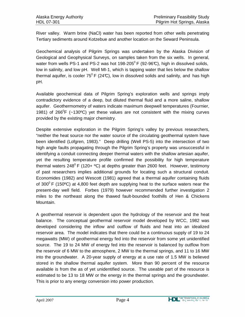
River valley. Warm brine (NaCl) water has been reported from other wells penetrating Tertiary sediments around Kotzebue and another location on the Seward Peninsula. Geochemical analysis of Pilgrim Springs was undertaken by the Alaska Division of Geological and Geophysical Surveys, on samples taken from the six wells. In general, water from wells PS-1 and PS-2 was hot 198-2050 F (92-96°C), high in dissolved solids, low in salinity, and low pH. Well MI-1, which is tapping water that lies below the shallow thermal aquifer, is cooler 750 F (24°C), low in dissolved solids and salinity, and has high pH. Available geochemical data of Pilgrim Spring’s exploration wells and springs imply contradictory evidence of a deep, but diluted thermal fluid and a more saline, shallow aquifer. Geothermometry of waters indicate maximum deepwell temperatures (Fournier, 1981) of 2660F (~130ºC) yet these values are not consistent with the mixing curves provided by the existing major chemistry.
Despite extensive exploration in the Pilgrim Spring’s valley by previous researchers, “neither the heat source nor the water source of the circulating geothermal system have been identified (Lofgren, 1983).” Deep drilling (Well PS-5) into the intersection of two high angle faults propagating through the Pilgrim Spring’s property was unsuccessful in identifying a conduit connecting deeper thermal waters with the shallow artesian aquifer, yet the resulting temperature profile confirmed the possibility for high temperature thermal waters 2480 F (120+ ºC) at depths greater than 2600 feet. However, testimony of past researchers implies additional grounds for locating such a structural conduit. Economides (1982) and Wescott (1981) agreed that a thermal aquifer containing fluids of 3000 F (150ºC) at 4,800 feet depth are supplying heat to the surface waters near the present-day well field. Forbes (1979) however recommended further investigation 2 miles to the northeast along the thawed fault-bounded foothills of Hen & Chickens Mountain.
A geothermal reservoir is dependent upon the hydrology of the reservoir and the heat balance. The conceptual geothermal reservoir model developed by WCC, 1982 was developed considering the inflow and outflow of fluids and heat into an idealized reservoir area. The model indicates that there could be a continuous supply of 19 to 24 megawatts (MW) of geothermal energy fed into the reservoir from some yet unidentified source. The 19 to 24 MW of energy fed into the reservoir is balanced by outflow from the reservoir of 6 MW to the atmosphere, 2 MW to the thermal springs, and 11 to 16 MW into the groundwater. A 20-year supply of energy at a use rate of 1.5 MW is believed stored in the shallow thermal aquifer system. More than 90 percent of the resource available is from the as of yet unidentified source. The useable part of the resource is estimated to be 13 to 18 MW or the energy in the thermal springs and the groundwater. This is prior to any energy conversion into power production.

Alaska Energy Authority Preliminary Feasibility Study HDL 07-301 Pilgrim Hot Springs, Alaska
April 2007 Page 5
3.0 POWER PLANTS Corresponding to progressively lower resource temperature, geothermal energy is used for electric power generation, direct heating and geothermal heat pumps. Two main types of geothermal systems are utilized for electric power generation: steam dominated and hot water systems. Steam dominated systems have pure high temperature steam that is greater than 455ºF (235ºC) and typically have production wells 3,000 to 13,000 feet in depth. The steam is brought to the surface and it is used directly to spin the generators to create electricity. Hot water geothermal systems in production have a typical temperature range of 300 to 570ºF (150-300ºC) (DOE 2003). A flash steam power plant is most common in these systems. The geothermal fluids are brought to the surface through production wells as deep as 13,000 feet. They are highly pressurized; up to 40 percent of the water flashes or in a series of steps boils explosively and turns to steam. The steam is then separated and is fed to the turbine generator unit directly to produce electricity. For hot water systems with lower temperature reservoirs, those between approximately 255ºF and 430ºF (125ºC and 225ºC) a binary cycle power plant instead of a flash steam plant is required. In the binary cycle plant the geothermal waters are passed through a heat exchanger to heat a secondary working fluid that vaporizes and that vapor is then used to turn the turbines. United Technologies Corporation (UTC) has developed a binary geothermal power plant currently operational at Chena Hot Springs which produces power from even lower temperature fluids. A reverse-engineered refrigeration unit is used as the binary plant and only requires a 100ºF (38ºC) temperature differential between heat source and sink to generate power. At Chena Hot Springs, this differential is achieved by using 164ºF (73ºC) water from the geothermal wells and 40 to 45ºF (4 to 7ºC) water from a local cold water source. This system is currently only produced by UTC and hereafter will be referred to as the UTC system. See Figure 5 for a photo of a UTC system at Chena Hot Springs.
4.0 ENERGY EFFICIENCY Based on the conceptual model there is approximately 13 to18 MW of energy available prior to power production. The amount of energy that can be produced is based upon the energy available at the well heads, losses in the hot water delivery system, and the efficiency of the generators. Losses in the transmission line to Nome would also impact the amount of power that reaches the customer. The energy available at the well heads is based upon the flow rate and the temperature of the fluid. Table 1 provides an estimate of well productivity or the amount of energy available per reservoir temperature. For the low temperature source (90 ºC) the energy available is approximately 0.4 MW
Alaska Energy Authority Preliminary Feasibility Study HDL 07-301 Pilgrim Hot Springs, Alaska
April 2007 Page 6
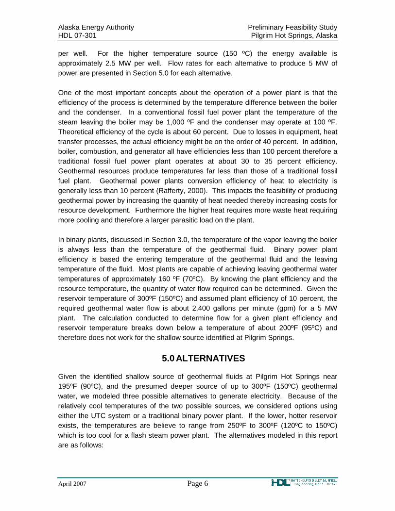
per well. For the higher temperature source (150 ºC) the energy available is approximately 2.5 MW per well. Flow rates for each alternative to produce 5 MW of power are presented in Section 5.0 for each alternative. One of the most important concepts about the operation of a power plant is that the efficiency of the process is determined by the temperature difference between the boiler and the condenser. In a conventional fossil fuel power plant the temperature of the steam leaving the boiler may be 1,000 ºF and the condenser may operate at 100 ºF. Theoretical efficiency of the cycle is about 60 percent. Due to losses in equipment, heat transfer processes, the actual efficiency might be on the order of 40 percent. In addition, boiler, combustion, and generator all have efficiencies less than 100 percent therefore a traditional fossil fuel power plant operates at about 30 to 35 percent efficiency. Geothermal resources produce temperatures far less than those of a traditional fossil fuel plant. Geothermal power plants conversion efficiency of heat to electricity is generally less than 10 percent (Rafferty, 2000). This impacts the feasibility of producing geothermal power by increasing the quantity of heat needed thereby increasing costs for resource development. Furthermore the higher heat requires more waste heat requiring more cooling and therefore a larger parasitic load on the plant. In binary plants, discussed in Section 3.0, the temperature of the vapor leaving the boiler is always less than the temperature of the geothermal fluid. Binary power plant efficiency is based the entering temperature of the geothermal fluid and the leaving temperature of the fluid. Most plants are capable of achieving leaving geothermal water temperatures of approximately 160 ºF (70ºC). By knowing the plant efficiency and the resource temperature, the quantity of water flow required can be determined. Given the reservoir temperature of 300ºF (150ºC) and assumed plant efficiency of 10 percent, the required geothermal water flow is about 2,400 gallons per minute (gpm) for a 5 MW plant. The calculation conducted to determine flow for a given plant efficiency and reservoir temperature breaks down below a temperature of about 200ºF (95ºC) and therefore does not work for the shallow source identified at Pilgrim Springs.
5.0 ALTERNATIVES Given the identified shallow source of geothermal fluids at Pilgrim Hot Springs near 195ºF (90ºC), and the presumed deeper source of up to 300ºF (150ºC) geothermal water, we modeled three possible alternatives to generate electricity. Because of the relatively cool temperatures of the two possible sources, we considered options using either the UTC system or a traditional binary power plant. If the lower, hotter reservoir exists, the temperatures are believe to range from 250ºF to 300ºF (120ºC to 150ºC) which is too cool for a flash steam power plant. The alternatives modeled in this report are as follows:

Alaska Energy Authority Preliminary Feasibility Study HDL 07-301 Pilgrim Hot Springs, Alaska
April 2007 Page 7
Alternative 1: Shallow Source; UTC System. Alternative 2: Deep Source; UTC System. Alternative 3: Deep Source; Binary Plant.
For each alternative, we assumed that there was a developable resource able to produce 5 MW of electricity, which needs to be proven by drilling. Because so little is known about the nature of the resource, including total size, or the sustainable flow rates of the geothermal fluids, this assumption may prove to be either much lower or higher than the real potential of the resource. This can only be verified by more onsite investigation of the resource. A resource capable of producing 5 MW’s may be more likely to hold for the deep, higher temperature, geothermal source. The current peak power needs of Nome are in the neighborhood of 5 MW, and they are projected to exceed this by around 9 MW with the Rock Creek Gold Mine on line. Table 1 presents components and costs associated with confirming the existence of the geothermal reservoir. Table 2 presents a summary of the alternatives. The order of magnitude cost estimates for each alternative are based on a completed 5 MW capacity power plant, with enough geothermal wells drilled for supplying the necessary fluids and providing for reinjection wells in order to maintain reservoir pressures. Schematic diagrams of the alternatives are presented in Appendix A, Figures A1 – A3. The cost estimates are an order of magnitude costs and should only be used to compare costs between the alternatives and as an assessment of the feasibility of the models, should further research prove out the resource. Further analysis of the components of the cost estimates follow in Section 5.
5.1 Alternative 1: Shallow Source; UTC System In this alternative we modelled tapping the shallow, 195ºF (90ºC) geothermal waters. This temperature is well suited to the temperature differential utilized in a Chena Hot Springs-style UTC system; assuming cooling is achieved by winter air or local, cold stream waters used in the power plant. The Pilgrim River runs nearby, and would provide the necessary cooling water. We assume a depth of 500 feet below the surface for wells utilizing this source. According to Chena Power, LLC, a flow rate of approximately 1200 gallons per minute (gpm) would be necessary to generate 1 MW with the assumed 195ºF (90ºC) fluid. For the 5 MW, a flow rate of about 6,000 gpm would be necessary. The efficiency of the larger 5 MW system may require additional flow, which is unknown at this time. If the attainable flow rate for each well was near 300 gpm, approximately 20 production wells would be necessary. Simple calculations based on fluid temperature (Hanse, 2005) give a productivity of 0.4 MW per well (see Table 1). This calculation results in 13 wells necessary to generate 5 MW of power. The number of wells with this low-temperature

Alaska Energy Authority Preliminary Feasibility Study HDL 07-301 Pilgrim Hot Springs, Alaska
April 2007 Page 8
resource was set at between 13 to 20 wells. This number of wells may be unfeasible in such a small area, leading to well interference among other problems. At least one reinjection well, and likely more, would be necessary to maintain the pressure and fluid flow within the reservoir. The existing UTC power plant technology as utilized at Chena takes advantage of a temperature range very similar to that found in the shallow resource at Pilgrim. The geothermal waters utilized at Chena are 164ºF (73ºC), and the cooling river waters are 40ºF (4ºC). The generators at Chena are 200 KW units. Twenty-five of these units would be required to produce 5 MW. UTC is reported to be developing a 1 MW generator, in which case this rather unwieldy number of generators would be cut to 5.
5.2 Alternative 2: Deep Source; UTC System In this alternative we consider the as yet to be determined deeper, hotter, geothermal source. We model this source using the 300ºF (150ºC) fluid temperature and well depths at 5000 feet below the ground surface. Alternative 2 investigates the costs associated with using a UTC power plant with this source. According to Chena Power LLC, the flow rate of geothermal fluids necessary to generate 1 MW at this temperature is approximately 350 gpm, much lower than the preceding alternative. Using an assumed plant efficiency of 10 percent, we calculated the flow rate at about 480 gpm per 1 MW. Therefore to produce 5 MW of electricity the geothermal fluid flow rate would be between 1,750 to 2,400 gpm. Drillhole productivity calculations from Table 1 indicated each well in this alternative would produce about 2.5 MW. For the anticipated 5 MW, 2 wells would be needed. However, based on the high flow rates needed 3 wells may be necessary. For this alternative we have assumed 2 to 3 production wells would be necessary. The existing UTC technology would have to be modified to take advantage of this higher temperature source. The larger temperature differential would at least require a different secondary fluid to maximize the efficiency of power generation. Assuming this technological problem is adequately solved, the greater temperature differential should help increase the power available, perhaps lowering the cost per MW.
5.3 Alternative 3: Deep Source; Traditional Binary Plant In this alternative we again consider the inferred deeper, hotter, geothermal source. We modeled this source assuming 300ºF (150ºC) fluids at 5000 feet depth below the ground surface. Alternative 3 investigates the costs associated with using a traditional binary power plant. As with Alternative 2 above, calculations in Table 1 give us roughly 2.5 MW per well, necessitating 2 wells to produce 5 MW. Flow rates would be similar to those in Alternative 2 therefore we have assumed 2 to 3 wells would be needed to achieve the necessary flow rates at the assumed plant efficiency of 10 percent.

Alaska Energy Authority Preliminary Feasibility Study HDL 07-301 Pilgrim Hot Springs, Alaska
April 2007 Page 9
The temperature of this source is in the range of fluid temperatures that have proved to be economically exploitable by traditional binary power plants. Ormat is a major supplier of this type of power plant with generators in the 5 MW range.
6.0 CAPITAL COST COMPONENTS Presented are the components of the capital cost for the alternatives dicussed. All costs detailed are order of magnitude only. Summaries of these costs are found on the schematics of the alternatives in Figures A1 through A3 in Appendix A and in Table 2. All costs are based on 2008 construction with no inflation. The large capital costs required for these types of projects necessarily involve borrowing money and long delays in construction can add significant costs to any of the projects. The components considered were the following:
• Site Development • Exploration & Confirmation
• Permitting
• Production Well Drilling • Power Plant and Gathering System
• Transmission Line For the geothermal components such as exploration and confirmation, and well drilling, we relied on calculations in Table 1 developed by Hanse, 2005. Site development and transmission line costs were developed based on experience of local engineers, the new Nome Power Plant, and contacting suppliers. Power plant costs were based on Hanse and quotes from suppliers of the power plants.
6.1 Site Development Site development would include upgrading the gravel access road and developing an area for the power plant site and well pads. An existing, approximately 7.5-mile, 4-wheel drive road that connects the Nome-Taylor Highway to Pilgrim Springs would need to be upgraded to provide access for drill rigs and other equipment (see photo in Figure 3). The last 200 yards of this road is especially swampy and difficult for vehicles according to the on-site caretaker. Costs for this improvement will depend on a number of factors, including number and type of stream crossings necessary, size and adequacy of existing road section, availability and grading of local materials, subsurface conditions at the site, etc. For our cost analysis we assume that the current 4-wheel drive road is approximately 16 feet wide and has a

Alaska Energy Authority Preliminary Feasibility Study HDL 07-301 Pilgrim Hot Springs, Alaska
April 2007 Page 10
2-foot thick section and will be upgraded to 24 feet wide and 3-foot thick section. We assume that adequate gravel will be available from quarries near Nome. Bid tab estimates were used plus additional increase in the cost for hauling material to Pilgrim, we estimated approximately $40 to $80 per cubic yard for gravel. These numbers are on the low end for rural Alaska projects, but Nome generally has a reasonably available source of gravel from local mining operations. We further assume that two stream crossings will be necessary, and that these will be provided by road culverts at approximately $200,000 per crossing. This gives a total range for the road upgrade of about 3 to 5 million dollars (M$). Based on the new Nome Power Plant size and scaling for the size and number of generators that would be used at Pilgrim we estimated a building size of about 15,000 square feet. Pad development for the power plant will be on the order of $250,000 to $500,000 assuming a 15,000 square foot building and cost for gravel of $40 to $80 per cubic yard. Well sites and additional upgrades to on-site roads will probably add an additional $250,000 to $400,000 in gravel to the project. Site development would add an additional 0.5 to 1 M$. This assumes that the power plant would not need a specialize foundation. The new Nome Power Plant needed a specialize foundation with a cost of about 1 to 1.2 M$ for the foundation alone.
5.2 Exploration & Confirmation The exploration phase consists of investigating the geothermal resource, beginning with prospecting and field analysis, and ending with the drilling of the first full-scale commercial production well. Some of this work has already been accomplished. For example, a full regional reconnaissance is not necessary as the focus has already been narrowed to the region of apparent geothermal activity at Pilgrim. Some district exploration has already been accomplished in the 1979 study of Pilgrim Springs. However, much work does remain to be done to characterize reservoir morphology, flow rates and temperature for both the shallow and deep resource. It is expected that exploration of the shallow resource, (though it may be less likely to satisfy the power generating needs of Nome) would be less costly due to being nearer the surface and better characterized at this time than the deeper source. According to Hanse (2005), exploration costs typically run in the range of $100 to $200/kW depending on the nature and size of the project, the amount of information already available, and the technologies employed in exploration. Factors affecting drilling costs also greatly influence exploration. The size of drill rig will also affect the drilling costs. For the proposed shallow wells, a shallow gas drill rig may may be preferred to a large oil drill rig. The shallow gas drill rigs are capable of drilling depths on the order of 3,000 feet and are transported on a single, heavy duty truck. Support trucks are used for carrying supplies, mud tanks, and some associated gear

Alaska Energy Authority Preliminary Feasibility Study HDL 07-301 Pilgrim Hot Springs, Alaska
April 2007 Page 11
however the drilling footprint is much smaller than the large oil drill rigs. The deeper depth of 5,000 feet is near the cut off for some of the more advanced shallow drill rigs and it may still be possible to use this type of drill rig for this depth. Currently, drilling costs are expected to be high because of the high cost of oil and the high demand for rigs for petroleum exploration projects. Figure 7 presents drilling costs of oil and gas wells in 2003. The costs for the shallower depths use the smaller drill rigs. If one doubles these numbers to account for the current (2007) level of exploration, and then doubles the cost again as a rough “Alaska factor” to try to compensate for remoteness, a range of about 0.8 to 2 M$ per well results. Confirmation costs are those costs necessary to confirm 25 percent of the total project capacity. Table 1 provides the costs for administration, unsuccessful drill holes, regulatory compliance for exploration drilling, reporting documents, and well testing. These costs are needed to confirm a geothermal reservoir prior to production drilling. If the costs from Table 1 are added up for the two sources and multiplied by an Alaska factor of 2, this gives a low-end total confirmation cost of around 5 M$ for the shallow resource and 9 M$ for the deeper resource. If we double these numbers again to give a rough estimate to the high end of the expected range (to allow mainly for more expensive drilling costs due to the competition for drilling equipment with the petroleum industry, etc.), and add on the range above for the exploration costs we get the numbers listed on Figures A1 through A3 for the costs of exploration and confirmation of 7 to 14 M$ for the shallow resource and 11 to 22 M$ for the deeper resource. This is the range of costs needed to confirm that the resource is actually there.
5.3 Permitting Permitting costs are necessary for compliance with state and federal regulations. Hanse gives a range of typical project costs for permitting of from about 0.2 M$ with a completion time for permitting of less than a year (best case scenario) to over 1 M$ with a permitting time of over 3 years, mostly depending on the stringency of local regulations. Air permitting on the Nome Power Plant was extensive and required two years of monitoring data before permitting would take place. However geothermal power plants generally have better air quality than traditional fossil fuel plants and therefore air permitting will probably be less rigorous. Additional permitting issues may arise particularly with transmission lines and migratory birds as well as discharge of waters into the surrounding environment. These costs are included into the Exploration and Confirmation costs on Figures A1 through A3 of Appendix A.
6.4 Production Well Drilling Although some well drilling is included above in costs to confirm the resource, additional wells would need to be drilled to complete the development of the resource to 5 MW.

Alaska Energy Authority Preliminary Feasibility Study HDL 07-301 Pilgrim Hot Springs, Alaska
April 2007 Page 12
Drilling costs are affected by depth of hole, availability of equipment, how well the resource is characterized, temperature, chemistry and permeability of the resource, and cost of construction materials, among other factors. A little over half of the drilling costs are explained solely by the depth of the well. Assuming the brine in this resource is not corrosive and given that the relatively low temperatures of these resources should not result in high pressure, the drilling conditions at Pilgrim should not be unduly adverse. One method for assessing base cost for drilling each well is that given by Table 1. This value is significantly higher, however, than drilling costs averaged from onshore oil and gas drilling (Augustin, 2006), see Figure 7. Either of these costs must be multiplied by an “Alaska Factor” to take local conditions and remoteness into account, as well as availability and cost of drilling equipment in the current market. The number of wells that need to be drilled depends most strongly on the productive capacity of each well, which has been estimated in Section 4.0. The success rate of holes drilled during this phase is in the range of 80 percent. It is strongly recommended to drill at least one extra production well during this phase to help offset the common occurrence of well productivity decline. Reinjection wells will also be necessary to maintain the resource. Taking all of these factors into account, a range for the cost of drilling is around 4 to 8 M$ for the shallow resource and 5.5 to 11 M$ for the deep source, keeping in mind that 25 percent of the production capacity for the shallow resource and 33 percent of the production capacity for the deep resource was developed in the confirmation phase. Competition for drilling services from the oil and gas industry could drive these figures up even higher.
6.5 Gathering System/Power Plant In costs for the power plant we include costs for the generators and generator building and pumps and piping to bring the geothermal fluids to the generators. The hot water gathering system includes the pipes and pumps. Under a reasonable assumption that our geothermal fluids are not too highly corrosive, we can start with the industry average of around $250 per kW from Hanse(2005), which gives about 1 M$ for a 5 MW project. Doubling this for the Alaska factor, one obtains a range of roughly 1 to 2 M$. The number of pipes necessary to develop the shallow resource will undoubtedly be greater, as we require a greater number of wells in our model. At the new Nome Power Plant, a traditional fossil fuel plant, building costs were on the order of 5 to 7 M$, with the final project costs approaching 30 M$. Geothermal power plant costs include the cost of land, and physical plant, including buildings and power-generating turbines. Geothermal plants are relatively capital-intensive, with low variable

Alaska Energy Authority Preliminary Feasibility Study HDL 07-301 Pilgrim Hot Springs, Alaska
April 2007 Page 13
costs and no fuel costs. Plant lifetimes are typically 30–45 years. Financing is often structured such that the project pays back its capital costs in the first 15 years. Costs then fall by 50–70%, to cover just operations and maintenance for the remaining 15–30 years that the facility operates. In the case of the traditional binary power plant, we use numbers from Hanse, multiplied by a factor of 2 (“Alaska Factor”) to estimate a range of from 23 M$ to 30 M$ for a 5 MW power plant, assuming a resource temperature of 150ºC. According to the Renewable Energy Policy Project (REPP) in Washington DC, capital cost for geothermal power plants in the 5 MW range using a medium quality resource ranges from $1600 to $2400 per installed kW. Applying a factor of 2 for the remoteness of the project, construction cycles and Alaska weather the REPP numbers are in the same range as Hanse. Chena Power, LLC gives a cost of $1300 per KW for the UTC generators. Based on conversations with Chena Power, LLC, this cost is expected to hold for the currently produced 200 kW generators and the 1 MW generators they are developing. Shipping for the 200 kW generator to Chena Hot Springs was around $50 per kW. We also assume the construction of a 15,000 square foot building to house the generators, shops, and apartment space at around $350 to $500 per square foot. Using these values we get a cost of roughly 12 to 17 M$ for the UTC plant.
6.6 Transmission Line To bring the power produced to Nome, approximately 60 miles of transmission line would be necessary. For a single pole structure, Dryden and LaRue (personal communication) provided a rough estimate of $500,000 to $750,000 per mile. This assumes winter construction for tundra protection, and further assumes that topography is gentle along the path of the transmission line. This gives a total cost of between 30 to 45 M$. Hanse reports costs for construction lines of from $164,000 to $450,000 per mile, doubling these numbers for the Alaska Factor we get a total of around 20 M$ to 54 M$. We take a middle range to be a reasonable rough cost estimate, and assume transmission costs to be approximately 20 M$ to 45 M$.
Alaska Energy Authority Preliminary Feasibility Study HDL 07-301 Pilgrim Hot Springs, Alaska
April 2007 Page 14
7.0 CONCLUSIONS
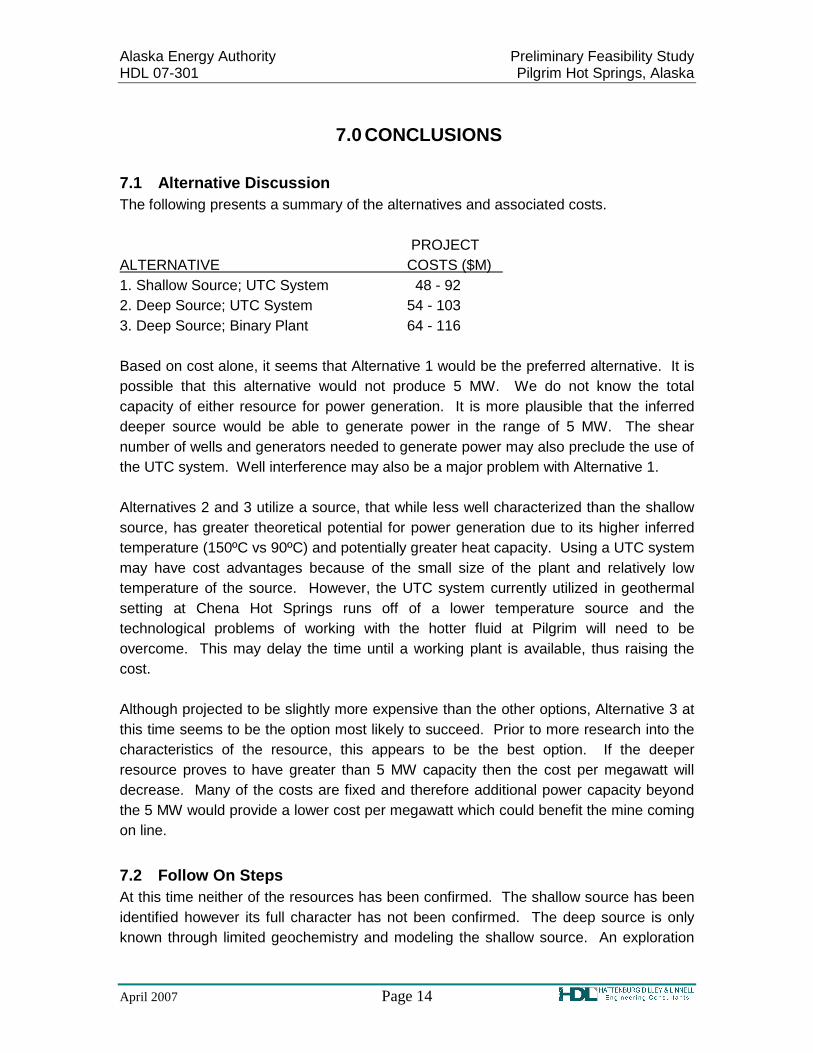
7.1 Alternative Discussion The following presents a summary of the alternatives and associated costs. PROJECT ALTERNATIVE COSTS ($M) 1. Shallow Source; UTC System 48 - 92 2. Deep Source; UTC System 54 - 103 3. Deep Source; Binary Plant 64 - 116 Based on cost alone, it seems that Alternative 1 would be the preferred alternative. It is possible that this alternative would not produce 5 MW. We do not know the total capacity of either resource for power generation. It is more plausible that the inferred deeper source would be able to generate power in the range of 5 MW. The shear number of wells and generators needed to generate power may also preclude the use of the UTC system. Well interference may also be a major problem with Alternative 1. Alternatives 2 and 3 utilize a source, that while less well characterized than the shallow source, has greater theoretical potential for power generation due to its higher inferred temperature (150ºC vs 90ºC) and potentially greater heat capacity. Using a UTC system may have cost advantages because of the small size of the plant and relatively low temperature of the source. However, the UTC system currently utilized in geothermal setting at Chena Hot Springs runs off of a lower temperature source and the technological problems of working with the hotter fluid at Pilgrim will need to be overcome. This may delay the time until a working plant is available, thus raising the cost. Although projected to be slightly more expensive than the other options, Alternative 3 at this time seems to be the option most likely to succeed. Prior to more research into the characteristics of the resource, this appears to be the best option. If the deeper resource proves to have greater than 5 MW capacity then the cost per megawatt will decrease. Many of the costs are fixed and therefore additional power capacity beyond the 5 MW would provide a lower cost per megawatt which could benefit the mine coming on line.
7.2 Follow On Steps At this time neither of the resources has been confirmed. The shallow source has been identified however its full character has not been confirmed. The deep source is only known through limited geochemistry and modeling the shallow source. An exploration

Alaska Energy Authority Preliminary Feasibility Study HDL 07-301 Pilgrim Hot Springs, Alaska
April 2007 Page 15
followed by a confirmation phase needs to be conducted prior to any decisions about type of power plant and number of wells. We would recommend that the exploratory phase focuses initially on both the shallow and the deep source. A better characterization of each would help immensely in refining the feasibility estimates of the available options. We would recommend the following for assessing the resources: 1. Identifying the regional thermal and hydrologic gradient; 2. Repeat equilibrium temperature profiles for existing wells; 3. Accurately and uniformly characterize the chemistry of the well, spring and river
waters; 4. Complete mapping of regional geothermal system; 5. Characterizing regional aqueous geochemistry; and 6. Quantifying thermal budget and environmental impacts. In addition to these items, a conceptual model of the shallow and deep geothermal reservoirs with our improved understanding of structurally controlled geothermal systems should be developed. Based on the exploratory phase one or both of the sources will be identified and a more thorough understanding of the sources will be achieved. After the exploratory phase a decision can be made as to which source to pursue and a confirmation phase can begin. The costs associated with exploratory and confirmation phases including the drilling of test holes and well tests is on the order of 7 to 22 M$.
8.0 LIMITATIONS If substantial time has elapsed between submission of this report and the start of work at the site, or if conditions have changed because of natural causes or construction operations at or adjacent to the site, we recommend that this report be reviewed to determine the applicability of the conclusions and recommendations considering the time lapse or changed conditions. Prepared By: Reviewed By: Hattenburg Dilley & Linnell Hattenburg Dilley & Linnell Michelle Wilber Lorie M. Dilley, PE/CPG Staff Geologist Principal Geologist

Alaska Energy Authority Preliminary Feasibility Study HDL 07-301 Pilgrim Hot Springs, Alaska
April 2007 Page 16
9.0 BIBLIOGRAPHY Economides, M.J., Economides, C.E., Kunza, J.F., and Lofgren, B.E. (1982) A fieldwide
reservoir engineering analysis of the Pilgrim Springs, Alaska, geothermal reservoir: Proceedings, 8th Workshop in Geothermal Reservoir Engineering, Stanford University, Stanford, CA.
Forbes R.B., Wescott, G., Turner, D.L., Kienle, J. (1979) A Geological and Geophysical
Assessment of the Geothermal Potential of Pilgrim Springs, Alaska: Unpublished preliminary report to Alaska Division of Energy and Power Development and U.S. Department of Energy
Forbes, R.B., Gedney, L., Van Wormer, D., and Hook, J. (1975) A geophysical
reconnaissance of the Pilgrim Springs, Alaska: Geophysical Institute Report UAG-R231.
Hanse, Cedric Nathanael. (2005) Factors Affecting Costs of Geothermal Power
Development. Geothermal Energy Association. Kirkwood, P. (1979) Status of Pilgrim Springs: Topical Report – Energy Systems, Inc.
prepared for U.S. Department of Energy. Kline, J.T. (1981) Surficial Geology of the Lower Pilgrim River Valley and Vicinity,
Western Seward Peninsula, Alaska: Alaska Division of Geological and Geophysical Surveys, Alaska Open File Report AOF-140
Lofgren, B.E. (1983) Results of Drilling, Testing and Resource Confirmation -
Geothermal Energy Development at Pilgrim Springs, Alaska: Unpublished report of Alaska, Woodward-Clyde Consultants to Alaska Division of Energy and Power Development.
Rafferty, Kevin (2000) Geothermal Power Generation, a primer on Low-Temperature,
Small-Scale Applications: Fact Sheet by Department of Energy Geo-Heat Center. Wescott, E., and Turner, D.L. (1981) Geothermal reconnaissance survey of the central
Seward Peninsula, Alaska: Alaska Geophysical Institute, Report UAG-R284.

Table 1: Confirmation Program Components and Unit Costs Method Unit Cost per unit
($) For 500 ft deep/90ºC
For 5000 ft deep/150ºC
Administration project 7.5 % of total confirmation costs
0.2 M$ 0.3 M$
Drilling : Full diameter hole foot Cost = 240,000 + 210 (depth in feet) + 0.019069
(depth)2
0.3 M$/Well 1.8 M$/Well
Drilling : Hole productivity °F MW/Well = reservoir Temp. (°F)/50 – 3.5
0.4 MW/well 2.5 MW/well
Drilling : Unsuccessful hole factor
% 40% 5 wells needed* =1.5 M$
2 wells needed* =3.6 M$
Other project 20,000 0.02 M$ 0.02 M$
Regulatory Compliance (includes permitting and environmental compliance)
project 5 % of drilling 0.08 M$ 0.2 M$
Reporting document: (data integration/analysis/modeling)
project 5 % of drilling 0.08 m$ 0.2 M$
Well Test: Full diameter hole, 3-10 days
well 70,000 0.2 M$ 0.07 M$
Well Test: Multi-well field test, 15-30 days
project 100,000 0.1 M$ 0.1 M$
Source: GeothermEx, "New Geothermal Site Identification and Qualification" (Table IV-1), 2004. * Number of wells needed to confirm 25% of the production capacity, which in our case is 25% of 5 MW = 1.25 MW. Note that in the case of the deep, 5000 ft resource, one successful well at 2.5 MW/well will confirm 50% of the capacity as modeled in this paper.

Table 2: Summary of Alternatives
Alt Temp Depth # of Wells Flow Rate # Generators Costs (M$)
1 195 0F 90 0C
500 Feet 13~20 + 4 reinjection
6,000 gpm 25 UTC @ 200 kW 5 UTC @ 1 MW
48-92
2 300 0F 150 0C
5,000 Feet 2 - 3 production
1 reinjection
1,750 gpm – 2,400 gpm
5 UTC @ 1 MW 54-103
3 300 0F 150 0C
5,000 Feet 2 - 3 production
1 reinjection
1,750 gpm – 2,400 gpm
1 Binary @ 5 MW 64 – 116
gpm: gallons per minute: kW: kilowatt, MW: megawatt


Alaska Energy Authority Preliminary Feasibility Study HDL 07-301 Pilgrim Hot Springs, Alaska
April 2007 FIGURE 3
Pilgrim Hot Springs. Catholic Church built 1918-1920 and Mission grounds. View
facing mostly north.
The 7-1/2 mile access road from Road Marker 53 of the Nome-Taylor Road.


APPENDIX A Model Schematics and Order of Magnitude Cost Estimates