Embed Size (px)
Citation preview

Steve Rogers – Head of Planning & Regulatory Services Kirkbank, English Street, Dumfries, DG1 2HS Telephone (01387) 260199 - Direct Dial Fax (01387) 260188
Planning Applications Committee Report ERECTION OF 15 NO. WIND TURBINES WITH ASSOCIATED TRANSFORMERS AND SWITCHGEAR; ANCILLARY DEVELOPMENT INCLUDING FORMATION OF 2 NO. PUBLIC ROAD ACCESSES, CONSTRUCTION OF NEW INTERNAL ACCESS TRACK AND UPGRADING / WIDENING OF EXISTING INTERNAL ACCESS TRACKS AND PUBLIC ROAD, FORMATION OF HARDSTANDING AREAS AND TEMPORARY CONSTRUCTION COMPOUNDS; AND ERECTION OF CONTROL BUILDING, SUBSTATION COMPOUND, TELECOMMUNICATIONS MAST AND METEOROLOGICAL MAST AT SOLWAYBANK, ALLFORNOUGHTHILL, LANGHOLM Application Type: Full Planning Permission Applicant: RES UK & Ireland Ltd
Ref. No.: 11/P/4/0354
Recommendation - Refuse Ward - Annandale East & Eskdale Hierarchy Type (if applicable) - Major Case Officer - Mhairi Duff 1 BACKGROUND 1.1 Under the Scheme of Delegation, this application requires to be considered by the Planning Applications Committee as it is a Major application. Furthermore, 48 objections were received to the application. Site Location and Description 1.2 The application site is located approximately 8km to the south-west of Langholm to the south of the B7068 Lockerbie to Langholm road. The closest settlement is Kirtleton which is approximately 1.5km to the east of the site. The village of Waterbeck is approximately 3.5km to the south-west of the site. There are also several farmsteads and individual dwellings within the vicinity. The application site extends from the Lockerbie to Langholm road in a south-easterly direction to abut an unclassified road between Solwaybank and Pingle. The site includes an area of coniferous commercial forestry to the north. The southern part is more moorland and unimproved pastures. The topography of the site is undulating with the highest point being the forested Gowd Muir to the north of the site (247m AOD). It also includes Allfornought Hill further south (223m AOD). The lowest point is at the most southerly part of the site (not including the access)

at the unclassified road close to Woodside Burn (114m AOD). The site contains several burns and watercourses which drain towards the catchments of Kirtle Water, River Sark and River Esk. The site occupies a complex and transitional area of landscape between the more extensive foothill uplands, smaller scale farmed valleys and the more expansive flow plateau which extends to the coastal flats to the south. The Proposal 1.3 The proposed wind farm development at Solwaybank would comprise:-
15 no. three-bladed horizontal axis wind turbines of up to 126.5m tip-height, nominally rated at between 2 - 2.5MW;
at each turbine, associated low to medium voltage transformers and related switchgear;
turbine foundations;
hard-standing areas for erection cranes at each turbine location;
a single, permanent, free-standing meteorological mast;
up to six temporary meteorological masts;
a series of on-site access tracks;
two public road site accesses;
a wind farm sub-station compound containing a control building;
an on-site electrical and control network of buried cables;
road widening and improvement along the public road access route;
forestry felling and replanting is also proposed. 1.4 It is proposed that the site would be accessed by two routes. Construction traffic would travel to the site along the B7068 (Lockerbie - Langholm road) to gain access from a point to the north of the application site, close to Callisterhall. Construction traffic would travel either east or west along this road depending on the source of construction materials. Abnormal load deliveries would travel to the site from junction 21 (Kirkpatrick Fleming) off the A74(M) via the B6357 through Chapelknowe before turning left past Tympanheck and north to Solwaybank and east to Pingle Farm where the access is located. The application site includes the section of public road from Tympanheck to Solwaybank due to the widening and improvement works proposed. Application Site History and Design Amendments 1.5 A planning application for the erection of 21 turbines submitted in 2009 (ref 09/P/4/0238) was withdrawn by the applicant in August 2010. This followed the receipt of consultation responses which prompted the applicant to re-consider the layout. This included a response from the Council’s outsourced landscape advisor who objected to the application on the grounds of the significant adverse cumulative landscape and visual impacts within 15km of the site. There were considered to be cumulative impacts in combination with the existing Minsca and Craig wind farms and the proposed Ewe Hill and Newfield wind farms (see paragraph 1.7 below). The landscape and visual impact of the scheme on its own was not a grounds for objection and it was considered that the scheme was ‘broadly compatible with the scale of other existing and proposed wind farms in the local area and would accord with the association of wind farm development with a certain type of landscape (broader areas of upland moorland occurring within the foothills)’. SNH cited significant adverse landscape and visual impacts.

1.6 The proposal now aims to provide a more compact 'cluster' layout, rather than the layout which extended further to the south and east and less so to the north-west. 5 of the 15 turbines proposed are now proposed to be within the elevated open moorland, whereas 11 were proposed within this area in the 2009 application. The layout of the remaining turbines has also been altered to show the turbines roughly in three rows running along a north-west to south-east axis from just north of the summit of Allfornought Hill. 1.7 Chapter 5 of the Design and Access Statement states that the revised design also aims to avoid the spread of turbines across two landscape character types (LCTs) and for the 'layout to be coherent and compact without outliers, when viewed from all directions'. There were also environmental considerations which influenced the design. Supporting Documents 1.8 The application was accompanied by an Environmental Statement (the ES) and a Non-Technical Summary as required by the Environmental Impact Assessment (Scotland) Amendment Regulations 2011. A Design and Access Statement and Pre-Application Consultation (PAC) report was also submitted as required by the Development Management Regulations due to the Major hierarchy of the development. The ES includes a Landscape and Visual Assessment (LVIA) of the proposed wind farm and also cumulatively other existing, approved (but not commenced) and proposed (beyond scoping stage) wind farms within 35km of the application site. Those within 15km are: Existing
Minsca – 16 turbines located 6km to the west of the application site.
Craig – 4 turbines located 6km to the north-east of the application site. Proposed / approved
Craig – 1 turbine extension to existing wind farm located 6km to the north-east (current application ref. 09/P/4/0342).
Ewe Hill – 22 turbines proposed 5km to the north of the application site within two current applications: 04/C/4/0005 (Section 36 application for 16 turbines) and 09/P/4/0400 (planning application for 6 turbines).
Newfield – 21 turbines located 13km to the north-west (current S36 application). 1.9 Following the submission of the application and the receipt of the Council Landscape Architect response, the applicant undertook a Residential Visual Amenity Study which provides an assessment of the changes in views and visual amenity from local residential properties that are likely to result from the proposed wind farm. 2 CONSULTATIONS 2.1 Scottish Natural Heritage - No objections. Ecological Interests Comments made in respect of the previous application have been addressed.

Landscape and Visual Impact Impact on Landscape Designations No significant impacts on the Nith Estuary National Scenic Area (NSA). The integrity of the Langholm Hills Regional Scenic Area (RSA) is unlikely to be noticeably diminished. Impact on Landscape Character In agreement with the assessment that the development's impact upon the Foothills (Annandale) unit to be moderate - significant and that this grades to an overall impact of minor for the entire Landscape Character Type (LCT) in the study area. This is due to the relatively common occurrence of this LCT. The effect of the development upon the Flow Plateau could be higher than that predicted within the assessment due to the turbines often being viewed as associated with this LCT from the south. The ZTV also shows almost entire visibility of this scheme from the majority of this landscape character type, which is the only example of Flow Plateau within Dumfries and Galloway. The development is closer to this LCT than any of the existing wind developments. The wind farm being viewed in the context of this landscape could reduce the subtle distinction between Foothills, Upland Fringe and Flow Plateau as the turbines will become a defining feature of this landscape type as well as within the more common Foothills and Upland Fringe, where the effects are more likely to be localised given the wide ranging size and distribution of these types. SNH therefore consider that there would be a fundamental change to the local landscape and to some extent at a regional level, as the location of the wind farm at the southern boundary of the Foothills LCT, strongly influences the Flow Plateau LCT. In views from the north, the development appears to be on lower ground, which may create a sense of turbines spreading to different parts of the landscape further influencing the Flow Plateau LCT. However, overall, as Flow Plateau is not designated (save for a section within the Lowther Hills RSA), this shows that this rarity is perhaps not as valued and that this change to ‘with wind farm,’ could be considered within the bounds of acceptable change. SNH note, however, that this area would then be further susceptible to cumulative landscape effects in the future. Impact on Visual Amenity In agreement with the findings of the ES. Therefore, there would be significant visual impacts from viewpoints 1-5 which are within close to 5km of the site and represent views from all directions around the site. Viewpoints 8 and 9 will also receive significant visual impacts; they are located at higher points around 10km from the site. In slight disagreement with the conclusion reached for viewpoints 10 (The Old Smithy) and 12 (Repentance Tower) and consider that there may be significant visual impacts possible from these locations SNH have some concerns over the distribution of significant visual impacts given that they are achieved from relatively wide ranging locations and from different directions though the majority are within 10km of the site.

Concerns over the distribution of significant visual impacts given that they are achieved from relatively wide-ranging locations and from different directions though the majority are within 10km of the site. Cumulative Landscape Impact In agreement with the assessment that finds the local Annandale foothills unit would receive a moderate (significant) cumulative effect. This further consolidates the change to this landscape to ‘with wind farm.’ Some concern that in comparison to the other wind farms within this LCT, Minsca, and in the Southern Uplands, within 10km, Craig and Ewe Hill, that the addition of Solwaybank begins to set a different context for wind development as it appears to be located on lower land than the other developments, potentially blurring the distinction between larger wind farms located within a clearly upland context. This is perhaps due to the site being viewed within the context of Flow Plateau LCT from the south. SNH consider that this could lead to an increase in cumulative effect upon this LCT as well. Cumulative Visual Impact Overall, in agreement with the assessment which finds no significant cumulative visual effects though the introduction of Solwaybank does begin to fill in some notable wind farm-free gaps and increase the extent of skyline where wind turbines are present. 2.2 Council Landscape Architect - The proposed wind farm is not supportable in its current form and is contrary to Policy WEP 1 (3) and (4) of the Dumfries & Galloway Interim Planning Policy: Wind Energy Development. Summary of Recommendation The contribution of Solwaybank in itself, and as an addition, particularly to Minsca, would give rise to cumulative landscape character impacts that could lead to wind farm development being a locally defining characteristic across the settled farmlands of the Kirtle Water Valley, and to a lesser degree towards Middlebie.
The geometry of the revised layout would be likely to be more overbearing along the valley edge than the previous more organic layout. Solwaybank would contribute to successive cumulative impacts with Minsca from the approaches to Waterbeck, and with Craig from Collin Bridge; the former being of greatest concern due to the settled valley context. Effects from the revised scheme would be greatest across the settled farmlands within 5km of the site. The ranked turbines across the flank of the valley would be a significant intrusion, and in addition to Minsca would give rise to successional cumulative impacts at short range. The turbines would read on the edge of the valley, and their perceived scale in sky-lining silhouette would tend to be exaggerated. The actual size of the turbines and their proximity to the settled area is anticipated to make them a defining characteristic of this area. The scheme has undergone several revisions in its development, most recently in response to the previous landscape advice [2009]. These revisions reduce a proportion of

the identified adverse impacts. The removal of turbines from Gowdmuir Hill, Leadheads Hill and the east of Allfornought Hill would reduce the potential cumulative impacts locally from the south-east and north-east and wider cumulative impacts in longer range views to an acceptable level. However, there remain concerns regarding local landscape, visual, and cumulative effects in relation to the Kirtle Water Valley and surrounding farmland. It is judged that the proposed wind turbines would be unduly dominant and overwhelming on a settled area; in themselves, and cumulatively in addition to existing, consented and potential schemes [Minsca, Craig, Ewe Hill]. Policy Assessment
The proposal raises concerns in relation to paragraphs 7.8 to 7.10 and paragraphs 7.15 to 7.16 (Cumulative Impacts) of the IPP (Landscape and Visual Amenity).
There is partial compliance with the principles of scale, character and capacity set out in the Dumfries & Galloway Wind farm Landscape Capacity Study (DGWLCS). However, this site is seen in the context of smaller scale settled valleys. The DGWLCS sets out these issues in detail for the Foothills (Annandale) LCT: "This [Large, >80m] typology could relate to the scale of broader topped hills but would overwhelm the scale of narrow valleys..."
It is not considered that the Solwaybank site has a strategic function as a gap within an overall emerging pattern of wind farm development, or would compromise the specific functions set out of the Annandale CSZ.
Recommended Mitigation 1. Reduction in the dominance of turbines on the local landscape: Removal or re-siting of turbines 10 and 14, OR
Reduction in turbine size by 15m to 110m. 2. Consideration of alternative turbine layouts, achievable through micro-siting, and tested / explored through the production of wirelines, with the aim of reducing the regimented appearance of the turbines locally [no representative VP] and in views from the south-west and south-east [VP 4, Milltown, and VP 5, Waterbeck approach B725 and B722]. Landscape Impacts
The larger scale broad ridges and commercial forestry plantation of Allfornought Hill are potentially suited to the Large (>80m) typology. However, experienced locally from the Kirtle Water valley and appreciated from the south, the turbines would potentially dominate, overwhelm, and disrupt, the scale, patterns, and features of the settled farm and estate lands.
The local area [up to 5km] is settled with small villages, hamlets, dispersed farms, and is crossed with a network of roads. Large typologies would overwhelm the character and visual amenity of these local landscapes.
Important elevated viewpoints, such as Burnswark, and Whita Hill (Langholm) lie within 10km. These take in the locality and also wider patterns of wind farm development. Serial cumulative impacts would also be an issue.
The Foothills and Upland Fringe form a backdrop and edge to the wider lowlands of the Annandale Flow and Coastal Plateau, lying to the south, and crossed by key transport routes. Due to the prominence of the upland edge:

Features that appear along it, such as Minsca, become landmarks and could potentially detract from other landmark features, such as Burnswark Fort, and also the visual amenity of the settled areas.
Cumulative visual effects would arise with the addition of wind farms across the skyline of this edge. The scale and degree of separation between wind farms will be important to avoid the coalescence of development, and allow individual wind farms to be appreciated as distinct entities.
Cumulative sequential effects from the M74 and train route would worsen should proposals along the backdrop and either side of the Annan Valley [Newfield, Minnygap, Solwaygap] be consented.
Allfornought Hill currently forms a low lying and unremarkable backdrop to the Kirtle Water Valley north of Waterbeck. However, given the prominence of the turbines compared to the landform element, they would be likely to dominate the dispersed settlements and farmland, and detract from the rural character and experience of this area, and to a lesser extent areas to the south-east. Even recognising the presence of Minsca, it is considered that the lower elevation, proximity, and geometric layout of Solwaybank would make its impact significant in its own right. In the immediate locality of 2 – 3 km to the west and south of the site, the wind farm would be a defining characteristic and feature of local distinctiveness in the area. The roads worst affected are anticipated to be Fulton northwards along the minor road to the B7068, the B722 from Craigs to Fallford, the B7068 Fallford approach, and the minor road from the B7068 via West Linnbridgeford to Kennedy’s Corner. The experience from and / or setting of the villages, hamlets and farms of Waterbeck, West Linnbridgeford, Fallford, and Kirtleton, and the farmlands around Whiteleys, Crosslands, Crossbankhead, Crowdieknowe, Carruthers, Conhess, Chapel Hill, Allfornought, and High Stenries would also be significantly impacted upon. Of note visualised in the LVIA [VP 1], turbines 14 and 10, and to a lesser extent 4 and 5 overwhelm the setting of Allfornought Farm and dominate the scale and character of the farmed landscape. The turbines are set back 800m and more from Allfornought. This VP represents a worst case scenario, although there would be a variety of effects on the different properties, hamlets and villages set around the site. Visual Impacts
Analysis Local viewpoints [VPs 1, 2, 3, 4, 5] are all assessed within the ES as having either Major or Moderate impact. It is considered that all these viewpoints would be significantly and adversely affected, and that further representative viewpoints would verify this concern. Of particular concern: Turbines 14 and 10, and to a lesser extent 4 and 5, detract from the visual amenity of
farmland and settlement south of the proposals [VP 1].
Turbines 1 and 2 detract from the visual amenity of the Collin Burn Valley and surrounding moorlands, although restructuring of forestry would be a benefit [VP 2].
Turbines 6, 15, and 10 are most overbearing on the skyline above Fallford [VP 3].
The geometric layout of the wind farm is legible and problematic from angles where the turbines overlap and are seen to be stacking [VP 4], such as Milltown and approaches to Barnglies from the south-east.
Both the geometric layout, with turbine overlap and stacking, and the scale of the turbines are likely to detract from the visual amenity in approaches to Waterbeck along the B725 from the south-west [VP 5 and Waterbeck photograph above].
Effects on mid range views [5 – 15 km] are assessed as being Minor to Negligible from lower elevations and towards the upper range [VPs 6, 7, 10, 12], and Moderate from elevated viewpoints [VPs 8, 9]. It is agreed that at these longer distances, where the wind farm would be seen well set back and in the context of larger scale and more expansive landscape types of the Foothills, the Flow Plateau, and the Coastal Flats, visual impacts would not be significant. Previous concerns with the views from Malcolm Monument [VP 8] and Burnswark [VP 9], judging the proposed layout unsatisfactory, displaying some overlapping turbines and a congested arrangement in relation to the simple ridge, appears to be resolved in the revisions. It is agreed that the visual impact is not significant [assessed in the LVIA as Minor and Negligible] in views beyond 15km, where the wind farm would appear as a skyline feature on a wide horizon from lower elevations [VP 16], and a set within the expansive upland transition, back-clothed by the Solway Basin lowlands from the uplands [VPs 15, 18]. Visual effects on settlements At distances beyond 6km, it is agreed that visual impacts on settlements are unlikely to be significant. It is considered that the LVIA assessment from the settlements at up to 6 km distance tends to under-represent the potential effects of Solwaybank on visual amenity. Further representative viewpoints within the short range view would be helpful, although VP 3 provides an indication of turbine scale and the extent of the wind farm in relation to Allfornought Hill. The view from West Linnbridgeford and approaches would be less oblique / more straight-on. From the settlements and dispersed farmsteads of the Kirtle Water Valley north and east of Waterbeck, Allfornought Hill forms the eastern flank of the valley, and the parallel lines of wind turbines along its upper slopes and ridges would be prominent, rising above any remaining forestry on the hill, and visible from the whole of this area. Whilst there may be some partial screening, the proximity and extent of the wind farm would mean that it would dominate the cone of vision in any views looking east. The setting and approaches to Kirtleton, Fallford, West Linnbridgeford, and Waterbeck would all be significantly and adversely affected. Views from individual properties and streets have not been assessed in detail, but it is anticipated that whilst there may be some screening, framed views of Allfornought Hill, and also more extensive ones, are likely to occur. Visual effects on routes The LVIA assesses the visual effects on routes as being Minor, on all routes except minor roads around the site, which are assessed as being Moderately affected. It is considered that this under-represents the effects within 5km of the site on, minor roads [VP 1], the B722 [no representative VP], the B725 [VP 5] and the B7068 [VP 2, 3]. The sensitivity of

all these roads is identified as Low, which places too little importance of the daily usage by residents and the critical role this network plays to appreciation and experience of the local landscape and visual amenity it affords. Cumulative Impacts Strategic Role of the Solwaybank Site The application site is within the Annandale Cumulative Sensitivity Zone (CSZ). Paragraphs A19, A20 and A21 set out the strategic function and criteria for the CSZ. It is not considered that the Solwaybank site has a strategic function as a gap, within an overall emerging pattern of wind farm development, nor would it compromise the specific functions set out of the Annandale CSZ. Cumulative Impacts Assessment Wider landscape impact It is not considered that the addition of Solwaybank would lead to a tipping point in the wider landscape character, in combination with Minsca, Craig, or the Ewe Hill proposals. From elevated viewpoints, Solwaybank would be a notable feature but from the popular viewpoint summits of Malcolm’s Monument (VP 8) and Burnswark (CVP 9), it would be viewed at a distance and set back beyond intervening undeveloped foothills and other wind farms, Craig and Minsca respectively. Seen within the panoramic view, Solwaybank appears as a feature, reasonably scaled to the landscape context, and not coalesced to form overly extensive development. The revised scheme, with fewer turbines to the north and south reduces the spread of the wind farm by almost a third from Malcolm’s Monument. From Burnswark, the reduction in turbines would simplify the visual image of the wind farm. The geometric alignment of the revised scheme does not appear from the visualisation to be problematic from this viewpoint. In long views from southern orientations, Solwaybank would appear as a significant additional skyline feature. However, the schemes are sufficiently separated, and of a scale such that there remains a reasonable balance of undeveloped skyline, and it is judged that wind farms would appear as features, rather than a coalesced grouping forming a defining characteristic. The removal of turbines from the south-east in the revised scheme would reduce the spread of the wind farm by more than a third as seen from Gretna Green [CVP 10]. Local landscape impact Locally, the contribution of Solwaybank as an addition, particularly to Minsca [and in itself], would give rise to cumulative landscape character impacts that could lead to wind farm development being a defining characteristic. The revisions to the scheme would lessen potential impacts, marginally reducing the spread and congestion of turbines. However, there would be three ranks of turbines visible edging the Kirtle Water Valley, with the front five turbines extending 1 km, elevated above and in close proximity [1 – 5 km] to settled valley farmland, and as close as 800m to the nearest property. It is considered that this remains an incompatible proposal in relation to the scale and character of the local area.
Effect on local visual receptors The overwhelming effect of wind farms in the surrounding 5km remains a concern with the revised scheme. The geometry of the revised layout is likely to be more overbearing than the previous proposals, where the turbines have a more organic and loosely staggered alignment.
Solwaybank would contribute to successive cumulative impacts with Minsca from the approaches to Waterbeck, and with Craig from Collin Bridge. From Collin Bridge, the upland character of the receptor and the contexts the wind farms are seen means that such impacts are less significant. From the Kirtle Water Valley receptors, the turbines would tend to be seen in relation to the smaller scale features of the settled and farmed valley, and therefore appear more dominant and incongruous. From High Stenries [VP 1] and other receptors to the south of the scheme, removal of turbines from the south would reduce the additional combined visual impact of Solwaybank, with Minsca, Craig, and the Ewe Hill proposals. However, Solwaybank would remain a much more dominant and intrusive feature. Scale, design and layout in relation to other turbines Turbines from different developments are not likely to be seen in close proximity. Although there will be a contrast in layout, between the geometric rectilinear layout of Solwaybank, and the more organic layouts of the Minsca turbine grouping, the line of Craig turbines, and the Ewe Hill proposals, this difference is unlikely to be unduly discernible from situations of combined visibility cumulative impacts. Conclusion Whilst the removal of turbines from the south-east and north of the Solwaybank proposals should reduce potential cumulative impacts in the wider landscape, local impacts are still of significant concern.
Proposed Mitigation Measures There remain significant concerns regarding the landscape, visual and cumulative impacts of the proposals, which are related to the impacts on the local landscape, within 5km of the site. These are principally related to the perceived scale and dominance of the turbines in relation to the settled and farmed landscape of the Kirtle Water Valley and nearby areas. The turbine size and elevated position along the edge of the valley, exacerbated by the geometric layout are the key factors contributing to these effects. Further design iterations could bring these effects within a range of acceptability. Mitigation for the overall loss of 39 ha of forestry, in relation to the Control of Woodland Removal (FCS, 2009) policy is set out in the ES in clause 6.34, and in relation to the benefits set out in 6.8 and 6.9. Additional compensatory mitigation might be achieved through a more radical shift away from the commercial objectives of the forest management. The improvements to forest structure outlined [6.29-6.32 and 6.34], including riparian and sensitive wetland planting, increasing open space habitats, and management objectives to conserve BAP species, are likely to be achieved to meet the UK Forestry Standard at the next fell and restock

phase, as the forests are brought within the Forest Plan system, even should the wind farm not be built. See Future Baseline / ‘Do Nothing’ Scenario, 8.130. Provision of a more attractive forest environment and access to it, would be of public benefit, particularly in relation to making a positive contribution to the recreational interest in the area. Enhancement of the forest areas for both public amenity [visual and access] and wildlife, could be sought to a greater extent as compensatory mitigation for potential adverse effects of the wind farm, unable to be reduced through other means. Council Landscape Architect further response to Residential Visual Amenity Study – Concerns remain regarding the potential local impact. The residential visual amenity study focuses on visual amenity and effects from residential properties. The original landscape concern was with landscape effects on the local area and the potential development of a wind farm within the locality of the Kirtle Water valley. The assessment of visual effects can help to inform a judgement of whether this tipping point in landscape character would be reached and the visualisations help determine whether the visual prominence of the turbines would be acceptable. However, a residential amenity study has a clear focus and does not fully address the suggested gaps in the LVIA assessment. It also does not provide the whole picture in terms of issues of local landscape and visual concern. Comments on study findings The conclusions of the study are questioned and it is considered to be unlikely that “at none of the properties (within the study area) would the Solwaybank wind farm appear dominant, oppressive, or overwhelming”. Whether the properties become “an unattractive place to live”, is difficult to verify based on the scope of this study. Criteria against whether turbines are “overbearing, dominant and overwhelming and if so to what degree”, are not set out in the study. Cumulative effects on residential properties should be considered for the properties of the greatest concern. The findings of the residential visual amenity study can be used to get a greater understanding of public visual amenity effects. Many of the properties lie along the public road network, and this is well used by locals informally for walking and cycling, and well used local access routes. Whilst many of the properties are assessed as low, barely perceptible, or of no magnitude of change, due to the combination of factors taken in to consideration, there are instances of High and Medium effects from others. Many of the roads would be more open to views than the enclosed curtilages of private properties, and some directly orientate on the site. Therefore, for example, the High assessments for two properties in Linnbridgeford, can be taken as an indication of scope for a potentially High visual effect for public amenity. In this way, it is suggested that the following broad pattern of magnitude of change affecting public amenity within 2.5km of Solwaybank may potentially be experienced:
Minor road, Barnglieshead to Allfornought access point – worst case scenario (wcs) Low

Minor road, Alfornought access point to Kennedy’s Corner – (wcs) High
Minor road, Snab Corner to Toddle Knowe – wcs High
Craigs hamlet – wcs Low
Linnbridgeford & B722 – wcs High
Lauriesclose & B722 – wcs High
Kirtleton – wcs Medium
Minor road, Crowdieknowes to Linnbridgeford – wcs Low, but road likely to be High due to orientation directly towards the site
Fallford – wcs Low
B7068 – wcs – High 2.3 RSPB - No objections. 2.4 SEPA - Objection unless the following conditions are attached to any planning permission which may be approved:
Further details of a Drainage Plan (including SuDS) to protect the water environment.
Details of the protection of wetland area M37 (a sensitive Ground Water Dependent Terrestrial Ecosystem (GWDTE)).
Relocation of the temporary construction compound to within the forest area to avoid good quality blanket bog.
Micrositing to avoid any significant direct or indirect impacts on the identified GWDTE M6 and identified areas of M25b and M15. It is also considered by SEPA that a 25m buffer zone is not appropriate for wetlands dependent on groundwater within bedrock or glacial deposits. The effects on GWDTEs should be reassessed using a more appropriate buffer zone. 2.5 Historic Scotland - No objections. The assessment of the development in relation to impacts on the historic environment is more robust. It notes a number of impacts of minor significance on schedules monuments and category A listed buildings and summarises the overall effect on the historic environment as not significant. Historic Scotland is content to agree with these findings. 2.6 Council Archaeologist - No objections subject to a condition requiring the implementation of a programme of archaeological work. The proposal would have no significant direct effects on known archaeological sites. Indirect effects on the setting of archaeological and cultural features are not assessed as being sufficiently adverse to recommend refusal relative to policies E12 and E13. 2.7 Ministry of Defence (MoD) - Objection on the following grounds:- Impact on Air Traffic Control (ATC) radar The turbines would be 27.3km from, in line of sight to, and would cause unacceptable interference to the Deadwater Fell ATC radar at RAF Spadeadam. The desensitisation of radar could result in aircraft not being detected by the radar and therefore not presented to

air traffic controllers. The creation of "false" aircraft displayed on the radar leads to increased workload for both controllers and aircrews, and may have a significant operational impact. Furthermore, real aircraft returns can be obscured by the turbine's radar returns, making the tracking of conflicting unknown aircraft (the controllers’ own traffic) much more difficult. Impact on Eskdalemuir Seismological Recording Station This site is 24.9 km from the seismological recording station at Eskdalemuir and falls within its statutory safeguarded area. Following research jointly commissioned by DTI, BWEA and MOD, it has been confirmed that wind turbines of current design generate seismic noise which can interfere with the operational functionality of the array. In order to ensure the UK complies with the Comprehensive Nuclear-Test-Ban Treaty, a noise budget based on the findings of the research has been allocated by the MOD for a 50 km radius surrounding the array. The budget has been set at 0.336 nm rms. At present, the reserved noise budget has been reached. 2.8 National Air Traffic Services (NATS) - Objection on the following grounds:- The proposed wind farm conflicts with NATS (En Route) Plc's safeguarding criteria. The proposed wind farm development is located within an area where there is insufficient terrain shielding from the Primary Radar Service at Lowther. Due to the large dimension of the wind turbines and the distance from the radar, it is anticipated that the reflected power from the wind turbines would be of adequate value to be detected by the radar and consequently generate false plots. A reduction in the radar's probability of detection, for real targets, is also expected. A reduction of the primary radar’s ability to detect small aircraft at low altitude in the airspace residing directly above the wind farm is also anticipated. 2.9 Transport Scotland - No objections. 2.10 Council Roads Officer - No objections subject to conditions. 2.11 Council Environmental Health Officer - No objections subject to conditions relating to operational and construction noise. 2.12 Scottish Borders Council - No objections. 2.13 Carlisle City Council - No objections. 2.14 Forestry Commission Scotland - No objections in principle but would require compensatory planting to offset the woodland loss. The plan, in its general approach of trying to integrate the wind farm into the existing woodland area, rather than advocating complete woodland removal, is positive and to be welcomed. It is, however, considered that the current proposal does not comply with the Scottish

Government's Policy on Woodland Removal. An area of some 39 ha of woodland is being lost for the purposes of development, not as suggested in the text for the purposes of habitat restoration. This "restoration" is at best a secondary outcome of the proposal, and this is clearly illustrated by the selection of the sites for "restoration" being largely directly associated with the creation of open ground for the purposes of the development. Whilst some of this proposed open ground could be considered acceptable in the context of designed open ground within a woodland environment, the extent and location of it is such that not all the area proposed could be considered as such. It is therefore considered that the open ground being created is primarily for the purpose of facilitation and enabling of the development and on that basis would require compensatory planting to offset the woodland loss. Ideally, this could be delivered on site or failing this at an agreed off site location. 2.15 Dumfries & Galloway Constabulary - No objections. Should planning permission be granted, Dumfries & Galloway Constabulary would be happy to be involved in agreeing a safe working plan for the movement of construction material and abnormal loads. 2.16 Council Access Officer - No objections. 2.17 Canonbie & District Community Council - Object on the following grounds:-
Adverse effect on the natural environment.
Potential cumulative impact with existing / planned developments in the Annandale & Eskdale area.
Adverse effect on habitat and species present in this location. [NB - Inefficiency of wind power and use of Neodymium Magnets within turbines are not a material planning considerations.] 2.18 Lockerbie & District Community Council - Object on the following grounds:-
Cumulative visual impact of the development in combination with Minsca as well as the cumulative impact on the M74 corridor.
Impact on Eskdalemuir Seismological Recording Station 2.19 Middlebie & Waterbeck Community Council - Object on the following grounds-:
Cumulative visual impact with Minsca, Carlsgill, Ewe Hill and Newfield wind farms. If all the proposed wind farms go ahead, it will mean that the valley would be surrounded by 94 turbines. Some properties would have a 360 degree view of turbines.
Potential noise impact on residents.
Impact on health of children / residents in future years. 2.20 Springfield & Gretna Green Community Council - Object due to the impact of the proposal on the Eskdalemuir Seismological Recording Station. 2.21 Langholm, Ewes & Westerkirk Community Council - No objections.

3 REPRESENTATIONS 3.1 Objections from 48 parties were received against this planning application. A list of the objectors is include in Appendix 1. The grounds of objection can be summarised as follows:- a. Wind Energy Policy
The site is not within an area identified as having high wind speed potential within Structure Plan Policy 22 and Technical Paper 5 and the Wind Energy Diagram.
b. Landscape and Visual Impact
The site is within an area that requires 'significant protection' due to a 'cumulative sensitivity zone' (as identified within the draft IPP) and not within an area of search for large scale wind energy developments.
Unacceptable cumulative landscape and visual impact with operational and approved wind farms in the area, including Minsca, Craig and Ewe Hill.
Solwaybank, if approved, would be the third wind farm visible from Waterbeck.
The turbines would look like a giant chain across the horizon.
It would form the dominant feature in the landscape by being on high ground and having a significant impact on the landscape so contravening Structure Plan Policy E3 and IPP: WED Development Management Policy.
The proposal would fundamentally change the character of the landscape.
There would be a gradual degradation of the landscape which would deter visitors.
The Minsca, Ewe Hill and Solwaybank wind farms would be clearly visible from the Linnbridgeford Crossroads of the B722 and minor road. Moving only a short distance from the crossroads brings a fourth wind farm, Carlesgill, into view. From the dwellinghouse "Rowan Brae", there will not be a single view that does not include a wind farm.
The turbines would tower above the tree cover and nearby dwellings producing unacceptable comparisons of scale and a distorted perspective. When the trees are cut down, they would leave the turbines exposed.
Views from dwellinghouse "Holmfoot" (Viewpoint 2) are assessed as having a major effect within the ES.
Minsca, Ewe Hill and Sowaybank wind farms would clearly be visible from the Linnbridgeford cross roads of the B722 and minor road (Dunnabie - Snab Corner).
The proposed turbines would be significantly larger than the smaller, less visually intrusive structures and would dominate the landscape.

c. Impact on Landscape Designations
The development would have a significant adverse impact on the Langholm Hills RSA. d. Tourism and socio-economic issues
The development would be visible by tourists entering Scotland and from the A75 and B7068 which are important tourist routes. It would be visible from the Southern Upland Way and A702. There is growing evidence that tourists are deterred by wind turbines.
The Solwaybank proposal, in combination with Minsca, Carlesgill and Ewe Hill would erode the area's potential for future tourism and in-migration impacting on the economy.
e. Archaeology
The ES underestimates the cultural status of the area. The wind farm would be able to be viewed from cultural heritage features. The wind farm would be visible from Hadrian's Wall.
f. Noise / amenity impact
There are 36 dwellinghouses within a 2km distance of the wind farm and one is just 938m away from a turbine which is unacceptable. No turbine should be nearer than 2km to any dwelling. There is evidence that the close proximity of wind turbines can lead to health problems.
The ES makes little comment on low-frequency noise. Evidence suggests that low frequency noise from turbines can cause significant mental and physical health effects.
The developer is seeking noise level allowances well above the background noise levels which means an effective doubling of the noise levels from the low background noise levels found. Allowed noise levels are only recommended levels and are based on inappropriate conditions where background noise levels are higher.
The ES is flawed and does not provide a valid portrayal of the likely acoustic impact of the development. The assessment is based on a turbine type which may change.
There would be a cumulative noise impact in combination with other wind farms existing and proposed.
Impact on neighbouring grazing livestock due to noise and vibration impacting on financial loss and increased labour costs to shepherd animals.
Health impact.
Noise and amenity impact from construction traffic and plant.
The Residential Visual Amenity Study leans heavily towards the views of the applicant and could not be considered to be an objective and unbiased assessment.

A 3km radius (instead of a 2.5km radius) should have been used within the Residential Visual Amenity Study.
The Residential Amenity Study does not take account of the cumulative effect of multiple wind farm developments.
There would be less mitigation from tress, hedgerows etc in the winter, autumn and spring.
The conclusions of the Residential Amenity Study contradict the findings. g. Ecology
The development would result in a loss of 198ha of forest meaning the loss of trees as a carbon sink and loss of habitat for birds and wildlife, loss of stabilisation mechanism against soil erosion and flooding and a dramatic change in the landscape character.
Concern over the effect on resident and migrating birds. Increase in mortality to barn owls and woodcock and would destroy an area of established habitat for curlews.
The blanket bog in the area is diminishing and rare habitat is in danger of being damaged.
Danger to bats.
Carbon release caused by peat disturbance on siting of turbines.
There is significant risk of pollution to water courses during construction. h. Eskdalemuir Seismological Recording Station and Defence
The development would exceed the reserved noise level budget and so endanger the security and safety of the UK.
Impact on radar and / or telecommunications cover which may increase the risk of air accident.
i. Roads and Infrastructure
The surrounding roads are small B class or unclassified roads and could not cope with additional construction traffic.
j. Water Supply
Concern over water supply to dwelling supplied by a spring. [NB – The objections also include a number of issues which are not material planning concerns and which cannot be taken into consideration in the determination of the application. These include:- effect on property value; efficiency of wind power; type and location of grid connection (this would be the subject of a separate application to the Scottish Government); unacceptably high electricity generation density of locality; risk of damage from falling pieces of turbine; and deterioration in surface of public roads.]

4 REPORT Relevant development plan policies:- Dumfries & Galloway Structure Plan S21 - Renewable Energy S22 - Wind Farm & Wind Turbines Development D36 - Design of Development D38 - Environmental Assessment & Monitoring E3 - Landscape Character E9 - Listed Buildings E12 - Development Affecting Archaeological Sites Annandale & Eskdale Local Plan General Policy 1 - Development Principle General Policy 2 - Development Considerations General Policy 7 - Siting & Design General Policy 12 - Potentially Polluting Development General Policy 50 - Listed Buildings General Policy 54 - Known Archaeological Sites – Including Schedule Ancient Monuments General Policy 55 - Archaeologically Sensitive Areas General Policy 60 - Water Sewerage & Drainage Provision General Policy 65 - Traffic Management & Road Safety General Policy 66 - Local Road Network Other material considerations include: Dumfries & Galloway Council Interim Planning Policy: Wind Energy Development (IPP) Dumfries & Galloway Wind farm Landscape Capacity Study (DGWLCS) (2011) Dumfries & Galloway Landscape Character Assessment (1998) Scottish Planning Policy (SPP) Scottish Government Renewables advice series: Onshore wind turbines Dumfries & Galloway Proposed Local Development Plan (Policy IN2: Wind Energy) 4.1 Section 25 of the Town and Country Planning (Scotland) Act 1997, as amended by the Planning etc. (Scotland) Act 2006, requires that:- “Where, in making any determination under the planning Acts, regard is to be had to the development plan, the determination is, unless material considerations indicate otherwise, to be made in accordance with that plan”. 4.2 In September 2013, the Council approved a Proposed Local Development Plan (LDP) to go forward for examination. Accordingly, the Proposed Local Development Plan is now a material consideration of some weight. The wind farm policies in the Proposed Local Development Plan differ from those in the current development plan (due to changes in the scale and nature of wind farm proposals since the Structure Plan’s approval in 1999) but they accord with the IPP, which is the Council’s approved up-to-date policy document for considering such proposals (see paragraph 4.7 below).

Policy 4.3 When determining applications, the Council is required to consider the overall aims and objectives of the development plan as well the above subject policies. The guiding principle of the Dumfries & Galloway Structure Plan is to encourage the growth and development of sustainable communities in Dumfries & Galloway. To achieve this, the following aims have been set out for the Structure Plan:-
To support development of the local economy; and
To support urban and rural communities; and
To support and protect the natural and built environment; and
To make best use of services and facilities. 4.4 The Scottish Government is committed to increasing the amount of electricity generated from renewable sources as a vital part of the response to climate change in line with the European Commission's Renewable Energy Directive 2009. The Climate Change Delivery Plan (2009) committed Scotland to generating 20% of all energy and 50% of its electricity from renewable sources by 2020. This target has now been raised to generating 100% of its electricity demand from renewable resources by 2020. These targets are expected to be met from a range of renewable energy sources. 4.5 Scottish Planning Policy (SPP) (2010) seeks to support the commitment to increase the amount of electricity generated from renewable sources and sets out specific planning policy issues in relation to wind farms that planning authorities are expected to address in development plans and supplementary guidance. Paragraph 184 of SPP states that planning authorities are expected to "support the development of a diverse range of renewable energy technologies, guide development to appropriate locations and provide clarity on the issues that will be taken into account when specific issues are assessed". 4.6 Paragraph 187 goes on to state that (in respect of wind energy developments) "planning authorities should support the development of wind farms in locations where the technology can operate efficiently and environmental and cumulative impacts can be satisfactorily addressed. Development plans should provide a clear indication of the potential for development of wind farms of all scales and should set out criteria that will be considered in deciding applications for all wind farm developments" 4.7 In response to SPP, the Dumfries & Galloway Interim Planning Policy on Wind Energy Development (IPP) was produced. The IPP was approved by the Council's Planning and Environment Committee on 14 February 2012. With the supporting technical document, the Dumfries & Galloway Wind Farm Landscape Capacity Study (DGWLCS), it is the Council's latest statement of policy for wind energy development, and is therefore a material consideration in the assessment of all such developments. The IPP replaces the Wind Energy Diagram and Technical Paper No.5, but does not replace any development plan policies at this stage. Notwithstanding this, the methodology of Structure Plan Policy S22 is now considered to be outdated because it does not comply with the SPP requirement for planning authorities to set out a spatial framework for wind energy development identifying areas of protection, areas of constraint, and areas of search. The methodology undertaken by IPP does meet these requirements and, as a consequence, is considered to outweigh Structure Plan Policy S22.
4.8 The aim of the IPP is to "accommodate renewable energy developments where the technology can operate efficiently, and environmental impacts can be addressed satisfactorily". 4.9 The IPP sets out 3 Interim Policies: WEP1 for Areas Requiring Significant Protection; WEP2 for Areas of Search for Large and Medium Scale Wind Energy Developments; and WEP3 for All Other Areas. The proposal falls outwith Areas of Significant Protection. The IPP categorises turbines as being 'Large' where they are above 80 metres (base to blade tip) in height. The proposed turbines are identified within the IPP as being within the 'Large' typology (over 80m in height) and this proposal falls within WEP1 (Area Requiring Significant Protection). WEP1 notes that areas requiring significant protection are of high environmental sensitivity to all scales of wind energy development and its associated infrastructure. WEP1 states that wind energy developments will only be acceptable where:
The proposal would have no adverse effects either alone or in combination on the integrity of any Natura site;
Proposals would not result in unacceptable cumulative landscape or visual impacts on the Cumulative Sensitivity Zones (CSZs);
Proposals adequately resolve all relevant factors contained in Section 7 of the IPP; and
Proposals have taken into account and responded to the sensitivity assessments and guidance contained in the DGWLCS.
4.10 The site is distant from Natura sites and falls outwith the Areas of Potential Constraint. It is within the Annandale Cumulative Sensitivity Zone (CSZ). Taking into account Policy S21 and WEP1, the main considerations are:
Landscape and visual amenity (including cumulative impact and design);
Historic environment and cultural heritage;
Tourism and recreation;
Aviation and defence;
Effects of local amenity and communities;
Biodiversity
Access
Ancillary development;
Broadcasting installations;
Other considerations (including decommissioning and restoration). Landscape and visual amenity 4.11 The application site is located close to the southern boundary of the Annandale Foothills, within Landscape Character Type (LCT) 18 of the DGWLCS. It is also within the proximity of and inter-visible with LCT 16, Upland Fringe – Annandale, LCT 15 Annandale Flow Plateau and LCT 19 Southern Uplands. 4.12 The DGWLCS describes the Annandale foothills as having "a diverse rolling landform with broader hill tops having an increased scale in relation to the narrow winding valleys and more pronounced conical hills which punctuate this landscape." The DGWLS notes that the landscape sensitivity would be High-medium for the large and medium typology of turbines. The visual sensitivity of these Foothills is concluded as being High for the large typologies. As these foothills do not contain any landscape designations, the landscape value is judged as being Low for all typologies

The following constraints are noted within the DGWLCS:
The more complex landform of small, steep-sloped, knolly hills that occasionally occur and which would be sensitive to all scales of wind energy development,
The narrow small-scale settled valleys which weave their way through these foothills.
A rich archaeology with numerous hill forts, cairns and early settlements sited on hill tops and upper slopes.
The backdrop provided by the outer edge of these foothills to well-settled
Upland Fringes (16), lowland areas such as the Flow Plateau (15) and Annandale (7) and to the Dryfe valley (5).
Potential cumulative effects with the existing Minsca wind farm and consented wind farm in the wider Annandale area.
Opportunities:
Broader hill tops and more expansive hill slopes with a relatively simple landform, set back from the sensitive southern and western edges of these foothills which abut well-settled upland fringes and lowland areas.
An absence of landscape designations. 4.13 The DGWLCS guidance on development considers that "opportunities to locate larger typologies within the Annandale Foothills are very limited. These typologies could relate to the scale of broader hill tops with a simple plateau-like landform but should be sited away from the more visually sensitive southern and western edges of these foothills in order to minimise impacts on adjacent settled upland fringes and lowland areas......Turbines sited on the edge of the deeply incised narrow valleys that cut through these foothills would dominate their intimate scale and settlement which is largely concentrated within these valleys. The presence of existing wind farm development within this character type (and also within the wider Annandale area) severely limits scope in relation to cumulative landscape and visual effects. The Annandale Foothills are considered to be close to reaching capacity for larger typologies given the constraints listed above and likely cumulative effects with existing and consented wind farms, where multiple developments of large wind turbines would be likely to form a dominant rather than an incidental feature across this landscape unit". 4.14 The broader hill tops are cited as being an opportunity within the DGWLCS could be applied to the Solwaybank site. The site is located close to the southern boundary of the Annandale Foothills LCT which the DGWLS states as being sensitive given the proximity to the settled upland fringes and low land areas. 4.15 Chapter 8 of the ES considers the landscape and visual impact of the proposal which includes the Landscape and Visual Impact Assessment (LVIA). It assesses the impacts which the proposed wind farm is predicated to have on the landscape and views from the surrounding area, during construction and operation. 4.16 Landscape impact is separate but closely linked to visual impact. Landscape impact considers potential changes as a result of the proposal on the physical landscape including landscape features, changes in landscape character and on how this is experienced. Visual impact considers potential changes to views in a landscape and how people may respond to these changes.

4.17 The LVIA predicts the following landscape and visual effects during operation:
Major landscape effect on the application site.
Locally moderate landscape effect for Foothills - Annandale Unit, minor for LCT as a whole.
Effects on other LCTs within a 35km radius are assessed as being negligible or minor
Negligible / minor residual effects on Designated Landscapes.
Major residual visual effect on VP 2 (Collin Burn) and VP 3 (B7068 west of Fallford) Moderate residual visual effect on VP 1 (High Stenries), VP 4 (Milltown), VP 5 (B725 between Middlebie and Waterbeck), VP 8 (Malcolm Monument, Langholm), VP 9 (Burnswark).
All other view points are assessed as having negligible or minor residual visual effect.
Moderate residual visual effect on the settlements of Kirtleton, Fallford and West Linnbridgeford.
Minor residual visual effect on the settlements of Milltown, Waterbeck, Langholm, Eaglesfield and Kirtlebridge.
Major residual visual effect on the B7068 road close to the site and minor further away.
Moderate residual visual effect on minor roads around the site.
Minor residual visual effect on other routes assessed including routes along the A74(M) corridor, A7, A75, B6357, B722 and National Cycle Byway.
4.18 The following cumulative landscape and visual effects were predicted within the ES:
Moderate residual landscape effect on the application site.
Moderate residual landscape effect for the Foothills - Annandale unit, minor for the LCT as a whole.
Effects on other LCTs within 35km are assessed as being minor or negligible.
No significant effects predicted on Designated Landscapes.
Negligible residual cumulative visual effect on VP 1 (High Stenries) and minor effect on VPs 7 (Corrie Common), 8 (Malcolm Monument), 9 (Burnswark) and 10 (Old Smithy, Gretna Green).
No significant cumulative visual effects on settlements were predicted.
Moderate cumulative visual effect on B7068 road.
Minor cumulative visual effect on B6357, B722 and minor roads.
Negligible cumulative visual effects on other routes assessed. 4.19 SNH and the Council Landscape Architect (CLA) are the two main consultees in respect of landscape and visual amenity. 4.20 In its response, SNH do not object to the application and are generally in agreement with the findings of the LVIA. The CLA, however, does not support the application as it stands and cites the following as being ‘key outstanding issues’:
The contribution of Solwaybank in itself, and as an addition, particularly to Minsca, would give rise to cumulative landscape character impacts that could lead to wind farm development being a locally defining characteristic across the settled farmlands of the Kirtle Water Valley, and to a lesser degree towards Middlebie.

The geometry of the revised layout would be likely to be more overbearing along the valley edge than the previous more organic layout.
Solwaybank would contribute to successive cumulative impacts with Minsca from the approaches to Waterbeck, and with Craig from Collin Bridge; the former being of greatest concern due to the settled valley context.
4.21 Mitigation measures are recommended by the CLA in order to ‘bring the scheme within the range of acceptability’. These are:
The removal or re-siting of turbines 10 and 14, or
The reduction in turbine size by 15m to 110m; and
Consideration of alternative turbine layouts with the aim of reducing the regimented appearance of the turbines locally and in views from the south-west and south-east.
Landscape Impact 4.22 The CLA considers that although the site is potentially suited to the Large turbine typology, when experienced locally, the proposal would be likely to dominate the dispersed settlements and farmland and detract from the rural character; and that the lower elevation, proximity and geometric layout of Solwaybank would make its impact significant in its own right. The wind farm would be a locally defining characteristic and feature of local distinctiveness in the immediate locality of 2-3km to the west and south. Turbines 10 and 14 and to a lesser extent 4 and 5 are noted as overwhelming the setting of Allfornought Farm and dominating the scale and character of the farmed landscape. 4.23 SNH are in agreement with the ES which finds that the impact on the Foothills (Annandale Unit) would be moderate-significant and minor for the entire LCT due to the relatively common occurrence of this LCT. SNH also consider the effect on the Flow Plateau could be higher than predicted in the ES, but that the rarity of this LCT may not be as valued due to the absence of landscape designations. Visual Amenity Impact 4.24 In terms of visual impact, SNH agree with the findings of the ES that there would be significant visual impacts from viewpoints 1-5 which are mainly within 5km of the site, as well as from viewpoints 8 and 9 which are to higher ground within 10km SNH also consider there to be possible visual impacts from viewpoints 10 (The Old Smithy) and 12 (Repentance Tower). Again, no objection to these impacts is made. Although there is some concern from SNH regarding the distribution of significant visual impacts, the majority are within 10km of the site. 4.25 The CLA also considers that there would be significant and adverse impacts on viewpoints 1-5, although visual amenity impact as a result of the proposed wind farm itself is not specifically highlighted as a ‘key outstanding issue’. The CLA places a higher sensitivity rating for residential properties than the LVIA does. The viewpoint assessment summary and suggested mitigation would suggest that turbines 10 and 14 cause the most impact on the visual amenity, particularly from viewpoint 1 (High Stenries) to the south of the site, but that the reduction in height by 15m of all of the turbines would have benefit to a wider a distribution of viewpoints and receptors. Additionally, an outstanding issue is the “regular geometric layout of the turbines” along the valley edge which would be

overbearing on settlements and farmsteads within the Kirtle Water valley north and east of Waterbeck. The CLA disagrees with the ES assessment that the visual effect on local routes would be minor, judging that this places too little importance on the daily usage by residents and role that the network plays in the appreciation and experience of the local landscape and amenity. 4.26 No objections are given from either consultee to impact on mid-long range views (more than 5km). Cumulative Landscape and Visual Impact 4.27 SNH generally agree with the findings of the LVIA on cumulative landscape impact in that the local Annandale foothills unit would receive a moderate cumulative effect which further consolidates the change to 'with wind farm'. There is also concern that Solwaybank begins to set a different context for wind development as it "appears to be located on lower land than other developments, potentially blurring the distinction between larger wind farms located within a clearly upland context". SNH consider that this could lead to an increase in cumulative landscape effects, but no objection is made to this. 4.28 Cumulative landscape character impact in combination with Minsca which could lead to wind farm development being a locally defining characteristic across the settled farmlands of the Kirtle Valley and Middlebie are one of the CLA’s ‘key outstanding issues’. 4.29 IPP Policy WEP1 requires that proposals do not result in unacceptable cumulative landscape or visual impacts on the Annandale Cumulative Sensitivity Zone (CSZ). CSZs are intended to “avoid coalescence between broad areas of search or to protect a coherent pattern of wind energy development and thereby reduce the potential for adverse cumulative impacts” (para A2 of Appendix A, IPP). The rationale behind the identification of the Annandale CSZ (in terms of the area around Solwaybank) is to prevent the area of transitional landscapes north of the flow plateau / upland fringe area to the north of Gretna becoming dominated by wind energy developments, taking account of views from the Annan Valley and M74 corridor. 4.30 The CLA considers that the Solwaybank site does not have a strategic function as a gap within an overall emerging pattern of wind farm development, or would compromise the specific functions set out in the Annandale CSZ, therefore no objections are given in this respect. 4.31 Successive cumulative impacts with Minsca wind farm from approaches to Waterbeck and with Craig wind farm from Collin Bridge are one of the CLA’s ‘key outstanding issues’. 4.32 SNH consider that there are no significant cumulative effects but note that the introduction of Solwaybank begins to fill some “notable wind farm free gaps and increase the extent of skyline where wind turbines are present”. Conclusion 4.33 SNH and the CLA have differing views on landscape and visual impact, particularly in respect of cumulative impact where SNH consider there would be no significant

cumulative visual impact, but the CLA considers there would be. Both consultees also have differing views on where the cumulative landscape impacts would be and in general, SNH are in agreement with the findings of the LVIA, unlike the CLA who considers that local roads and residences should have a higher sensitivity rating in the LVIA. This makes drawing conclusions more difficult. 4.34 It is of relevance to note that the CLA has not clearly objected to the fundamental principle of the proposed wind farm (it is considered to be one of the limited ‘opportunity’ sites within the DGWLCS), rather highlighting outstanding issues and suggesting mitigation measures primarily to reduce the overall scale and / or proximity to the local settled valley. This suggests that the principle of the proposed wind farm is acceptable in landscape and visual terms, but it is the scale, particularly of turbines 10 and 14 and the proposed ‘regimented’ layout, which is of concern. The applicant has not amended the proposals and considers it unnecessary to do so concluding that such amendments would not alter the findings of the LVIA in respect to the predicted number and significance of visual effects. 4.35 Looking at the first recommended mitigation measure, which suggests either removing turbines 10 and 14 or reducing the height of all turbines by 15m (from 125m to 110m), this would suggest that it is the scale, particularly of turbines 10 and 14 which is the greatest issue. Taking into account the scale of the entire wind farm, its location and localised impact, it is not considered the retention of turbines 10 and 14 at their proposed height would materially impact on landscape or visual amenity (including cumulatively). 4.36 Similarly, in respect of the second requested mitigation measure with regard to the regimented layout; the impact of this is confined to local views and would result in some views of ‘stacking’ and / or ‘overlapping’ of wind turbines. The re-arrangement of turbines to a more ‘organic’ layout would potentially reduce this effect but the visibility of the turbines would not be reduced. Therefore it is not considered the proposed layout alone would materially impact on landscape or visual amenity. 4.37 In view of the limited impact that the recommended mitigation measures are likely to make as well as the general acceptability of the principle of a wind farm at this location and the contribution the scheme would make to providing renewable energy, it is considered that the landscape and visual impact should not form grounds for refusal of this application. Historic and Cultural Heritage 4.38 The IPP requires assessment of the impact that wind farm proposals may have on the historic environment and cultural heritage. Chapter 11 of the ES addresses these potential impacts. This includes the impact on listed buildings, archaeological sites and Inventory Gardens and Designed Landscapes. Table 11.10 summarises the impacts on cultural heritage. 4.39 The ES predicts minor (not significant) impacts during construction and minor – negligible impacts during both on its own and in combination with other wind farms. Both Historic Scotland and the Council Archaeologist are in broad agreement with these findings and offer no objections to the proposal.
Tourism and Recreation 4.40 The IPP requires proposals to be assessed for their impact on the interests of tourism and recreation. The IPP recognises tourism as an important element of the local economy and that any detrimental impacts on this economic sector resulting from wind energy developments be minimised. 4.41 Such impacts are often related to the landscape quality, nature conservation interests or to historical and cultural interests which are dealt with elsewhere within this report. Chapter 16 of the ES considers 13 viewpoints (6 to 18 inclusive) of relevance to recreation and / or tourism (paragraph 16.41 of ES). The remaining viewpoints (1-5) are located within 5km of the site and not directly related to tourism although it is recognised that they are important for recreation locally. Viewpoints 6-18 are located at between 8.4km and 37.2km from the site. The ES predicts minor impact (positive or negative depending on perception) on tourism and recreation. Overall, there is no evidence to suggest that this proposal would adversely affect tourism. Aviation and Defence 4.42 The IPP requires proposals to be assessed for their impact on aviation and defence interests. 4.43 The MoD has objected on two grounds – interference with air traffic control (ATC) radar at RAF Spadeadam and impact on the Eskdalemuir Seismological Recording Station. An objection has also been received from NATS (En Route) Plc on the grounds of potential interference of the turbines with the Primary Radar Service at Lowther. 4.44 The interference with MoD ATC radar at Spadeadam has the effect of desensitising the radar and creating “false” aircraft returns which controllers must treat as being real. This increased workload for both controllers and aircrews and may have significant operational impact. Additionally, real aircraft returns can be obscured by the turbine’s radar returns, making tracking of conflicting unknown aircraft much more difficult. Although the applicant has been seeking to meet with the MoD regarding this issue, no mitigation plan has been submitted. Similarly, the proposal would have the potential to interfere with the radar at Lowther, which has resulted in objection from NATS (En Route) Plc. 4.45 Additionally, the proposed wind turbines would generate seismic noise which can interfere with the operational functionality of the Eskdalemuir seismological recording station. The wind farm would be 24.9km from the recording station and therefore within the 50km statutory safeguarded area. In order to ensure the UK’s compliance with the Comprehensive Nuclear Test Ban Treaty, a noise budget of 0.336 nm rms was allocated by the MoD for wind energy development within the safeguarded area. This budget is allocated for wind turbines within a 50km radius of the array and is currently taken up by other wind turbine proposals which are either determined or are awaiting determination. The current application was submitted after the submission of those which are within the allocation. Although it is understood that a working group is actively assessing this issue and there is a possibility that in the near future the level of available noise budget may change, at the time of writing, the above remains the case and the MoD objection stands.
4.46 It is therefore considered that the proposed wind farm would have a materially adverse impact on aviation and defence interests. Effects on local amenity and communities 4.47 Section 7 of the IPP requires that wind farm proposals be assessed for their impact on local amenity and communities. This relates primarily to issues of noise, visual dominance and shadow flicker. Noise 4.48 Chapter 13 of the ES contains an assessment of the noise impact of the proposal. The emphasis is on operational noise (including cumulative), although construction noise effects are also assessed. Noise during construction is not a planning consideration and specific complaints can be dealt with under Environmental Health legislation. Therefore, operation noise only is considered within this report. 4.49 Impact on a total of 68 properties, up to 3.35km of the turbines is assessed within the ES. There are 42 dwellinghouses located within 2km of the turbines. The closest is Allfornought (938m from Turbine 14). The majority are located to the west of the site, along the Kirtle Water valley. The property with the highest predicted noise emission level is Allfornought. Noise levels at the remaining 67 properties are assessed as being below 35 dB(A) level which ESTU-R-97 (‘The Assessment and Rating of Noise from Wind Farms’) considers as being acceptable without requiring further assessment. 4.50 ESTU-R-97 states that different limits should be applied during quiet waking and night time hours. The quiet waking hours are intended to preserve outdoor amenity, while the night time limits are intended to prevent sleep disturbance. Noise limits are based on existing background noise levels. During quiet waking hours and at low background noise levels, a permissible noise level of 35dB(A) to 40dB(A) should be used. A higher noise level is permissible during night time hours (under ESTU-R-97) as it is assumed that residents would be indoors. 4.51 A full acoustic assessment was carried out at Allfornought (as it exceeded the 35dB(A) level) and at Bigholms Cottages, Kirtleton House and Pingle Farm to provide a more comprehensive consideration of the acoustic effect. Noise levels at all locations are within both the quiet waking hours limit and night time noise limits, at all wind speeds considered. 4.52 A cumulative noise assessment was carried out for the potential effect of the proposed Solwaybank wind farm in combination with Craig, Minsca and Ewe Hill. The predicted noise levels within this assessment derived appropriate noise limits. 4.53 The Council Environmental Health Officer is the main consultee on noise impact and has offered no objections to the application on these grounds. This is subject to several conditions relating to constructional and operational noise. Visual Dominance 4.54 Potential impacts due to visual dominance are assessed within the Residential Visual Amenity Study. Visual dominance of turbines on residential properties is closely linked to

visual amenity more generally, except that the assessment is more focused on the visual impact on the residents of the particular dwellings. The Residential Amenity Study provides an assessment of the changes in views and visual amenity from residential properties within 2.5km of the application site (a total of 64 properties) and includes wirelines, descriptions of the existing and likely views and conclusions on each with respect to the magnitude of visual change. Where properties were judged to have a high magnitude of change, a further judgement with respect to the potential effects on living conditions was made. It does not assume that a high degree of change necessarily means there would be an adverse impact and focuses on the impact on the living conditions of these properties. A total of 9 properties to the west and south-west of the site were judged to have a high magnitude of change. These are:
Allfornought – 937m from nearest turbine (financial involvement)
Wallacehall East – 1739m from nearest turbine.
Wallacehall West – 1885m from nearest turbine.
Snab Corner – 2620m from nearest turbine.
Stable Cottage, East Linnbridgeford – 1381m from nearest turbine.
Barn Cottage, East Linnbridgeford – 1409m from nearest turbine.
Kirtle Knowe – 1617m from nearest turbine.
Carvanne, Lauries Close – 1594m from nearest turbine.
Megsfield – 1423m from nearest turbine. 4.55 The Study uses the ‘Lavender Test’ of living conditions as the method of assessing the effect of wind turbines on the living conditions of the above residential properties. This ‘test’ was established following an appeal case (Enifer Downs) where the Inspector (David Lavender) considered the following: "… when turbines are present in such number, size and proximity that they represent
an unpleasantly overwhelming and unavoidable presence in main views from a house
or garden, there is every likelihood that the property concerned would come to be
widely regarded as an unattractive and thus unsatisfactory (but not necessarily
uninhabitable) place in which to live. It is not in the public interest to create such living
conditions where they did not exist before."
4.56 It should be noted that the ‘Lavender Test’ is not the sole method of determining residential amenity impact and this is shown in other recent appeal decisions, including several within Dumfries & Galloway, where the respective Reporter has considered there to be an adverse visual impact on residential properties (although these have tended to be for smaller schemes where the wider public benefits would not be as great). What is notable is that there is a wide variation in the consideration of residential visual amenity within appeal decisions. However, the applicant makes the case that the ‘Lavender Test’ has been used in more than one case and that from various appeal decisions, it is considered (within the Study) that the visual effect of the wind farm would have to be commonly described as ‘unacceptably overbearing’, ‘overpowering’, ‘oppressive’, or ‘unpleasantly overwhelming and unavoidably present in main views’ for there to be a potential unacceptable adverse effect.

4.57 The Study concludes that none of the properties fail the Lavender Test and that the proposed wind farm would not affect ‘the outlook of these residents to such an extent, i.e. be so unpleasant, overwhelming and oppressive that’ the property ‘would become an unattractive place to live’ (appeal decision at Land North of Burnthoue Farm which used the ‘Lavender Test’ to assess residential impact). 4.58 The study concludes that at none of the above 9 properties would the proposed wind farm appear dominant, oppressive or overwhelming such that any would fail the ‘Lavender Test’. The Study does not give any information on how the judgements were arrived at other than to state the use of criteria derived from previous appeal cases as described within the Study. 4.59 The CLA has provided comments on the Study and does not agree with the conclusion that at none of the properties, included in the Study, would the proposed wind farm appear dominant, oppressive or overwhelming. It is also the view of the CLA that the findings have not been adequately substantiated and requests additional assessment for the properties with a high magnitude of change predicted using methodology set out in the Guidelines for Landscape and Visual Impact Assessment and presented with photomontage visualisations to assist decision makers with the judgement of acceptability (wirelines are out of context and show the worst case scenario). The applicant has not provided any additional information. 4.60 The CLA makes observations (based on the information within the Study) on patterns of visibility. 4.61 Looking at each of the properties judged to have a high magnitude of change, the following considerations are made: Allfornought 4.62 Allfornought farmhouse is located to the south of the proposed wind farm and is the only property which is less than 1km it (937m to the nearest turbine). The property owner has a financial involvement with the proposed wind farm development (the Study does not take this into account). All of the proposed turbines would be theoretically visible from this property and over a relatively wide view to the north. The principal elevation of this dwelling faces away from the proposed wind farm (to the south-east) but views could be experienced from the rear at relatively close proximity (although the angle is oblique). It is noted, also, that this property has sheds and other agricultural buildings which are likely to provide some screening of the wind farm. It is therefore agreed that the visual impact of the proposed wind farm on this dwelling would not be materially adverse. Wallacehall East 4.63 This property is located to the south-south-west of the proposed wind farm and is 1739m from the nearest turbine. It fronts onto a minor public road which runs roughly east-west from Kennedy’s Corner to Solwaybank Farm. The principal elevation is to the south (away from the proposed wind farm), although views of the wind farm could be obtained from the rear. Due to the distance and the orientation of the dwellinghouse, as well as existing vegetation within the rear garden, it is agreed that the visual impact on this property would not be materially adverse.

Wallacehall West 4.64 Wallacehall West is located fronting the same public road as Wallacehall East and is 1885m from the nearest turbine. As with Wallacehall East (which has a similar orientation and distance) the same consideration is made with this property. Additionally, the more distant turbines would be less visible with the hub of one turbine obscured by the topography. Snab Corner 4.65 This property is located 2620m to the south-east of the proposed wind farm from which all 15 of the turbines would be theoretically visible. The principal elevation (which includes a conservatory) faces to the south-west (away from the proposed site). The turbines would be visible from the rear which includes a garden area. The Study does however state that some views will be partially obscured by the underlying topography and coniferous forestry. In view of the distance of this property from the site and the orientation of the principal elevation (which appears to contain the principal outlook), it is agreed that the visual impact on this property would not be materially adverse. Stable Cottage, East Linnbridgeford 4.66 This cottage is located to the west of the application site and is 1381m from the nearest turbine. The proposed wind farm would be visible from the rear elevation which faces south-east. The views would include all of the turbines although the view from the rear elevation would be oblique. It is therefore agreed that the visual impact on this property would not be materially adverse. Barn Cottage, East Linnbrigeford 4.67 Barn Cottage occupies a similar position to Stable Cottage, being attached to it at an approximate right angle. An objection from the occupant of this house was received with the visibility of the wind farm forming one of the grounds. Views of the entire wind farm would be possible from the rear (north-east elevation). Again, this view would be at an oblique angle and would therefore occupy part of the range of views from the rear (including garden area), above the coniferous forestry. As with Stable Cottage, it is agreed that the visual impact, although significant, would not be materially adverse. Kirtle Knowe 4.68 Kirtle Knowe is located to the west of the site and is 1617m from the nearest turbine. It fronts to the B722 road. The principal elevation faces east towards the proposed wind farm from which all turbines would be visible. The occupant of Kirtle Knowe has objected to the application with one of the grounds being loss of property value. This is not a material planning consideration but indicates a concern about the visibility of the turbines. The range of view of the turbines along the horizon would, however, be limited based on the wireline submitted and therefore it is not considered that they would be dominant on this property. Carvanne, Lauries Close 4.69 This property is located close to Kirtle Knowe on the B722 with the principal elevation also facing east, the effects of the wind farm would be similar to Carvanne and therefore the findings of the Visual Amenity Study are concurred with.

Megsfield 4.70 Megsfield is located to the north-west of the application site with the nearest turbine being 1423m from it. The primary outlook from this dwellinghouse is to the south-east towards the proposed site. A coniferous plantation exists to the south-east boundary which may partially screen views. The turbines would occupy a relatively narrow view of the horizon from this location. It is therefore agreed that the visual effect would not be materially adverse. Shadow Flicker 4.71 Shadow flicker can occur within 10 blade diameters at dwellings that are within 130 degrees either side of north relative to a turbine. There are no properties within this area and therefore, shadow flicker is not considered to be an issue at Solwaybank. Biodiversity 4.72 The IPP requires wind energy proposals to be assessed for their impact on biodiversity which includes protected species, ornithology and habitats. 4.73 Chapter 9 of the ES assesses the potential impacts of the proposed wind farm and access routes on the ecological interests of the site. Chapter 10 specifically assesses ornithology impacts. 4.74 The ES assesses that the predicted effects on ecology and ornithology would be of minor significance or less both during construction and operation. 4.75 SNH advises on issues affecting habitat interests, ecology and ornithology and is content with the findings of the ES. The RSPB also concur with the conclusions of the ES that the proposal is unlikely to have a significant impact on wild birds and no objections are offered. Physical Site Constraints 4.76 All wind farm proposals require to be assessed for their impact in respect of physical site constraints. Chapter 12 of the ES assesses the potential geological, hydrogeological and hydrological impacts of the development. Most of the potential effects are considered likely to arise during construction. The ES sets out a number of mitigation methods to limit the extent of any potential impact. The residual effects of these impacts have been assessed as being minor. 4.77 SEPA has made comments in respect of wetland ecology, ecology and peat management. Their response requires the attachment of conditions relating to drainage, the habitat management plan and relocation of the temporary construction compound to avoid blanket bog. 4.78 SEPA also consider that a 25m buffer zone for wetlands dependent on ground water within bedrock or glacial deposits is not sufficient and therefore request that the effects on GWDTEs should be reassessed using a more appropriate buffer zone. Access 4.79 Chapter 15 of the ES considers access, transport and traffic related impacts of the

construction and operation of the proposed wind farm. The proposed access arrangements are described in paragraph 1.4 above. 4.80 The Council Roads Officer is content with the proposals subject to a number of conditions and legal agreement. This includes the submission of a traffic management plan. A legal agreement to require the applicant to undertake road improvement works which are attributable to the development would be required. Ancillary Development 4.81 Other ancillary development includes borrow pits, control buildings and substations, electricity connection cables, grid connection cables, construction compounds, lay down / storage areas and crane pads / assembly areas at each turbine and fencing. 4.82 The IPP requires that such ancillary developments are assessed for their impacts on the locality. Borrow Pits 4.83 The application does not include proposals for borrow pits, although paragraph 4.40 states that should suitable aggregate material and locations be found, a separate planning application would be made. Sub-station and Control Building 4.84 An on-site sub-station and control building is proposed for the purposes of housing equipment that is needed to combine the feed and electrical power output from the wind farm into the regional distribution network. The proposed sub-station and control building would be sited to the north-west of Turbine 6 within the forested area. Grid Connection 4.85 Connection to the gird requires a separate application for consent under Section 37 of the Electricity Act. Notwithstanding this, Chapter 18 of the ES considers the likely environmental impacts. The most likely connection would be into the 33kv network at Chapelcross, approximately 12.5km south-west of the site. Forestry 4.86 Although not development, the felling of forestry is considered as part of this application. The felling proposals are exempt from the need for a felling licence if planning permission is granted. The application site contains approximately 228 ha of commercial planted forestry (primarily a mix of Sitka Spruce and Mixed Conifer). The ES states that each turbine would require trees to be felled within a 500m radius of each turbine. This would also allow for the siting of infrastructure. The proposal involves the felling of 198 ha of forestry over an estimated 12 month period. The total felling represents over 40% of the wider forest area. It is proposed to replant 159 ha of forestry whilst maintaining ‘keyhole’ areas of open ground around the turbines and opening up more boggy areas around the top of Palling Burn. The objective, according to the ES, is to minimise, where possible, permanent loss of the forest area and to create a more diverse forest habitat, striking a balance between the operational requirements of the proposed wind farm, forestry and ecological issues.

4.87 Whilst the Forestry Commission Scotland (FCS) has responded to the proposals with no objection and welcome proposals to integrate the wind farm into the existing woodland, the FCS do not consider that the proposal complies with the Scottish Government’s policy on Woodland Removal. The removal of 39 ha of woodland is considered to be for the purposes of development and not for primarily of the purposes of habitat restoration. The FCS considers that the proposal would require compensatory planting to offset the woodland loss. This should be delivered on-site, or if not possible, at an agreed off-site location. Broadcasting Installations 4.88 The IPP requires that all proposals shall be assessed for their impact on broadcasting installations. Chapter 14 of the ES considers impacts on television and radio broadcasting and microwave communications as not significant. 4.89 No objections have been received from contractors responsible for such broadcasting and communications. Decommissioning and Restoration 4.90 The IPP requires that proposals be assessed in relation to the reinstatement of the site at the end of the development along with ancillary works. The expected operational life of the wind farm is 25 years. As it is normal practise to restrict the permission to 25 years, a further application would be required should it be intended to retain, replace or refurbish the turbines at this stage. 4.91 If decommissioning takes place, this would involve the removal of all of the turbine components, transformers, sub-station and associated buildings. If planning permission is granted, it is expected that a legal agreement would be entered into with the developer to ensure a restoration bond to enable the Council to commission the required restoration works, in the event of the developer being unable to do so themselves. 4.92 The IPP requires developers to enter into a legal agreement to correct television / radio interference, repair damage to the public roads and appoint monitoring officer to assist the Council in the monitoring of the site in terms of any planning permission and conditions. Although not a material planning consideration, a developer community benefit contribution would also be required. Conclusion 4.93 In terms of landscape and visual amenity, the reduction in the number of turbines and ‘compacting’ of the proposed wind farm from the 2009 proposal has resulted in an improved layout which reduces the landscape and visual impacts cited within the Landscape Architect consultation response to the previous withdrawn application (09/P/4/0238). There is still concern from the Council Landscape Architect that two of the proposed turbines, in particular, would cause significant adverse landscape and visual effects due to the impact on the scale and character of the local settled landscape and that the ‘stacking’ and ‘overlapping’ effect of the turbines due to their layout would impact significantly on the local area. However, it is considered that these concerns are relatively minor in comparison to the overall scale of the proposed scheme and affect a limited local

area with no landscape designations; therefore, landscape and visual impact are not one of the recommended grounds for refusal. 4.94 The proposed wind farm could adversely impact on aviation and defence due to the potential for interference with radars at Spadeadam and Lowther and the generation of seismic noise which could affect the operational functionality of the seismological recording station at Eskdalemuir, in contravention of the Comprehensive Nuclear-Test-Ban Treaty. 4.95 As there are no overriding considerations in favour which would outweigh these impacts, the application is recommended for refusal. 5 RECOMMENDATION 5.1 Refuse on the following grounds:- 1. That the proposed wind farm is within the statutory safeguarded area for
the Seismological recording station at Eskdalemuir and would generate additional seismic noise which would compromise the capability of the UK to detect distant nuclear tests and breach the agreement under the Comprehensive Test Ban Treaty. This is contrary to Wind Energy Policy 1 of the Dumfries & Galloway Interim Planning Policy: Wind Energy Development.
2.
That the proposed turbines would cause unacceptable interference to air traffic control radars at RAF Spadeadam and at Lowther (National Air Traffic Services), adversely impacting on aviation safety, contrary to Wind Energy Policy 1 of the Dumfries & Galloway Interim Planning Policy: Wind Energy Development.
Relevant Drawing Numbers:
01307D2509-01 Planning Application Boundary
01307D2242-01 Forest Felling
01307D2238-02 Typical Masts
01307D2202-06 Typical Front & Side Elevation of Wind Turbine
01307D2206-06 Control Building & Substation - Floor Plan
1307D2207-07 Control Building & Substation - Elevations
01307D2211-09 Location Plan
01307D1001-12 Infrastructure Layout
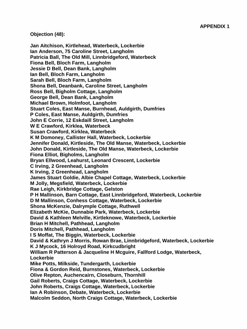
APPENDIX 1
Objection (48): Jan Aitchison, Kirtlehead, Waterbeck, Lockerbie Ian Anderson, 75 Caroline Street, Langholm Patricia Ball, The Old Mill, Linnbridgeford, Waterbeck Fiona Bell, Bloch Farm, Langholm Jessie D Bell, Dean Bank, Langholm Ian Bell, Bloch Farm, Langholm Sarah Bell, Bloch Farm, Langholm Shona Bell, Deanbank, Caroline Street, Langholm Ross Bell, Bigholm Cottage, Langholm George Bell, Dean Bank, Langholm Michael Brown, Holmfoot, Langholm Stuart Coles, East Manse, Burnhead, Auldgirth, Dumfries P Coles, East Manse, Auldgirth, Dumfries John E Corrie, 12 Eskdaill Street, Langholm W E Crawford, Kirklea, Waterbeck Susan Crawford, Kirklea, Waterbeck K M Domoney, Callister Hall, Waterbeck, Lockerbie Jennifer Donald, Kirtleside, The Old Manse, Waterbeck, Lockerbie John Donald, Kirtleside, The Old Manse, Waterbeck, Lockerbie Fiona Elliot, Bigholms, Langholm Bryan Ellwood, Leahurst, Leonard Crescent, Lockerbie C Irving, 2 Greenhead, Langholm K Irving, 2 Greenhead, Langholm James Stuart Goldie, Albie Chapel Cottage, Waterbeck, Lockerbie M Jolly, Megsfield, Waterbeck, Lockerbie Rae Leigh, Kirkbridge Cottage, Gelston P H Mallinson, Barn Cottage, East Linnbridgeford, Waterbeck, Lockerbie D M Mallinson, Conhess Cottage, Waterbeck, Lockerbie Shona McKenzie, Dalrymple Cottage, Ruthwell Elizabeth McKie, Dunnabie Park, Waterbeck, Lockerbie David & Kathleen Melville, Kirtleknowe, Waterbeck, Lockerbie Brian H Mitchell, Pathhead, Langholm Doris Mitchell, Pathhead, Langholm I S Moffat, The Biggin, Waterbeck, Lockerbie David & Kathryn J Morris, Rowan Brae, Linnbridgeford, Waterbeck, Lockerbie K J Mycock, 16 Holroyd Road, Kirkcudbright William R Patterson & Jacqueline H Mcguire, Fallford Lodge, Waterbeck, Lockerbie Mike Potts, Milkside, Tundergarth, Lockerbie Fiona & Gordon Reid, Burnstones, Waterbeck, Lockerbie Olive Repton, Auchencairn, Closeburn, Thornhill Gail Roberts, Craigs Cottage, Waterbeck, Lockerbie John Roberts, Craigs Cottage, Waterbeck, Lockerbie Ian A Robinson, Debate, Waterbeck, Lockerbie Malcolm Seddon, North Craigs Cottage, Waterbeck, Lockerbie

M Seddon, North Craigs Cottage, Waterbeck, Lockerbie Fran Smee, 1 Brookside, Lightwood Avenue, Buxton, Derbyshire Mr & Mrs K Wilkinson, Templehill, Waterbeck, Lockerbie D Young, Arkinholm Terrace, Langholm