Embed Size (px)
Citation preview
U.S. Department of the Interior
U.S. Geological Survey
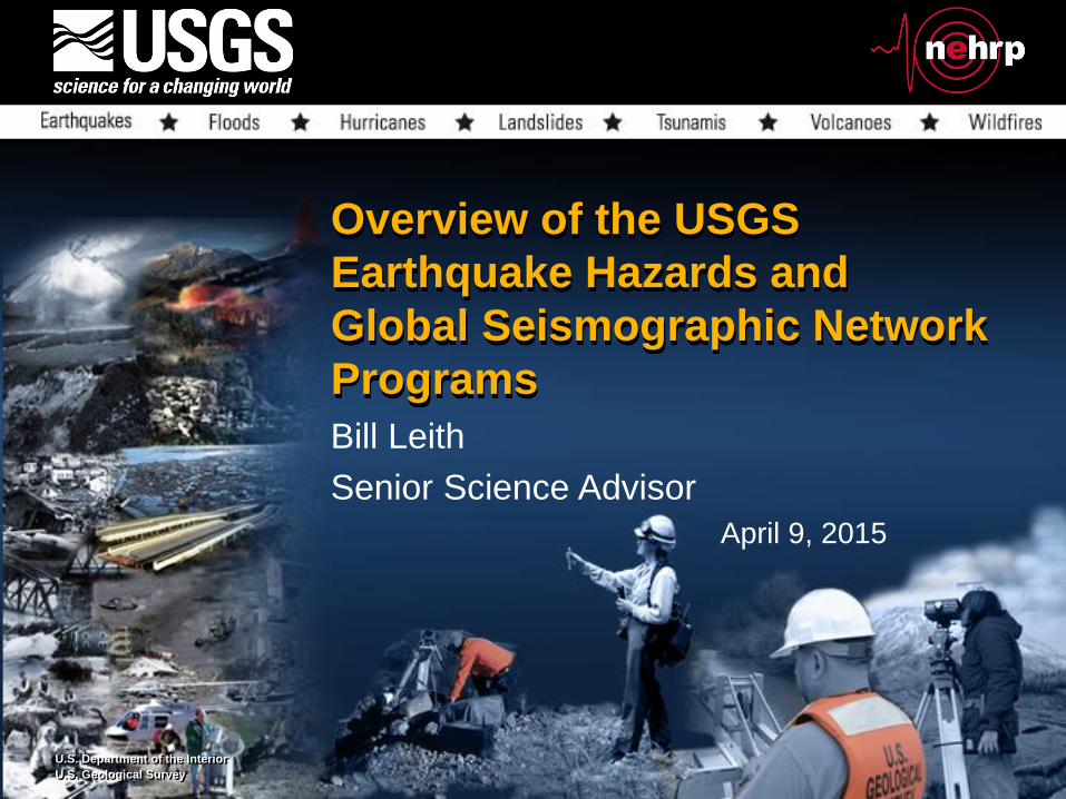
Overview of the USGS
Earthquake Hazards and
Global Seismographic Network
Programs
Bill Leith
Senior Science Advisor
April 9, 2015

Outline
• program overview
• FY14 accomplishments
• FY15 budget
• FY16 proposed budget
• unmet needs

The USGS role in the National Earthquake
Hazard Reduction Program
national earthquake hazards reduction program
• Provide earthquake monitoring and notifications
• Assess seismic hazards
• Conduct targeted research needed to reduce the risk from earthquake hazards nationwide, and
• Build public awareness
USGS National Earthquake
Information Center

Primary EHP-funded Science Centers
and Regional Offices
• Menlo Park, CA – Earthquake Science Center
• Seattle, WA – Regional Office at Univ. Washington
• Pasadena, CA – Regional Office at CalTech
• Golden, CO – Geologic Hazards Science Center and
the National Earthquake Information Center
• Albuquerque, NM – Regional Office for ANSS
Backbone and GSN activities
• Alaska: Alaska and Volcano Science Centers

Global Seismographic Network
The 150-station GSN is the workhorse of global seismology, supporting earthquake alerting, tsunami warning, nuclear treaty monitoring, and research on the structure
and dynamics of the Earth.
a shared program of the USGS and NSF

USGS Advanced National Seismic System
National, regional, strong motion and portable networks support the generation of USGS situational awareness products (PAGER,
ShakeCast), catalogs and waveform databases
National Earthquake
Information Center,
Golden, Colorado

USGS National Seismic Hazard Map
Earthquakes are a national hazard
M5.2
M6.0
M5.4
Notable earthquakes in past decade
M7.2
M6.0
M5.6
M6.5
M7.2
M4.9
M5.1
M6.7
M6.7
M7.9M6.6
M6.0
M3.8
M5.6
M5.8
M5.3

Excess earthquakes, 2009-2013
Llenos, 2014

• Approximately 25% of core program funds
• Gives flexibility and adds breadth of expertise to program
• Leverages support from other state and federal agencies, and universities
• FY15 funding - $16.5M:
• $7.0M for seismic and geodetic networks
• $7.8M research grants
• $1.3M SCEC
• EEW funding TBD
External grants and cooperative agreementsa key component of the Earthquake Hazards Program
USGS-funded research by Goldfinger et al.
uses turbidites to determine precise ages for
earthquakes on the Cascadia Subduction Zone

• USGS/CISN Phase I (2007-
2009) cooperative agreement
supported algorithm testing
• Phase II (2010-2012) supports
prototype development and
identifies test users
• ARRA funding used to reduce
datalogger delays
• EEW requirements:
-- rapid earthquake detection
-- early magnitude estimation
-- ground shaking prediction
-- robust monitoring networks
-- well-defined user community
Earthquake Early Warninggetting ahead of strong ground shaking
UC
Berkeley
SCEC/USC
U.S.
Geological
Survey
Caltech
CISN California Integrated Seismic Network

Congress
Advocates for
Earthquake
Early Warning
Letter signed by Feinstein, Schiff and 35 other Senators and Representatives
Letter signed by Schiff, DeFazio and 34 other Representatives

Global Seismographic Network – 2014 Accomplishments
• Procurement progress for new borehole sensors. Solicitation posted, vendor recommended, and award in-progress. Vendor will provide prototype for testing 9 months after award. USGS also performed study of noise versus depth of deployment for borehole sensors in anticipation of deployment. However, additional funds are needed for installation. [DOE FUNDED]
• Furthered development of software to automatically assess GSN data quality, to quickly identify, diagnose and fix station performance and metadata problems. This has resulted in unprecedented data quality for the USGS-operated stations.
• Metrozet M2166 evaluated to replace the venerable STS-1 vault seismometer.
USGS GSN stations

• Napa earthquake response: The USGS responded to the magnitude 6.0 South Napa earthquake with the rapid release of earthquake information products including ShakeMap, ShakeCast and PAGER. USGS joined the California Geological Survey in a suite of field investigations to document the earthquake and its impacts on infra-structure.
• Seismic and geodetic networks, InSaR and LiDaRcaptured details of the earthquake rupture and ground motion, including significant afterslip.
• FEMA funded USGS to document afterslip; USGS funded new paleoseismic fieldwork
Earthquake Hazards – 2014 accomplishments

26” gas pipeline at 350 psi

• National Seismic Hazard Maps: The USGS completed and released a major update to the National Seismic Hazard Maps. These maps, which forecast the levels of earthquake shaking expected throughout the conterminous USA over long time periods, are the basis for seismic provisions in building codes in use in most US states and communities.
• The maps were updated for the first time since 2008, using the latest data on faults, deformation and ground shaking.
• A new “Uniform California Earthquake Rupture Forecast”, completed by USGS, SCEC and partners last year, informs the Calif. Portion (UCERF3)
Earthquake Hazards – 2014 accomplishments

• Alaska earthquake anniversary: 2014 marks fifty years since the magnitude 9.2 Great Alaska earthquake rocked that state, causing extensive damage to Anchorage and spawning tsunamis. The USGS marked the anniversary with projects to raise education and preparedness, in partnership with federal, state and local organizations.
• The USGS supported FEMA in developing the Alaska Shield response preparedness exercise, which was based on a repeat of the 1964 earthquake, and participated in the exercise, providing twice-daily briefings to multi-agency partners on the earthquake’s impacts and aftershocks.
Earthquake Hazards – 2014 accomplishments

• Induced Seismicity: USGS researchers continued studies of potentially induced earthquakes in several states, demonstrated that Oklahoma’s seismically active regions continue to expand, and tied this to an expansion in the number of wastewater disposal wells in northern Oklahoma.
• In a public-private partnership, USGS also installed a seismic network at the high-volume CO2 injection site at Decatur, IL, and developed plans with DOE & industry partners for monitoring and modeling seismicity around the injection site of the FutureGen 2.0 test site (now cancelled).
Earthquake Hazards – 2014 accomplishments
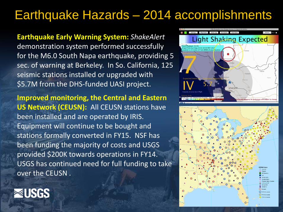
Earthquake Early Warning System: ShakeAlertdemonstration system performed successfully for the M6.0 South Napa earthquake, providing 5 sec. of warning at Berkeley. In So. California, 125 seismic stations installed or upgraded with $5.7M from the DHS-funded UASI project.
Improved monitoring, the Central and Eastern US Network (CEUSN): All CEUSN stations have been installed and are operated by IRIS. Equipment will continue to be bought and stations formally converted in FY15. NSF has been funding the majority of costs and USGS provided $200K towards operations in FY14. USGS has continued need for full funding to take over the CEUSN .
Earthquake Hazards – 2014 accomplishments

FY15 Budget
A second year of improving budget:
+$5.0M for earthquake early warning
+$0.7M for induced seismicity

USGS Natural Hazards changes in the FY 2015 “CROmnibus” relative to request
• Congress provided an unrequested $5M above FY14 levels toward development of earthquake early warning prototype for the West Coast
• A requested $700K increase for induced seismicity studies was provided but without a requested offsetting cut to the Earthquake Hazards Program
• Provided an unrequested $2M increase above FY14 for repairing and upgrading monitoring at highest threat volcanoes.
FY15 CROmnibus by the numbers
USGS overall: $1045M (+$13M over FY14)
NHMA overall: $135M (+6.7M over FY14)

EHP FY15 Budget by Program Element
Total budget is $59M
External funding will be $16.5M for grants and coops

FY 2016 initiative: “Natural Hazards Science for Disaster Response” (+$6.6M over FY15)
• Expanding use of flood inundation mapping and rapid deployable streamgages (+$0.5M)
• Rapid response to volcano unrest and eruption (at FY15 level)
• Earthquake early warning (-$1.5M below FY15 level)
• but $700k cut proposed to the base program
• Global Seismographic Network sensor deployment (+$4.9M)
• Building landslide and sinkhole response capacity (+$0.7M)
• Improved geomagnetic monitoring to support space weather situational awareness (+$1.7M)
• Rapid wildfire science response (+$0.5M)
• Disaster scenarios and strategic science crisis response (+$0.3M)

• Congress has proposed +$5M for further EEW development in FY15
• This FY16 proposal leverages public and private sector investments to deliver EEW capability
• If funded, USGS could implement limited public warning system in southern California by 2018
• Requires expanding and modernizing existing networks, implementing and integrating response capabilities, partnering with end users on products, and support structure for rapid emergency response
Improving Disaster Response:
Earthquake Early Warning($-1.5M relative to FY15; total funding requested $5M)
ShakeAlert Prototype – user display

Lingering effects of sequestration
on the USGS hazards mission
Because Congress did not restore sequestration cuts in 2014 and
the Administration did not request the restoration of cuts in 2015,
there are lingering effects of the 2013 budget cuts:
• Funding for earthquake and volcano monitoring networks was
reduced and modernization efforts are on-hold.
• Cuts to networks include seismic, geodetic & geochemical
• Funding for targeted research grants to universities was
reduced by about $1 million
• Slow erosion of science staffing has reduced progress in many
sub-disciplines
• approximately one rehire for every two retirements

Objectives not met in the FY16 budget proposal
Earthquake Hazards:
• Restoration of sequestration cuts (retaining stable staffing)
• Ensuring the long-term operation of the Central and
Eastern U.S. Seismic Network. ($1.25M/yr needed)
• Implementing an Earthquake Early Warning System for
the U.S. West Coast ($16.1M/yr needed)
Global Seismographic Network
• Replacement of the STS-1 sensors, no longer made
• Increased operating funds to reduce maintenance backlog (resulting in poorly performing stations)
.