Embed Size (px)
Citation preview

North Washington Street Bridge Project Charlestown Neighborhood Council Briefing
April 6, 2016 1
Boston, Massachusetts

2
City of Boston: Para Jayasinghe, City Engineer Mass DOT: Michael O’Dowd, Project Manager
Introduction
3
City of Boston Mass DOT Highway Division Federal Highway Administration Bridge Engineer: Benesch Bridge Architect: Rosales + Partners Public Involvement Specialist: Howard Stein Hudson
Project Team
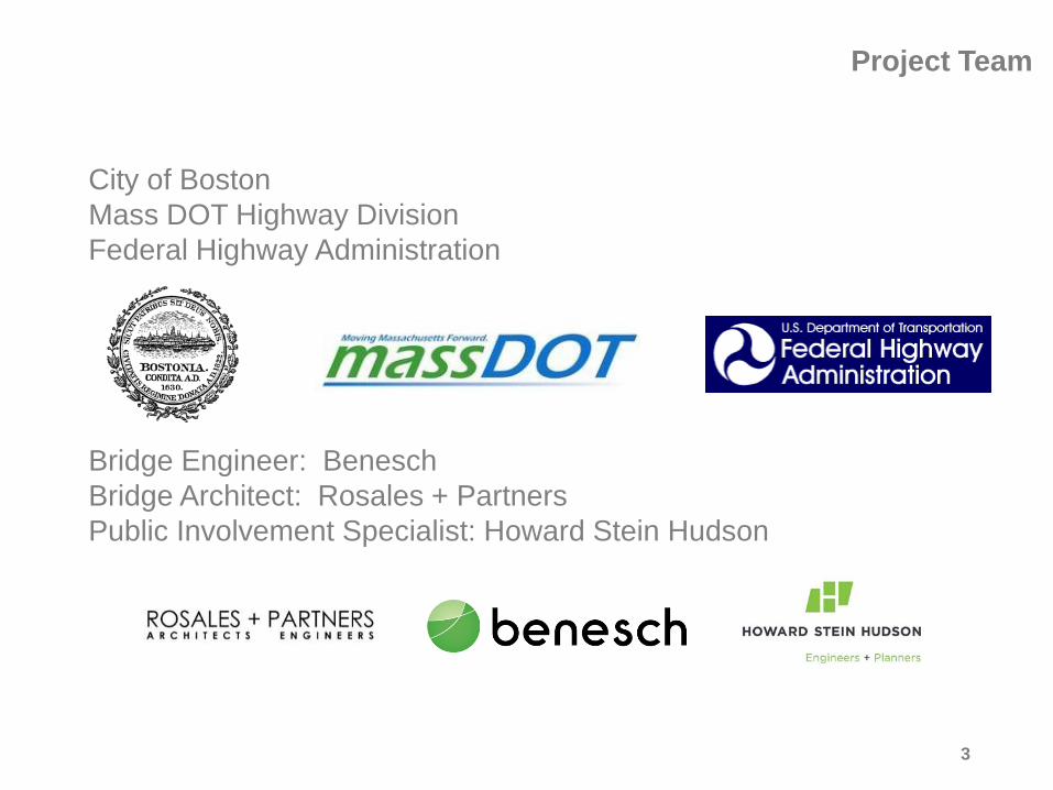
Existing Bridge
NORTH END
BOSTON HARBOR CHARLESTOWN
LOVEJOY WHARF
4

Existing Bridge Context
5
Project Limits
Project Limits
NORTH END CHARLESTOWN
BOSTON HARBOR
CHARLES RIVER

1898 Existing Bridge Constructed - 12 spans, 1087’ in Length 1956 Bridge is Reconstructed 1961 Swing Span Closed Permanently 1977 Elevated Street Railway Structure Removed 1992 Adjoining Warehouse Bridge Structure in Charlestown is Replaced 2003 Center Truss Bay Lanes Closed 2004-2015 Ongoing Maintenance and Repairs
Project History
6

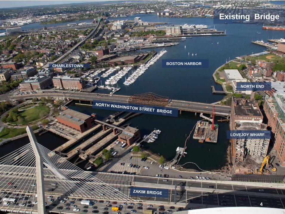
Existing Bridge
7
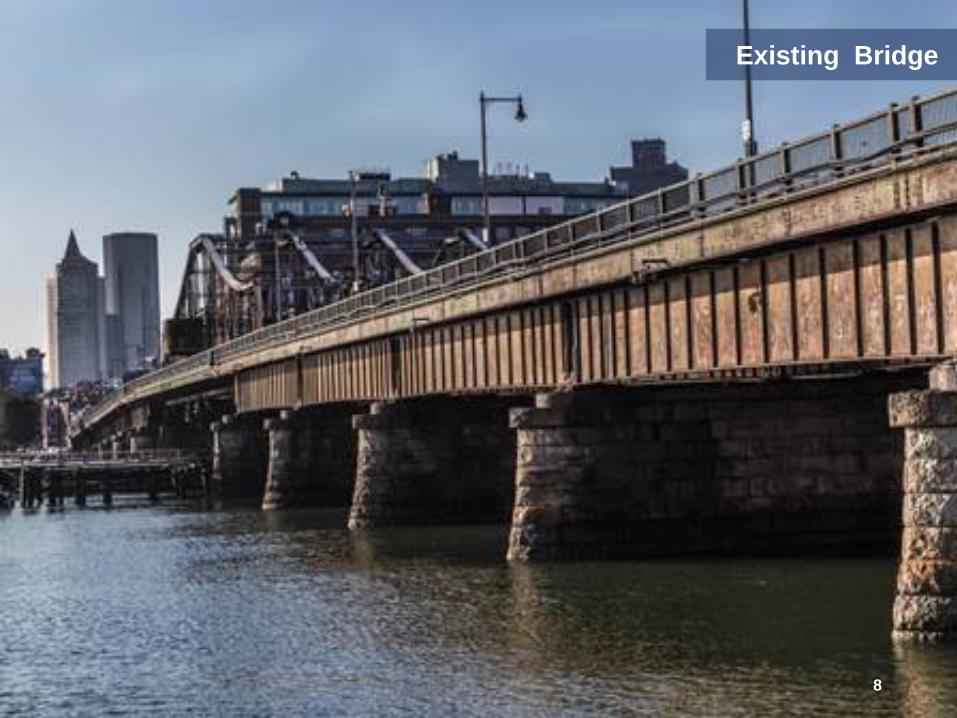
Existing Bridge
8
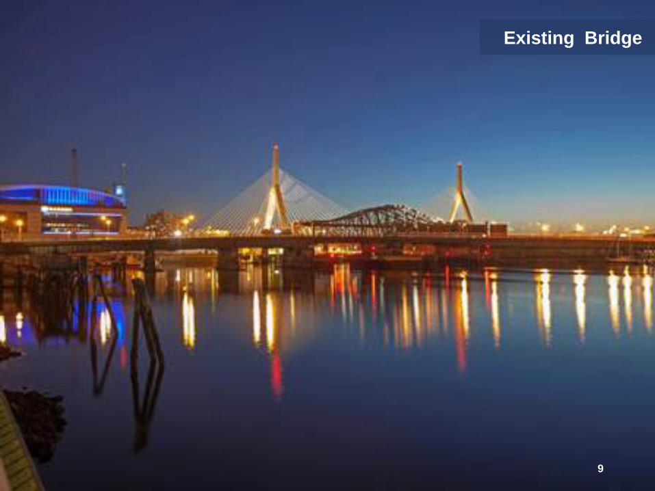
Existing Bridge
9

10
• Replacement of Structurally Deficient Bridge • Multi-Modal Bridge as a Complete City Street over Water • Improvements to Deficient Bike and Pedestrian Accommodations • Improvements to Intersections Safety and Functionality • Improvements to Navigation Channel • Context Sensitive Bridge Design in Important Waterfront and Historic
Bridge Location • Visually Appealing Bridge Design Complementing the Zakim Bridge
Project Goals
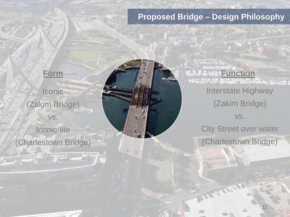
Form
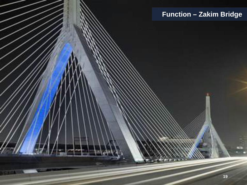
Iconic (Zakim Bridge)
vs. Iconic-lite
(Charlestown Bridge)
Function
Interstate Highway (Zakim Bridge)
vs. City Street over water (Charlestown Bridge)
11
Proposed Bridge – Design Philosophy

12
Bridge Type Study Alternatives
Double Steel Arch Alternative Single Diagonal Steel Arch Alternative
Hammerhead Piers Alternative V-Shape Piers Alternative

13
Comprehensive Bridge Type Study
• Constructability • Initial Construction Cost • Life Cycle Maintenance Cost • Structural Considerations • Bridge Aesthetics • Context Sensitive Considerations • Environmental / Permitting
Bridge Type Selection Criteria

14
• Meeting with DCR and Coast Guard: Spring 2014 • City of Boston Interdepartmental Briefing Including Boston
Landmarks Commission: Summer 2014 • Charlestown Neighborhood Community Meeting: Fall of 2014 • North End Neighborhood Community Meeting: Fall of 2014 • Bicycle and Pedestrian Advocacy Groups Meeting Including Walk
Boston, Livable Streets, and MassBike: Fall of 2014 • Charlestown Preservation Society: Winter of 2015 • Stakeholders Meetings Include Marriott Hotel, Constitution
Marina, and Downtown North Association: Spring of 2015 • A Better City Transportation Committee : Spring of 2015 • Friends of City Square Park: Fall of 2015 • 25% Design Public Hearing: December 2015
History of Public Outreach
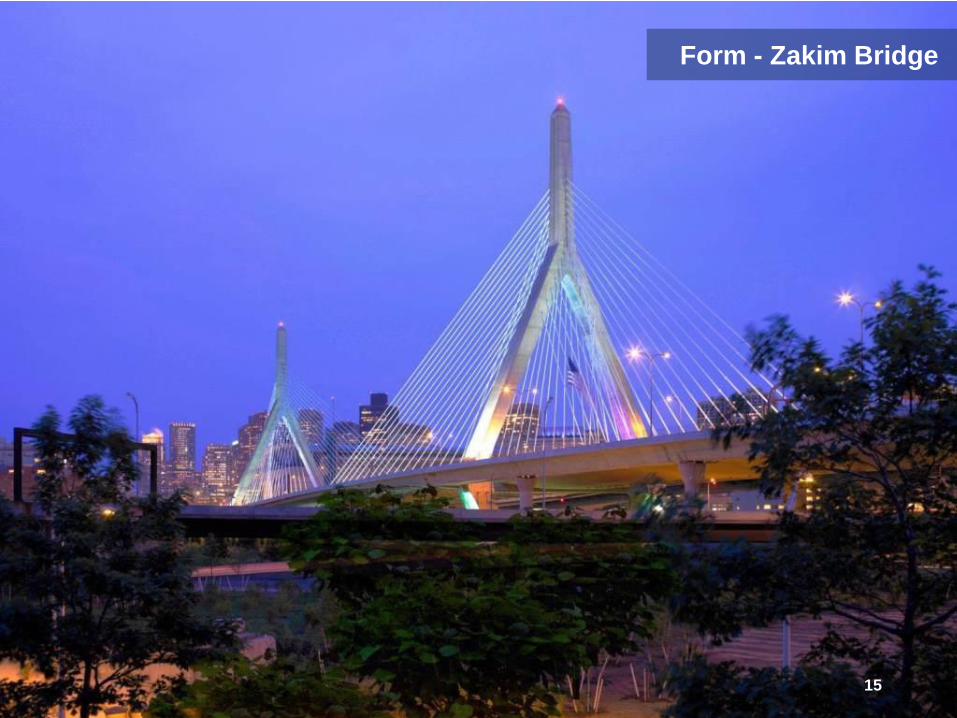
Form - Zakim Bridge
15
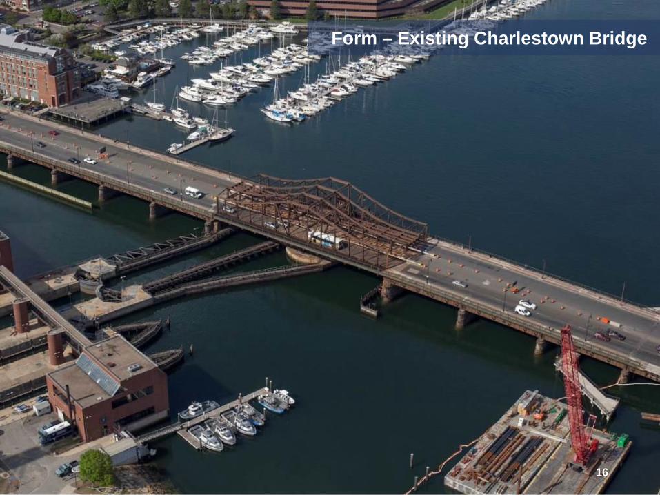
Form – Existing Charlestown Bridge
16

Form - Proposed Bridge Aerial View
17
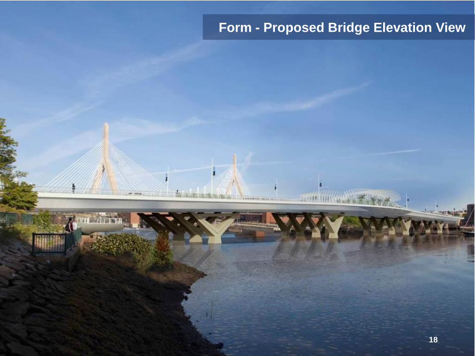
Form - Proposed Bridge Elevation View
18
Function – Zakim Bridge
19
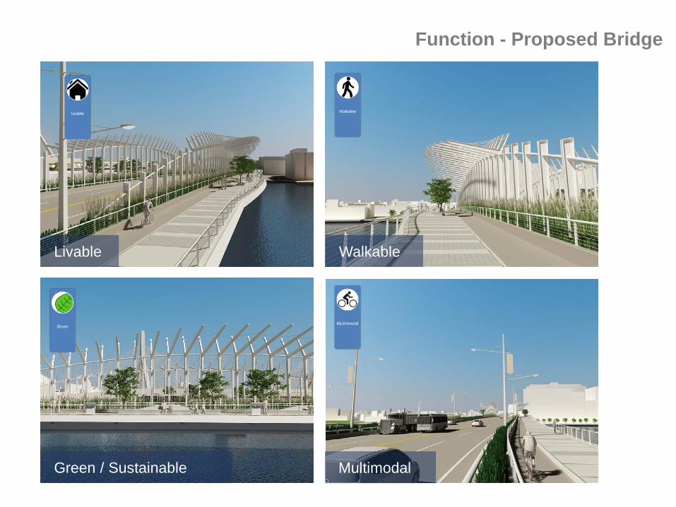
Function - Proposed Bridge
20
Livable Walkable
Green / Sustainable Multimodal

21
Project Limits
Project Limits
Context Plan with Proposed Bridge

Proposed Bridge Elevation
• Constant Depth Trapezoidal Steel Box Superstructure • Five Sets of Concrete V Piers Substructure • Main Span 190 Feet • Overall Length 1,087 Feet
22
23
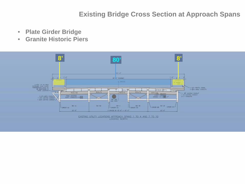
Existing Bridge Cross Section at Approach Spans
8’ 80’ 8’
• Plate Girder Bridge • Granite Historic Piers

24
Existing Bridge Cross Section at Navigation Span
11’ 22’ 11’ 22’ 22’
• Swing Movable Span • Steel Truss

25
Proposed Bridge Cross Section at Approach Spans
12’ 12’ 7’ 7’ 54’
• Wide Sidewalks • Separated Bike Lanes • Two Vehicular Lanes in Each Direction

26
Proposed Bridge Cross Section at Navigation Span
21’ 21’ 7’ 7’ 54’
• Pedestrian Overlooks • Architectural Trellis and Plantings
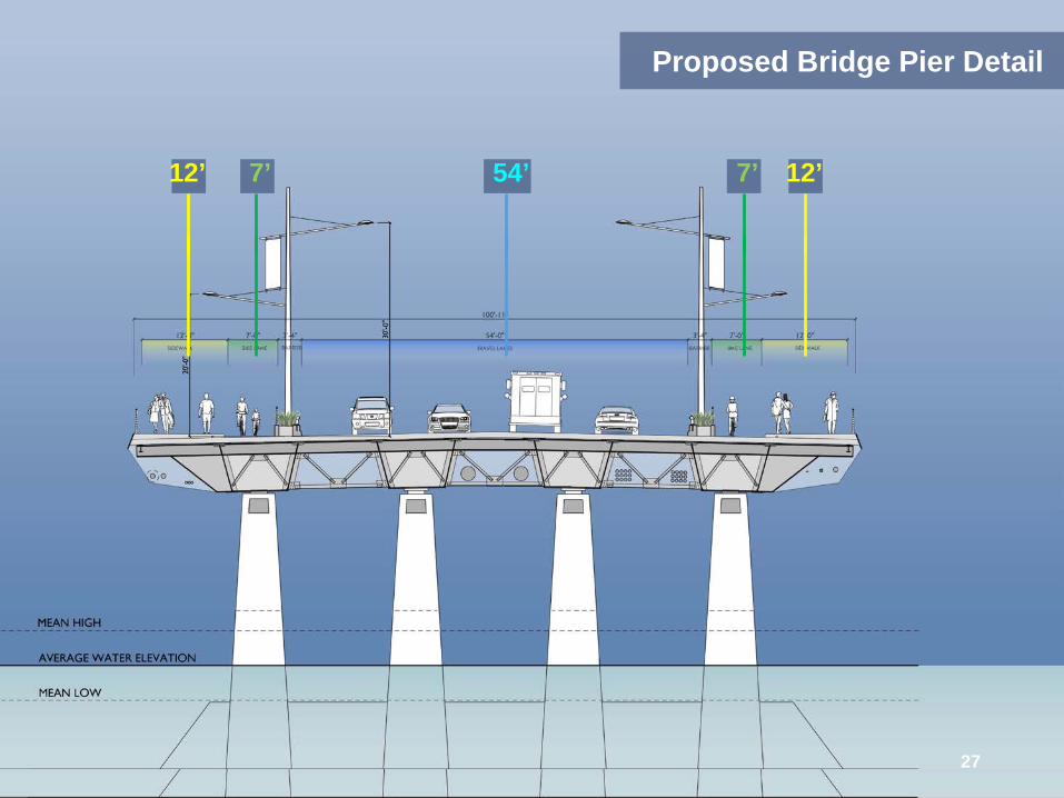
Proposed Bridge Pier Detail
12’ 12’ 7’ 7’ 54’
27

Elevation of Architectural Trellis
28

Roadway and Pedestrian Lighting
Light Fixture
29

Pedestrian Railing
30

Suggested Themes for Interpretive Signage
CUSTOM HOUSE TOWER
BOSTON GARDEN
ZAKIM BRIDGE
U.S. CONSTITUTION
OLD NORTH
CHURCH
BUNKER HILL
MONUMENT
31
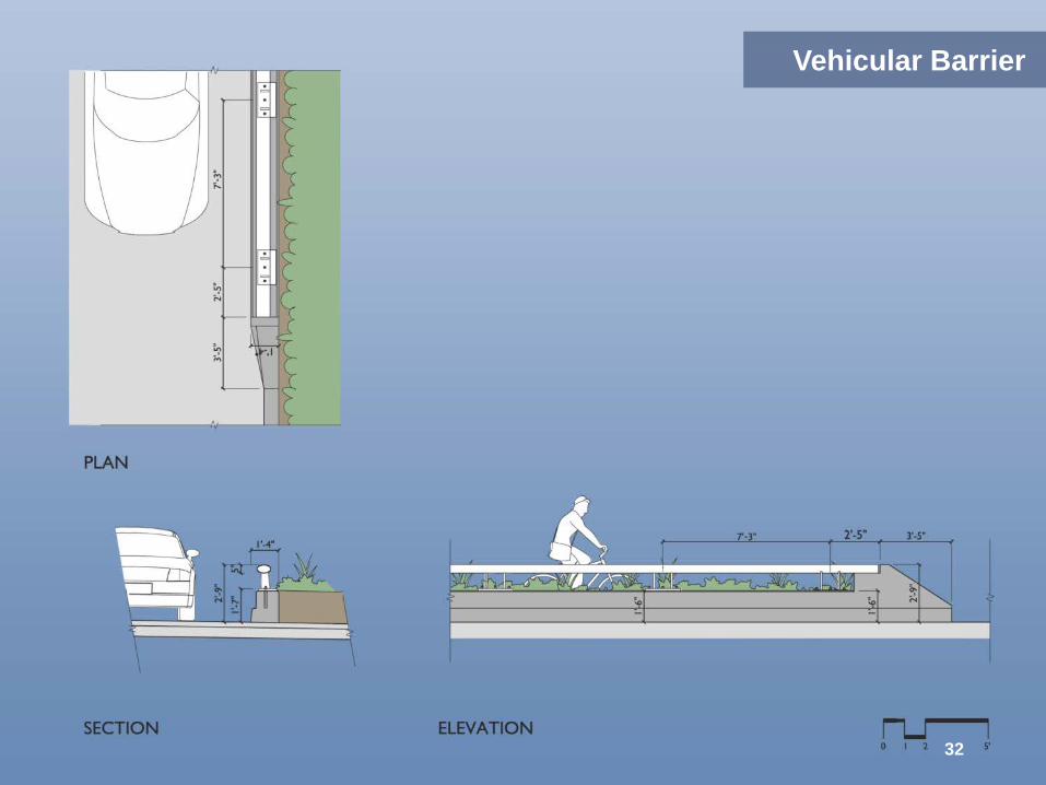
Vehicular Barrier
32

33
3D Visualizations
34
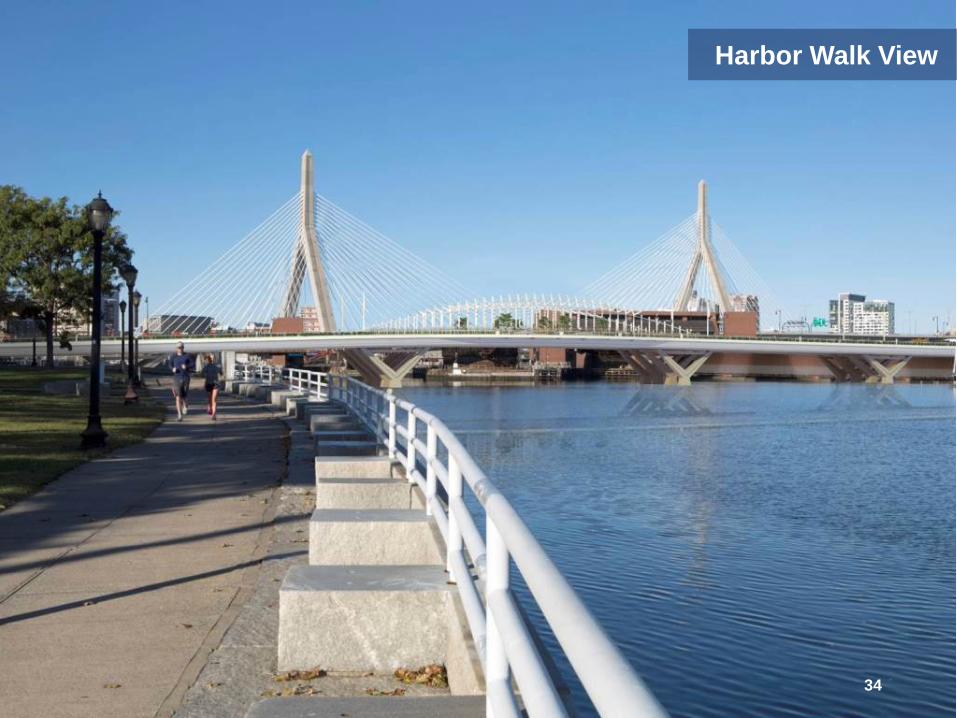
Harbor Walk View

35
Harbor View

36
Pedestrian View

37
Pedestrian View

Motorist View
38

39
Motorist View

40
Pedestrian View at Overlook

41
Pedestrian View at Overlook

42
Pedestrian View at Grade Separated Walkway
43
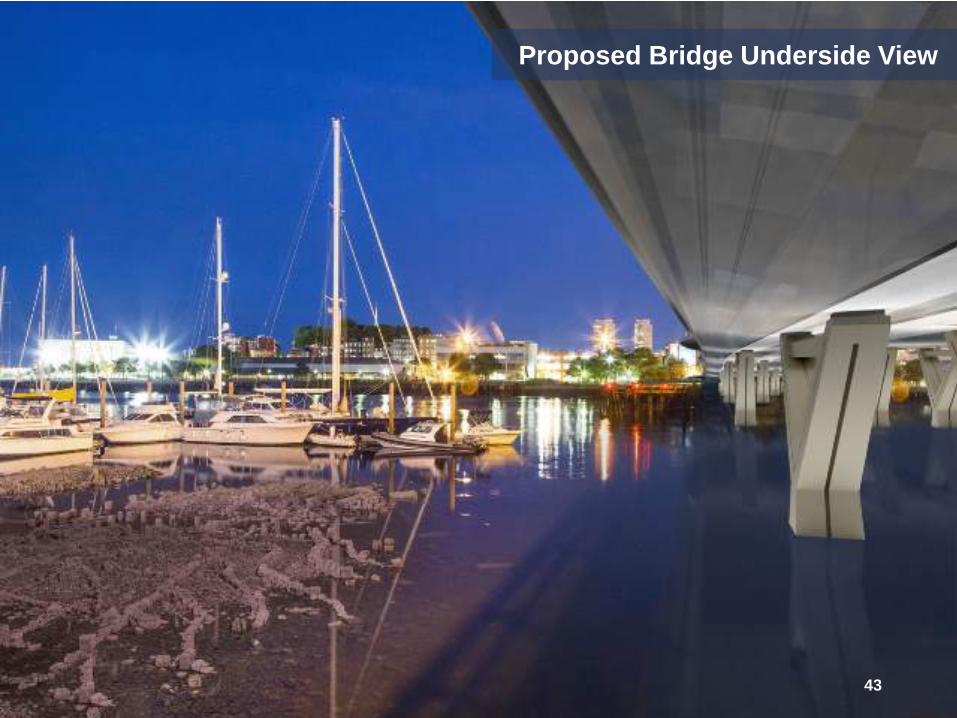
Proposed Bridge Underside View

Proposed Bridge Night Elevation View
44
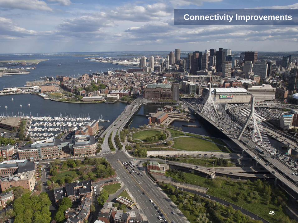
Connectivity Improvements
45

46
CITY SQUARE PARK
PAUL REVERE PARK
City Square Intersection Improvements
46

Keany Square Intersection Improvements
NORTH WASHINGTON STREET
47
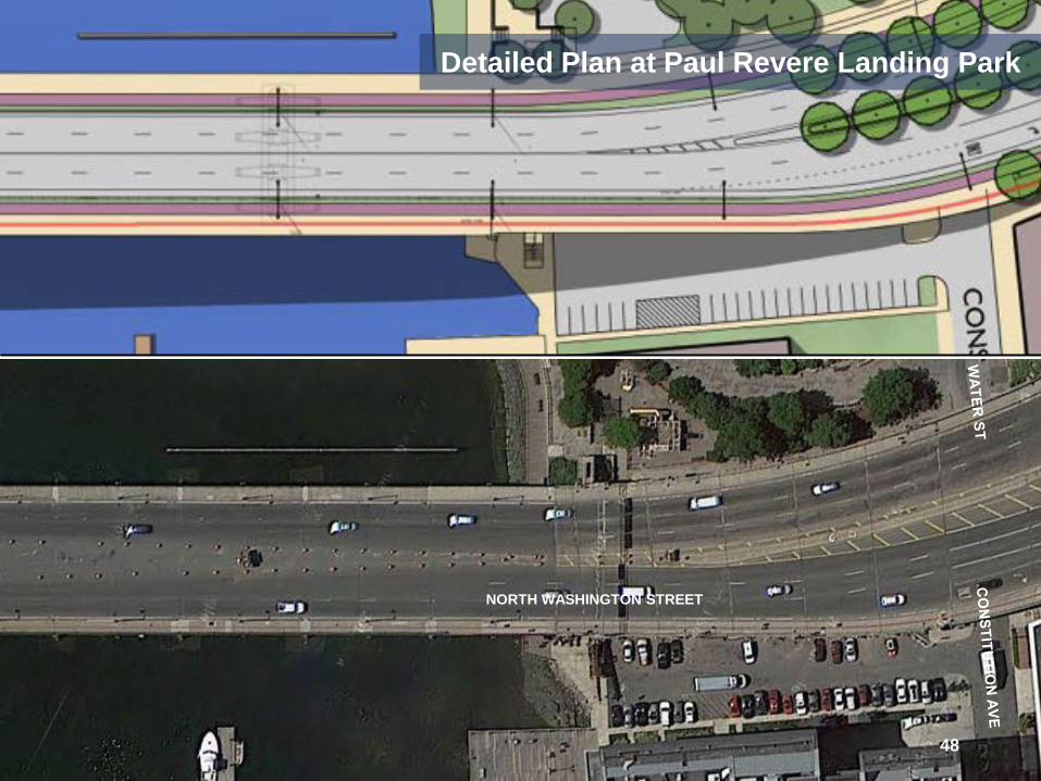
Detailed Plan at Paul Revere Landing Park
NORTH WASHINGTON STREET
48

Detail Plan at Grade Separated Walkway
NORTH WASHINGTON STREET
49

50
Grade Separated Walkway Elevation

Comparison Before and After Views
Before
51

52
After

53
Before

54
After
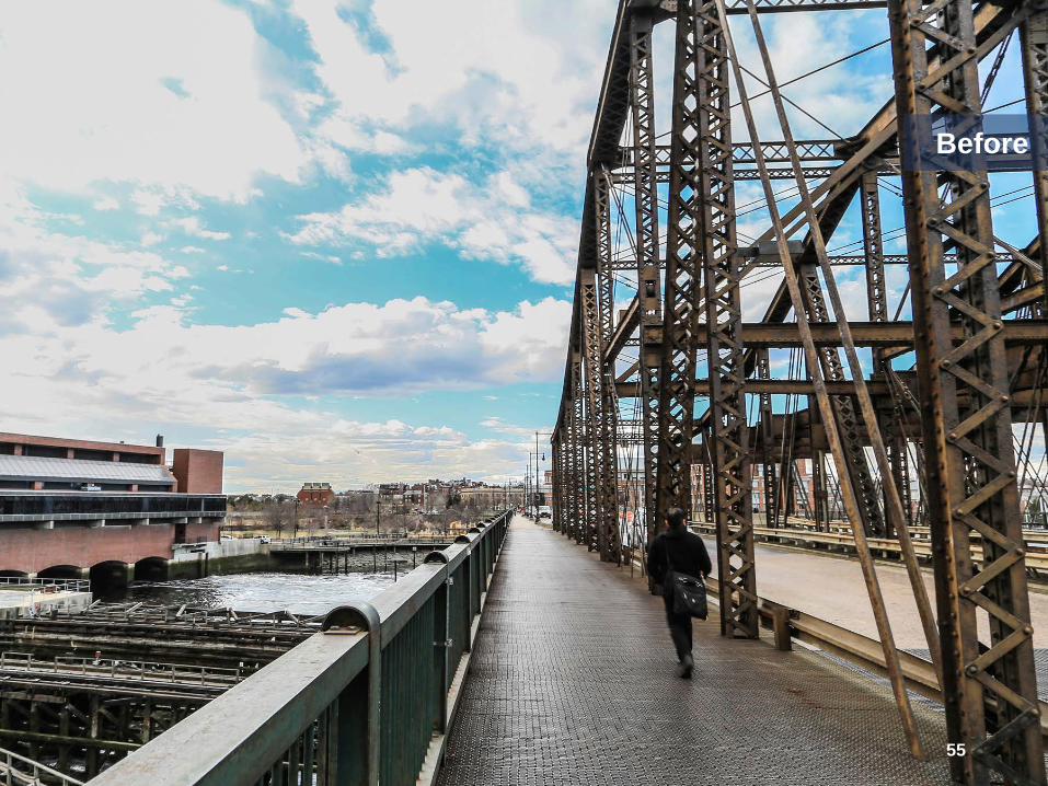
55
Before
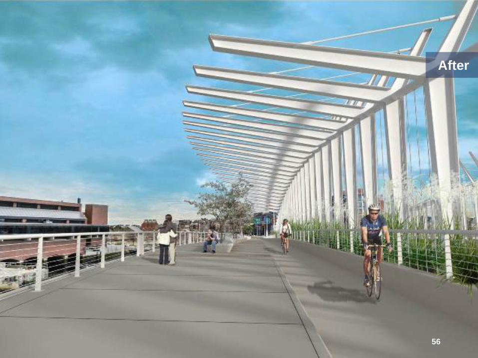
56
After
57
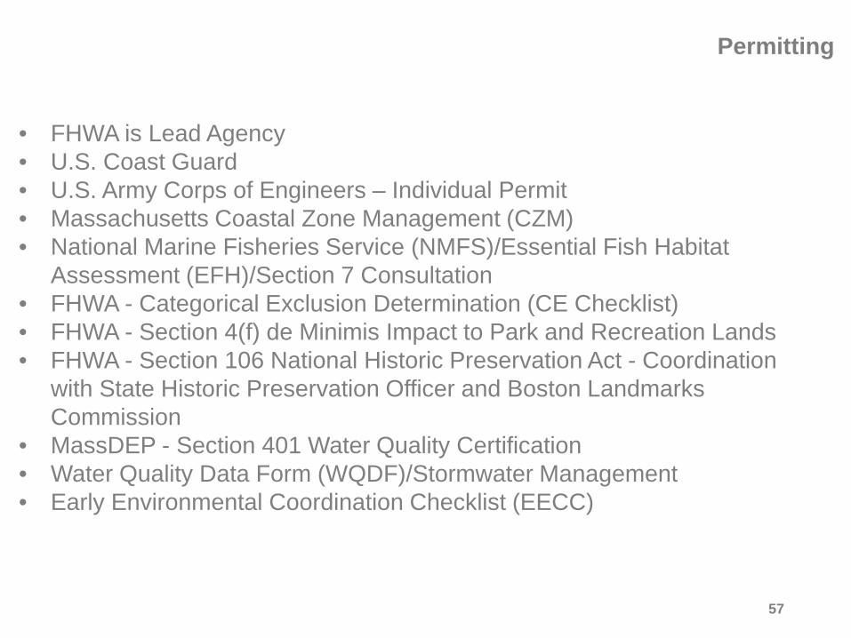
• FHWA is Lead Agency • U.S. Coast Guard • U.S. Army Corps of Engineers – Individual Permit • Massachusetts Coastal Zone Management (CZM) • National Marine Fisheries Service (NMFS)/Essential Fish Habitat
Assessment (EFH)/Section 7 Consultation • FHWA - Categorical Exclusion Determination (CE Checklist) • FHWA - Section 4(f) de Minimis Impact to Park and Recreation Lands • FHWA - Section 106 National Historic Preservation Act - Coordination
with State Historic Preservation Officer and Boston Landmarks Commission
• MassDEP - Section 401 Water Quality Certification • Water Quality Data Form (WQDF)/Stormwater Management • Early Environmental Coordination Checklist (EECC)
Permitting

58
North Washington Street
Paul Revere Park Boston Inner Harbor
Constitution Marina Proposed Temporary Easement
Proposed Permanent Easement
Right - Of - Way Impacts

59
Rutherford Avenue
Paul Revere Park
Proposed Temporary Easement
Proposed Permanent Easement
Right - Of - Way Impacts

Existing
NORTH END CHARLESTOWN
BOSTON HARBOR Proj
ect L
imits
Construction Sequence and Traffic Impacts
60

Stage 1A
NORTH END CHARLESTOWN
BOSTON HARBOR Proj
ect L
imits
Construction Sequence and Traffic Impacts
61

Stage 1B
NORTH END CHARLESTOWN
BOSTON HARBOR Proj
ect L
imits
Construction Sequence and Traffic Impacts
62

Stage 1B Detour
Construction Sequence and Traffic Impacts
63

Stage 2
NORTH END CHARLESTOWN
BOSTON HARBOR Proj
ect L
imits
Construction Sequence and Traffic Impacts
64
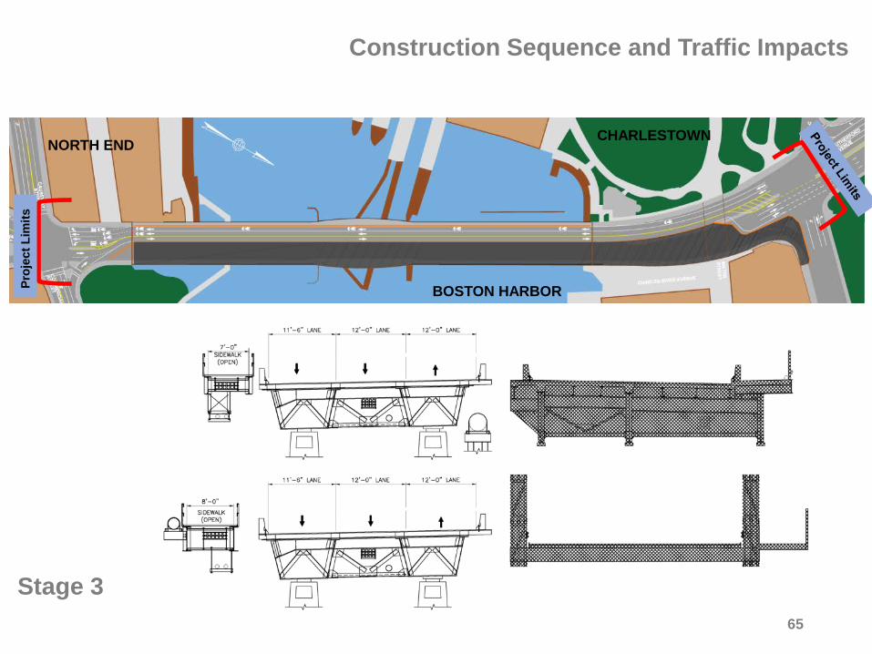
Stage 3
NORTH END CHARLESTOWN
BOSTON HARBOR Proj
ect L
imits
Construction Sequence and Traffic Impacts
65

Stage 4A
NORTH END CHARLESTOWN
BOSTON HARBOR Proj
ect L
imits
Construction Sequence and Traffic Impacts
66

Stage 4B
NORTH END CHARLESTOWN
BOSTON HARBOR Proj
ect L
imits
Construction Sequence and Traffic Impacts
67
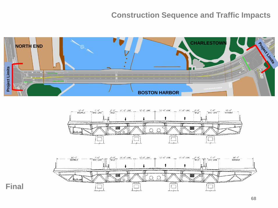
Final
NORTH END CHARLESTOWN
BOSTON HARBOR Proj
ect L
imits
Construction Sequence and Traffic Impacts
68

Possibility for dedicated bus lane Purpose
• Dedicated bus lane providing expedited service inbound • MBTA and shuttles
Proposed Roadway Dimensions • 57.5 foot roadway • Two 11 foot lanes • Two 10.5 foot lanes • 10.5 foot dedicated bus lane • 2 foot shoulders
69

• Completed Conceptual Design: Spring 2015 • Preliminary Design: Fall 2015 • Environmental Permits: 2015 to 2016 • Final Design: Winter 2016 • Anticipated Construction Activity: 2017 to 2020
Project Progress and Schedule
70

FAQ
71
72
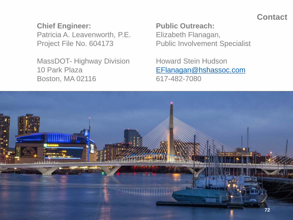
Chief Engineer: Patricia A. Leavenworth, P.E. Project File No. 604173 MassDOT- Highway Division 10 Park Plaza Boston, MA 02116
Contact Public Outreach: Elizabeth Flanagan, Public Involvement Specialist Howard Stein Hudson [email protected] 617-482-7080

73
Thank you
Q & A
North Washington Street Bridge Replacement Project Boston, Massachusetts

74
Lovejoy Wharf
North Washington Street
Prince Street Park
Boston Inner Harbor
Proposed Temporary Easement
Proposed Permanent Easement
Right - Of - Way Impacts
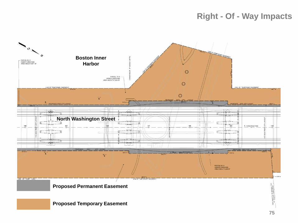
75
North Washington Street
Boston Inner Harbor
Proposed Temporary Easement
Proposed Permanent Easement
Right - Of - Way Impacts

76
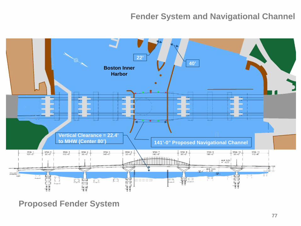
Boston Inner Harbor
Existing Fender System
2- Separated Channels
40’
Vertical Clearance = 22.4’ to MHW
22’
Fender System and Navigational Channel
77
Boston Inner Harbor
Proposed Fender System
141’-0” Proposed Navigational Channel
40’
Vertical Clearance = 22.4’ to MHW (Center 80’)
22’
Fender System and Navigational Channel