Embed Size (px)
Citation preview
NavanPoints ofPrideWalking Tour of Navan, Ireland’s Floral Town

Navan Points of Pride
A Concise History of NavanNavan, Ireland’s floral town, located in the heart of the Boyne Valley, is avibrant business, shopping and tourist destination with plenty to interest themodern visitor. The name Navan comes from the Irish translation of ‘AnUaimh’ which means cave. The cave in question is located on the east bankof the Boyne at Athlumney and was discovered in 1849 during excavationsfor the extension of the railway line from Drogheda to Navan.
Navan developed first as a market town and because it is a natural meetingpoint for North-South traffic. The town was utilised by the landed families ofrural Meath although it did not benefit from any great patronage, as did thetowns of Kells and Slane. The four principal estates in and around the townwere owned by absentee landlords: the Duke of Bedford, the Earl of Essex,Lord Howth and Lord de Ros.
Navan was originally the point where travellers came to cross the Boyne andBlackwater rivers, at the ford of the Poolboy (from the Irish ‘Póll buí’ or‘Yellow Hole’). Soon after the Norman conquest in 1170, Henry II granted theKingdom of Meath to the Norman Hugh de Lacey, who in turn passed theBarony of Navan to Jocelyn de Angelo (later Nangle). De Angelo foundedNavan town to encourage settlement and to create a centre for the exchangeof goods, grain, linen, hides and wool for iron, salt and luxury goods such aswines and silk. He also founded an Augustinian Abbey dedicated to theVirgin in 1189, which was in ruins in 1641 and of which no trace remainstoday. The statue of the Blessed Virgin, which was housed in the monasteryattracted large numbers of pilgrims during the Middle Ages.
Welcome to ‘Points of Pride’a walking tour of Navandesigned to showcase thebest of Navan’s heritage,with reference to thetown’s rich historicalpast and more recentdevelopments. It is acelebration of the people,the architecture and theculture of Navan.

By the turn of the century Navan was a modest town, and home to aroundfour thousand people. County buildings were located here in the early 20thcentury, and Navan became, in effect, the county town of Meath. The areaprospered as a centre of manufacturing particularly of furniture and carpetsthroughout the 1930s and 40s. Since the 1960s the town has been steadilyexpanding and by 2011 the population stood at nearly 30,000.
Recent times have brought further changes to the townscape. The develop-ment of Tara Mines (the largest lead and zinc mine in Europe, and the 5thlargest in the world) has attracted wealth to the town, while the manyexcellent shops in the town provide plenty of opportunity to spend it! Navan’sfirst shopping centre also moved Navan’s urban focus from the historic MarketSquare for the first time since the twelfth century. Though the world-famousNavan Carpets factory is long since gone, the famous Navan Carpet name liveson, and the town maintains its reputation for quality furniture.
On this walk, you are invited to trace the town’s past and to experience life inNavan as it is lived today.
By the late Middle Ages Navan was a partially walled town but the area en-closed by the wall was relatively small. In 1539, it is recorded that the town’sdefenses were damaged by the native Irish, and Navan was described as being‘not walled nor defensible’. The first settlers ran the town until they were dis-placed by the Cromwellian wars. In these turbulent times, the Catholic Nanglefamily was replaced by the Protestant Preston family and from 1661, onlyProtestants were permitted to serve in the Town Corporation.
Through marriage the Prestons became Ludlows and in 1830, they left theirestate to the Russells, Dukes of Bedford. The land was eventually bought outunder the Wyndham Land (Purchase) Act of 1903, but some Navan Streetnames still reflect the Russell family’s connection with the town.
During the 18th century, the Catholic population gradually prospered and whenrepresentative town government was established in Navan in 1840, Catholicscame to dominate town life. The 19th century was a time of radical change andshifts of fortune in Navan. The town witnessed the tragedy of the Famine andthe building of a Navan Workhouse, the rise and fall of industry, the coming ofthe railway, and investment in water supply, sewage disposal and architecture.
River Boyne
River Blackwater
River Boyne
Cannon Row
Kennedy Road
Trimgate Stree
t
Metges Lane
Circular Road
Church Hill Bridge Street
Academy Street
Railway Street
St Finian’s Tce
Ludlow Street
Convent Road
Athlumney RoadKentstown Road
To Cavan
To Dublin
Wat
erga
te St
reet
Flow
erH
ill
The Ramparts
15
12
3
4
5
6
7
8
9
10
11
12
13
14
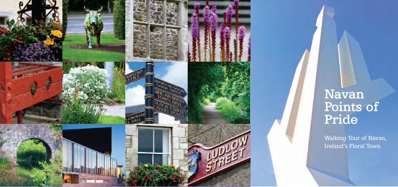
The Navan Points of Pride town walk starts at the SolsticeArts Centre and is 4km long. At a leisurely pace it can becompleted in approximately 2 hours.
The old walls and gates ofNavan which defined theboundaries of the town, havelong since disappeared. Theyare indicated on this map toshow how the medieval townhas grown over the centuries.
Navan Points of Pride
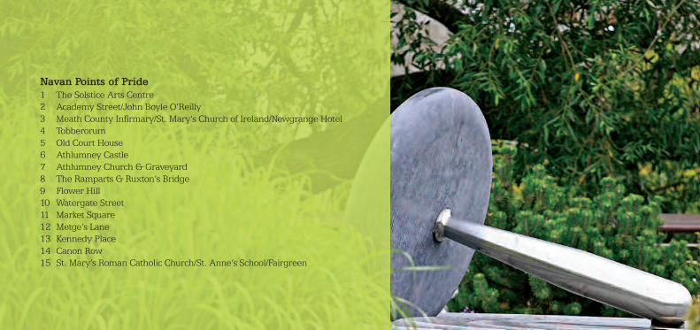
Navan Points of Pride1 The Solstice Arts Centre2 Academy Street/John Boyle O’Reilly3 Meath County Infirmary/St. Mary’s Church of Ireland/Newgrange Hotel4 Tobberorum5 Old Court House6 Athlumney Castle7 Athlumney Church & Graveyard8 The Ramparts & Ruxton’s Bridge9 Flower Hill10 Watergate Street11 Market Square12 Metge’s Lane13 Kennedy Place14 Canon Row15 St. Mary’s Roman Catholic Church/St. Anne’s School/Fairgreen

Canal
15
1
23
4
5
67
8
9
Tow PathTow Path
Canal
The Ramparts walk starts atthe Ramparts car park. Fromhere to Stackallen Lock covers adistance of 8km. At a leisurelypace it can be completed inapproximately 3.5 hours.
Ramparts Canal Walk
Generations of Navan townspeoplepromenaded along the Ramparts onSundays and holidays. The beautifulriverwalk can still be enjoyed today.
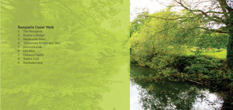
Ramparts Canal Walk1 The Ramparts 2 Ruxton’s Bridge3 Blackcastle Point4 Athlumney Bridge and Weir5 Rowley’s Lock6 Old Weir7 Dunmoe Castle8 Taafe’s Lock9 Stackallen lock

start here1
The SolsticeThe Solstice, Meath’s state-of-the-art centre for the arts, stands on the siteof the original Irish National Foresters Hall which was built in 1927. TheNavan ‘Dean Cogan’ branch of the Irish National Foresters was establishedin March 1899 as a benefit society for working men and was dissolved inDecember 2003. The Solstice Arts Centre was launched in 2006 as aplatform for the arts in Meath. The centre provides a 320-seat theatre,foyer, meeting and showcase space, a café, three galleries and a studio.The building design echoes the natural slope of the site, and at night thetall glass walls exude an atmospheric light.
Across the street is a double row of houses called St. Finian’s Terrace builtin 1911. As a child, Navan’s own James Bond, Pierce Brosnan lived innumber 2, St. Finian’s Terrace.
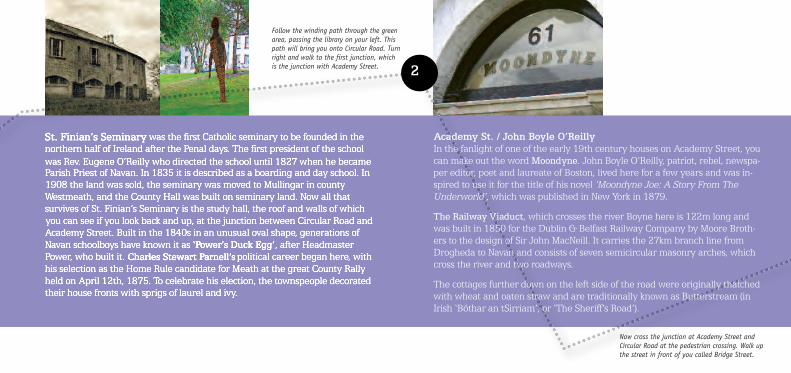
St. Finian’s Seminary was the first Catholic seminary to be founded in thenorthern half of Ireland after the Penal days. The first president of the schoolwas Rev. Eugene O’Reilly who directed the school until 1827 when he becameParish Priest of Navan. In 1835 it is described as a boarding and day school. In1908 the land was sold, the seminary was moved to Mullingar in countyWestmeath, and the County Hall was built on seminary land. Now all thatsurvives of St. Finian’s Seminary is the study hall, the roof and walls of whichyou can see if you look back and up, at the junction between Circular Road andAcademy Street. Built in the 1840s in an unusual oval shape, generations ofNavan schoolboys have known it as ‘Power’s Duck Egg’, after HeadmasterPower, who built it. Charles Stewart Parnell’s political career began here, withhis selection as the Home Rule candidate for Meath at the great County Rallyheld on April 12th, 1875. To celebrate his election, the townspeople decoratedtheir house fronts with sprigs of laurel and ivy.
2
Follow the winding path through the greenarea, passing the library on your left. Thispath will bring you onto Circular Road. Turnright and walk to the first junction, whichis the junction with Academy Street.
Now cross the junction at Academy Street andCircular Road at the pedestrian crossing. Walk upthe street in front of you called Bridge Street.
Academy St. / John Boyle O’ReillyIn the fanlight of one of the early 19th century houses on Academy Street, youcan make out the word Moondyne. John Boyle O’Reilly, patriot, rebel, newspa-per editor, poet and laureate of Boston, lived here for a few years and was in-spired to use it for the title of his novel ‘Moondyne Joe: A Story From TheUnderworld’, which was published in New York in 1879.
The Railway Viaduct, which crosses the river Boyne here is 122m long andwas built in 1850 for the Dublin & Belfast Railway Company by Moore Broth-ers to the design of Sir John MacNeill. It carries the 27km branch line fromDrogheda to Navan and consists of seven semicircular masonry arches, whichcross the river and two roadways.
The cottages further down on the left side of the road were originally thatchedwith wheat and oaten straw and are traditionally known as Butterstream (inIrish ‘Bóthar an tSirriam’, or ‘The Sheriff’s Road’).
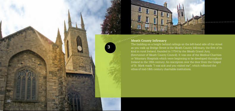
Meath County InfirmaryThe building on a height behind railings on the left-hand side of the streetas you walk up Bridge Street is the Meath County Infirmary, the first of itskind in rural Ireland, founded in 1754 by the Meath Grand Jury,(forerunner of Meath County Council). It was one of the Medical Charitiesor Voluntary Hospitals which were beginning to be developed throughoutIreland in the 18th century. An inscription over the door from the Gospelof St. Mark reads “I was sick and you visited me”, which reflected theethos of mid-18th century charitable institutions.
3
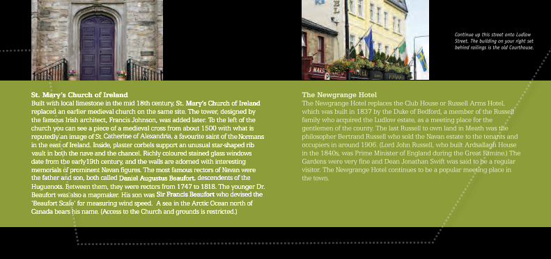
St. Mary’s Church of IrelandBuilt with local limestone in the mid 18th century, St. Mary’s Church of Irelandreplaced an earlier medieval church on the same site. The tower, designed bythe famous Irish architect, Francis Johnson, was added later. To the left of thechurch you can see a piece of a medieval cross from about 1500 with what is reputedly an image of St.Catherine of Alexandria, a favourite saint of theNormansin the east of Ireland. Inside, plaster corbels support an unusual star-shaped ribvault in both the nave and the chancel. Richly coloured stained glass windowsdate from the early19th century, and the walls are adorned with interestingmemorials of prominent Navan figures. The most famous rectors of Navan werethe father and son, both called Daniel Augustus Beaufort, descendents of theHuguenots. Between them, they were rectors from 1747 to 1818. The younger Dr.Beaufort was also a mapmaker. His son was Sir Francis Beaufortwho devised the‘Beaufort Scale‘ for measuring wind speed. A sea in the Arctic Ocean north ofCanada bears his name. (Access to the Church and grounds is restricted.)
Continue up this street onto LudlowStreet. The building on your right setbehind railings is the old Courthouse.
The Newgrange HotelThe Newgrange Hotel replaces the Club House or Russell Arms Hotel,which was built in 1837 by the Duke of Bedford, a member of the Russellfamily who acquired the Ludlow estate, as a meeting place for thegentlemen of the county. The last Russell to own land in Meath was thephilosopher Bertrand Russell who sold the Navan estate to the tenants andoccupiers in around 1906. (Lord John Russell, who built Ardsallagh Housein the 1840s, was Prime Minister of England during the Great Famine.) TheGardens were very fine and Dean Jonathan Swift was said to be a regularvisitor. The Newgrange Hotel continues to be a popular meeting place inthe town.

4
TobberorumHistorically the townspeople of Navan depended on the wells andsprings of the town for their drinking water, and many springs werereputed to cure certain ailments. (‘Tubber’ is the Irish word for ‘a well’and ‘Oran’or ‘Odhran’ was the name of the charioteer who transportedSt. Patrick when he was in this part of the Country). Tobberorum wasthe only large well inside the town walls during the Middle Ages, and itwas considered important enough to be restored by the TownCommissioners in 1858. It is said that Meath’s most famous highway-man Michael Collier (the Robber), who was born in Bellewstown in1780 and died in Drogheda in 1849, lived in Tobberorum Lane andthat, during periods of abstinence from strong drink, he drank only thewater of Tobberorum well.
Just beside the Old Courthouse is a narrowlaneway which leads down to Tobberorum.
Continue up the hill and take a right turn onto thestreet named Timmons Hill. (‘Timmons’ is a familyname, a prominent member that served as a towncommissioner.) The street slopes down to the river. At the bottom of the hill, at the traffic lights, crossstraight through the junction. You will be crossingthe river Boyne on a bridge known as the NewBridge.
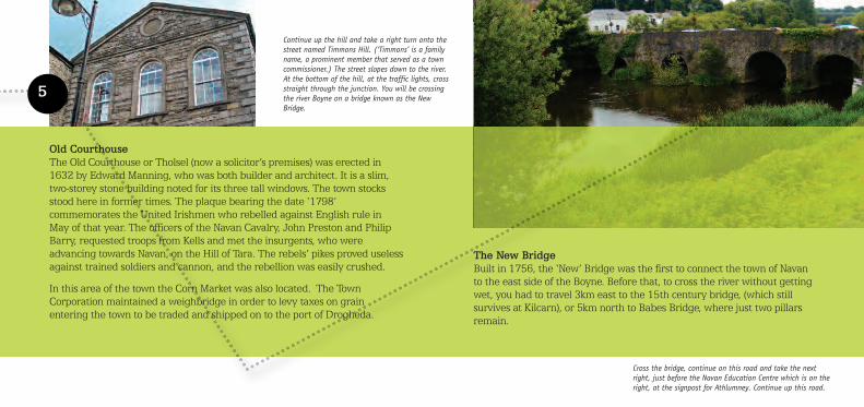
The New BridgeBuilt in 1756, the ‘New’ Bridge was the first to connect the town of Navanto the east side of the Boyne. Before that, to cross the river without gettingwet, you had to travel 3km east to the 15th century bridge, (which still survives at Kilcarn), or 5km north to Babes Bridge, where just two pillars remain.
5
Old CourthouseThe Old Courthouse or Tholsel (now a solicitor’s premises) was erected in 1632 by Edward Manning, who was both builder and architect. It is a slim, two-storey stone building noted for its three tall windows. The town stocksstood here in former times. The plaque bearing the date ‘1798’commemorates the United Irishmen who rebelled against English rule inMay of that year. The officers of the Navan Cavalry, John Preston and PhilipBarry, requested troops from Kells and met the insurgents, who wereadvancing towards Navan, on the Hill of Tara. The rebels’ pikes proved uselessagainst trained soldiers and cannon, and the rebellion was easily crushed.
In this area of the town the Corn Market was also located. The TownCorporation maintained a weighbridge in order to levy taxes on grain entering the town to be traded and shipped on to the port of Drogheda.
Cross the bridge, continue on this road and take the nextright, just before the Navan Education Centre which is on theright, at the signpost for Athlumney. Continue up this road.
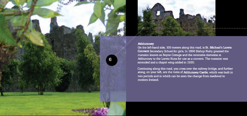
AthlumneyOn the left-hand side, 100 meters along this road, is St. Michael’s LoretoConvent Secondary School for girls. In 1896 Bishop Nulty granted themansion known as Boyne Cottage and the extensive demesne atAthlumney to the Loreto Nuns for use as a convent. The mansion wasextended and a chapel wing added in 1930.
Continuing along this road, you cross over the railway bridge, and furtheralong, on your left, are the ruins of Athlumney Castle, which was built intwo periods and in which can be seen the change from medieval tomodern Ireland.
6

The name ‘Athlumney’ derives from ‘Atha Luman’ or ‘Loman’s Ford’.(St. Loman is reputed to have been a nephew of Saint Patrick and was thefirst Bishop of Meath.) The corner turrets were common in late medievalncastles in Ireland, and the three-storey part of the building is either lateElizabethan or early Jacobean.
The Lords of the manor enjoyed such modern luxuries as glass windows andcentral heating rising from the kitchens below. According to legend, thecastle was burned down by Launcelot Dowdall, the last owner. He fled toexile in France having supported the Catholic King James II in his waragainst William of Orange in 1689-1691. One of the most important battlesof this was the famous Battle of the Boyne, which took place in 1690.
On the oppositeside of the road isthe graveyard andthe church ruins.
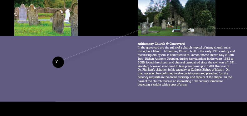
Athlumney Church & GraveyardIn the graveyard are the ruins of a church, typical of many church ruinsthroughout Meath. Athlumney Church, built in the early 13th century andmeasuring 2m by 8m, is dedicated to St. James, whose Patron Day is 27thJuly. Bishop Anthony Dopping, during his visitations in the years 1682 to1685, found the church and chancel unrepaired since the civil war of 1641.Worship, however, continued to take place here up to 1789, the year ofDr. Plunkett’s visitation in his capacity as Catholic Bishop of Meath. Onthat occasion he confirmed twelve parishioners and preached ‘on thedecency requisite in the divine worship, and repairs of the chapel.’ In thenave of the church there is an interesting 15th century tombstonedepicting a knight with a coat of arms.
7

The table tomb at the entrance of the graveyard from the road holds theremains of Peter Metge, of the Navan Huguenot family, who became LordChancellor of Ireland. (Metge’s Lane, in the centre of the town, is namedafter him.) On the site between you and the river Boyne lie the remains ofthe first Norman settlement in Navan, an earthworks known as a motte.Built by an unknown knight, the castle also featured a bailey (a woodenfenced yard) and a wooden watchtower, from which a sentry could look outfor approaching enemies. The church extended into the site occupied by the tower when the tower was no longer needed.
Retrace your steps back to the mainroad, cross the road, you pass Spicers’Bakery on the left, a long establishedNavan enterprise. Turn into and crossthe small car park you arrive at TheRamparts

7

Some interesting graves worth visiting in the old cemetery include:
No. 20 The oldest recorded age in Old Athlumney is James Mannon who died September, 10th 1778 aged 96 years.
No. 22 Private P. Kane, Leinster Regiment, died 3rd March 1919.No. 57 Joseph Boylan, Killed in France Oct. 1917.No. 60 James Flanagan, Killed in Action 1st July 1916.No. 116 The Metges were “Huguenots” who left France after the revocation of
the Edict of Nantes (1685) and settled in Athlumney c.1700. Peter Metgewas made Bencher of the King’ s Inns Law Society in 1782 and Baron ofthe Irish Exchequer 1784-1801. He died 9th Feb 1809 aged 65 years. “By lyeing on top of Box Tomb, cure for bad back or Back-Ake”.
No. 174 John Rice, Athlumney who died 21st December 1899, aged 96 years.
(Old Athlumney Cemetery Committee 2001)

8The RampartsIf you fancy a nice river walk there is the old towpath of the Boyne Canalwhich runs for almost eight kilometers to the bridge over the Boyne atStackallen.
On the Ramparts Walk, you will see the single remaining eye of Babe’sBridge, the only bridge over the Boyne which survived the great flood of1330.

Ruxton’s BridgeTo continue on your current walk of the town, take the humpbacked bridgeover the canal, called Ruxton’s Bridge. It is named after Mr.WilliamRuxton, a shareholder in the Boyne Navigation which connects Navan andDrogheda. Construction of the canal was begun by the Commissioners ofInland Navigation in 1759 and completed by 1800. Most of the Navigationis on the south bank of the Boyne.
If you continue along this path by the canal you will enter one of the manypocket parks scattered throughout the town. Take a break and enjoy theview and peacefulness of the river Boyne. To the left you will see therailway viaduct which crosses the river, and the road you see on the farside of the viaduct is the main road which leads southwards to Dublin.
When you exit the park gates, cross theroad carefully at the designated cross-ing point and cross back over the river.Turn right at the next junction andproceed to the next bridge you can see.
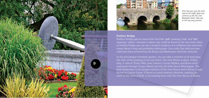
From here you cross the mainroad at the traffic lights andcontinue up the hill, onto Watergate Street. Take care at this very busy junction.
9
Poolboy BridgePoolboy Bridge gets its name from the Irish ‘poll’meaning ‘hole’ and ‘buí’meaning ‘yellow’, because a yellow clay could be found in the river here. Hereat Poolboy Bridge you can see a modern sculpture of a millstone that commem-orates Navan’s long and profitable milling past. Corn mills, flax mills and sawmills have been powered by the Boyne and Blackwater rivers for centuries.
In the picturesque riverbank garden, you can take a moment to sit and enjoythe view of the meeting of the two rivers. The river Boyne is about 112kmlong. It rises at Trinity Well, near Carbury, County Kildare, and flows north-eastwards through County Meath and into the Irish Sea at Mornington. TheKells Blackwater is the largest tributary of the river Boyne and is fed by LoughRamor in County Cavan. It flows in a south-easterly direction, passing justnorth of the town of Kells, to its meeting here with the river Boyne at Navan.

10
Watergate StreetOn your right, as you progress up Watergate Street, you will see the Town Hall,an 18th century building that once operated as a police barracks and before thatas a Bridewell prison. To the left of the main door, set behind railings, are theTown Stocks which were originally located outside the Court House on LudlowStreet. Petty criminals were shackled by their ankles in the stocks and publiclyexposed to the townspeople who were encouraged to hurl abuse, as well asrotten fruit and vegetables at them.
The crest of the town, which you can see on an archway in front of the townhall, derives from the seal of the town of Navan from the 17th century silvermatrix. It is the crest of the family of Cowan, and shows a forearm issuing fromclouds holding a heart; on the right side of the crest is a harp and on the left arose; above is a royal crown. On the seal from which the crest derives, appearsthe date 1661 and the legend that refers to the restoration of Charles II reads:
Continue up Watergate Street you should now be enteringa triangular space known as Market Square. You will knowyou have arrived when you see a stone sculpture of a bull.
RESTAURATO CAROLO SECUNDO RESPIRAMUS(We rejoice in the restoration of Charles II)
The population of Navan received a new Charter of Incorporation fromJames I, which was confirmed by Charles II on his restoration in 1660. ThePortreve (Mayor) of Navan at the time the matrix was made was a memberof the Cowan family.

11
The Market SquareFor many centuries the Market Square was the commercial centre ofNavan, and a market cross stood at its centre. Preachers preached at thefoot of the cross, deals were made in its shadow, and proclamations andpublic announcements were read there.
The cross was originally erected by Martin Nangle, eldest son of PatrickNangle, Baron of Navan, and on it was carved the family crest and arequest for prayers for Nangle (de Angelo) and his wife. The only survivingsection of the cross was sent to the Royal Irish Academy by the antiquarianW. F. Wakeman who wrote an account of his discovering the stone in theAcademy’s journal in December, 1849.

12
Now leave the Market Square and go down anarrow street, which you can easily identify bythe glass roof over it (bus stop). This street isnamed Metge’s Lane.
Follow Metge’s Lane as it curves around to theleft. When you arrive at the junction, cross thestreet and turn right into Kennedy Place.
Two similar stones, sculpted and inscribed, were being used as supports forcasks in a public house in Trimgate Street at that time and, although he offeredto pay to have the casks moved, Mr. Wakeman’s request was refused and thewhereabouts of those stones are still unknown. The bronze replicas of thesurviving section of the Navan Market Cross, which can be seen in the MarketSquare now, were created by Meath based sculptor, Orla De Bri. The survivingsection of the Market Cross is on permanent loan from the National Museum ofIreland and is now exhibited in its hometown at The Solstice Arts Centre.
The sculpture which now dominates the Market Square, weighs 16 tonnes andwas carved in limestone by Galway sculptor Colin Grehan. The Bull took upresidence on his plinth in March 2011 and is a fitting memorial to the trade inlivestock and agricultural produce which has taken place for centuries in Navan.
Metge’s LaneMetge’s Lane is named after one of the important Huguenot families wholeft France after the revocation of the Edict of Nantes in 1685 and whosettled in Navan in the early 18th century. Peter Metge was made Bencherof the King’s Inns Law Society in 1782 and held the position of Baron of theIrish Exchequer from 1784 to 1801.
Metge’s Lane is typical of the narrow streets where, in centuries past, thepoor took what shelter they could in squalid, mud-walled cabins.

13
Kennedy PlaceThe open space in front of you is the new Civic Plaza, completed in 2007.This award-winning urban space provides a venue for town events and acraft market (on certain days). An attractive fountain and pleasantseating area provide a quiet place to relax and watch the world go by.The impressive bronze sculpture you can see was created by MeathSculptor, Betty Newman Maguire, and is intended to signify humanaspiration and the uplifting of the spirit. To the right is Navan ShoppingCentre, which is the new commercial centre of the town.
Kennedy Road is named, not after an American president as you maythink, but after a local landowner. Tom Kennedy was a local politicianand a dairy farmer who had a milk round in the town.

Continue on this street and, atthe roundabout, take a left andthen pause at the sculpture.
An interesting fact, as we walk along, is that Faulkner’s Dublin Journalreported on April 15th, 1784, that a Mr. Rosseau, accompanied by a 10year-old drummer boy playing ‘The Grenadier’s March’, flew in a hot airballoon from here, in a south-easterly direction and landed in a field near thevillage of Ratoath. Strangely, however, the honour of the first balloon flight inIreland is usually accorded to another aeronaut, one Richard Crosbie, whotook off from Dublin in January 1785. As a result, Navan’s place inaeronautical history remains to be established.
On your left shortly will be the modern landmark building you see at theend of the Civic Plaza is St. Mary’s Credit Union. This award-winningstructure,designed by local architect Paul Leech, has received specialrecognition for its sustainable and eco-friendly design. The sculpture closeto the main entrance is by Derry-born sculptor Eamon O’Doherty anddepicts a salmon leaping up a waterfall on its way upstream to spawn.
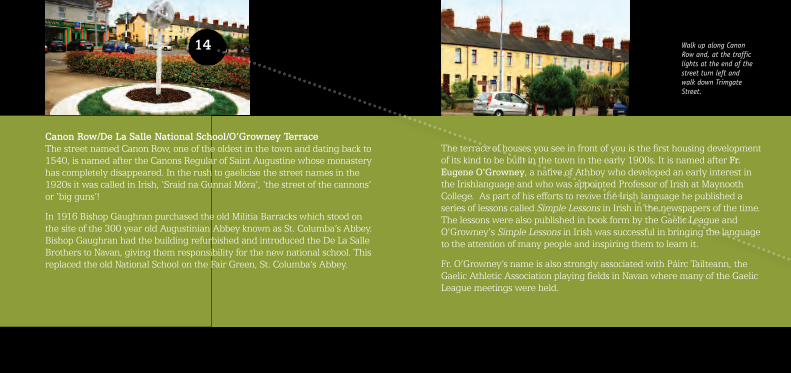
14 Walk up along CanonRow and, at the trafficlights at the end of thestreet turn left andwalk down TrimgateStreet.
The terrace of houses you see in front of you is the first housing developmentof its kind to be built in the town in the early 1900s. It is named after Fr.Eugene O'Growney, a native of Athboy who developed an early interest inthe Irishlanguage and who was appointed Professor of Irish at MaynoothCollege. As part of his efforts to revive the Irish language he published aseries of lessons called Simple Lessons in Irish in the newspapers of the time.The lessons were also published in book form by the Gaelic League andO'Growney's Simple Lessons in Irish was successful in bringing the languageto the attention of many people and inspiring them to learn it.
Fr. O’Growney’s name is also strongly associated with Páirc Tailteann, theGaelic Athletic Association playing fields in Navan where many of the GaelicLeague meetings were held.
Canon Row/De La Salle National School/O’Growney TerraceThe street named Canon Row, one of the oldest in the town and dating back to1540, is named after the Canons Regular of Saint Augustine whose monasteryhas completely disappeared. In the rush to gaelicise the street names in the1920s it was called in Irish, ‘Sraid na Gunnaí Móra’, ‘the street of the cannons’or ‘big guns’!
In 1916 Bishop Gaughran purchased the old Militia Barracks which stood onthe site of the 300 year old Augustinian Abbey known as St. Columba’s Abbey.Bishop Gaughran had the building refurbished and introduced the De La SalleBrothers to Navan, giving them responsibility for the new national school. Thisreplaced the old National School on the Fair Green, St. Columba’s Abbey.

Trimgate Street has been the town’s main street since the Middle Ages. Asyou walk down Trimgate Street, you will notice a stone plaque on the wallof the pub across the street, next to the Community Centre. The plaquecommemorates the widening of one of the town gates, the Trim Gate in1795, which was financed by John Fay, a wealthy Catholic miller. OnTrimgate Street you can see some of the few narrow medieval alleywaysto have survived.

15
Chapel YardWhen you turn into the Chapel Yard, the first thing you will see isa stone crucifix chiselled by a local stonemason named ThomasCurry which was presented to St. Mary’s Church in the mid 19th century. On one side of the cross is a figure of the Crucifixion, and on the other is a Stabat Mater which depicts the mother of Jesus at the foot of the cross.

St. Mary’s Roman Catholic ChurchSt. Mary’s Roman Catholic Church was built between 1830 -1839 under thedirection of Fr. Eugene O’Reilly. His long association with Navan, beginningas curate in 1797, founder and president of St. Finian’s School for Boys in1802 and parish priest from 1827-1852, makes him one of the founders ofthe modern town. To ensure good acoustics at mass, the church was modeledon the Cercle Metropolitan of Paris. Inside, some interesting features includea bust of Fr. O’Reilly to the left of the altar, and paintings of the fourEvangelists above the altar, commissioned in 1950 from the artist RichardKing. The crucifix over the altar was created by Edward Smith, the leadingsculptor of the day. It was commissioned by the parishioners of the originalchurch which stood on this site, as a public statement that the dark PenalDays were over. This is the only religious piece in wood by Edward Smith tohave survived.
Continuing through the churchyard, you will see to your right St. Anne’sPrimary School, established in 1831 by the Loreto Nuns as the first freeschool for girls in Navan. Across the street from the churchyard is the FairGreen where the weekly Navan fair was held on Mondays. Now a markettakes place on Fridays where you can buy everything from carpets to potatoes.
You have walked through hundreds of years of Navan history and come fullcircle. Now, take some time to explore the town further, ramble back downTrimgate Street, take the weight off your feet and have a deserving cup ofcoffee, or take in some shopping in the many delightful shops Navan has tooffer.
Whatever you decide to do, enjoy your visit to Navan, Ireland’s floral town.

NavanSolstice Arts CentreTourist Information and Arts CentreRailway Street, Navan, Co. MeathTel +353 (0) 46 909 [email protected]
TrimTrim Visitor CentreTourist Office & Coffee ShopTown Hall, Castle Street, Trim, Co. MeathTel +353 (0) 46 943 [email protected]
KellsKells Tourist Information PointKells Civic Offices, Headfort Place, Kells, Co. Meath(opposite the Church and beside the Headfort Arms Hotel)Tel+353 (0) 46 [email protected]
Brú Na Bóinne (Newgrange)Brú Na Bóinne Visitor CentreDonore, Co. MeathTel +353 (0) 41 988 [email protected]
Oldcastle Kraft Kaffee and Tourist Point1 Ardfrail Court, Millbrook Road, Oldcastle, Co. MeathTel +353 (0) 49 8542645
Our Tourist Information Centres can also provide customised itineraries of County Meath to suit yourinterests, provide information on entertainment andleisure activities and reserve accommodation at approved facilities throughout Ireland.