Embed Size (px)
Citation preview

Module 3:
Aquifer characterization for groundwater management
MODULE 3
Expensive process

Groundwater…the “invisible” resource
A resource, stored in underground reservoir (rocks) and transmitted through interconnected spaces
Aquifers have huge differences with respect to their hydrogeological setting.
GW management based on a good understanding of aquifer system.

Facts
All rocks cannot contain water: It depends on the degree of weathering and fracturing (porosity and permeability)
Rocks can be classified as water bearing (Aquifers and aquitards) and non-water bearing (Aquiclude and aquifuges)

Aquifers
AQUIFER - geologic formation that stores a large volume of groundwater and allows it to drain to streams, springs, or wells at rates that humans consider useful
1. Unconfined aquifer – upper boundary of saturated zone is a water table atmospheric pressure and connected directly to the atmosphere
2. Confined aquifer – bounded on its upper surface by an aquiclude, which precludes direct recharge from the overlying land surface, but only from some remote ‘upstream’ zone of the surface
4

Aquitard: geological materials with low porosity and permeability
Aquiclude: Extremely low effective porosity and permeability
Aquifuge: blind rocks
Aquifer Aquitard Aquiclude Aquifuge

Aquifers main functions
Storage capacity (storage coefficient or specific yield)
Transfer capacity (transmissivity)
Physical and chemical interaction capacity (reservoir-rock vs GW)

Hydrogeological diversity
Unconsolidated rocks:
• Pore spaces
• Large storage
Consolidated rocks:
• Fractures
• Small storage
Consolidated rocks:
• Karsts (enlarged
fractures)
• Large storage

Hardrock Hydrogeology
Hydraulic Conductivity of bedrock is controlled by:
Size of fracture openings
Spacing of fractures
Interconnectedness of fractures

Different hydrogeological environments

Can rocks hold water? YES
Solid rock may look like it is
solid, but, it actually has tiny
holes or spaces between its
cemented grains.
This is called Pore space
Porosity - The percentage of a material’s
volume that is pore space.
Interstitial Porosity

Permeability
Can rocks transmit Water? yes
If a rock has pore space,
water can pass through.
This is referred to as
permeability. It is a function
of the sizes of particles,
pores, and the way they are
arranged

Groundwater flow
GW in continuous slow movement from recharge areas (usually upland areas) discharge areas (springs, baseflow, wetlands and coastal zones)

Recharge rate quantification
Recharge area vs land-use (GW protection)
Interactions (quantity/ quality) with surface water bodies
Impacts of GW pumping
Critical issues of GW characterization
Aquifer system water balance:
• to check our understanding
Modelling approach:
• to predict implication of impacts

Groundwater cannot be readily observed;
GW may occur in large, and complex aquifer systems;
Aquifers have high spatial variability of its characteristics.
Difficulties and uncertainties
(MacDonald et al., 2012)

Problems in Africa
• Lack of available groundwater
information
• Good Quality Database and data
sharing
• Lack of groundwater professionals on
permanent basis: Hydrogeologists
• Variation in Natural groundwater
quality is a problem (e.g. high salinity
in the coastal parts, AMD, nitrate,
fluoride, arsenic etc..
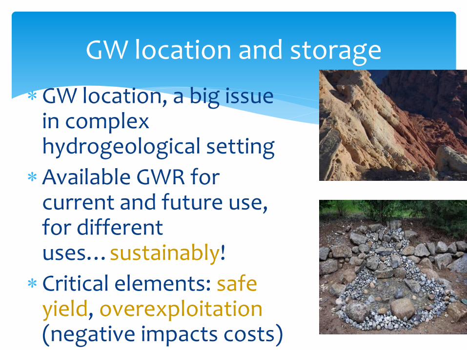
GW location, a big issue in complexhydrogeological setting
Available GWR for current and future use, for differentuses…sustainably!
Critical elements: safeyield, overexploitation(negative impacts costs)
GW location and storage
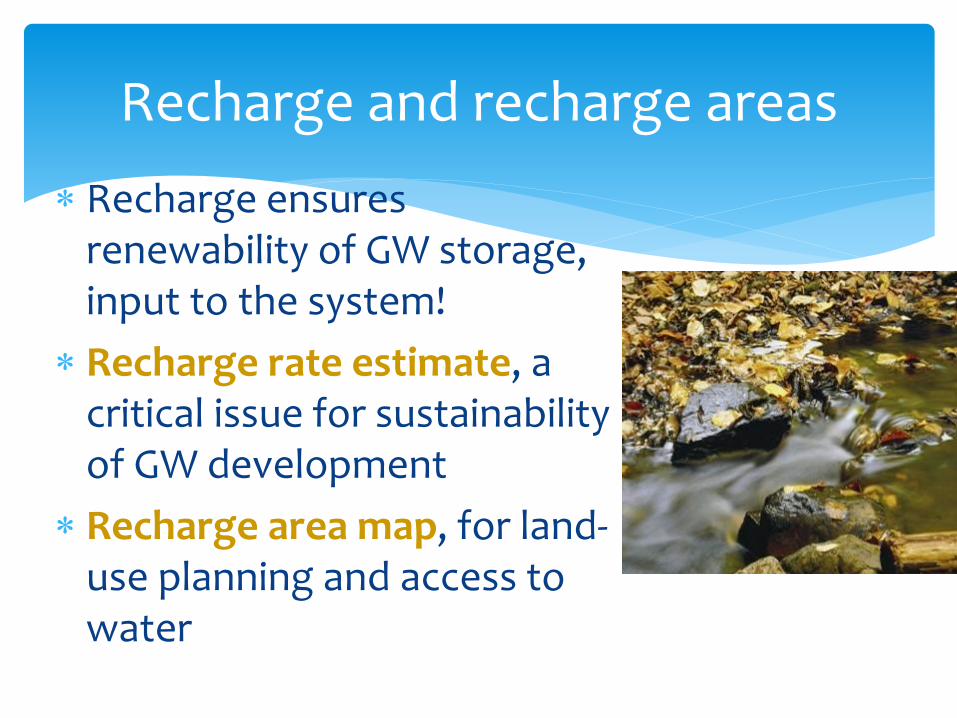
Recharge ensuresrenewability of GW storage, input to the system!
Recharge rate estimate, a critical issue for sustainabilityof GW development
Recharge area map, for land-use planning and access to water
Recharge and recharge areas
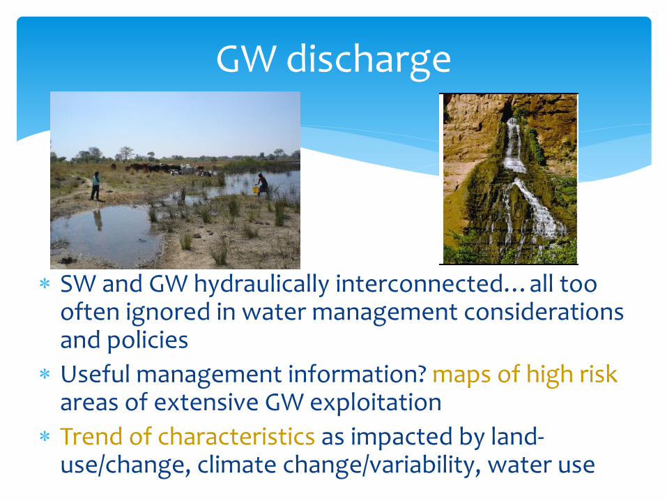
SW and GW hydraulically interconnected…all too often ignored in water management considerations and policies
Useful management information? maps of high riskareas of extensive GW exploitation
Trend of characteristics as impacted by land-use/change, climate change/variability, water use
GW discharge

GW connection with surface water: through aquifers

Pressure on
groundwater
development
• Rapidly increasing demand for urban water-supply provision
• Expansion of groundwater use for irrigation.
• Water provision for dispersed rural communities.

GW: Intensive irrigation • Abstraction that exceeds
groundwater recharge can lead to declining water‐tables and possible salinization or even land subsidence.
• Fertilizers and pesticides application: degrade groundwater quality
Food security is achieved
but groundwater quality/quantity
could be compromised.

Hydrogeological parameters: Hydraulic conductivity/permeability, Porosity, Storativity/ Storage coefficients
Degree of weathering, Degree of fracturing
Aquifer thickness, Aquifer extent
Borehole or aquifer Yield
Hydrogeochemical/isotopic variables
Some variables to be compiled
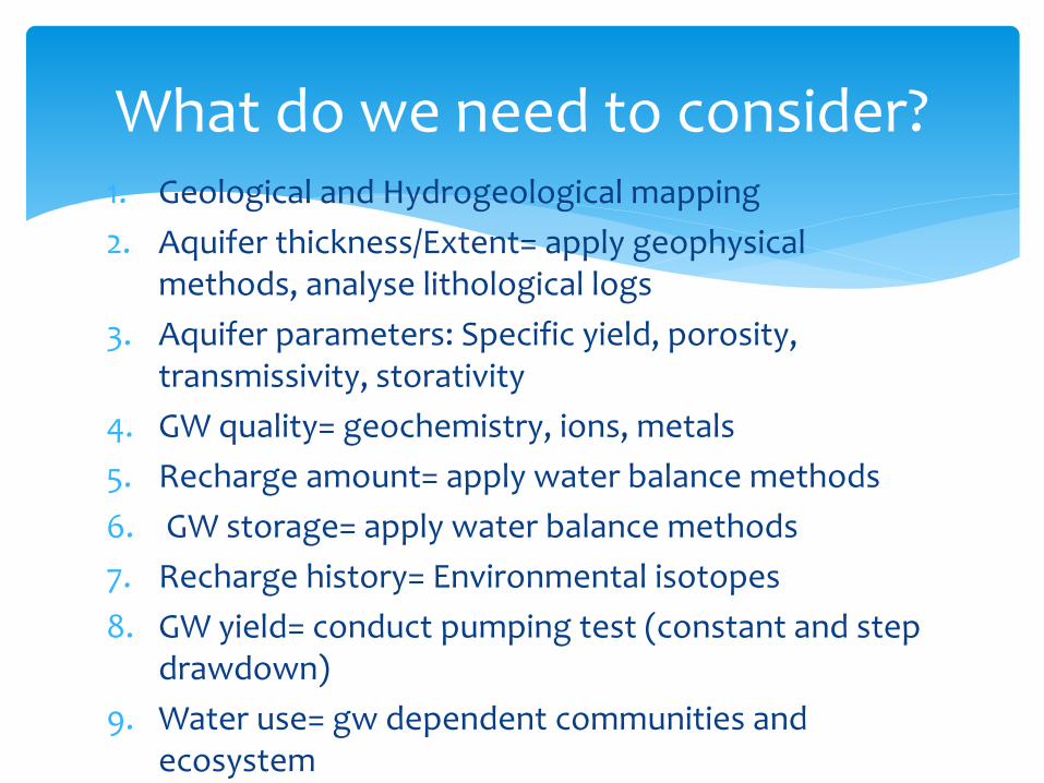
1. Geological and Hydrogeological mapping
2. Aquifer thickness/Extent= apply geophysical methods, analyse lithological logs
3. Aquifer parameters: Specific yield, porosity, transmissivity, storativity
4. GW quality= geochemistry, ions, metals
5. Recharge amount= apply water balance methods
6. GW storage= apply water balance methods
7. Recharge history= Environmental isotopes
8. GW yield= conduct pumping test (constant and step drawdown)
9. Water use= gw dependent communities and ecosystem
What do we need to consider?

Groundwater
Other stakeholders Policy level
Understanding of GW system
Information on unit system
Knowledge on aquifer properties, and
Technical solutions
Demand side
Water provision and
management
Policies
Strategies
Regulatory framework
The needed interaction to providesuitable GWR information
Sustainable development
GW protection

Operation & Maintenance of water
points: PART OF MANAGEMENT
O&M dictates groundwater supply, hence, controlling ‘water security”
Water sector corruption
is extravagant in Africa
that affects O & M.
Policy perspective
A thorough understanding of aquifers, storage and groundwater quality, management could help to maintain water security during the most stressful period of climate change.
• Balancing the demand through decentralized use of groundwater and localized augmentation by runoff/treated wastewater and runoff
:Managed aquifer recharge
• Should groundwater be developed widely, effective governance will become increasingly important.

Management aspect
• Develop detailed national scale groundwater availability maps and reports
• Develop groundwater monitoring program: Abstraction, recharge, quality
• Develop strategy on the groundwater use based on the demand.
• Introduce water demand management techniques to minimise loss

Thank You!


![148: Aquifer Characterization by Geophysical …AQUIFER CHARACTERIZATION BY GEOPHYSICAL METHODS 2267 0 0.2 0.4 0.6 0.8 1 S 2600 2400 2200 2000 1800 1600 1400 v [m s − 1] P-wave S-wave](https://img.dokumen.tips/doc/110x75/5f0ff5337e708231d446bb5a/148-aquifer-characterization-by-geophysical-aquifer-characterization-by-geophysical.jpg)


