Embed Size (px)
Citation preview

DRAFT
MEMORANDUM State of Alaska
TO: Niblack LMPT
DATE: September 15, 2006
FROM: Bob Tsigonis, Large Mine Coordinator
SUBJECT: Niblack meeting & site visit, August 24, 2006
Attendees from the State of Alaska LMPT: Bob Tsigonis, OPMP Rick Fredericksen, ML&W Steve McGroarty, ML&W Andrea Meyer, OPMP Kenwyn George, ADEC-AWQ Ed Emswiler, ADEC-SW
Attendees from Niblack Mining Corporation: Paddy Nicol, President Darwin Green, VP Exploration Frazier Adams Rick Richins, Consultant
At a meeting in Ketchikan at the Cape Fox Lodge on the morning of August 24, 2006, Paddy Nicol and Darwin Green provided historic information on the Niblack property, results of exploratory drilling, and a presentation on Niblack Mining Company’s (NMC) plans for underground exploration of the deposit. After lunch, all (except Frazier Adams) flew via two Beaver floatplanes out to Niblack and inspected the proposed development area on foot. This trip report summarizes the observations and understandings of the Niblack LMPT based on this meeting and site inspection.
1. General understanding of the project: a. Water problems in the historic Niblack Mine hampered mining in 1908. b. Full permits for an underground exploration program, similar to the currently
proposed plan, were granted in 1998. c. Five or six massive sulfide zones have thus far been identified on the claim
block. d. Cook Inlet Corporation has a 15 percent net profits interest in the property. e. Niblack is using ALS Chemex for assays. f. A temporary tidelands permit is being processed by ADNR ML&W.
2. The access road to the proposed powder magazine location has been deleted and the
powder magazine has been shifted to a location behind the rock quarry where a natural topographic feature provides appropriate safety.
3. A material site (quarry) has been added to the project to develop construction rock for
the project. 4. The surface exploration drill holes completed to date have not resulted in any artesian
holes. The rock is tight and drilling is good. The ground does not make water.

Memorandum September 15, 2006 DRAFT VERSION Page 2 of 20
DRAFT
5. Carbonate mineralogy: a. The core logging database only contains 18 records of observation of ankerite or
Fe-carbonate vs. 1428 records of observation of calcite or carbonate. b. Proximal to the massive sulfide zones, the carbonate is locally Mn rich. c. Up to 20 percent of the rocks in the Lookout formation are highly neutralizing
dikes.
6. There are 10 or more historic adits on the property. Several of these adits are located in the Lookout Formation and contain standing water.
7. The Operational Waste Rock Characterization Plan is being developed by Knight
Piesold and reviewed by SRK.
8. The barge camp and the barge used to store drilling equipment and as a helicopter landing pad appeared neat and orderly. The barge camp has all necessary permits including an ADEC wastewater discharge permit and drinking water plan approval.
9. The “burn-barrel” for the burnable camp wastes appears to be well operated in that
bears and other animals are not attracted to the burned portion of the waste. In this operation, food waste is not burned. A fire is made with wood and an efficient operating temperature is reached before incorporating waste to be burned. Metals from the burned remains are sorted and recycled. Only ash is disposed. A general permit from the ADEC Solid Waste Program is required for this operation.
10. Drill core for Hole LO-189 contained a fracture zone with oxidized sulfides at a depth
of approximately 1000 feet. This suggests the flow of oxygenated surface waters.
11. Eight-year old drill core shows evidence of the oxidation of sulfide mineralization.
12. The core we saw appeared to have a fairly high RQD (“Rock Quality Designation”) which suggests fairly competent rock that might have relatively low permeability except in fracture zones.
13. The Blue Belle Fault Zone did not appear to contain sulfides in the core that we
examined.
14. A traverse from the core shed area to the start of the access road crossed several small creeks. At one of these there was an outcrop of the Lookout Rhyolite Lithologic Unit. The rocks contained disseminated sulfides and showed evidence of oxidation.
15. Access Road:
a. Road construction is being done under the COE Nationwide Permit 14. b. Tree cutting and surface disturbance has been kept to a minimum. c. There is a well defined ditch on the up-slope side of the road. d. The company has installed culverts at appropriate locations to transfer water
down-slope.
Memorandum September 15, 2006 DRAFT VERSION Page 3 of 20
DRAFT
e. Standard silt-fences have been installed below the road where culverts are located. Some of the silt-fences need to have the sediment removed.
f. Deep “sediment traps” have been excavated in the drainage ditch at the up-slope end of most culverts. Some of these need to be cleaned out.
g. The road is being constructed with an excavator and cut-fill methodology. h. The “A-Horizon” of soil ranges from 8” to 24” and contains a significant
percentage of cobble and larger sized rock. Given the steepness of the topography, topsoil salvage would be challenging.
i. To date, no topsoil has been salvaged. It is important for NMC to salvage topsoil from the larger areas that remain to be disturbed, if it is reasonably practicable and safe for the equipment operators to do so.
j. Examination of the rock from the construction rock quarry indicated minimal sulfides. We suggested that some representative samples be run for ABA so that the company has a record of the character of the rock utilized on the road.
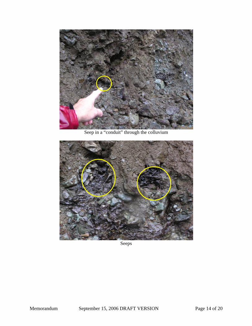
16. Road cuts exposed a mixture of rubble or talus mixed with fine grained materials. At
places, surface water flows dissappear underground and reemerge some distance down the slope. There does not appear to be a clearly defined shallow groundwater system on the steeper slope and the shallow sub-surface flows appear to be highly chanelized into “conduits” of groundwater flow through well-washed rocks. This groundwater regime may make the establishment of groundwater monitoring locations challenging.
17. The proposed portal has been raised to a higher elevation in order to reduce the
volume of AG material that will be excavated from the exploration adit. The new location puts the adit predominantly in the Hanging Wall Unit (NAG), however rock from the first blast round will be from the Lookout Unit (AG). Since this rock is at the surface and is probably weathered, it may be oxidized (and therefore NAG), but plans must be in place before the first blast to characteize this rock and handle it appropriately.
18. Because the portal will be at a higher elevation, the grade of the adit will be less than
the originally proposed 6 percent incline. 19. The estimated time for the project is two years, comprised of six to eight months of
adit excavation, six to eight months of drilling, then reclamation. 20. Most of the AG material is expected to come from near the end of the adit during the
final phase of construction. a. In order to submerge the AG rock post-closure, the adit may be changed from an
incline to a decline for the last section. A plug could be installed at the top of the incline/decline near the last section to seal off the underground AG rock disposal area.
b. It is expected that the bulk of the AG material will be put on the AG storage site late in the project.

Memorandum September 15, 2006 DRAFT VERSION Page 4 of 20
DRAFT
c. The AG storage/disposal site must meet the requirements of Title 18, Chapter 60 of the Alaska Administrative Code (18 AAC 60.410(a)), which prohibits a monofill from being constructed on slopes greater than 10 percent grade or on unstable soils that might cause the waste to slide or settle excessively. Under 18 AAC 60.410(c) a monofill must be designed to protect its integrity from damage caused by natural events that could be reasonably anticipated to occur at the facility such as floods, earthquakes and the effects of freezing and thawing.
d. A geosynthetic liner will be placed under the AG site. Rain/seepage water will flow by gravity (preferred) or be pumped to the treatment facility.
e. The reclamation bond will cover the cost of putting AG rock underground and installing a water tight adit plug. This may not be necessary if this becomes a working mine.
21. The AG waste storage/disposal facility will be required to meet specific requirements
in 18 AAC 60, from which a bulleted list of application materials will be sent to Niblack Mining Company to communicate the items that must be provided prior to authorization and construction.
22. As currently proposed, the runoff/seepage water treatment system consists of two ponds with a rock berm between them (to allow filtration of treated water) followed by discharge to a constructed wetlands. There will be flocculation and settling of particles and pH adjustment in the first pond. These ponds must be constructed to standards set in 18 AAC 60.225(b)(2) that requires the construction and maintenance of a control system capable of containing and controlling the run-off from a 24-hour, 25-year storm event. The present proposal is for WQ standards to be met at the discharge point to the constructed wetlands.
23. The constructed wetlands is designed to have no surface discharge, but to act as an infiltration area.

Memorandum September 15, 2006 DRAFT VERSION Page 5 of 20
LMPT Photos from the Niblack Inspection on August 24, 2006
Landing near barge camp
Barge camp

Memorandum September 15, 2006 DRAFT VERSION Page 6 of 20
“The portal will be up there.”
(Use your imagination)
Scrap metal recycling bin and double-walled fuel tanks
(Helicopter is parked behind photographer)

Memorandum September 15, 2006 DRAFT VERSION Page 7 of 20
Walkway from barge
Walkway from shore

Memorandum September 15, 2006 DRAFT VERSION Page 8 of 20
Barge camp at temporary location
Incinerator (burn barrel) with secondary containment/fire safety tank

Memorandum September 15, 2006 DRAFT VERSION Page 9 of 20
Graveled trail from the barge to the old camp area
Core set out for our examination
(Core is stored under cover as behind)

Memorandum September 15, 2006 DRAFT VERSION Page 10 of 20
Boarded-up decline from the early 1900s
New barge landing (very inconspicuous)

Memorandum September 15, 2006 DRAFT VERSION Page 11 of 20
New barge landing
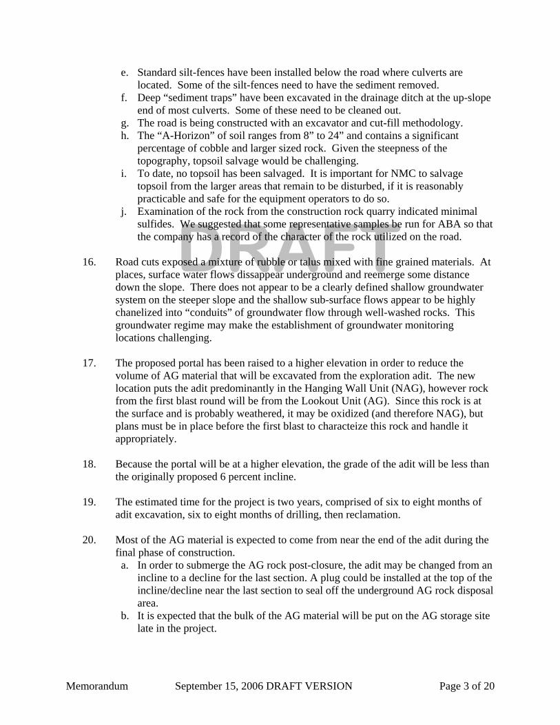
Road from new barge landing
Memorandum September 15, 2006 DRAFT VERSION Page 12 of 20
Road from new barge landing
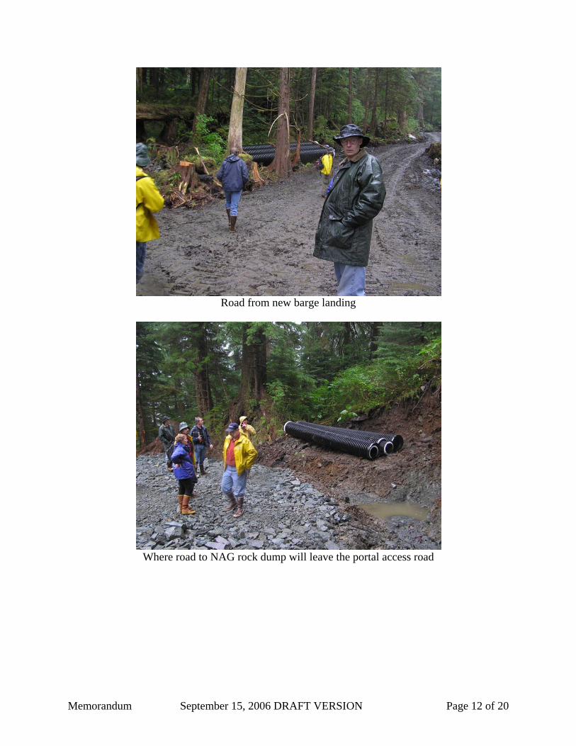
Where road to NAG rock dump will leave the portal access road

Memorandum September 15, 2006 DRAFT VERSION Page 13 of 20
Road not yet graveled
Road to quarry, magazine, and AG rock storage
Memorandum September 15, 2006 DRAFT VERSION Page 14 of 20
Seep in a “conduit” through the colluvium
Seeps

Memorandum September 15, 2006 DRAFT VERSION Page 15 of 20
Close up of a seep
Sediment trap along road

Memorandum September 15, 2006 DRAFT VERSION Page 16 of 20
Sediment trap along road
New location of proposed portal

Memorandum September 15, 2006 DRAFT VERSION Page 17 of 20
Bridge across Camp Creek
Bridge across Camp Creek

Memorandum September 15, 2006 DRAFT VERSION Page 18 of 20
Discussion along road near proposed water treatment pond location
Culvert along road to quarry

Memorandum September 15, 2006 DRAFT VERSION Page 19 of 20
Quarry
Proposed location of AG rock storage pile as viewed from quarry

Memorandum September 15, 2006 DRAFT VERSION Page 20 of 20
Trench between quarry and area of proposed AG rock storage pile
Evidence of rapid regrowth in a disturbed area near proposed AG rock pile