Embed Size (px)
Citation preview

Manila Third Sewerage Project
Henry Manguerra
GEF-MTSP Consultant
August 3-4, 2011

Introduction Watershed/Water Quality Modeling 101 Chesapeake Bay TMDL – A Complex Modeling
Example GIS for Modeling EPA SWMM5 Theory and Hands-On Tutorial Hypothetical SWMM Application in San Juan
River Watershed Summary and Next Steps Optional Module: MapWindow Hands-On
Exercises

Manila Third Sewerage Project
IntroductionHenry Manguerra
GEF-MTSP Consultant
August 3-4, 2011
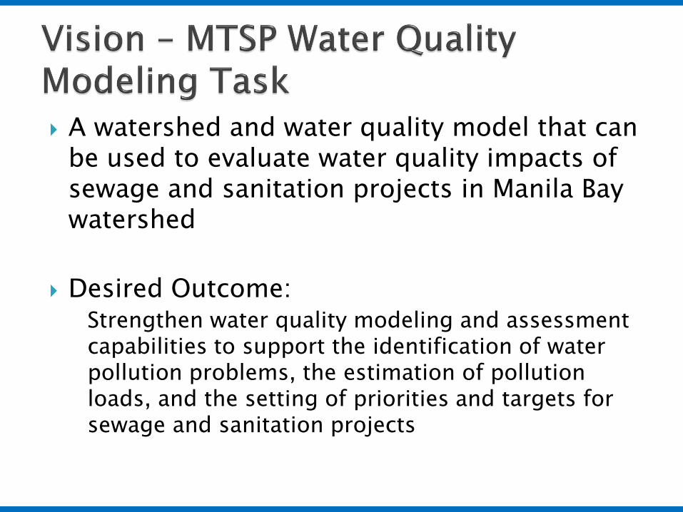
A watershed and water quality model that can be used to evaluate water quality impacts of sewage and sanitation projects in Manila Bay watershed
Desired Outcome:Strengthen water quality modeling and assessment capabilities to support the identification of water pollution problems, the estimation of pollution loads, and the setting of priorities and targets for sewage and sanitation projects

Use the model to assist in identifying strategic and effective environmental projects for the restoration and protection of water quality of Manila Bay and its tributaries within the National Capital Region.
Master Plan
Factors:Pollution control effectivenessFinancial/economic feasibilitySocial impactsEnvironmental impactsInstitutional drivers and capacity
Master PlanRevisionUnder MTSP
Water Quality Modeling

17 LGUsCaloocanLas PinasMakatiMalabonMandaluyongManilaMarikinaMuntinlupaNavotasParanaquePasayPasigPaterosQuezon CitySan JuanTaguigValenzuela
Main Receiving WaterBodiesPasig RiverMarikina RiverSan Juan RiverNMTT RiverParanaqueLaguna de Bay
MWSS Service AreaMWSIMWCI

◦ Selected and approved the EPA SWMM Model for San Juan WQMA
◦ Formed the Modeling Workgroup
◦ EPA SWMM Model Training
◦ EPA SWMM Model Application Workshop

To understand capabilities of the SWMM model and its potential applications for the protection and restoration of Manila Bay watershed
To gain operational familiarity of the model through hands-on exercises supplemented by its theoretical underpinnings as needed
To become familiar with selected data processing/GIS technologies to support watershed/water quality modeling using SWMM model

Decision makers, and program/project managers involved in the restoration/ protection of the Manila Bay watershed
Technical managers/specialists, modelers, data and GIS specialists

Monitor water quality
Assess against water quality standards to
determine if waterbodyis Impaired or not
Implement Plan
If impaired, determine allowable maximum pollutant load and
required load reduction
Plan what S&S Investments and management measures will collectively meet load
reduction requirement
Continuous Adaptive Management ProcessWQ
Monitoring Program
WQ Standards Program
TMDL Program
NPDES Permitting, Compliance
and Enforcement
and NPS Programs
Model Model

Jumpstarting the process
Monitor water quality
Assess against water quality standards to
determine if waterbodyis Impaired or not
Implement Plan
If impaired, determine allowable maximum pollutant load and
required load reduction
Plan what S&S Investments and management measures will collectively meet load
reduction requirement50 Percent BOD Load Reduction
Model Model

Pollutant Loads fromthe Bay Watershed
Water Quality Impacts atthe Bay/Lake and Tributaries
Management Decisions on Investments and Other MeasuresTo Reduce Pollution Loads and Meet Water Quality Standards
Integrated Suite of Models = Watershed Model + Receiving Bay/Lake Model

• Land and in-stream processes• Rainfall – runoff process• Nonpoint and point pollutant
sources
In-stream processes only Flow time series user input Pollutant sources are represented
as direct discharges to the stream

• EPA SWMM• EPA HSPF• USDA SWAT• DHI Mike-BASIN• DHI Mike-Urban
DELTARES DELFT3D DHI MIKE11 EPA WASP

WASP (Marikina River)
DELFT3D (Laguna Lake)
MIKE11 (Pasig River)

Consistent with the paradigm of protecting and restoring waters using the watershed approach
Provides the capability to simulate important land-based processes◦ Rainfall – runoff◦ Pollutant fate and transport of nonpoint (diffused) sources
during wet-weather
Provides hydrologic and pollutant load input to receiving water models (including to its internal in-stream module)
Serves as a framework for a holistic and watershed-wide assessment of what-if management scenarios including land-based measures
Allows better integration with GIS technology◦ Take advantage of watershed delineation and
characterization tools

• Watershed Model (Urban)• Rainfall-Runoff Process• Nonpoint Sources (Watershed)• Point Sources (Direct Discharge)• Steady, Kinematic, Dynamic• Event-Based, Continuous


• The watershed model expands Agency’s modeling capacity and flexibility
• use the most appropriate model for the given situation• use an integrated model by linking watershed model with receiving water model
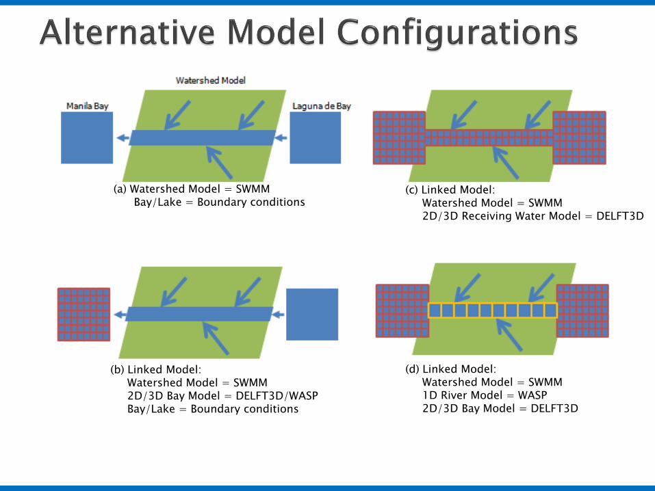
(a) Watershed Model = SWMMBay/Lake = Boundary conditions
(c) Linked Model:Watershed Model = SWMM2D/3D Receiving Water Model = DELFT3D
(d) Linked Model:Watershed Model = SWMM1D River Model = WASP2D/3D Bay Model = DELFT3D
(b) Linked Model:Watershed Model = SWMM2D/3D Bay Model = DELFT3D/WASPBay/Lake = Boundary conditions

• For the purposes of MTSP, configuration (a) is sufficient to evaluate pollutant loads and load reductions associated with S&S investments
• Configurations (b), (c), (d) allow evaluation of water quality impacts in the Bay What is the impact of 50% reduction
in BOD load?
Will result to 50%reduction in BOD load
to the waterquality in the bay
What S&S investments?
• Note that configuration (a) also allows the evaluation of water quality impacts in 1-D receiving waters (e.g., Pasig river)