Embed Size (px)
Citation preview

Maitland River Flood History June 23, 2017
February 27, 2018
Public Presentation


Welcome
• Town of Minto, County of Wellington, Maitland Valley
Conservation Authority, OPP, Guelph Wellington
Health Unit and others here tonight
• Town background leading up to event(s)
• Maitland detail regarding watershed and weather
conditions
• Minto Fire and Wellington County local and overall
response and EOC operation
• Wrap up and break out for questions

Clifford Mount Forest
Saugeen River Watershed
Maitland River Watershed


12+ Floods in 100 Years
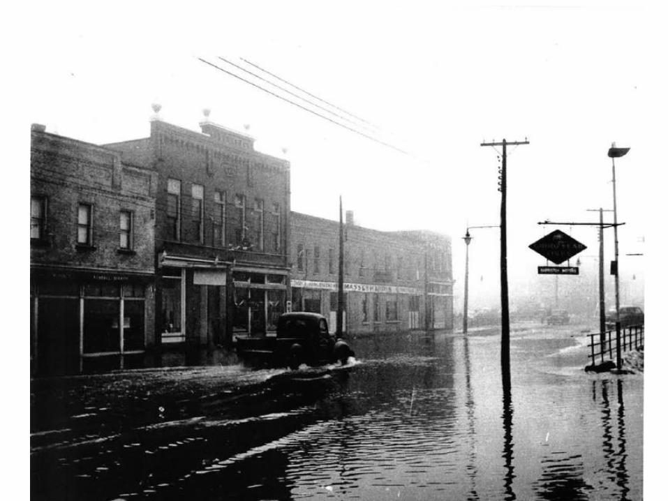
• Harriston flood history back to mid 1800’s plus:
– March 1913 bridge threatened; damage mills and stores
– March 1914 severe flood; streets and mills flooded
– March 1929 severe flood “One of the worst floods”
– April 1929 severe flood streets, homes, factories, stores
– February 1932 heavy flood streets and stores
– May 1943 heavy flood damage to dams and bridges
– 1948 flooding to Post office on Elora Street
– 1974 some flooding including trailer park
– 1975 and 1977 substantial flooding
– Early 1980’s, mid 1990’s some level of flooding
– 2008 flooding King & Young; north ward

Peak Flows 1981-2017
Median Peak Flow 33.1 cu. metres/second
Highest Previous Peak Flows +57 cu. metres/second
Peak Flow 78 cu. metres/second


1975 – Looking North from Elora St. Bridge

1977 – Looking North from Elora St. bridge

1977 –Trailer park

1975? – Young St. Bridge Before Arena


Studies 1975, 1985, 1986

1975 Dillion Engineering
Arena Senior School
Trailers
Old Post
King St N
• Hurricane Hazel flood lines
most of downtown
• 6 times high flow at Arthur &
John Street, Young St.
• 25 yr 73 homes $371,789
• Regional (<100 yr) 213
homes $1.3 million
• Solutions to reduce loss:
• Dikes (in Town, Legion)
• Bridge (Young, Elora, Arthur)
• Diversion Dam & Channel
(Faulkner Farm) $1.7 million
• Reservoirs at Melgund (8th
Line) & Glenlee (4th/6th Line)
too far from Harriston?

1985 Flood Damage Reduction
• Cost benefit of 5 options
• Re-calculate” flood lines
• “Complex” flow patterns
• Reduce flood plain with new flows
• Solutions Elora St Bridge, channelize, dikes &
combinations thereof; & work re: Elora Street conduit.
• Preferred solution “100% protection to the 500 year
flood” estimated $1.3 million with Town share 10%.
• Rip rap channel begin north west of Arthur St & John
St and finish up stream of the Harriston Arena
• “Urbanized” river ie. Town like Paisley

1986 Flood Control Works
• Economic viability of “preferred option” - Rip rap channel north
west of Arthur St & John St to up stream of Harriston Arena
• Elora St Bridge 1:11 yr capacity and less at Young St.
• expand recommended work includes lower river bed 0.6 to 0.9 m,
reconstruction Young, Queen & King Streets & upgrading Young St
Bridge, and restructuring Elora St. conduit (Tannery Park)
• Public concerns business disrupted, private lawn space, driveway
around Leslie Ford etc.
• Project cost $3.128 million; Town’s share 10%; Conservation
Authority 66%; Ministry & private landowners 24%

Trends from Past Studies
• Flood mapping increasing accuracy increased 1975-86 but never re-done; Recommended new maps since 1986
• Incremental improvements: bridge repairs, no complete physical solution due to public and financial concern
• Focus on in Town dikes and diversion river north of and through Faulkner Farm; upstream reservoir ruled out
• No talk of downstream solutions or North Ward Drain
• Province & Conservation Authority funding not available
• Incremental improvements helped, but property value continues to grow and so does cost of solutions (ie. Drop the river 2-3 feet?)

Between 2008 & June 23/17
• March 2011 Town approves trailer park removal program (14 sites)
• Oct 2011 receive Triton Engineering Report North Ward Drain
• Oct 2012 public open house Harriston Senior School purchase
• Sept 2013 comprehensive staff report looking at major studies to
date and starting process to update flood maps
• Nov 2014 Council hears work plan ready for new flood maps,
$21,000 new flood monitors MVCA, assess CR 87 bridge upgrade
• June 2015 MVCA updates rural hazard maps; staff update Council
that Province Wide mapping (SWOOP) due in March 2016
• 2016 Triton surveys Harriston cross sections in floodplain to tie into
SWOOP mapping; MVCA applies model and determines SWOOP
maps inadequate for urban flood maps; 2 trailers remain

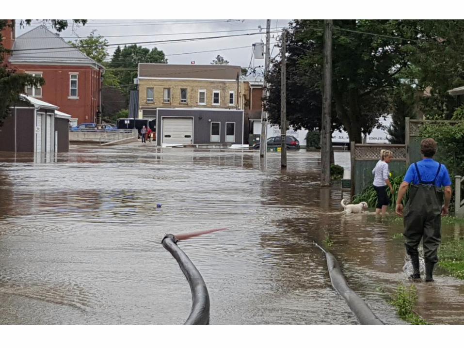
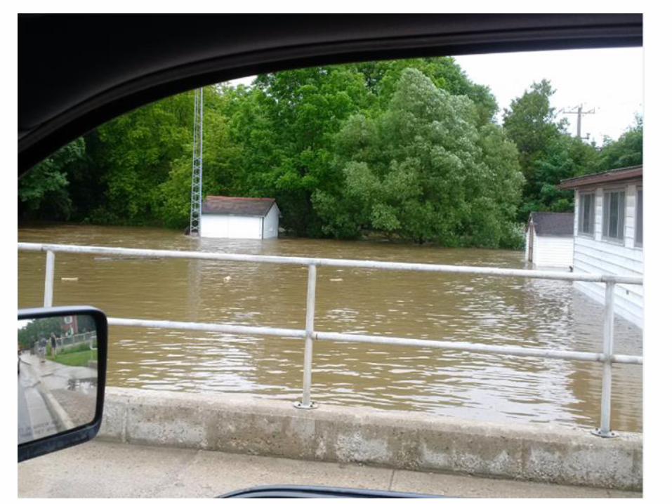
June 23, 2017 Storm
• Rain began after 9pm June 22 with 40mm by midnight plus 20mm more before 4:00am
• Weather network ticker 35mm in one hour Mount Forest shortly after midnight
• Public Works to SCADA alarms in all urban areas
• Between 4:00am and 6:00am 95mm of rain
• Total 170mm (“7 inches in 7 hours”), but more than half that in 2 hours between 4:00am and 6:00am
• Initial storm sewer back up floods roads then recedes
• River rises and is over the banks by 9:00am
• Peaks at around 6:00pm; Boil Water Advisory

12:30am
H

4:30am
H

H
6:15am

Response
• Water receded to within the floodway by Saturday morning June 24; all roads open Saturday afternoon
• Seven EOC meetings over three days; 11 media releases; 9 in three days
• Minto Fire coordinated response all three stations
• Increase in @TownofMinto and @MintoFire social media contacts; Mayor stopped tweeting very early
• Three formal media events; one at firehall (morning); one over phone (afternoon) and one on-site (evening)
• CAO 5:37am to 11:03pm 285+ electronic interactions and 420 Friday through Sunday


Feb. 20, 2018 Event
• Environment Canada Warnings combined snow melt & rain
• Feb 19: -4C @7am; Feb 20: 24 hours later +8C & +12C (25 -54F) when Council starts at 7:00pm = complete snow melt
• Weather Network: 40mm rain Feb 19-20
• Recorded Flow 50+ cubic metres/second (<2008 levels)
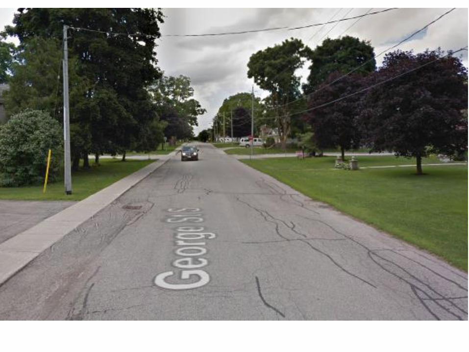
• Noon flooding George St. N. @ Maitland and later George St. S. @ William (North Ward Drain); 12th Line (run-off)
• Town pumps George @ William to divert North Ward Drain
• About 10:00pm flooding just tops Young & King
• 10 year event

North Ward Drain
• 1962 Municipal Drain; 60+ acres inlets west of William St. &
14+ acres another arm inlets at Maitland St.
• Pump in response; remedial work with adjacent farm; long term
diversion?


Since June 23, 2017
• Recovery , contractors, insurance, disaster relief
• July 26, 2017 formal after event debrief was held with discussion
and reporting on what went well and lessons learned
• Aug 1, 2017 Council receives drain update report noting impact of
flood, agrees to apply for Province for Flood Mapping, Mitigation
Planning analysis under National Disaster Mitigation Program
• Debrief notes included in County After Action Report received by
Council September 5, 2017
• Initial thoughts of Fall Public Meeting on flood reconsidered as
MVCA was working on flow evaluation, and in field recovery by
citizens still occupying considerable time

On-going efforts • County CEMC Linda Dickson and Treasurer Duff complete and
file NDMP with Federal Government; Provincial Municipal
Affairs confirms it supports November 3, 2017
• December 12 Council Operating Budget NDMP funding for
grant related work $66,000 of $132,000 project
• December 19, 2017 Drain update Council still pending
decision on NDMP grant and timing for public meeting
• January 25, 2018 MVCA staff, County and Town staff meet to
discuss grant and timing for public meeting
• February 20, 2018 flood update presentation to Council the
day of George Street; 12th Line; Young St flooding

On-going efforts • Town Disaster Relief Grant of $66,000 approved; the Town
adds $66,000 2018 budget; $132,000 work starting May 1
• LIDAR mapping has been flown; 3D maps (coffee cup)
• MVCA hydrology modelling using data collected from the June
23 flood by the expanded gauge program shows flows for
Regional Storm (Hurricane Hazel) will be less than that used
for the current floodplain maps
• Regional Storm flow for flood plain maps will be higher than
June 23, 2017 storm
• Summer = flood plain maps; fall = remedial work options
(upstream, in Harriston & downstream); apply NDRP again;
Nov/Dec public meeting?, Town budget & new NDRP funding

Suggestions…
• Summer/fall people encouraged to think about upstream,
in Harriston, downstream solutions
• Engineering analysis/report using new draft flood plain
mapping now that NDMP grant approved
• Early winter 2nd public meeting with new draft flood plain
mapping; options for upstream, in Harriston, downstream
solutions (engineers report available before meeting)
• New Floodplain mapping implementation:
1. Insert in planning documents (MVCA process)
2. Apply for remedial project NDMP (fall)

Thank you…