Embed Size (px)
Citation preview

Lower Colorado RiverDrop 2 Storage Reservoir ProjectImperial County, CaliforniaFinal Environmental Assessment
U.S. Department of the InteriorBureau of ReclamationYuma Area OfficeYuma, AZ June 2007

Mission Statements The mission of the Department of the Interior is to protect and provide access to our Nation’s natural and cultural heritage and honor our trust responsibilities to Indian Tribes and our commitments to island communities.
The mission of the Bureau of Reclamation is to manage, develop, and protect water and related resources in an environmentally and economically sound manner in the interest of the American public.

U.S. Department of the InteriorBureau of ReclamationYuma Area OfficeYuma, AZ June 2007
Prepared by:
Prepared for:
Science Applications International Corporation525 Anacapa StreetSanta Barbara, CA 93101
Lower Colorado RiverDrop 2 Storage Reservoir ProjectImperial County, California
Final Environmental Assessment

i
Table of Contents Executive Summary ................................................................................................................ ES-1
1.0 Purpose and Need ............................................................................................................ 1-1 1.1 Introduction ................................................................................................................. 1-1 1.2 Project Location .......................................................................................................... 1-2 1.3 Background ................................................................................................................. 1-4
1.3.1 Key Concepts Behind “Non-Storable” Water .................................................. 1-4 1.4 Purpose and Need for Proposed Action ...................................................................... 1-7 1.5 Public Involvement and Scoping Process ................................................................... 1-8 1.6 EA Organization .......................................................................................................... 1-8
2.0 Alternatives Including the Proposed Action ................................................................. 2-1 2.1 Description of the Proposed Action ............................................................................ 2-1
2.1.1 Physical and Operational Project Components ................................................... 2-1 2.1.1.1 Drop 2 Reservoir ....................................................................................... 2-1 2.1.1.2 Inlet and Outlet Canals .............................................................................. 2-2
2.1.2 Operations and Maintenance Activities .............................................................. 2-7 2.1.3 Construction ...................................................................................................... 2-7
2.1.3.1 Avoidance and Minimization of Environmental Impacts ...................... 2-11 2.1.4 Other Aspects of the Proposed Action ........................................................... 2-12
2.2 No-Action Alternative ............................................................................................... 2-12 2.3 Alternatives Considered but Eliminated .................................................................... 2-13
2.3.1 Storage Reservoir Near Drop 1 ...................................................................... 2-13 2.3.2 Senator Wash Dam Rehabilitation ................................................................. 2-14 2.3.3 Reservoir Size and Storage Capacity ............................................................. 2-15 2.3.4 Inlet Canal Alignment Options 1-4, 6-9 ......................................................... 2-16
2.4 Summary of Impacts ................................................................................................. 2-16
3.0 Affected Environment, Environmental Consequences, and Compensation Measures ........................................................................................................................... 3-1
3.1 Hydrology/Water Quality .......................................................................................... 3.1-1 3.1.1 Affected Environment .................................................................................... 3.1-1
3.1.1.1 Regulatory Environment ........................................................................ 3.1-1 3.1.1.2 Water Management ................................................................................ 3.1-2 3.1.1.3 Existing Flows ....................................................................................... 3.1-3 3.1.1.4 Flows within the Limitrophe .................................................................. 3.1-3

Table of Contents Drop 2 Storage Reservoir Project EA
ii
3.1.1.5 Groundwater in Limitrophe .................................................................... 3.1-4 3.1.1.6 Water Quality ......................................................................................... 3.1-4
3.1.2 Environmental Consequences and Compensation Measures............................ 3.1-9 3.1.2.1 Thresholds of Significance ..................................................................... 3.1-9 3.1.2.2 Methodology ......................................................................................... 3.1-9 3.1.2.3 Proposed Action ................................................................................... 3.1-10 3.1.2.4 No-Action Alternative .......................................................................... 3.1-26
3.2 Biological Resources ................................................................................................ 3.2-1 3.2.1 Affected Environment ................................................................................... 3.2-1
3.2.1.1 Vegetation and Wildlife Habitat ........................................................... 3.2-1 3.2.1.2 Common Wildlife Species .................................................................... 3.2-9 3.2.1.3 Aquatic Habitats and Biota ................................................................. 3.2-10 3.2.1.4 Sensitive Species ................................................................................. 3.2-11
3.2.2 Regulatory Setting ....................................................................................... 3.2-18 3.2.2.1 Federal Laws, Regulations, and Executive Orders ............................. 3.2-18 3.2.2.2 Flat-Tailed Horned Lizard Rangewide Management Strategy
Plan ..................................................................................................... 3.2-19 3.2.3 Environmental Consequences and Compensation Measures ...................... 3.2-20
3.2.3.1 Thresholds of Significance ................................................................. 3.2-20 3.2.3.2 Proposed Action .................................................................................. 3.2-20 3.2.3.3 No-Action Alternative ........................................................................ 3.2-32
3.3 Aesthetics ................................................................................................................. 3.3-1 3.3.1 Affected Environment ................................................................................... 3.3-1
3.3.1.1 Regulatory Environment ....................................................................... 3.3-1 3.3.1.2 Visual Setting ........................................................................................ 3.3-2 3.3.1.3 Views .................................................................................................... 3.3-3 3.3.1.4 Light and Glare ..................................................................................... 3.3-3
3.3.2 Environmental Consequences and Compensation Measures ........................ 3.3-4 3.3.2.1 Thresholds of Significance ................................................................... 3.3-4 3.3.2.2 Methodology ......................................................................................... 3.3-4 3.3.2.3 Proposed Action .................................................................................... 3.3-7 3.3.2.4 No-Action Alternative .......................................................................... 3.3-8
3.4 Agricultural Resources ............................................................................................. 3.4-1 3.4.1 Affected Environment ................................................................................... 3.4-1 3.4.2 Environmental Consequences and Compensation Measures ........................ 3.4-3
3.4.2.1 Proposed Action .................................................................................... 3.4-3 3.4.2.3 No-Action Alternative .......................................................................... 3.4-4

Drop 2 Storage Reservoir Project EA Table of Contents
iii
3.5 Air Quality ................................................................................................................ 3.5-1 3.5.1 Affected Environment ................................................................................... 3.5-1
3.5.1.1 Region of Influence ............................................................................... 3.5-1 3.5.1.2 Baseline Air Quality ............................................................................. 3.5-1 3.5.1.3 Regulatory Setting ................................................................................ 3.5-2
3.5.2 Environmental Consequences and Compensation Measures ........................ 3.5-3 3.5.2.1 Thresholds of Significance and Methodology ...................................... 3.5-3 3.5.2.2 Proposed Action .................................................................................... 3.5-4 3.5.2.2 No-Action Alternative .......................................................................... 3.5-6
3.6 Cultural Resources ................................................................................................... 3.6-1 3.6.1 Affected Environment ................................................................................... 3.6-1
3.6.1.1 Background ........................................................................................... 3.6-1 3.6.1.2 Inventory Results .................................................................................. 3.6-2
3.6.2 Environmental Consequences and Compensation Measures ........................ 3.6-5 3.6.2.1 Thresholds of Significance ................................................................... 3.6-5 3.6.2.2 Proposed Action .................................................................................... 3.6-5 3.6.2.3 No-Action Alternative .......................................................................... 3.6-6
3.7 Environmental Justice .............................................................................................. 3.7-1 3.7.1 Affected Environment ................................................................................... 3.7-1 3.7.2 Environmental Consequences and Compensation Measures ........................ 3.7-2
3.7.2.1 Thresholds of Significance ................................................................... 3.7-2 3.7.2.2 Methodology ......................................................................................... 3.7-2 3.7.2.3 Proposed Action .................................................................................... 3.7-3 3.7.2.4 No-Action Alternative .......................................................................... 3.7-3
3.8 Hazards/Hazardous Materials ................................................................................... 3.8-1 3.8.1 Affected Environment ................................................................................... 3.8-1 3.8.2 Environmental Consequences and Compensation Measures ........................ 3.8-2
3.8.2.1 Thresholds of Significance ................................................................... 3.8-2 3.8.2.2 Proposed Action .................................................................................... 3.8-3 3.8.2.3 No-Action Alternative .......................................................................... 3.8-4
3.9 Indian Trust Assets ................................................................................................... 3.9-1 3.9.1 Affected Environment ................................................................................... 3.9-1 3.9.2 Environmental Consequences and Compensation Measures ........................ 3.9-1
3.9.2.1 Thresholds of Significance ................................................................... 3.9-1 3.9.2.2 Proposed Action .................................................................................... 3.9-2
3.10 Land Use ................................................................................................................. 3.10-1 3.10.1 Affected Environment ................................................................................. 3.10-1

Table of Contents Drop 2 Storage Reservoir Project EA
iv
3.10.2 Environmental Consequences and Compensation Measures ...................... 3.10-3 3.10.2.1 Thresholds of Significance ................................................................. 3.10-3 3.10.2.2 Proposed Action .................................................................................. 3.10-3 3.10.2.3 No-Action Alternative ........................................................................ 3.10-4
3.11 Noise ....................................................................................................................... 3.11-1 3.11.1 Affected Environment ................................................................................. 3.11-1
3.11.1.1 Regulatory Environment ..................................................................... 3.11-1 3.11.1.2 Noise Setting ....................................................................................... 3.11-3
3.11.2 Environmental Consequences and Compensation Measures ...................... 3.11-3 3.11.2.1 Thresholds of Significance ................................................................. 3.11-3 3.11.2.2 Proposed Action .................................................................................. 3.11-4 3.11.2.3 No-Action Alternative ........................................................................ 3.11-4
3.12 Recreation ............................................................................................................... 3.12-1 3.12.1 Affected Environment ................................................................................. 3.12-1
3.12.1.1 Regional Recreational Resources ....................................................... 3.12-1 3.12.1.2 Site Specific Recreational Resources .................................................. 3.12-2
3.12.2 Environmental Consequences and Compensation Measures ...................... 3.12-2 3.12.2.1 Thresholds of Significance ................................................................. 3.12-2 3.12.2.2 Proposed Action .................................................................................. 3.12-2 3.12.2.3 No-Action Alternative ........................................................................ 3.12-7
3.13 Socioeconomics ...................................................................................................... 3.13-1 3.13.1 Affected Environment ................................................................................. 3.13-1
3.13.1.1 Agricultural Production ...................................................................... 3.13-1 3.13.1.2 Economic Activity .............................................................................. 3.13-2
3.13.2 Environmental Consequences and Compensation Measures ...................... 3.13-2 3.13.2.1 Thresholds of Significance ................................................................. 3.13-2 3.13.2.2 Methodology ....................................................................................... 3.13-2 3.13.2.3 Proposed Action .................................................................................. 3.13-3 3.13.2.4 No-Action Alternative ........................................................................ 3.13-4
3.14 Topography, Geology, Soils, and Mineral Resources ............................................ 3.14-1 3.14.1 Affected Environment ................................................................................. 3.14-1 3.14.2 Environmental Consequences and Compensation Measures ...................... 3.14-2
3.14.2.1 Thresholds of Significance ................................................................. 3.14-2 3.14.2.2 Proposed Action .................................................................................. 3.14-2 3.14.2.3 No-Action Alternative ........................................................................ 3.14-3
3.15 Transportation ........................................................................................................ 3.15-1 3.15.1 Affected Environment ................................................................................. 3.15-1

Drop 2 Storage Reservoir Project EA Table of Contents
v
3.15.2 Environmental Consequences and Compensation Measures ...................... 3.15-2 3.15.2.1 Thresholds of Significance ................................................................. 3.15-2 3.15.2.2 Proposed Action .................................................................................. 3.15-2 3.15.2.3 No-Action Alternative ........................................................................ 3.15-3
4.0 Cumulative Impacts ........................................................................................................ 4-1 4.1 Cumulative Impact Methodology ................................................................................ 4-1 4.2 Analysis of Cumulative Impacts ................................................................................. 4-1
4.2.1 Other Lower Colorado River System Management and Storage Projects ....... 4-1 4.2.1.1 Lower Colorado River Multi-Species Habitat Conservation
Plan .......................................................................................................... 4-1 4.2.1.2 Wellton-Mohawk Bypass Flow Replacement or Recovery
Program .................................................................................................... 4-2 4.2.1.3 All-American Canal Lining Project ......................................................... 4-4 4.2.1.4 Development of Lower Basin Shortage Guidelines and
Coordinated Management Strategies for Lake Powell and Lake Mead ........................................................................................................ 4-4
4.2.2 Other Projects ................................................................................................... 4-5 4.2.2.1 Lower Colorado River Boundary and Capacity Preservation
Project ...................................................................................................... 4-5 4.2.2.2 Morelos Diversion Dam Channel Capacity Restoration Project ............. 4-5
4.3 Impacts by Resource ................................................................................................... 4-6 4.3.1 Hydrology/Water Quality ................................................................................. 4-6 4.3.2 Biological Resources ........................................................................................ 4-7 4.3.3 Aesthetics ......................................................................................................... 4-7 4.3.4 Agricultural Resources ..................................................................................... 4-8 4.3.5 Air Quality ........................................................................................................ 4-8 4.3.6 Cultural Resources ........................................................................................... 4-8 4.3.7 Environmental Justice ...................................................................................... 4-9 4.3.8 Hazards/Hazardous Materials .......................................................................... 4-9 4.3.9 Indian Trust Assets ......................................................................................... 4-10 4.3.10 Land Use ........................................................................................................ 4-10 4.3.11 Noise ............................................................................................................ 4-10 4.3.12 Recreation ....................................................................................................... 4-10 4.3.13 Socioeconomics .............................................................................................. 4-11 4.3.14 Topography, Geology, Soils, and Mineral Resources .................................... 4-11 4.3.15 Transportation ................................................................................................ 4-11

Table of Contents Drop 2 Storage Reservoir Project EA
vi
5.0 Other NEPA Considerations .......................................................................................... 5-1 5.1 Possible Conflicts between the Proposed Action and the Objectives of
Federal, State, Local, and Regional Land Use Plans, Policies, and Controls ............. 5-1 5.1.1 Federal Acts, Executive Orders, Policies, and Plans ........................................ 5-1
5.1.1.1 National Environmental Policy Act ......................................................... 5-1 5.1.1.2 Clean Air Act and General Conformity Rule .......................................... 5-1 5.1.1.3 Clean Water Act and Salinity Control Act .............................................. 5-1 5.1.1.4 Endangered Species Act .......................................................................... 5-2 5.1.1.5 National Historic Preservation Act .......................................................... 5-2 5.1.1.6 Executive Order 12898 ............................................................................ 5-2 5.1.1.7 Executive Order 12372 ............................................................................ 5-2
5.1.2 State, Local, and Regional Plans, Policies, and Controls ................................. 5-3 5.1.2.1 Imperial County Air Pollution Control District Rules and
Regulations .............................................................................................. 5-3 5.2 Relationship between Local Short-Term Use of the Human Environment
and Maintenance and Enhancement of Long-Term Biological Productivity .............. 5-3 5.3 Any Probable Adverse Environmental Effects that Cannot be Avoided and
are not Amenable to Compensation ............................................................................ 5-4
6.0 List of Preparers .............................................................................................................. 6-1
7.0 Persons and Agencies Contacted or Consulted ............................................................ 7-1
8.0 Distribution of the Final EA ........................................................................................... 8-1
9.0 References ........................................................................................................................ 9-1
10.0 List of Acronyms ........................................................................................................... 10-1
List of Figures
ES-1 Project Location ..........................................................................................................ES-4 ES-2 Drop 2 Reservoir Proposed Action Components ........................................................ES-5 1-1 Project Location ............................................................................................................ 1-3 1-2 Major Facilities of the Lower Colorado River. ............................................................. 1-5 2-1 Drop 2 Reservoir Proposed Action Components .......................................................... 2-3 2-2 Detail of Proposed Road Relocation ............................................................................. 2-5 2-3 Detail of the Outlet Canal ............................................................................................. 2-9 2-4 Inlet Canal Alignments Considered ............................................................................ 2-17 3.1-1 Limitrophe Division Schematic ................................................................................. 3.1-5 3.1-2 Observed and Estimated Depth to Groundwater in the Limitrophe .......................... 3.1-7 3.1-3a Comparison of Non-Storable Flows Arriving at Morelos Dam With and
Without Morelos Dam – Excluding Flood Flows (1974 to 2004) ........................... 3.1-13 3.1-3b Comparison of Non-Storable Flows Arriving at Morelos Dam With and
Without Morelos Dam – Including Flood Flows (1974 to 2004) ............................ 3.1-15

Drop 2 Storage Reservoir Project EA Table of Contents
vii
3.1-4a Comparison of Non-Storable Flows Arriving at Morelos Dam With and Without Morelos Dam – Excluding Flood Flows (1974 to 2004) ........................... 3.1-17
3.1-4b Comparison of Non-Storable Flows Diverted at Morelos Dam With and Without Morelos Dam –Including Flood Flows (1974 to 2004) ............................. 3.1-19
3.1-5a Comparison of Non-Storable Flows Passing Morelos Dam With and Without Morelos Dam – Excluding Flood Flows (1974 to 2004) ......................................... 3.1-21
3.1-5b Comparison of Non-Storable Flows Passing Morelos Dam With and Without Morelos Dam –Including Flood Flows (1974 to 2004) ........................................... 3.1-23
3.2-1 Habitat Map ............................................................................................................... 3.2-3 3.2-2 Distribution of Riparian Communities by Limitrophe Reach .................................... 3.2-7 3.2-3 Flat-tailed Horned Lizard Compensation Areas ...................................................... 3.2-25 3.3-1 Views from Locations within Proposed Action Construction Area .......................... 3.3-5 3.4-1 Location of Important Farmland in Project Vicinity ................................................. 3.4-5 3.12-1 Regional Recreation and Management Areas .......................................................... 3.12-3 3.12-2 Recreational Resources within the Project Site Vicinity ......................................... 3.12-5
List of Tables
ES-1 Summary of Impacts ...................................................................................................ES-8 1-1 Reported Monthly and Annual Non-Storable Water (af), 2000 to 2003 ...................... 1-7 2-1 Summary of Major Construction Activities .................................................................... 2-8 2-2 Equipment Anticipated in Construction Areas ................................................................ 2-8 2-3 Alternatives Considered but Eliminated ..................................................................... 2-13 2-4 Percent of Currently Non-Storable Flows Captured for Different Reservoir
Capacities .................................................................................................................... 2-15 2-5 Summary of Impacts ................................................................................................... 2-19 3.2-1 Plant Species Observed in Native Habitats During the September 2004 and
April 2005 Surveys .................................................................................................... 3.2-2 3.2-2 Extent of Riparian Communities in the US Portion of the Limitrophe
Division ...................................................................................................................... 3.2-6 3.2–3 Sensitive Plant Species that are Known or Have the Potential to Occur in the
Vicinity of the Project Area ..................................................................................... 3.2-11 3.2-4 Special-Status Wildlife Species that Occur or Could Occur in the U.S.
Portion of Limitrophe .............................................................................................. 3.2-17 3.2-5 Construction Impacts on Vegetation and Wildlife Habitats .................................... 3.2-21 3.2-6 FTHL Habitat Acreages Affected by the Proposed Action ..................................... 3.2-22 3.2-7 Reduction in Groundwater Elevations with the Proposed Project based on
Groundwater Modeling ............................................................................................ 3.2-24 3.2-8 Existing Depth to Groundwater Beneath Patches of Cottonwood-Willow ............ 3.2-27 3.2-9 Existing Depth to Groundwater Beneath Patches of Marsh ................................... 3.2-28 3.2-10 Occupancy and Hydrologic Conditions at Southwestern Willow Flycatcher
Habitat Areas in the Limitrophe during 2004 .......................................................... 3.2-29 3.4-1 General Definitions of Categories Used in Important Farmland Maps ..................... 3.4-2 3.5-1 Annual Emissions for Proposed Construction Activities – Drop 2 Reservoir ........... 3.5-4 3.5-2 Annual Emissions for Proposed Maintenance Activities – Drop 2 Reservoir ........... 3.5-5 3.5-3 Annual Conformity-Related Emissions – Drop 2 Reservoir ..................................... 3.5-5 3.6-1 Drop 2 Reservoir Project Site Cultural Resources Inventory ................................... 3.6-2

Table of Contents Drop 2 Storage Reservoir Project EA
viii
3.6-2 Drop 2 Reservoir Project Isolate Inventory ............................................................... 3.6-5 3.7-1 Total Population, Minority Population and Population Living Below Poverty
in the Affected Area, 2000 ......................................................................................... 3.7-2 3.11-1 Typical Sound Levels Measured in the Environment and Industry ........................ 3.11-2 3.11-2 Construction Noise Regulations .............................................................................. 3.11-3 3.11-3 Long-Term Noise Compatibility Thresholds ........................................................... 3.11-3 3.11-4 Maximum Noise Levels (Ldn) with No Noise Reduction Measures in Place 3.13-1 Agricultural Data by County (2002) ........................................................................ 3.13-1 3.13-2 Total Full-time and Part-time Employment by Industry .......................................... 3.13-3 3.15-1 Existing Traffic Conditions of Interstates and State Routes in Project Area ........... 3.15-1
Appendices
A Agency and Public Scoping
B Evaluation of Alternative Alignments for the Drop 2 Reservoir Inlet Canal
C Assessment of Flows Passing Morelos Dam with Future Drop 2 Reservoir Operations
D Analysis of Impacts to Groundwater Levels South of Morelos Dam due to Operation of Drop 2 Reservoir
E Sensitive Plant and Wildlife Survey Report
F Air Quality Appendix

ES-1
Executive Summary This Environmental Assessment (EA) has been prepared to evaluate the potential environmental impacts associated with the Lower Colorado River (LCR) Drop 2 Storage Reservoir Project (Proposed Action) by the Bureau of Reclamation (Reclamation). The Proposed Action consists of various actions and facilities needed to store presently non-storable flows in the LCR system and to enhance beneficial use of Colorado River water within the United States (US). Capture of water at the proposed reservoir would ultimately reduce releases from Hoover Dam and save on average approximately 70,000 acre-feet per year (afy) of Colorado River water.
Congress has mandated in Public Law 109-432, 120 Stat. 2922, 3046-47 (Dec. 20, 2006) that Reclamation construct the Drop 2 Reservoir:
(a) Notwithstanding any other provision of law, upon the date of enactment of this Act, the Secretary shall, without delay, pursuant to the Act of January 1, 1927 (44 Stat. 1010, chapter 47) (commonly known as the ``River and Harbor Act of 1927''), as amended, design and provide for the construction, operation, and maintenance of a regulated water storage facility (including all incidental works that are reasonably necessary to operate the storage facility) to provide additional storage capacity to reduce nonstorable flows on the Colorado River below Parker Dam.
(b) Location of Facility.--The storage facility (including all incidental works) described in subsection (a) shall be located at or near the All American Canal.
In Section 397 of this legislation, Congress further clarified that:
The Treaty between the United States of America and Mexico relating to the utilization of waters of the Colorado and Tijuana Rivers and of the Rio Grande, and supplementary protocol signed November 14, 1944, signed at Washington February 3, 1944 (59 Stat. 1219) is the exclusive authority for identifying, considering, analyzing, or addressing impacts occurring outside the boundary of the United States of works constructed, acquired, or used within the territorial limits of the United States.
Consultations with the IBWC have continued throughout the Project’s planning process.
This EA has been prepared by the Bureau of Reclamation to facilitate the public information disclosure purposes of the National Environmental Policy Act of 1969. Design and provision for the construction, operation and maintenance of the Drop 2 structure analyzed within this EA shall be implemented by the Secretary, acting through Reclamation, pursuant to the applicable provisions of Public Law Number 109-432, 120 Stat. 2922 (Dec.20, 2006). Nothing in this EA

Executive Summary Drop 2 Storage Reservoir Project EA
ES-2
is intended to constitute an interpretation of the applicable provisions of federal law pursuant to Public Law 109-432.
Purpose of and Need for the Proposed Action
On the Colorado River there are inherent limitations associated with river regulation. These inefficiencies are due in part to the approximate three-day travel time required for water released from Parker Dam to arrive at Imperial Dam and the lack of sufficient system storage capacity to enable better management of the demands for water and flows arriving at Imperial Dam once scheduled water orders are released. Factors such as evaporation, transpiration by vegetation, channel storage, tributary flows, infiltration, weather conditions, unscheduled pumping from the river, variations in water user demand and variations in return flows can significantly affect scheduled water deliveries and river regulation. The limited regulating capacity available downstream of Parker Dam is principally in Senator Wash Reservoir, the reservoir behind Imperial Dam, and the reservoir behind Laguna Dam. Since 1992, operating restrictions have been imposed on Senator Wash Reservoir and have reduced the useable storage capacity by 4,692 acre-feet (af). The operational limitations imposed on Senator Wash Reservoir have made it much more difficult for river operators to manage the differences between water released from Parker Dam to meet water orders and the amount of water arriving at Imperial Dam three days later. Additional regulating capacity is needed to increase beneficial use of water released from Parker Dam in the US to minimize unscheduled deliveries to Mexico.
Any water exceeding user demand that arrives at Imperial Dam and cannot be sent to another user, sent to storage, or delivered as part of scheduled deliveries to Mexico is inadvertently delivered to Mexico in excess of Treaty obligations1 and is considered to be “non-storable” water. Non-storable water may also result from infrequent and unregulated inflow from numerous desert washes and the Gila River that discharge into the Colorado River. Flood control releases from Hoover Dam are normally in excess of downstream demands and result in non-storable volumes. During the period 2000 to 2003 annual non-storable flows have ranged from approximately 62,000 to approximately 337,000 af.
The Proposed Action’s purpose is to provide additional system regulating capacity to maximize beneficial use in the US of Colorado River water released from Parker Dam. Specific objectives of the Proposed Action are to address the following needs:
1 Under Article 10(a) of the Utilization of Waters of the Colorado and Tijuana Rivers and of the Rio Grande —
Treaty between the United States of America and Mexico dated February 3, 1944, Mexico is entitled to an annual amount of 1.5 million acre feet of Colorado River water. Under Article 10(b) of the US-Mexico Water Treaty of 1944, Mexico may schedule up to an additional 0.2 million acre feet when “there exists a surplus of waters of the Colorado River in excess of the amount necessary to satisfy uses in the United States.” However, “Mexico shall acquire no right beyond that provided by this subparagraph by the use of the waters of the Colorado River system, for any purpose whatsoever, in excess of 1,500,000 af (1,850,234,000 cubic meters) annually.” In the event of extraordinary drought or serious accident to the irrigation system in the US, thereby making it difficult for the US to deliver the guaranteed quantity of 1,500,000 af, the water allotted to Mexico will be reduced in the same proportion as consumptive uses in the US are reduced.

Drop 2 Storage Reservoir Project EA Executive Summary
ES-3
• Provide additional operational flexibility in the LCR system, to the Imperial Irrigation District, Coachella Valley Water District, and other Colorado River system. This Project objective requires that operational storage be provided within the All-American Canal (AAC) system, at Imperial Dam, or above Imperial Dam as Imperial Dam is currently the lowest point on the US system with diversion works; and
• Provide additional storage capacity needed to reduce currently non-storable flows of the Colorado River below Parker Dam.
Description of Proposed Action
The Proposed Action has three primary physical components, the reservoir itself, an inlet canal, and an outlet canal. The Proposed Action would be located within Imperial County, California. The proposed reservoir site, approximately 615 acres, is north of the AAC and Interstate 8 (I-8), west of the Coachella Canal, approximately 30 miles east of the City of El Centro, California, and 25 miles west of the City of Yuma, Arizona (see Figure ES-1). The proposed reservoir site is the former Brock Ranch Research Center (Brock Ranch), an experimental farm area extensively disturbed by past agricultural operations. The reservoir site lies fully within Reclamation withdrawn lands2. The reservoir would have a capacity of approximately 8,000 af. The proposed reservoir site is outside of the nearby Flat-Tailed Horned Lizard Management Area (FTHL MA) (see Figure ES-2).
An inlet canal, 6.6 miles in length, would connect the AAC to the Drop 2 Reservoir. The inlet canal would begin at the existing Coachella Canal turnout and would use gates already present at the Coachella Canal turnout. The inlet canal would have a width of approximately 75 feet at normal water surface, with an approximate water depth of 14 feet. The inlet canal would be designed for a flow capacity of 1,800 cubic feet per second (cfs). Twenty-foot wide access roads would be located on the top of each canal embankment. Altogether, the canal, embankments, and roadways have an overall width of approximately 150 feet. The inlet canal would reside within Reclamation withdrawn lands including that portion of the canal overlying the Evan Hewes Highway right-of-way. A portion of the inlet canal would extend into the FTHL MA to the north of Even Hewes Highway (see Figure ES-2).
An inverted siphon and canal (outlet canal), approximately 2,000 feet in length would connect the reservoir to the AAC near Drop 2. The pipeline/siphon would extend from the point at which it connects to the southeast corner of the Drop 2 Reservoir until a point south of I-8 (600 feet). The southern 1,200 feet of the outlet canal would be a canal sized similar to the inlet canal, approximately 75 feet wide at normal water surface, with an approximate depth of 14 feet. The outlet canal would be designed for a flow capacity of 1,800 cfs (see Figure ES-2).
Non-storable flows diverted from the Colorado River to the AAC would be conveyed and delivered from the AAC to the Drop 2 Reservoir via the inlet canal. As water schedules allow, the stored flows would be released from the reservoir as scheduled water and conveyed to the AAC downstream of Drop 2 via gravity flow through the outlet canal. 2 Reclamation withdrawn lands are federal lands withdrawn from some or all of the public land laws, including the
mineral laws, transferring jurisdiction for Reclamation project purposes.
Executive Summary Drop 2 Storage Reservoir Project EA
ES-4
Figure
ES-1 Project Location
(black and white, Letter )

Drop 1 of theAll-American Canal
Drop 2 of theAll-American Canal
Evan Hewes Highway
Coachella C
anal
Flat-Tailed Horned LizardManagement Area
Gordon’s WellExit
8
All-American Canal
United States
Mexico
R 19
ER
20 E
R 19
ER
20 E
R 19
ER
20 E
T 16 ST 17 S
CoachellaCanal Turnout
ExperimentalFarm Exit
36 31 32
29
20
353433
4
3
5
21
6
5
25 3026272829
20 21 22 23 24 19
30
19
3231
Proposed Lined SegmentAll-American Canal
Proposed Outlet Canal
Proposed Inlet CanalProposed Drop 2
Reservoir Site
Proposed Relocation ofUn-named Imperial County Road
Figure ES-2. Drop 2 Reservoir Proposed Action Components
Former Brock RanchResearch Center
Flat-tailed Horned LizardManagement Area
Proposed Drop 2 Reservoir Site
Proposed Inlet Canal
Proposed Outlet Canal
Lined Portion All-American Canal(Proposed)
N
Scale
0 0.5Mile
Scale
0 0.5Mile
LEGEND

Drop 2 Storage Reservoir Project EA Executive Summary
ES-7
No-Action Alternative
Under the No-Action Alternative, the Drop 2 Reservoir and associated facilities would not be constructed. This alternative would not be consistent with Section 396 of Public Law Number 109-432, which mandates that the Secretary of the Interior shall "design and provide for the construction, operation, and maintenance of a regulated water storage facility.” This alternative would not replace diminished storage capacity or provide additional regulating capacity to maximize beneficial use in the US of Colorado River water released from Parker Dam prior to delivery to Mexico, in order to manage differences between water user demand and water arriving at Imperial Dam. The No-Action Alternative would not provide additional operational flexibility in the LCR system, and would not provide additional storage capacity needed to reduce currently non-storable flows of the Colorado River released from Parker Dam.
Alternatives Considered But Eliminated
Reclamation considered and screened a range of alternatives in developing the Proposed Action. Various alternatives were considered and rejected due to environmental, engineering, and/or estimated costs. The following alternatives were considered but eliminated from further consideration:
• Storage Reservoir Near Drop 1 of the AAC;
• Rehabilitation of Senator Wash Dam;
• Reservoir size of 2,000 af, 4,000 af, 6,000 af, and 10,000 af; and
• Other inlet canal alignments.
Summary of Environmental Impacts
The analysis presented in this EA indicates that with adoption of compensation measures and best management practices, implementation of the Proposed Action would not result in significant impacts to any resource area. The No-Action Alternative would not result in significant impacts but would not have any of the benefits that would result from implementation of the Proposed Action (e.g., enhance beneficial use of Colorado River water in the US, enhance LCR system operational flexibility). A summary of the environmental consequences associated with implementation of the Proposed Action and No-Action Alternative, after implementation of applicable compensation measures, is presented in Table ES-1. For a detailed description and analysis, refer to Chapter 3.0, Affected Environment and Environmental Consequences.

Executive Summary Drop 2 Storage Reservoir Project EA
ES-8
Table ES-1. Summary of Impacts
Resource Area Proposed Action No-Action Alternative Hydrology/Water Quality No significant impact. No impact. No benefit to water
supply reliability. Biological Resources With implementation of compensation
measures, no significant impact. No impact.
Aesthetics With implementation of compensation measures, no significant impact.
No impact.
Agriculture No significant impact. No impact. No benefit to irrigation water supply reliability.
Air Quality With implementation of compensation measures, no significant impact.
No impact.
Cultural Resources With implementation of compensation measures, no significant impact.
No impact.
Environmental Justice No significant impact. No significant impact. Hazards/Hazardous Materials With implementation of compensation
measures, no significant impact. No impact. No benefit related to potential soil remediation.
Indian Trust Assets No significant impact No impact. Land Use With implementation of compensation
measures, no significant impact. No impact.
Noise No significant impact. No impact. Recreation With implementation of compensation
measures, no significant impact. No impact.
Socioeconomics No significant impact. No impact. Topography, Geology, Soils, and Mineral Resources
With implementation of compensation measures, no significant impact.
No impact.
Transportation With implementation of compensation measures, no significant impact.
No impact.
Summary of Proposed Compensation Measures
The following is a summary of proposed compensation measures:
• Biological Resources – Reclamation shall compensate for impacts to Flat-Tailed Horned Lizard (FTHL) habitat consistent with the Flat-Tailed Horned Lizard Rangewide Management Strategy. Construction activities shall be conducted in a manner consistent with the Strategy. Reclamation shall also follow general biological compensation measures including minimizing the construction area, revegetating or implementing other means of erosion control following construction, restricting tree removal to periods outside the breeding season for most raptors and songbirds.
• Aesthetics – Security and night lighting shall be directed downward and inward through use of standard light shields or hoods toward the area to be illuminated, in order to minimize offsite light and glare. All site facilities shall be color treated with non-reflective materials to avoid off-site glare, and a neutral color palette shall be used to blend with the surrounding landscape except where safety is an issue.

Drop 2 Storage Reservoir Project EA Executive Summary
ES-9
• Air Quality – To ensure that the Proposed Action produces no significant air quality impacts, Reclamation will utilize, as appropriate, “Standard Mitigation Measures for Construction Equipment,” “Standard Mitigation Measures for Fugitive PM10 [particulate matter less than 10 microns in size] Control,” and “Discretionary Mitigation Measures for Fugitive PM10 Control” described in the applicable Imperial County Air Pollution Control District CEQA Air Quality Handbook (February 2005), as outlined in Chapter 2 and section 3.5 of this EA.
• Cultural Resources – Ceramic scatters identified as National Register of Historic Places (NRHP)-eligible and the remnants of the historic US Army telegraph will be avoided during clearing, grading and excavation of Proposed Action facilities. If avoidance is impractical or infeasible, then a data recovery plan will be developed and implemented in consultation with the California State Historic Preservation Officer and representatives of Native American groups with traditional ties to the area. In the event that the 1937 Reclamation benchmark and three 1915 Government Land Office survey markers can not be avoided by Proposed Action construction, it is recommended that they be recovered consistent with federal protocols.
• Hazards – A monitor shall be present during excavation of known and suspected areas of soil contamination to direct proper excavation and characterization of any contaminated materials. Spill response equipment shall be readily available at the Project construction site. Prior to construction, existing monitoring wells at the Project site shall be abandoned in accordance with Imperial County and State of California regulations.
• Topography, Geology, Soils, and Mineral Resources – Grading, construction, and desilting operations shall be completed in accordance with provisions of General Permit for Discharges of Storm Water Associated with Construction Activity (Construction General Permit No. 99-08-DWQ), for discharges of storm water during construction. The Construction General Permit requires the development and implementation of a Storm Water Pollution Prevention Plan (SWPPP), which includes erosion related best management practices, such as construction of sediment traps (e.g., hay bales, silt fences, straw wattles) and temporary desilting basins. Reclamation will arrange for a site-specific geotechnical report, prepared by a qualified geotechnical engineer or engineering geologist. The report will be based on a comprehensive evaluation of potential seismically induced ground accelerations and associated liquefaction, differential settlement, lateral spreading, and slope failure, which may affect construction of the Proposed Action facilities. The report will make Project- and site-specific recommendations to avoid and minimize potential seismic impacts. Recommendations will be consistent with provisions of Reclamation’s Health and Safety Code and Reclamation’s Design Standards No. 13 (Embankment Dams), Chapter 13 (Seismic Design and Analysis). Reclamation shall implement the recommendations contained in the site-specific geotechnical report.
• Transportation – During Project construction Reclamation will direct the contractor to maintain at least one eastbound travel lane and one westbound travel lane on I-8 (or the functional equivalent using detours). Reclamation will direct the contractor to have a qualified traffic engineer prepare and implement a traffic management plan that defines how traffic operations will be managed and maintained on roadways

Executive Summary Drop 2 Storage Reservoir Project EA
ES-10
during each phase of construction. Reclamation will direct the contractor to comply with the provisions of applicable California Department of Transportation and Imperial County roadway encroachment permits. Reclamation will direct the contractor to repair and refurbish to any portions of Evan Hewes Highway damaged by Project construction.
• Cumulative Impacts – Reclamation has identified appropriate compensation measures for protection and maintenance of southwestern willow flycatcher habitat at or near Gadsden Bend. Mitigation measures will render this cumulative impact insignificant.

1-1
1.0 Purpose and Need
1.1 Introduction
The Colorado River Basin encompasses approximately 250,000 square miles within portions of seven states. The Colorado River provides the water supply for over 25 million people and about 3.5 million acres of agricultural lands (Water Education Foundation 2004). The Colorado River Compact of 1922 divided the Colorado River into Upper (Colorado, New Mexico, Utah, and Wyoming) and Lower basins (Arizona, California, and Nevada). The Lower Basin extends from Lees Ferry to the Northerly International Boundary (NIB) and is generally referred to as the lower Colorado River (LCR). Hoover Dam is the northernmost US Department of the Interior, Bureau of Reclamation (Reclamation) facility on this portion of the river. The Secretary of the Department of the Interior (Secretary) is vested with the responsibility to manage the mainstream waters of the LCR pursuant to a body of law commonly referred to as the “Law of the River.” The Law of the River includes, but is not limited to, Federal laws, interstate compacts, an international treaty, court decisions, Federal contracts, Federal and state regulations, and multi-party agreements1. The Law of the River encompasses discretionary and nondiscretionary actions by Reclamation, acting for the Secretary of the Interior as watermaster, related to its operation and maintenance (O&M) of the LCR.
This Environmental Assessment (EA) has been prepared to evaluate the potential environmental impacts associated with the LCR Drop 2 Storage Reservoir Project (Proposed Action) proposed by Reclamation. The Project consists of various actions and facilities needed to store presently non-storable flows in the LCR system. The Project is intended to enhance beneficial use of Colorado River water within the US. Capture of water at the proposed reservoir would ultimately reduce releases from Hoover Dam and save an average of approximately 70,000 acre-feet per year (afy) of system water (see Chapter 2).
This EA has been prepared by the Bureau of Reclamation to facilitate the public information disclosure purposes of the National Environmental Policy Act of 1969. Design and provision for the construction, operation and maintenance of the Drop 2 structure analyzed within this EA shall be implemented by the Secretary, acting through Reclamation, pursuant to the applicable provisions of Public Law Number 109-432, 120 Stat. 2922 (Dec.20, 2006). Nothing in this EA is intended to constitute an interpretation of the applicable provisions of federal law pursuant to Public Law 109-432.
1 Select elements of the “Law of the River” include: the Colorado River Compact of 1922, Boulder Canyon
Project Act of 1928, California Seven Party Agreement of 1931, Utilization of Waters of the Colorado and Tijuana Rivers and of the Rio Grande—Treaty between the United States of America and Mexico (1944), Arizona v. California 1964 Supreme Court Decree, and Colorado River Basin Project Act of 1968.

1.0 Purpose and Need Drop 2 Storage Reservoir Project EA
1-2
The purposes of the EA are to:
• Disclose to decision-makers and the public the Project’s potential environmental effects;
• Identify ways to avoid or reduce these effects through alternatives or compensation measures; and
• Enhance agency coordination and public participation in the Project review process.
Reclamation is the lead agency for the EA. Other agencies that may use the EA or information contained in the EA in approving various aspects of the Project are discussed in Chapter 5.
Congress has mandated in Public Law 109-432, 120 Stat. 2922, 3046-47 (Dec. 20, 2006) that Reclamation construct the Drop 2 Reservoir:
(a) Notwithstanding any other provision of law, upon the date of enactment of this Act, the Secretary shall, without delay, pursuant to the Act of January 1, 1927 (44 Stat. 1010, chapter 47) (commonly known as the ``River and Harbor Act of 1927''), as amended, design and provide for the construction, operation, and maintenance of a regulated water storage facility (including all incidental works that are reasonably necessary to operate the storage facility) to provide additional storage capacity to reduce nonstorable flows on the Colorado River below Parker Dam.
(b) Location of Facility.--The storage facility (including all incidental works) described in subsection (a) shall be located at or near the All American Canal.
In Section 397 of this legislation, Congress further clarified that:
The Treaty between the United States of America and Mexico relating to the utilization of waters of the Colorado and Tijuana Rivers and of the Rio Grande, and supplementary protocol signed November 14, 1944, signed at Washington February 3, 1944 (59 Stat. 1219) is the exclusive authority for identifying, considering, analyzing, or addressing impacts occurring outside the boundary of the United States of works constructed, acquired, or used within the territorial limits of the United States.
1.2 Project Location
The proposed Project would be located within Imperial County, California. The proposed reservoir site, approximately 615 acres, is north of the All-American Canal (AAC) and Interstate 8 (I-8), west of the Coachella Canal, approximately 30 miles east of the City of El Centro, California, and 25 miles west of the City of Yuma, Arizona. Facilities associated with the Project would extend eastward from the reservoir site to the Coachella Canal and southward across I-8 to the AAC downstream of the Drop 2 power plant. See Figure 1-1.

Drop 2 Storage Reservoir Project EA 1.0 Purpose and Need
1-3
Placeholder.
Figure 1-1. Project Location
8.5 x 11. Landscape. Black and White.

1.0 Purpose and Need Drop 2 Storage Reservoir Project EA
1-4
1.3 Background
Figure 1-2 shows the major facilities associated with lower Colorado River regulation. Reclamation manages facilities along the Colorado River to control floods, deliver water for beneficial uses in the US and Mexico, and generate electrical energy.
On the Colorado River there are inherent limitations associated with river regulation. These limitations are due in part to the approximate three-day travel time required for water released from Parker Dam to arrive at Imperial Dam and the lack of sufficient system storage capacity to enable better management of the demands for water and flows arriving at Imperial Dam. Except when flood control is necessary, Hoover, Parker, and Davis dams are operated to meet downstream water demands. Within these operations, Hoover Dam releases are managed to maximize the value of generated power by release of water during high energy demand periods. The fluctuating releases from Hoover Dam are regulated by Lake Mohave/Davis Dam downstream. In turn, water released from Lake Mohave/Davis Dam is regulated by Lake Havasu/Parker Dam. The transit time for water released at Hoover Dam to reach Lake Havasu is less than two days. Water released from Lake Havasu/Parker Dam takes another three days to travel the 143 miles to Imperial Dam and Reservoir where diversions from the river occur but where the ability to regulate flows is minimal. Factors such as evaporation, transpiration by vegetation, channel storage, tributary flows, infiltration, weather conditions, unscheduled pumping from the river, variations in water user demand and variations in return flows can significantly affect water deliveries and river regulation. The limited regulating capacity available downstream of Parker Dam is principally in Senator Wash Reservoir, the reservoir behind Imperial Dam, and the reservoir behind Laguna Dam. Since 1992, operating restrictions have been imposed on Senator Wash Reservoir. The operational restrictions on Senator Wash Reservoir are associated with Safety of Dams concerns and have reduced the useable storage capacity from 12,259 acre-feet (af) to 7,567 af, a loss of 4,692 af of useable storage. The operational limitations imposed on Senator Wash Reservoir have made it much more difficult for river operators to manage the differences between water released from Parker Dam to meet water orders and the amount of water arriving at Imperial Dam three days later. Additional regulating capacity is needed to increase beneficial use of water released from Parker Dam in the US prior to its delivery to Mexico. As dictated by the Water Treaty of 1944, Reclamation has no control of Colorado River Water once it reaches Morelos Dam. The Limitrophe is fed by waters passing through and over Morelos Dam and by groundwater. Reclamation cannot control these variables and has no requirement to ensure delivery of waters past Morelos Dam. The need for better water management has been critical given the drought conditions from 2000 to 2006 in the Colorado River basin (Reclamation 2006).
1.3.1 Key Concepts Behind “Non-Storable” Water
Reclamation evaluates several factors in determining how much water to release from Hoover, Davis, and Parker dams. These factors include: water orders obtained in advance of the release of water from the dams, trends in the water orders (i.e., are the orders going up, down, or

Drop 2 Storage Reservoir Project EA 1.0 Purpose and Need
1-5
Placeholder.
Figure 1-2. Major Facilities of the Lower Colorado River.
8.5 x 11.Portrait. Black and White.

1.0 Purpose and Need Drop 2 Storage Reservoir Project EA
1-6
remaining constant), drainage return flows, current and projected weather forecasts, downstream river losses or gains, and the current and projected status of storage at Senator Wash Reservoir and the reservoirs behind Imperial and Laguna dams. Also, different considerations apply to accommodate environmental and recreational resources. Given these variables, Reclamation determines how much water to release from Hoover, Davis, and Parker dams to meet downstream water orders and environmental and recreational needs. Users in Arizona and California that divert water at Imperial Dam are all required to make any desired modifications to their respective orders three days in advance of delivery at Imperial Dam, which is the travel time from Parker Dam to Imperial Dam. This allows for any order changes to be regulated in Lake Havasu/Parker Dam.
Once released from Parker Dam, there is limited capacity to regulate river flows to accommodate changes in demand for water by downstream users. Water released from Parker Dam pursuant to a user’s order may be rejected by that user for the following reasons:
• Unexpected changes in weather including rain, wind, or cooler than expected temperatures;
• Unexpected damage or failure of canal or distribution facilities; or
• Unexpected changes in water requests from farmers due to on-farm irrigation system changes, or unexpected on-farm management changes.
Any user demand that is less than their final water order (i.e., the amount of a user’s order rejected after it has been released from Parker Dam) is managed in one of the following ways:
• Delivered to another water user needing to divert more water than ordered;
• Delivered to storage at Senator Wash Reservoir or behind Imperial Dam as space allows;
• Released from Imperial Dam downstream to the Laguna Desilting Basin and thence to Laguna Dam to temporarily store the water or slow down travel time for delivery to Mexico at the Northerly International Boundary (NIB); or
• Delivered to Mexico as part of its scheduled delivery.
Any water exceeding user demand that arrives at Imperial Dam and cannot be managed using any one or a combination of the above options is inadvertently delivered to Mexico in excess of Treaty obligations2 and is considered to be “non-storable” water. Non-storable water may also result from infrequent and unregulated inflow from numerous desert washes and the Gila River that discharge into the Colorado River. Flood control releases from Hoover Dam are normally in excess of downstream demands and result in non-storable flows. The range of non-storable flows for years 2000 to 2003, by month, is provided in Table 1-1.
2 Article 10 of the Treaty between the United States of America and Mexico dated February 3, 1944.

Drop 2 Storage Reservoir Project EA 1.0 Purpose and Need
1-7
Table 1-1. Reported Monthly and Annual Non-Storable Water (af), 2000 to 2003
Month Year
2000 2001 2002 2003 January 14,958 29,676 10,844 4,196 February 7,410 31,836 2,616 26,551 March 24,011 37,609 20,068 7,240 April 12,969 12,987 16,107 11,389 May 29,643 7,790 13,909 3,788 June 13,648 2,406 9,417 118 July 18,291 17,037 8,058 664 August 29,111 17,179 4,480 992 September 38,195 13,787 19,994 2,478 October 74,784 17,687 9,698 1,169 November 41,749 4,785 4,230 1,784 December 32,369 7,798 3,742 1,486 Total 337,138 200,577 123,163 61,855 Source: Reclamation, unpublished data.
Non-storable water due to flood control releases from Hoover Dam cannot be re-regulated due to the magnitude of these flows. Such flood control releases made periodically from 1983 to 1988 and from 1997 through 1999 were in excess of water demands by more than 1,000 cubic feet per second (cfs). These flows were sustained over periods of several weeks during which the non-storable volume amounted to more than 240,000 af. A better regulated system could capture all or a major portion of the non-storable flows that are delivered to Mexico under normal conditions, but not under such large sustained flood conditions.
1.4 Purpose and Need for Proposed Action
The Proposed Action’s purpose is to provide additional system regulating capacity to maximize beneficial use in the US of Colorado River water released from Parker Dam. Specific objectives of the Proposed Action are to address the following needs:
• Provide additional operational flexibility in the LCR system, to the Imperial Irrigation District (IID), Coachella Valley Water District (CVWD), and other Colorado River system users. This Project objective requires that operational storage be provided within the AAC system, at Imperial Dam, or above Imperial Dam as Imperial Dam is currently the lowest point on the US system with diversion works; and
• Provide additional storage capacity needed to reduce currently non-storable flows of the Colorado River below Parker Dam.

1.0 Purpose and Need Drop 2 Storage Reservoir Project EA
1-8
1.5 Public Involvement and Scoping Process
Reclamation encouraged public involvement in scoping issues and Project alternatives by several means. Reclamation held two public open house meetings to solicit input on the environmental documentation for the LCR Drop 2 Storage Reservoir Project. In addition to the public open houses, Reclamation provided briefings and has encouraged input on the Project from various resource agencies. Details related to agency and public scoping is included in Appendix A.
Comments received as part of initial public scoping addressed a number of issues, including:
• Potential impacts to the Flat-Tailed Horned Lizard (FTHL), from direct loss during construction in the Flat-Tailed Horned Lizard Management Area (FTHL MA), from entrapment hazards posed by the inlet canal, and from the inlet canal acting to isolate a portion of FTHL habitat;
• Potential changes in flows and water quality (salinity) and resulting impacts on riparian habitat, wetlands, and associated habitat functions within the Limitrophe Division (i.e., that portion of the Colorado River from the NIB to the SIB);
• Concern that the Project could limit safe access to and from the nearby Imperial Sand Dunes Recreation Area by off-highway vehicles (OHVs) or otherwise disrupt recreational uses;
• Potential for air quality impacts during construction; and
• Potential effects on private lands and landowner businesses.
Reclamation produced a draft Environmental Assessment for this project and distributed it to the public in November, 2006. During the subsequent public review period, we received several comment letters. The substantive comments received, and Reclamation's responses to those comments, can be found in appendix A of this EA.
1.6 EA Organization
The Proposed Action as well as alternatives considered as part of this process are described in detail in Chapter 2. Chapter 3 presents information on the affected environment, environmental consequences associated with implementation of the Proposed Action, and compensation measures designed to avoid or minimize potentially significant environmental effects. Chapter 4 describes the cumulative impacts of the Proposed Action when combined with impacts of other past, present, and reasonably foreseeable future actions. Chapter 5 addresses other NEPA considerations, including compliance with environmental statutes, possible conflicts with land use plans, and the relationship between short-term uses of the environment and long-term productivity. Chapter 6 identifies preparers of the EA and Chapter 7 contains a list of the persons and agencies consulted during preparation of the EA. Chapter 8 provides the list of those entities that will receive a copy of the Final EA. Chapter 9 provides the reference list for the EA and Chapter 10 identifies the acronyms used in the document.

2-1
2.0 Alternatives Including the Proposed Action
2.1 Description of the Proposed Action
2.1.1 Physical and Operational Project Components
The Proposed Action has three primary physical components, the reservoir, an inlet canal, and an outlet canal. See Figure 2-1. The new inlet canal would convey water from the AAC to the new storage reservoir, and later, water would be returned to the AAC at a point approximately one-quarter mile downstream of the Drop 2 power plant via the new outlet canal. Both the inlet and outlet canals would be designed to use gravity flow. To maintain capacity, silt build-up would be removed periodically from the bottom of the reservoir. Proposed facilities have been designed with the assumption that the AAC, currently unlined in the Project vicinity, will be lined as part of the independent All-American Canal Lining Project. If the AAC is not lined, minor design changes would be made to connect to the existing AAC.
2.1.1.1 Drop 2 Reservoir
The proposed reservoir site is the former Brock Ranch Research Center (Brock Ranch), an experimental farm area extensively disturbed by past agricultural operations. The reservoir site lies fully within Reclamation withdrawn lands1. The proposed reservoir site is outside of the FTHL MA (see Figure 2-1).
The reservoir would be created by constructing two, approximately 4,000 af capacity adjacent cells. The reservoir cells would be formed by excavating below the existing ground surface elevation and using the excavated soil to construct earthen embankments. The reservoir would occupy approximately 460 acres within the 615-acre site. The two cells would be operated to reduce evaporation losses by minimizing the reservoir water surface area (e.g., water would be held in only one cell when storage volume is 4,000 af or less). Two cells would also facilitate maintenance (one cell could be operated while the other is under repair). The cell embankments would have interior side slopes of 3 horizontal to 1 vertical and exterior side slopes of 4 horizontal to 1 vertical. The cell floors would be sloped to drain toward the outlet structure. Maximum water depth would be 22 feet with 4 feet of freeboard. A geomembrane liner would be installed on the reservoir floor and the interior embankment slopes to provide a water barrier, preventing seepage. The geomembrane placed on the embankment slopes would be covered with slope protection consisting of local soil, cement, and water (soil cement). The geomembrane placed on the reservoir floor would be covered with a 2-foot thick cover of soil obtained during excavation.
1 Reclamation withdrawn lands are federal lands withdrawn from some or all of the public land laws, including the
mineral laws, transferring jurisdiction for Reclamation project purposes.

2.0 Alternatives Drop 2 Storage Reservoir Project EA
2-2
The reservoir site would be fenced to secure the facility and to ensure the safety of the public and to protect wildlife. The existing windrow trees surrounding the reservoir site would be left in place to provide screening of the facility. Access to the site would be provided via Evan Hewes Highway and an existing improved dirt road perpendicular to the highway or via the Brock Ranch Experimental Farm Exit from I-8.
2.1.1.2 Inlet and Outlet Canals
An inlet canal, 6.6 miles in length, would connect the AAC to the Drop 2 Reservoir. The inlet canal would begin at the existing Coachella Canal turnout and would use gates already present at the Coachella Canal turnout. Construction of the inlet canal would require modifications to the existing Coachella Canal turnout but no interruptions in service to the Coachella Canal are anticipated. Design flows of 1,550 cfs to the Coachella Canal would be maintained. The inlet canal would be approximately 19 feet wide at its base, with 2 to 1 (horizontal to vertical) side slopes resulting in a top width of approximately 75 feet at normal water surface, with an approximate water depth of 14 feet. The canal would be lined with un-reinforced concrete over a high-density polyethylene geomembrane liner. The inlet canal would be designed for a flow capacity of 1,800 cfs. Twenty-foot wide access roads would be located on the top of each canal embankment. Altogether, the canal, embankments, and roadways have an overall width of approximately 150 feet. See Figure 2-1 for the location of the inlet canal.
The inlet canal would reside within Reclamation withdrawn lands including that portion of the canal overlying the Evan Hewes Highway right-of-way. Evan Hewes Highway is located on withdrawn lands through a right-of-way grant to the State of California for old Highway 80 that was abandoned (with agreement by the US) to Imperial County. In addition, Reclamation is the underlying fee owner of the land for the Evan Hewes Highway. As proposed, that portion of the inlet canal between the southwest corner of Section 36 (Township 16 South, Range 19 East) and the reservoir site would be constructed approximately 60 feet north of the paved area of Evan Hewes Highway. Between Section 36 and the reservoir site, 110 feet of canal width would reside within the right-of-way for Evan Hewes Highway, the remaining approximately 40 feet of canal width would extend into the FTHL MA to the north of Even Hewes Highway (see Figure 2-1).
The entire length of the inlet canal would be fenced so as to secure the facility and to ensure the safety of the public and wildlife. Access to the inlet canal would be via secured gates at the reservoir site, to the west of Section 36 from the relocated section of an un-named county road (see Figure 2-1), and the Coachella Turnout Structure.
On the western edge of Section 36, construction of the inlet canal would disrupt an un-named north-south trending Imperial County road that connects to Evan Hewes Highway (see Figure 2-2). The un-named county road is graded but unpaved, approximately 30 feet wide. To maintain access to and use of this road, as part of the Proposed Action, approximately 1.15 miles of the road would be relocated to the west of the inlet canal and a bridge would be provided over the inlet canal at a point north of Evan Hewes Highway (see Figure 2-2).
An inverted siphon and outlet canal, approximately 2,000 feet in length would connect the reservoir to the AAC near Drop 2. The pipeline/siphon would extend from the point at which it connects to the southwest corner of the Drop 2 Reservoir until a point south of I-8 (600 feet). The southern 1,200 feet of the outlet canal would be a canal sized similar to the inlet canal, 19 feet wide at its base, approximately 75 feet wide at normal water surface, with an approximate depth of 14 feet. The canal

Drop 1 of theAll-American Canal
Drop 2 of theAll-American Canal
Evan Hewes Highway
Coachella C
anal
Flat-Tailed Horned LizardManagement Area
Gordon’s WellExit
8
All-American Canal
United States
Mexico
R 19
ER
20 E
R 19
ER
20 E
T 16 ST 17 S
CoachellaCanal Turnout
ExperimentalFarm Exit
36 31 32
29
20
353433
4
3
5
21
6
5
25 3026272829
20 21 22 23 24 19
30
19
3231
Proposed Lined SegmentAll-American Canal
Proposed Outlet Canal
Proposed Inlet CanalProposed Drop 2
Reservoir Site
Proposed Relocation ofUn-named Imperial County Road
Figure 2-1. Drop 2 Reservoir Proposed Action Components
Former Brock RanchResearch Center
Flat-tailed Horned LizardManagement Area
Proposed Drop 2 Reservoir Site
Proposed Inlet Canal
Proposed Outlet Canal
Lined Portion All-American Canal(Proposed)
N
Scale
0 0.5Mile
LEGEND

Caltrans Type 7Chain Link Railing
11’
Symmetrical aboutRoad C
11’2’ Shoulder
2’ Shoulder
22’
TYPICAL BRIDGE SECTION
TYPICAL RELOCATED ROAD SECTION
22’
2%2%
Caltrans Type 732Barrier
6” Gravel SurfacingCompacted
Embankment
L
Symmetrical aboutRoad CL
Inlet Canal
Inlet Canal
Proposed Bridge
All-American CanalAll-American Canal
Proposed Bridge
Inlet Canal
Inlet Canal
Re
loc
ate
d R
oa
dR
elo
ca
ted
Ro
ad
Relo
cate
d R
oad
Figure 2-2. Detail of Proposed Road Relocation
LEGEND
Project Area
Archaeological Sites
N
N
Scale
0 2500Feet
Source: Reclamation 2006
scale for Plan View
Scale
0 200Feet
NO SCALE

Drop 2 Storage Reservoir Project EA 2.0 Alternatives
2-7
would be lined with un-reinforced concrete over a high-density polyethylene geomembrane liner. The outlet canal would be designed for a flow capacity of 1,800 cfs (see Figures 2-1 and 2-3). The outlet canal would be within Reclamation withdrawn lands. The outlet canal is outside of the FTHL MA (see Figure 2-1). The canal portion of the outlet canal would be fenced so as to secure the facility and to ensure the safety of the public and wildlife. Access to the outlet canal would be via gates at the reservoir site.
2.1.2 Operations and Maintenance Activities
Non-storable flows diverted from the Colorado River to the AAC would be conveyed and delivered from the AAC to the Drop 2 Reservoir via the existing Coachella Turnout and inlet canal. As water schedules allow, the stored flows would be released from the reservoir and conveyed into the AAC via the outlet canal. Water in the Drop 2 Reservoir would be held in storage until water schedules allow release into the AAC. By cycling water through the reservoir, an annual average of approximately 70,000 af of otherwise non-storable flows could be captured for beneficial use. Rather than using the 72,000 afy number as noted in Appendix C, to account for evaporation, seepage and other factors, Reclamation has adjusted the expected capture to approximately 70,000 afy. Capture of water at the Drop 2 Reservoir would ultimately reduce releases from Hoover Dam and save Colorado River water.
Flows into and out of the Drop 2 Reservoir have the potential to fluctuate extensively over short periods of time. The operating water surface elevation of the reservoir and the inlet and outlet canal flows would also fluctuate extensively. A limited amount of water will be held at all times for dust control.
Operations and maintenance of Project facilities would consist of daily coordination and scheduling of reservoir inflows and outflows, and weekly inspection of facilities (flow regulation devices, fences). Based on inspections, on an “as needed” basis, debris would be removed, rodents and other burrowing animals removed, and any vandalism or wildlife damage to the facilities repaired. Mechanical components would undergo routine maintenance per manufacturers’ recommendations. Embankment maintenance and maintenance of the inlet/outlet canals and access roads would be accomplished as necessary to insure proper facility operation. Periodically, but no more than once every 2 years, the reservoir cells would be assessed and any excess silt removed. The volume of silt is anticipated to be minimal and any silt would be wasted on the 615-acre reservoir site adjacent to the reservoir embankments or incorporated into the reservoir waste embankment or inlet canal levee (Reclamation 2006).
2.1.3 Construction
The initial phase of construction would consist of connecting the outlet canal to the AAC, estimated to take approximately 1 year. The remaining construction would consist of building the reservoir (2 approximately 4,000 acre-feet cells), inlet and outlet canals, and modifications to the existing Coachella Canal turnout. Construction for this portion of the work is estimated to take approximately 2 years. Water and electricity for construction and operation of the LCR Drop 2 Storage Project would be obtained from the local utility agency - IID. Existing spoils from the original All American Canal project, and subsequent maintenance, which occur in the existing maintenance easement may be used for construction on the proposed project.

2.0 Alternatives Drop 2 Storage Reservoir Project EA
2-8
Tables 2-1 and 2-2 summarize the major construction activities for each Proposed Action component.
Table 2-1. Summary of Major Construction Activities
Construction Activity Reservoir
Construction
Inlet and Outlet Canal Construction (including road
relocation) Coachella Canal Turnout
Modification Construction Corridor Not Applicable Up to 250 feet Up to 250 feet
Construction Staging Area Within reservoir Area Within construction corridor Within construction corridor Ground Disturbance (acres) 615 350 2
Estimated Excavation (thousand cubic yards)
5,460 438 13
Material Disposal (thousand cubic yards)
385 12 4
Maximum Daily Construction Personnel
25 to 50 25 to 50 10 to 20
External Vehicle Trips per Day* 25 25 25 *External Vehicle Trips count trips to and from the site, deliveries of materials, and trips to and from the site by construction equipment such as water trucks.
Table 2-2. Equipment Anticipated in Construction Areas
Construction Equipment
CONSTRUCTION EQUIPMENT USED Reservoir
Construction Inlet and Outlet Canal Construction
(including road relocation) Coachella Canal
Turnout Modification Concrete Batch Plant 1
Tractor w/scraper bowls 6 2 Compressor 1 2 1
Vibratory Compactor 4 5 Steel Wheel Roller 2 1
Grader 2 2 1 Backhoe 1 2 1
Front-end Loader 1 2 1 Excavator 3 2 1
End Dump Truck 6 1 Generator, gas 1 2 1
Crane 1 2 1 Pump, gas 1 2 1
Welder, gas 1 2 1 Highway Dump Truck 3 2
Water Truck, off-highway 3 3 Water Truck, highway 1 2 1
Canal Trimmer 1 Canal Liner 1
Soil Cement Pugmill 1 Dozer 2 1
Miscellaneous Truck 2 1 Bottom Dump Truck 4
Bobcat, propane powered 2 Drill Rig 1 1
Light Plant 6 2 2

Proposed A
ll-Am
eric
an Canal
(Line
d)
Inlet Canal
Inlet Canal
Al l -American CanalAl l -American Canal
Figure 2-3. Detail of Outlet Canal
LEGEND
Project Area
Archaeological Sites
NScale
0 2500Feet
Scale
0 500Feet
Source: Reclamation 2006

Drop 2 Storage Reservoir Project EA 2.0 Alternatives
2-11
2.1.3.1 Avoidance and Minimization of Environmental Impacts
Potentially significant effects related to construction activities under the Proposed Action would be avoided and or minimized by implementing standard best management practices (BMPs) as required by Federal, state and local regulations. Examples of typical compensation and control measures that will be implemented as part of the Proposed Action are provided below. As necessary, specific compensation measures have been identified for impacts (see Chapter 3).
Fugitive Dust Control. Reclamation will utilize the appropriate “Standard Mitigation Measures for Construction Equipment,” “Standard Mitigation Measures for Fugitive PM10 [particulate mater less than 10 microns in size] Control,” and “Discretionary Mitigation Measures for Fugitive PM10 Control” described in the applicable Imperial County Air Pollution Control District CEQA Air Quality Handbook (February 2005). Examples of typical control measures include but are not limited to the following:
• Pre-watering the entire construction site 48 hours prior to any clearing or grubbing;
• Reducing the amount of disturbed area where possible;
• Paving, applying water, or applying (non-toxic) soil stabilizers on all unpaved access roads, parking areas and staging areas at construction sites; and
• Use of water trucks or sprinkler systems in sufficient quantities to prevent airborne dust from leaving the site. When wind speeds exceed 15 miles per hour, watering frequency shall be increased.
Erosion Control Grading, construction, and desilting operations will be completed in accordance with provisions of General Permit for Discharges of Storm Water Associated with Construction Activity (Construction General Permit No. 99-08-DWQ), for discharges of storm water during construction. The Construction General Permit requires the development and implementation of a Storm Water Pollution Prevention Plan (SWPPP), which includes erosion related BMPs, such as construction of sediment traps (e.g., hay bales, silt fences, straw wattles) and temporary desilting basins.
FTHL Protection Reclamation is a signatory to the Flat-Tailed Horned Lizard Rangewide Management Strategy Plan (Strategy) (FTHLICC 2003). The Strategy was prepared by representatives from Federal, state, and local governments to provide guidance for the conservation and management of sufficient habitat to maintain extant populations of FTHL in five Management Areas (MAs) in perpetuity. Signatories to the Plan are required to incorporate measures from the Plan into their land management plans and projects. Measures include:
• Compensation for loss of FTHL habitat;
• Fencing and clearing FTHLs from construction areas;
• Minimizing soil disturbance;
• Storing and replacing surface soils after construction to facilitate habitat restoration; and
• Placement of lizard barriers around structures hazardous to FTHLs.

2.0 Alternatives Drop 2 Storage Reservoir Project EA
2-12
2.1.4 Other Aspects of the Proposed Action
As described earlier, the LCR Drop 2 Storage Reservoir will capture on average approximately 70,000 afy of otherwise non-storable flows, this additional capture will be reflected in reduced releases from Hoover Dam. This change in point of diversion created by the Proposed Action is a covered activity under the Lower Colorado River Multi-Species Conservation Program (LCR MSCP). Among other activities, the LCR MSCP provides the necessary federal Endangered Species Act (ESA) documentation for future changes in points of diversion of up to 1.574 million acre-feet (maf) per year within the LCR system. The LCR MSCP provides for the conservation of habitat that offsets the habitat impacts of all covered activities, including only the portion of this Project associated with a change in point of diversion, and contributes to the recovery of various endangered and threatened species of fish, wildlife, and plants. The LCR MSCP conservation measures include maintenance of existing habitat, creation of new habitat, avoidance and minimization of impacts on habitat, population enhancement of specific species, monitoring and research, and adaptive management.
Proposed facilities, specifically the outlet canal, would interconnect to facilities of the AAC. The outlet canal has been designed with the assumption that the AAC, currently unlined in the Project vicinity, will be lined as part of the All-American Canal Lining Project, a separate and distinct project being constructed pursuant to Sections 395 and 397 of Public Law 109-432, 120 Stat. 2922, 3046-47 (Dec. 20, 2006), San Luis Rey Indian Water Rights Settlement Act. However, construction and operation of the Proposed Action is not dependent upon the All-American Canal Lining Project going forward. With minor design changes, limited to the outlet canal, it would be possible to construct and operate the Drop 2 Reservoir Project using the existing AAC system. If, at a future time, redesign of the outlet canal is necessary, Reclamation would then assess any potential effects related to these design changes and determine whether this document's discussion of potential effects will remain accurate.
2.2 No-Action Alternative
Under the No-Action Alternative, the Drop 2 Reservoir and associated facilities would not be constructed. Therefore, this alternative would not replace diminished storage capacity or provide additional regulating capacity to maximize beneficial use in the US of Colorado River water released from Parker Dam prior to delivery to Mexico, in order to manage differences between water orders and water arriving at Imperial Dam. The No-Action Alternative would not provide additional operational flexibility in the LCR system, and would not provide additional storage capacity needed to reduce currently non-storable flows of the Colorado River released from Parker Dam.
The No-Action Alternative is not considered a reasonable alternative because it does not meet the purpose and need for the Proposed Action. Specifically, the No-Action Alternative would not be consistent with Congress' mandate in Section 396 of Public Law Number 109-432 to "design and provide for the construction, operation and maintenance of a regulated water storage facility.” However, it does provide a measure of the baseline conditions against which the impacts of the Proposed Action can be compared. In this EA, the No-Action Alternative is represented by the baseline conditions described in Chapter 3, Affected Environment.

Drop 2 Storage Reservoir Project EA 2.0 Alternatives
2-13
2.3 Alternatives Considered but Eliminated
Reclamation identified, developed, and evaluated a range of alternatives through an extensive Value Planning process in developing the Proposed Action (Table 2-3). This section contains descriptions of the most viable alternatives considered under the Value Planning Process.
Table 2-3. Alternatives Considered but Eliminated Storage Reservoir Near Drop 1 Improve water measurement
methods Use rock quarry near Laguna as a reservoir
Senator Wash Dam Rehabilitation Improve training and education of water users
Reroute AAC to obtain storage
Reservoir Size and Storage Capacity at Drop 2
Employ better information sharing Use rock quarry near Pilot Knob
Inlet Canal Alignment Options at Drop 2
Establish a joint operations center Raise Morelos Dam
Raise Laguna Dam Charge for water ordered but not taken
Make use of groundwater storage along AAC
Raise Imperial Dam Build new dam between Laguna and Morelos
Use Coachella canal for recharge
Coachella Canal Storage Coordinate excess flows with MSCP Water needs
Raise Imperial Dam 2 feet and check Drop 1 by 2 feet
Gila Gravity Canal Storage Increase capacity of AAC between Siphon Drop and Pilot Knob
Phased Drop 1
Widen the AAC Canal Prism Build reservoir on the Yuma Main Canal
Build mile 52 off stream reservoir north of Imperial Dam
Storage at Drop 3 on AAC Build reservoir at east highline turnoff and other IID Mains
Build reservoir at Mission Wash
Storage at Drop 4 on AAC Build additional check structures with overshot gates
Build reservoir near Picacho Peak
Storage at Drop 5 on AAC Use old Coachella canal as storage Build reservoir upstream of Southwest and West side of river
Storage Reservoir at Siphon Drop Create wetlands at siphon drop Pump water in at stations 29, 19 and 20
Storage reservoir at AAC Westside main turnout
Build reservoir upstream of Imperial Dam and below Cibola Irrigation District
Dredge Imperial reservoir to recover storage lost to silt
Combo Drop 1 and Westside main Modify Gila Gravity main canal
2.3.1 Storage Reservoir Near Drop 1
This alternative would have involved construction of a new storage reservoir, made up of two equal sized cells on the west side of the Coachella Canal, on a site located to the north of the AAC, near the Drop 1 power plant. Similar to the Proposed Action, this alternative would have included a new reservoir, an inlet canal, and an outlet canal. The proposed storage reservoir would have been an earthen embankment-type reservoir covering up to 750 acres, and would have been designed with a capacity of up to 6,000 af. A new Coachella Canal Turnout would have been constructed, and the existing Coachella Canal Turnout would be modified and used as a diversion and flow control facility for the Drop 1 Reservoir. Water would have been diverted
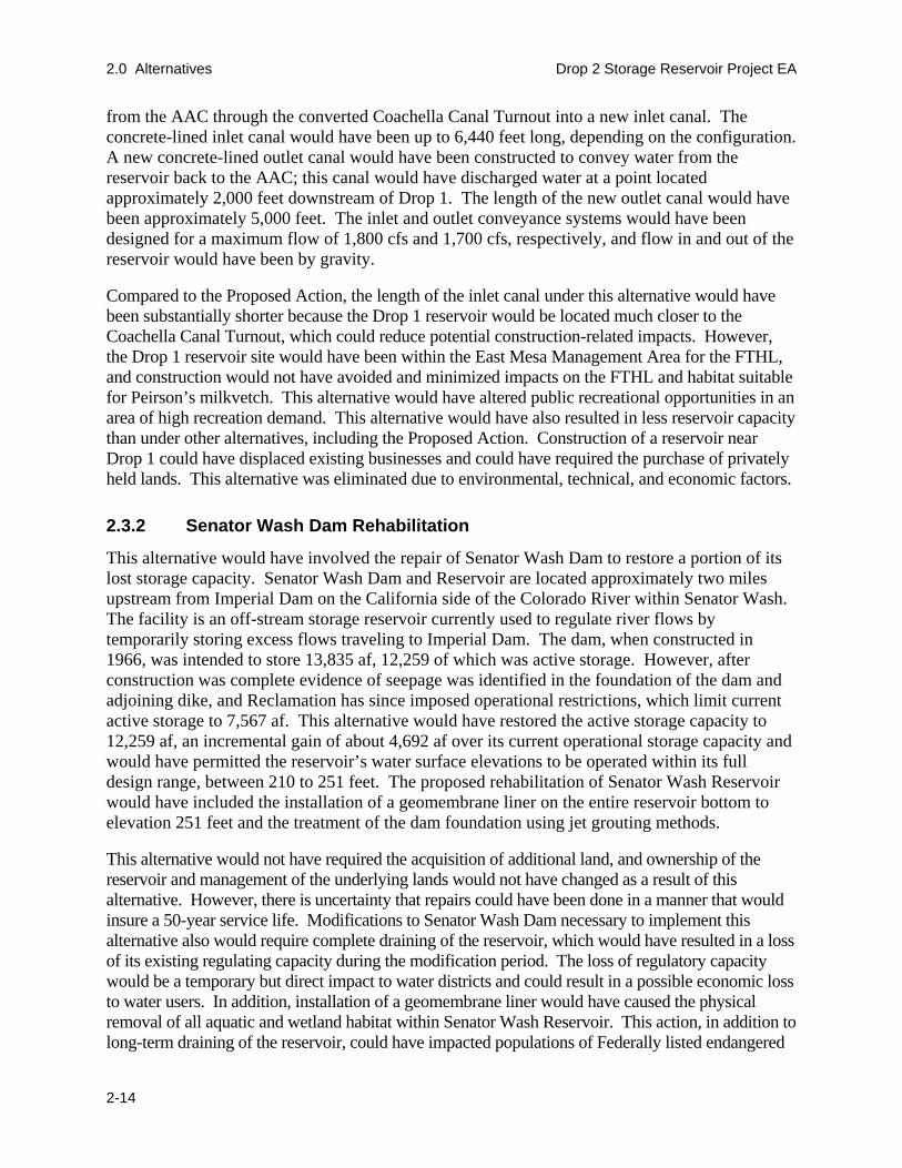
2.0 Alternatives Drop 2 Storage Reservoir Project EA
2-14
from the AAC through the converted Coachella Canal Turnout into a new inlet canal. The concrete-lined inlet canal would have been up to 6,440 feet long, depending on the configuration. A new concrete-lined outlet canal would have been constructed to convey water from the reservoir back to the AAC; this canal would have discharged water at a point located approximately 2,000 feet downstream of Drop 1. The length of the new outlet canal would have been approximately 5,000 feet. The inlet and outlet conveyance systems would have been designed for a maximum flow of 1,800 cfs and 1,700 cfs, respectively, and flow in and out of the reservoir would have been by gravity.
Compared to the Proposed Action, the length of the inlet canal under this alternative would have been substantially shorter because the Drop 1 reservoir would be located much closer to the Coachella Canal Turnout, which could reduce potential construction-related impacts. However, the Drop 1 reservoir site would have been within the East Mesa Management Area for the FTHL, and construction would not have avoided and minimized impacts on the FTHL and habitat suitable for Peirson’s milkvetch. This alternative would have altered public recreational opportunities in an area of high recreation demand. This alternative would have also resulted in less reservoir capacity than under other alternatives, including the Proposed Action. Construction of a reservoir near Drop 1 could have displaced existing businesses and could have required the purchase of privately held lands. This alternative was eliminated due to environmental, technical, and economic factors.
2.3.2 Senator Wash Dam Rehabilitation
This alternative would have involved the repair of Senator Wash Dam to restore a portion of its lost storage capacity. Senator Wash Dam and Reservoir are located approximately two miles upstream from Imperial Dam on the California side of the Colorado River within Senator Wash. The facility is an off-stream storage reservoir currently used to regulate river flows by temporarily storing excess flows traveling to Imperial Dam. The dam, when constructed in 1966, was intended to store 13,835 af, 12,259 of which was active storage. However, after construction was complete evidence of seepage was identified in the foundation of the dam and adjoining dike, and Reclamation has since imposed operational restrictions, which limit current active storage to 7,567 af. This alternative would have restored the active storage capacity to 12,259 af, an incremental gain of about 4,692 af over its current operational storage capacity and would have permitted the reservoir’s water surface elevations to be operated within its full design range, between 210 to 251 feet. The proposed rehabilitation of Senator Wash Reservoir would have included the installation of a geomembrane liner on the entire reservoir bottom to elevation 251 feet and the treatment of the dam foundation using jet grouting methods.
This alternative would not have required the acquisition of additional land, and ownership of the reservoir and management of the underlying lands would not have changed as a result of this alternative. However, there is uncertainty that repairs could have been done in a manner that would insure a 50-year service life. Modifications to Senator Wash Dam necessary to implement this alternative also would require complete draining of the reservoir, which would have resulted in a loss of its existing regulating capacity during the modification period. The loss of regulatory capacity would be a temporary but direct impact to water districts and could result in a possible economic loss to water users. In addition, installation of a geomembrane liner would have caused the physical removal of all aquatic and wetland habitat within Senator Wash Reservoir. This action, in addition to long-term draining of the reservoir, could have impacted populations of Federally listed endangered

Drop 2 Storage Reservoir Project EA 2.0 Alternatives
2-15
species (razorback sucker and Yuma clapper rail). This alternative was eliminated due to environmental, technical, and economic factors.
2.3.3 Reservoir Size and Storage Capacity
While developing the Proposed Action, a variety of reservoir sizes were examined for the proposed Drop 2 Reservoir facility. Appraisal level designs and cost estimates were developed for alternative storage capacities of 2,000 af, 4,000 af, 6,000 af, 8,000 af, and 10,000 af for the Drop 2 Project. These various reservoir sizes were selected to provide Reclamation with a range of reservoir capacities in evaluating the selection of a preferred alternative.
The appraisal analysis looked at the footprint of the reservoir (could it be accommodated in the potential reservoir site area without extending into the FTHL MA), the percentage of non-storable flows that could be captured given a certain reservoir size, and the difficulty in constructing and operating the different reservoir sizes/configurations.
The footprints of the reservoirs designed for the various storage capacities ranged from 140 to 530 acres. Therefore, all analyzed reservoir sizes fit within the 615 acres of land currently available, located outside the FTHL MA, on the former Brock Ranch site.
Table 2-4 illustrates the estimated percent of currently non-storable flows that could be captured with different reservoir storage volumes. Under actual conditions, a reservoir is rarely filled to 100% capacity so that operational flexibility can be maintained. Assuming 15 percent of the reservoir capacity is reserved for operational flexibility, a 2,000 af reservoir would capture approximately 65 percent of the non-storable flows and a 10,000 af reservoir would capture approximately 94 percent.
Table 2-4. Percent of Currently Non-Storable Flows Captured for Different Reservoir Capacities
Reservoir Storage Capacity
Capacity Dedicated to Capturing Currently Non-
Storable Flows Only
15% of Capacity Reserved for Operational Flexibility
and Remainder Allocated for Capturing Non-Storable Flows
2,000 67.8% 65.1% 4,000 82.9% 80.4% 6,000 89.5% 87.3% 8,000 93.2% 91.5% 10,000 95.0% 94.0%
Source: Reclamation, unpublished data.
Because the 10,000 af reservoir size maximizes the amount of capture, it would appear to best achieve the Project’s objectives to capture currently non-storable flows and increase operational flexibility in the LCR. However, the 10,000 af reservoir, in order to fit within the reservoir site without extending into the FTHL MA, would need to be excavated to a depth of 22 feet (as opposed to 20 feet for the other reservoir sizes). This additional depth of excavation would make it impossible to balance cut-and fill within the reservoir site and greatly increases the extent, cost, and complexity of construction. The additional impacts and cost of the 10,000 af reservoir

2.0 Alternatives Drop 2 Storage Reservoir Project EA
2-16
eliminated it from further consideration. This leaves the 8,000 af reservoir as the option that maximizes Project objectives without requiring unduly complex or extensive construction.
2.3.4 Inlet Canal Alignment Options 1-4, 6-9
Reclamation also examined various inlet canal alignments during the development of the Proposed Action (Reclamation 2005a, see Appendix B). A total of nine inlet canal alignments were considered and evaluated based on technical, environmental, and economic factors. The nine options, Option 1 through Option 9, shown in Figure 2-4, all begin and end at common points, and all of them consider the conveyance of water through gravity flow. The different routes represent the most direct routes with due consideration to 1) the directness of the route (i.e., avoid bends and turns); 2) the perceived acceptability of the alignment to the local community, County of Imperial Planning and Road Departments, and State of California Department of Transportation; 3) the perceived difficulty or ease of construction (constructability); 4) the potential environmental impacts, level of compensation required, and effort required to achieve environmental compliance; 5) the estimated level of effort for right of way acquisition and respective cost (i.e., number of acquisitions, total acres, and current public/private ownership of affected lands); and 6) the utilities relocation and associated costs.
The different alignments would traverse different types of terrain and different combinations of publicly and privately owned lands. In some cases, the alignments would also cross underneath or be located within public rights-of-way. To minimize the impacts to the privately owned parcels and to the public rights-of-way, some of the alignments considered the use of either buried pipelines or box conduits in lieu of open channels (canals). Also, in other cases, the inlet canal alignments were routed around the privately owned parcels to minimize the impacts to these properties and their owners or to minimize the land acquisition cost. The circumvention of the privately owned parcels increased the length and cost of the inlet canal alignment.
The preferred inlet canal alignment (Option 5) was chosen based on consideration of total cost, engineering effort, environmental considerations, land acquisition, and schedule. Inlet Canal Alignment Option 5, with some refinements is the inlet canal alignment used as part of the Proposed Action. For more detail on the review and selection of the inlet canal alignment, please see Appendix B.
2.4 Summary of Impacts
A summary of the environmental consequences associated with implementation of the Proposed Action and No-Action, after implementation of applicable compensation measures, is presented and compared in Table 2-5. For a detailed description and analysis, refer to Chapter 3.0, Affected Environment and Environmental Consequences. The analysis presented in this EA indicates that with implementation of applicable compensation measures, the Proposed Action would not result in significant impacts.

Drop 1 of theAll-American Canal
Proposed Lined SegmentAll-American Canal
Drop 2 of theAll-American Canal
Evan Hewes
Highway
Coachella C
anal
Flat-Tailed Horned LizardManagement Area
Gordon’s WellExit8
8
ExperimentalFarm Exit
All-American Canal
United States
Mexico
36
R 19
ER
20 E
R 19
ER
20 E
R 19
ER
20 E
31 32
29
20
353433
4 352
1 6
5
25 3026272829
20 21 22 23 24 19
30
19
3231
T 16 ST 17 S
Figure 2-4. Inlet Canal Options Considered
Former Brock RanchResearch Center
Flat-tailed Horned LizardManagement Area
Proposed Drop 2 Reservoir Site
Lined Portion All-American Canal(Proposed)
NScale
0 0.5Mile
Proposed Inlet Canal Options Option 1 Option 2 Option 3 Option 4 Option 5 Option 6 Option 7 Option 8 Option 9
LEGEND
from usgs map to thisis 85.965%

Drop 2 Storage Reservoir Project EA 2.0 Alternatives
2-19
Table 2-5. Summary of Impacts
Resource Area Proposed Action No-Action Alternative Hydrology/Water Quality No significant impact. No impact. No benefit to water supply
reliability. Biological Resources With implementation of compensation
measures, no significant impact. No impact.
Aesthetics With implementation of compensation measures, no significant impact.
No impact.
Agriculture No significant impact. No impact. No benefit to irrigation water supply reliability.
Air Quality With implementation of compensation measures, no significant impact.
No impact.
Cultural Resources With implementation of compensation measures, no significant impact.
No impact.
Environmental Justice No significant impact. No significant impact. Hazards/Hazardous Materials With implementation of compensation
measures, no significant impact. No impact. No benefit related to potential soil remediation.
Indian Trust Assets No significant impact No impact. Land Use With implementation of compensation
measures, no significant impact. No impact.
Noise No significant impact. No impact. Recreation With implementation of compensation
measures, no significant impact. No impact.
Socioeconomics No significant impact. No impact. Topography, Geology, Soils, and Mineral Resources
With implementation of compensation measures, no significant impact.
No impact.
Transportation With implementation of compensation measures, no significant impact.
No impact.

2.0 Alternatives Drop 2 Storage Reservoir Project EA
2-20
This page intentionally left blank.