Embed Size (px)
Citation preview

LANGI GHIRAN STATE
PARK MANAGEMENT
PLAN
National Parks Service
DEPARTMENT OF NATURAL RESOURCESAND ENVIRONMENT
VICTORIA
JUNE 1996

This Management Plan for Langi Ghiran State Park is approved for implementation. Its purpose is to direct all aspects of management in the Park until the Plan is reviewed.
Copies of the Plan can be obtained from:
NRE Ballarat OfficeDepartment of Natural Resources and Environment Cnr Mair and Doveton StreetsBALLARAT VIC 3350
Outdoors Information CentreDepartment of Natural Resources and Environment 240 Victoria ParadeEAST MELBOURNE VIC 3002.
For further information on this Plan, please contact:
Chief Ranger - Central Park Management AreaNRE Ballarat Office Phone (053) 336 782

2 Langi Ghiran State Park
Crown (State of Victoria) 1996A Victorian Government Publication This publication is copyright.No part may be reproduced by any process, except in accordance with the provisions of theCopyright Act 1986.
Published June 1996 by the Department of Natural Resources and Environment 240 Victoria Parade, East Melbourne, Victoria 3002.
National Library of Australia Cataloguing-in-Publication entry
Victoria. National Parks Service.Langi Ghiran State Park management plan.
Bibliography.ISBN 0 7306 6175 X.
1. National parks and reserves - Victoria - Management.2. Langi Ghiran State Park (Vic.). I. Victoria.Dept. of Natural Resources and Environment. II. Title.
333.783099457
Note: In April 1996 the Department of Conservation and Natural Resources (CNR) became part of the Department of Natural Resources and Environment (NRE).
Cover: View from the range (Photograph Noel Ryan)
Printed on 100% recycled paper to help save our natural environment

Langi Ghiran State 3
Langi Ghiran State Park protects significant natural areas which complement those in the statewide system of National and State parks, and has an important Aboriginal art site. The Park has been less disturbed than other reserved areas in the region and offers good opportunities for recreation in a semi-remote setting.
The Approved Plan provides for the protection of the Park’s important natural and cultural features. Visitor facilities are designed to enhance the experience of day visitors, but still ensure that opportunities for recreation in semi- remote settings are preserved.
I thank those individuals and organisations who made submissions on the Proposed Plan. The 42 submissions received were carefully considered in preparing this Approved Plan.
Hon Marie Tehan MPMINISTER FOR CONSERVATION and LAND MANAGEMENT

FOREWOR
4 Langi Ghiran State Park
APPROVED MANAGEMENT PLAN
This Approved Management Plan has been prepared under the provisions of section 17 of the National Parks Act 1975 (Vic.) and is approved for implementation.
Mark StoneDirector, National Parks Service
The Plan provides the basis for future management of Langi Ghiran State Park. It was finalised following consideration of the 42 submissions received on the Proposed Plan.
Paul MaineyInterim Regional Manager, South West

Langi Ghiran State 5
Langi Ghiran State Park (2695 ha) takes in the granitic Mount Langi Ghiran in the north, Mount Gorrin in the south and a River Red Gum-Yellow Box open woodland in the west. The Park has a rich Aboriginal cultural heritage and contains a wide range of significant Aboriginal archaeological sites. Of particular importance are the regionally distinct art sites, one of which is listed on the Register of the National Estate.
The historic Langi Ghiran Reservoir, which is still used as a supplementary water supply for the Rural City of Ararat, is surrounded by the Park, and its proclaimed water catchment and associated pipeline lie within the Park.
The Park contains a variety of vegetation communities once typical of the area, and some significant species and communities. The Plan emphasises the protection of the natural environment and the maintenance of biodiversity.
Management will concentrate on the conservation of the natural and scenic features of the Park, and the protection of significant cultural and historic sites, while providing for a range of recreational activities.
Langi Ghiran State Park is relatively free of pest plants and animals although regular monitoring of populations will be required. Control programs will be undertaken in co- operation with adjoining landholders.
The Park is a natural setting for a range of recreational pursuits which add to and complement activities in the rest of the region.
The Park currently receives an estimated 5600 visitors annually, most of whom picnic at the Langi Ghiran Picnic Area or at the reservoir. Enhancing these facilities, while still maintaining the low-key feel of the park, will be a priority. Opportunities for bushwalking in a semi-remote area will be retained and enhanced.
Management directions for the Park are described below.
· Most of the Park will be retained in its natural condition, and special protection will be given to the water catchments and sites of natural and cultural significance. Special protection will be given to significant species and communities as they are identified.
· Cultural and historic sites will be preserved and protected. Quality visitor information will be provided on-site, enabling people to learn about Aboriginal cultural history.
· An ecologically based fire management system will be developed through formalised monitoring and appraisal of all fires within the Park.
· Visitor facilities will be kept unobtrusive.The main visitor facilities will be confined to the north of the Park.
· The walking track system will be extended to enhance the range of walking opportunities but still protect the Park’s semi-remote settings.

Langi Ghiran State 6
SUMMAR
v Langi Ghiran State
FOREWORD iii
SUMMARY v
1 INTRODUCTION 1
1.1 Location and planning area 11.2 Regional context 11.3 Significance of the Park 11.4 Creation of the Park 21.5 Legislation, LCC recommendations and guidelines 21.6 Park management aims 2
2 STRATEGIC DIRECTIONS 4
2.1 Park vision 42.2 Management directions 42.3 Zoning 5
3 RESOURCE CONSERVATION 7
3.1 Geological and landform features 73.2 Rivers and streams 73.3 Vegetation 73.4 Fauna 83.5 Landscape 93.6 Cultural heritage 9
4 PARK PROTECTION 12
4.1 Fire management 124.2 Pest plants and animals, and diseases 134.3 Soil conservation 13
5 THE PARK VISIT 15
5.1 The Park visitor 155.2 Visitor recreation activities and facilities 15
5.2.1 Vehicle access 155.2.2 Picnicking and camping 185.2.3 Bushwalking 185.2.4 Hang-gliding 195.2.5 Horse riding 205.2.6 Dogs 205.2.7 Rockclimbing and abseiling 20
5.3 Visitor information and interpretation 205.4 Commercial tourism operations 21

CONTENT
Langi Ghiran State 8
5.5 Public safety 21
6 COMMUNITY AWARENESS AND INVOLVEMENT 23
6.1 Friends and volunteers 236.2 Community awareness and park neighbours 236.3 Schools education 23
7 OTHER ISSUES 24
7.1 Authorised uses 247.2 Boundaries and adjacent uses 25
8 IMPLEMENTATION 26
REFERENCES 27
TABLES
1 Management zones and overlays 62 Summary of recreation activities 163 Management of roads and tracks 174 Management of walking tracks 195 Priority management strategies 26
APPENDIX
1 Significant flora and fauna 28
FIGURES
1 Location, facilities and authorised uses End of plan2 Management zones "

Introducti
v Langi Ghiran State
1 INTRODUCTION
1.1 Location and planning areaLangi Ghiran State Park is 220 km west of Melbourne (figure 1). The management plan covers the 2695 hectares of the Park, but it should be noted that the management of three adjoining areas of public land is integral to management of the Park. These areas are:
· Kartuk Road on the western boundary of the Park. This government road easement gives access to the picnic and camping area and the Langi Ghiran Reservoir;
· a 282 ha block of Crown Land on the north- west boundary that supports high conservation and cultural values;
· the Langi Ghiran Reservoir within the park and a 100 m strip of land surrounding the reservoir. This area is a Water Supply Reserve for which NRE has appointed the Rural City of Ararat as the Committee of Management. Natural, historical and conservation values in this reserve are high.
1.2 Regional contextLangi Ghiran State Park is one of a number of major blocks of public land accessible from the Western Highway between Ballarat and Horsham. This highway is the major route between Melbourne and Adelaide. The closest town to the Park is Ararat, 12 km west.
Grampians National Park, 65 km west of the Park and 167 000 ha in size, attracts more than 1 million visitors annually. The attractions of Grampians National Park include its rugged scenery, wildflower displays and Aboriginal art sites. There is a wide range and number of visitor facilities including a Visitor Information Centre, an Aboriginal Cultural Centre, camping areas and walking tracks of varying lengths.
Mount Buangor State Park, 10 km to the east, has basic camping facilities and high quality short walks in a wetter environment than that of Langi Ghiran.
Ararat Hills Regional Park is 15 km west. This Park primarily provides for short visits.
Mount Cole State Forest, 10 km to the east, is an important timber production area as well as a well known recreation area. Vehicle touring on the well constructed roads of the Forest is popular.
1.3 Significance of the ParkLangi Ghiran State Park makes a valuable contribution to Victoria's park system, which aims to protect viable, representative samples of the State's natural environments. Parks also provide opportunities for visitors to enjoy and appreciate natural and cultural values, and many make important contributions to tourism.
The Park is assigned to the IUCN Category II (National Parks) of the United Nations’ List of National Parks and Protected Areas, the worldwide list of such reserves. Category II areas are managed primarily for ecosystem protection and recreation.
Significant features of the Park are summarised below.
Natural values· Rugged granite peaks and attractive
landscapes.
· Relatively undisturbed plant communities and a number of significant species.
Cultural values· Features associated with a water supply
system constructed in the 1870s.
· A range of sites which contain evidence of past Aboriginal use of the area, including an art site which is listed on the Register of the National Estate in recognition of a style unique to the Langi Ghiran area, and for its importance to the local Aboriginal community.

2 Langi Ghiran State
Introducti
Tourism and recreational values· Opportunities for picnicking and camping.
· Opportunities for walking and camping in a semi-remote setting.
1.4 Creation of the ParkLangi Ghiran State Park is included on Schedule Two B of the National Parks Act 1975 (Vic.) and was proclaimed on 24 June 1987. It was created following acceptance by the Government of Land Conservation Council (LCC) recommendations for the Ballarat Study Area (LCC 1982).
1.5 Legislation, LCC recommendations and guidelines
Langi Ghiran State Park is reserved and managed under the National Parks Act 1975 (Vic.). The Act requires the Director to preserve and protect the natural condition of the Park and its natural and other features, and to provide for the use of the Park by the public for enjoyment, recreation and education, and for research.
All of the Aboriginal archaeological sites (known and unknown) within the Park, adjoining Crown Land and the Langi Ghiran Reservoir and its buffer are protected under the Aboriginal and Torres Strait Islander Heritage Protection Act 1984 (Cwlth) and the Archaeological and Aboriginal Relics Preservation Act 1972 (Vic).
The LCC recommended that sites of historic and archaeological significance in the Park should be preserved, and the water supply and catchment of the Langi Ghiran Reservoir protected (LCC 1982). The LCC recommended that the City of Ararat be permitted to carry out all necessary works associated with the supply of water to and from the Langi Ghiran Reservoir, and that a management plan for the catchment within the Park should be prepared in consultation with the water supply authority.
The Park is managed in accordance with Department of Natural Resources and Environment guidelines (NPS 1995) and with
other Departmental guidelines and procedures. This Plan operates in conjunction with the Midlands Fire Protection Plan (CFL 1985) and the Code of Practice for Fire Management on Public Land (CNR 1995a).
1.6 Park management aimsSection 17 of the National Parks Act provides the basis for management of the Park. The following management aims are derived from this section and as such broadly govern all aspects of park management.
Resource conservation· Preserve and protect the natural
environment.
· Maintain, and where possible enhance, semi-remote values.
· Allow natural environmental processes to continue with the minimum of disturbance, and maintain biodiversity.
· Conserve features of archaeological, historical and cultural significance.
Park protection· Protect water catchments and streams.
· Protect human life, the park and adjacent lands from injury by fire.
· Eradicate, or otherwise control, introduced plants, animals and diseases.
The Park visit· Provide opportunities for appropriate
recreation and tourism.
· Promote and encourage an appreciation, understanding and enjoyment of the Park's natural and cultural values and its recreational opportunities.
· Encourage appropriate Park use and behaviour, and foster a conservation ethic in visitors.
· Take reasonable steps to ensure the safety of visitors.
· Provide opportunities to view selected aspects of traditional Aboriginal culture.

Introducti
Langi Ghiran State 3
Other· Provide for and encourage scientific
research, surveys and monitoring that will contribute to better understanding and management of the Park.
· Co-operate with local, state and interstate authorities, the community (including the Ballarat and District Aboriginal Co- operative) and other interested organisations to assist in the management of the Park.

Strategic
4 Langi Ghiran State
2 STRATEGIC DIRECTIONS
2.1 Park visionA future visitor to Langi Ghiran State Park finds an area with a pristine character. Simple but high quality picnic and camping facilities with two-wheel drive access directly from the Western Highway are provided. The picnic area is quiet and visitors appreciate the natural setting and the mature trees in the area which support abundant bird life. There are exciting opportunities for overnight and day bushwalks in a semi-remote setting.
Distinctive landscape features, dominated by Mount Langi Ghiran and Mount Gorrin, create rugged scenery and pristine environments. These granite peaks and their lower slopes conserve a range of plant communities including open woodlands whose species diversity is among the highest in the world. Park management gives a strong emphasis to protecting plant communities and the range of native fauna they support.
A walking track commencing at the picnic area links features of historic interest associated with the Langi Ghiran Reservoir, and climbs a gentle hill through an undisturbed shady woodland to a lookout point. Signs along this track explain features of interest.
More adventurous visitors can plan walks of various lengths onto the granite peaks. These visitors find an undeveloped area where they can appreciate the unspoilt beauty of the environment and escape from developed facilities.
It is a place where both Aboriginal and non- Aboriginal Australians may have the opportunity to view selected aspects of traditional Aboriginal culture. Visitors are pleased to note that the Aboriginal community plays a continuing role in the management of the Park.
Visitors are also pleased that a comprehensive monitoring program ensures that flora and fauna are well managed.
Fire management planning gives an emphasis to ensuring that the ecological requirements of the flora and fauna are met, including the retention
of long unburnt areas as appropriate. Research is continuing into the ecological requirements of the plant communities and notable species present.
For the many people who simply pass the Park on the Western Highway, or who see it each day as a rugged backdrop to the City of Ararat, the Park offers the reassurance of the continuing presence of unspoilt but accessible natural areas.
2.2 Management directionsMajor management directions for the Park are outlined below.
Resource conservation· Give special protection to areas of high
conservation significance, in particular sites where significant flora, fauna and cultural features occur.
· Maintain the native vegetation and the characteristic landscape of the Park.
· Survey and monitor flora and fauna, particularly in relation to management actions such as fuel reduction burning and the control of pest species.
Park protection· Protect the significant Aboriginal and
European cultural sites within the Park. This will be given a high priority.
· Protect the high scenic quality of the park.
· Protect the gazetted water supply catchment of the Langi Ghiran Reservoir.
· Ensure that fire protection plans provide for strategic locations to protect the Park and visitors from wildfire.
The Park visit· Promote opportunities for appropriate
recreation and tourism.
· Promote and encourage an appreciation, understanding and enjoyment of the Park’s
Strategic
Langi Ghiran State 5
natural and cultural values and its recreational opportunities.
· Encourage appropriate use and behaviour and foster a conservation ethic in visitors
· Take reasonable steps to ensure the safety of visitors.
Community awareness and involvement· Encourage co-operation with local
Government and public authorities, community groups and landowners in promoting greater awareness and appreciation of the Park.
2.3 ZoningA Park management zoning scheme has been developed to:
· provide a geographic framework in which to manage the Park;
· indicate which management directions have priority in different parts of the Park;
· indicate the types and levels of use appropriate throughout the Park;
· assist in minimising existing and potential conflicts between uses and activities, or between these and protection of Park values;
· provide a basis for assessing the suitability of future activities and development proposals.
Table 1 specifies park management zone and overlay characteristics; the location of these zones and overlays are shown in figure 2.

Strategic Strategic directions
TABLE 1 MANAGEMENT ZONES AND OVERLAYS
ZONE OVERLAY
CONSERVATION CONSERVATION AND RECREATION
RECREATION DEVELOPMENT
SPECIAL PROTECTION AREA - CULTURAL AND
LAND USE DETERMINATION -
NATURAL SITES WATER SUPPLYCATCHMENT
AREA/LOCATION 1001 ha, 37% of Park. The area of significant Yellow Box-Red Gum Open Woodland.
1685 ha, 62.5% ofPark.
12.5 ha, <1% of Park. Comprises the picnic area and a surrounding buffer of 200 m.
216 ha, 8% of Park. Aboriginal cultural sites and sites containing the rare Langi Ghiran Grevillea.
97 ha, 3.6% of Park. The proclaimed catchment for the Langi Ghiran reservoir.
VALUES Sensitive semi-natural area of international botanical significance.
Important natural values with scope for dispersed recreational activities.
Site of existing facility development.
Discrete areas of high conservation, cultural or scientific value.
Important for the preservation of water quality to the reservoir.
GENERAL Protect sensitive Protect less sensitive Provide primarily for Protect specific natural Provide for specificMANAGEMENT natural environments natural environments high use visitor nodes and cultural values in legislativeAIMS and to provide for
minimal impact recreation activities and simple visitor facilities subject to ensuring minimal interference to natural processes.
and provide forsustainable dispersed recreation activities and small-scale recreation facilities without significant impact on natural processes.
with a concentration ofrecreation and/or interpretation facilities.
specific areas and siteswhere a special management focus is required.
requirements.

Resource
6 Langi Ghiran State
3 RESOURCE CONSERVATION
3.1 Geological and land form features
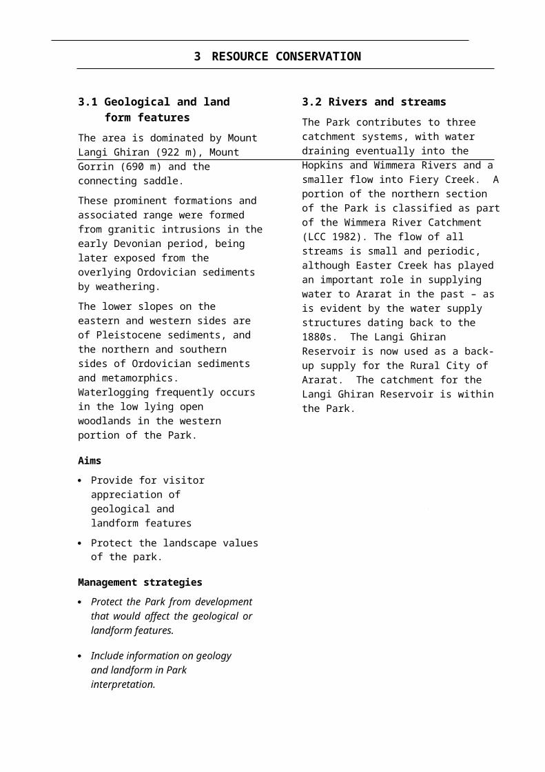
The area is dominated by Mount Langi Ghiran (922 m), Mount Gorrin (690 m) and the connecting saddle.
These prominent formations and associated range were formed from granitic intrusions in the early Devonian period, being later exposed from the overlying Ordovician sediments by weathering.
The lower slopes on the eastern and western sides are of Pleistocene sediments, and the northern and southern sides of Ordovician sediments and metamorphics. Waterlogging frequently occurs in the low lying open woodlands in the western portion of the Park.
Aims
· Provide for visitor appreciation of geological and landform features
· Protect the landscape values of the park.
Management strategies
· Protect the Park from development that would affect the geological or landform features.
· Include information on geology and landform in Park interpretation.
3.2 Rivers and streamsThe Park contributes to three catchment systems, with water draining eventually into the Hopkins and Wimmera Rivers and a smaller flow into Fiery Creek. A portion of the northern section of the Park is classified as part of the Wimmera River Catchment (LCC 1982). The flow of all streams is small and periodic, although Easter Creek has played an important role in supplying water to Ararat in the past – as is evident by the water supply structures dating back to the 1880s. The Langi Ghiran Reservoir is now used as a back-up supply for the Rural City of Ararat. The catchment for the Langi Ghiran Reservoir is within the Park.
Easter Creek, the Langi Ghiran Picnic Area, the reservoir and linking walking track, are the main focus for visitors to the Park.
Aims
· Conserve the aesthetic and water quality of the creeks within the Park.
· Protect water quality within the Proclaimed Catchment to the Langi Ghiran Reservoir.
Management strategies
· Restrict any development to the area below the Langi Ghiran Reservoir.
· Liaise with the Rural City of Ararat and Grampians Region Water Authority in the management of the proclaimed catchment.
· Prohibit camping within the Proclaimed Catchment to the reservoir.
· Maintain all walking tracks in the catchment in good condition.
3.3 VegetationLittle systematic study of the vegetation of the Park has been carried out. Five communities, based on structure and the species of dominant tree, have been described and mapped (Williamson 1985). The peaks and slopes support an open forest of Red Stringybark and Long-leaf Box with a shrub understorey.
Elevated gullies and saddles support forests of Messmate and Manna Gum; the western slopes fan out to a plain containing an attractive open woodland of Yellow Box and River Red Gum (LCC 1982) with Candlebark sometimes locally dominant. The fifth vegetation community, an open forest dominated by Long-leaved Box with a diverse heathy understorey, is found on the adjacent Crown Land, though there is a small, less diverse example of this community on the western side of the Park.
Beauglehole (1983) recorded 343 vascular plants from the Park.
Langi Ghiran State 8
Resource
The Yellow Box - Red Gum open woodland is a grassy woodland of international scientific and botanical significance because of the exceptionally high species diversity in the understorey (Lunt 1990). These values are very vulnerable to soil disturbance, compaction and inappropriate fire regimes. Very careful consideration will need to be given to the management of these grassy woodlands.
Five significant plant species occur in the Park, including the Langi Ghiran Grevillea, which is endemic to Mount Langi Ghiran (appendix 1).
Most of the Park has been subject to some level of disturbance from previous land uses, including timber harvesting, sheep grazing and removal of sand and gravel. The last continued until the mid 1970s. The resulting pits have been rehabilitated, but this included the establishment of non-indigenous trees.
Aims
· Conserve native plant communities in their natural condition as far as is practicable, and maintain genetic diversity.
· Provide special protection for, and increase knowledge of, significant plant communities and species.
· Revegetate degraded areas.
Management strategies
· Prepare a strategy to guide management of the significant grassy open woodland community.
· Manage any species or communities listed under the Flora and Fauna Guarantee Act 1988 (Vic.) according to approved Action Statements.
· Undertake a primary floristic survey of the Park and describe floristic vegetation communities.
· Undertake research and monitoring of significant species and communities with an emphasis on determining and refining appropriate management practices.
· Revegetate sand pits with local indigenous species.
3.4 FaunaTwelve native mammal species have been recorded for the Park (Gilmore et al. 1979).
Williamson (1985) recorded 105 species of birds for the Park, including the rare species Painted Honeyeater, Powerful Owl and Black Falcon (appendix 1).
Reptiles found in the Park include the Marbled Gecko, Large Striped Skink, Bougainville's Skink and Shingleback (Gilmore et al. 1979).
Three amphibian species have been recorded for the Park.
Fish and invertebrate groups have not been studied.
The long-unburnt forests and woodlands of the Park are of significance in a regional context. Research is required into the optimum fire regime for the ecological requirements of the fauna. However, it is thought that the Yellow- footed Antechinus, which is present in the Park, may depend on patches of long unburnt forest.
The conservation value of the open woodlands has been reduced in the past by removal of standing and fallen dead timber for firewood, and by the long-term use of 1080 baiting for rabbit control. Protection of existing dead trees and fallen timber is required for fauna habitat.
The presence of large trees with large hollows meets the habitat requirements of a range of wildlife species.
There are unconfirmed reports of Squirrel Gliders on the adjacent Crown Land. The Squirrel Glider is considered rare and is listed under the Flora and Fauna Guarantee Act.
The habitat in the Park is also likely to be suitable for the Brush-tailed Phascogale - a rare species listed under the Flora and Fauna Guarantee Act. A survey should aim to determine if these species are present.
Monitoring of the Eastern Grey Kangaroo population is required to assess population size and its impact on important grassland communities.
Resource
8 Langi Ghiran State
While Sambar are an introduced species of deer, they are defined as protected wildlife under the Wildlife Act 1975 (Vic.). The number of deer in the Park is not known. The Park and adjoining Crown Land are included in the Mount Cole Sanctuary, which was declared in 1923 principally to protect deer. The Sanctuary is still current.
Little is known about the effect that Sambar have on the Park, and a monitoring program needs to be undertaken.
Aims
· Protect and maintain the assemblage of native fauna by maintaining suitable habitat.
· Actively manage threatened or significant species.
· Encourage continuing research into the ecological requirements of the fauna.
Management strategies
· Conduct fauna surveys and encourage research into the biology and habitat requirements of Park fauna.
· Manage Flora and Fauna Guarantee listed species in accordance with approved Action Statements.
· Determine an appropriate fire management regime for the grassy woodland community based on the ecological requirements of the community (which may be fire exclusion). Exclude any burning in this zone for fuel reduction purposes per se other than a narrow strip adjacent to the railway line (the latter only if the line is to be used regularly by trains).
· Monitor the Sambar population.
· Monitor the Eastern Grey Kangaroo population.
3.5 LandscapeThe landscape value of the Park is very high. Mounts Langi Ghiran and Gorrin and the linking saddle are prominent features, jutting up from the low-lying, principally agricultural setting. The Park adjoins the Western Highway, and is visible from Ararat and vantage points in Beaufort.
The lack of disturbance adds to the landscape character. The area has been classed as of high scenic value by Leonard and Hammond (1984). Landscape protection in the Park involves the appropriate siting of all developments and the sensitive design of facilities.
Operating gravel quarries adjacent to the north- western boundary of the Park are visible from some distance.
Aims
· Protect and preserve landscapes in areas of greatest scenic quality and viewer interest.
· Minimise the visual impact of management activities in the landscape.
Management strategies
· Ensure that any developments within the Park are in keeping with its essential character, and do not conflict with or encroach on internal views in, and external views of, the Park.
· Liaise with the Rural City of Ararat to involve NRE in approvals relating to any planning permits on any land adjacent to, or which may affect, the Park.
· Ensure that rehabilitation and revegetation of quarry sites takes place promptly.
3.6 Cultural heritage
Aboriginal cultureLangi Ghiran State Park lies within an area once used by the Ngutuwul balug (Mountain people) clan of the Djab Wurrung language group (Clark 1990). The Black Cockatoo was believed to be the totem of the Ngutuwul balug, and it is also believed that the Or-rer-keet were

Langi Ghiran State 1
Resource
the evil spirits that inhabited Lar-ne-jeering (Mount Langi Ghiran).
Three Aboriginal art sites have been discovered which represent a style unique to the Langi Ghiran area. The site known as Langi Ghiran 1 was made public in 1929; Langi Ghiran 2 was discovered in 1985. Gunn (1983, 1991) made an extensive study of Langi Ghiran 1, recording 23 motifs in the alcove. Langi Ghiran 1 is on the register of the National Estate. Langi Ghiran 2 consists of several layers of painting, with designs similar to those at Langi Ghiran 1. The site is badly affected by weathering and the centre panel has been totally destroyed.
To date, close to 70 Aboriginal archaeological sites have been recorded in the Park and the adjoining Crown Land. These consist of art sites, scarred trees, isolated stone artefact scatters, rock shelters and a bark slab (possibly used as a carrying container). Seven of the sites have been allocated a high level of archaeological and scientific significance, and five have been rated at a high level of educational significance (Gunn 1991). All the sites are significant to the local Aboriginal Community (Ballarat and District Aboriginal Co-operative Ltd.).
European settlementMount Langi Ghiran was sighted by Major Thomas Mitchell on 22 September 1836 on his journey through Western Victoria. The area was first grazed in 1841. In 1871 the Ararat Borough Council took steps to have a timber reserve gazetted in the area. On 31 May 1872 a reserve for the supply of timber covering 2140 ha in the Parishes of Langi Ghiran and Warrak was gazetted (Banfield 1955).
There is evidence of selective logging on the upper massif dating to the early 1900s. Larkin’s Mill operated upstream from the reservoir before World War II. Licensed grazing continued to the late 1950s, and two gravel pits, totalling 12 ha, were being worked to the early 1970s.
In 1870 construction began on a pipe head weir and reservoir to supply water to the City of Ararat. The wall of the reservoir was constructed from granite blocks quarried
nearby. Stone races were constructed to carry water from ephemeral creeks on the mountain into the reservoir (Banfield 1955).
After construction, it was found that the productivity of the catchment had been misjudged (Banfield 1955). To rectify this, a pipe head weir was constructed in Mount Cole. From there a pipeline carried a gravitational flow to Langi Ghiran Lookout Point. The water was then discharged via an open slab stone aqueduct into the Langi Ghiran Reservoir.
The system was changed recently. The open stone aqueduct was replaced by a steel pipe which bypasses the reservoir and takes water direct to Ararat. The Langi Ghiran Reservoir is of historic interest. Other historic structures and sites that were associated with the original water supply project remain, and they make interesting viewing.
Aims
· Protect and preserve Aboriginal archaeological features within the Park and on adjoining Crown Land.
· Encourage understanding and appreciation of Aboriginal history and occupation at Langi Ghiran.
· Encourage further archaeological research to better understand the nature and extent of past Aboriginal occupation of the area.
· Encourage investigation into the cultural history of the area.
· Protect and manage all historical features within the Park.
Management strategies
· Continue to co-operate with the Ballarat and District Aboriginal Co-operative and Aboriginal Affairs Victoria in the management of Aboriginal sites.
· Promote the use of a carefully selected number of Aboriginal archaeological sites for the purpose of public education, but do not promote or externally publicise any other sites.

Resource
1 Langi Ghiran State
· Develop an interpreted walking track to the Aboriginal art site known as Langi Ghiran 1.
· Formally monitor significant sites as determined by Aboriginal Affairs Victoria including Langi Ghiran 1, and the impact of visitation to that site.
· Protect existing historic water supply structures and sites.
· Establish an interpreted walking track linking appropriate historic water supply structures and sites.
Park
1 Langi Ghiran State
4 PARK PROTECTION
4.1 Fire managementThe Director of National Parks has a statutory requirement to protect life and property from wildfire. Fire protection measures will be undertaken at strategic locations within the Park, principally in and around picnic and camping areas.
Fire records for the Park are not complete. It is many years since there has been a fire of any significance in the Park. In the mid 1970s there were three small wildfires in the Park, and over the last few years there have been a couple of fires, which burnt only small areas, resulting from lightning strikes.
The main threats to the Park are from fires entering the Park from adjacent land or from lightning strikes.
Some fuel reduction burning has been carried out in the past with the aim of reducing fine fuel loads to protect visitor facilities and reduce threats from adjoining utilities.
Broad scale fuel reduction burning has not generally been considered because of:
· the low risk of wildfire, evident from lack of fire scarred tree trunks and a lack of fuel accumulation in the lower slopes;
· the sensitivity of some forest types, particularly the open woodlands, to fire;
· the need to protect the habitat values of the mature understorey and tree associations; and
· the difficulty of undertaking controlled burns, taking into account the variable fuels, slopes and limited accessibility in the higher slopes.
In accordance with the Code of Practice for Fire Management on Public Land (CNR 1995a) all opportunities will be used to develop a better understanding of the responses of the flora and fauna of the Park to fire, and to include that information in an ecologically based fire management plan.
This plan will be consistent with the Midlands Fire Protection Plan and the Code of Practice
for the Management of Fire on Public Land (CNR 1995a). The plan should take into account the recorded low frequency of fire within the Park, the sensitivity of the open woodland vegetation, and the habitat and aesthetic values of the massif. The plan should allow limited fuel reduction burning on the massif, and little or no fuel reduction burning on the flats. Some access tracks will be open to fire management vehicles only. Cultural sites, water supply installations and visitor facilities will require special protection.
Aims
· Protect Park visitors from wildfire.
· Improve knowledge of the ecological effects of fire on the park.
· Control wildfires by means which cause the least damage to Park values and which confine wildfires to the minimum area as rapidly as possible.
· Determine and manage a fire regime in the Park which is consistent with the protection of conservation values, with special emphasis given to management of the significant open woodlands.
Management strategies
· Prepare a comprehensive ecologically based fire management plan for the Park.
· Seek the co-operation of adjacent landholders and the Country Fire Authority in the preparation and implementation of the plan.
· Maintain a network of roads and tracks, as shown in figure 1, in a condition suitable for fire suppression vehicles.
· Continue to liaise with the Country Fire Authority in relation to fire management issues in and adjacent to the Park.
· Restrict the use of earth moving equipment in the suppression of wildfires in accordance with the provisions of section

Park
Langi Ghiran State 1
2.4 of the Code of Practice for Fire Management on Public Land (CNR 1995a).
· Confine all fuel reduction measures to areas adjacent to picnic and camping areas. Burning and slashing will be the only methods used.
· Do not undertake fuel reduction burning in Special Protection Areas or on the steeper slopes until further research on the effects of fire can be undertaken.
· Develop a formal monitoring and appraisal system for the ecological assessment of all fires within the Park. The monitoring will include:
· Flora and fauna surveys before burning and for five years following the burn.
· Quantitative assessment of fuel loads.· Recording of fire behaviour and
weather conditions during the burn.· Mapping of the area burnt and
recording of conditions immediately post burn.
· Incorporate the results and recommendations of the fire monitoring program into the Midlands Fire Protection Plan. Burns prescribed for the investigation of ecological requirements may be carried out and an ecological burning program implemented once adequate information is gathered.
4.2 Pests plants and animals, and diseases
Pest plants in the Park include Tree of Heaven, Elm, Poplar, Radiata Pine, and Blackberry and Cootamundra Wattle.
Introduced fauna includes rabbits, cats, foxes and feral bees. Rabbits contribute to erosion problems and interfere with revegetation and regeneration. As predators, foxes and cats adversely affect native mammal and bird populations. If rabbit numbers decline, extra emphasis will be put into reducing cat and fox populations.
Cinnamon Fungus has been detected in the gravel pits in the south of the Park now
undergoing revegetation, but it is believed to be restricted to these areas.
Aims
· Eradicate or control pest plants and animals.
· Monitor the effectiveness of control programs and modify as required
· Co-operate with adjoining landowners in the control of pest plants and animals.
· Prevent the spread of soil pathogens such as Cinnamon Fungus.
Management strategies
· Prepare a pest plant and animal strategy for the Park which will detail priority species and areas for pest control and methods to be used.
· In conjunction with adjoining landholders control rabbits, foxes and feral cats using prescribed methods.
· Undertake fox and cat control programs as a priority if rabbit populations decline.
· Destroy feral bee colonies.
· Undertake soil testing to determine areas of Cinnamon Fungus, and practise appropriate hygiene methods to prevent its spread.
4.3 Soil conservationThe granite-derived soils of the Park are highly dispersible and consequently erode quickly once vegetation cover is disturbed. Track construction and maintenance, especially drainage, need to be carefully planned and implemented to minimise erosion. Sand was removed from pits, and although the sites were rehabilitated, erosion from these areas and associated tracks is occurring.
Aims
· Minimise, and where possible prevent, erosion.
· Rehabilitate eroded areas.
Management strategies

Park
1 Langi Ghiran State
· Maintain the road and track network to a high standard. Roads and tracks may be seasonally closed because of weather conditions or for maintenance purposes.
· Complete rehabilitation of the old sandpits and associated tracks.
· Monitor high visitor use areas with a view to preventing erosion in these areas.

The Park
1 Langi Ghiran State
5 THE PARK VISIT
5.1 The Park visitorLangi Ghiran State Park offers two distinct visitor experiences: short stay day visits and semi-remote walking and camping.
At present some 5600 people visit the Park each year. Given the Park’s many natural and cultural features of interest, and it’s proximity to urban centres and the Western Highway, visitor numbers have the potential to increase. Emerging areas of visitor interest are in nature- based tourism, backpacking (particularly by internationals) and tourism associated with major events in Melbourne and elsewhere.
Special provisions must also be made to meet the needs of the ageing population and the increasing number of families with young children participating in nature-based recreation. In addition, the State Government is promoting Victoria's natural areas to niche tourism market segments that are looking for close-to-nature experiences, short breaks and quality services.
Providing for the visitorDevelopment of a park brochure, installation of tourist advisory signs on the Western Highway and development of interpreted tracks will attract more visitors.
Aims
· Provide for visitors in accordance with the above overview of future management for visitors.
· Develop an understanding of visitor profiles, attitudes, expectations and needs.
Management strategies
· Permit visitor activities in accordance with table 2.
· Provide facilities and services which highlight, but are in keeping with, the area’s distinctive character (sections 5.2,5.3 and table 3).
· Conduct visitor surveys to assess visitor profiles, patterns of behaviour, expectations and preferences.
· Establish a program to determine levels of recreational activity consistent with protecting recreational experiences and park values.
· Encourage all visitors to adopt minimum impact techniques and to adhere to Codes of Conduct appropriate to their activity.
· Monitor visitor use to ensure adequate provision of facilities consistent with appropriate types and levels of use.
5.2 Visitor recreation activities and facilities
5.2.1 Vehicle accessThe network of tracks in the Park is shown on figure 1. Kartuk Road is the major access route. It leads directly to the picnic and camping area and provides access to other major tracks. Kartuk Road is not part of the Park and is maintained by the Rural City of Ararat. It also gives access to the sand pits in the Crown Land to the north west of the Park.
Entry to the Park may also be gained via Langi Ghiran Track, but because of the awkward nature of its intersection with the Western Highway this entry point is not signposted. Langi Ghiran Track is narrow in sections; widening of these sections may be required, though the existing low-key character of the track should be retained. In extreme wet weather this road can become unsuitable for vehicles.
Reservoir Road runs off Kartuk Road. It leads to the reservoir and then continues as Easter Creek Track. A small number of hang-gliders have used Easter Creek Track for access to an unofficial launching site on the eastern slope of Mount Langi Ghiran (section 5.2.4). The upper half of Easter Creek Track is steep and

The Park
1 Langi Ghiran State
TABLE 2 SUMMARY OF RECREATION ACTIVITIES
MANAGEMENT ZONES AND OVERLAYS
ACTIVITY 1 2 3 4 5
Picnicking Yes Yes Yes Yes Yes
Camping - designated sites No No Yes No No
Camping - dispersed No Yes No Yes No
Walking Yes Yes Yes Yes Yes
Horse riding No No No No No
Orienteering/rogaining No No No No No
Rockclimbing/abseiling N/A No N/A No No
Dogs No No No No No
Campfires No YC YC No No
1 Conservation Zone 4 Special Protection Area - Cultural and natural sites2 Conservation and Recreation Zone 5 Land Use Determination - Water Supply Catchment3 Recreation Development Zone
Yes Appropriate YC Conditional - refer to relevant section for detailsNo Not appropriate N/A Not applicable
rocky, and is difficult and expensive to maintain. This track is not essential for fire management in the Park and vehicular use of it conflicts with the provision of semi-remote walking opportunities in this section of the Park.
Reservoir Track is required by the Rural City of Ararat for access to the water supply installations. By closing the road to the general public by a gate some two hundred metres below the reservoir, pressure on this road can be reduced while still allowing the public reasonable access to the reservoir.
A naturally formed lake, ‘Hidden Lagoon’, lies in the saddle between Mounts Langi Ghiran and Gorrin. Hidden Lagoon is currently accessible by vehicle, and there has been damage to the bed of the lake by motorbikes. Lagoon Track enters the Park from the east. A gate at the start of the track is periodically locked for management purposes.
The nature of the granitic sands results in the poorly drained flats becoming very wet in winter, often making unsurfaced tracks
impassable. Tracks on the massif are steep in sections and subject to erosion if overused and not properly maintained.
There is potential for the development of a circular driving route for visitors by constructing a track to link the south-eastern section of Langi Ghiran Track to the southern section of Kartuk Road.
Aims
· Provide vehicular access for the public to recreation sites and for pleasure driving consistent with other Park values.
· Provide vehicular access for management purposes.
Management strategies
· Maintain public and management access in accordance with figure 1 and table 3.
· Close and rehabilitate tracks not required.
· Seek the continued co-operation of the Shire of Ararat to maintain Kartuk Road.

The Park
TABLE 3 MANAGEMENT OF ROADS AND TRACKS
ROAD OR TRACK CLASS COMMENTS/USES STATUS FUTURE MANAGEMENT
The Park visit
CURRENT PROPOSED
*Kartuk Road 1 Major access route maintained by the Rural City of Ararat
O O Public Road, not part of Park.
Reservoir Road 1 Required by the Rural City of Ararat for access to water supply installations. Public access to historic water supply structure.
O O Future status to be determined by joint management plan with the Rural City of Ararat and Grampians Region Water Authority.
Easter Creek Track 3 Steep infrequently used track that is very prone to erosion. Presence of vehicles on track conflicts with semi-remote walking opportunities.
O MVO Retain for fire access and walkers. Install a barrier at a suitable location.
Langi Ghiran Track 2 2WD public access (narrow road on outwash slopes)
O O May be temporarily closed in extreme wet weather conditions for public safety and to prevent damage to the track.
Link Track 3 Provides access from Langi Ghiran Track to Lagoon Track. Track is steep and prone to erosion.
O MVO Retain for fire access and walkers.
Railway Track
Red Gum Track
3
3
Little-used track in conservation zone, indistinct in places, waterlogged during winter.Track passes through open woodland. Dry
O
O
MVO
MVO
Alternative access along railway reserve. Retain for management purposes only. Retain for fire access and walkers.
weather track only, indistinct in places.
Lagoon Track 3 Vehicular use of this tracks conflicts with semi- remote walking opportunities, and in the past has led to damage to important natural values at Hidden lagoon.
O MVO Retain for fire access and walkers. Install a barrier at a suitable location.
Status: O Open to public MVO Management vehicles only * Road reserve not in Park Class: 1 All Vehicle-All Weather; 2 All Vehicle-Dry Weather Only; 3 4WD-Dry Weather Only.
Note 1 All un-named, disused or little used tracks that do not appear on figure 1 will be closed and revegetated.Note 2 Access track from Langi Ghiran Track to old gravel pits will be classified MVO in order to carry out ongoing pest plant works.
Langi Ghiran State Park 17

The Park
1 Langi Ghiran State
· Seek the co-operation of the Rural City of Ararat to maintain Reservoir Road.
· Investigate the closure of Reservoir Road for private vehicles 200 m from the reservoir as part of a joint management strategy between the Department, the Rural City of Ararat and the Grampians Region Water Authority.
· Investigate the feasibility of providing a circular driving route for visitors by linking the south-eastern section of Langi Ghiran Track to the southern section of Kartuk Road with a surfaced track.
· Monitor the use and condition of all roads.
· Monitor the impacts of trail-bike riding.
5.2.2 Picnicking and campingPicnicking is the major recreational use of the Park. The picnic and camping area is in the north-west of the Park in an attractive stand of Candlebark.
Semi-remote camping is also permitted on the massif. Hidden Lagoon, on the saddle, is an attraction for visitors. It is accessible on foot and camping in this undeveloped area is popular.
The possibility of providing picnic facilities at Langi Ghiran Reservoir will be investigated jointly with the Rural City of Ararat and Grampians Region Water Authority.
Aim
· Provide opportunities for picnicking and camping.
Management strategies
· Continue to provide for picnicking and camping at the Langi Ghiran Picnic Area.
· Allow minimal impact camping in the Conservation and Recreation Zone.
· Allow fires for cooking or warmth, provided they are in accordance with Fire Regulations and only in fireplaces provided.
· Promote the Minimal Impact Camping Code.
· Monitor the impact of firewood collection.
5.2.3 BushwalkingThe Park is an excellent venue for day or overnight bushwalking. Despite its potential, only moderate use is made of the Park for this activity at present. The Grampians area is probably seen as a better destination.
Day walking is centred around the picnic and camping area or Hidden Lagoon.
A walking track has been opened up to the Langi Ghiran 1 Art Site and rock shelter at the request of the Ballarat and District Aboriginal Co-operative to enable the public to learn about Aboriginal cultural heritage.
Overnight walkers generally camp near the summit of Mount Langi Ghiran or near Hidden Lagoon. Hidden Lagoon is also the location of a significant Aboriginal archaeological site.
The saddle between Mt Langi Ghiran and Mt Gorrin is easily reached from a point on Langi Ghiran Track, and is a practical cross-country route to the massif. Constructed walking tracks to the massif are not planned.
Few management difficulties are being caused by current levels of bushwalking. However, this will require continued monitoring.
A short walking track from the picnic and camping area takes visitors to the remains of the past water supply.
Aims
· Provide appropriate access for walkers.
· Provide selected opportunities for the public to learn about Aboriginal culture.
Management strategies
· Maintain walking tracks in accordance with table 4.
· Upgrade the Lar-ne-Jeering Walking Track to Langi Ghiran 1 Art Site and rock shelter, to assist in the interpretation of Aboriginal culture and the natural environment.

The Park
Langi Ghiran State 1
TABLE 4 MANAGEMENT OF WALKING TRACKS
TRACK STANDARD DISTANCE KM
COMMENTS
Reservoir Walking Track A2 1 Links the Picnic Area with the historicwater supply structures. Upgrade to interpreted circuit walk.
Water-race Walking Track B 1 Track to scenic lookout. Formalisemanagement with the appropriate authority.
*Easter Creek Track A2 5 Also MVO track, ends below summitof Mt Langi Ghiran.
*Lagoon Track - Link Track A2 5 Also MVO tracks, from Langi GhiranTrack to Hidden Lagoon.
Lar-ne-Jeering Walking Track
A2 0.75 Leads to LG1 Art site and rock shelter.Upgrade to interpreted circuit walk.
* To allow for a semi-remote walking experience, the area between Mt Langi Ghiran and Hidden Lagoon has no defined walking track. There are no defined tracks on Mt Gorrin.Standard:A2 Well drained, well defined track to 1.5 m wide.B Well defined track, benched and drained, to 1 m wide.
· Construct a small car park on Langi Ghiran Track as a take-off point for extended walks, particularly to the massif. Erect signs at the car park containing information for bushwalkers.
· Monitor the impact of bushwalking and visitation on the Park and Aboriginal archaeological sites.
· Promote the Minimal Impact Camping Code.
· Provide information on walking access by sign-posting roads and tracks as appropriate and by information in the Park brochure.
· Upgrade the Reservoir Walking Track to an interpreted circuit walking track connecting historic water supply structures and sites with the picnic ground.
5.2.4 Hang-glidingHang-gliders have used a rock face on the eastern side of Mount Langi Ghiran as a launch site. This site is the location of the endangered Langi Ghiran Grevillea.
Vehicle access to this site was previously possible for 4WDs along Easter Creek Track. Vehicular use of Easter Creek Track conflicts with the provision of semi-remote walking opportunities.
There are four hang-gliding launch sites within the adjacent Mt Cole State Forest and Buangor State Park which have better access and a range of aspects suitable for launching with most wind directions.
Hang gliding is not considered an appropriate use because of the proximity to an endangered species, and the availability of alternative sites nearby.

Langi Ghiran State 2
The Park
Aim
· Protect the habitat of the Langi Ghiran Grevillea and the semi-remote walking experience in the Special Protection Area.
Management strategies
· Prohibit hang-gliding at the Langi Ghiran site.
· Designate Easter Creek Track for the use of management vehicles only.
5.2.5 Horse ridingGroups and individuals occasionally use the Park for horse riding. The level of horse riding has increased in recent years. Most riders who use the Park also ride in nearby areas which offer greater opportunities, including overnight camping in Mount Cole State Forest.
Horse riding may contribute to the erosion or damage of steep or unsurfaced tracks, especially when soils are waterlogged, and to the spread of weeds.
There are other opportunities for horse riders outside the Park.
Aim
· Protect park values, and soils in particular.
Management strategy
· Prohibit horses within the Park. Promote alternative areas (Ararat Hills Regional Park, Mount Cole State Forest and Dunnworthy State Forest) for horse riding.
5.2.6 DogsNative fauna is at risk from injury, disturbance or predation by domestic dogs. Dogs can also cause inconvenience and annoyance to other Park users.
Aim
· Protect conservation values and limit conflict between park users.
Management strategy
· Prohibit dogs from entering or remaining in the Park. Bona fide guide dogs are exempted from this prohibition.
5.2.7 Rockclimbing and abseilingRockclimbing and abseiling have taken place on a north-facing rockface off Easter Creek Track. The level of usage has been low and access is relatively difficult.
The endangered Langi Ghiran Grevillea occurs on this rockface, and rockfaces in the Park are an important habitat for Peregrine Falcon. There are alternative sites for rockclimbing and abseiling in the nearby Mount Cole State Forest and Grampians National Park.
Aim
· Protect endangered and vulnerable species within the park.
Management strategy
· Prohibit rockclimbing or abseiling within the Park.
5.3 Visitor information and interpretation
Visitor information and interpretation is an essential component of effective Park management. The provision of information and interpretive services will help orientate visitors, foster an understanding and appreciation of the Park’s features, reduce management problems, and contribute to a broader understanding of natural environments and management objectives. Contact with a ranger is also an important aspect of a Park visit for many Park visitors.
Many Park visitors, and potential visitors travelling along the Western Highway, have little knowledge of the opportunities the Park offers for recreation and appreciation of the natural environment. Most local residents are familiar with the opportunities for picnicking, but many are not fully aware of other opportunities, such as the excellent setting for bushwalking.

The Park
2 Langi Ghiran State
Development of a Park brochure, installation of tourist advisory signs on the Western Highway and the promotion of interpretive services will result in increased visitation to the Park. The information supplied will also enable visitors more fully to understand and enjoy the Park, foster respect for Park values and an understanding of how it should be looked after.
Interpretation will promote the unique natural and cultural features, particularly the historic Ararat Water Supply relics, and a selection of Aboriginal archaeological sites.
Aims
· Provide direction and orientation for Park visitors through information and adequate signposting.
· Enhance visitor enjoyment and understanding of natural and cultural values, through the provision of quality interpretive services.
Management strategies
· Provide adequate visitor orientation information and safety messages at key visitor nodes.
· Establish and implement monitoring and maintenance schedules for all interpretive facilities.
· Undertake regular evaluation of information and interpretation programs related to the Park.
· Provide Park entrance signs and clearly signpost all tracks open to the public.
· Conduct educational programs with interested groups from a wide cross-section of the community.
· Develop an interpretation plan for the Park.
5.4 Commercial tourism operations
Commercial tourism operators currently do not regularly use the Park. However, there is ample opportunity for licensed commercial tourism to develop. The Park could be used as a nature-based destination either on its own or within a wider regional itinerary.
The Ballarat and District Aboriginal Co- operative intend to use the Park as part of their Koori Heritage Trail Tours.
Aim
· Permit licensed commercial tourism that is consistent with the provisions of this Plan.
Management strategies
· Encourage commercial tourism operations within the Park, provided they are consistent with the provisions of this Plan.
· Ensure that rangers liaise with commercial tour operator permit holders.
· Ensure that operators convey appropriate messages and information regarding the park and its values.
5.5 Public safetyThe climate and topography of the Park present inherent dangers and risks to some Park visitors. These dangers and risks are increased in parts of the Park by their remoteness and limited vehicle access.
Wildfire is a potential hazard during drier times of the year.
The Victoria Police are responsible for search and rescue operations within the Park. Such operations would normally involve NRE, the State Emergency Service and other groups under police supervision.
Emergency contact information will be included in Park information publications.
Aim
· Promote and encourage safe practices among staff and visitors to the Park.

2 Langi Ghiran State
The Park
Management strategies
· Maintain an ongoing risk management program.
· Encourage visitors to seek information on any activities they intend to undertake in the Park, and to be well prepared for intended walks.
· Ensure that Park staff are available to assist in emergency situations.

Other
Langi Ghiran State 2
6 COMMUNITY AWARENESS AND INVOLVEMENT
6.1 Friends and volunteersField naturalists clubs, local bird observers and other interested groups or individuals can make valuable contributions to several Park management projects, and their assistance will be encouraged.
Aim
· Encourage volunteer groups to undertake appropriate management tasks in the Park.
Management strategies
· Encourage the formation of, and support, a Friends group for the Park, or for a group of Parks including Mount Buangor State Park and Ararat Hills Regional Park.
· Develop and evaluate a long-term volunteer strategy which incorporates the skills and interests of volunteer groups in park management activities, such as a volunteer guides program.
6.2 Community awareness and Park neighbours
Land adjoining the Park consists of Railway reserve in the south and Crown Land in the north-west. The remaining boundary abuts freehold land principally used for grazing, and a portion of privately owned forested land abutting the north-eastern boundary. The Langi Ghiran Reservoir and a 100 m buffer surrounding it are enclosed by Park. A number of issues requiring liaison and co-operation with adjoining landholders have been addressed elsewhere in this plan.
Organised groups, including local schools, make use of the Park’s facilities and visit on a regular basis.
Aims
· Liaise with Park neighbours on issues of mutual concern.
· Promote greater local community awareness and appreciation of the Park.
Management strategies
· Maintain liaison with the Rural City of Ararat and the Grampians Region Water Authority in matters relating to the Langi Ghiran Reservoir and surrounding area.
· Liaise with local community groups and land owners, and as appropriate involve them in relevant aspects of planning and managing the Park.
· Apply, and encourage the application of, the Good Neighbour Policy to management issues on or near the boundary of the Park.
· Develop an ongoing community awareness program through local newspapers, schools and community groups.
6.3 Schools educationA number of school groups use the Park for various activities. Outdoor education is increasingly becoming an important part of school curriculum and may include hiking, nature study and other recreational activities. Passive learning activities will be provided for and encouraged in the Park.
Aim
· Provide educational opportunities for schools in the Park through interpretation facilities and activities (section 5.3).
Management strategies
· Provide a group camping area at the Langi Ghiran camping site.
· Provide information and interpretation for school groups by arrangement.
· Monitor the impact of all activities.

Community awareness and
2 Langi Ghiran State
7 OTHER ISSUES
7.1 Authorised uses
7.1.1 Water resources and supplyThe Langi Ghiran Reservoir and land within 100 m of the reservoir are not included in the Park. This area of Public land is managed by a Committee of Management appointed by the Minister for Conservation and Land Management. The Rural City of Ararat, as the Committee of Management, prohibits swimming, angling and camping in the Reserve. Ararat relies on the reservoir for back-up water supplies.
The catchment serving the reservoir was gazetted in 1988 as the ‘Langi Ghiran Reservoir (Ararat) Water Supply Catchment’ and is part of the Park.
A pipeline from Mount Cole also runs through the Park and is a major source of water for Ararat.
The LCC (1982) recommended that the City of Ararat be permitted to carry out works on their water supply installations, and that a management plan be prepared for the Water Supply Reserve by NRE in consultation with the City of Ararat. This management Plan will take the form of a formalised agreement between NRE and the City of Ararat.
Aims
· Protect the catchment of the Langi Ghiran Reservoir.
· Provide for necessary works on the water supply installations to be carried out in a manner sympathetic with other Park values.
Management strategies
· Permit necessary maintenance to the water supply installations associated with the Langi Ghiran Reservoir and Ararat water supply, and provide the Rural City of Ararat with access to these sites.
· Prepare an agreement between NRE and the Rural City of Ararat with respect to the management of the Water Supply Reserve
and the part of the Park supporting water supply installations. This agreement would include a Section 27 consent for the water supply installations in the Park.
· Monitor visitor impact on the catchment.
7.1.2 ApicultureThe Park has a long history of use for honey production, the Yellow Box open woodlands being of particular importance.
The Park has been an important area for apiarists for many years, with four sites regularly used. The LCC (1982) recommended that honey production continue to be permitted.
Aims
· Continue to provide for honey production in the Park.
· Minimise the impact of apiculture on other Park values.
Management strategies
· Provide four apiary sites in the Park.
· Co-operate with apiarists to eradicate feral bee populations within the Park.
· Monitor the use of apiary sites in the Park and manage these to minimise impacts on other Park values.
7.1.3 Military trainingMilitary training exercises have been conducted in the Park in the past. In accordance with the LCC recommendations this training has been phased out and is no longer permitted.
Aim
· Protect Park values.
Management strategy
· Prohibit military exercises within the Park.
7.2 Boundaries and adjacent uses

Implementati
Langi Ghiran State 2
A 282 ha block of Crown Land adjoins the Park on its north-west boundary. The LCC (1982) recommended that it should be used for extraction of granitic sand, subject to conditions which included confining extraction to the north of the prominent ridge running approximately east-west through the area. A portion of the area is currently licensed for extraction.
Open woodland dominated by Long-leaf Box with a heathy understorey occurs on this Crown Land. This heathy understorey is not represented in the Park and the area has very high conservation values.
Gunn (1991) surveyed this Crown Land and found significant archaeological sites. He recommended that the land be incorporated into the Park to give greater protection to these sites.
The Melbourne to Adelaide railway runs along the southern boundary of the Park. The Railway Reserve, which is managed by the Public Transport Corporation (PTC), also has high conservation and landscape values. Rail services ceased on this line in April 1995 with the opening of the standard gauge link to Adelaide.
The Road Reserve supporting Kartuk Road has significant conservation and landscape values. This Road Reserve is managed by the Rural City of Ararat.
The land surrounding the Park is principally agricultural land, including vineyards. Some freehold allotments abutting the Park contain relatively undisturbed areas of vegetation. These areas, if available for purchase, may be valuable additions to the Park.
Aims
· Incorporate adjacent land with significant conservation values to the Park if and when land is available.
· Minimise the impact of adjacent land uses on Park values.
· Encourage land managers to protect and enhance conservation values on adjacent land.
Management strategies
· Investigate the incorporation of adjacent Crown Land into the Park.
· Consider the purchase of suitable adjacent freehold land if offered for sale.
· Negotiate with the PTC to provide for the protection of conservation and landscape values on that section of the Railway Reserve adjacent to the Park.
· Negotiate with the Rural City of Ararat to provide for the protection of conservation and landscape values on the Kartuk Road Reserve.

Other
2 Langi Ghiran State
8 IMPLEMENTATION
A three-year rolling implementation program will be prepared for the Park to ensure efficient implementation of this Plan. Priorities for management are identified in table 5 as an initial step in this process.
TABLE 5 PRIORITY MANAGEMENT STRATEGIES
MANAGEMENT STRATEGY SECTION IN PLAN
Resource conservation3.3, 3.4, 4.1, 5.2.7Protect habitat and breeding sites of significant flora and fauna species
Determine appropriate fire regimes for the conservation of flora and fauna 3.3, 3.4, 4.1Protect the water quality of catchments. 3.2, 4.3, 7.1.1Prepare a strategy for the management of open woodland communities. 3.3, 3.4, 4.1
Park protectionPrepare and implement a pest plant and animal control strategy 4.2, 6.2Develop an ecologically based fire management strategy for the Park 3.3, 3.4, 4.1, 5.5Identify and map areas affected by fungal pathogens 4.2Protect the quality of water supplies in the Park 3.2, 5.2.2, 5.2.3, 7.1.1Continue ongoing risk management programs. 4.1, 5.5Close tracks as per table 3 5.2.1
The Park visitDevelop an interpretation plan for the Park. 5.3Provide Park information and interpretation. 5.3, 6.3Construct an interpreted circuit walking track to Langi Ghiran 1. 3.6, 5.3, 6.3Construct an interpreted walking track connecting historic water supplystructures 5.3, 6.2
with the picnic ground. 5.2.3, 5.3Maintain the current walking track network to a high standard. 5.2.1, 5.5Maintain the road network to a high standard.
Monitoring and researchDevelop a formal monitoring system for the ecological assessment of fire 4.1Monitor the distribution and condition of rare or threatened plant and animal
species. 3.3, 3.4Monitor designated Aboriginal archaeological sites and visitor impacts on Langi
Ghiran 1. 3.6, 5.2.2, 5.2.3Assess visitor requirements with regular surveys. 5.1Encourage further archaeological research in the Park and adjoining
Crown Land. 3.6Conduct Flora and Fauna surveys within the Park. 3.3, 3.4
Other issuesInvestigate the addition of adjacent Crown Land to the Park 7.2Liaise with the Rural City of Ararat and Grampians Region Water Authority on
matters of mutual interest. 7.1.1Liaise with Aboriginal Affairs Victoria and Ballarat and District Aboriginal Co-
operative in all matters to do with Aboriginal archaeological sites. 3.6, 5.2.2, 5.2.3Liaise with adjoining landholders in matters of mutual interest 4.1, 4.2, 6.2, 7.2

Appen
Langi Ghiran State 2
REFERENCES
Banfield, L.L. (1955) Like the Ark. The Story of Ararat. Cheshire, Melbourne.
Beauglehole, A.C. (1983) The Distribution and Conservation of Vascular Plants in the Ballarat Area, Victoria. Western Victoria Field Naturalists Clubs Association, Portland.
Clark, I. D. (1990) The Aboriginal Heritage of Langi Ghiran State Park. Koorie Tourism Unit, Victorian Tourism Commission, Victoria.
CNR (1995a) Code of Practice for Fire Management on Public Land. Department of Conservation and Natural Resources, Victoria.
CNR (1995b) Threatened Fauna in Victoria - 1995. Department of Conservation and Natural Resources, Victoria.
FIS (1996) Flora Information System database of Victorian plant distribution records. Department of Natural Resources and Environment, Victoria (unpub.).
Gilmore, A.M., Emison, W.B. & Wheeler, J.R. (1979) Vertebrate Fauna of the Ballarat Area. Victoria. Mem. Nat. Mus. Vict. 40:51- 103.
Gunn, R.G. (1983) Langi Ghiran 1, Aboriginal Rock Art Site (Site 75233/005). Ministry for Planning and Environment, Victoria.
Gunn, R.G. (1991) Langi Ghiran State Park Archaeological Survey. Draft, (unpub.).
LCC (1982) Ballarat Area, Final Recommendations. Land Conservation Council, Victoria.
Leonard, H. & Hammond, R. (1984) Landscape Character Types of Victoria. Forests Commission, Victoria.
Lunt, I.D. (1990) Species - area curves and growth-form spectra for some herb-rich woodlands in western Victoria, Australia. Aust. J. Ecol. 15:155-61.
NPS (1995) National Parks and Conservation Reserves, Guidelines and Procedures Manual. Department of Conservation and Natural Resources, Victoria.
Williamson, R.(1985) Langi Ghiran State Park, Resources and Conflicts Report. Draft. Department of Conservation, Forests and Lands, Victoria (unpub.).
Personal communicationsGunn, R.G. (1985) Consultant Archaeologist,
Stawell.
Irvin, K. (1989) Victorian Tourism Commission, Ballarat.

Referenc
2 Langi Ghiran State
APPENDIX 1 SIGNIFICANT FLORA AND FAUNA
SCIENTIFIC NAME COMMON NAME STATUS* NOTES
FloraCaladenia sp. (C. patersonii group)
Spider-orchid Rare
Diuris palustris Swamp Diuris Vulnerable
Eucalyptus yarraensis Yarra Gum Rare
Leucopogon neurophyllus
Mt William Beard- heath.
Rare Also known as Veined Beard Heath
Grevillea montis-colessp. brevistyla
Langi Ghiran Grevillea Vulnerable The subspecies is apparently confined to Mount Langi Ghiran. Its distribution and abundance within the Park is not fully documented.
Fauna
Grantiella picta Painted Honeyeater Rare A migratory species which feeds on Drooping Mistletoe (Amyema pendulum) and Box Mistletoe (Amyema miquelii).
Ninox strenua Powerful Owl Rare Breeding has been confirmed within the Park
Falco subniger Black Falcon Rare
Petaurus norfolcensis Squirrel Glider Vulnerable Unconfirmed report in adjacent Crown Land. Need to survey for this species in the Park.
Phascogale tapoatafa Brush-tailed Phascogale
Rare Occurs in nearby Mount Cole State Forest. Need to survey for this species in the Park.
* Source: FIS 1996, CNR 1995b

R
SAND
Appen
Langi Ghiran State 2
WARRAK
To Ararat
PUBLIC
LAND
Langi Ghiran Reservoir
To Bayindeen
❀LANGI GHIRAN
PICNIC AND CAMPING AREA MT. LANGI GHIRAN
Hidden Lagoon
❀❀
TK
To Ararat 12km
MT. GORRIN
To Bayindeen
❀
To Buangor 5km
LANGI GHIRAN STATE PARK
FIGURE 1 LOCATIONS, FACILITIES AND AUTHORIZED USESLangi Ghiran State Park
Highway
Sealed road
Unsealed road
Picnic
Area
Camping
Fireplace
InformationStawell
0 20 40 60km
Daylesford
Vehicular
track Walking
track Gate
Management Vehicles
Only Close and
Revegetate
Lookout
T
oilets
Water
❀ Apiary Sites
Ararat
Avoca
BeaufortBallarat

0
G/65131 2
Kilometres
Natural Resource Systems Branch 1996
Natural Resources and Environment

R
SAND
WARRAK
To Ararat
PUBLIC
LAND
Langi Ghiran Reservoir
To Bayindeen
LANGI GHIRAN PICNIC AND
CAMPING AREAMT. LANGI GHIRAN
Hidden Lagoon
TK
To Ararat 12km
MT. GORRIN
To Bayindeen
To Buangor 5km
LANGI GHIRAN STATE PARK
FIGURE 2 MANAGEMENT ZONESLangi Ghiran State Park
Highway
Sealed road
Unsealed road
Recreation Development Zone
Conservation and Recreation
Zone Conservation Zone
Stawell
0 20 40 60km
DaylesfordVehicular
track Walking
track Gate
Special Protection Area - Cultural and Natural Sites
Land Use Determination - WaterSupply Catchment
Ararat
Avoca
BeaufortBallarat
0 G/6513

1 2
KilometresN
atural Resource Systems Branch 1996 Natural Resources
and
Environment