Embed Size (px)
Citation preview

Landscape and Regional Impactsof Hurricanes in New England
The Harvard community has made thisarticle openly available. Please share howthis access benefits you. Your story matters
Citation Boose, Emery R., Kristen E. Chamberlin, and David R. Foster. 2001.“Landscape and Regional Impacts of Hurricanes in New England.”Ecological Monographs 71 (1) (February): 27. doi:10.2307/3100043.
Published Version doi:http:10.2307/3100043
Citable link http://nrs.harvard.edu/urn-3:HUL.InstRepos:29395000
Terms of Use This article was downloaded from Harvard University’s DASHrepository, and is made available under the terms and conditionsapplicable to Other Posted Material, as set forth at http://nrs.harvard.edu/urn-3:HUL.InstRepos:dash.current.terms-of-use#LAA

27
Ecological Monographs, 71(1), 2001, pp. 27–48q 2001 by the Ecological Society of America
LANDSCAPE AND REGIONAL IMPACTS OF HURRICANESIN NEW ENGLAND
EMERY R. BOOSE, KRISTEN E. CHAMBERLIN,1 AND DAVID R. FOSTER
Harvard Forest, Harvard University, Petersham, Massachusetts 01366 USA
Abstract. Hurricanes are a major factor controlling ecosystem structure, function, anddynamics in many coastal forests, but their ecological role can be understood only byassessing impacts in space and time over a period of centuries. We present a new methodfor reconstructing hurricane disturbance regimes using a combination of historical researchand computer modeling. Historical evidence of wind damage for each hurricane in theselected region is quantified using the Fujita scale to produce regional maps of actualdamage. A simple meteorological model (HURRECON), parameterized and tested for se-lected recent hurricanes, provides regional estimates of wind speed, direction, and damagefor each storm. Individual reconstructions are compiled to analyze spatial and temporalpatterns of hurricane impacts. Long-term effects of topography on a landscape scale arethen simulated with a simple topographic exposure model (EXPOS).
We applied this method to the region of New England, USA, examining hurricanessince European settlement in 1620. Results showed strong regional gradients in hurricanefrequency and intensity from southeast to northwest: mean return intervals for F0 damageon the Fujita scale (loss of leaves and branches) ranged from 5 to 85 yr, mean returnintervals for F1 damage (scattered blowdowns, small gaps) ranged from 10 to .200 yr,and mean return intervals for F2 damage (extensive blowdowns, large gaps) ranged from85 to .380 yr. On a landscape scale, mean return intervals for F2 damage in the town ofPetersham, Massachusetts, ranged from 125 yr across most sites to .380 yr on scatteredlee slopes. Actual forest damage was strongly dependent on land use and natural disturbancehistory. Annual and decadal timing of hurricanes varied widely. There was no clear century-scale trend in the number of major hurricanes.
The historical-modeling approach is applicable to any region with good historical recordsand will enable ecologists and land managers to incorporate insights on hurricane distur-bance regimes into the interpretation and conservation of forests at landscape to regionalscales.
Key words: Fujita scale; historical record; hurricane; landscape patterns; modeling; naturaldisturbance; New England (USA); regional patterns; temperate forests; topographic exposure; winddamage.
INTRODUCTION
Many coastal regions are subject to severe impactsby hurricanes and typhoons, including wind damage toforests, scouring and flooding of river channels, andsalt water inundation along shorelines (Dunn and Mill-er 1964, Simpson and Riehl 1981, Diaz and Pulwarty1997). Tropical storms can generate intensive forestdisturbance extending inland many hundreds of kilo-meters. Effects can be highly variable, depending onmeteorological, topographical, and biological factors,and the intensity of damage can range from leaf strip-ping and branch break to individual tree gaps to ex-tensive blowdowns (Foster and Boose 1992, Boose etal. 1994). Because of the longevity of trees, the rangeof biological and physical damage, and the lags andlegacies inherent in ecological systems; tropical storms
Manuscript received 22 July 1999; revised 20 December 1999;accepted 6 January 2000; final version received 22 February2000.
1 Present address: P.O. Box 305, Colrain, Massachusetts01340 USA.
may shape ecosystem, landscape, and regional char-acteristics over very long periods of time (Foster et al.1998).
An understanding of the history and role of hurri-canes is a priority for ecologists seeking to interpretnatural ecosystems as well as for conservation biolo-gists and silviculturalists seeking to inform manage-ment decisions. Recent management, for example, hasfocused on adjusting rotation lengths to fit naturalstorm frequencies and impacts (e.g., Quine 1995, Stu-dholme 1995), designing landscape-level silviculturalapproaches to reduce the impacts of future storms (e.g.,Metropolitan District Commission 1995), or mimickingsome of the effects and temporal patterns of hurricanesin sustainable forestry systems (e.g., Hunter 1993).However, all of these efforts have been based on in-ferences from a small number of storms over recentdecades in limited geographic areas.
There remains a strong need for more informationon hurricane frequency, intensity, and size over largerareas and longer time spans, in order to understand

28 EMERY R. BOOSE ET AL. Ecological MonographsVol. 71, No. 1
disturbance regimes that typically include both fre-quent, low-intensity events and infrequent, intenseones. In theory it would be possible to take an approachsimilar to that employed in reconstructing fire distur-bance regimes in which stand origin and fire historymaps are compiled over an extensive area (e.g., Hein-selman 1973, Foster 1983, Johnson 1992). However,given the time span, geographic area, and complexityof damage patterns under consideration it is hardly sur-prising that such attempts have failed to yield completeregional interpretations. Past efforts include: (1) de-tailed forest stand reconstructions (e.g., Stephens 1955,Henry and Swan 1974), which provide lengthy andaccurate records but are severely restricted in spatialcoverage; (2) compilations of historical information(e.g., Ludlum 1963), which may be comprehensivegeographically but provide little insight into ecosystemimpacts; (3) compilations of storm tracks and calcu-lation of geographical frequencies (e.g., Scatena andLarsen 1991), which largely ignore variation in stormintensity or size; (4) extrapolation from single notableevents such as the 1938 hurricane in New England (e.g.,Metropolitan District Commission 1995), which sim-plifies the inherent variability among storms; and (5)paleoecological and geomorphological approaches(e.g., Liu and Fearn 1997) that are most successful incoastal areas. Most studies by ecologists have avoidedconsiderations of hurricane meteorology. One impor-tant exception is that of D. M. Smith (1946) who usedmeteorological characteristics of the major historicalstorms in a single region (New England) to infer thedistribution of intense winds and compile a generalchronology of storm damage in time and space.
In order to improve on past attempts and to addressmany of their shortcomings, we developed an approachand tools that combine historical research, wind dam-age assessment, and meteorological modeling to pro-vide multiple lines of evidence on hurricanes and winddamage over any geographic area and historical ti-meframe (Boose et al. 1994, Foster and Boose 1995,Boose et al. 1997). The resulting historical-modelingmethod involves six steps: (1) Identify all historicalhurricanes with damaging winds in the selected region.(2) Collect wind damage reports and meteorologicalobservations for each storm. (3) Analyze and compilethe damage reports into regional maps of actual dam-age. (4) Parameterize and test a simple meteorologicalmodel (HURRECON) with data from selected recenthurricanes. (5) Use the parameterized model to recon-struct each storm. Finally, (6) compile the results ofindividual storm reconstructions to study the spatialand temporal patterns of hurricane impacts during thehistorical period. The long-term effects of topographyon a landscape scale can then be examined with a sim-ple topographic exposure model (EXPOS).
In the current project we applied this method to studyhurricane impacts in the region of New England, USA,over a period of 378 yr from 1620 to 1997. The re-
sulting gradients of hurricane frequency and intensityacross the region matched the general patterns expectedfrom the fact that hurricanes weaken over land or coldocean water. However the historical-modeling methodenabled us to quantify these gradients and to evaluatesite and landscape-level impacts at a level of detail andaccuracy not previously possible. The HURRECONand EXPOS models and the historical data used in ouranalysis of New England hurricanes are available onthe Harvard Forest web page.2
STUDY AREA
New England
The six New England states plus adjoining New YorkCity and Long Island form the study region of;175 000 km2. Topographic relief varies from coastalplains to mountains of 1000 m elevation (maximum1900 m) to the west and north. Differences in elevation,latitude, and distance from the ocean produce signifi-cant climatic gradients. For example, mean annual tem-peratures range from 118C in Bridgeport, Connecticut,to 48C in Caribou, Maine (National Climatic Data Cen-ter web page).3
The region contains four major vegetation zones,based on dominant tree species (Westveld 1956, Fosterand Aber 2001): (1) Northern hardwoods–spruce–fir(northern New England and higher elevations). Hard-woods include beech (Fagus grandifolia), yellow birch(Betula alleghaniensis), sugar maple (Acer saccarum),paper birch (B. papyrifera), and red maple (A. rubrum).Conifers include red spruce (Picea rubens) and balsamfir (Abies balsamea), replaced by hemlock (Tsuga can-adensis) and white pine (Pinus strobus) in southernareas and lower elevations. (2) Transition hardwoods(central New England). Northern hardwood species(beech, birches, and maples) overlap with oaks andhickories of the central hardwoods. White pine andhemlock are common conifers. (3) Central hardwoods(southern New England). Hardwoods include red,black, and white oaks (Quercus rubra, Q. velutina, Q.alba), and shagbark and bitternut hickories (Carya ova-ta, C. cordiformis). Common softwoods are white pineand hemlock. (4) Pitch pine–oak (Cape Cod, the is-lands, and scattered sand plains). Dominant species arepitch pine (P. rigida) and scrub oak (Q. ilicifolia).
European settlement began in 1620 in Massachusettsand spread gradually inland. By 1800 most of the re-gion (except northern Maine and the mountains) wassettled and cleared for dispersed agriculture, whichreached a peak in the mid-1800s. By 1900 populationswere concentrated in the larger cities and industrialtowns, with widespread farm abandonment and refor-estation in surrounding areas (Foster and Aber 2001).
2 URL: ^http://lternet.edu/hfr&3 URL: ^http://www.ncdc.noaa.gov&

February 2001 29IMPACTS OF HURRICANES IN NEW ENGLAND
FIG. 1. Tracks of eight hurricanes that caused F3 damage on the Fujita scale (see Table 1) in the study region during thehistorical period (1620–1997). Inset: common hurricane paths in the North Atlantic (adapted from Dunn and Miller 1964).
Hurricanes in New England
New England is affected by mature and late-stageAtlantic hurricanes that form at lower latitudes andapproach from the south. Most hurricanes weaken bythe time they reach New England, though an intensityof category 3 on the Saffir-Simpson scale (sustainedwind speeds of 50–58 m/s) is not unusual (Simpsonand Riehl 1981). The regional impact of hurricanes iscontrolled in part by the storm track (Smith 1946).Because hurricanes derive most of their energy fromwarm ocean water, hurricanes that cross the Atlanticcoastline and pass over inland areas to the south and
west generally cause little wind damage in New Eng-land. Similarly, because the highest surface winds arenormally located to the right of the storm track (wherethe forward motion of the storm and the counterclock-wise rotation of wind around the center coincide),storms that pass offshore to the east also tend to causeless wind damage. The greatest impacts result fromhurricanes that travel northward over the warm watersof the Gulf Stream and pass directly over New England(Fig. 1). Rapid forward motion helps to offset the ef-fects of weakening as the storms come over land orover the cold waters of the Gulf of Maine. The mete-

30 EMERY R. BOOSE ET AL. Ecological MonographsVol. 71, No. 1
orological structure of the hurricane may be trans-formed from tropical to extratropical with the influx ofcold air, occasionally resulting in short-term intensi-fication (Simpson and Riehl 1981).
METHODS
Historical data
Damage data.—Primary sources of wind damagedata included: (1) For the period 1871–1997, contem-porary newspapers, especially The Boston Globe andThe New York Times. (2) For the period 1700–1871,contemporary newspapers from Boston, Massachu-setts; Concord, New Hampshire; New Bedford, Mas-sachusetts; New York, New York; Northampton, Mas-sachusetts; Portland, Maine; Providence, Rhode Island;and other cities, depending on the area of impact. (3)For the period 1620–1699, personal diaries and townhistories (especially at the American Antiquarian So-ciety, Worcester, Massachusetts). Primary sources citedin Ludlum (1963) were consulted wherever possible.Secondary materials included studies of great or recenthurricanes (e.g., Darling 1842, Perley 1891, Tyler1938, Minsinger 1988, Minsinger and Orloff 1992,1994). Efforts focused on obtaining a good map ofregional damage for each hurricane.
Meteorological data.—The range and quantity ofmeteorological data have increased dramatically since1620 as a result of a more widely distributed popula-tion, better historical records, and steady improvementsin technology (Ludlum 1963, Neumann et al. 1987).Primary sources of meteorological data included: (1)For the period 1871–1997, the HURDAT (HurricaneData) database maintained by the U.S. National Hur-ricane Center, which provides location and maximumsustained (1-min) wind speed every 6 h for Atlantichurricanes since 1886, and location every 12 h for theperiod 1871–1885. HURDAT data for 1871–1992 wereretrieved from the Global Tropical/Extratropical Cy-clone Climatic Atlas (NOAA 1994), and for 1993–1997from the National Hurricane Center web page.4 Studiesof individual hurricanes in the Monthly Weather Re-view were consulted. Wind observation data from sur-face stations throughout New England were obtainedfrom the U.S. National Climatic Data Center for sixhurricanes since 1938. (2) For the period 1620–1870,contemporary accounts of each storm from historicalrecords, analyses of each storm by Ludlum (1963), andreconstructed tracks for hurricanes since 1851 by Fer-nandez-Partagas and Diaz (1995). Though actual mea-surements of wind speed are not available, early ob-servers often left careful records of wind speed (inqualitative terms) and direction (eight points of thecompass), and noted the times of peak wind, wind shift,lulls, and changes in cloud cover and precipitation in-tensity.
Hurricane selection.—Sixty-seven hurricanes were
4 URL: ^http://www.nhc.noaa.gov&
selected for detailed study, based on the following cri-teria: (1) For the period 1886–1997, HURDAT wasused to identify all tropical storms with sustained windsof hurricane force (33 m/s) or greater within 200 kmof the New England coastline (36 hurricanes). (2) Forthe period 1871–1885, HURDAT was used to identifyall tropical storms that approached within 200 km ofthe New England coastline. Those storms with histor-ical evidence of major wind damage (F1 or higher onthe Fujita scale; see next section) were included (1hurricane). (3) For the period 1620–1870, all hurri-canes for which Ludlum (1963) presented evidence ofmajor wind damage (F11) were included (30 hurri-canes).
Actual damage
Fujita scale.—Damage to trees, buildings, and otherproperty was classified using Fujita’s (1971, 1987) sys-tem for assessing wind damage in tornadoes and hur-ricanes, which is used by the U.S. National WeatherService for tornadoes (Grazulis 1993). Fujita’s broaddamage classes extend from F0 (minor damage causedby gale or storm force winds) to F5 (extreme damagein the most severe tornadoes). Each F-scale (Fujitascale) class is defined by specified levels of damage tovarious common objects in the landscape. The systemwas designed for rapid application in the field and doesnot require detailed engineering analysis.
For this study, Fujita’s original system was modifiedand extended slightly for better application to the his-torical materials utilized (Table 1). These changes werebased in part on the work of Grazulis (1993) and in parton historical evidence of comparable damage in the hur-ricanes studied (e.g., town halls in New England tendedto suffer damage comparable to churches and barns, inthe same location and the same storm). The followingchanges were most important: (1) One or more treesblown down was classified as F1. F0 was assigned onlyif the report stated that the tree was weak. Fujita regardedthe pushing over of shallow-rooted trees as F0, but inmost cases it was impossible to determine the conditionof the tree from the historical reports. (2) Part or all ofa roof blown off of a wood frame house was classifiedas F2. Fujita required that the entire roof be removed,but again in most cases it was impossible to determineexactly how much of the roof was gone. (3) Damage towood frame houses was assigned F3 only if at least threehouses in the same town were completely blown down;this restriction was added to increase the likelihood thatat least one of the three houses was well built and ingood condition. (4) F3 was assigned to forest damageonly in two extreme cases (N1635 and N1869b; seeTable 4 for hurricane codes) where it was supported bycomparable damage to houses. (5) Damage to unfinishedbuildings was not classified except in a few cases wherelittle other information was available; in such cases thenormal Fujita rating was reduced by one class. (6) In

February 2001 31IMPACTS OF HURRICANES IN NEW ENGLAND
TABLE 1. The Fujita scale of wind damage, with minor modifications for use in this study.
Fujita rating F0 damage F1 damage F2 damage F3 damage
Sustained wind speed(m/s)
18–25 26–35 36–47 48–62
Trees Leaves and fruit off,branches broken,trees damaged
Trees blown down Extensive blowdowns Most treesdown
Crops Damaged or blowndown
Buildings (unspecified) Minor damage Unroofed or damaged Blown down ordestroyed
Masonry buildings Minor damage Roof peeled, windowsbroken, chimneysdown
Unroofed Blown downor destroyed
Wood houses Minor damage Roof peeled, windowsbroken, chimneysdown
Unroofed or destroyed 31 Blowndown
Barns, cottages, church-es, town halls
Minor damage Unroofed, steepleblown down
Blown down ordestroyed
Shacks, sheds, outbuild-ings, warehouses
Minor damage Unroofed, blown down,or destroyed
Brick or block walls No damage Blown downUtility poles Wires down Poles damaged or
blown downSigns, fences Some damage Blown downAutos No damage Moving autos pushed
off roadStationary autos moved
or pushed overTrains No damage Pushed along tracks Boxcars pushed overSmall airplanes Minor damage DestroyedMissiles None None Light objects
Note: Corresponding sustained wind speed values are derived from Fujita’s equations (1971), assuming a wind gust factorof 1.5 over land.
TABLE 2. Sample record from the database of historical reports for the Great Colonial Hurricane (N1635).
Parameter Record
Hurricane N1635Location Plymouth, MassachusettsSource William Bradford, Of Plymouth Plantation 1620–1647Meteorological
observations‘‘This year . . . was such a mighty storm of wind and rain as none living in these parts, either English
or Indians, ever saw. . . . It began in the morning a little before day, and grew not by degrees butcame with violence in the beginning, to the great amazement of many. . . . It began in the southeastand parted toward the south and east, and veered sundry ways, but the greatest force of it here wasfrom the former quarters. It continued not (in the extremity) above five or six hours but the violencebegan to abate.’’
Storm surge ‘‘Divers vessels were lost at sea and many more in extreme danger. It caused the sea to swell to thesouth wind of this place above 20 foot right up and down, and made many of the Indians to climbinto trees for their safety. . . . And if it had continued long without the shifting of the wind, it is likeit would have drowned some part of the country.’’
Damage ‘‘It blew down sundry houses and uncovered others. It took off the boarded roof of a house whichbelonged to this Plantation at Manomet, and floated it to another place, the posts still standing in theground. . . . It blew down many hundred thousands of trees, turning up the stronger by the roots andbreaking the higher pine trees off in the middle. And the tall young oaks and walnut trees of goodbigness were wound like a withe, very strange and fearful to behold. . . . The signs and marks of itwill remain this hundred years in these parts where it was sorest.’’
Fujita rating F3
general, damage to other objects (such as bridges) notconsidered by Fujita or Grazulis was not classified.
The Fujita scale provided a means to quantify the levelof wind damage caused by historical hurricanes and alink to the meteorological modeling described below,through the range of wind speeds proposed by Fujita foreach damage class (1971; Table 1). Though some en-gineers have suggested that Fujita’s wind speeds maybe too high, especially for F3–F5 damage (e.g., Twisdale
1978, Liu 1993), and much work is still needed to un-derstand the forces generated on buildings in hurricanewinds (Powell et al. 1994), Fujita’s values were foundto work well for the lower damage classes (F0–F3) treat-ed in this study.
Database and map compilation.—Reports of winddamage were collected and indexed by town to create adatabase for each hurricane, and each report that con-tained sufficient information was assigned an F-scale val-

32 EMERY R. BOOSE ET AL. Ecological MonographsVol. 71, No. 1
TABLE 3. Adjustments to maximum sustained wind speed(Vm) values in the HURDAT database for nine hurricanes.
Hurricane Month Day Hour
HUR-DAT
Vm (m/s)AdjustedVm (m/s)
N1893b 8888
24252525
1800000006001200
39363331
36312626
N1896 99
1111
12001800
4139
3631
N1916 7777
21212121
0000060012001800
44413933
41363128
N1924 88
2626
12001800
5146
5454
N1938 999999
212121222222
120018002000000006000900
5144
3623
575757463123
N1944 9999
14151515
1800000006001200
44393318
46464428
N1954b 99
1111
12001800
4641
5149
N1961 9999
21212121
0000060012001800
59575754
57494136
N1991 8 19 1800 44 46
Note: Adjusted values were used in reconstructions withthe HURRECON model.
FIG. 2. HURRECON model. (a) At the surface, air isdrawn into the hurricane along spiral streamlines that crossthe nearly circular isobars at inflow angle I. The estimatedwind direction at point P is a function of I and the relativepositions of P and the storm center. (b) The estimated windspeed along a radial line outward from the storm center is afunction of the radius of maximum winds (Rm), the wind speedat that radius (Vrm), and the scaling parameter B which con-trols the shape of the curve. Vrm varies as a function of theforward velocity of the storm (Vh) and the angle T, and itreaches a maximum (Vm) at T 5 908.
ue based on the highest level of damage reported (Table2). Care was taken to exclude coastal damage caused bythe storm surge and valley damage caused by river flood-ing. Maps of actual wind damage were then created foreach hurricane, using the maximum F-scale value as-signed for each town. For mapping purposes, referencesto New York City and Martha’s Vineyard were assumedto refer to all five boroughs and six towns, respectively;though individual boroughs or towns were treated sepa-rately if referenced separately in the reports. However, inthe analysis of the maps, New York City and Martha’sVineyard were each treated as a single town. Reports fromlarger areas (e.g., entire counties or states) were assignedF-scale values but were not used in the creation of thedamage maps. Map resolution was 2.5 km.
Meteorological reconstructions
Hurrecon model.—A simple meteorological model(HURRECON; Boose et al. 1994), based on publishedempirical studies of many hurricanes, was used to re-construct each storm (Fig. 2). The model estimates sur-face wind speed and direction based on the track, size,and intensity of a hurricane and the surface type (landor water). Recent improvements in the model (Boose etal. 1997) include: (1) an estimate of Fujita-scale winddamage from peak wind speed, using the correlation
between maximum 1/4-mile wind velocity (i.e., maxi-mum wind velocity sustained over a quarter mile dis-tance) and wind damage proposed by Fujita (1971); and(2) the original wind profile equations were replacedwith Holland’s equation for the cyclostrophic wind (Hol-land 1980: Eq. 5), which gives a more rounded windprofile and renders accurate determination of the radiusof maximum winds less critical.
Model equations are given below. Wind velocity anddirection are measured relative to the Earth’s surface,and angles are measured in degrees. Parameter valuesused in this study are given in parentheses. The sus-tained wind velocity (Vs) at any point P in the northernhemisphere is estimated as
V 5 F[V 2 S(1 2 sin T)V /2]s m h
B B 1/23 [(R /R) exp(1 2 (R /R) )] (1)m m

February 2001 33IMPACTS OF HURRICANES IN NEW ENGLAND
FIG. 3. Comparison of actual and reconstructed wind damage on the Fujita scale for Hurricane Bob (N1991): (a) Actualdamage by town; (b) Reconstructed damage for the same towns at 10-km resolution using the HURRECON model; (c)Difference map showing reconstructed damage minus actual damage.
where F is a scaling parameter for effects of friction(water 5 1.0, land 5 0.8), Vm is the maximum sustainedwind velocity over water anywhere in the hurricane, Sis a scaling parameter for asymmetry due to forwardmotion of the storm (1.0), T is the clockwise anglebetween forward path of the hurricane and a radial linefrom the hurricane center to point P, Vh is the forwardvelocity of the hurricane, Rm is the radius of maximumwinds (50–100 km), R is the radial distance from thehurricane center to point P, and B is a scaling parametercontrolling shape of wind profile curve (1.3). The peakwind gust velocity (Vg) at point P is estimated from Vs
as follows:
V 5 GVg s (2)
where G is a gust factor (water 5 1.2, land 5 1.5).The maximum 1/4 mile wind velocity (Vf ) is estimatedfrom Vs and G using Fujita’s method (Fujita 1971: Eq.12). Wind direction (D) at point P is estimated as
D 5 A 2 90 2 Iz (3)
where Az is the azimuth from point P to the hurricanecenter and I is the cross isobar inflow angle (water 5208, land 5 408). In the southern hemisphere, wherethe wind circulation is clockwise around the center, Tis the counterclockwise angle between forward path ofhurricane and a radial line from hurricane center topoint P, and D 5 Az 1 90 1 I.
Parameterization and validation.—The originalHURRECON model was tested in detailed studies ofthe 1938 New England Hurricane and Hurricane Hugoin Puerto Rico (Boose et al. 1994). For this study, therevised model was parameterized and tested as follows:(1) Parameters were assigned from the literature andadjusted as necessary in detailed studies of the six ma-
jor hurricanes since 1938 (N1938, N1944, N1954a,N1960, N1985, and N1991). For each of these storms,model estimates were compared to actual wind anddamage observations. The goal was to find parametersor a range of parameters that worked well for all sixstorms. (2) The model thus parameterized was testedby comparing actual and reconstructed damage for theremaining 30 hurricanes since 1886, where damagedata were independent of the (input) meteorologicaldata. (3) The model was then applied to the 31 hurri-canes before 1886, where the damage data were usedto help determine the (input) storm track and/or max-imum wind speed.
Parameter values for F, G, and I were adopted di-rectly from published sources (Dunn and Miller 1964,Fujita 1971, Simpson and Riehl 1981, Powell 1982,Powell 1987); F and G were chosen so that peak gustspeeds are the same over water and land. The value S5 2.0 reported in the literature (i.e., peak wind speedon right side minus peak wind speed on left side 52Vh) was found to consistently underestimate windspeed and damage on the left side of the storm; betterresults were obtained with S 5 1.0. The width of themodeled storm (for a given value of Vm) is controlledby the parameters B and Rm. A low value for B (1.3)was selected to match the relatively flat wind profilesin New England hurricanes. Direct measurements ofthe radius of maximum winds (Rm) were unavailablefor all but the most recent hurricanes (H. Willoughby,personal communication). For this reason, and to testmodel sensitivity to this critical parameter, each stormwas separately modeled for three values of Rm (50, 75,and 100 km), and the value of Rm that produced thebest agreement between actual and reconstructed re-gional damage was selected for the final results. Input

34 EMERY R. BOOSE ET AL. Ecological MonographsVol. 71, No. 1
variables for each model run included location of thestorm center and maximum sustained wind velocity(Vm) at regular (usually 6 h) intervals.
HURRECON provides estimates for individual sites(as tables) and for entire regions (as GIS maps in Idrisiformat; Eastman 1997). Model runs for individual siteswere made using a time step of 5 min; output variablesincluded peak wind speed and direction and maximumF-scale damage for each storm. The cover type forindividual sites was assumed to be land. Regional es-timates were made at 10-km resolution using a timestep equal to the minimum time required for each hur-ricane to traverse one 10 3 10-km grid cell within theregional study window (388–488 N latitude, 658–778 Wlongitude). Output maps included peak wind speed andmaximum F-scale damage across the region for eachstorm.
Model reconstructions were tested by comparing ac-tual and reconstructed F-scale wind damage on a re-gional scale (Fig. 3). Such comparisons were quantifiedby creating and analyzing a difference map (recon-structed damage minus actual damage) for each storm.The difference maps provided a measure of the overallaccuracy of each reconstruction as well as the spatialpattern of agreement (e.g., reconstructed values mightbe too high or too low on one side of the track, or alongthe fringes of the storm).
Reconstructed and observed wind speeds at surfacestations were also compared for the six major hurri-canes since 1938. However, a detailed study of ob-served wind speeds, though desirable, was beyond thescope of this project. Accurate comparisons requirecareful correction of the observed wind speed for var-ious factors including height of the anemometer, sur-face roughness over the approaching wind trajectory,and duration of measurement (Powell et al. 1994), in-formation that was difficult or impossible to obtain inmany cases. In addition, peak wind speeds were oftenmissed in all but the most recent storms because ob-servations were only made at fixed, infrequent inter-vals.
Hurricanes 1871–1997.—The meteorological recon-structions of hurricanes from 1871 to 1997 were basedon the HURDAT database. Though widely used, HUR-DAT has known deficiencies (including both systematicand random errors) and is currently under revision byNOAA (Neumann and McAdie 1997). In most casesthere was good agreement between observed and re-constructed F-scale wind damage. However for eighthurricanes there were significant discrepancies whichwere interpreted as stemming from problems with theNOAA data and resolved by making conservative ad-justments to the maximum sustained wind speed (Vm)values in HURDAT (Table 3; these values were re-ported to NOAA). Vm was also increased slightly at onelocation for N1991, following the reconstruction byHouston and Powell (1993). Finally, the track forN1878 was moved eastward to improve agreement be-
tween actual and reconstructed damage, and Vm valuesassigned according to the procedures described in thenext section for storms before 1871.
Hurricanes 1620–1870.—The meteorological recon-structions of hurricanes from 1620 to 1870 were basedon contemporary accounts and published studies. Thetrack of each storm through the New England regionwas plotted using the map of actual damage and reportsof observed peak wind direction, wind shift, and/orpassage of the hurricane eye. These data were judgedsufficient (for the purposes of this study) to locatetracks for even the earliest hurricanes. Positions werefixed at 2- to 12-h intervals, depending on the forwardmotion of the storm and the curvature of the track.Tracks were checked against the analyses of Ludlum(1963) and (for storms since 1851) tracks published byFernandez-Partagas and Diaz (1995). Maximum sus-tained wind speeds (Vm) were determined by the levelof actual wind damage and through comparisons withwind speeds and damage for 20th century hurricanes.The observed storm surge was also considered as ev-idence of hurricane intensity at landfall. In general, Vm
at landfall was assigned as follows: scattered F3 andextensive inland F2 damage 5 57 m/s (110 knots),scattered F3 damage and some inland F2 damage 549–51 m/s (95–100 knots), scattered (mostly coastal)F2 damage 5 46 m/s (90 knots), and F1 and F0 damage5 41–44 m/s (80–85 knots). Hurricanes were assumedto weaken as they passed over or near New England,except for two hurricanes (N1804 and N1869b) wherethere was evidence of significant and anomalousstrengthening (perhaps intensification as the storms be-came extratropical) in the vicinity of New England.
Compilations.—At the regional scale, maps of re-constructed F-scale damage for each hurricane werecompiled to generate maps showing the number ofstorms at a given minimum intensity (F0, F1, or F2)as well as the maximum F-scale intensity for each 103 10-km cell. Each frequency map was divided by handinto 4–6 regions, and a mean return time was calculatedfor each region (rounded to the nearest 5 yr) based onthe mean number of storms and the observation period.Data were analyzed for three observation periods (1)the entire historical period (1620–1997), (2) an inter-mediate period characterized by improvements in me-teorological records and newspaper coverage (1800–1997), and (3) the modern period beginning with theestablishment of the U.S. Signal Corps storm warningsystem and covered by HURDAT (1871–1997).
For two sites within the regional hurricane gradient(Petersham, Massachusetts, and Providence, Rhode Is-land), model reconstructions were collated to create (1)timelines of reconstructed F-scale damage as a functionof time and (2) plots of reconstructed F-scale damageas a function of reconstructed peak wind direction.Landscape-level impacts in Petersham were exploredwith the EXPOS model (Boose et al. 1994) and anelevation map at 60-m resolution (digitized from 1:

February 2001 35IMPACTS OF HURRICANES IN NEW ENGLAND
TABLE 4. Dates and actual damage by town for the 67 hurricanes investigated in this study.
Hurricane No. Date Name Sources Rpts Towns F 2 F0 F1 F2 F3 Fmax
N1635N1638aN1638bN1646N1675N1683N1698N1716N1727N1761
25 Aug13–14 Aug4–5 Oct14–15 Nov7 Sep23 Aug10 Oct24–25 Oct27 Sep23–24 Oct
5122211344
18222641
101121
2121311167
1
1
1
1
21
132
1
11
1
34
1 F3F1F2F2F1F1F2F1F2F2
N1769N1770N1785N1788N1804N1806N1815N1821N1825N1830
8 Sep20–21 Oct24–25 Sep19 Aug9 Oct23–24 Aug23 Sep3–4 Sep4–5 Jun17–18 Aug
798
1616
35512
65
2031116066
8365
928
11
341
2520
39232
13
1
11148
21
792
29811
131
169
5213
2
11
63
F2F2F2F3F3F1F3F3F1F2
N1839N1841N1846N1849N1850N1854N1858N1861N1869aN1869b
2386
10
30–31 Aug3–4 Oct13–14 Oct6–7 Oct19 Jul10–11 Sep16 Sep2–3 Nov8 Sep4 Oct
2523555171
10412515271818
6185
20
39
1542151
873
1
1
22
11
2
6
1471
131
25
2821
511
42
F1F2F2F2F2F1F1F1F3F3
N1878N1888N1891N1893aN1893bN1893cN1896N1903N1904N1908N1916N1924
999146242222
23–24 Oct27–28 Nov13–14 Oct18 Jun24 Aug29 Aug10–11 Sep16 Sep15 Sep1–2 Aug21 Jul26 Aug
211111112111
611
11
1012
47211
33
21
n.r.n.r.
2422
n.r.n.r.n.r.
27
1
2
2
11
3
1
23
1
11
1
2
F2F1
F2F2F0F2
F2N1927N1933N1934N1936aN1936bN1938N1940N1944N1950aN1950bN1953aN1953b
113
61315
4471423
24 Aug17–18 Sep8–9 Sep19 Sep24–25 Sep21 Sep2 Sep15 Sep20–21 Aug11–12 Sep15 Aug7 Sep
AbleDogBarbaraCarol
111113171112
713
513
1382
3149
1684
2717
n.r.126
251
n.r.11
n.r.
1
27
2
31
14
741
40
11
48
11
1
F0F0F1F1
F3F1F2
F1F1
N1954aN1954bN1958N1960N1961N1962aN1962bN1963N1969N1976N1985
35455148737
31 Aug11 Sep29 Aug12–13 Sep21 Sep29 Aug7 Oct29 Oct9–10 Sep10 Aug27 Sep
CarolEdnaDaisyDonnaEstherAlmaDaisyGinnyGerdaBelleGloria
62241111226
15748
3112
71449
21193
8316
n.d.42
6n.r.
1219
99
1
3
46
13
12
6814
37
11
678
122
1
9
F2F2
F2F0
F1F1F0F1F2
N1991N1996Totals
25
19 Aug2 Sep
BobEdouard
11
263
3488
2710
2936
1135 5
314
116
2392
710
23
285 19
F2F1
Notes: No. 5 tropical storm number in Fernandez-Partagas and Diaz (1995) (1851–1870) or HURDAT (1871–1997); Date5 date of landfall or closest approach to New England (Gregorian calendar); Sources 5 number of historical sources used;Rpts 5 number of historical reports collected; Towns 5 number of towns with sufficient information to assign an F-scalevalue; F 2 (no damage); F0, F1, F2, F3 5 number of towns at the specified damage level; Fmax 5 maximum reporteddamage; n.d. 5 no wind damage; n.r. 5 no reports of wind damage.
36 EMERY R. BOOSE ET AL. Ecological MonographsVol. 71, No. 1
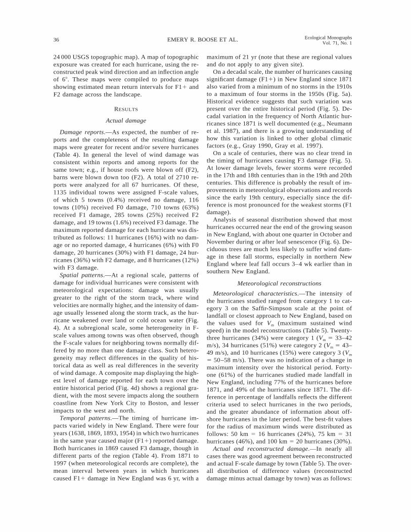
24 000 USGS topographic map). A map of topographicexposure was created for each hurricane, using the re-constructed peak wind direction and an inflection angleof 68. These maps were compiled to produce mapsshowing estimated mean return intervals for F11 andF2 damage across the landscape.
RESULTS
Actual damage
Damage reports.—As expected, the number of re-ports and the completeness of the resulting damagemaps were greater for recent and/or severe hurricanes(Table 4). In general the level of wind damage wasconsistent within reports and among reports for thesame town; e.g., if house roofs were blown off (F2),barns were blown down too (F2). A total of 2710 re-ports were analyzed for all 67 hurricanes. Of these,1135 individual towns were assigned F-scale values,of which 5 towns (0.4%) received no damage, 116towns (10%) received F0 damage, 710 towns (63%)received F1 damage, 285 towns (25%) received F2damage, and 19 towns (1.6%) received F3 damage. Themaximum reported damage for each hurricane was dis-tributed as follows: 11 hurricanes (16%) with no dam-age or no reported damage, 4 hurricanes (6%) with F0damage, 20 hurricanes (30%) with F1 damage, 24 hur-ricanes (36%) with F2 damage, and 8 hurricanes (12%)with F3 damage.
Spatial patterns.—At a regional scale, patterns ofdamage for individual hurricanes were consistent withmeteorological expectations: damage was usuallygreater to the right of the storm track, where windvelocities are normally higher, and the intensity of dam-age usually lessened along the storm track, as the hur-ricane weakened over land or cold ocean water (Fig.4). At a subregional scale, some heterogeneity in F-scale values among towns was often observed, thoughthe F-scale values for neighboring towns normally dif-fered by no more than one damage class. Such hetero-geneity may reflect differences in the quality of his-torical data as well as real differences in the severityof wind damage. A composite map displaying the high-est level of damage reported for each town over theentire historical period (Fig. 4d) shows a regional gra-dient, with the most severe impacts along the southerncoastline from New York City to Boston, and lesserimpacts to the west and north.
Temporal patterns.—The timing of hurricane im-pacts varied widely in New England. There were fouryears (1638, 1869, 1893, 1954) in which two hurricanesin the same year caused major (F11) reported damage.Both hurricanes in 1869 caused F3 damage, though indifferent parts of the region (Table 4). From 1871 to1997 (when meteorological records are complete), themean interval between years in which hurricanescaused F11 damage in New England was 6 yr, with a
maximum of 21 yr (note that these are regional valuesand do not apply to any given site).
On a decadal scale, the number of hurricanes causingsignificant damage (F11) in New England since 1871also varied from a minimum of no storms in the 1910sto a maximum of four storms in the 1950s (Fig. 5a).Historical evidence suggests that such variation waspresent over the entire historical period (Fig. 5). De-cadal variation in the frequency of North Atlantic hur-ricanes since 1871 is well documented (e.g., Neumannet al. 1987), and there is a growing understanding ofhow this variation is linked to other global climaticfactors (e.g., Gray 1990, Gray et al. 1997).
On a scale of centuries, there was no clear trend inthe timing of hurricanes causing F3 damage (Fig. 5).At lower damage levels, fewer storms were recordedin the 17th and 18th centuries than in the 19th and 20thcenturies. This difference is probably the result of im-provements in meteorological observations and recordssince the early 19th century, especially since the dif-ference is most pronounced for the weakest storms (F1damage).
Analysis of seasonal distribution showed that mosthurricanes occurred near the end of the growing seasonin New England, with about one quarter in October andNovember during or after leaf senescence (Fig. 6). De-ciduous trees are much less likely to suffer wind dam-age in these fall storms, especially in northern NewEngland where leaf fall occurs 3–4 wk earlier than insouthern New England.
Meteorological reconstructions
Meteorological characteristics.—The intensity ofthe hurricanes studied ranged from category 1 to cat-egory 3 on the Saffir-Simpson scale at the point oflandfall or closest approach to New England, based onthe values used for Vm (maximum sustained windspeed) in the model reconstructions (Table 5). Twenty-three hurricanes (34%) were category 1 (Vm 5 33–42m/s), 34 hurricanes (51%) were category 2 (Vm 5 43–49 m/s), and 10 hurricanes (15%) were category 3 (Vm
5 50–58 m/s). There was no indication of a change inmaximum intensity over the historical period. Forty-one (61%) of the hurricanes studied made landfall inNew England, including 77% of the hurricanes before1871, and 49% of the hurricanes since 1871. The dif-ference in percentage of landfalls reflects the differentcriteria used to select hurricanes in the two periods,and the greater abundance of information about off-shore hurricanes in the later period. The best-fit valuesfor the radius of maximum winds were distributed asfollows: 50 km 5 16 hurricanes (24%), 75 km 5 31hurricanes (46%), and 100 km 5 20 hurricanes (30%).
Actual and reconstructed damage.—In nearly allcases there was good agreement between reconstructedand actual F-scale damage by town (Table 5). The over-all distribution of difference values (reconstructeddamage minus actual damage by town) was as follows:

February 2001 37IMPACTS OF HURRICANES IN NEW ENGLAND
FIG. 4. Regional patterns of actual wind damage by town for selected major hurricanes: (a) N1815, (b) N1869a, (c)N1938, and (d) composite map showing the highest level of reported damage for each town in all 67 hurricanes studied.
two classes too low 5 7 towns (0.6%), one class toolow 5 259 towns (23%), no difference 5 684 towns(62%), one class too high 5 153 towns (14%), and twoclasses too high 5 7 towns (0.6%). Thus the recon-structed F-scale damage equaled the actual damage in62% of the cases and was within one damage class in
99% of the cases. Overall, there was a slight tendencyto underestimate actual damage. In some cases themodel also underestimated the level of damage on theleft side of the storm track, particularly when the stormpassed offshore. The highest level of reconstructeddamage over land in all storms was F2. There was no

38 EMERY R. BOOSE ET AL. Ecological MonographsVol. 71, No. 1
FIG. 5. Number of hurricanes by decade (1620–1997) over the entire study area with maximum reported damage on theFujita scale equal to (a) F1 or higher, (b) F3, (c) F2, and (d) F1.
clear evidence of widespread F3 damage over land dur-ing the historical period, nor of sustained wind speedshigh enough to produce such damage ($62 m/s) exceptperhaps along the coast.
Regional impacts.—As expected, estimated hurri-
cane frequency varied across the three observation pe-riods. For example, the estimated minimum return in-terval for F01 events in New England was greatest forthe period 1620–1997, suggesting that some of theseevents were not recorded in the early period; while the

February 2001 39IMPACTS OF HURRICANES IN NEW ENGLAND
FIG. 6. Seasonal distribution of hurricanes with maximum reported damage on the Fujita scale of F1 or higher (1620–1997), showing the date of landfall or closest approach to New England (Gregorian calendar).
greatest variation occurred for F2 events, no doubt be-cause of the small sample size (Table 6). Final resultspresented below for F01, F11, and F2 damage werebased on the periods 1871–1997, 1800–1997, and1620–1997, respectively, to maximize the observationperiod while still minimizing the likelihood that stormsof a given magnitude escaped historical notice.
Composite maps of individual hurricane reconstruc-tions, using best-fit values for radius of maximumwinds, showed clear gradients of reconstructed fre-quency and intensity across New England (Fig. 7).Mean return intervals for F0 damage (loss of leavesand branches) or higher ranged from 5 yr in Long Islandand southeastern New England to 85 yr in northwesternVermont and northernmost Maine (Fig. 8a). Mean re-turn intervals for F1 damage (scattered blowdowns,small gaps) or higher ranged from 10 yr in Long Islandand southeastern New England to .200 yr in northernMaine (Fig. 8b). Mean return intervals for F2 damage(extensive blowdowns, large gaps) ranged from 85 yrin eastern Long Island and southeastern New Englandto 150 yr in central Massachusetts and .380 yr acrossmost of northern New England (Fig. 8c). Maximumreconstructed F-scale damage showed much the samepattern, with values ranging from F2.5 in eastern Con-necticut, Rhode Island, and southeastern Massachusettsto F0.0 in northernmost Maine (Fig. 7d). This mapmatches the map of maximum reported damage (Fig.4d), except for the very high damage (F3) reported inthe vicinity of New York City.
Analysis of model sensitivity to the parameter Rm
(radius of maximum winds) yielded the following rangeof values for the maximum number of storms causingF2 damage over an area greater than one cell: fourstorms with Rm 5 50 km, five storms with Rm 5 bestfit, six storms with Rm 5 75 km, and seven storms withRm 5 100 km; with corresponding mean return intervals
of 95, 76, 63, and 54 yr, respectively (Fig. 9). Thusestimated return intervals for Rm 5 50 km and Rm 5100 km were within about 20 yr or 25% of the best-fit value of 76 yr.
Site and landscape impacts.—Timelines of recon-structed F-scale damage for the town of Petersham,Massachusetts, and the city of Providence, Rhode Is-land, were generated using the best-fit values for theradius of maximum winds (Fig. 10). Though the tem-poral patterns are similar, there are important differ-ences despite the fact that the sites are only 100 kmapart. On average, Providence experiences more hur-ricanes and more severe hurricanes than Petersham, asone would expect from the regional gradients describedabove. For example, hurricane damage at the F2 levelwas estimated to occur three times in Petersham andfive times in Providence over the historical period.
Peak hurricane wind directions were compared be-tween Petersham and Providence, using the best-fit val-ues for the radius of maximum winds (Fig. 11). Theplot for Petersham showed a concentration of stormswith peak winds from the northeast (i.e., storms passingto the east), while the highest winds came from thesoutheast (i.e., storms passing to the west). The plotfor Providence was similar, with a somewhat greaterfraction of storms with winds from the southeast, andone unusual storm with high winds from the southwest(N1804). At both sites peak hurricane winds were con-centrated in certain directions.
The role of local topography in modifying hurricanewind impacts was investigated for Petersham with theEXPOS model (Fig. 12). For the 19 hurricanes thatwere estimated to cause F11 damage, 74% of the land-scape was predicted to be exposed to all 19 storms(mean return interval 5 20 yr), 20% was exposed to10–18 storms (30 yr), and 6% was exposed to 1–9storms (75 yr). For the three hurricanes that were es-

40 EMERY R. BOOSE ET AL. Ecological MonographsVol. 71, No. 1
TABLE 5. Meteorological characteristics of the 67 hurri-canes investigated in this study, and comparisons betweenactual and reconstructed damage by town.
Hurri-cane
SSCat Track
Rm
(km)
Reconstructed damage minusactual damage
22 21 0 11 12
N1635 3 L 75 1 1N1638a 2 L 75 1N1638b 2 L 50 1 1N1646 2 L 100 1N1675 2 L 75 2 1N1683 1 L 75 1N1698 2 L 75 1N1716 2 O 75 1N1727 2 L 75 3 3N1761 2 L 75 4 2N1769 2 L 100 1 2N1770 2 L 75 2 1N1785 2 O 100 1N1788 3 L 50 13 8 4N1804 2 L 75 1 6 10 2N1806 2 O 75 2 1N1815 3 L 75 13 50 25 2N1821 3 L 50 5 18 9N1825 2 L 75 1N1830 2 O 75 2 1N1839 1 L 75 1 2N1841 2 O 75 2 5 2N1846 2 L 100 8 7N1849 2 O 100 2 1 1N1850 1 L 75 1 1N1854 2 O 100 1N1858 2 L 75 2 3N1861 1 L 100 1N1869a 3 L 50 13 48 19 5N1869b 3 L 50 2 1N1878 1 L 75 1 1N1888 2 O 75 1N1891 2 O 50N1893a 1 O 50N1893b 2 L 50 1 1N1893c 1 L 75 2 2N1896 1 L 50 1 1N1903 1 W 100 1 1N1904 1 L 75N1908 2 O 50N1916 1 L 50N1924 3 O 100 7 19N1927 2 O 75 1 1N1933 1 O 100 6 1N1934 1 L 100 1N1936a 1 L 75 4 2 1N1936b 1 O 75N1938 3 L 75 22 66 37N1940 1 O 100 1 1N1944 2 L 100 10 37N1950a 2 O 50N1950b 1 O 100 1N1953a 1 O 75 1N1953b 1 O 75N1954a 2 L 75 19 57 3N1954b 2 L 100 1 8 6 1N1958 3 O 50N1960 2 L 100 4 33 3N1961 1 L 50 6N1962a 2 O 50N1962b 1 O 100 1N1963 2 O 75 1 1N1969 3 L 50 1N1976 1 L 100 5 4
TABLE 5. Continued.
Hurri-cane
SSCat Track
Rm(km)
Reconstructed damage minusactual damage
22 21 0 11 12
N1985 2 L 75 3 41 47 7N1991 2 L 100 38 219 31N1996 1 O 100 2 4Totals 7 259 684 153 7
Notes: SS Cat 5 Saffir-Simpson category at landfall orclosest approach to New England. Track 5 landfall (L), off-shore (O), or passed to west (W) of New England. Rm 5 best-fit radius of maximum winds. Values in rightmost columnsshow the number of towns for the specified value of recon-structed damage minus actual damage on the Fujita scale.
TABLE 6. Reconstructed hurricane frequencies for three his-torical time periods, using best-fit values for the radius ofmaximum winds.
Dates YearsHurri-canes F01 F11 F2
1620–19971800–19971871–1997
378198127
675337
644
119
12
7650
127
Note: Values in rightmost columns are minimum mean re-turn intervals in years over the entire study area for F01,F11, and F2 wind damage on the Fujita scale.
timated to cause F2 damage, 82% of the landscape waspredicted to be exposed to all three storms (125 yr),10% was exposed to two storms (190 yr), 6% wasexposed to one storm (380 yr), and 2% was protectedfrom all 3 storms (.380 yr). This analysis suggests asignificant landscape-level gradient of hurricane im-pacts within the larger regional gradient, though mostof the gently rolling terrain of Petersham was predictedto be fully exposed to all storms.
DISCUSSION
Historical-modeling method
Historical completeness.—Perhaps the most difficultproblem in using historical materials to reconstruct hur-ricane regimes is estimating the completeness of theearly records. In New England, it is possible that allrecords of a storm in the first few decades after settle-ment were lost, particularly if impacts were confinedto sparsely settled areas such as the far eastern coastof Maine. On the other hand, there was considerabletraffic at sea even in the early 17th century, increasingthe likelihood that major hurricanes were not over-looked (cf. Lamb 1991). We find numerous accountsof the first storm on record (N1635) from ships at seaand from points along the coast of Maine and NovaScotia, fifteen years after the first European settlersarrived in New England. And observers often comparedthe current storm to other storms within living memory,suggesting the lack of comparable storms (at those lo-cations, at least) during the intervening years. Theprobability that a hurricane was overlooked is no doubt

February 2001 41IMPACTS OF HURRICANES IN NEW ENGLAND
FIG. 7. Regional gradients in reconstructed hurricane damage, using best-fit values for the radius of maximum winds:(a) F01 damage (1871–1997); (b) F11 damage (1800–1997); (c) F2 damage (1620–1997); and (d) maximum damage onthe Fujita scale in 0.5 class increments (1620–1997).
greatest for minimal hurricanes during the earliest pe-riod, which is why we relied on more recent time pe-riods for assessing weaker events in this study.
Damage assessment.—In this study, Fujita-scale val-ues were assigned to entire towns on the basis of his-torical reports of wind damage. Potential sources of
error include: (1) Damage levels may be overestimatedif the object damaged (e.g., a tree or a house) was weakor defective before the storm, or if severe damage ona smaller scale (e.g., caused by a tornado embedded inthe hurricane) is generalized to an entire town. Failureto exclude damage caused by storm surge or river flood-

42 EMERY R. BOOSE ET AL. Ecological MonographsVol. 71, No. 1
FIG. 8. Smoothed regional gradients in reconstructed hurricane damage, using best-fit values for the radius of maximumwinds: mean return intervals for (a) F01 damage (1871–1997), (b) F11 damage (1800–1997), and (c) F2 damage (1620–1997).
FIG. 9. Regional gradients in reconstructed F2 damage (1620–1997), for different fixed values of the radius of maximumwinds: (a) Rm 5 50 km; (b) Rm 5 75 km; (c) Rm 5 100 km.
ing may also lead to overestimation of the level of winddamage for coastal or valley towns. (2) Damage levelsmay be underestimated if suitable objects are not pre-sent in the area surveyed (e.g., if only barns and out-buildings are present, then the highest possible levelof damage to buildings is F2), or if examples of higherdamage are not observed and reported (e.g., in sparselypopulated areas). F-scale values may be higher for larg-er towns and cities than in the surrounding countrysidebecause there are more observers, more property sub-ject to potential damage, and better records. (3) Sys-tematic errors may occur because of differences in con-struction practices over time, or from place to place.The susceptibility of a particular building to wind dam-age is a complex function of building design and con-struction quality, as well as state of repair, wind di-rection, topographic position, surrounding wind breaks,
and whether or not doors and windows are open, closed,or shuttered (Liu 1993). However this information isgenerally unavailable from historical sources. Finally,(4) random errors may result from inaccuracies in thehistorical accounts.
The problems described above arise mainly from theneed to rely on written records and photographs fordamage assessment. However the basic technique wasfound to work well for the purposes of this study, large-ly because the Fujita damage classes are so broad. Theinclusion of all tree blowdowns as F1 and even partialhouse roof removals as F2 (required by the nature ofthe historical reports) may have contributed to theslight overall tendency for the model to underestimateactual wind damage.
Meteorological modeling.—Meteorological model-ing complements wind damage assessment by provid-

February 2001 43IMPACTS OF HURRICANES IN NEW ENGLAND
FIG. 10. Timelines of reconstructed hurricane damage on the Fujita scale by year for (a) Petersham, Massachusetts, and(b) Providence, Rhode Island.
FIG. 11. Reconstructed hurricane damage on the Fujita scale by peak wind direction for (a) Petersham, Massachusetts,and (b) Providence, Rhode Island (1620–1997). Each point represents one hurricane.

44 EMERY R. BOOSE ET AL. Ecological MonographsVol. 71, No. 1
ing informed estimates for sites that lack actual ob-servations, as well as a complete picture of the esti-mated impacts of each hurricane on a regional scale.Potential sources of error include: (1) The HURRE-CON model is based on an idealized wind profile thatworks best for intense hurricanes and less well for de-caying hurricanes or hurricanes becoming extratropicalstorms. The model is not able to reconstruct multiplewind maxima or other mesoscale features (Willoughby1995). (2) Damage estimates were based on peak 1/4-mile wind speed following Fujita’s method (1971),which assumes that the period of sustained wind re-quired to produce specific damage is inversely pro-portional to wind speed. This approach yields winddurations appropriate for tree and building damage(e.g., 12 s for minimal hurricane force winds), but doesnot take into account fatigue and stress damage thatmay occur on a scale of minutes or hours. (3) Uncer-tainties in input data (hurricane track, size, and inten-sity) are much greater for the early hurricanes, espe-cially in sparsely populated areas.
In this study, input data accuracy increased by aboutan order of magnitude over the historical period. HUR-DAT gives hurricane positions to the nearest tenth ofa degree (65 km) and maximum wind speeds to thenearest 5 knots (61.3 m/s), while the correspondinguncertainties for the earliest storms are closer to 6100km and 610 m/s. Less information was generally avail-able for Cape Cod, Martha’s Vineyard and Nantucket,the Maine coast, and northern New England; so un-certainties are greatest for early hurricanes in theseareas.
Despite these problems, regional maps of actual andreconstructed damage were found to agree closely forhurricanes since 1871, for which meteorological anddamage data were independent. This agreement was nodoubt enhanced by the small number of predicted dam-age classes (no damage, F0, F1, F2); a larger numberof classes would provide a more robust test of the mod-el, but was not practical given the nature of the his-torical materials. For hurricanes before 1871, modelreconstructions were consistent with available windand damage data.
Mean return intervals were clearly affected by sam-ple size. For example, the number of hurricanes esti-mated to cause widespread F01 damage in New Eng-land since 1871 (34 storms) or widespread F11 damagesince 1800 (34 storms) was large enough to create fairlysmooth maps of reconstructed frequency (Fig. 7a andb). However the number of hurricanes estimated to pro-duce widespread F2 damage since 1620 was smallenough (9 storms) that the maps of reconstructed fre-quency (Figs. 7c and 9) were relatively coarse and thearea of highest estimated frequency shifted from east-ern Long Island and Connecticut to Cape Cod withdifferent values of the radius of maximum winds.
Ecological significance for New England
Regional impacts.—Historical gradients in hurricanefrequency and intensity across New England resultfrom the consistent direction of the storm tracks, theshape of the coastline, and the tendency for hurricanesto weaken rapidly over land or over cold ocean waternorth of the Gulf Stream. These regional gradients arestrong enough to have significant ecological implica-tions. For example, the historical record suggests thathurricane impacts have been minimal in northern NewEngland, especially northernmost Maine, where F11damage has not occurred over the last 200 yr. On theother hand, southeastern New England experiencedF11 damage about every 10 yr on average and F2damage about every 85 yr. In these areas, a significantportion of the forest will experience blowdowns, withgap formation and recovery, on a scale of centuries.The major hurricanes may limit the maximum size andlife span of susceptible species such as white pine (Pi-nus strobus) on exposed sites, and the combination ofmajor and minor storms will cause most trees to ex-perience some wind damage during their lifetimes. Be-cause hurricanes are not evenly spaced in time, actualreturn intervals are sometimes much shorter than meanvalues and on rare occasions trees may be damagedtwice in the same season.
At a regional scale, the impact of these gradients iscontrolled in part by broad-scale differences in naturalvegetation and in land use and disturbance history. Forexample, forests on the immediate coastline and athigher elevations are routinely subject to higher windspeeds and may be more resilient to wind damage thanforests in surrounding areas, though they are also sub-ject to higher winds during a hurricane. The spruce–fir forests of northern New England and the Mainecoast, though less exposed to hurricane damage on av-erage, are more likely to experience fires after a majorhurricane than the hardwood forests of southern NewEngland, where fewer fine fuels are generated and de-composition is faster. Forests closer to population cen-ters are more likely to see blowdowns salvaged (fortimber or fire prevention) after a major hurricane. Andareas that have been cleared for agriculture or devel-opment, or whose forests are shorter in stature becauseof recent cutting, will tend to suffer less damage thanareas with mature forest.
These results allow us to broaden our appreciationfor the range of ecological roles that hurricanes mayplay in controlling forest structure and function. Em-phasis in the ecological and forestry literature is gen-erally placed on the catastrophic effect of hurricanesas they blow down extensive areas and create new,even-aged forests. Indeed our analysis identifies suchoccasional damage as important across southern andcentral New England and coastal Maine. However, hur-ricanes play another important role as a much morefrequent and less intensive disturbance factor gener-

February 2001 45IMPACTS OF HURRICANES IN NEW ENGLAND
FIG. 12. Landscape gradients in reconstructed hurricane damage for the town of Petersham, Massachusetts (1620–1997),using the EXPOS model: (a) mean return intervals for F11 damage; (b) mean return intervals for F2 damage.
ating small individual tree gaps, crown damage, branchbreak, and leaf stripping. Such damage is widespreadand frequent across the region.
Site and landscape impacts.—On a landscape scale,
in hilly or mountainous terrain, local topography mayprotect certain areas from wind damage from a givendirection. Such protection may be long-term if the dam-aging winds tend to come from the same direction in

46 EMERY R. BOOSE ET AL. Ecological MonographsVol. 71, No. 1
most or all hurricanes. In New England, the most dam-aging winds normally come from the southeast becauseof the direction of the storm tracks, the rapid forwardmotion of the storms, and the inward spiraling of windsat the surface. The size and spatial distribution of pro-tected areas depends on the interaction between winddirection and local topography. In the gently rollinglandscape of central New England around Petersham,areas predicted to have reduced long-term exposure todamaging winds were confined to relatively smallpatches in protected valleys and lee hillsides. Ofcourse, the more subtle effects of this long-term pro-tection on the vegetation are difficult to resolve in alandscape that has been so greatly affected by humanactivity in recent centuries.
The response of forest stands to winds of a givenspeed and duration varies considerably as a functionof stand composition and structure. In the 1938 hur-ricane, conifer stands at Harvard Forest (mostly whitepine) sustained greater damage than hardwood standsof the same height and exposure, while damage in-creased with stand height (Foster and Boose 1992).Thus site conditions and disturbance history play acritical role in determining forest response to wind. Incentral New England, for example, the two most pow-erful hurricanes since European settlement (N1815 andN1938) had different impacts on forests because ofsignificant differences in land use history. In 1815, only;15% of the landscape was forested, and some of thatwas probably sprout growth of low stature and lowsusceptibility to wind damage. In contrast, much of thelandscape in 1938 was forested, and there was an un-usual abundance of mature, old-field white pine thatwas highly susceptible to wind damage. Thus, whilethe two storms were of comparable strength and hadsimilar impacts on man-made structures, the hurricaneof 1938 probably caused greater damage to forests interms of the percentage of blowdowns and the fractionof the landscape affected.
No historical hurricanes in New England were pow-erful enough to blow down all the trees over extensiveareas. At the scale of individual trees, damage is quiteheterogeneous, and even the most severe storms in NewEngland, capable of producing extensive blowdowns,produce many more examples of lesser damage suchas individual treefall, branch break, and defoliation.The distribution of damage patch size tends to be highlyskewed, with a preponderance of small patches (Fosterand Boose 1992). The long-term impacts of blowdownsmay include changes in structure and composition,coarse woody debris, microtopography, and soil nutri-ent processes, as well as greater susceptibility to fire(Foster et al. 1997). The effects of repeated minor dam-age (loss of leaves and small branches) are not wellunderstood, but may be significant when combined withother stresses such as drought or disease.
Future impacts.—Present understanding of hurri-cane meteorology is not sufficient to predict the effects
of climate change on hurricane frequency and intensityon theoretical grounds alone. If sea surface tempera-tures increase with global warming, for example, thenthe theoretical upper limit on hurricane intensity willincrease, but the effects on mean hurricane intensity,frequency, and size are unclear. There is no evidencethat the regions currently impacted by hurricanes willundergo expansion or contraction (Emanuel 1997).Some global modeling results actually show a decreasein predicted hurricane frequency under a doubled CO2
regime, in part because of a predicted increase in ver-tical wind shear over the portions of the tropical oceanswhere hurricanes form (Bengtsson et al. 1997). An al-ternative, empirical approach to the problem is to com-pare the hurricane and climate regimes of the past. Thehistorical-modeling method presented here can be usedto help calibrate and interpret various techniques forstudying prehistoric hurricanes such as the stratigraphicanalysis of salt marsh deposits (e.g., Bravo et al. 1997).Though future climate change might lead to changesin hurricane frequency and intensity over New Eng-land, the gradient patterns identified in this study, re-sulting from storm track direction, coastline geography,and hurricane weakening over land or cold water, wouldprobably persist.
Application to other regions
The historical-modeling method makes it possible toquantify hurricane disturbance regimes in coastal for-ests, and can be applied to any part of the world wheregood historical records survive. The information ob-tained in this way can be combined with knowledge ofother disturbance events to build a comprehensive dis-turbance history for a site or region. It can also becombined with other techniques to help interpret evi-dence of prehistoric hurricanes. The main disadvantageof the approach is the time and effort required to locateand assess the historical materials. In some areas it mayalso be necessary to adapt or extend the Fujita scaledamage specifications to account for local buildingpractices and local vegetation.
ACKNOWLEDGMENTS
The authors thank S. Baker and M. Feldberg for assistancewith the historical research; S. Fitzgerald, M. Serrano, andB. Slater for help with the GIS analysis and figure preparation;H. Willoughby for supplying aerial reconnaissance data; andE. Johnson, S. Jackson, and an anonymous reviewer for in-valuable comments on the manuscript. The research was sup-ported by grants from the National Science Foundation (DEB-9318552 and DEB-9411975) and is a contribution from theHarvard Forest Long-Term Ecological Research Program.
LITERATURE CITED
Bengtsson, L., M. Botzet, and M. Esch. 1997. Numericalsimulation of intense tropical storms. Pages 67–90 in H. F.Diaz and R. S. Pulwarty, editors. Hurricanes: climate andsocioeconomic impacts. Springer-Verlag, New York, NewYork, USA.
Boose, E. R., K. E. Chamberlin, and D. R. Foster. 1997.Reconstructing historical hurricanes in New England. Pag-es 388–389 in Preprints of the 22nd conference on hurri-

February 2001 47IMPACTS OF HURRICANES IN NEW ENGLAND
canes and tropical meteorology. American MeteorologicalSociety, Boston, Massachusetts, USA.
Boose, E. R., D. R. Foster, and M. Fluet. 1994. Hurricaneimpacts to tropical and temperate forest landscapes. Eco-logical Monographs 64:369–400.
Bravo, J., J. P. Donnelly, J. Dowling, and T. Webb. 1997.Sedimentary evidence for the 1938 hurricane in southernNew England. Pages 395–396 in Preprints of the 22nd con-ference on hurricanes and tropical meteorology. AmericanMeteorological Society, Boston, Massachusetts, USA.
Darling, N. 1842. Notice of a hurricane that passed over NewEngland in September, 1815. American Journal of Scienceand Arts 42:243–252.
Diaz, H. F., and R. S. Pulwarty, editors. 1997. Hurricanes:climate and socioeconomic impacts. Springer-Verlag, NewYork, New York, USA.
Dunn, G. E., and B. I. Miller. 1964. Atlantic hurricanes.Revised edition. Louisiana State University Press, BatonRouge, Louisiana, USA.
Eastman, J. R. 1997. IDRISI for Windows, version 2.0. ClarkUniversity, Department of Geography, Worcester, Massa-chusetts, USA.
Emanuel, K. A. 1997. Climatic variations and hurricane ac-tivity: some theoretical issues. Pages 55–65 in H. F. Diazand R. S. Pulwarty, editors. Hurricanes: climate and so-cioeconomic impacts. Springer-Verlag, New York, NewYork, USA.
Fernandez-Partagas, J., and H. F. Diaz. 1995. A reconstruc-tion of historical tropical cyclone frequency in the Atlanticfrom documentary and other historical sources 1851 to1880. Part I (1851–1870) and Final Report. Climate Di-agnostics Center, National Oceanographic and AtmosphericAdministration, Washington, D.C., USA.
Foster, D. R. 1983. The history and pattern of fire in theboreal forest of southeastern Labrador. Canadian Journalof Botany 61:2459–2471.
Foster, D. R., and J. D. Aber, editors. 2001. Forests in time:the environmental consequences of 1000 years of changein New England. Oxford University Press, Oxford, UK.
Foster, D. R., J. D. Aber, J. M. Melillo, R. D. Bowden, andF. A. Bazzaz. 1997. Forest response to disturbance andanthropogenic stress: rethinking the 1938 Hurricane andthe impact of physical disturbance vs. chemical and climatestress on forest ecosystems. BioScience 47(7):437–445.
Foster, D. R., and E. R. Boose. 1992. Patterns of forest dam-age resulting from catastrophic wind in central New Eng-land, U.S.A. Journal of Ecology 80:79–98.
Foster, D. R., and E. R. Boose. 1995. Hurricane disturbanceregimes in temperate and tropical forest ecosystems. Pages305–339 in M. P. Coutts and J. Grace, editors. Wind andtrees. Cambridge University Press, Cambridge, UK.
Foster, D. R., D. H. Knight, and J. F. Franklin. 1998. Land-scape patterns and legacies resulting from large, infrequentforest disturbances. Ecosystems 1:497–510.
Fujita, T. T. 1971. Proposed characterization of tornadoes andhurricanes by area and intensity. Satellite and Mesometeo-rology Research Project Research Paper 91. University ofChicago, Chicago, Illinois, USA.
Fujita, T. T. 1987. U.S. Tornadoes: Part one, 70-year statistics.Satellite and Mesometeorology Research Project ResearchPaper 218. University of Chicago, Chicago, Illinois, USA.
Gray, W. M. 1990. Strong association between West Africanrainfall and U.S. landfalling intense hurricanes. Science249:1251–1256.
Gray, W. M., J. D. Sheaffer, and C. W. Landsea. 1997. Climatetrends associated with multidecadal variability of Atlantichurricane activity. Pages 15–53 in H. F. Diaz and R. S.Pulwarty, editors. Hurricanes: climate and socioeconomicimpacts. Springer-Verlag, New York, New York, USA.
Grazulis, T. P. 1993. Significant tornadoes 1680–1991. En-vironmental Films, St. Johnsbury, Vermont, USA.
Heinselman, M. L. 1973. Fire in the virgin forests of theBoundary Waters Canoe Area, Minnesota. Quaternary Re-search 3:329–382.
Henry, J. D., and J. M. A. Swan. 1974. Reconstructing foresthistory from live and dead plant material—an approach tothe study of forest succession in southwest New Hampshire.Ecology 55:772–783.
Holland, G. J. 1980. An analytical model of the wind andpressure profiles in hurricanes. Monthly Weather Review108:1212–1218.
Houston, S. H., and M. D. Powell. 1993. Surface wind fieldsduring Hurricane Bob’s (1991) landfall in New England.Pages 58–61 in Preprints of the 20th conference on hur-ricanes and tropical meteorology. American MeteorologicalSociety, Boston, Massachusetts, USA.
Hunter, M. L. 1993. Natural fire regimes as spatial modelsfor managing boreal forests. Biological Conservation 65:115–120.
Johnson, E. A. 1992. The ecology of fire in the boreal forest.Cambridge University Press, Cambridge, UK.
Lamb, H. 1991. Historic storms of the North Sea, BritishIsles and northwestern Europe. Cambridge UniversityPress, Cambridge, UK.
Liu, H. 1993. Calculation of wind speeds required to damageor destroy buildings. Pages 535–541 in C. Church, D. Bur-gess, C. Doswell, and R. Davies-Jones, editors. The tor-nado: its structure, dynamics, prediction, and hazards. Geo-physical Monograph 79. American Geophysical Union,Washington, D.C., USA.
Liu, K., and M. L. Fearn. 1997. Lake sediment records ofHurricane Opal and prehistoric hurricanes from the Floridapanhandle. Pages 397–398 in Preprints of the 22nd con-ference on hurricanes and tropical meteorology. AmericanMeteorological Society, Boston, Massachusetts, USA.
Ludlum, D. M. 1963. Early American hurricanes 1492–1870.American Meteorological Society, Boston, Massachusetts,USA.
Metropolitan District Commission. 1995. Final managementplan for the Quabbin Reservoir Reservation. MetropolitanDistrict Commission, Boston, Massachusetts, USA.
Minsinger, W. E. 1988. The 1938 hurricane: an historical andpictorial summary. Blue Hill Meteorological Observatory,East Milton, Massachusetts, USA.
Minsinger, W. E., and C. T. Orloff. 1992. Hurricane Bob,August 16–August 20, 1991: a brief history. Blue Hill Me-teorological Observatory, East Milton, Massachusetts,USA.
Minsinger, W. E., and C. T. Orloff. 1994. The Great AtlanticHurricane, September 8–16, 1944: an historical and pic-torial summary. Blue Hill Meteorological Observatory,East Milton, Massachusetts, USA.
National Oceanic and Atmospheric Administration. 1994.Global tropical/extratropical cyclone climatic atlas. CD-ROM, version. 1.0. NOAA/U.S. Navy, Washington, D.C.,USA.
Neumann, C. J., B. R. Jarvinen, and A. C. Pike. 1987. Trop-ical cyclones of the North Atlantic ocean 1871–1986 Thirdrevised edition. NOAA-National Climatic Data Center,Asheville, North Carolina, USA.
Neumann, C. J., and C. J. McAdie. 1997. The Atlantic trop-ical cyclone file: a critical need for a revision. Pages 401–402 in Preprints of the 22nd conference on hurricanes andtropical meteorology. American Meteorological Society,Boston, Massachusetts, USA.
Perley, S. 1891. Historic storms of New England. SalemPress, Salem, Massachusetts, USA.
Powell, M. D. 1982. The transition of the Hurricane Frederic

48 EMERY R. BOOSE ET AL. Ecological MonographsVol. 71, No. 1
boundary-layer wind field from the open Gulf of Mexicoto landfall. Monthly Weather Review 110:1912–1932.
Powell, M. D. 1987. Changes in the low-level kinematic andthermodynamic structure of Hurricane Alicia (1983) atlandfall. Monthly Weather Review 115:75–99.
Powell, M. D., S. H. Houston, and T. A. Reinhold. 1994.Standardizing wind measurements for documentation ofsurface wind fields in Hurricane Andrew. Pages 52–69 inR. A. Cook and M. Soltani, editors. Hurricanes of 1992:lessons learned and implications for the future. AmericanSociety of Civil Engineers, New York, New York, USA.
Quine, C. P. 1995. Assessing the risk of wind damage toforests: practice and pitfalls. Pages 378–403 in M. P. Couttsand J. Grace, editors. Wind and trees. Cambridge Univer-sity Press, Cambridge, UK.
Scatena, F. N., and M. C. Larsen. 1991. Physical aspects ofHurricane Hugo in Puerto Rico. Biotropica 23:317–323.
Simpson, R. H., and H. Riehl. 1981. The Hurricane and itsimpact. Louisiana State University Press, Baton Rouge,Louisiana, USA.
Smith, D. M. 1946. Storm damage in New England forests.Thesis. Yale University, New Haven, Connecticut, USA.
Stephens, E. P. 1955. The historical-development method ofdetermining forest trends. Dissertation. Harvard Univer-sity, Cambridge, Massachusetts, USA.
Studholme, W. P. 1995. The experience of and managementstrategy adopted by the Selwyn Plantation Board, New Zea-land. Pages 468–476 in M. P. Coutts and J. Grace, editors.Wind and trees. Cambridge University Press, Cambridge,UK.
Twisdale, L. A. 1978. Tornado data characterization andwindspeed risk. Journal of the Structural Division, Pro-ceedings of the American Society of Civil Engineers 104:1611–1630.
Tyler, L. H. 1938. An album of pictures of the New EnglandHurricane and floods of September, nineteen hundred andthirty-eight. City Printing Company, New Haven, Con-necticut, USA.
Westveld, M. 1956. Natural forest vegetation zones of NewEngland. Journal of Forestry 54:332–338.
Willoughby, H. E. 1995. Mature structure and evolution.Pages 21–62 in Global perspectives on tropical cyclones.World Meteorological Organization, Geneva, Switzerland.


![HURRICANE IMPACTS ON KEY DEER IN THE FLORIDA KEYS et al 2003b [Hurricane impacts..].pdf · 2001). Hurricanes have been a major natural dis-turbance affecting coastal areas in the](https://img.dokumen.tips/doc/110x75/5ec9612dd44861083e4f3b03/hurricane-impacts-on-key-deer-in-the-florida-keys-et-al-2003b-hurricane-impactspdf.jpg)