Embed Size (px)
Citation preview

Land at asker Lane Matlock derbyshireDESIGN AND ACCESS STATEMENTPrEPArED by PEGASuS urbAN DESIGN | rIChborouGh ESTATES | JANuAry 2014 | bIr.4029

Pegasus urban DesignThe CourtyardChurch StreetLockingtonDerbyshireDE74 2SLwww.pegasuspg.co.uk I T 01509 670806 I F 01509 672247
Prepared by Pegasus Urban Design. Pegasus Urban Design is part of Pegasus Group Ltd Prepared on behalf of Richborough EstatesProject code: BIR.4029Document ref: BIR.4029_200Contact: Haydn Jones, Paul Smith, Robert BlandfordChecked by: XXX
CoPyrIGhT The contents of this document must not be copied or reproduced in whole or in part without the written consent of Pegasus Group Ltd.Front cover: Aerial photo (grey scale) of the site.
Crown copyright. All rights reserved, Licence number 100042093
date Comment Created by Checked by Version
29.11.2013 For initial internal review RB - 1st draft
09.01.2014 client review RB PS 2nd draft
27.01.2014 Final Draft for client review RB PS 3rd draft
30.01.2014 Final Draft for client review RB - 4th draft
Matlock derbyshire DeSign & acceSS StateMent
3prepared by Pegasus Urban Design on behalf of Richborough Estates
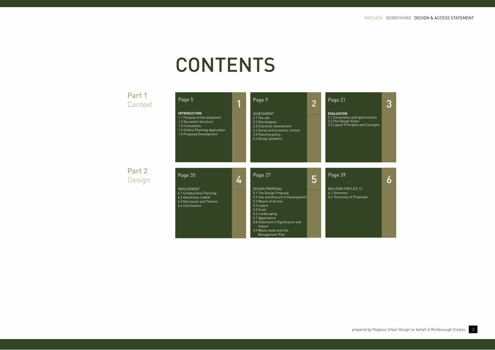
CoNTENTS
aSSeSSMent2.1 the site2.2 Site analysis2.3 character assessment 2.4 Social and economic context2.5 Planning policy2.6 Design guidance
2Page 9
eVaLUatiOn3.1 constraints and opportunities3.2 the Design Vision3.3 layout Principles and concepts
3Page 21
BUilDing FoR liFe 126.1 Summary6.2 Summary of Proposals
6Page 39
DeSign PRoPoSal5.1 the Design Proposal5.2 Use and amount of Development5.3 Means of access5.4 layout5.5 Scale5.6 landscaping5.7 appearance5.8 Statement if Significance and impact5.9 Waste audit and Site Management Plan
5Page 27
inVolVeMent4.1 collaborative Planning4.2 awareness leaflet4.3 key issues and themes4.4 conclusions
4Page 35
intrOdUCtiOn1.1 Purpose of the statement1.2 Document structure1.3 consultants1.4 outline Planning application1.5 Proposed Development
1Page 5Part 1Context
Part 2Design

the Vision
the vision for the land at asker lane is to provide a new high quality development that integrates with the existing settlement of Matlock and complements the existing landscape setting.
“ “
aeriaL phOtOgraph Of the site and its sUrrOUnding COntext

Matlock derbyshire DeSign & acceSS StateMent
5prepared by Pegasus Urban Design on behalf of Richborough Estates
1.1 PURPoSe oF the StateMent
1.1.1 This Statement has been prepared by Pegasus Urban Design on behalf of richborough Estates to accompany the outline planning application for residential development on land off Asker Lane, Matlock.
1.1.2 This statement has been prepared in accordance with Article 8 of the Town and Country Planning (Development Management Procedure) (England) Order 2010, as amended June 2013, which requires certain applications to be accompanied by a Design and Access Statement. Reference has also been made to DCLG Circular 01/2006 and the Commission for Architecture and the Built Environment’s (CABE) guidance on ‘Design and Access Statements: How to write, read and use them’ (CABE, 2006).
1.1.3 The purpose of this statement is to explain; “the design principles and concepts that have been applied to the proposed development and how issues relating to access to the development have been dealt with” (para. 80, DCLG Circular 01/2006).
1.1.4 The Town and Country Planning (Development Management Procedure) (England) Order 2010 (as amended 2013) also states the following requirements:
“(2) an application for planning permission to which this article applies shall be accompanied by a statement (“a design and access statement”) about:
(a) the design principles and concepts that have been applied to the development; and
(b) how issues relating to access to the development have been dealt with.
(3) a design and access statement shall:
(a) explain the design principles and concepts that have been applied to the development;
(b) demonstrate the steps taken to appraise the context of the development and how the design of the development takes that context into account;
(c) explain the policy adopted as to access, and how policies relating to access in relevant local development documents have been taken into account;
(d) state what, if any, consultation has been undertaken on issues relating to access to the development and what account has been taken of the outcome of any such consultation; and
(e) explain how any specific issues which might affect access to the development have been addressed.”
1.1.5 A Building for Life (BfL) Assessment has also been undertaken in accordance with BfL 12. Section 6 of this DAS provides evidence in relation to the 12 Building for Life questions.
introduction1 “the government attaches great importance to the design of the built environment. good design is a key aspect of sustainable development, is indivisible from good planning, and should contribute positively to making places better for people.”
(para 56 of nPPF)

Matlock derbyshire DeSign & acceSS StateMent
6 prepared by Pegasus Urban Design on behalf of Richborough Estates
1.3 conSUltantS
1.3.1 The document has been prepared by Pegasus Urban Design, masterplanners and urban designers, with contributions from the following consultants who have helped prepare the outline planning application and its accompanying documents:
pegasus group
Planning
Landscape
ptb
Transport
bWb
Hydrology
Just ecology
Ecology
Midland forestry
Trees
northamptonshire archaeology
Cultural Heritage
1.2 DocUMent StRUctURe
1.2.1 The document is divided into six sections as follows:
Section 1 - Introduction - outlines the purpose of the document;
Section 2 - Assessment - considers the site and its surroundings in terms of the physical, social and planning context as part of Article 8(3)(b) and 8(3)(c) DMPO 2010 (as amended 2013) requirements;
Section 3 - Evaluation - identifies the site’s constraints and opportunities and presents the design principles that have been derived from a combination of Government Policy, site assessment, public consultation and design evolution as referred to within Article 8(3)(e) DMPO 2010 (as amended 2013);
Section 4 - Involvement - outlines the stakeholder participation and consultation undertaken as well as its key findings as part of the Article 8(3)(d) DMPO 2010 (as amended 2013) requirements;
Section 5 - Design Proposals - presentation of the design proposals including uses and amount proposed, access arrangements, layout of the development, scale of buildings, landscaping treatments and appearance, as required within Article 8(3)(a) & (4)(c) DMPO 2010 (as amended 2013).
Section 6 - building for Life 12 - sets out a Building for Life 12 summary for the design proposals and provides an overview of the Design and Access Statement.
1.2.2 This statement should be read in conjunction with the Outline Planning Application and its accompanying documents including the Planning Statement, Transport Statement, Heritage Statement, Ecology Assessment, Landscape Assessment, Flood Risk Assessment, and Statement of Community Involvement.
1.4 oUtline Planning aPPlication
1.4.1 The outline application is for a comprehensive residential development for up to 110 dwellings and associated uses. This includes: a new access from Asker Lane and related road infrastructure; new pedestrian links; comprehensive green infrastructure; water attenuation area, informal and formal public open space.
1.4.2 The application is seeking outline planning permission with all matters reserved except for access. Therefore layout, scale, appearance, landscaping and the details of the internal highway/cycle/pedestrian network will all be determined at a later date. However, an Illustrative Masterplan is submitted with the application to show how the site can be developed and that it can accommodate the level of development proposed. This indicative layout has been informed by a number of technical studies and assessments including those for ecology, highways, landscape, drainage, trees and hedgerows, and archaeology/cultural heritage.
1.4.3 The site is being brought forward by Richborough Estates with the overriding aim of providing a new residential development that respects and enhances the existing landscape setting of the site but also fulfils a role in the wider neighbourhood, respecting the character of the local vernacular within the context of Matlock and the adjacent conservation area.
1.4.4 In order to achieve that aim, the proposal includes the following elements.
•Up to 110 dwellings in a range of types and tenure.
•Public open space.
•Water attenuation.
•Safe and convenient access from Asker Lane and the existing access road from Chesterfield Road, otherwise known as the Presentation Sisters access road.

Matlock derbyshire DeSign & acceSS StateMent
7prepared by Pegasus Urban Design on behalf of Richborough Estates
1.5 PRoPoSeD DeVeloPMent
site area
7.25 hectares gross/ 3.314 hectares net*
Current land use
Agricultural fields
access
Asker Lane
Existing Chesterfield Road from Presentation Sisters access
proposed uses
Residential: 3.314ha - 47%
Open space: 3.792ha - 52%
Existing road infrastructure: 0.146ha - 1%
proposed number of dwellings
Up to 110 dwellings.
average net density*
32.5 dwellings per hectare.
* Net area excludes constrained land and areas to be used for structural landscape. Net area corresponds to the land that is available for development.
right illUStRatiVe MaSteRPlan
N


Matlock derbyshire DeSign & acceSS StateMent
9prepared by Pegasus Urban Design on behalf of Richborough Estates
“...a crucial first step to achieving good design is to develop a thorough understanding of the context within which the new housing will sit and then the nature of the site itself and its immediate surroundings”(page 16 of Better Places to Live: By Design)
2 2.1 the Site
2.1.1 This chapter of the Design and Access Statement provides a baseline analysis of the existing context of Matlock and an assessment undertaken of the site.
2.1.2 The site is located in Matlock. Matlock is in the county town of Derbyshire and is situated at the south eastern edge of the Peak District.
2.1.3 Matlock is nine miles (14 km) south-west of Chesterfield, and in easy reach of the cities of Derby (30km), Sheffield (32km), and Nottingham (47km); the Greater Manchester conurbation is 48km away. Matlock, in west Derbyshire, is within the Derbyshire Dales which includes the towns of Bakewell and Ashbourne, as well as Wirksworth.
2.1.4 The site is effectively split into two parts by the Public Right of Way (PRoW) and access road that leads from Chesterfield Road to the east.
2.1.5 The site has two access points; one off Asker Lane and the other off the Presentation Sister access road from Chesterfield Road.
2.1.6 The northern part of site (larger area) is defined by a number of landscape and townscape features, which include a well established network of hedgerows and trees, particularly along the edges of the site as well as through the centre. To the north western corner are existing residential properties that back on to the site.
2.1.7 The southern part of the site also contains a number of well established trees and hedgerows. To the south are existing residential properties along Hilltops View that back onto the site.
assessment
abOVe Site location Plan
key destinatiOns frOM the site distanCe (km)
ChesterfieLd 14km
derby 30km
sheffieLd 32km
nOttinghaM 47km

Matlock derbyshire DeSign & acceSS StateMent
10 prepared by Pegasus Urban Design on behalf of Richborough Estates
2.2 Site analySiS
ExISTING LAND uSES2.2.1 The site is currently occupied by a collection of fields
separated by mature hedgerows and dry stone walls with a number of mature trees. The fields are covered with overgrown grassland vegetation. The fields in the south and south-east of the site are covered with a number of young trees in addition to the general rough grassland vegetation.
SurrouNDING LAND uSES2.2.2 The site is bound to the north by Asker Lane beyond
which are residential properties, to the north-east by Bull Lane beyond which are residential properties, to the south-east by the buildings and residential properties associated with Bull Farm beyond which are further fields, to the south by residential properties, to the south-west by a primary school with associated grounds that is understood to have been a convent. The site is bound to the west by residential properties, playing fields and offices.
ExISTING ACCESS2.2.3 Access to the site is gained via a gateway that enters
the south-western corner of the central field. From this access point the fields to the north of the main footpath can also be accessed. The site can also be accessed from Asker Lane to the north and the Presentation Sister Access Road to the south.
PEDESTrIAN & CyCLE LINkS2.2.4 A number of tracks or footpaths are present across the
fields with the most prominent crossing the southern part of the site from east to west.
2.2.5 There is also a PRoW that runs through the centre of the site, in an east-west direction connecting Bull Lane to Chesterfield Road.
abOVe PhotoS oF the Site anD SURRoUnDing context

Matlock derbyshire DeSign & acceSS StateMent
11prepared by Pegasus Urban Design on behalf of Richborough Estates
LANDSCAPE SETTING AND vEGETATIoN2.2.6 The site is currently occupied by a collection of fields
separated by mature hedgerows and dry stone walls with a number of mature trees. The fields are covered with overgrown grassland vegetation. The fields in the south and south-east of the site are covered with a number of young trees in addition to the general rough grassland vegetation.
2.2.7 In the north-eastern part of the site is a mound named ‘Baileys Tump’ which was formed from the spoil arising from the excavations associated with the Derwent Valley Aqueduct. This mound was used as an air defence installation during the Second World War and the remains of the defensive installations are clearly visible.
ECoLoGy2.2.8 The site provides a relatively diverse range of habitats.
The tall ruderal and scrub habitats with scattered trees provide a relatively diverse structure and may be used by a range of species. Although there are a few hedgerows within the site, these are generally species rich and are UK BAP priority habitats.
ArChAEoLoGy2.2.9 There is a single Historic Environment Record
monument within the site; that of Bailey’s Tump, a Second World War air defence site. This is currently under lease to Matlock Town Council and will not be developed.
2.2.10 There are a number of dry stone walls within the site and along it’s boundaries which are characteristic within the region and the locality of Matlock and are therefore an important feature to maintain and enhance.
2.2.11 Matlock Bank Conservation Area lies to the west of the site.
abOVe VieWS oF the Site

Matlock derbyshire DeSign & acceSS StateMent
12 prepared by Pegasus Urban Design on behalf of Richborough Estates
ToPoGrAPhy AND TErrAIN2.2.12 The site occupies an elevated position off Asker Lane,
at approximately +195m AOD along its northern edge. The land then rises to the north where it eventually reaches a height of +208m AOD in the vicinity of Bentley Bridge and continues to increase in height to the north. To the south, the land falls until it reaches a level of approximately +100m AOD in the vicinity of Matlock Green as it follows a stream corridor. The site lies on a south facing valley side.

Matlock derbyshire DeSign & acceSS StateMent
13prepared by Pegasus Urban Design on behalf of Richborough Estates
LANDSCAPE PLANNING DESIGNATIoNS2.2.13 Key landscape planning designations are illustrated
opposite.

Matlock derbyshire DeSign & acceSS StateMent
14 prepared by Pegasus Urban Design on behalf of Richborough Estates
vISuAL ANALySIS2.2.14 The site is set within an enclosed landscape where
individual trees and tree groups to settlements and farmsteads have created framed views across the landscape, reinforced by the local topography, which is often steep sided in places, providing views across valley floors that are heavily developed with commercial, residential and elements of road infrastructure. What is common to all these views is that the existing urban edge and urbanising elements are visible, particularly to the north, west and south, though mature boundary vegetation obscures some of the more immediate adjacent residential surrounds.
2.2.15 The site benefits from landscape infrastructure that creates enclosure; therefore views into the site from Chesterfield Road and Bull Lane reach only part way into the site, with intermittent views extending through the layered vegetation. The Views from Asker Lane and the upper part of the site retain a greater relationship in landscape and visual terms with the wider landscape context.
2.2.16 The visual assessment references a series of viewpoints that are representative of visual receptors in the area. A detailed description of the locations identified as representative receptors in the LVIA.
right Photo locationS Within the Site
right VieWPoint 2
right VieWPoint 3

Matlock derbyshire DeSign & acceSS StateMent
15prepared by Pegasus Urban Design on behalf of Richborough Estates
right VieWPoint 4
right VieWPoint 6
right VieWPoint 7
right VieWPoint 10

Matlock derbyshire DeSign & acceSS StateMent
16 prepared by Pegasus Urban Design on behalf of Richborough Estates
2.3 chaRacteR aSSeSSMent
urbAN forM AND LAyouT2.3.1 Chesterfield Road is a primary route that connects the
site to the wider context including the A615 and the A61. The road is enclosed by residential development that is made up from an array of building types and forms, set within a rich landscape.
2.3.2 There are a number of different architectural styles within Matlock and along Chesterfield, which provide some precedents for new development. This includes the traditional stone terraces that are close to the back edge of pavement. Other building forms include semi-detached and detached properties, particularly towards the edges of Matlock.
2.3.3 The architectural design, style, layout and form of local buildings and streets represents a local character that could provide a strong design rationale for the new development.
2.3.4 The majority of the housing to the north of the site was built on greenfield land between the mid-1970s and the 1980s. Beyond this housing is Highfields School. The remainder of the northern/north western boundary is formed by properties on the southern side of Asker Lane and along Chesterfield Road. It is understood that the properties on the south side of Asker Lane were constructed in the 1990s.
MATLoCk bANk CoNSErvATIoN ArEA2.3.5 The site is located next to the Matlock Bank
Conservation Area. Further detail on the conservation area is provided on page 16.
abOVe PhotoS oF SURRoUnDing context.

Matlock derbyshire DeSign & acceSS StateMent
17prepared by Pegasus Urban Design on behalf of Richborough Estates
abOVe local FacilitieS anD SeRViceS
2.4 Social anD econoMic context
fACILITIES AND SErvICES2.4.1 An assessment of existing facilities and services in the
local area has been undertaken. The site is within access of local facilities and services located in Matlock as well as higher order facilities, services and employment opportunities in Chesterfield.
EDuCATIoN2.4.2 The nearest primary schools to the site area St Josephs
Catholic Primary School and Castle View Primary School. For secondary education the site is also served by Highfields School.
hEALTh AND CoMMuNITy fACILITIES2.4.3 The closest GP surgery is located in the town centre.
In terms of other community based facilities, Matlock Library is located within the centre of the town.
ShoPPING AND SErvICES2.4.4 There are a number of shops and retail facilities within
Matlock Town Centre, including Sainsburys Supermarket and Somerfield Supermarket.
SPorT AND rECrEATIoN2.4.5 There are a large number of public open spaces in the
local area such as Spider Park which is located to the south of the site. More formal sports and recreation opportunities are available in the local area, particularly to the north of the town. Matlock Town Football Club is located in the centre of town.
EMPLoyMENT oPPorTuNITIES2.4.6 Employment opportunities are available within the local
area and within Chesterfield. Matlock also consists of both Derbyshire County Council and Derbyshire Dales District Council.
PubLIC TrANSPorT2.4.7 There are three bus services that operate within close
proximity of the site. This includes bus service 64, M1 and the X17.
2.4.8 Bus stops are located on; Asker Lane, Chesterfield Road just to the north of Asker Lane, and on Wellington Street.
2.4.9 The distances from the centre of the site are 100m, 300m and 340m respectively; therefore, all bus stops are within an easy walking distance of the site and within the 400m threshold prescribed in the ‘6C’s Design Guide’.
2.4.10 The site is provided with a reasonable level of bus service towards Chesterfield and Sheffield, with services starting early and finishing well into the evening as far as Chesterfield (services to Sheffield finish early evening).
2.4.11 Service M1 provides local links including to the town centre and railway station.

Matlock derbyshire DeSign & acceSS StateMent
18 prepared by Pegasus Urban Design on behalf of Richborough Estates
2.5 Planning PolicieS
NATIoNAL PoLICy2.5.1 Development proposals will be formulated having
due regard to the policies that make up the statutory Development Plan, and supplementary guidance together with the relevant emerging local policies.
2.5.2 Government guidance in the form of the National Planning Policy Framework (NPPF) states that there is a presumption in favour of sustainable development. A core principle of this is to:
“Always seek to secure high quality design and a good standard of amenity for all existing and future occupants of land and buildings.”
(para. 17, point 4, NPPF, 2012)
2.5.3 National Planning Policy Framework (Section 7: Requiring good design) sets out the Government’s commitment to good design:
“The Government attaches great importance to the design of the built environment. Good design is a key aspect of sustainable development, is indivisible from good planning, and should contribute positively to making places better for people.”
“It is important to plan positively for the achievement of high quality and inclusive design for all development, including individual buildings, public and private spaces and wider area development schemes.”
(para. 56 & 57, NPPF, 2012)
2.5.4 Furthermore, the NPPF seeks to promote more sustainable development by requiring an approach that is based on stated objectives for the future of the area and an understanding and evaluation of its defining characteristics. Therefore, future design decisions should aim to ensure that developments:
•add to the overall quality of the area;
•establish a strong sense of place;
•optimise the use of land and placing an importance on high quality design;
• respond to the local character and history;
•create safe and accessible environments; and
•are visually attractive with good architecture and appropriate landscaping.
(para. 58, NPPF, 2012)
“our standards of design can be so much higher. We are a nation renowned worldwide for creative excellence, yet, at home, confidence in development itself has been eroded by the too frequent experience of mediocrity.”(page ii, NPPF, 2012)

Matlock derbyshire DeSign & acceSS StateMent
19prepared by Pegasus Urban Design on behalf of Richborough Estates
buILDING for LIfE 122.5.5 Building for Life is the industry standard, endorsed
by the Government, for well-design homes and neighbourhoods that local communities, local authorities and developers are invited to stimulate conversations about creating good places to live.
2.5.6 The 12 questions reflect the vision of what new housing developments should be: attractive, functional and sustainable places. BfL12 is based on the new National Planning Policy Framework and the Government’s commitment to build more new homes.
2.5.7 The 12 questions are designed to help structure discussions between local communities, the local planning authority and the developer of the proposed scheme. It is also designed to help local planning authorities assess the quality of proposed and completed schemes.
2.5.8 To answer the 12 Building for Life questions specific references have been made within Section 6 of this DAS.
“Building for life is the industry standard, endorsed by government, for well-designed homes and neighbourhoods that local communities, local authorities and developers are invited to use to stimulate conversations about creating good places to live.”(page 2, Building for Life 12, 2012)

Matlock derbyshire DeSign & acceSS StateMent
20 prepared by Pegasus Urban Design on behalf of Richborough Estates
LoCAL PoLICy2.5.9 This section provides an overview of relevant planning
policy.
2.5.10 This section addresses the Development Plan, which for the purposes of this application is the Saved Policies of the Adopted Derbyshire Dales Local Plan (2005). Other associated local supplementary planning documents/guidance including Affordable Housing Supplementary Planning Guidance (July 2006) and Landscape Character and Design Supplementary Planning Document (July 2007) are also relevant to the application.
DErbyShIrE DALES LoCAL PLAN (2005)2.5.11 The Derbyshire Dales Local Plan was adopted in
November 2005 and provides policy guidance for the period to 2011. In November 2008 the Secretary of State issued a Direction outlining a number of policies which could be saved until new policies were developed as part of the Local Development Framework. However, importantly what the saved policies do not do is identify land for development post-2011.
2.5.12 To the north east of the site lies Baileys Tump, an earthwork created from the spoil excavated as part of the construction of the Derwent Valley Aqueduct. This part of the site is allocated under policy SF2 as an Important Open Space. Policy SF2 provides those areas identified as Important Open Spaces with protection and restricts development on such sites unless the proposed development would assist the maintenance, reinforcement or improvement of the land’s undeveloped character. No development will take place on or immediately adjacent to Baileys Tump.
2.5.13 Policies SF5 and H9 deal with the design and appearance of new development, with H9 dealing specifically with new housing development. Both policies require new development to have regard to the scale and character of its surroundings, be accessible, and not have unacceptable impacts in respect of residential amenity and the environment.
SuPPLEMENTAry PLANNING DoCuMENTS2.5.14 The Landscape Character and Design SPD was
published in 2007 and seeks to protect and enhance the character, appearance and features important in the landscape and provide detailed guidance on landscape issues to be considered as part of any proposal.
EMErGING rEvISED DErbyShIrE DALES LoCAL PLAN
2.5.15 The Revised Derbyshire Dales Local Plan will set out the District Council’s planning policies for the period 2006-2028. The most recent complete document published was the Pre-Submission Draft Document which was published in June 2013.
2.5.16 Draft Strategic Policy 1 seeks to ensure that all new development makes a positive contribution towards the achievement of sustainable development. This will be achieved by, amongst other things, directing the majority of new development to the market towns, including Matlock; seeking to secure high quality, locally distinctive design in all development; making efficient and effective use of land, and; minimising the need to travel by promoting development in locations where there is access to a broad range of services and facilities which are accessible by foot, cycle or public transport with minimal reliance on the private car.
2.5.17 In light of the Council revisiting its emerging Local Plan evidence base, at the current time little weight can be attached to the emerging Plan in the consideration of this application.
MATLoCk bANk CoNSErvATIoN ArEA2.5.18 The site is adjacent to the Matlock Bank Conservation
Area to which proposals will have to respect the setting of.
2.5.19 The majority of the conservation area was developed over a relatively short period in connection with the hydropathic industry from the mid nineteenth century to the early part of the twentieth century, and this is reflected in the predominant character of the architecture.
2.5.20 Scattered across the area are cottages and former farms of the earlier, largely agricultural, community before the arrival of Smedley and his influential development. These older properties reflect a more rural, vernacular character, in traditional north Derbyshire detail and form. They are an important part of the history of the area, and their relative rarity within the immediate locality increases their significance. The Millstone Grit (gritstone) construction provides the strong link between architectural periods, in harmony with the ground on which the buildings stand, enabling buildings of different periods with contrasting design and detailing to stand side by side without visual conflict.
2.5.21 Former hydros stand proudly as landmark buildings. These were the key to the success and rapid development of the area, and likewise their architecture creates the strongest and most visually memorable character of the area.
2.5.22 In between these, the rows of terraces, shops and other buildings, built during the same period, offer a subtle variety and interest in architectural detailing. The quality of the late Victorian and Edwardian buildings associated with the hydros is generally of a consistently high quality, much of which has been preserved.
2.5.23 There are a handful of later villas, influenced by the Arts and Crafts movement, particularly on Cavendish Road. Within the conservation area are also pockets of considerable infill, developed in the latter part of the twentieth century, which does not follow the overall historic character. However, on the whole, the most recent developments have taken into consideration materials and design relating to earlier local building styles.
Matlock derbyshire DeSign & acceSS StateMent
21prepared by Pegasus Urban Design on behalf of Richborough Estates
2.5.24 Matlock Bank Conservation Area’s character is predominantly formed by the steep Derwent Valley hillside topography and resulting dramatic views, coupled with the wealth of architectural heritage of the hydropathic industry.
2.5.25 The distinctive characteristics of Matlock Bank include:
•A steep hillside resulting in expansive views across the Derwent Valley from within the conservation area, and long-reaching views into it from the south side of the valley.
•Dramatic topography viewed from the south side of the Derwent valley resulting in a mosaic of buildings jostling for position.
•A variety of buildings associated with the hydropathic industry, most prevalently terraced & semi-detached housing.
•Linear rows of development aligned on a predominantly east-west axis, generally following the contours of the bank.
•A number of older vernacular cottages, predating the hydropathic industry.
•The prevalent use of locally quarried gritstone for buildings of all sizes and for boundary walls.
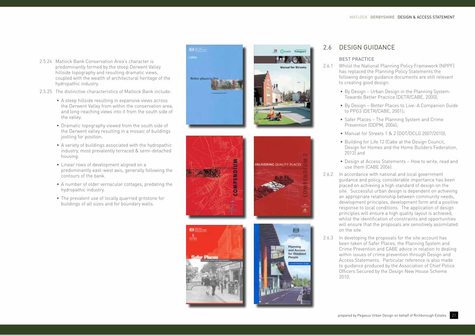
2.6 DeSign gUiDance
bEST PrACTICE2.6.1 Whilst the National Planning Policy Framework (NPPF)
has replaced the Planning Policy Statements the following design guidance documents are still relevant to creating good design:
•By Design – Urban Design in the Planning System: Towards Better Practice (DETR/CABE, 2000);
•By Design – Better Places to Live: A Companion Guide to PPG3 (DETR/CABE, 2001);
•Safer Places – The Planning System and Crime Prevention (ODPM, 2004);
•Manual for Streets 1 & 2 (DOT/DCLG 2007/2010);
•Building for Life 12 (Cabe at the Design Council, Design for Homes and the Home Builders Federation, 2012) and
•Design at Access Statements – How to write, read and use them (CABE 2006).
2.6.2 In accordance with national and local government guidance and policy, considerable importance has been placed on achieving a high standard of design on the site. Successful urban design is dependent on achieving an appropriate relationship between community needs, development principles, development form and a positive response to local conditions. The application of design principles will ensure a high quality layout is achieved, whilst the identification of constraints and opportunities will ensure that the proposals are sensitively assimilated on the site.
2.6.3 In developing the proposals for the site account has been taken of Safer Places, the Planning System and Crime Prevention and CABE advice in relation to dealing within issues of crime prevention through Design and Access Statements. Particular reference is also made to guidance produced by the Association of Chief Police Officers Secured by the Design New House Scheme 2010.

abOVe conStRaintS anD oPPoRtUnitieS Plan
Matlock derbyshire DeSign & acceSS StateMent
23prepared by Pegasus Urban Design on behalf of Richborough Estates
3 evaluation
3.1 conStRaintS anD oPPoRtUnitieS
INTroDuCTIoN3.1.1 Following the assessment of the site and its
surroundings, a number of constraints and opportunities associated with the proposed development have been identified. These are outlined below and are illustrated on the constraints and opportunities plan. The constraints and opportunities have helped to inform both the design concepts and proposals for the site.
CoNSTrAINTS
•Existing landscape features such as hedgerows and trees.
•Site topography - the site is relatively steep in places.
•Existing Public Rights of Way need to be integrated in to the proposals.
•Sensitive boundary edges to existing residential development to the north west of the site.
•Water pipe easement running through part of the site.
•Setting of Matlock Bank Conservation Area.
oPPorTuNITIES
•New, safe and convenient access from Asker Lane and an existing access road from Chesterfield Road.
•Respect and enhance the existing landscape character of the site.
•Preserve and enhance existing ecological and wildlife features of the site.
•Create water attenuation areas that provide opportunities for enhancing wildlife habitats.
•Provide a new residential development that respects and enhances the landscape setting of the site, including view in to and out of Matlock, particularly from Asker Lane.
“evaluation of the information collected on the site’s immediate and wider context, identifying opportunities and constraints and formulating design and access principles for the development.”(para 97 of DCLG Circular 01/2006)

Matlock derbyshire DeSign & acceSS StateMent
24 prepared by Pegasus Urban Design on behalf of Richborough Estates
abOVe DeSign concePt Plan

Matlock derbyshire DeSign & acceSS StateMent
25prepared by Pegasus Urban Design on behalf of Richborough Estates
3.2 the DeSign ViSion
3.2.1 The Vision for the development at Asker Lane is to create a new, residential development which builds upon the character and identity of the local vernacular and urban form of the surrounding context of Matlock. The proposals will respond positively to the constraints and opportunities of the site and its immediate context.
“a unique location, within a rural setting; handy for access to the a6, the town centre and local jobs, development at asker Lane will attract young families because of its range of high quality homes, access to green space, and the convenient local services. the development will include a range of households who like the mix of housing that have been influenced by the context of the derbyshire dale’s villages and settlements, offering people something different.”
3.2.2 As such, land at Asker Lane will:
•Create a well connected and integrated place that provides pedestrian linkages to the surrounding area that allows people to access the wider public transport and road network in the local area.
•Provide a rich mix of natural open space and green infrastructure that maintains and enhances the existing local wildlife and ecology.
•Provide a mix of traditional dwelling types within a high quality landscaped framework, reinforced by differing character and unified architectural styles.
3.2.3 The design principles and concepts set out in this section are based on good practice and guidance, and reflect the characteristics and constraints of the site, as outlined above.
3.3 layoUt PRinciPleS & concePtS
3.3.1 The vision for the layout is based on a series of good design principles. These include:
ACCESS & MovEMENT3.3.2 Providing suitable and efficient access and considering
the requirements in the design of new streets, to reflect the hierarchy of routes and spaces. Streets will be designed according to their role in the hierarchy.
LAyouT, urbAN forM & SCALE3.3.3 A structure of streets and blocks will link the
development to adjacent areas and amenities. Way finding will be increased by creating landmarks in prominent locations and locating open spaces along desire lines.
SPACES & WAyfINDING3.3.4 Ensuring a legible design will enable residents and
visitors to easily find their way around through a series of key spaces that adds variety along the principal routes.
LANDSCAPE & GrEEN INfrASTruCTurE3.3.5 Respecting key aspects of the existing landscape and
introducing new features to create an attractive setting for new development.
ChArACTEr & IDENTITy3.3.6 Through careful study, positive aspects of the local
vernacular will be introduced through innovative design solutions, which will ensure that the development responds to the local character.
“Successful streets, spaces, villages, towns and cities tend to have characteristics in common. these factors have been analysed to produce principles or objectives of good urban design. they help to remind us what should be sought to create a successful place.”
(page 14 of By Design)

Matlock derbyshire DeSign & acceSS StateMent
26 prepared by Pegasus Urban Design on behalf of Richborough Estates
QuALITy of PubLIC rEALM3.4.4 “Developments will establish a strong sense of place,
using streetscapes and buildings to create attractive and comfortable places to live, work and visit” paragraph 58, point 2, NPPF 2012.
3.4.5 Provision of a clear hierarchy of connected spaces and places, including streets, accessible by a variety of users which consider the design of the space as well as its function as a movement corridor;
• Integration of existing and proposed landscape features in order to soften the built form, particularly towards the countryside edge of the development;
•Creation of a clearly defined public realm through the provision of continuous building frontage lines and variations in enclosure of private spaces;
•Control of access to private areas, particularly rear gardens and parking courts; and
•Provision of a variety of accessible public open spaces and recreation areas to meet the needs of the local community whilst encouraging social activity.
fuNCTIoN AND QuALITy3.4.3 “Developments will function well and add to the overall
quality of the area, not just for the short term but over the lifetime of the development” (paragraph 58, point 1, NPPF 2012.)
•New development provides the opportunity to establish a distinctive identity to a place which, whilst having its own character, integrates with the surrounding built form and landscape context;
•Retention of the existing landscape features on the site;
•Establish a distinctive identity through well-designed spaces and built form; and
•Minimise the impact of the development on the open countryside and surrounding context; and
•Protection of the existing floodplain which is located within and in the vicinity of the site to ensure that the development does not increase the risk from flooding in the area.
3.4 DeSign PRinciPleS
3.4.1 In line with National and Local Government Guidance and Policy, considerable importance has been placed on achieving a high standard of design across the site. The application of urban design objectives will ensure a high quality layout is achieved whilst the identification of the constraints and opportunities will ensure that the proposals are sensitively assimilated on the site and into the surrounding landscape and urban fabric. Successful urban design is dependent upon achieving an appropriate relationship between community needs, development principles, development form and a positive response to local conditions.
3.4.2 The principles which have been developed in order to steer the design of the new development have been derived from the site assessment in conjunction with the delivery of a high quality development which achieves the criteria set out within the NPPF, namely:

Matlock derbyshire DeSign & acceSS StateMent
27prepared by Pegasus Urban Design on behalf of Richborough Estates
ACCESSIbILITy3.4.6 “Developments optimise the potential of the site to
accommodate development, create and sustain an appropriate mix of uses (including incorporation of green and other public spaces as part of developments) and support local facilities and transport networks” paragraph 58, point 3, NPPF 2012.
3.4.7 Integration of the development at Asker Lane into the existing movement network including new public transport provision with bus stops located within easy walking distance of all the new dwellings;
•Convenient, safe and direct access for all residents to the existing and proposed local services and facilities including schools, retail, community uses and employment opportunities;
•Provision of multiple access points into the development forming part of a permeable network of streets which assists in dispersing traffic (vehicular and pedestrian);
•Enhancement and extension of the existing public rights of way network as an integral part of the development, particularly facilitating access to the Town Centre and existing employment areas;
•Maximisation of the opportunities for alternative modes of transport to the car particularly walking, cycling and bus travel;
•Creation of a clear movement hierarchy providing easily recognisable routes which balances the street as a space alongside its function as a movement corridor; and
•Maximisation of the connections to the Town Centre via sustainable routes for pedestrians, cyclists and public transport users.
rESPoNSE To CoNTExT3.4.8 “Developments will respond to local character and
history, and reflect the identity of local surrounding and materials, while not preventing or discouraging appropriate innovation” paragraph 58, point 4, NPPF 2012.
3.4.9 Integration of the development into the existing built form fabric of Matlock particularly in relation to scale, height and massing;
•Respond to the existing site topography including the consideration of views in and out of the site;
•Retention of the existing landscape features and habitats on the site; and
•Protection of existing and proposed residential amenity through the use of frontage development thereby enclosing rear gardens.
SAfE AND ACCESSIbLE ENvIroNMENTS3.4.10 “Developments create safe and accessible environments
where crime and disorder, and the fear of crime, do not undermine quality of life or community cohesion” paragraph 58, point 5, NPPF 2012.
•Creation of a clearly defined public realm through the provision of continuous building frontage lines and variations in enclosure of private spaces; and
•Control of access to private areas, particularly rear gardens and parking courts.
A PLACE for EvEryoNE
•Creation of a development which allows ease of movement for all types of users and provides equal employment, social, community, leisure and retail activity opportunities for all; and
•Consideration of the proposals in relation to the location of the buildings on the site, gradients, and the relationship between various uses and transport infrastructure, particularly for those with disabilities.
SuSTAINAbILITy 3.4.11 Provision of a mix of uses which cater for the everyday
needs of the new residents including work, education, leisure, recreation and retail activities whilst respecting and assisting in the growth of Matlock;
3.4.12 Provision of a range of house types, tenures and sizes in order to cater for choice and a variety of households;
•Provision of Sustainable Urban Drainage Systems as part of the flood mitigation proposals;
• In-built ‘robustness’ – the ability of the development, including individual buildings, to adapt to changes such as use, lifestyle and demography over time; and
•Make efficient use of land through proposing a development with an appropriate density.

Matlock derbyshire DeSign & acceSS StateMent
28 prepared by Pegasus Urban Design on behalf of Richborough Estates

Matlock derbyshire DeSign & acceSS StateMent
29prepared by Pegasus Urban Design on behalf of Richborough Estates
4 involvement4.1 collaBoRatiVe Planning
INTroDuCTIoN4.1.1 The purpose of this section is to set out how
richborough Estates have engaged with the local community and other key stakeholders, the key issues that have emerged from the consultation process to date, and how the design proposal has evolved to these issues.
4.1.2 Public consultation is an essential element of the planning and development process. Good consultation engages with all sectors of society, at early stages, to develop a sense of understanding about the issues, concerns and opportunities found in the local community that could be affected by a proposed development.
ThE APProACh4.1.3 The aim of this section is to explain the pre-application
consultation process that has been undertaken and to summarise the issues that emerged through the feedback.
4.2 aWaReneSS leaFlet
4.2.1 A leaflet setting out the development proposals was prepared and distributed to households in Matlock surrounding the site.
4.2.2 The leaflet explained what was being proposed and included an illustrative sketch of the development scheme. It also provided an overview of work undertaken at that point in time. In total 126 responses were received.
“early engagement has significant potential to improve the efficiency and effectiveness of the planning application system for all parties. good quality pre-application discussion enables better coordination between public and private resources and improved outcomes for the community.”(para 188 of nPPF)
4.3 key theMeS anD iSSUeS
4.3.1 All the comments received have been reviewed. The following provides a summary overview of the issues raised and the response to these from the applicant.
•The majority of the responses disagreed / objected in varying degrees to the proposals.
• It is acknowledged that if developed part of the site would change from greenfield to brownfield land. However, as noted above, our assessment shows that the Council is not providing enough new housing over the coming years and therefore further greenfield sites need to be released for housing.
•Some of the responses supported the need for more affordable housing.
• It is acknowledged that the proposed development will increase traffic flows on the adjacent highway network; however, the volume of peak hour traffic from c.100 dwellings is around one vehicle per minute in any direction, so not significant.
•Some responses suggested the need for either traffic lights or a mini roundabout at the Asker Lane / Chesterfield Road junction.
•The proposals for the site are sensitive to the existing ecological features of the site.
4.4 conclUSionS
4.4.1 The main issues raised were the loss of greenfield land, the fact that the site is not identified for residential development in either the adopted or emerging Local Plans (and it is outside the Settlement Framework Boundary), and an increase in traffic (in particular the impact on the Asker Lane / Chesterfield Road junction).

Matlock derbyshire DeSign & acceSS StateMent
30 prepared by Pegasus Urban Design on behalf of Richborough Estates

Matlock derbyshire DeSign & acceSS StateMent
31prepared by Pegasus Urban Design on behalf of Richborough Estates
“it is important to plan positively for the achievement of high quality and inclusive design for all development, including individual buildings, public and private spaces and wider area development schemes.”
(para 57 of NPPF)
5 Design Proposals
5.1 the DeSign PRoPoSal
5.1.1 This design and access statement explains the design principles and concepts that have been applied to particular aspects of the proposal – these are the amount, layout, scale, landscaping and appearance of the development.
5.1.2 The development framework overleaf represents the basic structuring components for the development at Asker Lane. The Framework is then broken down into the following elements/matters.
•use and amount of development - how much development is proposed. For residential development, this means the number of proposed units for residential use and for all other development, this means the proposed floor space for each proposed use.
• Access – this covers accessibility to and within the site for vehicles, cycles and pedestrians in terms of the positioning and treatment of access and circulation routes and how these fit into the surrounding access network.
• Layout – the way in which buildings, routes and open spaces are provided within the development and their relationship to buildings and spaces outside the development.
• Scale – the height, width and length of each building proposed in relation to its surroundings.
• Landscaping – this is the treatment of private and public space to enhance or protect the site’s amenity through hard and soft measures, for example, through planting of trees or hedges or screening by fences or walls.
• Appearance – the aspects of a building or place which determine the visual impression it makes, excluding the external built form of the development.
Matlock derbyshire DeSign & acceSS StateMent
32 prepared by Pegasus Urban Design on behalf of Richborough Estates
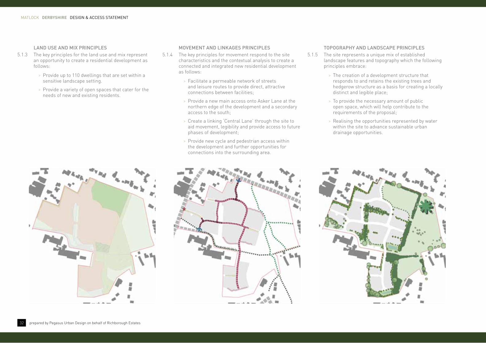
LAND uSE AND MIx PrINCIPLES5.1.3 The key principles for the land use and mix represent
an opportunity to create a residential development as follows:
> Provide up to 110 dwellings that are set within a sensitive landscape setting.
> Provide a variety of open spaces that cater for the needs of new and existing residents.
MovEMENT AND LINkAGES PrINCIPLES5.1.4 The key principles for movement respond to the site
characteristics and the contextual analysis to create a connected and integrated new residential development as follows:
> Facilitate a permeable network of streets and leisure routes to provide direct, attractive connections between facilities;
> Provide a new main access onto Asker Lane at the northern edge of the development and a secondary access to the south;
> Create a linking ‘Central Lane’ through the site to aid movement, legibility and provide access to future phases of development;
> Provide new cycle and pedestrian access within the development and further opportunities for connections into the surrounding area.
ToPoGrAPhy AND LANDSCAPE PrINCIPLES5.1.5 The site represents a unique mix of established
landscape features and topography which the following principles embrace:
> The creation of a development structure that responds to and retains the existing trees and hedgerow structure as a basis for creating a locally distinct and legible place;
> To provide the necessary amount of public open space, which will help contribute to the requirements of the proposal;
> Realising the opportunities represented by water within the site to advance sustainable urban drainage opportunities.

Matlock derbyshire DeSign & acceSS StateMent
33prepared by Pegasus Urban Design on behalf of Richborough Estates
SCALE, hEIGhT AND MASSING PrINCIPLES5.1.6 The residential development provides an opportunity
to create a series of interlinked spaces that help aid legibility through the scheme so that people can get to where they want to go.
> Provide a series of key spaces that are defined by keynote buildings so that streets are terminated with a strong building form;
> Create a hierarchy of streets and spaces that are defined by their location and siting with the development to help promote a sense of character;
> Locate buildings appropriate to their surroundings with the local townscape and use taller 2.5/3 storey houses to define gateways and nodes.
buILDING LAyouT AND forM PrINCIPLES5.1.7 Buildings should positively contribute to the setting of
existing settlements and provide a unified character and identity that local people can relate to. Designing streets and spaces that are well overlooked by new development helps promote a sense of safety and security.
> New buildings will create active frontages and passive surveillance of the public realm;
> Central core areas of housing will generally have a more continuous built frontage, overlooking the street and have secure on-plot car parking.
> Building along the edges of development will have a more loose built form with larger ‘villa’ style building overlooking the surrounding area and creating a rural edge.
APPEArANCE AND ChArACTEr PrINCIPLES5.1.8 Matlock and the immediate surrounding area provides
the back drop to the character and appearance of new buildings within the development. The following principles are as follows:
> Create a series of character areas that reflect the surrounding context and the design principles contained within this document;
> Create a ‘rural edge’ that reflects the current setting of the site;
> Establish a ‘Central Lane’ style character along the key access route through the site that is defined by new tree planting and built form that helps provide a sense of continuity and enclosure.

Matlock derbyshire DeSign & acceSS StateMent
34 prepared by Pegasus Urban Design on behalf of Richborough Estates
abOVe USe anD aMoUnt oF DeVeloPMent

Matlock derbyshire DeSign & acceSS StateMent
35prepared by Pegasus Urban Design on behalf of Richborough Estates
5.2 USe anD aMoUnt oF DeVeloPMent
5.2.1 The site is approximately 7.25 hectares in size and will consist of the following uses.
rESIDENTIAL (3.3 hectares, up to 110 dwellings)
5.2.2 The development proposals will deliver a mix of housing in line with national and local policy, which also reflects the particular characteristics of the local housing market. There will be a range of house types varying from 2 to 5 bed dwellings.
5.2.3 The development achieves an average net density of approximately 32.5 dwellings per hectare (dph).
5.2.4 Within the dwellings proposed across the site, a range of house types, sizes and tenures are envisaged in order to accommodate a variety of household types. The scale of development provides the opportunity to incorporate a mix of housing styles in this location.
INfrASTruCTurE5.2.5 The proposals incorporate an access spine road, which
connects from Asker Lane, with changes in surface materials and deflection to add character. Alongside this are the following uses:
•Formal public open space
• Informal open space
Use aMOUnt (ha)
residentiaL 3.314
fOrMaL Open spaCe 0.701
infOrMaL Open spaCe 3.091
existing rOad infrastrUCtUre 0.146
tOtaL 7.25
forMAL PubLIC oPEN SPACE (0.701 hectares)
5.2.6 The proposals will include a range of open spaces, including formal public open space to north of the site. This space exceeds the National Playing Fields Association (NPFA) requirement for the site.
5.2.7 The open space is also intended to help protect view across Matlock from Asker Lane.
INforMAL oPEN SPACE (3.091 hectares)
5.2.8 Informal open spaces are also located around the site. This includes maintaining existing hedgerows that run through the development. These spaces maintain existing trees and hedgerows. Existing groups of trees will also be maintained where possible.
WATEr ATTENuATIoN ArEA5.2.9 Three water attenuation areas are located to the
southern and central areas of the site which forms part of the wider green infrastructure proposals.
hAbITAT CorrIDor5.2.10 A Habitat Corridor is also proposed to maintain and
preserve wildlife habitat areas within informal open spaces.
buILDINGfor LIfE 12
Integrating intothe neighbourhood
Creating a place
Street & home
2 Facilities and services3 Public transport4 Meeting local housing requirements
Does the development provide (or is it close to) community facilities, such as shops, schools, workplaces, parks, play areas, pubs or cafes?Does the scheme have good access to public transport to help reduce car dependency?Does the development have a mix of housing types and tenures that suit local requirements?

Matlock derbyshire DeSign & acceSS StateMent
36 prepared by Pegasus Urban Design on behalf of Richborough Estates
abOVe MeanS oF acceSS

Matlock derbyshire DeSign & acceSS StateMent
37prepared by Pegasus Urban Design on behalf of Richborough Estates
5.3 MeanS oF acceSS
MovEMENT AND CIrCuLATIoN5.3.1 The proposed development will be accessed from two
points of access off Asker Lane (primary access) and an existing access road off Chesterfield Road (secondary access), which provides the main connection in to the site. This will ensure that the residential development accords with the ‘6C’s Design Guide’ document, in terms of a well-connected street network and encouragement for people to walk and cycle to local destinations.
5.3.2 This route or ‘Central Lane’ provides access to the main areas of housing. Changes in surface treatment will be used to add character around open spaces and define the hierarchy of streets throughout the development.
5.3.3 The proposal also includes a range of transport and movement improvements to help connect the site to its surroundings. This includes the following improvements:
•One new access point from [Main Road].
•Enhanced pedestrian connections to existing PRoW.
•A ‘Central Lane’ to provide access to residential development parcels.
•Create a direct footpath linkage to the Chesterfield Road through proposal.
fooTPAThS AND CyCLEWAyS5.3.4 The main internal route will incorporate footways to
enable easy pedestrian access within the development and to Asker Lane and Chesterfield Road. Additional footpath links will be provided to the surrounding footpath network, including the PRoW to provide better access to the site to the south.
5.3.5 There is a single public footpath running along the southern edge of the northern section of the site, Matlock FP8; this runs from Bull Lane to Chesterfield Road, connecting Matlock FP38, 49 and 83 to Matlock FP9 onthe western side of Chesterfield Road.
5.3.6 The retained hedgerows and proposed green corridors will allow greater permeability and access to the wider area.
LINkS AND CoNNECTIoNS5.3.7 An interconnected series of spaces are located around
the development will aid in legibility, adding variety to the urban grain and create an experience as people travel through the area.
STrEET hIErArChy5.3.8 A hierarchy of streets is provided throughout the layout,
which provides for the necessary vehicle circulation but also allows for footpath and cycleway connections with the wider area in order to assist in the creation of an integrated movement network. This includes:
• Primary route Access - two access points provide the main access into the site.
• Secondary route (Central Lane) – this street provides access around the development once off the two main access points. Footpaths will be provided along these routes to encourage walking and cycling through the site.
• Tertiary routes (Lanes) – these streets provide access around the development once off the Central Lane and provide direct access to plots. They are designed to promote low vehicle speeds to allow spaces to be shared by a number of users and create a sense of enclosure due to their decreased corridor width. These streets will benefit from traffic calming measures thereby aiming to strike a balance between vehicles and other street users.
• Tertiary routes (Private drives) – typically provided to the perimeter of development parcels and to the backs of development blocks, where one-sided development occurs. These shared surface routes provide direct plot access.
buILDINGfor LIfE 12
9 Streets for all10 Car Parking
Integrating intothe neighbourhood
Creating a place
Street & home
1 Connections3 Public transport
Does the scheme integrate into its surroundings by reinforcing existing connections and creating new ones; whilst also respecting existing buildings and land uses along the boundaries of the development site?Does the scheme have good access to public transport to help reduce car dependency?
are streets designed in a way that encourages low vehicle speeds and allow them to function as social spaces?is resident and visitor parking sufficient and well integrated so that it does not dominate the street?

Matlock derbyshire DeSign & acceSS StateMent
38 prepared by Pegasus Urban Design on behalf of Richborough Estates
abOVe illUStRatiVe layoUt Plan

Matlock derbyshire DeSign & acceSS StateMent
39prepared by Pegasus Urban Design on behalf of Richborough Estates
5.4 layoUt
5.4.1 The layout for the site has been influenced by the characteristics of the site, it’s surroundings, the context of the local area and a series of good design principles.
LoCAL DISTINCTIvENESS5.4.2 The layout is based on a clear network of streets and
spaces. By providing a coherent sense of place to key locations within the development, the foundation for the creation of a legible environment can be established in combination with a hierarchy of street types which provide an extensive choice of routes.
5.4.3 The layout reflects the character of the surrounding area with traditional patterns of perimeter blocks and a mix of building forms, including semi-detached and detached properties.
CoNTINuITy AND ENCLoSurE5.4.4 The design is based on the principle of houses defining
and overlooking the main spine road and key public spaces.
5.4.5 The creation of perimeter blocks helps to create strong frontages to the public realm which are overlooked with defensible private space to the rear of properties.
5.4.6 The proposed areas of open space will be overlooked by adjoining properties, to increase safety and security in these areas. Development plots will be defined by a range of boundary treatments including walls, bollards, hedges and fencing. This will assist in clearly defining the public and private realm within the development.
5.4.7 The design solution for the site is to create variety in townscape form. It is expected that significant numbers of dwellings will have front elevations close to the back of the pavement (within 2 metres) in order to create a sense of enclosure, particularly along the Central Lane.
SAfETy AND SECurITy5.4.8 Pedestrian safety within the development will be
achieved by securing reduced vehicle speeds through the design of the internal access roads. Differences in road surface treatment and vertical and horizontal deflections are proposed.
5.4.9 Any proposed parking courtyards to the rear and side of properties will be limited in size.
5.4.10 Buildings will generally be overlooking the public realm with traditional back-to-back gardens that are well-contained and enclosed creating a greater distinction between the public and private realm.
bouNDAry TrEATMENTS5.4.11 A variety of boundary treatments will be used to
create a sense of variety and character throughout the development.
5.4.12 Towards the edges of the development an emphasis will be placed on using hedgerows to help respect and enhance the existing landscape setting of the site. Towards the centre of the proposal boundary treatments will change, with a stronger emphasis on railings and/or short walls.
urbAN forM5.4.13 The location of the site and its sensitive setting have had
a considerable impact on the design of the scheme. The vision is to provide a development that is rural in nature yet create urban edge to the existing settlement that is harmonious to the setting of the surrounding landscape and provide a positive frontage to open space.
buILDINGfor LIfE 12
6 Working with the site and its context7 Creating well defined streets and spaces8 Easy to find your way around
9 External storage and amenity space
Integrating intothe neighbourhood
Creating a place
Does the scheme take advantage of existing topography, landscape features (including water courses), wildlife habitats, existing buildings, site orientation and micro climates?are buildings designed and positioned with landscaping to define and enhance streets and spaces and are buildings design to turn street corners well? is the scheme designed to make it easy ti find your way around?
is there adequate external storage spaces for bins and recycling as well as vehicle and cycles?
Street & home

Matlock derbyshire DeSign & acceSS StateMent
40 prepared by Pegasus Urban Design on behalf of Richborough Estates
abOVe Scale anD MaSSing Plan

Matlock derbyshire DeSign & acceSS StateMent
41prepared by Pegasus Urban Design on behalf of Richborough Estates
buILDINGfor LIfE 12
8 Easy to find your way around
Integrating intothe neighbourhood
Creating a place
Street & home
is the scheme designed to make it easy to find your way around?
5.5 Scale
buILDING hEIGhTS AND MASSING 5.5.1 A range of 1, 2 and 3 storey properties can be provided
for the site ranging from 2 to 5 bed properties. This reflects the general height and scale of buildings in the surrounding context.
5.5.2 While the general building height parameters are quite flexible, the height of buildings overlooking the open space along Asker Lane will be restricted to 8.5m (to ridge height) to enable views across Matlock from Asker Lane to be maintained.
kEyNoTE buILDINGS 5.5.3 Keynote buildings have been carefully sited to act as
focal points within the proposal to aid legibility and help create an attractive street scene.
5.5.4 The disposition and orientation of buildings provides for a strong street scene with clear demarcation between public and private space. Variation in house types will provide for visual variety along key routes.
vIEWS AND vISTAS5.5.5 The proposal includes the development of key vistas
through the site to help break up the ‘Central Lane’.
5.5.6 The existing hedgerows and trees that run through the middle of the site represent opportunities to provide new spaces that help break up the long ‘Central Lane’. It is at these points that pedestrian links are created to provide connections to the wider area
DENSITy5.5.7 The proposed density across the site will be 32.5
dwellings per hectare to provide up to 110 dwellings. This is consistent with the overall density and character in the surrounding areas and makes best use of the land available.
buILDING TyPES5.5.8 A range of house types, sizes and tenures are proposed
within the development, providing a range of 2-5 bed properties. This will provide further housing to meet local needs and will assist in creating a diverse and mixed community.
Land Use bUiLding type Length (m) depth (m) height (m) stOreys
Residential Bungalows Minimum 8.00 8.00 5.50 1
Maximum 16.00 10.00 7.50 1.5
coach houses/Fogs Minimum 10.00 6.00 8.00 2
Maximum 13.00 7.00 8.50 2
terrace Minimum 15.00 8.00 8.00 2
Maximum 25.00 10.00 10.80 3
Semi-detached Minimum 8.00 5.00 8.00 2
Maximum 10.00 10.00 10.80 3
Detached Minimum 8.00 5.00 8.00 2
Maximum 11.00 10.00 10.80 3
garage Minimum 3.00 6.00 2.50 1
Maximum 9.00 6.00 4.50 1
cycle Store Minimum 2.50 3.50 3.50 1
Maximum 7.00 4.50 4.50 1
Bin Store Minimum 2.00 3.00 3.00 1
Maximum 5.00 5.00 3.50 1

Matlock derbyshire DeSign & acceSS StateMent
42 prepared by Pegasus Urban Design on behalf of Richborough Estates
abOVe lanDScaPe StRategy Plan

Matlock derbyshire DeSign & acceSS StateMent
43prepared by Pegasus Urban Design on behalf of Richborough Estates
5.6 lanDScaPing
5.6.1 The development of the proposals has considered the landscape setting from the outset reflecting the ideas and conclusions drawn from the LVIA.
5.6.2 The development of the green infrastructure framework is therefore been an integral component of the masterplanning process. The main green infrastructure principles which have been developed are summarised as follows:
•Preserving views in to and out of Matlock particulary from Asker Lane (see pages 44-45).
•Retaining existing trees and hedgerows.
•Provision of formal open space to the north.
• Integrating water attenuation areas and swales as part of the green infrastructure framework.
•Respecting the setting of Baileys Tump.
•Respecting and preserving areas of wildlife and ecological habitats creating a new ecological corridor through the proposal.
•Creation of a high quality public realm and streetscape.
5.6.3 The green infrastructure framework is based on a multi-functional and connected landscape setting for the development. This is based on a combination of existing vegetation, proposed open space and new tree planting to reinforce the existing landscape and provide a new landscape framework. This creates an enhanced landscape setting which also has gains in terms of biodiversity.
forMAL PubLIC oPEN SPACE5.6.4 A new area of open space has been incorporated to the
north of the development. This will help to preserve views in to and out of Matlock from Asker Lane as well Baileys Tump to the east of the site.
WATEr ATTENuATIoN5.6.5 Water attenuation areas and swales will form an integral
part of the green infrastructure framework. These will be located to the south and central parts of the site and be part of an integrated drainage solution.
INforMAL oPEN SPACE5.6.6 Areas of informal open space will be provided that help
respect and preserve existing wildlife and ecological features, particularly to the east of the site. Informal footpath links will be maintained in this area to help integrate the site into the wider area.
5.6.7 Existing trees and hedgerows will be maintained and preserved where possible to help mitigate the impact of development.
A hIGh QuALITy PubLIC rEALM AND STrEETSCAPE5.6.8 The streets and green spaces are designed to form a
network of places and open spaces, each with their own character. Hard landscape materials and planting will be used to define the main pedestrian zones, minor roads and private drives and the principle vehicular routes to assist in orientation and legibility.
5.6.9 The new road layout, which requires the selective opening up of the network of existing hedgerows, will help to create a legible route through the development.
buILDINGfor LIfE 12
8 Public and private spaces
Integrating intothe neighbourhood
Creating a place
Street & home
Will public and private spaces be clearly defined and designed to be attractive, well managed and safe?

Matlock derbyshire DeSign & acceSS StateMent
44 prepared by Pegasus Urban Design on behalf of Richborough Estates
abOVe cRoSS Section thRoUgh the Site

Matlock derbyshire DeSign & acceSS StateMent
45prepared by Pegasus Urban Design on behalf of Richborough Estates
vISuAL IMPACT AND SETTING5.6.10 The development strategy for the site has been
landscape and visual amenity led. This is in direct response to the opportunities and constraints on both the site and within its context. The first part of the process therefore identified the extent of an approximate development envelope, both in terms of its horizontal parameter i.e. its height; and its vertical parameter i.e. its spread; which have been based on the constraints and opportunities. The illustrative masterplan therefore respects the overall parameters.
5.6.11 The identification of the approximate development envelope, the location of which pays particular attention to the opportunities and constraints offered by both the site and its context represents the first part of the capacity process. This is considered to be an important consideration in the acceptability of the scale of the development, in the context of the capacity of the surrounding landscape. The process by which the alignment of the envelope has been identified, has been an iterative one, with a series of options having been tested in advance of the alignment being finally concluded. Particular note has been made in respect of the sensitive landscape and visual context, in particular the following:
•Views from Asker Lane looking south towards Masson Mount and Riber Castle;
•Elevated views from Bailey’s Tump towards the wider landscape to the south;
•The elevated location of the site on a valley side and the topography of the site itself;
•The role of the existing mature vegetation framework; and
•The relationship between the site and the adjacent urban area.
5.6.12 In general it is considered that fields to the west and south of the site are suitable for development given their topography is falling in a southerly direction, allowing key views from Asker Lane across the site to the south to be retained. The development envelope has been augmented such that views across the site towards the local landmarks of Masson Hills and Riber Castle will be retained. The lower fields to the south are also well vegetated to the perimeters with isolated stands of trees providing a landscape infrastructure into which development can to be assimilated.
5.6.13 A number of long landscape sections have been used to test the extent of the development envelope, as well as being used as a design tool to identify the capacity of the site and the basis of a mitigation strategy. This is illustrated in the cross sections opposite. Each section illustrated shows both the existing situation and the proposed situation.
5.6.14 Section AA (p44) is taken across the landscape from Riber in the south to Asker Lane and the residential development to the north of the site. The sloping valley landform containing existing residential development is evident. The proposed public open space to the north of the site will help retain views from Asker Lane across the wider landscape to the south.
5.6.15 Section B-B (p44) is taken across the landscape from Limestone Way long distance footpath to the southwest to Asker Lane and Bailey’s Tump to the northeastern corner of the site. The sloping valley landform containing existing residential development is evident. Views from the public right of way will be retained towards properties on Asker Lane.

Matlock derbyshire DeSign & acceSS StateMent
46 prepared by Pegasus Urban Design on behalf of Richborough Estates
abOVe lanDScaPe MaSteRPlan

Matlock derbyshire DeSign & acceSS StateMent
47prepared by Pegasus Urban Design on behalf of Richborough Estates
buILDINGfor LIfE 12
8 Public and private spaces
Integrating intothe neighbourhood
Creating a place
Street & home
Will public and private spaces be clearly defined and designed to be attractive, well managed and safe?
LANDSCAPE MASTErPLAN5.6.16 The Landscape Masterplan opposite illustrates the key
landscape features, which are also set out below. This inlcudes:
•Retaining grassland and Bailey’s Tump.
•Retaining key areas of vegetation.
•Additional hedgerow and tree planting.
•Access abd view corridor
rETAINED GrASSLAND AND bAILEy’S TuMP5.6.17 The eastern part of the site is to be retained as open
space. Retention of this area is considered important in terms of the role the site plays in its urban context and consequently its appearance, management and function will also reflect this point. An important function of it is the offset it provides from existing properties along Asker Lane and the opportunity to retain views from Asker Lane to the south. To the north of the site, the area will function as formal open space by virtue of its relationship with the proposed residential units and the enclosure provided by existing tree belts and hedgerows. Bailey’s Tump will be retained and the land to the south of it will be also be retained as informal open space with opportunities for encouraging biodiversity as well as a setting for the proposed built form.
rETAINED vEGETATIoN5.6.18 The proposed development aims to retain as much
existing vegetation as possible. There are a number of existing hedgerows, tree belts and individual trees on-site which have been incorporated where possible into an overall green infrastructure strategy for the proposed development .
ADDITIoNAL hEDGEroW AND TrEE PLANTING INfrASTruCTurE
5.6.19 Where there are any gaps in hedgerows these will be replenished with additional hedgerow and hedgerow tree planting. There will be additional planting across the proposed development, both in terms of the planting in open spaces and amenity planting through garden spaces to provide a pleasant local setting for the new development, and ensure that a balance is struck across the site in terms of planting, as opposed to confine it to the perimeter of the site. Species mixes will be based on native mixes found in the area to assist in assimilating the development in the surrounding area on a more detailed level (refer also to the Ecological Mitigation Strategy ).
ACCESS AND vIEW CorrIDor5.6.20 There are long range views from Asker Lane Along the
access road, which will be retained through the set back provided by the proposed open space to the north of the proposed development, in conjunction with the topography, which falls from Asker Lane in a southerly direction (as shown in the cross-section below).

Matlock derbyshire DeSign & acceSS StateMent
48 prepared by Pegasus Urban Design on behalf of Richborough Estates
abOVe chaRacteR aReaS

Matlock derbyshire DeSign & acceSS StateMent
49prepared by Pegasus Urban Design on behalf of Richborough Estates
5.7 aPPeaRance
ChArACTEr ArEAS5.7.1 Where the proposals form a direct interface with the
existing and surrounding areas it is important that the built form creates both an attractive and appropriate character that reflects the surrounding context.
5.7.2 A network of streets, squares, open and incidental spaces shapes the urban form of the development. By providing a coherent sense of place to key locations within the development such as along the Central Lane, adjoining areas of open space and prominent locations throughout the development, the foundation for the creation of a legible environment can be established in combination with a hierarchy of street types which provide a choice of routes.
5.7.3 Four distinct ‘street based’ character areas have evolved for the development which consist of:
•Main Street (access)
•Central Lane
•Mews Courts
•Rural Drive
5.7.4 The designation of the 4 character areas has taken into account a range of factors relating to the site and the response to the local context. These specifically include:
•The landscape character of the site and the surrounding area, including existing features and topography.
•The provision of a development built around a landscape focus and well defined street hierarchy.
•Existing patterns of development in more traditional parts of the local area and coupled with the aim of creating a development with subtle contemporary characteristics.
•The relationship between the proposed movement network, built form and existing/retained features on the site.
MAIN STrEET (ACCESS)5.7.5 The Main Street access routes entering the site will
provide linear focal points, defined by key building groups to clearly mark the gateway into the site. Some formal avenue tree planting along the length of the road will help create a more formal character area and regular shared surface squares will help calm traffic.
5.7.6 The proposed built form will follow a strong building line in this area and there will be an increase in the number and proportion of semi-detached dwellings and the introduction of small runs of terraced properties to be in keeping with the Matlock Bank Conservation Area.
CENTrAL LANE5.7.7 The built form within the proposal between Main Street
access and the Rural Drive character areas will have a slightly more urban character with the use of railings and shorts walls for boundary treatments at the front of properties. Buildings will consist of semi-detached and terrace houses.
MEWS CourTS5.7.8 Mews Courts will also have a strong urban form and
be made up of hardscape materials typical of shared surface spaces.
rurAL DrIvE5.7.9 Built form along the edges of the built-up area will
have a more informal rural character with a mixture of house types designed to overlook and exploit views. The built form provides a more ‘broken’ building line in this area and lower category access roads will serve on-plot parking to properties.
buILDINGfor LIfE 12
5 Character
Integrating intothe neighbourhood
Creating a place
Street & home
Does the scheme create a place with a locally inspired or otherwise distinctive character?

Matlock derbyshire DeSign & acceSS StateMent
50 prepared by Pegasus Urban Design on behalf of Richborough Estates
5.8 StateMent oF SigniFicance anD iMPact - conSeRVation aReaS
5.8.1 The following statement provides a summary of the key characteristics of the development and its impact on the special interest, character and appearance of the conservation area.
SuMMAry of IMPorTANT fEATurES of ThE ToWNSCAPE
•Generally small massing of buildings providing frequent glimpses across the Derwent Valley.
•Landmark quality of large former hydros.
•Large private gardens to former hydros and the grandest houses.
•Tree cover providing screening and sculptural quality, Scots pines in particular.
•Key public open spaces.
• Informal wooded areas.
•Roofscapes visible from above.
•Landmark features visible from above (particularly large chimneys & mansard roofs).
•Contrast between wide, open junctions and enclosed character of connecting roads.
•Hierarchy of roads from main roads (generally more or less north-south routes) down to cul-de-sacs and semi-private side roads (often running east-west).
•Narrow, steep footpaths and stepped routes, crossing the contours, especially where stone setted.
CoNTrIbuTIoN To CoNSErvATIoN ArEA5.8.2 The proposals aim to make a positive contribution to the
adjacent conservation area by incorporating a range of measures that will help enhance to the local area. This includes:
•using materials that are appropriate and sympathetic to the setting of the conservation area.
•creating an urban form and layout that follows the general guidance contained with the Conservation Area Appraisal for Matlock Bank.
•maintaining and creating views in to and out of the development.
•providing areas of open space to the north of the site to limit the impact of development on the surrounding context.
LoSS or ALTErATIoN To fEATurE WALLS5.8.3 Any loss or alterations to feature walls will only occur
where access is needed to serve new development. Where loss of feature walls occurs, new walls should be created in locations that are appropriate to the setting of the development.
IMPACT of NEW DEvELoPMENT5.8.4 New buildings will respect and where possible enhance
the special interest, character and appearance of the conservation area.
DESIGN PrINCIPLES5.8.5 The design rationale for the development is set out
within the DAS in terms of its overall scale, massing, siting, layout and design.
•Scale and massing - new buildings will be in-keeping with the surrounding context and the adjacent conservation area. Key views in to and out of the site will be maintained, particularly from Asker Lane. The small massing and grouping of building will also allow for frequent glimpses throughout the area.
•Siting and layout - new buildings will follow and consistent building line similar to that of buildings within the surrounding context of the conservation area.
•Design and choice of materials - should be in-keeping with the local vernacular.
TrAffIC AND CAr PArkING5.8.6 Car parking and the use of building materials for street
and spaces will be designed to be in-keeping and sympathetic with the conservation area.
5.8.7 Car parking will be predominately on-plot and setback from the building line to mitigate the impact of the car within the development and the adjacent conservation area.

Matlock derbyshire DeSign & acceSS StateMent
51prepared by Pegasus Urban Design on behalf of Richborough Estates
5.9 WaSte aUDit anD Site ManageMent Plan (SWMP)
5.9.1 Waste and recycling will be in accordance with the District Council requirements.
MANAGEMENT of WASTE5.9.2 An specific area shall be laid out and labelled to
facilitate the separation of materials for potential recycling, salvage, reuse and return. Recycling and waste bins are to be kept clean and clearly marked in order to avoid contamination of materials. The labelling systems shall be the Waste Awareness Colour Coding Scheme. If the skips are clearly identified the bulk of the workforce will deposit the correct materials into the correct skip. Skips for segregation of waste identified currently are:
•Wood
•Metal
•Brick/rubble
•Canteen waste
5.9.3 Surplus or waste materials arise from either the materials imported to site or from those generated on site. Imported materials are those, which are brought to the project for inclusion into the permanent works. Generated materials are those, which exist on the project such as topsoil, sub-soil, trees and materials from demolition works etc.
5.9.4 All surplus or waste materials fall into three categories for management, these are:
•Re-used
•Recycled
•Landfill
5.9.5 If surplus materials can be used in the permanent works they are classified as materials, which have been re-used. If they are surplus to requirements and need to be removed from site and they can be removed and used in their present form, they can be removed from site for re-use.
5.9.6 If the surplus material cannot be re-used in its present form but could be used in a different form, it is sent for recycling. If either of the above cannot be satisfied then the only option left is to send the surplus materials to landfill.
uSE of rECyCLED AND rENEWAbLE buILDING MATErIALS
5.9.7 The proposes development will, where possible, maximise opportunities for the re-use, recycling and recovery of building materials.
GENErAL WASTE5.9.8 There are three types of bin used for waster collection
within the Derbyshire Dales. This includes:
•Grey wheeled bin (140 litre) for household waste.
•Green-lid bin (240 litre) for green waste.
•Blue-lid bin (240 litres) for dry recycling.
5.9.9 For properties that do not have bins for recyclable materials a blue box and blue bags are available.
ACCESS ArrANGEMENTS for ThE CoLLECTIoN of WASTE
5.9.10 Generally refuse collection is located in the backs gardens within the bin storage supplied by the council. Storage will have clear, direct and safe access to the street for the collection by refuse vehicle.
5.9.11 Where groups of buildings, particularly terraces, are proposed an appropriate setback from the street should be provided so that people can choose to leave their bins outside the front of their house, behind the property boundary.

Matlock derbyshire DeSign & acceSS StateMent
52 prepared by Pegasus Urban Design on behalf of Richborough Estates

Matlock derbyshire DeSign & acceSS StateMent
53prepared by Pegasus Urban Design on behalf of Richborough Estates
6 Building for life
6.1 SUMMaRy
6.1.1 A Building for Life 12 Assessment has been undertaken for the detailed layout to understand the overall design quality of the proposals. A summary of the scheme is provided overleaf.
6.1.2 This DAS sets out all outline matters relating to:
•Use and amount of development,
•Access,
•Layout,
•Scale,
•Landscaping, and
•Appearance.
6.1.3 In assessing these proposals in accordance with BfL 12 section 6 of this DAS provides specific reference in relation to the 12 Building for Life questions.
6.1.4 BfL12 comprises of 12 questions, with four questions in each chapter:
• Integrating into the neighbourhood
•Creating a place
•Street and home
6.1.5 Based on a simple ‘traffic light’ system (red, amber and green) new developments should aim to:
•Secure as many ‘greens’ as possible,
•Minimise the number of ‘ambers’ and;
•Avoid ‘reds’.
6.1.6 A summary of the key design issues and themes is provided in the table opposite and shows that the design proposal secures 12 out of the possible 12 ‘greens’.
BUILDING FOR LIFE 12
integrating into the neighbourhood
1 connections The outline proposals has two key points of access; Asker Lane (north) and an existing access road off Chesterfield Road (central). The proposals area based on a permeable grid of streets with footpath links connecting the site to the wider area. Formal Public Rights of Way and informal footpath connections will be maintained and integrated into the proposals.
2 Facilities and services The proposals area located within 1km from the centre of Matlock where there are a range of local services and facilities.
3 Public transport A number of bus services operate close to the site providing good connections to the centre of Matlock where further (more strategic) connections can be made to the wider area.
4 Meeting local housing requirements
Derbyshire Dales has a significant shortfall in the five year supply of housing land, as confirmed by the Inspector and accepted by the Council through the recent Ashbourne appeal decision. Therefore the Council cannot meet their housing land supply obligations under the NPPF. One of the reasons for submitting this planning application at this point in time is to respond to that pressing need to deliver further residential development within Derbyshire Dales.
Creating a place
5 character The outline proposals include four characters areas that will help identify each particular area of the development. These character areas are based on the street hierarchy where different building forms and the use of materials and building details will very in part to reflect the street type the are located.
6 Working with the site and its context
The outline proposals respond positively to the surrounding context, maintaining and enhancing, where possible the existing landscape framework of trees and hedgerows and other key features such as Baileys Tump and views in to and out of Matlock from Asker Lane. New routes and spaces will be connected to lead people where they need to go, creating an integrated development.
7 creating well defined streets and spaces
The outline proposals include a variety of space that aim to create a ‘sense of place’ and break up the scale and massing of the development. This includes maintaining existing hedgerows and trees through the site as well as a new open space to the north with buildings overlooking the space.
8 easy to find your way around
The illustrative, permeable grid of perimeter blocks provides opportunities to create keynote buildings along primary and secondary streets, at corners and at the end of streets, enabling people to easily move through the development.
street & home
9 Streets for all The outline proposals are based on a clear hierarchy of streets that provide access and circulation around the development. Streets will be pedestrian friendly with Lanes and Drives providing shared surface area to create a different type of character and encourage lower vehicle speeds.
10 car parking Car parking will be provided in a variety of forms. The primary car parking typology will be on-plot wait a garage. Car parking will also be provided at the front of houses and within integral garage house types. Parking will also be located at the rear of blocks but contained within small areas, serving no more than five houses.
11 Public and private spaces
Key public spaces will be clearly defined by new buildings with active frontages overlooking the public realm. Private spaces at the front of buildings will be clearly defined by a variety of boundary treatments that reflect the character area they are located in.
12 external storage and amenity space
Storage space will be provided within enlarged garage and in back gardens. Convenient access to and from the back garden will be provided that is safe and secure to allow for the movement of refuse bins and recycling.
abOVe BFl 12 SUMMaRy

abOVe MaSteRPlan concePt

Matlock derbyshire DeSign & acceSS StateMent
55prepared by Pegasus Urban Design on behalf of Richborough Estates
grOss site area (ha) 7.25 hectares
Land Use tOtaL area (ha) perCent Of tOtaL
Residential 3.314 46%
Formal public open space 0.701 10%
Informal open space 3.091 43%
Existing road infrastructure 0.146 1%
TOTAL 7.25
dWeLLings tOtaL area (ha) per heCtare
Net density 7.25 32.5/ha
tOtaL nUMber Of dWeLLings Up tO 110
6.2 SUMMaRy oF PRoPoSalS
6.2.1 This Design and Access Statement is submitted in support of an outline planning application for development on land at Asker Lane.
6.2.2 The proposed development includes the creation of a new residential development with associated open space, set within an established landscape setting.
6.2.3 In arriving at the design solution for the site, we have shown how the physical, social and economic context has influenced the design in conceptual terms and informed the final proposals. The design concept plan has been prepared illustrating the key principles that have guided the detailed development of the final illustrative layout.
6.2.4 This Design and Access Statement confirms the applicant’s commitment to the delivery of a high quality development that is sensitive to the local context of Matlock and its immediate context. In particular, the design proposal takes into account the need to create character areas that are unique to the scheme, but also reflect the identity of the local area.
6.2.5 The proposals aim to make the most efficient use of land that is appropriate to the nature and setting of the site. The scheme successfully promotes better access to local facilities and public transport, with clear access into the site and good pedestrian linkages to surrounding uses.
6.2.6 The layout and urban form of the scheme is such that it supports crime prevention and community safety, with development clearly overlooking public spaces and streets.
6.2.7 The landscape design is responsive to the sensitive setting of the site. Hedgerows and trees have been maintained, where possible, and inform the structure and layout of residential parcels.
“this document has ‘told the story’ of how the layout has developed from conceptual to a detailed illustrative masterplan, having regard for the need to balance design aspirations with planning policy requirements and the concerns of the local community.”

www.pegasuspg.co.uk
planning i environmental i Urban design i Landscape design i renewable energy i retail i graphic design i Consultation i sustainability
pegasus Urban design4 the CourtyardChurch streetLockingtonderbyshirede74 2sL
telephone: (01509) 670806facsimile: (01509) 672247
COpyright the contents of this document must not be copied or reproduced in whole or in part without the written consent of pegasus planning group Ltd Crown copyright. all rights reserved, Licence number 100042093


![Untitled-2 [] · asker/ alan tÜrkiye'deí erzincan askeri alan asker/ aun ilx66r.0x erzincan ili n 258 s .karabekir m 3tðs astanesi is hpcabe yerlesim asker](https://img.dokumen.tips/doc/110x75/5fa25379b3e44e6a1361cfad/untitled-2-asker-alan-toerkiyede-erzincan-askeri-alan-asker-aun-ilx66r0x.jpg)